Embed Size (px)
Citation preview
GIS for Ponneri Town Panchayat
1 DTP, Chennai and NIC, TNSC
GIS for Town Panchayat Ponneri Town Pachayat,
Ponneri Taluk, Tiruvallur District, Tamil Nadu
User Manual
Directorate of Town Panchayat
and
NIC-TNSC

GIS for Ponneri Town Panchayat
2 DTP, Chennai and NIC, TNSC
Contents I. Introduction .............................................................................................................................. 3
II. Home Page ................................................................................................................................ 4
III. Citizen Interface ..................................................................................................................... 4
1. View Maps............................................................................................................................... 5
2. Overlay Layers ......................................................................................................................... 6
a) Administrative Unit ............................................................................................................ 6
b) Transport ........................................................................................................................... 7
c) Water Resources ................................................................................................................ 8
d) Public Infrastructre and Utilities ......................................................................................... 8
e) Institutions ......................................................................................................................... 9
f) Recreations ........................................................................................................................ 9
g) Others .............................................................................................................................. 10
IV. Complaints/Suggestions ........................................................................................................ 10
i. Complaint / View Complaint Status directly (Unregistered User)............................................ 11
ii. For already Registered users : ................................................................................................ 15
iii. To Register ............................................................................................................................ 17
GIS for Ponneri Town Panchayat
3 DTP, Chennai and NIC, TNSC
GIS for Ponneri Town Panchayat
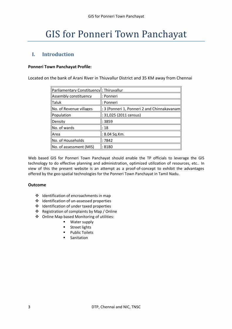
I. Introduction
Ponneri Town Panchayat Profile:
Located on the bank of Arani River in Thiuvallur District and 35 KM away from Chennai
Web based GIS for Ponneri Town Panchayat should enable the TP officials to leverage the GIS technology to do effective planning and administration, optimized utilization of resources, etc.. In view of this the present website is an attempt as a proof-of-concept to exhibit the advantages offered by the geo-spatial technologies for the Ponneri Town Panchayat in Tamil Nadu.
Outcome
Identification of encroachments in map Identification of un-assessed properties Identification of under taxed properties Registration of complaints by Map / Online Online Map based Monitoring of utilities:
Water supply Street lights Public Toilets Sanitation
Parliamentary Constituency : Thiruvallur
Assembly constituency : Ponneri
Taluk : Ponneri
No. of Revenue villages : 3 (Ponneri 1, Ponneri 2 and Chinnakavanam
Population : 31,025 (2011 census)
Density : 3859
No. of wards : 18
Area : 8.04 Sq.Km.
No. of Households : 7842
No. of assessment (MIS) : 8180

GIS for Ponneri Town Panchayat
4 DTP, Chennai and NIC, TNSC
II. Home Page
Fig 1: Home Page
This Application has 2 modules
I. Citizen – Maps for General Public to view various spatial features and overlay them over
various popular Web Maps like Google, OpenStreetMap etc.
II. Official – Highly Interactive, analytical online maps with enriched GIS Functionalities for
Town Panchayat Officials and Directorate of Town Panchayat Officials.
III. Citizen Interface This is for General Public to view the Ponneri Interactive Online Maps which can be superimposed
over online web Map Serivces( Google,Open Street Map etc)
Citizen Module has two options 1. View Maps 2. Complaints / Suggestions
Fig 2: Citizen Interface

GIS for Ponneri Town Panchayat
5 DTP, Chennai and NIC, TNSC
1. View Maps
Ward boundary with Google Hybrid map: User may choose any one of the base maps from left side
tree view.
Fig 3: View Maps Page Layout
Ponneri Town Panchayat Ward Boundary as Base Map:-
Fig 4: Selection of Base Maps
3.Map Panel
2. Menu Bar
5. Temporary
Layer Panel
8.Map Zoom Tool
7. Map Pan Tool
1.Layer Panel
Info Tool Pan
Previous
Extent
Next
Extent
Legend
On/off
GIS for Ponneri Town Panchayat
6 DTP, Chennai and NIC, TNSC
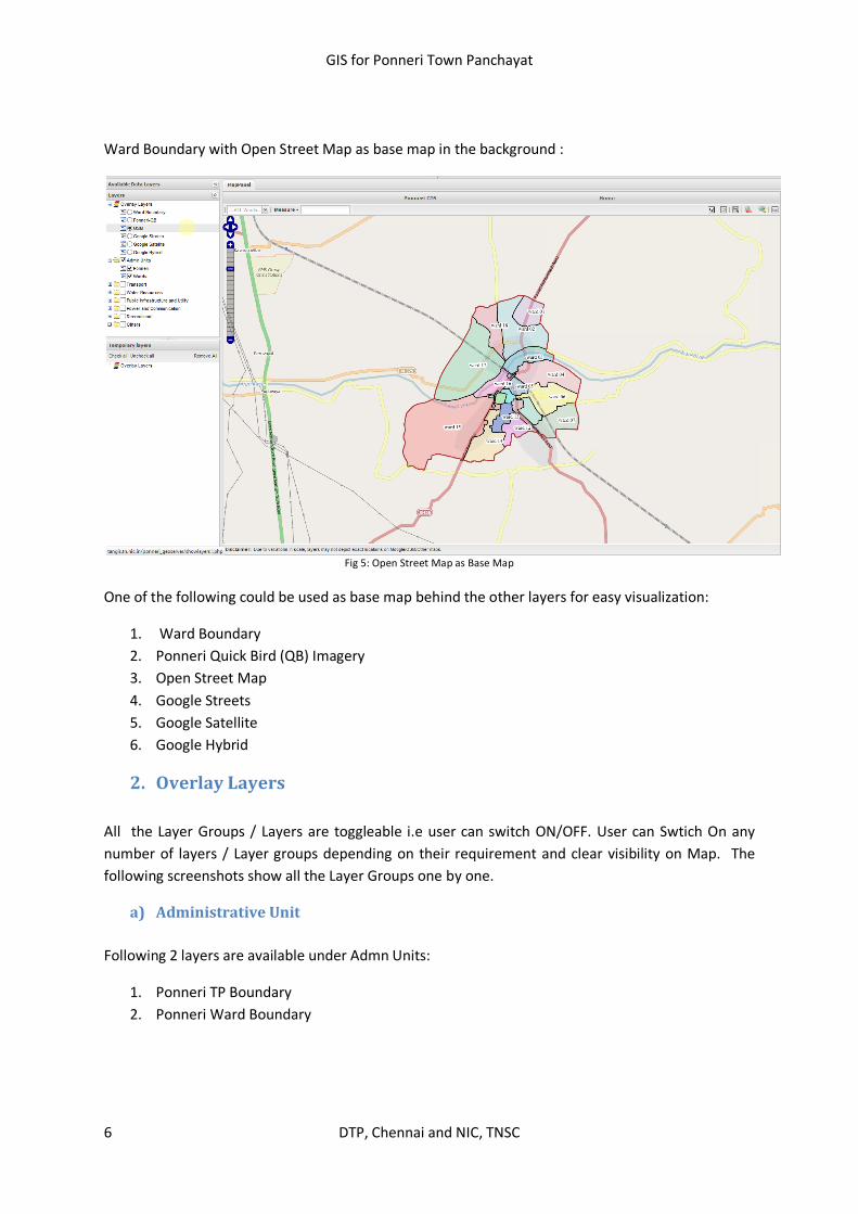
Ward Boundary with Open Street Map as base map in the background :
Fig 5: Open Street Map as Base Map
One of the following could be used as base map behind the other layers for easy visualization:
1. Ward Boundary
2. Ponneri Quick Bird (QB) Imagery
3. Open Street Map
4. Google Streets
5. Google Satellite
6. Google Hybrid
2. Overlay Layers
All the Layer Groups / Layers are toggleable i.e user can switch ON/OFF. User can Swtich On any
number of layers / Layer groups depending on their requirement and clear visibility on Map. The
following screenshots show all the Layer Groups one by one.
a) Administrative Unit
Following 2 layers are available under Admn Units:
1. Ponneri TP Boundary
2. Ponneri Ward Boundary
GIS for Ponneri Town Panchayat
7 DTP, Chennai and NIC, TNSC
Fig 5:
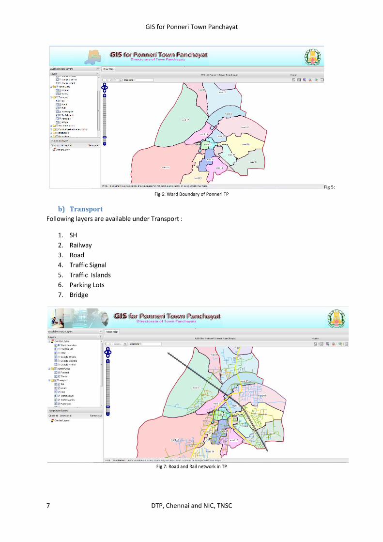
Fig 6: Ward Boundary of Ponneri TP
b) Transport
Following layers are available under Transport :
1. SH
2. Railway
3. Road
4. Traffic Signal
5. Traffic Islands
6. Parking Lots
7. Bridge
Fig 7: Road and Rail network in TP
GIS for Ponneri Town Panchayat
8 DTP, Chennai and NIC, TNSC
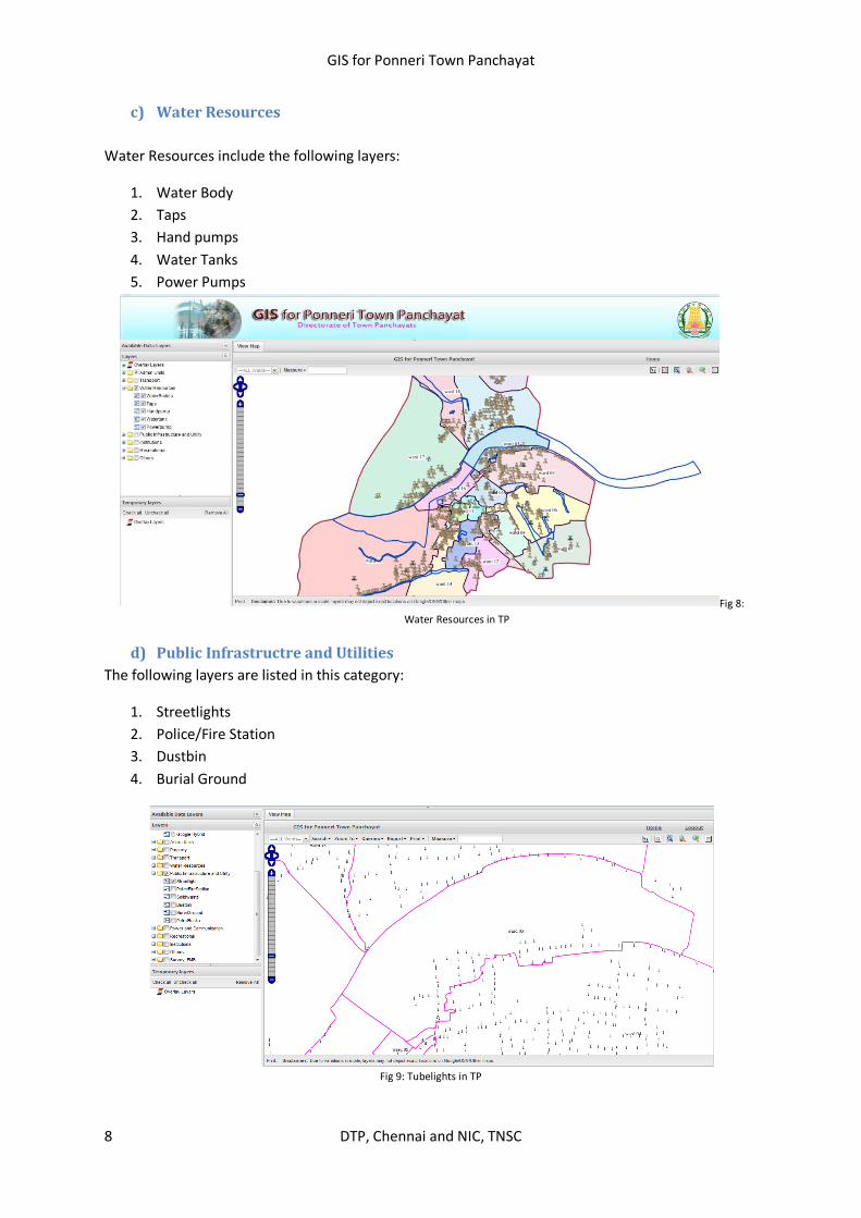
c) Water Resources
Water Resources include the following layers:
1. Water Body
2. Taps
3. Hand pumps
4. Water Tanks
5. Power Pumps
Fig 8:
Water Resources in TP
d) Public Infrastructre and Utilities
The following layers are listed in this category:
1. Streetlights
2. Police/Fire Station
3. Dustbin
4. Burial Ground
Fig 9: Tubelights in TP

GIS for Ponneri Town Panchayat
9 DTP, Chennai and NIC, TNSC
e) Institutions
The following layers appear under Institutions category:
1. Court
2. Taluk Office
3. Religious Places
4. Colleges
5. Schools
6. Anganwadi
7. Hospitals
Fig 10: Spread of Institutions such as Hospitals in TP
f) Recreations
This category includes the Parks / Play Grounds
Fig 11: Parks and Play Grounds in TP
GIS for Ponneri Town Panchayat
10 DTP, Chennai and NIC, TNSC
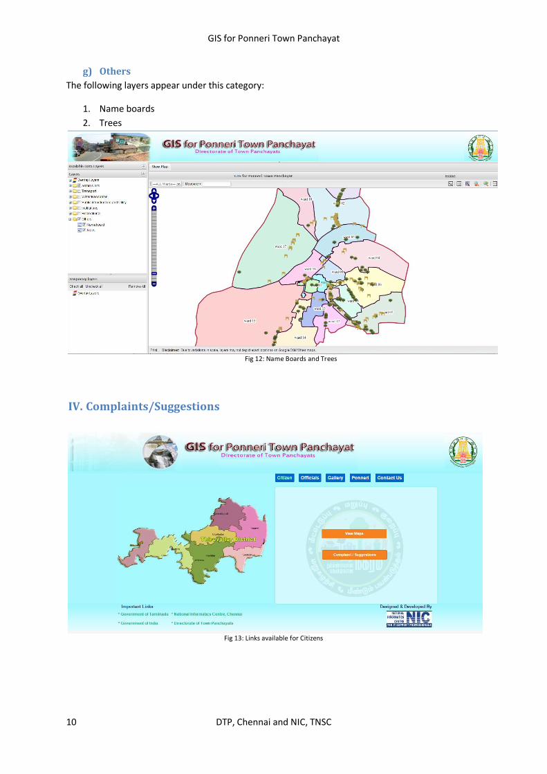
g) Others
The following layers appear under this category:
1. Name boards
2. Trees
Fig 12: Name Boards and Trees
IV. Complaints/Suggestions
Fig 13: Links available for Citizens

GIS for Ponneri Town Panchayat
11 DTP, Chennai and NIC, TNSC
By Clicking on Complaint/Suggestion from Citizen Menu, the following menu would be shown :-
Fig 14: Complaints and Suggestions
This Complaint/Suggestion Module has the following functionalities :
Home: Back to Main Menu About: About Citizen Module of the Applicatiion Complaints: Facilitate user to launch complaints about any Utility in Ponneri TP
There are 3 options available under Complaint Menu Complaint / View Complaint Status
i. Directly without registering as a User ii. Use Registeration credentials created earlier iii. To Register
i. Complaint / View Complaint Status directly (Unregistered User) Choose a Ward->Choose a Street in selected Ward & ->Choose a Facility about which you wish to launch complaint -> Click on Get Report.

GIS for Ponneri Town Panchayat
12 DTP, Chennai and NIC, TNSC
Fig 15: Parameters to select for lodging a Complaint
It will show the list of all selected Facilities available on selected Street & Ward as shown below:-
Fig 16: List of Utilities – Street Lights
Click on Map Icon against any desired Utility from the list to view the location of the selected Utility on Map.
Enter
Complaint
Click here for
Map(location)
GIS for Ponneri Town Panchayat
13 DTP, Chennai and NIC, TNSC
Fig 17: View the selected utility’s location on map
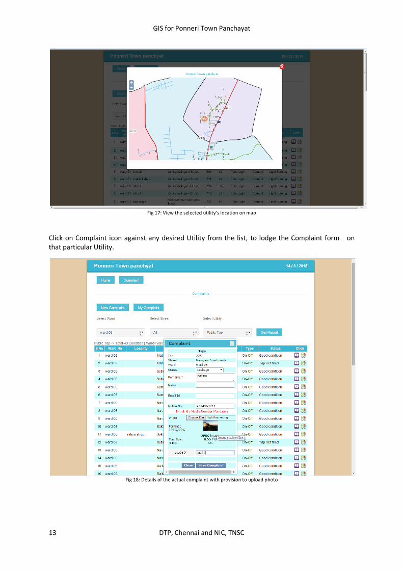
Click on Complaint icon against any desired Utility from the list, to lodge the Complaint form on that particular Utility.
Fig 18: Details of the actual complaint with provision to upload photo

GIS for Ponneri Town Panchayat
14 DTP, Chennai and NIC, TNSC
After lodging the complaint, Complaint ID is shown to the user. This unique number is to be used in future to verify the status of the Complaints by the user.
Screen showing complaint id:
Fig 19: Complaint Number with which user can track the status

GIS for Ponneri Town Panchayat
15 DTP, Chennai and NIC, TNSC
My complaints
Fig 20: Check the status with the help of Complaint Number
Fig 21: Check the status with the help of Complaint Number

GIS for Ponneri Town Panchayat
16 DTP, Chennai and NIC, TNSC
ii. For already Registered users:
Fig 22: Check the status with the help of Mobile number used to register in the website
GIS for Ponneri Town Panchayat
17 DTP, Chennai and NIC, TNSC
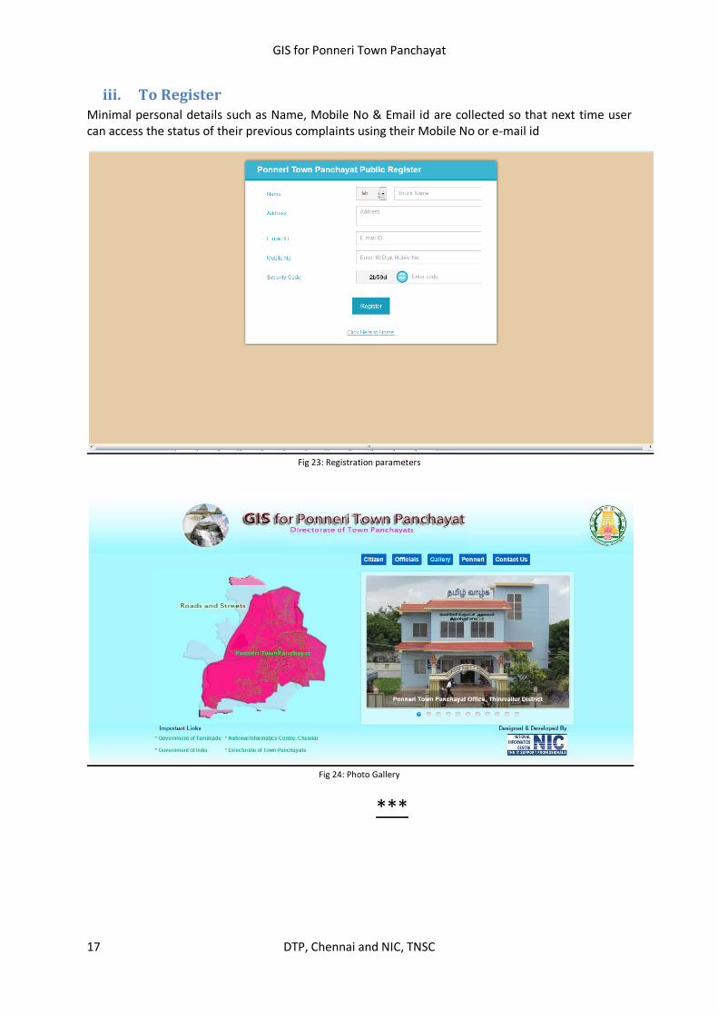
iii. To Register Minimal personal details such as Name, Mobile No & Email id are collected so that next time user can access the status of their previous complaints using their Mobile No or e-mail id
Fig 23: Registration parameters
Fig 24: Photo Gallery
***