Embed Size (px)
Citation preview

GIS for Insurance Claims
Relevant and reliable information when you need it—that’s the difference with Esri® technology and data.
Large-scale emergencies add significant complexity to the claims process and can challenge an organization’s ability to deliver the best customer service. When you, as a claims professional, have access to the data and information you need, anywhere you need it, you can deliver the best customer experience.
Mapping is a critical part of the claims process.
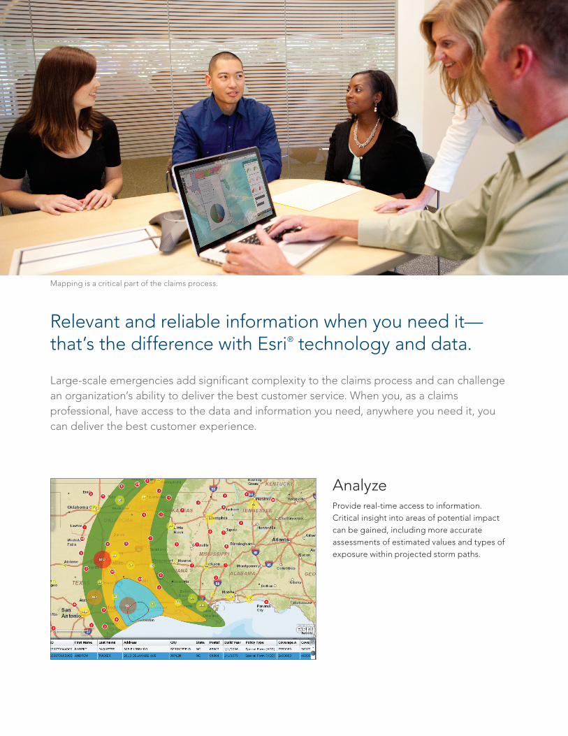
AnalyzeProvide real-time access to information. Critical insight into areas of potential impact can be gained, including more accurate assessments of estimated values and types of exposure within projected storm paths.
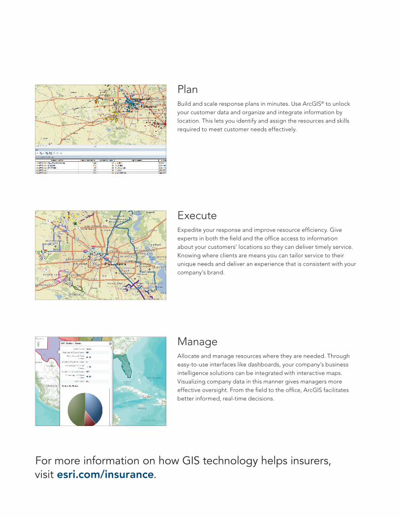
PlanBuild and scale response plans in minutes. Use ArcGIS® to unlock your customer data and organize and integrate information by location. This lets you identify and assign the resources and skills required to meet customer needs effectively.
Execute Expedite your response and improve resource efficiency. Give experts in both the field and the office access to information about your customers’ locations so they can deliver timely service. Knowing where clients are means you can tailor service to their unique needs and deliver an experience that is consistent with your company’s brand.
ManageAllocate and manage resources where they are needed. Through easy-to-use interfaces like dashboards, your company’s business intelligence solutions can be integrated with interactive maps. Visualizing company data in this manner gives managers more effective oversight. From the field to the office, ArcGIS facilitates better informed, real-time decisions.
For more information on how GIS technology helps insurers, visit esri.com/insurance.
Printed in USA
Contact Esri
380 New York Street Redlands, California 92373-8100 USA
1 800 447 9778T 909 793 2853 F 909 793 [email protected]
Offi ces worldwideesri.com/locations
Esri inspires and enables people to positively impact their future through a deeper, geographic understanding of the changing world around them.
Governments, industry leaders, academics, and nongovernmental
organizations trust us to connect them with the analytic knowledge
they need to make the critical decisions that shape the planet. For
more than 40 years, Esri has cultivated collaborative relationships
with partners who share our commitment to solving earth’s most
pressing challenges with geographic expertise and rational resolve.
Today, we believe that geography is at the heart of a more resilient
and sustainable future. Creating responsible products and solutions
drives our passion for improving quality of life everywhere.
Copyright © 2012 Esri. All rights reserved. Esri, the Esri globe logo, ArcGIS, @esri.com, and esri.com are trademarks, service marks, or registered marks of Esri in the United States, the European Community, or certain other jurisdictions. Other companies and products or services mentioned herein may be trademarks, service marks, or registered marks of their respective mark owners.
129663ESRI4/12ek