Embed Size (px)
Citation preview

THE REPUBLIC OF UGANDA
Ministry of Energy and Mineral Development, Uganda
Presented at the Sixth African Rift Geothermal Conference (ARGeo-C6),
Addis Ababa, Ethiopia, Oct. 31-Nov.6, 2016
GEOTHERMAL ENERGY DEVELOPMENT IN
UGANDA - A COUNTRY UPDATE 2016
Godfrey Bahati Ministry of Energy and Mineral Development,
P.O Box 7072, Kampala, Uganda.

THE REPUBLIC OF UGANDA
Ministry of Energy and Mineral Development, Uganda
Country Overview
Area 241 000 km2.
Over 34 million people.
Economy depends mainly on agriculture.
Oil products imported (100%).
Biomass represents 84% of the national energy balance.
Energy development a priority in the 5 year National Development Plan (2016 - 2020) & Vision 2040.
Geothermal Energy to contribute 1,500 MW to the energy mix.

THE REPUBLIC OF UGANDA
Ministry of Energy and Mineral Development, Uganda
3
Installed capacity for electricity generation over 892.7 MW.
The current power generation capacity is 724 MW(hydro, thermal, cogeneration).
Peak Demand is about 580 MW.
Electricity coverage is 18% for the whole country and 7% for rural areas.
Annual demand for electricity is growing at about 8% per year.
Status of power supply in Uganda

THE REPUBLIC OF UGANDA
Ministry of Energy and Mineral Development, Uganda
4
Plan for increased power supply in the Short
to Medium term (2015 – 2025)
Increasing generation capacity using fossil fuels.
Construction of two large hydropower dams, Karuma (600 MW) and Isimba (183 MW) to be completed in 2018.
Enhancement of renewable energy development.
Development of Geothermal (100 MW).
Emplacement of energy efficiency measures.

THE REPUBLIC OF UGANDA
Ministry of Energy and Mineral Development, Uganda
Long-term measures (2025-2040)
The development of large hydro power sites, namely,
Ayago (840 MW), Oriang (392 MW).
Interconnection of the regional power grid.
Use of locally produced oil to generate thermal
power (750 MW).
Use of new and renewable sources of energy which
include; solar, wind, biomass, peat and geothermal.
Development of the country’s geothermal resources
estimated at 1,500 MW.
Development and use of nuclear energy.

THE REPUBLIC OF UGANDA
Ministry of Energy and Mineral Development, Uganda
6
Policy and Institutional Framework
Renewable Energy 2007:
Introduced the feed-in tariffs (Geothermal 7.70 cents/KWh).
Standardized Power Purchase Agreements.
Obligation of fossils fuel companies to mix products with biofuels up to 20%.
Tax incentives on renewable energy technologies.
Uganda has formulated a Geothermal Policy and Legislation which are pending approval by Cabinet and Parliament.
Institutional framework:
A Geothermal Resources Department to explore and promote geothermal energy development.
Electricity Regulatory Authority (ERA) provides a generation license for all energy resources.

THE REPUBLIC OF UGANDA
Ministry of Energy and Mineral Development, Uganda
7
Geothermal Development in Uganda
The aim is to develop geothermal energy to complement hydro and other sources of power to meet the energy demand of Uganda in sound environment.

THE REPUBLIC OF UGANDA
Ministry of Energy and Mineral Development, Uganda
Location of geothermal resources

THE REPUBLIC OF UGANDA
Ministry of Energy and Mineral Development, Uganda
9
Major Geothermal areas under study
The four major geothermal areas under study are Katwe-Kikorongo, Buranga, Kibiro and Panyimur located in the Western Branch of the East African Rift System and along the Democratic Republic of Congo (DRC).

THE REPUBLIC OF UGANDA
Ministry of Energy and Mineral Development, Uganda
Katwe: Geology
The Geology is dominated by explosion craters, ejected pyroclastics, tuffs with abundant granite and gneissic rocks from basement.
Lava flows in L. Kitagata and Kyemengo craters.
Extinct hydrothermal deposits in and around L. Katwe and L. Kikorongo.
Surficial deposits (Rift valley sediments).
Gneisses in the Rwenzori Mountains
THE REPUBLIC OF UGANDA
Ministry of Energy and Mineral Development, Uganda
Katwe: Geochemistry
The geothermal surface manifestations in the Katwe prospect
are hot springs located in the Lake Kitagata crater, and warm
springs in Lake Katwe.
The maximum surface temperature is 70ºC in Lake Kitagata,
while in Lake Katwe Crater it is 32ºC.
The geothermal fluids are characterized by high carbonate and
sulphate, and salinity of 19,000 - 28,000 mg/kg total dissolved
solids.
The Subsurface temperature is estimated at 140-200˚C
(Armannsson, 1994). High concentration of hydrogen sulphide
at 30-40 ppm suggests its source could be volcanic and
hydrothermal (Bahati, 2003).

THE REPUBLIC OF UGANDA
Ministry of Energy and Mineral Development, Uganda
Katwe: Geophysics (TEM) results
Katwe resistivity anomalous areas
Low resisitivity Anomalous
Areas mapped by geophysics
(TEM).
Drilling of shallow boreholes
(200 – 300m) at selected
sites.
Temperature gradient drilling
and measurements at Katwe
(13 - 36°C/km) suggest
geothermal reservoirs that
are either deep seated or
offset from the drilled areas.

THE REPUBLIC OF UGANDA
Ministry of Energy and Mineral Development, Uganda
Kibiro: Geology
East of the escarpment the geology is dominated by the ancient crystalline basement (granite and gneisses), block faulted, extensive deposition of travertine.
West of the escarpment; - Rift Valley sediments of up to 4-5 km thick.

THE REPUBLIC OF UGANDA
Ministry of Energy and Mineral Development, Uganda
1. West of the escarpment at Kibiro
• Subsurface temperatures150-
250ᵒC predicted by
geothermometry and mixing
models.
• Salinity up to 4,000 – 5,000 ppm.
• Geothermal water has a cold
water component and
hydrocarbons.
• The fluid is depleted in sulphate
(20-50 ppm): interaction of
sulphate with hydrocarbons to
produce hydrogen sulphide.
• Recharge is from high ground in
Mukihani-Waisembe Ridge.
Kibiro: Geochemistry

THE REPUBLIC OF UGANDA
Ministry of Energy and Mineral Development, Uganda
Kibiro: Geophysics (MT) results
• All the cross-sections
show the clay alteration
deepening towards the
lake but vary to the extent
that they indicate a clay
apron that might overlie a
thermal aquifer.
• Low resistivity sediments
in yellow-red, high
resistivity Pre-Cambrian is
blue.

THE REPUBLIC OF UGANDA
Ministry of Energy and Mineral Development, Uganda
Kibiro: Geophysics (TEM) results
• The objective of TEM was to
identify a relatively shallow
onshore capped aquifer that
might host a >150°C
geothermal aquifer that could
be tested at low cost, and to
collect a telluric shift in MT.
• The Figure shows a cap rock
which appears to be thicker
and less distinctly layered
than the MT inversion.
• The clay zone (yellow-red) is
interpreted as capping a more
resistive and possibly
permeable hot aquifer or
reservoir.

THE REPUBLIC OF UGANDA
Ministry of Energy and Mineral Development, Uganda
Kibiro: Proposed subsurface conceptual
model • The 240°C reservoir hosting
the geothermal liquid is
assumed to be situated below
the lacustrine sediments at
depths of 2.0 to 2.3 km.
• A temperature of 150°C is
attained through mixing
between the uprising
geothermal liquid and the
descending cold brackish
water establishing a secondary
reservoir.
• Conductive cooling occurs
afterwards during the final
upflow of the mixed water to
the surface.
Seismic cross-section (Karp et al.,
2012) on which the possible
geothermal reservoir and paths of the
geothermal liquids are indicated.

THE REPUBLIC OF UGANDA
Ministry of Energy and Mineral Development, Uganda
• Drill shallow wells (about 200 to 300 m depth)
to explore the possibility that a shallow aquifer
exists, as hinted by the resistivity (MT/TEM)
data.
• If the temperatures are closer to 140 to 150°C,
then design a low temperature exploration plan
for the discovered resource.
• If it shows more definitive indications of being
over 230°C, then consider options to target the
deeper system, possibly by directional drilling.
Kibiro: Recommendations

THE REPUBLIC OF UGANDA
Ministry of Energy and Mineral Development, Uganda
• Located at the foot of the
Rwenzori Mountains.
• Sedimentary environment.
• No evidence of volcanism
but highly tectonically
active.
• Most impressive
geothermal manifestations
in the whole Western
Branch of the EARS.
• Surface temp. 98ºC.
Buranga: Location and geology

THE REPUBLIC OF UGANDA
Ministry of Energy and Mineral Development, Uganda
Buranga: Geothermal surface
manifestations
1. Boiling hot springs 2. Close to boiling
3. Gas discharge 4. Geothermal grass

THE REPUBLIC OF UGANDA
Ministry of Energy and Mineral Development, Uganda
Buranga: Geochemistry
• Subsurface temperatures of 120-150°C have
been predicted by geothermometry.
• Fluids with neutral pH (7-8).
• Salinity 14,000-15,000 mg/kg TDS.
• The source of sulphate: sulphate reach
minerals/rocks.
• Recharge is from high ground in the
Rwenzori Mountains.

THE REPUBLIC OF UGANDA
Ministry of Energy and Mineral Development, Uganda
Buranga: Seismic results
Micro-seismic surveys located a subsurface anomaly within the vicinity of the thermal activity at Buranga and could be the sources heat for the area.
Buranga conceptual model (DGSM-BGR 2007)

THE REPUBLIC OF UGANDA
Ministry of Energy and Mineral Development, Uganda
Buranga: MT/TEM Results
• The sedimentary basin highly
conductive due to the clay type
minerals which are consolidated in
the sediments.
• The conductive layers have been
mapped and can go deeper than
3000 m b.s.l.
• The Figure shows a 2D MT
resistivity map at 1500 m b.s.l.
• The conductive anomalous area is
more prominent in the NNE – SSW
direction implying that it is
possibly controlled by the Bwamba
fault.

THE REPUBLIC OF UGANDA
Ministry of Energy and Mineral Development, Uganda
Buranga: Cross-section through MT
anomalies • Low resistivity layer close
to the surface underlain by
a high resistive layer.
• The low resistive layer
could represent a cap rock
made by highly conductive
clay minerals.
• Beneath would lie a
geothermal reservoir which
is expected to be highly
resistive.
• The model looks
ambiguous because a few
soundings done and a need
to collect more data at a
close spacing.

THE REPUBLIC OF UGANDA
Ministry of Energy and Mineral Development, Uganda
Panyimur: Geochemistry
• Geothermal manifestations are
hot springs namely Amoropii,
Okumu and Avuka with surface
temperatures of 60, 47, and
45˚C respectively.
• Other surface manifestations
are altered ground, geothermal
grass and shrub trees.
• High levels of hydrogen
sulphide gas (10 – 12 ppm)
suggest that the source of heat
could be magmatic.

THE REPUBLIC OF UGANDA
Ministry of Energy and Mineral Development, Uganda
Panyimur: Magnetics and Gravity results
MAGNETICS
GRAVITY
Both Gravity and Magnetic data show possible geothermal signatures. Magmatic
intrusions have high density hence Gravity -High and heat demagnetises the
rocks hence low magnetic anomaly for geothermal is detected as magnetic -Low.
GRAVITY

THE REPUBLIC OF UGANDA
Ministry of Energy and Mineral Development, Uganda
MT – Cross-section
Panyimur: Recent MT Results
MT: 2D

THE REPUBLIC OF UGANDA
Ministry of Energy and Mineral Development, Uganda
Status of Licensing geothermal areas
S/No Area License Holder EL Date of
Issue
Date of
Expiry
1. Katwe-Kikorongo Cozumel Energy
(U) Limited
EL 0705 29/11/2010 28/11/2017
2. Katwe-Bunyampaka AAE Systems Inc. EL 1377 19/09/2014 18/09/2017
3. Bunyaruguru Spencon (U) Ltd. EL 1283 05/02/2014 04/02/2017
4. Buranga Gids Consult Ltd. EL 0725 10/02/2011 08/02/2018
5. Buranga Kapex Ltd EL 1456 13/03/2015 12/03/2018
6. Ntoroko Kapex Ltd EL 1455 12/03/2015 11/03/2018
7. Ntoroko Kapex Ltd EL 1395 14/11/2014 13/11/2017

THE REPUBLIC OF UGANDA
Ministry of Energy and Mineral Development, Uganda
Current Support to Government of Uganda
African Rift Geothermal Development Facility (ARGeo).
Climate Technology Centre Network (CTCN) of the United
Nations Framework Convention on Climate Change
(UNFCCC).
UK Department for International Development (DFID) funded
East Africa Geothermal Energy Facility (EAGER) represented
by Adam Smith International (ASI).
MoU between Government of Uganda and Toshiba.
MoU with Government of Kenya and Rwanda.
Energy for Rural Transformation (ERT III) Funded by WB.
Fluids and Volatiles Laboratory, Scripps Institution of
Oceanography, University of California San Diego (UCSD).

THE REPUBLIC OF UGANDA
Ministry of Energy and Mineral Development, Uganda
Challenges
Inadequate Policy and Legal framework.
Inadequate data on the geothermal resources.
Inadequate resources for exploration and feasibility
study.
Capacity building:
• Inadequate trained personnel to carryout
exploration and development of the geothermal
resources.
• Inadequate equipment.
Private sector participation in surface exploration
has led to speculation than development.

THE REPUBLIC OF UGANDA
Ministry of Energy and Mineral Development, Uganda
Strategies to address the challenges
• Institution Framework: Creation of a Geothermal
Department to handle activities regarding geothermal
development.
• Policy and regulatory framework: Review the existing
policy and legal framework, and put in place a new geothermal
policy and legislation to focus on geothermal energy
development.
• Financing of the Geothermal Energy projects:
Government to provide funding for geothermal exploration and
development.
• Feed-in tariffs: Government to establish Feed-in tariff to
create a predictable business environment for geothermal
energy projects.

THE REPUBLIC OF UGANDA
Ministry of Energy and Mineral Development, Uganda
Conclusions
• Potential for geothermal development.
• Government commitment to develop geothermal resources.
• Subsurface temperatures in the range of 100 - 250˚C suitable for power generation and use in industry and agriculture.
• Surface exploration near completion at Kibiro and Panyimur.
• Private sector not performing to expectations.

THE REPUBLIC OF UGANDA
Ministry of Energy and Mineral Development, Uganda
Recommendations
• Fast track the Formulation of Geothermal Policy and Legislation.
• Need to finalize surface studies at Katwe, Buranga, Kibiro and Panyimur & proceed to the feasibility study.
• Detailed studies of other geothermal areas in Uganda.
• Capacity building (manpower and equipment).
THE REPUBLIC OF UGANDA
Ministry of Energy and Mineral Development, Uganda
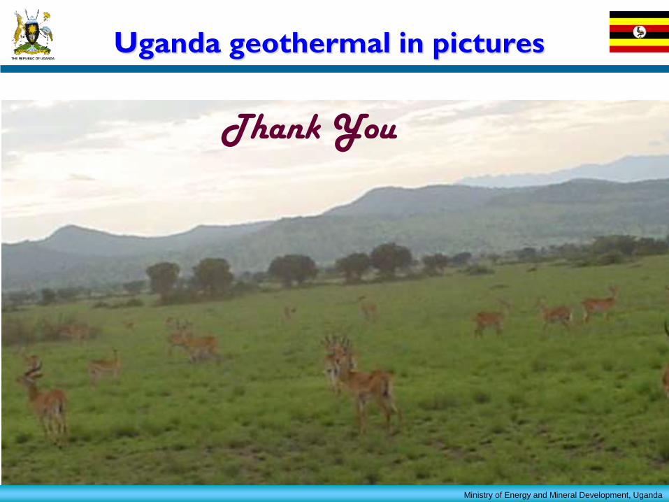
Uganda geothermal in pictures
END Thank You