Embed Size (px)
Citation preview
HarrisGeospatial.com
GEOSPATIAL SOLUTIONS FOR DEFENSE & INTELLIGENCE

OUR GEOSPATIAL PROCESSING, EXPLOITATION, AND DISSEMINATION (PED) SOFTWARE SOLUTIONS ARE EASY TO USE AND ACCURATE, AND CAN BE CUSTOMIZED TO MEET MISSION OBJECTIVES.

Today, remotely sensed data is commonly used to make mission-critical decisions in theater and to better understand an area of interest before a mission ever begins. With the proliferation of data collection systems, there is a flood of data that includes everything from video and satellite imagery to non-optical data such as LiDAR and SAR. With so many data sources, the geospatial data needed to solve a problem likely exists; the challenge is to manage and discover the relevant data, transform it into information to solve a problem, and disseminate it in a timely manner to the people that need it most.
WE HELP YOU MAKE MISSION-CRITICAL DECISIONS. FASTER.
ENABLE YOUR COMMAND Harris Geospatial Solutions delivers software solutions to government organizations worldwide, helping them to use satellite and other geographically contextual data to make higher confidence decisions. Our products enable the defense and intelligence chain – from the command center to the tip of the spear – with the most advanced software technology available today to effectively manage and exploit geospatial data.
Whether the mission requires forensic analysis of a geographic area of interest or real-time access to data that’s relevant right now, our solutions are used around the world to manage, exploit, and disseminate virtually any type of geospatial imagery, video, or data.
THE MOST ADVANCED TECHNOLOGY AVAILABLE Jagwire™, ENVI®, and IDL® software solutions are used throughout the defense industry from the SOF community to Intelligence agencies. Jagwire is field-tested, web-based software, which reduces the time from data collection to decision making through a federated architecture and a flexible platform that is easily accessed from the cloud, mobile devices, and desktops.
Combine Jagwire with the advanced image analytic capabilities of our ENVI software suite and it’s possible to produce highly advanced geospatial products, even on-the-fly, and in real time. IDL makes it easy to add custom algorithms to ENVI products, automate common exploitation tasks, and extend ENVI products to meet the unique needs of very specific missions.
TIME-SAVING, ON-BUDGET SOLUTIONS Since our solutions were built for the critical needs of defense and intelligence operations, your organization doesn’t need to invest time and money in ground-up development. Whether the need is to keep eyes on target by streaming full motion video, quickly re-task a UAS to zero in on an area of interest, or to rapidly discover relevant data to share with field deployed personnel, Harris Geospatial Solutions has interoperable software solutions to help make critical decisions faster than ever.

Military commanders, intelligence officers, and decision makers of all kinds have massive amounts of data available to them. In fact, there’s so much data that the challenge is generally not whether the appropriate data exists, but rather how to quickly find the necessary data to solve the problem at hand. An effective geospatial data management solution will be federated and allow for search and discovery based upon spatial and temporal values, chat and user-driven keywords, and user-defined key imagery fields.
BIG DATA BECOMES HIGH-CONFIDENCE DECISIONS
ONE SOFTWARE SYSTEM FROM START TO FINISH Jagwire and ENVI deliver exactly that. These world-class software products provide end-to-end geospatial data management so your command and control can focus on solving issues, not finding data. Jagwire is a fully web-based data ingest, management, image exploitation, and information dissemination tool that turns data into high-confidence decisions faster than ever before.
SPEND MORE TIME SOLVING PROBLEMS AND LESS TIME SEARCHING THROUGH DATA Now your decision makers can access a single full-spectrum product rather than disconnected software pieces that don’t speak to each other effectively. Whether it’s a critical military operation, a border control exercise, or responding to a natural disaster, there is no time to sift through terabytes of data to find mission-relevant information. With Jagwire and ENVI, the entire chain of command can quickly find the multi-source data they need so more time is spent solving problems rather than searching through data. And, if real-time information is what they need, users can easily find the multi-source data to start solving problems.
Catalog your geospatial data for quick discovery via the web using Jagwire (bottom picture). ENVI software (right picture) allows for quick, easy, and accurate image analysis on your data.
TRANSFORM BIG DATA INTO INTELLIGENCE

FMV
SAR
LiDAR
CHAT IMAGERY
SATELLITEVIDEO
WAMI
GMTI &VMTI
YOURDATA
Information Dissemination From ingest to dissemination, the end-to-end solution enabled by Jagwire and ENVI provides decision makers with information from their data, whether in a command center or for making tactical decisions in the field.
Geospatial Data Management From full motion video and satellite imagery, to non-optical data such as SAR and LiDAR, and even mission chat sessions, you can rely on Jagwire to manage data and quickly make it available when it’s needed – regardless of location.
Image ExploitationWhen Jagwire is outfitted with ENVI, it’s possible to provide multi-INT fusion for intel/map product
generation, enabling more informed decisions using all the information available. Or, ENVI
can act as a completely interoperable solution with existing products and infrastructure.

Stream video from a UASReal-time information from a video stream makes a UAS even more valuable, keeps troops out of harm’s way, and allows them to make coordinated maneuvers at the most opportune time.
Video stream to command centerSee what the soldier sees and turn the command center into a more valuable source of real-time intelligence to inform soldiers that are in theater.
Connect field of vision When soldiers can see what their peers
see, it’s easier to coordinate movements, stay safe, and achieve mission success.
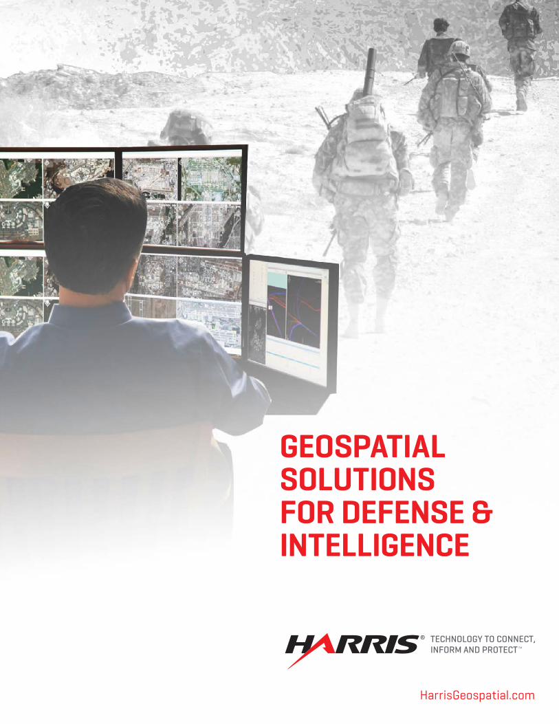
Working in a tactical, in-theater environment means information needs to be pertinent to what is happening right now, not what happened in the past. Time is of the essence, and data needs to be delivered quickly and in an easy-to-use, reliable format. Whether the mission demands a video stream to observe a high-risk zone, on-demand intelligence products to coordinate movements, or the dynamic re-tasking of an asset to gain a greater understanding of an area of interest (AOI), Jagwire and ENVI can quickly provide the intelligence needed to make informed decisions.
CURRENT INFORMATION ENABLES WARFIGHTERS
ON-THE-FLY ANALYSIS ENSURES SAFE AND SUCCESSFUL MISSIONS Missions that require soldiers to move through hostile territory to gather strategic intelligence, protect a convoy, rescue a hostage, or perform any number of other scenarios that would benefit from on-the-fly information to inform mission decisions. When Jagwire is combined with a cloud-deployed version of ENVI, the analytics are moved to where the data resides – making it possible to create on-the-fly intelligence products with thin and mobile clients. Now, soldiers in theater can use the most up-to-date data to get answers in near real-time to ensure mission objectives are achieved. REAL-TIME BATTLEFIELD DECISIONS REQUIRE REAL-TIME INFORMATION Using Jagwire enables soldiers on the ground to view live video from a UAS, provide real-time video feeds to a command center, or even connect the field of vision of each member of a unit.
USE JAGWIRE AND ENVI TO QUICKLY CREATE ON-THE-FLY INTELLIGENCE PRODUCTS WITH THIN AND MOBILE CLIENTS.

About Harris CorporationHarris Corporation is a leading technology innovator, solving customers’ toughest mission-critical challenges by providing solutions that connect, inform and protect. Harris supports government and commercial customers around the world. Learn more at harris.com.
Harris is a registered trademark of Harris Corporation. Trademarks and tradenames are the property of their respective companies.© 2017 Harris Corporation -04/16 rev.6-17 VIS-AL
Non-Export-Controlled Information
STAY CONNECTED
HarrisGeospatial.comEmail: [email protected]
Phone: 303.786.9900
CONTACT US
FLORIDA | NEW YORK | VIRGINIA | BRAZIL | UNITED KINGDOM | UAE | SINGAPORE
Government agencies today are facing more challenges than ever before. It’s important to be at the forefront of technology and innovation to stay one step ahead, yet budgets are being squeezed. When off-the-shelf solutions will not solve the very unique specifications of a mission, Harris Geospatial Solutions can provide trusted, time-proven technology, mission knowledge, and the best systems integrators and consultants in the business to develop the solution needed.
We provide expertise across the GEOINT chain, from image science, modeling and simulation, systems engineering, and COTS integration, to expanding capabilities in non-traditional sensors and multi-INT sources beyond GEOINT. And, since we can make analytic capabilities that can be easily consumed, the solution will reach every stakeholder, even those in bandwidth constrained environments on thick, thin, or mobile clients.
CUSTOM CONSULTING SERVICES
BENEFITS
Integrate our trusted COTS software with existing infrastructure
Build a custom system from the ground up to solve any problem
Support daily operations with a full-time on-site consultant
LEVERAGE YOUR PREVIOUS INVESTMENTS We are committed to efficiency when solving every problem. Our experts will work with you to define requirements, understand timetables, consolidate redundant functions, and reduce risk early in a system lifecycle. We use an agile development process that allows our consultants to respond to change requests quickly while simultaneously tracking towards deadlines. We provide a wide range of service offerings and business models based on customer-specific requirements. We’ll keep costs low by offering you a range of options, and we’ll scale to meet any organizational need.
GET BETTER SOLUTIONS IN LESS TIME Using GEOINT, Harris can help solve complex technical challenges by implementing custom and automated workflows and information management systems that directly map to the requirements of an organization. This fosters collaboration across the user base and transforms assets from a legacy, stovepiped infrastructure to a modern, online/on-demand marketplace of capabilities.
Images courtesy of DoD. Use of DoD images does not constitute or imply endorsement.