Embed Size (px)
Citation preview
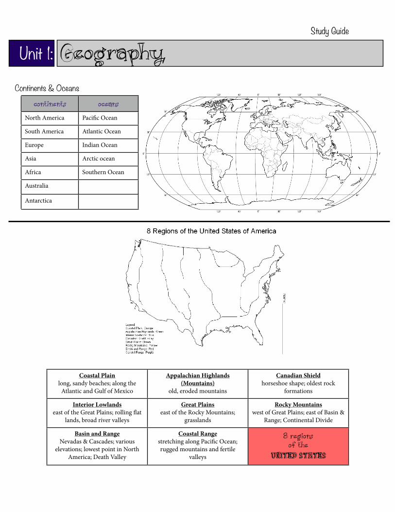
Coastal Plainlong, sandy beaches; along the
Atlantic and Gulf of Mexico
Appalachian Highlands (Mountains)
old, eroded mountains
Canadian Shieldhorseshoe shape; oldest rock
formations
Interior Lowlandseast of the Great Plains; rolling !at
lands, broad river valleys
Great Plainseast of the Rocky Mountains;
grasslands
Rocky Mountainswest of Great Plains; east of Basin &
Range; Continental Divide
Basin and RangeNevadas & Cascades; various
elevations; lowest point in North America; Death Valley
Coastal Rangestretching along Paci"c Ocean; rugged mountains and fertile
valleys
8 Regions of the
United States
Study Guide
Continents Oceans
North America Paci"c Ocean
South America Atlantic Ocean
Europe Indian Ocean
Asia Arctic ocean
Africa Southern Ocean
Australia
Antarctica
Continents & Oceans
Unit 1: Geography

Major Bodies of Water Trade, Transportation, and Settlement
Oceans: Atlantic Ocean, Paci"c Ocean
Lakes: Great Lakes
Gulf: Gulf of Mexico
Rivers: Mississippi River, Missouri River, Ohio River, St. Lawrence River, Rio Grande, Colorado River, Columbia River
e location of the United States (with the Atlantic and Paci"c coasts) has given access to the rest of the world
e Atlantic Ocean served as the highway for explorers, early settlers, and later immigrants
e Ohio River was the gateway to the west
Cities began to develop in the Midwest along the Great Lakes
St. Lawrence River forms part of the northeastern border with Canada and connects the Great Lakes to the Atlantic Ocean.
e Mississippi and Missouri Rivers were the transportation routes for farm and industrial products. ey were also links to the rest of the world.
e Columbia River was explored by Lewis and Clark
e Colorado River was explored by the Spanish
e Rio Grande forms the border with Mexico
e Paci!c Ocean was an early exploration route
e Gulf of Mexico allowed the French and Spanish to explore Mexico and other parts of America
Study Guide
Major Bodies of WaterGeographic Features
Water Land
GulfTributaries
LakesOceansRives
MountainsHills
PlainsPlateausIslands
Peninsulas
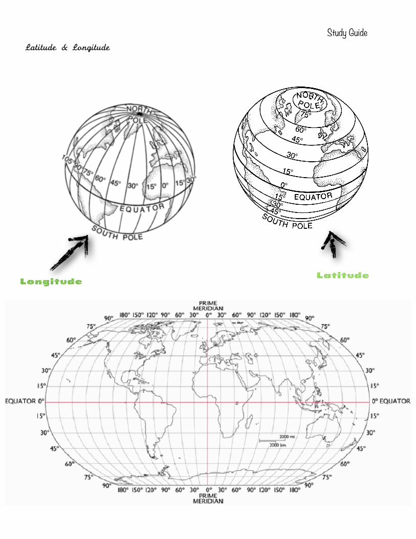
Study GuideLatitude & Longitude
Longitude
Latitude