Embed Size (px)
Citation preview

Geography 155-08
Dr. Susan W.S. [email protected]
Class meets: M&W 10:35 am – 11:30 am
The Natural
Environment
Flooding along Ohio River last week.
Images from NASA EOS.
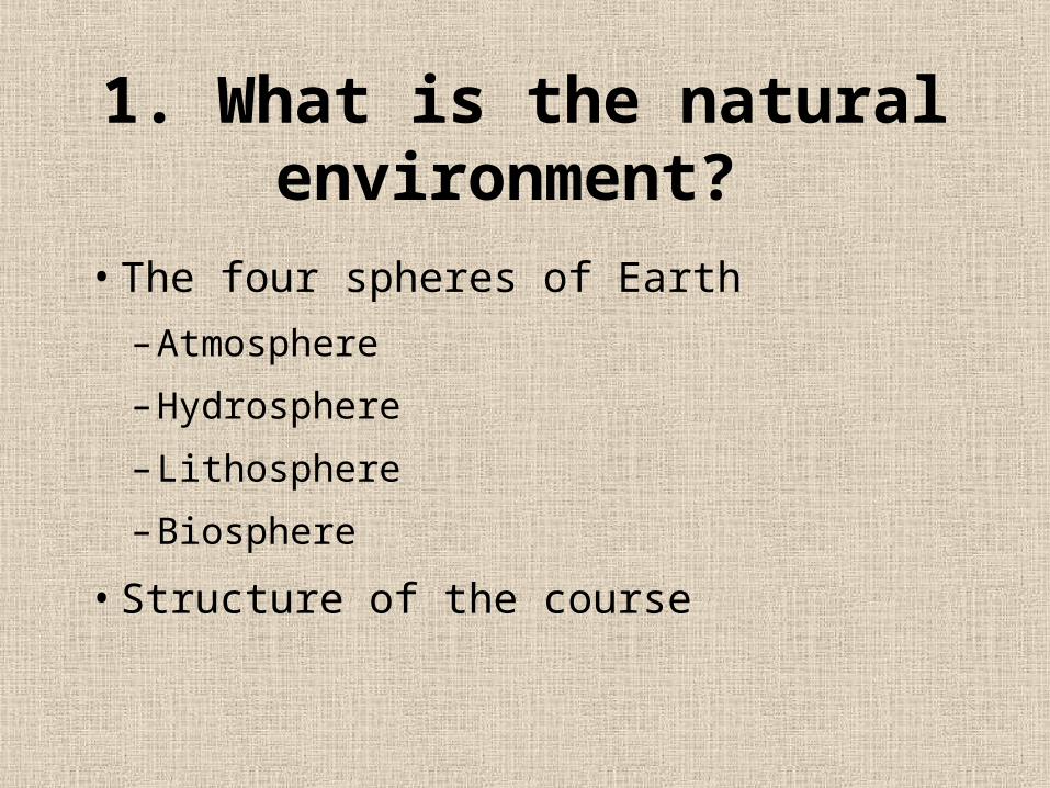
1. What is the natural environment?
• The four spheres of Earth
– Atmosphere
– Hydrosphere
– Lithosphere
– Biosphere
• Structure of the course

Part 1
The Energy-A
tmosp
here
Syste
m
Part 2
The Water, Weather
and Climate Systems
Part 4The Earth-Atmosphere
Interface
Part 3Ecosystems and Biomes

Why Geography?
•Definition: Earth’s description
• Understanding spatial relationships

2. Association of American Geographers:
5 Themes•Location
• Region
• Human-earth relationships
• Place
• Movement

Location•Absolute location
– latitude and longitude•Syracuse, NY: 43°N, 76°W
•Relative location– relative to some other place or
feature•Syracuse, NY: south of Lake Ontario•Syracuse, NY: half way between NYC and Buffalo

Association of American Geographers:
5 Themes• Location
•Region
• Human-earth relationships
• Place
• Movement

Region
• Areas delineated based on commonalities
– Appalachia
– Rust belt
– America’s food basket

Folded mountain belt of Appalachians

Rust Belt
From: Rubenstein, 1994

Sun Belt
Based on a survey of geographers. From Rubenstein, 1994


Association of American Geographers:
5 Themes• Location
• Region
•Human-earth relationships
• Place
• Movement

Human-Earth Relationships
• Hazard perception
• Resource exploitation
• Environmental modification

Hazard Perception
•Fort Worth Tornado, 1999

Resource Exploitation
Bingham canyon copper mine, Utah

Environmental Modification
• City of Venice, Italy

Association of American Geographers:
5 Themes• Location
• Region
• Human-earth relationships
•Place
• Movement

Place• What makes a place unique.
• Mt. St. Helens, Washington

Association of American Geographers:
5 Themes• Location• Region• Human-earth relationships• Place•Movement

Movement
• Communication• Movement•Circulation

Circulation
The Gulf Stream

Palm trees in Scotland!
. . . At a latitude equivalent to Alaska. . .

3. Physical Geography
• Uses the scientific method
• In the framework of systems theory

General theory, governing laws
Hypothesis
RealWorld
Scientific method begins here
Predictions
Inductive reasoning
Observations, measurements
Theory formulation
Experiment and testing
Search for patterns and order
Explanation
Data collection
Perception
Real world understood
General statement
What data?
Model building
Refining of hypothesis
What’s known, what do we want to know?
Posi
tive
feedback
Negativ
e
feedback
Geosystems, p 7

Observation of the real world
• Lots of heavy rain makes rivers muddy.
Hypothesis• Greatest sediment loss with
highest annual precipitation
Data Collection
Rainfall dataSediment loss (yield) from land

Testing Predictions• Measure precipitation and sediment yield in
as many places as possible• Expected results:
0
200
400
600
800
1000
1200
1400
0 500 1000 1500
Rainfall
Sedim
ent
Yie
ld (
t m
-2 y
r-1)

Actual Results
0
200
400
600
800
1000
1200
0 500 1000 1500 2000
Precipitation (mm)
Sed
imen
t Y
ield
(t
m-2 y
r-1)

Refine Hypothesis
• Observations of real world• Are other factor(s) important?• Vegetation!


Relationship between vegetation and sediment
yield
0 10 20 30 40 50
Percent vegetation cover
Sed
imen
t Yie
ld

Interaction of different factors
0
200
400
600
800
1000
1200
0 500 1000 1500 2000 0 10 20 30 40 50
Percent vegetation cover
Sed
imen
t Yie
ld

4. Systems Theory
• A set of ordered, inter-related things and their attributes, linked by flows of energy and matter.
• System Feedbacks– Positive feedback: change leads to
growth.– Negative feedback: change leads
to reduction in growth.

Positive Feedback
• Growth continues in same direction
• Runaway system
0
4
8
12
16
20
0 1 2 3 4 5
Time Step
• Compound interest• Greenhouse
warming and evaporation

Negative Feedback
• Limits growth• System control
66
68
70
72
74
0 2 4 6 8 10
Time Step
Tem
p (
oF)
-ve feedback 1
-ve feedback 2
• Human sweating• Greenhouse warming
and increased cloud cover

Feedbacks lead to system stability
• Earth-system tends to remain in equilibrium (balance).
• But is it a steady-state equilibrium, dynamic equilibrium? Or metastable?

Steady-State Equilibrium
• Fluctuates around a mean value
Figure in Geosystems, p10

Dynamic Equilibrium and Metastable
Systems• Trend of operation varies – dynamic• Jumps to a new level of operation - metastable

Steady-state
Relaxation
Steady-state
Perturbation
A Geomorphic System
A metastable system

Global System

Summary
• Physical geographers study the natural environment.
• Use the scientific method to understand earth systems
• Focus on spatial relationships that help explain aspects of the system.