Embed Size (px)
Citation preview

geodjangoRapid Geographic Web Application with GeoDjango
May 14, 2008
Where 2.0

③Third-Party Libraries
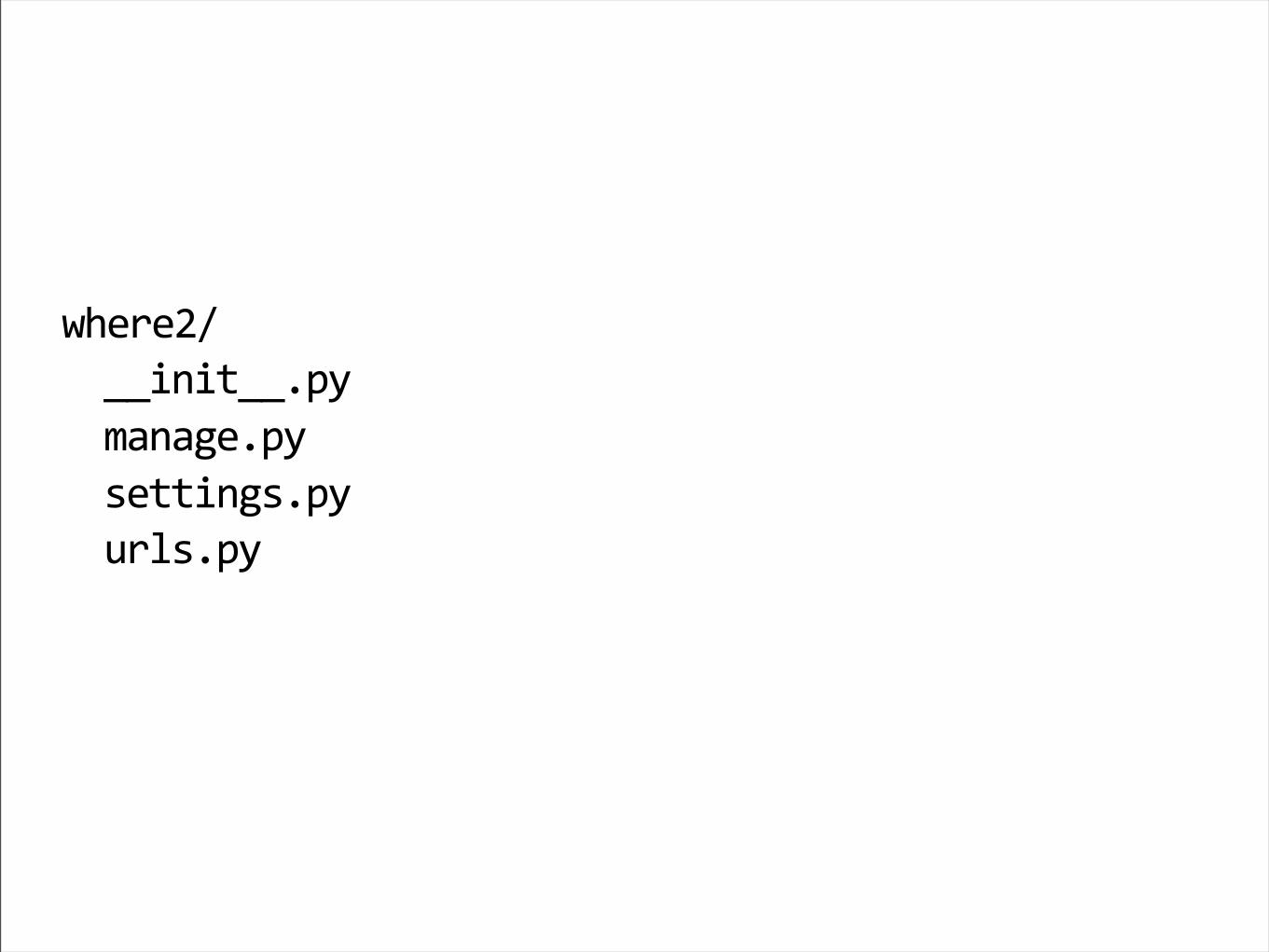
②Installation
①Django Intro
④Inspection & Import

⑤Exploration
⑥Admin
⑦Mapping
⑧Conclusion

①Django Intro

geodjango

(Crazily brief) Introduction

“”
Django is a high-level Python web framework
that encourages rapid development and clean,
pragmatic design.

More…http://toys.jacobian.org/presentations/2008/pycon/tutorial/
http://www.djangoproject.com/documentation/design_philosophies/
http://www.djangobook.com/en/1.0/chapter01/

!"!"#$%&'#!()$*+,-./#0/+0&"12/-341015
#$%&%'(
))*+*,))-./
01+12%-./
3%,,*+23-./
4&53-./

from django.db import models
class County(models.Model):
name = models.CharField(...)
>>> County(name=’x’).save()
>>> County(name=’y’).save()
>>> County.objects.count()
2
>>> c = County.objects.get(name=’y’)

6789:8":9;<8"=1..)>?4+,/="@""""=*A="*+,%2%&"BC:"BD<<"E7FG97H"I8HJ""""=+10%="K1&>$1&@LMN"BC:"BD<<"""""NO

from django.contrib.gis.db \
import models
from django.contrib.gis.geos \
import Point
class County(models.Model):
name = models.CharField(...)
center = models.PointField(srid=4269)
objects = models.GeoManager()
>>> p1 = ’POINT (0 1)’
>>> p2 = Point(10, 20)
>>> County(name=’x’, center=p1).save()
>>> County(name=’y’, center=p2).save()
>>> County.objects.count()
2
>>> y = County.objects.get(center=p2)
6789:8":9;<8"=1..)>?4+,/="@""""=*A="*+,%2%&"BC:"BD<<"E7FG97H"I8HJ""""=+10%="K1&>$1&@LMN"BC:"BD<<J"""""NO"""P8<86:"9AAQ%?0%,&/6?540+@R1..)>?4+,/RJ"""""""""""""""""""""""""""""""R>%+,%&RJ"S'TUJ"RECFB:RJ"'"""""NO

!"*6(#$#%1*+,-.,$2!7
6&%1,*+2",1V5%"14,$)0%3312%
6&%1,*+2",1V5%"14,$)2&?4.
W
6&%1,*+2",1V5%"1..)>?4+,/
W
8*6(#$#%1*+,-09$.10:10-;<=;;;
X15*A1,*+2"0?A%53---
M"%&&?&3"Y?4+A-
Z[1+2?"K%&3*?+"M-U\].&%]PXB]\SMMJ"43*+2"3%,,*+23"R3%,,*+23R
Z%K%5?.0%+,"3%&K%&"*3"&4++*+2"1,"$,,.^((M^_MMM(
`4*,",$%"3%&K%&"#*,$"6CB:7C<]6-

“Apps”http://www.b-list.org/weblog/2008/mar/15/
slides/

django.contrib.auth django-votinghttp://django-voting.googlecode.com/
cheeserater.packages
User
PackageTopic
Vote
Category

“Views”The guts.

Q8:"(3?0%)4&5(
3%,,*+23-7CC:)D7<6CBa"b"c4&53d
4&53
@&Re3?0%)4&5(RJ"*+>54A%@R1..-4&53RNN
1..-4&53
@Re!RJ">?4+,/)5*3,N
>?4+,/)5*3,@&%f4%3,N
Dissecting a request

Y&?0"A[1+2?->?+Y-4&53-A%Y145,3"*0.?&,"g
Y&?0"1..-K*%#3"*0.?&,"g
4&5.1,,%&+3"b".1,,%&+3@RRJ
""""@Re1..(!RJ">?4+,/)5*3,NJ
N

Y&?0"A[1+2?-3$?&,>4,3"*0.?&,"&%+A%&),?)&%3.?+3%
Y&?0"0?A%53"*0.?&,"6?4+,/
A%Y">?4+,/)5*3,@&%f4%3,N^
"""">3"b"6?4+,/-?V[%>,3-?&A%&)V/@c+10%dN
""""&%,4&+"&%+A%&),?)&%3.?+3%@c>?4+,/)5*3,-$,05dJ
""""""""""""""""""""""""""""""""""""""""""""""""""
hc>?4+,*%3d^>3iN

TemplatesSkinning

jkZC6:HE8"l:G<"ED;<F6"=]((mn6((Z:Z"l:G<"S-Mo((8B=p
j$,05"51+2b=%+=p
j$%1Apj,*,5%p6?4+,*%3j(,*,5%pj($%1Ap
jV?A/p
j45p
hq"Y?&"2"*+">?4+,*%3"qi
j5*p>>-2*$#(1-??j(5*p
hq"%+AY?&"qi
j(45p
j(V?A/p
j($,05p

p["name"]
p.name
p.name()
The magic dot

More...http://www.djangoproject.com/documentation/
http://www.djangoproject.com/documentation/
http://www.djangoproject.com/documentation/
No, really.
http://www.djangoproject.com/documentation/

②Installation

Installation:it builds character
• Relying on relatively new versions of the most libraries.
• But ctypes saves us (sort-of).
• We plan to fix this at some point.
• For now, hurrah for virtualization!

③Third-Party Libraries
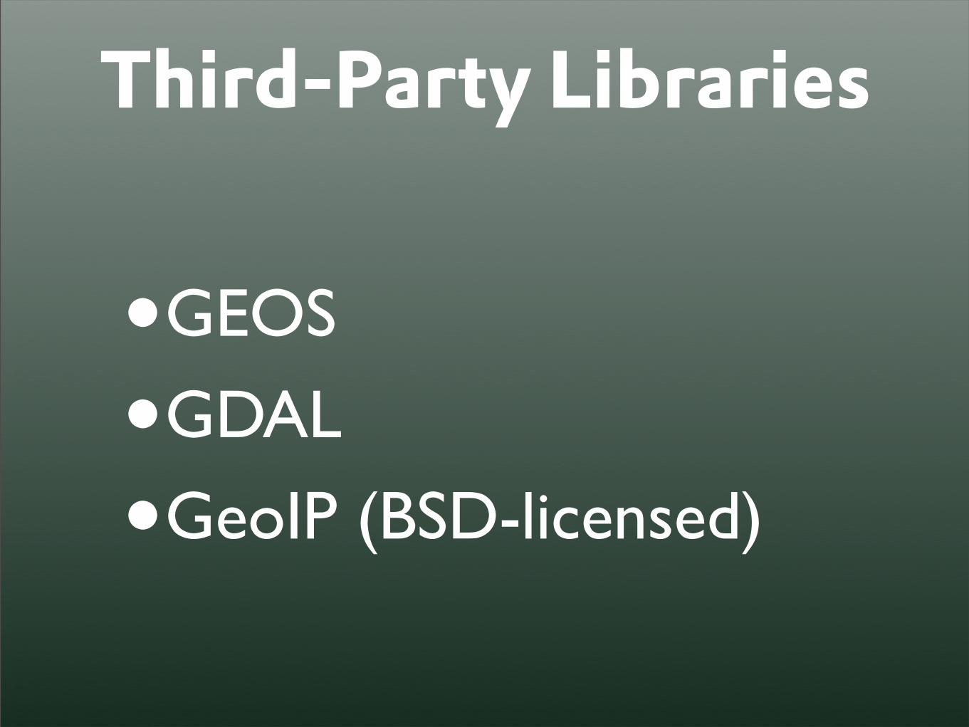
Third-Party Libraries
•GEOS
•GDAL
•GeoIP (BSD-licensed)

Third-Party Libraries
• Why?
• Powerful open source libraries; temperamental SWIG interfaces
• ctypes enables all-Python interfaces (no compilation necessary)
• Use of C APIs allows for high degree of cross-platform compatibility

GEOSGeometry Engine Open Source
>>> from django.contrib.gis.geos import *>>> pnt = Point(5, 23)>>> ring = LinearRing((0, 0), (0, 50), (50, 50), (50, 0), (0, 0))
>>> poly = Polygon(ring)>>> print poly.contains(pnt)True>>> print polyPOLYGON ((0.0000000000000000 0.0000000000000000, 0.0000000000000000 50.0000000000000000, 50.0000000000000000 50.0000000000000000, 50.0000000000000000 0.0000000000000000, 0.0000000000000000 0.0000000000000000))
>>> print poly.kml<Polygon><outerBoundaryIs><LinearRing><coordinates>0.0,0.0,0 0.0,50.0,0 50.0,50.0,0 50.0,0.0,0 0.0,0.0,0</coordinates></LinearRing></outerBoundaryIs></Polygon>

GDAL
>>> from django.contrib.gis.gdal import *>>> s1 = SpatialReference(4326)>>> s2 = SpatialReference(’NAD83’)>>> s3 = SpatialReference(’+proj=lcc +lat_1=27.5 +lat_2=35 +lat_0=18 +lon_0=-100 +x_0=1500000 +y_0=5000000 +ellps=GRS80 +units=m +no_defs’)
>>> geom = OGRGeometry(’POINT(5 23)’, s1)>>> geom.transform(900913)>>> print geomPOINT (556597.453966367174871 2632018.637504272162914)
Geospatial Data Abstraction Library

GeoIP>>> from django.contrib.gis.utils import GeoIP>>> g = GeoIP()>>> print g.country('refractions.net'){'country_name': 'Canada', 'country_code': 'CA'}>>> print g.city('refractions.net'){'city': 'Vancouver', 'region': 'BC', 'area_code': 0, 'longitude': -123.13330078125, 'country_code3': 'CAN', 'latitude': 49.25, 'postal_code': 'v6c2b5', 'dma_code': 0, 'country_code': 'CA', 'country_name': 'Canada'}
>>> print g.geos(‘refractions.net’)POINT (-123.1333007812500000 49.2500000000000000)
* This is not enabled on the VM.

④Inspection & Import
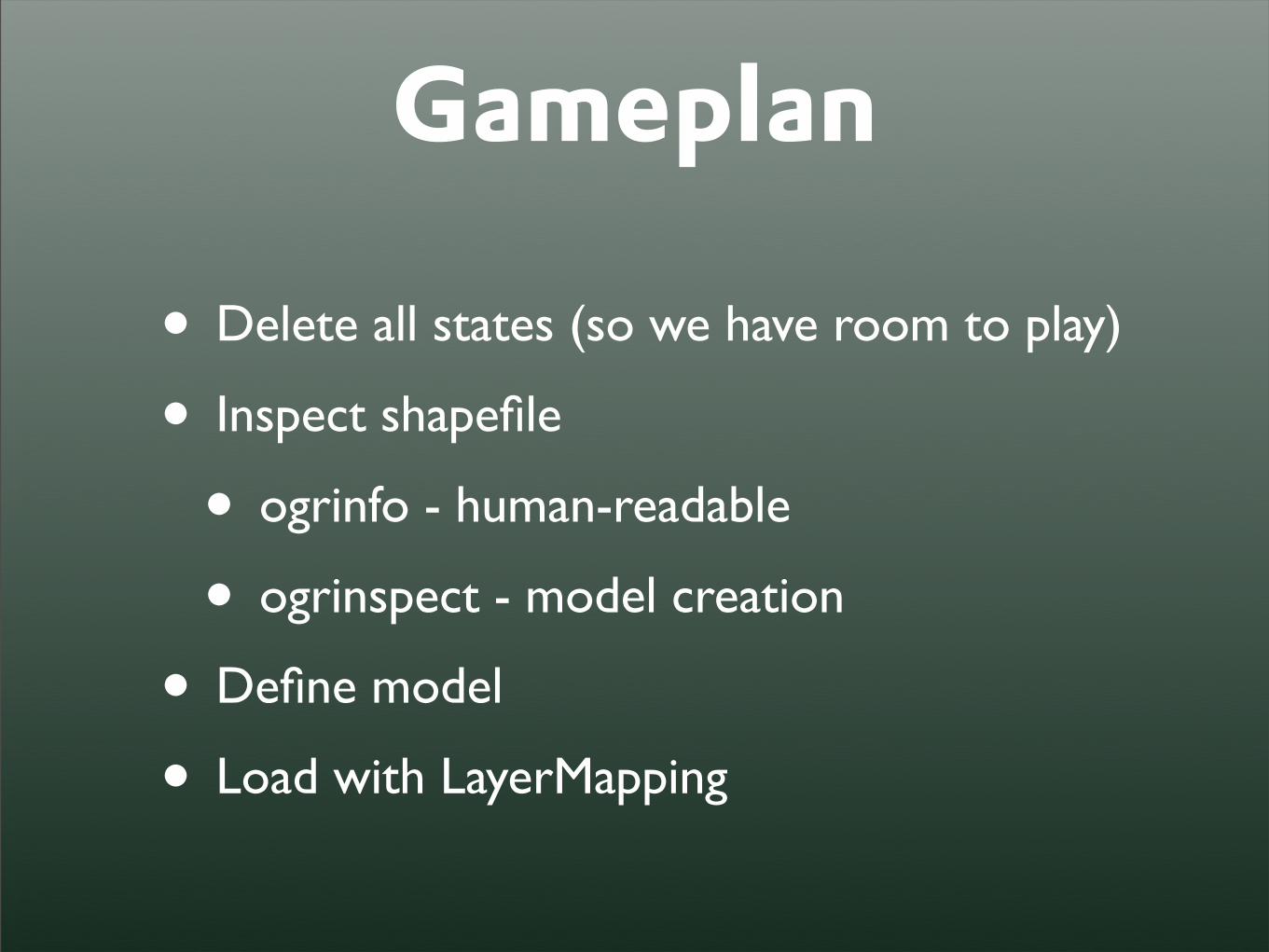
Gameplan
• Delete all states (so we have room to play)
• Inspect shapefile
• ogrinfo - human-readable
• ogrinspect - model creation
• Define model
• Load with LayerMapping

Delete states
>>> from census.models import State>>> State.objects.all().delete()

Inspect Shapefile>>> from django.contrib.gis.utils \... import ogrinfo, ogrinspect>>> ogrinfo(df('st'), num_features=2)...>>> print ogrinspect(df('st'), \... 'State', srid=4269)...

Define Model
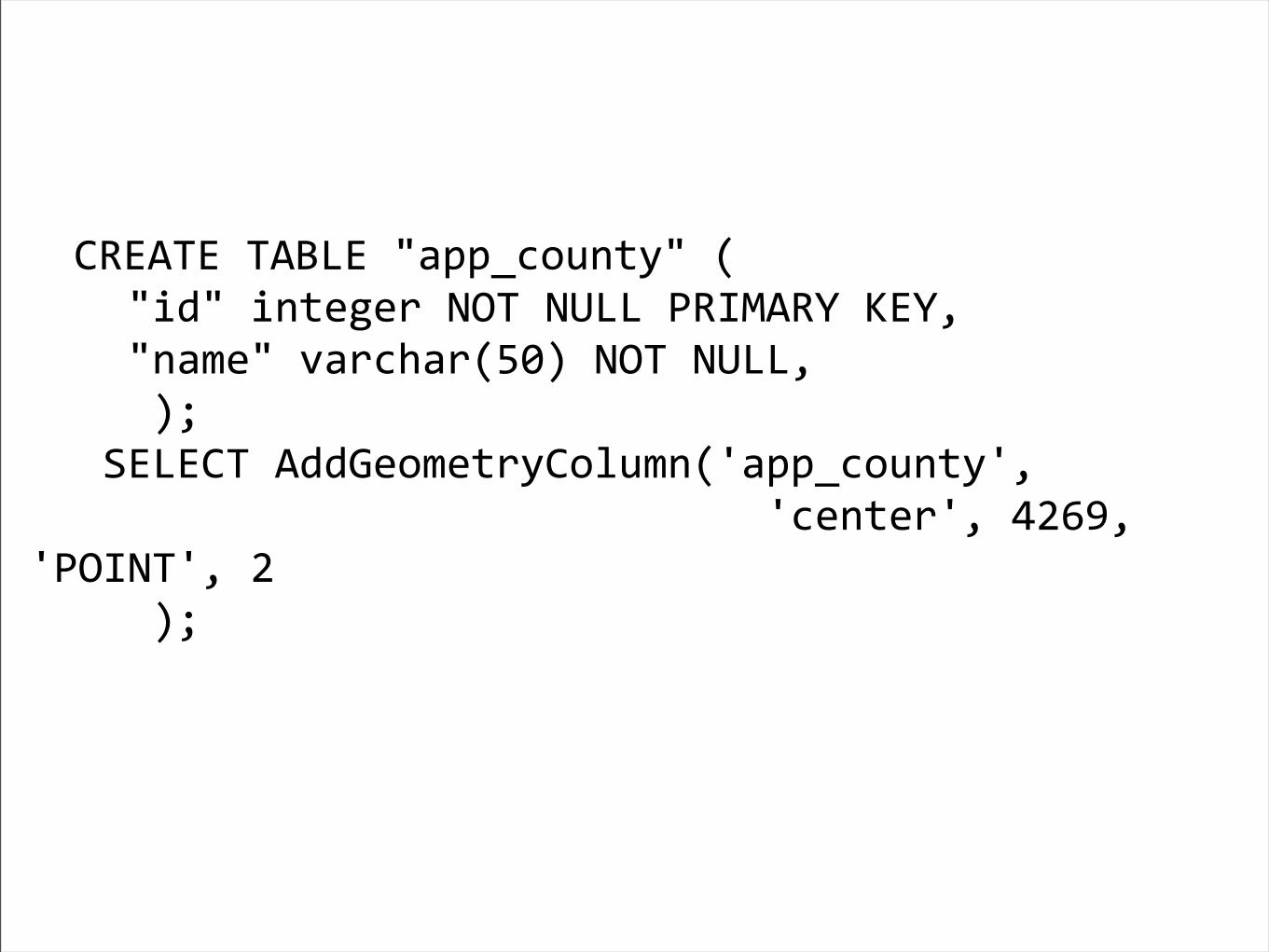
class State(models.Model): #STATE fips = models.CharField(max_length=2) #NAME name = models.CharField(max_length=20) #MULTIPOLYGON mpoly = models.MultiPolygonField(srid=4269) objects = models.GeoManager()

Define >>> mapping = {... 'fips': 'STATE',... 'name': 'NAME',... 'mpoly': 'MULTIPOLYGON'... }>>> lm = LayerMapping(State, \... df('st'), mapping, \... unique=('name', 'fips'),\... encoding='cp437', \... transform=False)>>> lm.save(verbose=True)

(Bonus if time)
Your turn:Load Counties!Ask questions.

⑤Exploration

Spatial QueriesNeighborhood.objects.filter(poly__intersects=zipcode.mpoly) |
Neighborhood.objects.filter(poly__within=county.mpoly)
SELECT "houston_neighborhood"."id", "houston_neighborhood"."name", "houston_neighborhood"."poly"
FROM "houston_neighborhood" WHERE (ST_Intersects("houston_neighborhood"."poly",
ST_Transform(ST_GeomFromWKB('\\001\\006\\000\ ... ', 4269), 32140)) OR ST_Within("houston_neighborhood"."poly",
ST_GeomFromWKB('\\001\\006\\000 ... ', 32140))
vs.
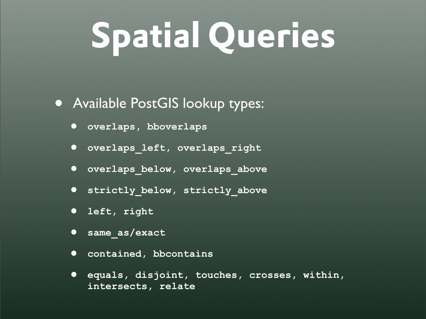
Spatial Queries
• Available PostGIS lookup types:
• overlaps, bboverlaps
• overlaps_left, overlaps_right
• overlaps_below, overlaps_above
• strictly_below, strictly_above
• left, right
• same_as/exact
• contained, bbcontains
• equals, disjoint, touches, crosses, within, intersects, relate

Distance Queries• Projected/Geodetic coordinate system a
source of confusion for beginners.
• Inherent PostGIS limitation,
• Distance Lookups:
• distance_lte, distance_lt
•distance_gte, distance_gt

Distance Queries# Distances will be calculated from this point, # which does _not_ have to be projected.>>> pnt = fromstr('POINT(-96.876369 29.905320)', srid=4326)
# If numeric parameter, units of field (meters in this case)# are assumed.>>> qs = SouthTexasCity.objects.filter( point__distance_lte=(pnt, 7000))
# Find all Cities w/in 7km of pnt>>> qs =SouthTexasCity.objects.filter( point__distance_lte=(pnt, D(km=7)))
# Find all Cities > 20 miles away from pnt.>>> qs = SouthTexasCity.objects.filter( point__distance_gte=(pnt, D(mi=20)))
# More obscure units, such as chains, are supported.>>> qs = SouthTexasCity.objects.filter( point__distance_gte=(pnt, D(chain=100)))

Distance Queries• Distance object eases conversion
between units of measure.
>>> from django.contrib.gis.measure import Distance>>> dist = Distance(ft=5280)>>> print dist.mi1.0
• Projected/Geodetic coordinate system a source of confusion for beginners.

Automatic Transformation• If a geometry with a different SRID is used,
it will be automatically transformed -- one less thing to worry about.
>>> pnt = Point(-95.4067, 29.7183, srid=4326)>>> qs = Neighborhood.objects.filter(mpoly__intersects=pnt)>>> print qs.query.as_sql()SELECT "texas_neighborhood"."id", "texas_neighborhood"."name", "texas_neighborhood"."state", "texas_neighborhood"."city", "texas_neighborhood"."county", "texas_neighborhood"."region", "texas_neighborhood"."mpoly" FROM "texas_neighborhood" WHERE ST_Intersects("texas_neighborhood"."mpoly", ST_Transform(%s, 3084))

GeoQuerySet Methods• gml
• County.objects.all().gml
• Neighborhood.objects.all().gml()[0].gml
• <gml:MultiPolygon srsName="EPSG:3084">...</gml:MultiPolygon>

GeoQuerySet Methods
• kml
•Neighborhood.objects.all().kml()[0].kml
•<MultiGeometry><Polygon><outerBoundaryIs>...</MultiGeometry>

GeoQuerySet Methods
• distance
•p=Neighborhood.objects.all()[2].mpoly.centroid
• Neighborhood.objects.all().distance(p)[0].distance

⑥Admin

“Old” AdminHow you currently create an admin interface in trunk:
from django.contrib.gis.db import models
class Location(models.Model): name = models.CharField(max_length=30) point = models.PointField()
class Admin: list_display = ['name'] search_fields = ['name']

“Old” AdminOld style admin URLs:
urlpatterns = patterns('', (r'^admin/', include('django.contrib.admin.urls')),)
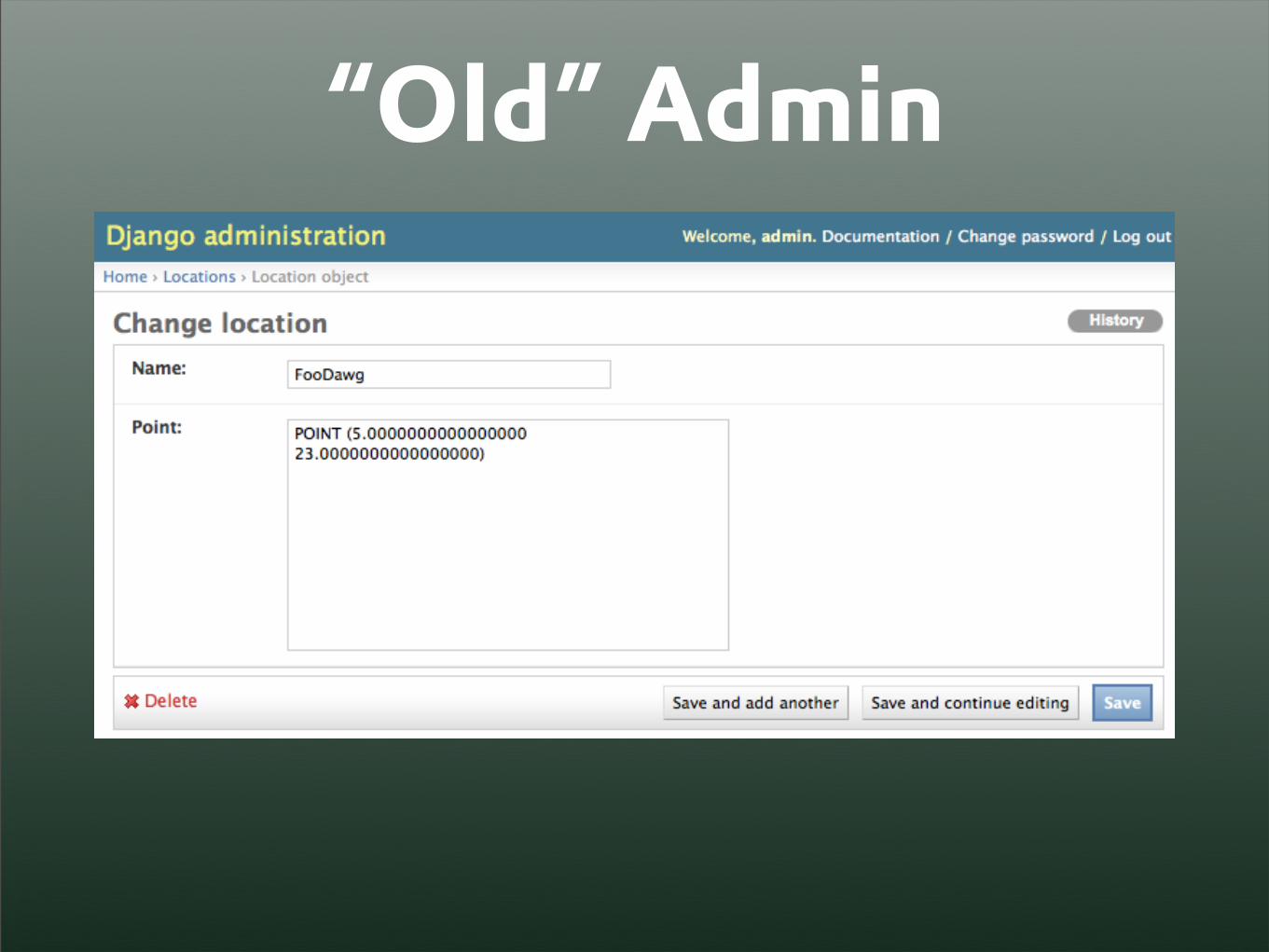
“Old” Admin

newforms-admin
• The newforms-admin branch decouples Admin settings from your models.
• More flexibility and customization
• Other goal is to convert the Admin to use Django’s “newforms.”

gis-newforms
• Django has branch policy prohibiting merges between SVN branches.
• I couldn’t wait for new functionality -- so I created mercurial merge between two branches.

gis-newformsHow to create new admin interface:
from django.contrib.gis import adminfrom django.contrib.gis.db import models
class Location(models.Model): name = models.CharField(max_length=30) point = models.PointField()
class LocationAdmin(admin.GeoModelAdmin): list_display = ['name'] search_fields = ['name']

gis-newformsHow to create new admin interface (in urls.py):
from django.contrib.gis import adminfrom geoapp.models import Locationfrom geoapp.admin import LocationAdmin
admin.site.regster(Location, LocationAdmin)
urlpatterns = patterns('', (r'^admin/(.*)', admin.site.root),)

gis-newformsIncluded in your VM as the default distribution.
May change to GIS SVN trunk via:$ sudo chdjango.py gis
To change back:$ sudo chdjango.py gis-newforms

⑦Mapping
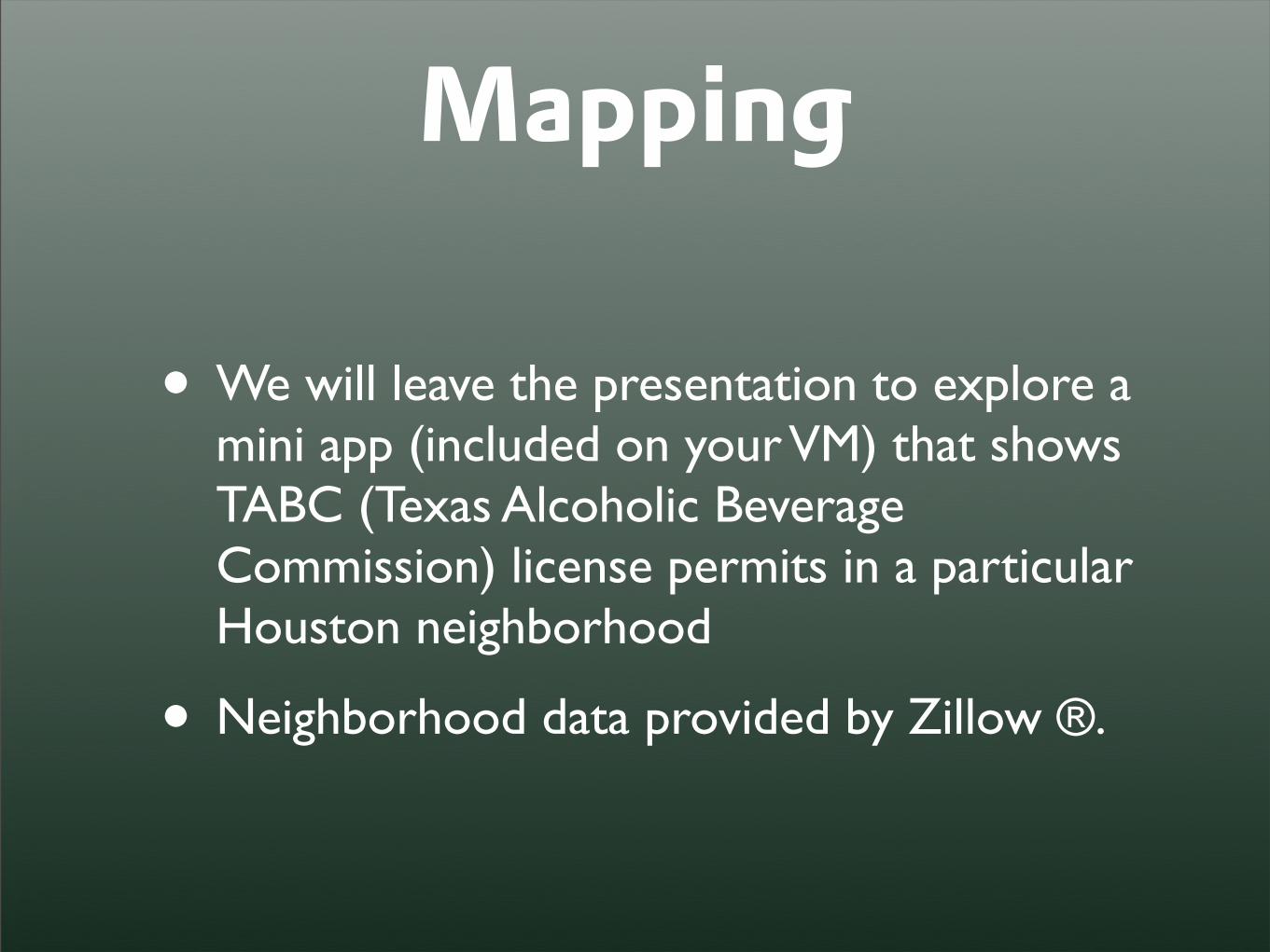
Mapping
• We will leave the presentation to explore a mini app (included on your VM) that shows TABC (Texas Alcoholic Beverage Commission) license permits in a particular Houston neighborhood
• Neighborhood data provided by Zillow ®.
⑧Conclusion