Embed Size (px)
Citation preview
Part 1: Mantle geochemistry
Geochemical evolution of the Earth mantel and crust
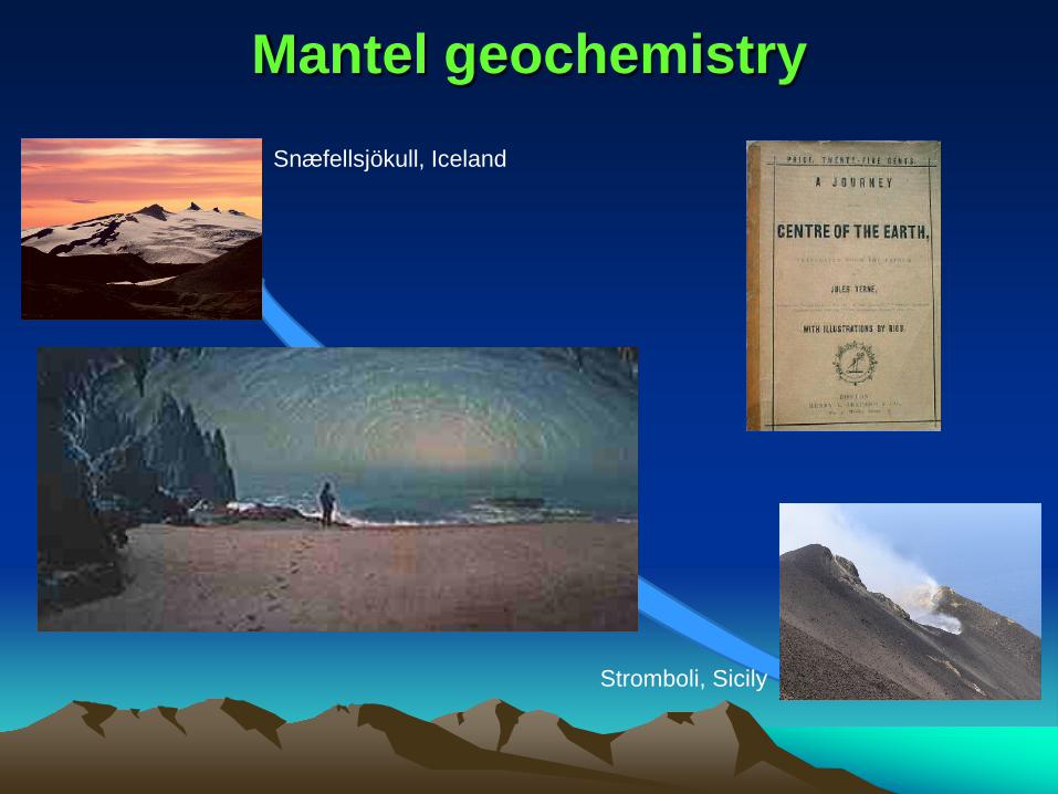
Mantel geochemistry Snæfellsjökull, Iceland
Stromboli, Sicily

Recommended reading
Allègre, J.C. (2008) Isotope Geology, Cambridge University Press, 512.
Rollison, H. (2007) Early Earth Systems - A Geochemical Approach,
Blackwell Plublishing, 285
White, M.W. (2013) Geochemistry, Wiley-Blackwell, 637
White, M.W. (2015) Isotope Geochemistry, Whiley-Blackwell, 496
Wilson, M. (1991) Igneous Petrogenesis – A Global Tectonic
Approach, Harper Collins, 466
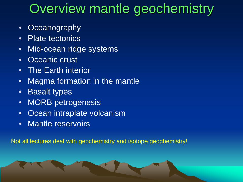
Overview mantle geochemistry • Oceanography • Plate tectonics • Mid-ocean ridge systems • Oceanic crust • The Earth interior • Magma formation in the mantle • Basalt types • MORB petrogenesis • Ocean intraplate volcanism • Mantle reservoirs
Not all lectures deal with geochemistry and isotope geochemistry!
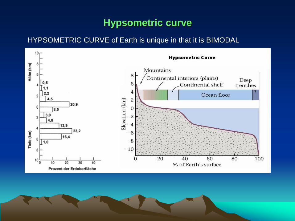
Hypsometric curve HYPSOMETRIC CURVE of Earth is unique in that it is BIMODAL
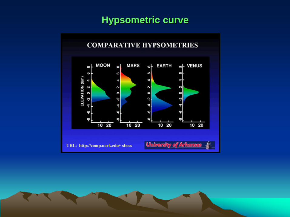
Hypsometric curve

Ocean Surface Area Water Volume Avg. Depth Max. Depth (million km2) (million km3) (km) (km) Pacific 180 700 4.0 11.0 Atlantic 93 335 3.6 9.2 Indian 77 285 3.7 7.5 Arctic 15 15 1.1 5.2
The Oceans

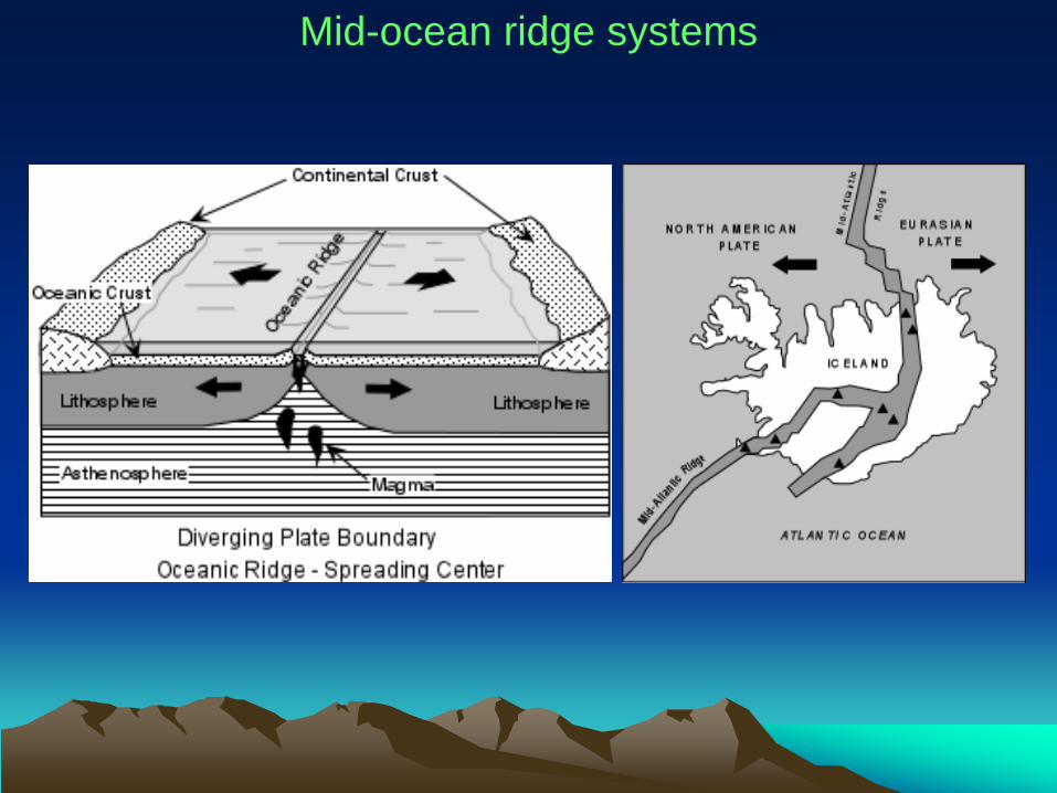
Ocean crust Covers about 70% of the Earth's surface Abyssal plains Flat, deep ocean floor Depth may be 3 - 5 km Sediments bury topography of oceanic crust Deep sea trenches The deepest part of the oceans May exceed 10.000 m deep Mariana trench and Tonga trench in the Pacific Ocean (subduction zones) - more than 11.000 m Mid-ocean ridges continuous range of undersea mountains winding through 60.000 km of the world’s oceans Seamounts Undersea volcanic peaks which formed along mid-ocean ridges or over hot spots May be eroded flat on top and called guyots (tablemount) May be ringed by coral reefs called atolls

~14 tectonic plates today

Mid-ocean ridge systems
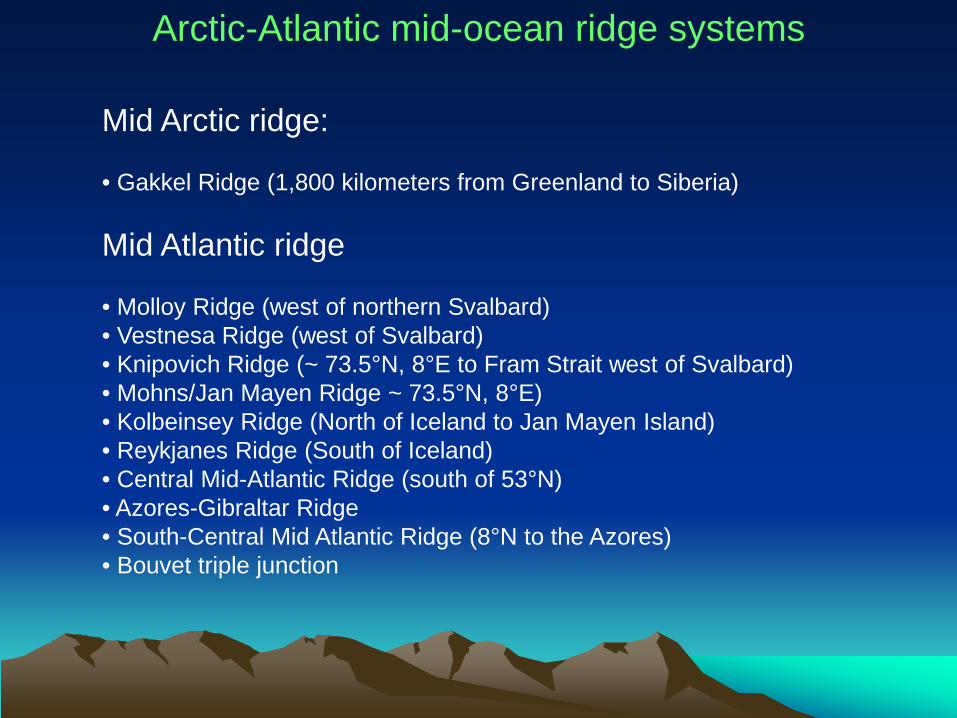
Mid Arctic ridge: • Gakkel Ridge (1,800 kilometers from Greenland to Siberia) Mid Atlantic ridge • Molloy Ridge (west of northern Svalbard) • Vestnesa Ridge (west of Svalbard) • Knipovich Ridge (~ 73.5°N, 8°E to Fram Strait west of Svalbard) • Mohns/Jan Mayen Ridge ~ 73.5°N, 8°E) • Kolbeinsey Ridge (North of Iceland to Jan Mayen Island) • Reykjanes Ridge (South of Iceland) • Central Mid-Atlantic Ridge (south of 53°N) • Azores-Gibraltar Ridge • South-Central Mid Atlantic Ridge (8°N to the Azores) • Bouvet triple junction
Arctic-Atlantic mid-ocean ridge systems
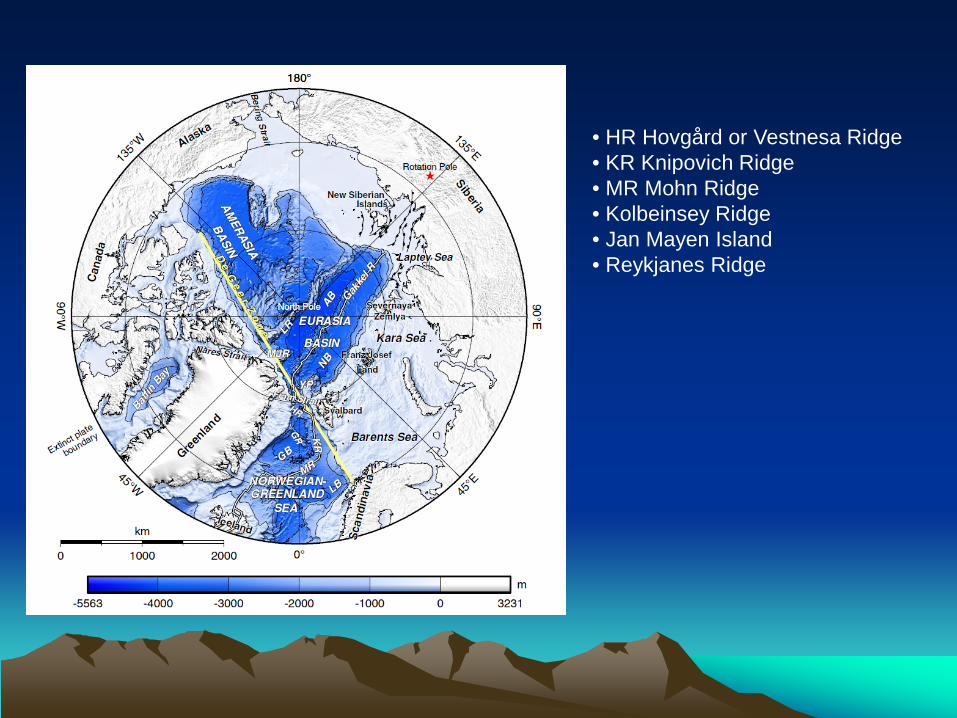
• HR Hovgård or Vestnesa Ridge • KR Knipovich Ridge • MR Mohn Ridge • Kolbeinsey Ridge • Jan Mayen Island • Reykjanes Ridge

Ultraslow: Gakkel ridge
spreading rates only 6 - 13 mm/a
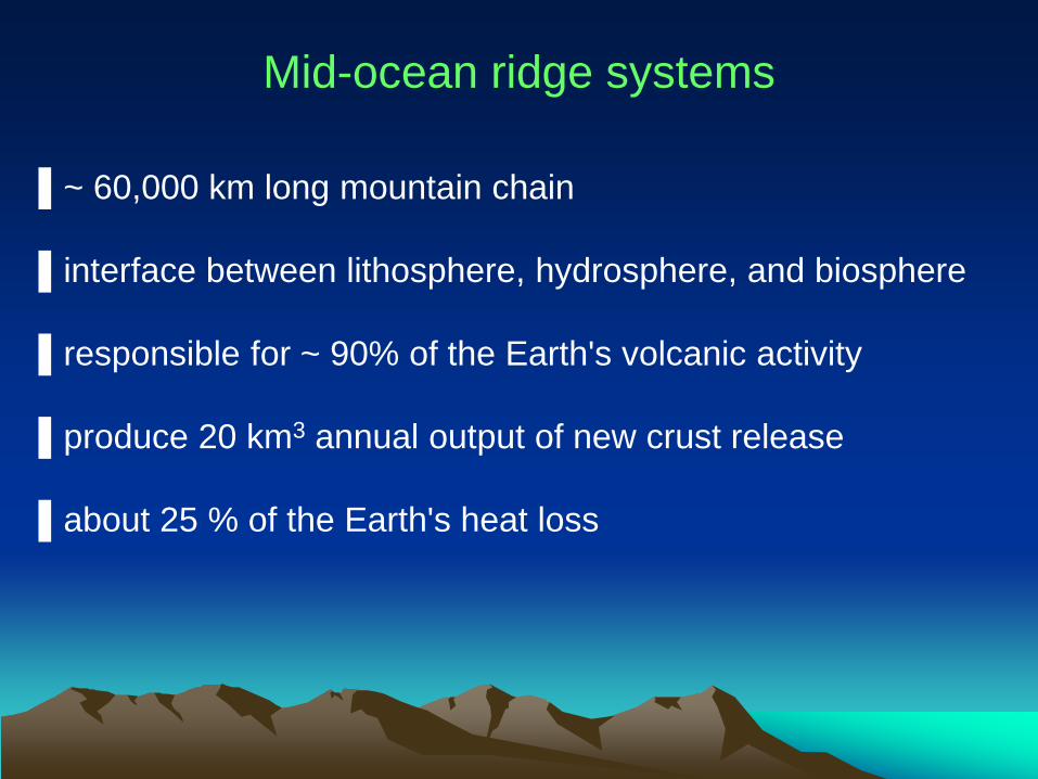
▌~ 60,000 km long mountain chain ▌interface between lithosphere, hydrosphere, and biosphere ▌responsible for ~ 90% of the Earth's volcanic activity ▌produce 20 km3 annual output of new crust release ▌about 25 % of the Earth's heat loss
Mid-ocean ridge systems
Mid-ocean ridge systems
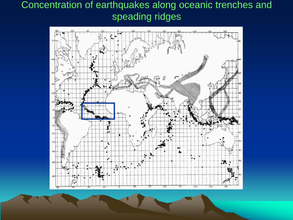
Concentration of earthquakes along oceanic trenches and speading ridges
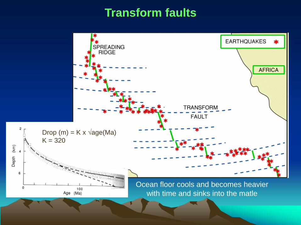
Transform faults
Drop (m) = K x √age(Ma) K = 320
Ocean floor cools and becomes heavier with time and sinks into the matle

Vema transverse ridge
Science 323: p. 1048
offsets the MAR by 320 km


Ocean crust accretion rates
Lissenberg et al. 2009 Science 323: p. 1048
20000000 cm /13.200.000 years = 1.5 cm/year

Deep Sea Drilling
In the beginnings…..
Mohole Project (AMSOC)
deeper drilling never took place
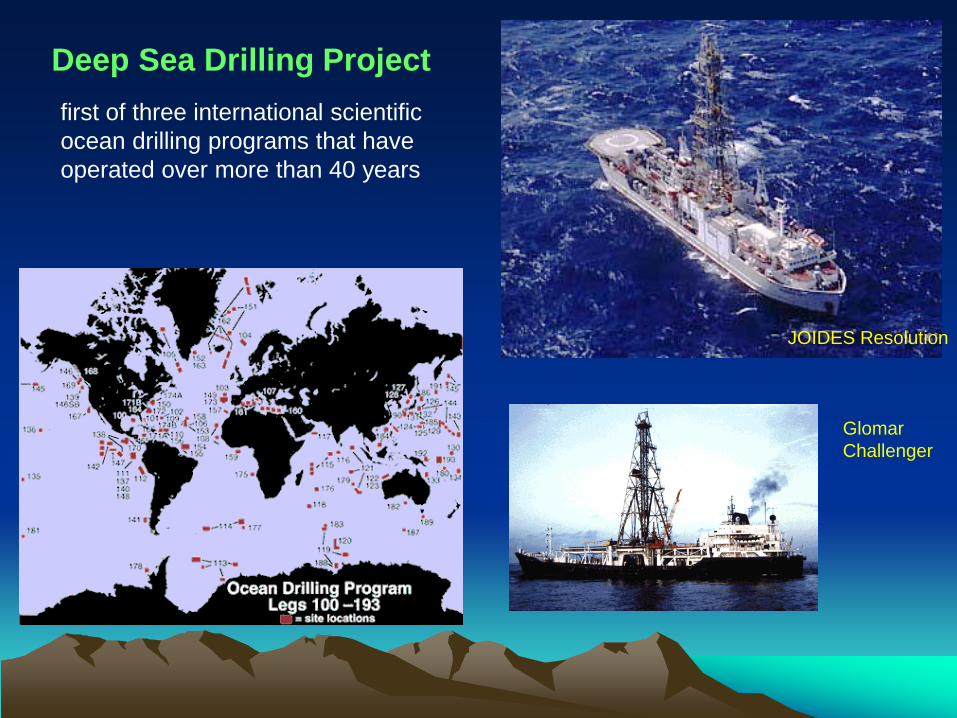
Deep Sea Drilling Project
JOIDES Resolution
Glomar Challenger
first of three international scientific ocean drilling programs that have operated over more than 40 years

Chikyu (jap. “Planet Earth”) New drilling method with riser system mud used instead of seawater (mud circulation system) Chikyu can drill more than 7,000 meters below the seafloor in water depths that exceed 2,000 meters
http://www.iodp.org/
IODP International Ocean Discovery Program

German fleet: Sonne (image) Polarstern Meteor Maria S. Merian
Oceanographic research vessels
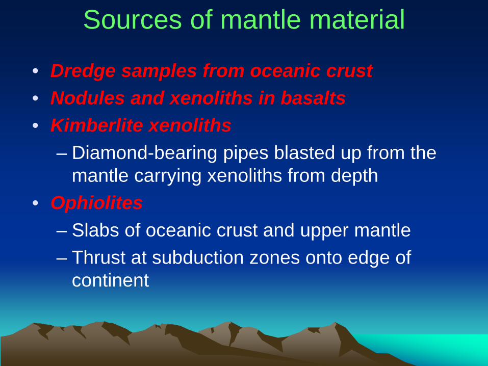
• Dredge samples from oceanic crust • Nodules and xenoliths in basalts • Kimberlite xenoliths
– Diamond-bearing pipes blasted up from the mantle carrying xenoliths from depth
• Ophiolites – Slabs of oceanic crust and upper mantle – Thrust at subduction zones onto edge of
continent
Sources of mantle material

Sources of mantle material - ophiolites

Lorand et al. (2008) Elements
Mantle rocks: peridotite (green) in basalt lava
Melting of peridotite mantle extracts basaltic liquids to form ocean crust, leaving a residue of harzburgite (ol+opx)

15
10
5
0 0.0 0.2 0.4 0.6 0.8
wt.% TiO2
Dunite Harzburgite (residuum after basalt has been extracted)
Lherzolite (fertile unaltered mantle)
Tholeiitic basalt
Brown & Mussett (1993) The Inaccessible Earth
Mantle rocks: fertile vs.
refractory mantle

Major element compositions of the earth’s mantle

Geochemical/cosmochemical fractionation diagram

Intersection at MgO = 36,77%
Palme & O´Neill (2003)
Geochemical fractionation diagram