Embed Size (px)
Citation preview
GeoAtom, OGC, and the Geospatial Enablement of
EverythingJoshua Lieberman,
Traverse Technologies & Open Geospatial Consortium
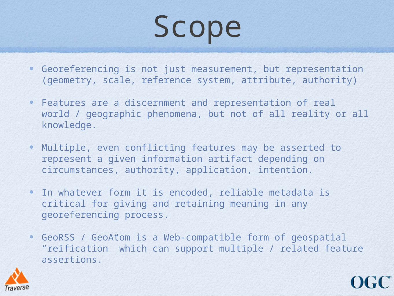
Scope
Georeferencing is not just measurement, but representation (geometry, scale, reference system, attribute, authority)
Features are a discernment and representation of real world / geographic phenomena, but not of all reality or all knowledge.
Multiple, even conflicting features may be asserted to represent a given information artifact depending on circumstances, authority, application, intention.
In whatever form it is encoded, reliable metadata is critical for giving and retaining meaning in any georeferencing process.
GeoRSS / GeoAtom is a Web-compatible form of geospatial “reification” which can support multiple / related feature assertions.

General feature ModelGeneral feature Model
Model presumes all is shared
within an information community
What if features are created and
consumed by different
communities?
What if phenomena have
already been observed for a different, non-
geographic application?
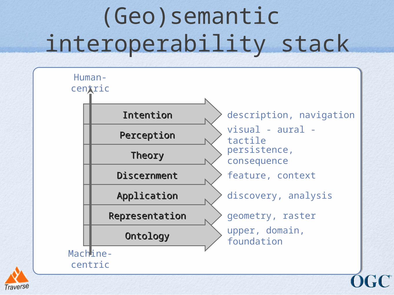
IntentionIntention
PerceptionPerception
TheoryTheory
DiscernmentDiscernment
ApplicationApplication
RepresentationRepresentation
OntologyOntology upper, domain, foundation
geometry, raster
discovery, analysis
feature, context
persistence, consequence
visual - aural - tactile
description, navigation
Machine-centric
Human-centric
(Geo)semantic interoperability stack
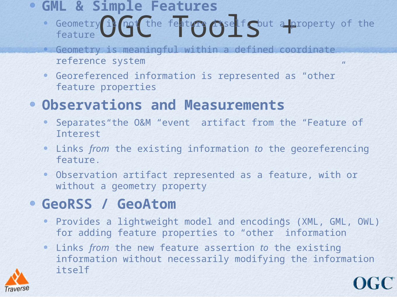
OGC Tools +GML & Simple Features
Geometry is not the feature itself, but a property of the feature
Geometry is meaningful within a defined coordinate reference system
Georeferenced information is represented as “other” feature properties
Observations and MeasurementsSeparates the O&M “event” artifact from the “Feature of Interest”
Links from the existing information to the georeferencing feature.
Observation artifact represented as a feature, with or without a geometry property
GeoRSS / GeoAtomProvides a lightweight model and encodings (XML, GML, OWL) for adding feature properties to “other” information
Links from the new feature assertion to the existing information without necessarily modifying the information itself
OGC Service Tools
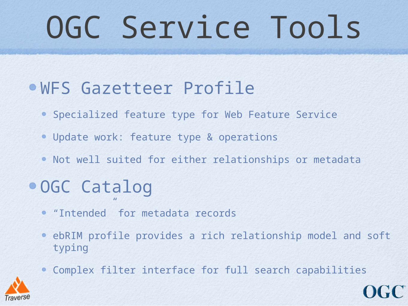
WFS Gazetteer ProfileSpecialized feature type for Web Feature Service
Update work: feature type & operations
Not well suited for either relationships or metadata
OGC Catalog“Intended” for metadata records
ebRIM profile provides a rich relationship model and soft typing
Complex filter interface for full search capabilities
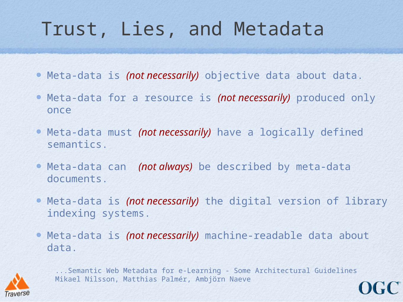
Trust, Lies, and Metadata
Meta-data is (not necessarily) objective data about data.
Meta-data for a resource is (not necessarily) produced only once
Meta-data must (not necessarily) have a logically defined semantics.
Meta-data can (not always) be described by meta-data documents.
Meta-data is (not necessarily) the digital version of library indexing systems.
Meta-data is (not necessarily) machine-readable data about data.
...Semantic Web Metadata for e-Learning - Some Architectural GuidelinesMikael Nilsson, Matthias Palmér, Ambjörn Naeve
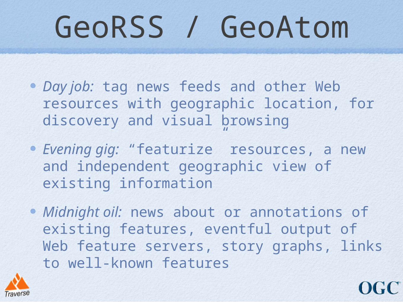
GeoRSS / GeoAtom
Day job: tag news feeds and other Web resources with geographic location, for discovery and visual browsing
Evening gig: “featurize” resources, a new and independent geographic view of existing information
Midnight oil: news about or annotations of existing features, eventful output of Web feature servers, story graphs, links to well-known features
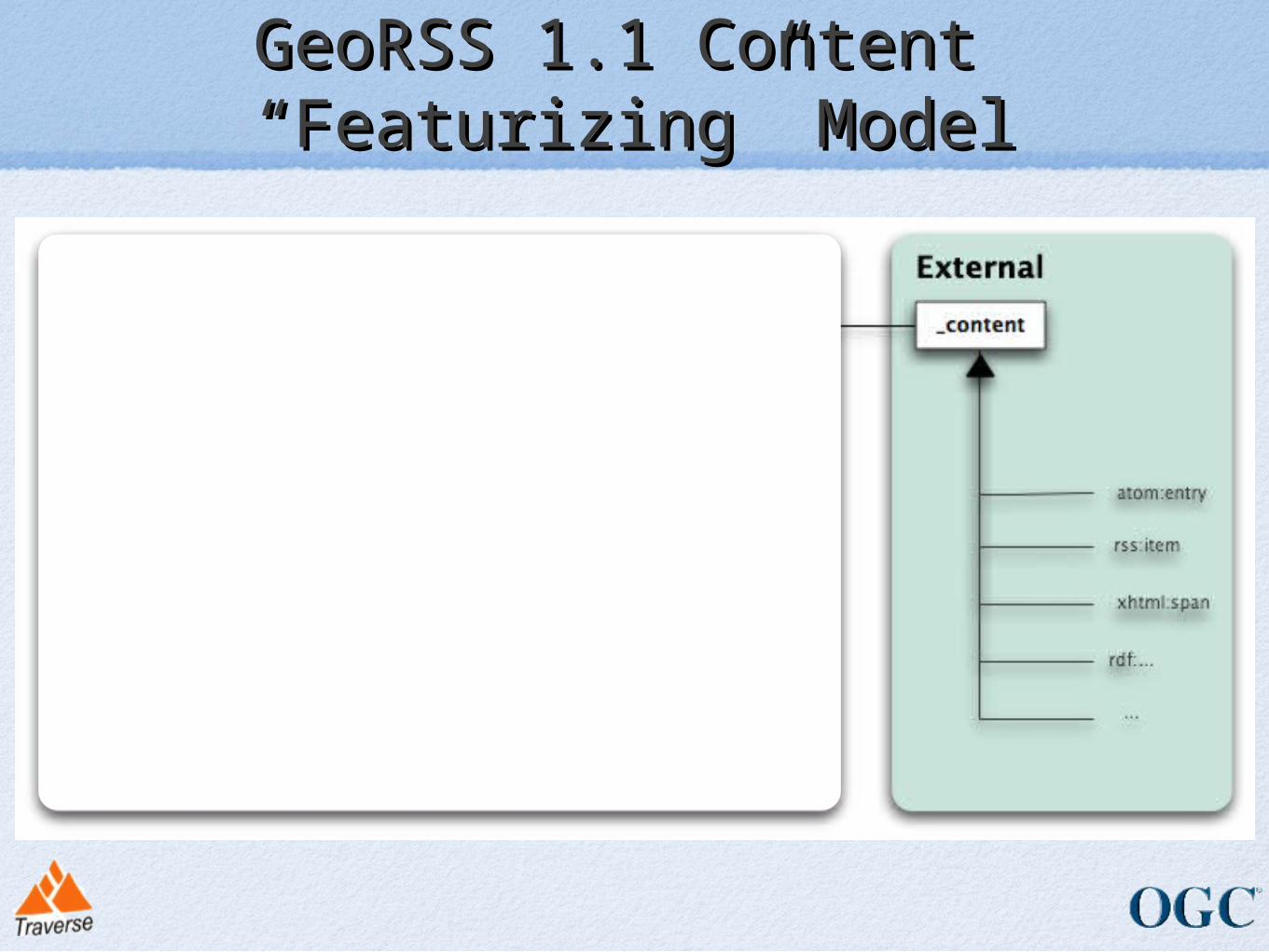
GeoRSS 1.1 Content GeoRSS 1.1 Content “Featurizing” Model“Featurizing” Model
• Simple• <georss:point>45.256 -71.92</georss:point>• <georss:line>45.256 -110.45 46.46 -109.48
43.84 -109.86</georss:line>• <georss:polygon>• 45.256 -110.45 46.46 -109.48 43.84 -
109.86 45.256 -110.45• </georss:polygon>• <georss:box>42.943 -71.032 43.039 -
69.856</georss:box><georss:featuretyeptag>city</georss:featuretypetag><georss:relationshiptag>is-contained-within</georss:relationshiptag>
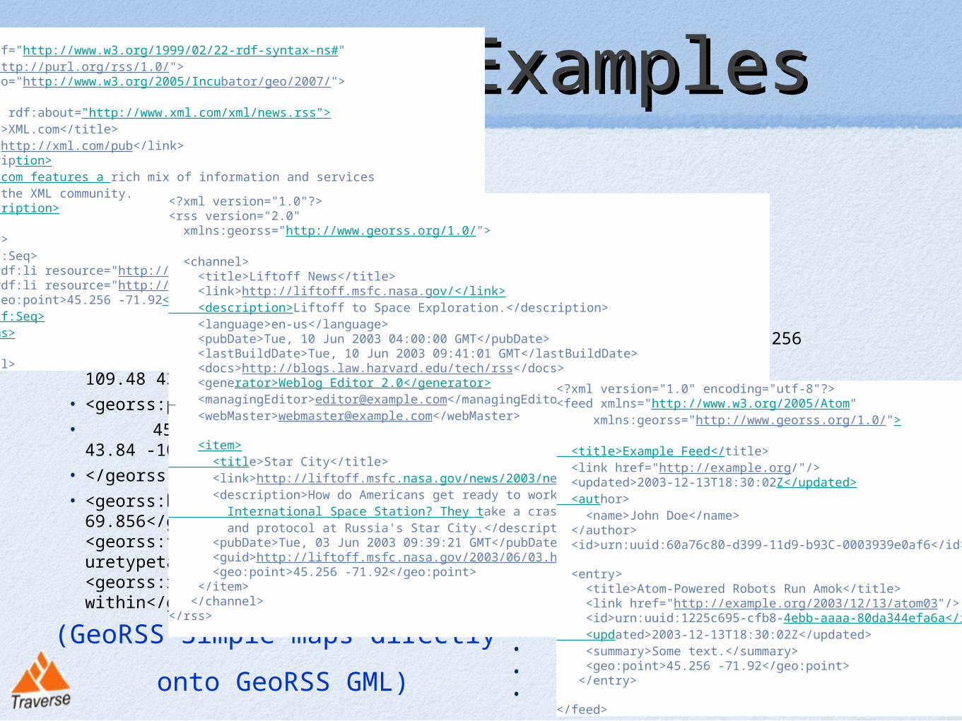
GeoRSS ExamplesGeoRSS Examples
• GML• <georss:where>• <gml:Point>• <gml:pos>45.256 -71.92</gml:pos>• </gml:Point>• </georss:where>
• <georss:where>• <gml:Polygon>• <gml:exterior>• <gml:LinearRing>• <gml:posList>• 45.256 -110.45 46.46 -109.48 43.84 -
109.86 45.256 -110.45• </gml:posList>• </gml:LinearRing>• </gml:exterior>• </gml:Polygon>• </georss:where>
(GeoRSS Simple maps directly
onto GeoRSS GML)
<rdf:RDF xmlns:rdf="http://www.w3.org/1999/02/22-rdf-syntax-ns#" xmlns="http://purl.org/rss/1.0/"> xmlns:geo="http://www.w3.org/2005/Incubator/geo/2007/">
<channel rdf:about="http://www.xml.com/xml/news.rss"> <title>XML.com</title> <link>http://xml.com/pub</link> <description> XML.com features a rich mix of information and services for the XML community. </description>
<items> <rdf:Seq> <rdf:li resource="http://xml.com/pub/2000/08/09/xslt/xslt.html" /> <rdf:li resource="http://xml.com/pub/2000/08/09/rdfdb/index.html" /> <geo:point>45.256 -71.92</geo:point> </rdf:Seq> </items>
</channel>
<?xml version="1.0"?><rss version="2.0" xmlns:georss="http://www.georss.org/1.0/">
<channel> <title>Liftoff News</title> <link>http://liftoff.msfc.nasa.gov/</link> <description>Liftoff to Space Exploration.</description> <language>en-us</language> <pubDate>Tue, 10 Jun 2003 04:00:00 GMT</pubDate> <lastBuildDate>Tue, 10 Jun 2003 09:41:01 GMT</lastBuildDate> <docs>http://blogs.law.harvard.edu/tech/rss</docs> <generator>Weblog Editor 2.0</generator> <managingEditor>[email protected]</managingEditor> <webMaster>[email protected]</webMaster> <item> <title>Star City</title> <link>http://liftoff.msfc.nasa.gov/news/2003/news-starcity.asp</link> <description>How do Americans get ready to work with Russians aboard the International Space Station? They take a crash course in culture, language and protocol at Russia's Star City.</description> <pubDate>Tue, 03 Jun 2003 09:39:21 GMT</pubDate> <guid>http://liftoff.msfc.nasa.gov/2003/06/03.html#item573</guid> <geo:point>45.256 -71.92</geo:point> </item> </channel></rss>
<?xml version="1.0" encoding="utf-8"?><feed xmlns="http://www.w3.org/2005/Atom" xmlns:georss="http://www.georss.org/1.0/">
<title>Example Feed</title> <link href="http://example.org/"/> <updated>2003-12-13T18:30:02Z</updated> <author> <name>John Doe</name> </author> <id>urn:uuid:60a76c80-d399-11d9-b93C-0003939e0af6</id>
<entry> <title>Atom-Powered Robots Run Amok</title> <link href="http://example.org/2003/12/13/atom03"/> <id>urn:uuid:1225c695-cfb8-4ebb-aaaa-80da344efa6a</id> <updated>2003-12-13T18:30:02Z</updated> <summary>Some text.</summary> <geo:point>45.256 -71.92</geo:point> </entry>
</feed>
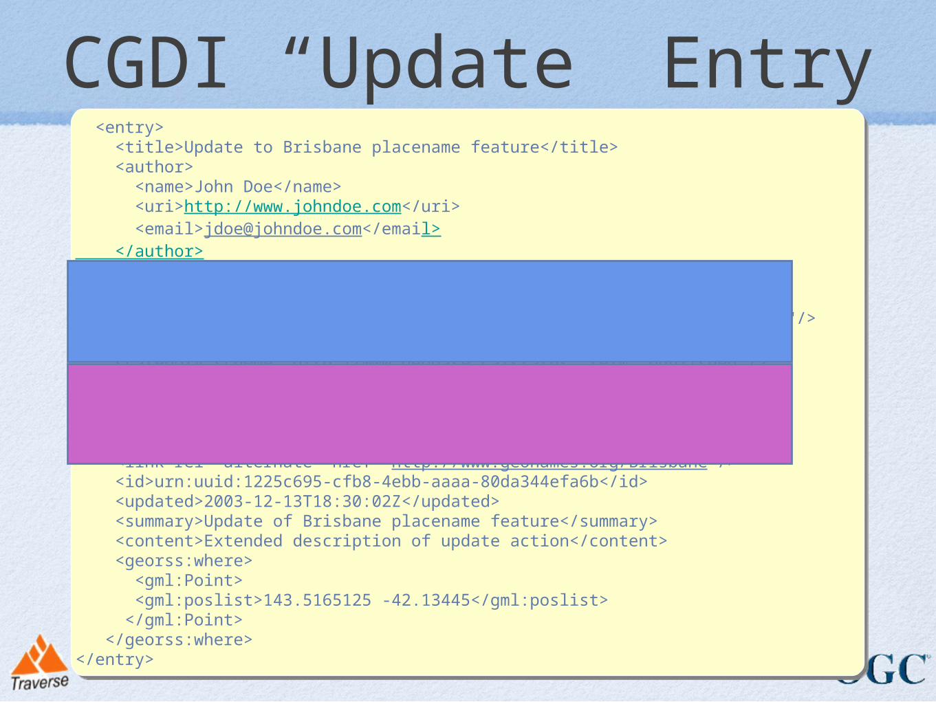
CGDI “Update” Entry <entry> <title>Update to Brisbane placename feature</title> <author> <name>John Doe</name> <uri>http://www.johndoe.com</uri> <email>[email protected]</email> </author> <category scheme="http://www.geobase.ca/feedtype" term="update"/> <category scheme="http://www.geobase.ca/domain" term="Tasmania"/> <category scheme="http://www.geobase.ca/featuretype" term="placename"/> <category scheme="http://www.geobase.ca/action" term="update"/> <category scheme="http://www.geobase.ca/status" term="published"/> <link rel="http://www.geobase.ca/linktype/sourcefeature" href="http://wfs.geobase.ca?request=GetFeature..."/> <link rel="http://www.geobase.ca/linktype/feedback" href="urn:uuid:1225c695-cfb8-4ebb-aaaa-80da344efa6a"/> <link rel="alternate" href="http://www.geonames.org/Brisbane"/> <id>urn:uuid:1225c695-cfb8-4ebb-aaaa-80da344efa6b</id> <updated>2003-12-13T18:30:02Z</updated> <summary>Update of Brisbane placename feature</summary> <content>Extended description of update action</content> <georss:where> <gml:Point> <gml:poslist>143.5165125 -42.13445</gml:poslist> </gml:Point> </georss:where></entry>
<entry> <title>Update to Brisbane placename feature</title> <author> <name>John Doe</name> <uri>http://www.johndoe.com</uri> <email>[email protected]</email> </author> <category scheme="http://www.geobase.ca/feedtype" term="update"/> <category scheme="http://www.geobase.ca/domain" term="Tasmania"/> <category scheme="http://www.geobase.ca/featuretype" term="placename"/> <category scheme="http://www.geobase.ca/action" term="update"/> <category scheme="http://www.geobase.ca/status" term="published"/> <link rel="http://www.geobase.ca/linktype/sourcefeature" href="http://wfs.geobase.ca?request=GetFeature..."/> <link rel="http://www.geobase.ca/linktype/feedback" href="urn:uuid:1225c695-cfb8-4ebb-aaaa-80da344efa6a"/> <link rel="alternate" href="http://www.geonames.org/Brisbane"/> <id>urn:uuid:1225c695-cfb8-4ebb-aaaa-80da344efa6b</id> <updated>2003-12-13T18:30:02Z</updated> <summary>Update of Brisbane placename feature</summary> <content>Extended description of update action</content> <georss:where> <gml:Point> <gml:poslist>143.5165125 -42.13445</gml:poslist> </gml:Point> </georss:where></entry>
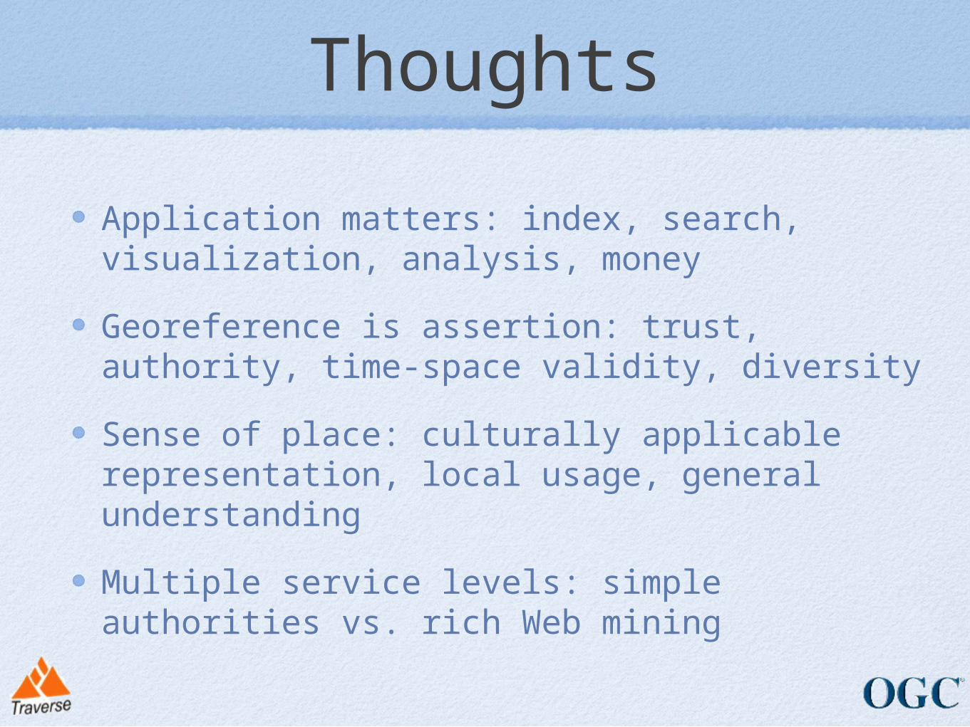
Thoughts
Application matters: index, search, visualization, analysis, money
Georeference is assertion: trust, authority, time-space validity, diversity
Sense of place: culturally applicable representation, local usage, general understanding
Multiple service levels: simple authorities vs. rich Web mining