Embed Size (px)
Citation preview
Geo-enabling the Enterprise
Akakpo Agbago & Patrick Brennan
Esri Inc.
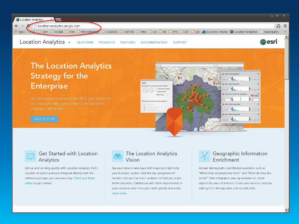
Location Analytics
Why Location Analytics?

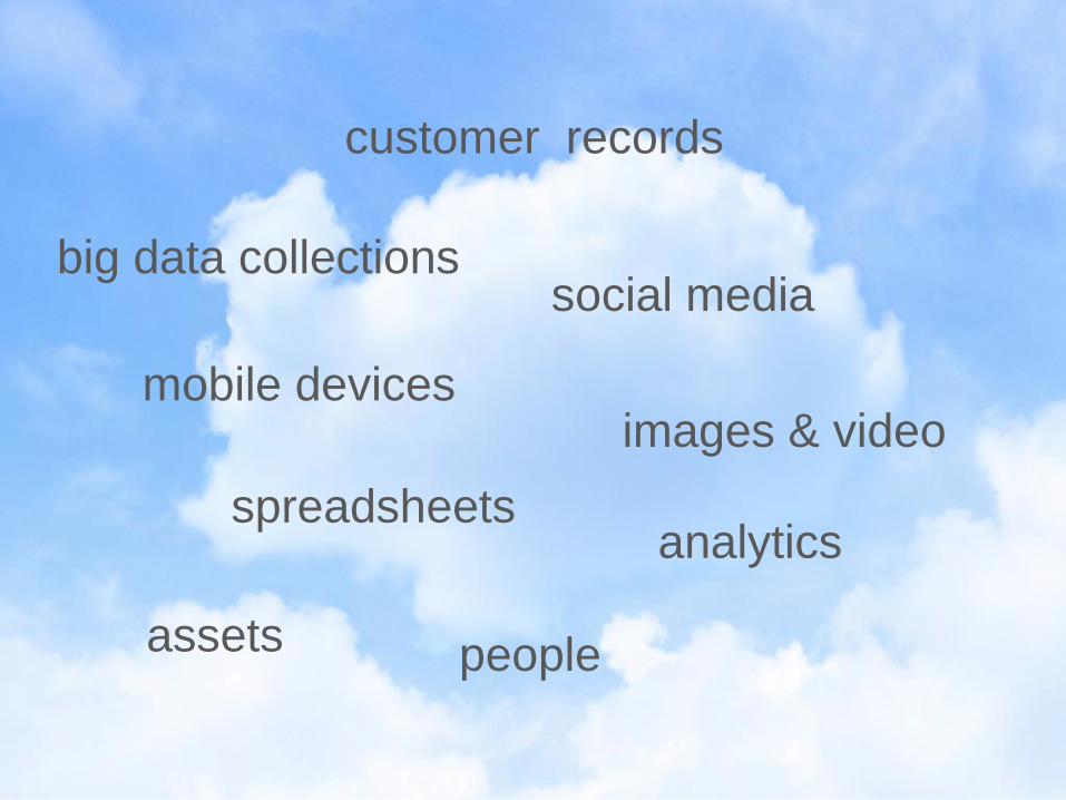
spreadsheets
assets
customer records
big data collections
images & video mobile devices
social media
analytics
people

True for All Industries

Sales Marketing Executive Suite
Operations HR
Finance
Real
Estate
Customer Support
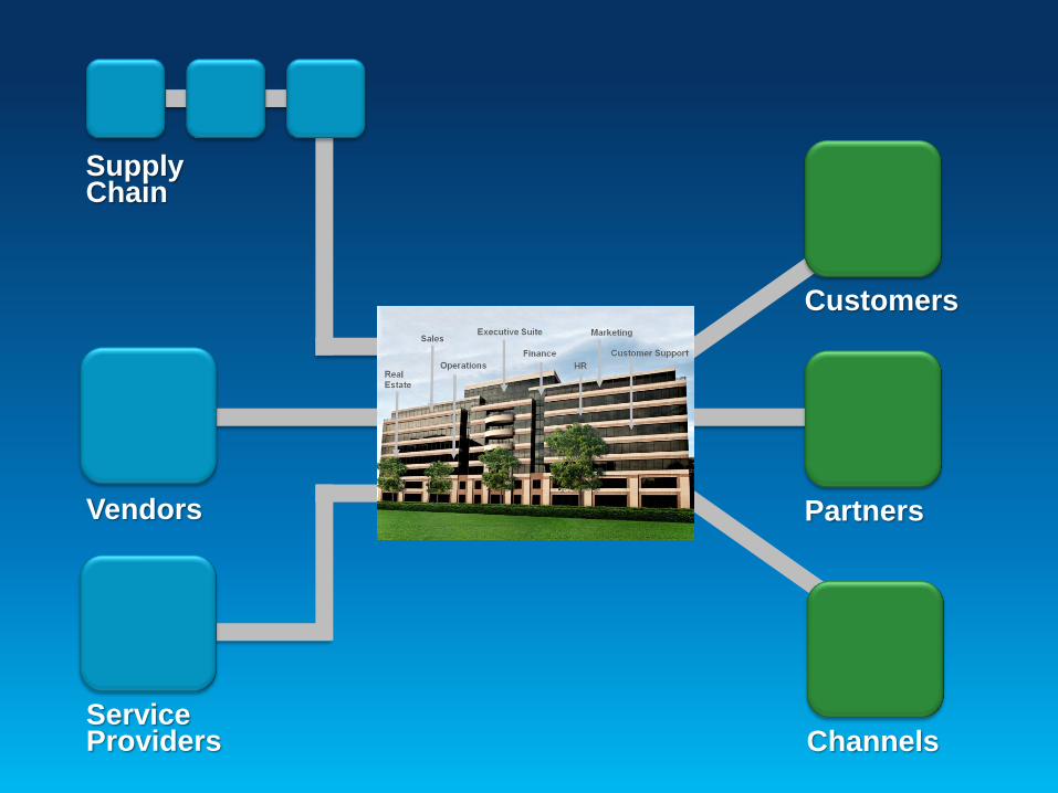
Supply Chain
Customers
Partners Vendors
Service Providers Channels


Done?

Just the First Step
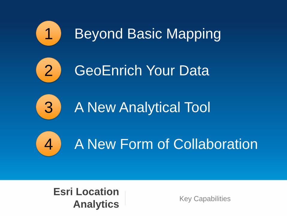
Beyond Basic Mapping 1
GeoEnrich Your Data 2
A New Analytical Tool 3
A New Form of Collaboration 4
Esri Location
Analytics Key Capabilities
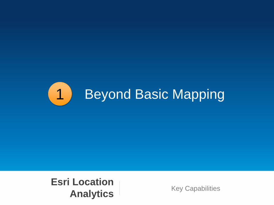
Beyond Basic Mapping 1
Esri Location
Analytics Key Capabilities
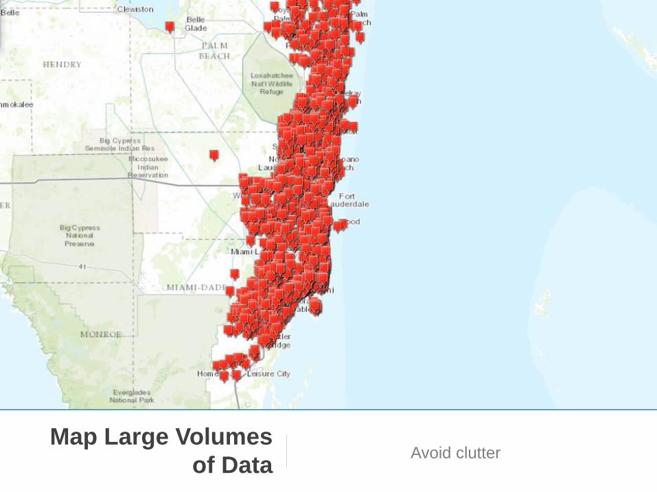
Map Large Volumes
of Data Avoid clutter

Map Large Volumes
of Data Avoid clutter
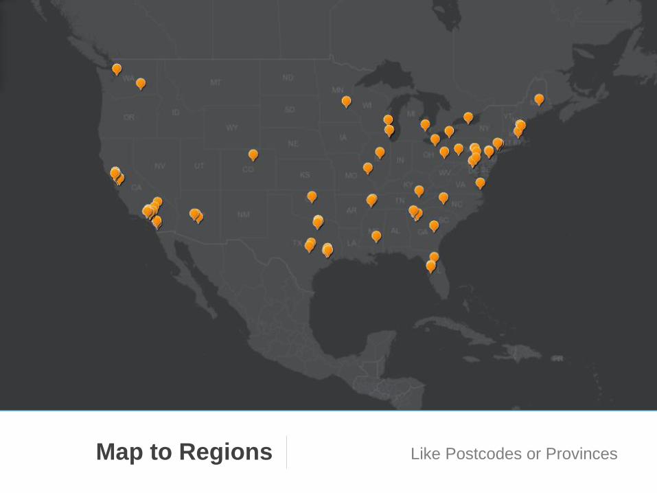
Map to Regions Like Postcodes or Provinces

Map to Regions Like Postcodes or Provinces
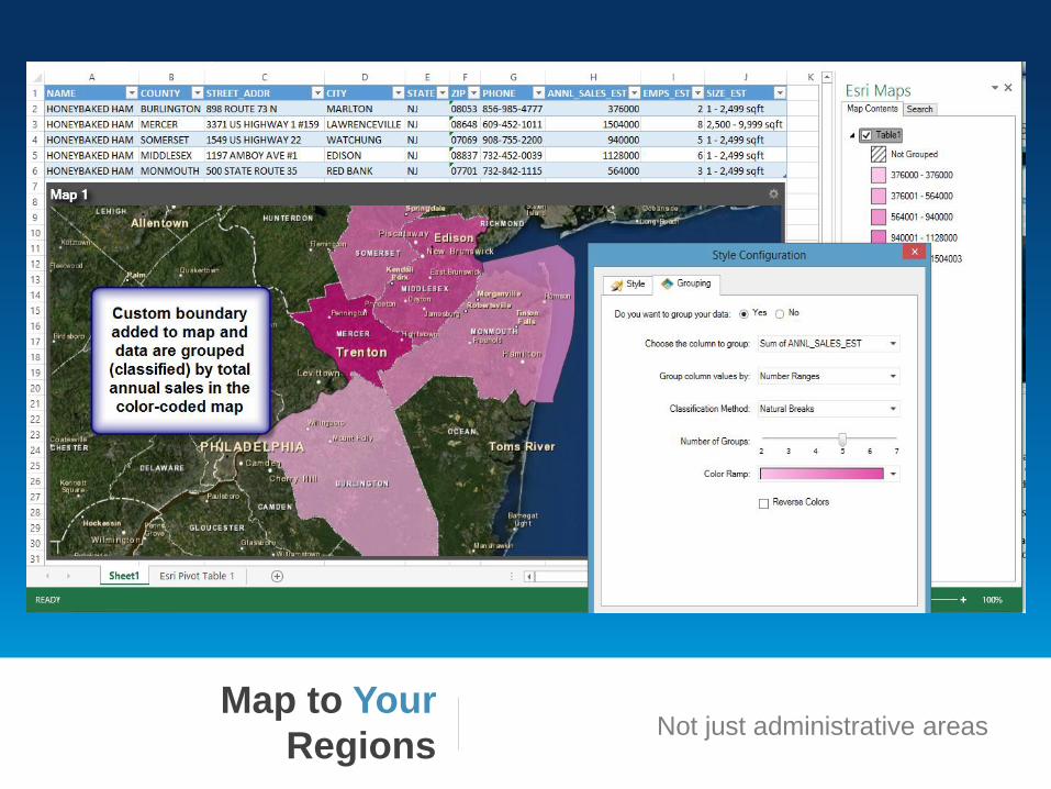
Map to Your
Regions Not just administrative areas

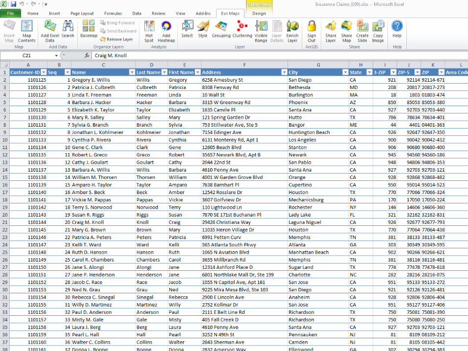
GeoEnrich Your Data 2
Esri Location
Analytics Key Capabilities

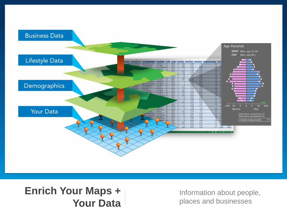
Enrich Your Maps +
Your Data Information about people,
places and businesses
A New Analytical Tool 3
Esri Location
Analytics Key Capabilities
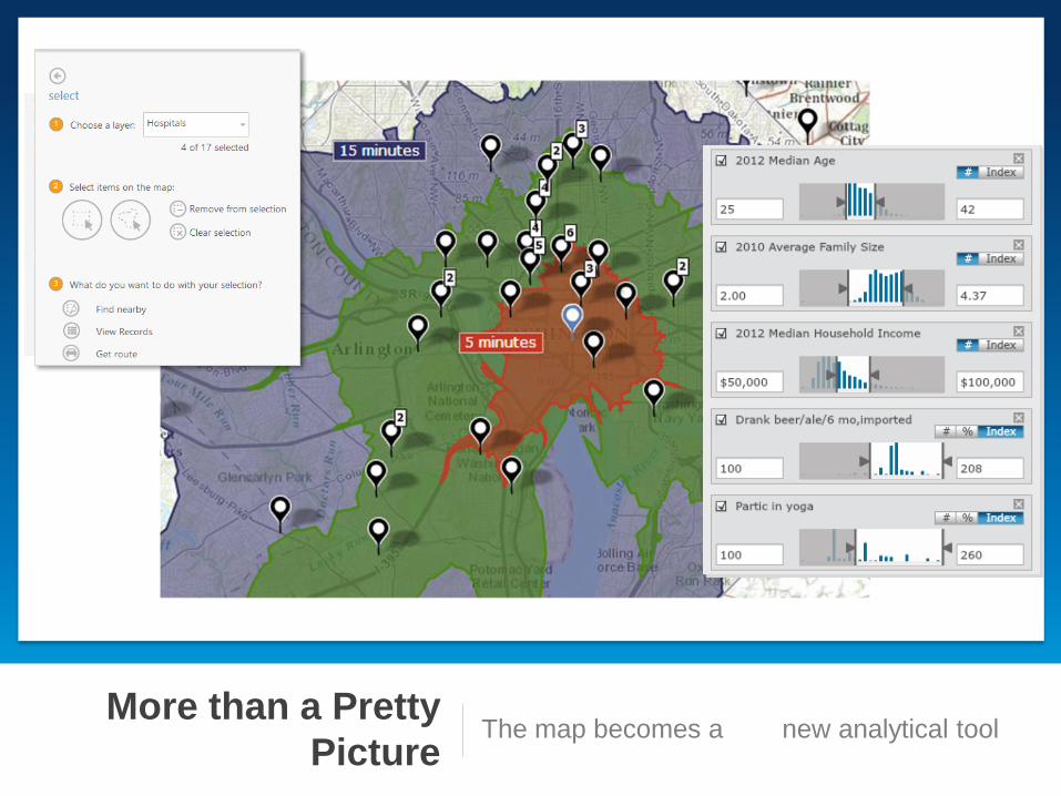
More than a Pretty
Picture The map becomes a new analytical tool
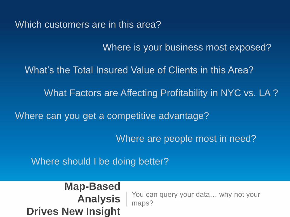
Map-Based
Analysis
Drives New Insight
You can query your data… why not your
maps?
Where can you get a competitive advantage?
Which customers are in this area?
What Factors are Affecting Profitability in NYC vs. LA ?
What’s the Total Insured Value of Clients in this Area?
Where should I be doing better?
Where is your business most exposed?
Where are people most in need?
A New Form of Collaboration 4
Esri Location
Analytics Key Capabilities
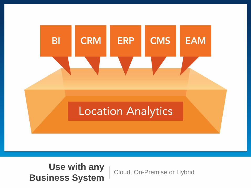
Use with any
Business System Cloud, On-Premise or Hybrid
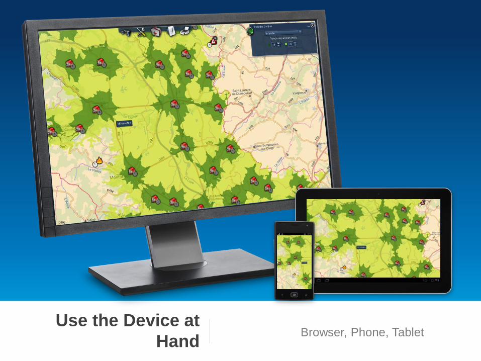
Use the Device at
Hand Browser, Phone, Tablet
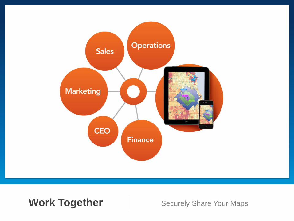
Work Together Securely Share Your Maps
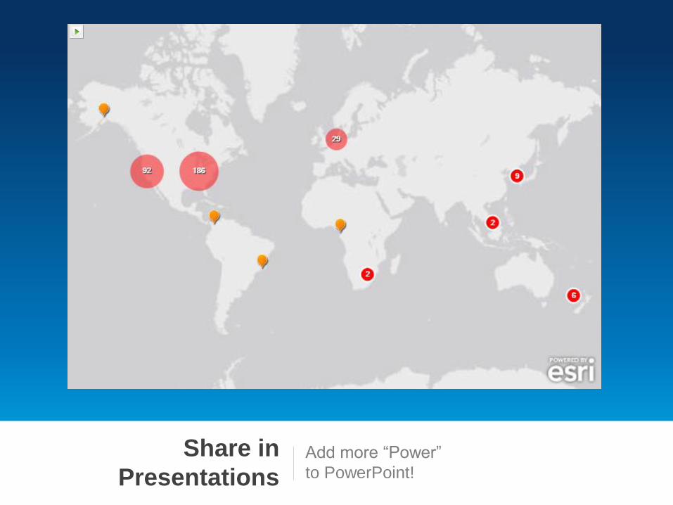
Share in
Presentations Add more “Power”
to PowerPoint!
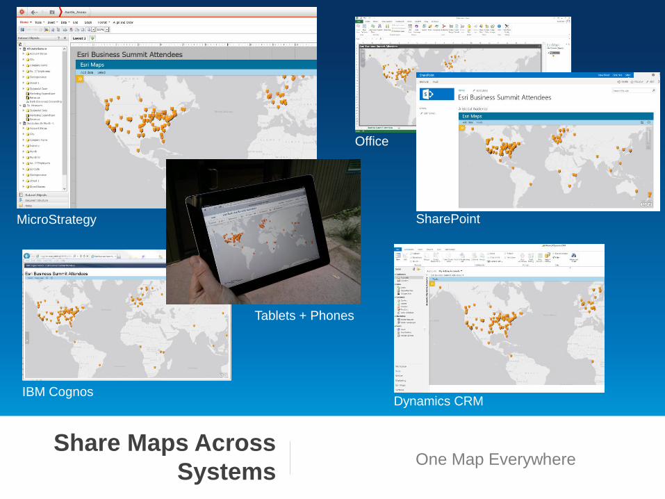
Share Maps Across
Systems One Map Everywhere
MicroStrategy
IBM Cognos
SharePoint
Office
Tablets + Phones
Dynamics CRM
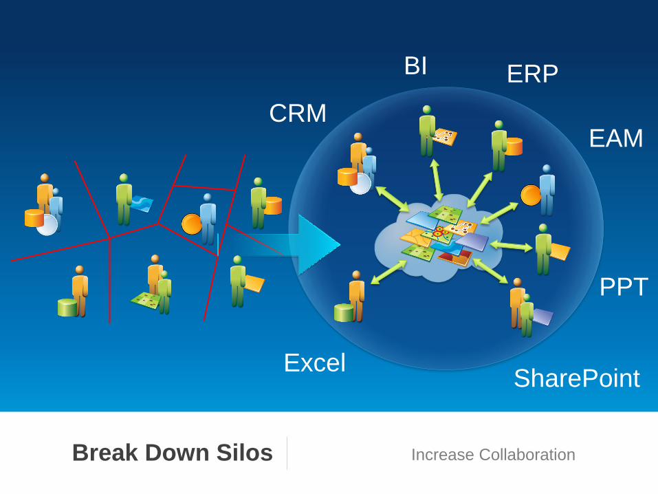
BI
CRM
ERP
EAM
Excel SharePoint
PPT
Break Down Silos Increase Collaboration

Beyond Basic Mapping 1
GeoEnrich Your Data 2
A New Analytical Tool 3
A New Form of Collaboration 4
Esri Location
Analytics Key Capabilities

DEMOS
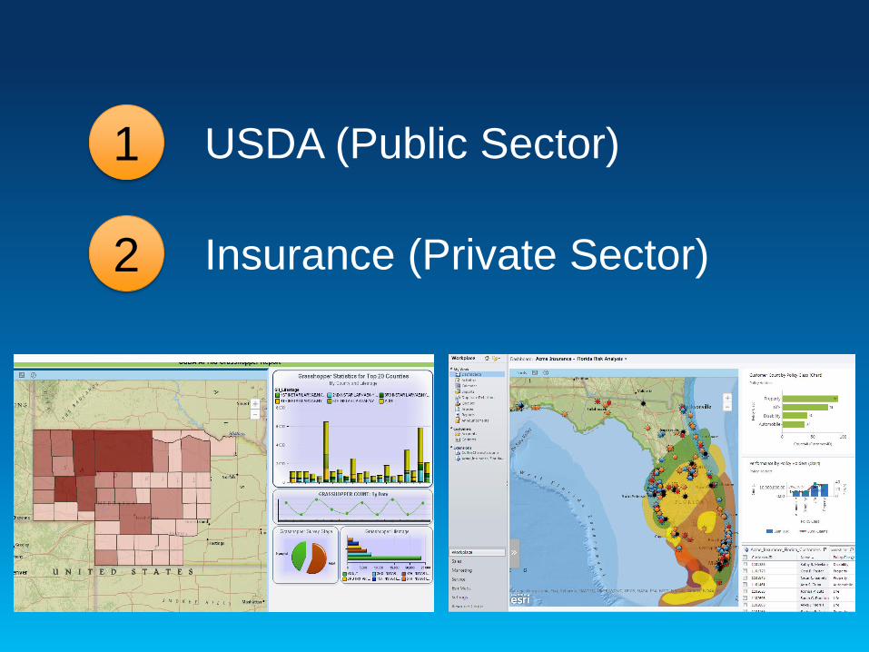
USDA (Public Sector) 1
Insurance (Private Sector) 2
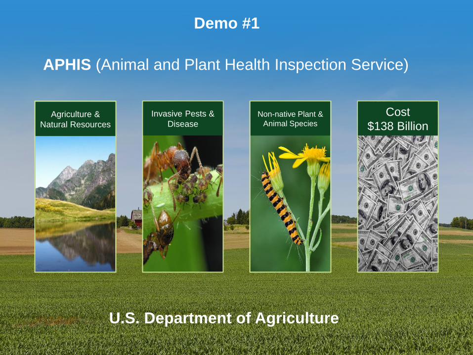
APHIS (Animal and Plant Health Inspection Service)
Agriculture &
Natural Resources
Invasive Pests &
Disease
Non-native Plant &
Animal Species
Cost
$138 Billion
U.S. Department of Agriculture
Demo #1

EATING
approximately
ONE-HALF
of its body weight
per day
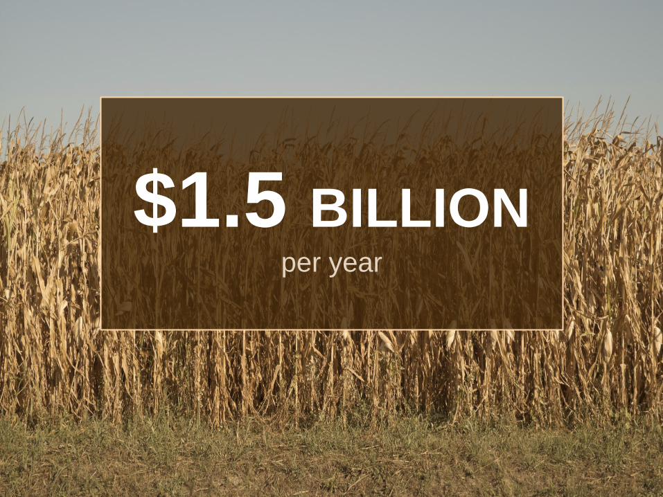
$1.5 BILLION per year
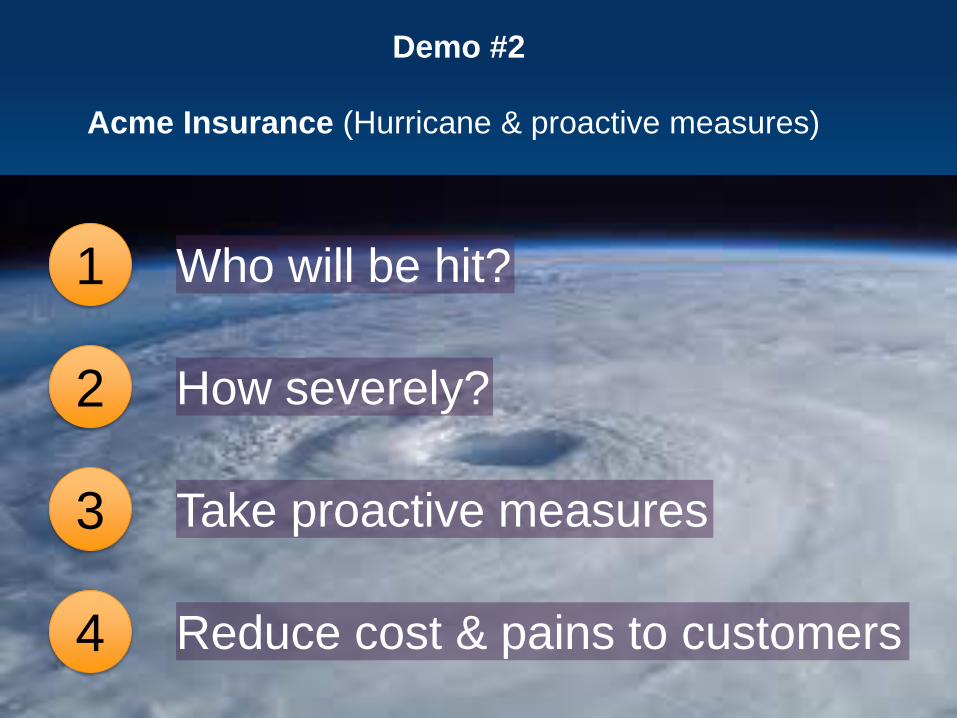
Who will be hit? 1
How severely? 2
Take proactive measures 3
Reduce cost & pains to customers 4
Acme Insurance (Hurricane & proactive measures)
Demo #2

REDUX
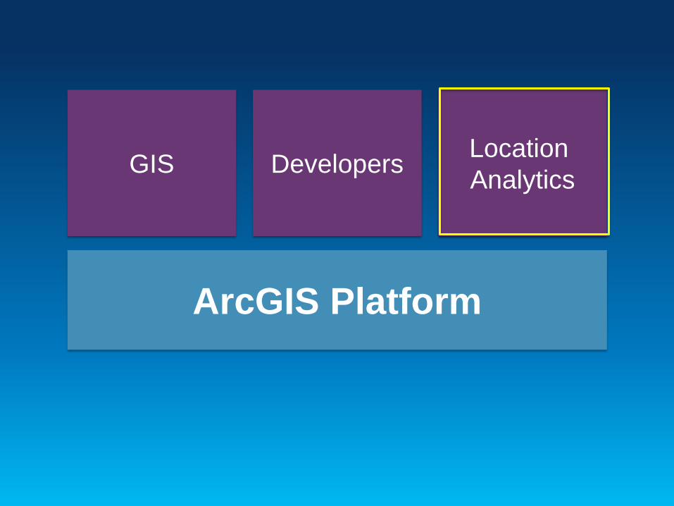
GIS Developers Location
Analytics
ArcGIS Platform
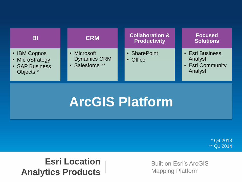
Esri Location
Analytics Products Built on Esri’s ArcGIS
Mapping Platform
BI
• IBM Cognos
• MicroStrategy
• SAP Business Objects *
CRM
• Microsoft Dynamics CRM
• Salesforce **
Collaboration & Productivity
• SharePoint
• Office
Focused Solutions
• Esri Business Analyst
• Esri Community Analyst
ArcGIS Platform
* Q4 2013
** Q1 2014
ArcGIS Platform
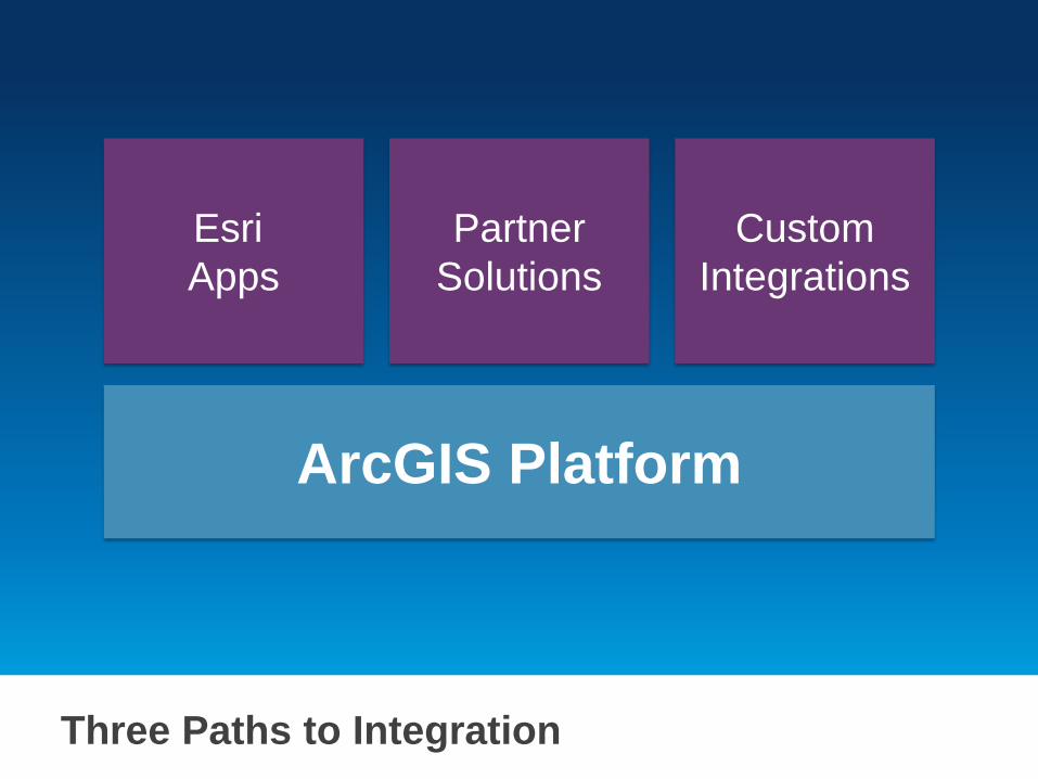
Three Paths to Integration
Esri
Apps
Custom
Integrations
Partner
Solutions
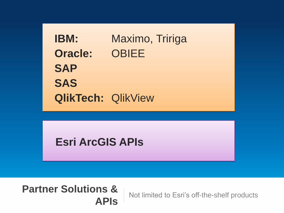
Partner Solutions &
APIs Not limited to Esri’s off-the-shelf products
IBM: Maximo, Tririga
Oracle: OBIEE
SAP
SAS
QlikTech: QlikView
Esri ArcGIS APIs
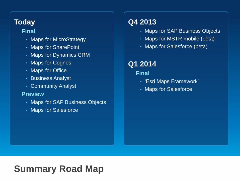
Summary Road Map
Today
Final
• Maps for MicroStrategy
• Maps for SharePoint
• Maps for Dynamics CRM
• Maps for Cognos
• Maps for Office
• Business Analyst
• Community Analyst
Preview
• Maps for SAP Business Objects
• Maps for Salesforce
Q4 2013 • Maps for SAP Business Objects
• Maps for MSTR mobile (beta)
• Maps for Salesforce (beta)
Q1 2014
Final
• ‘Esri Maps Framework’
• Maps for Salesforce