Embed Size (px)
Citation preview

General Management Plan– Island Lake Recreation Area 1
The project was directed by Paul N. Curtis, Management Plan AdministratorMichigan Department of Natural Resources, Parks & Recreation Division withassistance from Birchler Arroyo Associates, Inc.;
General Management PlanLong-range management guidance focused on the specific natural resources, historic-cultural resources,
recreation opportunities and the education-interpretation opportunities of…
Island Lake Recreation Area

General Management Plan– Island Lake Recreation Area 2
Intentionally Left Blank

RESOLUTION NO. 12-2012-02
MICHIGAN STATE PARKS ADVISORY COMMITTEE (MSPAC)
RESOLUTION TO RECOMMEND APPROVAL OF THE “ISLAND LAKE RECREATION AREA – PHASE 1 GENERAL MANAGEMENT PLAN”
ADOPTED: DECEMBER 13, 2012
WHEREAS, the Department of Natural Resources’ (DNR) Parks and Recreation Division has completed Phase 1 of the General Management Plan for the Island Lake Recreation Area; and WHEREAS, the planning process reflects sensitivity to natural resource values, historic and cultural resource values, recreation and education opportunities, and is inclusive of all DNR programs and representative of eco-management; and WHEREAS, the planning process was further inclusive of stakeholder, constituent, and public input; and WHEREAS, the General Management Plan represents sound guidance for future planning phases that will be consistent with the mission of the DNR and the Parks and Recreation Division, and reflective of the purpose and significance of the Island Lake Recreation Area; and WHEREAS, the General Management Plan has been reviewed and recommended for approval by the Parks and Recreation Division and the MSPAC Stewardship and Operations Subcommittee; and WHEREAS, the General Management Plan is consistent with the recommendations of the Michigan State Parks and Outdoor Recreation Blue Ribbon Panel report submitted to Governor Rick Snyder. THEREFORE, BE IT RESOLVED, that the Michigan State Parks Advisory Committee recommends approval of the Island Lake Recreation Area – Phase 1 - General Management Plan; and THERFORE, BE IT FURTHER RESOLVED, that the Michigan State Parks Advisory Committee further recommends that the DNR Director approve the Phase 1 – General Management Plan for the Island Lake Recreation Area; and THEREFORE, BE IT FURTHER RESOLVED, that upon the DNR Director’s approval, the Parks and Recreation Division initiate the Phase 2 – Long Range Action Goals Plan for the Island Lake Recreation Area. Submitted by: Chris Graham, Chair, MSPAC Operations and Stewardship Subcommittee Motioned by: Chris Graham Yeas: 10 Seconded by: Mike McDonald Nays: 0 Abstained: 0 Absent: 6 This Resolution was adopted by the Michigan State Parks Advisory Committee at their December 13, 2012, meeting as Resolution No. 12-2012-02.
General Management Plan– Island Lake Recreation Area 4

General Management Plan– Island Lake Recreation Area 5
Table of Contents
Executive Summary
1.0 Plan Process Overview
1.1 Planning Objectives
1.2 Planning Team
1.3 Recreation Partners
1.4 Management Plan Process
2.0 Core Values
2.1 Mission Statements
2.2 Statements of Purpose
2.3 Statements of Significance
2.4 Legal Mandates
2.5 Land Acquisition & Funding Sources
2.6 Easements
3.0 Management Zone Plan
AppendicesA Supporting AnalysisB Public Participation Program ResultsC Planning Team Meeting Agendas and MinutesD Future Plan Inserts

General Management Plan– Island Lake Recreation Area 6
Island Lake Recreation Area, with 4,000 acres is located primarily in Livingston County,Michigan. The Phase I General Management Plan (GMP) process for Island Lake RecreationArea was made possible by funding provided by Michigan’s Park Improvement Fund. TheDepartment of Natural Resources (DNR) Parks & Recreation Division (PRD) oversaw theplanning process. The endeavor represents a new planning philosophy of the PRD.“Management Planning,” a comprehensive, resource-based process is the PRD’s adaptation ofNational Park Service planning methodology. During Phase 1, the GMP focuses on the fourprinciples of the PRD Mission Statement: to acquire, preserve, and protect; (1) naturalresources, (2) cultural resource, (3) provide public recreation, and (4) provide educationopportunities. The process includes a thorough inventory of Island Lake Recreation Area’snatural and historic/cultural resources, recreational opportunities and education andinterpretation opportunities.
With this base of knowledge, the Core Values for Island Lake Recreation Area were developedby the Planning Team (made up of DNR staff) with meaningful input from government officials,recreation partners, stakeholders and the public. Island Lake Recreation Area was determinedto be significant for the following reasons:
♦ Established in 1944, this park contains about 4,000 acres and provides a wide variety ofrecreational opportunities.
♦ The Huron River, which is a significant natural and cultural resources corridor, runs throughthe park. The park’s portion of the Huron River is managed as a Designated State NaturalRiver.
♦ There are 18 miles of marked, designated use trails in the park for land-based recreation andfitness activities and regional events. Land and water trails connect this park to KensingtonMetropark to the north, as well as provide links and potential links to a regional park system,which includes three State Recreation Areas, two Huron Clinton Metroparks, and numerouslocal parks.
♦ The size and location of the park allow it to be used by local schools and municipalities forrecreation programs, as well as by visitors from Wayne, Oakland, Washtenaw and LivingstonCounties.
♦ The park offers educational and interpretive activities through summer day camps, ExplorerGuides’ programs, and urban outreach programs.
♦ The park is historically and culturally significant as the first Dodge Park and as a location fora Spanish-American War encampment. The park contains scattered prehistoric sites, oldfarmsteads and graveyards. The park is located along land and water transportation routesfor Native Americans and early settlers.
Executive Summary

General Management Plan– Island Lake Recreation Area 7
♦ The park includes a modern shooting range that offers expanded opportunities foreducational and recreational purposes.
♦ The park has an undeveloped and natural feel, with its hardwoods and unique wetlands. Afew areas of oak savannas remain that are being conserved and could be expanded.
♦ There is a strong stewardship ethic at Island Lake Recreation Area, carried out byvolunteers, the Michigan Civilian Conservation Corps (MCCC) and The Nature Conservancy.
Considering the identity and significance of Island Lake Recreation Area, the Planning Team,with recreation partners, stakeholder and public input, established appropriate ManagementZones and the extent of influence on the property. From a palette of nine standard zones, 7were applied to Island Lake Recreation Area. In addition, a Natural River Corridor Zone, a non-standard management zone, was applied to address management of the Huron River. TheManagement Zone map and a thorough review of each Management Zone are found in Section3 of this Plan. A condensed view of the Management Zones is as follows:
♦ Natural River Corridor comprises 745 acres, or 17.1%, and focuses on the specificmanagement requirements of the Huron River. In general, the river corridor (400’ wide) willbe managed in a natural condition, with specific limitation on man-made intrusions andspecific goals of maintaining natural vegetative cover and high water quality.
♦ Primitive Zone comprises 519 acres, or 11.9%, and will reflect a desired condition thatemphasizes the natural resources. The allowance of recreational uses should depend onattaining and maintaining a high quality natural resource condition.
♦ Backcountry Zone comprises 1,156 acres, or 26.6%, and emphasizes resource quality overrecreation, but allows for modification of landscape to allow for moderate levels of activerecreation uses. Most of park’s extensive trail system is located in this zone.
♦ Cultural Landscape Zone and Overlay together comprise 200 acres, or 4.7%, of Island LakeRecreation Area. Both the zone and the overlay address management of the cultural andhistorical resources found within the park.
♦ Scenic Overlay Zone comprises 836 acres, or 19.2%, of Island Lake Recreation Area willdesignated Scenic Overlay Zone, which maintains the underlying zone but raises anawareness of managing the area to optimize the scenic views.
♦ Natural Resource Recreation Zone comprises 811 acres, or 18.7%, and permits activerecreation with medium to high density of use conducted in natural areas. There is still anemphasis on resource quality over recreation, but in this zone, higher levels of use areallowed.
♦ Developed Recreation Zone comprises 991 acres, or 22.8%, and allows active recreationwith high density of use conducted in areas not designated for natural resource significance.In this zone, recreation dominates, while natural resource attributes enhance the experiencewhenever possible. The park’s campgrounds, day-use beaches, and parking areas arefound in this zone.
♦ Visitor Services Zone comprises 25 acres, or 0.6 %, and encompasses those areas requiredfor program administration and operations. The current headquarters for the park will be inthe Visitors Services Zone.

General Management Plan– Island Lake Recreation Area 8
A General Management Plan (GMP) guides the management ofresources, visitor use, and general development at Island Lakeover a 20-year horizon. The GMP provides the foundation forprotecting park resources while providing for meaningful visitorexperiences. The long-range vision and management objectivesfor the park are derived from applicable legal directives, thepurpose of the park, and the park’s significant natural and culturalresources.
GMPs develop as a result of a series of planning steps. Each stepbuilds upon the previous, and action decisions focus on (1) themission of the Parks & Recreation Division (PRD), and (2) thespecific Purpose and Significance of the park. There are fourphases of planning, implemented in the following order:
♦ Phase 1. General Management Plan (GMP) that presents long-range goals (20-year).♦ Phase 2. Long-range Action Goals Plan that identifies 10-year action strategies to attain
the GMP (requires review of Phase 1)♦ Phase 3. Five-Year Implementation Plan, which outlines specific actions to implement
(requires review of Phase 1 and Phase 2)♦ Phase 4. Annual Action Plan and Progress Report to answer what will be done this year,
and what progress was made on last year’s plan.
This Plan represents Phase I. In this phase of planning, a 20-year vision for the park is defined,and critical questions are answered, such as: What will be the condition of flora and fauna?How will we address historic and cultural resources? What recreational opportunities could beprovided? What education and interpretation efforts will meet the visitor? What will guide themanager’s operational decisions? What will be the visitor’s overall experience?
Phase I determines management zones, and describes a variety of activities that may beappropriate within each zone. Phase I does not determine specific uses. Identifyingspecific uses within each management zone is a function of Phase 2. Management Plansdo not guarantee future PRD funding to achieve them. PRD will seek internal funding,alternative funding sources, grants, partnerships and other potential mechanisms forimplementing the desired future conditions defined in this plan.
1.0 Plan Process Overview
Swimmers at Spring Mill Pond
General Management Plan– Island Lake Recreation Area 9
The tool used by this plan is the designation of “Management Zones.” Management zonesdefine specific characteristics of the land, addressing management for:
♦ Natural features♦ Historic/cultural features♦ Education/interpretation♦ Recreational opportunities
These four elements represent the primary goals of the PRD Mission Statement, and provideguidance for both planning and management decisions. Appendix A presents a detailed accountof each of these elements. In addition, management zones prescribe values for:
♦ Visitor experience♦ Management Focus♦ Development
Within the parameters of this guidance, “Purpose” and “Significance” statements are developedfor the park that establish its unique identity and focus. No two parks are the same andemphasis is directed at ensuring that the differences found from park to park are acknowledged,highlighted and celebrated.
1.1 Planning Objectives
The objective of this General Management Plan was to bring together Parks & RecreationDivision staff, recreation partners, stakeholders, and the public who use the park into a planningprocess that will define and clarify the unique “Purpose” and “Significance” of Island LakeRecreation Area. Collectively, those attributes will be reinforced in the planning andmanagement decisions that impact the park through the implementation of the ManagementZone Plan. Future action plans, whether focused on a development proposal, a resourceimprovement initiative, an interpretive program, or day-to-day management of the park will beguided by this General Management Plan.
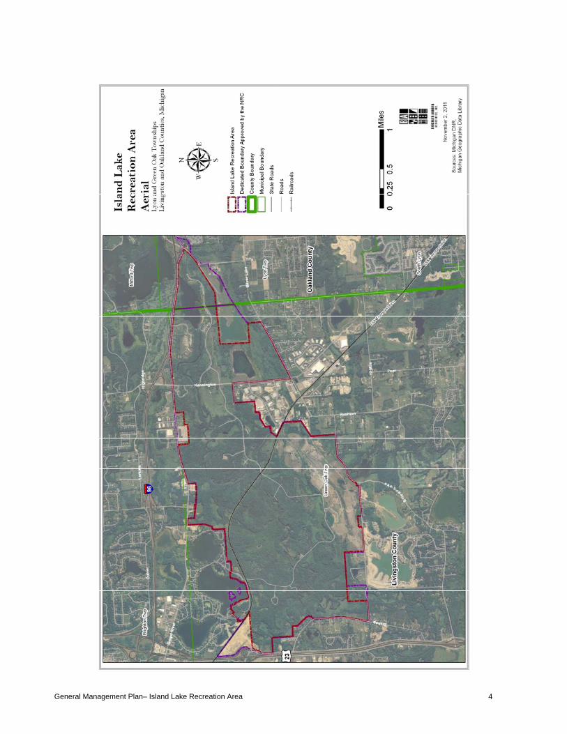
Extensive input was sought throughout theplanning process. The Planning Team metseveral times to review, develop, andcomment on the plan elements (see Section1.2). In addition, the DNR hosted recreationpartner focus groups, a stakeholderworkshop and a public participationworkshop. Both the stakeholder and publicparticipation workshops involved solicitedwritten and verbal comments. The draft planwas available for review on a website and thepublic was invited to email, call or mailquestions or comments concerning thisinitiative. The results of the publicparticipation program are provided inAttachment B.
Stakeholder Meeting

General Management Plan– Island Lake Recreation Area 10
ILRA Planning Team
1.2 Planning Team
Accomplishment of our planning objectives was and is dependent upon the valuable inputprovided by all members of the “Planning Team.” The names listed below are those who werecritical participants in this planning process. Agendas, meeting minutes and attendance atPlanning Team meetings is provided in Appendix C.
DNR StaffPaul N. Curtis PRD Park Management Plan AdministratorPaul Yauk PRD Lands ManagerKristen Bennett PRD District PlannerMurdock Jemmerson PRD Rose Lake District SupervisorGlenn Palmgren PRD Stewardship Unit EcologistLisa Gamero PRD Cultural Resource AnalystKaris Floyd PRD Island Lake RA Park ManagerJamie Metheringham PRD Island Lake RA Park SupervisorTim Payne WD Southeast Region ManagerJulie Oakes WD Wildlife BiologistJeff Braunscheidel FD Fisheries BiologistLiz Hay-Chmielewski FD Fisheries SupervisorTom Hoane FMD FMD – GeologistBruce Miller FMD Fire OfficerDavid Malloch LED LieutenantKaren Gourlay M&O Park InterpreterAiden McLearon MOD Shooting Range SupervisorPat Lieske MSC Shooting Range Concessionaire
ConsultantsDavid Birchler, Birchler Arroyo Associates, Inc.Jill Bahm, Birchler Arroyo Associates, Inc.Susan Roble, Birchler Arroyo Associates, Inc.Sheila Starks, Birchler Arroyo Associates, Inc.
1.3 Recreation PartnersThe input of regional Recreation Partners is also critical when evaluating the need for facilitiesand programs while avoiding unnecessary duplication of facilities and services. Island LakeRecreation Partners included: Huron-Clinton Metropolitan Authority, Livingston County Parksand Open Space Advisory Committee, Kensignton Metropark, Oakland County Parks &Recreation, Lyon Oaks County Park, Lyon Township Parks & Recreation Advisory CommitteeSouth Lyon Area Recreation Authority, Hamburg Township, Community Recreational ServicesOrganization, South Lyon High Schools, Running Fit, MI Mountain Biking Association, MichiganTrail Riders, South Michigan Adventure Club, Hiking Michigan, Legacy Land Conservancy.

General Management Plan– Island Lake Recreation Area 11
1.4 Management Plan Planning Process
Management Planning is a defined strategic process within the Parks & Recreation DivisionStrategic Plan (2009), reflecting the following Goals and Objectives:
♦ Goal 1, Objective 1.2: Strengthen, update, and implement Management Plans.♦ Goal 3, Objective 3.1: Perform landscape level assessment of recreation opportunities
in decision making.♦ Goal 8, Objective 8.1: Continue to use the MSPAC (Michigan State Parks Advisory
Committee), MSWC (Michigan State Waterways Commission), NRC (Natural ResourcesCommission), SWC (Statewide Council), and Ecoregion Teams and partners to advise inParks & Recreation Division planning, policy development, and issue resolution.
Trail Map Kiosk

General Management Plan– Island Lake Recreation Area 12
Core values are the foundation upon which the park management plan is based. Core valuesare derived from the mission statements of the DNR and PRD, as well as the priorities of theDirector to ensure that the State will acquire, preserve, and protect (1) natural resources and (2)cultural resources, and continue to provide (3) public recreation and (4) educationalopportunities throughout the State park system.
2.1 Mission Statements
Guidance for the General Management Plan stems from the Mission Statements of theDepartment and its Parks & Recreation Division, and the Purpose and Significance Statementsthat have evolved through the planning process. The core values found in these statementsmust be reflected in this long-range General Management Plan for Island Lake Recreation Area,and subsequently reflected in any shorter range action plans:
DNR Mission StatementThe Michigan Department of Natural Resources is committed to the conservation,protection, management, use and enjoyment of the state’s natural and cultural resourcesfor current and future generations.
PRD Mission StatementThe Parks & Recreation Division’s mission is to acquire, protect, and preserve thenatural and cultural features of Michigan’s unique resources, and to provide access toland and water based public recreation and educational opportunities.
DNR Priorities Related to State Parks♦ Renewed emphasis on providing top-notch customer service♦ Broaden the base of support for outdoor recreation by continuously promoting the
Recreation Passport♦ Increase participation in outdoor recreation in our state, and reverse the trend of
declining participation in hunting and fishing♦ Foster the growth of Michigan’s resource-based economy and be recognized as the
leader in trail-based recreation.
2.2 Park Purpose
Park purpose statements are based on park legislation, legislative history, special designationsand DNR policies. These statements reaffirm the reasons for which Island Lake RecreationArea was identified as part of the state park system.
2.0 Core Values

General Management Plan– Island Lake Recreation Area 13
Island Lake
1. To be used as a public park, pursuant to the intentions of the State Legislature when itcreated the park and authorized its purchase, beginning in 1944.
2. To preserve and protect Island Lake Recreation Area’s unique natural resources for currentand future generations.
3. To provide diverse recreational opportunities to nearby populations.
4. To provide educational and interpretive opportunities for the public that reflect the DNRmission and the unique qualities of Island Lake Recreation Area.
2.3 Statements of Significance
Park Significance statements capture the essence of the park’s importance to our state’s naturaland cultural heritage. These statements demonstrate the distinctiveness of Island LakeRecreation Area. Understanding the park’s significance helps managers make decisions thatpreserve those resources and values necessary to accomplish the park’s purpose.
1. Established in 1944, this park contains about 4,000acres and provides a wide variety of recreationalopportunities.
2. The Huron River, which is a significant natural andcultural resources corridor, runs through the park. Thepark’s portion of the Huron River is managed as aDesignated State Natural River.
3. There are 18 miles of marked, designated use trails inthe park for land-based recreation and fitness activities and regional events. Land and watertrails connect this park to Kensington Metropark to the north, as well as provide links andpotential links to a regional park system, which includes three State Recreation Areas, twoHuron Clinton Metroparks, and numerous local parks.
4. The size and location of the park allow it to be used by local schools and municipalities forrecreation programs, as well as by visitors from Wayne, Oakland, Washtenaw andLivingston Counties.
5. The park offers educational and interpretive activities through summer day camps, ExplorerGuides’ programs, and urban outreach programs.
6. The park is historically and culturally significant as the first Dodge Park and as a location fora Spanish-American War encampment. The park contains scattered prehistoric sites, oldfarmsteads and graveyards. The park is located along land and water transportation routesfor Native Americans and early settlers.
7. The park includes a modern shooting range that offers expanded opportunities foreducational and recreational purposes.
8. The park has an undeveloped and natural feel, with its hardwoods and unique wetlands. Afew areas of oak savannas remain that are being conserved and could be expanded.
9. There is a strong stewardship ethic at Island Lake Recreation Area, carried out byvolunteers, the Michigan Civilian Conservation Corps (MCCC) and The NatureConservancy.

General Management Plan– Island Lake Recreation Area 14
2.4 Legal Mandates
For all park General Management Plans, all legal mandates are identified that serve to furtherguide the development of the General Management Plan and subsequent Action Plans. For ourplanning purposes, the term “Legal Mandates” refers to not only state law, but also theadministrative tools of “Policy” and “Directive” of the Natural Resource Commission, theDepartment, and the Parks & Recreation Division. Examples include Wildlife ConservationOrders, Orders of the Director, and all other laws, commission orders, and rules or directivesthat apply to the park. Specific to Island Lake Recreation Area, several legal mandates havebeen identified, which are listed below. Please refer to Appendix A: Supporting Analysis for amore detailed summary of these mandates.
DNR Policy 26.04-04 - Use of State-Owned Lands Administered by the MichiganDepartment of Natural Resources (ISSUED: 02/01/2006)♦ The NRC will manage state-owned lands in a manner that protects and enhances the
public trust while providing for the use and enjoyment of those lands as outlined in theNatural Resources and Environmental Protection Act.
♦ Established to protect and promote the public health by establishing health coderequirements specifically addressing campgrounds.
♦ All public (including DNR) and private campgrounds must comply with these regulations.♦ Mandates that a campground wastewater system must meet the construction permit,
design, and operation requirements under Michigan’s Public Health Code.
National Pollutant Discharge Elimination System (NPDES) Permit, including Storm WaterRunoff Discharge Authorization♦ The purpose of this permit is to control the discharge of pollutants into surface waters of
the state to protect the environment; administered by the Michigan Department of NaturalResources.
PA 35 of 2010, Part 741 (“Recreation Passport”)♦ This act amended the Michigan Motor Vehicle Code to provide for a State Park and
State-operated public boating access site “Recreation Passport” that a Michigan residentmay obtain by paying an additional fee when registering a motor vehicle.
♦ The Recreation Passport is required for entry into all PRD administered facilities andtakes the place of the Motor Vehicle Permit (MVP).
PA 368 OF 1978, ARTICLE 12 - ENVIRONMENTAL HEALTH, PART 125 –CAMPGROUNDS – Part 125 of the Public Health Code♦ Established to protect and promote the public health by establishing health code
requirements and regulations that all public (including DNR) and private campgroundsmust meet.
♦ Campground wastewater system must meet the construction permit, design, andoperation requirements under Michigan’s Public Health Code.
PA 451 OF 1994, PART 22 – CAMPGROUND WASTEWATER SYSTEMS♦ These rules apply to all campground wastewater systems and regulates discharges to
groundwater; administered by the Water Division, Groundwater Discharge Unit

General Management Plan– Island Lake Recreation Area 15
PA 451 of 1994, PART 303 - WETLANDS PROTECTION (formerly Act No. 203, P.A. 1979Wetland Protection Act)♦ Administered by the DNR and part of the Natural Resources and Environmental
Protection Act, this legislation provides clarification and guidance on interpreting Part 303by defining specific rules for the regulation of wetlands in Michigan.
♦ The law requires that persons planning to conduct certain activities in regulated wetlandsapply for and receive a permit from the state before beginning the activity.
PA 451 OF 1994, PART 419 - HUNTING AREA CONTROL♦ Administered by the DNR, this part of PA 451 establishes the powers of the Department
to establish safety zones for hunting.
PA 451 OF 1994, PART 504 - STATE LAND USE RULES / LAND USE ORDERS OF THEDIRECTOR♦ Administered by DNR Law Division.♦ States that the department shall promulgate rules for the protection of the lands and
property under its control against wrongful use or occupancy.
PA 451 OF 1994, PART 741 - STATE PARK SYSTEM - NATURAL RESOURCE ANDENVIRONMENTAL PROTECTION ACT♦ Notable in this law is Section 324.74102, which identifies the duties of the DNR and
reinforces those core values concerning preservation, protection and management citedabove.
WILDLIFE CONSERVATION ORDERS♦ Established by the Natural Resources Commission (NRC).♦ Describes hunting and trapping regulations including methods of take, bag limits, license
quotas, and season dates are established by the NRC and are described in the WildlifeConservation Orders.
PA 451 OF 1994, PART 305 – NATURAL RIVERS - NATURAL RESOURCE ANDENVIRONMENTAL PROTECTION ACT♦ Section 324.30502 of this Act states in part… “The department, in the interest of the
people of the state and future generations, may designate a river or portion of a river as anatural river area for the purpose of preserving and enhancing its values for waterconservation, its free flowing condition, and its fish, wildlife, boating, scenic, aesthetic,floodplain, ecologic, historic, and recreational values and uses”.
♦ It further states…”The Department shall prepare and adopt a long-range comprehensiveplan for a designated natural river area that sets forth the purposes of the designation,proposed uses of the lands and waters, and management measures designed toaccomplish the purposes.” The Department prepared such a plan and the Huron River(Natural River) Plan (as Revised March 12, 2002) shall direct all activities influenced bythe designation.
PA 45 OF 2010 – NATURAL RESOURCES AND ENVIRONMENTAL PROTECTION ACT♦ Amendes the Natural Resources and Environmental Protection Act (PA 451 of 1994) to
require the DNR to establish a plan for a statewide trail network that includes Michigantrailways, pack and saddle trailways, and other recreational use trailways, and to permitpack and saddle animals on designated trailways managed by the DNR.

General Management Plan– Island Lake Recreation Area 16
LAND ACQUISITIONMAP
PA 46 OF 2010 – NATURAL RESOURCES AND ENVIRONMENTAL PROTECTION ACT♦ Amendes the Natural Resources and Environmental Protection Act (PA 451 of 1994) with
a finding that a statewide system of trails, trailways, and pack and saddle trailways is inthe best interest of the state; requires the DNR to establish an “adopt-a-trail” program thatallows volunteer groups to assist in maintaining and enhancing Michigan trailways, packand saddle trailways, and rail-trails; and creates the Michigan snowmobile and trailsadvisory council within the department.
2.5 Land Acquisition & Funding Sources
The following descriptions relate to the fund source map and legend for Island Lake RecreationArea. Those lands were acquired by the state through a variety of funding sources and/ortransactions. Often, conditions attached to the original funding source or other details of theproperty transaction encumber the future use or disposition of the land. Descriptions of the fundcategories represented at this park can be found in the following list:
Michigan Natural Resources Trust Fund (MNRTF)The trust fund was established in 1976 to provide a source of funding for public acquisitionof lands for resource protection and public outdoor recreation. Funding is derived fromroyalties on the sale and lease of state owned mineral rights. It is utilized for generalprogram purposes.
The State Constitution was amended in 1984 to provide for a "Michigan Natural ResourcesTrust Fund” which was implemented in 1985. Most rentals, royalties, and other revenuesderived from mineral, coal, oil, and gas interests on State-owned land are credited to thefund. Public Act 451 of 1994 redirected a portion ($10 million per year) of these revenuespreviously committed to this fund, to the Michigan State Parks Endowment Fund.Appropriations are used to fund grants to local units of government, as well as Stateagencies, to acquire or develop outdoor public recreation facilities.

General Management Plan– Island Lake Recreation Area 17
Game and Fish Funds (now known as the State Game and Fish Protection Fund)This fund was established in 1921 and is financed principally by the sale of hunting andfishing licenses. The license fees are set by statute and their purpose is to support theconservation program for preservation and control of fish and wildlife. The fund alsoreceives revenues from the investment earnings of the Game and Fish Protection TrustFund. The fund provides financial support for state-wide hunting and fishing programs,including resource management, research, enforcement of hunting and fishing laws, andacquisition of lands to be used for hunting and fishing purposes.
State Game and Fish Protection Trust FundThe State Game and Fish Protection Trust Fund was created under the provisions of PublicAct 73 of 1986. The Game and Fish Protection Fund provides revenues for the operation ofthe Fish, Wildlife, and Law Enforcement programs in the Department of Natural Resources.Management, research, enforcement of fishing and hunting laws and acquisition of lands tobe used for hunting and fishing purposes are examples of uses of this fund.
Special LegislationAcquisitions for park purposes through this source are tied to specific funding establishedby the legislature.
Other FundsIncluded in this category are “General Fund,” defined as properties that were purchasedwith monies from the state’s General Fund, and not associated with a specific revenuestream or bond program. Also included in this category are “Exchanges.” These landtransactions result in acquisition of lands in return for disposition of land to the offeringparty.
Another fund source represented in this category is the “Recreation Bond Fund.” This fundwas established in 1988 and operates under Parts 196 and 715 of P.A. 451 of 1994, asamended. The fund was created from the proceeds and investment earnings of a bondpackage approved by the voters in November 1988 to finance state and local publicrecreation projects.
Multiple FundsOften, more than one funding source is designated for successful completion of a realestate transaction. In those cases, this ‘Multiple Funds’ designation is made. Specificinformation for these must be investigated on a case-by-case basis.
2.6 Easements
Island Lake Recreation Area is significantly impacted by granted easements as outlined in thefollowing:
♦ Huron – Clinton MetropolitanAuthority
♦ Detroit Edison Company♦ Michigan Bell Telephone Company♦ Livingston County Road Company
♦ Kimberly - Clark Corporation♦ Consumers Power Company♦ Island and Briggs Lake♦ American Aggregates Corporation
(AAC)

General Management Plan– Island Lake Recreation Area 18
With guidance of the Planning Team and input from the park’s stakeholders and the public, the“Purpose and Significance” statements were formulated for Island Lake Recreation Area. Thisestablished an identity for Island Lake Recreation Area as a place to be valued for its uniquenatural features, multi-use recreational trails, and opportunity for natural resources education.
The Management Zone Plan was developed in keeping with the park’s unique Identity. Similarto the Purpose and Significance statements, the Management Zone Plan was also drafted withPlanning Team, recreation partners, stakeholder and public support. The Management ZonePlan seeks to preserve and protect the park’s natural resources, while creating opportunities forrecreation, education and interpretation. To achieve this, the 4,000acre park was divided intothe following zones:
♦ Natural River Corridor comprises 745 acres (17.1%) of IslandLake Recreation Area. The Natural River Corridor is a non-standard zone that has been established to focus on thespecific management requirements of the Huron River. Ingeneral, the river corridor (400’ wide) will be managed in anatural condition, with specific limitation on man-madeintrusions and specific goals of maintaining natural vegetativecover and high water quality.
♦ Primitive Zone comprises 519 acres (11.9%) of Island LakeRecreation Area. Only foot traffic would be allowed in thiszone to ensure that the natural features are not damaged orcompromised by recreation. This zone preserves and protectsthe unique resources found in the western portion of this park.
♦ Backcountry Zone comprises 1,156 acres (26.6%) of IslandLake Recreation Area. The zone allows for a slightly higherlevel of use than the Primitive Zone, but still preserves the natural resources.
♦ Cultural Landscape Zone and Overlay combined comprise 200 acres (4.7%) of Island LakeRecreation Area. In the Cultural Landscape Zone, preservation of the historical and culturalresources is the primary management focus. The Cultural Landscape Overlay allows theuses in the underlying zone but addresses the cultural and historical resources found withinthe park. The former Spanish-American War Encampment and other important historicalfeatures are included in this zone.
♦ Scenic Overlay Zone comprises 836 acres (19.2%) of Island Lake Recreation Area. Thiszone allows the uses in the underlying zone but places a management priority on maintaining
3.0 Management Zones
This is Phase I of theGeneral Management Planfor Island Lake Recreation
Area to determinemanagement zones for the
parkland. Managementzones describe a variety of
activities that may beappropriate within that zone.Identifying specific activitiesthat will occur is a function
of Phase 2 generalmanagement planning, and
not a component of thisphase.

General Management Plan– Island Lake Recreation Area 19
the scenic views. The zone encompasses the area managed as a Natural Area in thecentral-western area of the park.
♦ Natural Resource Recreation Zone comprises 811 acres (18.7%) of Island lake RecreationArea and allows for active recreation with medium to high density of use conducted in naturalareas.
♦ Developed Recreation Zone comprises 991 acres (22.8%) of Island Lake Recreation Area.Land in this zone is mainly comprised of the park campground, day-use beach, andassociated parking areas. The three most developed areas within the park are Kent Lakeday use and beach area, Island Lake day use area, and Spring Mill Pond day use and beacharea.
♦ Visitor Services Zone comprises 25 acres (0.6%) of Island Lake Recreation Area andencompasses the developed areas required for program administration and operations. Itincludes offices, contact stations, maintenance facilities and all related land required toconduct the business of running a recreation area. The Visitor Services zone in Island LakeRecreation Area includes the existing park office and maintenance facilities.
Sandhill crane outside HCMA Office Kent Lake Beach Area

General Management Plan– Island Lake Recreation Area 20
Intentionally left blank

General Management Plan– Island Lake Recreation Area 21

General Management Plan– Island Lake Recreation Area 22
Intentionally left blank

General Management Plan– Island Lake Recreation Area 23
The Huron River
3.1 Natural River Corridor
Approximately 745 acres (17.1%) of Island Lake Recreation Area are designated a NaturalRiver Corridor and will focus on specific management standards for the Huron River.
3.2 Primitive Zone
Approximately 519 acres (11.9%) of Island Lake Recreation Area aredesignated Primitive. This zone preserves and protects the uniqueexemplary natural communities found in this park. Only foot trafficwould be allowed in this zone to ensure that the natural features arenot damaged or compromised by recreation.
A. Natural Resources: This zone will reflect natural processes, withvegetative management only allowed to restore and maintainnatural ecological structure and processes (such as removinginvasive species), to address hazard trees, and to manage pestsand disease. The management zone plan promotes the on-goingmaintenance and enhancement of these natural resources toensure their success in the long-term. Native species and naturalprocesses would take precedence over visitor accommodation. The area managed as aNatural Area, between the Huron River and the railroad, is included in this zone.
B. Historic/Cultural Resources: There are several historic structures or resources in this zoneincluding historic dam locations, farmsteads, and cemeteries.
C. Recreation Opportunities: With the focus of this zone being preservation, protection andenhancement of the natural communities present within the zone, recreational opportunitiesare limited to low-intensity uses. Any uses must be dispersed, low intensity, off-trail or trail,self-reliant, outdoor activities. Activities that could occur in this zone are hiking, backpacking,hunting/trapping/fishing, primitive camping (designated sites), cross-country skiing, andnature observation.
D. Education Opportunities: The ecological significance of the resources in the park presents atremendous educational opportunity. Information can be relayed through the use of kiosksat trailheads and interpretive signage along trails and other appropriate locations.
E. Visitor Experience: Visitor experience would reflect a high degree of natural feel: asignificant sense of solitude, and a lack of man-made improvements. Overall, there wouldbe low interaction with other visitors.
F. Management Focus: Management would focus on maintaining the low-impact character ofthe zone, with emphasis on natural resource quality. Routine maintenance would beprovided. Care would be taken to eliminate any detrimental impacts such as incursion ofinvasive species. Vegetation will be protected from human predation.
G. Development: The focus is to maintain as little evidence of human activity as possible. Trailimprovements, which can include boardwalks and/or overlooks, will be considered.

General Management Plan– Island Lake Recreation Area 24
3.3 Backcountry Zone
Approximately 1,156 acres (26.6%) of Island Lake Recreation Area are designatedBackcountry Zone. The zone is located in the central and western portions of the park. Thiszone allows for modification of the landscape to allow for moderate levels of active recreationuses.
A. Natural Resources: This zone will reflect naturalprocesses, with vegetative management onlyallowed to restore and maintain naturalecological structure and processes (such asremoving invasive species), to address hazardtrees, and to manage pests and disease. Withinthe Backcountry Zone, natural resources maybe modified slightly to support visitor use, butthe tolerance for natural resource impacts islow.
B. Historic/Cultural Resources: There are several historic structures or resources in this zoneincluding historic dam locations, farmsteads, and cemeteries.
C. Recreational Opportunities: Moderate levels of recreation are allowed in the BackcountryZone, provided the activities are compatible with the natural character. Non-motorizedoutdoor activities could be permitted, including hiking, backpacking, backcountry camping,canoeing, kayaking, mountain biking, nature observation, cross-country skiing,snowshoeing and hunting/trapping/fishing. Most of Island Lake Recreation Area’s extensivetrail system, which includes biking and hiking trails, are found within the Backcountry Zone.
D. Education Opportunities: The ecological significance of the resources in the park presentsa tremendous educational opportunity. Information can be relayed through the use ofkiosks at trailheads and interpretive signage along trails and other appropriate locations.The Michigan State Park Explorer Program (also known as the Outdoor Explorer Program)offers campers and day visitors the opportunity to learn about a wide range of topicsincluding forests, insects, and pond studies.
E. Visitor Experience: A moderate level of visitor encounters can be accommodated in theBackcountry Zone. Visitors will engage in self-reliant, non-motorized outdoor activities thatmay require a fairly high time commitment. Low noise tolerance and low interaction withothers can be expected.
F. Management Focus: Management will focus on maintaining the low-impact character of thezone, with emphasis on natural resource quality. Routine maintenance, includingmaintenance for trails or access routes, will be provided. Care will be taken to eliminate anydetrimental impacts such as incursion of invasive species.
G. Development: A low level of development is allowed to support visitor access to activitiesoffered in the zone. Development would be unobtrusive and blend in with the naturalenvironment.
Mountain Bike Trail

General Management Plan– Island Lake Recreation Area 25
3.4 Cultural Landscape Zone and Overlay
Approximately 91 acres (2.1%) of land within Island Lake Recreation Area are designatedCultural Landscape Zone, located in the eastern portion of the park. In the central and westernportions of the park, approximately 109 acres (2.5%) of land is designated Cultural LandscapeOverlay Zone. The management focus of the Cultural Landscape Zone is to address the overallsetting in which is found historic structures as well as non-structural evidence of traditions,beliefs, practices, lifeways, arts, crafts and institutions of any community. The CulturalLandscape Overlay maintains the underlying zone but raises an awareness of managing thearea to preserve its historical and cultural features.
A. Natural Resources: This zone will reflect natural processes,with vegetative management focused to restore and maintainnatural ecological structure and processes (such as removingof invasive species), to address hazard trees, and to managepests and disease. Vegetation may also be managed toenhance education/interpretation uses which can include non-native species specific to the era and/or location, andmaintaining an aesthetically appealing landscape that issensitive to the historical resource and interpretation of thezone.
B. Historic/Cultural Resources: Includes historic buildings,structures, and other landscape characteristics and features,which represent the evolution of the cultural resource, temporalchange, and the continuum of time. Island Lake RecreationArea’s historic resources include Spanish-American WarRegiments, the Bingham House, and Gage Farm.
C. Recreation Opportunities: Visitors engaged in sightseeing, recreational, and educationalactivities in a cultural setting (i.e. automobile, bicycle, walking, hiking tour), compatible withand sensitive to the setting.
D. Education Opportunities: Interpretive signage at trail heads, on the trail, overlooks and otherpoints of interest. Off site interpretation as well.
E. Visitor Experience: Visitors engaged in sightseeing, recreational, and educational activitiesin a cultural setting (i.e. automobile, bicycle, walking, hiking tour). Moderate timecommitment. Moderate on-site interpretation, off-site interpretation, noise tolerance, andinteraction with DNR staff.
F. Management Focus: The focus of this zone is to maintain the cultural character of the zone,and the underlying zone, which is mainly Developed Recreation.
G. Development: Non-historic development and activities that do not conflict with the culturallandscape are tolerated. Moderate level of development to support visitor access and use(i.e. interpretive media, walks, trails, small picnic areas, and restrooms). Developmentcompatible with the cultural landscape.
Historical Marker

General Management Plan– Island Lake Recreation Area 26
3.5 Scenic Overlay Zone
Approximately 836 acres (19.2%) of Island Lake Recreation Area are zoned Scenic Overlayzone. This zone allows the uses in the underlying zone, but raises an awareness of managingthe area to optimize Natural Resources: This zone reflects natural processes, with vegetativemanagement only allowed to restore and maintain natural ecological structure and processes(such as removing of invasive species), to address hazard trees, and to manage pests anddisease. Vegetation may also be managed to enhance the viewscapes of the zone.
A. Historic / Cultural Resources: Cultural resources would be preserved, rehabilitated orremoved. Historic structures could be adaptively used for operational uses or educationalpurposes.
B. Recreational Opportunities: Low-moderate levels of recreation would be allowed, compatiblewith the underlying zone. Low-intensity activities only would be allowed in the trail andobservation point(s), where provided.
C. Education Opportunities: Interpretive signage may be used at key viewing points, trailheads,or observation area(s). There may be opportunities for off-site interpretation as well.
D. Visitor Experience: Moderate encounters may be expected in Scenic Overlays. Visitorswould be engaged in sightseeing activities by hiking. A moderate time commitment, off-siteinterpretation and noise tolerance would be expected.
E. Management Focus: Management focuses on maintaining the quality natural resources andalso of the viewscape. Ensuring public safety and that other activities and/or developmentwithin the Scenic Overlay Zone are compatible with the overriding purpose of the viewquality are other management concerns.
F. Development: Development will be appropriate with the underlying zone, which is mainlyzoned Primitive, to accommodate such things as interpretive activities and sightseeing.

General Management Plan– Island Lake Recreation Area 27
3.6 Natural Resource Recreation Zone
Approximately 811 acres (18.7%) of the land within Island Lake Recreation Area are designatedNatural Resource Recreation Zone. The zone allows for active recreation with medium to highdensity of use conducted in natural areas.
A. Natural Resources: This zone will reflect naturalprocesses, with vegetative management onlyallowed to restore and maintain natural ecologicalstructure and processes (such as removing ofinvasive species), to address hazard trees, and tomanage pests and disease. Vegetation may alsobe managed to facilitate recreational use andmaintaining an aesthetically appealing landscape.
B. Historic/Cultural Resources: Cultural resourcespreserved, rehabilitated, removed or allowed towaste away. Historic structures could beadaptively used for operational uses or educationalpurposes.
C. Recreation Opportunities: In this zone, visitors engage in outdoor activities in diverse landand water natural settings (i.e. hiking, backpacking, back-country and rustic camping,bicycling, canoeing, kayaking, nature observation, cross-country skiing, and snowshoeing).Hunting/trapping/fishing are permitted in designated areas. Snowmobiling is permitted ondesignated routes. Moderate to high levels of recreation compatible with natural character ofthe zone.
D. Education Opportunities: Interpretive signage at trail heads, on the trail, and at overlooks.
E. Visitor Experience: Visitors engaged in outdoor activities in diverse land and water naturalsettings for recreation and education. Hunting/trapping/fishing permitted in designatedareas. Snowmobiling permitted on designated routes. Variable time commitment. Variablechallenge and adventure. Moderate noise tolerance. Moderate interaction with DNR staff.High visitor encounters accommodated.
F. Management Focus: Management focuses on maintaining the use of the zone appropriateto the PRD’s mission. Public safety, protection of resources, and universal access aremanagement priorities.
G. Development: A moderate level of development of facilities for support of visitor activities ispermitted in this zone. Examples of development include walkways and parking, trails,benches, and picnic tables. Site hardening is allowed as necessary to facilitate activities andprotect natural resources.
Multi-use Trail

General Management Plan– Island Lake Recreation Area 28
3.7 Developed Recreation Zone
Approximately 991 acres (22.8%) of Island Lake Recreation Area are designated DevelopedRecreation. This zone allows active recreation with high density of use conducted in areas notdesignated for natural resource significance. This zone includes the Kent Lake day use andbeach area, Island Lake day use area, and Spring Mill Pond day use and beach area.
A. Natural Resources: Vegetativemanagement in this zone will addresshazard trees, invasive species, andpests and disease, and will also beallowed for purposes of facilitatingdevelopment and recreational use andmaintaining an aesthetically appealinglandscape. Natural resources areactively managed and modified tosupport visitor activities. Water quality ismaintained or restored.
B. Historic/Cultural Resources: Resourcesin this zone could be preserved,adapted or rehabilitated. Non-utilized ornon-stabilized structures are removed.
C. Recreational Opportunities: High levels of recreation in a highly structured environment arefound in this zone. Visitors engage in recreation activities in diverse and modified lad andwater settings: hiking, modern and rustic camping, bicycling, boating, canoeing, kayaking,fishing, nature observation, cross-country skiing, snowshoeing, day-use beach, picnicking,and other day-use activities.
D. Education Opportunities: Interpretive signage and information could be provided at thecampground, registration building, trailheads, and/or along trails and overlooks.
E. Visitor Experience: A high level of visitor encounters can be accommodated. Activities forvisitors to engage in could offer a variable time commitment, challenge and adventure.Moderate noise tolerance and moderate to high interaction with others can be expected.
F. Management Focus: Management focuses on maintaining the use of the zone appropriateto the PRD’s mission. Public safety, protection of resources, and universal access aremanagement priorities.
G. Development: A high level of development of facilities for support of visitor activities ispermitted in this zone. Examples of development include restrooms,concrete/asphalt/gravel walkways and parking, fishing piers, trails, benches, picnic tables,rustic campsites, cabins and shelters for recreation and educational opportunities. Sitehardening is allowed as necessary to facilitate activities, protect natural resources, andprovide universal access.
Spring Mill Pond Day Use Area

General Management Plan– Island Lake Recreation Area 29
3.8 Visitor Services Zone
This zone is 25 acres (0.6%) and encompasses the developed areas required for programadministration and operations. It includes offices, contact stations, maintenance facilities and allrelated land required to conduct the business of running a state park. The Visitor Services zonein Island Lake Recreation Area includes the park headquarters.
A. Natural Resources: Natural resources are activelymanaged and modified to support administrative andsupport activities. Vegetative management is allowed(primarily tree removal for safety).
B. Historic/Cultural Resources: Resources in this zonecould be preserved, adapted or rehabilitated to supportadministrative and support activities.
C. Recreational Opportunities: There are no recreational activities permitted in the VisitorServices zone.
D. Education Opportunities: Person to person contact at park headquarters for generalinformation; informational kiosk may be available.
E. Visitor Experience: Business and information only. High noise tolerance and moderate tohigh interaction with others can be expected.
F. Management Focus: Management focuses on the business of running the park,appropriate facilities for staff, employee safety. Universal access will be provided to theoffices.
G. Development: A high level of development of facilities for support of administrativeactivities is permitted in this zone. Examples of development include office space,meeting rooms, employee locker room, eating area, shop space, and storage space.
Shooting Range Building

General Management Plan– Island Lake Recreation Area 30
The following are items that will be added to this General Management Plan (GMP) as they aredeveloped. The GMP serves as a guide for each subsequent plan.
10-Year Long Range Action Goals Plan: (Plan to attain the GMP): Phase 2 of theManagement Planning Process. Includes review and update of General Management Plan.
5-Year Implementation Plan: (Specific actions to implement the Long Range Action GoalsPlan): Phase 3 of the Management Planning Process. Includes review and update of GMP andPhase 2 Plan.
Annual Action Plan and Progress Report: Phase 4 of the Management Planning Process.
Operational/Management Resources: The following categories are established as a guide forthe park manager to use to supplement this working document. Other categories can be addedas needed.
♦ Annual Work Plan (This report ties in withPhase 4 – Annual Report ofManagement Planning)
♦ Stewardship Plan♦ Staffing♦ Budget♦ Equipment♦ Training♦ Public Relations / Marketing / Outreach♦ Programming (ie. special events, MCCC,
volunteers, etc.)Public Health, Safety,and Welfare
♦ Water system♦ Wastewater system♦ Electrical system♦ Law enforcement♦ Emergency Access Plan♦ Wildfire Management Plan♦ CRS♦ FOIA♦ Raster Image Index♦ Raster Images of historic park plans♦ Park Infrastructure data
4.0 Future Plan Inserts

General Management Plan – Island Lake Recreation Area A-1 Appendix A – Supporting Analysis
A.1. Park Location............................................................................................. 2 A.2. Demographics............................................................................................ 3 A.3. General History of Island Lake Recreation Area..................................... 5 A.4 Land Acquisition & Funding Sources...................................................... 6 A.5 Relationship of Island Lake RA to Other Park Resources ..................... 9 A.6 Current Land Use .................................................................................... 15 A.7 Natural Resources .................................................................................. 16 A.8 Historic/Cultural Resources.................................................................... 21 A.9 Education and Interpretation .................................................................. 22 A.10 Recreational Resources.......................................................................... 23 A.11 Areas of Conflict ...................................................................................... 25 A.12 Park Use Statistics and Economic Impacts........................................... 26
APPENDIX A Supporting Analysis
Table of Contents

General Management Plan – Island Lake Recreation Area A-2 Appendix A – Supporting Analysis
A.1 Park Setting
Island Lake Recreation Area, a 4,000-acre park, is located downstream of Kensington Metropark, along the Huron River. The park offers the feeling of being “up north” while maintaining proximity to metro Detroit and surrounding urban areas. The majority of the park is located in the southeastern corner of Livingston County, but a small section spreads west into Oakland County. Its geographic coordinates approximate 42 ۫۫ 52” latitude and 83 ۫ 69” longitude. The Recreation Area is confined to the north by I-96 and to the west by US-23. The southern border of the park spreads along Silver Lake Road. Island Lake Recreation Area is easily accessible from both I-96 and US-23.

General Management Plan – Island Lake Recreation Area A-3 Appendix A – Supporting Analysis
A.2 Demographics The U.S. Census Bureau estimates the 2010 population of Livingston County at 180,967, a 15.3% increase since 2000. The population density of Livingston County is 320.2 people per square mile and the county population exceeds the state average of 175 people per square mile. 2010 U.S Census Estimates for Livingston County People QuickFacts Livingston
County Michigan
Population, 2010 180,967 9,883,640 Population, percent change, 2000 to 2010 15.3% -0.6% Population, 2000 156,951 9,938,444 Persons under 5 years, percent, 2010 5.5% 6.0% Persons under 18 years, percent, 2010 25.5% 23.7% Persons 65 years and over, percent, 2010 12.0% 13.8% Female persons, percent, 2010 50.0% 50.9%
White persons, percent, 2010 (a) 96.7% 78.9% Black persons, percent, 2010 (a) 0.4% 14.2% American Indian and Alaska Native persons, percent, 2010 (a) 0.4% 0.6% Asian persons, percent, 2010 (a) 0.8% 2.4% Native Hawaiian and Other Pacific Islander, percent, 2010 (a) 0.0% Z Persons reporting two or more races, percent, 2010 1.3% 2.3% Persons of Hispanic or Latino origin, percent, 2010 (b) 1.9% 4.4% White persons not Hispanic, percent, 2010 95.3% 76.6%
Living in same house 1 year & over, 2005-2009 89.6% 85.4% Foreign born persons, percent, 2005-2009 3.0% 6.0% Language other than English spoken at home, pct age 5+, 2005-2009
4.3% 9.0%
High school graduates, percent of persons age 25+, 2005-2009 93.6% 87.4% Bachelor's degree or higher, pct of persons age 25+, 2005-2009 31.8% 24.5% Veterans, 2005-2009 13,377 751,248 Mean travel time to work (minutes), workers age 16+, 2005-2009 31.7 23.7
Housing units, 2010 72,809 4,532,233 Homeownership rate, 2005-2009 87.4% 74.6% Housing units in multi-unit structures, percent, 2005-2009 8.4% 17.8% Median value of owner-occupied housing units, 2005-2009 $225,900 $147,500 Households, 2005-2009 66,818 3,860,160 Persons per household, 2005-2009 2.69 2.53 Per capita money income in past 12 months (2009 dollars) 2005-2009
$32,297 $25,172
Median household income, 2009 $68,514 $45,254 Persons below poverty level, percent, 2009 6.6% 16.1%

General Management Plan – Island Lake Recreation Area A-4 Appendix A – Supporting Analysis
Business QuickFacts Livingston
County Michigan
Private nonfarm establishments, 2009 4,042 221,682 Private nonfarm employment, 2009 45,657 3,383,615 Private nonfarm employment, percent change 2000-2009 2.5% -16.9% Nonemployer establishments, 2009 12,854 632,618
Total number of firms, 2007 17,856 816,972 Black-owned firms, percent, 2007 0.3% 8.9% American Indian and Alaska Native owned firms, percent, 2007 0.4% 0.7% Asian-owned firms, percent, 2007 1.5% 2.6% Native Hawaiian and Other Pacific Islander owned firms, percent, 2007
F 0.1%
Hispanic-owned firms, percent, 2007 S 1.3% Women-owned firms, percent, 2007 29.1% 30.4%
Manufacturers shipments, 2007 ($1000) 2,715,794 234,455,768 Merchant wholesaler sales, 2007 ($1000) 1,293,290 107,109,349 Retail sales, 2007 ($1000) 2,059,768 109,102,594 Retail sales per capita, 2007 $11,260 $10,855 Accommodation and food services sales, 2007 ($1000) 180,995 14,536,648 Building permits, 2010 178 9,075 Federal spending, 2009 688,212 91,316,137
Geography QuickFacts Livingston County Michigan
Land area in square miles, 2010 565.25 56,538.90 Persons per square mile, 2010 320.2 174.8 FIPS Code 93 26

General Management Plan – Island Lake Recreation Area A-5 Appendix A – Supporting Analysis
A.3 General History of Island Lake Recreation Area Historically, Livingston County was known agriculturally for its livestock and grain production. Early settlers were attracted to the county because of the opportunity to receive free land from the federal government if they were veterans of the war. Upon surveying the land and consequently discovering that it was well suited for agricultural uses, the federal government decided to sell the land for $2-$3 per acre. In the late 1800’s a section of the park was the site of Michigan State Militia summer encampments. During the early 1900’s, the property housed a boy’s academy. In 1922, Dodge Motor Company purchased the land and donated it to the State of Michigan. By the end of the year, major park improvements were made including the construction of a large pavilion, drinking water, toilets, roads, tables and benches, and five outdoor fireplaces. In 1923, the State accepted a 50-acre tract of land within Island Lake Colony from the Dodge Brothers’ Estate and named the land Dodge Brothers State Park Number One. This was the first of ten Dodge parks to be developed. From 1924-1930, park improvements continued. Most notably, a concession building and caretaker’s house were added, four tennis courts were built, and a new water system was installed. Additionally, 630 trees and 162 shrubs were planted throughout the park. Island Lake Recreation Area was established in 1944, becoming one of eleven recreation areas developed in Southeastern Michigan in the 1940’s. The establishment of the park involved the incorporation of several tracts of land, including Dodge Brothers State Park Number One and the Gage Centennial Farm. During 1944-1945, the Natural Resources Commission approved acquisition of 1,868 acres of land. Before the end of the decade, a group camp and beach and canoe facilities were constructed within the park. In 1955, the Commission approved a park master plan, which included a proposal to impound the Huron River. From 1961-1967, an additional 311 acres were purchased as park property. In July 1967, the U.S. Department of Interior Bureau of Outdoor Recreation (BOR) provided a 50% matching grant for land acquisition - a total of 7 parcels were purchased, equaling 260 acres. In June 1968, the Water Resources Commission provided a report called “Water Quality of the Huron River as Influenced by Existing Conditions and by the Proposed Impoundment in Island Lake Recreation Area.” In July 1968, the park commission prepared a Comprehensive Planning Study for the Island Lake Recreation Area. In 1969, the State of Michigan purchased the Gage Farm. Once its residents vacated the property in 1980, the Island Lake Recreation Area extended a use permit to the Green Oak Township Historical Society, which allowed for use of the Gage house and farm buildings as a museum. In April 1970, the DNR submitted a grant application to BOR for Phase 1 construction, including the development of a 910-acre impoundment and accompanying use facilities and activities. The DNR requested federal funds for dam construction, as well as for other control structures and lake bed preparation. The DNR’s application was approved by BOR. In July 1971, the DNR requested the preparation of an environmental impact statement on proposed park development. In August 1971, the DNR’s Natural Areas Advisory Council recommended plan review with an emphasis on river-oriented park. In August 1983, the Natural Resource Commission (NRC) approved the purchase of 284 acres of land located in the south-central portion of the recreation area to provide a buffer between the ORV area and adjacent private ownerships.

General Management Plan – Island Lake Recreation Area A-6 Appendix A – Supporting Analysis
A.4 Land Acquisition & Funding Sources The following descriptions relate to the below fund source map and legend for Island Lake Recreation Area. Those lands were acquired by the state through a variety of funding sources and/or transactions. Often, conditions attached to the original funding source or other details of the property transaction encumber the future use or disposition of the land. Descriptions of the fund categories represented at this park can be found in the following list:
.
Michigan Natural Resources Trust Fund (MNRTF) The trust fund was established in 1976 to provide a source of funding for public acquisition of lands for resource protection and public outdoor recreation. Funding is derived from royalties on the sale and lease of state owned mineral rights. It is utilized for general program purposes. The State Constitution was amended in 1984 to provide for a "Michigan Natural Resources Trust Fund” which was implemented in 1985. Most rentals, royalties, and other revenues derived from mineral, coal, oil, and gas interests on State-owned land are credited to the fund. Public Act 451 of 1994 redirected a portion ($10 million per year) of these revenues previously committed to this fund, to the Michigan State Parks Endowment Fund. Appropriations are used to fund grants to local units of government as well as State agencies to acquire or develop outdoor public recreation facilities. Game and Fish Funds (now known as the State Game and Fish Protection Fund) This fund was established in 1921 and is financed principally by the sale of hunting and fishing licenses. The license fees are set by statute and their purpose is to support the conservation program for preservation and control of fish and wildlife. The fund also receives revenues from the investment earnings of the Game and Fish Protection Trust Fund. The fund provides financial support for state-wide hunting and fishing programs, including resource management, research, enforcement of hunting and fishing laws, and acquisition of lands to be used for hunting and fishing purposes.

General Management Plan – Island Lake Recreation Area A-7 Appendix A – Supporting Analysis
State Game and Fish Protection Trust Fund The State Game and Fish Protection Trust Fund was created under the provisions of Public Act 73 of 1986. The Game and Fish Protection Fund provides revenues for the operation of the Fish, Wildlife, and Law Enforcement programs in the Department of Natural Resources. Management, research, enforcement of fishing and hunting laws and acquisition of lands to be used for hunting and fishing purposes are examples of uses of this fund. Special Legislation Acquisitions for park purposes through this source are tied to specific funding established by the legislature. Other Funds Included in this category is “General Fund,” defined as properties that were purchased with monies from the state’s General Fund, and not associated with a specific revenue stream or bond program. Also included in this category are “Exchanges.” These land transactions result in acquisition of lands in return for disposition of land to the offering party. Another fund source represented in this category is the “Recreation Bond Fund.” This fund was established in 1988 and operates under Parts 196 and 715 of P.A. 451 of 1994, as amended. The fund was created from the proceeds and investment earnings of a bond package approved by the voters in November 1988 to finance state and local public recreation projects. Multiple Funds Often, more than one funding source is designated for successful completion of a real estate transaction. In those cases, this ‘Multiple Funds’ designation is made. Specific information for these must be investigated on a case-by-case basis. Granted Easements Several easements have been granted at this park:
• Huron – Clinton Metropolitan Authority: The Huron-Clinton Metropolitan Authority was established by Public Act 147 of 1939, to allow the counties of Oakland, Wayne, Washtenaw and Macomb to join in a metropolitan district for the purpose of planning, promoting, developing, owning, maintaining, and operating parks, connecting drives, and/or limited access highways. An easement provides for a trailway connection between Kensington Metropark and Island Lake Recreation Area.
• Detroit Edison Company: Detroit Edison generates and distributes electricity to 2.2
million customers in Michigan. The utility, a unit of regional power player DTE Energy, has transmission line easements and local distribution line easements throughout Island Lake Recreation Area. Ownership of the transmission lines has been spun off to ITC Holding Corp.
• Michigan Bell Telephone Company: Michigan Bell Telephone Company is a wholly
owned subsidiary of Ameritech Corporation. The company provides a wide variety of advanced communication services, including local exchange, toll service, network access and communications products to business, residential and communication customers. There are telephone distribution system easements throughout Island Lake Recreation Area.
General Management Plan – Island Lake Recreation Area A-8 Appendix A – Supporting Analysis
• Livingston County Road Commission: The system of road districts did not result in a coordinated road system and, consequently, the Legislature in 1893 passed the County Road Law which encouraged counties, by vote of the people, to establish a County Road Commission. All county roads through and bordering Island Lake Recreation Area exist within 66-foot wide (or larger) county road easements.
• Kimberly - Clark Corporation: Kimberly – Clark’s headquarters are in Dallas, Texas, with
nearly 53,000 employees worldwide and operation in 37 countries.
• Consumers Power Company: Consumers Power Co., a subsidiary of CMS Energy Corp. since 1987, is the largest utility company in Michigan and the fourth largest in the United States; it has provided electricity and gas to Michigan homes throughout the 20th century and services six million people across the state. There are natural gas line easements within and crossing Island Lake Recreation Area.
• Island and Briggs Lake: Fonda Island & Briggs Lake is a private company categorized
under Water and Sewage Companies-Utility and located in Brighton, MI. There are easement for sewer and water lines serving homes and other structures that cross portions of Island Lake Recreation Area.
• American Aggregates Corporation (AAC): AAC was bought out by Martin Marietta
Aggregates (MMA). A sand and gravel operation on 200+ acres adjoining Island Lake Recreation Area was purchased from MMA by the Edward C. Levy Company, based in Novi, Michigan. The Edward C. Levy Company is a leading producer of construction aggregates in the United States, supplying crushed stone, sand and gravel used to build roads, sidewalks and foundations. Edward C. Levy Company also developed a patented process for rendering foundry sand to an inert material and incorporating it into aggregate cement products.

General Management Plan – Island Lake Recreation Area A-9 Appendix A – Supporting Analysis
A.5 Relationship of Island Lake RA to Other Park Resources There are a variety of regional, county and local park providers and facilities in the immediate vicinity of Island Lake Recreation Area. A partnership team was assembled to review existing resources, discuss needs, and evaluate ways to avoid duplication of facilities and programs. The members of the partnership team and the facilities they manage in the immediate area are described briefly below. The matrix, which follows this discussion, includes a more comprehensive listing of other recreation facilities near Island Lake but beyond the local area. Huron Clinton Metropolitan Authority The Huron-Clinton Metropolitan Authority, Metroparks, is a regional special park district encompassing Wayne, Oakland, Macomb, Washtenaw and Livingston counties. HCMA operates a system of 13 metro parks serving the five -county region. Adjacent to Island Lake Recreation Area, Kensington Metropark provides a wide variety of facilities. These include: hiking, biking, mountain biking, cross country skiing and nature trails; bike rentals; a golf course and a disc golf course; boat launch, boat rental, fishing and swimming beach; farm and nature center; and 15 reservable shelters, several of which have access to restrooms. Huron Meadows Metropark, located in close proximity to Island Lake Recreation Area, also provides many similar recreational opportunities. South Eastern Livingston County Recreation Authority (SELCRA) The South Eastern Livingston County Recreation Authority (SELCRA) was formed to provide parks and recreation programs in the Brighton area. The authority’s members include the City of Brighton, Brighton Township, and Green Oak Township. SELCRA was established as a way for these three neighboring communities to unite together to promote recreational activity. Livingston County Parks Lutz County Park is the only park administered by Livingston County. The park offers 300 acres of land that includes approximately 13 acres of wetlands, a Christmas tree farm, high-quality natural areas, scenic views, and extensive walking trails. Lyon Township Parks Lyon Township, located southeast of Island Lake Recreation Area, is home to James F. Atchison Memorial Park, which is located behind the Lyon Township Municipal Center. The park is open daily from dawn until dusk, pavilions in the park are available for rental, and a large play structure is provided. The annual Lyon Township Kite Festival is held in the park.

General Management Plan – Island Lake Recreation Area A-10 Appendix A – Supporting Analysis
South Lyon Parks The City of South Lyon has experienced tremendous growth and development within recent years. Known as a family-friendly community, it has several recreation facilities. McHattie Park, a nearly 15 acre park located in the heart of the City of South Lyon, includes playground equipment, little league ball diamonds, sand volleyball courts, sledding hill, outdoor ice skating and hockey rink, along with plenty of open spaces for picnics and outdoor fun. The Park is also home to the historic Witch's Hat Depot Museum, Little Village Chapel, the Freight House and the Victorian Gazebo. Located to the south of McHattie Park, Volunteer Park is the place for the majority of the City's sports facilities including baseball diamonds, soccer fields, a sand volley ball court and a multi-use trail. Finally, the Huron Valley Rail Trail, a 10.5-mile mixed-use paved trail that extends from the City of South Lyon to the City of Wixom, connects South Lyon to Island Lake Recreation Area. The trail has a mile of frontage along Lyon Oaks County Park, located in Oakland County. Segments of the trail are relatively flat with very gentle grades, while other extensions offer challenging, uphill grades. The Trail also provides direct access to McHattie and Volunteer Parks in South Lyon, the James F. Atchison Memorial Park, Lyon Oaks County Park, and Kensington Metropark. Photo source: www.traillink.com Hamburg Township Parks Hamburg Township, located west of Island Lake Recreation Area, is home to a 384-acre recreational park called Manly W Bennett Park. The park provides baseball, softball and T-ball fields, soccer fields, playgrounds, football practice fields, a model airplane runway/flying field, picnic areas, hiking trails. Furthermore, the park allows for easy access to the Lakelands Trail State Park, which is one of the four linear state parks in the Michigan State Park System that have been converted from railroad corridors into trails. The trail is 20 miles long with an asphalt or gravel surface and can accommodate hiking, bicycling, cross-country ski and wheelchair users, as well as horseback riders. Milford Township and Village Parks The Milford Trail, popularly known as the Milford-to-Kensington Trail, is 3.6 miles long and extends from the YMCA off Commerce Rd., around Mill Pond, to the Dairy Queen located at one of Kensington Metropark's entry points. The trail allows residents and visitors from downtown Milford to have direct access to Island Lake Recreation Area through Kensington Metropark. The Village of Milford has several smaller size parks including Central Park, Center Street Park, Southside Park, Fairgrounds Park, and Hubbell Pond Park, which is home to Friends of Milford Skate Park, a gathering place for skateboard enthusiasts.

General Management Plan – Island Lake Recreation Area A-11 Appendix A – Supporting Analysis
Brighton Parks The Meijer Skate Park offers users 19,000 sq. ft. of street skateboard park, 24 ft. wide mini ramp, a regulation-size in-line hockey rink and a 1/2 mile recreational skate trail. Furthermore, conveniently located in downtown Brighton, Mill Pond, provides visitors a variety of recreational features such as wooden play structures (referred to as the Imagination Station Playground) and the Mill Pond Walkway. Free concerts are held on Sunday evenings during the summer at the performance shelter between Millpond and the Old Town Hall. Lyon Oaks County Park Lyon Oaks County Park, located east of Island Lake Recreation Area in Lyon Township, is a 1,041-acre park that provides 800 acres of environmentally-sensitive wetlands. The park’s most popular features include a 13-acre fenced dog park, an 18-hole golf course on 230 acres, picnic shelters, playground areas, recreation fields, and approximately 6 miles of trails for hiking, biking, cross-country skiing and on-lease dog walking. Archery and deer hunting are permitted from Oct 1-Jan 1.
City of South Lyon Parks and Recreation Facilities

General Management Plan – Island Lake Recreation Area A-12 Appendix A – Supporting Analysis
Milford to Kensington Metropark Trail
Lakelands Trail State Park Map

General Management Plan – Island Lake Recreation Area A-13 Appendix A – Supporting Analysis
Table #1: Summary of Regional Recreational Resources within approximately 30-miles Sources: Livingston County, Oakland County, State of Michigan
Features
Recreational Resource
County Municipality
Picnic Area Hiking Hunting/
Trapping Biking Play- ground Equestrian Swimming Boat
Launch Snow Mobil
XC Skiing
Concession/ Vending Camping Drinking
Water Rest Rooms Showers Sport
Field/Ct Fishing Wildlife Viewing
State Resources
Dodge #4 State Park Oakland Waterford X X X X X X X X X X
Highland Recreation Area
Oakland White Lake X X X X X X X X X X X X X X
Holly Recreation Area
Oakland Holly X X X X X X X X X X X X X X
Maybury State Park Oakland Northville X X X X X X X X
Brighton Recreation Area
Livingston Brighton, Howell X X X X X X X X X X X
Oak Grove State Game Area
Livingston Howell X
Gregory State Game Area Livingston Unadilla,
Putnam X
Hillcrest Mini State Game Area
Livingston Marion Twp X
Unadilla State Game Area
Washtenaw, Livingston
Unadillla, Lyndon X
Seven Lakes State Park Oakland Holly X X X X X X X X X X X
Pontiac Lake Recreation Area
Oakland Waterford X X X X X X X X X X X X X
Lake Trail State Park Livingston Hamburg X X X
Proud Lake Recreation Area
Oakland Commerce Twp X X X X X X X X X X X X X X
Metroparks
Huron Meadows Metro Park
Livingston Brighton X X X X X X
Kensington Metro Park Livingston Milford X X X X X X X X X
Indian Springs Metropark Oakland White Lake X X X X X X X X

General Management Plan – Island Lake Recreation Area A-14 Appendix A – Supporting Analysis
Features
Recreational Resource
County Municipality
Picnic Area Hiking Hunting/
Trapping Biking Play- ground Equestrian Swimming Boat
Launch Snow Mobil
XC Skiing
Concession/ Vending Camping Drinking
Water Rest Rooms Showers Sport
Field/Ct Fishing Wildlife Viewing
County Resources
Lutz County Park Livingston Howell X X
Lyon Oaks County Park Oakland Lyon Twp. X X X X X X X
Municipal Resources
James F. Atchinson Memorial Park
Oakland Lyon Twp. X
McHattie Park Oakland South Lyon X X X
Volunteer Park Oakland South Lyon X X X
Huron Valley River Trail Oakland South Lyon X X
Manly W Bennett Park Livingston Hamburg
Meijer Skate Park Livingston Brighton X
Mill Pond Area Livingston Brighton X X
Southeast Livingston County Recreation Authority
Privately Owned Resources
Hell Creek Ranch Livingston Pinckney X
Mt. Brighton Ski Area Livingston Brighton X

General Management Plan – Island Lake Recreation Area A-15 Appendix A – Supporting Analysis
A.6 Current and Future Land Use Region Land use patterns across Livingston County vary greatly and are influenced by factors including local government decision-making, geography, topography, population growth, and existing infrastructure. Currently, forest cover makes up about 20% of land cover in Livingston County. Agricultural land covers about 36% of land in the county, which is considerably higher compared to adjacent counties, such as Oakland County. Urban built environment covers approximately 10% of land in Livingston County.
Livingston County Future Land Use Map
Source: Livingston County Department of Planning Park Island Lake Recreation Area is a multi-use park with a variety of outdoor recreational opportunities including camping, day-use areas, hunting, fishing, and use of the trail system. One of the most important features of Island Lake is its untarnished natural state in a region that is swiftly being developed into urban communities. Thus, development has been restricted and concentrated into a few areas of the park. The three most notable areas within the park are Island Lake group use area, Kent Lake day use and beach area, and Spring Mill Pond day use beach area. Other developed recreation areas include the 19-mile trail system and the shooting/archery range. More information regarding developed recreation areas within the park is provided in Section A.10 Recreational Resources.

General Management Plan – Island Lake Recreation Area A-16 Appendix A – Supporting Analysis
A.7 Natural Resources Information contained in this section was obtained from: Regional Landscape of Michigan and Wisconsin, A Working Map and Classification. Dennis Albert. September 20, 1995.
Island Lake Recreation Area is located in section 6, subsection 1.3, known as the Jackson Interlobate. This region is characterized by rolling hills and flat lake plains, most of which have been modified by agricultural and urban developments. The sub-subsection is also characterized by relatively steep end-moraine ridges surrounded by pitted outwash deposits. Kettle lakes and wetlands are common within the outwash. Elevations for this area range from 750 to 1,280 feet, the sub-subsection having an area of 2,581 square miles. Geology and Topography The area in which Island Lake Recreation Area lies is dominated by glacial outwash sand and gravel and postglacial alluvium. Also in this area are pockets of end moraines of medium-textured till. Bedrock, primarily Mississippian and Pennsylvanian sandstone, is exposed at the surface in some southwestern areas of this sub-subsection. In these areas, drift thickness is typically less than 100 feet. Areas in the northeastern portion of the sub-subsection, however, boast glacial drifts of 250-300 feet.
Broad expanses of outwash sands that surround sandy and gravelly end moraines and ground moraines are present in this area. Prior to agriculture and urban developments, the end and ground moraines remained as island like hills surrounded by flat outwash. Large linear segments of end moraine, broken only by narrow outwash channels, are typically located along the margins of this sub-subsection.
Sub-subsection VI.1.3 also includes areas of ice-contact topography. Kettle lakes, kames, eskers, and segments of outwash channel are the predominant features of the ice contact areas. At the west edge of the sub-subsection, the topography is gentler; broad, coarse textured ridges are surrounded by deposits of outwash sand.
Within this area, slopes are generally within 0-6%, some reaching 6-12%. However, there are areas located on end moraine and ice-contact ridges where slopes can reach 25-40%. (Source: Regional Landscape Ecosystems of Michigan) Climate Growing season is 140 to 150 days. Late spring frosts often pose great danger to numerous lowland depressions, including outwash and kettle lakes. Average snowfall is 63.7 inches. Average annual precipitation is 33 inches. Average minimum temperatures range from 17 F to 30۫ F. Average maximum temperatures range from 66F to 85F. (Source: NOAA, 2005)

General Management Plan – Island Lake Recreation Area A-17 Appendix A – Supporting Analysis
Water Resources This sub-subsection is composed of many kettle lakes and ponds formed within the pits of the outwash, end moraines and ice-contact topography. Wetland systems, often extensive, surround these lakes and ponds. Many headwaters of major rivers in the state originate within these wetland systems (e.g. Huron, Grand, Kalamazoo and St. Joseph Rivers).
Soils The moraines of this area typically boast well and excessively well drained soils. These conditions are more variable along the outwash, as drainage can range from excessively well drained to very poor drainage. Excessively well drained soils typically characterize thicker outwash deposits, while shallow deposits are usually underlain with bedrock or fine textured till and lacustrine deposits. These conditions cause very poor drainage in shallow deposits. Drainage within ice-contact topography is typically excessively drained on the upland kames and eskers, while the kettles and outwash channels are very poorly drained.
Soil textures range from sand to clay; the most common soil texture is sandy loam on the moraine ridges and sand on the outwash plains. The circumneutral glacial drift that forms the moraines is largely derived from the local limestone bedrock. Illuviation is responsible for the formation of a clay-rich (argillic) horizon in many of the soils on moraines, providing better waterholding capacity than many of the outwash soils. In the ice contact areas, soils are sands and gravels. The Soil Conservation Service (1967) classifies the soils of the sub-subsection as Hapludalfs with Argiudolls.

General Management Plan – Island Lake Recreation Area A-18 Appendix A – Supporting Analysis
Flora Rare Plant Communities
• Oak Savannas - once prevalent, since destroyed by agriculture or degraded by fire Rare Plants
• Baptisia lacteal (Prairie false indigo) • Baptisia leucophaea (Cream wild indigo) • Cacalia plantaginea (Prairie Indian-plantain) • Celtis tenuifolia (Dwarf hackberry) • Cypripedium candidum (White Lady’s Slipper) • Eleocharis caribaea (Spike-rush) • Eryngium yuccifolium (Rattlesnake master) • Eupatorium sessilifolium (Upland boneset) • Filipendula rubra (Queen of the prairie) • Gentiana puberulenta (Downy Gentian) • Muhlenbergia richardsonis (Mat Muhly) • Sporobulus heterolepis (Prairie Dropseed) • Valeriana ciliata (Edible Valerian)
Fauna Rare Animals
• Ammocrypta pellucida (Eastern Sand Darter) • Ammodramus henslowii (Henslow’s Sparrow) • Cryptotis parva (Least Shrew) • Dendroica discolor (Prairie Warbler) • Dendroica cerulea (Cerulean Warbler) • Nerodia erythrogaster neglecta (Copperbelly Water Snake) • Neonympha mitchelli michelli (Mitchell’s Satyr) • Oarisma Poweshiek (Poweshiek Skipper) • Oecanthus laricis (Tamarack Tree Cricket) • Papaipema beeriana (Blazing Star Borer) • Sistrurus catenatus catenatus (Easter Massasauga Rattlesnake) • Tachopteryx thoreyi (Greyback)
See table, “Michigan Natural Features in Livingston County” for additional information. Conservation Concerns Urban and residential development is destroying many of the lakes and wetlands of the sub-subsection, especially northwest of Detroit. Upland forests, important for wildlife habitat and migration corridors, are also being rapidly fragmented by residential developments.

General Management Plan – Island Lake Recreation Area A-19 Appendix A – Supporting Analysis
Michigan Natural Features in Livingston County
Scientific Name Common Name Federal Status State Status
Acris crepitans blanchardi Blanchard's cricket frog T Alasmidonta marginata Elktoe SC Alasmidonta viridis Slippershell T Ammocrypta pellucida Eastern sand darter T Ammodramus henslowii Henslow's sparrow E Ammodramus savannarum Grasshopper sparrow SC Amorpha canescens Leadplant SC Angelica venenosa Hairy angelica SC Asclepias purpurascens Purple milkweed T Astragalus canadensis Canadian milk vetch T Botaurus lentiginosus American bittern SC Bouteloua curtipendula Side-oats grama grass E Buteo lineatus Red-shouldered hawk T Calephelis mutica Swamp metalmark SC Carex richardsonii Richardson’s sedge SC Carex squarrosa Sedge SC Celtis tenuifolia Dwarf hackberry SC Cistothorus palustris Marsh wren SC Clemmys guttata Spotted turtle T Coregonus artedi Lake herring or Cisco T Cryptotis parva Least shrew T Cypripedium arietinum Ram's head lady's-slipper SC Cypripedium candidum White lady slipper T Dendroica cerulea Cerulean warbler T Draba reptans Creeping whitlow grass T Drosera anglica English sundew SC Eleocharis equisetoides Horsetail spike rush SC Eleocharis radicans Spike rush X Emydoidea blandingii Blanding’s Turtle SC Epioblasma triquetra Snuffbox C E Erynnis persius persuis Persuis dusky wing T Floodplain Forest Geum virginianum Pale avens SC Great Blue Heron Rookery Great Blue Heron Rookery Hemileuca maia Barrens buckmoth SC Hetaerina titia Smokey rubyspot SC Hydrastis canadensis Goldenseal T Justicia americana Water willow T Kuhnia eupatorioides False boneset SC Lampsilis fasciola Wavyrayed lampmussel T Ligumia recta Black sandshell E Linum virginianum Virginia flax T Liodessus cantralli Cantrall’s bog beetle SC Liparis liliifolia Purple twayblade SC Microtus pinetorum Woodland vole SC Morus rubra Red mulberry T Muhlenbergia richardsonis Mat muhly T Myotis sodalis Indiana bat LE E Nicrophorus americanus American burying beetle LE X Notropis photogenis Silver shiner E Noturus miurus Brindled madtom SC Oak Barrens Barrens, Central Midwest Type Oarisma poweshiek Poweshiek skipperling T Oecanthus laricis Tamarack tree cricket SC Papaipema beeriana Blazing star borer SC Papaipema speciosissima Regal fern borer SC Phoxinus erythrogaster Southern redbelly dace E Platanthera ciliaris Orange- or yellow-fringed orchid E Platanthera leucophaea Prairie white-fringed orchid LT E Pleurobema sintoxia Round pigtoe SC Poa paludigena Bog bluegrass T

General Management Plan – Island Lake Recreation Area A-20 Appendix A – Supporting Analysis
Scientific Name Common Name Federal Status State Status
Poor Conifer Swamp Prairie Fen Alkaline Shrub/herb Fen, Midwest Type Prosapia ignipectus Red-legged spittlebug SC Ptychobranchus fasciolaris Kidney shell SC Pyrgulopsis letsoni Gravel pyrg SC Rallus elegans King rail E
Rich Tamarack Swamp Forested Bog, Central Midwest Type
Scirpus clintonii Clinton's bulrush SC Scleria triglomerata Tall nut rush SC Sistrurus catenatus catenatus Eastern massasauga C SC Southern Wet Meadow Wet Meadow, Central Midwest Type Speyeria idalia Regal fritillary E Spiza americana Dickcissel SC Sporobolus heterolepis Prairie dropseed SC Terrapene carolina carolina Eastern box turtle SC Valeriana edulis var. ciliata Edible valerian T Ventridens suppressus Flat dome SC Venustaconcha ellipsiformis Ellipse SC Villosa iris Rainbow SC Wet Prairie Wet Prairie, Midwest Type Wet-mesic Prairie Tallgrass Prairie, Central Midwest Type Wilsonia citrina Hooded warbler SC *Current as of 12/10/2010 according to the Michigan Natural Features Inventory Website, http://web4.msue.msu.edu/mnfi State Protection Status Code Definitions E = Endangered T = Threatened SC = Special concern X = Presumed extirpated (legally 'threatened' if rediscovered)
Federal Protection Status Code Definitions LE = Listed endangered LT = Listed threatened LELT = Partly listed endangered and partly listed threatened PDL = Proposed delist E(S/A) = Endangered based on similarities/appearance PS = Partial status (federally listed in only part of its range) C = Species being considered for federal status

General Management Plan – Island Lake Recreation Area A-21 Appendix A – Supporting Analysis
A.8 Historic/Cultural Resources Physical Environment
• Bingham House – this property is listed on the State and National Registers of Historical Places. The house is notable for being “one of the oldest and finest Greek Revival buildings in the state.” Kingsley S. Bingham was a prominent farmer during the mid-1800’s. The house was built in 1842.
• Spanish American War Regiments – property within the park once stood as the summer camp of the Michigan National Guard. In 1898, five regiments were organized here and recruited during the Spanish American War.
• Gage Farm – now known as the Gage House Museum/Green Oak Historical Society. It’s open only on the weekends during the summer. This centennial farm serves as the Green Oak Historical Society's museum, library and headquarters. The early farmhouse contains a resource library, manuscripts, and 10 display rooms featuring area artifacts.
• The Bruce Farm • Kent Lake Dam • Sutherland Road Bridge • Rail Road Bridge

General Management Plan – Island Lake Recreation Area A-22 Appendix A – Supporting Analysis
A.9 Education and Interpretation State Park Explorer Programs are offered to visitors at Island Lake Recreation Area. Each summer, Explorer Guides lead programs, hikes, and activities that feature natural, cultural, and historic resources. Program topics include forests, insects, night hikes, pond studies, fishing, and other topics covering the variety of plants, animals, and natural features found within Island Lake Recreation Area. These programs are designed for children and adults, often in a family setting. Island Lake is one of the host parks for the Stepping Stones outreach program. This summer opportunity teaches outdoor skills to scheduled youth groups from urban areas, and includes instruction in archery, fishing, camping, compass/GPS, and nature exploration.

General Management Plan – Island Lake Recreation Area A-23 Appendix A – Supporting Analysis
A.10 Recreational Resources Island Lake Recreation Area offers a diverse array of recreational opportunities with both day-use activities and camping. Island Lake is the only balloon port in the state park system. Balloons usually take off in the early morning or late evening, depending on the wind and weather. The three most developed areas within the park are Island Lake group use area and campground, Kent Lake day use and beach area, and Spring Mill Pond day use beach area. Recreational Features • Hunting: The majority of Island Lake RA is open to hunting during the normal season for
each species. There are seasonal restrictions on shooting from April 1 to September 14. The park offers excellent opportunities for hunting deer, rabbit, woodcock, pheasant, duck, goose and squirrel.
• Designated Watchable Wildlife Site: The Wildlife Viewing Guide is now on line at www.michigan.gov/miwildlifeviewing
• Beach House at Kent Lake and Spring Mill Pond: Provides a clothes-changing area for swimmers.
• Swimming: Developed swimming beaches are available for day use, one at Kent Lake and one at Spring Mill Pond with more than 100 feet of sandy beach. The pond is spring fed, so the water stays cool and clear all summer.
• Fishing: Four lakes and the Huron River offer a variety of fishing opportunities. A universally accessible fishing pier is available at Island Lake. However, the park does not have a boat launch. Spring Mill Pond is stocked with trout and a special catch and release season is in effect from April 1 until opening day of trout season. Only artificial bait may be used. Ice fishing is a popular winter activity.
• Canoeing: A popular attraction at Island Lake is the canoe route down the Huron River. There are two canoe campground sites, accessible from the river only. Vault toilets are provided. Canoeists need to supply their own drinking water. Please call the park office for reservations. Canoes can be rented at the Kent Lake beach near the dam. Rowboats and paddleboats are also available for use on the lake from Memorial Day through Labor Day.
• Canoe/Kayak Rental: Canoes can be rented at the Kent Lake beach near the dam. Rowboats and paddleboats are also available for use on the lake from Memorial Day through Labor Day. For more information, contact Heavner Canoe Rental from Memorial Day to Labor Day at 248-685-2379.
• Picnic Area: Each picnic area provides picnic tables and fire pits/grills. Additional details about the individual picnic areas are listed below.
Kent Lake Beach Picnic Area: The beach at Kent Lake is surrounded by acres of grassy and inviting picnic area. The picnic area includes a modern toilet building with changing courts, vending machines, playground, sand volleyball courts, and horseshoe pits and grills. A baseball field is in close proximity.
Spring Mill Pond Picnic Area: The picnic area includes a modern toilet building, vending machines, sand volleyball courts and grills.
Meadow Picnic Area: This picnic area is notable as the location of the only Balloon Port in the state park system.

General Management Plan – Island Lake Recreation Area A-24 Appendix A – Supporting Analysis
• Picnic Shelter(s): Seven shelters are available for rent. Four are near modern toilet buildings and three have hand pumps and vault toilets. Grills, picnic tables, volleyball courts and horseshoe pits are provided at each shelter
• Trail System: Close to 19 miles of hiking, mountain biking, snowmobiling, and cross country ski trails criss-cross the entire park.
East/Yellow Loop – 5 miles for hiking, cross country skiing, mountain biking, snowmobiling
Paved Bicycle Trail – 4 miles for biking, cross country skiing, mountain biking, hiking
West/Blue Loop – 9 miles for mountain biking, cross country skiing, hiking, and snowmobiling
• Shooting/Archery Range: The Island Lake facility is one of the nation's most modern and safest shooting ranges. It has been expanded to include skeet, trap and sporting clays at in addition to its original forty 25-yard, 50-yard, and 100-yard shooting stations. The range is fully handicap accessible
• Biking: There are four miles of paved trail that wander through a variety of habitats. This trail also connects to Kensington Metropark and the Lyon Township Bike Trail.
• Mountain Biking: More than 14 miles of mountain bike trails travel through varied habitats.
• Snowmobiling: Allowed with 4” of snow or more on the ground. Snowmobiling is allowed only on unpaved trails.
• Metal Detecting: Any items found must be checked with the park staff and may be held for further investigation.

General Management Plan – Island Lake Recreation Area A-25 Appendix A – Supporting Analysis
A.11 Areas of Conflict Areas of conflict within and around Island Lake Recreation Area include:
• Multi use trails (mountain bike, cross country skiing, snowmobiling) • Road bikes cause traffic problems within the park • Number of requests for recreation land • Island Lake shooting range noise complaints • Hunting and hiking allowed on same trails

General Management Plan – Island Lake Recreation Area A-26 Appendix A – Supporting Analysis
A.12 Park Use Statistics and Economic Impacts Park Use Island Lake Recreation Area is located halfway between Lansing and Detroit, MI. Thus, its proximity to I-96 and M-23 helps to account for why in 2010 there were approximately 1,211,095 visits to the park. An estimated 0.2% of recreation visits were cabin use. Total revenues (Motor Vehicle Permits and Camping Fees) generated by the park in 2010 were $564,693. Characterization of park use is described as follows (based on DNR-Park Attendance Statistics):
• Summer Use Season – This is defined as the three-month period of June through
August, when schools are not in session. This is the busiest season for the park, as 49% of all day-use takes place during these months, 39% of cabin use takes place in this period.
• Fall Use Season – The fall season is defined by the months of September through
November. An estimated 24% of all day-use take place within this season. During this time period, cabin use is also at 24%.
• Winter Use Season – December through March marks a significant decline in park use,
as only 8% of its day-use occurs during this time. Cabin use during these months, however, ranges from 14-30%, likely due to cross-country ski enthusiasts.
• Spring Use Season – April through May shows gradual increases in park use. Day-use
is at 19%, and cabin use is at 23%. In this season, use continually increases as the weather warms up in May.
Economic Impacts Michigan State University (Dr. Dan Stynes) developed an economic analysis model known as “MGM2”. This model is an update of the MGM model developed by Dr. Ken Hornback for the National Park System in 1995. The purpose of the updated MGM2 model is to estimate the impact of park visitor spending on the local economy. These economic impacts are reflected in terms of sales, income, employment, and value added. This analysis tool relies on three primary factors in the common equation:
Economic Impact of Tourism Spending = Number of Tourists (x) Average Spending per Visitor (x) Multiplier (to estimate extended effects of direct spending).
For our purposes of conducting a very basic review of impacts, we have utilized the “MGM2-Short Form” version of the program, which simplifies the extent of analysis required for input, and utilizes more generalized multipliers for spending outputs. For the non-economist, this provides an excellent tool for establishing a baseline assessment of the economic impacts of our parks.
Following are the relative economic impacts (based on 2009 data) of Island Lake RA to the economy of Livingston/Oakland County.

General Management Plan – Island Lake Recreation Area A-27 Appendix A – Supporting Analysis
Direct Economic Effects to the Community
• Direct spending attributable to Island Lake RA visitors totaled $12,189,000 of which $12,160,000 came from Day-Use, and $29,000 from Organization Camping and Cabins.
• Jobs totaled 384 with 383 related to Day-Use activity and 1 to Camping. (Note…jobs are
not full-time equivalent. They include part-time and seasonal positions.)
• Personal Income total was $4,145,000 with $4,135,000 associated with Day-Use of the park and $10,000 associated with Camping.
• Value added (total income plus business taxes) totaled $6,258,000. Day-Use accounted
for $6,243,680 and Camping accounted for $14,680. Total Economic Effects to the Community (NOTE…this reflects ‘Direct Effects’ plus the ‘Secondary Effects’ of visitor spending on the local economy. Secondary Effects (sometimes called ‘Multiplier Effects’) capture economic activity that results from the re-circulation of money spent by the park visitors in the community.
• Total spending = $16,114,000
• Jobs = 448
• Personal Income = $5,453,000
• Value added = $8,677,000

General Management Plan – Island Lake Recreation Area Appendix B – Public Input B-1
Public Participation The Department of Natural Resources Parks & Recreation Division (DNR-PRD) emphasizes that comments on the general management plans are accepted at any time during the process. Two structured approaches to gathering public input are included in the general management plan process. The participation initiatives are summarized below, and the results are presented in this Appendix.
March 26, 2012 Stakeholder Workshop
The purpose of the workshop was to obtain comments on the draft General Management Plans for Island Lake Recreation Area. With assistance from the Planning Team, approximately 50 people and organizations were identified as stakeholders. Invitations to the Stakeholder Workshop were sent by email and via post. 15 people attended the workshop. The attendee list is included below.
Stakeholders were invited to comment at the meeting. Stakeholders could also comment by completing a survey. The surveys were provided at the workshops to complete in person or submit by mail.
May 14, 2012 Public Open House
A public input open house was held to allow the public the opportunity to express their comments about the park. The above noted people were again contacted regarding the public input workshops by mail and email. A notice was published in the local paper. Stakeholders and others were encouraged to share this information with interested members of the general public. Approximately 20 people attended.
There were two opportunities to provide comments:
1) Comment at the workshop
2) A hard-copy survey available at the workshop - for completion on site or submitted via mail
Appendix B –Summary of Public Input

General Management Plan – Island Lake Recreation Area Appendix B – Public Input B-2
Michigan DNR Stakeholder Workshop
Island Lake Recreation Area March 26th 5:00 p.m. – 8:00 p.m.
Huron-Clinton Metroparks Administrative Office
AGENDA
1. Introductions and Background 2. Brief Presentation Purpose of General Management Plan
Plan Process Overview of Draft Plan (this presentation slideshow will be running throughout the
evening) 3. Questions and Answers 4. Open House
You are invited to visit each of the map stations and talk to Planning Team members Post-it notes are available for you to add any comments you may have to the
Statements of Significance and/or Draft Management Zone map(s) Please be sure to fill out a survey!
Draft plan, the survey, and today’s presentation may be viewed at: www.birchlerarroyo.com/Clients/DNR-RD.htm

General Management Plan – Island Lake Recreation Area Appendix B – Public Input B-3
Island Lake Recreation Area Workshop Survey Results
March 26, 2012
1. Do you agree with the above statements? Would you add anything to the above statements? Yes; No Statement is good Yes, I agree; No, I would not add anything.
2. Do you agree with the above statements? What else makes Island Lake Recreation Area
significant to you? Yes It’s significant because the two parks are connected by paved path and river. Yes, I agree. Snowmobile trails, Re-open zones to hunting, family camping.
3. What natural resources are important?
All of them. It’s amazing how many different habitats are within the park. Water, wetlands, woods, steep slopes, farmland.
4. What cultural resources are important?
Settlements of previous people. Historical marker would be appreciated. Anything of historical significance.
5. What are the education and interpretation opportunities?
Yes, there opportunities; but in this economy it should not duplicate services offered by HCMA. I don’t know of any. Tours of some of the more unique habitats would be neat! Waterlife; animal life; plant life; water / wetland.
6. What are the recreation opportunities?
Lots – but more focused to adults or older children. Would like to see more play areas away from the water. Walking, birding. Athletic fields are important to the 4 counties surrounding Island Lake. Need to open up
family camping. 7. What should be the visitor experience?
Outdoor natural both passive and active recreation and focusing on activities not offered at Kensington ie: hunting. Should be able to enjoy and explore the park at anytime of year and have restrooms
available. Restrooms use seasonal only. Allowed to walk around on their own terms and enjoy nature. Unlimited

General Management Plan – Island Lake Recreation Area Appendix B – Public Input B-4
8. Are there any known user conflicts or issues? Yes, hunters vs. others. I have personally left the park because I could not see where the
shooter/hunter was; they couldn’t see men even though I did not leave the trail. Also, hunting seasons are not posted. None that I know of. Snowmobilers and bikers – snowmobiler zones have been eliminated, same with hunting
zones. 9. What should be the identity of Island Lake Recreation Area?
A place where people can go to view nature. Total recreation experience.
10. Other Comments:
Please do not expand the shooting range. You can hear the repercussions of the firearms in most of Island Lake, Kensington & neighboring areas. On some days, I can even hear it at Pontiac Trail & Martindale. We don’t begrudge the range; but don’t want it expanded.

General Management Plan – Island Lake Recreation Area Appendix B – Public Input B-5
Name Affiliation Address Phone # Email Address
Kelly Matthews Brighton Twp 4363 Buno 810-229-0562 [email protected]
Kathy Hansen Huron Valley
Audubon 29360 Roediger 248-437-8097 [email protected]
Miles Vieau
SELCRA Brighton Public
Schools 10878 Valley View 810-229-2783 [email protected]
Amy Allen
South Lyon Recreation (SLARA) 318 W. Lake St. 248-437-8105 [email protected]
Loren Konkus MMBA/MCMBA 2278 Cascade 248-421-5588 [email protected]
Mark Dombrowski MMBA/MCMBA
1477 Morning Mist Dr., Howell 48843 586-596-8395 Fsr1@charter,net
Ted Welsh MMBA 7230 Fox Chase Lane,
Westland 48185 734-634-6182 [email protected]
Dick Zanotti Levy Co. 51445 W. 12 Mile Rd.,
Wixom 248-866-1033 [email protected]
Rob Stevens DNR Island Lake RA 810-229-7067 [email protected]
Darren Swan DNR Island Lake RA 810-229-7067 [email protected]
Steve Weiner Levy Co. 8800 Dix Ave., Detroit,
48209 313-429-2600 [email protected]
Alan Heavner Heavner Canoe &
Kayak Rental 2775 Garden Rd, Milford
48381 248-561-8274 [email protected]
Sue Nyquist Metroparks 1300 High Ridge Drive,
Brighton 48114 810-494-6025 [email protected]
Derek Smith SELCRA 125 S. Church 810-229-4141 [email protected]

General Management Plan – Island Lake Recreation Area Appendix B – Public Input B-6
DNR Public Input Open House Island Lake Recreation Area
May 14th from 6:00 p.m. – 8:00 p.m. Lyon Oaks County Park
AGENDA
1. Introductions and Background 2. Brief Presentation Purpose of General Management Plans
Plan Process Overview of Draft Plans (this presentation slideshow will be running throughout the
evening) 3. Questions and Answers 4. Open House
You are invited to visit each of the map stations and talk to Planning Team members Post-it notes are available for you to add any comments you may have to the maps,
Statements of Significance, or Pure Michigan Ad Please be sure to fill out a survey!
Draft plans, the survey, and today’s presentation may be viewed at: www.birchlerarroyo.com/Clients/DNR-RD.htm

General Management Plan – Island Lake Recreation Area Appendix B – Public Input B-7
Island Lake Recreation Area
Workshop Input Worksheet May 2012
1. Do you agree with the above statements? Would you add anything to the above
statements? Yes. Yes and we must take and make every effort to protect the River which runs through it. Yes, agree with statement. Wildlife preservation. Yes. Yes, no. Yes. They all still apply to ILRA. I agree with these statements, but would add to statement three “….that fit with those
unique natural resources”. 2. Do you agree the three statements? What else makes Island Lake Recreation Area
significant to you? It is an ideal place close to Metro Detroit, for several active outdoor activities – canoeing ,
hiking, x-c skiing, road biking, mountain biking. Yes, I am so fortunate that this gem with all it has to offer is right out my back door. Agree with statement. How is the shooting range deemed educational? Yes. Yes, the river thoroughfare. Yes, peace and solitude. I agree with all but #7, The shooting range does not belong in a quiet use park that
should enhance the unique Natural Rivers designation. It does not belong. Since it exists, It should at least never be expanded.
3. What natural resources are important?
The woods and trails. The river. Water, trees and birds. Waterways, trailways. Huron River – the most unique resource. Huron River, trees and forest. River!! Wetlands, native plants species, birds and animals. The Huron River as a natural river.
4. What cultural resources are important?
Just to know the history of the land around us and who lived here before us. Historical homestead sites. Unsure – fairly new to the area. Old farm structured, civil war encampment, homesteads. Learning about the above and the history of the area. A nature / learning center.

General Management Plan – Island Lake Recreation Area Appendix B – Public Input B-8
Archaeological sites, I have found many Indian artifacts on my property along the river downstream of ILRA.
5. What are the education and interpretation opportunities? Education on water resource preservation, plant and wildlife education. Better interpretation of the Spanish War encampment. Teach nature preservation and resource conservation at a young age. Learning center, guided nature kayak and canoe trips, guided hikes – bird and plant
tours. Wildflowers.
6. What are the recreation opportunities?
Hiking, biking, swimming, recreational gathering, camping. Golfing, kayaking, hiking, etc. Hiking, biking, dog walking , canoeing/kayaking, picnic areas, general fitness. Hiking, biking, canoeing, swimming, primitive & group camping – I am very opposed to
RV/Trailer camping. Swimming, children’s nature activities, teach nature conservancy to our next generation. Hunting should continue to be allowed in designated areas.
7. What should be the visitor experience?
Ease in doing / enjoying the opportunity the user came for. The beauty of everything around you as you enter the park. Should be separate trails for hiking / running only. No bikes, with 18 trails and 900 miles.
There should be enough space for everyone. As natural as possible – keep the undeveloped feel. A sense of one with nature. Pleasure, respect and responsibility.
8. Are there any known user conflicts or issues?
None known. Yes, hikers and mountain bikers are on the same trail. Signs trying to keep them going in
opposite directions need to be more prominent and more clearly mark the trail. Also, the only picnic tables at River Bend are in a shelter that can be rented for private use, denying canoe-ers a place to picnic. On 2 occasions in the last 2 years when only a handful of renters were using 1-2 tables (others apparently had not arrived yet) renters denied canoe-ers use for the ¾ hour it would take for us to eat and depart. The safety factor on the mountain bike trails when hikers are also using them. None that I am currently aware of. It is dangerous for hikers to be on the same trail as bikers. Many people are very disturbed by the noise of the shooting range – noise abatement
needs to be implemented. I’m afraid to use any hiking tail during hunting season for fear of being shot. Maintain or enlarge the boundaries of ILRA.
9. What should be the identity of Island Lake Recreation Area?
The identity should center around the Huron River. The Huron River and all of it’s beauty.

General Management Plan – Island Lake Recreation Area Appendix B – Public Input B-9
Promotion of natural resources while also promoting general fitness in a serene environment ie: hiking, biking, paddling, etc. A natural experience especially as the population surrounding the park expands. The Huron River is it’s identity. An area which appeals to a wide variety of uses.
10. Other comments:
Nice presentation. Thanks for protecting our jewel! Island Lake Park is a rich area for outdoor education. Educators are saying that our
present day kids know little about their environment. They spend too much time inside with their electronic devices. We have a perfect place for them to learn in Island Lake. Perhaps there should be an interpretive center, as was proposed many years ago, or at least interpretive signs and trails, with some sort of publicity to the local schools telling them of the opportunities for kids to learn on field trips in the park. Volunteer or park naturalist-led field trips would be ideal. Some of the special areas that could be used for educational field trips:
• The Natural Rivers’ district, and the river itself, as well as all the other water resources: everything from man-made lakes, to natural lakes, to bog, to marsh, to forested swamp, etc. and the characteristics and benefits of each.
• The Spanish American War training site. History lesson! • The old homestead, what are the signs; how can we tell it was there? • Who lived there? When? How did they live here? Where did they come from?
Why is it part of the park now? Another history lesson, maybe coordinated with the Green Oak Township Historical Society museum and their docents.
• Were there Native People in the park? When? Why? What resources made it a good place for them? Did they live there, or just travel through? What evidence do we have?
• Any number of class topics could be explored in ILRA, for any level of education: biology, zoology, geology, plant communities, water resources, etc.
And one of the rarest opportunities to me is an opportunity to show the evolution of Michigan’s environment from the end of the glacial era to the present day. The gravel hills in Island Lake were deposited by the glacier when it receded north 12-14,000 years ago. When the gravel company removed a lot gravel, they left an apparently barren landscape that would have been the way this part of Michigan was as the glaciers receded. This present gravel environment is evolving and changing as it would have then. The wild prairie grasses and other plants that can survive in this environment are moving in and the landscape is gradually changing. A class or individual , could go the top of the surrounding, un-mined hills, where the topsoil that has been forming over the glacial gravel deposits for thousands of years and is still intact, and see the transition from the barren ground, to present day. Wow, what an opportunity to explain Michigan’s glacial geology and evolution of plant communities. Not to mention the fossils that must be present in that gravel, and that’s another feature to explore. Problems with combined bike and hike tails and possible solutions: -Separate trails – more signs directing bikers and hikers about which direction to hike in. – Clearer signs about which way bikers and hikers should go – signs instructing bikers to watch for hikers on curves and hills, the most dangerous spots because of impaired visability. Shared use of picnic shelter at River Bend when a renter is only using a handful of the dozen tables and canoe-ers would like to use 2 or 3 for ¾ hour.

General Management Plan – Island Lake Recreation Area Appendix B – Public Input B-10
Name Affiliation Address Phone # Email Address
Murdock Jemersen MDNR – PRD Lansing MI 517-641-4903 Jemersonm1@michigan.
gov Lisa Gamero MDNR – PRD Lansing, MI 517-241-4789 [email protected]
Clark Brown Residnt Brighton, MI 810-231-0793 [email protected]
Mark St. Chanler Supervisor/Resident
10001 Silver Lake Road Brighton
810-231-1333 [email protected]
Ginger Jones Resident 8552 Evergreen Brighton
248-790-3345 [email protected]
Ann Zinn Resident 11451 Fairlane Drive South Lyon, MI 48178
248-437-4183 [email protected]
Fred Hanert Resident Huron R.W.C
8304 Evergreen Brighton 48116
810-231-3254 [email protected]
Jamie Methingham DNR – PRD ILRA
12950 E. Grand River Ave. Brighton MI 48116
810-229-7061 [email protected]
Karis Floyd DNR – PRD ILRA 12950 E. Grand River Ave. Brighton, MI 48116
810-229-7067 [email protected]
Dominic Romano Student from EMU 29658 Barkley
Livonia, MI 48154 313-575-8317 Romano.dominic@gmail.
com
Brian Thomas MMBA Resident 6674 Morningdale Brighton, MI 48116
810-669-3760 [email protected]
Liz Wark Lakeland Trail 3027 E. Telluride Brighton, MI 48114
810-220-6273 [email protected]
Fred Wark Lakeland Trail 3027 E. Telluride Brighton, MI 48114
810-220-6273 [email protected]
Cindy Gunnip Hiker, Resident 3992 Kenmore Berkley, MI 48072
Roberto Marchesotti Resident 8254 Evergreen Road
Brighton, MI 48116 [email protected]
Dane Huck Resident 12801 Haven Drive South Lyon, MI 48178
248-486-9121 [email protected]
Jim Fackert
Green Oak Resident Friends of Lakelands Trail Chairperson
10555 McCabb Road Brighton 48116 810-599-3136 [email protected]
Bob Breckenfeld Resident Green Oak Township
10330 McCabe Road Brighton, MI 48116
810-231-3622 [email protected]
Joanne Canteni Biker 29640 Middlebelt
Farmington Hills MI 48334
Loren Konkus MMBA 22278 Cascade Novi MI
248-421-5588 [email protected]
Kristen Bennett DNR
Jon Noyes Oakland County Parks & Rec.
2800 Watkins Lake Road Waterford, MI 48328
248-858-4624 [email protected]

General Management Plan – Island Lake Recreation Area Appendix B – Public Input B-11
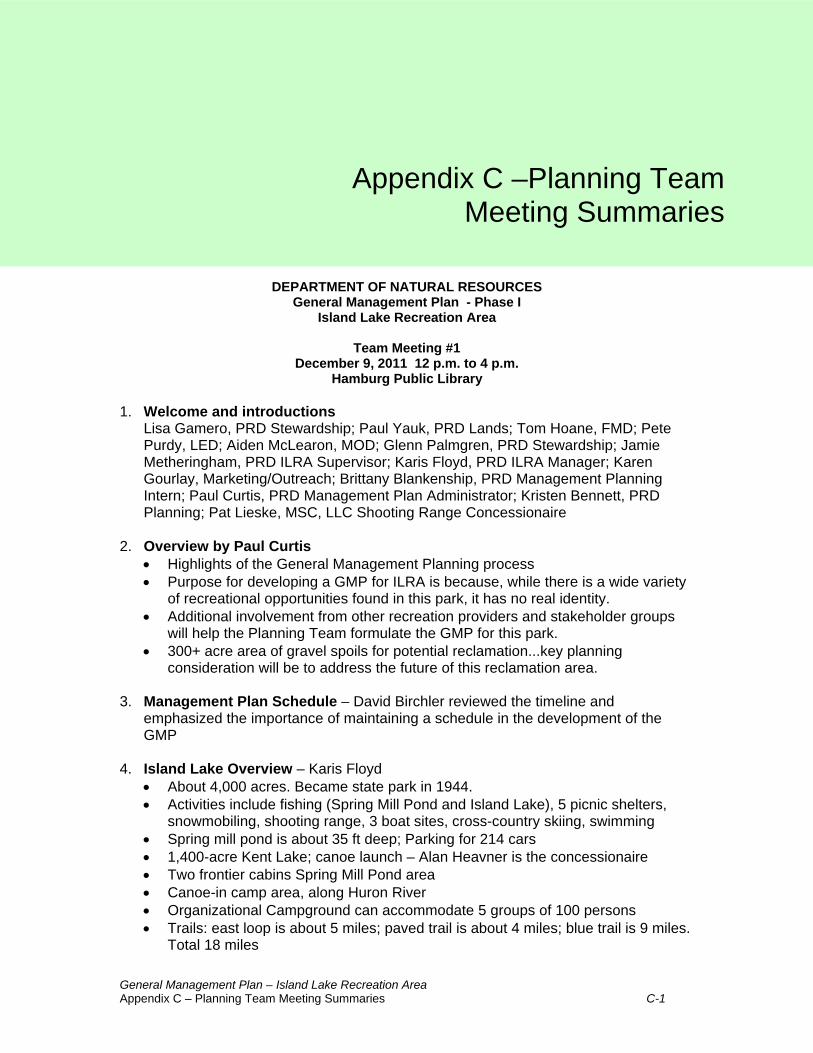
General Management Plan – Island Lake Recreation Area Appendix C – Planning Team Meeting Summaries C-1
DEPARTMENT OF NATURAL RESOURCES General Management Plan - Phase I
Island Lake Recreation Area
Team Meeting #1 December 9, 2011 12 p.m. to 4 p.m.
Hamburg Public Library 1. Welcome and introductions
Lisa Gamero, PRD Stewardship; Paul Yauk, PRD Lands; Tom Hoane, FMD; Pete Purdy, LED; Aiden McLearon, MOD; Glenn Palmgren, PRD Stewardship; Jamie Metheringham, PRD ILRA Supervisor; Karis Floyd, PRD ILRA Manager; Karen Gourlay, Marketing/Outreach; Brittany Blankenship, PRD Management Planning Intern; Paul Curtis, PRD Management Plan Administrator; Kristen Bennett, PRD Planning; Pat Lieske, MSC, LLC Shooting Range Concessionaire
2. Overview by Paul Curtis
• Highlights of the General Management Planning process • Purpose for developing a GMP for ILRA is because, while there is a wide variety
of recreational opportunities found in this park, it has no real identity. • Additional involvement from other recreation providers and stakeholder groups
will help the Planning Team formulate the GMP for this park. • 300+ acre area of gravel spoils for potential reclamation...key planning
consideration will be to address the future of this reclamation area.
3. Management Plan Schedule – David Birchler reviewed the timeline and emphasized the importance of maintaining a schedule in the development of the GMP
4. Island Lake Overview – Karis Floyd
• About 4,000 acres. Became state park in 1944. • Activities include fishing (Spring Mill Pond and Island Lake), 5 picnic shelters,
snowmobiling, shooting range, 3 boat sites, cross-country skiing, swimming • Spring mill pond is about 35 ft deep; Parking for 214 cars • 1,400-acre Kent Lake; canoe launch – Alan Heavner is the concessionaire • Two frontier cabins Spring Mill Pond area • Canoe-in camp area, along Huron River • Organizational Campground can accommodate 5 groups of 100 persons • Trails: east loop is about 5 miles; paved trail is about 4 miles; blue trail is 9 miles.
Total 18 miles
Appendix C –Planning TeamMeeting Summaries

General Management Plan – Island Lake Recreation Area Appendix C – Planning Team Meeting Summaries C-2
• Park revenue/attendance: 2007 - $487,000, 1 million visitors; 2008 - $514,000, 1.3 million visitors; 2009 and 2010 $563,000, 1.1 million visitors ; 2011 $159,000 (Recreation Passport resulted in lower sales at park but higher revenues overall) and 1.4 million visitors
• BAS sites outside the ILRA, but managed by ILRA. - Lake Chemung 312 acres; 27 parking spaces; Woodland Lake 297 acres, 36 ft deep; 36 spaces; Whitmore Lake 678 acres; 47 parking – crappie, large mouth bass, small mouth bass
• More of a “fitness” type park. Lots of mountain bikers (MMBA), many cross-country events.; South Lyon HS uses Island Lake for all cross-country events; Running Fit holds 4 triathlon events annually.
• Park offers kids summer care at Kent Lake unit at old concession building. Kids attend ILRA and go on field trips around the region.
• Many dog walkers, hunters, trappers • No Friends group currently, but one is desired • Regional use: draws from Wayne, Oakland, and Livingston Co. The park is
unique because it serves a large urban area as well as large suburban area population
• Conflicts: some ORV issues on McCabe Road – noticing fencing being removed; some issues with mountain bikers and hikers, due to shared multi-use trails
• Dodge-Unit, some unique historic remnants including the Spanish American War encampment and former hotels associated with popular sports figures of the day
• Hardwoods lend an “up north” feel. • Nicely laid out and well-defined park • One of the safest shooting ranges in Michigan • Chrysler tests vehicles at the gravel area at Spring Mill pond area and provides
the park with two utility vehicles at no charge • Railroad is still active, and runs through the park. • Consider opportunities to improve access to park through additional entries
Stewardship (Glenn Palmgren) • There is a 2003 Stewardship Plan, but much has been done since then • There are many parks in this “interlobate” eco-region area that runs from roughly
Jackson to Lapeer. This area was once dominated by oak savannas and there are many small pockets that can be seen. ILRA has the best opportunity for expansion of the oak savanna and work that is ongoing includes prescribed burns and brush removal.
• Michigan Civilian Conservation Corps (MCCC) is based at ILRA. Many stewardship opportunities and a strong volunteer base in the area
• Some unique wetlands: prairie fen and tamarack swamp • Huron River (a Natural River), and that portion that runs through the park is
managed as a Natural Area • Fires caused by passing trains have burned underbrush, protecting and helping
to restore the oak barrens. • Memorandum of Agreement in place with The Nature Conservancy
Cultural Resources (Lisa Gamero, Stewardship) • Many cultural resources in the park • The whole Huron River, as well as Island Lake and Kensington Lakes would be
considered culturally significant – a cultural resources corridor

General Management Plan – Island Lake Recreation Area Appendix C – Planning Team Meeting Summaries C-3
• While metal detecting is allowed, artifacts must be checked with park manager • Dodge Park No 1 was one of original parcels. Most of the 10 Dodge family parks
have been absorbed into other park systems • Spanish-American War (1898) – the park is home to an encampment where
soldiers were recruited and trained before being sent to Cuba. A 100-year old shooting range is also there (in part of a burn area)
• Known archeological sites, varying from SA War encampment, to Army National Guard encampment & shooting range, scattered prehistoric sites, and old farmsteads and graveyards. On north side of Kensington Lake is the old village of Kensington.
• This was a natural migration route for early settlers, particularly those to migrated west. Grand River is a former Native American trail.
• On behalf of the Stewardship Unit, Lisa provided the following information about the history of ILRA:
• Michigan Writer’s Project – Island Lake Dodge Brothers No. 1 State Parl • 1875 – Green Oak Twp. Plat Map • 22 known archaeological sites in ILRA • Old plat for Village or Town of Kensington • Area history of ILRA • Photos of Camp Eaton at ILRA (1898 Spanish-American War Encampment) • 1997 Historical Site Inventory in Southeast Michigan about ILRA by SHPO • Michigan State Marker about the Spanish American War Regiments in the park • Michigan’s Historic Sites Online – print out of Bingham House, which is the
nearest NRHP and state island site, located two miles south of headquarters area of the park on Silver Lake Rd (South Lyon area).
Interpretation (Karen Gourlay) • Adventure Ranger program was in place in the past, but moved to Proud Lake to
make most of overnight/camping users • Explorer guides are here in the summer, will continue • More regular urban outreach programming this summer 3 days/week. Staff will
spend some time at ILRA and some time at Maybury SP. • There is no joint programming with Kensington Metropark, although in the past
staff used to meet monthly to coordinate • Local recreation authority runs programs in the park
Law Enforcement (Pete Purdy) • Trout Lake, off Kensington Road, sees illicit activity from people who park off
Kensington Road. He suggests that if this area were opened up with a parking lot and properly managed it would make enforcement and public safety easier. There are private industrial roads in the area where people are going to avoid getting a ticket from parking on Kensington Road and to avoid paying entrance fee and using designated entries.
• In the fall, there are user conflicts between hikers, mountain bikers, and hunters. Archery hunters, duck hunters, small game hunters that use the park in fall, mainly October, frequently startle hikers and mountain bikers. Hunters feel hikers should not be in hunting areas as they drive game away. Suggests posting signs that provide details of the variety of hunting seasons.

General Management Plan – Island Lake Recreation Area Appendix C – Planning Team Meeting Summaries C-4
• In winter, park is open for snowmobiling, and patrols check on safety. In this park, users may not realize they still need trail permits and snowmobile registration. Education may help. Suggests posting the snowmobile laws.
• ORV problem from adjacent residential areas and invited friends. People use the industrial roads as parking areas and access the park for ORV use. Fences routinely knocked down. The gravel mining areas are popular places for ORVs year-round. A previous proposal to create an ORV area was unpopular with adjacent communities because of noise concerns. The shopping mall on Lee Road was formerly a very popular ORV scramble area.
• Dodge Unit/SA War training unit. There was reportedly a speakeasy on Island Lake due to its proximity to Grand River Ave (research online in the Livingston Argus)
Shooting Range (Aiden McLearon & Pat Lieske) • Modern shooting range • Issues with noise in the past were resolved through litigation; court ruling favored
State of Michigan. No recent complaints for last 3 years since improvements were completed.
• Shooting range is interested in expanding for educational purposes. Would like to establish an area within park just east of the shooting range for an archery range. A walkthrough archery range may be identified in the future. (noted need to review this with the Natural Rivers Program for potential impact/compatibility)
Real Estate (Paul Yauk, Lands Manager) • Corner piece of property on Lee Road was desired, but purchase fell through and
it became the retail shopping mall • Jim Fackert’s property on southeast parcel, with Huron River access, is still
possibility. Former Friends Group President. • Edward C. Levy Company parcel is of interest to State. Formerly interested in
developing high-end residential, but may be exploring other options. • Paul refers to this area, which runs from Ohio, Jackson to Lake St. Clair, as the
“emerald necklace” due to its rich concentration of minerals. • Discussion ensued about restoration of the former mining area in exchange for
the opportunity to mine on a portion of the current park area. • Another group, LaFave, did mining to the south, redeveloped with million dollar
lots and up to $5 million homes, may be interested in exploring swapping parcels to mine in exchange for restoration.
• Benefits include: restoration of former mining areas, royalties from mining of parcels, return of areas to the public.
• Paul noted that the GMP process will help guide the restoration/redevelopment plans for these areas. Grasslands restoration is one possibility, connecting two lakes is another.
• Active railroad tracks may add to desirability of mining activities in the park • Glenn Palmgren noted that the trains can affect his burns and they must be
carefully timed to the train schedule
Geology (Tom Hoane) • His division writes the leases for mining activities • Ballpark estimate of gravel stockpiles on park lands is 40 million tons...

General Management Plan – Island Lake Recreation Area Appendix C – Planning Team Meeting Summaries C-5
5. Stakeholder list development: The group is asked to consider groups or individuals who should be included. • Glenn Palmgren noted there are active bird watching groups in the area and he
will provide contact information • Long-term volunteers are another significant group of stakeholders • The active rail line and future plans for a high speed rail corridor passenger
station would involve stakeholders to invite 6. Planning Team Meeting #2 dates: The second team meeting will be Wednesday
January 25. The location will be the Southfield DNR office.

General Management Plan – Island Lake Recreation Area Appendix C – Planning Team Meeting Summaries C-6
DEPARTMENT OF NATURAL RESOURCES General Management Plan - Phase I
Island Lake Recreation Area
Team Meeting #2 January 25, 2012 1 p.m.. to 3 p.m.
Southfield DNR Office 1. Attendees
Paul Curtis, PRD Management Planning; Lisa Gamero, PRD Stewardship; Aiden McLearon, MOD; Kristen Bennett, PRD Planning; Karen Gourlay, Marketing/Outreach; Ray Fahlsing, PRD Stewardship; Dave Malloch, Law Enforcement; Jeff Braunscheidel, Fisheries; Karis Floyd, PRD – ILRA; Jamie Merthingham, PRD-ILRA; Glenn Palmgren, PRD Stewardship; Susie Roble and David Birchler from Birchler Arroyo Associates, Inc.
2. Welcome and Summary of ILRA Team Meeting #1
• Lisa has coordinates for 1902- 1903 National Guard Rifle Range to history of the park (unexploded ordinance, probably used during Spanish American War encampment as well)
• Karen will send a photo of a post card of the old dance hall
• Dave provided a summary of the Partners Meeting from 1/20/2012 (attendees and main topics)
3. Statements of Significance Exercise
• David Birchler gave each team member sticky notes upon which they wrote ideas about what is significant about ILRA. Team members shared ideas for significance statements and discussed merits with the full team. Statements were grouped with similar ideas and related to the draft statements on the wall. Statements are listed below and new ideas are coded in red text:
♦ Paul – 1) Mining/reclamation potential of 300+ acres in southern portion of the park; 2) Physically and has potential to be programmatically connected to HCMA; 3) Regional events can be hosted here; 4) Excellent potential for paint ball/zip-line in southern portion of park
♦ Lisa – 1) The park presents an opportunity for interpretation of historic and prehistoric transportation corridors (ex: water, foot trails, railway); 2) The park offers both Michigan history and natural resource education to school groups combined (history/science combo)
♦ Karen – 1) Several active local historical groups; 2) Make educational and interpretive programming year-round rather than seasonal; 3) Park is a good place for multi-skill and location events (ex: swim at Kensington, trail run at Island Lake, bike at Kensington/ILRA)
♦ David – 1) Shooting sport opportunities
♦ Kristen – 1) the park is located at intersection of two major highway corridor, which gives ILRA great visual exposure and provides convenient access to

General Management Plan – Island Lake Recreation Area Appendix C – Planning Team Meeting Summaries C-7
SE Michigan population; 2) Huron River corridor runs full length of park – it’s also managed as a Natural River Corridor and included on the Nature Conservancy Natural Area Registry
♦ Karis – 1) Park is a 30-45 minute drive from several major cities and the park can be accessed via bike/walk; 2) The park is a protected greenspace and has the ability to expand
♦ Aiden – 1) Park provides public hunting opportunities in an area that is well-populated
♦ Ray – 1) Park has the potential to be largest Oak Barrens restoration in the midwest; 2) Waterfowl and land-based hunting opportunities in close proximity to state’s population concentration.
♦ Jamie – 1) A variety of terrain available in one single unit
♦ Jeff – 1) The Spring Mill Pond is one of two waterbodies in the state for adult trout fishing; 2) Shooting range allows for shooting/archery events; 3) ILRA is a single unit
♦ Glenn – 1) Park represents one of the only locations where we could restore natural features of woodlands and the Huron River; 2) The park has large blocks of completely undisturbed land (no trails or development of any kind)
Additional New Ideas:
♦ Land-based recreation opportunities
♦ Water-based recreation opportunities
♦ Local community day use of hiking, biking and school cross-country running
4. Management Zones Brainstorming Exercise
• Team divided into two groups and given 30 x 40 Recreational Resource Opportunity Map of ILRA. Each group drew management zones on the map and then discussed zones with the whole group.
• Team 1 (Kris): 1) scenic overlay on the river; 2) cultural overlay for SA War encampment; 3) Developed Recreation where snowmobiles run
• Team 2 (Glenn): 1) natural River Zone (special) for entire Huron River; 2) Small Developed Recreation zones for the bike staging and Spring Mill Pond; 3) Backcountry for prairie remnant; 4) Grassland habitat potential is very rare – designate as NPR; 5) many cultural sites that deserve individual overlays,
• Kris – ILRA has one of the largest developed recreation areas in the park system. She’d like to error in favor of less-developed designations for much of the remaining area. Also, some type of overnight accommodation is warranted – but not necessarily camping. The accommodation could be a village of cabins overlooking the lake.
Additional Notes -Ray mentioned the possibility of a train station at ILRA – Susie will do some research on this

General Management Plan – Island Lake Recreation Area Appendix C – Planning Team Meeting Summaries C-8
DEPARTMENT OF NATURAL RESOURCES
General Management Plan - Phase I Island Lake Recreation Area
Team Meeting #3
February 15, 2012 11:00 a.m. to 12:30 p.m. Go-To-Meeting
1. Attendees
Paul Curtis, PRD Management Planning; Lisa Gamero, PRD Stewardship; Kristen Bennett, PRD Planning; Karis Floyd, PRD – ILRA Park Manager; Glenn Palmgren, PRD Stewardship; Karen Gourlay, Marketing/Outreach; Sheila Starks, Jill Bahm, Susie Roble and David Birchler from Birchler Arroyo Associates, Inc.
2. Draft Statements of Significance
• Using the team’s comments the list should be pared down to about 6‐8 statements, but the remaining excellent ideas should be saved as a narrative expansion of the statements.
• Birchler Arroyo will post the statements of significance at the stakeholder meeting and provide stakeholder’s the opportunity to determine which statements are most significant as one of the facilitated exercises.
• Following the Team exercise to revise the language of draft significance statements, it was agreed that Birchler Arroyo would revise the Statements of Significance and post on team website.
3. Draft Management Zones. Below is a list of the principal items discussed. Sheila Starks will revise and consolidate the draft management zones to a single map, illustrating all changes discussed during the meeting.
• The several differences between draft management zone maps for Team 1 and Team 2 were discussed in detail:
Area 1 • The area of the historic town and cemetery suggests this entire area should receive a
Cultural Resource Zone Area 2 • Agreement to use Team 2’s Developed Recreation designation for this area. Area 3 • The River Corridor approach suggested by Team 2 was selected. BA will map a Natural
River Corridor Zone (400‐foot wide buffer on either side of Huron River bank). The area would retain an underlying Primitive zone with a Scenic Overlay as well

General Management Plan – Island Lake Recreation Area Appendix C – Planning Team Meeting Summaries C-9
Areas 4, 5 and 6 • Use Team 1 Backcountry designation in order to protect the Oak Barrens remnants • The parking area for mountain biking trailhead needs to be designated Developed
Recreation. • Include Visitors Services Zone to indicate park headquarters Area 7 • Designating this area as Natural Resource Recreation will offer the most flexibility of use
in the future, allowing development following mining restoration. Area 8 • Need to modify western boundary where the current mall is located • This is the shopping mall and should be recommended for removal from the NRC
boundary. If it were feasible, the mall might provide one potential point for a west entrance into ILRA.
Area 9 • Re‐designate History as a Cultural Resource overlay, possibly re‐defining it as an area for
active education and interpretation, and extend it all the way across the railroad tracks to the edge of the lake.
Area 10 • A combination of Team 1 Backcountry (north) and Team 2 Natural Resource Recreation
(south) with Developed Recreation at the boat launch site Area 11 • Designate area around Spring Mill Pond as Developed Recreation, like the Team 1
proposal Area 12 • Change to a Cultural Resource overlay and incorporate the individual locations into a
single, all‐encompassing zone Area 13 • The entire area can be designated Developed Recreation, since the wetlands will dictate
where actual development can occur Area 14 • Region in southern portion of park is designated Natural Resource Recreation for
potential future recreational opportunities
Paul Curtis suggested the Cultural Resource Zone and overlays call for a new definition that includes their suitability for active education and interpretation”. Would also suggest we incorporate historical aspects of the park under the Cultural Resource Overlay Zone. Birchler Arroyo will revise the draft management zone map and post on the team website. Susie Roble will pull Natural River Zone description from Hartwick Pines and/or Rifle River GMP on state website, or Paul Curtis will forward file materials, as appropriate.

General Management Plan – Island Lake Recreation Area Appendix C – Planning Team Meeting Summaries C-10
4. Stakeholders List
• Birchler Arroyo will share a more robust list with the Team on the website – please add to the list or e‐mail us your suggestions.
The Go‐To‐Meeting was concluded at approximately 12:45 PM

General Management Plan – Island Lake Recreation Area Appendix C – Planning Team Meeting Summaries C-11
DEPARTMENT OF NATURAL RESOURCES General Management Plan - Phase I
Island Lake Recreation Area
Team Meeting #4 April 4th from 11 am – 12 pm
Go-To-Meeting 1. Attendees
Paul Curtis, PRD Management Planning; Lisa Gamero, PRD Stewardship; Kristen Bennett, PRD Planning; Glenn Palmgren, PRD Stewardship; Karis Floyd, Park Manager; Susie Roble and David Birchler from Birchler Arroyo Associates, Inc.
2. Review of Statements of Significance Comments
• Statement #1 ‐ Comments refer to Phase 2 action steps
• Statement #2 ‐ Change second sentence to, “The parks’ portion of the Huron River is managed as a Designated State Natural River.” The comment is related to Phase 2.
• Statement #3 – Delete ‘multi‐use’ term – and replace with ‘marked, designated use trails.’ The comments are related to Phase 2.
♦ Designate the paved trail (south of the river) that runs from the mountain biking trail parking lot in the center of the park to Developed Recreation Zone in the eastern portion of the recreation area as Developed Recreation (it is currently designated as Backcountry); show a narrow corridor as Developed Recreation
♦ Designate the entire area inside the mountain bike trail loop (which is currently zoned Primitive) as Backcountry.
• Statement #4 –The comments pertain to Phase 2.
• Statement #5 ‐ Capitalize the ‘G’ in Guides.’ The comments pertain to Phase 2.
• Statement #6 – The comment refers to Phase 2.
• Statement #7 – Change the statement to read, “The park includes a modern shooting range that offers expanded opportunities for educational and recreational purposes.”
• Statement #9 – Change the statement to read, “There is a strong stewardship ethic at Island Lake Recreation Area, carried out by volunteers, the Michigan Civilian Conservation Corps (MCCC) and The Nature Conservancy. The bullet points listed above under Statement #3 pertain to the comment.
Lisa will explore the history of hunting at the Dodge #1 State Recreation Area.
Birchler Arroyo will send public open house doodle poll reminder!