Embed Size (px)
Citation preview

GDTE site Kazu Leja:conceptual model
University of Latvia
Andis Kalvāns, Jānis Bikše, Konrāds Popovs
Nature Conservation Agency, Latvia
Agnese Priede

Conceptual model workflow
Three step process suggested but not mandatory
• Step 1, basic CM for the groundwater body• 1a, qualitative CM• 1b, Quantification of parameters in
the CM
• Step 2, to include risk assessment aspects into the CM• 2a, qualitative description of impacts
(anthropogenic)• 2b, quantitative description of
impacts
• Step 3, to include risk management aspects into the CM• 3a, description of effects of existing
measures• 3b, prediction of effects of existing
and future measures

Step 0: Why Kazu Leja is an important GDTE site?

Location of Kazu Leja
Similar to the borders of Kazu ieleja Nature Monument (protected nature
area of national importance, overlapping with Gauja National Park – Natura
2000 site)

Identified GDTE in Kazu Leja
◆ Petrifying springs with tufa formation:
- wet patches around spring discharges on slopes
- spring waterfalls
◆drained mesic to wet fen grassland on peat soil on the bottom
of the valley

Particular species – what we know for sure (but
maybe there are more)
Rare, protected plant species
Cypripedium
calceolus
In this area, on
slope, not
related to
GDTEs.
Several other
orchids
Largely related
to GDTEs (but
not all of them).
Primula
farinosa
Largely related
to GDTEs
(calcareous
fens).
Stellaria
crassifolia
Largely related
to GDTEs
(spring mires).
Gymnocarpiu
m robertianum
On tufa cliffs
and calcareous
rocky slopes.
Not related to
GDTEs.

Habitats – petrifying springs with tufa formation

Habitats – petrifying springs with tufa formation

Habitats – petrifying springs with tufa formation

Habitats – ponds, pits, fen grassland,
carbonatic rocky slope, slope forests

Habitats – ponds, pits, fen grassland,
carbonatic rocky slope, slope forests
Step 1: Basic conceptual model for groundwater body

Step 1: Conceptual model Kazu Leja
Questions
• The role of the groundwater in Kazu Leja site• What aquifers are feeding the
Kazu Leja site?
• What is the proportion of precipitation, surface runoff and groundwater in the water budget?
• Is there certain traits of water composition particularly important for the biota?

Qualitative conceptual model
• Hydrology
• Geology
• Hydrogeology
• Precipitation and evapotranspiration
• Groundwater discharge• D3pl
• D3am
• D3gj
• Surface catchment
• Groundwater recharge

Catchment area for Kazu Leja site
• Delineated based on digital elevation model (DEM)
• Catchment area 4.7 km2
• Includes agricultural lands, drainage system

Conceptual geological cross-section
D3gj
D2br
D2ar
D3amD3pl
Q3

Close-up for conceptual geological cross-section
1. The valuable GDTE site:Petrifying springs with tufa formation
2. suggested groundwater discharge at the base of the valley, drained mesic to wet fen grassland on peat soil

Quantification of parameters in the CM
• Groundwater table in aquifers• hydrogeological models of
Latvia (PUMA and LAMO)
• Water abstraction sites
= Downward gradient

Step 2: Risk assessment

Step 2: risk assessment
description of impacts
• Spring water interception by individual households
• Distant groundwater extraction: Cēsis, Priekuļi, Jāņmuiža
• Abandoned dolomite quarry near Cēsis
• Land drainage system: flow capture and/or nutrient runoff
• Nutrient and pesticide runoff from intensive farmland

Risk assessment – quantitative description of impacts• Groundwater abstraction
• Spring «interception» by locals
• Dolomite mining (abandoned quarry)
• ??
?

Risk assessment – quantitative description of impacts• Drainage system
• Agriculture - nutrient and pesticide runoff

Step 3: Risk management

Existing risk management measures
Triple-Protected area
• Gauja National Park
• Nature reserve territory
• Geological nature monument
• E.g. Mining not allowed except groundwater for personal usage
• Hydrotechnical infrastructure is not allowed

Next step: Data acquisition

Groundwater monitoring wells
• Groundwater wells:• Level
• Flow direction
• Temperature
• Chemistry
• Stable isotopes
• Development of low cost sensors:• Precise groundwater hydraulic head
measurements
• Temperature measurements at many places
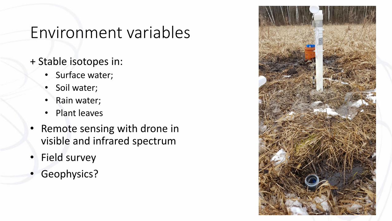
Environment variables
+ Stable isotopes in:• Surface water;
• Soil water;
• Rain water;
• Plant leaves
• Remote sensing with drone in visible and infrared spectrum
• Field survey
• Geophysics?

Field survey:(ground) water mineralization and temperature

Thank you!