Embed Size (px)
Citation preview

Frontier ExplorersTell It Again!™ Read-Aloud Anthology
grad
e 1
Core
Know
ledge
Lang
uage
Arts®
• List
enin
g & Le
arni
ng™
Stra
nd


Frontier ExplorersTell It Again!™ Read-Aloud Anthology
Listening & Learning™ StrandGradE 1
Core Knowledge Language Arts®

Creative Commons LicensingThis work is licensed under a Creative Commons Attribution-NonCommercial-ShareAlike 3.0 Unported License.
You are free:to Share — to copy, distribute and transmit the work to Remix — to adapt the work
Under the following conditions:Attribution — You must attribute the work in the following manner:
This work is based on an original work of the Core Knowledge® Foundation made available through licensing under a Creative Commons Attribution-NonCommercial-ShareAlike 3.0 Unported License. This does not in any way imply that the Core Knowledge Foundation endorses this work.
Noncommercial — You may not use this work for commercial purposes.
Share Alike — If you alter, transform, or build upon this work, you may distribute the resulting work only under the same or similar license to this one.
With the understanding that: For any reuse or distribution, you must make clear to others the license terms of this work. The best way to do this is with a link to this web page:
http://creativecommons.org/licenses/by-nc-sa/3.0/
Copyright © 2013 Core Knowledge Foundation www.coreknowledge.org
All Rights Reserved.
Core Knowledge Language Arts is a trademark of the Core Knowledge Foundation.
Trademarks and trade names are shown in this book strictly for illustrative and educational purposes and are the property of their respective owners. References herein should not be regarded as affecting the validity of said trademarks and trade names.

Table of Contents
Frontier ExplorersTell It again!™ read-aloud anthology
Alignment Chart for Frontier Explorers v
Introduction to Frontier Explorers 1
Lesson 1: Daniel Boone and the Opening of the West 11
Lesson 2: Crossing the Appalachian Mountains 23
Pausing Point 35
Lesson 3: Jefferson and Monroe 38
Lesson 4: The Louisiana Purchase 50
Lesson 5: Lewis and Clark 61
Lesson 6: Lewis and Clark: The Journey Begins 71
Lesson 7: Discovery and Danger on the Prairie 80
Lesson 8: Sacagawea 91
Lesson 9: Red Cedars and Grizzly Bears 102
Lesson 10: Rivers and Mountains 111
Lesson 11: To the Pacific and Back 122
Domain Review 131
Domain Assessment 135
Culminating Activities 138
Appendix 141


Frontier Explorers | Alignment Chart v© 2013 Core Knowledge Foundation
Alignment Chart for Frontier ExplorersThe following chart contains core content objectives addressed in this domain. It also demonstrates alignment between the Common Core State Standards and corresponding Core Knowledge Language Arts (CKLA) goals.
Alignment Chart for Frontier Explorers
Lesson
1 2 3 4 5 6 7 8 9 10 11
Core Content Objectives
Locate the Appalachian Mountains on a map P P
Recall basic facts about Daniel Boone P P
Describe Daniel Boone as a trailblazer P
Identify what the Wilderness Road refers to P
Locate the Mississippi River on a map P P P P P P P P P
Locate the Rocky Mountains on a map P P P P P P P P PExplain why Thomas Jefferson wanted to purchase New Orleans PIdentify and locate the Louisiana Territory on a map P P P P P P P PExplain the significance of the Louisiana Territory and Purchase P P P P P P P PExplain the reasons that Lewis and Clark went on their expedition P P P P P P PExplain that there were many, many Native American tribes living in the Louisiana Territory before the Lewis and Clark expedition
P P P P P P
Recall basic facts about Lewis and Clark’s encounters with Native Americans P P P PExplain why and how Sacagawea helped Lewis and Clark P P

vi Frontier Explorers | Alignment Chart© 2013 Core Knowledge Foundation
Alignment Chart for Frontier Explorers
Lesson
1 2 3 4 5 6 7 8 9 10 11
Reading Standards for Informational Text: Grade 1Key Ideas and Details
STD RI.1.1 Ask and answer questions about key details in a text.
CKLA
Goal(s)
Ask and answer questions (e.g., who, what, where, when), orally or in writing, requiring literal recall and understanding of the details and/or facts of a nonfiction/informational read-aloud
P
Answer questions that require making interpretations, judgments, or giving opinions about what is heard in a nonfiction/informational read-aloud, including answering why questions that require recognizing cause/effect relationships
P
STD RI.1.3 Describe the connection between two individuals, events, ideas, or pieces of information in a text.
CKLA
Goal(s)
Describe the connection between two individuals, events, ideas, or pieces of information in a nonfiction/informational read-aloud
P
Craft and Structure
STD RI.1.4 Ask and answer questions to help determine or clarify the meaning of words and phrases in a text.
CKLA
Goal(s)
Ask and answer questions about unknown words and phrases in nonfiction/informational read-alouds and discussions
P
STD RI.1.6Distinguish between information provided by pictures or other illustrations and information provided by the words in a text.
CKLA
Goal(s)
Distinguish between information provided by pictures or other illustrations and information provided by the words in a nonfiction/informational read-aloud
P P

Frontier Explorers | Alignment Chart vii© 2013 Core Knowledge Foundation
Alignment Chart for Frontier Explorers
Lesson
1 2 3 4 5 6 7 8 9 10 11
Integration of Knowledge and Ideas
STD RI.1.7 Use the illustrations and details in a text to describe its key ideas.
CKLA
Goal(s)
Use illustrations and details in a nonfiction/informational read-aloud to describe its key ideas P
STD RI.1.9Identify basic similarities in and differences between two texts on the same topic (e.g., in illustrations, descriptions, or procedures).
CKLA
Goal(s)
Compare and contrast (orally or in writing) similarities and differences within a single nonfiction/informational read-aloud or between two or more nonfiction/informational read-alouds
P P
Range of Reading and Level of Text Complexity
STD RI.1.10 With prompting and support, read informational texts appropriately complex for Grade 1.
CKLA
Goal(s)
Listen to and demonstrate understanding of nonfiction/informational read-alouds of appropriate complexity for Grades 1–3
P
Writing Standards: Grade 1Text Types and Purposes
STD W.1.1Write opinion pieces in which they introduce the topic or name the book they are writing about, state an opinion, supply a reason for the opinion, and provide some sense of closure.
CKLA
Goal(s)
Write opinion pieces in which they introduce the topic or name the book they are writing about, state an opinion, supply a reason for the opinion, and provide some sense of closure
P P
Production and Distribution of Writing
STD W.1.5With guidance and support from adults, focus on a topic, respond to questions and suggestions from peers, and add details to strengthen writing as needed.
CKLA
Goal(s)
With guidance and support from adults, focus on a topic, respond to questions and suggestions from peers, and add details to strengthen writing as needed
P

viii Frontier Explorers | Alignment Chart© 2013 Core Knowledge Foundation
Alignment Chart for Frontier Explorers
Lesson
1 2 3 4 5 6 7 8 9 10 11
Research to Build and Present Knowledge
STD W.1.8With guidance and support from adults, recall information from experiences or gather information from provided sources to answer a question.
CKLA
Goal(s)
Make personal connections (orally or in writing) to events or experiences in a fiction or nonfiction/informational read-aloud, and/or make connections among several read-alouds
P P P
With assistance, categorize and organize facts and information within a given domain to answer questions
P P P
Speaking and Listening Standards: Grade 1Comprehension and Collaboration
STD SL.1.1Participate in collaborative conversations with diverse partners about Grade 1 topics and texts with peers and adults in small and large groups.
STD SL.1.1aFollow agreed-upon rules for discussions (e.g., listening to others with care, speaking one at a time about the topics and texts under discussion).
CKLA
Goal(s)
Use agreed-upon rules for group discussion, e.g., look at and listen to the speaker, raise hand to speak, take turns, say “excuse me” or “please,” etc.
PSTD SL.1.1b Build on others’ talk in conversations by responding to the comments of others through multiple exchanges.
CKLA
Goal(s)
Carry on and participate in a conversation over at least six turns, staying on topic, initiating comments or responding to a partner’s comments, with either an adult or another child of the same age
P
STD SL.1.1c Ask questions to clear up any confusion about the topics and texts under discussion.
CKLA
Goal(s)
Ask questions to clarify information about the topic in a fiction or nonfiction/informational read-aloud
P

Frontier Explorers | Alignment Chart ix© 2013 Core Knowledge Foundation
Alignment Chart for Frontier Explorers
Lesson
1 2 3 4 5 6 7 8 9 10 11
STD SL.1.2Ask and answer questions about key details in a text read aloud or information presented orally or through other media.
CKLA
Goal(s)
Ask and answer questions (e.g., who, what, where, when), orally or in writing, requiring literal recall and understanding of the details, and/or facts of a fiction or nonfiction/informational read-aloud
P P P P P
Presentation of Knowledge and Ideas
STD SL.1.4 Describe people, places, things, and events with relevant details, expressing ideas and feelings clearly.
CKLA
Goal(s)
Describe people, places, things, and events with relevant details, expressing ideas and feelings clearly
P P P
STD SL.1.5 Add drawings or other visual displays to descriptions when appropriate to clarify ideas, thoughts, and feelings.
CKLA
Goal(s)
Add drawings or other visual displays to oral or written descriptions when appropriate to clarify ideas, thoughts, and feelings
P P P
STD SL.1.6 Produce complete sentences when appropriate to task and situation.
CKLA
Goal(s)
Produce complete sentences when appropriate to task and situation P
Language Standards: Grade 1Vocabulary Acquisition and Use
STD L.1.5With guidance and support from adults, demonstrate understanding of word relationships and nuances in word meanings.
STD L.1.5a Sort words into categories (e.g., colors, clothing) to gain a sense of the concepts the categories represent.
CKLA
Goal(s)Provide examples of common synonyms and antonyms P
STD L.1.5c Identify real-life connections between words and their use (e.g., note places at home that are cozy).
CKLA
Goal(s)
Identify real-life connections between words and their use (e.g., note places at home that are cozy)
P

x Frontier Explorers | Alignment Chart© 2013 Core Knowledge Foundation
Alignment Chart for Frontier Explorers
Lesson
1 2 3 4 5 6 7 8 9 10 11
STD L.1.6Use words and phrases acquired through conversations, reading and being read to, and responding to texts, including using frequently occurring conjunctions to signal simple relationships (e.g., because).
CKLA
Goal(s)
Learn the meaning of common sayings and phrases P
Use words and phrases acquired through conversations, reading and being read to, and responding to texts, including using frequently occurring conjunctions to signal simple relationships (e.g., because)
P
Additional CKLA GoalsPrior to listening to a read-aloud, identify orally what students have learned about a given topic PShare writing with others P P P P P P P
Make predictions (orally or in writing) prior to a read-aloud, based on the title, pictures, and/or text heard thus far, and then compare the actual outcomes to predictions
P
Identify new meanings for familiar words and apply them accurately P P
Identify declarative, interrogative, and exclamatory sentences orally in response to prompts
P
Evaluate and select read-alouds on the basic of personal choice for rereading P
99These goals are addressed in all lessons in this domain. Rather than repeat these goals as lesson objectives throughout the domain, they are designated here as frequently occurring goals.

Frontier Explorers | Introduction 1© 2013 Core Knowledge Foundation
This introduction includes the necessary background information to be used in teaching the Frontier Explorers domain. The Tell It Again! Read-Aloud Anthology for Frontier Explorers contains eleven daily lessons, each of which is composed of two distinct parts, so that the lesson may be divided into smaller chunks of time and presented at different intervals during the day. The entire lesson will require a total of sixty minutes.
This domain includes a Pausing Point following Lesson 2. At the end of the domain, a Domain Review, a Domain Assessment, and Culminating Activities are included to allow time to review, reinforce, assess, and remediate content knowledge. You should spend no more than fifteen days total on this domain.
Week One
Day 1 # Day 2 # Day 3 # Day 4 Day 5 #
Lesson 1A: “Daniel Boone and the Opening of the West” (40 min.)
Lesson 2A: “Crossing the Appalachian Mountains” (40 min.)
Pausing Point (40 min.) Lesson 3A: “Jefferson and Monroe” (40 min.)
Lesson 4A: “The Louisiana Purchase” (40 min.)
Lesson 1B: Extensions (20 min.)
Lesson 2B: Extensions (20 min.)
Pausing Point (20 min.) Lesson 3B: Extensions (20 min.)
Lesson 4B: Extensions (20 min.)
60 min. 60 min. 60 min. 60 min. 60 min.
Week Two
Day 6 # Day 7 Day 8 Day 9 Day 10 #
Lesson 5A: “Lewis and Clark” (40 min.)
Lesson 6A: “Lewis and Clark: The Journey Begins” (40 min.)
Lesson 7A: “Discovery and Danger on the Prairie” (40 min.)
Lesson 8A: “Sacagawea” (40 min.)
Lesson 9A: “Red Cedars and Grizzly Bears” (40 min.)
Lesson 5B: Extensions (20 min.)
Lesson 6B: Extensions (20 min.)
Lesson 7B: Extensions (20 min.)
Lesson 8B: Extensions (20 min.)
Lesson 9B: Extensions (20 min.)
60 min. 60 min. 60 min. 60 min. 60 min.
Week Three
Day 11 Day 12 Day 13 # Day 14 Day 15 #
Lesson 10A: “Rivers and Mountains” (40 min.)
Lesson 11A: “To the Pacific and Back” (40 min.)
Domain Review (40 min.) Domain Assessment (40 min.)
Culminating Activities (40 min.)
Lesson 10B: Extensions (20 min.)
Lesson 11B: Extensions (20 min.)
Domain Review (20 min.) Domain Assessment (20 min.)
Culminating Activities (20 min.)
60 min. 60 min. 60 min. 60 min. 60 min.
9Lessons include Student Performance Task Assessments
# Lessons require advance preparation and/or additional materials; please plan ahead
Introduction to Frontier Explorers
2 Frontier Explorers | Introduction© 2013 Core Knowledge Foundation
Domain ComponentsAlong with this Anthology, you will need:
• Tell It Again! Media Disk or the Tell It Again! Flip Book* for Frontier Explorers
• Tell It Again! Image Cards for Frontier Explorers
• Tell It Again! Supplemental Guide for Frontier Explorers
*The Tell It Again! Multiple Meaning Word Posters for Frontier Explorers are found at the back of the Tell It Again! Flip Book.
Recommended Resource:
• Core Knowledge Grade 1 Teacher Handbook, edited by E. D. Hirsch, Jr. and Souzanne A. Wright (Core Knowledge Foundation, 2004) ISBN: 978-1890517700
Why Frontier Explorers Are Important In this domain, students will learn about the American frontier and the explorers that played an important role in the westward expansion of the United States. Students will be introduced to key people and events that played a role in the early westward expansion of the United States.
The overriding focus of this domain is to emphasize the story of the westward expansion of the United States. While students will hear about many people, events, and dates, it is important to recognize that Grade 1 students are not expected to master or recall all of these details and facts. Some specifics are, of course, necessary so that students can understand and retell the story of the westward expansion of the United States. The details that Grade 1 students should be able to recall are explicitly identified in the Core Content Objectives that follow. Other factual information is incorporated to accurately tell and expose students to the complete “story.” Keep in mind that students in Core Knowledge schools will study this topic further in later grade levels.
Students will first review the development of the thirteen colonies and the Revolutionary War. They will hear how the first English colonists settled along the coast of the Atlantic Ocean. As
Frontier Explorers | Introduction 3© 2013 Core Knowledge Foundation
more people migrated to the colonies, and by the time of the Revolutionary War, the line of the frontier moved all the way to the Appalachian Mountains. Students will learn that the Appalachian Mountains were difficult to traverse and acted as a barrier to the colonists who wanted to settle farther west. Students will be introduced to Daniel Boone and the role he played in westward expansion, specifically his role in the creation of the Wilderness Road.
After hearing about Daniel Boone and the Wilderness Road, students will then hear about the presidency of Thomas Jefferson. Students will learn about how Jefferson enabled the purchase of the Louisiana Territory from France, moving the line of the frontier all the way to the Rocky Mountains. Students will hear about Lewis and Clark’s explorations of the Louisiana Territory and about the three reasons why President Jefferson commissioned the exploration of the new land. (to find an all-water route from the Mississippi River to the Pacific Ocean; to make contact with various Native American tribes; and to record the geography and the wildlife of the Louisiana Territory) Students will also be introduced to Sacagawea and her role in the expedition. By the end of the domain, students should have a good understanding of the concept of westward expansion and how it contributed to the growth of the United States, as well as the key people involved.
Understanding the chronology of events and people in the westward expansion of the United States will lay the foundation for other historical topics, including coverage of 19th-century westward expansion in later grades.
4 Frontier Explorers | Introduction© 2013 Core Knowledge Foundation
What Students Have Already Learned in Core Knowledge Language Arts During Kindergarten
The following domains, and the specific core content that was targeted in those domains, are particularly relevant to the read-alouds students will hear in Frontier Explorers. This background knowledge will greatly enhance your students’ understanding of the read-alouds they are about to enjoy:
Native Americans
• Recall that Native Americans were the first inhabitants of North America
• Explain that there are many tribes of Native Americans
• Identify the environment in which the Sioux lived
• Identify the Sioux as a nomadic tribe
• Describe the food, clothing, and shelter of the Sioux
• Explain the importance of the buffalo to the Sioux
• Identify the environment in which the Wampanoag lived
• Explain how the Wampanoag tribe lived
• Identify the Wampanoag as a settled tribe
• Describe the food, clothing, and shelter of the Wampanoag
• Explain that Native Americans still live in the United States today
Kings and Queens
• Describe what a king or queen does
Columbus and Pilgrims
• Identify the continents of North America, South America, Europe, Africa, and Asia
• Explain why Europeans wanted to travel to Asia
• Describe the accomplishments of Christopher Columbus
• Recall the year of Columbus’s first voyage to America: 1492
• Explain why Columbus called the land “India” and the inhabitants “Indians”

Frontier Explorers | Introduction 5© 2013 Core Knowledge Foundation
• Explain why Europeans eventually thought Columbus had discovered a “New World”
• Identify reasons why the Pilgrims left England
• Describe the Pilgrims’ voyage on the Mayflower
• Explain the significance of Plymouth Rock
• Describe the Pilgrims’ first year in America
• Describe the first Thanksgiving Day celebration
Colonial Towns and Townspeople
• Describe some features of colonial towns, such as a town square, shops, and adjacent buildings
Presidents and American Symbols
• Describe the differences between a president and a king
• Recognize Thomas Jefferson as the third president of the United States
• Identify Thomas Jefferson as the primary author of the Declaration of Independence
• Describe the purpose of the Declaration of Independence as a statement of America’s liberty

6 Frontier Explorers | Introduction© 2013 Core Knowledge Foundation
Core Vocabulary for Frontier ExplorersThe following list contains all of the core vocabulary words in Frontier Explorers in the forms in which they appear in the read-alouds, or in some instances, in the “Introducing the Read-Aloud” section at the beginning of the lesson. Boldfaced words on the list have an associated Word Work activity. The inclusion of the words on this list does not mean that students are immediately expected to be able to use all of these words on their own. However, through repeated exposure throughout the lessons, they should acquire a good understanding of most of these words and begin to use some of them in conversation.
Lesson 1barrier
claimed
settlements
woodsmen
Lesson 2passes
pioneers
trailblazer
wilderness
Lesson 3emperor
intelligent
loyal
mouth
Lesson 4brilliant
clever
mansion
purchase
territory
Lesson 5assistant
brave
co-captain
Lesson 6communicate
diary
expedition
shelters
survive
Lesson 7fascinated
guided
honored
prairie
Lesson 8permanent
plunged
protection
skilled
translate
Lesson 9hibernated
journals
overturned
record
toppled
Lesson 10confidently
dull
sign language
waterfall
Lesson 11canyons
communities
contentment
current
steered

Frontier Explorers | Introduction 7© 2013 Core Knowledge Foundation
Student Performance Task AssessmentsIn the Tell It Again! Read-Aloud Anthology for Frontier Explorers, there are numerous opportunities to assess students’ learning. These assessment opportunities range from informal observations, such as Think Pair Share and some Extension activities, to more formal written assessments. These Student Performance Task Assessments (SPTA) are identified in the Tell It Again! Read-Aloud Anthology with this icon: . There is also an end-of-domain summative assessment. Use the Tens Conversion Chart located in the Appendix to convert a raw score on each SPTA into a Tens score. On the same page, you will also find the rubric for recording observational Tens Scores.
Above and BeyondIn the Tell It Again! Read-Aloud Anthology for Frontier Explorers, there are numerous opportunities in the lessons and the Pausing Point to challenge students who are ready to attempt activities that are above grade-level. These activities are labeled “Above and Beyond” and are identified with this icon: ➶.
Supplemental GuideAccompanying the Tell It Again! Read-Aloud Anthology is a Supplemental Guide designed to assist education professionals who serve students with limited English language skills or students with limited home literacy experience, which may include English Language Learners (ELLs) and children with special needs. Teachers whose students would benefit from enhanced oral language practice may opt to use the Supplemental Guide as their primary guide in the Listening & Learning strand. Teachers may also choose to begin a domain by using the Supplemental Guide as their primary guide before transitioning to the Tell It Again! Read-Aloud Anthology, or may choose individual activities from the Supplemental Guide to augment the content covered in the Tell It Again! Read-Aloud Anthology.
The Supplemental Guide activities that may be particularly relevant to any classroom are the Multiple Meaning Word Activities and

8 Frontier Explorers | Introduction© 2013 Core Knowledge Foundation
accompanying Multiple Meaning Word Posters, which help students determine and clarify different meanings of words; Syntactic Awareness Activities, which call students’ attention to sentence structure, word order, and grammar; and Vocabulary Instructional Activities, which place importance on building students’ general academic, or Tier 2 vocabulary. These activities afford all students additional opportunities to acquire a richer understanding of the English language. Several of these activities have been included as Extensions in the Tell It Again! Read-Aloud Anthology. In addition, several words in the Tell It Again! Read-Aloud Anthology are underlined, indicating that they are multiple meaning words. The accompanying sidebars explain some of the more common alternate meanings of these words. Supplemental Guide activities included in the Tell It Again! Read-Aloud Anthology are identified with this icon: .
Recommended Resources for Frontier Explorers
Trade Book List
The Tell It Again! Read-Aloud Anthology includes a number of opportunities in Extensions, the Pausing Point, and the Domain Review for teachers to select trade books from this list to reinforce domain concepts through the use of authentic literature. In addition, teachers should consider other times throughout the day when they might infuse authentic domain-related literature. If you recommend that families read aloud with their child each night, you may wish to suggest that they choose titles from this trade book list to reinforce the domain concepts. You might also consider creating a classroom lending library, allowing students to borrow domain-related books to read at home with their families.
1. Bewildered for Three Days As to Why Daniel Boone Never Wore His Coonskin Cap, by Andrew Glass (Holiday House, 2000) ISBN 978-0823414468*
2. Exploring the West, edited by E. D. Hirsch, Jr. (Pearson Learning, 2002) ISBN 978-0769050119
3. Ghost Town at Sundown (Magic Tree House, #10), by Mary Pope Osborne (Random House Books for Young Readers, 1997) ISBN 978-0679883395

Frontier Explorers | Introduction 9© 2013 Core Knowledge Foundation
4. I Am: Sacagawea, by Grace Norwich and illustrated by Anthony Vanarsdale (Scholastic Paperbacks, 2012) ISBN 978-0545405744
5. The Legend of Daniel Boone, by Eric Blair and illustrated by Micah Chambers-Goldberg (Picture Window Books, 2005) ISBN 978-1404809741
6. Lewis and Clark, by Lisa Wade McCormick (Scholastic Inc., 2006) ISBN 978-0516214436
7. Lewis and Clark: A Prairie Dog for the President, by Shirley Raye Redmond (Random House, 2003) ISBN 978-0375811203
8. Lewis and Clark: Explorers of the American West, by Steven Kroll (Holiday House, 1996) ISBN 978-0823412730
9. Lewis and Clark for Kids: Their Journey of Discovery with 21 Activities, by Janis Herbert (Chicago Review Press, 2000) ISBN 978-1556523748
10. The Mississippi River, by Allan Fowler (Children’s Press, 2000) ISBN 978-0516265568
11. A Picture Book of Davy Crockett, by David A. Adler and illustrated by John and Alexandra Wallner (Holiday House, 1996) ISBN 978-0823412129
12. A Picture Book of Sacagawea, by David A. Adler and illustrated by Dan Brown (Holiday House, 2000) ISBN 978-0823414857
13. Postcards from William, by Betty Southard Stokes and illustrated by Emry Quinn (Harmony House Publishers, 2006) ISBN 978-1564692023
14. Sacagawea, by Jan Gleiter and Kathleen Thompson and illustrated by Yoshi Miyake (Raintree/Steck-Vaughn, 1998) ISBN 978-0817268893
15. Seaman’s Journal: On the Trail with Lewis and Clark, by Patricia Reeder Eubank (Ideals Children’s Books, 2002) ISBN 978-0824954420
16. Who Was Daniel Boone?, by Sydelle Kramer and illustrated by George Ulrich (Grosset and Dunlap, 2006) ISBN 978-0448439020
*This book may be better for one-on-one reading.

10 Frontier Explorers | Introduction© 2013 Core Knowledge Foundation
Websites and Other Resources
Teacher Resources
1. Lewis and Clark http://www.archives.gov/education/lessons/lewis-clark/
2. Louisiana Purchase http://www.learner.org/interactives/historymap/states_louisiana.html
3. Thomas Jefferson and the Louisiana Purchase http://www.loc.gov/exhibits/jefferson/jeffwest.html
4. Journals of Lewis and Clark http://www.lewisandclarkjournals.unl.edu/index.html

Frontier Explorers 1 | Daniel Boone and the Opening of the West 11© 2013 Core Knowledge Foundation
; Lesson Objectives
Core Content Objectives:
Students will:
9 Locate the Appalachian Mountains on a map
9 Recall basic facts about Daniel Boone
Language Arts Objectives
The following language arts objectives are addressed in this lesson. Objectives aligning with the Common Core State Standards are noted with the corresponding standard in parentheses. Refer to the Alignment Chart for additional standards addressed in all lessons in this domain.
Students will:
9 Describe the connection between the Appalachian Mountains and the settlers’ inability to move west (RI.1.3)
9With assistance, create and interpret a timeline of the settlement of North America (W.1.8)
9 Describe how a woodsman survives with relevant details, expressing ideas and feelings clearly (SL.1.4)
9 Add a drawing of a woodsman to a written description of how woodsmen survive to clarify ideas, thoughts, and feelings (SL.1.5)
9 Share writing with others
Core Vocabularybarrier, n. Something that prevents or blocks movement from one place
to anotherExample: The Appalachian Mountains were a natural barrier to moving west.Variation(s): barriers
Daniel Boone and the Opening of the West 1

12 Frontier Explorers 1 | Daniel Boone and the Opening of the West© 2013 Core Knowledge Foundation
claimed, v. To say something belongs to you, even if others might not agreeExample: Thomas claimed the basketball was his, even though it did not have his name written on it.Variation(s): claim, claims, claiming
settlements, n. Places where people make their homes, often in new areasExample: The families decided to leave their homes in Europe and move to the settlements in America.Variation(s): settlement
woodsmen, n. People who live or work in the forestExample: The woodsmen were able to build shelters out of tree branches.Variation(s): woodsman
At a Glance Exercise Materials Minutes
Introducing the Read-Aloud
Domain Introduction U.S. map
10Timeline
Image Cards 1–4; chart paper, chalkboard,
whiteboard; world map or globe
Purpose for Listening
Presenting the Read-Aloud Daniel Boone and the Opening of the West U.S. map 15
Discussing the Read-AloudComprehension Questions 10
Word Work: Woodsmen drawing paper, drawing tools 5
Complete Remainder of the Lesson Later in the Day
ExtensionsTimeline Image Card 5;
timeline20
The Appalachian Mountains Instructional Master 1B-1; crayons
Take-Home Material Family Letter Instructional Masters 1B-2 and 1B-3
*

Frontier Explorers 1A | Daniel Boone and the Opening of the West 13© 2013 Core Knowledge Foundation
Introducing the Read-Aloud 10 minutes
Domain IntroductionReview with students details about where they live. Point to the appropriate location on a U.S. map as you review the following:
• You live in (your city).
• (Your city) is in (your state).
• (Your state) is the country of the United States of America.
Explain to students that there has not always been a country known as the United States of America. Remind students that Native Americans were the first known people to live in North America, and that European settlers did not originally live in North America. Tell them that long ago the United States was much smaller than it is today. Explain to students that for a time, European settlers only lived on the east coast of what is now the United States. Point to the east coast area of the United States, from the Appalachian Mountains to the Atlantic Ocean.
Tell them that for the next several days they will be learning about how the United States grew in size and how this growth affected Native Americans, settlers, and the landscape.
Timeline
Note: The intent of this first lesson is to review information that students have previously learned in the Core Knowledge Language Arts program. This knowledge provides the foundation for subsequent lessons in this domain. In the timeline activity, students are asked to recall what they may have learned in Kindergarten about Native Americans, Columbus, and the Pilgrims. In this activity, it is not necessary to provide an exhaustive review of each of these topics. Rather, the purpose is to orient students
Daniel Boone and the Opening of the West 1A

14 Frontier Explorers 1A | Daniel Boone and the Opening of the West© 2013 Core Knowledge Foundation
to the topics that will be addressed in the read-aloud.
Create a timeline similar to the one shown below on a large piece of chart paper, a chalkboard, or a whiteboard.
Image Card 1: Native
Americans
Image Card 2: Columbus
Image Card 3: a Pilgrim
Leave blank for after the Read-Aloud
Image Card 4: Declaration of Independence
Remind students that in the Kindergarten Core Knowledge Language Arts program, they learned about the very first people who lived in North America, the Native Americans. Tell students that you are going to place an Image Card of Native Americans (Image Card 1) at the left end of the timeline to help them remember that Native Americans were the first people known to live in North America. Ask students to share what they remember about Native Americans.
Next, remind students that in Kindergarten they also learned about a European explorer named Columbus who traveled by ship to the continent of North America. Use a world map or globe to point out Europe and the general transatlantic route taken by Columbus sailing to North America. Ask students to share what they remember about Columbus’s travels. Tell them that you are going to place an Image Card of Columbus (Image Card 2) on the timeline to show that he came to North America after the Native Americans had been living there for many, many years.
Now explain to students that after Columbus’s voyages, more and more groups of people from various countries in Europe decided to make the trip across the Atlantic Ocean to explore North America. Remind students that one of these groups was the Pilgrims who came from England and landed at Plymouth Rock, along the east coast of North America. Use a world map or globe to point out the approximate location of the Pilgrims’ landing in Massachusetts. Ask students to share what they remember about the Pilgrims. Tell students that you are going to place an Image Card of Pilgrims (Image Card 3) on the timeline to show that the Pilgrims came to America after Columbus.
Review with students that, as they learned in A New Nation:

Frontier Explorers 1A | Daniel Boone and the Opening of the West 15© 2013 Core Knowledge Foundation
American Independence, more and more people came over from Europe after Columbus and formed colonies. Remind students that before the United States became a country, there were thirteen colonies that were ruled by the British king and government. These colonies displaced many of the Native Americans already living in the area, and forced them to leave their homes and move west. Remind students that the thirteen colonies decided they wanted to declare themselves a free and independent nation and that Thomas Jefferson was asked to write the Declaration of Independence. Tell students that you are going to place an Image Card of the Declaration of Independence (Image Card 4) on the timeline to remind them that the colonists declared independence from Great Britain, which resulted in the Revolutionary War.
Purpose for Listening
Explain to students that in today’s read-aloud, they will briefly review what they have already learned about the early history of the United States and the people who lived there. Tell them that they will also hear about one of the first explorers of the American West, Daniel Boone. Tell students to listen carefully to find out about one of the difficulties or challenges faced by Daniel Boone and other people who wanted to move west.

16 Frontier Explorers 1A | Daniel Boone and the Opening of the West© 2013 Core Knowledge Foundation
Presenting the Read-Aloud 15 minutes
Daniel Boone and the Opening of the West § Show image 1A-1: Map of North America with country and state lines
Today, people from all over the world live together in
communities from one end of the North American continent to the
other—from the Atlantic Ocean in the east, to the Pacific Ocean in
the west, and everywhere in between. 1 This map of North America
shows the United States in green. You can see lots of thin white
lines outlining the states that make up our country, the United
States of America. However, hundreds of years ago the map of the
United States was much smaller than it is today.
§ Show image 1A-2: Native Americans
Long, long ago, the only people who lived on the continent of
North America were people known as Native Americans. Native
Americans have lived in North America for thousands of years.
Native Americans lived in both seasonal and permanent villages.
They used great knowledge of the land and its resources to survive.
§ Show image 1A-3: World map
At the same time, far away on the other side of the ocean, many
other people had their own towns and villages. These people lived
on the continent of Europe and were known as Europeans. 2 About
six hundred years ago, Europeans began to leave their lands and
sail to other parts of the world, seeking spices, gold, and other
riches. Some of these explorers arrived in North America. 3
§ Show image 1A-4: Europeans and Native Americans
Imagine how surprised Native Americans and Europeans must
have been to see each other: people who looked, dressed, and
spoke very differently from themselves. 4
The early explorers who came to North America were mostly
interested in finding goods and riches that they could take back to
Europe to sell. Many of these explorers learned vital skills from the
1 [Point to North America as you talk about it, emphasizing that the Atlantic Ocean is to the east and the Pacific Ocean is to the west ]
2 [Point to Europe as you talk about it ]
3 [Point to North America again, and ask students if they can name one of the first European explorers to visit North America ]
4 Here, the word spoke means talked The word spoke also means one of the bars that connect the center of a wheel to its rim, like in a wagon wheel or bicycle wheel

Frontier Explorers 1A | Daniel Boone and the Opening of the West 17© 2013 Core Knowledge Foundation
Native Americans. 5 The Native Americans knew the land very well.
They taught the Europeans many skills, including hunting, fishing,
gathering, and farming. In exchange for their help, Europeans
brought things to trade with the Native Americans, such as cloth.
For many years Europeans traveled back and forth across the
Atlantic Ocean. 6
§ Show image 1A-5: Native Americans helping settlers survive
Most Europeans were content to just trade with the Native
Americans, but others became interested in starting settlements,
because they wanted to live on the continent as well. 7 The English
started two early settlements in North America in the 1600s—
Plymouth, in what is now Massachusetts, and Jamestown, in
what is now Virginia. 8 At first, the Native Americans helped them
survive. Do you remember how at Plymouth they celebrated their
harvest together, the first Thanksgiving in America? The Europeans
would not have been able to grow the corn and squash for that
meal without help from the Native Americans.
§ Show image 1A-6: English settlements and Native American communities
As time passed, more and more Europeans arrived to start
settlements in North America, even though Native Americans had
already been living in their own communities on that same land.
Fights over the land began to erupt, as each group refused to
share the land. The settlers claimed most of the land on the east
coast of North America—land where the Native Americans had
lived for many years. 9 The British formed colonies, or settlements
ruled by far-away Great Britain, from Massachusetts all the way to
Georgia. 10
Eventually, some of the more adventuresome settlers wanted
to explore land to the west of them. One of these people was a
young man by the name of Daniel Boone.
5 Vital skills are crucial or extremely important to someone’s survival
8 [Show students the approximate locations of Plymouth and Jamestown on a U S map ]
6 [Have students trace the paths of trading ships across the Atlantic Ocean on the map or in the air with their fingers ]
9 The word claimed means that the English said the land belonged to them, even though the Native Americans have been living on that land for thousands of years
10 [Help students locate the east coast, from Massachusetts to Georgia, on a map ]
7 Settlements are places where people make their homes in a new land
18 Frontier Explorers 1A | Daniel Boone and the Opening of the West© 2013 Core Knowledge Foundation
§ Show image 1A-7: Portrait of Daniel Boone
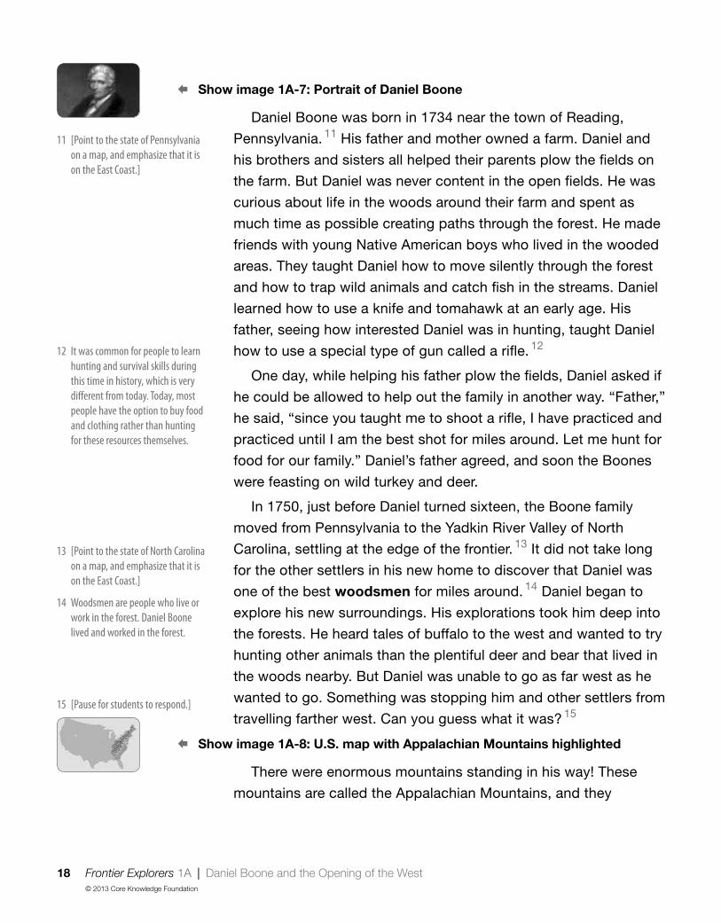
Daniel Boone was born in 1734 near the town of Reading,
Pennsylvania. 11 His father and mother owned a farm. Daniel and
his brothers and sisters all helped their parents plow the fields on
the farm. But Daniel was never content in the open fields. He was
curious about life in the woods around their farm and spent as
much time as possible creating paths through the forest. He made
friends with young Native American boys who lived in the wooded
areas. They taught Daniel how to move silently through the forest
and how to trap wild animals and catch fish in the streams. Daniel
learned how to use a knife and tomahawk at an early age. His
father, seeing how interested Daniel was in hunting, taught Daniel
how to use a special type of gun called a rifle. 12
One day, while helping his father plow the fields, Daniel asked if
he could be allowed to help out the family in another way. “Father,”
he said, “since you taught me to shoot a rifle, I have practiced and
practiced until I am the best shot for miles around. Let me hunt for
food for our family.” Daniel’s father agreed, and soon the Boones
were feasting on wild turkey and deer.
In 1750, just before Daniel turned sixteen, the Boone family
moved from Pennsylvania to the Yadkin River Valley of North
Carolina, settling at the edge of the frontier. 13 It did not take long
for the other settlers in his new home to discover that Daniel was
one of the best woodsmen for miles around. 14 Daniel began to
explore his new surroundings. His explorations took him deep into
the forests. He heard tales of buffalo to the west and wanted to try
hunting other animals than the plentiful deer and bear that lived in
the woods nearby. But Daniel was unable to go as far west as he
wanted to go. Something was stopping him and other settlers from
travelling farther west. Can you guess what it was? 15
§ Show image 1A-8: U.S. map with Appalachian Mountains highlighted
There were enormous mountains standing in his way! These
mountains are called the Appalachian Mountains, and they
11 [Point to the state of Pennsylvania on a map, and emphasize that it is on the East Coast ]
12 It was common for people to learn hunting and survival skills during this time in history, which is very different from today Today, most people have the option to buy food and clothing rather than hunting for these resources themselves
13 [Point to the state of North Carolina on a map, and emphasize that it is on the East Coast ]
14 Woodsmen are people who live or work in the forest Daniel Boone lived and worked in the forest
15 [Pause for students to respond ]

Frontier Explorers 1A | Daniel Boone and the Opening of the West 19© 2013 Core Knowledge Foundation
stretch for miles, from the present-day state of Maine all the way
to Georgia. The mountains were heavily wooded, making them
difficult to cross. They formed a natural barrier, and blocked
movement from one side of the mountains to the other. For this
reason, few European settlers had left their colonies along the
eastern coast of North America to travel west. But Daniel knew
that Native Americans had crisscrossed these mountains for years.
As he roamed through the densely forested hillsides, his curiosity
about lands to the west grew stronger. Daniel began to ask
everyone he met if they knew of a way to cross the mountains.
Discussing the Read-Aloud 15 minutes
Comprehension Questions 10 minutes
If students have difficulty responding to questions, reread pertinent passages of the read-aloud and/or refer to specific images. If students give one-word answers and/or fail to use read-aloud or domain vocabulary in their responses, acknowledge correct responses by expanding students’ responses using richer and more complex language. Ask students to answer in complete sentences by asking them to restate the question in their responses.
§ Show image 1A-8: U.S. map with the Appalachian Mountains highlighted
[Point out the eastern United States where the Europeans first settled.]
1. Inferential Where did Daniel Boone want to go? (Daniel Boone wanted to go west.) Why did Daniel Boone and other English settlers want to go west? (Daniel Boone wanted to go west so he could explore and find new places to live.)
2. Literal What kept the English settlers from moving farther west across North America? (The mountains kept the English settlers from moving farther west across North America.)
3. Literal Point to the mountains in this picture. (Students should point to the Appalachian Mountains, the highlighted portion of the map.) What are the mountains called? (The mountains in the picture are called the Appalachian Mountains.)

20 Frontier Explorers 1A | Daniel Boone and the Opening of the West© 2013 Core Knowledge Foundation
4. Inferential How would you describe Daniel Boone? (Daniel Boone was a good hunter and woodsman who was curious about how to travel west across the Appalachian Mountains.)
5. Evaluative Do you think that Daniel Boone will find a way over the mountains? (Answers may vary.)
[Please continue to model the Think Pair Share process for students, as necessary, and scaffold students in their use of the process.]
I am going to ask a question. I will give you a minute to think about the question, and then I will ask you to turn to your neighbor and discuss the question. Finally, I will call on several of you to share what you discussed with your partner.
6. Evaluative Think Pair Share: The title of today’s read-aloud was “Daniel Boone and the Opening of the West.” What do you think the title might mean? (Daniel Boone is looking for a way over the Appalachian Mountains to open the west to settlement, etc.)
7. After hearing today’s read-aloud and questions and answers, do you have any remaining questions? [If time permits, you may wish to allow for individual, group, or class research of the text and/or other resources to answer these questions.]
Word Work: Woodsmen 5 minutes
1. In the read-aloud you heard, “It did not take long for the other settlers in his new home to discover that Daniel was one of the best woodsmen for miles around.”
2. Say the word woodsmen with me. Another way to say woodsmen is to say one woodsman.
3. Woodsmen are people who live in the woods and are good at hunting and living off the land. Woodsmen would find their own food, build their own houses or shelters, and live in the forest.
4. The woodsmen crossed paths in the forest.
5. Would you all want to be woodsmen? Why or why not? [Ask two or three students. If necessary, guide and/or rephrase students’ responses: “I would/would not want to be a woodsman because . . .”]

Frontier Explorers 1A | Daniel Boone and the Opening of the West 21© 2013 Core Knowledge Foundation
6. What’s the word we’ve been talking about?
Use a Drawing activity for follow-up. Directions: Draw a picture of yourself living as a woodsman. Where would you live? What would you eat? Remember to answer in complete sentences and use the word woodsman in your response. [Have students share their drawings and writing with a partner or the class.]
,Complete Remainder of the Lesson Later in the Day

22 Frontier Explorers 1B | Daniel Boone and the Opening of the West© 2013 Core Knowledge Foundation
Extensions 20 minutes
Timeline
On the timeline, in the blank space right before the Declaration of Independence Image Card, place Image Card 5 (Daniel Boone).
Explain to students that Daniel Boone’s childhood and his explorations took place prior to the colonies’ declaring independence from Great Britain. He was an adult around the time of the Boston Tea Party and Paul Revere’s ride. Connect the events from A New Nation: American Independence with the timeline for Frontier Explorers.
The Appalachian Mountains (Instructional Master 1B-1)
Have students use a yellow crayon to color the part of the map where the first settlers from Europe lived. Have students color the Appalachian Mountains red. Remind students that the Appalachian Mountains were hard to cross, so for awhile, the settlers did not move into the land past the mountains. Have students color the land west of the mountains green, and remind students that the settlers wanted to move over the mountains but could not.
Have students write a sentence on the back of their Instructional Masters about the Appalachian Mountains and settlers’ eagerness to move west. Save this worksheet for a comparison exercise in Lesson 3.
Take-Home Material
Family Letter
Send home Instructional Masters 1B-2 and 1B-3.
Daniel Boone and the Opening of the West 1B

Frontier Explorers 2 | Crossing the Appalachian Mountains 23© 2013 Core Knowledge Foundation
; Lesson Objectives
Core Content Objectives
Students will:
9 Locate the Appalachian Mountains on a map
9 Recall basic facts about Daniel Boone
9 Describe Daniel Boone as a trailblazer
9 Identify what the Wilderness Road refers to
Language Arts Objectives
The following language arts objectives are addressed in this lesson. Objectives aligning with the Common Core State Standards are noted with the corresponding standard in parentheses. Refer to the Alignment Chart for additional standards addressed in all lessons in this domain.
Students will:
9 Distinguish between information provided by an image of Fort Boonesborough and information provided in the read-aloud to determine how forts protect the people living inside (RI.1.6)
9 Identify new meanings for the word pass and apply them accurately
9 Prior to listening to “Crossing the Appalachian Mountains,” predict whether Daniel Boone will make it to the land west of the Appalachian Mountains
Core Vocabularypasses, n. Ways through mountains, with areas of lower land
Example: They used the passes to cross the mountains because it was quicker than climbing all the way up to get to the other side.Variation(s): pass
Crossing the Appalachian Mountains 2

24 Frontier Explorers 2 | Crossing the Appalachian Mountains© 2013 Core Knowledge Foundation
pioneers, n. People who explore or travel to unknown places or study unknown subjectsExample: The girl and her brother pretended they were pioneers in outer space.Variation(s): pioneer
trailblazer, n. A person that blazes or makes a trail through unknown places for others to followExample: The trailblazer led the group of settlers through the forest.Variation(s): trailblazers
wilderness, n. An area of land that has many wild plants and animals and is often uninhabited by peopleExample: When the woodsmen went out into the wilderness, they saw plants they had never before seen.Variation(s): none
At a Glance Exercise Materials Minutes
Introducing the Read-Aloud
Where Are We?
tape; letters standing for the four cardinal directions;
U.S. map
[This exercise requires advance preparation.]
10What Have We Already Learned?
Essential Background Information or Terms
Making Predictions About the Read-Aloud
Purpose for Listening
Presenting the Read-Aloud Crossing the Appalachian Mountains Image Card 6 15
Discussing the Read-AloudComprehension Questions 10
Word Work: Pioneers 5
Complete Remainder of the Lesson Later in the Day
ExtensionsMultiple Meaning Word Activity: Pass Poster 2M (Pass)
20Domain-Related Trade Book
Frontier Explorers 2A | Crossing the Appalachian Mountains 25© 2013 Core Knowledge Foundation
Introducing the Read-Aloud 10 minutes
Where Are We?
Have students locate the Appalachian Mountains on a U.S. map. Discuss with students that Native Americans had already been living in North America for thousands of years when settlers arrived in North America from Europe. Review with students that European settlers settled in the land to the east of the Appalachian Mountains, along the east coast of North America.
You may want to discuss with students the concept of cardinal directions. Cardinal directions are the four main points of a compass: north, east, south, and west. Cardinal is a word that means basic or most important. North, east, south, and west are the basic, or most important, directions we use to describe our location.
Draw a simple compass rose for students, pointing out each direction: north, east, south, west. Tape the letters representing the four cardinal directions (N, E, S, W) on the appropriate location on the U.S. map. Point to each letter and have students repeat the direction each letter represents. You may wish to teach students a mnemonic device, such as “Never Eat Soggy Waffles.”
What Have We Already Learned?
Remind students that last time they learned about Daniel Boone. Have students describe Daniel Boone and where he wanted to go. (He was a very good hunter and woodsman. He wanted to explore land west of the Appalachian Mountains.) Have students share reasons Daniel Boone and other settlers had for crossing the Appalachian Mountains. Review with students why it was difficult to cross the Appalachian Mountains.
Crossing the Appalachian Mountains 2A

26 Frontier Explorers 2A | Crossing the Appalachian Mountains© 2013 Core Knowledge Foundation
Essential Background Information or Terms
Even though the settlers didn’t know very much about the land west of the Appalachian Mountains, they had people we call “trailblazers” who helped them. Ask students which two words they hear in the word trailblazer. Explain that even though the word blaze can mean a fire, blaze in this context means to lead and create. So a trailblazer is someone who creates a trail, leading the way. Explain to students that a trailblazer is a type of explorer. However, trailblazers don’t just explore; they also make trails in the areas they explore so that other people can go the same way they went. One of the most famous trailblazers was Daniel Boone.
Making Predictions About the Read-Aloud
Ask students to use what they learned about Daniel Boone and the Appalachian Mountains to predict whether they think he will make it to the land west of the mountains.
Purpose for Listening
Tell students to listen carefully to find out whether or not their predictions are correct and what happened during Daniel Boone’s adventures as a trailblazer.

Frontier Explorers 2A | Crossing the Appalachian Mountains 27© 2013 Core Knowledge Foundation
Presenting the Read-Aloud 15 minutes
Crossing the Appalachian Mountains § Show image 2A-1: Daniel Boone and John Finley
Daniel Boone continued to explore the Appalachian Mountains,
always on the lookout for a path that might lead him to the other
side. One day he was visited by an old friend, John Finley. As the
two men talked, Daniel told John of his desire to find a way to
cross the mountains. To his great surprise, Finley replied, “Why, I
know a way! I’ve crossed the Appalachians myself.” He told Daniel
that he knew of several big gaps in the mountains. 1
§ Show image 2A-2: Cumberland Gap
Formed by rushing water years ago, the natural gaps, or
passes, through the mountains had been trampled down first by
buffalo and later by Native Americans. One pass was not too far
from where Daniel Boone and his family lived. 2 “It’s in Virginia,
and it’s called the Cumberland Gap,” Finley told him. “We have
to follow an old Native American footpath to find it.” 3 Boone was
delighted! He asked John Finley to show him how to find it.
§ Show image 2A-3: Daniel Boone on the trail
Not long after that, the two men set off with four other men on
a big adventure to find the Cumberland Gap. 4 They walked and
rode on horseback for many miles before reaching the beaten
path that led up a steep side of the mountain. They spent long
days climbing up and up and up. Daniel’s skills as a woodsman
helped him identify animal tracks and follow the Native American
footpath. 5 They were overjoyed to reach the top of the mountains
where they could see a magnificent river stretching out beneath
them. Following a narrow footpath, the men finally made it to the
other side of the Appalachian Mountains, to the land that is now
known as Kentucky. 6
1 A gap is a space between two things Make a face that shows how Daniel Boone might have felt when he heard that John knew a way to cross the Appalachian Mountains
2 Passes make it easier to cross the mountains than climbing straight up the mountain to get to the other side The word pass also means to give something to someone using your hands
3 You can only walk or ride a horse on a footpath Wagons cannot fit
4 [Point to the state of Virginia on a U S map The Cumberland Gap is near its borders with Kentucky and Tennessee ]
5 Remember, a woodsman is someone who can live and survive in the forest
6 Kentucky is located to the west of the Appalachian Mountains, so Daniel Boone made it to the other side!

28 Frontier Explorers 2A | Crossing the Appalachian Mountains© 2013 Core Knowledge Foundation
§ Show image 2A-4: Daniel and friends hunting
Daniel and his friends were pleased with what they found on
the other side of the mountains. The land was rich and fertile, and
there were great herds of buffalo grazing on grasses. For the next
two years Daniel Boone stayed in eastern Kentucky, hunting and
trapping wild animals. 7
§ Show image 2A-5: Daniel Boone and pioneers
When he finally returned to North Carolina, he was met by other
settlers who expressed an interest in leaving their homes in the
east and moving westward. These pioneers asked Daniel if he
could show them the way across the Appalachian Mountains. 8
“It’s not an easy trip,” Boone told them. “The forests are dense,
and there are many dangers along the trail.”
§ Show image 2A-6: Appalachian Mountains
But the pioneering spirit of these settlers remained strong. Two
years later, they convinced Daniel that they were serious about
making the hard and dangerous trip to wilderness lands. 9 And so,
Daniel led his own family, along with several other families, back
through the Cumberland Gap into Kentucky. However, the trip
proved even harder for families than it had been for the woodsmen.
The families were not used to living in the wild outdoors like the
woodsmen. Setting up a settlement in Kentucky was more difficult
than the pioneers expected, and they were forced to go back home
over the Appalachian Mountains.
Soon after, a rich man bought land in eastern Kentucky from
the Native American Cherokee tribes. This rich man wanted to
sell the land to families so they could live on the other side of the
Appalachian Mountains. First, there needed to be a clearly marked
trail so that pioneers would not lose their way as they crossed the
mountains. The rich man had heard of the adventuresome and
talented trailblazer named Daniel Boone. He asked him to “blaze,”
or create, a trail that the pioneers could follow. 10
7 [Show Image Card 6 (Buffalo) ] Daniel Boone also used traps to catch animals Boone used these animals for food and for their fur
8 A pioneer is someone who wants to explore or live in a place that they don’t know very much about
9 Wilderness refers to a place where trees and other plants grow close together, and where people live far apart Often, there are few roads that go through the wilderness
10 Boone created a trail to make it easier for families to make the journey to the other side of the Appalachians

Frontier Explorers 2A | Crossing the Appalachian Mountains 29© 2013 Core Knowledge Foundation
§ Show image 2A-7: Blazing the Wilderness Road
Daniel Boone gathered together a group of men to help him
clear the forest through the wilderness. 11 Together they worked
through rain, snow, and mud. Their axes chopped down trees
and bushes to widen the old Native American footpath so that
the pioneers’ wagons would fit. 12 They built log bridges across
streams. Daniel Boone and the men successfully cleared a trail
from eastern Virginia, through the Cumberland Gap, and into
Kentucky. Their trail became known as the Wilderness Road. 13
Pioneers from Virginia, North Carolina, and Pennsylvania began
to move along the Wilderness Road in great numbers. By the time
that Kentucky was declared a state, less than twenty years after
the trail was blazed, more than one hundred thousand people
had used the Wilderness Road. Daniel Boone’s hard work was
responsible for opening up the area known as “the West” to many
pioneers. As more and more settlers streamed into the west,
relationships with the Native Americans who were already living
there became even more strained. 14
§ Show image 2A-8: Boonesborough 15
Daniel Boone’s own family was the first pioneer family to settle
in Kentucky. Daniel chose a spot near the Kentucky River to build
a fort. It took several years to complete the fort. About as large as
one city block, the fort sheltered log cabins and the people that
lived in them. The fort was named Boonesborough after Daniel
Boone, the man who built it.
§ Show image 2A-9: Portrait of Daniel Boone
Life was difficult for the pioneers in the beginning, but people
kept streaming across the mountains. In fact, so many people
came that Daniel Boone felt his wilderness was being destroyed.
It was no longer a wilderness land. 16 He never gave up his love
for the wilderness and continued to explore lands to the west of
Kentucky until his death at the age of eighty-six.
11 If the forest was in the wilderness were there a lot of trees and plants? Were there many roads?
12 An ax is a type of tool used to chop and cut wood Remember, a footpath is not wide enough for wagons
14 The Native Americans and the settlers wanted to live on the same land, and sometimes fought about it
16 How might the Native Americans who were already living there have felt about the wilderness being destroyed?
15 Describe what you see in this picture How might a fort protect the people inside?
13 Why do you think the trail received this name?

30 Frontier Explorers 2A | Crossing the Appalachian Mountains© 2013 Core Knowledge Foundation
Discussing the Read-Aloud 15 minutes
Comprehension Questions 10 minutes
If students have difficulty responding to questions, reread pertinent passages of the read-aloud and/or refer to specific images. If students give one-word answers and/or fail to use read-aloud or domain vocabulary in their responses, acknowledge correct responses by expanding students’ responses using richer and more complex language. Ask students to answer in complete sentences by asking them to restate the question in their responses.
1. Evaluative Were your predictions about whether Daniel Boone would find a way through the Appalachian Mountains correct? Why or why not? (Answers may vary.)
2. Inferential How were Daniel Boone and John Finley able to cross the Appalachian Mountains into Kentucky? (Daniel Boone and John Finley crossed the Appalachian Mountains through the Cumberland Gap using a Native American trail.)
3. Literal What did Daniel Boone and his friend do in Kentucky? (Daniel Boone hunted and trapped animals in Kentucky.)
4. Literal What did Daniel Boone create that made it easier for the settlers to cross the Appalachian Mountains? (Daniel Boone created the Wilderness Road to make it easier for settlers to cross the Appalachian Mountains.)
5. Inferential How did Daniel Boone make the Wilderness Road? (He widened the trail that the Native Americans used by hiring men to help cut down trees and bushes and build bridges across streams.) Why was it called the Wilderness Road? (It was a road through the wilderness, or forest, where trees and plants were close together and people did not live close together.)
6. Inferential Why was the Wilderness Road so important? (The Wilderness Road was important because it allowed many more people to travel to Kentucky and settle there. The road made it easier to transport supplies and easier for families to travel in their wagons.)

Frontier Explorers 2A | Crossing the Appalachian Mountains 31© 2013 Core Knowledge Foundation
[Please continue to model the Think Pair Share process for students, as necessary, and scaffold students in their use of the process.]
I am going to ask a question. I will give you a minute to think about the question, and then I will ask you to turn to your neighbor and discuss the question. Finally, I will call on several of you to share what you discussed with your partner.
7. Evaluative Think Pair Share: What did it mean when people called Daniel Boone a trailblazer? (Answers may vary, but could include that he made trails for other people to follow; he was the first person to travel through the mountains; etc.)
8. After hearing today’s read-aloud and questions and answers, do you have any remaining questions? [If time permits, you may wish to allow for individual, group, or class research of the text and/or other resources to answer these questions.]
Word Work: Pioneers 5 minutes
1. In the read-aloud you heard, “These pioneers asked Daniel if he could show them the way across the Appalachian Mountains.”
2. Say the word pioneers with me.
3. Pioneers are people who go to unknown places, leading the way for others.
4. Many wonderful children’s books have been written about pioneers settling the western part of the United States.
5. What kinds of traits or characteristics do you think describe pioneers? Try to use the word pioneers when you tell about them. [Ask two or three students. If necessary, guide and/or rephrase students’ responses: “Pioneers are people who are . . . ”]
6. What’s the word we’ve been talking about?
Use a Making Choices activity for follow-up. Directions: I am going to read some activities that people might do. If it sounds like something that Daniel Boone and the other pioneers might have done, you will say, “Pioneers would have done that.” If it does not sound like something Daniel Boone and the other pioneers would have done, you will say, “Pioneers would not have done that.”

32 Frontier Explorers 2A | Crossing the Appalachian Mountains© 2013 Core Knowledge Foundation
1. traveling long distances (Pioneers would have done that.)
2. building fires to keep warm (Pioneers would have done that.)
3. staying and settling in a big city (Pioneers would not have done that.)
4. shooting wild birds for dinner (Pioneers would have done that.)
5. building new log cabins in the wilderness (Pioneers would have done that.)
,Complete Remainder of the Lesson Later in the Day

Frontier Explorers 2B | Crossing the Appalachian Mountains 33© 2013 Core Knowledge Foundation
Extensions 20 minutes
Multiple Meaning Word Activity
Associated Phrase: Pass
1. [Show Poster 2M (Pass).] In the read-aloud you heard, “Formed by rushing water years ago, the natural gaps, or passes, through the mountains had been trampled down first by buffalo and later by Native Americans. One pass was not too far from where Daniel Boone and his family lived.” [Have students hold up one, two, three, or four fingers to indicate which image on the poster shows this meaning.]
2. Pass can also mean something else. Pass also means to give something to someone else using your hands, as in “Please pass the salt.” [Have students hold up one, two, three, or four fingers to indicate which image on the poster shows this meaning.]
3. Pass can also mean something else. Pass also means a ticket that allows you to do something, as in a bathroom pass. [Have students hold up one, two, three, or four fingers to indicate which image on the poster shows this meaning.]
4. Pass can also mean something else. Pass also means to move ahead of someone or something, as in when a car passes another car on the street. [Have students hold up one, two, three, or four fingers to indicate which image on the poster shows this meaning.]
5. [Point to the mountain pass.] With your partner, talk about what you think of when you see this kind of pass. I will call on a few partners to share what they came up with. Try to answer in complete sentences. (When I see this kind of pass, I think of Daniel Boone and the pioneers.)
Crossing the Appalachian Mountains 2B

34 Frontier Explorers 2B | Crossing the Appalachian Mountains© 2013 Core Knowledge Foundation
6. [Point to the action of passing something to someone.] With your partner, talk about what you think of when you see this kind of pass. I will call on a few partners to share what they came up with. Try to answer in complete sentences. (When I see this kind of pass, I think of sharing materials with others during art class.)
7. [Point to the ticket.] With your partner, talk about what you think of when you see this kind of pass. I will call on a few partners to share what they came up with. Try to answer in complete sentences. (When I see this kind of pass, I think of going to the movies or using the bus.)
8. [Point to the train passing the other train.] With your partner, talk about what you think of when you see this kind of pass. I will call on a few partners to share what they came up with. Try to answer in complete sentences. (When I see this kind of pass, I think of cars on the road.)
Domain-Related Trade Book
Refer to the list of recommended trade books in the Introduction at the front of this Anthology, and choose one to read aloud to the class. As you read, use the same strategies that you have been using when reading the read-aloud selections in this Anthology—pause and ask occasional questions; rapidly clarify critical vocabulary within the context of the read-aloud; etc. After you finish reading the trade book aloud, lead students in a discussion as to how the story or information in this book relates to the read-alouds in this domain. Discuss whether the trade book was fiction or nonfiction, fantasy or reality, historical or contemporary.

Frontier Explorers | Pausing Point 35© 2013 Core Knowledge Foundation
Note to TeacherYou should pause here and spend one day reviewing, reinforcing, or extending the material taught thus far.
You may have students do any combination of the activities listed, but it is highly recommended you use the Mid-Domain Student Performance Task Assessment to assess students’ knowledge of frontier exploration. The other activities may be done in any order. You may also choose to do an activity with the whole class or with a small group of students who would benefit from the particular activity.
Core Content Objectives Up to This Pausing PointStudents will:
9 Recall basic facts about Daniel Boone
9 Describe Daniel Boone as a trailblazer
9 Identify what the Wilderness Road refers to
9 Locate the Appalachian Mountains on a map
Student Performance Task Assessment
w Daniel Boone Review (Instructional Master PP-1)
Directions: First, circle the map that has the Appalachian Mountains highlighted.
Next, I am going to read some sentences to you. If the sentence is correct, circle the smiling face. If the sentence is not correct, circle the frowning face. I will say each sentence two times.
1. Daniel Boone was not a very good hunter or woodsman. (frowning face)
2. The Appalachian Mountains were easy to cross. (frowning face)
Pausing Point PP

36 Frontier Explorers | Pausing Point© 2013 Core Knowledge Foundation
3. The Wilderness Road was a way that the settlers were able to cross the Appalachian Mountains. (smiling face)
4. Daniel Boone was a trailblazer and a pioneer. (smiling face)
Activities
The Appalachian Mountains
Materials: Map of the United States
Help students locate and identify the Appalachian Mountains. Discuss with students the problems the Appalachian Mountains presented to those who wanted to move west.
Image Review
Show the Flip Book images from any read-aloud again, and have students retell the read-aloud using the images.
Image Card Review
Materials: Image Cards 1–5
Hold Image Cards 1–5 in your hand, fanned out like a deck of cards. Ask a student to choose a card but not show it to anyone else in the class. The student must then perform an action or say a clue about the picture s/he is holding. For example, for Columbus, a student may say, “I searched for a route to India but landed in the Americas instead. Who am I?” The rest of the class will guess what or who is being described. Proceed to another card when the correct answer has been given. Encourage students to use content-specific vocabulary and tier two words during this activity.
Domain-Related Trade Book or Student Choice
Materials: Trade book
Read a trade book to review a particular event; refer to the books listed in the Introduction. You may also choose to have the students select a read-aloud to be heard again.

Frontier Explorers | Pausing Point 37© 2013 Core Knowledge Foundation
You Were There: The Wilderness Road
Have students pretend that they were with Daniel Boone when he made the Wilderness Road. Ask students to describe what they saw and heard. For example, students’ may talk about all of the trees and plants that Daniel Boone had to cut down and how that may have sounded or what it may have looked like.
Key Vocabulary Brainstorming
Materials: Chart paper, chalkboard, or whiteboard
Give students a key vocabulary word such as trailblazer or pioneer. Have them brainstorm everything that comes to mind when they hear the word. Record their responses on a piece of chart paper, a chalkboard, or a whiteboard for reference.
Class Book: Daniel Boone
Materials: Drawing paper, drawing tools
Tell the class or a group of students that they are going to make a class book to help them remember what they have learned thus far in this domain. Have students brainstorm important information about the adventures of Daniel Boone. Have each student choose one idea to draw a picture of and then write a caption for the picture. Bind the pages to make a book to put in the class library for students to read again and again. You may choose to add more pages upon completion of the entire domain before binding the book.
On Stage: The Adventures of Daniel Boone
Note: Students may require additional guidance in order to complete this activity.
Have a group of students plan and then act out one of the adventures they heard about Daniel Boone. (building the Wilderness Road, etc.)

38 Frontier Explorers 3 | Jefferson and Monroe© 2013 Core Knowledge Foundation
; Lesson Objectives
Core Content Objectives
Students will:
9 Locate the Mississippi River on a map
9 Locate the Rocky Mountains on a map
9 Explain why Thomas Jefferson wanted to purchase New Orleans
Language Arts Objectives
The following language arts objectives are addressed in this lesson. Objectives aligning with the Common Core State Standards are noted with the corresponding standard in parentheses. Refer to the Alignment Chart for additional standards addressed in all lessons in this domain.
Students will:
9With assistance, create and interpret a timeline of the settlement of North America (W.1.8)
9 Ask and answer who questions orally, requiring literal recall and understanding of the details and facts from “Jefferson and Monroe” (SL.1.2)
9 Describe the images from the read-aloud to retell the read-aloud with relevant details, expressing ideas and feelings clearly (SL.1.4)
9 Identify simple declarative, interrogative, and exclamatory sentences orally in response to prompts
Jefferson and Monroe 3

Frontier Explorers 3 | Jefferson and Monroe 39© 2013 Core Knowledge Foundation
Core Vocabularyemperor, n. The ruler of a vast area of land or empire
Example: The emperor took a long journey to see all of his land and people. Variation(s): emperors
intelligent, adj. Very smart; quick to learn and understandExample: Her father was very intelligent and could answer any question she had.Variation(s): none
loyal, adj. Faithful to an idea, person, place, or thingExample: The king had many loyal subjects.Variation(s): none
mouth, n. The part of a stream or river that empties into a larger body of water.Example: They entered the ocean from the mouth of the river.Variation(s): mouths
At a Glance Exercise Materials Minutes
Introducing the Read-Aloud
What Have We Already Learned? Image Cards 5 and 7; timeline
10Where Are We? Image Card 8; timeline
Purpose for Listening
Presenting the Read-Aloud Jefferson and Monroe 15
Discussing the Read-AloudComprehension Questions 10
Word Work: Emperor 5
Complete Remainder of the Lesson Later in the Day
Extensions
Syntactic Awareness Activity: Sentence Types
20The Mississippi River Instructional Master 3B-1
Image Review

40 Frontier Explorers 3A | Jefferson and Monroe© 2013 Core Knowledge Foundation
Introducing the Read-Aloud 10 minutes
What Have We Already Learned?
Using the timeline, remind students that the read-alouds they heard about Daniel Boone took place prior to the United States becoming a country, when the thirteen colonies had just started talking about declaring independence from Great Britain. Use Image Cards 5 (Daniel Boone) and 7 (Eastern United States) to review what students learned about Daniel Boone and other settlers’ desire to move west of the Appalachian Mountains. Discuss with students that Native Americans had already been living in North America for thousands of years when settlers arrived in North America from Europe. As these settlements became colonies, many Native Americans were forced to move away from their family lands in what is now the eastern United States. Some moved west over the Appalachian Mountains. The Wilderness Road that Daniel Boone helped create made it easier for pioneer families to move west over the Appalachian Mountains, which in time expanded the area of the United States. This displaced many Native Americans already living in the area, or forced them to leave their homes and move even further west.
Tell students that the read-aloud they will hear today takes place about thirty years after Daniel Boone made the Wilderness Road. Explain that by this time, the colonies had already declared independence from Great Britain, and Thomas Jefferson was the third president of the country called the United States. Ask students what they remember about Thomas Jefferson and the term president from A New Nation: American Independence.
Jefferson and Monroe 3A

Frontier Explorers 3A | Jefferson and Monroe 41© 2013 Core Knowledge Foundation
Where Are We? § Show image 3A-1: Map of the early United States
Explain to students that in today’s read-aloud, the United States of America (shown in orange) had grown to include more land than there had been in the original thirteen colonies. Pioneer families had crossed the Appalachian Mountains and settled in lands on the other side of these mountains, pushing the borders of the United States farther and farther west, and forcing the Native Americans who lived in those areas to also move farther and farther west.
Point to the green area on the map, and then identify the city of New Orleans and the Mississippi River. Explain to students that, at the time of today’s read-aloud, this area of land, or territory, was not part of the United States. This part of North America had been explored and settled by people from another European country far across the Atlantic—the country of France. Ask students if they remember where the Pilgrims and other early settlers about whom they have already learned came from. (England)
Show students Image Card 8 (Thomas Jefferson), and place it on the timeline about thirty years after Image Card 5 (Daniel Boone) and just twenty-five years after Image Card 4 (Declaration of Independence). Explain to students that in the read-aloud today, they will hear about why the third president of the United States, Thomas Jefferson, wanted to buy the city of New Orleans from France.
Purpose for Listening
Tell students to listen to find out why Thomas Jefferson wanted to buy New Orleans.

42 Frontier Explorers 3A | Jefferson and Monroe© 2013 Core Knowledge Foundation
Presenting the Read-Aloud 15 minutes
Jefferson and Monroe § Show image 3A-2: Monroe and Jefferson
Entering his office in Washington, D.C., Thomas Jefferson,
president of the United States, was pleased 1 to find his friend,
James Monroe, waiting for him. Monroe politely rose to his feet,
but President Jefferson said, “Sit down, James. This is not a
formal meeting, as you can see.” In fact, Thomas Jefferson was
dressed in his robe and slippers! 2
As the two men sat down, James Monroe thought to himself,
“Thomas Jefferson doesn’t try to make himself look fancy or
important. But he is the smartest, most interesting person I have
ever known. How lucky I am to be his friend!”
At the same time, President Jefferson was thinking, “James
Monroe is honest and intelligent, 3 and he is willing to work hard
to do a good job.” 4
§ Show image 3A-3: Making plans
Speaking out loud now, the president said, “James, I have an
important job I want you to do, one that I think you are especially
well-suited to carry out: I want you to buy a city for us.” 5
“I beg your pardon!” James Monroe exclaimed in surprise. “Buy
a city?”
“Yes, I want to send you to France to see the Emperor
Napoleon, who rules France and half of Europe as well. 6 When
you reach France, I want you to buy the city of New Orleans from
Napoleon.”
§ Show image 3A-4: Map of the early United States
James Monroe knew that the city of New Orleans sat near the
mouth of the Mississippi River. 7 French settlers started settling in
New Orleans many years ago because they knew that ships and
boats could travel up and down the Mississippi River, allowing
1 or glad
2 [Point to Monroe and then Jefferson in the picture ]
3 or smart
4 Monroe and Jefferson are describing each other’s characteristics Do you think Monroe and Jefferson sound like they would be good leaders for our country?
5 Have you ever heard of someone buying a whole city?
7 The mouth of the Mississippi River is where the river empties into the sea The word mouth also means the body part you use to talk and smile!
6 An emperor is a male ruler, like a king [Remind students of the emperors they have already learned about in Early American Civilizations ]

Frontier Explorers 3A | Jefferson and Monroe 43© 2013 Core Knowledge Foundation
people to buy and sell with one another all along the length of
the great Mississippi River. 8 James Monroe knew that France
still owned New Orleans, plus a great deal of land west of the
Mississippi River stretching all the way to the Rocky Mountains. 9
Jefferson stopped and stared into the flames of the fire by
which they sat, for it was a chilly morning. Then he continued, “As
you know, James, our nation, the United States, is on the eastern
side of the Mississippi, while the area that France has claimed is
on the western side. 10
§ Show image 3A-5: A frontier village along the Mississippi
“More and more Americans are moving near the Mississippi and
building towns and cities along the river. 11 We must make sure
Americans can do business up and down the river if we are going
to build up that part of the United States. Right now, France and
the United States are friends, and Napoleon lets American ships
pass by New Orleans on their way from the ocean up and down
the river; but if Napoleon ever grew angry with us . . .” 12
“I understand,” said James Monroe. “Napoleon could stop our
ships and boats from bringing us the things we need. He could
stop our farmers in that part of the country from sending food they
grow to the rest of us back east, or stop people in the east from
shipping farm tools to the farmers. I understand why New Orleans
is important. But why would Napoleon want to sell the city?”
§ Show image 3A-6: Napoleon Bonaparte in battle 13
Jefferson answered, “Napoleon needs as much money as he
can get his hands on so that he can pay for supplies, uniforms,
food, and ships for his soldiers and sailors because France is
fighting in a war in Europe. We will offer to pay him the money he
wants, which will make him happy, and we will get control of the
river, which will make us happy.”
“Napoleon certainly seems to have a reason to sell New Orleans
to us,” said Monroe.
11 What group of people had been living on both sides of the Mississippi River for thousands of years? (Native Americans)
8 [Trace the ships’ journeys up and down the Mississippi River on the map ] It was easier than walking or using a horse and wagon
9 [Point to the Rocky Mountains on the map Explain to students that France owned the land from the Mississippi River to the Rocky Mountains ]
10 [Point to the orange area on the map, which represents the size of the United States at that time ]
13 [Have students describe the man in the image ]
12 The Americans were able to sail past New Orleans on their way from the ocean up and down the river What do you think President Jefferson was worried might happen if Napoleon got angry?

44 Frontier Explorers 3A | Jefferson and Monroe© 2013 Core Knowledge Foundation
§ Show image 3A-7: Napoleon Bonaparte 14
Jefferson replied, “He may have a reason, but we must get
Napoleon to agree to the sale. He can be very difficult to work
with, James. He thinks he is the most important person alive. If he
believes you think so, too, he can be a loyal, powerful friend. 15 On
the other hand, if he thinks you do not see him as important, or do
not agree with his ideas, he will have his servants throw you out
of his palace and slam the door. James, you are so likeable, he’ll
want to work with you. If you succeed, you will help us to open up
the whole western part of our country that is near the Mississippi
River. Will you try?” 16
§ Show image 3A-8: Jefferson and Monroe shaking hands
James Monroe stood up. “It will be my honor to do so,” he
said. Thomas Jefferson arose and the two friends shook hands.
As he turned to go, James Monroe thought, “When I came here
this morning, I had no idea I would be going to France for the
president of the United States! And just think—I am going there to
buy a city!”
Discussing the Read-Aloud 15 minutes
Comprehension Questions 10 minutes
If students have difficulty responding to questions, reread pertinent passages of the read-aloud and/or refer to specific images. If students give one-word answers and/or fail to use read-aloud or domain vocabulary in their responses, acknowledge correct responses by expanding students’ responses using richer and more complex language. Ask students to answer in complete sentences by asking them to restate the question in their responses.
1. Literal Who was the president of the United States at the time of this read-aloud? (The president of the United States was Thomas Jefferson.)
2. Literal Who was James Monroe? (James Monroe was Thomas Jefferson’s friend.)
14 [Tell students that this is a picture of the emperor Napoleon ]
15 Loyal friends stick by your side no matter what
16 This means Americans would be able to settle even further west

Frontier Explorers 3A | Jefferson and Monroe 45© 2013 Core Knowledge Foundation
§ Show image 3A-4: Map of the early United States
3. Literal Point to the area on the map that shows the area of land included in the United States of America at the time of this read-aloud. (Students should point to the eastern portion that is highlighted in orange.)
4. Inferential [Point to the Mississippi River and New Orleans, and remind students that at the time of this read-aloud, this part of North America had been settled by people from France, but that more and more Americans were settling nearby and using the Mississippi River.] At the time of this read-aloud, how did people use the Mississippi River? (Ships and boats traveled up and down it, carrying people and supplies.) Why did people use the river? (It was easier than walking or using horses.)
5. Literal Who was Napoleon? (Napoleon was the emperor or leader of France.)
6. Inferential Thomas Jefferson was worried about what might happen if Napoleon suddenly wouldn’t let American ships pass through New Orleans. Why was Thomas Jefferson worried? Would the Americans be able to use the Mississippi River to go to and from the ocean? (no) Why not? (In order to get to the Mississippi River from the ocean, people would have to go through New Orleans.)
7. Inferential Why did Thomas Jefferson want to buy New Orleans? (He wanted to make sure that Americans would always be able to go through New Orleans on their way to or from the Mississippi River and the ocean.)
[Please continue to model the Question? Pair Share process for students, as necessary, and scaffold students in their use of the process.]
8. Evaluative Who? Pair Share: Asking questions after a read-aloud is one way to see how much everyone has learned. Think of a question you can ask your neighbor about the read-aloud that starts with the word who. For example, you could ask, “Who did you hear about in today’s read-aloud?” Turn to your neighbor and ask your who question. Listen to your

46 Frontier Explorers 3A | Jefferson and Monroe© 2013 Core Knowledge Foundation
neighbor’s response. Then your neighbor will ask a new who question, and you will get a chance to respond. I will call on several of you to share your questions with the class.
9. After hearing today’s read-aloud and questions and answers, do you have any remaining questions? [If time permits, you may wish to allow for individual, group, or class research of the text and/or other resources to answer these questions.]
Word Work: Emperor 5 minutes
1. In the read-aloud you heard Thomas Jefferson say to James Monroe, “Yes, I want to send you to France to see the Emperor Napoleon, who rules France and half of Europe as well.”
2. Say the word emperor with me.
3. An emperor is the male ruler of an empire, or group of countries. An emperor is kind of like a king.
4. Thomas Jefferson wanted to buy the city of New Orleans from the emperor of France.
5. Emperors could do whatever they wanted. If you were emperor, what is one thing you would do? [Ask two or three students. If necessary, guide and/or rephrase students’ responses: “If I were emperor, I would . . . ”]
6. What’s the word we’ve been talking about?
Use a Discussion activity for follow-up. Directions: If you were Emperor Napoleon, would you sell New Orleans to the United States? Why or why not?
,Complete Remainder of the Lesson Later in the Day

Frontier Explorers 3B | Jefferson and Monroe 47© 2013 Core Knowledge Foundation
Extensions 20 minutes
Syntactic Awareness Activity: Sentence Types
The purpose of these syntactic activities is to help students understand the direct connection between grammatical structures and the meaning of text. These syntactic activities should be used in conjunction with the complex text presented in the read-alouds.
1. Every day we use different types of sentences to tell others information, ask questions, or shout or exclaim something exciting.
2. One reason we talk to others is to tell them information. [Please change the tone of your voice to match the punctuation as you read the sentence aloud.] In the read-aloud today, you heard a conversation between Thomas Jefferson and James Monroe. You heard Thomas Jefferson say to James Monroe, “This is not a formal meeting, as you can see.” This sentence ends in a period because it gives information. You say it in a regular tone of voice.
3. Now you try! I am going to say two sentences. Then you tell me which sentence sounds like I am telling someone information. [Please change the tone of your voice to match the punctuation as you read each sentence aloud.]
• Napoleon was the emperor of France.
• Napoleon was the emperor of France?
4. Another reason we talk to others is to ask questions. [Please change the tone of your voice to match the punctuation as you read each sentence aloud.] In the read-aloud you heard James Monroe ask Thomas Jefferson, “But why would Napoleon want to sell the city?” This sentence ends in a question mark because it asks a question. You change the tone of your voice when you ask a question.
Jefferson and Monroe 3B

48 Frontier Explorers 3B | Jefferson and Monroe© 2013 Core Knowledge Foundation
5. Now you try! I am going to say two sentences. Then you tell me which sentence sounds like I am asking a question. [Please change the tone of your voice to match the punctuation as you read each sentence aloud.]
• Napoleon is selling the city.
• Napoleon is selling the city?
6. Another reason we talk to others is to shout or exclaim something exciting. [Please change the tone of your voice to match the punctuation as you read each sentence aloud.] In the read-aloud you heard James Monroe say to Thomas Jefferson, “I beg your pardon!” This sentence ends in an exclamation point because it expresses James Monroe’s excitement—people don’t buy cities every day! You change the tone of your voice when you shout or exclaim something exciting.
7. Now you try! I am going to say two sentences. Then you tell me which sentence sounds like I am exclaiming something exciting. [Please change the tone of your voice to match the punctuation as you read each sentence aloud.]
• New Orleans would be ours?
• New Orleans would be ours!
The Mississippi River (Instructional Master 3B-1)
Have students outline the Mississippi River in black and color the land to the east of the Mississippi River (the land that was the United States at the time the read-aloud took place). Ask students to then circle the mouth of the Mississippi River in red where it opens up to the Atlantic Ocean. Use Instructional Master 1B-1 to compare and contrast this area with the area where the first settlers lived before Daniel Boone made the Wilderness Road and the United States expanded past the Appalachians.
Last, have students color the Rocky Mountains brown. Remind students that they learned that at the time of today’s read-aloud, France owned the land from the Mississippi River to the Rocky Mountains.
Be sure to save this Instructional Master to reuse in Lessons 7–10.

Frontier Explorers 3B | Jefferson and Monroe 49© 2013 Core Knowledge Foundation
Image Review
Go back through the Flip Book images from the read-aloud, and have students retell the story. Make sure students understand the importance of the Mississippi River and why Thomas Jefferson wanted to buy New Orleans.
50 Frontier Explorers 4 | The Louisiana Purchase© 2013 Core Knowledge Foundation
; Lesson Objectives
Core Content Objectives
Students will:
9 Locate the Mississippi River on a map
9 Locate the Rocky Mountains on a map
9 Identify and locate the Louisiana Territory on a map
9 Explain the significance of the Louisiana Territory and Purchase
Language Arts Objectives
The following language arts objectives are addressed in this lesson. Objectives aligning with the Common Core State Standards are noted with the corresponding standard in parentheses. Refer to the Alignment Chart for additional standards addressed in all lessons in this domain.
Students will:
9Compare and contrast emperors and presidents (RI.1.9)
9 Ask and answer what questions orally, requiring literal recall and understanding of the details and facts from “The Louisiana Purchase” (SL.1.2)
9 Identify new meanings for the word letter and apply them accurately
Core Vocabularybrilliant, adj. Very bright or smart with original ideas
Example: The judges said that only the most brilliant student could win the trophy.Variation(s): none
clever, adj. Able to quickly and easily solve problemsExample: There was a very clever fox on the farm that could always find the chickens.Variation(s): none
The Louisiana Purchase 4
Frontier Explorers 4 | The Louisiana Purchase 51© 2013 Core Knowledge Foundation
mansion, n. A large, impressive houseExample: The mansion was so big the girl almost got lost in it.Variation(s): mansions
purchase, v. To buyExample: She was able to purchase the book she wanted with her weekly allowance.Variation(s): purchases, purchased, purchasing
territory, n. Land that is controlled by a specific countryExample: The Louisiana Territory was controlled by France and then by the United States.Variation(s): territories
At a Glance Exercise Materials Minutes
Introducing the Read-Aloud
Where Are We? U.S. map with cardinal direction labels from Lesson 2
10What Have We Already Learned?
Setting world map
Purpose for Listening
Presenting the Read-Aloud The Louisiana Purchase 15
Discussing the Read-AloudComprehension Questions 10
Word Work: Purchase 5
Complete Remainder of the Lesson Later in the Day
Extensions
Multiple Meaning Word Activity: Letter Poster 3M (Letter)
20The Louisiana Purchase Puzzle
Instructional Master 4B-1; drawing paper, drawing tools;
scissors; glue or tape

52 Frontier Explorers 4A | The Louisiana Purchase© 2013 Core Knowledge Foundation
Introducing the Read-Aloud 10 minutes
Where Are We?
Review with students the four cardinal directions: north, east, south, and west. Point to each letter taped onto the map in Lesson 2 and have students repeat the direction each letter represents. You may wish to review using a mnemonic device, such as “Never Eat Soggy Waffles.”
Have students point out the Mississippi River and the Rocky Mountains on the U.S. map. Remind students that during the time when Thomas Jefferson was president, the United States was the land east of the Mississippi River. Then ask students to point to the mouth of the Mississippi River, and the city of New Orleans.
Finally, have students point out the Appalachian Mountains. Remind students of Daniel Boone’s Wilderness Road and how it allowed people to expand farther west past the Appalachians. This continued to displace many Native Americans already living in the area, and forced them to leave their homes once again and move even further west.
What Have We Already Learned?
Review with students the read-aloud they heard previously, emphasizing that New Orleans and the area west of the Mississippi River was not part of the United States at the time the previous read-aloud took place. Make sure that students understand why President Jefferson wanted to buy New Orleans from Napoleon and France. You may wish to ask the following questions:
• Why was the Mississippi River so important? (to move goods from land along the river to the ocean, and then to other people who wanted to buy them)
The Louisiana Purchase 4A

Frontier Explorers 4A | The Louisiana Purchase 53© 2013 Core Knowledge Foundation
• Why did Thomas Jefferson want to buy the city of New Orleans from Napoleon and France? (for control of the Mississippi River)
• Who did Thomas Jefferson decide to send to France to talk with Napoleon about buying New Orleans? (his friend James Monroe)
Setting
On a world map, point to England and ask students how the Pilgrims and other English settlers who first came to North America traveled there. (by boat) Remind them of how long the journey took on the Mayflower and how happy the Pilgrims were to finally reach land.
Now point to the country of France. Explain to students that the setting of today’s read-aloud—or where it takes place—is France, where James Monroe traveled in order to talk to Napoleon. Explain that in order for James Monroe to travel from the United States to France, he had to travel by boat, which could take a few weeks or even a month. Trace the path a ship would have traveled from the United States to France.
Purpose for Listening
Tell students to listen to find out if James Monroe was able to buy the city of New Orleans from Napoleon for the United States.

54 Frontier Explorers 4A | The Louisiana Purchase© 2013 Core Knowledge Foundation
Presenting the Read-Aloud 15 minutes
The Louisiana Purchase § Show image 4A-1: Making plans
James Monroe sat at a desk in his hotel room in France.
Monroe had been sent to France by the president of the United
States, Thomas Jefferson.
§ Show image 4A-2: Map of the early United States
Remember, France owned the city of New Orleans, which
was near the place where the mighty Mississippi River flowed
into the sea. 1 Whoever controlled New Orleans decided which
ships passed up and down the river. The land on the east side
of the river was owned by the United States. The land on the
west side of the river was owned by France. 2 President Jefferson
had told James Monroe, “I want you to go to France and offer
to purchase 3 the city of New Orleans from Napoleon. Napoleon
needs money to buy supplies for his soldiers and sailors, who are
fighting in a series of wars. If he will sell New Orleans to us, he
will receive the money he needs, and we will gain control of the
Mississippi River.”
§ Show image 4A-3: James Monroe and Napoleon Bonaparte
James Monroe met with Napoleon in the French emperor’s palace
in Paris, France. This palace was very different from the house in
which President Thomas Jefferson lived in Washington, D.C.
Now as James Monroe looked back on his meetings with both
President Jefferson and the French Emperor, Napoleon, Monroe
thought, “President Jefferson’s home certainly is different from
Napoleon’s home. Napoleon lives in a grand palace with fine
wooden floors half-covered in thick carpets. The walls are bright with
expensive wallpapers, and the furniture probably cost a lot of money.
When Napoleon is dressed in the fanciest clothes and sits on that
throne, he talks and everyone else listens because they are afraid of
his power, and because they hope he will do favors for them. 4
1 What is that area of the river called? (mouth)
2 [Point to the United States in orange and the Louisiana Territory in green on the map as you read ]
3 or buy
4 [Remind students that Napoleon was an emperor and had powers like a king ]

Frontier Explorers 4A | The Louisiana Purchase 55© 2013 Core Knowledge Foundation
§ Show image 4A-4: Thomas Jefferson
“But there are no thrones for Thomas Jefferson and no royal
uniforms to make him look special. Sometimes visitors to the
presidential mansion 5 don’t even recognize President Jefferson.
They think he is one of the servants until they are introduced to
him. When he starts to speak, however, everyone listens, but
not because they are afraid of him. They listen because he is a
brilliant man with wonderful ideas. 6 He doesn’t need thrones or
royal robes in order for people to realize that he is a great man.” 7
§ Show image 4A-5: Napoleon Bonaparte 8
“Well,” James Monroe thought, “I suppose I should be fair.
Napoleon may not be my sort of person, but he is very clever
once you are talking seriously with him; and he is about to do a
great favor for the United States.” 9
§ Show image 4A-6: Monroe and Napoleon 10
Monroe remembered his last meeting with Napoleon, during
which Napoleon had told Monroe, “I have thought over your
president’s offer to buy the city of New Orleans. I have decided
that selling New Orleans to the United States of America will not
bring me as much money as I need.
§ Show image 4A-7: Map of the early United States
“Instead, I will sell you New Orleans and all the lands owned by
France between the Mississippi River and the Rocky Mountains,
which is called the Louisiana Territory. 11 We will sell this land to
you at a fair price.” 12
Hearing this, Monroe realized with a shock, “That is as much
land as there is already in the entire United States of America!
Overnight, we could have a nation twice as big as it is right
now!” 13
8 [Have students compare this picture with image 4A-4 (Thomas Jefferson) ]
9 Clever means smart and able to solve problems quickly
5 or large house
11 [Point to the green area on the map that represents the Louisiana Territory, and explain that the word territory means a large area of land ]
12 Did Napoleon just want to sell New Orleans? What did he want to sell?
13 Do you think Monroe was excited or disappointed by Napoleon’s suggestion? How do you know?
10 [Point out Napoleon and Monroe in the picture ]
6 Monroe thinks that President Jefferson is very smart
7 How are emperors and presidents different?

56 Frontier Explorers 4A | The Louisiana Purchase© 2013 Core Knowledge Foundation
§ Show image 4A-8: James Monroe and Napoleon Bonaparte
Somehow Monroe had kept himself calm enough to answer
Napoleon. “Your Majesty, this is indeed a marvelous opportunity.
I cannot accept your offer, however, until I present it to President
Jefferson and receive his answer. I will write to him at once.”
In Monroe’s time, there was no phone or email, so Monroe had
to write a letter to Jefferson. 14 The letter would have to travel
over the ocean in the same kind of ship that Monroe had traveled
on when he first came to France. It would take a few weeks for
Jefferson to get Monroe’s letter and even longer for Monroe to get
Jefferson’s answer.
§ Show image 4A-9: Monroe writing to Jefferson
Now, sitting in his hotel room and remembering all this, James
Monroe picked up his pen. “I need to finish my letter to President
Jefferson,” he thought, “and then I can send it to him by the first
ship sailing across the ocean to the United States. When he reads
it, the president is going to be very surprised.” 15
§ Show image 4A-10: Jefferson reading Monroe’s letter
Just as Monroe had expected, Thomas Jefferson was amazed
when he read that letter. Jefferson thought, “This is even better
than I could have imagined! Not only will we be buying the city of
New Orleans, but also the entire Louisiana Territory. The United
States will double in size! I will write back to James Monroe
at once, telling him to purchase the Louisiana Territory for the
United States.” He smiled. “The timing could not be better.”
Then President Jefferson picked up his pen and began the letter
instructing Monroe to seal the bargain with France, a bargain that
would double the size of the United States of America. 16
14 Here, the word letter means a written message to someone The word letter also has other meanings The word letter can also mean one of the symbols of the alphabet
16 Seal the bargain means that Jefferson wanted Monroe to accept Napoleon’s offer and buy the Louisiana Territory [Tell students that when the United States bought the Louisiana Territory from France, it was called the Louisiana Purchase.]
15 Why did Monroe think that Jefferson would be surprised?
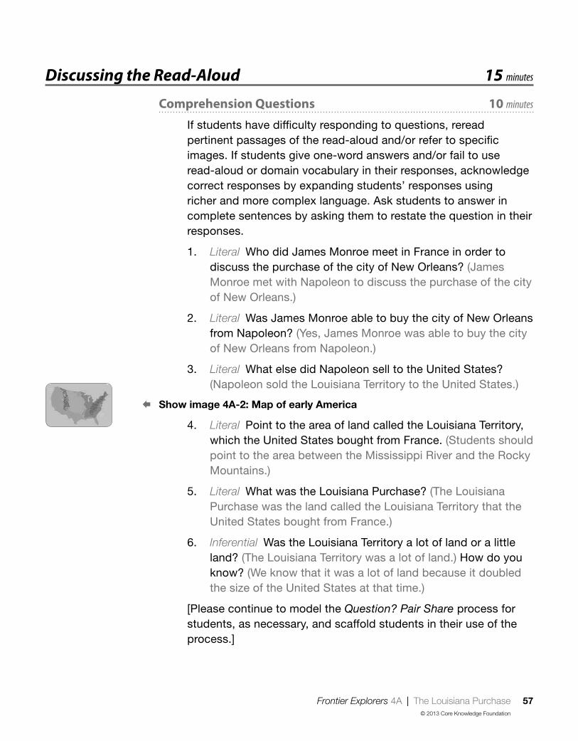
Frontier Explorers 4A | The Louisiana Purchase 57© 2013 Core Knowledge Foundation
Discussing the Read-Aloud 15 minutes
Comprehension Questions 10 minutes
If students have difficulty responding to questions, reread pertinent passages of the read-aloud and/or refer to specific images. If students give one-word answers and/or fail to use read-aloud or domain vocabulary in their responses, acknowledge correct responses by expanding students’ responses using richer and more complex language. Ask students to answer in complete sentences by asking them to restate the question in their responses.
1. Literal Who did James Monroe meet in France in order to discuss the purchase of the city of New Orleans? (James Monroe met with Napoleon to discuss the purchase of the city of New Orleans.)
2. Literal Was James Monroe able to buy the city of New Orleans from Napoleon? (Yes, James Monroe was able to buy the city of New Orleans from Napoleon.)
3. Literal What else did Napoleon sell to the United States? (Napoleon sold the Louisiana Territory to the United States.)
§ Show image 4A-2: Map of early America
4. Literal Point to the area of land called the Louisiana Territory, which the United States bought from France. (Students should point to the area between the Mississippi River and the Rocky Mountains.)
5. Literal What was the Louisiana Purchase? (The Louisiana Purchase was the land called the Louisiana Territory that the United States bought from France.)
6. Inferential Was the Louisiana Territory a lot of land or a little land? (The Louisiana Territory was a lot of land.) How do you know? (We know that it was a lot of land because it doubled the size of the United States at that time.)
[Please continue to model the Question? Pair Share process for students, as necessary, and scaffold students in their use of the process.]

58 Frontier Explorers 4A | The Louisiana Purchase© 2013 Core Knowledge Foundation
7. Evaluative What? Pair Share: Asking questions after a read-aloud is one way to see how much everyone has learned. Think of a question you can ask your neighbor about the read-aloud that starts with the word what. For example, you could ask, “What did you learn about in today’s read-aloud?” Turn to your neighbor and ask your what question. Listen to your neighbor’s response. Then your neighbor will ask a new what question, and you will get a chance to respond. I will call on several of you to share your questions with the class.
8. After hearing today’s read-aloud and questions and answers, do you have any remaining questions? [If time permits, you may wish to allow for individual, group, or class research of the text and/or other resources to answer these questions.]
Word Work: Purchase 5 minutes
1. In the read-aloud you heard Thomas Jefferson say, “I want you to go to France and offer to purchase the city of New Orleans from Napoleon.”
2. Say the word purchase with me.
3. When you purchase something, you buy it.
4. Jeremy went to the grocery store to purchase milk for his cereal.
5. What kinds of things would you purchase at the grocery store? Try to use the word purchase when you talk about it. [Ask two or three students. If necessary, guide and/or rephrase students’ responses: “I would purchase . . .”]
6. What’s the word we’ve been talking about?
[Use a Discussion activity for follow-up. Directions: Talk to your partner about what you would purchase at the grocery store. Remember to begin your responses with “At the grocery store, I would purchase . . . ”]
,Complete Remainder of the Lesson Later in the Day

Frontier Explorers 4B | The Louisiana Purchase 59© 2013 Core Knowledge Foundation
Extensions 20 minutes
Multiple Meaning Word Activity
Associated Phrase: Letter
1. [Show Poster 3M (Letter).] In the read-aloud you heard, “In Monroe’s time, there was no phone or email, so Monroe had to write a letter to Jefferson. The letter would have to travel over the ocean in the same kind of ship that Monroe had traveled on when he first came to France. It would take a few weeks for Jefferson to get Monroe’s letter and even longer for Monroe to get Jefferson’s answer.” [Have students hold up one or two fingers to indicate which image on the Poster shows this meaning.]
2. Letter can also mean something else. Letter also means a symbol of the alphabet, as in the ABCs. [Have students hold up one or two fingers to indicate which image on the poster shows this meaning.]
3. [Point to the letter as a message.] With your partner, talk about what you think of when you see this kind of letter. I will call on a few partners to share what they came up with. Try to answer in complete sentences. (When I see this kind of letter, I think of pen pals and the mail.)
4. [Point to the letter as a symbol of the alphabet.] With your partner, talk about what you think of when you see this kind of letter. I will call on a few partners to share what they came up with. Try to answer in complete sentences. (When I see this kind of letter, I think of the ABCs.)
The Louisiana Purchase Puzzle (Instructional Master 4B-1)
Remind students that when Jefferson purchased the Louisiana Territory, the United States became much bigger. Have students
The Louisiana Purchase 4B

60 Frontier Explorers 4B | The Louisiana Purchase© 2013 Core Knowledge Foundation
color the picture of the United States before the purchase of the Louisiana Territory and then cut it out. Tell students that this map picture represents the size of the United States before the purchase of the Louisiana Territory.
Next, have them color the picture of the Louisiana Territory another color and then cut it out. Have them place the Louisiana Territory and the eastern portion of the United States together. Be sure students observe the size of the country before the Louisiana Purchase and after. Discuss with students how the United States would be different without the Louisiana Territory. Talk with students about the amount of land that was added to the United States with this purchase.
Tell students to glue or tape the two pieces of the puzzle together on a blank sheet of paper. Have students write sentences about why the Louisiana Purchase was important to the United States. (It gave the United States control of trade on the Mississippi River, the city of New Orleans, and doubled the size of the United States.) Then have them share with a partner or the rest of the class what they wrote.

Frontier Explorers 5 | Lewis and Clark 61© 2013 Core Knowledge Foundation
; Lesson Objectives
Core Content Objectives
Students will:
9 Locate the Mississippi River on a map
9 Locate the Rocky Mountains on a map
9 Identify and locate the Louisiana Territory on a map
9 Explain the significance of the Louisiana Territory and Purchase
9 Explain the reasons that Lewis and Clark went on their expedition
9 Explain that there were many, many Native American tribes living in the Louisiana Territory before the Lewis and Clark expedition
Language Arts Objectives
The following language arts objectives are addressed in this lesson. Objectives aligning with the Common Core State Standards are noted with the corresponding standard in parentheses. Refer to the Alignment Chart for additional standards addressed in all lessons in this domain.
Students will:
9 Draw and write sentences about which one of Lewis and Clark’s three tasks they think will be easiest and which will be most difficult, supplying reasons for their opinions (W.1.1)
9Make personal connections to a map of Lewis and Clark’s route by creating a map of their route from home to school (W.1.8)
9With assistance, create and interpret a timeline of the settlement of North America (W.1.8)
9 Share writing with others
Lewis and Clark 5

62 Frontier Explorers 5 | Lewis and Clark© 2013 Core Knowledge Foundation
Core Vocabularyassistant, n. A person who helps someone in a higher position
Example: As the new president of the club, she was allowed to choose one assistant to help her.Variation(s): assistants
brave, adj. Showing courage and doing something even if it may be dangerous or frighteningExample: The boy was brave when he rode a bike without training wheels for the first time.Variation(s): braver, bravest
co-captain, n. Someone who shares responsibility as captain or leaderExample: As co-captain of the soccer team, the girl was able to lead a few practices.Variation(s): co-captains
At a Glance Exercise Materials Minutes
Introducing the Read-Aloud
Direction Review U.S. map with cardinal direction labels from lesson 2
10What Have We Already Learned? Image Card 9; timeline
Purpose for Listening
Presenting the Read-Aloud Lewis and Clark 15
Discussing the Read-AloudComprehension Questions 10
Word Work: Brave 5
Complete Remainder of the Lesson Later in the Day
Extensions
Vocabulary Instructional Activity: Route drawing paper, drawing tools
20Timeline Image Cards 10; timeline
Image Card Review Image Cards 11–13; drawing paper, drawing tools

Frontier Explorers 5A | Lewis and Clark 63© 2013 Core Knowledge Foundation
Introducing the Read-Aloud 10 minutes
Direction Review
Review with students the four cardinal directions: north, east, south, and west. Point to each letter taped onto the map in lesson 2 and have students repeat the direction each letter represents. You may wish to review using a mnemonic device, such as “Never Eat Soggy Waffles.”
What Have We Already Learned? § Show image 5A-1: Map of the Louisiana Purchase
Refer to the timeline as you review. Point to the area representing the original colonies, and remind students that the read-alouds they have heard over the last several days describe how America grew in size from the original thirteen colonies to a much larger country. Review what students learned about Daniel Boone and other settlers’ desire to move west of the Appalachian Mountains. Discuss with students that Native Americans had already been living in North America for thousands of years when settlers arrived to North America from Europe. As these settlements became colonies, many Native Americans were forced to move away from their family lands in what is now the eastern United States. Some moved west over the Appalachian Mountains. The Wilderness Road that Daniel Boone helped create made it easier for pioneer families to move west over the Appalachian Mountains, which in time expanded the area of the United States. This displaced many Native Americans already living in the area, or forced them to leave their homes and move even further west.
Now point to the image of Thomas Jefferson on the timeline, and ask students to identify him and the role he played in increasing the size of the United States as a country. Prompt students as needed to recall that President Jefferson wanted to purchase the
Lewis and Clark 5A

64 Frontier Explorers 5A | Lewis and Clark© 2013 Core Knowledge Foundation
city of New Orleans from the country of France so that Americans could continue to use the Mississippi River for travel and trade. Point to and have students identify the Mississippi River and the Rocky Mountains. Point to the land area between the Mississippi and the Rocky Mountains, and ask students what this area was called at the time Jefferson was president and how the United States acquired this land. Now place Image Card 9 (the Louisiana Purchase) on the timeline after Image Card 8 (Thomas Jefferson).
Purpose for Listening
Remind students that in the last read-aloud, they learned that the United States purchased the Louisiana Territory from France. Tell students that not many people in the United States knew what was in the Louisiana Territory, just like not many people knew much about the land between the Appalachian Mountains and the Mississippi River before Daniel Boone went exploring there. Tell students to listen to find out who will explore the Louisiana Territory and what their tasks will be.
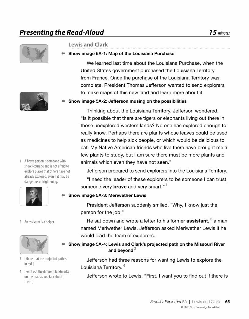
Frontier Explorers 5A | Lewis and Clark 65© 2013 Core Knowledge Foundation
Presenting the Read-Aloud 15 minutes
Lewis and Clark § Show image 5A-1: Map of the Louisiana Purchase
We learned last time about the Louisiana Purchase, when the
United States government purchased the Louisiana Territory
from France. Once the purchase of the Louisiana Territory was
complete, President Thomas Jefferson wanted to send explorers
to make maps of this new land and learn more about it.
§ Show image 5A-2: Jefferson musing on the possibilities
Thinking about the Louisiana Territory, Jefferson wondered,
“Is it possible that there are tigers or elephants living out there in
those unexplored western lands? No one has explored enough to
really know. Perhaps there are plants whose leaves could be used
as medicines to help sick people, or which would be delicious to
eat. My Native American friends who live there have brought me a
few plants to study, but I am sure there must be more plants and
animals which even they have not seen.”
Jefferson prepared to send explorers into the Louisiana Territory.
“I need the leader of these explorers to be someone I can trust,
someone very brave and very smart.” 1
§ Show image 5A-3: Meriwether Lewis
President Jefferson suddenly smiled. “Why, I know just the
person for the job.”
He sat down and wrote a letter to his former assistant, 2 a man
named Meriwether Lewis. Jefferson asked Meriwether Lewis if he
would lead the team of explorers.
§ Show image 5A-4: Lewis and Clark’s projected path on the Missouri River and beyond 3
Jefferson had three reasons for wanting Lewis to explore the
Louisiana Territory. 4
Jefferson wrote to Lewis, “First, I want you to find out if there is
1 A brave person is someone who shows courage and is not afraid to explore places that others have not already explored, even if it may be dangerous or frightening
2 An assistant is a helper
3 [Share that the projected path is in red ]
4 [Point out the different landmarks on the map as you talk about them ]

66 Frontier Explorers 5A | Lewis and Clark© 2013 Core Knowledge Foundation
an all-water route to the Pacific Ocean. Travel the Missouri River,
which branches out to the west from the Mississippi River. The
two big rivers meet at St. Louis, so you could start the trip along
the Missouri from there. Perhaps the Missouri River flows all the
way to the Pacific Ocean, or if it does not, maybe it connects to
other rivers that do reach the Pacific Ocean. You can find out for
us. Second, you can collect samples of plants and animals so that
we will know what grows well in the lands we have just added to
our nation. Third, you must also become friends with the Native
Americans you meet. You will want to bring along presents for
them so they will know you come to offer peace.” 5
§ Show image 5A-5: Lewis writing to Jefferson
When Meriwether Lewis received the president’s letter, he was
very excited. However, he was a thoughtful man. He wrote back, “I
am very honored that you have asked me to do this, Mr. President,
and I will do my very best for you and for our nation. With your
permission, however, I will ask a friend of mine, William Clark, to
help me with these tasks.
§ Show image 5A-6: William Clark 6
“William Clark and I became great friends when we served
together in the army. He and I work well together. Clark is very
good at drawing maps, identifying plants and animals, and he has
a lot of experience with Native Americans. I would feel much more
certain that we could do the things you ask if William Clark could
accompany me as co-captain.” 7 President Jefferson agreed.
§ Show image 5A-7: Lewis and Clark preparing for the journey
As Lewis and Clark prepared to start on their journey, they did
not know that the dangers and wonders they were about to face
together would make their friendship even stronger. 8
6 This is William Clark, Meriwether Lewis’s friend [Point out that he has reddish hair ]
7 Lewis wanted to share the job of captain with Clark
8 What dangers and wonders do you think Lewis and Clark may find?
5 [Help students to restate the three reasons Jefferson wanted Lewis to explore the Louisiana Terrritory You may wish to make a list on the board ]

Frontier Explorers 5A | Lewis and Clark 67© 2013 Core Knowledge Foundation
Discussing the Read-Aloud 15 minutes
Comprehension Questions 10 minutes
If students have difficulty responding to questions, reread pertinent passages of the read-aloud and/or refer to specific images. If students give one-word answers and/or fail to use read-aloud or domain vocabulary in their responses, acknowledge correct responses by expanding students’ responses using richer and more complex language. Ask students to answer in complete sentences by asking them to restate the question in their responses.
§ Show image 5A-1: Map of the Louisiana Purchase
1. Literal Point to the Louisiana Territory on the map. (Students should point to the land between the Mississippi River and the Rocky Mountains.)
2. Inferential Why did Thomas Jefferson want someone to explore the Louisiana Territory? (Thomas Jefferson wanted someone to explore the Louisiana Territory in order to learn more about it.)
3. Literal Who would explore the Louisiana Territory for Jefferson? (Lewis and Clark would explore the Louisiana Territory for Jefferson.)
4. Literal [Reread or paraphrase the paragraph where Jefferson explains to Lewis his three tasks.] What were the three things that Jefferson wanted Lewis to do on his trip? (Jefferson wanted Lewis to find an all-water route to the Pacific Ocean, collect samples of plants and animals, and make friends with the Native Americans.)
5. Evaluative Why were these three tasks important to the United States? (Answers may vary, but might include to help build the new country.)
[Please continue to model the Think Pair Share process for students, as necessary, and scaffold students in their use of the process.]
I am going to ask a question. I will give you a minute to think about the question, and then I will ask you to turn to your neighbor and

68 Frontier Explorers 5A | Lewis and Clark© 2013 Core Knowledge Foundation
discuss the question. Finally, I will call on several of you to share what you discussed with your partner.
6. Evaluative Think Pair Share: Would you have wanted to go exploring with Lewis and Clark? Why or why not? (Answers may vary.)
7. After hearing today’s read-aloud and questions and answers, do you have any remaining questions? [If time permits, you may wish to allow for individual, group, or class research of the text and/or other resources to answer these questions.]
Word Work: Brave 5 minutes
1. In the read-aloud you heard Jefferson say, “‘I need the leader of these explorers to be someone I can trust, someone very brave and very smart.’”
2. Say the word brave with me.
3. When someone is brave, it means he or she shows courage and does something even if it may be dangerous or frightening.
4. Tanya was brave when she decided to learn to swim, even though she was afraid of the water.
5. Can you think of a time when you or someone you know was brave? Try to use the word brave when you talk about it. [Ask two or three students. If necessary, guide and/or rephrase the students’ responses: “I was brave when . . .”]
6. What’s the word we’ve been talking about?
Use a Discussion activity for follow-up. Directions: Tell your partner about a time when you were brave or when someone you know was brave. Be sure to begin your responses with “I was brave when . . .”
,Complete Remainder of the Lesson Later in the Day

Frontier Explorers 5B | Lewis and Clark 69© 2013 Core Knowledge Foundation
Extensions 20 minutes
Vocabulary Instructional Activity
Word Work: Route
1. In today’s read-aloud you heard, “‘First, I want you to find out if there is an all-water route to the Pacific Ocean.’”
2. Say the word route with me.
3. A route is a way to get from one place to another place.
4. Which route do you take to get to school?
5. You heard that Daniel Boone created a route through the Appalachian Mountains called the Wilderness Road. How did this route help people to settle the land west of the Appalachian Mountains? [Ask two or three students. If necessary, guide and/or rephrase students’ responses: “This route helped people by . . . ”]
6. What’s the word we’ve been talking about?
Use a Drawing/Writing activity for follow-up. Directions: [Show image 5A-4: Lewis and Clark’s projected route to the Pacific.] This image shows a map of Lewis and Clark’s route to the Pacific Ocean, or the way they went to get to the Pacific Ocean. Discuss with your partner the route you take to get to school. Do you walk, take a subway or bus, or drive to school? Draw a map that shows where you live and where school is. Connect your home to your school by drawing a red line between the two places. This red line is the route you take to get to school. Include things you see on your way to school. On the back of your map, write about some things you see on your route to school.
Lewis and Clark 5B

70 Frontier Explorers 5B | Lewis and Clark© 2013 Core Knowledge Foundation
Timeline
Show students Image Card 10 (Lewis and Clark). Ask students what they remember about Lewis and Clark. Tell students you are going to place the card on the timeline next to Image Card 9 (The Louisiana Purchase) to help them remember that Lewis and Clark’s journey happened after President Jefferson purchased the Louisiana Territory for the United States.
Image Card Review
Use Image Cards 11–13 to review the three tasks that Lewis and Clark needed to accomplish on their trip. As you show the class each Image Card, have them talk about the task demonstrated on the Image Card. If students have trouble, you made wish to reread the appropriate passages from the read-aloud. You may also wish to divide the class into three groups and have each group present the task represented on the Image Card to the class. Discuss the tasks with the class.
Have students divide a blank sheet of paper into two halves. On one half, have students draw a picture of the task they think will be the hardest task and write a sentence about why they think that task will be the most difficult. On the other half, have students draw a picture of the task they think will be the easiest and write a sentence about why they think that task will be the easiest.
If time allows, have students share their drawings and writing with a partner or the class.

Frontier Explorers 6 | Lewis and Clark: The Journey Begins 71© 2013 Core Knowledge Foundation
; Lesson Objectives
Core Content Objectives
Students will:
9 Locate the Mississippi River on a map
9 Locate the Rocky Mountains on a map
9 Identify and locate the Louisiana Territory on a map
9 Explain the significance of the Louisiana Territory and Purchase
9 Explain the reasons that Lewis and Clark went on their expedition
9 Explain that there were many, many Native American tribes living in the Louisiana Territory before the Lewis and Clark expedition
Language Arts Objectives
The following language arts objectives are addressed in this lesson. Objectives aligning with the Common Core State Standards are noted with the corresponding standard in parentheses. Refer to the Alignment Chart for additional standards addressed in all lessons in this domain.
Students will:
9 Ask and answer when questions orally, requiring literal recall and understanding of the details and facts from “Lewis and Clark: The Journey Begins” (SL.1.2)
9 Add drawings to descriptions of the student on an expedition to clarify ideas, thoughts, and feelings (SL.1.5)
9 Share writing with others
9 Evaluate and select read-alouds on the basis of personal choice for rereading
Lewis and Clark: The Journey Begins 6

72 Frontier Explorers 6 | Lewis and Clark: The Journey Begins© 2013 Core Knowledge Foundation
Core Vocabularycommunicate, v. To share thoughts or ideas with someone by talking,
writing, or sending a messageExample: When Mary had a very sore throat and couldn’t talk, she used pictures to communicate with others.Variation(s): communicates, communicated, communicating
diary, n. A book or journal for writing personal thoughts and experiencesExample: Joy wrote about her day in her diary.Variation(s): diaries
expedition, n. A journey or trip taken for a special reasonExample: The class organized an expedition into the woods to observe the birds.Variation(s): expeditions
shelters, n. Things that cover or protect people from the weather or danger Example: When Daniel Boone was traveling along the Wilderness Road, he built shelters in the woods along the way.Variation(s): shelter
survive, v. To continue to liveExample: The cactus will survive in the desert, even though there is not very much rain.Variation(s): survives, survived, surviving
At a Glance Exercise Materials Minutes
Introducing the Read-AloudWhere Are We? U.S. map
10What Have We Already Learned? Image Cards 11–13
Purpose for Listening
Presenting the Read-Aloud Lewis and Clark: The Journey Begins U.S. map 15
Discussing the Read-AloudComprehension Questions 10
Word Work: Expedition drawing paper, drawing tools 5
Complete Remainder of the Lesson Later in the Day
Extensions Domain-Related Trade Book or Student Choice
trade book; chart paper, chalkboard, whiteboard; sticky notes
20

Frontier Explorers 6A | Lewis and Clark: The Journey Begins 73© 2013 Core Knowledge Foundation
Introducing the Read-Aloud 10 minutes
Where Are We?
Help students locate the Atlantic Ocean, the Appalachian Mountains, the Mississippi River, the Rocky Mountains, and the Pacific Ocean on a map.
What Have We Already Learned?
Remind students that they heard that Lewis and Clark would be leading the exploration of the Louisiana Territory. Ask students what Lewis and Clark’s three tasks were on their trip. Use Image Cards 11–13 to help students review the tasks.
Then, ask students if they remember why Jefferson wanted the United States to have control of the Mississippi River. Remind students that at that time it was much easier to transport people and goods on a river than over land. Explain to students that, for the same reason, Lewis and Clark traveled on rivers as they explored the Louisiana Territory.
Purpose for Listening
Ask students if they think that Lewis and Clark explored the Louisiana Territory and completed their three tasks all by themselves. Why or why not? Explain to students that Lewis and Clark gathered a group of people, known as the Corps of Discovery, to accompany and help them. Tell students to listen to find out what kinds of people Lewis and Clark looked for to help them.
Lewis and Clark: The Journey Begins 6A

74 Frontier Explorers 6A | Lewis and Clark: The Journey Begins© 2013 Core Knowledge Foundation
Presenting the Read-Aloud 15 minutes
Lewis and Clark: The Journey Begins § Show image 6A-1: Lewis and Clark preparing for their journey
Before they began their exploration of the Louisiana Territory,
Meriwether Lewis traveled to Indiana to join William Clark and
gather their team of explorers. Lewis explained, “As I wrote in
my letters, Will, because the United States government is paying
for this exploration, we will travel as members of the U.S. Army.
I asked that we be made co-captains so we would have equal
command over our men.”
§ Show image 6A-2: Frontier town
Soon they traveled to the city of St. Louis, where the wide
Missouri River flows into the even mightier Mississippi River. 1
St. Louis was a frontier town. Its streets and stores bustled with
hunters and trappers who had chosen to live far beyond the more
settled cities of the east. 2
§ Show image 6A-3: Part of Lewis and Clark’s team
The two captains knew that it would take courage, intelligence,
and skill to reach the Pacific, so they looked for people who
knew how to survive 3 in forests and on rivers and mountains.
These people would need to know how to hunt and fish for
food and build shelters in which they could stay warm, dry, and
safe. 4 Some were Americans who had grown up in Virginia or
Pennsylvania, and who had later moved farther west to live in
Kentucky. Others were Canadians, from the country north of the
United States, who spoke French as well as English. 5 The two
captains finally put together a team of trusty men who were daring
and brave enough for the expedition. 6
1 [Point to these locations on a U S map ]
2 Trappers are people who hunt and catch animals to use their fur for clothing and blankets
3 or stay alive
4 There were no houses or hotels in the Louisiana Territory, so people had to be able to make their own shelters to sleep in
5 [Show students each location on a map ]
6 An expedition is when a group of people travel together for some special reason, such as exploring

Frontier Explorers 6A | Lewis and Clark: The Journey Begins 75© 2013 Core Knowledge Foundation
§ Show image 6A-4: George Drouillard
Among the men who joined Lewis and Clark’s group, one
man stood out. He appeared before them one day dressed half
in manufactured clothing and half in the animal skins favored by
woodsmen. “I am George Drouillard (dru-yar),” he told them. “I
hear you are going all the way to the Pacific. Ask the others you
have already hired about me. They all know me. I speak French,
English, and some Native American languages, so I can help
you communicate with your men and with many native people
you meet. 7 I also know the hand sign languages used by Native
Americans who live out on the great western plains. When different
tribes meet, they use this sign language, since their spoken
languages are not all the same. I can ask them about the country
ahead, and help them understand that you have come in peace.” 8
§ Show image 6A-5: Pirogue and keelboat
Lewis and Clark had to gather supplies as well as people. They
were going to need to take a lot of things with them on their trip.
They purchased some long, narrow canoes called “pirogues”
(pi-rohgs), and one larger, wider boat called a keelboat. 9 On the
deck of the keelboat stood a little cabin that held supplies.
Riders in the pirogues moved their narrow boats forward using
canoe paddles, but the keelboat had a sail. Moving the keelboat
was slower and more difficult than moving a pirogue. When a
strong enough wind was behind them, it pushed the keelboat
along, but if there was no wind, the men had to take turns pushing
and pulling it with poles and ropes.
§ Show image 6A-6: Setting out
On Monday, May 14, 1804, the explorers were ready. They
called themselves the Corps (kohr) of Discovery. 10 Now they
would leave St. Louis and travel west along the Missouri, as
President Jefferson had requested. As one of them, Private John
Whitehouse, wrote in his diary that day, “We . . . hoisted [our] sail,
and set out in high spirits for the western expedition.” 11 At last
they were on their way.
10 A corps is a group of people working together
7 Communicating is sharing your thoughts with someone Speaking is one form of communication
8 Do you think George Drouillard would be helpful during the expedition?
9 [Point to the pirogue and the keelboat in the picture ]
11 A diary is a book or journal for writing down thoughts and experiences

76 Frontier Explorers 6A | Lewis and Clark: The Journey Begins© 2013 Core Knowledge Foundation
Discussing the Read-Aloud 15 minutes
Comprehension Questions 10 minutes
1. Evaluative Imagine you were going with Lewis and Clark and you wouldn’t be home for many months. What kinds of things do you think you would need to take with you? (You might need food, water, and clothes.)
2. Inferential The people that Lewis and Clark chose to take with them on their trip had many different skills. Name a few of their skills. (Some of the skills were survival skills, such as knowing how to hunt, fish, and build shelters, as well as language skills, such as the ability to speak many languages.) Why were these skills important? (They would have to find their own food, build their own shelters, and talk with Native Americans.)
3. Inferential Why did the Corps of Discovery travel up the river instead of on foot? (It was easier to travel and transport things on the river. There were no roads yet, so in order to travel you had to travel on foot or on a horse and cut down plants in your path. One of their tasks was to find an all-water route to the Pacific Ocean.)
4. Evaluative How do you think all the explorers felt as they began their trip? (The explorers might have felt nervous and excited.)
§ Show image 5A-4: Lewis and Clark’s projected path
5. Literal Where did Lewis and Clark begin their journey? (Lewis and Clark began their journey at St. Louis on the Missouri River.)
[Please continue to model the Question? Pair Share process for students, as necessary, and scaffold students in their use of the process.]
6. Evaluative When? Pair Share: Asking questions after a read-aloud is one way to see how much everyone has learned. In a moment you are going to ask your neighbor a question about the read-aloud that starts with the word when. For example, you could ask, “When did today’s read-aloud take place?” Turn to your neighbor and ask your when question. Listen to

Frontier Explorers 6A | Lewis and Clark: The Journey Begins 77© 2013 Core Knowledge Foundation
your neighbor’s response. Then your neighbor will ask a new when question, and you will get a chance to respond. I will call on several of you to share your questions with the class.
7. After hearing today’s read-aloud and questions and answers, do you have any remaining questions? [If time permits, you may wish to allow for individual, group, or class research of the text and/or other resources to answer these questions.]
Word Work: Expedition 5 minutes
1. In the read-aloud you heard, “[Lewis and Clark] finally put together a team of trusty men who were daring and brave enough for the expedition.”
2. Say the word expedition with me.
3. An expedition is a kind of journey or trip that has a specific purpose, like exploring. Often an expedition is an adventurous journey.
4. The brothers decided to go on an expedition to climb to the top of the tallest mountain.
5. What kind of expedition would you want to go on? [Ask two or three students. If necessary, guide and/or rephrase students’ responses: “I would want to go on an expedition to because . . . ”]
6. What’s the word we’ve been talking about?
Use a Drawing activity for follow-up. Directions: Draw a picture of yourself on an expedition. Include details that describe how you would prepare and where you would go and why. Remember to answer in complete sentences and use the word expedition in your response. [Have students share their drawings and writing with a partner or the class.]
,Complete Remainder of the Lesson Later in the Day
78 Frontier Explorers 6B | Lewis and Clark: The Journey Begins© 2013 Core Knowledge Foundation
Extensions 20 minutes
Domain-Related Trade Book or Student Choice
Domain-Related Trade Book
Refer to the list of recommended trade books in the Introduction at the front of this Anthology, and choose one to read aloud to the class. As you read, use the same strategies that you have been using when reading the read-aloud selections in this Anthology—pause and ask occasional questions; rapidly clarify critical vocabulary within the context of the read-aloud; etc. After you finish reading the trade book aloud, lead students in a discussion as to how the story or information in this book relates to the read-alouds in this domain. Discuss whether the trade book was fiction or nonfiction, fantasy or reality, historical or contemporary.
Student Choice
Tell students that they will vote for one read-aloud they have heard recently that they would like to hear again. On a piece of chart paper, a chalkboard, or a whiteboard make a bar graph with the six most recent read-aloud titles along one side. Read the titles to students, and if necessary, show key illustrations to remind them about the content of these read-alouds. Then have each student write his or her name on a sticky note and come up to the chart paper, a chalkboard, or a whiteboard to cast his or her vote, creating a bar graph of their selections. Have students tell you which read-aloud had the most votes on the Student Choice bar graph. You may also want to choose one yourself.
Reread the text that is selected. Feel free to pause at different places in the read-aloud this time and talk about vocabulary and information that you did not discuss previously during the read-aloud. After the read-aloud, ask students if they noticed anything new or different during the second reading that they did not notice
Lewis and Clark: The Journey Begins 6B

Frontier Explorers 6B | Lewis and Clark: The Journey Begins 79© 2013 Core Knowledge Foundation
during the first reading. Also, ask them to try to express why they like this read-aloud. Remember to repeat and expand upon each response using richer and more complex language, including, if possible, any read-aloud vocabulary.

80 Frontier Explorers 7 | Discovery and Danger on the Prairie© 2013 Core Knowledge Foundation
; Lesson Objectives
Core Content Objectives
Students will:
9 Locate the Mississippi River on a map
9 Locate the Rocky Mountains on a map
9 Identify and locate the Louisiana Territory on a map
9 Explain the significance of the Louisiana Territory and Purchase
9 Explain the reasons that Lewis and Clark went on their expedition
9 Explain that there were many, many Native American tribes living in the Louisiana Territory before the Lewis and Clark expedition
9 Recall basic facts about Lewis and Clark’s encounters with Native Americans
Language Arts Objectives
The following language arts objectives are addressed in this lesson. Objectives aligning with the Common Core State Standards are noted with the corresponding standard in parentheses. Refer to the Alignment Chart for additional standards addressed in all lessons in this domain.
Students will:
9 Draw and write sentences about a person they honor, explaining which characteristics you honor most, and supply reasons for their opinions (W.1.1)
9 Retell the read-aloud by describing Image Cards with relevant details, expressing ideas and feelings clearly (SL.1.4)
9 Share writing with others
Discovery and Danger on the Prairie 7

Frontier Explorers 7 | Discovery and Danger on the Prairie 81© 2013 Core Knowledge Foundation
Core Vocabularyfascinated, v. Very interested in or attracted to something
Example: The puppy was fascinated by the squirrels in the park.Variation(s): fascinate, fascinates, fascinating
guided, v. Led by someone or somethingExample: The dog guided the lost children back to their home.Variation(s): guide, guides, guiding
honored, v. Treated and thought of with respect; held in high regard and thought of with importanceExample: The kind man was honored at a special ceremony for his generosity to the school.Variation(s): honor, honors, honoring
prairie, n. A flat land with grass and not many treesExample: The grass on the prairie waved as the wind blew.Variation(s): prairies
At a Glance Exercise Materials Minutes
Introducing the Read-AloudWhere Are We? U.S. Map
10What Have We Already Learned? Image Cards 11–13
Purpose for Listening
Presenting the Read-Aloud Discovery and Danger on the Prairie 15
Discussing the Read-AloudComprehension Questions Image Cards 17, 18 10
Word Work: Honored drawing paper, drawing tools 5
Complete Remainder of the Lesson Later in the Day
Extensions
Tracking Lewis and Clark and the Corps of Discovery
Instructional Master 3B-1; drawing tools
20Image Card Retell Image Cards 10, 14–18;
drawing paper, drawing tools
Take-Home Material Family Letter Instructional Master 7B-1

82 Frontier Explorers 7A | Discovery and Danger on the Prairie© 2013 Core Knowledge Foundation
Introducing the Read-Aloud 10 minutes
Where Are We?
Help students locate the Atlantic Ocean, the Appalachian Mountains, the Mississippi River, the Rocky Mountains, the Louisiana Purchase, the Missouri River, and the Pacific Ocean on a map.
Explain that today’s read-aloud takes place in a part of the United States that we now call the Great Plains. Point out the Great Plains to students. (The Great Plains is made up of Colorado, Kansas, Montana, Nebraska, New Mexico, North Dakota, Oklahoma, South Dakota, Texas, and Wyoming.)
What Have We Already Learned?
Review with students the three tasks Lewis and Clark were asked to accomplish on their expedition. You may wish to use Image Cards 11–13 when you talk about each task.
Tell students that while not a lot of pioneer families who lived in the United States had traveled into the Louisiana Territory, many Native Americans had already been living there for a very long time.
Purpose for Listening
Tell students that in today’s read-aloud, Lewis and Clark will have an opportunity to accomplish two of their three tasks. Tell students to listen to find out which two tasks Lewis and Clark will have an opportunity to accomplish and whether or not they will be successful.
Discovery and Danger on the Prairie 7A

Frontier Explorers 7A | Discovery and Danger on the Prairie 83© 2013 Core Knowledge Foundation
Presenting the Read-Aloud 15 minutes
Discovery and Danger on the Prairie § Show image 7A-1: Clark and the Great Plains
On July 19, 1804, William Clark found himself at the edge of an
ocean. It was not the Pacific Ocean, the vast sea to the west that
Clark and his friends hoped to reach. In fact, it was not an ocean
of water at all. It was a large, flat area of land covered in grass
called a prairie. 1 A prairie goes on as far as the eye can see, just
like the ocean. 2
Clark was out hunting for the expedition and spotted some elk
tracks, which he followed up a hill. He later described what he
found at the top. “I came suddenly into an open and boundless
prairie. I could not see [the edges] in any direction. This . . .
was so sudden and entertaining that I forgot the [elk I had been
following].” Clark had reached the eastern edge of what today
we call “The Great Plains.” Wild grass as high as Clark’s knees
stretched out and blew gently in the wind, interrupted every so
often by a hill or a grove of trees. That sea of grass stretched all
the way to the distant Rocky Mountains, which it would take the
Corps of Discovery weeks more to reach. 3
§ Show image 7A-2: Pronghorn antelope
During those weeks, the explorers saw many plants and animals
new to them. Meriwether Lewis was especially fascinated 4 by the
pronghorn antelope, called pronghorns for short. He tried to get
close enough to draw pictures of them, but the pronghorns always
ran away. Pronghorns have incredibly sharp eyesight and a strong
sense of smell to warn them of approaching danger. When Lewis
finally came close to a pronghorn and got a good look at the long,
curved horns that give the animal its name, he wrote, “The speed
of this animal is equal, if not superior, to that of the finest [racing
horse.] [The pronghorn] is my favorite of all the animals we have
encountered so far.”
1 A prairie is also called a grassland. [Talk with students about the grassland habitat they learned about in the Animals and Habitats domain ]
2 So the prairie looked like an ocean because it went on as far as the eye could see
3 [Remind students that the Corps of Discovery was the group of people who were traveling with Lewis and Clark ]
4 or very interested

84 Frontier Explorers 7A | Discovery and Danger on the Prairie© 2013 Core Knowledge Foundation
§ Show image 7A-3: Prairie dog
The explorers were also astonished by the prairie dog, a tiny
rodent. These little creatures, related to squirrels, lived together by
the thousands in what the men came to call “prairie dog towns.”
The prairie dog towns consisted of underground tunnels that
sometimes stretched out for miles across the flat plains. “We have
to catch one of these to send back to President Jefferson,” William
Clark declared. But catching a prairie dog was not so easy. One
prairie dog, standing guard above its hole in the ground, saw the
men coming and chirped a high pitched warning. Instantly, all the
creatures dived down into the ground. The men dug down after
them but found that the tunnels went down more than six feet
below the surface, spreading out in all directions with emergency
exits to escape their many predators—hawks, coyotes, and
snakes—all of whom considered prairie dogs to be delicious
snacks. Clark wrote down their findings about the prairie dog and
pronghorn antelope in his journal.
§ Show image 7A-4: With the Yankton Sioux
Still following the Missouri River across the prairie, the
expedition moved on. Soon they began to meet new tribes of
Native Americans. Most were friendly and welcoming, especially
one tribe called the Yankton Sioux.
A few of the Yanktons guided 5 the travelers for a few days, but
then said, “You are coming to the land of the Teton Sioux. We will
not be able to guide you any longer.”
§ Show image 7A-5: Teton Sioux
Lewis and Clark had already heard about the Teton Sioux.
President Jefferson wanted them to become friends with the Teton
Sioux. However, the Teton Sioux were not interested in trade with
the settlers and did not want to allow Lewis and Clark on their land.
§ Show image 7A-6: Stealing a horse
One September afternoon, John Colter, one of the expedition’s
best hunters, was following the tracks of an animal. Colter
5 or led

Frontier Explorers 7A | Discovery and Danger on the Prairie 85© 2013 Core Knowledge Foundation
dismounted from his horse to look more closely. 6 Some Teton
Sioux, hiding among the nearby trees on their own horses,
shouted and rushed forward, riding off with Colter’s horse. Colter
walked back to the river and reported to Lewis and Clark what had
happened. Minutes later, five Teton Sioux appeared on the shore
calling out to talk to Lewis and Clark. Captain Clark answered,
“We will not speak with you until our horse is returned.”
§ Show image 7A-7: Confrontation
Minutes later, more than two hundred Teton warriors, all armed
with bows and arrows, rode out from the trees and spread out
along the riverbank. 7
Captain Lewis remembered that President Jefferson wanted
them to be friends with the Teton Sioux. He quietly ordered, “Stop
the boats and hold them steady here in the middle of the river.”
Clark, smiling, called, “We come as friends from our great chief.”
The chief that Clark was talking about was President Jefferson.
“We invite your chiefs to come and see our great boat.”
§ Show image 7A-8: Giving gifts
Clark ordered a few sailors to row him to shore in a pirogue,
and after greeting the three main chiefs, Clark brought two of them
aboard the keelboat. There he and Lewis were friendly to the Teton
Sioux and gave them gifts. Then Clark and the oarsmen took the
chiefs back to the shore. 8
§ Show image 7A-9: Taking the leaders back to shore 9
Meanwhile, Captain Lewis stood ready on the keelboat’s bow,
and his soldiers kept rifles in their hands or immediately by their
sides in case of trouble. Everything seemed to be going well until
suddenly one chief shouted, “Your gifts are not good enough.
You may not return to your big boat until you give us better gifts.”
Sioux warriors grabbed the pirogue’s rope and held it securely.
6 Dismounted means he got off his horse
7 Warriors are people who fight in a battle The Teton Sioux are prepared to fight to protect their land
8 [Point to the oarsman in the picture ]
9 [Point to the boat in the picture ]

86 Frontier Explorers 7A | Discovery and Danger on the Prairie© 2013 Core Knowledge Foundation
§ Show image 7A-10: Clark’s bluff
Clark knew that the Teton Sioux honored courage. 10 If he
showed any sign of weakness at this moment, the Tetons might
attack. Even if there were no fight, any chance of a strong
friendship with the Tetons could disappear. Clark whipped his
sword out, and holding it high, firmly demanded, “Release our
boat at once!”
Back on the keelboat, Lewis ordered his men, “Prepare arms!
Only on my order may you fire, and not a second before.” Instantly,
the soldiers raised their rifles. In answer, the Tetons raised their
bows and set arrows, ready to shoot at the Corps of Discovery.
No one moved. The silence stretched out for a long, tense
moment. Then a Sioux chief told the warriors holding the rope, “Let
go.” They obeyed. Clark told his oarsmen, “Return to the keelboat.”
One of his men asked quietly, “Without you, sir?”
“I gave you an order,” Clark said in a voice that sounded much
calmer than he actually felt.
§ Show image 7A-11: Clark surrounded
As the pirogue pushed off from the riverbank, Teton warriors
surrounded Clark. Lewis could see only his friend’s hat over the
shoulders of the Sioux. Lewis gave orders, and as the pirogue
reached the keelboat, a number of armed soldiers got into the
pirogue and started back for Clark. But then, suddenly, the Tetons
moved away from Clark.
§ Show image 7A-12: Truce at last
Clark’s bravery had impressed the Tetons. The Tetons thought
that Clark was brave because he stood up to them. They smiled
in friendship and invited the members of the expedition to their
village. The explorers accepted the invitation. The Corps of
Discovery had survived a dangerous situation. What they did not
know was that even greater dangers, and even greater victories,
still lay ahead.
10 Honored means the Teton Sioux admired and respected people who acted bravely

Frontier Explorers 7A | Discovery and Danger on the Prairie 87© 2013 Core Knowledge Foundation
Discussing the Read-Aloud 15 minutes
Comprehension Questions 10 minutes
1. Literal What is the area called where today’s read-aloud took place? (Today’s read-aloud took place in an area called the Great Plains.)
2. Literal What animals did Lewis and Clark discover? (Lewis and Clark discovered prairie dogs and pronghorn antelopes.)
3. Literal Before Lewis and Clark’s explorations, pioneer families living in the United States had not explored or settled the Louisiana Territory. Who had been living on that land for thousands of years? (Many Native American tribes had lived there for a long time.)
4. Evaluative In the read-aloud, Lewis and Clark met two different Native American tribes, the Yankton Sioux and the Teton Sioux. How were their meetings with the two tribes different? How were they the same? [You may wish to use Image Cards 16 (Yankton Sioux) and 17 (Teton Sioux) to help the students remember.] (The Yankton Sioux were friendly, but the Teton Sioux were not friendly. Both became friends with Lewis and Clark.)
5. Literal Which two of President Jefferson’s tasks did Lewis and Clark accomplish in the read-aloud? (Lewis and Clark accomplished two tasks: making friendships with Native Americans and discovering new animals and plants.)
[Please continue to model the Think Pair Share process for students, as necessary, and scaffold students in their use of the process.]
I am going to ask a question. I will give you a minute to think about the question, and then I will ask you to turn to your neighbor and discuss the question. Finally, I will call on several of you to share what you discussed with your partner.
6. Evaluative Think Pair Share: The title of this read-aloud is “Discovery and Danger on the Prairie.” What do you think was discovered and what was dangerous in this read-aloud? (Answers may vary.)

88 Frontier Explorers 7A | Discovery and Danger on the Prairie© 2013 Core Knowledge Foundation
7. After hearing today’s read-aloud and questions and answers, do you have any remaining questions? [If time permits, you may wish to allow for individual, group, or class research of the text and/or other resources to answer these questions.]
Word Work: Honored 5 minutes
1. In the read-aloud you heard, “Clark knew that the Teton Sioux honored courage.”
2. Say the word honored with me.
3. When you honor something, you respect it or think it is very important. The Native Americans in the story honored courage, meaning they thought that courage was very important.
4. I honor people who are kind.
5. What kind of people do you honor? [Ask two or three students. If necessary, guide and/or rephrase students’ responses: “I honor people who are .”]
6. What’s the word we’ve been talking about?
Use a Drawing activity for follow-up. Directions: Draw a picture of a person you honor. Include details in your drawing that help explain why you honor this person and which characteristics of this person you honor most. Remember to answer in complete sentences and use the word honor in your response. [Have students share their drawings and writing with a partner or the class.]
,Complete Remainder of the Lesson Later in the Day

Frontier Explorers 7B | Discovery and Danger on the Prairie 89© 2013 Core Knowledge Foundation
Extensions 20 minutes
Tracking Lewis and Clark and the Corps of Discovery (Instructional Master 3B-1)
Reuse Instructional Master 3B-1. Explain to students that over the next few days, they will track Lewis and Clark’s progress toward the Pacific Ocean. Have students identify and color the Pacific Ocean blue on their maps.
Remind students that Lewis and Clark started their journey in the town of St. Louis. Have students color in the dot that represents St. Louis on their maps. Ask students if they remember where today’s read-aloud took place. If students have trouble, remind them that the read-aloud took place in the Great Plains. Identify the area on the map that represents the Great Plains. Have students make another dot that represents where today’s read-aloud took place. Walk around and make sure that students make a dot on a part of the Missouri River that is in the Great Plains.
Image Card RetellUse Image Cards 10 (Lewis and Clark), 14 (Corps of Discovery), and 15–18 to retell the read-aloud. Show students each Image Card, and have them tell what happened when Lewis and Clark and the Corps of Discovery encountered the animals or people on the Image Cards. Be sure students use words like first, next, then, and last when retelling the story.
Have students divide a blank piece of paper into two sections. Students should draw pictures of the two tasks that the Corps of Discovery accomplished in this read-aloud. (making friendships with Native Americans and discovering new animals and plants) Then have them write sentences labeling each task. Have students share their drawings and writing with the class, in a group, or with partners.
Discovery and Danger on the Prairie 7B

90 Frontier Explorers 7B | Discovery and Danger on the Prairie© 2013 Core Knowledge Foundation
Take-Home Material
Family LetterSend home Instructional Master 7B-1.

Frontier Explorers 8 | Sacagawea 91© 2013 Core Knowledge Foundation
; Lesson Objectives
Core Content Objectives
Students will:
9 Locate the Mississippi River on a map
9 Locate the Rocky Mountains on a map
9 Identify and locate the Louisiana Territory on a map
9 Explain the significance of the Louisiana Territory and Purchase
9 Explain the reasons that Lewis and Clark went on their expedition
9 Explain that there were many, many Native American tribes already living in the Louisiana territory before the Lewis and Clark expedition
9 Recall basic facts about Lewis and Clark’s encounters with Native Americans
9 Explain why and how Sacagawea helped Lewis and Clark
Language Arts Objectives
The following language arts objectives are addressed in this lesson. Objectives aligning with the Common Core State Standards are noted with the corresponding standard in parentheses. Refer to the Alignment Chart for additional standards addressed in all lessons in this domain.
Students will:
9Write sentences about Sacagawea’s role on the expedition, respond to questions and suggestions from peers, and add details to strengthen writing as needed (W.1.5)
9 Ask and answer where questions orally, requiring literal recall and understanding of the details and facts from “Sacagawea” (SL.1.2)
Sacagawea 8

92 Frontier Explorers 8 | Sacagawea© 2013 Core Knowledge Foundation
9 Add drawings to a classmate’s written description of Sacagawea’s role on the expedition to clarify ideas, thoughts, and feelings (SL.1.5)
9 Share writing with others
Core Vocabularypermanent, adj. Lasting a long time and not changing in place or
conditionExample: The paint left a permanent stain on the carpet.Variation(s): none
plunged, v. Fell or dropped quicklyExample: The diver plunged into the pool.Variation(s): plunge, plunges, plunging
protection, n. Something that keeps you safeExample: The hikers used sunscreen for protection against the sun’s rays.Variation(s): none
skilled, adj. Trained to do something or being good at somethingExample: Her dream was to become a skilled painter. Variation(s): none
translate, v. To change words from one language into anotherExample: The boy knew two languages and was able to translate from one to the other.Variation(s): translates, translated, translating
At a Glance Exercise Materials Minutes
Introducing the Read-Aloud
Where Are We? U.S. map
10What Have We Already Learned? Image Cards 11–13
Essential Background Information or Terms
Purpose for Listening
Presenting the Read-Aloud Sacagawea 15
Discussing the Read-AloudComprehension Questions 10
Word Work: Protection 5
Complete Remainder of the Lesson Later in the Day
ExtensionsTracking Lewis and Clark and the Corps of Discovery Instructional Master 3B-1
20Interactive Illustrations drawing paper, drawing tools

Frontier Explorers 8A | Sacagawea 93© 2013 Core Knowledge Foundation
Introducing the Read-Aloud 10 minutes
Where Are We?
Help students locate the Atlantic Ocean, the Appalachian Mountains, the Mississippi River, the Rocky Mountains, the Louisiana Purchase, the Missouri River, and the Pacific Ocean on a map. Explain that today’s read-aloud takes place near the Rocky Mountains.
What Have We Already Learned?
Review with students the three tasks President Jefferson asked Lewis and Clark to accomplish on their expedition. You may wish to use Image Cards 11–13 when you talk about each task.
Remind students that while not a lot of pioneer families who lived in the United States at that time had gone into the Louisiana Territory, Native Americans had lived there for a very long time. Talk with students about the Corps of Discovery’s encounter with the Teton Sioux and the Yankton Sioux. Explain to students that today they will learn about two more Native American tribes, the Mandan and Hidatsa.
Essential Background Information or Terms
Remind students that Lewis and Clark needed people in the Corps of Discovery who could speak languages other than English. Ask students why they think Lewis and Clark needed people who could speak other languages.
Explain to students that Lewis and Clark needed to be able to communicate with Native American tribes, each of which spoke their own language. For example, Lewis understood and spoke only English. If he wanted to talk to someone who spoke only French, not English, he needed the help of someone who understood and spoke both French and English, like George
Sacagawea 8A

94 Frontier Explorers 8A | Sacagawea© 2013 Core Knowledge Foundation
Drouillard. Lewis might first say something in English, and then George would say what Lewis had said in French so the other person could understand.
Explain to students that someone like George Drouillard is called a translator. A translator is someone who is able to say the same thing in more than one language; he can listen to what someone says in one language and then repeat it in a completely different language.
Purpose for Listening
Tell students that today they will hear about where Lewis and Clark spent the winter of their expedition and the people they met while they were there. Tell students to listen to find out where Lewis and Clark spent the winter and who they decided to hire as a guide and translator.

Frontier Explorers 8A | Sacagawea 95© 2013 Core Knowledge Foundation
Presenting the Read-Aloud 15 minutes
Sacagawea § Show image 8A-1: Approaching winter
As autumn approached, Lewis and Clark were in a hurry. They
knew the Rocky Mountains lay ahead, and they hoped to spend
the winter there among the Mandan (man-dan) and Hidatsa (hee-
daht-sah). 1 However, it was already so cold that the river was
freezing into ice, and when the river froze, it was impossible to
travel up the river in their boats.
§ Show image 8A-2: Mandan village
Where the Knife River flows into the Missouri, Lewis and Clark
found five villages of Hidatsa and Mandan Native Americans. Like
other Native Americans living on the plains, these people hunted
bison—also known as buffalo—from horseback. They also lived
in permanent earth lodges and farmed the land around their
homes. 2 Four or five families shared each lodge, and even the
horses spent bad weather days inside, in a roped-off space just
inside the entrance.
The Mandans especially welcomed the travelers from the east,
because they were used to visitors. Other Native American tribes
and trappers came to the Mandan area to share news and to buy
and sell furs from beavers, bear, elk, or bison.
§ Show image 8A-3: Fort walls
Across the river from one of the Mandan villages, the explorers
built a wooden house and surrounded it with log walls eighteen
feet high for protection. 3 The men of the Corps of Discovery
called their winter home “Fort Mandan,” named after the Mandan
Native Americans.
§ Show image 8A-4: Wintertime troubles
They dragged the pirogues onto the riverbank, but before they
could move the keelboat, the river froze around it. It took three
1 The Mandan and Hidatsa are two Native American tribes who had been friendly to Lewis and Clark
2 This means they had shelters that they did not move, unlike nomads who moved their shelters with them
3 They made the high log walls to keep them safe

96 Frontier Explorers 8A | Sacagawea© 2013 Core Knowledge Foundation
weeks to chop the keelboat out of the ice. 4
They had other worries, too. Lewis told Clark, “We are eating so
much food that we will run out before the winter is over, and in this
terrible weather, it is getting harder to hunt.”
§ Show image 8A-5: Mandan interactions
Thankfully, the Mandans appeared one day to tell them, “We
have found a herd of bison nearby. Come hunting with us. We have
brought horses for you to ride.” The result was more food and
warm blankets made from their hides. As the winter nights grew
long and temperatures plunged 5 to thirty, even forty, degrees
below zero, the explorers also traded with the Mandan for food. In
return for the food the Mandan gave them, Lewis and Clark acted
as doctors for members of the tribes who were sick or injured, and
several of the explorers who were skilled 6 as blacksmiths made
iron tools, axes, and arrowheads for the Mandans. 7
The party spent many cold nights asking the Hidatsas and
Mandans about the country that lay ahead. Lewis and Clark kept
all the information they learned in a journal. 8
§ Show image 8A-6: Charbonneau and Sacagawea
Then one day, a French-Canadian trader appeared at the gates
of Fort Mandan. He announced, “I am Toussaint Charbonneau
(tu-sahn shar-bahn-o). I heard about you from the Hidatsas. I am
an excellent cook, and I speak English, French, and several Native
American languages. I could cook for you and translate what is
said in other languages into English.” 9
Charbonneau had not come alone. With him was his very
pregnant wife, a young Native American woman named
Sacagawea (sa-ka-ja-we-uh). Sacagawea was a member of
the Shoshone (shoh-shoh-nee) tribe who lived farther along
the Missouri River. The Shoshone were the next tribe that
Lewis and Clark expected to meet. Lewis and Clark discussed
Charbonneau’s offer. “Sacagawea could be helpful when we reach
the lands of the Shoshone. She could show the Shoshone that
4 When the river froze, it froze around the boat, and the keelboat became stuck in the ice
5 or fell quickly
9 Lewis and Clark couldn’t speak any of the Native American languages, so they needed people who could talk to them and to the Native Americans they would meet Also, one of their three tasks was to befriend the Native Americans
6 or talented
7 Do you think Lewis and Clark’s Corps of Discovery and the Native Americans treated one another fairly?
8 Why do you think Lewis and Clark kept information in a journal?

Frontier Explorers 8A | Sacagawea 97© 2013 Core Knowledge Foundation
we come as friends, and she knows a lot about the countryside
there. 10 As for Charbonneau, if he is the cook he claims to be, he
will be a welcome addition to our party.”
Lewis told Charbonneau, “We want you and your wife to join us,
and of course we will pay you for your work.”
§ Show image 8A-7: Charbonneau, Clark, Sacagawea with her son
This turned out to be one of the best decisions the co-captains
ever made, and while they had agreed to hire two new members of
the expedition, they soon had three. One cold night, Sacagawea
gave birth to a little boy. Charbonneau, the new father, looked
proudly at his newborn son and said, “We shall call you Jean
Baptiste (zhaun bap teest) Charbonneau.” William Clark laughed.
“That’s an awfully big name for such a little fellow to carry. I’ll call
him ‘Pompey.’” Pompey proved to be a good little traveler, too. 11
Lewis and Clark organized their notes and drawings and labeled
samples of plants and animals they had gathered. 12 When spring
came, Clark announced, “We have decided to split the party into
two groups. We will send some of you back east to take President
Jefferson the things we have collected and written. The rest of us
will continue west.” Remember, there were no telephones and no
e-mail yet, and there was no way to send mail in the Louisiana
Territory. Lewis and Clark sent some of the Corps of Discovery to
tell Jefferson of their progress and what they had found so far.
§ Show image 8A-8: Parting ways
On April 7, 1805, some of the party returned back east as
planned. They carried with them four boxes and a trunk filled
with plant and rock samples, as well as the captains’ journals
and drawings. 13 They also took with them some living animals,
such as a magpie and a prairie dog. 14 Lewis told Clark, “I wish
I could see President Jefferson’s face when that magpie starts
chattering away. The president will be mighty pleased; and he will
be delighted with all the information in our journals and drawings.”
Clark replied, “He will be even happier when you and I report to
10 Lewis and Clark thought that Sacagawea could be a guide and a translator for the expedition
11 Sacagawea’s baby was nicknamed Pomp or Pompey
12 Remember, this was one of their three tasks requested by President Jefferson
13 Here, the word trunk means a large, strong box used for holding things The word trunk also means an elephant’s nose
14 A magpie is a black and white bird that makes a lot of noise
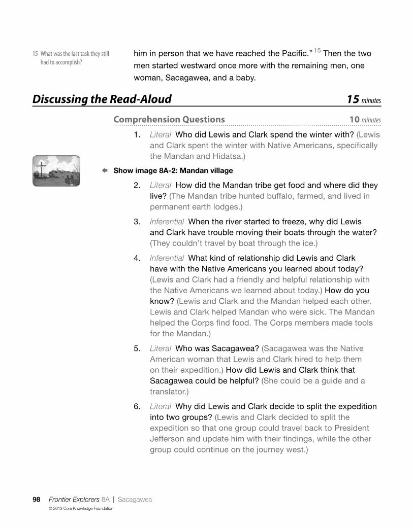
98 Frontier Explorers 8A | Sacagawea© 2013 Core Knowledge Foundation
him in person that we have reached the Pacific.” 15 Then the two
men started westward once more with the remaining men, one
woman, Sacagawea, and a baby.
Discussing the Read-Aloud 15 minutes
Comprehension Questions 10 minutes
1. Literal Who did Lewis and Clark spend the winter with? (Lewis and Clark spent the winter with Native Americans, specifically the Mandan and Hidatsa.)
§ Show image 8A-2: Mandan village
2. Literal How did the Mandan tribe get food and where did they live? (The Mandan tribe hunted buffalo, farmed, and lived in permanent earth lodges.)
3. Inferential When the river started to freeze, why did Lewis and Clark have trouble moving their boats through the water? (They couldn’t travel by boat through the ice.)
4. Inferential What kind of relationship did Lewis and Clark have with the Native Americans you learned about today? (Lewis and Clark had a friendly and helpful relationship with the Native Americans we learned about today.) How do you know? (Lewis and Clark and the Mandan helped each other. Lewis and Clark helped Mandan who were sick. The Mandan helped the Corps find food. The Corps members made tools for the Mandan.)
5. Literal Who was Sacagawea? (Sacagawea was the Native American woman that Lewis and Clark hired to help them on their expedition.) How did Lewis and Clark think that Sacagawea could be helpful? (She could be a guide and a translator.)
6. Literal Why did Lewis and Clark decide to split the expedition into two groups? (Lewis and Clark decided to split the expedition so that one group could travel back to President Jefferson and update him with their findings, while the other group could continue on the journey west.)
15 What was the last task they still had to accomplish?

Frontier Explorers 8A | Sacagawea 99© 2013 Core Knowledge Foundation
7. Inferential What did Lewis and Clark have the men take back to Jefferson? (Lewis and Clark had the men take plants, rocks, animals, journals, and drawings back to Jefferson.) Why did Lewis and Clark keep information in journals? (They kept information in a journal to report back to President Jefferson.)
8. Inferential Which two of President Jefferson’s three tasks did Lewis and Clark accomplish in the read-aloud today? (Lewis and Clark accomplished two tasks: making friends with Native Americans and collecting samples of different plants and animals.) Which task have they not yet completed? (Lewis and Clark have not yet found a water route all the way to the Pacific Ocean.)
[Please continue to model the Question? Pair Share process for students, as necessary, and scaffold students in their use of the process.]
9. Evaluative Where? Pair Share: Asking questions after a read-aloud is one way to see how much everyone has learned. Think of a question you can ask your neighbor about the read-aloud that starts with the word where. For example, you could ask, “Where does today’s read-aloud take place?” Turn to your neighbor and ask your where question. Listen to your neighbor’s response. Then your neighbor will ask a new where question, and you will get a chance to respond. I will call on several of you to share your questions with the class.
10. After hearing today’s read-aloud and questions and answers, do you have any remaining questions? [If time permits, you may wish to allow for individual, group, or class research of the text and/or other resources to answer these questions.]
Word Work: Protection 5 minutes
1. In the read-aloud you heard, “Across the river from one of the Mandan villages, the explorers built a wooden house and surrounded it with log walls eighteen feet high for protection.”
2. Say the word protection with me.
3. When something is called protection, that means it helps keep someone or something safe from something dangerous or harmful.

100 Frontier Explorers 8A | Sacagawea© 2013 Core Knowledge Foundation
4. Livie wore sunscreen as protection so that she wouldn’t get sunburned.
5. What kinds of things do you use as protection when you go outside in the sun? [Ask two or three students. If necessary, guide and/or rephrase students’ responses: “I use as protection from the sun.”]
6. What’s the word we’ve been talking about?
Use a Making Choices activity for follow-up. Tell students to listen to the following list of items. If the item is something they would use as protection from cold weather, they should say, “I would use that as protection.” If the item is not something they would use as protection from cold weather, they should say, “I would not use that as protection.” Remember to answer in complete sentences.
1. coat (I would use that as protection.)
2. bathing suit (I would not use that as protection.)
3. hat (I would use that as protection.)
4. gloves (I would use that as protection.)
5. a pair of shorts (I would not use that as protection.)
6. boots (I would use that as protection.)
,Complete Remainder of the Lesson Later in the Day
Frontier Explorers 8B | Sacagawea 101© 2013 Core Knowledge Foundation
Extensions 20 minutes
Tracking Lewis and Clark and the Corps of Discovery (Instructional Master 3B-1)
Reuse Instructional Master 3B-1. Remind students that Lewis and Clark started their journey in the town of St. Louis. Have students put their finger on the dot that represents St. Louis on their maps. Then, have students follow the Missouri River with their finger and draw a new dot that represents where the previous read-aloud took place on the Great Plains. Next, have students follow the Missouri River with their finger until they come closer to the Rocky Mountains (leaving room before the Rocky Mountains for two more dots) and make a dot on their maps to represent where today’s read-aloud took place. Talk with students about Lewis and Clark’s progress. Do students think Lewis and Clark are making good progress?
Interactive IllustrationsExplain to students that they will all get to be authors and illustrators in the next activity. Give every student a sheet of paper folded in half. On one half of the paper, have each student write a sentence about the read-aloud they just heard. Pair them with a partner, and ask them to read their sentence aloud and then trade papers. Using the second section on their partner’s paper, have each student draw a picture that goes with his or her friend’s sentence. Then have students hand the papers back to the original author. Encourage the author to add descriptive words to his or her original sentence using carets, and hand the papers back to the illustrators to draw more details into the illustration. Allow several students to share and discuss how their partners’ illustrations differed from the pictures they had imagined in their heads when they wrote their sentences. As students discuss the illustrations, remember to repeat and expand upon each response using richer and more complex language, including, if possible, any read-aloud vocabulary.
Sacagawea 8B

102 Frontier Explorers 9 | Red Cedars and Grizzly Bears© 2013 Core Knowledge Foundation
; Lesson Objectives
Core Content Objectives
Students will:
9 Locate the Mississippi River on a map
9 Locate the Rocky Mountains on a map
9 Identify and locate the Louisiana Territory on a map
9 Explain the significance of the Louisiana Territory and Purchase
9 Explain the reasons that Lewis and Clark went on their expedition
Language Arts Objectives
The following language arts objectives are addressed in this lesson. Objectives aligning with the Common Core State Standards are noted with the corresponding standard in parentheses. Refer to the Alignment Chart for additional standards addressed in all lessons in this domain.
Students will:
9 Distinguish between information provided by an image of a red cedar and information provided in the read-aloud to determine why Lewis and Clark could not bring a red cedar back east (RI.1.6)
9Compare and contrast a grizzly bear and a black bear (RI.1.9)
9Make personal connections to Lewis and Clark’s journals by creating journals of their own (W.1.8)
9 Share writing with others
Red Cedars and Grizzly Bears 9

Frontier Explorers 9 | Red Cedars and Grizzly Bears 103© 2013 Core Knowledge Foundation
Core Vocabularyhibernated, v. Slept for the winter
Example: The bears hibernated in the cave.Variation(s): hibernate, hibernates, hibernating
journals, n. Books kept to take down or record what happens on a daily basis, similar to diariesExample: For school, Guy and Pierce kept track of what they ate everyday in their food journals.Variation(s): journal
overturned, v. Flipped upside downExample: The cat overturned the bowl of water.Variation(s): overturn, overturns, overturning
record, v. To write down information as a way of remembering or sharingExample: During the meeting, Gwen used a notepad to record the information.Variation(s): records, recorded, recording
toppled, v. Fell forwardExample: The box of cards toppled down the stairs.Variation(s): topple, topples, toppling
At a Glance Exercise Materials Minutes
Introducing the Read-AloudWhere Are We? U.S. map
10What Have We Already Learned? Image Cards 11–13
Purpose for Listening
Presenting the Read-Aloud Red Cedars and Grizzly Bears 15
Discussing the Read-Aloud
Comprehension Questions 10
Word Work: Record
journals to take home; drawing paper, drawing tools
[This exercise requires advance preparation.]
5
Complete Remainder of the Lesson Later in the Day
ExtensionsTracking Lewis and Clark and the Corps of Discovery
Image Cards 15–20; Instructional Master 3B-1 20
Class Journal drawing paper, drawing tools

104 Frontier Explorers 9A | Red Cedars and Grizzly Bears© 2013 Core Knowledge Foundation
Introducing the Read-Aloud 10 minutes
Where Are We?
Help students locate the Atlantic Ocean, the Appalachian Mountains, the Mississippi River, the Rocky Mountains, the Louisiana Purchase, the Missouri River, and the Pacific Ocean on a United States map.
What Have We Already Learned?
Review with students the three tasks Lewis and Clark were to accomplish on their expedition. You may wish to use Image Cards 11–13 when you talk about each task.
Discuss with students the previous read-aloud. Remind students that in the last read-aloud, Lewis and Clark spent the winter with the Mandan people and met Sacagawea, who they decided to hire as a translator and guide.
Purpose for Listening
Tell students that in today’s read-aloud, Lewis and Clark will make more discoveries on their expedition. Tell students to listen to find out what Lewis and Clark discover and how they keep track of what they discover.
Red Cedars and Grizzly Bears 9A

Frontier Explorers 9A | Red Cedars and Grizzly Bears 105© 2013 Core Knowledge Foundation
Presenting the Read-Aloud 15 minutes
Red Cedars and Grizzly Bears § Show image 9A-1: Parting ways
After Lewis and Clark sent some of the team back east with
reports and scientific samples for President Jefferson, the captains
and the rest of their crew continued west. They rode in two of their
original pirogues plus six new canoes made from hollowed-out
trees. These canoes, about thirty feet long and three feet wide,
were hard to balance. More than once, as the men were getting
used to them, the canoes overturned in mid-river, forcing the
men to fish out wet supplies before going on. 1 Despite this, Lewis
wrote in his journal that the men were happy and healthy.
§ Show image 9A-2: Missouri River lined with Western red cedars
Soon they left behind the flat plains and entered hilly land.
Now, the Missouri River became more difficult to travel. Forests
of western red cedars lined the banks of the river. These beautiful
trees were so important to the Native Americans of the area that
some of the Native Americans called themselves “the people of
the red cedar,” performing special ceremonies before chopping
down the huge evergreens. 2
§ Show image 9A-3: Men gathered around a red cedar to show size
Lewis and Clark knew it would be impossible to take an entire
tree back with them because of its gigantic size, almost 200
feet above the ground. That’s as tall as a twenty-story building!
Nevertheless, the tree was so important to the lives of the Native
Americans that they knew they must gather samples and record 3
its many uses. They drew pictures and collected branches, cones,
and seeds.
As they learned more about the western red cedar from the
Native Americans in the area, both Lewis and Clark wrote about
the importance of the western red cedar in their journals. 4 The
people and animals of the northwest relied upon the tree for their
1 The men had to get the supplies out of the water because the boats flipped over in the water and the supplies fell out
2 An evergreen tree remains green all year long
3 or take notes on
4 A journal is a book in which you can write notes or stories or draw pictures

106 Frontier Explorers 9A | Red Cedars and Grizzly Bears© 2013 Core Knowledge Foundation
existence. The Native Americans used the bark of the tree to
weave mats, baskets, and clothing, and used the wood to build
canoes. Elk ate the leaves and shoots of the enormous tree. Bears
hibernated, or slept through the winter, in hollow cedar logs.
§ Show image 9A-4: Grizzly bear and Eastern black bear
The men heard often of the bears called grizzly bears that made
their homes in the hollowed-out logs of the cedars, so as they
made their way up the Missouri, William Clark warned, “Keep a
sharp eye out for grizzly bears.” 5
One of the hunters said, “Don’t worry, Captain, we’ve seen
plenty of bears before, back in Kentucky.”
“Black bears, yes; grizzly bears, no. From what I hear, it’s like
the difference between a house cat and a lion.” 6
§ Show image 9A-5: Meeting grizzlies
One day, Lewis and another man were out hunting along the
riverbank. Suddenly they saw two giant grizzly bears up ahead.
The bears rose up on their hind legs—up and up—until they stood
eight feet tall! Then, roaring, the bears charged. Raising their
rifles and taking careful aim, Lewis and his companion 7 shot one
bear, but the other one kept coming right at them with frightening
speed. “Run!” shouted Lewis, and the two men turned and ran for
their lives!
Lewis and the other man stopped running to take another shot,
turned, took aim, and fired at the same instant. The loud “bang”
was followed by a tense moment as the bear suddenly stopped
running. It held still for a moment, and then it toppled over. 8
§ Show image 9A-6: Examining the dead grizzly bear
Only when they were sure that the grizzly bear was dead did
Lewis and his companion carefully approach the animal. Lewis later
wrote in his journal that the bear weighed between five hundred and
six hundred pounds, and was eight and a half feet tall. That’s taller
than two first graders, one standing on top of the other!
5 [Point to the grizzly bear in the picture ] What do you think Clark means when he says, “Keep a sharp eye out for grizzly bears”?
6 Does Captain Clark think that grizzly bears are like black bears?
7 or friend
8 or fell forward

Frontier Explorers 9A | Red Cedars and Grizzly Bears 107© 2013 Core Knowledge Foundation
After this frightening chase, Lewis told the whole party, “From
now on, we must always move about, and do even the simplest
actions, in parties 9 of two or more. One man alone going up
against a grizzly would not stand a chance.”
Discussing the Read-Aloud 15 minutes
Comprehension Questions 10 minutes
1. Literal Which task or tasks did Lewis and Clark accomplish in the story today? (They discovered a new plant and animal.)
§ Show image 9A-2: Missouri River lined with Western red cedars
2. Inferential What was one plant that Lewis and Clark discovered? (Lewis and Clark discovered the red cedar.) Describe the red cedar. (The red cedar is very tall and has needles. It is an evergreen tree.)
3. Inferential Could Lewis and Clark bring a red cedar back with them? (No, they could not.) Why not? (It was too big.) What did they decide to do instead? (Instead, they decided to draw pictures and collect cones and branches.)
§ Show image 9A-4: Grizzly bear and Eastern black bear
4. Evaluative What was the animal that Lewis and Clark discovered? [Students should point to the grizzly bear.] How are the two bears the same? (They are both bears.) How are they different? (The black bear is smaller and black. The grizzly bear is brown and much bigger.)
5. Inferential Why did Lewis tell the group they must do things in parties of two or more? (They should do things in parties of two or more because of the danger of grizzly bears.)
[Please continue to model the Think Pair Share process for students, as necessary, and scaffold students in their use of the process.]
I am going to ask a question. I will give you a minute to think about the question, and then I will ask you to turn to your neighbor and discuss the question. Finally, I will call on several of you to share what you discussed with your partner.
9 or groups

108 Frontier Explorers 9A | Red Cedars and Grizzly Bears© 2013 Core Knowledge Foundation
6. Evaluative Think Pair Share: Which of the two discoveries did you find more interesting: the grizzly bear or the red cedar? Why? (Answers may vary.)
7. After hearing today’s read-aloud and questions and answers, do you have any remaining questions? [If time permits, you may wish to allow for individual, group, or class research of the text and/or other resources to answer these questions.]
Word Work: Record 5 minutes
1. In the read-aloud you heard, “Nevertheless, the [western red cedar] was so important to the lives of the Native Americans that [Lewis and Clark] knew they must gather samples and record its many uses.”
2. Say the word record with me.
3. When you record something that means you write it down or keep track of it.
4. Mia recorded how many cars passed her house in an hour.
5. Pretend that you were on the expedition with Lewis and Clark. What kinds of things would you record on the expedition? [Ask two or three students. If necessary, guide and/or rephrase students’ responses: “I would record because . . . ”]
6. What’s the word we’ve been talking about?
Use a Drawing activity for follow-up. [Create journals for students in advance by folding two pieces of blank paper in half and stapling them together along the crease.] Directions: Use this journal to record things you see on your way to and from school. Start your first drawing now and include details in your drawing that help you explain what you experience on your way to school. Remember to answer in complete sentences and use the word record in your response. [Have students share their drawings and writing with a partner or the class.]
,Complete Remainder of the Lesson Later in the Day

Frontier Explorers 9B | Red Cedars and Grizzly Bears 109© 2013 Core Knowledge Foundation
Extensions 20 minutes
Tracking Lewis and Clark and the Corps of Discovery (Instructional Master 3B-1)
Reuse Instructional Master 3B-1. Remind students that Lewis and Clark started their journey in the town of St. Louis. Have students put their finger on the dot that represents St. Louis on their maps. Remind students that this is where Lewis and Clark first started their expedition. Then, have students follow the Missouri River with their finger to the next dot. Remind students that this represents the area known as the Great Plains, where Lewis and Clark met the Sioux and where they discovered the prairie dog. You may wish to use Image Cards 15–18 to help students remember.
Then have students follow the Missouri River with their finger until they come to the next dot on their maps. Remind students that this represents where Lewis and Clark made their winter homes and met Sacagawea. You may wish to use Image Cards 19 (Mandan and Hidatsa) and 20 (Sacagawea) to help students review.
Next, have students follow the Missouri River even closer to the Rocky Mountains, and have them place a dot on the map that represents where today’s read-aloud took place.
Talk with students about Lewis and Clark’s progress. Do students think Lewis and Clark are making good progress? What do they think Lewis and Clark will have to do when they reach the Rocky Mountains? Do they think that Lewis and Clark will be able to travel by boat on the Missouri River over the mountains? Why or why not?
Red Cedars and Grizzly Bears 9A

110 Frontier Explorers 9B | Red Cedars and Grizzly Bears© 2013 Core Knowledge Foundation
Class Journal
Remind students that Lewis and Clark recorded all of their discoveries and events in a journal. Tell students to pretend that they are one of the members of the Corps of Discovery traveling with Lewis and Clark. Have them think about everything that they heard about Lewis and Clark’s travels over the past few days.
Tell students that they are going to record an event or discovery in their “journal” just like Lewis and Clark. Have them draw a picture of the event or discovery that they choose. Then have students write a word, sentence, or several sentences that describe the picture they drew. Last, have them sign their name below their drawing and journal entry. Have students share their journal entries with the class, and combine the journal entries to make a full class journal.

Frontier Explorers 10 | Rivers and Mountains 111© 2013 Core Knowledge Foundation
; Lesson Objectives
Core Content Objectives
Students will:
9 Locate the Mississippi River on a map
9 Locate the Rocky Mountains on a map
9 Identify and locate the Louisiana Territory on a map
9 Explain the significance of the Louisiana Territory and Purchase
9 Explain the reasons that Lewis and Clark went on their expedition
9 Explain that there were many, many Native American tribes already living in the Louisiana territory before the Lewis and Clark expedition
9 Recall basic facts about Lewis and Clark’s encounters with Native Americans
9 Explain why and how Sacagawea helped Lewis and Clark
Language Arts Objectives
The following language arts objectives are addressed in this lesson. Objectives aligning with the Common Core State Standards are noted with the corresponding standard in parentheses. Refer to the Alignment Chart for additional standards addressed in all lessons in this domain.
Students will:
9 Ask and answer what questions orally, requiring literal recall and understanding of the details and facts from “Rivers and Mountains” (SL.1.2)
9 Explain the meaning of “if at first you don’t succeed, try, try again” and use in appropriate contexts (L.1.6)
Rivers and Mountains 10

112 Frontier Explorers 10 | Rivers and Mountains© 2013 Core Knowledge Foundation
Core Vocabularyconfidently, adv. With confidence; being sure of yourself
Example: At the concert, the boy confidently sang the song.Variation(s): none
dull, adj. Boring; not excitingExample: The movie was very dull and very long.Variation(s): duller, dullest
sign language, n. A language or form of communication using one’s handsExample: While the story was read out loud, someone also told it using sign language.Variation(s): sign languages
waterfall, n. A place where a river falls from a high point or over a cliffExample: There is a very famous waterfall in both the United States and Canada called Niagara Falls.Variation(s): waterfalls
At a Glance Exercise Materials Minutes
Introducing the Read-AloudWhere Are We? U.S. map
10What Have We Already Learned? Image Cards 11–13
Purpose for Listening
Presenting the Read-Aloud Rivers and Mountains 15
Discussing the Read-AloudComprehension Questions 10
Word Work: Dull 5
Complete Remainder of the Lesson Later in the Day
Extensions
Tracking Lewis and Clark and the Corps of Discovery
Image Cards 15–22; Instructional Master 3B-1
20Sacagawea and the Dollar Coin dollar coin
Sayings and Phrases: If at First You Don’t Succeed, Try, Try Again

Frontier Explorers 10A | Rivers and Mountains 113© 2013 Core Knowledge Foundation
Introducing the Read-Aloud 10 minutes
Where Are We?
Help students locate the Atlantic Ocean, the Appalachian Mountains, the Mississippi River, the Rocky Mountains, the Louisiana Purchase, the Missouri River, and the Pacific Ocean on a United States map.
What Have We Already Learned?
Review with students the reasons why Lewis and Clark decided to bring Sacagawea on the expedition with them. (translator, guide) Review the term translator with students.
Review with students the three tasks that President Jefferson had asked Lewis and Clark to accomplish on their expedition. You may wish to use Image Cards 11–13 when you talk about each task.
Purpose for Listening
Tell students that in today’s read-aloud, Lewis and Clark discover that they may not be able to accomplish one of their three tasks. Tell students to listen to find out why one task was impossible to accomplish.
Rivers and Mountains 10A

114 Frontier Explorers 10A | Rivers and Mountains© 2013 Core Knowledge Foundation
Presenting the Read-Aloud 15 minutes
Rivers and Mountains § Show image 10A-1: John Shields and George Shannon paddling ahead
The Corps of Discovery had now been on their journey for over
a year. 1 The explorers were very good friends with one another
and had learned to depend on one another. One day, John Shields
and George Shannon went ahead of the others in a pirogue.
John Shields was the blacksmith, and he knew his way around
outdoors. George Shannon was smart and friendly.
Shields and Shannon paddled up the river, talking over the
exciting events they had gone through so far. 2 “Well,” Private
Shannon said, “no one can complain that it has been dull.” 3
§ Show image 10A-2: A fork in the river
No sooner were those words out of his mouth than the tip of
their pirogue came around a bend in the river, and they saw a
sight that caused them to stop paddling for a moment. Up ahead,
the Missouri River split into two wide rivers. One of the two rivers
was the Missouri, and the other was not. It was impossible to tell
which one was the Missouri River. “Which river is the Missouri?”
Shannon asked. “The Missouri River is the one the captains think
can carry us farther west.”
“I don’t know,” Shields replied, “and I don’t think the captains
will know either.
“We’ve passed the part of the river our Native American friends told
us about, and none of us has seen this part of the country before.”
Soon the other boats arrived. Going ashore, Lewis and Clark
walked ahead and inspected the two rivers. Clark said, “If we take
the wrong river, it may turn too cold for us to travel by the time we
are ready to start from here again.”
1 Can you imagine traveling and being away from home for a year?
2 Which events do you think they were talking about?
3 Dull means boring No one can say that this expedition has been boring

Frontier Explorers 10A | Rivers and Mountains 115© 2013 Core Knowledge Foundation
§ Show image 10A-3: Map of Lewis and Clark’s journey so far 4
The Native Americans told them that the Missouri River ended
in the Rocky Mountains. Lewis and Clark knew that they would
have to travel by land instead of by water to cross the mountains.
Since they wouldn’t be able to cross the mountains on a river, that
meant there was no all-water route to the Pacific Ocean. 5
“We need to find the Shoshone people up ahead, so we can
buy horses from them,” they agreed. 6 But first they would have to
continue along the Missouri River to the Rocky Mountains.
§ Show image 10A-4: Going exploring
Lewis suggested, “The last Native Americans we talked to said
that there was a huge waterfall up ahead on the Missouri River. 7
We need to find that waterfall. Take some men along the south
fork, Clark, and I’ll try the north. 8 If one of us finds it, that person
will know he is on the correct river. We’ll meet back here in a few
days to see which group has found the waterfall.” 9
Unfortunately when they met back up after a few days, neither
group had found the waterfall. Lewis had another idea. He decided
to try looking for the waterfall by land, rather than following one of
the two rivers.
§ Show image 10A-5: Waterfall 10
Lewis and his men walked for two days before they heard what
Lewis later described as “the agreeable sound of falling water.”
Following the sound, they came to not just one waterfall, but a
whole series of great waterfalls. This was it! They could now figure
out which of the two rivers was the Missouri River. Lewis sent a
man back for the rest of the party. When Clark and the rest arrived
at the great waterfalls, however, they found Lewis and his men
burying the keelboat and some of their supplies for the trip back.
“It’s too heavy,” Lewis explained. “We need to carry the boats
around the waterfalls in order to continue up the Missouri River.”
Finally, after eleven days of hard work, they left the great
4 [Point out that Lewis and Clark’s path so far is shown in red ]
7 [Explain to students that a waterfall is a place where the river falls from a high cliff ]
8 The fork is where the river split into two rivers The word fork also has other meanings The word fork also means a tool you use to eat food
9 Who do you think will find the waterfall: Lewis or Clark?
10 [Point to the waterfall ]
5 Which one of the three tasks will Lewis and Clark not be able to accomplish and why?
6 [Remind students that Sacagawea was Shoshone ]

116 Frontier Explorers 10A | Rivers and Mountains© 2013 Core Knowledge Foundation
waterfalls behind. It was a difficult journey. The river was becoming
harder to follow as it narrowed and filled with rocks.
§ Show image 10A-6: Sacagawea guiding the party
On the other hand, Sacagawea was closer to the area where
she had lived with the Shoshone. She was now able to guide
the Corps of Discovery better, because she started to recognize
the land where she had lived as a child. The more places she
recognized, the more confidently she guided them. 11
In August of 1805, Lewis told Clark, “I will take three men
ahead on foot, instead of following this winding river. If we find
the Shoshone, we’ll return with horses. We can use the horses to
cross the mountains. Then we can look for the other river we think
flows down from the mountains all the way to the Pacific Ocean.”
§ Show image 10A-7: Meeting a Shoshone horseman
A few days later, Lewis and his men were crossing a meadow
when they spied a Shoshone horseman up ahead. 12 Unfortunately,
when he saw Lewis and his men, the Shoshone horseman turned
and rode away.
§ Show image 10A-8: Map of Lewis and Clark’s journey so far
The four men kept looking for the Shoshone. A few days later,
they reached the Rocky Mountains, which, since the Louisiana
Purchase, formed the western edge of the United States.
§ Show image 10A-9: Meeting the Shoshone chief
The next afternoon, they came upon an old Shoshone woman
gathering wood for a fire. Smiling, Lewis said in English, “We are
friends.” She did not know English, but she understood when
Lewis smiled that he was friendly. She led the four travelers to
her village and introduced Lewis to the chief. The Shoshone had
plenty of horses, but the Shoshone chief explained with sign
language that the Shoshone did not have much food to share. 13
Two days later, Clark and the rest of the expedition arrived with
Sacagawea.
11 Sacagawea became more certain of which way to go as she got closer to the Shoshone lands where she used to live
12 Spied means they saw a Shoshone horseman
13 Sign language is a way of communicating by using your hands
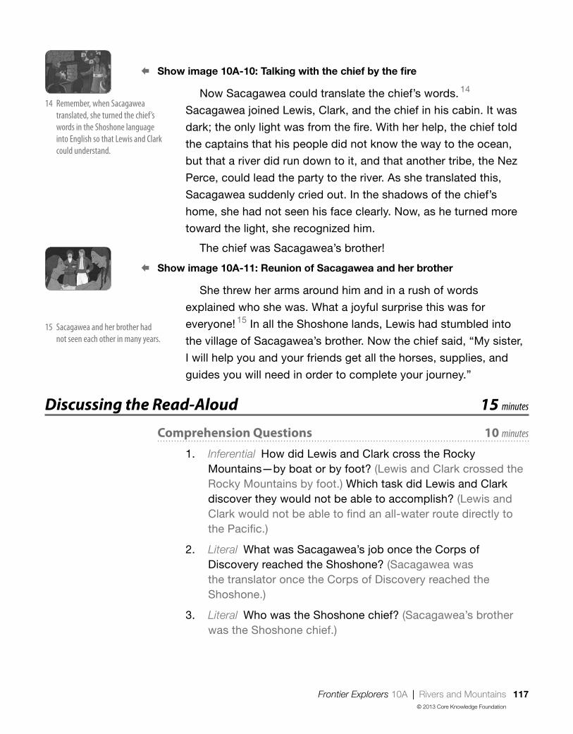
Frontier Explorers 10A | Rivers and Mountains 117© 2013 Core Knowledge Foundation
§ Show image 10A-10: Talking with the chief by the fire
Now Sacagawea could translate the chief’s words. 14
Sacagawea joined Lewis, Clark, and the chief in his cabin. It was
dark; the only light was from the fire. With her help, the chief told
the captains that his people did not know the way to the ocean,
but that a river did run down to it, and that another tribe, the Nez
Perce, could lead the party to the river. As she translated this,
Sacagawea suddenly cried out. In the shadows of the chief’s
home, she had not seen his face clearly. Now, as he turned more
toward the light, she recognized him.
The chief was Sacagawea’s brother!
§ Show image 10A-11: Reunion of Sacagawea and her brother
She threw her arms around him and in a rush of words
explained who she was. What a joyful surprise this was for
everyone! 15 In all the Shoshone lands, Lewis had stumbled into
the village of Sacagawea’s brother. Now the chief said, “My sister,
I will help you and your friends get all the horses, supplies, and
guides you will need in order to complete your journey.”
Discussing the Read-Aloud 15 minutes
Comprehension Questions 10 minutes
1. Inferential How did Lewis and Clark cross the Rocky Mountains—by boat or by foot? (Lewis and Clark crossed the Rocky Mountains by foot.) Which task did Lewis and Clark discover they would not be able to accomplish? (Lewis and Clark would not be able to find an all-water route directly to the Pacific.)
2. Literal What was Sacagawea’s job once the Corps of Discovery reached the Shoshone? (Sacagawea was the translator once the Corps of Discovery reached the Shoshone.)
3. Literal Who was the Shoshone chief? (Sacagawea’s brother was the Shoshone chief.)
14 Remember, when Sacagawea translated, she turned the chief’s words in the Shoshone language into English so that Lewis and Clark could understand
15 Sacagawea and her brother had not seen each other in many years

118 Frontier Explorers 10A | Rivers and Mountains© 2013 Core Knowledge Foundation
4. Inferential Describe how the Shoshone acted toward the explorers. (The Shoshone were friendly and gave them supplies, horses, and guides to help them.)
5. Literal Where did Lewis and Clark and the Corps of Discovery still want to travel to? (Lewis and Clark still wanted to travel to the Pacific Ocean.)
[Please continue to model the Question? Pair Share process for students, as necessary, and scaffold students in their use of the process.]
6. Evaluative What? Pair Share: Asking questions after a read-aloud is one way to see how much everyone has learned. Think of a question you can ask your neighbor about the read-aloud that starts with the word what. For example, you could ask, “What did you learn about in today’s read-aloud?” Turn to your neighbor and ask your what question. Listen to your neighbor’s response. Then your neighbor will ask a new what question, and you will get a chance to respond. I will call on several of you to share your questions with the class.
7. After hearing today’s read-aloud and questions and answers, do you have any remaining questions? [If time permits, you may wish to allow for individual, group, or class research of the text and/or other resources to answer these questions.]
Word Work: Dull 5 minutes
1. In the read-aloud you heard Private Shannon say, “No one could complain that [the trip] has been dull.”
2. Say the word dull with me.
3. Dull means boring or not exciting.
4. I had already seen this movie, so I found it very dull to watch again.
5. Have you experienced a situation that you thought was dull, or not exciting? What is something that you think of as dull? [Ask two or three students. If necessary, guide and/or rephrase students’ responses: “ is dull.”]
6. What’s the word we’ve been talking about?

Frontier Explorers 10A | Rivers and Mountains 119© 2013 Core Knowledge Foundation
Use a Making Choices activity for follow-up. Directions: I will name a few activities. If you think the activity I name would be dull, say, “That would be dull.” If you think the activity I name would not be dull, or it would be exciting, say, “That would not be dull.” Different people find different things exciting or dull, so remember that everyone might have a different response. (Answers may vary for all.)
1. swimming in a pool
2. sitting with nothing to do
3. waiting in line
4. swinging on the playground
5. standing still
6. listening to a story
7. a long car trip
,Complete Remainder of the Lesson Later in the Day

120 Frontier Explorers 10B | Rivers and Mountains© 2013 Core Knowledge Foundation
Extensions 20 minutes
Tracking Lewis and Clark and the Corps of Discovery (Instructional Master 3B-1)
Reuse Instructional Master 3B-1. Remind students that Lewis and Clark started their journey in the town of St. Louis. Have students put their finger on the dot that represents St. Louis on their maps. Remind students that this is where Lewis and Clark first started on their expedition. Then, have students follow the Missouri River with their finger to the next dot. Remind students that this represents the Great Plains where Lewis and Clark met the Sioux and where they discovered the prairie dog. You may wish to use Image Cards 15–18 to help students review.
Then have students follow the Missouri River with their finger until they come to the next dot on their maps. Remind students that this represents where Lewis and Clark made their winter homes and met Sacagawea. You may wish to use Image Cards 19 (Mandan and Hidatsa) and 20 (Sacagawea) to help students review.
Again, have students follow the Missouri River with their finger until they come to the next dot on their maps. Remind students that this was where Lewis and Clark discovered the western red cedar and encountered the grizzly bears. You may wish to use Image Cards 21 (Grizzly Bear) and 22 (Red Cedar) to help students review.
Next have students follow the Missouri River even closer to the Rocky Mountains, and have them place a dot on the map that represents where the read-aloud today took place.
Talk with students about Lewis and Clark’s progress. Do students think Lewis and Clark are making good progress? Was Sacagawea important to the success of the expedition thus far?
Rivers and Mountains 10B

Frontier Explorers 10B | Rivers and Mountains 121© 2013 Core Knowledge Foundation
Sacagawea and the Dollar Coin
If possible, bring in a dollar coin and show students the picture of Sacagawea. The dollar coin was minted first in 2000 and commemorates her contribution to Lewis and Clark’s expedition. Ask students why they think Sacagawea was chosen to be honored on a coin.
Sayings and Phrases: If at First You Don’t Succeed, Try, Try Again
Proverbs are short, traditional sayings that have been passed along orally from generation to generation. These sayings usually express general truths based on experiences and observations of everyday life. While some proverbs do have literal meanings—that is, they mean exactly what they say—many proverbs have a richer meaning beyond the literal level. It is important to help your students understand the difference between the literal meanings of the words and their implied, or figurative, meanings.
Ask students if they have ever heard the saying “if at first you don’t succeed, try, try again.” Explain to students that the saying means that you shouldn’t stop trying even if you fail at something the first time. Have students repeat the saying after you.
Explain to students that in the read-aloud today, they heard about the problems Lewis and Clark encountered when the river divided into two parts and they had to figure out which river to continue following. They knew that the correct river would have a waterfall, so they decided to try and find the waterfall. First, they tried splitting up and going down each of the two rivers to find the waterfall, but they did not succeed in finding it. However, they did not give up. Lewis and Clark may have said, “If at first you don’t succeed, try, try again.” They tried walking over land to find the waterfall, and this time they did find the waterfall! If Lewis and Clark had given up after their first try, they would never have found the waterfall.
So, just because their first try was unsuccessful, Lewis and Clark did not give up; they tried a second time—and were successful! Have students share experiences in which they failed at something at first, but then kept trying until they were successful.

122 Frontier Explorers 11 | To the Pacific and Back© 2013 Core Knowledge Foundation
; Lesson Objectives
Core Content Objectives
Students will:
9 Locate the Mississippi River on a map
9 Locate the Rocky Mountains on a map
9 Identify and locate the Louisiana Territory on a map
9 Explain the significance of the Louisiana Territory and Purchase
9 Explain the reasons that Lewis and Clark went on their expedition
9 Explain that there were many, many Native American tribes already living in the Louisiana territory before the Lewis and Clark expedition
9 Recall basic facts about Lewis and Clark’s encounters with Native Americans
Language Arts Objectives
The following language arts objectives are addressed in this lesson. Objectives aligning with the Common Core State Standards are noted with the corresponding standard in parentheses. Refer to the Alignment Chart for additional standards addressed in all lessons in this domain.
Students will:
9Make personal connections to Lewis and Clark’s journals by creating journals of their own (W.1.8)
9Use the antonyms contentment and discontentment appropriately in oral language (L.1.5a)
9 Share writing with others
To the Pacific and Back 11

Frontier Explorers 11 | To the Pacific and Back 123© 2013 Core Knowledge Foundation
Core Vocabularycanyons, n. Steep-sided, rocky valleys formed by water
Example: Of all the canyons in North America, the Grand Canyon was her favorite.Variation(s): canyon
communities, n. Groups of people who live together in the same place Example: The city was made up of many small communities.Variation(s): community
contentment, n. Being happy and satisfiedExample: The cat stretched in contentment after its long nap.Variation(s): none
current, n. A strong flow of water moving in a particular directionExample: The current pulled the log swiftly down the river.Variation(s): currents
steered, v. Guided or directed the movement of somethingExample: The farmer steered the cattle up the mountain.Variation(s): steer, steers, steering
At a Glance Exercise Materials Minutes
Introducing the Read-AloudWhere Are We? U.S. map
10What Have We Already Learned? Image Cards 11–13
Purpose for Listening
Presenting the Read-Aloud To the Pacific and Back 15
Discussing the Read-AloudComprehension Questions 10
Word Work: Contentment 5
Complete Remainder of the Lesson Later in the Day
Extensions Class Journal drawing paper, drawing tools 20

124 Frontier Explorers 11A | To the Pacific and Back© 2013 Core Knowledge Foundation
Introducing the Read-Aloud 10 minutes
Where Are We?
Have students locate the Atlantic Ocean, the Appalachian Mountains, the Mississippi River, the Rocky Mountains, the Louisiana Purchase, the Missouri River, and the Pacific Ocean on a map.
What Have We Already Learned?
Review with students the three tasks that President Jefferson asked Lewis and Clark to accomplish on their expedition. You may wish to use Image Cards 11–13 when you talk about each task. Discuss with students which of the tasks Lewis and Clark were able to accomplish and which task they were unable to accomplish.
Purpose for Listening
Explain to students that today they will hear about the last portion of Lewis and Clark’s trip. Tell students to listen to find out whether or not Lewis and Clark made it to the ocean and if everyone made it back home.
To the Pacific and Back 11A

Frontier Explorers 11A | To the Pacific and Back 125© 2013 Core Knowledge Foundation
Presenting the Read-Aloud 15 minutes
To the Pacific and Back § Show image 11A-1: Advice from the Nez Perce
The closer Meriwether Lewis, William Clark, Sacagawea, and
their friends came to the Pacific, the more Native American people
they met. This land was home to many Native Americans who had
lived there in settled communities for a long, long time. 1
With the help of the Shoshones and the Nez Perce, the Corps
of Discovery crossed the Rocky Mountains which stood between
them and the Pacific Ocean. A new, powerful river began in these
mountains. The captains hoped to ride it downhill to the ocean.
But the Nez Perce warned, “In some places, this river rushes
through narrow rock canyons, moving so quickly and powerfully
that it is difficult to control a boat there. 2 You could be hurt if your
boat hits the canyon walls or the sharp rocks sticking out of the
water.”
§ Show image 11A-2: The assessment
William Clark and the group’s best canoeist climbed the rocks
to look down at this part of the river. 3 They heard the roar of the
water charging through the narrow canyon even before they saw
it. Walking atop the rock rim high above, Clark asked the canoeist,
“What do you think?”
“Captain,” the canoeist answered, “I expect to play my violin
at our next campsite downriver, after we all get safely through this
canyon.” 4
Clark grinned. “That’s what I wanted to hear. Let us find the
others.”
§ Show image 11A-3: Braving the rapids
The men pushed off from the shore, and the pirogues and
canoes plunged into the rapids. The mighty current 5 pushed and
pulled the boats, but working together, the men steered 6 around
1 Communities are groups of people who live together in the same place
2 Canyons are steep valleys
3 A canoeist is someone who paddles a canoe
4 This means the canoeist thinks they can make it through the canyon
5 or strong flow of water
6 or guided the boats

126 Frontier Explorers 11A | To the Pacific and Back© 2013 Core Knowledge Foundation
rocks and away from the canyon walls, keeping their balance
whenever the river threatened to tip over the boats. Finally they
shot out the other end of the rocky canyon and into calm water.
John Shields turned to his young friend, George Shannon. “What
do you think, George?”
Shannon answered, “I was just starting to enjoy myself. Do you
think they have any more of those around here?” Then both men
laughed.
Soon afterward, the men landed on an island in the middle of
the river just short of the place where the river emptied into the
ocean. There, with the help of neighboring Native Americans,
they survived another long, cold, rainy winter. At last the weather
cleared, and they were able to travel the rest of the way to the
Pacific Ocean.
§ Show image 11A-4: Seeing the Pacific Ocean
There before them was the sight they had dreamed of seeing:
the Pacific Ocean. Some of the men cheered. Others stood in
silent contentment. 7
Sacagawea was amazed. She had never seen an ocean, or
even a picture of one. Clark heard that a whale had washed up
on a nearby beach and took Sacagawea to see it. She told him,
“I have traveled a long way with you to see the great waters, and
now I have seen this monstrous whale as well. I am so happy to
see the ocean!” Then she walked along the sand, happily letting
the waves wash over her feet.
§ Show image 11A-5: Returning home
On March 23, 1806, nearly two years after first leaving St.
Louis, the Corps of Discovery turned to head for home. They had
mapped a great deal of the Louisiana Territory and beyond, from
the Mississippi River to the Pacific. 8 They now knew how to get
to the Pacific: they could take the Missouri River to the Rockies,
cross the Rockies on foot, and then take other rivers to the Pacific
Ocean. They had made friends with many Native Americans. They
7 This means that they stood happily and quietly, looking at the Pacific Ocean
8 This means that they had been able to draw maps of the areas across which they had traveled

Frontier Explorers 11A | To the Pacific and Back 127© 2013 Core Knowledge Foundation
found out that no single river ran all the way from the Mississippi
to the Pacific. They had learned about many animals, birds, fish,
and insects.
They had more adventures on the journey home, of course, but
in the end, everyone got back safely except for a few who chose
not to go back.
§ Show image 11A-6: John Colter in the Mandan village
John Colter, the man from whom the Teton Sioux had taken
a horse, told Meriwether Lewis, “Captain, I have had enough of
cities and crowds. I will stay in the west, if you will let me.” So
Colter went to live among the Mandan people, promising, “I’ll be
here when you come back,” and more than one of his friends did
go back later to visit him.
§ Show image 11A-7: Saying goodbye to Charbonneau and Sacagawea
Sacagawea and her husband, Toussaint Charbonneau, with
their little son that everyone called “Pompey,” went home to the
Shoshone. Lewis and Clark told Sacagawea, “If it were not for
you, we would never have succeeded.” Sacagawea replied, “You
showed me the great waters. We are friends. We helped each
other.” Setting off again, Lewis and Clark watched Sacagawea,
with her son in her arms, waving from the shore until a bend in the
river blocked them from sight.
§ Show image 11A-8: Welcome home
Months later, the travelers reached home. There they said their
goodbyes and went their various ways, some to more adventures
and some to quieter lives. Perhaps you would like to know what
happened to the four people who had been most responsible for
the journey.
Meriwether Lewis became governor of the entire Louisiana
Territory. William Clark became the governor of Missouri, then
spent much of the rest of his life working with Native Americans on
behalf of the government’s newly created Bureau of Indian Affairs.

128 Frontier Explorers 11A | To the Pacific and Back© 2013 Core Knowledge Foundation
Thomas Jefferson continued as president until 1809. Eight
years later, James Monroe, who had arranged for Jefferson to buy
the Louisiana Territory, was himself elected President of the United
States. 9
Discussing the Read-Aloud 15 minutes
Comprehension Questions 10 minutes
1. Literal Did Lewis and Clark reach the Pacific Ocean? (Yes.)
2. Literal Did everyone in the read-aloud make it back home safely? (Yes, everyone made it home safely, except those who chose to stay and live in the Louisiana Territory.)
3. Inferential Why did Jefferson send Lewis and Clark to explore the Louisiana Territory? (No one in the United States knew what the Louisiana Territory was like.)
4. Literal What were the three tasks Jefferson asked Lewis and Clark to complete? (The three tasks were to make friends with Native Americans, record new plants and animals, and find an all-water route to the Pacific Ocean.)
5. Literal Were Lewis and Clark able to accomplish all three tasks? (No.)
6. Literal Which of the tasks were they able to accomplish? (Lewis and Clark made friends with the Native Americans and recorded new plants and animals.) Which of the tasks were they not able to accomplish? (Lewis and Clark did not find an all-water route to the Pacific Ocean. They had to go on foot through the Rockies and then sail other rivers to get to the Pacific Ocean.)
7. Evaluative Do you think Lewis and Clark’s expedition was a success or not? Why? (Answers may vary.)
[Please continue to model the Think Pair Share process for students, as necessary, and scaffold students in their use of the process.]
I am going to ask a question. I will give you a minute to think about the question, and then I will ask you to turn to your neighbor and
9 Jefferson was the president who bought the Louisiana Territory and hired Lewis and Clark to explore it James Monroe was Jefferson’s friend who traveled to France to buy New Orleans and the Louisiana Territory
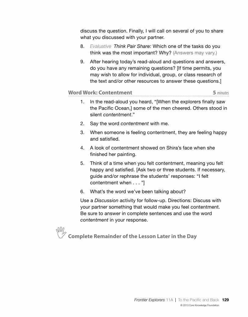
Frontier Explorers 11A | To the Pacific and Back 129© 2013 Core Knowledge Foundation
discuss the question. Finally, I will call on several of you to share what you discussed with your partner.
8. Evaluative Think Pair Share: Which one of the tasks do you think was the most important? Why? (Answers may vary.)
9. After hearing today’s read-aloud and questions and answers, do you have any remaining questions? [If time permits, you may wish to allow for individual, group, or class research of the text and/or other resources to answer these questions.]
Word Work: Contentment 5 minutes
1. In the read-aloud you heard, “[When the explorers finally saw the Pacific Ocean,] some of the men cheered. Others stood in silent contentment.”
2. Say the word contentment with me.
3. When someone is feeling contentment, they are feeling happy and satisfied.
4. A look of contentment showed on Shira’s face when she finished her painting.
5. Think of a time when you felt contentment, meaning you felt happy and satisfied. [Ask two or three students. If necessary, guide and/or rephrase the students’ responses: “I felt contentment when . . . ”]
6. What’s the word we’ve been talking about?
Use a Discussion activity for follow-up. Directions: Discuss with your partner something that would make you feel contentment. Be sure to answer in complete sentences and use the word contentment in your response.
,Complete Remainder of the Lesson Later in the Day

130 Frontier Explorers 11B | To the Pacific and Back© 2013 Core Knowledge Foundation
Extensions 20 minutes
Class Journal
For review, tell students that today they will add to their class journal. Remind students that Lewis and Clark recorded all of their discoveries and events in a journal. Tell students to pretend that they are one of the members of the Corps of Discovery traveling with Lewis and Clark. Have them think about everything that they heard about Lewis and Clark’s travels over the past few days.
Tell students that they are going to record another event or discovery in their “journal” just like Lewis and Clark. Have students draw a picture of the event or discovery of their choice. Then have students write sentences that describe the picture they drew.
Have students share their journal entries with the class, and combine the journal entries to make a full class journal.
To the Pacific and Back 11B

Frontier Explorers | Domain Review 131© 2013 Core Knowledge Foundation
Note to TeacherYou should spend one day reviewing, reinforcing, or extending the material taught in this domain. You may have students do any combination of the activities provided, in either whole-group or small-group settings.
Core Content Objectives Addressed in This DomainStudents will:
9 Recall basic facts about Daniel Boone
9 Describe Daniel Boone as a trailblazer
9 Identify what the Wilderness Road refers to
9 Locate the Appalachian Mountains on a map
9 Locate the Mississippi River on a map
9 Locate the Rocky Mountains on a map
9 Explain why Jefferson wanted to purchase New Orleans
9 Identify and locate the Louisiana Territory on a map
9 Explain the significance of the Louisiana Territory and Purchase
9 Explain the reasons that Lewis and Clark went on their expedition
9 Explain that there were many, many Native American tribes already living in the Louisiana territory before the Lewis and Clark expedition
9 Recall basic facts about Lewis and Clark’s encounters with Native Americans
9 Explain why and how Sacagawea helped Lewis and Clark
Domain Review DR

132 Frontier Explorers | Domain Review© 2013 Core Knowledge Foundation
Review Activities
Image Review
You may show the Flip Book images from any read-aloud again and have students retell the read-aloud using the images.
Image Card Review
Materials: Image Cards 8–22
Hold Image Cards 8–22 in your hand, fanned out like a deck of cards. Ask a student to choose a card but not show it to anyone else in the class. The student must then perform an action or say a clue about the picture s/he is holding. For example, for one of the tasks Lewis and Clark were to accomplish, a student may say, “This is one of the tasks that Lewis and Clark were supposed to accomplish.” The rest of the class will guess what person or object is being described. Proceed to another card when the correct answer has been given.
(You may also wish to include Image Cards 5 and 7, related to the content about Daniel Boone from the first two lessons, as a refresher prior to the Domain Assessment.)
Domain-Related Trade Book or Student Choice
Materials: Trade book
Read a trade book to review particular people, events, or concepts; refer to the books listed in the Introduction. You may also choose to have students select a read-aloud to be heard again.
You Were There: Corps of Discovery
Have students pretend that they were one of the people in the Corps of Discovery. Ask students to describe who they are and what they did.

Frontier Explorers | Domain Review 133© 2013 Core Knowledge Foundation
Key Vocabulary Brainstorming
Materials: Chart paper, Chalkboard, Whiteboard
Give students a key vocabulary word such as record. Have them brainstorm everything that comes to mind when they hear the word, such as the word journal, keeping track of things, etc.
Riddles for Core Content
Ask students riddles such as the following to review core content:
• I am Shoshone and was a guide and translator for Lewis, Clark, and the Corps of Discovery. Who am I? (Sacagawea)
• I am a piece of land or territory that President Jefferson bought from France that doubled the size of the United States. What am I called? (Louisiana Territory)
• We were hired by Thomas Jefferson to explore the Louisiana Territory? Who are we? (Lewis and Clark)
On Stage: Lewis and Clark and the Corps of Discovery
Note: This activity may require additional instruction on topics such as timing and voice.
Have a group of students plan and then act out roles played by the important people discussed in this domain, e.g., Thomas Jefferson, James Monroe, Lewis, Clark, Sacagawea, etc.
Letters to Lewis and Clark and Sacagawea
Have students choose people who were introduced in this domain and about whom they wish they knew more. Ask them to brainstorm a list of questions they would ask that person. Then, have them write letters using their lists of questions as starting points.
Using a Map
Materials: U.S. map
Use a map of the United States to review various locations from the read-alouds. Ask questions such as the following:

134 Frontier Explorers | Domain Review© 2013 Core Knowledge Foundation
• Daniel Boone was one of the settlers who wanted to move west. Which mountain range was a barrier to moving west?
• Daniel Boone wanted to move west into which state?
• Lewis and Clark led the expedition to explore the Louisiana Territory. From which city did they begin their expedition?
• Most of Lewis and Clark’s journey was by boat. On which rivers did Lewis and Clark travel?
• Lewis and Clark had to travel by foot for part of their journey. Which mountain range did they have to walk over?

Frontier Explorers | Domain Assessment 135© 2013 Core Knowledge Foundation
This domain assessment evaluates each student’s retention of the domain and academic vocabulary words and the core content targeted in Frontier Explorers. The results should guide review and remediation the following day.
There are three parts to this assessment. You may choose to do the parts in more than one sitting if you feel this is more appropriate for your students. Part I (vocabulary assessment) is divided into two sections: the first assesses domain-related vocabulary and the second assesses academic vocabulary. Parts II and III of the assessment address the core content targeted in Frontier Explorers.
w Part I (Instructional Master DA-1)
Directions: I am going to say a sentence using a word you have heard in the read-alouds and the domain. First I will say the word and then use it in a sentence. If I use the word correctly in my sentence, circle the smiling face. If I do not use the word correctly in my sentence, circle the frowning face. I will say each sentence two times. Let’s do number one together.
1. Woodsmen: Woodsmen live in cities and buy food at the grocery store. (frowning face)
2. Pioneers: Pioneers are excited to go to new places and try new things. (smiling face)
3. Expedition: Lewis and Clark’s expedition took them across the United States all the way to the Pacific Ocean. (smiling face)
4. Purchase: When someone gives you something for free, you were able to purchase it. (frowning face)
5. Guided: Sacagawea guided Lewis and Clark because she knew the way to cross the land. (smiling face)
Domain Assessment DA

136 Frontier Explorers | Domain Assessment© 2013 Core Knowledge Foundation
6. Protection: When it snows, flip flops are a good form of protection for your feet. (frowning face)
7. Emperor: An emperor cannot do anything unless the people vote for it. (frowning face)
8. Barrier: A fence is a barrier that makes sure kids do not play on the grass. (smiling face)
9. Translate: When people translate, they change words from one language into another language so that everyone can understand each other. (smiling face)
10. Survive: Lewis and Clark looked for people who knew how to survive, or stay alive, in forests and on rivers and mountains. (smiling face)
Directions: Now I am going to read more sentences using other words you have heard and practiced. First I will say the word and then use it in a sentence. If I use the word correctly in my sentence, circle the smiling face. If I do not use the word correctly in my sentence, circle the frowning face. I will say each sentence two times.
11. Route: Some students see tall buildings on the route they take to school. (smiling face)
12. Dull: Dull movies are so exciting that you want to watch them over and over again! (frowning face)
13. Brave: People are brave when they do what is right even when it is hard to do. (smiling face)
14. Honored: In many schools, hard work and determination are honored. (smiling face)
15. Record: A class project might be to record the weather for a week. (smiling face)
w Part II (Instructional Master DA-2)
Directions: Listen to the following sentences about important people who were instrumental in the expansion and exploration of the United States. Next to the number of the sentence I read, you will notice three possible choices. You will notice that the first two choices are always the same. Let’s read them together:

Frontier Explorers | Domain Assessment 137© 2013 Core Knowledge Foundation
“Daniel Boone; Lewis and Clark.” You will also notice that the last choice is usually different. I will read the three choices to you after I read each sentence. Circle the choice being described in each sentence.
1. I found a way to cross the Appalachian Mountains into Kentucky through the Cumberland Gap, a Native American trail. (Daniel Boone)
2. I was the third president of the United States, who arranged for the Louisiana Purchase. (Thomas Jefferson)
3. Jefferson hired us to lead the Corps of Discovery in exploration of the Louisiana Territory. (Lewis and Clark)
4. We already lived in the Louisiana Territory before the Corps of Discovery started their expedition. (Native Americans)
5. I was the trailblazer who made the Wilderness Road so that other colonists could cross the Appalachian Mountains. (Daniel Boone)
6. We recorded many new plants and animals in our journals. (Lewis and Clark)
7. I was a woodsman and hunter known for my good aim; some say I could even shoot a tick off a deer. (Daniel Boone)
8. I was a guide and translator for the Corps of Discovery. (Sacagawea)
9. We traveled by foot through the Rocky Mountains because there wasn’t an all-water route to the Pacific Ocean. (Lewis and Clark)
10. We finally got to see the Pacific Ocean before we headed for home. (Lewis and Clark)
w Part III (Instructional Master DA-3)
Directions: Look at your map. First, find the Appalachian Mountains and color them brown. Next, find the Mississippi River and color it blue. Then, find the Rocky Mountains and color them yellow. Last, find the area or territory that represents the Louisiana Purchase and color it green.

138 Frontier Explorers | Culminating Activities© 2013 Core Knowledge Foundation
Note to TeacherPlease use this final day to address class results of the Domain Assessment. Based on the results of the Domain Assessment and students’ Tens scores, you may wish to use this class time to provide remediation opportunities that target specific areas of weakness for individual students, small groups, or the whole class.
Alternatively, you may also choose to use this class time to extend or enrich students’ experience with domain knowledge. A number of enrichment activities are provided below in order to provide students with opportunities to enliven their experiences with domain concepts.
RemediationYou may choose to regroup students according to particular area of weakness, as indicated from Domain Assessment results and students’ Tens scores.
Remediation opportunities include:
• targeting Review Activities
• revisiting lesson Extensions
• rereading and discussing select read-alouds
• reading the corresponding lesson in the Supplemental Guide, if available
Culminating Activities CA
Frontier Explorers | Culminating Activities 139© 2013 Core Knowledge Foundation
Enrichment
Domain-Related Trade Book or Student Choice
Materials: Trade book
Read a trade book to review particular people, events, or concepts; refer to the books listed in the Introduction. You may also choose to have students select a read-aloud to be heard again.
You Were There: Corps of Discovery
Have students pretend that they were one of the people in the Corps of Discovery. Ask students to describe who they are and what they did.
On Stage: Lewis and Clark and the Corps of Discovery
Note: This activity may require additional instruction in the topics of timing and voice.
Have a group of students plan and then act out roles played by the important people discussed in this domain, e.g., Thomas Jefferson, James Monroe, Lewis, Clark, Sacagawea, etc.
Letters to Lewis and Clark and Sacagawea
Have students choose people who were introduced in this domain and about whom they wish they knew more. Ask them to brainstorm a list of questions they would ask that person. Then, have them write letters using their lists of questions as starting points.
Sign Language
Remind students that often the Native American tribes and Lewis and Clark used sign language to communicate since they didn’t know the same spoken language. In partners, have students try to communicate with each other without talking, using only signs they can make with their hands, arms, facial expressions, etc. Discuss with students the difficulties this may have presented.

140 Frontier Explorers | Culminating Activities© 2013 Core Knowledge Foundation
Class Book: Frontier Explorers
Materials: Drawing paper, drawing tools
Tell the class or a group of students that they are going to make a class book to help them remember what they have learned in this domain. Have students brainstorm important information about Daniel Boone and Lewis and Clark. Have each student choose one idea to draw a picture of, and then write a caption for the picture. Bind the pages to make a book to put in the class library for students to read again and again.
Using a Map
Materials: U.S. map
Use a map of the United States to review various locations from the read-alouds. Ask questions such as the following:
• Daniel Boone was one of the settlers who wanted to move west. Which mountain range was a barrier to moving west?
• Daniel Boone wanted to move west into which state?
• Lewis and Clark led the expedition to explore the Louisiana Territory. From which city did they begin their expedition?
• Most of Lewis and Clark’s journey was by boat. On which rivers did Lewis and Clark travel?
• Lewis and Clark had to travel by foot for part of their journey. Which mountain range did they have to walk over?
• Lewis and Clark were trying to travel to which ocean?
After students have reviewed Daniel Boone’s journey and Lewis and Clark’s expedition, have them brainstorm new ways that Lewis and Clark could have reached the Pacific Ocean. How would they prepare for this journey? How might they get there?

Frontier Explorers 141© 2013 Core Knowledge Foundation
For Teacher Reference Only:
Copies of Tell It Again! Workbook

142 Frontier Explorers© 2013 Core Knowledge Foundation

Name
Frontier Explorers 143© 2013 Core Knowledge Foundation
1B-1D
irect
ions
: Lis
ten
to t
he t
each
er’s
dire
ctio
ns, a
nd c
olor
or
mar
k th
e ap
pro
pria
te p
arts
of t
he m
ap.

144 Frontier Explorers© 2013 Core Knowledge Foundation

Frontier Explorers 145© 2013 Core Knowledge Foundation
Dear Family Member,
Today, your child has started learning about Daniel Boone, one of the first persons to explore the land west of the Appalachian Mountains. Daniel Boone helped make the Wilderness Road, which allowed other settlers to move west. During the next several days, your child will continue to learn about the westward expansion of the United States and specifically about the travels of Lewis and Clark. Below are some suggestions for activities you may do at home to reinforce what your child is learning about this period of American history.
1. Where Are We?
Have your child locate the Appalachian Mountains on a map. Share with each other any knowledge that you have of this area. (If you do not have a map, check one out from the library.)
2. Draw and Write
Have your child draw and/or write about what has been learned about Daniel Boone and then share the drawing with you. Ask questions to keep your child using the vocabulary learned at school, such as barrier, claimed, settlements, woodsmen, passes, pioneers, trailblazer, and wilderness.
3. If You Were There
With your child, imagine what it would have been like to have been with Daniel Boone when he crossed the Appalachian Mountains through the Cumberland Gap or made the Wilderness Road. Talk about what you would have seen and heard and how you would have felt.
4. Borrow a Book
Set aside time to read to your child each day. The local library has a variety of books about this period of American history. A list of books and other resources relevant to this topic is attached to this letter.
Be sure to let your child know how much you enjoy hearing about what s/he has been learning about at school.
1B-2

146 Frontier Explorers© 2013 Core Knowledge Foundation

Frontier Explorers 147© 2013 Core Knowledge Foundation
1B-3
Recommended Resources for Frontier Explorers
Trade Book List1. Bewildered for Three Days As to Why Daniel Boone Never
Wore His Coonskin Cap, by Andrew Glass (Holiday House, 2000) ISBN 978-0823414468*
2. Exploring the West, edited by E. D. Hirsch, Jr. (Pearson Learning, 2002) ISBN 978-0769050119
3. Ghost Town at Sundown (Magic Tree House, #10), by Mary Pope Osborne (Random House Books for Young Readers, 1997) ISBN 978-0679883395
4. I Am: Sacagawea, by Grace Norwich and illustrated by Anthony Vanarsdale (Scholastic Paperbacks, 2012) ISBN 978-0545405744
5. The Legend of Daniel Boone, by Eric Blair and illustrated by Micah Chambers-Goldberg (Picture Window Books, 2005) ISBN 978-1404809741
6. Lewis and Clark, by Lisa Wade McCormick (Scholastic Inc., 2006) ISBN 978-0516214436
7. Lewis and Clark: A Prairie Dog for the President, by Shirley Raye Redmond (Random House, 2003) ISBN 978-0375811203
8. Lewis and Clark: Explorers of the American West, by Steven Kroll (Holiday House, 1996) ISBN 978-0823412730
9. Lewis and Clark for Kids: Their Journey of Discovery with 21 Activities, by Janis Herbert (Chicago Review Press, 2000) ISBN 978-1556523748
10. The Mississippi River, by Allan Fowler (Children’s Press, 2000) ISBN 978-0516265568
11. A Picture Book of Davy Crockett, by David A. Adler and illustrated by John and Alexandra Wallner (Holiday House, 1996) ISBN 978-0823412129

148 Frontier Explorers© 2013 Core Knowledge Foundation
12. A Picture Book of Sacagawea, by David A. Adler and illustrated by Dan Brown (Holiday House, 2000) ISBN 978-0823414857
13. Postcards from William, by Betty Southard Stokes and illustrated by Emry Quinn (Harmony House Publishers, 2006) ISBN 978-1564692023
14. Sacagawea, by Jan Gleiter and Kathleen Thompson and illustrated by Yoshi Miyake (Raintree/Steck-Vaughn, 1998) ISBN 978-0817268893
15. Seaman’s Journal: On the Trail with Lewis and Clark, by Patricia Reeder Eubank (Ideals Children’s Books, 2002) ISBN 978-0824954420
16. Who Was Daniel Boone?, by Sydelle Kramer and illustrated by George Ulrich (Grosset and Dunlap, 2006) ISBN 978-0448439020
*This book may be better for one-on-one reading.
Websites and Other Resources
Family Resources
1. Lewis and Clark http://www.archives.gov/education/lessons/lewis-clark/
2. Louisiana Purchase http://www.learner.org/interactives/historymap/states_louisiana.html
3. Thomas Jefferson and the Louisiana Purchase http://www.loc.gov/exhibits/jefferson/jeffwest.html
4. Journals of Lewis and Clark http://www.lewisandclarkjournals.unl.edu/index.html
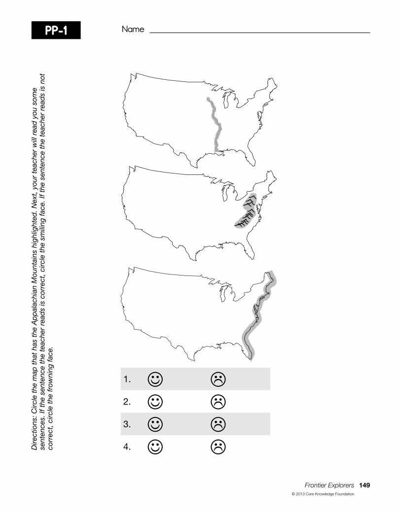
Name
Frontier Explorers 149© 2013 Core Knowledge Foundation
Dire
ctio
ns: C
ircle
the
map
tha
t ha
s th
e A
pp
alac
hian
Mou
ntai
ns h
ighl
ight
ed. N
ext,
you
r te
ache
r w
ill r
ead
you
som
e se
nten
ces.
If t
he s
ente
nce
the
teac
her
read
s is
cor
rect
, circ
le t
he s
mili
ng fa
ce. I
f the
sen
tenc
e th
e te
ache
r re
ads
is n
ot
corr
ect,
circ
le t
he fr
owni
ng fa
ce.
PP-1
1. 2. 3. 4.

150 Frontier Explorers© 2013 Core Knowledge Foundation

Name
Frontier Explorers 151© 2013 Core Knowledge Foundation
PP-1D
irect
ions
: Circ
le t
he m
ap t
hat
has
the
Ap
pal
achi
an M
ount
ains
hig
hlig
hted
. Nex
t, y
our
teac
her
will
rea
d y
ou s
ome
sent
ence
s. If
the
sen
tenc
e th
e te
ache
r re
ads
is c
orre
ct, c
ircle
the
sm
iling
face
. If t
he s
ente
nce
the
teac
her
read
s is
not
co
rrec
t, c
ircle
the
frow
ning
face
.
Answer Key
1. 2. 3. 4.

152 Frontier Explorers© 2013 Core Knowledge Foundation

Name
Frontier Explorers 153© 2013 Core Knowledge Foundation
R O C K Y
M O U N TA I N S
MI S S I S S I P P I
R I V E R
AP
PALA
CH
IAN
MOUNTAINS
MIS
SO
UR I R I V E R
Dire
ctio
ns: L
iste
n to
the
dire
ctio
ns t
he t
each
er r
ead
s an
d c
olor
or
mar
k th
e ap
pro
pria
te p
arts
of t
he m
ap.
3B-1

154 Frontier Explorers© 2013 Core Knowledge Foundation

Name
Frontier Explorers 155© 2013 Core Knowledge Foundation
4B-1D
irect
ions
: Col
or t
he p
ictu
re o
f the
Uni
ted
Sta
tes
bef
ore
the
pur
chas
e of
the
Lou
isia
na T
errit
ory
and
the
n cu
t it
out.
C
olor
the
pic
ture
of t
he L
ouis
iana
Ter
ritor
y an
othe
r co
lor
and
the
n cu
t it
out.
Pla
ce t
he L
ouis
iana
Ter
ritor
y an
d t
he
east
ern
por
tion
of t
he U
nite
d S
tate
s to
geth
er. G
lue
or t
ape
the
two
pie
ces
of t
he p
uzzl
e to
geth
er o
n a
bla
nk s
heet
of
pap
er.

156 Frontier Explorers© 2013 Core Knowledge Foundation

Name
Frontier Explorers 157© 2013 Core Knowledge Foundation
4B-1 cont.

158 Frontier Explorers© 2013 Core Knowledge Foundation

Frontier Explorers 159© 2013 Core Knowledge Foundation
Dear Family Member,
Over the next several days, your child will learn more about the westward expansion of the United States. S/he has already learned about the Louisiana Purchase and will continue learning about Lewis and Clark and the Corps of Discovery. S/he will also learn about Sacagawea, who helped the Corps as a guide.
1. If You Were There
With your child, imagine what it would have been like to have journeyed with the Corps of Discovery as they traveled through new lands and discovered new plants and animals. Talk about what you would have seen and heard and how you might have felt.
2. Draw and Write
Have your child draw and/or write about what has been learned about Lewis and Clark and the Corps of Discovery, and then ask him or her to share the drawing with you. Ask questions to keep your child using the vocabulary learned at school. You may wish to have your child list the three tasks President Thomas Jefferson wanted the Lewis and Clark expedition to accomplish. (1. making friends with Native Americans; 2. collecting samples of different plants and animals; 3. finding a water route all the way to the Pacific Ocean)
3. Sacagawea and the Dollar Coin
If possible, show your child a dollar coin and point out Sacagawea.
4. Borrow a Book
Set aside time to read to your child each day. Please refer to the list of books and other resources sent home with the previous family letter, recommending resources related to Lewis and Clark’s expedition.
5. Sayings and Phrases: If at First You Don’t Succeed, Try, Try Again
Your child will be learning the saying: “If at first you don’t succeed, try, try again.” Talk with your child about the meaning of this saying and that if you don’t succeed the first time you try something, you shouldn’t give up, but keep trying until you do succeed.
Be sure to let your child know how much you enjoy hearing about what s/he has been learning about at school.
7B-1

160 Frontier Explorers© 2013 Core Knowledge Foundation

Name
Frontier Explorers 161© 2013 Core Knowledge Foundation
DA-1D
irect
ions
: Lis
ten
care
fully
to
the
wor
ds
and
sen
tenc
es r
ead
by
your
tea
cher
. If t
he s
ente
nce
uses
the
wor
d c
orre
ctly
, ci
rcle
the
sm
iling
face
. If t
he s
ente
nce
doe
s no
t us
e th
e w
ord
cor
rect
ly, c
ircle
the
frow
ning
face
.
1. 2. 3. 4. 5. 6. 7. 8. 9. 10.

162 Frontier Explorers© 2013 Core Knowledge Foundation
11. 12. 13. 14. 15.

Name
Frontier Explorers 163© 2013 Core Knowledge Foundation
DA-1 Answer KeyD
irect
ions
: Lis
ten
care
fully
to
the
wor
ds
and
sen
tenc
es r
ead
by
your
tea
cher
. If t
he s
ente
nce
uses
the
wor
d c
orre
ctly
, ci
rcle
the
sm
iling
face
. If t
he s
ente
nce
doe
s no
t us
e th
e w
ord
cor
rect
ly, c
ircle
the
frow
ning
face
.
1. 2. 3. 4. 5. 6. 7. 8. 9. 10.

164 Frontier Explorers© 2013 Core Knowledge Foundation
11. 12. 13. 14. 15.

Name
Frontier Explorers 165© 2013 Core Knowledge Foundation
DA-2
1.
Daniel Boone Lewis and Clark Thomas Jefferson
2.
Daniel Boone Lewis and Clark Thomas Jefferson
3.
Daniel Boone Lewis and Clark Native Americans
4.
Daniel Boone Lewis and Clark Native Americans
5.
Daniel Boone Lewis and Clark Sacagawea
Dire
ctio
ns: L
iste
n to
the
tea
cher
’s in
stru
ctio
ns. C
ircle
the
cho
ice
bei
ng d
escr
ibed
in e
ach
sent
ence
.
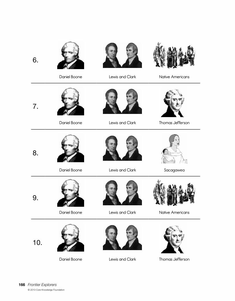
166 Frontier Explorers© 2013 Core Knowledge Foundation
6.
Daniel Boone Lewis and Clark Native Americans
7.
Daniel Boone Lewis and Clark Thomas Jefferson
8.
Daniel Boone Lewis and Clark Sacagawea
9.
Daniel Boone Lewis and Clark Native Americans
10.
Daniel Boone Lewis and Clark Thomas Jefferson

Name
Frontier Explorers 167© 2013 Core Knowledge Foundation
DA-2
1.
Daniel Boone Lewis and Clark Thomas Jefferson
2.
Daniel Boone Lewis and Clark Thomas Jefferson
3.
Daniel Boone Lewis and Clark Native Americans
4.
Daniel Boone Lewis and Clark Native Americans
5.
Daniel Boone Lewis and Clark Sacagawea
Dire
ctio
ns: L
iste
n to
the
tea
cher
’s in
stru
ctio
ns. C
ircle
the
cho
ice
bei
ng d
escr
ibed
in e
ach
sent
ence
.

168 Frontier Explorers© 2013 Core Knowledge Foundation
6.
Daniel Boone Lewis and Clark Native Americans
7.
Daniel Boone Lewis and Clark Thomas Jefferson
8.
Daniel Boone Lewis and Clark Sacagawea
9.
Daniel Boone Lewis and Clark Native Americans
10.
Daniel Boone Lewis and Clark Thomas Jefferson

Name
Frontier Explorers 169© 2013 Core Knowledge Foundation
DA-3D
irect
ions
: Loo
k at
you
r m
ap. F
irst,
find
the
Ap
pal
achi
an M
ount
ains
and
col
or t
hem
bro
wn.
Nex
t, fi
nd t
he M
issi
ssip
pi
Riv
er a
nd c
olor
it b
lue.
The
n, fi
nd t
he R
ocky
Mou
ntai
ns a
nd c
olor
the
m y
ello
w. L
ast,
find
the
are
a or
ter
ritor
y th
at
rep
rese
nts
the
Loui
sian
a P
urch
ase
and
col
or it
gre
en.

170 Frontier Explorers© 2013 Core Knowledge Foundation

Tens Recording ChartUse this grid to record Tens scores. Refer to the Tens Conversion Chart that follows.
Name

Tens Conversion ChartNumber Correct
0 1 2 3 4 5 6 7 8 9 10 11 12 13 14 15 16 17 18 19 20
Nu
mb
er o
f Q
ues
tio
ns
1 0 10
2 0 5 10
3 0 3 7 10
4 0 3 5 8 10
5 0 2 4 6 8 10
6 0 2 3 5 7 8 10
7 0 1 3 4 6 7 9 10
8 0 1 3 4 5 6 8 9 10
9 0 1 2 3 4 6 7 8 9 10
10 0 1 2 3 4 5 6 7 8 9 10
11 0 1 2 3 4 5 5 6 7 8 9 10
12 0 1 2 3 3 4 5 6 7 8 8 9 10
13 0 1 2 2 3 4 5 5 6 7 8 8 9 10
14 0 1 1 2 3 4 4 5 6 6 7 8 9 9 10
15 0 1 1 2 3 3 4 5 5 6 7 7 8 9 9 10
16 0 1 1 2 3 3 4 4 5 6 6 7 8 8 9 9 10
17 0 1 1 2 2 3 4 4 5 6 6 7 7 8 8 9 9 10
18 0 1 1 2 2 3 3 4 4 5 6 6 7 7 8 8 9 9 10
19 0 1 1 2 2 3 3 4 4 5 5 6 6 7 7 8 8 9 9 10
20 0 1 1 2 2 3 3 4 4 5 5 6 6 7 7 8 8 9 9 10 10
Simply find the number of correct answers the student produced along the top of the chart and the number of total questions on the worksheet or activity along the left side. Then find the cell where the column and the row converge. This indicates the Tens score. By using the Tens Conversion Chart, you can easily convert any raw score, from 0 to 20, into a Tens score.
Please note that the Tens Conversion Chart was created to be used with assessments that have a defined number of items (such as written assessments). However, teachers are encouraged to use the Tens system to record informal observations as well. Observational Tens scores are based on your observations during class. It is suggested that you use the following basic rubric for recording observational Tens scores.
9–10 Student appears to have excellent understanding
7–8 Student appears to have good understanding
5–6 Student appears to have basic understanding
3–4 Student appears to be having difficulty understanding
1–2 Student appears to be having great difficulty understanding
0 Student appears to have no understanding/does not participate

Frontier Explorers 173© 2013 Core Knowledge Foundation
Core Knowledge language arts
series editor-in-Chief
E. D. Hirsch, Jr.
President
Linda Bevilacqua
editorial staffCarolyn Gosse, Senior Editor - PreschoolKhara Turnbull, Materials Development ManagerMichelle L. Warner, Senior Editor - Listening & Learning
Mick AndersonRobin BlackshireMaggie BuchananPaula CoynerSue FultonSara HuntErin KistRobin LueckeRosie McCormickCynthia PengLiz PettitEllen SadlerDeborah SamleyDiane Auger SmithSarah Zelinke
design and graPhiCs staffScott Ritchie, Creative Director
Kim BerrallMichael DoneganLiza GreeneMatt LeechBridget MoriartyLauren Pack
Consulting ProjeCt ManageMent serviCesScribeConcepts.com
additional Consulting serviCesAng BlanchetteDorrit GreenCarolyn Pinkerton
aCKnowledgMentsThese materials are the result of the work, advice, and encouragement of numerous individuals over many years. Some of those singled out here already know the depth of our gratitude; others may be surprised to find themselves thanked publicly for help they gave quietly and generously for the sake of the enterprise alone. To helpers named and unnamed we are deeply grateful.
Contributors to earlier versions of these MaterialsSusan B. Albaugh, Kazuko Ashizawa, Nancy Braier, Kathryn M. Cummings, Michelle De Groot, Diana Espinal, Mary E. Forbes, Michael L. Ford, Ted Hirsch, Danielle Knecht, James K. Lee, Diane Henry Leipzig, Martha G. Mack, Liana Mahoney, Isabel McLean, Steve Morrison, Juliane K. Munson, Elizabeth B. Rasmussen, Laura Tortorelli, Rachael L. Shaw, Sivan B. Sherman, Miriam E. Vidaver, Catherine S. Whittington, Jeannette A. Williams
We would like to extend special recognition to Program Directors Matthew Davis and Souzanne Wright who were instrumental to the early development of this program.
sChoolsWe are truly grateful to the teachers, students, and administrators of the following schools for their willingness to field test these materials and for their invaluable advice: Capitol View Elementary, Challenge Foundation Academy (IN), Community Academy Public Charter School, Lake Lure Classical Academy, Lepanto Elementary School, New Holland Core Knowledge Academy, Paramount School of Excellence, Pioneer Challenge Foundation Academy, New York City PS 26R (The Carteret School), PS 30X (Wilton School), PS 50X (Clara Barton School), PS 96Q, PS 102X (Joseph O. Loretan), PS 104Q (The Bays Water), PS 214K (Michael Friedsam), PS 223Q (Lyndon B. Johnson School), PS 308K (Clara Cardwell), PS 333Q (Goldie Maple Academy), Sequoyah Elementary School, South Shore Charter Public School, Spartanburg Charter School, Steed Elementary School, Thomas Jefferson Classical Academy, Three Oaks Elementary, West Manor Elementary.
And a special thanks to the CKLA Pilot Coordinators Anita Henderson, Yasmin Lugo-Hernandez, and Susan Smith, whose suggestions and day-to-day support to teachers using these materials in their classrooms was critical.

174 Frontier Explorers© 2013 Core Knowledge Foundation
CreditsEvery effort has been taken to trace and acknowledge copyrights. The editors tender their apologies for any accidental infringement where copyright has proved untraceable. They would be pleased to insert the appropriate acknowledgment in any subsequent edition of this publication. Trademarks and trade names are shown in this publication for illustrative purposes only and are the property of their respective owners. The references to trademarks and trade names given herein do not affect their validity.
The Word Work exercises are based on the work of Beck, McKeown, and Kucan in Bringing Words to Life (The Guilford Press, 2002).
All photographs are used under license from Shutterstock, Inc. unless otherwise noted.
exPert reviewerCraig Thompson Friend; Jeffrey Hantman
writersLinda Bevilacqua; Anne Marie Pace; Catherine S. Whittington; James Weiss
illustrators and iMage sourCesCover: Steve Morrison; Title Page: Steve Morrision; Domain Icon: Core Knowledge Staff;
Take Home Icon: Core Knowledge Staff; 1A-1: Shutterstock; 1A-2: Daniel Hughes; 1A-3:
Shutterstock; 1A-4: Michael Parker; 1A-5: Bryan Beus; 1A-6 (left): Shari Griffiths; 1A-6 (right):
Carolyn Wouden; 1A-7: Library of Congress, Prints & Photographs Division, LC-USZ62-16240;
1A-8: Shutterstock; 2A-1: Michael Parker; 2A-2: Library of Congress, Prints and Photographs,
LC-USZ62-52628; 2A-3: Michael Parker; 2A-4: Michael Parker; 2A-5: Lithograph of “Daniel
Boone Escorting Settlers Through the Cumberland Gap” by George Caleb Bingham, 1851;
2A-6: Shutterstock; 2A-7: Michael Parker; 2A-8: Library of Congress, Prints and Photographs,
LC-USZ62-56160; 2A-9: Library of Congress, Prints & Photographs Division, LC-USZ62-16240;
3A-1: Shutterstock; 3A-2: Sharae Peterson; 3A-3: Sharae Peterson; 3A-4: Shutterstock; 3A-5:
Sharae Peterson; 3A-6: Shutterstock; 3A-7: Shutterstock; 3A-8: Sharae Peterson; 4A-1: Sharae
Peterson; 4A-2: Shutterstock; 4A-3: Sharae Peterson; 4A-4: Library of Congress, Prints &
Photographs Division, LC-DIG-ppmsca-31158; 4A-5: Shutterstock; 4A-6: Sharae Peterson; 4A-7:
Shutterstock; 4A-8: Sharae Peterson; 4A-9: Sharae Peterson; 4A-10: Sharae Peterson; 5A-1:
Shutterstock; 5A-2: Sharae Peterson; 5A-3: public domain; 5A-4: Shutterstock; 5A-5: Dustin
Mackay; 5A-6: public domain; 5A-7: Dustin Mackay; 6A-1: Dustin Mackay; 6A-2: Shutterstock;
6A-3: Dustin Mackay; 6A-4: Dustin Mackay; 6A-5: Core Knowledge Staff; 6A-6: Dustin Mackay;
7A-1: Dustin Mackay; 7A-2: Shutterstock; 7A-3: Shutterstock; 7A-4: Dustin Mackay; 7A-5: Dustin
Mackay; 7A-6: Dustin Mackay; 7A-7: Dustin Mackay; 7A-8: Dustin Mackay; 7A-9: Dustin Mackay;
7A-10: Dustin Mackay; 7A-11: Dustin Mackay; 7A-12: Dustin Mackay; 8A-1: Shutterstock; 8A-2:
Dustin Mackay; 8A-3: Shutterstock; 8A-4: Dustin Mackay; 8A-5: Dustin Mackay; 8A-6: Dustin
Mackay; 8A-7: Dustin Mackay; 8A-8: Dustin Mackay; 9A-1: Dustin Mackay; 9A-2: Shutterstock;
9A-3: Library of Congress, Prints & Photographs Division, LC-USZ62-63834; 9A-4: Shutterstock;
9A-5: Dustin Mackay; 9A-6: Dustin Mackay; 10A-1: Dustin Mackay; 10A-2: Dustin Mackay; 10A-3:
Shutterstock; 10A-4: Dustin Mackay; 10A-5: Great Falls of the Missouri River from H.R. Executive
Document Number 56, 36th Congress, First Session. A Century of Lawmaking for A New
Nation; 10A-6: “Lewis and Clark at Three Forks” by Edgar S. Paxson, 1912, Mural in the Montana
State Capitol, Courtesy of the Montana Historical Society, Don Beatty, photographer; 10A-7:
Dustin Mackay; 10A-8: Shutterstock; 10A-9: Dustin Mackay; 10A-10: Dustin Mackay; 10A-11:
Dustin Mackay; 11A-1: Dustin Mackay; 11A-2: Dustin Mackay; 11A-3: Dustin Mackay; 11A-4:
Dustin Mackay; 11A-5: Dustin Mackay; 11A-6: Dustin Mackay; 11A-7: Dustin Mackay; 11A-8:
Dustin Mackay; 1B-1: Core Knowledge Staff; PP-1: Core Knowledge Staff; PP-1 answer key:
Core Knowledge Staff; 3B-1: Core Knowledge Staff; 4B-1: Core Knowledge Staff; DA-2 (Boone):
Library of Congress, Prints & Photographs Division, LC-USZ62-16240; DA-2 (Lewis and Clark):
public domain; DA-2 (Jefferson): Library of Congress, Prints & Photographs Division, LC-DIG-
ppmsca-31158; DA-2 (Native Americans): Tyler Pack; DA-2 (Sacagawea): Dustin Mackay; DA-2
Answer Key(Boone): Library of Congress, Prints & Photographs Division, LC-USZ62-16240;
DA-2 Answer Key (Lewis and Clark): public domain; DA-2 Answer Key (Jefferson): Library of
Congress, Prints & Photographs Division, LC-DIG-ppmsca-31158; DA-2 Answer Key (Native
Americans): Tyler Pack; DA-2 Answer Key (Sacagawea): Dustin Mackay; DA-3: Core Knowledge
Staff
Regarding the Shutterstock items listed above, please note: “No person or entity shall falsely
represent, expressly or by way of reasonable implication, that the content herein was created
by that person or entity, or any person other than the copyright holder(s) of that content.”

Frontier Explorers Tell It Again!™ Read-Aloud Anthology
Listening & Learning™ StrandGrAdE 1
The Core Knowledge Foundationwww.coreknowledge.org