Embed Size (px)
Citation preview
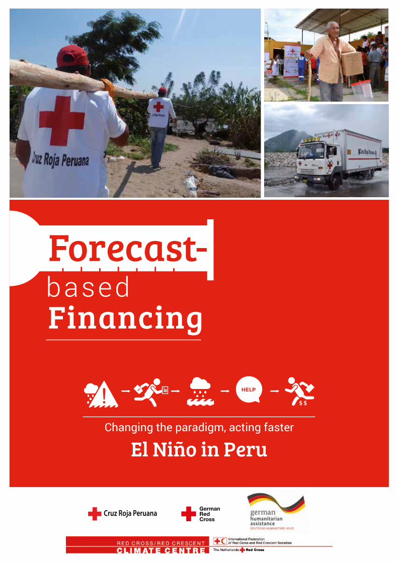
Financing
Changing the paradigm, acting faster
El Niño in Peru
Forecast-
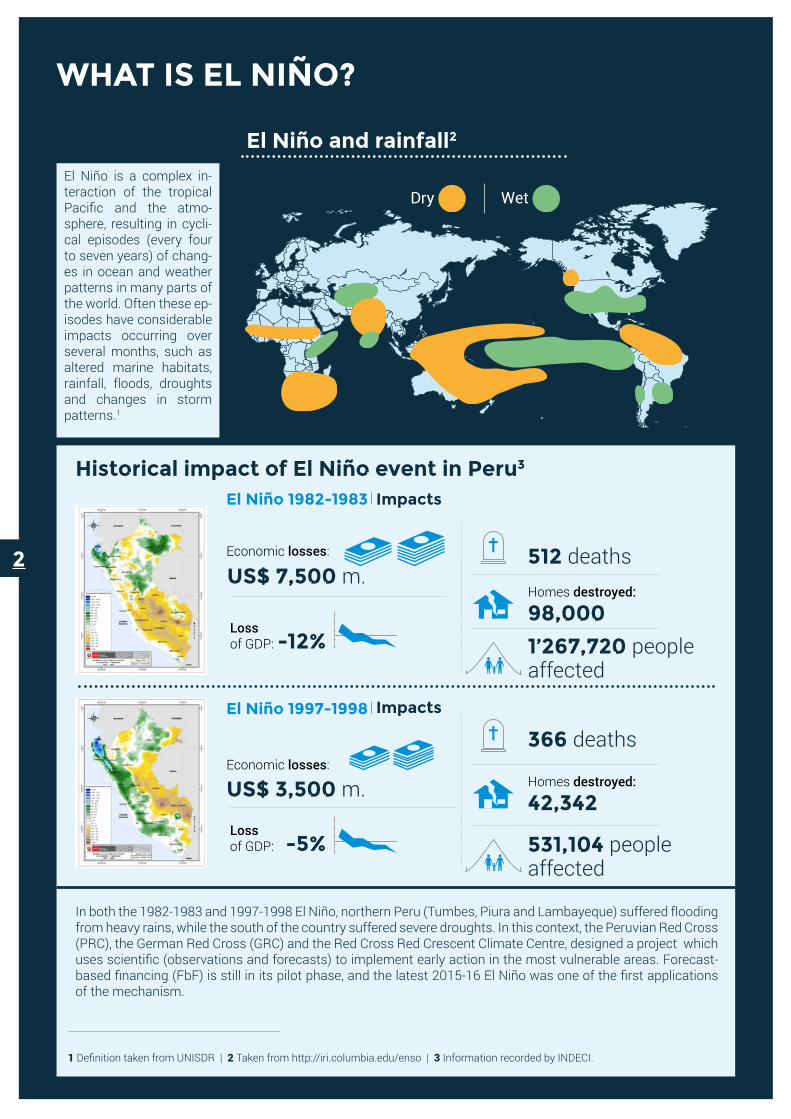
WHAT IS EL NIÑO?
Economic losses:
US$ 7,500 m.
ImpactsEl Niño 1982-1983
El Niño and rainfall2
Historical impact of El Niño event in Peru3
Homes destroyed:
98,000Loss of GDP: -12%
512 deaths
1’267,720 people affected
Economic losses:
US$ 3,500 m.
ImpactsEl Niño 1997-1998
Homes destroyed:
42,342Loss of GDP: -5%
366 deaths
531,104 people affected
El Niño is a complex in-teraction of the tropical Pacific and the atmo-sphere, resulting in cycli-cal episodes (every four to seven years) of chang-es in ocean and weather patterns in many parts of the world. Often these ep-isodes have considerable impacts occurring over several months, such as altered marine habitats, rainfall, floods, droughts and changes in storm patterns.1
In both the 1982-1983 and 1997-1998 El Niño, northern Peru (Tumbes, Piura and Lambayeque) suffered flooding from heavy rains, while the south of the country suffered severe droughts. In this context, the Peruvian Red Cross (PRC), the German Red Cross (GRC) and the Red Cross Red Crescent Climate Centre, designed a project which uses scientific (observations and forecasts) to implement early action in the most vulnerable areas. Forecast-based financing (FbF) is still in its pilot phase, and the latest 2015-16 El Niño was one of the first applications of the mechanism.
1 Definition taken from UNISDR | 2 Taken from http://iri.columbia.edu/enso | 3 Information recorded by INDECI.
Dry Wet
2
FbF CONCEPT
Some preparedness and humanitarian aid can be secured between a forecast and the impact of an event. Most hazards related to weather can be predicted. Thus, the humanitarian community can get information and know where and when to act, if a storm, flood or drought is expected.
FbF develops new processes and methodologies to prepare, deliver and respond in a more effective and efficient manner, based on national and international hydro-meteorological forecasts. It formulates defined danger levels and early actions. These actions are triggered when a forecast exceeds a danger level in a vulnerable intervention area (e.g. a specified amount of rain that make rivers and communities flood). Hence, actions can be taken before the impact of the disaster and strengthen resilience, of both communities and institutions.
Historical data from 1982-1983 and 1997-1998, show that a strong El Niño has a great impact on health, drinking water, food security and housing. FbF seeks to act before the disaster, with early action to build and enforce resilience, reducing the impact of an El Niño Event and ensuring that basic needs are available at the time that families and communities need them most.
In which field do we take early action?What do we want to change in the Peruvian context?
Applying FbF during El Niño in 2015-2016 proved that you can establish a system that triggers the use of funds to implement preparedness actions before a predicted disaster occurs. In this way suffering and losses can be avoided, and aid funds more efficiently used. Moreover it improves resilience and community preparedness.
Community based Early
warning
FBF EL Niño 2015-2016
Food security
Strengthening and protecting
housing
Health and hygiene during emergencies
Safe drinking
water
First Aid
3
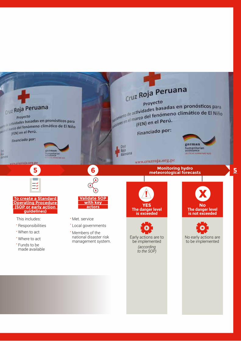
Met. serviceLocal governments
Members of the national disaster risk management system.
Validate SOP with key
actors
To identify available forecasts
Use of national and international data.Taking into consideration the probability, intensity and time prior to the occurrence of an event.
Awareness raising campaign on hygiene or safe drinking water
Strengthening of houses.
Such as:
To formulate early actions
To identify danger levels
Define the threshold for a specific hazard.Identify the critical character, analysing vulnerability and the historical impact in the area of intervention.Consider institutional capacity to act.
To create a Standard Operating Procedure (SOP or early action
guidelines)
This includes: ResponsibilitiesWhen to act
Where to actFunds to be made available
The risk scenarios are consulted to analysing threats including historical impact data and level of vulnerability.
To understand the risk
scenarios
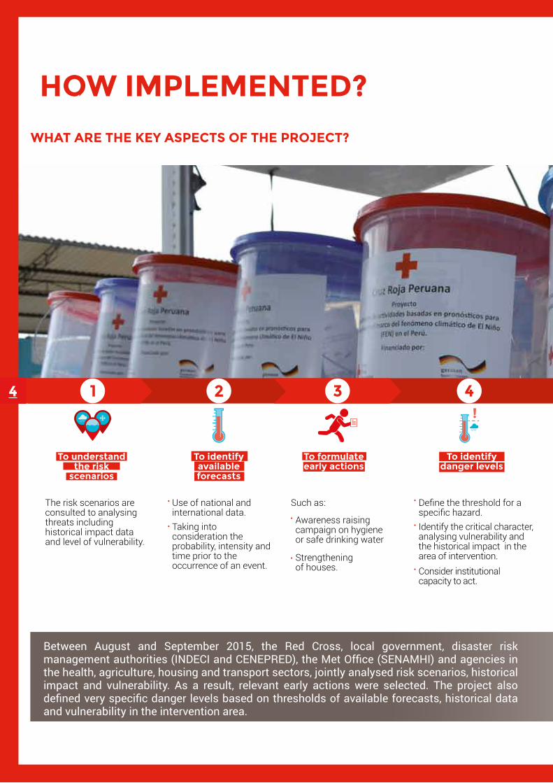
WHAT ARE THE KEY ASPECTS OF THE PROJECT?
YESThe danger level
is exceeded
Early actions are to be implemented
(according to the SOP)
No The danger level is not exceeded
No early actions are to be implemented
Monitoring hydro meteorological forecasts
HOW IMPLEMENTED?
Between August and September 2015, the Red Cross, local government, disaster risk management authorities (INDECI and CENEPRED), the Met Office (SENAMHI) and agencies in the health, agriculture, housing and transport sectors, jointly analysed risk scenarios, historical impact and vulnerability. As a result, relevant early actions were selected. The project also defined very specific danger levels based on thresholds of available forecasts, historical data and vulnerability in the intervention area.
4
Met. serviceLocal governments
Members of the national disaster risk management system.
Validate SOP with key
actors
To identify available forecasts
Use of national and international data.Taking into consideration the probability, intensity and time prior to the occurrence of an event.
Awareness raising campaign on hygiene or safe drinking water
Strengthening of houses.
Such as:
To formulate early actions
To identify danger levels
Define the threshold for a specific hazard.Identify the critical character, analysing vulnerability and the historical impact in the area of intervention.Consider institutional capacity to act.
To create a Standard Operating Procedure (SOP or early action
guidelines)
This includes: ResponsibilitiesWhen to act
Where to actFunds to be made available
The risk scenarios are consulted to analysing threats including historical impact data and level of vulnerability.
To understand the risk
scenarios
WHAT ARE THE KEY ASPECTS OF THE PROJECT?
YESThe danger level
is exceeded
Early actions are to be implemented
(according to the SOP)
No The danger level is not exceeded
No early actions are to be implemented
Monitoring hydro meteorological forecasts 5
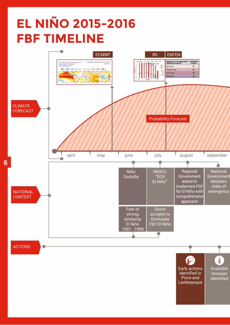
EL NIÑO 2015-2016 FBF TIMELINE
IRI ENFEN
No “Clear” Signal
april may june july august september october november december january february march april may
CLIMATEFORECAST
NATIONALCONTEXT
Probability Forecast
ECMWF
INDECI “SOS
El Niño”
NiñoGodzilla
Donor accepts to formulate
FbF El Niño
Identifying of hazard
levels
Deployment field team
Kit distribution
on water and hygiene
Start of purchasing
process
Start cons-truction and
reinforcement housing process
Early actions identified in Piura and
Lambayeque
Available forecast identified
Training on key practice volunteers.Awareness raising in communityEstablish brigades in the communities for early warning and First Aid
National Government
declares state of
emergency
ACTIONS
NOVEMBER 28TH: Low Probability Trigger | Low Impact
Regional Government
asked to implement FbF for El Niño with comprehensive
approach
JANUARY 25TH: Medium Probability Trigger
JANUARY 28TH: Medium Probability Trigger
1 month
7 days
RainySeason
Fear of strong
similarity El Niño
1997 - 1998
6

IRI ENFEN
No “Clear” Signal
april may june july august september october november december january february march april may
CLIMATEFORECAST
NATIONALCONTEXT
Probability Forecast
ECMWF
INDECI “SOS
El Niño”
NiñoGodzilla
Donor accepts to formulate
FbF El Niño
Identifying of hazard
levels
Deployment field team
Kit distribution
on water and hygiene
Start of purchasing
process
Start cons-truction and
reinforcement housing process
Early actions identified in Piura and
Lambayeque
Available forecast identified
Training on key practice volunteers.Awareness raising in communityEstablish brigades in the communities for early warning and First Aid
National Government
declares state of
emergency
ACTIONS
NOVEMBER 28TH: Low Probability Trigger | Low Impact
Regional Government
asked to implement FbF for El Niño with comprehensive
approach
JANUARY 25TH: Medium Probability Trigger
JANUARY 28TH: Medium Probability Trigger
1 month
7 days
RainySeason
Fear of strong
similarity El Niño
1997 - 1998
7

DE CIENCIA A ACCIÓN
Low
High
El Niño 1+2 SST* anomaly: 2˚C
ENFEN: 10% probability of ‘extraordinary’
IRI: 20% probability of top 10% precipitation
EUROSIP: 40-50% probability of top 20% precipitation
Forecast precipitation 1 month (NOAA.CFSv2)(4-6 mm/day anomaly)
Forecast precipitation 1 month (NOAA.CFSv2) (6-10 mm/day anomaly)
66% probability of excee-ding the 10 year return period threshold of GloFAS* model (for Bajo Piura)
Forecast precipitation: Percentile 85 of ECMWF and GFS –NOAA (> 20mm/day absolute values (Piura and Lambayeque)
Niño 1+2 SST* anomaly: 2.5˚C
ENFEN: 15% probability of ‘extraordinary’
IRI: 30% probability of top 10% precipitation
EUROSIP: 50-70% probability of top 20% precipitation
El Niño 1+2 SST anomaly: 3˚C
ENFEN: 20% probability of ‘extraordinary’
IRI: 40% probability of top 10% precipitation
EUROSIP: 70-100% probability of top 20% precipitation
Forecast precipitation 1 month (NOAA.CFSv2) (10 or + mm/day anomaly)
68% probability of exceeding the 10 year return period threshold of GloFAS* model (for Bajo Piura) Forecast precipitation: Percentile 93 of ECMWF and GFS –NOAA (> 30mm/day absolute values) (Piura and Lambayeque
Lead time Lead time
Seasonal Monthly Weekly
The FbF project builds a bridge between scientific information and early action, firstly to use available forecasts effectively, then to take actions and make decisions to be better prepared for disasters and increase resilience to floods and heavy rain.
The next matrix shows forecasts of various national and international sources (EU, CFS NOAA, NOAA GFS-ENFEN-PERU, IRI-Columbia University, Eurosip- ECMWF, GloFAS), organized by time of forecast, impact and probability, according to the levels of danger to the population. The arrows indicate how forecasts could be translated into actions that could be triggered, if danger levels were exceeded.
FROM SCIENCE... ...TO ACTION
Medium
Provide communities with 100 temporary housing for 100 families. Support for seed storage.
Surface sea water is warmer (>3ºC) and a lot more rain than normal (P90).
A lot more rain than normal (>10mm/day).
Provide communities with 100 temporary housing for 100 families. Support for seed storage.
(Early) evacuation.
Surface sea water is warmer (>2.5ºC) and a lot more rain than normal (P90).
Equip 18 units of first aidProvide drinking water for 2,000 families; 2000 assist families in healthcareStrengthen and protect homes at risk of collapse for 300 families
Wetter than normal (>6mm/day).
Equip 18 first aid unitsProvide drinking water for 2,000 familiesStrengthen and protect homes at risk of collapse for 300 families.
Surface sea water is warmer (>2ºC) and a lot more rain than normal (P90).
Community awareness brigades and installa-tion of early warning.
Community awareness and installation of brigades for early
warning.
Wetter than normal (>4mm/day).
68% chance of flood (Glofas) or very heavy rainfall with short-term forecasts (>30mm/day).
Distribution of buckets, chlorine, instalation of water reservoirs, temporary water tanks, distribution of hygiene kit.
66% chance of flood (Glofas) or very heavy rainfall with short-term forecasts (>20mm/day)
*SST: Sea Surface Temperature *GloFAS: Global Flood Awareness System
PRO
BABI
LITY
/ IM
PACT
PRO
BABI
LITY
/ IM
PACT
8

Low
High
El Niño 1+2 SST* anomaly: 2˚C
ENFEN: 10% probability of ‘extraordinary’
IRI: 20% probability of top 10% precipitation
EUROSIP: 40-50% probability of top 20% precipitation
Forecast precipitation 1 month (NOAA.CFSv2)(4-6 mm/day anomaly)
Forecast precipitation 1 month (NOAA.CFSv2) (6-10 mm/day anomaly)
66% probability of excee-ding the 10 year return period threshold of GloFAS* model (for Bajo Piura)
Forecast precipitation: Percentile 85 of ECMWF and GFS –NOAA (> 20mm/day absolute values (Piura and Lambayeque)
Niño 1+2 SST* anomaly: 2.5˚C
ENFEN: 15% probability of ‘extraordinary’
IRI: 30% probability of top 10% precipitation
EUROSIP: 50-70% probability of top 20% precipitation
El Niño 1+2 SST anomaly: 3˚C
ENFEN: 20% probability of ‘extraordinary’
IRI: 40% probability of top 10% precipitation
EUROSIP: 70-100% probability of top 20% precipitation
Forecast precipitation 1 month (NOAA.CFSv2) (10 or + mm/day anomaly)
68% probability of exceeding the 10 year return period threshold of GloFAS* model (for Bajo Piura) Forecast precipitation: Percentile 93 of ECMWF and GFS –NOAA (> 30mm/day absolute values) (Piura and Lambayeque
Lead time Lead time
Seasonal Monthly Weekly
The FbF project builds a bridge between scientific information and early action, firstly to use available forecasts effectively, then to take actions and make decisions to be better prepared for disasters and increase resilience to floods and heavy rain.
The next matrix shows forecasts of various national and international sources (EU, CFS NOAA, NOAA GFS-ENFEN-PERU, IRI-Columbia University, Eurosip- ECMWF, GloFAS), organized by time of forecast, impact and probability, according to the levels of danger to the population. The arrows indicate how forecasts could be translated into actions that could be triggered, if danger levels were exceeded.
FROM SCIENCE... ...TO ACTION
Medium
Provide communities with 100 temporary housing for 100 families. Support for seed storage.
Surface sea water is warmer (>3ºC) and a lot more rain than normal (P90).
A lot more rain than normal (>10mm/day).
Provide communities with 100 temporary housing for 100 families. Support for seed storage.
(Early) evacuation.
Surface sea water is warmer (>2.5ºC) and a lot more rain than normal (P90).
Equip 18 units of first aidProvide drinking water for 2,000 families; 2000 assist families in healthcareStrengthen and protect homes at risk of collapse for 300 families
Wetter than normal (>6mm/day).
Equip 18 first aid unitsProvide drinking water for 2,000 familiesStrengthen and protect homes at risk of collapse for 300 families.
Surface sea water is warmer (>2ºC) and a lot more rain than normal (P90).
Community awareness brigades and installa-tion of early warning.
Community awareness and installation of brigades for early
warning.
Wetter than normal (>4mm/day).
68% chance of flood (Glofas) or very heavy rainfall with short-term forecasts (>30mm/day).
Distribution of buckets, chlorine, instalation of water reservoirs, temporary water tanks, distribution of hygiene kit.
66% chance of flood (Glofas) or very heavy rainfall with short-term forecasts (>20mm/day)
*SST: Sea Surface Temperature *GloFAS: Global Flood Awareness System
PRO
BABI
LITY
/ IM
PACT
PRO
BABI
LITY
/ IM
PACT
9
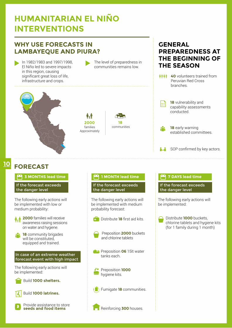
FORECAST
In 1982/1983 and 1997/1998, El Niño led to severe impacts in this region, causing significant great loss of life, infrastructure and crops.
The level of preparedness in communities remains low.
WHY USE FORECASTS IN LAMBAYEQUE AND PIURA?
GENERAL PREPAREDNESS AT THE BEGINNING OF THE SEASON
40 volunteers trained from Peruvian Red Cross branches.
18 vulnerability and capability assessments conducted.
18 early warning established committees.
SOP confirmed by key actors.
2000 families will receive awareness raising sessions on water and hygiene.
18 community brigades will be constituted, equipped and trained.
Build 1000 latrines.
Provide assistance to store seeds and food items
Build 1000 shelters.
Preposition 2000 buckets and chlorine tablets
Preposition 06 15lt water tanks each.
Fumigate 18 communities.
3 MONTHS lead time
Distribute 18 first aid kits.
HUMANITARIAN EL NIÑO INTERVENTIONS
The following early actions will be implemented with low or medium probability:
1 MONTH lead time 7 DAYS lead time
Preposition 1000 hygiene kits.
Reinforcing 300 houses.
Distribute 1000 buckets, chlorine tablets and hygiene kits (for 1 family during 1 month)
If the forecast exceeds the danger level
If the forecast exceeds the danger level
In case of an extreme weather forecast event with high impact
The following early actions will be implemented:
The following early actions will be implemented with medium probability forecast:
If the forecast exceeds the danger level
The following early actions will be implemented:
2000communities
18 families
Approximately
10

CONCLUSIONS
FORECAST
In 1982/1983 and 1997/1998, El Niño led to severe impacts in this region, causing significant great loss of life, infrastructure and crops.
The level of preparedness in communities remains low.
WHY USE FORECASTS IN LAMBAYEQUE AND PIURA?
GENERAL PREPAREDNESS AT THE BEGINNING OF THE SEASON
40 volunteers trained from Peruvian Red Cross branches.
18 vulnerability and capability assessments conducted.
18 early warning established committees.
SOP confirmed by key actors.
2000 families will receive awareness raising sessions on water and hygiene.
18 community brigades will be constituted, equipped and trained.
Build 1000 latrines.
Provide assistance to store seeds and food items
Build 1000 shelters.
Preposition 2000 buckets and chlorine tablets
Preposition 06 15lt water tanks each.
Fumigate 18 communities.
3 MONTHS lead time
Distribute 18 first aid kits.
HUMANITARIAN EL NIÑO INTERVENTIONS
The following early actions will be implemented with low or medium probability:
1 MONTH lead time 7 DAYS lead time
Preposition 1000 hygiene kits.
Reinforcing 300 houses.
Distribute 1000 buckets, chlorine tablets and hygiene kits (for 1 family during 1 month)
If the forecast exceeds the danger level
If the forecast exceeds the danger level
In case of an extreme weather forecast event with high impact
The following early actions will be implemented:
The following early actions will be implemented with medium probability forecast:
If the forecast exceeds the danger level
The following early actions will be implemented:
2000communities
18 families
Approximately
11
Forecast-based financing for El Niño in Peru is a unique initiative with an innovative approach. The use by the Red Cross of probabilistic forecasts for humanitarian early ac-tion is a first in Latin America. It is worth exploring what possibilities FbF can offer for other hydrometeorological events, and whether the probability, the impact, or the intensity of event, or a combination of all three, is important to consider.
Although, scientific signs predicting El Niño are improving, the local and international scien-tific communities still face a challenge to achieve forecast accuracy on both the probability and intensity of the phenomenon. It also remains extremely challenging to predict how it will influence local weather patterns.
In 2015-2016, El Niño in Peru was not a strong or extreme event. It should be noted that not all El Niños are equal, and a single El Niño does not impact in all places with the same intensity. In 2016 Argentina, Paraguay, Uruguay and Brazil suffered heavy rains and floo-ding, while in Colombia, Venezuela and much of Central America suffered severe droughts.
Droughts associated with El Niño and La Niña do not appear overnight. A combination of observation (e.g. sea-surface temperature) and forecasts with a longer lead-time provide humanitarians with several months’ advance warning.
Some actions were taken in vain, but most were beneficial in the long run, contributing to building the capacity for early action of the National Society and local communities. The project also improved the housing stock. Moreover, in very vulnerable rural areas, awa-reness raising was done in the field of health, safe drinking water, and hygiene and early warning. These are long-term benefits that increase resilience and contribute to being pre-pared for other events.
FbF interventions in Piura and Lambayeque will be measured through an impact study and analysed in an inter-agency workshop. Lessons will be identified and guidelines developed to scale up FbF in other countries and for other hazards.
TECHNICAL AND COORDINATION TEAMGerman Red CrossMathieu [email protected]
Red Cross Climate CentreJuan [email protected]
Peruvian Red CrossJuan Carlos [email protected]
Peruvian Red CrossMarcia [email protected]
IDE
NTI
FYING DANGER LEV
ELS
DEV
ELOP EARLY ACTIO
N
> Climate threshold defined.
> The critical danger level was identified by analysing the vulnerability and impact in the target area.
> It took into account the capacity of institutional performance.
> Community awareness campaigns.
> Distributing equipment and
first aid kits.
> Strengthening and protecting housing.
> Humanitarian aid prepared.
WATER IS WARMER > 2ºC THAN NORMAL.
LOT MORE RAIN THAN NORMAL AND POSSIBLE FLOODS.
2000families will receive
awareness raising sessions
40trained volunteers
300reinforced houses
2000families could access to clean drinking water
18first aid kits were distributed 1000
families access to clean drinking water in Piura
1000hygiene kits
100 shelters built
Provide assistance to store seeds and food items
FORECASTED AND TRIGGERED
WAS NOT FORECASTED
> 6 TO 10 MM OF RAIN PER DAY.
18community brigades
will be constituted, equipped and trained
> 20 MM OF RAIN PER DAY.
> 30 MM OF RAIN PER DAY.
FLOODS CAUSED BY RIVER OVERFLOW.
Piura1
2
4Picsi
Mórrope
Morropón
Bajo Piura
1.
2.
3.4.
3
Chiclayo
Desi
gn: J
avie
r Dom
íngu
ez |
Juan
Jos
é Vá
sque
z
FORECASTED AND TRIGGERED
FORECASTED AND TRIGGERED