Embed Size (px)
DESCRIPTION
This is the presentation given David Murphy, P.E., CFM and Mark Carabetta, PWS, CFM of Milione & MacBroom at the May 19th meeting of the East Branch Flood Commission.
Citation preview
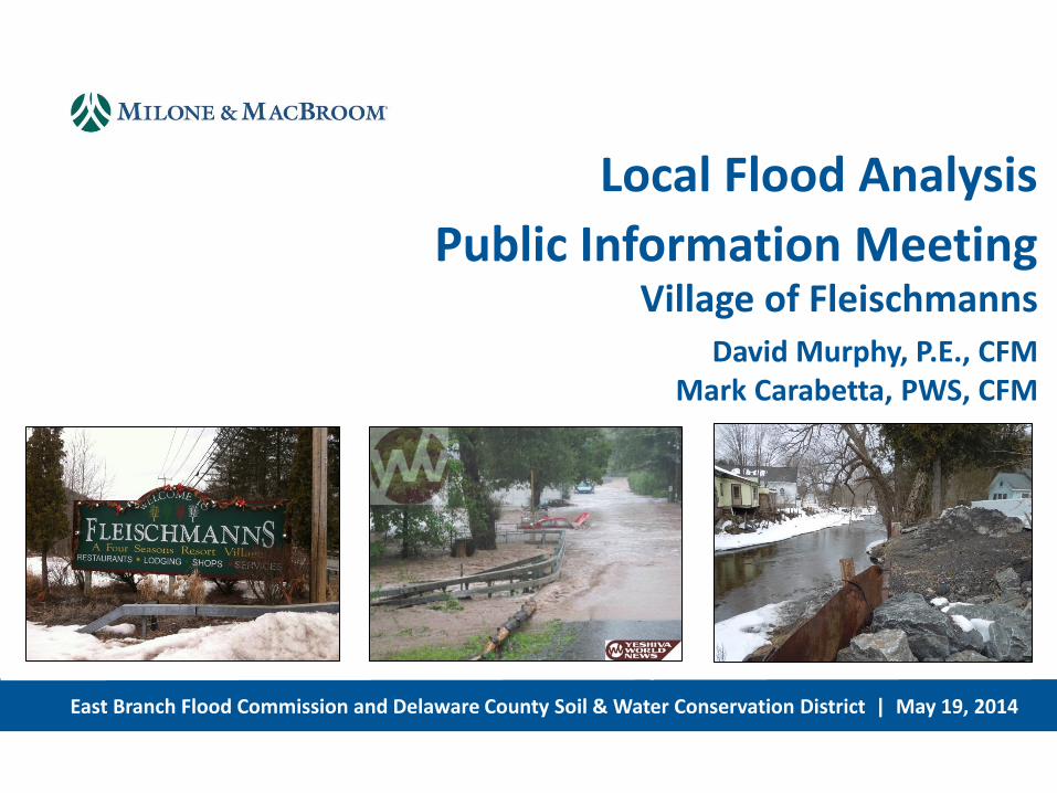
East Branch Flood Commission and Delaware County Soil & Water Conservation District | May 19, 2014
Local Flood Analysis
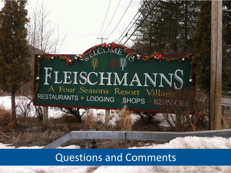
Public Information Meeting Village of Fleischmanns
David Murphy, P.E., CFM Mark Carabetta, PWS, CFM
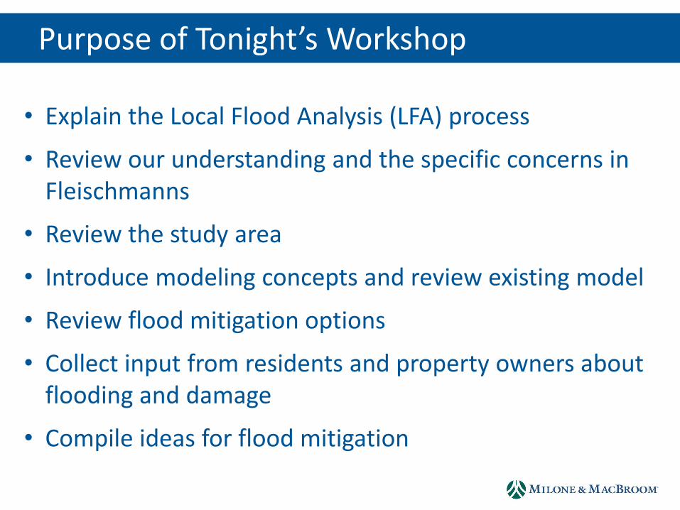
Purpose of Tonight’s Workshop
• Explain the Local Flood Analysis (LFA) process
• Review our understanding and the specific concerns in Fleischmanns
• Review the study area
• Introduce modeling concepts and review existing model
• Review flood mitigation options
• Collect input from residents and property owners about flooding and damage
• Compile ideas for flood mitigation
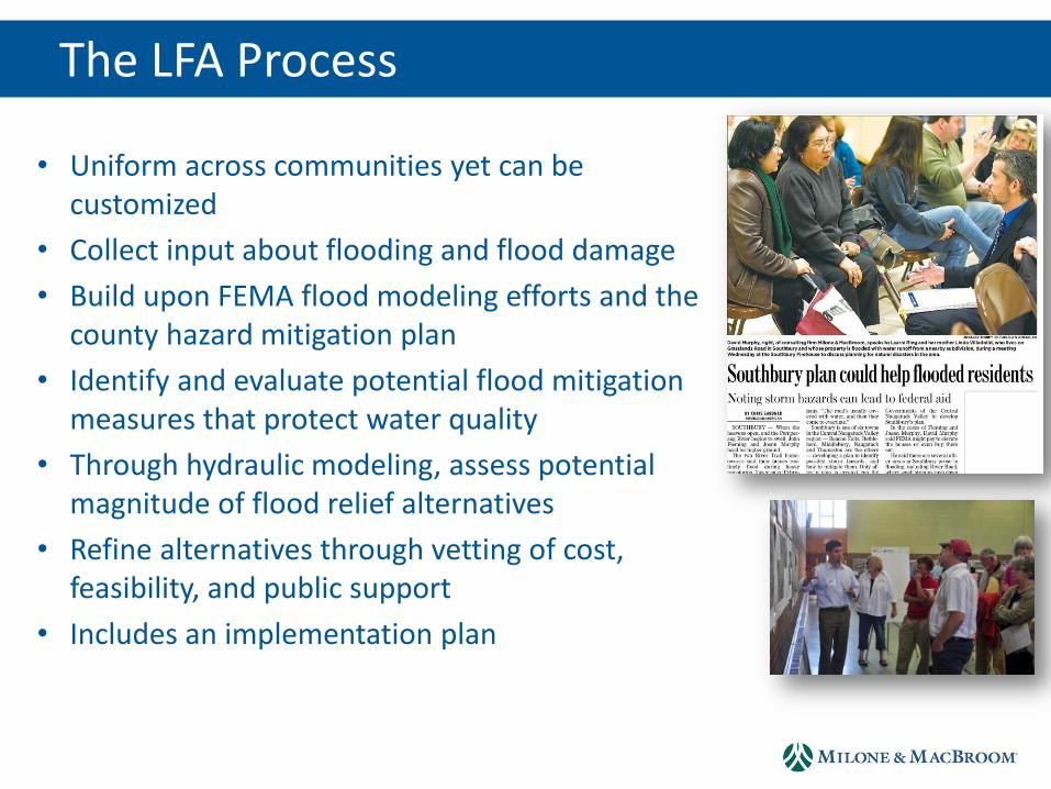
• Uniform across communities yet can be customized
• Collect input about flooding and flood damage
• Build upon FEMA flood modeling efforts and the county hazard mitigation plan
• Identify and evaluate potential flood mitigation measures that protect water quality
• Through hydraulic modeling, assess potential magnitude of flood relief alternatives
• Refine alternatives through vetting of cost, feasibility, and public support
• Includes an implementation plan
The LFA Process
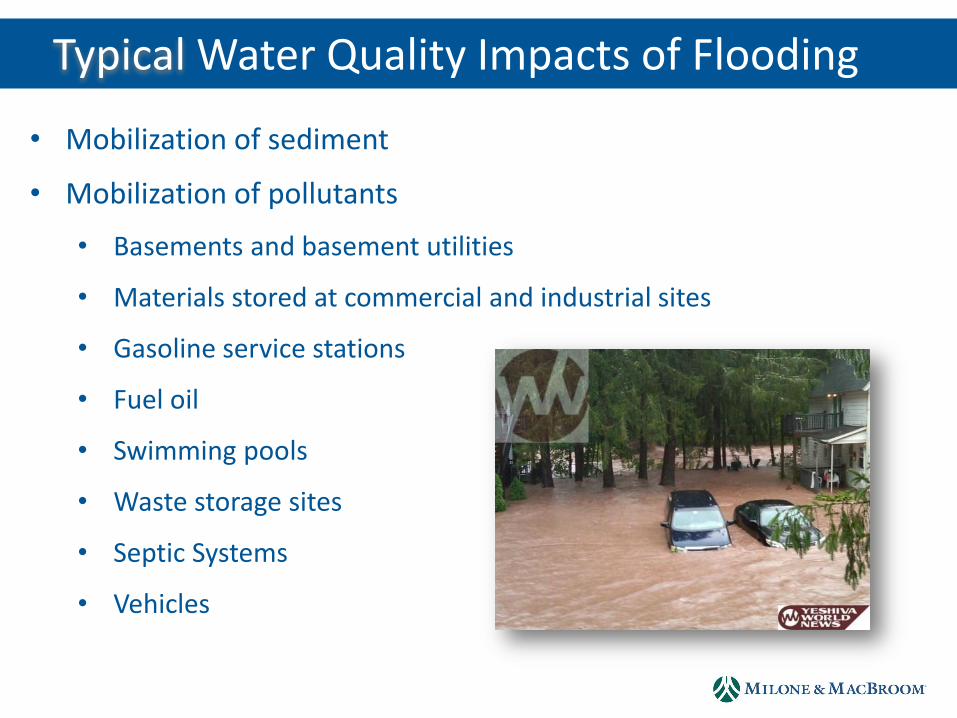
Why Third Brook? Typical Water Quality Impacts of Flooding
• Mobilization of sediment
• Mobilization of pollutants
• Basements and basement utilities
• Materials stored at commercial and industrial sites
• Gasoline service stations
• Fuel oil
• Swimming pools
• Waste storage sites
• Septic Systems
• Vehicles
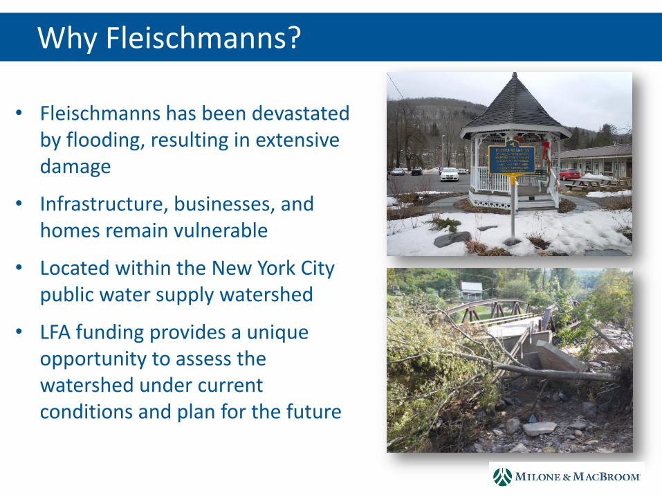
Why Third Brook? Why Fleischmanns?
• Fleischmanns has been devastated by flooding, resulting in extensive damage
• Infrastructure, businesses, and homes remain vulnerable
• Located within the New York City public water supply watershed
• LFA funding provides a unique opportunity to assess the watershed under current conditions and plan for the future

LHA Advisory Committee
• East Branch Flood Commission
• Village of Fleischmanns
• Town of Middletown
• Delaware County
• Delaware County Soil & Water Conservation District
• New York City Department of Environmental Protection
• Milone & MacBroom, Inc.

• Middletown, Halcott, Hardenburgh, Roxbury, Fleischmanns, and Margaretville
• Identify Flood Risks • Educate and Inform Residents, Businesses, Government Officials and
Local Agencies of Flood Risks • Work with Local, State and Federal Officials and Agencies to:
Identify projects and programs that reduce the incidence and impacts of flooding Work together regionally and individually to fund and implement projects and
associated programs throughout our area Enhance and encourage economic development in flood safe areas Educate the wider public regionally as to the mitigation and flood planning and
recovery efforts that are in process Work to coordinate and support local and regional communication and recovery
efforts during declared disaster events across municipal boundaries
East Branch Flood Commission
LFA Advisory Committee
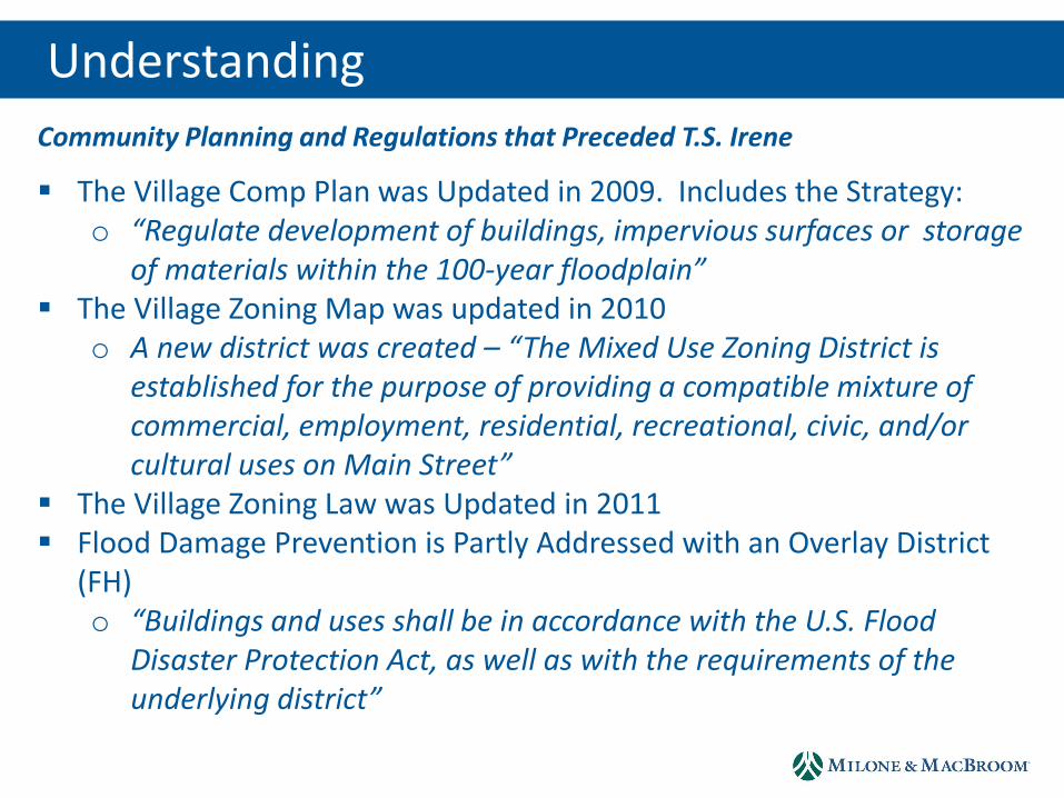
Understanding
The Village Comp Plan was Updated in 2009. Includes the Strategy: o “Regulate development of buildings, impervious surfaces or storage
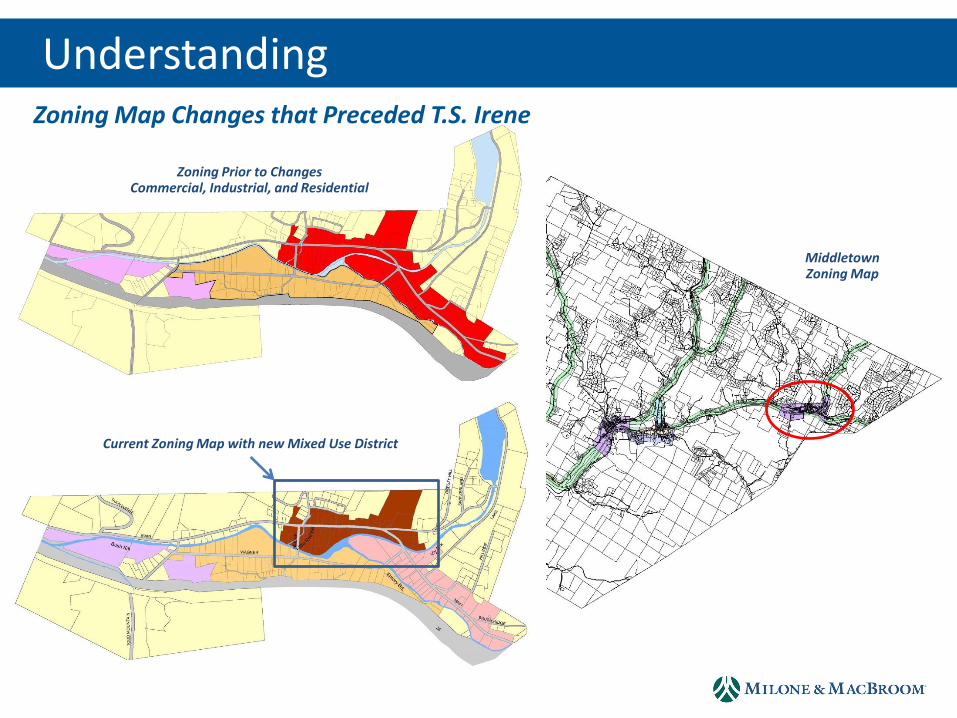
of materials within the 100-year floodplain” The Village Zoning Map was updated in 2010
o A new district was created – “The Mixed Use Zoning District is established for the purpose of providing a compatible mixture of commercial, employment, residential, recreational, civic, and/or cultural uses on Main Street”
The Village Zoning Law was Updated in 2011 Flood Damage Prevention is Partly Addressed with an Overlay District
(FH) o “Buildings and uses shall be in accordance with the U.S. Flood
Disaster Protection Act, as well as with the requirements of the underlying district”
Community Planning and Regulations that Preceded T.S. Irene
Understanding
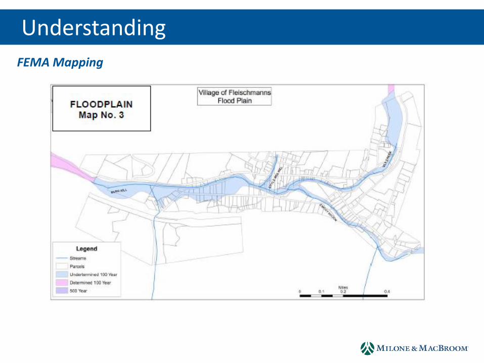
FEMA Mapping
Understanding
Zoning Prior to Changes Commercial, Industrial, and Residential
Current Zoning Map with new Mixed Use District
Middletown Zoning Map
Zoning Map Changes that Preceded T.S. Irene

Understanding
• Changes in FEMA Mapping – Expansion of Homes and Businesses in the SFHA
• Some Property Owners Have Not Been Required to Have Flood Insurance, But May Be Required to Have It
• At the Same Time, Flood Insurance Premiums are Increasing as Actuarial Rates are Phased In
• Potential Community Rating System (CRS) Participation
• Property Owners can Make Changes to Their Structures and Utilities to Reduce Insurance Premiums
• Approximately Four Property Acquisitions in the Village are Pending
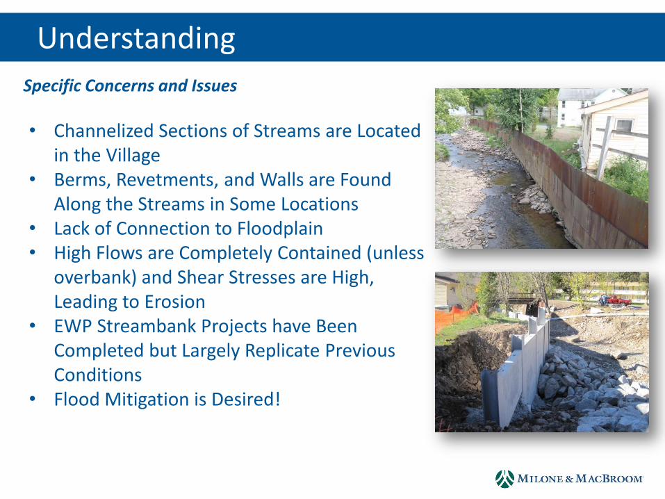
Specific Concerns and Issues
Understanding
• Channelized Sections of Streams are Located in the Village
• Berms, Revetments, and Walls are Found Along the Streams in Some Locations
• Lack of Connection to Floodplain • High Flows are Completely Contained (unless
overbank) and Shear Stresses are High, Leading to Erosion
• EWP Streambank Projects have Been Completed but Largely Replicate Previous Conditions
• Flood Mitigation is Desired!
Specific Concerns and Issues
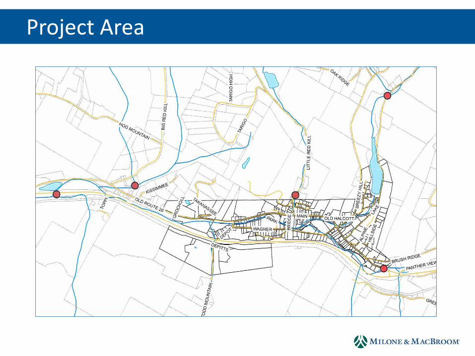
Project Area
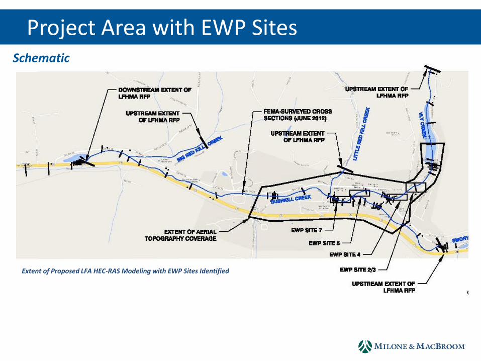
Project Area with EWP Sites
Extent of Proposed LFA HEC-RAS Modeling with EWP Sites Identified
Schematic
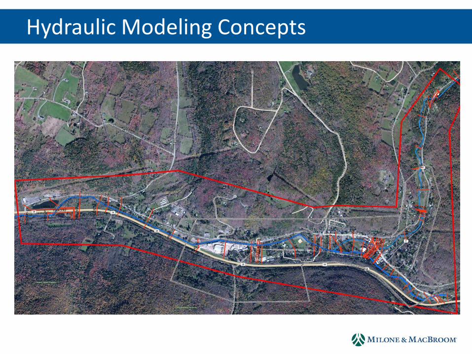
Hydraulic Modeling Concepts
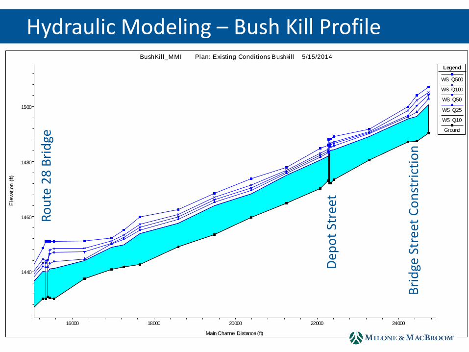
16000 18000 20000 22000 24000
1440
1460
1480
1500
BushKil l_MMI Plan: Existing Conditions Bushkil l 5/15/2014
Main Channel Distance (ft)
Ele
vation
(ft)
Legend
WS Q500
WS Q100
WS Q50
WS Q25
WS Q10
Ground
Hydraulic Modeling – Bush Kill Profile R
ou
te 2
8 B
rid
ge
Dep
ot
Stre
et
Bri
dge
Str
eet
Co
nst
rict
ion
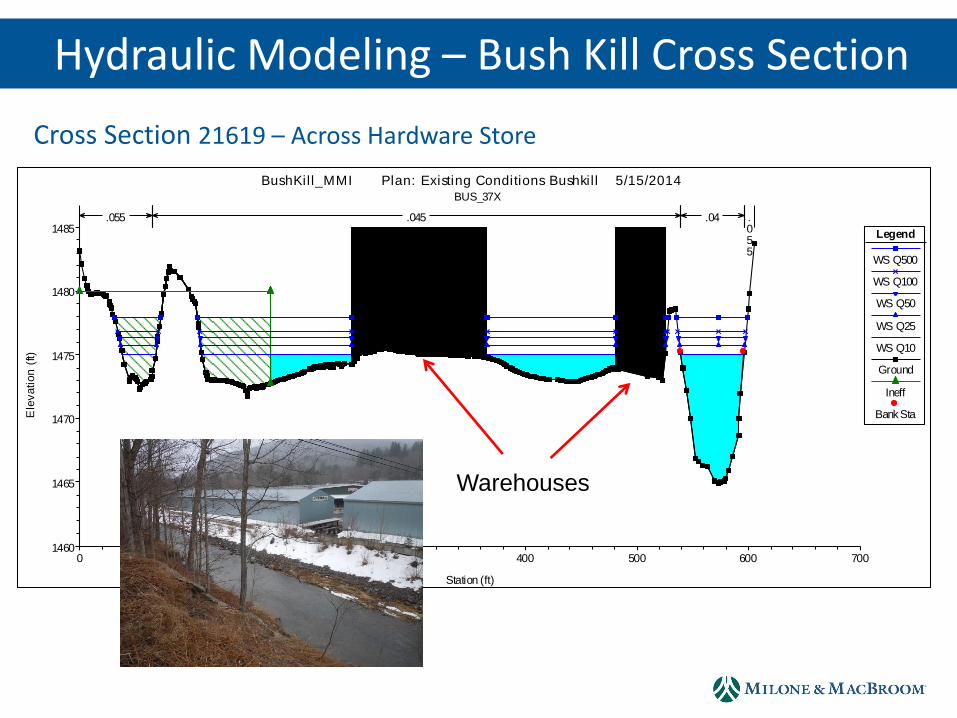
Hydraulic Modeling – Bush Kill Cross Section
Cross Section 21619 – Across Hardware Store
0 100 200 300 400 500 600 7001460
1465
1470
1475
1480
1485
BushKil l_MMI Plan: Existing Conditions Bushkil l 5/15/2014 BUS_37X
Station (ft)
Ele
vation
(ft)
Legend
WS Q500
WS Q100
WS Q50
WS Q25
WS Q10
Ground
Ineff
Bank Sta
.055 .045 .04 .055
Warehouses
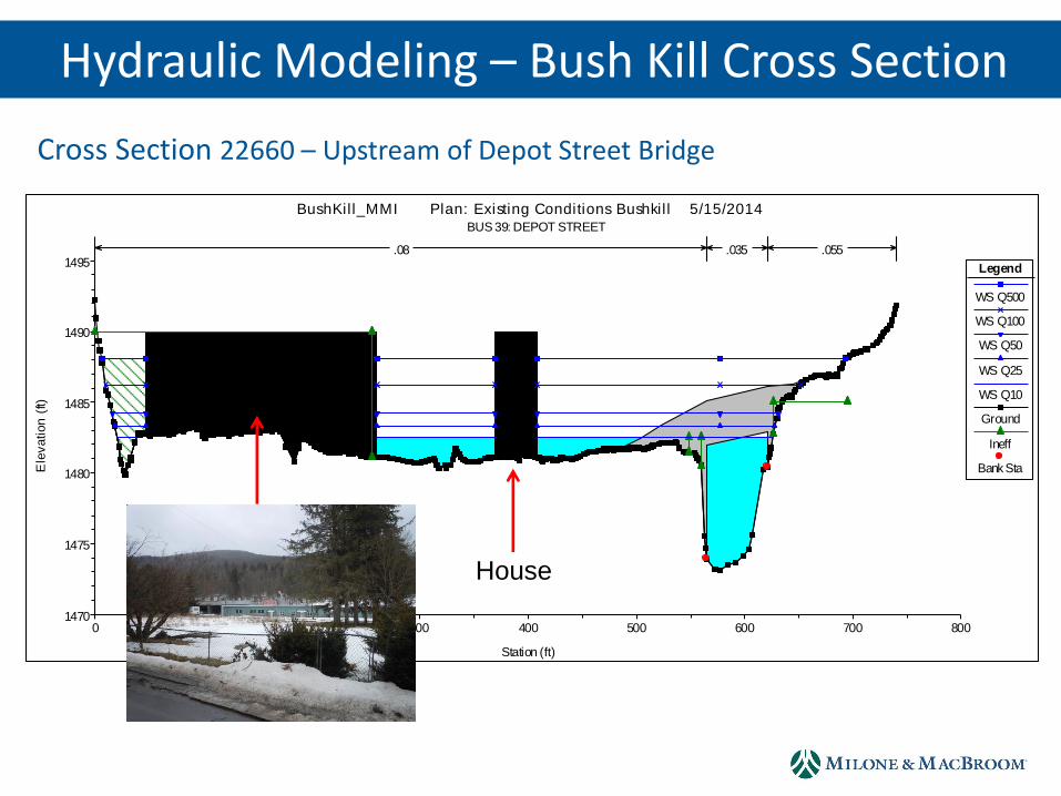
Cross Section 22660 – Upstream of Depot Street Bridge
0 100 200 300 400 500 600 700 8001470
1475
1480
1485
1490
1495
BushKil l_MMI Plan: Existing Conditions Bushkil l 5/15/2014 BUS 39: DEPOT STREET
Station (ft)
Ele
vation
(ft)
Legend
WS Q500
WS Q100
WS Q50
WS Q25
WS Q10
Ground
Ineff
Bank Sta
.08 .035 .055
House
Hydraulic Modeling – Bush Kill Cross Section
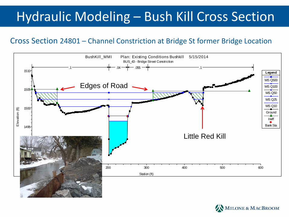
Cross Section 24801 – Channel Constriction at Bridge St former Bridge Location
0 100 200 300 400 500 6001485
1490
1495
1500
1505
1510
BushKil l_MMI Plan: Existing Conditions Bushkil l 5/15/2014 BUS_43 - Bridge Street Constriction
Station (ft)
Ele
vation
(ft)
Legend
WS Q500
WS Q100
WS Q50
WS Q25
WS Q10
Ground
Ineff
Bank Sta
.1 .04 .055 .1
Little Red Kill
Edges of Road
Hydraulic Modeling – Bush Kill Cross Section
0 500 1000 1500 2000 2500 3000 3500
1500
1520
1540
1560
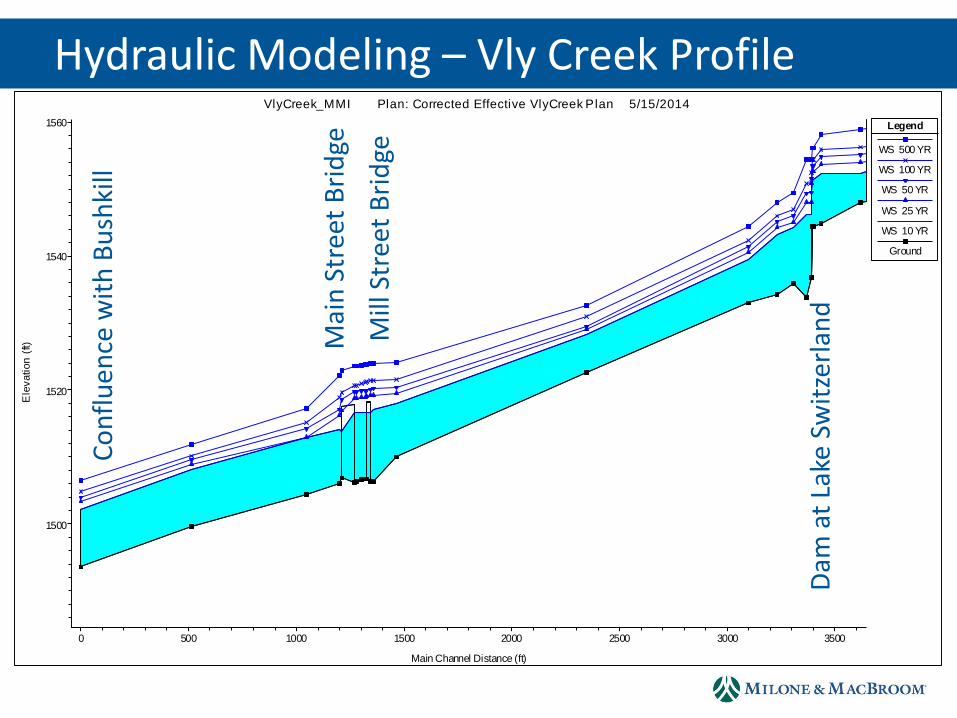
VlyCreek_MMI Plan: Corrected Effective VlyCreek Plan 5/15/2014
Main Channel Distance (ft)
Ele
vation
(ft)
Legend
WS 500 YR
WS 100 YR
WS 50 YR
WS 25 YR
WS 10 YR
Ground
Hydraulic Modeling – Vly Creek Profile
Mai
n S
tree
t B
rid
ge
Mill
Str
eet
Bri
dge
Dam
at
Lake
Sw
itze
rlan
d
Co
nfl
uen
ce w
ith
Bu
shki
ll
Hydraulic Modeling – Vly Creek Cross Section
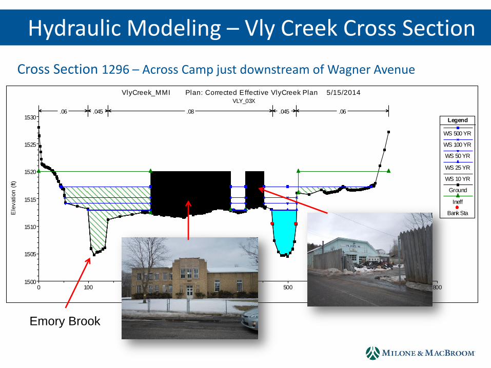
Cross Section 1296 – Across Camp just downstream of Wagner Avenue
0 100 200 300 400 500 600 700 8001500
1505
1510
1515
1520
1525
1530
VlyCreek_MMI Plan: Corrected Effective VlyCreek Plan 5/15/2014 VLY_03X
Station (ft)
Ele
vation
(ft)
Legend
WS 500 YR
WS 100 YR
WS 50 YR
WS 25 YR
WS 10 YR
Ground
Ineff
Bank Sta
.06 .045 .08 .045 .06
Emory Brook
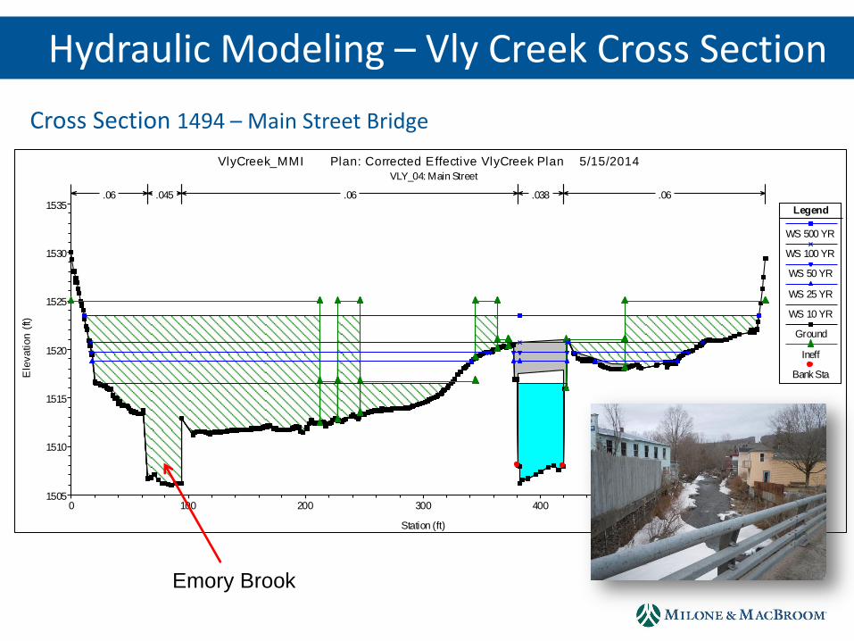
Cross Section 1494 – Main Street Bridge
0 100 200 300 400 500 6001505
1510
1515
1520
1525
1530
1535
VlyCreek_MMI Plan: Corrected Effective VlyCreek Plan 5/15/2014 VLY_04: Main Street
Station (ft)
Ele
vation
(ft)
Legend
WS 500 YR
WS 100 YR
WS 50 YR
WS 25 YR
WS 10 YR
Ground
Ineff
Bank Sta
.06 .045 .06 .038 .06
Emory Brook
Hydraulic Modeling – Vly Creek Cross Section
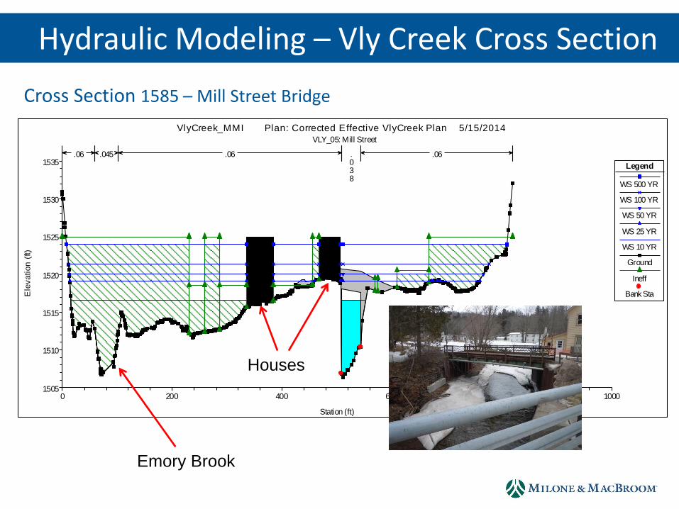
Cross Section 1585 – Mill Street Bridge
0 200 400 600 800 10001505
1510
1515
1520
1525
1530
1535
VlyCreek_MMI Plan: Corrected Effective VlyCreek Plan 5/15/2014 VLY_05: Mill Street
Station (ft)
Ele
vation
(ft)
Legend
WS 500 YR
WS 100 YR
WS 50 YR
WS 25 YR
WS 10 YR
Ground
Ineff
Bank Sta
.06 .045 .06 .038
.06
Emory Brook
Houses
Hydraulic Modeling – Vly Creek Cross Section
0 1000 2000 3000 4000
1500
1510
1520
1530
1540
1550
EB_Project_MMI Plan: Duplicate Effective Emory 5/15/2014
Main Channel Distance (ft)
Ele
vation
(ft)
Legend
WS 500 YR
WS 100 YR
WS 50 YR
WS 25 YR
WS 10 YR
Ground
Hydraulic Modeling – Emory Brook Profile
Wag
ner
Str
eet
Bri
dge
Mai
n S
tree
t B
rid
ge
Co
nfl
uen
ce w
ith
Bu
shki
ll
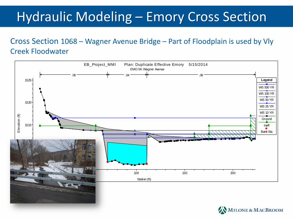
Hydraulic Modeling – Emory Cross Section
Cross Section 1068 – Wagner Avenue Bridge – Part of Floodplain is used by Vly Creek Floodwater
0 50 100 150 2001505
1510
1515
1520
1525
EB_Project_MMI Plan: Duplicate Effective Emory 5/15/2014 EMO 04: Wagner Avenue
Station (ft)
Ele
vation
(ft)
Legend
WS 500 YR
WS 100 YR
WS 50 YR
WS 25 YR
WS 10 YR
Ground
Ineff
Bank Sta
.06 .04 .06

Cross Section 3843 – Main Street Bridge
0 50 100 150 200 250 3001535
1540
1545
1550
1555
1560
1565
EB_Project_MMI Plan: Duplicate Effective Emory 5/15/2014 EMO 09: Main Street
Station (ft)
Ele
vation
(ft)
Legend
WS 500 YR
WS 100 YR
WS 50 YR
WS 25 YR
WS 10 YR
Ground
Ineff
Bank Sta
.06 .04 .06
Hydraulic Modeling – Emory Cross Section
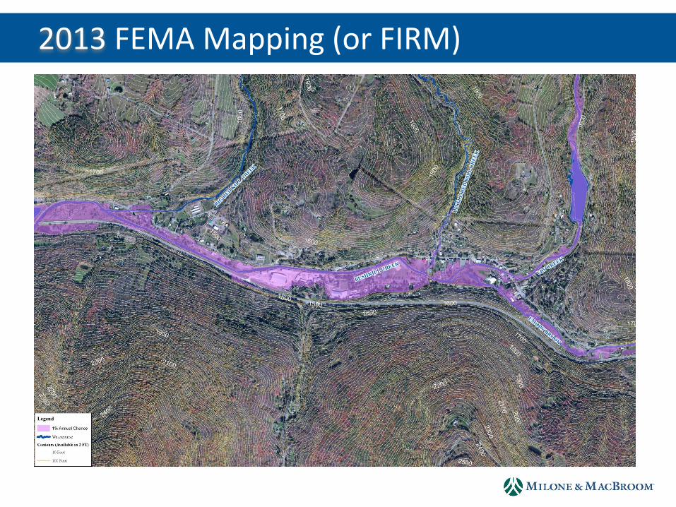
2013 FEMA Mapping (or FIRM)
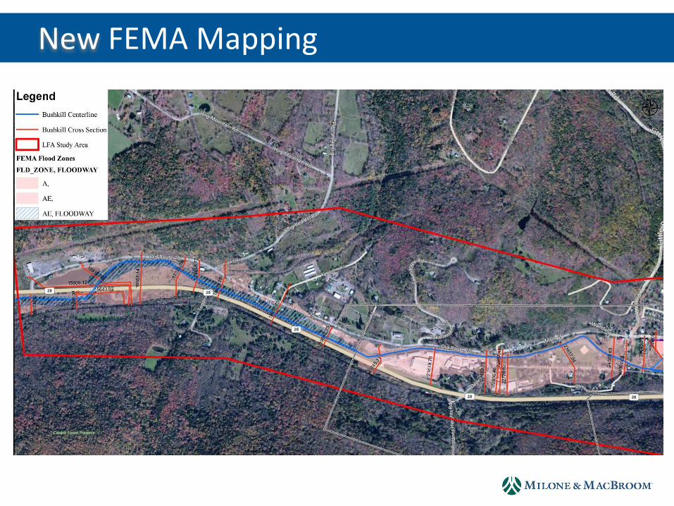
New FEMA Mapping
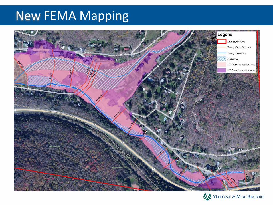
New FEMA Mapping
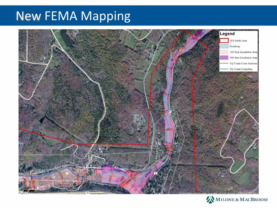
New FEMA Mapping
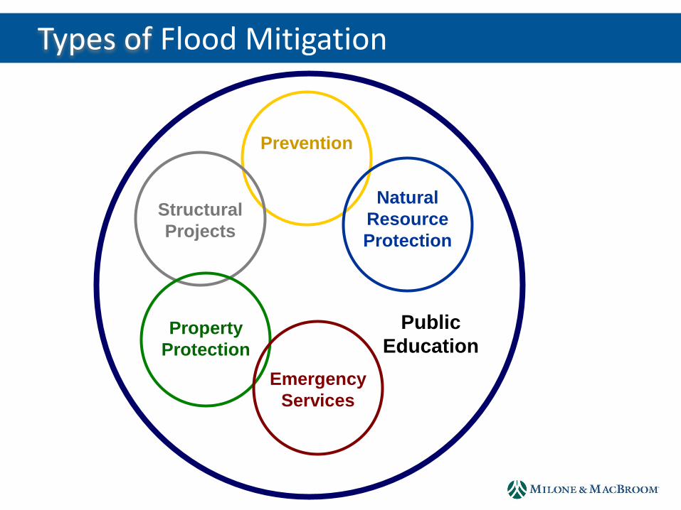
Types of Flood Mitigation
Public
Education
Prevention
Structural
Projects
Natural
Resource
Protection
Property
Protection
Emergency
Services
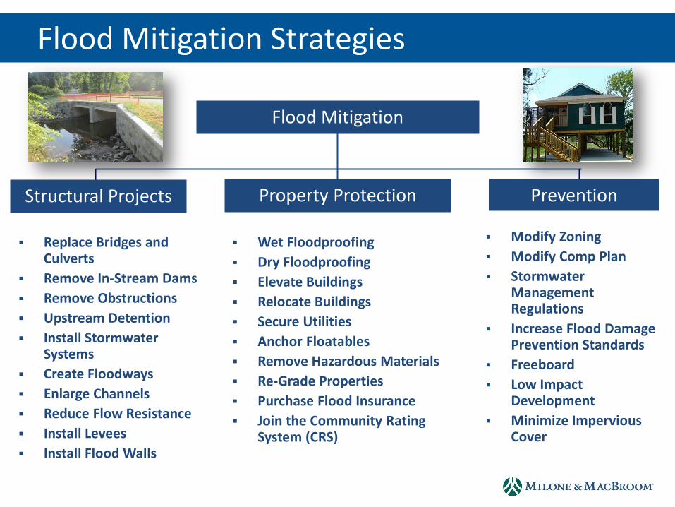
Flood Mitigation Strategies
Flood Mitigation
Structural Projects Prevention Property Protection
Replace Bridges and Culverts
Remove In-Stream Dams
Remove Obstructions
Upstream Detention
Install Stormwater Systems
Create Floodways
Enlarge Channels
Reduce Flow Resistance
Install Levees
Install Flood Walls
Wet Floodproofing
Dry Floodproofing
Elevate Buildings
Relocate Buildings
Secure Utilities
Anchor Floatables
Remove Hazardous Materials
Re-Grade Properties
Purchase Flood Insurance
Join the Community Rating System (CRS)
Modify Zoning
Modify Comp Plan
Stormwater Management Regulations
Increase Flood Damage Prevention Standards
Freeboard
Low Impact Development
Minimize Impervious Cover

Flood Mitigation Strategies
Flood Mitigation
Natural Resources Public Education Emergency Services
Acquire or Preserve Floodplain Land
Acquire and Remove Structures from Floodplains and Convert to Open Space
Acquire or Preserve Other Lands
Increase Wetland Storage
Re-Connect Streams to Floodplains
Build Local Capacities to Respond
Move Critical Facilities from Flood Risk Areas
Establish Emergency Shelters
Elevate Roads or Bridges to Ensure Egress
Develop Community Evacuation Plans
Develop Site-Specific Evacuation Plans
Establish Satellite Facilities in Areas Subject to Isolation
Newsletters
Community Meetings
Information Kiosks
Web Site with Flood Risk Maps
Education of Municipal Staff
Leverage State and FEMA Education Programs
Establish a Standing Committee or Board to Oversee Outreach
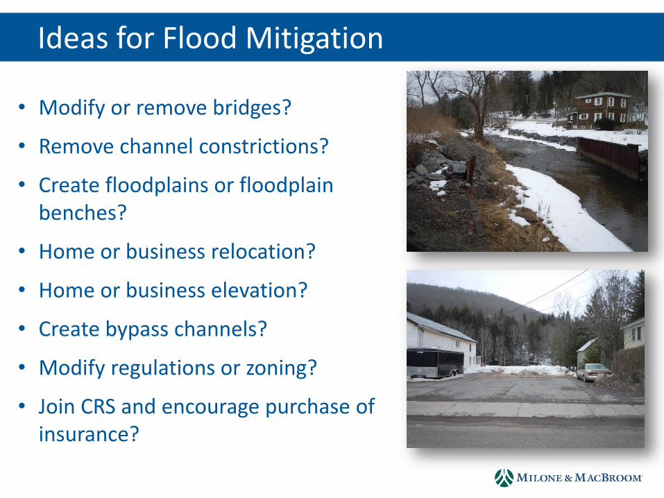
Ideas for Flood Mitigation
• Modify or remove bridges?
• Remove channel constrictions?
• Create floodplains or floodplain benches?
• Home or business relocation?
• Home or business elevation?
• Create bypass channels?
• Modify regulations or zoning?
• Join CRS and encourage purchase of insurance?
Next Steps
• Identification of additional alternatives
• HEC-RAS modeling of options
• Estimation of costs and flood mitigation benefits associated with these options
• Present preliminary findings at a public meeting
Questions and Comments