Embed Size (px)
DESCRIPTION
APPENDIX C Archeological Assessment and Historical and Architectural Survey ........................................... C1 Archaeological Monitoring Plan ................................................................................................... C2 Section 106 Consultation .............................................................................................................. C3 Archeological Assessment and Historical and Architectural Survey C1
Citation preview
APPENDIX C
Cultural Resources Consultants Reports and
Section 106 Consultation
Archeological Assessment and Historical and Architectural Survey ........................................... C1 Archaeological Monitoring Plan ................................................................................................... C2 Section 106 Consultation .............................................................................................................. C3
C1
Archeological Assessment and Historical and Architectural Survey
Archeological Assessment and Historical and Architectural Survey for the Wrangell Road and Utility Improvements Project, Wrangell, Alaska
November 2009
Prepared By: Michael R. Yarborough, MA and Catherine L. Pendleton, MA Cultural Resource Consultants LLC
Amanda Welsh, AIAWelsh Whiteley Architects
For:
4041 B Street
Anchorage, Alaska 99503
Executive Summary
The following is a report of an archeological assessment and a historical and architectural
survey for the Wrangell Road and Utility Improvements Project. The ultimate goal of this
study was the identification of significant properties in the project’s area of potential effects
(APE) that could be eligible for the National Register of Historic Places (National Register).
The City of Wrangell, located on the eastern shore of Zimovia Strait near the northern tip of
Wrangell Island, is approximately 155 miles south of Juneau. The Alaska Department of
Transportation and Public Facilities (DOT&PF), in cooperation with the Alaska Division of the
Federal Highway Administration (FHWA), and the U. S. Environmental Protection Agency
(EPA), is proposing to improve road and utilities along Front and Lynch Streets in the
downtown area of Wrangell, Alaska. FHWA is the lead federal agency for this project. The
proposed project area consists of a seven-block corridor in downtown Wrangell.
The analysis for this project is based on a review of all available archeological and historical
literature, an archeological assessment by Paul Rushmore of Paleo Logics, and reconnaissance
level field surveys by Catherine Pendleton of Cultural Resource Consultants LLC and Amanda
Welsh of Welsh Whiteley Architects.
There are a total of 38 buildings within the APE that date to or before 1965. Of these, four are
recommended as individually eligible under Criterion A: the Patenaude/Grant (PET-278),
National Bank of Alaska/Wells Fargo (PET-618), Jenkins/Hofstad (PET-298), and
Diehl/Neyman (PET-299) buildings. The National Bank of Alaska/Wells Fargo Building (PET-
618) is also recommended as eligible under Criterion C. Seven buildings on the northern side
of Front Street are included within the boundaries of the proposed Wrangell Commercial
Historic District (PET-638). The district includes two of the buildings recommended as
individually eligible—Jenkins/Hofstad (PET-298) and Diehl/Neyman (PET-299). It also
encompasses two buildings that are considered noncontributing, but do not detract from the
district’s overall streetscape. Front Street and the sidewalks are not considered contributing
elements of the district.
Currently available archeological and historical information suggests that archeological deposits
could be discovered during implementation of the project. Front Street from the “northern” end
of the Project to McKinnon Street and the vicinity of Episcopal Avenue to Case Avenue are
considered a high probability areas based on past land use and the potential for intact
prehistoric and historic cultural deposits. At present, however, the exact nature of, or any
possible effects on, archeological deposits in the APE cannot be fully determined. As access is
gained during construction, the identification and evaluation phases of the Section 106 process
will proceed. Archeological monitoring is proposed for areas where there may be buried
cultural remains.
The proposed project will not affect the location or physical features of the eligible buildings.
Also, each of the individual components of the project, in and of themselves, would not have a
significant impact on the historic identity and visual character of downtown Wrangell.
i
Wrangell Road and Utility Improvements Project November 2009
Archeological Assessment and Historical and Architectural Survey

However, in aggregation, the proposed changes to Front Street will affect the downtown
streetscape, which presently has an unadorned, utilitarian aspect. Altering the road cross
section and sidewalk conditions, and adding landscaping, street furniture, and signage, will
improve the accessibility, walkability, and aesthetics of Front Street, but it will also alter the
street’s historic character. As setting, feeling, and association are important aspects of integrity
for buildings eligible under Criterion A, CRC recommends a finding of “Adverse Affect” for
the project.
ii
Wrangell Road and Utility Improvements Project November 2009
Archeological Assessment and Historical and Architectural Survey
Table of Contents
Introduction . . . . . . . . . . . . . . . . . . . . . . . . . . . . . . . . . . . . . . . . . . . . . . . . . . . . . . . . . . . .1
Project Description . . . . . . . . . . . . . . . . . . . . . . . . . . . . . . . . . . . . . . . . . . . . . . . . . . . . . .1
Study Methods . . . . . . . . . . . . . . . . . . . . . . . . . . . . . . . . . . . . . . . . . . . . . . . . . . . . . . . . . .1
Area of Potential Effects . . . . . . . . . . . . . . . . . . . . . . . . . . . . . . . . . . . . . . . . . . . . . . . . .4
Previous Surveys . . . . . . . . . . . . . . . . . . . . . . . . . . . . . . . . . . . . . . . . . . . . . . . . . . . . . . . .4
Ethnic Heritage . . . . . . . . . . . . . . . . . . . . . . . . . . . . . . . . . . . . . . . . . . . . . . . . . . . . . . . . .6
Prehistory . . . . . . . . . . . . . . . . . . . . . . . . . . . . . . . . . . . . . . . . . . . . . . . . . . . . . . . .6
History . . . . . . . . . . . . . . . . . . . . . . . . . . . . . . . . . . . . . . . . . . . . . . . . . . . . . . . . . . .6
Russians and Americans . . . . . . . . . . . . . . . . . . . . . . . . . . . . . . . . . . . . . . . . . . . . . . . . . .9
Redoubt Saint Dionysius, 1834 to 1840 . . . . . . . . . . . . . . . . . . . . . . . . . . . . . . . . .9
Stikine River Gold Rush, 1861 to 1863 . . . . . . . . . . . . . . . . . . . . . . . . . . . . . . . . .9
Fort Wrangell, 1868 to 1877 . . . . . . . . . . . . . . . . . . . . . . . . . . . . . . . . . . . . . . . . .9
Late 19th to Early 20th Century Development of Wrangell . . . . . . . . . . . . . . . . . . . . .10
Post Cassiar Region Gold Rush, 1879 to 1886 . . . . . . . . . . . . . . . . . . . . . . . . . .10
Rise of the Wrangell Fishing and Timber Industries, 1887 to 1893 . . . . . . . . . .10
Klondike Gold Rush Boom and Bust, 1898 to 1899 . . . . . . . . . . . . . . . . . . . . . . .12
Early to Mid-20th Century Development of Wrangell, 1900 to 1941 . . . . . . . . . . . .15
Early Community Planning and Development, 1900 to 1916 . . . . . . . . . . . . . . .15
Community Expansion, 1920 to 1936 . . . . . . . . . . . . . . . . . . . . . . . . . . . . . . . . . .15
Wrangell Fishing and Timber Industry Boom, 1900 to 1939 . . . . . . . . . . . . . . . .17
Roosevelt’s New Deal in Wrangell, 1933 to 1941 . . . . . . . . . . . . . . . . . . . . . . . .17
Post World War II Development of Wrangell . . . . . . . . . . . . . . . . . . . . . . . . . . . . . . .17
Growth and the Changing Face of Wrangell, 1945 to 1965 . . . . . . . . . . . . . . . .17
Fishing Industry Decline, 1945 to 1960 . . . . . . . . . . . . . . . . . . . . . . . . . . . . . . . .19
Rebuilding After the 1952 Fire, 1952 to 1965 . . . . . . . . . . . . . . . . . . . . . . . . . . .20
Timber Industry Boom, 1953 to 1973 . . . . . . . . . . . . . . . . . . . . . . . . . . . . . . . . . .21
Wrangell Architectural Styles . . . . . . . . . . . . . . . . . . . . . . . . . . . . . . . . . . . . . . . . . . . .21
Periods of Significance and Historic Contexts . . . . . . . . . . . . . . . . . . . . . . . . . . . . . . .22
Late 19th to Early 20th Century Development of Wrangell, 1879 to 1899 . . . . .22
Early to Mid-20th Century Development of Wrangell, 1900 to 1941 . . . . . . . . .22
Post World War II Development of Wrangell, 1945 to 1973 . . . . . . . . . . . . . . . .23
iii
Wrangell Road and Utility Improvements Project November 2009
Archeological Assessment and Historical and Architectural Survey
National Register Criteria and Aspects of Integrity . . . . . . . . . . . . . . . . . . . . . . . . . .23
Summary of Recommendations of Eligibility . . . . . . . . . . . . . . . . . . . . . . . . . . . . . . .24
Wrangell Commercial Historic District (PET-638) . . . . . . . . . . . . . . . . . . . . . . .24
Individual Properties . . . . . . . . . . . . . . . . . . . . . . . . . . . . . . . . . . . . . . . . . . . . . .26
Matheson/Angerman Building (PET-274) . . . . . . . . . . . . . . . . . . . . . . . . . . .30
Miles/Benjamin Building (PET-275) . . . . . . . . . . . . . . . . . . . . . . . . . . . . . . .30
Grant/Buness (2) (PET-277) . . . . . . . . . . . . . . . . . . . . . . . . . . . . . . . . . . . . .30
Patenaude/Grant Building (PET-278) . . . . . . . . . . . . . . . . . . . . . . . . . . . . . .31
Campbell/Ottesen Building (PET-283) . . . . . . . . . . . . . . . . . . . . . . . . . . . . .31
Wrangell Fire Hall (PET-284) . . . . . . . . . . . . . . . . . . . . . . . . . . . . . . . . . . . .31
Wheeler/Angerman Building (PET-286) . . . . . . . . . . . . . . . . . . . . . . . . . . . .32
Greif/Stough Building (PET-287) . . . . . . . . . . . . . . . . . . . . . . . . . . . . . . . . . .32
Uhler/Nolan Building (PET-294) . . . . . . . . . . . . . . . . . . . . . . . . . . . . . . . . . .33
Engstrom/Taylor Building (PET-295) . . . . . . . . . . . . . . . . . . . . . . . . . . . . . . .33
Waters/Phillips Building (PET-296) . . . . . . . . . . . . . . . . . . . . . . . . . . . . . . . .33
Konatsu/Gross Building (PET-297) . . . . . . . . . . . . . . . . . . . . . . . . . . . . . . .34
Jenkins/Hofstad Building (PET-298) . . . . . . . . . . . . . . . . . . . . . . . . . . . . . . .34
Diehl/Neyman Building (PET-299) . . . . . . . . . . . . . . . . . . . . . . . . . . . . . . . .35
Grant/Wilcox Building (PET-307) . . . . . . . . . . . . . . . . . . . . . . . . . . . . . . . . .35
Alaska Power and Telephone (PET-615) . . . . . . . . . . . . . . . . . . . . . . . . . . . .35
Bjorge/Fennimore Building (PET-616) . . . . . . . . . . . . . . . . . . . . . . . . . . . . .35
Elks Lodge #1595 (PET-617) . . . . . . . . . . . . . . . . . . . . . . . . . . . . . . . . . . . . .36
National Bank of Alaska/Wells Fargo Building (PET-618) . . . . . . . . . . . . . .36
Redmen Hall/Goodale Building (PET-619) . . . . . . . . . . . . . . . . . . . . . . . . . .36
49th Star Theater/Privett Building (PET-620) . . . . . . . . . . . . . . . . . . . . . . . .37
Thunderbird Hotel/Diamond C Café Buildings (PET-621) . . . . . . . . . . . . . .37
Estaugh Building (PET-622) . . . . . . . . . . . . . . . . . . . . . . . . . . . . . . . . . . . . .38
SNO/Tlingit Haida Housing Authority Building (PET-623) . . . . . . . . . . . . .38
Armstrong House (1) (PET-624) . . . . . . . . . . . . . . . . . . . . . . . . . . . . . . . . . .38
Briskar House (PET-625) . . . . . . . . . . . . . . . . . . . . . . . . . . . . . . . . . . . . . . . .39
ILWU #87 House (PET-626) . . . . . . . . . . . . . . . . . . . . . . . . . . . . . . . . . . . . .39
City Market (PET-627) . . . . . . . . . . . . . . . . . . . . . . . . . . . . . . . . . . . . . . . . . .39
Willard House (PET-628) . . . . . . . . . . . . . . . . . . . . . . . . . . . . . . . . . . . . . . . .40
Farmer House (1) (PET-629) . . . . . . . . . . . . . . . . . . . . . . . . . . . . . . . . . . . .40
The Bay Company (PET-630) . . . . . . . . . . . . . . . . . . . . . . . . . . . . . . . . . . . . .41
Farmer House (2) (PET-631) . . . . . . . . . . . . . . . . . . . . . . . . . . . . . . . . . . . . .41
Armstrong House (2) (PET-632) . . . . . . . . . . . . . . . . . . . . . . . . . . . . . . . . . .41
Armstrong Duplex East (PET-633) and Armstrong
Duplex West (PET-634) . . . . . . . . . . . . . . . . . . . . . . . . . . . . . . . . . . . . . . . .42
Armstrong House (3) (PET-635) . . . . . . . . . . . . . . . . . . . . . . . . . . . . . . . . . .42
Grant’s Groceries/Rayme’s Bar (PET-636) . . . . . . . . . . . . . . . . . . . . . . . . . .42
Wickman House (PET-637) . . . . . . . . . . . . . . . . . . . . . . . . . . . . . . . . . . . . . .43
Archeological Assessment . . . . . . . . . . . . . . . . . . . . . . . . . . . . . . . . . . . . . . . . . . . . . . . .43
iv
Wrangell Road and Utility Improvements Project November 2009
Archeological Assessment and Historical and Architectural Survey
Recommendations of Effect . . . . . . . . . . . . . . . . . . . . . . . . . . . . . . . . . . . . . . . . . . . . . .45
References Cited . . . . . . . . . . . . . . . . . . . . . . . . . . . . . . . . . . . . . . . . . . . . . . . . . . . . . . .50
Appendix A, Historic District Survey Form . . . . . . . . . . . . . . . . . . . . . . . . . . . . . . .A-1
Appendix B, Building Survey Forms . . . . . . . . . . . . . . . . . . . . . . . . . . . . . . . . . . . . .B-1
Appendix C, Archeological Assessment . . . . . . . . . . . . . . . . . . . . . . . . . . . . . . . . . . .C-1
List of Figures
Figure 1. Wrangell Site and Vicinity Map . . . . . . . . . . . . . . . . . . . . . . . . . . . . . . . . . . . . 2
Figure 2. Project Location Map . . . . . . . . . . . . . . . . . . . . . . . . . . . . . . . . . . . . . . . . . . . . 3
Figure 3. Area of Potential Effects. . . . . . . . . . . . . . . . . . . . . . . . . . . . . . . . . . . . . . . . . . 5
Figure 4. “Street Scene Wrangle Alaska 1886.” . . . . . . . . . . . . . . . . . . . . . . . . . . . . . . 11
Figure 5. Wrangell in 1887. . . . . . . . . . . . . . . . . . . . . . . . . . . . . . . . . . . . . . . . . . . . . . . 11
Figure 6. “Front Street, 1886, near block 4, looking east.” . . . . . . . . . . . . . . . . . . . . . . 12
Figure 7. Front Street in 1898 . . . . . . . . . . . . . . . . . . . . . . . . . . . . . . . . . . . . . . . . . . . . 13
Figure 8. Northern end of Front Street in 1908 . . . . . . . . . . . . . . . . . . . . . . . . . . . . . . . 14
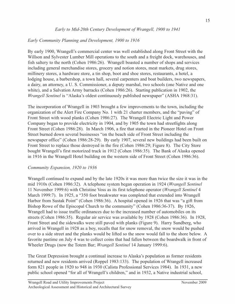
Figure 9. Front Street in 1928 with planked sidewalks and street. . . . . . . . . . . . . . . . . 16
Figure 10. Building Dates . . . . . . . . . . . . . . . . . . . . . . . . . . . . . . . . . . . . . . . . . . . . . . . . 27
Figure 11. Historic Buildings and District . . . . . . . . . . . . . . . . . . . . . . . . . . . . . . . . . . . . 28
Figure 12. Archeological Assessment. . . . . . . . . . . . . . . . . . . . . . . . . . . . . . . . . . . . . . . . 44
Figure 13. View east along the northern side of Front Street . . . . . . . . . . . . . . . . . . . . . 49
List of Tables
Table 1. Recommendations of Eligibility . . . . . . . . . . . . . . . . . . . . . . . . . . . . . . . . . . . 29
v
Wrangell Road and Utility Improvements Project November 2009
Archeological Assessment and Historical and Architectural Survey
Introduction
The following is a report of an archeological assessment and a historical and architectural
survey for the Wrangell Road and Utility Improvements Project. The ultimate goal of this study
was the identification of significant properties in the project’s area of potential effects (APE)
that could be eligible for the National Register of Historic Places (National Register), either
individually or as part of a historic district. Included is documentation prepared in accordance
with Section 106 of the National Historic Preservation Act of 1966, as amended December 12,
2000, and 36 CFR 800.
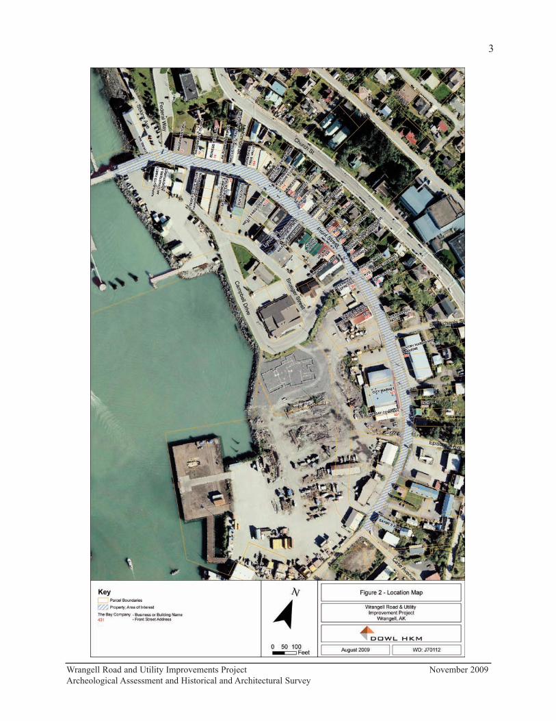
Project Description
The City of Wrangell, located on the eastern shore of Zimovia Strait near the northern tip of
Wrangell Island, is approximately 155 miles south of Juneau. Wrangell is primarily centered
around Wrangell Harbor, with scattered development northward toward the airport and
southward past the former location of the Wrangell Institute (Lemke 1974:8). The city is near
the mouth of the Stikine River, a historic trade route to the Canadian interior.
The Alaska Department of Transportation and Public Facilities (DOT&PF), in cooperation with
the Alaska Division of the Federal Highway Administration (FHWA), and the U. S.
Environmental Protection Agency (EPA), is proposing to improve road and utilities along Front
and Lynch Streets in the downtown area of Wrangell, Alaska. FHWA is the lead federal agency
for this project. The proposed project area is located in Section 25, T62S, R83E (1:63360
USGS Quadrangle Petersburg B-2 NE) and consists of a seven-block corridor in downtown
Wrangell (Figures 1 and 2).
The historic character of the community of Wrangell remains largely intact. Much of this
preservation can be attributed to the lack of recent significant economic investment in the
downtown core. As a result, the downtown area is comprised of deteriorated and uneven
concrete roads and sidewalks, unorganized on-street parking, and deteriorating utilities. On the
positive side, the downtown is lined with historic buildings and includes a working waterfront.
The primary goal of the Wrangell Road and Utility Improvements Project is to replace
sidewalks, rehabilitate and/or reconstruct utilities, and replace deteriorating Front and Lynch
streets. Resulting surfaces will meet State and Federal requirements for the Americans with
Disabilities Act. Although no road alignment shifts are being evaluated by DOT&PF due to
right-of-way constraints, project design alternatives include various parking configurations and
landscaping opportunities within the corridor, as well as different turnaround configurations at
the City pier. Utility work would rehabilitate the sewer line, replace the water line, and improve
the storm drain systems as necessary.
Study Methods
As part of the archeological assessment, Paul Rushmore (2009) of Paleo Logics conducted “a
non-scientific survey of individuals in Wrangell that have knowledge regarding the
Wrangell Road and Utility Improvements Project November 2009
Archeological Assessment and Historical and Architectural Survey

Wrangell Road and Utility Improvements Project November 2009
Archeological Assessment and Historical and Architectural Survey
2
Wrangell Road and Utility Improvements Project November 2009
Archeological Assessment and Historical and Architectural Survey
3
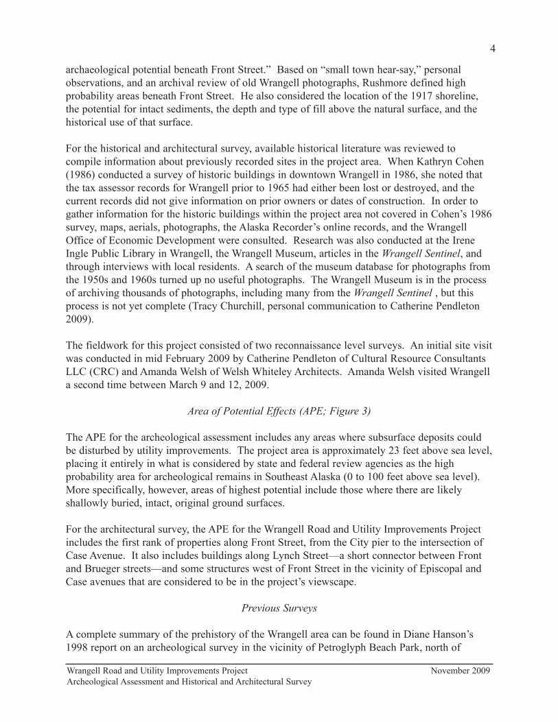
archaeological potential beneath Front Street.” Based on “small town hear-say,” personal
observations, and an archival review of old Wrangell photographs, Rushmore defined high
probability areas beneath Front Street. He also considered the location of the 1917 shoreline,
the potential for intact sediments, the depth and type of fill above the natural surface, and the
historical use of that surface.
For the historical and architectural survey, available historical literature was reviewed to
compile information about previously recorded sites in the project area. When Kathryn Cohen
(1986) conducted a survey of historic buildings in downtown Wrangell in 1986, she noted that
the tax assessor records for Wrangell prior to 1965 had either been lost or destroyed, and the
current records did not give information on prior owners or dates of construction. In order to
gather information for the historic buildings within the project area not covered in Cohen’s 1986
survey, maps, aerials, photographs, the Alaska Recorder’s online records, and the Wrangell
Office of Economic Development were consulted. Research was also conducted at the Irene
Ingle Public Library in Wrangell, the Wrangell Museum, articles in the Wrangell Sentinel, and
through interviews with local residents. A search of the museum database for photographs from
the 1950s and 1960s turned up no useful photographs. The Wrangell Museum is in the process
of archiving thousands of photographs, including many from the Wrangell Sentinel , but this
process is not yet complete (Tracy Churchill, personal communication to Catherine Pendleton
2009).
The fieldwork for this project consisted of two reconnaissance level surveys. An initial site visit
was conducted in mid February 2009 by Catherine Pendleton of Cultural Resource Consultants
LLC (CRC) and Amanda Welsh of Welsh Whiteley Architects. Amanda Welsh visited Wrangell
a second time between March 9 and 12, 2009.
Area of Potential Effects (APE; Figure 3)
The APE for the archeological assessment includes any areas where subsurface deposits could
be disturbed by utility improvements. The project area is approximately 23 feet above sea level,
placing it entirely in what is considered by state and federal review agencies as the high
probability area for archeological remains in Southeast Alaska (0 to 100 feet above sea level).
More specifically, however, areas of highest potential include those where there are likely
shallowly buried, intact, original ground surfaces.
For the architectural survey, the APE for the Wrangell Road and Utility Improvements Project
includes the first rank of properties along Front Street, from the City pier to the intersection of
Case Avenue. It also includes buildings along Lynch Street—a short connector between Front
and Brueger streets—and some structures west of Front Street in the vicinity of Episcopal and
Case avenues that are considered to be in the project’s viewscape.
Previous Surveys
A complete summary of the prehistory of the Wrangell area can be found in Diane Hanson’s
1998 report on an archeological survey in the vicinity of Petroglyph Beach Park, north of
Wrangell Road and Utility Improvements Project November 2009
Archeological Assessment and Historical and Architectural Survey
4

Wrangell Road and Utility Improvements Project November 2009
Archeological Assessment and Historical and Architectural Survey
5
downtown Wrangell (Hanson 1998). To date, the only comprehensive survey of historic
buildings in the project area has been Cohen’s 1986 survey along Front and Church streets,
between Federal Way and Episcopal Avenue.
Ethnic Heritage
Prehistory
To date, archaeological surveys in southeastern Alaska have recorded more than 2,100 sites. A
large percentage of these are shell middens, although numerous other types of prehistoric and
historic resources are known (Autrey 1992). A four-part cultural sequence for southeastern
Alaska proposed by Davis (1990:197) includes a Paleomarine tradition (9000-4500 B.C.), a
Transitional stage (4500-3000 B.C.), a Developmental Northwest Coast stage (3000 B.C. to
European contact), and a Historic period.
The Paleomarine tradition is used to define the earliest cultural stage yet identified within
coastal southeastern Alaska. It is characterized by a well-developed microblade industry with
wedge-shaped microblade cores, few or no bifacial tools, and an economy based on coastal-
marine subsistence (Davis 1990:197). The Paleomarine tradition is followed by a transitional
stage. While this stage has not been well defined, its existence is inferred because of the
appearance of a ground stone tool industry, which becomes dominant over the microblade and
unifacial stone tool industry by 5,000 years ago. The Developmental Northwest Coast stage is
differentiated from the Paleomarine and transitional stages by the presence of shell midden
deposits, ground stone and bone technology, human burials, and the establishment of large
settlements or winter villages, specialized camps, and fortifications.
History
The early historic native peoples of southeast Alaska represent three broad groups: the Tlingit,
the Alaskan Haida (Kaigani), and the Tsetsuat. Of these, the Tlingit were the most widespread
and numerous within the region. Ethnographic Tlingit society embodies most of what is
normally thought of as northern Northwest Coast culture. This culture included an economy
based upon fish (particularly anadromous fish); settled villages; a sophisticated wood working
industry; a highly developed and distinctive art form; a social organization structured around
lineages, clans, and phratries; and a ritual life focused upon totemism, shamanism, and the
attainment of status through potlatching. The Tlingit were distributed in a number of localized,
clan-based, territorial groups across southeast Alaska, with some 10 or more such groups being
known. The project area is within the territory of the Shtax'héen Kwáan (Stikine Tlingit).
Ivan Petrov reported eight villages on Etolin Island and along the Stikine River occupied by the
Stikine Tlingit in the 1880 census. Both Aurel Krause, in 1848, and John Swanton, in 1909,
described two villages on Wrangell Island—one at Deserted Village or Old Wrangell (qata!an,
PET-006), south of the City of Wrangell on the southwestern coast of Wrangell Island; and one
at Wrangell (qatexana-ak!u) (Goldschmidt and Haas 1998:73). According to an article in the
Wrangell Sentinel (3 July 1997), the Totem Park at the corner of Front Street and Episcopal
Wrangell Road and Utility Improvements Project November 2009
Archeological Assessment and Historical and Architectural Survey
6
Avenue was the former site of the Gagaan Hít (Sun House) and the original home of the first
Kiks.ádi totem, “the emblem of the Wrangell Tlingit people.”
According to legend, the Stikines migrated to the Wrangell area through an ice tunnel in a
glacier over the Stikine River (Neal 2007:13). Their first village was at Mill Creek on the
mainland east of Wrangell Island (Goldschmidt and Haas 1998:74). The Stikines were led by
Chief Shakes IV when the Russians came to Wrangell Island in 1834 to build a trading post on
Wrangell Island (Neal 2007:17). According to Thomas Ukas (quoted in Goldschmidt and Haas
1998:75), the Stikine Tlingit were living at Deserted Village at the time of Russian contact.
They moved to Fort Wrangell when the Americans arrived and used Deserted Village for their
gardens.
The British owned Hudson’s Bay Company leased Redoubt St. Dionysius from the Russians in
1840 but moved out in 1849 (Black 2004:201; Neal 2007:42). After the discovery of gold in
1862 and the influx of white prospectors, the Stikine at Wrangell carried supplies and gold
seekers up the Stikine River, “the first commercial transportation” on the river (Neal 2007:17).
The Americans arrived in 1868 and built Fort Wrangell. The Stikine Tlingit profited as
middlemen in trade not only with Native groups along the coasts, but with the Russians, British,
and Americans. In later years, they traded with the businesses at Fort Wrangell (Neal 2007:10).
Once the villagers moved to Fort Wrangell, they began to build their houses like those of the
whites (Neal 2007:21).
Wrangell’s first mission school for Native students was opened by Phillip McKay, a Tsimpsian
from Fort Simpson, B.C, who arrived in Wrangell in 1876 (Cohen 1986:18; Neal 2007:96). He
opened Wrangell’s first mission school with thirty Native students (Cohen 1986:18). The
Presbyterian Church sent Reverend Sheldon Jackson and missionary Amanda McFarland to
Wrangell in August 1877, and Reverend Hall Young arrived in 1878 (Neal 2007:99-100). A
boarding school for Native girls, the McFarland Industrial Home, opened in 1878, and in 1883,
a Native boys’ school was begun. Both of these schools were combined with the Presbyterian
school in Sitka in 1888 (Cohen 1986:18; Neal 2007:104-106). The missionaries in Wrangell
were aided in their work by Sarah Dickinson, a Tlingit from Tongass, who acted as interpreter
and translator before leaving for Haines to teach the Chilkat (Neal 2007:99).
In the late 1800s, many of the Stikine fished for or worked in the canneries in Wrangell. During
this time, the lumber industry was getting its start supporting the fishing industry with wood
products. The Stikine hauled passengers and supplies again during the Klondike gold rush of
1898 (Neal 2007:21). In 1890, Chief Shakes of Wrangell wrote to President Benjamin Harrison
concerning the decline of the salmon fishery. Chief Shakes stressed Tlingit dependence on
salmon for food and the importance of salmon in Tlingit culture. Since the 1880s, salmon
canneries had been trespassing on Native fishing sites and were using illegal barricades across
streams (Haycox and McClanahan 2007:19). In 1895, Congress enacted regulations and
authorized inspections but provided no means of transportation for the inspectors to reach the
canneries (Haycox and McClanahan 2007:19-20).
Wrangell Road and Utility Improvements Project November 2009
Archeological Assessment and Historical and Architectural Survey
7
The Stikine Tlingit were active in their pursuit of Alaska Native rights. Chester Worthington of
Wrangell was one of the founders of the Alaska Native Brotherhood (ANB), established in 1912
mainly to fight for citizenship for Alaska Natives (Haycox and McClanahan 2007: 71; Naske
and Slotnick 1994:188). The Alaska Native Sisterhood (ANS) got its start in Wrangell in 1914
with Eva Blake as President, Louise Bradley as Vice President, and Josie Ukas as Secretary
(Wrangell Sentinel 8 October 1998:1). The ANS was first formed as an auxiliary to the
Wrangell branch of the ANB. The ANS instituted their charter in 1923 and had a constitution
by 1925 (Wrangell Sentinel 8 October 1998:16). The ANS and ANB worked together to gain
citizenship and voting rights for Alaska Natives, integrate schools, and have the 1934 Indian
Reorganization Act extended to Alaska (Wrangell Sentinel 8 October 1998:16).
In 1932, a Native industrial school, the Wrangell Institute, began operation (Cohen 1986:37). In
1968, there were 250 Native students and 60 people on staff (Alaska State Housing Authority
[ASHA] 1968:49). The Wrangell Institute served Wrangell until 1987 when it was closed
because of asbestos; it was later demolished (Wrangell Guide 1999:15). In 1933, built under the
guidance of William Tamaree, the ANB planned the opening of their new hall on Front Street
(Wrangell Sentinel 18 November 1999:6).
In 1940, the Civilian Conservation Corps (CCC) completed their two-year Chief Shakes tribal
house and Shakes Island totem pole project at Wrangell Harbor. A dedication was held in June
1940, and the last Chief Shakes (Charley Jones [Neal 2007:24]) advanced to leadership
(Wrangell Guide 1999:15). According to the AHRS, the community house is a reconstruction of
previous buildings that formerly stood here. Inside the house are four house posts dating to the
17th or 18th century that reportedly were once part of Chief Shakes “Shark House” at “Old
Town” (PET-006) and two Raven Clan house posts. Nine reconstructed and original totem
poles stand outside the house.
Formed in 1939 by the ANB, the Central Council of Tlingit and Haida Indian Tribes of Alaska
(CCTHITA) requested that the Jurisdictional Act of 1935 be amended to distinguish the
CCTHITA as a federally recognized tribe (CCTHITA 2005; Haycox and McClanahan
2007:181). Today, the CCTHITA provides several assistance programs and services, one of
which is the Tlingit-Haida Regional Housing Authority (THRHA). The THRHA was formed in
1973 to supply affordable housing in Southeast Alaska (Daily Sitka Sentinel 26 January 1973:6;
THRHA 2005). The THRHA has an office in Wrangell on Front Street in the SNO/Tlingit-
Haida Regional Housing Authority Building (PET-623).
President Richard Nixon signed the Alaska Native Claims Settlement Act (ANCSA) into law on
December 18, 1971. The act extinguished Alaska Native land claims in exchange for title to
forty million acres of land and $962.5 million. The law also provided for the formation of 12
Native regional corporations, who would oversee the settlement, and over 200 villages
corporations (Naske and Slotnick 1994:207). The amount of land each village could have was
based on enrollment numbers. In Southeast Alaska, since the Tlingit and Haida had already
received $7.5 million for a land claims settlement in 1969, they were to choose “a single
township, or 23,050 acres” (Naske and Slotnick 1994:192, 207). However, the Stikine Tlingit in
Wrangell Road and Utility Improvements Project November 2009
Archeological Assessment and Historical and Architectural Survey
8
Wrangell were excluded from ANCSA because their population was less than half of the total
population of Wrangell (Berger 1985:32).
Kik.setti Totem Park was established in 1987 at the corner of Episcopal and Front streets
(Wrangell Sentinel 3 July 1997:6). The totem was reproduced by carvers Steve Brown and
Wayne Price using traditional tools and methods. Three other totems are also standing in the
park: the Raven, the Keet, and the One-Legged Fisherman.
Russians and Americans
Redoubt Saint Dionysius, 1834 to 1840
After learning that the British had built a trading post on the Stikine River to trade for furs with
the Stikine Tlingit, the Russian American Company built Redoubt Saint Dionysius on Wrangell
Harbor in 1834 in what is now the city of Wrangell (Cohen 1986:5; Naske and Slotnick
1994:47). The exact location of the trading post is unknown, but it is thought to have been built
at the site of the former Alaska Pacific Lumber mill at the southern end of Front Street (Cohen
1986:5). The Russians leased Redoubt St. Dionysius to the British owned Hudson’s Bay
Company (HBC) in 1840 who renamed it Fort Stikine (Black 2004:201). Less than a decade
later, the HBC closed Fort Stikine in 1849 (Neal 2007:42). The HBC later opened a post on the
Stikine River in 1868 which stayed in operation until 1877 (Cohen 1986:7).
Stikine River Gold Rush, 1861 to 1863
In 1861, the discovery of gold on the Stikine River brought an influx of miners to Wrangell, but
the gold rush was short-lived. Little gold was to be had; winter was coming, and supplies were
getting scarce and increasing in price (Cohen 1986:8; Neal 2007:65). The number of people
working claims on the river began to dwindle. In 1863, there were only about 650 prospectors
on the Stikine River and slightly more than 100 men at the end of 1863. Soon, “no more than a
handful” of miners were left (Neal 2007:74).
Fort Wrangell, 1868 to 1877
In 1868, the United States Army built an outpost on Wrangell Island at the present site of the
United States post office building in Wrangell (Cohen 1986:10; Neal 2007:48). It was named
Fort Wrangell after Baron Ferdinand von Wrangell who had been a Russian American Company
manager and a prominent governor of Russian America (Cohen 1986:8; Neal 2007:48). A
square stockade with blockhouses at each corner surrounded a barracks, hospital, and officers’
quarters (Cohen 1986:8). In 1870, because of the expense of keeping outposts in Alaska, the
United States War Department decided to move all of its Alaska operations to Sitka. Fort
Wrangell was closed that same year (Neal 2007:53-54). In 1871, the government sold the fort
property with “nine or ten buildings” to William King Lear; the sale was invalidated in 1877
due to questions about its legality (Neal 2007:55, 57).
Wrangell Road and Utility Improvements Project November 2009
Archeological Assessment and Historical and Architectural Survey
9

The discovery of gold in the Cassiar region in northern British Columbia in 1872 brought
thousands of miners to Fort Wrangell as a stopping off point before heading up the Stikine River
to the gold fields. Fort Wrangell grew as transportation companies, stores, saloons, and poker
houses were established to take advantage of the booming business provided by the visiting
miners (Cohen 1896:10). The U. S. Army returned to Wrangell in 1875 to bring law and order
to the population of “rowdy miners” (Cohen 1986:12). In 1877, the U. S. Treasury Department
took over jurisdiction of Alaska from the War Department. This, coupled with the decrease in
mining claims in the Cassiar region, prompted the U. S. Army to leave Alaska (Cohen 1986:12).
By this time, there were approximately 2,000 people living in Wrangell (Neal 2007:82).
Late 19th Century Development of Wrangell, 1879 to 1899
Post Cassiar Region Gold Rush, 1879 to 1886
After the short-lived Cassiar gold rush, Wrangell “lost its vitality” (Cohen 1986:12). A visitor
to Wrangell in 1883 described Wrangell as “a gloomy and depressing place” (Cohen 1986:12).
In the mid-1880s, E. Ruhamah Scidmore described the main street of Fort Wrangell as little
more than a “wandering grass-grown lane” that stretched from the fort and down the beach
(quoted in Neal 2007:113; Figures 4 and 5). There were log and split-planked buildings with
gable roofs along the street. All of the buildings faced the beach, and they were either directly
on top of the beach gravel or were sitting on pilings (Cohen 1986:13, 17). As shown in Figure
4, Tlingit canoes sat on the beach in front of where the Stikine Drug building is today. Also in
Figures 4 and 5 is a beached ship that was used to house visitors to Wrangell, including some
Chinese miners (Cohen 1986:13, 17). In another 1886 photograph (Figure 6), the St. Rose of
Lima Catholic Church and the First Presbyterian Church and manse can be seen on a rise
behind the buildings on Front Street and above where Church Street is today (Cohen 1986:17).
These church buildings no longer exist, although today’s Catholic and Presbyterian churches are
built on their sites (Cohen 1986:17).
Rise of the Wrangell Fishing and Timber Industries, 1887 to 1893
The first canneries in Alaska were built in Sitka and Klawock in 1878, and by 1900 there were
50 canneries in the state (Naske and Slotnick 1994:69). After the Cassiar Region gold rush
ended in the late 1870s, salmon and timber became important industries for Wrangell. The
Aberdeen Packing Company built the first commercial fish processing operation at the mouth of
the Stikine River in 1887 to harvest salmon (Cohen 1986:19; Alaska Geographic Society
1993:65). By 1889, the plant had moved to Point Highfield on Wrangell Island near where the
airport is today (Cohen 1986:19) and was reestablished as the Glacier Packing Company (Neal
2007:117). The company joined the Alaska Packers Association, who had canneries throughout
Southeast Alaska, in 1893 (Neal 2007:117). The cannery employed mostly Chinese laborers
from the lower 48 who arrived in the summer to work until the fall, when they left on ships
“full of canned salmon” (Cohen 1986:19).
The timber industry in Alaska got its start in the late 1800s as a “support industry,” supplying
wood that the canneries needed for shipping boxes and fish traps and for building storage
Wrangell Road and Utility Improvements Project November 2009
Archeological Assessment and Historical and Architectural Survey
10

Wrangell Road and Utility Improvements Project November 2009
Archeological Assessment and Historical and Architectural Survey
11
Figure 5. Wrangell in 1887. From Neal 2007:111.
Figure 4. “ Street Scene Wrangle Alaska 1886.” According to Cohen (1986:14), this is a view
of the tideland that became Front Street, in the area between McKinnon and St. Michaels
streets. She notes that some of the canoes are in front of where Stikine Drugs (202 Front
Street) is today (Cohen 1986:17).
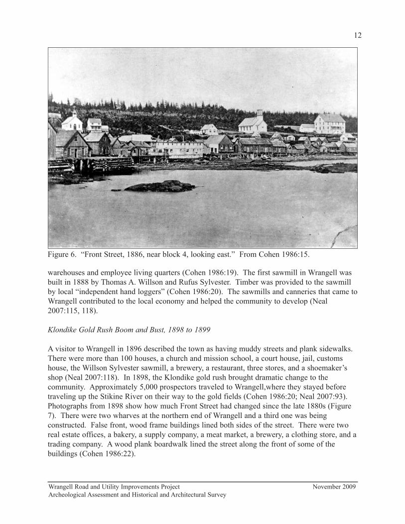
warehouses and employee living quarters (Cohen 1986:19). The first sawmill in Wrangell was
built in 1888 by Thomas A. Willson and Rufus Sylvester. Timber was provided to the sawmill
by local “independent hand loggers” (Cohen 1986:20). The sawmills and canneries that came to
Wrangell contributed to the local economy and helped the community to develop (Neal
2007:115, 118).
Klondike Gold Rush Boom and Bust, 1898 to 1899
A visitor to Wrangell in 1896 described the town as having muddy streets and plank sidewalks.
There were more than 100 houses, a church and mission school, a court house, jail, customs
house, the Willson Sylvester sawmill, a brewery, a restaurant, three stores, and a shoemaker’s
shop (Neal 2007:118). In 1898, the Klondike gold rush brought dramatic change to the
community. Approximately 5,000 prospectors traveled to Wrangell,where they stayed before
traveling up the Stikine River on their way to the gold fields (Cohen 1986:20; Neal 2007:93).
Photographs from 1898 show how much Front Street had changed since the late 1880s (Figure
7). There were two wharves at the northern end of Wrangell and a third one was being
constructed. False front, wood frame buildings lined both sides of the street. There were two
real estate offices, a bakery, a supply company, a meat market, a brewery, a clothing store, and a
trading company. A wood plank boardwalk lined the street along the front of some of the
buildings (Cohen 1986:22).
Wrangell Road and Utility Improvements Project November 2009
Archeological Assessment and Historical and Architectural Survey
12
Figure 6. “Front Street, 1886, near block 4, looking east.” From Cohen 1986:15.
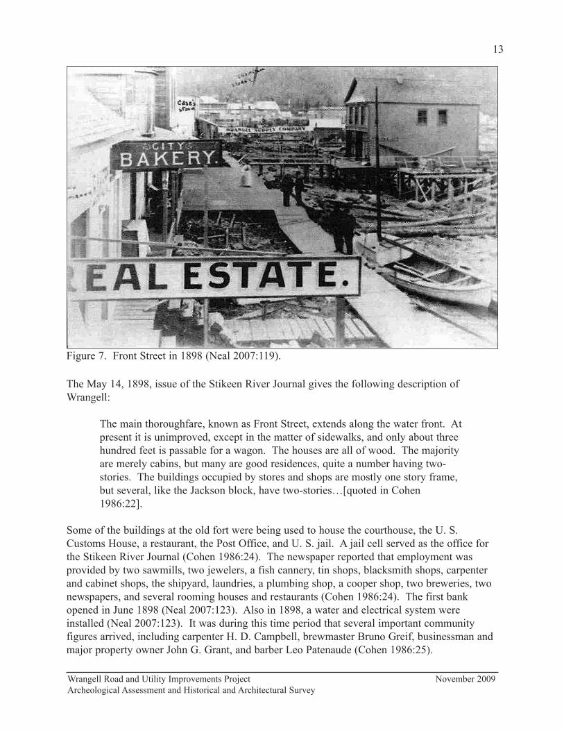
The May 14, 1898, issue of the Stikeen River Journal gives the following description of
Wrangell:
The main thoroughfare, known as Front Street, extends along the water front. At
present it is unimproved, except in the matter of sidewalks, and only about three
hundred feet is passable for a wagon. The houses are all of wood. The majority
are merely cabins, but many are good residences, quite a number having two-
stories. The buildings occupied by stores and shops are mostly one story frame,
but several, like the Jackson block, have two-stories…[quoted in Cohen
1986:22].
Some of the buildings at the old fort were being used to house the courthouse, the U. S.
Customs House, a restaurant, the Post Office, and U. S. jail. A jail cell served as the office for
the Stikeen River Journal (Cohen 1986:24). The newspaper reported that employment was
provided by two sawmills, two jewelers, a fish cannery, tin shops, blacksmith shops, carpenter
and cabinet shops, the shipyard, laundries, a plumbing shop, a cooper shop, two breweries, two
newspapers, and several rooming houses and restaurants (Cohen 1986:24). The first bank
opened in June 1898 (Neal 2007:123). Also in 1898, a water and electrical system were
installed (Neal 2007:123). It was during this time period that several important community
figures arrived, including carpenter H. D. Campbell, brewmaster Bruno Greif, businessman and
major property owner John G. Grant, and barber Leo Patenaude (Cohen 1986:25).
Wrangell Road and Utility Improvements Project November 2009
Archeological Assessment and Historical and Architectural Survey
13
Figure 7. Front Street in 1898 (Neal 2007:119).

One Canadian plan to make it easier to reach Dawson City involved a steamer route from
Wrangell to Glenora on the Stikine River, a railroad to Teslin Lake 150 miles away, and finally
another steamer trip to the Yukon River (Cohen 1986:21; Neal 2007:88). However, the
Canadians never followed through on their plans, and soon miners opted to “bypass Wrangell”
altogether and take the “shorter overland route out of Dyea and Skagway” (Cohen 1986:21).
However, in anticipation of the proposed Canada-route railroad to Dawson City and a
concomitant increase in population and business opportunities, the residents of Wrangell had a
town meeting in November 1898 “to discuss the surveying and platting of the townsite and to
subsequently apply for a patent” (Neal 2007:91). Town trustee and Wrangell businessman
Duncan McKinnon headed the effort, although it was a few more years “before the townsite was
actually acquired” (Neal 2007:91). As the nineteenth century came to a close, the town of
Wrangell was changing. Instead of gold, it was the sawmills and fish canneries that were
providing support for the town and its citizens.
Wrangell Road and Utility Improvements Project November 2009
Archeological Assessment and Historical and Architectural Survey
14
Figure 8. Northern end of Front Street in 1908. On the left are the Matheson/Angerman
Building (PET-274), Grant/Buness Building (PET-276), and Patenaude/Grant Building (PET-278
(Cohen 1986:91).
Early to Mid-20th Century Development of Wrangell, 1900 to 1941
Early Community Planning and Development, 1900 to 1916
By early 1900, Wrangell’s commercial center was well established along Front Street with the
Willson and Sylvester Lumber Mill operations to the south and a freight dock, warehouses, and
fish saltery to the north (Cohen 1986:26). Wrangell boasted a number of shops and services
including general merchandise stores, grocery and notion stores, meat markets, drug stores,
millinery stores, a hardware store, a tin shop, boot and shoe stores, restaurants, a hotel, a
lodging house, a barbershop, a town hall, several carpenters and boat builders, two newspapers,
a dairy, an attorney, a U. S. Commissioner, a deputy marshal, two schools (one Native and one
white), and a Salvation Army barracks (Cohen 1986:26). Starting publication in 1902, the
Wrangell Sentinel is “Alaska’s oldest continuously published newspaper” (ASHA 1968:31).
The incorporation of Wrangell in 1903 brought a few improvements to the town, including the
organization of the Alert Fire Company No. 1 with 21 charter members, and the “paving” of
Front Street with wood planks (Cohen 1986:27). The Wrangell Electric Light and Power
Company began to provide electricity in 1904, and by 1905 the town had streetlights along
Front Street (Cohen 1986:28). In March 1906, a fire that started in the Pioneer Hotel on Front
Street burned down several businesses “on the beach side of Front Street including the
newspaper office” (Cohen 1986:28-29). By early 1907, several new buildings had been built on
Front Street to replace those destroyed in the fire (Cohen 1986:29; Figure 8). The City Store
bought Wrangell’s first motorized truck in 1912 (Cohen 1986:35). The Bank of Alaska opened
in 1916 in the Wrangell Hotel building on the western side of Front Street (Cohen 1986:36).
Community Expansion, 1920 to 1936
Wrangell continued to expand and by the late 1920s it was more than twice the size it was in the
mid 1910s (Cohen 1986:32). A telephone system began operation in 1924 (Wrangell Sentinel
11 November 1999:6) with Christine Voss as its first telephone operator (Wrangell Sentinel 4
March 1999:7). In 1925, a “350 foot breakwater was completed that extended into Wrangell
Harbor from Sustak Point” (Cohen 1986:36). A hospital opened in 1926 that was “a gift from
Bishop Rowe of the Episcopal Church to the community” (Cohen 1986:36-37). By 1926,
Wrangell had to issue traffic ordinances due to the increased number of automobiles on its
streets (Cohen 1986:35). Regular air service was available by 1928 (Cohen 1986:36). In 1928,
Front Street and the sidewalks were still paved with planks (Figure 9). Harry Sundberg, who
arrived in Wrangell in 1928 as a boy, recalls that for snow removal, the snow would be pushed
over to a side street and the planks would be lifted so the snow would fall to the shore below. A
favorite pastime on July 4 was to collect coins that had fallen between the boardwalk in front of
Wheeler Drugs (now the Totem Bar; Wrangell Sentinel 14 January 1999:6).
The Great Depression brought a continual increase to Alaska’s population as former residents
returned and new residents arrived (Roppel 1983:133). The population of Wrangell increased
form 821 people in 1920 to 948 in 1930 (Calista Professional Services 1984). In 1931, a new
public school opened “for all of Wrangell’s children,” and in 1932, a Native industrial school,
Wrangell Road and Utility Improvements Project November 2009
Archeological Assessment and Historical and Architectural Survey
15
the Wrangell Institute, began operation (Cohen 1986:37). The Wrangell Institute served
Wrangell until 1987 when it was closed—and later demolished--because of asbestos
contamination (Wrangell Guide 1999:15). In 1931, a contest was held for a town slogan. The
March 6, 1931, Wrangell Sentinel (18 November 1999:6) announced that the winning slogan for
Wrangell—picked out of 136 entries—was “Wrangell – Where the Stikine Meets the Sea.”
That same year, after the previous owners defaulted on a franchise, the town of Wrangell took
over the light and power utility (Wrangell Sentinel 18 November 1999:6). In the March 29,
1935, issue of the Wrangell Sentinel, it was reported that Wrangell would soon have an Elks
Lodge even though the town was short by about 1,000 of the required 5,000 residents (Wrangell
Sentinel 18 November 1999:6).
The February 7, 1936, issue of the Wrangell Sentinel announced that bids were being accepted
at City Hall for improvements to Front Street and for water and sewer work; about $27,000 had
been “furnished by the Public Works Administration” (Wrangell Sentinel 18 November 1999:7).
The tidelands were covered with fill, the wooden street planks were replaced with crushed rock,
and a new water main and sewer line were placed under the improved street (Cohen 1986:37-
38). According to Cohen (1986:38), as a result “Wrangell has never been the same.”
Wrangell Fishing and Timber Industry Boom, 1900 to 1939
In the early 20th century, the fishing and timber industries helped to support the commercial
businesses on Front Street. In the early 1900s, there were 400 men fishing in the Wrangell area
Wrangell Road and Utility Improvements Project November 2009
Archeological Assessment and Historical and Architectural Survey
16
Figure 9. Front Street in 1928 with planked sidewalks and street. The Wheeler/Angerman
Building (PET-286) is on the left with the sign “Wheeler Drug Co.” (Cohen 1986:99).
and 60 men were employed at the timber mill (Cohen 1986:27, 32). World War I brought an
increase in demand for Alaskan fish and for timber needed for pilings, fish boxes, building
materials, and airplane parts Department of Commerce, Community and Economic
Development [DCCED] 2007). After a “postwar slump,” the fishing industry thrived. Also,
instead of importing most of its timber, the Territory became a timber exporter (Naske and
Slotnick 1994:108-109). The timber and fishing industries continued to be the mainstays of the
businesses along Front Street in Wrangell throughout the 1920s and 1930s (Cohen 1986:32;
Alaska Geographic Society 1993:66).
Important fisheries included not only salmon and halibut, but also shrimp and crab. The Alaska
Shellfish Company began to ship canned crab in 1924 (Cohen 1986:35). That same year, the
Alaska Sanitary Packing Company burned down. The fishing industry experienced a decline
after World War I due to overfishing during and after the war (Haycox and McClanahan
2007:99), but the industry had picked up again by 1926 (Naske and Slotnick 1994:109). The
Wrangell Packing Company was established in 1929, and there were two shrimp canneries and
one crab cannery located at the present City Dock (Wrangell Sentinel 20 May 1999:5). The
Diamond K Packing Company was formed in 1931 at the location of the present ferry terminal
(Wrangell Sentinel 20 May 1999:5). The Reliance Shrimp Company shipped 75,000 pounds of
shrimp in 1931 (Cohen 1986:35) and in 1934, they brought in ten shrimp picking machines
from Petersburg that replaced 100 workers (Wrangell Sentinel 18 November 1999:6).
The Willson and Sylvester Lumber Mill burned down in 1918, but it was rebuilt in 1919
(Wrangell Guide 1999:15). The mill continued to expand and by 1922 was an international
lumber supplier (Cohen 1986:32). By 1926, it had become “the largest lumber mill in the
Territory” (Cohen 1986:32).
Roosevelt’s New Deal in Wrangell, 1933 to 1941
Under President Roosevelt’s New Deal, the Civilian Conservation Corps (CCC, formed in 1933)
undertook many projects in Alaska, including building community houses, docks and small boat
harbors, and roads and trails; planning and building recreation areas; and refurbishing totem
poles (Naske and Slotnick 1994:110-111). In 1940, the CCC completed a two-year Chief
Shakes tribal house and Shakes Island totem project at Wrangell Harbor (Wrangell Guide
1999:15). In 1941, as part of the Public Works Administration (WPA) formed under the New
Deal in 1935, a new Art Deco United States Post Office and Customs House (PET-316) was
completed on the former site of the U. S. Army’s Fort Wrangell. Also a WPA project, the
Wrangell Fire Hall—an Art Moderne style building—was completed that same year.
Post World War II Development of Wrangell, 1945 to 1973
Growth and the Changing Face of Wrangell, 1945 to 1965
Wrangell was on the periphery of the dramatic developments elsewhere in the Territory during
World War II, although in 1944, even though the end of the war still about a year away, the
community was looking toward the future. R. W. Curtis moved his City Market into the newly
Wrangell Road and Utility Improvements Project November 2009
Archeological Assessment and Historical and Architectural Survey
17
renovated Redmen building in January 1944 to accommodate his expanding business, and in
June 1944, Mayor Fred G. Hanford and Street Supervisor Joe Weaver, along with Walter
Coulter, Bill Hanson, Mike Lynch, and Jocko Brown, poured the first concrete for the first
paving of Front Street (Wrangell Sentinel 25 November 1999:8). In 1946, Wrangell elected its
first woman mayor, Doris M. Barnes, by “a 50-vote margin” (Wrangell Sentinel 25 November
1999:8). That same year, the Wrangell Post Office was upgraded from third class to second
class due to an increased volume of business (Wrangell Sentinel 25 November 1999:8).
In 1950, Wrangell was planning for a new water and sewer system “as soon as the funds are
available,” and in 1951 the U. S. Forest Service and Bureau of Public Roads announced that
plans to extend the Zimovia Highway to Pat’s Creek had been approved (Wrangell Sentinel 25
November 1999:9). In late 1954, the Front Street water and sewer project was approved by the
Wrangell City Council (Wrangell Sentinel 25 November 1999:9). The year 1957 also saw
more improvements to Front Street. Under the headline “Paving Underway: ‘Sack of Cement
Club’ Now Over 300 Members,” the October 11, 1957, Wrangell Sentinel (2 December 1999:9)
reported:
Well over three hundred sacks of cement have been either paid for or pledged by
the local citizenry for the Front Street paving. The project is now under way and
Street Superintendent E. W. Hunter hopes to lay about 100 feet per day weather
permitting.
The building constructed by Hans Ensbrunner in the 1950s on the southern side of Front Street
west of City Market was later enlarged by the Stikine Native Organization (Dick Stokes,
personal communication 2009), and by 1962 was the home of Moore’s Building Supply (Alaska
Tidelands Survey No. 83 1962). By 1956, as shown on an Alaska Public Works Program 1956
as-built drawing of Wrangell, City Market had relocated to its present location and was next to
what was then Ottesen’s Machine Shop. By 1962, City Market had added onto their operations,
expanding north where Ottesen’s Machine Shop was formerly located. Carter Welding
(currently housing The Bay Company) had also added onto their building (Alaska Tidelands
Survey No. 83 1962). A new building for the General Telephone Company (currently housing
Alaska Power and Telephone) was built in 1963 on the northern side of Front Street between the
Grant/Buness Building (PET-277) and the Patenaude/Grant Building (PET-278; ASHA
1968:134).
The ferry terminal at Wrangell, completed in 1962, was the first along the Southeast Alaska
ferry route (Wrangell Sentinel 9 December 1999:8). The Wrangell Sentinel declared that the
Alaska marine highway officially opened on January 24, 1963, when the M/V Malaspina pulled
into Wrangell (Wrangell Sentinel 9 December 1999:8). Cruise ships also stopped at Wrangell
on their return voyages from Skagway, with approximately 8,000 cruise ship passengers visiting
Wrangell in 1966, (ASHA 1968:59). In 1963, capital improvements proposed by Governor
William Egan included $1,100,000 for airports to be built at Wrangell and Petersburg (Wrangell
Sentinel 9 December 1999:8). The airport on Wrangell was completed in 1969 at a cost of $2.5
million (Wrangell Sentinel 9 December 1999:9). In 1963, the Department of Highways
announced that plans were underway to extend Church Street and the south Wrangell Highway
Wrangell Road and Utility Improvements Project November 2009
Archeological Assessment and Historical and Architectural Survey
18
(Zimovia Highway) to connect with the north Wrangell Highway and the ferry terminal;
construction was to begin in 1965 (Wrangell Sentinel 9 December 1999:9).
An undated tourist brochure (possibly from the 1960s) titled “Wrangell, Alaska, Things to See
in Wrangell,” proclaimed that Wrangell was typical of any Southeastern city. The town of 1,450
people had three shrimp, two crab, and one salmon cannery; several stores and gift shops;
lodging facilities; sawmills; a library and drug store; a hospital and doctors; and restaurants.
There was a post office, U. S. Customs office, garages, a barber shop, a hardware store, and a
building supply store. The brochure noted that Wrangell had several civic organizations such as
Alaska Native Brotherhood, Alaska Native Sisterhood, American Legion, Business and
Professional Women’s Club, Eastern Star, Elks, and Redmen. It boasted that the high school
had been accredited since 1934 and had a band, a chorus, and basketball teams. The brochure
also listed several things to do around town including beach combing, boating, fishing, hunting,
and dancing.
Fishing Industry Decline, 1945 to 1960
Burnett Inlet Salmon Company, established in 1942 on the site of the “old city mill,” became
Farwest Saginaw in 1943. In 1946, the Grindall Fisheries—owned by Farwest Fisherman—
took over. Binkley’s Canning Company opened in 1946, but shut down in 1949 (Wrangell
Sentinel 20 May 1999:5). In 1947, the Farwest-Wrangell Cannery burned to the ground with an
estimated loss of $750,000 in buildings and equipment; this also resulted in the loss of local
jobs and fishermen’s profits (Wrangell Sentinel 25 November 1999:8). The Wrangell Packing
Company, Diamond K Packing Company, and the ARB Packing Company consolidated their
holdings and formed the Wrangell Packing Company in 1947 (Alaska Geographic 1978:86).
The Wrangell Packing and ARB Packing companies had been inactive for the previous four
years and the Diamond K had burned down in 1946 (Alaska Geographic 1978:86). Harbor
Seafoods, Inc. was established in 1949 by Ben Engdal and Harry Sundberg (Wrangell Sentinel
14 January 1999:6).
While salmon was the most important commodity of the fishing industry, shrimp processing
played a part in the economy, as well as Dungeness crab and halibut (ASHA 1968:31). Harbor
Seafoods and the newly opened W. F. Smith Company brought in shrimp picking machines in
1957 (Wrangell Sentinel 2 December 1999:9). The 1950s saw the collapse of the fishing
industry in Southeast Alaska due to overfishing and mismanagement by the Federal government
(Rogers 1960:299-308). Adding to the problem were the “high-seas salmon catches” made by
the Japanese (Naske and Slotnick 1994:158). Alaska achieved statehood in 1959, and that same
year the fishing industry experienced “a record low” (Naske and Slotnick 1994:174). The
March 13, 1959, Wrangell Sentinel announced that fish traps had been banned that year in
Alaska, a move that had been opposed by the “salmon fishing and canning industry, largely
centered in Seattle” (Wrangell Sentinel 2 December 1999:9). Management of the fisheries was
turned over to the State of Alaska in 1960. Under the more watchful eye of the State, the
fishery improved. The “wholesale value of the fish catch” had nearly doubled by 1965;
however, a shortage of salmon caused wholesale values to decline in 1967 (Naske and Slotnick
1994:176).
Wrangell Road and Utility Improvements Project November 2009
Archeological Assessment and Historical and Architectural Survey
19

Rebuilding After the 1952 Fire, 1952 to 1965
In March 1952, another disastrous fire broke out in Wrangell that burned through three blocks
of the waterfront side of Front Street (Wrangell Sentinel 25 November 1999:9) from where the
current Diamond “C” Café building stands to the current Napa building to the north (Mike
Whelan, personal communication 2009). A furnace explosion in the Wrangell Electric and
Supply Company building, a business co-owned by Charles Early and Virgil Neyman, was the
cause of the fire which burned all the way up to the Wrangell Cold Storage building and the
McCormack Dock before it was brought under control (Wrangell Sentinel 25 November
1999:9). Over 25 buildings were destroyed that housed businesses and homes. Several historic
buildings such as the Wrangell Hotel, the Redmen Hall building that housed City Market, and
the original Elks Lodge building were destroyed in the blaze (Wrangell Sentinel 25 November
1999:9). One of the many businesses destroyed was the American Bakery, opened by Kay and
Lee Stella just two months prior to the fire. It was located at the site where the Kadin building
is today (Wrangell Sentinel 1 April 1999:12).
Development of the southern side of Front Street after the 1952 fire was slow, and by 1965
there were still few buildings on the tideland fill. The first building to be rebuilt after the fire
was Bjorge Transfer (now Fennimore’s Service Center) completed in 1952. This was soon
followed by the Elks Lodge (Wrangell Sentinel 19 December 1952) and the building for the
Improved Order of Redmen (Wrangell Sentinel 25 December 1953). In 1955, a large area of fill
was put down covering the area that burned in the 1952 fire. It extended from the Wrangell
Wharf to where the Diamond “C” Café building is today (ASHA 1968:18; Wrangell Elementary
School 1974:26). Dick Ballard opened the 49th Star Theater in 1958 in the building currently
housing the Wrangell Sentinel and other businesses; it served Wrangell as a movie theater until
1976 (Wrangell Sentinel 2 December 1999:8).
The 1962 Alaska Tidelands Survey No. 83 map shows—in addition to the buildings noted
above—a hotel where the Diamond “C” Café is today and a place called “Ritchie’s” west of
Union Oil with a smaller building next to it. Frank Murkowski, assistant vice president and
manager of the Wrangell Branch of the National Bank of Alaska (and later U. S. Senator and ,
Governor of Alaska) announced that a dedication was to be held for the new bank building (now
Wells Fargo) on May 22, 1965 (Wrangell Sentinel 9 December 1999:9) constructed on the
tideland fill. The ASHA (1968:18, 31) reported that the waterfront area that burned in the 1952
fire was still largely undeveloped by 1968. In addition to the fill that was put down in the area
of the fire, fill had also been added at the Wrangell Lumber Company location and at the ferry
terminal site (ASHA 1968:19).
The 1978 Alaska Geographic reported that many of the commercial buildings in downtown
Wrangell were “relatively new,” as most of them had been built after the 1952 fire (Alaska
Geographic 1978:83). In the 1970s and later, several buildings were constructed south of Front
Street on the tideland fill: the Kadin Building, the now vacant TSA building, Wrangell City
Hall, Alaska Community Services, Smith Chiropractic Building, Northland Services, the Napa
Auto Parts building, and Ottesen’s True Value Hardware and Lumber Warehouse. The Stikine
Inn, west of the Post Office, was built in 1970. In 1973, the Alaska Native Brotherhood Hall,
Wrangell Road and Utility Improvements Project November 2009
Archeological Assessment and Historical and Architectural Survey
20
built in 1933 on the southern side of Front Street, burned down (Wrangell Sentinel 8 October
1998:1).
Timber Industry Boom, 1953 to 1973
Market demand for Alaskan timber began to decline after World War II, when metal replaced
Alaska spruce in airplanes, and cardboard cartons were used in place of wooden boxes for
shipping fish (DCCED 2007). However, a new timber market soon opened up that helped
bolster the economy while the fishing industry was collapsing. In 1953, the Japanese parent
company of Alaska Pulp Company formed the Alaska Pulp and Lumber Company, and in 1954,
established the Wrangell Lumber Company (DCCED 2007). The March 20, 1953, issue of the
Wrangell Sentinel announced that the pulp mill was going to cost $4,500,000 and was made
possible through the efforts of Alaska governor B. Frank Heintzleman who was instrumental in
bringing pulp mills to Alaska (Wrangell Sentinel 25 November 1999:9). On November 19,
1954, the Wrangell Sentinel reported that smoke was coming out of the new smokestack of the
Wrangell Lumber Company and that the company expected to start cutting lumber the following
week (Wrangell Sentinel 2 December 1999:8). The Wrangell Lumber Company, “Alaska’s
largest export mill,” received President Kennedy’s “E-for-Export” award in 1962 for its role in
the United States export expansion program (Wrangell Sentinel 9 December 1999:8).
The ASHA (1968:42) reported that Wrangell’s population had been increasing “at an accelerated
rate since 1960” due to the expanding wood products industry. A new, $2 million lumber
facility, the Pacific Northern Lumber Company, opened in 1960 at Shoemaker Bay “six miles
south of Wrangell” (Wrangell Sentinel 2 December 1999:9). The Alaska Lumbermen’s
Association, “the first organization of its kind” in Alaska, was formed in Wrangell in January
1961 (Wrangell Sentinel 9 December 1999:8). The December 22, 1961, issue of the Wrangell
Sentinel proclaimed Wrangell as the “Lumber Capital of Alaska” and reported that lumber
exports from Wrangell “tops 47 million” (Wrangell Sentinel 9 December 1999:8). The
$4,000,000 facility of the Alaska Pacific Lumber Company opened in Shoemaker Bay in May
1965 (Wrangell Sentinel 9 December 1999:9). Demand for Alaska lumber continued to increase
in the 1960s. It reached its peak in 1973 and began its decline due to lower demands for lumber
in Japan and increased competition from other producers (DCCED 2007). The Alaska timber
industry rebounded for a brief period in the late 1980s and early 1990s but dropped once again.
After the U. S. Forest cancelled its contract, the Alaska Pulp Corporation closed its Wrangell
sawmill in 1994 (DCCED 2007).
Wrangell Architectural Styles
According to Cohen (1986:29), it was during the brief Klondike gold rush boom of the late
nineteenth century that the Pioneer false front architectural style was first introduced to
Wrangell. Two commercial buildings on the northern side of Front Street remain from this
period: Greif/Stough Building (PET-287) and Diehl/Nyman Building (PET-299). This became
the prevailing style of commercial buildings on the northern side of Front Street after the 1906
fire (Cohen 1986:29, 32) and was predominant until 1935, with the occasional exception like
Wrangell Road and Utility Improvements Project November 2009
Archeological Assessment and Historical and Architectural Survey
21
the Art Deco Campbell Brothers building (PET-283) that was built in 1934. In the 1950s and
1960s, new buildings on Front Street were built in more modern, contemporary styles.
The residential areas of Wrangell formed along Church Street and Cow Alley behind the Front
Street commercial center. Middle-income families lived on Church Street near the churches and
schools, where there were older, Pioneer Farmhouse houses and, after 1912, Craftsman style
bungalows (Cohen 1986:37). Some of the small, single-story cottages on Cow Alley were used
for residences as well as businesses (Cohen 1986:178). There were also a few cottages along
Front Street. These were small, single-story houses built on pilings at the southern end of the
street, extending down to the Willson and Sylvester lumber mill site (Cohen 1986:37).
Periods of Significance and Historic Contexts
Background research and review have revealed three broad periods of significance for Wrangell
with associated historic contexts:
Late 19th Century Development of Wrangell, 1879 to 1899
• Post Cassiar Region Gold Rush, 1879 to 1886
• Rise of the Wrangell Fishing and Timber Industries, 1887 to 1893
• Klondike Gold Rush Boom and Bust, 1898 to 1899
This period defines the early development of downtown Wrangell. Fishing became an
important industry, and the timber industry got its start supporting the fishing industry. The 1898
Klondike gold rush brought an influx of prospectors to Wrangell on their way to the gold fields,
and by 1900, many commercial businesses had been established along Front Street to cater to
these visitors. It was during this period of significance that false front commercial buildings
were first introduced in Wrangell.
Early to Mid-20th Century Development of Wrangell, 1900 to 1941
• Early Community Planning and Development of Wrangell, 1900 to 1916
• Community Expansion, 1920 to 1936
• Wrangell Fishing and Timber Industry Boom, 1900 to 1939
• Roosevelt’s New Deal in Wrangell, 1933 to 1941
By the end of the 1920s, Wrangell was twice the size it was in the mid 1910s. Wrangell had
automobiles, telephone service, and regular air service. After the end of the gold rush, the
fishing and timber industries became the economic foundations of Wrangell, particularly during
the 1920s and 1930s. Wrangell’s population increased, the wooden street planks were removed,
and the tidelands were covered with fill. The CCC and WPA worked on several projects in
Wrangell during the 1930s and early 1940s. The false front building became the dominant
architectural style in downtown Wrangell and the older pioneer farmhouse style dwelling was
giving way to Craftsman bungalows.
Wrangell Road and Utility Improvements Project November 2009
Archeological Assessment and Historical and Architectural Survey
22
Post World War II Development of Wrangell, 1945 to 1973
• Growth and the Changing Face of Wrangell, 1945 to 1965
• Fishing Industry Decline, 1945 to 1960
• Rebuilding After the 1952 Fire, 1952 to 1965
• Timber Industry Boom, 1953 to 1973
By the beginning of this period, Front Street had been paved. A new water and sewer system
was installed in the 1950s, and air service was increased. The fishing industry began its decline
and then collapsed. The timber industry expanded, bringing more people to Wrangell.
Rebuilding was slow after a disastrous 1952 fire that destroyed the buildings on the southern
side of the western end of Front Street, and this area was still largely undeveloped in the 1960s.
New buildings on Front Street were built in more modern, contemporary styles indicative of the
1950s and 1960s.
National Register Criteria and Aspects of Integrity
In order for a particular property—a district, site, building, structure, or object—to qualify for
the National Register, it must meet one or more of the National Register Criteria for Evaluation
and retain enough historic integrity necessary to convey its significance (National Park Service
2002). The National Register Criteria are:
A. Association with events that have made a significant contribution to the broad
patterns of history.
B. Association with the lives of significant persons.
C. Embodiment of the distinctive characteristics of a type, period, or method of
construction, or representation of the work of a master, or possession of high
artistic values, or representation of a significant and distinguishable entity whose
components may lack individual distinction.
D. Having yielded, or having the ability to yield, information important in
prehistory or history.
Integrity is the ability of a property to convey its significance. The seven aspects of integrity
(location, design, setting, materials, workmanship, feeling and association) are defined in
National Register Bulletin 15, Part VIII (National Park Service 2002). Historic integrity is “the
authenticity of a property’s historic identity, evidenced by the survival of physical characteristics
that existed during the property’s prehistoric or historic period. The following are the seven
qualities of historic integrity:
• Location is the place where the historic property was constructed or the place
where the historic event took place.
• Design is the composition of elements that constitute the form, plan, space,
structure, and style of a property.
• Setting is the physical environment of a historic property that illustrates the
character of the place.
Wrangell Road and Utility Improvements Project November 2009
Archeological Assessment and Historical and Architectural Survey
23
• Materials are the physical elements combined in a particular pattern or
configuration to form the structure during a period in the past.
• Workmanship is the physical evidence of the crafts of a particular culture or
people during any given period of history.
• Feeling is the quality that a historic property has in evoking the aesthetic or
historic sense of a past period of time.
• Association is the direct link between a property and the event or person for
which the property is significant.
Bulletin 15 states that “To retain historic integrity a property will always possess several, and
usually most, of the aspects.” Properties important under Criteria A or B ideally should retain
some features of all seven aspects of integrity. However, integrity of design and workmanship
might not be as important as other aspects (National Park Service 1998:46). To be eligible
under Criterion C, a property must retain the physical features that characterize its type, period,
or method of construction. Retention of design, workmanship, and materials are usually more
important than location, setting, feeling, and association. For properties eligible under Criterion
D, integrity is based upon the property's potential to yield specific data that addresses important
research questions (National Park Service 1998:46).
Given the available information at this time, a recommendation of eligibility for Criterion B
cannot be made for the historic buildings within the APE. As noted above, the tax assessor
records for Wrangell prior to 1965 had either been lost or destroyed (Cohen 1986), and the
current records did not give information on prior owners or dates of construction.
Summary of Recommendations of Eligibility
Wrangell Commercial Historic District (PET-638)
A historic district “possesses a significant concentration, linkage, or continuity of sites,
buildings, structures, or objects united historically or aesthetically by plan or physical
development...A district can comprise both features that lack individual distinction and
individually distinctive features that serve as focal points” (National Park Service 2002:5).
Seven buildings on the northern side of Front Street between 124 and 312 Front Street are
included within the boundaries of the proposed Wrangell Commercial Historic District (PET-
638; Appendix A). Of these, two are recommended as both individually eligible and
contributing elements of the district: the Jenkins/Hofstad (PET-298) and Diehl/Neyman (PET-
299) buildings (see Appendix B for individual building descriptions). The Geif/Stough (PET-
287), Uhler/Nolan (PET-294), and Waters/Phillips (PET-296) buildings are recommended as
eligible as contributing structures. The two additional buildings (Engstrom/Taylor [PET-295]
and Konatsu/Gross [PET-297]) are considered noncontributing to the district since they do not
retain enough historical integrity, although they do date to periods of significance and do not
detract from the district’s overall streetscape. Front Street and the sidewalks are not considered
contributing parts of the district.
Wrangell Road and Utility Improvements Project November 2009
Archeological Assessment and Historical and Architectural Survey
24

The proposed Wrangell Historic Commercial District is a concentration of buildings that is
“united historically or aesthetically by plan or physical appearance” (National Park Service
1998). These buildings have some or all of the following character defining features: adjacent
to the sidewalk, false front façade, rectangular shape, two stories, display windows, and
recessed entryways. All of the buildings are rectangular and are adjacent to the sidewalk facing
south along the northern side of Front Street in the commercial area of downtown Wrangell.
Five of them are two-story and have false fronts: Uhler/Nolan (PET-294), Engstrom/Taylor
(PET-295), Waters/Phillips (PET-296), Jenkins/Hofstad (PET-298), and Diehl/Neyman (PET-
299). All of the buildings currently have display windows; although, the size, shape, opening,
and/or trim of these have been changed on all of the buildings. Five of the buildings still have
their recessed entryways: Uhler/Nolan (PET-294), Waters/Phillips (PET-296), Konatsu/Gross
(PET-297), Jenkins/Hofstad (PET-298), and Diehl/Neyman (PET-299).
The Geif/Stough Building (PET-287) originally had a modified false front and two stories;
remodeling in 1940s and 1950s changed the front façade and added a third story. It currently
has a recessed entry, but this is probably not original. Fires in the Konatsu/Gross Building
(PET-297) in 1935 and the late 1950s destroyed the second story, which was never rebuilt. The
Engstrom/Taylor Building (PET-295) has been significantly changed since its construction, but
it retains its massing. It has a false front, but no longer has its original recessed entry.
The district is significant as a representation of the Late 19th Century Development of
Wrangell, 1879 to 1899; the Early 20th to mid-20th Century Development of Wrangell, 1900 to
1941; the Post World War II Development of Wrangell, 1945 to 1973; and the associated
historic contexts discussed above. The Greif/Stough Building (1898) and the Diehl/Neyman
Building (ca. 1898) were built during the Late 19th Century Development of Wrangell, 1879 to
1899, and are associated with the contexts Rise of the Wrangell Fishing and Timber Industries,
1887 to 1893, and the Klondike Gold Rush Boom and Bust, 1898 to 1899. They represent the
time in the late 1800s when the false front building style began to emerge in Wrangell.
The remaining three contributing buildings in the district were built during the Early to mid-
20th Century Wrangell, 1900 to 1941 period of significance. The Uhler/Nolan (1913) building
is associated with the context Early Community Planning and Development of Wrangell, 1900
to 1916. The Waters/Phillips (1922) and Jenkins/Hofstad (1934) buildings are associated with
the context Community Expansion, 1920 to 1936. All five contributing building are associated
with the context Wrangell Fishing and Timber Industry Boom, 1900 to 1935. These buildings
also housed commercial businesses throughout the period Post World War II Development of
Wrangell, 1945 to 1973, and its associated contexts.
The Wrangell Historic Commercial District (PET-638) retains integrity of location, feeling, and
association as a contiguous grouping of buildings. These buildings served as commercial
establishments and represent the growth and development of Wrangell from the late 19th
century and throughout the post World War II era. They all face the northern side of Front
Street and are adjacent to the sidewalk, in the same relationships in which they were first
created. The setting on the northern side of the street has changed with the addition of 20th
century buildings, but this does not affect its integrity in any extraordinary way. The setting
Wrangell Road and Utility Improvements Project November 2009
Archeological Assessment and Historical and Architectural Survey
25
across the street on the southern side of Front Street was changed when the 1952 fire burned
down the buildings on that side of the street, but rebuilding began soon thereafter, and the area
continues today to serve as a commercial neighborhood. The district retains integrity of design,
with the cohesiveness of the buildings in scale, proportion, height, and siting. It is
recommended as eligible under Criterion A
Individual Properties
There are a total of 38 buildings within the APE that date to or before 1966 (Figure 10). Of
these, four are recommended as individually eligible under Criterion A for the periods of
significance: Late 19th Century Development of Wrangell 1879 to 1899; Early to Mid-20th
Century Development of Wrangell, 1900 to 1941; and Post World War II Development of
Wrangell, 1945 to 1973; and their appropriate contexts. One of these, the National Bank of
Alaska/Wells Fargo Building (PET-618), is also recommended eligible under Criterion C (see
Figure 11, Table 1, and Appendix B for descriptions and recommendations of eligibility of each
individual building within the APE.). None of the buildings are recommended eligible under
Criterion B or D. The buildings from Cohen’s 1986 survey reflect the names of the original
property owners (if known) and the names of the 1986 property owners. Buildings from the
2009 survey are described by the names of the original owners (if the information was available
at the time of this report) and/or the names of the current (as of 2008) property owners.
Many of the older buildings within the APE have been significantly altered with modern
materials that have compromised their integrity. Also, several historic buildings have been
removed from Front Street since Cohen’s 1986 historic building survey: the Grant/Buness
Building 1 (PET-276), currently the site of a new addition to Grant/Buness Building 2 (PET-
277); Salvation Army Barracks (PET-304), now the site of Hair Unlimited built in the 1990s;
five Front Street cottages (PET-308, PET-325, PET-326, PET-311, PET-327); and the
Lewis/Carlstrom House (PET-309), currently the site of Sentry Hardware. Since Amanda
Welsh’s architectural survey in March 2009, one other building—the house at 326 Front
Street—has been demolished.
At the western end of the project area, on the northern side of Front Street between Federal Way
and McKinnon Street, only the Patenaude/Grant Building (PET-278) is recommended as
individually eligible under Criterion A. Between McKinnon and St. Michaels streets, two
buildings within the Wrangell Commercial Historic District (PET-638; see above) are also
recommended as individually eligible under Criterion A: Jenkins/Hofstad Building (PET-298)
and Diehl/Neyman Building (PET-299).
Across the street on the tideland fill, only the National Bank of Alaska/Wells Fargo Building
(PET-618) is recommended as individually eligible under Criteria A and C. The other buildings
in the APE are either are not old enough or are lacking sufficient integrity to be recommended
as eligible. Below is a summary of the eligibility recommendations for each of the historic
buildings in the APE.
Wrangell Road and Utility Improvements Project November 2009
Archeological Assessment and Historical and Architectural Survey
26

Wrangell Road and Utility Improvements Project November 2009
Archeological Assessment and Historical and Architectural Survey
27
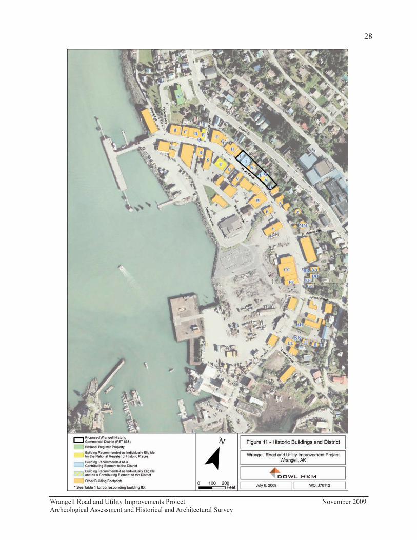
Wrangell Road and Utility Improvements Project November 2009
Archeological Assessment and Historical and Architectural Survey
28
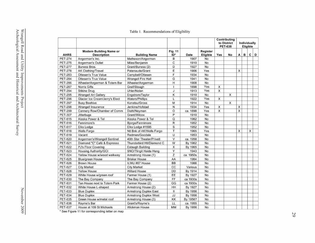
Wran
gell R
oad
and U
tility Im
pro
vem
ents P
roject N
ovem
ber 2
009
Arch
eolo
gical A
ssessmen
t and H
istorical an
d A
rchitectu
ral Surv
ey
29

Matheson/Angerman Building (PET-274)
2 Front Street
This two-story, rectangular shaped commercial building sits at the sidewalk on the northern side
of Front Street (Appendix B:B1-B5). Built in 1907, it is associated with the Early to Mid-20th
Century Development of Wrangell, 1900 to 1941, period of significance. From 1907 to 1926,
this building was the site of F. Matheson General Store, the largest store in Wrangell during that
time period. Commercial businesses housed in this building continued to support Wrangell
during the Post World War II Development of Wrangell, 1945 to 1973, period of significance.
This building retains integrity of location. Its setting has changed with the addition of 20th
century buildings, but this does not affect its integrity in any extraordinary way. However, its
design, materials, workmanship, feeling, and association with its periods of significance have
been obscured by extensive modifications to its exterior. This building is not recommended as
eligible for listing on the National Register under any Criterion.
Miles/Benjamin Building (PET-275)
10 Front Street
Built in 1910, this two-story, rectangular shaped commercial building sits at the sidewalk on the
northern side of Front Street (Appendix B:B6-B10). It is associated with the Early to Mid-20th
Century Development of Wrangell, 1900 to 1941, period of significance. Commercial
businesses housed in this building continued to support Wrangell during the period of Post
World War II Development of Wrangell, 1945 to 1973. This building was the site of the Charles
Benjamin General Merchandise Store, which operated until the mid-1970s. The building retains
integrity of location in the downtown commercial area of Wrangell. Its setting has changed
with the addition of 20th century buildings, but this does not affect its integrity in any
extraordinary way. However, it lacks integrity of design, materials, workmanship, feeling, and
association with its periods of significance due to the extensive exterior modifications. This
building is recommended as not eligible for listing on the National Register under any Criterion.
Grant/Buness (2) (PET-277)
18 Front Street
This building sits at the sidewalk facing south on the northern side of Front Street (Appendix
B:B11-B14). Built in 1927 as an automobile paint shop, this building is associated with the
Early to Mid-20th Century Development of Wrangell 1900 to 1941. Commercial businesses
housed in this building continued to support Wrangell during the Post World War II
Development of Wrangell, 1945 to 1973. This building has been expanded to the west where
Grant/Buness Building (1) (PET-276) was formerly located. It retains integrity of location in
the commercial area of downtown Wrangell. Its setting has changed with the addition of 20th
century buildings, but this does not affect its integrity in any extraordinary way. However, it no
longer retains integrity of design, materials, workmanship, feeling, and association with its
periods of significance due to extensive exterior modifications. It is recommended not eligible
for listing on the National Register under any Criterion.
Wrangell Road and Utility Improvements Project November 2009
Archeological Assessment and Historical and Architectural Survey
30

Patenaude/Grant Building (PET-278)
22 Front Street
This two-story, rectangular shaped commercial building sits at the sidewalk on the northern side
of Front Street (Appendix B:B15-B18). It is recommended as individually eligible for listing on
the National Register under Criterion A for its association with the Early 20th to mid-Century
Development of Wrangell, 1900 to 1941, period of significance, and the contexts Early
Community Planning and Development of Wrangell, 1900 to 1916; and Wrangell Fishing and
Timber Industry Boom, 1900 to 1939. Built in 1906 by Leo Patenaude, who operated a
barbershop here, this building has continued to serve as a commercial establishment since it was
built and is one of few remaining examples of the somewhat simplified version of Queen Anne
style popular during the time period. It retains integrity of location, design, materials, feeling,
and association with its period of significance. Its setting has changed with the addition of 20th
century buildings, but this does not affect its integrity in any extraordinary way. It is one of
only a few turreted buildings left in Southeast Alaska. Commercial businesses housed in this
building continued to support Wrangell during the Post World War II Development of Wrangell,
1945 to 1973, period of significance.
Campbell/Ottesen Building (PET-283)
104 Front Street
This two-story building sits at the sidewalk and faces south on the northern side of Front Street
(Appendix B:B19-B23). It was built in 1934 by Leonard and Ernest Campbell who operated
Campbell Brothers at this location, a general merchandise store. Originally Art Deco in style,
this building is associated with the Early to Mid-20th Century Development of Wrangell, 1900
to 1941. Commercial businesses housed in this building continued to support Wrangell during
the Post World War II Development of Wrangell, 1945 to 1973. This building retains integrity
of location in the commercial area of downtown Wrangell. Its setting has changed with the
addition of 20th century buildings, but this does not affect its integrity in any extraordinary way.
However, it lacks integrity of design, materials, workmanship, feeling, and association due to
the exterior changes that have been made that obscure its association with its periods of
significance. It is recommended as not eligible for listing on the National Register under any
Criterion.
Wrangell Fire Hall (PET-284)
108 Front Street
This rectangular building sits at the sidewalk and faces south on the northern side of Front
Street (Appendix B:B24-B27). Now part of Ottesen’s Inc., the Wrangell Fire Hall was built in
1941 as a Works Progress Administration project formed under President Roosevelt’s New Deal.
A simple example of an Art Moderne fire hall, this building is associated with the Early to mid-
20th Century Development of Wrangell, 1900 to 1941. It continued to serve as a fire hall
during the Post World War II Development of Wrangell, 1945 to 1973. It retains integrity of
location in the downtown commercial area of Wrangell. Its setting has changed with the
addition of 20th century buildings, but this does not affect its integrity in any extraordinary way.
Wrangell Road and Utility Improvements Project November 2009
Archeological Assessment and Historical and Architectural Survey
31
However, it lacks integrity of design, materials, workmanship, feeling, and association.
Changes to the primary elevation have affected its historic identity as a fire hall and have
covered important architectural features, such as the cast-in-place sign lettering. It is
recommended not eligible for listing on the National Register under any Criterion.
Wheeler/Angerman Building (PET-286)
116 Front Street
This rectangular building sits at the sidewalk on the northern side of Front Street (Appendix
B:B28-B32). Known originally as Wrangell Drug, it was constructed by H. D. Campbell for Dr.
J. H. Wheeler in 1908 to house a drug store on the first floor and medical offices on the second
floor, a common practice during that era. By 1928, the name had changed to Wheeler Drugs.
This building is associated with the Early 20th Century Development of Wrangell, 1900 to
1941, period of significance. Commercial businesses housed in this building continued to
support Wrangell during the Post World War II Development of Wrangell, 1945 to 1973, period
of significance. It retains integrity of location. Its setting has changed with the addition of 20th
century buildings, but this does not affect its integrity in any extraordinary way. However, it
lacks integrity of design, materials, workmanship, feeling, and association with its period of
significance due to the extensive changes that have been made. It is recommended not eligible
for listing on the National Register under any Criterion.
Greif/Stough Building (PET-287)
124 Front Street
This three-story, rectangular shaped, wood-framed commercial building sits at the sidewalk on
the northern side of Front Street (Appendix B:B33-B36). It was built in 1898 by Brewmaster
Bruno Greif who operated the Fort Wrangell Brewery Beer Hall here. It is associated with the
Late 19th Century Development of Wrangell, 1879 to 1899, period of significance, and the
contexts Rise of the Wrangell Fishing and Timber Industries, 1887 to 1893; and Klondike Gold
Rush Boom and Bust, 1898 to 1899. It retains integrity of location in the downtown
commercial area of Wrangell. Its setting has changed with the addition of 20th century
buildings, but this does not affect its integrity in any extraordinary way. However, it no longer
retains integrity of design, materials, workmanship, feeling, and association due to the changes
that have been made that obscure its association with these periods of significance. This
building continued to serve as a commercial establishment throughout the Early to Mid-20th
Century Development of Wrangell, 1900 to 1941, period of significance.
This building is also associated with the Post World War II Development of Wrangell, 1945 to
1973, and the contexts Growth and the Changing Face of Wrangell, 1945 to 1965; Fishing
Industry Decline, 1945 to 1960; and Timber Industry Boom, 1953 to 1973. The changes that
were made to the building were done in the 1940s and 1950s and give the building a 1940s
look. It retains integrity of materials, feeling, and association with these periods of significance.
This building is not recommended as individually eligible, although it is recommended as a
contributing element to the Wrangell Commercial Historic District (PET-638) under Criterion A.
Wrangell Road and Utility Improvements Project November 2009
Archeological Assessment and Historical and Architectural Survey
32
Uhler/Nolan Building (PET-294)
202 Front Street
This two-story, gable roofed, rectangular shaped building sits at the sidewalk on the northern
side of Front Street (Appendix B:B37-B41). It was built in 1913 by builder H. D. Campbell for
a Mrs. Uhler and was to have commercial businesses on the first floor and apartments on the
second floor. This building is associated with the Early to Mid-20th Century Development of
Wrangell, 1900 to 1941, period of significance, and the contexts Early Community Planning and
Development of Wrangell, 1900 to 1916; and Wrangell Fishing and Timber Industry Boom,
1900 to 1939. Commercial businesses housed in this building continued to support Wrangell
during the Post World War II Development of Wrangell, 1945 to 1973, period of significance,
and the contexts Fishing Industry Decline, 1945 to 1960, and Timber Industry Boom, 1953 to
1973. It retains integrity of location. Its setting has changed with the addition of 20th century
buildings, but this does not affect its integrity in any extraordinary way. However, it lacks
integrity of materials, feeling, and association with its periods of significance due to the many
changes. This building is not recommended as individually eligible, although it is
recommended as a contributing element to the Wrangell Commercial Historic District (PET-
638) under Criterion A.
Engstrom/Taylor Building (PET-295)
208 Front Street
This two-story, rectangular shaped commercial building sits at the sidewalk on the northern side
of Front Street (Appendix B:B42-B45). It was built in 1910 by Adolph Engstrom who operated
a general merchandise store on the first floor and lived with his family on the second floor. It is
associated with the Early 20th Century Development of Wrangell, 1900 to 1944, period of
significance, and the contexts Early Community Planning and Development of Wrangell, 1900
to 1916, and Wrangell Fishing and Timber Industry Boom, 1900 to 1939. It retains integrity of
location with the commercial area of downtown Wrangell. Its setting has changed with the
addition of 20th century buildings, but this does not affect its integrity in any extraordinary way.
However, it lacks integrity of materials, feeling, and association due to the changes that have
been made that obscure its association with its periods of significance. This building is not
recommended as eligible for listing on the National Register under any Criterion. It is included
within the boundaries of the proposed Wrangell Commercial Historic District (PET-638), but is
considered a noncontributing element.
Waters/Phillips Building (PET-296)
214 and 216 Front Street
This rectangular, two-story building faces south and sits at the sidewalk on the northern side of
Front Street (Appendix B:B46-B49). Originally the Waters home, this building was expanded by
Walter Waters who opened a curio shop, the Bear Totem Store, here in 1922. This building is
associated with the Early to mid-20th Century Develop of Wrangell, 1900 to 1941, period of
significance, and the contexts Community Expansion, 1920 to 1936, and Wrangell Fishing and
Timber Industry Boom, 1900 to 1939. Commercial businesses housed in this building
Wrangell Road and Utility Improvements Project November 2009
Archeological Assessment and Historical and Architectural Survey
33

continued to support Wrangell during the Post World War II Development of Wrangell, 1945 to
1973, period of significance and were associated with the contexts Fishing Industry Decline,
1945 to 1960, and Timber Industry Boom, 1953 to 1973. This building is still recognizable as a
historic building. It retains integrity of location. Its setting has changed with the addition of
20th century buildings, but this does not affect its integrity in any extraordinary way. However,
it lacks integrity of design, materials, workmanship, feeling, and association due to the changes
that have been made over the years that obscure its periods of significance. This building is not
recommended as individually eligible, although it is recommended as a contributing element to
the Wrangell Commercial Historic District (PET-638) under Criterion A.
Konatsu/Gross Building (PET-297)
218 Front Street
This building sits at the sidewalk facing south on the northern side of Front Street (Appendix
B:B50-B53). Built by 1914, this once two-story false-front building is associated with the Early
to mid-20th Century Development of Wrangell, 1900 to 1941, period of significance. In 1928,
Yajuro “Tom” Konatsu bought the building and opened his restaurant The Rainier Grill with
living quarters upstairs. Commercial businesses housed in this building continued to support
Wrangell during the Post World War II Development of Wrangell, 1945 to 1973. This building
retains integrity of location with the commercial area of downtown Wrangell and its relationship
to the buildings on either side. Its setting has changed with the addition of 20th century
buildings, but this does not affect its integrity in any extraordinary way. However, with the loss
of the second story and false-front in a fire in the 1950s and remodeling over the years, it no
longer retains integrity of design, materials, feeling, and association with its period of
significance. This building is not recommended as eligible for listing on the National Register
under any Criterion. It is included within the boundaries of the proposed Wrangell Commercial
Historic District (PET-638), but is considered a noncontributing element.
Jenkins/Hofstad Building (PET-298)
222 Front Street
This rectangular, two-story building sits at the sidewalk on the northern side of Front Street
(Appendix B:B54-B57). It was built in 1934 by Bill Jenkins who opened Jenkins’ Café here. It
is associated with the Early to Mid-20th Century Development of Wrangell, 1900 to 1941,
period of significance, and the contexts Community Expansion, 1920 to 1936, and Wrangell
Fishing and Timber Industry Boom, 1900 to 1939. It is an example of the type of false-front
commercial building constructed in Wrangell during the first part of the 20th century.
Commercial businesses housed in this building continued to support Wrangell during the Post
World War II Development of Wrangell, 1945 to 1973, period of significance, and were
associated with the contexts Fishing Industry Decline, 1945 to 1960, and Timber Industry
Boom, 1953 to 1973. It retains integrity of location, design, feeling, and association with its
period of significance. Its setting has changed with the addition of 20th century buildings, but
this does not affect its integrity in any extraordinary way. It retains integrity of materials and is
still recognizable as a historic building. It is recommended eligible for listing on the National
Wrangell Road and Utility Improvements Project November 2009
Archeological Assessment and Historical and Architectural Survey
34
Register under Criterion A. This building is also recommended as a contributing element to the
Wrangell Commercial Historic District (PET-638).
Diehl/Neyman Building (PET-299)
224 Front Street
Built by R. C. Diehl in 1898 for his general merchandise store, this two-story, rectangular
shaped commercial building sits at the sidewalk on the eastern side of Front Street (Appendix
B:B58-B62). It is associated with the Late 19th Century Development of Wrangell, 1879 to
1899, period of significance, and especially the context Klondike Gold Rush Boom and Bust,
1898 to 1899. It has served as a commercial establishment throughout the Early to Mid-20th
Century Development of Wrangell, 1900 to 1941, and Post World War II Development of
Wrangell 1945 to 1973, periods of significance. It retains integrity of location, feeling, and
association with its period of significance in the downtown commercial area of Wrangell, and it
retains integrity of materials. Its setting has changed somewhat with the modern building next
door to the south and carport to the north but this does not affect the setting in any extraordinary
way. This building is recommended as eligible for listing on the National Register under
Criterion A. It is also recommended as a contributing element to the Wrangell Commercial
Historic District (PET-638).
Grant/Wilcox Building (PET-307)
309 Front Street
This building faces northeast and sits back from the western side of Front Street (Appendix
B:B63-B67). It was owned by John G. Grant and is associated with the Early 20th Century
Development of Wrangell, 1900 to 1941, period of significance. Captain Jinks opened a
grocery and notions store here sometime before 1910 and bought the building from Grant in
1921. Commercial businesses housed in this building continued to support Wrangell during the
Post World War II Development of Wrangell, 1945 to 1973. George Gunderson took over the
building in 1937 and opened City Motor Service which operated until 1960. This building
retains integrity of location. Its setting has changed with the addition of 20th century buildings,
but this does not affect its integrity in any extraordinary way. However, it lacks integrity of
design, materials, workmanship, and feeling due to the changes to the front and side of the
building that obscure its association with its periods of significant. It is not recommended as
eligible for listing on the National Register under any Criterion.
Alaska Power and Telephone (PET-615)
20 Front Street
This rectangular building sits on the northern side of Front Street and occupies about half of the
property (Appendix B:B68-B70). It was constructed in 1962 and is associated with the period
of significance Post World War II Development of Wrangell, 1945 to 1973. It retains integrity
of location and most of its setting which now includes a few late 20th century buildings.
However, it lacks integrity of design, materials, workmanship, feeling, and association with its
Wrangell Road and Utility Improvements Project November 2009
Archeological Assessment and Historical and Architectural Survey
35

periods of significance due to major changes made since construction. It is not recommended as
eligible for listing on the National Register under any Criterion.
Bjorge/Fennimore Building (PET-616)
21 Front Street
This rectangular, automobile service building is located on the southern side of Front Street
between Front and Outer Drive and occupies the east half of the property (Appendix B:B71-
B74). Ralph Shulstad and Earl Lawton purchased Bjorge Transfer just before the 1952 fire that
destroyed the original building. The current building was built in 1952 and was the first
building to go up after the fire. It is associated with the Post World War II Development of
Wrangell, 1945 to 1973, period of significance. It retains integrity of location in the downtown
commercial area of Wrangell. Its setting on the southern side of Front Street has changed
somewhat with the addition of late 20th century buildings. It lacks integrity of design,
materials, workmanship, feeling, and association with its periods of significance due to the
changes that have been made that obscure it as a post World War II era building. It is not
recommended as eligible for listing on the National Register under any Criterion.
Elks Lodge #1595 (PET-617)
103 Front Street
The rectangular Wrangell Elks Lodge is located on the southern side of Front Street, across
from the intersection of Front and McKinnon (Appendix B:B75-B78). It was one of the first
buildings rebuilt after the 1952 fire. It was under construction by December 1952 and was built
in the same location as the previous Elks lodge building that burned in the fire. This building is
associated with the Post World II Development of Wrangell, 1945 to 1973, period of
significance. It retains integrity of location and most of its setting with the downtown
commercial area of Wrangell. The setting on the southern side of Front Street has changed
some with the addition of a few late 20th century buildings. However, this building lacks
integrity of design, materials, workmanship, feeling, and association with its period of
significance due to the extensive changes that have been made that obscure it as a 1950s era
building. It is not recommended as eligible for listing on the National Register under any
Criterion.
National Bank of Alaska/Wells Fargo Building (PET-618)
115 Front Street
This one-story, flat-roofed building is located on the southern side of Front Street east of the
Wrangell Elks lodge and still serves its original purpose as a bank (Appendix B:B79-B84).
Constructed in 1965, it is associated with the Post World War II Development of Wrangell, 1945
to 1973, period of significance, and the contexts Growth and the Changing Face of Wrangell,
1945 to 1965; Rebuilding After the 1952 Fire, 1952 to 1965; and Timber Industry Boom, 1953
to 1973. It retains integrity of location, feeling, and association with the commercial area of
downtown Wrangell. Its setting on the southern side of Front Street has changed somewhat
with the addition of late 20th century buildings but this does not affect it in any extraordinary
Wrangell Road and Utility Improvements Project November 2009
Archeological Assessment and Historical and Architectural Survey
36
way. It retains enough of its original materials to recommend it eligible for listing on the
National Register under Criterion A. It is also recommended as eligible under Criterion C as an
Alaska-adapted International Style building designed by preeminent Juneau architect Linn
Forrest. It is an example of his work during the “modern movement,” which emphasized
buildings that were designed in such a way that allowed building occupants to take in their
natural surroundings.
Redmen Hall/Goodale Building (PET-619)
123 Front Street
This rectangular, one-story building is located on the southern side of Front Street just west of
Lynch Street (Appendix B:B85-B88). It was constructed in 1953 for the Improved Order of
Redmen, Stikine Tribe No. 5, on the same location as the former Redmen building that burned
in the 1952 fire. It is associated with the Post World War II Development of Wrangell, 1945 to
1973, period of significance. It retains integrity of location in the commercial area of
downtown Wrangell. Its setting on the southern side of Front Street has changed somewhat
with the addition of late 20th century buildings, but this does not affect it in any extraordinary
way. However, the building lacks integrity of design, materials, workmanship, feeling, and
association with its periods of significance due to the changes that have been that obscure it as a
post World War II era building. It is not recommended as eligible for listing on the National
Register under any Criterion.
49th Star Theater/Privett Building (PET-620)
207 Front Street
This two-story, flat-roofed building is located on the southern side of Front Street, at the corner
of Front and Lynch Streets (Appendix B:B89-B92) It housed the 49th Star Theater, operated by
Dick Ballard, from 1958 until it closed in 1976. It is associated with the Post World War II
Development of Wrangell, 1945 to 1973. It retains integrity of location in the downtown
commercial area of Wrangell. Its setting has changed somewhat on the southern side of Front
Street but not in any extraordinary way. However, it lacks integrity of design, materials,
workmanship, feeling, and association due to the extensive changes that have been made that
obscure it as a post World War II era theater building. It is not recommended as eligible for
listing on the National Register under any Criterion.
Thunderbird Hotel/Diamond C Café Buildings (PET-621)
223-225 Front Street
223-225 Front Street is located on the southeastern side of Front Street, at the intersection of
Front and Campbell Drive, and consists of three attached structures (Appendix B:B93-B96).
The building that houses the Diamond C Café was constructed by 1958. It is advertised in the
1958 Alaska Telephone Corporation telephone directory as the Thunderbird Hotel with Harry
and Imogene Thorburn as proprietors. By 1962, there are two smaller buildings to the east
where the current coffee shop is located. This group of buildings is associated with the Post
World War II Development of Wrangell, 1945 to 1973, period of significance. The Diamond C
Wrangell Road and Utility Improvements Project November 2009
Archeological Assessment and Historical and Architectural Survey
37

Café buildings retain integrity of location in the commercial area of downtown Wrangell.
Although, there are a few late 20th century buildings in the vicinity, these do not affect the
setting in any extraordinary way. However, with the changes that have been made, this group of
buildings no longer retains integrity of design, materials, workmanship, feeling, and association
with the period of significance. These buildings are not recommended as eligible for listing on
the National Register under any Criterion.
Estaugh Building (PET-622)
312 Front Street
This unique two-story flat-roofed building, located on the northeastern side of Front Street, was
constructed by 1965 (Appendix B:B97-B100). It is associated with the Post World War II
Development of Wrangell, 1945 to 1973, period of significance. It retains integrity of location
and setting in the downtown commercial area of Wrangell. Its flat roof, wide eaves, and
cantilevered, tapered structural members are an interpretation of 1960s architectural trends but
are not a particularly complete or refined expression of the time period. While it retains
integrity of some materials that convey that it is a 1960s era building, it lacks integrity of
design, feeling, and association with its period of significance due to the changes that have been
made. It is not recommended as eligible for listing on the National Register under any
Criterion.
SNO/Tlingit Haida Housing Authority Building (PET-623)
321 Front Street
This large two-story false-front building is located on the southwestern side of Front Street
(Appendix B:B101-B104). This building may have been built as early as 1943, although it may
also have been constructed in the 1950s by Hans Ensbrunner as an apartment building. It was
later expanded by the Stikine Native Organization. It is associated with the Post World War II
Development of Wrangell, 1945 to 1973, period of significance. While it retains integrity of
location and setting in the commercial area of downtown Wrangell and has integrity of materials
and feeling, historical research has not revealed any important association with its period of
significance. It is, therefore, not recommended as eligible for listing on the National Register
under any criterion.
Armstrong House (1) (PET-624)
? Front Street
This one-story house is located on the northeastern side of Front Street (Appendix B:B105-
B107). It was built by 1956 and is associated with the Post World War II Development of
Wrangell, 1945 to 1973, period of significance. It is in an area that is still primarily residential,
particularly to the east along Church Street and has of location. Its setting has changed
somewhat with the addition of some later 20th century buildings, but this does not affect it in
any extraordinary way. However, it lacks integrity of design, materials, workmanship, feeling,
and association with its period of significance. It is not a particularly noteworthy example of
mid-century residential architecture, and the changes that have been made have had a
Wrangell Road and Utility Improvements Project November 2009
Archeological Assessment and Historical and Architectural Survey
38
detrimental effect on its historic character and masked its original appearance. This house is not
recommended as eligible for listing on the National Register under any Criterion.
Briskar House (PET-625)
418 Front Street
This one-story house is located on the northeastern side of Front Street, behind the small
building located at 420 Front Street (Appendix B:B108-B111). This house was built in 1964
and is associated with the Post World War II Development of Wrangell, 1945 to 1973, period of
significance. This building retains integrity of location in a small cluster of dwellings. Its
setting has changed somewhat with the large Sentry Hardware building to the north (where three
dwellings used to stand) separating it from the dwellings further north, but the area to the east is
still residential. Many changes have been made to the house over time. Although this house
was constructed in the mid-1960s, it does not seem to exhibit style or design characteristics
common during the time period. The house lacks integrity of design, materials, workmanship,
feeling, and association due to the changes that have been made that obscure its association with
its period of significance. This house is not recommended as eligible for listing on the National
Register under any Criterion
ILWU #87 House (PET-626)
420 Front Street
This small, one-story brown building is located on the northeastern side of Front Street
(Appendix B:B112-B115). Built in 1966, it is associated with the Post World War II
Development of Wrangell, 1945 to 1973, period of significance. It retains integrity of location
in a small cluster of dwellings. Its setting has changed with the large Sentry Hardware building
to the north (where three dwellings used to stand) separating it from the dwellings further north.
However, the area to the east is still residential. This house retains some features common
during the time period; however, it does not seem representative of any particular style, and the
bevel siding on the southwest side has a detrimental affect on the integrity of the primary
elevation. The house lacks integrity of design, materials, workmanship, feeling, and association
due to the changes that have been made that obscure its association with its period of
significance. This house not recommended as eligible for listing on the National Register under
any Criterion.
City Market (PET-627)
423 Front Street
City Market is a large building located on the southwestern side of Front Street, mid-way
between the intersections of St. Michael’s Street and Episcopal Avenue (Appendix B:B116-
B119). It consists of three distinct structures unified by a false-front and shed-roofed awning
along the street side. City Market is associated with the Early to mid-20th Century
Development of Wrangell, 1900 to 1941, and Post World II Development of Wrangell, 1945 to
1973, periods of significance. After the 1952 fire destroyed the Redmen building where he
operated his store, R. W. Curtis opened City Market in its current location. By 1962, City
Wrangell Road and Utility Improvements Project November 2009
Archeological Assessment and Historical and Architectural Survey
39

Market encompassed what were once separate buildings built in the early 1910s and 1920s. The
metal building at the northwestern end appears to date from the 1970s. One of the buildings
was built in 1958 or 1959. City Market retains integrity of location. The setting has changed
somewhat, but this does not effect the building in any extraordinary way. However, it lacks
integrity of design, materials, workmanship, feeling, and association with its periods of
significance due to extensive modifications. The original architectural features on the two
historic components have been obscured by the false-front and metal siding used to create a
monolithic front along the street side. This building not recommended as eligible for listing on
the National Register under any Criterion.
Willard House (PET-628)
426 Front Street
This small, 1-1/2 story house is located on the northeastern side of Front Street (Appendix
B:B120-B123). It is associated with the Early to mid-20th Century Development of Wrangell,
1900 to 1941, and Post World War II Development of Wrangell, 1945 to 1973, periods of
significance. The small size, number of stories, and steeply pitched roof indicate that it is the
same 1-1/2 story house depicted on the 1914 Sanborn map. These features are typical of the
tiny houses built throughout Southeast Alaska during the early years of the 20th century. It
retains integrity of location. Its setting has changed somewhat with the large Sentry Hardware
building to the north (where three dwellings used to stand during its period of significance)
separating it from the residential area further north on Front Street. However, the area to the
east is still residential. This house lacks integrity of design, materials, workmanship, feeling,
and association due to the changes that have been made over time that obscure its period of
significance. It is not recommended as eligible for listing on the National Register under any
Criterion.
Farmer House (1) (PET-629)
430 Front Street
This one-story house is located on the northeastern side of Front Street, adjacent to the sidewalk
(Appendix B:B124-B127). It is associated with the Early to Mid-20th Century Development of
Wrangell, 1900 to 1941, and Post World War II Development of Wrangell, 1945 to 1973,
periods of significance. It appears on the 1927 revised 1933 Sanborn map of Wrangell with a
smaller porch along the back and is labeled “Curio & D”, indicating it served a curio shop as
well as a dwelling. It retains integrity of location in a small cluster of dwellings. Its setting has
changed with the large Sentry Hardware building to the north (where three dwellings used to
stand) separating it from the dwellings further north, but the area to the east is still residential.
Although no historic photos have been found, the house has clearly had many exterior
alterations. It lacks integrity of design, materials, workmanship, feeling, and association with its
period of significance due to these changes. This house is not recommended as eligible for
listing on the National Register under any Criterion.
Wrangell Road and Utility Improvements Project November 2009
Archeological Assessment and Historical and Architectural Survey
40
The Bay Company (PET-630)
431 Front Street
This one-story, gable roofed, utilitarian building is located on the southwestern side of Front
Street next to City Market (Appendix B:B128-B131). The building appears to have been
constructed in phases between 1933—when the 1927 Sanborn map was revised—and 1956, and
is associated with the Early 20th Century Development of Wrangell, 1900 to 1941, and Post
World War Development of Wrangell, 1945 to 1973, periods of significance. The building
retains integrity of location. Its setting has changed somewhat from what was once a mixture of
residential and commercial buildings on the southern side of Front Street in the 1930s, although
this does not affect it in any extraordinary way. However, the building lacks integrity of design,
materials, workmanship, feeling, and association with its period of significance due to the
changes that have been made. The metal siding, vinyl windows, and new entry door on the two
most visible elevations of the building have compromised its integrity. Without the two
remaining shed dormers, it would be very difficult to tell the age of the building. It is not
recommended as eligible for listing on the National Register under any Criterion.
Farmer House (2) (PET-631)
434 Front Street
This one-story gable roofed house is located on the northeastern side of Front Street right next
to Totem Park (Appendix B:B132-B135). Wrangell property records indicate that this house
was built in 1904, but there is no house in this location on the 1914, 1927, and 1927 revised
1933 Sanborn maps. It was most likely built in the 1930s, which would make it associated with
the Early to Mid-20th Century Development of Wrangell, 1900 to 1941, and Post World War II
Development of Wrangell, 1945 to 1973, periods of significance. Its setting has changed
somewhat with the large Sentry Hardware building to the north (where three dwellings used to
stand) separating this house in this little cluster of houses from the dwellings further north.
Across the street was once a mixed neighborhood of residential and commercial buildings.
although it is entirely commercial today. There is a park to the south where a dwelling once
stood. However, there is still a residential area to the east. This house lacks integrity of design,
materials, workmanship, feeling, and association. It has had many recent exterior changes,
including new siding and windows, and the addition of a new front porch. It no longer exhibits
any exterior materials indicative of its age. It is not recommended as eligible for listing on the
National Register under any Criterion.
Armstrong House (2) (PET-632)
522 Front Street
This house is located at the southern end of the project area, on the eastern side of Front Street,
between Episcopal and Case avenues (Appendix B:B136-B139). It is associated with the Early
to mid-20th Century Development of Wrangell, 1900 to 1941, and Post World War II
Development of Wrangell, 1945 to 1973, periods of significance. Built sometime between 1914
and 1927, this L-shaped, gable-roofed, 1-1/2 story house retains integrity of location and
feeling, and still has integrity of some materials. It is clearly identifiable as a building from its
Wrangell Road and Utility Improvements Project November 2009
Archeological Assessment and Historical and Architectural Survey
41
period of significance, although its setting has changed. The dwellings that once stood to the
east and north, and the woodsheds that were once to the south and southeast, are all now gone
and there are some late 20th century buildings nearby. Historical research has not revealed that
this house had any important association with its period of significance. Therefore, it is not
recommended as eligible for listing on the National Register under any criterion.
Armstrong Duplex East (PET-633) and Armstrong Duplex West (PET-634)
522 Front Street
These gable-roofed buildings are two of three nearly identical duplexes on an un-named drive
accessed from Front Street (Appendix B:B140-B147). They were built at least by 1956, and are
associated with the Post World War II Development of Wrangell, 1945 to 1973, period of
significance. The third duplex is to the east out of the APE and is not being evaluated at this
time. These duplexes retain integrity of location and are in an area that is a small residential
section of Wrangell. By 1956, this area contained a combination of single-family and multi-
family dwellings with a grocery store (PET-636) and barn to the southwest. The setting has
changed somewhat since then, as several houses here in the 1950s are gone and there are some
late 20th century apartment buildings nearby. While these duplexes retain materials from their
period of significance and are still adjacent to the third duplex, they lack integrity of setting,
feeling, and association. They are also not particularly noteworthy examples of dwelling
construction during this time period. These duplexes are not recommended as eligible under
any Criterion, either individually or as part of a small district.
Armstrong House (3) (PET-635)
522 Front Street
This small one-story house is located on an un-named drive accessed from Front Street
(Appendix B:B148-B151). The exact date of construction is unknown, but it was possibly built
sometime during the 1930s or 1940s and is likely associated with the Early to Mid-20th Century
Development of Wrangell, 1900 to 1941, period of significance. It retains integrity of location
but it lacks integrity of materials, feeling, and association. Its setting has changed. Many of the
dwellings in this area are gone, and it now contains a combination of 1950s and 1970s era
apartment buildings with one single family house to the northeast (PET-632) and one to the
southeast (not evaluated at this time). Other than its unusually small size, it is unremarkable as
a representative of its period of significance and is not recommended as eligible for listing on
the National Register under any Criterion.
Grant’s Groceries/Rayme’s Bar (PET-636)
532 Front Street
This is a one-story, gable-roofed false-front building located on the eastern side of Front Street
near the intersection of Front and Case Avenue (Appendix B:B152-B155). It was built in 1955
by B. Y. Grant after he tore down the building that formerly stood here. This building is
associated with the Post World War II Development of Wrangell, 1945 to 1973, period of
significance. It retains integrity of location but lacks integrity of design, materials,
Wrangell Road and Utility Improvements Project November 2009
Archeological Assessment and Historical and Architectural Survey
42

workmanship, feeling, and association due to the changes that have been made that obscure its
period of significance. Its setting has changed somewhat. A modern metal building has
replaced the barn that was formerly to the southeast and another modern metal building sits
across Front Street to the southwest. Many of the dwellings that were once in this area near this
former neighborhood grocery store are now gone. This building is not recommended as eligible
for listing on the National Register under any Criterion.
Wickman House (PET-637)
109 St. Michael’s Street
This two-story gable roofed house is located on the western side of St. Michael’s Street, on
property that extends down the hill to Front Street (Appendix B:B156-B159). There is a
slightly smaller house at this same location shown on the Alaska Public Works Program’s 1956
as-built drawing for the new sewer system for Wrangell. This house is associated with the Post
World II Development of Wrangell, 1945 to 1973, period of significance. It appears to have had
many additions that date to the 1970s or 1980s. Changes to exterior materials and openings,
and the many additions completely obscure the unknown original appearance of the house. It
retains integrity of location but lacks integrity of design, materials, workmanship, feeling, and
association due to the changes that have been made that obscure its association with its period
of significance. Its setting has changed somewhat with the removal of dwellings to the
southwest where Sentry Hardware is now on the southern side of St. Michaels Street, but the
house itself is still in a residential neighborhood. This house is not recommended as eligible for
listing on the National Register under any Criterion.
Archeological Assessment
Currently available archeological and historical information suggests that archeological deposits
could be discovered during implementation of the project. The “northern” end of the Project to
McKinnon Street is considered a high probability area because of the potential for intact
sediments (Figure 12). There could be evidence here of prehistoric and/or early historic Tlinigt
occupations. The present site of the Post Office, across from the Stikine Inn, was the location
Fort Stikine built by the British that later became Fort Wrangell. Also in this area, south of
Front Street, was the former site of the old Wrangell Hotel, which is where McCormack’s dock
made landfall and where the cold storage and Canadian dock were located. Historically, this
area has been active and, depending on prior surface impacts, has a high potential for historic
remains. Also, except where it has been disturbed by later construction, the original ground and
inter-tidal surface beneath Front Street is covered and protected by fill. In areas of intact
sediments, subsurface features—such as foundations, dumps, privies, and cellars—could also be
present.
Front Street from McKinnon Street to the vicinity of Episcopal Street is considered a lower
probability area because of the amount and depth of fill material, especially on the southern side
of the street. However, the fill is thinner on the northern side of the road, so excavations here
could encounter both buried sediments and surface midden deposits. All the buildings and
docks on the southern side of the road from the Stikine Inn to Diamond C Cafe burned in 1953.
Wrangell Road and Utility Improvements Project November 2009
Archeological Assessment and Historical and Architectural Survey
43
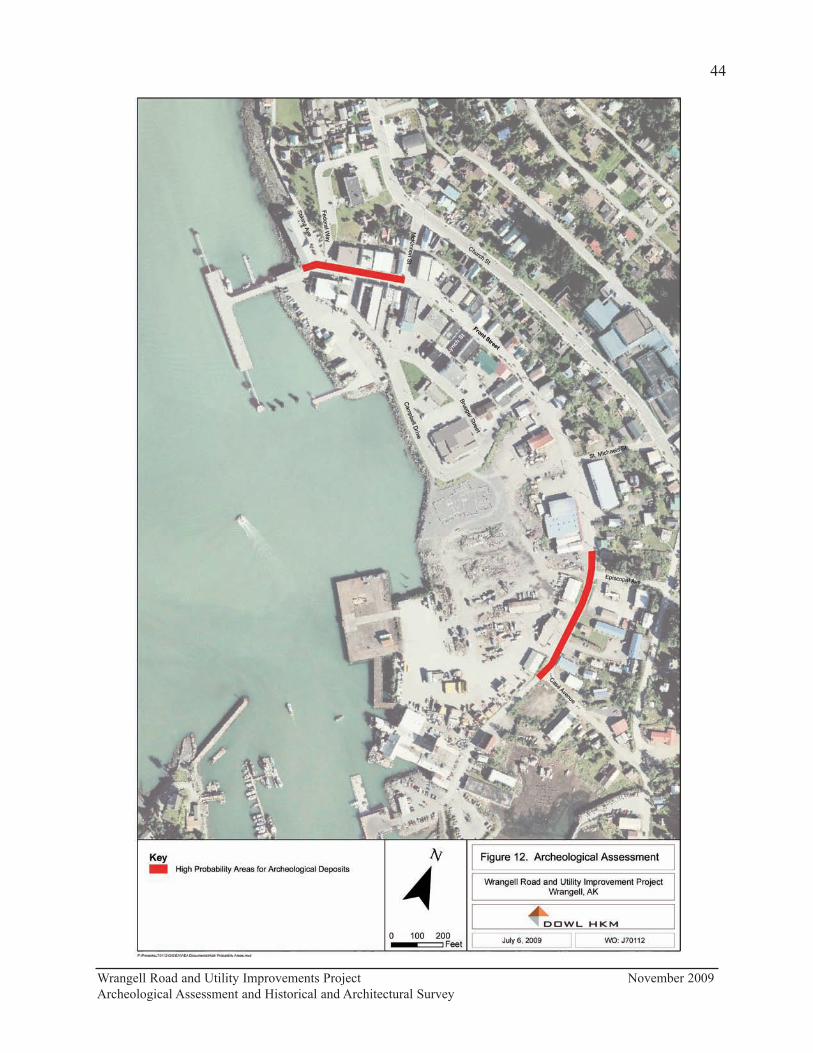
Wrangell Road and Utility Improvements Project November 2009
Archeological Assessment and Historical and Architectural Survey
44

Buildings in this area that were not on fire were dynamited to build a fire break. Today, all the
land in this section from the centerline of the road south to the present shoreline is composed of
fill material, which can include beach logs, cobbles and boulders, mill-cut wood, concrete,
harbor dredged material, and pit-run rock. There is also the potential for old road piling and
planks, and wood-stave pipe.
Front Street from Episcopal Avenue to Case Avenue is also considered a high probability area
based on past land use and the potential for intact prehistoric and historic cultural deposits. The
Russian fort built in 1834 was likely in this area and this was the location of one of Wrangell s
earliest neighborhoods. Also, as noted above, the Kiks.ádi Sun House was reportedly located at
the corner of Front Street and Episcopal Avenue. The road here is on natural ground above tidal
influence and the intact sediments along the right-of-way reportedly have some depth over
bedrock, especially in the vicinity of the old saw mill and lumber yard (Wilson and Sylvester
Mill Company, 1914, and Wrangell Lumber and Power Company, 1927). Both the 1914 and
1927 Sanborn maps describe this section of street as “undefined”, although early photographs
suggest that here has always been a path/road along the beach and that early buildings were
built along rather than in the right-of-way. The old mill covered the ground surface on both
sides of the street in the vicinity of Case Avenue with wood planks for roads and storage
surfaces and used wood debris for fill material. Past trench excavations in the area have
uncovered milled wood and shiplap at varying depths.
Recommendations of Effect
According to 36 CFR 800, the regulations for the National Historic Preservation Act, an
undertaking has an effect on a historic property when the undertaking may alter characteristics
of the property that qualify it for inclusion on the National Register (36 CFR 800.16(i)). An
adverse effect “is found when an undertaking may alter, directly or indirectly, any of the
characteristics of a historic property that qualify the property for inclusion in the National
Register in a manner that would diminish the integrity of the property’s location, design, setting,
materials, workmanship, feeling, or association” (36 CFR 800.5(1)).
To meet the project purpose and need, the proposed action would include the following
improvements:
• Road Surface
o Remove existing concrete roadway and resurface project corridor with
concrete.
o Reconstruct two vertical piling systems in the right-of-way (ROW) to support
road and sidewalks near the Tlingit and Haida Regional Housing Authority
and City Market buildings.
• Traffic Control and Safety
o Construct 13-foot vehicle traffic lanes from City Pier to Case Avenue, with
clearly marked road shoulders and posted 15-mile per hour speed limits.
Current driving lanes are not clearly delineated from parking lanes. Curb to
curb dimensions of Front Street are approximately 39 feet and will generally
Wrangell Road and Utility Improvements Project November 2009
Archeological Assessment and Historical and Architectural Survey
45

be widened to 42 feet.
o Use 8-foot parking lanes throughout most of the project. Bulb-outs, which
narrow the roadway width at intersections, will be added to the project
corridor to shorten crosswalks, protect sight distances at intersections, and
more clearly define the traveled way. Current parking lane width varies
throughout the project corridor and is not clearly defined. An additional
parking lane will be added to the western side of the road from Campbell to
Case Street.
o Create an offset circular turnaround for tour buses and truck traffic at the City
Pier.
o Improve truck-turning movement at the Front and McKinnon Street
intersection by restricting on-street parking and lengthening the curve. .
o Reconfigure parking at the City Market from head-on parking to angled
parking. This configuration would provide room for 13-foot driving lanes and
a 6-foot wide public sidewalk on both sides of the street.
• Pedestrian Safety
o Clearly define sidewalks by adding curbs and bulb-outs.
o Reconstruct and add sidewalks with widths, cross slopes, and ramps that meet
ADA standards, allow 13-foot driving lanes, and meet ROW restraints as
described below:
– Reconstruct 8-foot sidewalks on both sides of the road between City
Pier and Campbell Drive.
– Reconstruct sidewalks on the northeast side of the road between
Campbell Drive and Case Avenue. Current sidewalks widths are
approximately 4 feet in width and new sidewalk widths will vary
between 4 feet and 6 feet. The sidewalk across from City Market (in
front of Sentry Hardware) will be relocated into the parking area in
order to make space to separate the driving lane from vehicles parked
at the City Market. On the southwest side of the road new 6-foot
sidewalks will be constructed. Construct new 6-foot sidewalks on the
southwest side of the road between Campbell Street and Case Avenue.
– Reconstruct 4.5-foot sidewalks on both sides of the road on Lynch
Street.
– Construct new 8-foot sidewalks at the City Pier turnaround area.
– Add pedestrian amenities including benches near the new sidewalks at
the City Pier area.
• Utilities
o Storm drain systems
– Install storm drain stub-outs for individual properties along Front Street
(totaling approximately 1,500 lineal feet).
– Replace all existing corrugated pipe systems along Front Street with
approximately 4,725 lineal feet of new pipe systems according to
anticipated peak flows.
– Relocate the existing storm water pipe across from Episcopal Street.
– Enhance entire corridor with 2-foot curb/gutters.
Wrangell Road and Utility Improvements Project November 2009
Archeological Assessment and Historical and Architectural Survey
46
– Treat storm water runoff through installation of two oil/grit separators
to reduce pollutants entering Zinoviev Strait.
o Water/Sewer
– Increase capacity in main line by abandoning in place the existing 8-
inch asbestos cement pipe and replacing it with approximately 2,800
lineal feet of 10-inch high-density polyethylene pipe.
– Abandon 12-inch asbestos cement pipe sewer line across from City
Market and extend affected services to a 15-inch polyvinyl chloride
line, approximately 250 feet in length.
– Encase sewer main at water main crossings where necessary and add
stub-outs.
• Visual character
o Add landscaping (street trees with branching above 6 feet and small low-
growing plant material with a maximum growth height of less than 18 inches),
street furnishings (such as benches, pedestrian wayfinding signs, trash cans),
colored concrete blocks, a welcome sign, and interpretation facilities.
At present, the exact nature of, or any possible effects on, archeological deposits in the APE
cannot be fully determined. As access is gained during construction, the identification and
evaluation phases of the Section 106 process will proceed (36 CFR Part 800.4(2)).
Archeological monitoring, as detailed in Appendix C, is proposed for areas where there may be
buried cultural remains. An archaeological monitor is recommended for utility work in the
proposed high probability areas between the “northern” end of the project and McKinnon Street,
and from the vicinity of Episcopal Street to Case Avenue (see Figure 12). Monitoring is also
recommended for any excavation upslope (inland) of Front Street, where past trenching has
uncovered occasional historic artifacts. Monitoring is not recommended for any work in the
large body of fill west and southwest of Front Street, toward Brueger Street and Campbell
Drive.
The archeological potential of the intervening area between McKinnon and Episcopal streets is
difficult to judge and will have to be re-evaluated as more information is gained during
construction. There should be intial monitoring of work in this area to gage its actual potential,
followed by consultations with DOT&PF and SHPO on any necessary further course of action.
The five buildings that constitute the proposed Wrangell Commercial Historic District (PET-
638) are on the northern side of Front Street, between 124 and 224 Front Street (see Figure 11).
Of these, two are recommended as individually eligible and contributing to the district: the
Jenkins/Hofstad (PET-298) and Diehl/Neyman (PET-299) buildings. The proposed district is
recommended as eligible under Criterion A and is judged to retain integrity of location, setting,
and feeling as a contiguous grouping of buildings. The district also has integrity of design, with
cohesiveness of scale, proportion, height, and siting. Two additional buildings outside the
district are recommended as individually eligible: the Patenaude/Grant Building (PET-278) and
National Bank of Alaska/Wells Fargo Building (PET-618), recommended as eligible under
Criterion A. The National Bank of Alaska/Wells Fargo Building is also recommended as
eligible under Criterion C.
Wrangell Road and Utility Improvements Project November 2009
Archeological Assessment and Historical and Architectural Survey
47

The proposed project will not affect the location or any of the physical features of these
buildings. Also, each of the proposed improvements described above, in and of themselves,
would not have a significant impact on the historic identity and visual character of downtown
Wrangell. However, in aggregation, the proposed changes to Front Street, especially at its
intersections with McKinnon and Lynch streets, Campbell Drive, and Case Avenue, will affect
the downtown streetscape.
Restoring the historic core of Wrangell and making the downtown more pedestrian friendly can
inject new life into the city. However, streetscape improvements can also compromise a
downtown’s historic character (Georgia Historic Preservation Division 2008). As discussed in
detail in the Oregon Department of Transportation’s Historic Downtown Main Streets, Strategies
for Compatible Streetscape Design:
If historic character is important and the community is looking at a downtown
streetscape project, there are two key questions to address at the earliest stage of
planning: What is the ultimate goal of this project, and what are the character-
defining historic qualities of this downtown? There questions are important
because many of today’s popular streetscape “improvements”—curb extensions,
alternative paving materials, wholesale introduction of street trees, sidewalk
widening, etc.—can compromise a downtown’s historic character.
Efforts to restore the vitality of a main street can change it visual qualities for
better or worse, depending on the tactics used and the effort involved. If done
without consideration for the historic fabric of the downtown, these changes can
detract from the uniqueness and setting by diminishing its authenticity and sense
of place. This usually results in a sanitized or cookie-cutter look that ironically
make a town look just like other newly revitalized towns (Kenny and Osborne
2000:3).
As illustrated in Figure 14, downtown Wrangell presently has an unadorned, utilitarian aspect.
This is a character-defining historic quality of this downtown area. Altering the road cross
section and sidewalk conditions, and adding landscaping, street furniture, and signage, will
improve the accessibility, walkability, and aesthetics of Front Street, but it will also alter the
street’s historic character by detracting from its uniqueness and setting, and diminishing its
authenticity and sense of place. As setting—the physical environment of that illustrates the
character of a place—and feeling—the aesthetic or historic sense of a past period of time—are
important aspects of integrity for buildings eligible under Criteria A and C, CRC recommends a
finding of “Adverse Affect” for the project on the proposed Wrangell Commercial Historic
District (PET-638) and the two buildings outside the district recommended as individually
eligible: the Patenaude/Grant Building (PET-278) and National Bank of Alaska/Wells Fargo
Building (PET-618).
Wrangell Road and Utility Improvements Project November 2009
Archeological Assessment and Historical and Architectural Survey
48

Wrangell Road and Utility Improvements Project November 2009
Archeological Assessment and Historical and Architectural Survey
49
Figure 13. View east along the northern side of Front Street. Included in this photograph are
four buildings of the Wrangell Historic Commercial District (PET-638): Uhler/Nolan (PET-
294), Waters/Phillips (PET-296), Jenkins/Hofstad (PET-298), and Diehl/Neyman (PET-299).
References Cited
Alaska Geographic Society
1978 Wrangell. In Southeast Alaska’s Panhandle, 5(2):81-87.
1993 Wrangell. In Southeast Alaska, 20(2):64-66.
Alaska State Housing Authority [ASHA]
1968 City of Wrangell Comprehensive Development Plan. Alaska State Housing Authority,
Anchorage, Alaska.
Alaska Tidelands Survey
1962 Alaska Tidelands Survey 83. Alaska Department of Natural Resources, Recorder’s
Office. http://landrecords.alaska.gov/gis/raster/dnr/surveys/20001005/00022899.pdf.
Autrey, John T. (ed.)
1992 Draft 2, Research Design/Predictive Model Format for R-10. Manuscript on file,
Tongass National Forest, Sitka.
Berger, Thomas R.
1985 Village Journey: The Report of the Alaska Native Review Commission. Hill and
Wang, New York.
Black, Lydia T.
2004 Russians in Alaska 1732-1867. University of Alaska Press, Fairbanks.
Calista Professional Services
1984 Community Survey. Under contract with the Alaska Department of Community and
Regional Affairs, Division of Municipal and Regional Assistance.
Central Council Tlingit and Haida Indian Tribes of Alaska
2005 Timeline. Electronic document, www.ccthita.org, accessed July 7, 2009.
Cohen, Kathryn
1986 Wrangell Historic Building Survey and Inventory. Prepared for the Wrangell Historical
Society. Manuscript on file, Alaska Office of History and Archaeology, Anchorage.
Cole, Terrence, and Elmer E. Rasmuson
2000 Banking on Alaska: The Story of the National Bank of Alaska. Volume I. Rasmuson
Foundation, Anchorage, Alaska.
Daily Sitka Sentinel
1973 Natives Seek Housing Authority. 26 January:6.
Wrangell Road and Utility Improvements Project November 2009
Archeological Assessment and Historical and Architectural Survey
50
Davis, Stanley D.
1990 Prehistory of Southeastern Alaska. In Northwest Coast, edited by Wayne Suttles,
pp. 203-228. Handbook of North American Indians, Volume 7. William G.
Sturtevant, general editor. Smithsonian Institution, Washington, D. C.
Department of Commerce, Community and Economic Development
2007 Forest Products: An Historical Overview. Electronic document, accessed February 27,
2009. http://dced.state.ak.us/oed/forest_products/forest_products1.htm.
Georgia Historic Preservation Division
2008 Georgia Historic Downtown Streetscape Guidelines. http://www.gashpo.org/assets/
documents/streetscape_guidelines.pdf. Georgia Historic Preservation Division, Atlanta.
Goldschmidt, Walter R. and Theodore H. Haas
1998 Haa Aani Our Land: Tlingit and Haida Land Rights and Use. Edited by Thomas F.
Thornton. University of Washington Press, Seattle, and Sealaska Heritage Foundation,
Juneau.
Hanson, Diane
1998 Archaeological Survey of Property Associated with the Wrangell Petroglyphs Beach
Access. Office of History and Archaeology Report 71. Alaska Department of Natural
Resources, Anchorage.
Haycox, Stephen, and Alexandra J. McClanahan
2007 Alaska Scrapbook: Moments in Alaska History 1816-1998. The CIRI Foundation,
Anchorage, Alaska.
Hoagland, Alison K.
1993 Buildings of Alaska. Oxford University Press, New York.
Kenny, Rosalind, and Julie Osborne
2000 Historic Downtown Main Streets, Strategies for Compatible Streetscape Design.
Oregon Department of Transportation, Eugene.
Lemke, Richard W.
1974 Reconnaissance Engineering Geology of the Wrangell Area, Alaska, with Emphasis on
Evaluation of Earthquake and Other Geologic Hazards. U.S. Geological Survey, Menlo
Park.
Naske, Claus-M. and Herman E. Slotnick
1994 Alaska A History of the 49th State. University of Oklahoma Press, Norman.
Wrangell Road and Utility Improvements Project November 2009
Archeological Assessment and Historical and Architectural Survey
51
National Park Service
2002 How to Apply the National Register Criteria for Evaluation. National Register Bulletin
15. U. S. Department of the Interior, National Park Service, Washington, D. C.
http://www.nps.gov/history/nr/publications/bulletins/nrb15/
Nazar, Tony
2009 Wrangell photographs. Electronic document, http://welcome.tnazar.fotki.com/,
accessed March 2009.
Neal, Patricia A.
2007 Fort Wrangel, Alaska Gateway to the Stikine River: 1834-1899. Coachlamp Productions,
Greenwich, CT.
Rakestraw, Lawrence
2002 A History of the United States Forest Service in Alaska. Reprinted by the USDA
Forest Service.
Rogers, George W.
1960 Alaska in Transition: The Southeast Region. Johns Hopkins Press, Baltimore.
Roppel, Patricia
1983 Southeast Alaska: A Pictorial History. The Donning Company, Norfolk, VA.
Wrangell Elementary School
1974 Wrangell: Our Home Town. Wrangell Elementary School, Wrangell, Alaska.
Wrangell Guide
1999 Fur Trade, gold rushes, timber and fish shape Wrangell. Wrangell Sentinel.
Wrangell Sentinel
1952 Fire Hits Wrangell. 24 March.
1952 Seasons Greetings. Photograph of Front Street after the 1952 fire. 12 December.
1952 Wrangell Businesses Rebuilding and Relocating in 21 Months Since Fire. 25 December.
1953 New Redmen Building Now Theater. 25 December.
1954 Red Men Lodge Celebrates Golden Anniversary Here Dedicating New Building. 23
April.
1965 N B of A Dedication Day Tomorrow. 21 May:1
1965 Dedication Day ad. 21 May.
Wrangell Road and Utility Improvements Project November 2009
Archeological Assessment and Historical and Architectural Survey
52

1997 Totem Park Notes tenth anniversary. 3 July:6.
1998 Wrangell women give birth to Alaska Native Sisterhood. 8 October 1998:1, 16.
1999 Harry Sundberg sees 70 years of changes in Wrangell. 14 January 1999:6
1999 Ottesen one of Wrangell’s first telephone operators. 4 March, 1999:7.
1999 Fresh bread daily and ‘Wrangell Wolves’ best-loved specialties of town’s first bakery.
1 April:5, 12.
1999 Cannery town. 20 May:5.
1999 City Market undergoes renovation. 28 October:7.
1999 Wrangell Telephone Exchange is now doing business. 11 November 1999:6.
1999 Dorothy Neyman—tending flocks and stocks. 18 November:5
1999 The Twentieth Century Revisited: A hundred years in Wrangell as seen through the
pages of the Wrangell Sentinel. 18 November:6-7.
1999 The Twentieth Century Revisited: A hundred years in Wrangell as seen through the
pages of the Wrangell Sentinel. 25 November:8-9.
1999 The Twentieth Century Revisited: A hundred years in Wrangell as seen through the
pages of the Wrangell Sentinel. 2 December:8-9.
1999 The Twentieth Century Revisited: A hundred years in Wrangell as seen through the
pages of the Wrangell Sentinel. 9 December:8-9.
Wrangell Road and Utility Improvements Project November 2009
Archeological Assessment and Historical and Architectural Survey
53

Appendix A
Historic District Survey Form
Survey Form for the Wrangell Commercial Historic District (PET-638)
Wrangell Road and Utility Improvements Project November 2009
Archeological Assessment and Historical and Architectural Survey
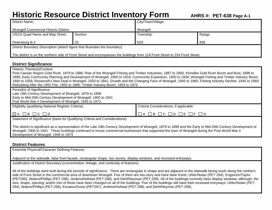
Historic Resource District Inventory Form AHRS #: PET-638 Page A-1 District Name: Wrangell Commercial Historic District
City/Town/Village: Wrangell
USGS Quad Name and Map Sheet: Petersburg B-2
Section: 25
Township: 62S
Range: 83E
District Boundary Description (attach figure that illustrates the boundary): The district is on the northern side of Front Street and encompasses the buildings from 124 Front Street to 224 Front Street. District Significance Historic Theme(s)/Context: Post Cassiar Region Gold Rush, 1879 to 1886; Rise of the Wrangell Fishing and Timber Industries, 1887 to 1893; Klondike Gold Rush Boom and Bust, 1898 to 1899; Early Community Planning and Development of Wrangell, 1900 to 1916; Community Expansion, 1920 to 1936; Wrangell Fishing and Timber Industry Boom, 1900 to 1939; Roosevelt’s New Deal in Wrangell, 1933 to 1941; Growth and the Changing Face of Wrangell, 1945 to 1965; Fishing Industry Decline, 1945 to 1960; Rebuilding After the 1952 Fire, 1952 to 1965; Timber Industry Boom, 1953 to 1973 Period(s) of Significance: Late 19th Century Development of Wrangell, 1879 to 1899 Early to Mid-20th Century Development of Wrangell, 1900 to 1941 Post World War II Development of Wrangell, 1945 to 1973 Eligibility (qualifying National Register Criteria):
A B C D Criteria Considerations, if applicable:
A B C D E F G Statement of Significance (basis for Qualifying Criteria and Considerations): This district is significant as a representation of the Late 19th Century Development of Wrangell, 1879 to 1899 and the Early to Mid-20th Century Development of Wrangell, 1900 to 1941. These buildings continued to house commercial businesses that supported the town of Wrangell during the Post World War II Development of Wrangell, 1945 to 1973. District Features Essential Physical/Character Defining Features: Adjacent to the sidewalk, false front facade, rectangular shape, two stories, display windows, and recessed entryways. Justification of District Boundary:(concentration, linkage, and continuity of features): All of the buildings were built during the periods of significance. There are rectangular in shape and are adjacent to the sidewalk facing south along the northern side of Front Street in the commercial area of downtown Wrangell. Five of them are two-story and have false fronts: Uhler/Nolan (PET-294), Engstrom/Taylor (PET295), Waters/Phillips (PET-296), Jenkins/Hofstad (PET-298), and Diehl/Neyman (PET-299). All of the buildings currently have display windows; although, the size, shape, opening, and/or trim of these have been changed on all of the buildings. Five of the buildings still have their recessed entryways: Uhler/Nolan (PET-294), Waters/Phillips (PET-296), Konatsu/Gross (PET297), Jenkins/Hofstad (PET-298), and Diehl/Neyman (PET-299).

Page A-2 District Contributing Properties (List all) Property Name: Greif/Stough
Address: 124 Front Street
AHRS Number: PET-287
Basis for inclusion in the District (such as historic association, adequate level of integrity, and continuity with other features): This three-story, rectangular shaped, wood-framed commercial building sits at the sidewalk on the northern side of Front Street (Appendix B:B33-B36). It was built in 1898 by Brewmaster Bruno Greif who operated the Fort Wrangell Brewery Beer Hall here. It originally had a modified false front and was two stories with a second story porch; remodeling in the 1940s and 1950s changed the front façade and added a third story. It currently has a recessed entry, but this is probably not original. The large display windows are not original. This building is associated with the Late 19th Century Development of Wrangell, 1879 to 1899, period of significance, and the contexts Rise of the Wrangell Fishing and Timber Industries, 1887 to 1893; and Klondike Gold Rush Boom and Bust, 1898 to 1899. It retains integrity of location in the downtown commercial area of Wrangell. Its setting has changed with the addition of 20th century buildings, but this does not affect its integrity in any extraordinary way. However, it no longer retains integrity of design, materials, workmanship, feeling, and association due to the changes that have been made that obscure its association with this period of significance. This building continued to serve as a commercial establishment throughout the Early to Mid-20th Century Development of Wrangell, 1900 to 1941, period of significance. This building is also associated with the Post World War II Development of Wrangell, 1945 to 1973, and the contexts Growth and the Changing Face of Wrangell, 1945 to 1965; Fishing Industry Decline, 1945 to 1960; and Timber Industry Boom, 1953 to 1973. The changes that were made to the building were done in the 1940s and 1950s and give the building a 1940s look. It retains integrity of materials, feeling, and association with this period of significance. This building is recommended not individually eligible. However, it is recommended as a contributing element to the Wrangell Commercial Historic District (PET-638) under Criterion A. Property Name: Uhler/Nolan
Address: 202 Front Street
AHRS Number: PET-294
Basis for inclusion in the District (such as historic association, adequate level of integrity, and continuity with other features): This two-story, gable roofed, rectangular shaped building sits at the sidewalk on the northern side of Front Street (Appendix B:B37-B41). It has a false front, two recessed entryways, and large display windows. It was built in 1913 by builder H. D. Campbell for a Mrs. Uhler and was to have commercial businesses on the first floor and apartments on the second floor. This building is associated with the Early to Mid-20th Century Development of Wrangell, 1900 to 1941, period of significance, and the contexts Early Community Planning and Development of Wrangell, 1900 to 1916; and Wrangell Fishing and Timber Industry Boom, 1900 to 1939. Commercial businesses housed in this building continued to support Wrangell during the Post World War II Development of Wrangell, 1945 to 1973, period of significance, and the contexts Fishing Industry Decline, 1945 to 1960, and Timber Industry Boom, 1953 to 1973. It retains integrity of location. Its setting has changed with the addition of 20th century buildings, but this does not affect its integrity in any extraordinary way. However, it lacks integrity of design, materials, feeling, and association with its periods of significance due to the many changes. This building is not recommended as individually eligible, although it is recommended as a contributing element to the Wrangell Commercial Historic District (PET-638) under Criterion A.
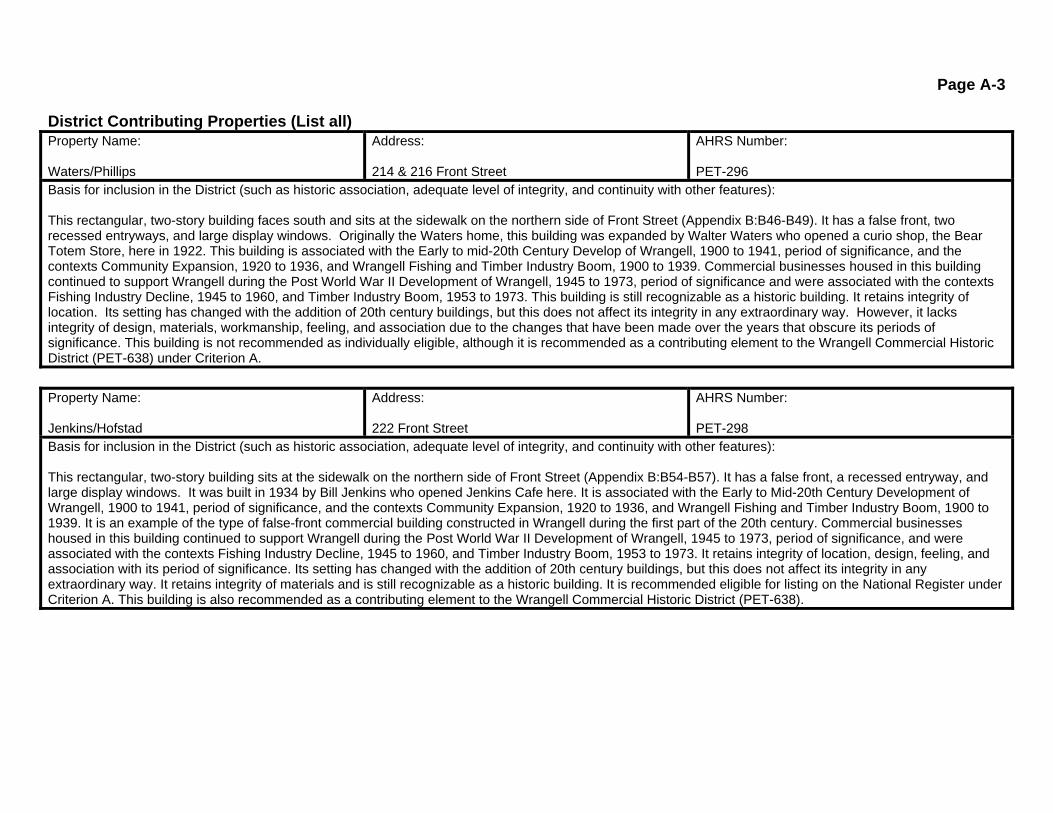
Page A-3 District Contributing Properties (List all) Property Name: Waters/Phillips
Address: 214 & 216 Front Street
AHRS Number: PET-296
Basis for inclusion in the District (such as historic association, adequate level of integrity, and continuity with other features): This rectangular, two-story building faces south and sits at the sidewalk on the northern side of Front Street (Appendix B:B46-B49). It has a false front, two recessed entryways, and large display windows. Originally the Waters home, this building was expanded by Walter Waters who opened a curio shop, the Bear Totem Store, here in 1922. This building is associated with the Early to mid-20th Century Develop of Wrangell, 1900 to 1941, period of significance, and the contexts Community Expansion, 1920 to 1936, and Wrangell Fishing and Timber Industry Boom, 1900 to 1939. Commercial businesses housed in this building continued to support Wrangell during the Post World War II Development of Wrangell, 1945 to 1973, period of significance and were associated with the contexts Fishing Industry Decline, 1945 to 1960, and Timber Industry Boom, 1953 to 1973. This building is still recognizable as a historic building. It retains integrity of location. Its setting has changed with the addition of 20th century buildings, but this does not affect its integrity in any extraordinary way. However, it lacks integrity of design, materials, workmanship, feeling, and association due to the changes that have been made over the years that obscure its periods of significance. This building is not recommended as individually eligible, although it is recommended as a contributing element to the Wrangell Commercial Historic District (PET-638) under Criterion A. Property Name: Jenkins/Hofstad
Address: 222 Front Street
AHRS Number: PET-298
Basis for inclusion in the District (such as historic association, adequate level of integrity, and continuity with other features): This rectangular, two-story building sits at the sidewalk on the northern side of Front Street (Appendix B:B54-B57). It has a false front, a recessed entryway, and large display windows. It was built in 1934 by Bill Jenkins who opened Jenkins Cafe here. It is associated with the Early to Mid-20th Century Development of Wrangell, 1900 to 1941, period of significance, and the contexts Community Expansion, 1920 to 1936, and Wrangell Fishing and Timber Industry Boom, 1900 to 1939. It is an example of the type of false-front commercial building constructed in Wrangell during the first part of the 20th century. Commercial businesses housed in this building continued to support Wrangell during the Post World War II Development of Wrangell, 1945 to 1973, period of significance, and were associated with the contexts Fishing Industry Decline, 1945 to 1960, and Timber Industry Boom, 1953 to 1973. It retains integrity of location, design, feeling, and association with its period of significance. Its setting has changed with the addition of 20th century buildings, but this does not affect its integrity in any extraordinary way. It retains integrity of materials and is still recognizable as a historic building. It is recommended eligible for listing on the National Register under Criterion A. This building is also recommended as a contributing element to the Wrangell Commercial Historic District (PET-638).

Page A-4
District Contributing Properties (List all) Property Name: Diehl/Neyman
Address: 224 Front Street
AHRS Number: PET-299
Basis for inclusion in the District (such as historic association, adequate level of integrity, and continuity with other features): Built by R. C. Diehl in 1898 for his general merchandise store, this two-story, rectangular shaped commercial building sits at the sidewalk on the eastern side of Front Street (Appendix B:B58-B62). It has a false front, recessed entry, and large display windows. It is associated with the Late 19th Century Development of Wrangell, 1879 to 1899, period of significance, and especially the context Klondike Gold Rush Boom and Bust, 1898 to 1899. It has served as a commercial establishment throughout the Early to Mid-20th Century Development of Wrangell, 1900 to 1941, and Post World War II Development of Wrangell 1945 to 1973, periods of significance. It retains integrity of location, feeling, and association with its period of significance in the downtown commercial area of Wrangell, and it retains integrity of materials. Its setting has changed somewhat with the modern building next door to the south and carport to the north but this does not affect the setting in any extraordinary way. This building is recommended as eligible for listing on the National Register under Criterion A. It is also recommended as a contributing element to the Wrangell Commercial Historic District (PET-638). Preparer/SHPO Response Prepared/Reviewed by: Cultural Resource Consultants, LLC
Reviewed by Professional that meets the following Professional Qualifications:
Architect Architectural Historian Historian Historic Architect None Date: 11/04/09
SHPO Response:
Eligible (Concur) Eligible (Do Not Concur) Not Eligible (Concur) Not Eligible (Do Not Concur) Minor Recommendations and Comments Include:
Need more information related to: Historic Context Integrity Architectural Description Period of Significance Authorized Signature: Date:
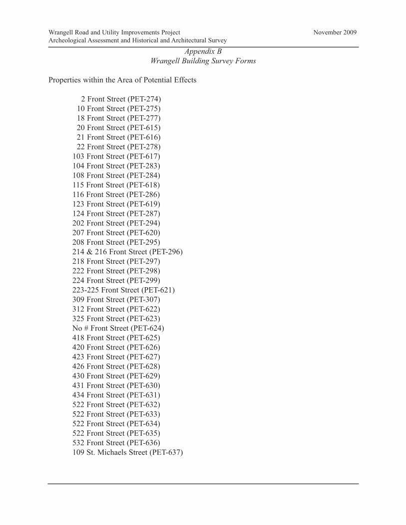
Appendix B
Wrangell Building Survey Forms
Properties within the Area of Potential Effects
2 Front Street (PET-274)
10 Front Street (PET-275)
18 Front Street (PET-277)
20 Front Street (PET-615)
21 Front Street (PET-616)
22 Front Street (PET-278)
103 Front Street (PET-617)
104 Front Street (PET-283)
108 Front Street (PET-284)
115 Front Street (PET-618)
116 Front Street (PET-286)
123 Front Street (PET-619)
124 Front Street (PET-287)
202 Front Street (PET-294)
207 Front Street (PET-620)
208 Front Street (PET-295)
214 & 216 Front Street (PET-296)
218 Front Street (PET-297)
222 Front Street (PET-298)
224 Front Street (PET-299)
223-225 Front Street (PET-621)
309 Front Street (PET-307)
312 Front Street (PET-622)
325 Front Street (PET-623)
No # Front Street (PET-624)
418 Front Street (PET-625)
420 Front Street (PET-626)
423 Front Street (PET-627)
426 Front Street (PET-628)
430 Front Street (PET-629)
431 Front Street (PET-630)
434 Front Street (PET-631)
522 Front Street (PET-632)
522 Front Street (PET-633)
522 Front Street (PET-634)
522 Front Street (PET-635)
532 Front Street (PET-636)
109 St. Michaels Street (PET-637)
Wrangell Road and Utility Improvements Project November 2009
Archeological Assessment and Historical and Architectural Survey

B-1
Alaska Building Inventory Form AHRS #: PET-274 Associated District: Historic Name: F. Matheson General Merchandise (Matheson/Angerman Building)
Other Name: Angerman’s, Inc.
Building Address: 2 Front Street, Block 2, Lot 1
City: Wrangell
Current Owner’s Name and Address: Jeffrey and Dawn Angerman, P.O. Box 928, Wrangell, AK 99929 USGS Quad Name and Map Sheet: Petersburg B2
Section: 25
Township: 62S
Range: 83E
GPS Coordinate (NAD-27 Alaska):
UTM: Zone Easting Northing
Historic Associations Historic Function and Sub-function: 1 Retail Store
2. Residence (2nd Floor)
3.
4.
Current Function and Sub-function: 1. Retail Store
2. Apartments (2nd Floor)
3.
4.
Significant Person(s): 1. Farquhar Matheson
2.
Significant Dates 1. 1907
2.
Architect, Builder, Contractor, Designer: Builder: H.D. Campbell
Original Owner: Farquhar Matheson
Architectural Information: Date of construction: 1907
Date Moved: N/A
Destruction Date: N/A
Reconstruction Date: N/A
Alteration Dates: Major exterior modifications 1. 1970s
2. pre-1986
3.
4.
Resource Type:
Building Site Structure Object
Stories 1. Street level retail
2. Second floor apartment
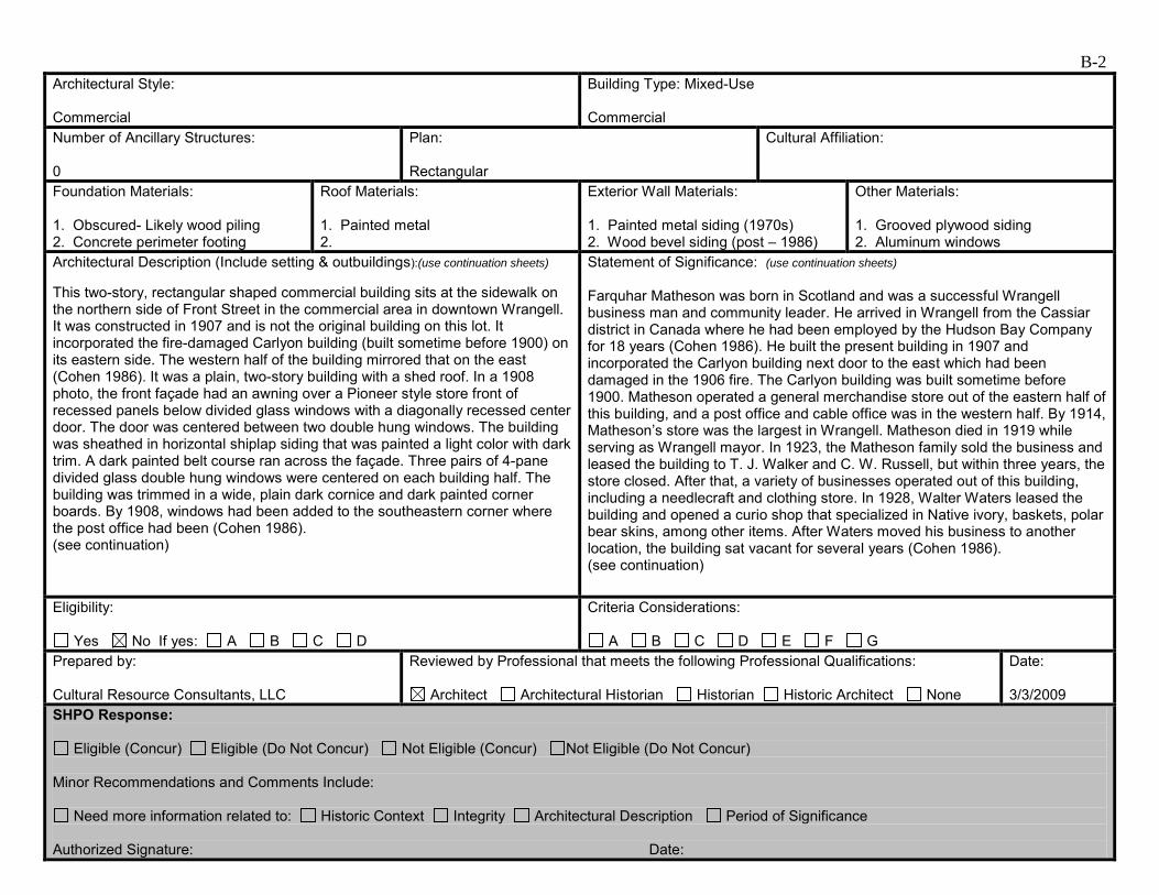
B-2 Architectural Style: Commercial
Building Type: Mixed-Use Commercial
Number of Ancillary Structures: 0
Plan: Rectangular
Cultural Affiliation:
Foundation Materials: 1. Obscured- Likely wood piling 2. Concrete perimeter footing
Roof Materials: 1. Painted metal 2.
Exterior Wall Materials: 1. Painted metal siding (1970s) 2. Wood bevel siding (post – 1986)
Other Materials: 1. Grooved plywood siding 2. Aluminum windows
Architectural Description (Include setting & outbuildings):(use continuation sheets) This two-story, rectangular shaped commercial building sits at the sidewalk on the northern side of Front Street in the commercial area in downtown Wrangell. It was constructed in 1907 and is not the original building on this lot. It incorporated the fire-damaged Carlyon building (built sometime before 1900) on its eastern side. The western half of the building mirrored that on the east (Cohen 1986). It was a plain, two-story building with a shed roof. In a 1908 photo, the front façade had an awning over a Pioneer style store front of recessed panels below divided glass windows with a diagonally recessed center door. The door was centered between two double hung windows. The building was sheathed in horizontal shiplap siding that was painted a light color with dark trim. A dark painted belt course ran across the façade. Three pairs of 4-pane divided glass double hung windows were centered on each building half. The building was trimmed in a wide, plain dark cornice and dark painted corner boards. By 1908, windows had been added to the southeastern corner where the post office had been (Cohen 1986). (see continuation)
Statement of Significance: (use continuation sheets) Farquhar Matheson was born in Scotland and was a successful Wrangell business man and community leader. He arrived in Wrangell from the Cassiar district in Canada where he had been employed by the Hudson Bay Company for 18 years (Cohen 1986). He built the present building in 1907 and incorporated the Carlyon building next door to the east which had been damaged in the 1906 fire. The Carlyon building was built sometime before 1900. Matheson operated a general merchandise store out of the eastern half of this building, and a post office and cable office was in the western half. By 1914, Matheson’s store was the largest in Wrangell. Matheson died in 1919 while serving as Wrangell mayor. In 1923, the Matheson family sold the business and leased the building to T. J. Walker and C. W. Russell, but within three years, the store closed. After that, a variety of businesses operated out of this building, including a needlecraft and clothing store. In 1928, Walter Waters leased the building and opened a curio shop that specialized in Native ivory, baskets, polar bear skins, among other items. After Waters moved his business to another location, the building sat vacant for several years (Cohen 1986). (see continuation)
Eligibility:
Yes No If yes: A B C D
Criteria Considerations:
A B C D E F G Prepared by: Cultural Resource Consultants, LLC
Reviewed by Professional that meets the following Professional Qualifications:
Architect Architectural Historian Historian Historic Architect None
Date: 3/3/2009
SHPO Response:
Eligible (Concur) Eligible (Do Not Concur) Not Eligible (Concur) Not Eligible (Do Not Concur) Minor Recommendations and Comments Include:
Need more information related to: Historic Context Integrity Architectural Description Period of Significance Authorized Signature: Date:
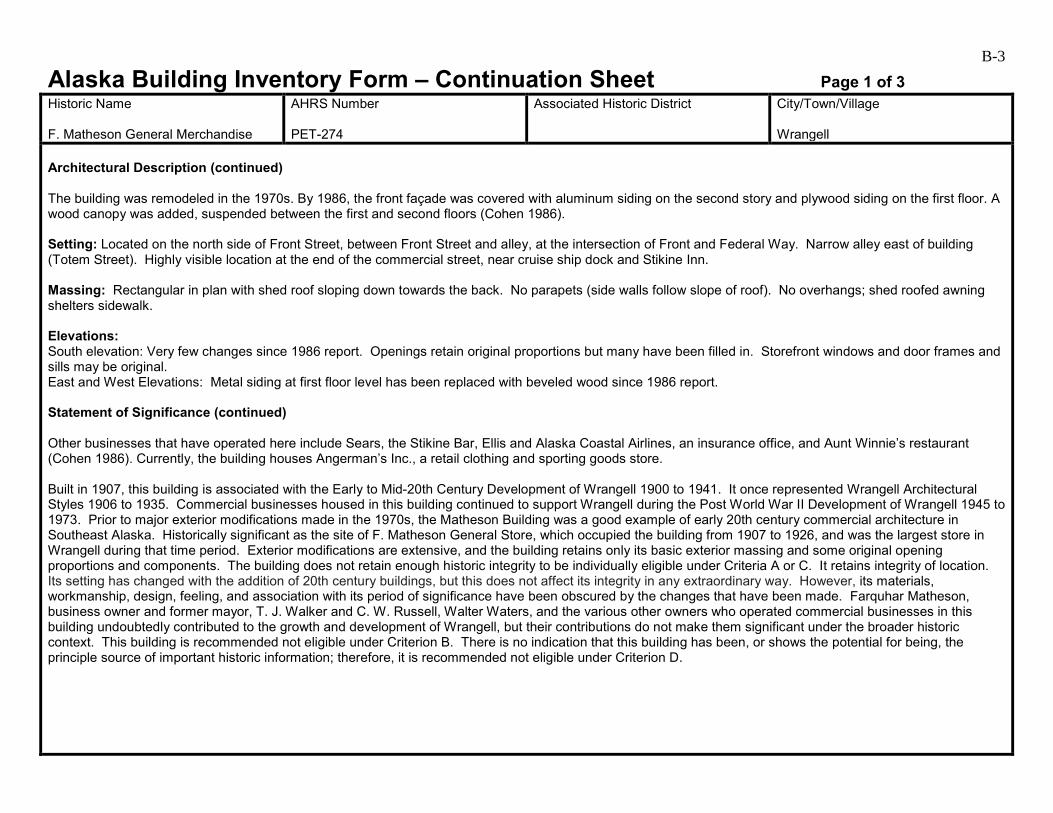
B-3
Alaska Building Inventory Form – Continuation Sheet Page 1 of 3 Historic Name F. Matheson General Merchandise
AHRS Number PET-274
Associated Historic District
City/Town/Village Wrangell
Architectural Description (continued) The building was remodeled in the 1970s. By 1986, the front façade was covered with aluminum siding on the second story and plywood siding on the first floor. A wood canopy was added, suspended between the first and second floors (Cohen 1986). Setting: Located on the north side of Front Street, between Front Street and alley, at the intersection of Front and Federal Way. Narrow alley east of building (Totem Street). Highly visible location at the end of the commercial street, near cruise ship dock and Stikine Inn. Massing: Rectangular in plan with shed roof sloping down towards the back. No parapets (side walls follow slope of roof). No overhangs; shed roofed awning shelters sidewalk. Elevations: South elevation: Very few changes since 1986 report. Openings retain original proportions but many have been filled in. Storefront windows and door frames and sills may be original. East and West Elevations: Metal siding at first floor level has been replaced with beveled wood since 1986 report. Statement of Significance (continued) Other businesses that have operated here include Sears, the Stikine Bar, Ellis and Alaska Coastal Airlines, an insurance office, and Aunt Winnie’s restaurant (Cohen 1986). Currently, the building houses Angerman’s Inc., a retail clothing and sporting goods store. Built in 1907, this building is associated with the Early to Mid-20th Century Development of Wrangell 1900 to 1941. It once represented Wrangell Architectural Styles 1906 to 1935. Commercial businesses housed in this building continued to support Wrangell during the Post World War II Development of Wrangell 1945 to 1973. Prior to major exterior modifications made in the 1970s, the Matheson Building was a good example of early 20th century commercial architecture in Southeast Alaska. Historically significant as the site of F. Matheson General Store, which occupied the building from 1907 to 1926, and was the largest store in Wrangell during that time period. Exterior modifications are extensive, and the building retains only its basic exterior massing and some original opening proportions and components. The building does not retain enough historic integrity to be individually eligible under Criteria A or C. It retains integrity of location. Its setting has changed with the addition of 20th century buildings, but this does not affect its integrity in any extraordinary way. However, its materials, workmanship, design, feeling, and association with its period of significance have been obscured by the changes that have been made. Farquhar Matheson, business owner and former mayor, T. J. Walker and C. W. Russell, Walter Waters, and the various other owners who operated commercial businesses in this building undoubtedly contributed to the growth and development of Wrangell, but their contributions do not make them significant under the broader historic context. This building is recommended not eligible under Criterion B. There is no indication that this building has been, or shows the potential for being, the principle source of important historic information; therefore, it is recommended not eligible under Criterion D.
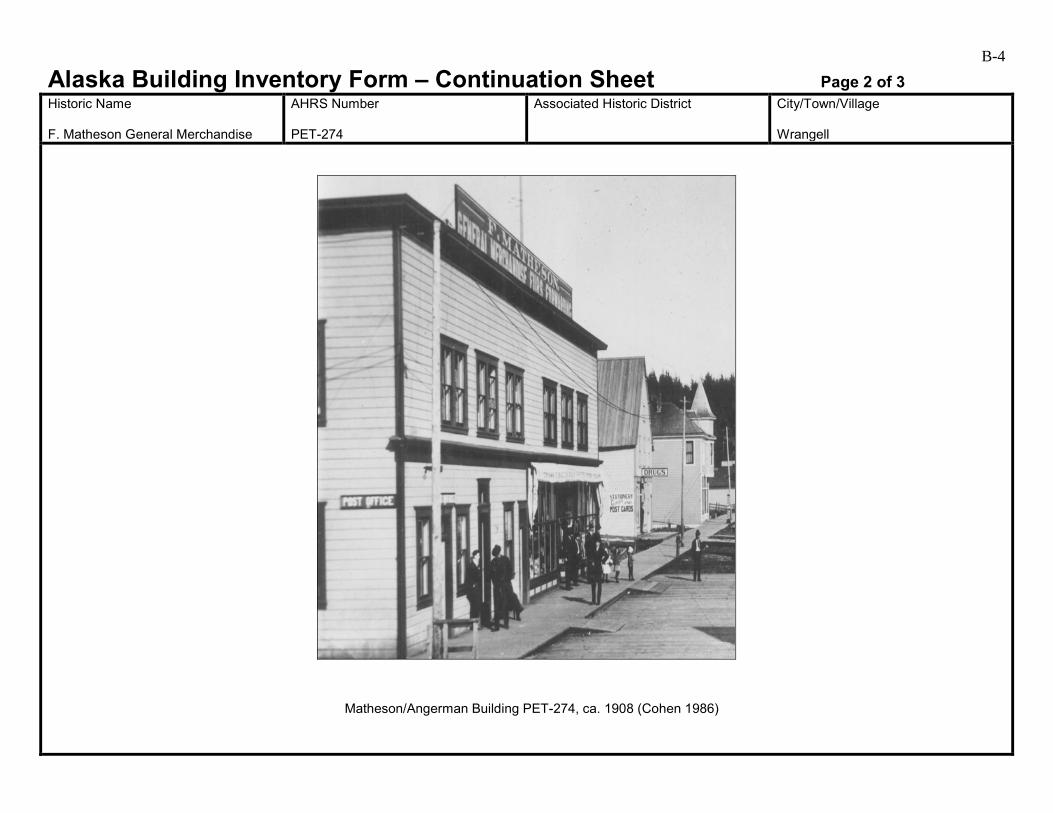
B-4
Alaska Building Inventory Form – Continuation Sheet Page 2 of 3 Historic Name F. Matheson General Merchandise
AHRS Number PET-274
Associated Historic District
City/Town/Village Wrangell
Matheson/Angerman Building PET-274, ca. 1908 (Cohen 1986)
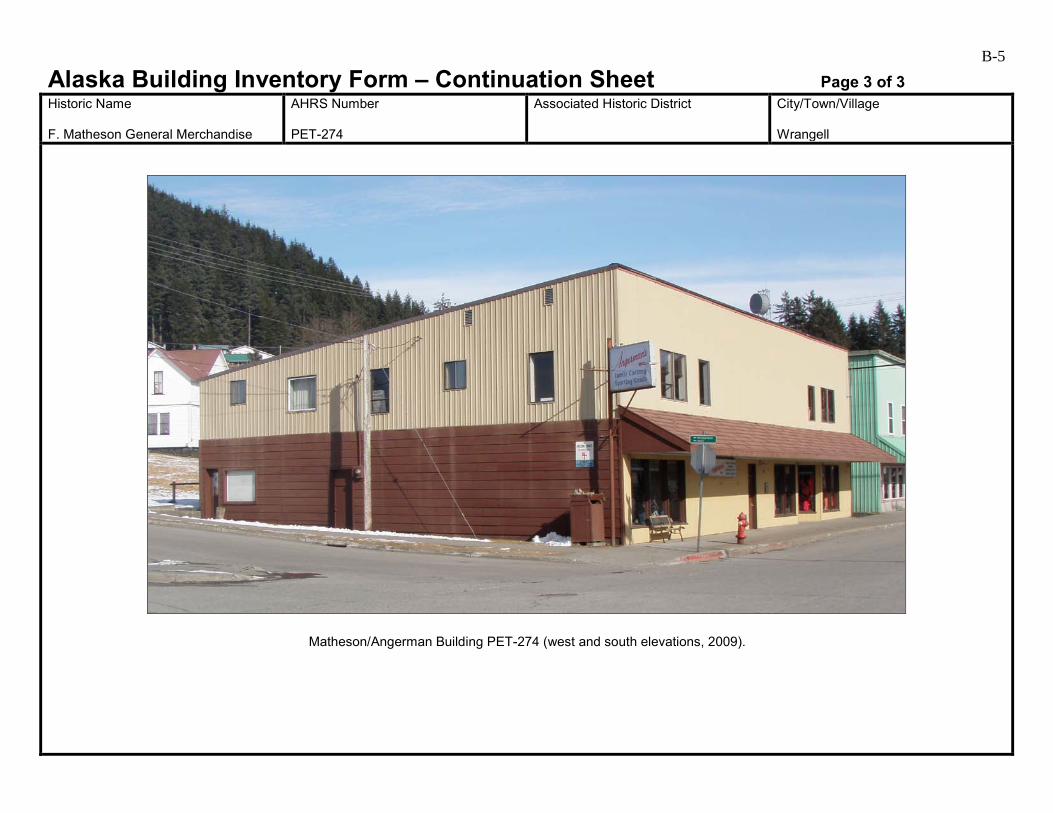
B-5
Alaska Building Inventory Form – Continuation Sheet Page 3 of 3 Historic Name F. Matheson General Merchandise
AHRS Number PET-274
Associated Historic District
City/Town/Village Wrangell
Matheson/Angerman Building PET-274 (west and south elevations, 2009).
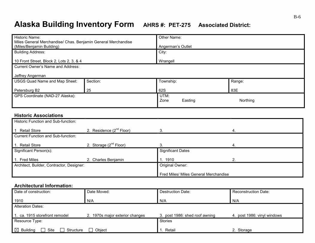
B-6
Alaska Building Inventory Form AHRS #: PET-275 Associated District: Historic Name: Miles General Merchandise/ Chas. Benjamin General Merchandise (Miles/Benjamin Building)
Other Name: Angerman’s Outlet
Building Address: 10 Front Street, Block 2, Lots 2, 3, & 4
City: Wrangell
Current Owner’s Name and Address: Jeffrey Angerman USGS Quad Name and Map Sheet: Petersburg B2
Section: 25
Township: 62S
Range: 83E
GPS Coordinate (NAD-27 Alaska):
UTM: Zone Easting Northing
Historic Associations Historic Function and Sub-function: 1 Retail Store
2. Residence (2nd Floor)
3.
4.
Current Function and Sub-function: 1. Retail Store
2. Storage (2nd Floor)
3.
4.
Significant Person(s): 1. Fred Miles
2. Charles Benjamin
Significant Dates 1. 1910
2.
Architect, Builder, Contractor, Designer:
Original Owner: Fred Miles/ Miles General Merchandise
Architectural Information: Date of construction: 1910
Date Moved: N/A
Destruction Date: N/A
Reconstruction Date: N/A
Alteration Dates: 1. ca. 1915 storefront remodel
2. 1970s major exterior changes
3. post 1986: shed roof awning
4. post 1986: vinyl windows
Resource Type:
Building Site Structure Object
Stories 1. Retail
2. Storage

B-7 Architectural Style: Commercial
Building Type: Mixed-Use Commercial
Number of Ancillary Structures: 0
Plan: Rectangular
Cultural Affiliation:
Foundation Materials: 1. Concrete Perimeter 2.
Roof Materials: 1. Painted Metal 2.
Exterior Wall Materials: 1. Painted Metal 2. Plywood
Other Materials: 1. 2.
Architectural Description (Include setting & outbuildings):(use continuation sheets) This two-story, rectangular shaped commercial building sits at the sidewalk on the northern side of Front Street surrounded by other commercial businesses in downtown Wrangell. It was originally a plain two-story building with a Pioneer style storefront. The main entrance was toward the back of its western side off of Totem Street—a narrow street between Matheson’s and Miles’s (Cohen 1986). The second story had a bay window on the west façade. A pair of double-hung windows was on the southeastern corner, and there were three single windows spaced evenly across the remainder of façade. The cornice and corner boards were painted a light color. After Benjamin purchased the building in 1912, he removed the bay window and changed the entrance and the storefront to face Front Street. The new symmetrical storefront extended the width of the building and centered around a recessed door bay. The storefront had tall windows divided with muntins near the top and recessed vertical tongue and grove wood panels below windows. The building was sheathed in 8-inch shiplap (Cohen 1986). (see continuation)
Statement of Significance: (use continuation sheets) This building was built in 1910 by Fred Miles who opened Miles General Merchandise here. Charles Benjamin bought the business in 1912 and changed the name to Chas. Benjamin, General Merchandise (Cohen 1986). Benjamin arrived in Wrangell in 1907 and was active in the logging business. He went to work for Miles in 1911 in the general store. He became store manager that year, and then in 1912, he bought the business from Miles and the lot next door. Benjamin served on the Wrangell City Council for a number of years. He was elected to the Territorial House of Representatives in 1927 and to the Senate in 1929 where he served for four years. The Benjamin family lived upstairs in this building until the 1920s and then used the upstairs for storage. They had a business here until 1972 when they moved into a new location that had been built on tideland fill. This building sat vacant for a while and then was rented to various businesses (Cohen 1986). (see continuation)
Eligibility:
Yes No If yes: A B C D
Criteria Considerations:
A B C D E F G Prepared by: Cultural Resource Consultants, LLC
Reviewed by Professional that meets the following Professional Qualifications:
Architect Architectural Historian Historian Historic Architect None
Date: 3/3/09
SHPO Response:
Eligible (Concur) Eligible (Do Not Concur) Not Eligible (Concur) Not Eligible (Do Not Concur) Minor Recommendations and Comments Include:
Need more information related to: Historic Context Integrity Architectural Description Period of Significance Authorized Signature: Date:
B-8
Alaska Building Inventory Form – Continuation Sheet Page 1 of 3 Historic Name Miles/Benjamin Building
AHRS Number PET-275
Associated Historic District
City/Town/Village Wrangell
Architectural Description (continued) The roof sloped from east to west parallel to the tall, plain street façade to create a false front. Benjamin added a flat roofed section to the rear harmonious in style with the original structure. In a 1930s photo, the panels are painted white with dark trim and the canvas awning was replaced with wood—a style popular in 1920s. Over the next several years, the façade went through several alterations. By 1986, the second story front façade was covered with aluminum siding and the first floor façade was covered with painted plywood. The original series of five display windows on either side of the double door entrance had been replaced with two sets of three display windows (Cohen 1986). Setting: Located on the north side of Front Street, between Front Street and an alley, narrow alley west of building (Totem Street). Massing: Rectangular in plan, shed roof of main building slopes down towards east. Shed-roofed addition at the north end of building with roof sloping towards alley. Small shed-roofed pent house likely for roof access. Minimal (less than 6 inches) or no overhangs, shed-roofed awning over sidewalk. Elevations: South: Exterior changes since 1986 report include replacement of flat-roofed, rod-supported awning with shed-roofed awning. Also on south elevation 2nd floor aluminum windows have been replaced by vinyl. Other Elevations: 1950s era cementitious shingles covered or replaced by painted metal siding. Statement of Significance (continued) Built in 1910, this building is associated with the Early to Mid-20th Century Development of Wrangell 1900 to 1941. It once represented Wrangell Architectural Styles 1906 to 1935. Commercial businesses housed in this building continued to support Wrangell during the Post World War II Development of Wrangell 1945 to 1973. Like the Matheson Building to the west, this building was once a good example of early 20th century commercial architecture, and is significant for its association with the Charles Benjamin General Merchandise Store, which operated until the mid-1970s. The building retains integrity of location in the downtown commercial area of Wrangell. Its setting has changed with the addition of 20th century buildings, but this does not affect its integrity in any extraordinary way. However, it lacks integrity of materials, feeling, and association with its period of significance due to the changes that have been made. It no longer resembles the original building. Extensive exterior modifications have left only the massing and some of the opening patterns intact. The building does not retain the integrity required for individual listing on the National Register under Criteria A or C. Fred Miles and Charles Benjamin undoubtedly contributed to the development of Wrangell with their commercial businesses, and Charles Benjamin served in the Wrangell City Council and in the Territorial House and Senate, but with the loss of integrity, this building is recommended not eligible under Criterion B. There is no indication that this building has been, or shows the potential for being, the principle source of important historic information; therefore, it is recommended as not eligible under criterion D

B-9
Alaska Building Inventory Form – Continuation Sheet Page 2 of 3 Historic Name Miles/Benjamin Building
AHRS Number PET-275
Associated Historic District
City/Town/Village Wrangell
Miles/Benjamin Building PET-275, ca. 1915 (Cohen 1986)
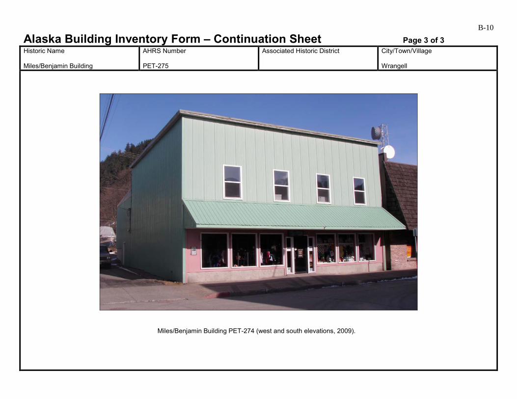
B-10
Alaska Building Inventory Form – Continuation Sheet Page 3 of 3 Historic Name Miles/Benjamin Building
AHRS Number PET-275
Associated Historic District
City/Town/Village Wrangell
Miles/Benjamin Building PET-274 (west and south elevations, 2009).

B-11
Alaska Building Inventory Form AHRS #: PET-277 Associated District: Historic Name: Grant/Buness Building (2)
Other Name: Buness Bros.
Building Address: 18 Front Street, Block 2, Lot 4
City: Wrangell
Current Owner’s Name and Address: Buness Brothers USGS Quad Name and Map Sheet: Petersburg B2
Section: 25
Township: 62S
Range: 83E
GPS Coordinate (NAD-27 Alaska):
UTM: Zone Easting Northing
Historic Associations Historic Function and Sub-function: 1 Automobile Paint Shop
2. Automobile Repairs and Parts
3.
4.
Current Function and Sub-function: 1. Furniture, appliances, electronics, boat dealer
2.
3.
4.
Significant Person(s): 1.
2.
Significant Dates 1.
2.
Architect, Builder, Contractor, Designer:
Original Owner: B.W. Burke and M.L. Burke
Architectural Information: Date of construction: 1927
Date Moved:
Destruction Date:
Reconstruction Date:
Alteration Dates: 1. 1970s major exterior changes
2. 1980s
3.
4.
Resource Type:
Building Site Structure Object
Stories 1. Retail store (1st floor)
2. Storage (2nd floor)

B-12 Architectural Style: Commercial
Building Type: Commercial
Number of Ancillary Structures:
Plan: Rectangular
Cultural Affiliation:
Foundation Materials: 1. Not visible 2.
Roof Materials: 1. Low-slope roof; material not visible 2.
Exterior Wall Materials: 1. Brick veneer 2. Painted metal siding
Other Materials: 1. Wood shingles 2. Y-groove shiplap wood siding
Architectural Description (Include setting & outbuildings):(use continuation sheets) This building sits at the sidewalk facing south on the northern side of Front Street and is surrounded by other commercial businesses in downtown Wrangell. Cohen noted that his building was built in 1927, but it is not depicted on the 1927 or the 1933 Sanborn Fire Insurance maps. There is little information about the original building (Cohen 1986:141). In 1986, this two-story building measured 18 by 36 feet and had a shed roof. It was sided on the rear and sides with narrow shiplap (Cohen 1986:142). The symmetrically placed door and window openings were boarded over, indicating the building was similar to other commercial buildings on Front Street (Cohen 1986:142, 144). The storefront was covered with brick facing and had a mansard shingled overhang. (see continuation)
Statement of Significance: (use continuation sheets) The lot where this building stands was owned by the Grant family who sometimes used this portion of the lot for a garden (Cohen 1986:141). Grant built the Grant/Buness Building (1) PET-276 (demolished) to the west on this same lot in 1906 (Cohen 1986). In September 1927, B. W. Burke and M. L. Burke built a building here as an automobile paint shop. The Burkes also owned the Yellow Paint Store which operated out of the Lemieux/Bahovec House (PET-285) at the corner of Cow Alley and McKinnon. The entrance of their new building opened onto Cow Alley and faced the Yellow Paint Store. The building was 18 by 36 feet and could accommodate three cars. Other automobile businesses operated out of this building, including Harris Harms who had Wrangell Motors in the building in 1932 and Van Fisk who had a garage business here. Bill Taylor took over Fisk’s business, and the garage was eventually leased to a transfer company. Harvey Hodge had an auto body business here from 1954 until 1975. Buness Bros. Inc. bought this property in 1980 (Cohen 1986) and is the current owner. (see continuation)
Eligibility:
Yes No If yes: A B C D
Criteria Considerations:
A B C D E F G Prepared by: Cultural Resource Consultants, LLC
Reviewed by Professional that meets the following Professional Qualifications:
Architect Architectural Historian Historian Historic Architect None
Date: 4/7/2009
SHPO Response:
Eligible (Concur) Eligible (Do Not Concur) Not Eligible (Concur) Not Eligible (Do Not Concur) Minor Recommendations and Comments Include:
Need more information related to: Historic Context Integrity Architectural Description Period of Significance Authorized Signature: Date:
B-13
Alaska Building Inventory Form – Continuation Sheet Page 1 of 2 Historic Name Grant/Buness Building (2)
AHRS Number PET-277
Associated Historic District
City/Town/Village Wrangell
Architectural description (continued) Like the adjacent 14 Front Street, this building has brick veneer on the south elevation, large fixed-pane storefront windows, and a shingled mansard awning obscuring the second floor. The only indication of the 1927 automobiles garage is the V-groove shiplap wood siding visible only on the west elevation. The north side of the building has metal siding and a pair of metal doors at the center. The sill height is several feet above the adjacent grade. Statement of Significance (continued) After the building next door (PET-276) was torn down in the mid-1980s, this building was completely remodeled and expanded to the west (Carol Rushmore, personal communication to Catherine Pendleton 2009). Built in 1927, this building is associated with the Early to Mid-20th Century Development of Wrangell 1900 to 1941. Commercial businesses housed in this building continued to support Wrangell during the Post World War II Development of Wrangell 1945 to 1973. It retains integrity of location in the commercial area of downtown Wrangell. Its setting has changed with the addition of 20th century buildings, but this does not affect its integrity in any extraordinary way. However, it no longer retains integrity of design, materials, workmanship, feeling, and association with its period of significance due to the changes that have been made. It is recommended not eligible under Criterion A. B. W. and M. L. Burke, Harris Harms, Van Fisk, and Bill Taylor, among others, operated automobile paid and repair businesses in this building undoubtedly contributed to the growth and development of Wrangell through their business enterprises, but with the loss of integrity, this building is recommended not eligible under Criterion B. It was drastically altered in the 1970s and is nearly unrecognizable as a historic structure. A ca. 1970 photo by Tony Nazar shows a 1920s-era commercial building with three garage doors on Front Street. The building does not retain enough integrity to be eligible for the National Register under Criterion C. There is no indication that this building has been, or shows the potential for being, the principle source of important historic information; therefore, it is recommended not eligible under Criterion D.
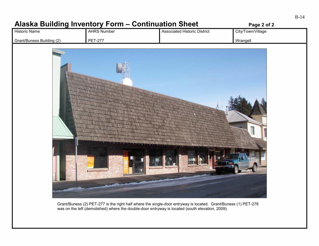
B-14
Alaska Building Inventory Form – Continuation Sheet Page 2 of 2 Historic Name Grant/Buness Building (2)
AHRS Number PET-277
Associated Historic District
City/Town/Village Wrangell
Grant/Buness (2) PET-277 is the right half where the single-door entryway is located. Grant/Buness (1) PET-276 was on the left (demolished) where the double-door entryway is located (south elevation, 2009).

B-15
Alaska Building Inventory Form AHRS #: PET-278 Associated District: Historic Name: Patenaude/ Grant Building
Other Name: Vacant
Building Address: 22 Front Street, Block 2, Lot 6
City: Wrangell
Current Owner’s Name and Address: Michael and Karen Lockabey USGS Quad Name and Map Sheet: Petersburg B2
Section: 25
Township: 62S
Range: 83E
GPS Coordinate (NAD-27 Alaska):
UTM: Zone Easting Northing
Historic Associations Historic Function and Sub-function: 1 Barber Shop and Tobacco shop
2. Shoe Repair, Hair salon (1920s)
3.
4.
Current Function and Sub-function: 1. Vacant
2.
3.
4.
Significant Person(s): 1.
2.
Significant Dates 1.
2.
Architect, Builder, Contractor, Designer:
Original Owner: Leo Patenaude
Architectural Information: Date of construction: 1906
Date Moved:
Destruction Date:
Reconstruction Date:
Alteration Dates: 1. 1950s
2. Post 1986
3.
4.
Resource Type:
Building Site Structure Object
Stories 1. 2
2.
B-16 Architectural Style: Queen Anne
Building Type: Commercial
Number of Ancillary Structures:
Plan: Rectangular
Cultural Affiliation:
Foundation Materials: 1. Concrete 2.
Roof Materials: 1. Wood shingles 2.
Exterior Wall Materials: 1. Asphalt shingles 2.
Other Materials: 1. 2.
Architectural Description (Include setting & outbuildings):(use continuation sheets) This two-story, rectangular shaped commercial building sits at the sidewalk on the northern side of Front Street surrounded by other commercial businesses in downtown Wrangell. In 1986, it was described has having a hip roof and a projecting six-sided shingled turret capped by a steeply pitched pointed roof. The roof and turret gave it an appearance of earlier Queen Anne or a shingle style. The original store front had a diagonally recessed entrance in the center of the south façade and horizontally divided plate glass storefront windows that extended to the side facing McKinnon Street (Cohen 1986). A trim belt course capped the storefront and ran around the lower edge of the tower. The upper floor had evenly spaced double-hung windows that rose to the trim board just under the eaves on the south façade and continued around the tower onto the east facade. In 1986, the building had unpainted metal roofing. The first floor entrance was a single recessed door flanked by large fixed pane windows. It had a fixed wooden horizontal canopy and the second floor was sided with asphalt shingles probably added 1950s (Cohen 1986). (see continuation)
Statement of Significance: (use continuation sheets) Leo C. Patenaude arrived in Wrangell in 1898 during the gold rush and first opened a barber shop in a building next to the Greif/Stough building down the street. After the 1906 fire destroyed his first building, he built a new one at the current location where he operated his barber shop and tobacco shop for six years (Cohen 1986). Patenaude served as Town Clerk, Treasurer, and ex-officio tax collector for Wrangell. In 1913, Patenaude left his business to Charles Fallowsbee who continued to operate a barber shop out of the building. In 1921, the building housed John Fanning’s shoe repair shop, and in 1925, it served as a beauty salon operated by Florence Schribner. Since that time it has been a plumbing supply store, photography shop, and a clothing and yarn shop. In 1985, Millie’s operated here (Cohen 1986). In 2008, it was Alaska Clothing and Travel Accessories shop. It is currently owned by Michael and Karen Lockabey. (see continuation)
Eligibility:
Yes No If yes: A B C D
Criteria Considerations:
A B C D E F G Prepared by: Cultural Resource Consultants, LLC
Reviewed by Professional that meets the following Professional Qualifications:
Architect Architectural Historian Historian Historic Architect None
Date: 4/7/2009
SHPO Response:
Eligible (Concur) Eligible (Do Not Concur) Not Eligible (Concur) Not Eligible (Do Not Concur) Minor Recommendations and Comments Include:
Need more information related to: Historic Context Integrity Architectural Description Period of Significance Authorized Signature: Date:
B-17
Alaska Building Inventory Form – Continuation Sheet Page 1 of 2 Historic Name Patenaude/Grant Building
AHRS Number PET-278
Associated Historic District
City/Town/Village Wrangell
Architectural Description (continued) This unique turreted building is located on the north side of Front Street at the corner of Front and McKinnon Streets. This building has changed very little since Cohen’s 1986 Survey. On the south elevation, a steeply-pitched, wood-shingled shed roof has been added on top the flat-roofed awning shown in the 1986 photographs. Awning: Streetscape photographs from the 1910s and 1920s show that most commercial buildings along Front Street had striped fabric awnings that rolled out to shelter the sidewalk. By the 1930s, flat-roofed wood-framed awnings supported by steel rods or chains had been added to many buildings. By the 1980s, most flat-roofed awnings in the potential historic district had been replaced by new structures with pitched-roofs. In some cases, pitched roofs were added on top of the existing flat awnings. The date of construction of the existing awning is unknown. As pictured in 1986, the flat-roofed, rod-supported awning matched the construction type of awnings popular in the 1930s. The pitched, shingled roof added on top the older awning after 1986 is not historic. Statement of Significance (continued) This building is one of several turreted commercial buildings constructed in Southeast Alaska towns during and after the Gold Rush of 1898. It is one of few remaining examples in Alaska of the somewhat simplified version of Queen Anne style popular during the time period. It is recommended eligible for listing on the National Register under Criterion A for its association with the Early to mid- 20th Century Development of Wrangell 1900 to 1941 and the contexts Early Community Planning and Development of Wrangell 1900 to 1916 and Wrangell Fishing and Timber Industry Boom 1900 to 1939. It retains integrity of location, materials, design, feeling, and association with its period of significance. Its setting has changed somewhat; the 19th century buildings to the west have been remodeled to a great extent, and 20th century buildings have been built across the street on the southern side of Front Street. However, this does not affect its integrity in any extraordinary way. Commercial businesses housed in this building continued to support Wrangell during the Post World War II Development of Wrangell 1945 to 1973.This is one of only a few turreted buildings left in Southeast Alaska. Leo Patenaude, who operated a commercial business in this building and served as Town Clerk, Treasurer, and ex-officio tax collector for Wrangell; Charles Fallowsbee; John Fanning; Florence Schribner; and the various other business owners who operated their business enterprises in this building undoubtedly contributed to the growth and development of Wrangell, but their contributions do not make them individually significant within the broader historic context. This building is recommended not eligible under Criterion B. It would be eligible for the National Register under Criterion C, except for many exterior changes affecting the building’s historic integrity for this criterion. A ca. 1970 photograph of this building on Tony Nazar’s website shows a glass storefront, with a row of windows above the flat awning. The current shingled awning and many changes to the storefront have a detrimental effect on the character of the primary elevation. Cementitious shingles from the 1950s, pressed plywood siding from the 1970s, and replacement double-hung second floor windows which appear to be from the 1980s have all affected the building’s historic appearance. It is possible that this building could be restored to convey its architectural significance. The form and massing, pattern of the openings, and the graceful turret, remain, as may remnants of the storefront and original siding beneath the layers of newer material. There is no indication that this building has been, or shows the potential for being, the principle source of important historic information; therefore, it is recommended not eligible under Criterion D.
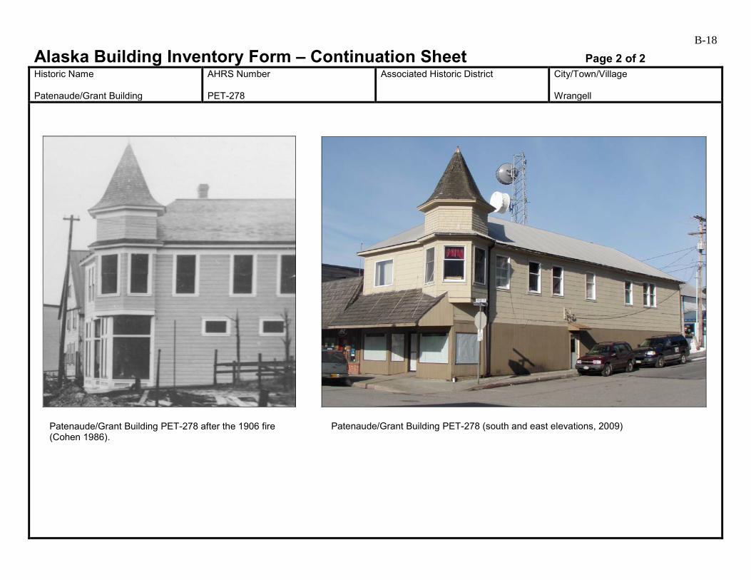
B-18
Alaska Building Inventory Form – Continuation Sheet Page 2 of 2 Historic Name Patenaude/Grant Building
AHRS Number PET-278
Associated Historic District
City/Town/Village Wrangell
Patenaude/Grant Building PET-278 after the 1906 fire (Cohen 1986).
Patenaude/Grant Building PET-278 (south and east elevations, 2009)
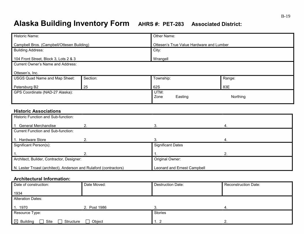
B-19
Alaska Building Inventory Form AHRS #: PET-283 Associated District: Historic Name: Campbell Bros. (Campbell/Ottesen Building)
Other Name: Ottesen’s True Value Hardware and Lumber
Building Address: 104 Front Street, Block 3, Lots 2 & 3
City: Wrangell
Current Owner’s Name and Address: Ottesen’s, Inc. USGS Quad Name and Map Sheet: Petersburg B2
Section: 25
Township: 62S
Range: 83E
GPS Coordinate (NAD-27 Alaska):
UTM: Zone Easting Northing
Historic Associations Historic Function and Sub-function: 1 General Merchandise
2.
3.
4.
Current Function and Sub-function: 1. Hardware Store
2.
3.
4.
Significant Person(s): 1.
2.
Significant Dates 1.
2.
Architect, Builder, Contractor, Designer: N. Lester Troast (architect), Anderson and Rulaford (contractors)
Original Owner: Leonard and Ernest Campbell
Architectural Information: Date of construction: 1934
Date Moved:
Destruction Date:
Reconstruction Date:
Alteration Dates: 1. 1970
2. Post 1986
3.
4.
Resource Type:
Building Site Structure Object
Stories 1. 2
2.

B-20 Architectural Style: Art Deco
Building Type: Commercial
Number of Ancillary Structures:
Plan: Rectangular
Cultural Affiliation:
Foundation Materials: 1. Concrete 2.
Roof Materials: 1. Corrugated metal 2.
Exterior Wall Materials: 1. Cementitious horizontal siding 2. Painted corrugated metal
Other Materials: 1. 2.
Architectural Description (Include setting & outbuildings):(use continuation sheets) This two-story building sits at the sidewalk and faces south on the northern side of Front Street in the downtown commercial area of Wrangell. The original storefront was stucco in an Art Deco style. It had a geometric frieze along the roof line and a marquee across the entire width of the front (Cohen 1986:145). The building had a wide storefront with small-paned transom windows above the awning. The upper story had six evenly spaced, tall double-hung windows with “Campbell Brothers” in dimensional letters across the front. A flat roofed awning hung over two recessed bay entrances on either side of the front façade (Cohen 1986:145). The building was 44 by 88 feet, and the foundation and first floor were made of concrete. In 1970, the storefront was covered with a combination of plywood, brick facing, and cedar strips. One entrance was covered over and the plate glass store windows were moved. The second floor windows were covered over (Cohen 1986). (see continuation)
Statement of Significance: (use continuation sheets) This building was built in 1934 by Leonard and Ernest Campbell who operated Campbell Brothers (Cohen 1986:145). Their father had a business on this lot that burned in the 1906 fire. The Campbell brothers had been in business since 1921 in a previous location between the Wheeler/Angerman Building (PET-286) and the Greif/Stough Building (PET-287) where they sold general merchandise (Cohen 1986:148). Campbell Brothers sold men’s wear, hardware, and groceries (Cohen 1986:Photo 44). The property was purchased in 1960 by Einar Ottesen who opened a hardware store here. He remodeled the storefront in 1970 (Cohen 1986:146). Einar Ottesen was superintendent for the Wrangell Packing Company and was a director of the National Bank of Alaska until he passed away in 1992 (Rasmuson 2000:81). (see continuation)
Eligibility:
Yes No If yes: A B C D
Criteria Considerations:
A B C D E F G Prepared by: Cultural Resource Consultants, LLC
Reviewed by Professional that meets the following Professional Qualifications:
Architect Architectural Historian Historian Historic Architect None
Date: 4/7/2009
SHPO Response:
Eligible (Concur) Eligible (Do Not Concur) Not Eligible (Concur) Not Eligible (Do Not Concur) Minor Recommendations and Comments Include:
Need more information related to: Historic Context Integrity Architectural Description Period of Significance Authorized Signature: Date:
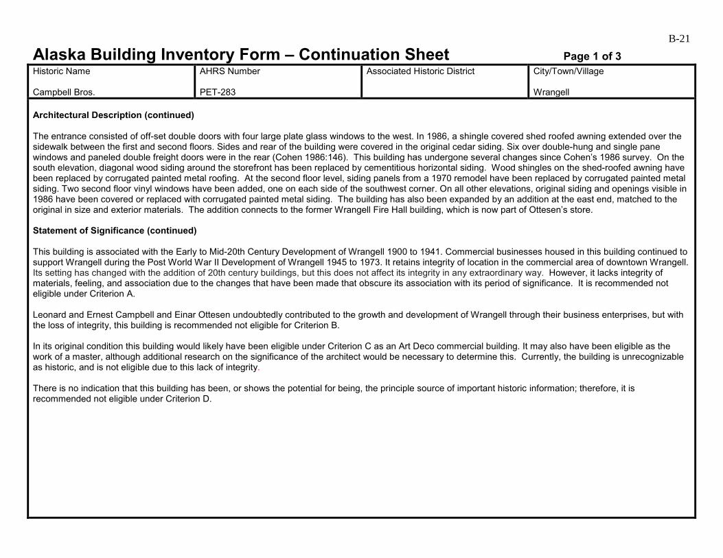
B-21
Alaska Building Inventory Form – Continuation Sheet Page 1 of 3 Historic Name Campbell Bros.
AHRS Number PET-283
Associated Historic District
City/Town/Village Wrangell
Architectural Description (continued) The entrance consisted of off-set double doors with four large plate glass windows to the west. In 1986, a shingle covered shed roofed awning extended over the sidewalk between the first and second floors. Sides and rear of the building were covered in the original cedar siding. Six over double-hung and single pane windows and paneled double freight doors were in the rear (Cohen 1986:146). This building has undergone several changes since Cohen’s 1986 survey. On the south elevation, diagonal wood siding around the storefront has been replaced by cementitious horizontal siding. Wood shingles on the shed-roofed awning have been replaced by corrugated painted metal roofing. At the second floor level, siding panels from a 1970 remodel have been replaced by corrugated painted metal siding. Two second floor vinyl windows have been added, one on each side of the southwest corner. On all other elevations, original siding and openings visible in 1986 have been covered or replaced with corrugated painted metal siding. The building has also been expanded by an addition at the east end, matched to the original in size and exterior materials. The addition connects to the former Wrangell Fire Hall building, which is now part of Ottesen’s store. Statement of Significance (continued) This building is associated with the Early to Mid-20th Century Development of Wrangell 1900 to 1941. Commercial businesses housed in this building continued to support Wrangell during the Post World War II Development of Wrangell 1945 to 1973. It retains integrity of location in the commercial area of downtown Wrangell. Its setting has changed with the addition of 20th century buildings, but this does not affect its integrity in any extraordinary way. However, it lacks integrity of materials, feeling, and association due to the changes that have been made that obscure its association with its period of significance. It is recommended not eligible under Criterion A. Leonard and Ernest Campbell and Einar Ottesen undoubtedly contributed to the growth and development of Wrangell through their business enterprises, but with the loss of integrity, this building is recommended not eligible for Criterion B. In its original condition this building would likely have been eligible under Criterion C as an Art Deco commercial building. It may also have been eligible as the work of a master, although additional research on the significance of the architect would be necessary to determine this. Currently, the building is unrecognizable as historic, and is not eligible due to this lack of integrity. There is no indication that this building has been, or shows the potential for being, the principle source of important historic information; therefore, it is recommended not eligible under Criterion D.
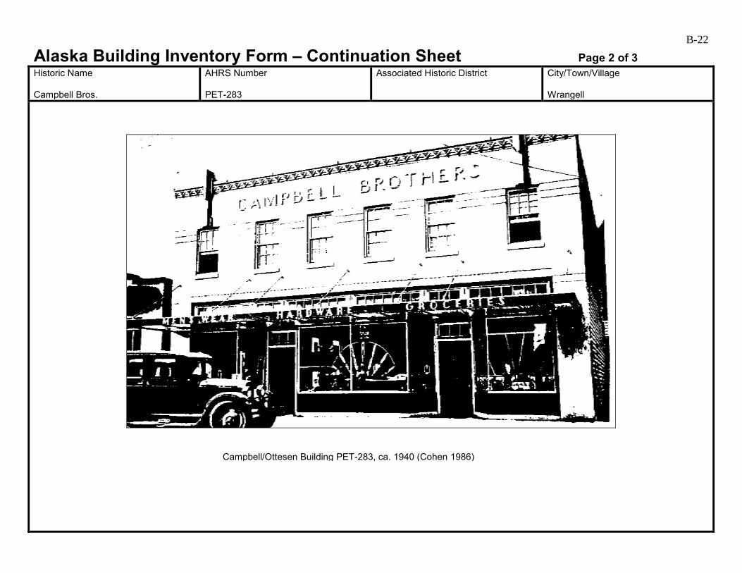
B-22
Alaska Building Inventory Form – Continuation Sheet Page 2 of 3 Historic Name Campbell Bros.
AHRS Number PET-283
Associated Historic District
City/Town/Village Wrangell
Campbell/Ottesen Building PET-283, ca. 1940 (Cohen 1986)
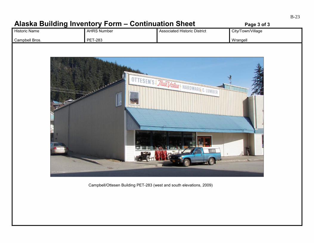
B-23
Alaska Building Inventory Form – Continuation Sheet Page 3 of 3 Historic Name Campbell Bros.
AHRS Number PET-283
Associated Historic District
City/Town/Village Wrangell
Campbell/Ottesen Building PET-283 (west and south elevations, 2009)
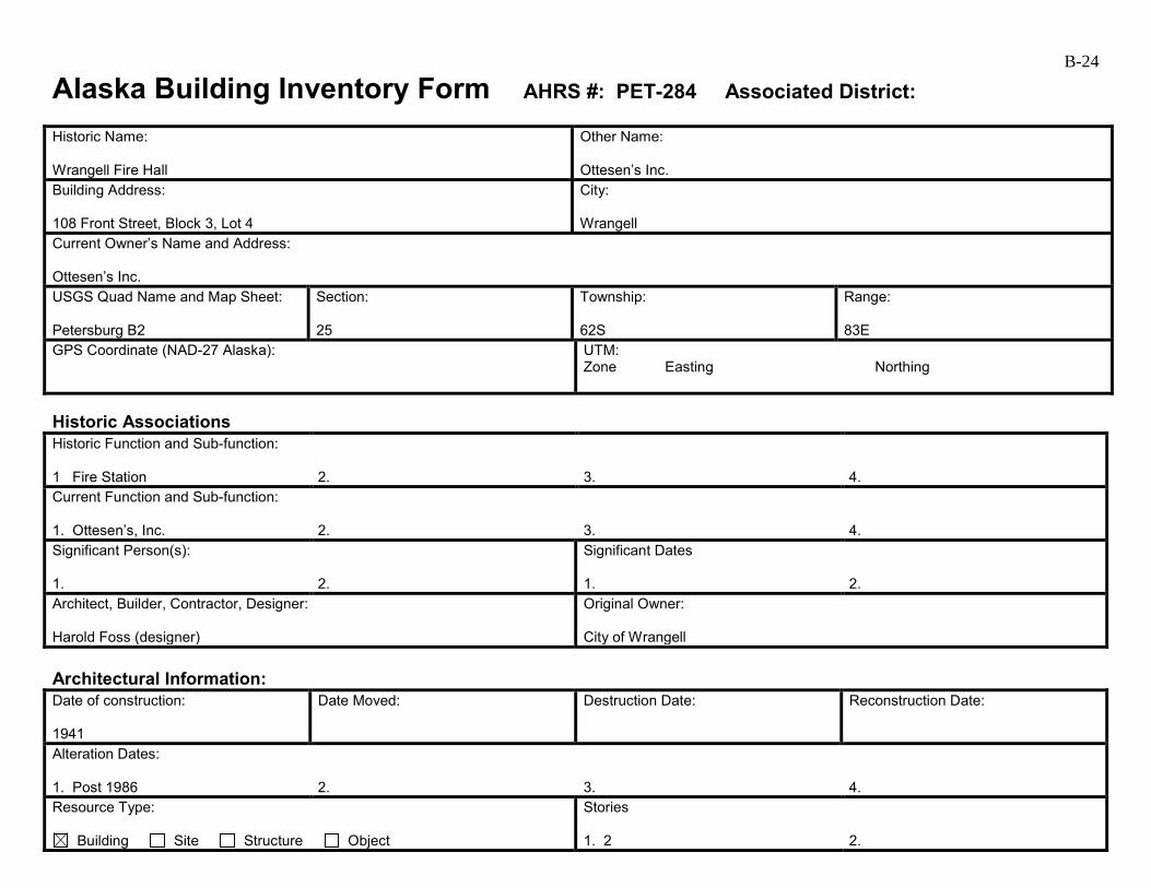
B-24
Alaska Building Inventory Form AHRS #: PET-284 Associated District: Historic Name: Wrangell Fire Hall
Other Name: Ottesen’s Inc.
Building Address: 108 Front Street, Block 3, Lot 4
City: Wrangell
Current Owner’s Name and Address: Ottesen’s Inc. USGS Quad Name and Map Sheet: Petersburg B2
Section: 25
Township: 62S
Range: 83E
GPS Coordinate (NAD-27 Alaska):
UTM: Zone Easting Northing
Historic Associations Historic Function and Sub-function: 1 Fire Station
2.
3.
4.
Current Function and Sub-function: 1. Ottesen’s, Inc.
2.
3.
4.
Significant Person(s): 1.
2.
Significant Dates 1.
2.
Architect, Builder, Contractor, Designer: Harold Foss (designer)
Original Owner: City of Wrangell
Architectural Information: Date of construction: 1941
Date Moved:
Destruction Date:
Reconstruction Date:
Alteration Dates: 1. Post 1986
2.
3.
4.
Resource Type:
Building Site Structure Object
Stories 1. 2
2.

B-25 Architectural Style: Art Moderne
Building Type: Commercial
Number of Ancillary Structures:
Plan: Rectangular
Cultural Affiliation:
Foundation Materials: 1. Concrete 2.
Roof Materials: 1. 2.
Exterior Wall Materials: 1. Cementitious horizontal siding 2.
Other Materials: 1. 2.
Architectural Description (Include setting & outbuildings):(use continuation sheets) This building sits at the sidewalk and faces south on the northern side of Front Street in the commercial area of downtown Wrangell. It is made of poured concrete in a modified, swept-back Art Deco style (Cohen 1986:222). It had a large door to accommodate the fire engine and the upstairs housed the fire department offices. By 1986, the building had been expanded in the rear for additional storage (Cohen 1986:222). At the time of Cohen’s 1986 survey, this concrete Art Moderne building was still serving the Wrangell Fire Department. The Fire Hall became part of Ottesen’s True Value Hardware next door sometime between Cohen’s 1986 survey and March 1999, as the March 18, 1999, Wrangell Sentinel mentions that even though it was “now an annex of Ottesen’s True Value Hardware,” it was still “recognizable as a Wrangell landmark.” Changes on the primary (south) elevation include filling in the large fire hall door opening with fixed-pane storefront windows, and adding new cementitious horizontal siding at the first floor level which covers the original entrance. (see continuation)
Statement of Significance: (use continuation sheets) The Wrangell Fire Hall building was designed by Harold Foss of H. B. Foss Company in Juneau. It was built on the site of the old fire hall and cost a total of $16,000. Roosevelt’s New Deal Works Progress Administration provided $6,000 and the remaining funds came from the city (Cohen 1986:224). In 1985, a new public safety building that would include the fire department was under construction (Cohen 1986:224). The old fire hall building is currently owned by Ottesen’s Inc. This building is associated with the Early to mid-20th Century Development of Wrangell 1900 to 1941. It continued to serve as a fire hall during the Post World War II Development of Wrangell 1945 to 1973. It retains integrity of location in the downtown commercial area of Wrangell. Its setting has changed with the addition of 20th century buildings, but this does not affect its integrity in any extraordinary way. However, it lacks integrity of materials, feeling, and association. It is no longer clearly identifiable as a fire hall due to the changes that have been made. Therefore, it is recommended not eligible under Criterion A. (see continuation)
Eligibility:
Yes No If yes: A B C D
Criteria Considerations:
A B C D E F G Prepared by: Cultural Resource Consultants, LLC
Reviewed by Professional that meets the following Professional Qualifications:
Architect Architectural Historian Historian Historic Architect None
Date: 4/7/2009
SHPO Response:
Eligible (Concur) Eligible (Do Not Concur) Not Eligible (Concur) Not Eligible (Do Not Concur) Minor Recommendations and Comments Include:
Need more information related to: Historic Context Integrity Architectural Description Period of Significance Authorized Signature: Date:
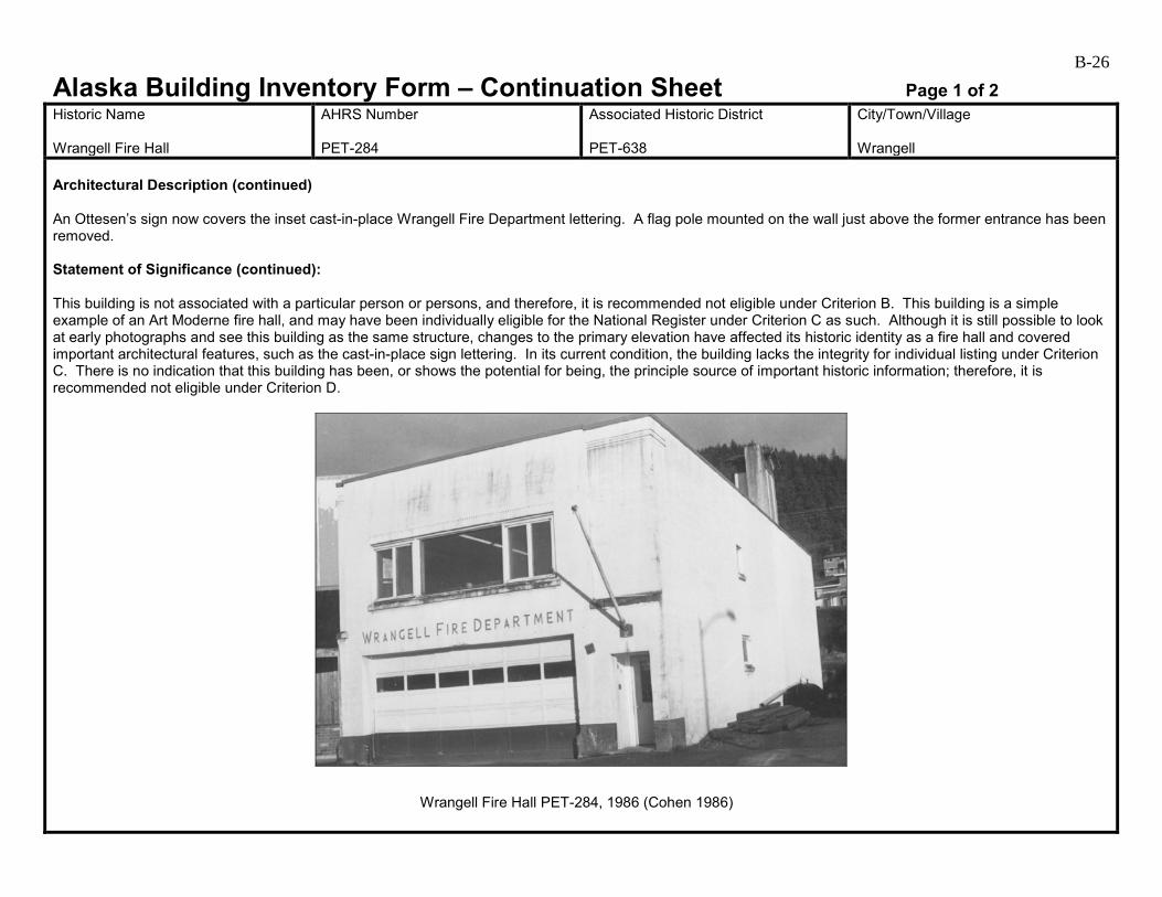
B-26
Alaska Building Inventory Form – Continuation Sheet Page 1 of 2 Historic Name Wrangell Fire Hall
AHRS Number PET-284
Associated Historic District PET-638
City/Town/Village Wrangell
Architectural Description (continued) An Ottesen’s sign now covers the inset cast-in-place Wrangell Fire Department lettering. A flag pole mounted on the wall just above the former entrance has been removed. Statement of Significance (continued): This building is not associated with a particular person or persons, and therefore, it is recommended not eligible under Criterion B. This building is a simple example of an Art Moderne fire hall, and may have been individually eligible for the National Register under Criterion C as such. Although it is still possible to look at early photographs and see this building as the same structure, changes to the primary elevation have affected its historic identity as a fire hall and covered important architectural features, such as the cast-in-place sign lettering. In its current condition, the building lacks the integrity for individual listing under Criterion C. There is no indication that this building has been, or shows the potential for being, the principle source of important historic information; therefore, it is recommended not eligible under Criterion D.
Wrangell Fire Hall PET-284, 1986 (Cohen 1986)
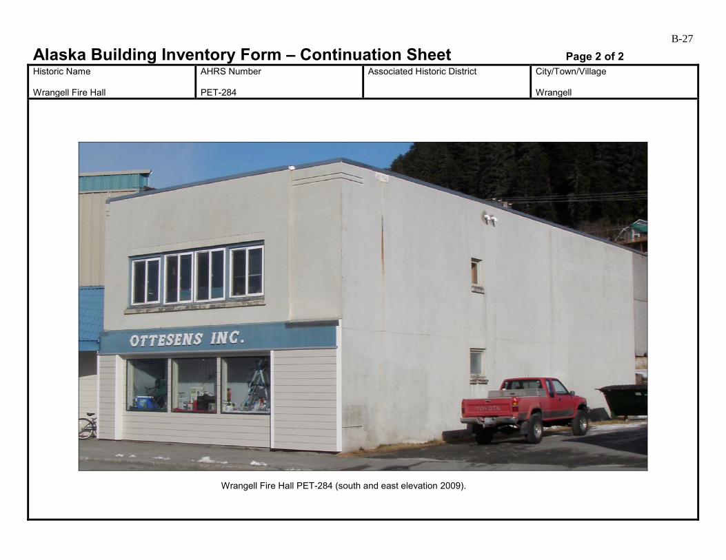
B-27
Alaska Building Inventory Form – Continuation Sheet Page 2 of 2 Historic Name Wrangell Fire Hall
AHRS Number PET-284
Associated Historic District
City/Town/Village Wrangell
Wrangell Fire Hall PET-284 (south and east elevation 2009).
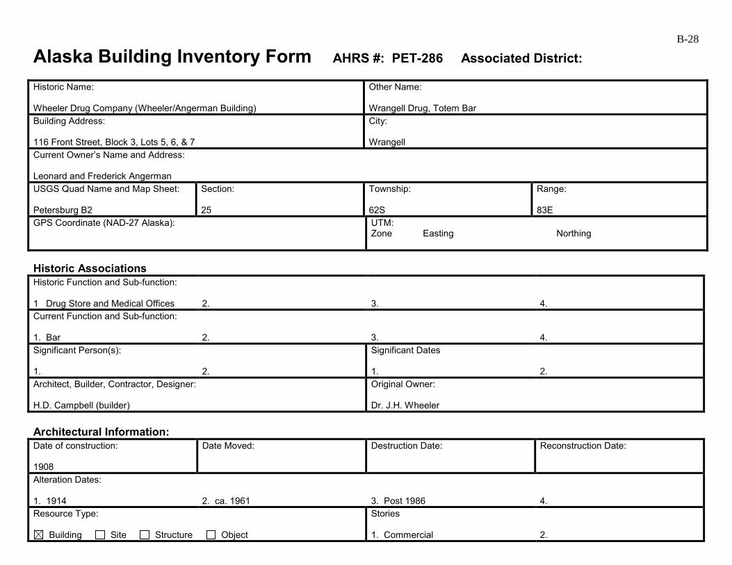
B-28
Alaska Building Inventory Form AHRS #: PET-286 Associated District: Historic Name: Wheeler Drug Company (Wheeler/Angerman Building)
Other Name: Wrangell Drug, Totem Bar
Building Address: 116 Front Street, Block 3, Lots 5, 6, & 7
City: Wrangell
Current Owner’s Name and Address: Leonard and Frederick Angerman USGS Quad Name and Map Sheet: Petersburg B2
Section: 25
Township: 62S
Range: 83E
GPS Coordinate (NAD-27 Alaska):
UTM: Zone Easting Northing
Historic Associations Historic Function and Sub-function: 1 Drug Store and Medical Offices
2.
3.
4.
Current Function and Sub-function: 1. Bar
2.
3.
4.
Significant Person(s): 1.
2.
Significant Dates 1.
2.
Architect, Builder, Contractor, Designer: H.D. Campbell (builder)
Original Owner: Dr. J.H. Wheeler
Architectural Information: Date of construction: 1908
Date Moved:
Destruction Date:
Reconstruction Date:
Alteration Dates: 1. 1914
2. ca. 1961
3. Post 1986
4.
Resource Type:
Building Site Structure Object
Stories 1. Commercial
2.

B-29 Architectural Style:
Building Type: Commercial
Number of Ancillary Structures:
Plan: Rectangular
Cultural Affiliation:
Foundation Materials: 1. Concrete 2.
Roof Materials: 1. Corrugated metal 2.
Exterior Wall Materials: 1. Painted metal 2.
Other Materials: 1. 2.
Architectural Description (Include setting & outbuildings):(use continuation sheets) This building sits at the sidewalk on the northern side of Front Street. The original building was a two-story and 22 by 50 feet. It was raised and remodeled in 1914. A 1928 photo shows a gable roof and a Pioneer false front. The top of the gable extended over the false front to create pediment. Two double-hung windows were placed symmetrically in the front façade on the second story. It had a recessed bay door entrance with divided plate glass windows and recessed wood panels below. A corniced belt course separated the two stories and it had a canvass awning. The Angermans dramatically altered the building after they bought it in 1961 (Cohen 1986). (see continuation)
Statement of Significance: (use continuation sheets) Known originally as Wrangell Drug, this building was constructed by H. D. Campbell for Dr. J. H. Wheeler in 1908 to house a drug store on the first floor and medical offices on the second floor, a common practice during that era. By 1928, the name had changed to Wheeler Drugs. Dr. Leonard Dawes opened an office on the second floor in 1910 and had purchased the stock and fixtures of the Wrangell Drug Company by 1911. In 1914, Mrs. Wheeler began managing the Wrangell Drug Company, and Dr. Pigg took over Dr. Dawes’s practice and opened the Wrangell Hospital in the building. The Wheelers, who also owned a store in Petersburg, owned this building until they sold it in 1961 to Fred and Leonard Angerman (Cohen 1986). This building is associated with Early 20th Century Development of Wrangell 1900 to 1941. It was once an example of Wrangell Architecture 1906 to 1935. (see continuation)
Eligibility:
Yes No If yes: A B C D
Criteria Considerations:
A B C D E F G Prepared by: Cultural Resource Consultants, LLC
Reviewed by Professional that meets the following Professional Qualifications:
Architect Architectural Historian Historian Historic Architect None
Date: 4/7/2009
SHPO Response:
Eligible (Concur) Eligible (Do Not Concur) Not Eligible (Concur) Not Eligible (Do Not Concur) Minor Recommendations and Comments Include:
Need more information related to: Historic Context Integrity Architectural Description Period of Significance Authorized Signature: Date:
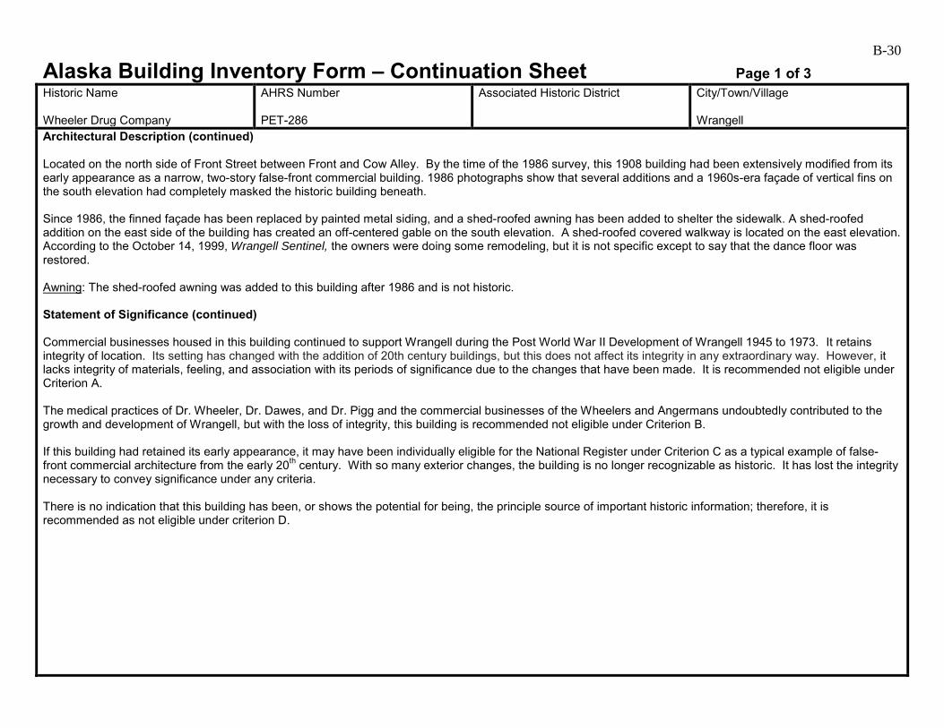
B-30
Alaska Building Inventory Form – Continuation Sheet Page 1 of 3 Historic Name Wheeler Drug Company
AHRS Number PET-286
Associated Historic District
City/Town/Village Wrangell
Architectural Description (continued) Located on the north side of Front Street between Front and Cow Alley. By the time of the 1986 survey, this 1908 building had been extensively modified from its early appearance as a narrow, two-story false-front commercial building. 1986 photographs show that several additions and a 1960s-era façade of vertical fins on the south elevation had completely masked the historic building beneath. Since 1986, the finned façade has been replaced by painted metal siding, and a shed-roofed awning has been added to shelter the sidewalk. A shed-roofed addition on the east side of the building has created an off-centered gable on the south elevation. A shed-roofed covered walkway is located on the east elevation. According to the October 14, 1999, Wrangell Sentinel, the owners were doing some remodeling, but it is not specific except to say that the dance floor was restored. Awning: The shed-roofed awning was added to this building after 1986 and is not historic. Statement of Significance (continued) Commercial businesses housed in this building continued to support Wrangell during the Post World War II Development of Wrangell 1945 to 1973. It retains integrity of location. Its setting has changed with the addition of 20th century buildings, but this does not affect its integrity in any extraordinary way. However, it lacks integrity of materials, feeling, and association with its periods of significance due to the changes that have been made. It is recommended not eligible under Criterion A. The medical practices of Dr. Wheeler, Dr. Dawes, and Dr. Pigg and the commercial businesses of the Wheelers and Angermans undoubtedly contributed to the growth and development of Wrangell, but with the loss of integrity, this building is recommended not eligible under Criterion B. If this building had retained its early appearance, it may have been individually eligible for the National Register under Criterion C as a typical example of false-front commercial architecture from the early 20th century. With so many exterior changes, the building is no longer recognizable as historic. It has lost the integrity necessary to convey significance under any criteria. There is no indication that this building has been, or shows the potential for being, the principle source of important historic information; therefore, it is recommended as not eligible under criterion D.

B-31
Alaska Building Inventory Form – Continuation Sheet Page 2 of 3 Historic Name Wheeler Drug Company
AHRS Number PET-286
Associated Historic District
City/Town/Village Wrangell
Wheeler/Angerman Building PET-286, ca. 1928 (Cohen 1986)

B-32
Alaska Building Inventory Form – Continuation Sheet Page 3 of 3 Historic Name Wheeler Drug Company
AHRS Number PET-286
Associated Historic District
City/Town/Village Wrangell
Wheeler/Angerman Building PET-286 (west and south elevations, 2009)
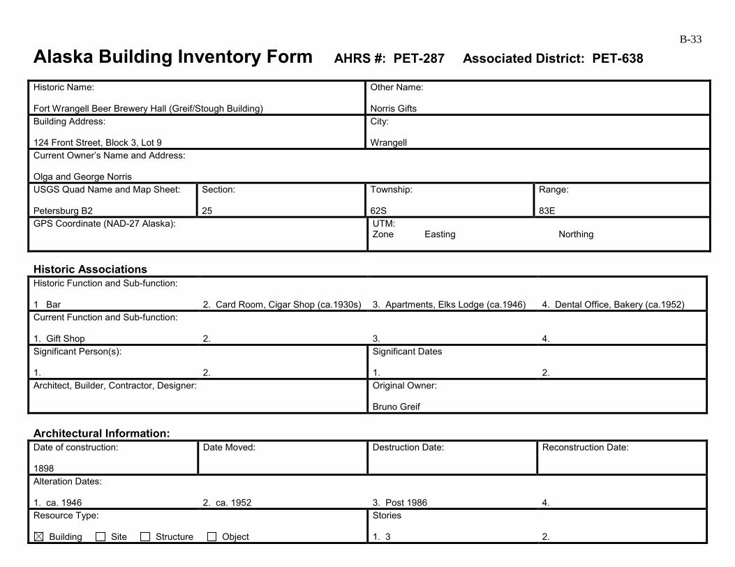
B-33
Alaska Building Inventory Form AHRS #: PET-287 Associated District: PET-638 Historic Name: Fort Wrangell Beer Brewery Hall (Greif/Stough Building)
Other Name: Norris Gifts
Building Address: 124 Front Street, Block 3, Lot 9
City: Wrangell
Current Owner’s Name and Address: Olga and George Norris USGS Quad Name and Map Sheet: Petersburg B2
Section: 25
Township: 62S
Range: 83E
GPS Coordinate (NAD-27 Alaska):
UTM: Zone Easting Northing
Historic Associations Historic Function and Sub-function: 1 Bar
2. Card Room, Cigar Shop (ca.1930s)
3. Apartments, Elks Lodge (ca.1946)
4. Dental Office, Bakery (ca.1952)
Current Function and Sub-function: 1. Gift Shop
2.
3.
4.
Significant Person(s): 1.
2.
Significant Dates 1.
2.
Architect, Builder, Contractor, Designer:
Original Owner: Bruno Greif
Architectural Information: Date of construction: 1898
Date Moved:
Destruction Date:
Reconstruction Date:
Alteration Dates: 1. ca. 1946
2. ca. 1952
3. Post 1986
4.
Resource Type:
Building Site Structure Object
Stories 1. 3
2.
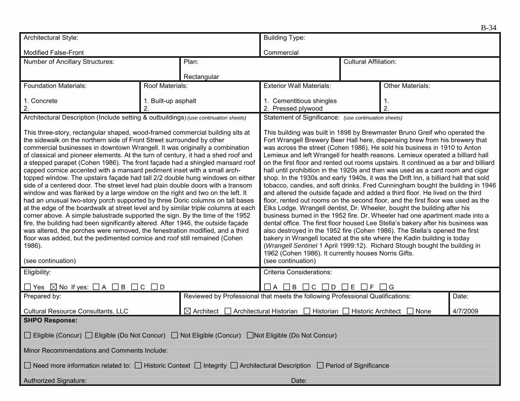
B-34 Architectural Style: Modified False-Front
Building Type: Commercial
Number of Ancillary Structures:
Plan: Rectangular
Cultural Affiliation:
Foundation Materials: 1. Concrete 2.
Roof Materials: 1. Built-up asphalt 2.
Exterior Wall Materials: 1. Cementitious shingles 2. Pressed plywood
Other Materials: 1. 2.
Architectural Description (Include setting & outbuildings):(use continuation sheets) This three-story, rectangular shaped, wood-framed commercial building sits at the sidewalk on the northern side of Front Street surrounded by other commercial businesses in downtown Wrangell. It was originally a combination of classical and pioneer elements. At the turn of century, it had a shed roof and a stepped parapet (Cohen 1986). The front façade had a shingled mansard roof capped cornice accented with a mansard pediment inset with a small arch-topped window. The upstairs façade had tall 2/2 double hung windows on either side of a centered door. The street level had plain double doors with a transom window and was flanked by a large window on the right and two on the left. It had an unusual two-story porch supported by three Doric columns on tall bases at the edge of the boardwalk at street level and by similar triple columns at each corner above. A simple balustrade supported the sign. By the time of the 1952 fire, the building had been significantly altered. After 1946, the outside façade was altered, the porches were removed, the fenestration modified, and a third floor was added, but the pedimented cornice and roof still remained (Cohen 1986). (see continuation)
Statement of Significance: (use continuation sheets) This building was built in 1898 by Brewmaster Bruno Greif who operated the Fort Wrangell Brewery Beer Hall here, dispensing brew from his brewery that was across the street (Cohen 1986). He sold his business in 1910 to Anton Lemieux and left Wrangell for health reasons. Lemieux operated a billiard hall on the first floor and rented out rooms upstairs. It continued as a bar and billiard hall until prohibition in the 1920s and then was used as a card room and cigar shop. In the 1930s and early 1940s, it was the Drift Inn, a billiard hall that sold tobacco, candies, and soft drinks. Fred Cunningham bought the building in 1946 and altered the outside façade and added a third floor. He lived on the third floor, rented out rooms on the second floor, and the first floor was used as the Elks Lodge. Wrangell dentist, Dr. Wheeler, bought the building after his business burned in the 1952 fire. Dr. Wheeler had one apartment made into a dental office. The first floor housed Lee Stella’s bakery after his business was also destroyed in the 1952 fire (Cohen 1986). The Stella’s opened the first bakery in Wrangell located at the site where the Kadin building is today (Wrangell Sentinel 1 April 1999:12). Richard Stough bought the building in 1962 (Cohen 1986). It currently houses Norris Gifts. (see continuation)
Eligibility:
Yes No If yes: A B C D
Criteria Considerations:
A B C D E F G Prepared by: Cultural Resource Consultants, LLC
Reviewed by Professional that meets the following Professional Qualifications:
Architect Architectural Historian Historian Historic Architect None
Date: 4/7/2009
SHPO Response:
Eligible (Concur) Eligible (Do Not Concur) Not Eligible (Concur) Not Eligible (Do Not Concur) Minor Recommendations and Comments Include:
Need more information related to: Historic Context Integrity Architectural Description Period of Significance Authorized Signature: Date:

B-35
Alaska Building Inventory Form – Continuation Sheet Page 1 of 2 Historic Name Fort Wrangell Beer Brewery Hall
AHRS Number PET-287
Associated Historic District PET-638
City/Town/Village Wrangell
Architectural Description (continued) After 1952, all remaining ornamentation was stripped off and the 8-inch shiplap siding was covered with asphalt shingles. The windows were changed to create a 1940s look, and a new decorative cornice and street awning were added. This building has had extensive exterior changes over time, but very few since the 1986 Cohen survey. A decorative diamond motif has been added to the wide parapet trim at the top of the south elevation. On the east side of the building, pressed plywood siding located at the base of the wall has been extended, replacing several courses of cementitious shingles. Statement of significance (continued) Built in 1898, this building is associated with the Late 19th Century Development of Wrangell 1879 to 1899. It retains integrity of location in the downtown commercial area of Wrangell. Its setting has changed with the addition of 20th century buildings, but this does not affect its integrity in any extraordinary way. However, it no longer retains integrity of design, materials, workmanship, feeling, and association due to the changes that have been made that obscure its association with this period of significance. This building continued to serve as a commercial establishment throughout the Early to Mid-20th Century Development of Wrangell 1900 to 1941. It is also associated with the Post World War II to Mid-1960s Development of Wrangell 1945 to 1973 and the subcategories Growth and the Changing Face of Wrangell 1945 to 1965, Fishing Industry Decline 1945 to 1960, and Timber Industry Boom 1953 to 1973. The changes that were made to the building were done in the 1940s and 1950s and give the building a 1940s look. It retains integrity of materials, feeling, and association with this period of significance. This building is not recommended individually eligible, although it is recommended as a contributing element to the Wrangell Commercial Historic District (PET-638) under Criterion A. Bruno Greif, Anton Lemieux, and various other owners who operated businesses in this building during the Late 19th to Early 20th Century Development of Downtown Wrangell period of significance undoubtedly contributed to the development of Wrangell, but with the loss of integrity for this time period, this building is recommended not eligible under Criterion B for this period of significance. Fred Cunningham, Dr. Wheeler, the Stella’s, Richard Stough, and other owners who operated businesses in this building during the Post World War II to Mid-1960s Development of Wrangell period of significance contributed to the development of Wrangell. The Stellas opened the first bakery in Wrangell but not in this building. However, the contributions of these business owners do not make them significant within the broader historic context. This building is recommended not eligible under Criterion B for this period of significance. In early photographs, this building had a two-level porch, tall narrow window openings, and a mansard roof topping the false-front, with a unique gambrel-roofed gable centered in the mansard. Over time, everything but the basic massing and setting of the building has changed. In its current condition, the building is no longer representative of a specific time period and is not individually eligible under Criterion C. There is no indication that this building has been, or shows the potential for being, the principle source of important historic information; therefore, it is recommended not eligible under Criterion D.
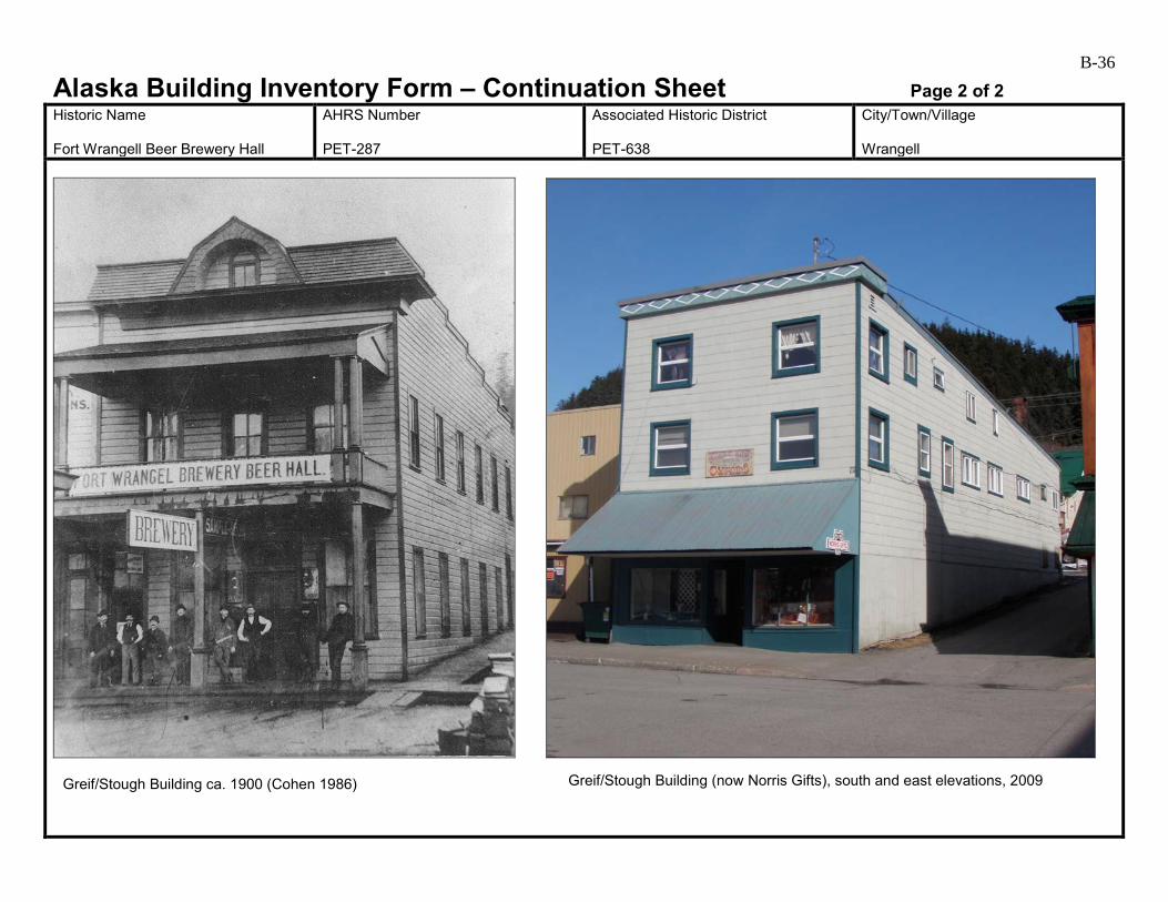
B-36
Alaska Building Inventory Form – Continuation Sheet Page 2 of 2 Historic Name Fort Wrangell Beer Brewery Hall
AHRS Number PET-287
Associated Historic District PET-638
City/Town/Village Wrangell
Greif/Stough Building ca. 1900 (Cohen 1986) Greif/Stough Building (now Norris Gifts), south and east elevations, 2009
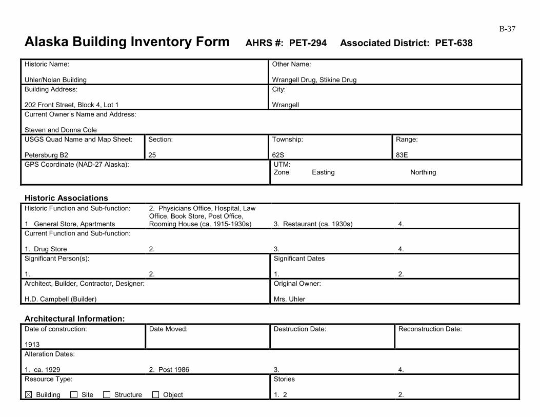
B-37
Alaska Building Inventory Form AHRS #: PET-294 Associated District: PET-638 Historic Name: Uhler/Nolan Building
Other Name: Wrangell Drug, Stikine Drug
Building Address: 202 Front Street, Block 4, Lot 1
City: Wrangell
Current Owner’s Name and Address: Steven and Donna Cole USGS Quad Name and Map Sheet: Petersburg B2
Section: 25
Township: 62S
Range: 83E
GPS Coordinate (NAD-27 Alaska):
UTM: Zone Easting Northing
Historic Associations Historic Function and Sub-function: 1 General Store, Apartments
2. Physicians Office, Hospital, Law Office, Book Store, Post Office, Rooming House (ca. 1915-1930s)
3. Restaurant (ca. 1930s)
4.
Current Function and Sub-function: 1. Drug Store
2.
3.
4.
Significant Person(s): 1.
2.
Significant Dates 1.
2.
Architect, Builder, Contractor, Designer: H.D. Campbell (Builder)
Original Owner: Mrs. Uhler
Architectural Information: Date of construction: 1913
Date Moved:
Destruction Date:
Reconstruction Date:
Alteration Dates: 1. ca. 1929
2. Post 1986
3.
4.
Resource Type:
Building Site Structure Object
Stories 1. 2
2.

B-38 Architectural Style: Billboard False-Front
Building Type: Commercial
Number of Ancillary Structures:
Plan: Rectangular
Cultural Affiliation:
Foundation Materials: 1. 2.
Roof Materials: 1. Painted metal 2.
Exterior Wall Materials: 1. Board and batten 2. Tile
Other Materials: 1. 2.
Architectural Description (Include setting & outbuildings):(use continuation sheets) This two-story, gable roofed building sits at the sidewalk on the northern side of Front Street surrounded by other commercial businesses in downtown Wrangell. How the building looked originally is unknown. Its short false front creates a pedimented billboard-style store front and it has a diamond-shaped window in the pediment peak (Cohen 1986). A hipped roof parapet caps the top of false front. The street level storefront extends past the upper level building line and is probably where the building was expanded after it changed hands in 1929. In 1931, new awnings were added. At the belt course was another metal roofed cornice over glass block transom windows. There were two diagonally-recessed door bays. In 1986, a wooden street canopy was suspended from the building between the transom and plate glass storefront windows, and the storefront had been tiled while the rest of the building was asphalt shingles (Cohen 1986). (see continuation)
Statement of Significance: (use continuation sheets) This building was constructed in 1913 by builder H. D. Campbell for Mrs. Uhler after the original log building at this location was torn down. The new building was to have commercial businesses on the first floor and apartments on the second floor (Cohen 1986). The first business in the new building was a general store called Martin and Richard Hofstad. J. J. McTague had a secondhand ship chandlery shop in the building in 1915, and in 1916, Ed Grigwire had a barbershop here. George Cowan had a watch repair here in 1918. In 1928, a book store moved into the building; it closed in 1932. Physicians and attorneys also occupied the building over the years, including traveling physician Dr. Emery, Dr. C. H. Upton, and Judge William G. Thomas who was the first city magistrate for Wrangell. Dr. A. B. Jones (a physician) and Dr. O. A. Braafladt (a dentist) opened a hospital in 1921 on the second floor called Wrangell General Hospital. The Uhler family sold the building in 1929 to James Nolan; at the time, it housed the Book Nook, the post office, and a rooming house (Cohen 1986).
Eligibility:
Yes No If yes: A B C D
Criteria Considerations:
A B C D E F G Prepared by: Cultural Resource Consultants, LLC
Reviewed by Professional that meets the following Professional Qualifications:
Architect Architectural Historian Historian Historic Architect None
Date: 4/9/2009
SHPO Response:
Eligible (Concur) Eligible (Do Not Concur) Not Eligible (Concur) Not Eligible (Do Not Concur) Minor Recommendations and Comments Include:
Need more information related to: Historic Context Integrity Architectural Description Period of Significance Authorized Signature: Date:
B-39
Alaska Building Inventory Form – Continuation Sheet Page 1 of 3 Historic Name Uhler/Nolan Building
AHRS Number PET-294
Associated Historic District PET-638
City/Town/Village Wrangell
Architectural Description (continued) Located on the north side of Front Street between Front and Cow Alley, this 1913 building has had several changes since the 1986 Cohen survey. Photographs from the survey show that the building had a 1930s-era storefront unique in Wrangell, with a tiled base and columns, expansive glazing, and a band of glass block over a flat-roofed awning. Since 1986, a new shed-roofed awning has been added. Although the storefront below remains unchanged, it is unclear whether the glass block transom still exists behind the awning. The building also has painted metal roofing on the awning and cornices, and vertical board-and-batten siding, which appear to be recently added. Vinyl windows are now located in most openings, except for high glass block openings in the first floor, on the east and west elevations. At the back of the building, a covered porch at the second floor level has been enclosed with vinyl windows. Awning: A flat-roofed, rod-supported awning is pictured in 1986 photographs of this building. The current, shed-roofed awning does not appear to be historic. Statement of significance (continued) In 1930, Nolan moved his restaurant, Den O’Sweets, into the building. In 1985, Wrangell Drug was in the building (Cohen 1986). The building currently houses Stikine Drug. Nolan sold the property in 1992 to Robert and Kathleen Fisher, who are the current owners. Built in 1913, this building is associated with the Early to Mid-20th Century Development of Wrangell 1900 to 1941. Commercial businesses housed in this building continued to support Wrangell during the Post World War II Development of Wrangell 1945 to 1973. It retains integrity of location. Its setting has changed with the addition of 20th century buildings, but this does not affect its integrity in any extraordinary way. However, it lacks integrity of materials, feeling, and association with its period of significance due to the many changes. It is recommend not eligible under Criterion A. It is not clear whether or not Mrs. Uhler, the original building owner, had a business in this building. The many business owners that operated out of this building undoubtedly contributed to the growth and development of Wrangell during the period of significance, but their contributions do not make them individually significant within the broader historic context. This building is recommended not eligible under Criterion B. This building has undergone many changes and is no longer representative of a specific architectural period or style. While it is clearly a historic building, its 1913 and 1930s identities are no longer intact. It is not individually eligible under Criterion C. There is no indication that this building has been, or shows the potential for being, the principle source of important historic information; therefore, it is recommended not eligible under Criterion D. This building is within the boundaries of a proposed historic district. It is recommended as a contributing element of the Wrangell Commercial Historic District PET-638.
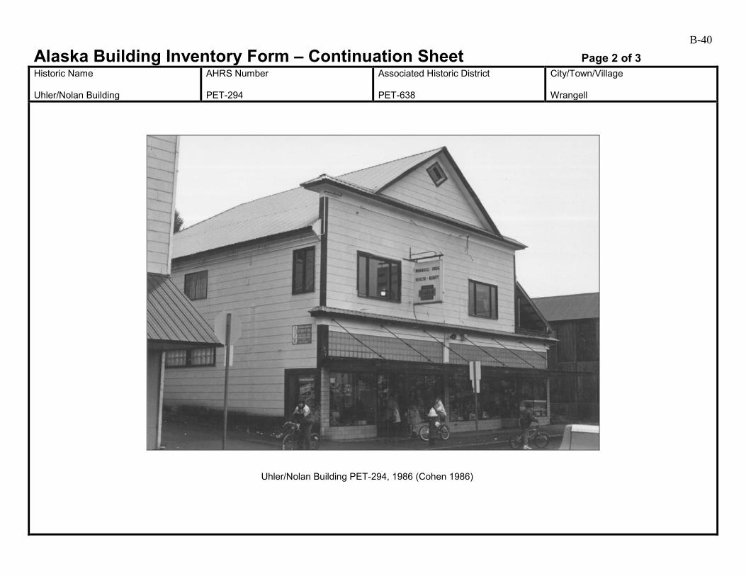
B-40
Alaska Building Inventory Form – Continuation Sheet Page 2 of 3 Historic Name Uhler/Nolan Building
AHRS Number PET-294
Associated Historic District PET-638
City/Town/Village Wrangell
Uhler/Nolan Building PET-294, 1986 (Cohen 1986)
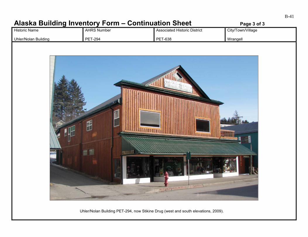
B-41
Alaska Building Inventory Form – Continuation Sheet Page 3 of 3 Historic Name Uhler/Nolan Building
AHRS Number PET-294
Associated Historic District PET-638
City/Town/Village Wrangell
Uhler/Nolan Building PET-294, now Stikine Drug (west and south elevations, 2009).
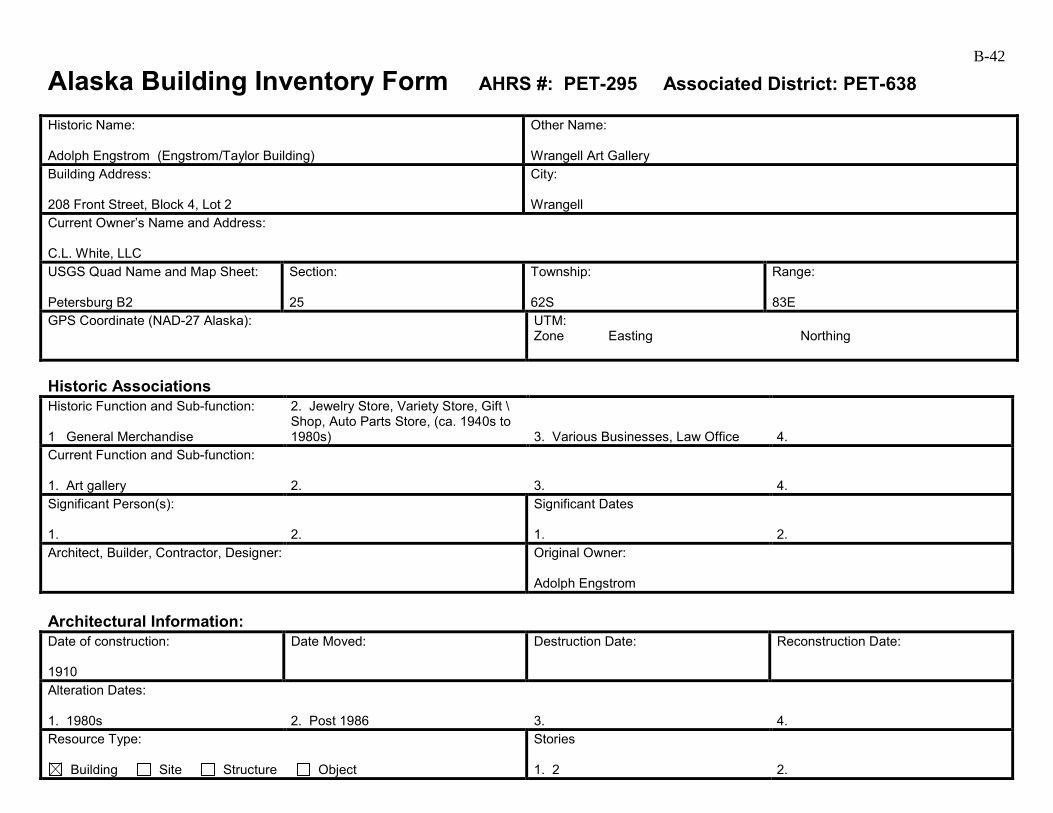
B-42
Alaska Building Inventory Form AHRS #: PET-295 Associated District: PET-638 Historic Name: Adolph Engstrom (Engstrom/Taylor Building)
Other Name: Wrangell Art Gallery
Building Address: 208 Front Street, Block 4, Lot 2
City: Wrangell
Current Owner’s Name and Address: C.L. White, LLC USGS Quad Name and Map Sheet: Petersburg B2
Section: 25
Township: 62S
Range: 83E
GPS Coordinate (NAD-27 Alaska):
UTM: Zone Easting Northing
Historic Associations Historic Function and Sub-function: 1 General Merchandise
2. Jewelry Store, Variety Store, Gift \ Shop, Auto Parts Store, (ca. 1940s to 1980s)
3. Various Businesses, Law Office
4.
Current Function and Sub-function: 1. Art gallery
2.
3.
4.
Significant Person(s): 1.
2.
Significant Dates 1.
2.
Architect, Builder, Contractor, Designer:
Original Owner: Adolph Engstrom
Architectural Information: Date of construction: 1910
Date Moved:
Destruction Date:
Reconstruction Date:
Alteration Dates: 1. 1980s
2. Post 1986
3.
4.
Resource Type:
Building Site Structure Object
Stories 1. 2
2.
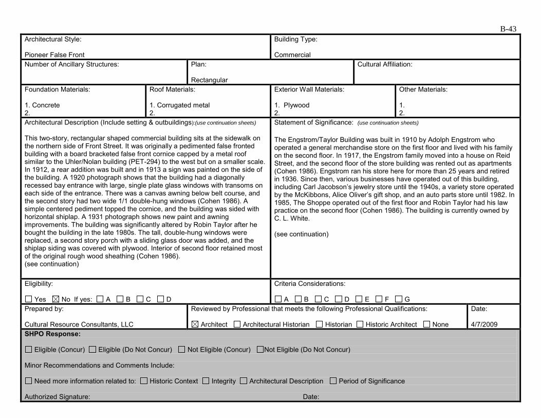
B-43 Architectural Style: Pioneer False Front
Building Type: Commercial
Number of Ancillary Structures:
Plan: Rectangular
Cultural Affiliation:
Foundation Materials: 1. Concrete 2.
Roof Materials: 1. Corrugated metal 2.
Exterior Wall Materials: 1. Plywood 2.
Other Materials: 1. 2.
Architectural Description (Include setting & outbuildings):(use continuation sheets) This two-story, rectangular shaped commercial building sits at the sidewalk on the northern side of Front Street. It was originally a pedimented false fronted building with a board bracketed false front cornice capped by a metal roof similar to the Uhler/Nolan building (PET-294) to the west but on a smaller scale. In 1912, a rear addition was built and in 1913 a sign was painted on the side of the building. A 1920 photograph shows that the building had a diagonally recessed bay entrance with large, single plate glass windows with transoms on each side of the entrance. There was a canvas awning below belt course, and the second story had two wide 1/1 double-hung windows (Cohen 1986). A simple centered pediment topped the cornice, and the building was sided with horizontal shiplap. A 1931 photograph shows new paint and awning improvements. The building was significantly altered by Robin Taylor after he bought the building in the late 1980s. The tall, double-hung windows were replaced, a second story porch with a sliding glass door was added, and the shiplap siding was covered with plywood. Interior of second floor retained most of the original rough wood sheathing (Cohen 1986). (see continuation)
Statement of Significance: (use continuation sheets) The Engstrom/Taylor Building was built in 1910 by Adolph Engstrom who operated a general merchandise store on the first floor and lived with his family on the second floor. In 1917, the Engstrom family moved into a house on Reid Street, and the second floor of the store building was rented out as apartments (Cohen 1986). Engstrom ran his store here for more than 25 years and retired in 1936. Since then, various businesses have operated out of this building, including Carl Jacobson’s jewelry store until the 1940s, a variety store operated by the McKibbons, Alice Oliver’s gift shop, and an auto parts store until 1982. In 1985, The Shoppe operated out of the first floor and Robin Taylor had his law practice on the second floor (Cohen 1986). The building is currently owned by C. L. White. (see continuation)
Eligibility:
Yes No If yes: A B C D
Criteria Considerations:
A B C D E F G Prepared by: Cultural Resource Consultants, LLC
Reviewed by Professional that meets the following Professional Qualifications:
Architect Architectural Historian Historian Historic Architect None
Date: 4/7/2009
SHPO Response:
Eligible (Concur) Eligible (Do Not Concur) Not Eligible (Concur) Not Eligible (Do Not Concur) Minor Recommendations and Comments Include:
Need more information related to: Historic Context Integrity Architectural Description Period of Significance Authorized Signature: Date:

B-44
Alaska Building Inventory Form – Continuation Sheet Page 1 of 2 Historic Name Adolph Engstrom
AHRS Number PET-295
Associated Historic District PET-638
City/Town/Village Wrangell
Architectural Description (continued) Located on the north side of Front Street, this 1910 two-story wood-framed building has had few exterior changes since its description in the 1986 Cohen survey. These include new vinyl railings on the awning (which also serves as a deck), decorative wood shutters at openings, and asphalt roof shingles on the parapet cornice and the face of the awning. Awning: The date of construction of the awning/deck on this building is unknown, but predates 1986. In its current configuration, the awning does not contribute to the historic character of the building. Statement of Significance (continued) This building is associated with the Early to mid-20th Century Development of Wrangell 1900 to 1941 and the contexts Early Community Planning and Development of Wrangell, 1900 to 1916, and Wrangell Fishing and Timber Industry Boom, 1900 to 1939. Commercial businesses housed in this building continued to support Wrangell during the Post World War II Development of Wrangell 1945 to 1973. It retains integrity of location with the commercial area of downtown Wrangell. Its setting has changed with the addition of 20th century buildings, but this does not affect its integrity in any extraordinary way. However, it lacks integrity of materials, feeling, and association due to the changes that have been made that obscure its association with its period of significance. It is recommended not eligible under Criterion A. Adolph Engstrom, who operated a commercial business in this building for 25 years, and the various business owners that followed undoubtedly contributed to the development of Wrangell, but with the loss of integrity, this building is recommended not eligible under Criterion B. Once a false-front commercial building typical of the early 20th century, major changes were made to this building in the 1970s. These include the grooved plywood siding, aluminum windows, and alterations to the openings on the primary elevation. The building retains its shape and massing, but is not individually eligible for the National Register under Criterion C due to these many changes. There is no indication that this building has been, or shows the potential for being, the principle source of important historic information; therefore, it is recommended as not eligible under criterion D. This building is included in the boundaries of a proposed historic district. However, it is recommended as a noncontributing element of the Wrangell Commercial Historic District PET-638

B-45Alaska Building Inventory Form – Continuation Sheet Page 2 of 2Historic Name
Engstrom/Taylor Building
AHRS Number PET-295
Associated Historic District PET-638
City/Town/Village Wrangell
Engstrom/Taylor Building PET-295, 1915 (Cohen 1986)
Engstrom/Taylor Building PET-295 (west and south elevations, 2009).
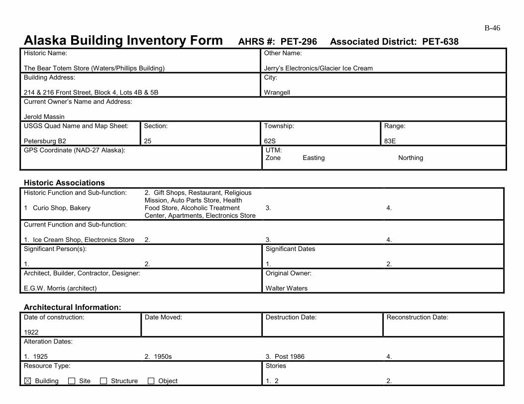
B-46
Alaska Building Inventory Form AHRS #: PET-296 Associated District: PET-638 Historic Name: The Bear Totem Store (Waters/Phillips Building)
Other Name: Jerry’s Electronics/Glacier Ice Cream
Building Address: 214 & 216 Front Street, Block 4, Lots 4B & 5B
City: Wrangell
Current Owner’s Name and Address: Jerold Massin USGS Quad Name and Map Sheet: Petersburg B2
Section: 25
Township: 62S
Range: 83E
GPS Coordinate (NAD-27 Alaska):
UTM: Zone Easting Northing
Historic Associations Historic Function and Sub-function: 1 Curio Shop, Bakery
2. Gift Shops, Restaurant, Religious Mission, Auto Parts Store, Health Food Store, Alcoholic Treatment Center, Apartments, Electronics Store
3.
4.
Current Function and Sub-function: 1. Ice Cream Shop, Electronics Store
2.
3.
4.
Significant Person(s): 1.
2.
Significant Dates 1.
2.
Architect, Builder, Contractor, Designer: E.G.W. Morris (architect)
Original Owner: Walter Waters
Architectural Information: Date of construction: 1922
Date Moved:
Destruction Date:
Reconstruction Date:
Alteration Dates: 1. 1925
2. 1950s
3. Post 1986
4.
Resource Type:
Building Site Structure Object
Stories 1. 2
2.
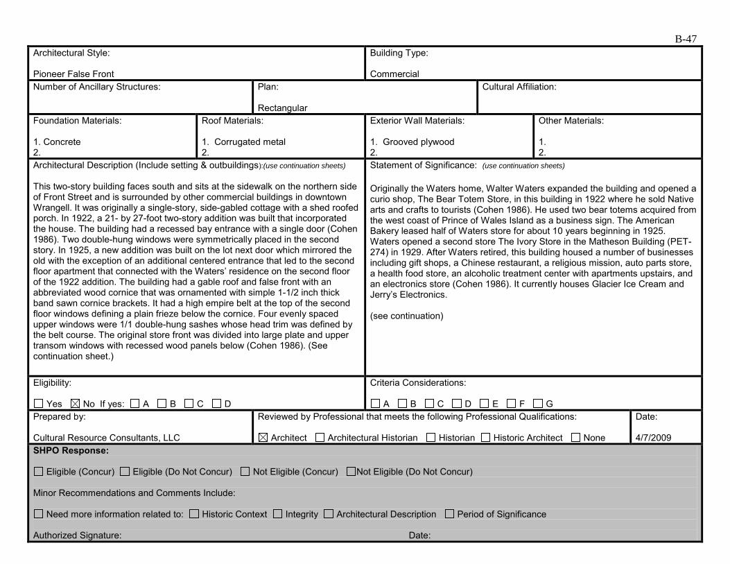
B-47 Architectural Style: Pioneer False Front
Building Type: Commercial
Number of Ancillary Structures:
Plan: Rectangular
Cultural Affiliation:
Foundation Materials: 1. Concrete 2.
Roof Materials: 1. Corrugated metal 2.
Exterior Wall Materials: 1. Grooved plywood 2.
Other Materials: 1. 2.
Architectural Description (Include setting & outbuildings):(use continuation sheets) This two-story building faces south and sits at the sidewalk on the northern side of Front Street and is surrounded by other commercial buildings in downtown Wrangell. It was originally a single-story, side-gabled cottage with a shed roofed porch. In 1922, a 21- by 27-foot two-story addition was built that incorporated the house. The building had a recessed bay entrance with a single door (Cohen 1986). Two double-hung windows were symmetrically placed in the second story. In 1925, a new addition was built on the lot next door which mirrored the old with the exception of an additional centered entrance that led to the second floor apartment that connected with the Waters’ residence on the second floor of the 1922 addition. The building had a gable roof and false front with an abbreviated wood cornice that was ornamented with simple 1-1/2 inch thick band sawn cornice brackets. It had a high empire belt at the top of the second floor windows defining a plain frieze below the cornice. Four evenly spaced upper windows were 1/1 double-hung sashes whose head trim was defined by the belt course. The original store front was divided into large plate and upper transom windows with recessed wood panels below (Cohen 1986). (See continuation sheet.)
Statement of Significance: (use continuation sheets) Originally the Waters home, Walter Waters expanded the building and opened a curio shop, The Bear Totem Store, in this building in 1922 where he sold Native arts and crafts to tourists (Cohen 1986). He used two bear totems acquired from the west coast of Prince of Wales Island as a business sign. The American Bakery leased half of Waters store for about 10 years beginning in 1925. Waters opened a second store The Ivory Store in the Matheson Building (PET-274) in 1929. After Waters retired, this building housed a number of businesses including gift shops, a Chinese restaurant, a religious mission, auto parts store, a health food store, an alcoholic treatment center with apartments upstairs, and an electronics store (Cohen 1986). It currently houses Glacier Ice Cream and Jerry’s Electronics. (see continuation)
Eligibility:
Yes No If yes: A B C D
Criteria Considerations:
A B C D E F G Prepared by: Cultural Resource Consultants, LLC
Reviewed by Professional that meets the following Professional Qualifications:
Architect Architectural Historian Historian Historic Architect None
Date: 4/7/2009
SHPO Response:
Eligible (Concur) Eligible (Do Not Concur) Not Eligible (Concur) Not Eligible (Do Not Concur) Minor Recommendations and Comments Include:
Need more information related to: Historic Context Integrity Architectural Description Period of Significance Authorized Signature: Date:
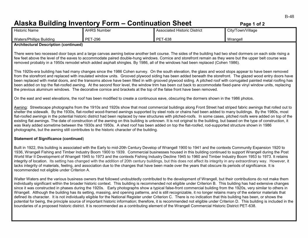
B-48
Alaska Building Inventory Form – Continuation Sheet Page 1 of 2 Historic Name Waters/Phillips Building
AHRS Number PET-296
Associated Historic District PET-638
City/Town/Village Wrangell
Architectural Description (continued) There were two recessed door bays and a large canvas awning below another belt course. The sides of the building had two shed dormers on each side rising a few feet above the level of the eaves to accommodate paired double-hung windows. Cornice and storefront remain as they were but the upper belt course was removed probably in a 1950s remodel which added asphalt shingles. By 1986, all of the windows had been replaced (Cohen 1986). This 1920s-era building has had many changes since the 1986 Cohen survey. On the south elevation, the glass and wood stops appear to have been removed from the storefront and replaced with insulated window units. Grooved plywood siding has been added beneath the storefront. The glazed wood entry doors have been replaced with metal doors, and the transoms above have been filled in with grooved plywood siding. A pitched roof with corrugated painted metal roofing has been added on top the flat-roofed awning. At the second floor level, the window trim has been cut back to accommodate fixed-pane vinyl window units, replacing the previous aluminum windows. The decorative cornice and brackets at the top of the false front have been removed. On the east and west elevations, the roof has been modified to create a continuous eave, obscuring the dormers shown in the 1986 photos. Awning: Streetscape photographs from the 1910s and 1920s show that most commercial buildings along Front Street had striped fabric awnings that rolled out to shelter the sidewalk. By the 1930s, flat-roofed wood-framed awnings supported by steel rods or chains had been added to many buildings. By the 1980s, most flat-roofed awnings in the potential historic district had been replaced by new structures with pitched-roofs. In some cases, pitched roofs were added on top of the existing flat awnings. The date of construction of the awning on this building is unknown. It is not original to the building, but based on the type of construction, it was likely added sometime between the 1930s and 1950s. A shed roof has been added on top the flat-roofed, rod-supported structure shown in 1986 photographs, but the awning still contributes to the historic character of the building. Statement of Significance (continued) Built in 1922, this building is associated with the Early to mid-20th Century Develop of Wrangell 1900 to 1941 and the contexts Community Expansion 1920 to 1936, Wrangell Fishing and Timber Industry Boom 1900 to 1939. Commercial businesses housed in this building continued to support Wrangell during the Post World War II Development of Wrangell 1945 to 1973 and the contexts Fishing Industry Decline 1945 to 1960 and Timber Industry Boom 1953 to 1973. It retains integrity of location. Its setting has changed with the addition of 20th century buildings, but this does not affect its integrity in any extraordinary way. However, it lacks integrity of materials, feeling, and association due to the changes that have been made over the years that obscure its periods of significance. It is recommended not eligible under Criterion A. Walter Waters and the various business owners that followed undoubtedly contributed to the development of Wrangell, but their contributions do not make them individually significant within the broader historic context. This building is recommended not eligible under Criterion B. This building has had extensive changes since it was constructed in phases during the 1920s. Early photographs show a typical false-front commercial building from the 1920s, very similar to others in Wrangell. Although the building has its setting, massing, and opening patterns, and is still recognizable, it no longer retains many of the exterior materials that defined its character. It is not individually eligible for the National Register under Criterion C. There is no indication that this building has been, or shows the potential for being, the principle source of important historic information; therefore, it is recommended not eligible under Criterion D. This building is included in the boundaries of a proposed historic district. It is recommended as a contributing element of the Wrangell Commercial Historic District PET-638.
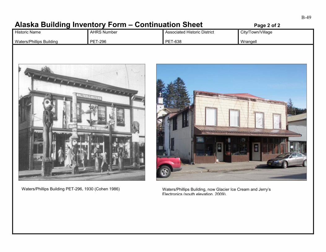
B-49Alaska Building Inventory Form – Continuation Sheet Page 2 of 2Historic Name
Waters/Phillips Building
AHRS Number PET-296
Associated Historic District PET-638
City/Town/Village Wrangell
Waters/Phillips Building PET-296, 1930 (Cohen 1986) Waters/Phillips Building, now Glacier Ice Cream and Jerry’s Electronics (south elevation, 2009).
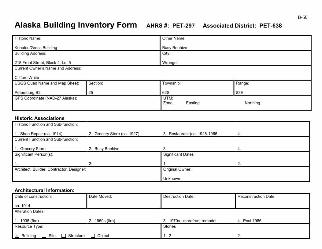
B-50
Alaska Building Inventory Form AHRS #: PET-297 Associated District: PET-638 Historic Name: Konatsu/Gross Building
Other Name: Busy Beehive
Building Address: 218 Front Street, Block 4, Lot 5
City: Wrangell
Current Owner’s Name and Address: Clifford White USGS Quad Name and Map Sheet: Petersburg B2
Section: 25
Township: 62S
Range: 83E
GPS Coordinate (NAD-27 Alaska):
UTM: Zone Easting Northing
Historic Associations Historic Function and Sub-function: 1 Shoe Repair (ca. 1914)
2. Grocery Store (ca. 1927)
3. Restaurant (ca. 1928-1965
4.
Current Function and Sub-function: 1. Grocery Store
2. Busy Beehive
3.
4.
Significant Person(s): 1.
2.
Significant Dates 1.
2.
Architect, Builder, Contractor, Designer:
Original Owner: Unknown
Architectural Information: Date of construction: ca. 1914
Date Moved:
Destruction Date:
Reconstruction Date:
Alteration Dates: 1. 1935 (fire)
2. 1950s (fire)
3. 1970s –storefront remodel
4. Post 1986
Resource Type:
Building Site Structure Object
Stories 1. 2
2.

B-51 Architectural Style: Commercial
Building Type: Commercial
Number of Ancillary Structures:
Plan: Rectangular
Cultural Affiliation:
Foundation Materials: 1. 2.
Roof Materials: 1. 2.
Exterior Wall Materials: 1. Cementitious horizontal siding 2.
Other Materials: 1. 2.
Architectural Description (Include setting & outbuildings):(use continuation sheets) This building sits at the sidewalk facing south on the northern side of Front Street in the commercial area of downtown Wrangell. It was originally a two-story false front building. A 1930s photograph shows that it had an abbreviated wood cornice and four pairs of band sawn cornice brackets (Cohen 1986). A single double-hung window was centered on the second story with an empire belt course above. It had a canvass awning and appeared to have the typical centered recessed bay door. A fire damaged the building in 1935; another fire in the late 1950s burned up part of the second story and it was not replaced. The remaining storefront was covered with board and batten (Cohen 1986). (see continuation)
Statement of Significance: (use continuation sheets) The earliest known business in this building is shown on the 1914 Sanborn Fire Insurance map as a shoe repair shop. By 1927, it was a grocery store (Sanborn 1927). In 1928, Yajuro “Tom” Konatsu bought the building and opened his restaurant The Rainier Grill with living quarters upstairs. Originally from Japan, Konatsu arrived in the United States in 1901 and Wrangell in 1923 (Cohen 1986). After completing a remodel in 1935, Konatsu perished in a fire that broke out in the building. Lloyd Goodrich bought the property at public auction and opened the Cassiar Café. He sold the property to the Neimeyers in 1965. Douglas and Alice Gross bought the building in 1979 (Cohen 1986). It is currently owned by Clifford White. (see continuation)
Eligibility:
Yes No If yes: A B C D
Criteria Considerations:
A B C D E F G Prepared by: Cultural Resource Consultants, LLC
Reviewed by Professional that meets the following Professional Qualifications:
Architect Architectural Historian Historian Historic Architect None
Date: 4/7/2009
SHPO Response:
Eligible (Concur) Eligible (Do Not Concur) Not Eligible (Concur) Not Eligible (Do Not Concur) Minor Recommendations and Comments Include:
Need more information related to: Historic Context Integrity Architectural Description Period of Significance Authorized Signature: Date:
B-52
Alaska Building Inventory Form – Continuation Sheet Page 1 of 2 Historic Name Konatsu/Gross Building
AHRS Number PET-297
Associated Historic District PET-638
City/Town/Village Wrangell
Architectural Description (continued) This small two-story building is located on the north side of Front Street. From the sidewalk, it appears to be one-story, because the second floor is set back from the street edge. This building was documented in the 1986 Cohen survey. Changes since that time include replacement of board-and-batten wood siding with cementitious horizontal siding, and installation of a half-light metal entry door. Statement of Significance (continued) Once a two-story false-front building typical of early 20th century commercial architecture in Wrangell, this building suffered a fire in the 1950s that resulted in the loss of the false-front and most of the second floor. A 1970s era remodel of the remaining storefront is visible in photographs taken in 1986. The most recent changes continue to mask any remnant of the remaining historic structure. This building is associated with the Early to mid-20th Century Development of Wrangell 1900 to 1941. Commercial businesses housed in this building continued to support Wrangell during the Post World War II Development of Wrangell 1945 to 1973. It retains integrity of location with the commercial area of downtown Wrangell and its relationship to the buildings on either side. Its setting has changed with the addition of 20th century buildings, but this does not affect its integrity in any extraordinary way. However, with the loss of the second story and false-front, it no longer retains integrity of design, materials, feeling, and association with its period of significance. It is recommended not eligible under Criterion A. Yajuro “Tom” Konatsu, Lloyd Goodrich, the Neimeyers, and the other business owners undoubtedly contributed to the development of Wrangell but with the loss of integrity, this building is recommended not eligible under Criterion B. The building is no longer representative of any particular style or era, and has very little resemblance to its historic appearance. It is not eligible for the National Register under Criterion C due to this lack of integrity. It is located within the boundaries of a potential historic district. There is no indication that this building has been, or shows the potential for being, the principle source of important historic information; therefore, it is recommended not eligible under Criterion D. This building is recommended as a noncontributing element of the Wrangell Commercial Historic District PET-638.
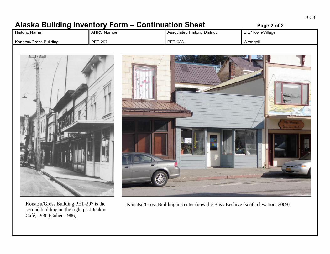
B-53
Alaska Building Inventory Form – Continuation Sheet Page 2 of 2 Historic Name Konatsu/Gross Building
AHRS Number PET-297
Associated Historic District PET-638
City/Town/Village Wrangell
Konatsu/Gross Building PET-297 is the second building on the right past Jenkins Café, 1930 (Cohen 1986)
Konatsu/Gross Building in center (now the Busy Beehive (south elevation, 2009).

B-54
Alaska Building Inventory Form AHRS #: PET-298 Associated District: PET-638 Historic Name: Jenkins Café (Jenkins/Hofstad Building)
Other Name: Wrangell Insurance
Building Address: 222 Front Street, Block 4, Lots 6 & 7
City: Wrangell
Current Owner’s Name and Address: Rental Properties, LLC USGS Quad Name and Map Sheet: Petersburg B2
Section: 25
Township: 62S
Range: 83E
GPS Coordinate (NAD-27 Alaska):
UTM: Zone Easting Northing
Historic Associations Historic Function and Sub-function: 1 Cafe
2. Newspaper Office (ca. 1950s-1970s)
3.
4.
Current Function and Sub-function: 1. Insurance Company
2.
3.
4.
Significant Person(s): 1.
2.
Significant Dates 1.
2.
Architect, Builder, Contractor, Designer:
Original Owner: Bill Jenkins
Architectural Information: Date of construction: 1934
Date Moved:
Destruction Date:
Reconstruction Date:
Alteration Dates: 1. Unknown
2.
3.
4.
Resource Type:
Building Site Structure Object
Stories 1. 2
2.
B-55 Architectural Style: Pioneer False Front
Building Type: Commercial
Number of Ancillary Structures:
Plan: Rectangular
Cultural Affiliation:
Foundation Materials: 1. 2.
Roof Materials: 1. Corrugated metal 2.
Exterior Wall Materials: 1. Plywood 2.
Other Materials: 1. 2.
Architectural Description (Include setting & outbuildings):(use continuation sheets) This two-story building sits at the sidewalk on the northern side of Front Street in the commercial downtown area of Wrangell. A 1930s photograph shows elaborate braces set symmetrically across the front façade to support the gabled cornice. It had a high empire belt course that ran across the top of the paired double-hung second story windows. The centered recessed bay entrance had plate glass windows with divided upper transom windows and with recessed wood panels below (Cohen 1986:150). By 1986, casement windows had replaced the original double-hung windows on the second floor. The original entrance had been replaced with two separate entrances on either side of the store front. The recessed north entrance opened into the first floor and the south entrance led upstairs. There were two solid plate glass windows between the two floors. The original 8-inch shiplap had been covered with plywood and painted pressboard (Cohen 1986:150-151). (see continuation)
Statement of Significance: (use continuation sheets) This building was built in 1934 by Bill Jenkins who opened Jenkins’ Café here. In the early 1950s, the Wrangell Sentinel moved into the building and operated here for 25 years (Cohen 1986:151). Currently, Wrangell Insurance occupies the building. This building is associated with the Early to Mid-20th Century Development of Wrangell 1900 to 1941 and the contexts Community Expansion 1920 to 1936, Wrangell Fishing and Timber Industry Boom 1900 to 1939, and Wrangell Architectural Styles 1906 to 1935. The building is an example of the type of false-front commercial building constructed in Wrangell during the first part of the 20th century. It retains several original, character-defining features. These include the flat-roofed, steel-rod supported awning, and the tall decorative brackets and cornice on the false front, which are visible in streetscape photograph taken ca. 1935. (see continuation)
Eligibility:
Yes No If yes: A B C D
Criteria Considerations:
A B C D E F G Prepared by: Cultural Resource Consultants, LLC
Reviewed by Professional that meets the following Professional Qualifications:
Architect Architectural Historian Historian Historic Architect None
Date: 4/7/2009
SHPO Response:
Eligible (Concur) Eligible (Do Not Concur) Not Eligible (Concur) Not Eligible (Do Not Concur) Minor Recommendations and Comments Include:
Need more information related to: Historic Context Integrity Architectural Description Period of Significance Authorized Signature: Date:
B-56
Alaska Building Inventory Form – Continuation Sheet Page 1 of 2 Historic Name Jenkins/Hofstad Building
AHRS Number PET-298
Associated Historic District PET-638
City/Town/Village Wrangell
Architectural Description (continued) This 1935 building appears to have had very few changes since the 1986 Cohen survey. Murals painted on the front and sides of the building appear to have been added within the last five years, and the wainscot at the base of the southwest elevation has been painted a lighter color. Lettering added near the top of the false front reads “Privett Building, 1936.” Awning: Streetscape photographs from the 1910s and 1920s show that most commercial buildings along Front Street had striped fabric awnings that rolled out to shelter the sidewalk. By the 1930s, flat-roofed wood-framed awnings supported by steel rods or chains had been added to many buildings. By the 1980s, most flat-roofed awnings in the potential historic district had been replaced by new structures with pitched-roofs. In some cases, pitched roofs were added on top of the existing flat awnings. The flat-roofed, chain-supported awning on this building appears to be the same one pictured a streetscape photograph ca. 1930. Although a metal roof has been added and parts may have been changed during maintenance (for example the chain appears relatively new), the awning looks very similar to the way it did when initially constructed, and contributes to the historic character of the building. Statement of Significance (continued) Commercial businesses housed in this building continued to support Wrangell during the Post World War II Development of Wrangell 1945 to 1973 and the contexts Fishing Industry Decline 1945 to 1960 and Timber Industry Boom 1953 to 1973. It retains integrity of location, design, feeling, and association with its period of significance. Its setting has changed with the addition of 20th century buildings, but this does not affect its integrity in any extraordinary way. It retains integrity of materials and is still recognizable as an historic building. It is recommended eligible under Criterion A. Bill Jenkins, the original owner, undoubtedly contributed to the growth and development of Wrangell, but this does not make his contributions significant within the broader historic context. This building is recommended not eligible under Criterion B. Major changes to the storefront, siding, and second floor windows appear to have been made during the 1970s, and have affected the integrity of the building. It does not appear to be individually eligible for the National Register under Criterion C. There is no indication that this building has been, or shows the potential for being, the principle source of important historic information; therefore, it is recommended not eligible under Criterion D. This building is included in the boundaries of a potential historic district. It is recommended as a contributing element of the Wrangell Commercial Historic District PET-638.
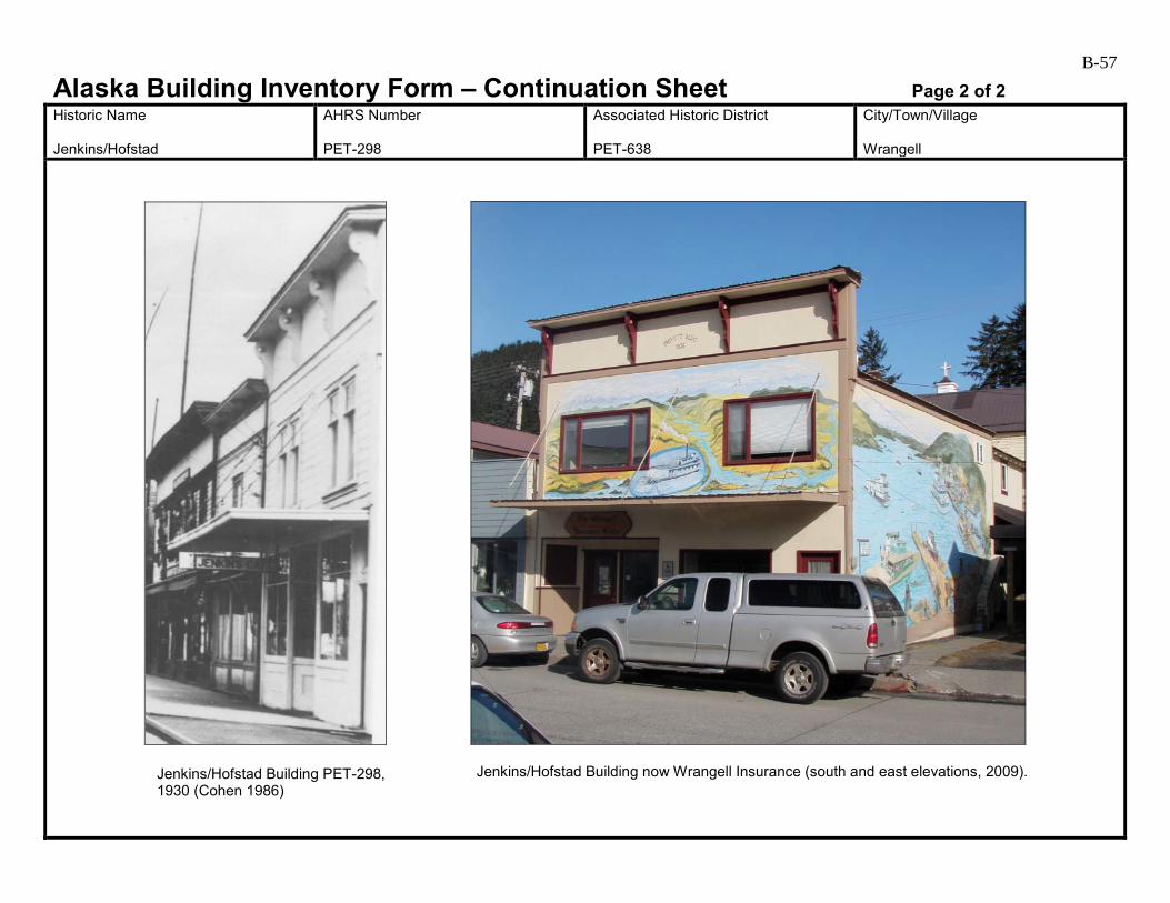
B-57
Alaska Building Inventory Form – Continuation Sheet Page 2 of 2 Historic Name Jenkins/Hofstad
AHRS Number PET-298
Associated Historic District PET-638
City/Town/Village Wrangell
Jenkins/Hofstad Building PET-298, 1930 (Cohen 1986)
Jenkins/Hofstad Building now Wrangell Insurance (south and east elevations, 2009).
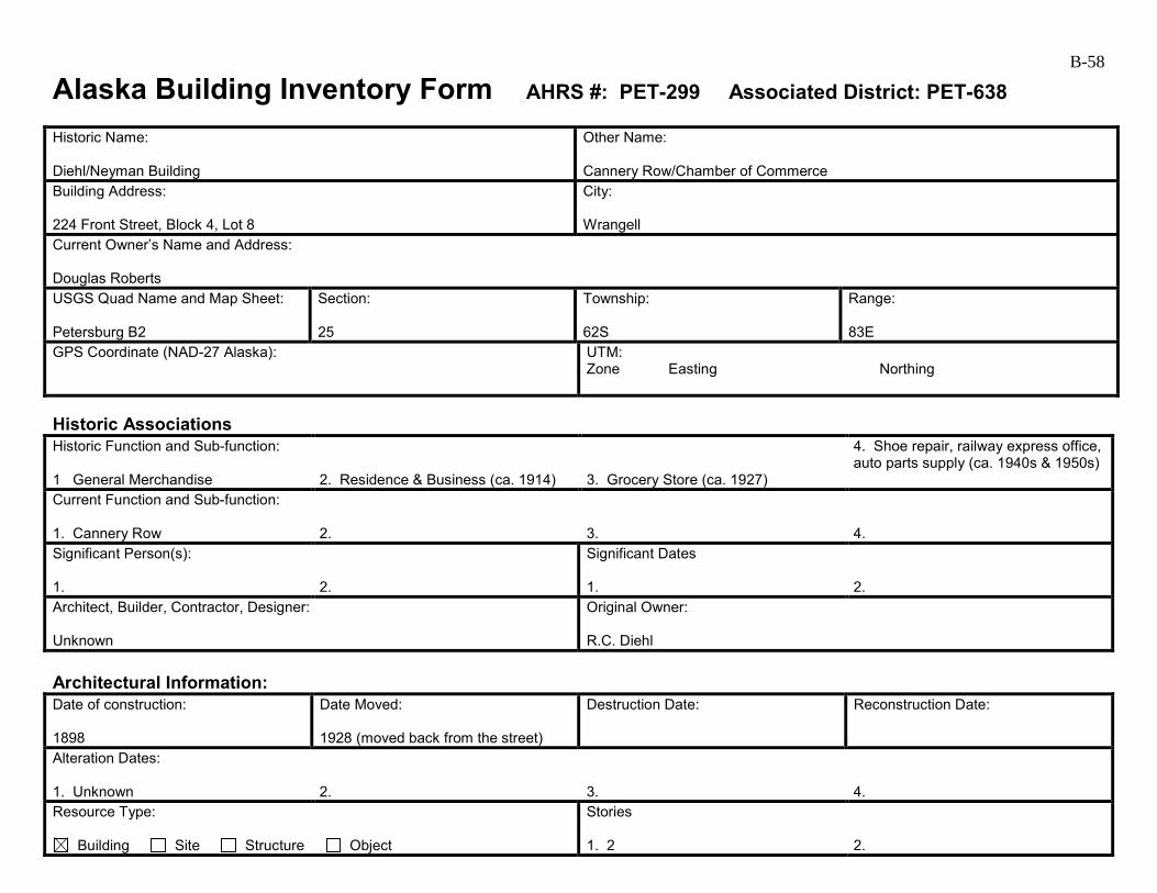
B-58
Alaska Building Inventory Form AHRS #: PET-299 Associated District: PET-638 Historic Name: Diehl/Neyman Building
Other Name: Cannery Row/Chamber of Commerce
Building Address: 224 Front Street, Block 4, Lot 8
City: Wrangell
Current Owner’s Name and Address: Douglas Roberts USGS Quad Name and Map Sheet: Petersburg B2
Section: 25
Township: 62S
Range: 83E
GPS Coordinate (NAD-27 Alaska):
UTM: Zone Easting Northing
Historic Associations Historic Function and Sub-function: 1 General Merchandise
2. Residence & Business (ca. 1914)
3. Grocery Store (ca. 1927)
4. Shoe repair, railway express office, auto parts supply (ca. 1940s & 1950s)
Current Function and Sub-function: 1. Cannery Row
2.
3.
4.
Significant Person(s): 1.
2.
Significant Dates 1.
2.
Architect, Builder, Contractor, Designer: Unknown
Original Owner: R.C. Diehl
Architectural Information: Date of construction: 1898
Date Moved: 1928 (moved back from the street)
Destruction Date:
Reconstruction Date:
Alteration Dates: 1. Unknown
2.
3.
4.
Resource Type:
Building Site Structure Object
Stories 1. 2
2.
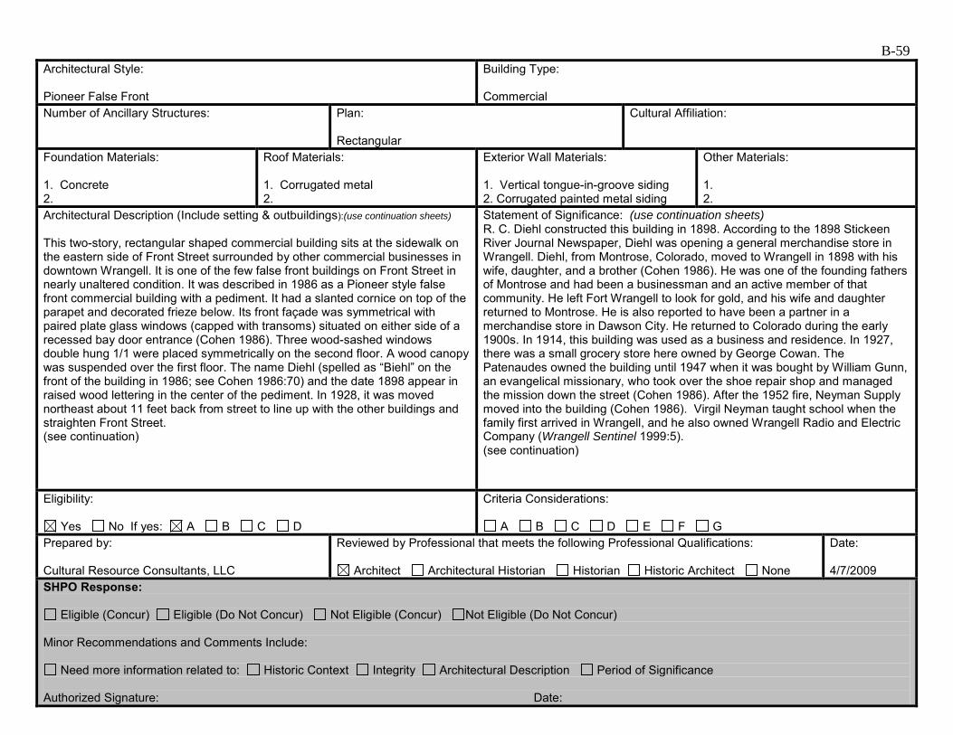
B-59 Architectural Style: Pioneer False Front
Building Type: Commercial
Number of Ancillary Structures:
Plan: Rectangular
Cultural Affiliation:
Foundation Materials: 1. Concrete 2.
Roof Materials: 1. Corrugated metal 2.
Exterior Wall Materials: 1. Vertical tongue-in-groove siding 2. Corrugated painted metal siding
Other Materials: 1. 2.
Architectural Description (Include setting & outbuildings):(use continuation sheets) This two-story, rectangular shaped commercial building sits at the sidewalk on the eastern side of Front Street surrounded by other commercial businesses in downtown Wrangell. It is one of the few false front buildings on Front Street in nearly unaltered condition. It was described in 1986 as a Pioneer style false front commercial building with a pediment. It had a slanted cornice on top of the parapet and decorated frieze below. Its front façade was symmetrical with paired plate glass windows (capped with transoms) situated on either side of a recessed bay door entrance (Cohen 1986). Three wood-sashed windows double hung 1/1 were placed symmetrically on the second floor. A wood canopy was suspended over the first floor. The name Diehl (spelled as “Biehl” on the front of the building in 1986; see Cohen 1986:70) and the date 1898 appear in raised wood lettering in the center of the pediment. In 1928, it was moved northeast about 11 feet back from street to line up with the other buildings and straighten Front Street. (see continuation)
Statement of Significance: (use continuation sheets) R. C. Diehl constructed this building in 1898. According to the 1898 Stickeen River Journal Newspaper, Diehl was opening a general merchandise store in Wrangell. Diehl, from Montrose, Colorado, moved to Wrangell in 1898 with his wife, daughter, and a brother (Cohen 1986). He was one of the founding fathers of Montrose and had been a businessman and an active member of that community. He left Fort Wrangell to look for gold, and his wife and daughter returned to Montrose. He is also reported to have been a partner in a merchandise store in Dawson City. He returned to Colorado during the early 1900s. In 1914, this building was used as a business and residence. In 1927, there was a small grocery store here owned by George Cowan. The Patenaudes owned the building until 1947 when it was bought by William Gunn, an evangelical missionary, who took over the shoe repair shop and managed the mission down the street (Cohen 1986). After the 1952 fire, Neyman Supply moved into the building (Cohen 1986). Virgil Neyman taught school when the family first arrived in Wrangell, and he also owned Wrangell Radio and Electric Company (Wrangell Sentinel 1999:5). (see continuation)
Eligibility:
Yes No If yes: A B C D
Criteria Considerations:
A B C D E F G Prepared by: Cultural Resource Consultants, LLC
Reviewed by Professional that meets the following Professional Qualifications:
Architect Architectural Historian Historian Historic Architect None
Date: 4/7/2009
SHPO Response:
Eligible (Concur) Eligible (Do Not Concur) Not Eligible (Concur) Not Eligible (Do Not Concur) Minor Recommendations and Comments Include:
Need more information related to: Historic Context Integrity Architectural Description Period of Significance Authorized Signature: Date:
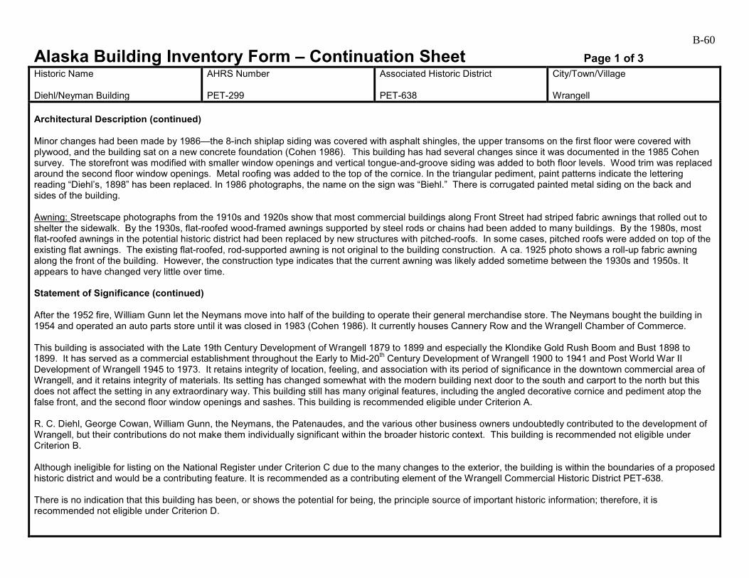
B-60
Alaska Building Inventory Form – Continuation Sheet Page 1 of 3 Historic Name Diehl/Neyman Building
AHRS Number PET-299
Associated Historic District PET-638
City/Town/Village Wrangell
Architectural Description (continued) Minor changes had been made by 1986—the 8-inch shiplap siding was covered with asphalt shingles, the upper transoms on the first floor were covered with plywood, and the building sat on a new concrete foundation (Cohen 1986). This building has had several changes since it was documented in the 1985 Cohen survey. The storefront was modified with smaller window openings and vertical tongue-and-groove siding was added to both floor levels. Wood trim was replaced around the second floor window openings. Metal roofing was added to the top of the cornice. In the triangular pediment, paint patterns indicate the lettering reading “Diehl’s, 1898” has been replaced. In 1986 photographs, the name on the sign was “Biehl.” There is corrugated painted metal siding on the back and sides of the building. Awning: Streetscape photographs from the 1910s and 1920s show that most commercial buildings along Front Street had striped fabric awnings that rolled out to shelter the sidewalk. By the 1930s, flat-roofed wood-framed awnings supported by steel rods or chains had been added to many buildings. By the 1980s, most flat-roofed awnings in the potential historic district had been replaced by new structures with pitched-roofs. In some cases, pitched roofs were added on top of the existing flat awnings. The existing flat-roofed, rod-supported awning is not original to the building construction. A ca. 1925 photo shows a roll-up fabric awning along the front of the building. However, the construction type indicates that the current awning was likely added sometime between the 1930s and 1950s. It appears to have changed very little over time. Statement of Significance (continued) After the 1952 fire, William Gunn let the Neymans move into half of the building to operate their general merchandise store. The Neymans bought the building in 1954 and operated an auto parts store until it was closed in 1983 (Cohen 1986). It currently houses Cannery Row and the Wrangell Chamber of Commerce. This building is associated with the Late 19th Century Development of Wrangell 1879 to 1899 and especially the Klondike Gold Rush Boom and Bust 1898 to 1899. It has served as a commercial establishment throughout the Early to Mid-20th Century Development of Wrangell 1900 to 1941 and Post World War II Development of Wrangell 1945 to 1973. It retains integrity of location, feeling, and association with its period of significance in the downtown commercial area of Wrangell, and it retains integrity of materials. Its setting has changed somewhat with the modern building next door to the south and carport to the north but this does not affect the setting in any extraordinary way. This building still has many original features, including the angled decorative cornice and pediment atop the false front, and the second floor window openings and sashes. This building is recommended eligible under Criterion A. R. C. Diehl, George Cowan, William Gunn, the Neymans, the Patenaudes, and the various other business owners undoubtedly contributed to the development of Wrangell, but their contributions do not make them individually significant within the broader historic context. This building is recommended not eligible under Criterion B. Although ineligible for listing on the National Register under Criterion C due to the many changes to the exterior, the building is within the boundaries of a proposed historic district and would be a contributing feature. It is recommended as a contributing element of the Wrangell Commercial Historic District PET-638. There is no indication that this building has been, or shows the potential for being, the principle source of important historic information; therefore, it is recommended not eligible under Criterion D.

B-61
Alaska Building Inventory Form – Continuation Sheet Page 2 of 3 Historic Name Diehl/Neyman Building
AHRS Number PET-299
Associated Historic District PET-638
City/Town/Village Wrangell
Diehl/Neyman Building PET-299, ca. 1925 (Cohen 1986)
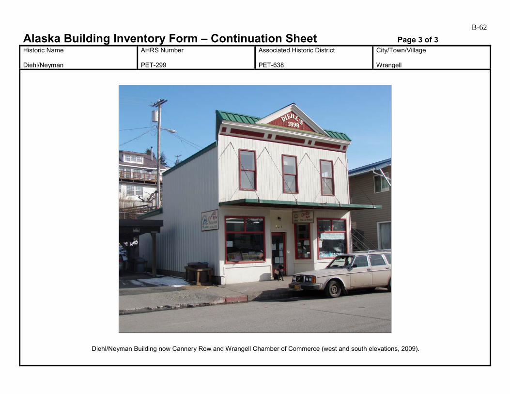
B-62
Alaska Building Inventory Form – Continuation Sheet Page 3 of 3 Historic Name Diehl/Neyman
AHRS Number PET-299
Associated Historic District PET-638
City/Town/Village Wrangell
Diehl/Neyman Building now Cannery Row and Wrangell Chamber of Commerce (west and south elevations, 2009).
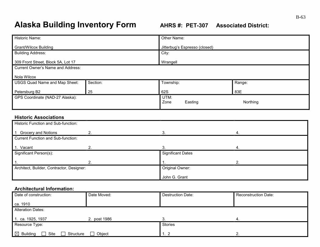
B-63
Alaska Building Inventory Form AHRS #: PET-307 Associated District: Historic Name: Grant/Wilcox Building
Other Name: Jitterbug’s Espresso (closed)
Building Address: 309 Front Street, Block 5A, Lot 17
City: Wrangell
Current Owner’s Name and Address: Nola Wilcox USGS Quad Name and Map Sheet: Petersburg B2
Section: 25
Township: 62S
Range: 83E
GPS Coordinate (NAD-27 Alaska):
UTM: Zone Easting Northing
Historic Associations Historic Function and Sub-function: 1 Grocery and Notions
2.
3.
4.
Current Function and Sub-function: 1. Vacant
2.
3.
4.
Significant Person(s): 1.
2.
Significant Dates 1.
2.
Architect, Builder, Contractor, Designer:
Original Owner: John G. Grant
Architectural Information: Date of construction: ca. 1910
Date Moved:
Destruction Date:
Reconstruction Date:
Alteration Dates: 1. ca. 1925, 1937
2. post 1986
3.
4.
Resource Type:
Building Site Structure Object
Stories 1. 2
2.
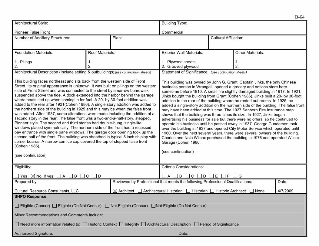
B-64 Architectural Style: Pioneer False Front
Building Type: Commercial
Number of Ancillary Structures:
Plan:
Cultural Affiliation:
Foundation Materials: 1. Pilings 2.
Roof Materials: 1. 2.
Exterior Wall Materials: 1. Plywood sheets 2. Grooved plywood
Other Materials: 1. 2.
Architectural Description (Include setting & outbuildings):(use continuation sheets) This building faces northeast and sits back from the western side of Front Street. Its original appearance is unknown. It was built on pilings on the western side of Front Street and was connected to the street by a narrow boardwalk suspended above the tide. A dock extended into the harbor behind the garage where boats tied up when coming in for fuel. A 20- by 30-foot addition was added to the rear after 1921(Cohen 1986). A single story addition was added to the northern side of the building in 1925 and this may be when the false front was added. After 1937, some alterations were made including the addition of a second story in the rear. The false front was a two-and-a-half-story, stepped, Pioneer style. The second and third stories had double-hung, single-lite windows placed symmetrically. The northern side of the front had a recessed bay entrance with single pane windows. The garage door opening took up the second half of the front. The building was sheathed in typical 8 inch shiplap with corner boards. A narrow cornice cap covered the top of stepped false front (Cohen 1986). (see continuation)
Statement of Significance: (use continuation sheets) This building was owned by John G. Grant. Captain Jinks, the only Chinese business person in Wrangell, opened a grocery and notions store here sometime before 1910. A small fire slightly damaged building in 1917. In 1921, Jinks bought the building from Grant (Cohen 1986). Jinks built a 20- by 30-foot addition to the rear of the building where he rented out rooms. In 1925, he added a single-story addition on the northern side of the building. The false front may have been added at this time. The 1927 Sanborn Fire Insurance map shows that the building was three times its size. In 1927, Jinks began advertising his business for sale but there were no offers, so he continued to operate his business until he passed away in 1937. George Gunderson took over the building in 1937 and opened City Motor Service which operated until 1960. Over the next several years, there were several owners of the building. Charles and Nola Wilcox purchased the building in 1976 and operated Wilcox Garage (Cohen 1986. (see continuation)
Eligibility:
Yes No If yes: A B C D
Criteria Considerations:
A B C D E F G Prepared by: Cultural Resource Consultants, LLC
Reviewed by Professional that meets the following Professional Qualifications:
Architect Architectural Historian Historian Historic Architect None
Date: 4/7/2009
SHPO Response:
Eligible (Concur) Eligible (Do Not Concur) Not Eligible (Concur) Not Eligible (Do Not Concur) Minor Recommendations and Comments Include:
Need more information related to: Historic Context Integrity Architectural Description Period of Significance Authorized Signature: Date:
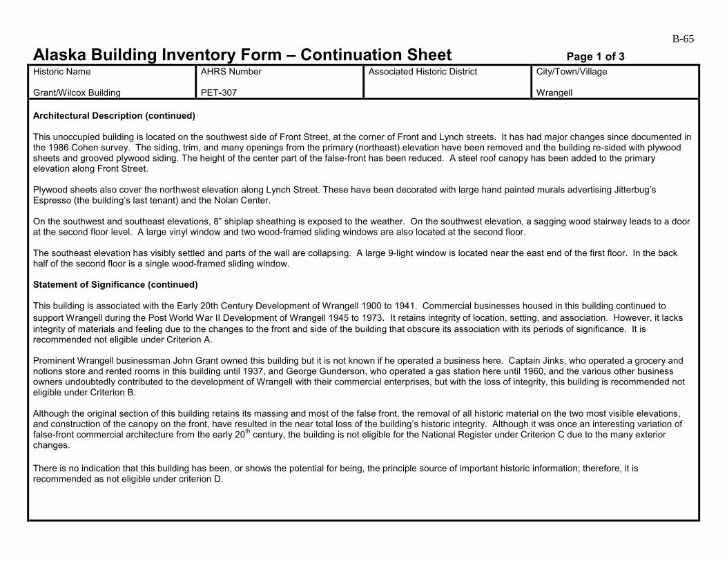
B-65
Alaska Building Inventory Form – Continuation Sheet Page 1 of 3 Historic Name Grant/Wilcox Building
AHRS Number PET-307
Associated Historic District
City/Town/Village Wrangell
Architectural Description (continued) This unoccupied building is located on the southwest side of Front Street, at the corner of Front and Lynch streets. It has had major changes since documented in the 1986 Cohen survey. The siding, trim, and many openings from the primary (northeast) elevation have been removed and the building re-sided with plywood sheets and grooved plywood siding. The height of the center part of the false-front has been reduced. A steel roof canopy has been added to the primary elevation along Front Street. Plywood sheets also cover the northwest elevation along Lynch Street. These have been decorated with large hand painted murals advertising Jitterbug’s Espresso (the building’s last tenant) and the Nolan Center. On the southwest and southeast elevations, 8” shiplap sheathing is exposed to the weather. On the southwest elevation, a sagging wood stairway leads to a door at the second floor level. A large vinyl window and two wood-framed sliding windows are also located at the second floor. The southeast elevation has visibly settled and parts of the wall are collapsing. A large 9-light window is located near the east end of the first floor. In the back half of the second floor is a single wood-framed sliding window. Statement of Significance (continued) This building is associated with the Early 20th Century Development of Wrangell 1900 to 1941. Commercial businesses housed in this building continued to support Wrangell during the Post World War II Development of Wrangell 1945 to 1973. It retains integrity of location, setting, and association. However, it lacks integrity of materials and feeling due to the changes to the front and side of the building that obscure its association with its periods of significance. It is recommended not eligible under Criterion A. Prominent Wrangell businessman John Grant owned this building but it is not known if he operated a business here. Captain Jinks, who operated a grocery and notions store and rented rooms in this building until 1937, and George Gunderson, who operated a gas station here until 1960, and the various other business owners undoubtedly contributed to the development of Wrangell with their commercial enterprises, but with the loss of integrity, this building is recommended not eligible under Criterion B. Although the original section of this building retains its massing and most of the false front, the removal of all historic material on the two most visible elevations, and construction of the canopy on the front, have resulted in the near total loss of the building’s historic integrity. Although it was once an interesting variation of false-front commercial architecture from the early 20th century, the building is not eligible for the National Register under Criterion C due to the many exterior changes. There is no indication that this building has been, or shows the potential for being, the principle source of important historic information; therefore, it is recommended as not eligible under criterion D.

B-66
Alaska Building Inventory Form – Continuation Sheet Page 2 of 3 Historic Name Grant/Wilcox
AHRS Number PET-307
Associated Historic District
City/Town/Village Wrangell
Grant/Wilcox Building PET-307, 1940 (Cohen 1986) Grant/Wilcox Building PET-307, 1986 (Cohen 1986).
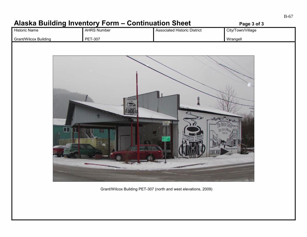
B-67
Alaska Building Inventory Form – Continuation Sheet Page 3 of 3 Historic Name Grant/Wilcox Building
AHRS Number PET-307
Associated Historic District
City/Town/Village Wrangell
Grant/Wilcox Building PET-307 (north and west elevations, 2009)
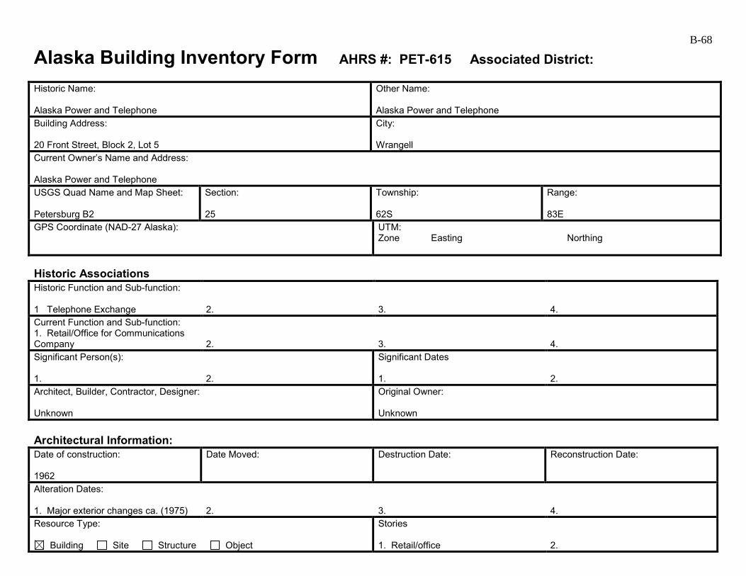
B-68
Alaska Building Inventory Form AHRS #: PET-615 Associated District: Historic Name: Alaska Power and Telephone
Other Name: Alaska Power and Telephone
Building Address: 20 Front Street, Block 2, Lot 5
City: Wrangell
Current Owner’s Name and Address: Alaska Power and Telephone USGS Quad Name and Map Sheet: Petersburg B2
Section: 25
Township: 62S
Range: 83E
GPS Coordinate (NAD-27 Alaska):
UTM: Zone Easting Northing
Historic Associations Historic Function and Sub-function: 1 Telephone Exchange
2.
3.
4.
Current Function and Sub-function: 1. Retail/Office for Communications Company
2.
3.
4.
Significant Person(s): 1.
2.
Significant Dates 1.
2.
Architect, Builder, Contractor, Designer: Unknown
Original Owner: Unknown
Architectural Information: Date of construction: 1962
Date Moved:
Destruction Date:
Reconstruction Date:
Alteration Dates: 1. Major exterior changes ca. (1975)
2.
3.
4.
Resource Type:
Building Site Structure Object
Stories 1. Retail/office
2.
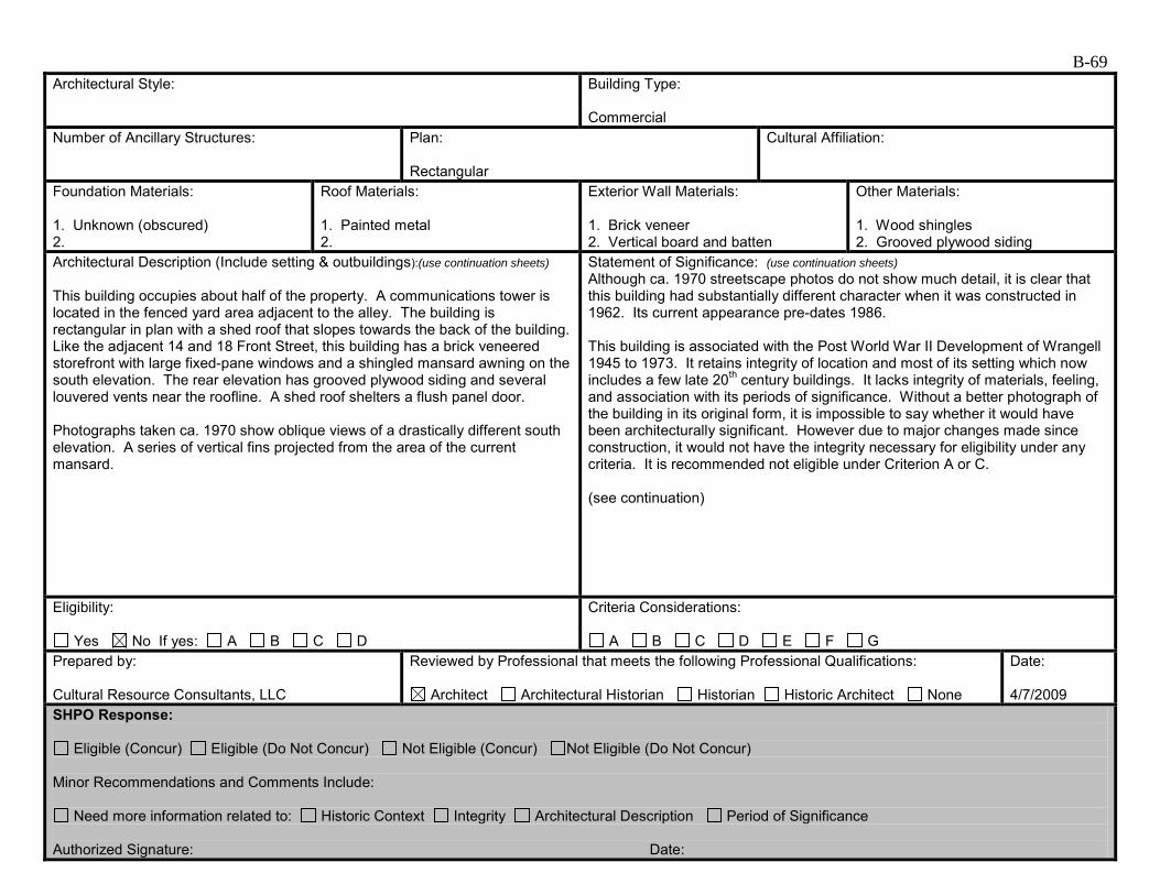
B-69 Architectural Style:
Building Type: Commercial
Number of Ancillary Structures:
Plan: Rectangular
Cultural Affiliation:
Foundation Materials: 1. Unknown (obscured) 2.
Roof Materials: 1. Painted metal 2.
Exterior Wall Materials: 1. Brick veneer 2. Vertical board and batten
Other Materials: 1. Wood shingles 2. Grooved plywood siding
Architectural Description (Include setting & outbuildings):(use continuation sheets) This building occupies about half of the property. A communications tower is located in the fenced yard area adjacent to the alley. The building is rectangular in plan with a shed roof that slopes towards the back of the building. Like the adjacent 14 and 18 Front Street, this building has a brick veneered storefront with large fixed-pane windows and a shingled mansard awning on the south elevation. The rear elevation has grooved plywood siding and several louvered vents near the roofline. A shed roof shelters a flush panel door. Photographs taken ca. 1970 show oblique views of a drastically different south elevation. A series of vertical fins projected from the area of the current mansard.
Statement of Significance: (use continuation sheets) Although ca. 1970 streetscape photos do not show much detail, it is clear that this building had substantially different character when it was constructed in 1962. Its current appearance pre-dates 1986. This building is associated with the Post World War II Development of Wrangell 1945 to 1973. It retains integrity of location and most of its setting which now includes a few late 20th century buildings. It lacks integrity of materials, feeling, and association with its periods of significance. Without a better photograph of the building in its original form, it is impossible to say whether it would have been architecturally significant. However due to major changes made since construction, it would not have the integrity necessary for eligibility under any criteria. It is recommended not eligible under Criterion A or C. (see continuation)
Eligibility:
Yes No If yes: A B C D
Criteria Considerations:
A B C D E F G Prepared by: Cultural Resource Consultants, LLC
Reviewed by Professional that meets the following Professional Qualifications:
Architect Architectural Historian Historian Historic Architect None
Date: 4/7/2009
SHPO Response:
Eligible (Concur) Eligible (Do Not Concur) Not Eligible (Concur) Not Eligible (Do Not Concur) Minor Recommendations and Comments Include:
Need more information related to: Historic Context Integrity Architectural Description Period of Significance Authorized Signature: Date:
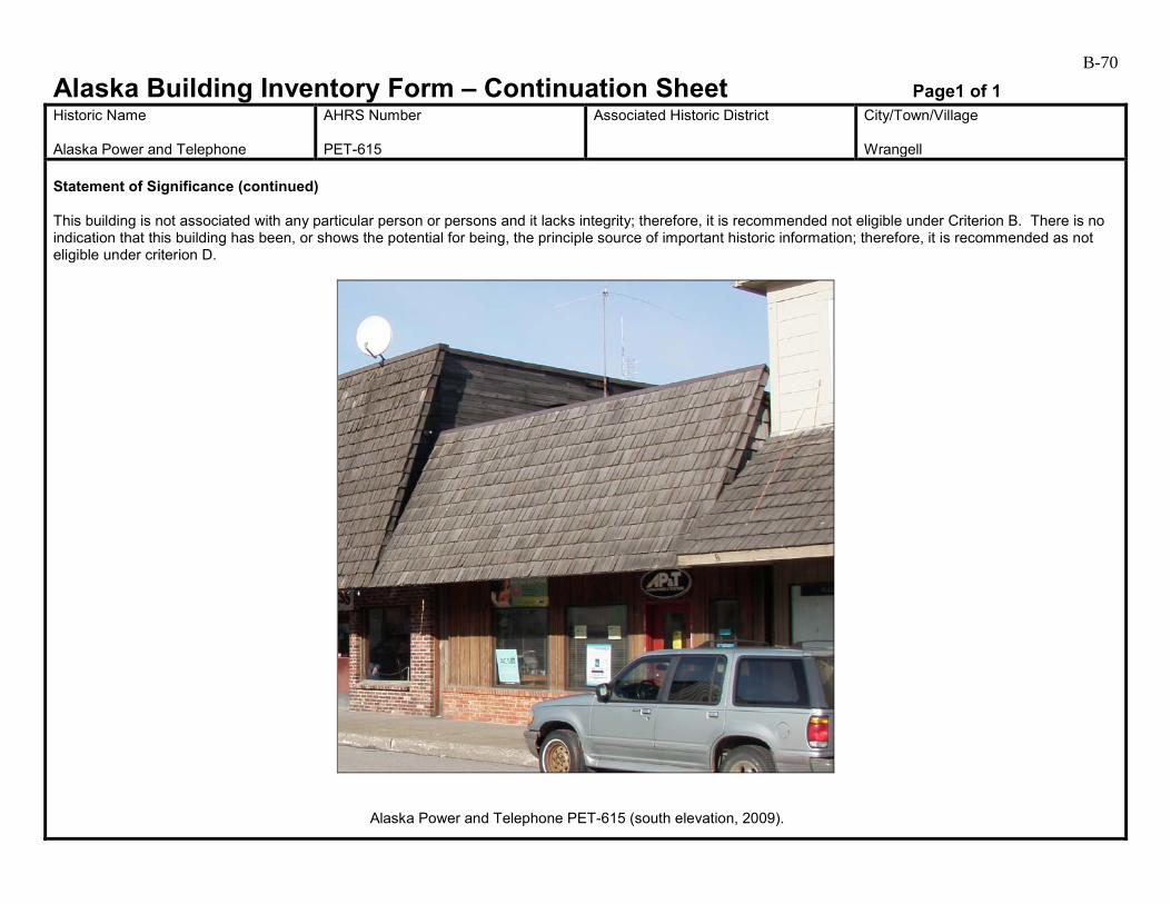
B-70
Alaska Building Inventory Form – Continuation Sheet Page1 of 1 Historic Name Alaska Power and Telephone
AHRS Number PET-615
Associated Historic District
City/Town/Village Wrangell
Statement of Significance (continued) This building is not associated with any particular person or persons and it lacks integrity; therefore, it is recommended not eligible under Criterion B. There is no indication that this building has been, or shows the potential for being, the principle source of important historic information; therefore, it is recommended as not eligible under criterion D.
Alaska Power and Telephone PET-615 (south elevation, 2009).
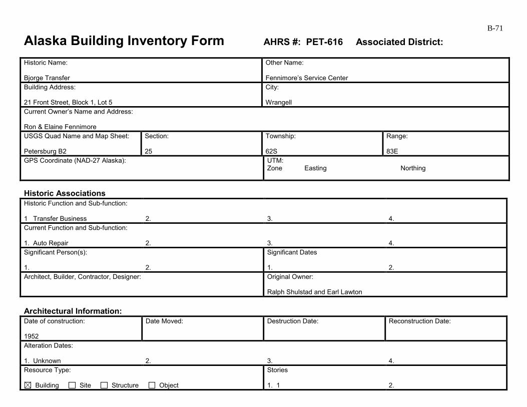
B-71
Alaska Building Inventory Form AHRS #: PET-616 Associated District: Historic Name: Bjorge Transfer
Other Name: Fennimore’s Service Center
Building Address: 21 Front Street, Block 1, Lot 5
City: Wrangell
Current Owner’s Name and Address: Ron & Elaine Fennimore USGS Quad Name and Map Sheet: Petersburg B2
Section: 25
Township: 62S
Range: 83E
GPS Coordinate (NAD-27 Alaska):
UTM: Zone Easting Northing
Historic Associations Historic Function and Sub-function: 1 Transfer Business
2.
3.
4.
Current Function and Sub-function: 1. Auto Repair
2.
3.
4.
Significant Person(s): 1.
2.
Significant Dates 1.
2.
Architect, Builder, Contractor, Designer:
Original Owner: Ralph Shulstad and Earl Lawton
Architectural Information: Date of construction: 1952
Date Moved:
Destruction Date:
Reconstruction Date:
Alteration Dates: 1. Unknown
2.
3.
4.
Resource Type:
Building Site Structure Object
Stories 1. 1
2.
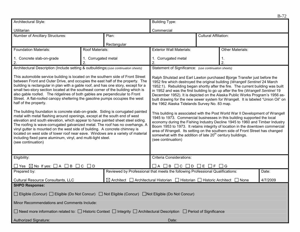
B-72 Architectural Style: Utilitarian
Building Type: Commercial
Number of Ancillary Structures:
Plan: Rectangular
Cultural Affiliation:
Foundation Materials: 1. Concrete slab-on-grade 2.
Roof Materials: 1. Corrugated metal 2.
Exterior Wall Materials: 1. Corrugated metal 2.
Other Materials: 1. 2.
Architectural Description (Include setting & outbuildings):(use continuation sheets) This automobile service building is located on the southern side of Front Street between Front and Outer Drive, and occupies the east half of the property. The building is rectangular in plan with a gable roof, and has one story, except for a small two-story section located at the southeast corner of the building which is also gable roofed. The ridgelines of both gables are perpendicular to Front Street. A flat-roofed canopy sheltering the gasoline pumps occupies the west half of the property. The building foundation is concrete slab-on-grade. Siding is corrugated painted metal with metal flashing around openings, except at the south end of west elevation and south elevation, which appear to have painted sheet steel siding. The roofing is wave-corrugated galvanized metal. The roof has no overhangs. A vinyl gutter is mounted on the west side of building. A concrete chimney is located on west side of lower roof near eave. Windows are a variety of material including fixed pane aluminum, vinyl, and multi-light steel. (see continuation)
Statement of Significance: (use continuation sheets) Ralph Shulstad and Earl Lawton purchased Bjorge Transfer just before the 1952 fire which destroyed the original building (Wrangell Sentinel 24 March 1952:1). Rebuilding began shortly after the fire. The current building was built in 1952 and was the first building to go up after the fire (Wrangell Sentinel 19 December 1952). It is depicted on the Alaska Public Works Program’s 1956 as-built drawing for the new sewer system for Wrangell. It is labeled “Union Oil” on the 1962 Alaska Tidelands Survey No. 83 map. This building is associated with the Post World War II Development of Wrangell 1945 to 1973. Commercial businesses in this building supported the local economy during the Fishing Industry Decline 1945 to 1960 and Timber Industry Boom 1953 to 1973. It retains integrity of location in the downtown commercial area of Wrangell. Its setting on the southern side of Front Street has changed somewhat with the addition of late 20th century buildings. (see continuation)
Eligibility:
Yes No If yes: A B C D
Criteria Considerations:
A B C D E F G Prepared by: Cultural Resource Consultants, LLC
Reviewed by Professional that meets the following Professional Qualifications:
Architect Architectural Historian Historian Historic Architect None
Date: 4/7/2009
SHPO Response:
Eligible (Concur) Eligible (Do Not Concur) Not Eligible (Concur) Not Eligible (Do Not Concur) Minor Recommendations and Comments Include:
Need more information related to: Historic Context Integrity Architectural Description Period of Significance Authorized Signature: Date:
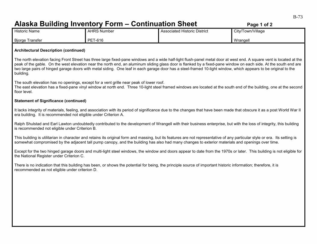
B-73
Alaska Building Inventory Form – Continuation Sheet Page 1 of 2 Historic Name Bjorge Transfer
AHRS Number PET-616
Associated Historic District
City/Town/Village Wrangell
Architectural Description (continued) The north elevation facing Front Street has three large fixed-pane windows and a wide half-light flush-panel metal door at west end. A square vent is located at the peak of the gable. On the west elevation near the north end, an aluminum sliding glass door is flanked by a fixed-pane window on each side. At the south end are two large pairs of hinged garage doors with metal siding. One leaf in each garage door has a steel-framed 10-light window, which appears to be original to the building. The south elevation has no openings, except for a vent grille near peak of lower roof. The east elevation has a fixed-pane vinyl window at north end. Three 10-light steel framed windows are located at the south end of the building, one at the second floor level. Statement of Significance (continued) It lacks integrity of materials, feeling, and association with its period of significance due to the changes that have been made that obscure it as a post World War II era building. It is recommended not eligible under Criterion A. Ralph Shulstad and Earl Lawton undoubtedly contributed to the development of Wrangell with their business enterprise, but with the loss of integrity, this building is recommended not eligible under Criterion B. This building is utilitarian in character and retains its original form and massing, but its features are not representative of any particular style or era. Its setting is somewhat compromised by the adjacent tall pump canopy, and the building has also had many changes to exterior materials and openings over time. Except for the two hinged garage doors and multi-light steel windows, the window and doors appear to date from the 1970s or later. This building is not eligible for the National Register under Criterion C. There is no indication that this building has been, or shows the potential for being, the principle source of important historic information; therefore, it is recommended as not eligible under criterion D.

B-74
Alaska Building Inventory Form – Continuation Sheet Page 2 of 2 Historic Name Bjorge Transfer
AHRS Number PET-616
Associated Historic District
City/Town/Village Wrangell
Bjorge Transfer/Fennimore’s Service Center PET-616 (north and west elevations, 2009).

B-75
Alaska Building Inventory Form AHRS #: PET-617 Associated District: Historic Name: Wrangell Elks Lodge
Other Name: Wrangell Elks Lodge
Building Address: 103 Front Street, Block 1, Lot 6
City: Wrangell
Current Owner’s Name and Address: Elks Lodge #1595 USGS Quad Name and Map Sheet: Petersburg B2
Section: 25
Township: 62S
Range: 83E
GPS Coordinate (NAD-27 Alaska):
UTM: Zone Easting Northing
Historic Associations Historic Function and Sub-function: 1 Elks Lodge
2.
3.
4.
Current Function and Sub-function: 1. Elks Lodge
2.
3.
4.
Significant Person(s): 1.
2.
Significant Dates 1.
2.
Architect, Builder, Contractor, Designer:
Original Owner: Elks Lodge #1595
Architectural Information: Date of construction: ca. 1952
Date Moved:
Destruction Date:
Reconstruction Date:
Alteration Dates: 1. 2002
2.
3.
4.
Resource Type:
Building Site Structure Object
Stories 1. 2
2.
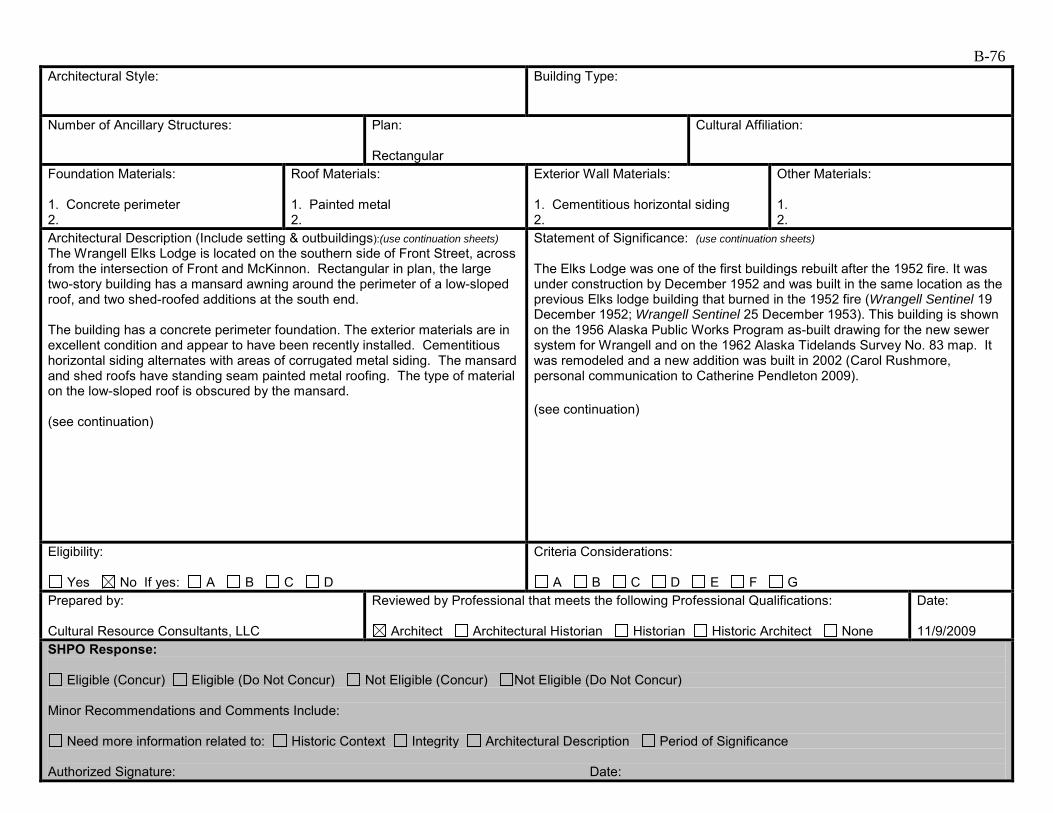
B-76 Architectural Style:
Building Type:
Number of Ancillary Structures:
Plan: Rectangular
Cultural Affiliation:
Foundation Materials: 1. Concrete perimeter 2.
Roof Materials: 1. Painted metal 2.
Exterior Wall Materials: 1. Cementitious horizontal siding 2.
Other Materials: 1. 2.
Architectural Description (Include setting & outbuildings):(use continuation sheets) The Wrangell Elks Lodge is located on the southern side of Front Street, across from the intersection of Front and McKinnon. Rectangular in plan, the large two-story building has a mansard awning around the perimeter of a low-sloped roof, and two shed-roofed additions at the south end. The building has a concrete perimeter foundation. The exterior materials are in excellent condition and appear to have been recently installed. Cementitious horizontal siding alternates with areas of corrugated metal siding. The mansard and shed roofs have standing seam painted metal roofing. The type of material on the low-sloped roof is obscured by the mansard. (see continuation)
Statement of Significance: (use continuation sheets) The Elks Lodge was one of the first buildings rebuilt after the 1952 fire. It was under construction by December 1952 and was built in the same location as the previous Elks lodge building that burned in the 1952 fire (Wrangell Sentinel 19 December 1952; Wrangell Sentinel 25 December 1953). This building is shown on the 1956 Alaska Public Works Program as-built drawing for the new sewer system for Wrangell and on the 1962 Alaska Tidelands Survey No. 83 map. It was remodeled and a new addition was built in 2002 (Carol Rushmore, personal communication to Catherine Pendleton 2009). (see continuation)
Eligibility:
Yes No If yes: A B C D
Criteria Considerations:
A B C D E F G Prepared by: Cultural Resource Consultants, LLC
Reviewed by Professional that meets the following Professional Qualifications:
Architect Architectural Historian Historian Historic Architect None
Date: 11/9/2009
SHPO Response:
Eligible (Concur) Eligible (Do Not Concur) Not Eligible (Concur) Not Eligible (Do Not Concur) Minor Recommendations and Comments Include:
Need more information related to: Historic Context Integrity Architectural Description Period of Significance Authorized Signature: Date:
B-77
Alaska Building Inventory Form – Continuation Sheet Page 1 of 2 Historic Name Wrangell Elks Lodge
AHRS Number PET-617
Associated Historic District
City/Town/Village Wrangell
Architectural Description (continued) The north elevation has a low brick wainscot and corner pilasters, cementitious horizontal siding, and a recessed main entrance with 1970s-era double doors and reeded glass sidelights and transom. A large chalkboard hangs on the wall on each side of the entry. A vinyl awning shelters the entrance. One vinyl window is located above the awning. Both the east and west elevations have cementitious horizontal siding alternating with sections of vertical corrugated metal, and vinyl windows of various types and sizes. On the west elevation, a second floor entry door with wood steps is located near the south end. On the east elevation, a first floor entry door with small gable-roofed shelter is located near the north end of the building. The south elevation has cementitious horizontal siding. The southern-most addition has three arched-top vinyl windows. There are three pairs of vinyl clerestory windows just above the roof line of the southern addition. Awning: Not historic Statement of Significance (continued) This building is associated with the Post World War II Development of Wrangell 1945 to 1973. It retains integrity of location and most of its setting with the downtown commercial area of Wrangell. The setting on the southern side of Front Street has changed some with the addition of a few late 20th century buildings. However, it lacks integrity of materials, feeling, and association with its period of significance due to the changes that have been made to it that obscure it as a 1950s era building. It is recommended not eligible under Criterion A. This building is not associated with a particular person or persons and it lacks integrity of materials, feeling, and association. It is recommended not eligible under Criterion B. Without access to historic photos, it is difficult to say what this building looked like when first constructed, and no clues are offered by the current exterior materials. Virtually all of the current exterior materials appear to be less than 10 years old, with the exception of the 1970s-era front door. The building may have once been an example of 1950s fraternal architecture, but has lost the integrity to convey any particular age or significance. It is recommended not eligible under Criterion C. There is no indication that this building has been, or shows the potential for being, the principle source of important historic information; therefore, it is recommended as not eligible under criterion D.

B-78
Alaska Building Inventory Form – Continuation Sheet Page 2 of 2 Historic Name Wrangell Elks Lodge
AHRS Number PET-617
Associated Historic District
City/Town/Village Wrangell
Wrangell Elks Lodge PET-617 (north and west elevations, 2009).

B-79
Alaska Building Inventory Form AHRS #: PET-618 Associated District: Historic Name: National Bank of Alaska
Other Name: Wells Fargo
Building Address: 115 Front Street, Block 1, Lots 7, 8, 9 and Block 1A, Lot 7
City: Wrangell
Current Owner’s Name and Address: Wells Fargo USGS Quad Name and Map Sheet: Petersburg B2
Section: 25
Township: 62S
Range: 83E
GPS Coordinate (NAD-27 Alaska):
UTM: Zone Easting Northing
Historic Associations Historic Function and Sub-function: 1 Bank
2.
3.
4.
Current Function and Sub-function: 1. Bank
2.
3.
4.
Significant Person(s): 1.
2.
Significant Dates 1.
2.
Architect, Builder, Contractor, Designer: Linn Forrest, architect; Arnie Lindjord, contractor
Original Owner: National Bank of Alaska
Architectural Information: Date of construction: 1965
Date Moved:
Destruction Date:
Reconstruction Date:
Alteration Dates: 1. Unknown
2.
3.
4.
Resource Type:
Building Site Structure Object
Stories 1. 1
2.

B-80 Architectural Style: International Style
Building Type: Commercial
Number of Ancillary Structures:
Plan: Rectangular
Cultural Affiliation:
Foundation Materials: 1. Concrete slab-on-grade 2.
Roof Materials: 1. 2.
Exterior Wall Materials: 1. Vertical tongue-in-groove 2.
Other Materials: 1. 2.
Architectural Description (Include setting & outbuildings):(use continuation sheets) This one-story, flat-roofed building is located on the southern side of Front Street east of the Wrangell Elks lodge and still serves its original purpose as a bank. Set back from the street, the building is rectangular in plan with wide roof overhangs, expansive but simple window patterns, and an emphasis on horizontal planes indicative of the International Style popular during the 1950s through 1970s. The building has a concrete slab-on-grade foundation, a low stone planter on the north elevation, and vertical tongue-and-groove wood siding. The large storefront windows and an intermittent band of high windows are set just under the glossy wood tongue-and-groove soffiting of the overhangs. The exterior soffits and interior ceilings are the same height, creating continuity between interior and exterior on each side of the storefront. This blurring of boundaries between inside and outside was a new and popular architectural concept during the 1960s. (see continuation)
Statement of Significance: (use continuation sheets) The Wrangell branch of the National Bank of Alaska was one of the first two branches opened in the state in 1916. It started out in the back of the Wrangell Hotel, but by the end of 1917, it was housed in its own concrete building next to Campbell Bros. (Cole and Rasmuson 2000:45-46, 73, 162). The current building was designed by Juneau architect Linn Forrest and completed in 1965 for the National Bank of Alaska (Wrangell Sentinel 21 May 1965:1). It was designed with “an Oriental feeling with an upswept, floating roof…surrounded by glass” (Wrangell Sentinel 21 May 1965:1). The interior and exterior walls and ceiling are made of native cedar, and the exterior stone planter was made of local stone “collected by Wrangell school children” (Wrangell Sentinel 21 May 1965:1). The employee lounge and conference room at the rear had “sweeping views of busy Wrangell harbor” (Wrangell Sentinel 21 May 1965:1). Before coming to Alaska, Linn Forrest “worked on Rustic masterpieces such as Oregon’s Timberline Lodge” (Hoagland 1993:78). He came to Alaska in the 1930s as a regional architect for the U. S. Forest Service. (see continuation)
Eligibility:
Yes No If yes: A B C D
Criteria Considerations:
A B C D E F G Prepared by: Cultural Resource Consultants, LLC
Reviewed by Professional that meets the following Professional Qualifications:
Architect Architectural Historian Historian Historic Architect None
Date: 4/7/2009
SHPO Response:
Eligible (Concur) Eligible (Do Not Concur) Not Eligible (Concur) Not Eligible (Do Not Concur) Minor Recommendations and Comments Include:
Need more information related to: Historic Context Integrity Architectural Description Period of Significance Authorized Signature: Date:
B-81
Alaska Building Inventory Form – Continuation Sheet Page 1 of 4 Historic Name National Bank of Alaska
AHRS Number PET-618
Associated Historic District
City/Town/Village Wrangell
Architectural Description (continued) The edge of the roof is just visible in one of Tony Nazar’s streetscape photographs taken ca. 1970. The roof appears to have a very narrow wood fascia and is painted a light color, compared to the tall, dark brown, metal siding-clad fascia today. The large difference in thickness suggests insulation may have been added on top of the original roof construction, which was likely un-insulated. Wide wood-framed, fixed-pane storefront windows with a band of fixed transoms above dominate the north elevation. The main entrance is located west of center, and consists of an aluminum storefront system with a pair of full-light doors and transom above. On the east and west elevations, the walls extend past the north and south edges of the building, emphasizing the planar nature of the building elements. On the west elevation, the band of transom windows is continuous along the top of the wall, just under the soffit. A shed-roofed addition near the center of the elevation has two small fixed-pane windows on the west side, and a half-light aluminum door on the north. On the east elevation, the continuous band of transoms stops short of the south end. At center, one of the transom openings has operable sliding sashes. In the wall below, a single fixed-pane window is located at center. On the south elevation, four wood framed windows of various sizes and operating types are located near the west end. Based on the different type of window frame, these appear to have been added. A flush-panel metal entry door is located near the east end. Statement of Significance (continued) Forrest was in charge of the totem pole restoration project for the Civilian Conservation Corps in Alaska in the 1930s and 1940s that also included the reconstruction of traditional houses in Southeast Alaska, including the Chief Shakes Community House in Wrangell (Hoagland 1993). Forrest coauthored The Wolf and the Raven: Totem Poles of Southeastern Alaska with Viola Garfield, a compilation of totem pole legends. He founded his own firm in 1952 and designed several buildings in Alaska. He worked on the Alaska State Office Building design (1974), designed the Juneau Federal Building (1962), the Mendenhall Glacier Visitors’ Center building in Juneau (1962), Chapel by the Lake (1954-1958) in Auke Bay in collaboration with Harold Foss, and the Patty Gymnasium (1963) at the University of Alaska campus in Fairbanks (Hoagland 1993). He received the first Ion Lewis Traveling Fellowship award in 1931 and was elected to the College of Fellows of the American Institute of Architects in 1979 for his work on the Timberline Lodge and the Mendenhall Glacier Visitor Center (Grosvenor 1999). The Mendenhall Glacier Visitor Center, “a classic example of the modern movement of the period,” was designed to take advantage of the “dramatic setting” through the use of glass walls (Hoagland 1993:179). Forrest died in 1987; his firm continues today as Minch Ritter Voelckers (Hoagland 1993). This building is associated with the period of significance Post World War II Development of Wrangell 1945 to 1973 and the contexts Growth and the Changing Face of Wrangell 1945 to 1965, Rebuilding After the 1952 Fire 1952 to 1965, and Timber Industry Boom 1953 to 1973. The success of the bank in Wrangell is representative of a thriving community. This building retains integrity of location, feeling, and association with the commercial area of downtown Wrangell. Its setting on the southern side of Front Street has changed somewhat with the addition of late 20th century buildings but this does not affect it in any extraordinary way. It retains enough of its original materials to recommend it as eligible under Criterion A.
B-82
Alaska Building Inventory Form – Continuation Sheet Page 2 of 4 Historic Name National Bank of Alaska
AHRS Number PET-618
Associated Historic District
City/Town/Village Wrangell
Former Alaska governor Frank Murkowski spent part of his banking career at the National Bank of Alaska in Wrangell. However, properties associated with living persons are usually not eligible for listing on the National Register until sufficient time has passed to asses that person’s body of work and contribution to that work. This building is recommended not eligible under Criterion B. One of Wrangell’s only mid-1960s International Style buildings, this building exhibits several features indicative of its style. The blending of interior and exterior space with the use of the continuous band of high windows, the emphasis on the planar nature of the building walls and roof, and the expansive glass storefront were common themes of the time period. Whereas many well-known International Style buildings are glass and steel, the use of locally available materials (wood and stone) on this building is an interesting variation. The roof has been changed, creating boxy, heavy-looking eave profile. The original roof was slim and light in appearance, and would have visually floated above the band of transoms. The aluminum storefront entrance is also a change on the primary elevation. The aluminum transom sill does not line up with the original datum, and the light aluminum stands out next to the dark brown stain on the exterior. In spite of these changes, this building is recommended eligible for individual listing on the National Register under Criterion C as an Alaska adapted International Style building. It is also recommended eligible under Criterion C for its association with preeminent Juneau architect Linn Forrest as an example of his work during the “modern movement,” designing buildings in such a way that allowed building occupants to take in their natural surroundings. There is no indication that this building has been, or shows the potential for being, the principle source of important historic information; therefore, it is recommended not eligible under Criterion D.
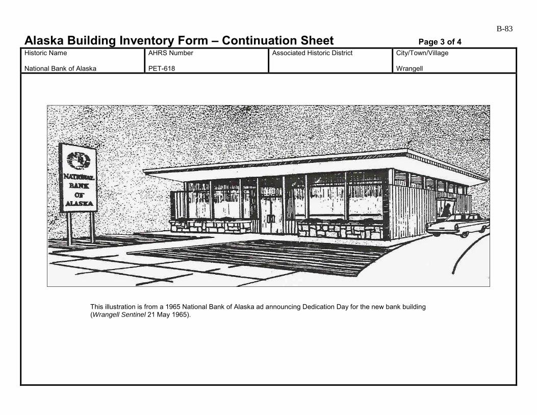
B-83
Alaska Building Inventory Form – Continuation Sheet Page 3 of 4 Historic Name National Bank of Alaska
AHRS Number PET-618
Associated Historic District
City/Town/Village Wrangell
This illustration is from a 1965 National Bank of Alaska ad announcing Dedication Day for the new bank building (Wrangell Sentinel 21 May 1965).
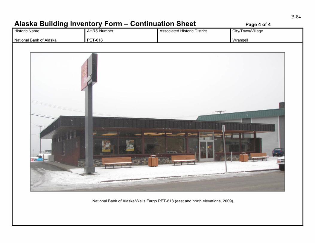
B-84
Alaska Building Inventory Form – Continuation Sheet Page 4 of 4 Historic Name National Bank of Alaska
AHRS Number PET-618
Associated Historic District
City/Town/Village Wrangell
National Bank of Alaska/Wells Fargo PET-618 (east and north elevations, 2009).
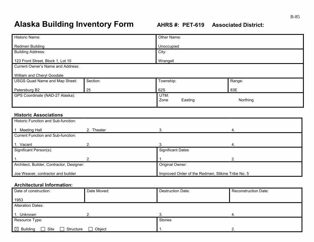
B-85
Alaska Building Inventory Form AHRS #: PET-619 Associated District: Historic Name: Redmen Building
Other Name: Unoccupied
Building Address: 123 Front Street, Block 1, Lot 10
City: Wrangell
Current Owner’s Name and Address: William and Cheryl Goodale USGS Quad Name and Map Sheet: Petersburg B2
Section: 25
Township: 62S
Range: 83E
GPS Coordinate (NAD-27 Alaska):
UTM: Zone Easting Northing
Historic Associations Historic Function and Sub-function: 1 Meeting Hall
2. Theater
3.
4.
Current Function and Sub-function: 1. Vacant
2.
3.
4.
Significant Person(s): 1.
2.
Significant Dates 1.
2.
Architect, Builder, Contractor, Designer: Joe Weaver, contractor and builder
Original Owner: Improved Order of the Redmen, Stikine Tribe No. 5
Architectural Information: Date of construction: 1953
Date Moved:
Destruction Date:
Reconstruction Date:
Alteration Dates: 1. Unknown
2.
3.
4.
Resource Type:
Building Site Structure Object
Stories 1.
2.
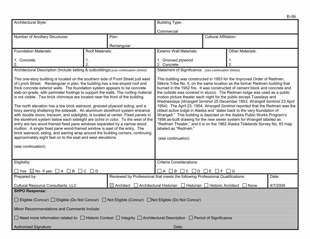
B-86 Architectural Style:
Building Type: Commercial
Number of Ancillary Structures:
Plan: Rectangular
Cultural Affiliation:
Foundation Materials: 1. Concrete 2.
Roof Materials: 1. 2.
Exterior Wall Materials: 1. Grooved plywood 2. Concrete
Other Materials: 1. 2.
Architectural Description (Include setting & outbuildings):(use continuation sheets) This one-story building is located on the southern side of Front Street just west of Lynch Street. Rectangular in plan, the building has a low-sloped roof and thick concrete exterior walls. The foundation system appears to be concrete slab-on-grade, with perimeter footings to support the walls. The roofing material is not visible. Two brick chimneys are located near the front of the building. The north elevation has a low brick wainscot, grooved plywood siding, and a boxy awning sheltering the sidewalk. An aluminum storefront system entrance with double doors, transom, and sidelights, is located at center. Fixed panels in the storefront system below each sidelight are ochre in color. To the west of the entry are two wood-framed fixed pane windows separated by a narrow wood mullion. A single fixed pane wood-framed window is east of the entry. The brick wainscot, siding, and awning wrap around the building corners, continuing approximately eight feet on to the east and west elevations. (see continuation)
Statement of Significance: (use continuation sheets) This building was constructed in 1953 for the Improved Order of Redmen, Stikine Tribe No. 5, on the same location as the former Redmen building that burned in the 1952 fire. It was constructed of cement block and concrete and the outside was covered in stucco. The Redmen lodge was used as a public motion picture theater each night for the public except Tuesdays and Wednesdays (Wrangell Sentinel 25 December 1953; Wrangell Sentinel 23 April 1954). The April 23, 1954, Wrangell Sentinel reported that the Redmen was the oldest active lodge in Alaska and “dates back to the very foundation of Wrangell.” This building is depicted on the Alaska Public Works Program’s 1956 as-built drawing for the new sewer system for Wrangell labeled as “Redmen Theater,” and it is on the 1962 Alaska Tidelands Survey No. 83 map labeled as “Redmen.” (see continuation)
Eligibility:
Yes No If yes: A B C D
Criteria Considerations:
A B C D E F G Prepared by: Cultural Resource Consultants, LLC
Reviewed by Professional that meets the following Professional Qualifications:
Architect Architectural Historian Historian Historic Architect None
Date: 4/7/2009
SHPO Response:
Eligible (Concur) Eligible (Do Not Concur) Not Eligible (Concur) Not Eligible (Do Not Concur) Minor Recommendations and Comments Include:
Need more information related to: Historic Context Integrity Architectural Description Period of Significance Authorized Signature: Date:
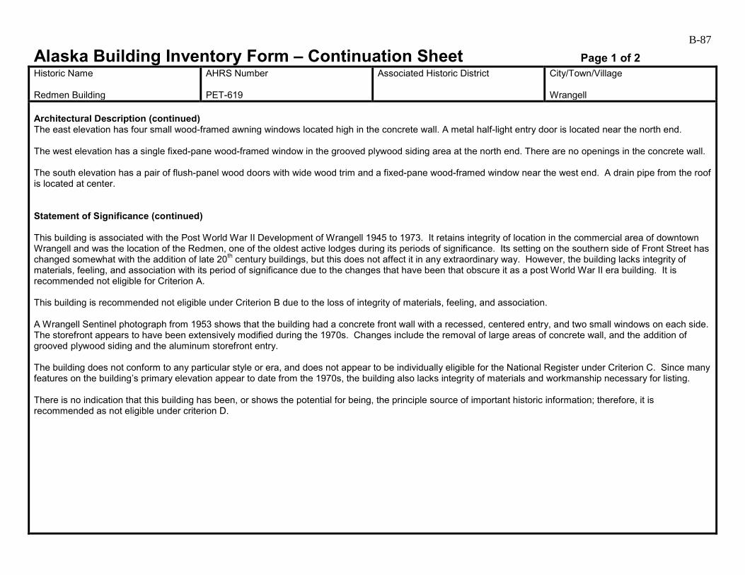
B-87
Alaska Building Inventory Form – Continuation Sheet Page 1 of 2 Historic Name Redmen Building
AHRS Number PET-619
Associated Historic District
City/Town/Village Wrangell
Architectural Description (continued) The east elevation has four small wood-framed awning windows located high in the concrete wall. A metal half-light entry door is located near the north end. The west elevation has a single fixed-pane wood-framed window in the grooved plywood siding area at the north end. There are no openings in the concrete wall. The south elevation has a pair of flush-panel wood doors with wide wood trim and a fixed-pane wood-framed window near the west end. A drain pipe from the roof is located at center. Statement of Significance (continued) This building is associated with the Post World War II Development of Wrangell 1945 to 1973. It retains integrity of location in the commercial area of downtown Wrangell and was the location of the Redmen, one of the oldest active lodges during its periods of significance. Its setting on the southern side of Front Street has changed somewhat with the addition of late 20th century buildings, but this does not affect it in any extraordinary way. However, the building lacks integrity of materials, feeling, and association with its period of significance due to the changes that have been that obscure it as a post World War II era building. It is recommended not eligible for Criterion A. This building is recommended not eligible under Criterion B due to the loss of integrity of materials, feeling, and association. A Wrangell Sentinel photograph from 1953 shows that the building had a concrete front wall with a recessed, centered entry, and two small windows on each side. The storefront appears to have been extensively modified during the 1970s. Changes include the removal of large areas of concrete wall, and the addition of grooved plywood siding and the aluminum storefront entry. The building does not conform to any particular style or era, and does not appear to be individually eligible for the National Register under Criterion C. Since many features on the building’s primary elevation appear to date from the 1970s, the building also lacks integrity of materials and workmanship necessary for listing. There is no indication that this building has been, or shows the potential for being, the principle source of important historic information; therefore, it is recommended as not eligible under criterion D.
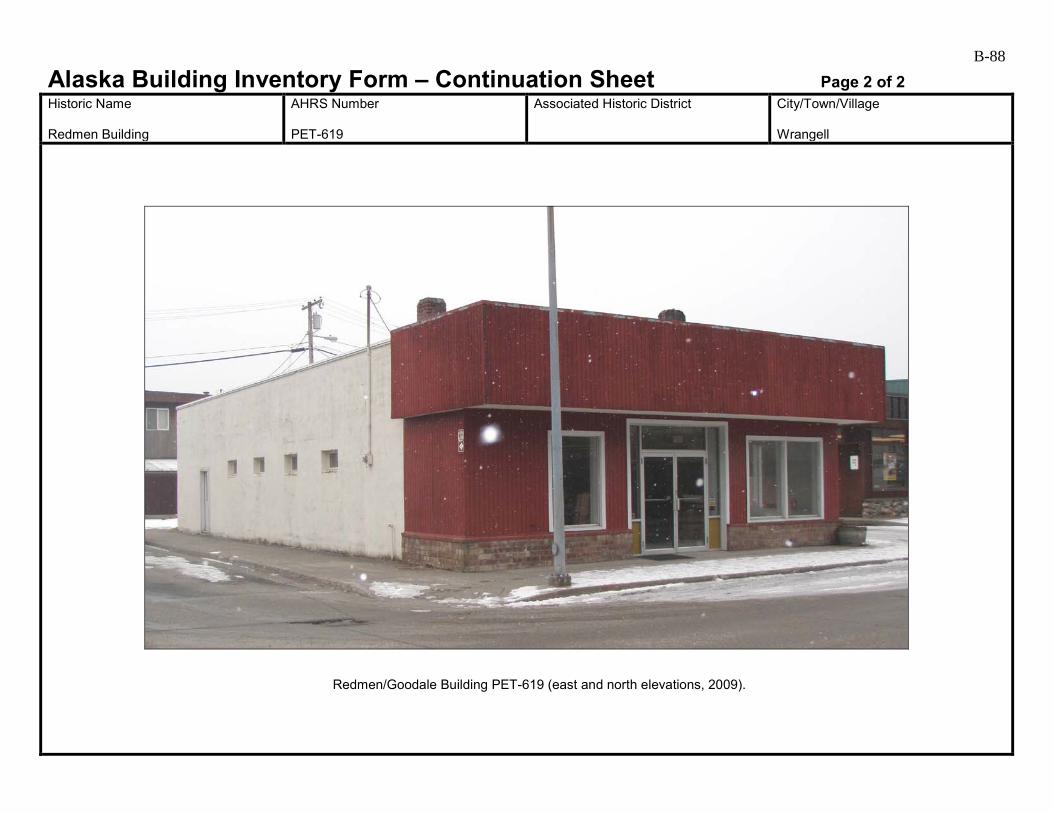
B-88
Alaska Building Inventory Form – Continuation Sheet Page 2 of 2 Historic Name Redmen Building
AHRS Number PET-619
Associated Historic District
City/Town/Village Wrangell
Redmen/Goodale Building PET-619 (east and north elevations, 2009).
B-89
Alaska Building Inventory Form AHRS #: PET-620 Associated District: Historic Name: 49th Star Theater
Other Name: Wrangell Sentinel Building
Building Address: 207 Front Street, Block 1A, Lot 5
City: Wrangell
Current Owner’s Name and Address: William and Janelle Privett USGS Quad Name and Map Sheet: Petersburg B2
Section: 25
Township: 62S
Range: 83E
GPS Coordinate (NAD-27 Alaska):
UTM: Zone Easting Northing
Historic Associations Historic Function and Sub-function: 1 Theater
2.
3.
4.
Current Function and Sub-function: 1. Newspaper
2. Commercial Businesses
3.
4.
Significant Person(s): 1.
2.
Significant Dates 1.
2.
Architect, Builder, Contractor, Designer:
Original Owner: Dick Ballard
Architectural Information: Date of construction: 1958
Date Moved:
Destruction Date:
Reconstruction Date:
Alteration Dates: 1. Unknown
2.
3.
4.
Resource Type:
Building Site Structure Object
Stories 1. 2
2.
B-90 Architectural Style:
Building Type: Commercial
Number of Ancillary Structures:
Plan: Rectangular
Cultural Affiliation:
Foundation Materials: 1. Concrete perimeter 2.
Roof Materials: 1. 2.
Exterior Wall Materials: 1. Painted metal 2.
Other Materials: 1. 2.
Architectural Description (Include setting & outbuildings):(use continuation sheets) This two–story flat-roofed building is located on the southern side of Front Street, at the corner of Front and Lynch Streets. Rectangular in plan, the building has a concrete perimeter foundation and corrugated, painted metal siding. Windows at the first floor level are primarily fixed-pane wood framed windows, while those at the second floor are mostly vinyl, in a variety of types and sizes. The low-sloped roofing material is not visible. A wood deck wraps around the east and south sides of the building at the second floor level. Wood stairs provide access to the deck from Front Street and Lynch Street. On the north elevation, a full-light wood entry door is located near the center of the first floor level. East of the door are two vinyl large windows. Two large fixed pane wood-framed windows are west of the door. The second floor has two vinyl sliding windows and one wood-framed fixed pane window. (see continuation)
Statement of Significance: (use continuation sheets) This building housed the 49th Star Theater, operated by Dick Ballard, from 1958 until it closed in 1976 (Wrangell Sentinel 2 December 1999:8). It is labeled on the 1962 Alaska Tidelands Survey No. 83 map as “Theater.” This building is associated with the Post World War II Development of Wrangell 1945 to 1973. It retains integrity of location in the downtown commercial area of Wrangell. Its setting has changed somewhat on the southern side of Front Street but not in any extraordinary way. However, it lacks integrity of materials, feeling, and association due to the changes that have been made that obscure it as a post World War II era theater building. It is recommended not eligible under Criterion A. (see continuation)
Eligibility:
Yes No If yes: A B C D
Criteria Considerations:
A B C D E F G Prepared by: Cultural Resource Consultants, LLC
Reviewed by Professional that meets the following Professional Qualifications:
Architect Architectural Historian Historian Historic Architect None
Date: 4/7/2009
SHPO Response:
Eligible (Concur) Eligible (Do Not Concur) Not Eligible (Concur) Not Eligible (Do Not Concur) Minor Recommendations and Comments Include:
Need more information related to: Historic Context Integrity Architectural Description Period of Significance Authorized Signature: Date:

B-91
Alaska Building Inventory Form – Continuation Sheet Page 1 of 2 Historic Name 49th Star Theater
AHRS Number PET-620
Associated Historic District
City/Town/Village Wrangell
Architectural Description (continued) The west elevation has three rental spaces; one with door at the north end, grouped with a single fixed-pane window, and two in the southern half of the building, each with a single door and three fixed-pane windows. A flush-panel entry door is located near the north end of the building. At the second floor are ten large vinyl windows of various types. On the south elevation, an entry door is located near the east end of the first floor. At the second level above the deck, an entry door at center is sheltered by a shed-roofed awning. Large vinyl windows are located one each side. On the east elevation, the first floor level has two doors, one near the center and one at the south end of the building. Above the deck, a pair of doors is located at the center and one near the north end. All of the doors on both floors are sheltered by shed-roofed awnings. The second floor has six vinyl windows, both sliding and casement types. Statement of Significance (continued) Dick Ballard undoubtedly contributed to the development of Wrangell with his business enterprise but due to the loss of integrity, this building is recommended not eligible under Criterion B. An undated photograph in a December 2, 1999, series of reprinted articles titled “A hundred years in Wrangell as seen through the pages of the Wrangell Sentinel” offers clues to the building’s original appearance, despite being very difficult to interpret. A rod-supported, flat roofed awning sheltered the sidewalk on the north elevation. Large signs were mounted at each end of the awning. An evenly spaced pattern of three large window openings was located at the second floor above. Although at some point this building may have been an example of mid-20th century movie theater design, it has been extensively altered and is no longer recognizable, so is not eligible for the National Register under Criterion C. There is no indication that this building has been, or shows the potential for being, the principle source of important historic information; therefore, it is recommended as not eligible under criterion D.

B-92
Alaska Building Inventory Form – Continuation Sheet Page 2 of 2 Historic Name 49th Star Theater
AHRS Number PET-620
Associated Historic District
City/Town/Village Wrangell
49th Star Theater/Wrangell Sentinel Building (west and north building, 2009).
B-93
Alaska Building Inventory Form AHRS #: PET-621 Associated District: Historic Name: Thunderbird Hotel
Other Name: Diamond C Cafe Buildings
Building Address: 223-225 Front Street, Block 1A, Lot 1
City: Wrangell
Current Owner’s Name and Address: John Agostine and Susan Cailbreath USGS Quad Name and Map Sheet: Petersburg B2
Section: 25
Township: 62S
Range: 83E
GPS Coordinate (NAD-27 Alaska):
UTM: Zone Easting Northing
Historic Associations Historic Function and Sub-function: 1 Hotel
2.
3.
4.
Current Function and Sub-function: 1. Cafe
2.
3.
4.
Significant Person(s): 1.
2.
Significant Dates 1.
2.
Architect, Builder, Contractor, Designer:
Original Owner:
Architectural Information: Date of construction: 1958
Date Moved:
Destruction Date:
Reconstruction Date:
Alteration Dates: 1. Unknown
2.
3.
4.
Resource Type:
Building Site Structure Object
Stories 1.
2.
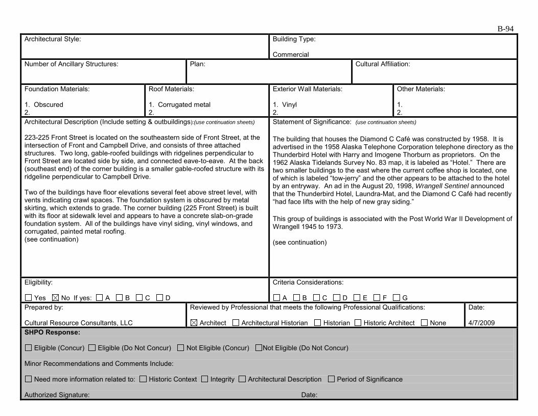
B-94 Architectural Style:
Building Type: Commercial
Number of Ancillary Structures:
Plan:
Cultural Affiliation:
Foundation Materials: 1. Obscured 2.
Roof Materials: 1. Corrugated metal 2.
Exterior Wall Materials: 1. Vinyl 2.
Other Materials: 1. 2.
Architectural Description (Include setting & outbuildings):(use continuation sheets) 223-225 Front Street is located on the southeastern side of Front Street, at the intersection of Front and Campbell Drive, and consists of three attached structures. Two long, gable-roofed buildings with ridgelines perpendicular to Front Street are located side by side, and connected eave-to-eave. At the back (southeast end) of the corner building is a smaller gable-roofed structure with its ridgeline perpendicular to Campbell Drive. Two of the buildings have floor elevations several feet above street level, with vents indicating crawl spaces. The foundation system is obscured by metal skirting, which extends to grade. The corner building (225 Front Street) is built with its floor at sidewalk level and appears to have a concrete slab-on-grade foundation system. All of the buildings have vinyl siding, vinyl windows, and corrugated, painted metal roofing. (see continuation)
Statement of Significance: (use continuation sheets) The building that houses the Diamond C Café was constructed by 1958. It is advertised in the 1958 Alaska Telephone Corporation telephone directory as the Thunderbird Hotel with Harry and Imogene Thorburn as proprietors. On the 1962 Alaska Tidelands Survey No. 83 map, it is labeled as “Hotel.” There are two smaller buildings to the east where the current coffee shop is located, one of which is labeled “tow-jerry” and the other appears to be attached to the hotel by an entryway. An ad in the August 20, 1998, Wrangell Sentinel announced that the Thunderbird Hotel, Laundra-Mat, and the Diamond C Café had recently “had face lifts with the help of new gray siding.” This group of buildings is associated with the Post World War II Development of Wrangell 1945 to 1973. (see continuation)
Eligibility:
Yes No If yes: A B C D
Criteria Considerations:
A B C D E F G Prepared by: Cultural Resource Consultants, LLC
Reviewed by Professional that meets the following Professional Qualifications:
Architect Architectural Historian Historian Historic Architect None
Date: 4/7/2009
SHPO Response:
Eligible (Concur) Eligible (Do Not Concur) Not Eligible (Concur) Not Eligible (Do Not Concur) Minor Recommendations and Comments Include:
Need more information related to: Historic Context Integrity Architectural Description Period of Significance Authorized Signature: Date:

B-95
Alaska Building Inventory Form – Continuation Sheet Page 1 of 2 Historic Name Thunderbird Hotel
AHRS Number PET-621
Associated Historic District
City/Town/Village Wrangell
Architectural Description (continued) On the northwest elevation on Front Street, the two gable ends are boxed in to create triangular forms overhanging the front façades. Both of the buildings have symmetrical opening patterns, with entry doors at center and equal numbers of vinyl windows on either side. The northeast building has a stone wainscot which wraps around the north corner. The northwest building has an entry landing accessed by a steep ramp on either side. The outer guardrail of the ramp and landing is a stone wall. On the northeast elevation on Campbell Drive, the building has a large fixed pane window near the north end, and an entry door near the south end. The modular addition has two vinyl single hung windows. The southeast and southwest elevation have vinyl siding and a variety of types of vinyl windows. A shed- roofed addition is located at the south corner of the building, with an entry door. A long shed-roofed porch is centered on the southeast side, with a sign advertising the hotel. Statement of Significance (continued) The Diamond C Café building retains integrity of location in the commercial area of downtown Wrangell. Although, there are a few late 20th century buildings in the vicinity, these do not affect the setting in any extraordinary way. With the changes that have been made, this group of buildings no longer retains integrity of materials, feeling, and association with the period of significance. These buildings are recommended not eligible under Criterion A. Harry and Imogene Thorburn and other property owners that came later undoubtedly contributed to the development of Wrangell through their business enterprise, but with the loss of integrity, this building is recommended not eligible under Criterion B. Without early photographs, it is impossible to tell what this group of buildings looked like when initially constructed. With vinyl siding and windows, metal skirting, and metal roofing, details that might have indicated the age of the building are obscured. The building is not representative of any particular style or era, and also lacks the integrity necessary for eligibility for the National Register under Criterion C. There is no indication that this building has been, or shows the potential for being, the principle source of important historic information; therefore, it is recommended as not eligible under criterion D.
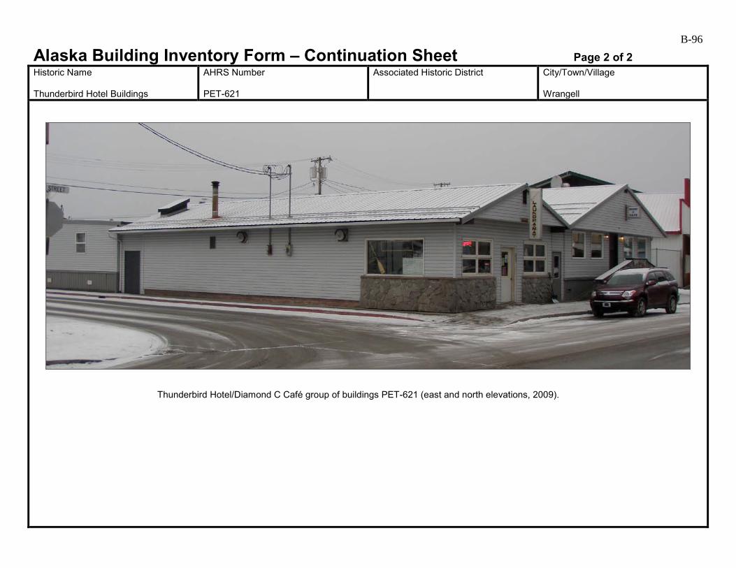
B-96
Alaska Building Inventory Form – Continuation Sheet Page 2 of 2 Historic Name Thunderbird Hotel Buildings
AHRS Number PET-621
Associated Historic District
City/Town/Village Wrangell
Thunderbird Hotel/Diamond C Café group of buildings PET-621 (east and north elevations, 2009).
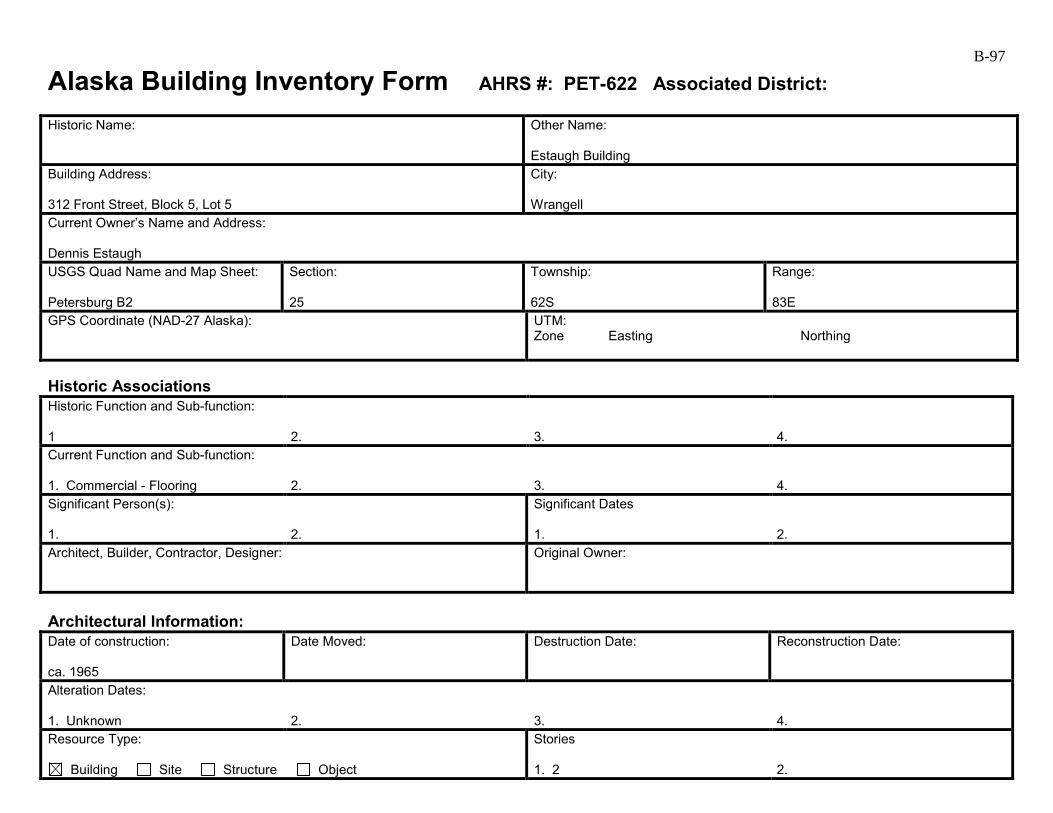
B-97
Alaska Building Inventory Form AHRS #: PET-622 Associated District: Historic Name:
Other Name: Estaugh Building
Building Address: 312 Front Street, Block 5, Lot 5
City: Wrangell
Current Owner’s Name and Address: Dennis Estaugh USGS Quad Name and Map Sheet: Petersburg B2
Section: 25
Township: 62S
Range: 83E
GPS Coordinate (NAD-27 Alaska):
UTM: Zone Easting Northing
Historic Associations Historic Function and Sub-function: 1
2.
3.
4.
Current Function and Sub-function: 1. Commercial - Flooring
2.
3.
4.
Significant Person(s): 1.
2.
Significant Dates 1.
2.
Architect, Builder, Contractor, Designer:
Original Owner:
Architectural Information: Date of construction: ca. 1965
Date Moved:
Destruction Date:
Reconstruction Date:
Alteration Dates: 1. Unknown
2.
3.
4.
Resource Type:
Building Site Structure Object
Stories 1. 2
2.
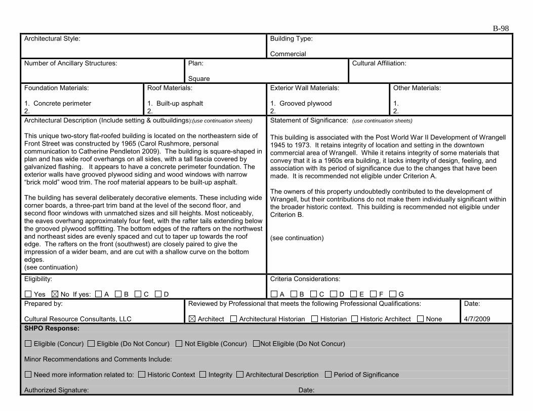
B-98 Architectural Style:
Building Type: Commercial
Number of Ancillary Structures:
Plan: Square
Cultural Affiliation:
Foundation Materials: 1. Concrete perimeter 2.
Roof Materials: 1. Built-up asphalt 2.
Exterior Wall Materials: 1. Grooved plywood 2.
Other Materials: 1. 2.
Architectural Description (Include setting & outbuildings):(use continuation sheets) This unique two-story flat-roofed building is located on the northeastern side of Front Street was constructed by 1965 (Carol Rushmore, personal communication to Catherine Pendleton 2009). The building is square-shaped in plan and has wide roof overhangs on all sides, with a tall fascia covered by galvanized flashing. It appears to have a concrete perimeter foundation. The exterior walls have grooved plywood siding and wood windows with narrow “brick mold” wood trim. The roof material appears to be built-up asphalt. The building has several deliberately decorative elements. These including wide corner boards, a three-part trim band at the level of the second floor, and second floor windows with unmatched sizes and sill heights. Most noticeably, the eaves overhang approximately four feet, with the rafter tails extending below the grooved plywood soffitting. The bottom edges of the rafters on the northwest and northeast sides are evenly spaced and cut to taper up towards the roof edge. The rafters on the front (southwest) are closely paired to give the impression of a wider beam, and are cut with a shallow curve on the bottom edges. (see continuation)
Statement of Significance: (use continuation sheets) This building is associated with the Post World War II Development of Wrangell 1945 to 1973. It retains integrity of location and setting in the downtown commercial area of Wrangell. While it retains integrity of some materials that convey that it is a 1960s era building, it lacks integrity of design, feeling, and association with its period of significance due to the changes that have been made. It is recommended not eligible under Criterion A. The owners of this property undoubtedly contributed to the development of Wrangell, but their contributions do not make them individually significant within the broader historic context. This building is recommended not eligible under Criterion B. (see continuation)
Eligibility:
Yes No If yes: A B C D
Criteria Considerations:
A B C D E F G Prepared by: Cultural Resource Consultants, LLC
Reviewed by Professional that meets the following Professional Qualifications:
Architect Architectural Historian Historian Historic Architect None
Date: 4/7/2009
SHPO Response:
Eligible (Concur) Eligible (Do Not Concur) Not Eligible (Concur) Not Eligible (Do Not Concur) Minor Recommendations and Comments Include:
Need more information related to: Historic Context Integrity Architectural Description Period of Significance Authorized Signature: Date:
B-99
Alaska Building Inventory Form – Continuation Sheet Page 1 of 2 Historic Name
AHRS Number PET-622
Associated Historic District
City/Town/Village Wrangell
Architectural Description (continued) On the southwest elevation along Front Street, a half-light metal door is flanked by two fixed-pane windows on each side. In the second floor above are two symmetrically placed pairs of unmatched windows. The inner window of each pair is a fixed pane window, while the outer is a tall narrow casement, with its sill extending almost to floor level. Plywood siding panels are located below the pair of windows, and between each rafter above. Narrow strips of vertical trim are located next to the brick mold on the inside edges of the windows. The southeast elevation has a half-light door at the east end. A large area of unpainted grooved plywood siding is located near the center of the first floor, indicating a garage door may have been removed. Two sliding window are in the second floor above. The northwest elevation has a narrow wood deck at the second floor level formed with the cantilevered ends of the second floor joists. It is in disrepair and missing most of the handrail and some of the deck boards. Statement of Significance (continued) Without early photographs it is difficult to tell which features on the building are part of its initial construction. The narrow trim strips located on only one side of the second floor windows, and the lack of additional trim on the first floor windows, indicate the window units are not original. The grooved plywood siding and soffitting was popular in the 1970s, but uncommon on 1960s-era buildings in Southeast Alaska, so it may also be a later addition. The flat roof, wide eaves, and cantilevered, tapered structural members are an interpretation of 1960s architectural trends, but are not a particularly complete or refined expression of the time period. The building is not eligible for listing on the National Register under Criterion C. There is no indication that this building has been, or shows the potential for being, the principle source of important historic information; therefore, it is recommended as not eligible under criterion D.
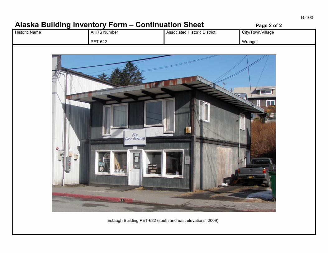
B-100
Alaska Building Inventory Form – Continuation Sheet Page 2 of 2 Historic Name
AHRS Number PET-622
Associated Historic District
City/Town/Village Wrangell
Estaugh Building PET-622 (south and east elevations, 2009).
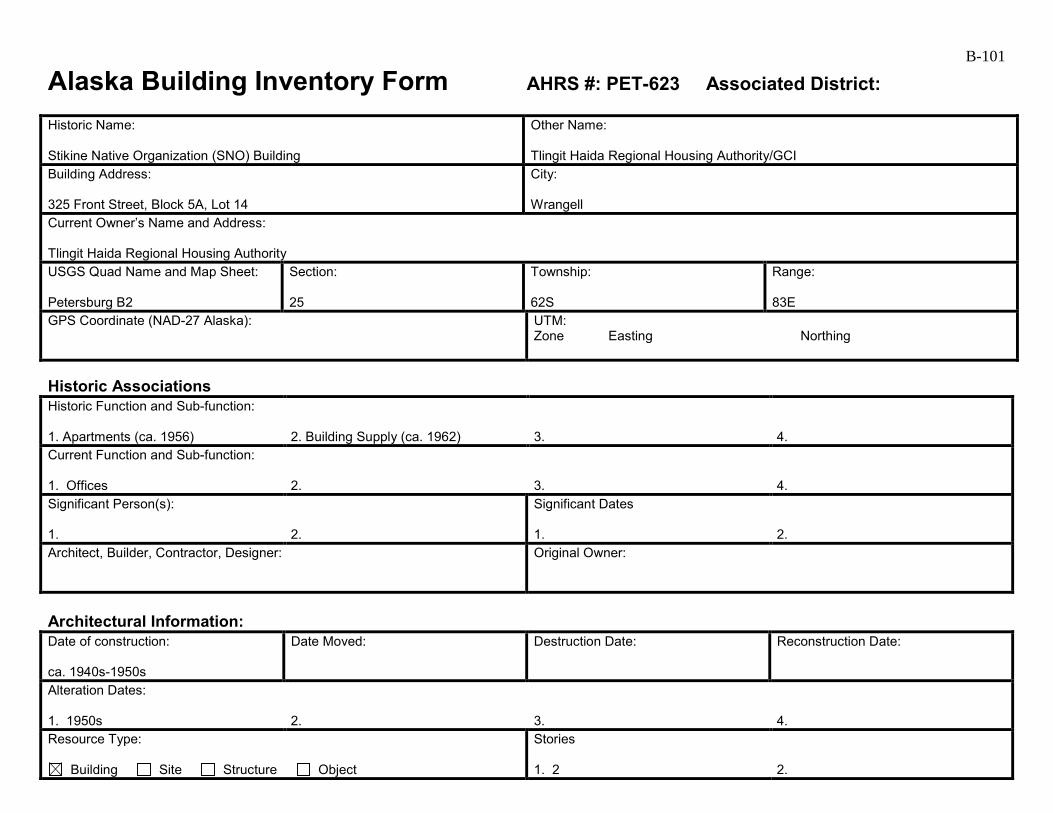
B-101
Alaska Building Inventory Form AHRS #: PET-623 Associated District: Historic Name: Stikine Native Organization (SNO) Building
Other Name: Tlingit Haida Regional Housing Authority/GCI
Building Address: 325 Front Street, Block 5A, Lot 14
City: Wrangell
Current Owner’s Name and Address: Tlingit Haida Regional Housing Authority USGS Quad Name and Map Sheet: Petersburg B2
Section: 25
Township: 62S
Range: 83E
GPS Coordinate (NAD-27 Alaska):
UTM: Zone Easting Northing
Historic Associations Historic Function and Sub-function: 1. Apartments (ca. 1956)
2. Building Supply (ca. 1962)
3.
4.
Current Function and Sub-function: 1. Offices
2.
3.
4.
Significant Person(s): 1.
2.
Significant Dates 1.
2.
Architect, Builder, Contractor, Designer:
Original Owner:
Architectural Information: Date of construction: ca. 1940s-1950s
Date Moved:
Destruction Date:
Reconstruction Date:
Alteration Dates: 1. 1950s
2.
3.
4.
Resource Type:
Building Site Structure Object
Stories 1. 2
2.
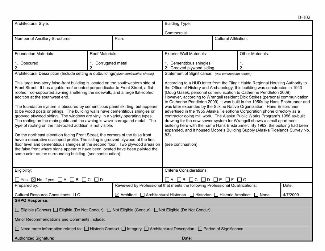
B-102 Architectural Style:
Building Type: Commercial
Number of Ancillary Structures:
Plan:
Cultural Affiliation:
Foundation Materials: 1. Obscured 2.
Roof Materials: 1. Corrugated metal 2.
Exterior Wall Materials: 1. Cementitious shingles 2. Grooved plywood siding
Other Materials: 1. 2.
Architectural Description (Include setting & outbuildings):(use continuation sheets) This large two-story false-front building is located on the southwestern side of Front Street. It has a gable roof oriented perpendicular to Front Street, a flat-roofed, rod-supported awning sheltering the sidewalk, and a large flat-roofed addition at the southwest end. The foundation system is obscured by cementitious panel skirting, but appears to be wood posts or pilings. The building walls have cementitious shingles or grooved plywood siding. The windows are vinyl in a variety operating types. The roofing on the main gable and the awning is wave-corrugated metal. The type of roofing on the flat-roofed addition is not visible. On the northeast elevation facing Front Street, the corners of the false front have a decorative scalloped profile. The siding is grooved plywood at the first floor level and cementitious shingles at the second floor. Two plywood areas on the false front where signs appear to have been located have been painted the same color as the surrounding building. (see continuation)
Statement of Significance: (use continuation sheets) According to a HUD letter from the Tlingit Haida Regional Housing Authority to the Office of History and Archaeology, this building was constructed in 1943 (Doug Gasek, personal communication to Catherine Pendleton 2009). However, according to Wrangell resident Dick Stokes (personal communication to Catherine Pendleton 2009), it was built in the 1950s by Hans Ensbrunner and was later expanded by the Stikine Native Organization. Hans Ensbrunner advertised in the 1955 Alaska Telephone Corporation phone directory as a contractor doing mill work. The Alaska Public Works Program’s 1956 as-built drawing for the new sewer system for Wrangell shows a small apartment building here with the name Hans Ensbrunner. By 1962, the building had been expanded, and it housed Moore’s Building Supply (Alaska Tidelands Survey No. 83). (see continuation)
Eligibility:
Yes No If yes: A B C D
Criteria Considerations:
A B C D E F G Prepared by: Cultural Resource Consultants, LLC
Reviewed by Professional that meets the following Professional Qualifications:
Architect Architectural Historian Historian Historic Architect None
Date: 4/7/2009
SHPO Response:
Eligible (Concur) Eligible (Do Not Concur) Not Eligible (Concur) Not Eligible (Do Not Concur) Minor Recommendations and Comments Include:
Need more information related to: Historic Context Integrity Architectural Description Period of Significance Authorized Signature: Date:
B-103
Alaska Building Inventory Form – Continuation Sheet Page 1 of 2 Historic Name SNO Building
AHRS Number PET-623
Associated Historic District
City/Town/Village Wrangell
Architectural Description (continued) There are four full-glazed entry doors near the center of the first floor; three wood and one metal. Wide aluminum-framed fixed-pane windows are located on each side of the group of doors. Above the awning, a single-hung window is located at center. Large openings with fixed-panes grouped with sliding panes on each side are located at each end. Patching indicates the second floor windows are shorter than the originals. The northeast and northwest elevations both have wood stairs near the back of the building accessing the second floor and many vinyl sliding windows at the first and second floors. The northwest elevation has grooved plywood siding, while the northeast has cementitious shingles. The addition at the southwest end of the building has grooved plywood siding and a variety of window types, including groupings of three casement windows and vinyl sliding windows. Statement of Significance (continued) Constructed in the 1940s or 1950s, this building retains many original features, such as its overall massing and location, decorative false-front and awning, and original siding in some locations. A streetscape photograph on Tony Nazar’s (2009) website (Front-St,-Wrangell038) illustrates changes to the primary elevation. The large second floor window openings contained Chicago-style windows (a double-hung on each side of a fixed-pane). A single door and two double-doors are located below the awning rather than the four today. This building is possibly associated with the Post World War II Development of Wrangell 1945 to 1973. While it retains integrity of location and setting in the commercial area of downtown Wrangell and has integrity of materials, feeling, and association, historical research has not revealed whether this building played a significant role during its period of significance. It is recommended not eligible under Criterion A. Hans Ensbrunner and later business owners undoubtedly contributed to the development of Wrangell with their business enterprises, but their contributions do not make them individually significant within the broader historic context. This building is recommended not eligible under Criterion B. Although it is still recognizable, the architectural style of the building is not particularly significant and it is not eligible for the National Register under Criterion C. There is no indication that this building has been, or shows the potential for being, the principle source of important historic information; therefore, it is recommended as not eligible under criterion D.
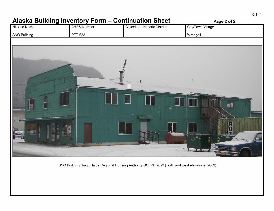
B-104
Alaska Building Inventory Form – Continuation Sheet Page 2 of 2 Historic Name SNO Building
AHRS Number PET-623
Associated Historic District
City/Town/Village Wrangell
SNO Building/Tlingit Haida Regional Housing Authority/GCI PET-623 (north and west elevations, 2009).

B-105
Alaska Building Inventory Form AHRS #: PET-624 Associated District: Historic Name:
Other Name: Armstrong House (1)
Building Address: No address, Front Street, Block 5, Lot 8A
City: Wrangell
Current Owner’s Name and Address: Annie Armstrong USGS Quad Name and Map Sheet: Petersburg B2
Section: 25
Township: 62S
Range: 83E
GPS Coordinate (NAD-27 Alaska):
UTM: Zone Easting Northing
Historic Associations Historic Function and Sub-function: 1 Residence
2.
3.
4.
Current Function and Sub-function: 1. Residence
2.
3.
4.
Significant Person(s): 1.
2.
Significant Dates 1.
2.
Architect, Builder, Contractor, Designer:
Original Owner:
Architectural Information: Date of construction: ca. 1950s
Date Moved:
Destruction Date:
Reconstruction Date:
Alteration Dates: 1. Unknown
2.
3.
4.
Resource Type:
Building Site Structure Object
Stories 1. 1
2.

B-106 Architectural Style:
Building Type: Residential
Number of Ancillary Structures:
Plan: Rectangular
Cultural Affiliation:
Foundation Materials: 1. Stone 2.
Roof Materials: 1. Asphalt shingle 2.
Exterior Wall Materials: 1. 2.
Other Materials: 1. 2.
Architectural Description (Include setting & outbuildings):(use continuation sheets) This one-story house is located on the northeastern side of Front Street. It is set back from the street and accessed via a long wooden stairway. The main form of the house is rectangular, with a low-pitched gable roof and several projecting elements. These include a small gable-roofed entry centered on the street side, a rectangular bay to the south of the entry, a gable-roofed bay on the southeast elevation, and a shed-roofed addition on the northeast side. A brick chimney is centered just northeast of the ridge on the main roof form. The house has unique stone foundation walls and the floor level is set several feet above grade. The walls have vinyl siding. Most of the windows are also vinyl. Some have wide wood trim and traditional sills, but most have narrower “brick mold” trim. The roofing is asphalt shingle. The roof overhangs have soffitted eaves, returned at the rake ends in a boxy detail known as a “pork chop”. (see continuation)
Statement of Significance: (use continuation sheets) There is a dwelling noted at this location on the Alaska Public Works Program’s 1956 as-built drawing for the new sewer system for Wrangell marked as “Case.” This house is possibly associated with the Post World War II Development of Wrangell 1945 to 1973. It is in an area that is still primarily residential, particularly to the east along Church Street, and it has integrity of location; its setting has changed somewhat with the addition of some later 20th century buildings, but this does not affect it in any extraordinary way. However, it lacks integrity of materials, feeling, and association with its period of significance due to the changes that have been made. This house is recommended not eligible under Criterion A. The residents of this house no doubt contributed to the development of Wrangell, but with the loss of integrity, this house is recommended not eligible under Criterion B. This plain house is not a particularly noteworthy example of mid-century residential architecture. (see continuation)
Eligibility:
Yes No If yes: A B C D
Criteria Considerations:
A B C D E F G Prepared by: Cultural Resource Consultants, LLS
Reviewed by Professional that meets the following Professional Qualifications:
Architect Architectural Historian Historian Historic Architect None
Date: 4/7/2009
SHPO Response:
Eligible (Concur) Eligible (Do Not Concur) Not Eligible (Concur) Not Eligible (Do Not Concur) Minor Recommendations and Comments Include:
Need more information related to: Historic Context Integrity Architectural Description Period of Significance Authorized Signature: Date:

B-107
Alaska Building Inventory Form – Continuation Sheet Page 1 of 1 Historic Name
AHRS Number PET-624
Associated Historic District
City/Town/Village Wrangell
Architectural Description (continued) The south elevation has a fixed-pane wood window in the entry. A vinyl window with paired casements is west of the entry. To the south in the projecting bay is a large fixed-pane vinyl window. The northwest elevation has a single opening with paired casements, similar to the one on the front. On the southeast elevation, another opening with paired casements is located towards the south end. A fixed-pane window is located in the projecting bay. Openings on the northeast elevation are obscured by adjacent trees and buildings. Statement of Significance (continued) Changes to the siding, windows, and possibly the eave detailing, have had a detrimental effect on the house’s historic character and masked its original appearance. The house is not eligible for listing on the National Register under Criterion C. There is no indication that this building has been, or shows the potential for being, the principle source of important historic information; therefore, it is recommended as not eligible under criterion D.
Armstrong House (1) PET-624 (south elevation, 2009)
B-108
Alaska Building Inventory Form AHRS #: PET-625 Associated District: Historic Name:
Other Name: Briskar House
Building Address: 418 Front Street, Block 6, Lot 9
City: Wrangell
Current Owner’s Name and Address: Rudy and Leann Briskar USGS Quad Name and Map Sheet: Petersburg B2
Section: 25
Township: 62S
Range: 83E
GPS Coordinate (NAD-27 Alaska):
UTM: Zone Easting Northing
Historic Associations Historic Function and Sub-function: 1 Residence
2.
3.
4.
Current Function and Sub-function: 1. Residence
2.
3.
4.
Significant Person(s): 1.
2.
Significant Dates 1.
2.
Architect, Builder, Contractor, Designer:
Original Owner:
Architectural Information: Date of construction: 1964
Date Moved:
Destruction Date:
Reconstruction Date:
Alteration Dates: 1. Unknown
2.
3.
4.
Resource Type:
Building Site Structure Object
Stories 1. 1
2.
B-109 Architectural Style:
Building Type: Residential
Number of Ancillary Structures:
Plan: Rectangular
Cultural Affiliation:
Foundation Materials: 1. Obscured 2.
Roof Materials: 1. Corrugated metal 2.
Exterior Wall Materials: 1. Grooved plywood 2.
Other Materials: 1. 2.
Architectural Description (Include setting & outbuildings):(use continuation sheets) This one-story house is located on the northeastern side of Front Street, behind the small building at 420 Front Street. Access is via a wooden boardwalk along the west side. The house is rectangular in plan, with a gable roof perpendicular to the street, and a hipped-roof front porch. At the back, a gable-roofed addition steps down from the main roof. The foundation system is obscured by grooved plywood skirting. The siding is also grooved plywood. The windows have narrow wood trim and most are vinyl. The roofing on the main gable is painted, corrugated metal. The porch has asphalt-roll roofing. On the southwest elevation, the porch shelters a metal entry door flanked by two large fixed-pane windows. A vinyl window is centered in the gable above. The northwest elevation has four windows of various sizes and types; a vinyl sliding window, a single-hung vinyl window, a wood 1/1 double-hung, and a wood sliding window. (see continuation)
Statement of Significance: (use continuation sheets) There is a one-story house at this location on the 1914, 1927, and 1927 revised 1933 Sanborn maps. It is on the Alaska Public Works Program’s 1956 as-built drawing for the new sewer system for Wrangell labeled as “Desmond.” However, according to the City of Wrangell property records, the house here was built in 1964 (Carol Rushmore, personal communication to Catherine Pendleton 2009). This house is associated with the Post World War II Development of Wrangell 1945 to 1973. It retains integrity of location in a small cluster of dwellings. Its setting has changed somewhat with the large Sentry Hardware building to the north (where three dwellings used to stand) separating it from the dwellings further north, but the area to the east is still residential. The house lacks integrity of materials, feeling, and association due to the changes that have been made that obscure its association with its period of significance. This house is recommended not eligible under Criterion A. (see continuation)
Eligibility:
Yes No If yes: A B C D
Criteria Considerations:
A B C D E F G Prepared by: Cultural Resource Consultants, LLC
Reviewed by Professional that meets the following Professional Qualifications:
Architect Architectural Historian Historian Historic Architect None
Date: 4/7/2009
SHPO Response:
Eligible (Concur) Eligible (Do Not Concur) Not Eligible (Concur) Not Eligible (Do Not Concur) Minor Recommendations and Comments Include:
Need more information related to: Historic Context Integrity Architectural Description Period of Significance Authorized Signature: Date:
B-110
Alaska Building Inventory Form – Continuation Sheet Page 1 of 2 Historic Name
AHRS Number PET-625
Associated Historic District
City/Town/Village Wrangell
Architectural Description (continued) The northeast elevation has a half-glazed metal entry door sheltered by a small shed-roofing awning, and a fixed-pane window. The southeast elevation has a wood sliding window and a vinyl sliding window. Statement of Significance (continued) The residents of this house undoubtedly contributed to the development of Wrangell, but with the loss of integrity, this house is recommended not eligible under Criterion B. Although this house was constructed in the mid-1960s, it does not seem to exhibit style or design characteristics common during the time period. It has had many changes over time, and the three remaining wood windows on the sides of the house are the only remnants of historic material on exterior. It does not appear to be eligible for the National Register under Criterion C. There is no indication that this building has been, or shows the potential for being, the principle source of important historic information; therefore, it is recommended as not eligible under criterion D.
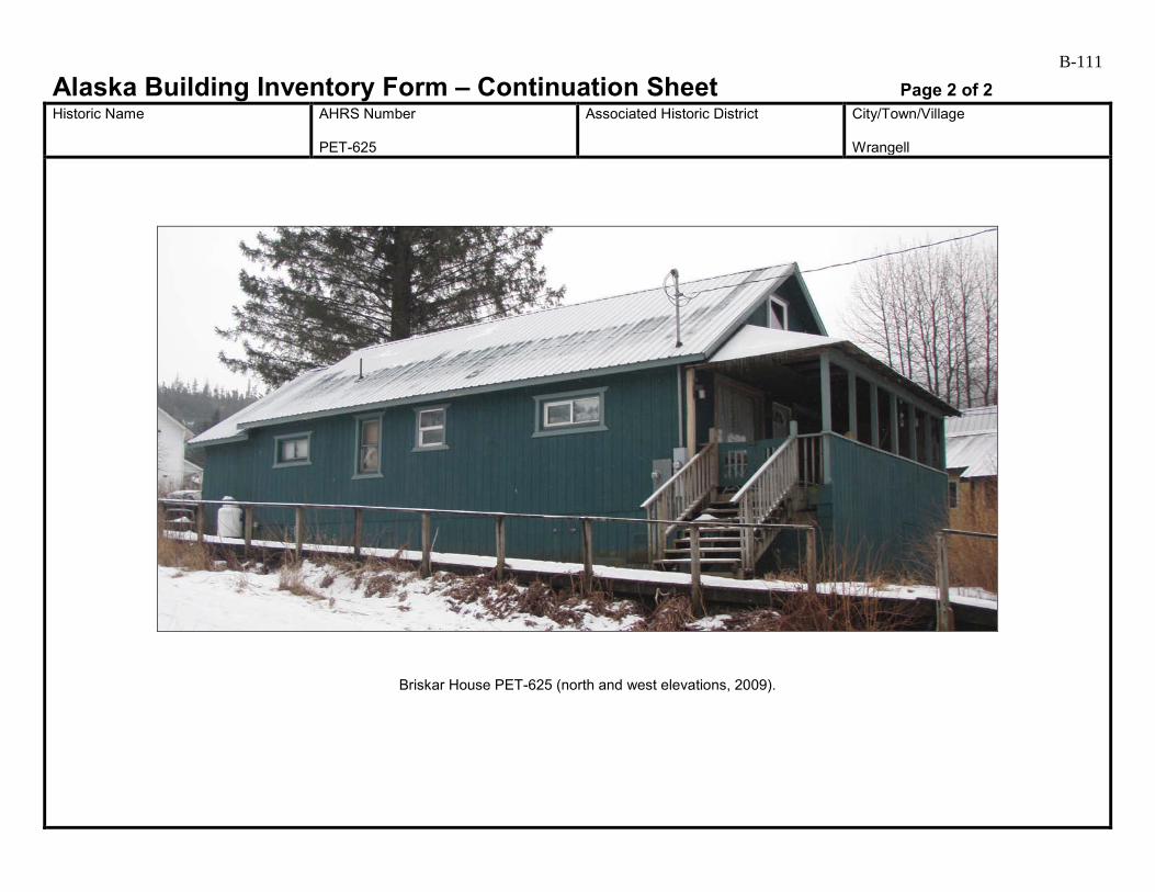
B-111
Alaska Building Inventory Form – Continuation Sheet Page 2 of 2 Historic Name
AHRS Number PET-625
Associated Historic District
City/Town/Village Wrangell
Briskar House PET-625 (north and west elevations, 2009).
B-112
Alaska Building Inventory Form AHRS #: PET-626 Associated District: Historic Name:
Other Name: ILWU #87 House
Building Address: 420 Front Street, Block 6, Lot 10
City: Wrangell
Current Owner’s Name and Address: ILWU #87 USGS Quad Name and Map Sheet: Petersburg B2
Section: 25
Township: 62S
Range: 83E
GPS Coordinate (NAD-27 Alaska):
UTM: Zone Easting Northing
Historic Associations Historic Function and Sub-function: 1 Residence
2.
3.
4.
Current Function and Sub-function: 1. Residence
2.
3.
4.
Significant Person(s): 1.
2.
Significant Dates 1.
2.
Architect, Builder, Contractor, Designer:
Original Owner:
Architectural Information: Date of construction: 1966
Date Moved:
Destruction Date:
Reconstruction Date:
Alteration Dates: 1. Unknown
2.
3.
4.
Resource Type:
Building Site Structure Object
Stories 1. 1
2.

B-113 Architectural Style:
Building Type:
Number of Ancillary Structures:
Plan: Rectangular
Cultural Affiliation:
Foundation Materials: 1. Wood posts on concrete pads 2.
Roof Materials: 1. 2.
Exterior Wall Materials: 1. Cementitious shingle 2.
Other Materials: 1. 2.
Architectural Description (Include setting & outbuildings):(use continuation sheets) This small, one-story brown building is located on the northeastern side of Front Street. It appears to contain only one room, and has a low-pitched gable roof with the ridgeline perpendicular to Front Street. The roof extends past the building walls at both gable ends. Each end is supported by 4x4 posts at the corners, forming a covering over a wood porch at front and back. The foundation system consists of wood posts on concrete pads, with no skirting. The floor level is about a foot above the level of the sidewalk. The northwest, northeast, and southeast walls have cementitious shingle siding. The southwest wall facing the street has wide horizontal bevel wood siding. The building has asphalt roll roofing and exposed rafter tails. A metal flue protrudes from the east corner of the roof. On the southwest elevation, a flush-panel wood door and fixed-pane window are located under the porch. An attic vent is located in the gable end. On both the northwest and southeast sides, one small awning window is centered high on the wall.
Statement of Significance: (use continuation sheets) The one-story, rectangular dwelling depicted on the 1914, 1927, and 1927 revised 1933 Sanborn maps at this location must have been removed as there is no house here on the Alaska Public Works Program’s 1956 as-built drawing for the new sewer system for Wrangell. According to the City of Wrangell property records, this house was built in 1966 (Carol Rushmore, personal communication to Catherine Pendleton 2009). This house is associated with the Post World War II Development of Wrangell 1945 to 1973. It retains integrity of location in a small cluster of dwellings. Its setting has changed with the large Sentry Hardware building to the north (where three dwellings used to stand) separating it from the dwellings further north. However, the area to the east is still residential. The house lacks integrity of materials, feeling, and association due to the changes that have been made that obscure its association with its period of significance. This house is recommended not eligible under Criterion A. (see continuation)
Eligibility:
Yes No If yes: A B C D
Criteria Considerations:
A B C D E F G Prepared by: Cultural Resource Consultants, LLC
Reviewed by Professional that meets the following Professional Qualifications:
Architect Architectural Historian Historian Historic Architect None
Date: 4/7/2009
SHPO Response:
Eligible (Concur) Eligible (Do Not Concur) Not Eligible (Concur) Not Eligible (Do Not Concur) Minor Recommendations and Comments Include:
Need more information related to: Historic Context Integrity Architectural Description Period of Significance Authorized Signature: Date:

B-114
Alaska Building Inventory Form – Continuation Sheet Page 1 of 2 Historic Name
AHRS Number PET-626
Associated Historic District
City/Town/Village Wrangell
Statement of Significance (continued) The residents of this house undoubtedly contributed to the development of Wrangell, but with the lack of integrity, this house is recommended not eligible under Criterion B. Constructed in the mid-1960s, this building retains some features common during the time period, such as the cementitious shingles and awning windows on the side elevations. However, the building does not seem representative of any particular style, and the bevel siding on the southwest side has a detrimental affect on the integrity of the primary elevation. The building is not eligible for listing on the National Register under Criterion C. There is no indication that this building has been, or shows the potential for being, the principle source of important historic information; therefore, it is recommended as not eligible under criterion D.

B-115
Alaska Building Inventory Form – Continuation Sheet Page 2 of 2 Historic Name
AHRS Number PET-626
Associated Historic District
City/Town/Village Wrangell
ILWU #87 House PET-626 (south elevation, 2009).

B-116
Alaska Building Inventory Form AHRS #: PET-627 Associated District: Historic Name: City Market
Other Name: City Market
Building Address: 423 Front Street, Block 5A, Lots 5-8
City: Wrangell
Current Owner’s Name and Address: Cit Market, Inc. USGS Quad Name and Map Sheet: Petersburg B2
Section: 25
Township: 62S
Range: 83E
GPS Coordinate (NAD-27 Alaska):
UTM: Zone Easting Northing
Historic Associations Historic Function and Sub-function: 1 Machine Shop
2. Market
3.
4.
Current Function and Sub-function: 1. Market
2.
3.
4.
Significant Person(s): 1.
2.
Significant Dates 1.
2.
Architect, Builder, Contractor, Designer:
Original Owner:
Architectural Information: Date of construction: 1914, pre-1960s, 1970s
Date Moved:
Destruction Date:
Reconstruction Date:
Alteration Dates: 1. Pre 1962
2. 1999
3.
4.
Resource Type:
Building Site Structure Object
Stories 1. 2
2.

B-117 Architectural Style:
Building Type: Commercial
Number of Ancillary Structures:
Plan:
Cultural Affiliation:
Foundation Materials: 1. Concrete 2.
Roof Materials: 1. 2.
Exterior Wall Materials: 1. Corrugated metal 2.
Other Materials: 1. 2.
Architectural Description (Include setting & outbuildings):(use continuation sheets) City Market is a large building located on the southwestern side of Front Street, mid-way between the intersections of St. Michael’s Street and Episcopal Avenue. The building consists of three distinct structures unified by a false-front and shed-roofed awning along the street side. The roofs of the three structures are visible in aerial photographs and from the back of the building. At the northwest end is a two-story steel-framed building with a low-pitched gable roof. At center, a one-story shed-roofed building has a low-pitched roof draining towards the back. A gable-roofed one-story false-front building is at the southeast end. The building appears to have a concrete foundation system. Siding on the northwest and northeast elevations is corrugated painted metal. The roofing on the northwest and center buildings is corrugated, painted metal, while the southeast building has wave-corrugated galvanized metal. (see continuation)
Statement of Significance: (use continuation sheets) There is a building here labeled as “Machine Shop” with a boat shop to the south on the 1914 Sanborn map. On the 1927 and 1927 rev 1933 Sanborn maps, the boat shop is labeled as a one-story dwelling. On the Alaska Public Works Program’s 1956 as-built drawing for the new sewer system for Wrangell, the machine shop building is labeled as Ottesen Machine Shop, and the dwelling is labeled “Curtis City Market”. Carter Welding is next door to the south. An ad in the 1961 Alaska Telephone Corporation telephone directory noted that City Market sold hardware, cosmetics, sundries, beer, wine, liquor, groceries, and meat. On the 1962 tidelands map (Alaska Tidelands Survey No. 83) the Ottesen Machine Shop and City Market buildings are shown as one and labeled “City Market”. The building was expanded further to the north past where the Ottesen building was located, and there is a “Warehouse” to the south where Carter Welding was. (see continuation)
Eligibility:
Yes No If yes: A B C D
Criteria Considerations:
A B C D E F G Prepared by: Cultural Resource Consultants, LLC
Reviewed by Professional that meets the following Professional Qualifications:
Architect Architectural Historian Historian Historic Architect None
Date: 4/7/2009
SHPO Response:
Eligible (Concur) Eligible (Do Not Concur) Not Eligible (Concur) Not Eligible (Do Not Concur) Minor Recommendations and Comments Include:
Need more information related to: Historic Context Integrity Architectural Description Period of Significance Authorized Signature: Date:

B-118
Alaska Building Inventory Form – Continuation Sheet Page 1 of 2 Historic Name City Market
AHRS Number PET-627
Associated Historic District
City/Town/Village Wrangell
Architectural Description (continued) On the northeast elevation along Front Street, a pair of full-light aluminum doors and three large fixed-pane windows are located near center. At the east end, a single half-light metal door leads into the liquor store, next to one fixed-pane window. On the northwest elevation, a pair of flush-panel doors is located at the first floor level near the west end. A steel stair leads to another pair of flush-panel doors at the second floor level. Two aluminum sliding windows are located in the second floor, one near the doors and one near the west corner. The southeast elevation is obscured by the adjacent building at 431 Front Street. The area behind the buildings is fenced with chain-link, and various containers, crab-pots, and vehicles obscure the southwest elevation. Statement of Significance (continued) In 1944, R. W. Curtis was operating his City Market in the newly renovated Redmen building that was later destroyed in the 1952 fire (Wrangell Sentinel 25 November 1999:8-9). After the fire, Curtis opened City Market in its current location. According to Benn Curtis, his family has owned the buildings here since 1935 (Wrangell Sentinel 28 October 1999:7). Curtis said that the building housing the liquor store was built sometime in 1920 followed by the other buildings in 1958/1959 and 1972. During renovations in 1999, crews found a 1952 Jughead comic book, a chart of Summer Strait dated 1924, and a 1950 breakfast menu from the steamship Baranof (Wrangell Sentinel 28 October 1999:7). City Market is associated with the Early to mid-20th Century Development of Wrangell 1900 to 1941 and with the Post World II Development of Wrangell 1945 to 1973. While it retains integrity of location, it lacks integrity of materials, feeling, and association with its periods of significance due to the changes that have been made. By 1962, City Market encompassed what were once separate buildings that were built in the early 1910s and 1920s. Its setting has changed somewhat but this does not effect it in any extraordinary way. It lacks integrity of materials, feeling, and association due to the changes that have been made that obscure its periods of significance. It is recommended not eligible under Criterion A. R. W. Curtis undoubtedly contributed to the development of Wrangell with his business enterprise, but with the loss of integrity, this building is recommended not eligible under Criterion B. The three sections of this building were built at different times. The gable roofed southeast building appears to date prior to 1914, the shed-roofed center component pre-dates 1962, and the metal building at the northwestern end appears to date from the 1970s. The metal building is easily discernable and is not historic. The original architectural features on the two historic components have been obscured by the false-front and metal siding used to create a monolithic front along the street side. Without early photographs it is difficult to tell what these buildings looked like and whether they are architecturally significant. Due to lack of integrity, City Market is not eligible for the National Register under Criterion C. There is no indication that this building has been, or shows the potential for being, the principle source of important historic information; therefore, it is recommended as not eligible under criterion D.
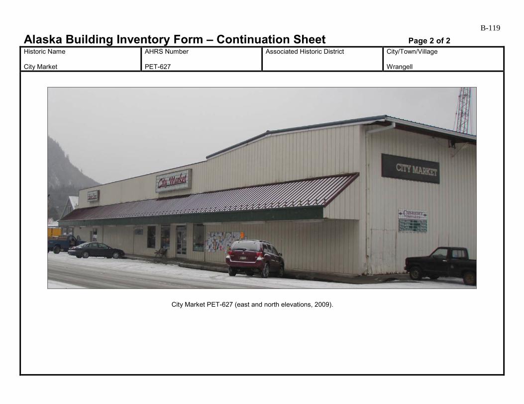
B-119
Alaska Building Inventory Form – Continuation Sheet Page 2 of 2 Historic Name City Market
AHRS Number PET-627
Associated Historic District
City/Town/Village Wrangell
City Market PET-627 (east and north elevations, 2009).
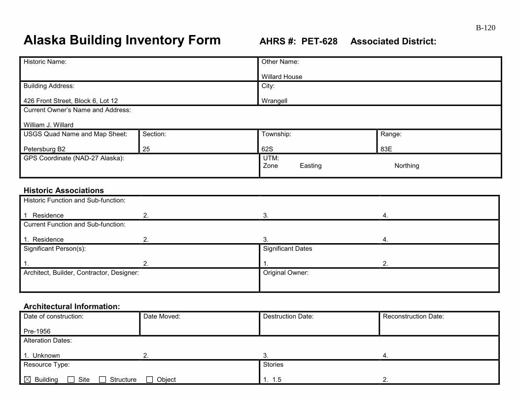
B-120
Alaska Building Inventory Form AHRS #: PET-628 Associated District: Historic Name:
Other Name: Willard House
Building Address: 426 Front Street, Block 6, Lot 12
City: Wrangell
Current Owner’s Name and Address: William J. Willard USGS Quad Name and Map Sheet: Petersburg B2
Section: 25
Township: 62S
Range: 83E
GPS Coordinate (NAD-27 Alaska):
UTM: Zone Easting Northing
Historic Associations Historic Function and Sub-function: 1 Residence
2.
3.
4.
Current Function and Sub-function: 1. Residence
2.
3.
4.
Significant Person(s): 1.
2.
Significant Dates 1.
2.
Architect, Builder, Contractor, Designer:
Original Owner:
Architectural Information: Date of construction: Pre-1956
Date Moved:
Destruction Date:
Reconstruction Date:
Alteration Dates: 1. Unknown
2.
3.
4.
Resource Type:
Building Site Structure Object
Stories 1. 1.5
2.
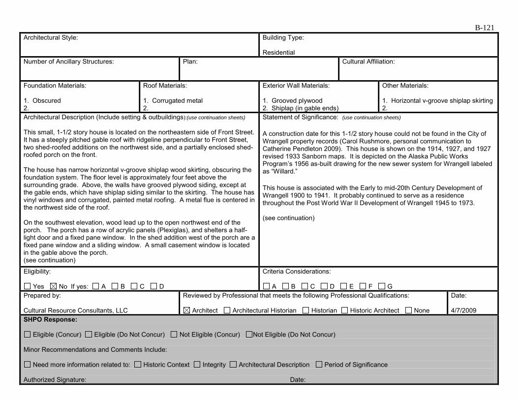
B-121 Architectural Style:
Building Type: Residential
Number of Ancillary Structures:
Plan:
Cultural Affiliation:
Foundation Materials: 1. Obscured 2.
Roof Materials: 1. Corrugated metal 2.
Exterior Wall Materials: 1. Grooved plywood 2. Shiplap (in gable ends)
Other Materials: 1. Horizontal v-groove shiplap skirting 2.
Architectural Description (Include setting & outbuildings):(use continuation sheets) This small, 1-1/2 story house is located on the northeastern side of Front Street. It has a steeply pitched gable roof with ridgeline perpendicular to Front Street, two shed-roofed additions on the northwest side, and a partially enclosed shed-roofed porch on the front. The house has narrow horizontal v-groove shiplap wood skirting, obscuring the foundation system. The floor level is approximately four feet above the surrounding grade. Above, the walls have grooved plywood siding, except at the gable ends, which have shiplap siding similar to the skirting. The house has vinyl windows and corrugated, painted metal roofing. A metal flue is centered in the northwest side of the roof. On the southwest elevation, wood lead up to the open northwest end of the porch. The porch has a row of acrylic panels (Plexiglas), and shelters a half-light door and a fixed pane window. In the shed addition west of the porch are a fixed pane window and a sliding window. A small casement window is located in the gable above the porch. (see continuation)
Statement of Significance: (use continuation sheets) A construction date for this 1-1/2 story house could not be found in the City of Wrangell property records (Carol Rushmore, personal communication to Catherine Pendleton 2009). This house is shown on the 1914, 1927, and 1927 revised 1933 Sanborn maps. It is depicted on the Alaska Public Works Program’s 1956 as-built drawing for the new sewer system for Wrangell labeled as “Willard.” This house is associated with the Early to mid-20th Century Development of Wrangell 1900 to 1941. It probably continued to serve as a residence throughout the Post World War II Development of Wrangell 1945 to 1973. (see continuation)
Eligibility:
Yes No If yes: A B C D
Criteria Considerations:
A B C D E F G Prepared by: Cultural Resource Consultants, LLC
Reviewed by Professional that meets the following Professional Qualifications:
Architect Architectural Historian Historian Historic Architect None
Date: 4/7/2009
SHPO Response:
Eligible (Concur) Eligible (Do Not Concur) Not Eligible (Concur) Not Eligible (Do Not Concur) Minor Recommendations and Comments Include:
Need more information related to: Historic Context Integrity Architectural Description Period of Significance Authorized Signature: Date:
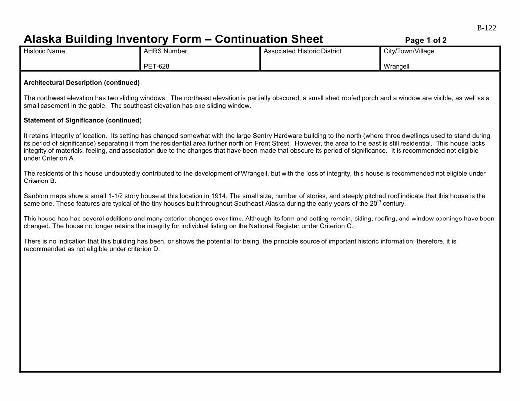
B-122
Alaska Building Inventory Form – Continuation Sheet Page 1 of 2 Historic Name
AHRS Number PET-628
Associated Historic District
City/Town/Village Wrangell
Architectural Description (continued) The northwest elevation has two sliding windows. The northeast elevation is partially obscured; a small shed roofed porch and a window are visible, as well as a small casement in the gable. The southeast elevation has one sliding window. Statement of Significance (continued) It retains integrity of location. Its setting has changed somewhat with the large Sentry Hardware building to the north (where three dwellings used to stand during its period of significance) separating it from the residential area further north on Front Street. However, the area to the east is still residential. This house lacks integrity of materials, feeling, and association due to the changes that have been made that obscure its period of significance. It is recommended not eligible under Criterion A. The residents of this house undoubtedly contributed to the development of Wrangell, but with the loss of integrity, this house is recommended not eligible under Criterion B. Sanborn maps show a small 1-1/2 story house at this location in 1914. The small size, number of stories, and steeply pitched roof indicate that this house is the same one. These features are typical of the tiny houses built throughout Southeast Alaska during the early years of the 20th century. This house has had several additions and many exterior changes over time. Although its form and setting remain, siding, roofing, and window openings have been changed. The house no longer retains the integrity for individual listing on the National Register under Criterion C. There is no indication that this building has been, or shows the potential for being, the principle source of important historic information; therefore, it is recommended as not eligible under criterion D.
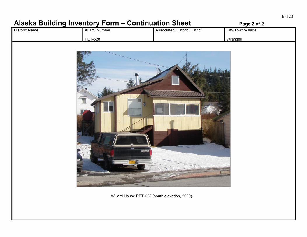
B-123
Alaska Building Inventory Form – Continuation Sheet Page 2 of 2 Historic Name
AHRS Number PET-628
Associated Historic District
City/Town/Village Wrangell
Willard House PET-628 (south elevation, 2009).
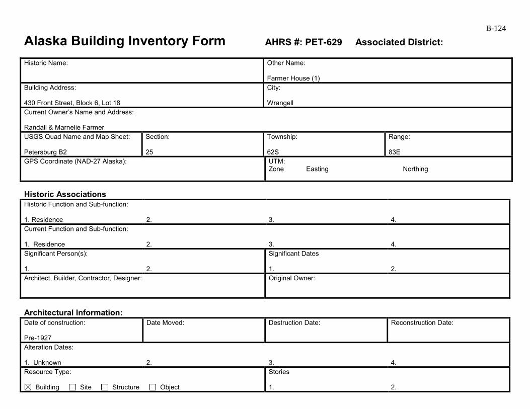
B-124
Alaska Building Inventory Form AHRS #: PET-629 Associated District: Historic Name:
Other Name: Farmer House (1)
Building Address: 430 Front Street, Block 6, Lot 18
City: Wrangell
Current Owner’s Name and Address: Randall & Marnelie Farmer USGS Quad Name and Map Sheet: Petersburg B2
Section: 25
Township: 62S
Range: 83E
GPS Coordinate (NAD-27 Alaska):
UTM: Zone Easting Northing
Historic Associations Historic Function and Sub-function: 1. Residence
2.
3.
4.
Current Function and Sub-function: 1. Residence
2.
3.
4.
Significant Person(s): 1.
2.
Significant Dates 1.
2.
Architect, Builder, Contractor, Designer:
Original Owner:
Architectural Information: Date of construction: Pre-1927
Date Moved:
Destruction Date:
Reconstruction Date:
Alteration Dates: 1. Unknown
2.
3.
4.
Resource Type:
Building Site Structure Object
Stories 1.
2.
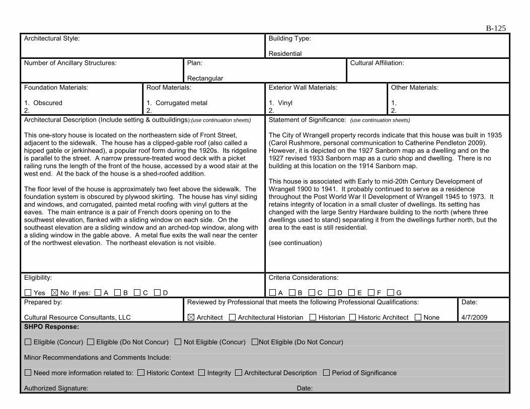
B-125 Architectural Style:
Building Type: Residential
Number of Ancillary Structures:
Plan: Rectangular
Cultural Affiliation:
Foundation Materials: 1. Obscured 2.
Roof Materials: 1. Corrugated metal 2.
Exterior Wall Materials: 1. Vinyl 2.
Other Materials: 1. 2.
Architectural Description (Include setting & outbuildings):(use continuation sheets) This one-story house is located on the northeastern side of Front Street, adjacent to the sidewalk. The house has a clipped-gable roof (also called a hipped gable or jerkinhead), a popular roof form during the 1920s. Its ridgeline is parallel to the street. A narrow pressure-treated wood deck with a picket railing runs the length of the front of the house, accessed by a wood stair at the west end. At the back of the house is a shed-roofed addition. The floor level of the house is approximately two feet above the sidewalk. The foundation system is obscured by plywood skirting. The house has vinyl siding and windows, and corrugated, painted metal roofing with vinyl gutters at the eaves. The main entrance is a pair of French doors opening on to the southwest elevation, flanked with a sliding window on each side. On the southeast elevation are a sliding window and an arched-top window, along with a sliding window in the gable above. A metal flue exits the wall near the center of the northwest elevation. The northeast elevation is not visible.
Statement of Significance: (use continuation sheets) The City of Wrangell property records indicate that this house was built in 1935 (Carol Rushmore, personal communication to Catherine Pendleton 2009). However, it is depicted on the 1927 Sanborn map as a dwelling and on the 1927 revised 1933 Sanborn map as a curio shop and dwelling. There is no building at this location on the 1914 Sanborn map. This house is associated with Early to mid-20th Century Development of Wrangell 1900 to 1941. It probably continued to serve as a residence throughout the Post World War II Development of Wrangell 1945 to 1973. It retains integrity of location in a small cluster of dwellings. Its setting has changed with the large Sentry Hardware building to the north (where three dwellings used to stand) separating it from the dwellings further north, but the area to the east is still residential. (see continuation)
Eligibility:
Yes No If yes: A B C D
Criteria Considerations:
A B C D E F G Prepared by: Cultural Resource Consultants, LLC
Reviewed by Professional that meets the following Professional Qualifications:
Architect Architectural Historian Historian Historic Architect None
Date: 4/7/2009
SHPO Response:
Eligible (Concur) Eligible (Do Not Concur) Not Eligible (Concur) Not Eligible (Do Not Concur) Minor Recommendations and Comments Include:
Need more information related to: Historic Context Integrity Architectural Description Period of Significance Authorized Signature: Date:
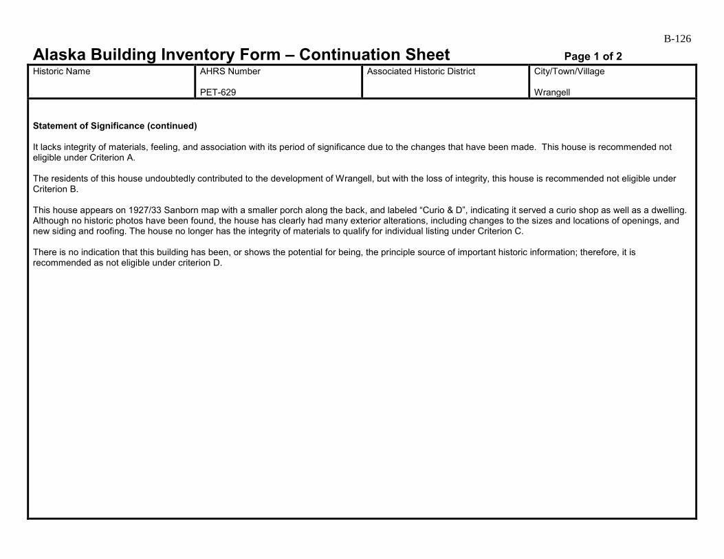
B-126
Alaska Building Inventory Form – Continuation Sheet Page 1 of 2 Historic Name
AHRS Number PET-629
Associated Historic District
City/Town/Village Wrangell
Statement of Significance (continued) It lacks integrity of materials, feeling, and association with its period of significance due to the changes that have been made. This house is recommended not eligible under Criterion A. The residents of this house undoubtedly contributed to the development of Wrangell, but with the loss of integrity, this house is recommended not eligible under Criterion B. This house appears on 1927/33 Sanborn map with a smaller porch along the back, and labeled “Curio & D”, indicating it served a curio shop as well as a dwelling. Although no historic photos have been found, the house has clearly had many exterior alterations, including changes to the sizes and locations of openings, and new siding and roofing. The house no longer has the integrity of materials to qualify for individual listing under Criterion C. There is no indication that this building has been, or shows the potential for being, the principle source of important historic information; therefore, it is recommended as not eligible under criterion D.

B-127
Alaska Building Inventory Form – Continuation Sheet Page 2 of 2 Historic Name
AHRS Number PET-629
Associated Historic District
City/Town/Village Wrangell
Farmer House (1) PET-629 (south and east elevations, 2009).
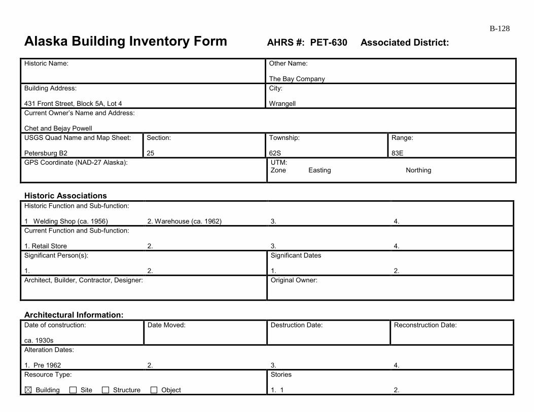
B-128
Alaska Building Inventory Form AHRS #: PET-630 Associated District: Historic Name:
Other Name: The Bay Company
Building Address: 431 Front Street, Block 5A, Lot 4
City: Wrangell
Current Owner’s Name and Address: Chet and Bejay Powell USGS Quad Name and Map Sheet: Petersburg B2
Section: 25
Township: 62S
Range: 83E
GPS Coordinate (NAD-27 Alaska):
UTM: Zone Easting Northing
Historic Associations Historic Function and Sub-function: 1 Welding Shop (ca. 1956)
2. Warehouse (ca. 1962)
3.
4.
Current Function and Sub-function: 1. Retail Store
2.
3.
4.
Significant Person(s): 1.
2.
Significant Dates 1.
2.
Architect, Builder, Contractor, Designer:
Original Owner:
Architectural Information: Date of construction: ca. 1930s
Date Moved:
Destruction Date:
Reconstruction Date:
Alteration Dates: 1. Pre 1962
2.
3.
4.
Resource Type:
Building Site Structure Object
Stories 1. 1
2.
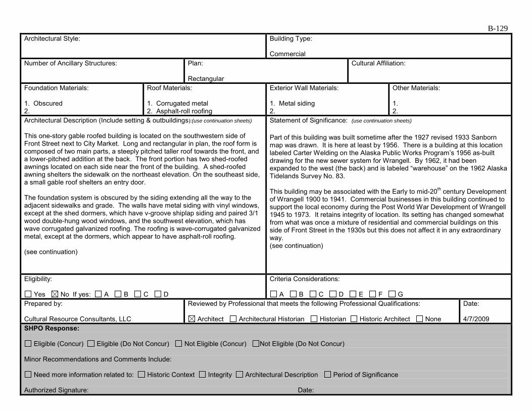
B-129 Architectural Style:
Building Type: Commercial
Number of Ancillary Structures:
Plan: Rectangular
Cultural Affiliation:
Foundation Materials: 1. Obscured 2.
Roof Materials: 1. Corrugated metal 2. Asphalt-roll roofing
Exterior Wall Materials: 1. Metal siding 2.
Other Materials: 1. 2.
Architectural Description (Include setting & outbuildings):(use continuation sheets) This one-story gable roofed building is located on the southwestern side of Front Street next to City Market. Long and rectangular in plan, the roof form is composed of two main parts, a steeply pitched taller roof towards the front, and a lower-pitched addition at the back. The front portion has two shed-roofed awnings located on each side near the front of the building. A shed-roofed awning shelters the sidewalk on the northeast elevation. On the southeast side, a small gable roof shelters an entry door. The foundation system is obscured by the siding extending all the way to the adjacent sidewalks and grade. The walls have metal siding with vinyl windows, except at the shed dormers, which have v-groove shiplap siding and paired 3/1 wood double-hung wood windows, and the southwest elevation, which has wave corrugated galvanized roofing. The roofing is wave-corrugated galvanized metal, except at the dormers, which appear to have asphalt-roll roofing. (see continuation)
Statement of Significance: (use continuation sheets) Part of this building was built sometime after the 1927 revised 1933 Sanborn map was drawn. It is here at least by 1956. There is a building at this location labeled Carter Welding on the Alaska Public Works Program’s 1956 as-built drawing for the new sewer system for Wrangell. By 1962, it had been expanded to the west (the back) and is labeled “warehouse” on the 1962 Alaska Tidelands Survey No. 83. This building may be associated with the Early to mid-20th century Development of Wrangell 1900 to 1941. Commercial businesses in this building continued to support the local economy during the Post World War Development of Wrangell 1945 to 1973. It retains integrity of location. Its setting has changed somewhat from what was once a mixture of residential and commercial buildings on this side of Front Street in the 1930s but this does not affect it in any extraordinary way. (see continuation)
Eligibility:
Yes No If yes: A B C D
Criteria Considerations:
A B C D E F G Prepared by: Cultural Resource Consultants, LLC
Reviewed by Professional that meets the following Professional Qualifications:
Architect Architectural Historian Historian Historic Architect None
Date: 4/7/2009
SHPO Response:
Eligible (Concur) Eligible (Do Not Concur) Not Eligible (Concur) Not Eligible (Do Not Concur) Minor Recommendations and Comments Include:
Need more information related to: Historic Context Integrity Architectural Description Period of Significance Authorized Signature: Date:
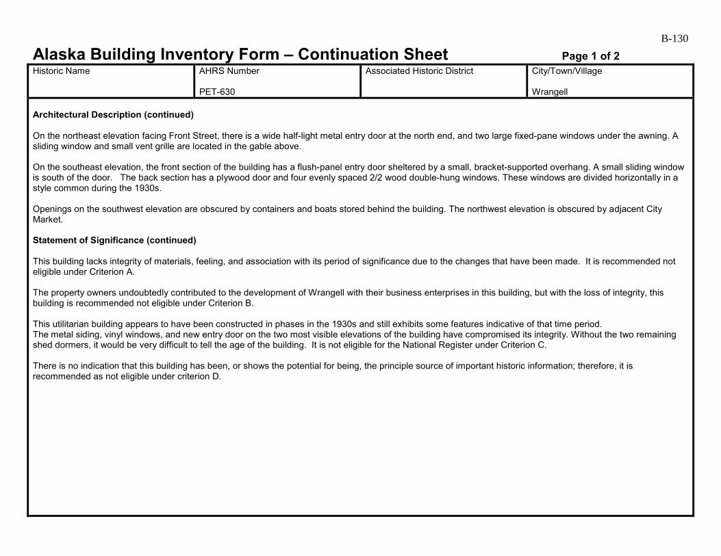
B-130
Alaska Building Inventory Form – Continuation Sheet Page 1 of 2 Historic Name
AHRS Number PET-630
Associated Historic District
City/Town/Village Wrangell
Architectural Description (continued) On the northeast elevation facing Front Street, there is a wide half-light metal entry door at the north end, and two large fixed-pane windows under the awning. A sliding window and small vent grille are located in the gable above. On the southeast elevation, the front section of the building has a flush-panel entry door sheltered by a small, bracket-supported overhang. A small sliding window is south of the door. The back section has a plywood door and four evenly spaced 2/2 wood double-hung windows. These windows are divided horizontally in a style common during the 1930s. Openings on the southwest elevation are obscured by containers and boats stored behind the building. The northwest elevation is obscured by adjacent City Market. Statement of Significance (continued) This building lacks integrity of materials, feeling, and association with its period of significance due to the changes that have been made. It is recommended not eligible under Criterion A. The property owners undoubtedly contributed to the development of Wrangell with their business enterprises in this building, but with the loss of integrity, this building is recommended not eligible under Criterion B. This utilitarian building appears to have been constructed in phases in the 1930s and still exhibits some features indicative of that time period. The metal siding, vinyl windows, and new entry door on the two most visible elevations of the building have compromised its integrity. Without the two remaining shed dormers, it would be very difficult to tell the age of the building. It is not eligible for the National Register under Criterion C. There is no indication that this building has been, or shows the potential for being, the principle source of important historic information; therefore, it is recommended as not eligible under criterion D.
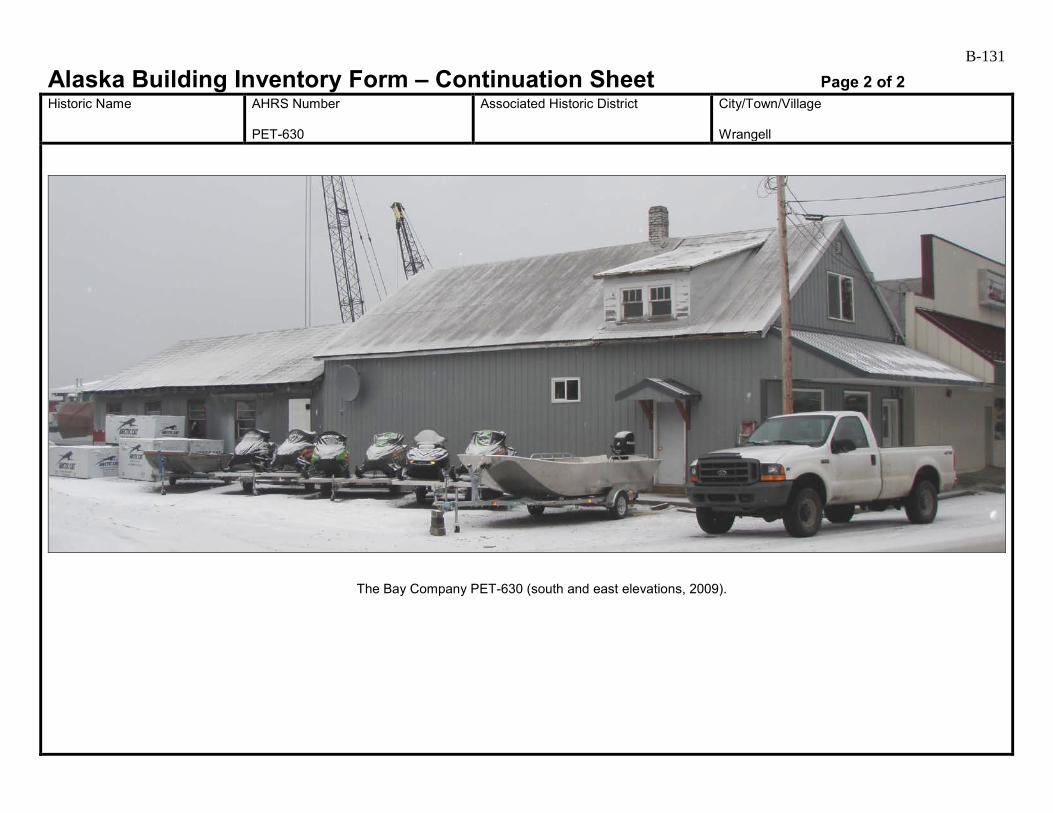
B-131
Alaska Building Inventory Form – Continuation Sheet Page 2 of 2 Historic Name
AHRS Number PET-630
Associated Historic District
City/Town/Village Wrangell
The Bay Company PET-630 (south and east elevations, 2009).

B-132
Alaska Building Inventory Form AHRS #: PET-631 Associated District: Historic Name:
Other Name: Farmer House (2)
Building Address: 434 Front Street, Block 6, Lot 15
City: Wrangell
Current Owner’s Name and Address: Randall & Marnelie Farmer USGS Quad Name and Map Sheet: Petersburg B2
Section: 25
Township: 62S
Range: 83E
GPS Coordinate (NAD-27 Alaska):
UTM: Zone Easting Northing
Historic Associations Historic Function and Sub-function: 1 Residence
2.
3.
4.
Current Function and Sub-function: 1. Residence
2.
3.
4.
Significant Person(s): 1.
2.
Significant Dates 1.
2.
Architect, Builder, Contractor, Designer:
Original Owner:
Architectural Information: Date of construction: ca. 1930s
Date Moved:
Destruction Date:
Reconstruction Date:
Alteration Dates: 1. Unknown
2.
3.
4.
Resource Type:
Building Site Structure Object
Stories 1. 1
2.

B-133 Architectural Style:
Building Type: Residential
Number of Ancillary Structures:
Plan: Rectangular
Cultural Affiliation:
Foundation Materials: 1. Obscured by plywood skirting 2.
Roof Materials: 1. Corrugated metal 2.
Exterior Wall Materials: 1. Grooved plywood 2.
Other Materials: 1. 2.
Architectural Description (Include setting & outbuildings):(use continuation sheets) This one-story gable roofed house is located on the northeast side of Front Street right next to Totem Park. The house is rectangular in plan, with its ridgeline perpendicular to the street. It appears to have had two additions at the front end, a gable-roofed addition the same width as the house, with a slightly lower roof line, and a gable-roofed front porch. The three gabled forms give the house a “telescoping” appearance. A small shed-roofed porch is located near the back on the northwest elevation. The house has plywood skirting obscuring the foundation system. The floor level is approximately four feet above the surrounding grade. The siding above is also grooved plywood. All of the windows are vinyl sliding windows. The roofing is corrugated, painted metal. The roof over the porch appears newer than that of the other areas. The southwest elevation has a metal entry door flanked by two windows. The porch has a picket railing and a decorative truss in the gable, and is accessed by steps from the northwest side. (see continuation)
Statement of Significance: (use continuation sheets) According the City of Wrangell property records, this house was built in 1904 (Carol Rushmore, personal communication to Catherine Pendleton 2009). However, no building is shown at this exact location on the 1914, 1927, and 1927 revised 1933 Sanborn maps or on the 1956 Alaska Public Works Program’s water/sewer map. There is a house further to the east on the Sanborn maps, and it is labeled “Wigg” on the 1956 water sewer map but it is further from the street and is not at the same angle as this house. This house is associated with the Early to mid-20th Century Development of Wrangell 1900 to 1941. As noted above, there was no house shown at this exact location on early maps. (see continuation)
Eligibility:
Yes No If yes: A B C D
Criteria Considerations:
A B C D E F G Prepared by: Cultural Resource Consultants, LLC
Reviewed by Professional that meets the following Professional Qualifications:
Architect Architectural Historian Historian Historic Architect None
Date: 4/7/2009
SHPO Response:
Eligible (Concur) Eligible (Do Not Concur) Not Eligible (Concur) Not Eligible (Do Not Concur) Minor Recommendations and Comments Include:
Need more information related to: Historic Context Integrity Architectural Description Period of Significance Authorized Signature: Date:
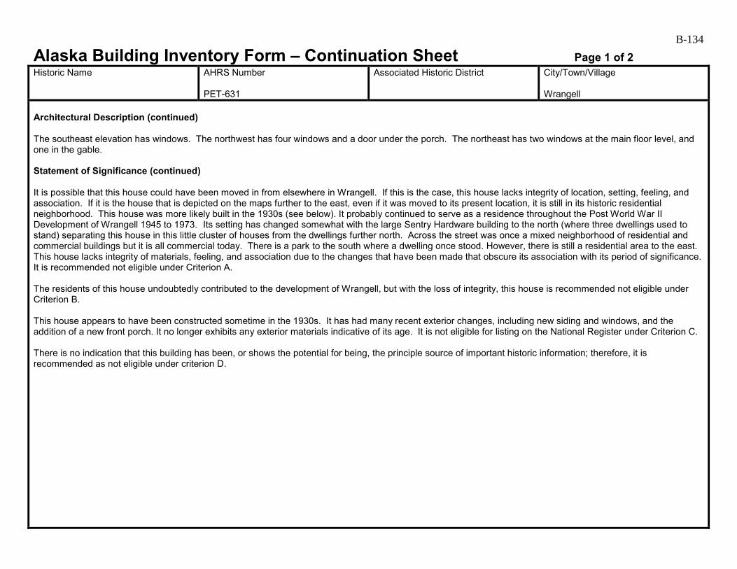
B-134
Alaska Building Inventory Form – Continuation Sheet Page 1 of 2 Historic Name
AHRS Number PET-631
Associated Historic District
City/Town/Village Wrangell
Architectural Description (continued) The southeast elevation has windows. The northwest has four windows and a door under the porch. The northeast has two windows at the main floor level, and one in the gable. Statement of Significance (continued) It is possible that this house could have been moved in from elsewhere in Wrangell. If this is the case, this house lacks integrity of location, setting, feeling, and association. If it is the house that is depicted on the maps further to the east, even if it was moved to its present location, it is still in its historic residential neighborhood. This house was more likely built in the 1930s (see below). It probably continued to serve as a residence throughout the Post World War II Development of Wrangell 1945 to 1973. Its setting has changed somewhat with the large Sentry Hardware building to the north (where three dwellings used to stand) separating this house in this little cluster of houses from the dwellings further north. Across the street was once a mixed neighborhood of residential and commercial buildings but it is all commercial today. There is a park to the south where a dwelling once stood. However, there is still a residential area to the east. This house lacks integrity of materials, feeling, and association due to the changes that have been made that obscure its association with its period of significance. It is recommended not eligible under Criterion A. The residents of this house undoubtedly contributed to the development of Wrangell, but with the loss of integrity, this house is recommended not eligible under Criterion B. This house appears to have been constructed sometime in the 1930s. It has had many recent exterior changes, including new siding and windows, and the addition of a new front porch. It no longer exhibits any exterior materials indicative of its age. It is not eligible for listing on the National Register under Criterion C. There is no indication that this building has been, or shows the potential for being, the principle source of important historic information; therefore, it is recommended as not eligible under criterion D.

B-135
Alaska Building Inventory Form – Continuation Sheet Page 2 of 2 Historic Name
AHRS Number PET-631
Associated Historic District
City/Town/Village Wrangell
Farmer House (2) PET-631 (west and south elevations, 2009).

B-136
Alaska Building Inventory Form AHRS #: PET-632 Associated District: Historic Name:
Other Name: Armstrong House (2)
Building Address: 522 Front Street, Block 21, Lot 7
City: Wrangell
Current Owner’s Name and Address: Annie Armstrong/Credit Shelter Trust USGS Quad Name and Map Sheet: Petersburg B2
Section: 25
Township: 62S
Range: 83E
GPS Coordinate (NAD-27 Alaska):
UTM: Zone Easting Northing
Historic Associations Historic Function and Sub-function: 1. Residence
2.
3.
4.
Current Function and Sub-function: 1. Residence
2.
3.
4.
Significant Person(s): 1.
2.
Significant Dates 1.
2.
Architect, Builder, Contractor, Designer:
Original Owner:
Architectural Information: Date of construction: Between 1914 and 1923
Date Moved:
Destruction Date:
Reconstruction Date:
Alteration Dates: 1. Unknown
2.
3.
4.
Resource Type:
Building Site Structure Object
Stories 1. 1.5
2.

B-137 Architectural Style:
Building Type: Residential
Number of Ancillary Structures:
Plan: L-shaped
Cultural Affiliation:
Foundation Materials: 1. Wood posts (obscured) 2.
Roof Materials: 1. Corrugated painted metal 2. Asphalt shingle
Exterior Wall Materials: 1. Cementitious shingles 2. Vinyl
Other Materials: 1. V-groove shiplap siding 2.
Architectural Description (Include setting & outbuildings):(use continuation sheets) This gable-roofed 1-1/2 story house is located on the eastern side of Front Street. The house is L-shaped in plan, with a rectangular main section and shed roofed addition at the back (which extends towards the southeast to form the L), and a hipped-roof front porch. A brick chimney is centered in the ridge of the main roof. The foundation system appears to be wood posts, but is obscured by the siding extending down to grade. Based on the distinctive 1-1/2 story height, the house is likely to be balloon-framed. The walls have cementitious shingle siding, except for the northeast gable, which has vinyl siding, and the shed-roofed addition, which has horizontal V-groove shiplap. The house retains many wood windows that appear to be original and wide wood trim at openings and corners. The roofing is corrugated, painted metal, except at the front porch, which has asphalt shingles. The west elevation has a flush-panel wood door centered under porch. (see continuation)
Statement of Significance: (use continuation sheets) This house is not shown on the 1914 Sanborn maps but is on the 1927 and 1927 revised 1933 Sanborn maps as a 1-1/2 story dwelling. It is on the Alaska Public Works Program’s 1956 as-built drawing for the new sewer system for Wrangell, but the name is illegible. It is mapped in Cohen’s 1986 survey report but not discussed. This house is associated with the Early to mid-20th Century Development of Wrangell 1900 to 1941. It probably continued to serve as a residence throughout the Post World War II Development of Wrangell 1945 to 1973. (see continuation)
Eligibility:
Yes No If yes: A B C D
Criteria Considerations:
A B C D E F G Prepared by: Cultural Resource Consultants, LLC
Reviewed by Professional that meets the following Professional Qualifications:
Architect Architectural Historian Historian Historic Architect None
Date: 4/7/2009
SHPO Response:
Eligible (Concur) Eligible (Do Not Concur) Not Eligible (Concur) Not Eligible (Do Not Concur) Minor Recommendations and Comments Include:
Need more information related to: Historic Context Integrity Architectural Description Period of Significance Authorized Signature: Date:
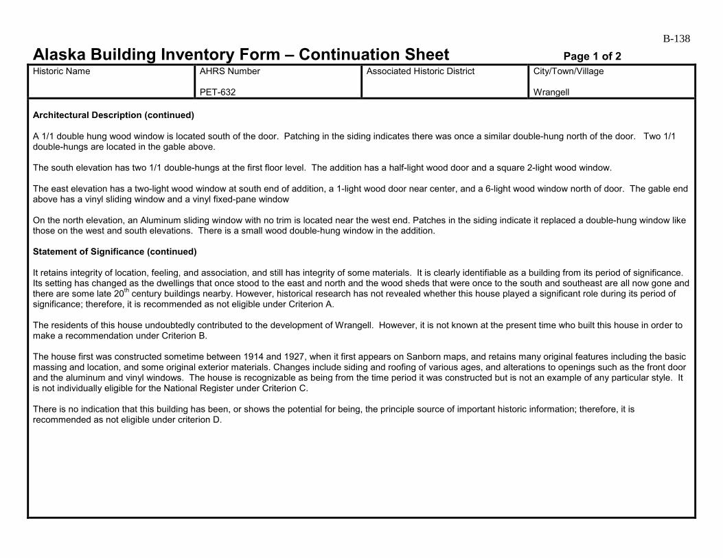
B-138
Alaska Building Inventory Form – Continuation Sheet Page 1 of 2 Historic Name
AHRS Number PET-632
Associated Historic District
City/Town/Village Wrangell
Architectural Description (continued) A 1/1 double hung wood window is located south of the door. Patching in the siding indicates there was once a similar double-hung north of the door. Two 1/1 double-hungs are located in the gable above. The south elevation has two 1/1 double-hungs at the first floor level. The addition has a half-light wood door and a square 2-light wood window. The east elevation has a two-light wood window at south end of addition, a 1-light wood door near center, and a 6-light wood window north of door. The gable end above has a vinyl sliding window and a vinyl fixed-pane window On the north elevation, an Aluminum sliding window with no trim is located near the west end. Patches in the siding indicate it replaced a double-hung window like those on the west and south elevations. There is a small wood double-hung window in the addition. Statement of Significance (continued) It retains integrity of location, feeling, and association, and still has integrity of some materials. It is clearly identifiable as a building from its period of significance. Its setting has changed as the dwellings that once stood to the east and north and the wood sheds that were once to the south and southeast are all now gone and there are some late 20th century buildings nearby. However, historical research has not revealed whether this house played a significant role during its period of significance; therefore, it is recommended as not eligible under Criterion A. The residents of this house undoubtedly contributed to the development of Wrangell. However, it is not known at the present time who built this house in order to make a recommendation under Criterion B. The house first was constructed sometime between 1914 and 1927, when it first appears on Sanborn maps, and retains many original features including the basic massing and location, and some original exterior materials. Changes include siding and roofing of various ages, and alterations to openings such as the front door and the aluminum and vinyl windows. The house is recognizable as being from the time period it was constructed but is not an example of any particular style. It is not individually eligible for the National Register under Criterion C. There is no indication that this building has been, or shows the potential for being, the principle source of important historic information; therefore, it is recommended as not eligible under criterion D.
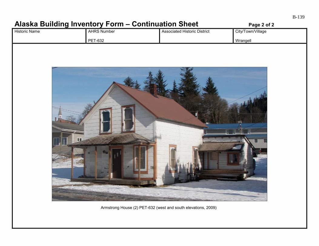
B-139
Alaska Building Inventory Form – Continuation Sheet Page 2 of 2 Historic Name
AHRS Number PET-632
Associated Historic District
City/Town/Village Wrangell
Armstrong House (2) PET-632 (west and south elevations, 2009)

B-140
Alaska Building Inventory Form AHRS #: PET-633 Associated District: Historic Name:
Other Name: Armstrong Duplex East
Building Address: 522 Front Street, Block 21, Lot 31
City: Wrangell
Current Owner’s Name and Address: Annie Armstrong/Credit Shelter Trust USGS Quad Name and Map Sheet: Petersburg B2
Section: 25
Township: 62S
Range: 83E
GPS Coordinate (NAD-27 Alaska):
UTM: Zone Easting Northing
Historic Associations Historic Function and Sub-function: 1. Residence
2.
3.
4.
Current Function and Sub-function: 1. Residence
2.
3.
4.
Significant Person(s): 1.
2.
Significant Dates 1.
2.
Architect, Builder, Contractor, Designer:
Original Owner:
Architectural Information: Date of construction: pre-1956
Date Moved:
Destruction Date:
Reconstruction Date:
Alteration Dates: 1. Unknown
2.
3.
4.
Resource Type:
Building Site Structure Object
Stories 1.
2.
B-141 Architectural Style:
Building Type: Residential
Number of Ancillary Structures:
Plan: Rectangular
Cultural Affiliation:
Foundation Materials: 1. Concrete pier 2.
Roof Materials: 1. Corrugated metal 2.
Exterior Wall Materials: 1. Brick patterned asphalt siding 2.
Other Materials: 1. 2.
Architectural Description (Include setting & outbuildings):(use continuation sheets) This gable-roofed building is one of two nearly identical duplexes on an un-named drive accessed from Front Street. The rectangular floor plan contains two dwelling units located side-by-side. Two small gable-roofed entries are located on the north elevation. The building has a concrete-pier foundation system with plywood skirting. The floor level is located approximately two feet above grade. The walls are sided with brick patterned asphalt siding. Most of the windows are vinyl. The roof has exposed rafter tails and corrugated metal roofing. On the north elevation, half-light wood doors are located in each entry. The doors are sheltered by small, bracket-supported wood awnings. Wood steps with no top landing lead up to each door. Based on the window types, the dwelling units appear to be mirrored in plan. A fixed-pane-over awning window is next to the inside of each entry, while a larger fixed-pane window is located to the outside, near each building corner. (see continuation)
Statement of Significance: (use continuation sheets) This duplex was built at least by 1956 as it is shown on the Alaska Public Works Program’s 1956 as-built drawing for the new sewer system for Wrangell labeled as “Armstrong.” This duplex may be associated with Post World War II Development of Wrangell 1945 to 1973. It is one of three duplexes in this area built by at least by 1956. One duplex is to the west (PET-634) and the other is to the east (not evaluated at this time). It retains integrity of location and is in an area that is a small residential section of Wrangell. By 1956, this area contained a combination of single-family and multi-family dwellings with a grocery store (PET-636) and barn to the southwest. (see continuation)
Eligibility:
Yes No If yes: A B C D
Criteria Considerations:
A B C D E F G Prepared by: Cultural Resource Consultants, LLC
Reviewed by Professional that meets the following Professional Qualifications:
Architect Architectural Historian Historian Historic Architect None
Date: 4/7/2009
SHPO Response:
Eligible (Concur) Eligible (Do Not Concur) Not Eligible (Concur) Not Eligible (Do Not Concur) Minor Recommendations and Comments Include:
Need more information related to: Historic Context Integrity Architectural Description Period of Significance Authorized Signature: Date:
B-142
Alaska Building Inventory Form – Continuation Sheet Page 1 of 2 Historic Name
AHRS Number PET-633
Associated Historic District
City/Town/Village Wrangell
Architectural Description (continued) The east and south elevations were inaccessible. The west elevation has a single fixed-pane-over-awning window. Statement of Significance (continued) The setting since then has changed somewhat as several houses here in the 1950s are gone, and there are some late 20th century apartment buildings nearby. While this duplex retains enough materials to convey its period of significance and is still associated with the other two duplexes, it lacks integrity of setting, feeling, and association with its period of significance. It is recommended not eligible under Criterion A. This building is recommended not eligible under Criterion B. Changes to the exterior of this building are limited to window replacement and the installation of metal roofing. The building appears to date to the 1940s or 1950s, but is not a particularly noteworthy example of dwelling construction during that time period. The building does not appear to be eligible for the National Register under Criterion C. There is no indication that this building has been, or shows the potential for being, the principle source of important historic information; therefore, it is recommended as not eligible under criterion D. This duplex, the one to the west (PET-634), and the one to the east that faces Church Street are in a grouping that might be considered as an historic district. However, there is not much continuity in the streetscape of these three buildings. The one furthest to the east faces east toward Church Street while the other two (PET-633 and PET-634) both face north. In addition, historical research has not revealed the significance of this group of buildings. This duplex is not recommended as part of a district.
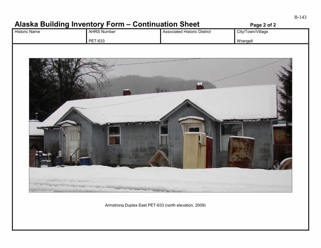
B-143
Alaska Building Inventory Form – Continuation Sheet Page 2 of 2 Historic Name
AHRS Number PET-633
Associated Historic District
City/Town/Village Wrangell
Armstrong Duplex East PET-633 (north elevation, 2009)
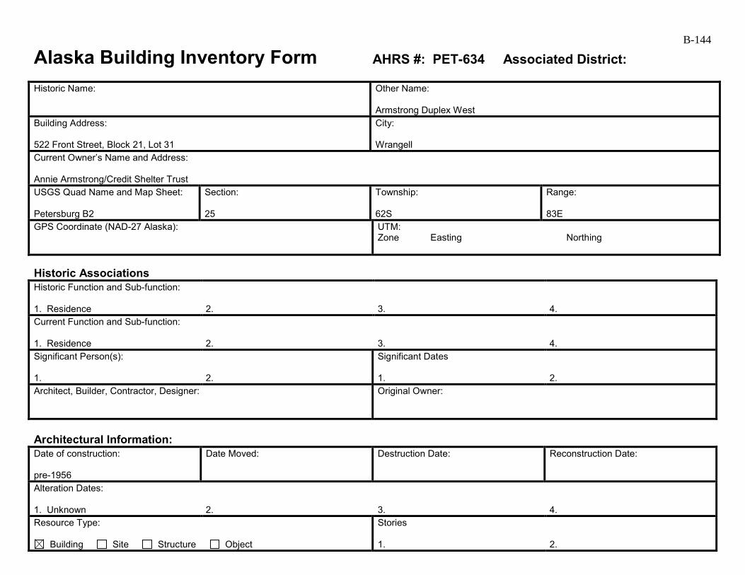
B-144
Alaska Building Inventory Form AHRS #: PET-634 Associated District: Historic Name:
Other Name: Armstrong Duplex West
Building Address: 522 Front Street, Block 21, Lot 31
City: Wrangell
Current Owner’s Name and Address: Annie Armstrong/Credit Shelter Trust USGS Quad Name and Map Sheet: Petersburg B2
Section: 25
Township: 62S
Range: 83E
GPS Coordinate (NAD-27 Alaska):
UTM: Zone Easting Northing
Historic Associations Historic Function and Sub-function: 1. Residence
2.
3.
4.
Current Function and Sub-function: 1. Residence
2.
3.
4.
Significant Person(s): 1.
2.
Significant Dates 1.
2.
Architect, Builder, Contractor, Designer:
Original Owner:
Architectural Information: Date of construction: pre-1956
Date Moved:
Destruction Date:
Reconstruction Date:
Alteration Dates: 1. Unknown
2.
3.
4.
Resource Type:
Building Site Structure Object
Stories 1.
2.

B-145 Architectural Style:
Building Type: Residential
Number of Ancillary Structures:
Plan: Rectangular
Cultural Affiliation:
Foundation Materials: 1. Concrete pier 2.
Roof Materials: 1. Corrugated metal 2.
Exterior Wall Materials: 1. Cementitious shingles 2.
Other Materials: 1. 2.
Architectural Description (Include setting & outbuildings):(use continuation sheets) This gable-roofed building is one of two nearly identical duplexes on an un-named drive accessed from Front Street. The rectangular floor plan contains two dwelling units located side-by-side. Two small gable-roofed entries are located on the north elevation. The building has a concrete-pier foundation system with plywood skirting. The floor level is located approximately two feet above grade. The walls are sided with cementitious shingles. Most of the windows are vinyl. The roof has exposed rafter tails and corrugated metal roofing. On the north elevation, half-light wood doors are located in each entry. The doors are sheltered by small, bracket-supported wood awnings. Wood steps with no top landing lead up to each door. Based on the window types, the dwelling units appear to be mirrored in plan. A fixed-pane-over awning window is next to the inside of each entry, while a larger fixed-pane window is located to the outside, near each building corner. (see continuation)
Statement of Significance: (use continuation sheets) History: This duplex was built at least by 1956 as it is shown on the Alaska Public Works Program’s 1956 as-built drawing for the new sewer system for Wrangell labeled as “Armstrong.” This duplex may be associated with Post World War II Development of Wrangell 1945 to 1973. It is one of three duplexes in this area built by at least by 1956. Two duplexes are to the east (PET-633 and one not evaluated at this time). It retains integrity of location and is in an area that is a small residential area of Wrangell. By 1956, this area contained a combination of single-family and multi-family dwellings with a grocery store (PET-636) and barn to the southwest. (see continuation)
Eligibility:
Yes No If yes: A B C D
Criteria Considerations:
A B C D E F G Prepared by: Cultural Resource Consultants, LLC
Reviewed by Professional that meets the following Professional Qualifications:
Architect Architectural Historian Historian Historic Architect None
Date: 4/7/2009
SHPO Response:
Eligible (Concur) Eligible (Do Not Concur) Not Eligible (Concur) Not Eligible (Do Not Concur) Minor Recommendations and Comments Include:
Need more information related to: Historic Context Integrity Architectural Description Period of Significance Authorized Signature: Date:
B-146
Alaska Building Inventory Form – Continuation Sheet Page 1 of 2 Historic Name
AHRS Number PET-634
Associated Historic District
City/Town/Village Wrangell
Architectural Description (continued) The east and west elevations each have a single fixed-pane-over-awning window. The south elevation has four evenly spaced awning windows. Statement of Significance (continued) The setting since then has changed somewhat as several houses here in the 1950s are gone, and there are some late 20th century apartment buildings nearby. While this duplex retains enough materials to convey its period of significance is still associated with the other two duplexes, it lacks integrity of setting, feeling, and association with its period of significance. It is recommended not eligible under Criterion A. This building is recommended not eligible under Criterion B. Changes to the exterior of this building are limited to window replacement and the installation of metal roofing. The building appears to date to the 1940s or 1950s, but is not a particularly noteworthy example of dwelling construction during that time period. The building does not appear to be eligible for the National Register under Criterion C. It does retain enough historic integrity to be listed if found eligible under other criteria. There is no indication that this building has been, or shows the potential for being, the principle source of important historic information; therefore, it is recommended as not eligible under criterion D. This duplex, the one adjacent to the east (PET-633), and the one furthest to the east that faces Church Street are in a grouping that might be considered as an historic district. However, there is not much continuity in the streetscape of these three buildings. The one furthest to the east faces east toward Church Street while the other two (PET-633 and PET-634) both face north. In addition, historical research has not revealed the significance of this group of buildings. This duplex is not recommended as part of a district.
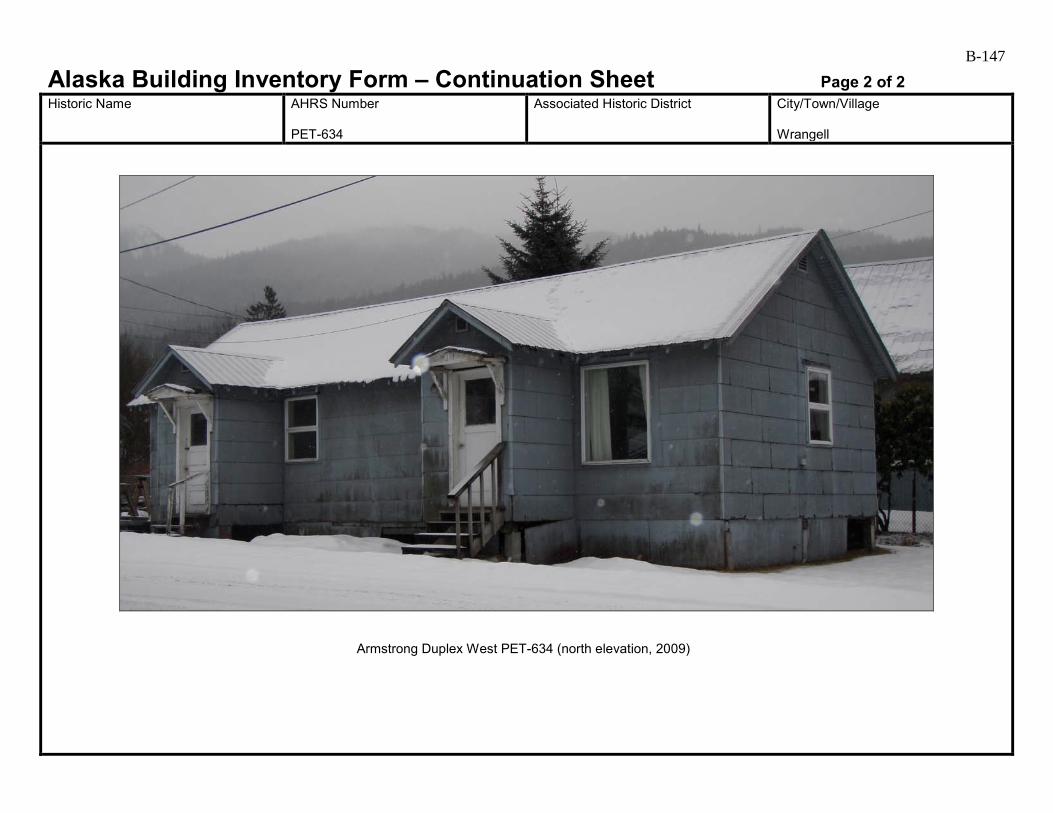
B-147
Alaska Building Inventory Form – Continuation Sheet Page 2 of 2 Historic Name
AHRS Number PET-634
Associated Historic District
City/Town/Village Wrangell
Armstrong Duplex West PET-634 (north elevation, 2009)
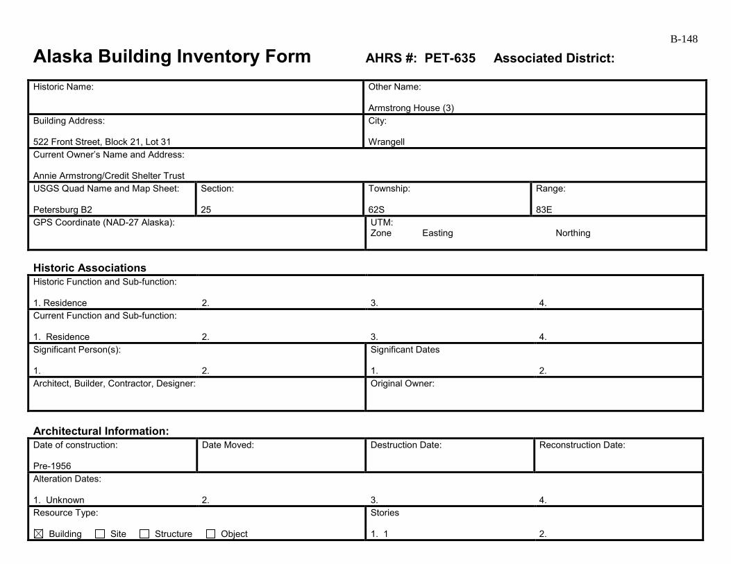
B-148
Alaska Building Inventory Form AHRS #: PET-635 Associated District: Historic Name:
Other Name: Armstrong House (3)
Building Address: 522 Front Street, Block 21, Lot 31
City: Wrangell
Current Owner’s Name and Address: Annie Armstrong/Credit Shelter Trust USGS Quad Name and Map Sheet: Petersburg B2
Section: 25
Township: 62S
Range: 83E
GPS Coordinate (NAD-27 Alaska):
UTM: Zone Easting Northing
Historic Associations Historic Function and Sub-function: 1. Residence
2.
3.
4.
Current Function and Sub-function: 1. Residence
2.
3.
4.
Significant Person(s): 1.
2.
Significant Dates 1.
2.
Architect, Builder, Contractor, Designer:
Original Owner:
Architectural Information: Date of construction: Pre-1956
Date Moved:
Destruction Date:
Reconstruction Date:
Alteration Dates: 1. Unknown
2.
3.
4.
Resource Type:
Building Site Structure Object
Stories 1. 1
2.

B-149 Architectural Style:
Building Type: Residential
Number of Ancillary Structures:
Plan: Rectangular
Cultural Affiliation:
Foundation Materials: 1. Wood post 2.
Roof Materials: 1. Corrugated metal 2.
Exterior Wall Materials: 1. Wood shingle 2. Board and batten (gable ends)
Other Materials: 1. 2.
Architectural Description (Include setting & outbuildings):(use continuation sheets) This small one-story house is located on an un-named drive accessed from Front Street. It has a gable roof with its ridgeline parallel to Front Street, and shed roofed addition on the east side. The house appears to have a wood post foundation, and the floor level is located slightly below the surrounding grade. The house has wood shingle siding on most walls, with board-and-batten wood siding in the gable ends. The window openings are removed or covered with plywood. The roofing is corrugated, galvanized metal. The eaves have narrow wood fascia and wide plank soffiting. The north elevation has a flush-panel wood door near the west end. A boarded up square window is located in the wall of the addition. The east elevation has a single, similar boarded up window. The south elevation has two square four-light awning windows with broken panes and wide wood trim, boarded up from the interior with plywood. The west elevation has no openings, but section of shiplap boards indicate that a tall, narrow window was once located near the north corner.
Statement of Significance: (use continuation sheets) This house was built at least by 1956 as it is shown on the Alaska Public Works Program’s 1956 as-built drawing for the new sewer system for Wrangell marked as “Armstrong.” It is not shown on the 1914, 1927, or the 1927 revised 1933 Sanborn maps. It is mapped in Cohen’s 1986 survey report but not discussed. This house may have been built in the 1930s or 1940s (see below) and is likely associated with the Early to Mid-20th Century Development of Wrangell 1900 to 1941. It probably continued to serve as a residence throughout the Post World War II Development of Wrangell 1945 to 1973. It retains integrity of location but it lacks integrity of materials, feeling, and association. Its setting has changed. The dwellings that once stood to the east and northeast are all now gone. The area is now a combination of 1950s and 1970s era apartment buildings with one single family house to the northeast (PET-632) and one to the southeast (not evaluated at this time). (see continuation)
Eligibility:
Yes No If yes: A B C D
Criteria Considerations:
A B C D E F G Prepared by: Cultural Resource Consultants, LLC
Reviewed by Professional that meets the following Professional Qualifications:
Architect Architectural Historian Historian Historic Architect None
Date: 4/7/2009
SHPO Response:
Eligible (Concur) Eligible (Do Not Concur) Not Eligible (Concur) Not Eligible (Do Not Concur) Minor Recommendations and Comments Include:
Need more information related to: Historic Context Integrity Architectural Description Period of Significance Authorized Signature: Date:
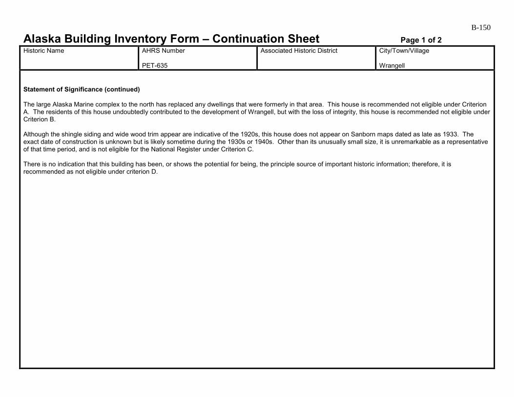
B-150
Alaska Building Inventory Form – Continuation Sheet Page 1 of 2 Historic Name
AHRS Number PET-635
Associated Historic District
City/Town/Village Wrangell
Statement of Significance (continued) The large Alaska Marine complex to the north has replaced any dwellings that were formerly in that area. This house is recommended not eligible under Criterion A. The residents of this house undoubtedly contributed to the development of Wrangell, but with the loss of integrity, this house is recommended not eligible under Criterion B. Although the shingle siding and wide wood trim appear are indicative of the 1920s, this house does not appear on Sanborn maps dated as late as 1933. The exact date of construction is unknown but is likely sometime during the 1930s or 1940s. Other than its unusually small size, it is unremarkable as a representative of that time period, and is not eligible for the National Register under Criterion C. There is no indication that this building has been, or shows the potential for being, the principle source of important historic information; therefore, it is recommended as not eligible under criterion D.
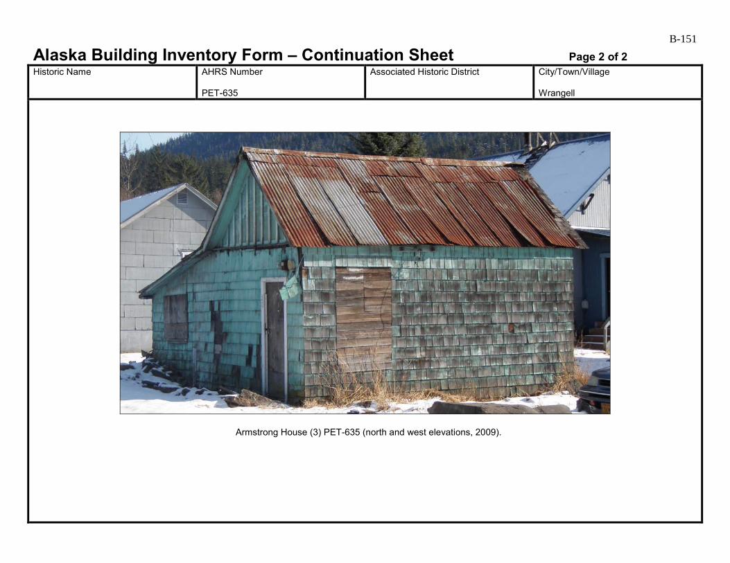
B-151
Alaska Building Inventory Form – Continuation Sheet Page 2 of 2 Historic Name
AHRS Number PET-635
Associated Historic District
City/Town/Village Wrangell
Armstrong House (3) PET-635 (north and west elevations, 2009).

B-152
Alaska Building Inventory Form AHRS #: PET-636 Associated District: Historic Name: Grant’s Groceries
Other Name: Rayme’s Bar
Building Address: 532 Front Street, Block 21, Lots 5, 30
City: Wrangell
Current Owner’s Name and Address: Samuel Raymond Pivett III USGS Quad Name and Map Sheet: Petersburg B2
Section: 25
Township: 62S
Range: 83E
GPS Coordinate (NAD-27 Alaska):
UTM: Zone Easting Northing
Historic Associations Historic Function and Sub-function: 1 Grocery Store
2.
3.
4.
Current Function and Sub-function: 1. Bar
2.
3.
4.
Significant Person(s): 1.
2.
Significant Dates 1.
2.
Architect, Builder, Contractor, Designer:
Original Owner: B. Y. Grant
Architectural Information: Date of construction: ca. 1955
Date Moved:
Destruction Date:
Reconstruction Date:
Alteration Dates: 1. Unknown
2.
3.
4.
Resource Type:
Building Site Structure Object
Stories 1. 1
2.
B-153 Architectural Style:
Building Type: Commercial
Number of Ancillary Structures:
Plan: Rectangular
Cultural Affiliation:
Foundation Materials: 1. Wood posts or pilings 2.
Roof Materials: 1. Painted corrugated metal 2.
Exterior Wall Materials: 1. Painted corrugated metal 2. Plywood and grooved plywood
Other Materials: 1. 2.
Architectural Description (Include setting & outbuildings):(use continuation sheets) Rayme’s Bar is a one-story, gable-roofed false-front building located on the eastern side of Front Street near the intersection of Front and Case Avenue. Long and rectangular in plan, it has a flat-roofed, steel rod-supported awning on the street side. The foundation system appears to be wood posts or pilings. Evenly spaced vents along the west elevation indicate a crawl space. The floor level is several feet above grade. The walls have painted corrugated metal siding, except on the west elevation along Front Street, which has a combination of plywood and grooved plywood siding below the awning and cementitious shingles above. The windows are vinyl in a variety of types and sizes. The roofing is painted corrugated metal. On the west elevation, wood steps with a solid guardrail covered in grooved plywood siding lead up to a metal entry door. Three fixed-pane windows are located to the south side of the door and one to the north.
Statement of Significance: (use continuation sheets) The building originally at this site was a two-story general merchandise store with a one-story dwelling at the rear built at least by 1927 (Sanborn 1927). It was torn down in 1955 when a new store was constructed by B. Y. Grant of Grant’s Groceries (Wrangell Sentinel 18 March 1955:3). It is shown on the Alaska Public Works Program’s 1956 as-built drawing for the new sewer system for Wrangell labeled “Grant.” This building is associated with the Post World War II Development of Wrangell 1945 to 1973. It retains integrity of location but lacks integrity of materials, feeling, and association due to the changes that have been made that obscure its period of significance. (see continuation)
Eligibility:
Yes No If yes: A B C D
Criteria Considerations:
A B C D E F G Prepared by: Cultural Resource Consultants, LLC
Reviewed by Professional that meets the following Professional Qualifications:
Architect Architectural Historian Historian Historic Architect None
Date: 4/7/2009
SHPO Response:
Eligible (Concur) Eligible (Do Not Concur) Not Eligible (Concur) Not Eligible (Do Not Concur) Minor Recommendations and Comments Include:
Need more information related to: Historic Context Integrity Architectural Description Period of Significance Authorized Signature: Date:
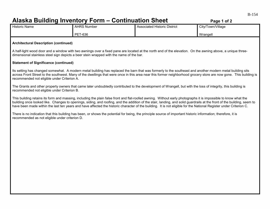
B-154
Alaska Building Inventory Form – Continuation Sheet Page 1 of 2 Historic Name
AHRS Number PET-636
Associated Historic District
City/Town/Village Wrangell
Architectural Description (continued) A half-light wood door and a window with two awnings over a fixed pane are located at the north end of the elevation. On the awning above, a unique three-dimensional stainless steel sign depicts a beer stein wrapped with the name of the bar. Statement of Significance (continued) Its setting has changed somewhat. A modern metal building has replaced the barn that was formerly to the southeast and another modern metal building sits across Front Street to the southwest. Many of the dwellings that were once in this area near this former neighborhood grocery store are now gone. This building is recommended not eligible under Criterion A. The Grants and other property owners that came later undoubtedly contributed to the development of Wrangell, but with the loss of integrity, this building is recommended not eligible under Criterion B. This building retains its form and massing, including the plain false front and flat-roofed awning. Without early photographs it is impossible to know what the building once looked like. Changes to openings, siding, and roofing, and the addition of the stair, landing, and solid guardrails at the front of the building, seem to have been made within the last ten years and have affected the historic character of the building. It is not eligible for the National Register under Criterion C. There is no indication that this building has been, or shows the potential for being, the principle source of important historic information; therefore, it is recommended as not eligible under criterion D.

B-155
Alaska Building Inventory Form – Continuation Sheet Page 2 of 2 Historic Name
AHRS Number PET-636
Associated Historic District
City/Town/Village Wrangell
Grant’s Groceries/Rayme’s Bar PET-636 (west and south elevations, 2009).

B-156
Alaska Building Inventory Form AHRS #: PET-637 Associated District: Historic Name:
Other Name: Wickman House
Building Address: 109 St. Michaels Street, Block 5, Lot 12A
City: Wrangell
Current Owner’s Name and Address: Robert and Cheryl Wickman USGS Quad Name and Map Sheet: Petersburg B2
Section: 25
Township: 62S
Range: 83E
GPS Coordinate (NAD-27 Alaska):
UTM: Zone Easting Northing
Historic Associations Historic Function and Sub-function: 1 Residential
2.
3.
4.
Current Function and Sub-function: 1. Residential
2.
3.
4.
Significant Person(s): 1.
2.
Significant Dates 1.
2.
Architect, Builder, Contractor, Designer:
Original Owner:
Architectural Information: Date of construction: ca. 1950s-1960s
Date Moved:
Destruction Date:
Reconstruction Date:
Alteration Dates: 1. Unknown
2.
3.
4.
Resource Type:
Building Site Structure Object
Stories 1.
2.
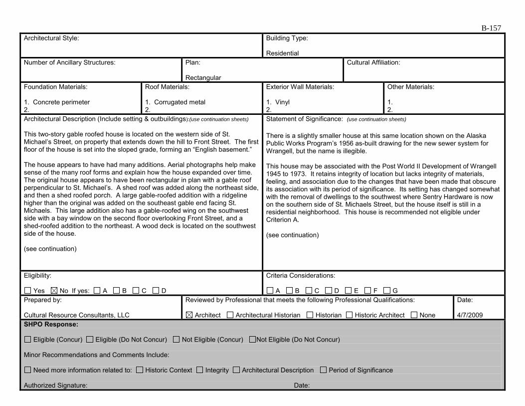
B-157 Architectural Style:
Building Type: Residential
Number of Ancillary Structures:
Plan: Rectangular
Cultural Affiliation:
Foundation Materials: 1. Concrete perimeter 2.
Roof Materials: 1. Corrugated metal 2.
Exterior Wall Materials: 1. Vinyl 2.
Other Materials: 1. 2.
Architectural Description (Include setting & outbuildings):(use continuation sheets) This two-story gable roofed house is located on the western side of St. Michael’s Street, on property that extends down the hill to Front Street. The first floor of the house is set into the sloped grade, forming an “English basement.” The house appears to have had many additions. Aerial photographs help make sense of the many roof forms and explain how the house expanded over time. The original house appears to have been rectangular in plan with a gable roof perpendicular to St. Michael’s. A shed roof was added along the northeast side, and then a shed roofed porch. A large gable-roofed addition with a ridgeline higher than the original was added on the southeast gable end facing St. Michaels. This large addition also has a gable-roofed wing on the southwest side with a bay window on the second floor overlooking Front Street, and a shed-roofed addition to the northeast. A wood deck is located on the southwest side of the house. (see continuation)
Statement of Significance: (use continuation sheets) There is a slightly smaller house at this same location shown on the Alaska Public Works Program’s 1956 as-built drawing for the new sewer system for Wrangell, but the name is illegible. This house may be associated with the Post World II Development of Wrangell 1945 to 1973. It retains integrity of location but lacks integrity of materials, feeling, and association due to the changes that have been made that obscure its association with its period of significance. Its setting has changed somewhat with the removal of dwellings to the southwest where Sentry Hardware is now on the southern side of St. Michaels Street, but the house itself is still in a residential neighborhood. This house is recommended not eligible under Criterion A. (see continuation)
Eligibility:
Yes No If yes: A B C D
Criteria Considerations:
A B C D E F G Prepared by: Cultural Resource Consultants, LLC
Reviewed by Professional that meets the following Professional Qualifications:
Architect Architectural Historian Historian Historic Architect None
Date: 4/7/2009
SHPO Response:
Eligible (Concur) Eligible (Do Not Concur) Not Eligible (Concur) Not Eligible (Do Not Concur) Minor Recommendations and Comments Include:
Need more information related to: Historic Context Integrity Architectural Description Period of Significance Authorized Signature: Date:

B-158
Alaska Building Inventory Form – Continuation Sheet Page 1 of 2 Historic Name
AHRS Number PET-637
Associated Historic District
City/Town/Village Wrangell
Architectural Description (continued) The foundation system is a concrete perimeter wall. The house has vinyl siding, windows and shutters, and painted, corrugated metal roofing. The windows are fixed-pane or sliding in operation and are many different sizes and heights. A metal flue is centered near the ridgeline of the original roof form. Statement of Significance (continued) The residents of this house undoubtedly contributed to the development of Wrangell, but with the loss of integrity, it is recommended not eligible under Criterion B. Additions to this 1950s-1960s era house appear to date to the 1970s or 1980s. Changes to exterior materials and openings, and the many additions completely obscure the unknown original appearance of the house. The house is not eligible for listing on the National Register under Criterion C. There is no indication that this building has been, or shows the potential for being, the principle source of important historic information; therefore, it is recommended as not eligible under criterion D.
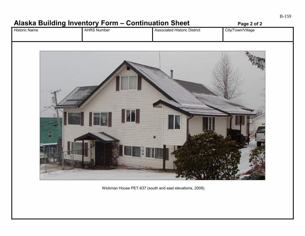
B-159
Alaska Building Inventory Form – Continuation Sheet Page 2 of 2 Historic Name
AHRS Number
Associated Historic District
City/Town/Village
Wickman House PET-637 (south and east elevations, 2009).
Appendix C
Archeological Assessment
Introduction
The following is an archeological assessment of the Wrangell Road and Utility Improvements
Project, in Wrangell, Alaska. Archeological deposits could be discovered during
implementation of the project, but, at present, the exact nature of, or any possible effects on,
these remains cannot be fully determined. However, as access is gained during construction,
the identification and evaluation phases of the Section 106 process will proceed (36 CFR Part
800.4(2)). Monitoring is proposed for areas where there may be buried cultural remains.
Description of the Undertaking
The City of Wrangell, located on the eastern shore of Zimovia Strait near the northern tip of
Wrangell Island, is approximately 155 miles south of Juneau. Wrangell is primarily centered
around Wrangell Harbor, with scattered development northward toward the airport and
southward past the former location of the Wrangell Institute (Lemke 1974:8). The city is near
the mouth of the Stikine River, a historic trade route to the Canadian interior.
The Alaska Department of Transportation and Public Facilities (DOT&PF), in cooperation with
the Alaska Division of the Federal Highway Administration (FHWA), and the U.S.
Environmental Protection Agency (EPA), is proposing to improve road and utilities along Front
and Lynch Streets in the downtown area of Wrangell, Alaska. FHWA is the lead federal agency
for this project. The proposed project area is located on Wrangell Island in Southeast Alaska in
Section 25, T62S, R83E (1:63360 USGS Quadrangle Petersburg B-2 NE) and consists of a
seven block corridor in downtown Wrangell (Figures 1 and 2).
The primary goal of the Wrangell Road and Utility Improvements Project is to replace
sidewalks, rehabilitate and/or reconstruct utilities, and replace the deteriorating Front and Lynch
Streets. Resulting surfaces will meet State and Federal requirements for the Americans with
Disabilities Act. Although no road alignment shifts are being evaluated by DOT&PF due to
right-of-way constraints, project design alternatives include various parking configurations and
landscaping opportunities within the corridor, as well as different turnaround configurations at
the City pier. Utility work would rehabilitate the sewer line, replace the water line, and
improve the storm drain systems as necessary. Relocating overhead utility (electrical and
communication) lines underground are also being considered.
Background
Prehistory
To date, archaeological surveys in southeastern Alaska have recorded several thousand sites. A
large percentage of these are shell middens, although numerous other types of prehistoric and
historic resources are known (Autrey 1992). In 1990, Stan Davis (1990:197) proposed a four-
Archeological Assessment Wrangell Road and Utility Improvements Project
November 2009
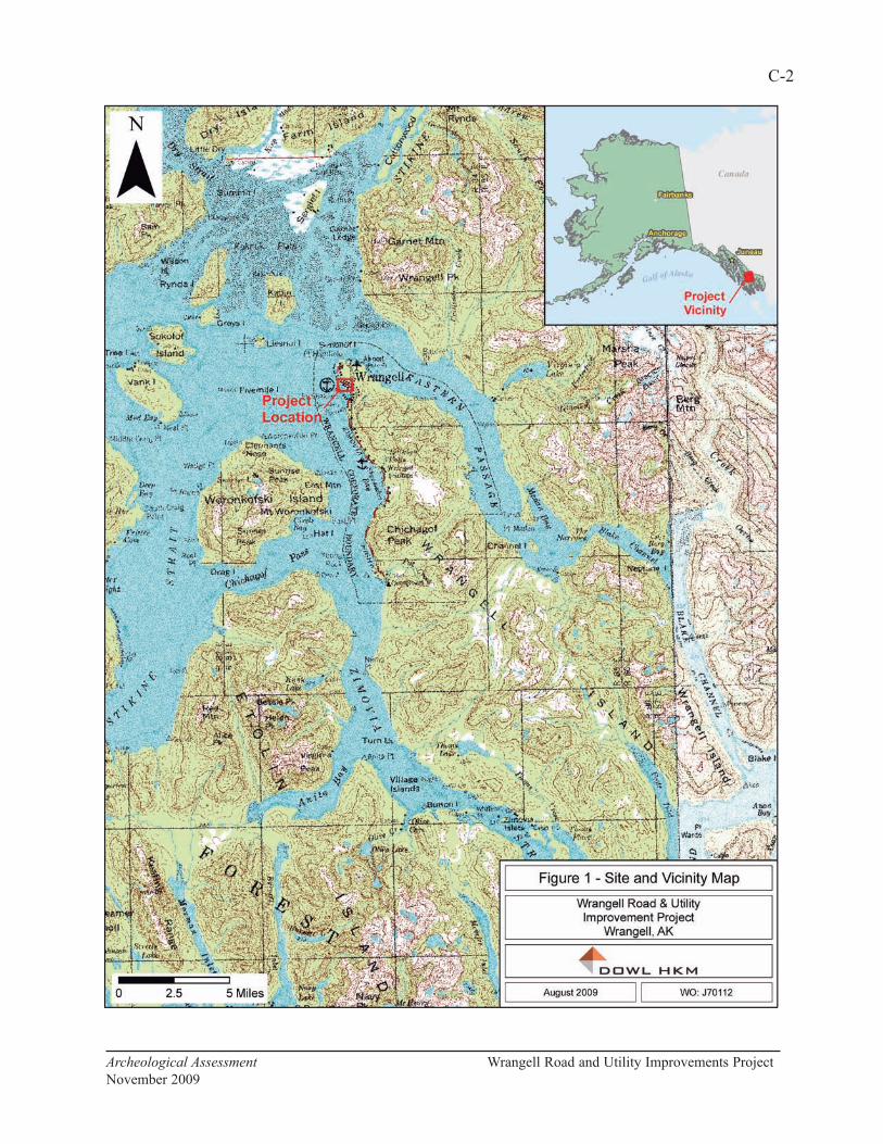
C-2
Archeological Assessment Wrangell Road and Utility Improvements Project
November 2009

C-3
Archeological Assessment Wrangell Road and Utility Improvements Project
November 2009

part cultural sequence for southeastern Alaska that includes a Paleomarine tradition (11,000 to
6500 B.P.), a Transitional stage (6500 to 5000 B.P.), a Developmental Northwest Coast stage
(5000 B.P. to European contact), and a Historic period. More recently, Madonna Moss (1998)
refined the sequence for northern Northwest Coast prehistory into an Early Period (10,000 to
5000 B.P.), a Middle Period (5000 to 1500 B.P.), and a Late Period (1500 B.P. to Contact).
The Early Period is characterized by a well-developed microblade industry with wedge-shaped
microblade cores, few or no bifacial tools, and an economy based on coastal-marine
subsistence. Middle Period sites are more numerous than those of the Early Period, have
extensive shell deposits, and are often associated with wood-stake fishing weirs. Middle Period
artifact assemblages include slate points and other groundstone materials, bone harpoons and
points, and shell beads. The Late Period, which is usually identified with the ethnographic
cultures of the region, featured the establishment of large winter villages, specialized camps,
and fortifications. Late period sites are also abundant along the southeastern Alaskan coast
(Davis 1990, Moss 1998).
A more complete summary of the prehistory of the Wrangell area can be found in Diane
Hanson’s 1998 report on an archeological survey in the vicinity of Petroglyph Beach Park,
south of Point Highfield (Hanson 1998).
Ethnography
The early historic native peoples of southeast Alaska represent three broad groups: the Tlingit,
the Alaskan Haida (Kaigani), and the Tsetsuat. Of these, the Tlingit were the most widespread
and numerous within the region. Ethnographic Tlingit culture embodies most of what is
normally thought of as northern Northwest Coast culture. This culture included an economy
based upon fish (particularly anadromous fish); settled villages; a sophisticated wood working
industry; a highly developed and distinctive art form; a social organization structured around
lineages, clans, and phratries; and a ritual life focused upon totemism, shamanism, and the
attainment of status through potlatching. The Tlingit were distributed in a number of localized,
clan-based, territorial groups across southeast Alaska, with some 10 or more such groups being
known. The project area is within the territory of the Shtax'héen Kwáan (Stikine Tlingit).
There was at least one principal village in each Tlingit tribal area. It was occupied in winter,
but was usually deserted in summer when families dispersed to fishing and hunting camps.
Village sites were preferably located on sheltered bays with views of the marine approach. A
sandy beach was important for landing canoes and for access to salmon streams, fresh water,
timber, and good hunting, fishing, and gathering grounds. Aboriginal houses were planked
rectangular structures, with excavated centers and low-pitched gabled roofs. They could
accommodate six or more families and slaves, often totaling 40 to 50 persons. Single houses or
whole villages were occasionally surrounded by palisades (de Laguna 1990:207).
Ivan Petrov reported eight villages on Etolin Island and along the Stikine River occupied by the
Stikine Tlingit in the 1880 census. Both Aurel Krause, in 1848, and John Swanton, in 1909,
described two villages on Wrangell Island—one at Deserted Village or Old Wrangell (qata!an,
C-4
Archeological Assessment Wrangell Road and Utility Improvements Project
November 2009

PET-006), south of the City of Wrangell on the southwestern coast of Wrangell Island; and one
at Wrangell (qatexana-ak!u) (Goldschmidt and Haas 1946:123, 127). According to an article in
the Wrangell Sentinel (3 July 1997) about the Totem Park at the corner of Front Street and
Episcopal Avenue was the former site of the Gagaan Hít (Sun House) and the original home of
the first Kiks.ádi totem, “the emblem of the Wrangell Tlingit people.”
History
Wrangell is one of the oldest non-Native settlements in Alaska. The Hudson’s Bay Company
established a trading post on the Stikine River in 1834 and, to counteract this move by the
English, the Russians built a post at Wrangell. In turn, the Hudson’s Bay Company later set up
a post next to the Russian-American settlement. The U.S. military established a fort at
Wrangell soon after the purchase of Alaska (Goldschmidt and Haas 1946:123). Many of the
Tlingit from Deserted Village moved to Wrangell (Figure 3) after the purchase (Goldschmidt
and Haas 1946:123, 127).
The discovery of gold on the Stikine River in 1861 had a significant impact on Wrangell. The
community continued to grow as thousands of miners traveled up the Stikine River into the
Cassiar District of British Columbia in 1874, and again to the Klondike in 1897 (Figure 4).
In the mid-1880s, E. Ruhamah Scidmore (quoted in Neal 2007:113) described the main street of
Fort Wrangell as a “wandering grass-grown lane” that stretched along the beach from the Fort
Wrangell (Figures 5 and 6). A visitor to Wrangell in 1896 described the town as having muddy
streets and plank sidewalks (Neal 2007:118). The May 14, 1898, issue of the Stikeen River
Journal gives the following description of Wrangell:
The main thoroughfare, known as Front Street, extends along the water front
[Figure 7]. At present it is unimproved, except in the matter of sidewalks, and
only about three hundred feet is passable for a wagon. The houses are all of
wood. The majority are merely cabins, but many are good residences, quite a
number having two-stories. The buildings occupied by stores and shops are
mostly one story frame, but several, like the Jackson block, have two-
stories…[quoted in Cohen 1986:22].
By the early 1900s, Wrangell’s commercial center was established along Front Street with the
Willson and Sylvester Lumber Mill operations to the south and a freight dock, warehouses, and
fish saltery to the north (Figure 8; Cohen 1986:26). The incorporation of Wrangell in 1903
brought a few improvements to the town, including the paving of Front Street with wood planks
(Cohen 1986:27; Figure 9).
The February 7, 1936, issue of the Wrangell Sentinel announced that bids were being accepted
at City Hall for improvements to Front Street and for water and sewer work; about $27,000 had
been “furnished by the Public Works Administration” (Wrangell Sentinel, 18 November
1999:7). As a result, the tidelands were covered with fill, the wooden street planks were
replaced with crushed rock, and a new water main and sewer line were placed under the
C-5
Archeological Assessment Wrangell Road and Utility Improvements Project
November 2009

C-6
Archeological Assessment Wrangell Road and Utility Improvements Project
November 2009
Figure 3. “Indian Village at Wrangell, Alaska.” From a sketch by Vincent Colter, ca. 1865.
Image from Harper's Weekly, February, 1870. University of Washington Libraries, Archives
Division Repository.
Figure 4. “Fort Wrangell as seen from the dock, Alaska, ca. 1897.” University of Washington
Libraries, Archives Division Repository. Frank La Roche Collection No. 283.
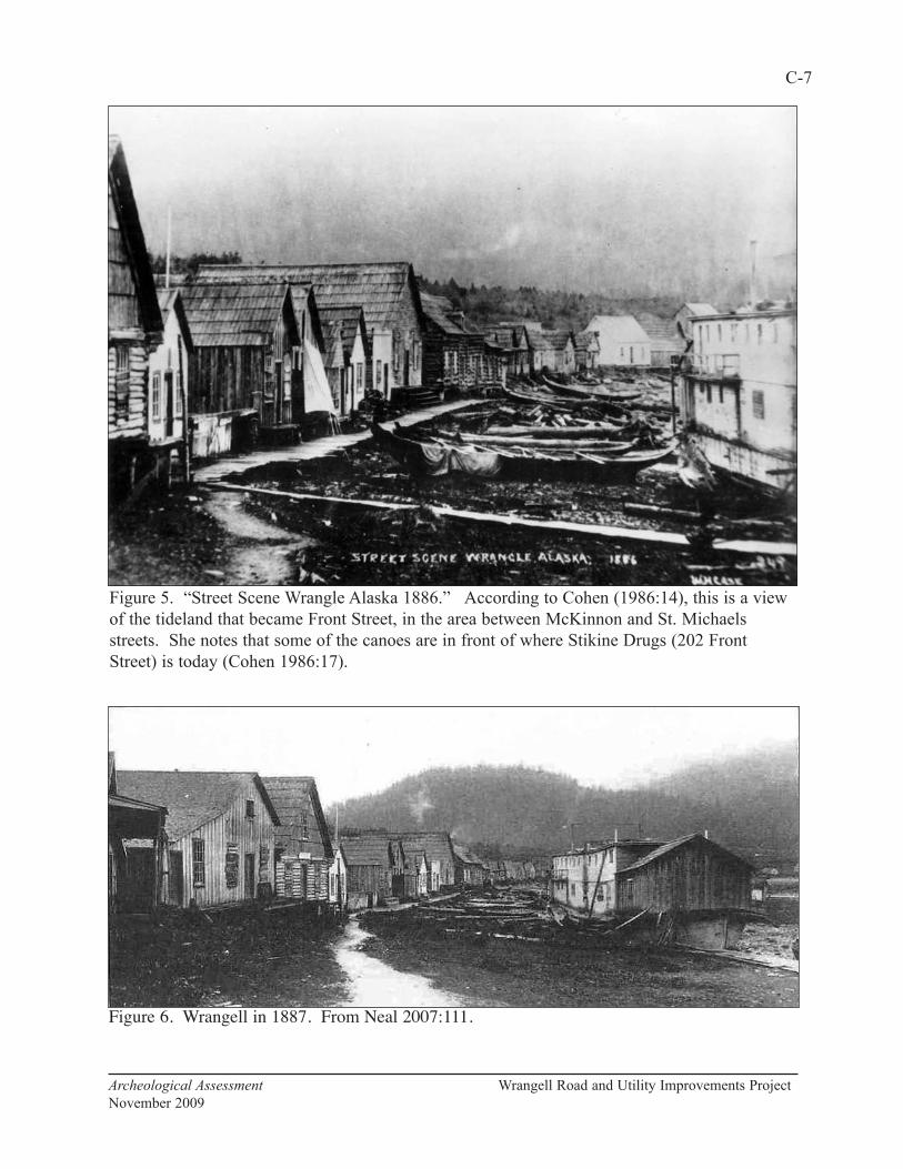
C-7
Archeological Assessment Wrangell Road and Utility Improvements Project
November 2009
Figure 5. “Street Scene Wrangle Alaska 1886.” According to Cohen (1986:14), this is a view
of the tideland that became Front Street, in the area between McKinnon and St. Michaels
streets. She notes that some of the canoes are in front of where Stikine Drugs (202 Front
Street) is today (Cohen 1986:17).
Figure 6. Wrangell in 1887. From Neal 2007:111.
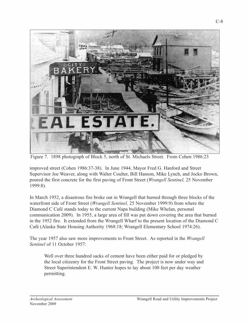
improved street (Cohen 1986:37-38). In June 1944, Mayor Fred G. Hanford and Street
Supervisor Joe Weaver, along with Walter Coulter, Bill Hanson, Mike Lynch, and Jocko Brown,
poured the first concrete for the first paving of Front Street (Wrangell Sentinel, 25 November
1999:8).
In March 1952, a disastrous fire broke out in Wrangell that burned through three blocks of the
waterfront side of Front Street (Wrangell Sentinel, 25 November 1999:9) from where the
Diamond C Café stands today to the current Napa building (Mike Whelan, personal
communication 2009). In 1955, a large area of fill was put down covering the area that burned
in the 1952 fire. It extended from the Wrangell Wharf to the present location of the Diamond C
Café (Alaska State Housing Authority 1968:18; Wrangell Elementary School 1974:26).
The year 1957 also saw more improvements to Front Street. As reported in the Wrangell
Sentinel of 11 October 1957:
Well over three hundred sacks of cement have been either paid for or pledged by
the local citizenry for the Front Street paving. The project is now under way and
Street Superintendent E. W. Hunter hopes to lay about 100 feet per day weather
permitting.
C-8
Archeological Assessment Wrangell Road and Utility Improvements Project
November 2009
Figure 7. 1898 photograph of Block 5, north of St. Michaels Street. From Cohen 1986:23

The Alaska State Housing Authority (1968:18, 31) reported that the waterfront area that burned
in the 1952 fire was still largely undeveloped by 1968. In addition to the fill that was put down
in the area of the fire, fill had also been added at the site of the Wrangell Lumber Company and
at the ferry terminal (Alaska State Housing Authority 1968:19). The 1978 Alaska Geographic
reported that many of the commercial buildings in downtown Wrangell were “relatively new,”
as most of them had been built after the 1952 fire (Alaska Geographic 1978:83).
Archeological Potential
As part of this evaluation, Paul Rushmore (2009) of Paleo Logics conducted “a non-scientific
survey of individuals in Wrangell that have knowledge regarding the archaeological potential
beneath Front Street.” Based on “small town hear-say,” personal observations, and an archival
review of old Wrangell photographs, Rushmore defined high probability areas beneath Front
Street (Figure 10). He also considered the location of the 1917 shoreline, the potential for
C-9
Archeological Assessment Wrangell Road and Utility Improvements Project
November 2009
Figure 8. Detail of the 1914 Sanborn map of Wrangell.

intact sediments, the depth and type of fill above the natural surface, and the historical use of
that surface.
The project area is approximately 23 feet above sea level, placing it entirely in what is
considered by state and federal review agencies as the high probability area for cultural remains
in Southeast Alaska (0 to 100 feet above sea level). More specifically, however, areas of
highest potential include those with shallowly buried, intact, original ground surfaces. If the
landform history in Wrangell is in any way analogous to that of Sitka, the village site shown in
Figure 3 would have become dry land and available for human occupation sometime between
about 4,600 and 1,650 years ago (Chaney et al. 1995:87-89).
“Northern” end of the Project to McKinnon Street
This is considered a high probability area because of the potential for intact sediments. There
could be evidence here of prehistoric and/or early historic Tlinigt occupations similar that
illustrated in Figure 3. The present site of the Post Office, across from the Stikine Inn, was the
location Fort Stikine built by the British that later became Fort Wrangell (see Figure 4). Also in
C-10
Archeological Assessment Wrangell Road and Utility Improvements Project
November 2009
Figure 9. Northern end of Front Street in 1908. On the left are the Matheson/Angerman
Building (PET-274), Grant/Buness Building (PET-276), and Patenaude/Grant Building (PET-
278 (Cohen 1986:91).

C-11
Archeological Assessment Wrangell Road and Utility Improvements Project
November 2009

this area, south of Front Street, was the former site of the old Wrangell Hotel, which is where
McCormack’s dock made landfall and where the cold storage and Canadian dock were located.
Historically, this area has been active and, depending on prior surface impacts, has a high
potential for historic remains.
The majority of these materials are likely to be in the form of midden on the original ground
surface. Surface midden is the result of the “virtually universal practice of discarding refuse at
locations adjacent to doorways” (LeeDecker 1994:353; South 1977). Prior to the advent of
designated dumps and municipally organized trash collection, garbage was often simply
discarded near structures. In Wrangell during the 1800s, much of the trash also probably went
into the intertidal zone (see Figure 5).
Surface midden is often a mixture of unstratified material and is particularly subject to
disturbance by later activities. However, as other urban archeological projects in Alaska—such
as Seward (Yarborough 1998) and Skagway (Cooper 2001)—have shown, redeposited cultural
remains can be an important source of data. Also, except where it has been disturbed by later
construction, the original ground and inter-tidal surface beneath Front Street is covered and
protected by fill. In areas of intact sediments, subsurface features—such as foundations,
dumps, privies, and cellars—could also be present. These features are more easily interpreted
than the surface deposits, since they have well-defined boundaries and represent limited periods
of occupation (LeeDecker 1994:353, 367).
McKinnon Street to Episcopal Street
This section of Front Street is considered a lower probability area because of the amount and
depth of fill material, especially on the southern side of the street. However, the fill is thinner
on the northern side of the road, so excavations here could encounter both buried sediments and
surface midden deposits. All the buildings and docks on the southern side of the road from the
Stikine Inn to Diamond C Cafe burned in 1953. Buildings in this area that were not on fire
were dynamited to build a fire break. Today, all the land in this section from the centerline of
the road south to the present shoreline is composed of fill material, which can include beach
logs, cobbles and boulders, mill-cut wood, concrete, harbor dredged material, and pit-run rock.
There is also the potential for old road piling and planks, and wood-stave pipe.
Episcopal Street to Case Avenue
This section of the project area is also considered a high probability area based on past land use
and the potential for intact prehistoric and historic cultural deposits. The Russian fort built in
1834 was likely in this area and this was the location of one of Wrangell’s earliest
neighborhoods. Also, as noted above, the Kiks.ádi Sun House was reportedly located at the
corner of Front Street and Episcopal Avenue. The road here is on natural ground above tidal
influence and the intact sediments along the right-of-way reportedly have some depth over
bedrock, especially in the vicinity of the old saw mill and lumber yard (Wilson and Sylvester
Mill Company, 1914, and Wrangell Lumber and Power Company, 1927).
C-12
Archeological Assessment Wrangell Road and Utility Improvements Project
November 2009
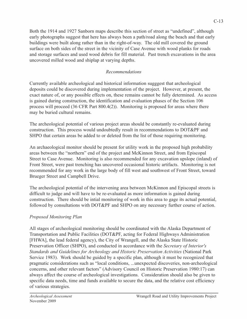
Both the 1914 and 1927 Sanborn maps describe this section of street as “undefined”, although
early photographs suggest that here has always been a path/road along the beach and that early
buildings were built along rather than in the right-of-way. The old mill covered the ground
surface on both sides of the street in the vicinity of Case Avenue with wood planks for roads
and storage surfaces and used wood debris for fill material. Past trench excavations in the area
uncovered milled wood and shiplap at varying depths.
Recommendations
Currently available archeological and historical information sugggest that archeological
deposits could be discovered during implementation of the project. However, at present, the
exact nature of, or any possible effects on, these remains cannot be fully determined. As access
is gained during construction, the identification and evaluation phases of the Section 106
process will proceed (36 CFR Part 800.4(2)). Monitoring is proposed for areas where there
may be buried cultural remains.
The archeological potential of various project areas should be constantly re-evaluated during
construction. This process would undoubtedly result in recommendations to DOT&PF and
SHPO that certain areas be added to or deleted from the list of those requiring monitoring.
An archaeological monitor should be present for utility work in the proposed high probability
areas between the “northern” end of the project and McKinnon Street, and from Episcopal
Street to Case Avenue. Monitoring is also recommended for any excavation upslope (inland) of
Front Street, were past trenching has uncovered occasional historic artifacts. Monitoring is not
recommended for any work in the large body of fill west and southwest of Front Street, toward
Brueger Street and Campbell Drive.
The archeological potential of the intervening area between McKinnon and Episcopal streets is
difficult to judge and will have to be re-evaluated as more information is gained during
construction. There should be intial monitoring of work in this area to gage its actual potential,
followed by consultations with DOT&PF and SHPO on any necessary further course of action.
Proposed Monitoring Plan
All stages of archeological monitoring should be coordinated with the Alaska Department of
Transportation and Public Facilities (DOT&PF, acting for Federal Highways Administration
[FHWA], the lead federal agency), the City of Wrangell, and the Alaska State Historic
Preservation Officer (SHPO), and conducted in accordance with the Secretary of Interior's
Standards and Guidelines for Archeology and Historic Preservation Activities (National Park
Service 1983). Work should be guided by a specific plan, although it must be recognized that
pragmatic considerations such as “local conditions, ...unexpected discoveries, non-archeological
concerns, and other relevant factors” (Advisory Council on Historic Preservation 1980:17) can
always affect the course of archeological investigations. Consideration should also be given to
specific data needs, time and funds available to secure the data, and the relative cost efficiency
of various strategies.
C-13
Archeological Assessment Wrangell Road and Utility Improvements Project
November 2009
An archaeologist meeting the qualifications of the Secretary of Interior's Standards and
Guidelines for Archeology and Historic Preservation Activities (National Park Service 1983,
also codified at 36 CFR Part 61) should be present during ground disturbing activities in areas
where there is the likelihood of uncovering previously unidentified archaeological or historical
materials (see Monitoring Recommendations below).
Upon the inadvertent discovery of human remains, sacred objects, or mortuary objects in any
work area, all activity in the vicinity should immediately cease and a Plan of Action (see
addenda) for the treatment of human remains should be implemented. Any and all human
remains, sacred objects, and objects of cultural patrimony discovered as a result of project
activities should be treated with dignity and respect.
Not all of the materials that might be discovered during monitoring would be eligible for the
National Register of Historic Places (National Register). According to the Advisory Council on
Historic Preservation (ACHP; 1980:6):
...the defining characteristic of an archeological property is that it can be studied
in order to identify, learn about, or solve problems in our understanding of the
past. Properties draw their archeological value from the assumption that they
can be used fruitfully for research.
Isolated or displaced prehistoric and Russian items could collected because of their historical
interest, even though they would have to be exceptionally significant to be considered eligible
for the National Register. Other objects found during the excavation with little or no integrity
and little research value—such as miscellaneous garbage and recent construction materials—
would simply be noted and photographed.
Should potentially significant prehistoric or historic cultural material be discovered during
construction, all work adjacent to the discovery should stop. The area of work stoppage should
be adequate to provide for the security, protection, and integrity of the remains. Appropriate
steps should be taken to protect the discovery site, including installation of a physical barrier
such as exclusionary fencing. All reasonable effort should be made to limit the duration of
work stoppage while also appropriately treating the discovery.
The discovery should be evaluated by the archeological monitor, who should recommend
whether the discovery potentially meets the criteria for listing in the National Register:
The quality of significance in American history, architecture, archeology,
engineering, and culture is present in districts, sites, buildings, structures, and
objects that possess integrity of location, design, setting, materials,
workmanship, feeling, and association and (a) that are associated with events
that have made a significant contribution to the broad patterns of our history; or
(b) that are associated with the lives of persons significant in our past; or (c) that
embody the distinctive characteristics of a type, period, or method of
construction, or that represent the work of a master, or that possess high artistic
C-14
Archeological Assessment Wrangell Road and Utility Improvements Project
November 2009
values, or that represent a significant and distinguishable entity whose
components may lack individual distinction; or (d) that have yielded, or may be
likely to yield, information important in prehistory or history (36 CFR 60.4).
DOT&PF should then contact the SHPO to seek consultation regarding the National Register
eligibility and appropriate treatment of the discovery. If DOT&PF and SHPO determines that
the discovery is an eligible prehistoric deposit, they would also include the Wrangell
Cooperative Association (WCA, the Federally recognized Tribe in Wrangell) and the Sealaska
Corporation in the consultations.
The methods and techniques chosen for archeological documentation should be the most
effective, least destructive, most efficient, and economical means of obtaining the needed
information. As per 36 CFR 800.11, the ACHP should be notified if properties discovered are
eligible and given an opportunity to comment on the proposed mitigation or treatment plan.
The archaeologist would then implement the appropriate treatment measures. Construction
should resume in the area of the discovery only after it has been evaluated and treated.
If data recovery becomes necessary during the course of the monitoring, the work should be
done in such a manner as to insure that full and accurate records are kept of all field
observations and operations. Where practicable, major features and artifact concentrations
should be recorded, and a sample of uncovered remains will be collected for study and curation
(ACHP 1989:50). The primary focus of any archeological documentation should be on data
classes required to address specific research questions. If any other data classes are deliberately
neglected, the reasons for such a decision should be carefully justified:
Archeological investigations seldom are able to collect and record all possible
data. It is essential to determine the point at which further data recovery and
documentation fail to improve the usefulness of the archeological information
being recovered (National Park Service 1983).
Every effort should be made to gather data through controlled archeological excavation.
However, when necessary, stratigraphic information should be recorded from trench walls and
artifacts collected from spoil piles. Techniques that could be appropriate for analyzing any data
collected during this work include, but would not be limited to, studies of artifacts and their
distribution, C-14 dating, analysis of faunal and floral remains, and studies of soils and
stratigraphy.
The final report on the project should be prepared according to contemporary professional
standards and Department of the Interior Format Standards for Final Reports of Data Recovery
Programs (42 FR 5377-79). This report should include documentation of monitoring activities,
discoveries, and any actions taken. Information resulting from this work should be provided to
the SHPO in a form suitable for inclusion in the Alaska Heritage Resources Survey.
C-15
Archeological Assessment Wrangell Road and Utility Improvements Project
November 2009
Curation
All materials requiring curation, including artifacts, samples, field notes, photographs, and
drawings, should be accessioned to a museum meeting 36 CFR 79 standards (see
www.nps.gov/archeology/tools/36CFR79.htm). Archeologists in the field and in the lab should
employ any needed preventive conservation measures. The collection should be in stable
condition and any necessary conservation will be completed before the collection is deposited
at the final curation facility.
C-16
Archeological Assessment Wrangell Road and Utility Improvements Project
November 2009
References Cited
Advisory Council on Historic Preservation
1980 Treatment of Archaeological Properties: A Handbook. Advisory Council on Historic
Preservation, Washington, D.C.
Alaska Geographic Society
1978 Wrangell. In Southeast Alaska’s Panhandle. 5(2):81-87.
Alaska State Housing Authority
1968 City of Wrangell Comprehensive Development Plan. Alaska State Housing Authority,
Anchorage.
Autrey, John T.(ed.)
1992 Draft 2, Research Design/Predictive Model Format for R-10. Manuscript on file,
Tongass National Forest, Sitka.
Chaney, Greg P., Robert C. Betts, and Dee Longenbaugh
1995 Physical and Cultural Landscapes of Sitka National Historical Park, Sitka. Prepared
for the National Park Service. Vanguard Research, Douglas, Alaska.
Cohen, Kathryn
1986 Wrangell Historic Building Inventory and Survey. Report to the Wrangell Historical
Society and Museum. Phoenix Associates, Wrangell.
Cooper, Doreen C.
2001 A Century at the Moore/Kirmse House. Archeological Investigations in Skagway,
Alaska, Volume 8. Klondike Gold Rush National Historical Park, Skagway.
Davis, Stanley D.
1990 Prehistory of Southeastern Alaska. In Northwest Coast, edited by Wayne Suttles,
pp. 203-228. Handbook of North American Indians, Volume 7. William G.
Sturtevant, general editor. Smithsonian Institution, Washington, D.C.
Goldschmidt, Walter and Theodore H. Haas.
1946 Possessory rights of the natives of Southeastern Alaska. A report to the Commissioner
of Indian Affairs.
Hanson, Diane
1998 Archaeological Survey of Property Associated with the Wrangell Petroglyphs Beach
Access. Office of History and Archaeology Report 71. Alaska Department of Natural
Resources, Anchorage.
C-17
Archeological Assessment Wrangell Road and Utility Improvements Project
November 2009

C-18
Archeological Assessment Wrangell Road and Utility Improvements Project
November 2009
Laguna, Frederica de
1990 Tlingit. In Northwest Coast, edited by Wayne Suttles, pp. 203-228. Handbook of
North American Indians, Volume 7. William G. Sturtevant, general editor.
Smithsonian Institution, Washington, D.C.
LeeDecker, Charles H.
1994 Discard Behavior on Domestic Historic Sites: Evaluation of Contexts for the
Interpretation of Household Consumption Behavior. Journal of Archaeological Method and
Theory, 1(4):345-375.
Lemke, Richard W.
1974 Reconnaissance Engineering Geology of the Wrangell Area, Alaska, with Emphasis on
Evaluation of Earthquake and Other Geologic Hazards. U.S. Geological Survey, Menlo
Park.
Moss, Madonna L.
1998 Northwest Coast Regional Overview. In North Pacific and Bering Sea Maritime
Societies, the Archaeology of Prehistoric and Early Historic Coastal Peoples. edited by A.
McCartney, H. Okada, A. Okada, and W. Workman. Arctic Anthropology 35(1):88-111.
National Park Service
1983 Archeology and Historic Preservation; Secretary of the Interior's Standards and
Guidelines. Federal Register 48(190):44716-44742.
Neal, Patricia A.
2007 Fort Wrangel, Alaska Gateway to the Stikine River:1834-1899. Coachlamp
Productions, Greenwich.
Rushmore, Paul
2009 Wrangell Road and Utilities Improvements: Archaeological Potential Beneath Front
Street, Wrangell, AK. Paleo Logics, Wrangell.
South, Stanley
1974 Palmetto Parapets, Exploratory Archeology at Fort Moultrie, South Carolina, 38CH50.
Anthropological Studies No. 1, Institute of Archeology and Anthropology, University of
South Carolina, Columbia.
Wrangell Sentinel
1999 The Twentieth Century Revisited: A hundred years in Wrangell as seen through the
pages of the Wrangell Sentinel. 18 November:6-7.
1999 The Twentieth Century Revisited: A hundred years in Wrangell as seen through the
pages of the Wrangell Sentinel. 25 November:8-9.

Wrangell Elementary School
1974 Wrangell: Our Home Town. Wrangell Elementary School, Wrangell.
Yarborough, Michael R.
1998 Archeology at the Alaska SeaLife Center, a Summary of Research in Seward, Alaska
from 1995 to 1997. Cultural Resource Consultants, Anchorage.
C-19
Archeological Assessment Wrangell Road and Utility Improvements Project
November 2009

Procedures for the Discovery of Human Skeletal Remains
General
Any and all human remains, sacred objects, and objects of cultural patrimony discovered
during construction will at all times be treated with dignity and respect.
If human skeletal remains are discovered during construction, all work will stop adjacent to the
discovery. The area of work stoppage will be adequate to provide for the security, protection,
and integrity of the remains.
The archeologist shall immediately inform the Wrangell Cooperative Association (WCA),
Sealaska Corporation, Wrangell Police, and Alaska State Troopers Criminal Investigation
Bureau if human remains are found.
Appropriate steps will be taken to protect the discovery, including installing a physical barrier
such as exclusionary fencing and prohibiting vehicles and equipment from traversing the
discovery site.
Construction will resume in the area of the discovery only after proper removal of the remains.
A Disinterment Permit must be obtained from the State Registrar prior to the removal of any
historic burial.
Native-American Remains and Associated Grave Items
The archeologist shall inform WCA and Sealaska Corporation if Native American human
remains and associated grave items are found.
If possible, lineal descendants shall be identified and then contacted by WCA.
Records shall be consulted for identification.
If it is not feasible to leave the human remains in place, they shall immediately be placed in a
container and then removed by WCA, or by the archeologist under Tribal supervision, if WCA
prefers.
The ultimate disposition of remains and associated grave items shall be at the discretion of
WCA, in consultation with DOT&PF, and any known lineal descendants.
With the permission of WCA, the original location of remains shall be documented in the
archeological report. No photograph of human remains or grave goods shall be placed in the
report unless written permission is obtained from WCA and any known lineal descendants.
Grave goods and objects of cultural patrimony shall be conserved and curated to a museum
C-20
Archeological Assessment Wrangell Road and Utility Improvements Project
November 2009
meeting 36 CFR 79 standards, unless WCA or any known lineal descendant determines that any
of these items must remain with the human remains.
Non-Native Remains
Available records shall be consulted to identify descendants.
Descendants, if known, shall be contacted.
If no descendants are found, the remains shall be buried in the Wrangell cemetery or curated at
a museum meeting 36 CRF 79 standards following examination by the archeologist.
Recent or Questionable Remains
If the remains appear recent (within 100 years) in the judgement of the archeologist, the
Wrangell Police and the Alaska State Troopers Criminal Investigation Bureau shall be contacted
for a determination of whether the remains are of forensic interest and/or subject to criminal
investigation.
If they are determined not to be of forensic interest, they shall be interred in the Wrangell
cemetery.
If the remains are subsequently identified as Native American, they shall be treated as described
above.
Fragmentary Remains
Fragmentary remains, principally isolated bones or bone fragments that do not appear to be part
of a purposeful burial, secondary burial, or cremation shall be curated to a museum meeting 36
CFR 79 standards along with any other artifacts collected during the project.
C-21
Archeological Assessment Wrangell Road and Utility Improvements Project
November 2009
C2
Archaeological Monitoring Plan
Archeological Monitoring Plan for the Wrangell Road and Utility Improvements Project, Wrangell, Alaska
April 2009
Prepared By: Michael R. Yarborough, MA and Catherine L. Pendleton, MA
Cultural Resource Consultants LLC
For:
4041 B Street
Anchorage, Alaska 99503
Introduction
The following is a plan for archeological monitoring of portions of the Wrangell Road and
Utility Improvements Project, in Wrangell, Alaska. Monitoring is proposed for areas where
there may be buried cultural remains. Archeological deposits could be discovered during
implementation of the project, but, at present, any possible effects on these remains cannot be
fully determined. However, as access is gained during construction, the identification and
evaluation phases of the Section 106 process will proceed (36 CFR Part 800.4(2)). Monitoring
will be based on the general principles of the Secretary of the Interior’s Guidelines for
Archeological Documentation, with consideration given to specific data needs, time and funds
available to secure the data, and the relative cost efficiency of various strategies.
Description of the Undertaking
The City of Wrangell, located on the eastern shore of Zimovia Strait near the northern tip of
Wrangell Island, is approximately 155 miles south of Juneau. Wrangell is primarily centered
around Wrangell Harbor, with scattered development northward toward the airport and
southward past the former location of the Wrangell Institute (Lemke 1974:8). The city is near
the mouth of the Stikine River, a historic trade route to the Canadian interior.
The Alaska Department of Transportation and Public Facilities (DOT&PF), in cooperation with
the Alaska Division of the Federal Highway Administration (FHWA), and the U.S.
Environmental Protection Agency (EPA), is proposing to improve road and utilities along Front
and Lynch Streets in the downtown area of Wrangell, Alaska. FHWA is the lead federal agency
for this project. The proposed project area is located on Wrangell Island in Southeast Alaska in
Section 25, T62S, R83E (1:63360 USGS Quadrangle Petersburg B-2 NE) and consists of a
seven block corridor in downtown Wrangell (Figures 1 and 2).
The primary goal of the Wrangell Road and Utility Improvements Project is to replace
sidewalks, rehabilitate and/or reconstruct utilities, and replace the deteriorating Front and Lynch
Streets. Resulting surfaces will meet State and Federal requirements for the Americans with
Disabilities Act. Although no road alignment shifts are being evaluated by DOT&PF due to
right-of-way constraints, project design alternatives include various parking configurations and
landscaping opportunities within the corridor, as well as different turnaround configurations at
the City pier. Utility work would rehabilitate the sewer line, replace the water line, and
improve the storm drain systems as necessary. Relocating overhead utility (electrical and
communication) lines underground are also being considered.
Work Plan
All stages of this project will be coordinated with the Alaska Department of Transportation and
Public Facilities (DOT&PF, acting for Federal Highways Administration [FHWA], the lead
federal agency), the City of Wrangell, and the Alaska State Historic Preservation Officer
(SHPO), and conducted in accordance with the Secretary of Interior's Standards and Guidelines
for Archeology and Historic Preservation Activities (National Park Service 1983). Work will be
Archeological Monitoring Plan Wrangell Road and Utility Improvements Project
April 2009
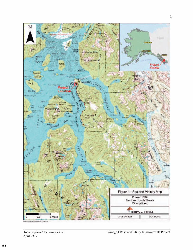
2
Archeological Monitoring Plan Wrangell Road and Utility Improvements Project
April 2009
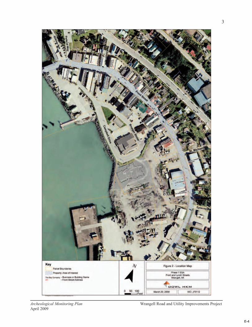
3
Archeological Monitoring Plan Wrangell Road and Utility Improvements Project
April 2009
guided by this plan, although it must be recognized that pragmatic considerations such as “local
conditions, ...unexpected discoveries, non-archeological concerns, and other relevant factors”
(Advisory Council on Historic Preservation 1980:17) can always affect the course of
archeological investigations.
An archaeologist meeting the qualifications of the Secretary of Interior's Standards and
Guidelines for Archeology and Historic Preservation Activities (National Park Service 1983,
also codified at 36 CFR Part 61) must be present during ground disturbing activities in areas
where there is the likelihood of uncovering previously unidentified archaeological or historical
materials (see Monitoring Recommendations below).
Upon the inadvertent discovery of human remains, sacred objects, or mortuary objects in any
work area, all activity in the vicinity shall immediately cease and a Plan of Action for the
treatment of human remains (Appendix A) shall be implemented. Any and all human remains,
sacred objects, and objects of cultural patrimony discovered as a result of project activities will
be treated with dignity and respect.
Not all of the materials that might be discovered during monitoring would be eligible for the
National Register of Historic Places (National Register). According to the Advisory Council on
Historic Preservation (ACHP; 1980:6):
...the defining characteristic of an archeological property is that it can be studied
in order to identify, learn about, or solve problems in our understanding of the
past. Properties draw their archeological value from the assumption that they
can be used fruitfully for research.
Isolated or displaced prehistoric and Russian items will be collected because of their historical
interest, even though they would have to be exceptionally significant to be considered eligible
for the National Register. Other objects found during the excavation with little or no integrity
and little research value—such as miscellaneous garbage and recent construction materials—
will simply be noted and photographed.
Should potentially significant prehistoric or historic cultural material be discovered during
construction, all work adjacent to the discovery will stop. The area of work stoppage will be
adequate to provide for the security, protection, and integrity of the remains. Appropriate steps
will be taken to protect the discovery site, including installation of a physical barrier such as
exclusionary fencing. All reasonable effort will be made to limit the duration of work stoppage
while also appropriately treating the discovery.
The discovery will be evaluated by the archeological monitor, who will recommend whether the
discovery potentially meets the criteria for listing in the National Register:
The quality of significance in American history, architecture, archeology,
engineering, and culture is present in districts, sites, buildings, structures, and
objects that possess integrity of location, design, setting, materials,
4
Archeological Monitoring Plan Wrangell Road and Utility Improvements Project
April 2009
workmanship, feeling, and association and (a) that are associated with events
that have made a significant contribution to the broad patterns of our history; or
(b) that are associated with the lives of persons significant in our past; or (c) that
embody the distinctive characteristics of a type, period, or method of
construction, or that represent the work of a master, or that possess high artistic
values, or that represent a significant and distinguishable entity whose
components may lack individual distinction; or (d) that have yielded, or may be
likely to yield, information important in prehistory or history (36 CFR 60.4).
DOT&PF will then contact the SHPO to seek consultation regarding the National Register
eligibility and appropriate treatment of the discovery. If DOT&PF and SHPO determine that
the discovery is an eligible prehistoric deposit, they will also include the Wrangell Cooperative
Association (WCA, the Federally recognized Tribe in Wrangell) and the Sealaska Corporation
in the consultations.
The methods and techniques chosen for archeological documentation will be the most effective,
least destructive, most efficient, and economical means of obtaining the needed information.
As per 36 CFR 800.11, the ACHP shall be notified if properties discovered are eligible and
shall be given an opportunity to comment on the proposed mitigation or treatment plan. The
archaeologist will then implement the appropriate treatment measures. Construction will
resume in the area of the discovery only after it has been evaluated and treated.
If data recovery becomes necessary during the course of the monitoring, the work will be done
in such a manner as to insure that full and accurate records are kept of all field observations and
operations. Where practicable, major features and artifact concentrations will be recorded, and
a sample of uncovered remains will be collected for study and curation (ACHP 1989:50). The
primary focus of any archeological documentation will be on data classes required to address
specific research questions. If any other data classes are deliberately neglected, the reasons for
such a decision will carefully justified:
Archeological investigations seldom are able to collect and record all possible
data. It is essential to determine the point at which further data recovery and
documentation fail to improve the usefulness of the archeological information
being recovered (National Park Service 1983).
Every effort will be made to gather data through controlled archeological excavation. However,
when necessary, stratigraphic information will be recorded from trench walls and artifacts
collected from spoil piles. Techniques that could be appropriate for analyzing any data
collected during this work include, but are not limited to, studies of artifacts and their
distribution, C-14 dating, analysis of faunal and floral remains, and studies of soils and
stratigraphy.
The final report on the project will be prepared according to contemporary professional
standards and Department of the Interior Format Standards for Final Reports of Data Recovery
Programs (42 FR 5377-79). This report will include documentation of monitoring activities,
5
Archeological Monitoring Plan Wrangell Road and Utility Improvements Project
April 2009

discoveries, and any actions taken. Information resulting from this work will be provided to the
SHPO in a form suitable for inclusion in the Alaska Heritage Resources Survey.
Curation
All materials requiring curation, including artifacts, samples, field notes, photographs, and
drawings, will be accessioned to a museum meeting 36 CFR 79 standards (see
www.nps.gov/archeology/tools/36CFR79.htm). Archeologists in the field and in the lab will
employ any needed preventive conservation measures. The collection will be in stable
condition and any necessary conservation will be completed before the collection is deposited
at the final curation facility.
Background
Prehistory
To date, archaeological surveys in southeastern Alaska have recorded several thousand sites. A
large percentage of these are shell middens, although numerous other types of prehistoric and
historic resources are known (Autrey 1992). In 1990, Stan Davis (1990:197) proposed a four-
part cultural sequence for southeastern Alaska that includes a Paleomarine tradition (11,000 to
6500 B.P.), a Transitional stage (6500 to 5000 B.P.), a Developmental Northwest Coast stage
(5000 B.P. to European contact), and a Historic period. More recently, Madonna Moss (1998)
refined the sequence for northern Northwest Coast prehistory into an Early Period (10,000 to
5000 B.P.), a Middle Period (5000 to 1500 B.P.), and a Late Period (1500 B.P. to Contact).
The Early Period is characterized by a well-developed microblade industry with wedge-shaped
microblade cores, few or no bifacial tools, and an economy based on coastal-marine
subsistence. Middle Period sites are more numerous than those of the Early Period, have
extensive shell deposits, and are often associated with wood-stake fishing weirs. Middle Period
artifact assemblages include slate points and other groundstone materials, bone harpoons and
points, and shell beads. The Late Period, which is usually identified with the ethnographic
cultures of the region, featured the establishment of large winter villages, specialized camps,
and fortifications. Late period sites are also abundant along the southeastern Alaskan coast
(Davis 1990, Moss 1998).
A more complete summary of the prehistory of the Wrangell area can be found in Diane
Hanson’s 1998 report on an archeological survey in the vicinity of Petroglyph Beach Park,
south of Point Highfield.
Ethnography
The early historic native peoples of southeast Alaska represent three broad groups: the Tlingit,
the Alaskan Haida (Kaigani), and the Tsetsuat. Of these, the Tlingit were the most widespread
and numerous within the region. Ethnographic Tlingit culture embodies most of what is
normally thought of as northern Northwest Coast culture. This culture included an economy
6
Archeological Monitoring Plan Wrangell Road and Utility Improvements Project
April 2009
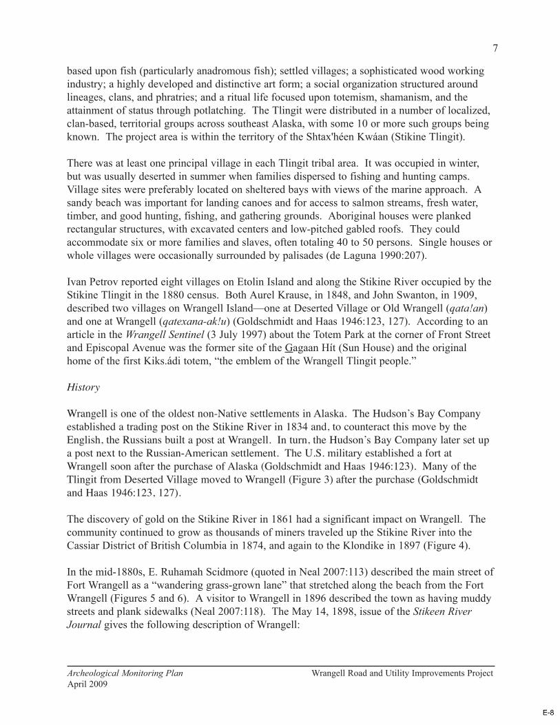
based upon fish (particularly anadromous fish); settled villages; a sophisticated wood working
industry; a highly developed and distinctive art form; a social organization structured around
lineages, clans, and phratries; and a ritual life focused upon totemism, shamanism, and the
attainment of status through potlatching. The Tlingit were distributed in a number of localized,
clan-based, territorial groups across southeast Alaska, with some 10 or more such groups being
known. The project area is within the territory of the Shtax'héen Kwáan (Stikine Tlingit).
There was at least one principal village in each Tlingit tribal area. It was occupied in winter,
but was usually deserted in summer when families dispersed to fishing and hunting camps.
Village sites were preferably located on sheltered bays with views of the marine approach. A
sandy beach was important for landing canoes and for access to salmon streams, fresh water,
timber, and good hunting, fishing, and gathering grounds. Aboriginal houses were planked
rectangular structures, with excavated centers and low-pitched gabled roofs. They could
accommodate six or more families and slaves, often totaling 40 to 50 persons. Single houses or
whole villages were occasionally surrounded by palisades (de Laguna 1990:207).
Ivan Petrov reported eight villages on Etolin Island and along the Stikine River occupied by the
Stikine Tlingit in the 1880 census. Both Aurel Krause, in 1848, and John Swanton, in 1909,
described two villages on Wrangell Island—one at Deserted Village or Old Wrangell (qata!an)
and one at Wrangell (qatexana-ak!u) (Goldschmidt and Haas 1946:123, 127). According to an
article in the Wrangell Sentinel (3 July 1997) about the Totem Park at the corner of Front Street
and Episcopal Avenue was the former site of the Gagaan Hít (Sun House) and the original
home of the first Kiks.ádi totem, “the emblem of the Wrangell Tlingit people.”
History
Wrangell is one of the oldest non-Native settlements in Alaska. The Hudson’s Bay Company
established a trading post on the Stikine River in 1834 and, to counteract this move by the
English, the Russians built a post at Wrangell. In turn, the Hudson’s Bay Company later set up
a post next to the Russian-American settlement. The U.S. military established a fort at
Wrangell soon after the purchase of Alaska (Goldschmidt and Haas 1946:123). Many of the
Tlingit from Deserted Village moved to Wrangell (Figure 3) after the purchase (Goldschmidt
and Haas 1946:123, 127).
The discovery of gold on the Stikine River in 1861 had a significant impact on Wrangell. The
community continued to grow as thousands of miners traveled up the Stikine River into the
Cassiar District of British Columbia in 1874, and again to the Klondike in 1897 (Figure 4).
In the mid-1880s, E. Ruhamah Scidmore (quoted in Neal 2007:113) described the main street of
Fort Wrangell as a “wandering grass-grown lane” that stretched along the beach from the Fort
Wrangell (Figures 5 and 6). A visitor to Wrangell in 1896 described the town as having muddy
streets and plank sidewalks (Neal 2007:118). The May 14, 1898, issue of the Stikeen River
Journal gives the following description of Wrangell:
7
Archeological Monitoring Plan Wrangell Road and Utility Improvements Project
April 2009
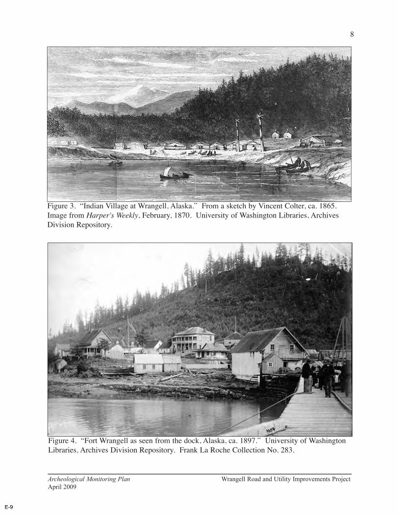
8
Archeological Monitoring Plan Wrangell Road and Utility Improvements Project
April 2009
Figure 3. “Indian Village at Wrangell, Alaska.” From a sketch by Vincent Colter, ca. 1865.
Image from Harper's Weekly, February, 1870. University of Washington Libraries, Archives
Division Repository.
Figure 4. “Fort Wrangell as seen from the dock, Alaska, ca. 1897.” University of Washington
Libraries, Archives Division Repository. Frank La Roche Collection No. 283.

9
Archeological Monitoring Plan Wrangell Road and Utility Improvements Project
April 2009
Figure 6. Wrangell in 1887. From Neal 2007:111.
Figure 5. “Street Scene Wrangle Alaska 1886.” According to Cohen (1986:14), this is a view
north of Blocks 3, 4, and 5, in the area between McKinnon and St. Michaels streets. She notes
that some of the canoes are in front of where Stikine Drugs (202 Front Street) is today (Cohen
1986:17).
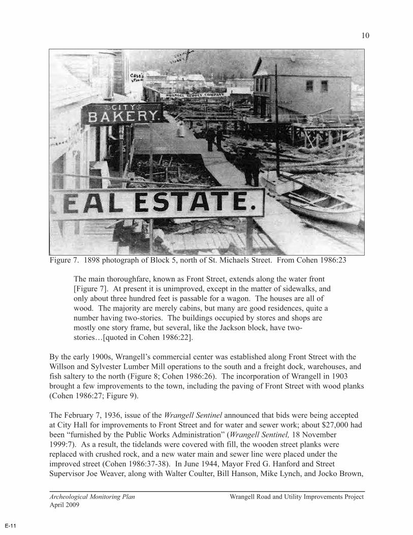
The main thoroughfare, known as Front Street, extends along the water front
[Figure 7]. At present it is unimproved, except in the matter of sidewalks, and
only about three hundred feet is passable for a wagon. The houses are all of
wood. The majority are merely cabins, but many are good residences, quite a
number having two-stories. The buildings occupied by stores and shops are
mostly one story frame, but several, like the Jackson block, have two-
stories…[quoted in Cohen 1986:22].
By the early 1900s, Wrangell’s commercial center was established along Front Street with the
Willson and Sylvester Lumber Mill operations to the south and a freight dock, warehouses, and
fish saltery to the north (Figure 8; Cohen 1986:26). The incorporation of Wrangell in 1903
brought a few improvements to the town, including the paving of Front Street with wood planks
(Cohen 1986:27; Figure 9).
The February 7, 1936, issue of the Wrangell Sentinel announced that bids were being accepted
at City Hall for improvements to Front Street and for water and sewer work; about $27,000 had
been “furnished by the Public Works Administration” (Wrangell Sentinel, 18 November
1999:7). As a result, the tidelands were covered with fill, the wooden street planks were
replaced with crushed rock, and a new water main and sewer line were placed under the
improved street (Cohen 1986:37-38). In June 1944, Mayor Fred G. Hanford and Street
Supervisor Joe Weaver, along with Walter Coulter, Bill Hanson, Mike Lynch, and Jocko Brown,
10
Archeological Monitoring Plan Wrangell Road and Utility Improvements Project
April 2009
Figure 7. 1898 photograph of Block 5, north of St. Michaels Street. From Cohen 1986:23
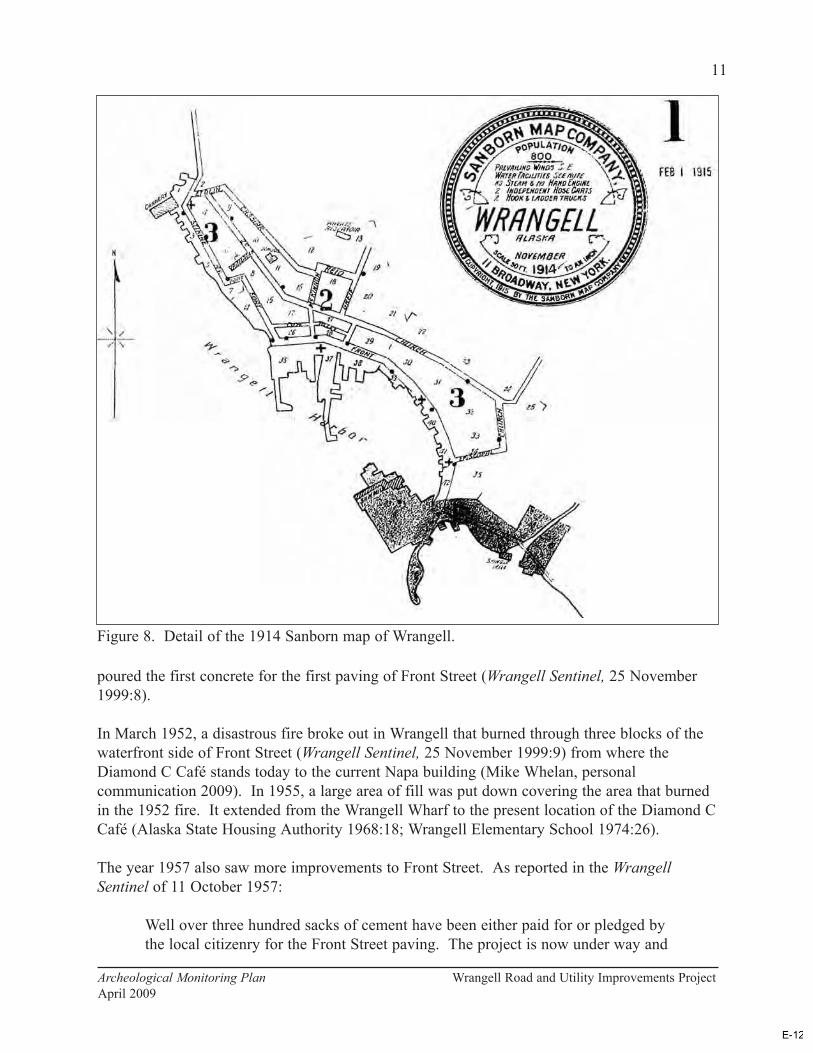
poured the first concrete for the first paving of Front Street (Wrangell Sentinel, 25 November
1999:8).
In March 1952, a disastrous fire broke out in Wrangell that burned through three blocks of the
waterfront side of Front Street (Wrangell Sentinel, 25 November 1999:9) from where the
Diamond C Café stands today to the current Napa building (Mike Whelan, personal
communication 2009). In 1955, a large area of fill was put down covering the area that burned
in the 1952 fire. It extended from the Wrangell Wharf to the present location of the Diamond C
Café (Alaska State Housing Authority 1968:18; Wrangell Elementary School 1974:26).
The year 1957 also saw more improvements to Front Street. As reported in the Wrangell
Sentinel of 11 October 1957:
Well over three hundred sacks of cement have been either paid for or pledged by
the local citizenry for the Front Street paving. The project is now under way and
11
Archeological Monitoring Plan Wrangell Road and Utility Improvements Project
April 2009
Figure 8. Detail of the 1914 Sanborn map of Wrangell.

Street Superintendent E. W. Hunter hopes to lay about 100 feet per day weather
permitting.
The Alaska State Housing Authority (1968:18, 31) reported that the waterfront area that burned
in the 1952 fire was still largely undeveloped by 1968. In addition to the fill that was put down
in the area of the fire, fill had also been added at the site of the Wrangell Lumber Company and
at the ferry terminal (Alaska State Housing Authority 1968:19). The 1978 Alaska Geographic
reported that many of the commercial buildings in downtown Wrangell were “relatively new,”
as most of them had been built after the 1952 fire (Alaska Geographic 1978:83).
Monitoring Recommendations
The following recommendations are based on currently available archeological and historical
information. However, the archeological potential of various project areas will be constantly
re-evaluated as more information is gained during construction. This process will undoubtedly
result in refinement of this plan and recommendations to DOT&PF and SHPO that certain areas
be added to or deleted from the list of those requiring monitoring.
12
Archeological Monitoring Plan Wrangell Road and Utility Improvements Project
April 2009
Figure 9. Northern end of Front Street in 1908. On the left are the Matheson/Angerman
Building (PET-274), Grant/Buness Building (PET-276), and Patenaude/Grant Building (PET-
278 (Cohen 1986:91).
As part of this evaluation, Paul Rushmore (2009) of Paleo Logics conducted “a non-scientific
survey of individuals in Wrangell that have knowledge regarding the archaeological potential
beneath Front Street.” Based on “small town hear-say,” personal observations, and an archival
review of old Wrangell photographs, Rushmore defined high probability areas beneath Front
Street. He also considered the location of the 1917 shoreline, the potential for intact sediments,
the depth and type of fill above the natural surface, and the historical use of that surface.
The project area is approximately 23 feet above sea level, placing it entirely in what is
considered by state and federal review agencies as the high probability area for cultural remains
in Southeast Alaska (0 to 100 feet above sea level). More specifically, however, areas of
highest potential include those with shallowly buried, intact, original ground surfaces.
If the landform history in Wrangell is in any way analogous to that of Sitka, the village site
shown in Figure 3 would have become dry land and available for human occupation sometime
between about 4,600 and 1,650 years ago (Chaney et al. 1995:87-89).
“Northern” end of the Project to McKinnon Street
This is considered a high probability area because of the potential for intact sediments. There
could be evidence here of prehistoric and/or early historic Tlinigt occupations similar that
illustrated in Figure 3. The present site of the Post Office, across from the Stikine Inn, was the
location Fort Stikine built by the British that later became Fort Wrangell (see Figure 4). Also in
this area, south of Front Street, was the former site of the old Wrangell Hotel, which is where
McCormack’s dock made landfall and where the cold storage and Canadian dock were located.
Historically, this area has been active and, depending on prior surface impacts, has a high
potential for historic remains.
The majority of these materials are likely to be in the form of midden on the original ground
surface. Surface midden is the result of the “virtually universal practice of discarding refuse at
locations adjacent to doorways” (LeeDecker 1994:353; South 1977). Prior to the advent of
designated dumps and municipally organized trash collection, garbage was often simply
discarded near structures. In Wrangell during the 1800s, much of the trash also probably went
into the intertidal zone (see Figure 5).
Surface midden is often a mixture of unstratified material and is particularly subject to
disturbance by later activities. However, as other urban archeological projects in Alaska—such
as Seward (Yarborough 1998) and Skagway (Cooper 2001)—have shown, redeposited cultural
remains can be an important source of data. Also, except where it has been disturbed by later
construction, the original ground and inter-tidal surface beneath Front Street is covered and
protected by fill. In areas of intact sediments, subsurface features—such as foundations,
dumps, privies, and cellars—could also be present. These features are more easily interpreted
than the surface deposits, since they have well-defined boundaries and represent limited periods
of occupation (LeeDecker 1994:353, 367).
13
Archeological Monitoring Plan Wrangell Road and Utility Improvements Project
April 2009
McKinnon Street to Episcopal Street
This section of Front Street is considered a lower probability area because of the amount and
depth of fill material, especially on the southern side of the street. However, the fill is thinner
on the northern side of the road, so excavations here could encounter both buried sediments and
surface midden deposits. All the buildings and docks on the southern side of the road from the
Stikine Inn to Diamond C Cafe burned in 1953. Buildings in this area that were not on fire
were dynamited to build a fire break. Today, all the land in this section from the centerline of
the road south to the present shoreline is composed of fill material, which can include beach
logs, cobbles and boulders, mill-cut wood, concrete, harbor dredged material, and pit-run rock.
There is also the potential for old road piling and planks, and wood-stave pipe.
Episcopal Street to Case Avenue
This section of the project area is also considered a high probability area based on past land use
and the potential for intact prehistoric and historic cultural deposits. The Russian fort built in
1834 was likely in this area and this was the location of one of Wrangell’s earliest
neighborhoods. Also, as noted above, the Kiks.ádi Sun House was reportedly located at the
corner of Front Street and Episcopal Avenue. The road here is on natural ground above tidal
influence and the intact sediments along the right-of-way reportedly have some depth over
bedrock, especially in the vicinity of the old saw mill and lumber yard (Wilson and Sylvester
Mill Company, 1914, and Wrangell Lumber and Power Company, 1927).
Both the 1914 and 1927 Sanborn maps describe this section of street as “undefined”, although
early photographs suggest that here has always been a path/road along the beach and that early
buildings were built along rather than in the right-of-way. The old mill covered the ground
surface on both sides of the street in the vicinity of Case Avenue with wood planks for roads
and storage surfaces and used wood debris for fill material. Past trench excavations in the area
uncovered milled wood and shiplap at varying depths.
Recommendations
An archaeological monitor should be present for utility work in the proposed high probability
areas between the “northern” end of the project and McKinnon Street, and from Episcopal
Street to Case Avenue. Monitoring is also recommended for any excavation upslope (inland) of
Front Street, were past trenching has uncovered occasional historic artifacts. Monitoring is not
recommended for any work in the large body of fill west and southwest of Front Street, toward
Brueger Street and Campbell Drive.
The archeological potential of the intervening area between McKinnon and Episcopal streets is
difficult to judge and will have to be re-evaluated as more information is gained during
construction. There should be intial monitoring of work in this area to gage its actual potential,
followed by consultations with DOT&PF and SHPO on any necessary further course of action.
14
Archeological Monitoring Plan Wrangell Road and Utility Improvements Project
April 2009

References Cited
Advisory Council on Historic Preservation
1980 Treatment of Archaeological Properties: A Handbook. Advisory Council on Historic
Preservation, Washington, D.C.
Alaska Geographic Society
1978 Wrangell. In Southeast Alaska’s Panhandle. 5(2):81-87.
Alaska State Housing Authority
1968 City of Wrangell Comprehensive Development Plan. Alaska State Housing Authority,
Anchorage.
Autrey, John T.(ed.)
1992 Draft 2, Research Design/Predictive Model Format for R-10. Manuscript on file,
Tongass National Forest, Sitka.
Chaney, Greg P., Robert C. Betts, and Dee Longenbaugh
1995 Physical and Cultural Landscapes of Sitka National Historical Park, Sitka. Prepared
for the National Park Service. Vanguard Research, Douglas, Alaska.
Cohen, Kathryn
1986 Wrangell Historic Building Inventory and Survey. Report to the Wrangell Historical
Society and Museum. Phoenix Associates, Wrangell.
Cooper, Doreen C.
2001 A Century at the Moore/Kirmse House. Archeological Investigations in Skagway,
Alaska, Volume 8. Klondike Gold Rush National Historical Park, Skagway.
Davis, Stanley D.
1990 Prehistory of Southeastern Alaska. In Northwest Coast, edited by Wayne Suttles,
pp. 203-228. Handbook of North American Indians, Volume 7. William G.
Sturtevant, general editor. Smithsonian Institution, Washington, D.C.
Goldschmidt, Walter and Theodore H. Haas.
1946 Possessory rights of the natives of Southeastern Alaska. A report to the Commissioner
of Indian Affairs.
Hanson, Diane
1998 Archaeological Survey of Property Associated with the Wrangell Petroglyphs Beach
Access. Office of History and Archaeology Report 71. Alaska Department of Natural
Resources, Anchorage.
15
Archeological Monitoring Plan Wrangell Road and Utility Improvements Project
April 2009

Laguna, Frederica de
1990 Tlingit. In Northwest Coast, edited by Wayne Suttles, pp. 203-228. Handbook of
North American Indians, Volume 7. William G. Sturtevant, general editor.
Smithsonian Institution, Washington, D.C.
LeeDecker, Charles H.
1994 Discard Behavior on Domestic Historic Sites: Evaluation of Contexts for the
Interpretation of Household Consumption Behavior. Journal of Archaeological Method and
Theory, 1(4):345-375.
Lemke, Richard W.
1974 Reconnaissance Engineering Geology of the Wrangell Area, Alaska, with Emphasis on
Evaluation of Earthquake and Other Geologic Hazards. U.S. Geological Survey, Menlo
Park.
Moss, Madonna L.
1998 Northwest Coast Regional Overview. In North Pacific and Bering Sea Maritime
Societies, the Archaeology of Prehistoric and Early Historic Coastal Peoples. edited by A.
McCartney, H. Okada, A. Okada, and W. Workman. Arctic Anthropology 35(1):88-111.
National Park Service
1983 Archeology and Historic Preservation; Secretary of the Interior's Standards and
Guidelines. Federal Register 48(190):44716-44742.
Neal, Patricia A.
2007 Fort Wrangel, Alaska Gateway to the Stikine River:1834-1899. Coachlamp
Productions, Greenwich.
Rushmore, Paul
2009 Wrangell Road and Utilities Improvements: Archaeological Potential Beneath Front
Street, Wrangell, AK. Paleo Logics, Wrangell.
South, Stanley
1974 Palmetto Parapets, Exploratory Archeology at Fort Moultrie, South Carolina, 38CH50.
Anthropological Studies No. 1, Institute of Archeology and Anthropology, University of
South Carolina, Columbia.
Wrangell Sentinel
1999 The Twentieth Century Revisited: A hundred years in Wrangell as seen through the
pages of the Wrangell Sentinel. 18 November:6-7.
1999 The Twentieth Century Revisited: A hundred years in Wrangell as seen through the
pages of the Wrangell Sentinel. 25 November:8-9.
16
Archeological Monitoring Plan Wrangell Road and Utility Improvements Project
April 2009
Wrangell Elementary School
1974 Wrangell: Our Home Town. Wrangell Elementary School, Wrangell.
Yarborough, Michael R.
1998 Archeology at the Alaska SeaLife Center, a Summary of Research in Seward, Alaska
from 1995 to 1997. Cultural Resource Consultants, Anchorage.
17
Archeological Monitoring Plan Wrangell Road and Utility Improvements Project
April 2009
Appendix A
Procedures for the Discovery of Human Skeletal Remains
General
Any and all human remains, sacred objects, and objects of cultural patrimony discovered during
construction will at all times be treated with dignity and respect.
If human skeletal remains are discovered during construction, all work will stop adjacent to the
discovery. The area of work stoppage will be adequate to provide for the security, protection,
and integrity of the remains.
The archeologist shall immediately inform the Wrangell Cooperative Association (WCA),
Sealaska Corporation, Wrangell Police, and Alaska State Troopers Criminal Investigation
Bureau if human remains are found.
Appropriate steps will be taken to protect the discovery, including installing a physical barrier
such as exclusionary fencing and prohibiting vehicles and equipment from traversing the
discovery site.
Construction will resume in the area of the discovery only after proper removal of the remains.
A Disinterment Permit must be obtained from the State Registrar prior to the removal of any
historic burial.
Native-American Remains and Associated Grave Items
The archeologist shall inform WCA and Sealaska Corporation if Native American human
remains and associated grave items are found.
If possible, lineal descendants shall be identified and then contacted by WCA.
Records shall be consulted for identification.
If it is not feasible to leave the human remains in place, they shall immediately be placed in a
container and then removed by WCA, or by the archeologist under Tribal supervision, if WCA
prefers.
The ultimate disposition of remains and associated grave items shall be at the discretion of
WCA, in consultation with DOT&PF, and any known lineal descendants.
With the permission of WCA, the original location of remains shall be documented in the
archeological report. No photograph of human remains or grave goods shall be placed in the
report unless written permission is obtained from WCA and any known lineal descendants.
A-1
Archeological Monitoring Plan Wrangell Road and Utility Improvements Project
April 2009

Grave goods and objects of cultural patrimony shall be conserved and curated at the University
of Alaska Museum unless WCA or any known lineal descendant determines that any of these
items must remain with the human remains.
Non-Native Remains
Available records shall be consulted to identify descendants.
Descendants, if known, shall be contacted.
If no descendants are found, the remains shall be buried in the Wrangell cemetery or curated at
a museum meeting 36 CRF 79 standards following examination by the archeologist.
Recent or Questionable Remains
If the remains appear recent (within 100 years) in the judgement of the archeologist, the
Wrangell Police and the Alaska State Troopers Criminal Investigation Bureau shall be contacted
for a determination of whether the remains are of forensic interest and/or subject to criminal
investigation.
If they are determined not to be of forensic interest, they shall be interred in the Wrangell
cemetery.
If the remains are subsequently identified as Native American, they shall be treated as described
above.
Fragmentary Remains
Fragmentary remains, principally isolated bones or bone fragments that do not appear to be part
of a purposeful burial, secondary burial, or cremation shall be curated at the University of
Alaska Museum along with any other artifacts collected during the project.
A-2
Archeological Monitoring Plan Wrangell Road and Utility Improvements Project
April 2009
C3
Section 106 Consultation Page
DOT&PF Field Notes from 2/18/09 Wrangell Visit................................................................. C3-1 Section 106 Initiation of Consultation Letter 03/18/09 ............................................................ C3-3 City of Wrangell Museum Director Section 106 Response 3/24/09 ....................................... C3-30 FHWA Potential 4(f) Meeting Agenda and Notes 4/2/09 ...................................................... C3-31 Sealaska Corporation Section 106 Response 4/10/09 ............................................................. C3-35 Section 106 Findings Letter Distribution List ........................................................................ C3-36 Section 106 Findings Letter to SHPO 06/01/10 ..................................................................... C3-37 Section 106 Findings Letter to Tribal Governments 06/01/10 ................................................C3-49 Section 106 Letter Attachments ...............................................................................................C3-61 Response Letter from SHPO to FHWA, 06/29/10 .................................................................C3-111 FHWA Response Letter to SHPO, 10/22/10 .........................................................................C3-114 SHPO Concurrence, 11/01/10 ................................................................................................C3-121

“Providing for the safe movement of people and goods and the delivery of state services.”
MEMORANDUM State of Alaska Department of Transportation & Public Facilities Design and Eng ineering Services – Southeast Region Preconstruction / Design
TO: Arne Oydna/DOT&PF PM DATE: March 13, 2009 Tim Haugh / FHWA
Jennifer Curtis / EPA Bob Prunella / Wrangell
RE: Wrangell Road and Utilities Project
FROM: Jane Gendron / DOT&PF Doug Gasek / DNR Amanda Walsh / CRC
TELEPHONE NO:
465-4499
CC: Carl Schrader / DOT&PF
Laurie Mulcahy / DOT&PF HQ Brandie Hofmeister /DOWL HKM
SUBJECT : Field Trip on February 18, 2009 with Doug Gasek/DNR—SHPO
Jane, Doug, and Amanda travelled to Wrangell on February 17th and spend Wednesday February 18 walking the project area and surrounding neighborhoods. The objective of this site visit was to familiarize Doug Gasek, the architectural historian with the State Historic Preservation Office, with Wrangell and the Front Street Road and Utilities project. This visit will allow the SHPO and staff a better understanding of the proposed approach to evaluate the potential historic resources and possible effect(s) the project might have on eligible properties or an historic district. Following is a summary of the discussions held during that visit that pertain to the ongoing architectural surveys and analyses of the historic resources within the identified Area of Potential Effect (APE) and the Section 106 process that is required for this federally funded project.
• The existing APE appears to be adequate for direct effects, with the exception of the Federal Building/Post Office. That should be included in the APE because it is already listed and there is a view of the proposed traffic circle. The report should include a photograph of the structure and its view of the traffic circle area and a discussion of how the view shed of the building would be affected.
• The existing APE does not adequately consider all viewsheds. Doug recommends an APE
for indirect effects (visual) that would essentially encompass all structures between Front and Church Streets from McKinnon Street to Case Avenue.
• Within this APE for indirect effects, Doug would like to have us to show how visual
impacts were considered and how the criteria of adverse effects applied. He recommends that we identify the types of properties and provide photographs and characterization by type rather than documenting each individual property.
Page 2
• The church at the end of Episcopal Street, on the other side of Church Street, should also
be characterized as a property type and included in the APE for indirect effects.
• There were several discussions about potential districts but no conclusions were reached. To try to summarize our discussions, Doug felt there probably is potential towards the west end of Front Street to qualify as a district, and probably also potential for an upland residential district, which might go beyond the boundaries of the APE for indirect effects, or be combined with the lower commercial area for one large overall district. Recognizing that we have to stop somewhere, he felt that the potential for a district including the APE for indirect effects area and beyond should be mentioned in the text for future reference, but did not need to be fully studied and defined. However, he also said FHWA may require more analysis and definite boundaries of any potential district.
• Should the overhead utilities be placed underground, the SHPO would not advocate for
retention. In general, this could be considered an adverse effect at some locations, but it would be a positive change to the downtown area. Also archaeological resources must be considered when the overheads are placed underground.
• Some of the landscape plans could affect historic structures, in particular if there are trees
planned directly in front of historic buildings. We should be able to minimize impacts by relocating these trees to areas that would not obstruct the view of these buildings. Doug also mentioned that plantings and material choices selected should be "subtle", i.e. should not visually overpower the historic surroundings.
• Doug reviewed the Wrangell Downtown Revitalization Report and found it to be a
worthy effort that will result in a positive outcome for Wrangell. It does address historic issues and attempts to preserve and enhance the historic aspects of the town. While there could be some adverse effects under Section 106, overall, he thought the SHPO office will be ready to work through the impacts.
• We did not discuss how an adverse effect finding under Section 106 would trigger
Section 4(f) or how that would be handled. This would be FHWA’s call but would result in additional analyses and possibly some changes to the proposed project.

oU5 Deportmentof Tronsportotion
FederolHighwoyAdminisirofion
Alaska Division
March 18, 2009
709 West 9th Street, Rm. 85lP.O. Box 21648
Juneau. AK 99802(907) 586-74t 8
(907) 586-1420 Fax
In Reply Refer To:HPRM-0003035y 68829
Mr. Dennis Chapman, Museum DirectorWrangell Museum/Nolan CenterP.O. Box l0-50Wrangell, Alaska 99929
Dear Mr. Chapman:
The Alaska Department of Transportation and Public Facilities (DOT&PF), in cooperation with theAlaska Division of the Federal Highway Administration (FHWA) and the U.S. Environmental ProtectionAgency (EPA), is proposing to improve road and utilities along Front and Lynch Streets in the downtownarea of Wrangell, Alaska. The FHWA is the lead federal agency for this project. The proposed projectarea is located on Wrangell Island in Southeast Alaska in Section 25, T625, R83E (l:63360 USGS
Quadrangle Petersburg B-2 NE) and consists of a seven (7) block corridor in downtown Wrangell(Figures I and 2).
For purposes of the National Historic Preservation Act, we are initiating this consultation with you toassist us in identifying historic properties that may be affected by the proposed project.
The primary goal of the Wr-angell Road and Utility Improvements Project is to replace sidewalks,rehabilitate and/or reconstruct utilities, and replace the deteriorating Front and Lynch Streets. Resultingsurfaces will meet State and federal requirements for the Americans with Disabilities Act, Although noroad alignment shifts are being evaluated by DOT&PF due to righrof-way constraints, project designalternatives include various parking configurations and landscaping opportunities within the corridor, as
well as different turnaround configurations at the City pier. Utility work would rehabilitate the sewerline, replace the water line, and improve the storm drain systems as necessary. Relocating overheadutility (electrical and communication) lines underground are also being considered.
The preliniinary Area of Potential Effect (APE) is shown on Figure 2. Because construction andimprovements are limited to the road and sidewalk areas, any buildings within the immediate viewshed ofthe road were considered in developing the APE. To account for possible visual effects of the project,the delineated APE follows the boundary lines of the properties adjacent to the road conidor.
In l9S5,theCityof Wrangellconductedahistoricbuildingsurvey. Itappearsthat l6buildingsofinterest identified by that slrrvey are within this project's APE. Those structures are noted belowaccording to their respective Alaska Heritage Resource Survey (AHRS) number and identified on Figure2:
AHRS # BUILDING NAMEPET-274 Matheson/AngermanPET-275 Miles/BenjaminPET-276 Grant/Buness (l )
PET-21'7 Grant/Buness (2)
PET-218 Patenaude/Grant
ADDRESS2 Front Street
l0 Front StreetPioneer Building (abandoned)l8 Front Street
22 Front Street.," ,1,"1.'4, rr+ -,
ffi s==ii
EGOHOI||Y i=^do

PET-283PET-284PET-286PET-287PET-294PET-295PET-296PET-29]PET-298PET-299PET-307
Campbell/OttesenWrangell FirehallWheeler/AngermanGreif/StoughUhler/NolanEngstrom/TaylorWaters/PhillipsKonatsu/GrossJenkins/HofstadBiehlNeymanGrant/!Vilcox
104 Front Street108 Front StreetI l6 Front StreetI 24 Front Street202 Front Street208 Front Street
214 &.216 Front Street218 Front Street
222 Front Street224 Front Street309 Front Street
Paul Rushmore, M.S., of Paleo Logics in Wrangell, and Michael Yarborough, M.A., of CulturalResources Consulting, LLC in Anchorage, are under contract to identify and evaluate potential historicproperties, including archaeological and cultural resources, in the downtown Wrangell area APE. Mr.Yarborough is also under contract to develop a construction work plan which will -quide actions shouldlunexpected historical or cultural rnaterial be discovered during excavation. Both contractors have begunwork to be finalized by April 2009.
If you have questions or comments related to this proposed project, I can be reached at the address above,by telephone at 907-586-'7245. or by e-mail at [email protected]. I also encourage you to include theDOT&PF, so that your comments and concerns may be immediately directed to project development.The point of contact is:
Mr. Carl Schrader, Southeast Region Environmental ManagerAlaska Department of Transportation and Public FacilitiesP.O. Box | 12506, Juneau, Alaska 998 I I -2506
[email protected], (907) 465-4544
Your timely response will greatly assist us in incorporating your concerns into project development. Forthat purpose, we request that you respond within thirty days of your receipt of this correspondence.
AlFletcherSoutheast Region/Safety and Operations Eng ineer
Enclosures:Figure l: Site and Vicinity MapFigule 2: Area of Potential Effect
cc w/o enclosures:Arne Oydna, P.E., DOT&PF Southeast Region Project ManagerCarl Schrader, DOT&PF Southeast Regional Environmental ManagerLaurie Mulcahy, DOT&PF HQ, Environmental Program ManagerJennifer Cufiis, US EPA, 222West 7th Ave., #19, Anchorage, AK 99513
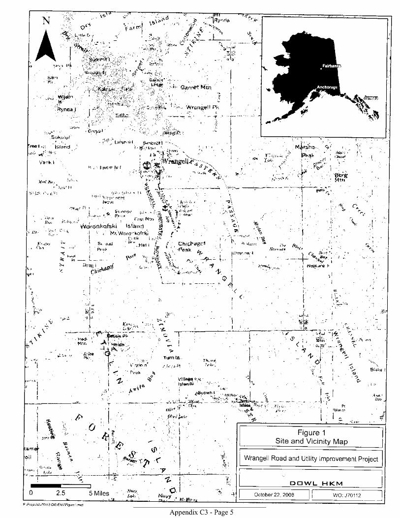
Figure 1
Site and Vicinity Map
Wrangell Road and Utility Improvement project
DTf \^/L H KMOctober 22,2008 \NO: J70112
Pr\Projects\J701 1 2\clS\EN\ Figurei.mxd

P:\Proiects\J70112\GlS\EN\ APE imaoeNllx17b.mxd
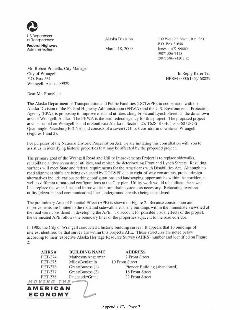
@US Deportmentof Tronsportotron
Federol HighwoyAdministrotion
FfsvrrvG rFf rAM ERIGAITIEGOHOMY
Alaska Division
March 18, 2009
709 west 9th Street, Rm. 85 |
P.O. Box 21648
Juneau, AK 99802(907) s86 7418(907) 586-7420 Fax
ln Reply Refer To:HPRM-0003(l3sy 68829
Mr. Robert Prunella, City ManagerCity of WrangellP.O. Box 531
Wrangell, Alaska 99929
Dear Mr. Prunellal:
The Alaska Department of Transponation and Public Facilities (DOT&PF), in cooperation with theAlaska Division of the Federal Highway Administration (FHWA) and the U.S. Environmental ProtectionAgency (EPA), is proposing to improve road and utilities along Front and Lynch Streets in the downtownarea of Wrangell, Alaska. The FHWA is the lead federal agency for this project. The proposed projectarea is located on Wrangell Island in Southeast Alaska in Section 25, T625, R83E (l:63360 USGS
Quadrangle Petersburg B-2 NE) and consists of a seven (7) block corridor in downtown Wrangell(Figures I and 2).
For purposes of the National Historic Preservation Act, we are initiating this consultation with you toassist us in identifying historic properties that may be affected by the proposed project.
The primary goal of the Wrangell Road and Utility Improvements Project is to replace sidewalks,rehabilitate and/or reconstruct utilities, and replace the deteriorating Front and Lynch Streets. Resultingsurfaces will meet State and federal requirements for the Americans with Disabilities Act. Although noroad alignment shifts are being evaluated by DOT&PF due to right-of-way constraints, project designalternatives include various parking configurations and landscaping opportunities within the coridor, as
well as different turnaround configurations at the City pier. Utility work would rehabilitate the sewerline, replace the water line, and improve the storm drain systems as necessary. Relocating overheadutility (electrical and communication) lines underground are also being considered.
The preliminary Area of Potential Effect (APE) is shown on Figure 2. Because construction andimprovements are limited to the road and sidewalk areas, any buildings within the immediate viewshed ofthe road were considered in developing the APE. To account for possible visual effects of the project,the delineated APE follows the boundary lines of the properties adjacent to the road coridor.
In I 985, the City of Wrangell conducted a historic building survey. It appears that l6 buildings ofinterest identified by that survey are within this project's APE. Those structures are noted belowaccording to their respective Alaska Heritage Resource Survey (AHRS) number and identified on Figure2:
AHRS # BUILDING NAMEPET-27 4 Matheson/AngermanPET-275 Miles/BenjaminPET-276 Grant/Buness (l)PFIT-211 Grant/Buness (2)PET-278 Patenaude/Grant
ADDRESS2 Front Street
l0 Front StreetPioneer Building (abandoned)18 Front Street22 Front Street
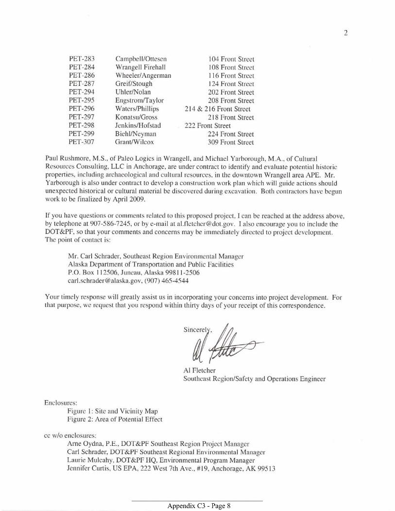
PET-283PET-284PET-286PET-281PET-294PET-295PET-296PET-297PET.298PET-299PET-307
Campbell/OttesenWrangell FirehallWheeler/AngermanGreif/StoughUhler/NolanEngstrom/TaylorWaters/PhillipsKonatsu/GrossJenkins/HofstadBiehl/NeymanGlant/Wilcox
104 Front Street108 Front StreetI l6 Front Street124 Front Street202 Front Street208 Front Street
214 & 216 Front Street2l 8 Front Street
222 Front Street224 Front Street309 Front Street
Paul Rushmore, M.S., of Paleo Logics in Wrangell, and Michael Yarborough, M.A., of CulturalResources Consulting, LLC in Anchorage, are under contract to identify and evaluate potential historicpropefties, including archaeological and cultural resources, in the downtown Wlangell area APE. Mr.Yarborough is also under contract to develop a construction work plan which will guide actions shouldunexpected historical or cultural material be discovered during excavation. Both contractors have begunwork to be finalized by April 2009.
If you have questions or comments related to this proposed project, I can be reached at the address above,by telephone at 907-586-7245, or by e-mail at [email protected]. I also encourage you to include theDOT&PF, so that your comments and concerns may be immediately directed to project development.The point of contact is:
Mr. Carl Schrader, Southeast Region Environmental ManagerAlaska Department of Transportation and Public FacilitiesP.O. Box I12506, Juneau, Alaska [email protected], (907) 465-4544
Your timely lesponse will greatly assist us in incorporating your concerns into project development. Forthat puryose, we rcquest that you respond within thirty days of your receipt of this corespondence
Al FletcherSoutheast Region/Safety and Operations Engineer
Enclosures:Figure l: Site and Vicinity MapFigure 2: Area of Potential Effect
cc w/o enclosures:Arne Oydna, P.E., DOT&PF Southeast Region Project ManagerCarl Schrader, DOT&PF Southeast Regional Environmental ManagerLaurie Mulcahy, DOT&PF HQ, Environmental Program ManagerJennifer Curtis, US EPA, 222 West 7th Ave., #19, Anchorage, AK 99513
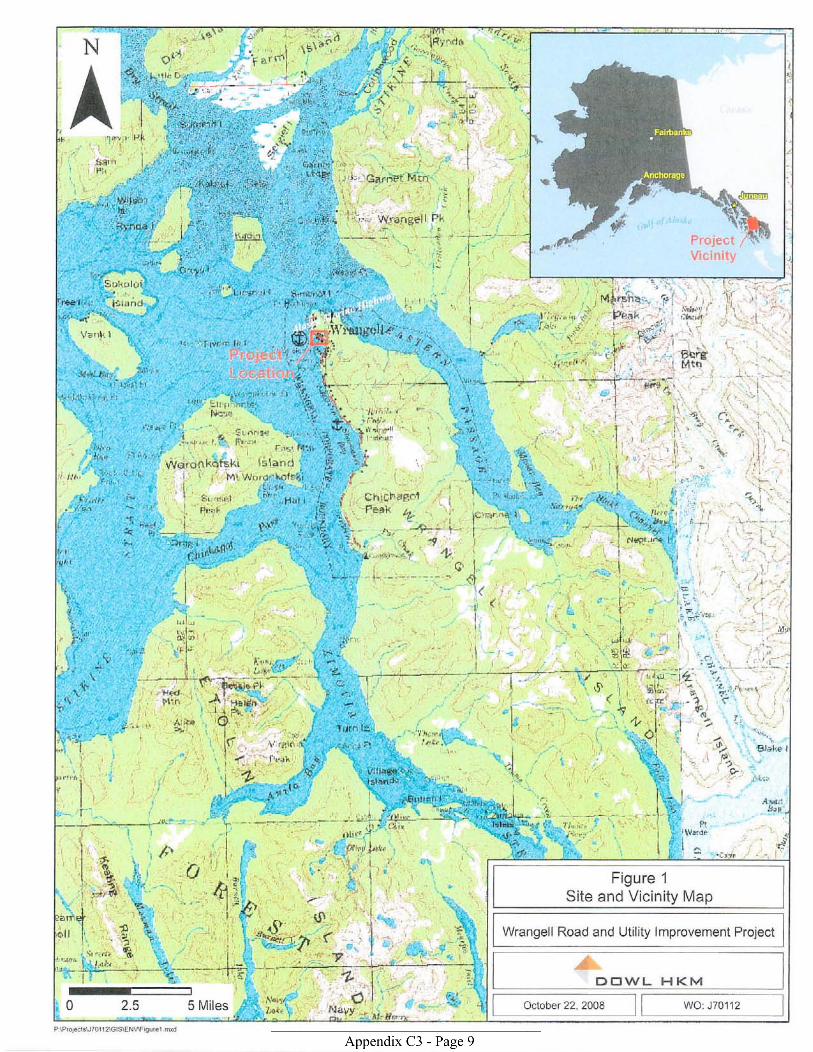
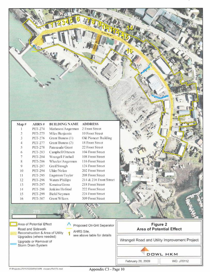
P \Proiecis\J 7011 2\G lS\E Nv,A PE maoervlTxlTb rnxd

?}US Deportmentof Tronsoortotion
FederolHighwoyAdminaslroiion
Alaska Division 709 West 9th Street. Rm. 851
P.O. Box 21648
March 18, 2009 Juneau. AK 99802(907) s86-74t8(907]t 586-7420 Fax
Ms. Rosita Worl, PresidentSealaska Heritage InstituteOne SeaiaskaPlaza, Suite 400Juneau, Alaska 99801
In Reply Refer To:HPRM-0003( 135)/ 68829
Dear Ms. Worl:
The Alaska Department of Transportation and Public Facilities (DOT&PF), in cooperation with theAlaska Division of the Federal Highway Administration (FHWA) and the U.S. Environmental ProtectionAgency (EPA), is proposing to improve road and utilities along Front and Lynch Streets in the downtownarea of Wran-eell, Alaska. The FHWA is the lead federal agency for this project. The proposed projectarea is located on Wrangell Island in Southeast Alaska in Section 25,T625, R83E (l:63360 USGS
Quadrangle Petersburg B-2 NE) and consists of a seven (7 ) block corridor in downtown Wrangell(Figures 1 and2).
For purposes of the National Historic Preservation Act, we are initiating this consultation with you toassist us in identifying historic properties that may be affected by the proposed project.
The primary goal of the Wrangell Road and Utility Improvements Project is to replace sidewalks,rehabilitate and./or reconstruct utilities, and replace the deteriorating Front and Lynch Streets. Resultingsurfaces will meet State and federal rcquirements for the Americans with Disabilities Act. Although noroad alignment shifts are being evaluated by DOT&PF due to right-of-way constraints, project designalternatives include various parking configurations and landscaping opportunities within the corridor, as
well as different turnaround configurations at the City pier. Utility work would rehabilitate the sewerline, replace the water line, and improve the storm drain systems as necessary. Relocating overheadutility (electrical and communication) lines underground are also being considered.
The preliminary Area of Potential Effect (APE) is shown on Figure 2. Because construction andimprovements are limited to the road and sidewalk areas, any buildings within the immediate viewshed ofthe road were considered in developing the APE. To account for possible visual effects of the project,the delineated APE follows the boundary lines of the properties adjacent to the road coridor.
In I 985, the City of Wrangell conducted a histonc building survey. It appears that I 6 buildings ofinterest identified by that survey are rvithin this project's APE. Those structures are noted belowaccording to their respective Alaska lleritage Resource Survey (AHRS) number and identified on Figure
AHRS # BUILDING NAMB ADDRESSPET-274 Matheson/Angerman 2 Front StreetPET-215 Miles/Benjamin l0 Front StreetPET-216 Grant/Buness (1) Pioneer Building (abandoned)PET-217 Grant/Buness (2) 18 Front StreetPET-218 Patenaude/Grant 22 Front Street
i{.*.il.'}'T il,fF-
ffiFdCCOHOTY f .,=:=--=
2
PET-283 Campbell/Ottesen 104 Front Street
PET-284 WrangellFirehall 108 Front Street
PET-286 Wheeler/Angerman I l6 Front Street
PET-287 Greif/Stough 124 Front Street
PET-294 UhlerA'Jolan 202 Front Street
PET-295 Engstrom/Taylor 208 Front Street
PET-296 Waters/Phillips 214 &- 216 Front Street
PET-291 Konatsr-r/Gross 218 Front Street
PET-298 Jenkins/Hofstad 222 Front Street
PET-299 Biehl/l'{eyman 224 Front Street
PET-307 Grant/Wilcox 309 Front Street
Paul Rushmore, M.S.. of Paleo Logics in Wrangell. and Michael Yarborough, M.A., of Cultural
Resources Consulting, LLC in Anchorage. are under contract to identify and evaluate potential historic
properties, including archaeological and cultural resources, in the downtown Wrangell area APE. Mr.
Yarborough is also under contract to develop a construction work plan which will guide actions should
unexpectecl historical or cultural material be discovered during excavation. Both contractors have begun
work to be finalized by April 2009.
If you have questions or comments related to this proposed project, I can be reached at the address above,
bytelephone at907-586-7245, or by e-mail at [email protected]. I also encourage you to include the
DOT&PF. so that your comments and concefirs may be immediately directed to project development.
The point of contact is:
Mr. CaLl Schrader, Southeast Region Environnental Managet'
Alaska Department of Transporlation and Public FacilitiesP.O. Box I 12506, Juneau, Alaska 9981 I -2506
[email protected], (907) 465-4544
Your timely response will greatly assist us in incorporating your concerns into project development. For
that purpose, we request that you respond within thirty days o1'your receipt of this con'espondence.
Al FletcherSoutheast Region/Safety and Operations Engineer
Enclosures:Figure l: Site and VicinitY MaPFigure 2: Area of Potential Effect
cc w/o enclosures:Arne Oydna, P.E., DOT&PF Southeast Region Project Manager
Carl Schrader, DOT&PF Southeast Regional Etrvirontnental Manager
Laurie Mulcahy, DOT&PF HQ, Environmental Program Manager
Jennifer Cuftis, US EPA, 222 West 7th Ave., #19, Anchorage, AK 99513
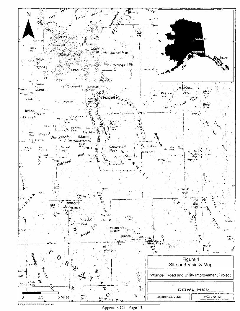
Figure 1
Site and Vicinity Map
Wrangell Road and Utility lmprovement Project
DEWL H KMOctober 22.2008 WO: J70112
P \Protecis\J701 1 2\GlS\EN\AFigurel . mxd
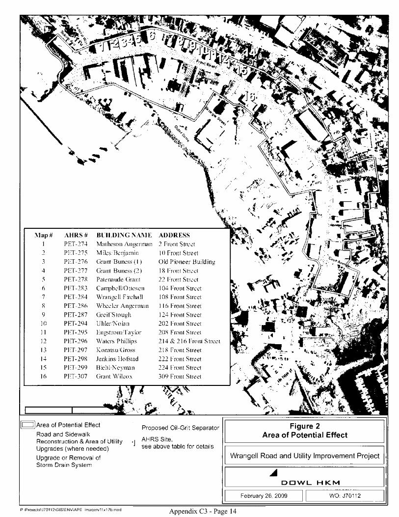
P:\Proiects\J7o112\GlS\EN\ APE imaqerv11x17b mxd
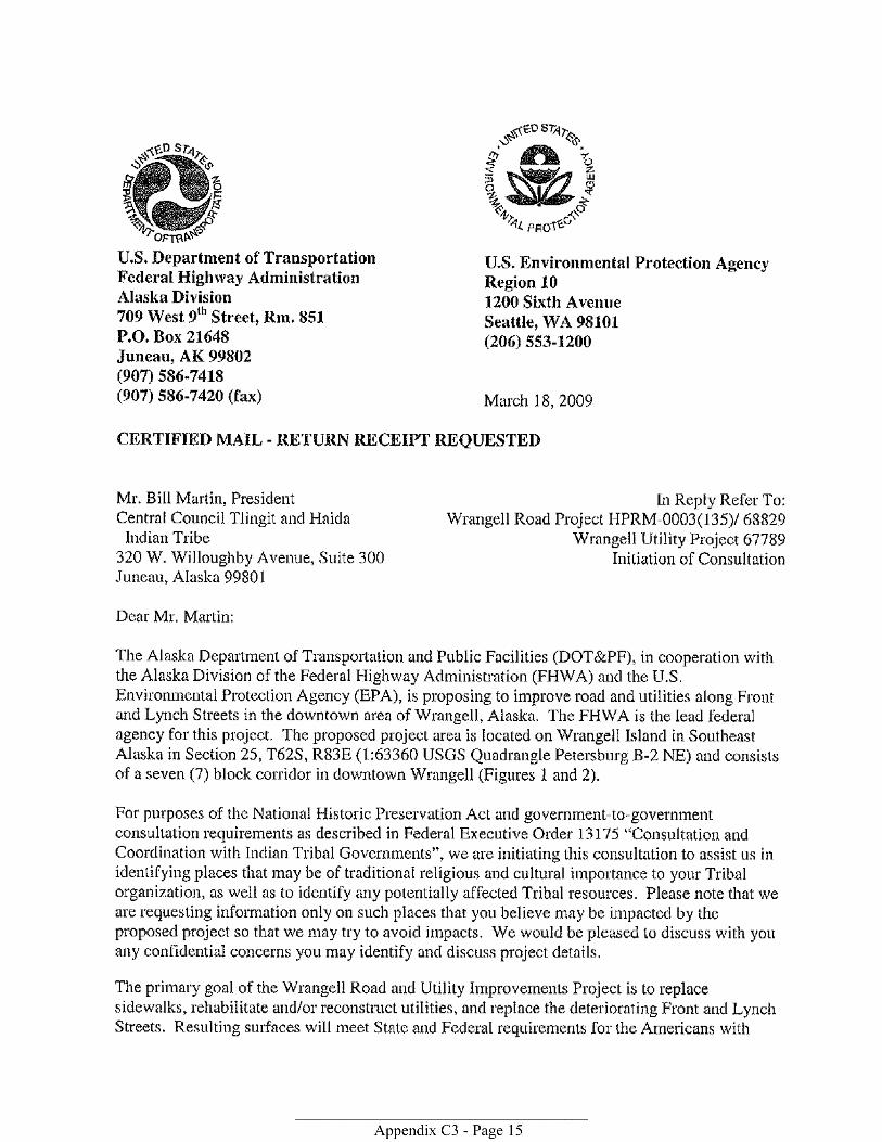


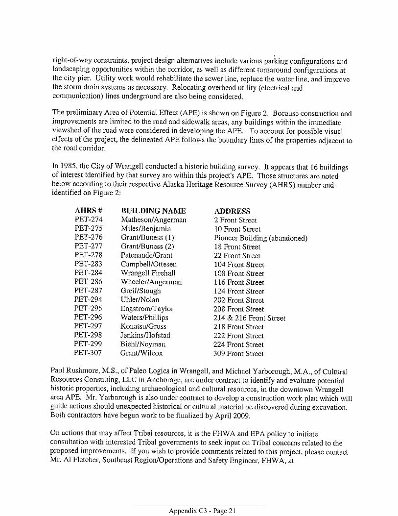


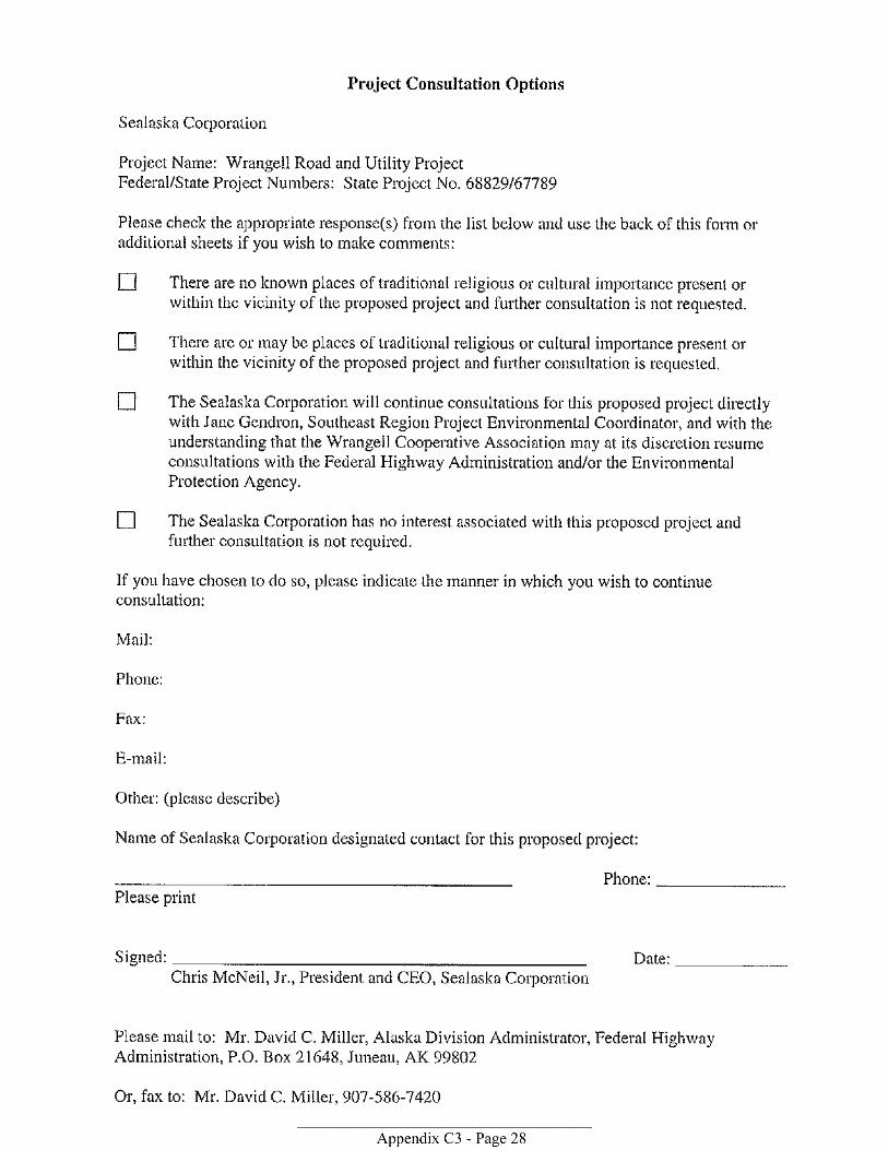
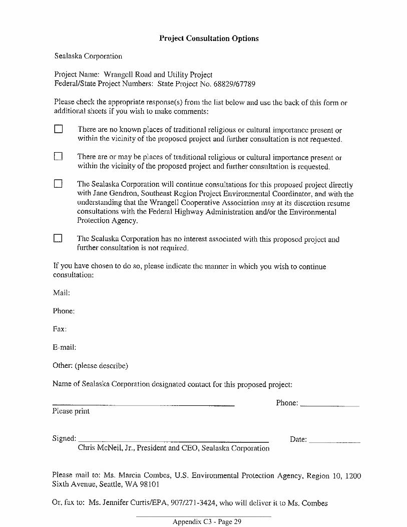
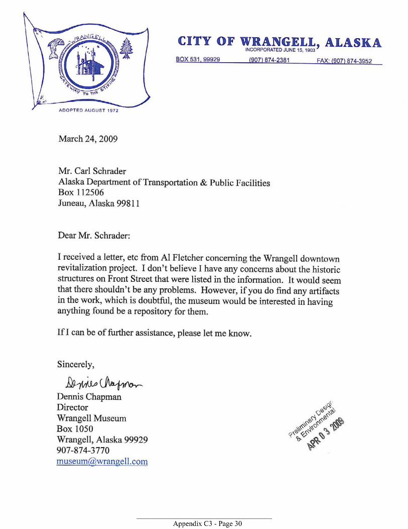

MEETING AGENDA Date: April 2, 2009
Project: Wrangell Road and Utility Improvements Subject: Section 4(f)—Discussion of APE, Project Historic Resources/Districts, and potential Section 4(f) analysis.
Attendees:
Federal Agency Representative Tim Haugh (FHWA, Environmental Manager) Al Fletcher (FHWA, Acting Southeast Regions Project Liaison) DOT&PF Staff Arne Oydna (DOT&PF, Consultant Coordinator) Jane Gendron (DOT&PF, Project Environmental Coordinator) City of Wrangell Carl Johnson (City of Wrangell – via telephone – Director of Public Works) Carol Rushmore (City of Wrangell – via telephone – Economic Development Director) DOT&PF and Wrangell’s Consultant Staff Steve Noble (DOWL HKM, Project Manager) Brandie Hofmeister (DOWL HKM, Environmental Specialist) Michael Yarborough (CRC, Archeologist)
Introductions – Jane Gendron Purpose of Meeting: To discuss the preliminary evaluation results from CRC regarding historic resources, historic districts, and potential for an adverse effect. Goal of Meeting: To determine the need for a Section 4(f) evaluation. Summary of the Historic Resource Analyses to date -- CRC Process followed Preliminary results Preliminary recommendations on eligibility Summary of the project’s actions pertinent to eligible resources – DOWL HKM Analyses ongoing to assess potential for adversely affecting the eligible resources – CRC Discussion – Group

MEETING NOTES Date: April 2, 2009
Project: Wrangell Road and Utility Improvements Subject: Section 4(f)—Discussion of APE, Project Historic Resources/Districts, and potential Section 4(f) analysis.
Attendees:
Federal Agency Representative Tim Haugh (FHWA, Environmental Manager) Elizabeth Hoffman (FHWA, ROW Program Specialist) DOT&PF Staff Arne Oydna (DOT&PF, Consultant Coordinator) Jane Gendron (DOT&PF, Project Environmental Coordinator) Al Steininger (DOT&PF, Project Manager) City of Wrangell Carl Johnson (City of Wrangell – via telephone – Director of Public Works) Carol Rushmore (City of Wrangell – via telephone – Economic Development Director) DOT&PF and Wrangell’s Consultant Staff Steve Noble (DOWL HKM, Project Manager) Kristen Hansen (DOWL HKM, Environmental Manager) Brandie Hofmeister (DOWL HKM, Environmental Specialist) Michael Yarborough (CRC, Archeologist) Amanda Welsh (CRC, Historic Architect)
Jane Gendron made introductions and asked about the progress of the Historic and Cultural Report. Mike Yarborough responded that Catherine Pendleton has been pulling together information and has been working with Carol Rushmore to determine construction dates of several buildings. Mike referred to the map which shows potential historic buildings and district. He noted that it represents preliminary results that are subject to change. However, he believes that the historic district shown on the map is accurately represented. Mike stated that he believes there is a historic district and that the inland/northern side of Front Street has enough integrity to be eligible for listing in the National Register of Historic Places under both Criteria A and C. Tim Haugh asked if Front Street and the sidewalk were part of the district. Both Mike Yarborough and Amanda Welsh stated that they do not believe these would be part of the district or contributing elements. Mike noted that while the period of significance likely post-dates the construction of the road, he doesn’t believe the sidewalks or the road itself are contributing elements to the district. Tim asked that they make sure to include this issue and support of these findings in their report, as it is a critical point. Tim also asked that they address the awnings and signs in their report. Amanda noted most of the signs did not appear to be historic, but that there has always been some type of awning associated with these buildings, and she’d have to take a closer look at them on an individual basis to determine whether they would be considered contributing elements. A question was raised to determine when Section 4(f) would be triggered. Tim Haugh stated that if land is taken, or if proximity impacts substantially impair the district, then 4(f) would be triggered. He stated that it would be very unusual for proximity impacts to impair the district.
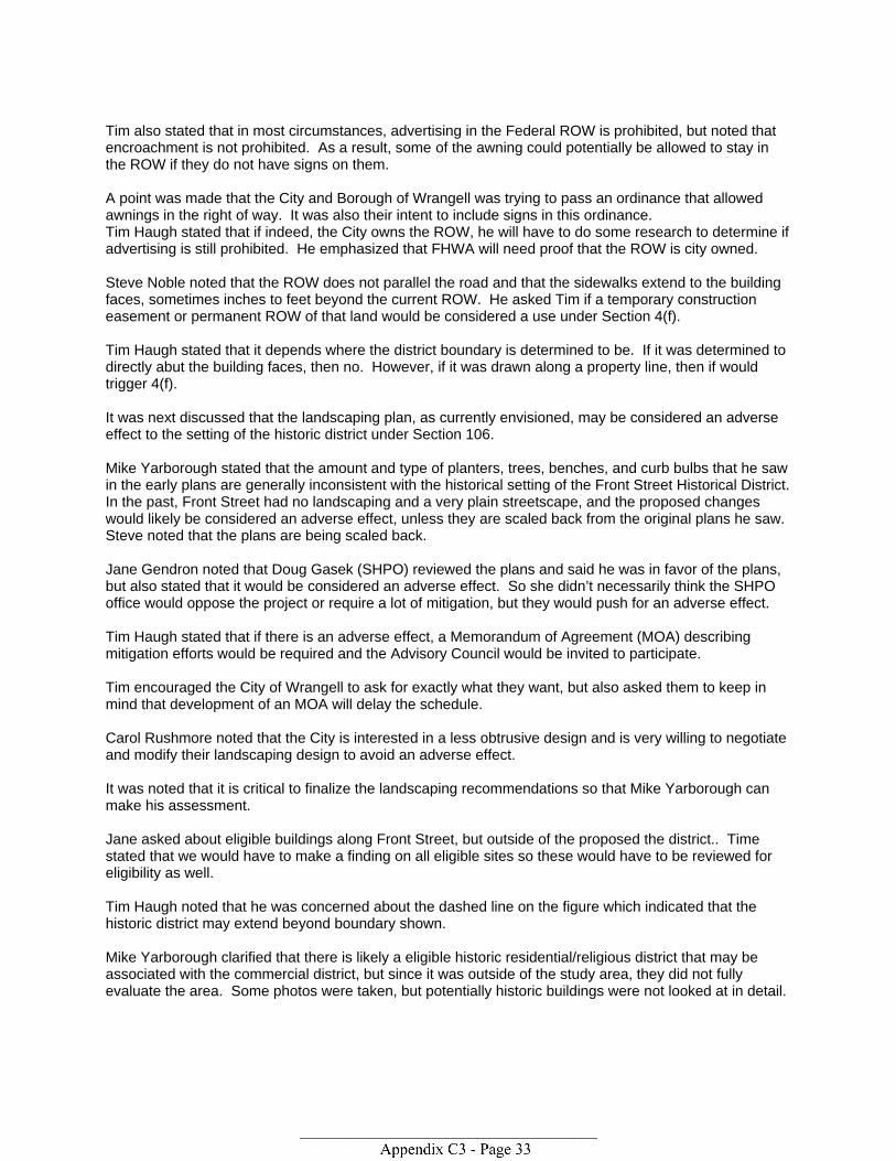
Tim also stated that in most circumstances, advertising in the Federal ROW is prohibited, but noted that encroachment is not prohibited. As a result, some of the awning could potentially be allowed to stay in the ROW if they do not have signs on them. A point was made that the City and Borough of Wrangell was trying to pass an ordinance that allowed awnings in the right of way. It was also their intent to include signs in this ordinance. Tim Haugh stated that if indeed, the City owns the ROW, he will have to do some research to determine if advertising is still prohibited. He emphasized that FHWA will need proof that the ROW is city owned. Steve Noble noted that the ROW does not parallel the road and that the sidewalks extend to the building faces, sometimes inches to feet beyond the current ROW. He asked Tim if a temporary construction easement or permanent ROW of that land would be considered a use under Section 4(f). Tim Haugh stated that it depends where the district boundary is determined to be. If it was determined to directly abut the building faces, then no. However, if it was drawn along a property line, then if would trigger 4(f). It was next discussed that the landscaping plan, as currently envisioned, may be considered an adverse effect to the setting of the historic district under Section 106. Mike Yarborough stated that the amount and type of planters, trees, benches, and curb bulbs that he saw in the early plans are generally inconsistent with the historical setting of the Front Street Historical District. In the past, Front Street had no landscaping and a very plain streetscape, and the proposed changes would likely be considered an adverse effect, unless they are scaled back from the original plans he saw. Steve noted that the plans are being scaled back. Jane Gendron noted that Doug Gasek (SHPO) reviewed the plans and said he was in favor of the plans, but also stated that it would be considered an adverse effect. So she didn’t necessarily think the SHPO office would oppose the project or require a lot of mitigation, but they would push for an adverse effect. Tim Haugh stated that if there is an adverse effect, a Memorandum of Agreement (MOA) describing mitigation efforts would be required and the Advisory Council would be invited to participate. Tim encouraged the City of Wrangell to ask for exactly what they want, but also asked them to keep in mind that development of an MOA will delay the schedule. Carol Rushmore noted that the City is interested in a less obtrusive design and is very willing to negotiate and modify their landscaping design to avoid an adverse effect. It was noted that it is critical to finalize the landscaping recommendations so that Mike Yarborough can make his assessment. Jane asked about eligible buildings along Front Street, but outside of the proposed the district.. Time stated that we would have to make a finding on all eligible sites so these would have to be reviewed for eligibility as well. Tim Haugh noted that he was concerned about the dashed line on the figure which indicated that the historic district may extend beyond boundary shown. Mike Yarborough clarified that there is likely a eligible historic residential/religious district that may be associated with the commercial district, but since it was outside of the study area, they did not fully evaluate the area. Some photos were taken, but potentially historic buildings were not looked at in detail.

Tim Haugh stated that FHWA may have difficulties approving this work without having definite district boundaries. It was suggested that perhaps a commercial district could be delineated, and note in the report that a rural/residential district may be associated. Mike Yarborough noted that we should not forget about the archeological aspect of this project. He noted that he just completed his archeological monitoring plan, based on research done by Paul Rushmore of Wrangell. He noted that monitoring will need to be conducted for some, if not all portions of the Front Street project area. Mike noted that he expects to have the draft report done by end of next week. Kristen noted that the draft EA is due 4/30/09, and asked when we might have the revised landscape design for Mike to review and make his recommendation of findings to DOT and FHWA. Steve thought we would have this in the next 2-4 weeks. It was agreed that DOWL HKM should submit the first draft EA without the 106 findings, so that DOT can review the other aspects of the EA.
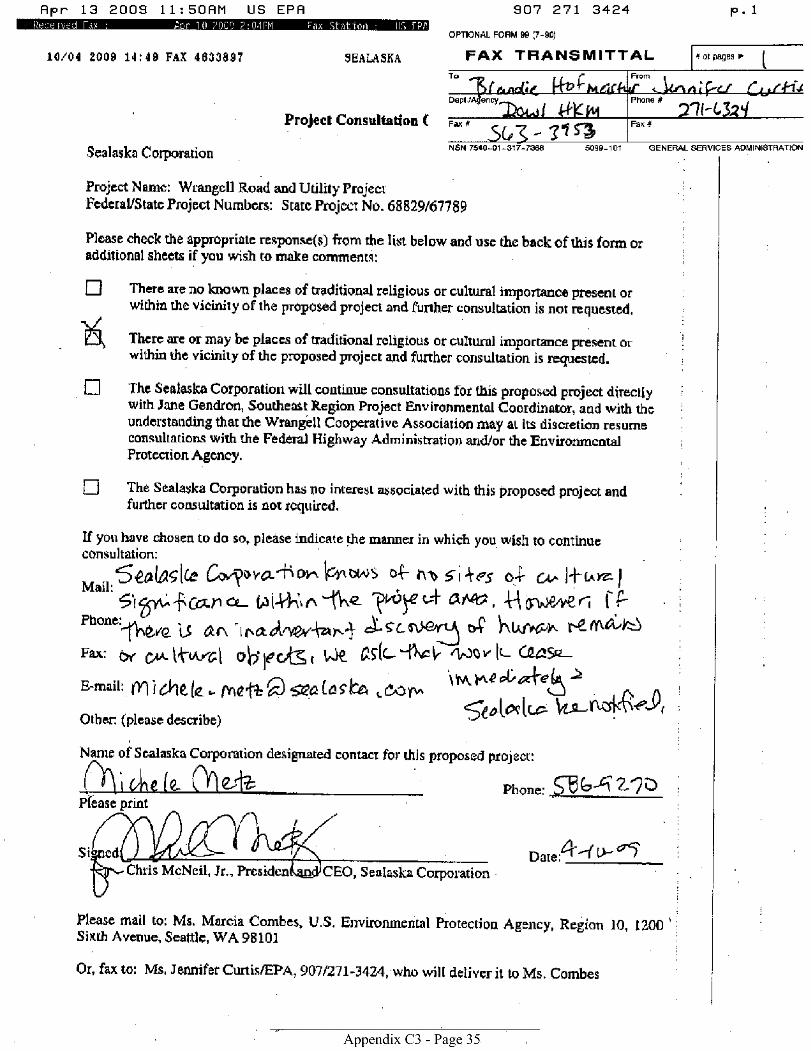
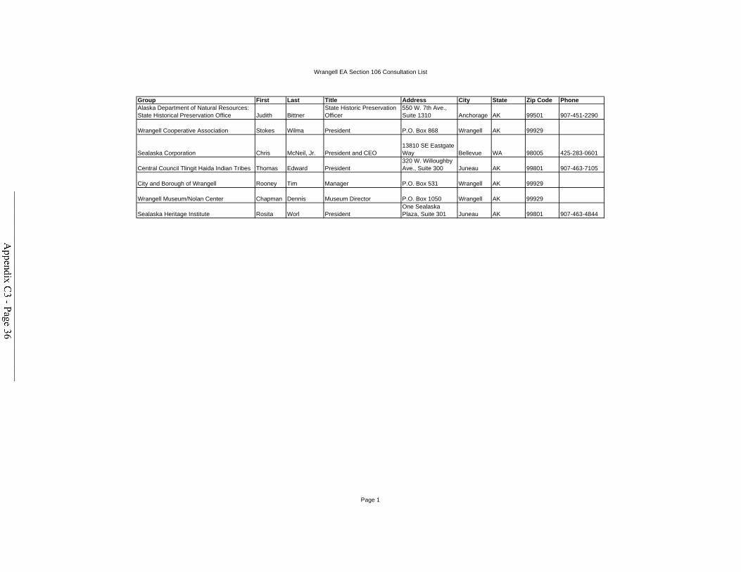
Wrangell EA Section 106 Consultation List
Group First Last Title Address City State Zip Code PhoneAlaska Department of Natural Resources: State Historical Preservation Office Judith Bittner
State Historic Preservation Officer
550 W. 7th Ave., Suite 1310 Anchorage AK 99501 907-451-2290
Wrangell Cooperative Association Stokes Wilma President P.O. Box 868 Wrangell AK 99929
Sealaska Corporation Chris McNeil, Jr. President and CEO13810 SE Eastgate Way Bellevue WA 98005 425-283-0601
Central Council Tlingit Haida Indian Tribes Thomas Edward President320 W. Willoughby Ave., Suite 300 Juneau AK 99801 907-463-7105
City and Borough of Wrangell Rooney Tim Manager P.O. Box 531 Wrangell AK 99929
Wrangell Museum/Nolan Center Chapman Dennis Museum Director P.O. Box 1050 Wrangell AK 99929
Sealaska Heritage Institute Rosita Worl PresidentOne Sealaska Plaza, Suite 301 Juneau AK 99801 907-463-4844
Page 1


P:\Projects\J70112\GIS\ENV\EA Documents\Vicinity Map.mxd
_̂
!
!
Gulf of Alaska
Canada
Juneau
Anchorage
Fairbanks
Project Vicinity
0 52.5 Miles
¯
Project Location
April 20, 2009
Wrangell Road and UtilityImprovement Project EA
Figure 1 - Location and Vicinity Map
WO: J70112
DOT & PF Project No: 68829, 67789

St. Michaels St
Episcopal Ave
Case Avenue
Campbell Drive
Front Street
Brueger Street
Lyn
ch S
t
Stikine Ave
Federal Way
Mc
Kin
no
n S
t
Church St
City PierTurnaround
Totem Park
City Market
Zimovia Strait
ConstructionStaging Area
Cam
pb
e
ll Drive
Ca
mp
bel
l Driv
e
P:\Projects\J70112\GIS\ENV\Archaeological\Fig 2_Project Corridor_DOT.mxd
Key
Project Corridor
¯0 125 250
Feet
Location Map
November 10, 2009
Wrangell Road and UtilityImprovement Project
Figure 2 - Project Corridor
WO: J70112
DOT & PF Project No: 68829, 67789
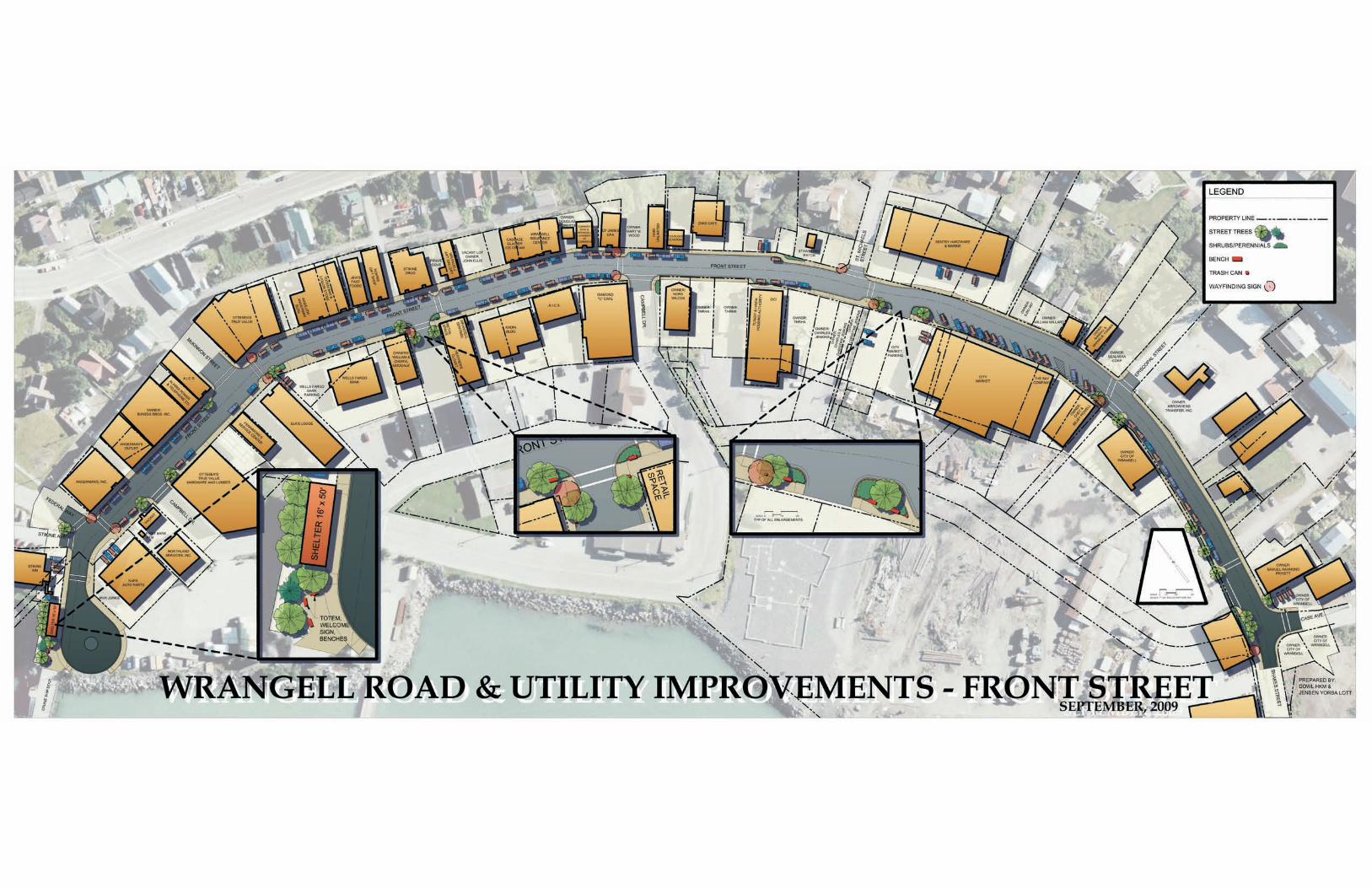

St. Michae
ls St
Episcopal Ave
Case Avenue
Campbell Drive
Front Street
Brueger Street
Lynch S
t
Stikine Ave
Federal Way
McKinnon St
Church St
Ca mpbell D rive
CC aamm pp
bb ee llll DD rr
ii vv ee
P:\Projects\J70112\GIS\ENV\Archaeological\Fig 4 APE_imagery.mxd
0 150 300Feet October 30, 2009
Wrangell Road and UtilityImprovement Project
Figure 4: Area of Potential Effect (APE)
WO: J70112
DOT & PF Project No: 68829, 67789
Area of Potential Effect(historiical/architectural)Area of Potential Effect(archaeological) ¯
Amended March 2010
DOT&PF Project No: 68828 and 67789

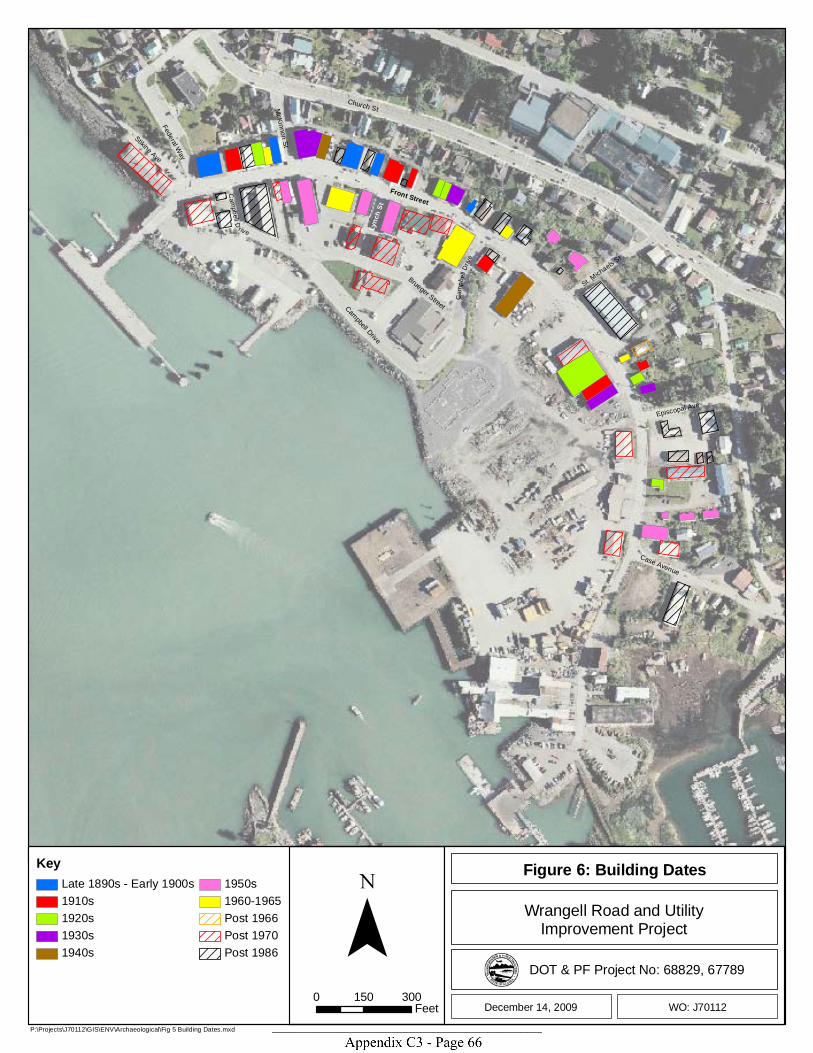
St. Michaels S
t
Episcopal Ave
Case Avenue
Campbell Drive
Front Street
Brueger Street
Lyn
ch S
t
Stikine Ave
Federal Way
McKinnon St
Church St
Campbell D
rive
Camp
bell D
rive
P:\Projects\J70112\GIS\ENV\Archaeological\Fig 5 Building Dates.mxd
0 150 300Feet December 14, 2009
Wrangell Road and UtilityImprovement Project
Figure 6: Building Dates
WO: J70112
DOT & PF Project No: 68829, 67789
Key
Late 1890s - Early 1900s1910s1920s1930s1940s
1950s1960-1965Post 1966Post 1970Post 1986 ¯
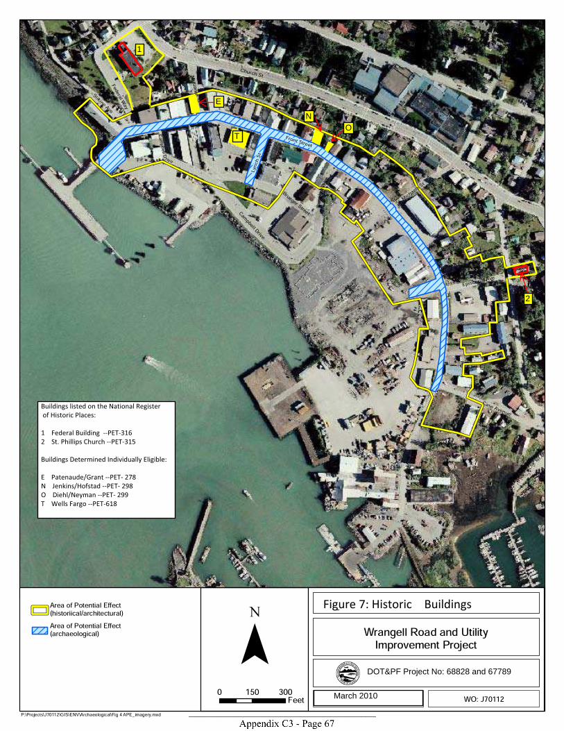
St. Michae
ls St
Episcopal Ave
Case Avenue
Campbell Drive
Front Street
Brueger Street
Lynch S
t
Stikine Ave
Federal Way
McKinnon St
Church St
Ca mpbell D rive
CC aamm pp
bb ee llll DD rr
ii vv ee
P:\Projects\J70112\GIS\ENV\Archaeological\Fig 4 APE_imagery.mxd
0 150 300Feet October 30, 2009
Wrangell Road and UtilityImprovement Project
Figure 4: Area of Potential Effect (APE)
WO: J70112
DOT & PF Project No: 68829, 67789
Area of Potential Effect(historiical/architectural)Area of Potential Effect(archaeological) ¯
March 2010
DOT&PF Project No: 68828 and 67789
T
N
E
O
1
2
Buildings listed on the National Register
of Historic Places:
1 Federal Building --PET-316
2 St. Phillips Church --PET-315
Buildings Determined Individually Eligible:
E Patenaude/Grant --PET- 278
N Jenkins/Hofstad --PET- 298
O Diehl/Neyman --PET- 299
T Wells Fargo --PET-618
Figure 7: Historic Buildings
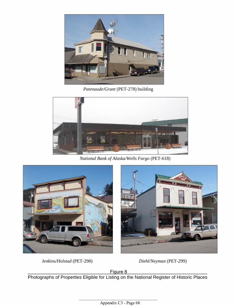
Patenaude/Grant (PET-278) building
National Bank of Alaska/Wells Fargo (PET-618)
Jenkins/Holstad (PET-298) Diehl/Neyman (PET-299)
Figure 8 Photographs of Properties Eligible for Listing on the National Register of Historic Places


Table 1: Building Information and Recommendations
CRC Report
and Appendix B page numbers
Individually
Eligible
AHRS Modern Building Name or
Description Building Name Figure
ID Date Register Eligible A B C D
PET-274 Angerman's Inc. Matheson/Angerman 30; B1-5 B 1907 No PET-275 Angerman's Outlet Miles/Benjamin 30; B6-10 C 1910 No PET-277 Buness Bros. Grant/Buness (2) 30; B11-14 D 1927 No PET-278 AK Clothing/Travel Patenaude/Grant 31; B15-18 E 1906 Yes X PET-283 Ottesen's True Value Campbell/Ottesen 31; B19-23 F 1934 No PET-284 Ottesen's True Value Wrangell Fire Hall 31; B24-27 G 1941 No PET-286 Wheeler/Angerman & Totem Bar Wheeler/Angerman 32; B28-32 H 1908 No PET-287 Norris Gifts Greif/Stough 32; B33-36 I 1898 No PET-294 Stikine Drug Uhler/Nolan 33; B37-41 J 1913 No PET-295 Wrangell Art Gallery Engstrom/Taylor 33; B42-45 K 1910 No PET-296 Glacier Ice Cream/Jerry's Elect Waters/Phillips 33; B46-49 L 1922 No PET-297 Busy Beehive Konatsu/Gross 34; B50-53 M 1914 No PET-298 Wrangell Insurance Jenkins/Hofstad 34; B54-57 N 1934 Yes X PET-299 Cannery Row/Chamber of Comm Diehl/Neyman 35; B58-62 O ca. 1898 Yes X PET-307 Jitterbugs Grant/Wilcox 35; B63-67 P 1910 No PET-615 Alaska Power & Tel Alaska Power & Tel 35; B68-70 Q 1962 No PET-616 Fennimore's Bjorge/Fennimore 36; B71-74 R 1952 No PET-617 Elks Lodge Elks Lodge #1595 36; B75-78 S 1952 No PET-618 Wells Fargo Ntl Bnk of AK/Wells Fargo 36; B79-84 T 1965 Yes X PET-619 Vacant Redmen/Goodale 37; B85-88 U 1953 No PET-620 Angerman's/Wrangell Sentinel 49th Star Theater/Privett 37; B89-92 V ca. 1958 No PET-621 Diamond "C" Café & Espresso Thunderbird Htl/Diamond C 37; B93-96 W By 1962 No PET-622 PJ's Floor Covering Estaugh Building 38; B97-100 X By 1965 No PET-623 Housing Authority/GCI SNO/Tlingit Haida Hsng 38; B101-104 Y 1943 No PET-624 Yellow House w/wood walkway Armstrong House (1) 38; B105-107 Z ca. 1950s No PET-625 Blue/green House Briskar House 39; B108-111 AA 1964 No PET-626 Brown House ILWU #87 House 39; B112-115 BB 1966 No PET-627 City Market City Market 39; B116-119 CC Various No PET-628 Yellow House Willard House 40; B120-123 DD By 1914 No PET-629 White House w/green roof Farmer House (1) 40; B124-127 EE By 1927 No PET-630 The Bay Company The Bay Company 41; B128-131 FF ca 1930s No PET-631 Tan House next to Totem Park Farmer House (2) 41; B132-135 GG ca 1930s No PET-632 White House L-shaped Armstrong House (2) 41; B136-139 HH By 1927 No PET-633 Blue Duplex Armstrong Duplex East 42; B140-143 II By 1956 No PET-634 Blue Duplex Armstrong Duplex West 42; B144-147 JJ By 1956 No PET-635 Green House w/metal roof Armstrong House (3) 42; B148-151 KK By 1956? No PET-636 Rayme's Bar Grant's/Rayme's 42; B152-155 LL ca. 1955 No PET-637 House at 109 St Michaels Wickman House 43; B156-159 MM By 1956 No
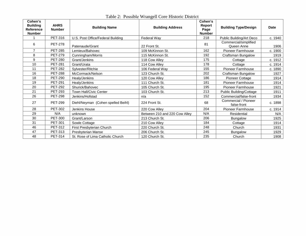
Table 2: Possible Wrangell Core Historic District Cohen ’s Building
Reference Number
AHRS Number Building Name Building Address
Cohen ’s Report Page
Number
Building Type/Design Date
1 PET-316 U.S. Post Office/Federal Building Federal Way 218 Public Building/Art Deco c. 1940
6 PET-278 Patenaude/Grant 22 Front St. 81 Commercial/simplified Queen Anne 1906
7 PET-285 Lemieux/Bahovec 109 McKinnon St. 162 Pioneer Farmhouse c. 1900 8 PET-279 Cunningham/Morris 115 McKinnon St. 192 Craftsman Bungalow 1919 9 PET-280 Grant/Jenkins 118 Cow Alley 175 Cottage c. 1912
10 PET-281 Grant/Urata 114 Cow Alley 178 Cottage c. 1914 11 PET-282 Sylvester/Ritchie 106 Federal Way 155 Pioneer Farmhouse c. 1890 16 PET-288 McCormack/Nelson 123 Church St. 202 Craftsman Bungalow 1927 18 PET-290 Healy/Jenkins 120 Cow Alley 186 Pioneer Cottage 1914 19 PET-291 Healy/Jenkins 111 Church St. 181 Pioneer Farmhouse 1914 20 PET-292 Shurick/Bahovec 105 Church St. 195 Pioneer Farmhouse 1921 21 PET-293 Town Hall/Civic Center 103 Church St. 213 Public Building/Cottage 1911 26 PET-298 Jenkins/Hofstad n/a 152 Commercial/false-front 1934
27 PET-299 Diehl/Neyman (Cohen spelled Beihl) 224 Front St. 68 Commercial / Pioneer false-front c. 1898
28 PET-302 Jenkins House 220 Cow Alley 204 Pioneer Farmhouse c. 1914 29 N/A unknown Between 210 and 220 Cow Alley N/A Residential N/A 30 PET-300 Grant/Larson 213 Church St. 206 Bungalow 1925 31 PET-301 Sowle Cottage 210 Cow Alley 184 Cottage 1914 46 PET-312 First Presbyterian Church 220 Church St. 248 Church 1931 47 PET-313 Presbyterian Manse 206 Church St. 245 Bungalow 1929 48 PET-314 St. Rose of Lima Catholic Church 120 Church St. 235 Church 1908

UPDATED PHOTOGRAPHIC DOCUMENTATION PACKET OF
STRUCTURES IN A POSSIBLE WRANGELL CORE HISTORIC DISTRICT
(PET-652)
STRUCTURE INFORMATION AND MAPS BASED ON MODIFIED
ALTERNATIVE A DISTRICT BOUNDARIES (COHEN 1986)
Contents:
Table of Structure Information
Map1
Map 2
Map 3
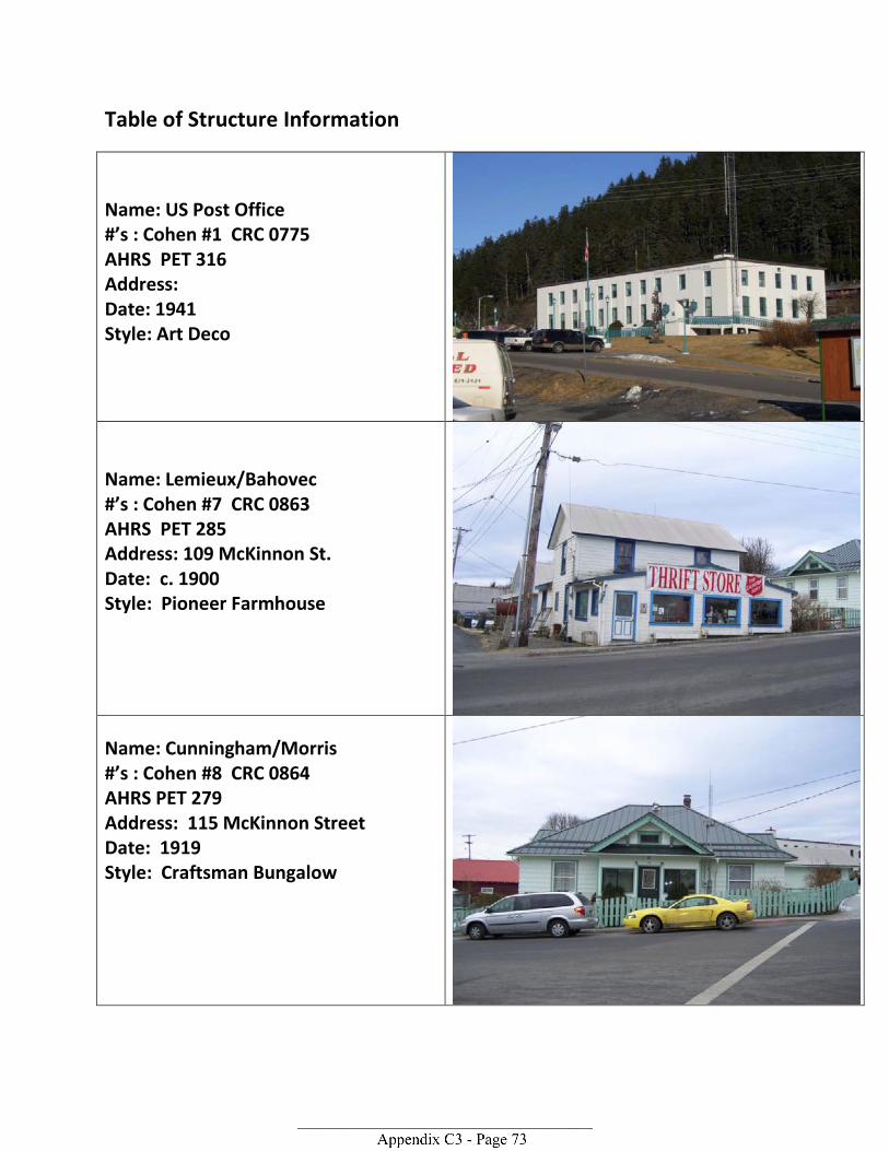
Table of Structure Information
Name: US Post Office #’s : Cohen #1 CRC 0775 AHRS PET 316 Address: Date: 1941 Style: Art Deco
Name: Lemieux/Bahovec #’s : Cohen #7 CRC 0863 AHRS PET 285 Address: 109 McKinnon St. Date: c. 1900 Style: Pioneer Farmhouse
Name: Cunningham/Morris #’s : Cohen #8 CRC 0864 AHRS PET 279 Address: 115 McKinnon Street Date: 1919 Style: Craftsman Bungalow
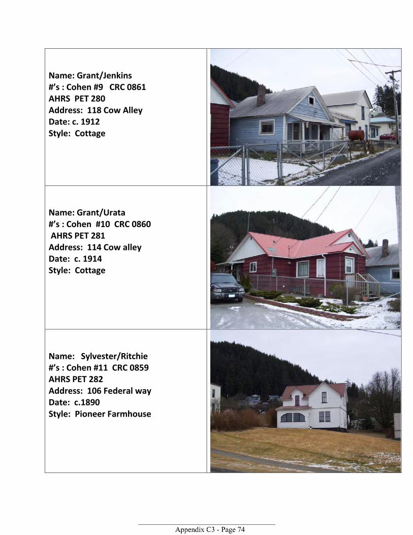
Name: Grant/Jenkins #’s : Cohen #9 CRC 0861 AHRS PET 280 Address: 118 Cow Alley Date: c. 1912 Style: Cottage
Name: Grant/Urata #’s : Cohen #10 CRC 0860 AHRS PET 281 Address: 114 Cow alley Date: c. 1914 Style: Cottage
Name: Sylvester/Ritchie #’s : Cohen #11 CRC 0859 AHRS PET 282 Address: 106 Federal way Date: c.1890 Style: Pioneer Farmhouse
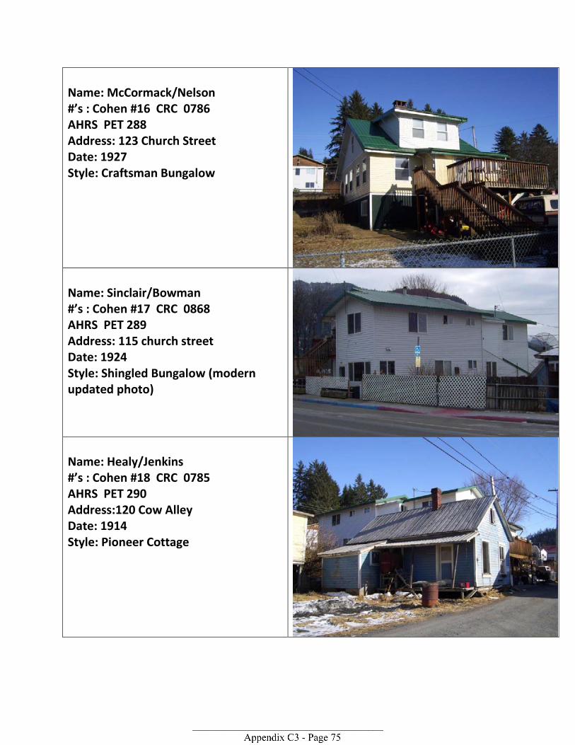
Name: McCormack/Nelson #’s : Cohen #16 CRC 0786 AHRS PET 288 Address: 123 Church Street Date: 1927 Style: Craftsman Bungalow
Name: Sinclair/Bowman #’s : Cohen #17 CRC 0868 AHRS PET 289 Address: 115 church street Date: 1924 Style: Shingled Bungalow (modern updated photo)
Name: Healy/Jenkins #’s : Cohen #18 CRC 0785 AHRS PET 290 Address:120 Cow Alley Date: 1914 Style: Pioneer Cottage
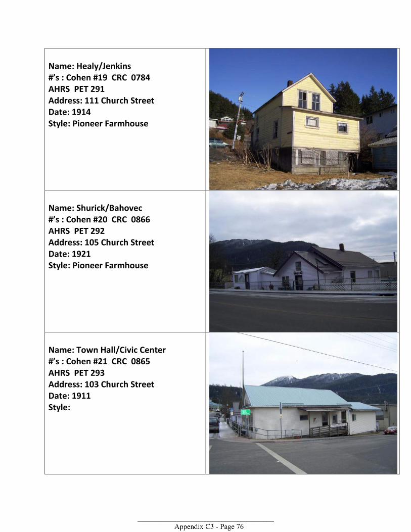
Name: Healy/Jenkins #’s : Cohen #19 CRC 0784 AHRS PET 291 Address: 111 Church Street Date: 1914 Style: Pioneer Farmhouse
Name: Shurick/Bahovec #’s : Cohen #20 CRC 0866 AHRS PET 292 Address: 105 Church Street Date: 1921 Style: Pioneer Farmhouse
Name: Town Hall/Civic Center #’s : Cohen #21 CRC 0865 AHRS PET 293 Address: 103 Church Street Date: 1911 Style:
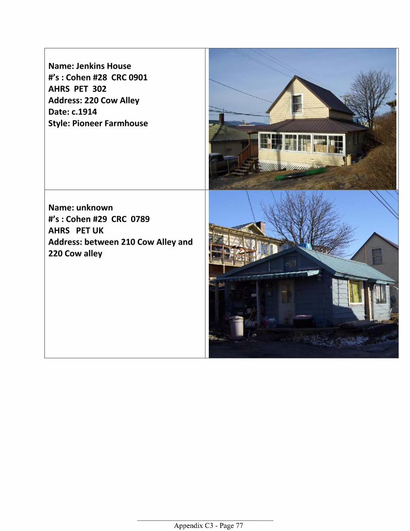
Name: Jenkins House #’s : Cohen #28 CRC 0901 AHRS PET 302 Address: 220 Cow Alley Date: c.1914 Style: Pioneer Farmhouse
Name: unknown #’s : Cohen #29 CRC 0789 AHRS PET UK Address: between 210 Cow Alley and 220 Cow alley
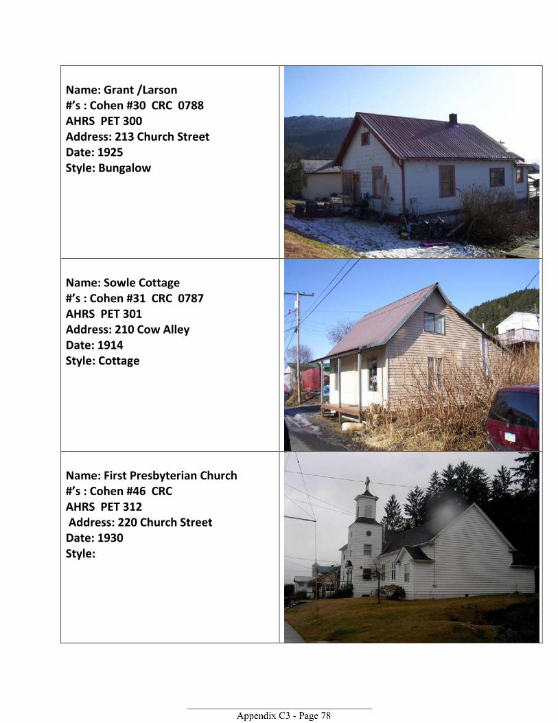
Name: Grant /Larson #’s : Cohen #30 CRC 0788 AHRS PET 300 Address: 213 Church Street Date: 1925 Style: Bungalow
Name: Sowle Cottage #’s : Cohen #31 CRC 0787 AHRS PET 301 Address: 210 Cow Alley Date: 1914 Style: Cottage
Name: First Presbyterian Church #’s : Cohen #46 CRC AHRS PET 312 Address: 220 Church Street Date: 1930 Style:
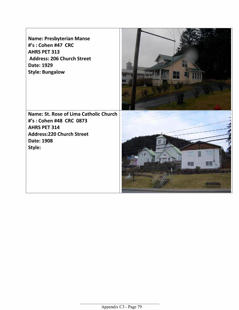
Name: Presbyterian Manse #’s : Cohen #47 CRC AHRS PET 313 Address: 206 Church Street Date: 1929 Style: Bungalow
Name: St. Rose of Lima Catholic Church #’s : Cohen #48 CRC 0873 AHRS PET 314 Address:220 Church Street Date: 1908 Style:
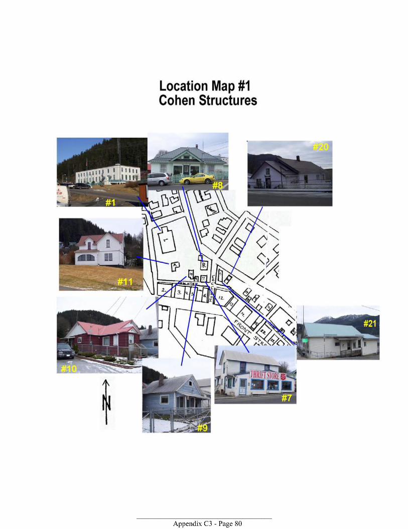
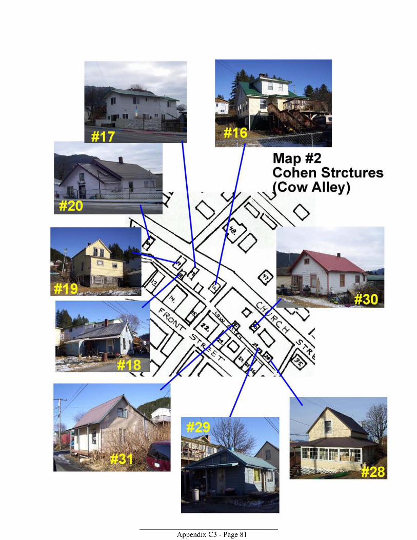

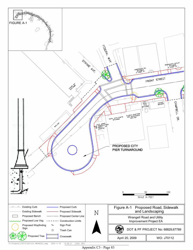
PROPOSED CITYPIER TURNAROUNDPROPOSED CITYPIER TURNAROUND
FIGURE A-1
N
DOT & PF PROJECT No: 68829,67789
WO: J70112April 20, 2009
Improvement Project EA
Figure A-1 Proposed Road, Sidewalk and LandscapingWrangell Road and Utility
Existing Curb
Existing Sidewalk
Proposed Bench
Proposed Low Veg
Proposed WayfindingSign
Proposed Curb
Proposed Sidewalk
Proposed Center Line
Construction Limits
Sign Post
Trash Can
CrosswalkProposed Tree
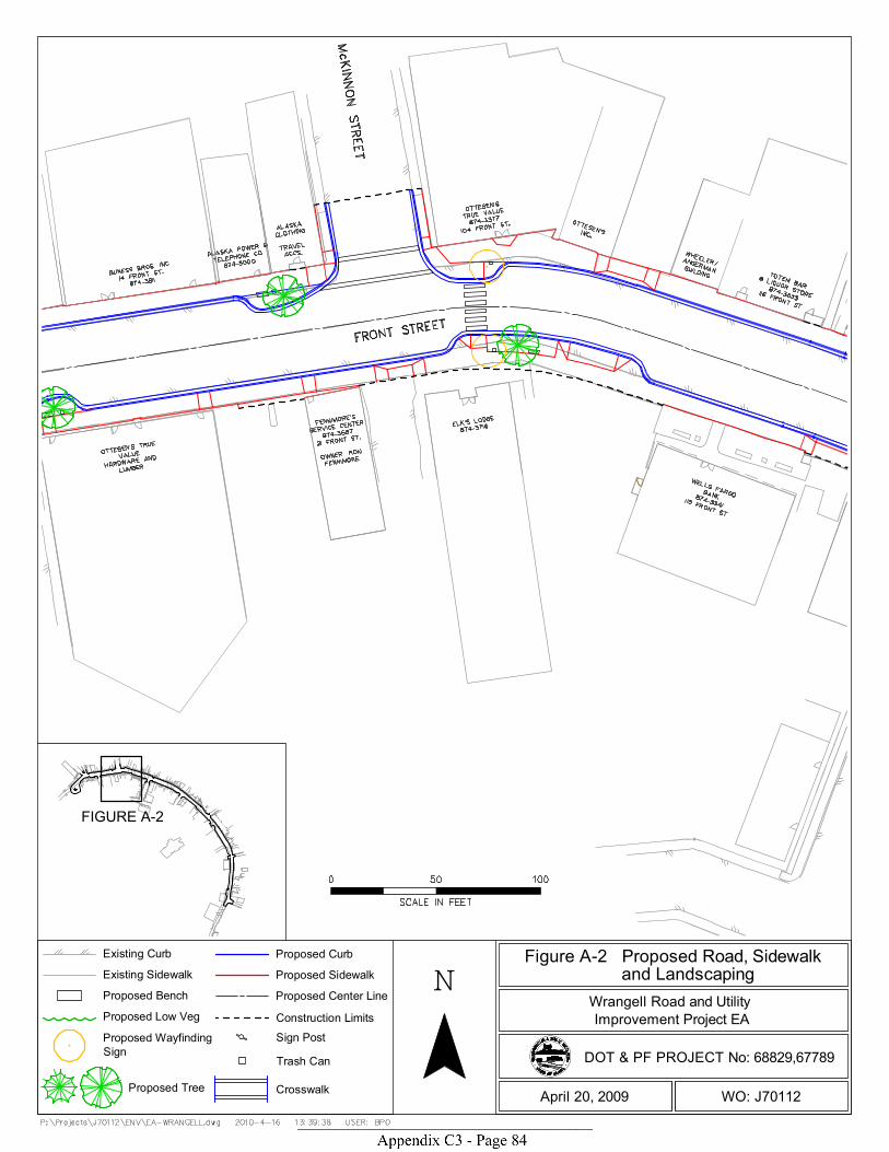
FIGURE A-2
N
DOT & PF PROJECT No: 68829,67789
WO: J70112April 20, 2009
Improvement Project EA
Figure A-2 Proposed Road, Sidewalk and LandscapingWrangell Road and Utility
Existing Curb
Existing Sidewalk
Proposed Bench
Proposed Low Veg
Proposed WayfindingSign
Proposed Curb
Proposed Sidewalk
Proposed Center Line
Construction Limits
Sign Post
Trash Can
CrosswalkProposed Tree

E A-2E B-2
FIGURE A-3
N
DOT & PF PROJECT No: 68829,67789
WO: J70112April 20, 2009
Improvement Project EA
Figure A-3 Proposed Road, Sidewalk and LandscapingWrangell Road and Utility
Existing Curb
Existing Sidewalk
Proposed Bench
Proposed Low Veg
Proposed WayfindingSign
Proposed Curb
Proposed Sidewalk
Proposed Center Line
Construction Limits
Sign Post
Trash Can
CrosswalkProposed Tree
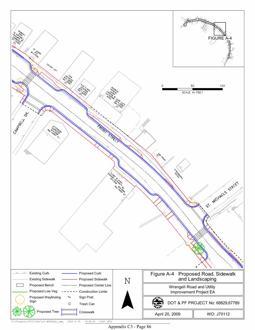
FIGURE A-4
N
DOT & PF PROJECT No: 68829,67789
WO: J70112April 20, 2009
Improvement Project EA
Figure A-4 Proposed Road, Sidewalk and LandscapingWrangell Road and Utility
Existing Curb
Existing Sidewalk
Proposed Bench
Proposed Low Veg
Proposed WayfindingSign
Proposed Curb
Proposed Sidewalk
Proposed Center Line
Construction Limits
Sign Post
Trash Can
CrosswalkProposed Tree
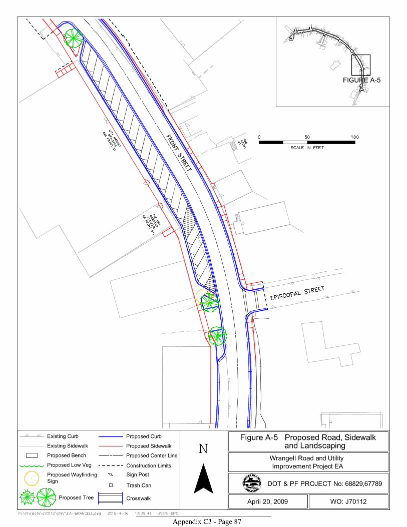
FIGURE A-5
N
DOT & PF PROJECT No: 68829,67789
WO: J70112April 20, 2009
Improvement Project EA
Figure A-5 Proposed Road, Sidewalk and LandscapingWrangell Road and Utility
Existing Curb
Existing Sidewalk
Proposed Bench
Proposed Low Veg
Proposed WayfindingSign
Proposed Curb
Proposed Sidewalk
Proposed Center Line
Construction Limits
Sign Post
Trash Can
CrosswalkProposed Tree
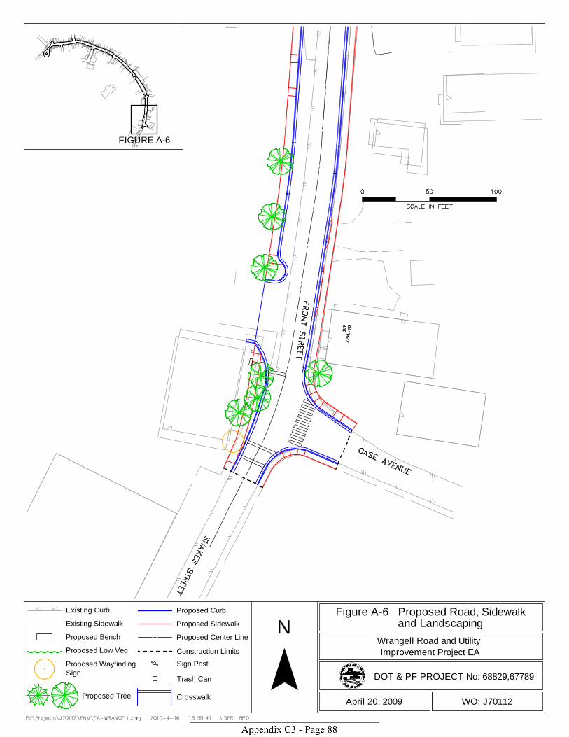
N
DOT & PF PROJECT No: 68829,67789
WO: J70112April 20, 2009
Improvement Project EA
Figure A-6 Proposed Road, Sidewalk and LandscapingWrangell Road and Utility
Existing CurbExisting SidewalkProposed BenchProposed Low VegProposed WayfindingSign
Proposed CurbProposed SidewalkProposed Center LineConstruction LimitsSign PostTrash Can
CrosswalkProposed Tree
FIGURE A-6
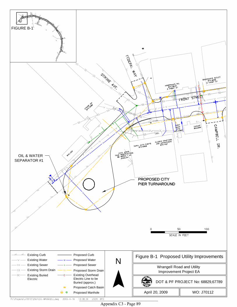
PROPOSED CITYPIER TURNAROUNDPROPOSED CITYPIER TURNAROUND
OIL & WATERSEPARATOR #1
W
W
W
W
W
W
WW
W
W
W
WW
W
W
S
S
W
W
W
SDSD
SDSD
SD
SD
SD
SD
SDSD
SD
SD
SD
SD
SD
SD
FIGURE B-1
N
DOT & PF PROJECT No: 68829,67789
WO: J70112April 20, 2009
Improvement Project EA
Figure B-1 Proposed Utility ImprovementsWrangell Road and Utility
Existing Curb Proposed CurbProposed WaterExisting WaterProposed SewerExisting SewerProposed Storm Drain
W
S
SDExisting Storm DrainExisting BuriedElectric
Existing OverheadElectric Line to beBuried (approx.)Proposed Catch BasinProposed Manhole
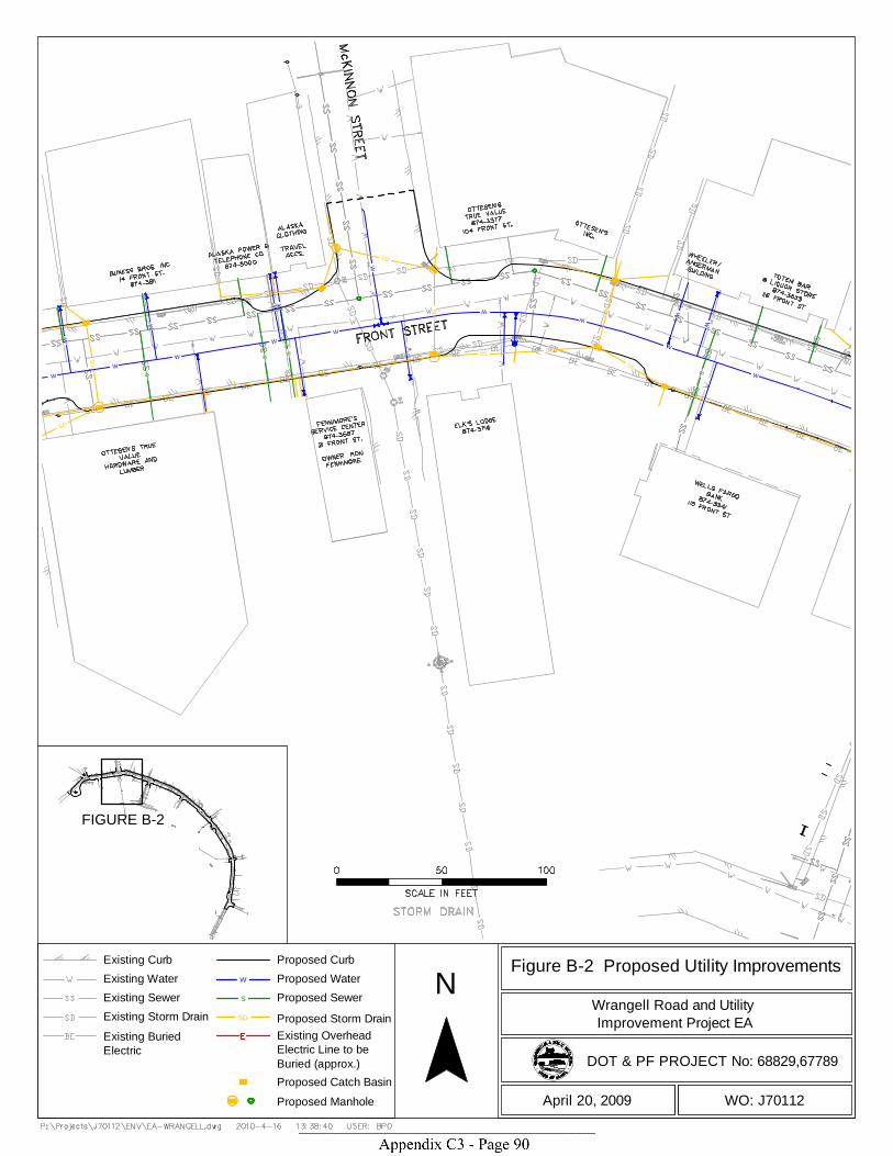
FIGURE B-2
WW
W
WW
WW
W
WS
S S
S
W
W
W W
W
W
W
SD
SD
SD
SD
SDSDSD
SDSD
SD
SD
SD
SD
SD
SD
N
DOT & PF PROJECT No: 68829,67789
WO: J70112April 20, 2009
Improvement Project EA
Figure B-2 Proposed Utility ImprovementsWrangell Road and Utility
Existing Curb Proposed CurbProposed WaterExisting WaterProposed SewerExisting SewerProposed Storm Drain
W
S
SDExisting Storm DrainExisting BuriedElectric
Existing OverheadElectric Line to beBuried (approx.)Proposed Catch BasinProposed Manhole

FIGURE B-3
E A-2E B-2
W
W
W
W
W
W
W
W
W
W
W
S
S
S
S
W
W
W
W
W
WW
W
W
SD
SD
SD
SD
SD
SD
SD
SD
SD
SD
SD
SD
SD
SD
SD
SD
SD
N
DOT & PF PROJECT No: 68829,67789
WO: J70112April 20, 2009
Improvement Project EA
Figure B-3 Proposed Utility ImprovementsWrangell Road and Utility
Existing Curb Proposed CurbProposed WaterExisting WaterProposed SewerExisting SewerProposed Storm Drain
W
S
SDExisting Storm DrainExisting BuriedElectric
Existing OverheadElectric Line to beBuried (approx.)Proposed Catch BasinProposed Manhole

FIGURE B-4
OIL & WATERSEPARATOR #2
W
W
W
W
W
W
W
W
W
W
W
W
W
S
S
S
S
S
S
SD
SD
SD
SD
SD
SD
SD
SD
SD
SD
SD
SDSD
SD
SDSD
SD
SD
SD
N
DOT & PF PROJECT No: 68829,67789
WO: J70112April 20, 2009
Improvement Project EA
Figure B-4 Proposed Utility ImprovementsWrangell Road and Utility
Existing Curb Proposed CurbProposed WaterExisting WaterProposed SewerExisting SewerProposed Storm Drain
W
S
SDExisting Storm DrainExisting BuriedElectric
Existing OverheadElectric Line to beBuried (approx.)Proposed Catch BasinProposed Manhole
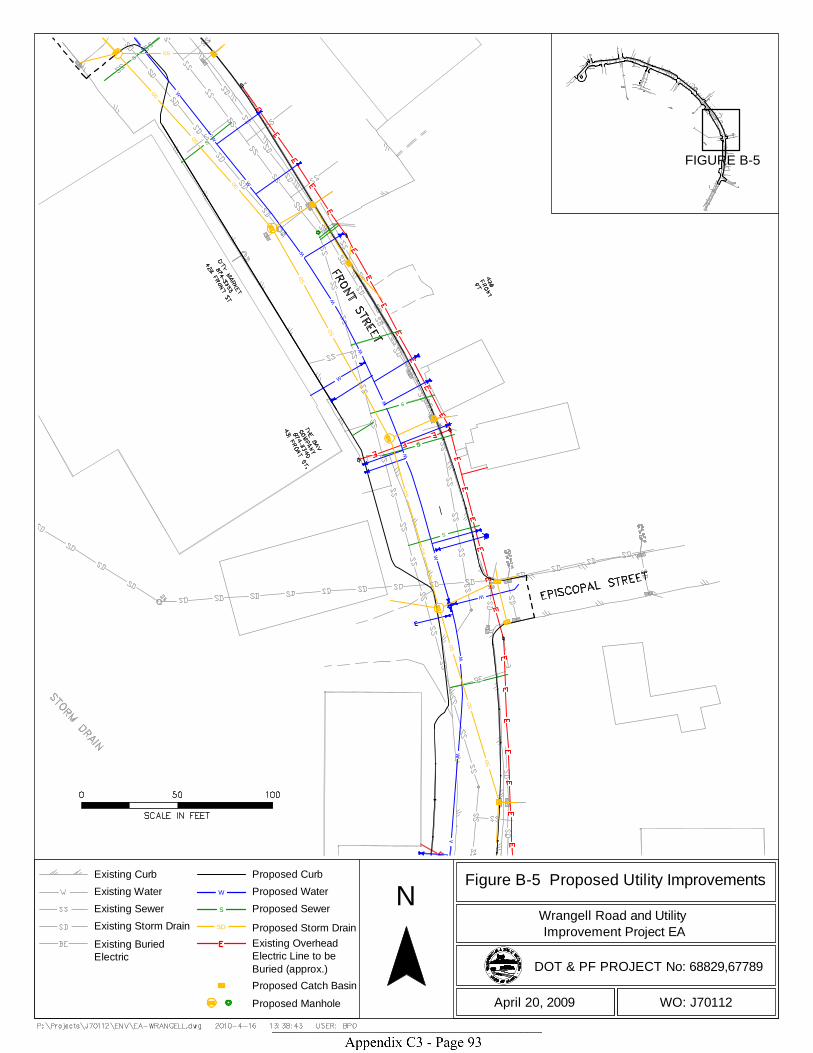
FIGURE B-5
W
W
W
W
W
W
W
W
W
W
W
WW
S
S
S
S
S
W
W
SD
SD
SD
SD
SD
SD
SD
SD
SD
SD
SD
SD
SD
N
DOT & PF PROJECT No: 68829,67789
WO: J70112April 20, 2009
Improvement Project EA
Figure B-5 Proposed Utility ImprovementsWrangell Road and Utility
Existing Curb Proposed CurbProposed WaterExisting WaterProposed SewerExisting SewerProposed Storm Drain
W
S
SDExisting Storm DrainExisting BuriedElectric
Existing OverheadElectric Line to beBuried (approx.)Proposed Catch BasinProposed Manhole
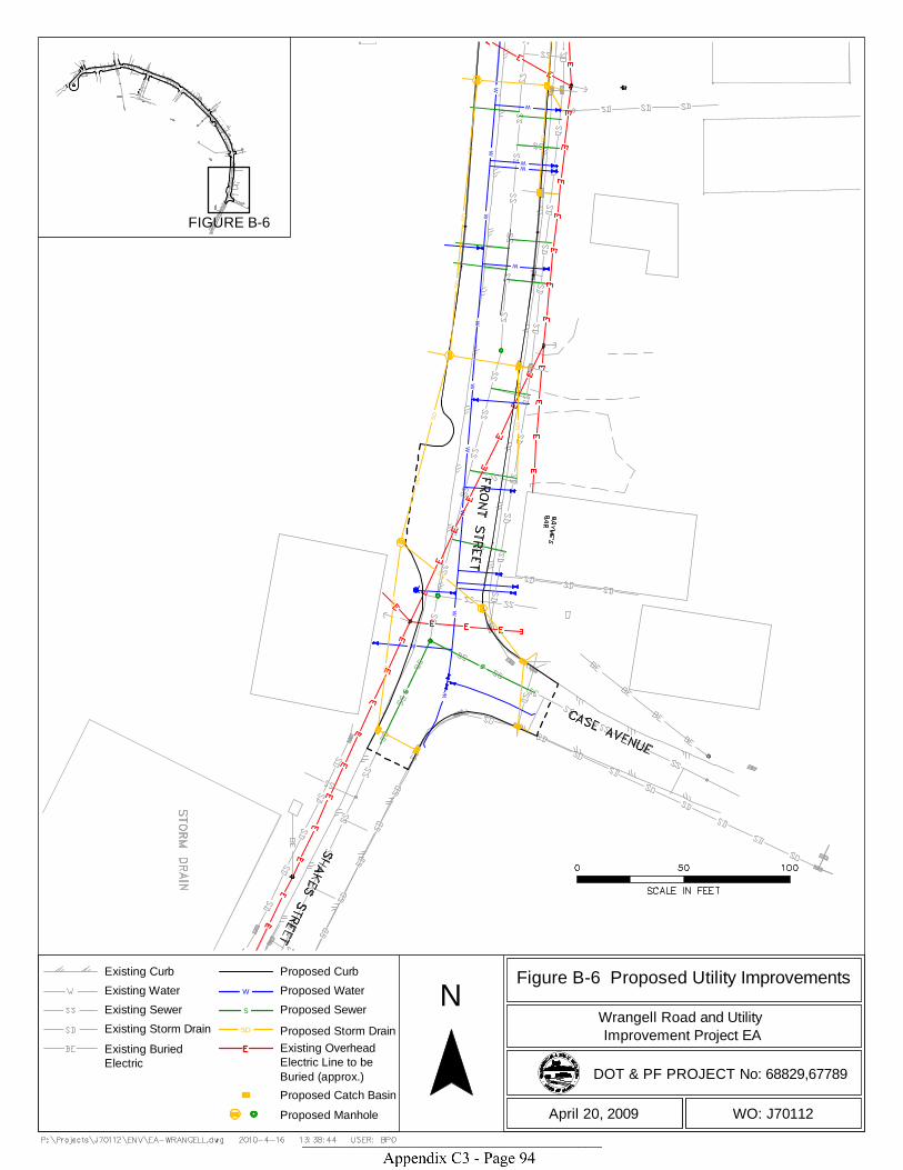
WW
WW
WW
WW
W
WW
W
W
W
SDSD
SD
SD
SD
SD
SDSD
SD
SD
N
DOT & PF PROJECT No: 68829,67789
WO: J70112April 20, 2009
Improvement Project EA
Figure B-6 Proposed Utility ImprovementsWrangell Road and Utility
Existing Curb Proposed CurbProposed WaterExisting WaterProposed SewerExisting SewerProposed Storm Drain
W
S
SDExisting Storm DrainExisting BuriedElectric
Existing OverheadElectric Line to beBuried (approx.)Proposed Catch BasinProposed Manhole
FIGURE B-6

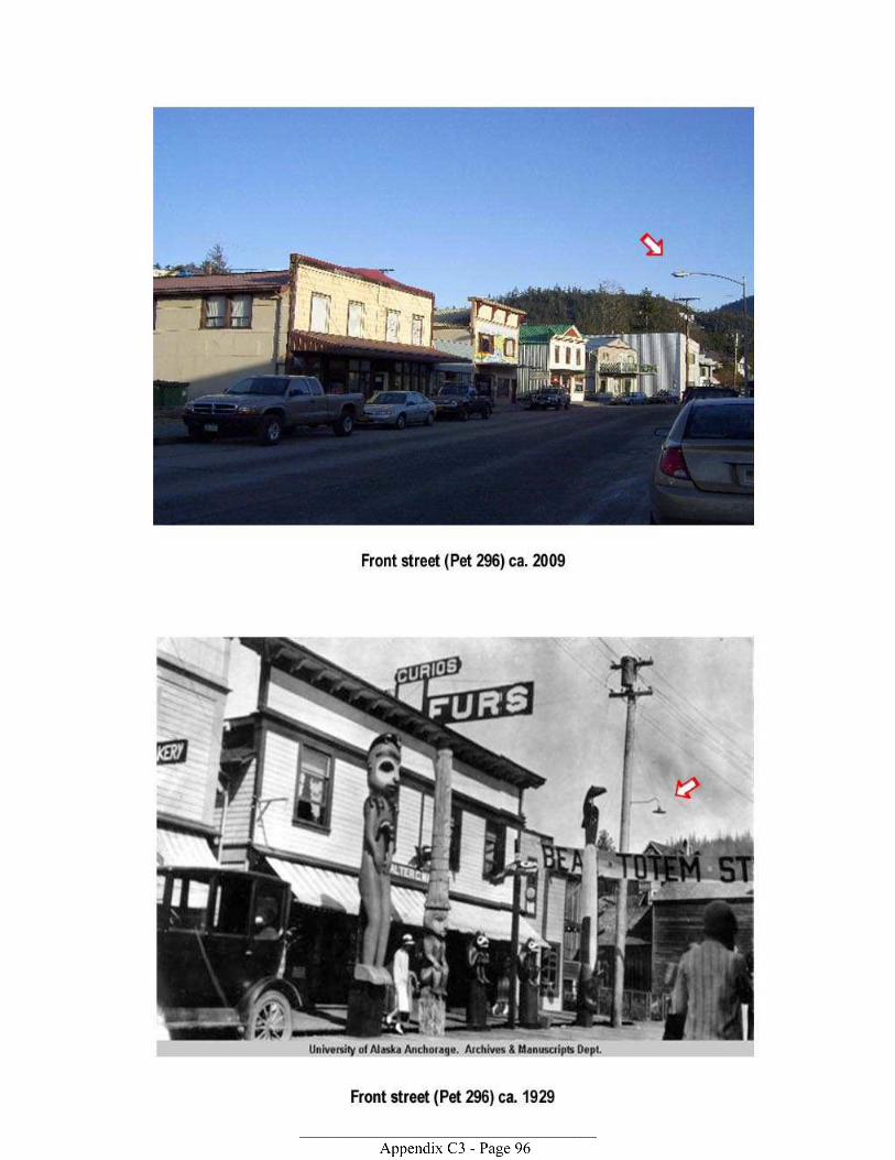
Office of History and Archaeology: Cultural Resources Report Coversheet (Must Accompany All Compliance Reports Submitted to OHA/SHPO)
Office of History and Archaeology Division of Parks & Outdoor Recreation Alaska Department of Natural Resources 550 W. 7th Ave., Suite 1310 Anchorage, AK 99501-3565 Phone: (907) 269-8721 Fax (907) 269-8908 http://www.dnr.state.ak.us/parks/oha/index.htm
Was this survey/investigation(Check one): Negative Positive Negative = no cultural resource sites are reported or updated. Positive = cultural resource sites are reported or updated.
Note: Alaska Heritage Resources Survey (AHRS) numbers are required for reported cultural resource sites, including buildings. AHRS numbers can be obtained by contacting Joan Dale at 907-269-8718).
Project/Report Information: ● Report Title: ● Report Author(s): ● Report Date: ● Submitting Organization/Agency ● Project Name and Project Number: ● Principal Investigator (PI) name: Geographic Information (attach an extra sheet or cite report page numbers if necessary) ● USGS Mapsheet (1:63,360 if available) ● Meridian/Township / Range / Section (MTRS) location: (all affected sections) Format example: “F021N018E|13-14” ● Verbal description of survey area (for example: “123 Acme Street,” “confluence of Fish and Moose creeks,” “Milepost 9-16 …” ● Does this report contain boundary coordinates for the surveyed area? Yes No Page #(s)
● Does this report contain boundary coordinates for reported sites? Yes No Page #(s) ● Land owner(s):
● Answer one: Acres Surveyed Hectares Surveyed Cultural Resources Management (CRM) Information ● List AHRS numbers of new and updated sites – (do not list sites that are merely described in the background section). ● Is the report part of a National Historic Preservation Act - Section 106 consultation? Yes No ● Is the report part of an Alaska Historic Preservation Act compliance consultation? Yes No ● Does the report’s data support a submitting agency’s determination of eligibility? Yes No
● Does the report’s data support a submitting agency’s determination of effect? Yes No ● Was this report submitted to fulfill State Field Archaeology Permit requirements?
Permit No.: Yes No
● Was this project and/or report overseen or authored by someone meeting the minimum
qualifications of the Sec. of the Interior’s Standards and Guidelines (48 FR 44738-44739)? Yes No
● Is the Principal Investigator’s resume’ appended to the report or on file at OHA? Yes No
Revised 3/29/07

The November 2009, Archaeological Assessment and Historical and
Architectural Survey for the Wrangell Road and Utility Improvements
Project, Wrangell, Alaska is included in Appendix C of the EA.
Wrangell Road and Utility Improvements Projects 1 January 21, 2010 Recommendations of Eligibility and Effect
Recommendations of Eligibility and Effect Wrangell Road Project HPRM-0003(135)/ 68829
Wrangell Utility Project 67789
Alaska Department of Transportation and Public Facilities January 21, 2010
1.0 Introduction The Alaska Department of Transportation and Public Facilities (DOT&PF), in cooperation with the Alaska Division of the Federal Highway Administration (FHWA), the U.S. Environmental Protection Agency (EPA), and the City and Borough of Wrangell, is proposing to improve a one-half mile (0.5 mile) corridor of road, sidewalks and underground utilities in and along Front and Lynch Streets in downtown Wrangell, Alaska (Section 25, T62S, R83E [USGS Petersburg B-2 NE]) (Figures 1 and 2). The project is an undertaking under Section 106 of the National Historic Preservation Act. Project elements are described and referenced figures are contained in the findings letters to the State Historic Preservation Officer and the consulting parties. Cultural Resource Consultants (CRC) completed a survey to identify historic properties in the project area in 2009 (Archeological Assessment and Historical and Architectural Survey for the Wrangell Road and Utility Improvements Project, Wrangell, Alaska, November 2009). That report recommended that four properties in the APE be considered individually eligible for the National Register of Historic Places (NRHP): Patenaude/Grant (PET-278); National Bank of Alaska/Wells Fargo (PET-618); Jenkins/Holstad (PET-298); and Diehl/Neyman (PET-299). Additionally, the report recommended a proposed Wrangell Commercial Historic District (PET-638) in one area on the north side of Front Street. CRC also stated that there was high potential for archaeological deposits in portions of the project area, although their precise nature and extent is presently unknown due to their inaccessibility. CRC recommended a finding of adverse effect for the proposed project. DOT&PF cultural resources staff has reviewed the CRC recommendations and: • agrees that the four properties are individually eligible; • does not agree that a historic district is present--three contributing properties have been
substantially altered and the two remaining properties do not reflect a significant entity warranting district status;
• agrees with the recommendations on archaeological potential; and • does not agree with the recommendation of adverse effect, and recommends a finding of no
adverse effect with the condition that archaeological monitoring would be provided in areas of new ground disturbance where there may be buried cultural remains. DOT&PF will develop a monitoring plan with the consulting parties to be incorporated into project construction.
Rationale for the DOT&PF recommendations is presented below. 2.0 Identification of Historic Properties Before addressing the property-specific determinations, it is necessary to clarify some points in the report.

Wrangell Road and Utility Improvements Projects 2 January 21, 2010 Recommendations of Eligibility and Effect
Wrangell history and periods of significance for the Front Street area: The report described a series of historic contexts for Wrangell (pp 10-21) and combined those into three broad headings, labeled “periods of significance” for the extant built properties (pp 22-23). The report identified these as: Late 19th Century Development of Wrangell, 1879 to 1899; the Early to Mid-20th Century Development of Wrangell, 1900 to 1941; and the Post World War II Development of Wrangell, 1945 to 1973. The information in the report assists in understanding some of the themes in Wrangell’s local history, but falls short of justifying the periods of significance proposed for many of the properties. The underlying assumption in many of the building discussions in the report was that a property’s period of significance would extend from its time of construction through the end of the last broad context theme in 1973, as long as the property continued in a similar use. Continued use does not equate to an extended period of significance. Using that logic, historic commercial properties that remain in commercial use today would have a period of significance extending up to the present, and this is not the case. DOT&PF believes that CRC has extended the period of significance for Front Street area properties more broadly than the historical information can support. The Front Street zone was central to Wrangell’s local history during several periods. It was the site of Stikine Tlingit use, as well as the Russian Redoubt St. Dionysius, the subsequent Hudson Bay Company Fort Stikine, and the later U.S. Fort Wrangell. The street, situated along the original beachfront, changed character as these different periods passed. By 1898, the date of the earliest extant buildings in the study area, it was beginning to shift from its late 19th century appearance with primarily gable-roofed log and split-planked buildings facing the beach to one that featured wood frame buildings, tidy milled lumber plank sidewalks, and buildings on both sides of the street (CRC Figs 4-9). Two buildings in the APE date to 1898. From that point until the onset of World War II, Front Street remained Wrangell’s central commercial area. It was associated with the primary industries of the period—seafood processing and sawmills—as well as the “Main Street” small proprietor retail and commercial sector that supported them. In addition to the industrial scale sawmill at the southern end of the area, Front Street featured false front wood frame buildings, many with storefront styles typical of the era, and planked sidewalks and a planked street. Totem poles became one of the decorative features in the downtown streetscape. This period brought the advent of electricity and streetlights (1905), telephone service and poles (1924), and later, a New Deal era water and sewer project in 1936. As a result of the latter utility work, the planked street surface was replaced with crushed rock. This period is recognized as significant in Wrangell’s commercial history, and Front Street properties are directly linked to the significant context. Eighteen properties in the APE date to this period. Following World War II, new economic circumstances brought change to Wrangell and Front Street. The Tongass Timber Act of 1947 led to a new phase in the timber industry, which lasted from 1954 until the 1990s. In response, the town’s population increased notably from pre-WWII levels. The road system expanded, and development increased outside the downtown core. Regionally, the fishing industry declined in the postwar decade, although Wrangell retained a
Wrangell Road and Utility Improvements Projects 3 January 21, 2010 Recommendations of Eligibility and Effect
fishing fleet and seafood processing facilities. Retail, service, and lumber industry enterprises continued to be active along Front Street, but other properties outside the immediate area became increasingly relevant to Wrangell’s economic development in the postwar years. These included the ferry terminal (1962), airport (1968), and a new sawmill complex at Shoemaker Bay. In the mid 1960s, Church Street, one block inland from Front Street, was upgraded, and became the primary route linking southern portions of town with the ferry terminal and north Wrangell Highway. Front Street’s setting also changed dramatically in the decades after the war. A fire in 1952 on the western end of Front Street destroyed 25 buildings on the south side of the street. Between 1955 and 1957, water, sewer and paving projects took place. In the late 1950’s/early 1960s, the waterfront and tidelands on the south side in the area of the fire were covered with a large fill, which became the site of Brueger Street and Campbell Drive. Additional fill was placed near the south end of Front Street as well. As years passed, more fill was placed in the former tidelands until it reached its present limits. The net effect of the fill work was to alter Front Street’s former relationship to the water, which had been one of its primary characteristics in earlier periods. Newer buildings were also constructed along Front Street, causing a patchwork effect of buildings of varying ages throughout the neighborhood. 2.1 Buildings The CRC report identifies 38 buildings within the APE that date to or before 1965 (enclosed Figure 5 and Table 1). Alaska Building Inventory Forms were prepared for each building and are included Appendix B of the enclosed report. Narrative summaries are provided on pages 30-43 of the report. Table 1 summarizes the recommendations of eligibility. Of the buildings assessed, 34 buildings were recommended by CRC as not eligible for the NRHP and the conclusions are provided on pages 30-43 of the report. Primarily these buildings were dismissed owing to lack of integrity. DOT&PF agrees with CRC’s recommendations that those 34 buildings are not eligible for the NRHP. Four buildings recommended by CRC as individually eligible (Figure 6) are discussed below: • Patenaude/Grant (PET-278) (pages B15-18): This two-story commercial building sits on
the northern side of Front Street. Built in 1906 by Leo Patenaude, it was originally a barbershop and later housed a variety of businesses. According to CRC, it is one of few remaining examples of a simplified version of the Queen Anne style in Alaska and one of only a few turreted buildings left in Southeast Alaska. However, CRC recommended that the property be considered not eligible under Criterion C for architectural significance due to “many exterior changes affecting the building’s historic integrity for this criterion.” CRC instead recommended that it be considered eligible under Criterion A for its association with the Early to Mid-20th Century Development of Wrangell 1900 to 1941.
The 1906 photo (page B-18) shows that this gable roof building had a commercial storefront façade that included a recessed bay entryway with a pair of vertical display windows flanking each side of a recessed entry door, with transom windows. The display windows were raised off the ground by a narrow band of decorative wooden panels. The fenestration of the upper

Wrangell Road and Utility Improvements Projects 4 January 21, 2010 Recommendations of Eligibility and Effect
story windows facing Front Street appears to be narrow paired 1-over-1 double hung wooden sash windows. The McKinnon Street elevation featured 1-over-1 sash windows on the second floor and small single paned transoms on the first level. The building included horizontal clapboard siding and a distinctive high pitched roofed tower with double hung windows and a projecting roof eave. A 1908 photo on page 14 of the CRC report also shows the building in the context of its original setting, in the back center left of the view.
The building today has been altered to include a large shed roofed awning over the storefront. The storefront windows and door, as well as the upper story street-facing windows have been replaced with fenestration of different styles and shapes. The wooden based panels and the large display windows, along with the transom windows, are gone. The upper story Front Street facing windows have been replaced with a wide, single fixed pane window. The clapboard siding has been replaced with asphalt shingles. The current shingled awning and the many changes to the storefront have had a detrimental effect on the character of the primary elevations. The awning from the 1950s, the pressed plywood siding from the 1970s, and the replacement upper story windows from the 1980s have all affected the building’s historic appearance. The building retains its signature turret, roofline, and massing, but the cumulative changes have diminished the building’s design, materials, workmanship, and feeling. While a future restoration could address the deficiencies in design integrity, particularly regarding storefront elements and fenestration, the integrity of design is currently compromised, and integrity of workmanship, materials, and feeling is diminished. The setting of this property is also compromised. The planked streets and boarded sidewalks of the early twentieth century Front Street were removed between 1936 and 1944. A disastrous fire in 1952 destroyed the buildings on the southern side of the western end of Front Street. In 1955, the waterfront and tidelands on the south side in the area of the 1952 fire were covered with a large fill, altering Front Street’s former relationship to the water. Between 1955 and 1957, water, sewer and paving projects took place along Front Street. As years passed, newer buildings were constructed throughout the area. The addition of these late 20th century buildings and other structures has further diminished the setting and feeling of the property.
DOT&PF’s recommendation: DOT&PF analyzed the significance determination under Criterion A and recommends that the Patenaude/Grant building would be individually significant on a local level for its association with the early 20th century commercial development of Wrangell, with a period of significance of 1906-1941. The property has continued in commercial use since that time, but that use does not rise above the “mere association” threshold (National Register Bulletin [NRB] 15:12), and would not necessarily warrant an extension of the period of significance to a later time unless subsequent significant associations were demonstrated. The property does not possess high artistic values and is not the work of a master. Changes have compromised the building’s features and materials so that it is no longer a true representative of a type, period, or method of construction, and consequently it does not meet the threshold for significance under Criterion C.

Wrangell Road and Utility Improvements Projects 5 January 21, 2010 Recommendations of Eligibility and Effect
Integrity: While the building is not eligible for its architectural style due to subsequent alterations, enough of its historic appearance should be evident to support its eligibility under Criterion A. NRHP guidance does allow for the rarity of a property to be considered in evaluating integrity, as long as enough of the property survives for it to be a significant resource (NRB 15:47). In this case, CRC has noted the regional rarity of this style of early 20th century commercial building, with simplified Queen Anne elements, recessed storefront, and distinguishing turret. DOT&PF has taken this rarity into account, and recommends that in this case, a greater degree of alteration of design, materials, and workmanship could be accepted for the property to convey its identity as a significant resource. Since the turret, roofline, and massing remain, and the recessed entryway is present, though altered, DOT&PF concludes that while the integrity of design, materials, and workmanship are diminished as noted above, they are sufficient to support eligibility. The property also retains integrity of location, and to a lesser degree, feeling and association. Setting, which has changed considerably since the period of significance, is not considered by DOT&PF to be an aspect of integrity which contributes to the eligibility of this property.
• National Bank of Alaska/Wells Fargo (PET-618) (pages B79-84): This one-story, flat-
roofed building is located on the southern side of Front Street east of the Wrangell Elks lodge. Constructed in 1965, it is an Alaska-adapted modern movement International Style building designed by preeminent Juneau architect Linn Forrest that is associated with the Post World War II Development of Wrangell. According to CRC, the property is significant under both Criteria A and C, with a period of significance of 1965-1973. CRC indicated that the building retains integrity of location, feeling, association, materials, workmanship, and design. Its setting on the southern side of Front Street has changed somewhat with the addition of later 20th century buildings.
DOT&PF’s recommendation: DOT&PF does not agree with the consultant’s recommendation that the property be considered eligible under Criterion A for its association with the Post World War II Development of Wrangell with the period of significance 1965 to 1973. That period of significance extends well within 50 years of the present. According to NRHP guidance, properties with periods of significance within this 50-year window would require consideration of “exceptional significance” under NRHP Criteria Consideration G (NRB 15:41). DOT&PF recognizes that the 50-year window for exceptional significance is not intended to be an inflexible, precise cutoff, and in current practice, the window is usually extended to 45 years. However, the period of significance proposed here begins at the 45-year mark and reaches into the recent past. It was not the NRHP’s intent to include such properties unless exceptional significance was established (NRB 15:41). In this case, the property’s historical association with postwar development does not rise to the level of exceptional significance. However, DOT&PF does agree with CRC’s recommendation that the building could be eligible for the NRHP on the local level under Criterion C for its architecture, with a period of significance corresponding to the construction date of 1965. This limited period of significance falls within the customary practice of flexing the 50-year standard to a reasonable degree. DOT&PF considered the bank’s significance under Criterion C under two components of the criterion—distinctive characteristics of a type, period, and method of construction as an
Wrangell Road and Utility Improvements Projects 6 January 21, 2010 Recommendations of Eligibility and Effect
example of modern movement International style, and for potential as the work of a master, for association with architect Linn Forrest. As noted by CRC, Linn Forrest is considered a regionally significant architect. Compared with his other notable works such as the Mendenhall Glacier Visitor Center, Chapel by the Lake, and Federal Building in Juneau, the bank building is a minor work that does not appear to meaningfully reflect his development as a regionally recognized master. Consequently, DOT&PF concludes that the connection with Linn Forrest is not sufficient to make the property significant under Criterion C. DOT&PF does agree that the property is significant at a local level for its expression of character defining features of the modern movement International style (Miesian subtype). Although the style covers a broad range of resources with many variants, character defining features include simplified rectangular form with minimum of ornamentation, horizontal emphasis, flat roof line, horizontal bands of glass, curtain wall construction that maximizes open interior space, and glass and steel as primary materials. The Miesian substyle, most often seen in commercial buildings, was symmetrical in appearance while other International Style design included asymmetrical elements. The Miesian subtype featured steel frame construction, flat roof, and rectangular design. As this subtype was described in a recent architectural guide, “Spaces between steel members are almost always filled with glass. When brick or stone are used, surfaces are often left exposed. Free-standing interior walls form a pattern of open and closed spaces that can be arranged to meet space requirements” (Higgins, Architectural Movements of the Recent Past, Historic Landmarks Foundation of Indiana, 2007:14). As noted by CRC, the bank features a “blending of interior and exterior space with the use of the continuous band of high windows, [an] emphasis on the planar nature of the building walls and roof, and the expansive glass storefront…”(B-82). It retains the general design features of the style noted above. Alterations have occurred, but are minor within the context of the overall design. DOT&PF agrees that the property is significant on a local level as a representative of a type, period, and method of construction. Integrity: The property retains integrity of location. The building has been altered, somewhat diminishing the property’s integrity of design, materials, and workmanship, but overall, the alterations are modest. The roof and fascia appearance has changed, and the current features now present a boxy, heavy eave profile. The aluminum storefront entrance is also a notable change on the primary elevation. Most of the rest of the building’s design characteristics are retained, and integrity of materials appears generally high. The setting has changed somewhat since the 1965 period of significance with the addition of more recent buildings in the vicinity, particularly to the west and south. Integrity of association and feeling are also sufficient to contribute to eligibility under Criterion C.
• Jenkins/Holstad (PET-298) (pages B54-57): This false front style two-story commercial building sits at the sidewalk on the northern side of Front Street. According to CRC, the property has a significant association with the Early to Mid-20th Century and Post World War II Development of Wrangell. It was built in 1934 by Bill Jenkins who opened the Jenkins’ Cafe. The Wrangell Sentinel newspaper moved into this building in the early 1950s and operated there for 25 years. According to CRC, the property retains integrity of location,
Wrangell Road and Utility Improvements Projects 7 January 21, 2010 Recommendations of Eligibility and Effect
design, materials, feeling, and association, and is recommended eligible for listing on the NRHP under Criterion A. Its setting has changed with the addition of modern buildings and other structures. DOT&PF’s recommendation: DOT&PF agrees with CRC’s recommendation that this property has local significance under Criterion A, for association with the Mid-20th Century Development of Wrangell. DOT&PF considers the property’s period of significance to be from 1934-1941. DOT&PF also agrees with CRC that the property is not individually eligible under Criterion C due to alterations to the character-defining features in the storefront. Integrity: While the building is not eligible for the NRHP for its architectural style due to alterations, enough of its historic appearance should be evident to support its eligibility as a mid-20th century Wrangell commercial building under Criterion A. The 1930s-era photo shows that this wood frame building had a commercial storefront façade that included a recessed bay entryway with a pair of vertical two-pane display windows flanking each side of a recessed entry door, with transom windows. The display windows were raised off the ground by wooden base panels. The upper story windows fenestration had two pairs of 1-over-1 double hung wooden sash windows. The building cornice included decorative brackets. The wood frame building had shiplap wood siding. There was a flat awning over the store front.
The building today has been altered, but historic elements remain. The property retains integrity of location, association, and to a lesser degree, design, materials, workmanship, and feeling. Changes to the storefront, siding, and second floor appear to have been made in the 1970s and 1980s. The storefront windows and door, and upper story windows have been replaced and the fenestration of front facing upper story windows has changed. The design of the recessed entryway has been altered by the replacement of the display and transom windows, door, and wooden base panels. The upper story windows are enlarged multiple panel fixed pane replacements. The wood siding has been replaced with plywood and is painted with murals. The building retains its narrow, flat steel-rod supported awning; false front façade; distinctive decorative cornice elements; massing; and roofline. Although the fenestration and storefront changes have affected the building’s design, materials and workmanship, the building still retains enough integrity to convey its significance under Criterion A. DOT&PF recommends that this property is individually eligible for the NRHP.
• Diehl/Neyman (PET-299) (pages B58-62): This false front style commercial two story
building was built by R. C. Diehl in 1898 for his general merchandise store, and sits at the sidewalk on the northern side of Front Street. CRC indicated that the property is associated with the Late 19th Century Development of Wrangell and continued to serve as a commercial establishment through Post World War II Development of Wrangell. Due to the many changes to the exterior, the building does not qualify under Criterion C; however, CRC recommended this building as eligible for listing on the NRHP under Criterion A. The report stated that the property retains integrity of location, feeling, association, and materials. Its setting has changed with the modern building next door to the south and carport to the north.
Wrangell Road and Utility Improvements Projects 8 January 21, 2010 Recommendations of Eligibility and Effect
DOT&PF’s recommendation: DOT&PF agrees with CRC’s recommendation that this property has local significance for the NRHP under Criterion A, for association with the Late 19th Century and Early to Mid-20th Century Development of Wrangell. DOT&PF considers the property’s period of significance to be 1898-1941. DOT&PF also agrees with CRC that the property is not individually eligible under Criterion C.
Integrity: While the building is not eligible for the NRHP as an example of a type, period, or method of construction due to alterations, enough physical integrity should be present to support its eligibility as a mid-20th century Wrangell commercial building under Criterion A. In this case, the property was a two story false front commercial building with a street facing façade parapet extending above the front gable roof, an elaborate cornice, and typical storefront elements of the period. The 1925 photo in the Cohen report is not distinct enough to clearly define the property features, but it does show a triangular pediment with lettering over a slanted upper cornice with a decorated frieze below. The Cohen report indicates that upper story window fenestration included three wood 1-over-1 double hung sash windows. The photo shows these over a decorative lower cornice with a fabric awning over the storefront. The Cohen report also indicates that the front façade was symmetrical with paired plate glass windows capped with transoms situated on either side of a recessed bay door entrance. The building had shiplap siding. The building today is somewhat altered. Changes include reconstructed metal roofing added to the top of the cornice. The shiplap siding is covered with vertical tongue and grove siding, with corrugated metal siding on the sides and back of the building. The fabric awning in the 1925 photo has been replaced with a flat-roofed awning, but the replacement awning is consistent with historic awnings from the period of significance. The storefront display windows with the transoms have been replaced with smaller windows and the wood trim has been replaced around the upper story windows, but these changes were sympathetic to the earlier fenestration patterns. The retention of the second floor sash-style windows contributes to the integrity of design, and the storefront continues to evoke its earlier design as well. The lettering on the pediment has been retained as a design feature. Although the changes have affected the building’s materials and workmanship, the building still retains characteristic design features that convey its historic appearance. Overall, the property retains integrity of location, feeling, association, design, and to a lesser degree, materials and workmanship. The setting is compromised by modern intrusions and is not an aspect that contributes to the eligibility of the property.
2.2 Wrangell Commercial Historic District (PET-638) (report Appendix A) The CRC report recommends a proposed Wrangell Commercial Historic District on the northern side of Front Street (Figure 6, Table 1, and Historic Resource District Inventory Form of report Appendix A). The district was recommended by CRC as eligible under Criterion A for its association with the Late 19th Century through Post World War II Development of Wrangell, with a period of significance extending from 1898 to 1973. Seven buildings are within the proposed district boundaries, five of which were recommended as contributing to the district. Proposed contributing elements include two buildings previously recommended as individually eligible: Jenkins/Hofstad (PET-298) and Diehl/Neyman (PET-299). Three other buildings, described below, Greif/Stough (PET-287), Uhler/Nolan (PET-294), and Waters/Philips (PET-

Wrangell Road and Utility Improvements Projects 9 January 21, 2010 Recommendations of Eligibility and Effect
296), were recommended by CRC as contributing to the district but were not recommended as individually eligible. CRC indicates that the district would be limited only to the northern side of Front Street. Due to the 1952 fire and subsequent slow redevelopment of the south side of Front Street in this area, no district resources exist in this south side area. Front Street and the sidewalks were assessed as non-contributing to the proposed district. According to CRC, the proposed district retains integrity of location, feeling, and association as a contiguous group of buildings (page 25). They indicate that the district retains integrity of design, based on cohesiveness of the buildings in scale, proportion, height, and siting. They acknowledge that the setting has changed on both north and south sides of Front Street in this vicinity. DOT&PF’s recommendation: DOT&PF does not agree with CRC’s recommendation of a proposed Wrangell Commercial Historic District. DOT&PF has reviewed the information on the properties in the proposed boundary, and recommends that the properties described below do not possess enough integrity to be considered contributing elements to a district. DOT&PF considers the properties local significance under Criterion A for their association with Wrangell development. The proposed district was then re-examined to determine whether sufficient continuity and linkage of interrelated resources was still present to support a district. It is DOT&PF’s conclusion that two individually eligible properties exist within the proposed boundary, but that no supportable district is present. When evaluating the proposed district, DOT&PF considered the period of significance to be 1898 to 1941. The NRHP guidance on historic districts indicates that “[f]or a district to retain integrity as a whole, the majority of the components that make up the district’s historic character must possess integrity even if they are individually undistinguished.” (NRB 15:46) A property may not have individual significance under Criterion A, for example, but could be included as a contributing element to a district that reflects Criterion A association. This does not necessarily translate into a substantially lesser standard for integrity. A property must still be able to physically convey its significance as a component of a district reflecting a particular context and time. • Greif/Stough (PET-287) (pages A-2, B33-36): This three-story rectangular shaped building
was built in 1898 by Bruno Greif as the Fort Wrangell Beer Hall. It is associated with the Late 19th Century to the Early to Mid-20th Century Development of Wrangell. According to CRC, the building housed various commercial businesses over the years. The building was substantially modified during the 1940s and 1950s. CRC stated that the property retains integrity of location, and that setting has been altered. The report states that the property “no longer retains integrity of design, materials, workmanship, feeling, and association due to the changes that have been made that obscure its association with this period of significance” (page A-2).
DOT&PF’s recommendation: DOT&PF considers the property’s period of significance to be 1898-1941. Given the diminished integrity noted by CRC, DOT&PF does not agree with CRC’s recommendation that the building contributes to a proposed Wrangell Commercial Historic District. The building was heavily modified in the 1940s and 1950s and no longer reflects the proposed district’s period of significance. The building today is substantially
Wrangell Road and Utility Improvements Projects 10 January 21, 2010 Recommendations of Eligibility and Effect
changed. It currently has a recessed storefront with a large wooden shed roofed awning. It no longer retains the basic design features that convey its historic appearance or function and substantial amounts of new materials have been incorporated into the building. The building no longer retains integrity of design, materials, workmanship, feeling, and association. The setting is also compromised. The property does not retain sufficient integrity to be considered a contributing element to a proposed district.
• Uhler/Nolan (PET-294) (pages A-2, B37-41): This false front style two-story commercial building was constructed in 1913 by H.D. Campbell and is associated with the Early to Mid-20th Century Development of Wrangell. According to CRC, the building housed various commercial businesses over the years. Many changes to the building have compromised its historic integrity and it lacks integrity of materials, feeling, and association. Changes have also affected the building’s design and workmanship so that it is no longer representative of a specific architectural period or style.
DOT&PF’s recommendation: DOT&PF considers the property’s period of significance to be 1913-1941. DOT&PF does not agree with CRC’s recommendation that the building contributes to a proposed Wrangell Commercial Historic District. The building has undergone significant alterations. Since the 1986 Cohen survey, cedar vertical board-and-batten siding now covers the building and a new shed-roofed awning has been added. It is unclear if the transom still exists under the siding; the tiled base and columns appear at a minimum to be painted over. The upper story windows have all been replaced and there are two large street facing fixed pane windows, with wooden sashes. The building lacks integrity of association, design, materials, and workmanship, and its 1913 and 1930s identities are no longer intact. It no longer retains its basic design features that convey its historic appearance and substantial amounts of new materials have been incorporated into the building. The property does not possess sufficient integrity to be considered a contributing element to a proposed district.
• Waters/Philips (PET-296) (pages A-3, B46-49): Originally a single-story, side-gabled cottage with a shed roofed porch, this building was modified in 1922 by Walter Waters into a false front style two-story commercial building that operated as a curio shop; it is associated with the Early to Mid-20th Century Development of Wrangell. According to CRC, the building housed various commercial businesses over the years. Many changes to this building over the years have diminished its original character. It lacks integrity of design, materials, workmanship, feeling, and association due to changes that obscure its periods of significance.
DOT&PF’s recommendation: DOT&PF considers the property’s period of significance to be 1922-1941. DOT&PF does not agree with CRC’s recommendation that the building contributes to a proposed Wrangell Commercial Historic District. The building has been substantially modified. The building today has undergone many changes. The decorative cornices no longer remain. By the 1950s the shiplap siding had been replaced by asphalt shingles and by 1986 all of the

Wrangell Road and Utility Improvements Projects 11 January 21, 2010 Recommendations of Eligibility and Effect
windows had been replaced. Grooved plywood siding has been placed over the storefront wooden based panels and columns, and the storefront pane windows have been replaced with insulated units. The upper story windows and trim are replaced with fixed pane vinyl windows. By the 1930s, flat-roofed awning had been added to many buildings. By 2009, a shed roof has been added to the top of the awning. The changes have compromised the building’s integrity of design, materials, workmanship, setting, and feeling and association that defined its character and obscure its periods of significance. The property does not retain sufficient integrity to be considered a contributing element to a proposed district.
DOT&PF’s recommendation: After reviewing the recommended district, DOT&PF concludes that the three properties recommended as contributing elements have been substantially altered. According to the NRHP, “A district is not eligible if it contains so many alterations or new intrusions that it no longer conveys the sense of a historic environment. A component of a district cannot contribute to the significance if it has been substantially altered since the period of the district's significance or it does not share the historic associations of the district” (NRB 15). The remaining two properties, Jenkins/Hofstad (PET-298) and Diehl/Neyman (PET-299) do not reflect a significant entity warranting district status. 2.3 Archaeology The CRC report concluded that there would be high potential for archaeological deposits in portions of the project area, although their precise nature and extent is presently unknown due to their inaccessibility. 3.0 Recommended Findings of Effect CRC provided a recommendation of adverse effect for the proposed project. DOT&PF disagrees with CRC’s recommendation and recommends a finding of no adverse effect on historic properties by the proposed project. Archeological Sites While no archeological deposits were identified, the CRC report indicated reasonably high potential that they could be discovered during implementation of the project. The northern end of the project (City Pier to McKinnon Street) and the vicinity of Episcopal Avenue to Case Avenue are considered high probability areas based on past land use and potential for intact prehistoric and historic cultural deposits (report pages 43, 44, and 47; Figure 12). As a result, archeological monitoring was recommended for areas of new ground disturbance where there may be buried cultural remains (Appendix C of the enclosed CRC report). DOT&PF will develop an archaeological monitoring plan that meets consulting party approval to ensure that project activities that could disturb archaeological properties are monitored to record and to recover cultural materials that may be encountered by the construction project. The monitoring plan will be developed in advance of the project’s Authority to Advertise and be incorporated into project construction.

Wrangell Road and Utility Improvements Projects 12 January 21, 2010 Recommendations of Eligibility and Effect
Historic Built Properties NRHP eligible properties in the APE are Patenaude/Grant (PET-278); National Bank of Alaska/Wells Fargo (PET-618); Jenkins/Holstad (PET-298); and Diehl/Neyman (PET-299). As documented in CRC’s report for each of those properties, the setting of these properties has been changed, and setting does not contribute to the characteristics of the properties that qualify them for NRHP eligibility. Figures A-2 through A-4 show that the proposed project does not add landscaping, street furnishing, provide altered street crossings, or other project amenities in areas directly fronting PET-618, PET-298, or PET-299. A curb extension and tree are proposed in the vicinity of PET-278. PET-278 is eligible under Criterion A for association with the early 20th century commercial development of Wrangell, with a period of significance of 1906-1941. It retains integrity of location, and has diminished, but adequate, integrity of design, materials, workmanship, feeling, and association. Setting does not contribute to the eligibility of the property. The integrity of feeling and association at this property emanate from the building’s features rather than from its current surroundings. The proposed work will not affect directly or indirectly, the qualities that make PET-278 eligible for listing in the NRHP.


T
1
N
E
2
O
P:\Projects\J70112\GIS\ENV\EA Documents\Historical District and Buildings for Letter.mxd Oct 19, 2010 11:51:38 AM User: bfarrell
Wrangell Core Historic District (PET-652)Area of Potential Effect (historical/architectural)Area of Potential Effect (archaeological)Historic Buildings ¯
0 150 30075 Feet October 19, 2010
Wrangell Road and UtilityImprovement Project
Figure 1: Historic Buildings and District
WO: J70112
DOT & PF Project No: 68828, 67789
ID Building Name AHRS #1 Federal Building PET-3162 St. Phillips Church PET-315
ID Building Name AHRS #E Patenaude/Grant PET-278N Jenkins/Hofstad PET-298O Diehl/Neyman PET-299T Wells Fargo PET-618
Buildings listed on the National Register of Historic Places
Buildings Determined as Individually EligibleFederal W
ay
Church StreetFront Street
Cow Alley
Mc
Kin
no
n S
t
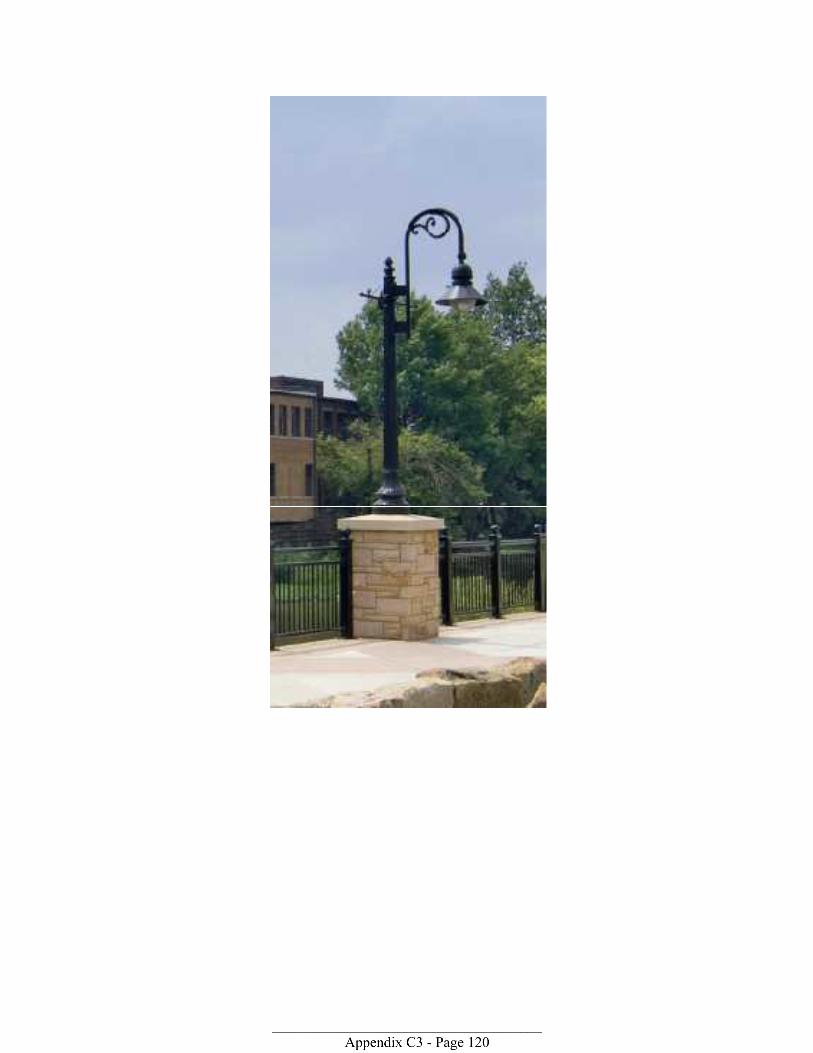
____________________________________ Appendix C3 - Page 121