Embed Size (px)
Citation preview
ENVIRONMENTAL MANAGEMENT AND CONCEPT DURING CONSTRUCTION OF DAM: A STUDY CASE OF MURUM DAM,
BELAGA DISTRICT, KAPIT DIVISION, SARAWAK
Castro Michael
G 300 M621 Master of Environmental Science 2013 (Land Use "nd Water Resource Management)
2013
,.... Pusat Khidmat Maklumat Akademik INIVF.RSm MALAYSIA SARAWAK
ENVIRONMENTAL MANAGEMENT AND CONCEPT DURING CONSTRUCTION OF DAM: A STUDY CASE OF MURUM DAM, BELAGA DISTRICT, KAPIT
DIVISION, SARAWAK " .KHIDMAT MAKL.UMAT AKADI!MIK
UNIMAS
1/11//1111/11111 1/" 11111 1000245937
CASTRO MICHAEL 11031886
This project is submitted in partial fulfillment of the requirements for Master of Environmental Science
Faculty of Resource Science and Technology UNIVERSITI MALAYSIA SARA WAK
2013
I

ACKNO~EDGEMENTS f
First of all, I would like to thank. my supervisor, Professor Dr. Lee Nyanti for his
continuous support, encouragement and valuable discussion. I would also like to
thank my family especially my parent, lecturers, staff of Sekitar Ceria
Environmental Services Sdn. Bhd. and my programme mates for guiding and
assisting me in completing this project.
Pusat Khidmat Maklumat Akademik UNIVERSCn MALAYSIA SARAWAK
TABLE OF CONTENTS Page
ACKNOWLEDGEMENT
TABLE OF CONTENTS 11
LIST OF TABLES V11
LIST OF ABBREVIATIONS IV
LIST OF FIGURES VI
ABSTRACT V1l1
1.0 INTRODUCTION 1
1.1 PROJECT BACKGROUND 1
1.1.1 DAM AROUND THE WORLD 1
1.1.2 ENVIRONMENTAL ASPECTS 4
1.1.2.1 PRE-CONSTRUCTION 4
1.1.2.2 DURING CONSTRUCTION 7
1.1.2.3 POST-CONSTRUCTION 9
1.2 PROBLEM STATEMENTS 10
1.3 OBJECTIVES 11
2.0 LITERA TURE REVIEW 11
2.1 THREE GORGES DAM 11
2.1.1 BACKGROUND 11
2.1.2 ENVIRONMENTAL MANAGEMENT AND CONCEPT 12
2.2 BAKUN DAM 16
2.2.1 BACKGROUND 16
2.2.2 ENVIRONMENTAL MANAGEMENT AND CONCEPT 17
ii

,.....
2.3 THREE GORGES DAM 18
2.3.1 BACKGROUND 18
2.3.2 ENVIRONMENTAL MANAGEMENT AND CONCEPT 19
3.0 METHODOLOGY 25
3.1 SECONDARY DATA COLLECTION AND REVIEW 25
3.1.1 SECONDARY DATA COLLECTION 25
3.1.2 LEGISLATIONS AND GUIDELINES 25
3.2 WATER QUALITY ANALYSIS 33
3.2.1 SAMPLING SITE 33
3.2.2 SAMPLES COLLECTION 35 I"
3.2.3 SAMPLES ANALYSIS 35
3.2.4 STATISTICAL ANALYSIS 37
4.0 RESULTS 38
4.1 SECONDARY DATA COLLECTION AND REVIEW 38
4.2 LEGISLA TIONS AND GUIDELINES 40
4.3 WATER QUALITY ANALYSIS 44
5.0 DISCUSSIONS . 53
5.l SECONDARY DATA COLLECTION AND REVIEW 53
5.2 LEGISLA TIONS AND GUIDELINES 54
5.3 STA TISTICAL ANALYSIS 55
6.0 CONCLUSION 57
7.0 REFERENCES 58
iii
I ,.....
LIST OF ABBREVIATIONS
ADB
AN
APHA
ASL
BOD
CFU
COD
DEIA
DO
DOE
EMP
EQA
ESIA
FSL
Ha
kWh
MVA
MW
NREB
NREO
NWQS
PFA
Asian Development Bank
Ammoniacal Nitrogen
American Public Health Association
Above Sea Level
Biological Oxygen Demand
Colony Fonning Unit
Chemical Oxygen Demand
Detailed Environmental Impact Assessment
Dissolved Oxygen
Department of Environment
Environmental Management Plan
Environmental Quality Act
Environmental and Social Impact Assessment
Full Supply Level
Hectare
Kilo Watt Per hour
Mega Volt Ampere
Megawatt
Natural Resource and Environment Board
Natural Resource and Environment Ordinance
National Water Quality Standards
Pulverised Fly Ash
iv
,..... I
RCC
SEB
SIA
SPU
SRB
TCC
TFC
TSS
UNIMAS
Roller Compacted Concrete
Sarawak Energy Berhad
Social Impact Assessment
State Planning Unit
Sarawak River Board
Total Coliform Count
Total Fecal Coliform
Total Suspended Solids
Universiti Malaysia Sarawak
v
LIST OF FIGURES
Page
Figure 1 River Water Sampling Locations 34
Figure 2 Trending Records ofBOD5 Level from November 45
2011 until April 2013 Compared to Class lIB
Figure 3 Trending Records of COD Level from November 46
2011 until April 2013 Compared to Class lIB
Figure 4 Trending Records of Total Suspended Solids Level 47
from November 2011 until April 2013 Compared to
Class lIB
Figure 5 Trending Records of Turbidity Level from November 48
2011 until April 2013 Compared to Class lIB
Figure 6 Trending Records of Ammoniacal Nitrogen Level 49
From November 2011 until April 2013 Compared to
Class lIB
Figure 7 Trending Records of Total Coliform Count Level 50
From November 2011 until April 2013 Compared to
Class lIB
Figure 8 Trending Records of Total Fecal Count Level 51
From November 2011 until April 2013 Compared to
Class lIB
vi
LIST OF TABLES
Page
Table 1 Fifth Schedule of Environmental Quality (Industrial 27
Effluent) Regulations 2009
Table 2 Seventh Schedule of Environmental Quality (Industrial 28
Effluent) Regulations 2009 for Chemical Oxygen
Demand (COD)
Table 3 National Water Quality Standards for Malaysia 29
Table 4 Water Quality Sampling Location's Details 33
Table 5 List of Documents Related with Environmental 43
Management
vii
I'
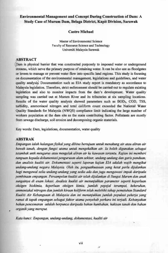
Environmental Management and Concept During Construction of Dam: A Study Case of Murum Dam, Belaga District, Kapit Division, Sarawak
Castro Michael
Master of Environmental Science Faculty of Resource Science and Technology
Universiti Malaysia Sarawak
ABSTRACT ~am is physical barrier that was constructed purposely to impound water or underground streams, which serve the primary purpose of retaining water. It can be also use as floodgates or levees to manage or prevent water flow into specific land regions. This study is focusing on documentation of the environmental management, legislations and guidelines, and water quality analysi~ Documentation such as EIA study report is mandatory as accordance to Malaysia legislation. Therefore, strict enforcement should be carried out to regulate existing legislation and also to monitor impacts from the dam's development. Water quality sampling was carried out at Murum River and its tributaries at six sampling locations. Results of the water quality analysis showed parameters such as BOD5, COD, TSS, turbidity, ammoniacal nitrogen and total coliform count exceeded the National Water Quality Standards for Malaysia (NWQS) compliance limit indicating the large number of workers population at the dam site as the main contributing factor. Pollutants are mostly from sewage discharge, soil erosion and decomposing organic materials.
Key words: Dam, legislations, documentation, water quality
ABSTRAK Empangan ialah halangan jizikal yang dibina bertujuan untuk menakung air atau aliran air bawah tanah, dengan fungsi utama untuk mengekalkan air. fa boleh digunakan sebagai tetambak untk mengurus atau mengelak aliran air ke kawasan tertentu. Kajian ini memberi tumpuan kepada dokumentasi pengurusan alam sekitar, undang-undang dan garis panduan, dan analisis kualiti air. Dokumentasi seperti laporan kajian EfA adalah wajib mengikut undang-undang negara Malaysia. Oleh itu, penguatkuasaan yang ketat perlu dijalankan bagi mengawal selia undang-undang yang sedia ada dan juga mengawasi impak daripada pembinaan empangan. Persampelan kualiti air telah dijalankan di Sungai Murum dan anak sungainya di enam lokasi. Analisis kualiti air menunjukkan parameter seperti keperluan oksigen biokimia, keperluan oksigen kimia, jumlah pepejal terampai, kekeruhan, ammoniakal nitrogen dan jumlah kiraan koliform telah melebihi tahap pematuhan Standard Kualiti Air Kebangsaan di Malaysia dan ini menunjukkan jumlah populasi pekerja yang ramai di tapak empangan sebagai faktor utama penyebab perkara ini terjadi. Kebanyakan bahan pencemaran adalah berpunca daripada bahan kumbahan, hakisan tanah dan bahan organik yang mereput.
Kata kunci: Empangan, undang-undang, dokumentasi, kualiti air
viii
-
1.0 Introduction
1.1 Project Background
1.1.1 Dam Around The World
Worldwide, many countries rely upon hydropower for substantial portion of their
electricity. In developing countries, rapid urbanization and continued population
growth will ensure increased demand for electric power for decades to come, even
with the most successful of demand management and energy efficiency measures.
Dams have one of the most important roles in utilizing water resources and were
constructed many years before gaining the present infonnation about hydrology and
hydromechanics (Anul et al., 2007). Dam is a physical barrier that was purposely
constructed to impound water or underground streams, which serve the primary
purpose of retaining water and it can be also use as floodgates or levees to manage
or prevent water flow into specific land regions. However, most dams are used as
hydropower dam to generate electricity.
In reviewing the past, the construction of dams have been going on from early man's
period of civilization as evidence are available in the region of Bacelonia around
Euphrates and Tigris in present-day Iraq (Aladelokun, 2012). The construction of
barrier across streams channels for the purpose of impounding water goes back to
about 5,000 years from now. There were nearly 700 dams built every ten years up to
1950s and later, this number grew rapidly (Anul et al., 2007). In general view,
development of dams could provide a major contribution to the economic
development of industrial as well as of developing countries, and sometimes often
1
, "
considered as sustainable source of electricity, e.g. sustainable hydropower or green
hydropower.
Dams can be classified into four major types, namely gravity dams, arch dams,
buttress dams and earth-filled dams (Schnitter, 1994). Gravity dams are solid
concrete structures with triangular cross sections which are suitable for sites with
reasonably sound rock foundation (United States Department of the Interior, 1987).
This type of dam is thick at its base and thinner towards its tops. When view from
the top, it is either straight or only curved and the upper stream is nearly vertical.
The broad bases gravity dam holds water by the brute force of its weight. Gravity
dam can be found on Columbia River in Washington, United States of America.
Meanwhile, arch dams are those that employ the same structural principles as the
arch bridges. Arch dam is a type whereby the upper stream curve of the slender dam
directs water pressure through the abetment to the retaining canyon walls. It is
normally built in the form of up ended arch with bases on the walls of canyon. Arch
dams are thinner and therefore, require less material than any other type of dam.
Arch dams are suitable for sites that are narrow and have strong abutments. It
usually made of concrete and more often in the shape of a V than U-shape. Arch
dams are generally classified as thin, medium and thick, depending on the ration of
the width of the base to the height (United States Department of the Interior, 1987).
Some examples of arch dam are namely, the Kariba Dam in Rhodesia, the Glen
Canyon Dam on the Colorado River in Arizona, the Vallon de Baume in France and
the Monte Novo Dam in Portugal.
2
Buttress dams are watertight upstream face and a series of buttresses that support the
face and the water pressure and the weight of the structure to the foundation. They
comprised of flat deck and multiple arch structures and require approximately about
60 percent less concrete of the solid gravity dams (United States Department of the
Interior, 1987). This kind of dam can be found at Greece, which is the Pidima Dam,
built in 1953.
Earth-filled dams are the most common type of dam which utilize natural materials
with minimum of processing and may be built with primitive equipment under
addition where any other construction materials would be impracticable. Although,
this type of darns are the earliest known dams and the easiest to be constructed,
however, numerous failures of many earth-filled dams that are poorly designed
make it an apparent threat (United States Department of the Interior, 1987). Prior to
that, earth-filled dams require much more engineering skill in their conception and
construction than other types of dam. The highest earth-filled embankment dam in
the world is the Oroville Dam in California.
There are about approximately 845,000 dams in the world, of which 80,000 of the
numbers are located in the United States of America and at least nearly 40 dams
including still in construction, located in Malaysia. The largest dam, which is also
the largest hydroelectric power station in the world is the Three Gorges Dam in
People's Republic of China and it has a generating capacity of approximately 22,400
megawatt (Ponseti & L6pez-Pujol, 2006). Other dams around the world are as listed
below:
3
1. Itaipu Dam (Brazil and Paraguay)
11. Guri Dam (Venezuela)
111. Tucurui Dam (Brazil)
lV. Grand Coulee Dam (United States of America)
v. Longtan Dam (People's Republic of China)
VI. Krasnoyarskaya Dam (Russia)
Vll. Robert - Bourassa Dam (Canada)
V111. Churchill Falls Dam (Canada)
lX. Bratskaya Dam (Russia)
x. Laxiwa Dam (People's Republic of China)
1.1.2 Environmental Aspects
1.1.2.1 Pre-Construction
Prior to construction of a dam, Early Stage and Preparation assessment need to be
carried out where both assessment can help guide the stakeholders involved in
managing the environment factor (International Hydropower Association, 2010).
Early Stage assessment guides the stakeholders to assess the strategic environment
from which proposals for hydropower projects emerge including the best location to
develop the dam. It identifies project risks and opportunities at an early stage, in
order to identify the challenges and management responses to proceed with a more
detailed project investigation. This Early Stage assessment can encourage better
early stage analysis and identification of knowledge gaps.
4
Pusat Khidmat Mak.lum~t Akademik UNlVERSm MALAYSIA SARAWAK
The most suitable location for building a dam is a narrow part of a deep river valley;
the valley sides that can act as naturaJ walls. The primary function of the dam's
structure is to fill the gap in the natural reservoir line left by the stream channel. The
sites are usuaUy those where the gap becomes a minimum for the required storage
capacity. The most economical arrangement is often a composite structure such as a
masonry dam flanked by earth embankments. The current use of the land to be
flooded should be dispensable too.
Apart from that, other significant engineering and engmeermg geology
considerations when building a dam include:
1. permeability of the surrounding rock or soil;
11. earthquake faults;
1Il. landslides and slope stability;
IV. water table;
v. peak flood flows;
VI. reservoir silting;
vii. environmental impacts on river fisheries, forests and wildlife (see also fish
ladder);
viii. impacts on human habitations;
ix. compensation for land being flooded as well as population resettlement; and
x. removal of toxic materials and buildings from the proposed reservoir area.
5
Meanwhile, the Preparation assessment helps to assess the preparation stage of a
hydropower project, during which investigations, planning and design are
undertaken for all aspects of the project. This project stage is normally subject to
national regulatory processes regarding project-specific Environmental and Social
Impact Assessment (ESIA) requirements as well as project management processes.
An assessment conducted at this point in time would assess whether all preparatory
requirements have been met, management plans are in place, and commitments are
appropriate and binding. Later, this decision is governed by national regulatory
processes to obtain a construction permit and an operating license based on the ESIA
and project specific governmental requirements. Following this point, construction
commences along with relevant elements of environmental and social management
plans.
The Environmental and Social Impact Assessment (ESIA) is an activity designed to
identify and predict the impact on the bio-geophysical environment and on man's
health and well-being, taking into account of the requirements, legislative proposals,
policies, programmes, projects and operational procedures, and to interpret and
communicate information about the impacts (Munn, 1975). Environmental changes
expected out of any physical developments can have harmful or beneficial
consequences, or both. These consequences are known as 'impacts', brought forth
by the man-induced changes, which are called 'activities'. The potential impacts
likely to arise as consequences of these activities are on:
6
Impacts on the abiotic environment
According to Wildi (2010), potential impact on the abiotic environment includes the
-degradation of water quality in terms of the spillage of lubricants and fuel from
machineries, soil is prone to erosion during the earthwork and also the changes in
temperature due to deforestation.
Impacts on the biotic environment
There are potential impacts from the construction, inundation and operational phase
of the dam, with the greatest impact predicted during the construction and
inundation phase. The major indirect impact is habitat loss and degradation. The
direct impact on wildlife ranged from psychological and physiological stress to the
more traumatic effect of injury, and death (McCartney & Sally, 2006).
Impacts on the human environment
There is likely to be social interaction with the resettled population at the affected
project area. Dam construction requires the state to displace individual people in the
name of the common good, and that it often leads to abuses of the masses by
planners or stakeholders. Potential impacts on the human environment are
population change, influx of temporary workers, presence of visitors, dissimilarity in
age, gender and ethnicity and relocation of affected communities.
1.1.2.2 During Construction
The Implementation assessment is purposely to assess the implementation stage of a
hydropower project, during which construction, resettlement, environmental and
7
other management plans and commitments are implemented (International
Hydropower Association, 2010). During the construction of dams, environmental
protection measures should be fully and timely carried out in strict as accordance
with the approved Environment and Social Impact Assessment (ESIA) and design
documents.
The environmental consequences in constructing dams are numerous and varied, and
includes direct impacts to the biological, chemical and physical properties of rivers
and riparian environments.
The dam wall itself will blocks fish migrations, which in some cases and with some
species completely separate spawning habitats from rearing habitats. The dam also
traps sediments, which are critical for maintaining physical processes and habitats
downstream of the dam
A dam also holds back sediments that would naturally replenish downstream
ecosystems. When a river is deprived of its sediment load, it seeks to recapture it by
eroding the downstream river bed and banks. Riverbeds downstream of dams are
typically eroded by several meters within the decade of first closing a dam; the
damage can extend for tens or even hundreds of kilometers below a dam.
Riverbed deepening will also lower groundwater tables along a river, lowering the
water table accessible to plant roots (and to human communities drawing water from
8
wells). Altering the riverbed also reduces habitat for fish that spawn m flver
bottoms, and for invertebrates.
Large dams have led to the extinction of many fish and other aquatic species, the
disappearance of birds in floodplains, huge losses of forest, wetland and fannland,
erosion of coastal deltas, and many other unmitigable impacts.
1.1.2.3 Post-Construction
The Operation assessment should be carried out to assess the operation of a
hydropower facility and can be used to infonn the view that the facility is operating
on a sustainable basis with active measures in place towards monitoring, compliance
and continuous improvement (International Hydropower Association, 2010). This
project phase is framed by the operating conditions put forth in a national
governmental authorization often called operating license.
The Operation assessment criterion looks in many cases to see if any ongoing or
emerging issues have been identified. Identification processes could take many
forms, for example through field inspections, review of data collected in-house or by
other agencies, national and international policy scans and mechanisms to be aware
of stakeholder issues and concerns.
Ongoing issues refer to unresolved issues associated with the operation of the
hydropower facility that have been of concern for a period of time. They could be
legacy issues. Emerging issues could be those arising from changes to policies,
9
legislation, standards, stakeholder expectations, or physical cbanges to the
environment in which the facility operates.
Mitigation measures to resolve the issues could take many forms; for example
continued monitoring, more intensive monitoring, a risk assessment or scenario
analyses, improvement to communications, negotiations, commissioning studies,
implementation of management responses and development of plans for future
implementation if the risks continue to emerge.
1.2 Problem Statements
Currently, there is no proper integrated environmental management in construction
of dam in Sarawak:
1. More than one major activities are involved in construction of dam such as
construction of quarry, landfill, development of new roads, extraction of river
sand, generation/usage of hazardous waste, resettlement, biomass removal and
wildlife rescue.
Implementation of rules and regulations from Federal and/or State Government are
causing confusion among stakeholders:
1. Construction of dam is under jurisdiction of State Government (NREO).
11. Generation/usage of hazardous waste is under jurisdiction of Federal
Government (EQA).
10
-:=::=:-::--:~-------=-----;---------~-----~~-----~~~-----.
1.3 Objectives
The objectives of this study were:
1. To assess the development activities from an environmental conservation
perspective.
11. To identify and quantify possible major environmental impacts that may result
from project development, and to incorporate into the project plan appropriate
abatement and mitigating measures.
lll. To assess and analyze the environmental significance of residual impacts.
2.0 Literature Review
2.1 Three Gorges Dam
2.1.1 Background
The Three Gorges Dam is a gravity cum hydroelectric dam and also the world's
largest power station with installed capacity of22,500 MW. The dam is spanning the
Yangtze River by the town of Sandouping, located in Yiling District, Yichang,
Hubei province, China (Challman, 2000). The dam body was completed in the year
2006 whilst the whole project was completed and fully functional on 4th July 2012
when the last of the main turbines in the underground plant began production. With
the total of 32 main turbines with two smaller generators (50 MW each), the total
electric capacity of the dam is 22,500 MW (Ponseti & Lopez-Pujol, 2006).
Apart being producing electricity, the dam is also intended to increase the Yangtze
River's shipping capacity and reduce the potential for floods downstream by
providing flood storage space (Gleick, 2008). This project was regard as a historic
11
engineering, social and economic success, with the design of state-of-the-art large
turbines, and a move toward limiting greenhouse gas emissions.
The main features of the Three Gorges Dam are as follows:
1. Main Dam:
• A reservoir with surface area of 1,084 km2 and a total storage capacity of
39.3 billion m3;
• A 181 m high Gravity Dam with a crest length of 2,310 m with the required
spillway incorporated in the main dam body; and
• Crest elevation is 185 m above sea level (ASL) with reservoir length is 600
km and maximum reservoir width is at average of 1.1 km.
11. Gated spiHway capacity - 102,500 m3 per second.
Ill. Powerhouse:
• The power house is a conventional type with installed capacity of22.5 GW.
• There are 32 unit of main turbines with each generate about 700 MW and 2
unit of small turbines of 50 MW each (Wahby, 2004)
2.1.2 Environmental Management and Concept
According to the National Development and Reform Commission of China, 366
grams of coal would produce 1 kWh of electricity during 2006. At full power, Three
Gorges reduces coal consumption by 45-50 million tonnes per year, avoiding 100
million tonnes of carbon dioxide, millions of tonnes of dust, two million tonnes of
sulfur dioxide, 370,000 tonnes of nitric oxide, 10,000 tonnes of carbon monoxide,
and a significant amount of wastewater and solid wastes (Challman, 2000).
12
Therefore, hydropower saves the energy needed to mine, wash, and transport the
coal from the northern China.
Sedimentation and Seismic Effects
There are two hazards that are uniquely identified with the dam. One is that
sedimentation projections and the other is that the dam sits on a seismic fault. At
current levels, 80% of the land in the area is experiencing erosion, depositing about
40 million tons of sediment into the Yangtze annually (Barber & Ryder, 1993). As
the sediment accumulates upstream, it will affect most of the cities and towns
located along the river due to the rise of water level at the reservoir's opposite end
and submerge some part of the cities or towns (Wahby, 2004).
Apart from that, incoming loads of sedimentation has caused imbalance in the
overburden pressure on soil strata which later may increase of triggering earthquakes
and landslides, and eventua1ly threaten the dam's stability (Wahby, 2004).
Large reservoirs can cause seismic events as the water fill in and as the pressure on
local faults increases (ICE, 1981). The area surrounding the dam and reservoir is
currently seismically active with numerous earthquakes ranging from smaller than a
magnitude of two to larger than a magnitude of four (Reynolds, 2011). Prior to that,
there has been an increase in reported seismic activity in the region following
construction of the dam and filling of the reservoir (Gleick, 2008). Following that, as
the risk of such disruptions appears to be far more severe, proper planning and effort
13
. ------~-----
of new resettlement need to be carried out in details as the danger zone around the
reservoir has expanded.
Flood Control
A major anticipated benefit from the development of the dam is highly improved
flood protection at the middle and lower reaches of the Yangtze River (Gleick,
2008). In the past, people living along the Yangtze River have suffered tremendous
losses from the flooding. The most disastrous floods happened in the twentieth
century occurred in 1931 which cause the death of 145,000 people and inundated
approximately 34,000 km2 of farmland (Ponseti & Lopez-Pujol, 2006). Therefore,
the Three Gorges Dam is projected to allow a precise control over the Yangtze
River, thus reducing the severity of flooding by 90%, thereby saving life and
property from major destruction (Wahby, 2004).
Navigation and Water Commerce
Another important purpose of the Three Gorges Dam is to improve navigation along
the Yangtze River to the interior of China (Challman, 2000). The dam is projected to
allow the passage of 10,000 tonnes ships to Chongqing from previously of 5,000
tonnes ships, therefore, increasing the annual one-way navigation capacity from 10
million tonnes to 50 million tonnes (Wahby, 2004).
Wildlife
This region has long been known for its rich biodiversity. It is home to 6,400 species
of plants, 3,400 species of insects and about 500 species of terrestrial vertebrates
14


