Embed Size (px)
Citation preview

E X P E R I E N C E Y O U R A M E R I C A
National Park ServiceU.S. Department of the Interior
Cape Hatteras National Seashore
Threatened bird tracking systems at Cape Hatteras National Seashore
Leslie Frattaroli Acting GIS SpecialistOuter Banks Group
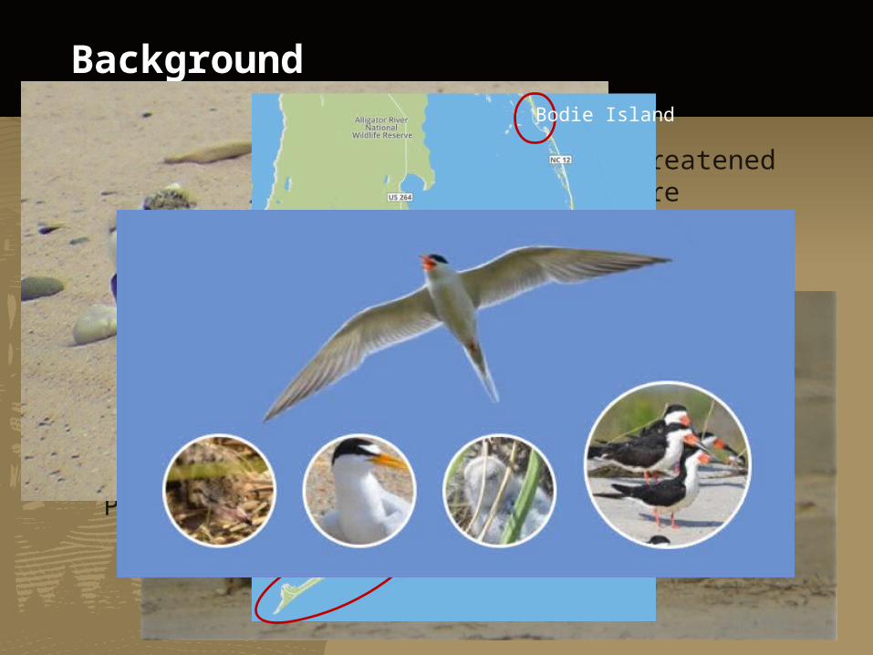
Background
Biological data is obtained for threatened and endangered birds on the Seashore
Monitoring data has been collected for over 10 years
Data is collected over 3 islands (Bodie, Hatteras, Ocracoke)
In 2012, Off-Road Vehicle (ORV) Management Plan was implemented
Bodie Island
Hatteras Island
Ocracoke Island

ORV Management Plan Continued
2012 ORV Management Plan
Bird location and movements dictate the current beach closures
Closure will then be reassessed based off current location on a daily basis
Internal hard-copy maps created to reflect this change
Public facing web map updated on Cape Hatteras National Seashore website

Old system
Wildlife technicians and management utilized google docs spreadsheets for data collection
Data collection entered manually from a paper form
Duplicate data entry, non standardized data
Interface wasn’t user-friendly
Wasn’t coherent easy way to compile data for future analysis

Workflow
Wildlife Technician
collects GPS points
GIS Technician/GIS Specialist enter GPS data into GIS database
Enter Tabular Data into Google
Docs
Reconcile Tabular and Spatial Data

Conversion to current system
Created an ArcSDE geodatabase located on a virtual server in the Denver Data Center
Database is highly relational
Implement versioning to enable simultaneous multiuser editing

Web Application Development
Development started in 2012
Created authoritative database
Implementation of ArcGIS Server Feature Services
Created web application
http://www.nps.gov/npmap/blog/how-we-build-internal-apps.html

New Work Flow – Data Entry

Some biological data is strictly spatial
Minimal information collected with a spatial location
Date Species

Work Flow – Spatial to Tabular Data

Add Tabular data to existing spatial location

Lessons learned
Steep learning curve to use the database compared to Google Docs
Two competing visions of what the database should look like Field Staff Programmers
Trying to get exact questions from management for reporting functions

Positive Outcomes
Central authoritative database in Denver allowed us to reduce in house versions of databases
Utilize ArcGIS online and NPS Portal to create quick online maps to visualize management areas (internal and public facing) Useful for non-GIS users
Once field staff knew the workflow, they liked being able to view the data spatially

What’s Next?
Upcoming field season, easy GPX file uploads by field staff
Enables quick verification of correct point locations
Incorporation of legacy data
Ideally, collect data directly in the field without paper form

Any questions?
National Park ServiceU.S. Department of the Interior


![Capitanul Hatteras [2.0].doc](https://img.dokumen.tips/doc/110x75/563dba87550346aa9aa66c30/capitanul-hatteras-20doc.jpg)