Embed Size (px)
Citation preview

DESIGN TASK GROUP 4 / page 1
Design Task Group 4 Movement and travel
Milton Keynes, 21 July 2006
This report is based on the presentations given, and comments offered, during the third Design Task Group for the housing growth areas at Milton Keynes Partnership, Milton Keynes on 21 July 2006. The day included presentations and a tour of Central Milton Keynes. The following is a summary of and commentary on the various presentations. These notes are intended as a summary of personal observations on the place and processes rather than a transcript, and therefore do not represent the formal views of authorities involved. The Design Task Group, established and managed by CABE is a forum for local authorities and delivery vehicles to consider policy and share best practice relating to design issues in the four housing growth areas, Opportunity Boroughs and Growth Points.
1.
2.
3.
4.
5.
6.
7.
8.
9.
10.
11.
Contents Sarah Allan CABE Welcome and introduction Jane Hamilton Milton Keynes Partnership The Milton Keynes experience Jake Desyllas Intelligent Space Partnership Making streets for real people David Birkbeck Design for Homes Car parking: what works where Victor Callister City of London Street scene challenge Q&A Louise Duggan Streets Advisor CABE Matthew Turner CABE Europan 9: call for sites Carlton Roberts-James MKSM architecture & built environment centre Sarah Whittaker Milton Keynes Partnership Tour of Central Milton Keynes John Dales Urban Initiatives Workshop: improving the public realm along Midsummer Boulevard

DESIGN TASK GROUP 4 / page 2
Sarah Allan
CABE
Introduction and welcome
Following the introductory design task group last October, we have established a pattern for each event, around a key theme that is shaping the decisions affecting design in the housing growth areas: Ashford: sustainable development, including use of renewables and sustainable urban drainage. Barnet: establishing positive relationships with developers – development agreements and robust procurement processes. Today: movement and travel because how we have chosen to travel has shaped the design of places. Using London as an example, we can see how its development has been shaped by the design of its streets. From Regent Street, designed as a boulevard for carriages in the eighteenth century, through the development of the railway suburbs in the nineteenth century to the dominant force of designing for the private car in the twentieth century. It is no accident that we have chosen Milton Keynes to discuss this issue. It is a good example of a place that has been designed at a scale to suit the private car. Currently we are changing the emphasis to reduce car use by creating walkable neighbourhoods, with shops and schools within easy walking distance of homes, providing opportunities for people to live in city centres and to use public transport to move around. Policy is changing our attitude to speed and travel. We want to be able to travel quickly from A to Z but easily walk or cycle from A to B. The speakers today will be exploring how we can create places for people, and yet still design to accommodate the car.
Jane Hamilton Milton Keynes Partnership
The Milton Keynes experience
MKP: areas of influence
Eastern Expansion Area
The purpose of the presentation is to explain the backdrop to what is currently happening in Milton Keynes and the influences on the city. Milton Keynes is based around the concept of accessibility by the car. It will be a substantial challenge to make the cultural changes necessary to reduce the reliance on cars as Milton Keynes grows. Milton Keynes Partnership (MKP) was formed in 2004 as a sub-committee of English Partnerships. It is not a UDC but it was set up by statute and aims “to contribute to the successful and sustainable growth of Milton Keynes”. English Partnerships has two seats on the Board, Milton Keynes Council has three, the Local Strategic Partnership has three and there are two independent appointments plus non voting members. Significant growth is planned for Milton Keynes. 33,900 new homes and 33,900 new jobs are planned by 2016. 68,000 new homes are planned by 2031. Milton Keynes has been growing for the last 40 years but these targets mean that the pace has to accelerate. Currently 1200-1400 new homes are being built every year and this needs to increase to 3-4,000 per year. It is important to ensure that quality is not compromised in meeting these targets. MKP are also delivering two Design for Manufacture sites (£60,000
WWWWWWWWoooooooo llllllllvvvvvvvv eeeeeeee rrrrrrrr ttttttttoooooooonnnnnnnn
RRRRRRRReeeeeeeeggggggggeeeeeeeennnnnnnneeeeeeee rrrrrrrr aaaaaaaatttttttt iiiiiiii oooooooonnnnnnnn
OOOOOOOOaaaaaaaa kkkkkkkk gggggggg rrrrrrrroooooooo vvvvvvvveeeeeeee MMMMMMMM iiiiiiii llllllll lllllllleeeeeeeennnnnnnnnnnnnnnn iiiiiiii uuuuuuuummmmmmmm CCCCCCCCoooooooommmmmmmmmmmmmmmmuuuuuuuunnnnnnnn iiiiiiii tttttttt yyyyyyyy
BBBBBBBB llllllll eeeeeeee ttttttttcccccccc hhhhhhhh lllllllleeeeeeee yyyyyyyy
RRRRRRRReeeeeeeeggggggggeeeeeeeennnnnnnneeeeeeee rrrrrrrr aaaaaaaatttttttt iiiiiiii oooooooonnnnnnnn
CCCCCCCCMMMMMMMMKKKKKKKK aaaaaaaannnnnnnndddddddd CCCCCCCCaaaaaaaammmmmmmmppppppppbbbbbbbbeeeeeeee llllllll llllllll PPPPPPPPaaaaaaaa rrrrrrrr kkkkkkkk
Potential Potential Potential Potential Expansion AreasExpansion AreasExpansion AreasExpansion Areas
Regeneration Regeneration Regeneration Regeneration ProjectsProjectsProjectsProjects
New New New New Development Development Development Development

DESIGN TASK GROUP 4 / page 3
Western Expansion Area
house) and Oakgrove Millennium Community. They have planning powers in the urban expansion areas, which comprise about 15,000 homes and 350,000 m
2 commercial floorspace.
There is a need to shift the nature of employment from retailing and distribution to knowledge based industries, allied to establishing a stronger university presence, building on links with the Open University, and strengthening the technology base. The long term growth strategy could see Milton Keynes expanding beyond its current local authority boundary into Bedfordshire and Buckinghamshire, which would be controversial, as well as intensifying in the centre. It is clear that the city centre needs to be denser and MKP are exploring how this could be done within the existing grid structure. Masterplans are being put together with the private sector for the Eastern and Western expansion areas. In an attempt to shift the emphasis form cars to public transport, the masterplans have moved away from the grid approach to a city street and public transport spine approach. Outline applications will be dealt with by the end of the year. MKP are using several quality standards:
� BREAMM/ Ecohomes – EP’s minimum standard is Very Good but many schemes are achieving Excellent
� EP’s National Quality Price Standards � Local Plan policy D4 – requires 10% renewables
Now area based programmes for renewables are being looked at and developers are being persuaded to look at heat transfer and wind turbines on an area wide scale in the expansion areas. Design quality cascades down from the masterplan, through development frameworks and design codes (on sites of 1000+ homes). Placemaking groups in Central Milton Keynes and the expansion areas include a mixture of partners and aim to bring together interested parties, officers and Members to discuss projects, especially design codes. In this way, all the key stakeholder consultation can be done together in a collaborative way, which is working very well. It is increasing local capacity and developers are learning that they need to work well with partners.
Central Milton Keynes masterplan
Reviewing the long term masterplan started in the late 1990s, before the growth agenda, and a new masterplan and framework were produced and adopted as supplementary planning guidance by the Council. The masterplan has moved away from stand alone buildings and promotes perimeter block development, taking current perimeter parking into multi-storeys. Residential density will be increased in the centre and even the shopping centre extension proposal contains 300 new homes.

DESIGN TASK GROUP 4 / page 4
Central Business Exchange III
C4.1
The Central Business Exchange III development, currently under construction, is breaking some of the unwritten rules of the original masterplan, with buildings of over 5 storeys and building to the edge of the grid road. The C4.1 scheme will create a new market for city centre, high density living in Milton Keynes and will be monitored closely. The scheme will be mixed use including a new Sainsbury’s supermarket, live-work units, commercial and community uses. A handbook is being developed to set principles for the design of the public realm. A comprehensive approach is being taken. Principles include:
� Diversity in the character of open spaces � Active fronts to streets � Space making buildings “outdoor rooms” � Community facilities around public squares � Flexible ground and first floor levels
Jake Desyllas Intelligent Space Partnership
Making streets for real people
Making streets for people presents an interesting challenge in Milton Keynes. The photograph on the left shows the pedestrian walkway on the most heavily used pedestrian route outside the shopping centre. Even here, pedestrians do not have priority! The challenge in places like Milton Keynes is undoing the 1960s vision of segregating different types of road user. The image below left is from the Buchanan Report Traffic in towns. To avoid dangerous and congested streets, it was thought that split level planning with different channels for pedestrian, car and bus movement would be a better solution. It was driven by the concept that streets don’t work. The plan was to create a series of urban motorways along Oxford Street and Tottenham Court Road. Although these plans did not come to fruition, we are still living with the consequences of this way of thinking today. Where once we had streets, we now have planned transport. The following two images show the same street in Reading. You can just make out the church spire in the background of the second picture.

DESIGN TASK GROUP 4 / page 5
above and below: St Giles
Circus
Pedestrian analysis at St Giles Circus
Streatham High Road analysis
Pedestrians do not follow this transport planning vision. Most major streets are examples of design failings in the way that vehicles and pedestrians interact. St Giles Circus, London W1 Centrepoint was built on what would have been the roundabout connecting the two urban motorways at the junction of Tottenham Court Road and Oxford Street. A strange public space has resulted which is a renowned pedestrian accident black spot. Pedestrians do not behave in the way that the transport planners want them to. People walk through barriers and cross at informal crossing points even though the risk of accident is much higher. The coloured diagram shows an analysis of pedestrian movement at this junction with red areas representing the highest number of movements, and blue the fewest. The black dots show the sites of accidents involving pedestrians. The analysis shows that many people are prepared to risk their lives by walking in the road and crossing at places other than the marked crossing points. We can either try to force pedestrians to change their behaviour, or design streets for people and vehicles to interact safely in the first place. Streatham High Road: the effect of severance Streatham High Road is extremely difficult to cross and so 72% of movement is on the western side of the road, the side of the stations. On the western side there are better quality shops and high street brands while the eastern side has marginal uses on short term leases as a result of the lower footfall. There is a direct relationship between the way that pedestrians are treated and how well dependent uses survive. Shoreditch Triangle The area within the ‘triangle’ created by streets in Shoreditch was difficult to access and so Transport for London planned to install new crossing points to improve accessibility. Intelligent Space analysed how people actually moved around the area and found that 59% of crossing took place ‘informally’ outside designated crossing points. The following series of diagrams show how the analysis helped to redesign the crossing points to match them with desire lines:

DESIGN TASK GROUP 4 / page 6
Leeds Eastgate
Tokyo pedestrian heaven
As a result of the improvements, informal crossings have reduced by 61% as now the crossing points are in the right place. Overall there are 9% more crossings into the area than before, despite the fact that movement in the area generally has reduced. Pedestrian flows can be modelled and measured. It is important to assess streets and junctions for pedestrian use as well as car use. Modelling can be used in many ways, for example to predict the impact of new retail development on pedestrian flows. Leeds Eastgate A developer is proposing a retail extension, which a few years ago would have meant a box on the edge of the town centre. Using pedestrian modelling, the developer is designing the extension to tap into existing pedestrian flows and create new circulation routes to extend the town centre. Tokyo There are other approaches to traffic segregation. Tokyo’s main retail street, containing all its flagship stores, has been closed to traffic every Saturday for 30 years. They call it ‘pedestrian heaven’.
David Birkbeck Design for Homes
Car parking: what works where
Car parking: what works where is a new study of different car parking solutions and an analysis of the contexts that they are suitable for. It was commissioned by English Partnerships because there is a huge demand for car parking and ideas on how to design for it. Research by Alan Young and Phil Jones based on the 2001 census showed that larger sized properties have higher levels of car ownership. 8 habitable room houses have twice the car ownership of 4 habitable room houses. Flat dwellers own 0.1-0.2 fewer cars than house dwellers and owner occupied households own 0.5 more cars than their rented equivalent. Location was found to be statistically irrelevant. Noble and Jenks studied Reading in 1996 and found that at any one time, the number of cars that had left Reading was balanced by the number of cars entering Reading.
TfL Planned Crossing Routes used by pedestrians Desire Lines ISP Proposed Crossing

DESIGN TASK GROUP 4 / page 7
Extract from car parking: what works
where
New parking innovations
Gunwharf Quay, Plymouth (above and
below)
19% of dwellings have no car 54% have one car 23% have two cars 4% have more than two cars
So designating two bays per household, suits only 23% of them, which suggests that allocated parking is inefficient and unallocated parking is a much more efficient approach. If spaces are allocated then more spaces need to be provided. Young and Jones calculated that 18% more spaces are necessary when they are allocated by dwelling. Sue McGlynn & Graham Smith from Oxford Brookes and Mike Stanley from Bristol City Council analysed the efficiency of various on-street parking layouts. Certain layouts have advantages. For example, the mixed tenure housing square works well because it is efficient and also tenure blind. Often affordable houses are easily distinguishable from the private housing because of their lack of garages. New innovations in parking technology are being introduced. In Cesena, Italy, a computerized underground parking system holds 108 cars in a 21 metre diameter space. This is because no circulation space is required and the cars can be parked and stacked extremely close together. The same number of cars would require 6 times as much land at the surface. This type of parking system is a huge selling point for the developer. Four similar parking systems are in the planning pipeline at the moment in the UK. Car free schemes generally are not truly car free as people tend to keep their cars elsewhere, in surrounding streets. Successful legal challenges have meant that car free can only be enforced within the development site itself. Car clubs and car sharing can be very effective. A firm in Sandwich, Kent runs a scheme which incentivises staff to leave their cars at home by paying them what they would otherwise have spent on car park maintenance for not driving to work. A Midas Homes scheme at Gunwharf Quay in Plymouth uses granite setts successfully to differentiate parking areas. Homezones have been designated (note the ugly signs) but on street parking creates street activity. In Poundbury, for example, the on-street parking works much better than the rear parking courts because of better surveillance at the front. The EP car parking guide sets out a series of case studies in different central, urban and suburban contexts and looks at which parking solutions are suitable for these contexts. Each context then has a series of rules of thumb. As a general rule, on street parking should be considered first and the quality of the street should be prioritised above all else.

DESIGN TASK GROUP 4 / page 8
Victor Callister City of London
Street scene challenge: improving public space in
partnership
Aldermanbury Square
Devonshire Square – before
Devonshire Square – after
London Wall – by Foster & Partners
The street scene challenge programme in the City of London has overseen a number of successful public realm improvement projects. Aldermanbury Square is being improved through a unilateral undertaking by Scottish Widows. The surrounding landowners are also contributing financially and the City of London is managing it – a true partnership between the private and public sectors. The architect of the development is also designing the public realm scheme, using space in the development for the plant for the water feature. The City would not have been able to afford to do this on its own and the developer has realised that a better public realm will add value to their development.
funding source amount (£)
scottish widows 500,000
stanhope 220,000
city 50,000
total 770,000
In Devonshire Square, the space has been made more human by removing the roundabout and street signage. It is working very well. 50% of the scheme was funded by Royal SunAlliance.
Post the ring of steel – a counter terrorism measure in the City – and the congestion charge, traffic has reduced by 40% in the City. This has led to opportunities for closing streets, widening pavements and creating more pedestrian friendly areas.
Devonshire Row has been closed following traffic reduction
Partnering with the private sector has given the Council access to design teams that they otherwise could not have afforded to use. For example, Foster & Partners have designed a scheme at Moorgate/London Wall, half funded by the developer and half by the Council. Generally developers have been very keen to participate in projects along London Wall to turn a highway back into a street. The Street Scene Challenge programme was launched without resources so Victor set up a working group which became the Streets and Walkways spending committee. 12-15 street scene officers are now paid for from the project budgets and not by the taxpayer. Parking revenue also goes into street scene projects. Officers have delegated powers and are not part of the capital bid round, allowing them to move quickly and make dynamic decisions to meet the expectations of the business community. The developer’s contribution is always capped and so the risk is borne

DESIGN TASK GROUP 4 / page 9
Award winning scheme at the Old Bailey
by the Corporation rather than the private sector, which is a critical part of partnering. Local authorities usually seek to place the risk on the private sector meaning that they are reluctant to get involved. Flexible financial partnerships are formed, which take account of the accounting needs of business, allowing them to benefit from tax efficiencies. The client team always includes the contributing businesses. The following table shows how the funding breaks down: Businesses want to be innovative to make a significant change in quality and they are prepared to fund the improvements to do so. In Queen Street, for example, artists were commissioned. Susan Collins designed a temporary drainage lighting installation which will now be in place for five years due to its popularity.
Shoe Lane
Leadenhall Street
Public realm improvements can also double as security measures. At Shoe Lane, Goldman Sachs were part funding new planting, paving and an Anthony Gormley sculpture but post the London bombings their security requirements increased dramatically. The City are allowing them to install bollards and use managed street closures. The planters shown left are crash rated and a much more attractive solution than concrete blocks. Street scene projects also include opening up public access to new buildings, such as the atrium at 122 Leadenhall Street.
Q&A
Q:
A:
Sarah Allan: it’s good to see presentations that emphasize that design is not just about aesthetics, but also about economics and adding value. Biljana Savic: Will there be intensification in the existing neighbourhoods in Milton Keynes or just in the centre as there is often local opposition to densification? Jane Hamilton: There is pressure from the government to make the most effective use of land. Significant consultation has been done in the city centre, Bletchley and Wolverton, so that the communities better understand what needs to happen. It is also important to manage the relationship with business. There is a need to regenerate some of the low density estates. MKP are trying to engage people to think collectively about how things might change, for example using place check exercises. It is important to instil confidence that change will bring benefits. People are worried that they might have to move to smaller houses and about loss of green space, even where that space is under utilised. Engaging with the community is a slow, bottom up process but one that is extremely important.

DESIGN TASK GROUP 4 / page 10
Q:
A:
Q:
A:
Q:
A:
Q:
A:
Heather Emery: how could Victor’s experiences in the City be translated to other towns? Victor Callister: The City of London has lots in common with a small market town. It has a historic environment, a strong sense of civic responsibility by the larger firms and a small number of decision makers. It should be possible to run similar schemes in a market town by encouraging local businesses to invest in the public realm. Sarah Allan: Was there a difference between the approach of commercial developers and housebuilders in the car parking study? David Birkbeck: It depends on the developer and their capital aspirations. They all need to be incentivised to act differently. Louise Duggan: Is there a future for car free development? With management of controlled parking zones, making residents aware and wider management, could it work? David Birkbeck: currently it isn’t working. All of these measures have been tried but residents have legally challenged it. It is very difficult to get people to buy in to it and sign up to the rules. Carlton Roberts-James: What cost effective ways are there to deal with pavement parking? David Birkbeck: There are some interesting ideas. Angell Town in Brixton uses planters; Piers Gough has created “fat corners” in Crown Street, Glasgow; steel bollards have been used. The formality of the arrangement appears to be the biggest deterrent.
Louise Duggan Streets Advisor CABE
Louise works in CABE Space focussing specifically on the interface between streets and place making. She works across research and enabling, and there are a number of initiatives underway: engagement with the Manual for Streets, research into the inclusive design of shared surface spaces and work on the whole life value of well designed spaces.
Over the next couple of months, Louise will be identifying projects with high design aspirations, which would benefit from specialist enabling support. CABE Space has recently widened their enabling to include a number of practitioners who are expert in highways and place making.
CABE Space is also producing a case based good practice guide on streets, to be delivered early 2007, and is looking for examples of good projects. These could be residential retrofitting, new build developments, mixed use high streets or ring road projects. If you are aware of any projects that may be suitable, or that you want to celebrate, please let Liz Hoehnke know, [email protected].

DESIGN TASK GROUP 4 / page 11
Matthew Turner CABE
Europan 9: The international housing design competition -
call for sites
Previous Europan winning schemes
Maccreanor Lavington Architects –
Zaanstad, Netherlands
Europan is a biennial competition for young architects (under 40), to design innovative housing schemes for sites across Europe. It has a pan-European reach: 74 sites in 19 participating countries. It’s not just a drawing board exercise: the intention is to deliver projects. Multidisciplinary design teams are encouraged The next Europan theme is sustainability. So what do you get out of it?
� Your development area on the international map � An injection of fresh and daring thinking � Innovative solutions developed partly in isolation of the
sometimes restricting complexities � Attend forums and exchange learning with young designers and
site promoters across Europe � The opportunity to work with CABE to develop a detailed brief
What do you need to provide?
� Specific information about the site is required by November 2006 in order to develop the brief
� Be able to have ownership issues and capital finance in place by summer 2008
� Be able to commit sufficient time over the two year competition period to actively contribute to brief development, competition judging, attend events across Europe (about 10-15 days over 2 years), and to nurture the winners
What kind of site is needed?
� To accommodate 50 - 200 dwellings � Set within a larger framework of a clear masterplan � Two interlinked scales to the site
- The ‘study’ site with an urban design focus (3-10 ha) - The ‘project’ site, within the study site, with an architectural focus (1-3 ha)
� Have the potential to explore major themes of sustainability - both at the dwelling and the neighbourhood scale
� Have the possibility for entrants to engage with a mix of uses, either on the site, or directly influencing the site.
The brief should be focussed on sustainability
� Aiming to comply with sustainable homes code, WWF / SEEDA checklist
� Set within a project with ambitious targets such as walkable communities, zero carbon / zero waste developments etc.
� The implication of the French translation ‘durable’ � The possibility of exploring issues of other uses mixed with
residential � Building for Life, Lifetime Homes, BREEAM Eco homes
Europan 9 – and after the competition?
� The site sponsor works with winner to develop the ‘idea’ into a deliverable project.
� CABE enabling support provided to winning teams to facilitate
DESIGN TASK GROUP 4 / page 12
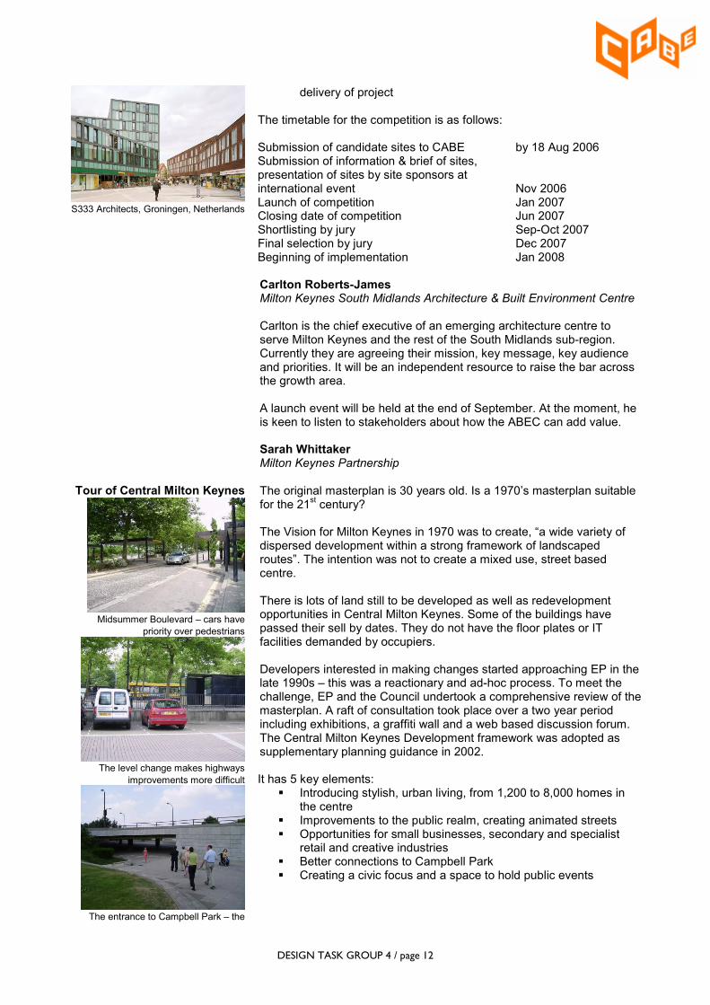
S333 Architects, Groningen, Netherlands
delivery of project The timetable for the competition is as follows: Submission of candidate sites to CABE by 18 Aug 2006 Submission of information & brief of sites, presentation of sites by site sponsors at international event Nov 2006 Launch of competition Jan 2007 Closing date of competition Jun 2007 Shortlisting by jury Sep-Oct 2007 Final selection by jury Dec 2007 Beginning of implementation Jan 2008
Carlton Roberts-James Milton Keynes South Midlands Architecture & Built Environment Centre
Carlton is the chief executive of an emerging architecture centre to serve Milton Keynes and the rest of the South Midlands sub-region. Currently they are agreeing their mission, key message, key audience and priorities. It will be an independent resource to raise the bar across the growth area. A launch event will be held at the end of September. At the moment, he is keen to listen to stakeholders about how the ABEC can add value.
Sarah Whittaker Milton Keynes Partnership
Tour of Central Milton Keynes
Midsummer Boulevard – cars have
priority over pedestrians
The level change makes highways
improvements more difficult
The entrance to Campbell Park – the
The original masterplan is 30 years old. Is a 1970’s masterplan suitable for the 21
st century?
The Vision for Milton Keynes in 1970 was to create, “a wide variety of dispersed development within a strong framework of landscaped routes”. The intention was not to create a mixed use, street based centre. There is lots of land still to be developed as well as redevelopment opportunities in Central Milton Keynes. Some of the buildings have passed their sell by dates. They do not have the floor plates or IT facilities demanded by occupiers. Developers interested in making changes started approaching EP in the late 1990s – this was a reactionary and ad-hoc process. To meet the challenge, EP and the Council undertook a comprehensive review of the masterplan. A raft of consultation took place over a two year period including exhibitions, a graffiti wall and a web based discussion forum. The Central Milton Keynes Development framework was adopted as supplementary planning guidance in 2002. It has 5 key elements:
� Introducing stylish, urban living, from 1,200 to 8,000 homes in the centre
� Improvements to the public realm, creating animated streets � Opportunities for small businesses, secondary and specialist
retail and creative industries � Better connections to Campbell Park � Creating a civic focus and a space to hold public events

DESIGN TASK GROUP 4 / page 13
subways are safe but are sometimes
perceived negatively and visually the
park is cut off from the centre
Campbell Park – needs to be better
connected to the city centre
The centre of the Boulevards have
potential for pedestrians and other
activity
The priority areas for improving the public realm are: � Station square � Midsummer Boulevard � Church square � Campbell Park � Marina and canalside
Sarah Whittaker led a walkabout to look at the challenges for turning Midsummer Boulevard into an animated streetscape and making better connections to Campbell Park. The Midsummer Place shopping centre severs the Boulevard, which otherwise forms the main spine from the station to Campbell Park. There is the potential to open the route up again if part of the shopping centre structure is removed. No shops have been built there to safeguard a public transport route and to allow for future reconfiguration. Pedestrians and traffic are segregated and this is exacerbated by a level change which raises the carriageway above the walkways and parking areas. This will have an effect on future improvements. On the far side of Midsummer Place, buses dominate. If future public transport improvements increase the number of buses from 60 per hour to 180 per hour, as has been suggested, then improvements will need to be made to the public realm in this location. A bus interchange is being considered. Many people do not realise that Campbell Park is located so close to the city centre because it is visually cut off, accessed through an underpass. Improving connections from the shopping centre is a priority.
John Dales Urban Initiatives
Workshop: improving the public realm along
Midsummer Boulevard
Urban design has to be considered from a movement perspective. Pedestrians will find their own way when a designer has done something wrong. It would be helpful if we could lay routes out in plasticine first and see where people go! It takes the skills of all urban professions to design the built environment and they have to work collaboratively. Urban design is a collection of individual inputs: interdisciplinary not multidisciplinary. The built environment needs to handle complexity. We need to think about all the ways that people will use space. There are lots of different activities and requirements. In Milton Keynes, the portes cochere and the drop kerbs do not line up so that mothers with buggies have to leave the sheltered walkway to cross the road. The public realm along Midsummer Boulevard is too big and the building frontages are inactive. Workshop In two groups, delegates were given a plan of part of Midsummer Boulevard around Midsummer Place and asked to consider what improvements they would make to animate the public realm. Workshop Group 1: From the station, the eye is naturally led to the middle of Midsummer

DESIGN TASK GROUP 4 / page 14
Boulevard but pedestrians are directed to the edges. Group 1 proposed moving the traffic into the parking strips and widening the central area to allow pedestrians to use it and also to allow a tramway to be installed in the future in the central strip. To allow a reconfiguration of the bus stops, The Point would be relocated to station square, and the space left behind would be opened up into an animated public space with a civic hub. Shops would be turned around by 180° and built out from the existing shopping centre, creating activity on the square frontage. Midsummer Place would be opened up to allow Midsummer Boulevard to continue through as a continuous pedestrian and public transport route to Campbell Park. Workshop Group 2: Group 2 proposed a strengthening of the Boulevard axis by creating a series of events along it. For example, views would be opened up to the church, the oak tree and The Point. The building line would be brought forward on one side, the central strip widened and the parking strip on the other side used to form a two way street. This would allow new activities in what was the central strip, such as markets, cafés etc. Planting would increase nearer to Campbell Park to draw the park into the centre. New development would take the form of perimeter blocks with activity at street level.