Embed Size (px)
Citation preview
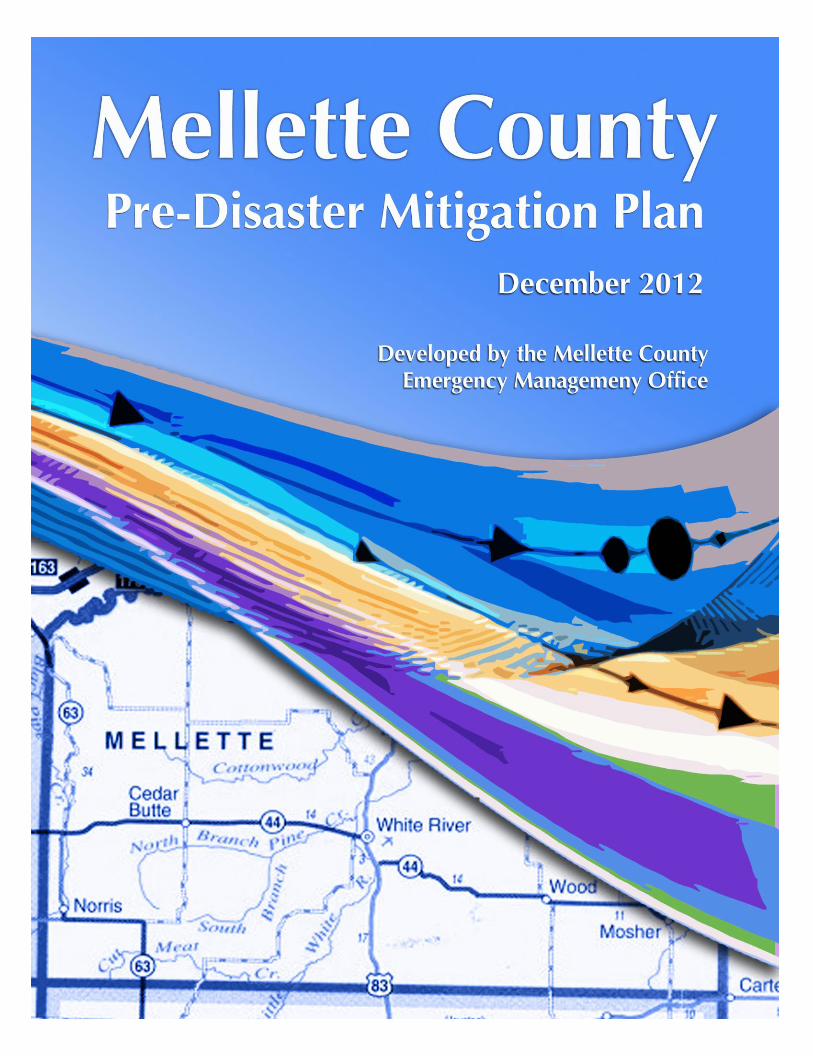
Draft 3, 1-23-13 Mellette County Pre-Disaster Mitigation 1

Draft 3, 1-23-13 Mellette County Pre-Disaster Mitigation 2
Table of Contents NEED To Complete Page Numbers
CHAPTER I. Introduction
A. Background
B. Methodology
C. Hazard Mitigation Goals of the State of South Dakota
D. Acknowledgements
CHAPTER 2. Community Profile
A. Location, Topography and Environmental Features
B. Development Trends
CHAPTER 3. Hazards in Mellette County
A. What Are the Hazards?
B. Past Hazard Events
C. Potential Hazards to Critical Facilities and Areas of Concern
CHAPTER 4. Prioritizing Critical Facilities and Areas of Concern
A. Category I: Emergency Response Services and Facilities
B. Category 2: facilities and Areas to Protect in a Hazard Event
C. Category 3: Potential Resources
CHAPTER 5. Determining the Affects of Defined Hazards
A. Identifying Vulnerable Facilities
B. Calculating the Potential Loss
Draft 3, 1-23-13 Mellette County Pre-Disaster Mitigation 3
CHAPTER 6. Existing Hazard Mitigation Programs
CHAPTER 7. Plan Goals and Objective Development
A. Goals, Objectives and Actions
CHAPTER 8. Potential Mitigation Strategies
CHAPTER 9. Feasibility and Prioritization of Mitigation Strategies
CHAPTER 10. Implementation Schedule
CHAPTER 11. Monitoring, Evaluating and Updating the Plan
LIST OF TABLES:
Table 1. Significant Hazard Occurrences Reported in Mellette County 30
Table 2. All-hazard Priority Matrix for Mellette County 30
Table 3. Existing Mitigation Strategies and Proposed Improvements 46
Table 4. Potential Mitigation Strategies 56
LIST OF MAPS: (before appendices):
1. Aerial photo of Mellette County
2. Aerial photo of White River
3. Aerial photo of
4. Aerial photo of
LIST OF APPENDICES:
Appendix A: Promulgation Statement
Appendix B: Map of Mellette County/Cities
Appendix C: List of Hazard Events NEED To ADD
Appendix D: STAPLEE Chart
Appendix E: Mitigation Action Chart
Appendix F: Copies of Sign In Sheets NEED to ADD
Appendix G: Community Survey NEED to ADD

Draft 3, 1-23-13 Mellette County Pre-Disaster Mitigation 4
Executive Summary
The Mellette County Pre-Disaster Mitigation Plan was prepared in response to the Disaster
Mitigation Act of 2000 (DMA 2000). The DMA 2000 requires state and local governments
to prepare hazard mitigation plans in order to remain eligible to receive pre-disaster
mitigation funds that are made available in the wake of federally declared disasters.
This plan is an update of the Pre-Disaster Mitigation Plan (PDM) developed by the County
in 2006. The document will serve as a strategic planning tool to mitigate against future
disaster events for use by the county and its communities. The plan identifies and analyzes
the natural and man-made disasters that may occur in Mellette County in order to
understand the county’s vulnerabilities and propose mitigation strategies that minimize
future damage caused by the hazards. This knowledge will help identify solutions that can
significantly reduce threat to life and property.
This is not an emergency response or emergency management plan. Undoubtedly, the plan
can be used to identify weaknesses and refocus emergency response planning. Enhanced
emergency response planning is a crucial mitigation strategy. However, the focus of this
plan is to support responsible decision-making to avoid risks and increase implementation
efforts of activities or projects that will eliminate or reduce the possibility of exposure to a
hazard threat.
Mellette County Pre-Disaster Mitigation Planning Process
The DMA 2000 requires states to submit comprehensive Hazard Mitigation Plans to the
Federal Emergency Management Agency (FEMA) to be eligible for future pre-disaster
mitigation funding. Local jurisdictions must also develop plans and to comply with such
requirements, Mellette County and the communities in the County have developed this Pre-
Disaster Mitigation Plan.

Draft 3, 1-23-13 Mellette County Pre-Disaster Mitigation 5
The plan was developed by the Mellette County Emergency Management Office and the
local Planning Committee to assist Mellette County and its jurisdictions to reduce and
mitigate future losses from natural and man-made hazards. The plan was coordinated and
authored through the assistance of a consultant, Northern Tier Consulting.
The plan contains the necessary tools to identify specific hazards and effectively improve
the disaster planning process by requiring participating municipalities to document their
hazard mitigation planning process by identifying hazards, potential losses, mitigation
needs, goals, and strategies.
To support the planning process for this Pre-Disaster Mitigation Plan, Mellette County
completed the following functions:
Scope of Planning Process
Formed a planning group with members from each municipality
Provided opportunities for public input and encourage participation and involvement
Identified hazards and vulnerabilities within the county and local jurisdictions
Combined risk assessments, community development, and emergency
management ideas
Developed goals and measurable objectives based on the identified hazards
and risks
Prioritized and evaluate each hazard and subsequent actions
Established guidelines for updating and monitoring the plan
Presented the plan to the Mellette County Commissioners and the participating
communities for adoption
Following the completion and adoption of this plan, it is the intention of the participating
jurisdictions to continue working collaboratively to address data gaps while implementing
complementary and collective mitigation actions. The plan is available for review at the
Mellette County Emergency Management Office. Updates to the plan will be similarly
announced after annual plan reviews and five-year updates, with the next update to occur
in 2017.
Hazard Identification
Mellette County is vulnerable to natural hazards that have the possibility of causing serious
threat to the health, welfare, and security of our citizens. The cost of response and recovery,
in terms of potential loss of life or loss of property, from potential disasters can be lessened

Draft 3, 1-23-13 Mellette County Pre-Disaster Mitigation 6
when attention is turned to mitigating their effects before they occur. Along with critical
structures essential to the county, the planning committee has identified; natural hazards,
man-made hazards, that repetitively and continuously affect the welfare of citizens in the
county. These are summarized below and will be expanded upon throughout this plan.
A key component of a mitigation plan is the accurate identification of risks posed by a
hazard along with the corresponding community impact. The process of identifying hazards
of concern, profiling hazard events and conducting a vulnerability assessment is known as a
risk assessment.
The following natural hazards are addressed:
Flooding
Droughts
Extreme Winter Weather
Tornado/High Winds/Lightning
Wildfire
The following man-made and
technological hazards are addressed:
Hazardous Materials
Transportation Incident
Power Failure
Urban Fire
Communication Outage
The list of critical facilities that would be most affected by an incident include:
Electric power lines, substations
Water supply stations
Telephone facilities
Fire stations
Law enforcement facilities
Hospitals and clinics
Transportation and evacuation routes

Draft 3, 1-23-13 Mellette County Pre-Disaster Mitigation 7
Chapter 1
Background
Purpose
The purpose of this plan is to maximize the survival of the citizens within Mellette County
and to preserve property, while working to lessen the environmental effects of a disaster.
This plan intends to familiarize elected and appointed officials to their collective emergency
preparedness and mitigation responsibilities as representatives of county and local
government.
The Mellette County Mitigation plan was developed to assist the county in reducing and
mitigating future losses from natural and man-made hazard events. The plan contains the
tools necessary to identify specific hazards along with aspects of existing and future
mitigation efforts.
The long-ranging outcome of the plan is to establish a framework of research, information,
and public education/involvement that can be expanded in the future to meet the needs of
the area.
These include:
• Providing a Methodical Approach to Mitigation Planning
• Enhancing Public Awareness and Understanding of Hazards
• Developing Decision-Making Tools for Policy Makers
• Promoting Compliance with State and Federal Program Requirements
• Assuring Inter-Jurisdictional Coordination of Mitigation-Related Programming
• Developing Jurisdiction Specific Hazard Mitigation Strategies for Implementation

Draft 3, 1-23-13 Mellette County Pre-Disaster Mitigation 8
Methodology
Mitigation planning is a process that communities employ to identify policies, activities, and
tools to implement mitigation actions. The process that was used in the development of this
plan consisted of the following recommended FEMA planning sections with action steps to
align to the County’s overall goals:
I. Planning Process
II. Hazard Identification and Risk Assessment
III. Mitigation Strategy
IV. Plan Review, Evaluation, and Implementation
V. Plan Adoption
I. Planning Process
Funding Approval
The County received funding approval from FEMA and the South Dakota Office of
Emergency Management, to prepare the mitigation plan, in February 2012.
Scope of the Plan
The scope of this plan is “All-Hazard” and includes the identification of both natural and
man-made hazards affecting Mellette County, as identified by community input, Hazard
Vulnerability Assessments (HVAs), risk assessments and the planning committee’s study and
input. They are categorized as follows:
I. Flood, Drought, Extreme Heat, and Wildfire
II. Tornado and Severe Wind
III. Winter Weather (Snow, Ice Storm and Extreme Cold)
IV. Man-made Hazards
The planning team’s consideration of issues related to man-made hazards has been
developed through recommendations from the previous plan, local planning committee,
area businesses, and local farmers and ranchers.

Draft 3, 1-23-13 Mellette County Pre-Disaster Mitigation 9
Building the Informational Group and Planning Committee
Prior to the Kick-off meeting, the Mellette County Emergency Management Coordinator
wrote letters to prospective members, which included a brief description, need, and
timeline for the completion of the Pre-Disaster Mitigation (PDM) Plan.
The first task was to organize the Mellette County Informational group of appointed and
elected officials, key stakeholders and subject matter experts. This assembly was comprised
of representatives from state government, county and local government, and community
groups. Individuals from the group attended the kick-off meeting in April 5, 2012 and have
been informed of planning updates on a quarterly basis.
At the Kick-off meeting, participants were invited to join and provide input as a volunteer to
the core planning team. Additional members from county and local government were
contacted and invited to join the team due to the role as a jurisdictional resource possessing
the following skills and knowledge:
An understanding of how hazards affect the counties and participating jurisdictions
Substantial knowledge of community and county infrastructure systems
Availability of resources such as maps or data on past hazard events
This appreciated and dedicated group attended the planning meetings, provided
information and documents that were used to produce the plan, reviewed drafts of the plan
as it was being assembled, and edited and approved the final version of the plan.
Public Input and Informational Meetings
After the Kick-Off Meeting, information was gathered through a series of public meetings in
July 2. Public input was solicited (public notices in area newspapers, meetings, etc.) during
the entire planning process. Opportunities for comments were made available at both the
local and county government levels. Citizens were able to obtain information to plan’s status
through Mellette County Emergency Management office, county government, and local
government officials.
Feedback received from the public proved valuable in the development of the plan. Several
remarks received by the committee led to the reconsideration of “suggested” priority
mitigation actions, which illustrated the need for options in the event of severe storms,
drought, and power outages.

Draft 3, 1-23-13 Mellette County Pre-Disaster Mitigation 10
For example, the set-up of shelters in White River Corn Creek and generators for shelters
along with sirens in the communities not currently protected are now included in the natural
hazard portion of the PDM.
Planning Meetings
To review the upcoming plan development process, review of existing data and lastly, to
begin systematic compiling of new information, the planning meetings started in October
and ran through December 2012. The final plan review was held the second week of
December. The majority of the meetings were held at the Mellette County Emergency
Services Building. An agenda was sent before the meetings and all members of the team
were invited to attend by email notification and prior meeting announcements.
Schedule of Events, 2012-2013
March: Email Introduction to Project and Consultant
April: Kick-off Meeting with Local Newspaper
May: County Commission and Council
Meeting Notification July: Public Notice Meetings with Local
Newspaper October First In-person Planning Meeting
November: Series of In-person Planning Meetings
Middle of
January: Final Plan Review
Late January
Through
February: Submission to South Dakota Office of Emergency Management and FEMA
May 2013: Community and County Adoption Presentations
II. Hazard Identification and Risk Assessment

Draft 3, 1-23-13 Mellette County Pre-Disaster Mitigation 11
Step 1 – Map the Hazards and Conduct Risk Assessments
Participants identified areas where damage from historic natural disasters had occurred and
areas where critical man-made facilities and other features may be at risk to property
damage, environmental pollution, and other factors. Updates to the list of past hazard
events was included from the information contained in the 2003 Plan.
An updated Hazard Vulnerability Assessment (HVA), using the main hazards and relating
them to a risk rating, vulnerability and overall damage it would cause to the people and
property of the county.
Step 2 – Identify Critical Facilities and Areas of Concern
Participants identified facilities and areas that were deemed significant or crucial to the
county for emergency management purposes, or provision of utilities and community
services, evacuation routes and for recreational and social value.
III. Mitigation Strategy
Step 3 – Identify Existing Mitigation Strategies
After collecting detailed information on each critical facility in the county, the local planning
committee members, Mellette County Emergency Management Office and the Consultant,
identified existing mitigation strategies.
Step 4 – Identify the Gaps in Existing Mitigation Strategies
The previous plan strategies were reviewed for coverage and effectiveness, as well as the
need for improvement or a downgrade of an existing strategy to a given area.
Step 5 – Identify Potential Mitigation Strategies
A list of additional hazard mitigation actions and strategies for the region was developed. A
sampling of potential actions included improving emergency services (i.e., development and
coordination of shelter generators and sirens for unprotected areas).
Step 6 – Prioritize and Develop the Action Plan

Draft 3, 1-23-13 Mellette County Pre-Disaster Mitigation 12
The proposed hazard mitigation actions and strategies were reviewed and each strategy was
rated (good, average, or poor) for its effectiveness according to seven factors (e.g., technical
and administrative applicability, political and social acceptability, legal authority,
environmental impact, and financial feasibility).
Each factor was then scored and all scores were totaled per strategy. Strategies were then
ranked by their overall score for preliminary prioritization and reviewed again under Step 7.
Step 7 – Determine Priorities
The preliminary list was evaluated in order to make changes and determine a final ranking
for new hazard mitigation actions and existing protection strategy improvements identified
in the previous steps.
Step 8 - Develop Implementation Strategy
An implementation strategy was developed that included those individuals responsible for
implementation (who), a timeline for completions (when), and funding or technical
assistance sources (how) for each identified hazard mitigation actions.
IV. Plan Review, Evaluation, and Implementation
Step 9 – Review and Implementation
Once the plan was developed the team conducted a thorough review of the PDM. The draft
plan was reviewed by the following local agencies:
Mellette County Commissioners and employees
Mellette County Emergency Management Office
Mellette County Highway Department
Mellette County Sheriffs Office
White River Volunteer Fire Department
Mission Volunteer Fire Department
Local business owners
Systematic changes were made in areas that need to be further clarified. The plan will be
implemented and evaluated on an ongoing basis to ensure the actions, timelines, and
responsible parties are correct, up-to-date and can be obtained as they are stated in the
PDM.

Draft 3, 1-23-13 Mellette County Pre-Disaster Mitigation 13
V. Plan Adoption
On _______________, the Mellette County Commission formally adopted this plan after
approval from each participating jurisdiction. The 2012 PDM plan is current and will be
updated annually by the Mellette County Emergency Management Office.
Overarching Mitigation Goals
State Mitigation Goals
Guide South Dakota's mitigation program to reduce or eliminate destructive effects of significant hazards to the state
Serve as a public and private sector reference document and management tool for mitigation activities throughout South Dakota
Local Mitigation Goals
Develop and maintain emergency response and mitigation plans
Reduce or eliminate flood damage
Provide and maintain generators for essential facilities
Continue to maintain and update communication and emergency warning systems
Increase security at critical facilities
Develop a public awareness education system
Produce a template of all businesses in the county so that all emergency responders
will become familiar with the properties.
This plan addresses significant hazard events of flooding, drought, winter/ice storms,
tornadoes, and wildfires experienced in south-central South Dakota. These natural disasters
have a history of occurrence with varying degrees of damage and economic loss.
An assessment and analysis can be completed through the information contained in this
plan and developed into prospective mitigation strategies to reduce or eliminate future
damages from such events.
Mellette County concurred and adopted the above-mentioned goals.

Draft 3, 1-23-13 Mellette County Pre-Disaster Mitigation 14
Acknowledgements
The Mellette County Emergency Management Office, Northern Tier Consulting and the
Planning Committee extend special thanks to those that assisted in the development of this
PDM:
Mellette County Commissioners
Mellette County Emergency Management Office
Mellette County Highway Department
Mellette County Sheriffs Office
White River Volunteer Fire Department
South Dakota Office of Emergency Management
City of White River
Mellette County EMS Association
Wood Fire Department
City of Wood
Chapter 2 – Community Profile
Draft 3, 1-23-13 Mellette County Pre-Disaster Mitigation 15
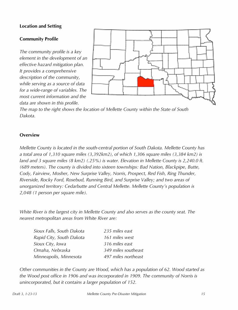
Location and Setting
Community Profile
The community profile is a key
element in the development of an
effective hazard mitigation plan.
It provides a comprehensive
description of the community,
while serving as a source of data
for a wide-range of variables. The
most current information and the
data are shown in this profile.
The map to the right shows the location of Mellette County within the State of South
Dakota.
Overview
Mellette County is located in the south-central portion of South Dakota. Mellette County has
a total area of 1,310 square miles (3,392km2), of which 1,306 square miles (3,384 km2) is
land and 3 square miles (8 km2) (.25%) is water. Elevation in Mellette County is 2,240.0 ft.
(689 meters). The county is divided into sixteen townships: Bad Nation, Blackpipe, Butte,
Cody, Fairview, Mosher, New Surprise Valley, Norris, Prospect, Red Fish, Ring Thunder,
Riverside, Rocky Ford, Rosebud, Running Bird, and Surprise Valley; and two areas of
unorganized territory: Cedarbutte and Central Mellette. Mellette County’s population is
2,048 (1 person per square mile).
White River is the largest city in Mellette County and also serves as the county seat. The
nearest metropolitan areas from White River are:
Sioux Falls, South Dakota 235 miles east
Rapid City, South Dakota 161 miles west
Sioux City, Iowa 316 miles east
Omaha, Nebraska 349 miles southeast
Minneapolis, Minnesota 497 miles northeast
Other communities in the County are Wood, which has a population of 62. Wood started as
the Wood post office in 1906 and was incorporated in 1909. The community of Norris is
unincorporated, but it contains a larger population of 152.

Draft 3, 1-23-13 Mellette County Pre-Disaster Mitigation 16
Mellette County has two school districts, White River School District 47-1, which includes
an alternative high school, high school, middle school and elementary school in White River
and an elementary school located in Norris. Wood School District 47-2 has two elementary
schools, one in Wood and another in Witten, located in neighboring Tripp County to the
east.
Mellette County
Founded 1909
Named for Arthur C. Mellette
Seat White River
Largest city White River
Area - Total - Land - Water
1,310 sq. mi (3,392 km²) 1,306 sq. mi (3,384 km²) 3 sq. mi (8 km²), 0.25%
Population - (2010) - Density
2,048 1/sq. mi (0/km²)
History
Mellette County is named for Arthur Calvin Mellette. Mellette was the last Governor of the
Dakota Territory and the first Governor of the State of South Dakota.
There are two National Register of Historic Places listings in Mellette County, South Dakota.
South Dakota Dept. of Transportation Bridge No. 48-244-204, listed in 1993, located
in White River
Stamford Bridge, listed 1993, located in Cedarbutte Unorganized Terrority (UT)
NAME POPULATION ELEVATION TOTAL
HOUSING UNITS
White River 581 2,135 feet 245
Wood 62 2,148 feet 33
Norris CDP 152 2,530 feet 47
Mellette County 2,048 2,240 feet 835

Draft 3, 1-23-13 Mellette County Pre-Disaster Mitigation 17
Development Trends
Current Trends
Hunting lodges in the county are one of the fastest growing businesses. This boom has
caused land prices to rise sharply over the past few years.
Jurisdiction Specific Trends
The county is divided into sixteen townships: Bad Nation, Blackpipe, Butte, Cody, Fairview,
Mosher, New Surprise Valley, Norris, Prospect, Red Fish, Ring Thunder, Riverside, Rocky
Ford, Rosebud, Running Bird, and Surprise Valley; and two areas of unorganized territory:
Cedarbutte and Central Mellette.
Terrain and Climate
The landscape in Mellette County is quite open, and the terrain is uneven. Several buttes
rise prominently from the landscape. Most of the land in the county is used for grazing
cattle, although some corn, wheat, and other crops are grown. The county lies entirely
within the watershed of the White River. Figure 1 below shows the watersheds in Mellette
County
.
Figure 1

Draft 3, 1-23-13 Mellette County Pre-Disaster Mitigation 18
As in most of South Dakota, the climate of Mellette County is characterized as sub-humid
and continental, which means that summers are often hot and winters can be very cold.
There are no large bodies of water or mountain ranges to lessen the extreme effects.
Precipitation averages less than 20 inches per year, and during drought years the amount
can be much less. Most of the precipitation occurs during the spring and early summer;
winter snow is not frequent, but snow cover on the ground is fairly constant during the
winters.
In general, most soil in the county is not particularly
fertile, and the low amount of rainfall the county
normally receives limits agriculturally production.
More information about the county’s soils can be
obtained from the National Resource Conservation
Service’s digital soil survey on their website at,
http://soils.usda.gov/.
Land Use
Because of the low rainfall, most of the land is
used for grazing livestock, although some crops
are grown. Crops grown in the county include corn, sorghum, wheat, and sunflowers.
Transportation
Mellette County's main transportation routes are U.S. Highway 83, which runs north
south through the center of the county, and SD Highway 44 US 18, which runs east-
west through the county. There are no railroad lines in the county, but there is a small
airport with a grass runway in White River.
Water and Wastewater
Most rural residents in Mellette County, and households in the Town of Wood, are served
by the Mini Wiconi water system. The Tripp County Water Users District serves the eastern
part of the county. The City of White River has as its own wastewater collection and
treatment system. Rural residences use individual septic tanks and drain fields. The density
of septic systems and its potential to cause water contamination is an environmental

Draft 3, 1-23-13 Mellette County Pre-Disaster Mitigation 19
concern. Although residential growth is not expected to be significant and new
developments need to be controlled through planning and development guidelines.
Power and Communications
The Cherry-Todd Electric Cooperative provides electric power to county residents. The
primary telephone company serving the county is Golden West Communications. Cellular
phone service is also available in parts of the county, but there are many areas where signals
are weak or non-existent.
Social and Economic Description
Mellette County's economy is dependent to a large extent upon agriculture, which consists
mostly of cattle grazing. Industry and manufacturing are not significant. Because of the
County’s dependence upon agriculture and the lack of high wage occupations, personal
income in the county is far below state and national figures.
Like much of the upper Midwest, the rural landscape in Mellette County experienced a
population decline during the last half of the twentieth century, although the county did
register a slight increase from 1990 to 2000.
Chapter 3 – Hazards in Mellette County
The first step in planning for natural hazards is to identify hazards that might affect Mellette
County. Some communities are more susceptible to certain hazards (i.e., grass fires,

Draft 3, 1-23-13 Mellette County Pre-Disaster Mitigation 20
structural fires, flash floods, tornadoes, blizzards, and drought). These incidents have caused
millions of dollars in property damage and the loss of several hundred lives. All of the
approved hazards from the previous plan were retained in the 2012 plan.
These hazards were identified through an extensive process that included the review of State
Emergency Management disaster declarations for the county, federally funded studies, input
from citizens and risk assessments completed by Mellette County Emergency Management
Office.
The Planning Team encountered a limited amount of digital data, which included limitations
in current Flood Insurance Rate Maps (FIRMs), complete and current data sets for water,
gas, and electrical, lack of digital parcels from the county assessors office, and up-to-date
HAZUS MH information.
A. What are the Hazards?
Natural Hazards
Flooding
This hazard includes erosion, mudslides, rapid snow pack melt, river/creek ice jams, and
dam breach and/or failure. Mellette County as a whole does not participate in the National
Flood Insurance Program (NFIP).
Probability of Occurrence
The probability of minor flooding in the county is moderately high, especially along
the larger streams. Luckily, the affect on residential property and human life is very
low.
Vulnerability and Loss Potential
The flooding that does occur in the county is usually slight. Vulnerability from
flooding exists in the rural areas, where the threat is primarily contained to rural
roads, and at times minor flooding in populated areas. From past incidents, there is
particular vulnerability in the river bottoms of the Little White and Big White Rivers.
There is slight chance that single homes in these areas would sustain some kind of
damage however there are no communities that lie along these rivers.
History

Draft 3, 1-23-13 Mellette County Pre-Disaster Mitigation 21
There has been significant flooding in parts of the county, but none that caused
tremendous economic or personal losses.
Drought
Drought is a very serious and common hazard in south central South Dakota, causing
massive deficits in farming and ranching businesses along with drinking water shortages.
Cold winters and hot summers characterize South Dakota’s climate. Semi-arid conditions
prevail in the western portion. This combination of hot summers and limited precipitation in
a semiarid geography, places South Dakota in a potential annual drought situation.
Probability of Occurrence
Droughts are extended periods when precipitation is significantly below normal. They
can occur during all times of the year, but the consequences are worse during the
summer growing season, especially after winters with very little snowfall. A small
departure in normal precipitation during the months of June through August can have a
negative impact on crop production and the amount of forage available to livestock.
Since South Dakota is located in a semiarid region, the probability of a drought
occurring in any given year in the county should be considered at least moderate.
Vulnerability and Loss Potential
The county is economically vulnerable to drought because of its effect on all agricultural
business production and especially food production. Crops raised in the county are,
wheat, sorghum, corn, alfalfa, and sunflowers, which are all vulnerable to drought. With
drought ridden land prices decrease for acreage.
Other impacts of drought include the increased potential for grassfires and plant
diseases. Energy related effects and possible increase cost of water transportation and
irrigation. All areas of the county are vulnerable to droughts, but non-irrigated land is
especially vulnerable. Direct impact on people is not substantial but on animals and
crops it is very damaging.
History
Droughts in the last decade that have significantly affected the state occurred in 2002,
through 2007 and 2012.
US Drought Monitor Graph and Map for South Dakota

Draft 3, 1-23-13 Mellette County Pre-Disaster Mitigation 22
Accessed from http://droughtmonitor.unl.edu
E
x
t
r
e
m
e
W
i
n
t
e
r
Severe Winter Weather
This natural hazard includes heavy snowstorms and ice storms that occur from early fall to
late spring. They vary in intensity from mild to very severe. Blizzards are storms that contain
heavy snowfall, strong winds, and cold temperatures. The combination of these elements
creates near zero visibility, deep snowdrifts, and life-threatening wind chills.
Probability of Occurrence
The probability of occurrence is high that a severe winter storm will occur on a historical
average of at least once or more every five years. However, exceptions have occurred
outside this timeframe. Consequences can include loss of life and injury to humans as
well as livestock.
Vulnerability and Loss Potential
The entire county is vulnerable to a severe winter storm. Particular populations that are
susceptible include rural homeowners, the elderly, and special needs residents. Facilities
at risk include hospitals, nursing homes, schools, etc. Other areas/items in danger
include transportation corridors, utilities and livestock.
History
Severe winter storms have affected the area on an annual basis.

Draft 3, 1-23-13 Mellette County Pre-Disaster Mitigation 23
Tornado/ High Winds
Included under this hazard are downbursts and lightning strikes causing grassfires and
severe damage to property, people and even loss of life.
Probability of Occurrence
High wind events are usually associated with storms and other unstable weather
conditions. All areas of the reservation are susceptible to high winds, and the
probability of occurrence is high in most areas. Tornadoes represent the most
dramatic and dangerous type of wind event that can strike in South Dakota.
Tornadoes occur most often during the months of May, June, and July. The greatest
period of tornado activity (about 82 percent of occurrence) is from 11 am to
midnight. Within this time frame, most tornadoes occur between 4 pm and 6 pm.
Mellette County Tornadoes from 2006-2012
Vulnerability and Loss Potential
Populated areas are most at risk from high wind events because of the amount of
infrastructure that can be affected. The primary risk is to property, but people can
also be directly impacted when high winds blow down power lines, causing a
disruption in service. There is also the slight chance that blowing debris can cause
personal injuries.
Two factors make the county particularly vulnerable to high wind events. Generally,
manufactured houses and mobile homes make up a high percentage of the county’s
housing types and many of these homes lack permanent foundations or basements.
People living in these types of homes are not able to seek shelter in basements.
Secondly, there are no designated tornado shelters in any of the communities, other
than local churches. Some of the schools are used as disaster relief areas, places
where people can go after power failures and other disaster events, but they are not
adequate tornado shelters.
Date F-level Death Injury
2007 1 0 0
2008 1 0 0
2009 1 0 0
2011 1 0 0

Draft 3, 1-23-13 Mellette County Pre-Disaster Mitigation 24
South Dakota ranks number 32 in the United States for cloud to ground lightning
strikes with 386,322, and with 77,116 square miles there is an average of 5 strikes
per square mile. With the amount of prairie in Mellette County the risk is high for
grassfires from lightning strikes.
History
Some amount of damage from high wind events can be expected to happen
annually, and the county has experienced some wind events that caused substantial
damage. With 23 lightning related fatalities in the last 50 years, South Dakota is
ranked in the top twenty states for lightning fatalities per population.
Fire
Urban, wild and grassfires, affecting businesses, residential and recreational areas are
contained in this section. They are prevalent due to the drought and high wind conditions.
Probability of Occurrence
Wildfires are more likely to occur than urban fires in Mellette County because of the
small population base and thousands of acres of grassland in the area. Wildfires can
occur in all parts, and the likelihood of these fires arising increases during extended
dry periods.
Vulnerability and Loss Potential
In regards to wildfires, the risk to people and property is usually low, unless such a
fire occurs near a dwelling or other structure. The loss potential is generally not
significant, but homes in various communities have been threatened in the past by
extensive wildfires that burned near inhabited areas. In regards to urban fires, all
communities have some vulnerability. A structure’s liability is dependent upon its
construction, and also whether any flammable materials are stored onsite.
History
There have been many extensive wildfires in the county. Lightning striking dry
vegetation has caused largest percentage of these fires.
Development Trends
No future development is expected to increase the severity of this type of disaster.

Draft 3, 1-23-13 Mellette County Pre-Disaster Mitigation 25
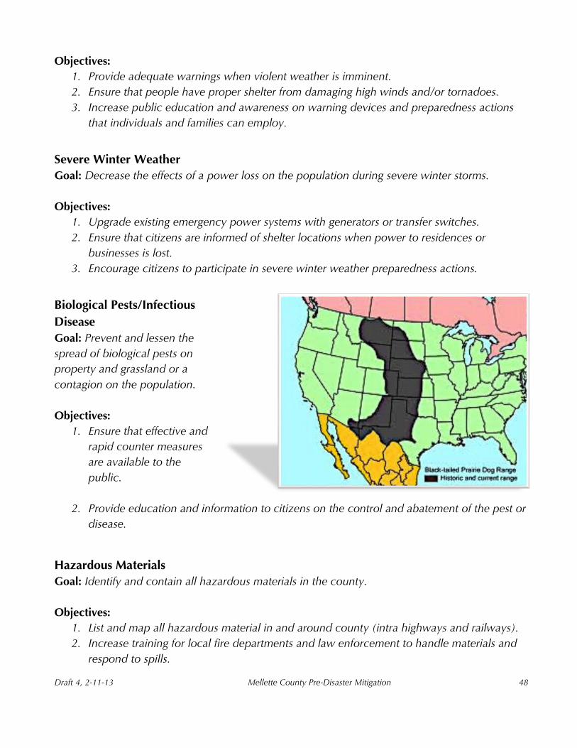
Biological Pests and Infectious Diseases
When Lewis and Clark came up the Missouri River with the Corps of Discovery in 1804,
they saw and recorded many different species of indigenous animals. One of these newly
found creatures was the prairie dog, which Lewis and Clark called “barking squirrels”.
Although, these animals are recorded in early American history they are devastating the
grasslands. They create mounds with many holed entrances and live in colonies known as
“towns” which can extend hundreds of
miles.
Additionally, zoonotic illnesses caused by
organisms such as bacteria, viruses, fungi and
parasites are a hazard to livestock and people
and since prairie dogs are carriers of fleas,
they are at a risk for and spreading an
infectious disease to other mammals, such as
the bubonic and sylvatic plague.
Probability of Occurrence
There are thousands of acres of dog
towns in south central South Dakota and within each of the towns there are
hundreds of prairie dogs. With the massive numbers, unfortunately,
there are just a few ways to control them,
natural disease (plague), and other methods, like poison, which works fairly well, but
also affects other wildlife species, and the reintroduction of a natural predator, the
endangered black-footed ferret. In South Dakota, black-footed ferrets feed on black-
tailed prairie dogs, and it is 91% of their diet.
Vulnerability and Loss Potential
Land for livestock, to graze is being taken over by the prairie dog towns. The prairie
dog and its predator, the black–footed ferret is also susceptible to disease, poisoning
and a loss of habitat. The struggle and the potential for even more loss on both sides
of the issue stems from the fact that these animals are federally protected but the
landowner has to ensure the health of its herds and with the laws enforced, find it
increasingly difficult to control them.
In late November 2012, the South Dakota Department of Health issued an advisory
to residents to be aware that the prairie dog carries fleas and the fleas can spread
sylvatic plague to other animals, pets and possibly to people.
Draft 3, 1-23-13 Mellette County Pre-Disaster Mitigation 26
History
The battle between farmers and ranchers and the prairie dog has been occurring as
long as settlers have been in the Dakotas. Nonetheless, within the last 25 years South
Dakota has been trying to find a compromise that will satisfy landowners while
ensuring endangered species laws are not broken, all with the hopes of enhancing its
conversation and management plan to satisfy the needs of both sides.
Development Trends
The amount and location
of prairie dog towns
limits new development
not only because of the
sheer amount of them
but also because of
restrictions to removing
their habitat.
Man-Made Hazards
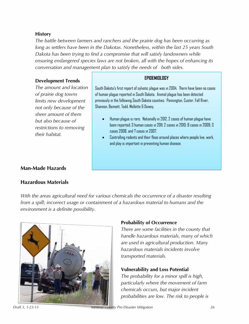
Hazardous Materials
With the areas agricultural need for various chemicals the occurrence of a disaster resulting
from a spill; incorrect usage or containment of a hazardous material to humans and the
environment is a definite possibility.
Probability of Occurrence
There are some facilities in the county that
handle hazardous materials, many of which
are used in agricultural production. Many
hazardous materials incidents involve
transported materials.
Vulnerability and Loss Potential
The probability for a minor spill is high,
particularly where the movement of farm
chemicals occurs, but major incident
probabilities are low. The risk to people is
EPIDEMIOLOGY South Dakota’s first report of sylvatic plague was in 2004. There have been no cases
of human plague reported in South Dakota. Animal plague has been detected
previously in the following South Dakota counties: Pennington, Custer, Fall River,
Shannon, Bennett, Todd, Mellette & Dewey.
Human plague is rare. Nationally in 2012, 2 cases of human plague have
been reported; 3 human cases in 2011; 2 cases in 2010; 8 cases in 2009; 3
cases 2008, and 7 cases in 2007.
Controlling rodents and their fleas around places where people live, work,
and play is important in preventing human disease.

Draft 3, 1-23-13 Mellette County Pre-Disaster Mitigation 27
moderate, and the degree of risk depends upon the type and amount of material
spilled. Other factors influencing the degree of risk include topography, wind
direction, and the population density at the place of occurrence.
History
There have been minor hazardous materials releases in the county, many of which
involved spills along the highways.
Transportation Incidents – Motor Vehicle
Probability of Occurrence
Although motor vehicle accidents can occur in all parts of the county, the areas
along the major transportation routes are most likely to experience these incidents.
The Highway 44 and US Highway 83 corridors carry the most traffic volume, but
roads leading to White River also carry a significant amount of traffic.
Vulnerability and Loss Potential
Vulnerability is greatest along the roads mentioned above. Vulnerability along all
roads and highways is increased during the winter, when ice, snow, and freezing rain
hamper driving conditions. The summer construction season also increases
vulnerability.
History
There have been serious traffic accidents along many of the roads and highways in
the county, including those involving multiple fatalities.
Dam Failure
Inspection and maintenance of dams, culverts, and other drainage structures is performed
regularly in the County to mitigate the occurrence of failure and subsequent flooding.
Probability of Occurrence
The probability of occurrence for a dam failure is very low and the consequences to
persons, property and the environment are also low if local dams were to fail.
Vulnerability and Loss Potential
Awareness of vulnerability is available through historical records, spring snowmelt,
and runoff. The largest potential for damage would incur from the loss to crops.

Draft 3, 1-23-13 Mellette County Pre-Disaster Mitigation 28
History
There have been no reported dam failures to Mellette County.
Power Failure
All populated areas are negatively
affected by power outages but with
the extreme weather patterns and
rugged terrain, power outages are a
major concern for Mellette County
and its citizens.
Probability of Occurrence
The probability of occurrence
is low for a massive power
failure countywide and high for an occasional localized power failure based upon
historical averages.
The consequences of occurrence range from a nuisance to a severe emergency
depending upon the length and location of the outage.
Vulnerability and Loss Potential
The entire county is at risk for a power loss. The need for all critical facilities and
shelters to have generators for back-up power is crucial. With the severe weather in
the summer and winter, a power loss could negatively affect the population if
services are not restored quickly.
History
A severe ice and snowstorm was recorded in November 2010, which caused power
outage to hundreds of homes in the western portion of the County for more than two
weeks. In December, of the same year, another severe wind and ice storm hit the
central and eastern portion of Mellette County causing power outages from one to
several days in outlying areas.
Communication Outage/Isolation
Loss of communication is a serious hazard in remote areas especially if emergency services
are needed and the outage occurs over a long period of time.
Probability of Occurrence

Draft 3, 1-23-13 Mellette County Pre-Disaster Mitigation 29
The risk of communications isolation is at a medium level. The reliability of Mellette
County’s communications infrastructure is not very high, experience and research
has revealed that it is all too easy to cripple large portions of the infrastructure.
Vulnerability and Loss Potential
Electronic communications (audio, video, data stream, etc.) are critical to frontier
residents, visitors, businesses, government, and emergency services. A disruption in
any portion of the communications infrastructure has an immediate effect.
Regrettably, as communication has increasingly become more significant and
specialized, so has its vulnerability.
B. Past Hazard Events
The planning team reviewed all hazard occurrences that have been reported in the last 6
years since the previous 2006 PDM was drafted. The information provided in the table is
not a complete history report, but rather an overview of reported hazard events. Appendix
C has the full list of hazardous weather events.
Table 1. Significant Hazard Occurrences Reported in Mellette County, 2006-2012
Type of Hazard Number of Occurrences
Drought Lasting three years, 2007-2010
Wildfire/Forest Fire 20-40 per year (all levels)
Flood 3
Hail 36
Major Lightning Strikes 5
Tornado/Funnel Cloud 4
Snow & Ice 16*
Thunderstorms/High Winds 44*
* Source: National Climatic Data Center, NOAA, 2006-July, 2012 ** SDDA 2005-2009 ***2008 Disaster declaration 12/12/08 SD Dept. Public Safety
C. Potential Hazards to Critical Facilities and Areas of Concern
The Mellette County hazard analysis reflects the comprehensive study of all hazards that
may affect its communities. It is based on the best available information describing those
hazards that have occurred and which ones are most likely to occur in the future. The
analysis includes the listing of each hazard, the risk level, impact, and priority score to
prioritize and address the defined hazards.

Draft 3, 1-23-13 Mellette County Pre-Disaster Mitigation 30
Table 2. All-hazard Priority Matrix for Mellette County
1
very
hig
h
prio
rity
haz
ards
(13-
15),
tan
sha
din
g
5 high priority hazards (10-12), blue shading
5 medium priority hazards (6-9) 4 Low priority hazards (2-5)
Once past incidents have been identified, the next step in the planning process is to deter-
mine what structures or areas could be affected. This requires the county to determine
which facilities and areas in the community are considered critical and why they are
considered critical (i.e., is the facility in the floodplain? It is storing hazardous material?)
D. Addressing Vulnerability: Repetitive Loss Properties
Periodic flooding affects numerous areas of the County, however the majority of the land is
unincorporated and has very little residential development. Repetitive loss properties are
those for which two or more losses of at least 1,000 dollars have been paid under the
National Flood Insurance Program (NFIP) within a ten-year period since 1978. For Mellette
County there are no repetitive loss properties or severe repetitive loss properties.
All-Hazards
(in alphabetical order)
Risk
1-5 X
Impact
1-3 =
Priority
Score
Biological Pests 4 2 8
Blizzard/Winter Storm 5
3
15
Dam Break 1 2 2
Drought 4 3 12
Fire – Wild 4 2 8
Fire – Urban 4 3 12
Flooding – Flash 2 2 4
Flooding – Slow-rising 2 1 2
Hailstorm 3 2 6
Hazardous Materials 4 2 8
High Winds 5 2 10
Ice Storm 4 2 8
Thunderstorm/Lightning 5 2 10
Tornado 3 2 6
Transportation – Air 3 1 3
Transportation – Highway 4 3 12
Draft 3, 1-23-13 Mellette County Pre-Disaster Mitigation 31
Chapter 4 – Prioritizing Critical Facilities and Areas of Concern
The Pre-Disaster Mitigation Plan for Mellette County identifies critical facilities located in the
County and the pre-disposed hazards affecting them. A critical facility is defined as a facility
in either the public or private sector that provides essential products and services to the
general public, is otherwise necessary to preserve the welfare and quality of life in the
County, or fulfills important public safety, emergency response, and/or disaster recovery
functions.
The next step in the Hazard Mitigation Planning process is to prioritize the facilities and
areas of concern that were initially identified in relation to community importance. It is vital
for the community to determine what resources are needed to protect the facilities in an
incident.
Draft 3, 1-23-13 Mellette County Pre-Disaster Mitigation 32
The critical facilities identified in the County are categorized, prioritized and described
throughout the next few pages.
Emergency Response Services
o The first category contains facilities needed for Emergency Response in the
event of a disaster.
White River Fire Department
White River Police Department
Mellette County Sheriff’s Office
Mellette County Emergency Management
Rosebud Ambulance Service
Rosebud Police Department
Rosebud Hospital
Rosebud Fire
Rosebud Emergency Management Office
Parmelee Fire
St Francis Fire
Non-emergency Response Facilities
o The second category contains Non-Emergency Response Facilities that have
been identified by the committee as non-essential. These are not required in
an emergency response event, but are required for everyday operation.
Administration Building in White River
Facilities/Populations to Protect
o The third category contains Facilities/Populations that the committee wishes
to protect.
All Schools
Cherry Todd Electric poles and power lines, no buildings
Emergency Shelters
Mellette County Highway Department
Draft 3, 1-23-13 Mellette County Pre-Disaster Mitigation 33
City of White River Public Works
Potential Resources for Services/Supplies
o The fourth category contains Potential Resources, which can provide services
or supplies in a disaster.
Grocery Stores
Convenience Stores
Category I: Emergency Response Services
The Planning Team identified the following facilities as the highest priority.
1. County EOC, City of White River Building and Mellette County Building
2. State Area EOC for western South Dakota, Mickelson Building in Pierre
Category 2: Emergency Communications and Warning Systems
Dispatch
State Radio Dispatch, Mellette County
Rosebud Tribal Police Department, Rosebud, SD
Mellette County Emergency Management Office
Broadcast
Radio Television Cable/Sat Television
KBHE-FM-SDPB KTTM Comcast Digital Cable
KZSD-FM 102.5 KDLT* DIRECTV
KOYA-FM 88.1 SDPB TV DISH Network
KINI-FM 96.1 KTTW*
KOTA KELO*
KTEQ-FM 91.3 FM KBHE
KSLT /KLMP KSFY*

Draft 3, 1-23-13 Mellette County Pre-Disaster Mitigation 34
KVSH*
*Mellette County is within the Sioux Falls, SD market for satellite coverage
Telephonic (Land line and Mobile)
Mobile Telephone
Verizon AT&T
Warning Systems
Emergency Alert System
Sirens
White River
Wood
NOAA weather radio stations
Station Name (County) Call sign Frequency News Office
WHITE RIVER WNG-558 162.550 RAPID CITY
(Jones, Mellette and Todd)
VALENTINE, NE WXN-82 162.450 NORTH PLATTE, NE
(Todd and Tripp)
Category 3: Law Enforcement
White River City Police
Mellette County Sheriff
South Dakota Highway Patrol
Rosebud Police Department
Federal Bureau of Investigations
Category 4: Fire Services

Draft 3, 1-23-13 Mellette County Pre-Disaster Mitigation 35
Mellette County Fire Departments
Rosebud
Rosebud Fire Department PO Box 200, Rosebud, SD 57570
Volunteer Fire Services
White River VFD PO Box 280 White River, SD 57579
Wood VFD PO Box 303 Wood, SD 57585
Norris VFD PO Box 152 Norris, SD 57560
Category 5: Emergency Medical Services
Ambulance Services
Rosebud Ambulance Service LifeFlight Air Ambulance SDNG Air Medivac
Mellette Co. Ambulance Service
First Responder Units
White River Fire Rescue Mellette County Ambulance Wood Fire Rescue
Rosebud EMS
Search and Rescue
South Dakota Wing, Civil Air Patrol Regional Response
Bennett County, K9 Rescue Team
Emergency Power
a. Substations (All are on loop so can be operated if one feed is lost)
(1) Cherry-Todd Electric Co-Op
625 W 2nd St., Mission, SD 57555
Draft 3, 1-23-13 Mellette County Pre-Disaster Mitigation 36
(2) LaCreek Electric Co-op
PO Box 220, Martin, SD 57551
b. Generators (backups for utility)
(1) Mellette County Emergency Management One portable generator.
Emergency Fuel
AmPride Bulk Fuel
Emergency Transportation
Private trucks, buses, and trailers SD Department of Transportation
South Dakota National Guard White River Schools Bus System
Rosebud Bus System Headstart Buses
Evacuation Routes
In natural or technological emergencies/disasters, the decision to evacuate endangered
areas will be made by the Incident Commander (IC). Governing officials will be notified of
the situation as soon as possible and consulted about the evacuation, if time permits.
Decisions on weather-related incidents will be made with advice from the National Weather
Service.
Bridges Located on Evacuation Routes
Little White River Bridge on HWY 44 and HWY 83
Big White River Bridge on HWY 83
Pine Creek Bridge on HWY 44
2 Bridges South of White River on HWY 83
Emergency Shelters: Primary Reception and Care Centers within Mellette County
Mellette County Emergency Services Building
White River School
Wood Community Center
Norris Township Hall

Draft 3, 1-23-13 Mellette County Pre-Disaster Mitigation 37
Category 6 - Non-Emergency Response and Services
The Planning Team has identified the following essential non-emergency facilities for the
everyday operation of Mellette County.
Public Works
Mellette County Highway Department
South Dakota Department of Transportation
White River Public Works
Power Utilities
Cherry-Todd, Mission
LaCreek Electric, Martin
Water Supply and Wastewater Treatment
West River/Lyman Jones Rural Water System
Mni Wiconi Water System
Schools
White River School
Wood School
Norris School
Hospitals/Clinics
Hospitals
Rosebud Hospital, 43 15 23 91 N, 100 50 59 59 W Valentine Hospital
Winner Hospital Martin Hospital
Mission Clinic St. Mary’s Hospital, Pierre

Draft 3, 1-23-13 Mellette County Pre-Disaster Mitigation 38
Note: The above named hospitals, clinics, and nursing care facilities can convert to
emergency treatment centers for emergencies/disasters, be used as casualty collection
points to handle mass casualties.
Category 7 - Facilities/Populations to Protect
The third category contains particularly vulnerable people and facilities that need to be
protected in event of a disaster.
1. Special Needs Population – Identified “populations” including, but not limited to,
the following:
Oxygen-dependent or those on dialysis
People on lifeline
People assisted by home health
Shut-ins, disabled and the elderly
Mentally challenged
Hearing impaired and sight impaired
2. Additional Facilities to Protect
Mobile Home Parks
Campgrounds and RV Parks
Assisted Living Facilities/Senior Centers
Childcare and Pre-school Centers
Category 8 - Miscellaneous Resources
Private Non-Profit Organizations
American Red Cross Salvation Army Ministerial Association

Draft 4, 2-11-13 Mellette County Pre-Disaster Mitigation
39
Chapter 5 – Determining the Effects of Defined Hazards
In Chapter 3, the hazards were analyzed in terms of the level of the community or county’s
vulnerability to the hazard. Vulnerability to the hazard is the susceptibility of life, property, and
the environment to injury or damage if a hazard occurs. Representatives from each participating
jurisdiction and the Planning Team rated their perception to hazard vulnerability for their specific
geographical location and for countywide risks.
The hazards have been given a low, moderate or a high-risk rating level. To formulate the risk
rating level, several factors are considered: including both the environment and history of the
area. Hazards categorized as low might not have occurred in the area although the team
identified a possibility of such a hazard and where and how it could affect the communities.
The greatest hazard threats were found in the following categories:
I. Flood, Drought, Extreme Heat, and Wildfire
III. Tornado, Thunderstorms and Severe Wind
IV. Winter Weather (Snow, Ice Storm and Extreme Cold)
A. Identifying Vulnerable Facilities It is important to determine which critical facilities are the most vulnerable while estimating their
potential loss. The first step is to identify the facilities most likely to be damaged in an incident. To
begin, the locations of Category 1 critical facilities were compared to the location of various
topographical elements, floodplains, roads and water bodies. Comparing their location to
possible hazard events subsequently identified vulnerable facilities.
Draft 4, 2-11-13 Mellette County Pre-Disaster Mitigation
40
B. Calculating the Potential Loss
The next step in completing the loss estimation is to assess the level of damage from an event as a
percentage of the facility’s structural value. The Federal Emergency Management Agency (FEMA)
and the National Institute of Building Sciences (NIBS) have developed a regional multi-hazard
loss estimation model, called HAZUS. The HAZUS software is a powerful risk assessment
methodology for analyzing potential losses from floods, hurricane, and earthquakes. In HAZUS,
current scientific and engineering knowledge is coupled with the latest geographic information
systems (GIS) technology to produce estimates of hazard-related damage before, or after, a
disaster occurs.
Potential loss estimates analyzed in HAZUS include:
Physical damage to residential and commercial buildings, schools, critical facilities, and
infrastructure;
Economic loss, including lost jobs, business, repair and reconstruction costs; and
Social impacts, including estimates of shelter requirements, displaced households, and
population exposed to scenario floods, earthquakes, and hurricanes.
Primarily local, state and regional officials would use these loss estimates to plan and stimulate
efforts to reduce risks from multi-hazards and to prepare for emergency response and recovery.
In Mellette County, the assessed values were determined for every structure. The potential loss
was calculated by multiplying the assessed value of the structure by the percent of damage
expected from a hazard event (i.e., 100-year, 4-foot flood, etc.). For example, FEMA estimates
that in the event of a 100-year, 4-foot flood, 76% of residential structures in the 100-year
floodplain would be affected.
Estimating Dollar Losses to Structures Due to Hazards other than Flood
Within the state’s codified laws, South Dakota SDCL 58-10-10, it states that insurance against,
fire, tornado or lightning must measure damages where property is wholly destroyed the amount
of insurance written in the policy shall be understood conclusively, to be the true value of the
property insured and the true amount of loss and measure of damages.
The insurance industry guidelines, for example, are established within Marshall, Swift and
Boeckh. These guides contain the information to determine the local replacement cost and cost
less depreciation for single or multi-family dwellings, high value dwellings, mobile-manufactured

Draft 4, 2-11-13 Mellette County Pre-Disaster Mitigation
41
homes, commercial, industrial, agricultural and institutional building types. Each guide includes a
base cost for six construction types.
Additionally, adjustments for story height, substructure, exterior wall type, heating and cooling
types, miscellaneous additions, and construction quality and area/perimeter relationship are
included. These publications furnished a guide for making general estimates of costs to replace
specific types of construction and summarized the potential loss estimates to structures
(residential and non-residential) due to natural or man-made hazard events.
Summary of Analysis
On the following pages, charts were run from the HAZUS model software supplied by the South
Dakota State Office of Emergency Management for Mellette County. The charts on the following
pages are summary of the loss by flood, for critical structures for Mellette County. Many values
within the charts are zero, which means these structures are not in the flood plain, and the
probability is low that they would sustain flood damage.
Chart 1 and 2 present the relative distribution of value with respect to the general occupancies by
Study Region and Scenario, respectively. There are an estimated 1,324 buildings in the area with
a total building replacement value (excluding contents) of 79 million dollars. Approximately
96.60% of the buildings (and 76.63% of the building value) are associated with residential
housing.
Chart 1: Study Region = Mellette County
Chart 2: Scenario=Flood

Draft 4, 2-11-13 Mellette County Pre-Disaster Mitigation
42
Building Related Losses
Building losses are broken into two categories: direct building losses and business interruption
losses. The direct building losses are the estimated costs to repair or replace the damage caused
to the building and its contents. The business interruption losses are the losses associated with
inability to operate a business because of the damage sustained during the flood. Business
interruption losses also include the temporary living expenses for those people displaced from
their homes from flood. The total building-related losses were 5.69 million dollars. 1% of the
estimated losses were related to the business interruption of the region. The residential
occupancies made up 55.44% of the total loss. Chart 3 provides a summary of the losses
associated with the building damage.
Chart 3: Building-Related Economic Loss Estimates (in millions of dollars)

Draft 4, 2-11-13 Mellette County Pre-Disaster Mitigation
43
For Essential Facilities, there are no hospitals in the county. There are 3 schools, 3 fire stations, 1
police station and 1 emergency operation center.
Chart 4: Expected Damage to Facilities
Debris Generation HAZUS estimates the amount of debris that will be generated by the flood. The model breaks
debris into three general categories: 1) Finishes (dry wall, insulation, etc.), 2) Structural (wood,
brick, etc.) and 3) Foundations (concrete slab, concrete block, rebar, etc.). This distinction is
made because of the different types of material handling equipment required to handle the
debris.
The model estimates that a total of 758 tons of debris will be generated. Of the total amount,
Finishes comprises 43% of the total, Structure comprises 28% of the total. If the debris tonnage
is converted into an estimated number of truckloads, it will require 30 truckloads (@25
tons/truck) to remove the debris generated by a flood.
Shelter Requirements HAZUS estimates the number of households, expected to be displaced from their homes due to
the flood and the associated potential evacuation. HAZUS also estimates those displaced people
that will require accommodations in temporary public shelters. The model estimates 74
households will be displaced due to the flood. Displacement includes households evacuated from
within or very near to the inundated area. Of these, 100 to 115 people will seek temporary
shelter in public shelters.
Building Value

Draft 4, 2-11-13 Mellette County Pre-Disaster Mitigation
44
The total economic loss estimated for a flood is 2.33 million dollars, which represents 8.02% of
the total replacement value. Chart 5 provides a general distribution of the building value by
Region and County.
Chart 5: Building Value, Mellette County
Chapter 6 – Existing Hazard Mitigation Programs

Draft 4, 2-11-13 Mellette County Pre-Disaster Mitigation
45
With the hazards identified, the Planning Team’s next step in the planning process is to outline
existing community strategies that have a mitigation component to deter hazards that might affect
the communities and plans that align with mitigation in the form of prevention and response. This
section outlines those programs and recommends improvements or changes to them, to ensure
they are up-to-date and responsive to community needs and short to long-range planning efforts.
A. Other Community Plans
The County
LEOP describes
the preparation
and emergency
response created
for the county
to react to
emergencies
that require
area resources.
The plan
also provides
information
on the disasters
and hazards
most likely to
affect Mellette
County.
Chapter 7 – Plan Goals and Objective Development
Table 3. Existing Mitigation Strategies and Proposed Improvements
Existing Protection Program
Description Area
Covered Enforcement Department
Effectiveness Improvements
or Changes Needed
Hospital Emergency Response
Plan
Mass Casualty, Bio-terrorism, Evacuation,
and Infectious Diseases
Regional Hospital
Administration High
Changes are up dated on annual basis
Mellette County
POD Plan
Pandemic/ Counter Measure
Local Area
Department of Health
Medium
Need to review,
Changes on biennial schedule
County Pandemic
Plan
Pandemic/ Counter Measure
Regional and Local
Mellette County, SD DoH, EMS,
hospitals & clinics
High Need to review
County LEOP
Emergency Operations
Plan
County and
Regional
Mellette County Emergency
Management High Annual review

Draft 4, 2-11-13 Mellette County Pre-Disaster Mitigation
46
This chapter discusses goals and actions that have been developed in response to the risk
assessment and hazard analysis completed in previous chapters.
A. Goals, Objectives and Actions
This plan bases our community’s mitigation goals on the findings of the local and state risk
assessments. It describes a long-term vision for hazard reduction and enhancement of mitigation
capabilities. The goals are intended to identify the overall improvements that Mellette County
wants to achieve. They are general guidelines that describe what our communities would like to
ensure over a period of time (short, medium and long-term). The goals in the document provide a
long-range vision and are less likely to be subject to change.
Examples of Goal Statements:
Protect and expand essential facilities
Improve the quality of life in the community
Ensure that public funds are used in the most efficient manner
Objectives define strategies or steps to achieve the goals that have been set. They are more
specific and narrow in scope than goals. It is important that the objectives be attainable and
measurable so the communities will have the best opportunity to successfully implement the
strategies. The public has been invited to participate in the development of the community’s goals
and objectives to ensure fair representation of all citizens. Examples of objectives:
Move or retrofit homes in the floodplain.
Increase awareness and preparedness activities for citizens.
Practice responsible land management in drought ridden terrain to prevent grass fires
For each hazard, the plan presents a goal reflecting the desired outcome for obtaining, as part of
this plan. For each goal, objectives have been identified that work toward the completion of the
goal and they are listed on the following pages. Objectives are separated into action items that
need to be addressed and actions that are a continuation of existing programs. These items
are most likely to change over time as needs change and opportunities arise, and are highly
contingent upon the availability of funding sources.

Draft 4, 2-11-13 Mellette County Pre-Disaster Mitigation
47
Below are the overarching goals and objectives for each of the hazards. The most noteworthy
and measureable objectives will be developed into a comprehensive strategy outlining attainable
actions.
Flooding
Goal: Lessen the occurrence of flooding and damage to flood prone structures.
Objectives:
1. Promote appropriate storm water drainage systems.
2. Ensure flash flood warning systems are operable and installed.
Drought
Goal: Assist in lessening the damage to
drought prone areas.
Objectives:
1. Regulate county and city water
usage.
2. Promote appropriate water saving
practices.
3. Increase public education and
awareness.
Fire
Goal: Reduce the loss of property and life
and the economic impact of lost businesses,
jobs and residences.
Objectives:
1. Assure that fire departments are adequately equipped and properly trained to respond to
wildfires and urban fires.
2. Practice responsible land management to prevent fires.
3. Promote preparedness programs in the community, in schools and in businesses.
4. Increase smoke and fire alarm awareness programs in schools and in homes.
Tornadoes/High Winds/Hail
Goal: Reduce injuries and the loss of life during violent weather.
Draft 4, 2-11-13 Mellette County Pre-Disaster Mitigation
48
Objectives:
1. Provide adequate warnings when violent weather is imminent.
2. Ensure that people have proper shelter from damaging high winds and/or tornadoes.
3. Increase public education and awareness on warning devices and preparedness actions
that individuals and families can employ.
Severe Winter Weather
Goal: Decrease the effects of a power loss on the population during severe winter storms.
Objectives:
1. Upgrade existing emergency power systems with generators or transfer switches.
2. Ensure that citizens are informed of shelter locations when power to residences or
businesses is lost.
3. Encourage citizens to participate in severe winter weather preparedness actions.
Biological Pests/Infectious
Disease
Goal: Prevent and lessen the
spread of biological pests on
property and grassland or a
contagion on the population.
Objectives:
1. Ensure that effective and
rapid counter measures
are available to the
public.
2. Provide education and information to citizens on the control and abatement of the pest or
disease.
Hazardous Materials
Goal: Identify and contain all hazardous materials in the county.
Objectives:
1. List and map all hazardous material in and around county (intra highways and railways).
2. Increase training for local fire departments and law enforcement to handle materials and
respond to spills.
Draft 4, 2-11-13 Mellette County Pre-Disaster Mitigation
49
3. Promote the continued use of the HAZMAT areas response team.
Transportation Incident
Goal: Decrease the vulnerability to motor vehicle crashes resulting in loss of life, explosion and/or
fire.
Objectives:
1. Promote regular full-scale operational training through law enforcement, fire and first
responders.
2. Have mass casualty and mass fatality plans in place along with alternate care site
agreements for families of loved ones.
Dam Failure
Goal: Ensure structures are safe.
Objectives:
1. Provide yearly and thorough dam
inspections.
2. Promote public awareness on
flooding effects to property.
Power Failure
Goal: Lessen the vulnerability to a power
failure and resulting emergency situation if
event occurs during high heat or severe
winter weather.
Objectives:
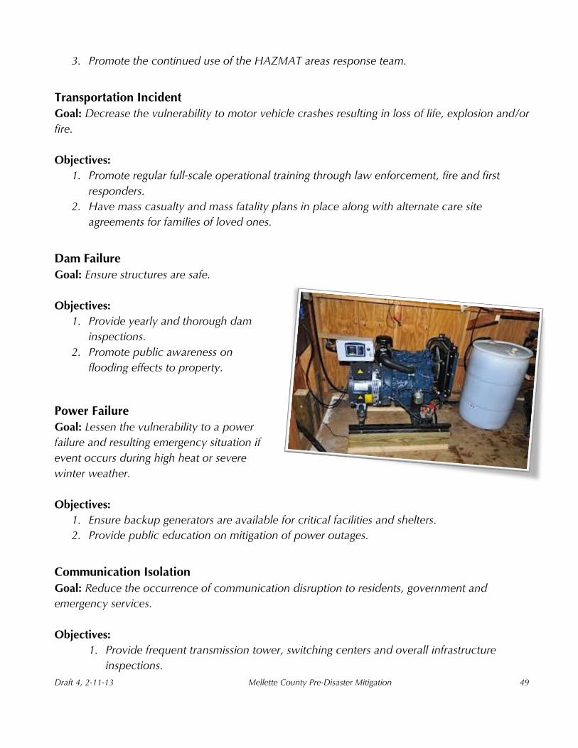
1. Ensure backup generators are available for critical facilities and shelters.
2. Provide public education on mitigation of power outages.
Communication Isolation
Goal: Reduce the occurrence of communication disruption to residents, government and
emergency services.
Objectives:
1. Provide frequent transmission tower, switching centers and overall infrastructure
inspections.
Draft 4, 2-11-13 Mellette County Pre-Disaster Mitigation
50
2. Increase interoperable communications between jurisdictions through redundancy and
diversity of systems.
Chapter 8 – Potential Mitigation Strategies

Draft 4, 2-11-13 Mellette County Pre-Disaster Mitigation
51
Building on the work in the previous chapters, the hazard mitigation planning team can set
mitigation goals, develop the objectives and begin defining the hazard mitigation strategy or
action plan.
A hazard mitigation action plan provides direction for the community’s efforts to reduce the
potential losses identified in the risk assessment. If the strategy is to be implemented, it should be
based on existing local authorities, policies, programs and resources. The approach should be
flexible enough to be expanded, reduced and/or improved upon if existing conditions change.
A benefit-cost review of proposed hazard mitigation actions is helpful in establishing priorities for
the strategy because such an analysis, studies the effectiveness of the actions with respect to their
cost. FEMA’s hazard mitigation plan review criteria, requires each community participating in a
multi-jurisdictional planning effort to identify the specific actions they will undertake.
A. Potential Mitigation Strategies
Hazard mitigation strategies to reduce specific risks can vary from basic to complex. They are
comprised of one or more hazard mitigation actions. There are many different hazard mitigation
actions, which are best classified into the following six categories:
Prevention
Property protection
Structural projects
Emergency services
Critical facilities protection
Public education and awareness
Prevention
Prevention measures are intended to keep a hazard risk from getting worse and ensure that future
development does not increase hazard losses. Communities can achieve significant progress
towards hazard resistance through prevention actions. This is particularly true in undeveloped
and redeveloped areas. Examples of prevention measures or actions are:
Planning and zoning (floodplain regulations)
Building codes

Draft 4, 2-11-13 Mellette County Pre-Disaster Mitigation
52
Capital improvement planning (no infrastructure extended into hazard area)
Land development regulations (large lot sizes)
Open space preservation (parks and recreation areas)
Storm water management (clear ditches/larger retention basins)
Property Protection
Property protection is used to modify buildings or their surroundings, rather than to prevent the
hazard from occurring since they directly impact people and property. A community may find
these to be inexpensive actions because they are usually implemented or cost-shared with
property owners. Examples of property protection measures are; acquisition, relocation,
rebuilding and flood-proofing.
Acquisition is public procurement and management of lands that are vulnerable to damage from
hazards. Public acquisition includes:
Full market value purchase
Purchase of foreclosure or tax delinquent property or bargain sales
Donations
Leases and easements
Relocation involves permanent evacuation to safer areas and includes:
Physical removal of buildings to a safe and future use area
Substitution of current use to another that is less vulnerable to the hazard(s) like utility
relocation by burying or flood proofing
Rebuilding or modifying structures to reduce damage along with adoption and enforcement of
building codes. They include some of the following actions:
Masonry structures can be retrofitted to lessen damage in landslides
Manufactured homes can be anchored for high wind speeds
Lightning protection for elevated structures
Flood-proofing is meant to protect flood-prone buildings by either dry flood-proofing, which seals
a structure by making the lower level watertight, or wet flood-proofing, in which water enters the
building and is allowed to minimize pressure on the structure.
Structural Projects

Draft 4, 2-11-13 Mellette County Pre-Disaster Mitigation
53
Structural projects involve construction of manmade projects to lessen or abate a hazard,
ultimately protecting people and property at risk. Protection measures include:
Placement of anemometers
Dams and reservoirs
Spillways
Channel modifications
Detaining walls
Storm sewers
Elevated roadways
Enclosing hazardous facilities
Detention/retention basins
Larger culverts
Higher flood standards for construction projects
Emergency Services
Some examples of emergency services include:
Local regional mutual aid agreements for assistance
Resources and alternate care sites for casualties/patients
Protection of critical facilities
Regular health and safety maintenance
Inventory of all assets and resources in the area
Annual multi-jurisdictional exercises
Annual review of operational plans
Critical Facilities Protection
Protecting critical facilities is essential for the community to respond and recover from an
incident. Damage or the closing of a critical facility can disrupt and impact the population and
needed services.
Critical facilities include:
Police stations, fire stations, emergency operation centers, hospitals, and other
structures/entities that are involved in the response effort
Facilities that care or house special needs populations, such as nursing homes, boarding
schools, assisted living centers and prisons
Power plants and hazardous materials production/storage facilities that create a secondary
hazard

Draft 4, 2-11-13 Mellette County Pre-Disaster Mitigation
54
Water supply sources and sewage treatment facilities
Public Education and Awareness
It is highly beneficial for the public be aware of educational activities in the community. These
components would include:
Provision of map information
Informational mass mailings especially to property owners in hazard-prone areas
Posters in high traffic areas
Real estate disclosure of flood hazards
Mellette County Emergency Management website updates
Tabbed page in local phone books
Public announcements through print ads
Radio and public access TV which provide updates on emergency situations
Table 4, identifies several potential mitigation strategies to eliminate or reduce the effects of the
county’s identified hazards along with subcategories of concern. Recognizing that hazards exist,
occur locally and can be very damaging to the community is the primary step in the mitigation
process. Specific mitigation projects should be addressed and prepared for on a local level, with
the knowledge that if the incident overwhelms the community, regional and state assistance is
available.

Draft 4, 2-11-13 Mellette County Pre-Disaster Mitigation
55
Table 4. Potential Mitigation Strategies
Hazard Prevention Property
Protection Structural Projects
Emergency Services
Critical Facilities
Protection
Public Awareness &
Education
Loss of electrical service for emergency operations
Purchase generators for emergency facilities
N/A N/A Backup system for emergency services
Ensure every critical facility has one or more generators
N/A
Flooding
1. Address 100 and 500-year flood risks by all county jurisdictions in their land use maps and land use planning and zoning
1. Sandbag, sump pumps, and flood insurance for homeowners 2. Adoption of floodplain mapping and zoning in the land use map and in its zoning ordinances
1. Require all culvert and road projects be conducted in accordance with NFIP standards 2. Control and oversee new development on the 100-year floodplain
1. Know which routes would potentially be blocked in flood and plan accordingly 2. Able to oversee resources to counteract or lessen the effect of flood waters
1. Sandbagging and evacuation of building if needed. 2. Alternate sites used with agreements in place
1. Educate community about potentially flooded routes and encourage them to avoid in heavy storms
Storms in Recreational
Areas
Develop an emergency evacuation plan for each facility
N/A
Determine the stability and capacity of structures at the facility and make appropriate upgrades
Share the emergency evacuation plan with each department
N/A
1. Lightning education 2. Post evac procedure in visible location and cable access channel
Fire (wildfire or urban)
1. Controlled burning 2. Posting of daily fire hazard
1. Family education and fire routes maps 2. Smoke alarms correctly installed and monitored
N/A
Designate what departments are responsible for action
1. Call 911 2.Fire training of SOPs within Emergency Operation Plans
Community education on wildfire prevention and fire within the home
Tornadoes, High winds
and Hail
Compile Severe Storm Evac Plan that addresses responsibilities, evacuation procedures, safety pre-cautions, etc.
1. Storm protection for elevated and/or exposed structures 2. Tie downs for mobile homes
Storm protection for elevated and/or exposed structures
1. Rapid storm detection 2. Identify the responsibilities of each city/ town department
Follow SOPS’s within Emergency Operation Plans
1. Encourage volunteers to become active in the severe storm spotters network 2. Severe storm education of tornadoes and high winds

Draft 4, 2-11-13 Mellette County Pre-Disaster Mitigation
56
Severe Winter Storm
1. Improve severe storm warning system for all county residents 2. Protect people and infrastructure from the impacts of severe weather 3. Assess adequacy of existing civil defense sirens
Evaluate the readiness of all homes and public buildings for preventing damage
1. Require that all new local electrical distribution lines be placed underground 2. Modify county codes to control tree growth near power lines; encourage cities to do the same
1. Ensure that emergency management personnel are notified as soon as possible in the event of a severe storm 2. Improve access to real-time weather data, ensure that all sectors of the county have immediate access to severe weather warnings
Follow SOPS’s within Emergency Operation Plans
1.Develop guidelines for homeowners describing what they can do to protect home 2. Understand the need for Shelter-in-Place or know where community shelter is 3. Have supplies at home to last at least 72 hrs
HAZMAT Unit
Development
1. Properly contain hazardous materials 2. List and map of all hazardous areas
N/A N/A
Exercise and training on how to handle for each substance
Safety and hazardous training for employees
1 Educating public on who to contact if aware of an incident 2. Identify alt. travel routes

Draft 4, 2-11-13 Mellette County Pre-Disaster Mitigation
57
Chapter 9 – Feasibility and Prioritization of Mitigation Strategies
The goal of each strategy is to reduce or prevent damage from a hazard event, while an important
criterion is whether the proposed action mitigates, the particular hazards or potential losses. Is it
effective in reducing flood damage? What will be the degree of impact in flood damage losses if
this action is taken? Consider that although some proposed actions might not reduce the hazards
or associated damages when done alone, they may be small and important steps toward more
effective actions.
Additionally, each action should also be reviewed for its congruency with other goals. For
example, actions the community wishes to make, that mitigates a particular hazard while
coordinating with other community priorities and the hazard mitigation goals of federal and state
agencies.
The advantages of coordination include:
Improved access to technical assistance and financial resources
Wide-ranging solutions developed for multiple problems
Broader support provided for implementation
Reduced chances of duplicating or conflicting with existing efforts
Additional questions that should be asked include, does this action affect the environment?
Another issue is timing: How quickly does the action have to take place? Which actions will
produce quicker results? This is particularly important to consider if funding sources have
application time limits.
In order to determine their effectiveness in accomplishing this goal, a set of criteria was applied to
each proposed strategy. The STAPLEE method analyzes the Social, Technical, and Admin-
istrative, Political, Legal, Economic and Environmental aspects of a project and is used by public
administration officials and planners as a decision-making tool.

Draft 4, 2-11-13 Mellette County Pre-Disaster Mitigation
58
Social: Is the proposed strategy socially acceptable to the community? Is there equity
issues involved that would mean one segment of the community are treated unfairly? Will
the action cause social disruption?
Technical: Will the proposed action work? Will it create more problems than it solves?
Doe it solve a problem or only a symptom? Is it the most useful action in light of other
goals?
Administrative: Can the community implement the action? Is there someone to coordinate
and lead the effort? Is there sufficient funding, staff and technical support available? Are
there ongoing administrative requirements that need to be met?
Political: Is the strategy politically acceptable? Is there public support both to implement
and to maintain the project?
Legal: Is the community authorized to implement the proposed action? Is there a clear
legal basis or precedent for this activity? Are there legal side effects? Is the proposed action
allowed by the comprehensive plan, or must the plan be amended to allow the proposed
action. Will the community be liable for action or lack of action? Will the activity be
challenged?
Economic: What are the costs and benefits of this action? Do the benefits exceed the
costs? Is initial, maintenance and administrative costs taken into account? Has funding
been secured for the proposed action? If not, what are the potential funding sources
(public, non-profit and private)? How will this action affect the fiscal capability of the
community? What burden will this action place on the tax base or local economy? The
actions contribute to other community goals, such as capital improvements or economic
development? What benefits will the action provide? (This can include dollar amount of
damages prevented or potential for funding under the HMGP program).
Environmental: How will the action impact the environment? Will the action need
environ-mental regulatory approvals? Will it meet local and state regulatory requirements?
Are endangered or threatened species likely to be affected?
In drafting this initial prioritization of the mitigation actions the STAPLEE criteria, assisted the team
in determining if each action was met or was likely to be completed. The criteria that were
considered “met” are identified with a “3”, and the criteria that were considered they would be
Draft 4, 2-11-13 Mellette County Pre-Disaster Mitigation
59
more difficult to meet are identified with a “1”. The methodology also allows for a “‐“designation
when impacts are expected to be negative although, none of the mitigation actions were marked
as adverse. The participants in this process have defined High, Medium, and Low priorities to be
assigned as follows:
High: Meets at least six of the seven STAPLEE criteria, in purple color on the chart
Medium: Meets at least five of the seven STAPLEE criteria, in tan color on the chart
Low: Meets at least four of the seven STAPLEE criteria, in blue color on the chart
This prioritization is found in Appendix D and is considered preliminary and should be revisited
on an annual basis by Mellette County Emergency Management Office and the participating
municipalities or as funding becomes available.
Chapter 10 – Mitigation Actions and Implementation Schedule
Draft 4, 2-11-13 Mellette County Pre-Disaster Mitigation
60
Mellette County and participating entities’ greatest needs are mitigating flood hazards, backup
generators for critical infrastructure, construction of storm shelters, and public awareness.
After focusing on damage caused by past events, and what could be done to ensure that future
damage will be lessened or eliminated and the completion of the risk assessment (identification of
hazards, probability of hazards and vulnerability to hazards), it was the mutual consensus of the
Planning Team that the mitigation strategies would focus on the following hazards: severe winter
and summer storms, flooding, fires (wild/urban), and power outages.
When identifying goals and objectives to the activities/ projects it was agreed upon, to include
broad reaching benefits but due to scope or varying levels of importance to individual
jurisdictions. In some instances, no specific cost, timeframe, or priority was assigned. Likewise
many infrastructure projects and policies throughout the communities would mitigate hazards but
were not located in the most vulnerable areas. For example all communities benefit from flood
proofing critical structures or burying above ground electric utility lines.
In order to select the project actions that will achieve the community’s hazard mitigation needs,
the Planning Team establishes a formal minimum threshold. Of the actions that meet the
minimum threshold, the team will select those that are the most likely to reduce damages while
encompassing a majority of the community’s acceptability criteria.
Once the actions have been selected, the Planning Team will prioritize them and focus on what is
most effective in reducing overall damages. A few of the actions will be achieved in a short
amount of time with little effort while the many of the major activities will not be executed so
easily, due to lack of funding, current regulations, or lack of technical or staff support.
It is recommended the team highlight a couple of “achievable projects” as top priorities, such as
a public education program or development of an online information portal. This will assist the
jurisdictions in building “small successes” at the onset of the project and encourages them to
continue with more challenging projects. The more complex and time-consuming actions can
remain top priorities and be implemented through the lifespan of the project.
Upon adoption of the updated plan, each jurisdiction will become responsible for implementing
its own mitigation actions. The planning required for implementation is the sole responsibility of
the local jurisdictions and private businesses that have participated in the plan update.
With the formulation of our mitigation strategies, the action plan will be developed to begin a
timeline for implementation of the activities. In this section the action plan is outlined with

Draft 4, 2-11-13 Mellette County Pre-Disaster Mitigation
61
information on whom is responsible for implementing each of the prioritized strategies, as well as
when and how the actions will be implemented.
The following questions were asked to assist the planning team in developing an implementation
schedule for the priority mitigation strategies.
WHO? Who will lead the implementation efforts? Who will put together funding
applications?
WHEN? When will these actions be implemented, and in what order?
HOW? How will the community fund these projects? How will the community implement
these projects? What resources and partnerships will be needed?
Appendix E includes the Action Plan. The following information is provided for each action:
The primary hazard being addressed with the associated action
The party(s) primarily responsible for implementing the action
The time frame to accomplish the action
o “Short Term, ST” means actions that are intended to be initiated within one year
o “Mid Term, MT” is for actions that will be begin within 1-4 years
o “Long Term, LT” is for actions that are not launching for at least five years
Potential sources of funding
o The estimated cost - estimates for many of the actions were obtained from
knowledgeable sources based on current information
The local priority rating
Funding sources can make or break a successful project. Many worthy programs and projects are
never implemented due to funding restraints. Given the existing financial reality of municipal and
county budgets, most of the proposed actions, would not commence without substantial grant
assistance that would otherwise put a large burden on small local budgets.
Funding resources are available from FEMA through the South Dakota Office of Emergency
Management and include the Hazard Mitigation Grant Program, Pre-Disaster Mitigation grant
program, and Flood Mitigation Assistance grant program. Other possible sources of funding
include:

Draft 4, 2-11-13 Mellette County Pre-Disaster Mitigation
62
State and Federal Government, Organizations and Programs o Small Business Administration (SBA) Disaster Loans
o FEMA Assistance to Firefighters Grant program
o SD Conservation District Association
o Central South Dakota Water Development District
o SD Department of Environment and Natural Resources
o SD Department of Transportation
o US Department of Agriculture Rural Development Office
o FEMA Public Assistance
o Housing and Urban Development (HUD)
o Economic Development Administration (EDA)
o Environmental Protection Agency (EPA)
o Community Development Block Grant Program
o Economic Development Administration
o Homeland Security (HLS) Annual Grants
o SD Community Foundation Grants
Local Government o Year-end money
o Post-disaster recovery
o Capital improvement budget
o Economic development funds
o Staff time (in-kind)
o General obligation bonds
o Revenue bonds
Private-sector o Time and labor
o Subject Matter Experts (consultants)
o Materials and resources
o Private contributions

Draft 4, 2-11-13 Mellette County Pre-Disaster Mitigation
63
Chapter 11 – Monitoring, Evaluating and Updating the Plan
Annual Review
The Pre-Disaster Mitigation Plan shall be reviewed annually, or as the situation dictates following
a disaster declaration. The Emergency Manager is responsible for initiating the yearly review and
should consult with members of the Local Emergency Planning Committee and the Hazard
Mitigation Planning Team. The evaluation process will include public notification of
planning/review meetings through press releases in the local newspapers and radio stations.

Draft 4, 2-11-13 Mellette County Pre-Disaster Mitigation
64
The EM will review the plan annually and ensure the following:
The County Elected body will receive an annual report and/or presentation on the
implementation status of the PDM activities;
The report will include an evaluation of the effectiveness and appropriateness of the
mitigation actions proposed in the plan; and
The report will recommend, as appropriate, any required changes or amendments.
Plan amendments will be considered by the County EM during the plan’s annual review to take
place the end of each fiscal year. Changes should be analyzed with the STAPLEE tool, an updated
timeframe, the community’s priorities and funding sources in mind. Priorities that that received a
lower rating should be reviewed as well during this time to determine the possibility of a need for
future implementation or removal.
Changes made to the plan should accommodate projects that have failed or are no longer
considered practical, sufficient or altered due to different scenarios.
Some actions will be carried out by the public sector, and some by the private sector
Certain actions will be accomplished pre-disaster and some will not be feasible until after a
disaster when post-disaster funding sources are available
A few actions can be accomplished in the short term and others will may require years to
accomplish
In keeping with the process of adopting the 2012 Mellette County Pre-Disaster Mitigation Plan,
the Local Emergency Management Office shall conduct public hearings to receive input and
comment on the Plan. Updates should be held during the annual review period and the final
product adopted by the various Boards of Commissioners.
The process of adoption demonstrates community commitment to hazard mitigation efforts
prepares the community for what they can expect before and after a disaster, ensures continuity
of loss reduction efforts and guarantees eligibility for other federal programs.
Five Year Review
Recognizing that many mitigation projects are ongoing, and that while in the implementation
stage communities may suffer budget cuts, experience staff turnover, or projects may fail, a good
plan needs to provide for periodic monitoring and evaluation of its successes and failures and
allow for updates when necessary.

Draft 4, 2-11-13 Mellette County Pre-Disaster Mitigation
65
In the absence of a disaster, a thorough review should be conducted every five years (a DMA
2000 requirement) to initiate a full update of the Pre-Disaster Mitigation Plan. All information in
the plan will be evaluated for completeness and accuracy based on new information or data
sources and the full planning and research process will be repeated.
In future years, if Mellette County relies on grant dollars to hire a contractor to write the plan
update, the county will initiate the process of applying for and securing funding in the third year
to ensure the funding is in place by the fourth year of the plan process. The fifth year will then be
used to write the update that in turn will prevent any lapse in time in which the county does not
have an approved current plan on file.
Other Plan Incorporation
The Mellette County Pre-Disaster Mitigation Plan shall be a part of any future Zoning Ordinances
or Comprehensive Plans developed and approved in the County and should be referenced while
implementing appropriate sections of the PDM, where applicable.
All municipality mitigation projects should be considered and prioritized in conjunction with non-
mitigation projects, such as water and wastewater infrastructure improvements, new construction
of residential areas, schools, libraries, parks, etc. In addition, all mitigation requirements, goals,
actions, and projects should be studied during the budget process. Budget preparation is a
favorable time to review the plan since municipalities are considering expenditures during this
time.

Draft 4, 2-11-13 Mellette County Pre-Disaster Mitigation
66
References
Appendix D Planning Process Toolkit. (n.d.). Retrieved from http://www.nyc.gov/html/oem/downloads/pdf/hazard_mitigation/appendix_d_toolkit.pdf
Appendix G STAPLEE Analysis of Mitigation Actions. (n.d.). Retrieved from http://www.co.cumberland.nj.us/filestorage/Final_Draft_appx_G_STAPLEE_060109.pdf
City Data, White River, SD. Retrieved from http://www.city-data.com/city/White River-South-Dakota.html
County of San Diego Guidelines for Determining Significance. (n.d.). Retrieved from http://www.sdcounty.ca.gov/pds/docs/Emergency_Response_Guidelines.pdf
Economic Analysis of Natural Hazard Mitigation Projects. (n.d.). Retrieved from http://darkwing.uoregon.edu/showcase/Current_Projects/pdfs
Executive Summary. (n.d.). Retrieved from http://www.co.delaware.ny.us/ departments/pln/docs
FEMA, Section Title. (n.d.). Retrieved from https://training.fema.gov/EMIWeb/IS/IS393A/Word/IS393final.doc
Hazus | FEMA.gov. (n.d.). Retrieved from http://www.fema.gov/hazus/
Draft 4, 2-11-13 Mellette County Pre-Disaster Mitigation
67
Introduction - National Preparedness Directorate National (n.d.). Retrieved from https://training.fema.gov/EMIWeb/IS/IS393A/PDF/IS393.A-Lesson4.pdf
Mitigation Plans and the FEMA Planning Process - California (n.d.). Retrieved from https://sites.google.com/site/cahazardprofilemitigationplan/california-hazard-profile
Natural Hazards Mitigation Planning Guide. (n.d.). Retrieved from http://www.docstoc.com/Natural-Hazards-Mitigation-Planning-Guide South Dakota Department of Public Safety: Emergency Services. Retrieved from http://dps.sd.gov/emergency_services/emergency_management/hazard_vulnerability.aSpx
South Dakota State Hazard Mitigation Plan. (n.d.). Retrieved from http://dps.sd.gov/emergency_services/emergency_management/documents