Embed Size (px)
Citation preview

Different types of maps and how to read them.
*Maps

*What is a map?
*A map is a picture or representation of the Earth's surface, showing how things are related to each other by distance, direction, and size.
Maps have been used for centuries. A person who creates map as a profession is called a cartographer.

*Types of Maps
*Political Maps
*Road Maps
*Thematic Maps
*Physical Maps
*Climate Maps
*Topographic Maps
*Economic or Resource Maps

*Political Maps
*A political map shows human-created features such as boundaries, cities, highways, roads, and railroads.
*It also shows counties, state or country boundaries, capitals.
*Its purpose is to specifically show borders.
*It shows a political purpose by showing what belongs to who.

*Road Maps
*Maps show; major highways, airports, city locations, and points of interests.
*Specifically designed for motorists to find their way around.
*Road maps contain information about roads, streets and highways as well as locations for gas stations, some restaurants, hotels, hospitals and airports.
*Road maps are like treasure maps, and like treasure maps they can open doors to all kinds of adventure.
*Road maps aren’t as common in todays time because we have more modern technology such as a GPS.
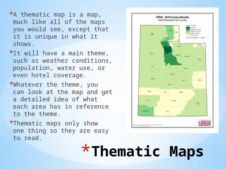
*Thematic Maps
*A thematic map is a map, much like all of the maps you would see, except that it is unique in what it shows.
*It will have a main theme, such as weather conditions, population, water use, or even hotel coverage.
*Whatever the theme, you can look at the map and get a detailed idea of what each area has in reference to the theme.
*Thematic maps only show one thing so they are easy to read.
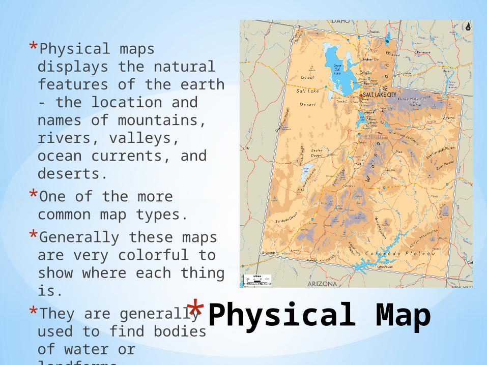
*Physical Map
*Physical maps displays the natural features of the earth - the location and names of mountains, rivers, valleys, ocean currents, and deserts.
*One of the more common map types.
*Generally these maps are very colorful to show where each thing is.
*They are generally used to find bodies of water or landforms.

*Climate Map
*Gives specific information about the climate of an area.
*Usually used to see climatic zones, temperature, the amount of snow an area receives, and amount of precipitation.
*Different colors are generally used to show different climates on the map.
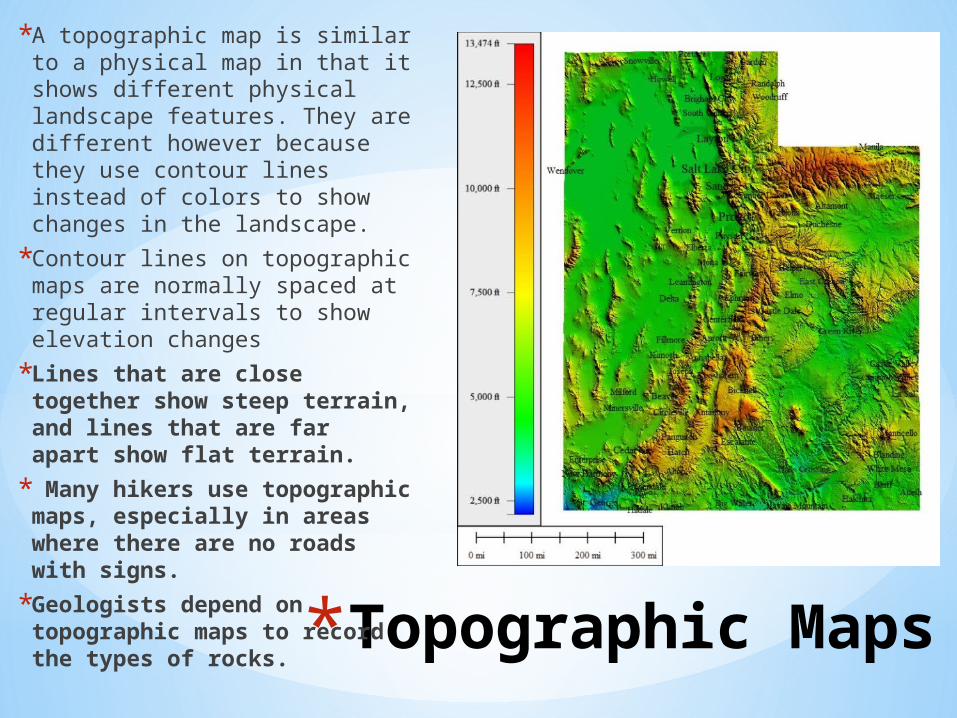
*Topographic Maps
*A topographic map is similar to a physical map in that it shows different physical landscape features. They are different however because they use contour lines instead of colors to show changes in the landscape.
*Contour lines on topographic maps are normally spaced at regular intervals to show elevation changes
*Lines that are close together show steep terrain, and lines that are far apart show flat terrain.
* Many hikers use topographic maps, especially in areas where there are no roads with signs.
*Geologists depend on topographic maps to record the types of rocks.

*Economic or Resource Map
*feature the major types of natural resources or economic activity in an area.
*They use symbols to show the locations of natural resources or economic activities.
*An economic or resource map shows the specific type of economic activity or natural resources present in an area through the use of different symbols or colors depending on what is being shown on the map.
*This map includes: the living standards, level of unemployment and how different regions contribute to the national economy.
*This map can be used to predict economic projections.

*First thing to do when looking at a map
*What is the first thing you should do when looking at a map?
*Read the title!
*The title will tell you what you are looking at and what type of map it is.

*Key or Legend
*What is a map key or legend?
*The key will explain the information shown on the map. Here is an example of a map key.
*The map key is usually located in a box on the bottom right hand of the map and is labeled map key or legend.

*Compass Rose
*What is a compass rose?
*The four cardinal directions, north, south, east, and west are indicated on the compass rose.
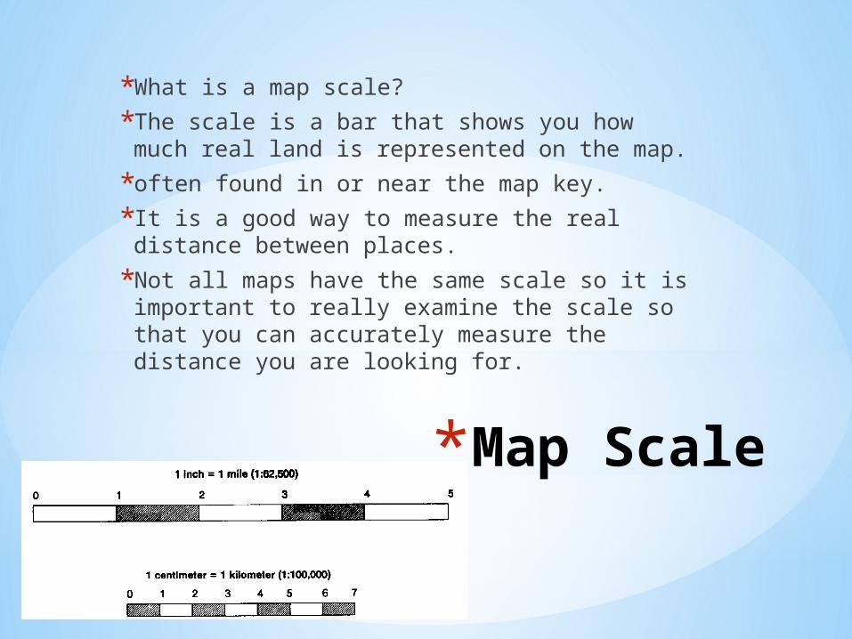
*Map Scale
*What is a map scale?
*The scale is a bar that shows you how much real land is represented on the map.
*often found in or near the map key.
*It is a good way to measure the real distance between places.
*Not all maps have the same scale so it is important to really examine the scale so that you can accurately measure the distance you are looking for.
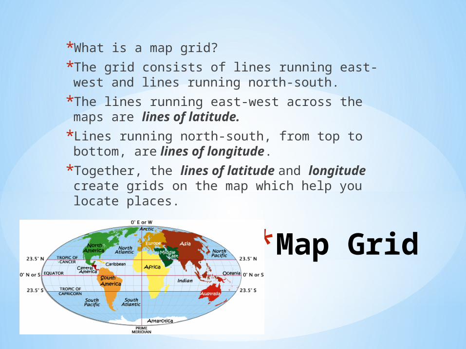
*Map Grid
*What is a map grid?
*The grid consists of lines running east-west and lines running north-south.
*The lines running east-west across the maps are lines of latitude.
*Lines running north-south, from top to bottom, are lines of longitude.
*Together, the lines of latitude and longitude create grids on the map which help you locate places.
![This Dynamic Earth [USGS]miltonscience.weebly.com/.../dynamic_earth_usgs.pdf · See also This Dynamic Planet, the map showing the Earth's physiographic features, current plate movements,](https://img.dokumen.tips/doc/110x75/600c4f13104e6d083f5a7a33/this-dynamic-earth-usgs-see-also-this-dynamic-planet-the-map-showing-the-earths.jpg)