Embed Size (px)
Citation preview


DEVELOPMENT AND OPERATIONS PLAN
WOLF CREEK WASTE DISPOSAL SITE
Environmental Compliance Approval
No. A361102
Submitted to:
Municipality of Hastings Highlands
33011 Highway No. 62
P.O. Box 130
Maynooth, ON K0L 2S0
Prepared by:
BluMetric Environmental Inc.
The Tower, The Woolen Mill
4 Cataraqui Street
Kingston, ON K7K 1Z7
Project Number: 170542-01
August 2017

TABLE OF CONTENTS
1. INTRODUCTION ......................................................................................................... 1
1.1 OBJECTIVES ........................................................................................................................ 1
1.2 BACKGROUND ................................................................................................................... 1
2. SITE LOCATION AND DESCRIPTON ............................................................................ 1
2.1 LAND USE AND ZONING ..................................................................................................... 2
2.2 POPULATION OF THE AREA ................................................................................................. 2
2.3 WASTE CHARACTERISTICS AND DENSITY ............................................................................... 3
2.4 TOPOGRAPHY AND SITE FEATURES ...................................................................................... 3
2.5 GEOLOGY ......................................................................................................................... 4
2.5.1 Surficial Geology .................................................................................................... 4 2.5.2 Bedrock Geology ................................................................................................... 4
3. SITE DESIGN AND DEVELOPMENT ............................................................................. 4
3.1 SURFACE WATER SETTING ................................................................................................... 4
3.2 SITE GROUNDWATER HYDROGEOLOGY ................................................................................ 5
3.3 CLIMATIC DATA ................................................................................................................. 6
3.4 SITE CAPACITY ................................................................................................................... 6
3.5 SITE DEVELOPMENT & IMPROVEMENT .................................................................................. 7
4. SITE OPERATION AND MAINTENANCE ..................................................................... 9
4.1 METHOD OF OPERATION ................................................................................................... 9
4.1.1 General Operating Guidelines ................................................................................ 9 4.1.2 Phase 1 Level Quadrant Landfilling Approach ......................................................... 9 4.1.3 Phase 2 Level Quadrant Landfilling Approach ......................................................... 9
4.2 PUBLIC ACCESS ................................................................................................................. 10
4.3 WASTE DISPOSAL COMPONENTS ......................................................................................... 10
4.3.1 Recyclables ............................................................................................................ 10 4.3.2 Household Hazardous Waste and Waste Electrical and Electronic Equipment ........ 10 4.3.3 Scrap Metal, Tires, Clean Wood ............................................................................. 11 4.3.4 Bulky Wastes ......................................................................................................... 12
4.4 WASTE COMPACTION, TRI-WEEKLY AND INTERMEDIATE COVER ............................................. 12
4.5 SITE PERIMETER AND WASTE FOOTPRINT ............................................................................. 13
4.6 HOURS OF OPERATION ..................................................................................................... 13
4.7 TIPPING FEES .................................................................................................................... 13
4.8 SIGNAGE .......................................................................................................................... 14
4.9 SECURITY ......................................................................................................................... 15
4.10 SITE SUPERVISION ............................................................................................................. 15
4.11 LITTER CONTROL .............................................................................................................. 15
4.12 NOISE CONTROL .............................................................................................................. 16

4.13 DUST CONTROL ............................................................................................................... 16
4.14 ODOUR IMPACT ............................................................................................................... 16
4.15 VECTOR AND VERMIN CONTROL ....................................................................................... 16
4.16 SITE EQUIPMENT .............................................................................................................. 16
4.17 ATTENDANT’S FACILITIES ................................................................................................... 16
4.18 BURNING ........................................................................................................................ 17
5. ENVIRONMENTAL CONTROLS ................................................................................. 17
5.1 SURFACE WATER CONTROL ............................................................................................... 17
5.2 GROUNDWATER CONTROL ............................................................................................... 17
5.3 FINAL COVER AND CLOSURE .............................................................................................. 18
5.3.1 Final Contours ...................................................................................................... 18 5.3.2 Site Closure ........................................................................................................... 18 5.3.3 Final Cover ........................................................................................................... 18
5.4 POST CLOSURE MAINTENANCE........................................................................................... 19
5.5 POST CLOSURE MONITORING ........................................................................................... 20
5.6 GROUNDWATER CONTINGENCY PLAN ............................................................................... 20
6. RECORD KEEPING, REPORTING AND INSPECTION ................................................... 21
6.1 WASTE INSPECTION PROCEDURES ....................................................................................... 21
6.2 DAILY OPERATOR’S LOG AND SITE RECORDS ........................................................................ 21
6.3 ANNUAL OPERATIONS REPORT ......................................................................................... 22
7. EMERGENCY RESPONSE PLAN .................................................................................. 22
7.1 FIRE CONTROL ................................................................................................................ 22
8. CLOSURE .................................................................................................................. 23
9. REFERENCES ............................................................................................................. 24

LIST OF TABLES
Table 1: Population Data ...................................................................................................... 2 Table 2: Groundwater Monitor GPS Co-ordinates ................................................................. 5 Table 3: Groundwater Elevation Data ................................................................................... 5 Table 4: Groundwater Quality Parameters ............................................................................ 6
LIST OF FIGURES
Figure 01: Site Location Map
Figure 02: Site Plan
Figure 03: Site Topography and Monitoring Locations
Figure 04 Proposed Design Contours
Figure 05: Volumetrics 2017 vs Final Design Contours
Figure 06: Cross-Sections A-A’, B-B’, and C-C’
Figure 07: Cross-Sections D-D’, E-E’, and F-F’
Figure 08: Site Development- Phase 1 Surface to 293.5 m
Figure 09: Site Development- Phase 2 293.5 m to Final Elevations
LIST OF APPENDICES
Appendix A: Environmental Compliance Approval, Land Use Permit, Official Plan and
Municipal Zoning Information, and MOECC Inspection Report
Appendix B: Site Photographs
Appendix C: Well Records and Climatic Data
Appendix D: Sampling Protocol
Appendix E: Operational Requirement for Burning at Landfill Sites (MOE Guideline C-7)
Appendix F: Trigger Mechanisms and Contingency Plan
Appendix G: Operator’s Log/Checklist

1. INTRODUCTION
1.1 OBJECTIVES
BluMetric Environmental Inc. (BluMetricTM
) was retained in July 2017 by the Municipality of
Hastings Highlands to prepare a Development and Operations Plan for the Wolf Creek Waste
Disposal Site (WDS).
The Development and Operations Plan is intended to address the future waste management
needs of the community, and to ensure that the operation of the Site is in compliance with the
waste disposal requirements of the Environmental Protection Act.
1.2 BACKGROUND
The Wolf Creek WDS is owned and operated by the Corporation of the Municipality of Hastings
Highlands and operates under Environmental Compliance Approval (ECA) No. A361102
(Appendix A). The Site has a total area of approximately 0.7 hectares (ha) with a 0.2 ha
approved landfilling area. The Site is believed to have been in operation since 1980 and was
previously operated by the Township of Bangor, Wicklow & McClure.
The ECA for the Site indicates that the Site is located on Part Lot 23, Concession 14. The ECA
should be amended to correct the geographic location of the Site. The Site is actually located on
Part of Lot 22, Concession 14. The current Land Use Permit (LUP) for the Site (LUP1634-1004191)
effective June 1, 2016 and expires May 31, 2026 identifies the correct location. The Site sketch
attached to the LUP identifies the location was corrected by MNRF on Sep. 1, 1990. The LUP is
also attached in Appendix A.
2. SITE LOCATION AND DESCRIPTON
The Site is located on Part of Lot 22, Concession 14, which is designated as Crown Land. It is
located at 567 River Road approximately 10 km southwest of Barry’s Bay and approximately 19
km from Barry’s Bay via River Road and Highway 69. It is located approximately 1.5 km
northwest of Kamaniskeg Lake. The Site Location Map for the Wolf Creek WDS is shown in
Figure 01. Access to the Site from the south is via Highway 62, Centerview Road and Siberia
Road. The Site is located in a former sand and gravel pit within a forested area. A Site Plan (aerial
image from July 2017) is included as Figure 02.

In addition to domestic waste, Wolf Creek WDS includes recycling bins for metal, plastic,
paper/cardboard products, as well as segregated areas on the west side of the property for scrap
metal, tires and brush. Currently there are covered waste bins that are filled by the public and
then subsequently transferred to waste site. Photographs are provided in Appendix B.
2.1 LAND USE AND ZONING
As mentioned previously, the Site is on leased Crown Land through a Land Use Permit. All
immediately surrounding lands are owned by the Crown and are administered by the MNRF.
The land use permit issued by the Ministry of Natural Resources is for a site property area of 0.7
hectares. The land use zoning information is provided in Appendix A and the Official Plan
indicates the property is identified as a waste disposal site, and is zoned Extractive (Active). The
Site or immediate adjacent lands are zoned Environmental Protection (EP) and Environmentally
Sensitive 11 Deer Concentration Area.
According to the municipal zoning by-law the Site is identified as waste disposal and the
immediate lands are designated Mineral Extractive (MX), Environmental Protection (EP),
Marginal Agricultural (MA), with properties designated as Limited Service Residential (LSR) to the
south along the Madawaska River (immediately to the west of Kamaniskeg Lake).
2.2 POPULATION OF THE AREA
The population of the Hastings Highlands area, according to the 2016 census, is 4,078 people
and 3,684 private dwellings. The population of this municipality increased from 2006 to 2011
followed by a decrease of 2.2 percent from the 2011 to the 2016 census. Overall the population
increased by 1.1% since 2006. Assuming a similar 1% increase in population over the next 10
years, the estimated population of the Municipality in 2026 is expected to be 4,119 people. A
summary of the recorded and projected 10-year population data is provided in
Table 1 below.
Table 1: Population Data
Year Recorded/Projected Population
2006 4,033
2016 4,078
2026 4,119
Waste at the Site is generally only accepted from the former townships of Bangor, Wicklow,
McClure, however it may be accepted from any MHHs’ resident.

There are currently nine (9) waste disposal/waste transfer sites available under the jurisdiction of
the Municipality of Hastings Highlands, two of which will be permanently closed in the near
future. These two sites (Sand Bay and North Baptiste Lake) have been converted to transfer site
operations. Trenching operations at Wolf Creek have ceased and the Site is currently acting as an
area fill operation.
It is not possible, using the currently available landfill historical data, to identify the population
contributing to each landfill within the MHHs. For estimation of the contributing population to
the Wolf Creek Waste Disposal Site, the 1996 census data (prior to the amalgamation of the
townships) was reviewed. The population for the Townships of Bangor, Wicklow and McClure
in 1996 was recorded as 1,154. Considering the 4.1% increase in population recorded in the 2001
census, and a 1% increase from 2006 to 2016 for the Municipality of Hastings Highlands, it is
estimated that the former townships of Bangor, Wicklow and McClure have a current population
of 1,213. Knowing that the Wolf Creek Waste Disposal Site is located near Bangor, it is expected
that approximately one-third, or 405 people are contributing to this landfill.
2.3 WASTE CHARACTERISTICS AND DENSITY
The waste deposited at the site is restricted to households within the geographical boundaries of
the Municipality of the Hastings Highlands. Typically, domestic wastes consist of mixed
household garbage, plastic, glass, aluminum, metal, cans, scrap metal, paper items, and bulk items
such as old appliances and furniture. Wolf Creek WDS also accepts tires. Illegally deposited
Electronic waste (E-waste) and propane cylinders are separated and stored for off-site transport.
No hazardous waste is accepted at this location.
2.4 TOPOGRAPHY AND SITE FEATURES
As mentioned previously Figure 02 illustrates the Site Plan. This Figure provides an aerial view of
the current site conditions. Figure 03 shows the current surface features and contours of the Site
(July 2017), the property boundaries, and the estimated limits of waste.
There is a stream within 250 m of the western boundary of the Site, which flows into Mud Bay
in the Madawaska River, located about 600 m southwest from the landfill. The Madawaska
River then flows into Kamaniskeg Lake which is located southeast of the Site. Wolf Lake is located
about 2 km north of the Site. There is a marshland, known as Moonshine Marsh, located 500 m
southeast of the Site.

2.5 GEOLOGY
2.5.1 Surficial Geology
The surficial geology of the area is a glaciofluvial plain covered with till veneer. The immediate
area of the Site is characterized by generally sandy overburden with a thickness ranging from 5
to 10 metres. Borehole logs for the three monitoring wells on site confirm that the overburden is
a sand and gravel unit to depths of over 11 metres. Well records for four wells located
within 500 m of the Site and along the Madawaska River were obtained from the MOECC
website. The well records indicate the overburden ranges from approximately 18 m to 44 m and
is generally sand and gravel with some silt and clay layers.
2.5.2 Bedrock Geology
The Wolf Creek Waste Disposal Site is located within the Grenville geological province, on
Precambrian bedrock. Bedrock is described as Felsic igneous rocks such as tonalite, granodiorite,
monzonite, granite, syenite; and derived gneisses (Map 2544, MNDM). Well Records for four
wells within 500 m of the Site are provided in Appendix C. These records identify the bedrock as
granite.
3. SITE DESIGN AND DEVELOPMENT
3.1 SURFACE WATER SETTING
Based on a review of the topographical maps, combined with a site inspection, it is evident that
the surface water drainage at the site flows into the current waste site, which is a former
aggregate pit. The surface water infiltrates into the Site and enters into the groundwater system
(Figure 03).
The MOECC Site Inspection Report (June 21, 2017) is also provided in Appendix A. Section 2.7
of this report confirms that surface water monitoring is not required unless additional
groundwater monitoring demonstrates a potential for leachate impacts to the creek.

3.2 SITE GROUNDWATER HYDROGEOLOGY
There is no requirement under the C of A for this Site to conduct groundwater monitoring.
However groundwater sampling has been performed at the Wolf Creek Waste Disposal Site to
characterize the groundwater quality.
Groundwater samples have been collected from three monitoring wells: WC1-03, WC2-03 and
WC3-03 (Figure 03). These wells were drilled and installed in 2003 by GET Drilling Ltd. under
the supervision of BluMetric. Monitors were installed to bottom depths of 7.62 m, 11.28 m,
and 11.28 m respectively below ground surface, and each well is screening a water-bearing
medium grained sand and gravel unit. Table 1 summarized the GPS co-ordinates of the
monitoring wells.
Table 2: Groundwater Monitor GPS Co-ordinates
Sample Location Northing Easting
WC1-03 5032818 285898
WC2-03 5032777 285840
WC3-03 5032703 285859
In 2017 and previous years, water level measurements were collected using a Solinst electronic
water level meter prior to purging. Groundwater elevation data are presented in Table 3. Using
the April 27, 2016 groundwater elevation data, the calculated hydraulic gradient was 0.004 m/m
with a flow direction to the west. The hydraulic gradient was calculated to be 0.0006 m/m in a
northwest flow direction using the October 27, 2016 groundwater elevation data, however there
is virtually no gradient. Historically the groundwater flow direction has been to the southwest.
The groundwater elevation data for the most recent sampling event are also provided in Table 3
below.
Table 3: Groundwater Elevation Data
Groundwater
Monitoring
Groundwater
Elevation
11-May-17
Groundwater Elevation
27-Oct-16
Groundwater Elevation
27-Apr-16
WC1-03 285.636 283.326 284.826
WC2-03 285.279 283.329 284.569
WC3-03 285.513 283.363 284.713
Note: 2016 and 2017 elevation data are geodetic, prior to the 2016 Annual Monitoring report elevations
were based on a site benchmark
The sampling protocol for the Site is provided in Appendix D.

Groundwater samples have been collected between 2006 and 2016. The samples have been
analyzed for the following parameters:
Table 4: Groundwater Quality Parameters
Category Parameters
Organic Parameters Dissolved Oxygen Demand (DOC)
Inorganic Parameters Ammonia, Chloride, Nitrate, Major Ions (Sodium, Potassium, Calcium,
Magnesium, Sulphate, Alkalinity)
Dissolved Metals
Aluminum, Barium, Beryllium, Boron, Cadmium, Chromium, Cobalt,
Copper, Iron, Lead, Manganese, Molybdenum, Nickel, Silicon, Silver,
Strontium, Thallium, Titanium, Vanadium, Zinc
Physical/Chemical
Parameters
Chemical Oxygen Demand (COD), Conductivity, pH, Total Dissolved
Solids (TDS)
The Annual Monitoring Report for 2016 recommended a reduction in the analytical parameters
tested for the 2017 sampling period. The recommendation for the reduction was based on a
review of the 10 years of historic groundwater data for the Site. The updated parameter list is
provided in the Sampling Protocol provided in Appendix D.
3.3 CLIMATIC DATA
The average annual precipitation data for the Site indicates the area receives an average of 1 030
mm of total precipitation. Climatic Data are provided in Appendix C. The annual precipitation
data for that Site is reflective of most locations in southeastern Ontario. Due to the porous soil
conditions on-site this precipitation is expected to infiltrate quickly.
3.4 SITE CAPACITY
In order to determine the landfill footprint, the following parameters have been taken into
account: previous waste disposal activities, the 0.2 ha allowable footprint, and the minimum and
maximum allowable side slopes. A maximum waste slope of 4:1 and a minimum slope of 20:1
were maintained to define the final contours.
Figure 04 illustrates the proposed design to fill the 0.2 ha footprint rising from the existing
ground surface to an elevation of 295.0. The peak of the mound will rise from the 295 m
contour at a 20:1 slope. Spot elevations of 295.22, 295.26, and 295.24 are shown across the
peak of the mound in Figure 04.
The footprint was selected such that the active waste location and probable previous waste
placement areas would be included within the 0.2 ha approved footprint. There are two
volumes to consider in determining the volume available for future waste placement,

according to the final design contours of the closed landfill. According to the study completed by
D.M. Mills in 2016, the volume of the buried waste at the end of 2016 was estimated to be 1 220
m3 with approximately 8 000 m
3 of trench and fill volume remaining. Based on historic
photographic records it is likely that only the area fill volume above the current ground surface
remains available within the 0.2 ha approved footprint at the Site.
A calculation of the vertical fill area between the ground surface contour of approximately 292
masl, and the proposed design waste elevation contour, resulted in an estimated net fill volume
of 2 587 m3 as illustrated on Figure 05.
The last three annual monitoring reports for the Site have recorded annual waste generation rates
of 29 (2014), 67 (2015) and 108.5 (2016) tonnes, resulting in an average tonnage of 68 tonnes
per year. The 68 tonnes are estimated to equate to 136 cubic metres of compacted waste per
year.
Considering a daily waste generation of 1 kg for each person using the landfill, the annual mass of
waste being directed to the Wolf Creek Waste Disposal Site is estimated to be:
405 x 1 kg/day x 365 day = 147 825 kg
500 kg/m3 estimated density for the compacted waste:
147 825 kg/ 500 (kg/m3) = 295.65 or approximately 300 m
3 is per year.
Taking the requirement for clean fill to be applied as interim and daily cover between waste
layers, a waste to fill ratio of 4:1 is assumed. Therefore the total waste production rate is
expected to range from approximately 170 to 375 m3 per year.
The life expectancy of the landfill is therefore estimated to range from 7 years (2587 m3/375
m3/year) to 15 years (2 587 m
3/170 m
3/year).
3.5 SITE DEVELOPMENT & IMPROVEMENT
The Site development plan was designed to maximize available disposal volumes within the
designated area of 0.2 ha, and to create a final contour that promotes surface run off and reduces
the likelihood of leachate breakout along the slopes. The final design elevations are provided on
plans Figures 04 and 05 and cross-sections through the mound are provided in Figures 06
and 07.

Steps for development of the Site are itemized in the following Phases:
Phase 1:
1. Install permanent elevation markers at 292 masl.
2. Install the footprint boundary markers.
3. Install 30 m buffer markers and remove any trees within the 30 m.
4. Place soil berms and signage to delineate active cell locations.
5. Remove the temporary waste bins.
6. Relocate the recycling bin to the west side of the Site.
7. Relocate the brush pile to maintain separation from the waste and vegetation.
8. Replace the attendant’s building with a new well ventilated structure.
9. Place a concrete well tile structure over WC3-03.
10. Install additional wells downgradient from WC2-03 to determine if there are any actual
or potential impacts to the creek, and extent of leachate plume.
11. Sample existing wells within 500 m of site should new wells indicate potential
groundwater impacts to the south.
12. Provide a sealable and lockable household hazardous waste (HHW) container for HHW
that is illegally brought to the Site by the community.
Phase 2:
1. Install permanent elevation markers at 293.5 masl.
2. Install the 293.5 m footprint boundary markers.
3. Place soil berms and signage to delineate active cell locations.
Phase 3:
1. Prepare a Closure Plan and submit to the MOECC for approval according to the timing
indicated by the ECA.
Phase 4:
1. Closure of the Site and long-term monitoring reporting for the closed site.

4. SITE OPERATION AND MAINTENANCE
4.1 METHOD OF OPERATION
The method of operation for the Wolf Creek Waste Disposal Site is the area method. After
preparation of the Site, the operation starts by filling the volume between the current ground
level and the elevation of 293.5 masl. The filling can take place by a tipping edge operation at
some locations. It is crucial that the waste being placed in this area does not exceed the assigned
footprint. During recent years the Municipality has been placing soil berms to contain and direct
the public to the proper location for active waste placement. This practice should continue.
4.1.1 General Operating Guidelines
Once the boundaries and capacity of the D&O Plan are approved, the Municipality should have
positional and grade stakes placed to ensure waste is placed according to the approved plan.
4.1.2 Phase 1 Level Quadrant Landfilling Approach
From the ground surface, the operation of the Site can continue with the area method. In the
area method each cell will be created by the placement of two lifts, with each lift having a
compacted waste depth of 0.75 meters. Each lift is to be compacted by completing six passes
with the Municipalities landfill compactor. The cells illustrated on Figure 08 have widths ranging
from 15 to 19 m and length from 15 to 20 m. When each lift is complete, it is covered by a 0.15
m thick layer of soil cover. The next lift is placed on top of the first lift in the same manner to
shape a cell with a thickness of 1.5 m (including the cover). After completion of each cell the
intermediate cover is applied and waste placement continues in sequence to the next cell. The
cells shall be sloped at a maximum 4:1 for side stability and a minimum 20:1 on top for drainage.
After completion of each cell the waste will be placed in the next cell. The cell placement and
sequencing for Phase 1 development is illustrated in Figure 08.
4.1.3 Phase 2 Level Quadrant Landfilling Approach
Phase 2 operations are to be carried out similar to Phase 1. Figure 09 illustrates the cell
placement and sequencing for the Phase 2 development.

4.2 PUBLIC ACCESS
The public will have access to the active cell of the landfill and the recycling areas. The
Municipality should continue to limit public access at the site and continue to use small berms
and signage for directing the public to drop their waste only in the designated areas. The Site
attendant will perform visual inspections of the incoming wood, tires, white goods and
recyclables and instruct the public where to deposit the various wastes.
4.3 WASTE DISPOSAL COMPONENTS
The Site accepts municipal household waste (domestic waste) which includes several waste
components. The components are described in the following sub-sections.
The types of waste to be accepted at this Site include municipal waste only; Non-hazardous
construction and demolition waste originating from the Municipality of Hastings Highland will be
directed to another MHHs WDS.
4.3.1 Recyclables
A recycling bin has been placed on Site and can be seen in the photographs provided in
Appendix B. The bin is located as can be seen on the Site Plan aerial view Figure 02,
within 50 meters of the waste footprint. Residents will drop their cardboard, boxboard and
paper waste into one side and the other side is for plastics and cans, glass, plastic #1 and #2,
aluminum trays and foil, and styrofoam.
The bin will be emptied by a licensed Contractor. The volume of recycled material leaving the
Site and the final destination will be recorded in the Operator’s Daily Log.
4.3.2 Household Hazardous Waste and Waste Electrical and Electronic Equipment
Although the Site is not approved to accept and dispose of Household Hazardous Waste (HHW)
or Waste Electrical and Electronic Equipment (WEEE), it is suggested that sealable and lockable
bins be placed on site as a practical approach to manage these items that are brought to the Site
and left there by unwitting community members. Every effort will be made by the Site Operator
to ensure that residents are aware that the Site is not approved to accept such waste and the
HHW/WEEE bins will only be used when an opportunity to turn this material has passed.

HHW includes products such as paints, spent solvents, batteries, pharmaceuticals, miscellaneous
chemicals, pesticides/ herbicides, compressed gas cylinders, oils, etc. WEEE includes items such as
desktop/portable computers, televisions and other display devices, printers, telephones, etc.
Both HHW and WEEE items must be separated from the waste stream and are not to be disposed
of in the landfill. Clear identification of this waste by residents or site staff is essential to the
safety of the personnel and proper recycling or disposal.
These wastes will be rejected and directed to an approved site for disposal. If improper waste is
left at the Site illegally, the Operator will be responsible for organizing the proper disposal of the
waste at a facility that is approved to accept the waste. If the owner of the waste can be
identified then any costs will be billed to him or her. A record of all prohibited wastes arriving at
the landfill, whether rejected or left illegally, will be noted in the daily log along with a note of
the instruction given for the final disposal.
A licensed hazardous waste contractor will be retained to remove and recycle or dispose of
HHW appropriately.
4.3.3 Scrap Metal, Tires, Clean Wood
In addition to the recyclables area, separate and clearly defined areas are established for the
handling and storage of clean wood, tires, and scrap metal.
Clean wood consists of brush and construction wood that is unpainted or untreated. Wood
chippers can be used to convert pallets, construction wood, logs, branches, tree stumps and brush
into chips and mulch. This chipped wood can be used on site for ground cover, erosion control
and on-site landscaping. Chipping the wood can substantially reduce the bulk of some wood
waste. Alternatively, this material can be burned on site.
Discarded tires create problems in landfills because they often float to the surface after they have
been buried. This results in uneven settlement of the landfill. Reuse or recycling of scrap tires is
the preferred alternative and tires should be removed from the Site on a regular basis (twice per
year); however, if this is not possible, then the tires should be shredded prior to disposal. The
volume of tires removed and the final destination will be recorded in the Operator’s Daily Log.
Metal is also segregated from the domestic waste prior to disposal in the active waste cell. All
scrap metal that is accepted at the Site is removed from the Site on a regular basis to be recycled.
The volume and final destination of metal removed from the Site will be recorded in the
Operator’s Daily Log.

4.3.4 Bulky Wastes
There is a wide range of items which generally have a large bulk size but low density. They
include old items of furniture, electrical appliances, animal cages, baskets and similar materials.
The principal problem is that these materials are non-compactable, and they occupy landfill
space, which may subsequently collapse when the waste decomposes. Bulky wastes can also
retain pools of water, which could develop as breeding sites for mosquitoes and other insects,
some of which could be disease carrying. The usual approach is to break up the bulky items,
either manually or by mechanical crushing with earthmoving equipment at the disposal site,
before putting them into the landfill.
For these items, the Municipality has taken the initiative to segregate and remove from site.
Bulky materials are separated from domestic wastes at the Site, and are currently trucked to an
off-site facility for disposal.
4.4 WASTE COMPACTION, TRI-WEEKLY AND INTERMEDIATE COVER
The waste will be spread and covered every week with 150 mm of cover material. Currently a
Caterpillar 936E sheepsfoot Landfill Compactor is shared between the MHH waste disposal sites
for waste compaction efforts. The most effective way to complete waste compaction is to pass six
times with the compactor while spreading the waste for each lift. Cover material (150 mm) shall
be applied to all exposed waste by the end of each third week. The purpose of the cover
material is to control vector, vermin and odor and to provide a working surface for vehicles and
equipment.
The cover material will be available on-site for use. A well-graded fill, containing a range of size
fractions from sand through silt is optimum material for use. Fill containing cobbles and boulders
larger than 0.20 m diameter should be avoided. Other materials suitable for cover are chipped
clean wood (either mixed with soil or placed in sufficient thickness to restrict infiltration) or
controlled compost. The mature, grade A compost is best suited as cover material, however
other lower grades of compost can be applied to the Site if necessary.
Each lift is covered with a minimum of 150 mm thickness of cover. Once a cell is filled with
two 0.75 m lifts and are covered with a 300 mm thick layer of intermediate cover, the filling can
proceed to the next cell. Intermediate cover is applied to areas which will not receive additional
wastes for a period in excess of several weeks or months. Intermediate cover consists of a 300
mm thickness of well-graded soil.

4.5 SITE PERIMETER AND WASTE FOOTPRINT
The property boundaries, waste footprint and 30 m buffer lines shall be marked on the ground.
There is to be no waste deposited outside the waste footprint, including no waste to be
deposited in the buffer zone.
4.6 HOURS OF OPERATION
The operation hours for the Site are as follows:
Summer hours of Operation (Victoria Day to Thanksgiving):
Wednesday 12:00-5:00pm
Sundays 12:00-5:00 pm
Holiday Mondays 12:00-5:00 pm
Winter hours of Operation (Thanksgiving to Victoria Day):
Wednesday 12:00-5:00pm
Sundays 12:00-5:00 pm
The Site is to be monitored by at least one site attendant when the site is open to the public.
4.7 TIPPING FEES
Furniture and household Items*:
Large Items - Sofas, Mattresses, Box springs,
Upholstered chairs, Kitchen tables, dressers,
desks, bookcases, televisions, carpet $10.00 each
Small Items - wooden chairs, metal chairs,
small tables, lamps, small shelves $5.00 each
*Cash only items

No Charge Items:
All tires – off rim
Electronic waste – if deposited in appropriate area for recycling
White goods – washers, dryers, stoves, fridge, freezer, etc. (tagged as Freon free)
Brush – stump must be under 10 cm/4 in
Demolition/Renovation/Construction By-products**:
Single axle dump truck load $200
Tandem axle dump truck load $400
Tri axle dump truck load $500
One ton or Contractor trailer load (dual axle) $125
Half ton or Single axle trailer load $30
Fibreglass boat $50
**Disposal must be prepaid at the municipal office. A receipt will be issued, which must be
produced for the Landfill Attendant or invoicing may be arranged at the municipal office.
Demolition/renovation/construction waste can only be taken to East Lake WDS or Papineau Lake
WDS (only one load).
4.8 SIGNAGE
The following signage will be placed if it is not already installed:
A sign at the entrance gate indicating the Owner’s name and contact telephone number, the
Operator’s name, the hours of operation, and the Provisional Certificate of Approval number
and emergency contacts.
A sign at the entrance gate indicating that scavenging is not permitted.
A sign at the entrance gate indicating that waste is not to be left at the gate.
A sign in the window of the Operator’s building and at the front gate indicating that
refrigerants must be removed from refrigeration units and properly tagged prior to
acceptance at the Site.
A sign indicating that household hazardous wastes are not accepted and giving the location,
dates and times where they can be legally disposed.
A sign identifying acceptable wastes.
A sign to indicate type of waste accepted at any particular disposal location.
A warning sign regarding illegal dumping by the side of roads.
Identification signs at all monitoring wells and sampling locations indicating restricted access.

4.9 SECURITY
Regulation 347 stipulates that the waste disposal sites shall be enclosed to prevent entry by
unauthorized persons, and that access to the property shall be by roadway closed by a gate
capable of being locked. The gate will be locked outside of the operational hours.
A new lockable gate was installed in 2016 and is illustrated in the Site Photographs (Appendix B).
The Site is not completely surrounded by fencing but is surrounded by trees. This gate provides
sufficient security for normal vehicular access to the Site, however it does not eliminate access by
those willing to trespass during non-operating hours.
If the Operator or a commercial hauler requires access to the Site outside of the operational
hours, then she or he will be provided with a key and be required to lock the gate to prevent
public access during their time working on the site.
4.10 SITE SUPERVISION
Site operation requires the employment of two staff members. One staff member, the Operator,
is responsible for operation of the waste compactor and application of the cover material. The
Site Operator is also responsible for burning the clean brush and wood on site. The Site Operator
shall inform the fire department authority prior to any burning operation on the Site. The Site
Operator shall follow Operational Requirement for Burning at Landfill Sites (MOE Guideline C-7)
(Appendix E) when burning brush on site. The burning of other municipal “waste” is prohibited
by O. Regulation 347, Section 12.1.
It is not necessary for the Site Operator to be on site during the hours of which the Site is open
for public waste disposal. Another staff member will be present during the hours of operation to
check the residents' entrance passes and direct them to the appropriate area. The Site Attendant
makes sure that the gate is properly locked.
4.11 LITTER CONTROL
Blowing refuse will be controlled primarily by the placement of cover over the refuse. If
windblown paper poses a problem additional fencing may be placed in the prevailing downwind
direction.

Litter control is achieved in the following ways:
A major litter pick-up is done by the Site Operator in the spring and fall of each year;
Ongoing litter pick up is also done by the Site Attendant/Operator.
4.12 NOISE CONTROL
The Site is surrounded by large trees and there are no private residents close to the Site. Noise is
not an issue at this site.
4.13 DUST CONTROL
The Site is sandy and has a low traffic volume. As a result, dust is generally not an issue. If dust
becomes an issue, appropriate dust control agents will be applied to the onsite roads.
4.14 ODOUR IMPACT
Odour from the Site is to be controlled by the placement of cover material over the waste on a
regular basis.
4.15 VECTOR AND VERMIN CONTROL
The Site is to be loosely covered once a week and thoroughly covered and compacted once
every three weeks. In addition, the collection of waste and recyclables in covered bins and
containers controls the activity of vectors. If animals become an issue, a licensed exterminator
will be hired to control the nuisance animals. The Site is to be inspected monthly for vermin and
pests and necessary measures are implemented as required.
4.16 SITE EQUIPMENT
As mentioned previously, a Caterpillar 936E sheepsfoot landfill compactor is available for use on
the Site. This machinery is to be used for applying tri-weekly, intermediate, and final cover. The
machinery will also be used for removing, spreading and compaction of the waste.
4.17 ATTENDANT’S FACILITIES
The Attendant’s shelter should be kept in good condition and be well ventilated. Sampling ports
should be provided for landfill gas monitoring.

4.18 BURNING
In order to maximize waste capacity at existing landfill sites, the open burning of clean wood and
brush will take place, under strictly controlled conditions and subject to certain requirements of
MOE guideline C-7 “Burning at Landfill Sites” (Appendix E). Burning will occur only when the Site is
closed and the Site Operator/Attendant is on duty. Under no circumstances will burning of these
materials occur without strict supervision. All fires are to be completely extinguished prior to site
personnel leaving the Site.
The burning of municipal waste is prohibited by O. Regulation 347, Section 12.1.
5. ENVIRONMENTAL CONTROLS
An environmental monitoring program has been in existence at the Site since the late 1990’s. The
program involves the collection of semi-annual groundwater samples as described previously in
Section in 3.2.
5.1 SURFACE WATER CONTROL
Surface water at the Site infiltrates into the subsurface, therefore surface water control is not
required at the Site.
5.2 GROUNDWATER CONTROL
The Site is currently following a groundwater monitoring program. Analytical results from
groundwater monitoring wells indicate that monitoring well WC2-03 has been impacted by
leachate. In addition to on-going groundwater monitoring, it is recommended that additional
groundwater monitoring wells be placed in the downgradient groundwater flow direction, to
ensure that natural attenuation is occurring.
The recent MOECC inspection (June 2017) requests that additional monitoring locations be
added to monitor potential groundwater discharge impacts to the creek located to the west of
the Site. It also indicates that due to the non-compliance with Guideline B-7, the Municipality
should delineate the vertical and horizontal extent of the leachate impacts.
It is therefore recommended that a minimum of three additional wells be installed at the Site,
one-bedrock well, and two overburden wells downgradient from WC2-03. These wells are
required in order to determine if natural attenuation is occurring and to determine the size of an
attenuation zone (horizontal and vertical extent of the leachate plume).

These wells should be sampled for a minimum of three sampling events prior to determining the
size of the attenuation zone.
5.3 FINAL COVER AND CLOSURE
5.3.1 Final Contours
Figure 07 shows the proposed final contours of the waste. Final contours were defined with
consideration of current site topography, surface water drainage, site access, landfill shape,
maximum capacity and acceptable design methods. All side slopes will have a maximum 25%
grade (4:1) and the crown slope will be constructed at a minimum 2% grade (20:1) to provide
drainage. Any permanent or temporary buildings will be removed prior to site closure.
5.3.2 Site Closure
Working towards the final grading presented in Figure 04 will be part of the ongoing operations to
avoid costly earth moving and waste moving at closure. Site closure will involve some final grading
and application of the final cover material, as discussed below.
5.3.3 Final Cover
The application of a final cover on the waste mound is required to prevent the surface exposure of
landfilled waste, for both public health and aesthetic reasons, and to limit the amount of
precipitation that can infiltrate into the waste. The final cover will determine the rate of
precipitation infiltration into the waste mound, thereby influencing the waste decomposition rate
and the rate and volume of leachate generation. The final cover will also provide a measure of
control for landfill gas and will promote structural stability of the waste mound.
The work required for the closure of the landfill will consist of supplying, hauling, placing, grading,
compacting and applying topsoil and vegetation to the final cover. The final cover will consist
of 0.6 m of moderate (10-5 cm/sec) to low (10
-7 cm/sec) permeability soil (e.g., silty sand to clay),
which will be compacted by sheep’s foot roller, and covered with 0.15 m of topsoil and seeded.
Cover topsoil used for the landfill is to be placed uniformly on the waste subgrade to a minimum
thickness of 0.15 metres, using a light, tracked dozer.

Hydraulic seeding and mulching on the final topsoil cover of the landfill is to conform to the
provisions of OPSS 572. Hydraulic seeding and mulching is to be done as a single-step process in
which the seed, fertilizer and hydraulic mulch are applied simultaneously in a water-slurry via the
hydraulic seeder/mulcher. The hydraulic seeder/mulcher is to be equipped with a mechanical
agitator capable of mixing the materials into homogeneous slurry and maintaining the slurry in a
homogeneous state until it is applied. The discharge pumps and gun nozzles shall be capable of
distributing the materials uniformly.
The primary seed mixture is to consist of Canada No. 1 seed, and is to be seeded at a rate of 100
kg/ha at the following mix ratio:
Birdsfoot Trefoil 25%
Creeping Red Fescue 25%
Canada Bluegrass 20%
Perennial Ryegrass 20%
White Clover 10%
A nurse crop of Annual Ryegrass, applied at a rate of 10 kg/ha is also to be applied simultaneously.
Hydraulic mulch is to conform to specifications for Type C. Fertilizer is to be 8-32-16, in dry
granular form, free-flowing and supplied in bags indicating the mass and analysis.
This seeding shall be undertaken immediately following final grading to reduce erosion. The final
cover layer shall be maintained until the vegetation has established itself.
5.4 POST CLOSURE MAINTENANCE
In the first year after closure, the Site will be inspected on a monthly basis to ensure the success of
re-vegetation, the integrity of the cover material and to ensure the gate is locked and in good
condition. Records will be made of each inspection and arrangements made for any required
maintenance. Monitoring wells will be fitted with locks and inspected for damage or blockage
with each scheduled monitoring visit.
There are no gas control systems in place. Methane gas leakage is a possibility in the areas of
recent filling. Close attention to vegetation survival in these areas is important during the first
few years after closure. If there is cracking of the cover and signs of vegetative stress, the cover
soils will be repaired and topsoil reapplied and re-vegetated. Since there are no buildings in the
immediate area there is no concern for gas migration to any buried openings. Provided there are
no ongoing concerns, after the first year of closure the frequency of site inspections can be
reduced to coincide with the surface and groundwater monitoring program.

It is recommended that a component of the maintenance program include the collection and
proper disposal of any new waste disposed at the Site since the last inspection. It is also
recommended that signage at the Site entrance include a phone number for the Municipality
contact person so that members of the public can contact with concerns or complaints regarding
the Site.
The results of the monitoring and inspections will be compiled in an annual report. Site
monitoring and inspections will be continued post-closure until the Site has reached physical and
chemical stability.
5.5 POST CLOSURE MONITORING
The groundwater monitoring program is conducted during the spring and fall. As identified
previously, currently three overburden groundwater monitoring wells (as shown on Figure 02)
are monitored. Following closure these wells, along with any future monitoring wells will
continue to be inspected on a semi-annual basis, water levels recorded and sampled and analyzed
according to Appendix D. The groundwater monitoring activities are proposed to continue for a
period of 25 years after the Site is deemed closed. This is anticipated to be until
approximately 2030. It is expected that the groundwater monitoring results will be evaluated
each year and recommended changes to the monitoring program will be considered annually,
however it is expected that the post closure frequency of the monitoring program may be
reduced over the years to:
Years 1 to 10 Semi-annual Groundwater Monitoring
Years 11 to 20 Groundwater Monitoring every other year
Years 21 to 25 Once at Year 25
As indicated above, the monitoring results shall be evaluated each year, and changes may be
required based on those results.
5.6 GROUNDWATER CONTINGENCY PLAN
A Draft Groundwater Trigger Mechanisms and Contingency Plan document is provided in
Appendix F for the MOECC’s review and comments.

6. RECORD KEEPING, REPORTING AND INSPECTION
6.1 WASTE INSPECTION PROCEDURES
The WDS will be inspected at least monthly by Municipality personnel. The inspection records
are kept at the Municipality of Hastings Highlands office.
When waste is delivered to the Site on operating days, the Site Attendant conducts a visual
inspection of the waste to be deposited. HHW items are rejected and directed to one of the
MOECC’s HHW approved sites.
The Operator will conduct daily inspections for each day that he or she is on site, regardless of
whether the Site is open to the public. Waste that is removed from the Site by one of the
commercial haulers, on a day when the Operator is absent, will be accounted for in the next
daily inspection.
6.2 DAILY OPERATOR’S LOG AND SITE RECORDS
In order to maintain the high operational standard of the landfill site and improve the operation
of the Site the records of every operational day and difficulties in the operation should be kept
by the Site Supervisor and archived by the Municipality of Hastings Highlands for future reports.
An example Operator’s Log/Checklist is provided in Appendix G.
Inspection of the Site and landfill operations must be performed by the landfill supervisor or
hired personnel to verify if all requirements associated with housekeeping, such as dust, litter,
odor, and noise procedures are fulfilled and are under control, thereby preventing routine
operational nuisances from developing into more serious environmental problems. If any
housekeeping or nuisance problems are observed, the need for and type of corrective action(s)
required to resolve the problems will be implemented as soon as possible after identification.
Operation complaints received by landfill personnel will be documented on a Landfill Complaint
Form, which records the information pertaining to the complaint, a description of the complaint,
and the appropriate response/action undertaken or carried out to address the complaint. The
landfill personnel will undertake corrective action(s) as soon as possible after identification of the
problem.
In addition to the above, the landfill personnel will ensure a Daily Operators Log is kept, which
will include estimating the quantity of all waste and cover material and the area of the active
disposal operation, the date, hours of operation, the type, volume and source of the waste
received and an estimate of the amount of recyclable materials removed from the Site.

In addition all occurrences of unapproved waste should be documented. This will also be kept in
the daily Operator’s Log along with the waste generator (if known), the type of waste,
approximate volume, nature of waste, steps taken to remove the waste, and the actions taken to
prevent recurrence.
Any unapproved waste noticed by the Site Attendant will be brought to the attention of the Site
Operator immediately and will also be noted on the monthly inspection report including as
much of the above information as possible.
The Daily Operator’s Log will be a continuous and complete log, meaning that any activities or
waste received on days that the Site is not open to the public will be accounted for by the
Operator in the log before the end of the next operating day.
6.3 ANNUAL OPERATIONS REPORT
An operations report will be provided to the MOECC District office yearly. The report will
contain the following with respect to the operation of the landfill:
A summary of type and quantity of incoming waste accepted during the reporting period;
A summary of total amount of waste received at the Site, remaining capacity and
remaining life expectancy of the Site;
A summary of the Site’s operation procedure and compliance as per this document;
A summary of recycling operations; and
A site plan illustrating the approved waste disposal site footprint and currently filled area.
7. EMERGENCY RESPONSE PLAN
7.1 FIRE CONTROL
Site personnel are to be equipped with cell phones (or other acceptable means of continuous
communications) to be used in emergency situations. If an accidental fire occurs at the Site, or if
on-site burning at the landfill goes out of control, site attendants will respond by calling 911 and
requesting the service of local Fire and Rescue personnel to extinguish the fire. Operators will be
trained to extinguish small fires, fire extinguisher and sand will be readily available for such cases.


9. REFERENCES
BluMetric, 2017. Wolf Creek WDS 2016 Annual Report. Submitted to The Corporation of the
Municipality of Hastings Highlands, April 2017.
BluMetric, 2016. Wolf Creek WDS 2015 Annual Report. Submitted to The Corporation of the
Municipality of Hastings Highlands, July 2016.
D. M. Wills Associates Limited, 2016. 2016 Solid Waste Management Assessment Report,
Assessment of Nine (9) Landfill Sites for the Municipality of Hastings Highlands,
December 2016.
Ministry of Environment and Climate Change (MOECC), https://www.ontario.ca/environment-
and-energy/map-well-records, July, 17, 2017.
Ministry of the Environment (MOE). Procedure B-7-1: Determination of Contaminant Limits and
Attenuation Zones. Ministry of Environment, Government of Ontario. 9pp.
Ontario Geological Survey, 1991. Quaternary Geology of Ontario, Southern sheet. Ontario
Geological Survey, Map 2556, scale 1: 1 000 000.
Ontario Geological Survey, 1991. Bedrock Geology of Ontario, Southern sheet. Ontario
Geological Survey, Map 2544, scale 1: 1 000 000.

FIGURES

!A!A!A
!(
!(!(!(
PROJECT #
DRAWN FIG NO.
DATE
CHECKED REV170542-01
GMAugust 11, 2017
01
CLIENT
PROJECT
TITLE
Site Location Map
Municipality of Hastings Highlands
LEGEND
REFERENCES
®PROPRIETARY INFORMATION MAY NOT BE REPRODUCED OR DIVULGEDWITHOUT PRIOR WRITTEN CONSENT OF BLUMETRIC ENVIRONMENTAL INC.DO NOT SCALE DRAWING.THIS DRAWING MAY HAVE BEEN REDUCED. ALL SCALE NOTATIONSINDICATED ARE BASED ON 11"x17" FORMAT DRAWINGS.
0 1,000500 Metres
IOC 0
REV.1
DESCRIPTION YY/MM/DD BY CHK
The Tower - The Woolen Mill,4 Cataraqui St.,Kingston, Ontario K7K 1Z7TEL: (613) 531-2725 FAX: (613) 531-1852Email: [email protected]: http://www.blumetric.ca
N:\GIS_PROJ ECTS\170 000 \17 054 2 - Hasting s High land\ 01 - Wolf Cr eek \MXD\2 017- 08 -11\1 705 42- WolfCre ek- Fig1 .mxd
Wolf CreekWaste Disposal Site
Private Wells!(
Contours (masl)
Groundwater Sampling Locations!A
Wolf Creek WasteDisposal Site
KaminiskegLake
Highway 69 to Barry's Bay
River Road

@A
@A
@A
WC-1-03
WC-2-03
WC-3-03
PROJECT #
DRAWN FIG NO.
DATE
CHECKED REV170542-01
GMAugust 11, 2017
02
CLIENT
PROJECT
TITLE
Site Plan
Municipality of Hastings Highlands
LEGEND
REFERENCES
®PROPRIETARY INFORMATION MAY NOT BE REPRODUCED OR DIVULGEDWITHOUT PRIOR WRITTEN CONSENT OF BLUMETRIC ENVIRONMENTAL INC.DO NOT SCALE DRAWING.THIS DRAWING MAY HAVE BEEN REDUCED. ALL SCALE NOTATIONSINDICATED ARE BASED ON 11"x17" FORMAT DRAWINGS.
0 4020 Metres
IOC 0
REV.1
DESCRIPTION YY/MM/DD BY CHK
The Tower - The Woolen Mill,4 Cataraqui St.,Kingston, Ontario K7K 1Z7TEL: (613) 531-2725 FAX: (613) 531-1852Email: [email protected]: http://www.blumetric.ca
N:\GIS_PROJ ECTS\170 000 \17 054 2 - Hasting s High land\ 01 - Wolf Cr eek \MXD\2 017- 08 -11\1 705 42- WolfCre ek- Fig2 .mxd
@A Monitoring Wells
Site Property Boundary (0.7 ha)
Property Corner:E285812N5032634
Front Gate (Off Image):E285743N5032464
Wolf Creek WasteDisposal Site

5555555555555555555555555555555555555555555555555555555555555555555555555555555555555555555555555555555555555555555555555555555555555555555555555555555555555555555555555555555555555555555555555555555555555555555555555555555555555555555555
555555555555
5555555555555555555555555555555555555555555555555555555555555555555555555555555555555555555555555555555555555555555555555555555555555555555555555555555555555555
55555555555555555555
5555555555555555
555555555555555555555555
5555555555555555555555555555
55555555555555555555555555555555555555555555555555555555555555555555555555555555555555
55555555555555555555555555555555555555555555
555555555555555555555555555555
555555555555555555555555555555555555555555555555555555555555555555555555555555555555555555555555555555555555555555555555555555555555555555555555555555555555555555555555555555555555555555555555555555555555555555555555555555555555555555
55555555
55555555555555555555555555555555555555555555
55555555555555555555555555
55555555555555555555555555555555
555555555555555555555555555555555555
55555555555555555555555555555555
5555555555555555555555555555555555555555555555555555555555555555555555555555555555555555555555555555555555555555555555555555555555555555555555555555
!%
@A
@A
@A
Attendants Shelter
Recycling Depot
Waste Bins
Bulky Items
Scrap Metal
Tires
289.5289
288.5288
287.5
293.5
291.5
288
287.5
292.5
292
292.5 292
290.5
290
287.5287
294293
291
291.5
290
289.5
289.5
292.5
293
292.5
291.5
294
29329
1
289.5
293.5
292.5
292.5
293
292.5
290.5
290
291
290
290
289
288.5
287.5
287
287
290
290
WC-1-03
WC-2-03
WC-3-03
BLM-WOLFCREEK-BM1 - Spike
PROJECT #
DRAWN FIG NO.
DATE
CHECKED REV170542-01
GMAugust 11, 2017
03
CLIENT
PROJECT
TITLESite Topography andMonitoring Locations
Municipality of Hastings Highlands
LEGEND
REFERENCES
®PROPRIETARY INFORMATION MAY NOT BE REPRODUCED OR DIVULGEDWITHOUT PRIOR WRITTEN CONSENT OF BLUMETRIC ENVIRONMENTAL INC.DO NOT SCALE DRAWING.THIS DRAWING MAY HAVE BEEN REDUCED. ALL SCALE NOTATIONSINDICATED ARE BASED ON 11"x17" FORMAT DRAWINGS.
0 4020 Metres
IOC 0
REV.1
DESCRIPTION YY/MM/DD BY CHK
The Tower - The Woolen Mill,4 Cataraqui St.,Kingston, Ontario K7K 1Z7TEL: (613) 531-2725 FAX: (613) 531-1852Email: [email protected]: http://www.blumetric.ca
N:\GIS_PROJ ECTS\170 000 \17 054 2 - Hasting s High land\ 01 - Wolf Cr eek \MXD\2 017- 08 -11\1 705 42- WolfCre ek- Fig3 .mxd
@A Monitoring Wells!% Benchmark
55555555555555 TreelineExisting Waste Footprint (0.127 ha)Proposed Waste Mound Footprint (0.2 ha)Site Property Boundary (0.7 ha)
2017 Topographic ContoursElevation Contour (2.0 m)Elevation Contour (0.5 m)
Approved Landfill Area (0.2 ha)
Wolf Creek WasteDisposal Site

@A
295.22
295.26295.24
295.24
WC-3-03
293.5289
288.5
288
292.5
290.5
290292
291.5
289
288.5
294
289.5
295.5
292.5
294
293
289
288
288
287.5
295294
.5294
290.5
290
287.5
287
293.5
293.5
293
291
29129
0
290289
.5
287.5
294
293
293.5
294
292
293.5
294
293.5
293.5293
293
293
292
292
291
291.5
291.5
290
289.5
290
288.5
288
287
287
288
287.5
PROJECT #
DRAWN FIG NO.
DATE
CHECKED REV170542-01
GMAugust 11, 2017
04
CLIENT
PROJECT
TITLE
Proposed Design Contours
Municipality of Hastings Highlands
LEGEND
REFERENCES
®PROPRIETARY INFORMATION MAY NOT BE REPRODUCED OR DIVULGEDWITHOUT PRIOR WRITTEN CONSENT OF BLUMETRIC ENVIRONMENTAL INC.DO NOT SCALE DRAWING.THIS DRAWING MAY HAVE BEEN REDUCED. ALL SCALE NOTATIONSINDICATED ARE BASED ON 11"x17" FORMAT DRAWINGS.
Wolf Creek WasteDisposal Site
0 2010 Metres
IOC 0
REV.1
DESCRIPTION YY/MM/DD BY CHK
The Tower - The Woolen Mill,4 Cataraqui St.,Kingston, Ontario K7K 1Z7TEL: (613) 531-2725 FAX: (613) 531-1852Email: [email protected]: http://www.blumetric.ca
N:\GIS_PROJ ECTS\170 000 \17 054 2 - Hasting s High land\ 01 - Wolf Cr eek \MXD\2 017- 08 -11\1 705 42- WolfCre ek- Fig4 .mxd
@A Monitoring WellsProposed Waste Mound Footprint (0.2 ha)
Design ContoursElevation Contour (2.0 m)
Elevation Contour (0.5 m)
Approved Landfill Area (0.2 ha)

B'
6
B
6
A'
6
A
6
C'
6
C
6
D
7
D'
7
E
7
E'
7
F
7
F'
7
4 Cataraqui Street, The Tower - The
Woolen Mill
Kingston, Ontario, K7K 1Z7
TEL: (613) 531-2725 FAX: (613)
531-1852
Email: [email protected]
Web: http://www.blumetric.ca
DWG NO. REVCHECKED
PROJECT # DATE
DRAWN
TITLE
PROJECT
CLIENT
LEGEND
REFERENCES
170542-01 2017-08-11
GM IOC
Municipality of Hastings Highlands
Wolf Creek Waste Disposal Site
Volumetrics 2017 vsFinal Design Contours
05 0
METRES
0 10
1:500
20
THIS SCALE TO BE USED TO OBTAINAPPROXIMATE DIMENSIONS FOR INFORMATION
N:\GIS_PROJECTS\170000\170542 - Hastings Highland\01 - Wolf Creek\CAD\2017-08-11\170542-WolfCreek-Fig5-7_V03.dwg
-1.0 - -0.5
-0.5 - -0.1
0.1 - 0.5
0.5 - 1.0
1.0 - 1.5
1.5 - 2.0
2.0 - 2.5
2.5 - 3.0
Cut/Fill Surface - 2017 Topography to Design Surface
Fill: 2604.1 m³Cut: 16.4 m³Net Fill: 2587.8 m³

Ele
va
tio
n (m
asl)
Distance (m)
A - A'
292
294
296
0 20 40
Ele
va
tio
n (m
asl)
Distance (m)
B - B'
292
294
296
0 20 40
Ele
va
tio
n (m
asl)
Distance (m)
C - C'
292
294
296
0 20 40
6
:
1
5
:
1
5
:
1
4
.
5
:
1
5
:
1
5
:
1
2
0
:
1
2
0
:
1
4
:
1
4 Cataraqui Street, The Tower - The
Woolen Mill
Kingston, Ontario, K7K 1Z7
TEL: (613) 531-2725 FAX: (613)
531-1852
Email: [email protected]
Web: http://www.blumetric.ca
DWG NO. REVCHECKED
PROJECT # DATE
DRAWN
TITLE
PROJECT
CLIENT
LEGEND
REFERENCES
170542-01
2017-08-11
GMIOC
Municipality of Hastings Highlands
Wolf Creek Waste Disposal Site
Cross-Sections A-A',
B-B', & C-C'
06 0
N:\GIS_PROJECTS\170000\170542 - Hastings Highland\01 - Wolf Creek\CAD\2017-08-11\170542-WolfCreek-Fig5-7_V03.dwg
2017 Surface
Design Surface (Top of Waste)
Vertical Scale - 1:100
Horizontal Scale - 1:500
Design Surface Notes:
Maximum Slope - 4:1
Minimum Slope - 20:1

Ele
va
tio
n (m
asl)
Distance (m)
D - D'
292
294
296
0 20 40 60
Ele
va
tio
n (m
asl)
Distance (m)
E - E'
292
294
296
0 20 40 60
Ele
va
tio
n (m
asl)
Distance (m)
F - F'
292
294
296
0 20 40 60 80
4 Cataraqui Street, The Tower - The
Woolen Mill
Kingston, Ontario, K7K 1Z7
TEL: (613) 531-2725 FAX: (613)
531-1852
Email: [email protected]
Web: http://www.blumetric.ca
DWG NO. REVCHECKED
PROJECT # DATE
DRAWN
TITLE
PROJECT
CLIENT
LEGEND
REFERENCES
170542-01
2017-08-11
GMIOC
Municipality of Hastings Highlands
Wolf Creek Waste Disposal Site
Cross-Section D-D',
E-E', & F-F'
07 0
N:\GIS_PROJECTS\170000\170542 - Hastings Highland\01 - Wolf Creek\CAD\2017-08-11\170542-WolfCreek-Fig5-7_V03.dwg
2017 Surface
Design Surface (Top of Waste)
Design Surface Notes:
Maximum Slope - 4:1
Minimum Slope - 20:1
Vertical Scale - 1:100
Horizontal Scale - 1:500

@A
295.22
295.26295.24
295.24
WC-3-03
293.5289
288.5
288
292.5
290.5
290292
291.5
289
288.5
294
289.5
295.5
292.5
293
290.5
289
288
288
287.5
295
294.529
4
287.5
287
294.5
293.5
293
291
291
290
290289
.5
287.5
292
294
293
293.5
294
292
294
293.5
294
293
293
293
292
291
291.5
291.5
290
290
289.5
290
288.5
288
287
287
288
287.5
¬«1
¬«2 ¬«3
¬«4¬«5
¬«6¬«7
PROJECT #
DRAWN FIG NO.
DATE
CHECKED REV170542-01
GMAugust 11, 2017
08
CLIENT
PROJECT
TITLESite Development - Phase 1
Surface to 293.5 m
Municipality of Hastings Highlands
LEGEND
REFERENCES
®PROPRIETARY INFORMATION MAY NOT BE REPRODUCED OR DIVULGEDWITHOUT PRIOR WRITTEN CONSENT OF BLUMETRIC ENVIRONMENTAL INC.DO NOT SCALE DRAWING.THIS DRAWING MAY HAVE BEEN REDUCED. ALL SCALE NOTATIONSINDICATED ARE BASED ON 11"x17" FORMAT DRAWINGS.
0 2010 Metres
IOC 0
REV.1
DESCRIPTION YY/MM/DD BY CHK
The Tower - The Woolen Mill,4 Cataraqui St.,Kingston, Ontario K7K 1Z7TEL: (613) 531-2725 FAX: (613) 531-1852Email: [email protected]: http://www.blumetric.ca
N:\GIS_PROJ ECTS\170 000 \17 054 2 - Hasting s High land\ 01 - Wolf Cr eek \MXD\2 017- 08 -11\1 705 42- WolfCre ek- Fig8 .mxd
Approved Landfill Area (0.2 ha)
Cell numbers indicate proposed sequenceof filling operationsCells range from 15 to 19 m wide and from 15 to 20 mlong with an approximate depth of 1.5 m.
@A Monitoring WellsCell Number and Outline
Design ContoursElevation Contour (2.0 m)
Elevation Contour (0.5 m)
1
Wolf Creek WasteDisposal Site

@A
295.22
295.26295.24
295.24
WC-3-03
293.5289
288.5
288
292.5
290.5
290292
291.5
289
288.5
294
289.5
295.5
292.5
294
293
289
288
288
287.5
295
294.5
290.5
290
287.5
287
294.5
294
293.5
293.5
293
291
29129
0
290289
.5
287.529
4.5
294
293
293.5
294
292
293.5
294
293.5
293.5293
293
293
292
292
291
291.5
291.5
290
289.5
290
288.5
288
287
287
288
287.5
¬«8
¬«9
¬«10
¬«11
¬«12
¬«13
PROJECT #
DRAWN FIG NO.
DATE
CHECKED REV170542-01
GMAugust 11, 2017
09
CLIENT
PROJECT
TITLESite Development - Phase 2293.5 m to Final Elevations
Municipality of Hastings Highlands
LEGEND
REFERENCES
®PROPRIETARY INFORMATION MAY NOT BE REPRODUCED OR DIVULGEDWITHOUT PRIOR WRITTEN CONSENT OF BLUMETRIC ENVIRONMENTAL INC.DO NOT SCALE DRAWING.THIS DRAWING MAY HAVE BEEN REDUCED. ALL SCALE NOTATIONSINDICATED ARE BASED ON 11"x17" FORMAT DRAWINGS.
0 2010 Metres
IOC 0
REV.1
DESCRIPTION YY/MM/DD BY CHK
The Tower - The Woolen Mill,4 Cataraqui St.,Kingston, Ontario K7K 1Z7TEL: (613) 531-2725 FAX: (613) 531-1852Email: [email protected]: http://www.blumetric.ca
N:\GIS_PROJ ECTS\170 000 \17 054 2 - Hasting s High land\ 01 - Wolf Cr eek \MXD\2 017- 08 -11\1 705 42- WolfCre ek- Fig9 .mxd
Approved Landfill Area (0.2 ha)
Cell numbers indicate proposed sequenceof filling operationCells range from 7 to 15 m wide andfrom 17 to 23 m long.
@A Monitoring WellsCell Number and Outline
Design ContoursElevation Contour (2.0 m)
Elevation Contour (0.5 m)
1
Wolf Creek WasteDisposal Site

APPENDIX A
Environmental Compliance Approval, Land Use Permit,
Official Plan and Municipal Zoning Information, and MOECC Inspection Report


Solid Non-Hazardous Waste Disposal Site Inspection Repo
Page 1
Ministry of the Environment and Climate ChangeMinistère de l’Environnement et de l’Action en
matière de changement climatique
Solid Non-Hazardous Waste Disposal Site Inspection Report
Client: The Corporation of the Municipality of Hastings HighlandsMailing Address: 33011 Highway 62 N, Post Office Box, 130, Maynooth, Ontario, Canada, K0L 2S0Physical Address: 33011 Highway 62 N, Hastings Highlands, Municipality, County of Hastings, Ontario, Canada, K0L 2S0Telephone: (613)338-2811, Extension: 233, FAX: (613)338-3292, email: [email protected]
Client #: 0967-57ZHKM, Client Type: Municipal Government
Inspection Site Address: Wolf Creek WDSAddress: Lot: Part of 23, Concession: 14, Geographic Township: BANGOR, Hastings Highlands, Municipality, County of HastingsDistrict Office: BellevilleLIO GeoReference: Zone: , UTM Easting: , UTM Northing: , Latitude: 45.4201, Longitude: -77.7338
Site #: 1973-57ZJB2
Contact Name: Pat Pilgrim/ Adrian Tomasini Title: CAO/ Operations Manager
Contact Telephone: (613)338-2811 ext288 Contact Fax:
Last Inspection Date: 2012/07/12
Inspection Start Date: 2017/06/04 Inspection Finish Date: 2017/06/21
Region:Eastern
1.0 INTRODUCTION
The Ministry of the Environment and Climate Change's Solid Non-Hazardous Waste Program provides for the protection and conservation of the natural environment by requiring the appropriate management and control of solid non-hazardous waste. This is supported by legislation, such as Ontario Regulation 347 (General Waste Management) and the Environmental Protection Act.
On June 4, 2017, Provincial Officer Sara Laver attended the Wolf Creek Waste Disposal Site (Site). The purpose of the visit was to conduct an inspection and assess the Site for compliance with the General Waste Management Regulation 347, the Environmental Protection Act and any other applicable legislation and guidelines. The Site is located ten (10) kilometres southwest of the village of Barry's Bay in the municipality of Hastings Highlands and it has been in operation since approximately 1980.
The inspection was conducted during regularly scheduled hours of operation and the site attendant, Rick Cullen, was present. In general, the Site was tidy, although there was a large amount of blown litter at the peripheral edges of the Site across the laneway from the attendant hut. The attendant mentioned that the spring litter pick-up had not yet taken place. There was a steady flow of residents visiting the Site. Sectioned off bays were used for bulky waste, metal, tires and wood, while lugger bins were used for e-waste, domestic waste and recycling. Domestic waste is no longer landfilled at the Site. At the time of the inspection, the Site had been operating as a Waste Transfer Station for approximately three (3) weeks.
2.0 INSPECTION OBSERVATIONS

Solid Non-Hazardous Waste Disposal Site Inspection Repo
Page 2
Certificate of Approval Number(s):
A361102, issued March 27, 1980 for the use and operation of a 0.2 hectare landfilling site for disposal of domestic
waste. (The Environmental Compliance Approval (ECA) has no conditions).
2.1 FINANCIAL ASSURANCE:
Specifics:
The Site is owned by the municipality, so there is no requirement for financial assurance.
2.2 APPROVED AREA OF THE SITE:
Specifics:
The approved area of the site is 0.2 hectares.
2.3 APPROVED CAPACITY:
Specifics:
There is no approved capacity for the Site.The 2013 report for the Site indicated that the Site contained approximately 900 cubic meters of waste.
2.4 ACCESS CONTROL:
Specifics:
During the inspection it was noted that the Site entrance has a gate with a lock. The perimeter of the Site was not fenced and it is possible that people may gain access to the Site outside of operating hours. The site attendant noted that waste was being left at the gate and the transfer bins, outside of the operating hours, and that the bears were scattering this loose waste creating a nuisance. Signs prohibiting the dumping of waste were located at the entrance, but this continues to be a problem.
2.5 COVER MATERIAL:
Specifics:
At the time of the visit the previously active waste area was observed to be well covered. The attendant noted that the cover material is stockpiled on the site. It appeared to be a sandy material and possibly local fill.
2.6 WASTE BURNING:
Specifics:
The Site has a wood waste pile, and only contained burnable items at the time of the site visit.
2.7 GROUNDWATER/SURFACEWATER IMPACT:
Specifics:
The Site's 2014 Annual Report was reviewed by the ministry's surface water technical support staff. The main comments from the review are as follows:- No surface water sampling program exists at the Site at this time.- The consultant (WESA) suggests that surface water monitoring is not required at the site as there is no surface water flow off the site.- The reviewer agreed with WESA that surface water monitoring was not warranted. However, should newly installed

Solid Non-Hazardous Waste Disposal Site Inspection Repo
Page 3
wells between the Site and the creek demonstrate leachate impacts, the need for creek sampling should be reconsidered.
The Site's 2012 Annual Report was reviewed by the ministry's groundwater technical support staff. The main comments from the review are as follows:- Guideline B-7 applies to the Site.- The Site is not in conformance with Guideline B-7. The municipality should address this issue.- The horizontal extent of the leachate impacts have not been determined. Additional monitoring wells are required. - The vertical extent of the leachate impacts have not been determined.- The groundwater/ surface water interaction has not been determined.- The recommendation of groundwater monitoring program is acceptable, however additional monitoring wells are required.
2.8 LEACHATE CONTROL SYSTEM:
Specifics:
There is no leachate control system at the Site.
2.9 METHANE GAS CONTROL SYSTEM:
Specifics:
There is no methane gas control system at the Site.
2.10 OTHER WASTES:
Specifics:
Other wastes accepted at the site include:Rimless TiresBulky WasteMetal (including tagged out white goods)Wood WasteRecycling (plastic, paper and metal)WEEE Waste *
*WEEE Waste are deposited in an uncovered metal bin by the attendant hut. It is recommended that the WEE waste be stored in a covered container that does not leak.
It is noted that the ECA approves the Site for a 0.2 hectare landfilling site for disposal of domestic waste only. The ECA should be amended to reflect the current use of the Site as a Transfer Station and should include the collection and transfer of all types of 'other wastes'. The current operations of the Site should be documented in a development and operations plan (D & O Plan), which should be submitted with the application for an ECA amendment. The D & O Plan should also include plans for capping and closure of the landfill area, as well as include ongoing groundwater and surface water monitoring, and a detailed outline of the waste footprint.
A letter to the municipality in 2007, following an inspection, noted that the 2006 D & O Plan by Quinte Eco-Consultants was not adequate. The ministry has no record of receiving an updated D & O Plan to replace the 2006 plan. As mentioned above, the Site has now changed major aspects of operation (ie. operating a transfer station and no landfilling) and not only does the D & O Plan need to be updated, it is required to be submitted with an application for amendment of the Site's ECA to the ministry's approvals branch.
3.0 REVIEW OF PREVIOUS NON-COMPLIANCE ISSUES
The previous inspection report in July 2012 included the following required actions:
1. The Site owner needs to address the non-conformance with Guideline B-7.

Solid Non-Hazardous Waste Disposal Site Inspection Repo
Page 4
2. The Site location description needs to be reviewed and the ECA amended as required.
The 2012 report also identifies that the comments from the ministry's inspection in 2006 have not been addressed. A revised D & O Plan and an application for amendment of the ECA was required in 2006 and the ministry has no information that demonstrates actions have or are currently being taken to address the comments.
The 2006 inspection report included the following required actions:
In a letter dated March 10, 2006, Mr. Mark Freymond, Manager of Transportation & Services, Municipality of Hastings Highlands, stated that a Site Development and Operation Plan was being drafted for the site and that a copy would be provided to the ministry during the summer of 2006 (attached). His letter also presented comments with respect to actions the municipality was undertaking to address burning problems, the coverage of wastes and questions related to the site size and location.
A Development & Operation Plan for the landfill was submitted to the Ministry on November 3, 2006. No cover letter was submitted with the plan and there was no indication other than the name of the consulting company as to who the author was. The document was reviewed by the ministry and found to be unsatisfactory. No site plan was provided as the consultant did not determine the actual footprint of the landfill. The only comments were that " A detailed survey of the Wolf Creek Landfill needs to be completed in order to obtain the remaining life of the landfill. The survey would also be required to outline the boundaries of the landfill". The ministry is at a loss in understanding why the municipality did not authorize the consultant to conduct an assessment to confirm whether or not a FBAL situation exists. The seriousness of a possible "filling beyond the approved limits" issue was clearly presented to council in the January 10, 2006 cover letter for the 2005 Inspection Report.
The present Provisional Certificate of Approval for the waste disposal site is outdated and requires amending to bring the operation of the landfill into line with the requirements of the Environmental Protection Act and other applicable legislation. The Municipality will be advised to submit a revised site development and operation plan which includes a detailed site plan of the landfill footprint and a groundwater and surface water monitoring program to assess the environmental impact of the operation will be required as part of the plan. The municipality will also be advised to submit the plan as part of an application to amend the present provisional certificate of approval in order to bring the CofA into conformity with current legislative and approval requirements for the operation of waste disposal sites.
4.0 SUMMARY OF INSPECTION FINDINGS (HEALTH/ENVIRONMENTAL IMPACT)
Was there any indication of a known or anticipated human health impact during the inspection and/or review
of relevant material, related to this Ministry’s mandate?
No
Specifics:
Was there any indication of a known or anticipated environmental impact during the inspection and/or review
of relevant material ?
No
Specifics:
Was there any indication of a known or suspected violation of a legal requirement during the inspection
and/or review of relevant material which could cause a human health impact or environmental impairment ?
Yes
Specifics:
The Municipality altered the Site from a landfill operation to a transfer station without an appropriate amendment to the ECA and approval of a D & O Plan.
Section 27 (1) of the Environmental Protection Act states that "no person shall use, operate, establish, alter, enlarge or extend a waste management system or a waste disposal site except under and in accordance with

Solid Non-Hazardous Waste Disposal Site Inspection Repo
Page 5
an environmental compliance approval."
Was there any indication of a potential for environmental impairment during the inspection and/or the review
of relevant material ?
Yes
Specifics:
The owner is in non-compliance with Guideline B-7.
Was there any indication of minor administrative non-compliance?No
Specifics:
5.0 ACTION(S) REQUIRED
1. As noted in previous 2006 and 2012 inspections, the Land Use Permit (LUP) issued by the Ministry of Natural Resources for the Site states that the area being leased for waste disposal purposes is approximately 1.7 hectares. The LUP also states that the site is located on Lot 22. (ECA indicates Lot 23 as the location). This discrepancy in the Site location description should be reviewed and corrected as needed in the application for the ECA amendment. No later then August 25, 2017, submit to the undersigned Environmental Officer, at [email protected], an action plan, including timelines, for addressing the discrepency described above.
2. No later then August 25, 2017, submit to the undersigned Environmental Officer, at [email protected], an action plan, including timelines, associated with submitting an application for amendment of the Site's ECA to the ministry's Approval Branch. The application should include a current D & O Plan.
3. No later then August 25, 2017, submit to the undersigned Environmental Officer, at [email protected], an action plan, including timelines, associated with addressing the non-compliance with guideline B-7.
6.0 OTHER INSPECTION FINDINGS
There are no other inspection findings.
7.0 INCIDENT REPORT
Applicable
3022-94TKKC
8.0 ATTACHMENTS
PREPARED BY:
Environmental Officer:
Name: Sara Laver
District Office: Belleville Area Office
Date: 2017/06/23
Signature

Solid Non-Hazardous Waste Disposal Site Inspection Repo
Page 6
REVIEWED BY:
District Supervisor:
Name: Cathy Chisholm
District Office: Belleville Area Office
Date: 2017/06/28
Signature:
File Storage Number: SI HA HH
Note:
"This inspection report does not in any way suggest that there is or has been compliance with applicable
legislation and regulations as they may apply to this facility. It is, and remains, the responsibility of the owner
and/or the operating authority to ensure compliance with all applicable legislative and regulatory
requirements"

APPENDIX B
Site Photographs

170542-01 – Wolf Creek WDS – D&O Plan Page 1
Photo 2: Lockable front gate – May 11, 2017Photo 1: Front signage – May 11, 2017
Photo 4: Segregated bulk waste – May 11, 2017Photo 3: Attendant’s shelter and covered recycling bins – May 11, 2017
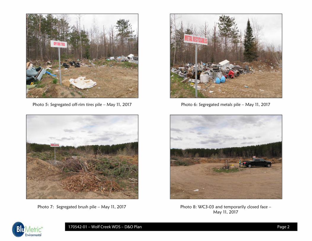
170542-01 – Wolf Creek WDS – D&O Plan Page 2
Photo 5: Segregated off-rim tires pile – May 11, 2017 Photo 6: Segregated metals pile – May 11, 2017
Photo 7: Segregated brush pile – May 11, 2017 Photo 8: WC3-03 and temporarily closed face –May 11, 2017

APPENDIX C
Well Records and Climatic Data


Appendix C:
Total Precipitation at Bancroft Auto Station
Month
January 72.5 80.2 *
Feburary 53.5 88
March 21.0 160.3
April 17.5 * 57.2 *
May 80.1 63.7
June 242.0 * 35.1
July 58.8 * 70
August 86.6 197.2
September 137.2 * 30.2 *
October 69.5 73.2
November 88.8 56.2 *
December 102.9 119
1030.4 1030.3
*Data missing from set
http://climate.weather.gc.ca/climate_data/daily_data_e.html
Total Precipitation (mm)
2010 2016
Page 1 of 1

APPENDIX D
Sampling Protocol

Appendix D Sampling Protocol August 2017
Page 1 BluMetric
Ground Water Sampling Procedures – Wolf Creek Waste Disposal Site Ground water samples will be taken and analyzed using the following procedure: On-site monitoring wells will be assessed for any damages or access problems (i.e. plugged). Repairs to monitoring wells will be conducted during the site monitoring visit if possible. If damage is such that a return visit is required, or that specialized machinery (i.e. drilling rig) is required, repairs will be done at a later date. Any fundamental repairs to the on-site monitoring wells must be completed by an MOE-licensed well contractor in accordance with the requirements of Ontario Regulation 903. Groundwater levels in all monitoring wells will be taken. The water levels obtained at each monitoring location will then converted to metres above sea level (masl) based on survey data. The monitoring wells will be properly purged three times then groundwater samples will be collected using dedicated bailers following the MOE protocol from the monitoring wells. The field parameters, pH and conductivity will be measured immediately. Appropriate numbers of samples, sample containers and preservatives (if any) will be used as outlined in Table 5.2D: Required Containers, Preservation Techniques, and Maximum Holding Times for Water Samples of in the Ministry of the Environment (MOE) document “Guidance on Sampling and Analytical Methods for use at Contaminated Sites in Ontario” Revised Dec 1996.
Throughout all sample collection procedures, latex or PVC un-powdered gloves may be worn. Samples will not be filtered in the field unless required by the laboratory conducting the parameter analyses. Samples will be kept in the dark at temperatures above the freezing point of the water and under 10°C. Sample temperatures will be brought down to below 4oC within 6 hours of collection. They will be shipped to the laboratory as soon as possible.
The groundwater samples will be analyzed for the parameters listed in Table 1 below. All analysis shall be completed by an accredited laboratory and the method detection limits must be below the guideline criteria specified in the Ontario Drinking Water Standards or other relevant guidelines (i.e. Reasonable Use Values, Ontario Drinking Water Standards and Operational Guidelines).

Appendix D Sampling Protocol August 2017
Page 2 BluMetric
A comprehensive Quality Assurance and Quality Control (QA\QC) Program will be implemented for all aspects of the field work as outlined in Section 7 of the Ministry of the Environment (MOE) document “Guidance on Sampling and Analytical Methods for use at Contaminated Sites in Ontario” Revised Dec 1996; This will include one field duplicate sample for each sampling round. The consistency of the results will be evaluated based on the relative percentage difference (RPD) of each field duplicate pair (Appendix E) (CCME, 2011)
The following tables describe the analytical parameters for groundwater samples collected at Wolf Creek Waste Disposal Site, as of August 2017, there is no requirement under the ECA (Certificate of Approval A361102) to conduct groundwater monitoring, so it is conducted voluntarily by the Municipality. Table 1: Annual Semi-Annual (Spring & Fall) Groundwater Analysis
Category Parameters
Organic Parameters Dissolved Organic Carbon (DOC)
Inorganic Parameters Alkalinity, Ammonia, Calcium, Chloride, Magnesium, Nitrate, Potassium, Sodium, Sulphate
Metals Aluminum, Boron, Iron, Lead, Manganese, Strontium, Zinc
Physical/Chemical Parameters Chemical Oxygen Demand (COD), Conductivity, pH, Total Dissolved Solids (TDS)

APPENDIX E
Operational Requirement for Burning at Landfill Sites (MOE Guideline C-7)

GUIDELINE C-7 (formerly 14-08)
Burning at Landfill Sites
Legislative Authority:
Environmental Protection Act, RSO 1990, Sections 6, 14and 27Ontario Regulation 347, Sections 1 and 12.1
Responsible Director:
Director, Program Development Branch
Last Revision Date:
April, 1994

Table of Contents
1.0 INTRODUCTION
2.0 GENERAL REQUIREMENTS
2.1 Other Agencies
2.2 Certificate of Approval
3.0 OPERATIONAL REQUIREMENTS

SYNOPSIS
The primary purpose of this guideline is to provide a set ofoperational requirements for the orderly burning of segregatedclean wood and brush in a safe and environmentally- acceptablemanner at appropriate landfill sites. This guideline isintended for use by landfill operators in their operation of alandfill site, and by Ministry staff during their review andinspection of landfill operations. The operationalrequirements are provided in Section 4-21, "Open Burning ofWaste", of Procedure C-8-1: "Guidance Manual for LandfillSites Receiving Municipal Waste" (C-8-1).
The guideline shall be enforced by including appropriateconditions on a Certificate of Approval for a landfill site,and by the Regions during the normal course of theiractivities.
1.0 Introduction
The burning of municipal waste, except for a limited number ofspecific materials, is prohibited by O. Regulation 347, Section12.1. Segregated clean wood and brush, however, may be burned atcertain sites, subject to certain requirements. Theserequirements are detailed in Section 4.21 of Procedure C-8-1:"Guidance Manual for Landfill Sites Receiving Municipal Waste".
2.0 General Requirements
As part of an overall program to maximize waste capacity atexisting landfill sites, thereby extending their life, burning ofclean wood and brush may be allowed under strictly controlledconditions.
2.1 Other Agencies
The Ministry of Natural Resources and local municipal authoritiesshall be consulted to obtain any necessary permits. Specificregulations enforced by the Ministry of Natural Resources shallbe complied with for burning wood and brush at landfills locatednorth of Ontario's fire line.
2.2 Certificate of Approval
Burning of any kind is not permitted at new landfill sites unlessspecifically allowed in the Certificate of Approval.
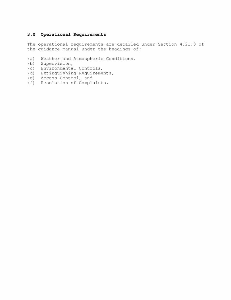
3.0 Operational Requirements
The operational requirements are detailed under Section 4.21.3 ofthe guidance manual under the headings of:
(a) Weather and Atmospheric Conditions,(b) Supervision,(c) Environmental Controls,(d) Extinguishing Requirements,(e) Access Control, and(f) Resolution of Complaints.

APPENDIX F
Trigger Mechanisms and Contingency Plan

WOLF CREEK WASTE DISPOSAL SITE
TRIGGER MECHANISMS
(DRAFT-PROPOSED)
OBJECTIVE AND BACKGROUND
The objective of the trigger mechanisms and contingency plan for the Wolf Creek Waste Disposal
Site (WDS) is to identify the offsite migration of leachate impacted groundwater, and ensure
timely action to prevent and mitigate any adverse impacts to the environment.
OBJECTIVE 1: SURFACE WATER IMPACTS
To identify migration of leachate impacted groundwater discharging to adjacent surface water
bodies and to identify impacts to surface water bodies and ensure timely action to prevent and
mitigate any adverse impacts to the environment.
West Property Boundary-Surface Water
Assessment Points- WC2-03
Trigger Mechanisms-Alkalinity, Nitrate, Sulphate, TDS, Iron and Un-ionized Ammonia
Frequency-Sampling twice per year (Spring and Fall)
Contingency Plan is activated if:
Three or more of the following chemical parameters; Alkalinity, Nitrite. Sulphate, TDS
exceeds the 75th percentile of the historical data for three of the chemical parameters; or
Iron or un-ionized ammonia exceeds the Provincial Water Quality Objectives (PWQO).
for either of the assessment points.
The 75th percentile for the sampling locations and chemical parameters based on the sampling
results from May 2006 to May 2017 are provided in the following tables:
Table 1: WC2-03 Trigger Values for Select Parameters
Parameter 75th Percentile Concentration
mg/L
PWQO
mg/L
WC2-03
Alkalinity 99
Nitrate 6.4
Sulphate 117
TDS 318
Iron 0.3
Unionized Ammonia 0.02

OBJECTIVE 2: GROUNDWATER IMPACTS
To identify migration of leachate impacted groundwater and ensure timely action to prevent and
mitigate any adverse impacts to the environment.
West Property Boundary-Groundwater
Assessment Point- WC2-03 and future western boundary well(s)
Trigger Mechanisms- Alkalinity, Iron, Nitrate, Sulphate, TDS
Frequency-Sampling twice per year (Spring and Fall)
Contingency Plan is activated if the following occurs: —
Three or more of the RUVs are exceeded
Table 2: Trigger Values for Select Parameters
Parameter RUV
mg/L
Alkalinity 265
Iron 0.3
Nitrate 3.4
Sulphate 254
TDS 318

WOLF CREEK WASTE DISPOSAL SITE
CONTINGENCY PLAN
Tier 1: If the triggers are exceeded, a repeat sampling will be conducted within one (1) month to
confirm or refute the result.
Tier 2: If the exceedance is confirmed through Tier 1 then the following will be carried out:
Additional sampling will be conducted at an increased monitoring frequency to twice
monthly, for four months (if exceedances continue). Revert back to semi-annual sampling
if there are two consecutive sampling results that do not show exceedances;
For surface water, if the exceedance is confirmed through four months of Tier 1 additional
sampling then a Toxicity test (Single Concentration – Acute Lethality) sample will be
collected to determine the impacts to surface water. If the toxicity test passes then no
additional mitigative measures will be required. If toxicity tests fail then proceed to Tier 3.
For groundwater, if the exceedance is confirmed through four months of Tier 1 additional
sampling then proceed to Tier 3.
Tier 3: If the increased sampling indicates a continuing issue resulting in impacts or potential
significant impacts to the environment, then mitigation/remediation measures will be
implemented to prevent further impact. These measures would be aimed at intercepting
or diverting the impacted surface water before it reaches a receptor. The specifics of the
plan will be dependent on the nature of the impact.

APPENDIX G
Operator’s Log/Checklist


Hastings Highlands Landfill Operator’s Report
Note:
1. Operator must inform Supervisor if burning so the Fire Department is notified.
2. Burn Pile must be extinguished before Operator leaves Waste Facility.
WASTE DEPOT Name
Date Cover Applied
Facility Operator
Quantity of
Cover Applied
Burn Pile Yes/No
Leaf, Yard & Clean Wood