Embed Size (px)
Citation preview

Orange County Government
April 2012
Developing a Cartographic Standard for your
Government Agency

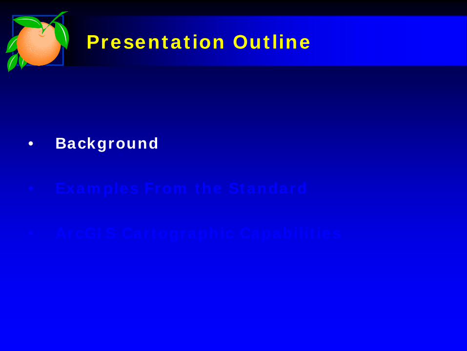
Presentation Outline
• Background
• Examples From the Standard
• ArcGIS Cartographic Capabilities
Presentation Outline
• Background
• Examples From the Standard
• ArcGIS Cartographic Capabilities

Background
Who Was Involved
• County GIS for Mapping Expertise
• Orange TV for Electronic Media Expertise
• Communications Division for Print Media and Publishing Expertise
• Information Systems for Web Expertise
Background
Development Process
• Developed Initial Draft Standard
• Created Draft Map Products for Review and Testing in Different Media Formats
• Numerous Testing Cycles to Refine Standards

Background
Considerations
• Mapping Basics– Content and Layout– Use of Colors and Greyscale– Fonts, Symbols and Pattern Usage
• Publishing Issues– Printed Maps– Maps on the Web– Television Friendly Maps– Maps in PowerPoint

Background
Scope of Proposed Map Standard
• Required and Optional Map Content
• Layout, Colors, Fonts, Symbols
• Support For All Forms of Hardcopy Publishing Formats
• Electronic Media Publishing Standards (TV, Powerpoint, PDF, Web)

Presentation Outline
• Background
• Examples From the Standard
• ArcGIS Cartographic Capabilities
Examples From the Standard
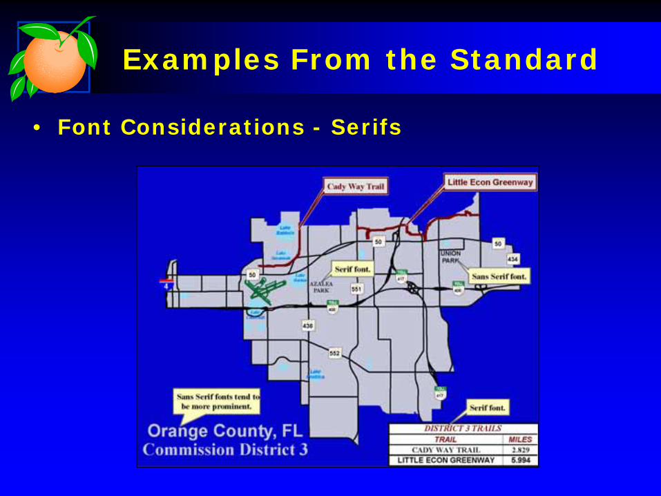
• Font Considerations - Serifs
Examples From the Standard
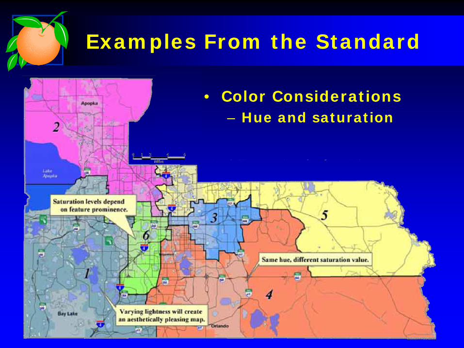
• Color Considerations– Hue and saturation

Examples From the Standard
• Television Considerations– Colors, line thickness, & shading

Examples From the Standard
• Web Considerations
Examples From the Standard
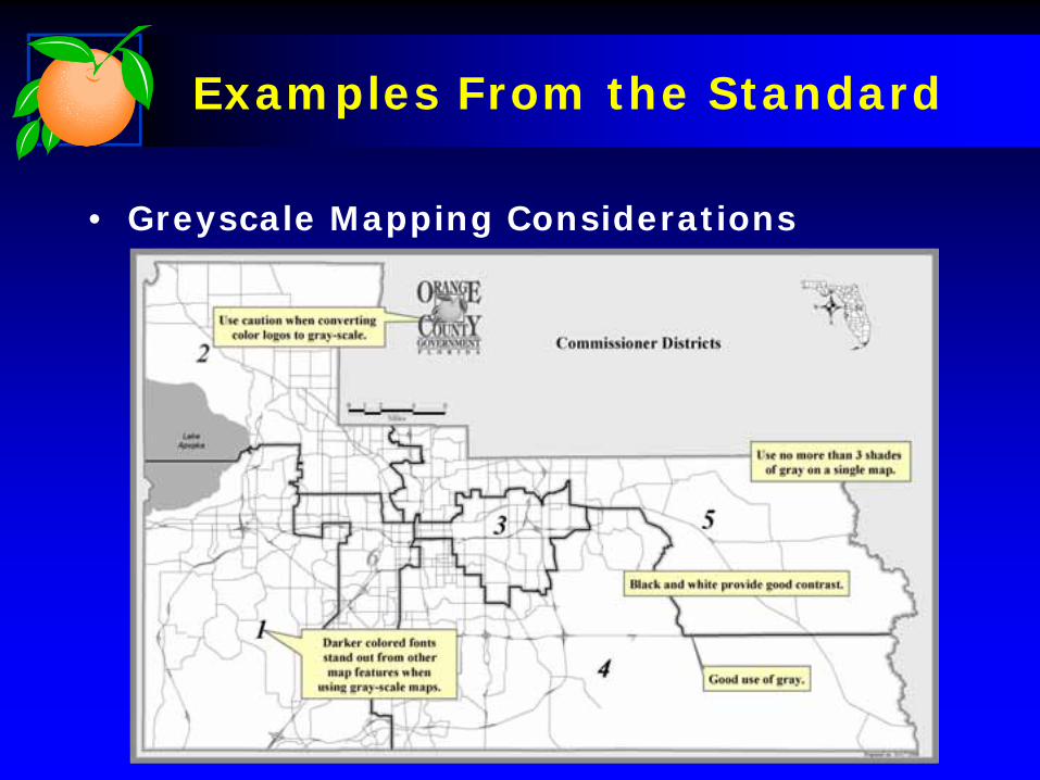
• Greyscale Mapping Considerations

Presentation Outline
• Background
• Examples From the Standard
• ArcGIS Cartographic Capabilities

ArcGIS Cartographic Functions
• Improved Cartographic Functionality– Addition of Symbol Tags
• Symbols can now be searchable tags that describe its characteristics
– Referencing Style• Provides consistent symbol usage for
specialized mapping projects
– Representation• Allows for an intelligent way to symbolize
features and improve manual cartographic tasks

Symbol Tags
Customize, categorizeand Tag new and
existingsymbols for easy
location

Example of Referencing Style
Map documents reference one or more styles,
Ex) Billboards, symbols shown will include anything that’s
tagged for billboard use.
Representation
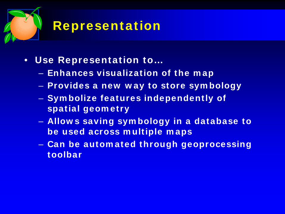
• Use Representation to…– Enhances visualization of the map– Provides a new way to store symbology– Symbolize features independently of
spatial geometry– Allows saving symbology in a database to
be used across multiple maps– Can be automated through geoprocessing
toolbar

Representation Cont…
Provides a single
interface to manage all
symbol properties

Representation Cont…
Representations allowaccess through
ArcCatalog and ArcMap
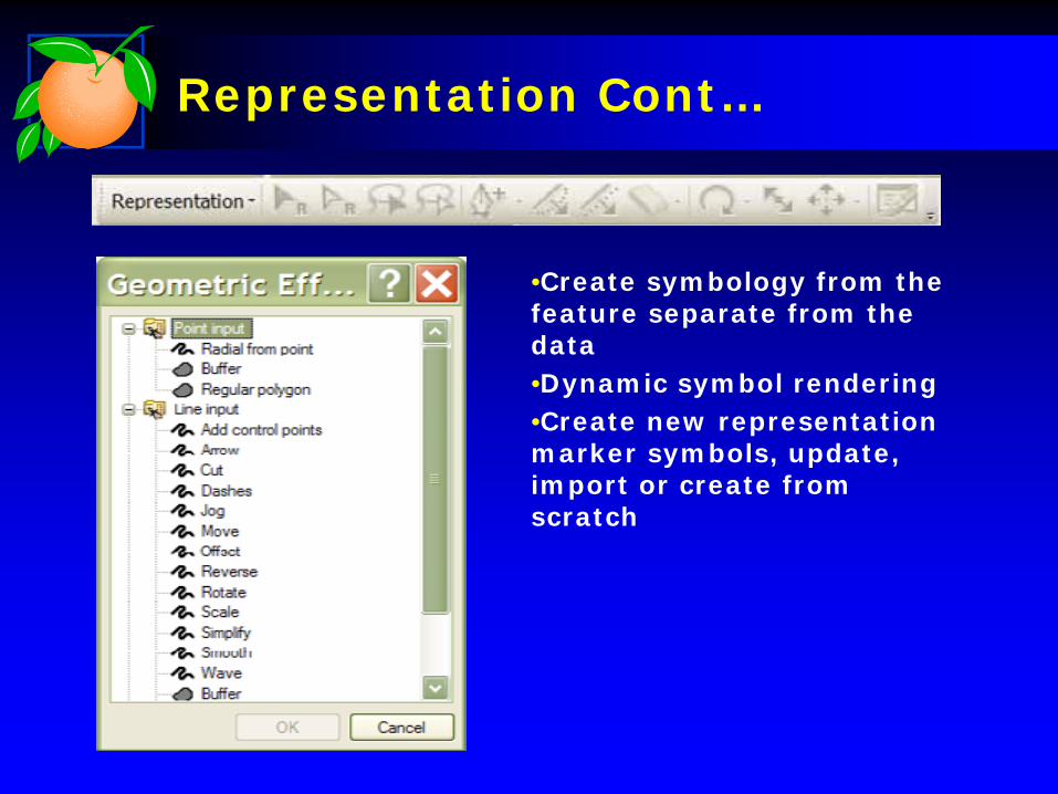
Representation Cont…
•Create symbology from the feature separate from the data•Dynamic symbol rendering•Create new representation marker symbols, update, import or create from scratch

Representation Example

Representation Example
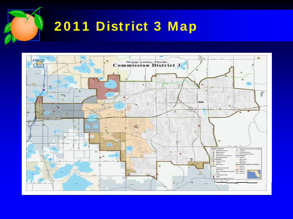
2011 District 3 Map

2012 District 3 Map

Orange County Government
Louis Schoolkate, GISP Joshua Humphrey
April 2012
Developing a Cartographic Standard for your
Government Agency