Embed Size (px)
Citation preview

Water Resources Modeling and GIS
Learning Objectives:• Describe the HEC-River Analysis System (RAS)
Model
HEC-RAS and Geo-RAS
M___, 2016
Model
• Utilize HEC Geo-RAS to import data into RAS

HEC-RAS
• River Analysis System
• Developed by Hydrologic Engineering
Center (HEC)
• One dimensional steady and unsteady • One dimensional steady and unsteady
flow analysis
• Subcritical, supercritical, and mixed
flow regime calculations

HEC-RAS cont.
• Manual Data Input Required
– stream centerline
– cross sections
– Manning’s “n”– Manning’s “n”
– flow data

Main Menu
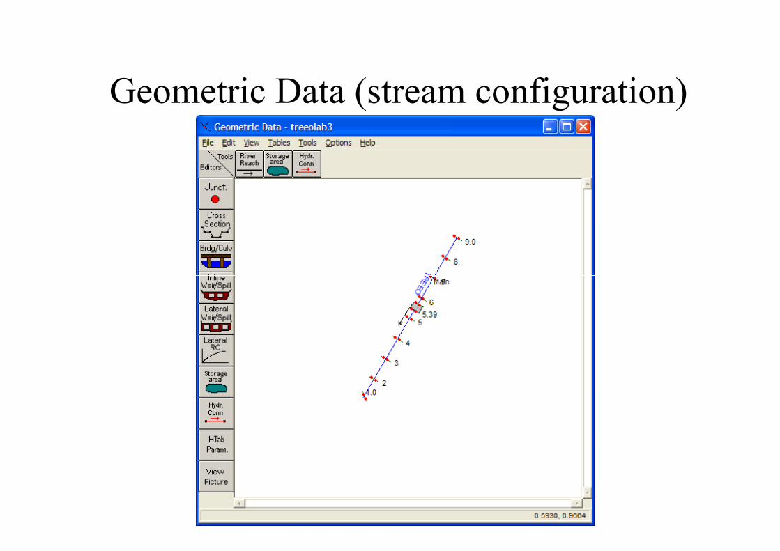
Geometric Data (stream configuration)

Cross Sections

Table Output

Profiles

HEC GeoRAS
• Pre-RAS processor
– Creates HEC-RAS input file
– Input Needs
• Triangular Irregular Network (TIN)• Triangular Irregular Network (TIN)
• Land Use Data

HEC GeoRAS
• Developed by Hydrologic Engineering
Center (HEC)
• pre and post Data Processor for the
River Analysis System (HEC-RAS)River Analysis System (HEC-RAS)

HEC GeoRAS
(creating a TIN from topography)

HEC GeoRAS
(creating a TIN from topography)

HEC GeoRAS(input Triangular Irregular Network)

HEC GeoRAS
• Pre-RAS processor
– Saves time on data input
• no manual cross section entry
• no manual Manning’s “n” entry• no manual Manning’s “n” entry

HEC GeoRAS (Pre-Processing)
Centerline
Banks
Cross Sections

HEC GeoRAS (Cross Section)

HEC GeoRAS
• Post-RAS processor
– Accepts HEC-RAS output file
– Output Formats
• Creates floodplain TINs• Creates floodplain TINs
• Creates depth and velocity maps
– Saves time on data presentation

HEC GeoRAS (Post Processing)

HEC GeoRAS (Floodplain Delineation)