Embed Size (px)
Citation preview

Proposed Provincial Policy Statement - July 2019
Provincial Policy Statement ReviewProposed Policies
July 2019
Davies Howe LLP has prepared this unofficial comparison of the changes between the PPS, 2014 and the proposed New Provincial Policy Statement to be used an educational tool only. It
should not be relied upon for legal purposes

Proposed Provincial Policy Statement - July 2019
Ontario ©
Highlights of the proposed Policy Changes
The proposed Provincial Policy Statement changes work together with other recent changes to the land use planning system - including changes to the Planning Act through Bill 108, More Homes, More Choice Act, 2019 (once proclaimed) and A Place to Grow: Growth Plan for the Greater Golden Horseshoe - to support overall goals related to increasing housing, supporting jobs and reducing red tape.
The government is seeking feedback on proposed changes to the Provincial Policy Statement. At this time, we are proposing policy changes to:
• encourage the development of an increased mix and supply of housing • protect the environment and public safety • reduce barriers and costs for development and provide greater predictability • support rural, northern and Indigenous communities • support the economy and jobs
Seeking Feedback
The government wants your feedback on proposed PPS changes to support Ontario communities that provide housing choices for all residents, are investment-ready, and protect the environment and important resources such as water and farmland.
As you read through the proposed PPS changes, we would appreciate hearing your views on the following questions:
■ Do the proposed policies effectively support goals related to increasing housing supply, creating and maintaining jobs, and red tape reduction while continuing to protect the environment, farmland, and public health and safety?
■ Do the proposed policies strike the right balance? Why or why not?
■ How do these policies take into consideration the views of Ontario communities?
■ Are there any other policy changes that are needed to support key priorities for housing, job creation, and streamlining of development approvals?
Davies Howe LLP has prepared this unofficial comparison of the changes between the PPS, 2014 and the proposed New Provincial Policy Statement to be used an educational tool only. It
should not be relied upon for legal purposes

Proposed Provincial Policy Statement - July 2019
■ Are there any other tools that are needed to help implement the proposed policies? Please submit written comments by:
• Emailing us at planningconsultation(5)ontario.ca • Submitting comments or questions on the Environmental Registry of Ontario (ERO) at
https://ero.ontario.ca/pps in response to posting #019-0279 • Writing us at:
Provincial Policy Statement ReviewMinistry of Municipal Affairs and Housing Provincial Planning Policy Branch 111 Bay St, 13th Floor Toronto, ON MSG 2E5
The deadline for written comments is October 21, 2019.
Please note: All comments and submissions received will become part of the public record and could be released.
Any collection of personal information is in accordance with subsection 39(2) of the Freedom of Information and Protection of Privacy Act. It is collected under the authority of the Ministry of Municipal Affairs and Housing Act for the purpose of obtaining input on this initiative. If you have any questions about the collection, use and disclosure of this information please contact:
Ministry of Municipal Affairs and Housing Senior Information and Privacy Advisor 111 Bay Street, 17 th Floor Toronto, ON MSG 2E5 (416) 585-7094
Davies Howe LLP has prepared this unofficial comparison of the changes between the PPS, 2014 and the proposed New Provincial Policy Statement to be used an educational tool only. It
should not be relied upon for legal purposes

Proposed Provincial Policy Statement - July 2019
Table of ContentsPart I: Preamble 1 Part II: Legislative Authority 2 Part III: How to Read the Provincial Policy Statement 3 Part IV: Vision for Ontario’s Land Use Planning System 6
Part V: Policies 8
1.0 Building Strong Healthy Communities 8 1.1 Managing and Directing Land Use to Achieve Efficient and Resilient
Development and Land Use Patterns 8 Settlement Areas 9 Rural Areas in Municipalities 12 Rural Lands in Municipalities 13 Territory Without Municipal Organization 14
1.2 Coordination 15 Land Use Compatibility 16
1.3 Employment 17 Employment Areas 17
1.4 Housing 19 1.5 Public Spaces, Recreation, Parks, Trails, and Open Space 20 1.6 Infrastructure and Public Service Facilities 21
Sewage, Water and Stormwater 21 Transportation Systems 24 Transportation and Infrastructure Corridors 24 Airports, Rail and Marine Facilities 25 Waste Management 26 Energy Supply 26
1.7 Long-Term Economic Prosperity 26 1.8 Energy Conservation, Air Quality, and Climate Change 27
2.0 Wise Use and Management of Resources 28 2.1 Natural Heritage 28 2.2 Water 29 2.3 Agriculture 30 2.4 Minerals and Petroleum 33 2.5 Mineral Aggregate Resources 34 2.6 Cultural Heritage and Archaeology 37
3.0 Protecting Public Health and Safety 38 3.1 Natural Hazards 38 3.2 Human-Made Hazards 40
4.0 Implementation and Interpretation 41 5.0 Figure 1 43 6.0 Definitions 45
Davies Howe LLP has prepared this unofficial comparison of the changes between the PPS, 2014 and the proposed New Provincial Policy Statement to be used an educational tool only. It
should not be relied upon for legal purposes
Proposed Provincial Policy Statement - July 2019
Part I: Preamble
The Provincial Policy Statement provides policy direction on matters of provincial interest related to land use planning and development. As a key part of Ontario’s policy- led planning system, the Provincial Policy Statement sets the policy foundation for regulating the development and use of land. It also supports the provincial goal to enhance the quality of life for all Ontarians.
The Provincial Policy Statement provides for appropriate development while protecting resources of provincial interest, public health and safety, and the quality of the natural and built environment. The Provincial Policy Statement supports improved land use planning and management, which contributes to a more effective and efficient land use planning system.
The policies of the Provincial Policy Statement may be complemented by provincial plans or by locally-generated policies regarding matters of municipal interest.Provincial plans and municipal official plans provide a framework for comprehensive, integrated, place-based and long-term planning that supports and integrates the principles of strong communities, a clean and healthy environment and economic growth, for the long term.
Municipal official plans are the most important vehicle for implementation of this Provincial Policy Statement and for achieving comprehensive, integrated and long-term planning. Official plans shall identify provincial interests and set out appropriate land use designations and policies.
Official plans should also coordinate cross-boundary matters to complement the actions of other planning authorities and promote mutually beneficial solutions. Official plans shall provide clear, reasonable and attainable policies to protect provincial interests and direct development to suitable areas. In order to protect provincial interests, planning authorities shall keep their official plans up-to-date with this Provincial Policy Statement.
Zoning and development permit by-laws are also important for implementation of this Provincial Policy Statement. Planning authorities shall keep their zoning and development permit by-laws up-to-date with their official plans and this Provincial Policy Statement.
Land use planning is only one of the tools for implementing provincial interests. A wide range of legislation, regulations, policies and programs may also apply to decisions with respect to Planning Act applications and affect planning matters, and assist in implementing these interests.
Davies Howe LLP has prepared this unofficial comparison of the changes between the PPS, 2014 and the proposed New Provincial Policy Statement to be used an educational tool only. It
should not be relied upon for legal purposes

Proposed Provincial Policy Statement - July 2019
In some cases, a Planning Act proposal may also require approval under other legislation or regulation, and policies and plans issued under other legislation may also apply. In addition to land use approvals under the Planning Act, infrastructure may also require approval under other legislation and regulations. An environmental assessment process may be applied to new infrastructure and modifications to existing infrastructure under applicable legislation.
There may be circumstances where land use approvals under the Planning Act may be integrated with approvals under other legislation, for example, integrating the planning processes and approvals under the Environmental Assessment Act and the Planning Act, provided the intent and requirements of both Acts are met.
Within the Great Lakes - St. Lawrence River Basin, there may be circumstances where planning authorities should consider agreements related to the protection or restoration of the Great Lakes - St. Lawrence River Basin. Examples of these agreements include Great Lakes agreements between Ontario and Canada, between Ontario and Quebec and the Great Lakes States of the United States of America, and between Canada and the United States of America.
Part II: Legislative Authority
The Provincial Policy Statement is issued under the authority of section 3 of the Planning Act and came into effect on April 30, 2014<DATE>.
In respect of the exercise of any authority that affects a planning matter, section 3 of the Planning Act requires that decisions affecting planning matters "shall be consistent with” policy statements issued under the Act.
Comments, submissions or advice that affect a planning matter that are provided by the council of a municipality, a local board, a planning board, a minister or ministry, board, commission or agency of the government "shall be consistent with” this Provincial Policy Statement.Part III: How to Read the Provincial Policy Statement
The provincial policy-led planning system recognizes and addresses the complex inter-relationships among environmental, economic and social factors in land use planning. The Provincial Policy Statement supports a comprehensive, integrated and long-term approach to planning, and recognizes linkages among policy areas.
Read the Entire Provincial Policy Statement
The Provincial Policy Statement is more than a set of individual policies. It is to be read in its
Davies Howe LLP has prepared this unofficial comparison of the changes between the PPS, 2014 and the proposed New Provincial Policy Statement to be used an educational tool only. It
should not be relied upon for legal purposes

Proposed Provincial Policy Statement - July 2019
entirety and the relevant policies are to be applied to each situation. When more than one policy is relevant, a decision-maker should consider all of the relevant policies to understand how they work together. The language of each policy, including the Implementation and Interpretation policies, will assist decision-makers in understanding how the policies are to be implemented.
While specific policies sometimes refer to other policies for ease of use, these cross- references do not take away from the need to read the Provincial Policy Statement as a whole.
There is no implied priority in the order in which the policies appear.
Consider Specific Policy Language
When applying the Provincial Policy Statement it is important to consider the specific language of the policies. Each policy provides direction on how it is to be implemented, how it is situated within the broader Provincial Policy Statement, and how it relates to other policies.
Some policies set out positive directives, such as "settlement areas shall be the focus of growth and development.” Other policies set out limitations and prohibitions, such as "development and site alteration shall not be permitted.” Other policies use enabling or supportive language, such as "should,” "promote” and "encourage.”
The choice of language is intended to distinguish between the types of policies and the nature of implementation. There is some discretion when applying a policy with enabling or supportive language in contrast to a policy with a directive, limitation or prohibition.
Geographic Scale of Policies
The Provincial Policy Statement recognizes the diversity of Ontario and that local context is important. Policies are outcome-oriented, and some policies provide flexibility in their implementation provided that provincial interests are upheld.
While the Provincial Policy Statement is to be read as a whole, not all policies will be applicable to every site, feature or area. The Provincial Policy Statement applies at a range of geographic scales.
Some of the policies refer to specific areas or features and can only be applied where these features or areas exist. Other policies refer to planning objectives that need to be considered in the context of the municipality or planning area as a whole, and are not necessarily applicable to a specific site or development proposal.
Davies Howe LLP has prepared this unofficial comparison of the changes between the PPS, 2014 and the proposed New Provincial Policy Statement to be used an educational tool only. It
should not be relied upon for legal purposes

Proposed Provincial Policy Statement - July 2019
Policies Represent Minimum Standards
The policies of the Provincial Policy Statement represent minimum standards.
Within the framework of the provincial policy-led planning system, planning authorities and decision-makers may go beyond these minimum standards to address matters of importance to a specific community, unless doing so would conflict with any policy of the Provincial Policy Statement.
Defined Terms and Meanings
Except for references to legislation which are italicized, other italicized terms in the Provincial Policy Statement are defined in the Definitions section. For non-italicized terms, the normal meaning of the word applies. Terms may be italicized only in specific policies; for these terms, the defined meaning applies where they are italicized and the normal meaning applies where they are not italicized. Defined terms in the Definitions section are intended to capture both singular and plural forms of these terms in the policies.
Guidance Material
Guidance material and technical criteria may be issued from time to time to assist planning authorities and decision-makers with implementing the policies of the Provincial Policy Statement. Information, technical criteria and approaches outlined in guidance material are meant to support but not add to or detract from the policies of the Provincial Policy Statement.
Relationship with Provincial PlansThe Provincial Policy Statement provides overall policy directions on matters of provincial interest related to land use planning and development in Ontario, and applies province-wide, except where this policy statement or another provincial plan provides otherwise.
Provincial plans, such as the Greenbelt Plan, the A Place to Grow: Growth Plan for the Greater Golden Horseshoe and the Growth Plan for Northern Ontario, build upon the policy foundation provided by the Provincial Policy Statement. They provide additional land use planning policies to address issues facing specific geographic areas in Ontario.
Provincial plans are to be read in conjunction with the Provincial Policy Statement.They take precedence over the policies of the Provincial Policy Statement to the extent of any conflict, except where the relevant legislation provides otherwise.
Where the policies of provincial plans address the same, similar, related, or overlapping matters
Davies Howe LLP has prepared this unofficial comparison of the changes between the PPS, 2014 and the proposed New Provincial Policy Statement to be used an educational tool only. It
should not be relied upon for legal purposes

Proposed Provincial Policy Statement - July 2019
as the policies of the Provincial Policy Statement, applying the more specific policies of the provincial plan satisfies the more general requirements of the Provincial Policy Statement. In contrast, where matters addressed in the Provincial Policy Statement do not overlap with policies in provincial plans, the policies in the Provincial Policy Statement must be independently satisfied.
Land use planning decisions made by municipalities, planning boards, the Province, or a commission or agency of the government must be consistent with the Provincial Policy Statement. Where provincial plans are in effect, planning decisions must conform or not conflict with them, as the case may be.
Davies Howe LLP has prepared this unofficial comparison of the changes between the PPS, 2014 and the proposed New Provincial Policy Statement to be used an educational tool only. It
should not be relied upon for legal purposes

Proposed Provincial Policy Statement - July 2019
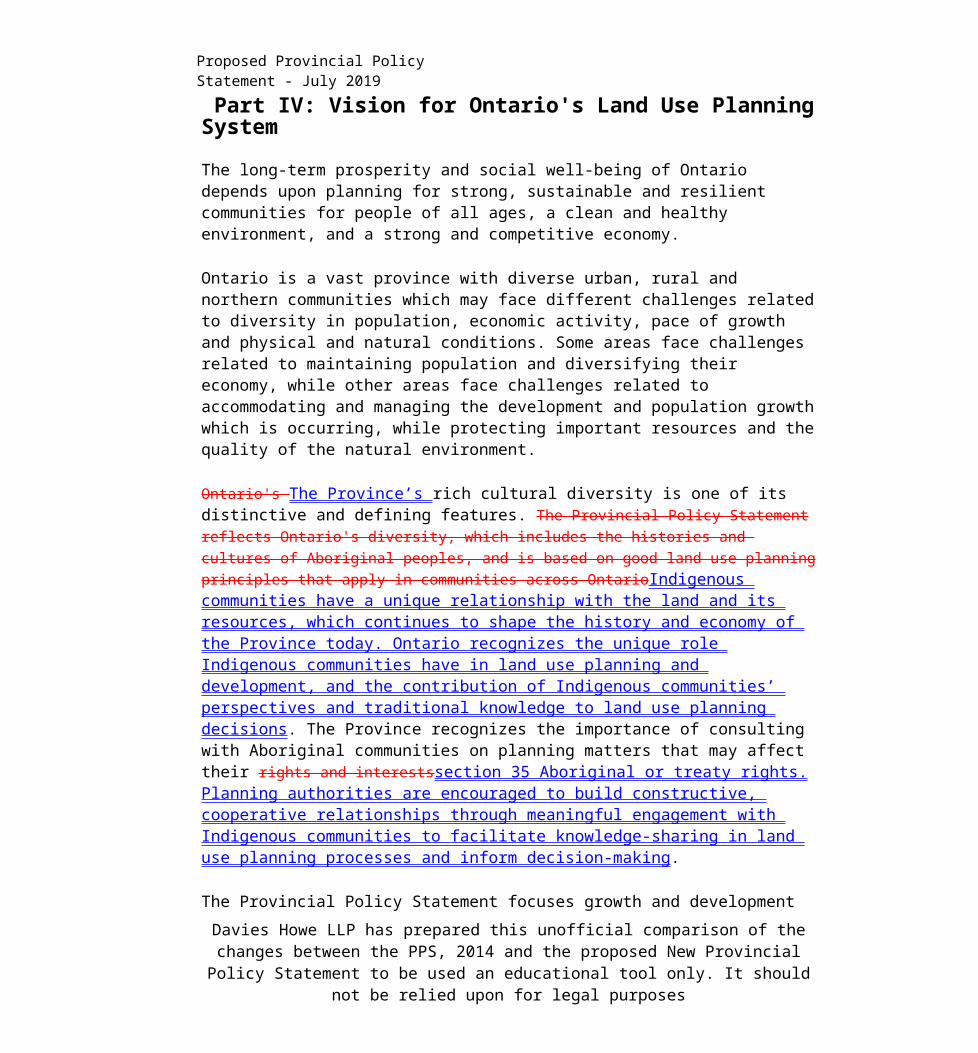
Part IV: Vision for Ontario's Land Use Planning System
The long-term prosperity and social well-being of Ontario depends upon planning for strong, sustainable and resilient communities for people of all ages, a clean and healthy environment, and a strong and competitive economy.
Ontario is a vast province with diverse urban, rural and northern communities which may face different challenges related to diversity in population, economic activity, pace of growth and physical and natural conditions. Some areas face challenges related to maintaining population and diversifying their economy, while other areas face challenges related to accommodating and managing the development and population growth which is occurring, while protecting important resources and the quality of the natural environment.
Ontario's The Province’s rich cultural diversity is one of its distinctive and defining features. The Provincial Policy Statement reflects Ontario's diversity, which includes the histories and cultures of Aboriginal peoples, and is based on good land use planning principles that apply in communities across OntarioIndigenous communities have a unique relationship with the land and its resources, which continues to shape the history and economy of the Province today. Ontario recognizes the unique role Indigenous communities have in land use planning and development, and the contribution of Indigenous communities’ perspectives and traditional knowledge to land use planning decisions. The Province recognizes the importance of consulting with Aboriginal communities on planning matters that may affect their rights and interestssection 35 Aboriginal or treaty rights. Planning authorities are encouraged to build constructive, cooperative relationships through meaningful engagement with Indigenous communities to facilitate knowledge-sharing in land use planning processes and inform decision-making.
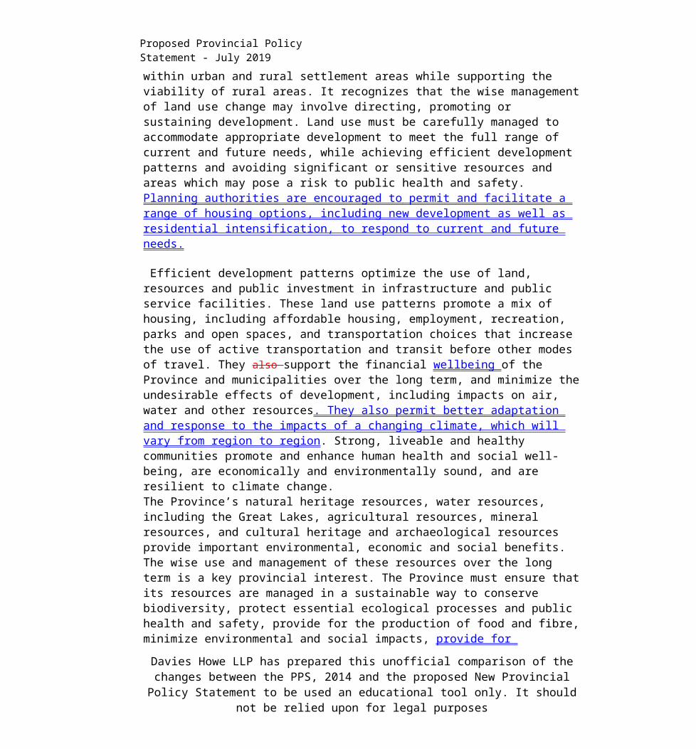
The Provincial Policy Statement focuses growth and development within urban and rural settlement areas while supporting the viability of rural areas. It recognizes that the wise management of land use change may involve directing, promoting or sustaining development. Land use must be carefully managed to accommodate appropriate development to meet the full range of current and future needs, while achieving efficient development patterns and avoiding significant or sensitive resources and areas which may pose a risk to public health and safety. Planning authorities are encouraged to permit and facilitate a range of housing options, including new development as well as residential intensification, to respond to current and future needs.
Efficient development patterns optimize the use of land, resources and public investment in infrastructure and public service facilities. These land use patterns promote a mix of housing,
Davies Howe LLP has prepared this unofficial comparison of the changes between the PPS, 2014 and the proposed New Provincial Policy Statement to be used an educational tool only. It
should not be relied upon for legal purposes

Proposed Provincial Policy Statement - July 2019
including affordable housing, employment, recreation, parks and open spaces, and transportation choices that increase the use of active transportation and transit before other modes of travel. They also support the financial well being of the Province and municipalities over the long term, and minimize the undesirable effects of development, including impacts on air, water and other resources. They also permit better adaptation and response to the impacts of a changing climate, which will vary from region to region. Strong, liveable and healthy communities promote and enhance human health and social well-being, are economically and environmentally sound, and are resilient to climate change.The Province’s natural heritage resources, water resources, including the Great Lakes, agricultural resources, mineral resources, and cultural heritage and archaeological resources provide important environmental, economic and social benefits. The wise use and management of these resources over the long term is a key provincial interest. The Province must ensure that its resources are managed in a sustainable way to conserve biodiversity, protect essential ecological processes and public health and safety, provide for the production of food and fibre, minimize environmental and social impacts, provide for recreational opportunities (e.g. fishing, hunting and hiking] and meet its long-term needs.
It is equally important to protect the overall health and safety of the population. The Provincial Policy Statement directs development away from areas of natural and human-made hazards. This preventative approach supports provincial and municipal financial well-being over the long term, protects public health and safety, and minimizes cost, risk and social disruption.
Taking action to conserve land and resources avoids the need for costly remedial measures to correct problems and supports economic and environmental principles.
Strong communities, a clean and healthy environment and a strong economy are inextricably linked. Long-term prosperity, human and environmental health and social well-being should take precedence over short-term considerations.
The fundamental principles set out in the Provincial Policy Statement apply throughout Ontario. To support our collective well-being, now and in the future, all land use must be well managed.
Davies Howe LLP has prepared this unofficial comparison of the changes between the PPS, 2014 and the proposed New Provincial Policy Statement to be used an educational tool only. It
should not be relied upon for legal purposes

Proposed Provincial Policy Statement - July 2019
PartV: Policies 1.0 Building Strong Healthy Communities
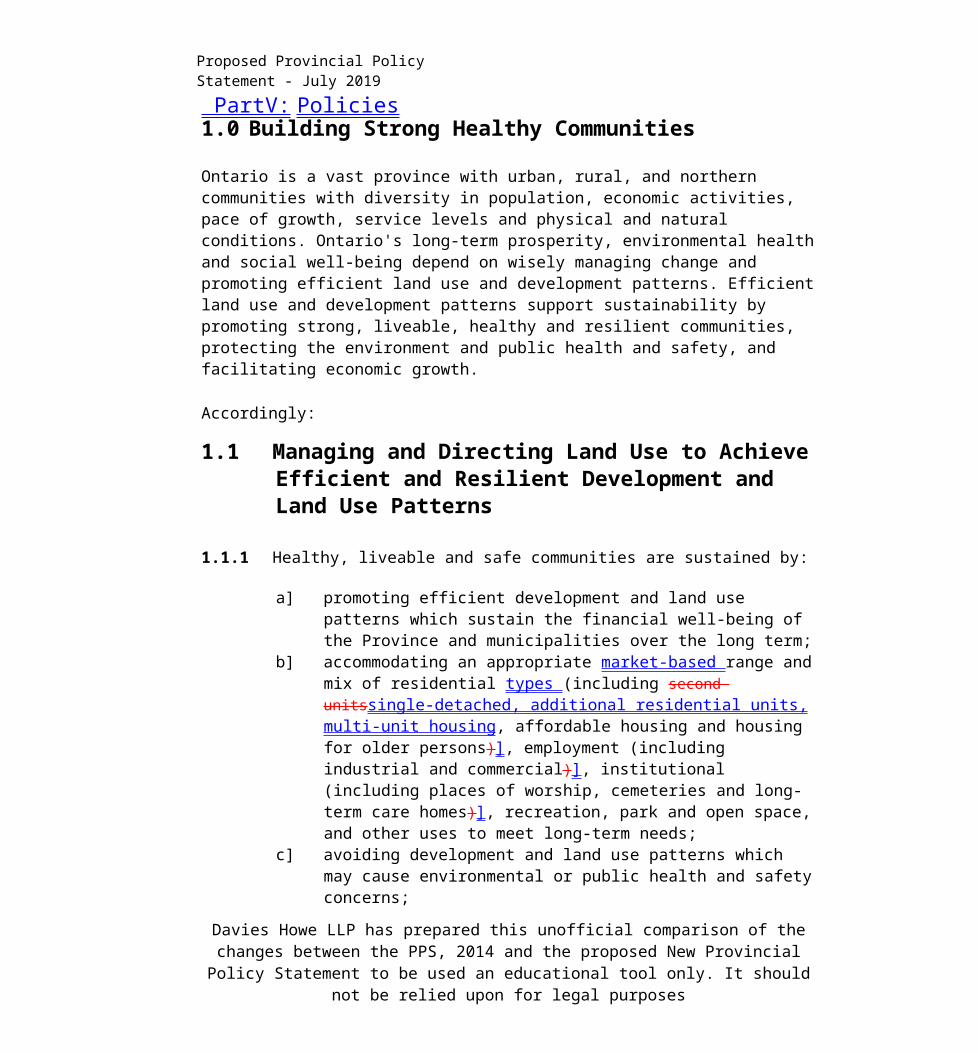
Ontario is a vast province with urban, rural, and northern communities with diversity in population, economic activities, pace of growth, service levels and physical and natural conditions. Ontario's long-term prosperity, environmental health and social well-being depend on wisely managing change and promoting efficient land use and development patterns. Efficient land use and development patterns support sustainability by promoting strong, liveable, healthy and resilient communities, protecting the environment and public health and safety, and facilitating economic growth.
Accordingly:
1.1 Managing and Directing Land Use to Achieve Efficient and Resilient Development and Land Use Patterns
1.1.1 Healthy, liveable and safe communities are sustained by:
a] promoting efficient development and land use patterns which sustain the financial well-being of the Province and municipalities over the long term;
b] accommodating an appropriate market-based range and mix of residential types (including second unitssingle-detached, additional residential units, multi-unit housing, affordable housing and housing for older persons)], employment (including industrial and commercial)], institutional (including places of worship, cemeteries and long-term care homes)], recreation, park and open space, and other uses to meet long-term needs;
c] avoiding development and land use patterns which may cause environmental or public health and safety concerns;
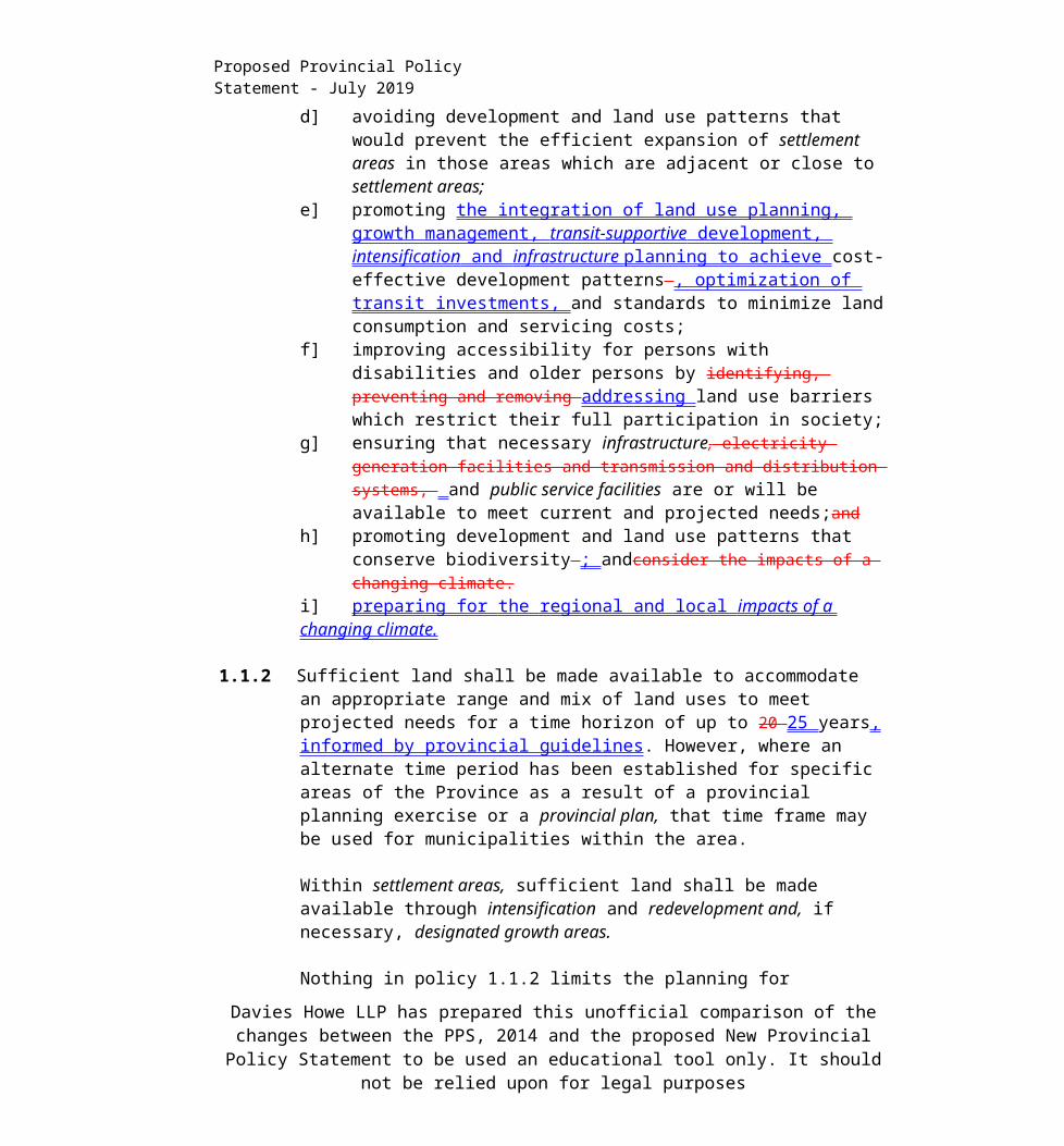
d] avoiding development and land use patterns that would prevent the efficient expansion of settlement areas in those areas which are adjacent or close to settlement areas;
e] promoting the integration of land use planning, growth management, transit- supportive development, intensification and infrastructure planning to achieve cost-effective development patterns , optimization of transit investments, and standards to minimize land consumption and servicing costs;
f] improving accessibility for persons with disabilities and older persons by identifying, preventing and removing addressing land use barriers which restrict their full participation in society;
Davies Howe LLP has prepared this unofficial comparison of the changes between the PPS, 2014 and the proposed New Provincial Policy Statement to be used an educational tool only. It
should not be relied upon for legal purposes
Proposed Provincial Policy Statement - July 2019
g] ensuring that necessary infrastructure, electricity generation facilities and transmission and distribution systems, and public service facilities are or will be available to meet current and projected needs;and
h] promoting development and land use patterns that conserve biodiversity ; andconsider the impacts of a changing climate.
i] preparing for the regional and local impacts of a changing climate.
1.1.2 Sufficient land shall be made available to accommodate an appropriate range and mix of land uses to meet projected needs for a time horizon of up to 20 25 years, informed by provincial guidelines. However, where an alternate time period has been established for specific areas of the Province as a result of a provincial planning exercise or a provincial plan, that time frame may be used for municipalities within the area.
Within settlement areas, sufficient land shall be made available through intensification and redevelopment and, if necessary, designated growth areas.
Nothing in policy 1.1.2 limits the planning for infrastructure and public service facilities and employment areas beyond a 20-year 25-year time horizon.
1.1.3 Settlement Areas
Settlement areas are urban areas and rural settlement areas, and include cities, towns, villages and hamlets. Ontario’s settlement areas vary significantly in terms of size, density, population, economic activity, diversity and intensity of land uses, service levels, and types of infrastructure available.
The vitality and regeneration of settlement areas is critical to the long-term economic prosperity of our communities. Development pressures and land use change will vary across Ontario. It is in the interest of all communities to use land and resources wisely, to promote efficient development patterns, protect resources, promote green spaces, ensure effective use of infrastructure and public service facilities and minimize unnecessary public expenditures.
1.1.3.1 Settlement areas shall be the focus of growth and development, and their vitality and regeneration shall be promoted.
1.1.3.2 Land use patterns within settlement areas shall be based on: densities and a mix of land uses which:a] efficiently use land and resources;
Davies Howe LLP has prepared this unofficial comparison of the changes between the PPS, 2014 and the proposed New Provincial Policy Statement to be used an educational tool only. It
should not be relied upon for legal purposes
Proposed Provincial Policy Statement - July 2019
b] are appropriate for, and efficiently use, the infrastructure and public service facilities which are planned or available, and avoid the need for their unjustified and/or uneconomical expansion;
c] minimize negative impacts to air quality and climate change, and promote energy efficiency;
d] prepare for the impacts of a changing climate; e] support active transportation;f] are transit-supportive, where transit is planned, exists or may be developed;
andg] are freight-supportive; and.
Land use patterns within settlement areas shall also be based on a range of uses and opportunities for intensification and redevelopment in accordance with the criteria in policy 1.1.3.3, where this can be accommodated.
1.1.3.3 Planning authorities shall identify appropriate locations and promote opportunities for transit-supportive development, accommodating a significant supply and range of housing options through intensification and redevelopment where this can be accommodated taking into account existing building stock or areas, including brownfield sites, and the availability of suitable existing or planned infrastructure and public service facilities required to accommodate projected needs.
Intensification and redevelopment sha\\ be directed in accordance with the policies of Section 2: Wise Use and Management of Resources and Section 3: Protecting Public Health and Safety.
1.1.3.4 Appropriate development standards should be promoted which facilitate intensification, redevelopment and compact form, while avoiding or mitigating risks to public health and safety.
1.1.3.5 Planning authorities shall establish and implement minimum targets for intensification and redevelopment within built-up areas, based on local conditions. However, where provincial targets are established through provincial plans, the provincial target shall represent the minimum target for affected areas.
1.1.3.6 New development taking place in designated growth areas should occur adjacent to the existing built-up area and shall should have a compact form, mix of uses and densities that allow for the efficient use of land, infrastructure and public service facilities.
Davies Howe LLP has prepared this unofficial comparison of the changes between the PPS, 2014 and the proposed New Provincial Policy Statement to be used an educational tool only. It
should not be relied upon for legal purposes
Proposed Provincial Policy Statement - July 2019
1.1.3.7 Planning authorities shall should establish and implement phasing policies to ensure:
a] that specified targets for intensification and redevelopment are achieved prior to, or concurrent with, new development within designated growth areas; and
b] the orderly progression of development within designated growth areas and the timely provision of the infrastructure and public service facilities required to meet current and projected needs.
1.1.3.8 A planning authority may identify a settlement area or allow the expansion of a settlement area boundary only at the time of a comprehensive review and only where it has been demonstrated that:
a) sufficient opportunities for to accommodate growth and to satisfy market demand are not available through intensification, redevelopment and designated growth areas to accommodate the projected needs over the identified planning horizon;
b) the infrastructure and public service facilities which are planned or available are suitable for the development over the long term, are financially viable over their life cycle, and protect public health and safety and the natural environment;
c) in prime agricultural areas:1. the lands do not comprise specialty crop areas;2. alternative locations have been evaluated, and
i. there are no reasonable alternatives which avoid prime agricultural areas; and
ii. there are no reasonable alternatives on lower priority agricultural lands in prime agricultural areas;
d) the new or expanding settlement area is in compliance with the minimum distance separation formulae; and
e) impacts from new or expanding settlement areas on agricultural operations which are adjacent or close to the settlement area are avoided, and where avoidance is not possible, impacts are minimized and mitigated to the extent feasible. in accordance with provincial guidelines. In undertaking a comprehensive review the level of detail of the assessment should correspond with the complexity and scale of the settlement boundary expansion or development proposal.
1.1.3.9 Notwithstanding policy 1.1.3.8, municipalities may permit adjustments of settlement area boundaries outside a comprehensive review provided:
Davies Howe LLP has prepared this unofficial comparison of the changes between the PPS, 2014 and the proposed New Provincial Policy Statement to be used an educational tool only. It
should not be relied upon for legal purposes
Proposed Provincial Policy Statement - July 2019
a] there would be no net increase in land within the settlement areas; b] the adjustment would support the municipality’s ability to meet
intensification and redevelopment targets established by the municipality; c) prime agricultural areas are addressed in accordance with 1.1.3.8 (c), (d)
and (e); andd) the settlement area to which lands would be added is appropriately serviced
and there is sufficient reserve infrastructure capacity to service the lands.
In determining the most appropriate direction for expansions to the boundaries of sett/ement areas or the identification of a settlement area by a planning authority, a planning authority shall apply the policies of Section 2: Wise Use and Management of Resources and Section 3: Protecting Public Health and Safety.
1.1.4 Rural Areas in Municipalities
Rural areas are important to the economic success of the Province and our quality of life. Rural areas are a system of lands that may include rural settlement areas, rural lands, prime agricultural areas, natural heritage features and areas, and other resource areas. Rural areas and urban areas are interdependent in terms of markets, resources and amenities. It is important to leverage rural assets and amenities and protect the environment as a foundation for a sustainable economy.
Ontario’s rural areas have diverse population levels, natural resources, geographies and physical characteristics, and economies. Across rural Ontario, local circumstances vary by region. For example, northern Ontario’s natural environment and vast geography offer different opportunities than the predominately agricultural areas of southern regions of the Province.
1.1.4.1 Healthy, integrated and viable rural areas should be supported by:
a) building upon rural character, and leveraging rural amenities and assets;b) promoting regeneration, including the redevelopment of brownfield sites;c) accommodating an appropriate range and mix of housing in rural settlement
areas;d) encouraging the conservation and redevelopment of existing rural housing
stock on rural lands;e) using rural infrastructure and public service facilities efficiently;f] promoting diversification of the economic base and employment
opportunities through goods and services, including value-added products and the sustainable management or use of resources;
Davies Howe LLP has prepared this unofficial comparison of the changes between the PPS, 2014 and the proposed New Provincial Policy Statement to be used an educational tool only. It
should not be relied upon for legal purposes
Proposed Provincial Policy Statement - July 2019
g] providing opportunities for sustainable and diversified tourism, including leveraging historical, cultural, and natural assets;
h] conserving biodiversity and considering the ecological benefits provided by nature; and
i] providing opportunities for economic activities in prime agricultural areas, in accordance with policy 2.3.
1.1.4.2 In rural areas, rural settlement areas shall be the focus of growth and development and their vitality and regeneration shall be promoted.
1.1.4.3 When directing development in rural settlement areas in accordance with policy planning authorities shall give consideration to rural characteristics, the scale of development and the provision of appropriate service levels.
1.1.4.4 Growth and development may be directed to rural lands in accordance with policy including where a municipality does not have a settlement area.
1.1.5 Rural Lands in Municipalities
1.1.5.1 When directing development on rural lands, a planning authority shall apply the relevant policies of Section 1: Building Strong Healthy Communities, as well as the policies of Section 2: Wise Use and Management of Resources and Section 3: Protecting Public Health and Safety.
1.1.5.2 On rural lands located in municipalities, permitted uses are:
a) the management or use of resources;b) resource-based recreational uses (including recreational dwellings)};c) limited residential development;d) home occupations and home industries;e) cemeteries; andf) other rural land uses.
Agricultural uses, agriculture-related uses, on-farm diversified uses and normal farm practices should be promoted and protected in accordance with provincial standards.
1.1.5.3 Recreational, tourism and other economic opportunities should be promoted.
1.1.5.4 Development that is compatible with the rural landscape and can be sustained by rural service levels should be promoted.
Davies Howe LLP has prepared this unofficial comparison of the changes between the PPS, 2014 and the proposed New Provincial Policy Statement to be used an educational tool only. It
should not be relied upon for legal purposes

Proposed Provincial Policy Statement - July 2019
1.1.5.5 Development shall be appropriate to the infrastructure which is planned or available, and avoid the need for the unjustified and/or uneconomical expansion of this infrastructure.
1.1.5.6 Opportunities should be retained to locate new or expanding land uses that require separation from other uses.
1.1.5.7 Opportunities to support a diversified rural economy should be promoted by protecting agricultural and other resource-related uses and directing non- related development to areas where it will minimize constraints on these uses.
Agricultural uses, agriculture-related uses, on-farm diversified uses and normal farm practices should be promoted and protected in accordance with provincial standards.
1.1.5.8 New land uses, including the creation of lots, and new or expanding livestock facilities, shall comply with the minimum distance separation formulae.
1.1.6 Territory Without Municipal Organization
1.1.6.1 On rural lands located in territory without municipal organization, the focus of development activity shall be related to the sustainable management or use of resources and resource-based recreational uses (including recreational dwellings).
1.1.6.2 Development shall be appropriate to the infrastructure which is planned or available, and avoid the need for the unjustified and/or uneconomical expansion of this infrastructure.
1.1.6.3 The establishment of new permanent townsites shall not be permitted.
1.1.6.4 In areas adjacent to and surrounding municipalities, only development that is related to the sustainable management or use of resources and resource- based recreational uses (including recreational dwellings) shall be permitted. Other uses may only be permitted if:
a] the area forms part of a planning area;b] the necessary infrastructure and public service facilities are planned or available to support the development and are financially viable over their life cycle; andc] it has been determined, as part of a comprehensive review, that the impacts of
development will not place an undue strain on the public service facilities
Davies Howe LLP has prepared this unofficial comparison of the changes between the PPS, 2014 and the proposed New Provincial Policy Statement to be used an educational tool only. It
should not be relied upon for legal purposes

Proposed Provincial Policy Statement - July 2019
and infrastructure provided by adjacent municipalities, regions and/or the Province.
Davies Howe LLP has prepared this unofficial comparison of the changes between the PPS, 2014 and the proposed New Provincial Policy Statement to be used an educational tool only. It
should not be relied upon for legal purposes

Proposed Provincial Policy Statement - July 2019
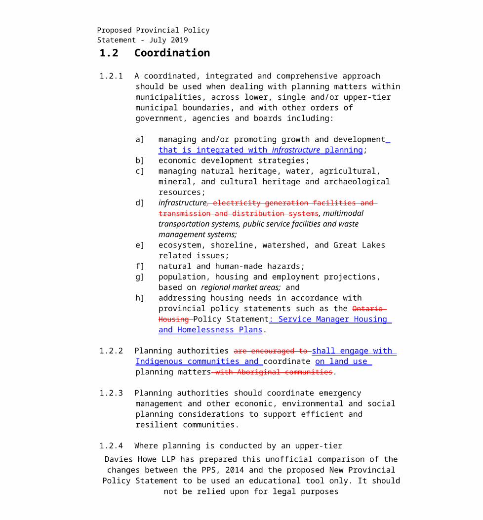
1.2 Coordination
1.2.1 A coordinated, integrated and comprehensive approach should be used when dealing with planning matters within municipalities, across lower, single and/or upper-tier municipal boundaries, and with other orders of government, agencies and boards including:
a] managing and/or promoting growth and development that is integrated with infrastructure planning ;
b] economic development strategies;c] managing natural heritage, water, agricultural, mineral, and cultural heritage
and archaeological resources;d] infrastructure, electricity generation facilities and transmission and
distribution systems, multimodal transportation systems, public service facilities and waste management systems;
e] ecosystem, shoreline, watershed, and Great Lakes related issues;f] natural and human-made hazards;g] population, housing and employment projections, based on regional market
areas; andh] addressing housing needs in accordance with provincial policy statements
such as the Ontario Housing Policy Statement: Service Manager Housing and Homelessness Plans.
1.2.2 Planning authorities are encouraged to shall engage with Indigenous communities and coordinate on land use planning matters with Aboriginal communities.
1.2.3 Planning authorities should coordinate emergency management and other economic, environmental and social planning considerations to support efficient and resilient communities.
1.2.4 Where planning is conducted by an upper-tier municipality, the upper-tier municipality in consultation with lower-tier municipalities shall:a) identify, coordinate and allocate population, housing and employment
projections for lower-tier municipalities. Allocations and projections by upper-upper- tier municipalities shall be based on and reflect provincial plans where these exist and informed by provincial guidelines;
b) identify areas where growth or development will be directed, including the identification of nodes and the corridors linking these nodes;
c) identify targets for intensification and redevelopment within all or any of the
Davies Howe LLP has prepared this unofficial comparison of the changes between the PPS, 2014 and the proposed New Provincial Policy Statement to be used an educational tool only. It
should not be relied upon for legal purposes

Proposed Provincial Policy Statement - July 2019
lower-tier municipalities, including minimum targets that should be met before expansion of the boundaries of settlement areas is permitted in accordance with policy 1.1.3.8;
d) where major transit corridors exist or are to be developed, identify density targets for areas adjacent or in proximity to these corridors and stations, including minimum targets that should be met before expansion of the boundaries of settlement areas is permitted in accordance with policy 1.1.3.8; and
e) identify and provide policy direction for the lower-tier municipalities on matters that cross municipal boundaries.
1.2.5 Where there is no upper-tier municipality, planning authorities shall ensure that policy 1.2.4 is addressed as part of the planning process, and should coordinate these matters with adjacent planning authorities.
1.2.6 Land Use Compatibility
1.2.6.1 Major facilities and sensitive land uses should be planned to ensure they are appropriately designed, buffered and/or separated from each other to prevent or mitigate shall be planned and developed to avoid, or if avoidance is not possible, minimize and mitigate any potential adverse effects from odour, noise and other contaminants, minimize risk to public health and safety, and to ensure the long-term operational and economic viability of major facilities in accordance with provincial guidelines, standards and procedures.
1.2.6.2 Where avoidance is not possible in accordance with policy 1.2.6.1, planning authorities shall ensure that the planning and development of sensitive land uses adjacent to existing or planned industrial, manufacturing, or other uses that are particularly vulnerable to encroachment are only permitted if:
a) alternative locations for the proposed sensitive land uses have been evaluated and there are no reasonable alternative locations; and
b) potential impacts of these uses are minimized and mitigated in accordance with provincial guidelines, standards and procedures.
1.3 Employment
1.3.1 Planning authorities shall promote economic development and competitiveness by:
a] providing for an appropriate mix and range of employment and ,
Davies Howe LLP has prepared this unofficial comparison of the changes between the PPS, 2014 and the proposed New Provincial Policy Statement to be used an educational tool only. It
should not be relied upon for legal purposes

Proposed Provincial Policy Statement - July 2019
institutional, and mixed uses to meet long-term needs;b] providing opportunities for a diversified economic base, including
maintaining a range and choice of suitable sites for employment uses which support a wide range of economic activities and ancillary uses, and take into account the needs of existing and future businesses;
c] facilitating the conditions for economic investment by identifying strategic sites for investment, monitoring the availability and suitability of employment sites, including market-ready sites, and seeking to address potential barriers to investment;
d] encouraging compact, mixed-use development that incorporates compatible employment uses to support liveable and resilient communities, with consideration of housing policy 1.4; and
e] ensuring the necessary infrastructure is provided to support current and projected needs.
1.3.2 Employment Areas
1.3.2.1 Planning authorities shall plan for, protect and preserve employment areas for current and future uses and ensure that the necessary infrastructure is provided to support current and projected needs.
1.3.2.2 At the time of the official plan review or update, planning authorities should assess employment areas identified in local official plans to ensure that this designation is appropriate to the planned function of the employment area.
Employment areas planned for industrial and manufacturing uses shall provide for separation or mitigation from sensitive land uses to maintain the long-term operational and economic viability of the planned uses and function of these areas.
1.3.2.3 Within employment areas planned for industrial and manufacturing uses, planning authorities shall prohibit residential and institutional uses that are not ancillary to the primary employment uses in order to maintain land use compatibility.
Employment areas planned for industrial and manufacturing uses, should include an appropriate transition to adjacent non-employment areas.
1.3.2.4 1.3.2.2 Planning authorities may permit conversion of lands within employment areas to non-employment uses through a comprehensive review, only where it has been demonstrated that the land is not required for employment purposes over the long term and that there is a need for the conversion.
Davies Howe LLP has prepared this unofficial comparison of the changes between the PPS, 2014 and the proposed New Provincial Policy Statement to be used an educational tool only. It
should not be relied upon for legal purposes

Proposed Provincial Policy Statement - July 2019
1.3.2.5 Notwithstanding policy 1.3.2.4, and until the official plan review or update in policy 1.3.2.4 is undertaken and completed, lands within existing employment areas may be converted to a designation that permits non-employment uses provided the area has not been identified as provincially significant througha provincial plan exercise or as regionally-significant by a regional economic development corporation working together with affected upper- and single tier municipalities and subject to the following:
a) there is an identified need for the conversion and the land is not required for employment purposes over the long term;
b) the proposed uses would not adversely affect the overall viability of the employment area; and
c) existing or planned infrastructure and public service facilities are available to accommodate the proposed uses.
1.3.2.6 1.3.2.3Planning authorities shall protect employment areas in proximity to major goods movement facilities and corridors for employment uses that require those locations.
1.3.2.7 1.3.2.4Planning authorities may plan beyond 20 25 years for the long-term protection of employment areas provided lands are not designated beyond the planning horizon identified in policy 1.1.2.
1.4 Housing
1.4.1 To provide for an appropriate range and mix of housing types options and densities required to meet projected requirements of current and future residents of the regional market area, planning authorities shall:
a] maintain at all times the ability to accommodate residential growth for a minimum of 10 12 years through residential intensification and redevelopment and, if necessary, lands which are designated and available for residential development; and
b] maintain at all times where new development is to occur, land with servicing capacity sufficient to provide at least a three-year supply of residential units available through lands suitably zoned to facilitate residential intensification and redevelopment, and land in draft approved and registered plans.
Upper-tier and single-tier municipalities may choose to maintain land with servicing
Davies Howe LLP has prepared this unofficial comparison of the changes between the PPS, 2014 and the proposed New Provincial Policy Statement to be used an educational tool only. It
should not be relied upon for legal purposes

Proposed Provincial Policy Statement - July 2019
capacity sufficient to provide at least a five-year supply of residential units available through lands suitably zoned to facilitate residential intensification and redevelopment, and land in draft approved and registered plans.
1.4.2 Where planning is conducted by an upper-tier municipality:
a] the land and unit supply maintained by the lower-tier municipality identified in policy 1.4.1 shall be based on and reflect the allocation of population and units by the upper-tier municipality; and
b] the allocation of population and units by the upper-tier municipality shall be based on and ref\ect reflect provincial plans where these exist.
1.4.3 Planning authorities shall provide for an appropriate range and mix of housing types options and densities to meet projected requirements market-based needs of current and future residents of the regional market area by:
a) establishing and implementing minimum targets for the provision of housing which is affordable to low and moderate income households and which aligns with applicable housing and homelessness plans. However, where planning is conducted by an upper-tier municipality, the upper-tier municipality in consultation with the lower-tier municipalities may identify a higher target(s) which shall represent the minimum target(s) for these lower-tier municipalities;
b] permitting and facilitating:1. all forms of housing options required to meet the social, health ,
economic and wellbeing well-being requirements of current and future residents, including special needs requirements and needs arising from demographic changes and employment opportunities; and
2. all forms types of residential intensification, including second additional residential units, and redevelopment in accordance with policy 1.1.3.3;
c] directing the development of new housing towards locations where appropriate levels of infrastructure and public service facilities are or will be available to support current and projected needs;
d] promoting densities for new housing which efficiently use land, resources, infrastructure and public service facilities, and support the use of active transportation and transit in areas where it exists or is to be developed;and
e] requiring transit-supportive development and prioritizing intensification, including potential air rights development, in proximity to transit, including
Davies Howe LLP has prepared this unofficial comparison of the changes between the PPS, 2014 and the proposed New Provincial Policy Statement to be used an educational tool only. It
should not be relied upon for legal purposes

Proposed Provincial Policy Statement - July 2019
corridors and stations; andf] e)establishing development standards for residential intensification,
redevelopment and new residential development which minimize the cost of housing and facilitate compact form, while maintaining appropriate levels of public health and safety.
1.5 Public Spaces, Recreation, Parks, Trails, and Open Space
1.5.1 Healthy, active communities should be promoted by:
a] planning public streets, spaces and facilities to be safe, meet the needs of pedestrians, foster social interaction and facilitate active transportation and community connectivity;
b] planning and providing for a full range and equitable distribution of publicly-accessible built and natural settings for recreot/onrecreation, including facilities, parklands, public spaces, open space areas, trails and linkages, and, where practical, water-based resources;
c] providing opportunities for public access to shorelines; andd] recognizing provincial parks, conservation reserves, and other protected
areas, and minimizing negative impacts on these areas.
Davies Howe LLP has prepared this unofficial comparison of the changes between the PPS, 2014 and the proposed New Provincial Policy Statement to be used an educational tool only. It
should not be relied upon for legal purposes
Proposed Provincial Policy Statement - July 2019
1.6 Infrastructure and Public Service Facilities
1.6.1 Infrastructure, electricity generation facilities and transmission and distribution systems, and public service facilities shall be provided in a coordinated, an efficient and cost-effective manner that considers prepares for the impacts from of a changing climate change while accommodating projected needs.
Planning for infrastructure, electricity generation facilities and transmission and distribution systems, and public service facilities shall be coordinated and integrated with land use planning and growth management so that they are:
a] financially viable over their life cycle, which may be demonstrated through asset management planning; and
b] available to meet current and projected needs.
1.6.2 Planning authorities should promote green infrastructure to complement infrastructure.
1.6.3 Before consideration is given to developing new infrastructure and public service facilities:
a) the use of existing infrastructure and public service facilities should be optimized; andb) opportunities for adaptive re-use should be considered, wherever feasible.
1.6.4 Infrastructure and public service facilities should be strategically located to support the effective and efficient delivery of emergency management services.
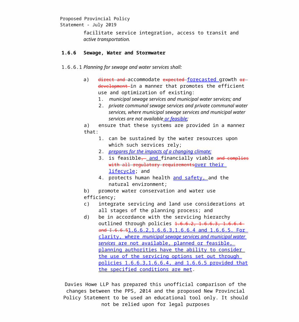
1.6.5 Public service facilities should be co-located in community hubs, where appropriate, to promote cost-effectiveness and facilitate service integration, access to transit and active transportation.
1.6.6 Sewage, Water and Stormwater
1.6.6.1 Planning for sewage and water services shall:
a) direct and accommodate expected forecasted growth or development in a manner that promotes the efficient use and optimization of existing:1. municipal sewage services and municipal water services; and
Davies Howe LLP has prepared this unofficial comparison of the changes between the PPS, 2014 and the proposed New Provincial Policy Statement to be used an educational tool only. It
should not be relied upon for legal purposes

Proposed Provincial Policy Statement - July 2019
2. private communal sewage services and private communal water services, where municipal sewage services and municipal water services are not available or feasible;
a) ensure that these systems are provided in a manner that:1. can be sustained by the water resources upon which such services rely;2. prepares for the impacts of a changing climate; 3. is feasible, and financially viable and complies with all regulatory
requirementsover their lifecycle; and4. protects human health and safety, and the natural environment;
b) promote water conservation and water use efficiency;c) integrate servicing and land use considerations at all stages of the planning
process; andd) be in accordance with the servicing hierarchy outlined through policies
1.6.6.2, 1.6.6.3, 1.6.6.4 and I.6.6.51.6.6.2,1.6.6.3,1.6.6.4 and 1.6.6.5. For clarity , where municipal sewage services and municipal water services are not available , planned or feasible, planning authorities have the ability to consider the use of the servicing options set out through policies 1.6.6.3,1.6.6.4, and 1.6.6.5 provided that the specified conditions are met.
1.6.6.2 Municipal sewage services and municipal water services are the preferred form of servicing for settlement areas to support protection of the environment and minimize potential risks to human health and safety.Intensification and redevelopment within settlement areas on existing 1.6.6.2municipal sewage services and municipal water serv/ces should be promoted, wherever feasible.1.6.6.3Where municipal sewage services and municipal water services are not provided, municipalities may allow the use of private communal sewage services and private communal water services.Within settlement areas with existing municipal sewage services and municipal water services, intensification and redevelopment shall be promoted wherever feasible to optimize the use of the services.
1.6.6.3 1.6.6.4 Where municipal sewage services and municipal water services or private communal sewage services and private communal water services are not providedare not available, planned or feasible , individual on-site sewage services and individual on-site water services may be used provided that site conditions are suitable for the long-term provision of such services with no negative impacts. In settlement areas, these services may only be used for infilling and minor rounding out of existing development.private communal sewage services and private communal water services are the preferred form of servicing for multi unit/lot development to support protection of the environment and minimize potential risks
Davies Howe LLP has prepared this unofficial comparison of the changes between the PPS, 2014 and the proposed New Provincial Policy Statement to be used an educational tool only. It
should not be relied upon for legal purposes

Proposed Provincial Policy Statement - July 2019
to human health and safety.
1.6.6.4 Where municipal sewage services and municipal water services or private communal sewage services and private communal water services are not available, planned or feasible , individual on-site sewage services and individual on-site water services may be used provided that site conditions are suitable for the long-term provision of such services with no negative impacts. In settlement areas, individual on-site sewage services and individual on-site water services may be used for infilling and minor rounding out of existing development.At the time of the official plan review or update, planning authorities should assess the long-term impacts of individual on-site sewage services and individual on-site water services on the environmental health and the character of rural settlement areas. Where planning is conducted by an upper-tier municipality, the upper-tier municipality should work with lower- tier municipalities at the time of the official plan review or update to assess the long-term impacts of individual on-site sewage services and individual on site water services on the environmental health and the desired character of rural settlement areas and the feasibility of other forms of servicing set out in policies 1.6.6.2 and 1.6.6.3.
1.6.6.5 Partial services shall only be permitted in the following circumstances:
a] where they are necessary to address failed individual on-site sewage services and individual on-site water services in existing development; or
b] within settlement areas, to allow for infilling and minor rounding out of existing development on partial services provided that site conditions are suitable for the long-term provision of such services with no negative impacts.
Where partial services have been provided to address failed services in accordance with subsection (a], infilling on existing lots of record in rural areas in municipalities may be permitted where this would represent a logical and financially viable connection to the existing partial service and provided that site conditions are suitable for the long-term provision of such services with no negative impacts. In accordance with subsection (a], the extension of partial services into rural areas is only permitted to address failed individual on-site sewage and individual on-site water services for existing development.
1.6.6.6 Subject to the hierarchy of services provided in policies 1.6.6.2,1.6.6.3,1.6.6.4 and 1.6.6.5 1.6.6.2,1.6.6.3,1.6.6.6and 1.6.6.5 , planning authorities may allow lot
Davies Howe LLP has prepared this unofficial comparison of the changes between the PPS, 2014 and the proposed New Provincial Policy Statement to be used an educational tool only. It
should not be relied upon for legal purposes

Proposed Provincial Policy Statement - July 2019
creation only if there is confirmation of sufficient reserve sewage system capacity and reserve water system capacity within municipal sewage services and municipal water services or private communal sewage services and private communal water services. The determination of sufficient reserve sewage system capacity shall include treatment capacity for hauled sewage from private communal sewage services and individual on-site sewage services.
1.6.6.7 Planning for stormwater management shall:
a] be integrated with planning for sewage and water services and ensure that systems are optimized, feasible and financially viable over the long term;
b] minimize, or, where possible, prevent increases in contaminant loads;c] minimize erosion and changes in water balance and erosion, and prepare for
the impacts of a changing climate through the effective management of stormwater;
d] mitigate risks to human health and , safety and , property damageand the environment;
e] maximize the extent and function of vegetative and pervious surfaces; andf] promote stormwater management best practices, including stormwater
attenuation and re-use, water conservation and efficiency, and low impact development.
1.6.7 Transportation Systems
1.6.7.1 Transportation systems should be provided which are safe, energy efficient, facilitate the movement of people and goods, and are appropriate to address projected needs.
1.6.7.2 Efficient use shall should be made of existing and planned infrastructure, including through the use of transportation demand management strategies, where feasible.
1.6.7.3 As part of a multimodal transportation system, connectivity within and among transportation systems and modes should be maintained and, where possible, improved including connections which cross jurisdictional boundaries.
1.6.7.4 A land use pattern, density and mix of uses should be promoted that minimize the length and number of vehicle trips and support current and future use of transit and active transportation.
1.6.7.5 Transportation and land use considerations shall be integrated at all stages of the
Davies Howe LLP has prepared this unofficial comparison of the changes between the PPS, 2014 and the proposed New Provincial Policy Statement to be used an educational tool only. It
should not be relied upon for legal purposes

Proposed Provincial Policy Statement - July 2019
planning process.
1.6.8 Transportation and Infrastructure Corridors
1.6.8.1 Planning authorities shall plan for and protect corridors and rights-of-way for infrastructure, including transportation, transit and electricity generation facilities and transmission systems to meet current and projected needs.
1.6.8.2 Major goods movement facilities and corridors shall be protected for the long term.
1.6.8.3 Planning authorities shall not permit development in planned corridors that could preclude or negatively affect the use of the corridor for the purpose(s) purposefs] for which it was identified.
New development proposed on adjacent lands to existing or planned corridors and transportation facilities should be compatible with, and supportive of, the long-term purposes of the corridor and should be designed to avoid, mitigate or minimize negative impacts on and from the corridor and transportation facilities.
1.6.8.4 The preservation and reuse of abandoned corridors for purposes that maintain the corridor’s integrity and continuous linear characteristics should be encouraged, wherever feasible.
1.6.8.5 The co-location of linear infrastructure should be promoted, where appropriate.
1.6.8.6 1.6.8.5 When planning for corridors and rights-of-way for significant transportation, electricity transmission, and infrastructure facilities, consideration will be given to the significant resources in Section 2: Wise Use and Management of Resources.
1.6.9 Airports, Rail and Marine Facilities
1.6.9.1 Planning for land uses in the vicinity of airports, rail facilities and marine facilities shall be undertaken so that:
a] their long-term operation and economic role is protected; andb] airports, rail facilities and marine facilities and sensitive land uses are
appropriately designed, buffered and/or separated from each other, in accordance with policy 1.2.6.
1.6.9.2 Airports shall be protected from incompatible land uses and development by:
Davies Howe LLP has prepared this unofficial comparison of the changes between the PPS, 2014 and the proposed New Provincial Policy Statement to be used an educational tool only. It
should not be relied upon for legal purposes

Proposed Provincial Policy Statement - July 2019
a] prohibiting new residential development and other sensitive land uses in areas near airports above 30 NEF/NEP;
b] considering redevelopment of existing residential uses and other sensitive land uses or infilling of residential and other sensitive land uses in areas above 30 NEF/NEP only if it has been demonstrated that there will be no negative impacts on the long-term function of the airport; and
c] discouraging land uses which may cause a potential aviation safety hazard.
1.6.10 Waste Management
1.6.10.1 Waste management systems need to be provided that are of an appropriate size and type to accommodate present and future requirements, and facilitate, encourage and promote reduction, reuse and recycling objectives.Planning authorities should consider the implications of development and land use patterns on waste generation, management and diversion.
Waste management systems shall be located and designed in accordance with provincial legislation and standards.
1.6.11 Energy Supply
1.6.11 Planning authorities should provide opportunities for the development of energy supply including electricity generation facilities and transmission and distribution systems, to accommodate current and projected needs.Planning authorities should promote district energy, and renewable energy systems and alternative energy systems, where feasible, in accordance with provincial and federal requirements.to accommodate current and projected needs.
1.7 Long-Term Economic Prosperity
1.7.1 Long-term economic prosperity should be supported by:
a) promoting opportunities for economic development and community investment-readiness;
b) encouraging residential uses to respond to dynamic market-based needs and provide necessary housing supply and range of housing options for a diverse workforce;
c) optimizing the long-term availability and use of land, resources, infrastructure, electricity generation facilities and transmission and distribution systems, and
Davies Howe LLP has prepared this unofficial comparison of the changes between the PPS, 2014 and the proposed New Provincial Policy Statement to be used an educational tool only. It
should not be relied upon for legal purposes

Proposed Provincial Policy Statement - July 2019
public service facilities;d) maintaining and, where possible, enhancing the vitality and viability of
downtowns and mainstreets;e) encouraging a sense of place, by promoting well-designed built form and
cultural planning, and by conserving features that help define character, including built heritage resources and cultural heritage landscapes;
f) promoting the redevelopment of brownfield sites;g) providing for an efficient, cost-effective, reliable multimodal transportation
system that is integrated with adjacent systems and those of other jurisdictions, and is appropriate to address projected needs to support the movement of goods and people;
h) providing opportunities for sustainable tourism development;i) providing opportunities to support local food, and promoting the
sustainability of agri-food and agri-product businesses by sustaining and enhancing the viability of the agricultural system through protecting agricultural resources, and minimizing land use conflicts, providing opportunities to support local food, and maintaining and improving the agri- food network;
j) promoting energy conservation and providing opportunities for development of renewable energy systems and alternative energy systems, including district energyincreased energy supply;
k) minimizing negative impacts from a changing climate and considering the ecological benefits provided by nature; and
l) encouraging efficient and coordinated communications and telecommunications infrastructure.
1.8 Energy Conservation, Air Quality and Climate Change
1.8.1 Planning authorities shall support energy conservation and efficiency,improved air quality, reduced greenhouse gas emissions, and preparing for impacts of a changing climate change adaptationthrough land use and development patterns which:
a) promote compact form and a structure of nodes and corridors;b) promote the use of active transportation and transit in and between
residential, employment (including commercial and industrial) and institutional uses and other areas;
c) focus major employment, commercial and other travel-intensive land uses on sites which are well served by transit where this exists or is to be developed,
Davies Howe LLP has prepared this unofficial comparison of the changes between the PPS, 2014 and the proposed New Provincial Policy Statement to be used an educational tool only. It
should not be relied upon for legal purposes

Proposed Provincial Policy Statement - July 2019
or designing these to facilitate the establishment of transit in the future;d) focus freight-intensive land uses to areas well served by major highways,
airports, rail facilities and marine facilities;e) encourage transit-supportive development and intensification to improve the
mix of employment and housing uses to shorten commute journeys and decrease transportation congestion;
f) promote design and orientation which: maximizes energy efficiency and conservation, and considers the mitigating effects of vegetation; and
2. maximizes opportunities for the use of renewable energy systems and alternative energy systems; and
g) maximize vegetation within settlement areas, where feasible.
2.0 Wise Use and Management of Resources
Ontario's long-term prosperity, environmental health, and social well-being depend on conserving biodiversity, protecting the health of the Great Lakes, and protecting natural heritage, water, agricultural, mineral and cultural heritage and archaeological resources for their economic, environmental and social benefits.
Accordingly:
2.1 Natural Heritage
2.1.1 Natural features and areas shall be protected for the long term.
2.1.2 The diversity and connectivity of natural features in an area, and the long-term long - term ecological function and biodiversity of natural heritage systems, should be maintained, restored or, where possible, improved, recognizing linkages between and among natural heritage features and areas, surface water features and ground water features.
2.1.3 Natural heritage systems shall be identified in Ecoregions 6E & 7E7E 1 1, recognizing that natural heritage systems will vary in size and form in settlement areas, rural areas, and prime agricultural areas.
2.1.4 Development and site alteration shall not be permitted in:
a] a)significant wetlands in Ecoregions 5E, 6E and 7E1; and
11 Ecoregions 5E, 6E and 7E are shown on Figure 1.Davies Howe LLP has prepared this unofficial comparison of the changes between the PPS,
2014 and the proposed New Provincial Policy Statement to be used an educational tool only. It should not be relied upon for legal purposes

Proposed Provincial Policy Statement - July 2019
b] b)significant coastal wetlands.
2.1.5 Development and site alteration shall not be permitted in:
a] a)significant wetlands in the Canadian Shield north of Ecoregions 5E, 6E and 7E1;
b] b)significant woodlands in Ecoregions 6E and 7E (excluding islands in Lake Huron and the St. Marys River)}1;
c] significant valleylands in Ecoregions 6E and 7E (excluding islands in Lake Huron and the St. Marys River)}1;
d) significant wildlife habitat;e) areas of natural and scientific interest; andf) coastal wetlands in Ecoregions 5E, 6E and 7E1 7E 1 that are not subject to
policy 2.1.4(b)]
unless it has been demonstrated that there will be no negative impacts on the natural features or their ecological functions.
2.1.6 Development and site alteration shall not be permitted in fish habitat except in accordance with provincial and federal requirements.
2.1.7 Development and site alteration shall not be permitted in habitat of endangered species and threatened species, except in accordance with provincial and federal requirements.
2.1.8 Development and site alteration shall not be permitted on adjacent lands to the natural heritage features and areas identified in policies 2.1.4, 2.1.5, and 2.1.6 unless the ecological function of the adjacent lands has been evaluated and it has been demonstrated that there will be no negative impacts on the natural features or on their ecological functions.
2.1.9 Nothing in policy 2.1 is intended to limit the ability of agricultural uses to continue.
2.1.10 Municipalities may choose to manage wetlands not subject to policy 2.1.4 and 2.1.5, in accordance with guidelines developed by the Province.
2.2 Water
2.2.1 Planning authorities shall protect, improve or restore the quality and quantity of 1 Ecoregions 5E, 6E and 7E are shown on Figure 1.
Davies Howe LLP has prepared this unofficial comparison of the changes between the PPS, 2014 and the proposed New Provincial Policy Statement to be used an educational tool only. It
should not be relied upon for legal purposes
Proposed Provincial Policy Statement - July 2019
water by:
a) using the watershed as the ecologically meaningful scale for integrated and long-term planning, which can be a foundation for considering cumulative impacts of development;
b) minimizing potential negative impacts, including cross-jurisdictional and cross-watershed impacts;
c) evaluating and preparing for the impacts of a changing climate to water resource systems at the watershed level;
d] c) identifying water resource systems consisting of ground water features, hydrologic functions, natural heritage features and areas, and surface water features including shoreline areas, which are necessary for the ecological and hydrological integrity of the watershed;
e] d) maintaining linkages and related functions among ground water features, hydrologic functions, natural heritage features and areas, and surface water features including shoreline areas;
f] e) implementing necessary restrictions on development and site alteration to:1. protect all municipal drinking water supplies and designated
vulnerable areas; and2. protect, improve or restore vulnerable surface and ground water,
sensitive surface water features and sensitive ground water features, and their hydrologic functions;
g] f) planning for efficient and sustainable use of water resources, through practices for water conservation and sustaining water quality;
h] g) ensuring consideration of environmental lake capacity, where applicable; and
i] h) ensuring stormwater management practices minimize stormwater volumes and contaminant loads, and maintain or increase the extent of vegetative and pervious surfaces.
2.2.2 Development and site alteration shall be restricted in or near sensitive surface water features and sensitive ground water features such that these features and their related hydrologic functions will be protected, improved or restored.
Mitigative measures and/or alternative development approaches may be required in order to protect, improve or restore sensitive surface water features, sensitive ground water features, and their hydrologic functions.
Davies Howe LLP has prepared this unofficial comparison of the changes between the PPS, 2014 and the proposed New Provincial Policy Statement to be used an educational tool only. It
should not be relied upon for legal purposes

Proposed Provincial Policy Statement - July 2019
2.3 Agriculture
2.3.1 Prime agricultural areas shall be protected for long-term use for agriculture.
Prime agricultural areas are areas where prime agricultural lands predominate. Specialty crop areas shall be given the highest priority for protection, followed by Canada Land Inventory Class 1, 2, and 3 lands, and any associated Class 4 through 7 lands within the prime agricultural area, in this order of priority.
2.3.2 Planning authorities shall designate prime agricultural areas and specialty crop areas in accordance with guidelines developed by the Province, as amended from time to time.
Planning authorities are encouraged to use an agricultural system approach to maintain and enhance the geographic continuity of the agricultural land base and the functional and economic connections to the agri-food network.
2.3.3 Permitted Uses
2.3.3.1 In prime agricultural areas, permitted uses and activities are: agricultural uses, agriculture-related uses and on-farm diversified uses.
Proposed agriculture-related uses and on-farm diversified uses shall be compatible with, and shall not hinder, surrounding agricultural operations. Criteria for these uses may be based on guidelines developed by the Province or municipal approaches, as set out in municipal planning documents, which achieve the same objectives.
2.3.3.2 In prime agricultural areas, all types, sizes and intensities of agricultural uses and normal farm practices shall be promoted and protected in accordance with provincial standards.
2.3.3.3 New land uses, in prime agricultural areas, including the creation of lots, and new or expanding livestock facilities shall comply with the minimum distance separation formulae.
2.3.4 Lot Creation and Lot Adjustments
2.3.4.1 Lot creation in prime agricultural areas is discouraged and may only bepermitted for:
Davies Howe LLP has prepared this unofficial comparison of the changes between the PPS, 2014 and the proposed New Provincial Policy Statement to be used an educational tool only. It
should not be relied upon for legal purposes

Proposed Provincial Policy Statement - July 2019
a) agricultural uses, provided that the lots are of a size appropriate for the type of agricultural use(s) common in the area and are sufficiently large to maintain flexibility for future changes in the type or size of agricultural operations;
b) agriculture-related uses, provided that any new lot will be limited to a minimum size needed to accommodate the use and appropriate sewage and water services;
c) a residence surplus to a farming operation as a result of farm consolidation, provided that:1. the new lot will be limited to a minimum size needed to accommodate
the use and appropriate sewage and water services; and2. the planning authority ensures that new residential dwellings are
prohibited on any remnant parcel of farmland created by the severance. The approach used to ensure that no new residential dwellings are permitted on the remnant parcel may be recommended by the Province, or based on municipal approaches which achieve the same objective; and
d] infrastructure, where the facility or corridor cannot be accommodated through the use of easements or rights-of-way.
2.3.4.2 Lot adjustments in prime agricultural areas may be permitted for legal or technical reasons.
2.3.4.3 The creation of new residential lots in prime agricultural areas shall not be permitted, except in accordance with policy 2.3.4.1(c).
2.3.5 Removal of Land from Prime Agricultural Areas
2.3.5.1 Planning authorities may only exclude land from prime agricultural areas for expansions of or identification of settlement areas in accordance with policy1.1.3.8.
2.3.6 Non-Agricultural Uses in Prime Agricultural Areas
2.3.6.1 Planning authorities may only permit non-agricultural uses in prime agricultural areas for:
a) extraction of minerals, petroleum resources and mineral aggregate resources, in accordance with policies 2.4 and 2.5; or
Davies Howe LLP has prepared this unofficial comparison of the changes between the PPS, 2014 and the proposed New Provincial Policy Statement to be used an educational tool only. It
should not be relied upon for legal purposes

Proposed Provincial Policy Statement - July 2019
b) limited non-residential uses, provided that all of the following are demonstrated:1. the land does not comprise a specialty crop area-,;2. the proposed use complies with the minimum distance separation
formulae;2. 3. there is an identified need within the planning horizon provided for
in policy 1.1.2 for additional land to be designated to accommodate the proposed use; and
3. 4.alternative locations have been evaluated, andi. there are no reasonable alternative locations which avoid prime
agricultural areas; andii. there are no reasonable alternative locations in prime agricultural
areas with lower priority agricultural lands.
2.3.6.2 Impacts from any new or expanding non-agricultural uses on surroundingagricultural operations and lands are to be avoided, and where avoidance is not possible, minimized and mitigated to the extent feasible and informed by provincial guidelines.
2.4 Minerals and Petroleum
2.4.1 Minerals and petroleum resources shall be protected for long-term use.
2.4.2 Protection of Long-Term Resource Supply
2.4.2.1 Mineral mining operations and petroleum resource operations shall be identified and protected from development and activities that would preclude or hinder their expansion or continued use or which would be incompatible for reasons of public health, public safety or environmental impact.
2.4.2.2 Known mineral deposits, known petroleum resources and significant areas of mineral potential shall be identified and development and activities in these resources or on adjacent lands which would preclude or hinder the establishment of new operations or access to the resources shall only be permitted if:
a] resource use would not be feasible; orb] the proposed land use or development serves a greater long-term public
interest; andc] issues of public health, public safety and environmental impact are
addressed.Davies Howe LLP has prepared this unofficial comparison of the changes between the PPS,
2014 and the proposed New Provincial Policy Statement to be used an educational tool only. It should not be relied upon for legal purposes

Proposed Provincial Policy Statement - July 2019
2.4.3 Rehabilitation
2.4.3.1 Rehabilitation to accommodate subsequent land uses shall be required afterextraction and other related activities have ceased. Progressive rehabilitation should be undertaken wherever feasible.
2.4.4 Extraction in Prime Agricultural Areas
2.4.4.1 Extraction of minerals and petroleum resources is permitted in prime agricultural areas provided that the site will be rehabilitated.
2.5 Mineral Aggregate Resources
2.5.1 Mineral aggregate resources shall be protected for long-term use and, where provincial information is available, deposits of mineral aggregate resources shall be identified.
2.5.2 Protection of Long-Term Resource Supply
2.5.2.1 As much of the mineral aggregate resources as is realistically possible shall be made available as close to markets as possible.
Demonstration of need for mineral aggregate resources, including any type of supply/demand analysis, shall not be required, notwithstanding the availability, designation or licensing for extraction of mineral aggregate resources locally or elsewhere.
2.5.2.2 Extraction shall be undertaken in a manner which minimizes social, economic and environmental impacts.
Outside of the Greenbelt Area, extraction may be considered in the natural heritage features listed in section 2.1.5, 2.1.6 and 2.1.7, provided that the long-term rehabilitation can demonstrate no negative impacts on the natural features or their ecological functions.
2.5.2.3 Mineral aggregate resource conservation shall be undertaken, including through the use of accessory aggregate recycling facilities within operations, wherever feasible. Mineral aggregate operations shall be protected from development and activities that would preclude or hinder their expansion or continued use or which would be incompatible for reasons of public health, public safety or environmental impact.
Davies Howe LLP has prepared this unofficial comparison of the changes between the PPS, 2014 and the proposed New Provincial Policy Statement to be used an educational tool only. It
should not be relied upon for legal purposes
Proposed Provincial Policy Statement - July 2019
Existing mineral aggregate operations shall be permitted to continue without the need for official plan amendment, rezoning or development permit under the Planning Act. Where the Aggregate Resources Act applies, processes under the Aggregate Resources Act shall address the depth of extraction of new or existing mineral aggregate operations or their expansions. When a license for extraction or operation ceases to exist, policy 2.5.2.5 continues to apply.
2.5.2.4 In known deposits of mineral aggregate resources and on adjacent lands, development and activities which would preclude or hinder the establishment of new operations or access to the resources shall only be permitted if:
a] resource use would not be feasible; orb] the proposed land use or development serves a greater long-term public
interest; andc] issues of public health, public safety and environmental impact are
addressed.
2.5.3 Rehabilitation
2.5.3.1 Progressive and final rehabilitation shall be required to accommodate subsequent land uses, to promote land use compatibility, to recognize the interim nature of extraction, and to mitigate negative impacts to the extent possible. Final rehabilitation shall take surrounding land use and approved land use designations into consideration.
2.5.3.2 Comprehensive rehabilitation planning is encouraged where there is a concentration of mineral aggregate operations.
2.5.3.3 In parts of the Province not designated under the Aggregate Resources Act, rehabilitation standards that are compatible with those under the Act should be adopted for extraction operations on private lands.
2.5.4 Extraction in Prime Agricultural Areas
2.5.4.1 In prime agricultural areas, on prime agricultural land, extraction of mineral aggregate resources is permitted as an interim use provided that the site will be rehabilitated back to an agricultural condition.
Complete rehabilitation to an agricultural condition is not required if:
Davies Howe LLP has prepared this unofficial comparison of the changes between the PPS, 2014 and the proposed New Provincial Policy Statement to be used an educational tool only. It
should not be relied upon for legal purposes

Proposed Provincial Policy Statement - July 2019
a] outside of a specialty crop area, there is a substantial quantity of mineral aggregate resources below the water table warranting extraction, or the depth of planned extraction in a quarry makes restoration of preextraction pre-extraction agricultural capability unfeasible;
b] b)in a specialty crop area, there is a substantial quantity of high quality mineral aggregate resources below the water table warranting extraction, and the depth of planned extraction makes restoration of preextraction pre-extraction agricultural capability unfeasible;
c] c)other alternatives have been considered by the applicant and found unsuitable. The consideration of other alternatives shall include resources in areas of Canada Land Inventory Class 4 through 7 lands, resources on lands identified as designated growth areas, and resources on prime agricultural lands where rehabilitation is feasible. Where no other alternatives are found, prime agricultural lands shall be protected in this order of priority: specialty crop areas, Canada Land Inventory Class 1, 2 and 3 lands; and
d] d)agricultural rehabilitation in remaining areas is maximized.
2.5.5 Wayside Pits and Quarries, Portable Asphalt Plants and Portable Concrete Plants
2.5.5.1 Wayside pits and quarries, portable asphalt plants and portable concrete plants used on public authority contracts shall be permitted, without the need for an official plan amendment, rezoning, or development permit under the Planning Act in all areas, except those areas of existing development or particular environmental sensitivity which have been determined to be incompatible with extraction and associated activities.
Davies Howe LLP has prepared this unofficial comparison of the changes between the PPS, 2014 and the proposed New Provincial Policy Statement to be used an educational tool only. It
should not be relied upon for legal purposes

Proposed Provincial Policy Statement - July 2019
2.6 Cultural Heritage and Archaeology
2.6.1 Significant built heritage resources and significant cultural heritage landscapes shall be conserved.
2.6.2 Development and site alteration shall not be permitted on lands containing archaeological resources or areas of archaeological potential unless significant archaeological resources have been conserved.
2.6.3 Planning authorities shall not permit development and site alteration on adjacent lands to protected heritage property except where the proposed development and site alteration has been evaluated and it has been demonstrated that the heritage attributes of the protected heritage property will be conserved.
2.6.4 Planning authorities should consider and promote archaeological management plans and cultural plans in conserving cultural heritage and archaeological resources.
2.6.5 Planning authorities shall consider the interests of Aboriginal engage with Indigenous communities in conserving and consider their interests when identifying, protecting and managing cultural heritage and archaeological resources.
Davies Howe LLP has prepared this unofficial comparison of the changes between the PPS, 2014 and the proposed New Provincial Policy Statement to be used an educational tool only. It
should not be relied upon for legal purposes

Proposed Provincial Policy Statement - July 2019
3.0 Protecting Public Health and Safety(Note: policies in this section related to natural hazards are subject to ongoing review by the Province's Special Advisor on flooding. Further changes may be considered as a result of this review]
Ontario's long-term prosperity, environmental health and social well-being depend on reducing the potential for public cost or risk to Ontario’s residents from natural or human- human-made hazards.
Development shall be directed away from areas of natural or human-made hazards where there is an unacceptable risk to public health or safety or of property damage, and not create new or aggravate existing hazards.
Accordingly:
3.1 Natural Hazards
3.1.1 Development shall generally be directed to areas outside of:
a] hazardous lands adjacent to the shorelines of the Great Lakes - St. Lawrence River System and large inland lakes which are impacted by flooding hazards, erosion hazards and/or dynamic beach hazards;
b] hazardous lands adjacent to river, stream and small inland lake systems which are impacted by flooding hazards and/or erosion hazards; and
c] hazardous sites.
3.1.2 Development and site alteration shall not be permitted within:
a] the dynamic beach hazard;b] defined portions of the flooding hazard along connecting channels (the St.
Marys, St. Clair, Detroit, Niagara and St. Lawrence Rivers)];c] areas that would be rendered inaccessible to people and vehicles during
times offloading of flooding hazards, erosion hazards and/or dynamic beach hazards, unless it has been demonstrated that the site has safe access appropriate for the nature of the development and the natural hazard; and
d] a floodway regardless of whether the area of inundation contains high points of land not subject to flooding.
Davies Howe LLP has prepared this unofficial comparison of the changes between the PPS, 2014 and the proposed New Provincial Policy Statement to be used an educational tool only. It
should not be relied upon for legal purposes

Proposed Provincial Policy Statement - July 2019
3.1.3 Planning authorities shall consider prepare for the potential impacts of a changing climate change that may increase the risk associated with natural hazards.
3.1.4 Despite policy 3.1.2, development and site alteration may be permitted in certain areas associated with the flooding hazard along river, stream and small inland lake systems:
a] a)in those exceptional situations where a Special Policy Area has been approved. The designation of a Special Policy Area, and any change or modification to the official plan policies, land use designations or boundaries applying to Special Policy Area lands, must be approved by the Ministers of Municipal Affairs and Housing and Natural Resources prior to the approval authority approving such changes or modifications; or
b] b)where the development is limited to uses which by their nature must locate within the floodway, including flood and/or erosion control works or minor additions or passive non-structural uses which do not affect flood flows.
3.1.5 Development sha\\ shaii not be permitted to locate in hazardous lands and hazardous sites where the use is:
a] a)an institutional use including hospitals, long-term care homes, retirement homes, pre-schools, school nurseries, day cares and schools;
b] b)an essential emergency service such as that provided by fire, police and ambulance stations and electrical substations; or
c] c)uses associated with the disposal, manufacture, treatment or storage of hazardous substances.
3.1.6 Where the two zone concept for flood plains is applied, development and site alteration may be maybe permitted in the flood fringe, subject to appropriate floodproofing to the flooding hazard elevation or another flooding hazard standard approved by the Minister of Natural Resources.
3.1.7 Further to policy 3.1.6, and except as prohibited in policies 3.1.2 and 3.1.5, development and site alteration may be permitted in those portions of hazardous lands and hazardous sites where the effects and risk to public safety are minor, could be mitigated in accordance with provincial standards, and where all of the following are demonstrated and achieved:a] a)development and site alteration is carried out in accordance with
floodproofing standards, protection works standards, and access standards;
Davies Howe LLP has prepared this unofficial comparison of the changes between the PPS, 2014 and the proposed New Provincial Policy Statement to be used an educational tool only. It
should not be relied upon for legal purposes
Proposed Provincial Policy Statement - July 2019
b] b)vehicles and people have a way of safely entering and exiting the area during times of flooding, erosion and other emergencies;
c] c)new hazards are not created and existing hazards are not aggravated; andd] d)no adverse environmental impacts will result.
3.1.8 Development shall generally be directed to areas outside of lands that are unsafe for development due to the presence of hazardous forest types for wildland fire.
Development may however be permitted in lands with hazardous forest types for wildland fire where the risk is mitigated in accordance with wildland fire assessment and mitigation standards.
3.2 Human-Made Hazards
3.2.1 Development on, abutting or adjacent to lands affected by mine hazards; oil, gas and salt hazards; or former mineral mining operations, mineral aggregate operations or petroleum resource operations may be permitted only if rehabilitation or other measures to address and mitigate known or suspected hazards are under way or have been completed.
3.2.2 Sites with contaminants in land or water shall be assessed and remediated as necessary prior to any activity on the site associated with the proposed use such that there will be no adverse effects.
3.2.3 Planning authorities should support, where feasible, on-site and local re-use of excess soil through planning and development approvals while protecting human health and the environment.
Davies Howe LLP has prepared this unofficial comparison of the changes between the PPS, 2014 and the proposed New Provincial Policy Statement to be used an educational tool only. It
should not be relied upon for legal purposes

Proposed Provincial Policy Statement - July 2019
4.0 Implementation and Interpretation
4.1 4.1This Provincial Policy Statement applies to all decisions in respect of the exercise of any authority that affects a planning matter made on or after April 30, 2014.<DATE>.
4.2 This Provincial Policy Statement shall be read in its entirety and all relevant policies are to be applied to each situation.
4.2 In accordance with section 3 of the Planning Act, a decision of the council of a municipality, a local board, a planning board, a minister of the Crown and a ministry, board, commission or agency of the government, including the Municipal Board, in respect of the exercise of any authority that affects a planning matter, "shall be consistent with" this Provincial Policy Statement.
Comments, submissions or advice that affect a planning matter that are provided by the council of a municipality, a local board, a planning board, a minister or ministry, board, commission or agency of the government "shall be consistent with" this Provincial Policy Statement.
4.3 4.3This Provincial Policy Statement shall be implemented in a manner that is consistent with the recognition and affirmation of existing Aboriginal and treaty rights in section 35 of the Constitution Act, 1982.
4.4 4.4This Provincial Policy Statement shall be read in its entirety and all relevant policies are to be applied to each situation.implemented in a manner that is consistent with Ontario Human Rights Code and the Canadian Charter of Rights and Freedoms.
4.5 4.5In implementing the Provincial Policy Statement, the Minister of Municipal Affairs and Housing may take into account other considerations when making decisions to support strong communities, a clean and healthy environment and the economic vitality of the Province.
4.6This Provincial Policy Statement shall be implemented in a manner that is consistent with the Ontario Human Rights Code and the Canadian Charter of Rights and Freedoms.
Davies Howe LLP has prepared this unofficial comparison of the changes between the PPS, 2014 and the proposed New Provincial Policy Statement to be used an educational tool only. It
should not be relied upon for legal purposes

Proposed Provincial Policy Statement - July 2019
4.6 The official plan is the most important vehicle for implementation of this Provincial Policy Statement. Comprehensive, integrated and long-term planning is best achieved through official plans.
Official plans shall identify provincial interests and set out appropriate land use designations and policies. To determine the significance of some natural heritage features and other resources, evaluation may be required.
Official plans should also coordinate cross-boundary matters to complement the actions of other planning authorities and promote mutually beneficial solutions. Official plans shall provide clear, reasonable and attainable policies to protect provincial interests and direct development to suitable areas.In order to protect provincial interests, planning authorities shall keep their official plans up-to-date with this Provincial Policy Statement. The policies of this Provincial Policy Statement continue to apply after adoption and approval of an official plan.
4.8 Zoning and development permit by-laws are important for implementation of this Provincial Policy Statement. Planning authorities shall keep their zoning and development permit by-laws up-to-date with their official plans and this Provincial Policy Statement.
4.9 The policies of this Provincial Policy Statement represent minimum standards. This Provincial Policy Statement does not prevent planning authorities and decision-makers from going beyond the minimum standards established in specific policies, unless doing so would conflict with any policy of this Provincial Policy Statement.
4.10 A wide range of legislation, regulations, policies, and plans may apply to decisions with respect to Planning Act applications. In some cases, a Planning Act proposal may also require approval under other legislation or regulation, and policies and plans issued under other legislation may also apply.
4.11 In addition to land use approvals under the Planning Act, infrastructure may also require approval under other legislation and regulations. An environmental assessment process may be applied to new infrastructure and modifications to existing infrastructure under applicable legislation.
There may be circumstances where land use approvals under the Planning Act may be Davies Howe LLP has prepared this unofficial comparison of the changes between the PPS,
2014 and the proposed New Provincial Policy Statement to be used an educational tool only. It should not be relied upon for legal purposes

Proposed Provincial Policy Statement - July 2019
integrated with approvals under other legislation, for example, integrating the planning processes and approvals under the Environmental Assessment Act and the Planning Act, provided the intent and requirements of both Acts are met.
4.12 Provincial plans shall be read in conjunction with this Provincial Policy Statement and take precedence over policies in this Provincial Policy Statement to the extent of any conflict, except where legislation establishing provincial plans provides otherwise. Examples of these are plans created under the/V/agora Escarpment Planning and Development Act, the Ontario Planning and Development Act, 1994, the Oak Ridges Moraine Conservation Act, 2001, the Green be It Act, 2005 and the Places to Grow Act, 2005.
4.13Within the Great Lakes - St. Lawrence River Basin, there may be circumstances where planning authorities should consider agreements related to the protection or restoration of the Great Lakes - St. Lawrence River Basin. Examples of these agreements include Great Lakes agreements between Ontario and Canada, between Ontario, Quebec and the Great Lakes States of the United States of America, and between Canada and the United States of America.
4.7 Planning authorities shall take action to support increased housing supply and facilitate a timely and streamlined process for local development by:
a] identifying and fast-tracking priority applications which support housing and job-related growth and development; and
b] reducing the time needed to process residential and priority applications to the extent practical.
4.8 4.14The Province, in consultation with municipalities, other public bodies and stakeholders shall identify performance indicators for measuring the effectiveness of some or all of the policies. The Province shall monitor their implementation, including reviewing performance indicators concurrent with any review of this Provincial Policy Statement.
4.9 4.15Municipalities are encouraged to establish performance indicators to monitor and report on the implementation of the policies in their official plans, in accordance with any reporting requirements, data standards and any other guidelines that may be issued by the Minister.
Davies Howe LLP has prepared this unofficial comparison of the changes between the PPS, 2014 and the proposed New Provincial Policy Statement to be used an educational tool only. It
should not be relied upon for legal purposes

Proposed Provincial Policy Statement - July 2019
Davies Howe LLP has prepared this unofficial comparison of the changes between the PPS, 2014 and the proposed New Provincial Policy Statement to be used an educational tool only. It
should not be relied upon for legal purposes
5.0 Figure 1

Proposed Provincial Policy Statement - July 2019
6.0 Definitions
Access standards: means methods or procedures to ensure safe vehicular and pedestrian movement, and access for the maintenance and repair of protection works, during times of flooding hazards, erosion hazards and/or other water-related hazards.
Active transportation: means human-
human- powered travel, including but not limited to, walking, cycling, inline skating and travel with the use of mobility aids, including motorized wheelchairs and other power-assisted devices moving at a comparable speed.
Adjacent lands: meansa] a)b)for the purposes of policy 1.6.8.3,
those lands contiguous to existing or planned corridors and transportation facilities where development would have a negative impact on the corridor or facility.The extent of the adjacent lands may be recommended in guidelines developed by the Province or based on municipal approaches that achieve the same objectives;
b] c)for the purposes of policy 2.1.8, those lands contiguous to a specific natural heritage feature or area where it is likely that development or site alteration would have a negative impact on the feature or area. The extent of the adjacent lands may be recommended by the Province or based on municipal approaches which achieve the same objectives;
c) for the purposes of policies 2.4.2.2 and 2.5.2.5, those lands contiguous to lands on the surface of known petroleum resources, mineral deposits, or deposits of mineral aggregate resources where it is likely that development wou\d
would constrain future access to the resources. The extent of the adjacent lands may be recommended by the Province; and
d) for the purposes of policy 2.6.3, those lands contiguous to a protected heritage property or as otherwise defined in the municipal official plan.
Adverse effects: as defined in theEnvironmental Protection Act, meansone or more of:a) impairment of the quality of the natural
environment for any use that can be made of it;
b) injury or damage to property or plant or animal life;
c) harm or material discomfort to any person;
d) an adverse effect on the health of any person;
e) impairment of the safety of any person;f) rendering any property or plant or
animal life unfit for human use;g) loss of enjoyment of normal use of
property; andh) interference with normal conduct of
business.Affordable: meansa] a)in the case of ownership housing, the
least expensive of:1. housing for which the purchase
price results in annual accommodation costs which do not exceed 30 percent of gross annual
Davies Howe LLP has prepared this unofficial comparison of the changes between the PPS, 2014 and the proposed New Provincial Policy Statement to be used an educational tool only.
It should not be relied upon for legal purposes
Proposed Provincial Policy Statement - July 2019
household income for low and moderate income households; or
2. housing for which the purchase price is at least 10 percent below the average purchase price of a resale unit in the regional market area;
b] b)in the case of rental housing, the least expensive of:1. a unit for which the rent does not
exceed 30 percent of gross annual household income for low and moderate income households; or
2. a unit for which the rent is at or below the average market rent of a unit in the regional market area.
Agricultural condition: meansa)a] in regard to specialty crop areas, a
condition in which substantially the same areas and same average soil capability for agriculture are restored, the same range and productivity of specialty crops common in the area can be achieved, and, where applicable, the microclimate on which the site and surrounding area may be dependent for specialty crop production will be maintained or restored; and
b)b] in regard to prime agricultural land outside of specialty crop areas, a condition in which substantially the same areas and same average soil capability for agriculture are restored.
Agricultural System: A system comprised of a group of inter-connected elements that collectively create a viable, thriving agricultural sector. It has two components:a] an agricultural land base comprised of
prime agricultural areas, including
specialty crop areas, and rural lands that together create a continuous productive land base for agriculture; and
b] an agri-food network which includes infrastructure, services, and assets important to the viability of the agri - food sector.
Agricultural uses: means the growing of crops, including nursery, biomass, and horticultural crops; raising of livestock; raising of other animals for food, fur or fibre, including poultry and fish; aquaculture; apiaries; agro-forestryagro- forestiy; maple syrup production; and associated on-farm buildings and structures, including, but not limited to livestock facilities, manure storages, value-retaining facilities, and accommodation for full-time farm labour when the size and nature of the operation requires additional employment.Agri-food network: Within the Agricultural System, a network that includes elements important to the viability of the agri-food sector such as regional infrastructure and transportation networks; on-farm buildings and infrastructure; agricultural services, farm markets, distributors, and primary processing; and vibrant, agriculture-supportive communities.
Agri-tourism uses: means those farm-farm- related tourism uses, including limited accommodation such as a bed and breakfast, that promote the enjoyment, education or activities related to the farm operation.
Davies Howe LLP has prepared this unofficial comparison of the changes between the PPS, 2014 and the proposed New Provincial Policy Statement to be used an educational tool only.
It should not be relied upon for legal purposes

Proposed Provincial Policy Statement - July 2019
Agriculture-related uses: means those farm- farm-related commercial and farm-
farm- related industrial uses that are directly related to farm operations in the area, support agriculture, benefit from being in close proximity to farm operations, and provide direct products and/or services to farm operations as a primary activity.
Airports: means all Ontario airports, including designated lands for future airports, with Noise Exposure Forecast (NEF)/Noise NEFJ/Noise Exposure Projection (NEP) mapping.
Alternative energy system: means a system that uses sources of energy or energy conversion processes to produce power, heat and/or cooling that significantly reduces the amount of harmful emissions to the environment (air, earth and water) when compared to conventional energy systems.
Archaeological resources: includes artifacts, archaeological sites, marine archaeological sites, as defined under the Ontario Heritage Act. The identification and evaluation of such resources are based upon archaeological fieldwork undertaken in accordance with the Ontario Heritage Act.
Areas of archaeological potential:means areas with the likelihood to contain archaeological resources. Methods Criteria to identify archaeological potential are established by the Province, but municipal
approaches which achieve the same objectives may
also be used. The Ontario Heritage Act requires archaeological potential to be
confirmed by a licensed archaeologist through archaeological assessment and/or fieldwork.
Areas of mineral potential: means areas favourable to the discovery of mineral deposits due to geology, the presence of known mineral deposits or other technical evidence.
Areas of natural and scientific interest (ANSI): means areas of land and water containing natural landscapes or features that have been identified as having life science or earth science values related to protection, scientific study or education.
Brownfield sites: means undeveloped or previously developed properties that may be contaminated. They are usually, .but not exclusively, former industrial or commercial properties that may be underutilized, derelict or vacant.
Built heritage resource: means a building, structure, monument, installation or any manufactured or constructed part or remnant that contributes to a property’s cultural heritage value or interest as identified by a community, including an Aboriginal Indigenous community. Built Most built heritage resources are generally located on property that has been designated under Parts IV or V of the Ontario Heritage Act, or has been included on local, provincial and/or , federal and/or international registers.
Coastal wetland: meansa) any wetland that is located on one of
the Great Lakes or their connecting
Davies Howe LLP has prepared this unofficial comparison of the changes between the PPS, 2014 and the proposed New Provincial Policy Statement to be used an educational tool only.
It should not be relied upon for legal purposes
Proposed Provincial Policy Statement - July 2019
channels (Lake St. Clair, St. Marys, St. Clair, Detroit, Niagara and St. Lawrence Rivers); or
b) any other wetland that is on a tributary to any of the above-above- specified water bodies and lies, either wholly or in part, downstream of a line located 2 kilometres upstream of the 1:100 year floodline (plus wave run-up) of the large water body to which the tributary is connected.
Comprehensive rehabilitation: means rehabilitation of land from which mineral aggregate resources have been extracted that is coordinated and complementary, to the extent possible, with the rehabilitation of other sites in an area where there is a high concentration of mineral aggregate operations.
Comprehensive review: means a) for the purposes of policies 1.1.3.8 ,
1.1.3.9 and 1.3.2.2, an official plan review which is initiated by a planning authority, or an official plan amendment which is initiated or adopted by a planning authority, which:1. is based on a review of population
and employment projections and which reflect projections and allocations by upper-tier municipalities and provincial plans, where applicable; considers alternative directions for growth or development; and determines how best to accommodate the development while protecting provincial interests;
2. utilizes opportunities to
accommodate projected growth or development through intensification and redevelopment; and considers physical constraints to accommodating the proposed development within existing settlement area boundaries;
3. is integrated with planning for infrastructure and public service facilities, and considers financial viability over the life cycle of these assets, which may be demonstrated through asset management planning;
4. confirms sufficient water quality, quantity and assimilative capacity of receiving water are available to accommodate the proposed development;
5. confirms that sewage and water services can be provided in accordance with policy 1.6.6; and
6. considers cross-jurisdictional issues,.
b)b] for the purposes of policy 1.1.6, means a review undertaken by a planning authority or comparable body which:1. addresses long-term population
projections, infrastructure requirements and related matters;
2. confirms that the lands to be developed do not comprise specialty crop areas in accordance with policy 2.3.2; and
3. considers cross-jurisdictional issues.
Davies Howe LLP has prepared this unofficial comparison of the changes between the PPS, 2014 and the proposed New Provincial Policy Statement to be used an educational tool only.
It should not be relied upon for legal purposes

Proposed Provincial Policy Statement - July 2019
In undertaking a comprehensive review the level of detail of the assessment should correspond with the complexity and scale of the settlement boundary or development proposal.
Conserved: means the identification, protection, management and use of built heritage resources, cultural heritage landscapes and archaeological resources in a manner that ensures their cultural heritage value or interest is retained under
the Ontario Heritage Act. This may be achieved by the implementation of recommendations set out in a conservation plan, archaeological assessment, and/or heritage impact assessment that has been approved or adopted by the planning authority or decision-maker. Mitigative measures and/or alternative development approaches can be included in these plans and assessments.
Cultural heritage landscape: means a defined geographical area that may have been modified by human activity and is identified as having cultural heritage value or interest by a community, including an Aboriginal Indigenous community. The area may involve include features such as buildings, structures, spaces, views, archaeological sites or natural elements that are valued together for their interrelationship, meaning or association. Examples may include, but are not limited to,
heritage conservation districts designated under the
Ontario Heritage Act; villages, parks, gardens,
battlefields, mainstreets and
neighbourhoodsCultural heritage landscapes may be properties that have been determined to have cultural heritage value
or interest under the Ontario Heritage Act , cemeteries, trailways, viewsheds, natural areas and
industrial complexes of heritage significance; and
areas recognized by federal or international
designation authorities (e.g. a National Historic Site
or District designation, or a UNESCO World Heritage
Site)or have been included on federal and/or international registers, or protected through official plan, zoning by-law, or other land use planning mechanisms.
Defined portions of the flooding hazard along connecting channels:means those areas which are critical to the conveyance of the flows associated with the one hundred year flood level along the St. MarysMaiys, St. Clair, Detroit, Niagara and St. Lawrence Rivers, where development or site alteration will create flooding hazards, cause updrift and/or downdrift impacts and/or cause adverse environmental impacts.Deposits of mineral aggregate resources: means an area of identified mineral aggregate resources, as delineated in Aggregate Resource Inventory Papers or comprehensive studies prepared using evaluation procedures established by the Province for surficial and bedrock resources, as amended from time to time, that has a sufficient quantity and quality to warrant present or future extraction.
Designated and available: means lands designated in the official plan for urban residential use. For municipalities where more detailed official plan policies (e.g. secondary plans) ] are required before development applications can be considered for approval, only lands that have commenced the more detailed
Davies Howe LLP has prepared this unofficial comparison of the changes between the PPS, 2014 and the proposed New Provincial Policy Statement to be used an educational tool only.
It should not be relied upon for legal purposes

Proposed Provincial Policy Statement - July 2019
planning process are considered to be designated and available for the purposes of this definition.
Designated growth areas: means lands within settlement areas designated in an official plan for growth over the long-term
long term planning horizon provided in policy 1.1.2, but which have not yet been fully developed. Designated growth areas include lands which are designated and available for residential growth in accordance with policy 1.4.1(a), as well as lands required for employment and other uses.
Designated vulnerable area: means areas defined as vulnerable, in accordance with provincial standards, .by virtue of their importance as a drinking water source.
Development: means the creation of a new lot, a change in land use, or the construction of buildings and structures requiring approval under the Planning Act, but does not include:a) activities that create or maintain
infrastructure authorized under an environmental assessment process;
b) works subject to the Drainage Act; orc) for the purposes of policy 2.1.4(a),
underground or surface mining of minerals or advanced exploration on mining lands in significant areas of mineral potential in Ecoregion 5E, where advanced exploration has the same meaning as under the Mining Act. Instead, those matters shall be subject to policy 2.1.5(a).
Dynamic beach hazard: means areas of inherently unstable accumulations of shoreline sediments along the Great Lakes - St. Lawrence River System and large inland lakes, as identified by provincial standards, as amended from time to time. The dynamic beach hazard limit consists of the flooding hazard limit plus a dynamic beach allowance.
Ecological function: means the natural processes, products or services that living and non-living environments provide or perform within or between species, ecosystems and landscapes. These may include biological, physical and socio-
economic socio-economic interactions.Employment area: means those areas designated in an official plan for clusters of business and economic activities including, but not limited to, manufacturing, warehousing, offices, and associated retail and ancillary facilities.
Endangered species: means a species that is listed or categorized as an classified as "Endangered Species” on the Ontario Ministry
of Natural Resources' official Species at Risk listin Ontario List, as updated and amended from time to time.
Erosion hazard: means the loss of land, due to human or natural processes, that poses a threat to life and property. The erosion hazard limit is determined using considerations that include the 100 year erosion rate (the average annual rate of recession extended over a one hundred year time span)], an allowance for slope stability, and an erosion/erosion access allowance.
Davies Howe LLP has prepared this unofficial comparison of the changes between the PPS, 2014 and the proposed New Provincial Policy Statement to be used an educational tool only.
It should not be relied upon for legal purposes

Proposed Provincial Policy Statement - July 2019
Essential emergency service: means services which would be impaired during an emergency as a result of flooding, the failure of floodproofing measures and/or protection works, and/or erosion.
Fish: means fish, which as defined in the Fisheries Act, includes fish, shellfish, crustaceans, and marine animals, at all stages of their life cycles.
Fish habitat: as defined in the Fisheries Act, means spawning grounds and any other areas, including nursery, rearing, food supply, and migration areas on which//s/? fish depend directly or indirectly in order to carry out their life processes.
Flood fringe: for river, stream and small inland lake systems, means the outer portion of the flood plain between the floodway and the flooding hazard limit. Depths and velocities of flooding are generally less severe in the flood fringe than those experienced in the floodway.
Flood plain: for river, stream and small inland lake systems, means the area, usually low lands adjoining a watercourse, which has been or may be subject to flooding hazards.
Flooding hazard: means the inundation, under the conditions specified below, of areas adjacent to a shoreline or a river or stream system and not ordinarily covered by water:a) along the shorelines of the Great Lakes
- St. Lawrence River System and large inland lakes, the flooding hazard limit is based on the one hundred year flood
level plus an allowance for wave uprush and other water-related hazards;
b) along river, stream and small inland lake systems, the flooding hazard limit is the greater of:1. the flood resulting from the rainfall
actually experienced during a major storm such as the Hurricane Hazel storm (1954) or the Timmins storm (1961), transposed over a specific watershed and combined with the local conditions, where evidence suggests that the storm event could have potentially occurred over watersheds in the general area;
2. the one hundred year flood; and3. a flood which is greater than 1. or
2. which was actually experienced in a particular watershed or portion thereof asa result of ice jams and which has been approved as the standard for that specific area by the Minister of Natural Resources;
except where the use of the one hundred year flood or the actually experienced event has been approved by the Minister of Natural Resources as the standard for a specific watershed (where the past history of flooding supports the lowering of the standard)}.
Floodproofing standard: means the combination of measures incorporated into the basic design and/or construction of buildings, structures, or properties to reduce or eliminate/7ooc//>7g flooding
Davies Howe LLP has prepared this unofficial comparison of the changes between the PPS, 2014 and the proposed New Provincial Policy Statement to be used an educational tool only.
It should not be relied upon for legal purposes
Proposed Provincial Policy Statement - July 2019
hazards, wave uprush and other water-related hazards along the shorelines of the Great Lakes - St. Lawrence River System and large inland lakes, and flooding hazards along river, stream and small inland lake systems.
Floodway: for river, stream and small inland lake systems, means the portion of the flood plain where development and site alteration would cause a danger to public health and safety or property damage.Where the one zone concept is applied, the floodway is the entire contiguous/7ooc/ flood plain.
Where the two zone concept is applied, the floodway is the contiguous inner portion of the flood plain, representing that area required for the safe passage of flood flow and/or that area where flood depths and/or velocities are considered to be such that they pose a potential threat to life and/or property damage. Where the two zone concept applies, the outer portion of the flood plain is called the flood fringe.
Freight-supportive: in regard to land use patterns, means transportation systems and facilities that facilitate the movement of goods. This includes policies or programs intended to support efficient freight movement through the planning, design and operation of land use and transportation systems. Approaches may be recommended in guidelines developed by the Province or based on municipal approaches that achieve the same objectives.
Great Lakes - St. Lawrence River
System: means the major water system consisting of Lakes Superior, Huron, St. Clair, Erie and Ontario and their connecting channels, and the St. Lawrence River within the boundaries of the Province of Ontario.
Greenbelt Area: means the area identified in Ontario Regulation 59/05, as amended from time to time.Green infrastructure: means natural and human- human-made elements that provide ecological and hydrological functions and processes. Green infrastructure can include components such as natural heritage features and systems, parklands, stormwater management systems, street trees, urban forests, natural channels, permeable surfaces, and green roofs.
Ground water feature: means water-water- related features in the earth’s subsurface, including recharge/discharge areas, water tables, aquifers and unsaturated zones that can be defined by surface and subsurface hydrogeologic investigations.
Habitat of endangered species and threatened species: means a) with
respect to a species listed on the Species at Risk
in Ontario List as an endangered or threatened
species for which a regulation made under
clause 55(l)(a) habitat within the meaning of Section 2 of the Endangered Species Act, 2007 is in force, the area prescribed by
that regulation as the habitat of the species; or.
b) with respect to any other species listed on the Species at Risk in Ontario List as an endangered or threatened species, an area on which the species depends, directly or indirectly, to carry on its life processes,
Davies Howe LLP has prepared this unofficial comparison of the changes between the PPS, 2014 and the proposed New Provincial Policy Statement to be used an educational tool only.
It should not be relied upon for legal purposes
Proposed Provincial Policy Statement - July 2019
including life processes such as reproduction, rearing, hibernation, migration or feeding, as approved by the Ontario Ministry of Natural Resources; and
places in the areas described in clause (a) or (b), whichever is applicable, that are used by members of the species as dens, nests, hibernacula or other residences.
Hazardous forest types for wildland fire: means forest types assessed as being associated with the risk of high to extreme wildland fire using risk assessment tools established by the Ontario Ministry of Natural Resources, as amended from time to time.
Hazardous lands: means property or lands that could be unsafe for development due to naturally occurring processes. Along the shorelines of the Great Lakes - St. Lawrence River System, this means the land, including that covered by water, between the international boundary, where applicable, and the furthest landward limit of the flooding hazard, erosion hazard or dynamic beach hazard limits. Along the shorelines of large inland lakes, this means the land, including that covered by water, between a defined offshore distance or depth and the furthest landward limit of the flooding hazard, erosion hazard or dynamic beach hazard limits. Along river, stream and small inland lake systems, this means the land, including that covered by water, to the furthest landward limit of the flooding hazard or erosion hazard limits.
Hazardous sites: means property or lands that could be unsafe for development and site alteration due to naturally occurring hazards. These may include unstable soils (sensitive marine clays [leda], organic soils)
] or unstable bedrock (karst topography)].
Hazardous substances: means substances which, individually, or in combination with other substances, are normally considered to pose a danger to public health, safety and the environment. These substances generally include a wide array of materials that are toxic, ignitable, corrosive, reactive, radioactive or pathological.
Heritage attributes: means the principal features or elements that contribute to a protected heritage property’s cultural heritage value or interest, and that must be retained. Attributes may include the property’s built , constructed, or manufactured elements, as well as natural landforms, .vegetation, water features, and its visual setting (including e.g. significant views or vistas to or from a protected heritage property)].
High quality: means primary and secondary sand and gravel resources and bedrock resources as defined in the Aggregate Resource Inventory Papers (ARIP)
Housing options: means a range of housing types such as, but not limited to single-detached, semi-detached, rowhouses, townhouses, stacked townhouses, multiplexes, additional residential units, tiny homes, multi- residential buildings and uses such as, but not limited to life lease housing, co- ownership housing, co-operative housing, community land trusts, affordable housing, housing for people with special needs, and housing related to employment, institutional or educational
Davies Howe LLP has prepared this unofficial comparison of the changes between the PPS, 2014 and the proposed New Provincial Policy Statement to be used an educational tool only.
It should not be relied upon for legal purposes

Proposed Provincial Policy Statement - July 2019
uses.
Hydrologic function: means the functions of the hydrological cycle that include the occurrence, circulation, distribution and chemical and physical properties of water on the surface of the land, in the soil and underlying rocks, and in the atmosphere, and water’s interaction with the environment including its relation to living things.
Impacts of a changing climate: means the potential for present and future consequences and opportunities from changes in weather patterns at local and regional levels including extreme weather events and increased climate variability.
Individual on-site sewage services:means sewage systems, as defined in O0. Reg. 332/12 under the Building Code Act, 1992, that are owned, operated and managed by the owner of the property upon which the system is located.
Individual on-site water services:means individual, autonomous water supply systems that are owned, operated and managed by the owner of the property upon which the system is located.
Infrastructure: means physical structures (facilities and corridors) ] that form the foundation for development. Infrastructure includes: sewage and water systems, septage treatment systems, stormwater management systems, waste management systems, electricity generation facilities, electricity transmission and distribution systems, communications/communications/
telecommunications, transit and transportation corridors and facilities, oil and gas pipelines and associated facilities.
Institutional use: for the purposes of policy 3.1.5, means land uses where there is a threat to the safe evacuation of vulnerable populations such as older persons, persons with disabilities, and those who are sick or young, during an emergency as a result of flooding, failure of floodproofing measures or protection works, or erosion.Intensification: means the development of a property, site or area at a higher density than currently exists through:a] a)redevelopment, including the reuse of
brownfield sites;b] b)the development of vacant and/or
underutilized lots within previously developed areas;
c] c)infill development; andd] d)the expansion or conversion of
existing buildings.
Large inland lakes: means those waterbodies having a surface area of equal to or greater than 100 square kilometres where there is not a measurable or predictable response to a single runoff event.
Legal or technical reasons: means severances for purposes such as easements, corrections of deeds, quit claims, and minor boundary adjustments, which do not result in the creation of a new lot.
Low and moderate income households: meansa] a)in the case of ownership housing,
Davies Howe LLP has prepared this unofficial comparison of the changes between the PPS, 2014 and the proposed New Provincial Policy Statement to be used an educational tool only.
It should not be relied upon for legal purposes

Proposed Provincial Policy Statement - July 2019
households with incomes in the lowest 60 percent of the income distribution for the regional market area; or
b] b)in the case of rental housing, households with incomes in the lowest 60 percent of the income distribution for renter households for the regional market area.
Major facilities: means facilities which may require separation from sensitive land uses, including but not limited to airports, manufacturing uses, transportation infrastructure and corridors, rail facilities, marine facilities, sewage treatment facilities, waste management systems, oil and gas pipelines, industries, energy generation facilities and transmission systems, and resource extraction activities.
Major goods movement facilities and corridors: means transportation facilities and corridors associated with the inter- and intra-provincial movement of goods. Examples include: inter- inter-modal facilities, ports, airports, rail facilities, truck terminals, freight corridors, freight facilities, and haul routes and primary transportation corridors used for the movement of goods. Approaches that are freight-freight- supportive may be recommended in guidelines developed by the Province or based on municipal approaches that achieve the same objectives.
Marine facilities: means ferries, harbours, ports, ferry terminals, canals and associated uses, including designated lands for future marine facilities.
Mine hazard: means any feature of a mine
as defined under the Mining Act, or any related disturbance of the ground that has not been rehabilitated.
Minerals: means metallic minerals and non-
non-metallic minerals as herein defined, .but does not include mineral aggregate resources or petroleum resources.
Metallic minerals means those minerals from which metals (e.g. copper, nickel, gold) ] are derived.
Non-metallic minerals means those minerals that are of value for intrinsic properties of the minerals themselves and not as a source of metal. They are generally synonymous with industrial minerals (e.g. asbestos, graphite, kyanite, mica, nepheline syenite, salt, talc, and wollastonite)}.
Mineral aggregate operation: meansa] a)lands under license or permit, other
than for wayside pits and guarriesquarries, issued in accordance with the Aggregate Resources Act;
b] b)for lands not designated under the Aggregate Resources Act, established pits and quarries that are not in contravention of municipal zoning by-laws and including adjacent land under agreement with or owned by the operator, to permit continuation of the operation; and
c] c)associated facilities used in extraction, transport, beneficiation, processing or recycling of mineral aggregate resources and derived products such as asphalt and concrete, or the production of secondary related products.
Davies Howe LLP has prepared this unofficial comparison of the changes between the PPS, 2014 and the proposed New Provincial Policy Statement to be used an educational tool only.
It should not be relied upon for legal purposes

Proposed Provincial Policy Statement - July 2019
Mineral aggregate resources: means gravel, sand, clay, earth, shale, stone, limestone, dolostone, sandstone, marble, granite, rock or other material prescribed under the Aggregate Resources Act suitable for construction, industrial, manufacturing and maintenance purposes but does not include metallic ores, asbestos, graphite, kyanite, mica, nepheline syenite, salt, talc, wollastonite, mine tailings or other material prescribed under the Mining Act.
Mineral aggregate resource conservation: meansa] a)the recovery and recycling of
manufactured materials derived from mineral aggregates (e.g. glass, porcelain, brick, concrete, asphalt, slag, etc.)}, for re-use in construction, manufacturing, industrial or maintenance projects as a substitute for new mineral aggregates; and
b] b)the wise use of mineral aggregates including utilization or extraction of on-site mineral aggregate resources prior to development occurring.
Mineral deposits: means areas of identified minerals that have sufficient quantity and quality based on specific geological evidence to warrant present or future extraction.
Mineral mining operation: means mining operations and associated facilities, or, past producing mines with remaining mineral development potential that have not been permanently rehabilitated to another use.Minimum distance separation formulae: means formulae and guidelines developed by the Province, as amended from time to
time, to separate uses so as to reduce incompatibility concerns about odour from livestock facilities.
Multimodal transportation system:means a transportation system which may include several forms of transportation such as automobiles, walking, trucks, cycling, buses, rapid transit, rail (such as commuter and freight)], air and marine.
Municipal sewage services: means a sewage works within the meaning of section 1 of the Ontario Water Resources Act that is owned or operated by a municipality, including centralized and decentralized systems.
Municipal water services: means a municipal drinking-water system within the meaning of section 2 of the Safe Drinking Water Act, 2002, including centralized and decentralized systems.
Natural heritage features and areas:means features and areas, including significant wetlands, significant coastal wetlands, other coastal wetlands in Ecoregions 5E, 6E and 7E, fish habitat, significant woodlands and significant valleylands in Ecoregions 6E and 7E (excluding islands in Lake Huron and the St. Marys River)], habitat of endangered species and threatened species, significant wildlife habitat, and significant areas of natural and scientific interest, which are important for their environmental and social values as a legacy of the natural landscapes of an area.
Natural heritage system: means a system
Davies Howe LLP has prepared this unofficial comparison of the changes between the PPS, 2014 and the proposed New Provincial Policy Statement to be used an educational tool only.
It should not be relied upon for legal purposes

Proposed Provincial Policy Statement - July 2019
made up of natural heritage features and areas, and linkages intended to provide connectivity (at the regional or site level) ] and support natural processes which are necessary to maintain biological and geological diversity, natural functions, viable populations of indigenous species, and ecosystems. These systems can include natural heritage features and areas, federal and provincial parks and conservation reserves, other natural heritage features, lands that have been restored or have the potential to be restored to a natural state, areas that support hydrologic functions, and working landscapes that enable ecological functions to continue. The Province has a recommended approach for identifying natural heritage systems, but municipal approaches that achieve or exceed the same objective may also be used.
Negative impacts: meansa] a)in regard to policy 1.6.6.4 and 1.6.6.5,
potential risks to human health and safety and degradation to the guality
quality and guantity quantity of water, sensitive surface water features and sensitive ground water features, and their related hydrologic functions, due to single, multiple or successive development. Negative impacts should be assessed through environmental studies including hydrogeological or water quality impact assessments, in accordance with provincial standards;
b] b)in regard to policy 2.2, degradation to the guality quality and guantity quantity of water, sensitive surface water features and sensitive ground water features, and their related hydrologic functions, due to single, multiple or successive
development or site alteration activities;
c] c)in regard to fish habitat, any permanent alteration to, or destruction offish of fish habitat, except where, in conjunction with the appropriate authorities, it has been authorized under the Fisheries Act; and
d] d)in regard to other natural heritage features and areas, degradation that threatens the health and integrity of the natural features or ecological functions for which an area is identified due to single, multiple or successive development or site alteration activities.
Normal farm practices: means a practice, as defined in the Farming and Food Production Protection Act, 1998, that is conducted in a manner consistent with proper and acceptable customs and standards as established and followed by similar agricultural operations under similar circumstances; or makes use of innovative technology in a manner consistent with proper advanced farm management practices. Normal farm practices shall be consistent with the NutrientManagement Act, 2002 and regulations made under that Act.
Oil, gas and salt hazards: means any feature of a well or work as defined under the Oil, Gas and Salt Resources Act, or any related disturbance of the ground that has not been rehabilitated.
On-farm diversified uses: means uses that are secondary to the principal agricultural
Davies Howe LLP has prepared this unofficial comparison of the changes between the PPS, 2014 and the proposed New Provincial Policy Statement to be used an educational tool only.
It should not be relied upon for legal purposes

Proposed Provincial Policy Statement - July 2019
use of the property, and are limited in area. On-farm diversified uses include, but are not limited to, home occupations, home industries, agri-tourism agri tourism uses, and uses that produce value-added agricultural products. Ground-mounted solar facilities are permitted in prime agricultural areas and specialty crop areas only as on-farm diversified uses.
One hundred year flood: for river, stream and small inland lake systems, means that flood, based on an analysis of precipitation, snow melt, or a combination thereof, having a return period of 100 years on average, or having a 1% chance of occurring or being exceeded in any given year.
One hundred year flood level: meansa] a)for the shorelines of the Great Lakes,
the peak instantaneous Stillwater level, resulting from combinations of mean monthly lake levels and wind setups, which has a 1% chance of being equalled or exceeded in any given year;
b] b)in the connecting channels (St.Marys, St. Clair, Detroit, Niagara and
St. Lawrence Rivers)], the peak instantaneous Stillwater level which has a 1% chance of being equalled or exceeded in any given year; and
c] c)for large inland lakes, lake levels and wind setups that have a 1% chance of being equalled or exceeded in any given year, except that, where sufficient water level records do not exist, the one hundred year flood level is based on the highest known water level and wind setups.
Other water-related hazards: means water- water-associated phenomena other than flooding hazards and wave uprush which act on shorelines. This includes, but is not limited to ship-generated waves, ice piling and ice jamming.
Partial services: meansa] a)municipal sewage services or private
communal sewage services and
combined with individual onsite on-site water services; or
b] b)municipal water services or private communal water services and combined with individual on-site sewage services.
Petroleum resource operations:means oil, gas and salt wells and associated facilities and other drilling operations, oil field fluid disposal wells and associated facilities, and wells and facilities for the underground storage of natural gas and other hydrocarbons.
Petroleum resources: means oil, gas, and salt (extracted by solution mining method) ] and formation water resources which have been identified through exploration and verified by preliminary drilling or other forms of investigation. This may include sites of former operations where resources are still present or former sites that may be converted to underground storage for natural gas or other hydrocarbons.
Planned corridors: means corridors or future corridors which are required to meet projected needs, and are identified through provincial plans, preferred alignment(s)
alignments] determined through the Environmental Assessment Act Environmen tal
Davies Howe LLP has prepared this unofficial comparison of the changes between the PPS, 2014 and the proposed New Provincial Policy Statement to be used an educational tool only.
It should not be relied upon for legal purposes
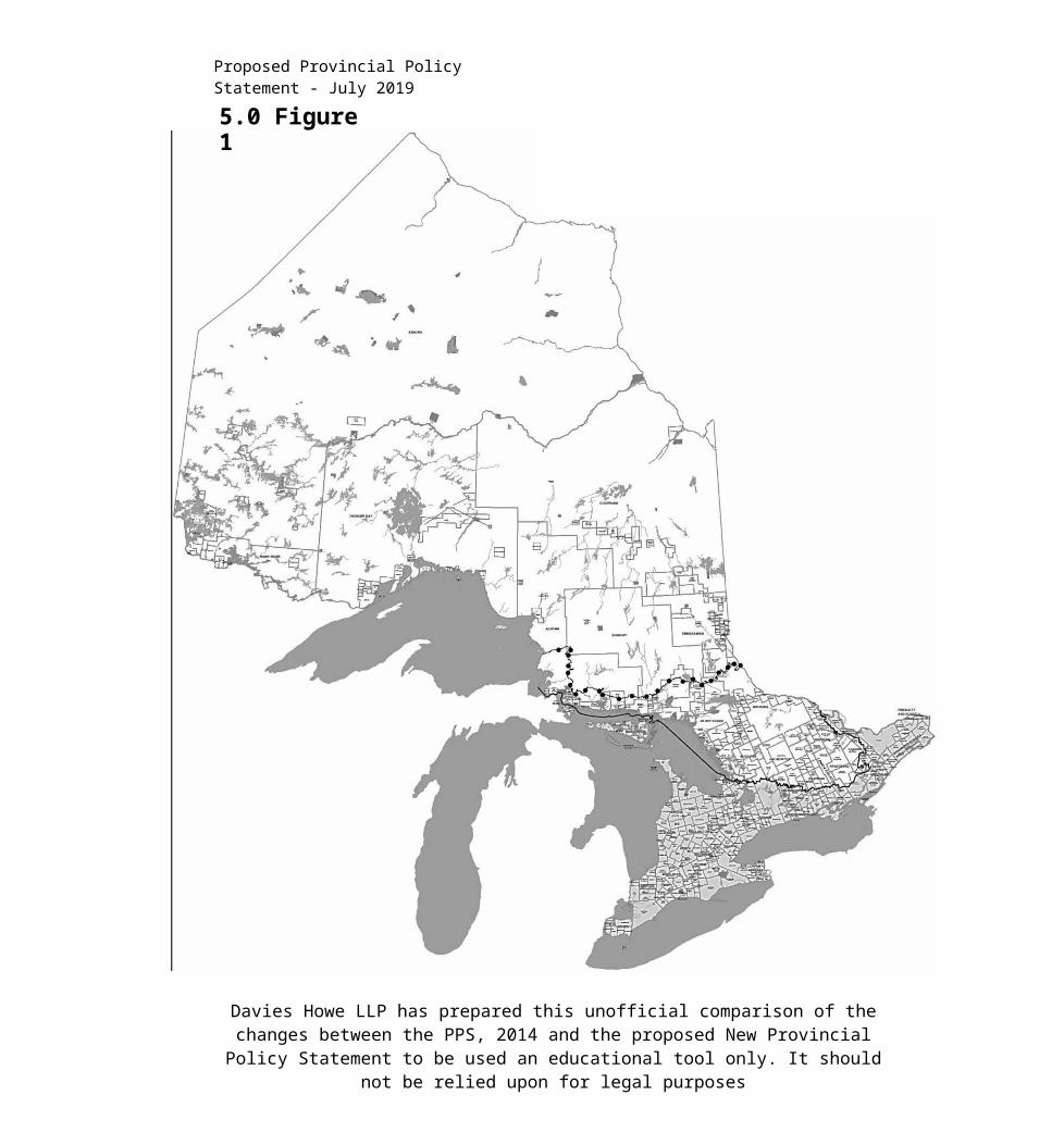
Proposed Provincial Policy Statement - July 2019
Assessmen tAct process, or identified through planning studies where the Ontario Ministry of Transportation , Metrolinx, Ontario Ministry of Energy, Northern Development and Mines or Independent Electricity System Operator (IESO] or any successor to those ministries or entities is actively pursuing the identification of a corridor. Approaches for the protection of planned corridors may be recommended in guidelines developed by the Province.
Portable asphalt plant: means a facilitya] a)with equipment designed to heat and
dry aggregate and to mix aggregate with bituminous asphalt to produce asphalt paving material, and includes stockpiling and storage of bulk materials used in the process; and
b] b)which is not of permanent construction, but which is to be dismantled at the completion of the construction project.
Portable concrete plant: means a building or structurea] a)with equipment designed to mix
cementing materials, aggregate, water and admixtures to produce concrete, and includes stockpiling and storage of bulk materials used in the process; and
b] b)which is not of permanent construction, but which is designed to be dismantled at the completion of the construction project.
Prime agricultural area: means areas where prime agricultural lands predominate. This includes areas of prime agricultural lands and associated Canada Land Inventory Class 4 through 7 lands, and additional areas where there is a local
concentration of farms which exhibit characteristics of ongoing agriculture. Prime agricultural areas may be identified by the Ontario Ministry of Agriculture and Food using guidelines developed by the Province as amended from time to time. A prime agricultural area may also be identified through an alternative agricultural land evaluation system approved by the Province.
Prime agricultural land: means specialty crop areas and/or Canada Land Inventory Class 1, 2, and 3 lands, as amended from time to time, in this order of priority for protection.
Private communal sewage services:means a sewage works within the meaning of section 1 of the Ontario Water Resources Act that serves six or more lots or private residences and is not owned by a municipality.
Private communal water services:means a nonmunicipal non-municipal drinking-water system within the meaning of section 2 of the Safe Drinking Water Act, 2002 that serves six or more lots or private residences.
Protected heritage property: means property designated under Parts IV, V or VI of the Ontario Heritage Act; property subject to a heritage conservation easement under Parts II or IV of the Ontario Heritage Act; property identified by the Province and prescribed public bodies as provincial heritage property under the Standards and Guidelines for Conservation of Provincial Heritage Properties; property
Davies Howe LLP has prepared this unofficial comparison of the changes between the PPS, 2014 and the proposed New Provincial Policy Statement to be used an educational tool only.
It should not be relied upon for legal purposes
Proposed Provincial Policy Statement - July 2019
protected under federal legislation, and UNESCO World Heritage Sites.
Protection works standards: means the combination of non-structural or structural works and allowances for slope stability and flooding/erosion to reduce the damage caused by flooding hazards, erosion hazards and other water- water-related hazards, and to allow access for their maintenance and repair.
Provincial and federal requirements:meansa) in regard to policy 1.6.11.2, legislation,
regulations, policies and standards administered by the federal or provincial governments for the purpose of protecting the environment from potential impacts associated with energy systems and ensuring that the necessary approvals are obtained;
a) b)in regard to policy 2.1.6, legislation and policies administered by the federal or provincial governments for the purpose of fisheries protection (including//sincluding/is/? and fish habitat)], and related, scientificallyestablished standards such as water quality criteria for protecting lake trout populations; and
b] c)in regard to policy 2.1.7, legislation and policies administered by the provincial government or federal government, where applicable, for the purpose of protecting species at risk and their habitat.
Provincial plan: means a provincial plan within the meaning of section 1 of the Planning Act.
Public service facilities: means land,
buildings and structures for the provision of programs and services provided or subsidized by a government or other body, such as social assistance, recreation, police and fire protection, health and educational programs, long term care services, and cultural services. Public service facilities do not include infrastructure.
Quality and quantity of water: ismeasured by indicators associated with hydrologic function such as minimum base flow, depth to water table, aquifer pressure, oxygen levels, suspended solids, temperature, bacteria, nutrients and hazardous contaminants, and hydrologic regime.
Rail facilities: means rail corridors, rail sidings, train stations, inter-modal facilities, rail yards and associated uses, including designated lands for future rail facilities.Recreation: means leisure time activity undertaken in built or natural settings for purposes of physical activity, health benefits, sport participation and skill development, personal enjoyment, positive social interaction and the achievement of human potential.
Redevelopment: means the creation of new units, uses or lots on previously developed land in existing communities, including brownfield sites.
Regional market area: refers to an area that has a high degree of social and economic interaction. The upper or single-tier municipality, or planning area, will normally serve as the regional market area. However, where a regional market area
Davies Howe LLP has prepared this unofficial comparison of the changes between the PPS, 2014 and the proposed New Provincial Policy Statement to be used an educational tool only.
It should not be relied upon for legal purposes

Proposed Provincial Policy Statement - July 2019
extends significantly beyond these boundaries, then the regional market area may be based on the larger market area. Where regional market areas are very large and sparsely populated, a smaller area, if defined in an official plan, may be utilized.
Renewable energy source: means an energy source that is renewed by natural processes and includes wind, water, biomass, biogas, biofuel, solar energy, geothermal energy and tidal forces.
Renewable energy system: means a system that generates electricity, heat and/or cooling from a renewable energy source.Reserve sewage system capacity:means design or planned capacity in a centralized waste water treatment facility which is not yet committed to existing or approved development. For the purposes of policy 1.6.6.6, reserve capacity for private communal sewage services and individual on-site sewage services is considered sufficient if the hauled sewage from the development can be treated and land-applied on agricultural land under the Nutrient Management Act, or disposed of at sites approved under the Environmental Protection Act or the Ontario Water Resources Act, but not by land-applying untreated, hauled sewage.
Reserve water system capacity:means design or planned capacity in a centralized water treatment facility which is not yet committed to existing or approved development.
Residence surplus to a farming
operation: means an existing habitable farm residence that is rendered surplus as a result of farm consolidation (the acquisition of additional farm parcels to be operated as one farm operation)}.
Residential intensification: means intensification of a property, site or area which results in a net increase in residential units or accommodation and includes:a] a)redevelopment, including the
redevelopment of brownfield sites;b) the development of vacant or
underutilized lots within previously developed areas;
c) infill development;d) development and introduction of new
housing options within previously developed areas;
e) d)the conversion or expansion of existing industrial, commercial and institutional buildings for residential use; and
f) e)the conversion or expansion of existing residential buildings to create new residential units or accommodation, including accessory apartments, second additional residential units and , rooming houses, and other housing options .
River, stream and small inland lake systems: means all watercourses, rivers, streams, and small inland lakes or waterbodies that have a measurable or predictable response to a single runoff event.
Rural areas: means a system of lands within municipalities that may include rural settlement areas, rural lands, prime
Davies Howe LLP has prepared this unofficial comparison of the changes between the PPS, 2014 and the proposed New Provincial Policy Statement to be used an educational tool only.
It should not be relied upon for legal purposes

Proposed Provincial Policy Statement - July 2019
agricultural areas, natural heritage features and areas, and resource areas.
Rural lands: means lands which are located outside settlement areas and which are outside prime agricultural areas.
Sensitive: in regard to surface water features and ground water features, means areas that are particularly susceptible to impacts from activities or events including, but not limited to, water withdrawals, and additions of pollutants.Sensitive land uses: means buildings, amenity areas, or outdoor spaces where routine or normal activities occurring at reasonably expected times would experience one or more adverse effects from contaminant discharges generated by a nearby major facility. Sensitive land uses may be a part of the natural or built environment. Examples may include, but are not limited to: residences, day care centres, and educational and health facilities.
Settlement areas: means urban areas and rural settlement areas within municipalities (such as cities, towns, villages and hamlets)
] that are:a] a)built up areas where development is
concentrated and which have a mix of land uses; and
b] b)lands which have been designated in an official plan for development over the longterm long-term planning horizon provided for in policy 1.1.2. In cases where land in designated growth areas is not available, the settlement area may be no larger than the area where development is concentrated.
Sewage and water services: includes municipal sewage services and municipal water services, private communal sewage services and private communal water services, individual on-site sewage services and individual on-site water services, and partial services.
Significant: means a] in regard to wetlands, coastal wetlands and areas of natural and scientific interest, an area identified
as provincially significant by the Ontario Ministry of Natural Resources using evaluation procedures established by the Province, as amended from time to time;
b] b)in regard to woodlands, an area which is ecologically important in terms of features such as species composition, age of trees and stand history; functionally important due to its contribution to the broader landscape because of its location, size or due to the amount of forest cover in the planning area; or economically important due to site quality, species composition, or past management history. These are to be identified using criteria established by the Ontario Ministry of Natural Resources;
c] c)in regard to other features and areas in policy 2.1, ecologically important in terms of features, functions, representation or amount, and contributing to the quality and diversity of an identifiable geographic area or natural heritage system;
d] d)in regard to mineral potential, an area identified as provincially significant through evaluation procedures
Davies Howe LLP has prepared this unofficial comparison of the changes between the PPS, 2014 and the proposed New Provincial Policy Statement to be used an educational tool only.
It should not be relied upon for legal purposes

Proposed Provincial Policy Statement - July 2019
developed by the Province, as amended from time to time, such as the Provincially Significant Mineral Potential Index; and
e] e)in regard to cultural heritage and archaeology, resources that have been determined to have cultural heritage value or interest for the important
contribution they make to our understanding of
the history of a place, an event, or a people. Processes for determining cultural heritage value or interest are established by the Province under the authority of the Ontario Heritage Act. National and international criteria are established by the certifying bodies.
Criteria for determining significance for the resources identified in sections (c)-(e) cj- (d] are recommended by the Province, but municipal approaches that achieve or exceed the same objective may also be used.
While some significant resources may already be identified and inventoried by official sources, the significance of others can only be determined after evaluation.
Site alteration: means activities, such as grading, excavation and the placement of fill that would change the landform and natural vegetative characteristics of a site.
For the purposes of policy 2.1.4(a)], site alteration does not include underground or surface mining of minerals or advanced exploration on mining lands in significant areas of mineral potential in Ecoregion 5E, where advanced exploration has the same meaning as in the Mining Act. Instead,
those matters shall be subject to policy 2.1.5(a).
Special needs: means any housing, including dedicated facilities, in whole or in part, that is used by people who have specific needs beyond economic needs, including but not limited to, needs such as mobility requirements or support functions required for daily living. Examples of special needs housing may include, but are not limited to long term care homes , -adaptable and accessible housing, and -housing for persons with disabilities such as physical, sensory or mental health disabilities, and housing for older persons.
Special Policy Area: means an area within a community that has historically existed in the flood plain and where site-site- specific policies, approved by both the Ministers of Natural Resources and Municipal Affairs and Housing, are intended to provide for the continued viability of existing uses (which are generally on a small scale) and address the significant social and economic hardships to the community that would result from strict adherence to provincial policies concerning development. The criteria and procedures for approval are established by the Province.
A Special Policy Area is not intended to allow for new or intensified development and site alteration, if a community has feasible opportunities for development outside the flood plain.
Specialty crop area: means areas designated using guidelines developed by the Province, as amended from time to
Davies Howe LLP has prepared this unofficial comparison of the changes between the PPS, 2014 and the proposed New Provincial Policy Statement to be used an educational tool only.
It should not be relied upon for legal purposes
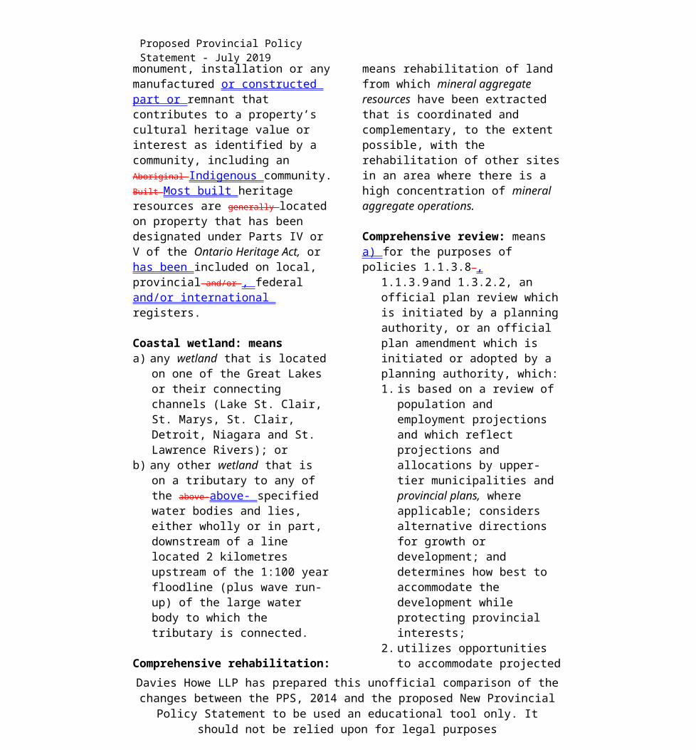
Proposed Provincial Policy Statement - July 2019
time. In these areas, specialty crops are predominantly grown such as tender fruits (peaches, cherries, plums), .grapes, other fruit crops, vegetable crops, greenhouse crops, and crops from agriculturally developed organic soil, usually resulting from:a] soils that have suitability to produce
specialty crops, or lands that are subject to special climatic conditions, or a combination of both;
b] farmers skilled in the production of specialty crops; and
c] a long-term investment of capital in areas such as crops, drainage, infrastructure and related facilities and services to produce, store, or process specialty crops.
Surface water feature: means water-water- related features on the earth’s surface, including headwaters, rivers, stream channels, inland lakes, seepage areas, recharge/discharge areas, springs, wetlands, and associated riparian lands that can be defined by their soil moisture, soil type, vegetation or topographic characteristics.
Threatened species: means a species that is listed or categorized as a classified as "Threatened Species” on the Ontario Ministry
of Natural Resources' official Species at Risk listin Ontario List, as updated and amended from time to time.
Transit-supportive: in regard to land use patterns, means development that makes transit viable , optimizes investments in transit infrastructure, and improves the quality of the experience of using transit. It often refers to compact, mixed-use
development that has a high level of employment and residential densities.including air rights development, in proximity to transit stations, corridors and associated elements within the transportation system. Approaches may be recommended in guidelines developed by the Province or based on municipal approaches that achieve the same objectives.
Transportation demand management: means a set of strategies that result in more efficient use of the transportation system by influencing travel behaviour by mode, time of day, frequency, trip length, regulation, route, or cost.
Transportation system: means a system consisting of facilities, corridors and rights-of-way for the movement of people and goods, and associated transportation facilities including transit stops and stations, sidewalks, cycle lanes, bus lanes, high occupancy vehicle lanes, rail facilities, parking facilities, park’n’ride lots, service centres, rest stops, vehicle inspection stations, inter-modal facilities, harbours, airports, marine facilities, ferries, canals and associated facilities such as storage and maintenance.
Two zone concept: means an approach to flood plain management where the flood plain is differentiated in two parts: the floodway and the flood fringe.
Valleylands: means a natural area that occurs in a valley or other landform depression that has water flowing through or standing for some period of the year.
Davies Howe LLP has prepared this unofficial comparison of the changes between the PPS, 2014 and the proposed New Provincial Policy Statement to be used an educational tool only.
It should not be relied upon for legal purposes

Proposed Provincial Policy Statement - July 2019
Vulnerable: means surface and/or ground water that can be easily changed or impacted.
Waste management system: means sites and facilities to accommodate solid waste from one or more municipalities and includes recycling facilities, transfer stations, processing sites and disposal sites.
Watershed: means an area that is drained by a river and its tributaries.
Wave uprush: means the rush of water up onto a shoreline or structure following the breaking of a wave; the limit of wave uprush is the point of furthest landward rush of water onto the shoreline.
Wayside pits and quarries: means a temporary pit or quarry opened and used by or for a public authority solely for the purpose of a particular project or contract of road construction and not located on the road right-of-way.
Wetlands: means lands that are seasonally or permanently covered by shallow water, as well as lands where the water table is close to or at the surface. In either case the presence of abundant water has caused the formation of hydric soils and has favoured the dominance of either hydrophytic plants or water tolerant plants. The four major types of wetlands are swamps, marshes, bogs and fens.
Periodically soaked or wet lands being used for agricultural purposes which no longer exhibit wetland characteristics are not considered to be wetlands for the purposes
of this definition.
Wildland fire assessment and mitigation standards: means the combination of risk assessment tools and environmentally appropriate mitigation measures identified by the Ontario Ministry of Natural Resources to be incorporated into the design, construction and/or modification of buildings, structures, properties and/or communities to reduce the risk to public safety, infrastructure and property from wildland fire.
Wildlife habitat: means areas where plants, animals and other organisms live, and find adequate amounts of food, water, shelter and space needed to sustain their populations. Specific wildlife habitats of concern may include areas where species concentrate at a vulnerable point in their annual or life cycle; and areas which are important to migratory or non-migratory species.
Woodlands: means treed areas that provide environmental and economic benefits to both the private landowner and the general public, such as erosion prevention, hydrological and nutrient cycling, provision of clean air and the long-term storage of carbon, provision of wildlife habitat, outdoor recreational opportunities, and the sustainable harvest of a wide range of woodland products. Woodlands include treed areas, woodlots or forested areas and vary in their level of significance at the local, regional and provincial levels. Woodlands may be delineated according to the Forestry Act definition or the Province’s Ecological Land Classification
Davies Howe LLP has prepared this unofficial comparison of the changes between the PPS, 2014 and the proposed New Provincial Policy Statement to be used an educational tool only.
It should not be relied upon for legal purposes

Proposed Provincial Policy Statement - July 2019
system definition for "forest.”
Davies Howe LLP has prepared this unofficial comparison of the changes between the PPS, 2014 and the proposed New Provincial Policy Statement to be used an educational tool only.
It should not be relied upon for legal purposes

Ministry of Municipal Affairs and Housing
© Queen’s Printer for Ontario, 20142019
ISBN: 978-1-4868-3647-5 (Print) ISBN: 978-1-4868-3648-2 (HTML)
ISBN: 978-1-4868-3649-9 (PDF)
07/19
Davies Howe LLP has prepared this unofficial comparison of the changes between the PPS, 2014 and the proposed New Provincial Policy Statement to be used an educational tool only. It
should not be relied upon for legal purposes