Embed Size (px)
Citation preview

D4D Challenge 2014 Pages 1–6
Genesis of millet prices in Senegal: the role ofproduction, markets and their failuresDamien Christophe Jacques 1, Raphael d’Andrimont 1, Julien Radoux 1,Francois Waldner 1 and Eduardo Marinho 2
1Earth and Life Institute, Universite Catholique de Louvain, Belgium2Rua Capistrano de Abreu, 33 - Rio de Janeiro, Brazil31th December 2014
ABSTRACTStaple prices are the main indicator of food access and a key
determinant of the revenues of those living in agricultural zones.Differentials in prices between producing (low prices) and consuming(high prices) areas harm both groups and indicate the presence ofmarket failures. In this study we model the millet prices formationprocess in Senegal in a spatially explicit model that accounts for bothhigh transportation costs and information asymmetries. The modelintegrates a unique and diversified set of data in a framework that iscoherent with the economic theory. The high ability of the model inreproducing the price differentials between 41 markets (r2 > 80%)opens a new avenue for the research on market integration which (i)integrates production data derived from remote sensing, (ii) simulatesthe demand and supply at the local level and (iii) the arbitrage processbetween imperfectly integrated markets.Contact: [email protected]
1 INTRODUCTIONIn 2008, when international food prices reached their highest valuesin the last 30 years, a new global challenge has emerged asemphasized by FAO Director-General Jos Graziano da Silva: ”Ifhigher and volatile prices are here to stay, then we need to adaptto this new pattern.” Since then and at the request of AgriculturalMinisters of the G20 2011, the top-leading group of internationalorganizations working on food related matters have created theAgricultural Markets Information System in order to improve foodmarket transparency and encourage policy coordination. Clearlyenough, there is a true need for understanding how food marketsoperate, as it is a sine qua non condition for the implementationof appropriate food policies and ensure food security at the globalscale.
This need is also true at the domestic scale, in particular in low-income and food-insecure countries where the rain-fed agriculturalproduction relies on erratic rainfall patterns and where marketfailures result in the imperfect allocation of resources. Indeed, insuch environments consumers suffer from high and volatile foodprices that do not benefit producers since the price differentialsbetween consumption and production markets can be substantiallyhigh. The Sahel is a a critical example of such situation. Indeed,in Senegal, average price differentials between markets can reachmore than 50% as a consequence of market failures. Moreover, dueto the high variability on the agricultural production, both yearly
and spatially, market prices are very volatile at the local scale.
In this study we explore the formation process of food prices inSenegal, with a specific focus on millet. Our goal is to reproduce thewhole dynamics behind the functioning of the Senegalese markets,from the production to the retail sale, by simulating profitabletransfers of millet from surplus to deficit areas. We then assess whatmarket failures are likely to generate the price differentials observedbetween markets in the country.
The spatially explicit model integrates a rich set of data comingfrom different sources. Local supply and demand are respectivelyderived from remote sensing and population density maps. Theroad network is used to establish the markets catchment areasand the distances between each couple of markets as a proxy oftransportation costs. Finally, a unique dataset on mobile phonecommunications between the antennas within the country is used asa proxy for information circulation between the markets. This datais then put together in a model coherent with the economic theory.Actual millet prices are used for validation purposes.
2 MATERIAL AND METHODIn order to model the market integration, the first step is to considerthe extreme situation where all markets are independents i.e. whenthere is no exchange of merchandise between the markets. In thiscase, a pseudo-price can be defined for each market as a function ofthe demand (estimated by the population) and the supply (estimatedby the production) found in each area covered by the market (Eq. 2).
Pi = f(Di, Si) (1)
withdPi
dSi> 0;
dSi
dPi< 0;
dPi
d2Si> 0
where Pi, Di, Si are the price, the demand and the supply for themarket i.
Our approach (figure 1) is to model these pseudo-prices, thatare expected to be proportional to the actual millet prices, usingthe population (see section 2.3) as a proxy of the demand andthe local food production approximated using a vegetation indexderived from satellite images (see section 2.4) as the supply input(Eq. 2). Both data are spatialized and the aggregation area of each
1
Jacques, d’Andrimont, Radoux, Waldner and Marinho, 2014
Fig. 1: Overview of the method (erratum: population data used are for 2013)
market (catchment areas) is the area that minimize the journey time(using road network) between each market (see section 2.2).
Pi ∝ PsPri =Popi
Prodi + 1(2)
where PsPri, Popi, Prodi are the pseudo-price, the populationand the production for the catchment area cover by the market i.
The opposite situation is a completely open market where foodflows freely from surplus markets to deficits markets or from areasof production (rural, agricultural areas) to areas of consumption(urban centers). In this particular case, transfers of merchandiseoccur until an equilibrium is reached with a unique price throughoutthe country.
The reality lies in between these two extreme situations. Transfersof merchandise between two markets occur if the transportation costis less than the difference of prices between these two markets. Inthis study, the impact of the inefficiency of the circulation of theprice information between the markets is also studied. In addition tothe transportation cost, we therefore introduce an information costthat reflects the risk to move from one market to another marketwhere the price is not well known. The higher the asymmetry ofinformation, the higher information cost between two markets (Eq.3):
TCi,j = βi,j ×PsPri − PsPrj
di,j + 1(3)
where TCi,j , βi,j and di,j are the transfer cost, the informationcost (see section 2.5) and the distance (see section 2.2) between themarket i and j.
To mimic the dynamics behind the functioning of the Senegalesemarkets, we have built a model that simulates profitable transfersof millet from surplus to deficit areas. From a complete segregatedmarket situation (Eq. 2), we have computed the pseudo-prices asobserved at the equilibrium when several plausible combinationsof information and transportation costs (i.e. several transfer costs)are carried out. The equilibrium is reached after all the profitabletransfers of production units between the markets have beenoccurred i.e. when the difference of the new prices between twomarkets is not sufficient to justify a transfer of merchandise. Thecorrelation between the pseudo-prices obtained at the differentequilibrium and the actual prices are then computed. Situationsleading to high correlation are assumed to be representative of theactual functioning of the market. The various contribution of theinformation and transportation cost can then be analyzed.
2.1 Market pricesRice, millet and sorghum are the main subsistence food crops forSenegal’s rural population but millet is definitely the most vital.This crop beats out the other major staples as the most droughtresistant and ne third of Senegal’s arable land (1 million hectares) isdevoted to it. Most of the millet is grown in the regions of Kaolack,Kaffrine and Fattick where it is interchanged with peanuts. This croprotation is crucial as peanuts fix nitrogen into the soil. Generally,
2

Genesis of millet prices in Senegal: the role of production, markets and their failures
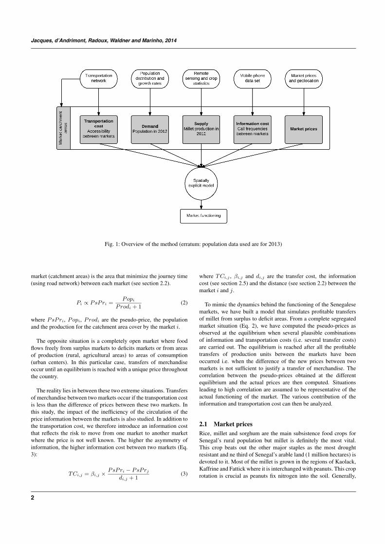
Fig. 2: Distance to Tambacounda market from each geolocatedmarket.
production of cereal food crops does not meet Senegal’s needs. Onlyin years of good rainfall, the country approaches self-sufficiency inthe main staples in rural areas. In 2005 and 2006, for example, thetotal production of cereals was estimated at 1.177.782 MT, coveringonly 60% of the consumption needs. In years of poor rainfall, theshortfall in grains, especially millet, could be more difficult to coverbecause of low availability and trade of this grain in the region. Suchconstraints have been overcome with an increase in rice imports,leading to a shift from millet to rice consumption in households whocan afford it [Dong, 2011].
Domestic price data are coming from the VAM Foodand Commodity Prices Data Store of the UN World FoodProgram[VAM, 2014]. The data set consists in monthly retailprices (when available) from 41 markets (one market was discardedbecause its geolocation appeared uncertain) distributed in the 14regions of Senegal for the years 2012.
2.2 Transportation modellingMost of the food transport in Senegal relies on the road network.It was therefore assumed that the production transfers were drivenby the proximity of producers to markets. The distance by road wasused to approximate the transport costs and the catchment areas.A topological network has been built based on the Global Insightdataset and minimum travelling times computed using Dijkstra’salgorithm.
Transport cost is assumed to be directly proportional to thedistance between the markets using the road network. The roadnetwork was therefore used to compute an origin-destination costmatrix for all markets. Figure 2 illustrates the transport cost for oneof the markets.
The catchment areas of each market have been computed based onthe best approximation of the most accessible markets. In absenceof secondary travelling directions, the main underlying hypothesisis that the farmers will travel to the nearest main road and then go
Fig. 3: Market catchment areas derived with an accessibility modelusing the transportation network
to the nearest market using the road network in order to sell theirproduction. First, the closest road segments have been computed foreach market. Each road segment is thus assigned to a single marketbased on the least travelling distance by road. Second, Euclidean(bird fly air) distance allocation of a raster grid to the nearest roadsegment yielded the catchment areas (figure 3).
In the absence of communication fluxes with other countries,foreign existing markets were not taken into account and thecatchment areas were clipped to the boundaries of the Senegal.Therefore, border effects could occur but are likely to be very smalldue to the constraints of international trade for the small producers.
2.3 Demand and PopulationTo estimate the demand, population distribution maps from theAfripop project have been used [Linard, 2011]. Afripop mapspresent estimates of numbers of inhabitants per grid square withnational totals adjusted to match UN population division estimates.As the population for the year of interest (2013) was not available,it was simulated with national population growth rates from theWorld Bank assuming that the growth is equally distributed overthe Senegalese territory.
2.4 Supply and ProductionSatellite remote sensing provides a suitable alternative for cropcondition and yield estimation, as it gives a timely, accurate,synoptic, and objective estimation of various yield-directly relatedcrop parameters such as net primary production [Ren et al., 2008].Vegetation indices are widely used in crop growth monitoringand yield estimation based on remote sensing technology. Mostof the vegetation indices are information-condensed which canreflect terrestrial vegetation cover and growth condition effectivelyand economically. Substantial research has shown that NormalizedDifference Vegetation Index (NDVI) is a reliable index that canbe related to crop yield [Manjunath et al., 2002] but also andmore specifically to millet yield and production [Rasmussen, 1992].NDVI is defined as the difference between near infrared and redreflection normalized by the sum of the two. The NDVI-values varyfrom 0.15 for bare soils to 0.80 for full green vegetations, with
3

Jacques, d’Andrimont, Radoux, Waldner and Marinho, 2014
Fig. 4: Estimated distribution of the population for 2013
all gradations in-between. A large number of metrics have beendevised to relate NDVI with yield or production: maximum NDVI[Lewis et al., 1998], sum of NDVI between flowering and ripening[Genovese et al., 2001], Cumulative NDVI [Quarmby et al., 1993],or cumulative NDVI from the onset to the end of season, maximumNDVI throughout the crop season.
In order to link the NDVI metric to actual production, milletproduction statistics have been downloaded from the SenegalMinistry of Economy and Finance. However, as the granularity ofthese statistics is at the regional level (14 regions), it is neededto convert them at the market catchment level. To deal with thismismatch of spatial unit, a three-step procedure was followed to i)mask the agricultural areas, ii) define a spatially explicit proxy ofthe crop production and iii) redistribute subnational statistics at thecatchment level.
First, the cropland areas have been masked using the SenegalLand Cover Map of 2005 at the 1:100.000 scale produced by theGlobal Land Cover Network [Leonardi, 2008]. Lacking reliableinformation on the spatial distribution of millet, it is here assumedthat this crop is grown evenly within the cropland area.
Second, 10-day temporal synthesis of SPOT-VEGETATIONNDVI at 1-km have been downloaded over the area of interestfrom 2012. In the multi-temporal image set, each pixel is thuscharacterised by a specific NDVI-time profile. However, sincethe raw profiles are still disturbed by cloudy measurements, thecomposites images are first submitted to a cleaning procedure bymeans of the Whittaker smoother [Eilers, 2003]. For each pixelwithin the cropland, NDVI values above 0.2 observed during themillet growing season were integrated, limiting thus the contributionof the soil to the signal. The actual millet production observed at theregional scale was then spatially distributed at the pixel level:
Prodi = CUMNDV Ii × Prodregion
CUMNDV Iregion
(4)
Fig. 5: Estimated Millet production for 2012
where Prodi is the estimated millet production for a pixel i,CUMNDV I
i is the cumulated NDVI above 0.2 for the same pixeli, Prodregion is the millet production of the region of pixel i andCUMNDV I
region is the cumulated NDVI for the entire region.
Finally, using the market catchment area boundaries the pixel’sproduction values were aggregated to give millet production bycatchment areas.
2.5 Information cost modellingMobile phone data have been provided by Sonatel Orange inthe frame of the Data For Development (D4D) challenge. TheD4D-Senegal challenge is an open innovation data challenge onanonymous call patterns of Oranges mobile phone users in Senegal[de Montjoye et al., 2014]. An original dataset of phone calls andtext exchanges between more than 9 million of Oranges customersin Senegal between January 1, 2013 to December 31, 2013 havebeen sampled based on two criteria:
1. users having more than 75% days with interactions per givenperiod (biweekly for the second dataset, yearly for the thirddataset)
2. users having an average of less than 1000 interactions per week.The users with more than 1000 interactions per week werepresumed to be machines or shared phones.
For commercial and privacy reasons, the exact location of thebase transceiver stations (BTS), the mobile network antennas, hasnot been delivered. A new random geolocation has been associatedto each site in its Voronoi cell i.e. in the region where all pointsare closer to that antenna than to any other.Among the three datasets delivered by Sonatel Orange, only the first one, antenna-to-antenna traffic for 1666 antennas on an hourly basis (number ofsms, number of calls, duration of calls), has been explored. Fromthe three variable proposed, the number of calls has been selected asit has been shown to be the more relevant variable for the purposeof the study.
4

Genesis of millet prices in Senegal: the role of production, markets and their failures
Fig. 6: Incoming calls to Tambacounda
Antennas in a buffer of 10 km around the market places havebeen aggregated and associated to each market. Due to theirclose proximity, the markets of Dakar; Diaobe and Sare Yoba;Ourossogui and Matam; have been merged. For each market thesum of the number calls from the associated antenna has beencomputed by month and averaged over the year. From this value,a contingency table (cross-tabulation) between all the markets hasbeen defined giving the averaged number of calls over one yearfor each combination of origin-destination markets. From this, theparameter β used to estimate the cost of information is defined as:
βi,j =
{1 if log(Ncallsi,j)−min(log(Ncallsi,j))
(ICi,j−min(log(Ncallsi,j)))> 1
else log(Ncallsi,j)−min(log(Ncallsi,j))
(ICi,j−min(log(Ncallsi,j)))
(5)
where Ncallsi,j , ICi,j are the number of calls and the betweenmarkets i and j
3 RESULTS AND DISCUSSIONAs expected, before the transfers from surplus to deficit areas start,the correlation between actual millet prices and pseudo-prices isvery low (r2 = 0.26 for April, r2 = 0.23 for August), which allowus to reject the perfect markets segregation in Senegal; while theperfect integration, or the law of one price, is directly rejected by theobserved price differentials between markets. It leads us to explorethe intermediary situation of imperfect arbitrage, i.e. the presence ofinformation asymmetries and transportation costs. Figure 7 showsthe correlation between pseudo-prices, under several regimes oftransportation costs and the β parameter of information asymmetry,and millet prices in 4 selected months.
Notice the high explanatory power reached by the simulatedpseudo-prices for some combinations of transaction costs and betaparameter. Here it is worth nothing that the model is extremelyefficient, reaching correlations above 0.8 with the fitting of onlytwo parameters when combining a plethora of data sets in asound theoretical framework. Correlations increase immediately
Fig. 7: Correlation between pseudo-prices and actual millet prices
with the inclusion of even small transportation costs and reachtheir maximum for pseudo-transportation costs around 0.4 units perkilometer. Clearly, today this is the main source of inefficiencies inmillet markets in the country.
On the other hand, due to the widespread coverage of mobilephone network in the country, information asymmetries seemto play a minor, although not negligible, role in millet pricesdifferentials among markets. Interestingly enough, the effect ofinformation asymmetries seems to be more important during themonths where the pseudo-prices have lower explanatory power. Thereasons for that remain unclear given that the mobile phone dataused is limited to 2013, a year with already a good mobile phonecoverage throughout the country.
More pragmatically, the figure 8 shows an idea of the mainmarkets where and when the circulation of the information isimperfect and could be improved. Using a model such as the onepresented in this study could pave the way to address some marketfailures created by the asymmetry of the information.
4 CONCLUSIONThis study aims at describing and simulating the formation processof millet market prices in Senegal. To the best of our knowledge,that is the first time that such an approach is implemented in aSahelian country. The model shows a very good ability to reproducethe price differentials observed in the country withR2 > 80%. Thispioneer work opens a new avenue for (i) the already rich literature onmarket integration (ii) the integration of the two first pillars of foodsecurity, i.e. availability and access and (iii) the development of thefood security early warning systems in the region. New findings areexpected from the use of several years of mobile phone data and theexpansion of the model to other Sahelian countries.
5

Jacques, d’Andrimont, Radoux, Waldner and Marinho, 2014
Fig. 8: Market integration defined by mobile phone data (numberof markets with a β < 1 for the best modelling in February, April,June and August)
ACKNOWLEDGEMENTThanks to Orange Sonatel Senegal and the D4D team for providingthe mobile phone data. Support from the Belgian National Fund forScientific Research through a FRIA grant is acknowledged.REFERENCESFood and commodity prices data store, 2014. URLhttp://foodprices.vam.wfp.org/.
Y.-A. de Montjoye, Z. Smoreda, R. Trinquart, C. Ziemlicki, andV. D. Blondel. D4d-senegal: The second mobile phone data fordevelopment challenge. arXiv preprint arXiv:1407.4885, 2014.
Dong. Millet has many faces. Global Agricultural InformationNetwork, 2011.
P. H. Eilers. A perfect smoother. Analytical chemistry, 75(14):3631–3636, 2003.
G. Genovese, C. Vignolles, T. Negre, G. Passera, et al. Amethodology for a combined use of normalised differencevegetation index and corine land cover data for crop yieldmonitoring and forecasting. a case study on spain. Agronomie,21(1):91–111, 2001.
U. Leonardi. Senegal land cover mapping, 2008.J. Lewis, J. Rowland, and A. Nadeau. Estimating maize production
in kenya using ndvi: some statistical considerations. InternationalJournal of Remote Sensing, 19(13):2609–2617, 1998.
C. Linard. Population distribution mapping: the afripop dataset. InData from Conflict-Affected Regions: Filling-in the Blanks, 2011.
K. Manjunath, M. Potdar, and N. Purohit. Large area operationalwheat yield model development and validation based on spectraland meteorological data. International Journal of RemoteSensing, 23(15):3023–3038, 2002.
N. Quarmby, M. Milnes, T. Hindle, and N. Silleos. The useof multi-temporal ndvi measurements from avhrr data for cropyield estimation and prediction. International Journal of RemoteSensing, 14(2):199–210, 1993.
M. S. Rasmussen. Assessment of millet yields and productionin northern burkina faso using integrated ndvi from the avhrr.International Journal of Remote Sensing, 13(18):3431–3442,1992.
J. Ren, Z. Chen, Q. Zhou, and H. Tang. Regional yieldestimation for winter wheat with modis-ndvi data in shandong,china. International Journal of Applied Earth Observation andGeoinformation, 10(4):403–413, 2008.
6