Embed Size (px)
Citation preview

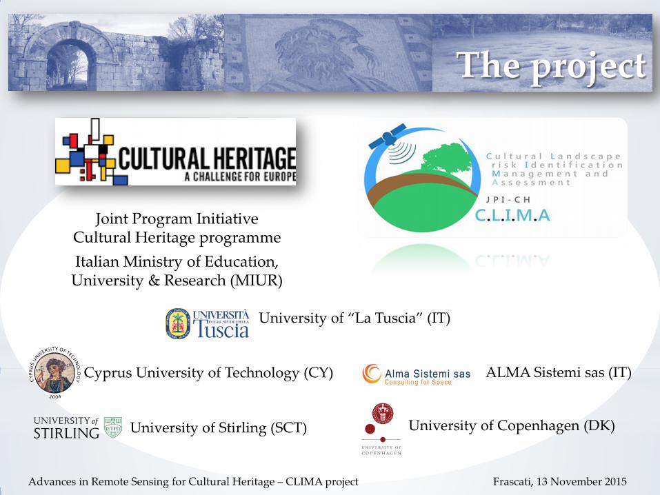
Cultural Landscape risk Identification, Management and Assessment (CLIMA)
S. De Angeli, A. Di Iorio, J. Patruno
ADVANCES IN REMOTE SENSING FOR CULTURAL HERITAGE: FROM SITE DETECTION, TO DOCUMENTATION AND RISK MONITORING
Frascati, 12-13 November 2015
The project
Joint Program Initiative Cultural Heritage programme Italian Ministry of Education,
University & Research (MIUR)
University of “La Tuscia” (IT)
Cyprus University of Technology (CY)
University of Stirling (SCT) University of Copenhagen (DK)
ALMA Sistemi sas (IT)
Advances in Remote Sensing for Cultural Heritage – CLIMA project Frascati, 13 November 2015

ANTHROPIC AND NATURAL HAZARDS
Cultural heritage ravaged by urban sprawl, floods, war, earthquakes, climate change, agricultural activity, soil processes, water infiltration…
The need
C.L.I.M.A The project aims to promote highly interdisciplinary research, based on a soil-oriented approach, to develop effective tools for the authorities responsible for cultural landscape preservation.
Lucius Publicius Syneros tomb, Porta Nocera’s necropolis.
Pompeii, IT
Advances in Remote Sensing for Cultural Heritage – CLIMA project Frascati, 13 November 2015

CLIMA Web Portal
WebGIS platform integrating: • Remote Sensing technologies • Archaeological and environmental
baselines Mapping, diagnostic and monitoring of risk factors affecting archaeological remains and cultural landscapes
C.L.I.M.A Web Portal
Vulnerability and warning maps

Overall Architecture
Advances in Remote Sensing for Cultural Heritage – CLIMA project Frascati, 13 November 2015

• Identification of main risk factors addressing cultural landscape sites • EO methods and EO data processing chain addressing each specific risk factor • Ground-based RS methods for mapping of buried and exposed structures • Innovative ground RS tool for the monitoring of lateral and vertical soil disturbance (agriculture)
Scientific approach Project analysis input data
Advances in Remote Sensing for Cultural Heritage – CLIMA project Frascati, 13 November 2015
Pompeii, IT
Domus of the Gladiators

Scientific approach
• Soil Erosion and land movement surface deformation, active slope instabilities and subsidence • Land cover/ Land change Land use and vegetation monitoring • Mapping and detection Surface features analysis and ortho-images • Ground soil erosion tool (in-situ gamma spectrometry) erosion risk assessment • Ground-based (MAG, ERT, GPR) archaeo-geophysical survey
Processing techniques associated to natural and human pressures
@effigis Arpi, IT*
*Applications of Remote Sensing in Archaeology: Surface and sub-surface feature detection over UNESCO World Heritage sites and archaeological sites in Italy using optical and radar data, N. Dore et al., 2009 **Remote Sensing techniques in archaeology. From Space to Ground investigation through the microwaves spectrum: SAR and GPR detection, J. Patruno et al., 2010
Arpi, IT* Aquinum, IT**
Advances in Remote Sensing for Cultural Heritage – CLIMA project Frascati, 13 November 2015

*
Periodic risk maps (monthly update for rapid response)
High-resolution maps on archaeological indicators: • anomalies • soil marks • cropmarks…
Warning maps
Advances in Remote Sensing for Cultural Heritage – CLIMA project Frascati, 13 November 2015
VULNERABILITY AND WARNING MAPS
• land use change • vegetation increase or reduction • soil erosion maps • velocity maps …
Features detection maps (multitemporal analysis)
*
*Cultural heritage management and monitoring using remote sensing data and GIS: The case study of Paphos area, Cyprus, Agapiou et al., 2015
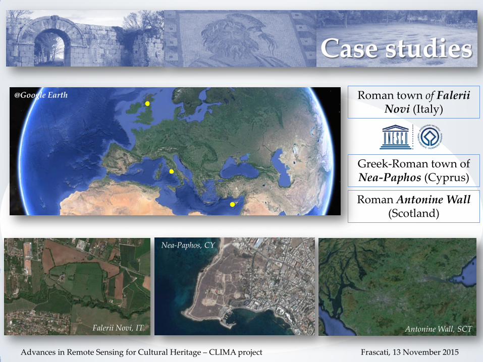
@Google Earth
Falerii Novi, IT
Nea-Paphos, CY
Roman Antonine Wall (Scotland)
Antonine Wall, SCT
Roman town of Falerii Novi (Italy)
Greek-Roman town of Nea-Paphos (Cyprus)
Case studies
Advances in Remote Sensing for Cultural Heritage – CLIMA project Frascati, 13 November 2015

Falerii Novi - Aerial view
Falerii Novi – Via Amerina
The site
Falerii Novi (Italy)
Advances in Remote Sensing for Cultural Heritage – CLIMA project Frascati, 13 November 2015
Foundation 241 BC Conservation state
City walls are conserved. The urban area is totally buried.
Archaeological evidences
Roman rural Villas, many paved stretches of the Via Amerina, with tombs on the both sides.
Hazard Impact
Agriculture Buried remains
Vegetation Biomass accumulation
Exposed remains (physical damage)
Soil erosion Land movement
Structures’ stability

The site
Nea Paphos (Cyprus)
Urban expansion near Nea Paphos, Tombs of the Kings*.
*Remote Sensing for Archaeological Applications: Management, Documentation and Monitoring, Hadjimitsis et al., 2011 Advances in Remote Sensing for Cultural Heritage – CLIMA project Frascati, 13 November 2015
Foundation End of 4th Century BC
Conservation state
A Large portion of the archaeological area is still unexcavated
Archaeological evidences
buried structures, palaces, fortresses, theatre and tombs
Hazard Impact
Agriculture Buried remains
Urban pressure
Expansion towards archaeological area
Soil erosion Land movement
Structures’ stability
Nea Paphos, Cyprus

Antonine Wall (Scotland) The site
Advances in Remote Sensing for Cultural Heritage – CLIMA project Frascati, 13 November 2015
Foundation AD 140
Conservation state
The turf built rampart and ditch structure itself survive as an upstanding monument across much of its length
Archaeological evidences
Buried forts, fortlets, marching camps and roadways, most unexcavated.
Hazard Impact
Agriculture Pasture
Buried remains, earthwork features
Scrub, forestry, burrowing
upstanding sections of the wall
Soil erosion Land movement
Structures’ stability
Antonine Wall - Aerial view
Antonine Wall - Ditch

Dissemination
Significant advances in our understanding of archaeological cultural landscapes across the broader research community, the public authorities and the society.
Maximise the value of research outcomes by promoting their transfer to individuals and organisations outside the immediate research community.
Advances in Remote Sensing for Cultural Heritage – CLIMA project Frascati, 13 November 2015
Nowadays, authorities have a strong requirement for systematic, effective, usable and affordable tools to monitor the degradation process and enable preventive maintenance.
Rehabilitation intervention
Preventive intervention
Future objective
Public end-users, private enterprises
Cultural heritage researchers

Thank you!
Cultural Landscape risk Identification, Management and Assessment (CLIMA)
S. De Angeli, A. Di Iorio, J. Patruno
ADVANCES IN REMOTE SENSING FOR CULTURAL HERITAGE: FROM SITE DETECTION, TO DOCUMENTATION AND RISK MONITORING
Frascati, 12-13 November 2015