Embed Size (px)
Citation preview

Esri UC 2014 | Technical Workshop |
Creating a Hydrologically Conditioned DEM Dean Djokic

Esri UC 2014 | Technical Workshop |
• What is a “hydrologically conditioned DEM” • How to develop hydro DEM • Tools for hydro DEM conditioning • Using hydro DEM/flow direction
Content
Creating a Hydrologically Conditioned DEM
Esri UC 2014 | Technical Workshop |
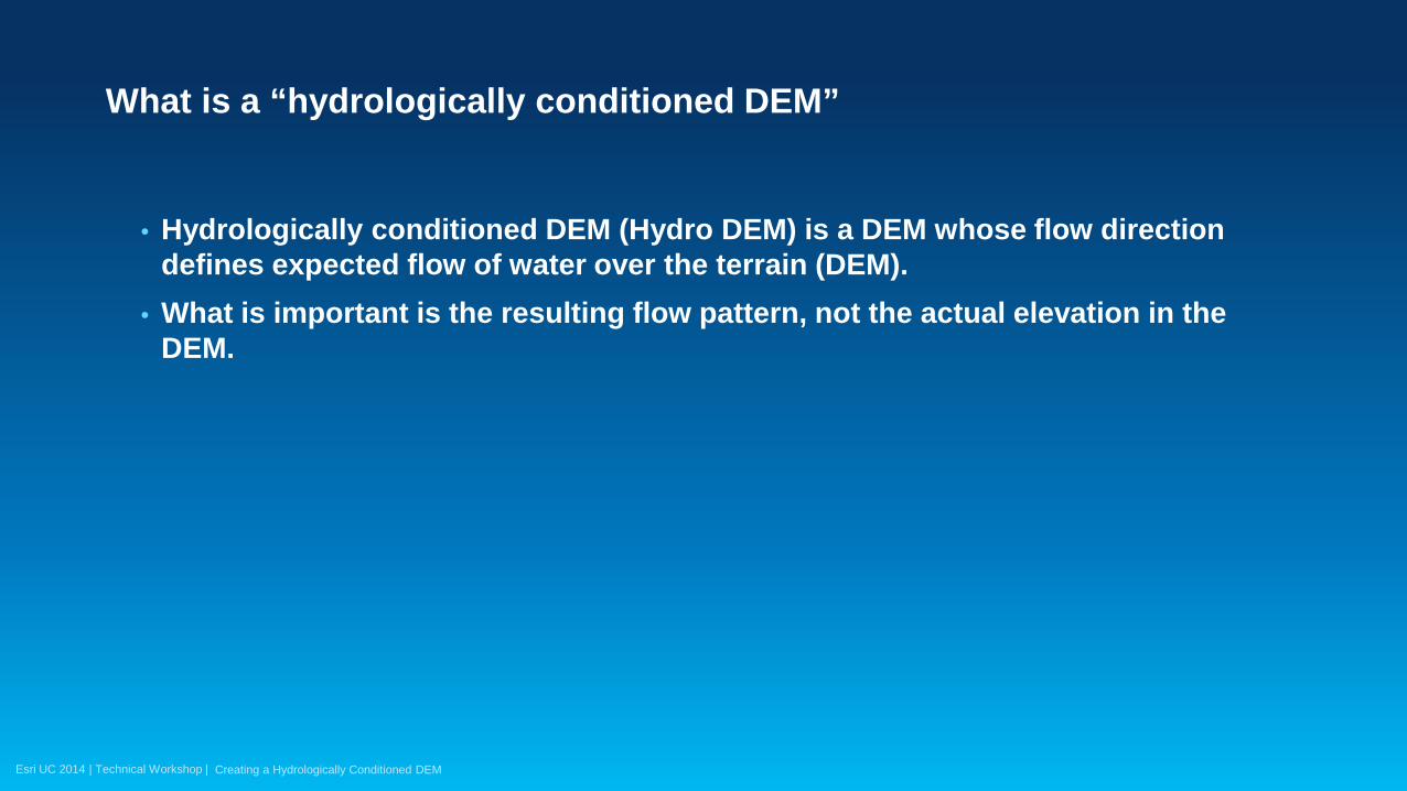
What is a “hydrologically conditioned DEM”
Esri UC 2014 | Technical Workshop |
• Hydrologically conditioned DEM (Hydro DEM) is a DEM whose flow direction defines expected flow of water over the terrain (DEM).
• What is important is the resulting flow pattern, not the actual elevation in the DEM.
What is a “hydrologically conditioned DEM”
Creating a Hydrologically Conditioned DEM

Esri UC 2014 | Technical Workshop |
• Elevation in the DEM is secondary to the flow direction it generates. You are NOT “fixing” elevations in the DEM – just making changes to get the flow direction correctly. Take advantage of that (don’t sweat the small things)!
• Do NOT use hydro DEM for surface characterization, just for flow direction determination.
What is a “hydrologically conditioned DEM”
Creating a Hydrologically Conditioned DEM
Esri UC 2014 | Technical Workshop |
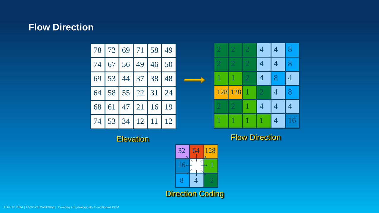
Flow Direction
Creating a Hydrologically Conditioned DEM
64 128
1 16
8 2 4
32
128 128
2
2 2
2
2
2
4
4
4
8
1 1 2
1
4
2
8
4
4
8
2
1
2
1
1
1
4
1
4
4
4
16
4
8 78
74
72
67
69
56
71
49
58
50
69
64
53
58
44
55
37
22
38
31
48
24
68
74
61
53
47
34
21
12
16
11
19
12
46
49
Elevation
Direction Coding
Flow Direction
Esri UC 2014 | Technical Workshop |
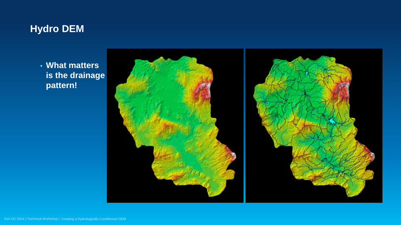
• What matters is the drainage pattern!
Hydro DEM
Creating a Hydrologically Conditioned DEM
Esri UC 2014 | Technical Workshop |
• Hydro DEM is a function of analysis being performed. Different analyses will require different hydro DEM for the same area. Some examples:
- Environmental (low) flows – small depressions in the terrain are important and should be explicitly modeled. They will catch and retain water.
- High flows (floods) – smaller depressions (and some larger ones) will fill and contribute to the downstream areas. They can be “ignored”.
One size does not necessarily fit all
Creating a Hydrologically Conditioned DEM

Esri UC 2014 | Technical Workshop |
• Examples continued: - Design conditions (e.g. structure design). Most depressions can be “ignored” as it is
expected that under design conditions they will be filled due to the size of the event and will eventually contribute to the flow downstream.
- Real-time management (e.g. emergency management). While depressions will eventually fill and “spill”, the storage they provide might be critical for timing of the runoff and timely management of the resources (e.g. evacuation).
One size does not necessarily fit all
Creating a Hydrologically Conditioned DEM
Esri UC 2014 | Technical Workshop |
• Examples continued: - Hydrology. Focus on getting the contributing area. DEM can be coarser and
generalized, but has to extend to larger area – whole watershed. Have to deal with depressions but coarser DEM will “smooth” out details, so there will be less issues to deal with.
One size does not necessarily fit all
Creating a Hydrologically Conditioned DEM
Esri UC 2014 | Technical Workshop |
• Examples continued: - Hydraulics. Focus on channel flow conveyance. Has to be detailed, but has more
limited spatial extent – just floodplain. Does not have to be as concerned with smaller imperfections.
- Explicit models and modeling techniques. - 1-D or 2-D overland models. - Are depressions modeled as storage areas or not. - DEM too detailed/large. - …
One size does not necessarily fit all
Creating a Hydrologically Conditioned DEM
Esri UC 2014 | Technical Workshop |
How to develop hydro DEM
Esri UC 2014 | Technical Workshop |
How to develop hydro DEM … carefully
• You have to know your terrain! - Do field work. Talk to the locals. Know the history. - Get wet - be there when it rains J.
• You have to know what it will be used for. • Have supplemental topographic/hydrographic data:
- Known drainage lines (streams). - Known ridges. - Known depressions.
Creating a Hydrologically Conditioned DEM
Esri UC 2014 | Technical Workshop |
How to develop hydro DEM … carefully
• Have “other” supplemental data sources such as land use, soils, vegetation, that can all help in identifying geomorphologic elements (e.g. certain soils indicate standing water that in turn indicates depressions).
Creating a Hydrologically Conditioned DEM
Esri UC 2014 | Technical Workshop |
• Process can be iterative if you do not know the existing drainage pattern or/and do not have supplemental data.
- Make assumptions on the flow pattern - Apply them (burn streams, wall ridges) - Get the flow direction based on those assumptions - Evaluate the flow pattern and modify the assumptions if necessary
How to develop hydro DEM
Creating a Hydrologically Conditioned DEM
Esri UC 2014 | Technical Workshop |
• More difficult in flat areas! - If you do not know where the critical morphological structures are (ridges in
particular), it might be impossible to determine them from the DEM alone.
How to develop hydro DEM
Creating a Hydrologically Conditioned DEM
Esri UC 2014 | Technical Workshop |
Key techniques for hydro DEM development … not that many
• “Fill” sinks. • “Burn” streams. • “Wall” ridges (also called “fencing”). • Manage flow within lakes. • When all fails – change flow direction directly instead of modifying DEM to get
the right flow direction.
Creating a Hydrologically Conditioned DEM
Esri UC 2014 | Technical Workshop |
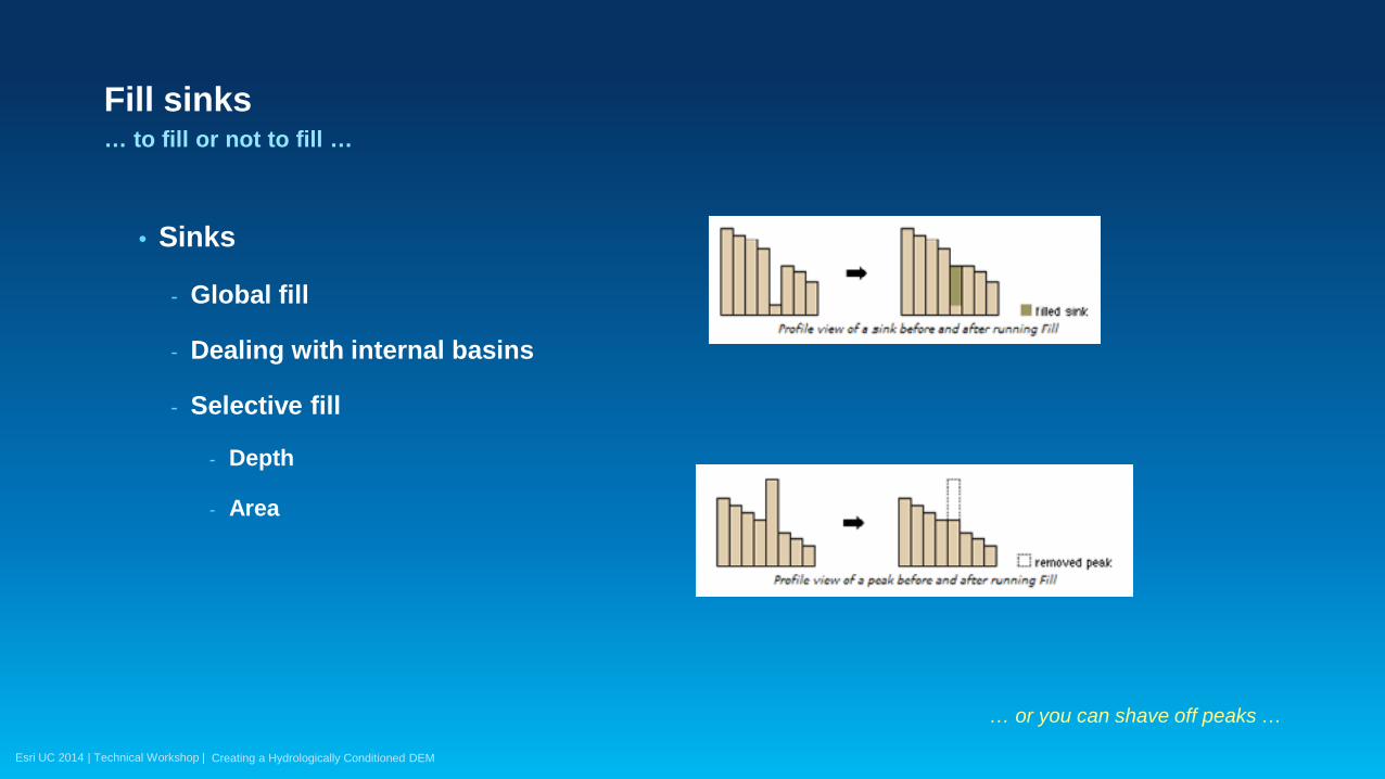
Fill sinks
• Sinks
- Global fill
- Dealing with internal basins
- Selective fill
- Depth
- Area
… to fill or not to fill …
… or you can shave off peaks …
Creating a Hydrologically Conditioned DEM
Esri UC 2014 | Technical Workshop |
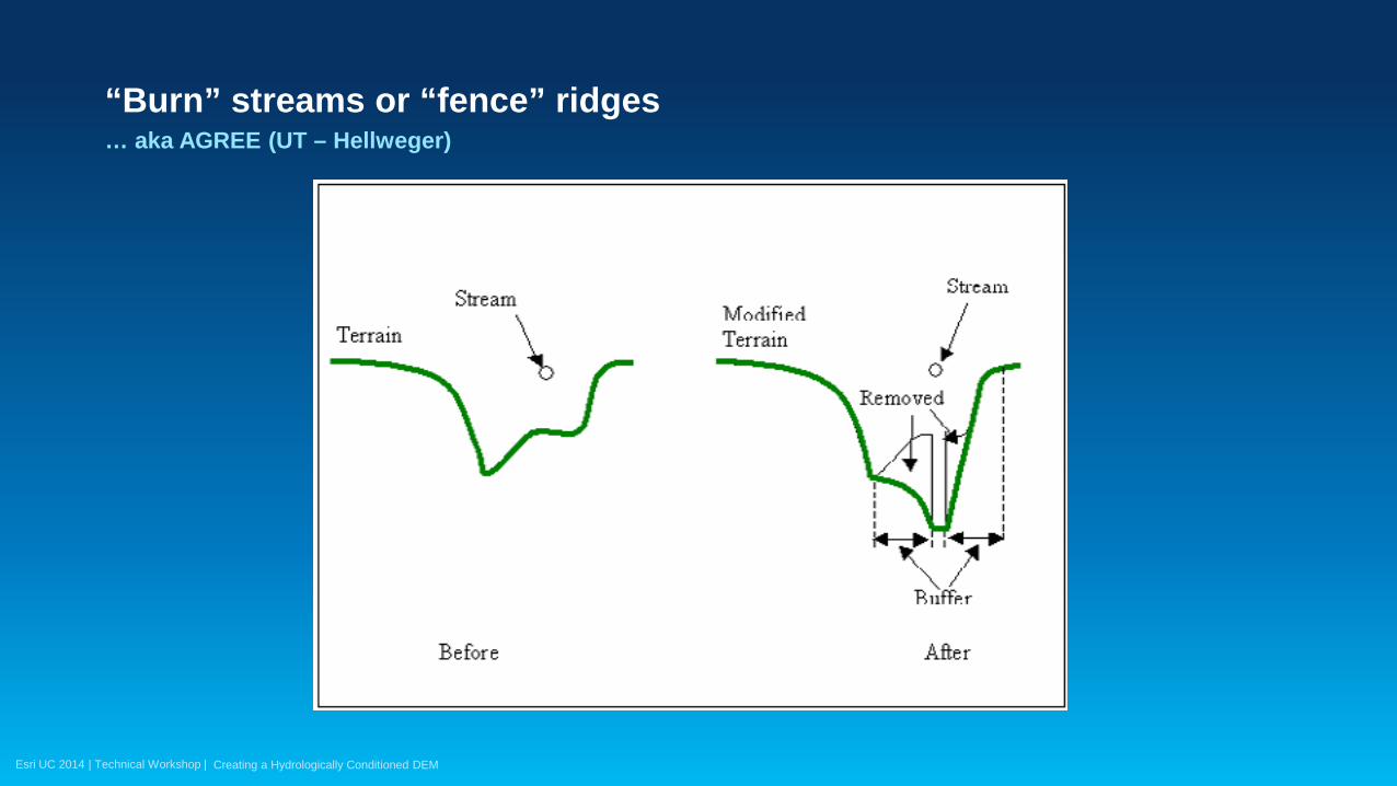
“Burn” streams or “fence” ridges … aka AGREE (UT – Hellweger)
Creating a Hydrologically Conditioned DEM
Esri UC 2014 | Technical Workshop |
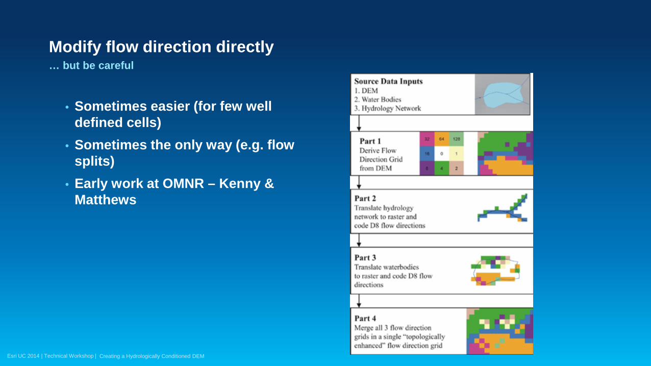
Modify flow direction directly … but be careful
• Sometimes easier (for few well defined cells)
• Sometimes the only way (e.g. flow splits)
• Early work at OMNR – Kenny & Matthews
Creating a Hydrologically Conditioned DEM
Esri UC 2014 | Technical Workshop |
Automating hydro DEM development … does it make sense?
• Although hydro DEM development might be iterative process and a function of the predominant terrain morphology (dendritic/deranged), the workflow can be captured and automated.
• Automation ensures implementation of best practices and consistency of the approach through the iterations and datasets.
Creating a Hydrologically Conditioned DEM
Esri UC 2014 | Technical Workshop |
Automating hydro DEM development … does it make sense?
• Usefulness of the results of the automated process will depend on the quality of the input data and knowledge of the terrain being modeled.
• How much QC is needed? - QC on the DEM itself - QC on vector data as input into the processing workflow
Creating a Hydrologically Conditioned DEM
Esri UC 2014 | Technical Workshop |
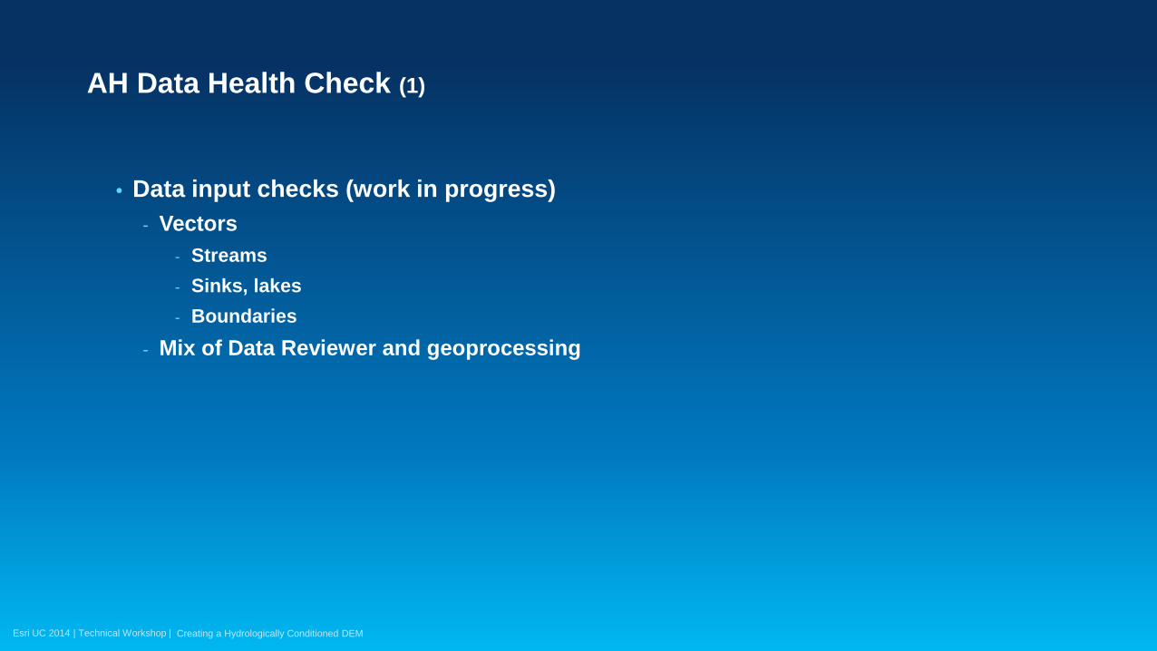
• Data input checks (work in progress) - Vectors
- Streams - Sinks, lakes - Boundaries
- Mix of Data Reviewer and geoprocessing
AH Data Health Check (1)
Creating a Hydrologically Conditioned DEM
Esri UC 2014 | Technical Workshop |
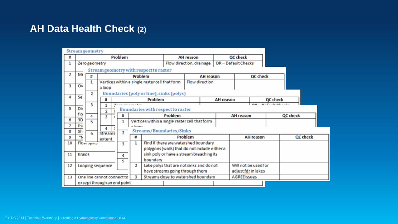
AH Data Health Check (2)
Creating a Hydrologically Conditioned DEM

Esri UC 2014 | Technical Workshop |
• Use Data Reviewer capabilities
AH Data Health Check (3)
Creating a Hydrologically Conditioned DEM
• Custom GP QC checks when needed

Esri UC 2014 | Technical Workshop |
• Configuration on NHD / NHDPlus V2 data • Check as a service
• Does NOT fix data – just identifies issues!
AH Data Health Check (4)
Creating a Hydrologically Conditioned DEM
Esri UC 2014 | Technical Workshop |
Tools for hydro DEM conditioning

Esri UC 2014 | Technical Workshop |
• Specialized software (ANUDEM, TAUDEM, TOPAZ, …) that can generate raster datasets.
• ArcGIS - Spatial Analyst (basic functionality)
- TopoToRaster - Arc Hydro (advanced functionality, automation)
Tools for hydro DEM conditioning
Creating a Hydrologically Conditioned DEM

Esri UC 2014 | Technical Workshop |
• Spatial Analyst (Hydrology toolset) - Sink (for identification) - Fill - Flow Direction
Tools for hydro DEM conditioning
Creating a Hydrologically Conditioned DEM
Esri UC 2014 | Technical Workshop |
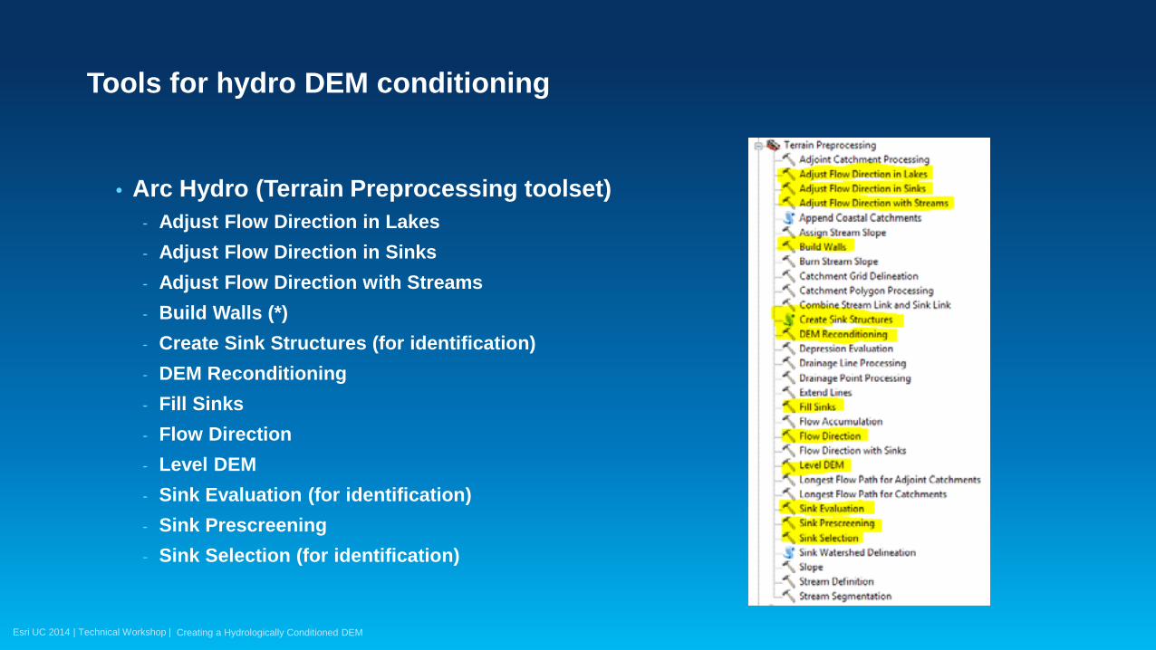
• Arc Hydro (Terrain Preprocessing toolset) - Adjust Flow Direction in Lakes - Adjust Flow Direction in Sinks - Adjust Flow Direction with Streams - Build Walls (*) - Create Sink Structures (for identification) - DEM Reconditioning - Fill Sinks - Flow Direction - Level DEM - Sink Evaluation (for identification) - Sink Prescreening - Sink Selection (for identification)
Tools for hydro DEM conditioning
Creating a Hydrologically Conditioned DEM
Esri UC 2014 | Technical Workshop |
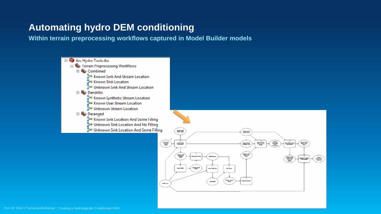
Automating hydro DEM conditioning Within terrain preprocessing workflows captured in Model Builder models
Creating a Hydrologically Conditioned DEM

Esri UC 2014 | Technical Workshop |
Automating hydro DEM conditioning Details (Known Sink Location And Some Filling)
Creating a Hydrologically Conditioned DEM
Portion of the overall model dealing with development of hydro DEM and flow direction

Esri UC 2014 | Technical Workshop |
Automating hydro DEM conditioning More details (Known Sink Location And Some Filling)
Creating a Hydrologically Conditioned DEM
… and this is one of the medium complexity processes
Esri UC 2014 | Technical Workshop |
Using hydro DEM/flow direction
Esri UC 2014 | Technical Workshop |
• Once correct flow direction is established, other raster and vector functions can be applied to determine important drainage pattern elements (drainage lines, catchments, watersheds, watershed characteristic, …).
• Many of these are captured in Arc Hydro tools and terrain preprocessing workflows.
Using hydroDEM/flow direction
Creating a Hydrologically Conditioned DEM
Esri UC 2014 | Technical Workshop |
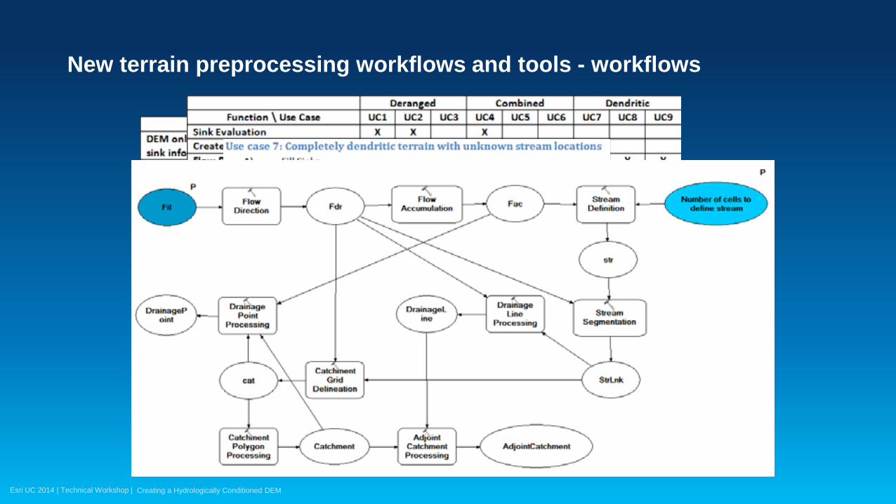
Using hydroDEM/flow direction Example terrain preprocessing workflow (UC4 – unknown sinks and streams)
1. Sink Evaluation.
2. Selection of sinks process.
3. Create Sink Structures.
4. Fill Sinks.
5. Flow Direction.
6. Adjust Flow Direction in Sinks.
7. Adjust Flow Direction in Lakes.
8. Sink Watershed Delineation.
9. Flow Accumulation.
10. Stream Definition.
Creating a Hydrologically Conditioned DEM
11. Stream Segmentation.
12. Combine Stream Link and Sink Link.
13. Drainage Line Processing.
14. Catchment Grid Delineation.
15. Catchment Polygon Processing.
16. Adjoint Catchment Processing.
17. Append Coastal Catchments.
18. Assign CatType Attribute to Catchment FC.
Esri UC 2014 | Technical Workshop |
New terrain preprocessing workflows and tools - workflows
Creating a Hydrologically Conditioned DEM
Esri UC 2014 | Technical Workshop |
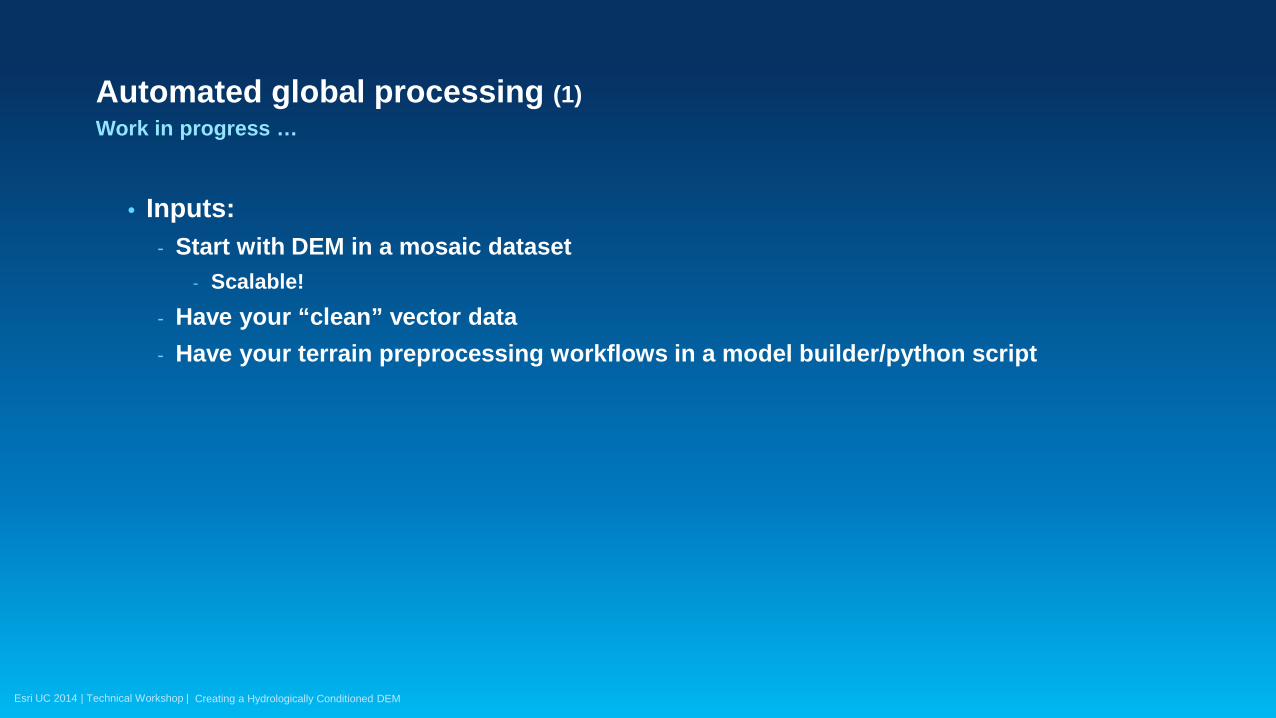
Automated global processing (1) Work in progress …
• Inputs: - Start with DEM in a mosaic dataset
- Scalable! - Have your “clean” vector data - Have your terrain preprocessing workflows in a model builder/python script
Creating a Hydrologically Conditioned DEM
Esri UC 2014 | Technical Workshop |
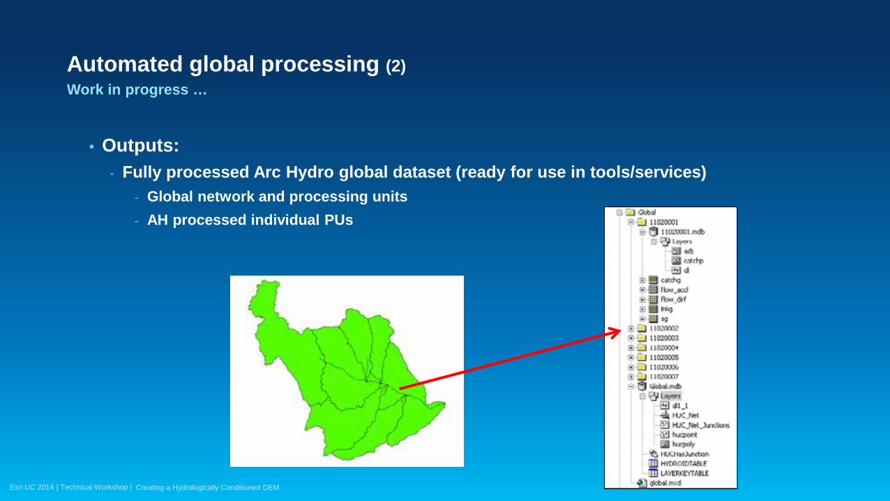
Automated global processing (2) Work in progress …
• Outputs: - Fully processed Arc Hydro global dataset (ready for use in tools/services)
- Global network and processing units - AH processed individual PUs
Creating a Hydrologically Conditioned DEM

Esri UC 2014 | Technical Workshop |
Using hydroDEM/flow direction Interactive analyses
• Watershed delineation (interactive or batch)
Creating a Hydrologically Conditioned DEM
• Watershed characterization (e.g. flow path length)

Esri UC 2014 | Technical Workshop |
Summary

Esri UC 2014 | Technical Workshop |
• Hydrologically correct DEM’s role is derivation of proper flow direction grid which in turn is the foundation for hydro analyses.
• Same extent can have several hydro DEMs, depending on the analysis type. - Hydro DEM is derived with analysis in mind.
• There are few core techniques for “correcting” DEM, but many permutations of how to use them depending on the available data and terrain morphology.
• Development of hydro DEM can be iterative process. • Be patient and know your “dirt”.
Summary
Creating a Hydrologically Conditioned DEM
Esri UC 2014 | Technical Workshop |
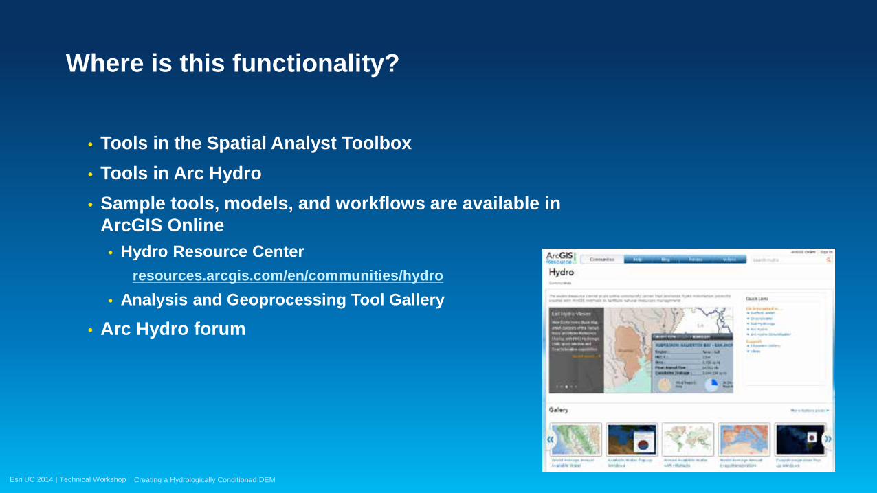
• Tools in the Spatial Analyst Toolbox • Tools in Arc Hydro • Sample tools, models, and workflows are available in
ArcGIS Online • Hydro Resource Center
resources.arcgis.com/en/communities/hydro • Analysis and Geoprocessing Tool Gallery
• Arc Hydro forum
Where is this functionality?
Creating a Hydrologically Conditioned DEM

Esri UC 2014 | Technical Workshop |
Thank you…
• Please fill out the session survey:
First Offering ID: 1711
Online – www.esri.com/ucsessionsurveys Paper – pick up and put in drop box
Hydrologic and Hydraulic Modeling with ArcGIS

Esri UC 2014 | Technical Workshop | Hydrologic and Hydraulic Modeling with ArcGIS