Embed Size (px)
Citation preview

Could It Happen Here?The prospect of a tsunami in the north
west
Joshua Alcantara
Maria Dougherty

Outline
• History of Previous Tsunamis
• What causes a tsunami?
• Types of Tsunamis
• Why Southern California?
• Other information:– Economic effect of a Tsunami.

Area of possible tsunami in California

History
• Southern California has been free of damaging earthquakes for the past 200 years.
• However, moderate earthquakes have been increasing recently
• Unusual damaging waves have gather considerable attention.
• Papua New Guinea July 17, 1998
• Also several locally generated tsunamis have been recorded.
• Santa Barbara December 1812 generated a tsunami effecting 60km (37.28 miles) of the coast.
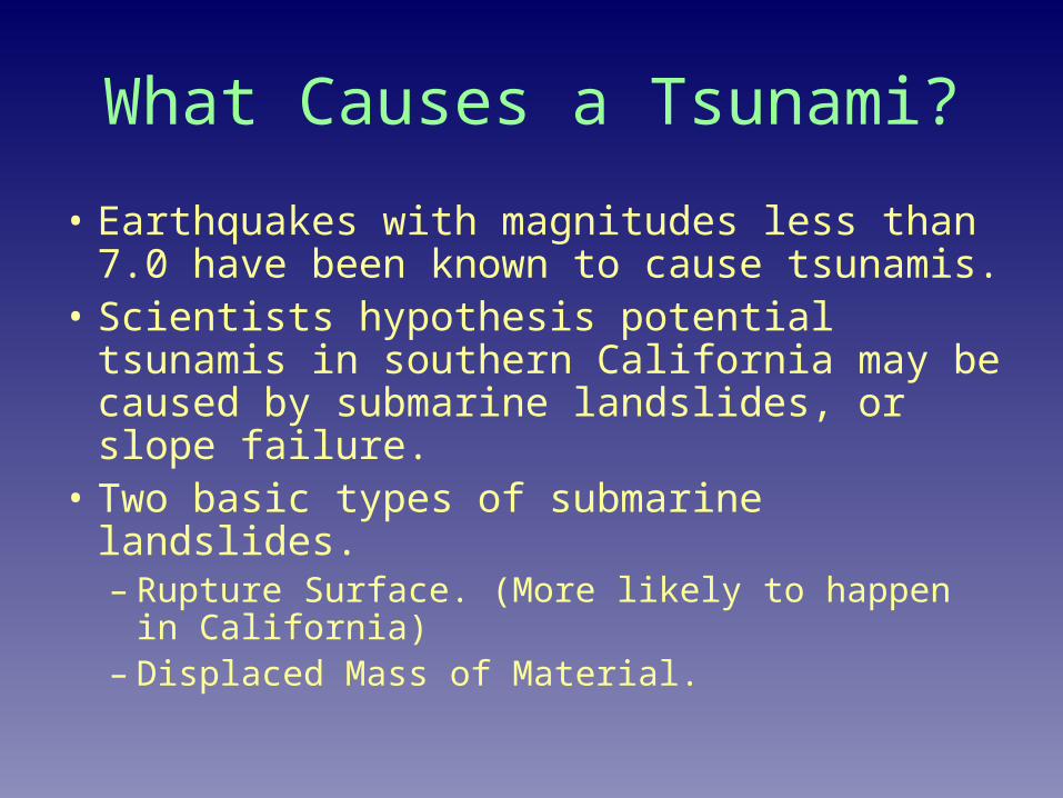
What Causes a Tsunami?
• Earthquakes with magnitudes less than 7.0 have been known to cause tsunamis.
• Scientists hypothesis potential tsunamis in southern California may be caused by submarine landslides, or slope failure.
• Two basic types of submarine landslides.– Rupture Surface. (More likely to happen in
California)– Displaced Mass of Material.

Rotational Slump
• Rupture surface cuts through a homogenous material
• Scoop shaped, concave upward
• Slope follows a circular arc.
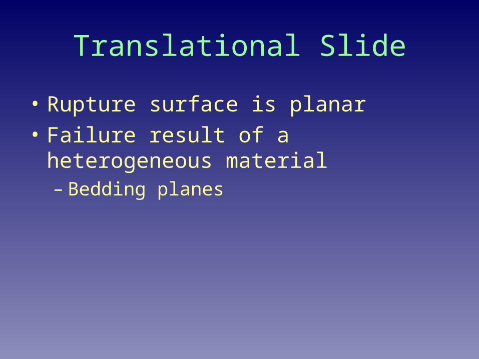
Translational Slide
• Rupture surface is planar
• Failure result of a heterogeneous material– Bedding planes

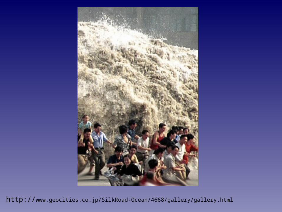
http://www.geocities.co.jp/SilkRoad-Ocean/4668/gallery/gallery.html
http://www.geocities.co.jp/SilkRoad-Ocean/4668/gallery/gallery.html
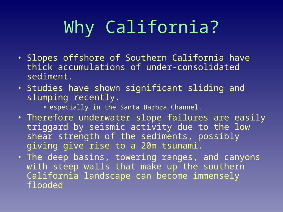
Why California?
• Slopes offshore of Southern California have thick accumulations of under-consolidated sediment.
• Studies have shown significant sliding and slumping recently.
• especially in the Santa Barbra Channel.
• Therefore underwater slope failures are easily triggard by seismic activity due to the low shear strength of the sediments, possibly giving give rise to a 20m tsunami.
• The deep basins, towering ranges, and canyons with steep walls that make up the southern California landscape can become immensely flooded

Map of Southern California Coast


Potential Wave Heights
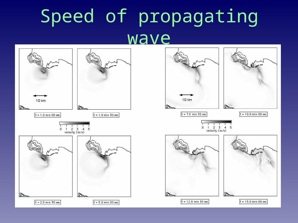
Speed of propagating wave

Calculating the cost of a flood in Southern California
• Southern California Planning Model: a holistic approach to tsunami effects – A model that incorporates the economic loss through
loss of labor, transportation, services• SPCM 1
– Shows detailed economic effects by region– Trip matrices
» A model that traces back consumption patterns.» Examples: Journey to work and journey to services
• SPCM 2– The model calculates direct losses within a damage area and
the economic effects of those losses.– Transportation effects on supply and demand

Losses
• Direct losses: Losses due to lost opportunities to produce. – transportation issues
• Indirect and induced losses arise as people and businesses are unable to work or generate income as a result of the damages. – Indirect losses: Losses by suppliers whose products
and services are no longer purchased by damaged firms and households.
– Induced losses: Losses due to labor.

Direct, indirect and induced business loss in flooded area
No freeway links
Port of Los Angeles and Long Beach Closed
reduction in export capabilities
Scenario 1
Scenario 2
Scenario 3Truck and rail only
Scenario 4
Scenarios of flooded area


Questions?

Resources– Jose Borrero, Ph.D., Sungbin Cho, James E. Moore II, Ph.D., Harry W.
Richardson, and Costas Synolakis, Ph.D., “ Could it happen Here?” American Society of Civil Engineers (2005) 54-65,133
– http://www.geocities.co.jp/SilkRoad-Ocean/4668/gallery/gallery.html– http://www.noaanews.noaa.gov/stories2005/s2365.htm– http://www.atlasmousepads.com/smiley-02.gif


![National Register of Historic Places Registration Form · Section 7 Page 1 Dougherty-Prospect Heights Historic District [preferred] Clay County, MO _____Historic Resources of Liberty,](https://img.dokumen.tips/doc/110x75/5f8dd86318dae4653c3de96e/national-register-of-historic-places-registration-form-section-7-page-1-dougherty-prospect.jpg)