Embed Size (px)
Citation preview

Contribution to Michigan Geology Report — 90-4
PORT HURON STUDY Historical Development of Hydrocarbons
and Subsequent Problems
Contribution to Michigan Geology Report – 90-4: PORT HURON STUDY – Page 1 of 25
Walter Danyluk, Michigan Department of Natural Resources
Geological Survey Division
Published by the
MICHIGAN DEPARTMENT OF NATURAL RESOURCES GEOLOGICAL SURVEY DIVISION
1990
This report has not been edited to meet editorial standards for publication. The views expressed are those of the authors and do not necessarily reflect the policies or practices of the Michigan Department of Natural Resources, Geological Survey Division.
The content, availability and price of this report is subject to change without notice.
A list of Publications, Maps and related information is also available from the Geological Survey Division upon request. This report may be purchased from:
Geological Survey Division Michigan Department of Natural Resources P.O. Box 30028 Lansing, Michigan 48909
Telephone 517 334 6943 Facsimile 517 334 6919
Please forward any comments to the attention of the Geologic Information Systems Unit at the above address.
© COPYRIGHT 1990 by MI DNR Geological Survey Division
ALL RIGHTS RESERVED. No part of this document may be copied or reproduced in any form or by any means without prior written consent of the MICHIGAN DEPARTMENT OF NATURAL RESOURCES, (MI DNR) GEOLOGICAL SURVEY DIVISION.
PORT HURON STUDY - Table of Contents
BACKGROUND ................................................................ 2 GEOLOGY ........................................................................ 4
Regional Structure......................................................... 4 Port Huron ..................................................................... 5 Sarnia Southwest Ontario.............................................. 5
WELL HISTORY ............................................................... 6
Port Huron Area .............................................................6 Port Huron Salt Wells.....................................................7 Sarnia Area ....................................................................7 Well Disposal of Oil Field & Industrial Wastes in Ontario............................................................................7
CASE HISTORIES.............................................................8 2990 Military (south of Reid) - Reid’s Dry Dock 1 .....8 2516 Chestnut - E.F. Minnie residence 2.....8 Roosevelt High School (19th & Wall) 3.....8 Thompson #1 - PN 7916 - Bach and Creech 4.....8 Blue Water Mall, sec. 27, T7N-R17E 5 .....8 K-Mart parking lot - Howard and 24th 6 .....8 14th and Hancock (former Texaco station) 7.....8 18th and Wall Street 8 ....9 2636 Electric Ave. - Botsford-Shieman residence 9 ....9 2604 Military - Andrew Bryan residence 10 ....9 City Post Office parking lot - 4th Street 11.....9 Winkworth Transit Co - foot of Water St. 12 ....9 3110 Ravenswood - Marvin Leaym residence 13.....9 1511 4th - Joe Thomas Radiator Shop 14...10 2651 Electric Ave. - Clarence Burkholder prop. 15...10 5721 N. River Rd. - Marine City - HJ. Otter prop. 16 ..10 Mercy Hospital - Electric and 10th 17 ..10 2004 Military - Boy Scout Council next to GT tracks 18 .10 1039 Water Street 19...10 Port Huron Paper Company 20..10 16th and Bancroft Street 21..10 Lakeport State Park - water well (not on map).............11 Morton Salt Company - S.E.M.G.Co. 22...11 Oak Street extension easement - east of Military 23 ..11 5816 Lakeshore Drive – ‘Verne Becker well’ (not on map) .............................................................................11 1615 Griswold - Dobrowolski owners in 1974 24....11 1925 Lapeer Street - Mueller Brass Co. 25 ...11 1726 Military - Berkshire Apts. (Patrick Phelan) 26 ...11 1313 Minnie Street 27....11 1807 Pine St. - Russell Smith residence 28....12 1624 15th Street - Gerald Kelly residence 29....12 Church and Wright Street (?) - Dunn Paper Co. - Draper # 1 30....12 2470 Sharon Lane - Joe Rynties residence - Klohn # 1 well 31....12 5931 Lakeshore Dr. - Alphons Rynties residence (not on map) ........................................................................12 1006 Military - Huron Cinema 32 ...12 Grand River and Huron - J. C. Penny parking lot 33 ..12 2418 Oak St. (between 24th & 25th) - Hammond - McRoberts residence 34...12 Military Street Bascule Bridge (Black River) 35 ...12 3900 Butternut - Orphan # 1 - City of Port Huron 36 ..13 3099 Riverwood - Riverwood Hghts. Sub. 37....13

Contribution to Michigan Geology Report – 90-4: PORT HURON STUDY – Page 2 of 25
1221 18th Street (between Court & Union) – Hoyt well 38. 13 4806 Westwood - Charmwood Sub. (not on map) ...... 13 1024 Union Street - (between 10th & 11th) 39.. 13 5741 Lakeshore - Par 3 Golf Course (not on map) ..... 13 4172 Maes Dr. (south of W. Water) 40 . 13 8991 Lake Court - sec. 5 Burtchville Twp. (not on map)............................................................................. 13 204 Botsford 41.. 13 1621 25th Street 42.. 13 Lapeer Rd. west of 24th - Union 76 gas station 43 .. 13 McLeod & Baldwin #1 - PN 25196 - Mau-Gul/Guldenzoph 44 .. 14 3556 W. Water Street - Gillette well 45 ... 14 3427 Lapeer Street - Darling residence 46 ... 14 700 32nd Street - Ron Hargett 47 ... 14 586 32nd Street - West Side Auto Parts 48 .. 14 no date - West Howard east of 32nd - Francis Smith well 49 ... 14 no date - 4285 Lapeer Road 50 ... 14 no date - Oakwood and West Water St. 51... 14 no date - Atkins Road (5300 block) near Wadhams (not on map) ................................................................ 15 no date - West Water near Wescott 52 . 15 no date - 521 24th Street - Dutchess Bar 53. 15 Water Street and 1-94 - City Boat Launch and Marina. 54 15 12th & Washington - Michigan Sulphate Fiber Co. 55 15 Quay and Huron Streets 56 15 Lapeer and 24th Street 57 15 Minnie and 6th Street 58 15
REFERENCES................................................................ 15 APPENDIX A: CHRONOLOGY OF EVENTS................. 16 APPENDIX B: LIST OF WELLS...................................... 18 APPENDIX C: LIST OF WELLS...................................... 18 APPENDIX D RISK POTENTIAL FOR HYDROCARBON PROBLEMS .................................................................... 18
Low Potential ............................................................... 18 Medium Potential......................................................... 18 High Potential .............................................................. 18
FIGURE 1: description ................................................... 19 MAP 1: Risk Assessment for Hydrocarbon Problems.... 20 MAP 2: Case History Locations ..................................... 21 MAP 3: Drift Thickness................................................... 22 MAP 4: Bedrock Topography......................................... 23 MAP 5: Bedrock Geology............................................... 24 MAP 6: Contours on Top of the Dundee........................ 25
PORT HURON STUDY
Historical Development of Hydrocarbons and Subsequent Problems
By Walte Danyluk
BACKGROUND Port Huron could easily lay claim to the fact that it gave birth to the oil and gas industry in Michigan. Dorothy Mitts, in a Feb 2, 1952 Port Huron Times Herald article, wrote that one of first (if not the first) wells in the state was drilled one and a half miles south of the village of Lakeport which lies approximately ten miles north of Port Huron. The year was 1863. The flurry of leasing and drilling activity in the Port Huron area that followed lasted for a short time. Poor production discouraged further exploration and the ‘boom’ ended by 1865. Little happened over the next 20 years. However, the development of oil fields on the Canadian side around Sarnia, particularly the Euphemia field in the early 1880’s, changed all that.
Commercial oil and gas activity in the Port Huron area began with the discovery, drilling for, and production of hydrocarbons in 1886. At the same time, natural brine and salt (solution mining) wells were drilled on both sides of the St. Clair River to provide raw materials for the growing chemical industry. However, it was not until 1929 that laws were passed to govern these type of activities with the enactment of Act 15, P.A. 1929, giving the Department of Conservation (now the Department of Natural Resources - DNR)) authority to regulate the development of oil and gas fields, and other type of borings such as disposal and mineral wells. The rules were further enhanced by passage of Act 61, known as Michigan’s Oil and Gas Regulations, in 1939.
Since there were no laws or regulations to control this early development, little if anything is known about these wells:
- it has been estimated that 200 to 400 wells had been drilled in the Port Huron area between 1864 and the early 1900’s (Canadian government estimates put the number of wells drilled in the SW Ontario-E. Mich. area at 10,000).
- the location of the majority of these wells is unknown and they are impossible to locate.
- depth of the wells is unknown, although it can be assumed that they penetrated the Dundee (500-700’) or deeper in search for oil/gas, and the Salina (1600-2200’) for the production of brines.
- whether the wells were plugged, how adequately, and with what type of materials is also unknown.
On the Canadian side, development of Detroit River formation (600-950’ deep) waste disposal wells to service the growing chemical and refining industries, and

Contribution to Michigan Geology Report – 90-4: PORT HURON STUDY – Page 3 of 25
brine disposal wells for the Ontario oil fields was initiated in the 1950’s.
As the city of Port Huron grew and expanded, development most likely occurred over many of these old wells. Over the years there were periodic reports and complaints of old wells leaking oil, brine and gas to the surface, seepages from unknown sources, and associated odors. In some cases the individual land owner, or the city of Port Huron assumed responsibility and had the problem corrected; in other instances nothing was done.
The situation became more serious when problems began to appear in Sarnia in 1966, and Port Huron in 1967 when old unrecorded and unplugged (or improperly plugged) wells began to leak or flow fluids and gas. Evidence that the possible cause for these outbreaks were Canadian disposal practices mounted. Numerous communications between Michigan and Ontario government officials beginning in 1967 culminated in a meeting on May 13, 1969 regarding waste disposal wells in Sarnia. In attendance were various Sarnia business representatives, Ontario Dept. of Energy and Resources Management (ODE&RM) officials, and staff of the Geological Survey Division (GSD) and Water Resources Commission, DNR. At that time there were 11 wells in the Port Huron area that were flowing with some getting worse. GSD staff felt that plugging these old wells was not the solution to the problem since due to the absence of records, the location and condition of many wells was not known. It was felt that as some wells were plugged, others would begin to leak/flow. GSD representatives believed the source of the problem was the waste disposal wells in Sarnia.
Ontario officials stated that the evidence was circumstantial and, that “the problem could be solved by plugging, and if necessary, restricting injection volumes and pressures”. They pointed out that abandoned and uncapped wells also leaked in Sarnia but the problem was eliminated by plugging. Industry representatives stated that future injection volumes would remain steady or be reduced, such as Imperial Oil which already cut disposal from 10,000 bpd to 3,000 bpd. It was finally suggested that Michigan develop an observation well to either prove or disprove subsurface communication between Michigan and Ontario. Details for implementation and funding were to be worked out.
During this same period, GSD sought and obtained funding to plug leaking wells in the Port Huron area. The DNR was appropriated $50,000 under Act 247, P.A. 1968, a contract awarded to Empire Services, and plugging commenced in July 1969. By the summer of 1970, 8 wells had been sealed. Problems with the contract language, liability insurance, changing contractors, and inability to obtain new bids resulted in no further work and lapse of the appropriation with the remaining funds ($11,000) returned to the State in 1972.
As expected, new leaks and seepages occured at Port Huron. In addition, but not related to Port Huron, reports
of flowing wells were received from Marine City in 1970. Of interest is the fact that the ODE&RM approved a Detroit River formation disposal well (Canadian Industries Limited - C.I.L.) across the river from Marine City, and that prior to commencement of injection operations in 1968, the State had voiced opposition to this activity, citing the possibility of old wells breaking out due to pressure from fluid migration.
On October 15, 1970 a meeting with Sarnia industry, Ontario Dept. of Mines and Northern Affairs, and the GSD-MDNR was held to discuss the new Ontario Subsurface Disposal Policy. The policy statement called for a two year phase-out of existing Detroit River formation disposal wells along the St. Clair River, and no new Detroit River disposal wells within three miles of the river.
The GSD-MDNR maintained that there was evidence that Ontario disposal practices were responsible for the Port Huron/Marine City problems: physical evidence from abnormal pressures (Marine City), chemical evidence in the chemistry of fluids recovered (phenol in the Boy Scout well sample), and circumstantial evidence in the timing of the disposal program with Port Huron problems.
Complicating an already complex situation, Russell Prins, Assistant Attorney General, in a Nov. 15, 1973 opinion expressed ‘serious doubts as to the advisability of proceeding to plug “ancient” wells’. The opinion was based on the fact that, 1. appropriations were limited, 2. insurance costs were prohibitive, and 3. uncertainty as to whether plugging would prevent the problem at the well, or by repressurization, cause new or renewed flowing at other sites.
Odor complaints, and leakages of oil/brine/gas continued to be reported. When located, numerous other wells were plugged during the 70’s & 80’s by the city, township, property owner, or with various state funds when available: orphan well funds, special appropriations for plugging wells in the Port Huron area, brine investigation fund, etc. In other instances gas leaks were vented to the atmosphere. The 1973-74 DNR budget request (Act 111, P. A. 1973) included $50,000 for the GSD (boilerplate, sec. 1 and 31) to plug old wells but not for Port Huron specifically. Lease Management Inc. of Mt. Pleasant was subsequently contracted and 5 old wells in the Port Huron area were (re)plugged in 1974.
As a result of the problems in the Port Huron area, Canadian industry eventually decreased the injection rate of industrial wastes voluntarily to a minimum. Finally, Ontario regulations were passed prohibiting injection of wastes into the Detroit River formation. As of December 31, 1976, nothing other than brine was to be injected into the Detroit River formation, with all the brine disposal wells located some distance from Sarnia.
One should be aware, however, that years of waste disposal practice may have over-pressured the disposal zone (and formations in contact with it) to the extent that

Contribution to Michigan Geology Report – 90-4: PORT HURON STUDY – Page 4 of 25
subsurface fluid hydraulics may have been affected for years beyond the termination of disposal. Several investigations addressing this issue came to no definite conclusions.
According to a Nov. 21, 1985 Port Huron Times Herald article (David Poulson), a study by Canadian environmental agencies detected chlorides (salt water), phenols and hydrogen sulfide (H2S) gas in the railroad tunnel linking Port Huron and Sarnia. The Canadian National Railroad in fact, conducted a private tunnel contaminant study in 1978 but the results were never made public. The article further stated that other possible sources for the contaminants were, the storage of gas and propane in salt caverns (discussed in the Well History section), and the disposal of salt mine wastes (dissolved salt water) and oil field brines.
In a statewide study conducted by the U.S. Geological Survey (USGS) to investigate groundwater flow and quality near the upper Great Lakes connecting channels, it was stated that “no relation between water quality and land use was evident”. Four wells (one into bedrock) were drilled along the St. Clair River in the Port Huron area, and the well water was sampled and analyzed for organic compounds, trace metals, and other dissolved substances between April 1985 and Sept. 1987. In the subsequent report summarizing the data, Gillespie and Dumouchelle (1989) concluded that “concentrations of volatile hydrocarbons generally were less than the detection limit and, therefore, estimates of transport to connecting channels (St. Clair River) was impractical. Base neutral and chlorinated neutral extractable compounds were detected more frequently than were volatile hydrocarbons, but information also is insufficient to make valid estimates of amounts entering the connecting channels. Estimates of the amounts of trace metals and other dissolved substances transported by groundwater were not made because of the finely divided particulate matter in the water”.
Other factors, such as natural variations in subsurface fluid hydraulics, and leakage from improperly cased and cemented (or subsequent mechanical failures) more recent oil and gas tests, may influence underground conditions and contribute to, or initiate surface leaks and odor problems.
All these factors though, must remain as possibilities. Without a well monitoring program (into the Dundee for instance) to gauge pressure changes in specific formations, fluid migration and chemistry, and fluid levels, any statements made regarding the Port Huron situation are inconclusive.
Another aspect of the Port Huron problem is that the gas bearing Antrim Shale directly underlies the glacial deposits in parts of the area, and that potable water is usually found in the lower portions (approx. 100’in depth) of the glacial sediments. With the Antrim as a source of migrating gas into the overlying materials, the occurrence of natural gas in groundwater, and during drilling of water wells, foundation borings, excavations,
etc., is common. Reports of well water impregnated with gas, gas odors, blowouts while drilling water wells or other soil borings, and building fires or explosions associated with the migrating gas are numerous. Several of these are described in the case histories section.
Near the close of the 1980’s there were increasing reports of water wells with gas, and gas seeps with associated odors. This increase coincided with a severe drought in Michigan in 1987-88. A review of U.S. Geological Survey groundwater data for 1986-1988, from monitor wells in Sanilac and Oakland counties (closest monitor stations to Port Huron), indicated a drop in water levels of up to two feet.
A lowering (or raising) of the groundwater table does affect water quality and hydrostatic pressure. A reduction in the water column, with a subsequent decrease in hydrostatic pressure, may have allowed more Antrim gas to migrate into the overlying materials, and this may explain the increase in incidents.
GEOLOGY
Regional Structure
The Michigan Basin is a circular, depositional basin in which the rock layers dip gently towards a common center located in the Bay-Midland county area. The Port Huron area lies on the eastern edge of this basin, astride a southwest-northeast trending structural high - the Algonquin and Findlay (NE branch of the Cincinnati arch) arches - which separate it from the Appalachian basin to the east-southeast (Brown, R. E., 1963). These two arches, with the Findlay arch axis dipping to the northeast and the Algonquin axis dipping to the southwest, meet just south of the Port Huron-Sarnia area forming a northwest-southeast trending low feature known as the Chatham Sag.
The study area is underlain by relatively flat-lying to gently dipping bedrock. Briefly, the sedimentary rock sequence of concern to this study consists (beginning with the oldest) of Silurian to Middle Devonian period limestones and evaporites (Salina, Bass Island, Bois Blanc, Detroit River, Dundee, Traverse), and Upper (Late) Devonian to Mississippian period shales and sandstones (Antrim, Bedford). The northwesterly regional dip of these sediments into the Michigan basin is approximately 50 ft./mile in SW Ontario (Kent etal, 1986), and 40 ft./mile in the Port Huron area (with the rate decreasing to the northwest) (Brown, R. E., 1963). However, the structural attitudes of formations are affected by factors other than tectonics.
Folds in the Dundee-Detroit River sequence run parallel to, and at angles or perpendicular to the regional structure. An anticline in Enniskillen Twp. of Lambton Co., Ontario trends to the northwest and extends into St. Clair Co., Michigan. According to Douglas et al (1970, pg.351), in the Canadian oil fields the “reservoirs are

Contribution to Michigan Geology Report – 90-4: PORT HURON STUDY – Page 5 of 25
characterized by dome structures in the Dundee and Lucas (top of Detroit River) formations which have been locally dolomitized and deformed because of the post-Devonian solution and removal of underlying Upper Silurian Salina salts”. Due to solution collapse, the northwest dip of Middle Devonian carbonate rocks has been reversed along the southern and eastern margins of the oil fields, resulting in structural closures (Douglas R. J. W., 1937). In other areas draping occurred over underlying reefal structures (Kent etal, 1986), and this may be reflected in succeeding (younger) rock layers.
Port Huron
Eastern and southern St. Clair County is located on the Erie-Huron lowland and has been covered by several glacial lake substages of the Wisconsin (Pleistocene age) glacial stage (Brown, R. E., 1963).
As described by Brown (1963, pg.21), the glacial sediments are composed mainly of glacial lake clay, with discontinuous lenses of glacio-fluvial (rivers/streams associated with glaciation) and glacio-lacustrine (lakes associated with glaciation) sands and gravel occurring in the lower portions of the sediments. Some till plain deposits are found around Lakeport and to the northeast.
The thickness of the glacial deposits averages 100’ (range 50-160’), and may be thicker in bedrock valleys. Although groundwater is generally a difficult resource to obtain in St. Clair county, water is derived from the basal portions of the deposits primarily from the sand/gravel lenses. Regionally, groundwater flows towards the St. Clair River, or its tributaries such as the Black River (Gillespie, J.L. etal, 1989).
The bedrock surface can be described as mainly flat-lying with minor undulations dipping gently east towards the St. Clair River. Other factors which may influence bedrock topography according to Brown (1963, pg.30), in addition to deeper structures, are: 1. pre-glacial, differential weathering and erosion due to lithologic differences, 2. pre-glacial erosion channels, and 3. glacial erosion dependent on ice movement and rock type. With the exception of a few east-west trending erosional valleys such as the one underlying the lower tier of sections in Fort Gratiot Twp., 7N-17E, there are no distinct or striking features in the bedrock topography, and it is not reflected at the surface, nor greatly affected by deeper structures in the Dundee/Detroit River.
Bedrock geology can be characterized by the Early Mississippian Bedford shale in the southern half and the Late Devonian Antrim shale in the northern half of the study area, with the contact line between the two running generally NW-SE from sec. 6 to sec. 22, T6N-R17E, Port Huron Twp. Since both formations are partially eroded due to glaciation, combined thickness ranges from less than 100’ to more than 160’. Based on stratigraphic and lithologic investigations by Brown (1963), Dorr (1981) and Gillespie (1989), a composite description follows, starting with the youngest rock unit:
- Bedford - a light gray, sandy shale with sandstone, limestone, and dolostone (dolomite) lenses; approx. 100’deep.
- Antrim shale - a gray to black, carbonaceous, gas bearing, dense shale with pyrite inclusions, calcareous concretions, and few fossils; generally 160-220 +’ in thickness in St. Clair county but reduced to 60-100’ in the east and northeast as result of glacial erosion; approx. 100’ in depth.
- Traverse formation - interbedded shales, limestone and dolostones, 250-300’ thick, with a fairly level bedrock surface.
- Dundee formation - Middle Devonian, gray-buff-brown, fossiliferous limestone, averaging 130’ thick, and found 500 +’ below the surface in the Port Huron area.
- Detroit River - gray to buff, thin bedded dolomite with interbedded limestone, anhydrite, salt (halite), and sandstone.
- Salina section - Upper (Late) Silurian interbedded shales, evaporites, and dolostones; 1600-2200’ in depth.
Sarnia Southwest Ontario
The stratigraphy on the Canadian side is very similar to that of Port Huron. The glacial deposits are composed of stacked till units with interbedded sand and clay, and generally 100’ in thickness.
The Kettle Point (Antrim equivalent) is bedrock throughout much of region. It is a thin bedded, dark shale, 200-300’ thick. A high angle, NW-SE fracture pattern was observed in this formation in studies by Black (1983), and Sanford & McFall (84). Below this lies the Ipperwash Limestone which is the top of the Hamilton Group (Traverse equivalent), and is composed of shales and fossiliferous limestones with some reef structures. This sequence varies in thickness from 150-650’ (300’ in the Sarnia area).
The Dundee follows. It is a fine-grained limestone, 160’ thick, and has a porous (lost circulation zone-LCZ) near the base. Two oil zones with little methane are found in the Sarnia field at approximately 450’ in depth. Petrolia oil comes from the Dundee-Detroit River contact.
Below the Dundee is the Lucas Fm. (top of Detroit River) consisting mainly of dolostones and limestones with a porous zone (LCZ). Generally, it is found at 600’ in depth in southwestern Ontario. There are vertical fractures in the Dundee-Detroit River perpendicular to the axis of the anticline, and this was very well demonstrated by a mining for oil project in 1980’s. From 1982 to 1988 Devran Inc. and Shell Oil Company conducted a gravity drainage of petroleum operation in the Sarnia-London Road oil field. This project revealed fracture communication between the two formations, and H2S in the Lucas formation aquifer (Cowen, J. 1990). Due to the volumes, and highly corrosive nature of the

Contribution to Michigan Geology Report – 90-4: PORT HURON STUDY – Page 6 of 25
water migrating into the radiating drain holes (from the main vertical shaft) which intersected the fractures, the operation was found to be non-economical and was abandoned in 1988.
The Salina section, at 400-1500’ in depth, consists of interbedded evaporites, shales, and limestone, and was/is the source of salt and brines for the chemical industry.
WELL HISTORY
Port Huron Area
The knowledge that hydrocarbons existed in the subsurface of St. Clair county dates back to the middle 1800’s when early water wells occasionally encountered oil or gas, or from the existence of oil springs and salt licks, such as an 1880 report that “oil seepages were observed along the bottom of Indian Creek where it crosses Lapeer 1/3 mile west of Military in Port Huron” (History of St. Clair Co., A.J. Andreas Co., Chicago, 1883). The gas was a nuisance since there was not enough of it to market, however, oil could be refined into various products if commercial quantities could be found.
Oil was discovered 1-1/2 miles south of Lakeport in 1863. Drilled by man named Funk, oil was reportedly encountered at 35’ (Mitts). At the same time a 57’ well was sunk on the Pulcifer farm (south of Black River and 4 miles west of Port Huron) which had ‘oil impregnated water’. This, along with Ontario discoveries of oil in Oil Springs and Petrolia led to the drilling of numerous wells in the Port Huron area. Various historical publications describe some of these well sites, but with very little, if any, location or description accuracy. By 1865 there were 11 Michigan corporations operating in St. Clair county, among which were the Port Huron Petroleum and Mining Co., Merchants Petroleum Company of Port Huron, and Gratiot Petroleum. It cost two dollars per foot, and took four to eight weeks to drill the wells. Land (mineral rights) sold for up to $1000 per acre in the Port Huron vicinity. By the end of 1865 the ‘boom’ fizzled. At least ten wells had been drilled (A.J. Andreas Co., Chicago, 1883); the Baker well at Lakeport produced 30-40 BOPD for a short time while most other wells produced less than one barrel of oil per day (Mitts, D. 1956).
These early cable tool borings had little or no free water while penetrating the Dundee, indicating low rock permeability.
The Port Huron oil field historically is dated as beginning in 1886 with the drilling of wells for oil and/or gas into the Dundee and Detroit River formations (500-700’ deep in the area). The growing demands for fuel for lighting, heating, power, greases, and lubricants spurred the activity.
Charles Bailey drilled the first wells in 1886 on the west side of city in what is now the area north of Griswold
street, and west of 24th where the old Stock Xylite & Grease Company was located; he drilled at least three. Johnson Brothers of Petrolia drilled the first well and struck oil and gas at 515’ with a recorded (shut-in?) pressure of 250 psi (Mitts, 1956). Several other wells were drilled, however production remained low, though consistent. Well development followed the northeasterly trending anticlinal structure underlying the Port Huron-Sarnia area. Michigan’s Oil and Gas News, in an August 7, 1937 article, indicated the total production for the year 1887 was 156 barrels of crude oil. According to Mitts, 75 wells had been drilled by 1889.
Another flurry of drilling occured in 1898 when G. B. Stock drilled several wells just north of the Bailey wells, in what is now the K-Mart parking lot SW of the Lapeer and 24th street intersection. By 1919 there were 21 wells in this cluster. Numerous other wells for oil and for salt were drilled during this period, however the field was abandoned in 1921.
The location of these early wells is difficult to establish. They were usually described only as being located on a given farm or parcel of land, or in proximity to some landmark/building which may not exist today. Many wells were ‘drilled’ by property owners themselves in search of a source for heating or illuminating fuel. Drilling equipment consisted of either spring pole devices or primitive cable tools. ‘Derricks’for the earlier wells were usually tripods constructed from heavy wooden beams, followed by the standard cable tool four-sided, wooden derricks. ‘Drill pipe’ was either metal reinforced wooden poles or iron rods thus due to weight limiting the size of the hole. Casing generally consisted of four to seven inch iron pipe run/driven to either the top of the first rock encountered (Antrim), or top of the producing formation (Dundee-Salina). With the former, a smaller diameter casing was then run to the top of the producing zone. In either case, 1” to 2” tubing and open hole completions were utilized, with nitroglycerin used for stimulation of the potentially productive zone. Conductor pipe, usually wooden, may or may not have been used. In summary, there was no standard well casing program. The wells were produced singly, or more commonly, in groups by means of a central pumping station which had horizontal rods radiating to the individual wells.
Since the casings were either driven or run by cable tool rigs, the rock-casing or casing-casing annuli were not sealed other than by the initial packer (lead, rags) or drive point at or near the casing shoe, and the drilling fluid itself. Surface casing in many instances, were it was intended to be driven several feet into the first bedrock (Bedford-Antrim in this case), may not even have been set into competent strata, but landed in a hard clay or on top of a boulder.
Very little information exists on if or how these early wells were plugged, however, recent re-plugging operations on some of the wells reveal minimal efforts to seal the wellbore. Some were simply abandoned with only drilling ‘mud’ (not in the technical sense of todays

Contribution to Michigan Geology Report – 90-4: PORT HURON STUDY – Page 7 of 25
mud technology which was not developed until the late 1920’s) left in the well. Others were sealed with wooden plugs (cedar) driven to various depths and, sometimes, with gravel or rocks placed on top. Other methods utilized lead seals in the annulus of the surface-production casing, or lead plugs inside the casing remaining in the hole. Subsequent problems with some of these old and improperly plugged wells are addressed in the Case History section.
Through the years wells continued to be drilled (mostly Devonian tests) in the area with little success. Niagaran development of recent decades generally did not affect Port Huron since it occurred mostly to the southwest. A Trenton-Black River well discovery by Gunner Energy in the summer of 1989 five miles west of Marysville may initiate new drilling, however, it is too early to tell. Early production rates have not been too promising, and two subsequent wells to that horizon have resulted in dry holes. However, several other wells are being planned as of this writing.
Currently there is one producing gas well within the city limits, located in the north part of sec. 33, T7N-R17E.
Port Huron Salt Wells
During the late 1880’s wells along St. Clair River were drilled (1600-2200’) into the Salina for production of brines by solutioning. The geographic distribution of industry along the river, and not geology dictated the location of the wells. Salt (solution) blocks used in this operation utilized steam and coal as a source of fuel, and four different processes were in use: vacuum pan, Alberger. grainer, and open pan.
Port Huron Salt Co’s plant #1 was located approximately 1 mile south of the city limits in the NE quarter of section 32, T6N-R17E, and had 8 wells in the field (Cook, 1913).
Another mineral (salt?) well was located near the old Lapeer road schoolhouse in 1870. F.L. Wells drilled a salt well (1882) at what is now the intersection of Lapeer and 10th, however no plant was ever built there and the final disposition of the well is unknown (Jenks, W. L., 1912).
Church & Company drilled several wells south of the city. Numerous other companies drilled and operated salt wells although many were short lived due to economics; they could not compete with the operations in the Saginaw valley. Also, since most of the activity was centered around the towns of St. Clair and Marine City, 5 to 12 miles south of Port Huron, it is of little consequence to this study.
Morton Salt Co. did develop and operate a 20 well salt solution brine field during the 1950’s just south of the Port Huron city limit in the south half of sec. 29, and north half of section 32, T6N-R17E. This was later transferred to Southeast Michigan Gas Co. (S.E.M.G.Co.) and converted into the Marysville gas storage field.
Sarnia Area
Oil seepages, springs, and gum beds in Enniskillen Twp., Lambton Co., were tapped for their oil from the early 1800’s thru the 1850’s. The need for illuminating oils and the knowledge that oil existed in the glacial sediments and rocks underlying southwestern Ontario led to the search for oil in the province in 1860. Several wells were drilled in Enniskillen township and the name Oil Springs was given to the field. The wells were drilled to approximately 250-300 feet into the Corniferous (Dundee and Lucas formation of the Detroit River Group) limestone of Devonian age. Shortly after, another field was discovered a little to the southeast and parallel to Oil Springs. This new Petrolia field following an anticlinal structure extended for a dozen miles towards the westnorthwest almost into the middle of Sarnia township. Drilling activity varied thru the 1880’s. Oil was discovered in Euphemia Twp. in 1886 (this spurred the search for oil on the American side) and activity continued into the 1900’s. As an example of volumes of oil produced, total production for 1894 was 829,000 bbls.
As a direct result of this oil activity, salt was discovered in Goderich in 1866 (Douglas, 1970). Wells for solution mining were drilled into the Salina formation of Upper Silurian age and the products were used by the chemical and food processing industries, for tanning, and for street ice control. Over the years numerous salt borings were made to supply the needs of local industry and for export.
Wells were also drilled into the salt beds of the Salina (approx. 2000’) for the development of storage caverns. By 1980 there were 63 active LPG (liquid hydrocarbon gas) sites with a total storage capacity of 13.9 million bbls.; the 52 million bbls. of cavern washing brine generated was injected thru disposal wells into the “LCZ” (lost circulation zone) of the Lucas Formation, Detroit River Group (ODMNA, 1970).
Well Disposal of Oil Field & Industrial Wastes in Ontario
Imperial Oil developed the first subsurface disposal wells for industrial wastes at their Sarnia refinery operation between 1958 and 1960. Initially six disposal and one observation well were drilled. Twelve more wells were drilled by other industries. All were completed in the Detroit River Group (with the exception of three Salina brine wells) which is relatively shallow in southwestern Ontario - depths generally less than 1000 feet. Nine of these injection wells were located within the Sarnia city limits along the St. Clair River, and two just to the south.
The waste consisted of spent caustic, phenols, steam condensate water with ammonia and carbon dioxide, waste oils, chlorides, ethers, and sulfuric acid. From 1958 thru 1976, almost 63 million barrels of industrial waste was injected into these wells (Kent et al, 1986).
In addition, there are 27 brine disposal wells servicing the Ontario oil and gas industry with 16 in the Detroit

River Group and 11 in the Guelph formation (Niagaran equivalent in Michigan).
Most of the BDW’s however, are located at least several miles east of Sarnia and the St. Clair River. Earlier brine disposal practices consisted of either discharges to surface waters or evaporation pits.
Although the casing and sealing design of the recent Detroit River disposal wells was more than adequate, the presence of many old and poorly plugged Dundee-Detroit River (and deeper) penetrations in the area created a situation conducive for surface and subsurface environmental degradation. Liquid industrial waste injection in Ontario ceased on Dec. 31, 1976. The events leading up to cessation follow.
In 1966, an unrecorded well on Imperial Oil Enterprises property began leaking phenolic wastes and was plugged. In 1967 a second well in Sarnia also began leaking high pH phenolic waste. At the same time there were numerous breakouts on the American side. In 1969 two old Ontario wells (plugged with lead plugs) one mile east of the two C.I.L. disposal wells near Sombra, and shortly after, an old salt well (Crystal Salt Flake Co.) north of Marine City and two miles southwest of the C.I.L. site began to leak fluids. Also, brine began to flow from two Detroit River formation oil/gas tests drilled in the vicinity in 1970; this was an abnormal characteristic for the formation in this area. It should be noted that during this period Canadian industry was reducing the volume of injected wastes.
All this culminated in the 1970 Ontario policy statement recognizing that the disposal of wastes into the shallow Detroit River formation was not suitable because of, 1.) the possibility of fracture communication with upper rock strata, 2.) the area was penetrated by hundreds of holes in search of oil, gas, and salt, with the location and plugging status of the majority of these being an unknown and, 3.) the Detroit River has potable water 30 miles east of the Sarnia-Port Huron area. The policy statement also called for a phase-out of Detroit River formation waste disposal practices. Eventually in 1976 laws were passed banning this activity.
CASE HISTORIES
2990 Military (south of Reid) - Reid’s Dry Dock
Active well in 1941. Property owner had well plugged in 1941 (?); Dowell circulated well full of cement.
2516 Chestnut - E.F. Minnie residence An oily-gasoline smelling water leak in the front yard reported to the Geological Survey Division by the property owner on Oct. 17, 1951; located in the SW1/4, sec. 9, T6N-17E. Owner stated that he was informed by a G.D. Russell (well driller) that it could have been an old oil well. In January 1952, the GSD replied that it had no record of any wells drilled on the property and recommended to Minnie that if a well is discovered it should be plugged with puddled clay, or if it is too deep, that it be plugged by a well driller. Final disposition unknown.
Roosevelt High School (19th & Wall) A leaking gas well on the school grounds believed to have been drilled around 1900, was plugged by the school board. Dowell cemented with 20 sacks (no pipe recovered) in December 1952.
Thompson #1 - PN 7916 - Bach and Creech
Located in the SE NW SW, sec. 5, T6N-R17W, Port Huron Township. A 660’ Dundee well drilled in 1940. 28’ of 10” csg., 132’ of 8-1/4” csg. Hole left with ‘mud bottom to top’. Leaking gas from 8” reported on 9/7/1942, and 12/14/1955. Plugged in April 1958: cleaned out to 265’, ran wood plug to same depth and placed 10 (?) sacks cement on top; ‘pulled 8” in two at 33 feet’.
Blue Water Mall, sec. 27, T7N-R17E A test hole drilled for water supply for a proposed mall in December 1962. Gas bearing clay with some sand recorded at 120’ with a pressure of 11 psi. Shale rock (Antrim) recorded at 127’.
K-Mart parking lot - Howard and 24th A gas breakout in the parking lot reported on 1/31/1964; lot located on what used to be a part of the Port Huron oil field where approx. 20 wells were drilled in the 1890’s by G.B. Stock in the SE, NW, sec. 9, T6N-R17E. Leaking gas and oil reported in February. A well was located and plugged by Diamond Pipe Pullers and paid for by the property owner; details on plugging and date (1964?) not available.
14th and Hancock (former Texaco station) An old 3” water well which encountered gas and may have been used to supply fuel to several residences according to a local resident. There were some odor reports in the past but the source was never identified. Allied plugged the well on 11/16/65: ran 1-1/4” tubing to
Contribution to Michigan Geology Report – 90-4: PORT HURON STUDY – Page 8 of 25
bottom (110’) but could not circulate, moved up hole to 60’ and circulated accelerated cement. Screwed plug into 3” casing collar.
18th and Wall Street Gas and odors leaking from underneath city street reported in 1967. Testing by SEMGCo thru holes punched in pavement revealed high explosive levels. Grass along curbing burnt. Source unknown.
2636 Electric Ave. - Botsford-Shieman residence
Leakage from a 5” well casing next to the house reported on 1/8/68. Water and oil, with associated odors, was also appearing along the base of the basement wall. Empire Services was contracted (as part of 1969 special well plugging appropriation) and work commenced on 7/12/69. When the well was initially uncapped, there was some pressure but the amount was not measured. The depth of the casing and the well were not known, however, 1-1/2” tubing was tagged at 52’. Empire managed to clean out the hole to 185’, but further drilling/fishing drove whatever was in the hole to 211’ creating and impassable bridge. The well was bailed dry to 185’ and cemented with 50 sacks cement (calculated 25 sx. as necessary to fill the hole) on 8/8/69. The top of cement was observed at 5’, and inspections for several days following showed no further leakage.
2604 Military - Andrew Bryan residence In 1967 a water flow broke out from a badly deteriorated 5” well casing located 3’ from south side of the house footing. Since during this period there were numerous other leakages occuring in the Port Huron area, and Canadian waste disposal practices as the suspected cause, the gas and fluids were sampled on 4/7/67 by Michigan Consolidated Gas Co., Lab & Testing Group, showing a 55,000 ppm chloride concentration and gas composition consisting of 83.71% methane, 10.26% ethane, 2.19% propane, 2.76% nitrogen, and 0.3 gr.(5ppm) H2S. Brine samples were also submitted to Dow’s Midland Laboratories and results indicated the presence of 110 ppm phenol, and a brine Ca/Mg ratio of 1.35. The conclusion was that this was not a natural Detroit River Fm. brine which has a Ca/Mg ratio greater than 3, and that the detected phenol is a refinery product. The well was also sampled by the Mich. Dept. of Public Health indicating the gas consisted of 77% methane, 9% ethane, 3% propane, and 10% nitrogen. The fluid tested at 60,000 ppm chloride. In a letter to the Michigan Public Service Commission (MPSC), it was stated that the composition was typical to that of gases encountered in the Dundee and Detroit River formations of the Port Huron area. Plugging operations by Empire Services commenced on 8/11/1969. After removal of an 8” long wooden plug at the surface, 1” tubing was run into the wellbore with no obstruction encountered until
300’. Since previous tubing removal attempts from other wells succeded in inflating plugging costs, and little else, the GSD opted to plug and abandon; 1” tubing was run to 298’ and the well circulated with 105 sacks cement with 3% CaCl, but it was noted that some gas was being leaked thru the cement. The last report in the records indicated there was still some gas leaking from the well on 11/14/1969.
City Post Office parking lot - 4th Street Oil seeps and leakages reported as far back as 1967. Empire Services was contracted to plug the well and commenced in August 1969. Located 5” well casing with 1-1/2” tubing (free) underneath blacktopped parking lot. Cleaned out hole to 475’ and circulated 130 sacks cement to surface thru 1” tubing, 8/22/1969. There were no signs of leakage after several weeks of observation.
Winkworth Transit Co - foot of Water St. Oil in soils; owner attempted to locate old well in Sept. 1969 but had no success. It is also on record that Henry Howard drilled a Dundee (?) well in 1887 at the site of his mill located ‘south of the Black River at its mouth’.
3110 Ravenswood - Marvin Leaym residence Property abstract indicates that four wells were drilled for salt by Church & Church Co. in 1887. Owner capped one of the wells with cement in 1965 (?) but it started to leak again in 1967. Also, two of the other wells were reported to be leaking gas or brine in 1967. Fluid sampling in May 1967 and analysis by Dow Chemical’s Midland Labs showed a 38,220 ppm chloride brine with a Ca/Mg ratio of 1.34; natural Detroit River fm. brines have a ratio greater than 3. This along with the detection of 36 ppm phenol supported the contention of State officials that Canadian injection practices in Sarnia was the cause of the new breakouts in Port Huron. A 1969 chemical analysis by the Mich. Dept. of Health showed a chloride content of 39,000 ppm, 590 ppm H2S, and .34 ppm phenol. A contract was given to Empire Services (as part of 1969 special well plugging appropriation) and the four wells plugged in Sept. 1969. Well #1: cleaned out 8” csg (440’?) and hole to 659’ (lower Dundee or Detroit River fm.), ran 2” tbg. with packer to 441’ and monitored pressure - 120 psi highest recorded. Reran 2” tbg. to 658’ and cemented with 75 sacks accelerated cement w/9% CaCl, and 75 sacks Neat cement, pulled tbg. to 153’ and cemented with 115 sacks Regular cement, 9/12/69. Well #2: cleaned out to 458’, ran 1” tbg. to 433’, and cemented with 25 sacks cement (?), 9/16/69. Well #3: cleaned well to 60’ (previously plugged with pea gravel and mud 12-60’), ‘filled hole and capped’, 9/16/69. Well #4: no leakage, did not attempt to clean out, filled hole and capped, 9/16/69. The records are not clear as to whether cement was used to plug wells 2, 3, and 4.
Contribution to Michigan Geology Report – 90-4: PORT HURON STUDY – Page 9 of 25

1511 4th - Joe Thomas Radiator Shop A leaking 5” (?) well inside a garage. Plugged by Empire Services as part of special 1969 plugging appropriation, 10/9-14/1969. Could not pull 2” tbg.; ran 1” to 502’ and circulated hole with 75 sacks cement. No leakage observed.
2651 Electric Ave. - Clarence Burkholder prop. Odor complaints in the vicinity were common for several years. On 2/24/1970 it was reported that oil was leaking into the basement and floor drain of the Burkholder residence. This may have been going on for some time prior to February because the owner was aware of previous leakage but never reported it. The oil eventually made its way into sewer system and the St. Clair River at the foot of 11th street. Oily waste was also being detected in the sewage treatment plant, however, this was later traced to a waste oil loss at the Mueller Brass Company. The city dug up the sewer at the site on 4/23/1970 but a source for the oil was never located. On 10/16/1988, six homes in the area were evacuated due to a gas leak; the leak stopped after the drain in the basement was filled with water.
5721 N. River Rd. - Marine City - HJ. Otter prop. The well may have been an old Crystal Flake Co. ‘salt block’ operation (Detroit River). Property owner (Otter) reported the well leaking in May 1970. Inspected by, and capped by GSD with aid from local businesses in June of same year; the source of funding is not clear. Well consisted of 8” casing and, 5” casing plugged with wood plug; leakage from 8”-5” annulus. Capped 8” by welding on sub and cap with a 2” nipple with a plug, welded into the 8” cap. Brief pressure monitoring showed 14 psi on the gauge. Of interest is the fact that two C.I.L. Dundee/Detroit River injection wells were drilled across the river in Sombra in 1968 (GSD voiced opposition to this operation), with open hole (750’-1250’) injection commencing shortly after. The Otter wellbore was sampled by the Ontario Water Resources Commission in June 1970 but the lab analysis was inconclusive.
Mercy Hospital - Electric and 10th Gas odors reported in the late 60’s. Checked by S.E.M.G. Co. and recorded accumulations of combustible quantities of gas from several areas in the lawn. Source of gas was never determined. A vent system was installed in early 70’s as safety precaution.
2004 Military - Boy Scout Council next to GT
tracks
Well history details are sketchy but it was believed to be an 800 to 900 foot Dundee/Detroit River well drilled in the 1870’s and may have been used for domestic gas supply. The well received publicity in 1963 (owned by the Baptist Church at the time) when locals set the oil on fire necessitating the services of the Fire Dept. Plans to plug the well were proposed that same year but never materialized and the property was sold to the BSC a short time later. The well was sampled by the Mich. Dept. of Health in 1968, and among other things, the analysis showed 210 ppm H2S and .19 ppm phenols. The GSD proposed to use the well for observation of a possible link to Sarnia injection practices, but the idea was later rejected due to financial and other constraints. The well was placed on the list of sites to be plugged by Empire Services (as part of a special 1969 well plugging appropriation) but plugging didn’t begin until 1970 partly because of problems obtaining a permit from the GT railroad. The well had 6” casing and 2 or 3” tubing to unknown depths. The contractor fished out 212’ of tubing, however, the first two attempts to plug the wellbore by Dowell were unsuccessful; gas/water flows washed out the 50 and 85 sack cement plugs with varying amounts of water, oil and sand. Allied squeezed cemented the well with 1300 psi on Oct. 5 but no other details on record, and no further problems reported.
1039 Water Street
Gas odors in house reported to SEMGCo. on 10/5/1971. A source was not found but it was determined it was not a pipeline leak; possibly an old salt well in area. This is area were F.L. Wells drilled a salt well in 1882.
Port Huron Paper Company
Oil seepage from well reported in April 1969. According to company employee (Noetzel) there were three wells within a 12’ radius and all were plugged full of cement in 1949 (?). Empire Services was contracted to plug the well (special 1969 well plugging appropriation) and moved in a truck mounted mast on 10/7/1970. Well located 8’ from a former warehouse floor and 5’ from a C.& O. rail spur, and consisted of a wooden conductor pipe and 5” casing at the surface and 2” tubing 18” downhole. Washed over 2” with 3” tubing to 476’ and Allied cemented w/accelerated cement, (quantity unknown), 10/14/1970.
16th and Bancroft Street Reports of leakage since 1968 - type not specified. City located 6” casing 7’ below city street, 4’ from north curb, and 36’ and 44’ from NW and NE corners of the house (1925 Bancroft). Plugged by City Streets Division on
Contribution to Michigan Geology Report – 90-4: PORT HURON STUDY – Page 10 of 25
3/31/1971 with wooden plug and one cubic yard of concrete on top.
Lakeport State Park - water well (not on map)
A 124’ (Antrim shale @ 124’) dry water well which began leaking gas in April 1971. Previously plugged with alternate sections of mud, and sand and cement. Whether annulus or casing was avenue for escaping gas not determined. State installed vent system in May 1971: excavated 4’x8’ area around well and filled with 2” size float stone, placed 3” pipe (perforated on bottom) into stone and covered with plastic liner, filled remainder of hole with clay, and pipe vented 6’ above ground.
Morton Salt Company - S.E.M.G.Co. Approx. 20 wells drilled for salt solution mining between 1956 and 1958, and located in the south half of section 29, T6N-R17E. The wells were drilled to approximately 1600’ into the Salina section for the extraction of brine. SEMGCo converted the field to gas storage in the early 70’s.
Oak Street extension easement - east of Military
A well was reported under a Mich. Highway Dept. storm sewer in 1972. Since the State had no funds to plug the well, the city constructed a dike around it. The well became active in 1974 with oil overflowing the dike and gas bubbling inside of it. The State Highway Dept. was to take corrective action - final disposition unknown. Of interest is the 1970 report of oil in the basement and storm sewers at 2651 Electric Ave. (Burkholder res.) where the source was never identified. Sporadic odor reports in the area continue with the latest in the fall of 1989.
5816 Lakeshore Drive – ‘Verne Becker well’ (not on map)
According to Mrs. Booth, resident, this was a “deep well” (Dundee) drilled in 1948; may have been drilled without a permit. Located in the SW NW NW, sec. 33, T8N-R17E, Burtchville Twp. Used for gas supply for dryer in 1974 -inspection revealed that the wellhead was in good condition and with 80 psi pressure on gauge.
1615 Griswold - Dobrowolski owners in 1974
Probably a Dundee well. In 1958 there were reports of natural gas odors emanating from a well under the garage floor. The owner then connected a copper pipe to the well and vented it to the atmosphere at roof level. A 5/1/1974 inspection by J. Manners revealed that the garage floor was cemented and vent removed (gas venting had stopped) around 1967-68.
1925 Lapeer Street - Mueller Brass Co. A well leaking oil and creating odors reported by company personnel on 4/21/1971. May have been plugged by company in 1961. The State contracted Lease Management (orphan well fund) and moved in a pole rig on 5/9/1974. The well, located in a parking lot, had 3” casing at the surface and 1-1/4” tubing at 6’. First attempted to wash over 1” with 2-7/8” tubing but encountered numerous obstructions - drilled up wood, copper, iron, leaves, shale, gravel, and field stone. Recovered approx. 50’ of 1-1/4” tubing when 2-7/8” tubing pulled out for inspection at 89’. Discovered 3/8” hollow rod inside of the 1-1/4” tubing. Eventually fished out 574’ of 1-1/4” tbg. and 474’ of 3/8”; tubing solid on bottom with no holes. Dowell cemented at 479’ and 4’ using a total of 60 sacks Class A, 3% CaCl, 5/16/1974.
1726 Military - Berkshire Apts. (Patrick Phelan) An oil breakout in the parking shelter was reported on 1/4/1970. Previous leakages in the area were investigated during the 60’s by Terwilliger of the GSD. Intermittent leakage continued even though the owner capped the 5” well in 1972 by digging down 6 feet and placing ‘half a yard of concrete’ on top. The GSD obtained funds and contracted Lease Management to plug the well in 1974. Problems were encountered almost immediately when plugging operations commenced on 5/20/1974. With the removal of the concrete slab came 7’ of badly deteriorated 5” casing and 56’ of 1-3/4” tubing. Construction of a cellar was hamperred by nauseating sour gas odors and several fires when the escaping gas ignited. Noting the poor condition of the casing, 7” was driven over it and landed at 120’; either in the Antrim or some other obstruction. Numerous fishing attempts resulted in the removal of approximately 223’ of 1-3/4” tubing. It was also observed that fluid was now being circulated outside the 7” drive pipe suggesting it was not seated properly in bedrock. Caliper and casing collar locator logs indicated there was no 5” casing below 124’. One inch tubing was run to bottom and the well circ. with 50 sx. cement by Halliburton; it should be noted that the outside of the 7” drive pipe was squeeze cemented also. Plugging was completed on 6/11/1974 with no further problems on record. However, occasional odor complaints from the general vicinity are still being received.
1313 Minnie Street Reports of oil seeps, gas accumulations, or suspected well location. The State contracted Lease Management (orphan well fund) and a pole rig moved in on 6/13/1974. The well at the surface had 7” and 4” casings with cement in the annulus, and 1” tubing, however depths were unknown. The tubing had 125 psi pressure on gauge. Recovered 520’ of 1” tubing and cleaned out hole to 534’. McCullough ran casing collar log but
Contribution to Michigan Geology Report – 90-4: PORT HURON STUDY – Page 11 of 25

results not available. Ran 2-3/8” tubing to total depth and Dowell cemented to surface with 60 sacks Class A, 4% CaCl, 6/18/74. Had 70 psi pressure on gauge while plugging.
1807 Pine St. - Russell Smith residence A leaking well next to a garage reported in 1972. The State contracted Mich. Well Services (orphan well fund) and plugging commenced in June 1974. Cleaned out surface csg. (4” ID) to 570’; fished out 150’ of 3/8” tbg. Dowell cemented at 570’ and 5’ with a total of 60 sacks Class A, 4% CAC1, 6/19/1974; lost 180’ of 2-3/8” tbg. while cementing.
1624 15th Street - Gerald Kelly residence Lease Management was contracted by the State (orphan well funds) and the well plugged in February 1977. Cleaned out 5” casing and hole to 500’ (obstruction @ 300’) and Dowell circulated well with 80 sacks Class A cement with 3% CaCl, 3/1/1977.
Church and Wright Street (?) - Dunn Paper Co. -
Draper # 1 A Dundee well plugged with state funds. Lease Management moved in service rig with power swivel on 3/7/1977. Opened up 8” which also had a portion of 4-1/2” casing at the surface with lead in the annulus; encountered wood bridge at 235’. Drilled, milled, and fished out wood and metal to 550’. Dowell cemented with 90 sacks cement.
2470 Sharon Lane - Joe Rynties residence - Klohn # 1 well
A 641’ Dundee well cable-drilled in 1936 by M.D.O. Co. - Klohn #1, P.N. 3417, NE SE SW, sec. 33, T7N-R17E; 12” conductor @ 7’, 8” csg. @ 117, and 6-5/8” @ 545. Plugged in Dec. 1936 with mud and cedar plugs at 543’, 117’, and at surface. Reported to the Geol. Surv. Div. in 1974, and re-plugged with orphan well funds in 1977. Cleaned out well to 515’ (recovered approx. 475’ of 1-1/2” tbg.), and Dowell cemented with 70 sacks, 3/14/1977.
5931 Lakeshore Dr. - Alphons Rynties residence (not on map)
An old Dundee well with 3” casing at the surface. Plugged with state orphan well funds in 1977. Encountered bridge at 126’ and began losing fluid; either into bedrock or thru hole in 3” csg. An impression block indicated 1-1/2” tbg. at 126’ but unable to fish it out. Ran tubing to 126’ and Dowell cemented with 50 sacks RFC, however, cement started to flow back. Squeeze cemented with an additional 50 sacks (left tubing in
hole), 4/5/1977. Cut-off 3” csg. 2’ below ground. Subsequent inspections showed no leakage.
1006 Military - Huron Cinema A methane gas explosion occurred at the theater on 7/1/1987. A rusted vent pipe in a water well pumphouse at the rear of building allowed gas to build up and ignite. From Port Huron Times Herald.
Grand River and Huron - J. C. Penny parking lot Odors reported in the past but area became quite active in 1987. A gas and water eruption in the rear parking lot was reported on 12/10/87 forcing the evacuation of 12 buildings in the area. Trees and vegetation near eruption site had previously died. A gas analysis by SEMGCo. showed 79% methane, 15% nitrogen, and 5% ethane (Antrim?). A source for the gas was not found and the city eventually put in a vent system to release gas underneath the service drive. There were also four water wells which supplied cooling water for air conditioning units for J.C. Penny and Sperry’s Dept. Stores, and Innes Men’s Wear; three were plugged (two possibly in the 1960’s when Sperry’s sold land to the city for parking) because they produced gas, and one still being used by Innes but fitted with a vent system.
2418 Oak St. (between 24th & 25th) - Hammond -
McRoberts residence Two family residence on south side of road. A gas leak on 2/29/1988 prompted evacuation of house. Investigation by SEMGCo determined gas to be of natural origin (gas sample results not available). Gas levels in house (basement), in soil outside, and in sewer were monitored by SEMGCo until 3/4/88. A natural gas detector was eventually installed in the furnace room and tied into the 911 system. Info, from Thomas Reilly, S.E.M.G.Co.
Military Street Bascule Bridge (Black River)
SOMAT Engineering was contracted by the Mich. Dept. of Transportation (MDOT) to drill four test borings for the proposed construction of a new bridge in 1992. The first two were drilled to approx. 40’ with no problems. The third test boring began leaking gas while being cored at 103’ on 4/21/1988, and eventually blew out resulting in the evacuation of nearby businesses (LEL .readings of up to 208% gas were recorded). The boring was plugged with 3600 lbs (38 sacks) of cement on 4/22/88. MDOT obtained the services of Ed Terrel, Terrel Production Co., and on his recommendation, a vent system on both sides of the existing bridge was installed in October 1988. Basically, it consisted of two wells where 8-5/8” csg. was driven to 26’ & 28’, 5-1/2” csg. set at 98’ and 99’ (7-7/8” hole) into the top of bedrock, and open 4-3/4” hole to a total depth of 148’ & 149’. Each
Contribution to Michigan Geology Report – 90-4: PORT HURON STUDY – Page 12 of 25

well is equipped with a timed pump (both @ 138’), and vent pipe, separator, and water line (to Black River) at the surface. The system is currently being monitored on a monthly basis by Terrel Production Co.; the pressure builds up to 25-30 psi when shut-in. From Port Huron Times Herald and Terrel Prod.Co./MDOT Military Street Bridge Report, #26273-C.
3900 Butternut - Orphan # 1 - City of Port Huron No drilling or casing history available. The 7” well was plugged by the City of Port Huron with Ed Terrel consulting. Moved in Well Tech service rig on 5/4/88 and, after drilling out an obstruction at 120’, the well blew gas. After gas flow subsided next day, ran tubing to 166’ and circulated hole; had partial returns and Antrim cuttings. Dowell cemented well to surface with 75 sx. cement, 5/5/1988. City cut off casing 5’ below ground level; no record as to whether steel plate welded on.
3099 Riverwood - Riverwood Hghts. Sub. A vent system in the soil was installed in June 1987 after numerous odor complaints in the area. Sulfur odor complaints in May 1988 prompted SEMGCo to take soil gas samples on 5/26/1988 which indicated a composition of 24% nitrogen, 48% methane, 4% carbon dioxide, 13% ethane, and 8% propane. Info, from T. Reilly.
1221 18th Street (between Court & Union) –
Hoyt well A well uncovered by SEMGCo while investigating a gas odor leak complaint in 1985. The well vented minor gas (sour odor) when opened by a city worker on 5/22/1988. City of Port Huron contracted Well Tech and Ed Terrel, consultant, to plug the 5-1/2” well. Moved in a service rig and commenced operations on 6/6/1988. Well bled minor gas and oil when opened. Fished out 130’ of 1-1/2” tubing, 290’ of 1/2” tubing, cleaned out to depth of 535’, and Schlumberger ran casing collar log which indicated 5-1/2” casing was set @ 486. Dowell spotted 50 sacks cement at 535’ and 20 sacks at 120’, cut off casing 5’ below ground level, and welded on 1/2” steel plate, 6/10/1988.
4806 Westwood - Charmwood Sub. (not on map)
Gas with sulfur odor reported in water well on 7/7/1988 in sec. 36 of Clyde Twp. Currently being used. Info, from T. Reilly.
1024 Union Street - (between 10th & 11th) Odor reports on 10/29/88 prompted inspection by SEMGCo. Obtained 5-10% gas readings on explosivity meter; no samples taken. Info, from T. Reilly.
5741 Lakeshore - Par 3 Golf Course (not on map)
Gas escaping from a water well being drilled in Fort Gratiot Twp. on 11/23/1988 ignited. Final disposition unknown. Info, from T. Reilly.
4172 Maes Dr. (south of W. Water) Two water wells in sec. 6 of Port Huron Twp., One blew out and was plugged (cemented) by well driller in Oct. 1988. Gas from the second was sampled by SEMGCo on 12/1/1988 and indicated a composition of mainly methane and nitrogen, with a 906 BTU (free air) content (771 BTU as received). Vent installed in front of duplex; not known by whom. Info, from T. Reilly.
8991 Lake Court - sec. 5 Burtchville Twp. (not on map)
Water well being drilled at 60’ blew out water and gas on 6/18/89. Final disposition unknown. Info, from T. Reilly.
204 Botsford Odors (crude oil according to Fire Dept.) reported along curb line. Gas sampled on 8/25/1989 by SEMGCo: 79% nitrogen, 19% oxygen, 53 BTU content. Info, from T. Reilly.
1621 25th Street Odor reports over the years; most recent, including diesel fuel smell, on 9/23/89. Soil gas sampled by SEMGCo on 9/23/89: 79% nitrogen, 20% oxygen, no BTU content. Info, from T. Reilly.
Lapeer Rd. west of 24th - Union 76 gas station According to Fred Kemp, Wastewater Treatment Plant Manager, an area in the adjacent lot to the west (approx. 40’ WSW of current sign) bubbled when saturated with water from approx. 1983 to 1986. Odor complaints occurred over the years, however, an increase in gas odors in the area prompted soil probes and excavation at the Union 76 station in May 1989 revealing gas in the soil. Soil probes indicated fluctuating explosive levels of gas and sampling by SEMGCo on 5/18/1989 showed a composition of 59% methane, 16.6% nitrogen and ethane each, and 5.9 % propane. Subsequent inspections by the GSD and EPA resulted in varying H2S readings, with 28 ppm from a bag sample being the highest. The GSD recommended to Bob Howe, Port Huron Twp. Fire Chief, that the gas be vented. The township, with county funding, opted to construct a vent at the site on 11/9/1989 based on recommendations from Tom Reilly, SEMGCo. The vent was reported to have been plugged (per Bob Howe) and the gas levels in the surrounding soils rising on 3/9/1990. The vent has since been pumped (water) out several times to resume
Contribution to Michigan Geology Report – 90-4: PORT HURON STUDY – Page 13 of 25

venting. The site is currently being monitored. Howe is also recommending that soils under concrete drive be vented. The gas station is located just north of a group of 20 plus wells drilled by G.B. Stock (1896-1910) in the old Port Huron field.
McLeod & Baldwin #1 - PN 25196 -
Mau-Gul/Guldenzoph A Niagaran well cable tooled in 1964 by Lakeland and located in the SW NW NE, sec.31, T7N-R17E, Fort Gratiot Twp. 10” csg.set at 149’ and cemented with 10 sx. cement, 8-1/4” set at 1169’, 7” set at 1809’. CTD at 3297. Although gas shows were recorded in the drift and Niagaran, and oil shows in the Detroit River and Salina A-1, the well was determined to be un-economical and - plugged with the 8-1/4” and 7” casings being removed. The well was re-entered and reworked by Mau-Gul Oil Co. (M. L. Guldenzoph) in 1974: drilled out old plugs, ran 5-1/2” casing to 3242’ and cemented, and produced well from 1974-1982. It should be noted that when the first cement plug at 200’ was drilled out in 1974, the well blew out and had to be shut in with BOP equipment. Subsequent to the termination of production, the GSD requested that a pressure gauge be installed on the 10”-5-1/2” csg. annulus; later, pressures were observed up to 80 psi. State funds were provided, Ken E. Davis Associates contracted, and the well was plugged a second time in 1989. A 5-1/2” cement retainer was set at 3156’ (A-1 carbonate) with 20 sx. cement pumped below, and 10 sx. cement placed above the retainer. The 5-1/2” casing was shot at 2046’ (Salina F unit) and during its removal from the wellbore, the well kicked several times (first kick occurred when 21 joints of casing remained in the hole approx. 630’) with gas coming from the casing, the 5-1/2”-10” casing annulus, and outside the 10”; the Dundee/Detroit River formations were the suspected gas source (Dundee top @ 635’) although it was more probable that it was the Dundee since the Detroit River does contain hydrogen sulfide (H2S). After the well was killed, plugging operations were completed by balancing in cement plugs at 2076, 1000, 660 feet. This leakage may have been going on for some time prior to the plugging operations in 1989, however, without knowing the location of the leak (casing hole, improper csg. shoe seal, etc.) it can only be theorized as to what effect this had, if any, on upper zones.
3556 W. Water Street - Gillette well An old Dundee 7” well currently being monitored by the GSD on a weekly basis. Recorded H2S readings over 600 ppm before well was recapped in September 1989: Midway Supply installed a new plate with 1” nipple welded on, and silicon seal over well casing which is approx. 1 foot above ground. Pressure gauge installed on 1” nipple reading up to 15 psi. Site fenced-off and posted with poison gas signs. Fence taken down sometime prior to 2/1/1990, and put back up sometime
in late March or April. Soils around casing bubble when saturated with water. Located in the old Port Huron field in a group of wells drilled by May-Gillette
3427 Lapeer Street - Darling residence House adjacent to roller rink reported to have been built over well. Periodic reports of odors. Inspected by Bob Howe, Pt. Huron Twp. Fire Chief, and Walt Danyluk, GSD, on 2/1/1990. Current owner stated that odors inside house get bad enough to sicken family. Hydrocarbon odors noticable outside NW corner of house. Well water impregnated with methane gas - burns easily (water well located behind house). Used metal detector but unable to locate old well (casing) outside house. Later Darling discovered the suspected well may be underneath bedroom floor (did not actually see it because of concrete floor) and that it was being vented thru the roof. Investigation continuing.
700 32nd Street - Ron Hargett Photograph and address of well location only information on file. Inspected on 2/1/1990 by Walt Danyluk, GSD. Prentiss current owner. Only top, square portion (with hole) of plug visible above ground where driveway flares out in front of garage; slight odors noticable. Owner advised that other wells exist in area but unable to say exactly where; did say that one was located in junk yard next door.
586 32nd Street - West Side Auto Parts
Inspected by Walt Danyluk, GSD on 2/1/1990. Owner stated there is a well casing above ground behind the building but unable to locate due to junk cars.
no date - West Howard east of 32nd -
Francis Smith well Well location. No other information on file.
no date - 4285 Lapeer Road LEL gas readings of up to 10% recorded in water well pump house. Two adjacent homes also have gas impregnated water. SEMGCo recommended that vent systems be installed on casings. Port Huron Twp. Fire Dept. recommended (via letter) hook-up to city water system. Final disposition unknown. Info, from T. Reilly.
no date - Oakwood and West Water St. Gas from a water well caused fire in a house sometime prior to the early 70’s. Property owner plugged the well in 1972 (?) by stuffing rags at 25’ and placing cement on
Contribution to Michigan Geology Report – 90-4: PORT HURON STUDY – Page 14 of 25

top. Info. from Robert Howe, Port Huron Twp. Fire Chief.
no date - Atkins Road (5300 block) near Wadhams (not on map)
A water well in the basement (or under the garage?) leaked gas resulting in small explosion and fire. Date unknown. Info, from R. Howe.
no date - West Water near Wescott House leveled by explosion in the 60’s; gas source unknown. Info, from R. Howe.
no date - 521 24th Street - Dutchess Bar Located in front of K-Mart parking lot in area of over 20 oil wells drilled by Stock in the 1890’s. It was reported to the Twp. Fire Dept. that crude oil filled excavated hole in concrete floor during construction of dance floor. Six inches of crude pumped out and hole recemented. Info. from R. Howe and owner.
Water Street and 1-94 - City Boat Launch and
Marina. Robert Lewandowski, Pt. Huron Twp. Supervisor states that an oil well existed in the Black River floodplain SE of the current intersection where the marina is now located, and that the well is now covered with fill dirt. Robert Lewandowski Jr. verified this information and added that they obtained oil from this site during the 1950’s.
12th & Washington - Michigan Sulphate Fiber
Co. According to the 1903 Geological Survey report by Alfred C. Lane, a 600’ well drilled in 1898 in search of a fuel source. Six and eight inch pipe were used to the bedrock, and ‘smaller pipe continued down’. A strong show of gas was recorded at 266-67’ and the well blew for two days with up to 75 psi pressure (not known whether this was shut-in or flowing pressure). Salt was recorded at 575. Final disposition of well unknown.
Quay and Huron Streets A Dundee (?) well drilled by Henry Howard in 1887 in back of Fox Jewelry (formerly 1st National Bank) in the SW corner of the intersection. Odor (sulphur) reports over the years. Gas measured in street (506 Quay) by SEMGCo.
Lapeer and 24th Street According to a Feb. 19, 1956 Port Huron Times Herald article by D. Mitts, a 100’ well (water well?) was drilled
by E. R. Marcotte near his house just north of Lapeer at 24th street in 1897. The well blew out and burned for several days, injuring Marcotte in the process.
Minnie and 6th Street Possible well (depth unknown) located south of Minnie in the vicinity of 6th street, and used as gas supply for several nearby residences; info, obtained by Roy Monroe, former city inspector, from H.L. Stevens, longtime resident of Military Street. Odor reports have been received over the years with several in 1989 and 1990. Info, from Fred Kemp, Wastewater Treatment Plant Supervisor, Dept. Public Works, City of Port Huron.
REFERENCES A.J. Andreas Co., “History of St. Clair Co.”, Chicago,
1883, pp.148-150, 464-467.
Bellinger, Scott, “Petroleum History Update - St. Clair County”, Michigan’s Oil & Gas News, Sept. 22, 1989, pp. 24-26, 38-39.
Biehl, Timothy, Project Management-Design Division, Mich. Dept. of Transportation; interview in Lansing, April 18, 1990.
Brown, Robert E., “Bedrock Topography, Lithology, and Glacial Drift Thickness of Lapeer and St. Clair Counties, Michigan”, M.S. Thesis, Michigan State University, East Lansing, 1963.
Cook, “Brine and Salt Deposits of Michigan”, Mich. Geological and Biological Survey Publication 15, Geological Series 12, 1913, pp. 151-156.
Cowen, John, “Devran-Shell Sarnia London Road Field Gravity Drainage of Petroleum Project - 1984-1988”, Seminar presented at Michigan Basin Geological Society meeting, Feb. 14, 1990.
Dorr, Lawrence L., “The Upper Devonian and Lower Mississippian of St. Clair and Northeastern Macomb Counties”, M.S. Thesis, Wayne State University, Detroit, MI, 1981.
Douglas, R.J.W., editor, “Geology and Economic Minerals of Canada (Econ. Geol. Report No.1), Dept. of Energy, Mines, and Resources - Geological Survey of Canada, 1970, pp. 307-309, 341-342, 345-351.
Geological Survey Div., Mich.Dept.Nat.Rsrcs.; Oil and gas files, reports, correspondance, water well records, Groundwater Section county correspondence files, Imlay City office files, 1952-1989.
Gillespie, J.L. and Dumouchelle, D.H., “Groundwater Flow and Quality Near the Upper Great Lakes Connecting Channels, Mich.”, U.S. Geological Survey, Water Resources Investigation Report 88-4232, 1989, pp. 1-25, 34-36, 40.
Contribution to Michigan Geology Report – 90-4: PORT HURON STUDY – Page 15 of 25

Contribution to Michigan Geology Report – 90-4: PORT HURON STUDY – Page 16 of 25
Howe, Robert, Port Huron Twp. Fire Chief; interview in Port Huron, Dec. 7, 1989, Feb.l, 1990, April 12, 1990.
Jenks, William Lee, “St. Clair County - Its History & Its People”, Volume 1 (Salt & Its Manufacture), Lewis Publishing Co., Chicago-New York, 1912, pp. 374-377.
Kemp, Fred and Osborn, Larry A., Wastewater Treatment Plant Supervisor and Dep. Dir. of Public Works, City of Port Huron; interview in Port Huron, April 12, 1990.
Kent, Robert T., Brown, Daniel R., Bentley, Michael E.,” Subsurface Injection in Ontario, Canada”, paper presented at UIPC meeting, March 1986.
Lewandowski, Robert; Port Huron Twp. Supervisor; interview in Port Huron, October 4, 1989. Miller, Ron; Environmental Health Section, Port Huron Health Department; telephone interview, Sept. 19, 1989.
Michigan Oil and Gas News, “First Commercial Production Began 50 Years Ago, Port Huron”, Michigan Oil and Gas News, August 7, 1937, pp.3, 11- 12.
Mitts, Dorothy, “Oil Boom of 1864”, Port Huron Times Herald, 2/26/1956.
Mitts, Dorothy M.,” A History of Gas Service in Port Huron”, Jensen-Townsend Printing Co., 1958
Ontario Dept. of Mines and Northern Affairs, “Deep Well Disposal of Industrial Wastes in Ontario”, Ontario Dept. of Mines and Northern Affairs, Policy Paper, July 30, 1970.
Port Huron Times Herald - Gannett Newspapers, Library; Dec. 8, 1989; files relating to oil & gas, natural gas.
Reilly, Thomas, Div. Manager, Southeastern Mich. Gas Co.; interview in Port Huron, Dec. 7, 1989.
Smith, Richard A., “Occurence of Oil & Gas In Michigan, The Port Huron Field”, Mich. Geological and Biological Survey Publication 14, Geological Series 11, 1912, pp. 50-69.
U.S. Geological Survey, Groundwater Data for Michigan - Open File Reports 88-87 (1986), 88-704 (1987), 88-597 (1988).
APPENDIX A: CHRONOLOGY OF EVENTS Year mm dd ..EVENT
1863 00 00 First oil well in Michigan? - drilled south of Lakeport.
1880 00 00 Oil seepages reported along Indian Creek where it crosses Lapeer road.
1886 00 00 Development of Port Huron oil field begins with drilling of Bailey wells.
1925 00 00 Port Huron oil field abandoned.
1929 00 00 Act 15, P.A. 1929 - 1st legislation to control oil and gas develop.(Dept. of Conservation).
1937 00 00 Act 327, P.A. 1937
1939 00 00 Act 61, P.A. 1939 - current Oil & Gas regulations.
1941 00 00 Reid’s Dry Dock well plugged; had been ‘active’ prior to plugging.
1951 10 17 Oily smelling water seepage in front yard of Minnie residence - Chestnut St.
1952 10 09 Leakinggas well reported at Roosevelt school, Port Huron; plugged Dec. 1952.
1958 00 00 Drilling of industrial waste disposal wells begins in Sarnia, Ontario.
1964 01 31 Gas/oil leak - K-Mart parking lot: well located and plugged.
1965 00 00 Waste injection in Ontario averaging 10,000 BPD.
1966 00 00 Reports of leaking wells beginning in Ontario.
1967 00 00 Numerous reports of leaking wells, seepages, and odor complaints in Port Huron.
1967 06 08 1st GSD-MDNR contact with ODE&RM regarding Port Huron problem and request for disposal well info.
1967 06 14 D.Sharp, ODE&RM, reply to DNR request; disp. well information included.
1967 06 26 Joint inspection of Port Huron wells by ODE&RM and GSD-MDNR personnel.
1967 07 00 Gas in soils next to Mercy Hospital during repair of gas line. Vent installed.
1967 07 31 Fluid samp.from leaking wells and disp.wells have similar results: possible pressure influence/reservoir connection?
1968 00 00 Numerous confidential letters with disposal well data from IOEL to D. McLean, ODE&RM.
1968 00 00 Numerous reports of fluid/gas leakage, odors in Port Huron and Sarnia continue.
1968 00 00 Two disposal wells drilled near Sombra, Ont. by C.I.L. - GSD-MDNR objected.
1968 01 11 GSD memo to G.Walker, Dep.Dir., Admins, re. justification for Legislative Proposal #35 (plug.of old wells in Pt.Huron).
1968 01 16 Disposal in Sarnia industrial waste disposal wells reduced to 3000 bpd.
1968 02 19 Meeting of state and local officials to discuss Port Huron.
1968 03 06 Meeting between GSD-MDNR and ODE&RM regarding Port Huron.
1968 04 04 GSD communication to ODE&RM to express opposition to new disposal wells in Sombra, Ont.
1968 07 00 Act 247, P.A. 1968 - Legislative appropriation of $50,000 to plug 11 wells in Port Huron.
1969 00 00 Average waste injection in Ontario for 1969 is 3,000 BPD (reduction from 1965).
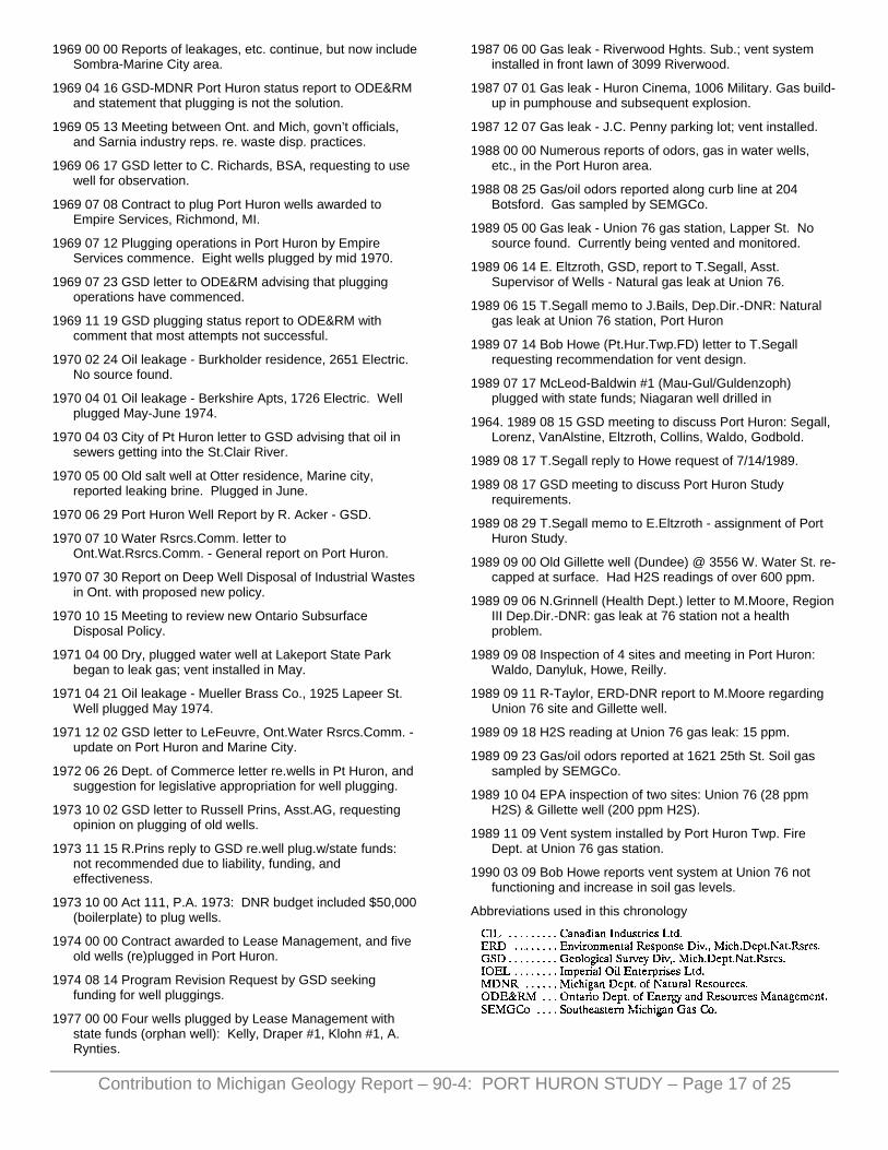
1969 00 00 Reports of leakages, etc. continue, but now include Sombra-Marine City area.
1969 04 16 GSD-MDNR Port Huron status report to ODE&RM and statement that plugging is not the solution.
1969 05 13 Meeting between Ont. and Mich, govn’t officials, and Sarnia industry reps. re. waste disp. practices.
1969 06 17 GSD letter to C. Richards, BSA, requesting to use well for observation.
1969 07 08 Contract to plug Port Huron wells awarded to Empire Services, Richmond, MI.
1969 07 12 Plugging operations in Port Huron by Empire Services commence. Eight wells plugged by mid 1970.
1969 07 23 GSD letter to ODE&RM advising that plugging operations have commenced.
1969 11 19 GSD plugging status report to ODE&RM with comment that most attempts not successful.
1970 02 24 Oil leakage - Burkholder residence, 2651 Electric. No source found.
1970 04 01 Oil leakage - Berkshire Apts, 1726 Electric. Well plugged May-June 1974.
1970 04 03 City of Pt Huron letter to GSD advising that oil in sewers getting into the St.Clair River.
1970 05 00 Old salt well at Otter residence, Marine city, reported leaking brine. Plugged in June.
1970 06 29 Port Huron Well Report by R. Acker - GSD.
1970 07 10 Water Rsrcs.Comm. letter to Ont.Wat.Rsrcs.Comm. - General report on Port Huron.
1970 07 30 Report on Deep Well Disposal of Industrial Wastes in Ont. with proposed new policy.
1970 10 15 Meeting to review new Ontario Subsurface Disposal Policy.
1971 04 00 Dry, plugged water well at Lakeport State Park began to leak gas; vent installed in May.
1971 04 21 Oil leakage - Mueller Brass Co., 1925 Lapeer St. Well plugged May 1974.
1971 12 02 GSD letter to LeFeuvre, Ont.Water Rsrcs.Comm. - update on Port Huron and Marine City.
1972 06 26 Dept. of Commerce letter re.wells in Pt Huron, and suggestion for legislative appropriation for well plugging.
1973 10 02 GSD letter to Russell Prins, Asst.AG, requesting opinion on plugging of old wells.
1973 11 15 R.Prins reply to GSD re.well plug.w/state funds: not recommended due to liability, funding, and effectiveness.
1973 10 00 Act 111, P.A. 1973: DNR budget included $50,000 (boilerplate) to plug wells.
1974 00 00 Contract awarded to Lease Management, and five old wells (re)plugged in Port Huron.
1974 08 14 Program Revision Request by GSD seeking funding for well pluggings.
1977 00 00 Four wells plugged by Lease Management with state funds (orphan well): Kelly, Draper #1, Klohn #1, A. Rynties.
1987 06 00 Gas leak - Riverwood Hghts. Sub.; vent system installed in front lawn of 3099 Riverwood.
1987 07 01 Gas leak - Huron Cinema, 1006 Military. Gas build-up in pumphouse and subsequent explosion.
1987 12 07 Gas leak - J.C. Penny parking lot; vent installed.
1988 00 00 Numerous reports of odors, gas in water wells, etc., in the Port Huron area.
1988 08 25 Gas/oil odors reported along curb line at 204 Botsford. Gas sampled by SEMGCo.
1989 05 00 Gas leak - Union 76 gas station, Lapper St. No source found. Currently being vented and monitored.
1989 06 14 E. Eltzroth, GSD, report to T.Segall, Asst. Supervisor of Wells - Natural gas leak at Union 76.
1989 06 15 T.Segall memo to J.Bails, Dep.Dir.-DNR: Natural gas leak at Union 76 station, Port Huron
1989 07 14 Bob Howe (Pt.Hur.Twp.FD) letter to T.Segall requesting recommendation for vent design.
1989 07 17 McLeod-Baldwin #1 (Mau-Gul/Guldenzoph) plugged with state funds; Niagaran well drilled in
1964. 1989 08 15 GSD meeting to discuss Port Huron: Segall, Lorenz, VanAlstine, Eltzroth, Collins, Waldo, Godbold.
1989 08 17 T.Segall reply to Howe request of 7/14/1989.
1989 08 17 GSD meeting to discuss Port Huron Study requirements.
1989 08 29 T.Segall memo to E.Eltzroth - assignment of Port Huron Study.
1989 09 00 Old Gillette well (Dundee) @ 3556 W. Water St. re-capped at surface. Had H2S readings of over 600 ppm.
1989 09 06 N.Grinnell (Health Dept.) letter to M.Moore, Region III Dep.Dir.-DNR: gas leak at 76 station not a health problem.
1989 09 08 Inspection of 4 sites and meeting in Port Huron: Waldo, Danyluk, Howe, Reilly.
1989 09 11 R-Taylor, ERD-DNR report to M.Moore regarding Union 76 site and Gillette well.
1989 09 18 H2S reading at Union 76 gas leak: 15 ppm.
1989 09 23 Gas/oil odors reported at 1621 25th St. Soil gas sampled by SEMGCo.
1989 10 04 EPA inspection of two sites: Union 76 (28 ppm H2S) & Gillette well (200 ppm H2S).
1989 11 09 Vent system installed by Port Huron Twp. Fire Dept. at Union 76 gas station.
1990 03 09 Bob Howe reports vent system at Union 76 not functioning and increase in soil gas levels.
Abbreviations used in this chronology
Contribution to Michigan Geology Report – 90-4: PORT HURON STUDY – Page 17 of 25
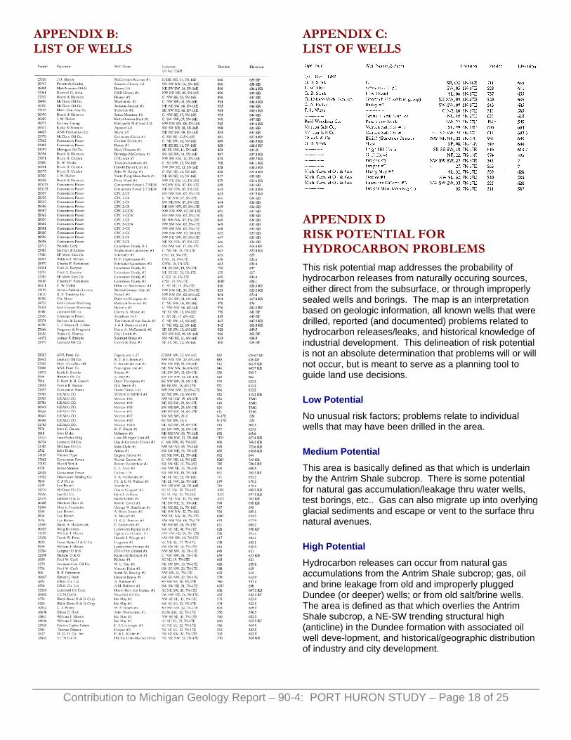
APPENDIX B: LIST OF WELLS
APPENDIX C: LIST OF WELLS
APPENDIX D RISK POTENTIAL FOR HYDROCARBON PROBLEMS This risk potential map addresses the probability of hydrocarbon releases from naturally occuring sources, either direct from the subsurface, or through improperly sealed wells and borings. The map is an interpretation based on geologic information, all known wells that were drilled, reported (and documented) problems related to hydrocarbon releases/leaks, and historical knowledge of industrial development. This delineation of risk potential is not an absolute determination that problems will or will not occur, but is meant to serve as a planning tool to guide land use decisions.
Low Potential
No unusual risk factors; problems relate to individual wells that may have been drilled in the area.
Medium Potential
This area is basically defined as that which is underlain by the Antrim Shale subcrop. There is some potential for natural gas accumulation/leakage thru water wells, test borings, etc.. Gas can also migrate up into overlying glacial sediments and escape or vent to the surface thru natural avenues.
High Potential
Hydrocarbon releases can occur from natural gas accumulations from the Antrim Shale subcrop; gas, oil and brine leakage from old and improperly plugged Dundee (or deeper) wells; or from old salt/brine wells. The area is defined as that which overlies the Antrim Shale subcrop, a NE-SW trending structural high (anticline) in the Dundee formation with associated oil well deve-lopment, and historical/geographic distribution of industry and city development.
Contribution to Michigan Geology Report – 90-4: PORT HURON STUDY – Page 18 of 25

Contribution to Michigan Geology Report – 90-4: PORT HURON STUDY – Page 19 of 25
FIGURE 1: DESCRIPTION The schematic of the subsurface in Port Huron is a composite of the Case Histories depicting the various ways by which hydro- carbons and fluids (brines, brackish and fresh water) can migrate between different formations, and between formations and the surface.
The old Dundee well (A) shows that if the well is not (properly) plugged, or not cased at all, or cased but corroded/damaged, fluids and gas can enter the
wellbore in the Dundee, Antrim, or Glacial Drift and migrate to upper zones, or to the surface. The same can occur in old salt wells (B), except here even more formations are involved. A good portion of the Case Histories represent this scenario.
Industrial wastes injected down a disposal well (C) can migrate, or thru increased pressure force formation fluids to migrate laterally in the Detroit River formation and enter old salt wells (B), or migrate into the Dundee formation thru fractures and eventually enter old Dundee wells (A). Actual access to the well- bore is the same as described for old Dundee wells.
Gas can enter water wells (D) directly if the well penetrates the Antrim Shale, or migrate into the overlying glacial sediments and then into the well. Case Histories 5, 7, 32, 40 are examples.
Deeper, more recent Niagaran wells (E) provide other potential avenues for gas/fluid migration into higher rock formations, or to the surface. Again, entry into the wellbore occurs in portions of the hole that may not be cased, cased but corroded, or improperly plugged. Case History 44 is an example.
Storage well (F) operations can also create potential for subsurface/surface problems if there is leakage from the storage zone which may overpressurize surrounding rock formations and initiate or alter gas/fluid migration.
In all the cases above, migration can also occur via the annulus (space between wellbore and the casing) if it is not properly sealed.

[MAP 1: Risk Assessment for Hydrocarbon Problems]
Contribution to Michigan Geology Report – 90-4: PORT HURON STUDY – Page 20 of 25

[MAP 2: Case History Locations]
Contribution to Michigan Geology Report – 90-4: PORT HURON STUDY – Page 21 of 25

[MAP 3: Drift Thickness]
Contribution to Michigan Geology Report – 90-4: PORT HURON STUDY – Page 22 of 25

[MAP 4: Bedrock Topography]
Contribution to Michigan Geology Report – 90-4: PORT HURON STUDY – Page 23 of 25

[MAP 5: Bedrock Geology]
Contribution to Michigan Geology Report – 90-4: PORT HURON STUDY – Page 24 of 25

[MAP 6: Contours on Top of the Dundee]
Contribution to Michigan Geology Report – 90-4: PORT HURON STUDY – Page 25 of 25