Embed Size (px)
DESCRIPTION
,
Citation preview
Continental Systems and Facies
Terrestrial depositional systems may include the
deposits of rivers, deserts, lakes, slope wastage and
ice sheets and glaciers.
We concentrate here on fluvial and desert systems.
Continental basins have a basic two-fold subdivision:
1. Basins with through drainage are dominated by well-established river systems and perennial lakes.
2. Basins with internal drainage are characterized by ephemeral river systems, generally shallow and short-lived lakes, continental sabkhas and deserts.
Fluvial Systems
Fluvial style is a complex response to a number of autocyclic and allocyclic controls.
The primary allocyclic controls include:
1) climate, which controls run-off (discharge) and the weathering of parent rocks, and
2) tectonics, which controls basin slopes and relief of hinterlands in the drainage basin.
This interplay results in a distinctive set of characters of the river system, e.g. sediment load, discharge, slope, vegetation which in turn determine channel pattern.
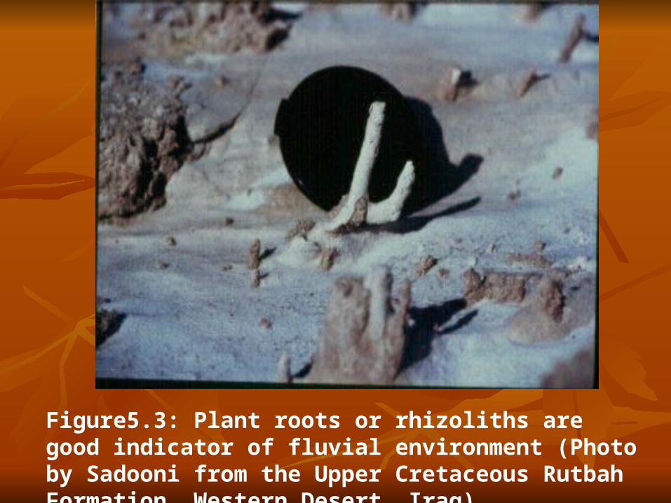
Figure5.3: Plant roots or rhizoliths are good indicator of fluvial environment (Photo by Sadooni from the Upper Cretaceous Rutbah Formation, Western Desert, Iraq).
Alluvial basin types can be classified according to a number of simple criteria:
Existence of transverse or longitudinal drainage systems. Transverse rivers may alternatively join a major longitudinal trunk river.
Nature of proximal, medial and distal elements. Tectonically active basin margins commonly have alluvial fans as proximal elements. Medial elements include braidplains and high-sinuosity
alluvial systems of transverse or longitudinal type. Distal elements may be lake margins, terminal fans and
sabkhas, deltas and estuaries.

River channel patterns are a sensitive response to type of load, discharge, slope and vegetation. They can be divided into a number of types based on:
suspended-, mixed- or bed-load transport. (Schumm 1963)
channel sinuosity (Leopold and Wolman 1957, Rust 1978)
single or multiple thalweg (cf. Rust's (1978) braiding parameter).
The channel pattern, lateral migration and vertical accretion of the river and floodplain all respond to a delicate balance in a wide range of variables. Three principal river types exist:
(1) Meandering river facies model
(2) Sandy braided stream model
(3) Anastomosing rivers
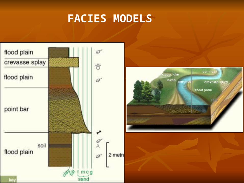
(1) Meandering River Facies Model
The morphological elements of a meandering river system, are shown in Fig. 5.2.
Sand deposition is normally restricted to the main channel with its point-bars and chute bars.
The floodplain and levees receive finer grades of sediment during river floods.
The channel floor commonly has a coarse lag of pebbles which are only moved at maximum flood velocities.
During 'average' discharges, sand is moved through the system in dunes on the channel floor and in ripples higher on the point bar.
The migration of the meander bend therefore commonly results in the upward passage from coarse lag to trough cross-stratification to ripple cross-lamination, all preserved by the process of lateral accretion.
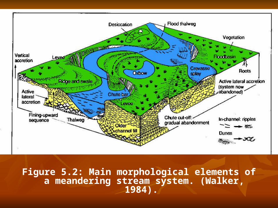
Figure 5.2: Main morphological elements of a meandering stream system. (Walker, 1984).

The meandering river facies model comprises therefore, classically at least, a fining-up sequence.
This serves merely as a norm by which the many possible variations can be compared.
In three dimensions, the sandbodies representing point-bar sheets should be elongated in the longitudinal direction.
In the transverse direction, their extent will be controlled by the rate of lateral migration of the meander loop and the duration of steady lateral migration in between abandonment phases.
FACIES MODELS
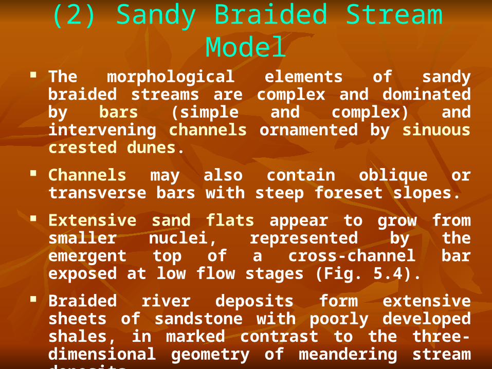
(2) Sandy Braided Stream Model The morphological elements of sandy braided streams are
complex and dominated by bars (simple and complex) and intervening channels ornamented by sinuous crested dunes.
Channels may also contain oblique or transverse bars with steep foreset slopes.
Extensive sand flats appear to grow from smaller nuclei, represented by the emergent top of a cross-channel bar exposed at low flow stages (Fig. 5.4).
Braided river deposits form extensive sheets of sandstone with poorly developed shales, in marked contrast to the three-dimensional geometry of meandering stream deposits.
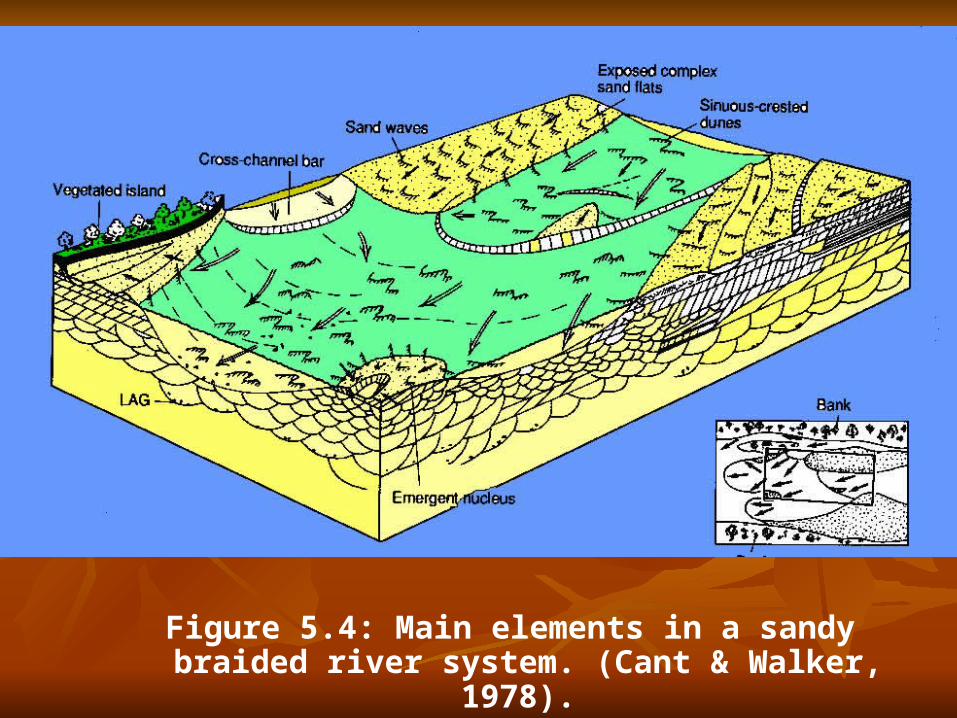
Figure 5.4: Main elements in a sandy braided river system. (Cant & Walker, 1978).
(3) Anastomosing Rivers
A number of studies suggest that a river type characterized by multiple but relatively stable channels exists, although there are at present relatively few documentations of ancient examples.
There is not an anastomosing river model, but there are some interesting and useful descriptions of individual rivers.
Anastomosed rivers appear to be favoured by high rates of vertical aggradation, causing stabilization of channels between adjacent wetlands. Such conditions might be induced by the local raising of base levels (Fig. 5.5).
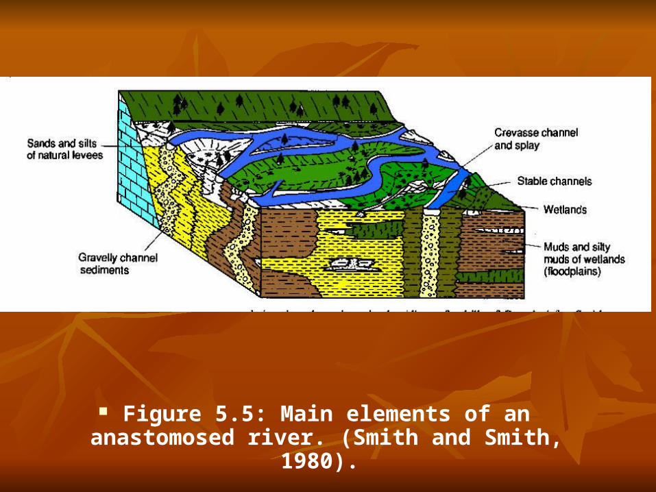
Figure 5.5: Main elements of an anastomosed river. (Smith and Smith, 1980).
Eolian Systems Deserts include a variety of environments of
deposition from the giant sand seas or ergs, to stony wastelands, interdune sabkhas with temporary lakes, and dried up river courses.
Deserts occur in both Arctic areas, where sediment is derived from wasting glaciers, and tropical zones where ergs are concentrated.
Areas of low rainfall occur as two discontinuous belts around latitudes of 20-30° and are associated with persistently high atmospheric pressures.
Deserts also occur in the centres of large continental masses.
The occurrence of aeolian deposits in the stratigraphic record is therefore to a large extent a reflection of an ancient climatic zone

http://www.uoregon.edu/~millerm/sanddunes.html
The average thickness of the erg may exceed 100 m with bedform (draa) heights of several tens of metres to over 200 m.
Aeolian sequences are characterized by a hierarchy of bounding surfaces, some of which 'slice' through the entire aeolian stratigraphy and are clearly allogenic and of inter-regional importance.
Some bounding surfaces are widespread and related to deflation down to a water table - these are known as 'Stokes surfaces'.
Others are related to the climb of draas and smaller superimposed bedforms and are therefore autogenic.
Distinct trends have been identified in transects from the erg centre to the erg margin.
Such erg fringes may merge with ephemeral fluvial systems, playa lakes or marine environments.
These erg margin environments are characterized by a complex interaction of sedimentary processes.
Aeolian sequences are dominated by cross-stratified sandstones and facies models rely on the recognition of a hierarchy of migrating aeolian bedforms.
Much recent interest, however, has focused on the finer-grained intercalations within aeolian sequences that may represent:
interdunal environments playas and continental sabkhas products of ephemeral stream activity.
These intercalations are particularly common at the fringes of the large ancient sand seas or ergs.
As a result, models of aeolian-fluviatile interaction and aeolian-lacustrine interaction are being developed.
Interdune areas are an integral part of the aeolian system. In sand-depleted areas, the inter-dunes consist of deflated surfaces
lined with coarse lags or thin sand sheets and small isolated dunes. Where the water table is elevated, sabkhas with evaporites may form. A range of depositional conditions in the interdunal areas from dry to
damp to wet can be recognized in the Arabian Desert. The interdune sediments are extremely important in contributing to
the heterogeneity of aeolian reservoirs.

Siliciclastic shoreline systems The geomorphology and oceanography of the Earth's
siliciclostic coastlines reveals an exceedingly complex interplay between fluvial input on the one hand, and basinal parameters such as wave energy, tidal range, storm regime on the other.
The two main types of coastal depositional system are deltaic and non-deltaic.
Non-deltaic coastal systems may be (1) wave-dominated, containing beaches, microtidal barrier islands
and cheniers,
(2) mixed wave-tide influenced consisting of me-sotidal barrier islands with tidal inlets and ebb- and flood-tidal deltas, and
(3) tide-dominated, made up of tidal flats and estuaries.
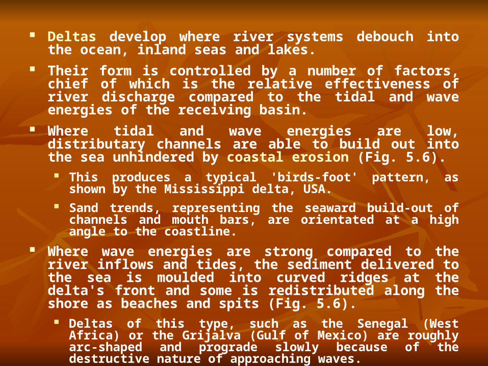
Deltas develop where river systems debouch into the ocean, inland seas and lakes.
Their form is controlled by a number of factors, chief of which is the relative effectiveness of river discharge compared to the tidal and wave energies of the receiving basin.
Where tidal and wave energies are low, distributary channels are able to build out into the sea unhindered by coastal erosion (Fig. 5.6).
This produces a typical 'birds-foot' pattern, as shown by the Mississippi delta, USA.
Sand trends, representing the seaward build-out of channels and mouth bars, are orientated at a high angle to the coastline.
Where wave energies are strong compared to the river inflows and tides, the sediment delivered to the sea is moulded into curved ridges at the delta's front and some is redistributed along the shore as beaches and spits (Fig. 5.6).
Deltas of this type, such as the Senegal (West Africa) or the Grijalva (Gulf of Mexico) are roughly arc-shaped and prograde slowly because of the destructive nature of approaching waves.
Sand trends are generally orientated parallel to shore.

Deltas strongly affected by tides have tidal channels cutting deep into the coastline with associated tidal sand ridges or shoals elongated in the same direction as the tidal current pathways (Fig. 5.6).
The Ganga-Brahmaputra delta in the Bay of Bengal, and the Mahakam delta, Indonesia, are of this type.
Linear sand trends are generally elongated at a high angle to the shoreline.
Depositional patterns at river mouths can also be studied in relation to the dynamics of outflow dispersion.
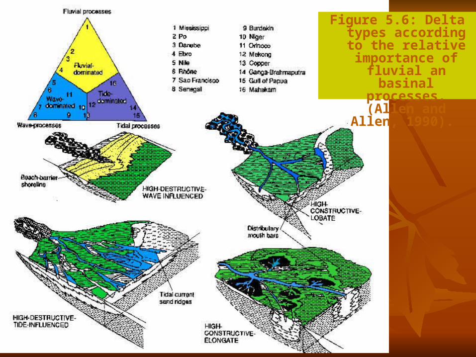
Figure 5.6: Delta types according to the
relative importance of fluvial an basinal
processes. (Allen and Allen, 1990).
1 River-dominated deltas
River-dominated deltas, exemplified by the present-day Mississippi, are characterized by distributaries and interdistributary bays flanked with marshes.
The sequential filling by crevasse splays and abandonment of an interdistributary bay is well illustrated in West Bay on the Mississippi delta.
The vertical sequence differs considerably according to proximity to the crevasse channel.
Progradation of the mouth bar produces large scale (60-150m) coarsening-upward sequences representing the passage from prodelta muds to bar front to bar crest.
2 Wave-dominated deltas
Wave-dominated deltas are characterized by beach ridge complexes with active shorelines, shallow lagoons between old beach ridges and aeolian dunes in areas of ridge reworking.
Progradation should once again lead to a coarsening-upwards sequence, the uppermost part of the sequence comprising high-energy beachface deposits and rarely an aeolian capping.
The Costa de Nayarit delta in Mexico is an example of a prograding wave dominated delta.
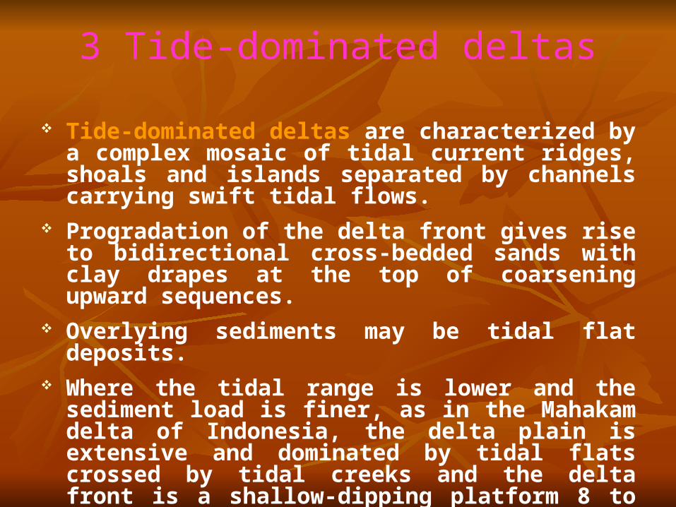
3 Tide-dominated deltas
Tide-dominated deltas are characterized by a complex mosaic of tidal current ridges, shoals and islands separated by channels carrying swift tidal flows.
Progradation of the delta front gives rise to bidirectional cross-bedded sands with clay drapes at the top of coarsening upward sequences.
Overlying sediments may be tidal flat deposits. Where the tidal range is lower and the sediment load is
finer, as in the Mahakam delta of Indonesia, the delta plain is extensive and dominated by tidal flats crossed by tidal creeks and the delta front is a shallow-dipping platform 8 to 10 km wide of wave reworked silts and sands.
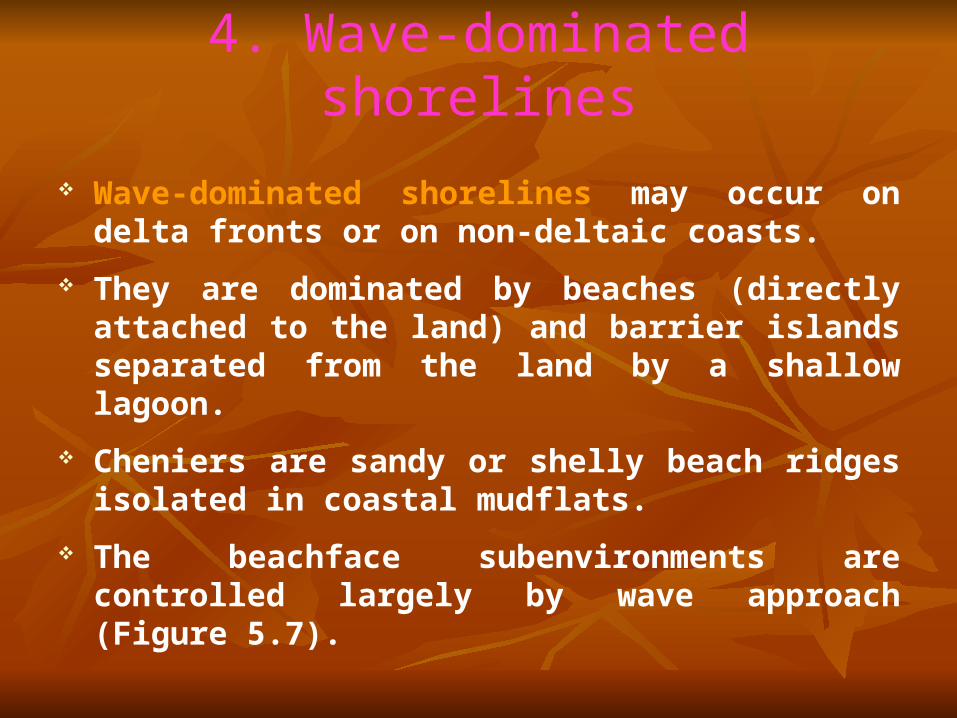
4. Wave-dominated shorelines
Wave-dominated shorelines may occur on delta fronts or on non-deltaic coasts.
They are dominated by beaches (directly attached to the land) and barrier islands separated from the land by a shallow lagoon.
Cheniers are sandy or shelly beach ridges isolated in coastal mudflats.
The beachface subenvironments are controlled largely by wave approach (Figure 5.7).
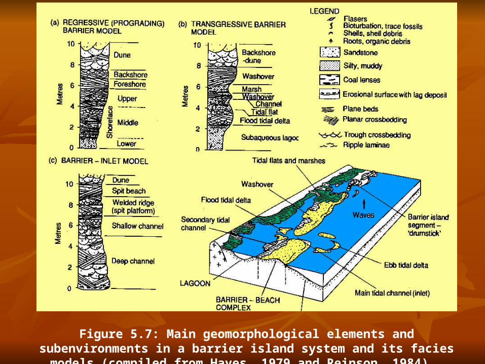
Figure 5.7: Main geomorphological elements and subenvironments in a barrier island system and its facies models (compiled from Hayes, 1979 and Reinson, 1984).
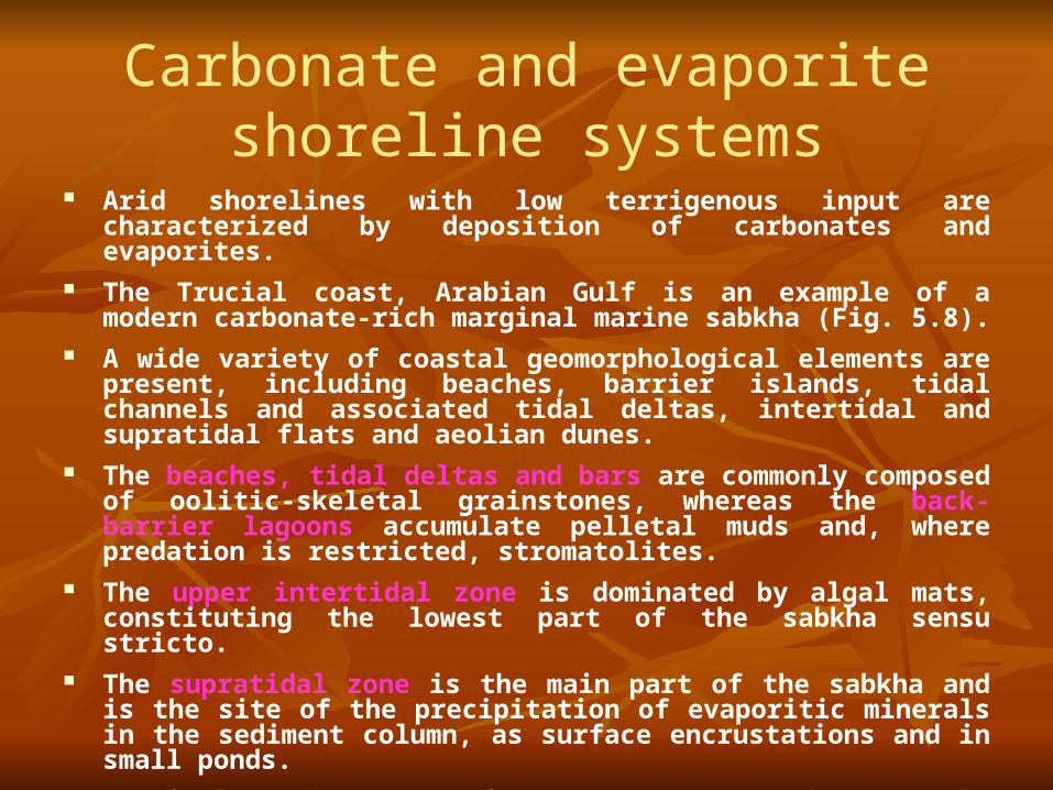
Carbonate and evaporite shoreline systems
Arid shorelines with low terrigenous input are characterized by deposition of carbonates and evaporites.
The Trucial coast, Arabian Gulf is an example of a modern carbonate-rich marginal marine sabkha (Fig. 5.8).
A wide variety of coastal geomorphological elements are present, including beaches, barrier islands, tidal channels and associated tidal deltas, intertidal and supratidal flats and aeolian dunes.
The beaches, tidal deltas and bars are commonly composed of oolitic-skeletal grainstones, whereas the back-barrier lagoons accumulate pelletal muds and, where predation is restricted, stromatolites.
The upper intertidal zone is dominated by algal mats, constituting the lowest part of the sabkha sensu stricto.
The supratidal zone is the main part of the sabkha and is the site of the precipitation of evaporitic minerals in the sediment column, as surface encrustations and in small ponds.
Detrital carbonate grains are transported onto the sabkha by marine flooding.
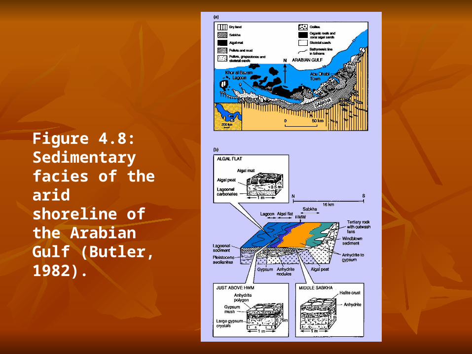
Figure 4.8: Sedimentary facies of the arid shoreline of the Arabian Gulf (Butler, 1982).

Arid shorelines may also be dominated by siliciclastic sedimentation, as in Baja California, the Gulf of Elat and some parts of the Arabian Gulf (e.g. east Qatar).
Here the sabkhas are composed of siliceous sands and muds with a possible admixture of carbonate grains.
In many ways siliciclastic sabkhas are similar to their carbonate-rich counterparts.
During progradation of the sabkha, normal marine sediments are first overlain by intertidal deposits, then supratidal sabkha evaporites, giving a vertical sequence indicative of increasing salinity.
The thickness of the vertical sequence should approximate the tidal range of the adjacent sea, that is, 0.5 to 3 m.
In some sabkhas, however, the deposits are arranged in a 'bulls-eye' pattern, suggesting the progressive filling of water bodies rather than shoreline progradation.
The preservation of very thick sabkha deposits (> a few metres ) suggests that either subsidence matched the rate of deposition over a long period of time or that sea level was rising at the same rate as deposition.
Carbonate sediments are produced in great abundance in shallow, warm waters where the biological and physicochemical conditions are optimal for carbonate precipitation and fixation.
Because the sedimentation rate commonly outstrips the rate of subsidence, the sedimentary surface shallows with time, giving a shallowing upward sequence.
The sequence typically has four or five parts comprising a basal high-energy trans-gressive deposit, subtidal carbonates, intertidal stromatolitic sediments and finally supratidal to terrestrial deposits.
Intertidal sediments may be of low-energy tidal-flat type or may be high-energy beaches.
1 Sequences containing low-energy tidal flats
There are a number of well-studied modern examples of carbonate tidal flats, e.g. southern coast of Arabian Gulf, Bahama Banks platform and Shark Bay, Australia. The main morphological elements are:
1 A protective barrier of carbonate sand shoals, islands and reefs, dissected by tidal channels.
2 A shallow muddy lagoon.
3 Tidal flats occurring along the landward edge of the barrier, and as a wide belt attached to the mainland.
There are two contrasting sequences that may result from either progradation of the wide shore-attached tidal flats or by shoaling of the offshore barrier, termed a muddy sequence and a grainy sequence respectively (Fig. 5.9).
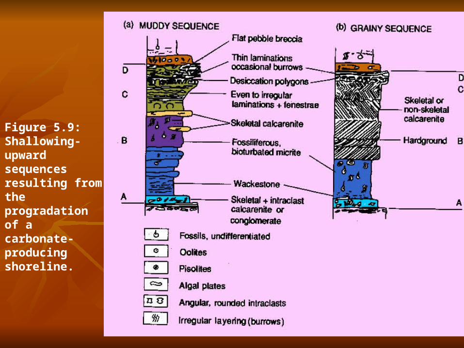
Figure 5.9: Shallowing-upward sequences resulting from the progradation of a carbonate-producing shoreline.
A variation on the muddy and grainy sequences is the development of abundant stromatolites or reefs.
Shoaling of large bioherms in the back-reef environment of reef complexes results in a capping of beach carbonate sands or conglomerate and fenestral and laminated intertidal sediments.
If the groundwaters are continuously within the field of gypsum precipitation, evaporite minerals grow as a gypsum mush in the intertidal sediments, as coalescing nodules (chicken-wire texture) or as folded layers ('enterolithic' texture).
Formation of evaporite minerals is accompanied by widespread dolomitization of intertidal zone sediments.
Collapse of evaporite-bearing layers takes place if the sequence is flushed by meteoric 'fresh' waters, producing brecciated horizons.
Anhydrite crystals are commonly leached, forming vugs which may subsequently be filled with quartz or chalcedony, and the dolomite may be calcitized (so-called 'dedolomitization').

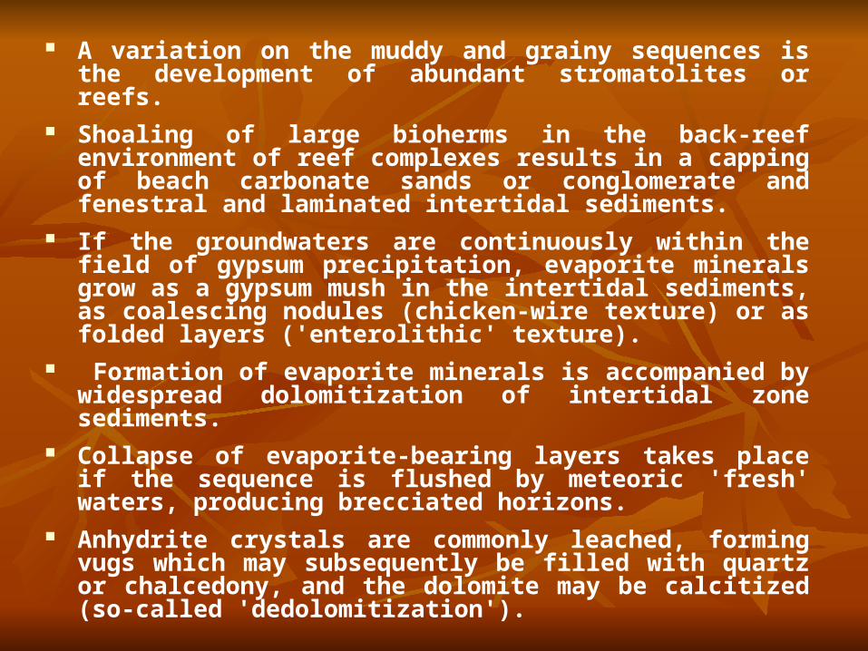
2. Sequences containing high-energy intertidal units
These sequences differ from those containing extensive low-energy tidal flats in having foreshore sediments as an important component.
These sediments are generally cross-stratified carbonate sands. Calcretes, karsts or soils may cap the shallowing-up sequence (Fig. 5.10).
The mechanism for producing repeated shallowing upward sequences is not well known.
An allocyclic eustatic mechanism involving repeated rapid sea level rises has been suggested, as has a purely autocyclic mechanism involving changes in the rate of carbonate sedimentation controlled by the sub-tidal source area.
As the tidal flat wedge progrades onto the shallow subtidal shelf, the area of source area is reduced, so that progra-dation is self-limiting.
Continued relative sea level rise (caused by a eustatic rise or subsidence) floods the tidal flat wedge and the process of progradation begins again.
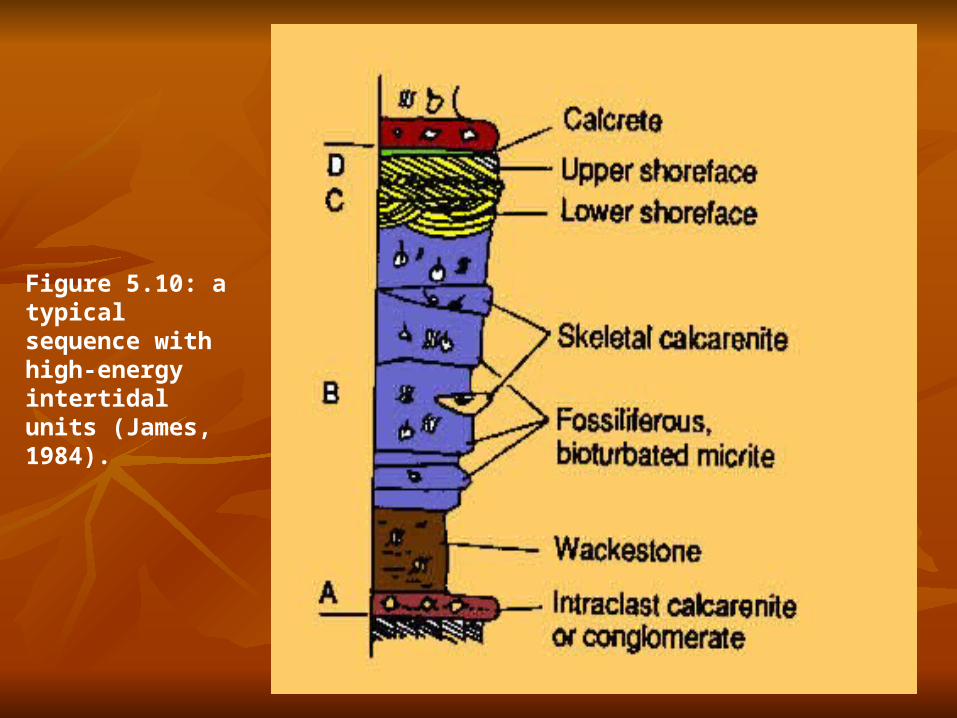
Figure 5.10: a typical sequence with high-energy intertidal units (James, 1984).
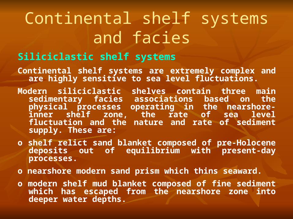
Continental shelf systems and facies
Siliciclastic shelf systemsContinental shelf systems are extremely complex and are highly sensitive
to sea level fluctuations.
Modern siliciclastic shelves contain three main sedimentary facies associations based on the physical processes operating in the nearshore-inner shelf zone, the rate of sea level fluctuation and the nature and rate of sediment supply. These are:
o shelf relict sand blanket composed of pre-Holocene deposits out of equilibrium with present-day processes.
o nearshore modern sand prism which thins seaward.
o modern shelf mud blanket composed of fine sediment which has escaped from the nearshore zone into deeper water depths.
Some sediment on the shelf (perhaps 50 per cent of the Earth's shelf area), is relict, that is, it is remnant from an earlier environment and is now out of equilibrium with the new environment; other sediments are termed palimpsest which means that they are reworked and therefore possess aspects of both their present and former environments; finally, some sediment is modern and is supplied from outside the shelf area.
Facies sequences should, however, be dominated by the deposits of flow-transverse tidal sandwaves and/or flow-parallel tidal sand ridges with a stratification pattern indicative of systematic flow reversals or, more likely, systematic variations in the sediment transport rate.
Storm-dominated shelves are generally dominated by the accumulation of mud derived from major river mouths, with sand being concentrated on the inner shelf, as on the southern Oregon shelf.
Repeated transgressions and regressions may clean up the muds, concentrating the sand into distinct sediment bodies.
Carbonate shelf systems and reefs
Much of the continental shelf between the latitudes of 30 °S and 30 °N is an area of high organic productivity and is covered not by river-derived or relict siliciclastic sediments, but by organic carbonate material.
There are two major categories of subtropical carbonate shelf (Ginsburg and James 1974).
(1) Rimmed shelves sheltering protected shelf lagoons. Their margins often fall precipitously into the abyssal depths. Some rimmed shelves are attached to continental areas. Others are now isolated platforms.
(2) Open shelves on the other hand, slope gently towards the continental edge and are termed 'ramps'. Because of the lack of a protective rim, they are strongly affected by storm waves and tidal currents.
Reefs are biogenic constructions on the seafloor and reef facies models must successfully integrate sedimentological and palaeontological observations.
Reefs can generally be divided into (1) reef core comprising skeletons of reef-building organisms and a lime-mud
matrix, (2) reef flank of bedded reef debris and (3) inter-reef of subtidal shallow marine carbonates (or siliciclastics).
Where reefs form a natural breakwater on the windward sides of shelves or islands, however, they protect a back-reef environment from wave attack.
Here the arrangement of reef facies is strongly asymmetrical. o High-energy reefs are zoned into reef crest, reef front, reef flat, back reef and
fore reef. o Low-energy reefs are less well zoned and commonly occur as isolated,
circular to elliptical 'patch-reefs'. o Reef mounds are flat lenses to steep conical piles of poorly sorted bioclastic
lime mud which accumulated in quiet water. Some reef mounds possess no large skeletons, being dominated by lime mud. These 'Waulsortian mounds', or mud mounds, occur in deeper water on carbonate slopes.
o Stromatolite reefs are common in the Precam-brian and Palaeozoic, before the appearance of grazing metazoans. (HofFman 1974, Grotzinger 1989).
A facies model for reefs has been proposed which is based on four growth stages:
1. Pioneer stage when loose sediment accumulations are stabilized by organisms with roots or holdfasts.
2. Colonization stage during which reef-builders join the stabilized mound.
3. Diversification stage, representing most of the reef mass, is characterized by rapid upward growth towards sea level and a distinct zonation develops.
4. Domination stage at which point the reef has built to an elevation that produces a surf zone and reef flat.
Many reefs show stacked patterns of reef growth separated by horizons testifying to dissolution, karst and paleosol development and the formation of hardgrounds.
Reef facies models are complicated by the changing nature of the biota through geological time.
Deep sea systems and faciesThere are three fundamentally different environments of deposition of clastic sediments in the deep sea:
Slope-aprons, which accumulate between the shelf and basin floor, vary in width from less than 1 km to over 200 km.
Normal clastic slope aprons have a smooth convex-concave profile built by slope progradation.
Faulted slope aprons typically have a highly stepped profile with perched basins alternating with steeply dipping slope segments.
Carbonate slope arpons may form against reef edges or carbonate shoal margins.
Where such margins are steep, sediment largely bypasses the slope apron and it is dominated by calcirudite talus wedges.
Where the margins are gentle, the slope apron is more actively depositional and more like its clastic counterpart.