Embed Size (px)
Citation preview

-2.0m AHD
-1.0m AHD
0.0m AHD
1.0m AHD
2.0m AHD
3.0m AHD
4.0m AHD
5.0m AHD
6.0m AHD
7.0m AHD
MHWS
MLWS
MSL
REV.NO.
PROJECT NAME
DRAWING TITLE
DRAWN :
SIZE:
DRAWING No.
CHECKED :
SCALE :
APPROVED :
DATE :
DESCRIPTIONDATE
REVISION REGISTER
BY ENG. APP.
LEGEND
LOCALITY PLAN
REVISION:
NOTES
InternationalCoastalManagement
OFFICE 50G 1 MacArthur Parade, Main Beach, 4217, QLD, AustraliaPOST PO Box 306, Main Beach LPO, Main Beach QLD, 4217, AustraliaTELEPHONE +61 7 55640564 FAX +61 7 55329147WEBSITE www.coastalmanagement.com.au
RPEQ 2876
VERTICAL DATUM: HORIZONTAL DATUM:
19 Dec, 2016
SK AJ AJ
A3 A3
BSR - CS3 - 003
BELONGIL SEAWALL REPAIRS
-
- - - - - AJ
- - - - - -
- - - - - -
- - - - - -
- - - - - -
- - - - - -
X-SECTION A (PRESENT)
AHD -
X-SECTION A (PRESENT)
DAMAGED RUBBLE WALL (TO BE REPAIRED)Present Profile (2016)ROCK FILL
ROCK FILL
ROCK FILL
TOP OF SLOPE+5.3m AHD
EXISTING PUBLIC WALKWAY(TURFED)
VARIOUS ROCK SIZES BEHIND DAMAGED RUBBLE WALL
Typical Profile [approx. 1V:1.5H](from historical photos and surveys)
PROJECT NAME
DRAWING TITLE
DRAWN :
SIZE:
DRAWING No.
CHECKED :
SCALE :
APPROVED :
DATE :
DESCRIPTIONDATE
REVISION REGISTER
BY ENG. APP.
LOCALITY PLAN
REVISION:
InternationalCoastalManagement
OFFICE 50G 1 MacArthur Parade, Main Beach, 4217, QLD, AustraliaPOST PO Box 306, Main Beach LPO, Main Beach QLD, 4217, AustraliaTELEPHONE +61 7 55640564 FAX +61 7 55329147WEBSITE www.coastalmanagement.com.au
RPEQ 2876
VERTICAL DATUM: HORIZONTAL DATUM:
19 Dec, 2016
SK AJ AJ
A3 A3
BSR - CS3 - 007
BELONGIL SEAWALL REPAIRS
-
- - AJ -
- - - -
- - - -
- - - -
- - - -
- - - -
CONSTRUCTION PLAN
AHD -
CONSTRUCTION PLAN
1. Construction access to be from 'Old Jetty Site'- Construction access to be adequatelyfenced
2. Provide safe access to beach over repairedwall at each end.
Safety Fence
Approximate Property Boundary
APPROX. P
ROPERTY B
OUNDARY
PROX. P
ROPERTY B
OUNDARY
APP
APPRO
X. PRO
PERTY
BO
UNDAR
Y
RE
V.N
O.
LE
GE
ND
NO
TE
S
--
--
--
--
--
--
SAFETY FENCE
SA
FE
TY F
EN
CE
SAFETY FENCE
RETA
IN H
IGH
TID
E A
CC
ESS A
LON
G B
EAC
HRETA
IN H
IGH T
IDE A
CCESS ALO
NG B
EACH
CONSTRUCTIO
N ACCESS
EXIS
TIN
G P
UBLI
C W
ALK
WAY
(SEE N
OTE
2)
REPA
IR E
XISTIN
G W
ALL A
ND T
IE IN
WIT
H A
DJA
CEN
T W
ALLS
Development Application
PLANNERS NORTH, December 2016
Proposal to repair existing coastal
protection works at Belongil

COMPLIANCE AND USAGE STATEMENT
This Statement of Environmental Effects has been prepared and submitted under Part 4 of the
Environmental Planning and Assessment Act 1979 by:
Preparation
Name: Kate Singleton
Company: PLANNERS NORTH
Address: 3/69 Centennial Circuit, Byron Bay, NSW, 2481
Postal Address: P.O. Box 538 Lennox Head NSW 2478
In respect of: Development Application
Application
Proponent: Michael Siddle
Address: C/ - PLANNERS NORTH
P.O. Box 538, Lennox Head NSW 2478
Land to be developed: Land immediately to the north east of Lots 32-36 Section 2 DP 1623
comprising an existing seawall
Proposed development: Proposal to repair existing coastal protection works
Environmental Assessment: Statement of Environmental Effects
Certificate
I certify that I have prepared the content of this Development Application and to the best of my
knowledge:
it is in accordance with the Act and Regulations, and
it is true in all material particulars and does not, by its presentation or omission of information,
materially mislead.
Notice
The plans to this document were prepared for the exclusive use of the proponent and are not to be
used for any other purpose or by any other person or corporation. PLANNERS NORTH accepts no
responsibility for any loss or damage suffered howsoever arising to any person or corporation who
may use or rely on this document for purposes other than the proposed development.
Plans accompanying this document may not be reproduced, stored or transmitted in any form unless
this note is included.
PLANNERS NORTH declares that it does not have, nor expects to have, a beneficial interest in the
subject project. Nor does it have any reportable political donations within the meaning of Section
147(3) of the Act to declare.
No extract of text from this document may be reproduced, stored or transmitted in any form without
the prior consent of PLANNERS NORTH.
Kate Singleton MPIA CPP
PARTNERSHIP PRINCIPAL
Ref: 1540.1130
Date: December 2016
ABN 56 291 496 553
3/69 Centennial Circuit
Byron Bay NSW 2481
T: 1300 66 00 87
W: plannersnorth.com.au

REPAIR OF EXISTING SEAWALL
EXECUTIVE SUMMARY
i
1540.1130
PLANNERS NORTH has been engaged by Michael Siddle to provide Town Planning advice with respect to
the preparation and lodgement of a Development Application. Development consent is sought for the
repair of existing coastal protection works comprising a seawall to the immediate north east of Lots 32-
36 Section 2 DP 1623.
The proposal to repair the coastal protection works is a product of several factors including:
Responding to the identified structural inadequacies of the existing sea wall; and
Supreme Court of NSW Consent Orders made on 12 August 2016.
This report is accompanied by plans and supporting information prepared by International Coastal
Management in relation to the design and construction of the repair works. The proposed works are not
considered likely to result in any impacts on the existing natural or built environment. Further, the
proposed works provide for the enhancement of the existing public walkway and will address risks
associated with the existing structure.
It is important to note how the Supreme Court of NSW Consent Orders function. Under the Consent
Orders, the Council cannot take any action to remove any part of the current protection works. So,
unless maintained properly, the walls would fall into disrepair and become dangerous.
The Consent Orders facilitate the ongoing maintenance of the walls and this DA is the first step in the
long term maintenance of current protection measures.
The proposed works are consistent with relevant statutory and policy provisions and it is concluded that
the proposed works warrant approval.

REPAIR OF EXISTING SEAWALL ii
1540.1130
T A B L E O F C O N T E N T S
1. INTRODUCTION ____________________________________________________________________________________ 1
Background __________________________________________________________________________________ 1 1.1
Structure of Report and its Scope _____________________________________________________________ 1 1.2
Further Information __________________________________________________________________________ 1 1.3
2. THE SITE AND ITS CONTEXT ________________________________________________________________________ 3
Cadastral Description _________________________________________________________________________ 3 2.1
Site Context __________________________________________________________________________________ 3 2.2
Site History ___________________________________________________________________________________ 3 2.3
3. THE DEVELOPMENT PROPOSAL ____________________________________________________________________ 5
Site Planning Objectives ______________________________________________________________________ 5 3.1
General Description of Proposal ______________________________________________________________ 5 3.2
Ancillary Approvals ___________________________________________________________________________ 6 3.3
4. STATUTORY AND POLICY PLANNING _______________________________________________________________ 8
Statutory Considerations _____________________________________________________________________ 8 4.1
4.1.1 Deemed Environmental Planning Instruments _________________________________________ 8 4.1.2 Local Environmental Plans _____________________________________________________________ 8 4.1.3 Development Control Plans ___________________________________________________________ 11 4.1.4 State Environmental Planning Policies ________________________________________________ 11 4.1.5 Coastal Protection Act 1979 ___________________________________________________________ 15 4.1.6 The Marine Estate Management Act 2014 _____________________________________________ 18 4.1.7 Certified Draft Plans __________________________________________________________________ 18 4.1.8 Specific Environmental Planning & Assessment Act Requirements ____________________ 18 4.1.9 Integrated Development Considerations ______________________________________________ 18
Contribution Plans ___________________________________________________________________________ 19 4.2
Local Policy Controls _________________________________________________________________________ 19 4.3
State Government Policy ____________________________________________________________________ 19 4.4
Ancillary Legislation _________________________________________________________________________ 25 4.5
5. ENVIRONMENTAL INTERACTIONS _________________________________________________________________ 26
Context and Setting _________________________________________________________________________ 26 5.1
Public Access ________________________________________________________________________________ 26 5.2
Natural and Built Environment ______________________________________________________________ 26 5.3
6. CONCLUSION _____________________________________________________________________________________ 27
7. REFERENCES ______________________________________________________________________________________ 28
LIST OF PLANS
Plan 1.1 The Locality ________________________________________________________________________________ 2 Plan 2.1 The Site ____________________________________________________________________________________ 4 Plan 3.1 The Proposal _______________________________________________________________________________ 7 Plan 4.1 LEP Zoning ________________________________________________________________________________ 10
LIST OF TABLES
Table 4.1 Review of Key Provisions of the NSW Coastal Policy 1997 _________________________________ 19

REPAIR OF EXISTING SEAWALL iii
1540.1130
A P P E N D I C E S
APPENDIX A Supreme Court of NSW Consent Orders ______________________________________________ 29
APPENDIX B Plans prepared by International Coastal Management ________________________________ 36
APPENDIX C Ecological Assessment ________________________________________________________________ 45

REPAIR OF EXISTING SEAWALL 1
1540.1130
1 . I N T R O D U C T I O N
This section of the report identifies the nature of client instructions, relevant background information and
the structure of the report.
B A C K G R O U N D 1.1
PLANNERS NORTH has been engaged by Michael Siddle to provide
Town Planning advice with respect to the preparation and
lodgement of a Development Application with the New South Wales
Coastal Panel.
S T R U C T U R E O F R E P O R T A N D I T S S C O P E 1.2
Section 2 of this report describes the physical characteristics of
the subject land and its planning context. Section 3 describes in
detail the development proposal. Having regard to the provisions
of Section 79C (1)(a) of the Environmental Planning and
Assessment Act 1979 and Section 55M of the Coastal Protection Act 1979, Section 4 sets out an
examination of the statutory and policy planning status relating to the land, with particular regard to
the proposal described in Section 3. Section 5 looks at the environmental interactions of the
proposal. The final section of the report undertakes a general review of the project and summation
as to the appropriateness of the project having regard to the planning controls applying to the land
and land use needs in the locality and matters set out for consideration in Section 79C (1)(e) of the
Environmental Planning and Assessment Act 1979 and the provisions of the Coastal Protection Act
1979 Regulations.
F U R T H E R I N F O R M A T I O N 1.3
Should the New South Wales Coastal Panel require any additional information, or wish to clarify any
matter raised by this proposal or submissions made to same, Council is requested to consult with
Kate Singleton prior to determination of this application.
The existing structure as viewed from the
north west looking east east.

SUFFOLK PARK
SIT
E L
OC
AL
ITY
PL
AN
PLAN 1.10 1250m
SOURCE: S J CONNELLY PTY LTD
DATE: JANUARY 2006
FILE: 1054692
Wategos
Beach
Main Beach
Belongil Beach
BA
YS
HO
RE
SHIRLEY ST
JON
SO
N S
T
EWINGSDALE ROADJO
NS
ON
ST
Ra
ilwa
y Line
Railway Line
LAWSON ST
DRIV
E
BA
YS
HO
RE
SHIRLEY ST
CHILDE ST
MAN
FRED
ST
KE
ND
ALL
ST
BYRON BAY
TOWN CENTRE
BYRON BAY
TOWN CENTRE
BYRON BAY
TOWN CENTRE
SIX Aerial View
Byron Bay Locality Map
SUBJECT SITE
So
urc
e:
S J
Co
nn
elly
1540.1130
REPAIR OF EXISTING SEA WALL
Plan 1.1
SITE
LOCALITY
PLAN
0 500m
1 : 25 000 @ A4
No
rth

REPAIR OF EXISTING SEAWALL 3
1540.1130
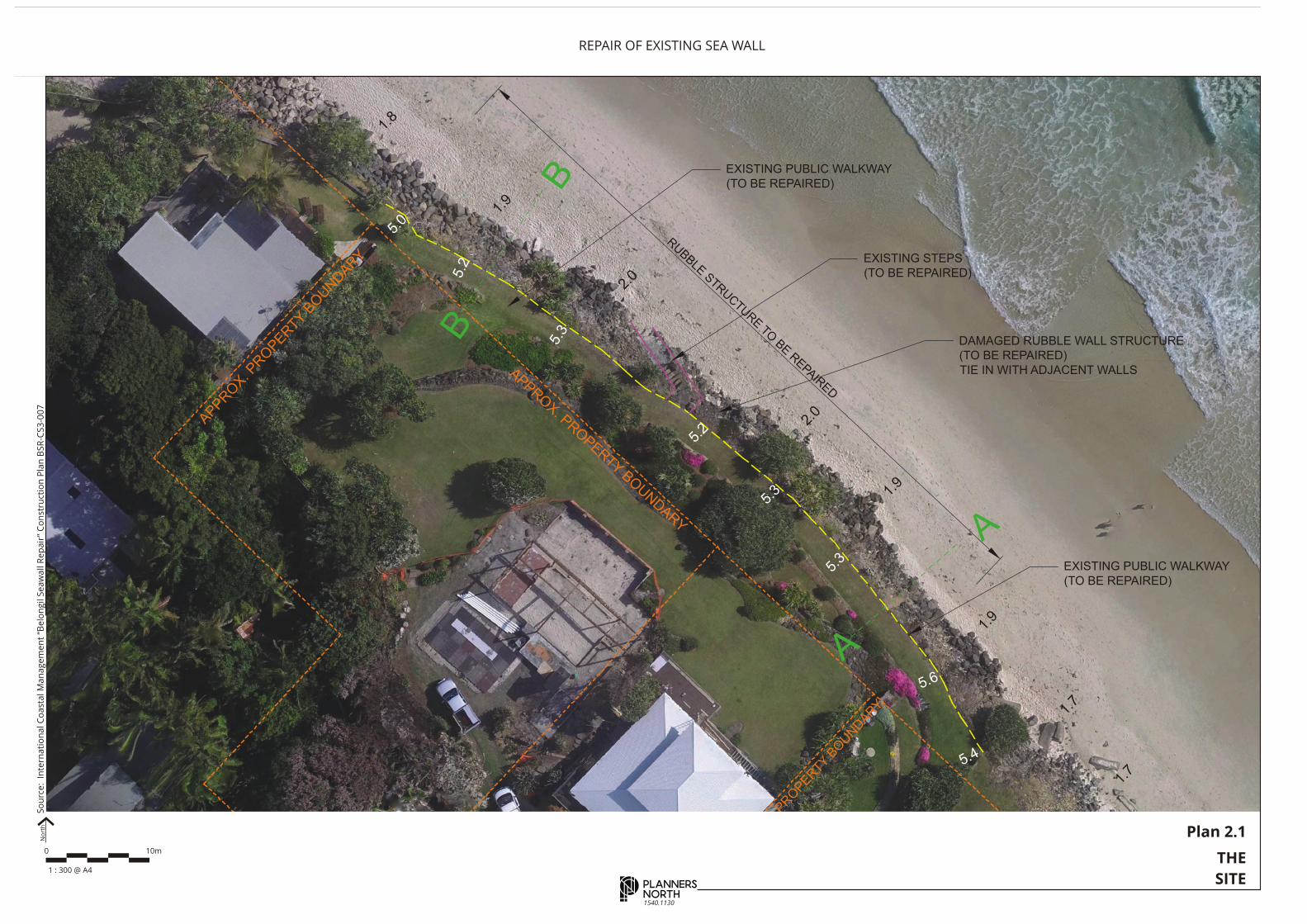
2 . T H E S I T E A N D I T S C O N T E X T
This section of the report identifies the subject site and describes its environmental planning context.
C A D A S T R A L D E S C R I P T I O N 2.1
The subject site is located directly to the immediate north-east of
existing residential properties at Lots 32-36 Section 2 DP 1623, Nos.
28 and 28A Childe Street, Belongil. The subject land forms part of
the Esplanade and is public land owned by Byron Shire Council.
S I T E C O N T E X T 2.2
The subject site is located on the New South Wales coastline in an
area known as Belongil Beach. The site is approximately 2.2km or
6 minutes drive from Byron Bay Post Office.
S I T E H I S T O R Y 2.3
The existing seawall extends along the Belongil Beach and has been in place for many years. A
“Byron Bay Erosion Protection Structures – Risk Assessment” was prepared by Worley Parsons in
2013 for Byron Shire Council. That report examined existing sea walls along the Belongil and their
condition. The report then identified the risk associated with the failure of the various parts of the
wall. The subject sea wall is identified as being in fair observed condition with poor rating for
hydraulic stability, wave over top rating, climate change and geotechnical stability. The report
concluded that the risks associated with the subject wall are “extreme”. That is, the risks are extreme
in the event of wall failure.
The existing structure as viewed from the
north west looking east eastsouth east.
APPRO
X. PRO
PERTY B
OUNDAR
Y
AP
PRO
X. PRO
PERTY B
OUNDAR
Y
APPRO
APPROX. PRO
PERTY BOUNDARY
B
B
A
A
1.8
1.9
2.0
2.0
1.9
1.9
1.7
1.7
1.6
2
5.0
5.2
5.2
5.3
5.3
5.3
5.4
5.6
REV.NO.
PROJECT NAME
DRAWING TITLE
DRAWN :
SIZE:
DRAWING No.
CHECKED :
SCALE :
APPROVED :
DATE :
DESCRIPTIONDATE
REVISION REGISTER
BY ENG. APP.
LEGEND
LOCALITY PLAN
REVISION:
NOTES
InternationalCoastalManagement
OFFICE 50G 1 MacArthur Parade, Main Beach, 4217, QLD, AustraliaPOST PO Box 306, Main Beach LPO, Main Beach QLD, 4217, AustraliaTELEPHONE +61 7 55640564 FAX +61 7 55329147WEBSITE www.coastalmanagement.com.au
RPEQ 2876
VERTICAL DATUM: HORIZONTAL DATUM:
19 Dec, 2016
SK AJ AJ
A3 A3
BSR - CS3 - 002
BELONGIL SEAWALL REPAIRS
-
- - - - - -
- - - - - -
- - - - - -
- - - - - -
- - - - - -
- - - - - -
PLAN VIEW (PRESENT
AHD -
SITE PLAN
Slope Crest Level (October 2016Survey)
Approximate Property Boundary
X-Section
Stair Access
DAMAGED RUBBLE WALL STRUCTURE(TO BE REPAIRED)TIE IN WITH ADJACENT WALLS
EXISTING STEPS(TO BE REPAIRED)
EXISTING PUBLIC WALKWAY(TO BE REPAIRED)
EXISTING PUBLIC WALKWAY(TO BE REPAIRED)
RUBBLE STRUCTURE TO BE REPAIRED
Plan 2.1
THE
SITE
0 10m
1 : 300 @ A4
1540.1130
REPAIR OF EXISTING SEA WALLN
ort
hS
ou
rce
: I
nte
rna
tio
na
l C
oa
sta
l M
an
ag
em
en
t “B
elo
ng
il S
ea
wa
ll R
ep
air
” C
on
stru
ctio
n P
lan
BS
R-C
S3
-00
7
REPAIR OF EXISTING SEAWALL 5
1540.1130
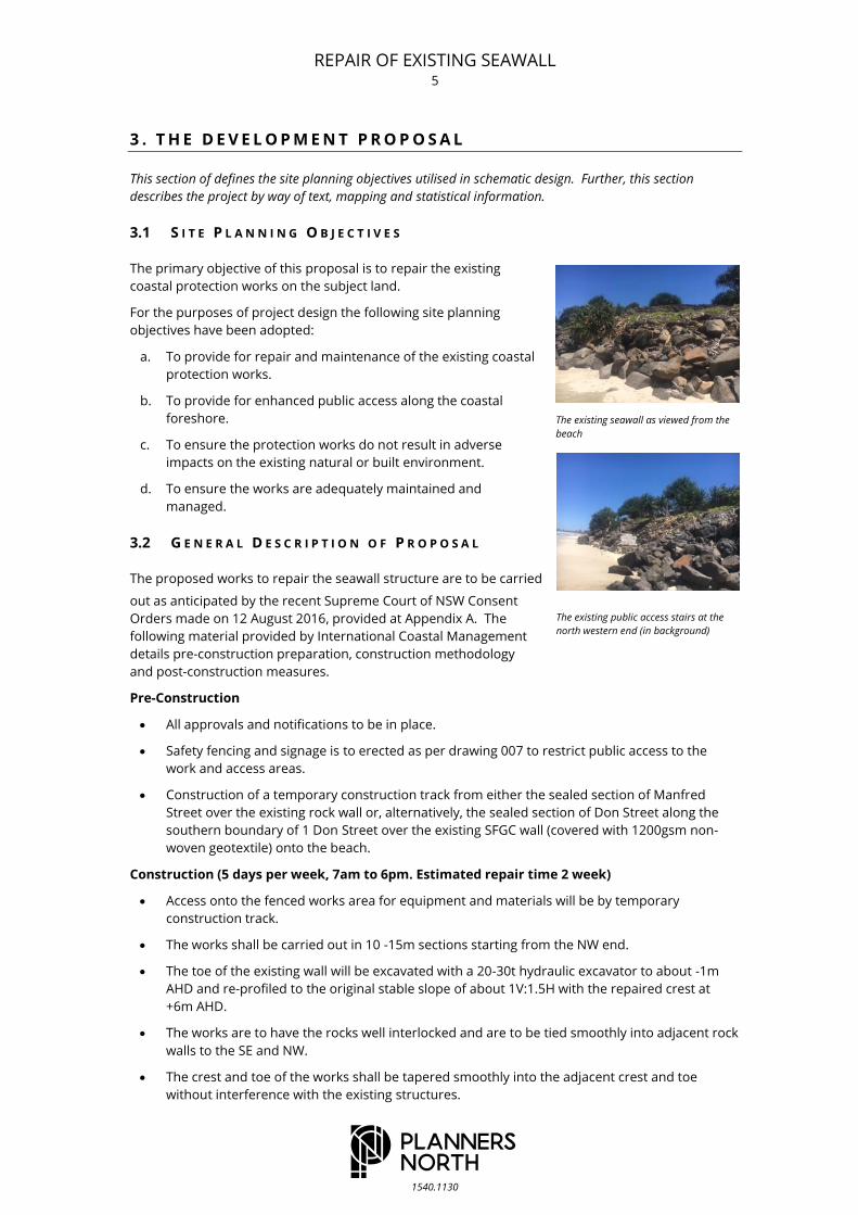
3 . T H E D E V E L O P M E N T P R O P O S A L
This section of defines the site planning objectives utilised in schematic design. Further, this section
describes the project by way of text, mapping and statistical information.
S I T E P L A N N I N G O B J E C T I V E S 3.1
The primary objective of this proposal is to repair the existing
coastal protection works on the subject land.
For the purposes of project design the following site planning
objectives have been adopted:
a. To provide for repair and maintenance of the existing coastal
protection works.
b. To provide for enhanced public access along the coastal
foreshore.
c. To ensure the protection works do not result in adverse
impacts on the existing natural or built environment.
d. To ensure the works are adequately maintained and
managed.
G E N E R A L D E S C R I P T I O N O F P R O P O S A L 3.2
The proposed works to repair the seawall structure are to be carried
out as anticipated by the recent Supreme Court of NSW Consent
Orders made on 12 August 2016, provided at Appendix A. The
following material provided by International Coastal Management
details pre-construction preparation, construction methodology
and post-construction measures.
Pre-Construction
All approvals and notifications to be in place.
Safety fencing and signage is to erected as per drawing 007 to restrict public access to the
work and access areas.
Construction of a temporary construction track from either the sealed section of Manfred
Street over the existing rock wall or, alternatively, the sealed section of Don Street along the
southern boundary of 1 Don Street over the existing SFGC wall (covered with 1200gsm non-
woven geotextile) onto the beach.
Construction (5 days per week, 7am to 6pm. Estimated repair time 2 week)
Access onto the fenced works area for equipment and materials will be by temporary
construction track.
The works shall be carried out in 10 -15m sections starting from the NW end.
The toe of the existing wall will be excavated with a 20-30t hydraulic excavator to about -1m
AHD and re-profiled to the original stable slope of about 1V:1.5H with the repaired crest at
+6m AHD.
The works are to have the rocks well interlocked and are to be tied smoothly into adjacent rock
walls to the SE and NW.
The crest and toe of the works shall be tapered smoothly into the adjacent crest and toe
without interference with the existing structures.
The existing public access stairs at the
north western end (in background)
The existing seawall as viewed from the
beach
REPAIR OF EXISTING SEAWALL 6
1540.1130
The existing access to the beach shall be repaired and safe access provided at each end of the
works to provide public access along the top of the wall.
The wall is to be progressively surveyed and final “as constructed” drawings prepared.
Post-Construction
The beach is to be groomed and left in a clean condition free from rock or rubble.
The access track is to be removed and the area impacted by the track revegetated and
restored to the original condition.
The safety fencing is to be removed.
Repair Costs
Preliminary Estimate = $165,000
A N C I L L A R Y A P P R O V A L S 3.3
No Ancillary approvals are sought in association with the application.

APPRO
X. PRO
PERTY B
OUNDAR
Y
PRO
X. PRO
PERTY B
OUNDAR
Y
APP
APPROX. PRO
PERTY BOUNDARY
REV.NO.
PROJECT NAME
DRAWING TITLE
DRAWN :
SIZE:
DRAWING No.
CHECKED :
SCALE :
APPROVED :
DATE :
DESCRIPTIONDATE
REVISION REGISTER
BY ENG. APP.
LEGEND
LOCALITY PLAN
REVISION:
NOTES
InternationalCoastalManagement
OFFICE 50G 1 MacArthur Parade, Main Beach, 4217, QLD, AustraliaPOST PO Box 306, Main Beach LPO, Main Beach QLD, 4217, AustraliaTELEPHONE +61 7 55640564 FAX +61 7 55329147WEBSITE www.coastalmanagement.com.au
RPEQ 2876
VERTICAL DATUM: HORIZONTAL DATUM:
19 Dec, 2016
SK AJ AJ
A3 A3
BSR - CS3 - 007
BELONGIL SEAWALL REPAIRS
-
- - - - AJ -
- - - - - -
- - - - - -
- - - - - -
- - - - - -
- - - - - -
CONSTRUCTION PLAN
AHD -
CONSTRUCTION PLAN
SAFETY FENCE
SAFETY FENCESAFETY FEN
CE
RETAIN HIGH TIDE ACCESS ALONG BEACH
RETAIN
HIG
H TID
E ACCESS ALO
NG
BEACH
CO
NSTR
UCTIO
N AC
CESS
1. Construction access to be from 'Old Jetty Site'- Construction access to be adequatelyfenced
2. Provide safe access to beach over repairedwall at each end.
Safety Fence
Approximate Property Boundary
EXISTING PUBLIC WALKW
AY (SEE NOTE 2)
REPAIR EXISTING W
ALL AND TIE IN WITH ADJACENT W
ALLS
-2.0m AHD
-1.0m AHD
0.0m AHD
1.0m AHD
2.0m AHD
3.0m AHD
4.0m AHD
5.0m AHD
6.0m AHD
7.0m AHD
MHWS
MLWS
MSL
REV.NO.
PROJECT NAME
DRAWING TITLE
DRAWN :
SIZE:
DRAWING No.
CHECKED :
SCALE :
APPROVED :
DATE :
DESCRIPTIONDATE
REVISION REGISTER
BY ENG. APP.
LEGEND
LOCALITY PLAN
REVISION:
NOTES
InternationalCoastalManagement
OFFICE 50G 1 MacArthur Parade, Main Beach, 4217, QLD, AustraliaPOST PO Box 306, Main Beach LPO, Main Beach QLD, 4217, AustraliaTELEPHONE +61 7 55640564 FAX +61 7 55329147WEBSITE www.coastalmanagement.com.au
RPEQ 2876
VERTICAL DATUM: HORIZONTAL DATUM:
19 Dec, 2016
SK AJ AJ
A3 A3
BSR - CS3 - 006
BELONGIL SEAWALL REPAIRS
-
A - - - AJ -
- - - - - -
- - - - - -
- - - - - -
- - - - - -
- - - - - -
REPAIR WORKS B
AHD -
TYPICAL REPAIR PROFILE B
REPAIR PRIMARY ARMOUR LAYERTO 1:1.5 SLOPE (0.5-2.5t BOULDERS OR EQUIVALENT)
REPAIR SECONDARY ARMOUR LAYER(100 to 500kg Rock) AS REQUIRED
Sand Level (13th October 2016)
ROCK FILL
ROCK FILL
ROCK FILL
REPAIR FILTER LAYER
1.5
1
TOP OF WALL +5.0m AHD (MIN)TOP OF SLOPE +5.3m AHD
Present Profile (2016)
PRESENT PROFILE (2016)
Ti-tree LogsRemoved
EXISTING PUBLIC WALKWAY REPAIRED(TURFED)
Plan 3.1
PROPOSED
DEVELOPMENT
1540.1130
REPAIR OF EXISTING SEA WALLS
ou
rce
: I
nte
rna
tio
na
l C
oa
sta
l M
an
ag
em
en
t “B
elo
ng
il S
ea
wa
ll R
ep
air
” C
on
stru
ctio
n P
lan
BS
R-C
S3
-00
7
0 2.5m
1 : 100 @ A3
No
rth

REPAIR OF EXISTING SEAWALL 8
1540.1130
4 . S T A T U T O R Y A N D P O L I C Y P L A N N I N G
Section 4 documents the range of planning controls applicable in the subject case pursuant to Section 79C
(1) (a) of the Act and the provisions of the Coastal Protection Act 1979.
S T A T U T O R Y C O N S I D E R A T I O N S 4.1
Pursuant to the Environmental Planning & Assessment Act, 1979, a
number of statutes are potentially applicable to any single
development proposal. This section reviews the range of
instruments and notes their application in terms of the subject
development application proposal.
4.1.1 DEEMED ENVIRONMENTAL PLANNING INSTRUMENTS
No deemed environmental planning instruments apply to the
subject land.
4.1.2 LOCAL ENVIRONMENTAL PLANS
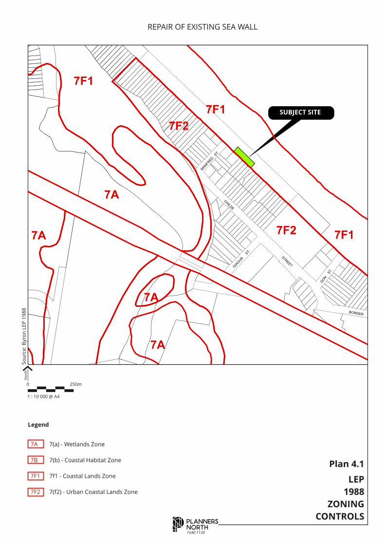
Name: Byron Local Environmental Plan 1988 (BLEP88)
Application in Subject Case:
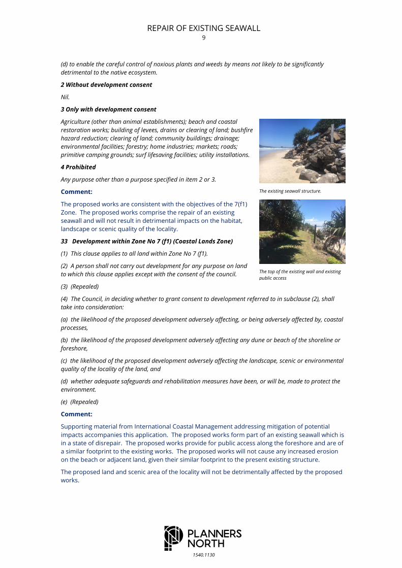
Zone: The land is zoned 7(f1) (Coastal Lands Zone).
Permissibility: Beach and coastal restoration works are permissible
with development consent in the 7(f1) zone. Beach and Coastal
Restoration Works are defined as follows:
"beach and coastal restoration works" means structures or works
to restore the coastline from the effects of coastal erosion.
Concurrence: No concurrence is required for the proposed development in accordance with the
provisions of BLEP88.
Advertising: The proposal does not trigger any requirement for advertising in accordance with the
provisions of BLEP88.
Special Provisions Applicable: The following provisions of BLEP88 are applicable to Council's
consideration of the subject proposal:
Clause 9 - Zone Objectives & Development Control Table: The objectives and land use table for
the 7(f1) (Coastal Lands Zone) are set out below.
subclause (3) Except as otherwise provided by this plan, the council shall not grant consent to the carrying
out of development on land to which this plan applies unless the Council is of the opinion that the carrying
out of the development is consistent with the objectives of the zone within which the development is
proposed to be carried out.
Zone Objectives
1 Objectives of zone
The objectives of the zone are:
(a) to identify and protect environmentally sensitive coastal land,
(b) to enable development for certain purposes where such development does not have a detrimental
effect on the habitat, landscape or scenic quality of the locality,
(c) to prevent development which would adversely affect, or be adversely affected by, coastal processes,
and
The existing public access stairs at the
north western end
The existing seawall structure
REPAIR OF EXISTING SEAWALL 9
1540.1130
(d) to enable the careful control of noxious plants and weeds by means not likely to be significantly
detrimental to the native ecosystem.
2 Without development consent
Nil.
3 Only with development consent
Agriculture (other than animal establishments); beach and coastal
restoration works; building of levees, drains or clearing of land; bushfire
hazard reduction; clearing of land; community buildings; drainage;
environmental facilities; forestry; home industries; markets; roads;
primitive camping grounds; surf lifesaving facilities; utility installations.
4 Prohibited
Any purpose other than a purpose specified in item 2 or 3.
Comment:
The proposed works are consistent with the objectives of the 7(f1)
Zone. The proposed works comprise the repair of an existing
seawall and will not result in detrimental impacts on the habitat,
landscape or scenic quality of the locality.
33 Development within Zone No 7 (f1) (Coastal Lands Zone)
(1) This clause applies to all land within Zone No 7 (f1).
(2) A person shall not carry out development for any purpose on land
to which this clause applies except with the consent of the council.
(3) (Repealed)
(4) The Council, in deciding whether to grant consent to development referred to in subclause (2), shall
take into consideration:
(a) the likelihood of the proposed development adversely affecting, or being adversely affected by, coastal
processes,
(b) the likelihood of the proposed development adversely affecting any dune or beach of the shoreline or
foreshore,
(c) the likelihood of the proposed development adversely affecting the landscape, scenic or environmental
quality of the locality of the land, and
(d) whether adequate safeguards and rehabilitation measures have been, or will be, made to protect the
environment.
(e) (Repealed)
Comment:
Supporting material from International Coastal Management addressing mitigation of potential
impacts accompanies this application. The proposed works form part of an existing seawall which is
in a state of disrepair. The proposed works provide for public access along the foreshore and are of
a similar footprint to the existing works. The proposed works will not cause any increased erosion
on the beach or adjacent land, given their similar footprint to the present existing structure.
The proposed land and scenic area of the locality will not be detrimentally affected by the proposed
works.
The existing seawall structure.
The top of the existing wall and existing
public access
Disclaimer : While all reasonable care has been taken to ensure the informationcontained on this map is up to date and accurate, no warranty is given that theinformation contained on this map is free from error or omission. Any relianceplaced on such information shall be at the sole risk of the user. Please verify theaccuracy of all information prior to using it.
Note : The information shown on this map is a copyright of the Byron Shire Council and the '(c) Land Information Centre (1991)'.
O0712
WO
LL
ON
GB
AR
S T R E E T
TA
SM
AN
CIRCUIT
CENTENNIAL
WA
Y
CE
NT
EN
NIA
L C
IRC
UIT
CENTENNIAL
BA
YS
HO
RE
BAY
SH
OR
E
EWINGSDALE ROAD
BR
IGA
NT
INE
GREVILLEA
BANKSIA
DR
IVE
DR
IVE
ST.
CIRCUIT
SUNRISE
JULI
AN
FERN PL.
ACAC
IA
ST.
STREET
BA
NK
SIA
DR
IVE
TI-
TR
EE
PL.
BO
RO
NIA
PL.
C AP E
C T. BOULEVARDE
DRIVE
ROCKS
BELONGIL
JAC
AR
AN
DA
PALM PLACE
JACARANDA DRIVE
CYPRESS COURT
DRIVE
SUNRISE
DR
IVE
COACHWOOD
CLO
SE
CR
ES
.
CA
IN C
T
BOULEVARDE1D
1D
7B
4A
7A
7B
1D3A
1A7B
7B
2A
2T
5A
7F1
7F1
7F1
7F1
7A
1AH
7B
2V
7A
7A
1A
5A
5A
5A
5A
7B
8A
7A
EWINGSDALE
ISLA
ND
QU
AR
RY
R
OA
D
ROAD
DR
IVE
ME
LA
LE
UC
A
1:10,0000 500250 Metres
LEP Map Sheet #
Byron Local Environmental Plan 1988 (as amended)Last Updated.....
Warning : Amendments to the Byron Local Environmental Plan maps can occur on a regular basis and all users should ensure that their copy is current. The information contained in these maps should be verified by reference to the original maps (including amendments) held by Byron Shire Council.
Mar 16, 2006
Tile Scale
10000
15000
0711
0611 0612
SUBJECT SITE
Disclaimer : While all reasonable care has been taken to ensure the informationcontained on this map is up to date and accurate, no warranty is given that theinformation contained on this map is free from error or omission. Any relianceplaced on such information shall be at the sole risk of the user. Please verify theaccuracy of all information prior to using it.Note : The information shown on this map is a copyright of the Byron Shire Council and the '(c) Land Information Centre (1991)'. O0713
ST.
STREET
STREET
MIL
TO
NSTREET
ST.
EWINGSDALE
CHILD
E
STREET
GIA
OUR
ST.
MAN
FRED
ST.
ROAD
BORDER
DO
N
ST.
DR
YD
EN
BYRON
SHIRLEY
KE
ND
ALL
ST
RE
ET
ST
RE
ET
CAVVANBAH
SOMMERSET
BU
TLE
R
ST
RE
ET
GILMORE CRES.
BAY
STREET
LAWSON
JON
SO
N
STREET
ST
RE
ET
BYRON
STREET
FLE
TC
HE
R
ST
RE
ET
7J
7A
7A
7A
6A
7B
1D
2A
6A3A
7F2
7F2
7F2
7F2
5A
7F1
1D
1:10,0000 500250 Metres
LEP Map Sheet #
Byron Local Environmental Plan 1988 (as amended)Last Updated.....
Warning : Amendments to the Byron Local Environmental Plan maps can occur on a regular basis and all users should ensure that their copy is current. The information contained in these maps should be verified by reference to the original maps (including amendments) held by Byron Shire Council. Mar 16, 2006
Tile Scale
10000
15000
0814
0714
7(a) - Wetlands Zone
7(b) - Coastal Habitat Zone
7f1 - Coastal Lands Zone
7(f2) - Urban Coastal Lands Zone
Legend
7A
7B
7F1
7F2
So
urc
e:
Byro
n L
EP
19
88
Plan 4.1
LEP
1988
ZONING
CONTROLS
0 250m
1 : 10 000 @ A4
No
rth
1540.1130
REPAIR OF EXISTING SEA WALL
REPAIR OF EXISTING SEAWALL 11
1540.1130
4.1.3 DEVELOPMENT CONTROL PLANS
Name: Byron Development Control Plan 2010 (BDCP10)Application
in Subject Case:
The following provisions of BDCP10 are applicable to the proposed
development.
Chapter 1, Part J – Coastal Erosions Lands; Clause J2.5
J2.5 Element – Beach Protection
Element Objective
To ensure that works proposed by property owners to protect
land from coastal processes will not have adverse effects on
other land or on other processes
Performance Criteria
And work proposed by individual property owners to protect
land from erosion must be designed to ensure that the work
will not cause adverse impacts on other lands or on coastal
processes
Prescriptive Measures
Any work carried out by individual property owners to protect land from erosion will require the consent of
Council.
Council will consider consent for such works only where such works will have no adverse effect on any
adjoining properties or on any coastal processes.
Rock, concrete and like hard materials must not be used for the construction of beach protection works.
Comment:
The subject application provides for repairs to an existing seawall and the works are to be
undertaken as anticipated by recent Supreme Court of New South Wales Consent Orders made in
August 2016. The consent authority in the subject circumstances is the New South Wales Coastal
Panel.
It is noted that the consequences of not proceeding with the work will see the wall fall into disrepair
and potentially present public safety problems.
Chapter 17 of BDCP10 provides for public exhibition and notification of applications. The proposed
development is not listed in the tables provided in Section 4 of Chapter 17. The development is
therefore identified as Level 1 advertising in accordance with the provisions of Chapter 17.
4.1.4 STATE ENVIRONMENTAL PLANNING POLICIES
The following State Environmental Planning Policies apply to this development:
Title: SEPP No. 71 - Coastal Protection
Gazetted: 01.11.02
Abstract: The policy has been made under the Environmental Planning and Assessment Act 1979 to
ensure that development in the NSW coastal zone is appropriate and suitably located, to
ensure that there is a consistent and strategic approach to coastal planning and
management and to ensure there is a clear development assessment framework for the
coastal zone.
2 Aims of Policy
(1) This Policy aims:
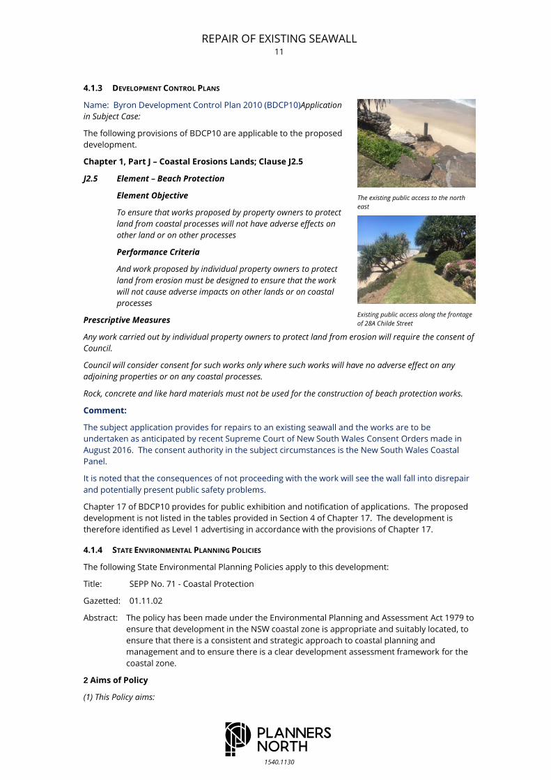
The existing public access to the north
east
Existing public access along the frontage
of 28A Childe Street
REPAIR OF EXISTING SEAWALL 12
1540.1130
(a) to protect and manage the natural, cultural, recreational and economic attributes of the New South
Wales coast, and
(b) to protect and improve existing public access to and along coastal
foreshores to the extent that this is compatible with the natural
attributes of the coastal foreshore, and
(c) to ensure that new opportunities for public access to and along
coastal foreshores are identified and realised to the extent that this is
compatible with the natural attributes of the coastal foreshore, and
(d) to protect and preserve Aboriginal cultural heritage, and Aboriginal
places, values, customs, beliefs and traditional knowledge, and
(e) to ensure that the visual amenity of the coast is protected, and
(f) to protect and preserve beach environments and beach amenity, and
(g) to protect and preserve native coastal vegetation, and
(h) to protect and preserve the marine environment of New South Wales,
and
(i) to protect and preserve rock platforms, and
(j) to manage the coastal zone in accordance with the principles of
ecologically sustainable development (within the meaning of section 6
(2) of the Protection of the Environment Administration Act 1991), and
(k) to ensure that the type, bulk, scale and size of development is appropriate for the location and protects
and improves the natural scenic quality of the surrounding area, and
(l) to encourage a strategic approach to coastal management.
Comment:
The proposed development is consistent with the aims of SEPP No. 71 Coastal Protection. The
proposal will protect and improve existing public access along the foreshore. The proposed repair of
the existing wall will not adversely impact on the visual amenity of the coast or result in the loss of
native coastal vegetation. The repair of the existing seawall is consistent with the current bulk, scale
and size of this development.
8 Matters for consideration
The matters for consideration are the following:
(a) the aims of this Policy set out in clause 2,
(b) existing public access to and along the coastal foreshore for pedestrians or persons with a disability
should be retained and, where possible, public access to and along the coastal foreshore for pedestrians or
persons with a disability should be improved,
(c) opportunities to provide new public access to and along the coastal foreshore for pedestrians or
persons with a disability,
(d) the suitability of development given its type, location and design and its relationship with the
surrounding area,
(e) any detrimental impact that development may have on the amenity of the coastal foreshore, including
any significant overshadowing of the coastal foreshore and any significant loss of views from a public
place to the coastal foreshore,
(f) the scenic qualities of the New South Wales coast, and means to protect and improve these qualities,
(g) measures to conserve animals (within the meaning of the Threatened Species Conservation Act 1995)
and plants (within the meaning of that Act), and their habitats,
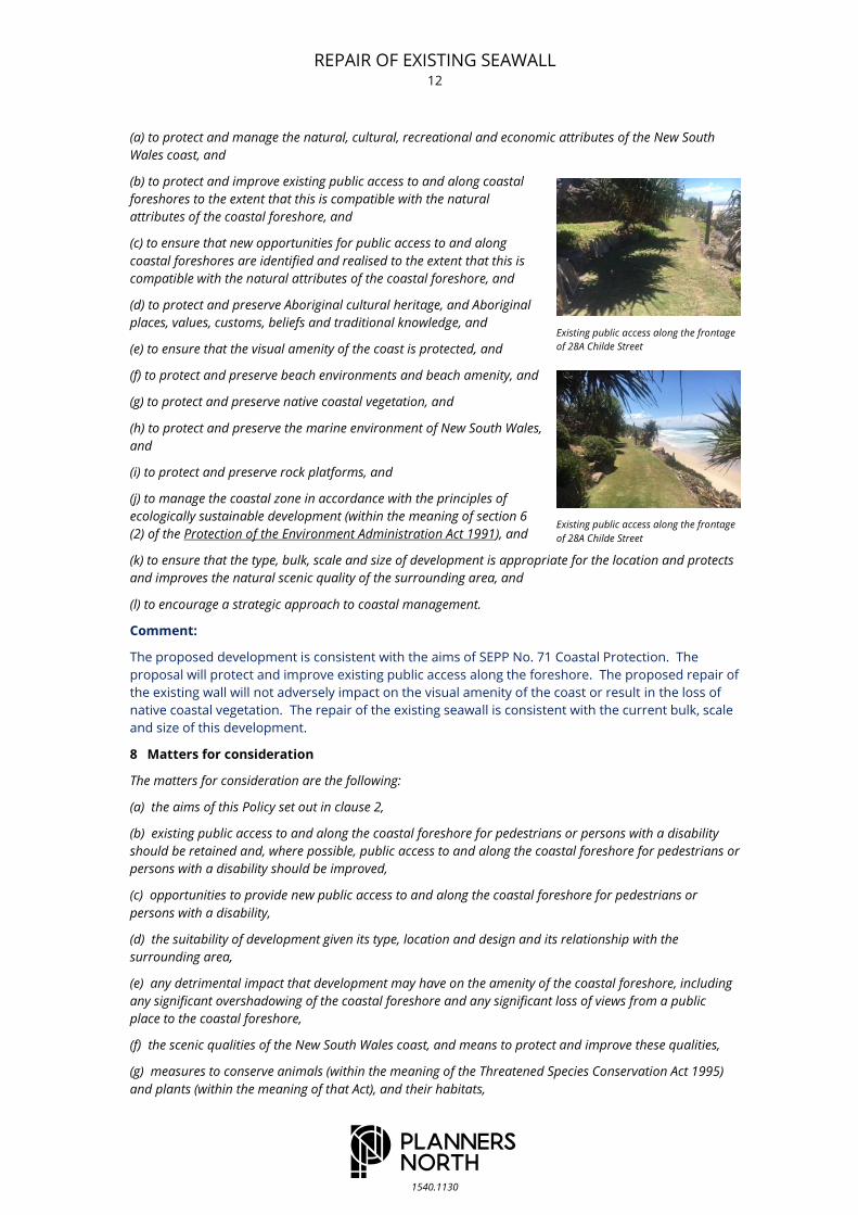
Existing public access along the frontage
of 28A Childe Street
Existing public access along the frontage
of 28A Childe Street
REPAIR OF EXISTING SEAWALL 13
1540.1130
(h) measures to conserve fish (within the meaning of Part 7A of the Fisheries Management Act 1994) and
marine vegetation (within the meaning of that Part), and their habitats
(i) existing wildlife corridors and the impact of development on these
corridors,
(j) the likely impact of coastal processes and coastal hazards on
development and any likely impacts of development on coastal
processes and coastal hazards,
(k) measures to reduce the potential for conflict between land-based
and water-based coastal activities,
(l) measures to protect the cultural places, values, customs, beliefs
and traditional knowledge of Aboriginals,
(m) likely impacts of development on the water quality of coastal
waterbodies,
(n) the conservation and preservation of items of heritage,
archaeological or historic significance,
(o) only in cases in which a council prepares a draft local environmental
plan that applies to land to which this Policy applies, the means to
encourage compact towns and cities,
(p) only in cases in which a development application in relation to
proposed development is determined:
(i) the cumulative impacts of the proposed development on the environment, and
(ii) measures to ensure that water and energy usage by the proposed development is efficient.
Note. Clause 92 of the Environmental Planning and Assessment Regulation 2000 requires the Government
Coastal Policy (as defined in that clause) to be taken into consideration by a consent authority when
determining development applications in the local government areas identified in that clause or on land to
which the Government Coastal Policy applies.
Comment:
In relation to the matters identified in Clause 8 of SEPP No. 71, the existing public access along the
coastal foreshore will be retained and enhanced by the proposed works. The repair works are
suitable for the location, given their design and relationship to existing works along the foreshore.
The proposed works maintain the existing sea wall and will not impact on the amenity of the coastal
foreshore or result in any significant increase in over shadowing or impact on views.
It is noted that the consequences of not proceeding with the works will see the seawall further
deteriorate and fall into a state of disrepair.
In relation to the scenic qualities of the New South Wales coast, it is submitted that the proposed
repair of the existing seawall will maintain these qualities.
The proposed works are not considered likely to adversely impact on existing flora or fauna or their
habitats.
The proposed repair works have been designed to respond to the likely impact of coastal processes
and coastal hazards on the seawall.
Part 4 of the SEPP contains provisions relating to development control. The following table provides
an assessment of the proposed development in relation to the provisions of Part 4.
Provision Compliance
Clause 13 -Flexible Zoning Provisions
A provision of an environmental planning instrument that allows
The proposed development
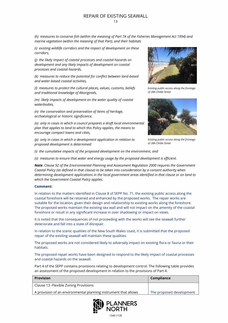
Existing public access along the frontage
of 28A Childe Street
Existing public access along the frontage
of 28A Childe Street

REPAIR OF EXISTING SEAWALL 14
1540.1130
Provision Compliance
development within a zone to be consented to as if it were in a
neighbouring zone, or similar provision, has no effect.
does not rely on any flexible
zoning provisions.
Clause 14 -Public Access
A consent authority must not consent to an application to carry out
development on land to which this Policy applies if, in the opinion of
the consent authority, the development, will, or is likely to, result in
the impeding or diminishing, to any extent, of the physical, land-
based right of access of the public to or along the coastal foreshore.
As previously noted, the
proposed repair works will
improve and enhance the
existing public access along
the coastal foreshore.
Clause 15 -Effluent Disposal
The consent authority must not consent to a development
application to carry out development on land to which this policy
applies in which effluent is proposed to be disposed of by means of a
non-reticulated system if the consent authority is satisfied the
proposal will, or is likely to, have a negative effect on the water
quality of the sea or any nearby beach, or an estuary, a coastal lake, a
coastal creek or other similar body of water, or a rock platform.
Not applicable.
Provision Compliance
Clause 16 –Stormwater
The consent authority must not consent to a development
application to carry out development on land to which this policy
applies if the consent authority is of the opinion that the
development will, or is likely to, discharge untreated stormwater into
the sea, a beach, or an estuary, a coastal lake, a coastal creek or
other similar body of water, or onto a rock platform.
The proposed works provide
for the repair of the existing
seawall only.
The proposed development is consistent with the aims of SEPP 71 and complies with the relevant
provisions of this instrument.
Title: SEPP (Infrastructure) 2007 (Infrastructre SEPP)
Gazetted: 21.12.07; commences 1.1.08
Abstract: Provides a consistent planning regime for infrastructure
and the provision of services across NSW, along with
providing for consultation with relevant public
authorities during the assessment process. The SEPP
supports greater flexibility in the location of
infrastructure and service facilities along with improved
regulatory certainty and efficiency. More details about
the SEPP, including a guide, are available here.
SEPP: SEPP (Infrastructure) 2007
The following provisions of the Infrastructure SEPP apply to the proposed development.
Division 25 of the Infrastructure SEPP applies to Waterways or foreshore management activities.
Division 25 Waterway or foreshore management activities
128 Definitions
The following definitions apply to the proposed development.
In this Division:
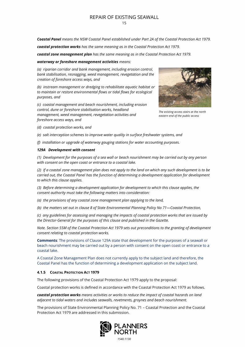
The existing stair access at the north
eastern end
REPAIR OF EXISTING SEAWALL 15
1540.1130
Coastal Panel means the NSW Coastal Panel established under Part 2A of the Coastal Protection Act 1979.
coastal protection works has the same meaning as in the Coastal Protection Act 1979.
coastal zone management plan has the same meaning as in the Coastal Protection Act 1979.
waterway or foreshore management activities means:
(a) riparian corridor and bank management, including erosion control,
bank stabilisation, resnagging, weed management, revegetation and the
creation of foreshore access ways, and
(b) instream management or dredging to rehabilitate aquatic habitat or
to maintain or restore environmental flows or tidal flows for ecological
purposes, and
(c) coastal management and beach nourishment, including erosion
control, dune or foreshore stabilisation works, headland
management, weed management, revegetation activities and
foreshore access ways, and
(d) coastal protection works, and
(e) salt interception schemes to improve water quality in surface freshwater systems, and
(f) installation or upgrade of waterway gauging stations for water accounting purposes.
129A Development with consent
(1) Development for the purposes of a sea wall or beach nourishment may be carried out by any person
with consent on the open coast or entrance to a coastal lake.
(2) If a coastal zone management plan does not apply to the land on which any such development is to be
carried out, the Coastal Panel has the function of determining a development application for development
to which this clause applies.
(3) Before determining a development application for development to which this clause applies, the
consent authority must take the following matters into consideration:
(a) the provisions of any coastal zone management plan applying to the land,
(b) the matters set out in clause 8 of State Environmental Planning Policy No 71—Coastal Protection,
(c) any guidelines for assessing and managing the impacts of coastal protection works that are issued by
the Director-General for the purposes of this clause and published in the Gazette.
Note. Section 55M of the Coastal Protection Act 1979 sets out preconditions to the granting of development
consent relating to coastal protection works.
Comments: The provisions of Clause 129A state that development for the purposes of a seawall or
beach nourishment may be carried out by a person with consent on the open coast or entrance to a
coastal lake.
A Coastal Zone Management Plan does not currently apply to the subject land and therefore, the
Coastal Panel has the function of determining a development application on the subject land.
4.1.5 COASTAL PROTECTION ACT 1979
The following provisions of the Coastal Protection Act 1979 apply to the proposal:
Coastal protection works is defined in accordance with the Coastal Protection Act 1979 as follows.
coastal protection works means activities or works to reduce the impact of coastal hazards on land
adjacent to tidal waters and includes seawalls, revetments, groynes and beach nourishment.
The provisions of State Environmental Planning Policy No. 71 – Coastal Protection and the Coastal
Protection Act 1979 are addressed in this submission.
The existing access stairs at the north
eastern end of the public access

REPAIR OF EXISTING SEAWALL 16
1540.1130
coastal hazard means the following:
(a) beach erosion,
(b) shoreline recession,
(c) coastal lake or watercourse entrance instability,
(d) coastal inundation,
(e) coastal cliff or slope instability,
(f) tidal inundation,
(g) erosion caused by tidal waters, including the interaction of those
waters with catchment floodwaters.
Coastal Panel means the NSW Coastal Panel established under Part
2A.
coastal protection works means activities or works to reduce the
impact of coastal hazards on land adjacent to tidal waters and includes
seawalls, revetments, groynes and beach nourishment.
coastal zone management plan means a coastal zone management
plan made under Part 4A.
public land means:
(a) Crown land within the meaning of the Crown Lands Act 1989 or
land within a reserve as defined in Part 5 of that Act, or
(b) land owned or under the care, management or control of a council or a public authority,
but does not include any land reserved under the National Parks and Wildlife Act 1974 or land acquired
under Part 11 of that Act.
temporary coastal protection works—see Division 1 of Part 4C.
37B Concurrence of Minister not required for certain development
The concurrence of the Minister under this Part is not required in relation to the carrying out in the coastal
zone of any development (within the meaning of the Environmental Planning and Assessment Act 1979)
that:
(a) requires development consent under that Act, or
(b) is exempt development under that Act, or
(c) is carried out in accordance with a coastal zone management plan under Part 4A of this Act.
Note. The concurrence of the Minister under this Part is also not required for other development under the
Environmental Planning and Assessment Act 1979 (see projects approved under Part 3A and State
significant development or infrastructure).
Comment: As the proposed development requires consent under the Environmental Planning and
Assessment Act 1979, the concurrence of the Minister is not required for the proposed works.
Part 4B Erosion and accretion
55M Granting of development consent relating to coastal protection works
(1) Consent must not be granted under the Environmental Planning and Assessment Act 1979 to
development for the purpose of coastal protection works, unless the consent authority is satisfied that:
(a) the works will not over the life of the works:
(i) unreasonably limit or be likely to unreasonably limit public access to or the use of a beach or headland,
or
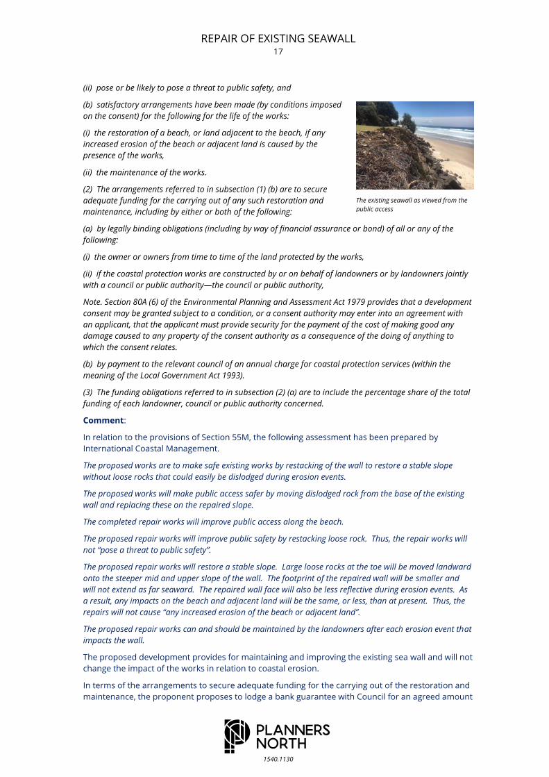
The existing seawall as viewed from the
public access
The existing seawall as viewed from the
public access
REPAIR OF EXISTING SEAWALL 17
1540.1130
(ii) pose or be likely to pose a threat to public safety, and
(b) satisfactory arrangements have been made (by conditions imposed
on the consent) for the following for the life of the works:
(i) the restoration of a beach, or land adjacent to the beach, if any
increased erosion of the beach or adjacent land is caused by the
presence of the works,
(ii) the maintenance of the works.
(2) The arrangements referred to in subsection (1) (b) are to secure
adequate funding for the carrying out of any such restoration and
maintenance, including by either or both of the following:
(a) by legally binding obligations (including by way of financial assurance or bond) of all or any of the
following:
(i) the owner or owners from time to time of the land protected by the works,
(ii) if the coastal protection works are constructed by or on behalf of landowners or by landowners jointly
with a council or public authority—the council or public authority,
Note. Section 80A (6) of the Environmental Planning and Assessment Act 1979 provides that a development
consent may be granted subject to a condition, or a consent authority may enter into an agreement with
an applicant, that the applicant must provide security for the payment of the cost of making good any
damage caused to any property of the consent authority as a consequence of the doing of anything to
which the consent relates.
(b) by payment to the relevant council of an annual charge for coastal protection services (within the
meaning of the Local Government Act 1993).
(3) The funding obligations referred to in subsection (2) (a) are to include the percentage share of the total
funding of each landowner, council or public authority concerned.
Comment:
In relation to the provisions of Section 55M, the following assessment has been prepared by
International Coastal Management.
The proposed works are to make safe existing works by restacking of the wall to restore a stable slope
without loose rocks that could easily be dislodged during erosion events.
The proposed works will make public access safer by moving dislodged rock from the base of the existing
wall and replacing these on the repaired slope.
The completed repair works will improve public access along the beach.
The proposed repair works will improve public safety by restacking loose rock. Thus, the repair works will
not “pose a threat to public safety”.
The proposed repair works will restore a stable slope. Large loose rocks at the toe will be moved landward
onto the steeper mid and upper slope of the wall. The footprint of the repaired wall will be smaller and
will not extend as far seaward. The repaired wall face will also be less reflective during erosion events. As
a result, any impacts on the beach and adjacent land will be the same, or less, than at present. Thus, the
repairs will not cause “any increased erosion of the beach or adjacent land”.
The proposed repair works can and should be maintained by the landowners after each erosion event that
impacts the wall.
The proposed development provides for maintaining and improving the existing sea wall and will not
change the impact of the works in relation to coastal erosion.
In terms of the arrangements to secure adequate funding for the carrying out of the restoration and
maintenance, the proponent proposes to lodge a bank guarantee with Council for an agreed amount
The existing seawall as viewed from the
public access
REPAIR OF EXISTING SEAWALL 18
1540.1130
to be released upon completion of the works, that is, when International Coastal Management
provide certification that the works have been satisfactorily completed.
Financial assurance required for the ongoing maintenance will be provided by bond or bank
guarantee.
4.1.6 THE MARINE ESTATE MANAGEMENT ACT 2014
The following provisions of the Marine Estate Management Act 2014
apply to the proposed development.
56 Development affecting marine parks and aquatic reserves—
application of EPA Act
(1) In determining a development application under Part 4 of the
Environmental Planning and Assessment Act 1979for the carrying out of
development on land that is in the locality of a marine park or an
aquatic reserve, the consent authority must take into consideration
the objects of this Act, the permissible uses of the area concerned
under the regulations or the management rules and any advice given to
it by the relevant Ministers about the impact on the marine park or
aquatic reserve of development in the locality.
(2) If the consent authority is of the opinion that development proposed
in the development application is likely to have an effect on the plants or
animals within the marine park or aquatic reserve and their habitat, the
consent authority must consult with the relevant Ministers before finally
determining the application.
(3) A determining authority must not carry out, or grant an approval
to carry out, an activity on land that is in the locality of a marine park
or an aquatic reserve in purported compliance with Part 5 of the Environmental Planning and Assessment
Act 1979 unless:
(a) the determining authority has taken into consideration the purposes of marine parks or aquatic
reserves, the regulations and any advice given to it by the relevant Ministers on the impact on the marine
park or aquatic reserve of the carrying out of an activity in the locality, and
(b) if the determining authority is of the opinion that the proposed activity is likely to have an effect on the
plants or animals within the marine park or aquatic reserve or their habitat, the determining authority has
consulted with the relevant Ministers.
Comment:
The proposed repair and maintenance of the existing seawall are not considered likely to result in
any adverse environmental impacts in terms of the marine park.
4.1.7 CERTIFIED DRAFT PLANS
No Certified Draft Plans apply to the proposed development.
4.1.8 SPECIFIC ENVIRONMENTAL PLANNING & ASSESSMENT ACT REQUIREMENTS
No specific provisions apply to the change in use.
4.1.9 INTEGRATED DEVELOPMENT CONSIDERATIONS
The subject works are to be undertaken within the road reserve of The Esplanade and therefore
require Section 138 Roads Act approval. The propose works are therefore Integrated Development
for the purposes of Section 91 of the Environmental Planning and Assessment Act 1979.
The existing road reserve presently forms part of the beach and will continue to function in this
manner.
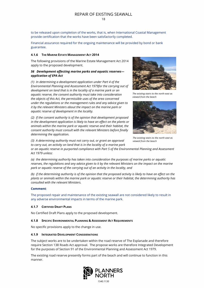
The existing stairs to the north east as
viewed from the beach
The existing stairs to the north east as
viewed from the beach

REPAIR OF EXISTING SEAWALL 19
1540.1130
C O N T R I B U T I O N P L A N S 4.2
No Developer Contribution Plans apply to the proposed development.
L O C A L P O L I C Y C O N T R O L S 4.3
Other than the provisions described in the above, it is understood that no specific policy of Council is
applicable to the subject project.
S T A T E G O V E R N M E N T P O L I C Y 4.4
The following State Government Policy document(s) is (are)
applicable in the subject case.
Name: NSW Flood Plain Development Manual.
Application in Subject Case:
The proposed repair works are not inconsistent with the provisions
of the NSW Flood Plain Development Manual.
Name: The NSW Coast - Government Policy.
Application in Subject Case:
Pursuant to the Regulations made under the Act, relevant provisions of the Government Coastal
Policy must be considered for this project. The proposed development is consistent with the
relevant provisions of the NSW Coastal Policy 1997.
Key provisions from the NSW Coastal Policy are tabulated below. Commentary by PLANNERS NORTH
is provided with respect to each of the key planning principles.
TABLE 4.1 REVIEW OF KEY PROVISIONS OF THE NSW COASTAL POLICY 1997
Goal Objective Strategic Action Proposed Development
1. To protect,
rehabilitate and
improve the natural
environment.
1.1 To identify
coastal lands and
aquatic
environments with
conservation values
and devise and
implement
acquisition policies,
management
strategies and
controls to ensure
that those values are
protected.
1.1.6 Voluntary
conservation agreements
will be negotiated with
landowners to ensure
preservation of plant and
animal species on
freehold and other lands
of significant
conservation value.
1.1.7 Seagrass,
mangrove, saltmarsh and
other associated wetland
species will be conserved
and managed as valuable
components of the
coastal ecosystem by
effectively implementing
existing controls (eg.
SEPP No. 14, Fish Habitat
Protection Plans, Ramsar
listing of important
wetlands) and through
The proposed works
comprise the repair of an
existing seawall and are
not considered to be
inconsistent with the
protection, rehabilitation
and improvement of the
natural environment.
The existing seawall
protects the dunes,
existing dwelling houses
and the Belongil estuary
beyond.
The existing seawall as viewed from the
beach
REPAIR OF EXISTING SEAWALL 20
1540.1130
Goal Objective Strategic Action Proposed Development
controlling runoff,
sedimentation and other
water quality impacts.
1.2 To conserve the
diversity of
alternative plant and
animal species and
to protect and assist
the recovery of
threatened and
endangered species.
1.2.3 The changes in fish
habitats and utilisation by
fish populations and
communities will be
studied to assist in
planning decisions where
habitat modification or
alienation may be
involved.
1.2.5 Lists of threatened
species, populations and
ecological communities
established under the
Threatened Species
Conservation Act 1995,
will include coastal
species, populations and
ecological communities
and will be regularly
reviewed.
The proposed works are
not likely to impact on
any fish habitats.
1.3 To improve
water quality in
coastal and
estuarine waters
and coastal rivers
where it is currently
unsatisfactory and
to maintain water
quality where it is
satisfactory.
1.3.1 Licence limits
imposed by the
Environment Protection
Authority will continue to
be used as appropriate to
control discharges of
pesticide compounds,
heavy metals and other
contaminants from
sewage treatment works
and other point sources.
1.3.2 Problems of other
non-point source
pollution (eg resulting
from urban
development) will be
addressed through a
range of actions including
the setting of ambient
water quality objectives;
the development of
stormwater management
plans; the promulgation
of environmental
guidelines; and
The proposed repair
works are not likely to
result in adverse water
quality impacts.

REPAIR OF EXISTING SEAWALL 21
1540.1130
Goal Objective Strategic Action Proposed Development
encouraging the
adoption and
implementation of
industry and developers
“best management
practices” for minimising
pollution.
1.3.7 The highest possible
quality of coastal waters
will be ensured by:
establishing water quality
and environmental flow
objectives for coastal
rivers and implementing
through catchment plans;
basing waste water
discharge limits on the
relevant national water
quality guidelines and the
local ambient water
quality objectives in
accordance with the
Australian Water Quality
Guidelines for Fresh and
Marine Waters (ANZECC,
1992);assessing the
quality of ocean and
estuarine waters against
local water quality
objectives, where
established, and
otherwise by using the
ANZECC (1992) Marine
Waters standards as
benchmarks.
1.3.8 The discharge of
contaminated
stormwater to coastal
waters will be minimised,
with the aim being to
ensure environmentally
sound management of
stormwater and prevent
contamination in the
future.
1.3.12 The control of
discharge of toilet and

REPAIR OF EXISTING SEAWALL 22
1540.1130
Goal Objective Strategic Action Proposed Development
galley waste from vessels
in intensively used
waterways will be
enforced and adequate
vessel sewage pumpout
facilities in the State’s
intensively used
waterways will be
provided.
1.3.13 The re-use of
treated bio-solids and
effluent will continue to
be investigated and
promoted where
ecologically sustainable.
Trials of re-use in
industry, agriculture and
domestic uses will be
extended as appropriate.
1.4 To manage the
coastline and
estuarine
environments in the
public interest to
ensure their health
and vitality.
1.4.5 Development
proposals on the
coastline and offshore,
which are threatened by
coastal hazards or where
they pose a threat to the
physical wellbeing of the
coastline subject to the
provisions of the Coastal
Protection Act, 1979 will
be approved subject to
conditions which
minimise impacts or
rejected where they pose
an unacceptable threat to
the physical wellbeing of
the coastline.
1.4.7 Development
proposals in or adjacent
to estuaries will only be
approved where
conditions can be
imposed which minimise
potential impacts to the
extent that they are
acceptable under the
Rivers and Foreshores
Improvement Act, 1948
and Fisheries
Management Act, 1994.
The proposed works
comprise repair works
only and as detailed in
the material provided by
International Coastal
Management, they are
not considered likely to
cause any increase in
erosion of the beach or
adjacent land.
It is noted that the
existing wall protects the
dunes, houses and the
estuary beyond.

REPAIR OF EXISTING SEAWALL 23
1540.1130
Goal Objective Strategic Action Proposed Development
Development proposals
in or adjacent to
estuaries will be rejected
where they have the
potential to adversely
impact on the physical
amenity or ecology of the
estuaries to the extent
that they are
unacceptable under the
Rivers and Foreshores
Improvement Act, 1948
and Fisheries
Management Act, 1994.
2. To recognise and
accommodate
natural processes
and climate change.
2.1 To give the
impacts of natural
processes and
hazards a high
priority in the
planning and
management of
coastal areas.
2.1.3 Physical and
ecological processes and
hazards will be
considered when
assessing Development
Applications.
2.1.4 Initiatives will be
taken to address the
impacts of acid sulfate
soils (ASS) through:
consideration being given
to the need for
environmental studies
which address ASS early
in the planning and
development process;
the use of ASS soils risk
mapping undertaken by
the Department of Land
and Water Conservation
and guidelines for their
assessment and
management prepared
by the Environment
Protection Authority in
the assessment of any
proposals likely to disturb
ASS;
EISs being required for
certain types of
development if located
on potential ASS soils in
accordance with
Schedule 3 of the EP & A
Regulation;
The proposed works
seek to repair an existing
seawall.
REPAIR OF EXISTING SEAWALL 24
1540.1130
Goal Objective Strategic Action Proposed Development
Monitoring of the
impacts of disturbed ASS
and requiring restoration
and mitigation works to
be undertaken
progressively;
The preparation of
management plans, as
appropriate, to effectively
manage project level
impacts and the
remediation of ASS sites.
3. To protect and
enhance the
aesthetic qualities of
the coastal zone.
3.2 To design and
locate development
to complement the
surrounding
environment and to
recognise aesthetic
qualities.
3.2.1 Guidelines such as
the North Coast Design
Guidelines and
Guidelines for Tourism
Development along the
New South Wales Coast
will be promoted to
encourage good
development and design
in order to conserve the
natural environment and
integrate built features
with the natural
environment.
3.2.2 The use of good
design principles will be
encouraged to ensure
more compact, human
scale towns are
developed with their own
character within the
constraints of the existing
infrastructure.
The proposed repair
works are unlikely to
result in adverse impacts
in relation to the
aesthetic qualities of the
coastal zone, given the
presence of an existing
seawall.
3.2.4 When assessing
Development
Applications
consideration of the
design and locational
principles contained in
the Coastal Policy will be
required.
Name: Draft State Environmental Planning Policy (Coastal Management) 2016
Application in Subject Case:
REPAIR OF EXISTING SEAWALL 25
1540.1130
Draft State Environmental Planning Policy (Coastal Management) 2016 applies to the land. The aim
of this policy is to promote and integrate a coordinated approach to land use planning in the Coastal
Zone in a manner consistent with the objectives of the new Coastal Management Act 2016.
The draft SEPP contains the following transitional provisions:
24 Savings and transitional provisions
This Policy does not apply to a development application lodged, but not finally
determined, immediately before the commencement of this Policy in relation to land
to which this Policy applies.
A N C I L L A R Y L E G I S L A T I O N 4.5
The applicant is aware that in addition to the consent authority's
approval of the subject application, the provisions of the following
statutes may regulate development in the manner proposed:
Environmental Planning and Assessment Act 1979
Local Government Act 1993
Protection of the Environment Administration Act 1991
Protection of the Environment Operations Act 1997
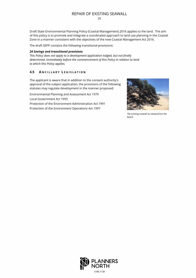
The existing seawall as viewed from the
beach
REPAIR OF EXISTING SEAWALL 26
1540.1130
5 . E N V I R O N M E N T A L I N T E R A C T I O N S
This section of the report expands on the contextual description of the physical environment given in
Section 2, and undertakes an analysis of environmental interactions (particularly those at aspects of S.79C
(1) (b) and (c) relevant in the subject circumstances) applicable to the proposed development with specific
reference to the site planning objectives specified in Section 3.1 of the report. Further, this section reviews
a range of comprehensive environmental management measures, again aimed at specifically addressing
adopted site planning objectives.
C O N T E X T A N D S E T T I N G 5.1
Objective a
To provide for the repair and maintenance of the existing coastal protection works.
The proposed works reflect repairs anticipated by recent Supreme Court of New South Wales
Consent Orders made in August 2016. The works provide for the repair and maintenance of the
existing wall only and no not protrude further seaward than the existing structure.
P U B L I C A C C E S S 5.2
Objective b
To provide for enhanced public access along the coastal foreshore.
The proposed works will make public access along the beach safer by moving dislodged rocks form
the existing wall and replacing these on the repaired slope. The completed repair works provide for
safe public access along the top of the wall and will remove any existing potential threat to public
safety.
N A T U R A L A N D B U I L T E N V I R O N M E N T 5.3
Objective c
To ensure the protection works do not result in adverse impacts on the existing natural or built
environment.
As detailed in the information prepared by International Coastal Management, the proposed works
will not cause any increase in erosion of the beach or adjacent land, as it will have a similar footprint
to the existing structure and will not protrude further seaward. The repaired walls will act in a
similar manner to the present damaged walls.
Objective d
To ensure the works are adequately maintained and managed.
In relation to the maintenance and management of the works, financial assurance will be provided
by bond or bank guarantee.
REPAIR OF EXISTING SEAWALL 27
1540.1130
6 . C O N C L U S I O N
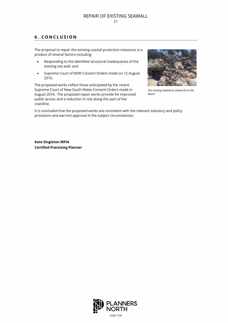
The proposal to repair the existing coastal protection measures is a
product of several factors including:
Responding to the identified structural inadequacies of the
existing sea wall; and
Supreme Court of NSW Consent Orders made on 12 August
2016.
The proposed works reflect those anticipated by the recent
Supreme Court of New South Wales Consent Orders made in
August 2016. The proposed repair works provide for improved
public access and a reduction in risk along this part of the
coastline.
It is concluded that the proposed works are consistent with the relevant statutory and policy
provisions and warrant approval in the subject circumstances.
Kate Singleton MPIA
Certified Practising Planner
The existing seawall as viewed from the
beach

REPAIR OF EXISTING SEAWALL 28
1540.1130
7 . R E F E R E N C E S
BLEP, 1988 Byron Local Environmental Plan 2014, Byron Shire Council, 1988.
BDCP 2010 Byron Development Control Plan 2014, Byron Shire Council, 2010.
Worley Parsons Byron Bay Erosion Protection Structures – Risk Assessment, Worley Parsons,
March 2013.

REPAIR OF EXISTING SEAWALL
1540.1130
A P P E N D I X A
Supreme Court of NSW Consent Orders
29

30

31

32

33
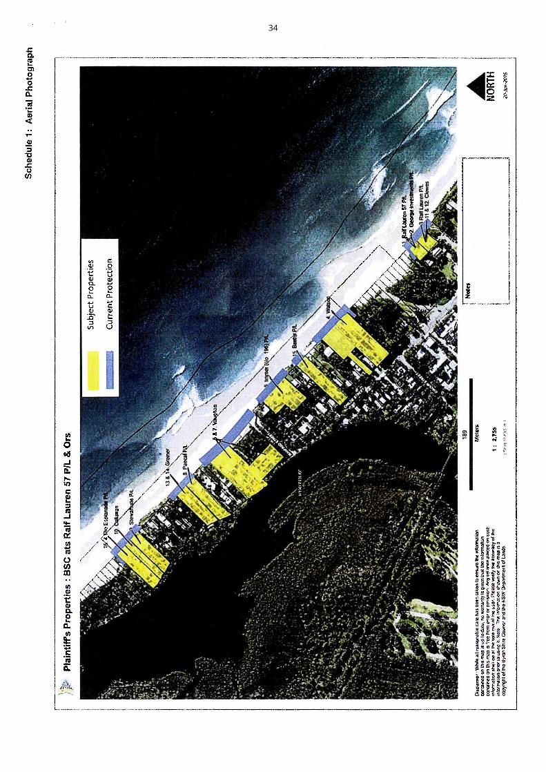
34

35

REPAIR OF EXISTING SEAWALL
1540.1130
A P P E N D I X B
Plans prepared by International Coastal Management
36

InternationalCoastalManagement
OFFICE 50G 1 MacArthur Parade, Main Beach, 4217, QLD, AustraliaPOST PO Box 306, Main Beach LPO, Main Beach QLD, 4217, AustraliaTELEPHONE +61 7 55640564 FAX +61 7 55329147WEBSITE www.coastalmanagement.com.au
Belongil Seawall Repairs
28A CHILDE STREET AND 8 THE ESPLANADE
(Lots 32, 33, 34, 35 and 36 in Section 2 of DP1623)
DRAWING REGISTER
21.12.2016
BSR - CS3 - 001 COVER PAGE
BSR - CS3 - 002 PLAN VIEW (PRESENT)
BSR - CS3 - 003 X-SECTION A (PRESENT)
BSR - CS3 - 004 REPAIR WORKS A
BSR - CS3 - 005 X-SECTION B(PRESENT)
BSR - CS3 - 006 REPAIR WORKS B
BSR - CS3 - 007 CONSTRUCTION PLAN
BSR - CS3 - 008 CONSTRUCTION NOTES
SITE LOCATION
37
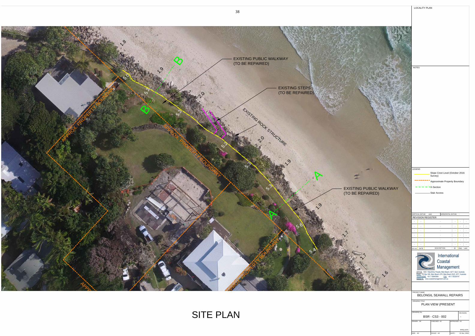
A
P
P
R
O
X
.
P
R
O
P
E
R
T
Y
B
O
U
N
D
A
R
Y
A
P
P
R
O
X
.
P
R
O
P
E
R
T
Y
B
O
U
N
D
A
R
Y
A
P
P
R
O
X
.
P
R
O
P
E
R
T
Y
B
O
U
N
D
A
R
Y
A
P
P
R
O
X
.
P
R
O
P
E
R
T
Y
B
O
U
N
D
A
R
Y
B
B
A
A
1
.
8
1
.
9
2
.
0
2
.
0
1
.
9
1
.
9
1
.
7
1
.
7
1
.
6
2
.
0
5
.
0
5
.
2
5
.
2
5
.
3
5
.
3
5
.
3
5
.
4
5
.
6
REV.NO.
PROJECT NAME
DRAWING TITLE
DRAWN :
SIZE:
DRAWING No.
CHECKED :
SCALE :
APPROVED :
DATE :
DESCRIPTION
DATE
REVISION REGISTER
BY ENG.APP.
LEGEND
LOCALITY PLAN
REVISION:
NOTES
InternationalCoastalManagement
OFFICE 50G 1 MacArthur Parade, Main Beach, 4217, QLD, AustraliaPOST PO Box 306, Main Beach LPO, Main Beach QLD, 4217, AustraliaTELEPHONE +61 7 55640564 FAX +61 7 55329147WEBSITE www.coastalmanagement.com.au
RPEQ 2876
VERTICAL DATUM: HORIZONTAL DATUM:
21 Dec, 2016
SK AJ AJ
A3 A3
BSR - CS3 - 002
BELONGIL SEAWALL REPAIRS
-
- - - - - -
- - - - - -
- - - - - -
- - - - - -
- - - - - -
- --
- - -
PLAN VIEW (PRESENT
AHD -
SITE PLAN
Slope Crest Level (October 2016
Survey)
Approximate Property Boundary
X-Section
Stair Access
EXISTING STEPS
(TO BE REPAIRED)
EXISTING PUBLIC WALKWAY
(TO BE REPAIRED)
EXISTING PUBLIC WALKWAY
(TO BE REPAIRED)
E
X
I
S
T
I
N
G
R
O
C
K
S
T
R
U
C
T
U
R
E
38

-2.0m AHD
-1.0m AHD
0.0m AHD
1.0m AHD
2.0m AHD
3.0m AHD
4.0m AHD
5.0m AHD
6.0m AHD
7.0m AHD
-2.0m AHD
-1.0m AHD
0.0m AHD
1.0m AHD
2.0m AHD
3.0m AHD
4.0m AHD
5.0m AHD
6.0m AHD
7.0m AHD
MHWS
MLWS
MSL
MHWS
MLWS
MSL
REV.NO.
PROJECT NAME
DRAWING TITLE
DRAWN :
SIZE:
DRAWING No.
CHECKED :
SCALE :
APPROVED :
DATE :
DESCRIPTION
DATE
REVISION REGISTER
BY ENG.APP.
LEGEND
LOCALITY PLAN
REVISION:
NOTES
InternationalCoastalManagement
OFFICE 50G 1 MacArthur Parade, Main Beach, 4217, QLD, AustraliaPOST PO Box 306, Main Beach LPO, Main Beach QLD, 4217, AustraliaTELEPHONE +61 7 55640564 FAX +61 7 55329147WEBSITE www.coastalmanagement.com.au
RPEQ 2876
VERTICAL DATUM: HORIZONTAL DATUM:
21 Dec, 2016
SK AJ AJ
A3 A3
BSR - CS3 - 003
BELONGIL SEAWALL REPAIRS
-
- - - - - AJ
- - - - - -
- - - - - -
- - - - - -
- - - - - -
- --
- - -
X-SECTION A (PRESENT)
AHD -
X-SECTION A (PRESENT)
DAMAGED RUBBLE WALL (TO BE REPAIRED)
Present Profile (2016)
Sand Level (13th October 2016)
ROCK FILL
ROCK FILL
ROCK FILL
TOP OF SLOPE
+5.3m AHD
Previous Scour Level
(from Photos)
EXISTING PUBLIC WALKWAY
(TURFED)
Ti-Tree Logs
(TO BE REMOVED)
(from Photos)
VARIOUS ROCK SIZES BEHIND DAMAGED RUBBLE WALL
Typical Profile [approx. 1V:1.5H]
(from historical photos and surveys)
PHOTO (ICM 13/10/16)
AERIAL PHOTO JUNE 2016 (Source: WRL)
39
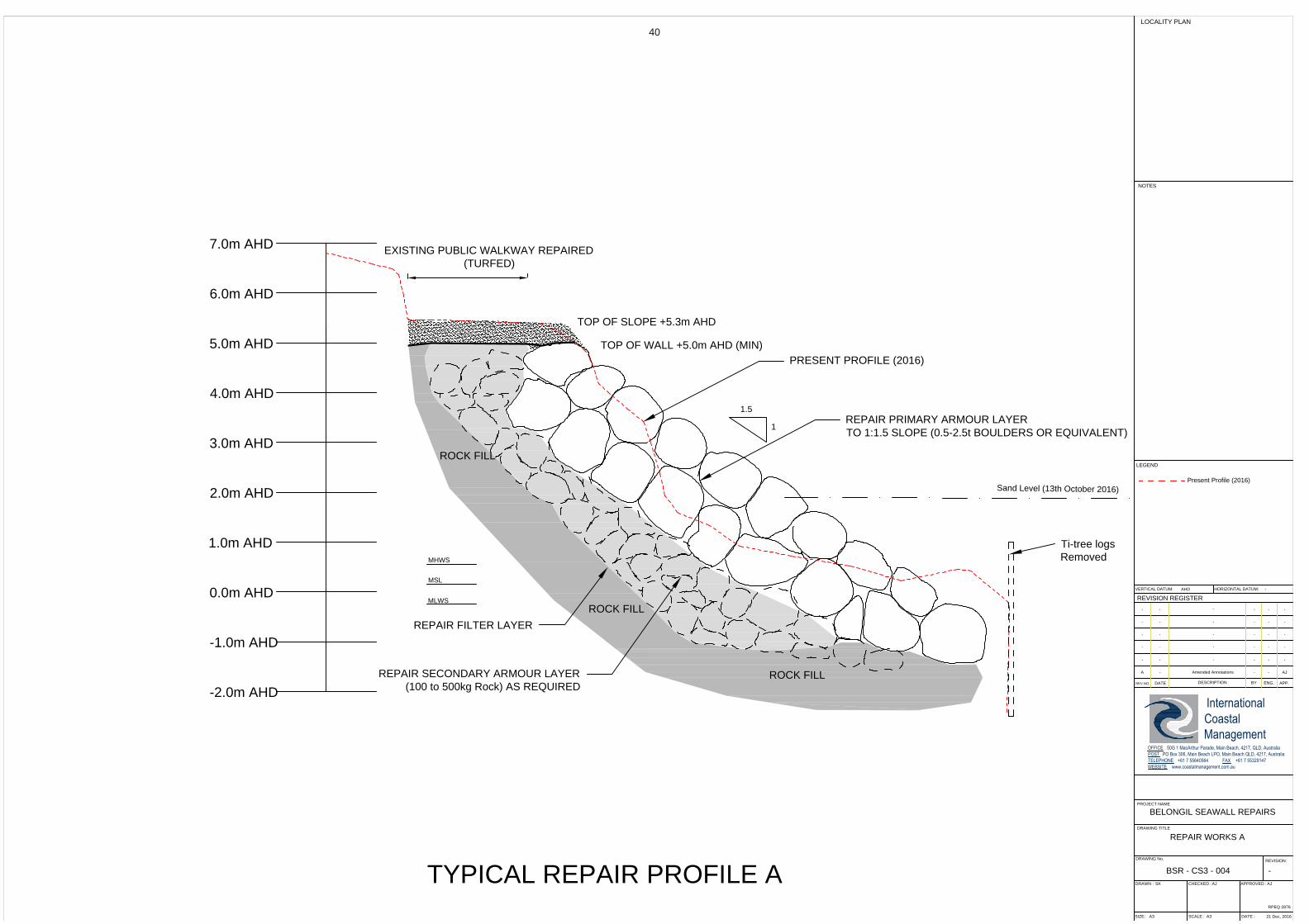
-2.0m AHD
-1.0m AHD
0.0m AHD
1.0m AHD
2.0m AHD
3.0m AHD
4.0m AHD
5.0m AHD
6.0m AHD
7.0m AHD
MHWS
MLWS
MSL
REV.NO.
PROJECT NAME
DRAWING TITLE
DRAWN :
SIZE:
DRAWING No.
CHECKED :
SCALE :
APPROVED :
DATE :
DESCRIPTION
DATE
REVISION REGISTER
BY ENG.APP.
LEGEND
LOCALITY PLAN
REVISION:
NOTES
InternationalCoastalManagement
OFFICE 50G 1 MacArthur Parade, Main Beach, 4217, QLD, AustraliaPOST PO Box 306, Main Beach LPO, Main Beach QLD, 4217, AustraliaTELEPHONE +61 7 55640564 FAX +61 7 55329147WEBSITE www.coastalmanagement.com.au
RPEQ 2876
VERTICAL DATUM: HORIZONTAL DATUM:
21 Dec, 2016
SK AJ AJ
A3 A3
BSR - CS3 - 004
BELONGIL SEAWALL REPAIRS
-
A - Amended Annotations - - AJ
- - - - - -
- - - - - -
- - - - - -
- - - - - -
- --
- - -
REPAIR WORKS A
AHD -
TYPICAL REPAIR PROFILE A
REPAIR PRIMARY ARMOUR LAYER
TO 1:1.5 SLOPE (0.5-2.5t BOULDERS OR EQUIVALENT)
REPAIR SECONDARY ARMOUR LAYER
(100 to 500kg Rock) AS REQUIRED
Sand Level (13th October 2016)
REPAIR FILTER LAYER
1.5
1
TOP OF WALL +5.0m AHD (MIN)
TOP OF SLOPE +5.3m AHD
Present Profile (2016)
Ti-tree logs
Removed
EXISTING PUBLIC WALKWAY REPAIRED
(TURFED)
PRESENT PROFILE (2016)
ROCK FILL
ROCK FILL
ROCK FILL
40

-2.0m AHD
-1.0m AHD
0.0m AHD
1.0m AHD
2.0m AHD
3.0m AHD
4.0m AHD
5.0m AHD
6.0m AHD
7.0m AHD
-2.0m AHD
-1.0m AHD
0.0m AHD
1.0m AHD
2.0m AHD
3.0m AHD
4.0m AHD
5.0m AHD
6.0m AHD
7.0m AHD
MHWS
MLWS
MSL
MHWS
MLWS
MSL
REV.NO.
PROJECT NAME
DRAWING TITLE
DRAWN :
SIZE:
DRAWING No.
CHECKED :
SCALE :
APPROVED :
DATE :
DESCRIPTION
DATE
REVISION REGISTER
BY ENG.APP.
LEGEND
LOCALITY PLAN
REVISION:
NOTES
InternationalCoastalManagement
OFFICE 50G 1 MacArthur Parade, Main Beach, 4217, QLD, AustraliaPOST PO Box 306, Main Beach LPO, Main Beach QLD, 4217, AustraliaTELEPHONE +61 7 55640564 FAX +61 7 55329147WEBSITE www.coastalmanagement.com.au
RPEQ 2876
VERTICAL DATUM: HORIZONTAL DATUM:
21 Dec, 2016
SK AJ AJ
A3 A3
BSR - CS3 - 005
BELONGIL SEAWALL REPAIRS
-
- - - - AJ AJ
- - - - - -
- - - - - -
- - - - - -
- - - - - -
- --
- - -
X-SECTION B (PRESENT)
AHD -
X-SECTION B (PRESENT)
DAMAGED RUBBLE WALL (TO BE REPAIRED)
Present Profile (2016)
Sand Level (13th October 2016)
TOP OF SLOPE
+5.3m AHD
Previous Scour Level
(from Photos)
Ti-tree Logs
(TO BE REMOVED)
(from photos)
ROCK FILL
ROCK FILL
ROCK FILL
EXISTING PUBLIC WALKWAY
(TURFED)
VARIOUS ROCK SIZES BEHIND DAMAGED RUBBLE WALL
Typical profile [approx 1V:1.5H]
(from historical photos and surveys)
PHOTO (ICM 13/10/16)
AERIAL PHOTO JUNE 2016 (Source: WRL)
41
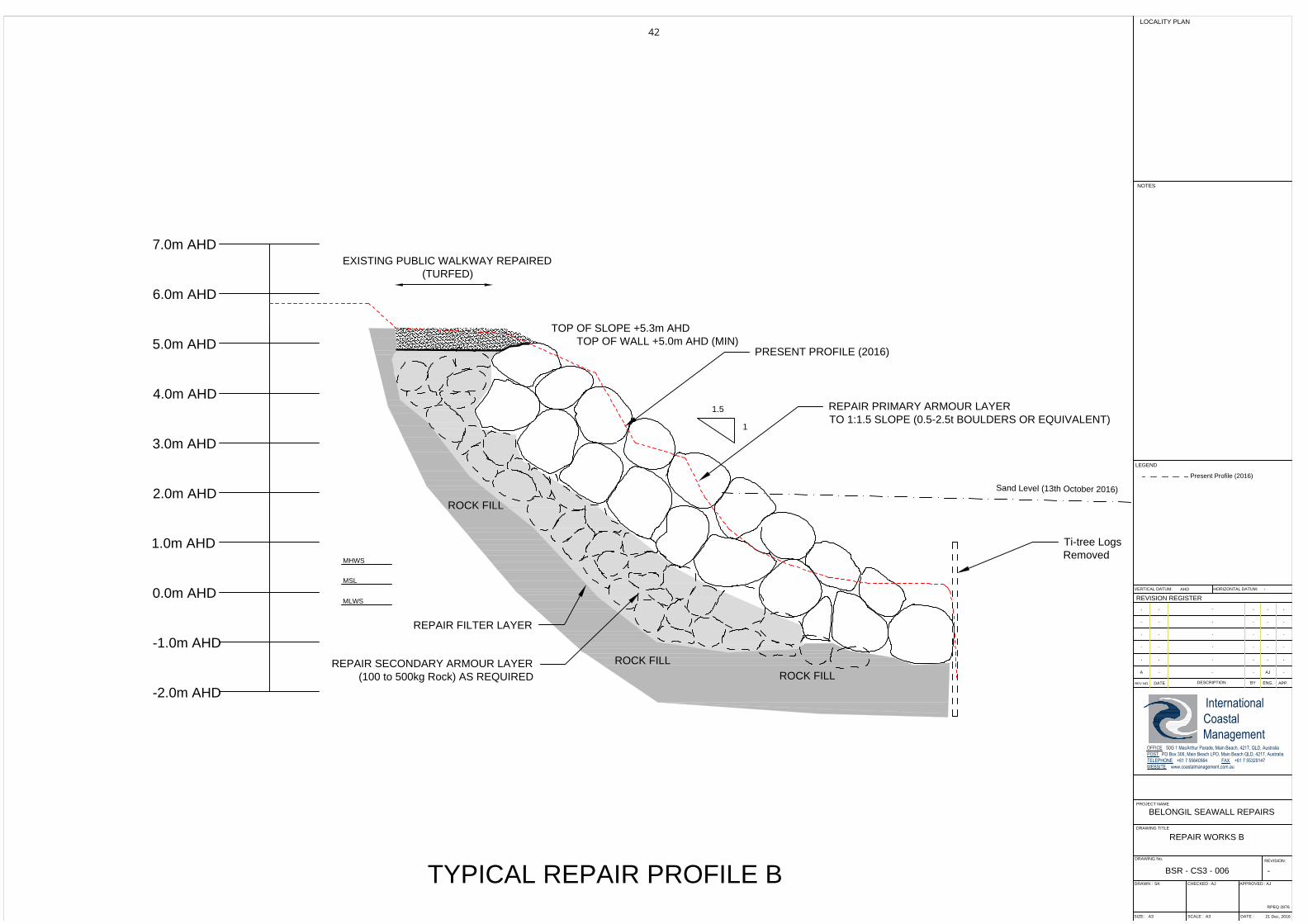
-2.0m AHD
-1.0m AHD
0.0m AHD
1.0m AHD
2.0m AHD
3.0m AHD
4.0m AHD
5.0m AHD
6.0m AHD
7.0m AHD
MHWS
MLWS
MSL
REV.NO.
PROJECT NAME
DRAWING TITLE
DRAWN :
SIZE:
DRAWING No.
CHECKED :
SCALE :
APPROVED :
DATE :
DESCRIPTION
DATE
REVISION REGISTER
BY ENG.APP.
LEGEND
LOCALITY PLAN
REVISION:
NOTES
InternationalCoastalManagement
OFFICE 50G 1 MacArthur Parade, Main Beach, 4217, QLD, AustraliaPOST PO Box 306, Main Beach LPO, Main Beach QLD, 4217, AustraliaTELEPHONE +61 7 55640564 FAX +61 7 55329147WEBSITE www.coastalmanagement.com.au
RPEQ 2876
VERTICAL DATUM: HORIZONTAL DATUM:
21 Dec, 2016
SK AJ AJ
A3 A3
BSR - CS3 - 006
BELONGIL SEAWALL REPAIRS
-
A - - - AJ -
- - - - - -
- - - - - -
- - - - - -
- - - - - -
- --
- - -
REPAIR WORKS B
AHD -
TYPICAL REPAIR PROFILE B
REPAIR PRIMARY ARMOUR LAYER
TO 1:1.5 SLOPE (0.5-2.5t BOULDERS OR EQUIVALENT)
REPAIR SECONDARY ARMOUR LAYER
(100 to 500kg Rock) AS REQUIRED
Sand Level (13th October 2016)
ROCK FILL
ROCK FILL
ROCK FILL
REPAIR FILTER LAYER
1.5
1
TOP OF WALL +5.0m AHD (MIN)
TOP OF SLOPE +5.3m AHD
Present Profile (2016)
PRESENT PROFILE (2016)
Ti-tree Logs
Removed
EXISTING PUBLIC WALKWAY REPAIRED
(TURFED)
42

A
P
P
R
O
X
.
P
R
O
P
E
R
T
Y
B
O
U
N
D
A
R
Y
A
P
P
R
O
X
.
P
R
O
P
E
R
T
Y
B
O
U
N
D
A
R
Y
A
P
P
R
O
X
.
P
R
O
P
E
R
T
Y
B
O
U
N
D
A
R
Y
A
P
P
R
O
X
.
P
R
O
P
E
R
T
Y
B
O
U
N
D
A
R
Y
REV.NO.
PROJECT NAME
DRAWING TITLE
DRAWN :
SIZE:
DRAWING No.
CHECKED :
SCALE :
APPROVED :
DATE :
DESCRIPTION
DATE
REVISION REGISTER
BY ENG.APP.
LEGEND
LOCALITY PLAN
REVISION:
NOTES
InternationalCoastalManagement
OFFICE 50G 1 MacArthur Parade, Main Beach, 4217, QLD, AustraliaPOST PO Box 306, Main Beach LPO, Main Beach QLD, 4217, AustraliaTELEPHONE +61 7 55640564 FAX +61 7 55329147WEBSITE www.coastalmanagement.com.au
RPEQ 2876
VERTICAL DATUM: HORIZONTAL DATUM:
21 Dec, 2016
SK AJ AJ
A3 A3
BSR - CS3 - 007
BELONGIL SEAWALL REPAIRS
-
- - - - AJ -
- - - - - -
- - - - - -
- - - - - -
- - - - - -
- --
- - -
CONSTRUCTION PLAN
AHD -
CONSTRUCTION PLAN
S
A
F
E
T
Y
F
E
N
C
E
S
A
F
E
T
Y
F
E
N
C
E
S
A
F
E
T
Y
F
E
N
C
E
R
E
T
A
I
N
H
I
G
H
T
I
D
E
A
C
C
E
S
S
A
L
O
N
G
B
E
A
C
H
R
E
T
A
I
N
H
I
G
H
T
I
D
E
A
C
C
E
S
S
A
L
O
N
G
B
E
A
C
H
C
O
N
S
T
R
U
C
T
I
O
N
A
C
C
E
S
S
1. Construction access to be from 'Old Jetty Site'
- Construction access to be adequately
fenced
2. Provide safe access to beach over repaired
wall at each end.
Safety Fence
Approximate Property Boundary
E
X
I
S
T
I
N
G
P
U
B
L
I
C
W
A
L
K
W
A
Y
(
S
E
E
N
O
T
E
2
)
R
E
P
A
I
R
E
X
I
S
T
I
N
G
W
A
L
L
A
N
D
T
I
E
I
N
W
I
T
H
A
D
J
A
C
E
N
T
W
A
L
L
S
43

REV.NO.
PROJECT NAME
DRAWING TITLE
DRAWN :
SIZE:
DRAWING No.
CHECKED :
SCALE :
APPROVED :
DATE :
DESCRIPTION
DATE
REVISION REGISTER
BY ENG.APP.
LEGEND
LOCALITY PLAN
REVISION:
NOTES
InternationalCoastalManagement
OFFICE 50G 1 MacArthur Parade, Main Beach, 4217, QLD, AustraliaPOST PO Box 306, Main Beach LPO, Main Beach QLD, 4217, AustraliaTELEPHONE +61 7 55640564 FAX +61 7 55329147WEBSITE www.coastalmanagement.com.au
RPEQ 2876
VERTICAL DATUM: HORIZONTAL DATUM:
21 Dec, 2016
SK AJ AJ
A3 A3
BSR - CS3 - 008
BELONGIL SEAWALL REPAIRS
-
- - - - - -
- - - - - -
- - - - - -
- - - - - -
- - - - - -
- --
- - -
CONSTRUCTION NOTES
AHD -
REPAIR CONSTRUCTION METHOD STATEMENTWorks to repair the seawall structures are to be carried out as anticipated by the recent Supreme Court of NSW
consent orders made 12/8/16. The proposed method of carrying out the works is as follows:
Pre-Construction
o All approvals and notifications to be in place.
o Safety fencing and signage is to erected as per drawing 007 to restrict public access to the work and
access areas.
o Construction of a temporary construction track from either the sealed section of Manfred Street over the
existing rock wall or, alternatively, the sealed section of Don Street along the southern boundary of 1 Don
Street over the existing SFGC wall (covered with 1200gsm non-woven geotextile) onto the beach.
Construction (5 days per week, 7am to 6pm. Estimated repair time 2 week)
o Access onto the fenced works area for equipment and materials will be by temporary construction track.
o The works shall be carried out in 10 -15m sections starting from the NW end.
o The toe of the existing wall will be excavated with a 20-30t hydraulic excavator to about -1m AHD and
re-profiled to the original stable slope of about 1V:1.5H with the repaired crest at +6m AHD.
o The works are to have the rocks well interlocked and are to be tied smoothly into adjacent rock walls to
the SE and NW.
o The crest and toe of the works shall be tapered smoothly into the adjacent crest and toe without
interference with the existing structures.
o The existing access to the beach shall be repaired and safe access provided at each end of the works to
provide public access along the top of the wall.
o The wall is to be progressively surveyed and final “as constructed” drawings prepared.
Post-Construction
o The beach is to be groomed and left in a clean condition free from rock or rubble.
o The access track is to be removed and the area impacted by the track revegetated and restored to the
original condition.
o The safety fencing is to be removed.
Repair Costs
o Preliminary Estimate = $165,000
MITIGATION OF IMPACTS
The works have been designed to avoid adverse impacts. Section 55M of the Coastal Protection Act requires that:
(a) the works will not over the life of the works:
(i) unreasonably limit or be likely to unreasonably limit public access to or the use of a beach or headland, or
(ii) pose or be likely to pose a threat to public safety, and
(b) satisfactory arrangements have been made (by conditions imposed on the consent) for the following for the life of the
works:
(i) the restoration of a beach, or land adjacent to the beach, if any increased erosion of the beach or adjacent land is
caused by the presence of the works,
(ii) the maintenance of the works.
With reference to the above conditions:
Re (a) (i);
The proposed works are to make safe existing works by restacking of the wall to restore a stable slope without loose
rocks that could be easily dislodged during erosion events.
The proposed works will make public access safer by moving dislodged rock from the base of the existing wall and
replacing these on the repaired slope.
The completed repair works will improve public access along the beach.
Re(a) (ii);
The proposed repair works will improve public safety by restacking loose rock. Thus, the repair works will not “pose a
threat to public safety”.
Re (b) (i);
The proposed repair works will restore a stable slope. Large loose rocks at the toe will be moved landward onto the
steeper mid and upper slope of the wall. The footprint of the repaired wall will be smaller and will not extend as far
seaward. The repaired wall face will also be less reflective during erosion events. As a result, any impacts on the
beach and adjacent land will be the same, or less, than at present. Thus, the repairs will not cause “any increased
erosion of the beach or adjacent land”.
Re (b) (ii);
The proposed repair works can and should be maintained by the landowners after each erosion event that impacts thewall.
REPAIR DESIGNTo determine the extent of repair works:
An inspection of the walls covered under the consent orders was carried out by ICM engineers on 13/10/16 to
ascertain the present condition.
Historical photos and surveys held by ICM were reviewed to ascertain the previous condition.
44

REPAIR OF EXISTING SEAWALL
1540.1130
A P P E N D I X C
Ecological Assessment
45

1 |P e t e r P a r k e r c o n s u l t a n c y a d v i c e
Peter Parker Environmental Consultants
Pty Ltd
250 Broken Head Road,
Broken Head, NSW 2481
0266 853 148
0419984954
ACN 076 885 704
_________________________________________________________________
21 December 2016
Kate Singleton
Planners North 3/69 Centennial Circuit
Byron Bay
NSW 2481
Kate:
Proposal to repair existing coastal protection works at
28 and 28A Childe Street Belongil
Further to your instructions, I have reviewed the scope of works described in the
planning report prepared by Planners North and the Engineering report prepared
by International Coastal Management Pty Ltd (“ICM”) for 28 and 28A Childe Street
Belongil and my environmental assessment is attached.
The proposed works
A description of the repairs is contained in ICM and the Planning Report prepared
by Planners North. The site is described as Lots 32-36 Section 2 DP 1623 Nos. 28
and 28A Childe Street Belongil (Fig. 1). The site of the repairs is immediately
seaward of the above allotments as illustrated in the engineering plans (ICM
2016).
Factors associated with the works are described by Planners North as follows:
46

2 |P e t e r P a r k e r c o n s u l t a n c y a d v i c e
The proposed works to repair the seawall structure are to be carried out
as anticipated by the recent Supreme Court of NSW Consent Orders made
on 12 August 2016. The following material provided by International
Coastal Management details pre-construction preparation, construction
methodology and post-construction measures.
Pre-Construction
All approvals and notifications to be in place.
Safety fencing and signage is to erected as per drawing 007 to restrict
public access to the work and access areas.
Construction of a temporary construction track from either the sealed
section of Manfred Street over the existing rock wall or, alternatively,
the sealed section of Don Street along the southern boundary of 1 Don
Street over the existing SFGC wall (covered with 1200gsm non-woven
geotextile) onto the beach.
Construction (5 days per week, 7am to 6pm)
Access onto the fenced works area for equipment and materials will be
by temporary construction track.
The works shall be carried out in 10 -15m sections starting from the NW
end.
The toe of the existing wall will be excavated with a 20-301 hydraulic
excavator to about -1 m AHD and re-profiled to the original stable slope
of about 1V: 1.5H with the repaired crest at +6m AHD.
Unsuitable existing materials such as the ti-tree logs are to be removed
from site and disposed of at the Council tip.
The works are to have the rocks well interlocked and are to be tied
smoothly into adjacent rock walls to the SE and NW.
The crest and toe of the works shall be tapered smoothly into the
adjacent crest and toe without interference with the existing structures.
The existing access to the beach shall be repaired and safe access
provided at each end of the works to provide public access along the top
of the wall.
The wall is to be progressively surveyed and final “as constructed"
drawings prepared.
47
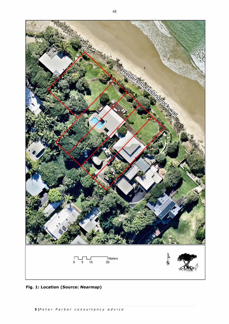
3 |P e t e r P a r k e r c o n s u l t a n c y a d v i c e
Fig. 1: Location (Source: Nearmap)
48

4 |P e t e r P a r k e r c o n s u l t a n c y a d v i c e
Post-Construction
The beach is to be groomed and left in a clean condition free from rock
or rubble.
The access track is to be removed and the area impacted by the track
revegetated and restored to the original condition.
The safety fencing is to be removed.
The works will be undertaken adjacent to the Cape Byron Marine Park (“CBMP”)
which extends up to the mean high water mark. However, the works will be
confined to the reinstatement and repair of an existing rock wall with access along
Belongil Beach. Potential impacts on marine fauna will be minimal, localised and
of a short duration.
Environmental Planning and Assessment Act 1979
For the purposes of the Environmental Planning and Assessment Act 1979 (“EPA
Act”) and, in particular, in the administration of sections 78A, 79B, 79C, 111 and
112, the following must be taken into account in deciding whether there is likely
to be a significant effect on threatened species, populations or ecological
communities, or their habitats:
Each of the factors listed below under sections 5A a-g; and
Any assessment guidelines1.
S.5A (a)
a). in the case of a threatened species, whether the action
proposed is likely to have an adverse effect on the life cycle of
the species such that a viable local population of the species is
likely to be placed at risk of extinction
In assessing the likelihood that a viable local population of a species will be placed
at risk of extinction from this proposal the following factors have been considered:
1 For the purpose of this assessment the Threatened species assessment guidelines, the assessment
of significance have been adopted. Publ. DECC 2007
49

5 |P e t e r P a r k e r c o n s u l t a n c y a d v i c e
the proposal’s likely impact upon the key habitat components essential
to the species’ lifecycle; and
the size of the local population in comparison with that which is
proposed to be removed/modified.
A study area of 1 km around the site was considered appropriate for fauna and is
in accordance with the Threatened species assessment guidelines (“the
Guidelines”) for the undertaking of the 7 part-test (Fig. 2).
The Guidelines provide the following advice:
“The assessment of the local population may be extended to include
individuals beyond the study area if it can be clearly demonstrated that
contiguous or interconnecting parts of the population continue beyond the
study area, according to the following definitions:
The local population of a threatened plant species comprises those
individuals occurring in the study area or the cluster of individuals that
extend into habitat adjoining and contiguous with the study area that
could reasonably be expected to be cross-pollinating with those in the
study area.
The local population of resident fauna species comprises those individuals
known or likely to occur in the study area, as well as any individuals
occurring in adjoining areas (contiguous or otherwise) that are known or
likely to utilise habitats in the study area.
The local population of migratory or nomadic fauna species comprises
those individuals that are likely to occur in the study area from time to
time.”
50

6 |P e t e r P a r k e r c o n s u l t a n c y a d v i c e
Fig. 2: Office of Environment and Heritage BioNet records
51
7 |P e t e r P a r k e r c o n s u l t a n c y a d v i c e
The Office of Environment and Heritage BioNet records for threatened species within 1
km of the site are mapped in Fig. 2 and the relevant species are addressed below.
Reptiles
Green turtle
The green turtle is a large sea-turtle that grows up to 1 m in length. Its heart-shaped
shell is olive-green, brown and black, and the scales on the side of the face and limbs
have distinctive pale edges. It is an ocean-dwelling species spending most of its life at
sea. Its eggs are laid in holes dug in beaches throughout their range and it has been
recorded within 1 km of the site (Fig. 2).
The OEH threatened species profile for the green turtle recommends that nesting turtles
and nest sites be protected. Thus, it is important to consider this factor prior to
construction.
The recovery plan for green turtles states:
The management of marine turtles is difficult because of their complex
ecology. The size and status of these populations is difficult to quantify
because:
most of their lives are spent in the marine environment;
hatchlings disperse throughout entire oceans;
individuals follow their own migratory path;
they are highly migratory, crossing Commonwealth, State, Northern Territory
and international boundaries;
only the females return to their natal beach, where they lay several clutches of
eggs, and not all females nest each year;
they are long-lived and slow to mature;
they occupy different habitats at different stages of their life; and
they are subject to a wide range of impacts at different stages of their life.
Ideally construction should be undertaken out of the breeding season. Nesting occurs
between mid-late October and late March-early April with a peak in late December-early
January for the southern Great Barrier Reef population. Liaison with the CBMP Authority
52

8 |P e t e r P a r k e r c o n s u l t a n c y a d v i c e
is recommended to determine whether any nest sites occur in the locality prior to
construction commencing.
Birds
Little tern
The little tern is a small, slender, migratory or partly migratory seabird. At less than 25
cm long it is two-thirds to half the size of any other south-eastern tern. Pale grey
upperparts contrast with the white chest, underbelly and the moderately long, deeply
forked tail (80 - 110 mm). The Little Tern has a black cap and black outer wing-edges.
During breeding the bill (26 - 32 mm) and legs change from black to yellow, and a black
wedge appears from the bill to the eye. During non-breeding, the Little Tern’s black cap
shrinks to a black nape and its bill becomes black.
The little tern occurs on the north, east and south-east Australian coasts, from Shark Bay
in Western Australia to the Gulf of St Vincent in South Australia. In NSW, it arrives from
September to November, occurring mainly north of Sydney, with smaller numbers found
south to Victoria. It breeds in spring and summer along the entire east coast from
Tasmania to northern Queensland, and is seen until May, with only occasional birds seen
in winter months.
It no longer breeds at the mouth of the Belongil Estuary, although this is an important
roosting and feeding site. The proposed works will not impact on the roosting feeding
and nest requirements of this species.
Pied oystercatcher
The pied oystercatcher is a large, black and white wader, reaching 50 cm in length. The
sexes are similar, yet may be separable when together with the female having a slightly
longer, more slender bill. When not in flight, it appears entirely black above, with white
underparts. The back, head and breast are black, and the belly, rump and tail are white.
The tail is tipped black. The wings are black with a narrow white bar on the upperwing
and white underwing coverts. The eye-ring, iris and bill of the Pied Oystercatcher are
brilliant scarlet and its legs are stout and coral pink. The most often heard call is a loud,
sharp, high-pitched ‘kurvee-kurvee-kurvee’, usually given in alarm, which increases in
53
9 |P e t e r P a r k e r c o n s u l t a n c y a d v i c e
pitch and rapidity when a nest site is approached. The species is distributed around the
entire Australian coastline, although it is most common in coastal Tasmania and parts of
Victoria, such as Corner Inlet. In NSW the species is thinly scattered along the entire
coast, with fewer than 200 breeding pairs estimated to occur in the State.
http://www.environment.nsw.gov.au/threatenedspeciesapp/profile.aspx?id=10386
This species breeds each year at the mouth of the Belongil Estuary. However, no
breeding, foraging or roosting areas will be impacted by the proposed works.
Beach stone curlew
The beach stone-curlew is a large, heavy-set wader (up to 56 cm in body length, and
with a wingspan of up to 1.1 m), with a large-headed appearance, emphasised by its
massive bill, strong legs and a short tail. Adults have largely grey-brown upperparts with
a distinctive black-and-white striped face and shoulder-patch. The throat and breast are
a paler grey and the belly white. The wings are broad and long, mostly pale grey with
dark leading and trailing edges to the innerwing and a boldly black-and-white outerwing.
The eyes are yellow and there is a yellow patch at the base of the bill. Beach stone-
curlews are usually seen alone or in pairs, but sometimes occur in small groups of up to
six birds. They are mainly active at dawn, dusk and at night, but birds are often seen
when they shift or move about sedately during the day.
Beach stone-curlews are found exclusively along the coast, on a wide range of beaches,
islands, reefs and in estuaries, and may often be seen at the edges of or near
mangroves. They forage in the intertidal zone of beaches and estuaries, on islands, flats,
banks and spits of sand, mud, gravel or rock, and among mangroves. Beach stone-
curlews breed above the littoral zone, at the backs of beaches, or on sandbanks and
islands, among low vegetation of grass, scattered shrubs or low trees; also among open
mangroves.
http://www.environment.nsw.gov.au/threatenedSpeciesApp/profile.aspx?id=10280
This species has not been recorded proximal to the site and proposed works will not
impact on breeding, foraging or roosting areas.
54

10 |P e t e r P a r k e r c o n s u l t a n c y a d v i c e
Eastern Osprey
The eastern osprey is a large, water-dependent bird of prey, distinctive in flight and
when perched. Despite its wing-span of up to 1.7 m, it is noticeably smaller than the
White-bellied Sea-eagle. In flight it can be recognised by its distinctly bowed wings that
are dark brown above, and barred underneath, and with white underwing coverts.
Perched, the upperparts are dark brown and the underparts are white. The female has a
dark streaky collar. The head is mainly white with a blackish stripe through the eye.
This species favours coastal areas, especially the mouths of large rivers, lagoons and
lakes, is a fish feeder, and nest high in dead trees or in live trees usually within 1 km of
the ocean
http://www.environment.nsw.gov.au/threatenedspeciesapp/profile.aspx?id=10585.
The proposed works will not impact on breeding, foraging or roosting areas.
S5A (a) conclusion
The proposed development is unlikely to significantly impact on the habitat of any
threatened species. It is will not have an adverse effect on the life cycle of the species
such that a viable local population of the species is likely to be placed at risk of
extinction.
S.5A (b)
b) in the case of an endangered population, whether the action
proposed is likely to have an adverse effect on the life cycle of the
species that constitutes the endangered population such that a viable
local population of the species is likely to be placed at risk of
extinction,
No endangered populations, listed under Part 2 of Schedule 1 of the TSC Act, occur
within the vicinity of the subdivision site. Thus, the action proposed will not cause a
viable local population of the species to be placed at risk of extinction.
S.5A (c)
c) in the case of an endangered ecological community or critically
endangered ecological community, whether the action proposed:
55

11 |P e t e r P a r k e r c o n s u l t a n c y a d v i c e
(i) is likely to have an adverse effect on the extent of the
ecological community such that its local occurrence is likely
to be placed at risk of extinction, or
(ii) is likely to substantially and adversely modify the
composition of the ecological community such that its local
occurrence is likely to be placed at risk of extinction,
Thus, the proposed development will not have an adverse effect on the extent of the
ecological community such that its local occurrence is likely to be placed at risk of
extinction nor will any proposed action substantially and adversely modify the
composition of the ecological community such that its local occurrence is likely to be
placed at risk of extinction.
S.5A (d)
d) in relation to the habitat of a threatened species, population or
ecological community:
(i) the extent to which habitat is likely to be removed or
modified as a result of the action proposed, and
(ii) whether an area of habitat is likely to become fragmented or
isolated from other areas of habitat as a result of the
proposed action, and
(iii) the importance of the habitat to be removed, modified,
fragmented or isolated to the long-term survival of the
species, population or ecological community in the locality,
With respect to s.5A (i), no habitat is likely to be removed or modified as a result of the
action proposed.
With respect to s.5A (ii), no habitat is likely to become fragmented or isolated.
With respect to s.5A (iii), no habitat will be removed. Accordingly, the proposal will not
significantly affect the long-term survival of the species, population or ecological
community in the locality.
56

12 |P e t e r P a r k e r c o n s u l t a n c y a d v i c e
S.5A (e)
whether the action proposed is likely to have an adverse effect on
critical habitat (either directly or indirectly)
The site does not contain any area which has been identified and declared as critical
habitat under Part 3 of the TSC Act. Therefore, critical habitat will not be affected by the
proposed development.
S.5A (f)
f) whether the action proposed is consistent with the objectives or
actions of a recovery plan or threat abatement plan
The priorities action statement and associated Saving our Species conservation
projects have replaced the need for recovery plans. However, a recovery plan has been
prepared for the green turtle and extracts are contained in this advice under its species
profile (http://www.environment.nsw.gov.au/threatenedspecies/RecoveryPlans.htm.).
The NSW threatened species priority action statement (“PAS”) (DECCW 2007) advises:
“Habitat loss or modification for urban development and agricultural
practices has been a major factor in the decline of many native plants and
animals. Rehabilitation and regeneration of modified or lost habitat can
help many threatened species continue to survive in the wild. Actions
include planting local native plants to provide food, shelter and roosting
sites, or bush regeneration to reduce the impact on native plants from
weeds.”
The proposed development will not result in habitat loss.
57

13 |P e t e r P a r k e r c o n s u l t a n c y a d v i c e
S.5A (g)
g) whether the action proposed constitutes or is part of a key
threatening process or is likely to result in the operation of, or
increase the impact of, a key threatening process
Threatening processes gazetted pursuant to the TSC Act are as follows:
Aggressive exclusion of birds from woodland and forest habitat by abundant
noisy miners, Manorina melanocephala;
Alteration of habitat following subsidence due to longwall mining;
Alteration to the natural flow regimes of rivers and streams and their
floodplains and wetlands (as described in the final determination of the
Scientific Committee to list the threatening process);
Anthropogenic climate change;
Bushrock removal;
Clearing of native vegetation. Clearing is defined as the destruction of a
sufficient proportion of one or more strata (layers) within a stand or stands of
native vegetation so as to result in the loss, or long-term modification, of the
structure, composition and ecological function of a stand or stands;
Competition and grazing by the feral European rabbit, Oryctolagus cuniculus;
Competition and habitat degradation by feral goats, Capra hircus;
Competition from feral honey bees, Apis mellifera;
Death or injury to marine species following capture in shark control programs
on ocean beaches;
Entanglement in or ingestion of anthropogenic debris in marine and estuarine
environments;
Forest eucalypt dieback associated with over-abundant psyllids and bell
miners;
Herbivory and environmental degradation caused by feral deer;
High frequency fire resulting in the disruption of life cycle processes in plants
and animals and loss of vegetation structure and composition. High frequency
fire is defined as two or more successive fires close enough together in time to
interfere with or limit the ability of plants or animals to recruit new individuals
into a population, or for plants to build up a seed-bank of sufficient size to
maintain the population through the next fire;
Importation of red imported fire ants, Solenopsis invicta;
58

14 |P e t e r P a r k e r c o n s u l t a n c y a d v i c e
Infection by Psittacine Circoviral (beak and feather) disease affecting
endangered psittacine species and populations;
Infection of frogs by amphibian chytrid causing the disease, chytridiomycosis;
Infection of native plants by the fungus, Phytophthora cinnamomi;
Introduction and establishment of exotic rust fungi of the order Pucciniales
pathogenic on plants of the family Myrtaceae;
Introduction of the large earth bumblebee, Bombus terrestris;
Invasion and establishment of exotic vines and scramblers;
Loss or degradation (or both) of sites used for hill-topping by butterflies. Hill-
topping in butterflies is a complex behaviour that often facilitates mating
between sexes. Many butterfly species appear to congregate on hill-tops or
ridges that are usually higher than the surrounding landscape. These sites may
range in area from a few square metres to several hectares;
Invasion and establishment of scotch broom, Cytisus scoparius;
Invasion and establishment of the cane toad, Bufo marinus;
Invasion, establishment and spread of Lantana;
Invasion of native plant communities by African olive, Olea europaea L. subsp.
cuspidate;
Invasion of native plant communities by bitou bush, Chrysanthemoides
monilifera. The ability of bitou bush to become the overwhelming dominant in
invaded ecological communities threatens all plant communities within its’
distribution;
Invasion of native plant communities by exotic perennial grasses;
Invasion of the yellow crazy ant, Anoplolepis gracilipes, into NSW;
Loss and degradation of native plant and animal habitat by invasion of escaped
garden plants, including aquatic plants;
Loss of hollow-bearing trees;
Predation by the mosquito fish, Gambusia holbrooki;
Predation by the European red fox, Vulpes vulpes;
Predation by the feral cat, Felix cattus. Predation by the feral cat has been
implicated in the extinction and decline of many species of birds on islands
around Australia and in the early extinction of up to seven species of small
mammals on the Australian mainland;
Predation by the ship rat, Rattus rattus, on Lord Howe Island; and
59

15 |P e t e r P a r k e r c o n s u l t a n c y a d v i c e
Removal of dead wood and dead trees.
None of the above-listed threatening process will occur as a result of the proposed
development.
Should you require any further information, please do not hesitate to contact me.
Yours sincerely,
60