Embed Size (px)
Citation preview


COMMONWEALTH OF PENNSYLVANIA Milton J. Shapp, Governor
DEPARTMENT OF ENVIRONMENTAL RESOURCES Maurice K. Goddard, Secretary
TOPOGRAPHIC AND GEOLOGIC~L SURVEY Arthur A. Socolow, State Geologist
ON THE COVER: Large scale joint block separation in sandstone of the Pocono Formation; Hickory Run State Park, Carbon County. Photo courtesy of William Bolles.
PENNSYLVANIA GEOLOGY is published bimonthly by the Topographic and Geologic Survey, Dept. of Environmental Resources, Harrisburg, Pennsylvania, 17120.

FROM THE DESK
OF THE
STATE GEOLOGIST. ..
THERE'S AN EIS IN OUR LIFE- AND YOURS Since the early 1930's, government agencies and functions have
frequently been identified by various combinations of the alphabet. Today, one of the most important activities of the Bureau of Topographic and Geologic Survey and the Department of Environmental Resources is the EIS or Environmental Impact Statement. No major government construction project can proceed in Pennsylvania unless the project designers provide a statement of the impact of the proposed project on the various physical, biological, economic, and social elements of the environment. Then the Environmental Impact Statement (EIS) is reviewed for accuracy and thoroughness by each of several state agencies.
The Pennsylvania Geological Survey has been evaluating as many as 50 EIS's each month. These include projects by the U.S. Army Corps of Engineers, the U.S. Department of Housing and Urban Development (HUD), the Atomic Energy Commission (AEC licensed nuclear generating plants) and, particularly, proposed projects of the Pennsylvania Department of Transportation (PENNDOT). As the Survey's Environmental Geology Division reviews each EIS, we are determined that there should be a clear statement as to what effects the proposed project will have on the geologic environment (might it cause landslides, groundwater pollution, restricted mineral extraction, stream erosion, etc.), and, also, what effects the geologic environment may have on the project (difficult sinkhole condition, mined out voids, costly hard rock excavation, unstable slope formations, availability of construction materials, etc.).
The 40 to 50 EIS reviews which the Survey writes up each month do not show up in the annual list of basic geologic projects cited in the following pages of this bulletin. Yet these EIS reviews are a vital contribution to the preservation of the quality of Pennsylvania's environment, while at the same time forwarning engineers and planners of costly geologic pitfalls.
It is important to note that while EIS write-ups are not usually considered as basic research projects, they require astute, comprehensive geologic expertise and an existing accumulation of geologic data. It is precisely because the Pennsylvania Geological Survey has a long history of geologic mapping and mineral resource investigations that are we now able to provide on short notice the Environmental Impact assessments so important in protecting our environment.

GEOLOGICAL RESEARCH IN PENNSYLVANIA
1973
INTRODUCTION This publication is the sixteenth annual report on Geological Research
and Publications in Pennsylvania. No report was issued in 1972 because the flood of June 1972 destroyed all of the typed copy and original data for that year's report. Thus there was no convenient way to regenerate the data. We decided, thus, to eliminate the 1972 report because of the problems of recovering from the flood and combine it with 1973 data. The data on geological research reports and in-press reports represent current work. The list of published reports since June 1971 is so extensive we do not have room to publish it.
The listings are grouped into major categories of research to facilitate your search for information on a particular subject. Publications in press are listed by author.
As with all compilations .. there are omissions. This is unintentional. Additional copies can be obtained by writing to the Bureau of Topographic and Geologic Survey, Department of Environmental Resources, Harrisburg, Pennsylvania 171.20.
2
RESEARCH IN PROGRESS
AREAL GEOLOGY
HAROLD H. ARNDT, U.S. Geological Survey. Western Middle Anthracite Field. Geology of the Shenandoah and Delano ?%-minute quadrangles will be combined with a previously planned report on the Ashland, Mt. Carmel and south half of the Shamokin quadrangles. Work continues on the preparation of final summary report, "Geology of the Western Middle Anthracite field and adjoining areas, Pa."
T. M. BERG, Pa. Geological Survey, Geology and Mineral Resources of the Brodheadsville ?%-minute quadrangle, Monroe County, Pa. Publication will include geologic maps of bedrock and surficial deposits. A fracture trace map will also be included. Stratigraphic units and surficial deposits are described in terms of detailed lithology, field occurrence and exposed sections, origin, ground-water potential, mineral resources, engineering characteristics, and geologic hazards. A complete discussion of the structural geology is included. Maps of this area are on open file at the offices of the Pa. Geological Survey in Harrisburg.
M. J. BERGIN, U.S. Geological Survey. Northern Anthracite Field. Geologic studies, including field checking and revision of mapping, continue in the Kingston, Pittston, Wilkes-Barre East ?%-minute quadrangles. Resumption of geologic mapping is planned in the Nanticoke quadrangle.
AVERY A. DRAKE, JR., U.S. Geological Survey. Geology of Allentown quadrangle and vicinity. Objectives: To decipher the tectonic history of the area with special emphasis on the emplacement of gravity slides, Alpine nappes, and thrust sheets as well as the mechanics of multiple deformation. It is planned to complete a cross section across the central Appalachians by tying on the ground work in the Anthracite region and along strike with that of the Pa. Geological Survey in the Reading area. Field work is complete in the Hellertown, Allentown East, and Catasauqua quadrangles and has been started in Clementon, Slatedale, New Tripoli and Topton quadrangles. Field work is temporarily recessed while Drake is involved in the design of the Interior Department's R.A.L.I. program.
JACK B. EPSTEIN, U.S. Geological Survey, W. D. SEVON and J. D. GLAESER, Pa. Geological Survey, and G. G. CONNALLY, SUNY at Buffalo. Wind Gap Area, Pa. Mapping in Saylorsburg, Wind Gap, Kunkletown, Palmerton, and Lehighton quadrangles. Studying the stratigraphy, sedimentation, structure, geomorphology, glacial geology, economic geology, and environmental geology of Ordovician-Devonian and Pleistocene sediments. Studies on the origin of cleavage. Topical studies in the western part of the Hamburg klippe of Pa.
3

ROBERT T. FAILL and RICHARD B. WELLS, Pa. Geological Survey. Geology of the southern half of the Warrensville and the northern half of the Milton quadrangles. Project involves a geologic map, with a brief, descriptive text on the stratigraphy, structure, environmental geology and mineral resources.
G. B. GLASS, Wyo. Geological Survey, WILLIAM E. EDMUNDS and J. DOUGLAS GLAESER, Pa. Geological Survey, and VINCENT C. SHEPPS. Geology and Mineral Resources of the southern Houtzdale quadrangle.
ALBERT D. GLOVER and WILLIAM A. BRAGONIER, Pa. Geological Survey. Geology and Mineral Resources of the DuBois 15 -minute quadrangle. Study involves geologic mapping of bedrock and surficial material. Report will include a discussion of the stratigraphy, structure, mineral resources and environmental aspects of the area. Field work is completed and the report is in preparation.
ALBERT D. GLOVER and JOHN H. WAY, JR., Pa. Geological Survey. Geology and Mineral Resources of the Altoona 15-minute quadrangle. The study involves geologic mapping of bedrock and surficial material. Hydrology, (by Ed Meiser at The Pennsylvania State University) mineral resources, and environmental aspects of the area will be incorporated in a report due to be completed late in 1975.
DONALD M. HOSKINS, Pa. Geological Survey. Geology and Mineral Resources of the Millersburg quadrangle. Work was stopped due to the destruction of all notebooks and aerial photographs by the June 1972 flood. Compilation maps with all structural data were saved and are the basis for resumption of the work.
DAVIS M. LAPHAM, Pa. Geological Survey. Serpentinites of Lancaster County. Structure, lithology, petrology, mineralogy, geochemistry, and economic geology of the serpentinites and associated metasediments of southern Lancaster County.
DAVID B. MACLACHLAN, Pa. Geological Survey. Geology of the Reading 15-minute quadrangle. Investigation to date has primarily been directed to several parautochthonous slices of lower Paleozoic rocks and their relationship to the termination of the Reading Prong of Precambrian crystalline rocks. Reconnaissance, especially by Alterman and Myers, indicates a substantial proportion of allochthonous clastics in the northern part of the area. Less intensely deformed Triassic rocks in the southern part of the area will be included in the final report.
4

LUCIAN 8. PLATT, Bryn Mawr College. Allochthonous Blocks in Martinsburg Shale. Large and small blocks of various rock types are recognized as arriving in the Martinsburg Shale during the time of deposition of that unit. Mapping in the Great Valley aims at determining the extent and stratigraphic relations of the allochthonous rocks.
SAMUEL I. ROOT, Pa. Geological Survey. Geology and Mineral Resources of the Harrisburg West Area. Mapping completed in the Harrisburg West area. Four periods of deformation recognized.
S. P. SCHWEINFURTH, U.S. Geological Survey. Claysville-Avella Project. This project is to map geologically two ?%-minute quadrangles and parts of two others that join on the west; to evaluate coal and other mineral resources and to gather and evaluate data that will aid in understanding the depositional framework of the Upper- Pennsylvanian-Lower Permian of the northern part of the Dunkard Basin, its structural history and the paleogeographic controls of coal accumulation and quality.
W. D. SEVON and T. M. BERG, Pa. Geological Survey. Geology and Mineral Resources of the southern half of the Pocono 1 5-minute quadrangle, Pa. Field work for this mapping project is approximately three-quarters completed.
WALTER R. WAGNER, JESSE CRAFT, LOUIS HEYMAN and W.S. LYTLE, Pa. Geological Survey. Revising Geologic Maps of Greater Pittsburgh Urban Area. Published geologic maps (1 :62,500) are being updated by transferring selected information and group boundaries to 1 :24,000 topographic quadrangles. The contacts are checked by subsurface data and by coal and limestone mining. Northern Butler County structure maps on the Van port limestone are being revised.
G. H. WOOD, JR., U.S. Geological Survey. Drainage of Pa. Anthracite Mines. Geologic data on the structure, stratigraphy, mining, and resources of specified areas in the Pa. anthracite region as required by the U.S. and Pa. Bureaus of Mines.
G. H. WOOD, JR., U.S. Geological Survey. Southern Anthracite Field. Field work is continuing in the area of the Weatherly 7 Y2 -minute quadrangle, and mapping of the Nesquehoning ?%-minute quadrangle is near completion. The mining and geologic data will be incorporated into geologic quadrangle maps at 1:24,000 scale and coal maps at 1:12,000 scale.
5

ECONOMIC
GEOLOGY
JACOB FREEDMAN and various students, Franklin and Marshall College. Geochemical Exploration for Nickel in the Mine Ridge Anticline . Intermittently collecting water , stream sediment and soil samples for AAS analysis for Ni , Cu. Co, V, and Mn. Aim is to find deposits of ore similar to that in the Gap Nickel Mine.
JOHN C. GRIFFITHS, The Pa. State University . Value of Mineral Resources of Pa.
JOHN. W. HOSTERMAN, U.S. Geological Survey. Clay Studies in Pa.
WILLIAM S. LYTLE, J. CRAFT, L. HEYMAN and W. WAGNER, Pa. Geological Survey. Oil and Gas Map of the Greater Pittsburgh Urban Area. Compilation of a map, 1:125,000 scale, showing the oil and gas fields. Where possible, map will show the abandoned fields, the dry holes outside the fie lds, and the location of a well in the fie ld for which the Survey has a record showing the stratigraphy.
BERNARD J. O'NEILL, JR. , Pa. Geological Survey. Sources of Sand and Gravel and Other Construction Aggregates within the Greater Pittsburgh Urban Area. The purposes of this investigation are to identify the following: ( 1 ) locations of active producers of sand and gravel and other construction aggregates, (2) areas where the geological conditions are considered favorable for exploration to develop additional sources of these mineral commodities.
BERNARD J. O'NEILL, JR., DAVIS M. LAPHAM, and JOHN H. BARNES, Pa. Geological Survey, and U.S. BUREAU OF MINES. Properties and Uses of Pa. Shales and Clays. This regional study is the third in a series started in 1962 to evaluate the economic potential of shales and clays. Tests on sam-
6

pies collected from various intervals in the stratigraphic column wi ll determine their fired and unfired properties, chemical content, and mineralogy. The results of these tests will be used to determine use patterns, and to identify variables for predicting the uses for such raw materials.
ROBERT C. SMITH, II, Pa. Geological Survey. Lead and Zinc Occurrences of Pa. An attempt is being made to locate each sphalerite and/ or galena occurrence in Pa., map the accessible mines or outcrops, and describe the relation of mineralization to geology. Representative samples will be collected for trace element analyses of pure mineral separates. The mineral trace element data will be considered in terms of health hazard, economic recovery, geochemical exploration, c lassification and genesis.
ENGINEERING
GEOLOGY
NORMAN K. FLINT, HEINZ DEHN and HAMEED ELN AGGAR, University of Pittsburgh. Slope Stability Studies in Southwestern Pa.
B.H. KENT, U.S. Geological Survey. Geologic Factors in Coal-Mine Roof Falls, Pa. and W.Va. Compilation of isopach maps of overburden thickness on Pittsburgh coal is nearing completion. Regional and local structurecontour maps of the Pittsburgh coal bed, a regional isopach map of overlying Pittsburgh sandstone, and local isopach maps of main seam thickness and of the interval from the top of the main seam to the base of the Pittsburgh sandstone have been completed.
L. KIRKALDIE, T. DUMPER and J. VAN, U.S. Department of Agriculture , Soil Conservation Service. Rock Weathering Beneath Glacial Deposits.
7

L. KIRKALDIE, T. DUMPER and J. VAN, U.S. Department of Agriculture, Soil Conservation Service. Short Term Weathering Characteristics of Pennsylvanian Shales.
MARC SBAR, ALBERT J. DEPMAN and DANIEL G. PARRILLO, U.S. Army Corps of Engineers, Philadelphia. Natural Seismicity in the Vicinity of the Delaware Water Gap National Recreation Area. Project will study the natural background seismicity in the proposed Tocks Island Lake area with a network of permanent recording stations and continue monitoring all seismic events during construction, initial spillway and normal operation of the proposed reservoir. Resutts of this pilot program, in what is regarded as a nonseismic area, will indicate the advisability of future installation and any need to revise present seismic design criteria.
ENVIRONMENTAL
GEOLOGY
GEORGE L. BAIN, U.S. Geological Survey. Feasibility of East Coast Triassic Basins for Waste Storage. (Information on open file.)
R. P. BRIGGS, U.S. Geological Survey. Greater Pittsburgh Regional Studies. Reports on flood-plain mapping and on recent and historic floods are soon to be distributed. Distribution of a mineral field investigation map showing the nature of roof rock and jointing of roof rock in the Pittsburgh coal and a guide to large-scale geologic maps is also planned. Two geologic maps will be forthcoming. Overdip slope maps for Allegheny, Armstrong, and Beaver Counties will be distributed and are in preparation for Butler, Washington and Westmoreland Counties.
JESSE L. CRAFT, Pennsylvania Geological Survey. Overburden Thickness Map of Greater Pittsburgh Urban Area. Map to show thickness of rock above the Pittsburgh coal to be published at a scale of 1 :125,000. Phase I will consist of Washington, Allegheny and Butler Counties, completed July 1, 1973. Phase II will consist of Beaver, Armstrong and Westmoreland Counties, and will be completed by Dec. 30, 1973.
8

HARRY CROUSE and ARTHUR W. ROSE, The Pa. State University. Coal Resources and Acid Mine Drainage, Pine Creek Drainage Basin. Project involves mapping the extent of coals in the basin, collecting data on thickness of coal and investigating the reactions of acid mine drainage with stream sediments.
GROVER H. EMRICH and DONALD BATIPPS, A. W. Martin Associates. Inc. Sediment Runoff from Highway Construction and Effect on Public Water Supply Reservoir. A three-year study will be conducted to determine the normal sediment runoff into a public surface-water reservoir and then monitor changes in this sediment runoff with phases of construction of an Interstate highway.
GROVER H. EMRICH and ARTHUR RUSSNOW, A. W. Martin Associates, Inc. Environmental Impact of Proposed Highway Construction. A detailed study of the hydrogeology influencing the movement of ground water, including definition of specific recharge areas in Hollidaysburg area. Pa. Once the ground water, surface water system is defined, the impact of proposed highway constuction will be determined.
GROVER H. EMRICH, A. W. Martin Associates, Inc., and DAVE WITWER. Pennypack Watershed Assn. Land and Water Management in the Pennypack Creek Basin. Evaluation of three square miles of the Pennypack Watershed based on soils, slope, geology and ground-water and surfacewater conditions. To define areas for management as a resource corridor by the Pennypack Watershed Assn. Definition of areas for spray irrigation and design of system for treatment of sewage and its application by spray irrigation for management of surface and ground water within the basin.
JACOB FREEDMAN and various students, Franklin and Marshall College. Relationship of Incidence of Cancer to Rock in Vicinity of Homes of Patients. "Does the underlying rock, the soil in it, and the water passing through it have a carcinogenic effect on the endemic population?'' With cooperation of the local offices of the American Cancer Society, home addresses of past and present cancer patients are plotted on (Lancaster and Lebanon) County maps. If concentrations develop, trace element investigations of the area's rocks, soils, and water will be checked for possible carcinogenic trace elements.
MARY E. HORNE, General Analytics, Inc. Environmental Geology of the York Area.
S. G. KHOURY and HENRY L. POLLAK, University of Pittsburgh. Quantitative Geology and its Environmental Applications. The available structural contour maps on the base of shallow subsurface marker horizons in the Ap-
9
palachian Plateau are not reliable estimates of the actual structure. Besides being subjective, the resulting maps do not recognize the complexity of the signal at each datum point. Modern electronic computer techniques permit solution of these problems with much precision. The resulting models can not only predict a likely condition but will also estimate the error involved in such a prediction. The models can predict the orientation of joints, the flow of underground water, the risk of mine subsidence, etc.
EDWIN F. KOPPE, Consulting Geologist, and D. R. THOMPSON, Pa. Department of Environmental Resources. Progress in the Recognition of Rock Zones in Prevention and Abatement of Mine Drainage in Lackawanna and Clearfield Counties. Studies of linear features and fracture traces lead to improved techniques in the prevention and abatement of mine drainage from deep coal mines. An example in Lackawanna County proposes a f lume to reduce quantities of surface water entering abandoned mine workings. Examples from Clearfield County illustrate relocation of boreholes and proposed mine seals to assure integrity when mines are abandoned, sealed and flooded. Plans for new mines also are modified to intercept fracture traces at angles designed to provide roof control for added safety and to reduce water quantities entering the mines.
JOHN OSGOOD (Task Manager), Pa. Department of Environmental Resources, Bureau of Water Quality Management. Ground-Water Quality of the Erie Basin. An examination of the ground-water characteristics of the Erie Basin with special emphasis on the physical properties, ground-water quality and quantity, waste disposal practices, polluted areas, and future resource management procedures. A portion of the Comprehensive Waste and Water Quality Management Study of the Pa. Area of the Erie Basin and the Erie Standard Metropolitan Statistical Area.
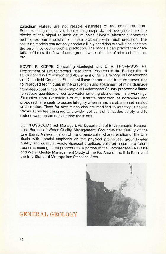
GENERAL GEOLOGY
10

ERNST CLOOS, Johns Hopkins University. Geology of the Thomasville Ume· stone Deposit. The limestone deposit at Thomasville is unique and of more than local interest. A thorough study has been underway since 1 937 and it is planned to make the general data available to others.
JOHN A. ENMAN, Bloomsburg State College. Production o f Color Slides of Pa. Landscapes and Formations and Collection of Rocks and Minerals for International Exchange. I am producing a set of 2 x 2 inch color slides of Pa. landscapes and geological formations and collecting museum type specimens of Pa. rocks and minerals to be exchanged for like minerals sup· plied by the Department of Geology and Mines, Government of Rajasthan. Udaipur, India.
ALAN R. GEYER, Pa. Geological Survey, and WILLIAM BOLLES, Penn· sylvania Department of Education. Guide to the Geology of In terstate 80. A general guide stressing significant geologic points of interest for the local as well as long-distance traveler.
RICHARD NICKELSEN and various students , Bucknell University. Geologic Mapping- Bedrock of Buffalo Valley, Lewisburg quadrang le .
K. C. ROBERTS and R. D. SHACKLETON, Medusa Cement Company. Geology o f Carlisle Clay, Inc. Clay Pit, Toland , Pa. Various papers have been published concerning the origin and structure of the white clay at the Carlisle Clay , Inc. (formerly Philadelphia Clay Co.) c lay pit at the base of South Mt . near Mr. Holly Springs , Pennsylvania. We have done three separate drilling programs and a substantial amount of chemical work on the c lay seam. Extensive mapping has also been performed. Our opinion as to the structure of the clay deposit and the origin of the c lay w ill be discussed along with the results o f the drilling.
GEOCHEMISTRY MARIA LUISA CRAWFORD and various students, Bryn Mawr College. Chemical Analysis of Piedmont Crystalline Rocks.
BRUNO J. GILETTI, A. W. HOFMANN and J. W. MAHONEY, JR., Brown University. K·Ar and Rb·Sr Data on the Detrital and Postdeposi tional History o f Pennsylvanian Clays from Ohio and Pa.
FU TZU HSU and ARTHUR W. ROSE, The Pa. State University. Stream Sediments and Waters in Northwestern Nittany Valley and Vicinity . Stream sediments have been analyzed for Zn, Pb, Ni, Cu. Mn and Ba and stream and well waters for fluoride. Several anomalous localities have been recognized.
DAVIS M. LAPHAM, Pa. Geological Survey. Geochronology of Core from Erie County Basement. Correlation and significance of K-Ar and Rb-Sr age dates on Precambrian metasediments from drill cores beneath the Plateau.
DALE M. LEWIS and KARL K. TUREKIAN, Yale University. Geochemical study of the Susquehanna River as a Transport Medium of Elements as Dissolved Species and Solids.
JAMES MCNEAL and ARTHUR W. ROSE, The Pa. State University. Geochemistry of Mercury in Rocks, Stream Sediments and Soils of Pa. Rocks of Pa. average lower in Hg than most values in the literature, probably because literature values are largely near ore deposits. Soils and stream sediments contain far more mercury than rocks, probably because of absorption of atmospheric Hg by organic material and clay. The added mercury may result largely from human activities.
DENNIS PENNINGTON and ARTHUR W. ROSE, The Pa. State University. Use of Soil Geochemistry to Prospect for Chromite Deposits in the State Line District, South em Lancaster County. Soils adjacent to two old chromite mines are strongly anomalous in chromium and nickel. The anomalies appear to be of natural origin. The trend of the ore bearing zones can be identified. We hope the method will be useful in finding additional chromite ore bodies.
ROBERT C. SMITH, II, A. MONTGOMERY, N H. SUHR and J. B. BODKIN. The Chemical Composition of Chevkinite from Pa. The chemical composition of chevkinite, a rare earth titanosilicate from Bethlehem, Northampton County, Pa., is being determined by instrumental procedures. The chevkinite occurs as crystals in a hornblende-bearing pegmatite which contains traces of zircon and molybdenite with 2H:3R approximately 1 0:1. From the U, Th, and Pb contents, an age of 916+50 m.y. has been calculated. X-ray fluorescence, instrumental neutron activation analysis, and emission spectroscopy are being compared for the lanthanide analyses. To date, 34 components have been quantitatively determined.
R. W. WHITE, U.S. Geological Survey. Dispersion of Elements in the Zone of Weathering. Sample collection of fresh and weathered granitic and basaltic rocks and derived soils from 5 different climatic zones is continuing to determine their mineralogy and petrography. Samples from various areas will be prepared and submitted in a random sequence for analysis.
E. ZEN, U.S. Geological Survey. Low Temperature Mineral Equilibria. This continuing investigation includes studying and reporting on the petrology of metamorphic and sedimentary rocks, the thermody:lamic properties of
12

rock-forming minerals, general problems of near-surface gravity tectonics, and the geologic history, stratigraphy and metamorphism of the western part of the northern Appalachian orogen.
GEOMORPHOLOGY
NOEL POTTER, JR., Dickinson College. Distribution of Karst Depressions in Cumberland County, Pa.
DALE F. RITTER, Southern Illinois University, and W. FRED KINSEY and MARVIN E. KAUFFMAN, Franklin and Marshall College. Rates of Flood Plain Construction along the Delaware River near Bushkill, Pa.
GEOPHYSICS
WILLIAM A. CRAWFORD and J. H. KALMBACH, Bryn Mawr College. Magnetometer and Gravimeter Survey and Trace Element Trends of Honeybrook Anorthosite in the Wagontown Quadrangle .
B. F. HOWELL, JR. and THOMAS SHULTZ, The Pa. State University. Seismic Hazard in the United States. Average regional seismic hazard index (ARSHI), a newly developed measure of relative hazard from earthquakes, is being used to compare expected hazard from future earthquakes in different locations and is being correlated with different geologic features in a search for the causes of earthquakes in eastern U.S.
13

M. F. KANE, U.S. Geological Survey. National Aeromagnetic Survey. Approximately 23,000 square miles will be aeromagnetically surveyed this year in Pa. which will complete mapping of the State and permit preparation of 1:1 ,000,000 scale aeromagnetic maps.
PETER M. LAVIN and JOHN CHEWNING, The Pa. State University. Aeromagnetic Studies in Pa. Determination of the variation in thickness of the sedimentary rocks of western Pa. through spectral analysis of aeromagnetic data. Results will be interpreted in terms of the known regional geology in an attempt to predict the location of economic mineral deposits.
A. J. NAVAZIO, Aero Service Corporation. Digitizing and Computer In terpretation ., In 1962, Aero Service flew an aeromagnetic survey covering 130,000 square miles of the Appalachian Basin , including Pa. During 1972, a large portion of the data was digitized and a new interpretation developed using the Computer based Werner deconvolution technique. The results of the study reveal many prospective areas for gas and oil exploration. At this time, almost all of the Pa. data is in digital form , has second derivation maps to accompany it, and has been reinterpreted by computer techniques.
MARC L. SBAR and LYNN R. SYKES, Columbia University. Study of Seismicity in the Vicinity of the Proposed Tocks Island Lake.
JOHN R. SUMNER, Lehigh University. Regional Gravity Surveys. Interpretation of gravity surveys over the Reading Prong of central-eastern Pa. show the dip of the Precambrian gneiss-Paleozoic carbonate interface varies appreciably with locale. Density variations complicate interpretation, but model geologic sections constructed from gravity and suface geology show that gneiss bodies are up to 700 meters thick with steeply or shallowly dipping sides.
GLACIAL GEOLOGY
14

G. GORDON CONNAlLY, SUNY at Buffalo. Surficial Geology and Pleistocene Stratigraphy of the Bangor Quadrangle. Reconnaissance mapping in the Bangor quadrangle indicates that at least five tills are present: three Wisconsinian, one Illinoian, and one pre-Illinoian. The Terminal Moraine, or_ Bangor moraine, loses its identity within the quadrangle, which has resulted in difficulty in locating the Wisconsinan terminus. The ice
· margin will be approximated by detailed mapping of soil horizons across the quadrangle.
G. GORDON CONNALLY, SUNY at Buffalo, JACK B. EPSTEIN, U.S. Geological Survey, and LESLIE A. SIRKIN, Adelphi University. Deglaciation of the Wind-Gap-to-Water Gap area. Seven sequences of glacial deposits have been delineated and from these we have mapped seven successive ice marginal positions. Sequences consist of ice-contact, outwash, alluvial, and lacustrine deposits. Four tills are present in the area, one of which is probably pre-Woodfordian. The Wigwam Creek bog has been cored and is being analyzed for the pollen record. A sample from this core has been submitted to the U.S. G.S. for radiocarbon dating.
G. GORDON CONNALY, SUNY at Buffalo, and RAYMOND W. GRANT, Lafayette College. Definition of the Illinoian Formations of the Lehigh Valley. The Illinoian and pre-Illinoian formations of the Lehigh Valley will be described and named as will the soils and paleosols present on these deposits. Field studies are supported by heavy mineral and clay studies of tills and soils.
G. H. CROWL, Ohio Wesleyan University. Late Wisconsinan Glacial Border, North-Central Pa. The Late Wisconsinan glacial border has been traced from the Lehigh River near White Haven to the Appalachian Front north of Benton. Mapping by Lewis and Leverett has been revised. Areas of Early Wisconsinan and Illinoian drifts beyond this border have been noted. The work is partially completed from Benton west to the Loyalsock north of Montoursville.
DENIS E. MARCHAND, Bucknell University. Pleistocene Geology of the Central Susquehanna Basin. Reconnaissance field observations and detailed mapping of local areas along the Susquehanna River's West and North Branches above Selinsgrove reveal a long and complex Pleistocene history. Pre-WISCOnsinan glaciation is represented by till, ice contact deposits, fluvial sands, colluviu·m, and minor loess. Efforts to establish the existence or nonexistence of multiple Pre-Wisconsinan glaciation in this area have thus far been unsuccessful. North of Lewisburg, all or part of the Susquehanna River was diverted westward by Pre-Wisconsinan ice into the Buffalo Valley and possibly into Penns Creek. Wisconsinan deposits mapped outside the terminal moraine include loess, eolian sand, thin colluvium,
15

and outwash or periglacial alluvium deposited on at least five terraces. The 1 20-1 30-foot outwash terrace appears to correlate with the Wisconsinan terminal moraine at Berwick.
HYDROLOGY
RICHARD M. FOOSE, Amherst College. Characteristics of Porosity, Permeability, Ground Water Storage, Movement and Yield in the Carbonate Rocks of the Hershey Valley. Through a series of pump tests and the measurement of more than 25 points of observation on a two-week time period, and 6 points of observation by continuous recording, an understanding of all the parameters that affect the behavior of water in several carbonate formations (Ordovician age) is being developed.
JERRALD HOLLOWELL, Susquehanna River Basin Commission. Hydrology of the Abandoned Coal Mines in the Wyoming Valley, Pa. To determine what measures are required to provide a better quality mine discharge in the Wyoming Valley, mine hydrology and mine water quality are related to mine-pool management. The addition of mine-pool outlets at several critical locations will reduce interpool f low and increase the rate of discharge, which would reduce the total mineral load discharged to the river. Additional outlets will act as relief overflows to reduce the maximum fluctuation of mine-pool levels.
CHARLES W. POTH, U.S. Geological Survey. Summary Ground-Water Resources of Erie , Lancaster and Mercer Counties, Pennsylvania.
EVAN T. SHUSTER, Pa. Geological Survey. Hydrogeology of the DuBois Area, Jefferson and Clearfield Counties.
CHARLES R. WOOD, U.S. Geological Survey, and DAVID B. MACLACHLAN, Pa. Geological Survey. Geology and Hydrology of Northern Berks County.
16

IGNEOUS AND METAMORPHIC
PETROLOGY
D. BASU, Lehigh University. Genesis of the Grace Mine Magnetite Deposit, Morgantown, Berks County, Pennsylvan ia. The purpose of the project is to study the genesis of the magnetite deposit at the Grace Mine and to com pare the results with those obtained by other workers on other deposits of similar nature. Mainly petrographic and ore microscopic analysis, X-ray diffraction method and electron microprobe analysis. Specimens have been collec ted in the form of drill cores that go through the diabase in one direction and through the ore zone in the other. Preliminary petrographic and ore-m icroscopic investigations on the ore zone as well as on the diabase have been completed. The thermal conditions of the ore zone will probably be revealed in great detail as the work progresses and will be reported later. Finally an attempt will be made in establishing the genetic relationship between the diabase body and the ore body on the basis of detailed microscopic and electron microprobe analytical investigations.
MARIA LUISA CRAWFORD, Bryn Mawr College. Mapping in the Coatesville Quadrangle.
AVERY A. DRAKE, JR. and ROBERT I. TILLING, U.S. Geological Survey. Petrochemistry o f the Precambrian Rocks of the Reading Prong of Pa., N.J. and N. Y. The petrochemistry of the rocks of the Reading Prong is being studied by the collection of samples of all rock types from areas that have been adequately mapped. In addition, the radiogenic heat producing minerals o f these rocks will be studied to gain a greater insight into heat flow in this tectonic terrain. Analyses for U, Th, and K have been received for the first batch of samples. A preliminary study suggests that the hornblende granite-alaskite suite of N. J. has relatively high heat productivity values and that other metasedimentary-metavolcanic rocks have unusual Th/ U values.
JOHN L. FAUTH, SUNY College at Cortland. Possible Devitrified Precambrian Welded Tuffs, Blue Ridge Province, Md. and Pa.
WILLIAM R. PARROTT, JR., Bryn Mawr College. Precambrian Geology, Ridley Creek Area, Delaware County, Pa. The area between U.S. Routes 1 and 3 in the Media ? Y2·minute quadrangle, originally mapped by Bascom et al. (1 90 9) and Bascom and Stose (1932) as Precambrian gneiss and gabbro, is being reexamined in detail. Results thus far indicate the rocks to be a complex of amphibolites, gneisses of primarily sedimentary origin , and
17

various smaller gabbroic masses, all of which have been metamorphosed to amphibolite to granulite facies and partially migmatized. Age and structural relationships remain uncertain.
CHARLES F. SUTPHEN, Temple University. Petrogenetic Analysis of a Diabase Intrusion. This will consist of a complete chemical and physical analysis of a Triassic diabase dike which is an extension of the dike systems of southeastern Pa.
MINERALOGY
JOHN H. BARNES and DAVIS M. LAPHAM, Pa. Geological Survey, and WAYNE F. DOWNEY, JR. Mineralogy Associated with Burning Anthracite Deposits. A report on minerals forming from sublimation of gases produced by subsurface fires in anthracite mines and culm banks in Luzerne, Schuylkill, and northern Dauphin Counties.
G. W. BRINDLEY, The Pa. State University. Clay Mineralogy Study. Various aspects of clay mineralogy are being studied, including: ( 1) Adsorption of organic materials by clays, the formation of clay-organic complexes, swelling properties of clay-organic complexes. (2) Mixed-cation montmorillonites and their swelling behavior in water. (3) The formation of longspacing complexes, particularly by chlorites. ( 4) The nature of nickel hydrous silicates, particularly garnierites.
RAYMOND W. GRANT and ARTHUR MONTGOMERY, Lafayette College. Investigation of Pa. Minerals. Investigation of both older occurrences where data are incomplete, and new occurrences of minerals, new to the State. We are interested in their descriptive mineralogy, geochemistry, and manner of occurrence as keys to their regional relationships and geological origin . This research began in the fifties and data on it have been published monthly since November, 1962, in a column "Pa. Minerals" in the Keystone
18

Newsletter of the Mineralogical Society of Pa. Part of this project has been updating of Gordon 's Mineralogy of Pa., 1922. It has been closely coordinated at all times with similar research by mineralogists of the Pa. Geological Survey under the leadership of Dr. Davis M. Lapham, Chief Survey Mineralogist.
DAVIS M. LAPHAM, Pa. Geological Survey. Mineralogy of Limonite Pseudomorphs, Lancaster County. The mineralogy, geochemistry and geologic occurrence of limonite pseudomorphs from Columbia, Lancaster County, including some experimental work on ion diffusion.
DAVIS M. LAPHAM and JOHN H. BARNES, Pa. Geological Survey. Mineral Collecting in Pa. A revision and updating of Pa. Geological Survey publication G 33, Mineral Collecting in Pennsylvania, to include additional topics and new localities with revised mineralogy and geology.
PALEONTOLOGY
JAMES A. BARLOW, WILLIAM C. DARRAH and ROBERTS. REPPERT, W. Va. Geological Survey. Plant Fossils from the Cassville Shale. Recent paleobotanical collections made in active strip mines in the Morgantown, W. Va.-Mt. Morris, Pa. area have yielded some remarkable new plants in addition to the common forms , and have also revealed the existence of two basic paleobotanical facies in this area. These facies are apparently separated geographically, north from south, the northern one being essentially a Neuropteris facies, and the southern one a Pecopteris facies. These plants support a Permian age for the Dunkard and also substantiate many of the other geological and paleontological observations made by Fontaine and White in 1880 (Pa. 2nd Geol. Survey, v.PP).
BRUCE M. BELL, N.Y. Geological Survey. A Study of North American Edrioasteroidea. In this large monograph, Bell has described one edrioasteroid from the lower Keyser (Upper Silurian) at Hinman, Pa. This study will serve as the definitive work on this extinct c lass of the Echinodermata. lt will appear as a N.Y. State Museum and Science Service Memoir.
19

T.M. BERG, Pa. Geological Survey. Pelecypod Burrows in the Basal Sandstone Member of the Catskill Formation, Northeastern Pa. Large burrows made by the pelecypod Archanodon sp. have been recognized in the basal sandstone member of the Catskill Formation in northeastern Pa. These burrows display specific vectorial features which bear some similarities to approximately homeomorphic pelecypods living in the American northwest Pacific coastal regions. The observed similarities amplify the interpretation that the basal Catskill member is either a delta front or lower delta plain deposit.
T. M. BERG, Pennsylvania Geological Survey. Pa. Geological Survey Paleontological Collections. The Pennsylvania Survey paleontological collections were being organized when the June, 1972 flood hit the Survey. The collections suffered considerable damage and loss, particularly to the Devonian and Lower Paleozoic materials. The Carboniferous materials were not so severely damaged. The survey hopes to reestablish a reference collection as geologic projects are completed, and new paleontological materials are acquired and thoroughly analyzed.
J. THOMAS DEWINDT and J. E. EDSON, JR., Shell Oil Company. Occurrence of Phytoplankton in Bloomsburg and Associated Redbeds, Central Appalachian Region. Twelve samples representing "redbed" clastics of the ?Middle and Upper Silurian Bloomsburg Formation of Pa., and its genetic counterparts in N.J. and N.Y., are being analyzed for presence of phytoplanktonic remains (acritarchs and sporomorphs). Microscopic study of the residues is still in progress, the results appear to document previously published paleoenvironmental conclusions by Hoskins ( 1 961 ) and De Windt ( 1972): samples from the northeastern portion of the Bloomsburg depositional basin were barren, thus constituting negative evidence of nonmarine paleoenvironments; samples from central Pa. yielded sparse phytoplankton (including, from the western part of the Landisburg Tongue, a sporomorph resembling the younger genus Tasmanites) which was probably deposited in marginal marine environments. Surprisingly, a sample from a highly carbonaceous stratum reported by Willard ( 1938) proved barren.
STEVEN F. DODIN, University of Pittsburgh. Molluscan Reversal and Mulluscan Faunal Size Variation in Pa., Ohio and W.Va. The concept of "molluscan reversal" states that, in general, the abundance and diversity of molluscan faunas decrease offshore, as contrasted with the increase in other faunal elements from onshore to offshore marine. Trends in relative adult sizes of molluscan faunas will also be examined. Theoretically, onshore infaunal molluscs will grow to a larger size than will onshore epifaunal species; offshore epifaunal species will grow larger than offshore infaunal species. Field data is being collected to test these hypotheses, from the Ames and other marine Conemaugh units.
20

PETER W. GOODWIN, RAVINDRA TIPNIS and FRANCIS T. MANNS, Temple University. Conodont Biostratigraphy and Paleoenvironments of the Beekmantown Group in Central and Eastern Pa. ( 1 ) Description on conodonts from Stonehenge and Ax em ann Formations for purposes of comparing Appalachian succession with conodont successions in western North America. (2) Interpretation of Beekmantown paleoenvironments, integration with biostratigraphy to produce a more complete paleogeographic picture.
C. WARREN NORTON, University of Pittsburgh. Paleoecology of Foraminifera in the Brush Creek Marine Event in the Appalachian Basin. Trench samples of Brush Creek shales and limestones are being quantitatively counted for their microfauna, particularly Foraminiferida. From this, with supporting data on sedimentary petrology and microfauna! analysis, paleoecological inferences will be made.
WILLIAM A. OLIVER, JR., U.S. Geological Survey. Rugose Corals of the Keyser Limestone in South-Central Pa., Md., Va., and W.Va.
BARRY PERLMUTIER, Jersey City State College. Conodonts from the Keyser Group (Silurian) and the Helderberg Group (Devonian) in Pa. Samples will be collected and processed to recover conodonts using standard methods and equipment. The conodonts will be described and illustrated. The individual conodont elements will be grouped to form the whole organism empirically based on models previously developed. Correlation will be made with sections in N.Y., N.J., Md., Va., and W.Va. An attempt will be made to relate these conodont groupings to the environments represented in the Keyser and Helderberg Groups.
HORACE G. RICHARDS, The Academy of Natural Sciences, Philadelphia. Curating of Paleontological Collection - Including Specimens from Pennsylvania - Preparatory to Moving to a New Building Planned for Late 1 973.
HAROLD B. ROLLINS and JACK DONAHUE, University of Pittsburgh. Paleoecology of Conemaugh Marine Units. Study of the Upper Pennsylvanian marine benthic communities of the Appalachian Basin. This research is being conducted under the auspices of a National Science Foundation grant (GA 31898).
GRAIG D. SHAAK, Florida State Museum, University of Fla. Diversity and Community Structure of the Brush Creek Marine Interval {Conemaugh Group, Upper Pennsylvanian) in the Appalachian Basin of Western Pa. Transgressive-stillstand-regressive phases and their resulting organic~ommunities have been recognized and identified in the Brush Creek marine in-
21

terval. These results were obtained through application of diversity and equitability gradients to taxonomic frequency data in conjunction wi th more conventional paleoecological measures.
ALFRED TRAVERSE, J. B. WARG and BOBBY WILSON, The Pa. State University. Palynology of Upper Devonian-Mississippian Rocks, Centre County , Pa. We are working on the palynofloras of " Catskill-Pocono" rocks as exposed in Centre County, Pa., with special reference to the internationally important project (sponsored by CIMP - International Committee on the Microflora of the Paleozoic) of determining the DevonianMississippian contact on the basis of spores. A Belgian palynologist is cooperating by investigating spores from presumably equivalent levels in the Horseshoe Curve section near Altoona.
SEDIMENTOLOGY
J. D. GLAESER, University of N. Carolina, Chapel Hill. Deltas as Models for Subsurface Exploration - the Catskill Delta of the Central Appalachian delta deposits requires recognition and delineation of the delta front sandstones. The evolution of the delta front (Glaeser, 1973. Geol. Soc. America Abs. with Programs, v. 5, n. 2, p. 165) is controlled by subaqueous slope, width of the adjacent subaerial delta plain and locations of feeder streams. Westward, as slope lessened, the delta front developed more complex lobes and varieties of marginal marine environments. This increasingly complex coastal margin favors reservoir development for hydrocarbon stroage.
J. DOUGLAS GLAESER, Univ. of N. Carolina, Chapel Hill. Sediment Sequences in Catskill and Carboniferous Deposits: Analysis of Tectonic and Environmental Controls in the Appalachian Region. This is a study of ver· tical sequences and memory systems in two contrasting detrital clastic deposits. Use of facies "trees" shows the sequential (cyclical) nature of these deposits resulting from shifts in coexisting environments. Breaks in facies sequences not predictable from "tree" diagrams can be related to causes beyond the influence of the local depositional environment.
22
MARVIN E. KAUFFMAN, Franklin and Marshall College. Cambro-Ordovician Carbonates in Southeastern Pa.
JOHN B. ROEN, U.S. Geological Survey. Geology of the Sandstone Above the Pittsburgh Coal Bed, Northern Appalachian Basin, Pa., Ohio, W.Va. A study of the geometry, stratigraphy, petrology, and paleocurrents of the sandstone in the lower member of the Pittsburgh Formation.
STRATIGRAPHY
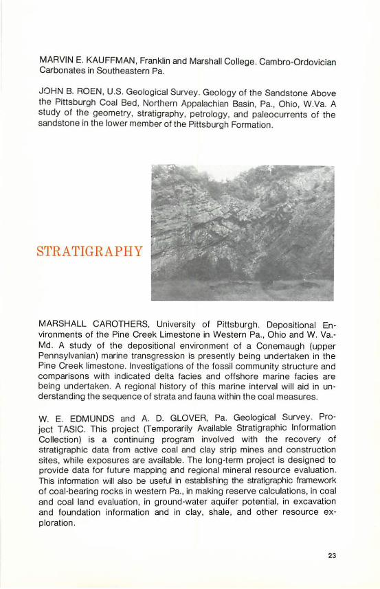
MARSHALL CAROTHERS, University of Pittsburgh. Depositional Environments of the Pine Creek Limestone in Western Pa., Ohio and W.Va.Md. A study of the depositional environment of a Conemaugh (upper Pennsylvanian) marine transgression is presently being undertaken in the Pine Creek limestone. Investigations of the fossil community structure and comparisons with indicated delta facies and offshore marine facies are being undertaken. A regional history of this marine interval will aid in understanding the sequence of strata and fauna within the coal measures.
W. E. EDMUNDS and A. D. GLOVER, Pa. Geological Survey. Project TASIC. This project (Temporarily Available Stratigraphic Information Collection) is a continuing program involved with the recovery of stratigraphic data from active coal and clay strip mines and construction sites, while exposures are available. The long-term project is designed to provide data for future mapping and regional mineral resource evaluation. This information will also be useful in establishing the stratigraphic framework of coal-bearing rocks in western Pa. , in making reserve calculations, in coal and coal land evaluation, in ground-water aquifer potential, in excavation and foundation information and in clay, shale , and other resource exploration.
23

RODGER FAILL, DONALD M. HOSKINS and RICHARD WELLS, Pa. Geological Survey. Middle Devonian Stratigraphy, Central Pa. Revision of Middle Devonian stratigraphy in central Pa. based on recent mapping in the area.
LOUIS HEYMAN, Pa. Geological Survey. The Oriskany Sandstone and Related Rocks in the Subsurface of Pennsylvania: 1. Stratigraphy and Areal Distribution in Western and Northern Half of Pa. Maps at 1 :250,000 drafting scale are being compiled which will show: ( 1) the areal extent of the basal Bois Blanc, Ridgeley and Helderberg (?) units at present comprised in the subsurface Oriskany; (2) the thickness of these units; and (3) units underlying and overlying ("worm and birdseye view maps") these units.
STEPHEN H. HOLLIS, Bryn Mawr College. Geologic Map and Interpretation of the Fredericksburg ?%-minute quadrangle. A thorough investigation of the petrology of the "exotic blocks" and their relation to the surrounding Martinsburg Shale will be conducted. The "exotic blocks" include limestones, sandstones and volcanic rocks with pillow structures.
JON D. INNERS, Pa. Department of Transportation. Stratigraphy and Paleontology of the Onesquethaw Stage in Pennsylvania and Adjacent States.
WAYNE D. MARTIN and DOUGLAS LORENZ, Miami University, Ohio. Uthofacies, Paleocurrents and Environments of Deposition of the Dunkard Group in Ohio, Pa. and W.Va. This is a lithofacies, lithofacies-trend, paleocurrent, and environmental analysis of the Dunkard Group of the Dunkard Basin. Over 1 35 rock sections have been measured and described and about 1 500 cross-bedding attitude determinations have been made over the past 20 years by Wayne Martin and several graduate students at Miami University.
GEORGE W. PEDLOW Ill, University of South Carolina. Facies Relationships, Depositional Environments and Source Terranes of Some Carboniferous Rocks in the Anthracite Region of Pa. This study will define the environments of deposition of the intertonguing sequence of red beds, green to gray shales, sandstones and conglomerates, coal and minor limestone which comprise part of the Carboniferous sediments (Llewellyn, Pottsville and Mauch Chunk Formations) in the Anthracite Region; will infer source area composition and tectonics; and will integrate findings with the depositional models recently developed for other Carboniferous rocks in the Black Warrior, Pocahontas and Dunkard Basins of the Appalachian region.
24

RICHARD B. WELLS, Pa. Geologic Survey. Stratigraphy and Economic Potential of the Loyalhanna(?) Limestone. Reconnaissance and preliminary stratigraphic study of a Mississippian limestone and calcareous sandstone unit which occurs near Philipsburg, Salladasburg, Forksville, and Shickshinny. If criteria can be developed for the identification of this unit in key outcrop localities in this area, it will be useful in the simplification and refinement of the Mississippian stratigraphic nomenclature and correlations across the Commonwealth . This unit will also be sampled for possible use as a nonskid highway surfacing material.
STRUCTURAL
GEOLOGY
INA B. ALTERMAN, Herbert H. Lehman College. Detailed Mapping in the Hamburg ? Y2-minute quadrangle and the Northern Half of Temple quadrangle. The present detailed mapping project extends, refines and builds upon an earlier project of detailed reconnaissance mapping of the eastern end of the Hamburg klippe from Schuylki ll River eastward. Now that the general structural and stratigraphic character of this part of the klippe is known to some extent, it is hoped that solutions to some of the unresolved structural and stratigraphic problems will be forthcoming from detailed quadrangle mapping. An attempt wi ll be made to link up the geologic maps of the Hamburg and Temple quadrangles directly to the west mapped by Paul Myers.
ERNST CLOOS and F. J. PETIIJOHN, Johns Hopkins University. Triassic Overlap at Thomasville, Pa. A drillhole into the Triassic encountered an unknown conglomerate and a sequence of cyclic sandstones and mudstones which are 800 feet thick instead of about 1 50 if there is a normal gently dipping overlap. Faulting or an erosional scarp must have been present . Investigation will continue.
25

RODGER FAILL, Pa. Geological Survey. Fossil Distortion in the Valley and Ridge Province. Project examines fossil distortion in samples of the Trim· mers Rock Formation from selected sites across the Valley and Ridge province. Data will be used to determine the contribution of flow to the Alleghenian folding, and to ascertain if there is any systematic variation across the province.
JOHN L FAUTH, SUNY College at Cortland. Tectonic Significance of the Carbaugh·Marsh Creek Fault , South Mountain , Pa.
PETER HART, U. S. Army Corps of Engineers, Baltimore. Anomalous Struc· tures in the Plateau of Bradford, Tioga and Lycoming Counties. Areas of high angle faulting and associated steep dips, surrounded by flat-lying Plateau struc tures, have been extended farther than previously mapped (Woodrow, 1968; Cathcart, 1934; Ingham, 1951 ). These faults may be connected to faulting recently mapped in the Williamsport area south of the Allegheny "Structural Front."
MICHAEL A. ROBERTS, JR., University of S. Carolina. Seismic In· terpretation in Light of Modified Literature in the Chestnut Ridge-Summit Field, Pa. The subsurface structure of Summit Dome is interpreted from seismic data. An alternative method for the development of synclinewarddipping thrust faults is offered.
MARY EMMA WAGNER, University of Pa. Structure of Baltimore Gneiss and Glenarm Series in Chester County, Pa. A study of the structures and fabric of the Baltimore Gneiss and Glenarm Series in Chester County in an attempt to unravel the sequence of nappe formation, folding, faulting and the rise of gneiss domes. This study will be aided by samples from wells drilled in and near the Cream Valley fault zone, loaned by Roy Weston Company. Aeromagnetic maps will also be used as an aid to interpretation.
26
ANNUAL FIELD CONFERENCE OF
PENNSYLVANIA GEOLOGISTS October 5-6, 1973
Structu re and stratigraphy of Central Pennsylvania . Hosts: Pennsylvania Geological Survey . Write for pre-registration forms to the: Field Conference
c/o Pennsylvania Geological Survey 418 Towne House 660 Boas Street Harrisburg , Pa. 17102
PUBLICATIONS IN PRESS
ALTERMAN . I. B .. Rotation and dewatering during slaty cleavage formation : some new evidence and interpretations. Geol. Soc. America Bull. ARNDT, H. H., WOOD. G. H., JR. , and SCHRYVER. R. G., Geo logic map of the southern half of the Shamokin quadrangle , Columbia and North umberland Counties. Pa. U.S. Geol. Survey Misc . Geol. lnv. Map 1-734 . BERG. T. M. and GLOVER. A. D., Geology and mineral resources of the northern half of the Penfield 15-minute quadrangle, Pa. Pa. Geol. Survey, 4th ser., Atlas 7 4ab. CLENDENING, J. A., Palynological evidence for a Pa. age assignmen t of the Dunkard Group in the Appalachian Basin : Part I. in Age of the Dunkard. W. Va. Geol. Survey, Proceedings volume. I. C. White Memorial Symposium. CLENDENING, J. A. , Palynological evidence for a Pa. age assignment of the Dunkard Group in the Appalachian Basin: Part II. W.Va. Geol. Survey. DEWINDT, J . T., Acanthodian scales from the Bloomsburg Formation (?Middle and Upper Silurian) of central Pa. Jour. Paleontology. DEWINDT, J . T., Occurrence of Rusophycus in the Pocono Island Formation (Upper Silurian) of eastern Pa. Jour. Paleontology. DEWINDT, J . T., The Landisburg Tongue of central Pa .: a late Silurian delta. Pa. Acad . Sci. Proc. DEWITT, W. W ., JR., Hyndman 15-minute quadrangle. U.S. Geol. Survey. EDMUNDS, W. E., Structure contour map of Allegheny , Armstrong, Beaver, Butler, Washington and Westmoreland Counties. Part of Pittsburgh Regional Environmental Geology Studies, to be published by U.S. Geol. Survey and Pa. Geol. Survey. EPSTEIN, J.B., Geologic map of the Stroudsburg quadrangle, Pa.-N.J. U.S. N.J. U.S. Geol. Survey Geol. Quad. Map G0-1 047 . EPSTEIN, J . B., SEVON, W. D. and GLAESER, J. D., Geology and mineral resources o f the Lehighton and Palmerton 7 Y2-minute quadrangle. Pa. Geo l. Survey, 4th ser., Atlas 1 95cd. FAILL, R., T., Structural analysis of the Valley and Ridge province, with particular emphasis on the Millerstown 15-minute quadrangle . Pa. Geol. Survey, 4th ser., Gen . Geol. Rept. FAILL, R. T. and WELLS, R. B., Geology and mineral resources of the Millerstown 1 5-minute quadrangle, Perry, Juniata and Snyder Counties, Pa. Pa. Geol. Survey, 4th ser., Atlas 136. FAILL, R.T. and WELLS, R.B., Geology of the northern half of the Williamsport quadrangle, Pa. Geo l. Survey, 4th ser., Atlas 134ab. FAILL, R.T. and WELLS, R.B., Geology of the southern half of the Trout Run quadrangle. Pa. Pa. Geol. Survey, 4th ser., Atlas 133cd. FAUTH, J. L., Geology and mineral resources o f the Iron Springs 7 Y2 -minute quadrangle. Pa. Geol. Survey, 4th ser., Atlas 129c.
27

GALLAHER, J.T., Summary ground-water resources of Allegheny County, Pa. Pa. Geol. Survey, 4th ser.,Water Resource Rept. 35. GLAESER, J.D., Upper Devonian stratigraphy and sedimentation environments in northeastern Pa. Pa. Geol. Survey, 4th ser., Gen. Geology Rept. 63. GLASS, GARY B., Geology and mineral resources of the Philipsburg ?Y2-minute quadrangle. Pa. Geol. Survey, 4th ser., Atlas 95a. GOODWIN, P.W. and ANDERSON, E.J. Interpretation of Cambrian burrow structures ("Scolithus" and "Monocraterion ") and sedimentary structures as indicators of subenvironments in tidal sand body, the Chickies Quartzite. GRAUERT, B., CRAWFORD, M. L. and WAGNER, M. E., U-Pb isotopic analyses of zircons from granulites and amphibolite facies rocks of the West Chester prong and Avondale anticline, southeastern Pa. Carnegie lnst. Ann. Rept., 1972-73. HEYMAN, LOUIS, Tully to Queenston correlations in the subsurface of Pa. Pa. Geol. Survey, 4th ser., Prog. Rept. 185. HOLLOWELL, J. R., Geology and ground-water resources of Lackawanna County, Pa. Pa. Geol. Survey, 4th ser ., Water Resource Rept. 41 . HOOVER, K.V., Clays and shales of Pa. Pa. Geol. Survey, 4th ser., Min. Resource Rept. 50, Part 2A. KENT, B.H., Geologic map of parts of the Masontown and Morgantown North quadrangles, Greene County, Pa. U.S. Geol. Survey Misc. Geol. lnv. Map 1-743. KENT, B. H., Some geologic causes of roof fall in room-and-pillar coal mines, southwestern Pa. Pa. Geol. Survey, 4th ser., Info. Circular 7 5. KENT, B. H. and GOMEZ, MANUEL, Paleotopographic-structure controls on thickness and composition of Pittsburgh coal in southwestern Pa. U.S. Geol. Survey. LAPHAM, D.M. and GRAY, CARLYLE, Geology and origin of Triassic magnetite deposits and diabase at Cornwall, Pa. Pa. Geol. Survey, 4th ser ., Min. Resource Rept. 56. LYTLE, W. S., 1973, Oil and gas developments in Pa. in 1972. Pa. Geol. Survey, 4th ser., Prog. Rept. 186. MACLACHLAN, D. B., Geology and mineral resources of the Sinking Spring ?%-minute quadrangle, Pa. Pa. Geol. Survey, 4th ser., Atlas 177d. MCGLADE, W. G., Environmental geology of the Harrisburg area. Pa. Geol. Survey, 4th ser., Environ. Geology Rept. 4. MCNEAL, JAMES and ROSE, A. W., Inhomogeneity of mercury in the USGS rock standards. Chern. Geol. MORRIS, R. W., ROLLINS, H. B. and SHAAK, G. D., 1973, A new ophiuroid from the Brush Creek (Connemaugh Group, Pennsylvanian) of western Pa. Jour. Paleontology. NEWPORT, T. G., 1973, Summary ground-water resources of Clarion County, Pa. Pa. Geol. Survey, 4th ser., Water Resource Rept. 32.
28

NEWPORT, T. G., Summary ground-water resources of Luzerne County. Pa. Pa. Geol. Survey, 4th ser., Water Resource Rept. 40. NEWPORT, T. G., 1973, Summary ground-water resources of Washington County, Pa. Pa. Geol. Survey, 4th ser., Water Resource Rept. 38. NEWPORT, T. G., 1973, Summary ground-water resources of Westmoreland County, Pa. Pa. Geol. Survey, 4th ser., Water Resource Rept. 37. O'NEILL, B. J., JR., Clay and shale resources in the Greater Pittsburgh Region. Part of Pittsburgh Regional Environmental Geology Studies, to be published by the U.S. Geol. Survey and Pa. Geol. Survey. PENNSYLVANIA GEOLOGICAL SURVEY, 1973, Topographic map of Lehigh County, Pa. POTH, C. W., 1973, Summary ground-water resources of Armstrong County, Pa. Pa. Geol. Survey, 4th ser., Water Resource Rept. 34. POTH, C. W., 1973, Summary ground-water resources of Beaver County, Pa. Pa. Geol. Survey, 4th ser., Water Resource Rept. 39. POTH, C. W., 1973, Summary ground-water resources of Butler County, Pa. Pa. Geol. Survey, 4th ser., Water Resource Rept. 36. RICKARD, L. V., 1973, Subsurface Trenton and sub-Trenton carbonates in N.Y., Pa., Ohio, Ont. and Quebec. N.Y. State Museum and Science Service Map and Chart Series. ROEN, J.B., Geologic map of the Midway quadrangle, southwestern Pa. U.S. Geol. Survey Geol. Quad. Map, 1 :24,000. ROEN, J. B., Geologic map of the Oak Forest quadrangle and part of the Blacksville quadrangle, southwestern Pa. U.S. Geol. Survey Misc. Geol.lnv. Map 1-699, 1 :24,000. ROOT, S. 1., 1973, Structure, basin development, and tectogenesis in the Pa. portion of the folded Appalachians, in deJong, K. A. and Scholten, R., eds., Gravity and tectonics: a volume dedicated toR. W. Bemmelen. Wileylnterscience, N.Y. SAMSON, P. L., Valley Forge State Park. Pa. Geol. Survey, 4th ser., Park Guide 8. SCHOOLER, E. E., Pleistocene beach ridges of northwestern Pa. Pa. Geol. Survey, Gen. Geology Rept. 64.
SEVON, W. D., Geology and mineral resources of the Christmans and Pohopoco Mountain ?%-minute quadrangles, Pa. Pa. Geol. Survey, 4th ser., Atlas 195ab. SHINER, G. R. and KIMMEL, G. E., Geology and hydrology of the Shenango and Stoneboro 1 5-minute quadrangles, Mercer and Crawford Counties, Pa. Pa. Geol. Survey, 4th ser., Water Resource Rept. 33.
WARG, J. B. and TRAVERSE, ALFRED, A palynological study of shales and "coals" of a Devonian-Mississippian transition zone, central Pa., in Geoscience and man. WOOD, C. R. and others, 1973, Water resources of Lehigh County, Pa. Pa. Geol. Survey, 4th ser., Water Resource Rept. 31.
29

SURVEY ANNOUNCEMENTS
MONROE COUNTY GEOLOGIC MAP OPEN FILE
The Pennsylvania Geological Survey announces that it is placing on open file a bedrock geologic map of Monroe County which has been compiled by W. D. Sevon and T. M. Berg, staff geologists, and J. B. Epstein, U. S. Geological Survey.
The map shows the distribution of the rock formations and their subdivisions in this area. The map is accompanied by brief discriptions of the various rock units. The scale of the geologic map is 1 :48,000.
Final publication of full-color maps and complete text for Monroe County wi ll occur in the form of a series of quadrangle reports to be published in 197 4 and 197 5. To meet the immediate needs of residents, developers, and planners in Monroe County, the Monroe County bedrock geologic map is now being placed on open file and may be examined in the Survey office, Towne House Apartments, 660 Boas Street , Harrisburg .
THREE NEW MINERALS FOR PA.
Pennsylvania mineral collectors have recently made three additions to the ever-growing list of minerals found in the State. Two of the minerals were found on a single specimen, while the third was found associated with the burning anthracite deposits previously reported in Pennsylvania Geology. All three minerals were identified by X-ray diffraction analysis by the Pennsylvania Geological Survey.
Neither langite nor posnjakite appeared in the most recent list of Pennsylvania's minerals (Grant, 1973), although the presence of posnjakite in Montgomery County has been suspected for some time. Both minerals were found on a sample recently collected by Mr. Martin L. Anne, a mineral collector from Wrightsville in York County. The sample was collected on a surface dump at the Ecton Mine, an abandoned copper and lead mine on property now owned by the Audobon Wildlife Sanctuary in Montgomery County. The two minerals are apparently intimately intermixed, occur as very small, dark blue, transparent crystals of high luster and were found in a vug on a sample of limonite-bearing quartz. Both minerals have the same chemical formula, Cu4S04(0H)e•H20 , the difference being that langite crystallize-3 in the orthorhombic system whereas posnjakite is monoclinic .
30

Langite has been known to the mineralogic world for some time, having been first described in 1864(Palache et al, 1951 ). Posnjakite, on the other hand, is a relatively recently described mineral, being first described in 1967 by two independent teams of investigators, A. I. Komkov and E. I. Nefedov of the USSR and M. E. Mrose and T. E. Reichen of the U. S. Geological Survey (Fleischer, 1967).
Hexahydrite, MgS04•6H20, is a material similar in composition to the more familiar epsomite (epsom salt), MgS04•?H20 . Hexahydrite was found recently associated with a burning anthracite deposit near Glen Lyon in Luzern e County by Mr. Wayne F. Downey, Jr., a Harrisburg mineral collector. Hexahydrite occurs at this location as curved white columns and fibers up to approximately 6 millimeters in length, closely associated with epsomite. The rarity of this mineral is apparently the result of the narrow range of temperatures for which it is stable, from 48° to 69 o C ( 118 o to 1 56 oF). At lower temperatures, additional water forms epsom salt (epsomite), at higher temperatures most of the water is removed , yielding kieserite, MgS04•H20 (Palache et all, 1951 ).
John H. Barnes
REFERENCES
Fleischer, M., 1967, New mineral names, posnjakite : Am. Mineralogist, v.52, p.1582-1583.
Grant, R. W., 1973, Pennsylvania minerals column no.122, Pennsylvania mineral species: Keystone Newsletter, v.22, no.2, p.9-1 0.
Palache, C., Berman, H., and Frondel, C. , 1951 , Dana's system of mineralogy, 7th ed.: John Wiley and Sons, Inc., New York, 11 24 p.
ST ALACTITIC LIMONITE
During the study of the Altoona barite-limonite occurrence (Pa. Geology, v.4, no. 3, p. 4), stalactitic limonite was noted in the Eldorado Stone Quarry, south of. Altoona and east of Canan (Caanan).
The limonite occurs as a 3-to 6 inch wide band between bedding planes of the Upper Tonoloway limestone, near its contact with the overlying Keyser Formation. Stalactites extend from the top of the band downward and resemble dozens of pencils all stacked together parallel to each other and cemented at the base (see photo).
Some of the limonite, especially near the ends of the stalactite pencils, appears to be pseudomorphous after some former crystals, some of which probably were pyramidal marcasite; however, the slightly distorted crystal shapes have not been measured accurately to confirm the marcasite identification.
31

The stalactitic and crystalline nature of the limonite, and the presence of solution cavities and channels in the limestone directly above the limonite band suggest the following gensis. Calcium carbonate stalactites, perhaps rich in iron, grew by precipitation from groundwater flowing downward through solution channels as would occur normally in cave deposits. Marcasite, an iron sulfide, formed at surface temperatures on the stalactites as crystals and possibly as massive, crystalline material. Later, limonite, a secondary mineral formed under oxidizing conditions, possibly as the solution channels opened into caves, replaced the marcasite and carbonate , leaving little of the pre-existing minerals other than some crystal shapes that appear to be a " rhomb" of marcasite form. Similar-appearing marcasite crystals are known from other localities, but have not been identified previously on Pennsylvania stalactites.
The limonite bed is located near the crest of a large anticline exposed in the quarry involving the Keyser and Tonoloway limestones. (The axial plane of the fold is oriented N 1 0 degrees East, plunges 22 degrees Southwest). Faulting both across and along bedding planes can be seen in the quarry face and slickensides and brecciation present additional evidence of offsets. Solution of the limestones was promoted by the fracturing and faulting and provided numerous opening and pathways for mineralization to follow.
The limestones from the Eldorado Quarry are used primarily for road metal, concrete and aggregate. Blasting has left many preciptious overhangs and steep rubble piles. Extreme caution should be exercised at all times while in the quarry. As always, permission to enter private land should be obtained at the quarry office prior to entering the quarry.
John H. Way, Jr.
32

Arthur A. Socolow, State Geologist Donald M. Hoskins, Assistant State Geologist
TECHNICAL SERVICES Shirley J. Barner, Stenographer Sandra Blust , Librarian Joanne Bowman, Typist John G. Kuchinski, Draftsman Christine Miles, Asst. Geological Editor
Virginia Milewski, Draftsman Marjorie Steel. Stenographer Albert Van Olden, Draftsman Terry M. Wilson , Stenographer John P. Wilshusen, Geological Editor
ENVIRONMENTAL GEOLOGY DIVISION Alan R. Geyer, Division Chief
Barbara Conrad, Clerk Jesse Craft, Geologist (Pittsburgh Office) William McGlade, Geologist
EvanT. Shuster, Geologist Donna M. Snyder, Stenographer Grace Tyson, Clerk
GEOLOGIC MAPPING DIVISION
Thomas M. Berg, Geologist William E. Edmunds, Geologist Rodger T. Faill, Geologist Albert D. Glover. Geologist Jon D. lnners, Geologist
Samuel I. Root, Division Chief David B. Maclachlan, Geologist Phyllis Ritter, Typist William D. Sevon,Geologist
Mark A. Sholes, Geologist John H. Way, Jr .. Geologist Richard B. Wells, Geologist
MINERAL RESOURCES DIVISION
John H. Barnes, Geologist John C. Benson, Typist
Davis M. Lapham, Division Chief Bernard J. O'Neill, Geologist Robert C. Smith. Geologist
Leslie T. Chubb, Laboratory Technician
Lajos Balogh, Draftsman
OIL AND GAS DIVISION (Pittsburgh State Office Bldg.)
WilliamS. Lytle , Division Chief
Robert Fenton. Laboratory Technician Louis Heyman, Geologist Cheryl Cozart , Stenographer Elizabeth A. Eberst. Typist Ullian Heeren, Draftsman Walter R. Wagner, Geologist
TOPOGRAPHIC DIVISION In Cooperation with The U.S. Geological Survey
GROUND WATER DIVISION In Cooperation with The U.S. Geological Survey
AUGUST 1973
GROUND-WATER LEVELS
BUREAU OF TOPOGRAPHIC AND GEOLOGIC SURVEY DEPT. OF ENVIRONMENTAL RESOURCES HARRISBURG, PA. 17120
0 AbO~• l u t r- • r
• klow lu t 'f•• r
BULK R A T E U . S. Postage
PAI D Harr isburg. Pa.
Permit No. 1
CORRECT ADDRESS REQUESTED