Embed Size (px)
Citation preview


Colorado River Basin" r ? 'r .. '..
It_ ... or .. ·,U
, v
w ,J "".'1,
~ .........."••• I• '0. M
", f \.-.~ .....• ..".
•..... .;: ..-..",
;.~ '" ....;.~.~ ..,u
0 ,
.'.. '
.....,.•.
(~
~-,-J~l "... ....
c AR
•
z o
.t,, __
N A
N
M
,,
w

ANNUAL REPORT
1974 OJ)cratlon of thcColorado Rlycr Basin1975 Projccted OJ)cratlons(prep:lred pu~uant 10 Ihe Colomdo River UasillProject Act of 1968, Public Lnw 90-537)
U. S. Department of the InteriorRogers C. B. ~1(lrton, Secretary
BurellU of ReclamatiollGilbert G. Stamm, ('ommis~ion('r
JJIIU:HY 1975
Tablc of Contents
~'W
Map-Upper Colorado and Lower Colorado RiverB:lsins ....
Authority for ReportIn trod llctionActual Operations under Criteria··Water
Year I Q74 . . . . . .Upper Basin ReservoirsLower Basin Reservoirs
River RegulationBeneficial Consumptive Uses
Upper B:lsin UsesLower Basin Uses and Losses
Water Quality ('ontrolWater Quality Operations during Wulcr
Year 1974 .Future Water Quality Control
l:nhllllCClllcnt or !-'ish and WildlifeUpper l3:lsin . . . .Lower B:\sin . . . .
Prl::scrv<ltiol1 or EnvironmentProjected Plal1 of OpCr:1!ioll under Criteria
for Current YcarDetem,ination of "602(::1) Storage" .Lower Ba~in RequirementsPlan of Operation-Water Year 1975
UppL'f Basin ReservoirsLower Basin Reservoirs
Page
InsideCover
II
ii
I,
"]2
23232325
26~6
27292933

Gtel/ eal/yon Vi'iitor Cenler
Authority t()rRc)ort
Pursuant to the Colorado River Basin ProjectAct (P.L. 90-537) of 1968. I am pleased to presentto the Congress and to the Go\'emors of theColorado River Basin States, the fourth AnnualReport on the Operation of the Colomdo River.
This report describes the actual operation ofthe reservoirs in the Colorado River drainage areaconstructed under the authority of the ColomdoRiver Storage Project Act. the Boulder CanyonProject Act. and the Boulder Canyon ProjectAdjustment Act during Water Year 1974 and theprojected operation of these reservoirs duringWater Year 1975 under the Criteria forCoordinated Long-Range Operation ofColorado River Reservoirs published in theFederal Register June 10. 1970.
ROGERS C. B. MORTONSecretary, United StatesDeparhnent of the Interior
Introduction
The oper.ltion of tile Colorado River duringthc past year and the projected operation for the,'urrent year reOect domestic usc, irrigation.hydroelectric power generation. water qualitycontrol, fish and wildlife propagation. recreation.nood control. and Colorado River Compactreq uiromen ts.
Storage and release of water from the UpperBasin reservoirs recognize all applicable laws andrelevant factors governing lhe Colorado River.including the impoundment of water in the UpperBasin required by Section 60:!(a) of PuhlicLaw 90-537. The operation of the Lower Basinreservoirs reflct.:ts Mexican Treaty obligations andLower Basin contractual commitmcnts.
ii

Kather;nes IAnd;1lg. Lake Mohal'e
Actual Ol)erations Under CriteriaWater Year 1974
Operation of the Colorado River during. 1974W3!i ba:.cd on 3 forecasl of nmoff. Starlm!,!.January I. th~ snowmelt runoff was forec::lst 301..1the required release of store<t water 10 meeldemands Wol, scheduled for each n:scrvoir Ihrou~h
September. At tile beg.inning. of each month(hcre~lflcr through ..Iunc. the forecast was rcvi"Cdhased on rreclpitJtion and snow data t.:oll~cted
during lht month and the scheduled operation wasrevised ilct.:ordin.gly.
1
A description of the actual oreration of eachof the reservoirs III Ihe Colorado River BJsin isgiven in the following paragJ"Olphs. Charts IIhrough 9 show hydrographs of monthly QUlnawfrom the reservoirs and waler surface elevation andat.:tive storage in tIll,: r~servoirs for waler year 1074.

UI)I)Cr Basin Rcscryoirs
FontenellcReservoir
_.~
~rt I~L_/
During the pJS{ yenr, Fontenclle Reservoirwas operated for hydroelectric generation. noodcontrol, fish and wildHfe enhancement, and forrecreation. During the fall and winter of 1973-74,the reservoir was slowly reduced from elevation6,505 feel at the beginning of the water year toa low elevation of 6,480 reet prior to spring runofrin April. The minimum release during [he fall andwinter was 700 cubic feet per second (ft3/5) inorder that power could be genemted at thepowerplnnt nnd fish nows maintained. Releasesduring March were high enough to force the geeseill the Seedskadee National Bird Refuge to buildtheir nests on higher ground. After the actual geesenesting and hatching period, releases werecontrolled to allow the reservoir to fill late in June.Maximum releases of 8,800 ft 3/s from the reservoiroccurred late in June. The reservoir as ofSeptember 30, 1974, had 3[5,000 acre-feet ofactive storage at elevation 6,502 feet. (Chart I)
STATISTICS
ACTIVE STORAoe-(ACRE FEETI ELEVATION IFEET!
344.1134 65Q6
133.189 64111
19(.962 6485
lI058 ACRES
18MIlES
RESERVOIR
"'AXIMU'II STORAGE
RA1£O HEAD
"'INIMUM POWUI
SURFACE AREA (FUlLl
RESERVOIR L.ENGTI1 (FULL!
POWER PLANT
NUMBER OF UIO,TS
TOTA,LCAPACITY 10,000 KILOWATTS
'oI\N'J nor 1r><:!<KN 56J.,lf f.r I1r<MMJI~ 1MIo..,64M /..,/
OUTFLOW
m AC.'
I I , I 1 I
LOWER QUARTILE
"~~ ,~ ,•••o•oo 0
iii ~i1~=========::::::;;:MOiilljHA~... )- '" )-
-~>.Uc2;<tIIr<::l:)-Z"'C1 .. ;:>'-'.;="""")-2 ... "' ....
Ig ~ :' ; :r ~ =: "! ~ ~I (5 £ ~ :;\ :t ~ ~ ~__'__'__•__~~I1------ w..... y,~, 117~------l.------w ••e<v... 117$ .
2

Seedskadee
2
J
o
z•uo
STORAGE....I ,- -- 1-,
."'" I I '~r"• "• ,,'Y~ • ... ~.- .
'".'-.~. ". -x::6 " •w - - I0
2~ ,>• I"w~
.'so>
~•
I~w-~ 1 MOST PI'108A8r..f
UPPEI'lOVAI'lT,r..E ------r..OWEI'l OUAOOlTlr..E ______
IMOST AOVEI'l$E ......_.....
fI 6<00 ' .."', . · >
3

Flaming GorgeReservoir
Flaming Gorge Reservoir has been operatedas p"rt of the Colorado River Storage I>rojecl inaccordance with governing comp3cts and laws 10provide optimum power production. recreationalopportunities, and fbh and wildlife benelits.
STItoTlSTICS
On september 30. 1973. Flaming Gorge wasat elevation 6,026 feet with an active storage of3.180,000 acre-fccl. Releases for power productionc<luscd the reservoir to recede 9 feel during therail and winter to elevation 6.017 feet. TheApril-J uly 1974 runoff above Flaming Gorge was1,430,000 acre-feet. or I '23 percent of thelong-time aver..lge. With this runoff. Flaming Gorgefilled for the fir<;1 lime on August I. 1974. atelevation 6.040 feet wilh an active storage of3.750.000 acre-feet. The reservoir was held nearthe seasona.l maximum through the recrealjonseason. (Chart :!)
Reservoir releascs were higher lhan normalduring August and September 1974. This was aresull of coord ina led operation with olherreservoirs so we could reduce Glen Canyon release~
to meet the operation criteria.ACTIVE STORACE-IACRE·FEETI ELEVATION CfEETl
J.I~9000 8OlIO1.061,000 MM6
133,000 5811
42,010 ACRES
91 MILES
,i~
Chart 2
R(SERVO"!/AA,lCl,",UIroISTOR"G£
RATED HEAO
/111"""""111 "'OWERSURfACE ARE'" IFULl)
AESlAVQIA lENG TH IfULLI
POWER PLANT
Nvtol8[R Of UNITS
TOTAL CAPACITY or \)NITS 108,OOOKllOWAns
·~norflv:~4(),()(J()."'HI(J,_.ltN.~5I4D"1
OUTFLOW
• AVE
J I i,, , I
0 I I I I I ,LOWEA OUAATILE•
4

Hamillg Gorgt! OfJm and Resen'oir, Flaming Gorge UI/it. Colorado Ril'tr StOrage Project, Utah· Wyoming
•
"",.
•
,
STORAGE6040 : -I -. - '- - -6000
I,
E ""'"'" I I~
I I I" I•
"""'",
~
: !I !
~
liI~
is ,,"OST "ROS.SL[
" ".. U'"[''' ou... ,.nLE ----- -•I I I I LOW£R ou.",nl.[ -----
MOST AOVEM£ .............
56.. I I I'59' I I I I , I I I I. > • >
5

STATISTICS
Chart 3 Blue MeS<l Resenolr
!_..-j
At the end of September 1973, Bille MesaReservoir had 716.000 acre-feet of active storageand a water surface elevation of 7,506 feet. Thereservoir was drawn down to elevation 7,4-11 feelby April I, 1974, with a content of 267,000acre-feel. During April-July 1974. inflow to BlueMesa was 555,000 acre-reet, with a 1974 wateryear total of 767,000 acre-feet. The seasonal highfor the reservoir was elevation 7,497 feet and anactive storage of 640.000 acre-feet. During wateryear 1974, a minimum flow of 200 ft3/s wasmaintained below Gunnison Tunnel.
The March I, 1974, forecast of the April-July1974 inflow to Blue Mesa was 800.000 acre-feeLThe flood control diagram sJlowed that thereservoir CQuid have remained full the remainderof the snowmelt season; thererore, the operationor Blue Mesa did not include releases ror Ooodcontrol. (Chart 3)
During the period May I throughSeptember 30, 1974. low releases rrom Blue Mesainsured a flow or not more than 1,500 n3{s inthe Crystal Dam sile area. Most or the springrunorf was slored behind Blue Mesa Dam.
ACTIVE STORAG£,lACRE FEET! ElEVATION tHETI
8~,~23 1519
2<l9.39!i 1·U8
81,010 1393
111110 ACRES
2. MILES
Ii~
RESERVOIR
MAXIMUM STOIlAG£
IlATEOHEjf,O
MINIMUM POWER
SURFACE AR(A IFULLJ
RE5I.RVOtll LENGTH (FULI.I
POWER PLANT
NUM8ER OF UNITS 2
TOTAL CAPACITY OF UNITS ro,lXXI KILOWATTS
'1/<* "'" /l>C11JIJI "I.U2.e-. fH' ofdf,td ltot. bf/o... 1JS8lft1'
Curccanti Unit
OUTFLOW

Blue Mesa Dam, Curecantl Unit. Colorado River Storage Project. Colorado
•B
·"ww•, w
~
·I
STORAGE\
1519,- - --,-,...
-T_.... ,I
,•'"I
I • ~~f1-f.. ..1--
~ ,.;w
·;; I,-. ,• I I•• Iw
" I~
I• ,!"00 LEGEND -
~ I~ MOST'AO.... llLE•
U~EA QUAIUILE ----I LOWEII' OUAATILE - -_.
IMOST ADVERSE -....._- ,-....., I
" 00
I I I I I7186
• > w •
7

Curecanti Unit
---~
Ii~
Chart -t Morrow Point Reser\'oir
Morrow Point Reservoir was essentially fullduring water year 1974. On September 30, 1973,the reservoir contained 115,000 acre-feet of 3Ctivestorage at elevation 7.158 feet. Irs inflow isextensively controlled by the larger Blue MesaReservoir which is upstream.
Morrow Point Reservoir will normally beoperated at or near full capacity regardless of theamount of snowmelt runoff. (Chart 4)
STATISTICS
ACTIVE STORAGE"(ACRE·FEET) ELEVATION (FEEn
1I1,02!I 71 GO
J9.eo& 11(1814,llOb T100
811 ACRES
" MILES
RESERVOIR
IIIAxr"'UM STORAGERATEOHEAD
MINIMUM f'O\VER
SuRfACE AREA (fULL I
RESERVOIR LEmiTH (FUll)
POWER PLANT
NUMBER OF VNITS 2
TOTAL CAPACITY Of UNITS 120,000 "IlOWAns
''*'" fIC/~ ffIe 166«" IN! ofdtHOII~ N!(JW 6iJ08 ,.,
OUTFLOW
A
I
I ILOWER OUAR TI LF
8

Mo"ow Point Dam and Reservoir. CurtCQnti Unit. Colorado Riv(!f Storage Project. Colorado
o
06
o
0.2
"
••~ ~ ~ ~ ~ ~ ~ ~ ~ ~ ~ ~Ig ~ ~ ~ ~ i ~ ifl-------w...,v"' UH------_~.-------w.... v- '.,5-------1
STORAGE
""" 1
"00,
E I I~ I,'000
§~
<•~w
I~~ 0800w
~
i
68006'" .
9

NaYajo RcserYoir
!---~
Ii~
Chart 5
STATISTICS
AcriVE STORACE-RESERVOIR IAe"'E FEUI ElEVAriOH tFEET)
"'''lCIMUIII STOIIAGE 1,896.00 608ftINACTIVE STORAGE _.500 S990SURFACE AAeA1FUlU 15,1110 o\CRlO$R£SERVOlR LENGTH (FUlll :l3 MILES
'dI>ef "", IJtdu<If- '2,6OO.en '-'CI' d..t~MIow-'-..on !l115 ,-,
During water year 1974 I avajo Reservoir waskept within the limits specified by the Bureau ofReclamation in its interim operation fules. Thereservoir was lowered to elevation 6,027 feetduring the winter of 1973 and spring of 1914. Theactual April-July inflow to Navajo Reservoir was271,000 acre-fecI or 32 percent of the long·timeApril·July runoff avcmgc above Navajo.
avajo Reservoir is operated under a formalflood conlro] pltlll. On March 1, 1974, NavajoReservoir had 986,000 acre-feet of storage. TheApril-July inflow forcc<lst on March I was600,000 acre-feet. The current flood controldiagram allowed the reservoir to be full with anactive storage of 1,696,400 acre-feet during theentire 1974 snowmelt runoff season based on lheMarch I forecasts and subsequent forecasts madeduring the snowmelt runoff period. Therefore, thescheduled operation of the reservoir did notinclude any releases specifically required for floodcontrol. (Chart 5)
Releases were scheduled to controldownstream flows to the mmimum level practicalin order to minimize bank erosion.
OUTFLOW
10

>
Navajo Dam alld R/!scn'oir, NOl'oja Unit, Colorado Ril'er SlOrage Projecl, New Mexico-Colorado
••~
••·•..'i
i
o
5
'0
STOR CE
IB ~ S ~ : ~ ~ i ~ ~ ~ ~ H i ~ ~ ~ ~ ; ~ ~ ~ ~ ~I
10------ \fIJo... v_ UH ~I-------w.,. y_ 1t1~-------l0
A
6065
i> -.
.J~~ - - > --
l' .. ,-"
I 1-1' -.;..;~ 1:<'I
6000I
ww~
§
" I~5900w
I Iw I I
I'i I•~I> LEG(ND
• I MOST ""oe"'8..(• -5800I I I I ufflUt OV... iI'ITII.. ( ---
LOWl" oy",llnl.£ ---
-j >no I I I I I I I "I' ',""" I 0 10 I Iw
11
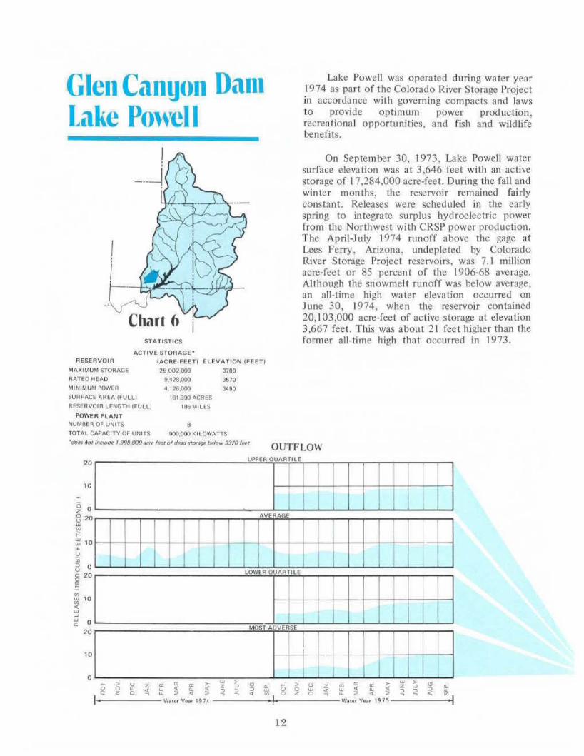
Glen Cangon DamLake Powell
Lake Powell was operated during watcr year1974 as part of the Colorallo River Storage Projectin accordance with governing compacts and lawsfO provide optimum power production,recreational opportun.ities, and fish and wildlifebenefits.
STATISTICS
On September 30. 1973, Lake Powell watersurface elevJtion was at 3,646 feet with an activestorage of 17,284,000 acre-feet. During the fall andwinter months, the reservoir remained fairlyconstant. Releases were scheduled in the carlyspring to integrate surplus hydroelectric powerfrolll the Northwest with CRSP power production.The April-July 1974 runofr above the gage atLees Ferry, Arizona, undepIcted by ColoradoRiver Storage Project reservoirs, was 7.1 millionacre-feet or 85 percent of the 1906-68 average.Although the snowmelt runoff was below average,an all-time high water elevation occurred onJune 30, 1974, when the reservoir contained20,103,000 acre-fcet of active storage at elevation3,667 feet. This was about 21 feet higher than theformer all-time high that occurred in 1973.
OUTFLOW
ELEVATION CHEf I
"""3510
'''0
ACTive STORAGe
IACRE FEET)
"~.OO2.000
9••28.000•• 10'6.000
191.300 ACRES
I86MILES
RESERVOIR
MAXIMI.JIl.I STORAGE
RATEOl-lEAO
MINIMUM I'QWER
SURFACE AREA (FULLI
RESERVOIR LENGTH IFULL)
POWER PLANTNUMBER OF UNITS 8
TOTAL CAPACITY OF UNITS IlOO.OOO KILOWATTS
.~ 4a1 (nc""* UJ98.()(}()_. IHI t1/dHtJ sf<K~l»Ia... .3J'O left
" ..I : I I
ILOWER OlIARTILE
•~I
12

- -•
,
-
=---
.-;!'--.-
,-, ." ......
Glen Cat/YOII Dam alld Lake Powell. Glen Canyon Unit, Colorodo River Storage Project ArizOfta·U/ali
-
~
>
~
o
o
,
,
13
STOIlAGE"00
!I I
,~
.- - - - ,.: - - -~ .~ • .. ,
3<00
I ,
/~~ ,~ """ I~
3
~,
• I~ ,; ,.00
!!i ~f.GENOI I I 0
~ Io'OST ~"o .... eLI
j~
3300 -• I I I UI"f'f.A OU.P1TILIE - --• LO .....ER QUARTILE ---•
I I ~ST .... OIVf.iIII$1! I I 1
3200
I I I I I I I. • - •

Lowcr Basin Rescrvolrs
'-Chari 7'--"-..-,-.~L.-
Lnke Mead aI the beginning of water year1974 had a water surface level of 1.180 feet andan active storage of 20,176,000 acre·feet, Duringthe water year, releases were made to meetdownstream water use requirements in theUnited States and Mexico, programed levels ofLakes Mohave and Havasu, and transit losses whichinclude river and reservoir evaporation, uses byphreatophytes, changes in bank storage.unmeasured inflows. and diversions, The totalrelease from Lake Mead through Hoover Dam was8,846,500 acre-feet. At the end of the water year.Lake Mead had a water surface elevation of 1.174feet and an active storage of 19,358,000 acre-feet.which reflect a decrease in storage during the wateryear of 818,000 acre-feet. On September 30.1974, the active storage of Lake Mead was1,348,000 acre·feet greater than the active storagein Lake Powell,
Lake Mead is the only reservoir on theColorado River in which a specified space isexclusively allocated for mainstream flood control.Flood control regulations have been published.These regulations take into account effective spacein CRSP reservoirs as well as in Lake Mead.
Space in Lake Mead and CRSP reservoirsduring water year 1974 was such that no unusualHoover releases were required to operate pursuantto provisions of the flood control regulations.(Chart 7)
STATInla
ACTIVE STORAOE'(ACRE. Fun ELEVATION (FEin
11.311,000 1m
13,m,ooo 112310lrn,OOO lo&:l
162.7Q04CRES
ll~MIlES
1
~~.~+-
RESERVOIR
MAXI"~5TOR""£
RAHO++EAO
NI"'IMlN POYo'ER "OOl
SUR'AC[ "'~[A C'U~lI
RESERVOIR ~[r+GTH IFU~LI
l'OWER P~ANT
NUM8E~ OF UNITS 11
TOTA~ CAPACITV Of' UNITS 1.J.U.800 ICI~OWAns.~ "'" __ ;,'1' (Jf)()«~ Iftl 01 fINd 11Of_ /1M1W ","U",," 89S lfel
Hoover DamLake Mead
I
OUTFLOW
0 ,7-'0 AV
I I I , I
0
I I I0
.::::;1
14
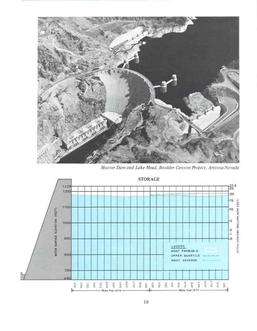
Hoover Dam and Lake Mead, BOll/der ea"yon Project, Arlzolla·Nel'ada
5 •••·o ~
~
~~!••••8•>•~
5
21
o
STORAGE
'22, -- --- - -- -- -- .--.n..-: ... ... ..... ..... ...~. .. .... _. ..... .- ..1
g 11001
i>'000~
<•~
I~
i~ 900• I~ LEGEND~ MOST I'fIlO..... LE~
~ 80 UI'I'EA OU... RTILE ----
I MOST "'DVERSE ..I
7.." .
15
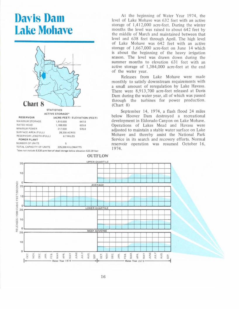
At the beginning of Water Year 1974, thelevel of Lake Mohave was 632 feet with an activestorage of 1,412,000 acre·feet. During the win termonths the level was raised to about 642 feet bythe middle of March and maintained between thatlevel and 638 feet through April. The high levelof Lake Mohave was 642 feet with an activestorage of 1,667,000 acre-feet 011 June 14 whichis about the beginning of the heavy irrigationseason. The level was drawn down during thesummer months to elevation 631 feet with anactive storage of 1,384,000 acre-feet at the endof the water year.
Releases from Lake Mohave were mademonthly to satisfy downstream requirements witha small amount of reregulation by Lake Havasu.There were 8,913,700 acre-feet released at DavisDam during the water year, all of which was passedthrough the turbines for power production.(Chart 8)
September 14, 1974, a flash flood 24 milesbelow Hoover Dam destroyed a recreationaldevelopment in Eldorado Canyon on Lake Mohave.Operations of Lakes Mead and Havasu wereadjusted to maintain a stable water surface on LakeMohave and thereby assist the National ParkService in its search and recovery efforts. Nanna!reservoir operation was resumed October 16,1974.
STATISTICS
ACTIVE STORAGe-
(ACRE·FEETI ELEVATION (FEElI
1.S10,OOO ~70
1,188.000 1123.0
217,SOO 610.0
28,200 ACRES
61 MILES
"
CharI 8 ........,.
RESERVOIR
MAXIMUM STORAGE
R"TED HEADMINIMUM POWER
SURfACE AREA (FULLI
RESERVOIR LENGTH (FULL)
POWER PLANT
NUMBER OF UNITS 5
TOTAL CAPACITY OF UNITS 22!o,OOO KILOWATTS
"<kNoo f/<Jr~ 8,530«n-'.' 01 deMJ .rot'. twio... _""" 533.39 'H'
Davis DamLake Mohave
OUTFLOW
00
I
0
0
0LOWER QUARTI LE
16

•
•
Davis Dam and Lake Mohave, Parker-tJaliis Projecl, ArizOtw·Nevada
o
~0.5 ~
~~•~
01 •>
~
E1.0 ~
••~
1.5
1.8
uwa
STORAGE
64
~w~
~ 6w<•w~w~w
~5S 550
;'-<1
w > • . >
17

STATISTICS
Joint use space in the top 10 feet of LakeHavasu (about 180,000 acre-feet) is reserved by theUnited States for control of floods and other usesincluding river regulation. Now that AlamoReservoir on the Bill Williams River is inopemtion, only about the top 4 feet or about77 ,000 acre-feet of space is normally used for thispurpose. (Chari 9)
At the beginning of water year 1974, the le....elof Lake Havasu was 447 feet with an active storageof 559,000 acre-feet. The level was drawn downto about 445 feet with an active storage of about525,000 acre-feet on January 25 and remainednear that level through March 13 to provide floodcontrol space for runoff from the drainage areabetween Davis and Parker Dams. The level wasthen raised to near full condition by mid·May.During the May 15 through June 30 period, thelevel was maintained near maximum with an activestorage of about 605,000 acre-feet and then wasdrawn down to 447 feet with an active storageof 561,100 acre·feet by the end of the water year.There were 7,282,800 acre-feet released at ParkerDam during the water year, all of which passedthrough the turbines for power production.
ACTIVE STORAGE"!ACRE·FEETI ELEVATION [FEETl
6111.400 45(l.0
619.400 4flO.O
439.400 440.020,400 ....CRES
3f>MllES
I,rf::~-~+--
RESERVOIR
MAXIMUM STORAGE
RATED HEAO
MINIMUM PQWER
SURFACE AREA (FULl)
RESERVOIR LENGTH IFULL)
POWER PLANTNUMBER OF UNITS 4
TOTAL CAPACITY OF UNITS 120.000 KILOWATTS
'doff tHll indJJdf 28.600 K/'f.fHf M dud 'for. b#low riI... ,iDtI 400-0 fHt
-,Chart 9--'--,_
~--'--''-
Parker DamLake Havasu
OUTFLOW
AV .AO
I I
0 I I II
I I ILOWER OUARTILE
18

Parkn Dom and Lake HaviUu. Parker·Davit Project, Arizorw·Ozli!omia
. 2
~
zw~
z8w>
~
o
5.0
4.0 ~ww
3.0 ~w~
20u~
Q
1.0 g,,;Q
STORAGE45 •440
C 43•~ 420"<•'"w 4'0~
~ 4~~• 390
380
37
19

Colorado River below OoI'U Dom. Arizona-Nel'ada
River Regulation
Water release from Glen Canyon Reservoirduring Water Year 1974 was 8,259,000acre-feet as measured at the Lees Ferry gagingstation. The water passing the Compact Pointat Lee Ferry totalled 8,270,000 acre-feet and88,773,000 acre-feet for the I-year and lO·yearperiods ending September 30, 1974,respectively. The annual release of 8,736,000acre-feet from Lake Powell scheduled for thecurrent year based on most probable runoffwhen added to the now of the Paria River willresult in Upper Basin delivery of about 86.7million acre-feet for the to-year period endingSeptember 30, 1975.
Water releases scheduled for the ColoradoRiver Storage Project and participating projectreservoirs were planned to accommodate all ofthe multiple purposes for which the project wasdesigned plus many day-to-day demands thatdeveloped throu~hout the year.
Daily releases are nonnally made from the
20
storage reservoirs in the Lower Basin to meetthe daily orders of the water user agencies andall water passes through the turbines. The dailyreleases are regulated on an hourly b.:lsis tomeet as nearly as possible the powerloads ofthe electric power customers. Minimum dailynows are provided in the river to maintainfishery habitat. Adjustments to the nonnalreleases are made when possible to provide formore satisfactory conditions for water-orientedrecreation activities, to provide transport forriverbome sediment to desilting facilities, andto provide a degree of control of water quality.
River regulation below Hoover Dam wasaccomplished in a manner which resulted indelivery to Mexico of only 157,495 acre-feetin excess of minimum Treaty requirementsduring water year 1974. There were 151,486acre-feet of this quantity which were deliveredpursuant to provisions of Minutes Nos. 241and 242 of the Mexican Treaty.

Beneficial Consumptive UseUPPER BASIN USES
The three largest categories of depletionin the Upper Basin are agricultural use withinthe drainage basin, diversions for all purposesto adjacent drainage basins, and evaporationlosses from all reservoirs.
During water year 1974, agriculture andM&I uses in the Upper Basin 3re estimated tohave been about 2,100,000 acre-feet due tobelow normal funoff above points of diversionin the San Juan and parts of the main stemColorado River drainage areas, About 569,000acre·feet were diverted to adjacent drainagebasins and 615,000 acre-feet were evaporatedfrom main stem reservoirs in the Upper Basin.An additional 150,000 acre-feet are estimatedas evaporation from other reservoirs andstockponds in the Upper Colorado Basin.
Water is being stored in the Upper Basinreservoirs and will be released to the LowerBasin as specified by Section 602(a) of PublicLaw 90-537 and the laws, compacts, andtreaties upon which Section 602(a) is based.
LOWER BASIN USES AND LOSSES
Releases of 7,283,000 acre-feet from LakeHavasu during water year 1974 were made tomeet the requirements for water deliveries atImperial Dam as well as those of theColorado River Indian Reservation near Parker,Arizona, the Palo Verde Irrigation District nearBlythe, California, other miscellaneous usersalong the river, and transit losses betweenParker Dam and Imperial Dam. Deliveries toMexico consisted of river water delivered to
Imperial Dam and waste and drainage returnflows from water users below Imperial Dam.The small regulatory waste of 6,009 acre-feetwas the result of beneficially using the smallamount of regulatory storage space in Imperial,Laguna, and Senator Wash Reservoirs.
The major water diversion above ParkerDam was by Metropolitan Water District ofSouthern California. Metropolitan WaterDistrict pumped 1,145,000 acre-feet from LakeHavasu during water year 1974. Releases of8,914,000 acre-feet were made from LakeMohave during water year 1974 to meet therequirements for releases at Parker Dam,diversions to Metropolitan Water District,diversions to contractors for small uses,diversions to other miscellaneous users, alongwith quantities to offset evaporation and othertransit losses between Davis and Parker Damsand to maintain the scheduled levels of LakeHavasu.
Releases of 8,847,000 acre-feet were madefrom Lake Mead at Hoover Dam during wateryear 1974 to regulate the levels of Lake Mohaveand to provide for the small uses and the lossesfrom that reservoir. tn addition there were86,400 acre-feet diverted from Lake Mead foruse by Lake Mead National Recreation Area,Boulder City, Basic Management, Inc., andcontractors of the Division of Colorado RiverResources. The total releases and diversionsfrom Lake Mead during water ye.. r 1974 were8,933,000 acre·feet.
Water for sugar beets in Grand Valley, Colorado
21

Water QualityControlWATER QUALITY OPERATIONS DURINGWATER YEAR 1974
Since water quality aspects of ColoradoRiver operations are extensively described inthe biennial series of reports entitled "Qualityof Water, Colorado River Basin," only minimaldiscussion of this aspect of operation ispresented in this report. Report No. 7 of thisseries will be issued in January 1975.
Specific water quality operations areperformed pursuant to Minute o. 242 withMexico such that during water year 1974, theUnited States bypassed 151,486 acre·feet ofdrainage water to the Colorado River belowMorelos Dam and replaced it with a likeamount of other water. Even though this wasthe only specific operation carried out forquality purposes, other incidental benefitsaccrue to water Quality from normalprocedures. Water is stored in reservoirs duringthe noninigation season and during thesnowmelt runoff period when the water issurplus to immediate requirements. As thestreamflows diminish in late summer, storagewater is released as needed to supplement thenatural flows in meeting demands. Althoughwater quality control is not generallyrecognized as a beneficial use of surface water,this type of release pattern greatly enhances thequality of water in the Basin.
FUTURE WATER QUALITY CONTROL
in recognizing the need to manage thewater quality of the Colorado River, it has beenrecommended that salinity increases in the riverwill be minimized through a water qualityimprovement program generally described inthe Department of the Interior's report"Colorado River Quality ImprovementProgram," dated February 1972. This programcalls for a basin-wide approach to salinitycontrol while the Upper Basin continues todevelop its Compact-apportioned waters. Toenhance and improve the quality of the river'swater, Congress authorized the Colorado RiverBosin Salinity Control Act, P.L. 93·320,June 24, 1974.
22
-
sO
-
Sailboats. Loke Havasu, Arizona-CoU!orma

Enhancement of Fish and WildlifeUPPER BASI
The interim operating rules for FontenelleReservoir provide for a continuous flow of atleast 300 ft3/s in the channel immediatelybelow the dam for the benefit of fish habitat.Releases for power production and otherpurposes during water year 1974 providedflows in excess of 600 ft3/5.
During the first part of March, releases atFontenelle Dam were about 1,550 ft3fs inorder to add to the tributary flow downstreamand provide a flow of 3,000 ft 3/5 through theSeedskadee National Wildlife Refuge and thusforce the geese to build their nests at a higherelevation and away from the river. Flows weremaintained at less than 3,000 ft3/s throughoutthe remainder of the geese-nesting period toavoid inundating the nests.
Fishing below Flaming Gorge Dam hasbeen enhanced by keeping a minimum of800 ft 3/s in the river.
A release of at least 54 ft3/s throughoutthe winter 1973-74 assured good fish habitatbetween Taylor Park and Blue Mesa Reservoirs.Coordinated operation between Taylor Parkand Blue Mesa Reservoirs in delivering irrigationwater to the Uncompahgre Project providedadditional fishery and recreationalopportunities between the two reservoirs. Theinterim operating rules specify a minimum of200 ft3{s for good fish habitat below Morrow
Point Dam and below the Gunnison Tunnel.A continuous now of at least 400 ft3/s
was maintained immediately below Navajo Damfor good flSh propajt3tion.
Clear water and a minimum release of1,000 ft3/s provided good habitat for flSh inthe river below Glen Canyon Dam.
LOWER BASIN
Lake Mead water levels were regulated tothe maximum extent possible, consistent withother uses, to provide a stable or rising watersurface during the bass spawning season. Thisresulted in a somewhat diminished spawn dueto unusual power marketing conditions at GlenCanyon Dam. Reduced flows into Lake Meadduring the bass spawn and high downstreamwater demands for agricultural use made itdifficult to fully provide the scheduledelevations for fishery enhancement.Downstream water demands were greater thananticipated during the spawning season, due toincreased cotton production in the LowerColorado River Basin.
Releases from Lakes Mohave and Havasuwere regulated so that minimum flows belowthe dams were never less than 1,500 ft3/s. Thiswas done to provide satisfactory fish habitatalong the lower river.
Feral horses, near Lake lfalJf1su. Arizona-Cali/omia
23

1.Runoff from snowfall provides high quality wafer
24
Preservation of Environment
Preservation or enhancement ofenvironment is a matter of the highestimportance in the planning, construction, andoperation of all Colorado River storage features.Contracts for water services, grants ofrights-of-way and indentures of lease for use ofFederal land, supply contracts, and participatingagreements executed by the Secretary of theInterior include language to control water :mdair pollution, to require restoration andreseeding of lands scarred by construction andoperation activities, and to encourageconservation of the esthetic beauty of nature.
Operation of the reservoirs of the ColoradoRiver system recognizes the need to schedulereleases from FontenelJe Reservoir so that theflow pattern will not adversely affect theecology of downstream geese-nesting areas.Minimum flows are maintained bclow all damsto provide a desirable habitat for fish, ilnimal,and ptantlife. Flood control operations at
avajo Reservoir and L.lke Mead protect thedownstream channels and flood plains fromerosion and scouring during periods of highflow. Recent proposals for several largethermal-electric generating plants cooled withwater and for coal gasification plants utilizingwater from Reclamation facilities in theColorado River system have required specinlconsideration to protect the environment andecology of the area. P::uticulale emissions fromcombustion of coal, provision for control ofnoxious gasses, waler quality, appearance, andesthetic considerations are some of the factorsin which Reclamation has become involvedwhile planning these plants. The Navajo, FourCorners, Huntington Canyon, and San Juan
25
Powerplants, and two coal gasific:llion plantsall lise water from the Colorado River systemnear the Four Corners area. The Secretary ofthe Interior's responsibility for pollutioncontrol has been delegated to the Commissionerof Reclamation and redelegated to the RegionalDirector of the Upper Colorado Region. TheRegional . Director of the Lower ColoradoRegion has been delegated responsibility forpoJlution control at the Mohave Powerplant.
Reclamation is presently involved in aFederal-State study to evaluate, among otherthings, the effects of reservoir operation on theL3.ke Mead bass fishery. The study is scheduledfor completion in 1977 and should providevaluable information to help protect andenhance Lake Mead's environment.
Fish habitat was enhanced in the riverbelow Glen Canyon Dam by maintainingadequate flow rates.
In order to assess the potential impact ofthermal powerplants on the Colorado RiverBasin and adjacent areas, the Secretary of theInterior has made an apprnisal report of therequirements and availability of resourcesneeded to permit an orderly development ofthermal..electric power to meet a logical portionof the projected demand for electric powerthrough year 1990 while protecting the qualityof the environment. One of the resources vi talto any thermal power development in thesemi·arid Southwest is water for cooling. Thereport identifies the sources and amounts ofwater available for thermal powerplant usc aswell as the compacts, laws, and otherconstraints likely to govern use of the availablewater for this purpose.

Projected Plan of OperationUnder Criteria for Current Year.
DETERMI ATIO OF "602(.) STORAGE"
Section 602(3)(3) of the Colorado RiverBasin Project Act of September 30, 1968(public Law 90·537), provides for the storageof Colorado River water not required to bereleased under Articles lII(c) and lII(d) of theColorado River Compact in Upper Basinreservoirs to the extent the Secretary finds itto be reasonably necessary to assure Compactdeliveries without impairment of annualconsumptive uses in the Upper Basin. Article IIof the Criteria for Coordinated Long.RangeOperation of Colorado River Reservoirspursuant to that Act provides that the annualplan of operation shall include a determinationby the Secretary of the quantity of waterconsidered nccessnry as of September 30 of thecurrent year to be in storage as required bySection 602(.) of P.L. 90-537 .fterconsideration or all appUcable laws and relevantractors, including, but not limited to therollowing:
(a) Historic streamflows;(b) The most critical period or record;(c) Probabilities or water supply;(d) Estimated ruture depletions in the
Upper Basin, including the errects ofrecurrence or critical periods or watersupply;
(e) The "Report or the Committee onProbabiUties and Test Studies to theTask Force on Operating Criteria ror
26
the Colorado River," datedOctober 30, 1969, and suchaddjtjonal studies as the Secretarydeems necessary;
{O The necessity (0 assure that UpperBasin consumptive uses not beimpaired because or railure to storesurticient water to assure deliveriesunder Section 602(.)( 1) .nd (2) ofP.L. 90-537.
Taking into consideration these and otherrelevant factors, the Secretary has determinedthat the active storage in Upper Basin reservoirsforecast for September 3D, 1975, on the basisor average runoff during the current year,exceeds this "602{a) Storage" requirementunder any reasonable range or assumptionswhich might be realistically applied to thoseitems which he is directed to consider inestablishing tltis storage requirement.Therefore, the accumulation of "602{a)Storage" is not the criterion governing therelease of water during the current year. TheLake Powell active storage forecast forSeptember 3D, 1975, is projected to be aboutequ31 to the La.ke Mead active storage forecastfor that d3te.
The plan or operation during the currentyear based on 3vcrage conditions is to releaseabout 8,736,000 acre·feet in accordance withSection 602(.)(3) of Public Law 90-537.

A release of 7,037,000 acre-feet fromLake Havasu has been projected for water year1975 including 5,413,000 acre-feet to meetconsumptive use requirements in theUnited States below Parker Dam, transit lossesin the river between Parker Dam and the
Annual calendar year schedules ofmonthly deliveries of water in the limitrophesection of the Colorado River, allotted inaccordance with the Mexican Water Treatysigned in 1944, are formulated by the MexicanSection and presented to the InternationalBoundary and Water Commission before thebeginning of each calendar year. Mexico has theright, upon 30 days' notice in advance to lheUnited States Section, to modify, within thetotal schedule, any monthly quantityprescribed by the schedule by not more than20 percent of the monthly quantity. Inaddition to the 1.5 million acre·foot minimumTreaty requirement, approximately 210,000acre·feet are projected for delivery pursuant toMinute No. 242 and approximately 5,000acre-feet are projected in regulatory waste. Thetotal delivery to Mexico for water year 1975is estimated to be 1,715,000 acre-feet.
Lower Basin Requirements
MEXICA TREATY OBLIGATIONS
CONSUMPTIYE USE A D LOSS REQUIREMENTS
-.;,;c:' ._
Imperial Dam and desilti"g lVorks. Arizona-California
Mexican Border, and a 1,715,000 acre-footdelivery to Mexico.
The Metropolitan Water District ofSouthern California is expected to divert879,000 acre-feet by pumping from LakeHavasu. Consumptive uses by smaU users, riverlosses or gains, and reservoir losses betweenDavis Dam and Parker Dam are projected tobe 269,000 acre-feet for water year 1975.
There arc no major users between HooverDam and Davis Dam. Consumptive uses bysmall users, river losses or gains, and reservoirlosses between Hoover Dam and Davis Dam areprojected [0 be a net loss of 145,000 acre-feetfor water year 1975.
The net diversions from L.1ke Mead lireprojected at 96,000 acre-feet for water year1975. Evaporation from Lake Mead is expectedto be about 833,000 acre-feet, and tributaryinflow between Glen Canyon Dam and LakeMead is expected to be about 320,000acre-feet.
REGULATORY WASTESA regulatory waste of 5,000 acre·feet has
been projected as being lost from the LowerColorado River for water year 1975 asindicated in the section under Mexican Treatyobligations.
The guides set forth in the Report onReservoir Regulations for Flood ControlStorage at Hoover Dam and Lake Mead are ineffect, but no flood control releases areanticipated for water year 1975.
27
I(
fl.'i.: .
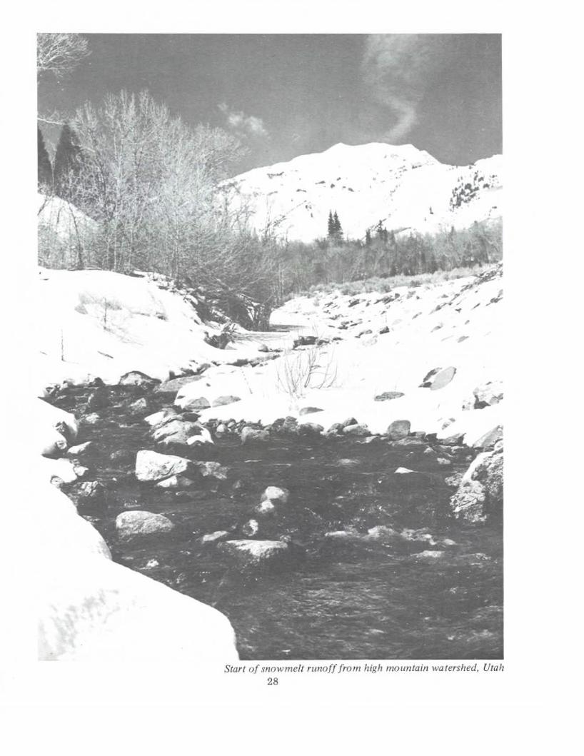
Start ofsnowmelt runoff from high mountain watershed. Utah28

Plan of OperationWater Year 1975
The projected operation of each of the reservoirs in theColorado River Basin during water year 1975 for averagerunoff conditions is described in the following paragraphs.Charts I through 9 show hydrographs of the projectedmonthly outnow from the reservoirs and the projectedend~f-month elevation and active storage in the reservoirsfor average and three other assumptions of 1975 modifiedrunoff from the Basin. The four assumptions are:(I) AVERAGE based on the 1906-68 record of runoff,(2) UPPER QUARTILE based on flows exceeded 25 percentof the time during 1906-68, (3) LOWER QUARTILE basedon flows exceeded 75 percent of the time during 190().68.and (4) MOST ADVERSE based on the lowest year ofrecord which occurred in 1934.
The projected releases from Lake Powell are 8.23million acre-feet for the Most Adverse and Lower Quartileassumed runoff conditions. Average and Upper Quartileassumed runoff conditions would cause a spliUing of storagecondition between Lake Mead and Lake Powell and releasesfrom Lake Powell would be 8.7 and 9.9 million acre-feet,respectively. The Average and Upper Quartile release to LakeMead would cause the reservoir to rise 4 feet and 13 feethigher at the end of the current year than the level reachedby the Most Adverse and Lower Quartile conditions. Theprojected operations of Lake Mohave and Lake Havasu arethe same under all four of the runoff assumptions.
UI)I)Cr Hasln Rcscr\'olrs
FontenellcIt is planned to lower the level of the reservoir through
the fall and winter months until a water surface elevationof about 6,480 feet is reached, then from the last of Marchthrough April to hold releases at about 1,400 ft3/s toencourage wild geese to nest back away from the river. Withaverage runoff during the spring months, FontenelleReservoir will fill by the end of June. After the spring runoffthe reservoir level will be controlled by adjusting the releasesthrough the powerplanl to slowly reduce the elevation to6,504 feel by the end of the summer of 1975. (Chart I)
29

F1amin~ Gor~e
Curecanti Unit
Navajo Reservoir
At the beginning of water year 1975 the active reservoirstorage was 3,580,000 acre-feet with a water surface atelevation 6,036 feet. The reservoir level will be lowered about7 feet by March of the current year but should remain highenough until the spring runoff so that boats can be launchedfrom all of the nine boat ramps. During the latter part ofMarch and through April 1975, releases from the reservoirwill be managed to encourage the geese to nest back awayfrom the river in Brown's Park, This will be accomplishedby varying the releases every other day from high to lowflows until nests are established. Flow will then vary on amore uniform pattern throughout the summer, but the rivershould not exceed 4,500 ft3{s and normally would not beless than 800 rt3Js. Releases should average about 150,000acre-feet per month through the rest of the summer for awater year total of 1,550,000 acre-feet. (Chart 2)
During the current year, Blue Mesa should reach a lowfor the year in April 1975 of elevation 6,453 feet with anactive storage of 330,000 acre-feet. With average inflowduring the spring of 1975, the reservoir should reachelevation 7,518 feet with an active storage of 820,000acre-feet. At this elevation the reservoir has a surface areaof 9,102 acres and a reservoir length of 24 miles. (Charts 3and 4)
Morrow Point Reservoir will be operated near fullduring the current year. Releases will be made fordownstream irrigation requirements plus a flow of 200 ft3/sbelow the Gunnison Tunnel Diversion Dam.
On September 30, 1974, Navajo Reservoir had an activestorage of 1,010,000 acre-feet with an elevation of 6,030feet. During October through March releases will becontrolled to lower the reservoir elevation to 6,028 feet priorto spring runoff. Average inflow would cause the reservoirto rcach elevation 6,060 feet with an active storage of1,350,000 acre-feet. It will be maintained for recreationalpurposes a t or near this level for the remainder of thesummer. (Chart 5)
30

31Water skiers, Lake Powell

·-.-
•
.-'-Running the rapids at Hell's Halfmile on Green River in Colorado
32

Glcn CanyonLakc Powcll
Lower Basin Resen'Olrs
Lakc Mead
For the current year the level of Lake Powellshould drop about 4 feet dUring the fall and wintermonths to elevation 3,648 feet with an activestorage of 17.6 million acre-feet. Assuming anaverage April·July 1975 runoff, the resultinginflow of about 8.0 million acre-feet should causethe lake to reach an all-time high elevation of3,668 feet dUring July Witll an active storage of20.1 million acre-feet. This will be about 80percent of the active capacity of the reservoir. Thelake will have a length of 184 miles and a watersurface area of J39,51 0 acres. Total release duringwater year 1975 of 8.7 million acre-feet isscheduled from Lake Powell, under averageconditions, to satisfy storage requirements forLake Mead and Lake Powell in compliance withSection 602 of Public Law 90-537. The scheduledrelease will pass through the turbines to generatepower for customers in the Upper Colorado RiverBasin. (Chart 6)
The level of Lake Mead during the currentyear is scheduled to remain essentially level atabout elevation 1,174 feet throughout water year1975 to enhance the bass spawn and survivalconditions. At this level, the lake will have anaverage active storage of about 19 million acre-feet.A total of 8.5 million acre-feet is scheduled to bereleased from Lake Mead during water year 1975to meet all downstream requirements. All releasesare scheduled to pass through the turbines forelectric power production. (Chart 7)
33
Lake Mohave
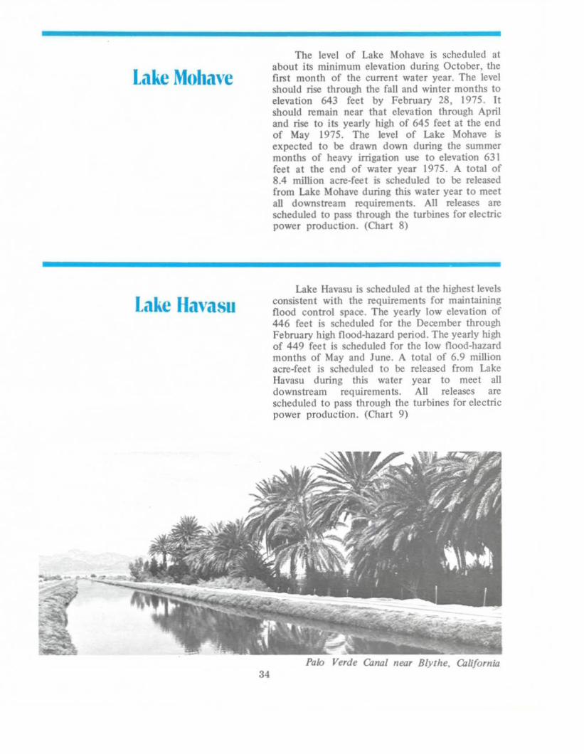
Lake Havasu
34
The level of Lake Mohave is scheduled atabout its minimum elevation during October, thefirst month of the current water year. The levelshould rise through the fall and winter months toelevation 643 feet by FebruaI)' 28, 1975. Itshould remain near that elevation through Apriland rise to its yearly high of 645 feet at the endof May 1975. The level of Lake Mohave isexpected to be drawn down during the summermonths of heavy irrigation use to elevation 631feet at the end of water year 1975. A total of8.4 million acre-feet is scheduled to be releasedfrom Lake Mohave during this water year to meetaU downstream requirements. All releases arescheduled to pass through the turbines for electricpower production. (Chart 8)
Lake Havasu is scheduled at the highest levelsconsistent with the requirements for maintainingflood control space. The yearly low elevation of446 feet is scheduled for the December throughFebruary high flood-hazard period. The yearly highof 449 feet is scheduled for the low flood-hazardmonths of May and June. A total of 6.9 miUionacre-feet is scheduled to be released from LakeHavasu during this water year to meet alldownstream requirements. All releases arescheduled to pass through the turbines for electricpower production. (Chart 9)
Palo Verde QJnQI near Blythe, California

."' __ 0