Embed Size (px)
Citation preview
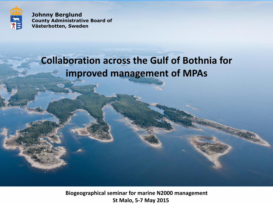
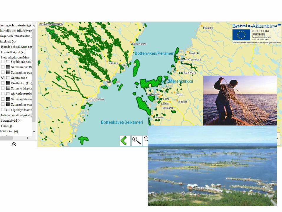
Collaboration across the Gulf of Bothnia for improved management of MPAs
Biogeographical seminar for marine N2000 management St Malo, 5-7 May 2015.
Johnny Berglund County Administrative Board of Västerbotten, Sweden
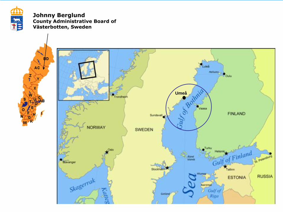
Johnny Berglund County Administrative Board of Västerbotten, Sweden
Umeå
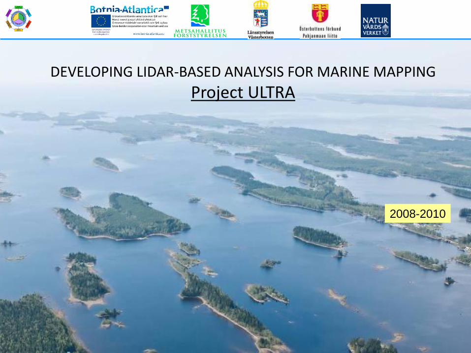
DEVELOPING LIDAR-BASED ANALYSIS FOR MARINE MAPPING
Project ULTRA
2008-2010
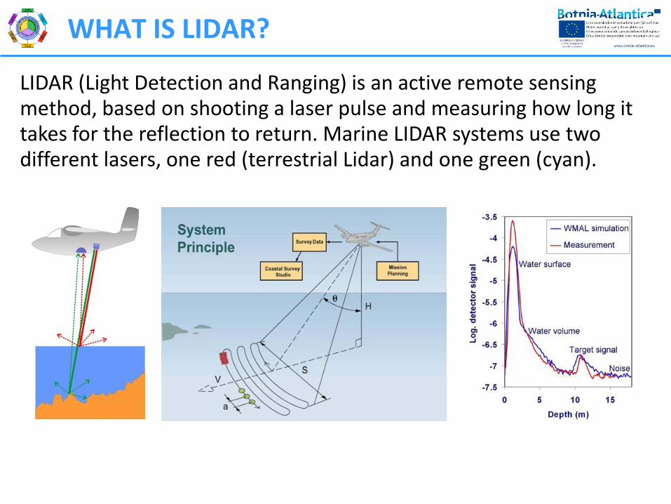
WHAT IS LIDAR?
LIDAR (Light Detection and Ranging) is an active remote sensing method, based on shooting a laser pulse and measuring how long it takes for the reflection to return. Marine LIDAR systems use two different lasers, one red (terrestrial Lidar) and one green (cyan).
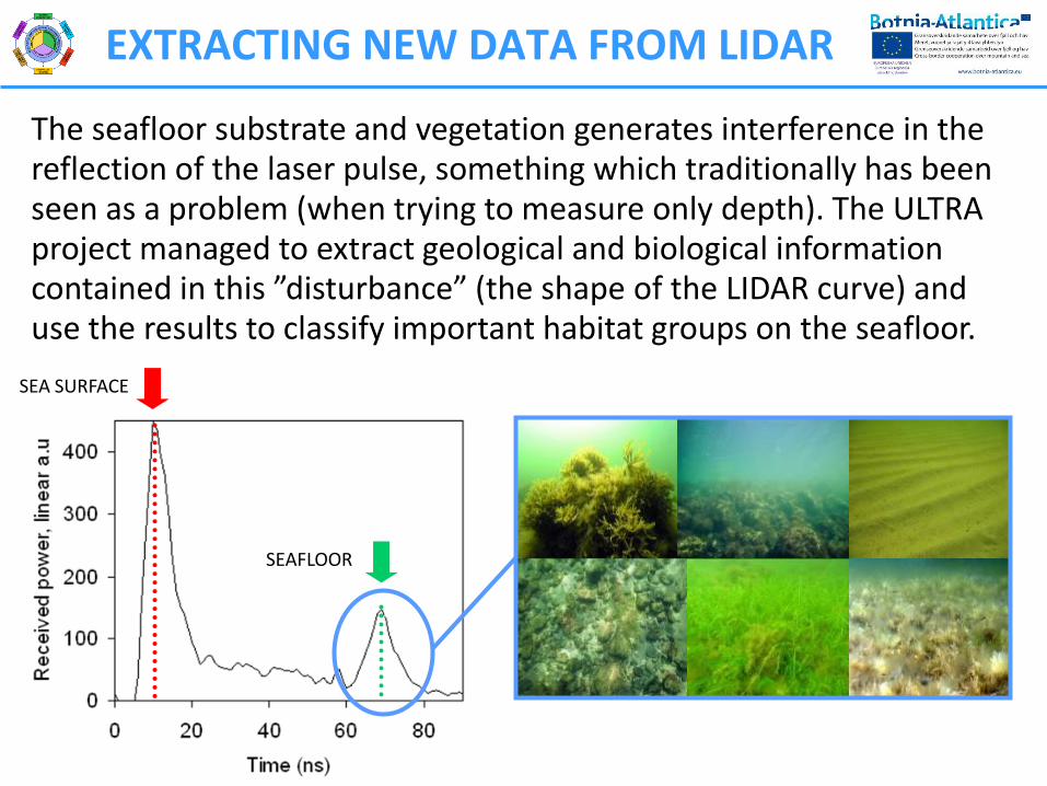
EXTRACTING NEW DATA FROM LIDAR
The seafloor substrate and vegetation generates interference in the reflection of the laser pulse, something which traditionally has been seen as a problem (when trying to measure only depth). The ULTRA project managed to extract geological and biological information contained in this ”disturbance” (the shape of the LIDAR curve) and use the results to classify important habitat groups on the seafloor.
SEA SURFACE
SEAFLOOR
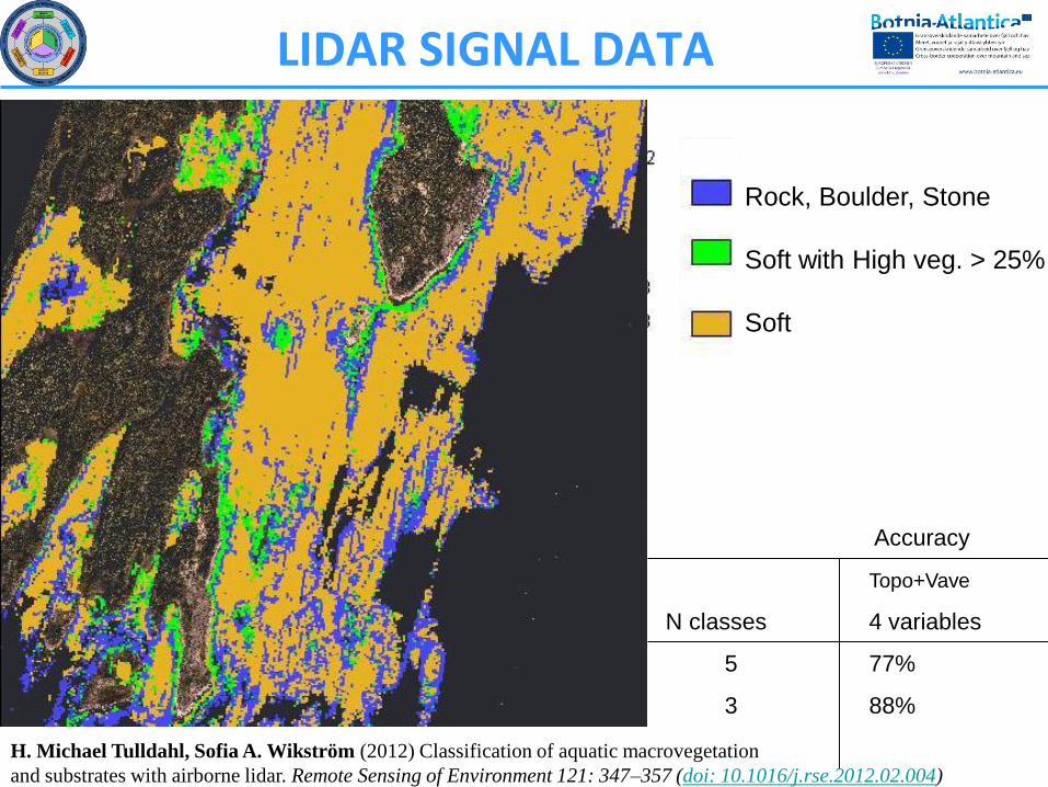
Rock, Boulder, Stone
Soft with High veg. > 25%
Soft
Accuracy
Topo+Vave
N classes 4 variables
5 77%
3 88%
H. Michael Tulldahl, Sofia A. Wikström (2012) Classification of aquatic macrovegetation
and substrates with airborne lidar. Remote Sensing of Environment 121: 347–357 (doi: 10.1016/j.rse.2012.02.004)
LIDAR SIGNAL DATA
Johnny Berglund, Länsstyrelsen Västerbotten
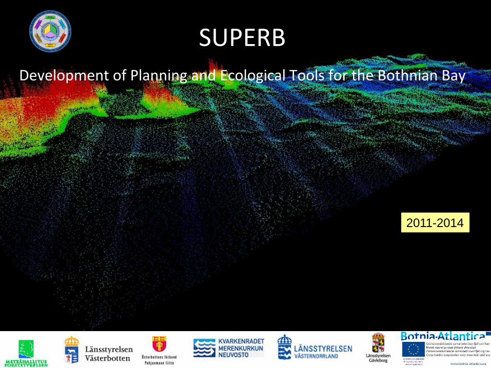
SUPERB
Development of Planning and Ecological Tools for the Bothnian Bay
2011-2014
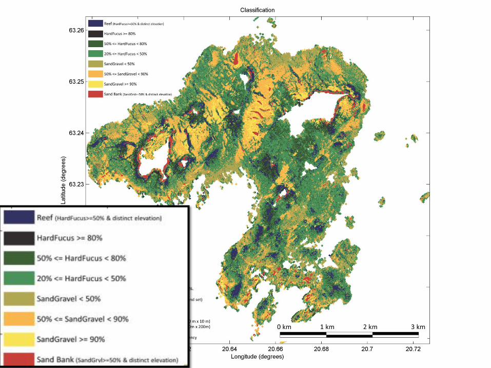
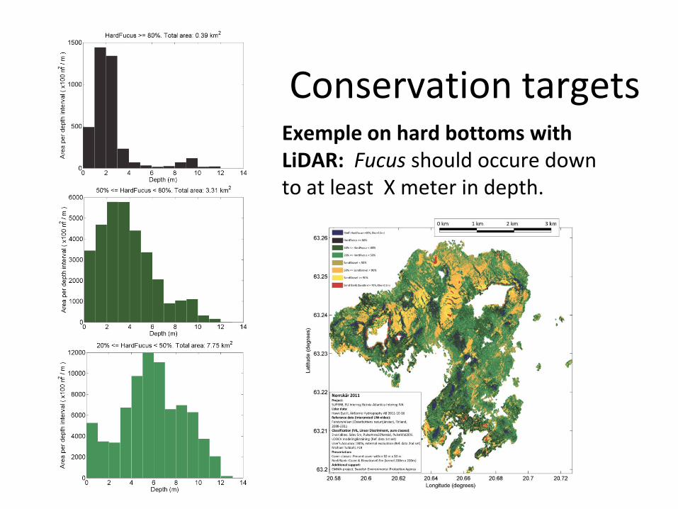
Conservation targets Exemple on hard bottoms with LiDAR: Fucus should occure down to at least X meter in depth.
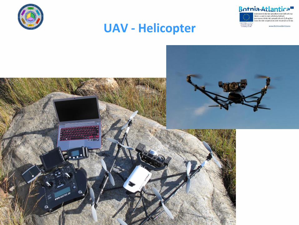
UAV - Helicopter
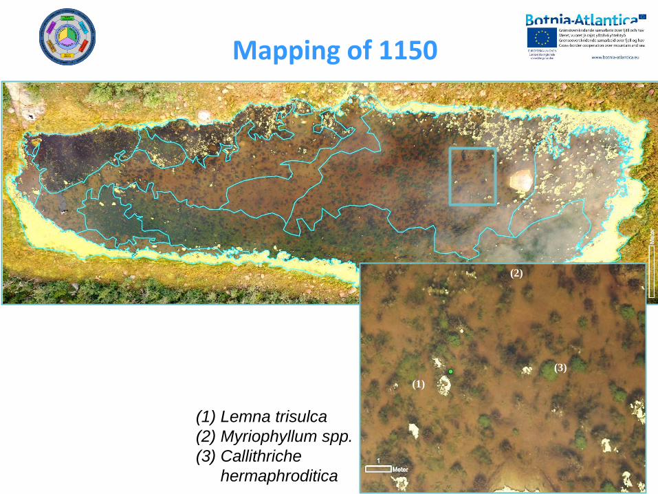
Mapping of 1150
(1)
(2)
(3)
(1) Lemna trisulca
(2) Myriophyllum spp.
(3) Callithriche
hermaphroditica
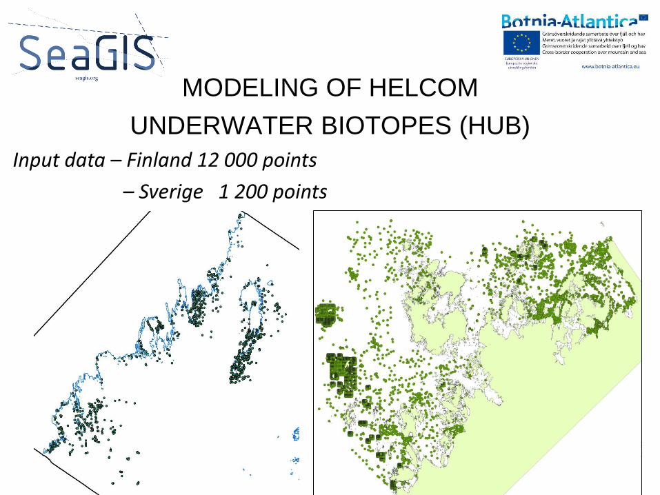
Input data – Finland 12 000 points
– Sverige 1 200 points
MODELING OF HELCOM
UNDERWATER BIOTOPES (HUB)
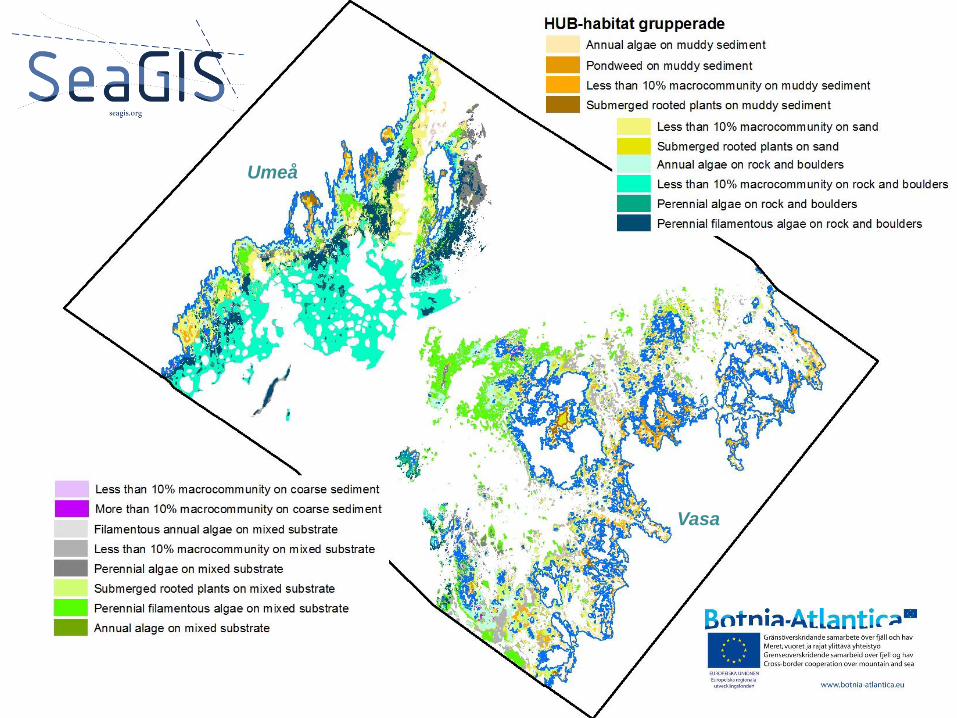
Umeå
Vasa
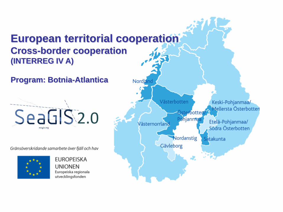
European territorial cooperation Cross-border cooperation (INTERREG IV A)
Program: Botnia-Atlantica
2.0
THANK YOU! www.ultra-superb.eu
Project ULTRA CONCLUSIONS
• The LIDAR method is very fast: 20 km2 per hour with 2x2 meter resolution (in optimal conditions) compared to 10 km2 per summer with 100x100 meter resolution for a 3-person field team (doing underwater video + diving utilizing boats).
• The new LIDAR inventory yields accurate depths as well as a rough but reliable classification of the natural values on the seafloor, but only down to 2,5-3 x Secchi-depth (12 – 18 meters in the Baltic).
• A reliable correlation of the LIDAR signal to seafloor geology and vegetation requires extensive groundtruthing, but the classification can then be extended to very large areas (thousands of km2).
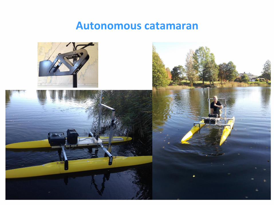
Autonomous catamaran