Embed Size (px)
Citation preview

COAST 2050: A NEW APPROACH TO RESTORATION OF LOUISIANA COASTAL WETLANDS
Denise J. ReedDepartment of Geology and Geophysics
University of New OrleansNew Orleans, Louisiana 70148
Lee WilsonLee Wilson and Associates
Box 931Santa Fe, New Mexico 87501
Abstract: The loss of Louisiana’s coastal wetlands continued at a rate of over 60 km2
per year in the 1990s and continued losses of an additional 1295 km2 are projected by 2050. The rapid rate of land loss is attributed to a complex combination of natural land-scape dynamics and massive human alterations of deltaic and wetland hydrology. While the problem was recognized in the 1970s, concerted attempts at restoration did not begin until the 1990s. Initial efforts largely focused on addressing local problem areas and were often defensive in nature; that is they sought to prevent future losses rather than restoring any of the wetlands which had already converted to open water. In the late 1990s, a new plan was developed with a more systemic approach to restoration. The Coast 2050 plan embraces the problems at the ecosystem scale and seeks to restore essential processes rather than continued manipulation of wetland hydrology. Implementation of this plan in the 21st century will require detailed consideration of riverine and deltaic processes, eco-system response to changes in those processes, and the socioeconomic implications of major re-plumbing of the Mississippi River Delta. [Key words: Mississippi River Delta, ecosystem restoration, wetlands, land loss.]
INTRODUCTION
Between 1956 and 2000, there was a loss of Louisiana’s coastal wetlands of some 3950 km2. Recent reports (Barras et al., 2003) present the current loss rate at an average of nearly 62 km2 per year. Projections suggest additional losses of over 1295 km2 by 2050 as rates slow due to almost complete loss of marshes in some areas. This future landscape degradation is expected to occur despite the efforts of a restoration program implemented in the 1990s.
These losses are one of the most significant environmental problems in North America, affecting an original wetlands area of some 14,245 km2 in which are located major population centers such as New Orleans, infrastructure for major components of the United States oil and gas supply and port system, and habitat for a large, diverse and commercially important fishery.
The cultural implications of these landscape changes have been examined by Tidwell (2002), public concern is growing (CRCL, 2000), and urgent efforts by the
4
Physical Geography, 2004, 25, 1, pp. 4–21.Copyright © 2004 by V. H. Winston & Son, Inc. All rights reserved.

LOUISIANA WETLAND RESTORATION 5
state and federal government are underway to address the problem using new stra-tegic approaches to system rehabilitation. The basis of current efforts is “Coast 2050” (LCWCRTF and the Wetlands Conservation and Restoration Authority, 1998), a strategic plan that recognizes the important biogeomorphic processes that must be sustained for future ecosystem health.
This paper outlines the land loss problem in coastal Louisiana, and evaluates the strategic approaches represented in Coast 2050 relative to previous large-scale res-toration efforts in Louisiana and elsewhere. Scientists have played key roles in the development of these plans and this paper will examine appropriate mechanisms for the incorporation of evolving science into the future implementation of wetland restoration in coastal Louisiana.
CAUSES OF LAND LOSS IN COASTAL LOUISIANA
Many studies have been conducted to identify the major factors contributing to wetland loss in Louisiana (e.g., Boesch et al., 1994; Turner, 1997; Day et al., 2000). Essentially, most agree that coastal land loss and the massive degradation of the coastal ecosystem can be attributed to two types of factors—natural and human induced. This is a very dynamic landscape with riverine floods, sea-level rise, natu-ral land subsidence, and storms from the Gulf of Mexico leading to patterns of land building and decay on time scales from days to millennia. The quasi-equilibrium achieved by these natural factors has been disturbed by multiple human influences on the landscape, such as the construction of levees on the Mississippi River, the internal disruption of hydrology associated with the construction of canals for vari-ous purposes, and the introduction of an exotic herbivore, the nutria. Ecosystem degradation is the result of these and other factors interacting to produce complex patterns and time sequences of stress to the ecosystem, ultimately resulting in land loss.
Natural Factors Associated with Coastal Land Loss
The coastal landscape of Louisiana has developed over thousands of years and land gain and land loss have always been ongoing (Kolb and van Lopik, 1966; Gagliano and van Beek, 1973). Most of the land in coastal Louisiana was built by deltas of the Mississippi River or by Mississippi River sediments entering the coastal mudstream. Barrier islands and sandy shorelines developed as waves and coastal currents eroded and reworked sediments, to build beaches and barrier islands (Penland et al., 1988). Maintaining the landscape involved these and other pro-cesses. For the marshes and swamps of coastal Louisiana, soil building processes are vital. Natural processes of sediment compaction and gradual sea-level rise can submerge marsh plants and swamp forests unless soil builds up to compensate and keep the elevation high enough for plants and trees to survive (Reed, 1995). Pro-cesses contributing to soil building include sediment deposition from rivers or by tides and storms, and the accumulation of organic material in the soil, mainly plant roots (DeLaune et al., 1990). Healthy plant growth and active sediment deposition are thus essential to the coastal ecosystem.

6 REED AND WILSON
Over millennia, sea-level rise and subsidence and erosion of deltaic and chenier plain sediments was balanced by delta building and mudstream accretion. Erosion of barrier shorelines and disruption of organic marshes by storms promoted changes in the landscape then as they do now, and the cycles of delta building and decay, as well as chenier plain accretion and erosion (Gould and McFarlan, 1959; Penland and Suter, 1989), were repeated many times over thousands of years. Indeed, there is little direct evidence that any of these natural processes changed in the mid to late 20th century. Geologic faulting, compaction of sediments rich in fines and organics, river stages, global sea-level rise, wave erosion and storms have likely been shaping the coastal Louisiana landscape for thousands of years (Williams et al., 1994; Kulp, 2000; Reed, 2002; Gagliano et al., 2003).
Human Activities Influencing Coastal Land Loss
During the mid to late 20th century a major disruption of the natural cycle occurred as rapid land loss and limited land building (Fig. 1) led to massive degra-dation of the natural ecosystem. In many areas of the United States, wetland losses occur primarily because of direct causes: people drain or fill wetlands to improve their suitability for development (Dahl, 2000). While direct losses such as ditching and draining for agriculture do occur in Louisiana, the vast majority of losses in the state are caused indirectly. Indirect losses occur when human activities alter the process of land building and maintenance. Many human activities at the coast have interrupted or altered these natural processes.
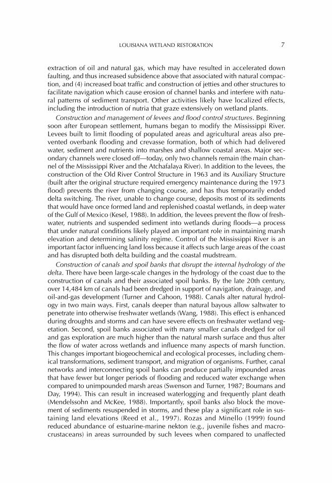
Some of these activities are widespread across the coast and can affect large areas. These include (1) construction and management of levees and flood control structures on the Mississippi River that alter the supply of freshwater, sediment and nutrients to wetlands and limit the building of new lands, (2) construction of canals and spoil banks that disrupt the internal hydrology of the estuaries and wetlands, (3)
Fig. 1. Diagrammatic representation of the change in cycles of land building and decay during the 20th century.
LOUISIANA WETLAND RESTORATION 7
extraction of oil and natural gas, which may have resulted in accelerated down faulting, and thus increased subsidence above that associated with natural compac-tion, and (4) increased boat traffic and construction of jetties and other structures to facilitate navigation which cause erosion of channel banks and interfere with natu-ral patterns of sediment transport. Other activities likely have localized effects, including the introduction of nutria that graze extensively on wetland plants.
Construction and management of levees and flood control structures. Beginning soon after European settlement, humans began to modify the Mississippi River. Levees built to limit flooding of populated areas and agricultural areas also pre-vented overbank flooding and crevasse formation, both of which had delivered water, sediment and nutrients into marshes and shallow coastal areas. Major sec-ondary channels were closed off—today, only two channels remain (the main chan-nel of the Mississippi River and the Atchafalaya River). In addition to the levees, the construction of the Old River Control Structure in 1963 and its Auxiliary Structure (built after the original structure required emergency maintenance during the 1973 flood) prevents the river from changing course, and has thus temporarily ended delta switching. The river, unable to change course, deposits most of its sediments that would have once formed land and replenished coastal wetlands, in deep water of the Gulf of Mexico (Kesel, 1988). In addition, the levees prevent the flow of fresh-water, nutrients and suspended sediment into wetlands during floods—a process that under natural conditions likely played an important role in maintaining marsh elevation and determining salinity regime. Control of the Mississippi River is an important factor influencing land loss because it affects such large areas of the coast and has disrupted both delta building and the coastal mudstream.
Construction of canals and spoil banks that disrupt the internal hydrology of the delta. There have been large-scale changes in the hydrology of the coast due to the construction of canals and their associated spoil banks. By the late 20th century, over 14,484 km of canals had been dredged in support of navigation, drainage, and oil-and-gas development (Turner and Cahoon, 1988). Canals alter natural hydrol-ogy in two main ways. First, canals deeper than natural bayous allow saltwater to penetrate into otherwise freshwater wetlands (Wang, 1988). This effect is enhanced during droughts and storms and can have severe effects on freshwater wetland veg-etation. Second, spoil banks associated with many smaller canals dredged for oil and gas exploration are much higher than the natural marsh surface and thus alter the flow of water across wetlands and influence many aspects of marsh function. This changes important biogeochemical and ecological processes, including chem-ical transformations, sediment transport, and migration of organisms. Further, canal networks and interconnecting spoil banks can produce partially impounded areas that have fewer but longer periods of flooding and reduced water exchange when compared to unimpounded marsh areas (Swenson and Turner, 1987; Boumans and Day, 1994). This can result in increased waterlogging and frequently plant death (Mendelssohn and McKee, 1988). Importantly, spoil banks also block the move-ment of sediments resuspended in storms, and these play a significant role in sus-taining land elevations (Reed et al., 1997). Rozas and Minello (1999) found reduced abundance of estuarine-marine nekton (e.g., juvenile fishes and macro-crustaceans) in areas surrounded by such levees when compared to unaffected

8 REED AND WILSON
marsh areas. Canal dredging (most of which occurred between 1950 and 1980) altered salinity gradients and patterns of water and sediment flow through marshes and not only directly changed land to open water, and marsh to upland, but also indirectly changed the processes essential to a healthy coastal ecosystem.
Removal of oil and natural gas causing accelerated subsidence. Scientific discus-sions of the role of oil and natural gas extraction as a cause of down faulting are in their infancy. Recent evidence suggests withdrawal of oil and natural gas may have lowered pressures in underlying geologic features sufficiently to activate existing geologic faults (Morton et al., 2002). In some areas fault movements associated with these withdrawals appear to have resulted in a tripling of subsidence rates. Indeed, in some “hot spot” areas of land loss, marsh sediments can be found more than a meter below their natural elevation suggesting rapid subsidence at rates much higher than the few mm/year associated with the compaction of deltaic sed-iments (Morton et al., 2003). Despite the need for more evidence to identify the role of oil and gas extraction and faulting on these rates, subsidence measured during the mid to late 20th century is much higher than that which occurred during the previous several thousand years when the coastal landscape was formed.
Increased boat traffic, and the construction of jetties. Wave erosion along exposed shorelines is a substantial factor contributing to coastal land loss, and in many areas this is an entirely natural process. Yet, human activities that increase wave action in coastal areas contribute to accelerated rates of erosion. For example, canals and navigation channels can widen rapidly due to the operation of vessels that generate wakes. Johnson and Gosselink (1982) measured canal widening rates of over 2.5 m/yr in heavily trafficked oilfield-access canals near Leeville. At the bar-rier shoreline, jetties have been built around many tidal inlets to facilitate naviga-tion from the Gulf into rivers and navigation channels by limiting sediment shoaling. These alter the drift of sediment along the shore that maintains barrier shorelines, and in many areas rapid erosion of beaches and shorelines has occurred on the downdrift side of the jetties (Williams et al., 1992).
QUANTIFYING CONTRIBUTIONS TO LAND LOSS
Direct losses can be quantified and attributed to specific causes with reasonable accuracy. Since the 1970s, direct losses have been reduced through a permitting program required by Section 404 of the Clean Water Act as well as state laws. Indi-rect losses, on the other hand, cannot be attributed to specific causes with any degree of accuracy. This is due to the natural variability of coastal processes and the complex way that human activities have altered these processes. In other words, indirect losses result from numerous causes, any of which alone may not have resulted in the serious crisis confronting Louisiana today. For example, the introduc-tion of nutria or a severe drought would likely have little effect on a healthy ecosys-tem, and constraining the Mississippi River and constructing canals impacts the coast, but neither of these acting in isolation would have necessarily resulted in the extensive land loss that has occurred.
Loss of coastal wetlands is most commonly caused by a number of factors, both natural and human-induced, interacting to produce conditions at the local scale

LOUISIANA WETLAND RESTORATION 9
where wetland vegetation can no longer survive. Figure 2 shows how different kinds of processes acting at a variety of scales can combine to produce intolerable conditions for wetland plants. Establishing the relative contribution of these various factors, both natural and human-induced, is almost impossible. In many cases, the changes in processes are manifest gradually over decades and huge areas, while other effects occur over single days and impact local areas.
While many studies have examined the individual factors contributing to land loss, few have attempted to isolate their individual contributions. Penland et al. (2000) made a detailed classification of the land loss that occurred between 1932 and 1990 within the Mississippi River deltaic plain. The loss was classified by (1) geomorphic form and (2) primary process responsible for the loss. Geomorphic form described the type of loss, which had occurred in terms of its location within the coastal landscape. The study showed that about 70% of the loss was due to ponding and channel formation in the marsh interior. Formation of ponds accounted for about 57% of this interior loss and the development of interior chan-nels about 13%. Approximately 30% of the remaining loss was due to shoreline erosion: Gulf shorelines (5%), bay shorelines (11%), lake shorelines (9%) and chan-nels edges (5%). The study also identified three basic processes responsible for loss: submergence (relative water level on the marsh increasing due to both human and natural causes), erosion (loss due to wind and waves), and direct removal (dredging) of marsh for various reasons. Importantly, as the study was based on examination of patterns of loss on maps and aerial photography, the causal processes inferred were limited to those acting at the surface. The scale of the study also meant that it was difficult to identify any geographically specific role of regional-scale surface pro-cesses, such as limited sediment delivery from the Mississippi River. Rather, Penland
Fig. 2. Conceptual model of interaction among hydrologic, geologic and biological factors influenc-ing wetland plants (after Gosselink and Sasser, 1995).

10 REED AND WILSON
et al. identify processes operating at the sub-basin scale that likely interact with regional dynamics to produce the patterns of land loss mapped and classified in their study. Submergence was found to cause about 54% of the land loss and it was mainly associated with altered hydrology causing saltwater penetration and the interruption of sheet flow. Erosion was found to cause about 31% of the total loss with natural waves accounting for most erosion. Direct removal accounted for the remaining 15% of land loss with construction of various types of canals the major cause.
In summary, dramatic coastal land loss in the mid to late 20th century occurred because human activities fundamentally altered the processes essential for main-taining the coastal ecosystem. The magnitude and variety of these changes, and their interaction with natural landscape processes, means looking at any one of these factors in isolation prevents a full understanding of the change in balance between land gain and land loss.
COASTAL LAND LOSS IN THE FUTURE
The effects of future changes in climate and climate variability are difficult to pre-dict. Some of these effects, such as changes in rate of sea-level rise are potentially important for future land loss. Louisiana’s coastal wetlands have been subjected to high rates of relative sea-level rise for centuries due to subsidence associated with the compaction and dewatering of deltaic sediments. Some Louisiana marshes have adjusted, and still survive in areas where measured rates of relative sea-level rise from tide gauges are over 1 cm per year (Penland and Ramsey, 1990); but others are experiencing stress which may in part be driven by relative sea-level rise. Morris et al. (2002) predict that in salt marshes with high sediment loading (such as those in Louisiana) marsh accretion should be able to keep pace with relative sea-level rise of at most 1.2 cm/yr. Eustatic factors are projected to result in a sea-level rise of approximately 20 cm by the year 2050 (Scavia et al., 2002), although there is much uncertainty surrounding this issue. If high rates of subsidence continue, many Louisiana marshes may deteriorate markedly under future sea-level rise conditions as rates increase beyond their maximum ability to build substrate. Morris et al. (2002) considered tidal flooding to be the primary determinant of sediment deposi-tion. In Louisiana, high water events associated with frontal passages, tropical storms and hurricanes cause the delivery of most of the sediment that is currently deposited in coastal marshes (Reed, 1989; Cahoon et al., 1995). In the past sedi-ment would also have been supplied periodically during major river floods. Reworked sediment undoubtedly contributes to the sustainability of existing Louisiana marshes, and it is not known how marshes will accommodate future increases in relative sea-level.
The second half of the 20th century was clearly a period of massive human influ-ence on the coastal Louisiana ecosystem. The question is whether these changes will continue to result in land loss into the future. Because much of the canal dredg-ing occurred between 1950 and 1980, the direct effects of extensive dredging are not expected to occur again. However, the indirect and ongoing effects of these activities on land loss, such as alterations to marsh hydrology or basin-scale salinity

LOUISIANA WETLAND RESTORATION 11
gradients, are expected to continue into the future. Meanwhile, chronic regional-scale problems such as subsidence and altered patterns of sediment delivery from the Mississippi River will also likely have the same effects in the future as in the past. Although recent data (Morton et al., 2002) suggest that extensive oil and gas extraction from subsurface reservoirs led to locally high rates of subsidence in pre-vious decades, the greatest volumes of hydrocarbons were extracted in the 1960s and 1970s. The extraction may have reactivated faults resulting in subsidence but the timing of fault movement relative to mineral extraction has yet to be clearly identified. Thus, it is possible that locally high subsidence rates identified in recent decades may not continue in the future, giving existing coastal marshes an even greater chance of survival. If some Louisiana marshes can survive the high subsidence-induced rises in water level experienced in the second half of the 20th century, these studies suggest that future sea-level rise alone may not increase rates of land loss. More likely, a new equilibrium will be reached in which slower rates of losses are balanced by minimal gains, albeit with a much smaller total ecosystem area.
20TH CENTURY RESTORATION EFFORT
For many years landowners in coastal Louisiana have recognized wetland loss and have made efforts to restore and enhance the quality of their lands. For the most part these actions have been species-specific habitat enhancements (Chabreck, 1967), and they have involved the manipulation of tidal regimes to maintain water levels at fixed elevations either above or below the surface to provide access to or encourage growth of particular forage vegetation (Chabreck and Junkin, 1989). Recent studies have shown that the traditional “marsh management” practiced in coastal Louisiana alters sedimentation regimes (Reed et al., 1997), impedes tidal flux of materials (Boumans and Day, 1994), and leads to changes in nekton nature and abundance (Rozas and Minello, 1999).
A more coordinated state-led response to coastal land loss began to emerge in the 1970s. A series of scientific reports termed Hydrologic and Geologic Studies of Coastal Louisiana documented coastal land loss and pointed to some of its causes (e.g., Gagliano and van Beek, 1970; Adams et al., 1976). During the same period, Act 35 of the 1971 Louisiana Legislature established the Louisiana Advisory Com-mission on Coastal and Marine Resources to determine the problems and needs of coastal and marine resources. The activities of this Commission provided a founda-tion for the establishment of Louisiana’s Coastal Zone Management (CZM) Program in 1978 pursuant to the Federal Coastal Zone Management Act of 1972. Dedicated funding for restoration projects and supporting applied research became a reality in 1981 when the Louisiana Legislature created a one-time fund of $35 million.
During the 1980s, maps produced by USGS and the US Army Corps of Engineers (Britsch and May, 1987; Barras et al., 1994) convinced the public of the need for restoration. Of critical importance during this period was the incorporation in 1988 of a non-profit group, the Coalition to Restore Coastal Louisiana (CRCL), and its publication of Coastal Louisiana: Here Today and Gone Tomorrow? (CRCL, 1989). This report called for river diversions, improved regulatory programs, and other

12 REED AND WILSON
initiatives to meet the growing problem. The grass roots effort of the 1980s resulted in the passage of Act 6 by the Louisiana Legislature in 1989, and created the Wet-lands Conservation and Restoration Authority. This body consists of agency heads from various state agencies with interests in the coast. It has oversight of the annual Coastal Wetlands Conservation and Restoration Plan, and funding generated from oil and gas revenues. This was followed by Federal recognition of the coastal Louisiana land loss problem with the passage of the Coastal Wetlands Planning, Protection and Restoration Act (CWPPRA) in 1990. CWPPRA, also known as the Breaux Act, provided approximately $40 million annually for restoration projects and planning, and called for the development of a comprehensive plan within three years. The Louisiana Coastal Wetlands Restoration Plan, completed in 1993, was intended to provide a comprehensive approach to restoration and the prevention of further loss of coastal wetlands. The 1993 plan used a basin-planning approach, identifying a number of projects in nine distinct hydrologic basins across the coast. The projects were a combination of defensive and offensive measures that addressed many recognized problem areas. It was anticipated that these projects would last for approximately 20 years and during that time they were to be moni-tored and a scientific evaluation of the projects was to be reported to Congress.
Restoration under CWPPRA proceeded in the early 1990s with the production of an annual list of projects, which were a priority to construct. In 1994, with funding from the W. Alton Jones Foundation, a group of scientists published a report titled Scientific Assessment of Coastal Wetland Loss, Restoration and Management in Louisiana (Boesch et al., 1994). It determined that the Breaux Act was off to a good start, but that the following issues should be addressed: (1) region-wide strategies needed better integration with small scale ones, (2) there needed to be a better tech-nical and policy review, (3) private land rights should be balanced with greater pub-lic interests, and (4) financing for large-scale introduction of alluvial materials should be obtained. Also during this period, as part of a comprehensive study of barrier-island restoration (Smith, 1999), scientists were projecting land loss into the future and including in those projections the benefits associated with the as yet largely unimplemented but authorized Breaux Act projects. It became clear as a result of these studies that projects costing approximately $40 million per year were having little impact on Louisiana’s coast.
As a result of the growing recognition of the scale of Louisiana’s problems, and the types of efforts that would be needed to rehabilitate the ecosystem, the Breaux Act Task Force (composed of representatives of five federal agencies and the State of Louisiana) dedicated funds in 1997 for a strategic planning effort to address the problem at an appropriate scale. Thus began an 18-month effort by academia, pri-vate industry, local, state and Federal agencies to develop a strategic plan to save the Louisiana coast.
COAST 2050: A NEW APPROACH
The mission statement of the Coast 2050 planning effort called for it to be “a technically sound strategic plan to sustain coastal resources and provide an inte-grated multiple-use approach to ecosystem management” (LCWCRTF and the

LOUISIANA WETLAND RESTORATION 13
Wetlands Conservation and Restoration Authority, 1998, p. 7). Fundamental to the planning process was recognition that the natural geomorphic and ecological pro-cesses that had created the coast were impaired and that reestablishment of these processes was essential. Reestablishment of natural processes does not mean a return to a prior landscape condition because some of the changes which have occurred are irreversible, or due to fundamental changes in forcing functions that have occurred over time (e.g., rising sea-level, management of Mississippi River dis-charge using dams). Rather, the aim is to create a coast that has the productivity and other socially, culturally, and economically desirable features of a natural system. Coast 2050 contains two important differences from previous coastal planning efforts in Louisiana: (1) a focus on meeting strategic goals rather than listing projects, and (2) consideration of what is needed in the landscape on a regional basis.
Achieving a sustainable coastal ecosystem in Louisiana that provides valuable ecosystem goods and services requires clear articulation of the underlying pro-cesses and identification of the fundamental values the restoration should provide. Consequently, rather than attempting only location-specific problem solving, the Coast 2050 plan focuses on strategies necessary to achieve a greater degree of sus-tainability throughout the region. This involves identifying where natural processes are most severely impaired and developing approaches to rehabilitating them as much as possible. The new plan hinges on three strategic goals that seek to remedy some of the altered process inadequacies in order to improve ecosystem function.
Goal 1: Assure vertical accumulation to achieve sustainability. During the natural cycles of land building and land loss (Fig. 1), marshes have (for the most part) built vertically to counteract deltaic subsidence either through riverine inputs of sedi-ment or via the delivery of reworked coastal sediments during storms (Reed, 1995, 2002). Combined with high rates of subsidence, 20th century interruption of these processes, both probably associated with human activities, has produced a reduc-tion in sediment inputs to marshes and this must be remedied. Continued long-term compactional subsidence across coastal Louisiana at rates of up to 3 mm per year (Kulp, 2000) added to projections of global sea-level rise of approximately 4 mm per year (Scavia et al., 2002) means that, even if the recent high rates of local sub-sidence do not continue, vertical accumulation of wetland substrate is essential for ecosystem sustainability. The ability of the coastal system to maintain itself through continued deposition has been reduced by human actions. Ecosystem strategies that meet this goal include reinitiating delta building, promoting marsh hydrology that encourages plant growth and organic matter production, and providing peri-odic inputs of sediments and nutrients.
Goal 2: Maintain estuarine gradient to achieve diversity. The future maintenance of coastal wetlands must be accompanied by a dynamic physical environment that supports diverse fish and wildlife populations. The estuarine gradient provides for a gradual change from freshwaters at the head of coastal basins to saline waters in the Gulf of Mexico. No matter how much freshwater is diverted from the Mississippi River into the estuaries, there will always be a gradient between the two extremes. The challenge is to ensure a dynamic balance between the salt and fresh waters to provide an array of habitats characterized by a variety of salinities and substrate

14 REED AND WILSON
types, thus supporting a diverse flora and fauna. Current habitats along the estuarine gradient include swamps, various marsh types, and more emergent landforms such as natural and artificial levees, chenier ridges, and barrier islands. A dynamic salin-ity gradient in each estuary is the fundamental driving force behind natural ecosys-tem diversity. The key strategy for reaching this goal is the management of substantial freshwater inputs at the upper end of each estuary so that fluctuations on an interannual or seasonal basis are not so great as to limit the presence of some species (e.g., oysters), while also providing sediments and nutrients essential to achieve Goal 1. This goal recognizes that diverting river water into estuarine basins for the exclusive purpose of maximizing delta building will likely limit the extent of salt-marsh habitats and the species, which use the higher salinity parts of the estu-ary.
Goal 3: Maintain exchange and interface to achieve system linkages. Ecosystem linkages are the pathways by which energy, materials, and organisms are transferred and mixed through the coastal system. Many of these linkages and the interfaces between habitats have been altered by levee building and the use of structures to manipulate flows of water. Many of the fauna that are so valued in coastal Louisiana, including species of shrimp, crabs, and fish, use many parts of the estu-arine ecosystem during their life cycle. Migration through the estuary and/or fre-quent transition between subhabitats, such as shallow waters and the marsh surface, is essential for these recreational and commercially important resources. Exchanges of water and material throughout the estuary must be efficient and capa-ble of dynamically responding to natural physical forcing, such as tides, winds and rainfall events. Similarly the interfaces between marsh and water must allow access to important food resources and refugia on the marsh surface. Strategies to achieve this goal must focus on natural flows of water and materials through the estuarine basins. This strategic goal also recognizes that the use of structures and barriers to manipulate flows inhibits an important aspect of ecosystem function.
These strategic goals point toward a natural process-based solution to the degra-dation of the Louisiana coast. Specific strategies developed to meet these goals must provide for vertical accretion of marsh soils, the provision of diverse habitats, and efficient flows of water and other materials. Consequently, the resulting strate-gic plan does not map projects with specific boundaries and physical structures. Rather, the aim is to ensure that natural processes function properly at the basin scale with less attention to local problems and solutions.
ECOSYSTEM NEEDS
The development of specific strategies to meet these goals requires consideration of the degree of process intervention across the coast. While Coast 2050 does not address all the local problems, it recognizes that the controlling processes and the landscape signature of ecosystem degradation in coastal Louisiana vary consider-ably across the coast. Inspection of historic and projected maps of land loss (e.g., Barras et al., 2003) shows complex patterns of land and water. In the Coast 2050 planning process, a crucial step was identifying the relative present and future “condition” of the landscape and distinguishing several categories of “ecosystem

LOUISIANA WETLAND RESTORATION 15
need.” Strategies to achieve the ecosystem goals were then developed to meet the needs of each part of the ecosystem. The categories focused on the level of inter-vention necessary to rehabilitate the system.
Enhance the Ecosystem by Using Resources More Efficiently
In some areas, especially those with substantial riverine influences, the integrity of the natural system is intact. Projections show low (if any) rates of future loss and consequently the ecosystem is considered sustainable given the continuation of current geomorphic conditions. In these cases, strategies were developed to maxi-mize the benefits of freshwater and sediment delivery and to ensure that current conditions were not adversely influenced by other restoration or infrastructure projects. Examples of such areas include those adjacent to the Atchafalaya Delta where new land is building and riverine influence is rejuvenating current marshes (DeLaune et al., 1987).
Maintain the Ecosystem by Addressing Known Risks
Some areas of the coast appear intact under current conditions but are poten-tially at risk because progressive change in other geomorphic components might alter their viability. For instance, wetland areas currently protected from wave ero-sion by steadily degrading barrier islands would be more vulnerable to erosion once the barriers have degraded to shoals. Alternatively, plans for future hydrologic changes within the system may present problems for marshes that are currently via-ble. In these areas, strategies to reduce future risks to the system should include measures that, at a minimum, promote the current environmental conditions such as existing efforts to maintain the integrity of barrier islands.
Recover the Ecosystem by Reversing the Loss Process
Extensive areas of the coast were categorized as having already lost their integrity but some elements of the landscape, such as the marsh platform, are still intact but cannot be sustained under current conditions. Examples include extensive areas of Barataria Basin where fragmented marsh is rapidly degrading while still providing some level of ecosystem function. Recovering sustainability in these areas is pro-posed using strategies that address existing stresses within the system, including opportunities for direct rebuilding of local areas to recover the skeleton of ridges and barriers necessary to support estuarine function.
Rebuild the Ecosystem by Creating New Wetlands
In some parts of the coast, the ecosystem has degraded to the point that virtually all ecosystem integrity is lost and there is no vegetated substrate upon which to recover sustainable conditions. Consequently, if emergent wetlands are desired, they will need to be built, as through a new delta lobe or marsh creation project. Alternatively, such areas would exist and function as an open water system.

16 REED AND WILSON
THE COAST 2050 PLAN: FROM CHALLENGES TO IMPLEMENTATION
The strategies included in the plan, based on ecosystem needs and assembled to meet the goals, are shown for the Mississippi Delta Plain in Figure 3. Assuring ver-tical accretion in existing marshes and rebuilding sustainable substrate in degraded areas are largely achieved through the diversion of waters from the Mississippi and Atchafalaya Rivers into the estuaries. The plan also includes the development of a third major channel known as the Third Delta Conveyance Channel, and provision for a new navigation channel for deep-draft vessels that would not be maintained by river flow, allowing the more productive use of Mississippi waters and sedi-ments. In some areas, remote from a river channel, some strategic use of dredged material would be used to rebuild substrate. Barrier-island restoration ensures that diverted waters are retained within the estuaries in order to support a diversity of habitats. Flows in navigation canals which accelerate freshwater passage through the basins and which allow salt penetration will be managed using locks or other navigable barriers. Together, the strategies seek to achieve dynamic salinity gradi-ents, providing flows of water, sediments, and other materials necessary to provide sustainable, diverse natural resources for future generations.
Moving such an ambitious plan toward implementation requires further refine-ment of the strategies and the development of increasingly more specific landscape
Fig. 3. Schematic diagram of the ecosystem strategies proposed by Coast 2050 for the Mississippi Delta Plain.

LOUISIANA WETLAND RESTORATION 17
actions, such that the full implications of projects can be considered. In contrast to a list of defined projects that require choices to be made (e.g., the 1993 CWPPRA plan), in Coast 2050 individual areas of the landscape can be affected by more than one of the strategies without conflict. For example, lower areas of Barataria Basin may have some substrate rebuilt with dredged material, created marshes will be maintained by river diversions, and barrier islands, together with the diversions, be used to regulate the salinity gradient to determine the vegetative and faunal com-munities. However, each of these approaches contains different levels of technical and scientific uncertainty, which must be resolved in concert to benefit the land-scape.
Complex landscape planning such as Coast 2050 must be implemented in phases. Early work involves studies for major plan elements such as the Third Delta Conveyance Channel. Some strategies can move to implementation quickly by opportunistic development of plan measures based on existing knowledge or con-ditions. The objective of early phase work is to begin studies which will underpin some of the longer-term implementation efforts, opportunistically address critical needs, and develop understanding of measures such as river diversions for future larger scale implementation.
Main phase work would involve implementation of larger scale efforts, building on knowledge gained from early phase work and the opportunity to explore more fully ecosystem process-response relationships. This would involve additional stud-ies as well as the design and operation of projects to reduce uncertainty regarding ecosystem response. In this phase, increased understanding of ecosystem response should allow project design to be optimized for both ecosystem and economic ben-efits, such as flood damage reduction and maintenance of navigation.
Long-term implementation involves both continued work from the main phase and moving forward on larger scale river-basin management issues such as the Third Delta Conveyance Channel concept, and relocating the navigation channel of the Mississippi River from Southwest Pass. These strategies contain much uncer-tainty regarding their consequences and represent massive investments. As such, their implementation must be based on more complete understanding and the experience gained in understanding ecosystem response to similar smaller scale measures developed during earlier phases.
The cost of implementing the Coast 2050 plan was estimated in the report at $14 billion (USD 1998). As the plan does not include specific projects, this estimate should be considered only as a guide to the eventual cost of planning, building and operating the projects necessary to reverse coastal land loss. If the strategies pro-posed are successful in halting land loss, the cost based on these estimates will be tens of thousands of dollars per acre. If the program is implemented and some of the land already lost is regained, the cost per unit area diminishes. However, the true cost of no new strategic restoration effort would be the almost complete loss of the Louisiana coastal ecosystem. Whether the effort is worth this cost is, as with any major restoration effort, for the nation to decide.
Acknowledgments: The ideas presented here were developed by the authors while working as part of the Planning Management Team for the Coast 2050 project. Reed’s participation was supported by the U.S. Army Corps of Engineers, and Wilson was funded by the Environmental Protection Agency

18 REED AND WILSON
(Contract 68D60067). The authors acknowledge the assistance of their colleagues in the Coast 2050 effort, especially Sue Hawes, Quin Kinler, Bill Good, Ric Ruebsamen, and Gerry Bodin. Nina de Luca and Reggie Graves assisted with the figures.
REFERENCES
Adams, R. D., Barrett, B. B., Blackmon, J. H., Gane, B. W., and McIntire, W. G. (1976) Barataria Basin: Geologic Processes and Framework. Baton Rouge, LA: Louisiana Sea Grant, Center for Wetland Resources, Louisiana State University.
Barras, J., Beville, S., Britsch, D., Hartley, S., Hawes, S., Johnston, J., Kemp, P., Kinler, Q., Martucci, A., Porthouse, J., Reed, D., Roy, K., Sapkota, S., and Suhayda, J., (2003) Historical and Projected Coastal Louisiana Land Changes: 1978–2050. Lafayette, LA: USGS. USGS Open File Report 03–334. Revised January 2004.
Barras, J. A., Bourgeois, P. E., and Handley, L. R. (1994) Land Loss in Coastal Louisiana 1956–90. Washington, DC: National Biological Survey, National Wet-lands Research Center, Open File Report 94–01.
Boesch, D. F., Josselyn, M. N., Mehta, A. J., Morris, J. T., Nuttle, W. K., Simenstad, C. A., and Swift, D. J. P. (1994) Scientific assessment of coastal wetland loss, restoration and management in Louisiana. Journal of Coastal Research, Vol. 20, 1–89.
Boumans, R. M. and Day, J. W. (1994) Effects of two Louisiana marsh management plans on water and materials flux and short-term sedimentation. Wetlands, Vol. 14, 247–261.
Britsch, D. and May R. (1987) Geological investigation of the Mississippi River Deltaic Plain: Studies in Land Loss. Vicksburg, MS: United States Army Corps of Engineers, Waterways Experiment Station.
Cahoon, D. R., Reed, D. J., Day, J. W., Boumans, R. M., Lynch, J. C., McNally, D., and Latif, N. (1995) The influence of Hurricane Andrew on sediment distribution in Louisiana coastal marshes. Journal of Coastal Research, Vol. 18, 280–294.
Chabreck, R. H. (1967) Weirs, plugs and artificial potholes for the management of wildlife in coastal marshes. In J. D. Newsom, ed., Proceedings of the Marsh and Estuary Management Symposium, July 19–20, 1967. Baton Rouge, LA: Louisiana State University, 178–192.
Chabreck, R. H. and Junkin, G. M. (1989) Marsh impoundments for the manage-ment of wildlife and plants in Louisiana. In W. G. Duffy and D. Clark, eds., Marsh Management in Coastal Louisiana: Effects and Issues—Proceedings of a Symposium. Washington, DC: U.S. Fish and Wildlife Service.
Coalition to Restore Coastal Louisiana, ed. (1989) Coastal Louisiana, Here Today and Gone Tomorrow: A Citizen’s Program for Saving the Mississippi River Delta Region, to Protect its Heritage, Economy, and Environment. Baton Rouge, LA: Author.
Coalition to Restore Coastal Louisiana, ed. (2000) No Time to Lose: Facing the Future of Louisiana and the Crisis of Coastal Land Loss. Baton Rouge, LA: Author.

LOUISIANA WETLAND RESTORATION 19
Dahl, T. E. (2000) Status and Trends of Wetlands in the Conterminous United States, 1986 to 1997. Washington, DC: U.S. Department of the Interior, Fish and Wild-life Service.
Day, J. W., Shaffer, G. P., Britsch, L. D., Reed, D. J., Hawes, S. R., and Cahoon, D. R. (2000) Pattern and process of land loss in the Mississippi Delta: A spatial and temporal analysis of wetland habitat change. Estuaries, Vol. 23, 425–438.
DeLaune, R. D., Patrick, Jr., W. H., and Van Breemen, N. (1990) Processes govern-ing marsh formation in a rapidly subsiding coastal environment. Catena, Vol. 17, 277–288.
DeLaune, R. D., Smith, C. J., Patrick, Jr., W. H., and Roberts, H. H. (1987) Rejuve-nated marsh and bay-bottom accretion on the rapidly subsiding coastal plain of U.S. Gulf coast: A second-order effect of the emerging Atchafalaya delta. Estua-rine, Coastal and Shelf Science, Vol. 25, 381–389.
Gagliano, S. M., Kemp, III, E. B., Wicker, K. M., and Wiltenmuth, K. S. (2003) Active Geological Faults and Land Change in Southeastern Louisiana, Final Report. New Orleans, LA: Coastal Environments, Inc., United States Army Corps of Engineers.
Gagliano, S. M. and van Beek, J. L. (1970) Hydrologic and Geologic Studies of Coastal Louisiana. I. Geologic and Geomorphic Aspects of Deltaic Processes, Mississippi Delta System. Baton Rouge, LA: Coastal Resources Unit, Center for Wetland Resources.
Gagliano, S. M. and van Beek, J. L. (1973) Environmental management in the Mississippi Delta system. Transactions—Gulf Coast Association of Geological Societies, Vol. 23, 203–209.
Gould, H. R. and McFarlan, Jr., E. (1959) Geologic history of the Chenier Plain, southwestern Louisiana. Transactions—Gulf Coast Association of Geological Societies, Vol. 9, 261–270.
Johnson, W. B. and Gosselink, J. G. (1982) Wetland loss directly associated with canal dredging in the Louisiana coastal zone. In D. F. Boesch, ed., Proceedings, Conference on Coastal Erosion and Wetland Modification in Louisiana. Washington, DC: U.S. Fish and Wildlife Service, FWS/OBS-82-59, 60–72.
Kesel, R. H. (1988) The decline in the suspended load of the lower Mississippi River and its influence on adjacent wetlands. Environmental Geology Water Science, Vol. 11, 271–281.
Kolb, C. R. and van Lopik, J. R. (1966) Depositional environments of the Mississippi River deltaic plain southeastern Louisiana. In M. L. Shirley and J. A. Ragsdale, eds., Deltas in Their Geologic Framework, Houston Geological Society, 17–61.
Kulp, M. (2000) Holocene Stratigraphy, History, and Subsidence of the Mississippi River Delta Region, North-Central Gulf of Mexico. Ph.D. thesis, University of Kentucky, Lexington, Department of Geological Sciences.
LCWCRTF (Louisiana Coastal Wetlands Conservation and Restoration Task Force) and the Wetlands Conservation and Restoration Authority. (1998) Coast 2050: Toward a Sustainable Coastal Louisiana. Baton Rouge, LA: Louisiana Department of Natural Resources.
Mendelssohn, I. A. and McKee, K. (1988) Spartina alterniflora die-back in Louisiana: Time-course investigation of soil waterlogging effects. Journal of Ecol-ogy, Vol. 76, 509–521.
20 REED AND WILSON
Morris, J. T., Sundareshwar, P. V., Nietch, C. T., Kjerfve, B., and Cahoon, D. R. (2002) Response of coastal wetlands to rising sea level. Ecology, Vol. 83, 2869–2877.
Morton, R. A., Buster, N. A., and Krohn, M. D. (2002) Subsurface controls on his-torical subsidence rates and associated wetland loss in Southcentral Louisiana. Gulf Coast Association of Geological Societies Transactions, Vol. 52, 767–778.
Morton, R. A., Tiling, G., and Ferina, N. F. (2003) Causes of hotspot wetland loss in the Mississippi delta plain. Environmental Geosciences, Vol. 10, 71–80.
Penland, S., Boyd, R., and Suter, J. R. (1988) Transgressive depositional systems of the Mississippi Delta Plain: A model for barrier shoreline and shelf sand devel-opment. Journal of Sedimentary Petrology, Vol. 58, 932–949.
Penland, S. and Ramsey, K. E. (1990) Relative sea-level rise in Louisiana and the Gulf of Mexico: 1908–1988. Journal of Coastal Research, Vol. 6, 323–342.
Penland, S. and Suter, J. R. (1989) The geomorphology of the Mississippi River Chenier Plain. Marine Geology, Vol. 90, 231–258.
Penland, S., Wayne, L. D., Britsch, L. D., Williams, S. J., Beall, A. D., and Butterworth, V. C. (2000) The Processes of Coastal Land Loss in the Mississippi River Delta Plain. New Orleans, LA: USGS. USGS Open-File Report 00-0418.
Reed, D. J. (1989) Patterns of sediment deposition to subsiding coastal salt marshes, Terrebonne Bay, Louisiana: The role of winter storms. Estuaries, Vol. 12, 222–227.
Reed, D. J. (1995) The response of coastal marshes to sea-level rise: Survival or submergence? Earth Surface Processes and Landforms, Vol. 20, 39–48.
Reed, D. J. (2002) Sea level rise and coastal marsh sustainability: Geological and ecological factors in the Mississippi Delta Plain. Geomorphology, Vol. 48, 233–243.
Reed, D. J., De Luca, N., and Foote, A. L. (1997) Effect of hydrologic management on marsh surface sediment deposition in coastal Louisiana. Estuaries, Vol. 20, 301–311.
Rozas, L. P. and Minello, T. J. (1999) Effects of structural marsh management on fishery species and other nekton before and during a spring drawdown. Wetlands Ecology and Management, Vol. 7, 121–139.
Scavia, D., Field, J. C., Boesch, D. F., Buddemeier, R. W., Burkett, V., Cayan, D. R., Fogarty, M., Harwell, M. A., Howarth, R. W., Mason, C., Reed, D. J., Royer, T. C., Sallenger, A. H., and Titus, J. G. (2002) Climate change impacts on U.S. coastal and marine ecosystems. Estuaries, Vol. 25, 149–164.
Smith, T. Baker and Son, Inc. (1999) Barrier Shoreline Feasibility Study, Phase 1. Selection and Description of Recommended Plan. Baton Rouge, LA: Louisiana Department of Natural Resources, prepared under contract 2509-98-02.
Swenson, E. M. and Turner, R. E. (1987) Spoil banks: Effects on a coastal marsh water-level regime. Estuarine, Coastal and Shelf Science, Vol. 24, 599–609.
Tidwell, M. (2002) Bayou Farewell: The Rich Life and Tragic Death of Louisiana’s Cajun Coast. New York, NY: Pantheon.
Turner, R. E. (1997) Wetland loss in the Northern Gulf of Mexico: Multiple working hypotheses. Estuaries, Vol. 20, 1–13.

LOUISIANA WETLAND RESTORATION 21
Turner, R. E. and Cahoon, D. R. (1988) Causes of Wetland Loss in the Coastal Central Gulf of Mexico, Volume I: Executive Summary. New Orleans, LA: U.S. Depart-ment of the Interior, Minerals Management Service, Gulf of Mexico OCS Regional Office.
Wang, F. C. (1988) Dynamics of saltwater intrusion in coastal channels. Journal of Geophysical Research, Vol. 93, No. C6, 6937–6946.
Williams, S. J., Penland, S., and Roberts, H. H. (1994) Processes affecting coastal wetland loss in the Louisiana deltaic plain. In S. J. Williams and H. A. Cichon, eds., Processes of Coastal Wetlands Loss in Louisiana. Presented at Coastal Zone ‘93, New Orleans, Louisiana: USGS. USGS Open-File Report 94-0275, 21–29.
Williams, S. J., Penland, S., and Sallenger, A. H., eds. (1992) Atlas of shoreline changes in Louisiana from 1853 to 1989. Washington, DC: USGS. Miscella-neous Investigations Series I-2150-A.