Embed Size (px)
DESCRIPTION
City of El Monte Draft Watershed Management Program (WMP). Ed Suher, P.G. CASC Engineering and Consulting October 9, 2014. Draft Watershed Management Program. Permittee: City of El Monte (Individual WMP) Los Angeles River and San Gabriel River Watersheds - PowerPoint PPT Presentation
Citation preview
City of El Monte
Draft Watershed Management Program (WMP)
Ed Suher, P.G.CASC Engineering and Consulting
October 9, 2014
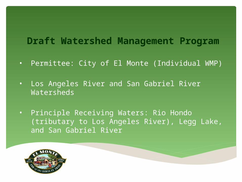
Draft Watershed Management Program
• Permittee: City of El Monte (Individual WMP)
• Los Angeles River and San Gabriel River Watersheds
• Principle Receiving Waters: Rio Hondo (tributary to Los Angeles River), Legg Lake, and San Gabriel River
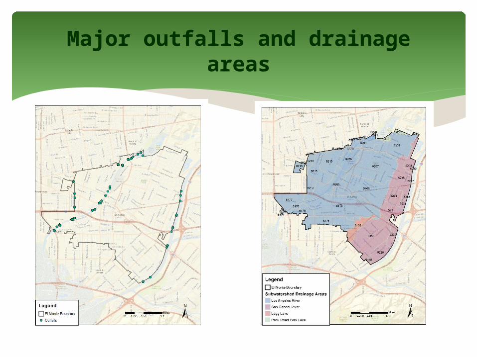
Major outfalls and drainage areas

Outfalls, catch basins, and drainage areas
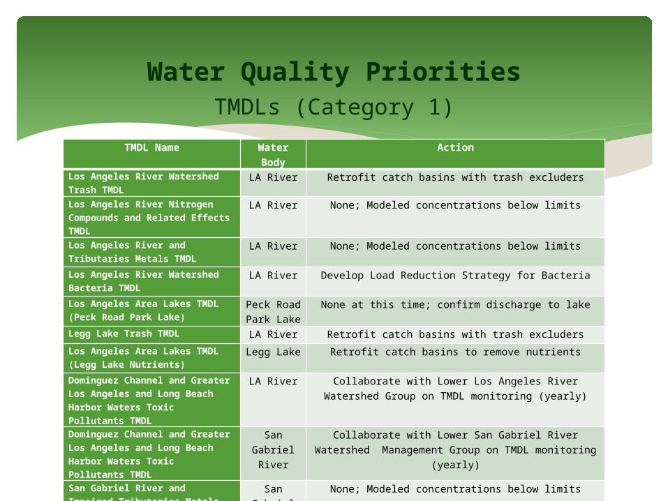
TMDLs (Category 1)
Water Quality Priorities
TMDL Name Water Body Action
Los Angeles River Watershed Trash TMDL
LA River Retrofit catch basins with trash excluders
Los Angeles River Nitrogen Compounds and Related Effects TMDL
LA River None; Modeled concentrations below limits
Los Angeles River and Tributaries Metals TMDL
LA River None; Modeled concentrations below limits
Los Angeles River Watershed Bacteria TMDL
LA River Develop Load Reduction Strategy for Bacteria
Los Angeles Area Lakes TMDL (Peck Road Park Lake)
Peck Road Park Lake
None at this time; confirm discharge to lake
Legg Lake Trash TMDL LA River Retrofit catch basins with trash excluders
Los Angeles Area Lakes TMDL (Legg Lake Nutrients)
Legg Lake Retrofit catch basins to remove nutrients
Dominguez Channel and Greater Los Angeles and Long Beach Harbor Waters Toxic Pollutants TMDL
LA River Collaborate with Lower Los Angeles River Watershed Group on TMDL monitoring (yearly)
Dominguez Channel and Greater Los Angeles and Long Beach Harbor Waters Toxic Pollutants TMDL
San Gabriel River
Collaborate with Lower San Gabriel River Watershed Management Group on TMDL monitoring (yearly)
San Gabriel River and Impaired Tributaries Metals and Selenium TMDL
San Gabriel River
None; Modeled concentrations below limits

Pollutant Reduction Strategy
• Use modeling and monitoring to target highest
concentration areas
• Generate maps to guide implementation of BMPs in
targeted areas
• Install distributed BMPs and/or retrofit existing BMPs
• Enhance/modify non-structural BMPs and source
controls
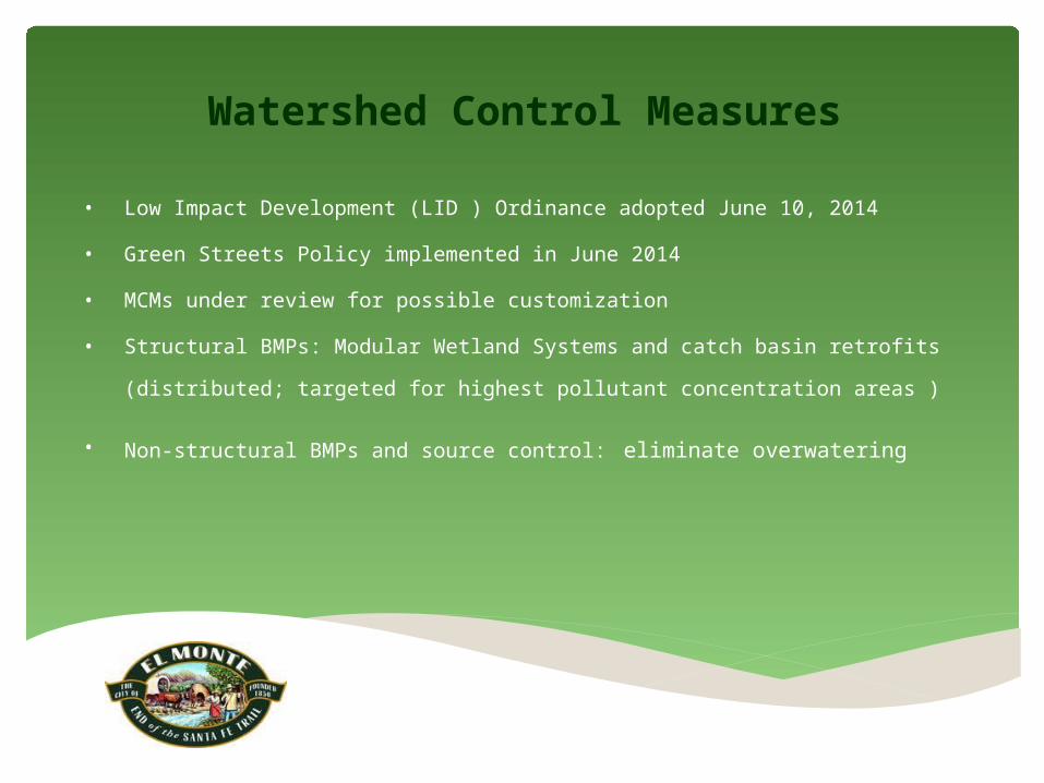
Watershed Control Measures
• Low Impact Development (LID ) Ordinance adopted June 10, 2014
• Green Streets Policy implemented in June 2014
• MCMs under review for possible customization
• Structural BMPs: Modular Wetland Systems and catch basin
retrofits (distributed; targeted for highest pollutant concentration
areas )
• Non-structural BMPs and source control: eliminate overwatering

Outreach and Stakeholder Input
• Heal the Bay (received comments on draft WMP/IMP)• The Public (received comment on draft WMP/IMP)• City Departments (receiving training on WMP elements)• Citizens of El Monte (provided with information on
stormwater)• Local organizations, groups, and schools (City is
encouraging involvement)
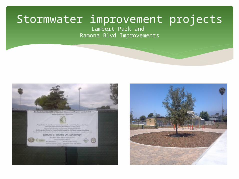
Stormwater improvement projectsLambert Park and
Ramona Blvd Improvements
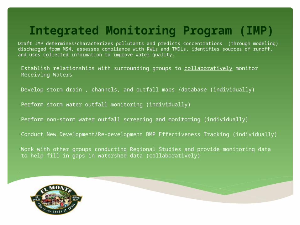
Integrated Monitoring Program (IMP)Draft IMP determines/characterizes pollutants and predicts concentrations (through modeling) discharged from MS4, assesses compliance with RWLs and TMDLs, identifies sources of runoff, and uses collected information to improve water quality.
• Establish relationships with surrounding groups to collaboratively monitor Receiving Waters
• Develop storm drain , channels, and outfall maps /database (individually)
• Perform storm water outfall monitoring (individually)
• Perform non-storm water outfall screening and monitoring (individually)
• Conduct New Development/Re-development BMP Effectiveness Tracking (individually)
• Work with other groups conducting Regional Studies and provide monitoring data to help fill in gaps in watershed data (collaboratively)


![WMP [Converted]](https://img.dokumen.tips/doc/110x75/58a115b21a28ab4b658b66d9/wmp-converted.jpg)