Embed Size (px)
Citation preview
Chapter 5
Interpreting Topographical Maps
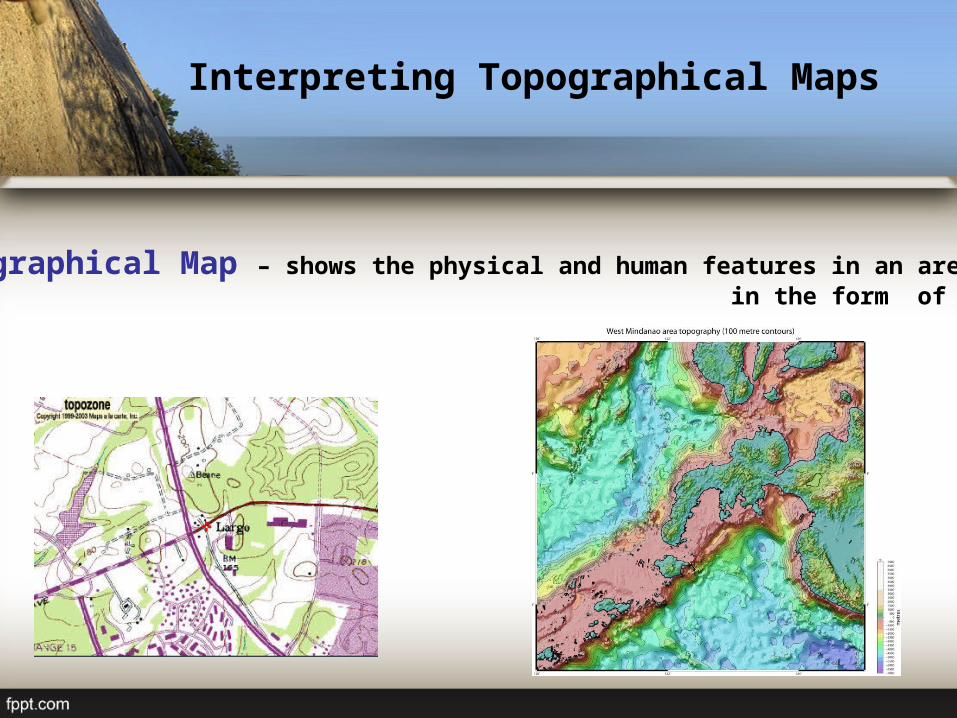
Interpreting Topographical Maps
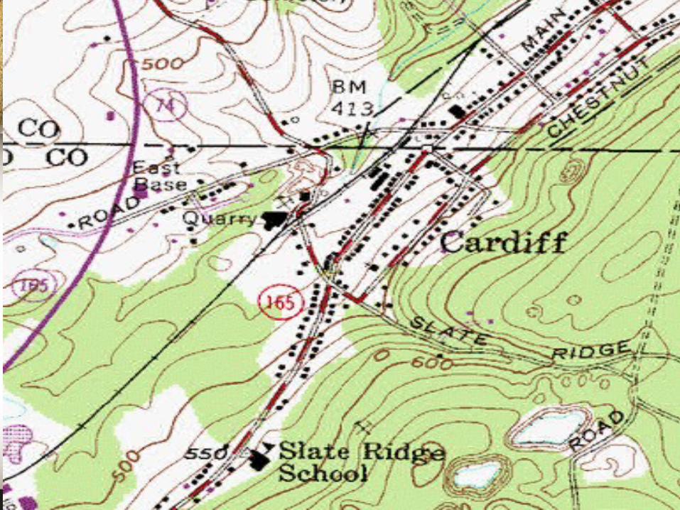
Topographical Map – shows the physical and human features in an area in the form of symbols.
Interpreting Topographical Maps
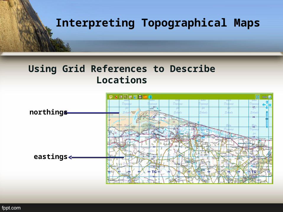
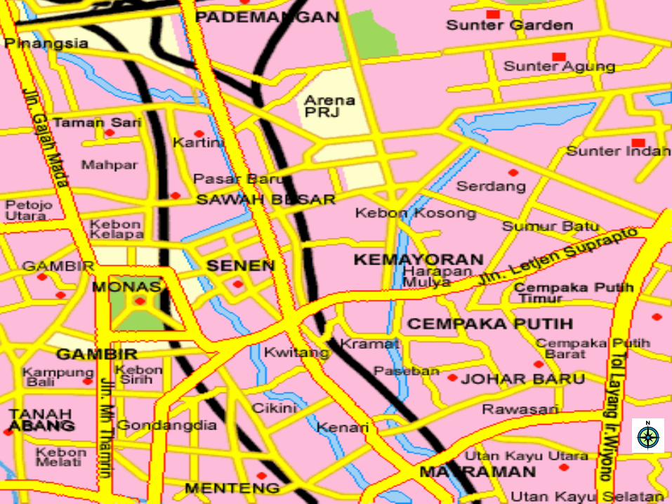
Using Grid References to Describe Locations
northings
eastings
Interpreting Topographical Maps
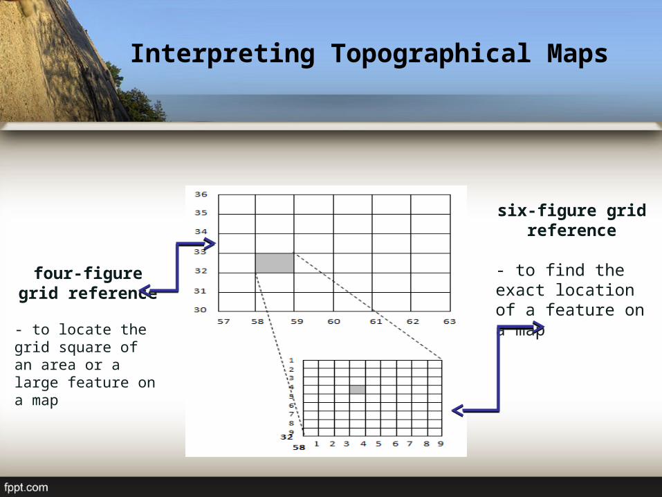
four-figure grid reference
- to locate the grid square of an area or a large feature on a map
six-figure grid reference
- to find the exact location of a feature on a map
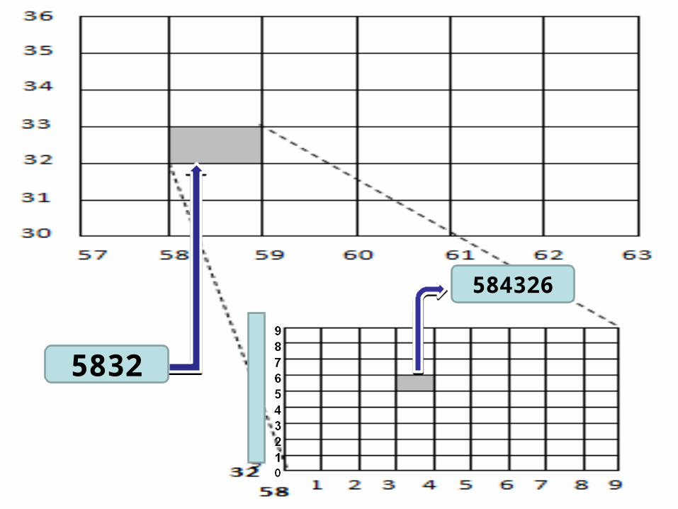
5832
584326
Interpreting Topographical Maps
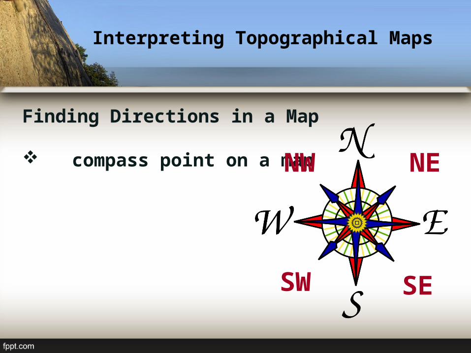
Finding Directions in a Map
compass point on a map NE
SESW
NW
Interpreting Topographical Maps
Interpreting Topographical Maps
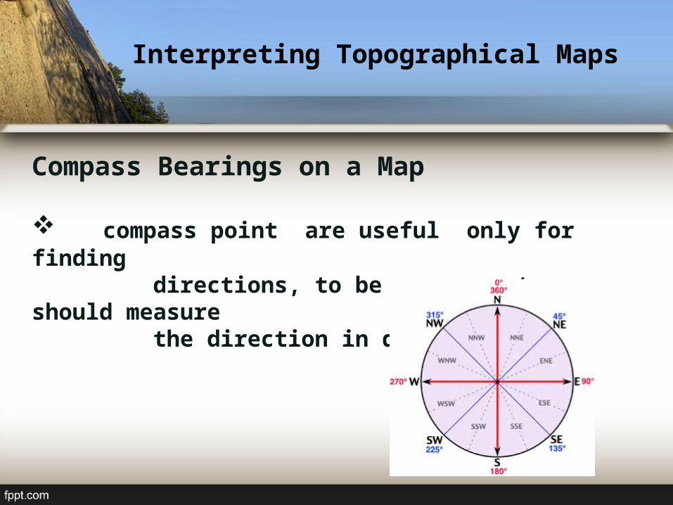
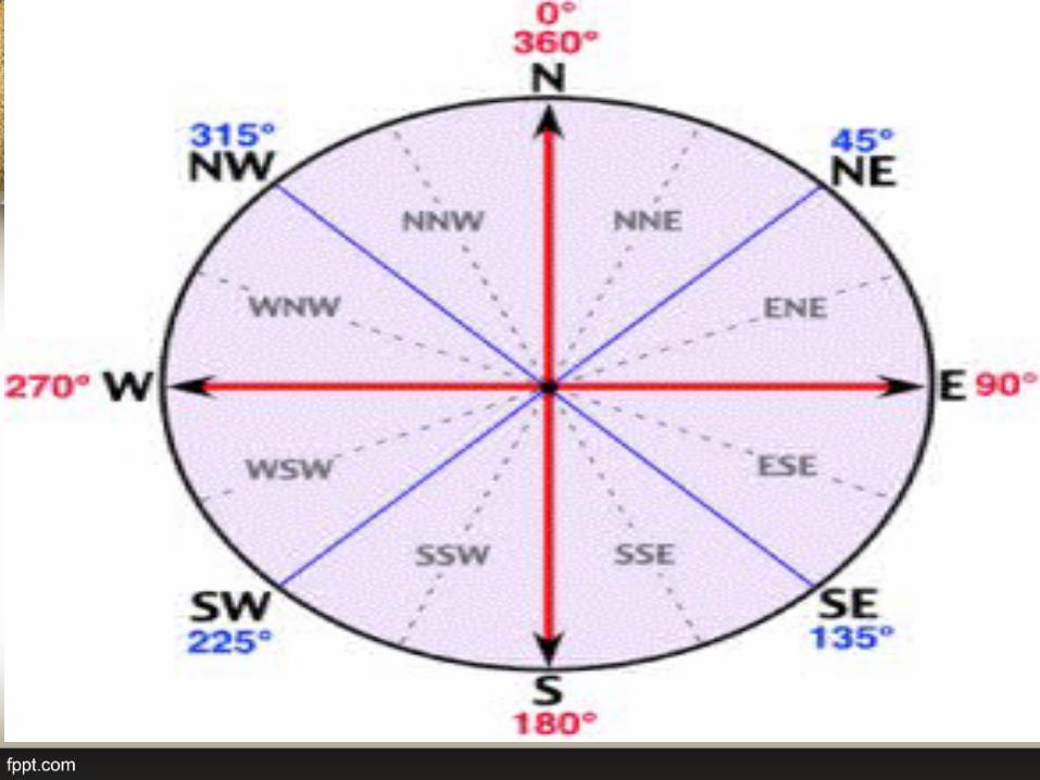
Compass Bearings on a Map
compass point are useful only for finding directions, to be more exact, we should measure the direction in degrees
Interpreting Topographical Maps
Interpreting Topographical Maps
Measuring Distances on a Map
straight-line distance
curved distance
Interpreting Topographical Maps
Interpreting the Physical Environment shown on a Topographical Maps
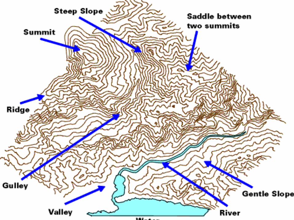
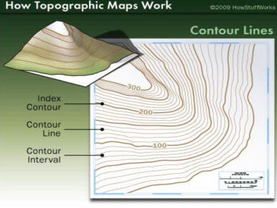
Using contours to represent relief
contours are imaginary lines that joins places of the same height above sea level
close together contours = steep slopesfar apart contours = gentle slopesvery far apart = almost flat land (plain)
Interpreting Topographical Maps
Interpreting Topographical Maps
Interpreting Topographical Maps
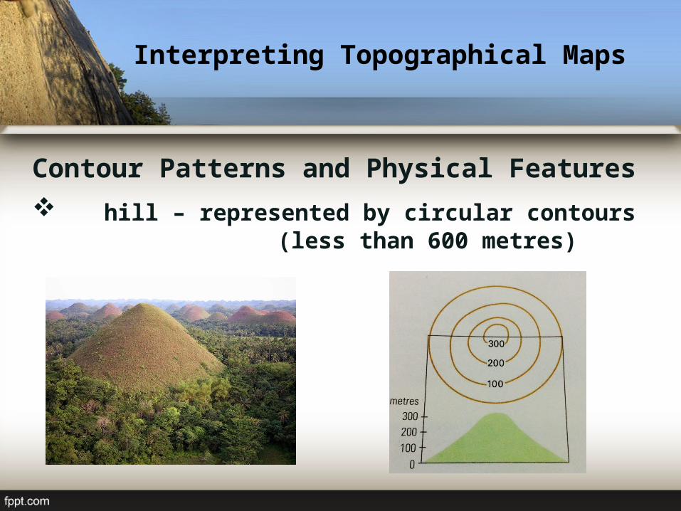
Contour Patterns and Physical Features
hill – represented by circular contours (less than 600 metres)
Interpreting Topographical Maps
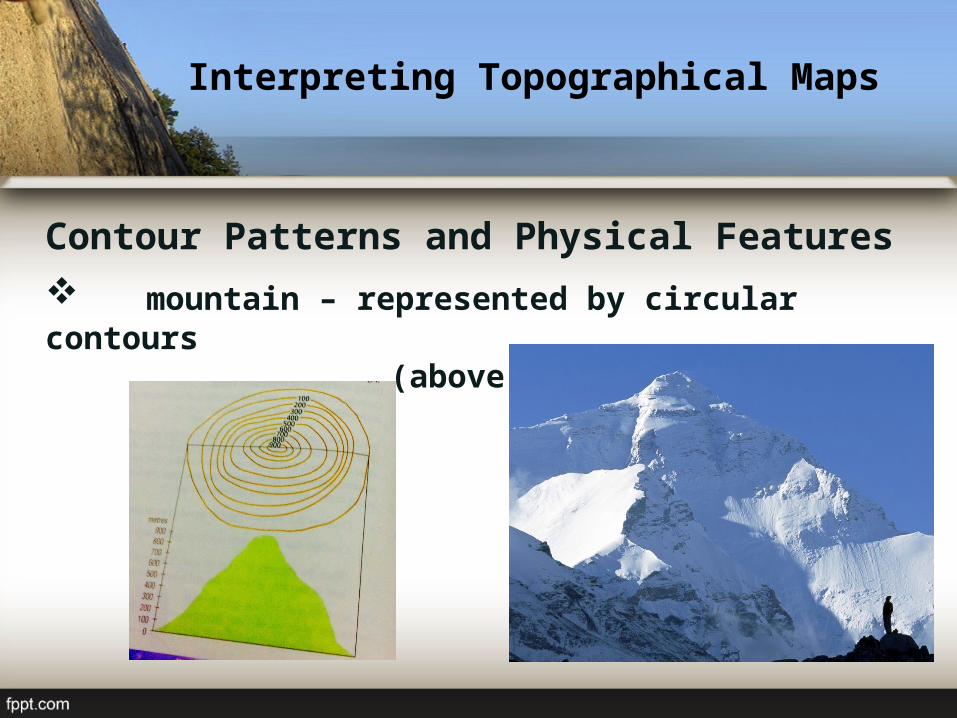
Contour Patterns and Physical Features
mountain – represented by circular contours (above 600 metres)
Interpreting Topographical Maps
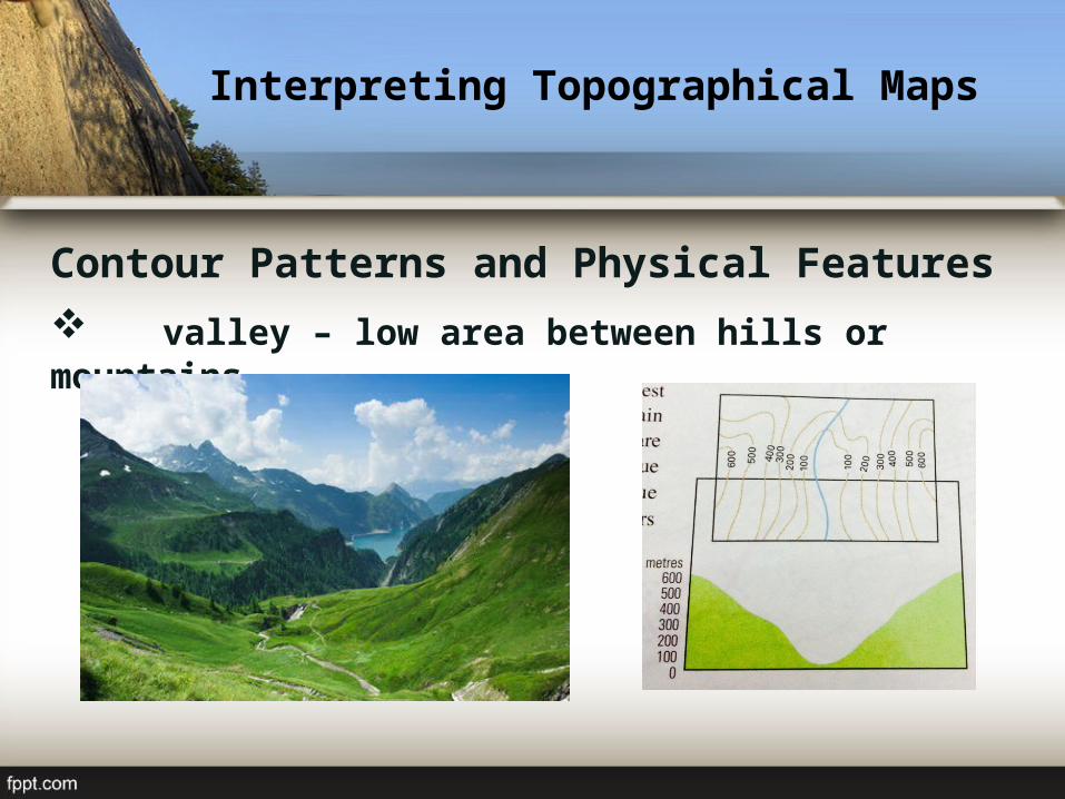
Contour Patterns and Physical Features
valley – low area between hills or mountains
Interpreting Topographical Maps
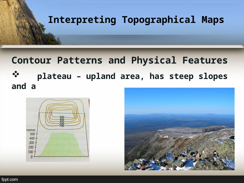
Contour Patterns and Physical Features
plateau – upland area, has steep slopes and a broad, flat top
Interpreting Topographical Maps
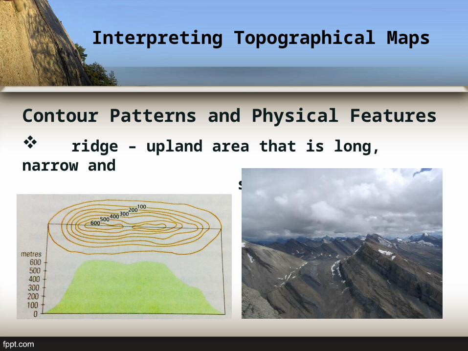
Contour Patterns and Physical Features
ridge – upland area that is long, narrow and steep-sided
Interpreting Topographical Maps
Interpreting the Human Environment shown on a Topographical Maps
settlements – place where people live and carry out activities such as farming, buying
and selling of goods
Interpreting Topographical Maps
Interpreting the Human Environment shown on a Topographical Maps
transport lines– refer to routes people use to travelfrom one place to another
Interpreting Topographical Maps
Interpreting the Human Environment shown on a Topographical Maps
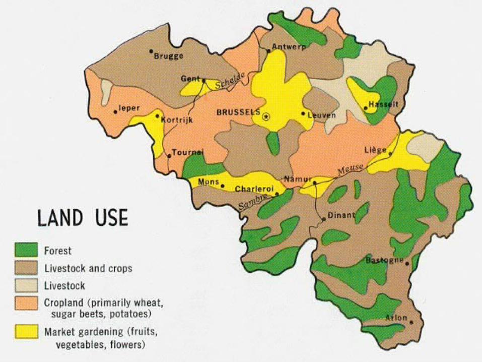
land use– refer to how the land is used in an area
Interpreting Topographical Maps

QUIZ