Embed Size (px)
Citation preview
Chapter 2 - Zoning Districts and Land Uses - Page | i
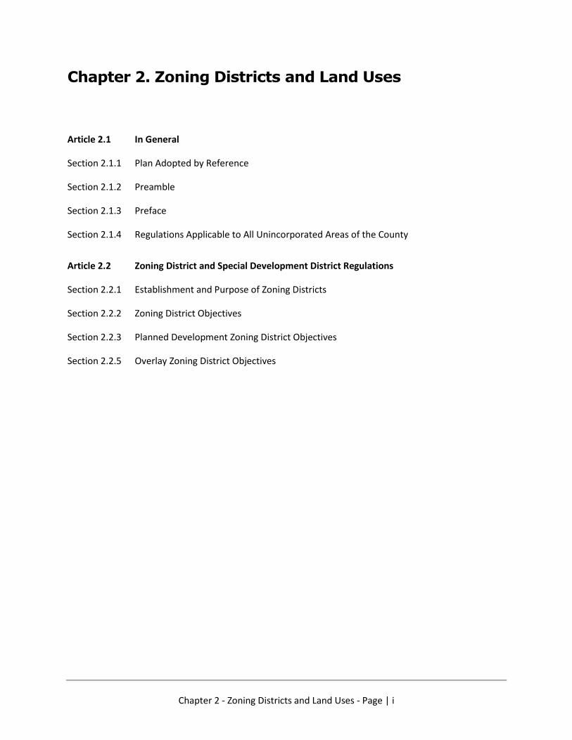
Chapter 2. Zoning Districts and Land Uses
Article 2.1 In General
Section 2.1.1 Plan Adopted by Reference
Section 2.1.2 Preamble
Section 2.1.3 Preface
Section 2.1.4 Regulations Applicable to All Unincorporated Areas of the County
Article 2.2 Zoning District and Special Development District Regulations
Section 2.2.1 Establishment and Purpose of Zoning Districts
Section 2.2.2 Zoning District Objectives
Section 2.2.3 Planned Development Zoning District Objectives
Section 2.2.5 Overlay Zoning District Objectives

Chapter 2 - Zoning Districts and Land Uses - Page | 2
Chapter 2 - Zoning Districts and Land Uses
ARTICLE 2.1. - IN GENERAL
2.1.1. - PLAN ADOPTED BY REFERENCE
Pursuant to S.C. Code 1976, title 6, ch. 29, there is hereby adopted by reference the Edgefield
County Comprehensive Plan, 2019, as fully as if set forth herein, and any revisions and
amendments subsequently adopted by council. Copies of the plan are available for public
inspection in the office of the county clerk.
(Code 1999, § 152.01; Ord. No. 97-98-363, 7-7-1998; Ord. No. 03-04-447, 8-17-2004;
Ord. No. 09-10-615, 12-1-2009; Ord. No. 14-15-686, 1-6-2015)
2.1.2. - PREAMBLE.
In accordance with authority conferred by the General Statutes of South Carolina, 1976 Code
of Laws, Title 6, Chapter 29 of the Comprehensive Planning Enabling Act of 1994, as amended,
and for the purpose of promoting public health, safety, morals, convenience, order,
appearance, prosperity, and general welfare; lessening congestion in the streets; securing
safety from fire; providing adequate light, air, and open space; preventing the overcrowding
of land; avoiding undue concentration of population; facilitating the creation of a convenient,
attractive and harmonious community; protecting and preserving scenic, historic, and
ecologically sensitive areas; facilitating the provision of public services, affordable housing,
and disaster evacuation, in harmony with the adopted Comprehensive Plan for Edgefield
County, the county council does hereby ordain and enact into law the following articles and
sections, which shall comprise and be known as the "Land Management Ordinance with Zoning
Regulations for Edgefield County."
(Code 1999, § 152.001; Ord. No. 99-00-380, Preamble, 4-4-2000)
2.1.3. – PREFACE.
2.1.3.1.
This chapter includes standards and regulations previously adopted and contained in the
following ordinances:
(a) Edgefield County Subdivision Ordinance No. 97-98-355;
(b) Edgefield County Airport Safety Zoning Ordinance No. 91-297;
(c) Edgefield County Sexually Oriented Business Ordinance No. 96-97-346;
(d) Edgefield County Manufactured Home Ordinance No. 97-98-359;
(e) Edgefield County Commercial and Industrial Land Development Ordinance No. 95-
96-330;
(f) Edgefield County Flood Damage Prevention Ordinance No. 18-19-748;
(g) Weapons Firing Range Ordinance.
2.1.3.2.
These ordinances are countywide in application and the standards and regulations contained
therein will remain in effect
Chapter 2 - Zoning Districts and Land Uses - Page | 3
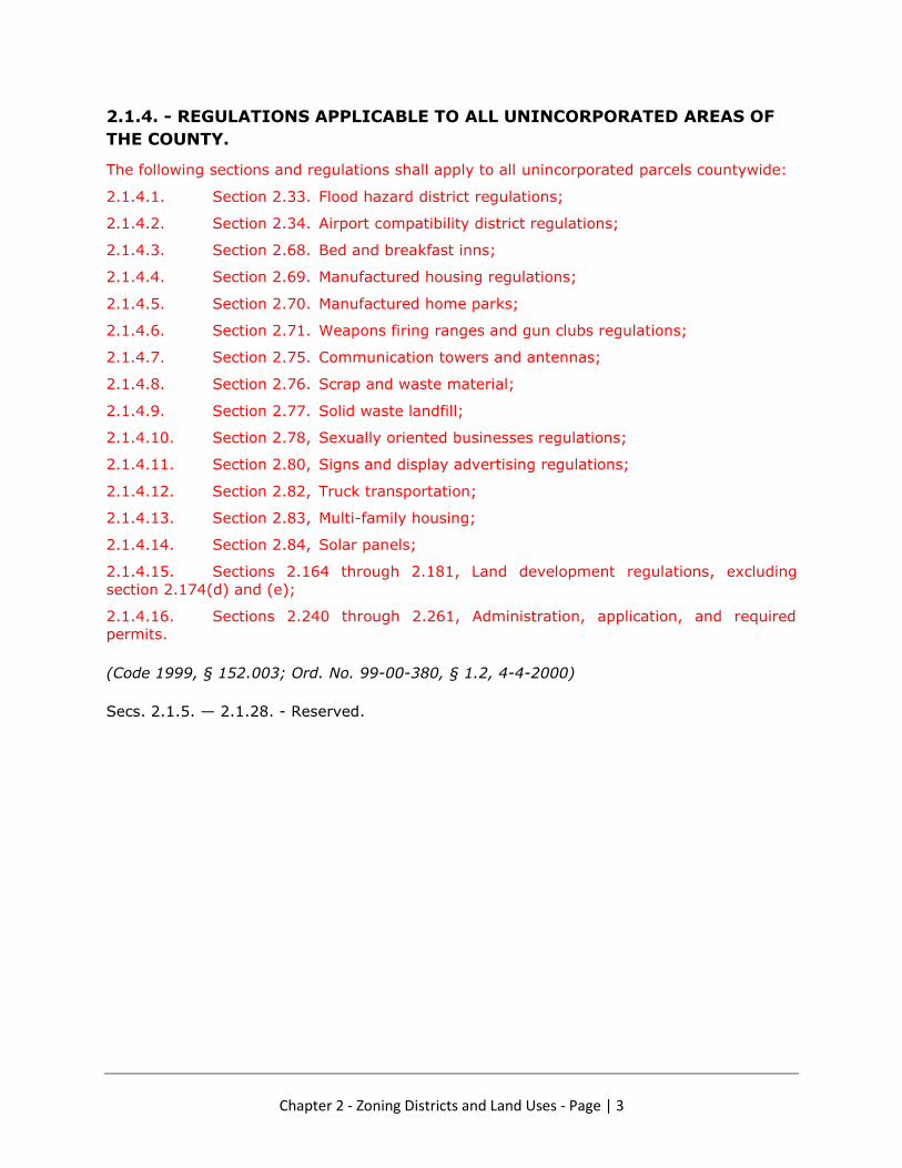
2.1.4. - REGULATIONS APPLICABLE TO ALL UNINCORPORATED AREAS OF
THE COUNTY.
The following sections and regulations shall apply to all unincorporated parcels countywide:
2.1.4.1. Section 2.33. Flood hazard district regulations;
2.1.4.2. Section 2.34. Airport compatibility district regulations;
2.1.4.3. Section 2.68. Bed and breakfast inns;
2.1.4.4. Section 2.69. Manufactured housing regulations;
2.1.4.5. Section 2.70. Manufactured home parks;
2.1.4.6. Section 2.71. Weapons firing ranges and gun clubs regulations;
2.1.4.7. Section 2.75. Communication towers and antennas;
2.1.4.8. Section 2.76. Scrap and waste material;
2.1.4.9. Section 2.77. Solid waste landfill;
2.1.4.10. Section 2.78, Sexually oriented businesses regulations;
2.1.4.11. Section 2.80, Signs and display advertising regulations;
2.1.4.12. Section 2.82, Truck transportation;
2.1.4.13. Section 2.83, Multi-family housing;
2.1.4.14. Section 2.84, Solar panels;
2.1.4.15. Sections 2.164 through 2.181, Land development regulations, excluding
section 2.174(d) and (e);
2.1.4.16. Sections 2.240 through 2.261, Administration, application, and required
permits.
(Code 1999, § 152.003; Ord. No. 99-00-380, § 1.2, 4-4-2000)
Secs. 2.1.5. — 2.1.28. - Reserved.

Chapter 2 - Zoning Districts and Land Uses - Page | 4
ARTICLE 2.2. ZONING DISTRICT AND SPECIAL DEVELOPMENT
DISTRICT REGULATIONS[2]
[2] - State Law reference— Zoning districts, S.C. Code 1976, § 6-29-720.
2.2.1. - ESTABLISHMENT AND PURPOSE OF ZONING DISTRICTS.
For purposes of this chapter, the following zoning and special development districts are hereby
established for all unincorporated portions of the county:
2.2.1.1. Zoning districts.
2.2.1.1.1. Rural Agricultural (RA)
2.2.1.1.2. Rural Conservation (RC)
2.2.1.1.3. Residential Estate (RE)
2.2.1.1.4. Residential Large Lot (RL)
2.2.1.1.5. Residential Suburban (RS)
2.2.1.1.6. Residential Village (RV)
2.2.1.1.7. Light Service Commercial (LSC)
2.2.1.1.8. General Service Commercial (GSC)
2.2.1.1.9. Light Transitional Office (LTO)
2.2.1.1.10. Light Industrial Manufacturing (LIM)
2.2.1.1.11. General Industrial Manufacturing (GIM)
2.2.1.1.12. Agricultural Industrial (AGI)
2.2.1.2. Special Purpose Zoning districts
2.2.1.2.1. Planned Unit Development (PUD).
2.2.1.2.2. Planned Residential Development (PRD).
2.2.1.2.3. Flood Hazard Protection (FHP).
2.2.1.2.4. Airport Compatibility Protection (ACP).
2.2.1.3. Special Overlay Zoning districts.
2.2.1.3.1. Highway Overlay District (OHD).
2.2.1.3.2. Sweetwater Overlay (OSW).
2.2.1.3.3. Martintown Overlay (OMT).
2.2.1.3.4. Town Edge Overlay (OTE).
2.2.2. - ZONING DISTRICT INTENT
Collectively, the zoning, custom zoning, and special development districts are intended to
advance the purposes of this chapter, as stated in the preamble. Individually, each district is
designed and intended to accomplish the following more specific objectives.

Chapter 2 - Zoning Districts and Land Uses - Page | 5
2.2.3. - ZONING DISTRICT OBJECTIVES
2.2.3.1.
Rural Agricultural (RA) - This district is established to encourage the retention and
development of suitable areas for common farm practices and various nonfarm uses,
preservation of open space, the conservation and management of soil, water, air, game and
other natural resources and amenities, and to discourage the creation or continuation of
conditions which could detract from the function, operation, and appearance of areas to
provide food supplies and to prevent or minimize conflicts between common farm practices
and nonfarm uses.
NOTES: Based on Catoosa County A-1 district / Requires *5/acre min. lot size for new
development (Allows conservation subdivisions w/conditions); Allows Agricultural uses with
buffer requirements for industrial ag uses due to noise or odor impacts. Allows agricultural
processing, warehousing, office and local commercial sales. Allows extraction industries with
appropriate buffers.
*May allow subdivision into 1/acre lots as allowed by current practice.
2.2.3.2.
Rural Conservation (RC) - This district is intended to conserve, sustain, and protect rural
areas and resources including agricultural and forested lands; and is intended to preserve a
mixed agricultural and residential character; serve as a transition between rural and suburban
land; protect rural areas from premature urban encroachment; and maintain a balanced rural-
urban environment.
NOTES: Requires *5/acre min. lot size for new development (Allows conservation subdivisions
w/conditions); allows limited Agricultural uses as above; prohibits extraction industries.
Conditional requirements for new manufactured housing such as permanent foundations.
*Prohibit subdivision into 1/acre lots as allowed by current practice for this zoning category.
2.2.3.3.
Residential Estate (RE) – This district is established to provide for large lot, very low-
density single-family detached dwellings; and is intended to serve as a transition between
rural and suburban land; and sustain existing rural-community values and environments.
NOTES: Provides large lot size with *2/acre min. lot size (Allows conservation subdivisions
w/conditions); allows limited Agricultural uses as above; prohibits extraction industries.
Conditional requirements for new manufactured housing such as permanent foundations.
*TBD (Allow/Prohibit) subdivision into 1/acre lots as allowed by current practice.
2.2.3.4.
Residential Large Lot (RL) – This district is established to provide for large lot, low-density
single-family detached dwellings, and is intended to foster, sustain, and protect areas in which
the principal use of land is for single-family dwellings and related support uses, and to reserve
sufficient undeveloped land to meet future single-family housing demands. This district also
is intended to encourage infilling and expansion of "like development" consistent with the
character of existing development.
NOTES: Provides large lot size with 1/acre min. lot size (Allows conservation subdivisions
w/conditions); allows Agricultural uses as above w/more restrictions; prohibits extraction
industries. Provides a transition density like the RC district in Aiken County / This may be the
most likely “holding” category of residential zoning pending expansion of sewer services to

Chapter 2 - Zoning Districts and Land Uses - Page | 6
areas that are harder to reach cost effectively. Conditional requirements for new
manufactured housing such as permanent foundations.
2.2.3.5.
Residential Suburban (RS) – This district is established to provide for small lot, medium
density single family detached dwellings which are served by publicly-owned sanitary sewer
systems. Residential uses that are not served by sanitary sewer systems require a sanitary
septic system that meets state requirements on the property.
NOTES: Provides small lot size with 9000sf on a sewer line (Allows for 11,500sf min. lot size
or larger if property percolates for septic tank). Prohibits commercial uses. Requires dedicated
green space (look at McCormick for requirements: Residential projects shall provide a
minimum of one hundred (100) square feet of usable open space per unit, which may be
private yards, courtyards, decks or commonly owned tracts. Usable open space within such
residential projects may be privately accessible to residents and guests only, without
providing public access). Requires conditions for new manufactured housing such as
permanent foundations to allow in the zoning category.
2.2.3.6.
Residential Village (RV) – This district is established to provide for small lot, high density
single family detached or attached (duplex and triplex) dwellings which are served by publicly-
owned sanitary sewer systems.
NOTES: Allows higher density residential with 5500sf min. lot size (8 units/ac) and required
sewer. Requires dedicated green space. Allows Mixed Use including light commercial uses.
Residential projects shall provide a minimum of one hundred (100) square feet of usable open
space per unit, which may be private yards, courtyards, decks or commonly owned tracts.
Usable open space within such residential projects may be privately accessible to residents
and guests only, without providing public access). Prohibits manufactured housing.
2.2.3.7.
Light Service Commercial (LSC) – This district is established to provide for limited retail
services, convenience goods, and personal services to satisfy the common and frequent
needs of surrounding residential neighborhoods. Goods and services normally available in
this district are of the “convenience variety.” The size of this district should relate to
surrounding residential markets and the location should be at or near major intersections, in
proximity to and/or on the periphery of residential areas, existing or proposed. Exterior
storage facilities are not allowed in this district.
NOTES: Permits general commercial uses to service suburban country development. No
outdoor storage or sales (See use table)
2.2.3.8.
General Service Commercial (GSC) – The purpose of this district is to provide for a wide
variety of retail and service uses to satisfy the common and frequent needs of residents in
large sections of the county. Exterior storage facilities may be allowed in this district as
conditionally approved.
NOTES: Permits more intensive commercial uses including outdoor storage and sales and
drive through window sales (See use table).
2.2.3.9.
Light Transitional Office (LTO) – This district is intended to provide for business and
professional activities, medical and dental offices, and community and institutional facilities

Chapter 2 - Zoning Districts and Land Uses - Page | 7
and to accommodate residential uses in areas along and adjacent to areas where land use
character is changing, or where such a mix of uses is appropriate. It is designed principally
for areas along major road corridors dominated by older houses in transition. In this district,
ancillary and directly related services and uses may not be the principal uses on the property.
Exterior storage facilities may be allowed in this district as conditionally approved.
NOTES: Permits office, institutional, and enclosed storage facilities with appropriate site
development requirements, setbacks, and buffers to maintain traffic flow and existing
residential uses. Allows limited outdoor storage with conditions. Allows residential uses to be
maintained or expanded with appropriate site development requirements, setbacks, and
buffers to allow continued transitional development opportunities.
2.2.3.10.
Light Industrial Manufacturing (LIM) – This district is established to provide for light
industrial uses such as assembling, wholesaling, warehousing and commercial services. The
LIM District shall not permit industries which may create injurious noise, smoke, gas fumes,
odor, dust, or fire hazard or that produce, store or handle hazardous waste. Exterior storage
facilities may be allowed in this district as conditionally approved.
NOTES: Permits office, warehouse/distribution and light manufacturing facilities. Allows
limited outdoor storage with conditions including site development, setbacks and buffers. New
residential uses are not allowed in this district.
2.2.3.11.
General Industrial Manufacturing (GIM) – The intent of this district is to protect and
accommodate wholesaling, distribution, warehousing, processing, manufacturing, office and
related business uses on individual lots and in business park settings. This district also is
intended to protect for future development land with industrial potential. The GIM District
shall not permit industries which may create injurious noise, smoke, gas fumes, odor, dust,
or fire hazard or that produce, store or handle hazardous waste unless a special use permit
has been granted by Edgefield County in accordance with this ordinance.
NOTES: Permits office, warehouse/distribution, and process manufacturing and permits
outdoor storage with buffers and extraction. Allows outdoor storage with conditions including
site development, setbacks and buffers. New residential uses are not allowed in this district.
2.2.3.12.
Agricultural Industrial (AGI) - This district is established to encourage the retention and
development of suitable areas for more intensive agricultural uses including commercial
farming and processing practices and various nonfarm uses, the conservation and
management of soil, water, air, game and other natural resources and amenities, and to
discourage the creation or continuation of conditions which could detract from the function,
operation, and appearance of areas to provide food supplies and to prevent or minimize
conflicts between commercial farm practices and nonfarm uses. This district permits office,
warehouse/distribution and agricultural processing facilities and promotes the creation of
appropriate buffers.
NOTES: Based on Catoosa County A-1 district / Requires 5/acre min. lot size for new
development. Allows Agricultural uses with buffer requirements for industrial ag uses due to
noise or odor impacts. Allows agricultural processing, warehousing, office and local
commercial sales. Allows extraction industries with appropriate buffers.

Chapter 2 - Zoning Districts and Land Uses - Page | 8
2.2.4. - SPECIAL PURPOSE ZONING DISTRICT OBJECTIVES
The special purpose zoning districts provide a customized mechanism for the planning
commission, the county council and the applicant to agree on the scope of a proposed
development
2.2.4.1.
Planned Development (PUD) - This district is established to provide flexibility in the
development of land to promote appropriate uses and do so in a manner that will enhance
public health, safety, morals, and general welfare, and to allow residential, commercial,
industrial, or institutional uses, or certain combinations thereof, to be developed as a unit.
The uses must be served by a DHEC approved sanitary sewer system or systems. The unified
planning and development regulations within the PUD are intended to accomplish the purpose
of zoning and other applicable regulations to an equal or higher degree than where regulations
are designed to control unscheduled development on individual lots or tracts, promote
economical and efficient land use, provide an improved level of amenities, foster a harmonious
variety of uses, encourage creative design, and produce an enhanced environment.
In view of the substantial public advantage of “planned use development”, it is the intent of
these regulations to promote and encourage or require development in this form where
appropriate in character, timing, and location, particularly where large undeveloped tracts are
involved.
NOTES: This category is intended to provide a mixed-use planned development zoning
category based on a plan recommended by the planning commission and approved by county
council and incorporating any required conditions. In view of the substantial public advantage
of “planned use development”, it is the intent of these regulations to promote and encourage
or require development in this form where appropriate in character, timing, and location,
particularly where large undeveloped tracts are involved.
2.2.4.2.
Planned Residential (PRD) - This district is established to provide for a variety of planned
residential uses including single family detached, single family attached, triplexes,
quadraplexes and multi-family dwellings (apartments) with four or more units which are
served by a DHEC approved sanitary sewer systems. Limited institutional or commercial uses
are permissible within the principal building.
NOTES: This category provides a mixed density residential planned development zoning
category based on a plan recommended by the planning commission and approved by county
council and incorporates any required conditions.
2.2.4.3.
Flood Hazard Protection (FHP) – It is the intent of this overlay district to protect human
life and health, minimize property damage, encourage appropriate construction practices, and
minimize public and private losses due to flood conditions by requiring that uses vulnerable
to floods, including facilities which serve such uses, be protected against flood damage at the
time of initial construction. Additionally, this district is intended to help maintain a stable tax
base by providing for the sound use and development of flood-prone areas and to ensure that
potential home buyers are notified that property is in a flood area. The provisions of this
district are intended to minimize damage to public facilities and utilities such as water and
gas mains, electric, telephone, and sewer lines, street and bridges located in the floodplain,
and prolonged business interruptions; and to minimize expenditures of public money for costly
flood control projects and rescue and relief efforts associated with flooding.

Chapter 2 - Zoning Districts and Land Uses - Page | 9
NOTES: Retained from existing ordinance to meet state requirements and local regulations.
This district has very similar language to the Aiken County LMO.
2.2.4.4.
Airport Compatibility Protection (ACP) - The intent of this overlay district is to protect
the dual interests of airports and neighboring land uses, and to:
2.2.4.4.1.
Protect and promote the general health, safety, economy, and welfare of airport environs;
2.2.4.4.2.
Prevent the impairment and promote the utility and safety of airports;
2.2.4.4.3.
Promote land use compatibility between airports and surrounding development;
2.2.4.4.4.
Protect the character and stability of existing land uses; and
2.2.4.4.5.
Enhance environmental conditions in areas affected by airports and airport operations.
NOTES: Retained from existing ordinance. May want to consider the subsets as bullets
pending discussion. This overlay is applied to areas in the approach and immediate
surroundings at and around recognized public access airports
2.2.5. – SPECIAL OVERLAY ZONING DISTRICT OBJECTIVES
The purpose of an Overlay Zoning district is to protect residents, enhance the appearance of
developments, and improve the traffic and circulation in areas adjacent to the primary
highway corridors and in the unincorporated areas along the main entrance roads into the
municipalities of Edgefield County by identifying additional requirements for design and
development. The requirements of the overlay zoning district are considered additional to the
requirements of the underlying zoning district and are to be considered cumulative.
2.2.5.1.
Highway Overlay District (OHD) - The purpose of this overlay district is to protect
residents, enhance the appearance of developments, and improve the traffic flow on the
primary highway corridors in Edgefield County. Specific criteria for design and open space
requirements for the Overlay district are identified all This overlay is divided specified for the
following locations:
NOTES: Retained from existing ordinance; but expected to see modifications specific to each
corridor. The current ordinance designates specific corridors areas located within 400’ of
public right of way except for property zoned residential. The new overlay districts are
expected to expand on design requirements requiring subsets of this overlay zoning district
category for each of the following corridors (albeit some or most of these can be combined to
limit being too specific). The requirements are expected to be unique to the corridor and
divided into two segments as below:
2.2.5.1.1.
OHD Subarea 1 - Highway 25 South Subarea – This section sets requirements for the
portion of the Highway Overlay District along the US Highway 25 corridor between the North

Chapter 2 - Zoning Districts and Land Uses - Page | 10
Augusta city limits and South Carolina State Route 19 [near Trenton]. Specified design criteria
are to be identified here. Specific boundaries are to be determined by County Council.
NOTES: This expands the current overlay’s northern limit from Greenhaven Road to SC19 and
sets new site development and design criteria. It is expected to change some of the
requirements of the existing Highway Corridor overlay located on a portion of the existing
roads.
2.2.5.1.2.
OHD Subarea 2 - Highway 25 Central Subarea - This section sets requirements for the
portion of the Highway Overlay District along the US Highway 25 corridor between South
Carolina State Route 121 [near Trenton] and the Edgefield town limits. Specified design
criteria for the subarea are to be identified here. Specific boundaries are to be determined by
County Council.
NOTES: This expands the OHD overlay from Trenton to Edgefield and sets new site
development and design criteria. These criteria are expected to differ from the South
section.
2.2.5.2.
Sweetwater Overlay District (OSW) – This overlay district is intended to protect residents,
enhance the appearance of developments, and improve the traffic flow on the primary
highway corridors in Edgefield County.
NOTES: This is expected to create new site development and design criteria for the
Sweetwater Road corridor as per recommendations from the Comprehensive Plan. It changes
the requirements of the existing Highway Corridor overlay. The requirements are expected to
be unique to the corridor and divided into two segments as below:
2.2.5.2.1.
OSW Subarea 1 - Transition Sweetwater Subarea - This overlay subarea includes the
Sweetwater Road corridor south of the Greenway (Ten Governors Railroad corridor) and
includes Murrah Extension and West Five Notch Road. Specific boundaries are to be
determined by County Council. Specified design criteria for the subarea are to be identified
here.
NOTES: This creates a new set of site development and design criteria for the corridor south
of the Ten Governors Greenway (former railroad) corridor as per recommendations from the
Comprehensive Plan. It is expected to change some of the requirements of the existing
Highway Corridor overlay located on a portion of the existing roads.
2.2.5.2.2.
OSW Subarea 2 - Pastoral Sweetwater Subarea – This overlay subarea provides site
development and design criteria to protect residents, enhance the appearance of
developments, and maintain traffic flow along the portion of Sweetwater Road located north
of the Greenway (Ten Governors Railroad corridor). Specific boundaries are to be determined
by County Council. Specified design criteria for the subareamay be identified here.
NOTES: This creates a new set of site development and design criteria for the corridor north
of the Ten Governors Greenway (former railroad) corridor as per recommendations from the
Comprehensive Plan.

Chapter 2 - Zoning Districts and Land Uses - Page | 11
2.2.5.3.
Martintown Overlay District (OMT) – This overlay district is intended to protect residents,
enhance the appearance of developments, and improve the traffic flow on the Martintown
Road highway corridor between the Colliers intersection and the North Augusta city limits in
Edgefield County. Specific boundaries are to be determined by County Council. Specified
design criteria are to be identified here.
NOTES: This is expected to It is expected to create site development and design criteria
requirements for properties located along the Martintown Road corridor per recommendations
from the Comprehensive Plan. The requirements are expected to be unique to the corridor.
2.2.5.4.
Town Edge Overlay District (OTE) – This overlay district is intended to protect residents,
enhance the appearance of developments, and improve the traffic flow in unincorporated
areas adjacent to the existing incorporated towns in Edgefield County. Specific boundaries
are to be determined by County Council. Specified design criteria are to be identified here.
NOTES: This overlay provides controls to support the transitional fringe areas outside
established towns. The requirements are expected to be unique to each subarea as identified
below:
2.2.5.4.1.
OTE Overlay Subarea 1 - Edgefield Unincorporated Subarea - Specified area and design
criteria are to be determined. Specific boundaries are to be determined by County Council.
Specified design criteria are to be identified here.
NOTES: This overlay district provides design requirements that are to be determined and are
expected to differ from Johnston fringe area due to unique nature of town regulations.
2.2.5.4.2.
OTE Subarea 2 - Johnston Unincorporated Subarea - Specified area and design criteria
are to be determined Specific boundaries are to be determined by County Council. Specified
design criteria are to be identified here.
NOTES: This overlay district provides design requirements that are to be determined and are
expected to differ from the Edgefield fringe area due to unique nature of town regulations.
2.2.5.5.
Bettis Academy Road Overlay (OBA) - (US 25 to Aiken County line) - Specified design
criteria are to be determined Specific boundaries are to be determined by County Council.
Specified design criteria are to be identified here.
NOTES: This expands the overlays to include Bettis Academy Road and sets specific site
development and design criteria for this corridor.
2.2.5.6.
Additional Overlay Districts - Edgefield County Council may establish additional Overlay
districts by ordinance in various areas of Edgefield County. Specified design criteria are to be
determined Specific boundaries are to be determined by County Council.
NOTES: Allows a process to add new Overlay districts.

Chapter 2 - Zoning Districts and Land Uses - Page | 12
2.2.6. ESTABLISHMENT OF OFFICIAL EDGEFIELD COUNTY ZONING MAP
The unincorporated areas of Edgefield County are divided into zoning districts as shown on
the Official Edgefield County Zoning Map which is maintained by the GIS Mapping Division of
the Aiken County Planning & Development Department. This Map is adopted as the Official
Aiken County Zoning Map by this Chapter. The Official Edgefield County Zoning Map may be
amended as set forth in Article xxx of this Chapter.
2.2.6.1.
Interpretation of Zoning District Boundaries
Boundary lines of districts coexist at lot lines, centerlines of streets or alleys, or such lines
extended, railroad right-of-way lines, centerlines of creeks and streams, or corporate limit
lines unless otherwise shown on the Official Zoning Map of Edgefield County. District boundary
lines not coinciding with the above shall be determined by use of the scale of the Official
Zoning Map unless actual dimensions are noted.
2.2.6.2.
Resolution of District Boundary Line Questions
Where uncertainty exists regarding the boundaries as shown by the Official Zoning Map, the
Planning Commission shall act to resolve any question or controversy arising over such district
boundary line.
2.2.7. ESTABLISHMENT OF ZONING DISTRICT REGULATIONS
Zoning district regulations are presented with the use of tables. The North American Industry
Classification System, 2017, is the basis for determining the use of property permitted by the
various zoning districts. Where uncertainty exists relative to a given use not specifically listed
on the table, the NAICS Manual should be consulted. In general, all uses listed by a given
NAICS number and category shall be construed as being permitted in the assigned zoning
district, unless separately listed.
2.2.7.1.
Use of Tables
2.2.7.1.1 - Uses not listed in the NAICS Manual, or to which a reference is not applicable are
identified by the letters “NA” (Not Applicable).
2.2.7.1.2 - Where the letter “P” is shown on the Table, the use to which it refers is permitted
as a use by right in the indicated district, provided it complies fully with all applicable
development standards of this Chapter.
2.2.7.1.3 - Where the letter “C” is shown on the Table, the use to which it refers is
conditionally permitted in the indicated district, subject to requirements for uses set out in
Article xxx.
2.2.7.1.4 - Where the letter “N” is shown on the Table, the use to which it refers is not
permitted in the indicated district.
2.2.7.1.5 - Where a given use or NAICS reference is not listed on the table, said use shall not
be permitted.
2.2.7.1.6 - A section number reference following a use category means the use must meet
the additional conditions and requirements of the referenced section.

Chapter 2 - Zoning Districts and Land Uses - Page | 13
2.2.7.1.7 - To aid in the use of the Table, major land use categories are arranged numerically
by NAICS Sectors, followed by the uses and codes included in each sector, as shown below:
Code Sector Uses
Sector 11: Agriculture, Forestry, Fishing and Hunting
Sector 21: Mining
Sector 22: Utilities
Sector 23: Construction
Sector 31-33: Manufacturing
Sector 42: Wholesale Trade
Sector 44-45: Retail Trade
Sector 48-49: Transportation and Warehousing
Sector 51: Information
Sector 52: Finance and Insurance
Sector 53: Real Estate and Rental and Leasing
Sector 54: Professional, Scientific, and Technical Services
Sector 55: Management of Companies and Enterprises
Sector 56: Administrative and Support and Waste Management and
Remediation Services
Sector 61: Educational Services
Sector 62: Health Care and Social Assistance
Sector 71: Arts, Entertainment, and Recreation
Sector 72: Accommodation and Food Services
Sector 81: Other Services (except Public Administration)
Sector 92: Public Administration
2.2.7.2.
Use Table - Table 2.2 identifies and lists all permitted uses in the several primary zoning
districts established by Section 2.2.1.1 above.
Insert Table 2.2 here:
USE TABLE - Permitted and Conditional Uses: P=permitted by right / C=permitted conditionally / N+not permitted
/ NA+not applicable (In addition pending ordinance recommendations: S=special use)
District RA RC RE RL RS RV LSC GSC LTO LIM GIM AGI PUD PRD FHP ACP
Use /NAICS
11: Agriculture, Forestry, Fishing & Hunting
111
112
112111
21: Mining
22: Utilities
23: Construction
31-33: Manufacturing
42: Wholesale Trade

Chapter 2 - Zoning Districts and Land Uses - Page | 14
44-45: Retail Trade
48-49: Transportation & Warehousing
51: Information
52: Finance and Insurance
53: Real Estate, Rental & Leasing
54: Professional, Scientific, & Technical Services
55: Management of Companies & Enterprises
56: Administrative, Support, Waste Management & Remediation Services
61: Educational Services
62: Health Care & Social Assistance
71: Arts, Entertainment, & Recreation
72: Accommodation & Food Services
81: Other Services (except Public Administration)
92: Public Administration

Chapter 2 - Zoning Districts and Land Uses - Page | 15
2.2.7.3.
NOTES to Use Table: To be determined and will be inserted here.
NOTE: TEMPORARY INSERTs - Chapter 2 identifies zoning categories and uses. The Aiken
County LMO includes additional tables to specify requirements for off street parking, lot area,
yard, setback, height, density, and impervious surface requirements in the Zoning District
Chapter. These tables may be included here but are initially proposed to be included in the
Building and Site Development chapter. For the purposes of putting the draft together the
tables are shown here as a temporary measure.
Table 2.3 identifies and lists off-street parking requirements for each use or category of use.
Insert Table 2.3 here:
Table 2.4 establishes lot area, yard, setback, height, density, and impervious surface
requirements for all uses, by zone district.
Insert Table 2.4 here:
Chapter 2 - Zoning Districts and Land Uses - Page | 16
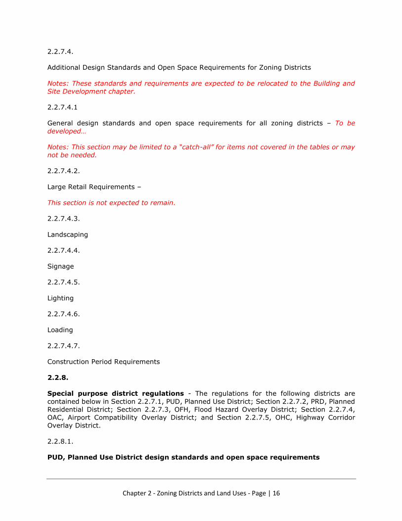
2.2.7.4.
Additional Design Standards and Open Space Requirements for Zoning Districts
Notes: These standards and requirements are expected to be relocated to the Building and
Site Development chapter.
2.2.7.4.1
General design standards and open space requirements for all zoning districts – To be
developed…
Notes: This section may be limited to a “catch-all” for items not covered in the tables or may
not be needed.
2.2.7.4.2.
Large Retail Requirements –
This section is not expected to remain.
2.2.7.4.3.
Landscaping
2.2.7.4.4.
Signage
2.2.7.4.5.
Lighting
2.2.7.4.6.
Loading
2.2.7.4.7.
Construction Period Requirements
2.2.8.
Special purpose district regulations - The regulations for the following districts are
contained below in Section 2.2.7.1, PUD, Planned Use District; Section 2.2.7.2, PRD, Planned
Residential District; Section 2.2.7.3, OFH, Flood Hazard Overlay District; Section 2.2.7.4,
OAC, Airport Compatibility Overlay District; and Section 2.2.7.5, OHC, Highway Corridor
Overlay District.
2.2.8.1.
PUD, Planned Use District design standards and open space requirements

Chapter 2 - Zoning Districts and Land Uses - Page | 17
2.2.8.1.1.
General design standards and open space requirements for all districts – To be developed…
Notes; This section may be limited to a “catch-all” for items not covered in the tables or may
not be needed.
2.2.8.1.2.
Landscaping
2.2.8.1.3.
Signage
2.2.8.1.4.
Lighting
2.2.8.1.5.
Loading
2.2.8.1.6.
Construction Period Requirements
2.2.8.2.
PRD, Planned Residential District design standards and open space requirements
2.2.8.2.1.
Landscaping
2.2.8.2.2.
Signage
2.2.8.2.3.
Lighting
2.2.8.2.4.
Loading
2.2.8.2.5.
Construction Period Requirements
2.2.8.3.

Chapter 2 - Zoning Districts and Land Uses - Page | 18
OFH, Flood Hazard Overlay District design standards and open space requirements
2.2.8.3.1.
Landscaping
2.2.8.3.2.
Signage
2.2.8.3.3.
Lighting
2.2.8.3.4.
Loading
2.2.8.3.5.
Construction Period Requirements
2.2.8.4.
OAC, Airport Compatibility Overlay District design standards and open space
requirements
2.2.8.4.1.
Landscaping
2.2.8.4.2.
Signage
2.2.8.4.3.
Lighting
2.2.8.4.4.
Loading
2.2.8.4.5.
Construction Period Requirements
2.2.8.5.
OHC, Highway Corridor Overlay District design standards and open space
requirements
2.2.8.5.1.

Chapter 2 - Zoning Districts and Land Uses - Page | 19
Landscaping
2.2.8.5.2.
Signage
2.2.8.5.3.
Lighting
2.2.8.5.4.
Loading
2.2.8.5.5.
Construction Period Requirements
2.2.9. To Be Determined
Any Additions to be Determined?