Embed Size (px)
Citation preview
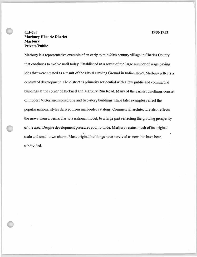
CH-785 1900-1953 Marbury Historic District Marbury Private/Public
Marbury is a representative example of an early to mid-20th century village in Charles County
that continues to evolve until today. Established as a result of the large number of wage paying
jobs that were created as a result of the Naval Proving Ground in Indian Head, Marbury reflects a
century of development. The district is primarily residential with a few public and commercial
buildings at the corner of Bicknell and Marbury Run Road. Many of the earliest dwellings consist
of modest Victorian-inspired one and two-story buildings while later examples reflect the
popular national styles derived from mail-order catalogs. Commercial architecture also reflects
the move from a vernacular to a national model, to a large part reflecting the growing prosperity
of the area. Despite development pressures county-wide, Marbury retains much of its original
scale and small town charm. Most original buildings have survived as new lots have been
subdivided.

Maryland Historical Trust Inventory No. CH-785
Maryland Inventory of Historic Properties Form
1. Name of Property (indicate preferred name)
historic Marbury Historic District
other
2. Location street and number Bicknell Road, Marbury Run Road not for publication
city, town Marbury vicinity
county Charles
3. Owner of Property (give names and mailing addresses of all owners)
name Multiple ownership
street and number telephone
city, town state zip code
4. Location of Legal Description ~ ? courthouse, registry of deeds, etc. Charles County Land Records * tax map and parcel: Map 20 ; :
city, town La Plata liber folio La ' ;.!
5. Primary Location of Additional Data Contributing Resource in National Register District Contributing Resource in Local Historic District Determined Eligible for the National Register/Maryland Register Determined Ineligible for the National Register/Maryland Register Recorded by HABS/HAER Historic Structure Report or Research Report Other
6. Classification
Category Ownership Current Function Resource Count X district hr - a 9 n c u ' t u r e landscape Contributing Noncontributing
building(s) " V t commerce/trade recreation/culture 41 9̂ buildings Z structure _ * £ * _ defense _X religion sites
X domestic social structures site — —
_ education transportation objects _ funerary work in progress 41 9̂ Total
government unknown health care vacant/not in use Number of Contributing Resources industry other: previously listed in the Inventory
6

7. Description Inventory No. CH-785
Condition
excellent deteriorated good ruins
JX. fair altered
Prepare both a one paragraph summary and a comprehensive description of the resource and its various elements as it exists today.
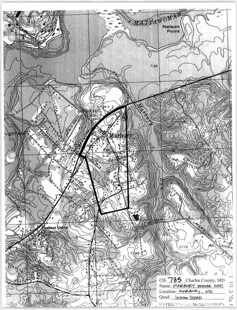
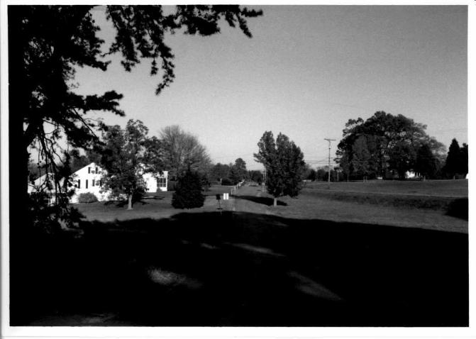
The Marbury Historic District consists of a small village located in the western section of Charles County. Established in the early 20th century, the district is primarily residential with a few public and commercial buildings at the corner of Bicknell and Marbury Run Road. Residential development in the village began in the early 20th century in response the establishment of the Naval Proving Ground in Indian Head. Bicknell Road was formerly the main route running from La Plata, Port Tobacco and Pisgah to the south and east, and terminating at the former Mattawoman Creek footbridge (CH-773) to the northwest. Marbury Run Road connects Indian Head and Glymont to the northeast, with Chicamuxen and Nanjemoy to the southwest.
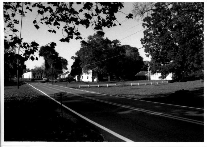
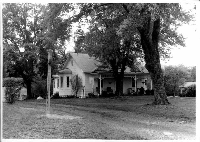
Marbury initially began as a cluster of small farms established in the vicinity of the crossroads of modern Marbury Run Road and Bicknell Road. As the Naval Proving Ground at Indian Head became a major employer in the region and demand for housing increased, property owners sold off parcels of their farms along the main roadways. Some of the earliest buildings include the previously surveyed Hetty and Tom Wright House (CH-763), built in 1904,4860 Bicknell Road (1905), and 4745 Bicknell Road (1907). These are generally two-story vernacular Victorian-inspired dwellings. A representative example of a one-story cottages in the village includes 5155 Marbury Run Road (1907). Later structures consist of rural 1- 1/2 story bungalows, late Victorian 1 and 2-story cottages and I-houses, foursquares, and mail-order homes. Structures are predominantly of frame construction. Lot size is irregular ranging from half acre parcels to some as large as 20 acres. Setbacks are also irregular.
PUBLIC BUILDINGS ... Public buildings in the village include two churches, a post office, and a fire house. The Marbury Church of God, built in 1986, and the Marbury Baptist Church, 1953 are located on either side of Bicknell Road and are surrounded by residential homes. The Marbury Post Office at 4570 Bicknell Road is located at the commercial core of the district near the intersection of Bicknell and Marbury Run Road. This is a 1940 frame front-gable structure. The 10th district firehouse was built in 1953 and stands at 4595 Bicknell Road across from the post office.
COMMERCIAL BUILDINGS Commercial buildings range from the early to mid 20th century.The earliest structure is known as Twiford's Store.This early 20th century front-gable building stands at 5105 Marbury Run Road. The latest commercial strucutre in the village is a former car dealership known as "Bill Abell's Hudson Dealership". This is a concrete block false front building erected 1946 at 5095 Marbury Run Road.
MARBURY RUN ROAD The southern segment is characterized by several one-story Victorian cottages. The best example is found on the southwest segment at 5155 Marbury Run Road, and a less ornate example at 5175 Marbury Run Road. The southeast segment includes another example of a one-story Victorian cottage as well as several altered examples of two story cottages closer to the intersection with Bicknell Road. Twiford's Store, typical of local turn-of-the-century commercial architecture is found on the southwest corner. The northern segment includes a Victorian dwelling at the far end of the district (p. 263) and a c. 1950 brick 2-story Alladin mail-order home (p. 36). P. 236 holds the former dealership.
BICKNELL ROAD Bicknell Road includes a wide array of resources ranging from circa 1900 to present day. Notable dwellings include the marl over stucco 1 1/2 story dwelling at 4590 Bicknell Road, and several 2-story Victorians at 4775 and 4745, as well as the Netty and Tom Wright House and the house at 4860 Bicknell Road built in 1905. Resources considered non-contributing include 4905,4885,4855, 4695, 4575,4610,4620,4750, 4780, and 4850.
Since its development in the early 20th century Marbury has continued its trend toward subdivision of existing parcels and infill construction. Since the 1970's many dwellings have been renovated with an emphasis on modernization rather than preservation.

Maryland Historical Trust Inventory N CH-785
Maryland Inventory o Historic Properties Form
Name Marbury Historic District Continuation Sheet
Number 7 Page 1
However, in more recent years, restorations have become increasingly more sensitive to preserving historic character and character defining elements. Up until recent years Marbury has been predominantly owned by second or third generation family members of the original occupants. The buildings and layout of Marbury reflect the informal evolution of a rural village in response to employment and transportation opportunities. Its architecture reveals the changing architectural taste in Charles County from the early to late 20th century.
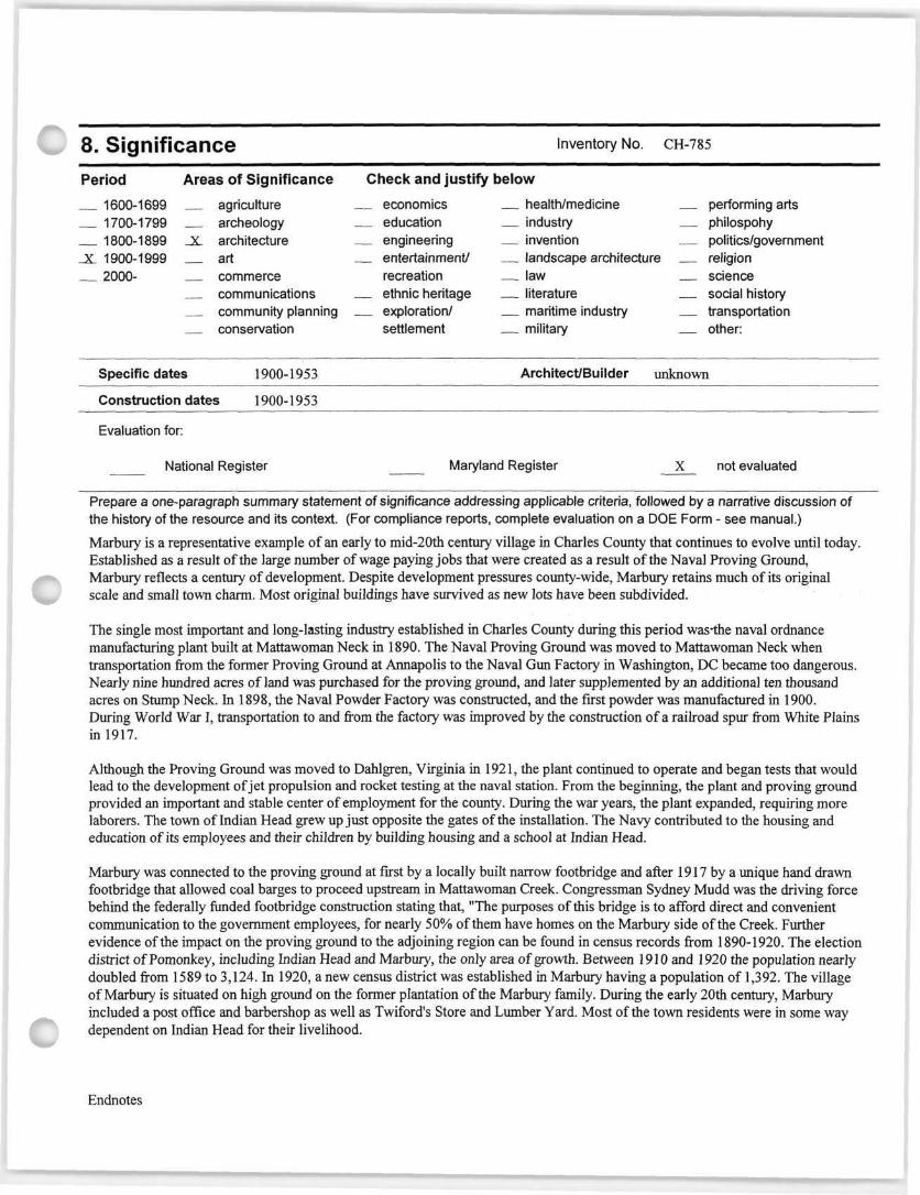
8. Significance Inventory No. CH-785
Period Areas of Significance Check and justify below
1600-1699 agriculture economics health/medicine performing arts 1700-1799 archeology education industry philospohy 1800-1899 _X_ architecture engineering invention politics/government
_X_ 1900-1999 art entertainment/ landscape architecture religion 2000- commerce recreation law science
communications ethnic heritage literature social history community planning exploration/ maritime industry transportation conservation settlement military other:
Specific dates 1900-1953 Architect/Builder unknown
Construction dates 1900-1953
Evaluation for:
National Register Maryland Register X not evaluated
Prepare a one-paragraph summary statement of significance addressing applicable criteria, followed by a narrative discussion of the history of the resource and its context. (For compliance reports, complete evaluation on a DOE Form - see manual.)
Marbury is a representative example of an early to mid-20th century village in Charles County that continues to evolve until today. Established as a result of the large number of wage paying jobs that were created as a result of the Naval Proving Ground, Marbury reflects a century of development. Despite development pressures county-wide, Marbury retains much of its original scale and small town charm. Most original buildings have survived as new lots have been subdivided.
The single most important and long-lasting industry established in Charles County during this period was-the naval ordnance manufacturing plant built at Mattawoman Neck in 1890. The Naval Proving Ground was moved to Mattawoman Neck when transportation from the former Proving Ground at Annapolis to the Naval Gun Factory in Washington, DC became too dangerous. Nearly nine hundred acres of land was purchased for the proving ground, and later supplemented by an additional ten thousand acres on Stump Neck. In 1898, the Naval Powder Factory was constructed, and the first powder was manufactured in 1900. During World War I, transportation to and from the factory was improved by the construction of a railroad spur from White Plains in 1917.
Although the Proving Ground was moved to Dahlgren, Virginia in 1921, the plant continued to operate and began tests that would lead to the development of jet propulsion and rocket testing at the naval station. From the beginning, the plant and proving ground provided an important and stable center of employment for the county. During the war years, the plant expanded, requiring more laborers. The town of Indian Head grew up just opposite the gates of the installation. The Navy contributed to the housing and education of its employees and their children by building housing and a school at Indian Head.
Marbury was connected to the proving ground at first by a locally built narrow footbridge and after 1917 by a unique hand drawn footbridge that allowed coal barges to proceed upstream in Mattawoman Creek. Congressman Sydney Mudd was the driving force behind the federally funded footbridge construction stating that, "The purposes of this bridge is to afford direct and convenient communication to the government employees, for nearly 50% of them have homes on the Marbury side of the Creek. Further evidence of the impact on the proving ground to the adjoining region can be found in census records from 1890-1920. The election district of Pomonkey, including Indian Head and Marbury, the only area of growth. Between 1910 and 1920 the population nearly doubled from 1589 to 3,124. In 1920, a new census district was established in Marbury having a population of 1,392. The village of Marbury is situated on high ground on the former plantation of the Marbury family. During the early 20th century, Marbury included a post office and barbershop as well as Twiford's Store and Lumber Yard. Most of the town residents were in some way dependent on Indian Head for their livelihood.
Endnotes
Maryland Historical Trust Inventory No CH-785
Maryland Inventory of Historic Properties For Name Marbury Historic District
Continuation Sheet Number 8 P a 9 e 1
(1) Charles County Land Records, Liber 30, Folio 8.
9. Major Bibliographical References Inventory No. CH-785
10. Geographical Data
Acreage of surveyed property unknown
Acreage of historical setting unknown
Quadrangle name Indian Head Quadrangle scale 1:24,000
Verbal boundary description and justification
Boundary descriptions reflect the highest concentration of historic resources.
11. Form Prepared By name/title Cathy Hardy/Historic Sites Surveyor
organization Charles County Planning dat 10/28/2003
street and number 200 Baltimore Street telephone 301-396-5815
city or town La Plata stat M D zip code 20646
The Maryland Inventory of Historic Properties was officially created by an Act of the Maryland Legislature to be found in the Annotated Code of Maryland, Article 41, Section 181 KA, 1974 supplement.
The survey and inventory are being prepared for information and record purposes only and do not constitute any infringement of individual property rights.
return to: Maryland Historical Trust DHCD/DHCP 100 Community Place Crownsville MD 21032 410-514-7600

MARYLAND INVENTORY OF HISTORIC PROPERTIES CONTINUATION SHEET Inventory No. CH-785
Section 9 Page 1 Marburv Historic District name of property Charles County. M P county and state
Major Bibliographic References:
Brown, Jack D., et al. Charles County, Maryland, A History. Charles County Bicentennial Committee, 1976.
Carlisle, Rodney. Powder and Propellants: Energetic Materials at Indian Head, Maryland, 1890-1990. Self-published 1990.
Charles County Land Records, Charles County Courthouse, LaPlata, Maryland.
Hardy, Cathy Currey. "Phase HI Final Report Charles County Historic Sites Survey." Charles County Planning. July 2002.
KCI Technologies, Inc. Draft—Historic Context For the U.S. 301 Southern Corridor Transportation Study. August 1996.
Klapthor, Margaret Brown. The History of Charles County, Maryland. LaPlata, MD: Charles County Tercentenary, Inc., 1958.
Lewis, J. Frank & Company. The Maryland Directory. 1880. Baltimore.
Maps Griffith, Dennis. Map of the State of Maryland Laid down from an actual Survey of all the
principal Waters, public Roads, and Divisions of the Counties therein.... Philadelphia, PA: J. Tallance, Engraver, June 6, 1795.
Martenet, Simon J. Martenet's Map of Maryland and the District of Columbia. Baltimore, MD: Simon J. Martenet, C.E., 1865; revised 1885.