Embed Size (px)
Citation preview
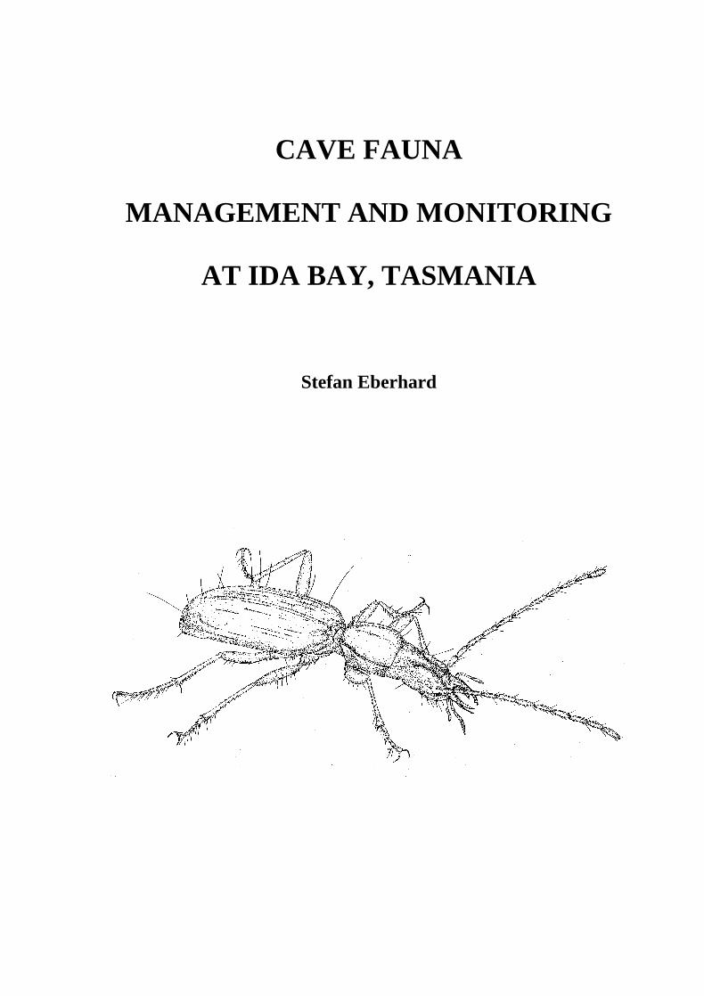
CAVE FAUNA
MANAGEMENT AND MONITORING
AT IDA BAY, TASMANIA
Stefan Eberhard

Parks and Wildlife Service, Tasmania Nature Conservation Report 99/1 ISSN 1441-0680
i
Cave Fauna Management and Monitoring at Ida Bay, Tasmania Stefan Eberhard This study was carried out under the direction of the Tasmanian Parks and Wildlife Service and was funded by the Commonwealth of Australia through Environment Australia’s World Heritage program. The views and opinions expressed in this report are those of the author and do not necessarily reflect those of the Tasmanian Parks and Wildlife Service or those of Environment Australia. ISSN 1441-0680 Copyright 1999 Crown in right of State of Tasmania Apart from fair dealing for the purposes of private study, research, criticism or review, as permitted under the Copyright Act, no part may be reproduced by any means without written permission from the Tasmanian Parks and Wildlife Service. Published by: Parks and Wildlife Service Department of Primary Industry, Water and Environment GPO Box 44A Hobart, Tasmania, Australia, 7001 Cover illustration: Blind cave beetle, Goedetrechus mendumae, by Karen Richards

ii
Cite as: Eberhard, S. (1999). Cave Fauna Management and Monitoring at Ida Bay, Tasmania. Nature Conservation Report 99/1. Parks and Wildlife Service, Tasmania.
iii
SUMMARY
This report presents strategies to manage and monitor cave fauna in the Ida Bay karst area. The primary tasks of the project are listed below, together with key results. All recommendations developed in this report are listed in Appendix VI.
1. Undertake cave fauna surveys in the Ida Bay karst system to identify locations of rare and sensitive
habitats and species.
A three month survey of major caves in the area was conducted in summer 1997/98. Caves surveyed were; Arthur Folly’s Cave, Bradley Chesterman Cave, Exit Cave (restricted to frequently visited areas), Loons Cave and Mystery Creek Cave. Habitat sensitivity and management issues of each of these caves are discussed. The known range of the blind cave beetle, Goedetrechus mendumae, was significantly extended to include Mystery Creek Cave and, based on indirect evidence, other parts of Exit Cave.
2. Develop management options for the protection of cave fauna in the Ida Bay karst system,
particularly in relation to visitor use.
Education of cave users is critical to protection of cave fauna. Specific minimal impact caving guidelines to protect fauna were developed and promoted. On-going promotion of these guidelines is required.
Vulnerability to visitor impacts of habitats types found within the caves were assessed.
Route markers and fauna sanctuaries were installed in Exit Cave to protect sensitive habitats and species. Similar protection measures were recommended for Mystery Creek Cave.
Arthur Folly’s Cave was found to have high biological values and access should be regulated by installation of a gate and provision of a permit system.
Habitat monitoring was recommended in Mystery Creek Cave, Bradley Chesterman Cave, Loons Cave and Arthur Folly’s Cave. Monitoring of selected cave fauna was recommended.
3. In consultation with cave users, assist with the development of a Minimum Impact Caving (MIC) code
of practice.
Minimum impact caving was addressed by production of illustrated fact sheets on cave fauna and minimum impact techniques. These fact sheets will be made available at Parks and Wildlife Service shop fronts, and will be distributed to cave users from regional offices and cave sites, through mail-outs and caving permit applications, as well as the Parks & Wildlife Service web site. An article on Tasmanian cave fauna and minimum impact caving was published in Australian Caver, the journal of the Australian Speleological Federation which most Australian caving clubs are affiliated with (Eberhard 1998). Public lectures were given to the local caving club (Southern Tasmanian Caverneers), scientists (University of Tasmania, Australian Karst Studies Seminars at Mole Creek), cave managers and cave guides at Hastings and Hobart.
4. Develop and commence a research program to monitor the impacts of cave users on cave fauna.
A program was developed to monitor glowworms, cave crickets, cave spiders and cave beetles in high visitor use areas of Exit and Mystery Creek Cave. This should provide baseline data to compare with future human impacts.

iv
As part of this project a review of an on-going snail monitoring program was organised. Snail monitoring was commenced in 1992 to assess the impacts of the nearby limestone quarry. This review is contained in a separate consultants report by Barmuta (1998). This review also contains recommendations on assessing the effects of visitor use on snails. Barmuta’s (1998) recommendations are summarised in this report.

v
CONTENTS
page SUMMARY ii ACKNOWLEDGMENTS iv PART 1 INTRODUCTION 1 1.1 Aims and project brief 1 1.2 Ida Bay karst system 1 1.3 Management framework 2 1.4 Diversity and significance of the cave fauna 2 1.5 Review of management issues 2 1.6 Review of conservation strategies 3 1.6.1 Protected areas 3 1.6.2 Species protection 3 1.6.3 Populations, communities, and key threatening processes 3 1.6.4 Habitat protection and habitat restoration 3 1.6.5 Public education and community involvement 4 PART 2. MANAGEMENT AT IDA BAY 5 2.1 Overview of fauna management issues 5 2.1.1 Exit Cave 5 2.1.2 Mystery Creek Cave 5 2.1.3 Bradley Chesterman Cave 7 2.1.4 Loons Cave 8 2.1.5 Arthurs Folly Cave 9 2.2 Catchment and fire management 9 2.3 Species management 10 2.3.1 Taxonomic status 10 2.3.2 Distribution and ecological status 10 2.3.3 Conservation status 11 2.3.4 Goedetrechus mendumae 11 2.3.5 Other localised species 13 2.4 Habitat management 14 2.4.1 Pools 14 2.4.2 Streams 15 2.4.3 Fossil passages 16 2.4.4 Micro-habitats 16 2.4.5 Habitat zonation 17
2.4.6 Habitat and food supply dynamics 18 2.4.7 Principles & Guidelines for Cave Routes, Visitation Levels and Minimum Impact Caving 18
2.5 General management guidelines (IUCN) 19 2.6 Habitat protection and management actions undertaken 19 2.6.1 Education 19 2.6.2 Route marking 19 2.6.3 Fauna sanctuaries 20 2.6.4 List of fauna sanctuaries 20 PART 3 MONITORING 22 3.1 Other monitoring studies 22 3.2 Monitoring at Ida Bay 22 3.3 Monitoring of glowworms 23 3.3.1 Monitoring trials 24 3.3.2 Monitoring sites 25 3.3.3 Monitoring frequency 25 3.3.4 Monitoring methods 26 3.4 Crickets, spiders and other species 26 3.4.1 Monitoring trials 27 3.4.2 Monitoring sites 27 3.4.3 Monitoring frequency 28 3.4.4 Monitoring methods 28 3.5 Monitoring hydrobiid snails 28 3.5.1 Review of studies to date 29 3.5.2 Future monitoring 29 3.5.3 Monitoring considerations 30

vi
3.5.4 Human impact experiments 30 REFERENCES 32 APPENDICES 34 I The cave environment 34 II Ecological classification of cave fauna 34 III Food supply for cave ecosystems 35 IV Minimum Impact Caving techniques for fauna 35 V Glowworm biology and threats 35 VI List of recommendations 36

vii
ACKNOWLEDGMENTS
Thanks and acknowledgment are due to Ingrid Albion, Leon Barmuta, Sally Bryant, Arthur Clarke, Daniel Eberhard, Ian Houshold, Edyta Jasinska, Chris Pugsley, the cave guides at Hastings and Parks & Wildlife Service staff at Dover. Particular thanks go to Mike Driessen for his enthusiastic support during the project. This project was an initiative of the Tasmanian Wilderness World Heritage Area Fauna Program.

1
PART 1 INTRODUCTION Owing to the paucity of earlier baseline data and, until recently, a general lack of impact-related studies, it has proved difficult to quantify and predict precisely the effects of various human activities on cave fauna. Nevertheless, there are numerous examples where human activities have caused the local extinction of cave-dwelling invertebrate populations, or where they have been seriously degraded or compromised (Eberhard & Hamilton-Smith 1996). Significant threats to cave fauna typically involve gross habitat and catchment disturbances associated with, for example, quarrying, forestry, land clearance, agriculture, and water abstraction. In addition direct disturbance caused by cave visitors, cave management and research activities also threaten cave fauna. Ida Bay karst has one of the richest obligate cave fauna assemblages in Tasmania and temperate zone Australia (Eberhard 1990a). Most of the Ida Bay karst area is protected within the Tasmanian Wilderness World Heritage Area. Many of the caves in the area are popular destinations for recreational cave users. Several caves within the karst area were once under threat from activities associated with a limestone quarry. Since closure of the quarry in 1992 the main concern for cave fauna has been the potential impacts of cave visitors. Cave visitors may impact upon cave fauna by causing direct disturbance, or trampling of individuals, or by causing the degradation of habitat through trampling and compaction of sensitive substrates or food sources. One of the most significant caves in the area, Exit Cave, was closed to general visitor access in 1992 while a management plan was to be prepared. The cave was re-opened in 1999 for restricted access to cavers by permit application. Other significant caves in the Ida Bay karst which are subject to visitor or other management issues are Mystery Creek Cave, Bradley Chestermans Cave, Loons Cave, and Arthur Folly's Cave. The purpose of this report was to develop strategies to manage and monitor cave fauna in these caves.
1.1 Aims and Project Brief
The aims of this project were to develop and commence strategies to manage and monitor cave fauna in the Ida Bay karst system. Primary tasks of the project brief were to:
undertake cave fauna surveys in the Ida Bay karst system to identify locations of rare and sensitive habitats and species;
develop management options for the protection of cave fauna in the Ida Bay karst system, particularly in relation to visitor use;
in consultation with cave users, assist with the development of a Minimum Impact Caving (MIC) code of practice;
develop and commence a research program to monitor the impacts of cave users on cave fauna.
1.2 Ida Bay Karst System
The Ida Bay karst area is located in southern Tasmania, mostly within the Tasmanian Wilderness World Heritage Area. Most of the karst retains native vegetation cover, which is wet sclerophyll forest and rainforest, but selective logging and quarrying of limestone have occurred in the past. The karst is developed in Ordovician limestones that outcrop between 50 and 300 m above sea level. Cave development is substantial, with more than 140 cave entrances and in excess of 20 km of mapped passages. Cave types represented include deep vertical shafts that are drained laterally from their base by horizontal stream passages. The caves have a long and complex history of development, with Cainozoic climate change exerting a major influence (Goede 1968; Kiernan 1982). The karst system comprises the cave and karst features developed in the carbonate rocks at Ida Bay, in addition to the associated hydrological and atmospheric systems, the sediments and soil systems, and the biota. The karst outcrop covers an area of approximately 8 square km but the water catchment area feeding into the karst is considerably larger than this. The catchment area exceeds 40 km2 and includes the major feeders of Mystery Creek and D'Entrecasteaux River. The Ida Bay karst system is composed of four hydrological subsystems (Houshold and Spate 1990). Each subsystem consists of a more or less discrete subterranean drainage network. The subsystems are developed around a number of major base level drainage caves - Bradley Chesterman Cave, Loons Cave, Arthurs Folly Cave, and Exit Cave. The Exit Cave subsystem is by far the largest of these, with more than 15 km of passages forming a branched network of passages and conduits that collect water from a variety of sources. The stream in Mystery Creek Cave for example, flows into Exit Cave although to date it has not been possible for human beings to negotiate the connection. The Bradley Chesterman Cave, Loons Cave, and Arthurs Folly Cave subsystems are considerably smaller in size than the Exit Cave subsystem. They exhibit less complicated
2
morphologies, with each subsystem consisting of a single major conduit draining a relatively small catchment area. Although hydrologically separate, the subsystems are contiguous within the karst outcrop, and there is a high probability of subterranean aerial connections existing between them via fossil conduits, some of which may be re-activated under high flow conditions (Kiernan 1991).
1.3 Management Framework
Management of cave fauna at Ida Bay can be considered at a number of different spatial scales, ranging from the macro - systems level down to the micro - habitat level. In developing management prescriptions for the Ida Bay cave fauna, consideration has been given to the representation of biological values and degree of threat to them, at each of the different spatial scales. It is argued that this approach facilitates management initiatives that can be more easily reconciled with the requirements of cave users, which sometimes conflict with conservation objectives. The minimum spatial planning unit for a karst area is ideally the entire hydrological catchment of the karst (Houshold 1994). Hence, the fundamental ecological unit for managing cave fauna at Ida Bay is the land system and contents comprising the karst outcrop and total water catchment area of the karst. The next level of scale consists of the area of carbonate rock and karst development - the distributions for quite a number of species coincide with the karst area boundaries. Below the karst system level is the subsystem level, which is particularly relevant in the case of aquatic fauna since hydrological boundaries frequently reflect distribution ranges for aquatic populations. This may not be the case for terrestrial fauna however, as there is potential for underground dispersal between separate subsystems via fossil conduits, cracks and fissures in the epikarstic zone, and through the soil and leaf litter layers. The distribution of the cave fauna at Ida Bay generally supports this view, since the ranges of a number of the terrestrial taxa transgress the subsystem boundaries. The next level down from the karst subsystem is the level of individual caves, which is a convenient scale for managing human visitors since individual caves are defined by the limits to which human beings can penetrate the passages. However, ongoing exploration may find navigable connections between previously separate caves, or more frequently, connections may exist that are too small for humans to penetrate. Although humans may not be able to directly explore these small-sized interconnections, they permit the underground migration and dispersal of invertebrate fauna. Still, the probability of genetically distinct populations occurring within the karst system, or subsystem, is considered likely (Eberhard et al. 1991). Management of cave fauna may also be considered at levels of scale below that of individual caves, such as individual cave passages, or areas of habitat within passages - this level of scale is most relevant to the on-site management of individual populations and habitats.
1.4 Diversity and Significance of the Cave Fauna
The biological importance of the Ida Bay caves has been recognised for more than 100 years, beginning when an article published in Scientific American described the spectacular glowworm display in Mystery Creek Cave (Anon. 1895). Australia’s first terrestrial troglobite, the cave beetle Idacarabus troglodytes, was described by Lea (1910). Over the years, numerous other rare and endemic species were discovered and described (eg. Goede 1967; Harrison 1966; Hickman 1958; Hunt & Hickman 1993; Moore 1972; Richards 1964). The Ida Bay caves are widely recognised as containing one of the more diverse and significant cave faunas in Australia’s temperate zone (Richards & Ollier 1976). About 100 species of invertebrate have been recorded from caves in the Ida Bay karst (Eberhard et al. 1991; Clarke 1997). More than a dozen species are obligate cave inhabitants (troglobites – the ecological classification of cave fauna is explained in Appendix 4.2) which are endemic to the Ida Bay karst area, including the extremely rare and highly cave adapted blind cave beetle Goedetrechus mendumae. The troglobitic species in particular have a high conservation and scientific value because of their rarity and importance to studies in evolution and zoogeography. For a number of other non-troglobitic species, the caves represent their primary habitat. The premier biological feature of the Ida Bay caves is undoubtedly the glowworm colonies which are the best developed in Australia, and rank amongst the finest in the world.
1.5 Review of Management Issues
Past and present threats to the integrity of underground ecosystems at Ida Bay include logging and quarrying operations, and human visitors to caves. Logging and quarrying are no longer major threats, but cave visitors continue to be a significant management issue.
3
Selective logging occurred on the slopes of Marble Hill and Lune Sugarloaf in the days when hand cutting and steam engines were used. Proposals for more intensive logging operations were curtailed following an ecological study of the caves by Richards & Ollier (1976). During the second world war, a limestone quarry (Blayney's Quarry) operated near to Mystery Creek Cave. Another limestone quarry (Bender's Quarry) was operated at the saddle between Marble Hill and Lune Sugarloaf. This operation was closed down in 1992 as a consequence of deleterious impacts impinging upon the Exit Cave subsystem, including impacts to cave fauna. Since then, a rehabilitation program has sought to minimise further adverse impacts and to restore the area to as near natural conditions as possible. As far as cave fauna is concerned, the rehabilitation appears to have been very successful - for example, aquatic species have now recolonised Bradley Chesterman Cave which was badly polluted and virtually defaunate (Eberhard 1995; present study) Cave-dwelling invertebrates in many caves are under threat from cave visitors who inadvertently trample them underfoot, cause other disturbances, or cause degradation of habitat. One effect of intensive trampling is the compaction of soft floor sediment that may render it less suitable as invertebrate habitat (Spate and Hamilton-Smith, 1991). Trampling of habitat and individuals has been identified as a possible threat to the blind cave beetle Goedetrechus mendumae at Ida Bay (Invertebrate Advisory Committee 1994). Activities associated with scientific research may also be a threat to cave fauna. Concern has been expressed about the possibility that invertebrate specimens may be over-collected (Slaney and Weinstein 1995). Specimen collection has been identified as a possible threat to glowworms, the blind cave beetle and other species at Ida Bay (Richards & Ollier 1976).
1.6 Review of Conservation Strategies
Present understanding of the nature of karst landscapes emphasises the importance of the interrelationships between environmental conditions prevailing on the surface and those underground. It is argued that this is fundamental to the development of effective strategies for the conservation of subterranean fauna. This approach may involve, for instance, the management of water catchment areas which extend well beyond the geological boundaries of the karst outcrop. Conservation management strategies that have been applied in Australia to date include: legislative protection of threatened species and development of recovery plans for them; the protection of areas of sensitive habitat at individual cave sites; legislative recognition of endangered populations and communities, and key threatening processes; habitat restoration; the location of karstlands within National Parks and other protected or recognised areas; and community involvement and public awareness campaigns (Eberhard & Hamilton-Smith 1996). The strategies relevant to Ida Bay are discussed in turn below.
1.6.1 Protected Areas
Quite a number of important karst areas in Tasmania are located within National Parks, but there are also numerous significant karsts located on privately-owned land, or they are located in areas of state forest subject to logging operations. Reserve boundaries sometimes do not incorporate the entire cave system or karst catchment area, although the reserve boundaries at Ida Bay do meet this criterion. Many caves in National Parks are under great pressure from large numbers of recreational visitors, and Ida Bay is no exception to this. Park managers walk a difficult line between rigorous enforcement of conservation ideals on one hand versus their need to maintain public access on the other.
1.6.2 Species Protection
A number of cave dwelling species are protected under legislation in Australia, including Tasmania. The legislation theoretically offers considerable security to listed species, as a person may not knowingly take, damage, or kill a protected species without a permit. Many troglobitic species, because of their restricted range and vulnerability to extinction, satisfy the International Union for the Conservation of Nature (IUCN) criteria as rare or threatened species. Twelve species of cave fauna are currently listed on the Tasmanian Threatened Species Protection Act 1995, all of which satisfy the criteria for national recognition. A number of other Tasmanian cave taxa are wholly protected under the National Parks & Wildlife Act 1971. Recovery plans for threatened species may involve habitat restoration and protection, public education programs, and enhanced breeding. The Parks and Wildlife Service has produced listing statements for

4
Tasmania's listed cave invertebrates, which includes three species from Ida Bay. However, there are formidable problems involved with invertebrates generally, including lack of sufficient baseline information to identify species demanding such action, lack of research upon which to base plans, and the complexity of implementation (Yen and New, 1995).
1.6.3 Populations, Communities, and Key Threatening Processes
A substantial portion of Australia's invertebrate cave taxa remain undescribed, and are likely to remain so in the foreseeable future - this includes at least a dozen rare taxa at Ida Bay. The lack of adequate taxonomic knowledge will continue to be a major stumbling block in gaining protection for individual species. One solution is to seek protection of endangered populations or ecological communities, which is provided for under the Commonwealth Endangered Species Protection Act 1992 (Eberhard and Spate, 1995). At present, the Tasmanian Threatened Species Protection Act 1995 does not incorporate these categories. Cave communities and populations, the distributional limits of which can usually be readily defined, are likely candidates for listing under this legislation if it becomes incorporated in Tasmania.
1.6.4 Habitat Protection and Habitat Restoration
The protection of areas of sensitive habitat within individual caves, coupled with an education program, has proved to be a pragmatic and successful conservation strategy which works much along the lines of a community recovery plan. Thus, in Mullamullang and Nurina Caves on the Nullarbor Plain, certain key habitat areas have been delineated with protective strings and signs that explain the reason for trying to exclude visitors from these areas (Poulter, 1991, 1994). Similarly in Kubla Khan and Little Trimmer Caves in Tasmania, so-called substrate protection zones have been maintained by marking out pathways and no-go areas (Eberhard 1990b). This approach relies upon voluntary compliance by the caves visitors, and its relative efficacy will depend on a number of factors such as the accessibility and popularity of the site, the presence of a dedicated management authority, and the type of people who visit the cave (eg. experienced cavers vs. casual visitors). The importance of restoring previously damaged and degraded habitats has only recently been realised (eg. Clarke 1997; Hamilton-Smith 1991). Both speleologists and tourism managers have been involved in aesthetic restoration (eg, Bonwick and Ellis, 1985), and this may have some benefits in terms of habitat restoration. The experience with glowworm colonies at Waitomo in New Zealand clearly demonstrates the potential importance of restoring cave climatic conditions, and surface catchment characteristics (de Freitas & Pugsley 1997). The breaking-up of compacted floors may significantly benefit the fauna (Clarke 1997). Rehabilitation of the former quarry at Ida Bay has been undertaken with a full recognition of the impacts upon fauna, and significant recovery of the cave fauna has occurred as a result (Eberhard 1995). In this instance, artificial fertilisers, which would have accelerated the surface revegetation program, were excluded because of their potentially negative impacts upon cave biota (Gillieson, 1995).
1.6.5 Public Education and Community Involvement
It would appear that the future management and conservation of cave communities will rest both on a legislative footing and on better public recognition and understanding of the complexities of karst processes and karst environments (Eberhard and Spate, 1995). Adoption of a Minimum Impact Caving Code (Australian Speleological Federation 1997) by cave visitors is seen as a crucial component of the education process. This code goes a long way towards detailing responsible caving practices although it is not directed specifically toward fauna conservation. Further information needs to be provided to cave visitors which is relevant in the local context, such as the recognition and avoidance of certain sensitive habitats and species. This awareness can be achieved through information leaflets, articles published in caving club newsletters, and public lectures for example. More generally, collaboration between cavers, academic researchers, and cave managers has proved to be a fertile starting point, from which there is a positive flow-on effect to the general public. The fostering of community involvement, particularly cave user groups, in the management of caves is seen as a crucial ingredient in the process.
5
PART 2. MANAGEMENT AT IDA BAY
2.1 Overview of Fauna Management Issues
An overview of fauna management considerations in five of the most important caves, in terms of potential visitor impacts, is given below. The caves are Exit Cave, Mystery Creek Cave, Loons Cave, Bradley Chesterman Cave, and Arthurs Folly Cave. The discussion is confined to these five sites because each are of central significance within the karst subsystem context, and because each site, with the possible exceptions of Arthurs Folly and Bradley Chesterman Cave, are popular with visitors. The latter two sites nonetheless are easily accessible and potentially vulnerable to cave visitor impacts. The more than one hundred other known caves in the Ida Bay karst are predominantly vertical shaft caves on the slopes of Marble Hill, which connect with the Exit Cave subsystem at depth. Most of these are rarely visited by cavers and none of the fauna or habitats they contain are considered to be threatened at the system or subsystem level, although one site - Midnight Hole - is a very popular abseil through-trip into Mystery Creek Cave.
2.1.1 Exit Cave
Among other values, Exit Cave is of outstanding value for its biological features. The glowworm display, for example, is one of the most spectacular anywhere, and for many people it is the highlight of their visit to the cave. Exit Cave is the type locality of the blind cave beetle Goedetrechus mendumae and is the primary habitat
for a number of rare and locally endemic species CHANGED. The great length of the cave (> 15 km passages) and its generally large-sized passages means that trampling impacts are spread over a large area rather than concentrated within a relatively small area. Nonetheless, certain sections of the cave are visited more frequently than other sections, such as the Valley Entrance through trip, the Wind Tunnel and the main streamway where the glowworm colony is situated. Most of the popular routes in the cave are relatively robust in a biological sense because they are located within medium and high energy stream environments (see description in Section 2.4.2) which have an inherent capacity to recover from trampling impacts, or the routes traverse areas of rock, sediment or speleothems which are of low habitat value. The management of faunal values within Exit Cave is relatively straightforward given the gating of horizontal entrances and the ability for Parks & Wildlife Service to regulate visitation to the site. The restriction of access to experienced cavers who are members of recognised clubs - such as those affiliated with the Australian Speleological Federation or other bodies - should minimise the possibility of unacceptable damage occurring. The proposed visitation levels of one or two caving parties per weekend on average are considered unlikely to cause significant impacts to the biota. Depending on which sections of the cave are visited, the biota and habitats could probably tolerate much higher visitation rates without undue disturbance. Adventure caving and ecotourism could be safely conducted through the lower main streamway section of the cave without threatening biological values. The most sensitive and important biota in this section of cave are the glowworms, which would undoubtedly be one of the main attractions on such tours. Glowworm colonies can be viewed and appreciated by large numbers of people so long as the noise and light levels are kept low (refer Section 3.3 and Appendix V). None of the species or habitats represented in Exit Cave are considered to be threatened by caver impacts at the whole subsystem level. There is potential for localised impacts in areas of high visitation and/or areas containing sensitive habitats and species, however, the fauna and habitat values can be retained and enhanced through judicious route marking and fauna sanctuary zones (refer Section 2.6.3). However, it is recommended that a fauna monitoring program be established to expand our knowledge of the caves biological values; to identify environmental seasons, cycles, changes and trends; and to provide a baseline upon which to assess the impact of human activity in the cave (refer Part 3). It is also recommended that monitoring of hydrobiid snails be continued as part of the quarry rehabilitation program (refer Section 3.5). Recommendation 1. Monitor glowworms, cave crickets, cave spiders, other species, and environmental parameters as suggested in Sections 3.3 and 3.4. Recommendation 2. Continue monitoring of hydrobiid snails as suggested in Section 3.5.
2.1.2 Mystery Creek Cave
Mystery Creek Cave presents the greatest management challenge at Ida Bay. This is because of the high biological significance of the site combined with unrestricted visitor access.

6
The most outstanding biological feature of the cave is the glowworm display which is comparable with that of Exit Cave and, in season, rivals any in the world. Mystery Creek Cave is the type locality for several cave dwelling species and so from a biological perspective it is more important than Exit Cave (Richards & Ollier 1976). The major fauna conservation issues in Mystery Creek Cave are habitat degradation caused by trampling in upper level passages, protection of Goedetrechus mendumae populations, and maintenance of the glowworm colony. Mystery Creek is an important inflow stream to the Exit Cave subsystem, which contributes water and nutrients to both Mystery Creek Cave and Exit Cave. Mystery Creek Cave has been a popular destination over many years for cavers and other members of the public wishing to visit an undeveloped cave. It is the most frequently visited undeveloped cave in southern Tasmania, and possibly in the state (Houshold 1994). The main streamway section of the cave is a relatively robust high energy environment, however the cave also contains low energy upper level passages which have suffered extensive trampling impacts. The impact is most evident as compaction of unconsolidated floor sediments with some trampling of wood and leaf litter micro-habitats. The worst affected areas are the upper levels and side passages close to the entrance, and the high level route leading to Midnight Hole. The dry upper levels close to the entrance are habitat for cave beetles, cave crickets, and cave spiders. The high level route to Midnight Hole contains old flood deposits of leaf litter, some of which are subject to trampling. This section contains little fauna at present because flooding has not reached this level during the last 15 years. As a result the leaf litter deposits have dried out and are no longer optimum habitat for fauna. However, when this section is next flooded and rejuvenated with moisture and nutrients then it may become an important fauna habitat again (refer Section 2.4.6). The trampling and compaction of floor habitats do not currently appear to threaten the survival of populations in Mystery Creek Cave because there are numerous nooks and crannies which remain undisturbed and which serve as refugiums for the fauna. Populations of cave crickets, cave spiders, and cave beetles, including Goedetrechus mendumae and Idacarabus troglodytes, persist in the areas subject to intensive trampling. However, the trampling may have the effect of reducing the area of optimum habitat available, and possibly affecting the abundance of fauna. Human visitors may accidentally trample invertebrates under foot, or break spider’s webs, as they explore the passages close to the entrance. One option to protect and enhance the habitat values in this section of the cave would be to install stringline pathways and attempt restoration of compacted areas. Such action meets the management prescriptions by Houshold (1994, Sections 2.3.1 & 2.3.2). Ensuring that people keep to the pathways could be a problem, given the conditions of unrestricted access and inexperienced visitors who are unaware of caving etiquette. Appropriate directions for cavers would need to be given if this course of action were followed. One of the more significant faunal values in Mystery Creek Cave is the population of Goedetrechus mendumae. The beetles were sighted in two parts of the cave, both subject to trampling impacts (refer Section 2.1.2), although it is considered likely that their distribution extends beyond these areas. The most important of these was located in the small muddy passage below Midnight Hole - an area of optimum habitat where several individuals were sighted. The passage shows evidence of occasional visitation by cavers, including quite possibly, parties searching for, but unfamiliar with, the route to Match Box Squeeze which is a popular destination for caving parties. The beetle population in this passage may deserve some protective measures in view of it's significance as optimum Goedetrechus habitat, and the potential for regular disturbance by visitors. Whilst I do not consider the population to be imminently threatened at present, the situation should be monitored on a continuing basis. There are a number of protective options for Goedetrechus in Mystery Creek Cave. The passage known to be prime habitat could be roped-off as a fauna sanctuary with an explanatory sign requesting visitors not to proceed further. This would rely upon voluntary compliance by cave visitors, but might also encourage curious visitors to explore further. An alternative strategy might be to reduce the probability of cavers entering this section of passage whilst they are searching for Midnight Hole, by more clearly defining the route to Midnight Hole. A gate would provide the most secure level of protection, and may be considered desirable pending the results of future monitoring and research. In the meantime it is recommended that this site be monitored for the presence of trampling impacts and beetles at least once per year (refer Section 2.3.4). Provision of interpretive material to users of Mystery Creek Cave would help reduce impacts on cave fauna and habitat. Cave fauna and minimum impact caving leaflets should be made available at the registration booth at the start of the track to the cave, or at the cave entrance. These locations are the most likely to intercept all visitors. This will serve the dual purpose of helping reduce visitor impacts and adding a further dimension to a visit to the cave, as well as meeting the management prescriptions (Houshold 1994, Sections 2.3.1 & 2.5).
7
If the values of the cave system are not to be compromised, basic research into karst processes and ecology is very important, and the ongoing stability of these systems must be monitored (Houshold 1994). The most significant biological feature in Mystery Creek Cave is undoubtedly the glowworm display. The colony is vulnerable to disturbance from cave visitors making loud noises, shining bright lights or approaching too closely. Visitors also occasionally smoke cigarettes, light fires, and let off fireworks in the cave which undoubtedly causes disturbance to the glowworms. Hence it is recommended that the health of the glowworm colony be monitored as detailed in Section 3.3, so that any population decline can be detected and appropriate management response taken. The draft management plan (Houshold 1994) specifies regular surveys by a karst ecologist to determine the presence/absence and in some cases abundance of key species at important habitats within the cave. The species proposed for monitoring are glowworms and G. mendumae, however it must be stressed that these are not key species in the sense of being general indicators of environmental quality since none of the cave species taken individually are likely to reflect the full range of environmental requirements for other species. The ‘limits of acceptable change’ scheme (sensu Houshold 1994) relies on the definition of easily assessed parameters which act as indicators of environmental quality for each area of significance, and the provision of guidance as to appropriate management responses if limits are approached (Houshold 1994, Section 2.3.3). Application of this scheme to fauna management is fraught with difficulty for the reason mentioned above, however rather than applying it to individual species, it could perhaps be more usefully applied to certain habitats which are more likely to cover the ecological requirements for a number of species. In addition to monitoring of glowworms, the management prescriptions (Houshold 1994, Section 2.3.3) also specify monitoring of riparian environments including active sediment banks; organic deposits; cave streams; dry upper areas especially those near tree roots; and the transitional zone near the cave entrances including the closed depression at the Mystery Creek blind valley and the Midnight Hole doline. For each site a management response will be specified according to the severity of recorded impacts. It is suggested that photo monitoring of selected sites on an annual basis may be the simplest method for determining limits of acceptable change. Areas of important habitat and biological vulnerability in Mystery Creek Cave are defined in the draft management plan prepared by Houshold (1994), but some additional points can be made following this survey. These are provided below, followed by recommendations arising from the previous discussion: 1. The area of Goedetrechus habitat near Midnight Hole needs to be recognised as an area of biological
vulnerability. 2. The most heavily trampled area of habitat in the cave is the upper level passage near the climb leading to
the upper entrance. Further to the management prescriptions relating to track marking and rehabilitation of degraded sites (Houshold 1994, Sections 2.3.1 & 2.3.2), it is suggested that such measures be considered for these sections of cave too.
3. The far downstream section of the cave near the siphon does contain some fauna but this is not considered
vulnerable to caver impacts because it is less frequently visited and the fauna is sparsely distributed. 4. The upper level entrance passage which has been designated a restricted area primarily for the protection of
geomorphological values (Houshold 1994, p. 24) is not an especially important habitat area although the fauna in this section may well benefit from reduced disturbance.
5. The area beneath the daylight hole in the main entrance chamber contains a significant transition zone fauna
which is subject to trampling impacts. 6. The Cephalopod Passage is a high energy environment which contains abundant deposits of flood litter, but
the deposits and associated fauna are mostly not subject to trampling impacts. People exploring this, and other low roofed sections of passage throughout the cave, need to be careful not to brush against and entangle glowworm threads.
7. The dynamic nature of food sources and habitat suitability must be appreciated such that major flood events
may cause the establishment of important habitat areas not previously recognised (see further description in Section 2.4.6). The old flood litter deposits located along the high level route to Midnight Hole are an example of this.
8. A glowworm monitoring program should be established to expand our knowledge of the species biology; to
identify environmental seasons, cycles, changes and trends; and to provide a baseline upon which to assess the impact of human activity in the cave. Monitoring of the glowworm population in Mystery Creek Cave
8
will provide a valuable comparison with the Exit Cave population. A suggested monitoring program is detailed in Section 3.3.
Recommendation 3. Monitor the glowworm population as suggested in Section 3.3.
Recommendation 4. Promote awareness of sensitive cave values and minimum impact caving (MIC) techniques by, for example, making the cave fauna/MIC fact sheets available to all cave visitors and attaching to permits. Recommendation 5. Monitor, at least once per year, the abundance of Goedetrechus and trampling impacts in the passage near the Midnight Hole climb. Recommendation 6. To monitor trampling impacts and establish limits of acceptable change (LAC), establish photo monitoring of key habitat sites at least once per year. Possible sites include the Mystery Creek Blind Valley entrance; Midnight Hole entrance; upper levels in the twilight zone and transition zone; upper levels beyond the broken column which contain flood litter deposits; Goedetrechus passage. Recommendation 7. Establish route marking and rehabilitation of compacted sediments in upper level passages. Recommendation 8. Incorporate Points 1 to 8 above into the revised management plan for Mystery Creek Cave.
2.1.3 Bradley Chesterman Cave
Bradley Chesterman Cave is a biologically significant site because it represents a case study of the effects of limestone quarrying on cave environments and aquatic cave fauna (Eberhard 1995). The extinction of Anaspides tasmaniae and most other aquatic species in Bradley Chesterman Cave by 1990 was probably caused by the severe sedimentation, and/or other disturbances which included flow regime changes, eutrophication and toxins (Eberhard 1995). Following closure of the quarry operation in 1992 the rehabilitation program sought to minimise the further influx of sediment and pollutants, and to restore the natural catchment characteristics. Some two to three years after rehabilitation had commenced one species of amphipod was observed to have re-colonised the cave (A. Clarke pers. comm.). By December 1998 Anaspides tasmaniae, amphipods, hydrobiids and planarians were observed to be present (Eberhard, data this survey). The recovery of the aquatic fauna clearly indicates that the quarry rehabilitation program has been successful in mitigating further impacts to Bradley Chesterman Cave. Bradley Chesterman Cave meets the criteria for classification and management as a Restoration Cave under the scheme developed by Eberhard (1997). Such sites have been damaged by human activity, either within the cave or its catchment. Caves in this category provide opportunities to monitor recovery processes relevant to wider questions of cave management. Monitoring the recovery of aquatic fauna in Bradley Chesterman Cave is likely to yield important information on the effectiveness of the quarry rehabilitation program, and will be valuable for planning restoration projects in other caves. In terms of human visitors to Bradley Chesterman Cave, the most sensitive biological features are the tree roots which are particularly fine examples. The roots are vulnerable to deliberate breakage. No access restrictions are considered necessary in this cave at present, but the tree roots, aquatic fauna, and visitation levels/trampling impacts should be monitored on a continuing basis (at least once per year). Recommendation 9. Monitor, at least once per year, aquatic fauna, tree roots and trampling impacts.
2.1.4 Loons Cave
The major management issue confronting Loons Cave is the progressive degradation of stream habitat. The low energy streamway in this cave has already suffered considerable habitat degradation from trampling by visitors. The cave essentially consists of a single, narrow stream passage which appears to be fed primarily by waters of seepage origin (Houshold & Spate 1990). The aquatic fauna comprises at least six species, including planarians, amphipods, syncarids (Anaspides tasmaniae), and three species of hydrobiid snail (Eberhard et al. 1991). Because of the narrowness of the passage, the only way to explore the cave is by wading up the streamway. The effect of high visitation rates in this low energy streamway has caused alteration of the stream habitat characteristics, which in turn has affected the distribution of some of the fauna. The natural, undisturbed substrate in this stream consists of a lightly cemented veneer of pebbles overlying a deep unconsolidated mass of fine clayey sediment. The effect of repeated trampling on this sensitive veneer of pebbles has caused it's breakage and collapse into the underlying soft sediments, resulting in the formation of
9
deep muddy pools. The characteristics of the habitat have thus been changed from a hard bottom substrate to a soft bottom substrate. This change has certainly affected the distribution and abundance of the hydrobiid snails since the snails are known to dwell only on the hard bottom substrates (Eberhard 1995). The extent of degradation is expanded on every visit to the cave as people break the fragile crust further and enlarge the muddy holes. Parts of the stream substrate remain in original, pristine condition where it crosses underneath sections of passage inaccessible to people, however most of the streamway is subject to trampling impacts. Loons Cave is a popular site visited by school and outdoor recreation groups, as well as members of caving groups. The cave is very accessible because it is located within 30 m of a road. It has traditionally been perceived as a good introductory caving experience because it offers a diverse range of caving experiences which include an abseil through-trip, swims, squeezes, crawls, climbs, and lots of mud. The cave is reasonably well decorated with speleothems but these are generally massive and robust, and already covered in natural mud deposits so that human traffic does not significantly threaten them. However, there is evidence of mud throwing having occurred in the cave. With continued visitation to Loons Cave, further degradation is inevitable. The question is whether or not it is acceptable to allow this to continue because it could be reasonably argued that much of the degradation has already occurred. At this stage I do not feel the cave should be closed to public access on account of the perceived threat to stream habitat. Further investigations must first be carried out to determine the precise extent of the degradation and possible management options. It would be useful to record the visitation levels to the cave (eg. install a visitors book) and measure the rate of habitat degradation (eg. photo monitoring). One management option might be to allow continued access to the downstream sections of the cave whilst restricting access to some of the upstream sections which could be maintained as a fauna sanctuary and habitat recovery zone. In the interim it would be beneficial to establish contact with the groups using the cave to inform them of the problem and promote minimum impact techniques, or discuss possible alternative introductory caving sites such as Mystery Creek Cave. Recommendation 10. Install visitors book at cave entrance to monitor cave user groups and visitation rates. Recommendation 11. Inform the Loons Cave user groups of the sensitive cave values and minimum impact caving techniques. Suggest Mystery Creek Cave as an alternative caving destination, especially for inexperienced and/or large groups. Recommendation 12. Conduct photo-monitoring, at least once per year, of key habitat sites to determine limits of acceptable change. The sites should include representative sections of both trampled and un-trampled streamway.
2.1.5 Arthurs Folly Cave
Arthurs Folly Cave has high biological significance because it is a good example of a percolation stream cave containing a reasonably diverse fauna which has had little disturbance by cavers or other impacts. It is significant as a karst subsystem alone, and also because it is one of the three karst subsystems which drain into Summers Creek on the northern side of Lunes Sugarloaf. The other two subsystems are Loons Cave and Bradley Chesterman Cave. These three subsystems share certain biological characteristics such as a species of isopod which is known only from these caves, in addition to examples of tree roots and fungal habitats. However, Loons Cave and Bradley Chesterman Cave have both experienced considerable ecological degradation, caused by cave visitors and quarrying respectively. Arthurs Folly Cave contains fauna and habitat attributes which are representative of the other two sites, but in a much better condition of natural integrity. Within the system context therefore, Arthurs Folly represents a valuable biological reference site. Arthurs Folly Cave has received few visits to date because the location of the entrance is not widely known, and because entry into the cave involves some difficult caving and an extended wet crawlway passage. These obstacles would deter many potential visitors but they could also encourage certain individuals who are seeking challenging or so-called ‘sporting’ caving trips. Because of the confined nature of the cave it is necessary for visitors to crawl along the streamway, and this is likely to cause trampling impacts to the aquatic fauna and possible degradation of stream habitat because it is a low energy environment. This statement is made in view of the habitat degradation caused by high visitation levels in Loons Cave, which contains a similar low energy stream environment (refer Section 2.1.4). If Arthurs Folly Cave becomes a popular caving destination in the future it is predicted that ecological degradation will rapidly occur. In view of the risk of degradation, and the potential value of the cave as a reference/research site, it is recommended that access to the cave be controlled and monitored. This could be achieved by installing a gate on the entrance, with access regulated through a permit system. Entry permits would be granted to members of the Australian Speleological Federation (or other suitably qualified persons),

10
but visitation rates and degradation rates should be monitored on a continuing basis. Photo monitoring could be used at selected control/impact sites to establish limits of acceptable change. Recommendation 13. Following consultation with cave users, install a gate in Arthurs Folly Cave and regulate access through a permit system. Recommendation 14. Establish control/impact photo monitoring sites of stream habitat. Monitor once per year, or as required depending on visitation rates.
2.2 Catchment and Fire Management
All of the Ida Bay karst and catchment area is protected within the Tasmanian Wilderness World Heritage Area (WHA). No serious threatening processes to cave fauna have been identified in the catchment area, although fire has the potential to affect the underground ecology by affecting surface vegetation and soil erosion, flow regimes, sediment and nutrient loads of inflow streams. The ecological effects of fire may be more profound when burning occurs directly on the karst. The residual limestone soils on the steep slopes of Marble Hill are prone to erosion, as evidenced by exposure of subsurface karst solution features such as rundkarren. Eroded sediment may be transported underground, where it may block conduits and alter flow regimes. After a fire, the cool, moist micro-climate in cave entrances will be affected through loss or reduction in shading effect of the forest canopy, which may limit the growth of hydrophilic cryptogam flora. This may affect species such as cave crickets which browse on mosses and liverworts growing in the moist cave entrance conditions. Cave spiders might also be affected because cave crickets are the spider's primary prey item. Similarly, the glowworm populations might conceivably be affected by stream hydro-biological changes consequent upon fires, depending on the magnitude of the changes and any effects to their food supply. Changes to the underground ecology caused by fire will presumably be generally short lived, until the surface vegetation recovers. However, the potential for fire to cause more profound and long term changes to soil profiles and vegetation patterns on the karst needs to be recognised. Fire is not considered a threat to the survival of cave fauna provided the natural fire frequency is more or less maintained. Some sections of the karst on Marble Hill and Lune Sugarloaf have been subjected to high fire frequency, which may have been exacerbated since European settlement. Other sections of the karst support old growth wet sclerophyll forest and rainforest, suggesting a naturally low fire frequency. Consequently it is recommended that fire management should aim to suppress high fire frequency directly on the karst. The IUCN guidelines for cave and karst protection specify, inter alia, that imposed fire regimes on karst should, as far as practicable, mimic those occurring naturally (Watson et al. 1997). The Tasmanian Wilderness World Heritage Area Management Plan (1999) objectives which are relevant in the context of catchment and fire management at Ida Bay are; "To ensure that natural rates and magnitudes of environmental change (both physical and biological) in karst ecosystems are not accelerated through inappropriate use or management. To ensure that the physical and biological components of surface and underground ecosystems in the WHA (which control rates of environmental change in karst areas and karst catchments) are managed primarily for their role in maintaining karst processes”.
Recommendation 15. Fire management plans for Marble Hill and Lune Sugarloaf should aim to mimic those regimes occurring naturally.
2.3 Species Management
In assessing the management requirements for individual species the following factors were considered: • taxonomic status (described or undescribed); • distribution (endemic to Ida Bay, or wider distribution); • ecological status (troglobite, troglophile, trogloxene, or accidental); • Conservation status (IUCN, Threatened Species Protection Act 1995, National Parks and Wildlife Act
1971); • habitat requirements (macrohabitat, microhabitat). Each of these factors are discussed in more detail below:
11
2.3.1 Taxonomic Status
A significant proportion of the Ida Bay cave fauna remains incompletely identified, or undescribed. Of approximately 97 cave dwelling taxa identified to the level of genus, less than one half (41%) have been fully identified to species level. The taxonomic impediment thus makes it difficult to accurately assess the conservation status, and other factors, for much of the fauna. The taxa recorded from Ida Bay caves are listed in Eberhard et al. (1991), and the Regional Forest Agreement (RFA) cave fauna database (Clarke 1997). In the case of undescribed or unidentified taxa which are troglobitic, it is likely that their distribution will be restricted. This is certainly the case for cave beetles and cave harvestmen in Tasmania, as each species is endemic, or nearly endemic, to a single karst system. Distribution patterns such as this are typical of troglobitic lineages throughout the world (eg. Culver 1982). Thus, it can be assumed with a reasonable degree of confidence, that undescribed or unidentified taxa which clearly display troglomorphic characters (eg. reduced eyes and pigment, elongation of appendages) are likely to be endemic to the Ida Bay karst system, or possibly even endemic at scales smaller than this, such as the karst subsystem or individual caves. If such taxa are not endemic to a single karst area, they may well represent isolated and genetically discrete populations, such as in the cave harvestmen, Hickmanoxyomma cavaticum and Lomanella thereseae, at Ida Bay (Hunt 1990, Hunt & Hickman 1993). For conservation and management purposes therefore, it would be prudent to assume, until proven otherwise, that undescribed or unidentified troglobitic taxa are locally endemic to the Ida Bay karst. Radiation of cavernicolous lineages, or genetic fragmentation of populations, may occur at scales below the karst subsystem level, viz. there may be more than one congeneric species or genetic population occurring in the same karst subsystem or individual cave even. This is known to be the case for a number of taxa in Tasmania, including beetles, harvestmen, hydrobiids, and probably others (Eberhard et al. 1991). To give an example, the troglobitic genus Idacarabus, is represented by different species each at Ida Bay, Hastings, and several other karst areas. The species described by Moore (1967) from Newdegate Cave at Hastings is I. cordicollis, however, another new undescribed species of Idacarabus (Moore pers. comm.) has subsequently been collected from Trafalgar Pot which is very close to Newdegate Cave and connected directly to it through the same hydrological subsystem (Eberhard et al. 1991). Other examples of radiation at this small-scale level are known to occur within the hydrobiid genus Pseudotricula (W. Ponder pers. comm.) as well as the trechine cave beetles, the same tribe to which Goedetrechus belongs. It should not be assumed therefore, that a troglobitic taxon is necessarily represented by the same species throughout it's range within a single karst area, or even karst subsystem. Similarly, even though the same morpho-species may be represented throughout it's restricted range, it is quite possible that a number of genetically distinct populations may be present, as has been demonstrated in the case of Hickmanoxyomma cavaticum (Hunt 1990). This fact clearly has implications for the conservation of rare and threatened taxa. For example, the development of a recovery plan for G. mendumae will be complicated if the taxon is found to comprise a number of genetically discrete populations. Recommendation 16. Taxonomic description of cave fauna should be encouraged and published.
2.3.2 Distribution and Ecological Status
The most vulnerable species are those with a distribution restricted to Ida Bay karst; an area of less than 8 km2, coinciding with the area of karst outcrop. All of the taxa known to be endemic to Ida Bay are troglobites (see Appendix 4.2 for explanation of ecological classification of cave fauna). None of the troglophiles, trogloxenes, or accidentals at Ida Bay are known to be locally endemic, although the possibility should not be discounted. Species in these ecological categories are generally less vulnerable than troglobites because of their greater ranges. Nevertheless, some species of cave crickets for example, have very restricted distributions (Richards 1972), and there is considerable morphological variation between different populations. Caves are an optimum habitat for a number of non-troglobitic species, such Arachnocampa tasmaniensis and Hickmania troglodytes (both troglophiles), and Micropathus tasmaniensis (a trogloxene). Populations of these species attain much greater densities in caves than they do in epigean habitats. As such, caves represent an important refuge for the conservation of troglophiles and trogloxenes, even though caves are not their exclusive and dependent habitat. Some of the troglobitic taxa at Ida Bay have a distribution which extends to the nearby North Lune and Hastings karsts, for example the cave harvestman Hickmanoxyomma cavaticum. However, preliminary allozyme studies indicate that the Ida Bay, North Lune, and Hastings populations of H. cavaticum are genetically distinct (Hunt 1990). For conservation purposes this taxon should be considered as comprising three discrete populations (Clarke 1997). A similar distribution pattern occurs for another species of harvestman, Lomanella thereseae,
12
which occurs in caves at Ida Bay, Hastings, and Weld River, as well as surface habitats in the Arve Valley. Based on the single recorded epigean occurrence of this species, L. thereseae is considered to be troglophilic although it is possible that one or more of the cave populations may be troglobitic - no surface specimens have been found at Ida Bay and Hastings despite repeated collecting, and variation between these populations suggests restricted gene flow (Hunt & Hickman 1993). Troglobitic taxa are the most vulnerable ecological category because of their restricted distribution. All of the described troglobitic taxa are endemic, or nearly endemic, to the Ida Bay karst.
2.3.3 Conservation status A number of cave dwelling taxa are totally protected under the National Parks & Wildlife Act 1970 (Statutory Rule No. 88 of 1976). This legislative protection of cave dwelling invertebrates was seminal for Australia at the time. Some of the taxa are listed by genera and species, whilst others are listed by genus only. It is an offence to collect, possess or disturb any of these taxa without a permit from the Tasmanian Parks and Wildlife Service. The taxa which occur at Ida Bay are: Goedetrechus mendumae Arachnocampa tasmaniensis Micropathus sp. Hickmanoxyomma sp. Lomanella sp. Idacarabus sp. The listing of genera without specifying the species implies protection of all species within that genus, whether they have been fully described or not. This has the advantage of ensuring protection of all entities within a specified cave dwelling lineage, and effectively circumvents the taxonomic impediment as new species are discovered. Arguably, the listing of taxa by species alone is less satisfactory, especially in the case of speciose lineages, because new and undescribed species are not automatically incorporated. For example, when the 1976 legislation was enacted there were only two species of cave dwelling pseudoscorpion described and listed, Pseudotyrannochthonius typhlus from the Mole Creek karst and P. tasmanicus from the Hastings karst (Dartnall 1970). However, numerous new and undescribed species of Pseudotyrannochthonius have subsequently been found in other karst areas including Ida Bay. These new species deserve protection as much as the species which have already been described and listed. Several Ida Bay cave species are listed on the Threatened Species Protection Act 1995. These species are: Hickmanoxyomma cavaticum (Rare) Idacarabus troglodytes (Rare) Goedetrechus mendumae (Vulnerable) H. cavaticum and I. troglodytes are widespread and abundant throughout the Ida Bay karst. I. troglodytes is endemic to Ida Bay, whilst genetically distinct populations of H. cavaticum occur in the North Lune and Hastings karsts (Hunt 1990). Neither of these species are considered threatened by caver impacts, although they should remain listed as rare species because of their restricted distribution. Their conservation status appears to be secure, although populations of H. cavaticum could potentially become threatened by activities such as forestry operations in the karst catchment areas between Ida Bay and Hastings. The conservation status of Goedetrechus mendumae is considered in detail below, and that of other localised species in the section following (Section 2.3.5).
2.3.4 Goedetrechus mendumae
The blind cave beetle (Goedetrechus mendumae Moore 1972) is an obligate cave dwelling beetle belonging to the tribe Trechini. In Tasmania, troglobitic trechines are represented by the genera Tasmanotrechus and Goedetrechus (Eberhard et al. 1991). The blind cave beetle is the most highly modified beetle species currently known in Tasmania. Other cave beetles such as G. parallelus and Tasmanotrechus cockerilli retain eye vestiges. G. mendumae is a small beetle about 5 mm long and 1.5 mm wide, with long slender legs and a slender build. A complete description of the species is given in Moore (1972). No life-history studies have been undertaken on the blind cave beetle or other closely related cave species in Tasmania. Where they have been studied elsewhere, cave Trechines are predators and both adults and larvae are likely to feed on invertebrates that live in the cave or are washed in by streams and floods. Goedetrechus mendumae was first collected in 1969 (Moore 1972). The distribution of the species appeared to be restricted to a small section of cave known as Kellers Squeeze and the Western Grand Fissure in Exit Cave.

13
In 1974 a visiting overseas biospeleologist collected a number of specimens, and since then very few specimens have been sighted or collected. Some members of the caving fraternity were concerned that the species might have been over-collected, and that cavers may be trampling individuals or causing degradation of the beetle's habitat as they passed through Kellers Squeeze. As a protective measure, caving parties were encouraged to avoid visiting this section of cave and to use an alternative route through the Broken Column Chamber. This initiative was instigated by the cavers themselves. In 1989 G. mendumae was recorded from passages in the vicinity of Kellers Squeeze, and the nearby Thun Junction Cave which connects into Exit Cave (A. Clarke pers. comm.). Its rarity, uncertain distribution and potential threats from trampling led Clarke (1997) to propose that the species be listed as critically endangered.
Survey results 1998
The 1998 field survey resulted in the sighing of seven live specimens. One was observed at Kellers Squeeze in Exit cave and the remainder were observed at two sites in Mystery Creek Cave. The discovery of this species in Mystery Creek cave is a significant extension of its known range. One of the sites in Mystery Creek Cave is frequently visited by recreational cavers and therefore has implications for management. The site is an upper level passage on the eastern side of the main stream less than 100 m from the entrance. This site is subject to extensive trampling and compaction of the substrate, although areas of un-trampled substrate are preserved close by, in passages which are too small for people to enter. Such meso-cavernous sized habitats (0.1 cm - 20 cm diameter) represent an important refuge for cave dwelling species (Howarth 1983). The distribution and occurrence of such refugiums are an important dimension to consider in the management of trampling impacts upon cave fauna. The other site in Mystery Creek Cave where Goedetrechus was located is the small streamway draining from the base of Midnight Hole. During a single visit, five individuals were sighted on mud banks and cobbles within a 25 m long section of passage downstream from the climb leading into Match Box Squeeze and Midnight Hole. The passage shows evidence of occasional visitation by cavers, including quite possibly, parties searching for, but unfamiliar with, the route to Match Box Squeeze. The beetle population in this passage may deserve some protective measures in view of its significance as optimum Goedetrechus habitat, and the potential for regular disturbance by cavers. Whilst I do not consider the population to be imminently threatened at present, the situation should be monitored on a continuing basis. There are a number of protective options. The passage could be roped-off as a fauna sanctuary with an explanatory sign requesting visitors not to proceed further. This would rely upon voluntary compliance by cave visitors, and might even encourage some curious visitors to explore further. An alternative strategy might be to reduce the probability of cavers entering this section of passage whilst they are searching for Midnight Hole, by more clearly defining the route to Midnight Hole (eg reflective markers). A gate would provide the most secure level of protection, and may be considered desirable pending the results of future monitoring and research. In addition to live specimens, evidence of 29 dead Goedetrechus was found in Exit Cave. Dead material consisted of either elytra fragments or whole specimens, some of which may have been deposited during floods. Goedetrechus material was found in Thrust Fault Aven, Southern Passage, Valley Entrance, Acoustic Chamber, Lost Squeeze, North-West Creek, Western Grand Fissure, Conference Concourse, Western Passage, Hat Walk Passage, Ballroom stream passage and Hammer Passage. Some of the remains appeared to be fairly recent, possibly since the last winter floods. Others may have been lying in situ for many years, possibly decades as the hard chitinous elytra could be expected to be preserved in the cave environment for a long period of time. Further study is required to determine if the distribution of the beetle remains reflects the current distribution of the species, or if there has been a contraction in it’s range. The latter is considered unlikely in view of the absence of identified threats, and the genuine rarity of trechine cave beetles elsewhere in Tasmania (Eberhard et al. 1991). If the dead material is, as suspected, a good indication of where Goedetrechus occurs then the species occurs throughout the Exit Cave subsystem. The discovery of live specimens in Mystery Creek suggests this is possible. This should not be unexpected given the wide distribution of apparently suitable riparian habitat throughout the subsystem, combined with the high level of passage inter-connectivity and the lack of obvious dispersal barriers. Goedetrechus might also be found in the other subsystems at Ida Bay, namely Loons Cave, Bradley Chesterman Cave and Arthurs Folly Cave. Although the species is more widely distributed than previously thought, it does appear to be very rare within this range or at least very difficult to observe. There is some evidence to suggest that the pattern of distribution and abundance of Goedetrechus may be clumped into relatively small and discrete areas of optimum habitat. The recurrent records from Keller's Squeeze and vicinity suggest this, as does the population in Mystery Creek Cave and the clustered remains of 13 individuals located in the Ball Room stream passage. Other localities
14
however, are represented by single specimens, or the scattered remains of just a few individuals, some of which may have been transported some distance by water. Given the sparse and apparently patchy distribution pattern of Goedetrechus, the possibility that the taxon may consist of a number of genetically discrete populations, or even separate subspecies, should not be discounted. Evidence in support of this hypothesis has already been found in other trechine and zoline cave beetles in Tasmania (Eberhard et al. 1991). The specific identity of a voucher specimen collected in Mystery Creek Cave is yet to be confirmed.
Conservation Assessment
Previous concerns relating to the security of this beetle species were justified in view of its extreme rarity and apparently highly localised distribution, when combined with identified threatening processes (trampling and collecting of specimens). However, later suggestions (eg. Clarke 1997) that the species was critically endangered were based on insubstantial evidence. It is my opinion, that the Goedetrechus lineage is not threatened by caver impacts at the karst system level. This statement is made in view of its extensive distribution throughout the Exit Cave subsystem, the widespread occurrence of suitable riparian habitat and meso-cavernous refugiums, and the comparatively low levels of human disturbance. However, the taxon is extremely rare within its range and some individuals might occasionally be killed by trampling. It is pertinent to note that the largest living population encountered during the field survey occurred in Mystery Creek Cave which is subject to regular and uncontrolled visitor access. G. mendumae is currently listed as 'vulnerable' on the Threatened Species Protection Act 1995. Goedetrechus is no more vulnerable than any of the other rare troglobitic taxa at Ida Bay, such as Pseudotyrannochthonius and Styloniscus sp. A (although both these taxa remain undescribed and therefore not listed). Trampling is not considered to threaten the survival of the taxon throughout its range. Application of the criteria for the listing of species under the Threatened Species Protection Act 1995 indicates that Goedetrechus should be listed as rare. This is based on its extent of occurrence (<2000 km2), area of occupancy (<50 ha), number of mature populations (<10) and no evidence of a decline in species abundance or occurrence over the past 10 years. Recommendation 17. Monitor the Goedetrechus population and habitat in Mystery Creek Cave. Do this by visiting the passage near Midnight Hole - count the number of beetles seen and assess the habitat for evidence of frequent trampling impacts (eg. photo-monitoring). Monitor the site at least once every year. Protection of this population may be required at some stage in the future. Recommendation 18. Protect areas of optimum Goedetrechus habitat within the Exit Cave subsystem. Fauna sanctuaries have been installed for this purpose in Keller's Squeeze (the original type locality) and the Ball Room stream passage (Refer Section 2.7.2). These sanctuaries may be revoked and/or additional sanctuaries may need to be installed pending the results of future research. Recommendation 19. Support research into the blind cave beetle, including life history, population size and population genetics. Search for the beetle in Loons Cave, Bradley Chesterman Cave and Arthurs Folly Cave. Recommendation 20. Downlist Goedetrechus mendumae from ‘vulnerable’ to ‘rare’ under the Threatened Species Protection Act 1995.
2.3.5 Other Localised Species
A species of beetle, Cyphon doctus, described from Mystery Creek Cave by Lea (1910) has not been collected since the original description (Richards & Ollier 1976). The beetle did not appear to be cave adapted, although it was present in such numbers as to preclude it being underground by accident (Lea 1910). The possibility that this species may be locally extinct cannot be ignored (Houshold 1994), although the lack of obvious threats or disturbance to the site makes this scenario seem less likely. It was recommended that a search for this species be undertaken (Clarke 1997). At least one other described species, Lomanella thereseae, probably qualifies for listing as rare under the IUCN criteria. This species occurs in caves at Ida Bay, Hastings, and Weld River, as well as surface habitats in the Arve Valley. However, some of the cave populations may well be troglobitic - no surface dwelling populations of L. thereseae have been found at Ida Bay or Hastings despite repeated collecting (Hunt & Hickman 1993). Further taxonomic and genetic studies will likely increase the number of taxa eligible for listing under IUCN criteria. There are a number of undescribed taxa which are considered likely to qualify for listing when they

15
become fully described. This statement is made in view of the apparent troglobitic status of these taxa, and, their likely restricted distribution. The taxa include: Eucrenonaspides sp. (Syncarida: Psammaspididae) Atopobathynella sp. (Syncarida: Parabathynellidae) Antipodeus spp. (Amphipoda: Paramelitidae) Heterias sp. (Isopoda: Janiridae) Styloniscus spp. (Isopoda: Styloniscidae) Pseudotyrannochthonius sp. (Pseudoscorpionida: Chthoniidae) Icona sp. (Araneae: Theridiidae) Olgania sp. (Araneae: Micropholcommatidae) Tupua sp. (Araneae: Synotaxidae) Amaurobiidae Gen. et sp. nov. (Araneae) Anapidae sp. (Araneae) Dalodesmidae Gen. et sp. nov. (Diplopoda) It is very likely this list will be extended when further determinations come to hand. An alternative conservation approach, given the large amount of undescribed material and the many years it will be before it is described, if at all, is to look at protecting the habitat of these taxa (Section 2.4). This is a valid and practical strategy which should be pursued in the interim, however, it is still highly desirable that conservation actions have a firm taxonomic foundation. As a case in point, there is an undescribed species of troglobitic isopod, Styloniscus sp. nov. A, which appears to be restricted to the Bradley Chesterman Cave, Loons Cave, and Arthurs Folly Cave subsystems (Eberhard et al. 1991). Another species, Styloniscus sp. nov. B, occurs in the Exit Cave subsystem. The distribution range of the former species is very small in area (less than one square kilometer), and it is only known from three comparatively small caves which are subject to uncontrolled access, and frequent visitation in the case of Loons Cave and Bradley Chesterman Cave. In its present format the Tasmanian Threatened Species Protection Act 1995 cannot accommodate threatened populations or communities, and only in special circumstance are undescribed species considered. These categories are available under the Commonwealth and New South Wales acts for example - allowing undescribed taxa to be listed where appropriate voucher specimens exist. A number of Tasmanian cave taxa would qualify for listing if these categories were available. Recommendation 21. Pursue additions to the Threatened Species Protection Act 1995 and Commonwealth Endangered Species Act 1992 to accommodate listing of undescribed taxa, threatened populations and communities. Recommendation 22. Nominate Lomanella thereseae Hunt and Hickman 1993 for listing as 'rare' on the Threatened Species Protection Act 1995. Recommendation 23. Survey Mystery Creek Cave and nearby forest habitats for the beetle species Cyphon doctus, which has not been recorded there since Lea (1910).
2.4 Habitat Management
An alternative strategy to managing individual species involves protecting specific or representative habitats. This strategy may indirectly benefit several species, or even whole communities. The habitat requirements of cave dwelling species can be defined at different scales, ranging from macro-habitat down to micro-habitat. Macro-habitats can be classified as either terrestrial or aquatic. Terrestrial macro-habitats can be further defined according to the different cave environmental zones, viz. entrance zone, twilight zone, transition zone, and deep zone (cave environmental zones are explained in Appendix IV). Aquatic macro-habitats can be classified as pools, or streamways - the latter being subdivided according to flow regime and load-carrying capacity into high energy, medium energy, and low energy types (refer Section 2.4.2). Micro-habitats comprise the specific substrates, food sources, or hiding places where animals dwell. Some micro-habitats are patchily distributed, and their distribution may change in time and space. The degree of representation of different micro-habitats may be highly variable between different caves and cave passages. A number of distinct communities or associations of invertebrates may be evident in different cave environments. These consist of commonly co-occurring species usually associated with various recognisable habitats. The members of a community spend all their lives together in one place, whilst the members of an
16
association do not necessarily all come together in the same place at the same time, although each spends a certain time in association with a common habitat (Chapman 1993). Different habitats may be characterised by a particular type of food source, substrate type, micro-climatic conditions, or a combination of these. Some species are entirely restricted to a certain habitat (eg. tree roots) whilst others range widely across several different types of habitat. Discussion of the sensitivity of various habitats found in Ida Bay caves to recreational caving is given below in Sections 2.4.1-6. From this information, principles and guidelines for defining cave routes, setting visitation levels and minimising caver impacts is given in Section 2.4.7.
2.4.1 Pools
Pool habitats, in the context of this management plan, refer to isolated pools of standing water which occur in otherwise dry upper level passages or vadose shaft systems. They tend to be fed by seepage waters and may be formed in bedrock, calcite, or unconsolidated sediments. These pools, and their associated seepage waters, may be colonised by a fauna which is distinct from that in the larger streamways. The pools appear to be the primary habitat for the rare syncarid crustacean, Eucrenonaspides sp. The pools may also contain amphipods, heteriids, hydrobiids, and planarians. These often small and patchily distributed habitats are very sensitive to trampling impacts - a few careless footsteps may degrade or destroy them. This habitat type is most vulnerable at the level of individual passages - Midnight Hole for example - but it is not considered threatened at the karst system level owing to the wide occurrence of these pools within the Ida Bay karst, especially in the many vertical caves which are infrequently visited by cavers.
2.4.2 Streams
Streams are a very important macro-habitat because they support an abundant aquatic fauna, and transport the food supply for much of the terrestrial fauna in the transition zone and deep zone. The food sources transported by streams include plant detritus such as wood and leaf litter, and accidental species. The glowworm colonies in Exit Cave and Mystery Creek Cave for example, are entirely dependent upon streams which carry in their food supply of aquatic accidentals. Stream macro-habitats are well represented in the Ida Bay karst system - nearly every cave passage contains an active watercourse of some kind or other. The terrestrial communities in the deep cave zone are almost invariably associated with areas of water flow. The dry upper level sections of cave passages contain little fauna. Underground streams may be classified as either percolation or non-percolation in origin. Percolation streams are fed by diffuse input of surface waters such as drainage through soil. Consequently, the range of flow conditions is less variable and more constant, with peak flows being less 'flashy' than in non-percolation streams. Examples of percolation streams include Lost Squeeze and Skeleton Creek. Non-percolation streams have a distinct surface inflow point, such as a sinkhole or cave entrance. Non-percolation streams may be further classified according to their energy level. Within a geomorphic context, the energy level of a stream translates as a measure of it's flow regime and load-carrying capacity. In a biological context the energy level refers to the quantity of food resources carried or deposited by the stream. Both contexts are relevant to fauna, but the geomorphic interpretation is more usefully applied here to aid the categorisation and management of stream habitats. This is because of the more or less direct relationship between geomorphic energy state and habitat robustness. High energy streams have a relatively high load-carrying capacity, viz. they are able to transport large sediment loads and large-sized clasts (cobble-sized rocks). They experience rapid and major variations in flow rate on a regular basis, their flow regime is characterised by 'flashiness' of flood peaks. Their high flow rate and frequent flooding regime means that considerable quantities of sediment and nutrients are transported and re-deposited. The size of clasts in high energy stream beds is larger than those in low energy streamways - viz. the stream beds tend to be more rocky rather than silty although they may also be armoured by brown, clay-rich deposits. Pieces of wood and considerable quantities of leaf litter are carried into caves by high energy streams. The substrate of the stream bed and stream banks which are subject to periodic inundation during floods are fairly robust with respect to visible impacts caused by trampling. Trampling effects, such as footprints and sediment compaction, may well be removed as sediments are reworked during the next flood event, and thus these high energy environments have a greater capacity to recover from trampling impacts than streams with lower energy. The fauna which dwells in high energy environments is adapted to cope with the high energy flow regime, and intuitively therefore might also be expected to be fairly robust and resistant to trampling impacts.
17
The only streamways at Ida Bay considered to be true high energy environments are Mystery Creek in Mystery Creek Cave, and the main stream below the D’Entrecasteaux junction in Exit Cave. However, these streams remain high energy only until back-flooding occurs, during which they revert to a lower energy state. This occurs when a blockage in the streamway - such as a rockfall or siphon - constricts the through-flow of water, thus causing a deep pond to form upstream of the constriction. The body of slow-moving ponded water then reverts to a low energy geomorphic environment where suspended sediment is deposited. Organic material will also be deposited under these conditions. At the other end of the scale are low energy streams of non-percolation origin. These are small streams which have a small flow volume and tend not to experience the dramatic flooding characteristic of high energy streams. Their low flow rate is not as capable of transporting large loads of sediment or pieces of wood, and the size of clasts which can be mobilised is smaller (sand and silt-sized particles). Streams of percolation origin are also low energy environments. Needless to say, low energy streams are still extremely important for supplying nutrients in the form of dissolved or suspended particulate organic matter. The substrates of low energy streams and associated riparian habitats may consist of fine uncompacted sediment which is more sensitive to trampling impacts than the substrates associated with high energy streams. Many of the smaller feeder passages within the Exit Cave subsystem are low energy streams. Examples include Western Passage, Base Camp Tributary, and Cormorant Passage in Little Grunt. The energy environment concept is a continuum. Thus, medium energy streamways are characterised by a flow regime which is somewhere in between the low energy and high energy states. Most of the major side passages in the Exit Cave subsystem may be classified as medium energy environments. Examples include Little Grunt Cave and Eastern Passage, Western Grand Fissure, Ballroom stream passage, Conference Concourse, and the main stream upstream of the D’Entrecasteaux junction. The classification of stream habitats into percolation or non-percolation and high, medium, or low energy types is intended only as a framework around which to consider habitat sensitivity and the management of trampling impacts. For management of stream habitats at Ida Bay, the geomorphic energy state (high, medium, low) of a cave stream under base flow conditions, is generally negatively correlated with its biological sensitivity to trampling impacts. The flow behaviour of many streams is highly variable, and is obviously influenced by precipitation events and the catchment characteristics, which may alter under different stage conditions - the examples given above refer to average base flow conditions. The flow regime of some streams changes when back-flooding occurs for instance. An example of this is the occasional back-flooding of the Base Camp Tributary and Hat Walk Passage caused by damming of the main stream water at The Rockfall.
2.4.3 Fossil Passages
Stream abandoned upper level passages in the deep zone environment are extremely low energy environments. Water flow is either absent or restricted to small seepages and drips. Because of the extremely low level of food input to these areas, fauna is very sparsely distributed, if it is present there at all. Old upper level passages therefore generally have low value as fauna habitat, but frequently contain extensive sediment and speleothem deposits. With the exception of pools and seepages which are generally fairly localised in distribution, the most sensitive and vulnerable values in these passages tend to be the geological and geomorphological features - for example Hammer Passage, Edies Treasure, the Ballroom and Colonnades. In Hammer Passage there is a deep pool containing hydrobiid snails and the syncarid Eucrenonaspides sp., but this is the only example of this habitat and animal community found within this extensive fossil passage system. The implication for management is that, excepting isolated pools and seepages, fossil passages are generally of low habitat value for cave fauna. Thus, defining routes and determining appropriate visitation levels for fossil passages can focus more on preserving geologic and geomorphic features.
2.4.4 Micro-habitats
Species micro-habitats comprise the specific substrates, food sources, or hiding places where they occur. Some species have very specific micro-habitat requirements whilst others range widely across a range of different habitats. Some types of micro-habitat are abundant and widely distributed throughout the Ida Bay karst system, whilst other micro-habitats are rare and localised. Micro-habitats vary in their sensitivity and resilience to trampling impacts. Clearly then, for route marking, minimum impact caving technique and general management planning, it is important to recognise and differentiate sensitive micro-habitats. Recognised micro-habitats/fauna locations which are vulnerable to trampling impacts or other disturbance by cave visitors include:
18
tree roots and associated fungi;
deposits of organic material, such as wood, leaf litter, fungi, animal droppings and carcasses;
seepages and drip pools;
riparian sediment banks;
the locations where cave crickets congregate;
the moist sediment banks where cave crickets lay their eggs;
the locations where cave spiders spin their webs;
the locations of glowworm colonies;
the flood-prone substrates where some millipedes and symphylids occur. One particular micro-habitat which is reasonably uncommon and sparsely distributed throughout the Ida Bay karst system is tree roots. Because the depth to which tree roots penetrate is limited, roots are only found in cave passages near to entrances, or where passages come close to the surface. Tree roots are a food supply and habitat for a number of species. They are the exclusive habitat for some hemipterans which feed on root sap, such as the nymphs of planthoppers (Fulgoroidea) known from Tasmanian and mainland Australian caves. Tree roots in Tasmanian cave ecosystems do not appear to play such a crucial role as food supply for cavernicoles, compared with the primarily root-driven ecosystems in Yanchep, Western Australia, and Hawaii for instance (Jasinska et al. 1996; Howarth 1973, 1983). Tree roots occur in the Wind Tunnel of Exit Cave, Loons Cave, Arthurs Folly, Bradley Chesterman Cave, and elsewhere. The tree roots in Bradley Chesterman Cave are particularly fine examples, and one of the few locations where fulgoroid hemipterans have been recorded in Tasmanian caves (Eberhard et al. 1991). The Tasmanian planthoppers are not troglobitic, unlike some species in Queensland and Western Australia (Hoch & Howarth 1989). Tree roots are very vulnerable to damage from cave visitors - they are fragile and easily broken or trampled. Ascomycete fungi are often found growing in soil associated with tree roots in caves. The fungi are likely to have a symbiotic association with the roots (Eberhard 1988). The fungal bodies are colonised by invertebrates such as isopods, symphylids, and springtails amongst others. The fungal bodies are small and inconspicuous, and like tree roots, they are fragile and easily broken or trampled. An example of a micro-habitat and associated fauna which is threatened in some caves and/or passages, but not in others, is hard-bottomed stream habitat. The substrate preference of hydrobiid snails is quite specific, for the snails dwell only on hard-bottomed substrates composed of pebbles and cobbles, and not soft-bottomed substrates composed of fine, motile sediment. Most streamways contain a mixture, in varying degrees, of both these substrate types. The snails in the Exit Cave subsystem are not generally threatened by trampling because of the low levels of visitor traffic and their great abundance in all the streamways. Some snails will unavoidably be crushed underfoot when people walk in streamways, but the impact of this on the populations overall is considered slight. A much greater threat to these snails occurred when the limestone quarry was operational and the distribution of snails was found to be limited by sedimentation derived from the limestone quarry, which was entering the cave system and smothering the snails preferred micro-habitat (Eberhard 1995). Populations of hydrobiids in other hydrological subsystems at Ida Bay have been variously, and more seriously, impacted than those in the Exit Cave subsystem however. The quarrying operation caused local extinction of hydrobiids in Bradley Chesterman Cave, although the population has since recovered. Additionally, the hydrobiid population in Loons Cave appears to be under some threat from trampling impacts causing degradation of the stream substrate (refer Section 2.1.4). One micro-habitat which is not at all threatened by trampling is the mesocaverns. The mesocaverns are the small-sized passages, less than 20 cm diameter, which are far too small for humans to enter but which may be occupied by invertebrates. Mesocavernous habitats represent a potentially important refugium, especially in heavily trampled passages. For example, mesocaverns may provide a refugium for Goedetrechus and other species, in the heavily trampled upper levels just inside Mystery Creek Cave.
2.4.5 Habitat Zonation
The energy environment, habitat characteristics, and distribution of fauna has a clear zonal distribution in vadose stream passages. The lowest level of the passage contains the energetic stream environment with aquatic habitats and associated aquatic fauna. The next stratum consists of the stream banks which are subject to occasional inundation during floods - the riparian zone. The riparian zone starts with the recent detritus near the stream, and ends with the rotten detritus of the oldest and largest flood episodes. A flood line can ordinarily be recognised, which separates the ordinary flood detritus (deposited every year during winter) from the exceptional flood detritus (Deharveng in press). Close to the stream bank the sediments are often moist and contain recent deposits of organic material such as wood and leaves which have been deposited by the stream. This riparian zone is an important habitat and food source for terrestrial fauna such as millipedes, symphylids,

19
mites, springtails, slaters, pseudoscorpions, amaurobiid spiders, and beetles for example. The principal habitat of Goedetrechus mendumae is riparian. The stratum above the riparian zone is rarely, if ever, subject to flooding, but its proximity to the moisture and food supplies transported in the streamway mean that it is still utilised by the riparian fauna, and other species such as Lomanella thereseae and Olgania sp. Species of Olgania spin sheet webs in the nooks and crannies of the lower levels of stream passage walls. For want of a more specific term, this stratum is referred to here as the supra-riparian habitat zone. Above the supra-riparian zone, the substrate tends to be drier and supports little fauna, if any at all. This uppermost, essentially fossil, stratum frequently contains sensitive and fragile sediment and speleothem deposits, including moonmilche and fragile calcite crusts - these features are extremely vulnerable to permanent damage by trampling. Sensitive non-biological features may also occur below the supra-riparian zone, in the riparian zone and within the stream itself. Thus, habitat stratification in vadose stream passages consists of four recognisable zones: 1. Stream habitat zone. 2. Riparian habitat zone. 3. Supra-riparian habitat zone. 4. Fossil zone. Recognising and differentiating these zones is important for management planning in the context of route delineation, and, for minimum impact caving technique. Good examples of habitat zonation in vadose streamways occur in Valley Entrance, Southern Passage, Lost Squeeze, Ball Room stream passage, and elsewhere. The relative extent of each habitat zone depends on the stream size and width, the cross-sectional profile of the passage floor, the flooding regime, the width and slope of the passage walls. In terms of route delineation and minimum impact caving technique there is a conundrum because of the varying sensitivities of the different habitat zones, which is often compounded by the co-occurrence of other sensitive non-biological values. Considering biological values alone, the stream habitat zone is likely to be most sensitive to trampling impacts in percolation fed streamways, especially if soft sediments are present. In non-percolation streams, the impacts of trampling are likely to be less persistent and damaging than trampling of riparian, supra-riparian and fossil substrates. Theoretically, stream habitats and fauna have a greater resilience and capacity to recover from trampling because of their dynamic, higher energy state. The riparian habitat zone has some resilience and capacity to recover due to occasional flooding. The supra-riparian habitat zone is a low energy environment that does not get flooded but may contain some fauna as well as sediments and speleothems, both of which are sensitive to trampling. The fossil stratum, although of little habitat value to deep zone fauna, frequently contains fragile sediments and speleothems with minimal or zero capacity for recovery. Thus, for minimum impact caving technique, deciding which route to follow involves balancing the relative sensitivities and recovery capacities of both the biological and non-biological values. Generally, the biological components have a greater capacity for recovery, and more so in the higher energy environments of non-percolation streamways. Streamways and riparian zones are important habitats, but have an inherent resilience and capacity to recover from trampling impacts. The dry, higher level fossil zones of passages in the deep zone are of low habitat value, but have minimal capacity to recover from trampling impacts.
2.4.6 Habitat and Food Supply Dynamics
Some food sources and substrates may be highly variable, both on a spatial and temporal scale, whilst others are stable and predictable. The suitability of habitats varies with changes in cave climate and air flows, stream flow regimes, flooding, and food inputs. The fauna responds to these changes by, for example, migrating to locations where the food supply and environmental conditions are optimum. Thus it is difficult to precisely map the locations of some habitats and faunal communities since these may change seasonally or more frequently, as well as from year to year. Food sources for cave ecosystems are detailed in Appendix III. Streams, particularly during flooding, may bring huge amounts of organic matter into the deep parts of the cave. Such a food resource is patchy and season-dependent, because: (1) it is limited to cave systems having stream sinks; (2) it is restricted to a usually narrow, well delimited strip along the allochthonous streams of the cave; (3) it roughly declines from the entrance to the deepest part of the cave; (4) it is strongly related to seasonal flooding (Deharveng in press). After the riparian zone has been re-charged with nutrients and moisture it will be colonised by terrestrial fauna until the food supply is used up and the sediment banks dry out. In principle, after
20
this period the fauna may die-off or disperse elsewhere. This cycle will repeat itself at intervals which are dependent upon the flooding regime, although the deposits of flood litter generally occur in the same places each year because of the spatial topography of the stream edges. In the case of occasional severe back-flooding such as occurs in Mystery Creek Cave and parts of Exit Cave, normally marginal habitats and defaunate areas in upper level passages may become temporarily re-charged with moisture, nutrients and fauna. These occasional big flood events may be separated by time periods of years, decades, or centuries. A good example of this phenomenon occurs in the upper level collapse chamber of Mystery Creek Cave. In this section of cave there are extensive deposits of leaf litter deposited by a major flood which occurred more than 15 years ago. The litter deposits have now dried out and contain little if any fauna, however the large quantities of frass (invertebrate faeces) present indicate previous utilisation by fauna, which presumably colonised this site for a period of time after the flood when the litter was still suitably moist. Thus it is important to recognise that this section of cave may become an important area for fauna again after the next big flood. Other micro-habitats remain relatively stable on both a temporal and spatial scale. One example is the favoured nooks and crannies, often away from air currents, where cave crickets congregate - extensive deposits of cricket guano beneath these 'roost' sites form an extensive black coating on the substrate. This potential nutrient source does not appear to be utilised by other cave dwelling macro-invertebrates. This contrasts with the situation in some North American caves, where cricket guano is colonised, and depended upon, by a suite of troglobitic organisms (Poulson 1992). The temporally and spatially dynamic behaviour of some food sources/habitats and associated faunal communities needs to be recognised in management planning. This means that some passages may contain vulnerable habitats and species at some times, but not at other times. The most profound changes occur after large floods which cause the redistribution of moisture and nutrient supplies.
2.4.7 Principles and Guidelines for Cave Routes, Visitation Levels and Minimium Impact Caving
Recommendation 24. Adopt the following principles and guidelines for defining routes, setting visitation levels and minimising caver impacts to protect cave fauna habitats.
avoid trampling of seepage-fed pools;
high energy streams are generally more resilient to trampling impacts than low energy streams;
where feasible routes should occur along high energy stream passages in preference to low energy stream passages;
avoid high visitation rates to stream passages of percolation origin;
streamways and riparian zones are important habitats, but have an inherent resilience and capacity to recover from trampling impacts;
except where pools and seepages occur, fossil passages are generally of low habitat value for cave fauna;
in fossil passages, geologic and geomorphic features may be the most sensitive features requiring protection from trampling impacts;
the dry, higher level fossil zones of passages in the deep zone are of low habitat value, but have minimal capacity to recover from trampling impacts;
it is important to recognise and differentiate sensitive micro-habitats and fauna locations;
habitats/fauna locations which are vulnerable to trampling impacts or other disturbance by cave visitors include: tree roots and associated fungi deposits of organic material, such as wood, leaf litter, fungi, animal droppings and carcasses seepages and drip pools riparian sediment banks the locations where cave crickets congregate the moist sediment banks where cave crickets lay their eggs the locations where cave spiders spin their webs the locations of glowworm colonies the flood-prone substrates where some millipedes and symphylids occur
consider the dynamic behaviour of some food sources/habitats and associated faunal communities. Some passages may contain vulnerable habitats and species at some times, but not at other times. The most profound changes occur after large floods which cause the redistribution of moisture and nutrient supplies.
21
2.5 General Management Guidelines (IUCN)
The World Commission on Protected Areas (WCPA) is one of six Commissions of the International Union for the Conservation of Nature (IUCN). The WCPA Working Group on Cave and Karst Protection has produced a set of guidelines for cave and karst protection (Watson et al. 1997). A number of the IUCN guidelines are relevant to the underlying management of subterranean ecosystems at Ida Bay. The relevant points for management planning at the karst system and catchment level are:
Managers of karst areas and specific cave sites should recognise that these landscapes are complex, three-dimensional integrated natural systems comprised of rock, water, soil, vegetation and atmosphere elements;
Management in karst and caves should aim to maintain natural flows and cycles of air and water through the landscape in balance with prevailing climatic and biotic regimes;
More than in any other landscape, a total catchment management regime must be adopted in karst areas. Activities undertaken at specific sites may have wider ramifications in the catchment due to the ease of transfer of materials in karst;
A stable natural vegetation cover should be maintained as this is pivotal to the prevention of erosion and maintenance of critical soil properties and biological processes;
Imposed fire regimes on karst should, as far as practicable, mimic those occurring naturally.
2.6 Habitat Protection and Management Actions Undertaken
2.6.1 Education
The management of cave fauna and their habitat at Ida Bay primarily depends on the education of cave users and the protection of vulnerable habitats. Cave users should adhere to the Minimum Impact Caving Code (1995) of the Australian Speleological Federation, and the caving practices detailed in Appendix 4.4 which are specifically relevant to Ida Bay. Habitats relevant to minimum impact caving are described in Section 2.4. Information on cave fauna and Minimum Impact Caving (MIC) techniques need to be promoted assertively, and should be made available to all potential cave users. The cave users which are not members of caving clubs affiliated with the Australian Speleological Federation - such as school and outdoor groups, and casual visitors - are the priority community groups to target because they may lack cave awareness and caving experience. As for the in-cave protection measures adopted (refer Sections 2.6.2 and 2.6.3), the education program needs to be promoted on a continuing basis (eg. public presentations, posters, leaflets, published articles, media, etc), and it’s efficacy closely monitored and reviewed periodically. During the preparation of this management plan, the issue of caver education was addressed by the production of cave fauna fact sheets which described and illustrated sensitive fauna and habitats, along with minimum impact caving techniques. These fact sheets will be made available at Parks and Wildlife Service shop fronts, and be distributed to cave users from regional offices and cave sites, through mail-outs and caving permit applications, as well as the Parks & Wildlife Service web site. In addition, a feature article on Tasmanian cave fauna and minimum impact caving was published in Australian Caver - the journal of the Australian Speleological Federation, which most Australian caving clubs are affiliated with (Eberhard 1998). Public lectures were given to the local caving club (Southern Tasmanian Caverneers), scientists (University of Tasmania, Australian Karst Studies Seminars at Mole Creek), cave managers and cave guides at Hastings and Hobart. Recommendation 25. Protect cave fauna and habitats through education of cave users
2.6.2 Route Marking
String-lines or other markers can be used to confine traffic across areas of sensitive substrate. The field survey identified a number of areas requiring this action, and these were protected with string-lines. String-line pathways were installed in two locations - the Wind Tunnel and between The Rockfall and Hat Walk Passage. Both these locations are on the main route through Exit Cave. The Wind Tunnel site consists of moist floor sediments which are inhabited by earthworms - this habitat is subject to progressive degradation by trampling and compaction of the sediments. The Wind Tunnel pathway also serves to make cavers aware of habitat sensitivity and protection practices as soon as they enter the cave. The other stringline pathway confines traffic across a prominent and fragile flood deposit of leaf litter. Monitoring of sensitive habitats and habitat degradation, and appropriate protective responses, is an ongoing concern in the management of Exit Cave. There are likely to be other sites identified in the future which will require route marking. In assessing whether or not to install route markers consider:

22
significance of the habitat to the populations of fauna in the immediate area;
significance and degree of how representative the habitat is at the level of cave passage, individual cave, and karst subsystem level;
likelihood of persistent habitat degradation occurring in relation to anticipated visitation levels;
aesthetic impacts of route marking upon underground wilderness values;
the protection, or possibility of compromising the protection, of other sensitive cave values nearby or elsewhere in the cave, eg. sediments, bones, speleothems.
2.6.3 Fauna Sanctuaries
The field survey identified a number sites considered worthy of special protection because of their vulnerability, or because of their conservation value as examples of optimum, representative, or rare habitat and/or animal communities; or because of their value for public interpretation. Designated as fauna sanctuaries these areas are not open to general access for cavers to preserve them in as undisturbed condition as possible. However they are intended for possible use as baseline monitoring sites, or other research activities. Caver access may be granted for special purposes such as surveying. Seven fauna sanctuaries have been designated within Exit Cave. Each sanctuary is delineated by a string line across the passage clearly indicating to cavers that further access is barred - an explanatory sign is attached bearing the following inscription:
FAUNA SANCTUARY
PLEASE DO NOT ENTER
For further information contact the
Karst Officer, Parks & Wildlife Service
Ph. 03 - 6233 6556 Seven fauna sanctuaries were designated during this survey - the location and reason for protection are
described in Section 2.6.4. DELTED. The adequacy of the fauna sanctuaries needs to be subject to periodic review. Additional sanctuaries may need to be installed in the future, whilst others may be revoked pending the results of further survey work, or other issues relating to visitor safety or protection of non-biological values (eg. Kellers Squeeze fauna sanctuary for Goedetrechus mendumae). In assessing the installation of fauna sanctuaries, consider the same criteria as for route marking outlined in Section 2.6.2 above, as well as:
that fauna sanctuaries may be used for research or as baseline fauna monitoring sites (refer Section 3.4);
possible interference with recreational caving routes, including possible compromise of safe escape routes during floods for example.
Recommendation 26. Exclude access to fauna sanctuaries except for purposes of biological monitoring and research, or other research and speleological activities (eg. surveying) as approved by the Karst Officer. Exceptions to this may occur when visitor safety is an issue, for example, when flooding or lock malfunction requires the Drop-In or Slip-In entrances to be utilised. Recommendation 27. Maps showing the location of fauna sanctuaries should be provided, together with explanatory information, to all cave visitors.
2.6.4 List of Fauna Sanctuaries
The fauna sanctuaries installed during the preparation of this management plan are listed below, along with an explanation of the faunal values being protected. A map of the sanctuary locations has been provided to the Karst Officer, Parks & Wildlife Service. Wind Tunnel - public interpretation site This sanctuary is located in a side chamber just beyond the lower entrance gate. The sanctuary is designed to protect and interpret a representative example of a cave cricket - cave spider community, and an example of tree roots. A stringline pathway provides access into one corner of the chamber, where visitors can clearly view and appreciate the fauna without causing undue disturbance. This sanctuary is also a fauna monitoring site (refer Part 3).
23
Wind Tunnel - fauna monitoring site This sanctuary protects a good example of a cricket - cave spider community, in addition to ascomycete fungi and associated fauna. It is also a fauna monitoring site (refer Part 3). The sanctuary is located at the end of a side passage accessed via a crawlway from the Wind Tunnel. The site will not be disturbed so long as visitors adhere to the stringline pathway through the Wind Tunnel. Side Entrances Passage This sanctuary protects representative examples of the entrance, twilight, and transition zone terrestrial communities, as well as low energy stream habitats. The passage supports large populations of crickets and spiders, including female spiders with egg sacs. The passage also contains cave beetles and harvestmen, as well as aquatic fauna. The small size of the passages and the high density of fauna means that considerable disturbance may be caused by cavers moving through this section of cave. The sanctuary does not interfere with general caving access routes since the side entrances (Slip-In, Drop-In, etc) have been gated. The gates are equipped with a one-way, exit-only, mechanism to allow an emergency escape route if the Wind Tunnel route is unusable. The sanctuary also serves to protect sensitive speleothems and sediments which have already suffered noticeable degradation because of the proximity of this passage to the main entrance, and its previous use as an alternative entry route. A stringline pathway still allows access for visitors into the lower section of the sanctuary so they can view some of the features. This sanctuary is also intended for possible use as a fauna monitoring or research site. Ball Room stream passage This sanctuary protects Goedetrechus habitat, as well as cricket egg-laying sites, and speleothems. Abundant Goedetrechus remains were found in this passage during the field survey, which suggests that it may be optimum habitat. This interpretation may be revised pending the results of future research. The narrow riparian strip in this passage is vulnerable to trampling impacts. Access routes through the Ballroom and Old Ditch Road remain unaffected. Base Camp Tributary This sanctuary was installed to protect a possibly troglophilic population of the caddis fly, Hydrobiosella tasmanica, recorded by Clarke (1997). No caddis flies were observed during the field survey in December 1997. The sanctuary also protects an example of a low energy stream and riparian habitats which are subject to occasional back-flooding from the main stream. It represents a potential biological research or reference site. Kellers Squeeze This sanctuary protects riparian habitat which is the type locality of Goedetrechus mendumae, a species listed as vulnerable under the Threatened Species Protection Act 1995. The sanctuary occupies approximately 100 m long section of low-roofed stream passage which has, for many years, been promoted as a 'no-go' area by the caving fraternity. In the absence of further research and/or a recovery plan, it is not possible to determine just how important this site is for the survival of G. mendumae, or even if occasional visitation will threaten the local population. Occasional visitation is unlikely to cause irreversible habitat degradation because it is a medium energy streamway, however the low-roofed nature of the passage means that cavers may inadvertently trample the odd beetle as they crawl along. Arguments in favour for revocation of this sanctuary are that it represents an easier alternative route between Valley Entrance and the lower entrance. The presently used route via Broken Column Chamber is longer and less straightforward than the Keller's Squeeze route, and there is a greater possibility of caving parties encountering route finding difficulties in addition to contributing to degradation of sensitive sediments and speleothems. Indeed, during March 1999 a party of Victorian speleologists became many hours overdue prompting a search and rescue callout, whilst attempting to find the route via Broken Column Chamber. One solution to this problem would be to more clearly define the route with reflective markers. Conference Concourse side passage This sanctuary protects an outstanding example of cave cricket egg-laying habitat. This small side passage, located near to the downstream terminus of the Conference Concourse stream passage as shown on the original survey, contains a moist mud-cracked floor which is densely pock-marked with holes made by the ovipositors of female cave crickets when they lay their eggs. Numerous small diggings made by invertebrates were also observed in the mud - these might be excavations made by cave beetles searching for the cricket eggs. Although this predation hypothesis has not been confirmed, species of cave beetle in North America are known to prey on cricket eggs (Mohr & Poulson 1966). The mud-cracked floor in this sanctuary has already been subject to some compaction from trampling.
24
PART 3 MONITORING
Very little research or monitoring has been undertaken in Australia which specifically relates to the impacts of cavers upon cave fauna. Consequently, some management strategies may be inefficient, inadequate, or even redundant. A strong case exists for rigorous scientific quantification and monitoring of the effects of cave visitors on cave biodiversity, as specified for example in the draft management plan for Mystery Creek Cave (Houshold 1994). The paucity of scientific studies probably reflects the difficulty of experimentally proving that impacts on cave fauna have been caused by human presence, given the high degree of natural variability in biological systems. As noted by Barmuta (1998), large numbers are required to increase the power of statistical tests in detecting impacts. Ecosystem responses may be influenced by critical thresholds beyond which recovery is unlikely (Eberhard 1997). Thus considerable uncertainty may be involved in predicting the effects of particular disturbances on cave ecosystems. The concept of indicator species is believed, by some scientists, to be flawed. No single species is likely to reflect the full range of environmental conditions, nor is it likely to reflect the conditions for other species. In designing a monitoring program it is important to consider the sensitivity of species to human disturbance, the species distribution and abundance, the ease of monitoring it, and the monitoring resources available. Ideally, such species should be widely distributed and abundant. So that the effect of impacts can be isolated, the monitoring must take into account the natural variability in species distribution and abundance, which in most cases is quite significant. Cave environmental conditions (especially moisture and air currents), food supply, predators, and the natural seasonal and annual variation in these parameters all affect fauna distribution and abundance. The monitoring resources available for Ida Bay are primarily constrained by the time available for personnel to undertake field work (M. Driessen pers. comm.). At present, Exit Cave is visited about one day in every month to undertake maintenance of water quality monitoring equipment installed in the Eastern and Western Passages (I. Houshold pers. comm.). It would be most efficient if the biological monitoring were dove-tailed with this.
3.1 Other Monitoring Studies
In Tasmania, cave fauna monitoring studies have already been established at Ida Bay and Little Trimmer Cave at Mole Creek. At Ida Bay, population densities of hydrobiid snails were monitored in an attempt to detect impacts associated with the quarry operation (Eberhard 1995). The snail monitoring has been continued in conjunction with water quality monitoring as part of the quarry rehabilitation program, and for the purpose of gathering baseline data on natural variability in snail abundance. The results of this work, which has extended over a number of years, will contribute to management planning. An analysis and re-appraisal of the snail monitoring is dealt with by Barmuta (1998), and later in this report (Section 3.5). The Little Trimmer Cave monitoring program was established to gather baseline ecological, hydrological and climatological information in an undisturbed cave ecosystem (Eberhard 1990b; Eberhard & Kiernan 1991). The ecological component of the program, initiated in 1991 by the Forest Practices Unit, Forestry Tasmania, has been run on a continuing basis by the Zoology Department, University of Tasmania. The results which have been accumulated through this long-term monitoring, although still largely unpublished, have provided some very useful life history and behavioural information on cave spiders, crickets, and amphipods (Doran 1992, Doran et al. 1997; Doran et al. in prep., Richardson et al. 1995).
3.2 Monitoring at Ida Bay
At least four species, three terrestrial and one aquatic, are considered suitable for monitoring because of their wide distribution and abundance throughout the karst system, their potential vulnerability to human impacts, and the relative ease with which they can be monitored. The species are glowworms, crickets, cave spiders and hydrobiid snails. The glowworm populations in Exit Cave and Mystery Creek Cave are outstanding examples which are the best in Australia - this fact alone gives a strong case for monitoring to ensure their continued health and survival. However, it is considered unlikely that monitoring of these, or any other species, will necessarily detect changes which can be directly attributed to human visitors, unless there occurs an incident where large numbers of individuals within the monitoring sites are deliberately killed. More realistically, subtle changes in abundance of animals responding to human presence might occur, but these changes are unlikely to be detected for the following reasons:
the low levels of human visitation to Exit Cave, viz. low levels of disturbance;

25
the high degree of natural variability in fauna distribution and abundance;
the large numbers of observations required for statistical validity;
the small numbers of observations possible due to limited monitoring resources. Higher levels of visitation occur in Mystery Creek Cave, but detecting impacts to fauna at this site is also constrained by the same reasons above. Despite the difficulties of trying to quantify impacts of cave visitors on cave fauna (refer Section 3.5.3), some low intensity, 'passive' monitoring of glowworms, crickets, cave spiders, and other species will still achieve a number of objectives, namely:
expand our knowledge of the caves biological resources;
identify environmental seasons, cycles, changes and trends;
provide a baseline upon which to assess the impact of future human activity in the cave. This baseline information will assist species conservation, future management planning for human visitation, and provide information for public interpretation. The monitoring will contribute towards satisfying one of the objectives for caving and karst management as stipulated in the Tasmanian Wilderness World Heritage Area Management Plan (1999, pp. 141-143), which is: "To ensure that natural rates and magnitudes of environmental change (both physical and biological) in karst ecosystems are not accelerated through inappropriate use or management."
3.3 Monitoring of Glowworms
The glowworm displays in Mystery Creek Cave and Exit Cave are truly exceptional examples, their significance having been recognised for more than a hundred years (Anon. 1895). The displays are arguably one of the most significant and unique features within the Ida Bay caves, and therefore deserving of special protection. In two specific locations the glowworms occur on the walls and ceiling in their thousands - their myriad blue lights resembling stars in the night sky. The only other known place in the world where similar displays occur is New Zealand. The displays in Mystery Creek Cave and Exit Cave are comparable with the famous Glowworm Cave at Waitomo in New Zealand (Richards & Ollier 1976), which is one of that country's premier tourist drawcards. The Waitomo glowworms were first monitored in 1975 following a serious decline in their numbers (Pugsley 1984). This population and their habitat have been subject to ongoing monitoring ever since (de Freitas & Pugsley 1997). The most critical environmental factors affecting glowworm distribution and abundance are the climate (moisture, air currents, and evaporation rate) and the food supply (Pugsley 1984). Further details on glowworm biology are provided in Appendix V. The largest glowworm displays at Ida Bay occur in specific locations within Mystery Creek Cave and Exit Cave because of the optimum environmental conditions, combined with an abundant food supply which is carried underground by nearby sinking streams. Mystery Creek and the D'Entrecasteaux River are crucial to the survival of the colonies because they carry in the food supply. The New Zealand and Tasmanian experience clearly show that glowworm colonies successfully survive in caves subject to very high levels of visitation. Examples in New Zealand include the Glowworm Cave and Te Anau Cave. Examples in Tasmania include Marakoopa Cave at Mole Creek, Gunns Plains Tourist Cave, and Mystery Creek Cave. In Exit Cave it is considered unlikely that human visitors pose a significant threat to the glowworm population, so long as Minimum Impact Caving protocol is followed. This statement is made considering the anticipated low visitation rates by experienced and responsible cavers who are affiliated with the Australian Speleological Federation. However, if Exit Cave is opened up to commercial adventure tours in the future then the situation may need to be re-appraised, although such tours should not adversely affect the glowworms if conducted responsibly. Mystery Creek Cave is subject to high visitation levels, mostly by casual and inexperienced cavers. The potential for disturbance and deliberate interference with the glowworms in this cave is high, because some of the colonies are located low down on the walls. To give an example, visitors are known to smoke cigarettes and occasionally light fires and let off fireworks in the cave (Houshold 1994) - these reported incidents although quite rare, are unlikely to benefit the glowworms. In Mystery Creek Cave it is possible to approach closely to some of the glowworm colonies, where the potential for disturbance is increased. Despite this situation existing over many years I am unaware of any anecdotal evidence suggesting major decline. If deliberate killing of glowworms has occurred in the past, or does occur in the future, then it is to be expected that recolonisation and

26
complete recovery would occur within a relatively short time span. This statement is made in view of the species short life cycle (less than 12 months), high mobility, abundance and wide distribution throughout the cave and nearby surface habitats. However, in view of the uniqueness, significance and outstanding examples provided by the glowworm displays in Exit Cave and Mystery Creek Cave, and the potential for human impacts especially in the latter cave, it is considered prudent to monitor the glowworm populations. The monitoring will expand our knowledge of the caves biological values; identify environmental seasons, cycles, changes and trends; and provide a baseline upon which to assess the impact of human activity in the cave. Monitoring of the glowworm populations in both Exit Cave and Mystery Creek Cave will provide a useful comparison between sites. The monitoring results will be valuable for both management and interpretation purposes. If a population decline is detected then appropriate recovery actions can be implemented.
3.3.1 Monitoring Trials
Both photographic and manual eye counting methods were trialed. The latter proved to be the most reliable and efficient, especially in view of the limited resources available. Observations clearly indicate that the intensity of the glowworm displays at Ida Bay vary considerably on a temporal basis. During the course of fieldwork for this study, the intensity of light emitted by the colonies was noted to wax and wane between visits, possibly in response to flow stage and/or food supply. For example, the colonies were glowing brightly in late December 1997 when stream levels were high compared with January 1998, when stream levels were very low. At both times there appeared to be an abundance of prey species. The monitoring program proposed herein should help to define the scale of natural variability, and to differentiate real impacts. In this respect, the monitoring will also record relevant environmental parameters such as stream flow and air currents as described in Section 3.3.5. Photographic monitoring Photographic monitoring trials were conducted with a Nikonas V camera and 35mm lens mounted on a tripod 1.6 metres high positioned in a marked location. Using 400 ASA colour transparency film with aperture set at f2.5, exposure times of about 1 minute produced the best results - longer exposures may give blurred images as the glowworms move about. The photographs showed, in addition to the distinct bright blue dots of large-sized larvae, a large number of very small, barely visible blue dots produced by the luminescing of very small juvenile larvae, and possibly pupae and adults as well. These fainter glowing spots are virtually invisible to the naked eye, and can not be detected by the observer when doing counts by eye in the cave unless he/she is at a very close distance - it is not possible to get close at some of the sites. For example, a count by eye at site 1 in Mystery Creek Cave on 19-12-97, repeated three times, gave numbers of 196, 210, 192. A photograph taken at the same time revealed a total of 320 dots, consisting of 196 clearly visible large and medium-sized dots, as well as an additional 124 tiny dots. Pugsley (1984) recorded high mortality amongst the first larval instars, so relatively few of these small larvae will reach the final instar stages. Thus, whilst eye-counts substantially under-estimate the actual number of glowworms present, they do appear to give a reasonable estimation of the numbers of larger instar larvae. Preliminary photo-monitoring results from site A in Mystery Creek Cave show a variation in total numbers, and the proportion of small instar larvae, over a one month period. Between 19-12-97 and 20-1-98, the total number of glowworms recorded decreased from 360 to 325, whilst the number of larger instar larvae recorded increased from 196 to 216. These results may be explained by some mortality of small instars, and by the growth of others towards larger instars, in the intervening period.
Counts by eye
Eye-counting trials showed that some observers consistently counted lower numbers than other observers. When conducting eye-counts therefore, it is important to record the name of the observer. For consistency, the same individual should do all the counts across all the sample periods. Eye-counting trials also indicated variation in successive counts by the same individual. Straining to see in the darkness, the faint blue dots can sometimes appear to play tricks with your eyes. The lights appear to be more easily visible in the observers peripheral vision, so counting efficiency may be improved by observing the colonies through the corner of the eye. It is important to repeat counting at each site until reasonably consistent numbers are recorded. Manual counting is complicated by the fact that some glowworms regularly quench their lights, and then switch them back on, sometimes in the space of a few seconds. Counting accuracy is improved by getting as close to the colony as possible, but not so close as to cause disturbance.
27
If the observer shifts his position whilst counting this may result in more glowworms being sighted because at some sites there are glowworms located behind rock projections. Some sites can be easily counted from a fixed position, whilst other sites are best counted by shifting position. Whichever approach is decided upon, it is important that counts are conducted in the same manner for each particular site, and that this is recorded in the methods and results.
Discussion
There are pros and cons to monitoring by eye-counts or photographic methods. An advantage of photography is the production of a permanent visible record which can be accurately analysed using computer software. The disadvantages include increased equipment, field time and analytical expenses, as well as the possibility of losing data through incorrect exposures or processing. The advantage of conducting manual eye-counts is the simplicity of the method and saving of field time. The disadvantage is that no permanent visible record of the glowworm colony is produced, and no analysis of dispersion patterns or size classes can be carried out. Another problem is that counting ability varies considerably between individuals, depending on how good their eye-sight is. Eye-counts are the most practical method for monitoring glowworms when only limited field time is available, but photographic records may prove useful for more detailed future analyses. In addition to population numbers, it is extremely important to record the frequency distribution of various life history stages and larval size classes, as well as observations of prey type and abundance. This data will greatly assist in correctly interpreting the overall population counts. Additional opportunistic observations relating to behaviours such as mating and egg-laying, or predators, pathogens, mortality, etc. may also prove to be very valuable when it comes to analysing the data. These observations could most easily be obtained by selecting one or more 'life history observation sites'. These sites could be a defined sub-area within one of the population counting sites, or a colony close by with similar characteristics. An important requirement for these observations is that the observation area is consistent between visits, and that the observer is able to get close enough to the colony to observe individual glowworms. It is suggested that useful observations to record at these sites might be:
numbers of small-sized, medium-sized, large-sized larval instars;
numbers of adults, pupae, eggs;
numbers of mating, egg laying;
numbers of prey (record taxon) caught in threads and nearby;
potential predators (eg. harvestmen), predation behaviour;
mortality caused by flooding, or other causes (people. predation);
presence/absence of other people in the cave during monitoring;
any other observations.
3.3.2 Monitoring Sites
At Waitomo, Pugsley (1984) had 57 fixed quadrats each of 0.1 square metre. His quadrats were either marked on the cave walls or delineated with wire frames. This high level of replication is not possible at Ida Bay given the limited field time available and few locations where glowworms can be easily accessed. The glowworm monitoring sites at Ida Bay consist of discrete colonies delineated by natural features, or discrete string markers. To minimise possible confusion over site boundaries, the colonies selected for monitoring were distinctive, isolated clusters of glowworms which did not overlap with other colonies - few of the colonies met this requirement. The size of the colonies at each site is variable. Locations of the trial monitoring sites were fixed with markers in the cave and/or described with maps provided to the WHA Zoologist and the Karst Officer. There are three or more potential monitoring sites each in Exit Cave and Mystery Creek Cave. The sites were selected, where possible, to reflect different environmental conditions ranging from optimal to sub-optimal habitat for glowworms. Thus, at least one site in each cave includes a colony situated close to water level where it may be subject to periodic flooding with expected mortality of glowworms. The other sites are located higher on the walls above flood level. One of the sites in Exit Cave (Site 1) is located in the vicinity of the Wind Tunnel, and the colony here is likely to be subject to greater stress from strong air currents and low humidity during winter, compared with the other two sites deeper into the cave. The environmental differences between the sites need to be recorded during monitoring, and taken into account when analysing the results. The sites within Mystery Creek Cave are all located within the main glowworm chamber.
28
Diagrams showing the locations of trial monitoring sites have been provided to the Parks & Wildlife Service Karst Officer and WHA Zoologist. The number and location of sites may be modified, with sites added or deleted as necessary, as the program develops and the data collected is reviewed. However, the sites for long term monitoring should be fixed as soon as possible. At least three sites should be monitored in both Exit Cave and Mystery Creek Cave, but the number and locations of sites may need to be altered as the program is developed. The sites for long term monitoring should preferably be fixed by the end of the first 12 months. Site locations should be discretely and appropriately marked within the cave, and/or maps drawn and adequately recorded for future reference.
3.3.3 Monitoring Frequency
The life cycle and population dynamics of the New Zealand glowworm involves a distinct annual cycle which may be related to seasonal changes. The monitoring at Ida Bay therefore should be frequent enough to account for this variability. Pugsley (1984) recorded variations in the abundance of different life cycle stages on a fortnightly basis over a two year period, although this frequency will not be possible at Ida Bay without further resource commitment. The more frequently that monitoring is undertaken the more useful will be the final data set. For the first 12 months at least, monitoring should be undertaken as frequently as possible in order to get a handle on the scale of seasonal variability. After analysis of the data collected during this preliminary sample period it may well be possible to decrease the monitoring intensity. As a bare minimum I would recommend that monitoring occur at least once in the middle of each season, and preferably more frequently than this, such as once every month for the first year. It would also be very useful to examine short term variability by monitoring say, once per week for a four week period, or at more frequent intervals than this. Monitoring over successive years should be undertaken at the same time each year. The data should be statistically analysed and the program reviewed at the end of every 12 months.
3.3.4 Monitoring Methods
The methods outlined below are intended as a guide only. They may be subject to modification as the program is refined and developed. However, it is important that the procedures and recordings are standardised as soon as practicable, and then fully documented. Glowworm colonies are disturbed by human presence - bright lights, loud noises, human body heat and odour may cause them to quench their lights. It is important therefore to cause minimal disturbance during monitoring. Approach the site slowly and quietly with a dimmed light. If the colonies have become disturbed, for example by other caving parties or the observer himself, then allow some time (possibly up to one hour) for the glowworms to settle down again. Before entering the cave, record weather conditions - temperature (eg. warm/cool/cold, fine/overcast, calm/windy, precipitation). Record the temperature away from the influence of outflowing cave air. Record the time of observations. Note date and observers. Just inside the cave entrance, determine direction of air flow, viz. draft into or out of cave, absent, or alternating. Record stream height by direct measurement if possible (eg. level on bars at Exit cave gate, or high, medium, low, flood) In the vicinity of the glowworm colonies record moisture on walls at colonies (eg. estimate % area of colony wall covered in water droplets, relative humidity and air currents (direction and relative strength). Approach the monitoring site slowly and quietly with a dimmed light, do not shine your light directly on the colony. Position yourself as close to the colony as possible without causing disturbance. Determine if the colony is best counted from a fixed position (as defined in the maps provided), or by moving around, but continue to use the same technique between sample periods - document this in the methods for future repeat sampling. With light switched off, allow some time for your eyes to adjust to the darkness, then count the number of luminescent dots within the site boundaries. Repeat the counting three to five times, or until two values are recorded within say 10% of each other. Record all values. After counting, switch light on and examine closely one of the monitoring colonies, a defined sub-area of this colony, or defined area nearby. Specify the location and use the same location during each monitoring period. Record the frequency distribution of larval size-classes (small, medium, large) and different life stages (adults, pupae, eggs). In addition, record any other observations including for example:
numbers of mating, egg laying;
numbers of prey (record taxa) in threads or on walls nearby;
29
numbers of predators (eg. harvestmen);
mortality caused by flooding, or other causes;
presence/absence of other people in the cave during monitoring;
any other observations. Standardise all methods and document them, as well as the sample site locations. Develop a standardised data recording form.
3.4 Crickets, Spiders and Other Species
The entrance, twilight and transition zones are important macro-habitats. Situated close to the surface, these cave zones receive major inputs of food and support a high biomass and diversity of organisms. Human impacts are often most evident near to cave entrances where foot traffic and fauna is concentrated. Cave crickets (Micropathus tasmaniensis) and cave spiders (Hickmania troglodytes) are the dominant species in the entrance, twilight and transition zones. Cave crickets are an important part of the food chain because they forage outside and bring food back into the cave. They occur in very large numbers, and are the major prey of the cave spider. Cave beetles and harvestmen also occur in the transition zone, where food is still plentiful. All of these species are potentially sensitive to human disturbance or trampling impacts. Aside from glowworms, cave crickets and cave spiders are considered the most appropriate species to monitor because of their large size, wide distribution and high abundance, and their potential sensitivity to disturbance. Cave spiders are easy to monitor because they stay in their webs, whereas cave crickets are more difficult to monitor because they frequently move away and hide when a light is shone on them. Cave beetles and harvestmen are not so abundant and they tend to be widely dispersed, however they can be monitored in places where they occur frequently. Cave crickets and cave spiders are sometimes disturbed by the presence of people. They display avoidance reactions to bright lights and loud noises. Crickets especially are prone to panic when cavers pass close by underneath them - they tend to jump off the ceiling and walls onto the floor where they may be crushed underfoot. The large horizontal sheet webs of cave spiders, strung across cave entrance areas, are easily broken by people as they enter and leave the cave. In some caves which are regularly visited, it is obvious that spider webs are excluded from certain locations. Cave beetles and harvestmen are not as sensitive to human presence but they are vulnerable to trampling because they are inconspicuous and frequently dwell on the cave floor. Cave crickets are highly mobile. Whilst they tend to congregate in colonies in specific sheltered areas, these may vary depending on seasonal, or shorter term changes, in cave climate. Movements of cave crickets out of, and into, the cave can occur on a daily basis. Cave crickets are also hygrophilic and prone to desiccation (Richards 1967). They tend to congregate in nooks and crannies away from air currents. The distribution and behaviour of crickets is likely to be strongly affected by circadian rhythms and cave climate changes such as dry winter air currents. In Little Trimmer Cave at Mole Creek for example, changes in cricket distribution have been attributed to seasonal changes in cave climate and air-flow patterns (Doran et al. unpub. data). Cave cricket distribution is also likely to vary in relation to their feeding and breeding requirements. They travel extensively through cave passages in search of food, mates, and egg-laying sites. Cave spiders are much more sedentary than crickets, although the juveniles and males still display great mobility in their search for suitable web sites and mates. Otherwise, they usually occupy a single permanent location where they spin a large, horizontal sheet web. They do move about on occasions however, especially juveniles, in search of better food supplies and locations to spin their web. The males also leave their webs to search for females. Cave spiders are anemophobic and do not spin their webs in places subject to strong air currents. Cave beetles (Idacarabus troglodytes) and harvestmen (Hickmanoxyomma cavaticum) occur in much lower numbers than crickets and spiders, and because they are troglobites they may be more sensitive to cave climate changes. They may be found close to entrances when air is flowing out of caves during summer, but may retreat deeper underground to avoid colder and drier conditions during winter. Both species are predators but their biology has not been studied. Owing to their high mobility and low numbers, neither of these species would be easy to monitor (L. Barmuta pers. comm.). Visitor traffic in Exit Cave is concentrated in the Wind Tunnel passage at the downstream entrance. This is considered the most appropriate site for monitoring because of its accessibility and the abundant populations of crickets, spiders and other species which congregate in this vicinity. However, it is considered unlikely that cavers will cause a significant or detectable impact to populations of cave crickets or other species in the Wind
30
Tunnel. This is because of the spacious size of the tunnel and the strong air flow. The major colonies are located in side passages which are not subject to through traffic or such strong air currents. These passages have now been designated as fauna sanctuaries where visitor access is restricted (refer Section 2.6.3). Observations indicate that the crickets on the walls and roof along the main access path through the Wind Tunnel are not excessively disturbed by people as they pass by directly underneath. Crickets are most disturbed in confined or low roofed passages where people come into close contact with them, such as the Slip-In and Drop-In entrances to Exit Cave - these entrances are now closed except for emergency access. In Mystery Creek Cave, both the fauna and visitor traffic is much more dispersed and less suitable for monitoring. It is considered unlikely that monitoring in the Wind Tunnel will detect an impact due to people. This statement is made in view of the high degree of natural variability, both temporally and spatially, in cricket distribution and abundance, and the anticipated low visitation levels to Exit Cave. To demonstrate an impact of cavers on crickets would require a manipulative experiment involving large numbers of crickets and replicate samples, as has been indicated for hydrobiid snails and trampling impacts (Barmuta 1998). However, the monitoring is justified on the basis that it will expand our knowledge of the caves biological values; identify environmental seasons, cycles, changes and trends; and provide a baseline upon which to assess the impact of future human activity in the cave. The results will assist future management planning in respect of defining the scale of natural variability, and hence help in distinguishing possible impacts caused by cavers. The results will also be a valuable source of information for interpretation. Crickets are perhaps the most appropriate and easily monitored species in Exit Cave, although useful data on spiders, beetles and harvestmen may be collected at the same time with little additional effort. In addition to recording abundance, information on the frequency distribution of sex and size classes would be useful, as would observations on life history and behaviour.
3.4.1 Monitoring Trials
As noted during the glowworm counting trials, there is some variability in the numbers recorded between successive counts made by the same observer, and there is also some variability in the numbers recorded between different observers even when counts are conducted at the same time. The degree of variability is higher than that for glowworms because the cave crickets are highly mobile and tend to avoid the light. Consequently, the first count will record higher numbers than later counts, although after the initial disturbance the numbers remain more stable. Cave spiders are less easily disturbed - although they tend to retreat to the edge of their web they will rarely desert it.
3.4.2 Monitoring Sites
Five monitoring sites have been established in the Wind Tunnel. Three 'treatment' sites (B, C, E) were located on the stringline pathway in the Wind Tunnel and two control sites (A and D) were located in a side passages. Site D is not visited by cavers and Site A is a fauna sanctuary with limited access to cavers One problem with the Wind Tunnel, or any other site for that matter, is obtaining adequate replication of sites for statistical analysis. Because of the complex, heterogenous structure of the cave habitat, and the clustered distribution of animals, it was not possible to locate equal numbers of treatment and control sites which share similar environmental characteristics (viz. passage configuration and cross-sectional area, relative humidity, direction of draft, etc). Environmental conditions between the treatment and control sites are therefore different. This is because the 'treatment' sites are located in the open passage of the Wind Tunnel which is subject to strong air currents. The 'control' sites are also subject to air currents, but these are not as strong because they are situated in side passages. Consequently, the 'control' sites support abundant and probably permanent colonies of crickets and spiders, whereas the 'treatment' sites support no spiders and small, possibly temporary, numbers of crickets. The monitoring sites vary somewhat in size because of the complex structure of the cave passages, and the clustered distribution of the fauna. This fact needs to be taken into account when analysing the data, Site locations have been provided on a map to the Parks & Wildlife Service Karst Officer and WHA Zoologist. Site boundaries for the 'treatment' sites are marked with small labeled tags on the stringline pathways. An imaginary vertical line extending upwards from the tags defines the site boundaries. Site names and observations to be recorded: Site A - Record abundance of crickets and number of spiders in chamber as can be seen from within the viewing enclosure. Site B - Record abundance of all species. Examine the walls and roof by walking along the pathway between the tag markers - do not search extensively the under-cuts near floor level.

31
Site C - Record abundance of all species. Examine the walls and roof by walking along the pathway between the tag markers. Site D - Record abundance of all species. Search the nooks and crannies but exclude the small passages leading off each side of the chamber. Site E - Record abundance of all species. Examine the walls and roof by walking along the pathway between the tag markers - do not search extensively the wall under-cuts on the western side.
3.4.3 Monitoring Frequency
The more frequently that monitoring is undertaken the more useful will be the final data set. For the first 12 months at least, monitoring should be undertaken as frequently as possible (eg once/month) in order to get a handle on the scale of seasonal variability. After analysis of the data collected during this preliminary sample period it may well be possible to decrease the monitoring intensity.
3.4.4 Monitoring Methods
Before entering the cave, record weather conditions - temperature (eg. warm/cool/cold, fine/overcast, calm/windy, precipitation). Also record the temperature away from the influence of outflowing cave air. Record the time of observations. Note date and observers. Just inside the cave entrance, determine direction of air flow, viz. draft into or out of cave, alternating, or absent. Approach the monitoring site slowly and quietly with light held low to cause as little disturbance as possible. Begin counting the number of crickets as soon as possible as they tend to disperse away from the light. Have two observers if possible. Count the numbers of spiders and/or other species present as specified for each site respectively (refer Section 3.4.2 above). It may be necessary to move around to some degree inside the monitoring sites to view all animals - search especially the nooks and crannies except where these are excluded as described below or indicated on the map provided to the Parks & Wildlife Service Karst Officer and WHA Zoologist. If possible, count the different sexes and size classes of crickets (eg. small nymph, large nymph, adult) and spiders (eg. spiderling, juvenile, sub-adult, adult). Refer to the biological monitoring program in Little Trimmer Cave at Mole Creek for consistency in the methods. At each site, note if the passage walls are dry, or moist and record the % area of walls and roof which are covered in water droplets. Record temperature, relative humidity and time of day. At each site, and opportunistically elsewhere, record the frequency of any behaviours, such as:
courtship;
mating;
cricket egg laying;
cricket movements towards, or away from, the entrance (record time);
spider guarding egg sac, emergence and dispersal of spiderlings;
predation (specify prey), scavenging, cannibalism, mortality. Record all observations on a standardised data recording form.
3.5 Monitoring Hydrobiid Snails
The aquatic fauna in the Exit Cave system comprises flatworms, several species of Crustacea, and gastropod molluscs belonging to the family Hydrobiidae (Eberhard et al. 1991). Of these groups, the hydrobiids are the easiest group to monitor because of their sessile benthic habits, their wide distribution in stream habitats and their high abundance (Eberhard 1995). Other aquatic species are much less abundant and highly mobile, both factors which make them difficult to monitor. The abundance of hydrobiid snails has been measured in Little Grunt and Exit Cave since 1992. Snail abundance was monitored initially in an attempt to identify impacts from the quarry. Monitoring in Little Grunt was discontinued in 1995 due to difficulty of access to this site, however, monitoring of snail abundance has continued in the Eastern Passage and Western Passage of Exit Cave on a twice yearly basis since then (Eberhard 1995). Dr Leon Barmuta (Zoology Department, University of Tasmania) was contracted to review the snail monitoring program and to provide advice on continued monitoring and experimental designs for investigating the impacts
32
of trampling by cavers. Readers should consult the separate and detailed report by Barmuta (1998), however, a synopsis and relevant points appear below.
3.5.1 Review of Studies to Date
The initial monitoring studies in Little Grunt and Eastern Passage attempted to determine if hydrological changes associated with the quarry were affecting the abundance of snails (Eberhard 1992a, 1992b, 1993, 1994a, 1994b, 1995). Observations clearly showed that sedimentation derived from the quarry was limiting the distribution of snails by smothering areas of hard-bottom stream habitats, whilst the physico-chemical characteristics of impacted streams were quite different to those of non-impacted streams. A study was undertaken to determine if snail abundance was significantly lower in sediment-affected streams compared with control streams. The initial results inferred this to be the case, although the conclusions remain somewhat equivocal because only one set of data was collected in the time available before closure of the quarry. Subsequent monitoring after closure of the quarry and during the period of rehabilitation works indicated no significant difference in snail densities between impact and control sites. To best address this question in statistically valid terms one really needs data on snail densities collected before as well as after the quarry started, whilst the pre-impact data should encompass several years because natural environmental fluctuations will affect snail densities (Barmuta 1998). Obviously in this study there was no opportunity to collect pre-impact data, so the question could be re-oriented to: Has rehabilitation of the quarry resulted in recovery of snail densities? The answer to this question is complicated by the fact that despite the works and control of further sediment inputs, large quantities of sediment still remain in situ in the cave streams, where they can be expected to persist for many years and continue to affect the distribution of snails. An additional complication is that control sites in Little Grunt were discontinued in 1994 due to the extreme difficulty of access to this cave. Alternative control sites were then established in the Western Passage of Exit Cave, whilst monitoring was continued at the impacted Eastern Passage site. A reasonable hypothesis to test is that the difference in density between the impact and control locations in Exit Cave has changed through time as the impacted location is gradually cleared of silt by natural high flow events and the snails might respond by increasing their density in the impacted location relative to that in the control location. At present there is no evidence to suggest that there is a trend in the differences in density between control and impact locations in Exit Cave (Barmuta 1998). A persistent pattern observed in the earlier studies was that densities in summer seem higher than those in winter (Eberhard 1995) - in general these were confirmed (Barmuta 1998). The principal value of continuing to monitor these sites would be to determine whether densities in Eastern Passage are converging with those in Western Passage. Whilst there seems to be no evidence for such a change at present, this may be because the recovery of snails from siltation and the other effects of quarrying and rehabilitation earthworks will be a slow gradual process. However, this needs to be weighed against the possibility that the densities of snails in the Eastern Passage have always been low (Barmuta 1998). Because there is a time course of several years data from several sites, the data provide a basis for designing further monitoring and experiments to help address management questions about long term responses of the snails to rehabilitation and the effects of caver activities on snail densities.
3.5.2 Future Monitoring
There are three options for future monitoring and complementary studies identified by Barmuta (1998). These are not mutually exclusive, nor are they presented in any order of preference.
Option 1
Continue to monitor the sites in Western and Eastern Passage, albeit with smaller numbers of quadrats per site. The goal of this program would be to determine whether the differences in abundance between the Western Passage sites and the impacted Eastern Passage was decreasing over time as silt was washed out of the interstices of the Eastern Passage stream. One argument against continuing this program is there is little evidence to suggest that snails in either the northern or southern tributaries of Little Grunt achieve higher densities than those observed over the last three years at the Eastern Passage site. In favour of continuing this program is the fact that a long run of data have already been collected and further collections may help illuminate the wisdom or otherwise of some of the key assumptions behind the simpler designs for monitoring and detecting impacts.
33
Option 2
Conduct auxiliary studies into the effects of silt on the snails. A combination of laboratory and field experiments could be carried out to determine whether the snails use interstitial spaces, and whether silt inhibits their movements, survivorship or fecundity. The advantage of such studies would be to evaluate whether silt (the most obvious, long-lasting effect of the quarry and rehabilitation process) affects these snails. If it does, then the case for long-term monitoring is stronger; if not, then this provides some evidence that water quality rather than silt from the quarrying operations was responsible for the differences found in the first sampling period.
Option 3
Replicate the full sampling program in Little Grunt and Eastern Passage some years into the future. The initial four sampling periods spanned three years (February 1992 to September 1994) during which quarry operations were winding down and rehabilitation works were undertaken. To determine in the longer term, whether snails have recovered from these impacts, the same sites could be re-visited and sampled at identically spaced intervals over three years at some time in the future. The data from these future dates could be compared with those from the early phase of this study to determine whether any changes had taken place. The chief objections in terms of design to conducting this study would be that there is only one impact (northern tributary of Little Grunt) and one control location (southern tributary), so that it would be difficult to attribute any improvements to the management interventions in the absence of any auxiliary data and studies. A major practical impediment to the success of this study is the low natural densities of snails in the Eastern Passage, which would make it difficult to detect all but very large changes in density. Monitoring of snail abundance in the Eastern and Western Passages should continue on at least a twice yearly basis, but adopt the revised monitoring schedule as recommended in this report, and by Barmuta (1998). As part of the quarry rehabilitation program, replicate the three year sampling program in Little Grunt sometime in the future.
3.5.3 Monitoring Considerations
Barmuta’s appraisal of the feasibility of using hydrobiid snails as environmental indicators for impact studies and management purposes has raised some important considerations. Firstly, it is very difficult to detect even substantial changes in population size of organisms with low, natural background densities. Secondly, even when background densities are quite high, several independent control locations would be needed to give a powerful test of changes in population size. The third implication is more general, and needs careful consideration by both managers and biologists. Such power calculations depend strongly on the size of the effect that one needs to detect and on the magnitude of the Type 1 and Type 2 errors. The important implication of this approach is that it emphasises the ratio of Type 1 and Type 2 errors as well as their absolute values. Thus we can anticipate situations in the future where indicator variables may have to be selected according to criteria other than their statistical niceties; in such cases it may be necessary to accept higher error rates while maintaining the ratio between them (Barmuta 1998). If hydrobiid snails are to be used in future MCBACI (multiple-before-after-control-impact) experiments in caves, then this would most likely require control densities of around 100 snails per 20 x 20 cm quadrat (= 2,500 snails/m2), and a change in density of at least 50%. At lower densities it is going to be more difficult to use hydrobiids unless managers and biologists are prepared to accept much higher risks of drawing false conclusions about a change having taken place when none has actually occurred, or vice versa.
3.5.4 Trampling Experiments
A pressing immediate problem facing cave managers is the likely impacts of human trampling on in-stream fauna. It is clear from Barmuta’s review that ‘passive’ monitoring of impacts on snail abundance is likely to involve substantial commitments of resources and would take several years to complete. An alternative approach would be to conduct a series of manipulative experiments to determine what levels of human trampling result in unacceptable declines in the abundance of in-stream fauna (Barmuta 1998). Again, hydrobiid snails would be targeted because they are the most abundant and slow moving inhabitants of the smaller streamways in caves where trampling effects are most likely to be concentrated and, to varying extents, unavoidable. At the present state of knowledge of these snails, Barmuta (1998) suggests three lines of research. First, a series of small scale experiments to establish how trampling by feet affects snails; secondly, some complementary research on the life histories, movements and behaviour of these snails so that larger-scale experiments can be timed and deployed over appropriate spatial and temporal scales; and, thirdly, one or more larger scale field
34
experiments using a realistic range of trampling intensities followed by monitoring of the recovery of snail numbers. The initial experiment should focus on determining whether snails are killed by the action of trampling. If even severe trampling results in only light mortality, then the focus of larger scale experiments and observations ought to be changed to other potential effects such as suspended sediment and turbidity or habitat degradation. Basic information about the ecology of the snails is essential both for ensuring appropriate scope for the longer term experiments and providing sufficient background information to permit the results to be interpreted properly. Several aspects warrant investigation (Barmuta 1998): (i) Life history investigations to determine when the snails breed, and, possibly how fecund they are. Breeding times may be periods when they are particularly vulnerable to trampling effects, but if they are discrete and easily predicted may provide a management option for temporary closure or reduction of human visitation. (ii) Laboratory and/or field based studies of rates of movement could provide valuable information about how far and how quickly snails can disperse from undisturbed to disturbed patches. If the snails are amenable to being kept in captivity, then movement rates can be crudely but cheaply estimated to provide approximate ideas about minimum spacings between treatment plots in further field experiments. (iii) Substratum preferences could be established using laboratory selection trials. Such trials would be useful to establish whether snails avoid fine or silty substrata. Investigations on the direct effects of siltation on snail movement, behaviour, survivorship and fecundity. Apart from direct crushing by rocks and boots, the other obvious effects of trampling in cave streams is suspension of fine sediment. If the first trampling experiment shows that trampling does affect snail densities, then the chief questions revolve around what threshold of trampling is permissible and how long it takes for disturbed reaches of stream to recover their snail densities. The third, larger scale field experiment would involve a realistic range of trampling intensities followed by monitoring of the recovery of snail numbers. The results of such an experiment could then be used to estimate desirable levels of trampling.
35
REFERENCES
Anon. (1895) The glow-worm caves of Tasmania. Scientific American 23: 332. Australian Speleological Federation (1995) Code of ethics and minimum impact caving code. Leaflet. Barmuta, L.A. (1998) Using hydrobiid snails for environmental monitoring and assessment in Tasmanian
caves. Report to Parks & Wildlife Service, Department of Environment and Land Management, Tasmania. 34 pp.
Barr, T.C. and Holsinger, J.R., (1985) Speciation in cave faunas. Annual Review of Ecology and Systematics, 16: 313-337.
Bonwick, J. & Ellis, R. (1985) New caves for old: cleaning, restoration and redevelopment of show caves. Cave management in Australasia, 6: 134-153.
Chapman, P. (1993) Caves and cave life. Harper Collins. Clarke, A. (1997) Management prescriptions for Tasmania’s cave fauna. Report to Tasmanian Regional Forest
Agreement (RFA) Environment and Heritage Technical Committee. 166 pp. communities under the Endangered Species Protection Act 1992. Unpublished submission to the Endangered
Species Unit, Australian Nature Conservation Agency. Culver, D.C. (1982) Cave life: evolution and ecology. Harvard University Press, Massachusetts. Dartnall, A.J. (1970) Some Tasmanian Chthoniid pseudoscorpions. Pap. Proc. R. Soc. Tas. 104: 65-68. de Freitas, C. & Pugsley, C. (1997) Monitoring and management of the Glowworm Cave, Waitomo.
Commissioned report to General Manager, Tourist Holdings Ltd. 22 pp. Deharveng, L. (in press) 'Cave fauna of Southeast Asia' chapter in H. Wilkens, D.C. Culver & W.F. Humphreys
(eds). Ecosystems of the World, Volume 30, Subterranean biota. Elsevier, Amsterdam. Doran, N.E. (1992) The Little Trimmer Cave biological monitoring program. Draft report, Zoology Department,
University of Tasmania. Doran, N.E., Eberhard, S.M., Richardson, A.M. & Swain, R. (1997) Invertebrate biodiversity and conservation
in Tasmanian caves. Memoirs Museum Victoria 56(2): 649-653. Doran, N.E., Richardson, A.M. & Swain, R. (in prep.) The reproductive history of Hickmania troglodytes, the
Tasmanian Cave Spider (Araneae, Austrochilidae). [In preparation, Zoology Department, University of Tasmania].
Eberhard, R.S. & Kiernan, K.W. (1991) 'Little Trimmer Project: instrumented monitoring of the underground environment' in S. Brooks (ed) Cave Leeuwin 1991, Preceedings of the 18th Biennial Conference of the Australian Speleological Federation. pp. 66-69.
Eberhard, R.S. (1997) A draft cave classification system for Tasmania. A report to Forestry Tasmania’s Conservation and Community Services Branch. 18 pp.
Eberhard, S. & Hamilton-Smith, E. (1996) Conservation of cave fauna in Australia. Journal of the Australasian Cave and Karst Management Association Inc. 23:4-14.
Eberhard, S. & Spate, A. (1995) Cave communities - listing ecological Eberhard, S.M. (1988) Report on the occurrence of an Ascomycete fungus from a cave at Ida Bay. Journal of
the Tasmanian Cave and Karst Research Group. 2: 29-30. Eberhard, S.M. (1990a) Ida Bay Karst Study: The Cave Fauna at Ida Bay in Tasmania and the Effect of Quarry
Operations. Report to department of Parks Wildlife and Heritage, Hobart. 18pp. Eberhard, S.M. (1990b) Little Trimmer Cave Project - biological monitoring program. Report to the Forestry
Commission, Tasmania. 14 pp. Eberhard, S.M. (1992a) Investigation of the potential for hydrobiid snails to be used as environmental
indicators in cave streams: preliminary draft report. Zoology Department, University of Tasmania . Eberhard, S.M. (1992b) The effect of stream sedimentation on population densities of hydrobiid molluscs in
caves. Report to Department of Parks, Wildlife & Heritage, Tasmania. Eberhard, S.M. (1993) Ecological monitoring during rehabilitation of the Ida Bay limestone quarry. Report to
Parks & Wildlife Service, Department of Environment & Land Management, Tasmania. Eberhard, S.M. (1994a) Ecological monitoring of aquatic cave fauna at Ida bay in Tasmania: results for May
1994. Report to Parks & Wildlife Service, Department of Environment & Land Management, Tasmania. Eberhard, S.M. (1994b) Ecological monitoring of aquatic cave fauna at Ida bay in Tasmania: results for
September 1994. Report to Parks & Wildlife Service, Department of Environment & Land Management, Tasmania.
Eberhard, S.M. (1995) Impact of a limestone quarry on aquatic cave fauna at Ida Bay in Tasmania. Proceedings of the 11th Australasian Cave and Karst Management Association Conference, Tasmania, May 1995. pp. 125-137.
Eberhard, S.M. (1998) Cave fauna. Australian Caver 144: 15-20. Eberhard, S.M., Richardson, A.M.M. & Swain, R. (1991) The invertebrate cave fauna of Tasmania. Report to
the National Estate Office, Canberra. 174 pp. Gillieson, D.S. (1995) Rehabilitation of the Lune River Quarry, Tasmanian Wilderness World heritage Area,
Australia. Journal of the Australasian Cave and Karst Management Association Inc. 19: 4-10.

36
Goede, A. (1967) Tasmanian cave fauna: character and distribution. Helictite 5(4): 71-86. Goede, A. (1968) Underground stream capture at Ida Bay, Tasmania, and the relevance of cold climatic
conditions. Aust. geogr. Stud. 7: 41-48. Hamilton-Smith, E. (1991) The return of the bats. Nargun 23(10): 81. Harrison, R.A. (1966) Australian glow-worms of the genus Arachnocampa Edwards (Diptera: Mycetophilidae).
Pacific Insects 8: 877-833. Hickman, V.V. (1958) Some Tasmanian harvestmen of the family Triaenonychidae (sub-order Laniatores). Pap.
Proc. R. Soc. Tasm. 92: 1-116. Hoch, H. and Howarth, F.G. (1989) The evolution of cave-adapted cixiid planthoppers in volcanic and
limestone caves in North Queensland, Australia (Homoptera: Fulgoroidea). Mémoires de Biospéologie, 16: 17-24.
Houshold, I. & Spate, A. (1990) Geomorphology and hydrology of the Ida Bay karst area. Ida Bay Karst Study report to Department of Parks, Wildlife & Heritage, Hobart. 3 vols.
Houshold, I. (1994) Mystery Creek Cave draft management plan. Report to Parks & Wildlife Service, Tasmania. 35 pp.
Howarth, F.G. (1973) The cavernicolous fauna of Hawaiian lava tubes, 1. Introduction. Pacific Insects, 15: 139-151.
Howarth, F.G., (1980). The zoogeography of specialised cave animals: a bioclimatic model. Evolution, 34: 394-406.
Howarth, F.G., (1983). Ecology of cave arthropods. Annual Review of Entomology, 28:365-389. Howarth, F.G., (1988). 'Environmental ecology of north Queensland caves: or why are there so many troglobites
in Australia'. Pp. 76-84 in L. Pearson (ed), Preceeedings 17th biennial conference, Australian Speleological Federation Tropicon Conference, Lake Tinaroo, Far North Queensland 27-31 Dec. 1988. Australian Speleological Federation, Cairns.
Humphreys, W.F. & Eberhard, S.M. (in prep.) 'The crawling, creeping and swimming life of caves' chapter in B. Finlayson & E. Hamilton-Smith (eds) Australia underground - a tribute to Joe Jennings.
Humphreys, W.F., Poole, A., Eberhard, S.M. & Warren, D. (in prep.) Acute effects of research diving on the physico-chemical profile of an anchialine remiped habitat at Cape Range, Western Australia. Royal Society of Western Australia.
Hunt, G.S. & Hickman, J.L. (1993) Revision of the genus Lomanella Pocock with implications for family level classification within the Travunoidea (Arachnida: Opiliones: Triaeonychidae). Rec. Aust. Mus. 45: 81-119.
Hunt, G.S. (1990) Hickmanoxyomma, a new genus of cavernicolous harvestmen from Tasmania (Opiliones: Triaenonychidae). Rec. Aust. Mus. 42: 45-68.
Invertebrate Advisory Committee (1994). Interim List of Native Vertebrates which are rare or Threatened in Tasmania. Species at Risk, Tasmania – Invertebrates. Parks and Wildlife Service, Tasmania.
Jasinska, E.J., Knott, B. and McComb, A.J., 1996. Root mats in ground water: a fauna-rich habitat. Journal North American Benthological Society, 15(4): 508-519.
Kiernan, K.W. (1982) Glaciation and karst in Tasmania: review and speculations. Helictite 20(1): 11-16. Kiernan, K.W. (1991) The Exit Cave quarry, Ida Bay karst system, Tasmanian World Heritage Area - a
hydrogeological perspective. Report to Department of Parks, Wildlife & Heritage, Tasmania. Lea, A.M. (1910) On some Tasmanian cave inhabiting beetles. Tasmanian Naturalist. 2: 53-58. Mohr, C.E. & Poulson, T.L. (1966) The life of the cave. McGraw-Hill. Moore, B.P. (1967) New Australian cave Carabidae (Coleoptera). Proc. Linn. Soc. N.S.W. 91: 179-184. Moore, B.P. (1972) A revision of the Australian Trechinae (Coleoptera: Carabidae). Aust. j. Zool. Suppl. Ser.
18: 1-61. Poulson, T.L. (1992) 'The Mammoth Cave ecosystem' pp. 569-611 in A.I. Camacho (ed) The natural history of
biospeleology. Monographs of the National Museum of Natural Sciences, Madrid, Spain. Poulter, N. (1991) Cave rights for troglobites. Proceedings 18th Biennial Conference Australian Speleological
Federation. Australian Speleological Federation. pp. 15-24. Poulter, N. (1994) Protecting caves from people II. Australian Caver, 137: 17-26. Pugsley, C. (1984) Ecology of the New Zealand glowworm, Arachnocampa luminosa (Diptera: Keroplatidae),
in the Glowworm Cave, Waitomo. Journal Royal Society New Zealand 14 (4): 387-407. Richards, A.M. & Ollier, C.D. (1976) Investigation and report on the ecological protection of Exit Cave near
Ida Bay in Tasmania for National Parks & Wildlife Service - Tasmania. Unisearch Ltd, Sydney. 73pp. Richards, A.M. (1964) The Rhaphidophoridae (Orthoptera) of Australia, 1: Tasmania. Pacific Insects 6(1): 217-
223. Richards, A.M. (1967) Notes on the biology of two species of Rhaphidophoridae (Orthoptera) in Tasmania.
Proc. Linn. Soc. N.S.W. 92: 273-278. Richards, A.M. (1972) The distribution and possible origins of Tasmanian cave crickets. Proceedings 8th
National Conference, Australian Speleological Federation. pp. 85-87. Richardson, A.M., Doran, N.E., Eberhard, S.M. & Swain, R. (1995) Bioconservation and Tasmanian cave
fauna. Proceedings of the 11th Australasian Cave and Karst Management Association Conference, Tasmania, May 1995. pp. 17-24.

37
Slaney, D.P. and Weinstein, P., 1996. Geographical variation in the tropical cave cockroach Paratemnopteryx stonei Roth (Blattellidae) in North Queensland, Australia. International Journal of Speleology, 25: 1-14.
Spate, A. & Hamilton-Smith, E. (1991) Cavers impacts - some theoretical and applied considerations. Proceedings of the 9th Australasian Cave and Karst Management Association Conference. pp. 20-30.
Tasmanian Wilderness World Heritage Area Management Plan (1999). Tasmanian Parks and Wildlife Service, Hobart, Tasmania.
Watson, J., Hamilton-Smith, E., Gillieson, D. & Kiernan, K. (1997) Guidelines for cave and karst protection. Prepared by the WCPA Working Group on Cave and Karst Protection, IUCN World Commission on protected Areas. 53 pp.
Williams, P.W. (1975) Report on Waitomo Caves. Bulletin of the New Zealand Speleological Society 5(3): 374-395.
Yen, A.L. & New, T.R. (1995) 'Some problems affecting implementation of recovery programmes for threatened Australian non-marine invertebrate species' in A. Bennett, G. Backhouse & T. Clark (eds) People and nature conservation: perspectives on private land use and endangered species recovery. Royal Zoological Society of New South Wales, Sydney. pp. 9-14.
38
APPENDICES
I. The Cave Environment
Cave environments are strongly buffered against the daily, seasonal, and longer term climatic changes occurring on the surface. Cave environments provide stable, sheltered and moist refuges for animals which otherwise might not survive on the surface. The terrestrial cave environment is strongly zonal, with four major zones being recognised - entrance, twilight, transition, and deep zone. The entrance zone is where the surface and underground environments meet each other. Beyond the entrance is the twilight zone where light progressively diminishes to zero. The transition zone is totally dark but the environmental effects from the surface are still felt. In the deep zone environmental conditions are relatively stable, with fairly constant temperature (usually approximating the mean annual surface temperature) and the relative humidity near saturation resulting in an extremely low rate of evaporation (Barr and Holsinger, 1985). The extent of the different zones depends on the size, shape and location of the entrance(s), on the configuration of the cave passages, and on the subterranean moisture supply (Howarth, 1988). The boundary between the transition and deep zones is dynamic, changing on a seasonal or even daily basis, as air is pushed into and pulled out of caves in response to changes in air density related to temperature and barometric pressure fluctuations on the surface (Howarth, 1980). In the temperate regions during summer it is usually warmer outside the caves than inside, whilst in winter the reverse is usually true. Generally there is a net movement of water vapour into caves during summer, and out of caves during winter. At Ida Bay during summer, relatively cool and moist cave air tends to flow out of the lower entrance - at this time the cave passage walls near the entrance may be covered in droplets of condensation. During winter the reverse happens as relatively cold mountain air flows down slope and into the lower entrance - even if both air masses are saturated with water, the cave will tend to dry out as water vapour leaves the cave along the vapour pressure gradient - the so called 'winter effect' (Howarth, 1980). At the same time, relatively warm and moist cave air may be pushed out of higher entrances. Air movements within the Exit Cave subsystem are complicated by the extensive and complex network of underground passages with numerous surface openings located at different elevations. The distribution of terrestrial cave fauna is strongly influenced by the cave zonation. Troglobites are usually restricted to the deep zone, and the most critical environmental factor governing their distribution appears to be the stable saturated atmosphere (Howarth, 1983). However, many troglobites migrate closer to the entrance, even into the twilight zone, under suitably humid conditions and further into the cave as the passages dry out. Many troglophiles and trogloxenes are also prone to desiccation outside of the moist and sheltered cave environment. Zonation of the cave environment, combined with temporal and spatial variation in the zonation, is important to the distribution of cave fauna at Ida Bay. This has implications for management, for example during summer when the lower entrance of Exit Cave is breathing outwards, the deep zone environment extends throughout the Wind Tunnel and even into the twilight zone. At this time of year troglobitic species may be found very close to the surface. During winter however, when cold dry air may be sucked into the lower entrance, the Wind Tunnel becomes a transition zone environment and the troglobites may retreat deeper underground.
II. Ecological Classification of Cave Fauna
Cave dwelling animals may be classified into a number of ecological categories according to their presumed degree of ecological/evolutionary dependence on the cave environment. The classification scheme is not entirely satisfactory owing both to the complexity of the ecosystems themselves and the relationships of the fauna within them (Humphreys & Eberhard in prep.). For example species in many lineages (eg. Symphyla) or lifestyles (eg. inhabitants of deep leaf litter) display apparent cave adaptations such as blindness and depigmentation. Nothing replaces detailed knowledge of species ecology.
Troglobites
Some species have become highly specialised to underground life. These species are known as troglobites (troglodytes are people inhabiting caves). Troglobites display a number of characteristic convergent morphological traits which suit them to underground life. These modifications include the gradual reduction or
39
complete loss of eyes and body pigment. To compensate for the absence of vision, troglobites have evolved longer legs and antennae than their surface dwelling counterparts, as well as other sensory structures such as hairs and an enhanced sense of smell. Collectively, these traits are referred to as troglomorphies. The degree of expression of troglomorphies may reflect different cave ecologies, the relative dependence of a species on the cave and the time since the lineage became isolated in a cave (Slaney & Weinstein 1996). Generally confined to the deep zone of caves, troglobites have a lowered metabolic rate and are able to withstand long periods of starvation. Troglobites are entirely dependent upon caves for their survival. They have evolved over long periods of isolation from their surface dwelling ancestors which have either long since become extinct, or migrated elsewhere because of changing conditions on the surface. Many troglobites have a very restricted distribution, often being confined to a single cave system or karst area. The relative constancy of the cave environment means that they have a reduced capacity to withstand environmental fluctuations. These characteristics make them vulnerable to extinction from a range of threats.
Troglophiles, Trogloxenes and Accidentals
There are three other categories of cave dwelling animals, depending upon their degree of ecological/evolutionary association with the cave environment. Some cave dwelling animals spend their entire life cycle underground, but they can also survive successfully in above ground habitats - these species are termed troglophiles. Other cave dwelling animals spend only a part of their life cycle within caves - these species are termed trogloxenes. The final category are accidentals - these are species that are not normally found in caves but which may accidentally wander, fall, or be washed underground. Accidentals are an important food source for the permanent cave inhabitants.
III. Food Supply for Cave Ecosystems
Because green plants cannot grow in the complete darkness of caves, except where tree roots penetrate into cave passages, the food supply for cave dwelling animals must ultimately come from the surface. The food supply consists of plant material carried in by streams or which falls in under gravity, and other animals which wander, fall, or are swept underground. Chemo-autotrophy may play a role in some special situations (eg. Humphreys et al. in prep.). Usually however, only small quantities of food reach the deep cave zone. Because cave ecosystems are directly dependent upon the surface environmental conditions, changes occurring above the ground may also affect the underground environment and fauna. Thus it is important to maintain the natural conditions of soil, vegetation, and water quality on the surface above caves, and in the water catchment draining into caves. At Ida Bay, the major sources of food are plant material (wood, leaves, particulate organic matter) and accidentals. The food supplies are transported underground by gravity and streams. Richards & Ollier (1976) present a generalised food web for the Ida Bay caves, although many of the trophic connections are speculative.
IV. Minimum Impact Caving Techniques for Fauna
Keep to a single path throughout the cave and follow marked routes. Do not wander about the place.
Move slowly and carefully at all times, taking care where you place you hands, feet and body, whilst looking out for small animals.
Where possible, use routes which avoid interfering with fauna and sensitive habitats (refer Section 2.4).
Avoid trampling on wood and leaf litter, tree roots or other organic material.
Avoid trampling on riparian sediment banks - step on solid rock surfaces where possible.
Avoid walking in pools and small water courses.
In medium energy and high energy stream passages walk in the stream bed in preference to riparian sediment banks or other fossil substrates. In low energy streamways try to avoid walking in the stream bed, but not if this causes greater degradation to riparian or other fossil substrates alongside.
Avoid making loud noises or shining lights directly onto animals.
Avoid breaking spider webs or entangling glowworm snares.
Do not leave any foreign material in the cave, including food scraps, human waste, or spent carbide.
Cave softly!
40
V. Glowworm Biology and Threats
Glowworms are the luminous larval stage of a fungus gnat. The cold blue light of the glowworm is produced by a chemical reaction in a special organ in the abdomen. The ecology of the Tasmanian glowworm, Arachnocampa tasmaniensis, has not been studied although the ecology of the closely related New Zealand glowworm, A. luminosa, has been studied by Pugsley (1984). The habitat and ecological requirements of both species are very similar. The larva builds a hollow, tubular nest of silk and mucous from which it suspends long sticky threads up to 30 cm long. Their food supply consists of flying insects which are attracted to the glowworms light. In stream caves the glowworms main food supply are insects such as stoneflies, caddisflies and mayflies, whose aquatic immature stages are carried underground by the stream. The immature stages then emerge from the water and change into adult flies, whereupon they fly upwards attracted by the light of the glowworm and may become entangled in the sticky threads. When prey is snared the glowworm quickly hauls up the appropriate thread and consumes its victim. After several months of growth the larva pupates inside a chrysalis then emerges as an adult gnat. The adults live only for a few days during which time they don't feed because they have no functional mouthparts. Instead, they mate and the female lays her eggs on the cave wall. The life cycle of the New Zealand glowworm involves a distinct annual cycle, although most life cycle stages are usually present at any one time, the relative proportions of each vary on a seasonal basis (Pugsley 1984). Glowworms may be preyed upon by cave harvestmen.
Threats
Glowworm colonies are dependent upon the continued availability of flying insects for their food, especially a supply of aquatic insects carried into caves by streams. Thus to preserve them it is important to maintain the natural conditions of stream flow and native forest within the cave catchment area. At Waitomo in New Zealand, the flow regime and food supply to the Glowworm Cave were affected by land clearance and erosion in the catchment (Williams 1975). The increased water yield exacerbated flooding in the stream, and large quantities of eroded sediment were deposited in the cave causing the tour boats to become grounded. As a result the silt had to be dug out periodically. Conditions have subsequently improved after erosion control and revegetation works in the catchment area. Glowworms are very susceptible to desiccation, and they prefer to dwell in areas away from strong air currents (Pugsley 1984). At Waitomo the glowworm population suffered a major decline between 1977-80 forcing temporary closure of the tourist operation. The decline was determined to be the result of climatic changes and increased climatic variability caused by unblocking the upper entrance which allowed cold, dry air winter air to flow freely into the Glowworm Grotto (Pugsley 1984). The stressful environmental conditions caused many glowworms to be attacked by a pathogenic fungus. The glowworm population recovered soon after the upper entrance was re-sealed and the environmental conditions stabilised. Strong air flows cause entanglement of the glowworms long threads, thus interfering with their prey catching ability (Pugsley 1984). Glowworms are also disturbed by the rising heat and air currents from people passing close by underneath them. In low roofed passages, cavers must take care not to brush against and entangle the long threads. Glowworms will shut down their lights if people shine bright lights on them, or make loud noises. In New Zealand, glowworm tours are conducted in complete darkness and tourists are instructed to keep quiet and not to use flash guns.
VI. List of Recommendations
Exit Cave (Refer Section 2.1.1)
1. Monitor glowworms, cave crickets, cave spiders, other species, and environmental parameters as suggested in Sections 3.3 and 3.4.
2. Continue monitoring of hydrobiid snails as suggested in Section 3.5.
41
Mystery Creek Cave (refer Section 2.1.2)
3. Monitor the glowworm population as suggested in Section 3.3. 4. Promote awareness of sensitive cave values and minimum impact caving (MIC) techniques by, for example,
making the cave fauna/MIC fact sheets available to all cave visitors and attaching to permits. 5. Monitor at least once per year, the abundance of Goedetrechus and trampling impacts in the passage near the
Midnight Hole climb (refer to Section 2.3.4). 6. To monitor trampling impacts and establish limits of acceptable change (LAC), establish photo-monitoring of
key habitat sites at least once per year. Possible sites include the Mystery Creek blind valley entrance; Midnight Hole entrance; upper levels in the twilight zone and transition zone; upper levels beyond the broken column which contain flood litter deposits; Goedetrechus passage.
7. Establish route marking and rehabilitation of compacted sediments in upper level passages. 8. Incorporate Points 1 to 8 from Section 2.1.2 into the revised management plan for Mystery Creek Cave.
Bradley Chesterman Cave (refer Section 2.1.3)
9. Monitor, at least once per year, aquatic fauna, tree roots and trampling impacts in Bradley Chesterman Cave.
Loons Cave (refer Section 2.1.4)
10. Install visitors book at Loons Cave entrance to monitor cave user groups and visitation rates. 11. Inform the Loons Cave user groups of the sensitive cave values and minimum impact caving techniques.
Suggest Mystery Creek Cave as an alternative caving destination, especially for inexperienced and/or large groups.
12. Consider photo-monitoring, at least once per year, of key habitat sites in Loons Cave to determine limits of
acceptable change. The sites should include representative sections of both trampled and un-trampled streamway.
Arthurs Folly Cave (refer Section 2.1.5 )
13. Following consultation with cave users, Install a gate in Arthurs Folly Cave and regulate access through a permit system.
14. Establish control/impact photo-monitoring sites of stream habitat. Monitor once per year, or as required
depending on visitation rates.
Fire Management (refer Section 2.2)
15. Fire management plans for Marble Hill and Lune Sugarloaf should aim to mimic those regimes occurring naturally.
Species management (refer Section 2.3)
16. Taxonomic description of cave fauna should be encouraged and published (refer Section 2.3.1 and 2.3.5). 17. Monitor the Goedetrechus population and habitat in Mystery Creek Cave. Do this by visiting the passage
near Midnight Hole - count the number of beetles seen and assess the habitat for evidence of frequent trampling impacts (eg. photo-monitoring). Monitor the site at least once every year. Protection of this population may be required at some stage in the future.
18. Protect areas of optimum Goedetrechus habitat within the Exit Cave subsystem. Fauna sanctuaries have
been installed for this purpose in Keller's Squeeze (the original type locality) and the Ball Room stream passage (Refer Section 2.7.2). These sanctuaries may be revoked and/or additional sanctuaries may need to be installed pending the results of future research.

42
19. Support research into the blind cave beetle, including life history, population size and population genetics. Search for the beetle in Loons Cave, Bradley Chesterman Cave and Arthurs Folly Cave.
20. Downlist Goedetrechus mendumae from ‘vulnerable’ to ‘rare’ under the Threatened Species Protection Act
1995. 21. Pursue additions to the Threatened Species Protection Act 1995 and Commonwealth Endangered Species
Act 1992 to accommodate listing of undescribed taxa and threatened populations and communities. 22. Nominate Lomanella thereseae Hunt and Hickman 1993 for listing as 'rare' under the Threatened Species
Protection Act 1995. 23. Survey Mystery Creek Cave and nearby forest habitats for the beetle species Cyphon doctus, which has not
been recorded there since Lea (1910).
Habitat Management (refer Sections 2.4-2.6)
24. Adopt principles and guidelines for defining routes, setting visitation levels and minimising caver impacts to protect cave fauna habitats (Section 2.4.7).
25. Protect cave fauna and habitats through education of cave users 26. Exclude access to fauna sanctuaries except for purposes of biological monitoring and research, or other
research and speleological activities (eg. surveying) as approved by the Karst Officer, Tasmanian Parks and Wildlife Service. Exceptions to this may occur when visitor safety is an issue, for example, when flooding or lock malfunction requires the Drop-In or Slip-In entrances to be utilised.
27. Provide maps showing the location of fauna sanctuaries, together with explanatory information, to all cave
visitors.