Embed Size (px)
Citation preview

California PLACE3S Program
Identifying Interagency Coordination Opportunities
Nancy Hanson, PLACE3S Program Manager
California Energy Commission
August 29, 2000

Agenda
Purpose of the meeting Overview of PLACE3S Method &Tools Ideas for partnerships Roundtable discussion Next steps

Purpose of the Meeting
Introduce PLACE3S Begin to identify beneficial program
links Discuss management options for
interagency program Plan next step

PLACE3S =
PLAnning for CommunityEnergyEnvironmental &EconomicSustainability

PLACE3S is a
notjust a GIS Tool
PLANNING METHOD

Opportunity to broaden PLACE3S issues & measurements Effectively work with statewide GIS and
internet efforts Could include your agency’s parameters
– drop down menu– embeded web links– “how to” wizzards
Goal: best information to locals

PLACE3S is... Information-based Participatory
Educational - local officials, citizens and
stakeholders Supported by public domain GIS
Quantifies & contrasts effects of growth and
development options Enhances tracking of benefits over time

PLACE3S Program is at key developmental decision point Phase One - Program development and
demonstration complete Phase Two:
– Add new topics– Add detail – Partner for direct & strong links to state
and federal programs – Initiate web access

Planning and Urban Design
Measurement and Analysis
Public and Agency Involvement
PLACE3S has
three components

1. Planning and Urban Design -
Detailed information about Smart Growth techniques including:– Land use mix and development options– Variety of transportation options – Infrastructure efficiency– On-site energy alternatives
Address change - economy, population Focus on realizing regional & local plans


2. Measurement and Analysis -
Use/develop local GIS data base
Objectively measure community
indicators to compare alternatives Perform analyses of plan / policy
viability

PLACE3S GIS Tool
Built to use ARCView (ESRI) Default indicators, customize to user Drop down menus Output: Maps, bar charts, data tables Choices displayed in real time (30
seconds instead of days) Public domain - Guidebook in 2001

PLACE3S public domain tool sample indicators Urbanized land, open space, & ag land Density of jobs and residences Mix of uses VMT and mode share Air pollution Infrastructure cost Energy use and generation options

Phase two additions planned Housing needs and affordability matched to
number of jobs and wages Redevelopment reality check Parking alternatives to cut redevelopment
costs, boost infill housing and employment, and enhance pedestrian and transit uses
Non-Auto energy saving options More detailed infrastructure costs

What can PLACE3S measure? Count anything per area, capita, year
– e.g., jobs per capita, residences/capita Measure proximity
– e.g., residences within 1/4 mile of transit Make ratios
– Jobs/Housing balance Assess reasonableness of plan/policy
– sq.ft. of new and infill development likely– ac.ft. runoff, heat island effect, mobility by income
level

3A. Public Involvement -
“Information-based planning”– Goal: Visualize & understand growth options– Increase learning about the
• range of choices and • long-term effects of each option
– Understand tradeoffs, develop informed opinions
– Helps develop consensus, constructive involvement, partnerships, implementation
Agency Outreach / Partnership Opportunity


3B. Agency Involvement -Key Partnership Opportunity
– PLACE3S method can help bring federal
and state programs to planning table early
– Use GIS tools to compare the public costs
with estimated benefits – Grant applications from PLACE3S project
areas can include estimated benefits– Funded projects track actual net change

PLACE3S = Five Step Method Document existing conditions Quantify Business-as-usual Future Quantify & map Alternatives including
Smart Growth Construct & adopt Preferred Alternative Implement and track
Planning, Community Involvement, and Analysis Throughout the Process
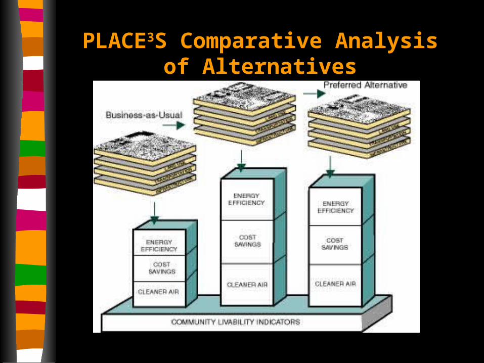
PLACE3S Comparative Analysis of Alternatives
Examples of PLACE3S
Applications
- Program Development -
Examples of Applications
Regional and local - quick tour Think about value of your program
being active in projects early– technical assistance?– data oversight?– higher quality requests for assistance and
mandate compliance?– cost and benefit tracking?
San Diego Regional Energy Plan & Growth Management Strategy
1993/94 - first regional project
Contrast resource efficiency of Regional
Growth Management Strategy alternatives
Integrate elements of RGMS
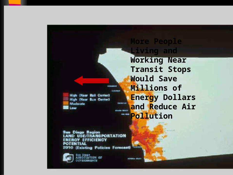
More People Living and Working Near Transit Stops Would Save Millions of Energy Dollars and Reduce Air Pollution

Regional Summary of
Adopted General Plans Show that they Do Only a
Fair Job of Linking Land
Uses to Transportation
and Transit Systems
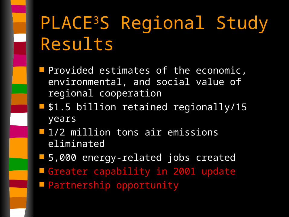
PLACE3S Regional Study Results Provided estimates of the economic,
environmental, and social value of regional cooperation
$1.5 billion retained regionally/15 years 1/2 million tons air emissions eliminated 5,000 energy-related jobs created Greater capability in 2001 update Partnership opportunity

Brownfield
Greenfield
US EPA Greenfield vs. Brownfield Impact Study
Downtown San Diego

Results of this study ... average driving time 48% less traffic congestion 75% lower household travel costs & energy use 45%
lower per dwelling unit infrastructure costs 90%
lower greenhouse gas emissions 45% less
…could improve intra-regional negotiating capability
Local/Neighborhood PLACE3S Projects Euclid area, Southeast San Diego El Cajon Blvd. Business Improvement
District and I-15 completion Sacramento San Luis Obispo


Gompers’ Students did Research and Planning

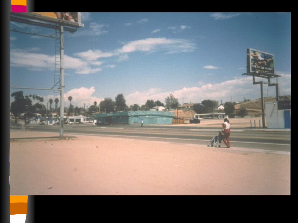
Transportation and Neighborhood Revitalization
18-Acre Retail/Residential
Trolley Station
SchoolLibrary
Community Center
Grocery

Mid City Transit Interchanges Project (MCTIP)
Initiated by Business Community to Increase Sustainability and Boost Economic Development

Mid City PLACE3S Partners El Cajon Blvd and City
Heights Business Improvement Assns.
Three Neighborhood Planning Associations
City of San Diego - Multiple Departments
San Diego City Schools MTDB (Bus and Trolley) SANDAG ESRI
San Diego State Univ. San Diego Energy
Resource Office CA Energy Commission Caltrans Contract:
– McKeever/Morris a division of Parsons Brinckerhoff
– Fregonese/Calthorpe – USC Center for Economic
Development

Eight Caltrans Excess Parcels in PLACE3S Tier One
El Cajon Blvd. Mini Decks
University Ave. Mini Decks
Full City Block of Park Deck “Freeway Cap”
Immediate Development Opportunities in Mid City
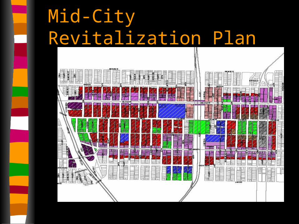
Mid-City Revitalization Plan


Experts interacting with citizens

Economic Analysis to find best real employment options Dr. Ed Blakely, USC Center for
Economic Development Matched regional economic cluster
trends with local skills = highest paying realistic new jobs
Outcome: Focused plan for attracting employers
www-rcf.usc.edu/~bahl

Use GIS to link Good Plan with Investment Reality
Redevelopment Reality Check

Redevelopment “Hot Spots”
Same technique could be used for many other functions

Dwelling Units and Jobs
Compare quantitatively the effect of economic (or environmental, or social)
reality on a Community Plan

Outcome Citizens and decision makers become
better informed Learn to use indicators of relative
difference among alternatives Understand integration of resource and
economic numbers Integrated decision makers - better long
term resource management
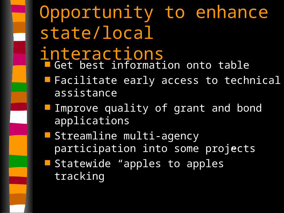
Opportunity to enhance state/local interactions Get best information onto table Facilitate early access to technical
assistance Improve quality of grant and bond
applications Streamline multi-agency participation into
some projects Statewide “apples to apples” tracking

Opportunity to broaden PLACE3S issues & measurements Phase two development starting Clarifying statewide GIS status Could include your agency’s parameters
– drop down menu– embeded web links– “how to” wizzards

Ideas for
Inter-Agency Partnerships

Ideas for Inter-agency Partnerships Simple - include parameters into
existing PLACE3S program. – Communities use when apply method
Comprehensive - Custom Program– Develop specialized software for large and
common uses (general plans, master plans, regional transportation plans, economic development plans, etc.)

Example of simple partnership -Cool Communities Program Goal - reduce urban heat islands with light
color surfaces and shading– Measure sq.ft. of roof area and pavement in
each alternative– Estimate amount that can be light colored in
each alternative– Calculate the cost savings, emissions
reductions, energy savings of each alternative – Add to PLACE3S energy menu

Comprehensive Example - General Plan Update Idea State agencies contribute / oversee General
Plan tool development Outcome is a standardized method Accessed via web Directs locals to best information and agency-
approved methods Could streamline funding applications Track implementation, costs, and benefits over
time and statewide

Roundtable Discussion
State Agency Smart Growth / Sustainable Resource Management Agenda Items
Ideas for working together

Next Steps
One - on - one meetings to define specific interests / issues?
Return of this group?
Create Interagency Working Group?