Embed Size (px)
Citation preview

Build and calibration of SWAT
model in basin-wide watershed
Majid Fereidoon
Design Point
1
5
6
3
2
1aaaa
4
Department of Geotechnology and Geohydraulics
University of Kassel

Which Model Should be Used?
It Depends on:
– What time scale are you working at?
– What hydrologic quantity are you trying to
obtain?
– What data do you have for your watershed?
– How fast of a computer do you have?
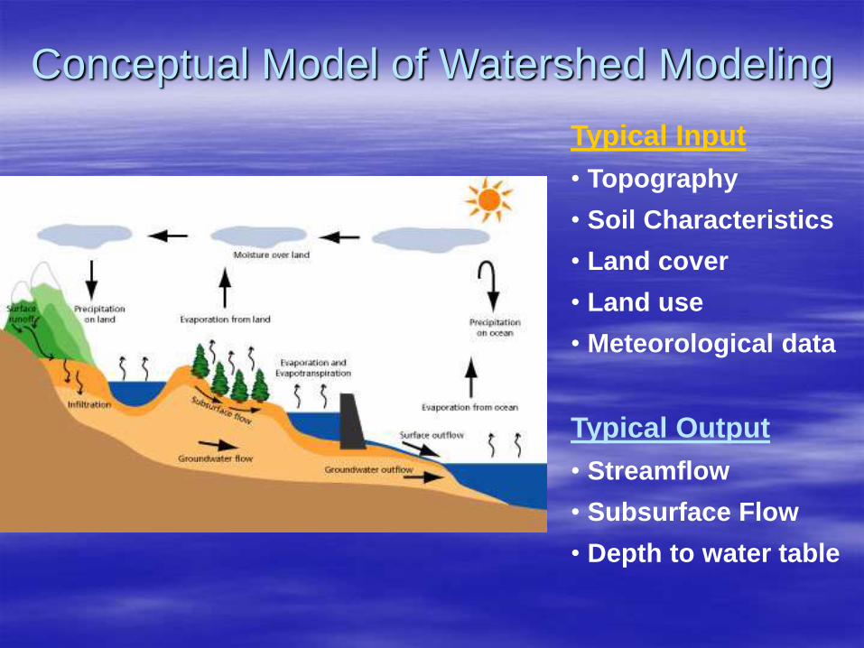
Conceptual Model of Watershed Modeling
Typical Input
• Topography
• Soil Characteristics
• Land cover
• Land use
• Meteorological data
Typical Output
• Streamflow
• Subsurface Flow
• Depth to water table
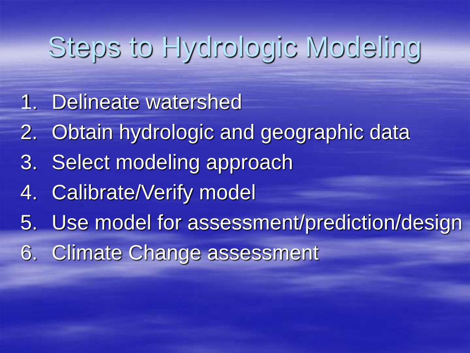
Steps to Hydrologic Modeling
1. Delineate watershed
2. Obtain hydrologic and geographic data
3. Select modeling approach
4. Calibrate/Verify model
5. Use model for assessment/prediction/design
6. Climate Change assessment

What is a Watershed? Area that topographically contributes to the
drainage to a point of interest
Natural Watershed
Points of Interest
• Road crossing
• Stream gage
• Reservoir inlet
• Wastewater treatment plant
• Location of stream restoration
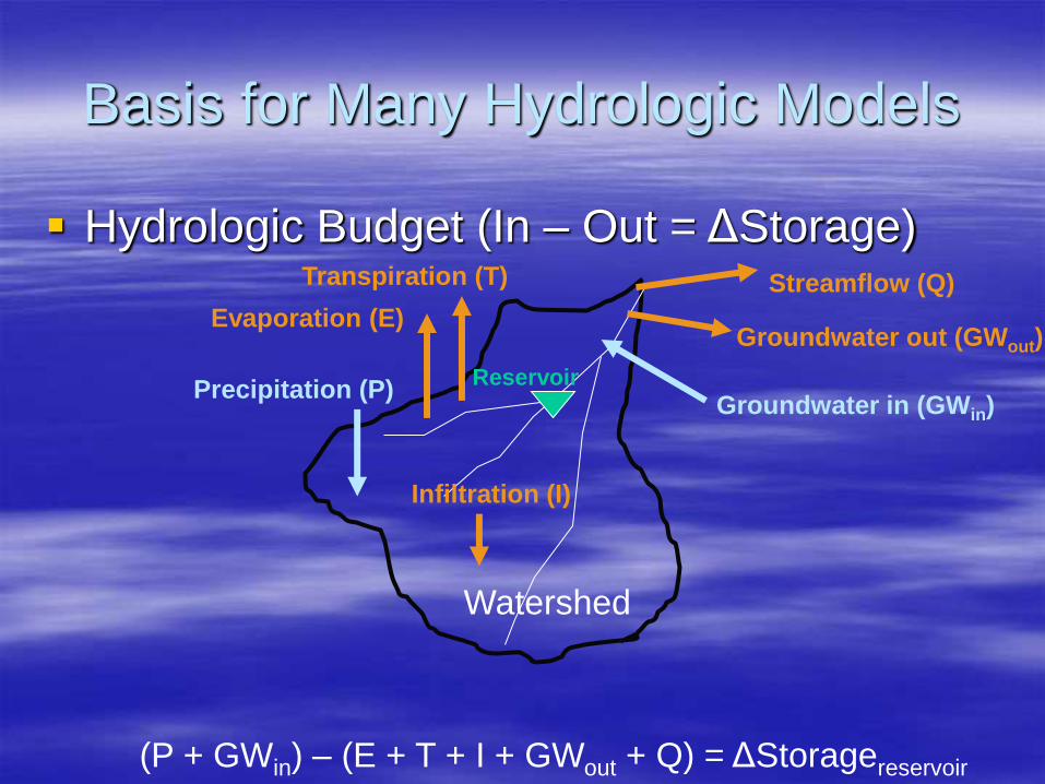
Basis for Many Hydrologic Models
Hydrologic Budget (In – Out = ΔStorage)
Watershed
Precipitation (P) Groundwater in (GWin)
Evaporation (E)
Transpiration (T) Streamflow (Q)
Groundwater out (GWout)
Reservoir
Infiltration (I)
(P + GWin) – (E + T + I + GWout + Q) = ΔStoragereservoir
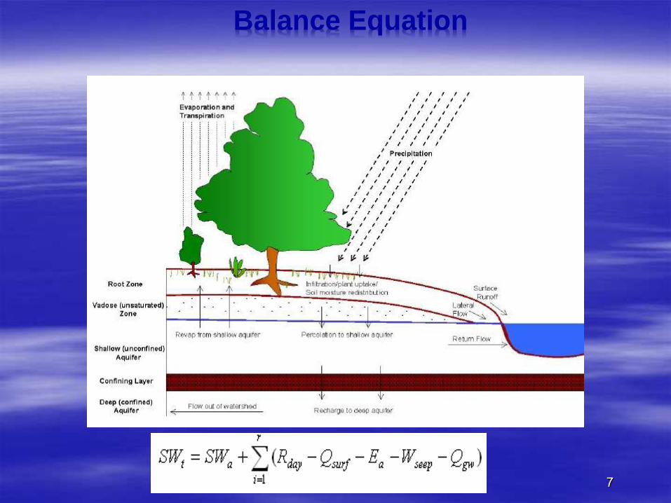
Balance Equation
7

SWAT Soil & water Assessment Tool
8
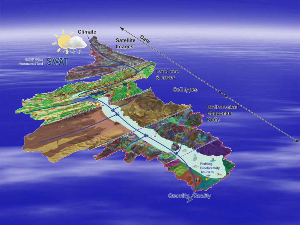

SWAT (Soil and Water Assessment Tool) is a
comprehensive, semi-distributed river basin
model that requires a large number of input
parameters, which complicates model
parameterization and calibration. It predicts the
impact of land management practices on water,
sediment and agricultural chemical yields in
large complex watersheds with varying soils,
land use and management conditions over long
periods of time.
SWAT- Hydrological Modeling

Spatial Scaling of Models Lumped Parameters assigned to
each subbasin
A1 A2
A3
Fully-Distributed Parameters assigned to
each grid cell
Semi-Distributed Parameters assigned to
each grid cell, but cells
with same parameters are
grouped

Digital Elevation Model (DEM)
Digital file that stores the elevation of the land
surface a specified grid cell size (e.g., 90 meters)
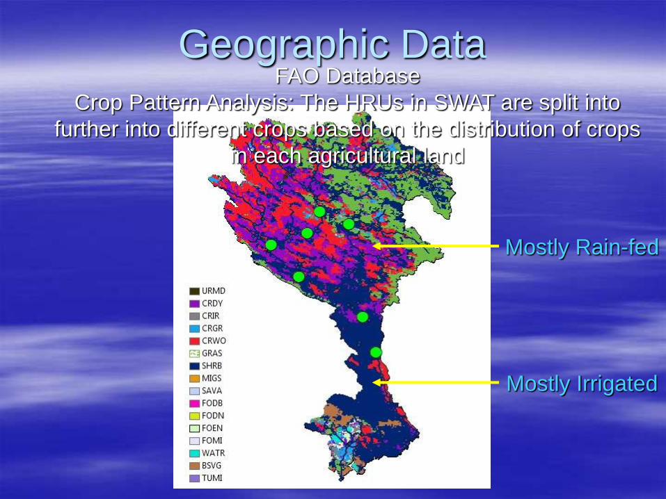
Geographic Data FAO Database
Crop Pattern Analysis: The HRUs in SWAT are split into
further into different crops based on the distribution of crops
in each agricultural land
Mostly Rain-fed
Mostly Irrigated
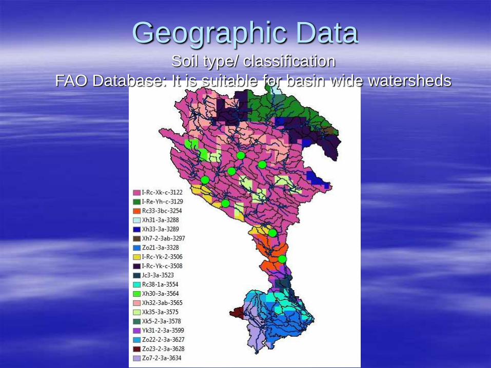
Soil type/ classification
FAO Database: It is suitable for basin wide watersheds
Geographic Data
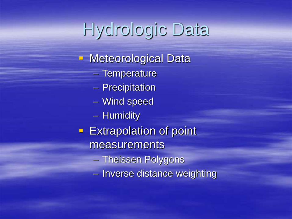
Hydrologic Data
Meteorological Data
– Temperature
– Precipitation
– Wind speed
– Humidity
Extrapolation of point
measurements
– Theissen Polygons
– Inverse distance weighting

Hydrologic Data
Hydrologic Data
– Streamflow
Peak discharge
Monthy flow volume
Annual flow volume
– Soil moisture
– Groundwater level

÷
One of the most important basins
in Iran in terms of Surface and
groundwater resources,
agriculture potential, hydropower
generation,…
16000 MCM of potential storage
capacity 40% percent of which
has been constructed
17
Karkheh River Basin
Area: 5100000 Hectar
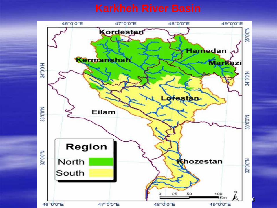
18
Karkheh River Basin
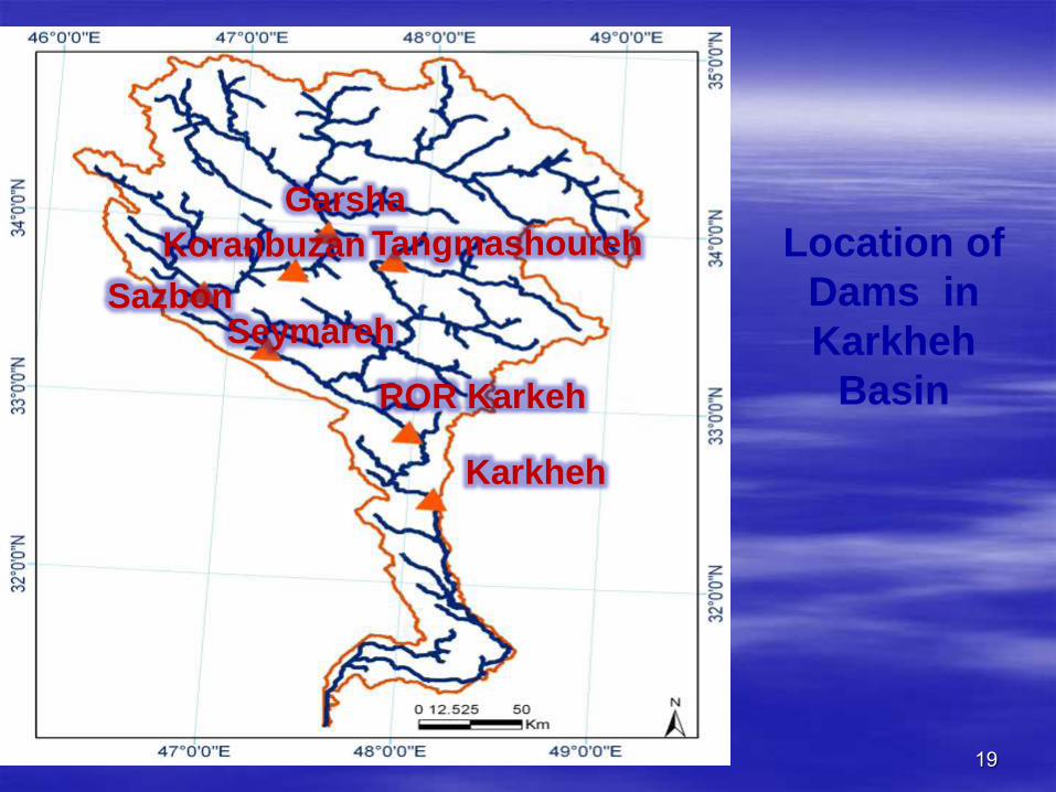
Tangmashoureh Garsha
Seymareh
Koranbuzan Sazbon
ROR Karkeh
Karkheh
19
Location of
Dams in
Karkheh
Basin
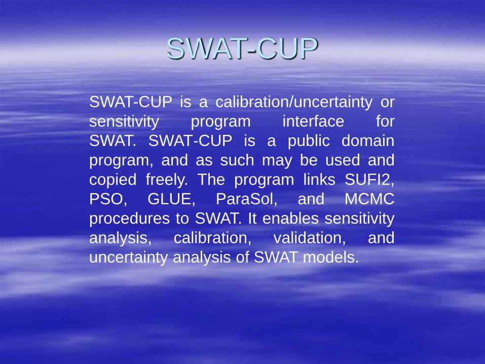
SWAT-CUP
SWAT-CUP is a calibration/uncertainty or
sensitivity program interface for
SWAT. SWAT‐CUP is a public domain
program, and as such may be used and
copied freely. The program links SUFI2,
PSO, GLUE, ParaSol, and MCMC
procedures to SWAT. It enables sensitivity
analysis, calibration, validation, and
uncertainty analysis of SWAT models.
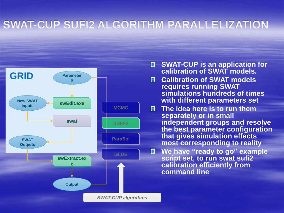
SWAT-CUP SUFI2 ALGORITHM PARALLELIZATION
SWAT-CUP is an application for calibration of SWAT models.
Calibration of SWAT models requires running SWAT simulations hundreds of times with different parameters set
The idea here is to run them separately or in small independent groups and resolve the best parameter configuration that gives simulation effects most corresponding to reality
We have “ready to go” example script set, to run swat sufi2 calibration efficiently from command line
Parameter
s
New SWAT
Inputs
SWAT
Outputs
swEdit.exe
swExtract.ex
e
swat
Output
SUFI-2
MCMC
ParaSol
GLUE
GRID
SWAT-CUP algorithms
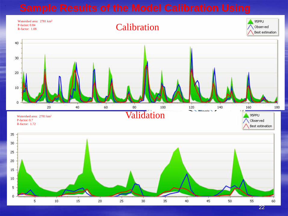
Calibration (1985-2000)
br2: 0.46
P-factor: 84%
R-factor: 1.08
Validation (2000-2004)
br2: 0.23
P-factor: 70%
R-factor: 1.72
Aran Station 8 Hydrometric Stations used
Sample Results of the Model Calibration Using SUFI
22
Watershed area: 2781 km2
P-factor: 0.84
R-factor: 1.08
Watershed area: 2781 km2
P-factor: 0.7
R-factor: 1.72
Calibration
Validation
Karkheh river basin has been suffering from
drought since 1999and as can be seen it has
affected the validation period of time

Sensitive Parameters Management
– Curve number
Ground water
– Threshold depth of water in the shallow aquifer required
for return flow to occur
– Ground water “ revap “ coefficient
– Initial depth of water in shallow aquifer
– Ground water delay time
Soil parameters
– Hydraulic conductivity
– Available water capacity of the soil layer
– Moist bulk density
Use of Models and Goals ahead
Assessment
– What happens if land use/land cover is
changed?
Prediction
– Flood forecasting
– Crop pattern analysis
Design
– Climate change impacts on river basin

QUESTIONS