Embed Size (px)
Citation preview
Bringing GEOSS services into practice
1 May 2014GEO Work Plan SymposiumGeneva
Pierre LacroixGrégory Giuliani
University of GenevaUNEP/GRID-Geneva
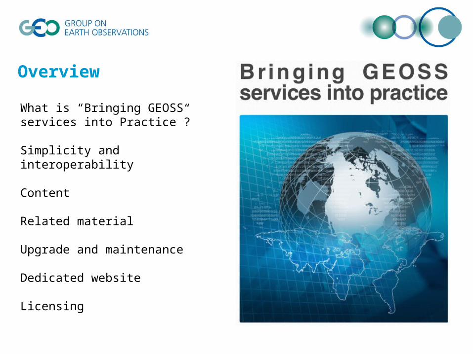
Overview
What is “Bringing GEOSS services into Practice”?
Simplicity and interoperability
Content
Related material
Upgrade and maintenance
Dedicated website
Licensing
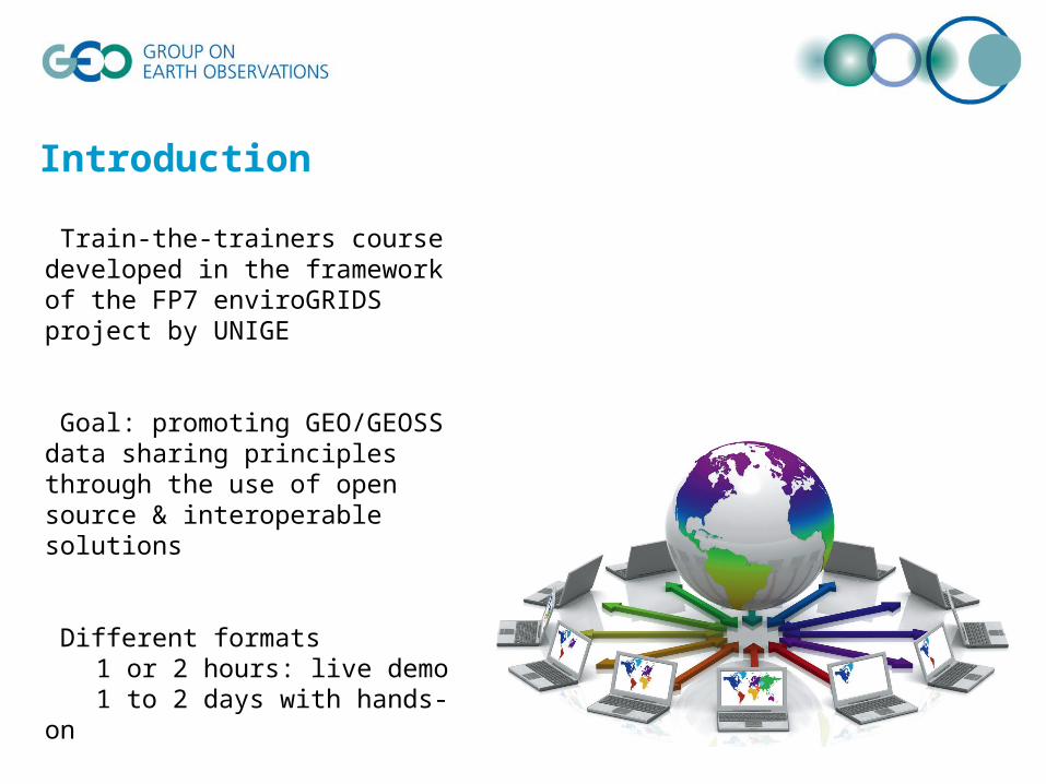
Introduction
Train-the-trainers course developed in the framework of the FP7 enviroGRIDS project by UNIGE
Goal: promoting GEO/GEOSS data sharing principles through the use of open source & interoperable solutions
Different formats1 or 2 hours: live demo1 to 2 days with hands-on
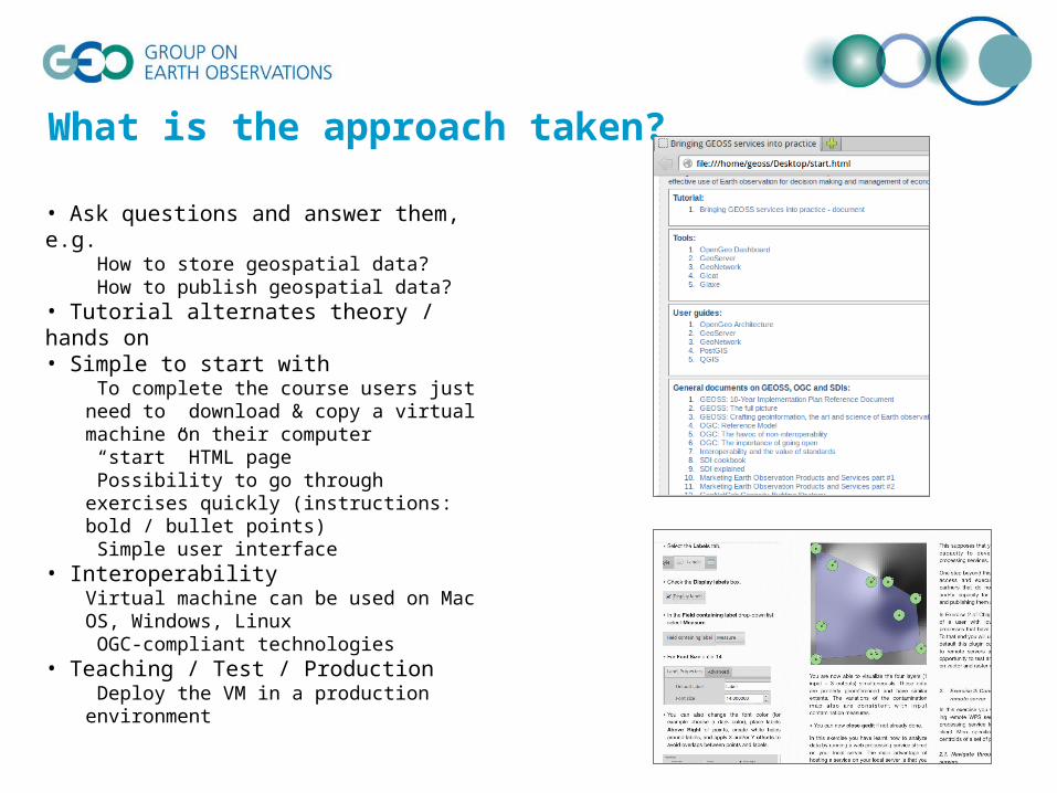
What is the approach taken?
• Ask questions and answer them, e.g. How to store geospatial data? How to publish geospatial data?
• Tutorial alternates theory / hands on• Simple to start with
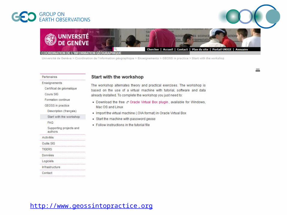
To complete the course users just need to download & copy a virtual machine on their computer “start” HTML page Possibility to go through exercises quickly (instructions: bold / bullet points) Simple user interface
• InteroperabilityVirtual machine can be used on Mac OS, Windows, Linux OGC-compliant technologies
• Teaching / Test / Production Deploy the VM in a production environment

5
Course content
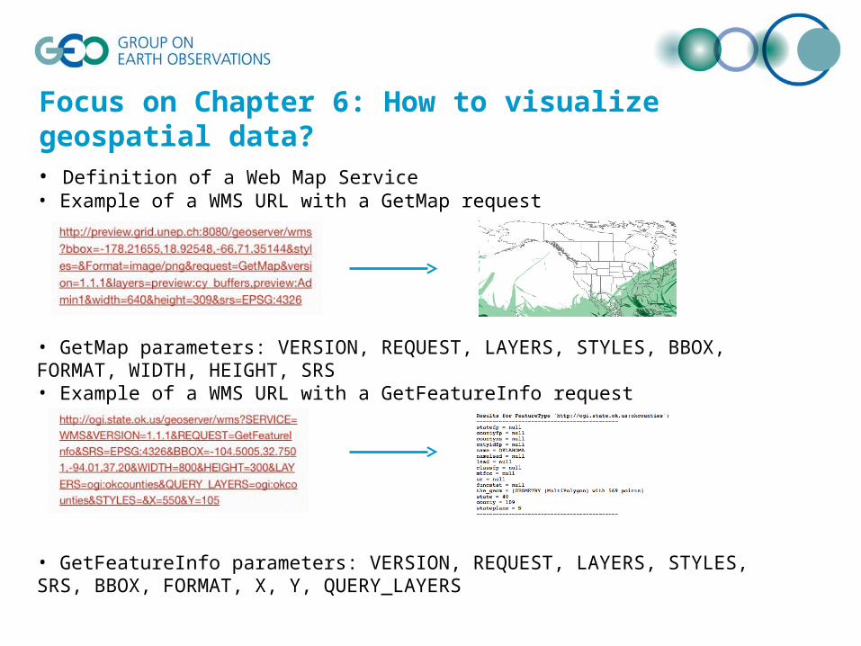
Focus on Chapter 6: How to visualize geospatial data?
• Definition of a Web Map Service• Example of a WMS URL with a GetMap request
• GetMap parameters: VERSION, REQUEST, LAYERS, STYLES, BBOX, FORMAT, WIDTH, HEIGHT, SRS • Example of a WMS URL with a GetFeatureInfo request
• GetFeatureInfo parameters: VERSION, REQUEST, LAYERS, STYLES, SRS, BBOX, FORMAT, X, Y, QUERY_LAYERS
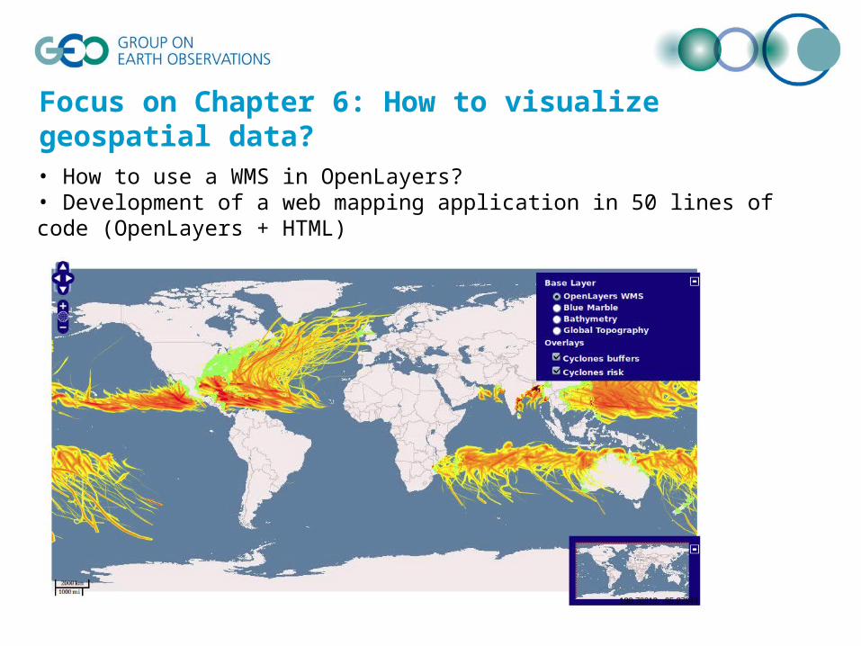
Focus on Chapter 6: How to visualize geospatial data?
• How to use a WMS in OpenLayers?• Development of a web mapping application in 50 lines of code (OpenLayers + HTML)
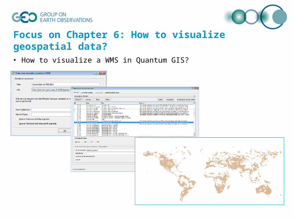
Focus on Chapter 6: How to visualize geospatial data?
• How to visualize a WMS in Quantum GIS?
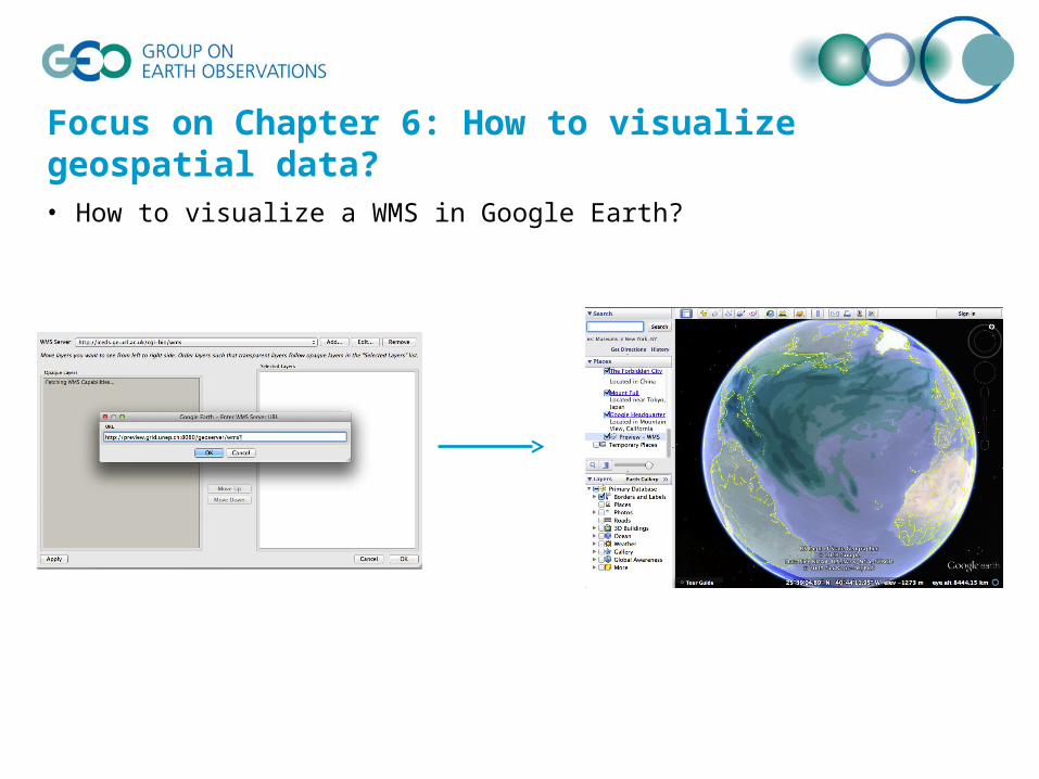
Focus on Chapter 6: How to visualize geospatial data?
• How to visualize a WMS in Google Earth?

Material
• eBook on Apple iBookstore and Google Play Books
• Virtual machine
• All software / tutorial / test data already installed
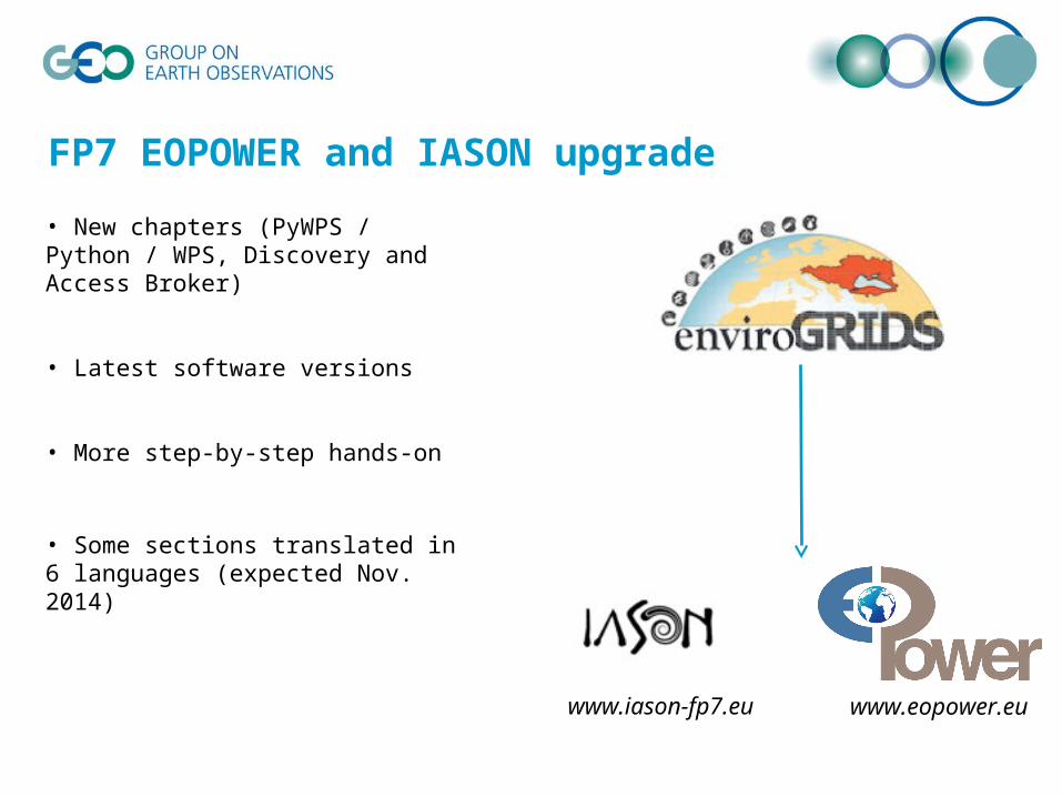
FP7 EOPOWER and IASON upgrade
• New chapters (PyWPS / Python / WPS, Discovery and Access Broker)
• Latest software versions
• More step-by-step hands-on
• Some sections translated in 6 languages (expected Nov. 2014)
www.iason-fp7.eu www.eopower.eu

http://www.geossintopractice.org
Already 400
attendees in 11
workshops
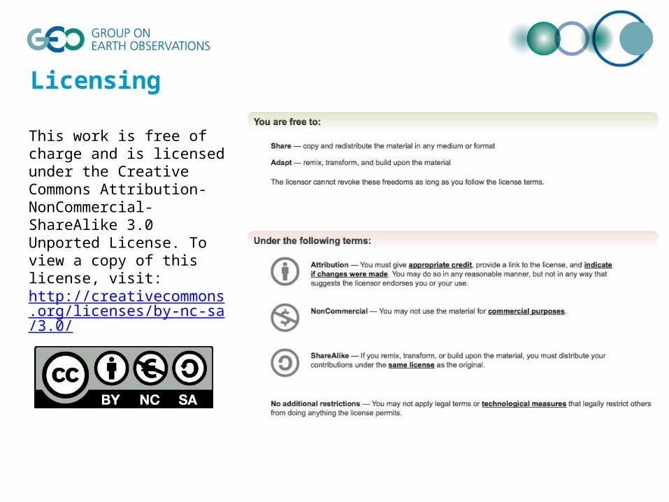
This work is free of charge and is licensed under the Creative Commons Attribution-NonCommercial-ShareAlike 3.0 Unported License. To view a copy of this license, visit: http://creativecommons.org/licenses/by-nc-sa/3.0/
Licensing
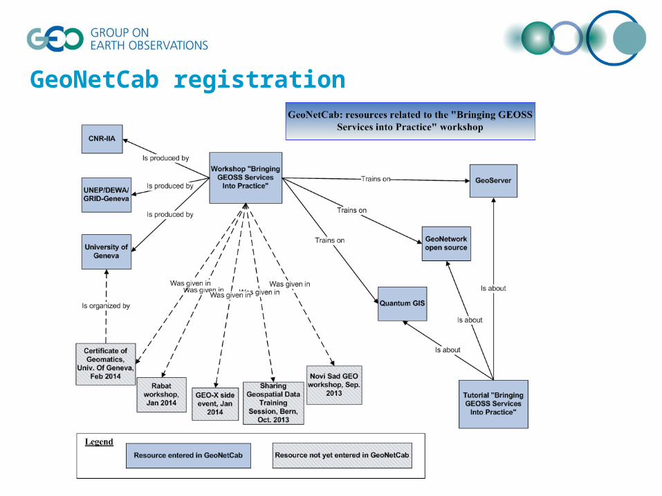
GeoNetCab registration

Partners involved