Embed Size (px)
DESCRIPTION
Beautiful Tourist guide for foreigners wanting to visit breathtaking landscapes from Brazil.
Citation preview

3
visitbrasil.com
Tourist Guide
4 5
Dados Internacionais de Catalogação na Publicação (CIP)(Câmara Brasileira do Livro, SP, Brasil)
Brasil : tourist guide 2012. -- 1. ed. -- São Paulo : Empresa Brasileira de Com. e Produções, 2012.
Vários autores.
1. Brasil - Descrição e viagens - Guias 2. Turismo - Brasil.
12-09290 CDD-918.1
Índices para catálogo sistemático:
1. Brasil : Guias turísticos 918.1
Tourist Guide
visitbrasil.com

How to use6 7
How to use this guideWelcome to City Guide 2012. With it, you’ll be able to take full advantage of all the attractions that Brazil has to offer in its 27 states. With maps, photos and suggestions of attractions, you will get to know in depth this country of great and beautiful contrasts.
1 - State name2 - Images highlight what is most
popular in each locality3 - Illustrations exemplify
characteristics and typical symbols of the states
4 - Each state has a specific color, which makes its location in the guide much easier
10 - The first city in each state is always its capital
11 - General information about the city symbolized by icons
12 - List with the description, location and characteristics of the main attractions
13 - Box highlighting regions, attractions, cuisine and traditions of great importance
14 - Maps highlighting the attractions in parks and cities
15 - Explanatory captions16 - Picture credits
Step by Step
IconS
IconS IntroductIon IconS attractIonS
Population Altitude Area - perimeter
Voltage Amount
Area code Airport
Temperature Climate Natural vegetation
Telephone Hours Wireless internet Full access for the disabled Partial access for the disabled Address Access Age Rating Time required for a visit Basic information
Admission Fee 1 to 10 Brazilian Reais 11 to 50 Brazilian Reais 51 to 100 Brazilian Reais more than 100
Brazilian Reais
12
3
4
5
6
77
8
9
10
1112
13
14
15
165 - The map locates the state
in Brazil 6 - State map with
major highways 7 - Map location captions 8 - State geographic information9 - Introductory text with
the highlights and history of the state
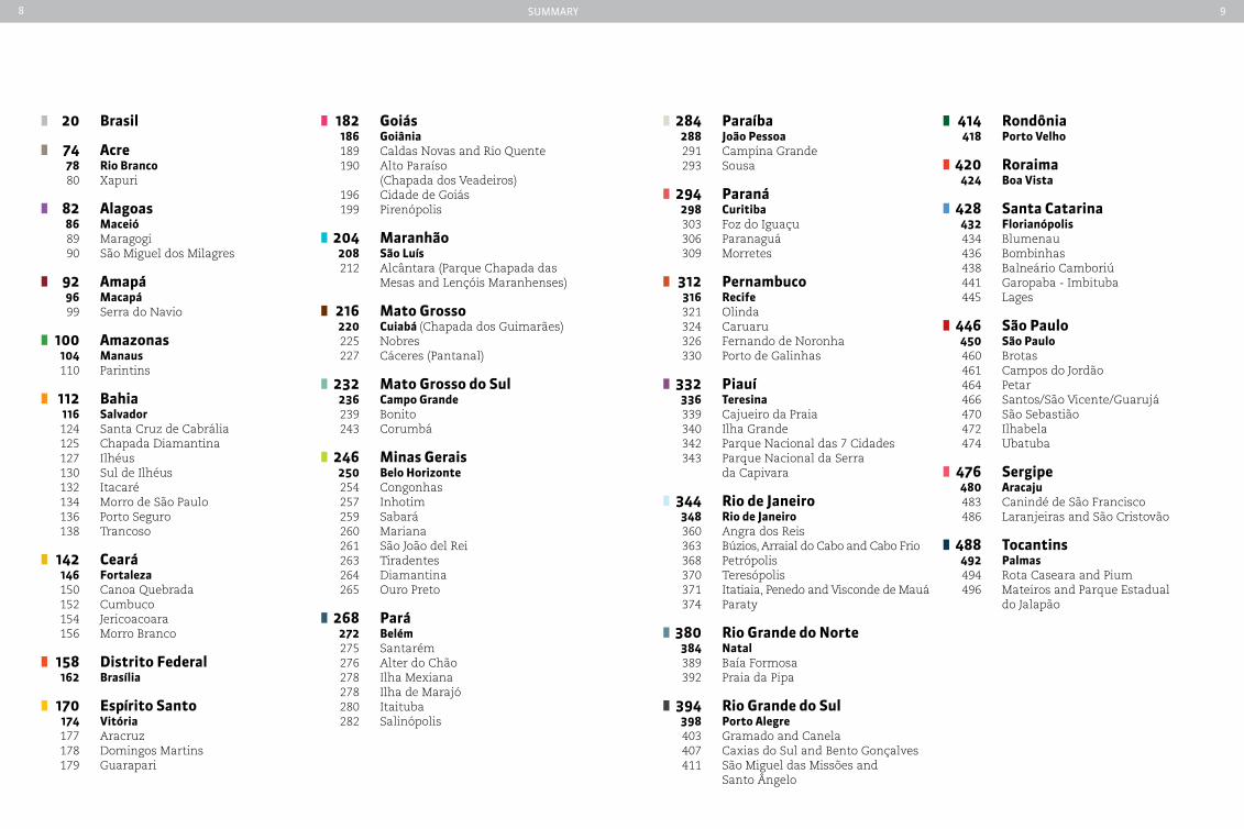
8 9summary
20 brasil
74 acre 78 rio branco 80 Xapuri
82 alagoas 86 Maceió 89 Maragogi 90 São Miguel dos Milagres
92 amapá 96 Macapá 99 Serra do Navio
100 amazonas 104 Manaus 110 Parintins
112 bahia 116 Salvador 124 Santa Cruz de Cabrália
125 Chapada Diamantina 127 Ilhéus 130 Sul de Ilhéus 132 Itacaré 134 Morro de São Paulo 136 Porto Seguro 138 Trancoso 142 ceará 146 Fortaleza
150 Canoa Quebrada 152 Cumbuco 154 Jericoacoara 156 Morro Branco 158 distrito Federal 162 brasília
170 espírito Santo 174 Vitória 177 Aracruz 178 Domingos Martins 179 Guarapari
182 Goiás 186 Goiânia
189 Caldas Novas and Rio Quente 190 Alto Paraíso (Chapada dos Veadeiros) 196 Cidade de Goiás 199 Pirenópolis 204 Maranhão 208 São Luís 212 Alcântara (Parque Chapada das Mesas and Lençóis Maranhenses) 216 Mato Grosso
220 cuiabá (Chapada dos Guimarães) 225 Nobres 227 Cáceres (Pantanal) 232 Mato Grosso do Sul 236 campo Grande
239 Bonito 243 Corumbá 246 Minas Gerais 250 belo Horizonte
254 Congonhas 257 Inhotim 259 Sabará 260 Mariana 261 São João del Rei 263 Tiradentes 264 Diamantina 265 Ouro Preto
268 pará 272 belém
275 Santarém 276 Alter do Chão 278 Ilha Mexiana 278 Ilha de Marajó 280 Itaituba 282 Salinópolis
284 paraíba 288 João pessoa 291 Campina Grande 293 Sousa
294 paraná 298 curitiba
303 Foz do Iguaçu 306 Paranaguá 309 Morretes
312 pernambuco 316 recife 321 Olinda 324 Caruaru 326 Fernando de Noronha 330 Porto de Galinhas
332 piauí 336 teresina
339 Cajueiro da Praia 340 Ilha Grande 342 Parque Nacional das 7 Cidades 343 Parque Nacional da Serra da Capivara
344 rio de Janeiro 348 rio de Janeiro 360 Angra dos Reis
363 Búzios, Arraial do Cabo and Cabo Frio 368 Petrópolis 370 Teresópolis 371 Itatiaia, Penedo and Visconde de Mauá 374 Paraty
380 rio Grande do norte 384 natal 389 Baía Formosa
392 Praia da Pipa
394 rio Grande do Sul 398 porto alegre 403 Gramado and Canela
407 Caxias do Sul and Bento Gonçalves 411 São Miguel das Missões and Santo Ângelo
414 rondônia 418 porto Velho
420 roraima 424 boa Vista
428 Santa catarina 432 Florianópolis 434 Blumenau 436 Bombinhas
438 Balneário Camboriú 441 Garopaba - Imbituba 445 Lages
446 São paulo 450 São paulo 460 Brotas
461 Campos do Jordão 464 Petar 466 Santos/São Vicente/Guarujá 470 São Sebastião 472 Ilhabela 474 Ubatuba 476 Sergipe 480 aracaju 483 Canindé de São Francisco 486 Laranjeiras and São Cristovão
488 tocantins 492 palmas 494 Rota Caseara and Pium 496 Mateiros and Parque Estadual do Jalapão
10 11
Clef
erso
n C
om
ar
ela
Ba
rB
osa
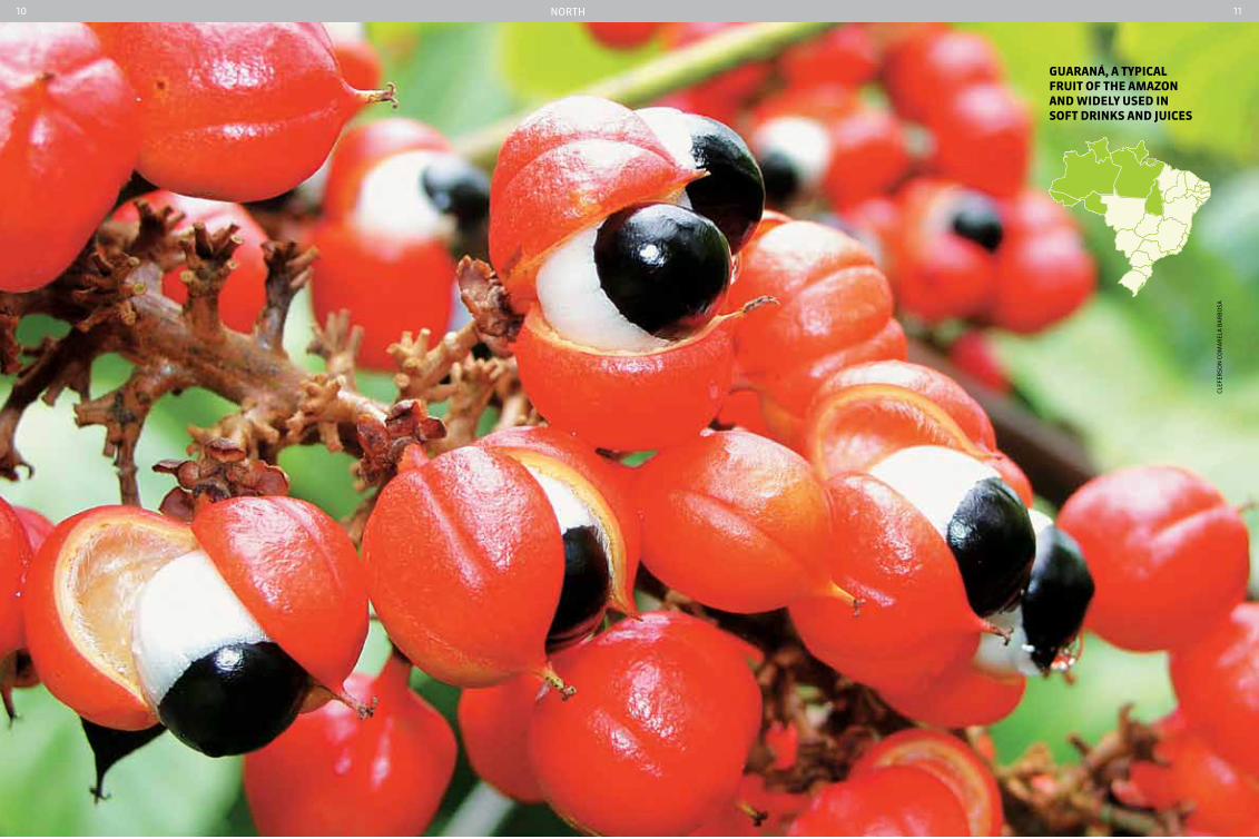
Guaraná, a typIcaL FruIt oF tHe aMazon and wIdeLy uSed In SoFt drInkS and JuIceS
nortH
12 13
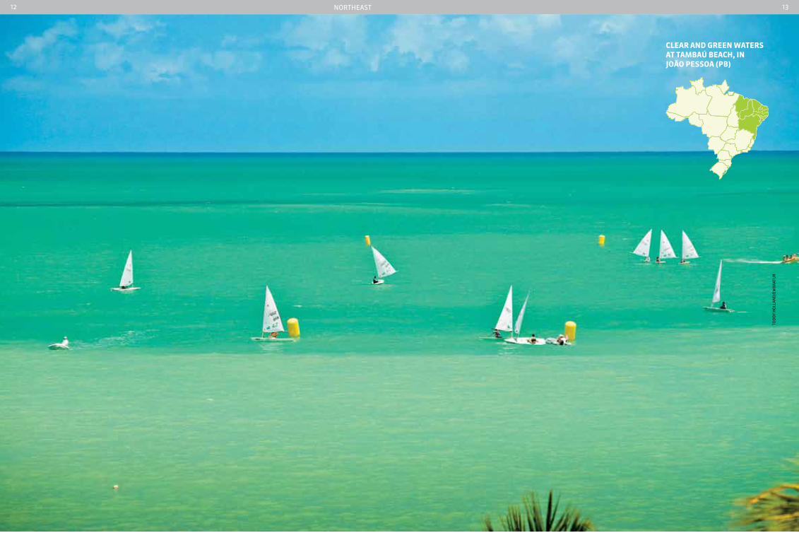
cLear and Green waterS at taMbaú beacH, In João peSSoa (pb)
tod
dy
Ho
lla
nd
/em
Br
atu
r
nortHeast

14 15Center-west
dIVer In tHe cLear waterS oF tHe LaGoa MISterIoSa, bonIto, Mato GroSSo do SuL
ma
rCe
lo K
ra
use
16 17soutHeast
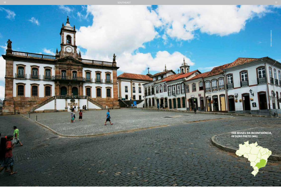
tHe MuSeu da InconFIdÊncIa, In ouro preto (MG)
nen
o V
ian
na
/ em
Br
atu
r

18 19soutH
VIneyard In tHe reGIon oF wIne productIon, In rIo Grande do SuL
Cris
tia
no
so
ar
es/e
mB
rat
ur
21263
brazIL
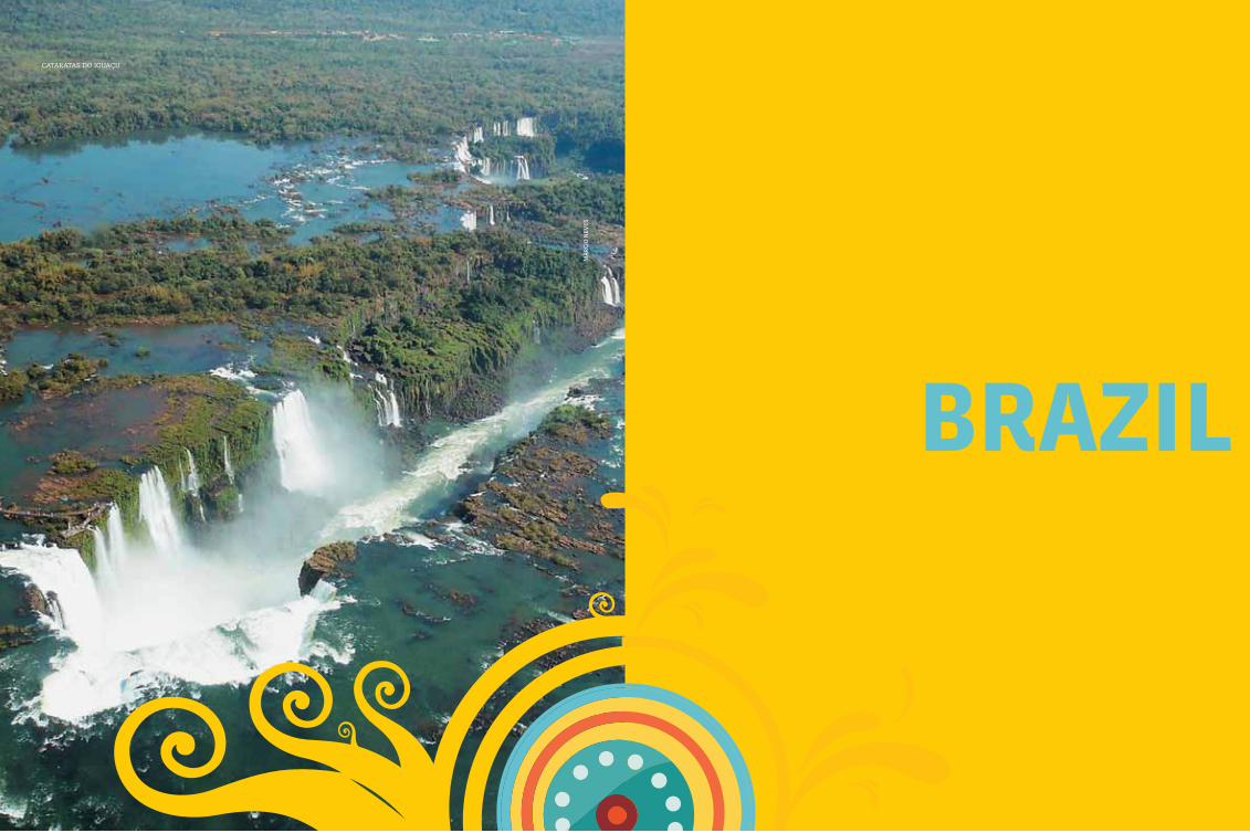
cataratas do iguaçu
ma
rCi
o n
eVes
Brazil22 23
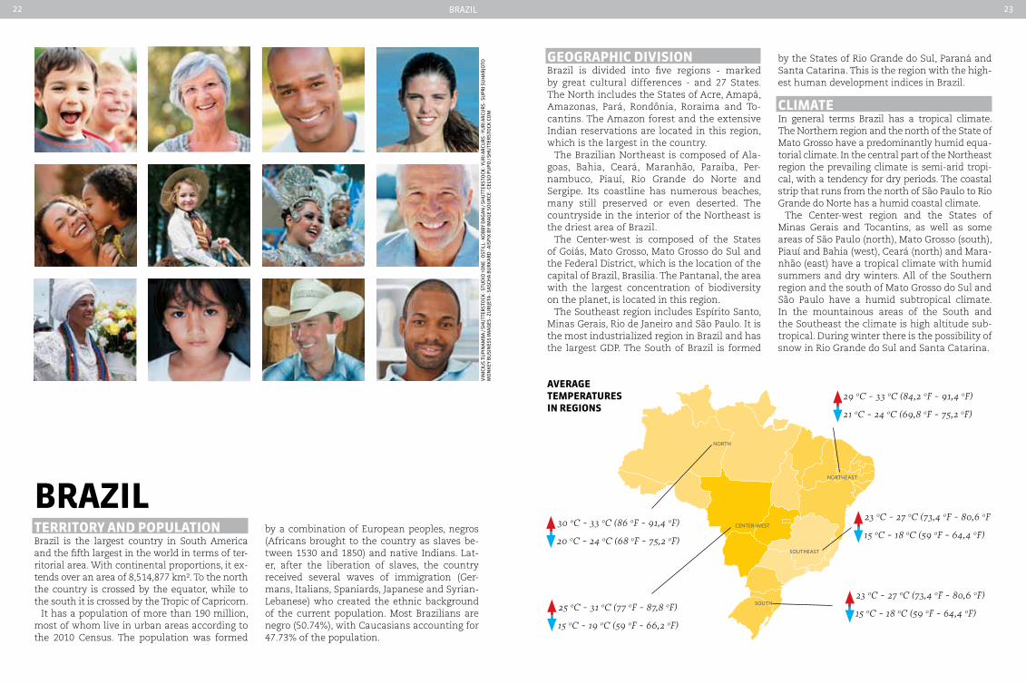
brazILterrItory and popuLatIonBrazil is the largest country in South America and the fifth largest in the world in terms of ter-ritorial area. With continental proportions, it ex-tends over an area of 8,514,877 km². To the north the country is crossed by the equator, while to the south it is crossed by the Tropic of Capricorn.
It has a population of more than 190 million, most of whom live in urban areas according to the 2010 Census. The population was formed
GeoGrapHIc dIVISIonBrazil is divided into five regions - marked by great cultural differences - and 27 States. The North includes the States of Acre, Amapá, Amazonas, Pará, Rondônia, Roraima and To-cantins. The Amazon forest and the extensive Indian reservations are located in this region, which is the largest in the country.
The Brazilian Northeast is composed of Ala-goas, Bahia, Ceará, Maranhão, Paraiba, Per-nambuco, Piauí, Rio Grande do Norte and Sergipe. Its coastline has numerous beaches, many still preserved or even deserted. The countryside in the interior of the Northeast is the driest area of Brazil.
The Center-west is composed of the States of Goiás, Mato Grosso, Mato Grosso do Sul and the Federal District, which is the location of the capital of Brazil, Brasilia. The Pantanal, the area with the largest concentration of biodiversity on the planet, is located in this region.
The Southeast region includes Espírito Santo, Minas Gerais, Rio de Janeiro and São Paulo. It is the most industrialized region in Brazil and has the largest GDP. The South of Brazil is formed
by the States of Rio Grande do Sul, Paraná and Santa Catarina. This is the region with the high-est human development indices in Brazil.
cLIMateIn general terms Brazil has a tropical climate. The Northern region and the north of the State of Mato Grosso have a predominantly humid equa-torial climate. In the central part of the Northeast region the prevailing climate is semi-arid tropi-cal, with a tendency for dry periods. The coastal strip that runs from the north of São Paulo to Rio Grande do Norte has a humid coastal climate.
The Center-west region and the States of Minas Gerais and Tocantins, as well as some areas of São Paulo (north), Mato Grosso (south), Piauí and Bahia (west), Ceará (north) and Mara-nhão (east) have a tropical climate with humid summers and dry winters. All of the Southern region and the south of Mato Grosso do Sul and São Paulo have a humid subtropical climate. In the mountainous areas of the South and the Southeast the climate is high altitude sub-tropical. During winter there is the possibility of snow in Rio Grande do Sul and Santa Catarina.
by a combination of European peoples, negros (Africans brought to the country as slaves be-tween 1530 and 1850) and native Indians. Lat-er, after the liberation of slaves, the country received several waves of immigration (Ger-mans, Italians, Spaniards, Japanese and Syrian-Lebanese) who created the ethnic background of the current population. Most Brazilians are negro (50.74%), with Caucasians accounting for 47.73% of the population.
Center-west
nOrtH
nOrtHeAst
sOUtH
sOUtHeAst
aVeraGeteMperatureSIn reGIonS
21 0c - 24 0c (69,8 0F - 75,2 0F)
29 0c - 33 0c (84,2 0F - 91,4 0F)
15 0c - 18 0c (59 0F - 64,4 0F)
23 0c - 27 0c (73,4 0F - 80,6 0F
20 0c - 24 0c (68 0F - 75,2 0F)
30 0c - 33 0c (86 0F - 91,4 0F)
15 0c - 18 0c (59 0F - 64,4 0F)
23 0c - 27 0c (73,4 0F - 80,6 0F)
15 0c - 19 0c (59 0F - 66,2 0F)
25 0c - 31 0c (77 0F - 87,8 0F)
Vin
iCiu
s tu
pin
amB
a / s
Hu
tter
sto
CK -
stu
dio
1on
e - o
stil
l - K
oB
By
dag
an /
sHu
tter
sto
CK -
yur
i ar
Cur
s - y
ur
i ar
Cur
s - s
upr
i su
Har
joto
m
on
Key
Bu
sin
ess
imag
es -
zur
ijeta
- sa
sCH
a B
ur
Kar
d -
aisp
iX B
y im
age
sou
rCe
- Ce
lso
pu
po /
sHu
tter
sto
CK.C
om
Brazil24 25
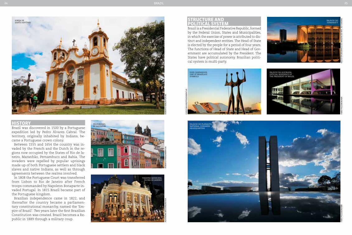
HIStoryBrazil was discovered in 1500 by a Portuguese expedition led by Pedro Álvares Cabral. The territory, originally inhabited by Indians, be-came a Portuguese crown colony.
Between 1555 and 1654 the country was in-vaded by the French and the Dutch in the re-gions now occupied by the States of Rio de Ja-neiro, Maranhão, Pernambuco and Bahia. The invaders were repelled by popular uprisings made up of both Portuguese settlers and black slaves and native Indians, as well as through agreements between the realms involved.
In 1808 the Portuguese Court was transferred from Lisbon to Rio de Janeiro after French troops commanded by Napoleon Bonaparte in-vaded Portugal. In 1815 Brazil became part of the Portuguese kingdom.
Brazilian independence came in 1822, and thereafter the country became a parliamen-tary constitutional monarchy, named the ‘Em-pire of Brazil’. Two years later the first Brazilian Constitution was created. Brazil becomes a Re-public in 1889 through a military coup.
igreja de santo antônio
Palácio do Planalto, national congress headquarters
Palácio do itamaraty
Pelourinho, in salvador
Palácio da alvorada official residence of the President of Brazil
dois candangos, one of Brasília’s symBols
theatro municiPal do rio de janeiro
ro
Ber
to s
eBa
/set
ur
mg
faB
io p
ozz
eBo
m/a
Br
faB
io p
ozz
eBo
m/a
Br
CHr
isti
an
Kn
epp
er/e
mB
rat
ur
ale
Xan
dr
e m
aCi
eir
a/r
iotu
r
Ka
zuo
oK
uB
o/B
an
Co d
e im
ag
ens
do
min
. do
tu
ris
mo
ro
Ber
to f
ar
ia/e
mB
rat
ur
Structure and poLItIcaL SySteMBrazil is a Presidential Federative Republic, formed by the Federal Union, States and Municipalities, in which the exercise of power is attributed to dis-tinct and independent entities. The Head of State is elected by the people for a period of four years. The functions of Head of State and Head of Gov-ernment are accumulated by the President. The States have political autonomy. Brazilian politi-cal system is multi-party.
Brazil26 27
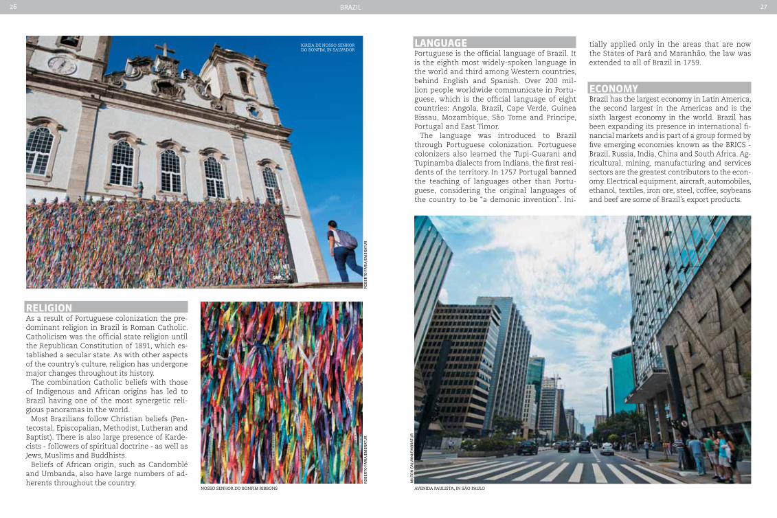
reLIGIonAs a result of Portuguese colonization the pre-dominant religion in Brazil is Roman Catholic. Catholicism was the official state religion until the Republican Constitution of 1891, which es-tablished a secular state. As with other aspects of the country’s culture, religion has undergone major changes throughout its history.
The combination Catholic beliefs with those of Indigenous and African origins has led to Brazil having one of the most synergetic reli-gious panoramas in the world.
Most Brazilians follow Christian beliefs (Pen-tecostal, Episcopalian, Methodist, Lutheran and Baptist). There is also large presence of Karde-cists - followers of spiritual doctrine - as well as Jews, Muslims and Buddhists.
Beliefs of African origin, such as Candomblé and Umbanda, also have large numbers of ad-herents throughout the country.
LanGuaGePortuguese is the official language of Brazil. It is the eighth most widely-spoken language in the world and third among Western countries, behind English and Spanish. Over 200 mil-lion people worldwide communicate in Portu-guese, which is the official language of eight countries: Angola, Brazil, Cape Verde, Guinea Bissau, Mozambique, São Tome and Principe, Portugal and East Timor.
The language was introduced to Brazil through Portuguese colonization. Portuguese colonizers also learned the Tupi-Guarani and Tupinamba dialects from Indians, the first resi-dents of the territory. In 1757 Portugal banned the teaching of languages other than Portu-guese, considering the original languages of the country to be “a demonic invention”. Ini-
igreja de nosso senhor do Bonfim, in salvador
nosso senhor do Bonfim riBBons
ro
Ber
to f
ar
ia/e
mB
rat
ur
ro
Ber
to f
ar
ia/e
mB
rat
ur
avenida Paulista, in são Paulo
mil
ton
ga
lVa
ni/
emB
rat
ur
tially applied only in the areas that are now the States of Pará and Maranhão, the law was extended to all of Brazil in 1759.
econoMyBrazil has the largest economy in Latin America, the second largest in the Americas and is the sixth largest economy in the world. Brazil has been expanding its presence in international fi-nancial markets and is part of a group formed by five emerging economies known as the BRICS - Brazil, Russia, India, China and South Africa. Ag-ricultural, mining, manufacturing and services sectors are the greatest contributors to the econ-omy. Electrical equipment, aircraft, automobiles, ethanol, textiles, iron ore, steel, coffee, soybeans and beef are some of Brazil’s export products.

Brazil28 29
currencyThe Brazilian currency is the Real. Instituted in 1994, it is available in notes with six denomina-tions: R$ 2, R$ 5, R$ 10, R$ 20, R$ 50 and R$ 100, as well as coins with a value of R$ 0.05, R$ 0.10, R$ 0.25, R$ 0.50 and R$ 1.00
brazILIan SIteS oF worLd cuLturaL HerItaGe
tHe cIty oF rIo de JaneIroWhen it comes to Rio de Janeiro, it is impos-sible not to think of places such as Pão de Açú-car (Sugar Loaf Mountain), the Jardim Botâni-co, Floresta da Tijuca, Praia de Copacabana, Corcovado and Baía de Guanabara. It was precisely these natural riches and their strong impression on the human soul that made the city a source of inspiration for artists and in-tellectuals from around the world and led to it being listed as a Cultural Heritage Site. This is the first city in the world to receive this honor, which was awarded by UNESCO during the 36th Session of the World Heritage Committee in St. Petersburg, Russia, on July 1st, 2012. Adopted by UNESCO in 1992, the concept of cultural landscape was hitherto only awarded to rural areas, farming systems and historic gardens. Rio de Janeiro was a candidate for the title of Mixed Urban Site in 2008. However, following guidance from UNESCO, the Brazilian heritage institute, Iphan, decided to emphasize the cul-tural landscape and its consequent harmony with urban life.
centro HIStÓrIco de SaLVador - baHIaThe first capital of Brazil (1549-1763), Salvador has been a focal point of European, African and Am-erindian cultures. In 1588 it was home to the first slave market in the New World, providing slaves to the sugar cane plantations. The city has man-aged to maintain numerous Renaissance build-ings and house facades painted in bright colors are a characteristic of the old part of the city.
SantuárIo do boM JeSuS de conGonHaSThe sanctuary was built in the second half of the 17th century and consists of a church with sump-tuous interior decoration in the Italian Rococo style, an approach with statues of the prophets and the seven chapels of the Via Crucis, with groups of polychrome sculptures by Aleijadinho that are masterpieces of Baroque art, expressive and moving, with great originality.
centro HIStÓrIco de dIaMantInaColonial city akin to a precious stone set on an inhospitable barren mountain. It recalls the exploits of diamond prospectors in the 18th century, as well as the influence exercised by man’s cultural and artistic achievements through the passage of time.
ro
Ber
to f
ar
ias/
emB
rat
ur
aCe
rV
o B
C
aCe
rV
o B
C
new ModeL
oLd ModeL StILL In cIrcuLatIon
aCe
rV
o B
C
aCe
rV
o B
C
Pelourinho, in the historic center of salvador
Brazil30 31
centro HIStÓrIco de cIdade de GoIáSGoiás bears witness to the occupation and colo-nization of the interior of Brazil in the 18th and 19th centuries. Its urban design is characteristic of the organic development and adaptation of mining towns. Although modest, the architec-ture of its public and private buildings presents great harmony, the result of the widespread use of local materials and techniques in their con-struction, among other factors.
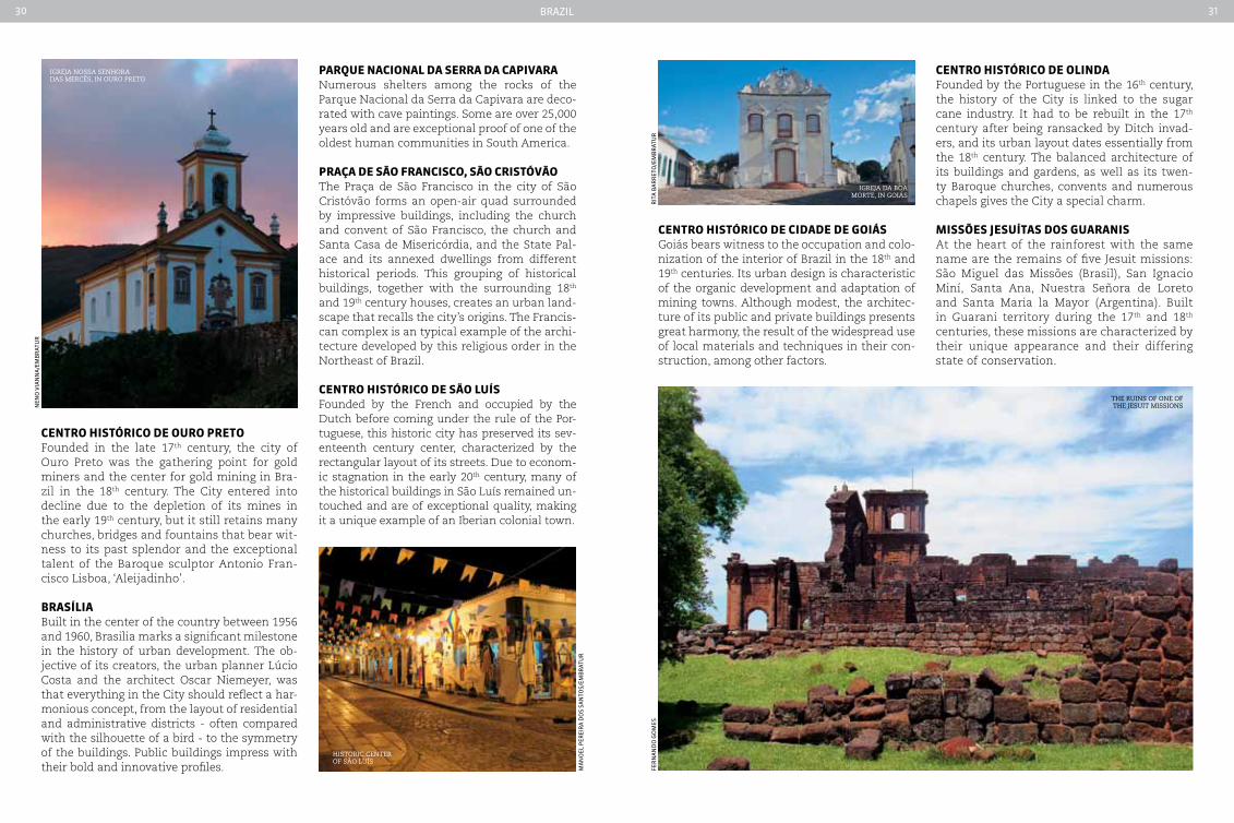
centro HIStÓrIco de ouro pretoFounded in the late 17th century, the city of Ouro Preto was the gathering point for gold miners and the center for gold mining in Bra-zil in the 18th century. The City entered into decline due to the depletion of its mines in the early 19th century, but it still retains many churches, bridges and fountains that bear wit-ness to its past splendor and the exceptional talent of the Baroque sculptor Antonio Fran-cisco Lisboa, ‘Aleijadinho’.
braSíLIaBuilt in the center of the country between 1956 and 1960, Brasilia marks a significant milestone in the history of urban development. The ob-jective of its creators, the urban planner Lúcio Costa and the architect Oscar Niemeyer, was that everything in the City should reflect a har-monious concept, from the layout of residential and administrative districts - often compared with the silhouette of a bird - to the symmetry of the buildings. Public buildings impress with their bold and innovative profiles.
parQue nacIonaL da Serra da capIVaraNumerous shelters among the rocks of the Parque Nacional da Serra da Capivara are deco-rated with cave paintings. Some are over 25,000 years old and are exceptional proof of one of the oldest human communities in South America.
praça de São FrancISco, São crIStÓVãoThe Praça de São Francisco in the city of São Cristóvão forms an open-air quad surrounded by impressive buildings, including the church and convent of São Francisco, the church and Santa Casa de Misericórdia, and the State Pal-ace and its annexed dwellings from different historical periods. This grouping of historical buildings, together with the surrounding 18th and 19th century houses, creates an urban land-scape that recalls the city’s origins. The Francis-can complex is an typical example of the archi-tecture developed by this religious order in the Northeast of Brazil.
centro HIStÓrIco de São LuíSFounded by the French and occupied by the Dutch before coming under the rule of the Por-tuguese, this historic city has preserved its sev-enteenth century center, characterized by the rectangular layout of its streets. Due to econom-ic stagnation in the early 20th century, many of the historical buildings in São Luís remained un-touched and are of exceptional quality, making it a unique example of an Iberian colonial town.
centro HIStÓrIco de oLInda Founded by the Portuguese in the 16th century, the history of the City is linked to the sugar cane industry. It had to be rebuilt in the 17th century after being ransacked by Ditch invad-ers, and its urban layout dates essentially from the 18th century. The balanced architecture of its buildings and gardens, as well as its twen-ty Baroque churches, convents and numerous chapels gives the City a special charm.
MISSõeS JeSuítaS doS GuaranISAt the heart of the rainforest with the same name are the remains of five Jesuit missions: São Miguel das Missões (Brasil), San Ignacio Miní, Santa Ana, Nuestra Señora de Loreto and Santa Maria la Mayor (Argentina). Built in Guarani territory during the 17th and 18th centuries, these missions are characterized by their unique appearance and their differing state of conservation.
rit
a B
ar
ret
o/e
mB
rat
ur
fer
na
nd
o g
om
es
nen
o V
ian
na
/em
Br
atu
r
ma
no
el p
erei
ra
do
s sa
nto
s/em
Br
atu
r
igreja nossa senhora das mercÊs, in ouro Preto
igreja da Boa morte, in goiás
the ruins of one of the jesuit missions
historic center of são luís
Brazil32 33
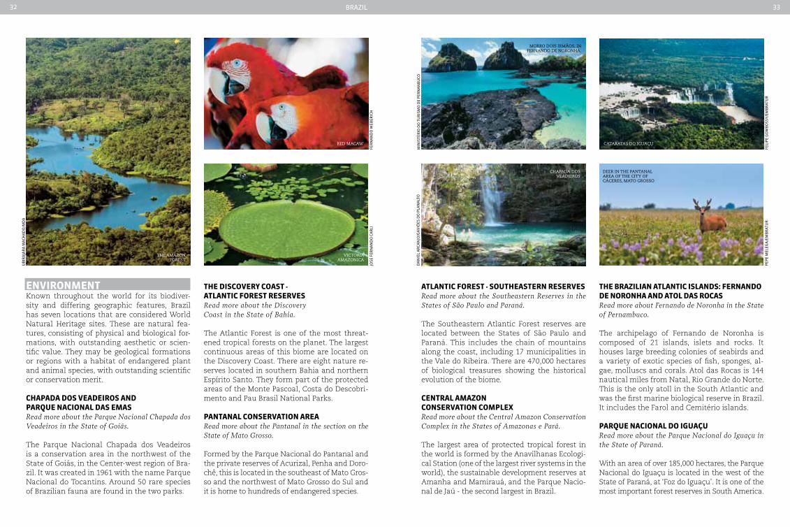
enVIronMentKnown throughout the world for its biodiver-sity and differing geographic features, Brazil has seven locations that are considered World Natural Heritage sites. These are natural fea-tures, consisting of physical and biological for-mations, with outstanding aesthetic or scien-tific value. They may be geological formations or regions with a habitat of endangered plant and animal species, with outstanding scientific or conservation merit.
cHapada doS VeadeIroS and parQue nacIonaL daS eMaSRead more about the Parque Nacional chapada dos Veadeiros in the State of Goiás.
The Parque Nacional Chapada dos Veadeiros is a conservation area in the northwest of the State of Goiás, in the Center-west region of Bra-zil. It was created in 1961 with the name Parque Nacional do Tocantins. Around 50 rare species of Brazilian fauna are found in the two parks.
tHe dIScoVery coaSt - atLantIc ForeSt reSerVeSRead more about the Discovery coast in the State of Bahia.
The Atlantic Forest is one of the most threat-ened tropical forests on the planet. The largest continuous areas of this biome are located on the Discovery Coast. There are eight nature re-serves located in southern Bahia and northern Espírito Santo. They form part of the protected areas of the Monte Pascoal, Costa do Descobri-mento and Pau Brasil National Parks.
pantanaL conSerVatIon areaRead more about the Pantanal in the section on the State of Mato Grosso.
Formed by the Parque Nacional do Pantanal and the private reserves of Acurizal, Penha and Doro-chê, this is located in the southeast of Mato Gros-so and the northwest of Mato Grosso do Sul and it is home to hundreds of endangered species.
the amazon forest
red macaw
victoria amazonica
jose
fer
na
nd
o C
ar
life
rn
an
do
weB
eriC
H
uB
ira
jar
a m
aCH
ad
o/m
da
atLantIc ForeSt - SoutHeaStern reSerVeSRead more about the Southeastern Reserves in the States of São Paulo and Paraná.
The Southeastern Atlantic Forest reserves are located between the States of São Paulo and Paraná. This includes the chain of mountains along the coast, including 17 municipalities in the Vale do Ribeira. There are 470,000 hectares of biological treasures showing the historical evolution of the biome.
centraL aMazon conSerVatIon coMpLexRead more about the central Amazon conservation complex in the States of Amazonas e Pará.
The largest area of protected tropical forest in the world is formed by the Anavilhanas Ecologi-cal Station (one of the largest river systems in the world), the sustainable development reserves at Amanha and Mamirauá, and the Parque Nacio-nal de Jaú - the second largest in Brazil.
cataratas do iguaçu
deer in the Pantanal area of the city of cáceres, mato grosso
morro dois irmãos, in fernando de noronha.
chaPada dos veadeiros
da
nie
l a
rCa
njo
/gaV
iões
do
pla
na
lto
min
isté
rio
do
tu
ris
mo
de
per
na
nB
uCo
tHe brazILIan atLantIc ISLandS: Fernando de noronHa and atoL daS rocaSRead more about Fernando de Noronha in the State of Pernambuco.
The archipelago of Fernando de Noronha is composed of 21 islands, islets and rocks. It houses large breeding colonies of seabirds and a variety of exotic species of fish, sponges, al-gae, molluscs and corals. Atol das Rocas is 144 nautical miles from Natal, Rio Grande do Norte. This is the only atoll in the South Atlantic and was the first marine biological reserve in Brazil. It includes the Farol and Cemitério islands.
parQue nacIonaL do IGuaçuRead more about the Parque Nacional do Iguaçu in the State of Paraná.
With an area of over 185,000 hectares, the Parque Nacional do Iguaçu is located in the west of the State of Paraná, at ‘Foz do Iguaçu’. It is one of the most important forest reserves in South America.
pep
e m
eleg
a/e
mB
rat
ur
feli
pe
go
mB
oss
y/em
Br
atu
r
Brazil34 35
which offers delicious river fishes, and by some indigenous people’s habits, that took control of the cassava. In the Southeast, ingredients and conservation methods used by Scouts still characterize local habits. It is the region of peasant and caiçara (fishermen) food. But it is also in the Southeast that the gastronomic capitals are concentrated, and where you can experience all that’s new.
The change in climate and biomes along the Brazilian territory, the traditions and innova-tions favor the use of various ingredients and techniques. Thus, it is not possible to quote a traditional dish that represents by itself the wealth of Brazilian cuisine. In order to better understand this complexity, it’s worth knowing the characteristics, cultural influences, main ingredients and dishes of each region.
tyPical seafood from the northeastern states
acarajé fried in Palm oil
a traditional Pizza from são Paulo
caPixaBa fish stew
cuISIneThe richness of the Brazilian cuisine is the re-sult of a great blend. The ingredients brought by people who migrated here over the years were added to the great diversity of the ingredients grown in the country. Likewise, the cooking hab-its, the treatment given to the ingredients, and the ways of serving bring together the tradition of every people to the inventiveness of the Bra-zilians. Thus, the same dish can have many ways of preparation, and an ancient ingredient can al-ways surprise as it is presented in a new way.
Some traits, however, characterize a region more than another. The changes don’t come to an end, but you can trace the origins and tradi-tions that, somehow, still feature some regional cuisines. The northern region, for example, is deeply characterized by the Amazon biome,
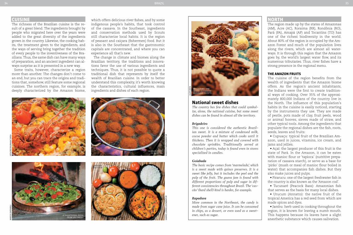
national sweet dishesThe country has few dishes that could symbol-ize, alone, the national cuisine, but some sweet dishes can be found in almost all the territory.
BrigadeiroThis one is considered the authentic Brazil-ian sweet. It is a mixture of condensed milk, cocoa powder and butter which cooks until it thickens. Then it is wrapped and covered with chocolate sprinkles. Traditionally served at children’s parties, today is found even in stores specialized in candies.
GoiabadaThe basic recipe comes from ‘marmelada’, which is a sweet made with quince preserves. It is a sweet like jelly, but it includes the peel and the pulp of the fruit. The guava jam is found with different proportions of pulp and sugar in dif-ferent consistencies throughout Brazil. The ‘cas-cão’ (hard shell) kind is harder, for example.
RapaduraMore common in the Northeast, the candy is made from sugar cane juice. It can be consumed in chips, as a dessert, or even used as a sweet-ener, such as sugar.
nortHThe region made up by the states of Amazonas (AM), Acre (AC), Roraima (RR), Rondônia (RO), Pará (PA), Amapá (AP) and Tocantins (TO) has one of the richest biodiversity in the world. About 80% of the region is occupied by the Am-azon Forest and much of the population lives along the rivers, which are almost all water-ways. It is through this region that the Amazon goes by, the world’s largest water flow, and its numerous tributaries. Thus, river fishes have a strong presence in the regional menu.
tHe aMazon FruItSThe cuisine of the region benefits from the wealth of ingredients that the Amazon biome offers. As the region’s ancient inhabitants, the Indians were the first to create tradition-al ways of cooking. Over 35% of the approxi-mately 800,000 Indians of the country live in the North. The influence of this population’s habits in the cuisine is easily noticed, starting by the instruments they use. They are made of pestle, pots made of clay, fruit peels, wood or animal hooves, sieves made of straw, and other typical tools. Among the ingredients that populate the regional dishes are the fish, roots, seeds, leaves and fruits:
• Cupuaçu: typical fruit of the Brazilian Am-azon, used in juices, vitamins, ice cream, and jams and jellies.
• Açaí: the largest producer of this fruit is the state of Pará. In the Amazon, it can be eaten with manioc flour or ‘tapioca’ (nutritive prepa-ration of cassava starch), or serve as a base for ‘pirão’ (mush or meal of manioc flour boiled in water) that accompanies fish dishes. But they also make juices and pulps.
• Pirarucu: one of the largest freshwater fish in the country is also known as the ‘Amazon cod’.
• Tucunaré (Peacock Bass): Amazonian fish that serves as the basis for many local dishes.
• Urucum (Annatto): the native fruit of the tropical America has a red seed from which are made spices and dyes.
• Jambu: herb used in cooking throughout the region, it is known for leaving a numb mouth. This happens because its leaves have a slight anesthetic substance which causes salivation.
Brigadeiro, one of the authentic Brazilian sweets
lau
po
Bet
a
ma
rCi
o z
ap
par
oli
jota
fr
eita
s/B
aH
ia t
ur
sa
ga
Br
iel
lor
del
lo/e
mB
rat
ur
ro
Ber
to f
ar
ia/e
mB
rat
ur

Brazil36 37
• Guaraná: the Amazonian native fruit is used in the manufacture of soft drinks, syr-ups, juices and powders. It is known to have stimulant properties.
• Brazil nuts: the seed is consumed fresh, roasted, or even as flour, in candies or ice cream.
tHe caSSaVaThis root grown and treated by Indians serves as the basis of several traditional and regional dishes. Across the country, it is also consumed boiled, fried or used in the form of flour or starch (extracted from the root, also known as tapioca starch or sweet gum). There are several names for cassava, and each region can refer to a different type of root: ‘macaxeira’ and ‘aipim’ are the most common. One type, also known as ‘mandioca-brava’, needs to be prepared for long periods of cooking, to eliminate an acid present in its roots and leaves.
tradItIonaL dISHeSThe regional cuisine received many influences in each cycle of immigration. Early in the colo-nization, the Portuguese who dominated farm-ing techniques and animal breeding brought their habits of cooking and food preservation in salt and sugar. From this blend, preserves, jams, compotes and exotic liquors, all with local in-gredients, were created.
With the rubber exploitation cycle, immi-grants from various regions of the country were working in the extraction of latex. All left traces of ways of dealing with the ingredients of the region. The strongest influence was from the Northeast - one of the dishes that was born from this mixture is the ‘caldeirada de tucu-naré’ (peacock bass stew). But Lebanese, Japa-nese and Italian people also arrived in the re-gion. Among the traditional dishes served in the region, the following are highlighted:
• ‘Pato no Tucupi’ (duck in Tucupi) : traditional dish of the Amazon region, especially Pará. Tucupi is a liquid extracted from peeled ‘macaxeira-bra-va’ (a species of cassava) grated and squeezed in an artisanal way and it is cooked for days. Pieces of duck are cooked in this broth and served with manioc flour, white rice and sheets of ‘Jambu’.
• Tacacá: this dish of indigenous origin is a kind of hot soup that takes ‘tucupi’ (a seasoning prepared of pepper and manioc juice), boiled tapioca gum (a cassava derivative), ‘Jambu’ and shrimp. It is usually served in gourds, easily found in the tents of the ‘tacacazeiras,’ (women who sell the ‘tacacá’) on the streets of the city of Belém, Pará state.
• ‘Maniçoba’: known as the feijoada (dish of beans cooked with dried meat, pork, sausages, etc.) from Pará, it can take more than a week to be ready. The delay is caused mainly by the cook-ing of the manioc leaf (the cassava plant). Dried meat, bacon, tripe, calf’s foot, pig’s ears, feet and ribs, chorizo, sausage and salamelle (a variety of pork sausage) are added to the broth. The dish is served with white rice, flour and pepper.
• ‘Pirarucu de casaca’: the fish is cut into piec-es, desalted and fried in olive oil. Then is served layered with fried bananas, manioc, potatoes stew and ‘farofa’ made with cassava flour, eggs and coconut milk.
• ‘Caldeirada de tucunaré’ (peacock stew): type of stew, usually made with fish and vegetables, common in Portugal. In the peacock stew served in the city of Manaus, the recipe asks for fish, po-tatoes, onions, cabbage, peppers, eggs, tomatoes, parsley and cilantro. The mixture also needs to-mato sauce and comes with pirão (mush or meal of manioc flour boiled in water), as a side dish.
nortHeaSt The diverse biomes in the Northeast region are reflected in its cuisine. The semiarid climate of the caatinga (region covered with brushwood) leaves its signature on dishes linked to food pres-ervation and high calorie content. In the Waste-land and its extensive coastline, the recipes gain a diversity of ingredients and colors. The strong flavor and taste of pepper, however, characteriz-es the northeastern cuisine as a whole. Many of the dishes are found throughout the region, but the visitor can find, in each of the nine states, special ways of preparing them. The following states are part of the Northeastern region: Ba-hia (BA), Sergipe (SE) and Alagoas (AL), Pernam-buco (PE), Paraíba (PB), Rio Grande do Norte (RN), Ceará (CE), Piauí (PI) and Maranhão (MA).
MuLtIcuLturaL InGredIentSIn addition to the native fruits of the caatinga and dry region of the northeast, northeastern cuisine includes in its menu novelties brought by foreigners. The coconut, an important ingre-dient in the cuisine, was brought from India by the Portuguese. The ‘sarapatel’ (dish made of the
boiled blood and viscera of hogs) and the ‘bucha-da’ (dish made of an animal’s insides) are dishes based on the Lusitanian cuisine. In the back-lands, the cowboys keep the habit of consum-ing simple and strong dishes, made with corned beef, cassava, corn and beans. Palm oil, a spice found in many of the traditional dishes, as well as the cayenne pepper, were brought by the Afri-cans. ‘Acarajé’ (little cake made of ground beans, fried in palm oil and served with shrimps, pep-per sauce and vatapá) and ‘vatapá’ (dish made of manioc flour, oil, pepper, fish and shrimp) are the products of this cultural mix. Learn about the main ingredients used in the region:
• ‘Azeite de dendê’ (palm oil): the palm oil has an orange color, which adds color and a unique flavor to the dishes. Produced largely in the southeast of Bahia, it is extracted from a palm tree originally from the east coast of Africa.
• ‘Pimenta malagueta’ (cayenne pepper): the species was brought by the Negroes of Africa, and it is mainly used in the cuisine from Bahia state.
cuPuaçu, tyPical fruit of the Brazilian amazon
manioc is the Basis of several Brazilian dishes
the traditional tacacá
Palm oil Production
cayenne PePPer
Car
los
ma
Cap
un
an
atH
ali
e d
ule
X
ma
rjo
lein
tati
an
a a
zeV
iCH
e - s
etu
r B
air
ina
na
um
ets

Brazil38 39
• Cassava: in the Northeast, the sweetest version of this root is known as manioc. The flour is used as a side dish and can even be eaten for breakfast.
• Beef: it is usual to find the meat already dried in the sun (called ‘carne de sol’) or air-dried and preserved with salt (dried meat). It can be served in portions or be used as an in-gredient in dishes from the region.
• Fruit: from the great variety of fruits con-sumed in the region some of them are: guava, ca-shew nut, banana, mango, jack-fruit, araça (kind of guava), mangaba, sapodilla, umbu, hog plum and soursop. From the cashew, the chestnut is also extracted, used in many traditional recipes.
FeSta JunIna (June’S ceLebrItIeS) cuISIneThe ‘Festa Junina’ is one of the most traditional festivities of the Northeast and happens in all states, which often compete to be the largest celebration. In addition to the dances, music and games, one of the biggest attractions are the delicacies typically served at the party.
• Coconut milk: made from the coconut’s white inside, beaten with a little water and strained. It is used in ‘bobó de camarão’ (a dish consisting of stewed shrimp with coconut milk, dendê oil and manioc cream).
• Fish and seafood: the northeastern coast provides fishes, mollusks and shellfish widely used in the local cuisine. Many dishes are made with big shrimps. Crabs are served in portions.
• Beans: there are several types. White, black, green and French beans are the most used.
• Cheese curd: traditional product of the north-eastern backlands, it is found mainly in Pernam-buco, Paraíba, Ceará and Rio Grande do Norte.
• Corn: consumed in countless ways, it can be boiled or roasted and used as a basis for prepar-ing ‘canjica’ (dish made from grated green corn, sugar, milk and cinnamon), cakes, ‘pamonha’ (a sweetish concoction of which green corn paste is the chief ingredient, rolled and baked in fresh corn husks), ‘curau’ (dish made of salted meat brayed together with manioc flour), among other recipes.
• Cooked maize: after removing the straw and hair, the corn is cooked and served with salt, and occasionally with butter.
• ‘Canjica’: also known as ‘curau’ in several states, it is a sweet dough made from ground corn and coconut milk, served with sugar and cinnamon.
• ‘Pé de moleque’: the candy is done in many different ways in each corner of the country. One of its traditional forms is found at par-ties, especially in Pernambuco state, it’s a kind of cake made with cassava dough, nuts and a syrup made of sugar and butter. Farther south, the candy is made of brown sugar and peanuts.
• ‘Cocada’: coconut candy made with white or dark sugar. It can be found being sold in the streets like a board candy.
• Rice pudding: sweet made with rice and milk. It may have condensed milk and be served with cloves and cinnamon.
• ‘Pamonha’: sweet or salty, the ‘pamonha’ is made with grated corn and milk.
one of the tyPes of shrimP served in the northeast region
soursoP canjica, also Known as curau
sweet made with cooKed corn
tyPical northeast
moqueca
corn is consumed in a numBer of different ways in the coutry
Banana, one of the most tyPical fruits of Brazil
cocada, coconut candy made with white or darK sugar
ra
fa m
osK
oV
ita
rit
a B
ar
ret
o -
setu
r B
a
jor
ge
fur
lan
ro
Ber
to f
ar
ia/e
mB
rat
ur
tati
an
a a
zeV
iCH
e - s
etu
r B
a
CHr
is s
áfa
tim
a p
erei
ra
Car
ol
Kr
am
Ber
ger
• Cuscus: dish of African origin, it has sever-al recipes that can take corn flakes, sardines, egg and cod sauce.
tradItIonaL dISHeS• ‘Buchada’: a recipe that calls for goat en-
trails boiled in the stomach (intestines) of the animal. For strong stomachs.
• Dried meat with curd mush: is the dried meat served with a mush made from curd cheese, milk, bottle butter (kind of butter that is kept in its liquid state in room temperature inside a bottle) and cassava flour.
• ‘Baião de dois’: dish made with green or French beans, mixed with white rice, dried meat, or dried meat and curd cheese. Served with the traditional bottle butter.
• ‘Moqueca’: fish stew with coconut milk, palm oil, pepper and cilantro.
Brazil40 41
• ‘Paçoca’ of dried meat: ‘farofa’ made from cassava flour, dried meat and minced onion. It can be served with banana and a ‘baião de dois’.
• ‘Tapioca’: made of cassava gum, in discs like pancakes, and served with sweet or salty stuffing.
• ‘Acarajé’: traditionally prepared by the ‘baianas’, ‘acarajé’ is a small dough made of French beans fried in palm oil. It can be stuffed with ‘vatapá’, ‘caruru’ (dish prepared by stew-ing dried shrimps, okra, minced herbs with palm oil and spices) and pepper sauce.
• ‘Caldo de sururu’: soup made with shellfish, coconut milk and palm oil.
• ‘Caldo de mocotó’: this hot soup is made of ox paws, from where the traditional broth comes out.
• ‘Dobradinha’: dish made of white beans cooked with beef tripe.
• ‘Sarapatel’: with different recipes in each state, the ‘sarapatel’ is a stew made with viscera of hogs, lamb or goat, thickened with the blood of the animal. It’s served with flour and pepper.
• ‘Vatapá’: there are several versions for the cream of shrimp, which can take bread, bread-crumbs or cornmeal, peanut, cashew, pepper, coconut milk and palm oil.
• ‘Caruru’: Just as ‘vatapá’, this dish became popular among the people from Pará and is also served in this state, with some modifica-tions. Basically, ‘caruaru’ is a mush (cassava flour mixed with a hot broth) made with okra, shrimp, parsley and oil palm.
• ‘Bolo de rolo’: candy made with a thin sponge cake wrapped with layers of ‘goiabada’ (guava jam), covered with sugar. Served in thin slices.
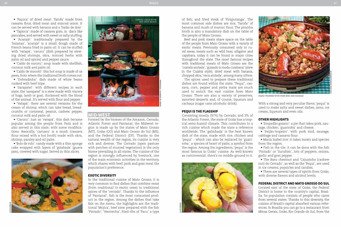
MId-weStFormed by the biomes of the Amazon, Cerrado, Atlantic Forest and Pantanal, the Midwest re-gion is made up by the states of Mato Grosso (MT), Goiás (GO) and Mato Grosso do Sul (MS), and the Federal District (DF). Thanks to the natural wealth of the region, its cuisine is very rich and diverse. The Cerrado (open pasture with patches of stunted vegetation) is the only biome prevailing in all states. The cuisine of the region is strongly influenced by livestock, one of the main economic activities in the territory, which shares with beef, pork and goat meat the population’s preference.
exotIc dIVerSItyIn the traditional cuisine of Mato Grosso, it is very common to find dishes that combine meat (from traditional to exotic ones) to traditional spices of the ‘cerrado’. Thanks to the influence of ‘Pantanal’, fish is the most consumed prod-uct in the region. Among the dishes that take fish on the menu, the highlights are the tradi-tional ‘Mojica’, beef stew prepared with the fish ‘Pintado’; ‘Ventrecha’, fried ribs of ‘Pacu’ a type
of fish; and fried steak of ‘Piraputanga’. The most common side dishes are rice, “farofa” of banana and mush of manioc flour. The piranha broth is also a mandatory dish on the table of the people of Mato Grosso.
Beef and pork meats share space on the table of the people from Mato Grosso with a variety of exotic meats. Previously consumed only in ru-ral areas, meats such as wild boar, alligator and capybara, today it can be found in major cities throughout the state. The most famous recipes with traditional meats of Mato Grosso are the ‘costela atolada’, ‘guisado à moda cuiabana’ (stew in the Cuiabá style), dried meat with banana, chopped okra, ‘vaca atolada’, among many others.
The spices used to prepare these traditional dishes are found within the state. “Pequi”, cas-sava, corn, pepper and yerba mate are much used to enrich the vast cuisine from Mato Grosso. There are also a variety of preserves, assorted desserts and, of course, liqueurs and cachaça (sugar cane alcoholic drink).
peQuI IS tHe FLaGSHIpConsisting mostly (97%) by Cerrado, and 3% of the Atlantic Forest, the state of Goiás has a trop-ical semi-humid climate. This contributes to a rich cuisine which made the state a reference worldwide. The ‘galinhada’ is the best known dish of the state, made with rice, chicken and ‘pequi’ - which can also be replaced by ‘guari-roba’, a species of heart of palm, a symbol from the region. Among the ingredients, ‘pequi’ is the most famous in Goiás’ cuisine. As well-known as controversial, there’s no middle ground to it.
With a strong and very peculiar flavor, ‘pequi’ is used to make salty and sweet dishes, jams, ice cream, liqueurs and even oils.
otHer HIGHLIGHtS• ‘Empadão goiano’: a pie that takes pork, sau-
sage, chicken, ‘guariroba’ and cheese.• ‘Feijão-tropeiro’: with pork rind, sausage,
cabbage and cassava flour.• Maria Isabel rice: it takes meats and species
from the region.• Fish in the tile: it can be done with the fish
‘Pintado’ or ‘Surubim’, lots of peppers, onions, garlic and goat pepper.
• The Baru chestnut and ‘Cajuzinho (cashew nut) do Cerrado’, as well as the ‘Pequi’, are used in ice creams, popsicles and candies.
• There are several types of spirits from Goiás, with diverse flavors and alcohol levels.
FederaL dIStrIct and Mato GroSSo do SuLLocated east of the state of Goiás, the Federal District is home to the country’s capital, Brasí-lia. Its population consists of people who came from several states. Thanks to this diversity, the cuisine of Brazil’s capital absorbed various refer-ences. In Brasília you can go to a restaurant from Minas Gerais, Goiás, Rio Grande do Sul, from the
tyPical lunch in the mid-west region
shrimP cream Known as vataPá
Pequi, tyPical fruit of the Brazilian cerrado
feijão-troPeiro with PorK rind and sausage
elin
gu
nn
ur
da
nie
l d
e g
ra
nV
ile
- fo
tog
ra
ma
elia
s m
ina
si
Cris
tia
no
XaV
ier
/em
Br
atu
r

Brazil42 43
SoutHeaStThe cuisine of the four Southeastern states incorporated dishes and habits from different cultures. In the countryside, the famous ‘tro-peira’ food still inhabits the kitchens of families and traditional restaurants.
Some say that the pizza from São Paulo is bet-ter than the real pasta made in Italy. Are they exaggerating? What is evident is that the city is a reference in the subject and attracts thou-sands of people because of its fame. The Italian immigrants arrived in the four states, but most chose São Paulo as their destination.
The capital of São Paulo also has the largest Japanese community in Brazil and the Liberdade district is home to most of these immigrants. ‘Tabouli’ (wheat salad), ‘kibbe’ (Arab dish, made of deep-fried ground meat and whole wheat flour), ‘esfijas’, ‘hummus’ and ‘kaftas’ reached the Southeast through the Syrian-Lebanese. In Minas Gerais, dishes such as ‘feijão tropeiro’ and ‘angu’ (flour of manioc, maize or rice boiled in water and salt) are an inheritance of the pioneers.
GaStronoMIc capItaLSSão Paulo attracts every year almost 12 million visitors. Most of them come for business, but for decades the capital has attracted visitors because of its culinary wealth. Voted the World Gastron-
omy Capital, São Paulo brings together the best restaurants in the country. It’s more than ten thousand options, ranging from simple cuisine to the most refined. This variety of options has put the city on top of the list of best places to eat.
In São Paulo, you can go to a Japanese, Italian, Thai, German, Mexican, Spanish, Portuguese, Argentinean, Turkish, Greek, Korean, Chinese restaurants. The possibilities are endless, en-abling the tourist to enjoy the best dishes of the world in the same city. Throughout the year the most diverse festivals are held, which fur-ther contributes to the fame that the capital acquired. Renowned chefs are invited to attend these events, and end up opening or expanding their businesses in the city.
But São Paulo has not only imported flavors and world experts in haute cuisine, the city is also re-sponsible for launching internationally recognized names. Mentioned in the Michelin Guide and con-sidered by the publication as one of the best chefs in the world, Alex Atala has taken the Brazilian cuisine to all continents. Helen Rizzo and the res-taurant chain Fasano are other names highlighted by the major international publications.
Rio de Janeiro and Belo Horizonte are on the list of cities also famous for haute cuisine. In Rio de Janeiro’s state capital, the most promi-nent name is that of Chef Roberta Sudbrack. Her restaurant in Rio, alongside D.O.M. and Mani (both in São Paulo) are on the list of the British magazine Restaurant. In Belo Horizonte, it is important to highlight Chef Ivo Faria, also nationally and internationally acclaimed.
deLIGHtS oF MInaS GeraISConsisting mostly of Cerrado, followed by Mata Atlântica and Caatinga, the state of Minas Gerais produces a series of traditional foods from the land. ‘Pão de queijo’ (cheese bread), ‘polenta’ (a kind of porridge made of cornmeal), chicken with okra, pururuca style piglet, Minas style tutu (a dish prepared of beans, bacon and manioc). It’s impossible to list all the dishes of the traditional cuisine of Minas Gerais we know. Abundant from breakfast to dinner, the cuisine of the state is known throughout Brazil.
The famous Minas cheese is produced exclu-sively in five micro regions of Minas Gerais: Ca-nastra Mountain Range (West), Araxá and Alto Paranaíba (Triângulo Mineiro), Serro (center) and Campos das Vertentes (South). All cheeses are made with the same production methods and ingredients, but the soil of each farm gives the products a peculiar flavor.
otHer HIGHLIGHtS oF tHe SoutHeaSt• Roast chicken with ‘farofa’ (manioc flour
toasted in butter or olive oil)• Frango (chicken) ‘caipira’ with okra• ‘Quirera’ or ‘Canjiquinha mineira’ (a dish made
from grated green corn, sugar, milk and cinnamon)• Roasted pork loin• ‘Feijão (beans) tropeiro mineiro’• Beef Stew with bananas• Homemade pastry• Couscous Paulista
Northeast without leaving the city. Its prevailing biome is from the Cerrado (100%), which contrib-utes to a closer relationship with the cuisine of Goiás. But international cuisine is greatly present in the city. There are plenty of Germans, Italian, French, Portuguese and Argentine restaurants.
The state of Mato Grosso do Sul consists of three biomes: Cerrado (61%), Mata Atlântica (14%) and Pantanal (25%). The major cities are the capital, Campo Grande, Bonito, Dourados, Três Lagoas, Ponta Porã and Aquidauna. The prevailing climate in the state is tropical, with variations between hot and semi-humid. The cuisine from southern Mato Grosso is made from ingredients found throughout the state. But the rich local cuisine has absorbed dishes from Argentina, Paraguay and Bolivia.
MaIn HIGHLIGHtS oF Mato GroSSo do SuL• Paraguayan soup: it takes big chunks of on-
ion, grated cheese and corn meal• Juice and soup of piranha (an extremely vo-
racious fresh-water fish)• ‘Forrundu’: papaya and brown sugar candy• ‘Puchero’: a sort of casserole inherited from
Argentina made with various cuts of meat• ‘Locro’: made with white beans and corn,
pork and different seasonings• ‘Pacu’: typical fish of the Pantanal, can be
served fried, baked or boiled• ‘Tererê’: the ‘chimarrão’ from southern
Mato Grosso” is the most popular beverage in the state. Made with yerba mate, it can be drunk hot or cold.
tererÊ, the chimarrão from southern mato grosso
homemade Pastry
the são Paulo Pizza
the minas cheese
edu
ar
do
Ces
ar
io
ga
ry
tam
in
ug
ur
Vid
inli
gil
ro
Ber
to s
eBa
/aCe
rV
o s
etu
r m
g
Brazil44 45
StewS, paeLLa and MuSSeLSThe ‘moqueca capixaba’ (capixaba stew) is per-haps the most famous dish from the coast of Es-pírito Santo state, but to limit the state’s coastal cuisine to only this delicious dish means to set aside a multitude of flavors. The rice with capixa-ba shrimp also accompanies its countryman, and just like it, it’s served in a huge clay pot - heritage of indigenous customs. There are a number of variations of the dish which acquired internation-al versions in several contemporary restaurants.
Those who visit the coast of Espírito Santo will also find the famous fish stew of mus-sels, usually prepared with white wine, olive oil and pepper. And what about the fish in green sauce in the oven? Made with herbs and lemon, it is found all along the coast. The fish used to prepare the dish can be anchovies, whiting and dogfish.
In Rio de Janeiro, the paella of seafood can be highlighted. The Spanish dish in Rio’s coastal version doesn’t add chicken and takes mussels, squid, medium and large-sized shrimps. Oth-er highlights of Rio de Janeiro are the dogfish stews (moqueca) with assorted peppers, mus-sels vinaigrette and several kinds of cod.
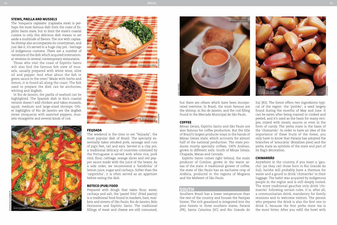
FeIJoadaThe weekend is the time to eat “feijoada”, the most popular dish of Brazil. The specialty es-sentially takes smoked pork, sausage and cuts of pig’s feet, tail and ears. Served in a clay pot, a traditional delicacy of countries colonized by the Portuguese is served with white rice, pork rind, flour, cabbage, orange slices and red pep-per sauce made with the juice of the beans. As a side order, we recommend a ‘batidinha’ of lemon juice, sugar and cachaça. Softer than the ‘caipirinha’, it is often served as an appetizer before eating the dish.
boteco (pub) FoodPrepared with dough that takes flour, water, cachaça and salt, the ‘pastel frito’ (fried pastry) is a traditional food found in markets, bars, mar-kets and streets of São Paulo, Rio de Janeiro, Belo Horizonte and Espírito Santo. The traditional fillings of meat and cheese are still consumed,
but there are others which have been incorpo-rated overtime. In Brazil, the most famous are the shrimp, in Rio de Janeiro, and the cod filling found in the Mercado Municipal de São Paulo.
coFFee Minas Gerais, Espírito Santo and São Paulo are also famous for coffee production. But the title of Brazil’s largest producer stays in the hands of Minas Gerais state, which accounts for almost half of the national production. The state pro-duces mostly specialty coffees, 100% Arabian, grown in different soils: South of Minas Gerais, Chapada, Matas and Cerrado.
Espírito Santo comes right behind, the main producer of Conilon, grown in the warm ar-eas of the state. A traditional grower of coffee, the state of São Paulo has an exclusive crop of Arábica, produced in the regions of Mogiana and the Midwest of São Paulo.
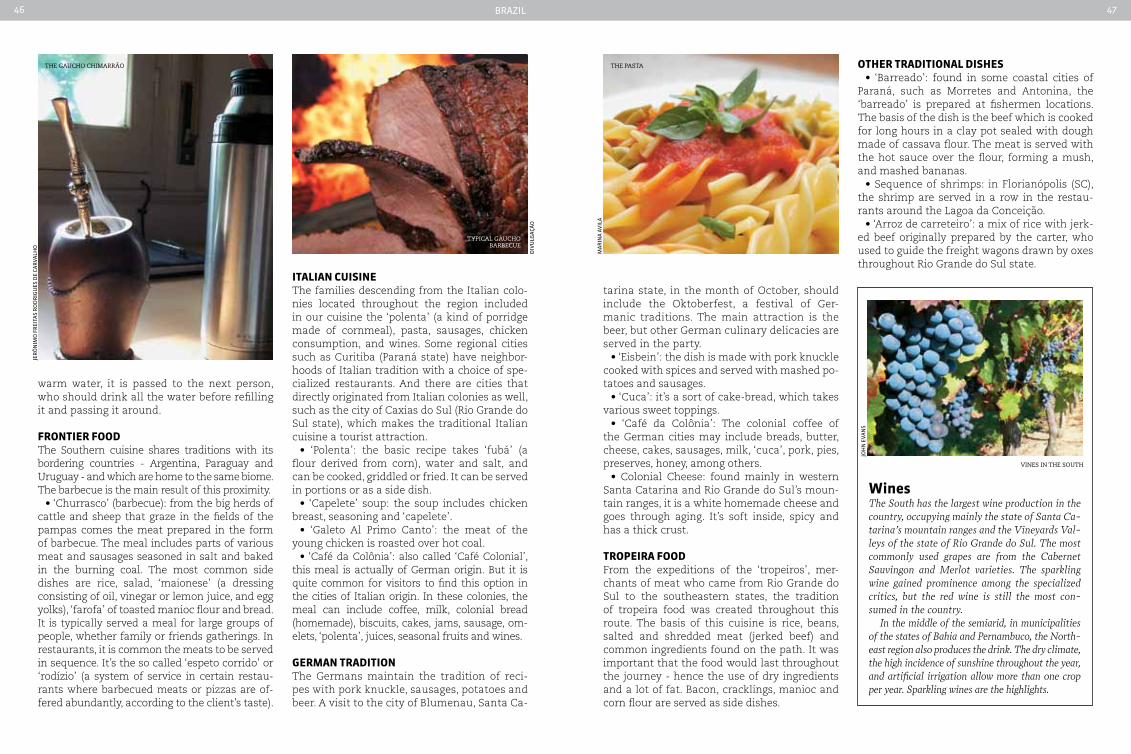
SoutHSouthern Brazil has a lower temperature than the rest of the country and houses the Pampas biome. The rich grassland is integrated into the pine forests in three southern states, Paraná (PR), Santa Catarina (SC) and Rio Grande do
Sul (RS). The forest offers two ingredients typi-cal of the region: the ‘pinhão’, a seed largely found during the months of May and June. It can be eaten after being roasted or cooked and peeled, and it’s used as the basis for many reci-pes, mixed with meats, sauces or even in the form of candy. The yerba mate is the basis of the ‘chimarrão’. In order to have an idea of the importance of these fruits of the forest, you only have to know that Paraná has adopted the branches of ‘araucária’ (Brazilian pine) and the yerba mate as symbols of the state and part of its flag’s decoration.
cHIMarrãoAnywhere in the country, if you meet a ‘gau-cho’ (as they call those born in Rio Grande do Sul), he/she will probably have a thermos for water and a gourd to drink ‘chimarrão’ in their luggage. The habit was acquired by indigenous people in the region and is still deeply rooted. The more traditional gauchos only drink ‘chi-marrão’ following certain rules. It is, after all, a communitarian drink, mandatory for family reunions and to welcome visitors. The person who prepares the drink is also the first one to drink it, because the first yerba mate tea is the most bitter. After you refill the bowl with
seafood Paella
feijoada side dish
feijoada, one of the most PoPular
dishes in Brazil
the traditional Brazilian coffee
the Pinhão, a seed largely found during the months of may and june
reC
eita
s d
e Cu
lin
ar
ia p
t
diV
ulg
açã
od
iVu
lga
ção
Ha
ns
tHo
ur
sie
diV
ulg
açã
o
Brazil46 47
ItaLIan cuISIneThe families descending from the Italian colo-nies located throughout the region included in our cuisine the ‘polenta’ (a kind of porridge made of cornmeal), pasta, sausages, chicken consumption, and wines. Some regional cities such as Curitiba (Paraná state) have neighbor-hoods of Italian tradition with a choice of spe-cialized restaurants. And there are cities that directly originated from Italian colonies as well, such as the city of Caxias do Sul (Rio Grande do Sul state), which makes the traditional Italian cuisine a tourist attraction.
• ‘Polenta’: the basic recipe takes ‘fubá’ (a flour derived from corn), water and salt, and can be cooked, griddled or fried. It can be served in portions or as a side dish.
• ‘Capelete’ soup: the soup includes chicken breast, seasoning and ‘capelete’.
• ‘Galeto Al Primo Canto’: the meat of the young chicken is roasted over hot coal.
• ‘Café da Colônia’: also called ‘Café Colonial’, this meal is actually of German origin. But it is quite common for visitors to find this option in the cities of Italian origin. In these colonies, the meal can include coffee, milk, colonial bread (homemade), biscuits, cakes, jams, sausage, om-elets, ‘polenta’, juices, seasonal fruits and wines.
GerMan tradItIonThe Germans maintain the tradition of reci-pes with pork knuckle, sausages, potatoes and beer. A visit to the city of Blumenau, Santa Ca-
tarina state, in the month of October, should include the Oktoberfest, a festival of Ger-manic traditions. The main attraction is the beer, but other German culinary delicacies are served in the party.
• ‘Eisbein’: the dish is made with pork knuckle cooked with spices and served with mashed po-tatoes and sausages.
• ‘Cuca’: it’s a sort of cake-bread, which takes various sweet toppings.
• ‘Café da Colônia’: The colonial coffee of the German cities may include breads, butter, cheese, cakes, sausages, milk, ‘cuca’, pork, pies, preserves, honey, among others.
• Colonial Cheese: found mainly in western Santa Catarina and Rio Grande do Sul’s moun-tain ranges, it is a white homemade cheese and goes through aging. It’s soft inside, spicy and has a thick crust.
tropeIra FoodFrom the expeditions of the ‘tropeiros’, mer-chants of meat who came from Rio Grande do Sul to the southeastern states, the tradition of tropeira food was created throughout this route. The basis of this cuisine is rice, beans, salted and shredded meat (jerked beef) and common ingredients found on the path. It was important that the food would last throughout the journey - hence the use of dry ingredients and a lot of fat. Bacon, cracklings, manioc and corn flour are served as side dishes.
warm water, it is passed to the next person, who should drink all the water before refilling it and passing it around.
FrontIer FoodThe Southern cuisine shares traditions with its bordering countries - Argentina, Paraguay and Uruguay - and which are home to the same biome. The barbecue is the main result of this proximity.
• ‘Churrasco’ (barbecue): from the big herds of cattle and sheep that graze in the fields of the pampas comes the meat prepared in the form of barbecue. The meal includes parts of various meat and sausages seasoned in salt and baked in the burning coal. The most common side dishes are rice, salad, ‘maionese’ (a dressing consisting of oil, vinegar or lemon juice, and egg yolks), ‘farofa’ of toasted manioc flour and bread. It is typically served a meal for large groups of people, whether family or friends gatherings. In restaurants, it is common the meats to be served in sequence. It’s the so called ‘espeto corrido’ or ‘rodízio’ (a system of service in certain restau-rants where barbecued meats or pizzas are of-fered abundantly, according to the client’s taste).
otHer tradItIonaL dISHeS• ‘Barreado’: found in some coastal cities of
Paraná, such as Morretes and Antonina, the ‘barreado’ is prepared at fishermen locations. The basis of the dish is the beef which is cooked for long hours in a clay pot sealed with dough made of cassava flour. The meat is served with the hot sauce over the flour, forming a mush, and mashed bananas.
• Sequence of shrimps: in Florianópolis (SC), the shrimp are served in a row in the restau-rants around the Lagoa da Conceição.
• ‘Arroz de carreteiro’: a mix of rice with jerk-ed beef originally prepared by the carter, who used to guide the freight wagons drawn by oxes throughout Rio Grande do Sul state.
winesThe South has the largest wine production in the country, occupying mainly the state of Santa ca-tarina’s mountain ranges and the Vineyards Val-leys of the state of Rio Grande do Sul. The most commonly used grapes are from the cabernet Sauvingon and Merlot varieties. The sparkling wine gained prominence among the specialized critics, but the red wine is still the most con-sumed in the country.
In the middle of the semiarid, in municipalities of the states of Bahia and Pernambuco, the North-east region also produces the drink. The dry climate, the high incidence of sunshine throughout the year, and artificial irrigation allow more than one crop per year. Sparkling wines are the highlights.
tyPical gaucho BarBecue
diV
ulg
açã
o
jer
ôn
imo
fr
eita
s r
od
rig
ues
de
Car
ValH
o
ma
rin
a a
Vil
a
joH
n e
Van
s
the gaucho chimarrão the Pasta
vines in the south
Brazil48 49
tatives of the State, with the towns of Monte Alegre do Sul, Serra Negra, Amparo and Jag-uariúna among the highlights. Vale do Paraíba also has excellent small-scale producers, such as those found in the charming town of São Luiz do Piratininga.
Minas Gerais cannot be excluded from the list of small-scale producers. Minas Gerais cachaça is among the most appreciated by specialists. The town of Salinas is one of the best known for the quality of cachaça pro-duced in its stills. Betim, Araguari Januária and historical cities including Congonhas, São João del Rei and Mariana, among others, are also producers of good quality cachaça.
There are also many small-scale producers in the Northeast of Brazil. The State of Paraíba, in particular the town of Alagoa Grande, usually ranks among the top Brazilian cachaças. The region of the Chapada Diamantina in the State of Bahia is another northeastern representa-tive of national cachaça production, along with Ibirataia and Abaíra.
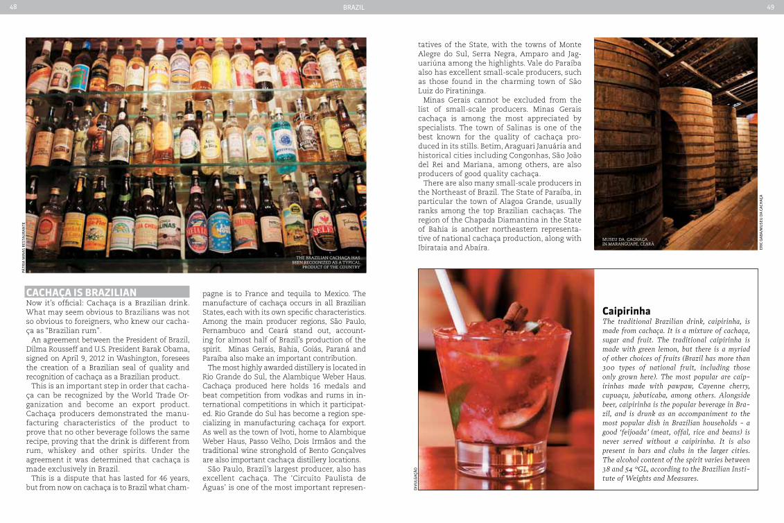
cacHaça IS brazILIanNow it’s official: Cachaça is a Brazilian drink. What may seem obvious to Brazilians was not so obvious to foreigners, who knew our cacha-ça as “Brazilian rum”.
An agreement between the President of Brazil, Dilma Rousseff and U.S. President Barak Obama, signed on April 9, 2012 in Washington, foresees the creation of a Brazilian seal of quality and recognition of cachaça as a Brazilian product.
This is an important step in order that cacha-ça can be recognized by the World Trade Or-ganization and become an export product. Cachaça producers demonstrated the manu-facturing characteristics of the product to prove that no other beverage follows the same recipe, proving that the drink is different from rum, whiskey and other spirits. Under the agreement it was determined that cachaça is made exclusively in Brazil.
This is a dispute that has lasted for 46 years, but from now on cachaça is to Brazil what cham-
pagne is to France and tequila to Mexico. The manufacture of cachaça occurs in all Brazilian States, each with its own specific characteristics. Among the main producer regions, São Paulo, Pernambuco and Ceará stand out, account-ing for almost half of Brazil’s production of the spirit. Minas Gerais, Bahia, Goiás, Paraná and Paraíba also make an important contribution.
The most highly awarded distillery is located in Rio Grande do Sul, the Alambique Weber Haus. Cachaça produced here holds 16 medals and beat competition from vodkas and rums in in-ternational competitions in which it participat-ed. Rio Grande do Sul has become a region spe-cializing in manufacturing cachaça for export. As well as the town of Ivoti, home to Alambique Weber Haus, Passo Velho, Dois Irmãos and the traditional wine stronghold of Bento Gonçalves are also important cachaça distillery locations.
São Paulo, Brazil’s largest producer, also has excellent cachaça. The ‘Circuito Paulista de Águas’ is one of the most important represen-
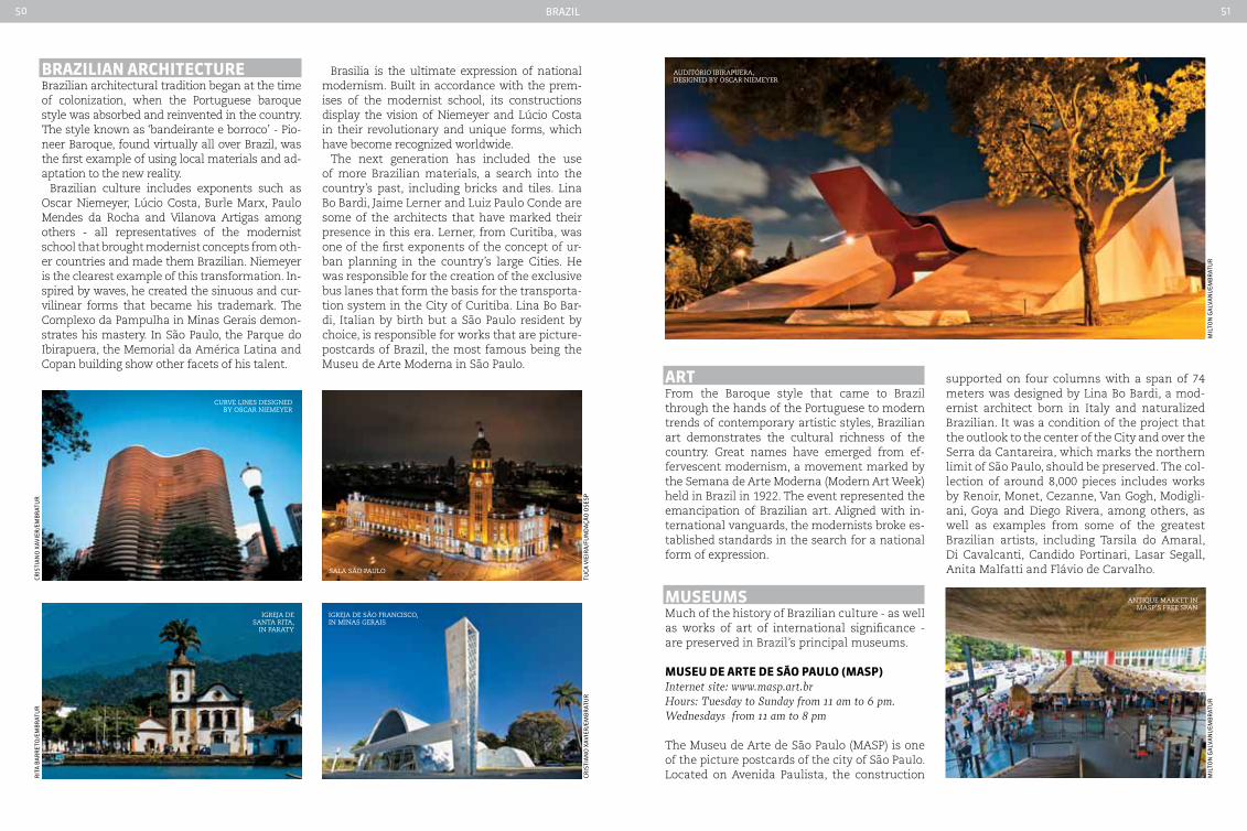
museu da cachaça in maranguaPe, ceará
pátr
ia m
ina
s r
esta
ur
an
te
caipirinhaThe traditional Brazilian drink, caipirinha, is made from cachaça. It is a mixture of cachaça, sugar and fruit. The traditional caipirinha is made with green lemon, but there is a myriad of other choices of fruits (Brazil has more than 300 types of national fruit, including those only grown here). The most popular are caip-irinhas made with pawpaw, cayenne cherry, cupuaçu, jabuticaba, among others. Alongside beer, caipirinha is the popular beverage in Bra-zil, and is drunk as an accompaniment to the most popular dish in Brazilian households - a good ‘feijoada’ (meat, offal, rice and beans) is never served without a caipirinha. It is also present in bars and clubs in the larger cities. The alcohol content of the spirit varies between 38 and 54 °GL, according to the Brazilian Insti-tute of Weights and Measures.
diV
ulg
açã
o
the Brazilian cachaça has Been recognized as a tyPical
Product of the country
eriC
ga
Ba
/mu
seu
da
Ca
CHa
ça
Brazil50 51
sala são Paulo
igreja de são francisco, in minas gerais
Cris
tia
no
XaV
ier
/em
Br
atu
rtu
Ca V
ieir
a/f
un
da
ção
ose
sp
curve lines designed By oscar niemeyer
igreja de santa rita,
in Paraty
rit
a B
ar
ret
o/e
mB
rat
ur
Cris
tia
no
XaV
ier
/em
Br
atu
r
brazILIan arcHItectureBrazilian architectural tradition began at the time of colonization, when the Portuguese baroque style was absorbed and reinvented in the country. The style known as ‘bandeirante e borroco’ - Pio-neer Baroque, found virtually all over Brazil, was the first example of using local materials and ad-aptation to the new reality.
Brazilian culture includes exponents such as Oscar Niemeyer, Lúcio Costa, Burle Marx, Paulo Mendes da Rocha and Vilanova Artigas among others - all representatives of the modernist school that brought modernist concepts from oth-er countries and made them Brazilian. Niemeyer is the clearest example of this transformation. In-spired by waves, he created the sinuous and cur-vilinear forms that became his trademark. The Complexo da Pampulha in Minas Gerais demon-strates his mastery. In São Paulo, the Parque do Ibirapuera, the Memorial da América Latina and Copan building show other facets of his talent.
Brasilia is the ultimate expression of national modernism. Built in accordance with the prem-ises of the modernist school, its constructions display the vision of Niemeyer and Lúcio Costa in their revolutionary and unique forms, which have become recognized worldwide.
The next generation has included the use of more Brazilian materials, a search into the country’s past, including bricks and tiles. Lina Bo Bardi, Jaime Lerner and Luiz Paulo Conde are some of the architects that have marked their presence in this era. Lerner, from Curitiba, was one of the first exponents of the concept of ur-ban planning in the country’s large Cities. He was responsible for the creation of the exclusive bus lanes that form the basis for the transporta-tion system in the City of Curitiba. Lina Bo Bar-di, Italian by birth but a São Paulo resident by choice, is responsible for works that are picture-postcards of Brazil, the most famous being the Museu de Arte Moderna in São Paulo.
artFrom the Baroque style that came to Brazil through the hands of the Portuguese to modern trends of contemporary artistic styles, Brazilian art demonstrates the cultural richness of the country. Great names have emerged from ef-fervescent modernism, a movement marked by the Semana de Arte Moderna (Modern Art Week) held in Brazil in 1922. The event represented the emancipation of Brazilian art. Aligned with in-ternational vanguards, the modernists broke es-tablished standards in the search for a national form of expression.
MuSeuMSMuch of the history of Brazilian culture - as well as works of art of international significance - are preserved in Brazil’s principal museums.
MuSeu de arte de São pauLo (MaSp)Internet site: www.masp.art.brHours: Tuesday to Sunday from 11 am to 6 pm. Wednesdays from 11 am to 8 pm
The Museu de Arte de São Paulo (MASP) is one of the picture postcards of the city of São Paulo. Located on Avenida Paulista, the construction
supported on four columns with a span of 74 meters was designed by Lina Bo Bardi, a mod-ernist architect born in Italy and naturalized Brazilian. It was a condition of the project that the outlook to the center of the City and over the Serra da Cantareira, which marks the northern limit of São Paulo, should be preserved. The col-lection of around 8,000 pieces includes works by Renoir, Monet, Cezanne, Van Gogh, Modigli-ani, Goya and Diego Rivera, among others, as well as examples from some of the greatest Brazilian artists, including Tarsila do Amaral, Di Cavalcanti, Candido Portinari, Lasar Segall, Anita Malfatti and Flávio de Carvalho.
mil
ton
ga
lVa
ni/
emB
rat
ur
mil
ton
ga
lVa
ni/
emB
rat
ur
auditÓrio iBiraPuera, designed By oscar niemeyer
antique marKet in masP’s free sPan

Brazil52 53
MuSeu de arte Moderna (MaM)Internet site: www.mam.org.brHours: Tuesday to Sunday (including holidays) from 10 am to 6 pm
A visit to the Museu de Arte Moderna (MAM) should include a trip to Parque do Ibirapuera in São Paulo, where the museum is located. The architectural complex, which also includes the Oca and the Pavilhão, were designed by the Bra-zilian architect Oscar Niemeyer. In addition to hosting the Panorama of Brazilian Art exhibi-tion every two years, MAM has more than 5,000 works in its collection. It includes works of modern art, principally contemporary Brazilian art, among them pieces by Livio Abramo, Flávio de Carvalho, Paulo Bruscky, Hélio Oiticica, Ly-gia Clark, Nelson Leirner, Cildo Meireles, Regina Silveira, Carlos Fajardo, Beatriz Milhazes, Rafael França, Vik Muniz and Rivane Neuenschwander.
MeMorIaL da aMÉrIca LatInaInternet site: www.memorial.org.brHours: Tuesday to Sunday from 9 am to 6 pm
Located in São Paulo, the Memorial was inaugu-rated in 1989 and is based on a cultural vision conceived by the Brazilian anthropologist Dar-cy Ribeiro. It was created with the mission of bringing Brazil closer to other Latin American countries. The exhibition areas are housed in a large architectural complex designed by Oscar Niemeyer. The architect invited each artist to choose where their work would be exhibited. Architectural and artistic works are therefore presented in an integrated manner throughout
a visit. The collection includes the ‘Tiradentes’ panel by Candido Portinari, the ‘Tapaçeira’ by Tomie Ohtake and items of folk art by anony-mous artisans, collected from across the conti-nent. The Memorial also houses a library spe-cializing in Latin American themes.
MuSeu da IMaGeM e do SoM (MIS)Internet site: www.mis-sp.org.brHours: Tuesday to Saturday from 12 am to 10 pm. Sundays and holidays from 11 am to 9 pm
Since its inauguration in 1970 the Museu da Imagem e do Som (MIS) in São Paulo has sought to be a living museum. Its collection of more than 200,000 items includes photographs, films, videos, posters, vinyl records and sound record-ings. Examples include narrations by Tarsila do Amaral and the musician Tom Jobim. Going be-yond preserving a rich archive, MIS maintains an intense schedule of events and projects it-self as an institution that fosters audiovisual language. It is always hosting an exhibition, show or performance.
pInacoteca do eStado de São pauLo Internet site: www.pinacoteca.org.brHours: Tuesday to Sunday from 10 am to 5:30 pm
The oldest art museum in the city of São Paulo, the Pinacoteca maintains an intense exhibi-tion schedule, with around 30 temporary ex-hibitions each year. Initially projected to house the collection of the Museu Paulista, the Pina-coteca (Art Gallery) has works by important artists who were active in the city, such as Al-meida Júnior and Antonio Parreiras. However, the Pinacoteca gradually became a contem-porary art museum. Temporary exhibitions feature works by both Brazilian and foreign artists. Close to the Estação da Luz, it occu-pies a building designed in the late nineteenth century by the offices of Ramos de Azevedo to house the College of Art.
MuSeu de arte conteMporÂnea (Mac)Internet site: www.mac.usp.brHours: Tuesday to Sunday from 10 am to 6 pm
Created in 1963, the Museu de Arte Contem-porânea de São Paulo (MAC) has a vast collec-tion of Western art and Brazilian modernism,
including works by Picasso, Matisse, Tarsila do Amaral and Volpi. The museum currently pos-sesses some 10,000 works, including paintings, drawings, prints, sculptures, objects and works of conceptual art and contemporary art. The ex-hibits are divided among three buildings. One is within Parque do Ibirapuera. The newest build-ing is located in a large building opposite the park, which was reformed especially to house the Museum. The oldest site is located within the São Paulo University campus (Cidade Uni-versitária). MAC has ties to University research, and undertakes academic activities as well as the dissemination of culture.
MuSeu aFro braSILInternet site: www.museuafrobrasil.org.brHours: Tuesday to Sunday from 10 am to 5 pm
Created in 2002, the Museu Afro Brasil in São Paulo has much of its collection on permanent display. As well as housing a theater, the in-stitution also maintains a library of approxi-mately 6,800 volumes on the theme of ‘The Atlantic Slave Trade and the Abolition of Slav-ery in Brazil, Latin America, the Caribbean and the United States’. The aim of the museum is
mil
ton
ga
lVa
ni/
emB
rat
ur
ru
Ben
s CH
iri/
Bie
spd
ing
mu
sa/m
is
mil
ton
ga
lVa
ni/
emB
rat
ur
museu da imagem e
do som
museu de arte moderna
memorial da américa latina
Pinacoteca indoor area

Brazil54 55
the research, conservation and exhibition of objects related to the black universe in Bra-zil. The museum is part of the cultural area of Parque do Ibirapuera, located next to the Mu-seu de Arte Moderna (MAM) and the Pavilhão da Bienal, among others.
MuSeu da LínGua portuGueSaInternet site: www.museudalinguaportuguesa.org.brHours: Tuesday to Sunday from 10 am to 6 pm
Opened in 2006, the museum has been one of the most visited in Latin America in recent years. The exhibition uses innovative interac-tive technology and resources to display and promote the Portuguese language. For example, in the Beco das Palavras (Word Alley) visitors can play with the creation of words in an in-teractive game. On the World Language Map it is possible to choose a location on a large map and hear narratives from local people, each with their own special way of speaking their language. Temporary exhibitions are of-ten mounted to further explore literature by Portuguese language authors such as Fernando Pessoa, Guimarães Rosa and Jorge Amado. The museum is located within Estação da Luz, one of the city of São Paulo’s tourist sights.
InStItuto toMIe oHtakeInternet site: www.institutotomieohtake.org.brHours: Tuesday to Sunday from 11 am to 8 pm
Opened in 2001, the museum is named after one of the most important Brazilian artists. Designed by the son of the artist, the architect Ruy Ohtake, the building has an avant-garde style, with an auditorium and seven halls for the exhibition of paintings, sculpture, deco-ration, architecture and design. The institu-tion also maintains four workshops for arts courses. Born in Japan, Tomie arrived in Brazil in 1936 and only began painting at the age 40, constructing a career that few Brazilian artists have been able to achieve. The 1960s, when she became a naturalized Brazilian, were decisive to her maturity as a painter.
bIenaL de São pauLoInternet site: www.bienal.org.br
The Bienal de São Paulo is one of the main events on the world art circuit, and as the name im-plies it occurs every two years in São Paulo. The event promotes the work of international art-ists and reflects current trends in the art scene. The event takes place in the Pavilhão da Bienal, a pavilion designed by the architect Oscar Nie-
meyer and which is part of the cultural area in Parque do Ibirapuera, at the side of the Museu de Arte Moderna (MAM) and the Museu Afro Brasil, among others. The first Biennial occurred in 1951. Two years later, the event was marked by the arrival in Brazil of the work ‘Guernica’, by Pablo Picasso. The Bienal program also includes dance, theater and music, as well as discussions and workshops. The Biennial usually takes place between September and December.
InStItuto MoreIra SaLLeSInternet site: www.ims.com.brHours: Tuesday to Friday from 1 pm to 7 pm. Saturdays and Sundays from 1 pm to 6 pm
Founded in 1992 by the late ambassador and banker, Walter Moreira Salles (1912-2001), the Institute seeks to promote and develop cultural programs. Its collection includes around 550,000 photographs, 100,000 recordings, a library of 400,000 books and an art gallery with more than 3,000 works. Highlights among the collection in-
clude works by Marc Ferrez, Marcel Gautherot, José Medeiros, José Ramos Tinhorão, Humberto Franceschi, Pixinguinha, Decio de Almeida Prado and Ana Cristina Cesar. The Institute has three cultural centers (São Paulo, Rio de Janeiro and Poços de Caldas, a town in the State of Minas Gerais), which host exhibitions, lectures, con-certs, film festivals and other events.
MuSeu de arte Moderna, rIo de JaneIro (MaM-rJ)Internet site: www.mamrio.org.brHours: Tuesday to Friday from 12 am to 6 pm. Sundays and holidays from 12 am to 7 pm
The Museu de Arte Moderna (MAM) had one of the most important art collections in the country in the twentieth century and was the stage of artistic avant-garde in the years from 1950 to 1960. The collection includes around 11,000 works. MAM currently pro-vides a panorama of international art, espe-cially Brazilian art. There are works by world r
uB
ens
CHir
i/B
iesp
ale
Xan
dr
e m
aCi
eir
a|r
iotu
r
edu
ar
do
Ca
sta
nH
o
exhiBition at museu da língua
Portuguesa
instituto tomie ohtaKe
museu de arte moderna in
rio de janeiro

Brazil56 57
renowned artists such as Fernand Léger, Al-berto Giacometti, Max Bill and Lucio Fontana. Among Latin American artists on display are Torres García, Jorge de La Vega and Antonio Seguí. Works by Brazilian artists include Di Cavalcanti, Lygia Clark, Helio Oiticica, Franz Weissmann, Amílcar de Castro and Willys de Castro. The building that houses the museum is located within the Parque do Flamengo on the shores of Guanabara Bay, with landscaped gardens designed by Roberto Burle Marx. Both the gardens and the building itself are attrac-tions. The design was by Affonso Eduardo Re-idy, one of the important names in Brazilian modern architecture.
MuSeu de arte conteMporÂnea (Mac-rJ) Internet site: www.macniteroi.com.brHours: Tuesday to Sunday from 10 am to 6 pm
A visit the Museu de Arte Contemporânea (MAC) in Niterói, Rio de Janeiro metropolitan region, is worthwhile just for the building itself, designed by Brazilian architect Oscar Niemeyer to in-tegrate with the landscape of the Boa Viagem viewpoint. Inaugurated in 1996, the museum be-gan its archives with the collection of João Sat-tamini, which includes works of contemporary Brazilian art and is considered to be the larg-est of its kind in Brazil. The collection includes
twelve pieces by the sculptor Franz Krajcberg, twenty-four paintings by Dionísio Del Santo and thirty works by Lygia Clark. Artists such as Lygia Pape, Tomie Ohtake, Tunga and Waltércio Caldas are also represented, among many others. The museum is part of the ‘Niemeyer Trail’, a group municipal buildings in the Cities of Niterói and Rio de Janeiro projected by Oscar Niemeyer that have significant architectural value.
MuSeu IMperIaL(petropÓLIS, rIo de JaneIro)Internet site: www.museuimperial.gov.brHours: Tuesday to Sunday from 11 am to 6 pm
The museum is housed in the building that served as a summer residence for Emperor Dom Pedro II in the City of Petropolis, 65 km from Rio de Janeiro. Dom Pedro II signed a decree creat-ing the City at the beginning of construction of the Petrópolis Palace. The site was transformed into a museum only in 1943, and already held a significant collection from Brazil’s imperial period. Over the years it has accumulated ob-jects, documents, sculptures, jewelry and sil-verware, which now totals over 300,000 items. The museum also offers a permanent spectacle with a sound and light show that recreates a Princess’ ball in the Palace as well as important moments from the Imperial period. centro cuLturaL banco do braSIL (ccbb)
Internet site: www.bb.com.br/culturaHours: Tuesday to Sunday from 9 am to 9 pm
In order to provide quality programs at af-fordable prices, the Banco do Brasil - one of the largest public financial institutions in the country - founded the Centro Cultural Banco do Brasil, known CCBBs, in the four main cit-ies in the country (Rio de Janeiro, São Paulo, Belo Horizonte and Brasilia). From the outset of the creation of the CCBB’s in 1989, events that add value to national and international culture have been presented throughout Bra-zil. In 2008 alone, 179 projects were presented through 724 exhibitions, attracting more than 4.2 million visitors. Exhibitions included ‘In-dia’ and ‘Paris: Impressionism and Modernity’, with works from the Musée d’Orsay, and by Tarsila do Amaral.
MuSeu nacIonaL de beLaS arteS (Mnba)Internet site: www.mnba.gov.brHours: Tuesday to Friday from 10 am to 6 pm. Saturdays and Sundays from 12 am to 5 pm
Located in Cinelândia, the museum occupies a building designed by the Spanish architect Adolfo Morales de los Rios. The initial design of the building has undergone several chang-es that have resulted in its eclectic style. The vast MNBA collection began with works of art brought by Dom João VI of Portugal and includes paintings, sculptures, drawings and prints from Brazil and overseas, dating from earlier centu-ries through contemporary works, as well as furniture, glyptic art (engraving on precious stones) and pieces of African art. Among the significant works are the paintings of the Battle of Avaí (1872) by Pedro Américo, and the First Mass in Brazil (1861) by Vitor Meirelles. m
use
u im
per
ial/
iBr
am
/min
C
ale
Xan
dr
e m
aCi
eria
/rio
tur
the museu imPerial in PetroPolis
centro cultural Banco do Brasil

Brazil58 59
MuSeu de arte da paMpuLHa (Map)Internet site: www.pbh.gov.br/cultura/mapHours: Tuesday to Sunday from 9 am to 7 pm
The Museu de Arte da Pampulha (MAP) was originally built to house a casino and is part of the project by Oscar Niemeyer for Complexo Ar-quitetônico da Pampulha, which also includes a church, a night club, a Yacht Club, Tennis Club and the house of Juscelino Kubitschek, the former President of Brazil. The museum collection main-ly holds contemporary art and includes works by Amilcar de Castro, Tomie Ohtake, Franz Weiss-man and Oswaldo Goeldi. In the Art Hall, MAP ex-hibits works by artists commencing their careers.
MuSeu nacIonaLInternet site: www.sc.df.gov.brHours: Tuesday to Sunday from 9 am to 6:30 pm
The Museu Nacional is a place that inserts Brasilia into the international arts circuit and exhibits the best in Brazilian art. The museum is used for exhibitions of works by renowned artists and themes that are important to so-ciety, as well as lectures, film shows, seminars and events. It thus contributes to education and tourism. Designed by architect Oscar Niemeyer, it is located on the Esplanada dos Ministérios, the region in Brasilia that is home to the princi-pal public buildings.
SoLar do unHãoInternet site: www.mam.ba.gov.brHours: Tuesday to Sunday from 1 pm to 7 pm
Located in Salvador, capital of the State of Bahia, the Solar do Unhão is an architectural complex composed of the Solar (a colonial mansion), the Capela de Nossa Senhora da Conceição, a private dock, aqueduct, fountain, slave quarters and a distillery with its storage tanks. The complex currently houses the Mu-seu de Arte Moderna da Bahia (MAM). With an estimated 200,000 visitors per year, its collec-tion includes works by Brazilian artists such as Tunga, Mario Cravo Junior, Waltércio Caldas and Ruben Valentim, considered to be one of the great exponents of constructivism. There are also photograph by Pierre Verger.
InStItuto rIcardo brennandInternet site: www.institutoricardobrennand.org.brHours: Tuesday to Sunday from 1 pm to 5 pm
Located in the City of Recife, capital of the State of Pernambuco, the Instituto Ricardo Bren-nand is housed in a construction in the style of a medieval castle. There are three buildings: Museu Castelo São João, the Pinacoteca and the Galeria, which are in an architectural complex within a park. Founded by Ricardo Brennand, a local businessman, the institution’s archives include one of the largest collections of weap-ons in the world with more than 3,000 items, a
library with 20,000 volumes with emphasis on the history of the Dutch-Brazil period, and a se-lection of sculptures, tapestries and furniture.
InHotIM Internet site: www.inhotim.org.brHours: Tuesday to Sunday from 9 am to 5 pm
Inhotim is located in Brumadinho and blends art and nature with the landscape gardens of Burle Marx. There are more than 450 works by 100 artists from Brazil and overseas, featuring the works of Cildo Meireles, Tunga, Vik Muniz, Hélio Oiticica, Ernesto Neto, Matthew Barney, Doug Aitken, Chris Burden, Yayoi Kusama, Paul McCarthy, Zhang Huan, Valeska Soares, Marcellvs and Rivane Neuenschwander. There are sculptures, installations, paintings, draw-ings, photographs, films and videos distributed among the extensive Jardim Botânico. Inhotim has a large area of preserved native forest in ad-dition to its botanical collections and lakes. Cr
isti
an
o X
aVie
r/e
mB
rat
ur
an
dr
e m
an
tell
i aCe
rV
o in
Ho
tim
, Br
um
ad
inH
o (m
g)
museu de arte da PamPulha
installation art in inhotim
instituto ricardo Brennand
gu
staV
o B
etti
ni/
emB
rat
u
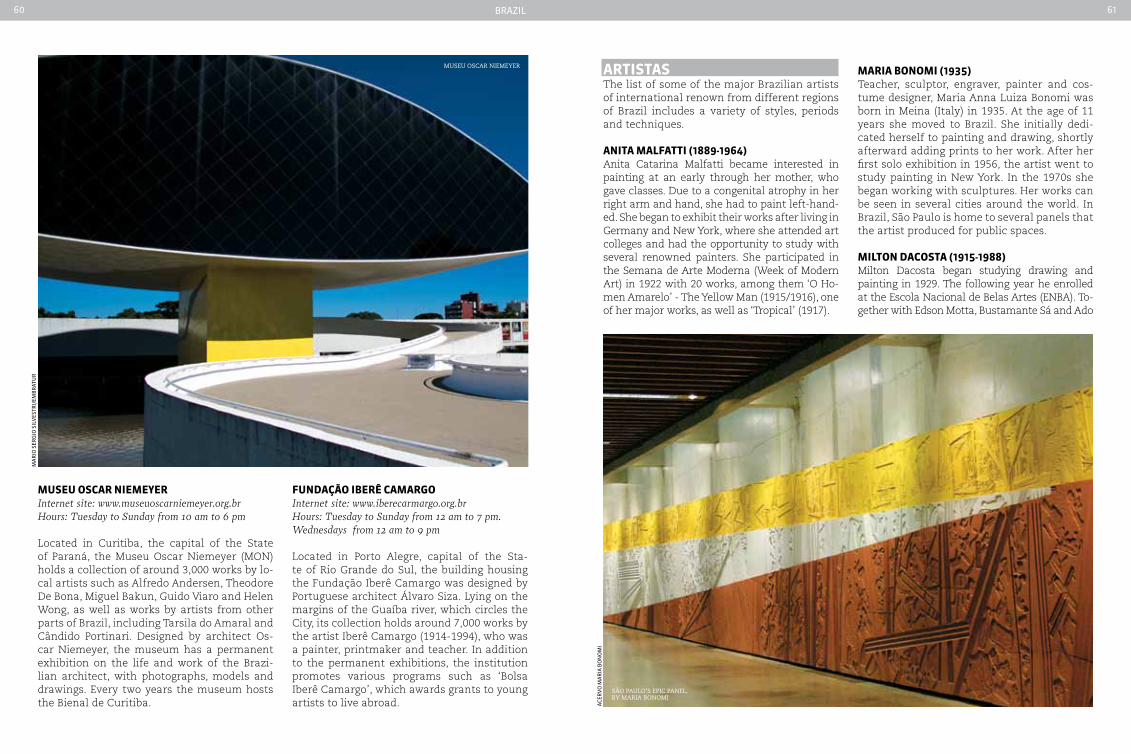
Brazil60 61
MuSeu oScar nIeMeyer Internet site: www.museuoscarniemeyer.org.brHours: Tuesday to Sunday from 10 am to 6 pm
Located in Curitiba, the capital of the State of Paraná, the Museu Oscar Niemeyer (MON) holds a collection of around 3,000 works by lo-cal artists such as Alfredo Andersen, Theodore De Bona, Miguel Bakun, Guido Viaro and Helen Wong, as well as works by artists from other parts of Brazil, including Tarsila do Amaral and Cândido Portinari. Designed by architect Os-car Niemeyer, the museum has a permanent exhibition on the life and work of the Brazi-lian architect, with photographs, models and drawings. Every two years the museum hosts the Bienal de Curitiba.
Fundação IberÊ caMarGoInternet site: www.iberecarmargo.org.brHours: Tuesday to Sunday from 12 am to 7 pm. Wednesdays from 12 am to 9 pm
Located in Porto Alegre, capital of the Sta-te of Rio Grande do Sul, the building housing the Fundação Iberê Camargo was designed by Portuguese architect Álvaro Siza. Lying on the margins of the Guaíba river, which circles the City, its collection holds around 7,000 works by the artist Iberê Camargo (1914-1994), who was a painter, printmaker and teacher. In addition to the permanent exhibitions, the institution promotes various programs such as ‘Bolsa Iberê Camargo’, which awards grants to young artists to live abroad.
ma
rio
ser
gio
sil
Ves
tri/
emB
rat
ur
museu oscar niemeyer artIStaS The list of some of the major Brazilian artists of international renown from different regions of Brazil includes a variety of styles, periods and techniques.
anIta MaLFattI (1889-1964)Anita Catarina Malfatti became interested in painting at an early through her mother, who gave classes. Due to a congenital atrophy in her right arm and hand, she had to paint left-hand-ed. She began to exhibit their works after living in Germany and New York, where she attended art colleges and had the opportunity to study with several renowned painters. She participated in the Semana de Arte Moderna (Week of Modern Art) in 1922 with 20 works, among them ‘O Ho-men Amarelo’ - The Yellow Man (1915/1916), one of her major works, as well as ‘Tropical’ (1917).
MarIa bonoMI (1935)Teacher, sculptor, engraver, painter and cos-tume designer, Maria Anna Luiza Bonomi was born in Meina (Italy) in 1935. At the age of 11 years she moved to Brazil. She initially dedi-cated herself to painting and drawing, shortly afterward adding prints to her work. After her first solo exhibition in 1956, the artist went to study painting in New York. In the 1970s she began working with sculptures. Her works can be seen in several cities around the world. In Brazil, São Paulo is home to several panels that the artist produced for public spaces.
MILton dacoSta (1915-1988)Milton Dacosta began studying drawing and painting in 1929. The following year he enrolled at the Escola Nacional de Belas Artes (ENBA). To-gether with Edson Motta, Bustamante Sá and Ado
são Paulo’s ePic Panel, By maria Bonomi
aCe
rV
o m
ar
ia B
on
om
i
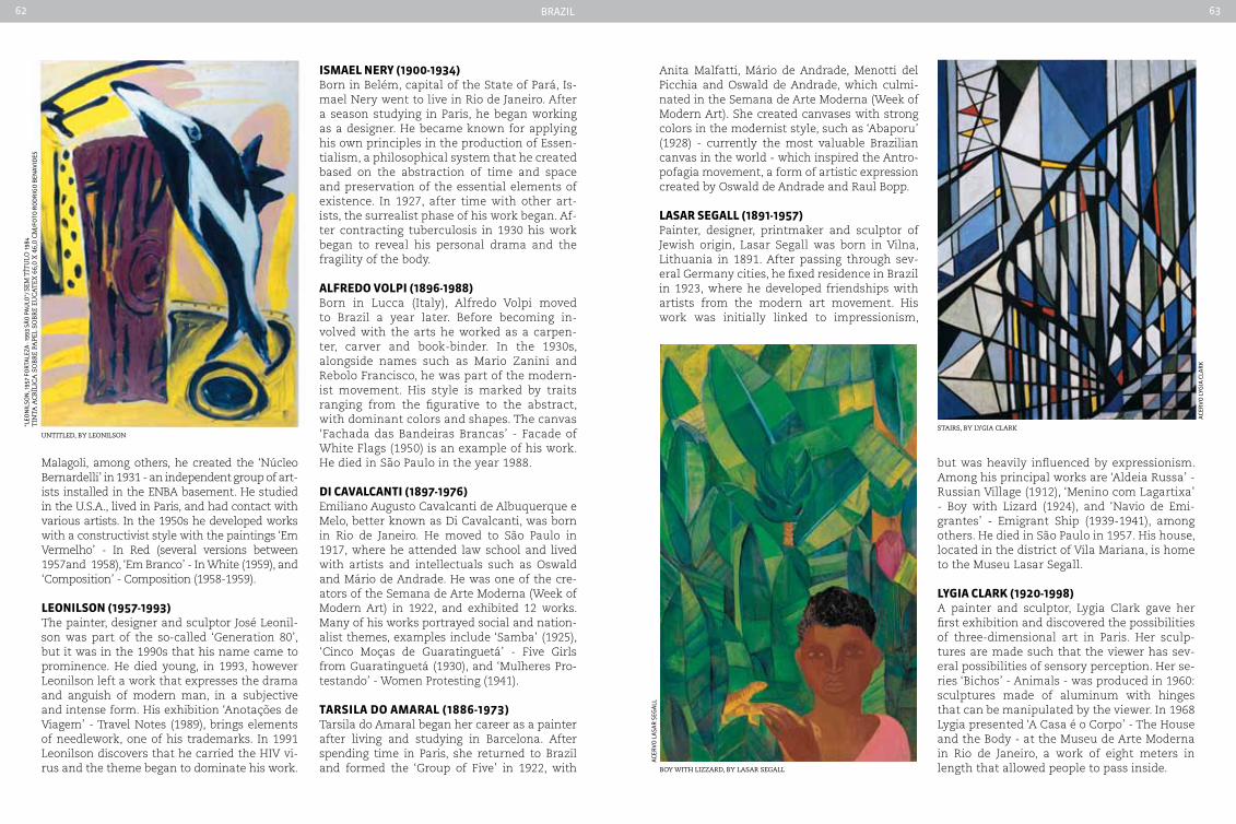
Brazil62 63
Malagoli, among others, he created the ‘Núcleo Bernardelli’ in 1931 - an independent group of art-ists installed in the ENBA basement. He studied in the U.S.A., lived in Paris, and had contact with various artists. In the 1950s he developed works with a constructivist style with the paintings ‘Em Vermelho’ - In Red (several versions between 1957and 1958), ‘Em Branco’ - In White (1959), and ‘Composition’ - Composition (1958-1959).
LeonILSon (1957-1993)The painter, designer and sculptor José Leonil-son was part of the so-called ‘Generation 80’, but it was in the 1990s that his name came to prominence. He died young, in 1993, however Leonilson left a work that expresses the drama and anguish of modern man, in a subjective and intense form. His exhibition ‘Anotações de Viagem’ - Travel Notes (1989), brings elements of needlework, one of his trademarks. In 1991 Leonilson discovers that he carried the HIV vi-rus and the theme began to dominate his work.
Anita Malfatti, Mário de Andrade, Menotti del Picchia and Oswald de Andrade, which culmi-nated in the Semana de Arte Moderna (Week of Modern Art). She created canvases with strong colors in the modernist style, such as ‘Abaporu’ (1928) - currently the most valuable Brazilian canvas in the world - which inspired the Antro-pofagia movement, a form of artistic expression created by Oswald de Andrade and Raul Bopp.
LaSar SeGaLL (1891-1957)Painter, designer, printmaker and sculptor of Jewish origin, Lasar Segall was born in Vilna, Lithuania in 1891. After passing through sev-eral Germany cities, he fixed residence in Brazil in 1923, where he developed friendships with artists from the modern art movement. His work was initially linked to impressionism,
ISMaeL nery (1900-1934)Born in Belém, capital of the State of Pará, Is-mael Nery went to live in Rio de Janeiro. After a season studying in Paris, he began working as a designer. He became known for applying his own principles in the production of Essen-tialism, a philosophical system that he created based on the abstraction of time and space and preservation of the essential elements of existence. In 1927, after time with other art-ists, the surrealist phase of his work began. Af-ter contracting tuberculosis in 1930 his work began to reveal his personal drama and the fragility of the body.
aLFredo VoLpI (1896-1988)Born in Lucca (Italy), Alfredo Volpi moved to Brazil a year later. Before becoming in-volved with the arts he worked as a carpen-ter, carver and book-binder. In the 1930s, alongside names such as Mario Zanini and Rebolo Francisco, he was part of the modern-ist movement. His style is marked by traits ranging from the figurative to the abstract, with dominant colors and shapes. The canvas ‘Fachada das Bandeiras Brancas’ - Facade of White Flags (1950) is an example of his work. He died in São Paulo in the year 1988.
dI caVaLcantI (1897-1976)Emiliano Augusto Cavalcanti de Albuquerque e Melo, better known as Di Cavalcanti, was born in Rio de Janeiro. He moved to São Paulo in 1917, where he attended law school and lived with artists and intellectuals such as Oswald and Mário de Andrade. He was one of the cre-ators of the Semana de Arte Moderna (Week of Modern Art) in 1922, and exhibited 12 works. Many of his works portrayed social and nation-alist themes, examples include ‘Samba’ (1925), ‘Cinco Moças de Guaratinguetá’ - Five Girls from Guaratinguetá (1930), and ‘Mulheres Pro-testando’ - Women Protesting (1941).
tarSILa do aMaraL (1886-1973)Tarsila do Amaral began her career as a painter after living and studying in Barcelona. After spending time in Paris, she returned to Brazil and formed the ‘Group of Five’ in 1922, with Boy with lizzard, By lasar segall
stairs, By lygia clarKuntitled, By leonilson
but was heavily influenced by expressionism. Among his principal works are ‘Aldeia Russa’ - Russian Village (1912), ‘Menino com Lagartixa’ - Boy with Lizard (1924), and ‘Navio de Emi-grantes’ - Emigrant Ship (1939-1941), among others. He died in São Paulo in 1957. His house, located in the district of Vila Mariana, is home to the Museu Lasar Segall.
LyGIa cLark (1920-1998)A painter and sculptor, Lygia Clark gave her first exhibition and discovered the possibilities of three-dimensional art in Paris. Her sculp-tures are made such that the viewer has sev-eral possibilities of sensory perception. Her se-ries ‘Bichos’ - Animals - was produced in 1960: sculptures made of aluminum with hinges that can be manipulated by the viewer. In 1968 Lygia presented ‘A Casa é o Corpo’ - The House and the Body - at the Museu de Arte Moderna in Rio de Janeiro, a work of eight meters in length that allowed people to pass inside.
“leo
nil
son
, 195
7 fo
rta
leza
- 19
93 s
ão
pa
ulo
”/ s
em t
ítu
lo 1
984
tin
ta a
cr
ílic
a s
oB
re
PaPe
l so
Br
e eu
ca
tex
66,
0 x
46,
0 c
m/f
oto
ro
dr
igo
Ben
aVid
es
aCe
rV
o l
ygia
Cla
rK
aCe
rV
o l
asa
r s
ega
ll
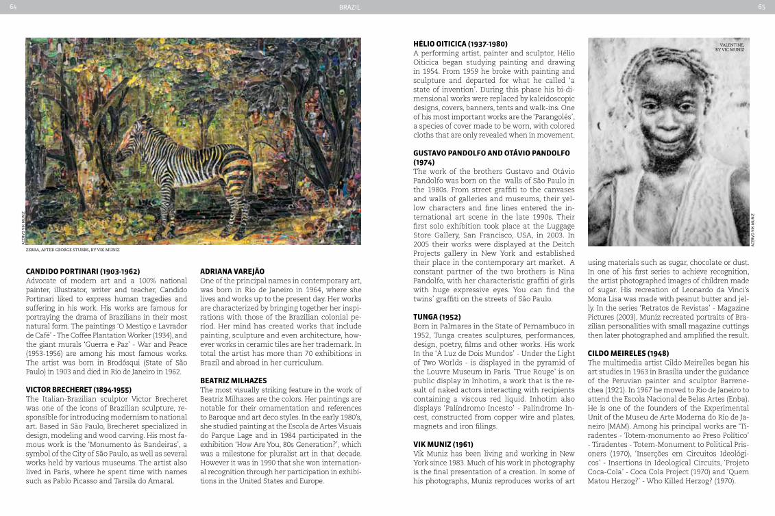
Brazil64 65
candIdo portInarI (1903-1962)Advocate of modern art and a 100% national painter, illustrator, writer and teacher, Candido Portinari liked to express human tragedies and suffering in his work. His works are famous for portraying the drama of Brazilians in their most natural form. The paintings ‘O Mestiço e Lavrador de Café’ - The Coffee Plantation Worker (1934), and the giant murals ‘Guerra e Paz’ - War and Peace (1953-1956) are among his most famous works. The artist was born in Brodósqui (State of São Paulo) in 1903 and died in Rio de Janeiro in 1962.
VIctor brecHeret (1894-1955)The Italian-Brazilian sculptor Victor Brecheret was one of the icons of Brazilian sculpture, re-sponsible for introducing modernism to national art. Based in São Paulo, Brecheret specialized in design, modeling and wood carving. His most fa-mous work is the ‘Monumento às Bandeiras’, a symbol of the City of São Paulo, as well as several works held by various museums. The artist also lived in Paris, where he spent time with names such as Pablo Picasso and Tarsila do Amaral.
adrIana VareJão One of the principal names in contemporary art, was born in Rio de Janeiro in 1964, where she lives and works up to the present day. Her works are characterized by bringing together her inspi-rations with those of the Brazilian colonial pe-riod. Her mind has created works that include painting, sculpture and even architecture, how-ever works in ceramic tiles are her trademark. In total the artist has more than 70 exhibitions in Brazil and abroad in her curriculum.
beatrIz MILHazeSThe most visually striking feature in the work of Beatriz Milhazes are the colors. Her paintings are notable for their ornamentation and references to Baroque and art deco styles. In the early 1980’s, she studied painting at the Escola de Artes Visuais do Parque Lage and in 1984 participated in the exhibition ‘How Are You, 80s Generation?’, which was a milestone for pluralist art in that decade. However it was in 1990 that she won internation-al recognition through her participation in exhibi-tions in the United States and Europe.
HÉLIo oItIcIca (1937-1980)A performing artist, painter and sculptor, Hélio Oiticica began studying painting and drawing in 1954. From 1959 he broke with painting and sculpture and departed for what he called ‘a state of invention’. During this phase his bi-di-mensional works were replaced by kaleidoscopic designs, covers, banners, tents and walk-ins. One of his most important works are the ‘Parangolés’, a species of cover made to be worn, with colored cloths that are only revealed when in movement.
GuStaVo pandoLFo and otáVIo pandoLFo (1974) The work of the brothers Gustavo and Otávio Pandolfo was born on the walls of São Paulo in the 1980s. From street graffiti to the canvases and walls of galleries and museums, their yel-low characters and fine lines entered the in-ternational art scene in the late 1990s. Their first solo exhibition took place at the Luggage Store Gallery, San Francisco, USA, in 2003. In 2005 their works were displayed at the Deitch Projects gallery in New York and established their place in the contemporary art market. A constant partner of the two brothers is Nina Pandolfo, with her characteristic graffiti of girls with huge expressive eyes. You can find the twins’ graffiti on the streets of São Paulo.
tunGa (1952)Born in Palmares in the State of Pernambuco in 1952, Tunga creates sculptures, performances, design, poetry, films and other works. His work In the ‘À Luz de Dois Mundos’ - Under the Light of Two Worlds - is displayed in the pyramid of the Louvre Museum in Paris. ‘True Rouge’ is on public display in Inhotim, a work that is the re-sult of naked actors interacting with recipients containing a viscous red liquid. Inhotim also displays ‘Palíndromo Incesto’ - Palindrome In-cest, constructed from copper wire and plates, magnets and iron filings.
VIk MunIz (1961)Vik Muniz has been living and working in New York since 1983. Much of his work in photography is the final presentation of a creation. In some of his photographs, Muniz reproduces works of art
using materials such as sugar, chocolate or dust. In one of his first series to achieve recognition, the artist photographed images of children made of sugar. His recreation of Leonardo da Vinci’s Mona Lisa was made with peanut butter and jel-ly. In the series ‘Retratos de Revistas’ - Magazine Pictures (2003), Muniz recreated portraits of Bra-zilian personalities with small magazine cuttings then later photographed and amplified the result.
cILdo MeIreLeS (1948)The multimedia artist Cildo Meirelles began his art studies in 1963 in Brasilia under the guidance of the Peruvian painter and sculptor Barrene-chea (1921). In 1967 he moved to Rio de Janeiro to attend the Escola Nacional de Belas Artes (Enba). He is one of the founders of the Experimental Unit of the Museu de Arte Moderna do Rio de Ja-neiro (MAM). Among his principal works are ‘Ti-radentes - Totem-monumento ao Preso Político’ - Tiradentes - Totem-Monument to Political Pris-oners (1970), ‘Inserções em Circuitos Ideológi-cos’ - Insertions in Ideological Circuits, ‘Projeto Coca-Cola’ - Coca Cola Project (1970) and ‘Quem Matou Herzog?’ - Who Killed Herzog? (1970).
aCe
rV
o V
iK m
un
iz
aCe
rV
o V
iK m
un
iz
valentine, By vic muniz
zeBra, after george stuBBs, By viK muniz
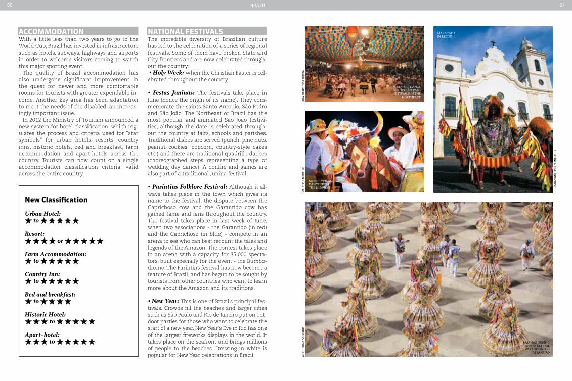
Brazil66 67
accoMModatIonWith a little less than two years to go to the World Cup, Brazil has invested in infrastructure such as hotels, subways, highways and airports in order to welcome visitors coming to watch this major sporting event.
The quality of Brazil accommodation has also undergone significant improvement in the quest for newer and more comfortable rooms for tourists with greater expendable in-come. Another key area has been adaptation to meet the needs of the disabled, an increas-ingly important issue.
In 2012 the Ministry of Tourism announced a new system for hotel classification, which reg-ulates the process and criteria used for “star symbols” for urban hotels, resorts, country inns, historic hotels, bed and breakfast, farm accommodation and apart-hotels across the country. Tourists can now count on a single accommodation classification criteria, valid across the entire country.
square dance during são joão festivals in the
northeast
siriri, tyPical dance from the midwest
Baianas during samBa school Parades in rio
de janeiro
ra
i rei
s/em
Br
atu
ra
f r
od
rig
ues
/rio
tur
CHr
isti
an
Kn
epp
er /
emB
rat
ur
rit
a B
ar
ret
o/s
etu
r B
a
natIonaL FeStIVaLSThe incredible diversity of Brazilian culture has led to the celebration of a series of regional festivals. Some of them have broken State and City frontiers and are now celebrated through-out the country: • Holy Week: When the Christian Easter is cel-ebrated throughout the country.
• Festas Juninas: The festivals take place in June (hence the origin of its name). They com-memorate the saints Santo Antonio, São Pedro and São João. The Northeast of Brazil has the most popular and animated São João festivi-ties, although the date is celebrated through-out the country at fairs, schools and parishes. Traditional dishes are served (punch, pine nuts, peanut cookies, popcorn, country-style cakes etc.) and there are traditional quadrille dances (choreographed steps representing a type of wedding day dance). A bonfire and games are also part of a traditional Junina festival.
• Parintins Folklore Festival: Although it al-ways takes place in the town which gives its name to the festival, the dispute between the Caprichoso cow and the Garantido cow has gained fame and fans throughout the country. The festival takes place in last week of June, when two associations - the Garantido (in red) and the Caprichoso (in blue) - compete in an arena to see who can best recount the tales and legends of the Amazon. The contest takes place in an arena with a capacity for 35,000 specta-tors, built especially for the event - the Bumbó-dromo. The Parintins festival has now become a feature of Brazil, and has begun to be sought by tourists from other countries who want to learn more about the Amazon and its traditions.
• New Year: This is one of Brazil’s principal fes-tivals. Crowds fill the beaches and larger cities such as São Paulo and Rio de Janeiro put on out-door parties for those who want to celebrate the start of a new year. New Year’s Eve in Rio has one of the largest fireworks displays in the world. It takes place on the seafront and brings millions of people to the beaches. Dressing in white is popular for New Year celebrations in Brazil.
new classification
Urban Hotel: to
Resort: or
Farm Accommodation: to
Country Inn: to
Bed and breakfast: to
Historic Hotel: to
Apart-hotel: to
maracatu in recife
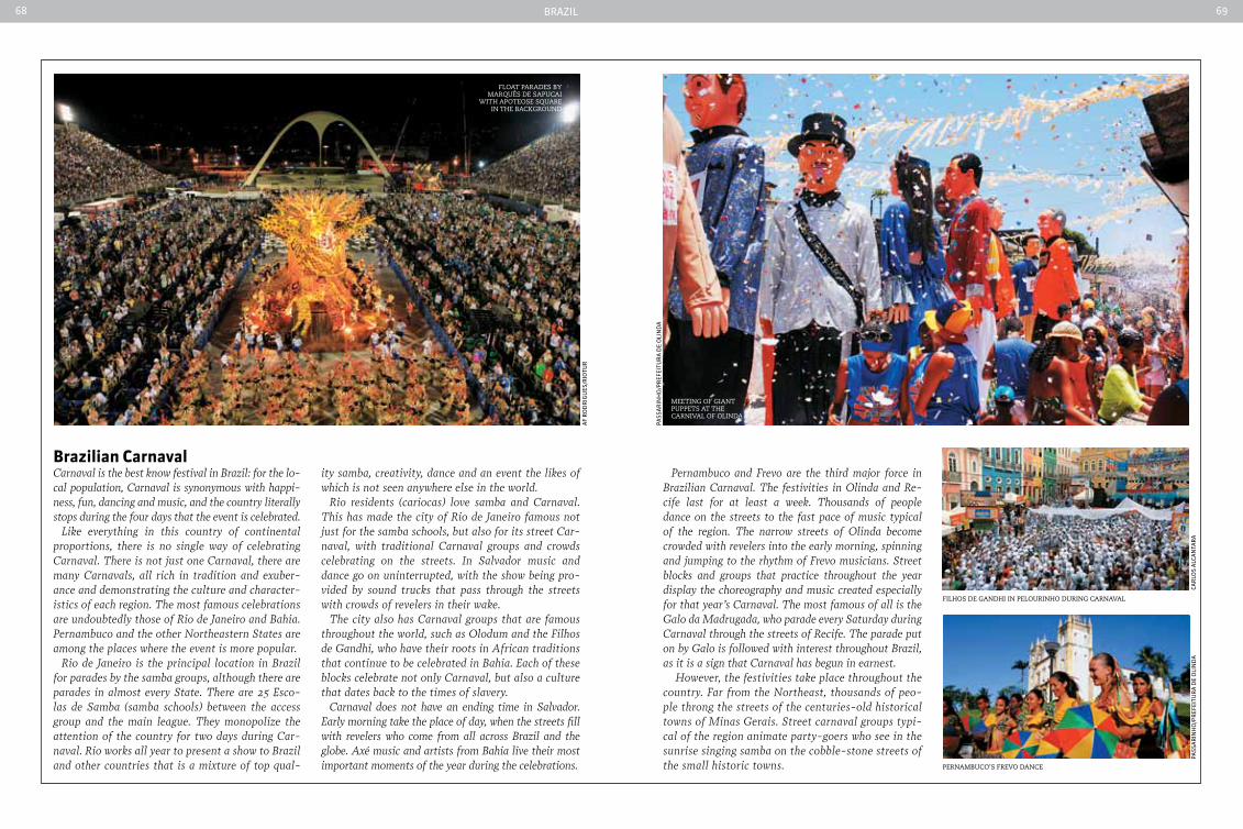
Brazil68 69
brazilian carnaval carnaval is the best know festival in Brazil: for the lo-cal population, carnaval is synonymous with happi-ness, fun, dancing and music, and the country literally stops during the four days that the event is celebrated.
Like everything in this country of continental proportions, there is no single way of celebrating carnaval. There is not just one carnaval, there are many carnavals, all rich in tradition and exuber-ance and demonstrating the culture and character-istics of each region. The most famous celebrations are undoubtedly those of Rio de Janeiro and Bahia. Pernambuco and the other Northeastern States are among the places where the event is more popular.
Rio de Janeiro is the principal location in Brazil for parades by the samba groups, although there are parades in almost every State. There are 25 Esco-las de Samba (samba schools) between the access group and the main league. They monopolize the attention of the country for two days during car-naval. Rio works all year to present a show to Brazil and other countries that is a mixture of top qual-
ity samba, creativity, dance and an event the likes of which is not seen anywhere else in the world.
Rio residents (cariocas) love samba and carnaval. This has made the city of Rio de Janeiro famous not just for the samba schools, but also for its street car-naval, with traditional carnaval groups and crowds celebrating on the streets. In Salvador music and dance go on uninterrupted, with the show being pro-vided by sound trucks that pass through the streets with crowds of revelers in their wake.
The city also has carnaval groups that are famous throughout the world, such as Olodum and the Filhos de Gandhi, who have their roots in African traditions that continue to be celebrated in Bahia. Each of these blocks celebrate not only carnaval, but also a culture that dates back to the times of slavery.
carnaval does not have an ending time in Salvador. Early morning take the place of day, when the streets fill with revelers who come from all across Brazil and the globe. Axé music and artists from Bahia live their most important moments of the year during the celebrations.
Pernambuco and Frevo are the third major force in Brazilian carnaval. The festivities in Olinda and Re-cife last for at least a week. Thousands of people dance on the streets to the fast pace of music typical of the region. The narrow streets of Olinda become crowded with revelers into the early morning, spinning and jumping to the rhythm of Frevo musicians. Street blocks and groups that practice throughout the year display the choreography and music created especially for that year’s carnaval. The most famous of all is the Galo da Madrugada, who parade every Saturday during carnaval through the streets of Recife. The parade put on by Galo is followed with interest throughout Brazil, as it is a sign that carnaval has begun in earnest.
However, the festivities take place throughout the country. Far from the Northeast, thousands of peo-ple throng the streets of the centuries-old historical towns of Minas Gerais. Street carnaval groups typi-cal of the region animate party-goers who see in the sunrise singing samba on the cobble-stone streets of the small historic towns.
float Parades By marquÊs de saPucai
with aPoteose square in the BacKground
meeting of giant PuPPets at the carnival of olinda
filhos de gandhi in Pelourinho during carnaval
PernamBuco’s frevo dance
af
ro
dr
igu
es/r
iotu
r
pass
ar
inH
o/p
ref
eitu
ra
de
oli
nd
a
pass
ar
inH
o/p
ref
eitu
ra
de
oli
nd
aCa
rlo
s a
lCa
nta
ra
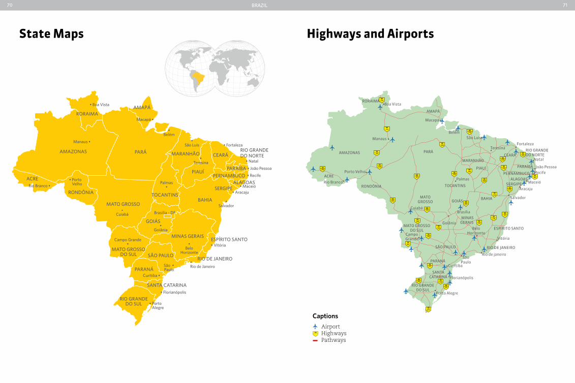
Brazil70 71
State Maps Highways and airports
BR163
BR163
BR285
BR230
BR316
BR226
BR364
BR262
BR267
BR116
BR277
BR116
BR101
BR101
BR116
BR232
BR020
BR020
BR020
BR135
BR242
BR070
BR070
BR471
BR304
BR230
BR230
BR319
BR174
BR174
BR364
BR101
RORAIMA
AMAPÁ
Macapá
BelémSão Luís
Teresina
Boa Vista
AMAZONAS PARÁ
MARANHÃOCEARÁ
RIO GRANDEDO NORTE
ALAGOASSERGIPE
BAHIA Salvador
TOCANTINS
GOIÁS
Palmas
Brasília
GoiâniaESPíRITO SANTO
Vitória
SANTACATARINA
RIO GRANDEDO SUL
Porto Alegre
RIO DE JANEIRO
Rio de janeiro
MINASGERAIS
BeloHorizonte
PARAÍBA
PERNAMBUCO
João Pessoa
Fortaleza
Recife
Natal
Maceió
Aracaju
PIAUÍ
Manaus
ACRE
RONDÔNIA
MATOGROSSO
Cuiabá
CampoGrande
PARANÁCuritiba
Florianópolis
SãoPaulo
SÃO PAULO
MATO GROSSODO SUL
Rio Branco
Porto Velho
Captions
AirportHighwaysPathways
BR
AmAzOnAs
Manaus •
• Belém
Macapá •
• Boa Vista
• Porto VelhoRio Branco •
Campo Grande•
Curitiba •
• Goiânia
•Cuiabá Brasília - DF
• Porto Alegre
• Florianópolis
São •Paulo
PARá
RonDôniA
RoRAiMA
PiAuí
mArAnHãO
BAhiA
Rio GRAnDe Do noRte
PeRnAMBuCo
CeARá
AlAGoAS
PARAíBA
SeRGiPe
MAto GRoSSo
MAto GRoSSo Do Sul
Rio GRAnDe Do Sul
GoiáS
São PAulo
PARAná
SAntA CAtARinA
MinAS GeRAiS
toCAntinS
Rio De JAneiRo• Rio de Janeiro
•Belo
horizonte
• Vitória
• Salvador
• Recife
• João Pessoa
• Maceió• Aracaju
• natal•
teresina
Palmas•
• Fortaleza•
São luís
eSPíRito SAnto
AMAPá
ACre
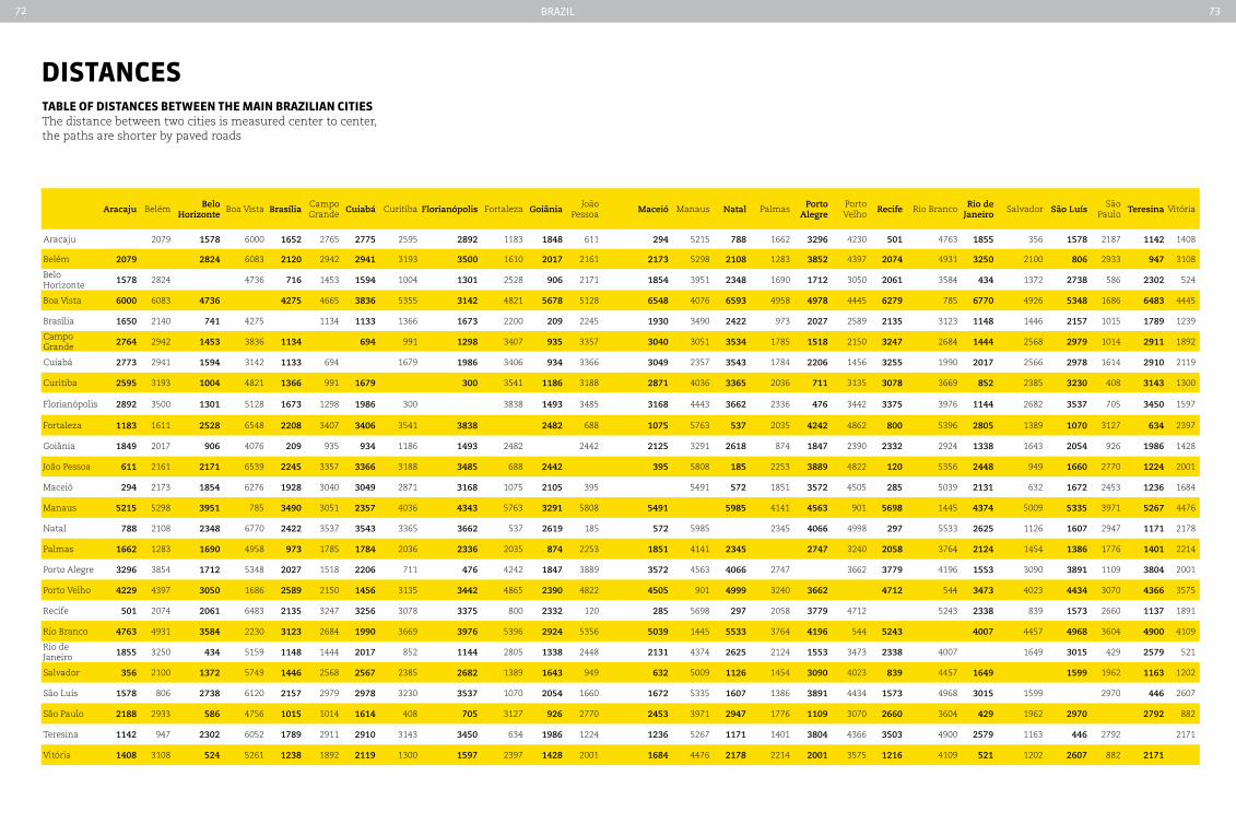
Brazil72 73
tabLe oF dIStanceS between tHe MaIn brazILIan cItIeSThe distance between two cities is measured center to center, the paths are shorter by paved roads
dIStanceS
Aracaju Belém Belo Horizonte
Boa Vista BrasíliaCampo Grande Cuiabá Curitiba Florianópolis Fortaleza Goiânia
João Pessoa Maceió Manaus Natal Palmas Porto
AlegrePorto Velho Recife Rio Branco Rio de
JaneiroSalvador São Luís
São Paulo Teresina Vitória
Aracaju 2079 1578 6000 1652 2765 2775 2595 2892 1183 1848 611 294 5215 788 1662 3296 4230 501 4763 1855 356 1578 2187 1142 1408
Belém 2079 2824 6083 2120 2942 2941 3193 3500 1610 2017 2161 2173 5298 2108 1283 3852 4397 2074 4931 3250 2100 806 2933 947 3108
Belo Horizonte 1578 2824 4736 716 1453 1594 1004 1301 2528 906 2171 1854 3951 2348 1690 1712 3050 2061 3584 434 1372 2738 586 2302 524
Boa Vista 6000 6083 4736 4275 4665 3836 5355 3142 4821 5678 5128 6548 4076 6593 4958 4978 4445 6279 785 6770 4926 5348 1686 6483 4445
Brasília 1650 2140 741 4275 1134 1133 1366 1673 2200 209 2245 1930 3490 2422 973 2027 2589 2135 3123 1148 1446 2157 1015 1789 1239
Campo Grande 2764 2942 1453 3836 1134 694 991 1298 3407 935 3357 3040 3051 3534 1785 1518 2150 3247 2684 1444 2568 2979 1014 2911 1892
Cuiabá 2773 2941 1594 3142 1133 694 1679 1986 3406 934 3366 3049 2357 3543 1784 2206 1456 3255 1990 2017 2566 2978 1614 2910 2119
Curitiba 2595 3193 1004 4821 1366 991 1679 300 3541 1186 3188 2871 4036 3365 2036 711 3135 3078 3669 852 2385 3230 408 3143 1300
Florianópolis 2892 3500 1301 5128 1673 1298 1986 300 3838 1493 3485 3168 4443 3662 2336 476 3442 3375 3976 1144 2682 3537 705 3450 1597
Fortaleza 1183 1611 2528 6548 2208 3407 3406 3541 3838 2482 688 1075 5763 537 2035 4242 4862 800 5396 2805 1389 1070 3127 634 2397
Goiânia 1849 2017 906 4076 209 935 934 1186 1493 2482 2442 2125 3291 2618 874 1847 2390 2332 2924 1338 1643 2054 926 1986 1428
João Pessoa 611 2161 2171 6539 2245 3357 3366 3188 3485 688 2442 395 5808 185 2253 3889 4822 120 5356 2448 949 1660 2770 1224 2001
Maceió 294 2173 1854 6276 1928 3040 3049 2871 3168 1075 2105 395 5491 572 1851 3572 4505 285 5039 2131 632 1672 2453 1236 1684
Manaus 5215 5298 3951 785 3490 3051 2357 4036 4343 5763 3291 5808 5491 5985 4141 4563 901 5698 1445 4374 5009 5335 3971 5267 4476
Natal 788 2108 2348 6770 2422 3537 3543 3365 3662 537 2619 185 572 5985 2345 4066 4998 297 5533 2625 1126 1607 2947 1171 2178
Palmas 1662 1283 1690 4958 973 1785 1784 2036 2336 2035 874 2253 1851 4141 2345 2747 3240 2058 3764 2124 1454 1386 1776 1401 2214
Porto Alegre 3296 3854 1712 5348 2027 1518 2206 711 476 4242 1847 3889 3572 4563 4066 2747 3662 3779 4196 1553 3090 3891 1109 3804 2001
Porto Velho 4229 4397 3050 1686 2589 2150 1456 3135 3442 4865 2390 4822 4505 901 4999 3240 3662 4712 544 3473 4023 4434 3070 4366 3575
Recife 501 2074 2061 6483 2135 3247 3256 3078 3375 800 2332 120 285 5698 297 2058 3779 4712 5243 2338 839 1573 2660 1137 1891
Rio Branco 4763 4931 3584 2230 3123 2684 1990 3669 3976 5396 2924 5356 5039 1445 5533 3764 4196 544 5243 4007 4457 4968 3604 4900 4109
Rio de Janeiro 1855 3250 434 5159 1148 1444 2017 852 1144 2805 1338 2448 2131 4374 2625 2124 1553 3473 2338 4007 1649 3015 429 2579 521
Salvador 356 2100 1372 5749 1446 2568 2567 2385 2682 1389 1643 949 632 5009 1126 1454 3090 4023 839 4457 1649 1599 1962 1163 1202
São Luís 1578 806 2738 6120 2157 2979 2978 3230 3537 1070 2054 1660 1672 5335 1607 1386 3891 4434 1573 4968 3015 1599 2970 446 2607
São Paulo 2188 2933 586 4756 1015 1014 1614 408 705 3127 926 2770 2453 3971 2947 1776 1109 3070 2660 3604 429 1962 2970 2792 882
Teresina 1142 947 2302 6052 1789 2911 2910 3143 3450 634 1986 1224 1236 5267 1171 1401 3804 4366 3503 4900 2579 1163 446 2792 2171
Vitória 1408 3108 524 5261 1238 1892 2119 1300 1597 2397 1428 2001 1684 4476 2178 2214 2001 3575 1216 4109 521 1202 2607 882 2171

75
acre
recently renovated house on rua da gameleira
ma
rCã
o/s
eCo
m -
aC
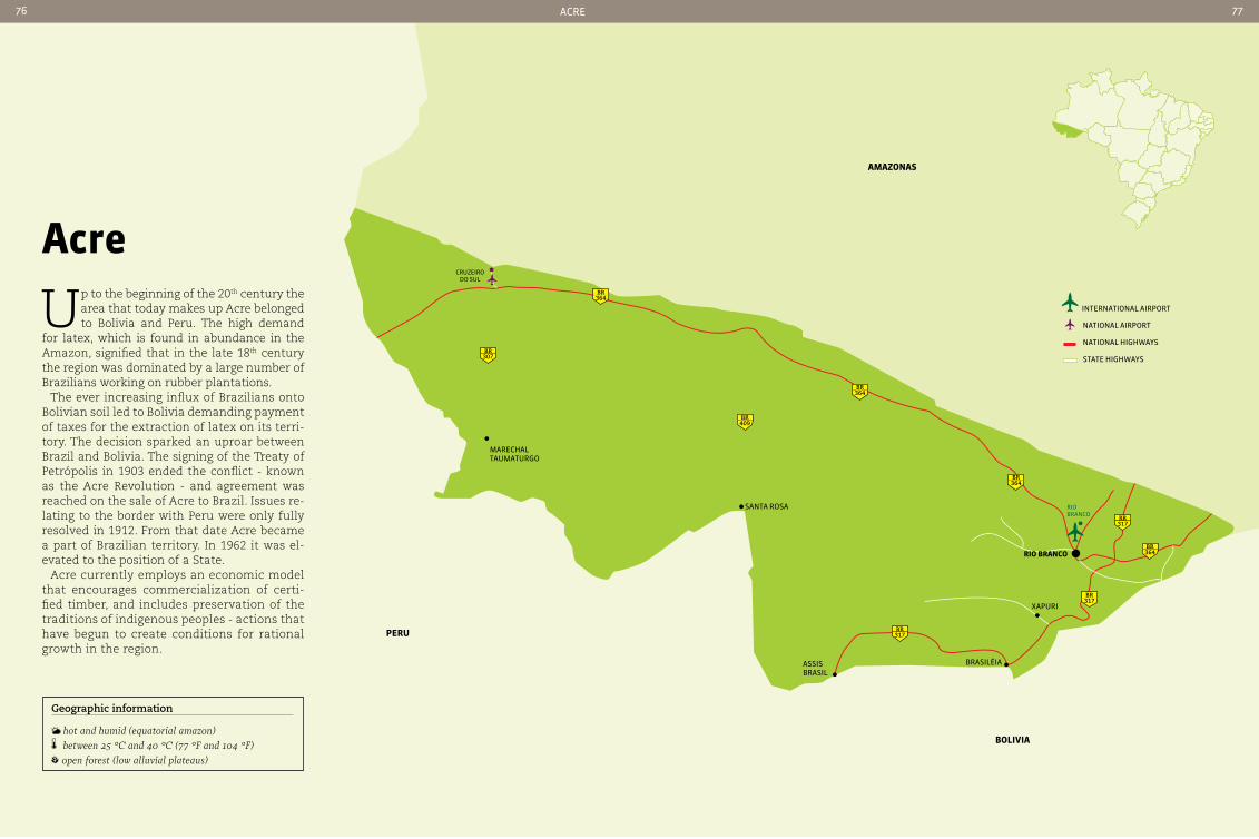
aMazonaS
peru
boLIVIa
364BR
364BR
307BR
409BR
364BR
364BR
317BR
317BR
317BR
rio BranCo
Xapuri
assis Brasil
Brasiléia
santa rosa
Cruzeiro do sul
mareCHaltaumaturgo
rIo branco
international airport
national airport
national HigHways
state HigHways
76 77
acre
Up to the beginning of the 20th century the area that today makes up Acre belonged to Bolivia and Peru. The high demand
for latex, which is found in abundance in the Amazon, signified that in the late 18th century the region was dominated by a large number of Brazilians working on rubber plantations.
The ever increasing influx of Brazilians onto Bolivian soil led to Bolivia demanding payment of taxes for the extraction of latex on its terri-tory. The decision sparked an uproar between Brazil and Bolivia. The signing of the Treaty of Petrópolis in 1903 ended the conflict - known as the Acre Revolution - and agreement was reached on the sale of Acre to Brazil. Issues re-lating to the border with Peru were only fully resolved in 1912. From that date Acre became a part of Brazilian territory. In 1962 it was el-evated to the position of a State.
Acre currently employs an economic model that encourages commercialization of certi-fied timber, and includes preservation of the traditions of indigenous peoples - actions that have begun to create conditions for rational growth in the region.
Geographic information
hot and humid (equatorial amazon) between 25 °c and 40 °c (77 °F and 104 °F) open forest (low alluvial plateaus)
aCre76 77
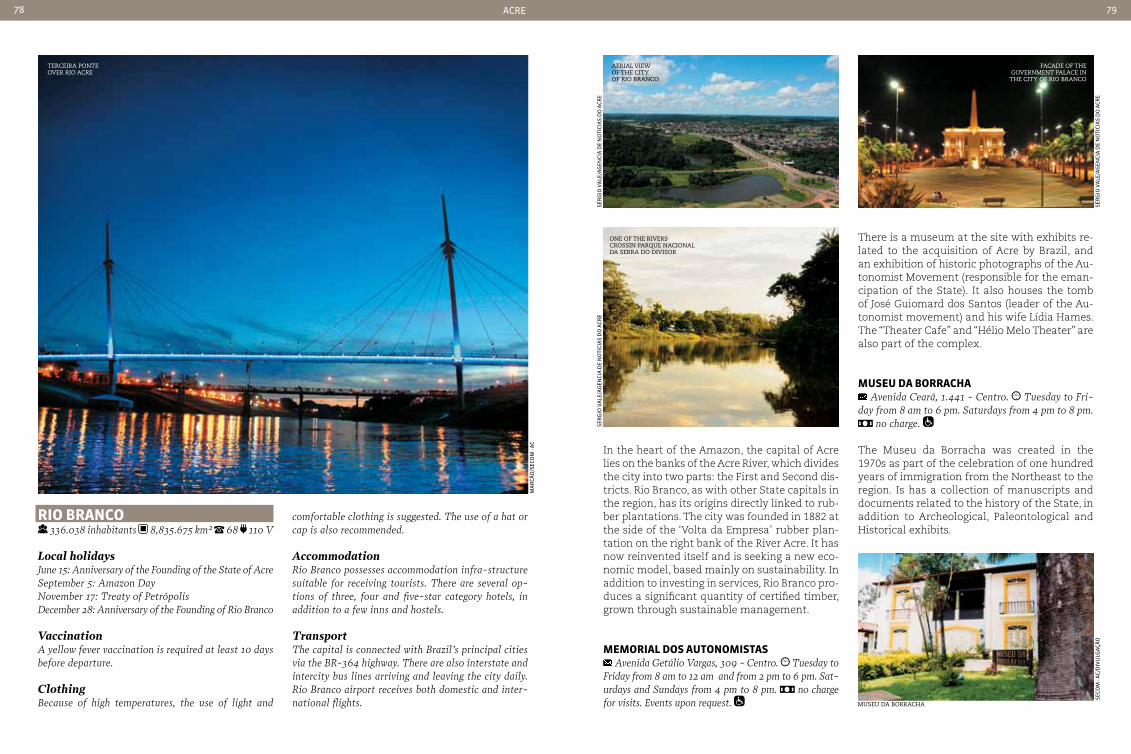
aCre78 79
terceira Ponte over rio acre
rIo branco 336.038 inhabitants 8,835.675 km² 68 110 V
Local holidaysJune 15: Anniversary of the Founding of the State of AcreSeptember 5: Amazon Day November 17: Treaty of PetrópolisDecember 28: Anniversary of the Founding of Rio Branco
VaccinationA yellow fever vaccination is required at least 10 days before departure.
ClothingBecause of high temperatures, the use of light and
comfortable clothing is suggested. The use of a hat or cap is also recommended.
AccommodationRio Branco possesses accommodation infra-structure suitable for receiving tourists. There are several op-tions of three, four and five-star category hotels, in addition to a few inns and hostels.
TransportThe capital is connected with Brazil’s principal cities via the BR-364 highway. There are also interstate and intercity bus lines arriving and leaving the city daily. Rio Branco airport receives both domestic and inter-national flights.
In the heart of the Amazon, the capital of Acre lies on the banks of the Acre River, which divides the city into two parts: the First and Second dis-tricts. Rio Branco, as with other State capitals in the region, has its origins directly linked to rub-ber plantations. The city was founded in 1882 at the side of the ‘Volta da Empresa’ rubber plan-tation on the right bank of the River Acre. It has now reinvented itself and is seeking a new eco-nomic model, based mainly on sustainability. In addition to investing in services, Rio Branco pro-duces a significant quantity of certified timber, grown through sustainable management.
MeMorIaL doS autonoMIStaS Avenida Getúlio Vargas, 309 - centro. Tuesday to
Friday from 8 am to 12 am and from 2 pm to 6 pm. Sat-urdays and Sundays from 4 pm to 8 pm. no charge for visits. Events upon request. museu da Borracha
ma
rCã
o/s
eCo
m -
aC
seCo
m -
aC/
diV
ulg
açã
o
There is a museum at the site with exhibits re-lated to the acquisition of Acre by Brazil, and an exhibition of historic photographs of the Au-tonomist Movement (responsible for the eman-cipation of the State). It also houses the tomb of José Guiomard dos Santos (leader of the Au-tonomist movement) and his wife Lídia Hames. The “Theater Cafe” and “Hélio Melo Theater” are also part of the complex.
MuSeu da borracHa Avenida ceará, 1.441 - centro. Tuesday to Fri-
day from 8 am to 6 pm. Saturdays from 4 pm to 8 pm. no charge.
The Museu da Borracha was created in the 1970s as part of the celebration of one hundred years of immigration from the Northeast to the region. Is has a collection of manuscripts and documents related to the history of the State, in addition to Archeological, Paleontological and Historical exhibits.
aerial view of the city of rio Branco
facade of the government Palace in the city of rio Branco
one of the riverscrossin Parque nacional da serra do divisor
sér
gio
Va
le/a
gen
Cia
de
no
tiCi
as
do
aCr
esé
rg
io V
ale
/ag
enCi
a d
e n
oti
Cia
s d
o a
Cre
sér
gio
Va
le/a
gen
Cia
de
no
tiCi
as
do
aCr
e

aCre80 81
xapurI 16.091 inhabitants 5,347.283 km2
68 110 V 150 meters
Xapuri entered into the annals of Brazilian history as a symbol of the struggle for the environment and the rights of small-scale subsistence growers in their struggle against destruction of the forests by large-scale farmers. The small town became known worldwide after death of the latex collec-tor and environmentalist leader, Chico Mendes. He was also one of the founders of the Aliança dos Povos da Floresta (Forest Peoples Alliance), one of the most important movements acting in defense of the Amazon. The historic town center, with its townhouses and residential and commercial properties on the central avenue on the banks of the River Acre, has recently undergone a restora-tion that seeks to recover the town’s past identity.
In tHe FootStepS oF cHIco MendeS Taking the walk during business hours is recom-
mended (from 10 am to 6 pm) to take advantage of the shops. to be agreed with local guides.
The trail starts on Rua do Comércio, where it is possible to take a little time to eat, drink or even make a small purchase of artifacts produced by local artisans, such as natural jewelry, marque-try, or articles made from seeds. Nearby is the Museu Xapuri, some 5w meters from the cem-etery where Chico Mendes is buried. The route can also include a walk along the river bank.
rubber pLantatIon tour 47 km from the center of Xapuri, via dirt roads and
trails. Groups: if you prefer to make a visit in the com-pany of a guide, contact one of the travel agencies in town. The country lodge located on the plantation also offers guided tours, with prices that vary according to the size of the group.
It is possible to visit the rubber plantations in Xa-puri to see latex being produced (the raw mate-rial for rubber). The best known is the Cachoeira Plantation, home of the Chico Mendes Small-holding. Here you will find trails into the Amazon Forest, crossing river tributaries and streams. latex extraction
chico mendes memorial center
taPPer extracting latex
the fight for the rights of forest people
The activist chico Mendes was involved in the struggle to preserve the Amazon rain forest and was one of the creators of the current sus-tainable use conservation Areas, which help to ensure the preservation of natural resources and continued economic activity in the re-gion. Dissatisfied with the living conditions of latex plantation workers and the system-atic destruction of natural forests, his struggle drew attention from around the world and the activist was praised by international organi-zations and governments. In 1987, on World Environment Day (June 5), chico Mendes was honored by the United Nations. Two years later he was to be murdered in his backyard by ranchers who were opposed to his fight.
ser
gio
Va
le/s
eCo
m -
aC
seCo
m -
aC/
diV
ulg
açã
o
ag
enCi
a d
e n
oti
Cia
s d
o a
Cre
/diV
ulg
açã
o
tacacá - a tyPical acre dish of indian origin
Flavors of the northAcre’s unique colonization is reflected in its cooking. There are strong influences from the original owners of the land - native Indians, from Bolivians - who occupied the region before it became part of Brazil, from North-Eastern Brazilians and Syrian-Lebanese - who arrived in the region at the hieght of the rubber industry. Among the most popular dishes are tucupi style duck and tacacá - both of Indian origin and also very common in other Northern states, saltenhas - a type of Bolivian pastry, sun-dried beef with spicy rice an beans - typical of the Northeast, and Arabic dishes such as stuffed vine leaves and kibe (made with rice and sweet cassava).
feli
pe
go
mB
oss
y/em
Br
atu
r
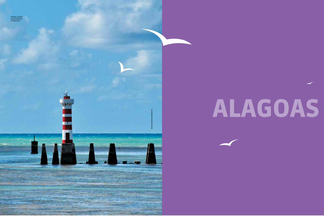
83
aLaGoaSB
eniC
io m
on
te/e
mB
rat
ur
Ponta verdelighthouse, in maceiÓ
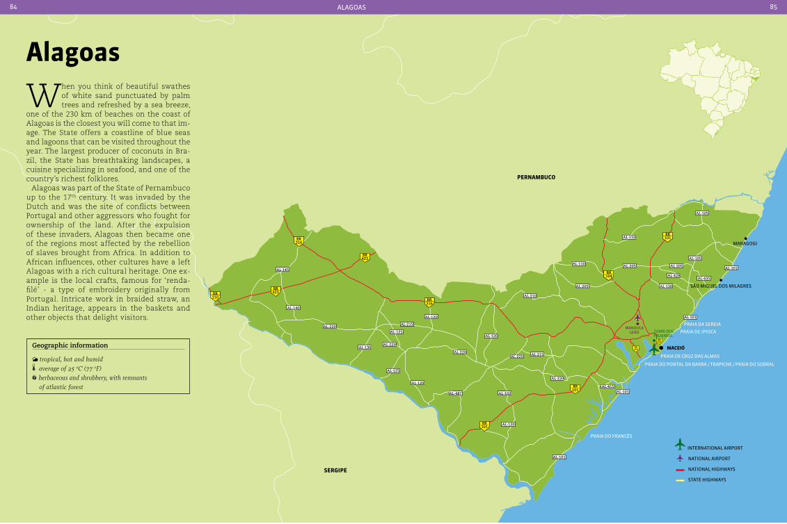
Geographic information
tropical, hot and humid average of 25 oc (77 oF) herbaceous and shrubbery, with remnants
of atlantic forest
MaceIÓ
maragogi
são miguel dos milagres
praia de Cruz das almas
praia do pontal da Barra / trapiCHe / praia do soBral
praia do franCês
praia da sereia
praia de ipioCa
316BR
101BR
101BR
101BR
104BR
424BR
423BR
423BR
110BR
316BR
AL-101
AL-101
AL-101
AL-101
AL-105
AL-105
AL-428
AL-130
AL-205 AL-205
AL-435
AL-110
AL-110
AL-205
AL-220
AL-130
AL-145
AL-140
AL-120
AL-210
AL-102
AL-120
AL-220
AL-220
AL-120
AL-120
AL-125
AL-125
AL-215AL-215
AL-220
AL-415
AL-225 AL-215
AL-487
zumBi dos palmares
manduCa leão
316BR
pernaMbuco
SerGIpe
alagoas
When you think of beautiful swathes of white sand punctuated by palm trees and refreshed by a sea breeze,
one of the 230 km of beaches on the coast of Alagoas is the closest you will come to that im-age. The State offers a coastline of blue seas and lagoons that can be visited throughout the year. The largest producer of coconuts in Bra-zil, the State has breathtaking landscapes, a cuisine specializing in seafood, and one of the country’s richest folklores.
Alagoas was part of the State of Pernambuco up to the 17th century. It was invaded by the Dutch and was the site of conflicts between Portugal and other aggressors who fought for ownership of the land. After the expulsion of these invaders, Alagoas then became one of the regions most affected by the rebellion of slaves brought from Africa. In addition to African influences, other cultures have a left Alagoas with a rich cultural heritage. One ex-ample is the local crafts, famous for ‘renda-filé’ - a type of embroidery originally from Portugal. Intricate work in braided straw, an Indian heritage, appears in the baskets and other objects that delight visitors.
international airport
national airport
national HigHways
state HigHways
alagoas84 85

houses on rua sá and rua alBuquerque in maceiÓ
MaceIÓ 932,748 inhabitants 503,069 km² 82 220 V
Local holidaysJune 24: São João’s dayJune 29: São Pedro’s dayAugust 27: Nossa Senhora dos Prazeres’ daySeptember 16: Political Emancipation of AlagoasDecember 8: Nossa Senhora da conceição’s day
ClothingThe visitor should pack lightweight clothes and shoes. A hat or cap and shorts are essential to move around the city comfortably.
AccommodationTourists who come to Maceió will find an excellent choice of hotels, inns and resorts in the city. There are options at all levels, from simple inns to five star hotels, spread out along the districts bordering the shoreline.
TransportRoad access to Maceió is via the BR-101 and BR-104 highways. The city also has air connections with several other cities in Brazil. The airport is 25 km from the center.
Within the cityMaceió has 93 urban bus lines and 648 buses in cir-culation. The city also has three integrated transport points, where passengers can change vehicle without having to pay an additional fare.
Green and turquoise waters, natural lagoons and coral reefs enchant tourists who come to any of Maceió’s beaches. In addition to enjoying the beauty of its white sands and calm seas, it is possible to take a trip on a raft or traditional canoe, take a relaxing walk along the water’s edge and later enjoy the delicacies served by restaurants and kiosks on the seafront.
Maceió grew out of a fishing village in 1609, and was originally founded to reduce traffick-ing of Pau-Brasil wood by the French. However, real growth came with the emancipation of the province of Alagoas in 1817. The City be-came the State Capital and went on to be the base for commerce between other Northeast-ern States and the rest of the country, through the port of Jaraguá. Several museums and buildings recall a little of history of the City and are worth visiting.
catedraL MetropoLItana Praça Dom Pedro II - centro. Monday to Satur-
day at 6 pm. Sundays at 5 pm and 7:30 pm
Known as the Paróquia de Nossa Senhora dos Prazeres (the patron saint of the city), this is the most important church in the State. It was built in 1859 with a predominance of neoclassical style, highlighted by its imposing stairway. The church has two smaller altars, in addition to the principal altar, which are dedicated to São Se-bastião and São Miguel, as well as the Capela do Sagrado Sacramento.
paLácIo FLorIano peIxoto Praça Marechal Floriano Peixoto, 517 - centro. Tuesday, Thursday and Friday, from 8 am to 5 pm.
Wednesday from 8 am to 9 pm. Saturdays, Sundays and public holidays, from 1 pm to 5 pm. no charge
Seat of the Government of the State of Alagoas, the buildings house the Museu Palácio Floriano Peixoto (MUPA). The collection consists of fur-niture from the 19th and 20th centuries, silver-ware, glassware, decorative objects, and works by painters from Alagoas.
museu Palácio floriano Peixoto
rich FolkloreThe culture of Alagoas is formed by a rich mix-ture of sounds, colors and dances. The State is renowned for the festivals and folklore events that take place throughout the year. Among the principal festivals is Guerreiro, a 100% Alagoan celebration that blends elements from several other popular festivals and takes place on the streets, with music, song and dance. Another event, the ‘Toré dos Indios’, has existed since the 18th century and is still practiced in its original form. During ‘Bumba Meu Boi’, animal costumes are used in dances in the streets, accompanied by typical regional music. With its origins in medieval tournaments, the cavalhada mixes a procession with a tournament involving twelve knights. In the dramatic Fandango, nautical songs telling of great voyages are the mainstay - many of them originating from Portugal.
the culture of alagoas has rich roots
alagoas86 87
Ben
iCio
mo
nte
/em
Br
atu
r
Ben
iCio
mo
nte
/em
Br
atu
r
Ben
iCio
mo
nte
/em
Br
atu
r

praIa do FrancÊS Via state highway AL-101 North. The beach is
20 km from the center of Maceió, in the Municipality of Marechal Deodoro
This Alagoan beach is considered to be one of the most beautiful in the country. The shal-lows are protected by a reef wall, which pro-vides for calm and crystalline waters, ideal for swimming and diving. The beach also has one stretch open to the ocean, with waves that are ideal for surfing.
MaraGoGI 28,749 inhabitants 334,042 km² 82 220 V
Local holidays June 24: São João’s dayJune 29: São Pedro’s dayAugust 27: Nossa Senhora dos Prazeres’ daySeptember 16: Political Emancipation of AlagoasDecember 8: Nossa Senhora da conceição’s day
AccommodationThose who visit Maragogi can experiment lodging in a fisherman’s cottage - these are available for rent by the season, subject to advance booking. There are also several inns available to accommodate visitors, from simple to sophisticate.
praIa cruz daS aLMaS From the center of Maceió take state highway
AL-101 North
This beach, with its strong waves, is a favorite destination for surfers. The site was previously a cemetery, which is where the name Cruz das Almas - “Soul’s Cross” - came from. However these days it is also known as Lagoa da Anta beach. It has good facilities for visitors.
praIa de IpIoca Via state highway AL-101 North. The beach is
24 km from Maceió
The beach is located at the village of the same name. Clear water, almost no waves, banks of soft white sand and natural pools make it ideal for diving and swimming. Children can play in the shallower waters without risk. The location also has a viewpoint with an even better view of the beautiful landscape, especially at sunset. It has several bars and restaurants.
praIa do pontaL da barra/ trapIcHe/ praIaS do SobraL
4 km from Maceió, via state highway AL-101 North
These beaches, which are open to the ocean, are not suitable for bathing. However the lo-cation is perfect for those who enjoy surfing, windsurfing and other radical sports. These stretches of beach are also frequented by am-ateur soccer players and fishermen, especially at Pontal da Barra.
catamarans taKe tourists to the natural Pools in maceio
TransportFrom Maceió, tourists should drive via state high-way AL-101 North. Vehicles can be rented at the airport in Maceió.
Maragogi is a popular destination in Alagoas thanks to the beauty and tranquility of its beaches. Tourism is the principal activity, which has led the town to developing without losing its original character and traditions, such as fishing and the manufacture of ‘Bolinhos de Goma’, a type of cookie well known to tourists and residents. The town originated as a village known as Gamela; the name was changed to Isabel in 1887 to honor the Princess who freed black slaves. Five years later, it received its cur-rent name, inherited from the river that cuts through the region.
praIa centraL To get to Maragogi take state highway AL-101 North
This urbanized beach is the busiest in the city, and is part of the Costa dos Corais (Coral Coast) Environmental Protection Area. Fine sand, clear water and few waves make it suitable for families and groups. Vessels depart from the beach to Galés - coral formations that lie six km from the shore.
praIa de paJuçara Via state highway AL-101 North. The beach is only
3 km from the center of Maceió
Jangadas (typical handmade rafts constructed from wood, often used for fishing and pleasure rides in the Northeast of Brazil) await visitors for rides out to the natural pools that lie around 2 km from the shore (prices can be agreed at the time). During low tide the main attraction - especially among younger ones - is to observe the various species of colorful fish in the crystal clear waters. At the tip of the bay, also known as the Praia dos Sete Coqueiros - Seven Coconut Palm Beach - visitors can shop at the craft fair and enjoy several bars and restaurants.
praIa da SereIa From the center of Maceió take state highway
AL-101 North. The beach is 16 km from Maceió
A statue of Yemanja (the queen of the sea, a pop-ular deity of African-Brazilian religions) that sits between the reefs gives the beach its name. The tribute to Yemanja derives from a legend told by fishermen. They claimed to have heard a mer-maid sing a beautiful melody when they were fishing at the site. With its calm and clear waters, the beach is ideal for families and for those who want to relax and swim in the natural pools.
alagoas88 89
faB
io p
ast
or
ello
/em
Br
atu
r
Pontal da Barra
Praia da iPioca
luis
ed
ua
rd
o V
az/
emB
rat
ur
sar
a a
nd
rea
Ver
a

AccommodationThe small town has few inns, although some houses can be rented in whole or in part by visitors. Most options are very simple.
ClothingLight clothing and shoes, as well as a hat, and plenty of sunscreen for tourist activities.
TransportOne of the major State highways, AL-101, provides access to São Miguels dos Milagres. Since there is no bus terminal or regular bus lines to the town, the best idea is to take a minibus from Maceió termi-nal, or rent a car.
Comprised of villages bordering little-visited beaches, São Miguel dos Milagres maintains its calm atmosphere despite receiving many tourists who come to the region in search of waves, div-ing or just to rest. It is one of the oldest towns in Alagoas, having existed since the Dutch invasion in the 17th century. The name comes from a piece of wood found on the beach by a fisherman, who discovered a few days later that the object was ac-tually an image of São Miguel. The man, who suf-fered from health problems, was instantly healed. Word spread, and the town became known as São Miguel dos Milagres (St. Miguel of the Miracles).
praIa de porto da rua On foot, from Praia do centro, about 20 minutes walk
With restaurants in the village specializing in lo-cally caught seafood, the beach provides a har-bor for fishing boats. Natural pools allow various species of marine life to be viewed by visitors.
praIa do toQue Leaving Maceió, take state highway AL-101
North, passing through São Luís do Quitunde and continuing on to Barra de camaragibe. São Miguel is the next town, around 100 km from Maceió A beautiful beach surrounded by coconut trees, crystal waters suitable for diving and swimming, even for small children. It is also an ideal spot for
walking or bike-riding on the white sands, while enjoying the beauty of the landscape. It has min-imal facilities for visitors, with just a few kiosks.
porto daS pedraS On foot, from Praia da Rua, about 15 minutes walk
Located between the sea and a rocky outcrop, the location includes Tatuamunha beach - little fre-quented by tourists, and Patacho beach - almost deserted, with natural pools that are ideal for div-ing. The port also has a lighthouse at the top of the hill, which provides a panoramic view of the entire region. It can be reached by a short walk.
praIa de buGaLHau Departing from the center of Maragogi, take state
highway AL-101 North
One of the most beautiful beaches in the region, it has fine, firm sand, white coral reefs and natu-ral swimming pools with clear water. Children can play in the shallower water, where there are no large waves. The Rio dos Paus mangrove swamp is close by the beach. Tourist facilities include inns, restaurants and stalls with aw-nings and hammocks for a well deserved rest.
São MIGueL doS MILaGreS 7,163 inhabitants 76,744 km² 82 220 V
Local holidaysMay 31: Nossa Senhora Mãe do Povo’s dayJune 7: Political emancipation of the townJune 24: São João’s day June 29: São Pedro’s day August 27: Nossa Senhora dos Prazeres’ daySeptember 16: Political Emancipation of AlagoasDecember 8: Nossa Senhora da conceição’s day
Beach at são miguel dos milagres
praIa de JaparatInGa Take state highway AL-101 North from Maragogi.
Jarapatinga is 10 km from Maragogi
The setting for this beach is formed by palm trees, warm waters and reefs that provide natu-ral pools that are safe for children and suitable for diving. Japaratinga includes the Barreiras do Boqueirão beach - with springs where you can bathe in fresh water, and Bitigui beach - which offers diving and raft trips to pools further away from the shore. Despite having more rustic fa-cilities, since it was once a fishing colony, it of-fers good tourist infrastructure, with hotels and restaurants on the seafront.
praIa da peroba Take state highway AL-101 North from the center
of Maragogi. Peroba is 230 km from Maragogi
Almost on the border with the State of Per-nambuco, this beach is an invitation to relax, even for families with small children. Its clear waters are suitable for swimming, and its set-ting fringed by coconut palms provides an un-spoiled atmosphere. With few visitors, Peroba has less tourist facilities, but even so it retains its charm. Small inns are available to accom-modate tourists, and they help maintain the simplicity of this beautiful beach.
praIa e VILa de São bento Take state highway AL-101 North from the center
of Maragogi
The meeting of the river with the ocean is the biggest attraction at this beach. Picturesque sand banks are visible at low tide, surrounded by coconut trees, rocks and the fishing vil-lage of São Bento. Do not forget to sample the famous bolinhos de goma - a type of cookie made from butter and coconut milk, which are produced by the local community. The beach is almost deserted and provides few tourist facilities, but its beautiful setting makes it a great place for a family outing and for relaxation.
octoPus rice, one of the region’s tyPical dishes
Flavors that enticeRich in fish and seafood, Alagoas cuisine has a secret ingredient that brings something special to its dishes: coconut milk. On the coast, the Sururu de capote (muscles farmed from lakes and cooked in the shell with coconut milk or water and salt) is one of the examples of this rich cuisine. In the towns in the interior of the State, the highlight is exotic dishes such as buchada de bode (goat’s intestines), sarapatel (a type of meat stew), jerked beef grilled with beans, stewed chicken and chicken with brown gravy. Be sure to try the delicious des-serts produced in a wood oven by Alagoan confec-tioners: pé-de-moleque (a sweet made from nuts), corn cakes, cassava and fermented mandioca. An-other delicacy that must be tried is tapioca. Made from a gummy flour, it can have various fillings and is a great snack for a day on the beach.
Ben
iCio
mo
nte
/em
Br
atu
r
luis
ed
ua
rd
o V
az/
emB
rat
ur
alagoas90 91
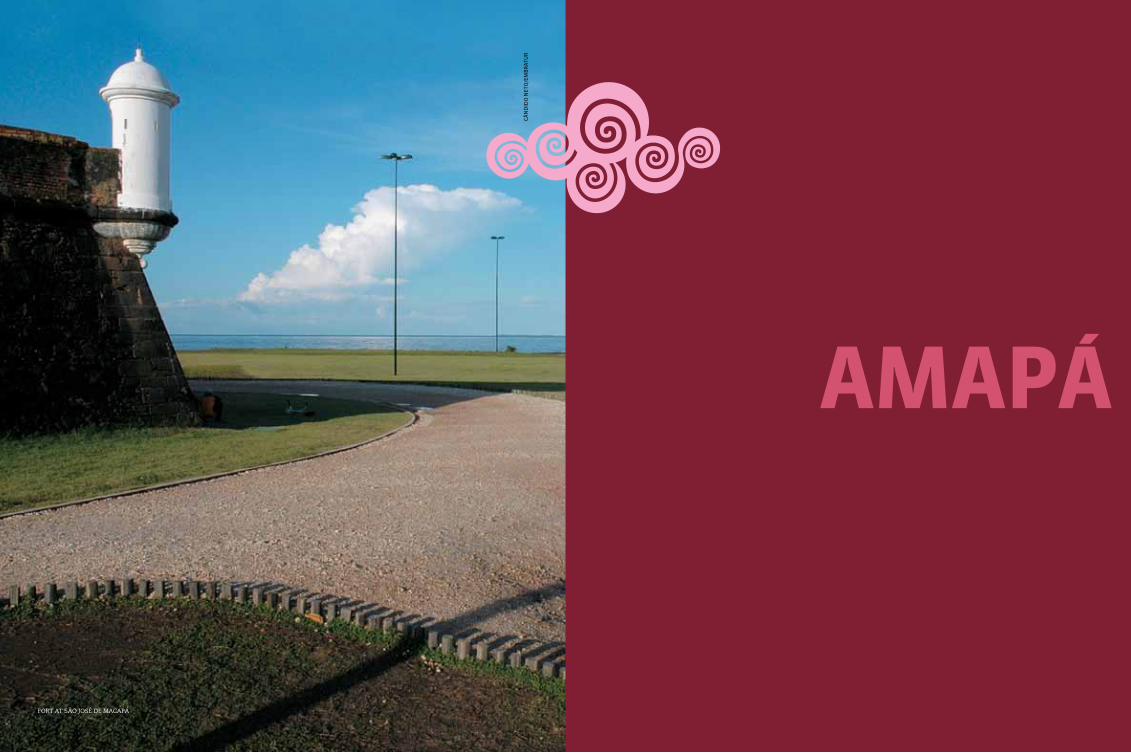
92 93amapá
aMapá
fort at são josé de macaPá
Cân
did
o n
eto
/em
Br
atu
r

AP-260
AP-260
AP-330
210BR
156BR
210BR
210BR
210BR
156BR
156BR
156BR
SurInaMe
pará pará
atLantIc ocean
FrencH GuIana
serra do naVio
AP-110
AP-070
AP-010
AP-030
Macapá
international airport
national HigHways
state HigHways
94 95amapá
amapá
The State of Amapá is located in the ex-treme north of Brazil, and in common with many other States in the region it
used to belong to the Spanish crown. With its privileged location - providing access to the Atlantic Ocean and from there to the Amazon River - Amapá was the scene of several disputes between the Portuguese, Spanish, French and Dutch. The State passed through a period of prosperity and growth in the 1940s, when man-ganese deposits were discovered in the region.
Geographic information
equatorial maximum of 32,6 °c and minimum of 20 °c (90,68 °F and minimum 68 °F)
forests
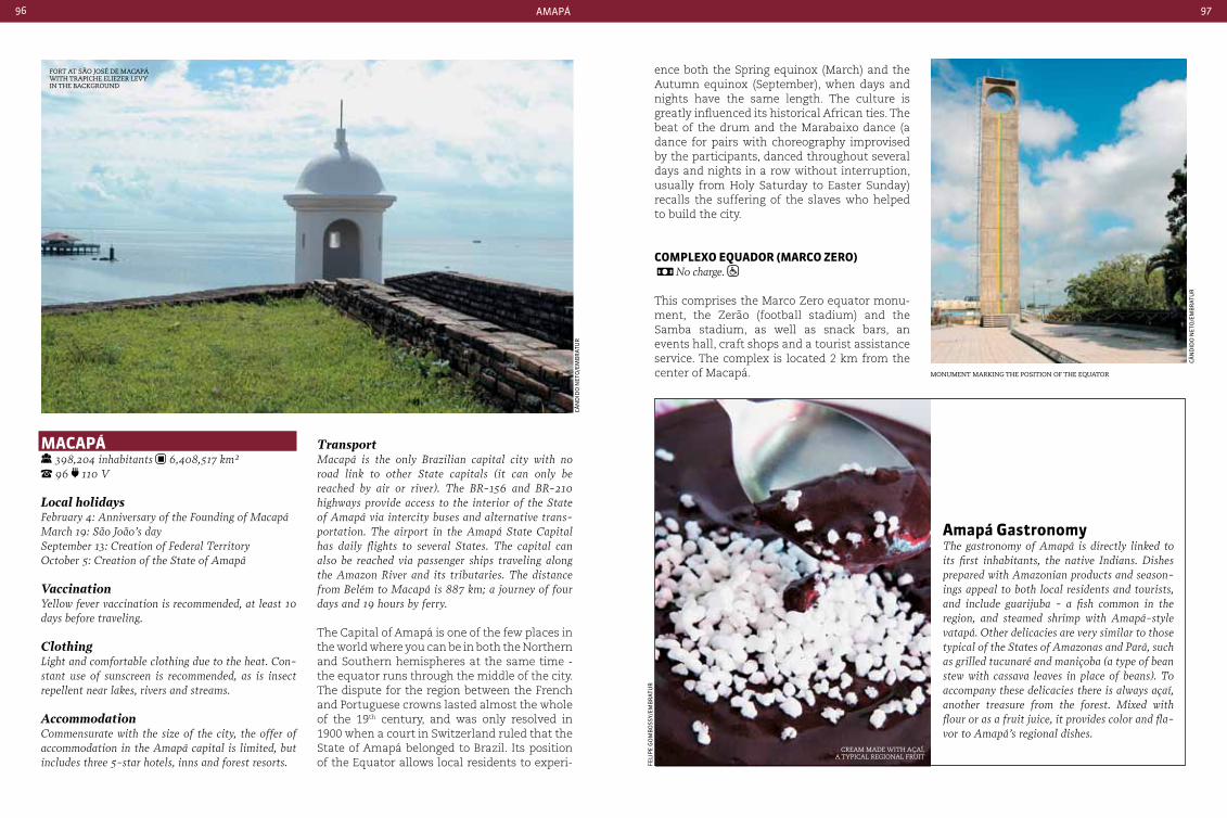
96 97amapá
Macapá 398,204 inhabitants 6,408,517 km² 96 110 V
Local holidaysFebruary 4: Anniversary of the Founding of MacapáMarch 19: São João’s daySeptember 13: creation of Federal TerritoryOctober 5: creation of the State of Amapá
VaccinationYellow fever vaccination is recommended, at least 10 days before traveling.
Clothing Light and comfortable clothing due to the heat. con-stant use of sunscreen is recommended, as is insect repellent near lakes, rivers and streams.
Accommodationcommensurate with the size of the city, the offer of accommodation in the Amapá capital is limited, but includes three 5-star hotels, inns and forest resorts.
TransportMacapá is the only Brazilian capital city with no road link to other State capitals (it can only be reached by air or river). The BR-156 and BR-210 highways provide access to the interior of the State of Amapá via intercity buses and alternative trans-portation. The airport in the Amapá State capital has daily flights to several States. The capital can also be reached via passenger ships traveling along the Amazon River and its tributaries. The distance from Belém to Macapá is 887 km; a journey of four days and 19 hours by ferry.
The Capital of Amapá is one of the few places in the world where you can be in both the Northern and Southern hemispheres at the same time - the equator runs through the middle of the city. The dispute for the region between the French and Portuguese crowns lasted almost the whole of the 19th century, and was only resolved in 1900 when a court in Switzerland ruled that the State of Amapá belonged to Brazil. Its position of the Equator allows local residents to experi-
ence both the Spring equinox (March) and the Autumn equinox (September), when days and nights have the same length. The culture is greatly influenced its historical African ties. The beat of the drum and the Marabaixo dance (a dance for pairs with choreography improvised by the participants, danced throughout several days and nights in a row without interruption, usually from Holy Saturday to Easter Sunday) recalls the suffering of the slaves who helped to build the city.
coMpLexo eQuador (Marco zero) No charge.
This comprises the Marco Zero equator monu-ment, the Zerão (football stadium) and the Samba stadium, as well as snack bars, an events hall, craft shops and a tourist assistance service. The complex is located 2 km from the center of Macapá.
fort at são josé de macaPá with traPiche eliezer levy in the BacKground
monument marKing the Position of the equator
cream made with açaí, a tyPical regional fruit
Cân
did
o n
eto
/em
Br
atu
r
Cân
did
o n
eto
/em
Br
atu
r
feli
pe
go
mB
oss
y/em
Br
atu
r
amapá GastronomyThe gastronomy of Amapá is directly linked to its first inhabitants, the native Indians. Dishes prepared with Amazonian products and season-ings appeal to both local residents and tourists, and include guarijuba - a fish common in the region, and steamed shrimp with Amapá-style vatapá. Other delicacies are very similar to those typical of the States of Amazonas and Pará, such as grilled tucunaré and maniçoba (a type of bean stew with cassava leaves in place of beans). To accompany these delicacies there is always açaí, another treasure from the forest. Mixed with flour or as a fruit juice, it provides color and fla-vor to Amapá’s regional dishes.
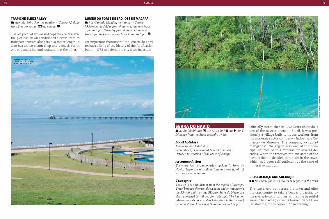
98 99amapá
trapIcHe eLIezer LeVy Avenida Beira Rio, no number - centro. daily
from 8 am to 10 pm. no charge.
The old point of arrival and departure in Macapá, the pier has an air-conditioned electric tram to transport tourists along its 500 meter length. It also has an ice cream shop and a snack bar at one end and a bar and restaurant at the other.
MuSeu do Forte de São JoSÉ de Macapá Rua candido Mendes, no number - centro. Monday to Friday from 8 am to 12 am and from
2 pm to 6 pm. Saturday from 8 am to 12 am and from 2 pm to 5 pm. Sunday from 12 am to 6 pm.
An important monument, the Museu do Forte rescues a little of the history of the fortification built in 1773 to defend the city from invasion.
Serra do naVIo 4,380 inhabitants 7,756,102 km² 96 110 V
Distance from the State capital: 197 km
Local holidaysMarch 19: São João’s day September 13: creation of Federal TerritoryOctober 5: creation of the State of Amapá
AccommodationThere are few accommodation options in Serra do Navio. There are only three inns and one hotel, all with very simple rooms.
TransportThe city is 197 km distant from the capital of Macapá. Travel between the two takes 2 hours and 45 minutes via the BR-156 and then the BR-210. Serra do Navio can also be reached by railroad from Macapá. The journey takes around six hours and includes stops in the towns of Santana, Porto Grande and Pedra Branca do Amapari.
Officially established in 1992, Serra do Navio is one of the newest towns in Brazil. It was pre-viously a village built to house workers from the minerals sector company - Indústria e Co-mércio de Minérios. The company extracted manganese; the region was one of the prin-cipal sources of this mineral for several de-cades. When the reserves ran out some of the local residents decided to remain in the town, which had been self-sufficient at the time of mineral extraction.
rIoS cacHaço and SucurIJu No charge for visits. Tours by request in the town
The two rivers cut across the town and offer the opportunity to take a boat trip passing by the riverside communities, with some beautiful views. The Cachaço River is formed by cold wa-ter streams, but is perfect for swimming.
rio macaPá with traPiche eliezer levy in the BacKground
one of the rivers that cuts through the serra do navio
Cân
did
o n
eto
/em
Br
atu
r
uya
ra
sCH
imit
td/e
mB
rat
ur
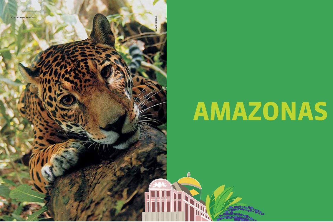
101
aMazonaS
tíPica regiÓn de amazonia
riB
am
ar
o C
aB
oCl
oa jaguar from amazônia

amazonas102 103
amazonas
acre
rondÔnIa
Mato GroSSo
roraIMa
VenezueLa
coLoMbIa
peru
pará
174BR
174BR
230BR
317BR 230
BR
230BR
307BR
307BR
411BR
413BR
230BR
319BR
319BR
319BR
174BR
210BR
210BR
AM-070
AM-010ManauSparintins
international airport
national airport
national HigHways
state HigHways
Amazonas is the largest state in Brazil, and one of the most famous places in the world due to its location amidst
the planet’s largest tropical rainforest - the Amazônia. With over 1.5 million km2, it cov-ers an area that is equivalent to the sum of France, Spain, Sweden and Greece. On the other hand, it has one of the lowest popula-tion densities in Brazil: 2.23 inhabitants per km2 according to data from the Brazilian In-stitute of Geography and Statistics (IBGE).
The late 19th century marked one of the re-gion’s golden moments, with the discovery of rubber trees and latex. Manaus was the wealth-iest city in Brazil at that time, and housed el-egant buildings such as the Opera House, with its eclectic style and neo-classical and Greco-Roman influences.
The State is one of the best preserved in the country, with protected areas, parks and forest reserves occupying approximately 98% of their original area. In the last decade issues such as sustainable development and preservation of the Floresta Amazônica were among the main political directives of the State, with economic incentives for projects that incorporate local products, fish farming, agribusiness and rural production. Today, this concern with the main-tenance of natural resources makes nature tourism one of the main attractions in Ama-zonas, with trips by boat and canoe on several of the region’s rivers, overnight stays in forest lodges and forest hikes.
Amazonas also has one of the highest rates of indigenous population in Brazil, with 65 different indigenous ethnic groups totaling about 170,000 people according to the 2010 population Census.
Geographic information
hot and humid (equatorial amazon) average 27 °c and a maximum of 38 °c (in the shade) (80,6 °F and a maximum 100,4 °F)
amazon forest
tefé
taBatinga
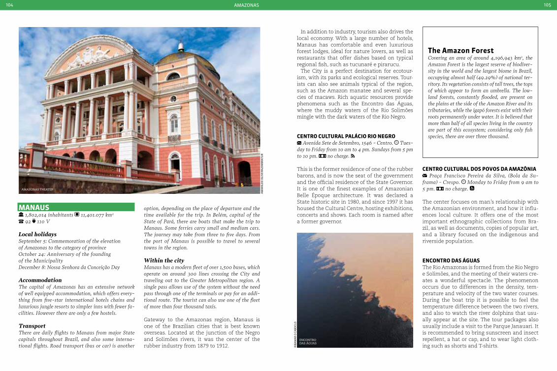
amazonas104 105
amazonas theater
am
ar
ild
o o
liV
eir
a/e
mB
rat
ur
riB
am
ar
o C
aB
oCl
o
ManauS 1,802,014 inhabitants 11,401.077 km2 92 110 V
Local holidaysSeptember 5: commemoration of the elevation of Amazonas to the category of provinceOctober 24: Anniversary of the founding of the MunicipalityDecember 8: Nossa Senhora da conceição Day AccommodationThe capital of Amazonas has an extensive network of well equipped accommodation, which offers every-thing from five-star international hotels chains and luxurious jungle resorts to simpler inns with fewer fa-cilities. However there are only a few hostels.
TransportThere are daily flights to Manaus from major State capitals throughout Brazil, and also some interna-tional flights. Road transport (bus or car) is another
option, depending on the place of departure and the time available for the trip. In Belém, capital of the State of Pará, there are boats that make the trip to Manaus. Some ferries carry small and medium cars. The journey may take from three to five days. From the port of Manaus is possible to travel to several towns in the region.
Within the cityManaus has a modern fleet of over 1,500 buses, which operate on around 300 lines crossing the city and traveling out to the Greater Metropolitan region. A single pass allows use of the system without the need pass through one of the terminals or pay for an addi-tional route. The tourist can also use one of the fleet of more than four thousand taxis.
Gateway to the Amazonas region, Manaus is one of the Brazilian cities that is best known overseas. Located at the junction of the Negro and Solimões rivers, it was the center of the rubber industry from 1879 to 1912.
In addition to industry, tourism also drives the local economy. With a large number of hotels, Manaus has comfortable and even luxurious forest lodges, ideal for nature lovers, as well as restaurants that offer dishes based on typical regional fish, such as tucunaré e pirarucu.
The City is a perfect destination for ecotour-ism, with its parks and ecological reserves. Tour-ists can also see animals typical of the region, such as the Amazon manatee and several spe-cies of macaws. Rich aquatic resources provide phenomena such as the Encontro das Águas, where the muddy waters of the Rio Solimões mingle with the dark waters of the Rio Negro.
centro cuLturaL paLácIo rIo neGro Avenida Sete de Setembro, 1546 - centro. Tues-
day to Friday from 10 am to 4 pm. Sundays from 5 pm to 10 pm. no charge.
This is the former residence of one of the rubber barons, and is now the seat of the government and the official residence of the State Governor. It is one of the finest examples of Amazonian Belle Époque architecture. It was declared a State historic site in 1980, and since 1997 it has housed the Cultural Centre, hosting exhibitions, concerts and shows. Each room is named after a former governor.
centro cuLturaL doS poVoS da aMazÔnIa Praça Francisco Pereira da Silva, (Bola da Su-
frama) - crespo. Monday to Friday from 9 am to 5 pm. no charge.
The center focuses on man’s relationship with the Amazonian environment, and how it influ-ences local culture. It offers one of the most important ethnographic collections from Bra-zil, as well as documents, copies of popular art, and a library focused on the indigenous and riverside population.
encontro daS áGuaSThe Rio Amazonas is formed from the Rio Negro e Solimões, and the meeting of their waters cre-ates a wonderful spectacle. The phenomenon occurs due to differences in the density, tem-perature and velocity of the two water courses. During the boat trip it is possible to feel the temperature difference between the two rivers, and also to watch the river dolphins that usu-ally appear at the site. The tour packages also usually include a visit to the Parque Janauari. It is recommended to bring sunscreen and insect repellent, a hat or cap, and to wear light cloth-ing such as shorts and T-shirts.
the amazon Forestcovering an area of around 4,196,943 km2, the Amazon Forest is the largest reserve of biodiver-sity in the world and the largest biome in Brazil, occupying almost half (49.29%) of national ter-ritory. Its vegetation consists of tall trees, the tops of which appear to form an umbrella. The low-land forests, constantly flooded, are present on the plains at the side of the Amazon River and its tributaries, while the igapó forests exist with their roots permanently under water. It is believed that more than half of all species living in the country are part of this ecosystem; considering only fish species, there are over three thousand.
encontro das águas
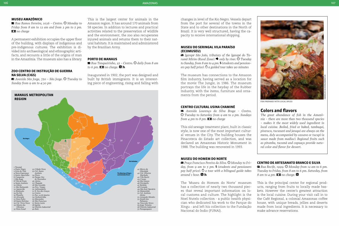
amazonas106 107
fish PrePared with local sPices
am
ar
ild
o o
liV
eir
a/e
mB
rat
ur
Rio Negro
Rio Solimões
The Meeting of Negro and Solimões Rivers
ManauS MetropoLItan reGIon
1 Tarumã2 Ponte Negra3 Lírio do Vale4 Nova Esperança5 Santo Agostinho6 Compensa7 São Jorge8 Vila da Prata9 Santo Antônio10 Glória11 São Raimundo12 Aparecida13 Redenção14 Da Paz15 Planalto16 Alvorada17 Dom Pedro18 Santa Etelvina19 Col. Terra Nova20 Monte das
Oliveiras21 Novo Israel
22 Cidade Nova23 Col. Santo
Antônio24 Flores25 Parque Dez
de Novembro26 Aleixo27 Chapada28 São Geraldo29 Pres. Vargas30 Adrianópolis31 N. Sra das Graças32 Centro33 Pça. 14 de Janeiro34 Cachoeirinha35 Educandos36 São Francisco37 Santa Luzia38 Japiim39 Distrito Industrial40 Raiz
41 Morro da Liberdade
42 Col. Oliveira Machado
43 Vila Buriti44 Crespo45 São Lázaro46 Petrópolis47 Betânia48 Coroado49 São José Operário50 Mauazinho51 Col. Antônio
Aleixo52 Armando Mendes53 Zumbi dos
Palmares54 Tancredo Neves55 Jorge Teixeira56 Distrito Industrial57 Puraquequara
42
1
2
3
5
6 78
910
11 12
13
15
16
14
17
18
20
19
2221
23
24
25
3128
29
3233
3646
48
49
54
55 5657
5150
52
53
34 40
38
39
434535 374147
44
26
3027
4
colors and flavorsThe great abundance of fish in the Amazô-nia - there are more than two thousand species - makes it the most widely used ingredient in local cuisine. Boiled, fried or baked, tambaqui, pirarucu, tucunaré and jaraqui are always on the menu, duly accompanied by cassava or tucupi (a sauce made from madioc). Regional fruits such as pitomba, tucumã and cupuaçu provide natu-ral color and flavor for dessert.
MuSeu aMazÔnIco Rua Ramos Ferreira, 1036 - centro. Monday to
Friday from 8 am to 12 am and from 2 pm to 5 pm. no charge
A permanent exhibition occupies the upper floor of the building, with displays of indigenous and pre-indigenous cultures. The exhibition is di-vided into archaeological and ethnographic arti-facts, and recounts a little of the origins of man in the Amazônia. The museum also has a library.
zoo centro de InStrução de Guerra na SeLVa (cIGS)
Avenida São Jorge, 750 - São Jorge. Tuesday to Sunday from 9 am to 4:30 pm
This is the largest center for animals in the Amazon region. It has around 170 animals from 58 species. In addition to lectures and practical activities related to the preservation of wildlife and the environment, the zoo also recuperates injured animals and returns them to their nat-ural habitats. It is maintained and administered by the Brazilian Army.
porto de ManauS Rua Tanqueirinho, 25 - centro. daily from 8 am
to 6 pm. no charge.
Inaugurated in 1902, the port was designed and built by British immigrants. It is an interest-ing piece of engineering, rising and falling with
changes in level of the Rio Negro. Vessels depart from the port for several of the towns in the State and to other destinations in the North of Brazil. It is very well structured, having the ca-pacity to receive international shipping.
MuSeu do SerInGaL VILa paraíSo (ecoMuSeu)
Igarapé São João, tributary of the Igarapé do Ta-rumã Mirim (Rural Zone). only by river. Tuesday to Sunday, from 8 am to 4 pm. (students and pension-ers pay half price). a guided tour takes 90 minutes
The museum has connections to the Amazon film industry, having served as a location for the movie The Jungle, in 1986. The museum portrays the life in the heyday of the Rubber Industry, with the items, furniture and orna-ments from the period.
centro cuLturaL uSIna cHaMInÉ Avenida Lourenço da Silva Braga - centro. Tuesday to Saturday from 9 am to 2 pm. Sundays
from 4 pm to 8 pm. no charge
This old sewage treatment plant, built in classic style, is now one of the most important cultur-al venues in the City. The building houses the Pinacoteca do Estado art collection, and was declared an Amazonas Historic Monument in 1988. The building was renovated in 1993.
MuSeu do HoMeM do norte Praça Francisco Pereira da Silva. Monday to Fri-
day, from 9 am to 5 pm. (students and pensioners pay half price). a tour with a bilingual guide takes around 1 hour.
The ‘Museu do Homem do Norte’ museum has a collection of nearly two thousand piec-es that reveal important information on lo-cal customs and culture. The highlight is the Noel Nutels collection - a public health physi-cian who dedicated his work to the Parque do Xingu - and left his collection to the Fundação Nacional do Índio (FUNAI).
centro de arteSanato branco e SILVa Rua Recife, 1999. Monday from 12 am to 6 pm.
Tuesday to Friday, from 8 am to 6 pm. Saturday, from 8 am to 4 pm. no charge.
This is the principal center for regional prod-ucts, ranging from fruits to locally made bas-kets. However the center’s greatest attraction is the local cuisine. During your visit call in to the Café Regional, a colonial Amazonas coffee house, with unique breads, jellies and deserts made from local ingredients. It is necessary to make advance reservations.
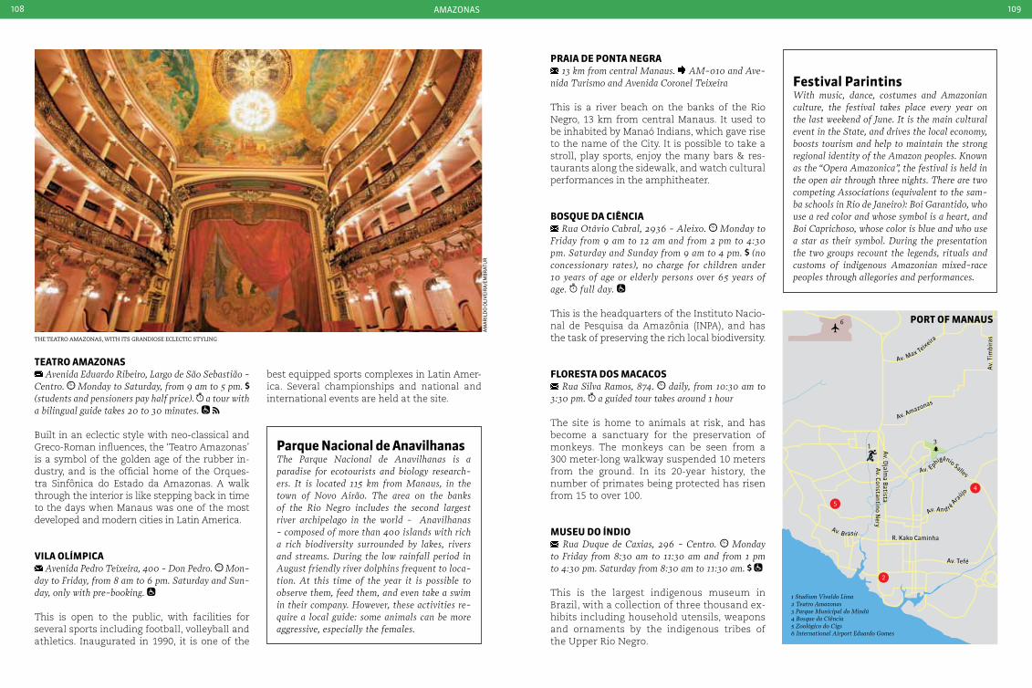
amazonas108 109
the teatro amazonas, with its grandiose eclectic styling
am
ar
ild
o o
liV
eir
a/e
mB
rat
ur
13
6
2
4
5
1 Stadium Vivaldo Lima2 Teatro Amazonas3 Parque Municipal do Mindú4 Bosque da Ciência5 Zoológico do Cigs6 International Airport Eduardo Gomes
R. Kako Caminha
Av. Tefé
Av. D
jalma B
atistaA
v. Constantino Nery
Av. Amazonas
Av.
Tim
bira
s
Av. Ephigênio Salles
Av. An d ré Araújo
Av. B rasil
Av. Max Teixeira
port oF ManauS
Festival parintinsWith music, dance, costumes and Amazonian culture, the festival takes place every year on the last weekend of June. It is the main cultural event in the State, and drives the local economy, boosts tourism and help to maintain the strong regional identity of the Amazon peoples. Known as the “Opera Amazonica”, the festival is held in the open air through three nights. There are two competing Associations (equivalent to the sam-ba schools in Rio de Janeiro): Boi Garantido, who use a red color and whose symbol is a heart, and Boi caprichoso, whose color is blue and who use a star as their symbol. During the presentation the two groups recount the legends, rituals and customs of indigenous Amazonian mixed-race peoples through allegories and performances.
parque nacional de anavilhanas The Parque Nacional de Anavilhanas is a paradise for ecotourists and biology research-ers. It is located 115 km from Manaus, in the town of Novo Airão. The area on the banks of the Rio Negro includes the second largest river archipelago in the world - Anavilhanas - composed of more than 400 islands with rich a rich biodiversity surrounded by lakes, rivers and streams. During the low rainfall period in August friendly river dolphins frequent to loca-tion. At this time of the year it is possible to observe them, feed them, and even take a swim in their company. However, these activities re-quire a local guide: some animals can be more aggressive, especially the females.
teatro aMazonaS Avenida Eduardo Ribeiro, Largo de São Sebastião -
centro. Monday to Saturday, from 9 am to 5 pm. (students and pensioners pay half price). a tour with a bilingual guide takes 20 to 30 minutes.
Built in an eclectic style with neo-classical and Greco-Roman influences, the ‘Teatro Amazonas’ is a symbol of the golden age of the rubber in-dustry, and is the official home of the Orques-tra Sinfônica do Estado da Amazonas. A walk through the interior is like stepping back in time to the days when Manaus was one of the most developed and modern cities in Latin America.
VILa oLíMpIca Avenida Pedro Teixeira, 400 - Don Pedro. Mon-
day to Friday, from 8 am to 6 pm. Saturday and Sun-day, only with pre-booking.
This is open to the public, with facilities for several sports including football, volleyball and athletics. Inaugurated in 1990, it is one of the
best equipped sports complexes in Latin Amer-ica. Several championships and national and international events are held at the site.
praIa de ponta neGra 13 km from central Manaus. AM-010 and Ave-
nida Turismo and Avenida coronel Teixeira
This is a river beach on the banks of the Rio Negro, 13 km from central Manaus. It used to be inhabited by Manaó Indians, which gave rise to the name of the City. It is possible to take a stroll, play sports, enjoy the many bars & res-taurants along the sidewalk, and watch cultural performances in the amphitheater.
boSQue da cIÊncIa Rua Otávio cabral, 2936 - Aleixo. Monday to
Friday from 9 am to 12 am and from 2 pm to 4:30 pm. Saturday and Sunday from 9 am to 4 pm. (no concessionary rates), no charge for children under 10 years of age or elderly persons over 65 years of age. full day.
This is the headquarters of the Instituto Nacio-nal de Pesquisa da Amazônia (INPA), and has the task of preserving the rich local biodiversity.
FLoreSta doS MacacoS Rua Silva Ramos, 874. daily, from 10:30 am to
3:30 pm. a guided tour takes around 1 hour
The site is home to animals at risk, and has become a sanctuary for the preservation of monkeys. The monkeys can be seen from a 300 meter-long walkway suspended 10 meters from the ground. In its 20-year history, the number of primates being protected has risen from 15 to over 100.
MuSeu do índIo Rua Duque de caxias, 296 - centro. Monday
to Friday from 8:30 am to 11:30 am and from 1 pm to 4:30 pm. Saturday from 8:30 am to 11:30 am.
This is the largest indigenous museum in Brazil, with a collection of three thousand ex-hibits including household utensils, weapons and ornaments by the indigenous tribes of the Upper Rio Negro.
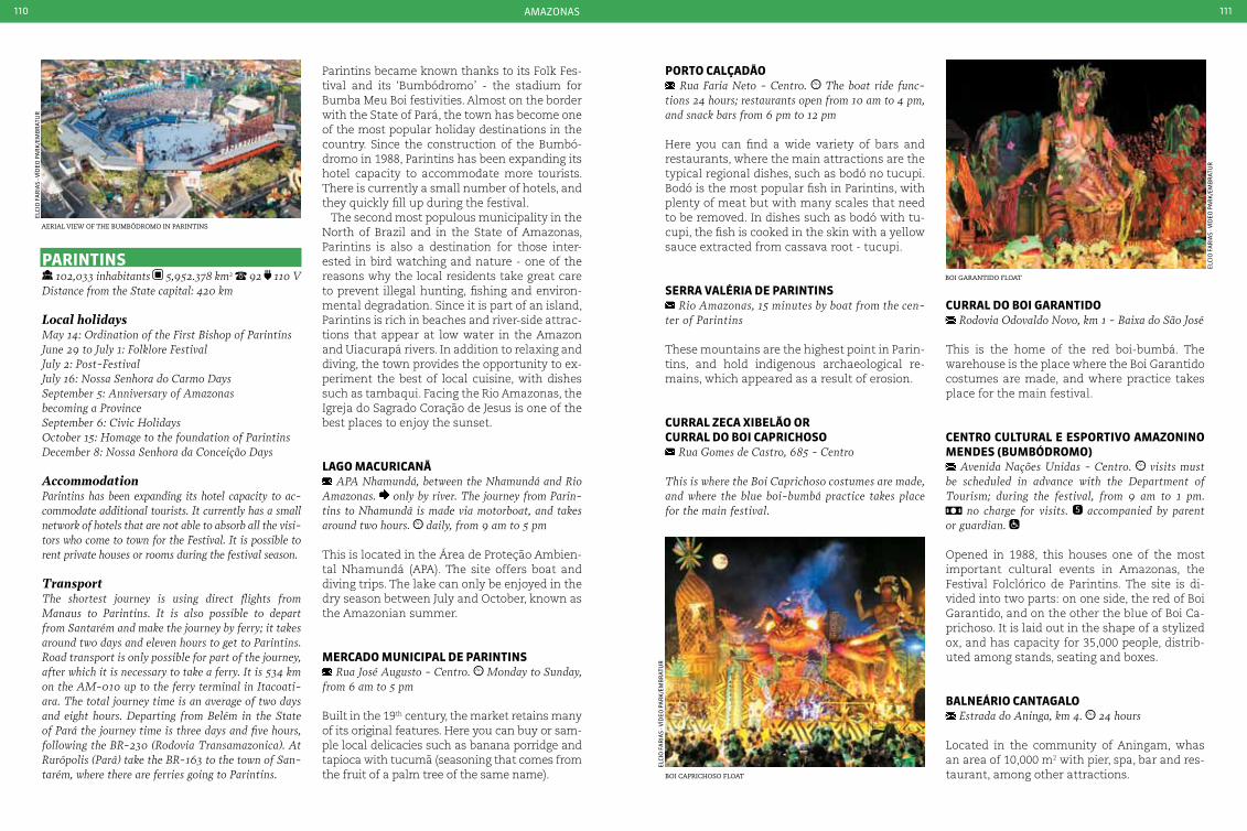
amazonas110 111
aerial view of the BumBÓdromo in Parintins
Boi caPrichoso float
Boi garantido float
elCi
o f
ar
ias
- VÍd
eo p
ar
K/e
mB
rat
ur
elCi
o f
ar
ias
- VÍd
eo p
ar
K/e
mB
rat
ur
elCi
o f
ar
ias
- VÍd
eo p
ar
K/e
mB
rat
ur
parIntInS 102,033 inhabitants 5,952.378 km2 92 110 V
Distance from the State capital: 420 km
Local holidaysMay 14: Ordination of the First Bishop of Parintins June 29 to July 1: Folklore FestivalJuly 2: Post-FestivalJuly 16: Nossa Senhora do carmo DaysSeptember 5: Anniversary of Amazonas becoming a Province September 6: civic HolidaysOctober 15: Homage to the foundation of ParintinsDecember 8: Nossa Senhora da conceição Days
AccommodationParintins has been expanding its hotel capacity to ac-commodate additional tourists. It currently has a small network of hotels that are not able to absorb all the visi-tors who come to town for the Festival. It is possible to rent private houses or rooms during the festival season.
TransportThe shortest journey is using direct flights from Manaus to Parintins. It is also possible to depart from Santarém and make the journey by ferry; it takes around two days and eleven hours to get to Parintins. Road transport is only possible for part of the journey, after which it is necessary to take a ferry. It is 534 km on the AM-010 up to the ferry terminal in Itacoati-ara. The total journey time is an average of two days and eight hours. Departing from Belém in the State of Pará the journey time is three days and five hours, following the BR-230 (Rodovia Transamazonica). At Rurópolis (Pará) take the BR-163 to the town of San-tarém, where there are ferries going to Parintins.
Parintins became known thanks to its Folk Fes-tival and its ‘Bumbódromo’ - the stadium for Bumba Meu Boi festivities. Almost on the border with the State of Pará, the town has become one of the most popular holiday destinations in the country. Since the construction of the Bumbó-dromo in 1988, Parintins has been expanding its hotel capacity to accommodate more tourists. There is currently a small number of hotels, and they quickly fill up during the festival.
The second most populous municipality in the North of Brazil and in the State of Amazonas, Parintins is also a destination for those inter-ested in bird watching and nature - one of the reasons why the local residents take great care to prevent illegal hunting, fishing and environ-mental degradation. Since it is part of an island, Parintins is rich in beaches and river-side attrac-tions that appear at low water in the Amazon and Uiacurapá rivers. In addition to relaxing and diving, the town provides the opportunity to ex-periment the best of local cuisine, with dishes such as tambaqui. Facing the Rio Amazonas, the Igreja do Sagrado Coração de Jesus is one of the best places to enjoy the sunset.
LaGo MacurIcanã APA Nhamundá, between the Nhamundá and Rio
Amazonas. only by river. The journey from Parin-tins to Nhamundá is made via motorboat, and takes around two hours. daily, from 9 am to 5 pm
This is located in the Área de Proteção Ambien-tal Nhamundá (APA). The site offers boat and diving trips. The lake can only be enjoyed in the dry season between July and October, known as the Amazonian summer.
Mercado MunIcIpaL de parIntInS Rua José Augusto - centro. Monday to Sunday,
from 6 am to 5 pm
Built in the 19th century, the market retains many of its original features. Here you can buy or sam-ple local delicacies such as banana porridge and tapioca with tucumã (seasoning that comes from the fruit of a palm tree of the same name).
porto caLçadão Rua Faria Neto - centro. The boat ride func-
tions 24 hours; restaurants open from 10 am to 4 pm, and snack bars from 6 pm to 12 pm
Here you can find a wide variety of bars and restaurants, where the main attractions are the typical regional dishes, such as bodó no tucupi. Bodó is the most popular fish in Parintins, with plenty of meat but with many scales that need to be removed. In dishes such as bodó with tu-cupi, the fish is cooked in the skin with a yellow sauce extracted from cassava root - tucupi.
Serra VaLÉrIa de parIntInS Rio Amazonas, 15 minutes by boat from the cen-
ter of Parintins
These mountains are the highest point in Parin-tins, and hold indigenous archaeological re-mains, which appeared as a result of erosion.
curraL zeca xIbeLão orcurraL do boI caprIcHoSo
Rua Gomes de castro, 685 - centro
This is where the Boi caprichoso costumes are made, and where the blue boi-bumbá practice takes place for the main festival.
curraL do boI GarantIdo Rodovia Odovaldo Novo, km 1 - Baixa do São José
This is the home of the red boi-bumbá. The warehouse is the place where the Boi Garantido costumes are made, and where practice takes place for the main festival.
centro cuLturaL e eSportIVo aMazonIno MendeS (buMbÓdroMo)
Avenida Nações Unidas - centro. visits must be scheduled in advance with the Department of Tourism; during the festival, from 9 am to 1 pm.
no charge for visits. accompanied by parent or guardian.
Opened in 1988, this houses one of the most important cultural events in Amazonas, the Festival Folclórico de Parintins. The site is di-vided into two parts: on one side, the red of Boi Garantido, and on the other the blue of Boi Ca-prichoso. It is laid out in the shape of a stylized ox, and has capacity for 35,000 people, distrib-uted among stands, seating and boxes.
baLneárIo cantaGaLo Estrada do Aninga, km 4. 24 hours
Located in the community of Aningam, whas an area of 10,000 m2 with pier, spa, bar and res-taurant, among other attractions.
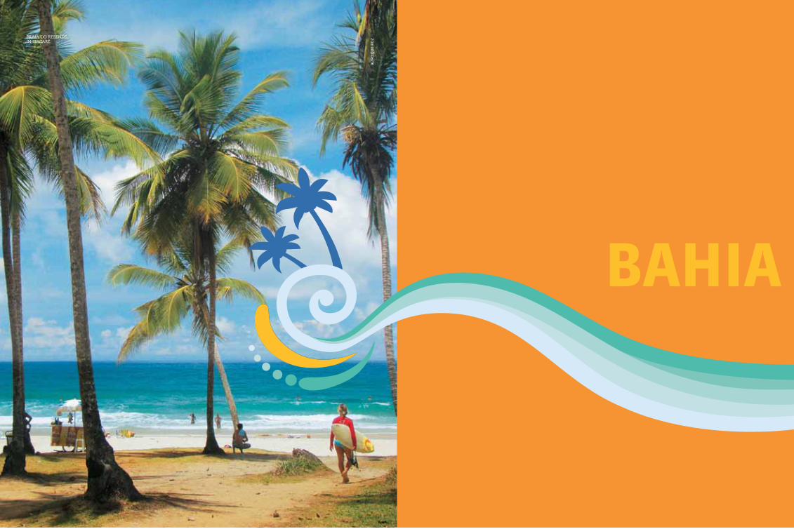
113
baHIa
Praia do resende, in itacaré
au
ro
Qu
eir
oz
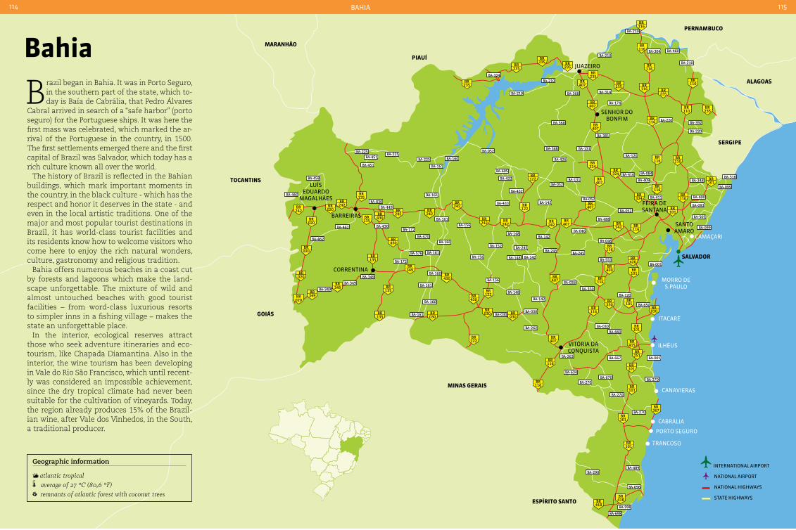
BaHia114 115
101BR
101BR
367BR
101BR
418BR 418
BR
101BR
116BR
116BR
116BR
116BR
116BR
116BR
116BR
116BR
116BR
407BR
235BR235
BR
235BR
235BR
407BR
407BR
407BR
407BR
407BR
407BR
407BR
030BR
430BR
135BR
135BR
135BR
135BR
135BR
430BR
430BR
242BR
242BR
242BR
020BR
020BR
020BR
020BR
020BR 349
BR349BR
349BR
242BR
242BR
242BR
242BR
122BR
122BR
242BR
242BR
324BR
324BR
324BR
430BR 122
BR
122BR
330BR
420BR
420BR
030BR 030
BR
116BR235
BR
235BR
235BR
235BR
116BR
116BR
116BR
251BR
415BR
101BR
030BR
101BR
101BR
101BR
110BR
110BR
110BR
110BR
101BR
BA-270BA-270
BA-270
BA-270
BA-489BA-290
BA-696
BA-998
BA-698
BA-001
BA-001
BA-099
BA-099
BA-318
BA-220
BA-220
BA-120
BA-416 BA-084
BA-409
BA-411
BA-052
BA-052
BA-488
BA-046
BA-046
BA-245
BA-026
BA-330
BA-553
BA-210
BA-460BA-304
BA-392
BA-348
BA-505
BA-093
BA-400
BA-667
BA-670BA-634
BA-030BA-660
BA-650
BA-120
BA-263
BA-262
BA-030BA-030BA-161
BA-349
BA-349
BA-349
BA-462
BA-462
BA-458
BA-451
BA-451BA-225
BA-225BA-225
BA-460
BA-430
BA-470
BA-161
BA-161BA-576
BA-172
BA-172
BA-161
BA-161
BA-449BA-830
BA-161
BA-160
BA-160
BA-160
BA-160
BA-148
BA-148
BA-148
BA-433
BA-433
BA-432
BA-142
BA-605
BA-052
BA-052
BA-368
BA-426
BA-131
BA-381
BA-131
BA-368
BA-368
BA-210
BA-210
BA-314
BA-174
BA-210
BA-210
BA-324
BA-142
BA-142
BA-142
BA-245BA-245
BA-156
BA-156
BA-156
BA-152
SaLVador
Vitória da ConQuista
ilHéus
porto seguro
senHor do Bonfim
Camaçari
santo amaro
feira de santana
Correntina
juazeiro
CaBrália
CanaVieras
tranCoso
itaCaré
morro de s.paulo
Barreiras
luÍs eduardo
magalHães
MInaS GeraIS
eSpírIto Santo
SerGIpe
aLaGoaS
pernaMbuco
pIauí
tocantInS
GoIáS
MaranHão
Geographic information
atlantic tropical average of 27 °c (80,6 °F) remnants of atlantic forest with coconut trees
bahia
Brazil began in Bahia. It was in Porto Seguro, in the southern part of the state, which to-day is Baía de Cabrália, that Pedro Álvares
Cabral arrived in search of a “safe harbor” (porto seguro) for the Portuguese ships. It was here the first mass was celebrated, which marked the ar-rival of the Portuguese in the country, in 1500. The first settlements emerged there and the first capital of Brazil was Salvador, which today has a rich culture known all over the world.
The history of Brazil is reflected in the Bahian buildings, which mark important moments in the country, in the black culture - which has the respect and honor it deserves in the state - and even in the local artistic traditions. One of the major and most popular tourist destinations in Brazil, it has world-class tourist facilities and its residents know how to welcome visitors who come here to enjoy the rich natural wonders, culture, gastronomy and religious tradition.
Bahia offers numerous beaches in a coast cut by forests and lagoons which make the land-scape unforgettable. The mixture of wild and almost untouched beaches with good tourist facilities – from word-class luxurious resorts to simpler inns in a fishing village – makes the state an unforgettable place.
In the interior, ecological reserves attract those who seek adventure itineraries and eco-tourism, like Chapada Diamantina. Also in the interior, the wine tourism has been developing in Vale do Rio São Francisco, which until recent-ly was considered an impossible achievement, since the dry tropical climate had never been suitable for the cultivation of vineyards. Today, the region already produces 15% of the Brazil-ian wine, after Vale dos Vinhedos, in the South, a traditional producer.
international airport
national airport
national HigHways
state HigHways
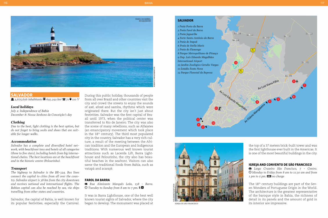
BaHia116 117
1
2
3
BA-528
BA-528
56
8
12
10
11
9
7
4
Av Luiz Eduardo Magalhães
Av Luiz Viana Filho
Av Otávio M
angabeira
BA-093
BA-099
BA-099
324BR
324BR
BA-535BA-093
BA-526BA-522
farol da Barra, in salvador
igreja de são francisco
ro
Ber
to f
ar
ia/e
mB
rat
ur
rit
a B
ar
ret
o/s
etu
r B
a
1 Praia Porto da Barra2 Praia Farol da Barra 3 Praia Jaguaribe 4 Forte Santo Antônio da Barra 5 Praia de Itapoã6 Praia de Stella Maris7 Praia do Flamengo8 Parque Metropolitano de Pituaçu9 Dep. Luís Eduardo Magalhães International Airport10 Jardim Zoológico Getulio Vargas11 Estádio Fonte Nova12 Parque Florestal da Represa
SaLVador
SaLVador 2,675,656 inhabitants 693.292 km2 71 110 V
Local holidaysJuly 2: Independence of Bahia December 8: Nossa Senhora da conceição’s day
ClothingDue to the heat, light clothing is the best option, but do not forget to bring socks and shoes that are suit-able for longer walks.
AccommodationSalvador has a complete and diversified hotel net-work, with beachfront inns and hotels of all categories (three to five stars), including hotels from big interna-tional chains. The best locations are at the beachfront and in the historic centre (Pelourinho).
TransportThe highway to Salvador is the BR-324. Bus lines connect the capital to cities from all over the coun-try. Salvador airport is 38 km from the city downtown and receives national and international flights. The Bahian capital can also be reached by sea, via ships travelling from other states and countries.
Salvador, the capital of Bahia, is well known for its popular festivities, especially the Carnival.
the top of a 37 meters brick-built tower and was the first lighthouse ever built in the Americas. It is one of the most beautiful buildings in the city.
IGreJa and conVento de São FrancISco Largo cruzeiro São Francisco, 7 - centro. Monday to Friday from 8 am to 11:30 am and from
1 pm to 5 pm. no charge
The 18th century buildings are part of the Sev-en Wonders of Portuguese Origin in the World. The architecture is the greatest representative of the baroque style in Bahia, the richness of detail in its panels and the amount of gold in its interior are impressive.
During this public holiday, thousands of people from all over Brazil and other countries visit the city and crowd the streets to enjoy the sounds of axé, afoxé and samba, rhythms which were originated there. But the city isn’t just about festivities. Salvador was the first capital of Bra-zil until 1973, when the political center was transferred to Rio de Janeiro. The city was also the scene of many rebellions, such as Alfaiates (an emancipatory movement which took place in the 18th century). The third most populated city in the country, Salvador has a very rich cul-ture, a result of the meeting between the Afri-can tradition and the European and Indigenous traditions. With numerous well known tourist attractions such as Lacerda Lift, Barra Light-house and Pelourinho, the city also has beau-tiful beaches in the seafront. Visitors can also savor the traditional foods from Bahia, such as vatapá and acarajé.
FaroL da barra Rua Almirante Marquês Leão, 138 - Barra. Tuesday to Sunday from 8 am to 7 pm.
It was in Barra Lighthouse, one of the best well known tourist sights of Salvador, where the city began to develop. The monument was placed at
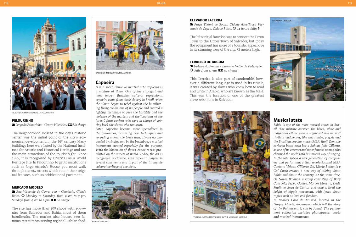
BaHia118 119
caPoeira in downtown salvador
tyPical instruments shoP in the mercado modelo
rit
a B
ar
ret
o/s
etu
r B
a
filhos de gandhi Parade, in Pelourinho
elevador lacerda
mercado modelo
ro
Ber
to f
ar
ia/e
mB
rat
ur
ro
Ber
to f
ar
ia/e
mB
rat
ur
ro
Ber
to f
ar
ia/e
mB
rat
ur
ro
Ber
to f
ar
ia/e
mB
rat
ur
peLourInHo Largo do Pelourinho - centro Histórico. No charge
The neighborhood located in the city’s historic center was the initial point of the city’s eco-nomical development, in the 16th century. Many buildings here were listed by the National Insti-tute for Artistic and Historical Heritage and are the main attractions of the tourist sight. Since 1985, it is recognized by UNESCO as a World Heritage Site. In Pelourinho, to get to institutions such as Jorge Amado’s House, you must walk through narrow streets which retain their origi-nal features, such as cobblestoned pavement.
Mercado ModeLo Rua Visconde de cayru, 250 - comércio, cidade
Baixa. Monday to Saturday, from 9 am to 7 pm. Sundays from 9 am to 2 pm. no charge
The site has more than 200 shops with souve-nirs from Salvador and Bahia, most of them handicrafts. The market also houses two fa-mous restaurants serving regional Bahian food.
eLeVador Lacerda Praça Thomé de Souza, cidade Alta/Praça Vis-
conde de cayru, cidade Baixa. 24 hours daily.
The lift’s initial function was to connect the Down Town to the Upper Town of Salvador, but today the equipment has more of a touristic appeal due to its stunning view of the city, 72 meters high.
terreIro de boGuM Ladeira do Bogum - Engenho Velho da Federação. daily from 11 am. no charge
This Terreiro is also part of candomblé, how-ever a different language is used in its rituals, it was created by slaves who knew how to read and write in Arabic, who are known as the Malê. This was the location of one of the greatest slave rebellions in Salvador.
capoeiraIs it a sport, dance or martial art? capoeira is a mixture of these. One of the strongest and most known Brazilian cultural expressions, capoeira came from black slavery in Brazil, when the slaves began to rebel against the humiliat-ing living conditions of its people and created a fighting technique to face the hostility and the violence of the masters and the “captains of the forest”, farm workers who were in charge of get-ting back the slaves who ran away.Later, capoeira became more specialized in the quilombos, acquiring new techniques and spreading among the black men, always accom-panied by singing and by the berimbau, a musical instrument created especially for the purpose. With the liberation of slaves, capoeira was pro-hibited on the streets of Bahia. Today, the art is recognized worldwide, with capoeira players in several continents and is part of the intangible cultural heritage of the state.
Musical stateBahia is one of the most musical states in Bra-zil. The mixture between the black, white and indigenous ethnic groups originated rich musical rhythms and genres, like axé, samba, pagode and the Brazilian popular music (MBP) itself. Even the cariocan bossa nova has a Bahian, João Gilberto, as one of its creators and most famous names, who charmed the world with his smooth way of singing.In the late 1960s a new generation of compos-ers and performing artists revolutionized MBP. caetano Veloso, Gilberto Gil, Maria Bethania e Gal costa created a new way of talking about Bahia and about the country. At the same time, Os Novos Baianos, a group consisting of Baby consuelo, Pepeu Gomes, Moraes Moreira, Dadi, Paulinho Boca de cantor and others, lived the height of hippie movement, with lyrics about topics such as love and freedom.In Bahia’s casa da Música, located in the Parque Abaeté, documents which tell the story of the Bahian music can be found. The perma-nent collection includes photographs, books and musical instruments.

BaHia120 121
Iglesiadel
Bonfim
Ponta deHumaitá
ElevadorLacerda
MercadoModelo
Solardo Unhão
Praia doPorto da Barra
Praia de Ondina
Praiade Piatã
Praiade Itapuã
Farolde Itapuã
AeroportoInternacional
Lagoadel Abaeté
Pelourinho
EstádioFonte Nova
RodoviáriaDiquedo Tororó
Praia doFarol da Barra
Av. Lafayete Coutinho
RuaCarlosGomes
Av. 7 deSetembro
Av.Oceânica
Av. AnitaGaribaldi
BR 324
Estrada doCoco
Av.Centenário
Av. Vascoda Gama
Av. Antônio Carlos Magalhães
dique do tororÓ
solar do unhão, home of museu de arte moderna da Bahia igreja do nosso senhor do Bonfim, salvador
ro
Ber
to f
ar
ia/e
mB
rat
ur
ro
Ber
to f
ar
ia/e
mB
rat
ur
ro
Ber
to f
ar
ia/e
mB
rat
ur
lagoa do aBaeté
ro
Ber
to f
ar
ia/e
mB
rat
ur
attractIonS
ILÊ axÉ opÔ aFonJá Rua Direita de São Gonçalo, 557. daily from
10 am. no charge
The Terreiro (worship place) is also known as House of Sustained Strength by Afonjá. It was listed by the National Institute of Historic and Artistic Heritage and it is one of the oldest Can-domblé temples in Bahia, founded in 1910.
dIQue do tororÓ Avenida Vasco da Gama - Brotas. daily, 24
hours. no charge.
The dyke was built in the 17th and 18th centu-ries, with the damming of the Urucaia River, to protect the city against possible attacks, since Salvador was at the time the capital of Brazil. Today, the 110 thousand m2 area is the desti-nation of those who want to rest and have fun on weekends. The site has decks for fishermen, tracks for running, restaurants and parking. Re-cently, the artist Tatti Moreno created and in-stalled, in the waters of the site, large statues which represent the orixas.
SoLar do unHão/MuSeu de arte Moderna da baHIa
Avenida do contorno - comércio. tuesday to friday from 1 pm to 7 pm. Saturdays and Sundays from 2 pm to 8 pm. no charge
The solar is an architectural complex which houses the Museu de Arte Moderna, a pier, a slave quarters and a distillery. The site was built to be the residence of the judge Pedro Unhão Castelo Branco. Today is a popular tourist sight, which also has a sculpture garden and a square where folk and musical performances take place. Try to wait until sunset, when the place becomes particularly beautiful.
LaGoa do abaetÉ Avenida Otávio Mangabeira, Itapuã
One of the most famous tourist attractions in the city, this dark waters lagoon is surrounded by fine white sand and several dunes formed by wind-blown particles from Itapuã beach. The surround-ing vegetation completes the beautiful scenery.
IGreJa do SenHor do bonFIM Largo do Bonfim, 236 - Bonfim. Monday from
9 am to 6 pm. Tuesday, Wednesday and Thursday from 6:30 am to 6 pm. Friday to Sunday from 5:30 am to 6 pm. no charge
It is the most famous church of Salvador and its patron saint is one of the most followed by the faithful. The ribbons are very popular in the arms and ankles of the many visitors. Every second Thursday of January it hosts a Washing Party, where the Bahian women go in a procession to the church and wash the stair-ways with scented water.
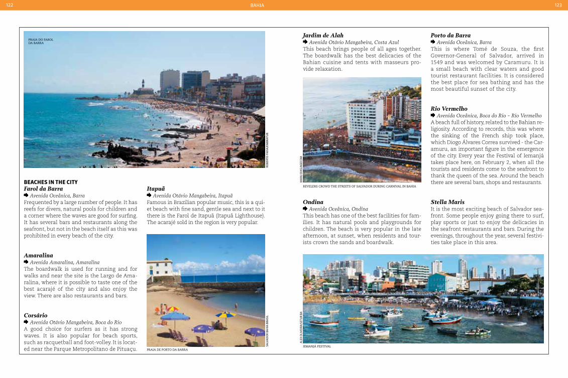
BaHia122 123
Praia do farol da Barra
ro
Ber
to f
ar
ia/e
mB
rat
ur
Praia de Porto da Barraiemanjá festival
revelers crowd the streets of salvador during carnival in Bahia
salV
ad
or
Ba
Hia
Br
asi
l
ale
X o
liV
eir
a/s
etu
r B
am
an
u d
ias/
ag
eCo
m
beacHeS In tHe cItyFarol da Barra
Avenida Oceânica, BarraFrequented by a large number of people. It has reefs for divers, natural pools for children and a corner where the waves are good for surfing. It has several bars and restaurants along the seafront, but not in the beach itself as this was prohibited in every beach of the city.
Amaralina Avenida Amaralina, Amaralina
The boardwalk is used for running and for walks and near the site is the Largo de Ama-ralina, where it is possible to taste one of the best acarajé of the city and also enjoy the view. There are also restaurants and bars.
Corsário Avenida Otávio Mangabeira, Boca do Rio
A good choice for surfers as it has strong waves. It is also popular for beach sports, such as racquetball and foot-volley. It is locat-ed near the Parque Metropolitano de Pituaçu.
Itapuã Avenida Otávio Mangabeira, Itapuã
Famous in Brazilian popular music, this is a qui-et beach with fine sand, gentle sea and next to it there is the Farol de Itapuã (Itapuã Lighthouse). The acarajé sold in the region is very popular.
Jardim de Alah Avenida Otávio Mangabeira, costa Azul
This beach brings people of all ages together. The boardwalk has the best delicacies of the Bahian cuisine and tents with masseurs pro-vide relaxation.
Ondina Avenida Oceânica, Ondina
This beach has one of the best facilities for fam-ilies. It has natural pools and playgrounds for children. The beach is very popular in the late afternoon, at sunset, when residents and tour-ists crown the sands and boardwalk.
Porto da Barra Avenida Oceânica, Barra
This is where Tomé de Souza, the first Governor-General of Salvador, arrived in 1549 and was welcomed by Caramuru. It is a small beach with clear waters and good tourist restaurant facilities. It is considered the best place for sea bathing and has the most beautiful sunset of the city.
Rio Vermelho Avenida Oceânica, Boca do Rio - Rio Vermelho
A beach full of history, related to the Bahian re-ligiosity. According to records, this was where the sinking of the French ship took place, which Diogo Álvares Correa survived - the Car-amuru, an important figure in the emergence of the city. Every year the Festival of Iemanjá takes place here, on February 2, when all the tourists and residents come to the seafront to thank the queen of the sea. Around the beach there are several bars, shops and restaurants.
Stella MarisIt is the most exciting beach of Salvador sea-front. Some people enjoy going there to surf, play sports or just to enjoy the delicacies in the seafront restaurants and bars. During the evenings, throughout the year, several festivi-ties take place in this area.

BaHia124 125
igreja de nossa senhora da
conceição
jota
fr
eita
s/B
aH
ia t
ur
sa
view from vale do Paty, in chaPada diamantina
Caet
an
o l
aCe
rd
a
Santa cruz cabráLIa 26,264 inhabitants 1,562.701 km² 73 220 V
Local holidaysJuly 2: Independence of BahiaJuly 23: Anniversary of the city
ClothingLight clothing such as shorts, t-shirts, sandals and dress-es are ideal to enjoy the city, and of course swimwear.
Accommodationcabrália has a few inns in several comfort and infra-structure categories. Visitors can also take a day trip to the town and stay overnight in Porto Seguro.
TransportBy land, the highway to cabrália is the BR-367. There are bus departures at regular intervals from Porto Se-guro and Salvador to cabrália. The city doesn’t have a bus terminal. The nearest airport is in Porto Seguro, 23 km away. From there you can take a taxi to cabrália.
Like Porto Seguro, Santa Cruz Cabrália is located in the region where the caravels led by Pedro Ál-vares Cabral arrived, discovering Brazil in 1500.
The name of the city is a tribute to the explorer and to the first name the country received, the Land of the Holy Cross. Besides the beautiful beaches, visitors can explore the culture and customs of the Indians by visiting the museum.
IGreJa de noSSa SenHora da conceIção Rua Tancredo Neves - cidade Alta. the masses
take place daily, at 5 pm. no charge
The church built in the 18th century is the moth-er church in tribute to the patron saint of Brazil during the colonial era and Imperial period, Nos-sa Senhora da Conceição, who was replaced by Nossa Senhora Aparecida during the Republic.
praIa de arakakaí Avenida Beira Mar
Right in the town center, this is the busiest beach in the small town and attracts many tourists who want to surf and windsurf. The clear green waters are suitable for swimming and natural pools form on the beach at low tide.
MuSeu IndíGena coroa Vermelha, 7 km from downtown. daily,
from 9 am to 6 pm.
The museum is dedicated to showing how the In-dians lived and to promoting their culture. Hand-icrafts created by the community are sold here.
ILHeu de coroa VerMeLHa 7 km from downtown. 24 hours daily. no charge
This is where the Portuguese explorer Pedro Álvares Cabral arrived. It was also the site of the first mass in the country, which is why
there is a cross there. The monument, named Memorial do Encontro, was constructed on the 500th anniversary of Brazil. The beach is quiet and has warm waters.
parQue MarInHo coroa aLta Banks of the Rio João de Tiba. daily from
10 am.
The site might look like and island, but is in fact a mixture of sand banks with coral reefs. Access is only possible via canoes and schoo-ners; diving here allows a close contact with the local marine fauna.
cHapada dIaMantInaCreated in 1985 to preserve its natural beauty, the Parque Nacional da Chapada Diamantina provides beautiful sceneries, with caves, water-falls, rivers and hills of a rare beauty in the midst of the caatinga shrubland. The main cities in the region - Lençóis, Mucugê, Xique-Xique do Igatu and Andaraí - emerged during the search for gold and diamonds. This is why the region was named this way. Today, mining is prohibited due to its negative environmental impact. It is neces-sary to use a guide on most of the visits in the
region. In Lençóis, there are several travel agen-cies who organize tours and hikes.
cacHoeIra da FuMaça 68 km from Lençóis. to be agreed with the guide
to be agreed with the guide or travel agency.
With more than 70 meters free fall this is one of the largest and most beautiful waterfalls in the country, although the access is difficult. But the breathtaking view is worth it.
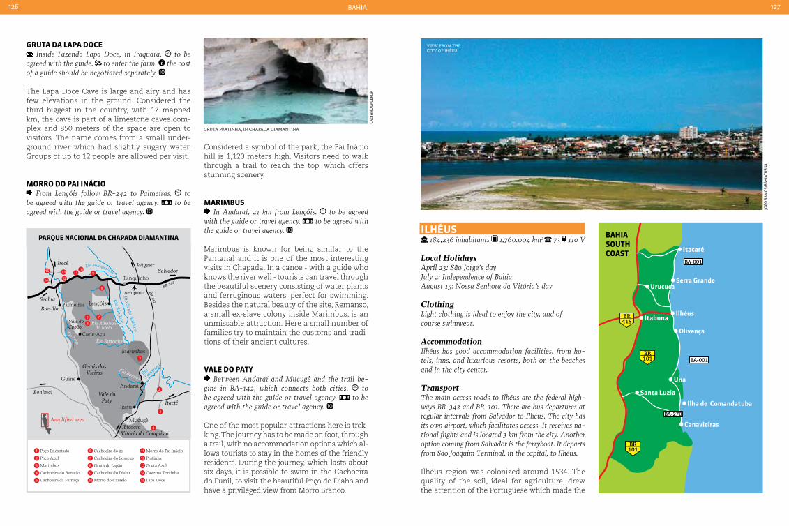
BaHia126 127
Itacaré
Serra Grande
Ilhéus
Uruçuca
Itabuna
Olivença
Una
Santa Luzia
Ilha de Comandatuba
Canavieiras
415BR
101BR
101BR
BA-001
BA-270
BA-001Irecê Wagner
Vale doCapão
Amplified area
Salvador
Seabra
Brasília
Bonimal
Gerais dosVieiras
Marimbus
BA 142
BR 242
Rio Santo A
ntônio
Rio São José
Rio Ribeirãodo Melo
Rio Roncador
Rio BaianoRio
Paragu
açu
Vale doPaty Itaetê
IbicoaraVitória da Conquista
Guiné
Caeté-Açu
Palmeiras Lençóis
Tanquinho
Igatu
Andarai
Mucugê
Aeroporto
15
14
13
1211
109
8
76
5
3
2
1
4
Ri o Preto
Rio Mucugezinho
Poço Encantado
Poço Azul
Marimbus
Cachoeira do Buracão
Cachoeira da Fumaça
Cachoeira do 21
Cachoeira do Sossego
Gruta do Lapão
Cachoeira do Diabo
Morro do Camelo
Morro do Pai Inácio
Pratinha
Gruta Azul
Caverna Torrinha
Lapa Doce
1
2
3
4
5
6
7
8
9
10
11
12
13
14
15
gruta Pratinha, in chaPada diamantina
view from the city of ihéus
Caet
an
o l
aCe
rd
a
joã
o r
am
os/
Ba
Hia
tur
sa
baHIa SoutH coaSt
parQue nacIonaL da cHapada dIaMantIna
Gruta da Lapa doce Inside Fazenda Lapa Doce, in Iraquara. to be
agreed with the guide. to enter the farm. the cost of a guide should be negotiated separately.
The Lapa Doce Cave is large and airy and has few elevations in the ground. Considered the third biggest in the country, with 17 mapped km, the cave is part of a limestone caves com-plex and 850 meters of the space are open to visitors. The name comes from a small under-ground river which had slightly sugary water. Groups of up to 12 people are allowed per visit.
Morro do paI InácIo From Lençóis follow BR-242 to Palmeiras. to
be agreed with the guide or travel agency. to be agreed with the guide or travel agency.
ILHÉuS 184,236 inhabitants 1,760.004 km2 73 110 V
Local HolidaysApril 23: São Jorge’s dayJuly 2: Independence of BahiaAugust 15: Nossa Senhora da Vitória’s day
Clothing Light clothing is ideal to enjoy the city, and of course swimwear.
AccommodationIlhéus has good accommodation facilities, from ho-tels, inns, and luxurious resorts, both on the beaches and in the city center.
TransportThe main access roads to Ilhéus are the federal high-ways BR-342 and BR-101. There are bus departures at regular intervals from Salvador to Ilhéus. The city has its own airport, which facilitates access. It receives na-tional flights and is located 3 km from the city. Another option coming from Salvador is the ferryboat. It departs from São Joaquim Terminal, in the capital, to Ilhéus.
Ilhéus region was colonized around 1534. The quality of the soil, ideal for agriculture, drew the attention of the Portuguese which made the
Considered a symbol of the park, the Pai Inácio hill is 1,120 meters high. Visitors need to walk through a trail to reach the top, which offers stunning scenery.
MarIMbuS In Andaraí, 21 km from Lençóis. to be agreed
with the guide or travel agency. to be agreed with the guide or travel agency.
Marimbus is known for being similar to the Pantanal and it is one of the most interesting visits in Chapada. In a canoe - with a guide who knows the river well - tourists can travel through the beautiful scenery consisting of water plants and ferruginous waters, perfect for swimming. Besides the natural beauty of the site, Remanso, a small ex-slave colony inside Marimbus, is an unmissable attraction. Here a small number of families try to maintain the customs and tradi-tions of their ancient cultures.
VaLe do paty Between Andaraí and Mucugê and the trail be-
gins in BA-142, which connects both cities. to be agreed with the guide or travel agency. to be agreed with the guide or travel agency.
One of the most popular attractions here is trek-king. The journey has to be made on foot, through a trail, with no accommodation options which al-lows tourists to stay in the homes of the friendly residents. During the journey, which lasts about six days, it is possible to swim in the Cachoeira do Funil, to visit the beautiful Poço do Diabo and have a privileged view from Morro Branco.

BaHia128 129
catedral de são seBastião, in ilhéus
joã
o r
am
os/
Ba
Hia
tur
sa Praia de cana Brava, in ilhéus
cocoa farm
tyPical construction in ilhéus
joã
o r
am
os/
Ba
Hia
tu
rsa
joã
o r
am
os/
Ba
Hia
tur
sa
joã
o r
am
os/
Ba
Hia
tur
sa
surfers enjoy the waves on the Beaches of ilhéus
ap
oen
a m
aCH
ad
o C
un
Ha
population increase rapidly. Cocoa was the most successful product in its farms, which were in-troduced to the city through plants brought from the Amazon region in the 17th century. The cocoa culture brought wealth and prosperity to the region. With the cocoa decline, the city, which has the longest coastline in Bahia, began investing in tourism. The city’s beaches are the main tourist attraction; however tourists can also visit the remaining cocoa farms of the city.
batacLan Avenida Dois de Julho, 75 - centro. daily, from
11 am to 11 pm. no charge
The building, which used to be a luxury cabaret where the cocoa colonels used to go, currently houses the cultural centre with the same name. The decorations are also its original, however, after a renovation the site now houses a restau-rant, bar, cigar shop and also rooms for exhibi-tions, soirées and theatrical presentations.
Mercado de arteSanato Rua Eustáquio Bastos, 308 - center. daily from
10 am to 10 pm. no charge
This shopping site has around 80 kiosks sell-ing souvenirs from the city. The most popular handicrafts include crochet items, clay objects, hand painted shirts and the cocoa liquor.
catedraL de São SebaStIão Praça Dom Eduardo - centro. the masses take
place daily, at 4 pm. no charge
Inaugurated in 1967, 36 years after construc-tion, the interior of the cathedral is discreet and simple, but its facade has fine details and a 47 meter-high round arch.
caSa de cuLtura JorGe aMado Rua Jorge Amado, 21 - center. monday to fri-
day from 8 am to 12 am and from 2 pm to 6 pm. Saturday from 9 am to 1 pm.
The house where the Bahian writer’s family lived is now a museum, which includes docu-ments, books, photographs and objects that be-
longed to Jorge Amado. The neoclassical house also includes the Ilhéus Historic Institute and the Bahia Academy of Arts and Letters.
praIa de canabraVa e tororoMba From Rua Tobias Barreto, turn right on Avenida
Soares Lopes to Ponte Lomanto Junior. After the bridge, follow the avenue to Rua Barão do Rio Branco, where you should turn left. Drive up to the 21 km marker on the highway
Both beaches are the most popular among tour-ists, as they have the largest infrastructure and two resorts nearby. The beach waters have calm waves and are surrounded by reefs.
praIa do crISto From Rua Tobias Barreto in downtown, follow
Avenida Soares Lopes and then Avenida Dois de Julho, where the beach is located
The main attraction in this urban beach is the replica of Rio de Janeiro’s Christ the Redeemer statue, almost eight meters high. Water sports such as kayaking, jet skiing and windsurfing also attract visitors to the beach.
poVoado do rIo do enGenHo Tours leave from Praça Maramata, no number -
Pontal. the tours are usually made during the day.
The village buildings, dated from before 1550, were listed by the National Institute of Histori-cal and Cultural Heritage. The village is located in the ruins of Sant’Ana, one of the first sugar mills in Brazil.

BaHia130 131
ilha de comandatuBa
lea
sa
rto
ri
SuL de ILHÉuS 73 110 V Una 24,106 inhabitants 159,525 km²
Canavieiras 32,331 inhabitants 375,556 km² Ilhéus 184,231 inhabitants
Local holidaysApril 23: São Jorge’s day (Ilhéus)July 2: Independence of BahiaAugust 15: Nossa Senhora da Vitória’s day (Ilhéus)
ClothingLight clothing such as shorts, t-shirts, sandals and dress-es are ideal to enjoy the city, and of course swimwear.
AccommodationUna offers several inns and resorts for those who choose the city as their destination. However, it is recommended to book in advance to avoid any set-back. There are very few inns and summer homes available for tourists in canavieiras. Therefore, it is
OlivençaOlivença is 18 km from Ilhéus. Bus lines connect the two locations; however the village doesn’t have a bus terminal. The car journey takes around half an hour.
The southern region from Costa do Cacau con-centrates a group of locations which preserve a great natural beauty and a fascinating history. Here, in the 16th century, the Portuguese began to cultivate cocoa, one of the most valuable and wanted products from that era. The cocoa culture drove the local economy, built great empires and became an inexhaustible source of memories and stories. With the decline of the product’s produc-tion, the proud cities of Canavieiras, Olivença and Una maintained their respect for the past but also looked to the future, investing in tourism, which is the most important activity in the re-gion. With beautiful and preserved beaches, his-torical houses and hospitable people, the region reserves a few surprises for visitors.
praIa da coSta From Avenida Barão do Rio Branco, follow
straight ahead through Avenida Himério caval-cante to the beach
Busy beach with a good tourist infrastructure. Ideal for children, as it has warm and calm waters.
praIa do patIpe From Avenida Beira Mar, at low tide. By boat,
through Patipe river, at high tide
Very popular for windsurfing and other sports, has warm waters and not many facilities. Only a few kiosks are available for visitors.
reSerVa bIoLÓGIca de una Rodovia Ilhéus, km 42. daily, from 8 am to 6 pm. no charge
The reserve is a remnant of the Atlantic Forest in the Bahian coast and it’s main attraction is a walkway 30 meters high, where visitors can ad-mire the untouched forest, plants and animals.
recommended to book in advance. The village has few options for accommodation; there are only a few ho-tels and fishermen’s cottages available for visitors.
TransportUnaFrom Ilhéus via BA-001, where there are bus depar-tures every two hours to Una. From Salvador, bus departures to canavieiras stop at Una. Una doesn’t have a bus terminal. Another option is the airport from Resort Transamérica Ilha comandatuba, 15 km from the city, but it only receives private flights.
Canavieiras By car or bus, the BA-101, BR-324 and BR-001 pro-vide access to the city. There are intercity bus lines connecting Salvador to canavieiras and other cities in the region. By air, the nearest airport is in Ilhéus, 120 km from the city. From there you can travel by car or bus to canavieiras.
poVoado de pedraS de una 9 km from the village center. the tours are usu-
ally made during the day. no charge
Artisans and fishermen live in this simple com-munity, which preserves a rustic lifestyle. Here vis-itors can take boat trips to view the mouth of the Una river and of the Maruim river, and also fish.
praIa de coMandatubaThe beach is accessed from Vila de comandatuba,
a village similar to Pedras do Una
The island used to be a cocoa farm and is 17 km long. One of the largest resorts in the region is located here; it occupies most of the seafront.
ILHa do ataLaIa By boat from Praia da costa, in canavieiras
The Island’s beaches are stretched for 17 km, with clear, calm and warm waters, ideal for swimming. The site also has Atlantic Forest re-serves and mangroves.
ocean courSe Ilha de comandatuba. daily from 9 am to 8 pm. price on request
The biggest golf course of the country is part of Hotel Transamérica, a resort which occupies most of the Ilha de Comandatuba. It has 780 thousand square meters, with 18 holes in accordance with international requirements. Those who do not own golfing equipment can rent it in the site.
baLneárIo e parQue aQuátIco de tororoMba
17 km from central Ilhéus. daily, from 9 am to 7 pm.
The site receives waters from the source of To-roromba River, which are believed to have me-dicinal powers. The park has an artificial water-fall, known as Véu de Noiva, and three pools.

BaHia132 133
Praia da tiririca, in itacaré
itacaré lighthouse
ga
Br
iel
Car
ValH
o/B
aH
ia t
ur
sa
ga
Br
iel
Car
ValH
o/B
aH
ia t
ur
sa
Pontal do maraú
au
ro
Qu
eir
oz/
emB
rat
ur
ItacarÉ 24,318 inhabitants 737.850 km² 73 110 V
Local holidaysJuly 2: Independence of Bahia (state holiday)
ClothingLight clothing and sandals, and don’t forget the swim-wear to enjoy the many beaches of the city.
AccommodationItacaré has a good and diversified hotel network, with inns in several comfort categories and luxury resorts.
TransportItacaré can be accessed by road via the state highway BA-001 (known as Estrada Parque) and the federal highway BR-324. From Salvador, follow up to Feira de Santana, where there is a junction to BA-001. From Ilhéus, access is made directly via BA-001. There are regular bus lines from Salvador and Ilhéus to Itacaré. Another option, from Salvador, is taking the ferryboat to Bom Despacho, in Ilha de Itaparica, and from there, by car or bus, follow BA-001 to Itacaré. The ferryboat departs from the Terminal São Joaquim, in the capital.
The coastline of the city, with less than 25 thousand inhabitants, is its biggest tourist at-traction. It was first discovered by surfers, who
ing (descending waterfalls through ropes) and aqua-ride (descending the river using a large buoy) in Rio de Contas.
praIa da concHa Rua da Pituba (caminho das Praias),
Itacaré’s main road
The beach is formed by the sea and the Rio de Contas. It has a great tourist infrastructure and attracts fans of canoeing and windsurfing. The beautiful scenery is complemented by the square-shaped lighthouse, one of the few in the country with this shape, which represents the Bahian maritime identity. The beach also includes the Ponta do Xaréu, where people get together in late afternoon to view the beautiful sunset in Itacaré.
praIa da rIbeIra Rua da Pituba (caminho das Praias),
Itacaré’s main road
Praia da Ribeira is one of the best options for those who seek good tourist facilities and an easy access. The more adventurous can enjoy the beautiful views from up above, through a
were seeking the great waves from Itacarez-inho and from Tiririca. The site is included in an Environmental Protection Area (APA), as it located in the middle of the Atlantic Forest, a type of forest which is devastated in the coun-try. The vegetation of the municipality, found-ed in 1732, spreads to the sea, creating rocky cliffs which make the beaches true natural works of art. Inside the Environmental Protec-tion Area (APA), visitors can participate in un-missable adventures, such as rafting, cascad-
zip-line which “flies” over the beach. For those who want peace and quiet, the creek - with small waterfalls and a dam which forms a freshwater natural pool - offers a cool water pool ideal for adults and children.
praIa da enGenHoca Via a trail from 12 km marker in BA-001
The beach is popular among surfers and those who seek peace and quiet. It is accessed via a beautiful trail. During the walk - which lasts around 20 minutes - it is possible to view the sea and the rocks. Palm trees frame the scenery. It is not recommended for children, as they can get tired during the walk and there are no tour-ist facilities on the beach.
praIa de ItacarezInHo Access to the beach is in the 15 km marker in
BA-001, after a private area
One of the best beaches in the region, with good waves throughout the year, it is a paradise for surfers in Bahia. Here you can dive and also view the sea turtles hatching. It has restaurants and bars with seafood delicacies.
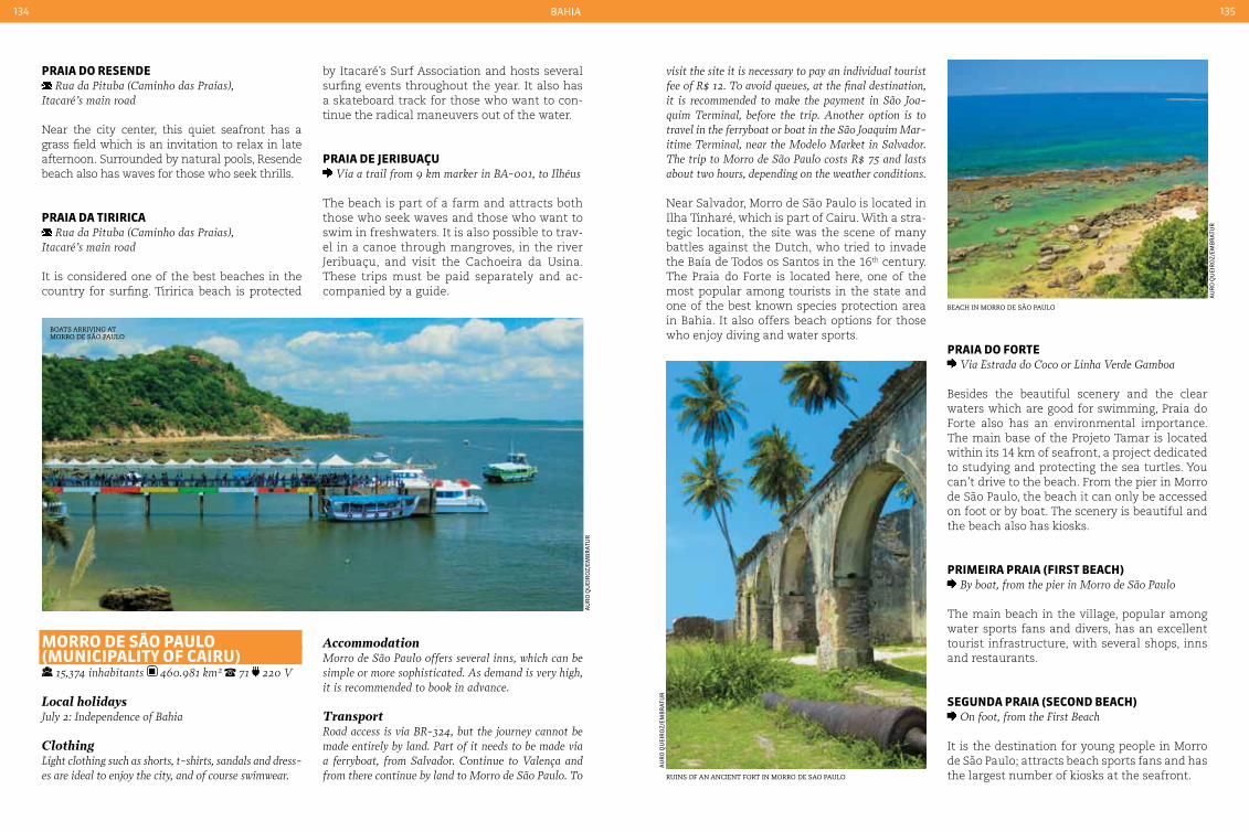
BaHia134 135
Boats arriving at morro de são Paulo
au
ro
Qu
eir
oz/
emB
rat
ur
Beach in morro de são Paulo
ruins of an ancient fort in morro de sao Paulo
au
ro
Qu
eir
oz/
emB
rat
ur
au
ro
Qu
eir
oz/
emB
rat
ur
praIa do reSende Rua da Pituba (caminho das Praias),
Itacaré’s main road
Near the city center, this quiet seafront has a grass field which is an invitation to relax in late afternoon. Surrounded by natural pools, Resende beach also has waves for those who seek thrills.
praIa da tIrIrIca Rua da Pituba (caminho das Praias),
Itacaré’s main road
It is considered one of the best beaches in the country for surfing. Tiririca beach is protected
visit the site it is necessary to pay an individual tourist fee of R$ 12. To avoid queues, at the final destination, it is recommended to make the payment in São Joa-quim Terminal, before the trip. Another option is to travel in the ferryboat or boat in the São Joaquim Mar-itime Terminal, near the Modelo Market in Salvador. The trip to Morro de São Paulo costs R$ 75 and lasts about two hours, depending on the weather conditions.
Near Salvador, Morro de São Paulo is located in Ilha Tinharé, which is part of Cairu. With a stra-tegic location, the site was the scene of many battles against the Dutch, who tried to invade the Baía de Todos os Santos in the 16th century. The Praia do Forte is located here, one of the most popular among tourists in the state and one of the best known species protection area in Bahia. It also offers beach options for those who enjoy diving and water sports.
by Itacaré’s Surf Association and hosts several surfing events throughout the year. It also has a skateboard track for those who want to con-tinue the radical maneuvers out of the water.
praIa de JerIbuaçu Via a trail from 9 km marker in BA-001, to Ilhéus
The beach is part of a farm and attracts both those who seek waves and those who want to swim in freshwaters. It is also possible to trav-el in a canoe through mangroves, in the river Jeribuaçu, and visit the Cachoeira da Usina. These trips must be paid separately and ac-companied by a guide.
Morro de São pauLo (MunIcIpaLIty oF caIru)
15,374 inhabitants 460.981 km² 71 220 V
Local holidaysJuly 2: Independence of Bahia
ClothingLight clothing such as shorts, t-shirts, sandals and dress-es are ideal to enjoy the city, and of course swimwear.
AccommodationMorro de São Paulo offers several inns, which can be simple or more sophisticated. As demand is very high, it is recommended to book in advance.
TransportRoad access is via BR-324, but the journey cannot be made entirely by land. Part of it needs to be made via a ferryboat, from Salvador. continue to Valença and from there continue by land to Morro de São Paulo. To
praIa do Forte Via Estrada do coco or Linha Verde Gamboa
Besides the beautiful scenery and the clear waters which are good for swimming, Praia do Forte also has an environmental importance. The main base of the Projeto Tamar is located within its 14 km of seafront, a project dedicated to studying and protecting the sea turtles. You can’t drive to the beach. From the pier in Morro de São Paulo, the beach it can only be accessed on foot or by boat. The scenery is beautiful and the beach also has kiosks.
prIMeIra praIa (FIrSt beacH) By boat, from the pier in Morro de São Paulo
The main beach in the village, popular among water sports fans and divers, has an excellent tourist infrastructure, with several shops, inns and restaurants.
SeGunda praIa (Second beacH) On foot, from the First Beach
It is the destination for young people in Morro de São Paulo; attracts beach sports fans and has the largest number of kiosks at the seafront.

BaHia136 137
Passarela do álcool
leti
Cia
do
s sa
nto
s
discovery landmarK with the igreja de nossa senhora da Pedra in the BacKground
caraíva Beach
Porto seguro lighthouse
tays
e a
rg
ôlo
/Ba
Hia
tu
rsa
tays
e a
rg
ôlo
/Ba
Hia
tu
rsa
tays
e a
rg
ôlo
/Ba
Hia
tu
rsa
terceIra praIa (tHIrd beacH) On foot, from the Second Beach
Near the Ilha do Caitá and the main diving spot, this beach is surrounded by coral reefs. Its infra-structure is smaller than the first two beaches.
Quarta praIa (FourtH beacH) On foot, from the Third Beach
It is the largest beach on the village and the best one for children. It has several natural pools for diving and swimming.
porto SeGuro
126,929 inhabitants 2,408.492 km² 73 220 V
Local holidaysApril 22: Discovery of BrazilJune 30: Porto Seguro AnniversaryJuly 2: Independence of BahiaSeptember 8: Nossa Senhora da Penha’s day
ClothingLight clothing such as shorts, t-shirts, sandals and dress-es are ideal to enjoy the city, and of course swimwear.
AccommodationIn Porto Seguro, tourists can choose between inns in several categories, resorts and hotels. As the demand is very high during the beginning and end of the year, it is recommended to book in advance.
TransportThe highways BR-101 and BR-367 provide access to the city. There are bus lines connecting the city to the main Brazilian capitals. Porto Seguro has an airport which re-ceives domestic flights from the main Brazilian airlines.
It was in this region where Pedro Álvares Cabral arrived in 1500, in the lands that would become Brazil. However, Porto Seguro only became a city in 1534. It was declared a historic site by the National Institute of Historical and Cultural Heritage in 1976, due to its obvious importance. Tourism is the main activity in the city, which is noticeable while walking around the city. Besides the beautiful beaches and preserved buildings, from the discovery era, the city also hosts several festivities. Porto Seguro is the capital of axé, a rhythm created in Bahia which accompanies all the carnivals
centro HIStÓrIco Trevo do cabral. 24 hours daily. no charge
To learn more about the history of Brazil it is essential to visit the Centro Histórico of Porto Seguro. This is the city where Brazil was born and where the first buildings of the country are located. Three churches and around 40 renovated buildings form the village where the country began to develop.
MeMorIaL do deScobrIMento Avenida Beira-Mar, 800 - cruzeiro. Monday to
Saturday from 8:30 am to 12:30 am and from 1:30 pm to 5 pm. no charge
The memorial takes the visitors on a journey back to 1500 and shows how the discovery of Brazil happened. One example of what can be seen there is a copy of the caravel in which the explorers travelled, with explanations about the journey and the way they stored supplies.
paSSareLa do áLcooL Avenida Passarela do Álcool - centro 24 hours
daily. No charge. no restriction during the day. in the evenings it is not recommended for children
Despite the name, during the day, the footbridge is like an open air shopping center and a tour-ist attraction which both adults and children can enjoy. Here there are restaurants, bars and shops selling souvenirs from the city, such as shirts and handicrafts. In the evenings stalls serving typical drinks are set up and there are free shows. At this time it is not recommended for children. The most popular drink in the city is available here, the famous Capeta, made from vodka, condensed milk and guarana powder.

BaHia138 139
trancoso
au
ro
Qu
eir
oz/
emB
rat
ur
shoPs and restaurants at the famous square of trancoso golf course overlooKing the sea
feli
pe
go
mB
oss
y/em
Br
atu
r
jota
fr
eita
s/a
rQ
uiV
o s
etu
r/B
aH
ia t
ur
sa
praIa do cururIpe From Avenida dos Navegantes (downtown), turn left
at Avenida Vinte e Dois de Abril. continue through Avenida Beira Mar for about two kilometers
The beach has warm water natural pools and calm waves at low tide. The site is popular among tourists travelling as a family, seeking some peace and quiet. It has a good tourist infrastructure.
praIa de rIo doS ManGueS From Avenida dos Navegantes (downtown), turn left
at Avenida Vinte and Dois de Abril. continue through Avenida Beira Mar for about 7 km
Also known as Barramares, the beach has sports equipment for rent, from soccer to kayaking and ultralight aircraft. The waters are good for swim-ming and there are also bars and kiosks.
trancoSo (MunIcIpaLIty oF porto SeGuro)
73 220 V
Local holidaysApril 22: Discovery of BrazilJune 30: Porto Seguro AnniversaryJuly 2: Independence of BahiaSeptember 8: Nossa Senhora da Penha’s day
ClothingLight clothing such as shorts, t-shirts, sandals and dress-es are ideal to enjoy the city, and of course swimwear.
AccommodationTrancoso is one of the most sophisticated destina-tions in Bahia, with inns and luxury resorts designed by great architects. There are high quality condomini-ums, with summer houses, available for tourists.
TransportIt is made by car or taxi, from Porto Seguro. The high-way to Trancoso is the BR-367.
Although it has a simple aura, Trancoso is a busy location and has some of the most luxuri-ous inns and buildings of Bahia. Initially a Jesuit village, known as São João Batista dos Índios, the village became well known in the 1970s, when young hippies went to its beaches to start a new life near the untouched nature. The site experienced a big growth in tourism, its main economic activity, in the last few years. Here, visitors have the opportunity to visit exclusive and untouched beaches, and also enjoy the so-phistication of boutique shops and restaurants with international cuisine.
Quadrado centro Histórico. no charge.
The main square in the city’s historic center is known as Quadrado, a place where people walk by all day long, mainly during late after-noon and evening. The old houses on the site became bars, restaurants and shops which sell
handicrafts and designer clothing. The site also houses the Igreja de São João Batista, one of the oldest churches in Brazil and an important tourist attraction in the city.
terraVISta GoLF Estrada Municipal de Trancoso, km 18. Monday
to Saturday from 8 am to 5 pm. price of services on request.
This is one of the biggest golf courses in the coun-try, with 18 holes. At the site, visitors can enjoy the course and can also learn how to play. Equip-ments are available for rental and purchase.
Itapororoca By car, from the village
It is a wild beach with restricted access due to a luxury condominium. It has a large forest with fruit trees which adorn the small beach with calm and clear waters. Only guests can use the tourist facilities on the site.
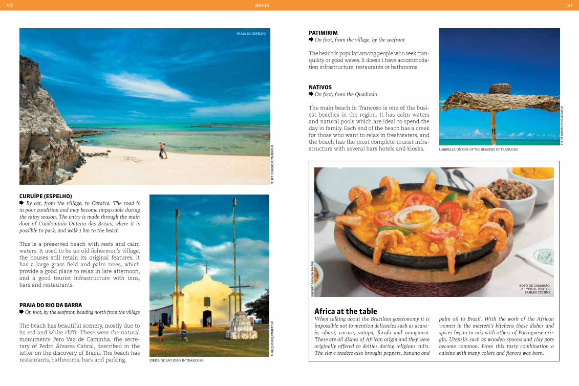
BaHia140 141
Praia do esPelho
feli
pe
go
mB
oss
y/em
Br
atu
r
umBrella on one of the Beaches of trancoso
feli
pe
go
mB
oss
y/em
Br
atu
r
igreja de são joão, in trancoso
au
ro
Qu
eir
oz/
emB
rat
ur
BoBÓ de camarão, a tyPical dish of
Bahian cuisine
ro
Ber
to f
ar
ia/e
mB
rat
ur
curuípe (eSpeLHo) By car, from the village, to caraíva. The road is
in poor condition and may become impassable during the rainy season. The entry is made through the main door of condomínio Outeiro das Brisas, where it is possible to park, and walk 1 km to the beach
This is a preserved beach with reefs and calm waters. It used to be an old fishermen’s village, the houses still retain its original features. It has a large grass field and palm trees, which provide a good place to relax in late afternoon, and a good tourist infrastructure with inns, bars and restaurants.
praIa do rIo da barra On foot, by the seafront, heading north from the village
The beach has beautiful scenery, mostly due to its red and white cliffs. These were the natural monuments Pero Vaz de Caminha, the secre-tary of Pedro Álvares Cabral, described in the letter on the discovery of Brazil. The beach has restaurants, bathrooms, bars and parking.
patIMIrIM On foot, from the village, by the seafront
The beach is popular among people who seek tran-quility or good waves. It doesn’t have accommoda-tion infrastructure, restaurants or bathrooms.
natIVoS On foot, from the Quadrado
The main beach in Trancoso is one of the busi-est beaches in the region. It has calm waters and natural pools which are ideal to spend the day in family. Each end of the beach has a creek for those who want to relax in freshwaters, and the beach has the most complete tourist infra-structure with several bars hotels and kiosks.
africa at the tableWhen talking about the Brazilian gastronomy it is impossible not to mention delicacies such as acara-jé, abará, caruru, vatapá, farofa and mungunzá. These are all dishes of African origin and they were originally offered to deities during religious cults. The slave traders also brought peppers, banana and
palm oil to Brazil. With the work of the African women in the masters’s kitchens these dishes and spices began to mix with others of Portuguese ori-gin. Utensils such as wooden spoons and clay pots become common. From this tasty combination a cuisine with many colors and flavors was born.

143
ceará
tratamento - suBir Céu
fra
nCi
sCo
CH
ag
as/
emB
rat
ur
Buggy ride on the dunes of cumBuco

FortaLeza
Canoa QueBrada
CumBuCo
jijoCa
jeriC
oaCoara
Bitupitá
Camooim
almofala
Baleia m
undaú
fleXeiras
lagoinHa
taÍBa
CumBuCa taBuBa
iCaraÍ
portodas d
unas
morro BranCo
praia d
as fontespontal d
o maCeió
QuiXaBa
redonda
rIo Grande do norte
pernaMbuco
paraíba
222BR
222BR
222BR
222BR
020BR
122BR
122BR
304BR
304BR
116BR
116BR
116BR
116BR
404BR
122BR
230BR
230BR
230BR
122BR
122BR
116BR
020BR
020BR
020BR
020BR
404BR
404BR
403BR
226BR
226BR
226BR
403BR
403BR
402BR
CE-202CE-364
CE-362
CE-364
CE-240
CE-187 CE-313CE-364
CE-362
CE-362
CE-119
CE-178
CE-178
CE-434
CE-085
CE-168
CE-163 CE-135
CE-187CE-232
CE-277CE-183
CE-382CE-230
CE-178
CE-211
CE-032CE-192
CE-187
CE-257
CE-192CE-333
CE-265
CE-187
CE-057CE-288
CE-265 CE-176
CE-467 CE-265
CE-266
CE-176
CE-257CE-032
CE-168
CE-354 CE-135
CE-341CE-162
CE-230
CE-455CE-119
CE-228CE-065
CE-060
CE-040
CE-356
CE-065
CE-257CE-060
CE-456
CE-215CE-060
CE-456
CE-060 CE-359
CE-359
CE-356
CE-257
CE-138
CE-040
CE-261
CE-222
CE-105
CE-138
CE-265CE-371
CE-166
CE-265
CE-266
CE-145
CE-169CE-060
CE-166
CE-266
CE-060
CE-169 CE-363
CE-363
CE-169CE-060
CE-021CE-371
CE-275CE-372
CE-371
CE-275
CE-153
CE-371
CE-187CE-176
CE-277
CE-169CE-371
CE-166
CE-060 CE-113
CE-266
CE-285
CE-266
CE-358CE-209
CE-205
CE-470
CE-470
CE-205
CE-284
CE-176
CE-187
CE-292
CE-375 CE-388
CE-292
CE-284
CE-375
CE-166
CE-060
CE-375CE-282
CE-282
CE-288CE-060
CE-055
CE-292
CE-297
CE-277
CE-187
CE-176
CE-187
CE-176
CE-189
CE-187
Ceará144 145
ceará
Ceará is privileged by a pleasant climate with an average temperature of 27 °C (80,6 °F) on the coast, while the hills and inte-
rior of the State are a little cooler, dropping to 20 °C (68 °F). It is a State with great cultural riches, having provided Brazil with writers such as José de Alencar and Rachel de Queiroz. It was also the birthplace of several great Brazilian humorists such as Renato Aragão, Chico Anísio and Tom Cavalcante, as well as poets such as Patativa of Asaré. Music is another interesting part of the Ceará culture, with rhythms ranging from forró to MPB (Brazilian Folk Music) and famous names such as Fagner, Belchior, Amelinha and Ednardo. It was also home to Eleazar de Carvalho, one of Brazil’s most renowned classical maestros.
Surrounded by fine white sand dunes, which help to reflect the sunlight, the capital of Ceará, Fortaleza, captivates its visitors with a mixture of sun, beaches and delicious aromas. The re-gion of Greater Fortaleza offers beaches circled by bars and restaurants, as Cumbuco and Porto das Dunas. Local residents are always willing to contribute with a tip or an explanation of the local delicacies.
At night the program for local residents and tourists is to gather in the bars and restaurants serving crab in diverse recipes: grilled with lem-on and salt or in more elaborate dishes accord-ing to the customer’s choosing, enjoyed while being refreshed by the evening breeze and For-taleza’s typical animation.
Juazeiro do Norte is located in the Cariri re-gion in Ceará’s countryside - founded by Pa-dre Cicero, a religious figure who is attributed with miracles and to whom many Brazilians are devotees. The town is visited by thousands who come to see the Igreja do Padre Cicero. The Santo Antônio festival is also celebrated here by thousands of devotees.
Those who enjoy ecotourism will have sev-eral options in this region: there are trails, natural spas and waterfalls. Mansions from the sugar-cane boom are also open for visits - reminders from the colonial period, when the Northeast was the richest region in Brazil.
Ceará was the location for many important events in the history of Brazil, and was the first State to abolish slavery. The interior of Ceará, and in particular Juazeiro do Norte, was home to a popular movement led by Padre Cicero and Padre Ibiapina.
The State is one of the largest wind power producers in the country, thanks to its strong winds, especially on the coast. In addition to providing a model of clean energy, the winds also attract those who enjoy sports such as windsurfing and kitesurfing.
As one of the 12 venues for the 2104 World Cup, Ceará is exerting even more care in the preparation of its delicious regional dishes, an paying even more attention in the traditional manufacture of bobbin lace, which is made following time-honored regional traditions.
international airport
national airport
national HigHways
state HigHways
Geographic information
tropical average of 27 °c (80,6 °F) mangroves and scrub
juazeiro do norte

Ceará146 147
FortaLeza 2,452,185 inhabitants 314,927 km² 85 220 V
Local holidaysMarch 19: São José’s dayMarch 25: End of slavery in cearáAugust 15: Nossa Senhora da Assunção’s day
ClothingLight clothing suitable for hot weather. caps or hats are recommended for protection from the sun.
AccommodationFortaleza has excellent tourist infrastructure, with a well-equipped hotel network that offers resorts, ho-tels in various categories and inns. There is an ex-tensive offer of rooms throughout the city, but the most sophisticated and popular are located near the seafront and in the central region.
TransportAccess to the city can be by air, car or bus. The high-ways leading to Fortaleza are the BR-222 and BR-116.
Fortaleza also has air connections with the major cit-ies in Brazil; the airport is only 6 km from the center.
Within the cityGetting around town is facilitated by 247 regular bus lines, including 22 that operate after midnight. Urban Transport company in Fortaleza: Tel. (85) 3452-9205
view of the seafront at iracema
fra
nCi
sCo
CH
ag
as/
emB
rat
ur
fra
nCi
sCo
CH
ag
as/
emB
rat
ur
mosaic of the centro cultural dragão do mar
The city was founded in 1726 on the banks of the Rio Pajeú, and currently has more than two million inhabitants. The Capital of Ceará is one of the venues for the 2014 World Cup, and is undergoing several improvements to its urban and tourist infrastructure. Besides the beach-es, Fortaleza also has other natural attractions that enchant its visitors, such as the Reserva Ecológica de Sabiaguaba. Museums, churches and squares make up part of a tourist circuit that has made the town popular with Brazilian tourists in recent years.
catedraL MetropoLItana Praça da Sé - centro. Tuesday to Friday from
8 am to 12 am and from 2 pm to 6 pm. Saturday from 8 am to 12 am. no charge
The Paróquia São José, also known as the Cat-edral Metropolitana, was built to replace the Igreja da Sé, demolished due to risk of collaps-ing. Construction took 40 years. The cathedral has attractive stained glass windows and im-posing dimensions - it has capacity to hold around five thousand people. se
Cret
ar
ia d
e tu
ris
mo
do
Cea
ra
teatro josé de alencar
teatro JoSÉ de aLencar Rua Liberato Barroso, 525 Praça José de Alencar -
centro. Monday to Friday from 8 am to 5 pm. Sat-urdays and Sundays from 12 am to 5 pm.
The theater is an artistic reference center in the State’s culture and is one of the main example of eclectic architecture in Brazil (it includes a room in Art Nouveau style). The institution has six stages - two indoor and four in the Burle Marx gardens, one of these being on the theater sidewalk, facing Praça José de Alencar.
1
Av. Pad. E
spiri
tual
Av. d
os E
xped
icio
nári
os
Av. d
os E
xped
icio
nári
os
Av. Con. d
e Castro
R. C
el V
irgí
lio N
ogue
ira
R. Emílio de Menezes
Av. ParanjanaAv. G
en. Osório
de Paiva
Av. José Bastos Av. Antônio Sales
BR 116
BR 116
Av. Pres. Castelo Branco
Av. Francisco Sá
Av. Srg. Herminio Sampaio
Av. Bezerra MenezesAv. Santos Dumont
Av. Santos Dumont
Av. Dioguinho
Av. Zezé Diogo
Av. W
ashington Soares
Av. R
ogac
iano
Lei
teVia
Exp
ress
a Pa
rang
aba
BR 020
Av. Carlos Jereissati
Av. Dedé
Brasil
Av. Dep. Paulino Rocha
2
3
45 7
89
10
11
6
12
Av. G
odof
redo
Mac
iel
Av. Augusto
dos Anjos
Av. Pres. Costa e Silva
1 Estádio Castelão2 Pinto Martins Interna-tional Airport3 Parque Adail Barreto4 Iracema5 Meireles6 Estátua de Iracema7 Mucuripe8 Iate Clube9 Farol10 Praia do Futuro11 Sabiaguaba12 Universidade
Federal do Ceará
FortaLeza
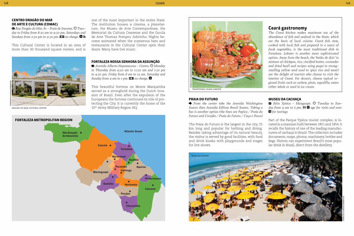
Atlantic OceanSão Gonçalodo Amarante
Caucaia
Maranguape
Guaiúba
Pacajus
Chorozinho
Horizonte
Cascavel
Pindoretama
Aquiraz
Fortaleza
Eusébio
ItaitingaPacatuba
Maracanaú
FortaLeza MetropoLItan reGIon
Ceará148 149
centro draGão do Mar de arte e cuLtura (cdMac)
Rua Dragão do Mar, 81 - Praia de Iracema. Tues-day to Friday from 8:30 am to 9:30 pm. Saturdays and Sundays from 2:30 pm to 9:30 pm. no charge.
This Cultural Center is located in an area of more than 30 thousand square meters, and is
praIa do Futuro From the center take the Avenida Washington
Soares then Avenida Edilson Brasil Soares. Taking a bus is another option (the lines are Papicu / Praia do Futuro and corujão / Praia do Futuro / caça e Pesca)
The Praia do Futuro is the largest in the city, 25 km long and popular for bathing and diving. Besides taking advantage of its natural beauty, the visitor is served by good facilities, with food and drink kiosks with playgrounds and stages for live shows.
MuSeu da cacHaça Sítio Ypióca - Manguape. Tuesday to Sun-
day from 9 am to 5 pm. age for visits and over. for tastings
Part of the Parque Ypióca tourist complex, is lo-cated in a mansion built between 1851 and 1854. It recalls the history of one of the leading manufac-turers of cachaça in Brazil. The collection includes documents, maps, photos, machinery, bottles and kegs. Visitors can experiment Brazil’s most popu-lar drink in Brazil, direct from the distillery.
fra
nCi
sCo
CH
ag
as/
emB
rat
ur
dragão do mar cultural center
ceará gastronomyThe ceará kitchen makes maximum use of the abundance of fish and seafood in the State, which are the basis of local cuisine. ceará fish stew, cooked with local fish and prepared in a sauce of fresh vegetables, is the most traditional dish in Fortaleza. Lobster is another more sophisticated option. Away from the beach, the ‘baião de dois’ (a mixture of chickpea, rice, clarified butter, coriander and dried beef) and recipes using pequi (a strong-smelling yellow seed used to spice rice and meat) are the delight of tourists who choose to visit the interior of ceará. For dessert, choose typical re-gional fruits such as cashew, plum, sapodilla, eaten either whole or used in ice cream.
traditional ceará loBster
fra
nCi
sCo
CH
ag
as/
emB
rat
ur
Praia do futuro
fra
nCi
sCo
CH
ag
as/
emB
rat
ur
one of the most important in the entire State. The institution houses a cinema, a planetar-ium, the Museu de Arte Contemporânea, the Memorial da Cultura Cearense and the Escola de Arte Thomaz Pompeu Sobrinho. Nights be-come animated when the numerous bars and restaurants in the Cultural Center open their doors. Many have live music.
FortaLeza noSSa SenHora da aSSunção Avenida Alberto Nepomuceno - centro. Monday
to Thursday from 9:30 am to 11:30 am and 1:30 pm to 4:30 pm. Friday from 8 am to 12 am. Saturday and Sunday from 9 am to 1 pm. no charge.
This beautiful fortress on Monte Marajaitiba served as a stronghold during the Dutch inva-sion of Brazil. Even after the expulsion of the Europeans the fortress continued its role of pro-tecting the City. It is currently the home of the 10th Army Military Region HQ.
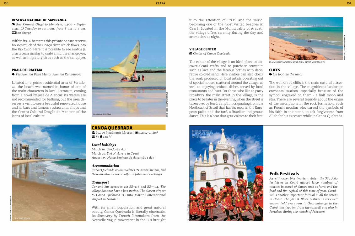
Ceará150 151
reSerVa naturaL de SapIranGa Rua coronel Olegário Memória, 3,300 - Sapir-
anga. Tuesday to saturday, from 8 am to 5 pm. no charge
Within its 60 hectares this private nature reserve houses much of the Coaçu river, which flows into the Rio Cocó. Here it is possible to see aratus (a crustacean similar to crab) amid the mangroves, as well as migratory birds such as the sandpiper.
praIa de IraceMa Via Avenida Beira Mar or Avenida Rui Barbosa
Located in a prime residential area of Fortale-za, the beach was named in honor of one of the main characters in local literature, coming from a novel by José de Alencar. Its waters are not recommended for bathing, but the area de-serves a visit to see a beautiful renovated house and its bars and famous restaurants, shops and the Centro Cultural Dragão do Mar, one of the icons of local culture.
canoa Quebrada 69,159 inhabitants (Aracati) 1,247,301 km² 85 220 V
Local holidaysMarch 19: São José’s dayMarch 25: End of slavery in cearáAugust 15: Nossa Senhora da Assunção’s day
Accommodationcanoa Quebrada accommodates its visitors in inns, and there are also rooms on offer in fishermen’s cottages.
Transportcar and bus access is via BR-116 and BR-304. The village does not have a bus station. The closest airport to canoa Quebrada is Pinto Martins International Airport in Fortaleza.
With its small population and great natural beauty, Canoa Quebrada is literally cinematic. Its discovery by French filmmakers from the Nouvelle Vague movement in the 60s brought
it to the attention of Brazil and the world, becoming one of the most visited beaches in Ceará. Located in the Municipality of Aracati, the village offers serenity during the day and animation at night.
VILLaGe center center of canoa Quebrada
The center of the village is an ideal place to dis-cover Ceará crafts and to purchase souvenirs such as lace and the famous bottles with deco-rative colored sand. Here visitors can also check the work produced of local artists operating out of special houses scattered around the village, as well as enjoying seafood dishes served by local restaurants and bars. For those who like to party Broadway, the main street in the village, is the place to be later in the evening, when the street is taken over by forró, a rhythm originating from the Northeast of Brazil that has its roots in the Euro-pean polka and the toré, a Brazilian indigenous dance. This is a beat that gets visitors to their feet.
cLIFFS On foot via the sands
The wall of red cliffs is the main natural attrac-tion in the village. The magnificent landscape enchants tourists, especially because of the symbol engraved on them - a half moon and star. There are several legends about the origin of the inscriptions in the rock formation, such as French muslim who carved the symbols of his faith in the stone, to ask forgiveness from Allah for his excesses while in Canoa Quebrada.
fra
nCi
sCo
CH
ag
as/
emB
rat
ur
iracema Beach
fra
nCi
sCo
CH
ag
as/
emB
rat
ur
canoa queBrada
Praia formosa with a wind farm in the BacKground
fra
nCi
sCo
CH
ag
as/
emB
rat
ur
Folk FestivalsAs with other Northeastern states, the São João festivities in ceará attract large numbers of tourists in search of dances such as forró, and the food and fun typical of this time of year. carni-val is another important festival in all the towns in ceará. The Jazz & Blues Festival is also well known, held every year in Guaramiranga in the ceará hills (110 km from the capital) and also in Fortaleza during the month of February.
Coll
eCti
on
of
setu
r C
e
são joão festivals in ceará are among the most tyPical in the northeast
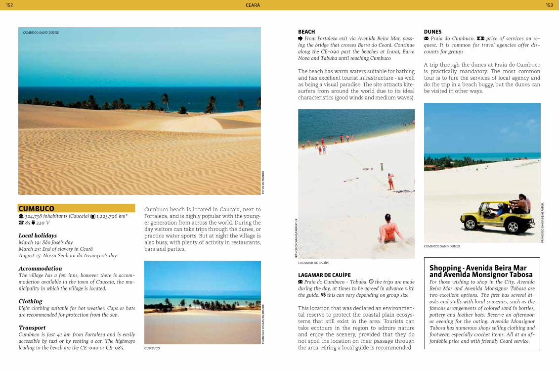
Ceará152 153
cuMbuco 324,738 inhabitants (caucaia) 1,223,796 km² 85 220 V
Local holidaysMarch 19: São José’s day March 25: End of slavery in cearáAugust 15: Nossa Senhora da Assunção’s day
AccommodationThe village has a few inns, however there is accom-modation available in the town of caucaia, the mu-nicipality in which the village is located.
ClothingLight clothing suitable for hot weather. caps or hats are recommended for protection from the sun.
Transportcumbuco is just 41 km from Fortaleza and is easily accessible by taxi or by renting a car. The highways leading to the beach are the cE-090 or cE-085.
Cumbuco beach is located in Caucaia, next to Fortaleza, and is highly popular with the young-er generation from across the world. During the day visitors can take trips through the dunes, or practice water sports. But at night the village is also busy, with plenty of activity in restaurants, bars and parties.
beacH From Fortaleza exit via Avenida Beira Mar, pass-
ing the bridge that crosses Barra do ceará. continue along the cE-090 past the beaches at Icaraí, Barra Nova and Tabuba until reaching cumbuco
The beach has warm waters suitable for bathing and has excellent tourist infrastructure - as well as being a visual paradise. The site attracts kite-surfers from around the world due to its ideal characteristics (good winds and medium waves).
duneS Praia do cumbuco. price of services on re-
quest. It is common for travel agencies offer dis-counts for groups
A trip through the dunes at Praia do Cumbuco is practically mandatory. The most common tour is to hire the services of local agency and do the trip in a beach buggy, but the dunes can be visited in other ways.
cumBuco sand dunes
fo
tos
do
mu
nd
ofr
an
CisC
o C
Ha
ga
s/em
Br
atu
r
cumBuco
fra
nCi
sCo
CH
ag
as/
emB
rat
ur
fra
nCi
sCo
CH
ag
as/
emB
rat
ur
lagamar de cauíPe
cumBuco sand dunes
LaGaMar de cauípe Praia do cumbuco - Tabuba. the trips are made
during the day, at times to be agreed in advance with the guide. this can vary depending on group size
This location that was declared an environmen-tal reserve to protect the coastal plain ecosys-tems that still exist in the area. Tourists can take ecotours in the region to admire nature and enjoy the scenery, provided that they do not spoil the location on their passage through the area. Hiring a local guide is recommended.
Shopping - avenida beira Mar and avenida Monsignor tabosaFor those wishing to shop in the city, Avenida Beira Mar and Avenida Monsignor Tabosa are two excellent options. The first has several ki-osks and stalls with local souvenirs, such as the famous arrangements of colored sand in bottles, pottery and leather hats. Reserve an afternoon or evening for the outing. Avenida Monsignor Tabosa has numerous shops selling clothing and footwear, especially crochet items. All at an af-fordable price and with friendly ceará service.
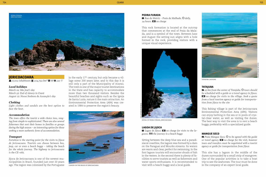
Ceará154 155
JerIcoacoara 17,002 inhabitants 204,792 km² 88 220 V
Local holidaysMarch 19: São José’s dayMarch 25: End of slavery in cearáAugust 15: Nossa Senhora da Assunção’s day
ClothingLight clothes and sandals are the best option to face the heat.
AccommodationThe town offers the tourist a wide choice inns, rang-ing from simple to sophisticated. There are also several fishermen that rent their homes to families or groups during the high season - an interesting option for those seeking a more authentic form of accommodation.
TransportFortaleza is the starting point for the visits to Jijoca de Jericoacoara. Tourists can choose between bus, jeep, car or even a beach buggy - taking the beach for the whole journey. The highway to Jericoacoara is the cE-085.
Jijoca de Jericoacoara is one of the newest mu-nicipalities in Brazil, founded just over 20 years ago. The region was colonized by the Portuguese
in the early 17th century, but only became a vil-lage some 200 years later, and to this day it is still only a part of the Municipality of Acaraú. The town is one of the major tourist destinations in the State and has capacity to accommodate more than two thousand visitors. Besides the beautiful beaches and sights such as the Igreja de Santa Luzia, nature it the main attraction. An Environmental Protection Area (APA) was cre-ated in 1984 to preserve the region’s beauty.
pedra Furada Rua da Matriz - Praia da Malhada. daily,
24 hours. no charge
This rock formation is located at the outcrop that commences at the end of Praia da Mala-da, and is a symbol of the town. Between June and August the setting sun aligns with a hole formed in the rock, providing visitors with a unique visual experience.
tataJuba 25 km from the center of Tatajuba. tours should
be scheduled with a guide or a travel agency in Jijoca. no charge for visits to the village. Seek a quote
from a local tourism agency or guide for transporta-tion from Jijoca to the site
This fishing village is part of the Jericoacoara Environmental Protection Area (APA). Visitors can enjoy bathing in the sea or in pools of crys-tal-clear water, as well as visiting the dunes. The best way to visit the area is to rent a beach buggy, preferably with a specialized guide.
ManGue Seco Praia Mangue Seco. to be agreed with the guide
or travel agency. no charge for the visit, however tours and transfers must be negotiated with a tourist agency or guide for transportation from Jijoca
This site has a lagoon in the middle of the dunes surrounded by a small strip of mangrove. One of the popular activities is to take a boat trip to see the seahorses. The tour must be done in the company of an expert local guide.
Pedra furada, jericoacoara
diV
ulg
açã
o/s
etu
r C
eCo
lleC
tio
n o
f se
tur
Ce
Coll
eCti
on
of
setu
r C
e
Coll
eCti
on
of
setu
r C
e
canoes on the Beach at jericoacoara
detail of Pedra furada, jericoacoara
tatajuBa lagoons
LaGoa de JIJoca Lagoa de Jijoca. no charge for visits to the la-
goons. the journey in a beach buggy
Sitting between the deep blue sea and a paradi-siacal coastline, the lagoon was formed by a dam on the Paraguai and Mourão streams. Its waters are warm and clear, perfect for swimming. In the first lagoon tourists will encounter shoals of fish in the waters. In the second there is plenty of fa-cilities to serve tourists as well as fishermen and water sports enthusiasts. It is recommended to visit with a beach buggy and a local guide.
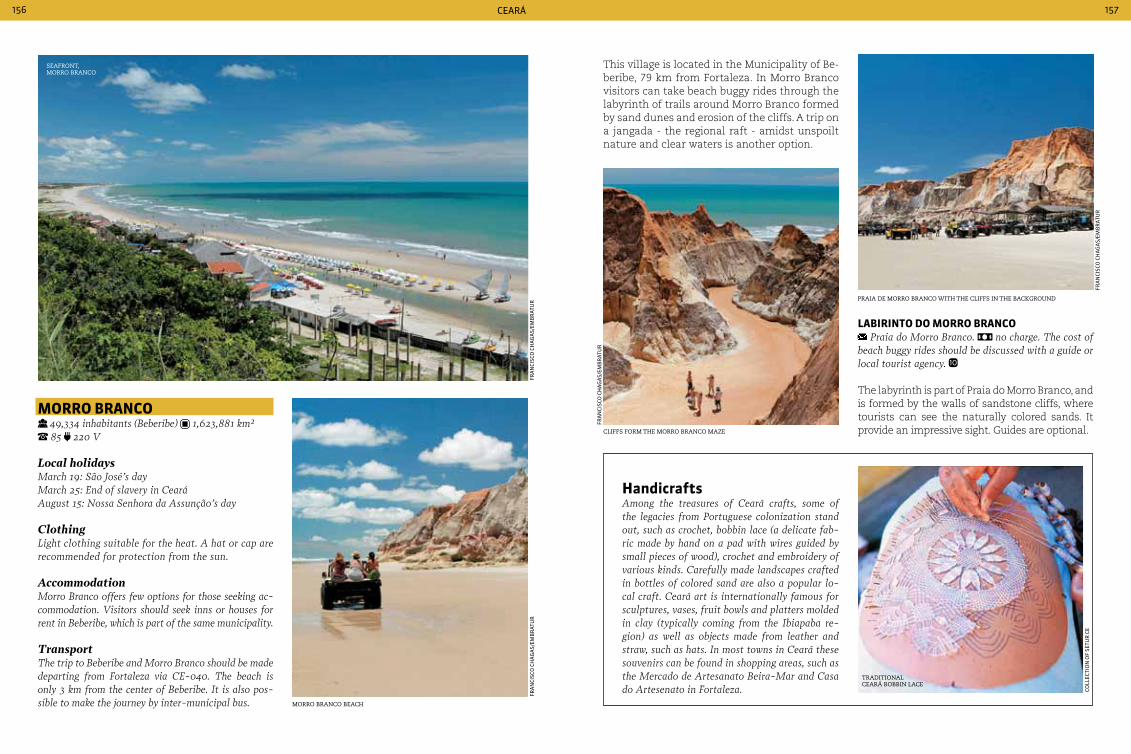
Ceará156 157
Morro branco 49,334 inhabitants (Beberibe) 1,623,881 km² 85 220 V
Local holidaysMarch 19: São José’s day March 25: End of slavery in cearáAugust 15: Nossa Senhora da Assunção’s day
ClothingLight clothing suitable for the heat. A hat or cap are recommended for protection from the sun.
AccommodationMorro Branco offers few options for those seeking ac-commodation. Visitors should seek inns or houses for rent in Beberibe, which is part of the same municipality.
TransportThe trip to Beberibe and Morro Branco should be made departing from Fortaleza via cE-040. The beach is only 3 km from the center of Beberibe. It is also pos-sible to make the journey by inter-municipal bus.
seafront, morro Branco
fra
nCi
sCo
CH
ag
as/
emB
rat
ur
This village is located in the Municipality of Be-beribe, 79 km from Fortaleza. In Morro Branco visitors can take beach buggy rides through the labyrinth of trails around Morro Branco formed by sand dunes and erosion of the cliffs. A trip on a jangada - the regional raft - amidst unspoilt nature and clear waters is another option.
HandicraftsAmong the treasures of ceará crafts, some of the legacies from Portuguese colonization stand out, such as crochet, bobbin lace (a delicate fab-ric made by hand on a pad with wires guided by small pieces of wood), crochet and embroidery of various kinds. carefully made landscapes crafted in bottles of colored sand are also a popular lo-cal craft. ceará art is internationally famous for sculptures, vases, fruit bowls and platters molded in clay (typically coming from the Ibiapaba re-gion) as well as objects made from leather and straw, such as hats. In most towns in ceará these souvenirs can be found in shopping areas, such as the Mercado de Artesanato Beira-Mar and casa do Artesenato in Fortaleza. Co
lleC
tio
n o
f se
tur
Ce
fra
nCi
sCo
CH
ag
as/
emB
rat
ur
fra
nCi
sCo
CH
ag
as/
emB
rat
ur
fra
nCi
sCo
CH
ag
as/
emB
rat
ur
morro Branco Beach
Praia de morro Branco with the cliffs in the BacKground
cliffs form the morro Branco maze
LabIrInto do Morro branco Praia do Morro Branco. no charge. The cost of
beach buggy rides should be discussed with a guide or local tourist agency.
The labyrinth is part of Praia do Morro Branco, and is formed by the walls of sandstone cliffs, where tourists can see the naturally colored sands. It provide an impressive sight. Guides are optional.
traditional ceará BoBBin lace
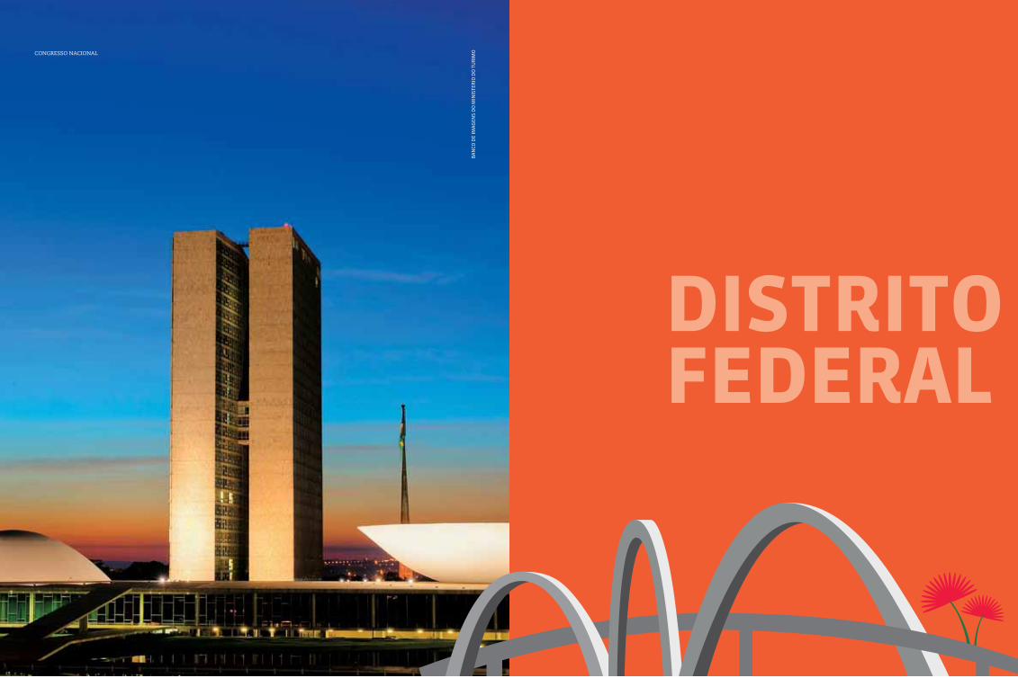
159
dIStrItoFederaL
Ba
nCo
de
ima
gen
s d
o m
inis
ter
io d
o t
ur
imocongresso nacional
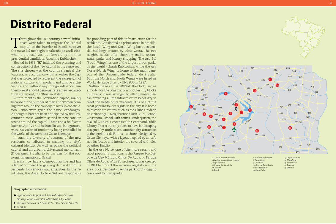
distrito federal160 161
distrito Federal
Throughout the 20th century several initia-tives were taken to migrate the Federal capital to the interior of Brazil, however
the move did not begin to take shape until 1955, when a proposal was put forward by the then presidential candidate, Juscelino Kubitschek.
Elected in 1956, “JK” initiated the planning and construction of the new capital in the same year. The site chosen was the country’s central pla-teau, and in accordance with his wishes the Cap-ital was projected to represent the expression of national culture, with modern and unique archi-tecture and without any foreign influence. Fur-thermore, it should demonstrate a new architec-tural statement, the “Brasilia style”.
Within months the population tripled, mainly because of the number of men and women com-ing from around the country to work in construc-tion - who were given the name ‘candangos’. Although it had not been anticipated by the Gov-ernment, these workers settled in new satellite towns around the capital. Three and a half years later, on April 21st, 1960, Brasilia was inaugurated, with JK’s vision of modernity being embodied in the works of the architect Oscar Niemeyer.
In turn, the diversity of customs of the new residents contributed to shaping the city’s cultural identity. As well as being the political capital and an urban-architectural monument, JK designed Brasilia to be the axis for the eco-nomic integration of Brazil.
Brasilia now has a cosmopolitan life and has adapted to meet the growing demand from its residents for services and amenities. In the Pi-lot Plan, the Asas Norte e Sul are responsible
for providing part of this infrastructure for the residents. Considered as prime areas in Brasilia, the South Wing and North Wing have residen-tial buildings created by Lúcio Costa. The two neighborhoods offer shopping malls, restau-rants, parks and luxury shopping. The Asa Sul (South Wing) has one of the largest urban parks in the world - Sarah Kubitschek, while the Asa Norte (North Wing) is home to the main cam-pus of the Universidade Federal de Brasilia. Both the North and South Wings were listed as World Heritage Sites by UNESCO in 1987.
Within the Asa Sul is ‘308 Sul’, the block used as a model for the construction of other city blocks in Brasilia: it was arranged to offer delimited ar-eas providing all the infrastructure necessary to meet the needs of its residents. It is one of the most popular tourist sights in the city. It is home to historic structures, such as the Clube Unidade de Vizinhança - “Neighborhood Unit Club”, School Classroom, School Park courts, Kindergarten, the 508 Sul Cultural Center, Health Center and Public Library. This is the only block to have landscaping designed by Burle Marx. Another city attraction is the Igrejinha de Fatima - a church designed by Oscar Niemeyer with a layout inspired by a nun’s hat. Its facade and interior are covered with tiles by Athos Bulcão.
In the Asa Norte, one of the more recent and most popular attractions is the Parque Ecológi-co e de Uso Múltiplo Olhos De Água, or Parque Olhos de Água. With 21 hectares, it was created in 1994 to protect the savanna vegetation in the area. Local residents use the park for its jogging track and to play sports.
3
13
14
15 1611
5 17
6
1
7
89
124
10
1 Estádio Mané Garrincha2 Brasília International Airport3 Lago Paranoá4 Represa Santa Maria5 Cruzeiro6 Guará
7 Núcleo Bandeirante8 Taguatinga9 Ceilândia10 Represa Descoberto11 São Sebastião12 Sobradinho
13 Lagoa Formosa14 Planaltina15 Samambaia16 Paranoá17 Brasília
405
230
250
455
355
355
320475
310
320
120
270
DF-250
120 100
255285
130
110
405
205345
010130
335
235330
205330330
205
170205
400251
220
415
080445
430
435001
001
240 251
204
070 095 087
085225
190
180075
470
001
480 040
050
060
290180
055
001
495
465
473 251
180 097
150
420
010
DF-003
EPPR
DF-025
440 330
020
030410
100
105
2
Geographic information
upper elevation tropical, with two well-defined seasons: the rainy season (November-March) and a dry season.
averages between 13 °c and 27 °c (55,4 °F and 80,6 °F) savanna
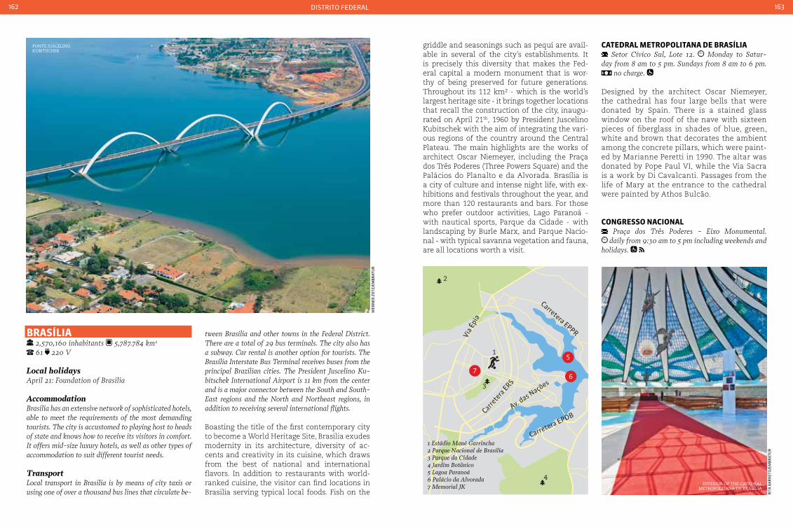
distrito federal162 163
braSíLIa 2,570,160 inhabitants 5,787.784 km2
61 220 V
Local holidaysApril 21: Foundation of Brasilia
AccommodationBrasilia has an extensive network of sophisticated hotels, able to meet the requirements of the most demanding tourists. The city is accustomed to playing host to heads of state and knows how to receive its visitors in comfort. It offers mid-size luxury hotels, as well as other types of accommodation to suit different tourist needs.
TransportLocal transport in Brasilia is by means of city taxis or using one of over a thousand bus lines that circulate be-
tween Brasilia and other towns in the Federal District. There are a total of 29 bus terminals. The city also has a subway. car rental is another option for tourists. The Brasilia Interstate Bus Terminal receives buses from the principal Brazilian cities. The President Juscelino Ku-bitschek International Airport is 11 km from the center and is a major connector between the South and South-East regions and the North and Northeast regions, in addition to receiving several international flights.
Boasting the title of the first contemporary city to become a World Heritage Site, Brasilia exudes modernity in its architecture, diversity of ac-cents and creativity in its cuisine, which draws from the best of national and international flavors. In addition to restaurants with world-ranked cuisine, the visitor can find locations in Brasilia serving typical local foods. Fish on the
wer
ner
zo
tz/e
mB
rat
ur
griddle and seasonings such as pequi are avail-able in several of the city’s establishments. It is precisely this diversity that makes the Fed-eral capital a modern monument that is wor-thy of being preserved for future generations. Throughout its 112 km² - which is the world’s largest heritage site - it brings together locations that recall the construction of the city, inaugu-rated on April 21th, 1960 by President Juscelino Kubitschek with the aim of integrating the vari-ous regions of the country around the Central Plateau. The main highlights are the works of architect Oscar Niemeyer, including the Praça dos Três Poderes (Three Powers Square) and the Palácios do Planalto e da Alvorada. Brasília is a city of culture and intense night life, with ex-hibitions and festivals throughout the year, and more than 120 restaurants and bars. For those who prefer outdoor activities, Lago Paranoá - with nautical sports, Parque da Cidade - with landscaping by Burle Marx, and Parque Nacio-nal - with typical savanna vegetation and fauna, are all locations worth a visit.
catedraL MetropoLItana de braSíLIa Setor cívico Sul, Lote 12. Monday to Satur-
day from 8 am to 5 pm. Sundays from 8 am to 6 pm. no charge.
Designed by the architect Oscar Niemeyer, the cathedral has four large bells that were donated by Spain. There is a stained glass window on the roof of the nave with sixteen pieces of fiberglass in shades of blue, green, white and brown that decorates the ambient among the concrete pillars, which were paint-ed by Marianne Peretti in 1990. The altar was donated by Pope Paul VI, while the Via Sacra is a work by Di Cavalcanti. Passages from the life of Mary at the entrance to the cathedral were painted by Athos Bulcão.
conGreSSo nacIonaL Praça dos Três Poderes - Eixo Monumental. daily from 9:30 am to 5 pm including weekends and
holidays.
Ponte juscelino KuBitscheK
interior of the catedral metroPolitana de Brasília
rit
a B
ar
ret
o/e
mB
rat
ur
braSíLIa
5
67
1
3
4
2
Via É
pia
Carrete
ra ERS
Carretera EPDBAv. das Nações
Carretera EPPR
1 Estádio Mané Garrincha2 Parque Nacional de Brasília3 Parque da Cidade4 Jardim Botânico5 Lagoa Paranoá6 Palácio da Alvorada7 Memorial JK

distrito federal164 165
During a visit it is possible to learn more about the artistic and cultural heritage of the National Congress and understand how it op-erates, as well to learn more of the role of the two legislative chambers in the Federative Republic of Brazil.
eSpaço LúcIo coSta Under the Praça dos Três Poderes. daily from
9 am to 6 pm, including weekends and public holi-days. no charge.
This small underground museum was de-signed by Oscar Niemeyer to honor the creator of the Federal capital. It has a model of Brasilia and copies of the original design of the Pilot Plan, as well as photos of the construction and inauguration of the city.
eSpaço oScar nIeMeyer Praça dos Três Poderes, Lote J. Monday to Fri-
day from 10 am to 5 pm.
The Centro Oscar Niemeyer in Brasilia is part of the architectural and cultural complex of Praça dos Três Poderes. Designed by Oscar Niemeyer in 1988, it has a permanent exhi-bition showing works by the architect, which includes models, drawings, photographic pan-els, audiovisuals, multimedia programs and a digital catalog of his work.
MeMorIaL doS poVoS IndíGenaS Praça do Buriti - Eixo Monumental Oeste. Tuesday to Friday from 9 am to 6 pm. Saturdays,
Sundays and public holidays from 10 am to 6 pm. no charge.
The memorial was built in 1987 to a design by Oscar Niemeyer. Its spiral shape is an allusion to the round hut used by Yanomami Indians. Its collection holds pieces from various tribes, including feather work by the Urubu-Kapoor, wooden seats by the Yawalapiti, Juruna and Kuikuro, and masks and musical instruments from Alto Xingu and Amazonas.
oscar niemeyerThe internationally recognized Brazilian architect, Oscar Niemeyer, is well known for the curved styles and grandiosity of his works. One of the princi-pal milestones of his career was the lead role he took in the implementation of Brasilia (1955) - a city dedicated to housing the headquarters of the Federal Government. The creation of the Pilot Plan for Brasilia was entrusted to Lúcio costa, his friend and former boss. It was Niemeyer, however, who designed several buildings including the Pa-lácio do Planalto, the Palácio da Justiça, the Pa-lácio da Alvorada, the Itamaraty, the congresso Nacional, the catedral and the buildings housing the Ministries. Some of his most famous proj-ects in other locations in Brazil include Parque Ibirapuera (São Paulo), the Edifício copam (São Paulo), Banco Boavista (Rio de Janeiro), the Museu de Arte contemporânea in Niterói (Rio de Janeiro) and the Memorial da América Latina (São Paulo). Niemeyer moved to France during the period of military dictatorship in Brazil, where he set up an office on the famous champs-Élysées. His best-known international projects are participation in the planning of the UN headquarters (1947, USA), the design of the headquarters of the French com-munist Party (1964), the Mentouri de constantine University (1971, Algeria), the Serpentine Gallery Pavilion (2003, England) and the centro cultural Oscar Niemeyer (2010, Spain). Niemeyer contin-ues to be involved in several projects, such as the Museu Pelé, to be constructed in the city of Santos in the State of São Paulo. He was the winner of the Pritzker Prize in 1988, architecture’s most impor-tant award, for the design of catedral de Brasília.
Lago paranoá Lago Paranoá was artificially created as part of the construction plan for Brasilia during the mandate of President Juscelino Kubitschek. It covers 48 km2 and has 80 km of perimeter, in-cluding artificial beaches. It is a haven for wa-ter sports and is home to a fleet of more than 11,000 vessels - the third largest in the country. Small-scale recreational fishing was permitted after the lake was cleaned up in year 2000. The most common species are minnows and traíras, both native to the region, as well as tilapia and carp. The Ponte JK was inaugurated in 2002, completing the Lago Paranoá panorama - the construction won an award for the architect Al-exandre chan. With 1,2 km in length and with three broad asymmetrical arches, it is one of the picture-postcards of the Federal capital.
LaGo paranoá By consultation with local operators for water
sports and diving. no charge for visits, price of activities on request
This artificial lake was designed in 1894 by the Cruls Mission - The Exploratory Commission of the Central Plateau of Brazil, formed in 1892 by
Floriano Peixoto. It was he who delineated the current location of Brasilia and gave birth to the construction of a city. It includes ecological parks and protected areas, as well as the Ponte JK and the jetty at Lago Sul. It provides facilities for leisure activities such as water skiing, wake-boarding, sailing and rowing, as well as diving in an old submerged village.
Palácio do itamaraty
rit
a B
ar
ret
o/e
mB
rat
ur
rit
a B
ar
ret
o/e
mB
rat
ur
lago Paranoá
rit
a B
ar
ret
o/e
mB
rat
ur
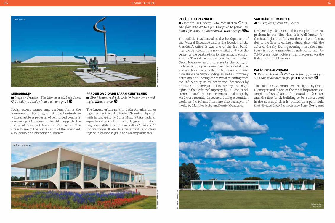
distrito federal166 167
MeMorIaL Jk Praça do cruzeiro - Eixo Monumental, Lado Oeste. Tuesday to Sunday from 9 am to 6 pm.
Pools, access ramps and gardens frame the monumental building, constructed entirely in white marble. A pedestal of reinforced concrete, measuring 28 meters in height, supports the statue of President Juscelino Kubitschek. The site is home to the mausoleum of the President, a museum and his personal library.
paLácIo do pLanaLto Praça dos Três Poderes - Eixo Monumental. Sun-
days from 9:30 am to 2 pm. Groups of 30 persons are formed for visits, in order of arrival. no charge.
The Palácio Presidencial is the headquarters of the Federal Executive and is the location of the President’s office. It was one of the first build-ings constructed in the new capital and was the center of the celebrations for the inauguration of Brasilia. The Palace was designed by the architect Oscar Niemeyer and impresses by the purity of its lines, with a predominance of horizontal lines and a refined tactile effect. The palace contains furnishings by Sergio Rodrigues, Indies Company porcelain and Portuguese silverware dating from the 18th century. Its collection includes works by Brazilian and foreign artists, among the high-lights is the ‘Músicos’ tapestry by Di Cavalcanti, commissioned by Oscar Niemeyer. Paintings by Miró were recently discovered during restoration works at the Palace. There are also examples of works by Manabu Mabe and Mario Mendonça.
memorial jK
Palácio do Planalto
Palácio da alvorada
rit
a B
ar
ret
o/e
mB
rat
ur
rit
a B
ar
ret
o/e
mB
rat
ur
rit
a B
ar
ret
o/e
mB
rat
ur
parQue da cIdade SaraH kubItScHek Eixo Monumental Sul. daily from 5 am to mid-
night. no charge.
The largest urban park in Latin America brings together the Praça das Fontes (“Fountain Square”) with landscaping by Burle Marx, a bike path, an equestrian track, a kart track, playgrounds, a 4 km beginners athletics circuit as well as 6 km and 10 km walkways. It also has restaurants and clear-ings with barbecue grills and an amphitheater.
SantuárIo doM boSco Av. W3 Sul Quadra 702, Lote B
Designed by Lúcio Costa, this occupies a central position in the Pilot Plan. It is well known for the blue light that falls on the entire ambient, due to the floor to ceiling stained glass with the color of the sky. During evening mass the sanc-tuary is lit by a majestic chandelier formed by 7,400 glass light holders manufactured on the Italian island of Murano.
paLácIo da aLVorada Via Presidencial. Wednesday from 3 pm to 5 pm.
Visits are undertaken in groups. no charge.
The Palácio da Alvorada was designed by Oscar Niemeyer and is one of the most important ex-amples of Brazilian architectural modernism and the first brick building to be constructed in the new capital. It is located on a peninsula that divides Lago Paranoá into Lago Norte and
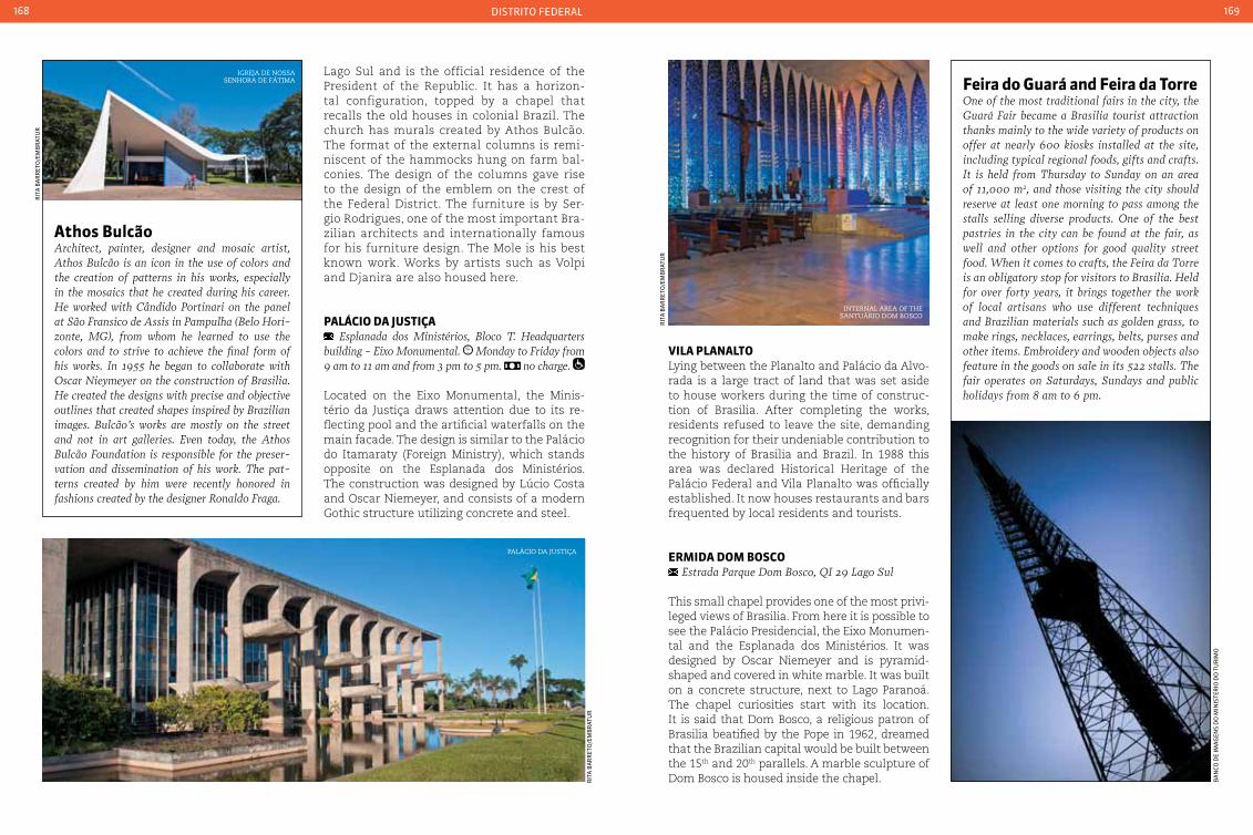
distrito federal168 169
athos bulcãoArchitect, painter, designer and mosaic artist, Athos Bulcão is an icon in the use of colors and the creation of patterns in his works, especially in the mosaics that he created during his career. He worked with cândido Portinari on the panel at São Fransico de Assis in Pampulha (Belo Hori-zonte, MG), from whom he learned to use the colors and to strive to achieve the final form of his works. In 1955 he began to collaborate with Oscar Nieymeyer on the construction of Brasilia. He created the designs with precise and objective outlines that created shapes inspired by Brazilian images. Bulcão’s works are mostly on the street and not in art galleries. Even today, the Athos Bulcão Foundation is responsible for the preser-vation and dissemination of his work. The pat-terns created by him were recently honored in fashions created by the designer Ronaldo Fraga.
Lago Sul and is the official residence of the President of the Republic. It has a horizon-tal configuration, topped by a chapel that recalls the old houses in colonial Brazil. The church has murals created by Athos Bulcão. The format of the external columns is remi-niscent of the hammocks hung on farm bal-conies. The design of the columns gave rise to the design of the emblem on the crest of the Federal District. The furniture is by Ser-gio Rodrigues, one of the most important Bra-zilian architects and internationally famous for his furniture design. The Mole is his best known work. Works by artists such as Volpi and Djanira are also housed here.
paLácIo da JuStIça Esplanada dos Ministérios, Bloco T. Headquarters
building - Eixo Monumental. Monday to Friday from 9 am to 11 am and from 3 pm to 5 pm. no charge.
Located on the Eixo Monumental, the Minis-tério da Justiça draws attention due to its re-flecting pool and the artificial waterfalls on the main facade. The design is similar to the Palácio do Itamaraty (Foreign Ministry), which stands opposite on the Esplanada dos Ministérios. The construction was designed by Lúcio Costa and Oscar Niemeyer, and consists of a modern Gothic structure utilizing concrete and steel.
VILa pLanaLtoLying between the Planalto and Palácio da Alvo-rada is a large tract of land that was set aside to house workers during the time of construc-tion of Brasilia. After completing the works, residents refused to leave the site, demanding recognition for their undeniable contribution to the history of Brasilia and Brazil. In 1988 this area was declared Historical Heritage of the Palácio Federal and Vila Planalto was officially established. It now houses restaurants and bars frequented by local residents and tourists.
erMIda doM boSco Estrada Parque Dom Bosco, QI 29 Lago Sul
This small chapel provides one of the most privi-leged views of Brasilia. From here it is possible to see the Palácio Presidencial, the Eixo Monumen-tal and the Esplanada dos Ministérios. It was designed by Oscar Niemeyer and is pyramid-shaped and covered in white marble. It was built on a concrete structure, next to Lago Paranoá. The chapel curiosities start with its location. It is said that Dom Bosco, a religious patron of Brasilia beatified by the Pope in 1962, dreamed that the Brazilian capital would be built between the 15th and 20th parallels. A marble sculpture of Dom Bosco is housed inside the chapel.
Palácio da justiça
rit
a B
ar
ret
o/e
mB
rat
ur
internal area of the santuário dom Bosco
rit
a B
ar
ret
o/e
mB
rat
ur
rit
a B
ar
ret
o/e
mB
rat
ur
igreja de nossa senhora de fátima
Ba
nCo
de
ima
gen
s d
o m
inis
ter
io d
o t
ur
imo
Feira do Guará and Feira da torreOne of the most traditional fairs in the city, the Guará Fair became a Brasilia tourist attraction thanks mainly to the wide variety of products on offer at nearly 600 kiosks installed at the site, including typical regional foods, gifts and crafts. It is held from Thursday to Sunday on an area of 11,000 m2, and those visiting the city should reserve at least one morning to pass among the stalls selling diverse products. One of the best pastries in the city can be found at the fair, as well and other options for good quality street food. When it comes to crafts, the Feira da Torre is an obligatory stop for visitors to Brasilia. Held for over forty years, it brings together the work of local artisans who use different techniques and Brazilian materials such as golden grass, to make rings, necklaces, earrings, belts, purses and other items. Embroidery and wooden objects also feature in the goods on sale in its 522 stalls. The fair operates on Saturdays, Sundays and public holidays from 8 am to 6 pm.
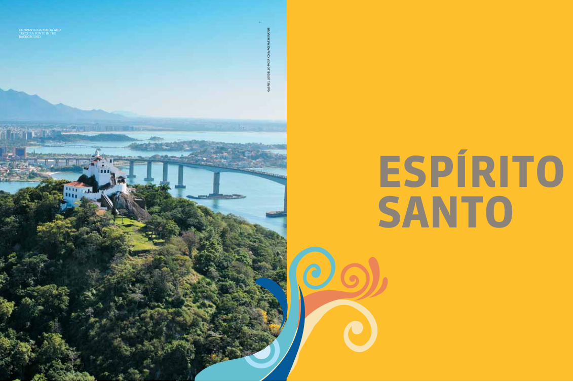
171
eSpírItoSanto
ga
Br
iel
lor
del
lo-m
osa
iCo
ima
gem
/em
Br
atu
rconvento da Penha and terceira Ponte in the BacKground
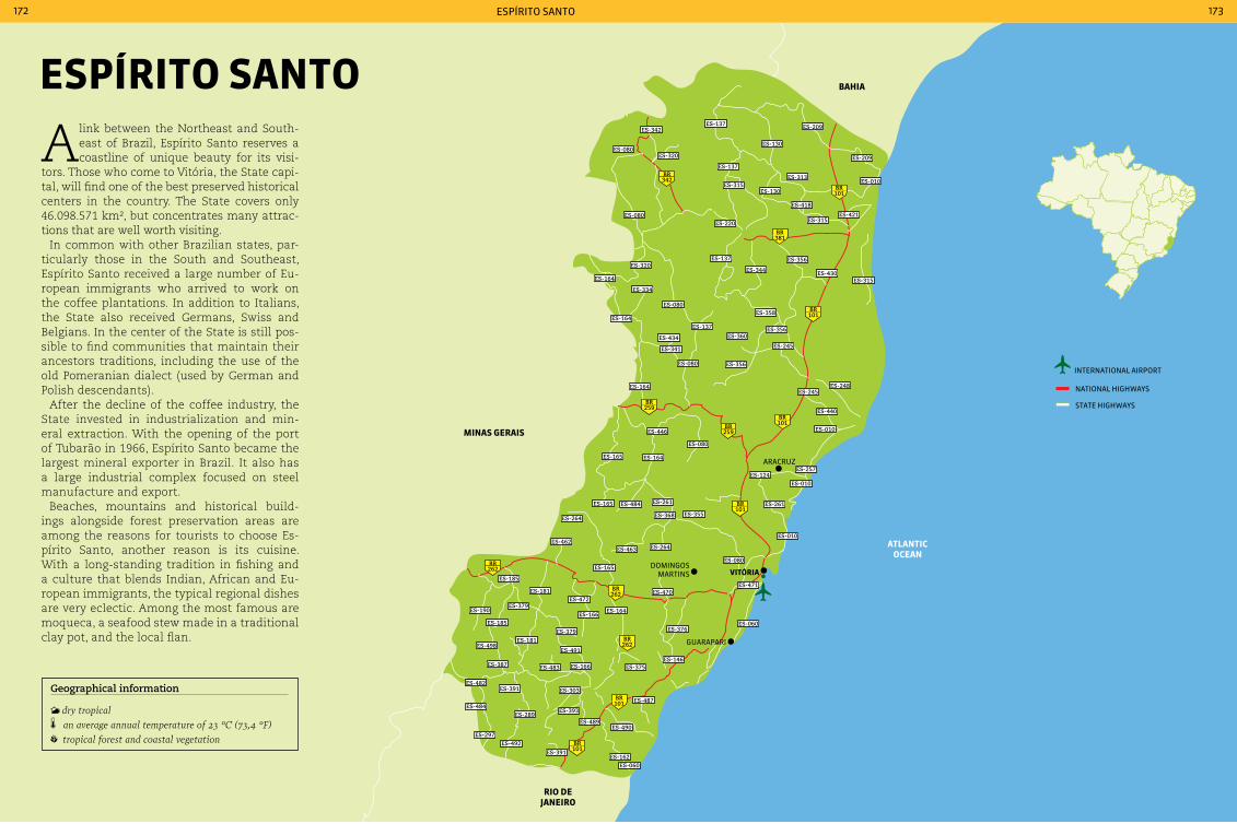
ES-482
ES-484
101BR
101BR
262BR
262BR
381BR
101BR
101BR
101BR
101BR
259BR
259BR
342BR
262BR
MInaS GeraIS
baHIa
rIo de JaneIro
atLantIc ocean
araCruz
domingos martins VItÓrIa
guarapari
ES-137ES-342
ES-080ES-320
ES-315ES-130
ES-313
ES-418
ES-315ES-421
ES-220
ES-320
ES-164
ES-137
ES-344
ES-356
ES-430ES-315
ES-358ES-080
ES-164
ES-434
ES-137 ES-356ES-360
ES-245
ES-356
ES-341
ES-080
ES-164ES-245
ES-248
ES-440
ES-010
ES-257
ES-010
ES-261
ES-124
ES-080
ES-446
ES-165 ES-164
ES-165 ES-484
ES-264
ES-010
ES-080
ES-264ES-463
ES-165
ES-462
ES-185
ES-181
ES-379ES-190
ES-185
ES-379
ES-491
ES-166ES-483ES-387
ES-482ES-391
ES-289
ES-303
ES-393
ES-487
ES-490ES-489
ES-162ES-060
ES-391
ES-492ES-297
ES-181ES-498
ES-166
ES-472
ES-164
ES-470ES-471
ES-060ES-376
ES-146ES-375
ES-261
ES-368 ES-355
ES-334
ES-080
ES-137
ES-130
ES-209
ES-209
ES-010
international airport
national HigHways
state HigHways
espÍrito santo172 173
eSpírIto Santo
A link between the Northeast and South-east of Brazil, Espírito Santo reserves a coastline of unique beauty for its visi-
tors. Those who come to Vitória, the State capi-tal, will find one of the best preserved historical centers in the country. The State covers only 46.098.571 km², but concentrates many attrac-tions that are well worth visiting.
In common with other Brazilian states, par-ticularly those in the South and Southeast, Espírito Santo received a large number of Eu-ropean immigrants who arrived to work on the coffee plantations. In addition to Italians, the State also received Germans, Swiss and Belgians. In the center of the State is still pos-sible to find communities that maintain their ancestors traditions, including the use of the old Pomeranian dialect (used by German and Polish descendants).
After the decline of the coffee industry, the State invested in industrialization and min-eral extraction. With the opening of the port of Tubarão in 1966, Espírito Santo became the largest mineral exporter in Brazil. It also has a large industrial complex focused on steel manufacture and export.
Beaches, mountains and historical build-ings alongside forest preservation areas are among the reasons for tourists to choose Es-pírito Santo, another reason is its cuisine. With a long-standing tradition in fishing and a culture that blends Indian, African and Eu-ropean immigrants, the typical regional dishes are very eclectic. Among the most famous are moqueca, a seafood stew made in a traditional clay pot, and the local flan.
Geographical information
dry tropical an average annual temperature of 23 °c (73,4 °F) tropical forest and coastal vegetation

espÍrito santo174 175
VItÓrIa 327,801 inhabitants 98.506 km² 27 110V
Local holidaysApril 16: Nossa Senhora da Penha’s dayMay 23: Settlement of Espírito Santo
AccommodationVitória possesses a network of modern hotels. There are both international and Brazilian hotel chains offering comfortable accommodation at dif-ferent price levels. The city also has inns, but hotels are more common.
TransportWhether by bus or car, Vitória can be reached via several highways, including BR-2626 (for those com-ing from Belo Horizonte), BR-101 (for those coming from São Paulo or Rio de Janeiro), and BR-116 (for those coming from São Paulo). The city may be ac-cessed by air, sea, road or rail.
The Vitória-Minas Gerais Railroad (EFVM) also carries passengers and from Belo Horizonte and towns in the East of Minas Gerais to the Vitória metropolitan region. In addition, Eurico Aguiar Salles Airport receives regular flights from the prin-cipal Brazilian State capitals.
The Ilha de Vitória holds many natural beauties for its visitors. Founded in the 16th century, the capital of Espírito Santo is divided into two zones - the upper and lower - linked by stairways that are symbols of the city’s architecture, especial-ly the Escadaria Maria Ortiz. The City has bold buildings that contrast with historical colonial works, and it offers an effervescent nightlife with options for every type of visitor.
The local cuisine has a traditional style, with delicacies made in handmade clay pots. Mo-queca is the traditional State dish, prepared with fish, shrimp, lobster or crab and seasoned with olive oil, achiote, tomato, onion and coriander.
The sea is part of everyday life in the city, with inviting beaches and bars and restaurants on the waterfronts and in the ports of Vitória and Tubarão, which drive the local economy. Vitória bay and its islands form a beautiful landscape around the city. Previously inhabited by Goitacazes Indians, who gave the town the name Ilha do Mel due to its slow moving waters and mild climate, Vitória is now affectionately known as Delightful Island.
aerial view of the city of vitÓria
GaLpão daS paneLeIraS(tHe pot MakerS wareHouSe)
Rua das Paneleiras, 55 - Goiabeiras. daily from 8 am to 6 pm.
Clay pots are a centuries-old tradition in Es-pírito Santo. They are used in the preparation of typical regional dishes, and they are the main attraction at this location. The pots are the re-sult of more than 400 years of tradition, and they continue to be made using the same tech-niques used by Indians. The warehouse has 32 booths, where each artisan prepares his wares. It is possible to watch the pots being manufac-tured, and it is also possible to sample the culi-nary delights of Espírito Santo.
IGreJa de São GonçaLo Rua São Gonçalo, no number - centro. Tuesday to
Sunday, including holidays, from 9 am to 5 pm
A church in colonial style with baroque fea-tures on its facade and altar, with wood carvings painted in gold. The Igreja de São Gonçalo was declared a historic site by the Institute of Histori-cal and Artistic Heritage (Iphan) in 1948.
eScadarIa MarIa ortIzPreviously named the Escadaria do Pelourinho (the Whipping Post Stairway), the name brings back memories of the victory of Espírito Santo over Dutch pirates who tried to conquer the is-land during the 17th century. In 1625 the invad-ers were expelled from the city by residents of what was then know as Ladeira Pelourinho, who threw boiling water on the Dutch. The move-ment was led by Espírito Santo resident Maria Ortiz. In 1899 the hill was renamed after the fearless heroin, and a stairways was constructed at the location in 1924. The Escadaria Maria Ortiz is located in the center of Vitória.
the escadaria maria ortiz in central vitÓria
traditional clay Pots
ga
Br
iel
lor
del
lo-m
osa
iCo
ima
gem
/em
Br
atu
r
tad
eu B
ian
Con
i-mo
saiC
o im
ag
ens/
emB
rat
ur
tad
eu B
ian
Con
i-mo
saiC
o im
ag
ens/
emB
rat
ur

espÍrito santo176 177
Mercado capIxaba Avenida Princesa Isabel, 251 - centro. Monday
to Friday from 8:30 am to 7 pm. Saturdays from 8 am to 4 pm.
Designed by the Czech architect Joseph Pitilick and built to replace the old municipal mar-ket, this is one of the locations most visited by tourists and local residents seeking handi-crafts. Items made from clay, straw and bam-boo are among the most sought after.
regional cookingA mixture of flavors and traditions: this is the typi-cal cuisine of Espírito Santo. A result of influences from Indians, African and European immigrants, Espírito Santo food is rich in flavors. The use of a panela de barro (clay pot) is one of the principal State traditions and is an “ingredient” of the famous recipes such as Espírito Santo flans and moqueca.
Palácio anchieta, seat of the esPírito santo state government
canoeing among the PiraquÊ-açú manguezais
State. Well-developed agro-tourism divides the visitors attention with beautiful beaches inter-spersed with rock outcrops and reefs. Aracruz has an infrastructure of hotels and inns able to receive visitors in comfort. The local cuisine is an attraction in itself, with its typical dishes based on fish and seafood served in clay pots. Two ceramic funeral urns are on permanent display in the lobby of the Teatro Municipal, which are around 800 years - these were used by Indians to deposit their dead in a squatting position for burial, before their bodies hard-ened. The urns were found in the district of Santa Cruz, and are held in pride by the City.
reSerVa naturaL de coMboIoS Rua Principal, no number - Vila Regência. Access to
the reserve from Vitória may be via one of two routes: BR-101 for 110 km up to Bebedouro, and then a dirt road for another 38 km to the village of Regência; or follow ES-010 for around 90 km and then take a dirt road for over 30 km to reach the nature reserve. daily, from 8 am to 12 am and from 1 pm to 5 pm. one day
The Reserva Natural Comboios, with its 14 km of beaches, was created to preserve fauna, flo-ra and sea turtle hatching grounds. The beach-es on the nature reserve are home to the only known concentration of Giant Turtle hatching grounds and the second largest concentration of Loggerhead Turtle nests (the reserve is home to Tamar Project Comboios Base, which moni-tors 37 km of semi-deserted beaches). The Visi-tor Center has four tanks with live examples of sea turtle species. The monitored release of new-born turtles takes place on the beach be-tween December and February.
reSerVa ecoLÓGIca pIraQuÊ -açu and pIraQuÊ -MIrIM
Rodovia ES-010, 35 km marker, Santa cruz District. open 24 hours, but it is recommended to make the trip
during the day. half day
This is an ecological paradise formed at the junction of the Rios Piraquê-Açu and Piraquê-Mirim, with 1,651 hectares of mangroves. It
aracruz 81,832 inhabitants 1,435.970 km² 27 110V
Distance from the capital: 83 km
Local holidaysApril 3: Anniversary of the Foundation of AracruzJune 24: São João Batista’s day
Accommodationcharming and relaxed inns are the most easily found type of accommodation in the Aracruz region. cities and beaches in the region have inns for every type of pocket. There are also campsites at the beaches around Aracruz.
TransportThe city can be reached by car or bus via BR-101, BR-261, ES-010, ES-124 and ES-257. The nearest airport is Eurico Salles, in Vitória.
Aracruz is a perfect destination for those who want tranquility amid beautiful scenery. Lo-cated around 80 km from Vitória, the City has historical, natural and cultural attractions that reveal the strong indigenous presence in the
ga
Br
iel
lor
del
lo-m
osa
iCo
ima
gem
/em
Br
atu
r
tad
eu B
ian
Con
i-mo
saiC
o im
ag
ens/
emB
rat
ur
paLácIo ancHIeta Praça João clímaco - centro. Wednesday to Sat-
urday from 10 am to 5 pm. Sundays from 10 am to 4 pm
A former Jesuit college, the building was con-verted into the seat of government. It is one of the oldest buildings in the country, and houses the tomb of Padre Anchieta.
parQue MoScoSo Avenida República, no number. Mondays from
5 am to 9 am and from 5 pm to 10 pm. Tuesday to Sunday from 5 am to 10 pm.
The Parque Moscoso is one of the most popular spots among Vitória residents. Visitors and resi-dents make use of the location for walks and to watch cultural performances in the acoustic shell. The park also houses a large fish pond, and an El-derly People’s Academy also operates on the site.
parQue Fonte Grande Estrada Tião Sá, no number - Serafim Derenze
Highway. Those arriving on foot can reach the State Park via Rua Antônio Dell Antonia in Fradinhos dis-trict, or via Rua Alziro Viana in the city center. By car, take the Seraphim Derenzi Highway or the Es-trada Tião Sá in Grande Vitória district. scheduled guided tours Tuesday to Sunday, from 8 am to 5 pm
The State capital maintains a small area of native Atlantic Forest in this park. There are 21,800 square meters of native forest, still home to small wild animals that can be observed dur-ing a walk through the park.
ga
Br
iel
lor
del
lo-m
osa
iCo
ima
gem
/em
Br
atu
r

espÍrito santo178 179
has brackish water rich in marine and terres-trial species. The estuary is the largest in Es-pírito Santo and advances inland by approxi-mately 13 km. Schooner trips are an option to learn a little more about the rivers and wild-life species of Aracruz.
BR-262. From São Paulo, take BR-116 (to the Rio de Ja-neiro), BR-101 (to Vitória) and then BR-262. The near-est airport is Vitória, 64 km from Domingos Martins.
Domingos Martins is an inspirational city, with its abundant greenery, agro-tourism and Germanic-style buildings, a legacy left by the immigrants who settled in the region in the 18th century.
It is also known as the “Green City” for having preserved an important stretch of the Atlan-tic Forest and registering around 100,000 plant species. It has gained international recognition for its 1,300 species of orchids and bromelias, especially the Cattleya Warneri, considered the largest orchid flower in the world with up to 25 centimeters in diameter.
The average elevation of Domingos Martins is 542 m, but the city has peaks that can ex-ceed 1,800 meters. One is Pedra Azul (“The Blue Stone”), one of the main tourist sites in Espírito Santo: a unique geological formation with its large outcrop of gneiss (a type of rock).
rua João batISta wernerSbacH Rua João Batista Wernersbach (Rua de Lazer) -
centro. daily from 8 am to 5 pm.
Come shopping time, all paths lead to Rua João Batista Wernersbach, also known as Rua de Lazer, or Entertainment Street. There are sev-eral craft shops spread along the avenue, as well as shops selling delicacies such as cookies, jams and liqueurs.
cIrcuIto turíStIco “ orGÂnIco e naturaL” Visits: weekends and holidays for groups between
15 and 30 people, and from Tuesday to Thursday with advance booking. a full day. parts of the attractions
The circuit consists of several properties in the vicinity of Pedra Azul. It offers leisure options in a typical rural environment, such as ecological trails, country inns, restaurants with local cuisine and a varied range of certified organic products. The circuit includes an apiary, shops specializ-ing in organic products, horse riding, a palm tree plantation, a country inn, restaurant and a small-holding with a garden of medicinal plants.
parQue eStaduaL pedra azuL Access via BR-262 (direction of Belo Horizonte)
at the 88 km marker, 50 km from Domingos Martins. there are two scheduled start times for tours, the
first is at 9 am and another at 1:30 pm. Those wish-ing to do the full tour will have to climb the Pedra Azul (Blue Stone) with the aid of a rope fixed to the rock to be able to reach the natural pools. The tour may only be undertaken accompanies by a guide and is free (including the guide). Age Restrictions: the walk requires good physical condition, as the trail inclines over the entire route. the complete walk takes about 3 hours (ascent and descent)
This is the main attraction in the region. The nature reserve was created in 1960 to protect a series of natural features, including the pic-ture postcard of the Espírito Santo mountains: the Pedra Azul, or “Blue Stone”. The name of the two thousand meter high rock forma-
tion comes from its coloration, which varies throughout the day depending on the angle of the sun’s rays. The nature reserve possesses rich fauna and a variety of animal species, in-cluding endangered species such as mountain marmosets, jaguars and howler monkeys. Veg-etation in the reserve includes high mountain rain forests - forests influenced by high rain-fall patterns, which are home to plant species such as orchids and bromelia, and trees such as inga, cedar, cassias and ipê, as well as nu-merous varieties of cinnamon.
Local delicacies on saleMany farms and country properties open their doors to receive tourists. Delicious cheeses, cookies, liqueurs, wines, yogurts, jams and pas-tries are offered for sale. It is also possible to participate in harvesting cereals, fruit and veg-etables, and to watch the products being pro-cessed. Agro-tourism is one of the more popu-lar tourist options in Domingos Martins.
Pedra azul, the Picture-Postcard of the town of domingos martins
a tyPical domingos martins farm
doMInGoS MartInS 31,847 inhabitants 1,225.331 km² 27 110V
Distance from the State capital: 43 Km
Local holidaysJanuary 20: Day of Penance June 12: Municipality Day July 4: Santa Isabel’s DayOctober 31: Reform Day
AccommodationThe city has inns, hotels and one hostel. Tourists have the option to stay in the city center or to stay at inns a little further away, closer to parks and natural attractions.
TransportThe city can be reached by car or bus via BR-262 (from Vitória and Belo Horizonte). Leaving from Rio de Ja-neiro, the route is via BR-101 (up to Vitória) and then
GuaraparI 105,286 inhabitants 595.483 km² 27 110V
Distance from Vitória: 52 km
Local holidaysSeptember 19: celebration of the Political Emancipation of GuarapariDecember 8: Nossa Senhora da conceição’s day
AccommodationOne of the best known cities in Espírito Santo, Guarapari offers diverse accommodation options, including hotels, inns and campgrounds. Hotels are mostly concentrated in the city, and have the high-est prices. However the beaches surroundings the
Beach at guaraPari
ma
rCo
Ceo
tto
-mo
saiC
o im
ag
ens/
emB
rat
ur
tad
eu B
ian
Con
i-mo
saiC
o im
ag
ens/
emB
rat
ur
feli
pe
go
mB
oss
y/em
Br
atu
r

ESPíRITO SANTO180 181
City have a wide variety of inns, many with swim-ming pool, as well as more spartan accommodation. Camping areas are also suitable for tourists who have a taste for adventure.
TransportLeaving from Vitória it is possible to use the Rodo-via do Sol - the “Sun Highway”. Alternatively, it is possible travel via BR-101 across the Grande Vitória region up to the 333 km marker, where there is an exit with access to the city. Bus companies arrive at the Guarapari bus station from cities including São Paulo, Rio de Janeiro, Belo Horizonte, Salvador and Porto Seguro. The nearest airport is Vitória Inter-national Airport.
Founded in 1585 by Father José de Anchieta (one of the most significant figures in the his-tory of Brazil due to his role in evangelizing Je-suits in Brazil), Guarapari offers a unique nat-ural landscape that includes both mountains and coastline. Monazite sand beaches with therapeutic properties attract many tourists. There is no lack of attractions for visitors. If the intention is to rest and recharge your ener-gies, then the mountain region of Guarapari is the right place, with its trails, waterfalls and Espírito Santo cooking over a wood stove. Ur-ban beaches offer good infrastructure, in addi-tion to their natural beauty.
EnsEada azulThe beaches at Guaíbura, Bacutia and Mucumã form a cove of fine white sand, and are popular with the younger generation. The water is so clear that it is possible to dive down to 8 meters with full visibility and ex-plore a German freighter that sank in 1942. A viewpoint on top of one of the hills offers fantastic views.
PRaIa da BaCuTIaThis is one of the most beautiful beaches in the region. It has calm, shallow waters with a stunning shade of blue. It is a meeting point for young people, especially in the summer months.
PRaIa da aldEIaWith gold and dark colored bands in the sand, this small beach, just 200 meters long, is the main monazite sand beach in Guarapari. The elderly bury themselves in the sands in search of its medicinal properties.
PRaIa da aREIa PRETaThis is one of the most famous beaches in Es-pírito Santo due to the high level of radioactiv-ity in its sands, which are rich in monazite. At the end of this beach it is possible to see a bank with varied colors: this is known as batinga, a moldable clay used in sculpture.
PRaIa da CERCaThis is an ideal location for surfers. This is a beach with agitated seas and crystal clear wa-ters, protected on one side by Morro da Pescaria and on the other by the forest reserve.
PRaIa dE CasTanHEIRasThis is one of the best urban beaches in the City. It has clear and calm waters that form natural pools protected by reefs. It is ideal for the family.
PRaIa dE MEaÍPEThis popular beach is part of a fishing village, and was once considered one of the ten most beautiful beaches in Brazil. It is a beach with calm waves and coarse sand, surrounded by tress providing natural sunshades.
PRaIa dE sETIBaQuiet and cozy, this urban beach with clear and calm waters is part of the Setiba complex (Setiba means “shells in abundance”). Kiosks and a camp site are available for visitors.
PRaIa dO sETIBÃOLocated within the Paulo Cesar Vinha State Park, this beach unites the beauty of the At-lantic Ocean with the Park’s lush native forest. Strong winds generate tall, strong, waves good for surfing and windsurfing.
PRaIa dO MEIOThis beach is located in central Guarapari and offers excellent infrastructure for bathers. It is sought after by families with children and divers, due to its protected waters. The beach ends at Siribeira Rock.
PRaIa dO MORROThe most popular beach town has blue wa-ters and golden sands, with some stretches having waves and others having calm waters. With this mix, Praia do Morro attracts two publics - families and surfers, windsurfers and body-boarders.
PRaIa dO sOlThis wild beach with rough seas runs almost the entire length of Parque Estadual Paulo Cesar Vinha. It is suitable for surfing and is a benchmark in environmental conservation.
PRaIa dOs adVEnTIsTasThis charming beach is a paradise. Located in a tranquil sea inlet, it has shallow waters with an impressive color. It has a stable depth, with natural pools forming in its crystalline waters. It provides an option for all types of recreation. Viewed from above it is one of the City’s most beautiful picture postcards.
PRaIa dOs naMORadOsThis is one of the most famous and romantic urban beaches in Guarapari, and is formed by a set of reefs. Its name comes from an ancient legend about a couple who fall in love because of the magic of the location.
PRaIa dOs PadREsBordered by fine golden sand, the sea has a blue-green tint to its crystal clear waters. It is protected by reefs and surrounded by native forest and coconut trees. It has stunning beauty.
PRaIa RECanTO da sEREIaPraia da Sereia - “Mermaid Beach” - is to the ex-treme north of Guarapari, on the border with Vilha Velha. It received its name because of a sculpture of the mythical figure of a mermaid in the middle of the beach. There is an amaz-ing panoramic view of the region to be seen from the viewpoint.
PRaIa d’uléThis is an ocean beach with high waves, perfect for surfing. It provides a privileged view of an ar-chipelago with three islands. The beach is part of Parque Estadual Paulo Cesar Vinha, and has a trail that leads to Logoa Vermelha.
PRaIa dE MuQuIÇaBaThis small beach is a cove of crystalline wa-ters, and is protected by an image of St. Peter located at the center of the beach.
TRês PRaIasThese are three beautiful beaches (Leontina, Mateus Lopes and Adventists) separated by small rock outcrops. The left side is popular with surfers. The right side, which does not have waves, is a good location for spearfishing.Praia da aldeia, in GuaraPari
GuaraPari beaches
GA
bR
IEl
lOR
dEl
lO-M
OSA
IcO
IMA
GEM
/EM
bR
ATu
R
fElI
PE
GO
Mb
OSS
y/EM
bR
ATu
R

183
GoIáS
cachoeira dos dragÕes in PirenÓPolis
diV
ulg
açã
o
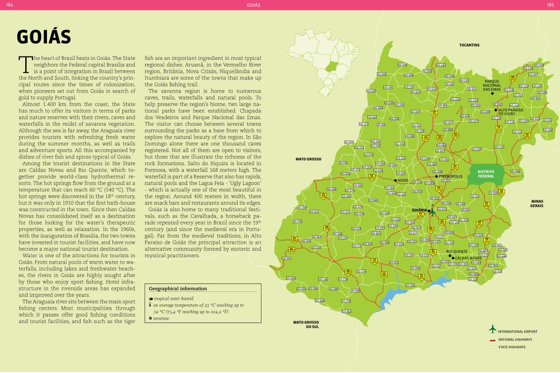
tocantInS
MInaS GeraIS
Mato GroSSo do SuL
Mato GroSSo
alto paraÍso de goiás
rio Quente
pirenópolisdIStrItoFederaL
GoIÂnIa
parQue naCional das emas
Caldas noVas
goiás
153BR
153BR
080BR 020
BR
153BR
060BR
351BR
153BR
153BR
352BR
352BR
040BR
251BR
158BR
158BR
359BR
364BR
364BR
483BR
452BR
452BR
050BR
414BR
010BR
010BR
070BR
GO-244
GO-164
GO-448
GO-244
GO-164GO-239
GO-142
GO-241GO-151
GO-347
GO-239
GO-156GO-239
GO-336
GO-454
GO-173 GO-164 GO-154
GO-338
GO-336
GO-156GO-164
GO-530
GO-070
GO-173
GO-324
GO-528
GO-256
GO-173GO-324
GO-070
GO-230GO-456
GO-156
GO-429
GO-145
GO-244
GO-142GO-132
GO-241
GO-239
GO-442
GO-132
GO-241
GO-532
GO-237 GO-237
GO-080
GO-239
GO-241
GO-118
GO-112
GO-447
GO-118GO-110
GO-110
GO-108
GO-453
GO-114
GO-241
GO-118
GO-116 GO-236GO-112 GO-236
GO-108GO-114
GO-116GO-230
GO-080
GO-437
GO-230
GO-080
GO-230
GO-338 GO-346
GO-520GO-436
GO-225GO-080GO-154
GO-164GO-326
GO-174GO-118
GO-060
GO-221
GO-174
GO-174
GO-060
GO-164
GO-162
GO-320GO-156
GO-417
GO-217 GO-020
GO-217
GO-050
GO-405
GO-174
GO-221
GO-194
GO-194
GO-341
GO-220
GO-341
GO-516
GO-206
GO-050 GO-206
GO-184
GO-184
GO-206
GO-178
GO-174
GO-174GO-333 GO-164
GO-410GO-215
GO-040GO-147 GO-139
GO-330
GO-307
GO-213
GO-457
GO-301
GO-440
GO-381GO-330
GO-210
GO-305
GO-139
GO-303GO-139GO-147
GO-419
GO-213GO-320
GO-410
GO-040
GO-206
GO-206
GO-178
GO-302
GO-210
GO-184GO-220
GO-326 GO-156GO-070
GO-222
GO-330
GO-010 GO-010
GO-139
GO-147
GO-139GO-330
GO-020
international airport
national HigHways
state HigHways
goiás184 185
The heart of Brazil beats in Goiás. The State neighbors the Federal capital Brasilia and is a point of integration in Brazil between
the North and South, linking the country’s prin-cipal routes since the times of colonization, when pioneers set out from Goiás in search of gold to supply Portugal.
Almost 1.400 km from the coast, the State has much to offer its visitors in terms of parks and nature reserves with their rivers, caves and waterfalls in the midst of savanna vegetation. Although the sea is far away, the Araguaia river provides tourists with refreshing fresh water during the summer months, as well as trails and adventure sports. All this accompanied by dishes of river fish and spices typical of Goiás.
Among the tourist destinations in the State are Caldas Novas and Rio Quente, which to-gether provide world-class hydrothermal re-sorts. The hot springs flow from the ground at a temperature that can reach 60 °C (140 °C). The hot springs were discovered in the 18th century, but it was only in 1910 that the first bath-house was constructed in the town. Since then Caldas Novas has consolidated itself as a destination for those looking for the water’s therapeutic properties, as well as relaxation. In the 1960s, with the inauguration of Brasilia, the two towns have invested in tourist facilities, and have now become a major national tourist destination.
Water is one of the attractions for tourists in Goiás. From natural pools of warm water to wa-terfalls, including lakes and freshwater beach-es, the rivers in Goiás are highly sought after by those who enjoy sport fishing. Hotel infra-structure in the riverside areas has expanded and improved over the years.
The Araguaia river sits between the main sport fishing centers. Most municipalities through which it passes offer good fishing conditions and tourist facilities, and fish such as the tiger
GoIáSfish are an important ingredient in most typical regional dishes. Aruanã, in the Vermelho River region, Britânia, Nova Crixás, Niquelândia and Itumbiara are some of the towns that make up the Goiás fishing trail.
The savanna region is home to numerous caves, trails, waterfalls and natural pools. To help preserve the region’s biome, two large na-tional parks have been established: Chapada dos Veadeiros and Parque Nacional das Emas. The visitor can choose between several towns surrounding the parks as a base from which to explore the natural beauty of the region. In São Domingo alone there are one thousand caves registered. Not all of them are open to visitors, but those that are illustrate the richness of the rock formations. Salto do Itiquira is located in Formosa, with a waterfall 168 meters high. The waterfall is part of a Reserve that also has rapids, natural pools and the Lagoa Feia - ‘Ugly Lagoon’ - which is actually one of the most beautiful in the region. Around 400 meters in width, there are snack bars and restaurants around its edges.
Goiás is also home to many traditional festi-vals, such as the Cavalhada, a horseback pa-rade repeated every year in Brazil since the 19th century (and since the medieval era in Portu-gal). Far from the medieval traditions, in Alto Paraíso de Goiás the principal attraction is an alternative community formed by esoteric and mystical practitioners.
Geographical information
tropical semi-humid an average temperature of 23 °c reaching up to 39 °c (73,4 °F reaching up to 102,2 °F)
savanna

goiás186 187
GoIÂnIa 1,302,001 inhabitants 732,801 km² 62 220 V
Local holidaysOctober 24: Anniversary of the founding of GoiâniaMay 24: Nossa Senhora Auxiliadora’s Day
AccommodationGoiânia has a modern and efficient hotel network that caters to everyone from business travelers through to those who coming for tourism. It is also possible to stay in inns, the more popular being distant from the city. There are also campgrounds and hostels.
TransportThe city has paved highways that are maintained in good condition, with connections to other State capitals. The city can also be reached by air via the Airport Santa Genoveva.
Goiânia is one of the greenest State capitals in Brazil. Its wide and straight avenues are the mark of a City designed to be the driving force of Goiás, while ensuring quality of life for its
residents. Built to house the new State capital, replacing Cidade de Goiás, the cornerstone for its construction was laid on October 24, 1933. However, the official inauguration only took place almost nine years later, on July 5, 1942, accompanied by a mood of euphoria, with par-ties, speeches, opening ceremony, dances, and the inauguration of numerous construction projects. Several public buildings inspired by Art Deco were constructed in Goiânia in 1950, and this architectural collection is considered to be one of the most significant in Brazil. Pro-tected by the Institute for National Artistic and Historical Heritage since 2003, this includes 22 buildings and public monuments, the original center of Goiânia and the center of Campinas, originally home to the first residents. But visit-ing Goiânia is not just about history, it encom-passes the Capital’s bars, clubs pubs and res-taurants, where you can sample the regional cuisine, with dishes such as galinhada with pequí (chicken with typical regional fruit), sau-sage, tamales and savanna-style paella. Also experiment a pastry in the Municipal Market.
FeIra da Lua Praça Tamandaré, 3 - Setor Oeste. Saturdays
from 4 pm to 10 pm.
The ‘Moon Fair’ is held every Saturday, and brings together over 900 exhibitors with food, crafts and mystical products.
MuSeu GoIano zoroaStro artIaGa Praça Doutor Pedro Ludovico Teixeira (Praça cívica),
13 - centro. Tuesday to Friday from 9 am to 5 pm. Saturdays, Sundays and holidays from 9 am to 4 pm
With Art Deco architecture - a style that marked the buildings of its time - this is the reference museum for Goiás history and culture. The col-lection includes paleontology, archeology, min-eralogy, taxidermy, anthropology, religious art, popular culture and art industry. Temporary exhibitions and a space dedicated to the history of the State capital occupy the top floor.
paInÉIS da VIa Sacra Rodovia dos Romeiros (road linking Goiânia to
Trindade). daily, 24 hours
In the largest open-air art gallery in the world, fourteen panels - each 10 meters wide by 4 me-ters tall each - depict the principal moments in the Passion of Jesus Christ. The artist Omar Souto
painted the panels on site during over 105 days. Constructed in pairs, the panels are intercon-nected to represent the shape of an altar. The surrounding area has grassed parks with halogen spotlights that illuminate the paintings.
Horto FLoreStaL Alameda das Rosas - Setor Oeste. to be advised
when the park reopens
Located in an area of 98,800 m² covered with vegetation, the Horto Florestal (Forest Gardens) is the City’s largest leisure area. It houses the entrance to the Goiânia Zoo as well as areas for sports activities, with a running track, areas of sand and the Lago das Rosas - ‘Lake of Roses’. It is currently closed for renovation.
craft fairsThe street fairs held on weekends are good plac-es to buy traditional Goiás handicrafts, such as clay pots and pans, straw baskets, woven fab-rics, jewelry, paintings and sculptures. Feira da Lua takes place at Praça Tamandaré – Setor Oeste on Saturday nights. On Sunday morning a Hippy Fair is held at Praça do Trabalhador – Setor central. On Sunday afternoons shows the Feira das Nuvens is held at Rua T-01 at the corner with Rua T-06 - Setor coimbra, and in the evening the Feira do Entardecer is held at Praça do Sol - Setor Oeste.
Parque flamBoyant
in goiania
lago das rosas in the horto
florestal
luCi
an
a B
ar
Celo
s/em
Br
atu
r
luCi
an
a B
ar
Celo
s/em
Br
atu
r
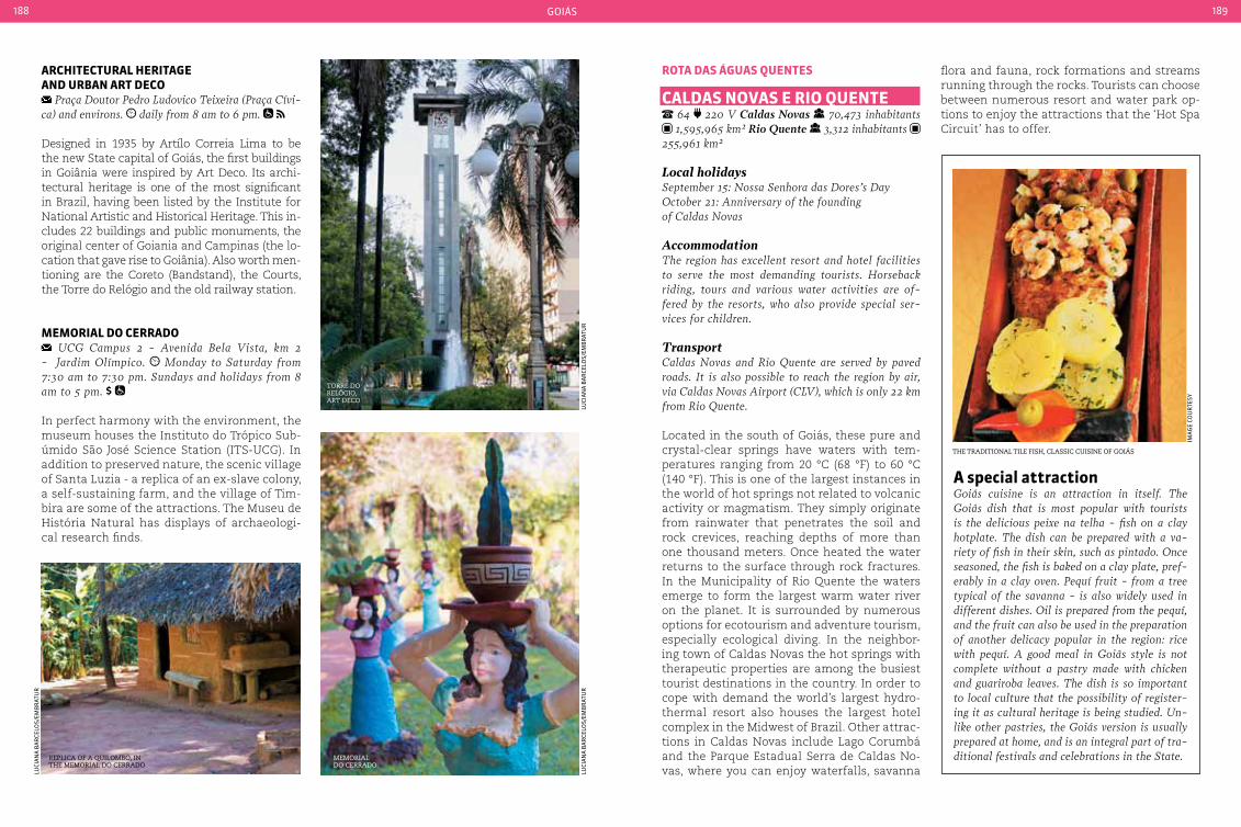
goiás188 189
arcHItecturaL HerItaGe and urban art deco
Praça Doutor Pedro Ludovico Teixeira (Praça cívi-ca) and environs. daily from 8 am to 6 pm.
Designed in 1935 by Artílo Correia Lima to be the new State capital of Goiás, the first buildings in Goiânia were inspired by Art Deco. Its archi-tectural heritage is one of the most significant in Brazil, having been listed by the Institute for National Artistic and Historical Heritage. This in-cludes 22 buildings and public monuments, the original center of Goiania and Campinas (the lo-cation that gave rise to Goiânia). Also worth men-tioning are the Coreto (Bandstand), the Courts, the Torre do Relógio and the old railway station.
MeMorIaL do cerrado UcG campus 2 - Avenida Bela Vista, km 2
- Jardim Olímpico. Monday to Saturday from 7:30 am to 7:30 pm. Sundays and holidays from 8 am to 5 pm.
In perfect harmony with the environment, the museum houses the Instituto do Trópico Sub-úmido São José Science Station (ITS-UCG). In addition to preserved nature, the scenic village of Santa Luzia - a replica of an ex-slave colony, a self-sustaining farm, and the village of Tim-bira are some of the attractions. The Museu de História Natural has displays of archaeologi-cal research finds.
rota daS áGuaS QuenteS
caLdaS noVaS e rIo Quente 64 220 V Caldas Novas 70,473 inhabitants 1,595,965 km² Rio Quente 3,312 inhabitants
255,961 km²
Local holidaysSeptember 15: Nossa Senhora das Dores’s DayOctober 21: Anniversary of the founding of caldas Novas
AccommodationThe region has excellent resort and hotel facilities to serve the most demanding tourists. Horseback riding, tours and various water activities are of-fered by the resorts, who also provide special ser-vices for children.
Transportcaldas Novas and Rio Quente are served by paved roads. It is also possible to reach the region by air, via caldas Novas Airport (cLV), which is only 22 km from Rio Quente.
Located in the south of Goiás, these pure and crystal-clear springs have waters with tem-peratures ranging from 20 °C (68 °F) to 60 °C (140 °F). This is one of the largest instances in the world of hot springs not related to volcanic activity or magmatism. They simply originate from rainwater that penetrates the soil and rock crevices, reaching depths of more than one thousand meters. Once heated the water returns to the surface through rock fractures. In the Municipality of Rio Quente the waters emerge to form the largest warm water river on the planet. It is surrounded by numerous options for ecotourism and adventure tourism, especially ecological diving. In the neighbor-ing town of Caldas Novas the hot springs with therapeutic properties are among the busiest tourist destinations in the country. In order to cope with demand the world’s largest hydro-thermal resort also houses the largest hotel complex in the Midwest of Brazil. Other attrac-tions in Caldas Novas include Lago Corumbá and the Parque Estadual Serra de Caldas No-vas, where you can enjoy waterfalls, savanna
flora and fauna, rock formations and streams running through the rocks. Tourists can choose between numerous resort and water park op-tions to enjoy the attractions that the ‘Hot Spa Circuit’ has to offer.
a special attractionGoiás cuisine is an attraction in itself. The Goiás dish that is most popular with tourists is the delicious peixe na telha - fish on a clay hotplate. The dish can be prepared with a va-riety of fish in their skin, such as pintado. Once seasoned, the fish is baked on a clay plate, pref-erably in a clay oven. Pequí fruit - from a tree typical of the savanna - is also widely used in different dishes. Oil is prepared from the pequí, and the fruit can also be used in the preparation of another delicacy popular in the region: rice with pequí. A good meal in Goiás style is not complete without a pastry made with chicken and guariroba leaves. The dish is so important to local culture that the possibility of register-ing it as cultural heritage is being studied. Un-like other pastries, the Goiás version is usually prepared at home, and is an integral part of tra-ditional festivals and celebrations in the State.
torre do relÓgio, art deco
the traditional tile fish, classic cuisine of goiás
rePlica of a quilomBo, in the memorial do cerrado
ima
ge
Cou
rte
sy
memorial do cerrado
luCi
an
a B
ar
Celo
s/em
Br
atu
rlu
Cia
na
Ba
rCe
los/
emB
rat
ur
luCi
an
a B
ar
Celo
s/em
Br
atu
r

goiás190 191
rIo Quente camping Esplanada, located at Rua Espírito Santo,
75, Bairro Esplanada - Rio Quente. from 7 am to 5 pm (it is possible to camp overnight at the site).
Rio Quente is 12 km long and its waters remain warm throughout its entire length. One of the biggest water parks in the country is located on the banks of the river. Facilities include restau-rants, bars and accommodations for tourists to enable them to make the most of a day by the tranquil waters of the river. There are also campsites on the riverbanks.
LaGo coruMbá Avenida caminho do Lago - caldas Novas. 24 hours daily
This is part of the Corumbá I Hydroelectric Plant and covers an area of 65 km2. Here you will find boat trips and jet ski rides. It is also good place for fishing. There are waterfalls on the shoreline that are open to visitors. The shoreline also has bars, restaurants and hotels.
parQue eStaduaL Serra de caLdaS noVaS Rua E-13, Rural Zone. daily from 8 am to 11 am
and from 1 pm to 5 pm. it is necessary to schedule a visit in advance.
The park was created in 1970 and is contains thermal springs. Two short trails lead to small waterfalls, with viewpoints along the way. A mini-bus ride takes visitors to the highest point (around 11 km away), which has panoramic views. Contracting a local guide is recommended.
aLto paraíSo 6,885 inhabitants 2,593,901 km² 62 220 V
Local holidaysNovember 27: Nossa Senhora das Graças’s DayDecember 12: Anniversary of the founding of Alto Paraíso
AccommodationThe town has many hotels - from the simple to the more sophisticated - all with the rustic style of the region. There are also some hotels in other towns in
the region. Booking in advance is recommended due to the limited number of vacancies.
TransportFrom Brasilia take the BR-020 to Planaltina, which becomes the GO-118 to Alto Paraíso. From the town it is more 36 km by dirt road to the São Jorge district and the entrance to the national park. Brasilia Inter-national Airport is the closest air link. Transfers to Alto Paraíso are available.
Located in the Chapada dos Veadeiros, the town is considered to be an important wild-life sanctuary, attracting tourists from around the world for its savanna flora and fauna. The town is also gateway to the Parque Nacional Chapada dos Veadeiros, via the district of São Jorge (36 km from Alto Paraíso). Once a min-ing village, the principal activity is now eco-tourism and serving tourists who come to ex-plore the region.
cacHoeIra VaLe do rIo MacaQuInHo GO-118 highway - Fazenda Santuário das Pedras. visits must be schedules with the owner. Trekking:
preferably between October and April when temper-atures are cooler. on average to hire a guide for groups of up to 10 people (not mandatory)
A trail of almost 5 km leading to the main falls is not the easiest, but compensates with the scen-ery along the way - canyons, natural pools and waterfalls of up to 50 meters suitable for canyo-neering. It is also possible to go trekking across the savanna to the source of the Rio do Macaco, passing by the top of a 150 meter waterfall.
JardIM de Maytrea via the road to Parque Nacional chapada dos
Veadeiros, GO-239, km 20. daily, 24 hours
This plain with gentle slopes has as its highlight the regional vegetation with buriti palms and a mysticism that revolves around an alleged magnetic force field in the Jardim de Maitreya. The visit consists of a stop at the side of the road to enjoy the scenery and take pictures.
MIrante da baLIza via GO-118 at km 162 in the direction of Brasilia. daily, 24 hours
With a height of 1,500 meters, the visitor has a 360° view of the mountains of the Chapada dos Veadeiros from this viewpoint. The loca-tion is considered the best viewing point for the town of Alto Paraiso.
encontro daS áGuaS via the road to colinas do Sul, 20 km from São Jorge. recommended between 8:30 am and 2 pm.
At the meeting of the Tocantinzinho and São Miguel rivers there is an easy 1.5 km trail lead-ing to canyons, rapids, and natural pools of wa-ter formed by the meeting of the rivers.
cacHoeIra aLMÉceGaS GO-327 highway at the 8 km marker. via highway GO-239 in the direction of São Jorge. Monday to Friday from 2 pm to 6 pm. Saturdays
from 9 am to 12 am.
são jorge canyon in the chaPada dos veadeiros
da
nil
o p
ru
dên
Cio
/em
Br
atu
r
Colinasdo Sul
CHAPADA DOS VEADEIROS
1
23
4
5
6
78
9
10
11 1213
14
GO- 118 Alto Paraíso
São João d’Aliança
Teresinade Goiás
Cavalcante
1 Cachoeira Poço Encantado2 Cachoeira Cristal3 Cachoeiras Anjos e Arcanjos4 Cachoeiras Loquinhas5 Cachoeiras Macaquinho
e Macaco6 Cachoeira dos Couros
7 Cachoeira Cânions and Cariocas8 Salto do Rio Preto9 Cachoeira Vale da Lua 10 Cachoeira Encontro das Águas 11 Cachoeira Água Quente 12 Cachoeira Raizama 13 Morada do Sol

goiás192 193
A self-guided trail of almost 1 km through the Pousada Fazenda São Bento takes visitors the Ca-choeira Almécegas (50 meters in height), which has a viewpoint and natural swimming pool. Rappel down the falls is possible if arranged in advance. Almécega 2 (15 meters in height) is a further 400 meters along an easy trail, and has a shallow pool and calm waters. Admission also includes a 300 meter trail to the São Bento falls, the third at this location. There is also a 850 me-ter zip line that reaches 55 km/h between the Serra Almécegas and Morro Mirante.
ponte de pedra Estrada cavalcante-colinas do Sul (GO-152), km 8
- Fazenda Renascer, cavalcante. it is recommended to visit during the day
This viewpoint overlooks the Parque Nacional Chapada dos Veadeiros, Catingueiro and the Rio Claro valley. Situated on the border be-tween Fazenda Renascer and the park, it is a
natural stone arch over the Rio São Domingos. The geological formation is 2.5 billion years old and 30 meters high.
catarataS doS couroS via highway GO-118 at km 148 in the direction of
Brasilia, in São Jorge. on average to hire a guide for groups of 6 to 10 people (not mandatory)
Four impressive cataracts are formed by the Rio dos Couros. The tour starts with a light 800 me-ter trail to the Cachoeira da Muralha. From there it is a further 900 meter walk along the river to Almécegas. Another track, 400 meters long, leads to the other waterfalls, with showers and areas where the sun shines throughout the day.
SaLto do rIo raIzaMa 2 km from the town of São Jorge, follow the GO-
239 toward colinas do Sul, taking an exit to the left. it is recommended to visit during the day
After forming a natural jacuzzi, the Raizama river plunges into a canyon over 100 m in length. The fall at the meeting with Rio San Miguel is 40 meters. A walk of almost 2 km passes through pools and canyons.
SítIo HIStÓrIco e patrIMÔnIo cuLturaL kaLunGa
via the road to São José, km 29 - comunidade do Engenho II, cavalcante
The largest ex-slave colony in Brazil is located in the town of Cavalcante, distributed among Engenho II, Prata, Vão do Moleque and Vão das Almas. The area has been listed by the Govern-ment of Goiás as a cultural heritage site.
Morro da baLeIa via the access road to Parque Nacional chapada
dos Veadeiros (GO-239) at km 18 in São Jorge. it is recommended to visit during the day
At an altitude of 1,500 m, this quartzite rock formation in the form of a whale unveils pan-oramic views of the Parque Nacional Chapada dos Veadeiros. From the top it is possible to see Sete Lagoas - a part of Alto Paraíso - and several mountains on the horizon.
VaLe da Lua take the GO-239 highway, access via São Jorge. it is recommended to visit during the day.
no charge
Formed over 600 million years ago, the rocky ‘Moon Valley’ presents shades of gray similar to those of lunar craters. The site was carved by the action of the São Miguel river, and can be accessed by an easy trail 900 meters long. Natural pools between caves and crevices com-plete the landscape.
cachoeira almécegas near the Parque nacional
chaPada dos veadeiros
vale da lua, near the Parque nacional chaPada dos veadeiros
Parque nacional chaPada dos veadeiros
ast
or
ina
ast
or
ina
ma
rin
a C
am
po
s V
inH
al

goiás194 195
parQue nacIonaL cHapada doS VeadeIroS GO-239 highway, 36 km marker. São Jorge - Alto
Paraíso. departing from Brasilia, the park can be reached via the highways BR-020 and GO-118 (220 km) leading to Alto Paraíso, then take GO-239 (36 km, 22 km of which are paved) to São Jorge (gate-way to the park). January and July, daily, including holidays, from 8 am to 6 pm with entry allowed only up to 12 am. Remaining months, Tuesday to Sunday from 8 am to 6 pm, with entry allowed only up to 12 am. at least one day Traveling through the natural history of the up-per savanna, the Parque Nacional Chapada dos Veadeiros invites visitors to explore its 65,514 hectares via the old routes used by miners. Now used by tourists, they lead to trails that reveal unique vegetation, hundreds of springs and streams, rocks more than a billion years old, and landscapes of rare beauty with features that change throughout the year. Walks, observ-ing flora and fauna and bathing in waterfall are the main activities, all amid the immense land-scapes of the park, which was declared a World Natural Heritage site in 2001 by UNESCO (Unit-ed Nations Educational, Scientific and Cultural
Organization). To complete the tour it is worth paying a visit to the old mining areas. Bring ap-propriate clothing, with hat, shoes with socks and sunscreen. The use of sunscreen and sham-poo or soap during river bathing is prohibited. In the rainy season from October to April, bring a light raincoat, sweater and spare clothing. Bring lightweight garbage sacks to take all waste back to the city, including organic waste. Groups are registered on entry, and a waiver must be signed. Remember that children under 5 years may not make the tour. There is also control on the number of visitors, in order to manage impact on the ecosystem. In days with greater movement it is recommend you arrive early at the Visitors Center, located at the entrance gate. Within the park it is only allowed to circulate in the company of guides accredited by the park administration and approved by ICMBio (Chico Mendes Institute for Biodiversity Conserva-tion), the Brazilian government’s environmen-tal agency. The Parque Nacional Chapada dos Veadeiros, located in the Northeast of Goiás, is located between the towns of Alto Paraíso de Goiás, Cavalcante and Colinas do Sul, which all have tourist accommodation facilities.
trILHa doS SaLtoS trail of 9 km (round trip). no charge, but it is
necessary to hire a guide. The guides have no formal relationship with the park and charge. per group
The itinerary includes passing through Garimpão, which was the largest quartz crystal mine in the region, and was active from 1912 to 1961. Over 30 minutes of trail lead to the Salto do Rio Preto viewpoint, which overlooks a waterfall of 120 meters in height. After 800 meters there is an 80 meter waterfall, which flows in one of the larg-est pools in the Chapada. A further 20 minutes of steep climb leads to the Rio Preto rapids, where you can bathe and enjoy the natural jacuzzi formed by small cascades.
trILHa do cÂnIon 2 and cacHoeIra daS carIocaS
Trail of 11 km (round trip). no charge, but it is necessary to hire a guide. The guides have no formal relationship with the park and charge. per group
This trail traverses large rock formations, cut by the Rio Preto. It is 2 hours and 30 minutes walk from the entrance to the Parque Nacional to Can-yon 1 - closed during the rainy season - and an-other 40 minutes along the river bed to Canyon 2, with an pool that is excellent for swimming. From there a 40 minute trail leads to the Cachoeira das Cariocas, where the Rio Preto flows into two wa-terfalls, forming pools suitable for bathing.
observing faunaAmong the mammals that inhabit the Parque Nacional chapada dos Veadeiros the attractions include the maned fox and pampas deer. Among the 312 species of birds are the rhea, king vulture, several species of hawks and the very rare Mer-ganser duck (in the Rio Preto rapids), there be-ing 30 bird species endemic to the savanna, 13 to the park and 8 threatened with extinction. Over a thousand species of butterflies and moths can also be observed, as well as 34 frogs and toads, 33 species of reptiles and 49 fish species in rivers and streams that pass through the park.
cachoeira dragÕes do Planalto, in cavalcante
cascata rio Preto in the Parque nacional
chaPada dos veadeiros
canyon in chaPada dos veadeiros
da
nie
l a
rCa
njo
/gaV
iões
do
pla
na
lto
ast
or
ina
ma
ria
am
elia
pa
iVa
aB
rã
o
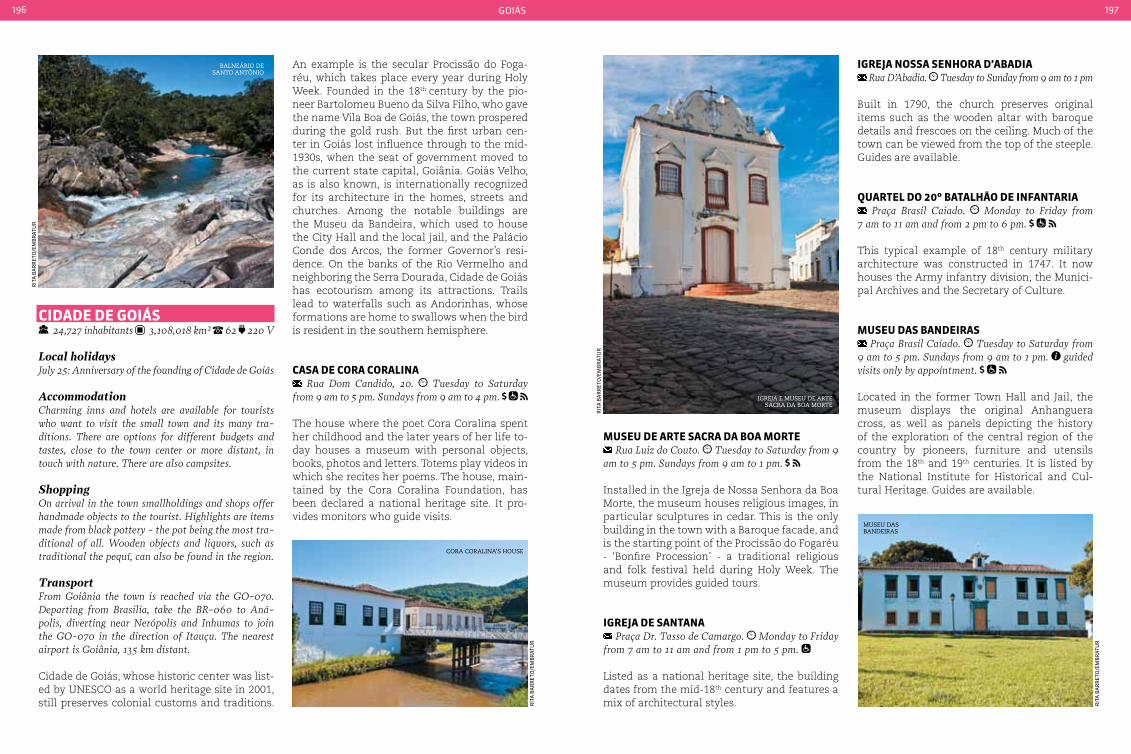
goiás196 197
An example is the secular Procissão do Foga-réu, which takes place every year during Holy Week. Founded in the 18th century by the pio-neer Bartolomeu Bueno da Silva Filho, who gave the name Vila Boa de Goiás, the town prospered during the gold rush. But the first urban cen-ter in Goiás lost influence through to the mid-1930s, when the seat of government moved to the current state capital, Goiânia. Goiás Velho, as is also known, is internationally recognized for its architecture in the homes, streets and churches. Among the notable buildings are the Museu da Bandeira, which used to house the City Hall and the local jail, and the Palácio Conde dos Arcos, the former Governor’s resi-dence. On the banks of the Rio Vermelho and neighboring the Serra Dourada, Cidade de Goiás has ecotourism among its attractions. Trails lead to waterfalls such as Andorinhas, whose formations are home to swallows when the bird is resident in the southern hemisphere.
caSa de cora coraLIna Rua Dom candido, 20. Tuesday to Saturday
from 9 am to 5 pm. Sundays from 9 am to 4 pm.
The house where the poet Cora Coralina spent her childhood and the later years of her life to-day houses a museum with personal objects, books, photos and letters. Totems play videos in which she recites her poems. The house, main-tained by the Cora Coralina Foundation, has been declared a national heritage site. It pro-vides monitors who guide visits.
IGreJa noSSa SenHora d’abadIa Rua D’Abadia. Tuesday to Sunday from 9 am to 1 pm
Built in 1790, the church preserves original items such as the wooden altar with baroque details and frescoes on the ceiling. Much of the town can be viewed from the top of the steeple. Guides are available.
QuarteL do 20º bataLHão de InFantarIa Praça Brasil caiado. Monday to Friday from
7 am to 11 am and from 2 pm to 6 pm.
This typical example of 18th century military architecture was constructed in 1747. It now houses the Army infantry division, the Munici-pal Archives and the Secretary of Culture.
MuSeu daS bandeIraS Praça Brasil caiado. Tuesday to Saturday from
9 am to 5 pm. Sundays from 9 am to 1 pm. guided visits only by appointment.
Located in the former Town Hall and Jail, the museum displays the original Anhanguera cross, as well as panels depicting the history of the exploration of the central region of the country by pioneers, furniture and utensils from the 18th and 19th centuries. It is listed by the National Institute for Historical and Cul-tural Heritage. Guides are available.
cIdade de GoIáS 24,727 inhabitants 3,108,018 km² 62 220 V
Local holidaysJuly 25: Anniversary of the founding of cidade de Goiás
Accommodationcharming inns and hotels are available for tourists who want to visit the small town and its many tra-ditions. There are options for different budgets and tastes, close to the town center or more distant, in touch with nature. There are also campsites.
ShoppingOn arrival in the town smallholdings and shops offer handmade objects to the tourist. Highlights are items made from black pottery - the pot being the most tra-ditional of all. Wooden objects and liquors, such as traditional the pequí, can also be found in the region.
TransportFrom Goiânia the town is reached via the GO-070. Departing from Brasilia, take the BR-060 to Aná-polis, diverting near Nerópolis and Inhumas to join the GO-070 in the direction of Itauçu. The nearest airport is Goiânia, 135 km distant.
Cidade de Goiás, whose historic center was list-ed by UNESCO as a world heritage site in 2001, still preserves colonial customs and traditions.
MuSeu de arte Sacra da boa Morte Rua Luiz do couto. Tuesday to Saturday from 9
am to 5 pm. Sundays from 9 am to 1 pm.
Installed in the Igreja de Nossa Senhora da Boa Morte, the museum houses religious images, in particular sculptures in cedar. This is the only building in the town with a Baroque facade, and is the starting point of the Procissão do Fogaréu - ‘Bonfire Procession’ - a traditional religious and folk festival held during Holy Week. The museum provides guided tours.
IGreJa de Santana Praça Dr. Tasso de camargo. Monday to Friday
from 7 am to 11 am and from 1 pm to 5 pm.
Listed as a national heritage site, the building dates from the mid-18th century and features a mix of architectural styles.
Balneário de santo antônio
cora coralina’s house
igreja e museu de arte sacra da Boa morte
museu das Bandeiras
rit
a B
ar
ret
o/e
mB
rat
ur
rit
a B
ar
ret
o/e
mB
rat
ur
rit
a B
ar
ret
o/e
mB
rat
ur
rit
a B
ar
ret
o/e
mB
rat
ur
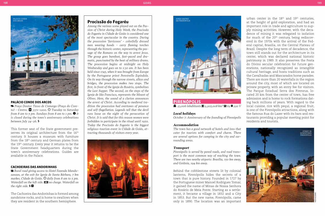
goiás198 199
pIrenÓpoLIS 23,006 inhabitants 2,205,008 km² 62 220 V
Local holidaysOctober 7: Anniversary of the founding of Pirenópolis
AccommodationThe town has a good network of hotels and inns that cater for tourists with comfort and charm. There are several options for camping in the city and sur-rounding areas.
TransportPirenópolis is served by paved roads, and road trans-port is the most common way of reaching the town. There are two nearby airports: Brasilia, 150 km away, and Goiânia, 194 km away.
Behind the cobblestone streets lit by colonial lanterns, Pirenópolis hides the secrets of a town that is pure history. Founded in 1727 by the Portuguese miner Manoel Rodrigues Tomar, it gained the name of Minas de Nossa Senhora do Rosário de Meia Ponte. Starting as a settle-ment, it became a village in 1832 and a City in 1853. But the new name, Pirenópolis, came only in 1890. The location was an important
urban center in the 18th and 19th centuries, at the height of gold exploration, and had an important role in trade and agriculture to sup-ply mining activities. However, with the deca-dence of mining it was relegated to isolation for much of the 20th century, being rediscov-ered in the 1970s with the arrival of the Fed-eral capital, Brasilia, on the Central Plateau of Brazil. Despite the long term of decadence, the town still stands out for the architecture in its center, which was declared national historic patrimony in 1989. It also preserves the Festa do Divino secular celebration for future gen-erations, nationally recognized as intangible cultural heritage, and hosts traditions such as the Cavalhadas and Mascarados horse parades. There are more than 20 waterfalls in the region around the city, most of which are located on private property, with an entry fee for visitors. The Parque Estadual Serra dos Pireneus, lo-cated 20 km from the center of town, has free admission and is home to rock formations dat-ing back millions of years. With regard to the local cuisine, rice with pequí, a regional fruit, is one of the Pirenópolis attractions, along with the famous Rua do Lazer with its bars and res-taurants providing a popular meeting point for residents and tourists.
procissão do FogaréuAmong the various scene played out on the Pas-sion of christ during Holy Week, the Procissão do Fogaréu in cidade de Goiás is considered one of the most spectacular in the country. During the procession ‘farricosos’ - colorfully dressed men wearing hoods - carry flaming torches through the historic center, representing the pas-sage of the Romans on the way to arrest Jesus. The group goes barefoot, fast-paced and dra-matic, punctuated by the beat of military drums. The procession begins at midnight on Holy Wednesday and goes on to 1:30 am. It has been held since 1745, when it was brought from Europe by the Portuguese priest Perestrello Espindola. On its way through the narrow streets, alleys and bridges, the procession makes two stops. The first, in front of the Igreja do Rosário, symbolizes the Last Supper. The second, on the steps of the Igreja de São Francisco, represents the Mount of Olives. Here, the sound of a clarion announces the arrest of christ. According to medieval tra-dition the procession had overtones of penance and self-flagellation. Legends tell that the devil runs loose on the night of the persecution of christ. It is said that for this reason women were forbidden to participate in the ritual until 1950. Today the Procissão do Fogaréu is the biggest religious-tourism event in cidade de Goiás, at-tracting thousands of visitors every year.
paLácIo conde doS arcoS Praça Doutor Tasso de camargo (Praça do core-
to) - centro. 3371-1200. Tuesday to Saturday from 8 am to 5 pm. Sundays from 8 am to 1 pm. it is closed during the town’s anniversary celebrations between July 24-26.
This former seat of the State government pre-serves its original architecture from the 16th century. It houses a museum with furniture from the 18th century and German plates from the 19th century. Every year it returns to be the State Government headquarters during the town’s anniversary celebrations. Guides are available in the Palace.
cacHoeIraS daS andorInHaS Rural road giving access to Hotel Fazenda Mandu-
zanzan, at the exit for Igreja de Santa Bárbara, 7 km marker, cidade de Goiás. daily from 8 am to 5 pm. Waterfall on the left side. no charge. Waterfall on the right side.
The Cachoeira das Andorinhas is formed among sandstone rocks, and is home to swallows when they are resident in the southern hemisphere.
Palácio conde dos arcos
igreja matriz em PirenÓPolis
Procissão do fogaréu
rit
a B
ar
ret
o/e
mB
rat
ur
ma
rCe
lo t
err
aza
ma
Ísa
na
rVa
ez
yud
i Ku
san
o
street in downtown PirenÓPolis

goiás200 201
other falls. The Cachoeira das Araras is located next to the town, just 18 km from the historic center. Access to the waterfall is controlled. There are two other waterfalls at the site (Paredão and Renascer). The site is structured to receive visitors and has restaurants, picnic sites, restrooms and a paved path to the main waterfall. The site has beautiful cascades over rocks, deep pools and a beach.
IGreJa noSSa SenHora do roSárIo Praça da Matriz - centro. Wednesday to Sunday
from 8 am to 6 pm (closes at lunchtime, from 12 am to 2 pm). Guided tours must be scheduled one week in advance.
Known as the Igreja da Matriz - ‘Parish Church’ - it has been listed as national cultural heritage since 1941. Built between 1728 and 1732, it was de-stroyed by fire in 2002 and has been fully restored.
centro HIStÓrIco 24 hours daily. There are many duly registered
tourist guides. the price of tours depends on agreement with the guide (private service)
Declared as national historic patrimony in 1989, a tour through the cobbled streets passes by colonial houses that now houses craft shops, bars and restaurants, as well as Churches, the Ponte de Maderia (Wooden Bridge), Ponte de Pênsil (Suspension Bridge), and the old City Hall and Jail, the Cinema and Teatro dos Pireneus.
parQue eStaduaL Serra doS pIreneuS Estrada dos Pireneus, 20 km from the city. daily
from 9 am to 7 pm. no charge. fee for guide. Age rating: only recommended for persons capable of undertaking a medium-difficult trek
Located 20 km from the town center in the Serra dos Pireneus, this environmental preser-vation area is home to rock formations dating back millions of years, waterfalls, such as the Pocinhos do Sonrisal, the Pico dos Pireneus - the
pirenópolis flavorsOne of the main tourist centers in Goiás and Bra-zil, Pirenópolis is a reference in gastronomy in the State. Typical regional dishes from pequí rice (a Brazilian tree native to the savanna and widely used in local cuisine) to Goiás pastry, peanut candy, corn desert or guariroba (a type of coco-nut that grows in the region and is very popular either fresh or in the preparation of other dishes). In June the town hosts the International Food Fes-tival, where in addition to typical food dishes it is possible to experience French and Italian cuisine, among others. The town has a good network of charming restaurants.
highest point of the region at 1,385 meters, Mor-ro Cabeludo, which is ideal for climbing, and a chapel that hosts the Festa do Morro every July. Visits are not controlled, but it is advisable to contract a local guide.
SantuárIo do VaGaFoGo daily from 9 am to 5 pm. Tour. Brunch. 1 day
The first Private Natural Protection Reserve in Goiás, it offers a trek along the Vagafogo river, tree climbing, rappel and observation of flora and fauna. It has a library, a snack kiosk with hammocks and a brunch with around 45 items produced on the farm, with savanna fruits and other local produce.
MIrante do VentILador Estrada dos Pireneus, km 9. daily, 24 hours. it is recommended to visit during the day
This viewpoint is 1,150 meters above sea level and provides good views of the Serra dos Piri-neus. It has short and easy access trail.
IGreJa noSSa SenHora do carMo Largo do carmo - centro. Wednesday to Sun-
day from 8 am to 6 pm (closes at lunchtime, from 12 am to 2 pm). Guided tours must be scheduled one week in advance.
The church was built between 1750 and 1754 and is listed as national historic patrimony. It is beautifully decorated with Baroque and Rococo altars in its interior, rich woodwork and statues, and also houses the Museu de Arte Sacra.
cacHoeIra daS araraS GO-338 at the 17 km marker (2 km of dirt road). daily from 9 am to 6 pm.
The Rio Dois Irmãos forms a natural pool before dropping down the Araras falls, with a height of 7 meters. Located within private property, the trail leading to the waterfall passes by three
cachoeira das araras, in PirenÓPolis
rice with Pequi
jose
ass
enCo
Car
los
ma
Cap
un
a
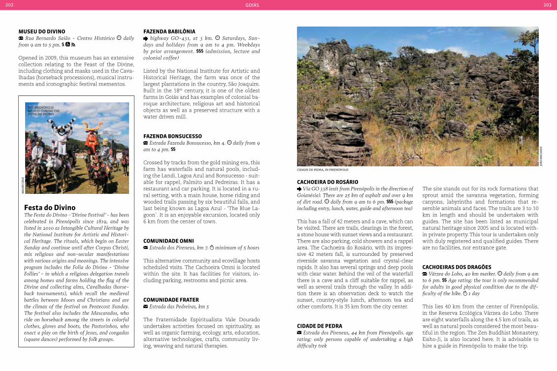
goiás202 203
Fazenda babILÔnIa highway GO-431, at 3 km. Saturdays, Sun-
days and holidays from 9 am to 4 pm. Weekdays by prior arrangement. (admission, lecture and colonial coffee)
Listed by the National Institute for Artistic and Historical Heritage, the farm was once of the largest plantations in the country, São Joaquim. Built in the 18th century, it is one of the oldest farms in Goiás and has examples of colonial ba-roque architecture, religious art and historical objects as well as a preserved structure with a water driven mill.
Fazenda bonSuceSSo Estrada Fazenda Bonsucesso, km 4. daily from 9
am to 4 pm.
Crossed by tracks from the gold mining era, this farm has waterfalls and natural pools, includ-ing the Landi, Lagoa Azul and Bonsucesso - suit-able for rappel, Palmito and Pedreiras. It has a restaurant and car parking. It is located in a ru-ral setting, with a main house, horse riding and wooded trails passing by six beautiful falls, and last being known as Lagoa Azul - ‘The Blue La-goon’. It is an enjoyable excursion, located only 6 km from the center of town.
coMunIdade oMnI Estrada dos Pireneus, km 7. minimum of 5 hours
This alternative community and ecovillage hosts scheduled visits. The Cachoeira Omni is located within the site. It has facilities for visitors, in-cluding parking, restrooms and picnic area.
coMunIdade Frater Estrada das Pedreiras, km 5
The Fraternidade Espiritualista Vale Dourado undertakes activities focused on spirituality, as well as organic farming, ecology, arts, education, alternative technologies, crafts, community liv-ing, weaving and natural therapies.
Festa do divinoThe Festa do Divino -’Divine Festival’ - has been celebrated in Pirenópolis since 1819, and was listed in 2010 as Intangible cultural Heritage by the National Institute for Artistic and Histori-cal Heritage. The rituals, which begin on Easter Sunday and continue until after corpus christi, mix religious and non-secular manifestations with various origins and meanings. The intensive program includes the Folia do Divino - ‘Divine Follies’ - in which a religious delegation travels among homes and farms holding the flag of the Divine and collecting alms, cavalhadas (horse-back tournaments), which recall the medieval battles between Moors and christians and are the climax of the festival on Pentecost Sunday. The festival also includes the Mascarados, who ride on horseback among the streets in colorful clothes, gloves and boots, the Pastorinhos, who enact a play on the birth of Jesus, and congadas (square dances) performed by folk groups.
MuSeu do dIVIno Rua Bernardo Saião - centro Histórico daily
from 9 am to 5 pm.
Opened in 2009, this museum has an extensive collection relating to the Feast of the Divine, including clothing and masks used in the Cava-lhadas (horseback processions), musical instru-ments and iconographic festival mementos.
cacHoeIra do roSárIo Via GO 338 (exit from Pirenópolis in the direction of
Goianésia). There are 25 km of asphalt and over 9 km of dirt road. daily from 9 am to 6 pm. (package including entry, lunch, water, guide and afternoon tea)
This has a fall of 42 meters and a cave, which can be visited. There are trails, clearings in the forest, a stone house with sunset views and a restaurant. There are also parking, cold showers and a rappel area. The Cachoeira do Rosário, with its impres-sive 42 meters fall, is surrounded by preserved riverside savanna vegetation and crystal-clear rapids. It also has several springs and deep pools with clear water. Behind the veil of the waterfall there is a cave and a cliff suitable for rappel, as well as several trails through the valley. In addi-tion there is an observation deck to watch the sunset, country-style lunch, afternoon tea and other comforts. It is 35 km from the city center.
cIdade de pedra Estrada dos Pireneus, 44 km from Pirenópolis. age
rating: only persons capable of undertaking a high difficulty trek
The site stands out for its rock formations that sprout amid the savanna vegetation, forming canyons, labyrinths and formations that re-semble animals and faces. The trails are 3 to 10 km in length and should be undertaken with guides. The site has been listed as municipal natural heritage since 2005 and is located with-in private property. This tour is undertaken only with duly registered and qualified guides. There are no facilities, nor entrance gate.
cacHoeIraS doS draGõeS Várzea do Lobo, 40 km marker. daily from 9 am
to 6 pm. Age rating: the tour is only recommended for adults in good physical condition due to the dif-ficulty of the hike. 1 day
This lies 40 km from the center of Pirenópolis, in the Reserva Ecológica Várzea do Lobo. There are eight waterfalls along the 4.5 km of trails, as well as natural pools considered the most beau-tiful in the region. The Zen Buddhist Monastery, Eisho-Ji, is also located here. It is advisable to hire a guide in Pirenópolis to make the trip.
cidade de Pedra, in PirenÓPolis
the PirenÓPolis masKed during the festa do divino
joã
o m
aCH
ad
o
ma
ur
o C
ru
z
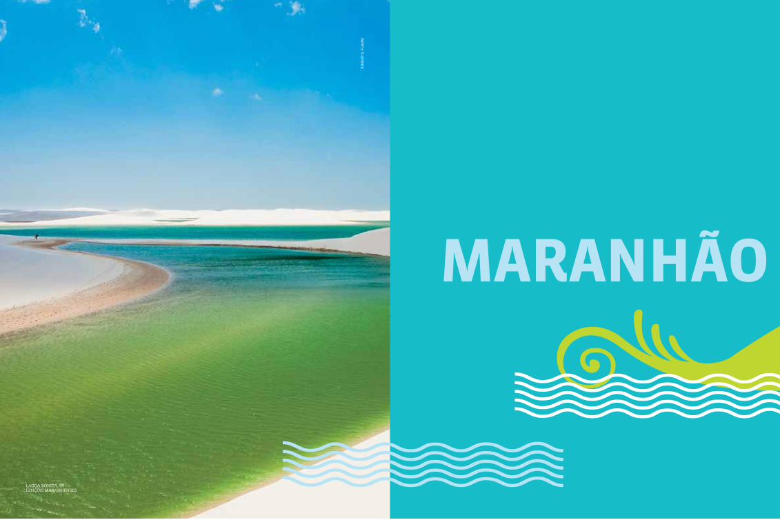
205
MaranHãor
oB
ert
s. f
lau
m
lagoa Bonita, in lençÓis maranhenses
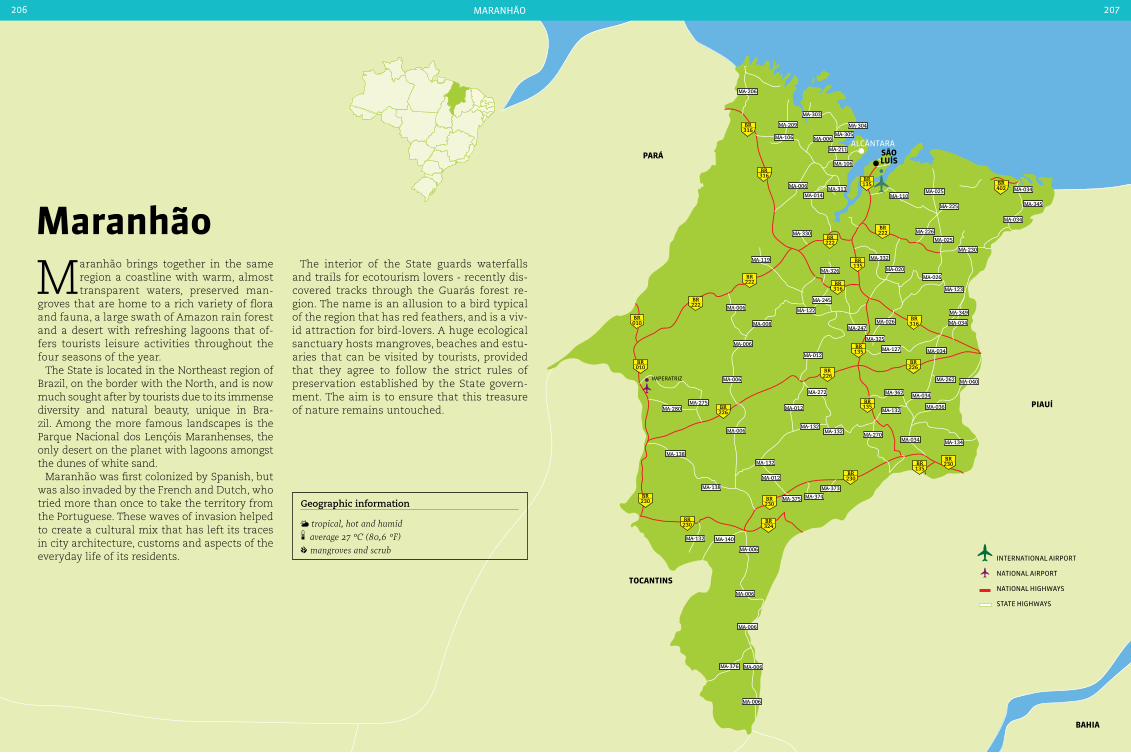
pará
pIauí
tocantInS
baHIa
316BR
316BR
222BR
222BR
402BR
226BR
226BR
230BR
230BR
230BR
226BR
222BR
316BR
316BR
135BR
135BR
135BR
222BR
010BR
010BR
230BR
230BR
324BR
135BR
135BR
MA-206
MA-209
MA-106
MA-303
MA-304
MA-305MA-006
MA-211
MA-106
MA-006
MA-014MA-313
MA-330
MA-025MA-110
MA-225
MA-226
MA-025
MA-230
MA-034
MA-345
MA-034
MA-332
MA-020MA-026
MA-123
MA-349
MA-034
MA-119
MA-326
MA-006
MA-008
MA-245
MA-122
MA-012
MA-247
MA-325
MA-127
MA-026
MA-034MA-006
MA-006
MA-275MA-280
MA-262 MA-040
MA-036
MA-034MA-362
MA-132
MA-034 MA-134MA-270
MA-132MA-132
MA-272
MA-012
MA-006
MA-132
MA-012
MA-138
MA-138
MA-132 MA-140
MA-006
MA-006
MA-006
MA-006
MA-006
MA-376
MA-375 MA-374
MA-373
São LuíS
alCântara
international airport
national airport
national HigHways
state HigHways
maranHão206 207
Maranhão
Maranhão brings together in the same region a coastline with warm, almost transparent waters, preserved man-
groves that are home to a rich variety of flora and fauna, a large swath of Amazon rain forest and a desert with refreshing lagoons that of-fers tourists leisure activities throughout the four seasons of the year.
The State is located in the Northeast region of Brazil, on the border with the North, and is now much sought after by tourists due to its immense diversity and natural beauty, unique in Bra-zil. Among the more famous landscapes is the Parque Nacional dos Lençóis Maranhenses, the only desert on the planet with lagoons amongst the dunes of white sand.
Maranhão was first colonized by Spanish, but was also invaded by the French and Dutch, who tried more than once to take the territory from the Portuguese. These waves of invasion helped to create a cultural mix that has left its traces in city architecture, customs and aspects of the everyday life of its residents.
Geographic information
tropical, hot and humid average 27 °c (80,6 °F) mangroves and scrub
The interior of the State guards waterfalls and trails for ecotourism lovers - recently dis-covered tracks through the Guarás forest re-gion. The name is an allusion to a bird typical of the region that has red feathers, and is a viv-id attraction for bird-lovers. A huge ecological sanctuary hosts mangroves, beaches and estu-aries that can be visited by tourists, provided that they agree to follow the strict rules of preservation established by the State govern-ment. The aim is to ensure that this treasure of nature remains untouched.
imperatriz

maranHão208 209
São LuíS 1,014,837 inhabitants 834.780 km2 98 220 V
Local holidaysJune 29: São Pedro’s dayJuly 28: Adhesion of Maranhão to Brazil’s IndependenceSeptember 8: Foundation of the city of São LuísDecember 8: N. Senhora da Imaculada conceição’s day
VaccinationYellow fever vaccination is recommended at least 10 days before traveling.
ClothingDue to the high temperatures, visitors should bring plenty of light clothing such as shorts and t-shirts, not forgetting the shoes suitable for long walks.
AccommodationVisitors coming to São Luís will find good accommoda-tion options at all levels, from simple inns to five star hotels. Most of them concentrated in the city center and on the seafront, especially near Avenida Litorânea.
TransportThe access highway to São Luís is the BR-135. There are bus lines connecting the capital of Maranhão to several Brazilian cities. For those who opt for air travel, São Luís has an airport that receives domestic and international flights and is only 15 minutes from the city center. The city also has Itaqui Port, which receives medium and large vessels from Brazil and other countries.
Within the cityThe city’s public transport is not very extensive. Visi-tors are recommended to rent a car or use taxis.
Stage of major disputes between the French, Dutch, Portuguese and Indians, São Luís is the capital of the second largest state in North-eastern Brazil. Located on the Ilha de Upaon-Açú (big island, in the Indian language), the City was founded by the French led by Dan-iel de La Touche with the support of the In-dian population, and was baptized Equatorial France in 1612. This period saw the start of construction of the Portuguese colonial houses in the City center, one of the most important examples of this type of architecture in the country. The cultural richness of these build-ings draws the attention of visitors coming to São Luís, as well as the beaches and wealth its wealth of cultural festivals.
monumento aos Pescadores, in são luis
Handicraftscotton, leather, wood, clay and even guarimã fiber (a leaf from a plant typical of the region) are transformed into art in the hands of local artisans who, inspired by local culture, produce sculptures, bags, pots and hats. Some of the highlights of the diverse Maranhão crafts are pieces produced from strands of buriti - a palm tree common in the region, pottery and lace.
ma
no
el p
erei
ra
/em
Br
atu
r
alB
an
i ra
mo
s/se
tur
ma
ra
nH
ão
alB
an
i ra
mo
s/se
tur
ma
ra
nH
ão
ma
no
el p
erei
ra
/em
Br
atu
r
aerial view of the igreja da sé and Palácio dos leÕes
tiles are the legacy of Portuguese colonization
centro de coMercIaLIzação de produtoS arteSanaIS (cepraMa)
Rua de São Pantaleão, 1232 - Madre Deus. Monday to Friday from 9 am to 7 pm. Saturday from
9 am to 8 pm. Sunday from 9 am to 1 pm. no charge
This warehouse served as the factory of the former ‘Companhia de Fiação e Tecidos de Cân-hamo’, and now operates as the base for the Center for Sale of Artisanal Products. There are items on sale ranging from bags and sandals made from buriti palm fiber, bobbin lace (a very thin type of lace, made on a kind of cushion), as well as miniatures of bumba-meu-boi.

maranHão210 211
Fonte daS pedraS Rua São João, no mumber - Tirirical
In addition to serving as a resting place and attracting many tourists, this water head has historical significance for the City. In 1615 it was here that Captain Jeronimo de Albu-querque camped with his troops prior to the battle to expel the French who had tried to invade the region. There are underground galleries, fountains and gargoyles carved in stone in colonial style.
praIa ponta d’areIa Via Avenida dos Holandeses and Avenida Ferreira
Goulart. Taxi or car are the easiest ways to get there. Public transport is not recommended Despite its water not being fit for bathing, the Ponta D’Areia beach attracts many tourists who are visiting São Luís. In addition to good tourist facilities, there are bars, restaurants and sever-al reggae clubs - a rhythm that is popular in the capital of Maranhão - attracting many young people to the beach.
MuSeu HIStÓrIco e artíStIco do MaranHão
Rua do Sol, 302 - centro. Tuesday to Sunday, from 9 am to 3:30 pm. guided tours are free
The Museu Histórico e Artístico do Maranhão houses a collection of furniture, porcelain, crys-tal and glass that belonged to the wealthiest families in town in the 18th and 19th centuries. The house, which was formerly the Solar Gomes de Sousa - one of the wealthy City residents in the past - also has an observatory with a view of vessels entering the Baía de São Marcos.
MuSeu de arte Sacra Rua Treze de Maio, 500 - centro. Monday to
Friday from 9 am to 6:30 pm. Saturdays and Sundays from 2 pm to 6 pm.
Folk FestivalsThe region’s folk festivals are rich in Portu-guese, Indian and African traditions. Among them is São João, a festival that takes place in many towns throughout the Northeast. The Tambor crioula - ‘creole Drum’ - a traditional African festival, gained the status of Intangible Brazilian cultural Heritage from UNEScO in 2007. The festivities mix song and dance in a parade honoring São Benedito. Traditionally the festivities do not have a fixed date, how-ever parades and small groups small celebrating this folk festival can occur on the streets or in squares in the State.
praIa de São MarcoS Via Avenida Litorânea and Avenida dos Holande-
ses. Taxi or car are the easiest ways to get there
As well as the agitated night life due to the bars along its entire length, the beach also tends to be crowded during the day, especially with surfers who take advantage of its big waves. The land-scape is formed by dunes and by what remains of Forte de São Marcos, built in the 18th century and giving rise to the name of the beach.
praIa do caLHau Via Avenida Litorânea and Avenida dos Holande-
ses. Taxi or car are the easiest ways to get there
This beach draws visitors due to its clear and calm waters and for the dunes and vegetation along its entire length, forming a beautiful landscape. The kiosks and restaurants located on stilts, a type of pile supporting buildings in maritime areas, help complete the appear-ance. Sports fans practicing running and cy-cling are amongst the visitors to the beach, in addition to families.
são joão festival
lagoa jansen
ma
no
el p
erei
ra
/em
Br
atu
r
setu
r-m
a
The Museu de Arte Sacra houses images of saints that were used in Holy Week processions. The collection also has religious objects from the 18th to 20th centuries, such as painted vases, crosses and priest and bishop’s robes.
parQue ecoLÓGIco LaGoa da JanSen Avenida dos Holandeses, no number - Ponta da
Areia. daily from 6 am to 6 pm. no charge
Ana Jansen was a major landowner during the colonial era in São Luís. The park that bears her name was built in around 150 hectares sur-rounding a lake with the same name, home to preserved species of native fauna and flora. The park includes sports courts and tracks for run-ning, football, basketball and volleyball, which are open to the public.
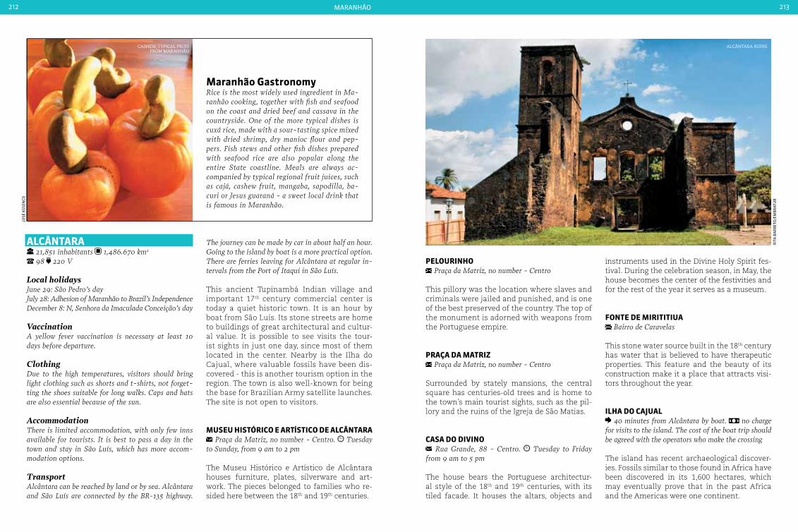
maranHão212 213
aLcÂntara 21,851 inhabitants 1,486.670 km2 98 220 V
Local holidaysJune 29: São Pedro’s dayJuly 28: Adhesion of Maranhão to Brazil’s IndependenceDecember 8: N, Senhora da Imaculada conceição’s day
VaccinationA yellow fever vaccination is necessary at least 10 days before departure.
ClothingDue to the high temperatures, visitors should bring light clothing such as shorts and t-shirts, not forget-ting the shoes suitable for long walks. caps and hats are also essential because of the sun.
AccommodationThere is limited accommodation, with only few inns available for tourists. It is best to pass a day in the town and stay in São Luís, which has more accom-modation options.
TransportAlcântara can be reached by land or by sea. Alcântara and São Luís are connected by the BR-135 highway.
The journey can be made by car in about half an hour. Going to the island by boat is a more practical option. There are ferries leaving for Alcântara at regular in-tervals from the Port of Itaqui in São Luís.
This ancient Tupinambá Indian village and important 17th century commercial center is today a quiet historic town. It is an hour by boat from São Luís. Its stone streets are home to buildings of great architectural and cultur-al value. It is possible to see visits the tour-ist sights in just one day, since most of them located in the center. Nearby is the Ilha do Cajual, where valuable fossils have been dis-covered - this is another tourism option in the region. The town is also well-known for being the base for Brazilian Army satellite launches. The site is not open to visitors.
MuSeu HIStÓrIco e artíStIco de aLcÂntara Praça da Matriz, no number - centro. Tuesday
to Sunday, from 9 am to 2 pm
The Museu Histórico e Artístico de Alcântara houses furniture, plates, silverware and art-work. The pieces belonged to families who re-sided here between the 18th and 19th centuries.
Maranhão GastronomyRice is the most widely used ingredient in Ma-ranhão cooking, together with fish and seafood on the coast and dried beef and cassava in the countryside. One of the more typical dishes is cuxá rice, made with a sour-tasting spice mixed with dried shrimp, dry manioc flour and pep-pers. Fish stews and other fish dishes prepared with seafood rice are also popular along the entire State coastline. Meals are always ac-companied by typical regional fruit juices, such as cajá, cashew fruit, mangaba, sapodilla, ba-curi or Jesus guaraná - a sweet local drink that is famous in Maranhão.
peLourInHo Praça da Matriz, no number - centro
This pillory was the location where slaves and criminals were jailed and punished, and is one of the best preserved of the country. The top of the monument is adorned with weapons from the Portuguese empire.
praça da MatrIz Praça da Matriz, no number - centro
Surrounded by stately mansions, the central square has centuries-old trees and is home to the town’s main tourist sights, such as the pil-lory and the ruins of the Igreja de São Matias.
caSa do dIVIno Rua Grande, 88 - centro. Tuesday to Friday
from 9 am to 5 pm
The house bears the Portuguese architectur-al style of the 18th and 19th centuries, with its tiled facade. It houses the altars, objects and
instruments used in the Divine Holy Spirit fes-tival. During the celebration season, in May, the house becomes the center of the festivities and for the rest of the year it serves as a museum.
Fonte de MIrItItIua Bairro de caravelas
This stone water source built in the 18th century has water that is believed to have therapeutic properties. This feature and the beauty of its construction make it a place that attracts visi-tors throughout the year.
ILHa do caJuaL 40 minutes from Alcântara by boat. no charge
for visits to the island. The cost of the boat trip should be agreed with the operators who make the crossing
The island has recent archaeological discover-ies. Fossils similar to those found in Africa have been discovered in its 1,600 hectares, which may eventually prove that in the past Africa and the Americas were one continent.
cashew, tyPical fruit from maranhão
josé
ass
enCo
alcÂntara ruins
rit
a B
ar
ret
o/e
mB
rat
ur
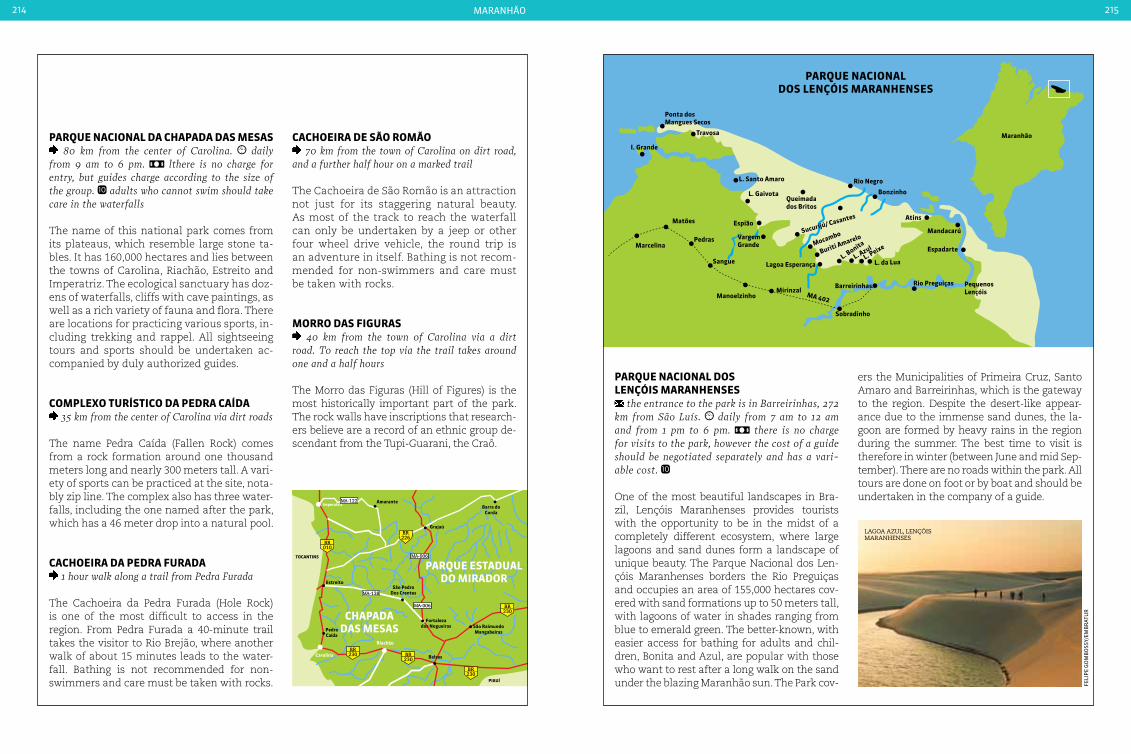
maranHão214 215
Ponta dosMangues Secos
Travosa
I. Grande
Matões
Pedras
Sangue
ManoelzinhoMirinzal
Rio Preguiças
Bonzinho
Rio Negro
PARQUE NACIONAL DOS LENÇÓIS MARANHENSES
Maranhão
MocamboSucurijú/ Casantes
L. da Lua
Buriti Amarelo
L. Bonita
L. AzulL. Peixe
Sobradinho
Barreirinhas
Espião
VargemGrande
Lagoa Esperança
Queimadados Britos
PequenosLençóis
Espadarte
Atins
Mandacarú
L. Santo Amaro
L. Gaivota
Marcelina
MA 402
Amarante
Grajaú
EstreitoSão Pedro
Dos Crentes
São RaimundoMangabeiras
Balsas
PedraCaída
Imperatriz
Riachão
Carolina
Fortalezados Nogueiras
Barra doCorda
cHapada daS MeSaS
parQue eStaduaL do MIrador
tocantInS
pIauí
010BR
226BR
230BR
230BR
230BR
230BR
MA-138
MA-006
MA-122
MA-006
parQue nacIonaL da cHapada daS MeSaS 80 km from the center of carolina. daily
from 9 am to 6 pm. lthere is no charge for entry, but guides charge according to the size of the group. adults who cannot swim should take care in the waterfalls
The name of this national park comes from its plateaus, which resemble large stone ta-bles. It has 160,000 hectares and lies between the towns of Carolina, Riachão, Estreito and Imperatriz. The ecological sanctuary has doz-ens of waterfalls, cliffs with cave paintings, as well as a rich variety of fauna and flora. There are locations for practicing various sports, in-cluding trekking and rappel. All sightseeing tours and sports should be undertaken ac-companied by duly authorized guides.
coMpLexo turíStIco da pedra caída 35 km from the center of carolina via dirt roads
The name Pedra Caída (Fallen Rock) comes from a rock formation around one thousand meters long and nearly 300 meters tall. A vari-ety of sports can be practiced at the site, nota-bly zip line. The complex also has three water-falls, including the one named after the park, which has a 46 meter drop into a natural pool.
cacHoeIra da pedra Furada 1 hour walk along a trail from Pedra Furada
The Cachoeira da Pedra Furada (Hole Rock) is one of the most difficult to access in the region. From Pedra Furada a 40-minute trail takes the visitor to Rio Brejão, where another walk of about 15 minutes leads to the water-fall. Bathing is not recommended for non-swimmers and care must be taken with rocks.
cacHoeIra de São roMão 70 km from the town of carolina on dirt road,
and a further half hour on a marked trail
The Cachoeira de São Romão is an attraction not just for its staggering natural beauty. As most of the track to reach the waterfall can only be undertaken by a jeep or other four wheel drive vehicle, the round trip is an adventure in itself. Bathing is not recom-mended for non-swimmers and care must be taken with rocks.
Morro daS FIGuraS 40 km from the town of carolina via a dirt
road. To reach the top via the trail takes around one and a half hours
The Morro das Figuras (Hill of Figures) is the most historically important part of the park. The rock walls have inscriptions that research-ers believe are a record of an ethnic group de-scendant from the Tupi-Guarani, the Craô.
parQue nacIonaL doS LençÓIS MaranHenSeS
the entrance to the park is in Barreirinhas, 272 km from São Luís. daily from 7 am to 12 am and from 1 pm to 6 pm. there is no charge for visits to the park, however the cost of a guide should be negotiated separately and has a vari-able cost.
One of the most beautiful landscapes in Bra-zil, Lençóis Maranhenses provides tourists with the opportunity to be in the midst of a completely different ecosystem, where large lagoons and sand dunes form a landscape of unique beauty. The Parque Nacional dos Len-çóis Maranhenses borders the Rio Preguiças and occupies an area of 155,000 hectares cov-ered with sand formations up to 50 meters tall, with lagoons of water in shades ranging from blue to emerald green. The better-known, with easier access for bathing for adults and chil-dren, Bonita and Azul, are popular with those who want to rest after a long walk on the sand under the blazing Maranhão sun. The Park cov-
ers the Municipalities of Primeira Cruz, Santo Amaro and Barreirinhas, which is the gateway to the region. Despite the desert-like appear-ance due to the immense sand dunes, the la-goon are formed by heavy rains in the region during the summer. The best time to visit is therefore in winter (between June and mid Sep-tember). There are no roads within the park. All tours are done on foot or by boat and should be undertaken in the company of a guide.
feli
pe
go
mB
oss
y/em
Br
atu
r
lagoa azul, lençÓis maranhenses

217
MatoGroSSo
sunset on the rio Paraguai
pep
e m
eleg
a/e
mB
rat
ur

cuIabá
noBres
CáCeres
364BR
364BR
364BR
364BR
163BR
070BR
070BR
158BR
158BR
242BR
174BR
163BR 251
BR
163BR
163BR
MT-100
MT-110MT-110 MT-109
MT-448
MT-020MT-129
MT-020
MT-130
MT-130
MT-338
MT-241
MT-351MT-140
MT-235
MT-338
MT-020
MT-326
MT-246
MT-130
MT-242
MT-322
MT-430MT-431
MT-432
MT-413
MT-412
Mato GroSSo do SuL
GoIáS
MT-199
MT-473
MT-265 MT-388
MT-358
MT-339
MT-343
MT-060
MT-351
MT-050
MT-471 MT-458
MT-370
MT-461
MT-107
MT-110
MT-110
MT-336
MT-160
MT-160
MT-409MT-343
MT-415
MT-388
MT-248
MT-250
MT-206
MT-418
MT-208
MT-208
MT-208
MT-410
MT-423
MT-423
MT-442
MT-225
MT-140
MT-206
MT-325 MT-010
MT-320
MT-160
MT-420
MT-170
MT-235
MT-388
MT-255MT-255
MT-235 MT-358
MT-220MT-319
MT-220
MT-328
MT-338
MT-010
MT-160
MT-160
MT-170
MT-322
MT-320
aMazonaS
pará
mato grosso218 219
Geographic information
tropical, hot and humid annual average of 24 Oc (75,2 OF) savanna
Mato GroSSo
Located in central Brazil, the State brings together several of the world’s great natural attractions: 10% of the Amazon
rainforest lies in the State, with its exuber-ant vegetation and impressive biodiversity. One third of the Brazilian part of the Pantanal wetlands is the main tourist attraction in the State, next to the Chapada dos Guimarães. Not to mention large areas on the margins of the Rio Araguaia that provide Mato Grosso with a second Pantanal thanks to the extent of the wetlands from the river’s waters. Finally, the State is home to more than 40 indigenous groups, an interesting historical heritage, and a cuisine influenced by the diversity of natural resources and the mixture of cultures.
The starting point to enjoy all that Mato Grosso has to offer is the Pantanal. The largest wetland in the world is one of nature’s wonders, and is shared by Brazil, Bolivia and Uruguay. The Bra-zilian side of the Pantanal is becoming an ever more important location for bird watchers, and the large variety of birds found in the region at-tracts both Brazilian and foreign ornithologists. Among the species found in the Pantanal is the tuitiú - Jabiru Stork - which is the symbol of the Pantanal, the black hawk and Spix’s Macaw.
Although most of the land area of the Pan-tanal is located in the neighboring State of Mato Grosso do Sul, the Mato Grosso wetlands compensate with a second Pantanal - the Araguaia. The Rio Araguaia is another of the State’s tourism attractions. Clear waters and the white sandy beaches fringing the length
of the river during the dry season provide visi-tors with the opportunity to enjoy the sun in the midst of the region’s unspoiled nature.
Visitors will have the opportunity to learn more about indigenous culture at first hand. Some Indian villages allow visitors to participate in tribal dances and chants, however, the largest indigenous reserve in the world, Território do Xingu, is not open to visitors. The reserve was established in 1960 and is home to 16 different ethnic groups that together represent the great-est indigenous cultural diversity on earth.
The Chapada dos Guimarães has rock forma-tions and hiking trails that lead tourists to in-credible landscapes. The region, which is sub-ject to environmental protection, also offers adventure sports such as rafting and rappel. Natural pools and waterfalls flowing over rock cliffs are the picture-postcards of the region. A new type of tourist is also being attracted to the region, looking for places that are considered to be mystical. Many UFO seekers and esoter-ics are among the visitors. Mystics believe that the Cerrado region, including Mato Grosso, is a point of healing for the planet, and they come to Mato Grosso for periods of contemplation.
Following outdoor activities in direct contact with nature, visitors can enjoy a varied local cuisine ranging from grilled fish in riverside areas to dishes like ‘Maria Isabel’ (dried meat with rice), pacu (a relative of the piranha) baked with cabbage, dried meat with banana flour, and Pantanal-style barbecue - a local variation created by cattle drovers.
international airport
national HigHways
state HigHways
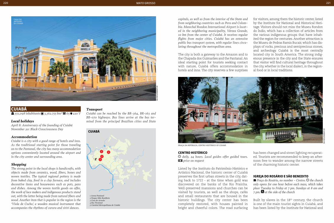
mato grosso220 221
casa do artesãoin cuiaBá
Praça da rePúBlica, centro histÓrico of cuiaBá
cuIabá 551,098 inhabitants 3,362.755 km² 65 220 V
Local holidaysApril 8: Anniversary of the founding of cuiabáNovember 20: Black consciousness Day
Accommodationcuiabá is a city with a good range of hotels and inns. As the traditional starting point for those traveling on to the Pantanal, the city has many accommodation options conveniently located around the airport and in the city center and surrounding area.
ShoppingThe strong point in the local shops is handicrafts, with objects made from ceramics, wood, fibers, bones and woven textiles. The typical regional pottery is made from baked clay, fired in a clay furnace, and includes decorative items and housewares such as pots, pans and dishes. Among the woven textile goods on offer, the work of lace makers and indigenous products stand out, with the latter being made from natural fibers and wood. Another item that is popular in the region is the ‘Viola de cocho’, a wooden musical instrument that accompanies the rhythms of cururu and siriri dances.
Transportcuiabá can be reached by the BR-364, BR-163 and BR-070 highways. Bus lines arrive at the bus ter-minal from the principal Brazilian cities and State
capitals, as well as from the interior of the State and from neighboring countries such as Peru and colom-bia. Marechal Rondon International Airport is locat-ed in the neighboring municipality, Várzea Grande, 10 km from the center of cuiabá. It receives regular flights from major cities. cuiabá has an extensive public bus transport system, with regular lines circu-lating throughout the metropolitan area.
The city is both a gateway to the Amazon and to the Chapada dos Guimarães and the Pantanal. An ideal starting point for tourists seeking contact with nature, Cuiabá offers accommodation in hotels and inns. The city reserves a few surprises
centro HIStÓrIco daily, 24 hours. Local guides offer guided tours.
price on request
Listed by the Instituto do Patrimônio Histórico e Artístico Nacional, the historic center of Cuiabá preserves the first urban streets in the city, dat-ing back to 1722 - at the time when gold was discovered on the banks of the Rio Prainha. Well-preserved mansions and churches can be visited by tourists, as well as the shops, cafés and small restaurants that are housed in the historic buildings. The city center has been completely restored, with houses painted in bright and cheerful colors. The road surfacing
for visitors, among them the historic center, listed by the Institute for National and Historical Heri-tage. Visitors should not miss the Museu Rondon do Índio, which has a collection of articles from the various indigenous groups that have inhab-ited the region for centuries. Another attraction is the Museu de Pedras Ramis Bucair, which has dis-plays of rocks, precious and semiprecious stones, and archeology. Cuiabá is the most centrally located city in South America. The strong indig-enous presence in the city and the State ensures that visitor will find cultural heritage throughout the city, whether in the local dialect, in the region-al food or in local traditions.
has been changed and street lighting recuperat-ed. Tourists are recommended to keep an after-noon free to wander among the narrow streets of the charming historic center.
IGreJa do roSárIo e São benedIto Praça do Rosário, no number - centro. the church
only opens for one hour before each mass, which takes place Tuesday to Friday at 7 pm. Sundays at 8 am and 7 pm. at the side of the church
Built by slaves in the 18th century, the church is one of the main tourist sights in Cuiabá, and has been listed by the Institute for National and
ra
i rei
s/em
Br
atu
r
ra
i rei
s/em
Br
atu
r
1
1 Arena Pantanal2 Parque Mãe Bonifácia3 Casa do Artesão4 Bus Terminal5 Catedral Metropolitana de Cuiabá
2 4
3
5
cuIabá

mato grosso222 223
CUIABÁ
NOBRES
MT-361
MT-351
MT-241
MT-140
MT-140
MT-344
CAMPOVERDE
JACIARA
1
2
3
910
11
78
12
13
14
15
16
4
6
5
364BR
251BR
251BR
MuSeu de pedraS raMIS bucaIr Rua Galdino Pimentel, 195 - centro. Monday to
Friday, from 7 am to 11 am and from 1 pm to 4 pm
The museum houses rocks, precious and semi-precious stones, and hundreds of archeologi-cal finds. Worthy of particular attention are the Indian artifacts, cave paintings, the femur of a Tyrannosaurus more than 100 million years old, and Neolithic stone axes that were discovered in the region.
SeSc caSa do arteSão Rua 13 de junho, 315 - Porto. Monday to Fri-
day from 8:30 am to 5 pm. Saturdays from 8:30 am to 1 pm.
This is located in a listed historic building that was previously used as a school in the early 20th century. The former classrooms now house wooden handicrafts, rattan made from palm
tyPical handicrafts from mato grosso Parque nacional chaPada dos guimarães
Historical Heritage. Its architecture is typical of the Brazilian colonial period, and its interior is home to rich gilt and silver decorative rococo-baroque altars.
MuSeu rondon do índIo UFMT campus (Federal University of Mato Grosso),
Avenida Fernando correia da costa, no number, coxipó. Tuesday to Friday, from 7:30 am to 11:30 am and
from 1:30 pm to 5:30 pm. Saturdays and Sundays, from 7:30 am to 11:30 am.
Inaugurated in 1972, the museum has one of the largest national collections relating to in-digenous culture, with over 16,000 publications. The audiovisual archive includes photographs and films of the rituals and activities of vari-ous indigenous groups. It is open to the public, but visits should be scheduled in advance. The museum also operates a research center on in-digenous life and culture.
fiber, weaving, indigenous works, bio-jewelry made from a wide range of local seeds, ceram-ics and regional deserts.
parQue nacIonaL cHapada doS GuIMarãeS Emanuel Pinheiro Highway (MT-251), km 51, in
chapada dos Guimarães. Saturdays, Sundays and public holidays, from 8 am to 5 pm. prices charged by independent guides accredited to operate in the park are negotiated directly with the guide or with a tour operator. for a group of four people
Amid sandstone walls in shades of red and orange, giant rock formations, caves, canyons and lookouts, many hundreds of species of savanna fauna and flora are unveiled to the eyes of visitors. The scenery is completed with waterfalls, rivers and streams that run through the 33,000 hectares of the diverse topography of the Parque Nacional Chapada dos Guimarães. A Natural Heritage Site, listed
rit
a B
ar
ret
o/e
mB
rat
ur
pau
lo r
iBa
s jr
cHapada doS GuIMarãeS
1 Gruta da Cerquinha2 Ribeirão Estivado3 Gruta da Lagoa Azul4 Cascada do Pingador5 Morro do Japão6 Lago do Manso
7 Mirante da Lage8 Curral da Pedra9 Balneário Rio Claro10 Véu da Noiva11 Alto do Céu12 Pedra Grande
13 Chalé dos Governavdores
14 Lagoa Azul15 Cascada Rio
das Mortes16 Baia Chacororé
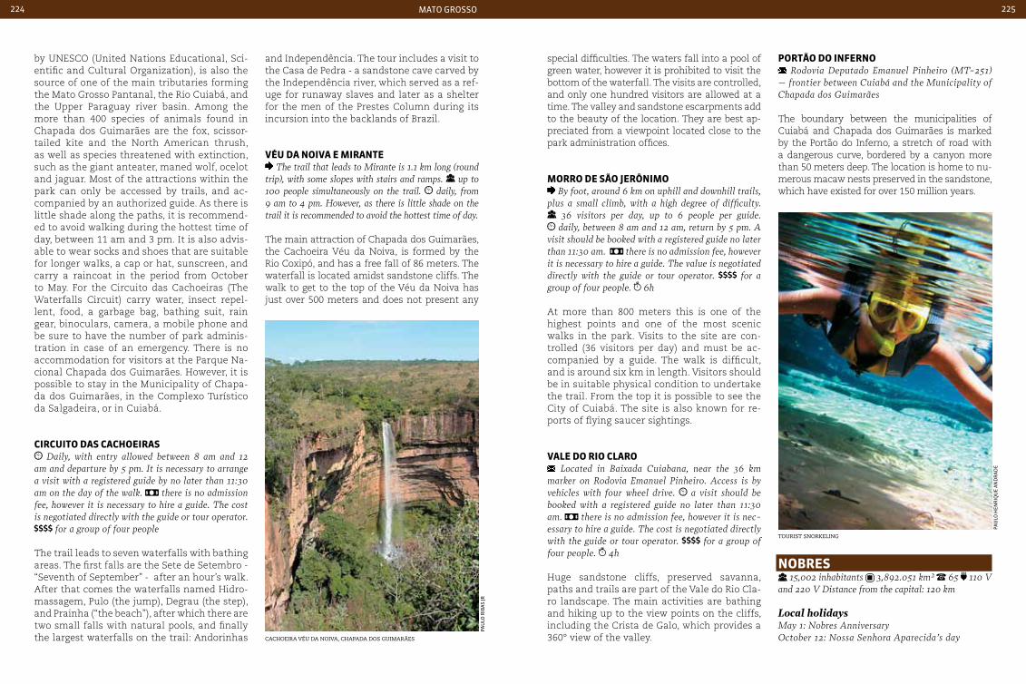
mato grosso224 225
by UNESCO (United Nations Educational, Sci-entific and Cultural Organization), is also the source of one of the main tributaries forming the Mato Grosso Pantanal, the Rio Cuiabá, and the Upper Paraguay river basin. Among the more than 400 species of animals found in Chapada dos Guimarães are the fox, scissor-tailed kite and the North American thrush, as well as species threatened with extinction, such as the giant anteater, maned wolf, ocelot and jaguar. Most of the attractions within the park can only be accessed by trails, and ac-companied by an authorized guide. As there is little shade along the paths, it is recommend-ed to avoid walking during the hottest time of day, between 11 am and 3 pm. It is also advis-able to wear socks and shoes that are suitable for longer walks, a cap or hat, sunscreen, and carry a raincoat in the period from October to May. For the Circuito das Cachoeiras (The Waterfalls Circuit) carry water, insect repel-lent, food, a garbage bag, bathing suit, rain gear, binoculars, camera, a mobile phone and be sure to have the number of park adminis-tration in case of an emergency. There is no accommodation for visitors at the Parque Na-cional Chapada dos Guimarães. However, it is possible to stay in the Municipality of Chapa-da dos Guimarães, in the Complexo Turístico da Salgadeira, or in Cuiabá.
cIrcuIto daS cacHoeIraS Daily, with entry allowed between 8 am and 12
am and departure by 5 pm. It is necessary to arrange a visit with a registered guide by no later than 11:30 am on the day of the walk. there is no admission fee, however it is necessary to hire a guide. The cost is negotiated directly with the guide or tour operator.
for a group of four people
The trail leads to seven waterfalls with bathing areas. The first falls are the Sete de Setembro - “Seventh of September” - after an hour’s walk. After that comes the waterfalls named Hidro-massagem, Pulo (the jump), Degrau (the step), and Prainha (“the beach”), after which there are two small falls with natural pools, and finally the largest waterfalls on the trail: Andorinhas
and Independência. The tour includes a visit to the Casa de Pedra - a sandstone cave carved by the Independência river, which served as a ref-uge for runaway slaves and later as a shelter for the men of the Prestes Column during its incursion into the backlands of Brazil.
VÉu da noIVa e MIrante The trail that leads to Mirante is 1.1 km long (round
trip), with some slopes with stairs and ramps. up to 100 people simultaneously on the trail. daily, from 9 am to 4 pm. However, as there is little shade on the trail it is recommended to avoid the hottest time of day.
The main attraction of Chapada dos Guimarães, the Cachoeira Véu da Noiva, is formed by the Rio Coxipó, and has a free fall of 86 meters. The waterfall is located amidst sandstone cliffs. The walk to get to the top of the Véu da Noiva has just over 500 meters and does not present any
portão do InFerno Rodovia Deputado Emanuel Pinheiro (MT-251)
– frontier between cuiabá and the Municipality of chapada dos Guimarães
The boundary between the municipalities of Cuiabá and Chapada dos Guimarães is marked by the Portão do Inferno, a stretch of road with a dangerous curve, bordered by a canyon more than 50 meters deep. The location is home to nu-merous macaw nests preserved in the sandstone, which have existed for over 150 million years.
special difficulties. The waters fall into a pool of green water, however it is prohibited to visit the bottom of the waterfall. The visits are controlled, and only one hundred visitors are allowed at a time. The valley and sandstone escarpments add to the beauty of the location. They are best ap-preciated from a viewpoint located close to the park administration offices.
Morro de São JerÔnIMo By foot, around 6 km on uphill and downhill trails,
plus a small climb, with a high degree of difficulty. 36 visitors per day, up to 6 people per guide. daily, between 8 am and 12 am, return by 5 pm. A
visit should be booked with a registered guide no later than 11:30 am. there is no admission fee, however it is necessary to hire a guide. The value is negotiated directly with the guide or tour operator. for a group of four people. 6h
At more than 800 meters this is one of the highest points and one of the most scenic walks in the park. Visits to the site are con-trolled (36 visitors per day) and must be ac-companied by a guide. The walk is difficult, and is around six km in length. Visitors should be in suitable physical condition to undertake the trail. From the top it is possible to see the City of Cuiabá. The site is also known for re-ports of flying saucer sightings.
VaLe do rIo cLaro Located in Baixada cuiabana, near the 36 km
marker on Rodovia Emanuel Pinheiro. Access is by vehicles with four wheel drive. a visit should be booked with a registered guide no later than 11:30 am. there is no admission fee, however it is nec-essary to hire a guide. The cost is negotiated directly with the guide or tour operator. for a group of four people. 4h
Huge sandstone cliffs, preserved savanna, paths and trails are part of the Vale do Rio Cla-ro landscape. The main activities are bathing and hiking up to the view points on the cliffs, including the Crista de Galo, which provides a 360° view of the valley.cachoeira véu da noiva, chaPada dos guimarães
tourist snorKeling
nobreS 15,002 inhabitants 3,892.051 km² 65 110 V
and 220 V Distance from the capital: 120 km
Local holidaysMay 1: Nobres AnniversaryOctober 12: Nossa Senhora Aparecida’s day
pau
lo r
iBa
s jr
pau
lo H
enr
iQu
e a
nd
ra
de
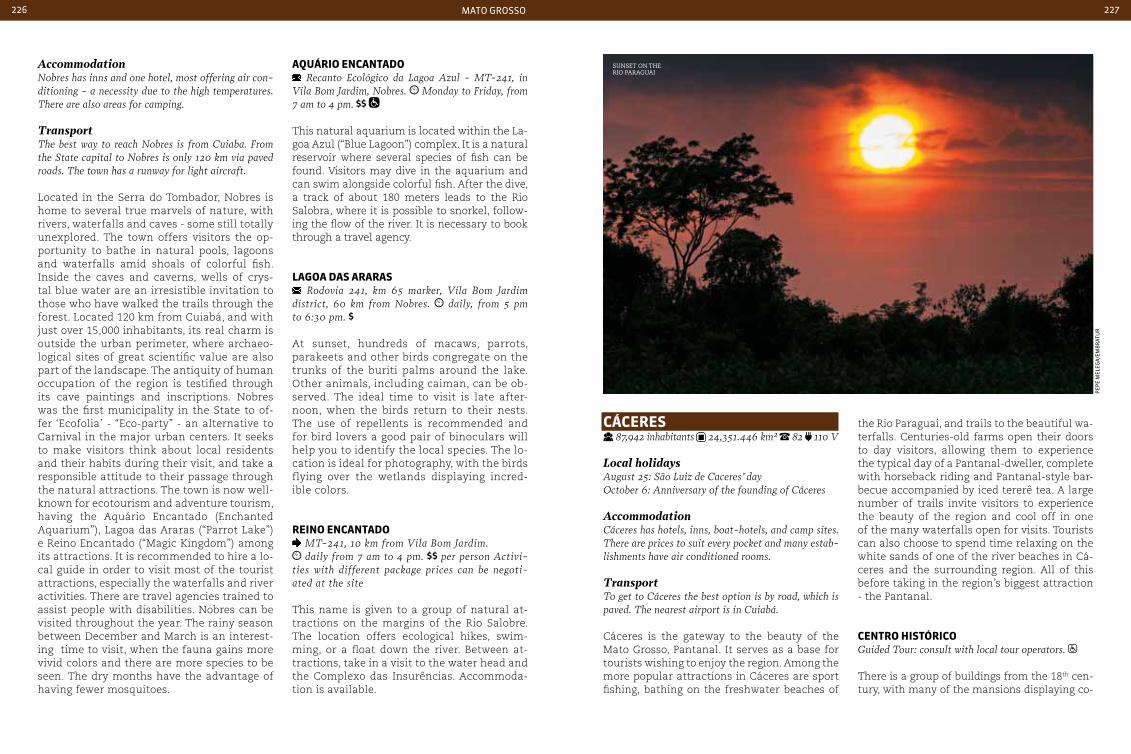
mato grosso226 227
aQuárIo encantado Recanto Ecológico da Lagoa Azul - MT-241, in
Vila Bom Jardim, Nobres. Monday to Friday, from 7 am to 4 pm.
This natural aquarium is located within the La-goa Azul (“Blue Lagoon”) complex. It is a natural reservoir where several species of fish can be found. Visitors may dive in the aquarium and can swim alongside colorful fish. After the dive, a track of about 180 meters leads to the Rio Salobra, where it is possible to snorkel, follow-ing the flow of the river. It is necessary to book through a travel agency.
LaGoa daS araraS Rodovia 241, km 65 marker, Vila Bom Jardim
district, 60 km from Nobres. daily, from 5 pm to 6:30 pm.
At sunset, hundreds of macaws, parrots, parakeets and other birds congregate on the trunks of the buriti palms around the lake. Other animals, including caiman, can be ob-served. The ideal time to visit is late after-noon, when the birds return to their nests. The use of repellents is recommended and for bird lovers a good pair of binoculars will help you to identify the local species. The lo-cation is ideal for photography, with the birds flying over the wetlands displaying incred-ible colors.
reIno encantado MT-241, 10 km from Vila Bom Jardim. daily from 7 am to 4 pm. per person Activi-
ties with different package prices can be negoti-ated at the site
This name is given to a group of natural at-tractions on the margins of the Rio Salobre. The location offers ecological hikes, swim-ming, or a float down the river. Between at-tractions, take in a visit to the water head and the Complexo das Insurências. Accommoda-tion is available.
cácereS 87,942 inhabitants 24,351.446 km² 82 110 V
Local holidaysAugust 25: São Luiz de caceres’ dayOctober 6: Anniversary of the founding of cáceres
Accommodationcáceres has hotels, inns, boat-hotels, and camp sites. There are prices to suit every pocket and many estab-lishments have air conditioned rooms.
TransportTo get to cáceres the best option is by road, which is paved. The nearest airport is in cuiabá.
Cáceres is the gateway to the beauty of the Mato Grosso, Pantanal. It serves as a base for tourists wishing to enjoy the region. Among the more popular attractions in Cáceres are sport fishing, bathing on the freshwater beaches of
the Rio Paraguai, and trails to the beautiful wa-terfalls. Centuries-old farms open their doors to day visitors, allowing them to experience the typical day of a Pantanal-dweller, complete with horseback riding and Pantanal-style bar-becue accompanied by iced tererê tea. A large number of trails invite visitors to experience the beauty of the region and cool off in one of the many waterfalls open for visits. Tourists can also choose to spend time relaxing on the white sands of one of the river beaches in Cá-ceres and the surrounding region. All of this before taking in the region’s biggest attraction - the Pantanal.
centro HIStÓrIcoGuided Tour: consult with local tour operators.
There is a group of buildings from the 18th cen-tury, with many of the mansions displaying co-
AccommodationNobres has inns and one hotel, most offering air con-ditioning - a necessity due to the high temperatures. There are also areas for camping.
TransportThe best way to reach Nobres is from cuiaba. From the State capital to Nobres is only 120 km via paved roads. The town has a runway for light aircraft.
Located in the Serra do Tombador, Nobres is home to several true marvels of nature, with rivers, waterfalls and caves - some still totally unexplored. The town offers visitors the op-portunity to bathe in natural pools, lagoons and waterfalls amid shoals of colorful fish. Inside the caves and caverns, wells of crys-tal blue water are an irresistible invitation to those who have walked the trails through the forest. Located 120 km from Cuiabá, and with just over 15,000 inhabitants, its real charm is outside the urban perimeter, where archaeo-logical sites of great scientific value are also part of the landscape. The antiquity of human occupation of the region is testified through its cave paintings and inscriptions. Nobres was the first municipality in the State to of-fer ‘Ecofolia’ - “Eco-party” - an alternative to Carnival in the major urban centers. It seeks to make visitors think about local residents and their habits during their visit, and take a responsible attitude to their passage through the natural attractions. The town is now well-known for ecotourism and adventure tourism, having the Aquário Encantado (Enchanted Aquarium”), Lagoa das Araras (“Parrot Lake”) e Reino Encantado (“Magic Kingdom”) among its attractions. It is recommended to hire a lo-cal guide in order to visit most of the tourist attractions, especially the waterfalls and river activities. There are travel agencies trained to assist people with disabilities. Nobres can be visited throughout the year. The rainy season between December and March is an interest-ing time to visit, when the fauna gains more vivid colors and there are more species to be seen. The dry months have the advantage of having fewer mosquitoes.
sunset on the rio Paraguai
pep
e m
eleg
a/e
mB
rat
ur
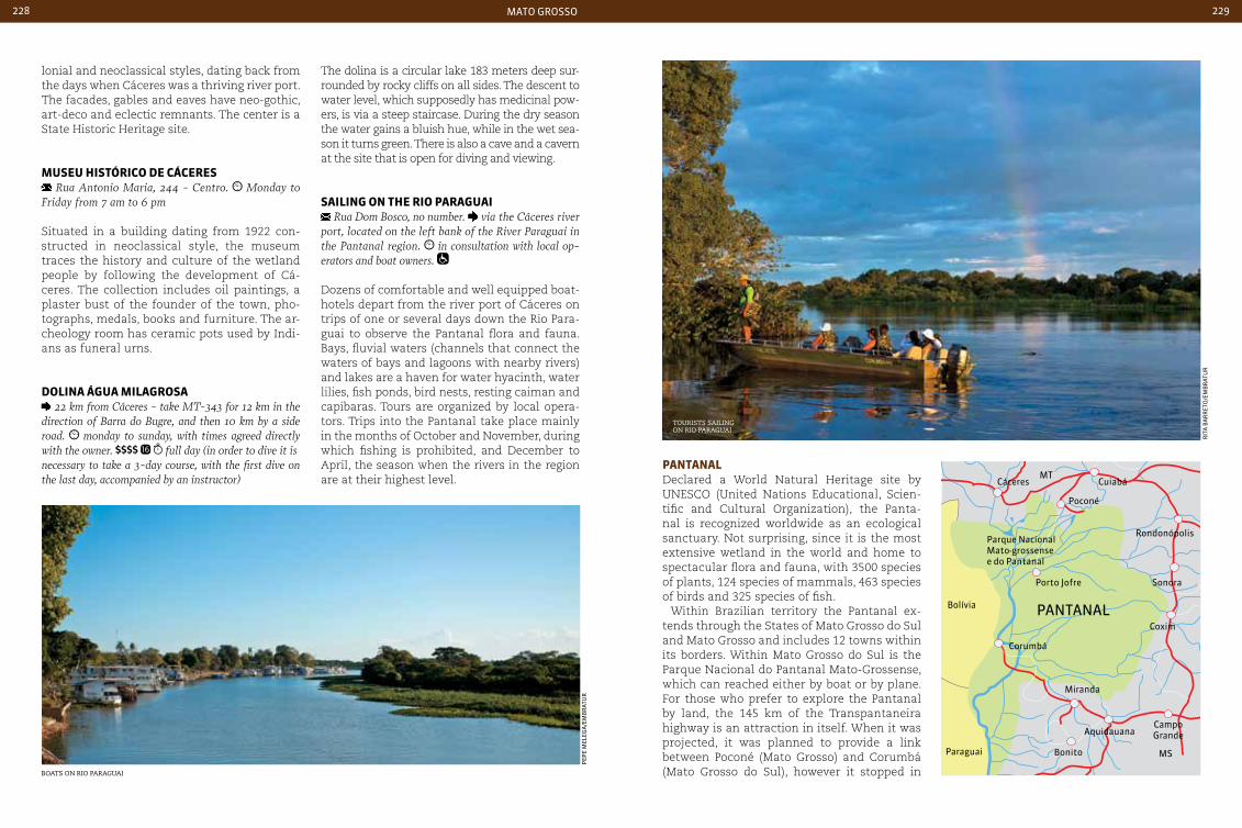
mato grosso228 229
lonial and neoclassical styles, dating back from the days when Cáceres was a thriving river port. The facades, gables and eaves have neo-gothic, art-deco and eclectic remnants. The center is a State Historic Heritage site.
MuSeu HIStÓrIco de cácereS Rua Antonio Maria, 244 - centro. Monday to
Friday from 7 am to 6 pm
Situated in a building dating from 1922 con-structed in neoclassical style, the museum traces the history and culture of the wetland people by following the development of Cá-ceres. The collection includes oil paintings, a plaster bust of the founder of the town, pho-tographs, medals, books and furniture. The ar-cheology room has ceramic pots used by Indi-ans as funeral urns.
doLIna áGua MILaGroSa 22 km from cáceres - take MT-343 for 12 km in the
direction of Barra do Bugre, and then 10 km by a side road. monday to sunday, with times agreed directly with the owner. full day (in order to dive it isnecessary to take a 3-day course, with the first dive on the last day, accompanied by an instructor)
The dolina is a circular lake 183 meters deep sur-rounded by rocky cliffs on all sides. The descent to water level, which supposedly has medicinal pow-ers, is via a steep staircase. During the dry season the water gains a bluish hue, while in the wet sea-son it turns green. There is also a cave and a cavern at the site that is open for diving and viewing.
SaILInG on tHe rIo paraGuaI Rua Dom Bosco, no number. via the cáceres river
port, located on the left bank of the River Paraguai in the Pantanal region. in consultation with local op-erators and boat owners.
Dozens of comfortable and well equipped boat-hotels depart from the river port of Cáceres on trips of one or several days down the Rio Para-guai to observe the Pantanal flora and fauna. Bays, fluvial waters (channels that connect the waters of bays and lagoons with nearby rivers) and lakes are a haven for water hyacinth, water lilies, fish ponds, bird nests, resting caiman and capibaras. Tours are organized by local opera-tors. Trips into the Pantanal take place mainly in the months of October and November, during which fishing is prohibited, and December to April, the season when the rivers in the region are at their highest level.
pantanaL Declared a World Natural Heritage site by UNESCO (United Nations Educational, Scien-tific and Cultural Organization), the Panta-nal is recognized worldwide as an ecological sanctuary. Not surprising, since it is the most extensive wetland in the world and home to spectacular flora and fauna, with 3500 species of plants, 124 species of mammals, 463 species of birds and 325 species of fish.
Within Brazilian territory the Pantanal ex-tends through the States of Mato Grosso do Sul and Mato Grosso and includes 12 towns within its borders. Within Mato Grosso do Sul is the Parque Nacional do Pantanal Mato-Grossense, which can reached either by boat or by plane. For those who prefer to explore the Pantanal by land, the 145 km of the Transpantaneira highway is an attraction in itself. When it was projected, it was planned to provide a link between Poconé (Mato Grosso) and Corumbá (Mato Grosso do Sul), however it stopped in Boats on rio Paraguai
tourists sailing on rio Paraguai
pep
e m
eleg
a/e
mB
rat
ur
rit
a B
ar
ret
o/e
mB
rat
ur
Porto Jofre
Bolívia
Parque NacionalMato-grossense e do Pantanal
Paraguai
PANTANAL
Corumbá
Miranda
CampoGrande
Bonito
Aquidauana
Poconé
Cuiabá
Rondonópolis
Sonora
Coxim
CáceresMT
MS
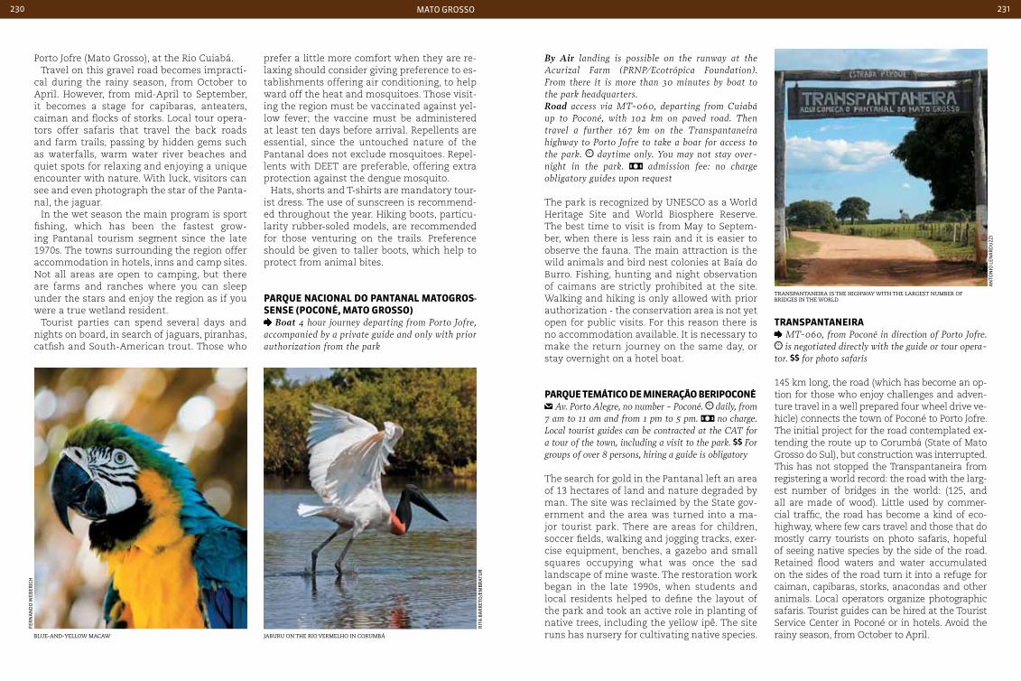
mato grosso230 231
Porto Jofre (Mato Grosso), at the Rio Cuiabá. Travel on this gravel road becomes impracti-
cal during the rainy season, from October to April. However, from mid-April to September, it becomes a stage for capibaras, anteaters, caiman and flocks of storks. Local tour opera-tors offer safaris that travel the back roads and farm trails, passing by hidden gems such as waterfalls, warm water river beaches and quiet spots for relaxing and enjoying a unique encounter with nature. With luck, visitors can see and even photograph the star of the Panta-nal, the jaguar.
In the wet season the main program is sport fishing, which has been the fastest grow-ing Pantanal tourism segment since the late 1970s. The towns surrounding the region offer accommodation in hotels, inns and camp sites. Not all areas are open to camping, but there are farms and ranches where you can sleep under the stars and enjoy the region as if you were a true wetland resident.
Tourist parties can spend several days and nights on board, in search of jaguars, piranhas, catfish and South-American trout. Those who
prefer a little more comfort when they are re-laxing should consider giving preference to es-tablishments offering air conditioning, to help ward off the heat and mosquitoes. Those visit-ing the region must be vaccinated against yel-low fever; the vaccine must be administered at least ten days before arrival. Repellents are essential, since the untouched nature of the Pantanal does not exclude mosquitoes. Repel-lents with DEET are preferable, offering extra protection against the dengue mosquito.
Hats, shorts and T-shirts are mandatory tour-ist dress. The use of sunscreen is recommend-ed throughout the year. Hiking boots, particu-larity rubber-soled models, are recommended for those venturing on the trails. Preference should be given to taller boots, which help to protect from animal bites.
parQue nacIonaL do pantanaL MatoGroS-SenSe (poconÉ, Mato GroSSo)
Boat 4 hour journey departing from Porto Jofre, accompanied by a private guide and only with prior authorization from the park
By Air landing is possible on the runway at the Acurizal Farm (PRNP/Ecotrópica Foundation). From there it is more than 30 minutes by boat to the park headquarters. Road access via MT-060, departing from cuiabá up to Poconé, with 102 km on paved road. Then travel a further 167 km on the Transpantaneira highway to Porto Jofre to take a boar for access to the park. daytime only. You may not stay over-night in the park. admission fee: no charge obligatory guides upon request
The park is recognized by UNESCO as a World Heritage Site and World Biosphere Reserve. The best time to visit is from May to Septem-ber, when there is less rain and it is easier to observe the fauna. The main attraction is the wild animals and bird nest colonies at Baía do Burro. Fishing, hunting and night observation of caimans are strictly prohibited at the site. Walking and hiking is only allowed with prior authorization - the conservation area is not yet open for public visits. For this reason there is no accommodation available. It is necessary to make the return journey on the same day, or stay overnight on a hotel boat.
parQue teMátIco de MIneração berIpoconÉ Av. Porto Alegre, no number - Poconé. daily, from
7 am to 11 am and from 1 pm to 5 pm. no charge. Local tourist guides can be contracted at the cAT for a tour of the town, including a visit to the park. For groups of over 8 persons, hiring a guide is obligatory
The search for gold in the Pantanal left an area of 13 hectares of land and nature degraded by man. The site was reclaimed by the State gov-ernment and the area was turned into a ma-jor tourist park. There are areas for children, soccer fields, walking and jogging tracks, exer-cise equipment, benches, a gazebo and small squares occupying what was once the sad landscape of mine waste. The restoration work began in the late 1990s, when students and local residents helped to define the layout of the park and took an active role in planting of native trees, including the yellow ipê. The site runs has nursery for cultivating native species.
tranSpantaneIra MT-060, from Poconé in direction of Porto Jofre. is negotiated directly with the guide or tour opera-
tor. for photo safaris
145 km long, the road (which has become an op-tion for those who enjoy challenges and adven-ture travel in a well prepared four wheel drive ve-hicle) connects the town of Poconé to Porto Jofre. The initial project for the road contemplated ex-tending the route up to Corumbá (State of Mato Grosso do Sul), but construction was interrupted. This has not stopped the Transpantaneira from registering a world record: the road with the larg-est number of bridges in the world: (125, and all are made of wood). Little used by commer-cial traffic, the road has become a kind of eco-highway, where few cars travel and those that do mostly carry tourists on photo safaris, hopeful of seeing native species by the side of the road. Retained flood waters and water accumulated on the sides of the road turn it into a refuge for caiman, capibaras, storks, anacondas and other animals. Local operators organize photographic safaris. Tourist guides can be hired at the Tourist Service Center in Poconé or in hotels. Avoid the rainy season, from October to April.
transPantaneira is the highway with the largest numBer of Bridges in the world
Blue-and-yellow macaw jaBuru on the rio vermelho in corumBá
fer
na
nd
o w
eBer
iCH
rit
a B
ar
ret
o/e
mB
rat
ur
an
ton
io l
ena
rd
uzz
i
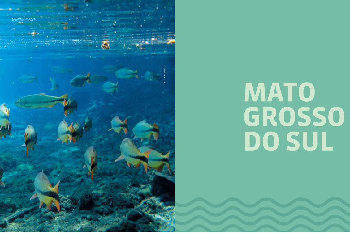
233
MatoGroSSodo SuL
da
nie
l d
e g
ra
nV
ille
a river of clear waters in the region of Bonito

mato grosso do sul234 235
262BR
262BR
262BR
262BR
262BR
419BR
419BR
267BR 267
BR
463BR
163BR 376
BR376BR
163BR
163BR
487BR
267BR
060BR
163BR
163BR
163BR
359BR 158
BR
158BR
158BR
158BR
483BR
060BR
060BR
060BR
163BR
060BR
MS-145
MS-145
MS-141MS-274
MS-141
MS-134
MS-355
MS-347
MS-455
MS-162
MS-166 MS-455
MS-456
MS-456
MS-338
MS-338
MS-395
MS-040
MS-459 MS-395
MS-438
MS-441
MS-245
MS-338
MS-245
MS-357
MS-324
MS-124
MS-316
MS-229
MS-320
MS-377
MS-124MS-440
MS-112
MS-444
MS-316
MS-240
MS-112 MS-310
MS-320
MS-324
MS-430
MS-352
MS-340MS-244
MS-345
MS-447
MS-352
MS-080
MS-010
MS-142
MS-223
MS-436
MS-422
MS-429
MS-223
MS-217
MS-223
MS-316MS-425
MS-215
caMpo Grande
CorumBá
Bonito
MS-422
163BR
MS-337MS-226
MS-184
MS-337
MS-170
MS-427
MS-325
MS-195
MS-243
MS-458MS-382
MS-339MS-178 MS-345
MS-339
MS-178MS-382
MS-467 MS-384MS-474 MS-472
MS-471
MS-362MS-164
MS-162MS-470
MS-157
MS-468
MS-270
MS-164MS-166
MS-270
MS-378
MS-280MS-380
MS-386
MS-156
MS-289
MS-156 MS-386
MS-295
MS-156
MS-276
MS-156
MS-141
MS-283
MS-134
MS-395
MS-283
MS-145
MS-487
MS-382
paraná
São pauLo
MInaS GeraIS
GoIáS
Mato GroSSo
boLIVIa
paraGuay
Geographical information
hot tropical average 23°c (73,4 °F) savanna and grasslands
Mato GroSSo do SuL
With its two magnificent calling cards - the Pantanal and the Bonito region - Mato Grosso do Sul dispenses further
introduction. But the State has even more to of-fer the tourist, with its regional cuisine, a heri-tage of the mixture of peoples who colonized the region, countless locations for ornitholo-gists, natural pools and freshwater rivers.
Created almost 40 years ago, when it was of-ficially separated from Mato Grosso, the State of Mato Grosso do Sul received a massive in-flux of migrants from other Brazilian States including Rio Grande do Sul, Paraná and São Paulo. The State has borders with Paraguay and Bolivia, which also contribute to its cul-tural melting pot.
Corumbá, considered to be the capital of the Pantanal, is one of the main gateways to the region, which attracts ever-increasing num-bers of tourists from around the world. The city serves as a base for those wishing to enjoy the natural wonders of the Pantanal, and has good hotel infrastructure, restaurants, bars and urban attractions.
Diving in crystal water in wells carved in rock formations, adventure sports and trekking on trails with idyllic landscapes are all on offer. The region of Serra da Bodoquena, which in-cludes Bonito and seven other municipalities, is one of the most beautiful in the country. It is no wonder that Bonito, which is the main tourist hub in the region, is among the prime ecotour-ism destinations in Brazil.
The Vale do Rio Aporé region is another des-tination that should be on the agenda of those seeking trails, waterfalls, adventure sports and fishing. Balneário do Salto, on the Rio Aporé, is listed as a heritage, culture and natural beauty site, and its waterfalls of over 5 meters in height make it one of the main attractions of the region.
The North of the State is maintained by Caiapó Indians. In this region of the Pantanal it is possible to observe numerous species of birds. The region retains its waterfalls, ar-chaeological sites and natural pools almost untouched, although it is open to ecological safaris allowing observation and contempla-tion of its natural assets.
international airport
national HigHways
state HigHways

mato grosso do sul236 237
morada dos Baís, Built Between 1913 and 1918, the first BricK-Built house in camPo grande
rit
a B
ar
ret
o/e
mB
rat
ur
rit
a B
ar
ret
o/e
mB
rat
ur
rit
a B
ar
ret
o/e
mB
rat
ur
traditional regional crafts, with Pottery and an indian influence
a diversity of flavors in the mercado municiPal in camPo grande
caMpo Grande 786,797 inhabitants 8,092.966 km² 67 110 V
Local holidays August 26: Anniversary of the founding of campo GrandeOctober 11: creation of the State of Mato Grosso do Sul
Accommodationcampo Grande has hotels to suit all types of tourists, with some establishments more oriented to business tourism and others to leisure tourism. The city also has hotels and inns outside the center.
Shoppingcharacteristic local crafts include bruguinhos carved from wood (small dolls typical of the region), indig-enous products, especially by the Kadiwéu and Te-rena ethnic groups, which use clay, straw and woven textile as their raw materials. carved pieces of bone sculpture, pieces made with fish leather, decorative pieces and agro-products are all regional specialties. A wide variety of regional products are available at the casa do Artesão.
Transportcampo Grande can be reached by air or by car. The city is served by paved roads, and campo Grande In-ternational Airport is located only 7 km from the cen-ter. It receives both national and international flights.
Within the citycampo Grande has a modern integrated system bus, which permits travel throughout the city with a single ticket. Taxi services are also available. Those who prefer, can opt for a city tour on a touristic line. The trip takes 2 hours and 30 minutes and is accompa-nied by a guide.
Campo Grande - also known as Cidade Morena because of the reddish color of the land - has countless green areas. An icon of outdoor recre-ation is the Parque das Nações Indígenas, which houses the Museu de Arte Contemporânea and the Museu das Culturas Dom Bosco, the latter with a collection of items by the State’s indig-enous peoples. The State Capital of Mato Grosso do Sul concentrates the second largest commu-nity of Indians in the country and is a point of confluence of traditions and customs since the
arrival of its first residents in the second half of the 19th century. The city also blends in in-fluences from neighboring countries such as Paraguay and Bolivia, as well as Japanese from Okinawa, who arrived in the early 20th century. This cultural diversity can be seen in the re-gional cuisine, in particular fish dishes, barbe-cue with cassava, chipa, salta, and locro Para-guayan soup (made from pumpkin, beans and corn). Those choosing to escape from city life will find that rural tourism provides an option for them to come in direct contact with nature. One of the attractions is the Pantanal train, which runs 220 km from Campo Grande to Mi-randa via Aquidauana, amid the landscapes of the Southern Pantanal.
MeMorIaL da cuLtura IndíGena Rua Terena - Bairro Marçal de Souza. daily from
8 am to 6 pm.
Situated in the only urban Indian village in Brazil, the ‘Memorial to Indigenous Culture’ houses around 100 families in an area of 340 m2. The area includes two large constructions made of renewable treated bamboo covered with bacuri straw. It provides an outlet for the sale of craft products.
Mercado MunIcIpaL antÔnIo VaLente Avenida Sete de Setembro, 65 - centro. Monday
to Saturday from 6:30 am to 6:30 pm. Sundays and public holidays, from 6 am to 12 am.
Opened in August 1958, the Mercado Munici-pal has its origins in a street fair, a point of sale for meat and vegetables that occupied a large area between Avenida Afonso Pena and Rua 7 de Setembro. The fair operated until the late 1950s, when the land was donated to the lo-cal City Hall. Known as the Mercadão (‘the Big Market’), it became the central point of sale for horticultural products, fish and spices.
caSa do arteSão Avenida Afonso Pena, 2.050 - centro. Monday
to Saturday from 8 am to 6 pm
The Casa do Artesão (Artisan’s House) was origi-nally designed for residential use. In the 1920s it was home to the first branch of the Bank of Brazil in the City, and since 1975 it houses the crafts cen-ter. It is one of the most popular shopping outlets in town. Specialties include Indian products such as Kadiweu ceramics, liqueurs, bows and arrows, lace, embroidery and straw artifacts. The site is part of the Mato Grosso do Sul’s cultural heritage.

mato grosso do sul238 239
the Indian), the Museu de Arte Contemporânea (Museum of Contemporary Art) and the Museu das Culturas Dom Bosco.
treM do pantanaL Vagão escritório (ticket purchase) - Avenida Noro-
este - opposite the Marada dos Baís. Estação Indusbra-sil/campo Grande (ticket purchase and train departure) Rua cascatinha – Vila Entroncamento Indubrasil. Vagão ticket office: Monday to Friday from 7 am to 6 pm. Saturdays from 8 am to 12 am.
This tourist train travels 220 km from Campo Grande to Miranda, via Aquidauana. It provides views of the Serra Maracaju. The train stops at Aquidauana station for 2 hours and 30 minutes and allows passengers to enjoy the surround-ings, where the transition from green forests of to wetlands begins. Boating and horse riding are available during the halt in the journey, and in addition there is the option to savor typical dish-es based on fish is that are offered during the trip.
parQue daS naçõeS IndíGenaS Upper part of Avenida Afonso Pena. daily from
6 am to 9 pm. no charge. Museu de Arte Contemporânea Tuesday to Fri-day from 12 am to 6 pm. Saturdays and Sundays from 2 pm to 6 pm. no charge Museu das Culturas Dom Bosco Tuesday to Friday from 8 am to 5:30 pm; Saturdays and Sundays from 1 pm to 6 pm.
Located on the upper part of Avenida Afonso Pena, the Parque das Nações Indígenas occu-pies an area of approximately 119 hectares, one of the largest urban parks in the world. The Rio Prosa, whose source is in the Reserva Natural de Poderes, forms a lake with a small island served by a pier. Its waters pass through the entire length of the park, and are crossed by several bridges. Although 70% of its area is covered by grass, some native vegetation is maintained, with areas of fruit and ornamen-tal trees planted by the previous owners. It also hosts the Monumento ao Índio (Monument to
bonIto 19,587 inhabitants 4,934.425 km² 67 110 V
Local holidaysJune 29: São Pedro’s dayOctober 2: Anniversary of the founding of Bonito
AccommodationBonito has excellent accommodation infrastructure, with inns and small hotels. There is space set aside for camping and it is also possible to stay in farm-hotels. This type of accommodation allows you to experience a taste of the life of a Pantanal resident, with horse rides, barbecues and tererê.
TransportBonito is located 300 km from campo Grande and has good access roads. There is an airport that re-ceives flights from major Brazilian cities.
Bonito is one of the main ecotourism and adven-ture tourism destinations in Brazil. Clear waters and colorful fish contrast with the intense green of the native forest. Rafting, floating in natural fish pools, tree climbing, waterfalls, caves, trails and diving are among the many leisure activities in the region. The attractions are complemented by extensive hotel and restaurant facilities. Due to the ecotourism management model adopted by the municipality, all tours are subject to a maximum daily capacity. It is therefore advis-able to make reservations early, especially dur-ing the high season in the months of July, De-cember, January and February, and during public holidays. Bonito can be visited at any time of the year. However, the ideal period is between De-cember and March, during the rainy season. This ishen flora and fauna thrive, the rivers run high-er and the waterfalls offer a greater spectacle.
Parque das naçÕes indígenas in camPo grande
Parque aquático municiPal in Bonito
rit
a B
ar
ret
o/e
mB
rat
ur
Via
er a
ero
foto
gr
afi
a

mato grosso do sul240 241
abISMo anHuMaS centro de Treinamento na Rua General Osório, 681
- centro. at least half a day. capacity: up to 18 people per day. training for rappel is undertaken the night before the trip
The Abismo Anhumas is the largest submerged cavern in the world. A drop of 72 meters by rappel from a cleft in the rock gives access to magnificent cave formations and a crystal-clear lake, where you can float and dive. Visitors receive training prior to descending by rappel. Diving is only permitted for certified divers.
GrutaS de São MIGueL Parque Ecológico da Reserva Natural do Vale das
Anhumas. Reservations: Zagaia Eco-Resort Hotel, Rodovia Bonito-Três Morros, km 0 Bonito. daily from 8 am to 4 pm.
The Grutas de São Miguel (São Miguel Cav-erns) are located in the Reserva Natural Parque Ecológico Vale Anhumas. Access to the caverns is via a narrow trail of almost 200 meters, pass-ing under a canopy formed by virgin forest tree-tops. The principal cavern is home to a large quantity of speleothems (formations typical of the interior of caves) and limestone formations.
FLoatInG down tHe rIo SucurI Rodovia Bonito - Fazenda São Geraldo, km 18. daily. The tours are conducted between 8 am and
4 pm. the trails are accessible and floating won the river can be undertaken by the disabled
This tour starts with a walk through the forest, which allows you to observe animals and trees. The tour includes a visit to the source of the Su-curi river, with an observation deck high above its crystalline waters. At the end of the walk the aquatic part of the tour begins: a descent of 45 minutes floating down the river between schools of varied species of fish. The site also offers cycling and horse riding.
buraco daS araraS BR-267 at the 510 km marker, Município de
Jardim. daily from 7 am to 5 pm. the first view-point is fully accessible. The remainder to the tour is still being adapted, however guides are trained to facilitate access for people with limited mobility
There is a trail around the sinkhole (a depres-sion caused by the erosion of limestone), which is 124 meters deep and 160 meters in diameter. The trail provides a view of the interior, where
Beef with cassava, one of the region’s tyPical dishes
cultural mixMato Grosso do Sul presents visitors an unusual cultural mix. Livestock ranching has provided the barbecue, served with cassava. Vaca Atolada, a beef rib dish prepared with cassava and cooked in a pressure cooker is also a popular dish in the wetlands. campo Grande contributes with the heritage left by the first Japanese immigrants who arrived in the region, and offers dishes based on sobá (a type of pasta). Fish, of course, is an important part of the menu: pacu (a fish from the piranha family), pintado and dourado (types of tigerfish) are the most sought after and are served in stews, fried or grilled. ‘caldo de pira-nha’ - piranha broth - is a local delicacy greatly emjoyed by residents and by visitors. The influ-ence of the ‘gaúcho’ from the South and from Paraguay has made tererê (iced tea drunk from a gourd) the official drink of the Pantanal. Para-guayans and Bolivians have also brought ingre-dients to Mato Grosso do Sul cuisine. cassava cakes, chipa (cheese savory), puchero (cooked meat and vegetables, Pantanal-style), savories and Paraguayan soup are some of the foods that have crossed the border.
Vald
emir
Cu
nH
a
ra
i rei
s/em
Br
atu
r
da
nie
l d
e g
ra
nV
ille
an
dr
é tu
rat
ti
raPPel in the aBismo de anhuma
gruta do lago azul in Bonito
fluctuation in rio sucuri
Gruta do LaGo azuL Road to campo dos Índios, km 2. daily from
7 am to 2 pm.
The Gruta do Lago Azul (Blue Lake Cavern) is home to a lake with dimensions that make it one of the largest flooded caves on the planet. The depth of the lake is unknown (87 meters is the maximum that a diver has reached), and it holds fossils of prehistoric animals. It is neces-sary to take a trail with a drop of 100 meters to reach the cavern, and a rustic stairway with 300 steps to get to the lake. It is obligatory to contract a guide through a local tour operator.

mato grosso do sul242 243
coruMbá 103,703 inhabitants 64,962.836 km² 67 110V
Local holidaysFebruary 2: Nossa Senhora da candelária’s day June 13: Retaking of corumbáSeptember 21: Foundation of corumbáNovember 20: Black consciousness Day
Accommodationcorumbá offers hotels, inns and campgrounds. There are also boat-hotels for those who prefer to stay on the river.
ShoppingThe casa do Artesão in corumbá is one of the main points of interest for those who want to purchase items made by the region’s indigenous population. The nearby city of Puerto Aguirre, in Bolivia, is a duty-free zone.
TransportThe city has an efficient bus system for passenger transport, and taxis are also available. corumbá can be reached by car, bus or by air.
One of the largest municipalities in terms of territorial area, Corumbá is considered to be the Capital of the Pantanal, and is one of its principal access gateways. Corumbá is also home to one of the largest inland ports in the world. This infrastructure will become even more necessary thanks to major development projects, including renovation of the ‘Trem do Pantanal’ and improvements to the high-way linking Brazil to Bolivia. A cosmopolitan town, it offers good hotel infrastructure and local services, which helps to attract tourists coming to the region to visit the Pantanal and Bonito. The town’s modern buildings have ad-opted an Art Nouveau style, reminiscent of cities such as Buenos Aires and Montevideo. It is a planned city, and is a mosaic of influences from the different peoples who helped create it. A border town, Corumbá is has Bolivian and Paraguayan influences in is cuisine and culture. Remnants of this influence can also be found in the musical preferences of the lo-cal population: guaranhas from Paraguay and even tango, which was once the most popular dance in the city.
red macaws and other birds return to their nests the end of the day. It is recommended to book a time in advance. The tour takes place every 15 minutes in groups of up to 10 persons.
da
nie
l d
e g
ra
nV
ille
rit
a B
ar
ret
o/e
mB
rat
ur
one of the waterfalls on the rio formoso in Bonito
parQue ecoLÓGIco rIo ForMoSo Rodovia Bonito - Guia Lopes, km 7. daily from 8
am to 5 pm. there is no specific infrastructure, but guides are trained to assist people with limited mobility
The float ride down the Formoso river starts with a walk along a trail. As you climb up Morro da Piúva, the Serra Bodoquena can be seen in the distance. The flora in this location attracts birds and wildlife. The 2.3 km ascent ends at the Deck Paraíso, where the descent of the river begins. The visitor floats between shoals of fish, algae and submersed trees. Diving is also an option. You can get to the park by bicycle from the town. The park also has a restaurant and horseback riding.
tererÊ from a gourd, the tyPical regional drinK
rodas de tererêA prime area of the city and the region with the busiest bars, upper Avenida Afonso Pena is a meeting point for the famous ‘rodas de tererê’ to the tune of regional music. Here, friends gather to enjoy the typical drink of the region - tererê, made of yerba mate and iced water, served in an ox horn mug. The meetings have well defined rules, such as serving tererê counter-clockwise, an allusion to the movement made with a lasso. Each person is served in turn and must drink the entire contents, until the gourd makes a noise, and then return it to the server. If nothing is said, it means they want to continue. To leave the circle, they should offer thanks. The tradi-tional fraternal gatherings gain a special touch at the end of the day, one of nature’s finest spectacles: the campo Grande sunset.
Boat ride on the rio vermelho in corumBá
rit
a B
ar
ret
o/e
mB
rat
ur
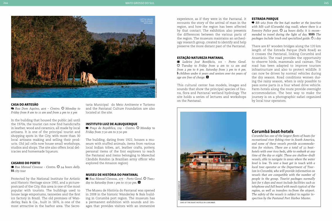
mato grosso do sul244 245
caSa do arteSão Rua Dom Aquino, 405 - centro. Monday to
Friday from 8 am to 11 am and from 2 pm to 5 pm
In the building that housed the public jail until the 1970s, the tourist can now find handicrafts in leather, wood and ceramics, all made by local artisans. It is one of the principal tourist and shopping spots in the City, with more than 30 local artisans making and selling their prod-ucts. Old jail cells now house small workshops, studios and shops. The site also offers local del-icacies and homemade liqueurs.
caSarIo do porto Rua Manuel cavassa - centro. 24 hours daily. city tour
Protected by the National Institute for Artistic and Historic Heritage since 1992, and a picture-postcard of the City, this area is one of the most popular with tourists. The buildings used to house large emporiums, tanneries and the first ice factory in Brazil. The old premises of Wan-derley, Baís & Cia., built in 1876, is one of the most attractive in the harbor area. The Secre-
taria Municipal do Meio Ambiente e Turismo and the Pantanal Culture Foundation are also located at the site.
InStItuto LuIz de aLbuQuerQue Praça da República, 119 - centro. Monday to
Friday from 7:30 am to 5:30 pm
The building, dating from 1922, houses a mu-seum with stuffed animals, items from various local Indian tribes, art, leather crafts, pottery, personal items of the first explorers to reach the Pantanal and items belonging to Marechal Cândido Rondon (a Brazilian army officer who explored the Amazon region)
MuSeu de HIStÓrIa do pantanaL Rua Manoel cavassa, 275 - Porto Geral. Tues-
day to Saturday from 1 pm to 17:30 pm.
The Museu de História do Pantanal was opened in 2008 in the historic Wanderley & Baís build-ing in Corumbá port region. The museum has a permanent exhibition with sounds and im-ages that provides visitors with an immersive
experience, as if they were in the Pantanal. It recounts the story of the arrival of man in the region, and how the region has been affected by that contact. The exhibition also presents the differences between the various parts of the region. The museum maintains an archeol-ogy research group, created to identify and help preserve the more distant past of the Pantanal.
eStação natureza pantanaL Ladeira José Bonifácio, 111 - Porto Geral. Tuesday to Friday from 9 am to 12 am and
from 2 pm to 6 pm. Saturday from 3 pm to 6 pm. children under 6 years and seniors over 60 years of
age are free of charge.
This cultural center has models, images and sounds that show the principal species of fau-na, flora and Pantanal wetland hydrology. The site holds a series of lectures and workshops on the Pantanal.
one of the Boat hotels in corumBá
corumbá boat-hotels corumbá has one of the largest fleets of boats for recreational river fishing river in South America, and some of these vessels provide accommoda-tion for visitors. There are a total of 33 boat-hotels with over 600 beds, able to embark at any time of the day or night. These are shallow-draft vessels, able to navigate in areas where the water level is low. To rent a boat get in touch with a local tour operator or the Department of Tour-ism in corumbá, who will provide information on vessels that are compatible with the number of people in the group. Tourist packages normally last for 5 days and most include facilities such as telephone and full board with meals typical of the region, as well as transfers to/from the airport. The safety of the vessels is subject to regular in-spection by the Pantanal Port Harbor Master.
eStrada parQue BR-262 from the km 646 marker at the junction
with MS-228 (corumbá ring road), where there is a Forestry Police post. 24 hours daily; it is recom-mended to travel during the light of day. The packages include lunch and specialized guide. 1 day
There are 87 wooden bridges along the 120 km length of the Estrada Parque (Park Road) as it crosses the Pantanal, linking Corumbá and Anastácio. The road provides the opportunity to observe birds, mammals and caiman. The road has been adapted to improve tourism infrastructure and also to protect wildlife. It can now be driven by normal vehicles during the dry season. Road conditions worsen dur-ing the rainy season, when is only possible to pass some parts in a four wheel drive vehicle. Farm-hotels along the route provide overnight accommodation. The best way to make the journey is on a photographic safari organized by local tour operators.
cattle graze the flooded
wetland
pep
e m
eleg
a/e
mB
rat
ur
rit
a B
ar
ret
o/e
mB
rat
ur
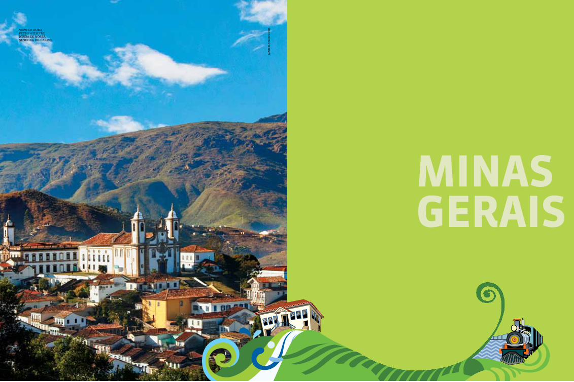
247
MInaSGeraIS
ma
rCe
lo n
aCi
no
ViCview of ouro
Preto with the igreja de nossa senhora do carmo

minas gerais248 249
beLo HorIzonte
CongonHas
tiradentes
são joãodel rei
mariana
saBará
ouro preto
inHotim
diamantina
040BR
040BR
497BR
497BR
262BR
262BR
146BR
491BR
381BR
381BR381BR
265BR
265BR
460BR
354BR
494BR
459BR
050BR
050BR
153BR
364BR
364BR
365BR 365
BR
452BR
146BR
354BR
354BR
352BR
369BR
040BR
381BR
381BR
262BR
116BR
259BR
381BR
116BR
418BR
116BR
367BR
365BR
365BR
367BR
451BR
451BR
135BR
251BR
259BR
259BR
496BR
342BR
251BR
251BR
251BR
122BR
135BR
135BR
479BR
267BR
482BR
356BR
120BR
120BR
120BR
MG-401
MG-405
MG-406
MG-105
MG-217
MG-232
MG-329MG-123MG-129
MG-179
MG-050
MG-456
MG-010
MG-229
MG-232
MG-211
MG-214
MG-402
MG-145
MG-308
MG-181
MG-408
MG-188
MG-188
MG-161
MG-202
São pauLo
baHIa
eSpírItoSanto
GoIáS
rIo deJaneIro
uBerlândia
uBeraBa
montes Claros
zona da mata
383BR
265BR
With its wide cultural diversity, and with one of the most important archi-tectural collections of Baroque art in
Brazil, Minas Gerais is home to many historical cities that reveal a part of Brazil’s colonial past, when the State was the economic heart of the country thanks to the mining of precious metals.
Ouro Preto was the State’s first capital city due to the high output from the region’s mines, which were eventually exhausted by Portugal. With the decline of the mining sector, towns and villages built in the vicinity of the mines started to empty. Although on the one hand the end of economic activity in mining threat-ened to plunge the region into a recession, on the other hand this was the incentive that the population needed to seek new locations and find new livelihoods.
Coffee helped to create a second economic boom in Minas Gerais. In the 19th century coffee plantations helped to open up new roads and cities, and they were the basis for strengthening the region’s transportation infrastructure. Also, thanks to the need to refine and transport cof-fee, Minas Gerais began to industrialize.
Occupying a land area larger than France, Minas Gerais grew without losing the character-istic hospitality of its inhabitants, and still pre-serves its rich history, traditions and culinary di-versity that both enchant and conquer tourists.
Minas Gerais
Geographic information
upper altitude tropical average temperature of 22.2 °c (71,96 °F) tropical savanna and atlantic forest
minas gerais248 249
international airport
national airport
national HigHways
state HigHways
Carlos prates
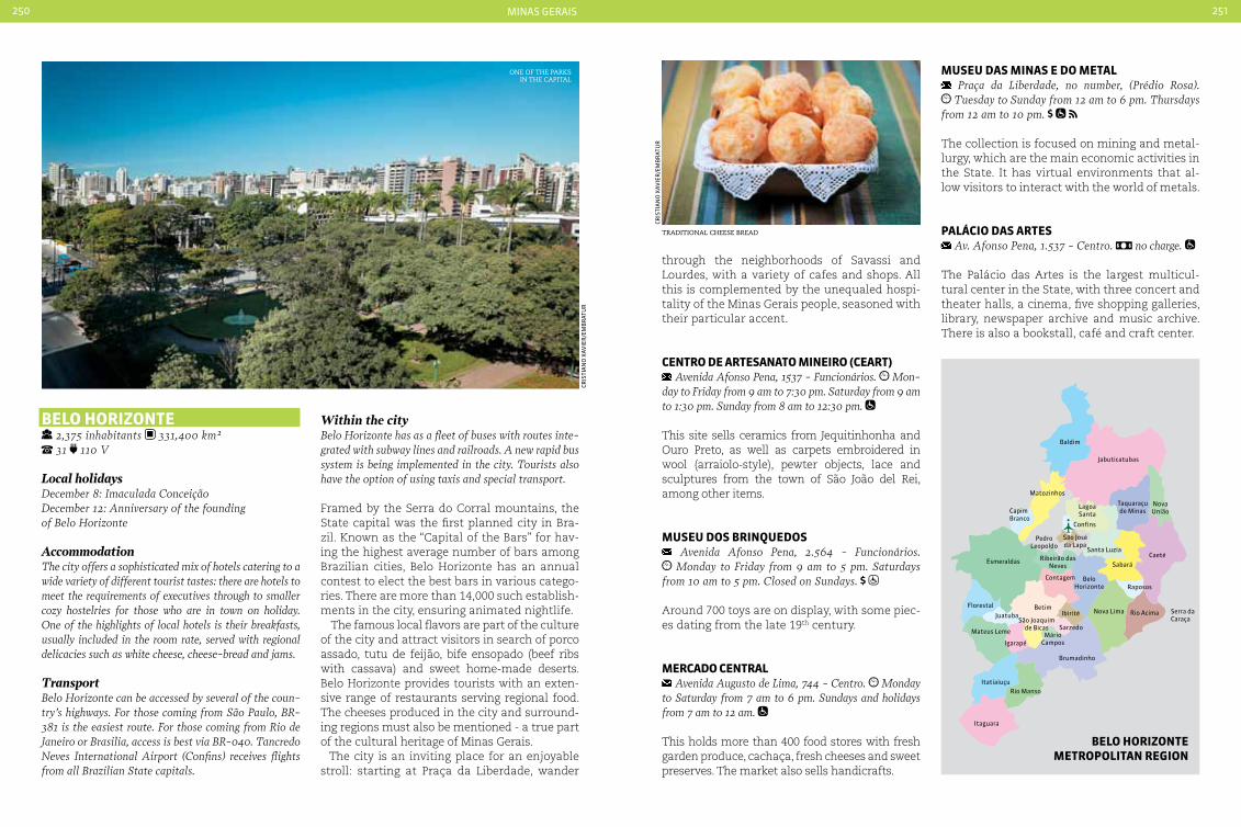
minas gerais250 251
Baldim
Caeté
Taquaraçude Minas
NovaUnião
Jabuticatubas
Matozinhos
Esmeraldas
CapimBranco
PedroLeopoldo
São Joséda Lapa
LagoaSanta
Confins
BeloHorizonte
Contagem
Florestal
JuatubaBetim
São Joaquimde Bicas
Ibirité
SarzedoMário
Campos
Ribeirão dasNeves
Mateus Leme
Igarapé
Brumadinho
Nova Lima Rio Acima
Raposos
Sabará
Itaguara
Rio MansoItatiaiuçu
Santa Luzia
Serra da Caraça
beLo HorIzonte 2,375 inhabitants 331,400 km² 31 110 V
Local holidaysDecember 8: Imaculada conceiçãoDecember 12: Anniversary of the foundingof Belo Horizonte
AccommodationThe city offers a sophisticated mix of hotels catering to a wide variety of different tourist tastes: there are hotels to meet the requirements of executives through to smaller cozy hostelries for those who are in town on holiday. One of the highlights of local hotels is their breakfasts, usually included in the room rate, served with regional delicacies such as white cheese, cheese-bread and jams.
TransportBelo Horizonte can be accessed by several of the coun-try’s highways. For those coming from São Paulo, BR-381 is the easiest route. For those coming from Rio de Janeiro or Brasilia, access is best via BR-040. Tancredo Neves International Airport (confins) receives flights from all Brazilian State capitals.
Within the cityBelo Horizonte has as a fleet of buses with routes inte-grated with subway lines and railroads. A new rapid bus system is being implemented in the city. Tourists also have the option of using taxis and special transport.
Framed by the Serra do Corral mountains, the State capital was the first planned city in Bra-zil. Known as the “Capital of the Bars” for hav-ing the highest average number of bars among Brazilian cities, Belo Horizonte has an annual contest to elect the best bars in various catego-ries. There are more than 14,000 such establish-ments in the city, ensuring animated nightlife.
The famous local flavors are part of the culture of the city and attract visitors in search of porco assado, tutu de feijão, bife ensopado (beef ribs with cassava) and sweet home-made deserts. Belo Horizonte provides tourists with an exten-sive range of restaurants serving regional food. The cheeses produced in the city and surround-ing regions must also be mentioned - a true part of the cultural heritage of Minas Gerais.
The city is an inviting place for an enjoyable stroll: starting at Praça da Liberdade, wander
through the neighborhoods of Savassi and Lourdes, with a variety of cafes and shops. All this is complemented by the unequaled hospi-tality of the Minas Gerais people, seasoned with their particular accent.
centro de arteSanato MIneIro (ceart) Avenida Afonso Pena, 1537 - Funcionários. Mon-
day to Friday from 9 am to 7:30 pm. Saturday from 9 am to 1:30 pm. Sunday from 8 am to 12:30 pm.
This site sells ceramics from Jequitinhonha and Ouro Preto, as well as carpets embroidered in wool (arraiolo-style), pewter objects, lace and sculptures from the town of São João del Rei, among other items.
MuSeu doS brInQuedoS Avenida Afonso Pena, 2.564 - Funcionários. Monday to Friday from 9 am to 5 pm. Saturdays
from 10 am to 5 pm. closed on Sundays. Around 700 toys are on display, with some piec-es dating from the late 19th century.
Mercado centraL Avenida Augusto de Lima, 744 - centro. Monday
to Saturday from 7 am to 6 pm. Sundays and holidays from 7 am to 12 am.
This holds more than 400 food stores with fresh garden produce, cachaça, fresh cheeses and sweet preserves. The market also sells handicrafts.
traditional cheese Bread
one of the ParKs in the caPital
Cris
tia
no
XaV
ier
/em
Br
atu
r
Cris
tia
no
XaV
ier
/em
Br
atu
r
beLo HorIzonte MetropoLItan reGIon
MuSeu daS MInaS e do MetaL Praça da Liberdade, no number, (Prédio Rosa). Tuesday to Sunday from 12 am to 6 pm. Thursdays
from 12 am to 10 pm.
The collection is focused on mining and metal-lurgy, which are the main economic activities in the State. It has virtual environments that al-low visitors to interact with the world of metals.
paLácIo daS arteS Av. Afonso Pena, 1.537 - centro. no charge.
The Palácio das Artes is the largest multicul-tural center in the State, with three concert and theater halls, a cinema, five shopping galleries, library, newspaper archive and music archive. There is also a bookstall, café and craft center.

minas gerais252 253
Av. Francisco Sales
Av. Barbacena
Estr. Ane
l Rod
oviário
Avenida Dom Pedro II
A v. do Cont o rno
Vd. Leste
Av. Pres. Antonio CarlosAv. P
res. C arlos Luz
Av. Cristiano
Machad
o A v. Jo
sé C
ândido
da Silveira
Av. Amazonas
1 56
7
8
9
23
4
Av. F
lem
ing
A
v. Otacílio Negrão de L ima
10
11
12
13
parQue daS ManGabeIraS Avenida José Patrocínio Pontes, 580 (south access)
and Rua caraça, 900 (north access) - Mangabeiras, MG. Tuesday to Sunday including holidays, from 8 am to 6 pm.
Designed by the landscape architect Roberto Burle Marx, the site is one of the largest urban parks in Latin America. It is home to 28 species of mammals, 160 species of birds, 20 species of reptiles and 19 species of amphibians. The park covers 2.8 million square meters, with trails, sport grounds and a playground. The park also offers cultural activities on specific commem-orative dates, which are held in the Praça das Águas and the Teatro Arena. From the Manga-beiras viewpoint it is possible to see the urban landscape on one side, and the Serra do Curral mountains on the other.
MuSeu MIneIro Avenida João Pinheiro, 342 - centro. Tuesday to
Friday from 10 am to 6 pm. Saturdays, Sundays and public holidays from 10 am to 4 pm. no charge on Sundays. no charge.
The Museu Mineiro maintains a permanent collection by important baroque artists (Alei-jadinho and Ataíde among others). It also has works by contemporary local artists such as Amilcar de Castro and Celso Renato. The mu-seum seeks to offer visitors a demonstration of Minas Gerais culture to the full, and is located in a preserved building that is also in Baroque style. After having been closed for almost a year, it reopened in January 2011.
tour at paMpuLHaconJunto arQuItetÔnIco da paMpuLHa
Avenida Otacílio Negrão de Lima, 751 - Pampulha. no restriction
The famous State capital architectural com-plex surrounds the Lago da Pampulha. There are three works designed in the 40s by Oscar Niemeyer: the Museu de Arte da Pampulha - a building which once housed a casino, the Casa do Baile - a construction with sinuous forms that appears as if it were a continuation of the lake, and the Igreja de São Francisco de As-sis - with 14 tiled panels that depict the Via Sacra, designed by Candido Portinari. The area has gardens created by Burle Marx. The Min-eirão football stadium, the Mineirinho gym, a zoo and an amusement park have also been added to the site.
IGreJa de São FrancISco de aSSIS Avenida Otacílio Negrão de Lima, 3.000 - Pam-
pulha. Tuesday to Saturday from 9 am to 5 pm. Sundays from 12 am to 5 pm.
The church was constructed in 1943 and is con-sidered a masterpiece of Brazilian modernist architecture. Designed by Oscar Niemeyer, it houses panels by Portinari and Paulo Werneck, sculptures by Alfredo Ceschiatti and gardens designed by Roberto Burle Marx.
LaGoa da paMpuLHa Avenida Otacílio Negrão de Lima, no number. daily, 24 hours.
With a length of 18 km, the lake is the site of various activities such as walking, cycling and international competitions.
MuSeu de arte da paMpuLHa (Map) Avenida Otacílio Negrão de Lima, 16.585 - Pam-
pulha. Tuesday to Sunday from 9 am to 7 pm. no charge.
This was Niemeyer’s first project, originally con-structed in 1946 as a casino. In 1957 the “Palácio de Cristal”, as it was known, was transformed into a museum. It was renovated in 1996 and gained new multimedia rooms, a library and cof-fee bar among other facilities. MAP has a collec-tion of 1,600 works by several Brazilian artists.
parQue ecoLÓGIco da paMpuLHa Avenida Otacílio Negrão de Lima, 7.111 / 6.061. Tuesday to Friday from 8:30 am to 5 pm.
no charge.
One of the greenest places in the city, the park houses a great diversity of Brazilian fauna. The site has a sports-orientated public, and offers a bicycle track, bicycle hire and a walking track.
cIty oF beLo HorIzonte
minas gerais craft Pieces
Local craftsThe cultural wealth of Minas Gerais is also mir-rored in the diversity of its handicrafts, includ-ing works in clay, wood, silver and stone, as well as embroidery, knitwear, crochet and handmade leather items. Pottery wares are also popular. With their origins in indigenous traditions, pot-ters (particularly in the valleys of Jequitinhonha and São Francisco) produce sculptures and ob-jects such as pots, pans and vases.
Ber
na
det
e g
uim
ar
ães
sil
Va
Ba
nCo
de
ima
gem
min
isté
rio
do
tu
ris
mo
PamPulha church
1 Estádio Governador Magalhães Pinto - Mineirão2 Airport of Pampulha3 Lagoa da Pampulha4 Igreja de São Francisco de Assis5 Parque Prof. Lage Guilherme6 Toca da Raposa I7 Parque Ecológico Renato de Azere8 Parque Carlos Prates9 Parque Municipal das Mangabeiras10 Museu Histórico Abílio Barreto11 Museu das Minas e do Metal12 Palácio das Artes13 Museu de Artes e Ofício

minas gerais254 255
conGonHaS 48,519 inhabitants 304,066 km² 31 110 VDistance from the State capital: 89 km
Local holidaysDecember 17: Anniversary of the Founding of congonhas
AccommodationThe historic town has comfortable hotels and inns available for tourists. Most offer accommodation in baroque buildings and take great care in the service and food that they provide. There are options both in the town center and also in the outskirts. Farm-hotels are another very popular choice.
Transportcongonhas can be reached via two major highways: BR-040 (departing from Belo Horizonte and Rio de Janeiro) and BR-381 (departing from São Paulo). The nearest airport is confins in Belo Horizonte, 89 km from congonhas.
The “Cidade dos Profetas” houses one of the masterpieces of Brazilian colonial art, the Ba-sílica do Senhor do Bom Jesus de Matosinho, in addition to the 12 figures carved in soapstone by the master Aleijadinho between 1795 and 1805. “Os Profetas” were declared a World Heritage Site by UNESCO and form the largest collection of baroque statues in the world. The stone ramp leading to the church, skirted by the prophets, is an invitation to travel back into the city’s rich cultural past. The ramp is also bordered by six chapels that display a total of 64 images carved from cedar (many of them made by Alei-jadinho) with scenes from the Paixão de Cristo. Congonhas has numerous colonial houses dat-
baSíLIca do SenHor boM JeSuS de MatoSInHoS e oS 12 proFetaS
Praça da Basílica, 180. Tuesday to Sunday from 6 am to 6 pm. no charge.
The Basilica originated from a promise by a Portuguese immigrant who became ill and swore that he would order a temple to be con-structed if he improved. Having been cured he ordered work to begin in 1757. In front of the rich baroque church is a churchyard with the twelve prophets carved in soapstone by the master craftsman, Aleijadinho. The statues were carved between 1800 and 1805, and the image of Daniel is considered to be the pin-nacle of the artist’s talent.
The group of 12 prophets in soapstone is the most famous group of baroque statues in the world. They took five years of hard work by Aleijadinho, who was very sick at the time and was aided by his assistants. The 12 prophets are Isaiah, Jeremiah, Baruch, Ezekiel, Daniel, Hosea, Jonah, Joel, Obadiah, Habakkuk, Amos, and Nahum.
eStrada reaL tHe eStrada reaL and ItS HIStoryThe Estrada Real is composed of four roads that were officially opened by the Portuguese Crown in the 17th century. The wealth extracted from Brazil (gold and diamonds) passed down these roads its way to the port of Rio de Janeiro, and from there to Portugal. The road guards true treasures of Brazilian history along its 1,200 km extension. The attractions along its path bring together a mix of history, culture, adventure, nature conservation and rich gastronomy.
The Old trailThe 630 km of old trail linked the mines to the sea: departing from Paraty it passes via the Mantiqueira mountain range, the Circuito das Águas - ‘The Circuit of the Waters’, and former villages that have now grown into towns. Its fi-nal destination is Ouro Preto, the central point of the Estrada Real. In the section between Passa Quatro and Vila Embaú you can take a 12 km ride on a steam train on Saturdays, Sun-
days and public holidays. The train runs from Passa Quatro to Estação Coronel Fulgêncio.
The Parque das Águas (“Water Park”) lies on the section between São Lorenço and Caxam-bu. The park receives visitors from across the country seeking the medicinal properties of its mineral waters. Chairlift rides and the steam train are just some of the attractions. A round trip along the banks of the Rio Verde lasts two hours and is accompanied by guitarists.
The Lambardi section is more suitable for el-derly tourists. The principal attraction is also named Parque das Águas. The area offers six different springs - gaseous, alkaline, magne-sian, slightly carbonated, ferruginous and spicy - as well as mineral water swimming pools.
Basílica do senhor Bom jesus de matosinhos
Cla
ud
io s
alV
ala
io
Minas Gerais baroqueBaroque in Minas Gerais was one of the first examples of Brazilian art forms. Imported from Portugal and adapted to the colonial setting by craftsmen, painters and local artists, it was born amid the excitement of the Minas Gerais gold rush, from which it gained greater momentum. Religious buildings were the main stage for ba-roque art in Brazil: ceilings and paintings in gold, a richness of detail and a profusion of Rococo - a predominantly Brazilian style found in floral paintings and carvings, particularly in religious objects. The principal name in Brazilian baroque is Aleijadinho. Antonio Francisco Lisboa was born in Ouro Preto, and his greatest work is the 12 phophets in the town of congonhas (further information in the congonhas section).
nen
o V
ian
na
-Ba
rr
oCo
pr
ess/
emB
rat
ur
ing back from the time of the gold rush, located mainly in the Beco dos Canudos. It is the stage for pilgrimages throughout the year, and in the 1930s the town built a Pilgrimage Hostel, a large inn consisting of bungalows arranged in a circle. It is now a site dedicated to preserving the town’s history. As if so much art and culture were not enough, the town also provides tourists with the best in Minas Gerais cuisine in restaurants serv-ing home-made food full of flavor and history.
Diamantina
Conceiçãodo Mato Dentro
Santuário do Caraça
Caminho dos DiamantesCaminho do SabarabuçuCaminho NovoCaminho Velho
Belo Horizonte
Ouro Preto Mariana
Barão de Cocais
Tiradentes
Rio de JaneiroParaty
ESTRADA REAL

minas gerais256 257
Caminho dos DiamantesThe “Diamond Trail” runs for around 350 km be-tween Diamantina and Ouro Preto. One of the stops on the route is São Gonçalo do Rio Preto, which offers several natural attractions.
Caminho NovoWith a length of 515 km, the “New Trail” was cre-ated in 1698, but its route was only finally de-fined in 1725. It leaves Ouro Preto in the direction of Rio de Janeiro and has dozens of remnants dating back to the mining days.
Caminho do SabarabuçuAn alternative route between the Diamond Trail and the city of Ouro Preto, the Sabarabuçu Trail is 160 km long and links the districts of Cocais (Barão de Cocais) and Glaura (Ouro Preto).
MuSeuMS on eStrada reaL(Towns included in the tour: Ouro Preto, Tira-dentes, Petrópolis, Sabará, Caeté).
ouro preto, MInaS GeraISMuseu da Inconfidência
Praça Tiradentes, 139 - centro. Tuesday to Sun-day, from 12 am to 6 pm.
The museum is located in the old Town Hall and Jail, built in 1855. Opened in 1944, it houses works of religious art from the 18th and 19th cen-turies together with replicas of works by Alei-jadinho, Xavier de Brito and Master Athayde, as well as documents and furnishings connected to the Conspiracy.
caetÉMuseu da Cachaça
Sitio Vale do Ipê - carretera da Fazenda Ouro Fino. Saturdays, Sundays and public holidays from 9 am to 5 pm.
The museum provides a detailed history of cachaça through the ages. The collection in-cludes labels that recall the history and tra-dition of the sugar cane distillate, which was originally prepared in slave quarters.
traIn routeS on eStrada reaL(Towns included in the tour: Ouro Preto, São João del Rei, São Lourenço, Passa Quatro)
MarIa FuMaça São João deL-reI - tIradenteS Avenida Hermílio Alves, 366, - São João del Rei.
Praça da Estacão, no number - Tiradentes. De-partures from São João del Rei: Friday and Saturday at 10 am and 3 pm. Sundays at 10 am and 1 pm. Departures from Tiradentes: Friday and Saturday at 1 pm and 5 pm. Sunday at 11 am and 2 pm. children under 5 years: free of charge. children 6-10 years old and adults over 60 years old: 50% discount. 3h
The journey is undertaken by an American steam locomotive from the early 20th century. The 13 km ride takes around half an hour, passing along the banks of the Rio das Mortes and providing views of the São José mountains. The steam train only operates on weekends. In São João Del Rei be sure to visit the Railroad
Complex - opened in 1881 by Dom Pedro II (the second and last monarch of Brazil’s Empire period) it is living museum, with locomotives still in operation. The station in Tiradentes was constructed around 1880, and was also inau-gurated by Emperor Dom Pedro II. The building has architectural characteristics typical of a British rail station of the period.
MarIa FuMaça (MarIana-ouro preto) Barro Preto - Mariana. Praça cesário Alvim -
Ouro Preto. Tuesday to Sunday, including holidays, from 9 am to 5 pm. Departure from Ouro Preto: 10 am and 3:30 pm. Departure from Mariana: 8:30 am and 2 pm. children under 5 years old. free of charge. children 6-10 years old and adults over 60 years old: 50% discount. half day.
The trip to Ouro Preto is short (there are only 18 km, traveled in less than an hour), but the sensation of traveling in time is guaranteed by the locomotive from 1949 and carriages with internal woodwork and design similar to com-positions of the early 20th century. Scenic views are provided by typical Minas Gerais land-scapes formed by waterfalls and mountains. In Ouro Preto, the former station and carriage shed has been restored and turned into a cul-tural center. While waiting for the train visi-tors can visit the Vagão Café, with its leisure facilities and cuisine, and the Culture Network Area, which offers crafts made by artisans from Ouro Preto and Mariana.
the steam train that maKes the journey Between mariana and ouro Preto
estrada real road marKer
treM daS áGuaS (MarIa FuMaça) São Lourenço - SoLedade de MInaS
Praça Dr. Ismael Junqueira de Souza, 9 (São Lou-renço). Departures on Saturdays and public holi-days at 10 am and 2:30 pm. Sunday at 10 am chil-dren under 5 years old. free of charge
This centuries-old railway was designed and built by the British, and Dom Pedro II and his entire entourage traveled on the track seeking the Minas Gerais climate and its health-giving mineral waters. This earned the track the nick-name of the “Water Railway”. Songs from guitar players enliven the journey.
treM da MantIQueIra (MarIa FuMaça) paSSa Quatro - coroneL FuLGÊncIo (Sp)
Praça Paulo de Frontim, no number. depar-tures on Saturdays at 10 am and 2 pm. Sundays at 10 am. There are additional departures on public holidays and during vacation periods. children under 5: no charge (ticket reservation required).
at the station. It is necessary to fold up wheel-chairs on the train
The composition is drawn by a steam locomo-tive constructed in 1929, departing from the historic station in Passa Quatro and making a stop for a little shopping at Manacá station before proceeding to Col. Fulgêncio station, at the mouth of the tunnel with the same name situated on the border between the States of Minas Gerais and São Paulo. The scenery is composed of Atlantic forests and numerous mountains, valleys and streams. Advance res-ervations are recommended at weekends.
InHotIM 33,973 639,434 km² 31 110 V
Distance from the capital: 60 km
AccommodationThe town of Brumadinho has accommodation avail-able for visitors in inns and farm-hotels, many of which are located in natural surroundings. Some have swimming pools and other amenities such as wireless internet. Those who wish can also stay in
set
ur
mg
joã
o C
or
rei
a/e
mB
rat
ur
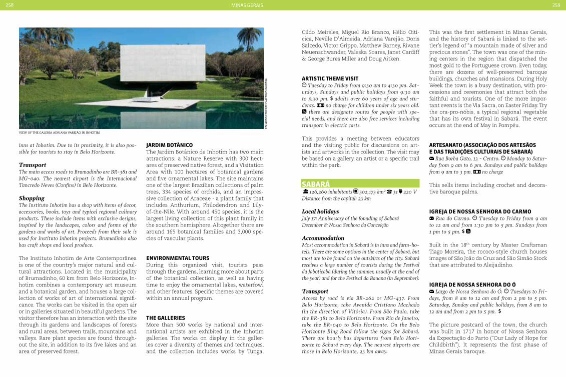
minas gerais258 259
inns at Inhotim. Due to its proximity, it is also pos-sible for tourists to stay in Belo Horizonte.
TransportThe main access roads to Brumadinho are BR-381 and MG-040. The nearest airport is the Internacional Tancredo Neves (confins) in Belo Horizonte.
ShoppingThe Instituto Inhotim has a shop with items of decor, accessories, books, toys and typical regional culinary products. These include items with exclusive designs, inspired by the landscapes, colors and forms of the gardens and works of art. Proceeds from their sale is used for Instituto Inhotim projects. Brumadinho also has craft shops and local produce.
The Instituto Inhotim de Arte Contemporânea is one of the country’s major natural and cul-tural attractions. Located in the municipality of Brumadinho, 60 km from Belo Horizonte, In-hotim combines a contemporary art museum and a botanical garden, and houses a large col-lection of works of art of international signifi-cance. The works can be visited in the open air or in galleries situated in beautiful gardens. The visitor therefore has an interaction with the site through its gardens and landscapes of forests and rural areas, between trails, mountains and valleys. Rare plant species are found through-out the site, in addition to its five lakes and an area of preserved forest.
JardIM botÂnIcoThe Jardim Botânico de Inhotim has two main attractions: a Nature Reserve with 300 hect-ares of preserved native forest, and a Visitation Area with 100 hectares of botanical gardens and five ornamental lakes. The site maintains one of the largest Brazilian collections of palm trees, 334 species of orchids, and an impres-sive collection of Araceae - a plant family that includes Anthurium, Philodendron and Lily-of-the-Nile. With around 450 species, it is the largest living collection of this plant family in the southern hemisphere. Altogether there are around 165 botanical families and 3,000 spe-cies of vascular plants.
enVIronMentaL tourSDuring this organized visit, tourists pass through the gardens, learning more about parts of the botanical collection, as well as having time to enjoy the ornamental lakes, waterfowl and other features. Specific themes are covered within an annual program.
tHe GaLLerIeSMore than 500 works by national and inter-national artists are exhibited in the Inhotim galleries. The works on display in the galler-ies cover a diversity of themes and techniques, and the collection includes works by Tunga,
Cildo Meireles, Miguel Rio Branco, Hélio Oiti-cica, Neville D’Almeida, Adriana Varejão, Doris Salcedo, Victor Grippo, Matthew Barney, Rivane Neuenschwander, Valeska Soares, Janet Cardiff & George Bures Miller and Doug Aitken.
artIStIc tHeMe VISIt Tuesday to Friday from 9:30 am to 4:30 pm. Sat-
urdays, Sundays and public holidays from 9:30 am to 5:30 pm. adults over 60 years of age and stu-dents. no charge for children under six years old.
there are designate routes for people with spe-cial needs, and there are also free services including transport in electric carts.
This provides a meeting between educators and the visiting public for discussions on art-ists and artworks in the collection. The visit may be based on a gallery, an artist or a specific trail within the park.
Sabará 126,269 inhabitants 302,173 km² 31 220 VDistance from the capital: 23 km
Local holidaysJuly 17: Anniversary of the founding of SabaráDecember 8: Nossa Senhora da conceição
AccommodationMost accommodation in Sabará is in inns and farm-ho-tels. There are some options in the center of Sabará, but most are to be found on the outskirts of the city. Sabará receives a large number of tourists during the Festival da Jaboticaba (during the summer, usually at the end of the year) and for the Festival da Banana (in September).
TransportAccess by road is via BR-262 or MG-437. From Belo Horizonte, take Avenida cristiano Machado (in the direction of Vitória). From São Paulo, take the BR-381 to Belo Horizonte. From Rio de Janeiro, take the BR-040 to Belo Horizonte. On the Belo Horizonte Ring Road follow the signs for Sabará. There are hourly bus departures from Belo Hori-zonte to Sabará every day. The nearest airports are those in Belo Horizonte, 23 km away.
This was the first settlement in Minas Gerais, and the history of Sabará is linked to the set-tler’s legend of “a mountain made of silver and precious stones”. The town was one of the min-ing centers in the region that dispatched the most gold to the Portuguese crown. Even today, there are dozens of well-preserved baroque buildings, churches and mansions. During Holy Week the town is a busy destination, with pro-cessions and ceremonies that attract both the faithful and tourists. One of the more impor-tant events is the Via Sacra, on Easter Friday. Try the ora-pro-nóbis, a typical regional vegetable that has its own festival in Sabará. The event occurs at the end of May in Pompéu.
arteSanato (aSSocIação doS arteSãoS e daS tradIçõeS cuLturaIS de Sabará)
Rua Borba Gato, 13 - centro. Monday to Satur-day from 9 am to 6 pm. Sundays and public holidays from 9 am to 3 pm. no charge
This sells items including crochet and decora-tive baroque palms.
IGreJa de noSSa SenHora do carMo Rua do carmo. Tuesday to Friday from 9 am
to 12 am and from 1:30 pm to 5 pm. Sundays from 1 pm to 5 pm.
Built in the 18th century by Master Craftsman Tiago Moreira, the rococo-style church houses images of São João da Cruz and São Simão Stock that are attributed to Aleijadinho.
IGreJa de noSSa SenHora do Ó Largo de Nossa Senhora do Ó. Tuesdays to Fri-
days, from 8 am to 12 am and from 2 pm to 5 pm. Saturday, Sunday and public holidays, from 8 am to 12 am and from 2 pm to 5 pm.
The picture postcard of the town, the church was built in 1717 in honor of Nossa Senhora da Expectação do Parto (“Our Lady of Hope for Childbirth”). It represents the first phase of Minas Gerais baroque.
view of the galeria adriana varejão in inhotim
edu
ar
do
eCK
enfe
ls-a
Cer
Vo
inH
oti
m

minas gerais260 261
IGreJa de noSSa SenHora do roSárIo doS pretoS
Praça Melo Viana. Tuesday to Sunday from 9 am to 11 am and from 1 pm to 5 pm.
The church was built by the ‘Irmandade dos Homens Pretos de Barra do Sabará’ in 1713. Be-cause of lack of funds, the slaves took almost 100 years to complete its construction.
MuSeu do ouro Rua da Intendência - centro. Tuesday to Sun-
day from 12 am to 5 pm.
The collection includes machinery and tools used to mine gold, a press from 1630, and an image of Sant’Anna attributed to Aleijadinho.
teatro MunIcIpaL Rua Dom Pedro II. Monday to Friday from 8 am
to 12 am and from 1 pm to 5 pm
Brazil’s second oldest theater still in operation, it has one of the best acoustics in Latin America and was built during the decline of the Gold Rush. The influence of English theaters of the period can be seen in its architectural lines.
MarIana 54,219 inhabitants 1,194.207 km² 31 110 V. Distance from the State capital: 110 km
Local holidaysJuly 16: Anniversary of the founding of Mariana
AccommodationThe town is one of the most sought after by those who appreciate good food and historical tourism. Mariana is making ongoing investments in its hotel infrastructure, and the town offers accommodation in hotels and inns. The most charming are housed in baroque buildings, following the prevailing architec-tural style of the town.
TransportAccess is via highways BR-356 and MG-262, or by train on the Ouro Preto - Mariana steam train. The nearest airport is the International Airport Tancredo Neves, located 116 km away in Belo Horizonte.
Mariana was the first capital of Minas Gerais and was the largest gold producer during the 18th century. Visiting Mariana is like travel-ing back in time, with its rich historical center, churches, museums and colonial buildings pro-viding an indication of the opulence of the gold period. The best way to town is by walking. The town center is where the main attractions such as the baroque churches can be found, in partic-ular the Basilica da Sé. The Passagem gold mine is open to visitors, and is another tourist at-traction that should not be missed. You can see how the metal that gave fame to the region was extracted. It is located in Passagem de Mariana district, 5 km from the center of Mariana. The annual Carnival celebration recalls the town’s history, with a lively carnival parade. Mariana’s Catholic traditions also provide some pictur-esque religious events such as processions.
catedraL baSíLIca da SÉ Praça claudio Manoel, no number - centro. Tuesday to Sunday, from 8 am to 6 pm.
The Basilica was founded in 1760 and is con-sidered to be one of the most richly decorated in Brazil. It has Bohemian crystal chandeliers, altars carved by Francisco Xavier de Brito and paintings by Athayde. But its great treasure is a German organ made in 1701 and measuring
seven meters in height and five meters in width. It attracts both local residents and tourists when it is played on Friday and Sunday mornings.
IGreJa noSSa SenHora do roSárIodoS pretoS
Rua Monsenhor Horta, no number - Rosário. Monday to Friday, from 1:30 pm to 7 pm.
The church was built in 1752, and brings to-gether Santa Efigênia, São Benedito and Nossa Senhora do Rosário. The ceiling painting is by the master Athaíde, and there are sculptures by the Portuguese artist Francisco Vieira Servas.
MuSeu arQuIdIoceSano de arte Sacra Rua Frei Durão, no number - centro. Tuesday
to Friday from 8:30 am to 12 am and from 1:30 pm to 5 pm. Saturdays, Sundays and holidays, from 8:30 am to 2 pm. Open Mondays during the months of january and july.
The museum holds a wide variety of works by Aleijadinho, paintings by Athaíde, as well as religious objects in silver and gold and re-ligious costumes and sculptures from the 17th
and 19th centuries. The museum is housed in a mansion built in 1770.
MInaS da paSSaGeM Rua Eugênio Eduardo Rapallo, 192. Passagem de
Minas district, 5 km from the center of Mariana. daily from 9 am to 5:30 pm. Monday and Tuesday
closes at 5 pm.
The complex was inaugurated in 1719 and de-activated in 1985. It yielded over 35 tons of gold in over two centuries of operation. Today is one of the largest mines in the world that is open to the public. The entry to the mine is via a trolley (a small wagon with seats) that runs along 315 meters of track, taking the visitor to a depth of 120 meters. On the way down tunnels and lakes can be seen, where cave diving is practiced. The tour is accompanied by guides who tell of the curiosities and the history of the mine.
Master of the brushesManuel da costa Athaíde, or Master Athaíde, worked with Aleijadinho and is considered to be one of the most important names in religious painting in the region. He was responsible for bringing painting in perspective and ceiling decoration to Minas Gerais. Among his more important works are the ceiling of the Igreja de Santa Bárbara, painted in perspective, and the Igreja de São Francisco de Assis in Ouro Preto.
São João deL reI 84,469 inhabitants 1,464.327 km² 32 110 V
Distance from the State capital: 180 km
Local holidaysDecember 8: Anniversary of the founding of São João del Rei
AccommodationThe town has comfortable inns that cater to every type of tourist. It is possible to encounter accommo-dation in colonial style, with characteristic furniture and excellent breakfasts. There are also options in more modern buildings, with rooms for groups.
TransportThe main highways serving the town are BR-265, BR-383, MG-6, MG-60 and MG-23. There are daily bus services from various locations to São João del Rei. The town also has a regional airport, Pre-feito Octávio de Almeida Neve.
igreja de nossa senhora das mercÊs in são joão del rei
aCe
rV
o s
etu
r-m
g

minas gerais262 263
ShoppingTin is the main raw material for items made in São João del Rei. From coffee sets to candlesticks, the town offers variety of products. Items in wood can also be found. Swiss rolls produced in nearby Lagoa Dourada are famous throughout the State and are sold in the center of São João.
“The land where the bells speak”. Thus it is known to the town of São João del Rei. And all because of a curious tradition: the ringing of the bell tells where, when, who will hold a re-ligious ceremony. The sound of the bells can also tell if there will be a procession, and in the case of funerals, if the deceased was a man or woman. A rich tradition that, along with beautiful historical sites, makes the town a very popular tourist destination. The town of São João del Rei grew out of the former Arraial Novo do Rio das Mortes. Occupation of the vil-lage dates back to 1704, when the office work-er Lourenço Costa discovered gold in the São Francisco Xavier creek. By 1713 it was already quite prosperous, and the location was raised to the stature of town, receiving the name São João Del-Rei in honor of Dom João V, the King of Portugal. It is worth taking the time for a ride in the steam train that connects São João to Tiradentes, passing along the “old trail” with its beautiful waterfalls.
Garden HILL GoLF cLub BR-383, Km 96 (entrance to the town). Not
including equipment
The Garden Hill Golf Club has a course that caters to all levels of players. It has a 150 yard driving range, equipment for golf lessons and six bays for practice throughout the year.
taLeS oF MIdnIGHt or São João LeGendS (nIGHt-tIMe SIGHtSeeInG tour)
Largo do Rosário. 2h
The tour takes visitors around the town’s tour-ist sites, where tales or scenes from the book of writer Lincoln de Souza are enacted. Note: A
minimum group of ten people is required for the scenes to be enacted. When there are fewer peo-ple, the tales are only read out. There are seven tales in seven different points around the town. • Chica mal acabada, at the Municipal Theater• Segredo, at the Igreja de São Gonçalo• Sacrilégio, at the Igreja de São Francisco• O Retrato, at house no. 33 on Rua Santo Antônio• Missa das Almas, at the Igreja de Nossa Senhora do Pilar• Defunto que o diabo levou, at the Mansão da Baronesa• Irmão Moreira, in the Cemitério do Carmo
IGreJa de noSSa SenHora do carMo Rua Dr. Augusto dos Viegas chagas, no number,
centro. Monday to Saturday from 7 am to 12 am and from 1 pm to 4 pm. Sunday from 7 am to 12 am.
The church was constructed in 1732 and its interior houses an image carved in wood, the famous “Cristo Inacabado” (author unknown). The roof, side altars and some images are by Joaquim Francisco de Assis Pereira.
IGreJa de São FrancISco de aSSIS Praça Frei Orlando Plaza, 170 - centro. Monday
from 8 am to 4 pm. Tuesday to Saturday from 8 am to 5 pm. Sundays from 8 am to 2:30 pm.
The town’s main tourist attraction of the city, the church was built in 1774 and sits amidst a garden of royal palms. The facade has carvings in soapstone, and its interior houses a Baccarat crystal chandelier. It also has a cemetery; Presi-dent Tancredo Neves is buried here.
MuSeu FerroVIárIo Avenida Hermílio Alves , 366 - São João Del Rei. Tuesday to Saturday from 9 am to 11 am and from
1 pm to 5 pm. Sunday from 9 am to 1 pm.
The São João del Rei railroad was inaugurated in 1881 by Dom Pedro II. It is a living museum, with machinery and equipment from the 19th century.
tIradenteS 6,961 inhabitants 83,047 km² 32 110 V
Distance from the capital: 190 km
Local holidaysJanuary 19: Anniversary of the founding of Tiradentes
AccommodationThere are hotels and inns in and around the town cen-ter. Accommodation in colonial style buildings is the most captivating and also the most sought after. Many inns and hotels offer package tours to the region’s more traditional attractions, such as steam train rides.
TransportAccess road to the town of Tiradentes is via the BR-040 and BR-265 highways. The nearest airport is 14 km away, at São João del Rei.
The historic town of Tiradentes offers a mix of culture, religion and nature. There are impor-tant examples of Baroque art located through-out the town, with architecture showing the
colonial houses in tiradentes
touch of the sculptor Aleijadinho. Reserve some time to stroll among the old mansions and take a look at local crafts. In July classic motorcycle fans gather in Tiradentes for the Bike Fest. Soon after, in August, the whole town participates in the Festival Gastronômico, which is considered to be one of Brazil’s big-gest haute-cuisine events.
IGreJa de noSSa SenHora do roSárIo doS pretoS
Rua Direita, no number. Tuesday to Sunday from 10 am to 5 pm.
The paintings on the ceiling representing the fifteen mysteries of the Rosary are by Victor Ma-noel de Jesus, who is buried in the church. Of mixed race, Manoel lived during the time of slav-ery, and was responsible for the paintings on the ceiling the retable (a large shrine found above the altar in baroque churches) in the church, a project that took three years to complete.
Ba
nCo
de
ima
gen
s d
o m
inis
tér
io d
o t
ur
ism
o

minas gerais264 265
MatrIz de Santo antÔnIo Rua da câmara, no number. daily from 9 am
to 12 am and from 2:30 pm to 5 pm. at the side of the church
The church is considered to be the second most richly decorated in Brazil, with its gilded altars and carvings. It is home to one of the fif-teen most important organs in the world. On Friday, Saturday and Sunday evenings a light show accompanies a presentation on the his-tory of the church.
HorSe and carrIaGe rIde, LarGo daS ForraS Largo das Forras. daily from 9 am to 9 pm.
The carriages take tourists around the town’s main points of interest, such as the churches of Nossa Senhora do Rosário dos Pretos, Nossa Sen-hora das Mercês, Matriz de Santo Antônio, the Chafariz de São José and the Museu Padre Toledo.
baLneárIo daS áGuaS SantaS Avenida Presidente castelo Branco, no number. daily from 9 am to 6 pm. partial
The site has water known for its curing powers flowing from underground springs. Attractions include a beautiful lake with paddleboats.
dIaMantIna 45,880 inhabitants 3,891 km² 38 110 V
Distance from the capital: 292 km
Local holidaysOctober 13: Anniversary of the founding of Diamantina
AccommodationThe tourist will find a variety of different types of ac-commodation in hotels and inns. A good tip is to seek establishments close to locations where the town’s musical performances are held, such as serenades and songs sung from the balconies of historic mansions.
TransportThe main highways serving the town are the BR-
259, MG-2, MG-121 and BR-367. There is also a regional airport with flights from Belo Horizonte on Fridays and Sundays.
Situated in the middle of the Espinhaço Moun-tains and known as the “Cidades das Serenatas”, it takes the visitor back to ancient and romantic times, when gold and diamonds were found here. Mining was responsible for the origins of the town. With origins in a settlement from around 1722, by 1730 urban development led to the formation of the town of Diamantina. The historical center of the town has now been declared a World Heritage Site by UNESCO. Diamantina gains new colors, sounds, and visitors during its religious festivals. The Festa do Divino is held seven weeks after Easter Sunday, when participants dress in Impe-rial period costumes for the parade. The Festa de Nossa Senhora do Rosário is held in the first half of October, with its novenas, banners, a Festival Mass and procession. The procession of the Royal Court takes place on the principal day of the fes-tival. The town’s craftwork was chosen as the of-ficial representative for the 2014 World Cup.
caSa de cHIca da SILVa Praça Lobo Mesquita, 266. Tuesday to Saturday
from 12 am to 5 pm, Sundays from 9 am to 12 am. no charge
This was the residence of the slave Chica da Silva between the years 1763 and 1771. Chica was a freed slave who maintained a stable rela-tionship with a diamond trader and reached a celebrated position in local society. The house is a symbol of the most prosperous phase of this diamond mining town.
JeQuItInHonHa - VaLLey oF tHe potterIeS Rua Macau do Meio, 401. Monday to Thursday
from 8 am to 6 pm (“Relics of the Valley” Potteries)
Crafts from Jequitinhonha Valley are famous, especially the clay figures inspired by every-day scenes. The region also offers items in other materials such as embroidery, basketry, wood and leather.
cooperatIVa arteSanaL reGIonaL de dIaMantIna
Rua das Bicas, 115 - Serrano. Monday to Friday from 9 am to 12 am and from 2 pm to 5 pm. Saturday and Sunday from 9 am to 5 pm
Wool-woven Arraiolos rugs are one of the best known handicraft products in Diamantina, made using a technique that arrived in the re-gion in the 17th century. In addition to carpets, the cooperative also sells products such as jew-elry and straw dolls.
IGreJa noSSa SenHora do roSárIo doS pretoS
Praça Dom Joaquim (Old Largo do Rosario), no number - centro. Tuesday to Saturday from 9 am to 12 am and from 1 pm to 5 pm.
The church was built in 1731, and is one of the old-est in Diamantina. It has a unique tower, which is listed by IPHAN, the Brazilian preservation Insti-tute. Outside the church is the Cruz da Gameleira and the Chafariz do Rosário, dated 1787.
MuSeu do dIaMante Rua Direita, 14 - centro. Tuesday to Saturday
from 12 am to 5:30 pm. Sundays and holidays from 9 am to 12 am.
The museum collection includes objects used in diamond mining as well as oratorios, weap-ons, pottery, artwork and furniture from the 17th to the 19th century.
paSSadIço caSa da GLÓrIa Rua da Glória, 297/298 - centro. daily from 8
am to 12 am and from 1 pm to 6 pm.
One of the picture postcards of Diamantina, this is an 18th century construction with two houses connected by a passageway above the street. The older of the houses belonged to the Portuguese Crown and later to Dona Josefa Ma-ria da Glória. Today it is the Headquarters of the Federal University Center for Geology.
ouro preto 70,281 inhabitants 1,245.864 km² 31 110 V
Distance from the capital: 96 km
Local holidaysJuly 8: Anniversary of the foundation of Ouro Preto
AccommodationOuro Preto has the greatest number of rooms among the historical cities of Minas Gerais. There are hotels, inns, and a few options for those who prefer to camp. There are also apart-hotels in town as well as some charming farm-hotels in the surrounding region. The gastronomy is another strong point of the hotels and inns, which are proud to offer elaborate breakfasts and typical regional dishes on their menus.
ShoppingFamous for its minerals and decorative crafts, Ouro Preto has several ateliers selling religious art and sculptures. The fair at the Largo de coimbra opens daily from 8 am to 6 pm and offers a wide variety of typical regional items carved in soapstone.
TransporteThe main highways serving the town are BR-356 and MG-030. The nearest airport is Tancredo Neves in Belo Horizonte, 140 km from Ouro Preto.
igreja de nossa senhora do carmo in ouro Preto
nen
o V
ian
na
-Ba
rr
oCo
pr
ess/
emB
rat
ur
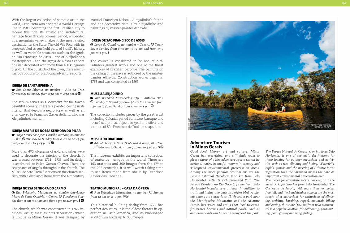
minas gerais266 267
With the largest collection of baroque art in the world, Ouro Preto was declared a World Heritage Site in 1980, becoming the first Brazilian city to receive this title. Its artistic and architectural heritage from Brazil’s colonial period, embedded in a mountain valley, makes it the most visited destination in the State. The old Vila Rica with its steep cobbled streets hold parts of Brazil’s history, as well as veritable treasures such as the Igreja de São Francisco de Assis - one of Aleijadinho’s masterpieces - and the Igreja de Nossa Senhora do Pilar, decorated with more than 400 kilograms of gold. On the outskirts of the town, there are nu-merous options for practicing adventure sports.
IGreJa de Santa eFIGÊnIa Rua Santa Efigenia, no number - Alto da cruz. Tuesday to Sunday from 8:30 am to 4:30 pm.
The atrium serves as a viewpoint for the town’s beautiful scenery. There is a painted ceiling in its interior that depicts a negro Pope, as well as an altar carved by Francisco Xavier de Brito, who was Aleijadinho’s mentor.
IGreJa MatrIz de noSSa SenHora do pILar Praça Monsenhor João castilho Barbosa, no number
- Pilar. Tuesday to Sunday from 9 am to 10:45 pm and from 12 am to 4:45 pm.
More than 400 kilograms of gold and silver were used to decorate the interior of the church. It was erected between 1711 - 1733, and its design is attributed to Pedro Gomes Chaves. There are sculptures of angels throughout the church. The Museu de Arte Sacra functions on the church sac-risty, with a display of items from the 18th century.
IGreJa noSSa SenHora do carMo Rua Brigadeiro Musqueira, no number (previously
Morro de Santa Quitéria) - centro. Tuesday to Sun-day from 9 am to 11 am and from 1 pm to 4:45 pm.
The church, which was constructed in 1766, in-cludes Portuguese tiles in its decoration - which is unique in Minas Gerais. It was designed by
Manuel Francisco Lisboa - Aleijadinho’s father, and has decorative details by Aleijadinho and paintings by master-painter Athayde.
IGreJa de São FrancISco de aSSIS Largo do coimbra, no number - centro. Tues-
day o Sunday from 8:30 am to 12 am and from 1:30 pm to 5 pm.
The church is considered to be one of Alei-jadinho’s greatest works and one of the finest examples of Brazilian baroque. The painting on the ceiling of the nave is authored by the master-painter Athayde. Construction works began in 1765 and was completed in 1869.
MuSeu aLeIJadInHo Rua Bernardo Vasconcelos, 179 - Antônio Dias. Tuesday to Saturday from 8:30 am to 12 am and from
1:30 pm to 5 pm. Sunday from 12 am to 5 pm.
The collection includes pieces by the great artist including Colonial period furniture, baroque and rococó sculptures, objects in gold and silver and a statue of São Francisco de Paula in soapstone.
MuSeu do oratÓrIo Adro da Igreja de Nossa Senhora do carmo, 28 - cen-
tro. Monday to Sunday from 9:30 am to 5:30 pm.
The museum exhibits an important collection of oratorios - unique in the world. There are 163 oratories and 300 images from the 17th to the 20th centuries. It is well worth taking time to see items made from shells by Francisco Xavier das Conchas.
teatro MunIcIpaL – caSa da Ópera Rua Brigadeiro Musqueira, no number. Sunday
from 12 am to 5:30 pm.
This historical building dating from 1770 has perfect acoustics. It is the oldest theater in op-eration in Latin America, and its lyre-shaped auditorium holds up to 350 people.
adventure tourism in Minas GeraisGood food, history, art and culture. Minas Gerais has everything, and still finds room to please those who like adventure sports within its national parks, beautiful mountain scenery and widespread environmental preservation areas. Among the more popular destinations are the Parque Estadual Itacolomi (100 km from Belo Horizonte), with its rich preserved flora. The Parque Estadual do Rio Doce (248 km from Belo Horizonte) includes several lakes. In addition to trails and hiking, the park also offers bird watch-ing among its attractions. Ibitipoca, a park near the Mantiqueira Mountains and the Atlantic Forest, has walks and trails that lead to caves, freshwater beaches and natural pools. Orchids and bromeliads can be seen throughout the park.
The Parque Natural do caraça, (130 km from Belo Horizonte) is one of the main destinations for those looking for outdoor excursions and activi-ties such as tree climbing and hiking. Waterfalls, rapids, grottos and the meeting of Atlantic forest vegetation with the savannah makes the park an important environmental preservation area. The mecca for adventure sports, however, is in the Serra do cipó (100 km from Belo Horizonte). The cachoeira da Farofa, with more than 70 meters free fall, and the Bandeirinhas canyon are the most sought after attractions for enthusiasts of climb-ing, trekking, kayaking, rappel, mountain biking and caving. Ibituruna (324 km from Belo Horizon-te) is a popular location for ballooning, parachut-ing, para-gliding and hang gliding.
ro
Ber
to s
eBa
adventure tourism in serra do ciPÓ
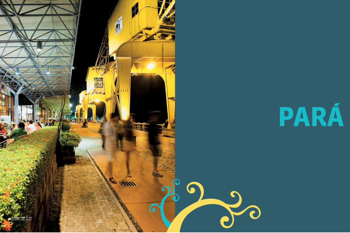
269
paráfe
lip
e g
om
Bo
ssy/
emB
rat
ur
restaurants in the estação das docas
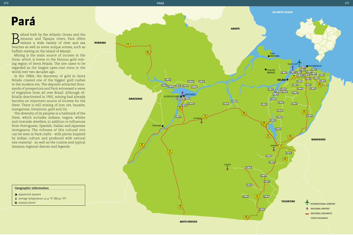
pará270 271
atLantIc ocean
210BR
163BR
163BR
163BR
163BR
158BR
156BR
230BR
010BR
222BR
316BR
316BR
422BR
230BR
230BR
153BR
230BR
230BR
alter do CHãosantarém
ilHa do marajó
beLÉM
salinópolis
itaituBa
ilHa meXiana
PA-254
PA-439PA-437 PA-429
PA-254 PA-254
PA-423
PA-457 PA-431
PA-370 PA-415
PA-167
PA-156
PA-156
PA-469
PA-151
PA-151PA-252
PA-475 PA-140
PA-252
PA-256
PA-125
PA-150
PA-257
PA-459
PA-150
PA-150
PA-449
PA-327
PA-411
PA-287
PA-235
PA-279
PA-124
PA-253
PA-127
PA-140
PA-154 PA-140 PA-136
PA-430
PA-395 PA-446
PA-124PA-448
PA-112
PA-102PA-380
PA-242PA-320 PA-324
PA-475
PA-475
PA-475
PA-263
PA-433
aMapá
roraIMa
aMazonaS
Mato GroSSo
tocantInS
MaranHão
PA-427
PA-435
pará
Bathed both by the Atlantic Ocean and the Amazon and Tapajos rivers, Pará offers visitors a wide variety of river and sea
beaches as well as some unique scenes, such as buffalo rearing on the island of Marajó.
Mining is the main source of income in the State, which is home to the famous gold min-ing region of Serra Pelada. The site came to be regarded as the largest open-cast mine in the world over two decades ago.
In the 1980s, the discovery of gold in Serra Pelada created one of the biggest gold rushes in the modern era. The deposits attracted thou-sands of prospectors and Pará witnessed a wave of migration from all over Brazil. Although of-ficially deactivated in 1992, mining had already become an important source of income for the State. There is still mining of iron ore, bauxite, manganese, limestone, gold and tin.
The diversity of its peoples is a hallmark of the State, which includes indians, negros, whites and riverside-dwellers, in addition to influences from Portuguese, Spanish, Italian and Japanese immigrants. The richness of this cultural mix can be seen in Pará crafts - with pieces inspired by Indian culture and produced with natural raw material - as well as the cuisine and typical Amazon regional dances and legends.
Geographic information
equatorial amazon average temperature 31.4 °c (88,52 °F) amazon forest international airport
national airport
national HigHways
state HigHways
maraBá
Val-de-Cans
Carajás
altamira
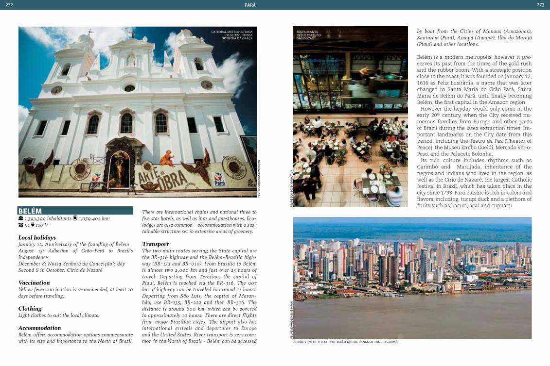
pará272 273
catedral metroPolitana de Belém - nossa
senhora da graça
beLÉM 1,393,399 inhabitants 1,059.402 km2
91 110 V
Local holidaysJanuary 12: Anniversary of the founding of Belém August 15: Adhesion of Grão-Pará to Brazil’s Independence December 8: Nossa Senhora da conceição’s day Second S in October: círio de Nazaré
VaccinationYellow fever vaccination is recommended, at least 10 days before traveling.
Clothing Light clothes to suit the local climate.
AccommodationBelém offers accommodation options commensurate with its size and importance to the North of Brazil.
feli
pe
go
mB
oss
y/em
Br
atu
r
There are international chains and national three to five star hotels, as well as inns and guesthouses. Eco-lodges are also common - accommodation with a sus-tainable structure set in extensive areas of greenery.
TransportThe two main routes serving the State capital are the BR-316 highway and the Belém-Brasilia high-way (BR-153 and BR-010). From Brasilia to Belém is almost two 2,000 km and just over 23 hours of travel. Departing from Teresina, the capital of Piauí, Belém is reached via the BR-316. The 907 km of highway can be traveled in around 11 hours. Departing from São Luis, the capital of Maran-hão, use BR-135, BR-222 and then BR-316. The distance is around 800 km, which can be covered in approximately 10 hours. There are direct flights from major Brazilian cities. The airport also has international arrivals and departures to Europe and the United States. River transport is very com-mon in the North of Brazil - Belém can be accessed
by boat from the cities of Manaus (Amazonas), Santarém (Pará), Amapá (Amapá), Ilha do Marajó (Piauí) and other locations.
Belém is a modern metropolis, however it pre-serves its past from the times of the gold rush and the rubber boom. With a strategic position close to the coast, it was founded on January 12, 1616 as Feliz Lusitânia, a name that was later changed to Santa Maria do Grão Pará, Santa Maria de Belém do Pará, until finally becoming Belém, the first capital in the Amazon region.
However the heyday would only come in the early 20th century, when the City received nu-merous families from Europe and other parts of Brazil during the latex extraction times. Im-portant landmarks on the City date from this period, including the Teatro da Paz (Theater of Peace), the Museu Emílio Goeldi, Mercado Ver-o-Peso, and the Palacete Bolonha.
Its rich culture includes rhythms such as Carimbó and Marujada, inheritance of the negros and indians who lived in the region, as well as the Círio de Nazaré, the largest Catholic festival in Brazil, which has taken place in the city since 1793. Pará cuisine is rich in colors and flavors, including tucupi duck and a plethora of fruits such as bacuri, açaí and cupuaçu.fe
lip
e g
om
Bo
ssy/
emB
rat
ur
restaurants in the estação das docas
feli
pe
go
mB
oss
y/em
Br
atu
r
aerial view of the city of Belém on the BanKs of the rio guamá

pará274 275
coMpLexo FeLIz LuSItÂnIa Praça D. Frei caetano Brandão, 117 - cidade
Velha. Tuesday to Sunday, from 10 am to 8 pm. Public holidays, from 9 am to 1 pm. (students pay half price) at the fort. For other attractions there is no charge for admission.
This is the oldest part of the city, and is home to historic buildings dating from the 17th and 18th centuries, including the Catedral Metropo-litana de Belém (which is where the procession begins for the Círio de Nazaré), Santo Alexandre and the Forte do Presépio, among others. Here tourists can visit the buildings and learn a little more about the history of the city.
eStação daS docaS Boulevard castilhos França, 707 - campina. variable - each restaurant and store has its own
opening times, some being open through the day and others at night. no charge for entry, consumption is charged by each establishment.
Opened in 2000 in an area that was previously occupied by the old port of Pará, Estação das Docas houses restaurants serving regional and international cuisine, as well as craft shops and an area for events.
baSíLIca de nazarÉ e MuSeu do círIo Praça Justo chermont - Nazaré. the Basilica is
open daily from 10 am to 6 pm. The museum is open from Tuesday to Sunday from 10 am to 6 pm. no charge for the Basílica. museum.
This is the most important church in Pará, built in honor of Nossa Senhora de Nazaré, the pa-tron saint of the State. Be sure to also visit the Museu do Círio de Nazaré housed in the crypt of the Basilica, which is dedicated to the largest religious festival in Northern Brazil.
SantarÉM 294,580 inhabitants 22,886.761 km² 91
110 V Distance from the State capital: 1,520 km
Local holidaysJune 22: Anniversary of the founding of Santarém August 15: Adhesion of Grão-Pará to Brazil’s Independence December 8: Nossa Senhora da conceição’s daySecond Sunday in October: círio de Nazaré
VaccinationYellow fever vaccination is recommended at least 10 days before traveling.
ClothingBring light and comfortable clothes, and use sun-screen and insect repellent when walking near lakes and streams.
AccommodationSantarém is the regional center and gateway to the beautiful beaches of the Rio Tapajós. The town offers small hotels (mostly three and four star rating) and pleasant inns, some situated by the river.
TransportAccess by road from Belém via BR-163 (Santarém-cuiabá Federal highway). The distance of 1,443 km takes around 18 hours. Air transport is available, with daily flights arriving at the Santarém Airport - Maestro Wilson Fonseca. There are air links from Santarém to Belém and Manaus, around one hour’s travel. To reach Santarém by river is around 880 km from Belém or 756 km from Manaus.KiosKs selling regional sPices and food Product in mercado ver-o-Peso
Belém city center
feli
pe
go
mB
oss
y/em
Br
atu
r
feli
pe
go
mB
oss
y/em
Br
atu
r
má
rCi
o w
. mo
nte
iro
parQue naturaLíStIco ManGaL daS GarçaS Passagem carneiro da Rocha - cidade Velha. Tuesday to Sunday from 9 am to 6 pm. Reserva
José Márcio Ayres (collection of Butterflies), Farol de Belém, Viveiro das Aningas, Memorial da Navegação da Amazônia, Passport (one price for all attractions)
This location is home to hundreds of aquatic birds, including herons, and has a butterfly garden and a viewpoint from where it is pos-sible to view the Rio Guamá. Next to the his-toric city center, the park was inaugurated in 2005 in an area that was formerly a part of the City that was flooded.
Mercado Ver-o-peSo Av. castilhos França - cidade Velha. daily
from 5 am to 2 pm.
One of the City’s landmarks, this majestic market offers an opportunity to get to know the ingredients in Pará cooking, as well as sampling them at the stalls. The same com-plex houses the Estação das Docas, Mercado da Carne (Meat Market), Mercado do Ferro (Iron Market), Praça do Relógio (Clock Tower Square) and the Feira do Açaí.
mercado ver-o-Peso
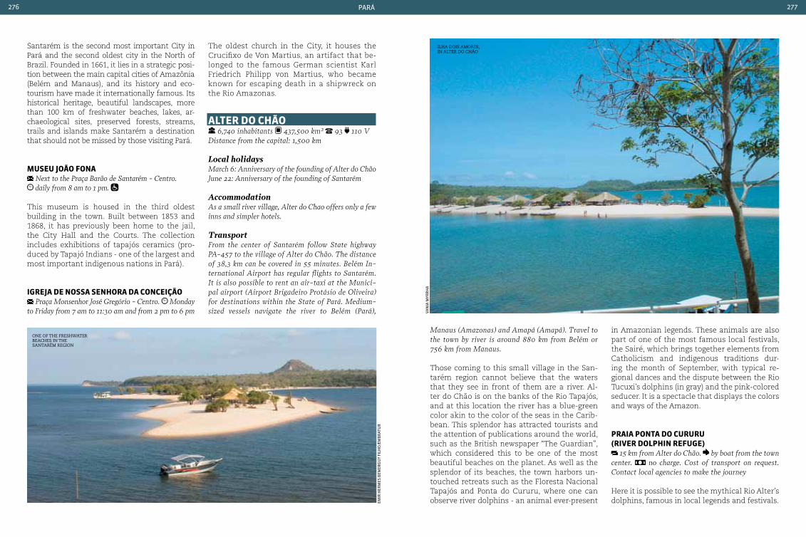
pará276 277
Santarém is the second most important City in Pará and the second oldest city in the North of Brazil. Founded in 1661, it lies in a strategic posi-tion between the main capital cities of Amazônia (Belém and Manaus), and its history and eco-tourism have made it internationally famous. Its historical heritage, beautiful landscapes, more than 100 km of freshwater beaches, lakes, ar-chaeological sites, preserved forests, streams, trails and islands make Santarém a destination that should not be missed by those visiting Pará.
MuSeu João Fona Next to the Praça Barão de Santarém - centro. daily from 8 am to 1 pm.
This museum is housed in the third oldest building in the town. Built between 1853 and 1868, it has previously been home to the jail, the City Hall and the Courts. The collection includes exhibitions of tapajós ceramics (pro-duced by Tapajó Indians - one of the largest and most important indigenous nations in Pará).
IGreJa de noSSa SenHora da conceIção Praça Monsenhor José Gregório - centro. Monday
to Friday from 7 am to 11:30 am and from 2 pm to 6 pm
The oldest church in the City, it houses the Crucifixo de Von Martius, an artifact that be-longed to the famous German scientist Karl Friedrich Philipp von Martius, who became known for escaping death in a shipwreck on the Rio Amazonas.
aLter do cHão
6,740 inhabitants 437,500 km² 93 110 VDistance from the capital: 1,500 km
Local holidaysMarch 6: Anniversary of the founding of Alter do chão June 22: Anniversary of the founding of Santarém AccommodationAs a small river village, Alter do chao offers only a few inns and simpler hotels.
TransportFrom the center of Santarém follow State highway PA-457 to the village of Alter do chão. The distance of 38,3 km can be covered in 55 minutes. Belém In-ternational Airport has regular flights to Santarém. It is also possible to rent an air-taxi at the Munici-pal airport (Airport Brigadeiro Protásio de Oliveira) for destinations within the State of Pará. Medium-sized vessels navigate the river to Belém (Pará),
Manaus (Amazonas) and Amapá (Amapá). Travel to the town by river is around 880 km from Belém or 756 km from Manaus.
Those coming to this small village in the San-tarém region cannot believe that the waters that they see in front of them are a river. Al-ter do Chão is on the banks of the Rio Tapajós, and at this location the river has a blue-green color akin to the color of the seas in the Carib-bean. This splendor has attracted tourists and the attention of publications around the world, such as the British newspaper “The Guardian”, which considered this to be one of the most beautiful beaches on the planet. As well as the splendor of its beaches, the town harbors un-touched retreats such as the Floresta Nacional Tapajós and Ponta do Cururu, where one can observe river dolphins - an animal ever-present
in Amazonian legends. These animals are also part of one of the most famous local festivals, the Sairé, which brings together elements from Catholicism and indigenous traditions dur-ing the month of September, with typical re-gional dances and the dispute between the Rio Tucuxi’s dolphins (in gray) and the pink-colored seducer. It is a spectacle that displays the colors and ways of the Amazon.
praIa ponta do cururu (rIVer doLpHIn reFuGe)
15 km from Alter do chão. by boat from the town center. no charge. cost of transport on request.contact local agencies to make the journey
Here it is possible to see the mythical Rio Alter’s dolphins, famous in local legends and festivals.em
ir H
erm
es B
emer
gu
y fi
lHo
/em
Br
atu
r
Van
ia m
yrr
Ha
one of the freshwater Beaches in the santarém region
ilha dois amores, in alter do chão
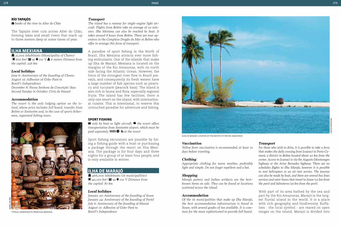
pará278 279
río tapaJÓS banks of the river in Alter do chão
The Tapajós river cuts across Alter do Chão, forming lakes and small rivers that reach up to three meters deep at some times of year.
ILHa MexIana 21,005 inhabitants (Municipality of chaves)
670 km² 91 110 V 6 meters Distance from the capital: 226 km
Local holidaysJune 6: Anniversary of the founding of chaves August 15: Adhesion of Grão-Pará to Brazil’s Independence December 8: Nossa Senhora da conceição’ days Second Sunday in October: círio de Nazaré AccommodationThe resort is the only lodging option on the is-land, whose price includes full board, transfer from Belém or Santarém and, in the case of sports fisher-men, organized fishing tours.
TransportThe island has a runway for single-engine light air-craft. Flights from Belém take an average of 30 min-utes. Ilha Mexiana can also be reached by boat. It takes around 8 hours from Belém. There are tour op-erators in the complexo Dragão do Mar in Belém who offer to arrange this form of transport.
A paradise of sport fishing in the North of Brazil, Ilha Mexiana attracts ever more fish-ing enthusiasts. One of the islands that make up Ilha de Marajó, Mexiana is located on the margins of the Rio Amazonas, with its north side facing the Atlantic Ocean. However, the force of the strongest river flow in Brazil pre-vails, and consequently its fresh waters have a large number of fish species such as piraru-cu and tucunaré (peacock bass). The island is also rich in fauna and flora, especially regional fruits. The island has few facilities; there is only one resort on the island, with internation-al cuisine. This is intentional, to reserve this untouched paradise for adventure and fishing.
Sport FISHInG only by boat or light aircraft. the resort offers
transportation from Santarém airport, which must be paid separately. at the resort
Sport fishing excursions are possible by hir-ing a fishing guide with a boat or purchasing a package through the resort on Ilha Mexi-ana. The package is for four days and three nights for a group of at least four people, and is only available in winter.
ILHa de MaraJÓ 466,005 inhabitants (16 municipalities) 40,100 km² 91 110 V Distance from
the capital: 87 km
Local holidaysJanuary 20: Anniversary of the founding of SoureJanuary 24: Anniversary of the founding of PortelJuly 6: Anniversary of the founding of Manaú August 15: Adhesion of Grão-Pará to Brazil’s Independence
VaccinationYellow fever vaccination is recommended, at least 10 days before traveling.
ClothingAppropriate clothing for warm weather, preferably light and simple. Do not forget repellent and a hat.
ShoppingMarajó pottery and Indian artifacts are the best-known items on sale. They can be found at locations scattered across the island.
AccommodationOf the 16 municipalities that make up Ilha Marajó, the best accommodation infrastructure is found in Soure, with several grades of inn available. It is com-mon for the more sophisticated to provide full board.
TransportFor those who wish to drive, it is possible to take a ferry that makes the daily crossing from Icoaraci to Porto ca-mará, a district in Belém located about 20 km from the center. Access to Icoaraci is via the Augusto Montenegro highway or the Artur Bernades highway. There are no schedules flights to Ilha Marajó, however it is possible to rent helicopters or an air-taxi service. The journey can also be made by boat, and there are several bus lines services and mini-buses that travel to Soure (31 km from the port) and Salvaterra (25 km from the port).
With part of its area bathed by the sea and part by the Rio Amazonas, Marajó is the larg-est fluvial island in the world. It is a place with rich geography and biodiversity. Buffa-loes - the local symbol - are reared on open ranges on the island. Marajó is divided into
ilha de marajÓ, located at the mouth of the rio amazonascerámica marajoara: arte de los indios de la regiÓn
ra
fael
da
ltr
o
Car
los
ma
Cap
un
a
tyPical handicrafts from ilha mexiana

pará280 281
16 municipalities, the principal towns being Joanes and Soure. Here is it possible to find a good selection of inns and restaurants, as well as guides for more remote tours. Dur-ing walks through the preserved forest is possible to see birds and caiman, the latter especially at night. Marajó pottery is known worldwide and reflects the heritage left by the Marajó Indians. Many of these pieces, such as centuries-old funeral urns, vases, jars and artwork can be seen in the Museu do Marajó in Cachoeira do Arari, one of the small villages on the island.
IGarapÉ da áGua boa the community is located around 14 km from
Salvaterra. the site is via PA-154 (before Joanes) on a dirt road
This is a fishing community where you can en-joy the tranquil waters of the streams, in ad-dition to buying fresh fish to be roasted on a beach campfire, Marajó-style.
praIa do pInHeIro located in the Municipality of Salvaterra, opposite
Praça das comunicações. it is possible to walk from the town center This is one of the most beautiful spots on Ilha Marajó. Praia do Pinheiro is popular with local residents at weekends, when families meet up around the restaurants and kiosks.
praIa do peSQueIro 10 km from the center of Soure. it is possible to
reach the beach by boat from the town center
This is the most popular beach on the island and has the best facilities. Its warm waters attract many visitors during holidays and at weekends.
praIa Grande de SaLVaterra within walking distance, less than 500 meters from
the centro de Salvaterra
This is the principal beach in Salvaterra, with numerous restaurants, bars and inns. At the height of the dry season it is the main meeting point in town.
ItaItuba 97,493 inhabitants 62,040.111 km² 93
110 V Distance from the capital: 1,626 km
Local holidaysAugust 15: Adhesion of Grão-Pará to Brazil’s In-dependence December 8: Nossa Senhora da conceiçãoSecond Sunday in October: círio de NazaréDecember 15: Anniversary of the founding of Itai-tuba
VaccinationYellow fever vaccination is recommended at least 10 days before traveling
ClothingAlthough average temperatures are not high, the use of lightweight, comfortable, clothing is recommend-ed. Insect repellent is essential for outdoor walks.
Accommodationconsidered a medium sized town, Itaituba has few facilities for visitors. There are a few simple inns and hotels, mainly in the central part of town. Some coastal communities offer rooms and houses for rent, but these must be reserved well in advance.
TransportFrom Belém it is 1,374 km by road, which takes ap-proximately 18 hours. Drivers should follow state highways PA-140, PA-252, PA-475, and PA-263. In Tucuruí take BR-422, then BR-230 (Rodovia Transamazônica), which leads to Itaituba. A small part of the route, just before the town of Itaituba, is made by ferry. The town also has a regional airport and it is possible to rent a helicopter or air-taxi.
Located in the Santarém region, on the banks of the Tapajós, Itaituba started out in 1836 as an Indian village, when the States of Pará and Ma-ranhão were still part of Grão-Pará. For a long time the town depended on mining, principally
gold. However with the depletion of the reserves interest turned to the wealth of biodiversity and landscapes around the town, which has now become a center with significant poten-tial for eco-tourism. In great part this is due to the beaches that form during the dry season, caves, the Parque Nacional da Amazônia (Am-azon National Park), the São Luiz do Tapajós
region, and the Tabuleiro de Monte Cristo. In addition to trekking on forest trails and diving in the clear waters of the Tapajós, one can also observe several species of birds and turtles. For those in search of sport fishing, Lago do Jacaré is the best option, with large tucunaré (peacock bass) and filhote - a small fish very popular in regional cuisine.
endless colors and FlavorsPará cuisine is mainly influences by Indian culture, but with some special touches brought by Portuguese and African immigrants. Typical ingre-dients from the Amazon region are the basis for many of the delicacies found in the State. Spices, greens and fruits such as açaí, cupuaçu, cas-tanha-do-pará (Brazil nut), peach, tucumã, muruci, peppers and herbs such as jambu (used in various reci-pes and known for leaving the tongue numb) accompany a wide variety of fish and seafood dishes. Tradi-tional dishes such as pato no tucupi (duck in yellow mandioc sauce), and maniçoba (a type of bean stew) and tacacá (a spicy soup) should not be missed by tourists visiting the State. Be sure to experiment chibá, a broth with manioc flour and water with a slightly acid taste, considered to be the most typical dish in Pará. Leave space for the desserts and liqueurs made with fruits from the Amazon.
jea
n B
ar
Bo
sa
the endless colors of tyPical amazonian fruits
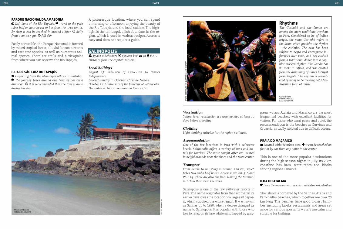
pará282 283
parQue nacIonaL da aMazÔnIa Left bank of the Rio Tapajós. travel to the park
takes half an hour by car or bus from the town center. By river it can be reached in around 1 hour. daily from 9 am to 5 pm. full day
Easily accessible, the Parque Nacional is formed by mixed tropical forest, alluvial forests, streams and rare tree species, as well as numerous ani-mal species. There are trails and a viewpoint from where you can observe the Rio Tapajós.
ILHa de São LuIz do tapaJÓS Departing from the Municipal offices in Itaituba. the journey takes around one hour by car on a
dirt road. it is recommended that the tour is done during the day
A picturesque location, where you can spend a morning or afternoon enjoying the beauty of the Rio Tapajós and the local cuisine. The high-light is the tambaqui, a fish abundant in the re-gion, which is used in various recipes. Access is easy and does not require a guide.
SaLInÓpoLIS 37,421 inhabitants 237.487 km2 91 110 V
Distance from the capital: 220 km
Local holidaysAugust 15: Adhesion of Grão-Pará to Brazil’s Independence Second Sunday in October: círio de NazaréOctober 22: Anniversary of the founding of SalinópolisDecember 8: Nossa Senhora da conceição
rhythmsThe carimbó and the Lundu are among the more traditional rhythms in Pará. considered to be of indian origin, the name carimbó refers to the drum which provides the rhythm - the curimbó. The beat has been subject to negro and Portuguese in-fluences over time, and has evolved from a traditional dance into a pop-ular modern rhythm. The Lundu has its roots in Africa, and was created from the drumming of slaves brought from Angola. The rhythm is consid-ered by many to be the original Afro-Brazilian form of music.
VaccinationYellow fever vaccination is recommended at least 10 days before traveling
ClothingLight clothing suitable for the region’s climate.
AccommodationOne of the few locations in Pará with a saltwater beach, Salinópolis offers a variety of inns and ho-tels for tourists. The most sought after are located in neighborhoods near the shore and the town center.
TransportFrom Belem to Salisbury is around 220 km, which takes two and a half hours. Access is via BR-316 and PA-124. There are also bus lines leaving the terminal in Belém that serve the town.
Salinópolis is one of the few saltwater resorts in Pará. The name originates from the fact that in its earlier days it was the location of a large salt depos-it, which supplied the entire region. It was known as Salinas up to 1920, when a decree changed its name to Salinópolis. It is popular with those who like to relax on its fine white sand lapped by gray-
green waters. Atalaia and Maçarico are the most frequented beaches, with excellent facilities for visitors. For those who want peace and quiet, the recommendation is the beaches at Curvinas and Cruzerio, virtually isolated due to difficult access.
praIa do MaçarIco Located with the urban area. it can be reached on
foot or by car from any point in the center
This is one of the more popular destinations during the high season nights in July. Its 2 km coastline has bars, restaurants and kiosks serving regional snacks.
ILHa do ataLaIa From the town center it is 12 km via Estrada do Atalaia
The island is bordered by the Salinas, Atalia and Farol Velho beaches, which together are over 20 km long. The beaches have good tourist facili-ties, including kiosks, restaurants and areas set aside for various sports. Its waters are calm and suitable for bathing.
gr
up
o d
e Ca
rim
Bó
“os
Qu
ente
s d
a m
ad
ru
ga
da
”
carimBÓ da irmandade de são Benedito
Praia do farol velho, in salinas
Car
los
ma
Cap
un
a
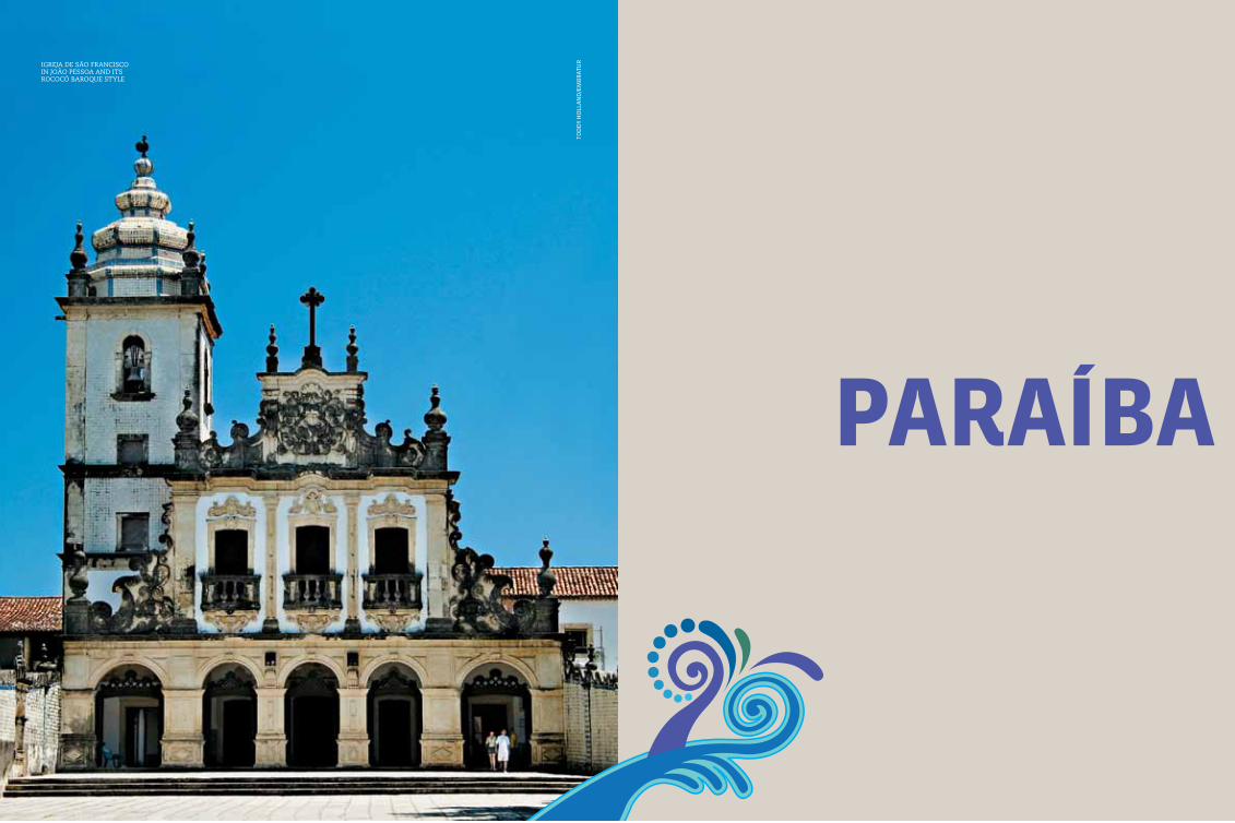
285
paraíbato
dd
y H
oll
an
d/e
mB
rat
urigreja de são francisco
in joão Pessoa and its rococÓ Baroque style
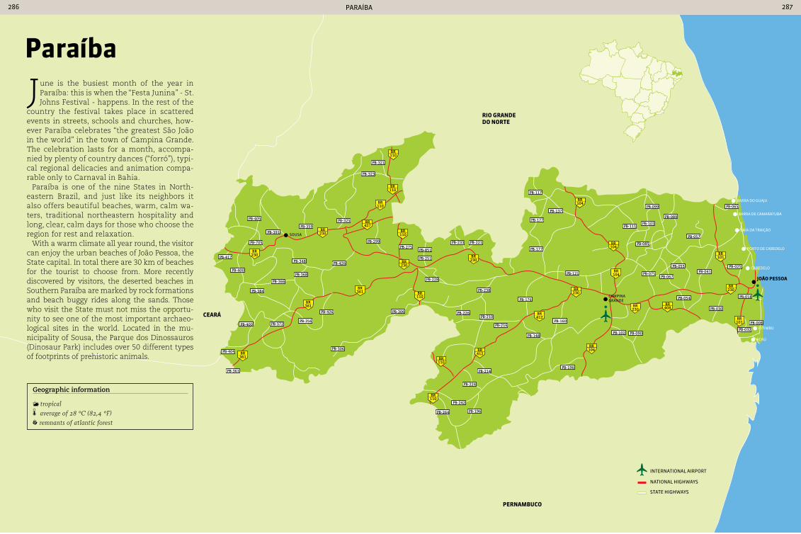
pernaMbuco
ceará
rIo Grande do norte
230BR
230BR
230BR 230
BR
230BR
412BR
412BR
110BR
110BR
230BR
230BR
101BR
101BR
408BR
104BR
104BR
104BR
104BR
361BR
361BR
361BR
110BR
110BR
427BR
110BR
110BR
110BR
João peSSoa
Barra do guaju
Barra de CamaratuBa
BaÍa da traição
porto de CaBedelo
CaBedelo
pitimBu
aCaú
Campina grande
sousa
PB-405
PB-391
PB-705
PB-400
PB-384
PB-366
PB-368
PB-348
PB-299PB-275
PB-851
PB-251
PB-228
PB-238
PB-226PB-210
PB-176
PB-177
PB-177
PB-137
PB-117
PB-099
PB-089
PB-103PB-111
PB-085
PB-057
PB-065
PB-216
PB-148
PB-160
PB-102 PB-090
PB-054
PB-030
PB-008
PB-075PB-067
PB-055PB-041
PB-025
PB-214PB-196
PB-224
PB-242
PB-196PB-264
PB-306
PB-306
PB-356PB-372PB-400
PB-404
PB-361
PB-359
PB-325
PB-323
PB-321
PB-426
PB-426
PB-417
PB-233 PB-221
PB-121
PB-032
PB-018
international airport
national HigHways
state HigHways
paraÍBa 286 287
paraíba
June is the busiest month of the year in Paraíba: this is when the “Festa Junina” - St. Johns Festival - happens. In the rest of the
country the festival takes place in scattered events in streets, schools and churches, how-ever Paraíba celebrates “the greatest São João in the world” in the town of Campina Grande. The celebration lasts for a month, accompa-nied by plenty of country dances (“forró”), typi-cal regional delicacies and animation compa-rable only to Carnaval in Bahia.
Paraíba is one of the nine States in North-eastern Brazil, and just like its neighbors it also offers beautiful beaches, warm, calm wa-ters, traditional northeastern hospitality and long, clear, calm days for those who choose the region for rest and relaxation.
With a warm climate all year round, the visitor can enjoy the urban beaches of João Pessoa, the State capital. In total there are 30 km of beaches for the tourist to choose from. More recently discovered by visitors, the deserted beaches in Southern Paraíba are marked by rock formations and beach buggy rides along the sands. Those who visit the State must not miss the opportu-nity to see one of the most important archaeo-logical sites in the world. Located in the mu-nicipality of Sousa, the Parque dos Dinossauros (Dinosaur Park) includes over 50 different types of footprints of prehistoric animals.
Geographic information
tropical average of 28 °c (82,4 °F) remnants of atlantic forest

paraÍBa 288 289
aerial view of Praia de tamBaú in joão Pessoa
João peSSoa 723,515 inhabitants 211,474 km² 83 220 V
Local holidaysAugust 5: Anniversary of the founding of João Pessoa
ClothingThe best choice for tourists visiting João Pessoa to pack light and comfortable clothes, due to the high temperatures. comfortable shoes are essential for walking long distances.
AccommodationVisitors to João Pessoa have a wide range of hotels in various price ranges to choose from. The more so-phisticated options are located on coast and include international hotel chains. For those who prefer sim-plicity, there are beachfront inns with lower prices.
TransportFor those who choose to travel by bus or car, the access roads to João Pessoa are BR-101 and BR-230. The bus terminal has lines serving several Brazilian State capitals. The Presidente castro Pinto International Airport is located in Bayeux, a small town 12 km from central João Pessoa, and has 16 daily flights.
Within the cityThe capital of Paraíba has 88 local bus routes and a fleet of 445 vehicles. Since 2005 it has been pos-sible to make at least three connections in three hours while paying for only one ride.
The beaches of João Pessoa are its main tourist attraction. A typical day is spent between the warm waters and fine clear sands, and then later enjoying an evening in a restaurant with
their offerings of dishes based on seafood. Ponta do Seixas, the point in Brazil which first sees the rising of the sun, is one of the most popular urban beaches in the City. Tambaba was the first beach in the North East to be dedicated to naturism. Cabo Blanco, with its 40 meter tall cliffs weathered by the action of the sea, offers unforgettable views. There are 30 km of beaches for the tourist to choose from. The capital of Paraíba is one of the coun-try’s principal centers of cachaça and cane juice production, both of which are a legacy from the golden age of sugar mills in the State, so well portrayed by the books of José Lins do Rego, one Paraíba’s most famous residents. The City has a past marked by conflicts with invaders, natives and settlers. Much of this history can be seen in the monuments located in the center of the City and in conversations with the friendly population.
FortaLeza Santa catarIna Rua Francisco Serafim - Praia Ponta de Matos. Monday to Friday from 8 am to 5 pm.
no charge
The original fort, built in 1589, was destroyed in battles for possession of the City by the Portu-guese, Spanish and Dutch. It was rebuilt in stone around 100 years later, and it remains intact to this day. Visits are accompanied by guides, who take visitors to the Captain’s house, chapel, 16th century canons, and to a viewpoint at the site.
JardIM botÂnIco Avenida Dom Pedro II - centro. Tuesday to
Saturday, from 8 am to 5 pm
In the middle of the Buraquinho Forest - a rem-nant of the Atlantic Forest - the city’s botanical garden maintains a cataloged collection of spe-cies and plants that are typical of the region. Besides its beautiful landscapes, is also offers seven walking trails open to the public, however only if accompanied by a guide.
InterMareS By car via BR-230, or intercity bus from João
Pessoa bus terminal
The high waves at this beach make it the main destination for the City’s surfers. In addition to the waves, the beach is visually stunning, fringed by coconut trees and with clear, soft sand.Praia formosa, in caBedelo
paraíba cuisineIn addition to seafood, which is abundant all along the coast of Paraíba, two dishes are con-sidered typical of the region: sun-dried beef and ‘buchada de bode’ - goat offal, both specialties of the interior of the State. Sun-dried beef - ‘carne-de-sol - is offered by restaurants accom-panied by cassava, beans and whole-milk butter. Buchada de bode is a hearty dish, based on offal seasoned and prepared in a goat’s stomach.
Plentiful seafood in ParaíBa cuisine
tod
dy
Ho
lla
nd
/em
Br
atu
r
tod
dy
Ho
lla
nd
/em
Br
atu
r
tod
dy
Ho
lla
nd
/em
Br
atu
r

paraÍBa 290 291
taMbaú From the center of town via Avenida Almirante
Tamandaré, or municipal bus (lines 510, 511 and 513)
Lying at the side of the main tourist infra-structure of hotels, inns, bars and restau-rants, this beach can get very busy. Its pleas-ant appearance, formed by coconut palms and gameleiras (a species of tree) helps to at-tract its public, mostly comprised of families. However the main attraction is the sidewalk, popular in the morning and late afternoon with people who enjoy walking.
Beach at Ponta do seixas, the easternmost tiP of
the americas
caMboInHa / ILHa areIa VerMeLHa By car via BR-230 to cabedelo. From there take a
catamaran or ferry to make the crossing
In the municipality of Cabedelo natural pools form on the beach at low tide, providing great fun for children. Long walks are also an option for vis-itors. Catamarans depart from the beach carrying tourists who wish to visit the Ilha Areia Vermelha - “Red Sand Island”. This sand islet appears only during low tide on around 20 days a month.
beSSa By car via BR-230 or by municipal bus (lines 601,
513, 521 and 603)
The paradisiacal beach has bungalows on the sand for those who want to enjoy sunbathing and relaxation, and it is also suitable for chil-dren. The clear and calm waters provide safe bathing. The beach becomes animated in late afternoon, when the kiosks become very busy.
cabo branco By car from the center of town or by municipal bus
(lines 507, 507B and 1007)
The beach is long and has many kiosks spread out along its length. The site attracts athletes who play volleyball on the fine sands, and is also popular for running, walking or cycling along the main avenue, which is closed for cars to allow the practice of physical exercises between 5 am and 8 am each morning.
praIa do JacarÉ From the center of João Pessoa take BR-320 for
18 km to the town of cabedelo
This beach is formed by the meeting of the wa-ters of the Paraíba River with the sea. and of-fers a landscape that is ideal for visits at sun-set with the entire family. The site has been listed by the Institute for National Artistic and Historical Heritage, which prevents new con-struction in the region, however it has a full range of facilities for visitors, with restrooms, restaurants, bars and inns.
ponta do SeIxaS By car or bus (lines 507, 1007 and 5007 B) via
Avenida cabo Branco or Avenida Panorâmica
This destination is famous for being the east-ernmost tip of the Americas. In addition to the blue sea and fine sand, the beach has rustic ki-osks that attract groups of friends and parents
with children. There is also a lighthouse that marks the easternmost point. Visitors choosing to visit the site are advised to program their trip for the morning, as the cliffs cast a shadow on the beach from early afternoon onward.
coQueIrInHo By car via the PB-008 State highway
This beach has both sea water and warm fresh water from a river, and attracts families of bathers - however water is not the only attrac-tion. Colored cliffs and a canyon that can be vis-ited by beach buggy help to make it one of the most popular destinations in João Pessoa. Con-sequently the beach gets crowded at weekends.
sculPtures on the shores of açude velho
rePresenting the troPeiros da BorBorema
caMpIna Grande 385,213 inhabitants 594.179 km² 83 220 V
Local holidaysOctober 11: Anniversary of founding of the cityJune 24: São João’s day
ClothingGive preference to light and comfortable clothes because of the heat, and comfortable shoes for long walks. The temperature usually drops at night dur-ing the winter months, so a light jacket is recommend.
HandicraftsEmbroidery and crochet are among the more widespread handicraft techniques in Paraíba. They are found in items such as purses, quilts, towels and in the decoration of T-shirts. The local artisans are also experts in working with ceramics.
ceramic statues sculPted By local artisans
ilha areia vermelhatod
dy
Ho
lla
nd
/em
Br
atu
r
tod
dy
Ho
lla
nd
/em
Br
atu
r
craft fair in tamBaú caBo Branco
tod
dy
Ho
lla
nd
/em
Br
atu
r
tod
dy
Ho
lla
nd
/em
Br
atu
r
tod
dy
Ho
lla
nd
/em
Br
atu
r
tod
dy
Ho
lla
nd
/em
Br
atu
r
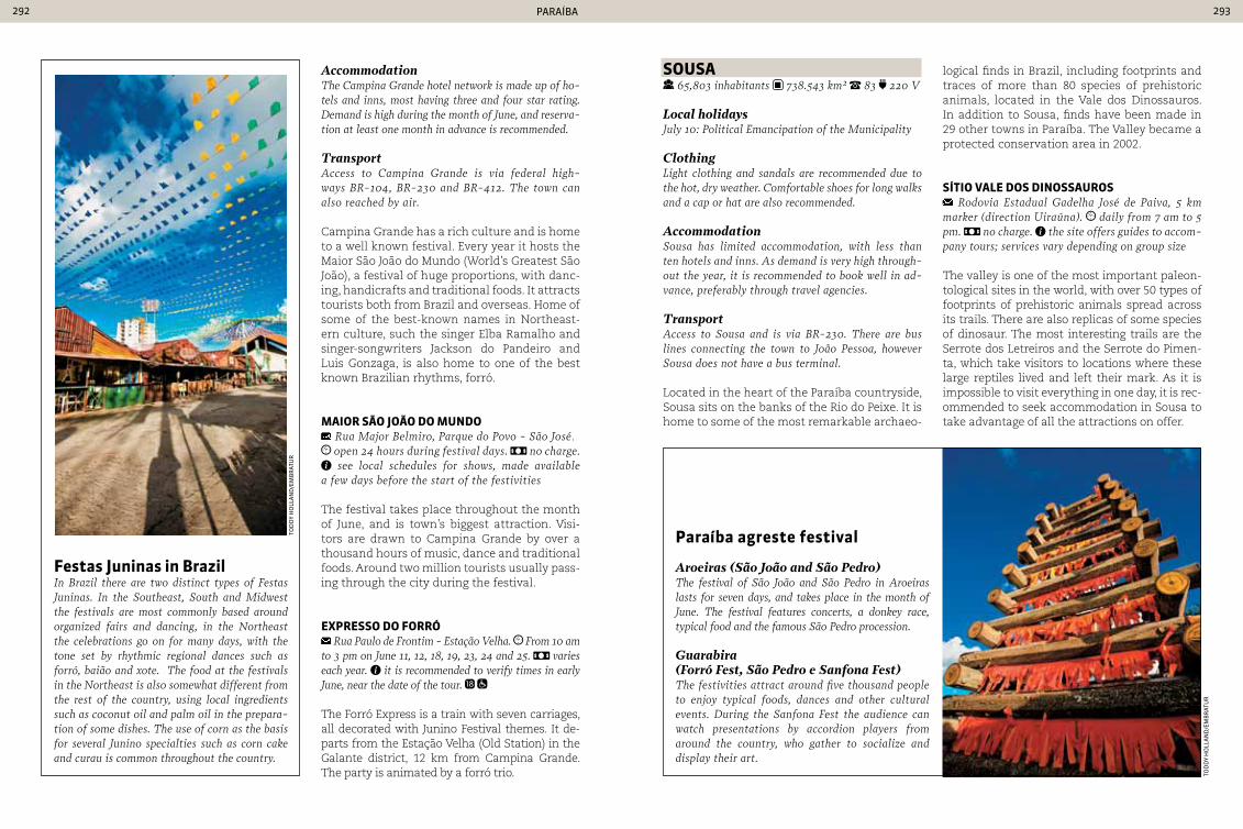
paraÍBa 292 293
AccommodationThe campina Grande hotel network is made up of ho-tels and inns, most having three and four star rating. Demand is high during the month of June, and reserva-tion at least one month in advance is recommended.
TransportAccess to campina Grande is via federal high-ways BR-104, BR-230 and BR-412. The town can also reached by air.
Campina Grande has a rich culture and is home to a well known festival. Every year it hosts the Maior São João do Mundo (World’s Greatest São João), a festival of huge proportions, with danc-ing, handicrafts and traditional foods. It attracts tourists both from Brazil and overseas. Home of some of the best-known names in Northeast-ern culture, such the singer Elba Ramalho and singer-songwriters Jackson do Pandeiro and Luis Gonzaga, is also home to one of the best known Brazilian rhythms, forró.
MaIor São João do Mundo Rua Major Belmiro, Parque do Povo - São José. open 24 hours during festival days. no charge. see local schedules for shows, made available
a few days before the start of the festivities
The festival takes place throughout the month of June, and is town’s biggest attraction. Visi-tors are drawn to Campina Grande by over a thousand hours of music, dance and traditional foods. Around two million tourists usually pass-ing through the city during the festival.
expreSSo do ForrÓ Rua Paulo de Frontim - Estação Velha. From 10 am
to 3 pm on June 11, 12, 18, 19, 23, 24 and 25. varies each year. it is recommended to verify times in early June, near the date of the tour.
The Forró Express is a train with seven carriages, all decorated with Junino Festival themes. It de-parts from the Estação Velha (Old Station) in the Galante district, 12 km from Campina Grande. The party is animated by a forró trio.
SouSa 65,803 inhabitants 738.543 km² 83 220 V
Local holidaysJuly 10: Political Emancipation of the Municipality
ClothingLight clothing and sandals are recommended due to the hot, dry weather. comfortable shoes for long walks and a cap or hat are also recommended.
AccommodationSousa has limited accommodation, with less than ten hotels and inns. As demand is very high through-out the year, it is recommended to book well in ad-vance, preferably through travel agencies.
TransportAccess to Sousa and is via BR-230. There are bus lines connecting the town to João Pessoa, however Sousa does not have a bus terminal.
Located in the heart of the Paraíba countryside, Sousa sits on the banks of the Rio do Peixe. It is home to some of the most remarkable archaeo-
Festas Juninas in brazilIn Brazil there are two distinct types of Festas Juninas. In the Southeast, South and Midwest the festivals are most commonly based around organized fairs and dancing, in the Northeast the celebrations go on for many days, with the tone set by rhythmic regional dances such as forró, baião and xote. The food at the festivals in the Northeast is also somewhat different from the rest of the country, using local ingredients such as coconut oil and palm oil in the prepara-tion of some dishes. The use of corn as the basis for several Junino specialties such as corn cake and curau is common throughout the country.
paraíba agreste festival
Aroeiras (São João and São Pedro)The festival of São João and São Pedro in Aroeiras lasts for seven days, and takes place in the month of June. The festival features concerts, a donkey race, typical food and the famous São Pedro procession.
Guarabira (Forró Fest, São Pedro e Sanfona Fest)The festivities attract around five thousand people to enjoy typical foods, dances and other cultural events. During the Sanfona Fest the audience can watch presentations by accordion players from around the country, who gather to socialize and display their art.
logical finds in Brazil, including footprints and traces of more than 80 species of prehistoric animals, located in the Vale dos Dinossauros. In addition to Sousa, finds have been made in 29 other towns in Paraíba. The Valley became a protected conservation area in 2002.
SítIo VaLe doS dInoSSauroS Rodovia Estadual Gadelha José de Paiva, 5 km
marker (direction Uiraúna). daily from 7 am to 5 pm. no charge. the site offers guides to accom-pany tours; services vary depending on group size
The valley is one of the most important paleon-tological sites in the world, with over 50 types of footprints of prehistoric animals spread across its trails. There are also replicas of some species of dinosaur. The most interesting trails are the Serrote dos Letreiros and the Serrote do Pimen-ta, which take visitors to locations where these large reptiles lived and left their mark. As it is impossible to visit everything in one day, it is rec-ommended to seek accommodation in Sousa to take advantage of all the attractions on offer.
tod
dy
Ho
lla
nd
/em
Br
atu
r
tod
dy
Ho
lla
nd
/em
Br
atu
r
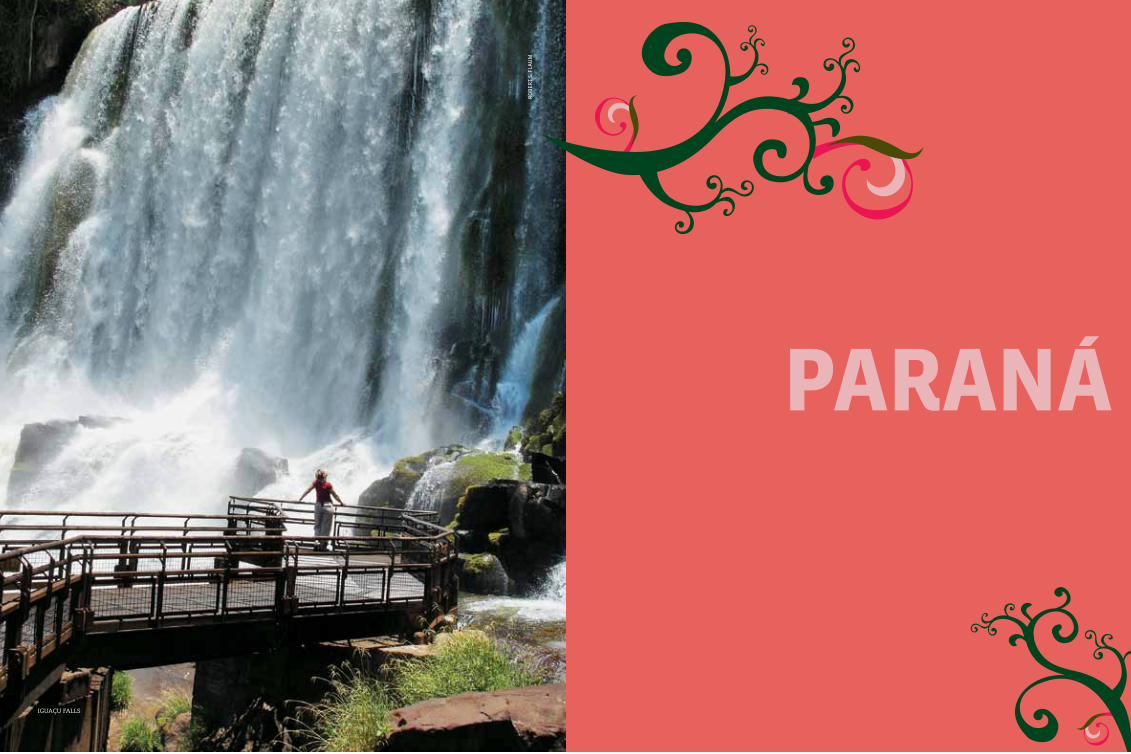
295
paranár
oB
ert
s. f
lau
m
iguaçu falls
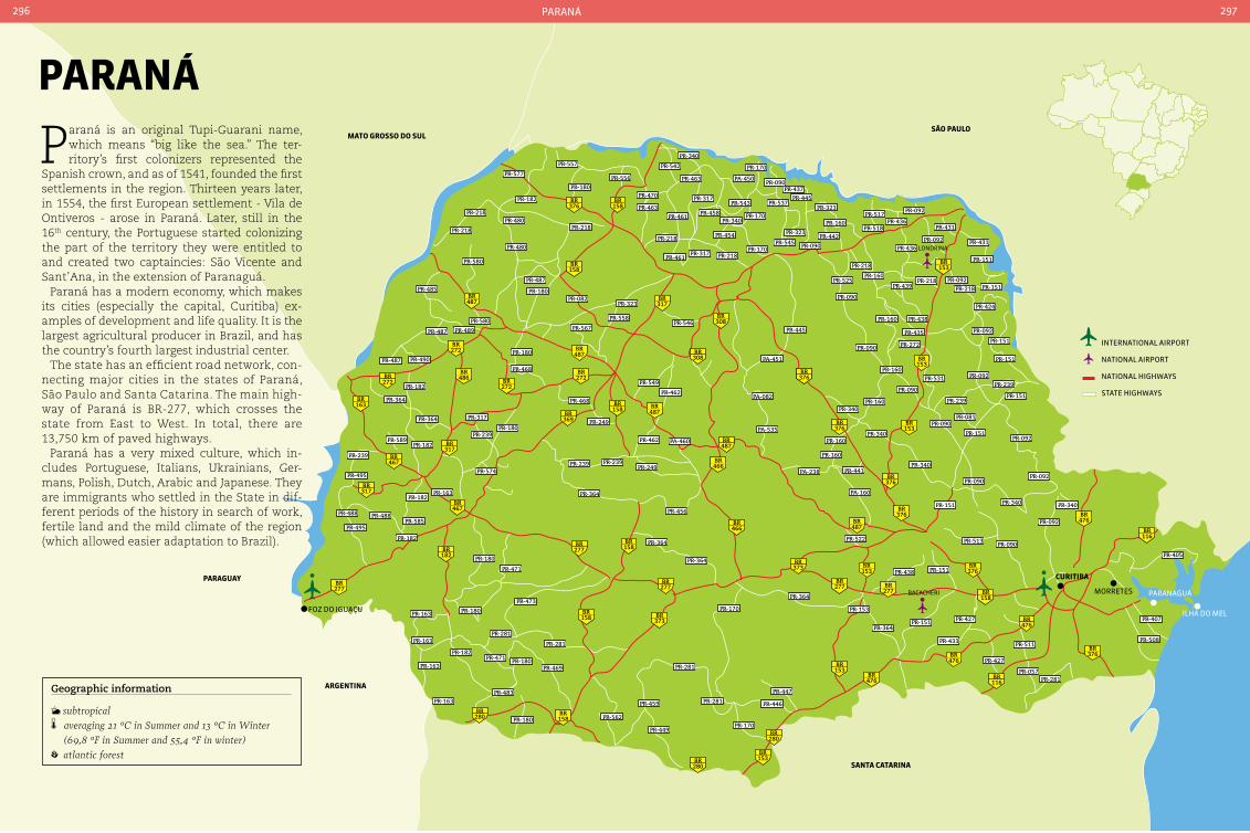
376BR
158BR
487BR
487BR
272BR
272BR
272BR
486BR
369BR
158BR
487BR
487BR
466BR
466BR
158BR
158BR
277BR
373BR
277BR
467BR
163BR
467BR
277BR
272BR
317BR
317BR
317BR
280BR
182BR
158BR
280BR 153
BR
280BR
153BR
476BR
476BR
476BR
476BR
487BR
376BR376BR
376BR
376BR
153BR
153BR
153BR
376BR
376BR
116BR
376BR
116BR
158BR
373BR
277BR
153BR
277BR
158BR
308BR
308BR
morretes
ilHa do melfoz do iguaçu
paranaguá
PR-577
PR-557
PR-180
PR-480
PR-218
PR-218
PR-182
PR-580
PR-480
PR-218
PR-487
PR-180PR-082
PR-567
PR-323
PR-558PR-546
PR-462
PR-549
PR-218
PR-461
PR-458
PR-317
PR-461
PR-317
PR-470
PR-463PR-543
PR-340
PR-454
PR-170
PR-170PR-218
PR-170
PR-090PR-437
PR-445PR-537
PR-180
PR-468
PR-364
PR-182
PR-585PR-488
PR-495
PR-163
PR-163
PR-163
PR-163 PR-180
PR-281
PR-281
PR-471 PR-180
PR-180
PR-469
PR-473
PR-180
PR-471
PR-182
PR-483
PR-281
PR-281PR-459
PR-449
PR-562
PR-488
PR-495
PR-239
PR-589
PR-239PR-249
PR-462
PR-249
PR-239
PR-456
PR-364
PR-364
PR-170
PR-364
PR-447
PR-446
PR-170
PR-153
PR-438
PR-522
PR-364PR-151
PR-433
PR-427
PR-281PR-057
PR-511PR-508
PR-407
PR-405
PR-092
PR-090
PR-340 PR-340PR-151
PR-513
PR-151
PR-090PR-092
PR-092
PR-081
PR-239
PR-239PR-092
PR-090
PR-151
PR-151
PR-151
PR-151
PR-092
PR-424
PR-151PR-439
PR-218
PR-160PR-525
PR-438
PR-435
PR-272
PR-160
PR-090
PR-090
PR-160
PR-160
PR-160
PR-160
PR-340
PR-340
PR-441
PR-090
PR-323PR-517
PR-092
PR-436PR-431
PR-431
PR-151
PR-092
PR-092
PR-436
PR-518
PR-445
PR-160
PR-442PR-323
PR-545 PR-090
PR-218PR-218
PR-531
PR-340
PR-239
PR-574
PR-180
PR-468
PR-489
PR-580
PR-487
PR-485
PR-487 PR-490
PR-182
PR-182
PR-182PR-163
PR-364
PR-364 PR-317
PR-556
PR-340
PR-463
PR-542
PA-450
PA-451
PA-082
PA-535
PA-460
PA-238
PA-160
PR-427
curItIba
São pauLoMato GroSSo do SuL
Santa catarIna
arGentIna
paraGuay
international airport
national airport
national HigHways
state HigHways
paraná296 297
Geographic information
subtropical averaging 21 °c in Summer and 13 °c in Winter
(69,8 °F in Summer and 55,4 °F in winter) atlantic forest
paraná
Paraná is an original Tupi-Guarani name, which means “big like the sea.” The ter-ritory’s first colonizers represented the
Spanish crown, and as of 1541, founded the first settlements in the region. Thirteen years later, in 1554, the first European settlement - Vila de Ontiveros - arose in Paraná. Later, still in the 16th century, the Portuguese started colonizing the part of the territory they were entitled to and created two captaincies: São Vicente and Sant’Ana, in the extension of Paranaguá.
Paraná has a modern economy, which makes its cities (especially the capital, Curitiba) ex-amples of development and life quality. It is the largest agricultural producer in Brazil, and has the country’s fourth largest industrial center.
The state has an efficient road network, con-necting major cities in the states of Paraná, São Paulo and Santa Catarina. The main high-way of Paraná is BR-277, which crosses the state from East to West. In total, there are 13,750 km of paved highways.
Paraná has a very mixed culture, which in-cludes Portuguese, Italians, Ukrainians, Ger-mans, Polish, Dutch, Arabic and Japanese. They are immigrants who settled in the State in dif-ferent periods of the history in search of work, fertile land and the mild climate of the region (which allowed easier adaptation to Brazil).
londrina
BaCaCHeri
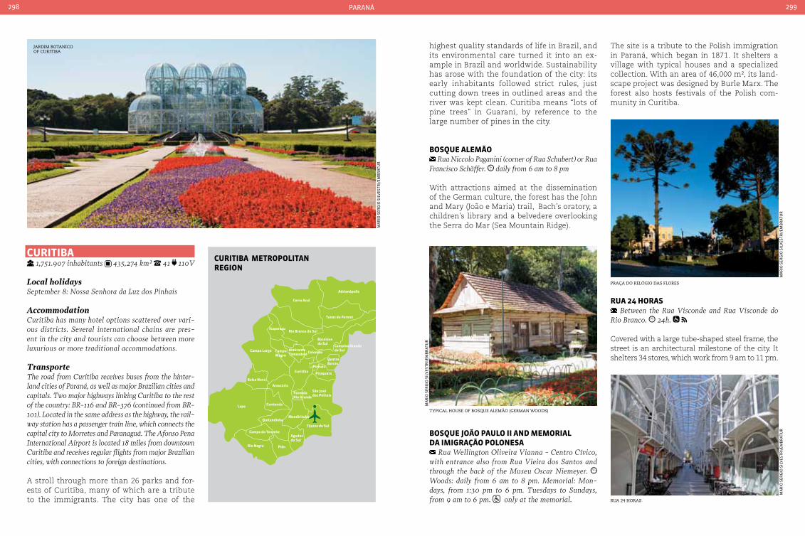
Cerro Azul
Itaperuçu
Campo Largo CampoMagro
AlmiranteTamandaré Colombo
Campina Grandedo Sul
QuatroBarras
PinhaisCuritiba
Balsa Nova
AraucáriaSão Josédos Pinhais
FazendaRio Grande
ContendaLapa
Mandirituba
Tijucas do Sul
Quitandinha
Campo do Tenente
Rio Negro Piên
Agudosdo Sul
Piraquara
Adrianópolis
Tunas do Paraná
Rio Branco do Sul
Bocaiúvado Sul
curItIba MetropoLItanreGIon
paraná298 299
curItIba 1,751.907 inhabitants 435,274 km² 41 110V
Local holidaysSeptember 8: Nossa Senhora da Luz dos Pinhais
Accommodationcuritiba has many hotel options scattered over vari-ous districts. Several international chains are pres-ent in the city and tourists can choose between more luxurious or more traditional accommodations.
TransporteThe road from curitiba receives buses from the hinter-land cities of Paraná, as well as major Brazilian cities and capitals. Two major highways linking curitiba to the rest of the country: BR-116 and BR-376 (continued from BR-101). Located in the same address as the highway, the rail-way station has a passenger train line, which connects the capital city to Morretes and Paranaguá. The Afonso Pena International Airport is located 18 miles from downtown curitiba and receives regular flights from major Brazilian cities, with connections to foreign destinations.
A stroll through more than 26 parks and for-ests of Curitiba, many of which are a tribute to the immigrants. The city has one of the
highest quality standards of life in Brazil, and its environmental care turned it into an ex-ample in Brazil and worldwide. Sustainability has arose with the foundation of the city: its early inhabitants followed strict rules, just cutting down trees in outlined areas and the river was kept clean. Curitiba means “lots of pine trees” in Guarani, by reference to the large number of pines in the city.
boSQue aLeMão Rua Niccolo Paganini (corner of Rua Schubert) or Rua
Francisco Schäffer. daily from 6 am to 8 pm
With attractions aimed at the dissemination of the German culture, the forest has the John and Mary (João e Maria) trail, Bach’s oratory, a children’s library and a belvedere overlooking the Serra do Mar (Sea Mountain Ridge).
The site is a tribute to the Polish immigration in Paraná, which began in 1871. It shelters a village with typical houses and a specialized collection. With an area of 46,000 m², its land-scape project was designed by Burle Marx. The forest also hosts festivals of the Polish com-munity in Curitiba.
jardim Botanico of curitiBa
ma
rio
ser
gio
sil
Ves
tri/
emB
rat
ur
tyPical house of Bosque alemão (german woods)
Praça do relÓgio das flores
rua 24 horas
ma
rio
ser
gio
sil
Ves
tri/
emB
rat
ur
ma
rio
ser
gio
sil
Ves
tri/
emB
rat
ur
ma
rio
ser
gio
sil
Ves
tri/
emB
rat
urboSQue João pauLo II and MeMorIaL
da IMIGração poLoneSa Rua Wellington Oliveira Vianna - centro cívico,
with entrance also from Rua Vieira dos Santos and through the back of the Museu Oscar Niemeyer. Woods: daily from 6 am to 8 pm. Memorial: Mon-days, from 1:30 pm to 6 pm. Tuesdays to Sundays, from 9 am to 6 pm. only at the memorial.
rua 24 HoraS Between the Rua Visconde and Rua Visconde do
Rio Branco. 24h.
Covered with a large tube-shaped steel frame, the street is an architectural milestone of the city. It shelters 34 stores, which work from 9 am to 11 pm.
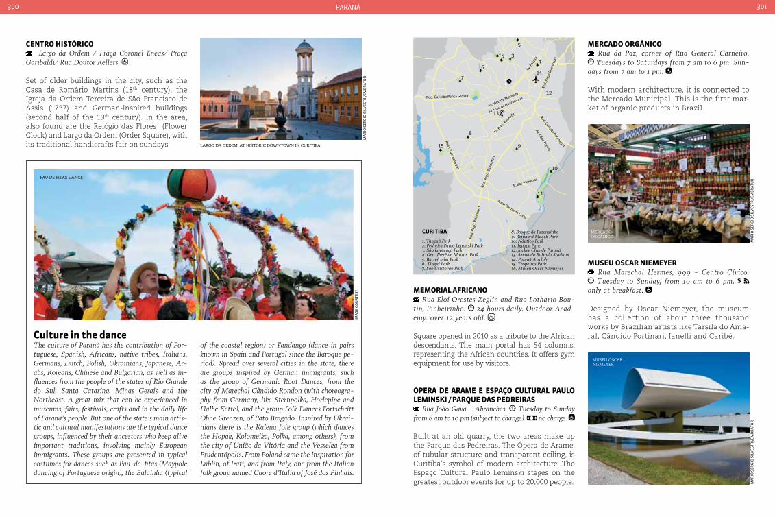
paraná300 301
centro HIStÓrIco Largo da Ordem / Praça coronel Enéas/ Praça
Garibaldi/ Rua Doutor Kellers.
Set of older buildings in the city, such as the Casa de Romário Martins (18th century), the Igreja da Ordem Terceira de São Francisco de Assis (1737) and German-inspired buildings (second half of the 19th century). In the area, also found are the Relógio das Flores (Flower Clock) and Largo da Ordem (Order Square), with its traditional handicrafts fair on sundays.
MeMorIaL aFrIcano Rua Eloi Orestes Zeglin and Rua Lothario Bou-
tin, Pinheirinho. 24 hours daily. Outdoor Acad-emy: over 12 years old.
Square opened in 2010 as a tribute to the African descendants. The main portal has 54 columns, representing the African countries. It offers gym equipment for use by visitors.
Ópera de araMe e eSpaço cuLturaL pauLo LeMInSkI / parQue daS pedreIraS
Rua João Gava - Abranches. Tuesday to Sunday from 8 am to 10 pm (subject to change). no charge.
Built at an old quarry, the two areas make up the Parque das Pedreiras. The Ópera de Arame, of tubular structure and transparent ceiling, is Curitiba’s symbol of modern architecture. The Espaço Cultural Paulo Leminski stages on the greatest outdoor events for up to 20,000 people.
Mercado orGÂnIco Rua da Paz, corner of Rua General carneiro. Tuesdays to Saturdays from 7 am to 6 pm. Sun-
days from 7 am to 1 pm.
With modern architecture, it is connected to the Mercado Municipal. This is the first mar-ket of organic products in Brazil.
culture in the dance The culture of Paraná has the contribution of Por-tuguese, Spanish, Africans, native tribes, Italians, Germans, Dutch, Polish, Ukrainians, Japanese, Ar-abs, Koreans, chinese and Bulgarian, as well as in-fluences from the people of the states of Rio Grande do Sul, Santa catarina, Minas Gerais and the Northeast. A great mix that can be experienced in museums, fairs, festivals, crafts and in the daily life of Paraná’s people. But one of the state’s main artis-tic and cultural manifestations are the typical dance groups, influenced by their ancestors who keep alive important traditions, involving mainly European immigrants. These groups are presented in typical costumes for dances such as Pau-de-fitas (Maypole dancing of Portuguese origin), the Balainha (typical
Pau de fitas dance
ima
ge
Cou
rte
sy
of the coastal region) or Fandango (dance in pairs known in Spain and Portugal since the Baroque pe-riod). Spread over several cities in the state, there are groups inspired by German immigrants, such as the group of Germanic Root Dances, from the city of Marechal cândido Rondon (with choreogra-phy from Germany, like Sternpolka, Horlepipe and Halbe Kette), and the group Folk Dances Fortschritt Ohne Grenzen, of Pato Bragado. Inspired by Ukrai-nians there is the Kalena folk group (which dances the Hopak, Kolomeika, Polka, among others), from the city of União da Vitória and the Vesselka from Prudentópolis. From Poland came the inspiration for Lublin, of Irati, and from Italy, one from the Italian folk group named cuore d’Italia of José dos Pinhais.
largo da ordem, at historic downtown in curitiBa
ma
rio
ser
gio
sil
Ves
tri/
emB
rat
ur
museu oscar niemeyer
ma
rio
ser
gio
sil
Ves
tri/
emB
rat
ur
ma
rio
ser
gio
sil
Ves
tri/
emB
rat
ur
MuSeu oScar nIeMeyer Rua Marechal Hermes, 999 - centro cívico. Tuesday to Sunday, from 10 am to 6 pm.
only at breakfast.
Designed by Oscar Niemeyer, the museum has a collection of about three thousand works by Brazilian artists like Tarsila do Ama-ral, Cândido Portinari, Ianelli and Caribé.
mercado orgÂnicoRo
d. R
egis
Bit
enco
urt
12 3
46
12
7
8
15 9
10
11
5
13
1416
Rod.
Reg
is B
iten
cour
t
R. dos Pioneiros
Av. Cdor. Franco
Rod. Curitiba Paranaguá
Rod. Curitiba Ponta Grossa
Av. Vicente Machado
Av. Visc. de Guarapuava
Av. Pre
s. Kennedy
Av. Para
ná
Roan Contorno Leste
Roan. Contorno Sul
Rod.
Reg
is B
iten
cour
t
8. Bosque da Fazendinha9. Reinhard Maack Park10. Náutico Park11. Iguaçu Park12. Jockey Club de Paraná13. Arena da Baixada Stadium14. Paraná Airclub15. Tropeiros Park16. Museu Oscar Niemeyer
1. Tanguá Park2. Pedreira Paulo Leminski Park3. São Lourenço Park4. Gen. Iberê de Mattos Park5. Barreirinha Park6. Tingui Park7. São Cristóvão Park
curItIba
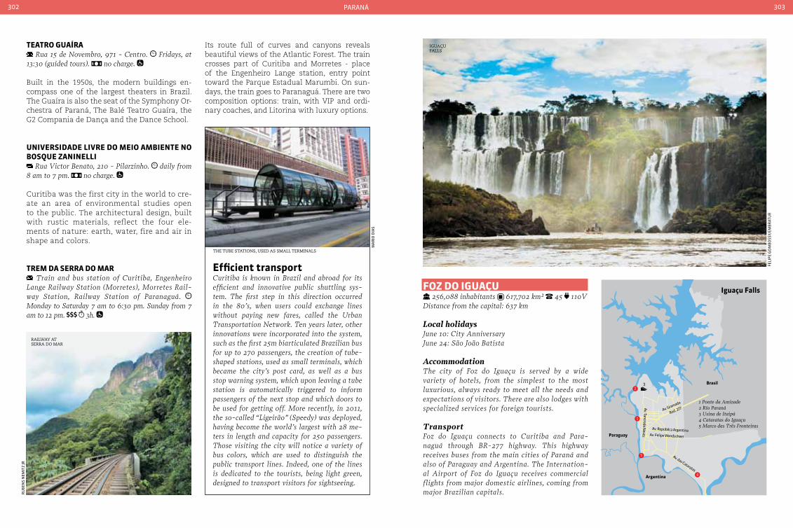
paraná302 303
1 Ponte da Amizade2 Río Paraná3 Usina de Itaipú4 Cataratas do Iguaçu5 Marco das Três Fronteiras
1
2
Av. Gramado
Av. Tancredo Neves
Rod. 277
Av. das Cataratas
Av. Felipe Wandscheer
Av. Repúbilca Argentina
3
4
5
Iguaçu Falls
Brasil
Paraguay
Argentina
teatro Guaíra Rua 15 de Novembro, 971 - centro. Fridays, at
13:30 (guided tours). no charge.
Built in the 1950s, the modern buildings en-compass one of the largest theaters in Brazil. The Guaíra is also the seat of the Symphony Or-chestra of Paraná, The Balé Teatro Guaíra, the G2 Compania de Dança and the Dance School.
unIVerSIdade LIVre do MeIo aMbIente no boSQue zanIneLLI
Rua Victor Benato, 210 - Pilarzinho. daily from 8 am to 7 pm. no charge.
Curitiba was the first city in the world to cre-ate an area of environmental studies open to the public. The architectural design, built with rustic materials, reflect the four ele-ments of nature: earth, water, fire and air in shape and colors.
treM da Serra do Mar Train and bus station of curitiba, Engenheiro
Lange Railway Station (Morretes), Morretes Rail-way Station, Railway Station of Paranaguá. Monday to Saturday 7 am to 6:30 pm. Sunday from 7 am to 12 pm. 3h.
Its route full of curves and canyons reveals beautiful views of the Atlantic Forest. The train crosses part of Curitiba and Morretes - place of the Engenheiro Lange station, entry point toward the Parque Estadual Marumbi. On sun-days, the train goes to Paranaguá. There are two composition options: train, with VIP and ordi-nary coaches, and Litorina with luxury options.
Foz do IGuaçu 256,088 inhabitants 617,702 km² 45 110V
Distance from the capital: 637 km
Local holidaysJune 10: city AnniversaryJune 24: São João Batista
AccommodationThe city of Foz do Iguaçu is served by a wide variety of hotels, from the simplest to the most luxurious, always ready to meet all the needs and expectations of visitors. There are also lodges with specialized services for foreign tourists.
TransportFoz do Iguaçu connects to curitiba and Para-naguá through BR-277 highway. This highway receives buses from the main cities of Paraná and also of Paraguay and Argentina. The Internation-al Airport of Foz do Iguaçu receives commercial flights from major domestic airlines, coming from major Brazilian capitals.r
uB
ens
nem
itz
jr
ma
rio
dia
s
iguaçu falls
feli
pe
go
mB
oss
y/em
Br
atu
r
efficient transport curitiba is known in Brazil and abroad for its efficient and innovative public shuttling sys-tem. The first step in this direction occurred in the 80’s, when users could exchange lines without paying new fares, called the Urban Transportation Network. Ten years later, other innovations were incorporated into the system, such as the first 25m biarticulated Brazilian bus for up to 270 passengers, the creation of tube-shaped stations, used as small terminals, which became the city’s post card, as well as a bus stop warning system, which upon leaving a tube station is automatically triggered to inform passengers of the next stop and which doors to be used for getting off. More recently, in 2011, the so-called “Ligeirão” (Speedy) was deployed, having become the world’s largest with 28 me-ters in length and capacity for 250 passengers. Those visiting the city will notice a variety of bus colors, which are used to distinguish the public transport lines. Indeed, one of the lines is dedicated to the tourists, being light green, designed to transport visitors for sightseeing.
the tuBe stations, used as small terminals
railway at serra do mar

paraná304 305
Foz do Iguaçu is one of the Brazil’s postcards, thanks to its monumental spectacle of 275 wa-terfalls that make up the Iguaçu falls, distributed over 2,7 km on the border between Brazil and Argentina. Of the 19 so-called “great falls”, three (Floriano, Deodoro and Benjamin Constant) are on the Brazilian side, in the Parque Nacional do Iguaçu. Declared a World Natural Heritage by UNESCO, it is the habitat of several species of fish, birds, mammals and butterflies. The best time to enjoy the Falls is in the summer (December to February), when rainfalls are short and the water volume greater. At Foz do Iguaçu there is no short-age of sightseeing options, such as the Parque dos Pássaros and the Marco das Três Fronteiras, whose diversified trade and affordable prices attract the visitors’ attention. Those looking for adventure are never disappointed. Foz do Iguaçu offers tourists a mix of wonder and excitement with activities like rappel, climbing, tyrolese and rafting on the Iguaçu river. The lake formed with the construc-
tion of the Itaipu hydroelectric plant also brings entertainment options with its artificial beaches, anchorages, marinas and parks. It also pays to take advantage of the city’s sports infrastructure, with its beautiful golf fields and tennis courts.
Marco daS trÊS FronteIraS Rua Marco das Três Fronteiras - Porto. daily
from 9 am to 6:30 pm
The obelisk is one of the main sights of the city and symbolizes the intersection of Bra-zil, Argentina and Paraguay. The site offers parking, coffee shop, craft shop and gazebo, where you can enjoy the sunset.
parQue daS aVeS Path to the Iguaçu Falls. Rodovia das cataratas,
km 17,1. daily from 8:30 am to 5:30 pm.
elevators allow the observation of the Iguaçu Falls, and a walkway that leads to Devil’s Throat, the largest fall of the set. You can also lunch and dine in restaurants on the brink of the Falls.
ponte da aMIzade BR-277, border with Paraguay. 24 hours, daily.
Inaugurated in 1965 and located at the end of the BR-277 highway, the bridge gives road ac-cess to Ciudad del Este, Paraguay. Tourists from countries outside the Mercosur must present a passport and visa (if required) to the customs.
uSIna HIdreLÉtrIca de ItaIpu Avenida Tancredo Neves, 6731. daily from 8 am
to 10 pm. just in the visitors’ area
During the visit to the largest dam in the world, one can observe the magnificence of the works and the water flow from the plant’s internal and external sides. The Itaipu Tourist Complex also offers attractions and activities in Brazil and Paraguay territories.
rafting on the rivers of iguaçu falls
ziPline in waterfall, at iguaçu falls
feli
pe
go
mB
oss
y/em
Br
atu
rm
ar
Cio
neV
es
feli
pe
go
mB
oss
y/em
Br
atu
r
bordersIguaçu Falls borders Argentina and Paraguay. Therefore, the transit of Brazilian and foreign tourists in this region is intense. At the Bra-zilian customs, watch out for buying quotas: by land, US$ 300 and by air (Asunción, Para-guay or Buenos Aires, Argentina), US$ 500. In purchases above the stipulated values there are 50% duties on the excess amount. Bra-zilian and foreign tourists must fill out the Accompanied Baggage Declaration (DBA), even within the limits allowed.
DocumentsForeigners must present a passport or passport together with visas (where required); foreign-ers residing in Mercosur countries may travel with the stay documents, provided the con-sular visa is waived by the receiving country.
Freshwater fishThe location of the city of Foz do Iguaçu makes the highlight of your stay become the cuisine in dishes where the freshwater fish stand out such as surubim (catfish) and dourado (golden). Be-sides the famous roasted dourado on the grill with varied seasonings, another typical dish is Pirá Foz, where the surubim is cooked with vari-ous spices and served with mashed cassava.
grilled Basst
ga
Br
iela
go
do
y
iguaçu falls
With an area of 17 hectares of native forest, home to more than 900 birds of 150 species in large nurseries open to visitors. At the site, there are still alligators, turtles, snakes and a butterfly nursery.
parQue nacIonaL IGuaçu Rodovia das cataratas, km 18. daily from 9 am
to 5 pm. Includes transportation within the park. Access for the handicapped: yes.
Protected by UNESCO, this World Heritage area occupies about 182,000 hectares, with waterfalls and preserved forest. Gazebos and panoramic

paraná306 307
paranaGuá 140,469 inhabitants 826,676 km² 41 110V
Distance from the capital: 91 km
Local holidaysJuly 29: Anniversary of ParanaguáOctober 7: Nossa Senhora do Rosário Day
AccommodationParanaguá has simpler hotels, resorts and inns to cater to tourists arriving in the city. At Ilha do Mel, most lodging options are typical inns of the beach, which are also divided among the simplest and the most sophisticated.
TransportThe main access is by BR-277 that links curitiba to Pa-ranaguá, a stretch about 90 km long and double-laned. coming from Santa catarina by BR-376, take a single lane road at the height of Garuva town up to Guara-tuba. Once there, take the ferry to Matinhos. Follow the Beach Road up to Paraná Point, and thence, through the link to Paranaguá. From curitiba’s road and railway station, regular buses shuttle to the Paranaguá highway. At Ilha do Mel, automobile traffic is not allowed. You must leave the car at Paraná Point and cross by boat to
the island. The access to Paraná Point can be done by BR-277, taking the exit to PR-407. From the passenger terminal of Paranaguá, the journey takes 1h30. From the terminal of Pontal do Sul, a neighboring city of Paraná Point, the passage is covered within 30 minutes. The nearest airport is Afonso Pena in São José dos Pinhais, in the outskirts of curitiba. From there, BR-277 con-nects the airport to Paranaguá.
Paranaguá means the “great round sea” in Tupi-Guarani native tribe dialect. The city has one of the biggest ports of Latin America and a historic center that brings together impor-tant examples of colonial architecture. From Paranaguá, one reaches the Ilha do Mel (Hon-ey Island ), one of the main touristic sights of the state. The State Park occupies 5% of the island area and is open to visitors. As the is-land is a protected area, up to 2000 concur-rent visitors are allowed.
centro HIStÓrIco Igreja de São Benedito, at Rua conselheiro Sinimbu
up to Rua Visconde de Nácar. daily, 24 hours (local operators offer guided tour with prior appointment).
It brings together important examples of colonial architecture, such as the Igreja de Nossa Senhora do Rosário, the Colégio Jesuíta, the Igreja da Or-dem Terceira de São Francisco das Chagas and the former Beach Road, with houses in neoclassic style. All the architectural and urban set was de-clared a National Historic Heritage in 2009.
IGreJa noSSa SenHora do roSárIo Largo Monsenhor celso - centro Histórico. daily from 6:30 am to 7 pm.
Inaugurated in 1578, it is the zero milestone of the township and village of Paranaguá. The land was home to the village’s cemetery, the work of pioneer Jesuits and Portuguese colonizers.
Mercado de arteSanato Rua General carneiro (Rua da Praia) - centro
Histórico. Monday to Saturday from 9 am to 6 pm. Sundays from 9 am to 12 am.
The construction in neo-renaissance style was the old fish market. It was restored and now serves as a point of sale of the region’s traditional crafts.
Mercado MunIcIpaL do caFÉ Rua General carneiro (Rua da Praia) - centro
Histórico (next to the Mercado do Artesanato). Monday to Saturday from 9 am to 6 pm. Sundays
from 9 am to 12 am.
Built in cast iron, mixing classical elements with art nouveau. It was transformed into a gastro-nomic center of seafood and typical dishes.
centro histÓrico de Paranaguá seen from rio itiBerÊ
ru
Ben
s n
emit
z jr
Porto dom Pedro ii in Paranaguá
handicrafts made from vine
mercado municiPal do café
craft marKet
ru
Ben
s n
emit
z jr
ru
Ben
s n
emit
z jr
ru
Ben
s n
emit
z jr
ru
Ben
s n
emit
z jr
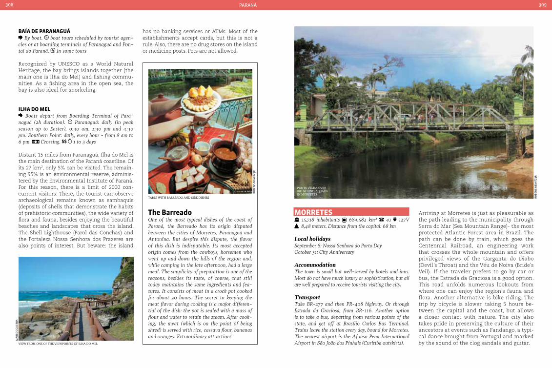
paraná308 309
baía de paranaGuá By boat. boat tours scheduled by tourist agen-
cies or at boarding terminals of Paranaguá and Pon-tal do Paraná. In some tours
Recognized by UNESCO as a World Natural Heritage, the bay brings islands together (the main one is Ilha do Mel) and fishing commu-nities. As a fishing area in the open sea, the bay is also ideal for snorkeling.
ILHa do MeL Boats depart from Boarding Terminal of Para-
naguá (2h duration). Paranaguá: daily (in peak season up to Easter), 9:30 am, 1:30 pm and 4:30 pm. Southern Point: daily, every hour - from 8 am to 6 pm. crossing. 1 to 3 days
Distant 15 miles from Paranaguá, Ilha do Mel is the main destination of the Paraná coastline. Of its 27 km2, only 5% can be visited. The remain-ing 95% is an environmental reserve, adminis-tered by the Environmental Institute of Paraná. For this reason, there is a limit of 2000 con-current visitors. There, the tourist can observe archaeological remains known as sambaquis (deposits of shells that demonstrate the habits of prehistoric communities), the wide variety of flora and fauna, besides enjoying the beautiful beaches and landscapes that cross the island. The Shell Lighthouse (Farol das Conchas) and the Fortaleza Nossa Senhora dos Prazeres are also points of interest. But beware: the island
MorreteS 15,718 inhabitants 684,582 km² 41 127V 8,48 meters. Distance from the capital: 68 km
Local holidaysSeptember 8: Nossa Senhora do Porto DayOctober 31: city Anniversary
AccommodationThe town is small but well-served by hotels and inns. Most do not have much luxury or sophistication, but all are well prepared to receive tourists visiting the city.
TransportTake BR-277 and then PR-408 highway. Or through Estrada da Graciosa, from BR-116. Another option is to take a bus, departing from various points of the state, and get off at Brasílio carlos Bus Terminal. Trains leave the station every day, bound for Morretes. The nearest airport is the Afonso Pena International Airport in São João dos Pinhais (curitiba outskirts).
Arriving at Morretes is just as pleasurable as the path leading to the municipality through Serra do Mar (Sea Mountain Range)- the most protected Atlantic Forest area in Brazil. The path can be done by train, which goes the Centennial Railroad, an engineering work that crosses the whole mountain and offers privileged views of the Garganta do Diabo (Devil’s Throat) and the Véu de Noiva (Bride’s Veil). If the traveler prefers to go by car or bus, the Estrada da Graciosa is a good option. This road unfolds numerous lookouts from where one can enjoy the region’s fauna and flora. Another alternative is bike riding. The trip by bicycle is slower, taking 5 hours be-tween the capital and the coast, but allows a closer contact with nature. The city also takes pride in preserving the culture of their ancestors at events such as Fandango, a typi-cal dance brought from Portugal and marked by the sound of the clog sandals and guitar.
the barreadoOne of the most typical dishes of the coast of Paraná, the Barreado has its origin disputed between the cities of Morretes, Paranaguá and Antonina. But despite this dispute, the flavor of this dish is indisputable. Its most accepted origin comes from the cowboys, horsemen who went up and down the hills of the region and, while camping in the late afternoon, had a large meal. The simplicity of preparation is one of the reasons, besides its taste, of course, that still today maintains the same ingredients and fea-tures. It consists of meat in a crock pot cooked for about 20 hours. The secret to keeping the meat flavor during cooking is a major differen-tial of the dish: the pot is sealed with a mass of flour and water to retain the steam. After cook-ing, the meat (which is on the point of being shred) is served with rice, cassava flour, bananas and oranges. Extraordinary attraction!
taBle with Barreado and side dishes
ru
Ben
s n
emit
z jr
view from one of the viewPoints of ilha do mel
ma
rCo
s g
uer
ra
has no banking services or ATMs. Most of the establishments accept cards, but this is not a rule. Also, there are no drug stores on the island or medicine posts. Pets are not allowed.
Ponte velha over rio nhundiaquarain morretes
ru
Ben
s n
emit
z jr
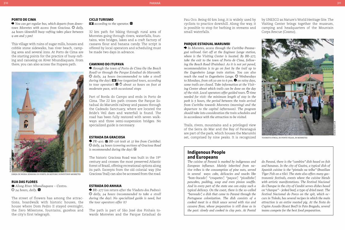
paraná310 311
porto de cIMa You can get regular bus, which departs from down-
town Morretes with access from Graciosa. daily, 24 hours (downhill buoy-rafting takes place between 9 am and 3 pm)
This village with ruins of sugar mills, houses and cobble stone sidewalks, has river beach, camp-ing area and several inns. At Porto de Cima are the starting points for the practice of buoy-raft-ing and canoeing on River Nhundiaquara. From there, you can also access the Itupava path.
cIcLo turISMo according to the operator.
32 km path for biking through rural area of Morretes going through rivers, waterfalls, foun-tains, wire bridges, lakes and a craft factory of cassava flour and banana candy. The script is offered by local operators and scheduling must be made two days in advance.
caMInHo do ItupaVa through the town of Porto de cima (by the Beach
Road) or through the Parque Estadual do Marumbi. daily, 24 hours (recommended to take a stroll
during the day). free (organized tours, according to tour operator). about 10 hours on foot at moderate pace, with occasional stops
Part of Borda do Campo and ends in Porto de Cima. The 22 km path crosses the Parque Es-tadual do Marumbi railway and passes through the Cadeado Sanctuary, where are located the Bride’s Veil dam and waterfall is found. The road has been fully restored with seven walk-ways and three semi-suspension bridges. No specialized guide is necessary.
eStrada da GracIoSa PR-410. BR-116 (exit at 37 km from curitiba). daily, 24 hours (covering sections of Graciosa Road
is recommended during the day).
The historic Graciosa Road was built in the 19th century and crosses the most preserved Atlantic forest of Brazil, offering recreational options along its path. Excerpts from the old colonial way (the Graciosa Trail) can also be accessed from the road.
eStrada do anHaIa BR-277 (on return after the Viaduto dos Padres). daily, 24 hours (recommended to take a stroll
during the day). No specialized guide is need, but the tour operators offer it)
The path is part of São José dos Pinhais to-wards Morretes and the Parque Estadual do
Pau Oco. Being 60 km long, it is widely used by cyclists to practice downhill. Along the way, it is possible to stop for bathing in streams and small waterfalls.
parQue eStaduaL MaruMbI In Morretes, access through the curitiba-Parana-
guá railroad. Get off at the Engineer Lange station, where is the Visiting center is located. By BR-277, take the exit to the town of Porto de cima, follow-ing the Beach Road (Prainhas). As it is not yet paved, recommendation is to go on foot by the trail up to the Engenheiro Lange train station. You can also reach the road to Engenheiro Lange. Wednesdays to Mondays, from 08:30 am to 6 pm. on rainy days, some trails are closed. Take information at the Visit-ing center about which trails can be done on the day of the visit. Local operators offer guided tours. time needed for visit: the minimum length of stay in the park is 5 hours, the period between the train arrival from curitiba towards Morretes (morning) and the departure to the capital (afternoon). The program should take into consideration the train schedules and in accordance with the attraction to be visited.
Trails, rivers, mountains and a privileged view of the Serra do Mar and the Bay of Paranaguá are part of the park, which houses the Marumbi set, comprised by nine peaks. It is recognized
Indigenous people and europeansThe cuisine of Paraná is marked by indigenous and European influence. Mainly inherited from na-tive tribes is the consumption of pine nuts, served in several ways: cake, delicacies and snacks like “bom-bocado”, “croquetes”, “paçoca”, “picadinho”, pancakes, pudding, soup and even pinion souffle. And in every part of the state one can enjoy such a typical delicacy. On the coast, there is the so-called “barreado”, a dish that came to Paraná through the Portuguese colonization. The dish consists of a cooked meat in a thick sauce served with rice and cassava flour, whose preparation is still done as in the past: slowly and cooked in clay pots. At Pontal
igreja de nossa senhora do Porto, in historic downtown morretes
ru
Ben
s n
emit
z jr
rua daS FLoreS Along River Nhundiaquara - centro. 24 hours, daily.
The street of flowers has among the attrac-tions, boardwalk with historic houses, the house where Dom Pedro II stayed overnight, the Zero Milestone, fountains, gazebos and the city’s first telegraph.
by UNESCO as Nature’s World Heritage Site. The Visiting Center brings together the museum, camping and headquarters of the Mountain Corps Rescue (Cosmo).
do Paraná, there is the “cambira” dish based on fish and bananas. In the city of Guaíra, a typical dish of Spanish cuisine is the “pintado na telha” (Brazilian Tiger Fish on a tile). The state also offers many gas-tronomic festivals, events where the cuisine blends with artistic manifestations. The Festival Nacional do charque in the city of candói serves dishes based on “charque” - jerked beef, a type of dried meat. The Festival Naciomal do Porco on the spit, which oc-curs in Toledo, has several recipes in which the main attraction is an entire roasted pig. At the Festa do cupim Assado (Roast Beef) in Pato Bragado, several teams compete for the best food preparation.
tourists stroll in Ponte velha, in morretes
ru
Ben
s n
emit
z jr
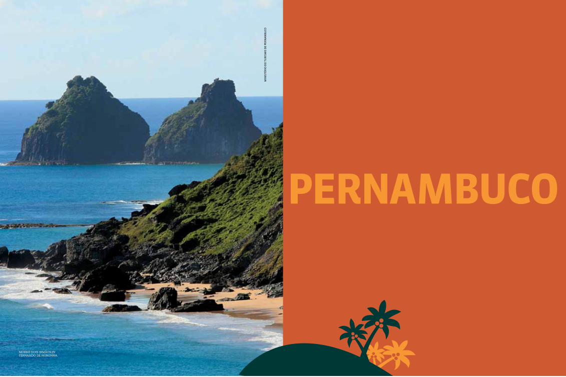
313
pernaMbucom
inis
tér
io d
o t
ur
ism
o d
e p
ern
an
Bu
Co
morro dois irmãos,in fernando de noronha.
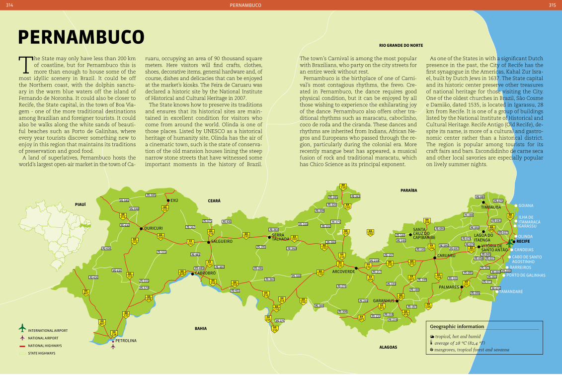
316BR
316BR
122BR
122BR
122BR
122BR
128BR
428BR
428BR
407BR
407BR
116BR
116BR
232BR
232BR
232BR
232BR
232BR
232BR
110BR
110BR
110BR
110BR
423BR
423BR
423BR
423BR
424BR
424BR
104BR
101BR
232BR
232BR
232BR
232BR
104BR
104BR
408BR
101BR
104BR
316BR
110BR
110BR
110BR
316BR
316BR
316BR
316BR316
BR
PE-590
PE-630
PE-630
PE-630
PE-635
PE-555
PE-555
PE-570
PE-483 PE-460
PE-360PE-360
PE-375
PE-422
PE-483
PE-585
PE-585
PE-507
PE-475 PE-430
PE-149
PE-270
PE-244
PE-233PE-218
PE-214
PE-187
PE-180
PE-103
PE-096
PE-076
PE-073
PE-060
PE-064
PE-009PE-063
PE-058 PE-037
PE-045
PE-027
PE-041
PE-075
PE-088
PE-090
PE-095
PE-145
PE-197
PE-219
PE-280
PE-292
PE-275
PE-320
PE-285 PE-263
PE-320
PE-340
PE-365
PE-390
PE-390
PE-309
PE-217
PE-193
PE-145
PE-160
PE-097
PE-089
PE-050
PE-078
PE-079
PE-085
PE-300
PE-300
petrolina
CaBroBró
salgueiro
serra talHada
arCoVerde
Caruarú
garanHus
palmares
recIFelagoa do itaenga
timBauBa
santa Cruz do CapiBariBe
Vitória de santo antão
eXú
ouriCuri
porto de galinHas
olinda
Candeias
Barreiros
CaBo de santo agostinHo
igarassu
ilHa de itamaraCá
goiana
tamandaré
paraíba
aLaGoaS
rIo Grande do norte
cearápIauí
baHIa
pernamBuCo314 315
The State may only have less than 200 km of coastline, but for Pernambuco this is more than enough to house some of the
most idyllic scenery in Brazil. It could be off the Northern coast, with the dolphin sanctu-ary in the warm blue waters off the island of Fernando de Noronha. It could also be closer to Recife, the State capital, in the town of Boa Via-gem - one of the more traditional destinations among Brazilian and foreigner tourists. It could also be walks along the white sands of beauti-ful beaches such as Porto de Galinhas, where every year tourists discover something new to enjoy in this region that maintains its traditions of preservation and good food.
A land of superlatives, Pernambuco hosts the world’s largest open-air market in the town of Ca-
ruaru, occupying an area of 90 thousand square meters. Here visitors will find crafts, clothes, shoes, decorative items, general hardware and, of course, dishes and delicacies that can be enjoyed at the market’s kiosks. The Feira de Caruaru was declared a historic site by the National Institute of Historical and Cultural Heritage in 2007.
The State knows how to preserve its traditions and ensures that its historical sites are main-tained in excellent condition for visitors who come from around the world. Olinda is one of those places. Listed by UNESCO as a historical heritage of humanity site, Olinda has the air of a cinematic town, such is the state of conserva-tion of the old mansion houses lining the steep narrow stone streets that have witnessed some important moments in the history of Brazil.
pernaMbuco
Geographic information
tropical, hot and humid average of 28 °c (82,4 °F) mangroves, tropical forest and savanna
The town’s Carnival is among the most popular with Brazilians, who party on the city streets for an entire week without rest.
Pernambuco is the birthplace of one of Carni-val’s most contagious rhythms, the frevo. Cre-ated in Pernambuco, the dance requires good physical condition, but it can be enjoyed by all those wishing to experience the exhilarating joy of the dance. Pernambuco also offers other tra-ditional rhythms such as maracatu, caboclinho, coco de roda and the ciranda. These dances and rhythms are inherited from Indians, African Ne-gros and Europeans who passed through the re-gion, particularly during the colonial era. More recently mangue beat has appeared, a musical fusion of rock and traditional maracatu, which has Chico Science as its principal exponent.
As one of the States in with a significant Dutch presence in the past, the City of Recife has the first synagogue in the Americas, Kahal Zur Isra-el, built by Dutch Jews in 1637. The State capital and its historic center preserve other treasures of national heritage for those visiting the City. One of the oldest churches in Brazil, São Cosme e Damião, dated 1535, is located in Igarassu, 28 km from Recife. It is one of a group of buildings listed by the National Institute of Historical and Cultural Heritage. Recife Antigo (Old Recife), de-spite its name, is more of a cultural and gastro-nomic center rather than a historical district. The region is popular among tourists for its craft fairs and bars. Escondidinho de carne seca and other local savories are especially popular on lively summer nights.
international airport
national airport
national HigHways
state HigHways

pernamBuCo316 317
ItaMaracá
IGaraSSu
pauLISta
oLInda
recIFe
Jaboatão doSGuararapeS
cabo de Santo aGoStInHo
IpoJuca
Moreno
São Lourenço da Mata
caMaraGIbe
abreu e LIMa
araIçoIaba
ItapISSuMa
recIFe 1,537,704 inhabitants 218.498 km² 81 220 V
Local holidaysMarch 12: Anniversary of the founding of the RecifeJune 24: São João’s dayJuly 16: Nossa Senhora do carmo’s day December 8: Nossa Senhora Imaculada da conceição
ClothingLight clothing is recommended for Recife’s tropi-cal climate. Do not forget sunscreen, sunglasses and a cap or hat.
Accommodation With an excellent accommodation network, the city of Recife has hotels and inns in all comfort and price categories located in several neighborhoods. The more expensive and sophisticated are located in Boa Vigem.
TransportFor those coming from the North or South of the country, the principal access route is the BR-101.
It is 123 km from the nearest State capital, and the journey can be undertaken in around an hour and forty minutes. The journey can also be undertaken by bus from Maceió to the Integrated Passenger Terminal in Recife. For those opting to fly there are regular flights from Brazil’s main cities to the Gil-berto Freyre International Airport - Guararapes, which lies 11 km from the center.
Within the cityThe city of Recife and the metropolitan region have an excellent public transportation network, with more than 2,700 buses operating on 385 lines. As in other cities, it is possible to make three connected rides on a single ticket.
The city is best known for its Carnival and São João festivities and for the famous Paixão de Cristo theatrical spectacle during Holy Week, which has been bringing people from around the world for over 40 years to witness its emo-tive scenes. Recife is also the birthplace of popular street performances and regional cu-
linary culture - it is the premier gastronomic center of the North and Northeast - and ranked third in Brazil.
Nicknamed the “Brazilian Venice”, the City is crisscrossed by rivers and bridges, forming islands such as Santo Antônio, São José and Bairro do Recife. Recife Antigo (Old Recife) is the region most popular with tourists. Its pic-turesque historic buildings practically make it an outdoor museum. A good way to get to know the City is on a catamaran trip on the Rio Capibaribe, with guides recounting stories and trivia about the City.
Recife’s coastline provides the City’s picture-postcard. Its beaches are known for their calm, clear and warm waters. The most popular beach is Praia de Boa Viagem, which offers visi-tors complete facilities as well as its natural beauty. Tourist activities include diving among shipwrecks in the region’s clear waters.
capeLa dourada Rua do Imperador Dom Pedro II, s/n. Monday to
Friday from 8 am to 11:30 am and from 2 pm to 5 pm. Saturday from 8 am to 11 am.
The Capela Dourada - ‘Golden Chapel’ - is the largest example of baroque religious art. It was built in the 16th century, at the height of the sug-ar cane boom. The name come from the gold painted wood paneling in its interior. The ceil-ing, as well as other parts of the chapel, is cov-ered in religious images typical of the period.
coMpLexo cuLturaL pátIo de São pedro Pátio São Pedro - São José. daily, 24 hours no charge.
The Complexo Cultural hosts Pernambucan cultural events. Several arts groups make presentations in the Courtyard, with music and dancing. It is also home to several insti-tutions including the Igreja de São Pedro dos Clérigos, Memorial Luiz Gonzaga, Museu de Arte Popular, Memorial Chico Science, Casa do Carnaval Research Center and the Recife Design Center. To round off their visit tourists can also sample local cuisine in the restau-rants and bars in the complex.
cinematographic statePernambuco is the birthplace of several success-ful filmmakers, including Karim Aïmouz, Paulo caldas, Lírio Ferreira, Marcelo Gomes and Heitor Dhalia. The State has hosted cine Pernambuco for over For 16 years - a major film festival that aims to present new directors to the public and show new works by prominent professionals. The festival takes place at the end of April and is part of the international cinema calendar.
gu
staV
o B
etti
ni/
emB
rat
ur
recIFe MetropoLItan reGIon
aereal view of Praia de Boa viagem, in recife
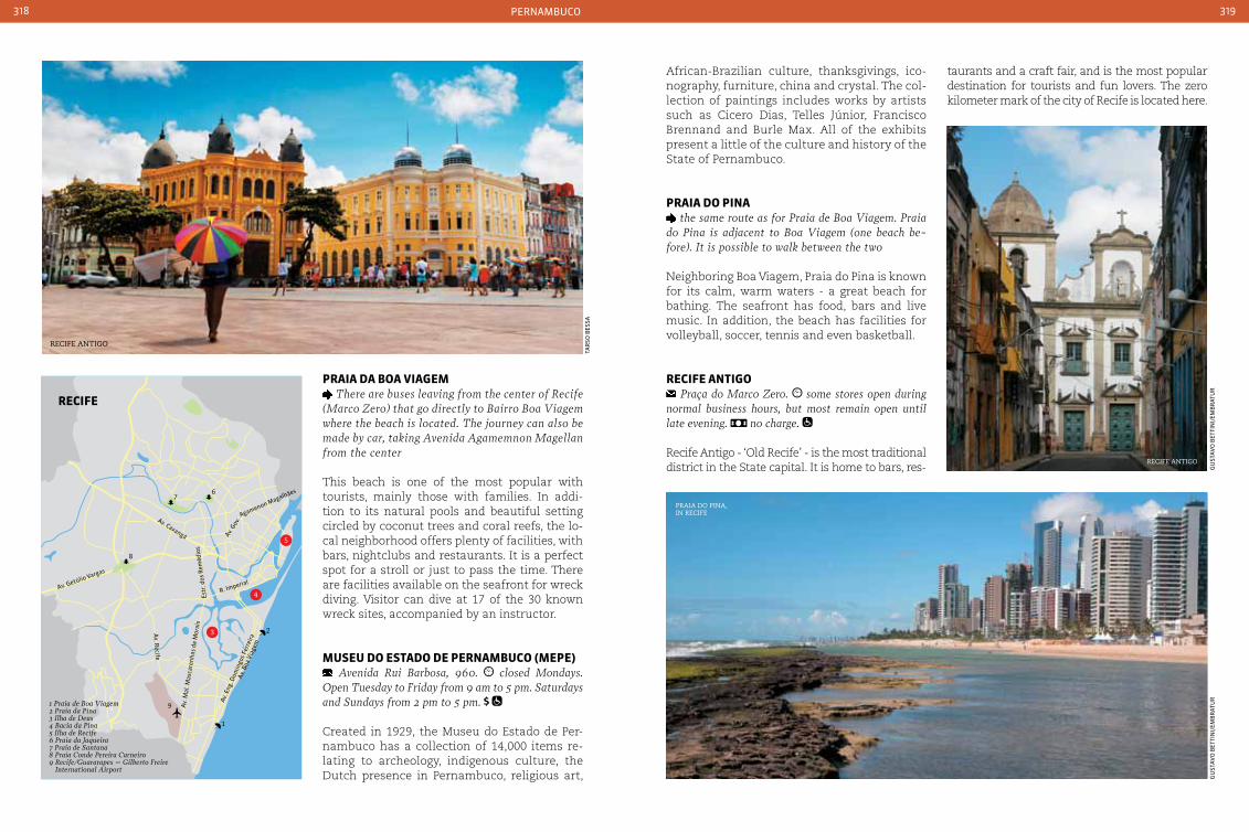
pernamBuCo318 319
praIa da boa VIaGeM There are buses leaving from the center of Recife
(Marco Zero) that go directly to Bairro Boa Viagem where the beach is located. The journey can also be made by car, taking Avenida Agamemnon Magellan from the center
This beach is one of the most popular with tourists, mainly those with families. In addi-tion to its natural pools and beautiful setting circled by coconut trees and coral reefs, the lo-cal neighborhood offers plenty of facilities, with bars, nightclubs and restaurants. It is a perfect spot for a stroll or just to pass the time. There are facilities available on the seafront for wreck diving. Visitor can dive at 17 of the 30 known wreck sites, accompanied by an instructor.
MuSeu do eStado de pernaMbuco (Mepe) Avenida Rui Barbosa, 960. closed Mondays.
Open Tuesday to Friday from 9 am to 5 pm. Saturdays and Sundays from 2 pm to 5 pm.
Created in 1929, the Museu do Estado de Per-nambuco has a collection of 14,000 items re-lating to archeology, indigenous culture, the Dutch presence in Pernambuco, religious art,
gu
staV
o B
etti
ni/
emB
rat
ur
recife antigo
gu
staV
o B
etti
ni/
emB
rat
ur
Praia do Pina, in recife
tar
so B
essa
African-Brazilian culture, thanksgivings, ico-nography, furniture, china and crystal. The col-lection of paintings includes works by artists such as Cicero Dias, Telles Júnior, Francisco Brennand and Burle Max. All of the exhibits present a little of the culture and history of the State of Pernambuco.
praIa do pIna the same route as for Praia de Boa Viagem. Praia
do Pina is adjacent to Boa Viagem (one beach be-fore). It is possible to walk between the two
Neighboring Boa Viagem, Praia do Pina is known for its calm, warm waters - a great beach for bathing. The seafront has food, bars and live music. In addition, the beach has facilities for volleyball, soccer, tennis and even basketball.
recIFe antIGo Praça do Marco Zero. some stores open during
normal business hours, but most remain open until late evening. no charge.
Recife Antigo - ‘Old Recife’ - is the most traditional district in the State capital. It is home to bars, res-
taurants and a craft fair, and is the most popular destination for tourists and fun lovers. The zero kilometer mark of the city of Recife is located here.
recife antigo
1
2
67
8
9 Av. M
al. M
asca
renh
as d
e M
orai
s
Av. E
ng. D
omin
gos F
erre
ira
Av. B
oa V
iage
m
Av. R
ecife
R. ImperialAv. Getúlio Vargas
Estr
. dos
Rem
édio
s
Av. Caxangá
Agamenon Magalhães
Av. Gov.
3
4
5
recIFe
1 Praia de Boa Viagem2 Praia da Pina3 Ilha de Deus4 Bacia da Pina5 Ilha de Recife6 Praia da Jaqueira7 Praia de Santana8 Praia Conde Pereira Carneiro9 Recife/Guararapes – Gilberto Freire
International Airport
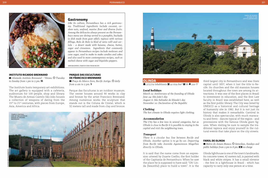
pernamBuCo320 321
oLInda 377,779 inhabitants 41.659 km² 81 220 V
Local holidaysMarch 12: Anniversary of the founding of OlindaJune 24: São João’s dayAugust 6: São Salvador do Mundo’s day November 10: Declaration of the Republic
ClothingThe hot climate in Olinda requires light clothing.
AccommodationThe city has a few inns in several categories, but as Olinda is close to Recife it is possible to staying in the capital and visit the neighboring town.
TransportThere is a circular bus line between Recife and Olinda. Another option is to go by car. Departing from Recife take Avenida Agamemnon Magellan directly to Olinda.
It is said that the name come from an expres-sion uttered by Duarte Coelho, the first holder of the Capitania de Pernambuco. When he saw the place he is supposed to have said: “Oh! Lin-da (beautiful) place to build a town”. It is the
third largest city in Pernambuco and was State capital until 1837, when it lost the title to Re-cife. Its churches and the old mansion houses located throughout the town are among its at-tractions. It was one of the first places in Brazil to investment in education, and the first Law faculty in Brazil was established here, as well as the first public library. The City was listed by UNESCO as a historical and cultural heritage of humanity site in 1982. But it is not just its history that makes it remarkable. Carnival in Olinda is also spectacular, with much maraca-tu and frevo - dances typical of the region - and processions with the famous Olinda giant fig-ures. When visiting be sure to sample the tra-ditional tapioca and enjoy yourself in the cul-tural events that take place on the city streets.
FaroL de oLInda Bairro do Amaro Branco. Saturdays, Sundays and
public holidays from 2 pm to 8 pm. no charge
Olinda lighthouse is one of the town’s landmarks. Its concrete tower, 42 meters tall, is painted with black and white stripes. It has a small elevator - the first in a lighthouse in Brazil - which has capacity to carry only one person at a time.
InStItuto rIcardo brennand Alameda Antônio Brennand - Várzea. Tuesday
to Sunday from 1 pm to 5 pm.
The Institute hosts temporary art exhibitions. The art gallery is equipped with a cafeteria, auditorium for 100 people, shop and library. The Museu de Armas Castelo São João houses a collection of weapons of dating from the 15th to 21st centuries, with pieces from Europe, Asia, America and Africa.
parQue daS eScuLturaS de FrancISco brennand
Praça do Marco Zero, Recife Antigo. daily from 9 am to 5 pm.
Parque das Esculturas is an outdoor museum. The center houses around 90 works in clay and bronze by the artist Francisco Brennand. Among numerous works the sculpture that stands out is the Coluna de Cristal, which is 32 meters tall and made from clay and bronze.
farol de olinda is one of the
city’s landmarKs
temPlo central, one of the outdoor sPaces of oficina Brennand
gu
staV
o B
etti
ni/
emB
rat
ur
gu
staV
o B
etti
ni/
emB
rat
ur
arrumadinho, famous dish from recife
GastronomyLike its culture, Pernambuco has a rich gastrono-my. Traditional ingredients include coconut, ca-shew nuts, seafood, manioc flour and diverse fruits. Among the delicacies always present on the Pernam-buco menu are shrimp served in a pumpkin, buchada (a dish made from goat offal), tapioca with various fillings, Bolo de Rolo (a kind of swiss roll) and car-tola - a desert made with banana, cheese, butter, sugar and cinnamon. Ingredients that commonly appear in Pernambuco recipes include molasses and cane sugar, used to make to make candies and cakes and also used in more contemporary recipes, such as melted cheese with sugar and biquinho peppers.
gu
staV
o B
etti
ni/
emB
rat
ur

pernamBuCo322 323
IGreJa de noSSa SenHora da Graça Rua Bispo coutinho. daily from 9 am to 11:45
am and from 2 pm to 5 pm. Mass: Monday to Satur-day at 7 am. no charge
Located on the highest point in Olinda, the building was inspired by the Igreja de São Roque in Lisbon, Portugal. It has functioned as a reli-gious seminary since the 19th century, when the Jesuits - former owners of this building - were expelled from the city.
Mercado da rIbeIra Rua Bernardo Vieira de Melo. daily from 9
am to 6:30 pm. Some shops remain open until 9 pm. no charge
The Mercado de Ribeira is home to several craft galleries as well as the workshops of artisans and painters. The building has design and deco-ration from the colonial era, complete with Por-tuguese floor tiles and surrounds. This was the location for slave trading in the past. During Carnival the market becomes the meeting point for processions that depart from here before go-ing on to the hills of the city.
HandicraftsFrom the clay figurines of Mestre Vitalino to leather pieces to the carved wooden figureheads from the Rio São Francisco region, Pernambuco crafts are one of the great prides of its people. In Olinda large doll figures are a feature of the local carnival processions, and miniature ver-sions are always popular souvenirs with tour-ists. Folk stories, poems and songs accompanied by sketches, published in booklets - known as Literatura de cordel - are very common. This is one of the richest cultural traditions of Per-nambuco, and their sketches can be seen in other art forms such as decor.
MuSeu do MaMuLenGo Rua de São Bento, 344. Tuesday to Friday from
10 am to 5 pm.
Mamulengos are puppet-like dolls typical of Northeastern Brazil, especially Pernambuco. They are used to enact light-hearted theater pieces depicting Northeastern life and cus-toms. The museum has a collection of more than one thousand pieces made by great arti-sans. Some of the dolls date from the 18th cen-tury. It is the first museum in Brazil and Latin America dedicated to this type of folk culture.
conVento de São FrancISco Rua de São Francisco, 280. daily from 9 am to
12 am and from 2 pm to 5 pm. Mass takes place tues-day at 7 pm, Saturday at 5 pm and Sunday at 8 am.
no charge
The building was constructed in the 16th cen-tury is home to several religious sites: the Igreja de Nossa Senhora das Neves, the Capela de São Roque (the oldest chapel of the Third Secular Order in Brazil) and cloisters with 16 Portuguese tiled panels depicting the life and death of Francisco de Assis, as well as the sacristy. Its beauty lies in the craftsmanship in the ceiling, carved in wood and containing paintings from the 18th century. To complete the picture there is a cross made from reef coral in front of the building. This was the first Franciscan convent to be built in Brazil.
centro HIStÓrIco de oLInda Avenida Getúlio Vargas, Praça do carmo and Rua
Amparo and Rua 13 de Maio are some of the princi-pal roads that make up the center of town. daily, 24 hours. no charge
The Centro Histórico de Olinda is home to many old mansion houses and sloped streets. Simply taking a walk through the town the visitor will find many fascinating sights. It is on the streets that the magic happens. The stage for street performances, the center of Olinda is also home to one of the best known festivals in Brazil, Carnival.
praIa do FaroL Via Avenida Ministro Marcos Freire, on the seafront
Located by Farol de Olinda, this beach is popular because of the bars and restaurants lining the seafront, which become animated at night. Visitors can also purchase fresh fish and seafood from the local fish stalls. An-other attraction is the Forte de São Francisco (known as the ‘Fortim do Queijo’ - Cheese For-tress - on account of its shape), which records local culture and history. There is no bathing on this beach and there is no sand on the sea-shore, only rocks.
São João FestivalsSão João celebrations take place throughout Brazil and are known as Junina festivals, so named because they are celebrated each year in the month of June. During these festivals - in the Northeast they are somewhat different to other States - tourists and residents enjoy cakes made with cassava and maize, tapioca, canjica, dance forró, quadrille, xote and xaxa-do, wear country fancy-dress and celebrate around bonfires.
the mercado da riBeira has history and handicrafts
olinda historic center view
clay is a raw material for
various crafts
gu
staV
o B
etti
ni/
emB
rat
ur
gu
staV
o B
etti
ni/
emB
rat
ur
gu
staV
o B
etti
ni/
emB
rat
ur
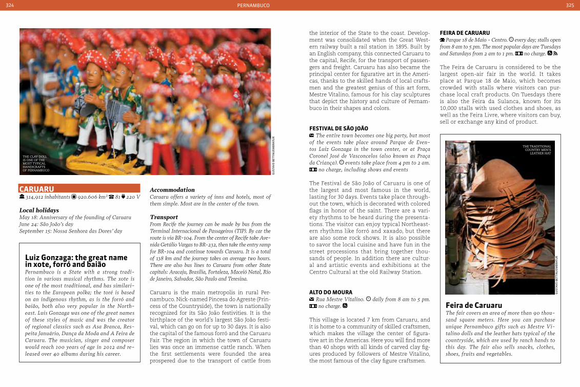
pernamBuCo324 325
the interior of the State to the coast. Develop-ment was consolidated when the Great West-ern railway built a rail station in 1895. Built by an English company, this connected Caruaru to the capital, Recife, for the transport of passen-gers and freight. Caruaru has also became the principal center for figurative art in the Ameri-cas, thanks to the skilled hands of local crafts-men and the greatest genius of this art form, Mestre Vitalino, famous for his clay sculptures that depict the history and culture of Pernam-buco in their shapes and colors.
FeStIVaL de São João The entire town becomes one big party, but most
of the events take place around Parque de Even-tos Luiz Gonzaga in the town center, or at Praça coronel José de Vasconcelos (also known as Praça da criança). events take place from 4 pm to 2 am.
no charge, including shows and events
The Festival de São João of Caruaru is one of the largest and most famous in the world, lasting for 30 days. Events take place through-out the town, which is decorated with colored flags in honor of the saint. There are a vari-ety rhythms to be heard during the presenta-tions. The visitor can enjoy typical Northeast-ern rhythms like forró and xaxado, but there are also some rock shows. It is also possible to savor the local cuisine and have fun in the street processions that bring together thou-sands of people. In addition there are cultur-al and artistic events and exhibitions at the Centro Cultural at the old Railway Station.
aLto do Moura Rua Mestre Vitalino. daily from 8 am to 5 pm. no charge.
This village is located 7 km from Caruaru, and it is home to a community of skilled craftsmen, which makes the village the center of figura-tive art in the Americas. Here you will find more than 40 shops with all kinds of carved clay fig-ures produced by followers of Mestre Vitalino, the most famous of the clay figure craftsmen.
FeIra de caruaru Parque 18 de Maio - centro. every day; stalls open
from 8 am to 5 pm. The most popular days are Tuesdays and Saturdays from 2 am to 1 pm. no charge.
The Feira de Caruaru is considered to be the largest open-air fair in the world. It takes place at Parque 18 de Maio, which becomes crowded with stalls where visitors can pur-chase local craft products. On Tuesdays there is also the Feira da Sulanca, known for its 10,000 stalls with used clothes and shoes, as well as the Feira Livre, where visitors can buy, sell or exchange any kind of product.
caruaru 314,912 inhabitants 920.606 km² 81 220 V
Local holidaysMay 18: Anniversary of the founding of caruaruJune 24: São João’s daySeptember 15: Nossa Senhora das Dores’ day
Accommodation caruaru offers a variety of inns and hotels, most of them simple. Most are in the center of the town.
TransportFrom Recife the journey can be made by bus from the Terminal Internacional de Passageiros (TIP). By car the route is via BR-104. From the center of Recife take Ave-nida Getúlio Vargas to BR-232, then take the entry ramp for BR-104 and continue towards caruaru. It is a total of 138 km and the journey takes on average two hours. There are also bus lines to caruaru from other State capitals: Aracaju, Brasilia, Fortaleza, Maceió Natal, Rio de Janeiro, Salvador, São Paulo and Teresina.
Caruaru is the main metropolis in rural Per-nambuco. Nick-named Pincesa do Agreste (Prin-cess of the Countryside), the town is nationally recognized for its São João festivities. It is the birthplace of the world’s largest São João festi-val, which can go on for up to 30 days. It is also the capital of the famous forró and the Caruaru Fair. The region in which the town of Caruaru lies was once an immense cattle ranch. When the first settlements were founded the area prospered due to the transport of cattle from
Feira de caruaruThe fair covers an area of more than 90 thou-sand square meters. Here you can purchase unique Pernambuco gifts such as Mestre Vi-talino dolls and the leather hats typical of the countryside, which are used by ranch hands to this day. The fair also sells snacks, clothes, shoes, fruits and vegetables.
Luiz Gonzaga: the great name in xote, forró and baiãoPernambuco is a State with a strong tradi-tion in various musical rhythms. The xote is one of the most traditional, and has similari-ties to the European polka; the toré is based on an indigenous rhythm, as is the forró and baião, both also very popular in the North-east. Luis Gonzaga was one of the great names of these styles of music and was the creator of regional classics such as Asa Branca, Res-peita Januário, Dança da Moda and A Feira de caruaru. The musician, singer and composer would reach 100 years of age in 2012 and re-leased over 40 albums during his career.
the traditional country men’s
leather hatthe clay doll is one of the most tyPical handicrafts of PernamBuco
gu
staV
o B
etti
ni/
emB
rat
ur
gu
staV
o B
etti
ni/
emB
rat
ur

pernamBuCo326 327
Fernando de noronHa 2,630 inhabitants 17.017 km² 81 220 V
Local holidaysAugust 10: Anniversary of the IslandAugust 29: São Pedro’s day
ClothingIt is recommended to bring sunscreen, swimsuits and other items such as sandals, sunglasses and diving equipment, although this can be rented on the island. The warm climate signifies the use of lightweight clothing, but it is also recommended to bring some-thing a little warmer. You should also bring also a pair of shoes suitable for walking trails and a snorkel, as there are beaches where snorkeling is widely practiced and marine life can be observed up close.
AccommodationIn order to stay in Fernando de Noronha it is neces-sary to pay an Environmental conservation Fee, which is charged per person per day, regardless of age. Rates may be checked and paid directly via the internet at http://www.noronha.pe.gov.br
TransportThere are only two ways to get to Fernando de Noronha, from Recife and Natal. It will be necessary
to make a stopover at one of these two cities if de-parting from elsewhere in the country. There are regu-lar flights out of Guararapes International Airport in Recife and the Augusto Severo International Airport in Natal. The flight takes approximately one hour. To arrive at the archipelago by sea, the visitor can choose an organized tour packages including transport by cruise ship. There is also the option to travel with your own vessel - in this case you must have permis-sion from the Island Administration and you will be charged a daily anchorage fee.
Of volcanic origin, this archipelago compris-es 21 islands and rock islets, with only the largest island being inhabited: Fernando de Noronha. Its beaches are divided between the “land-facing” where the waters are facing the continent, and the “sea-facing”, fronting the Atlantic Ocean. Long before becoming an ecological paradise, sought by tourists from around the world, Fernando de Noronha was used as a prison colony. Detainees saw out their sentence in an old prison, located near the Praia Cacimba do Padre in the village of Quixaba. That was until 1938, when it only housed political prisoners of the Estado Novo. Today the prison is deactivated, and what re-mains of the building can be seen from the beach. The island has unique flora and fauna, which is protected by the Chico Mendes Insti-tute for Biodiversity Conservation (ICMBio). It is common to find locations where bathing is prohibited or restricted, and there are a lim-ited number of people allowed into the wa-ter and only at certain times. Nevertheless, the archipelago is one of the most beautiful places in Brazil.
baía and porto de Santo antÔnIo At the tip of the island, near Buraco da Raquel. 24 hours. no charge
Santo Antônio bay is the harbor that receives visiting vessels - both fishing and tourism. Its depths hold the remains of the cargo vessel El-eani Sthatathos. Besides the natural beauty of the bay, you can also see the remains of the first pier, built during the war for unloading canons.
praIa doS aMerIcanoS Between Praia do Boldró and Praia do Bode
This is the beach that has greatest level of pri-vacy on the island. It sits next to the Praia do Boldró and received its name because of the Observation Post installed by Americans.
praIa do MeIo Between Praia da conceição and Praia do cachorro
Located between Praia da Conceição and Praia do Cachorro, Praia do Meio is a small tract of land. The waters are calm, but become agitated by swollen seas. It is therefore prohibited to en-ter the seas during this period.
praIa do cacHorro Just below the Fortaleza dos Remédios,
near Praia da conceição
Praia do Cachorro -’Dog Beach’ - got its name because it has a bronze fountain with the face
of a dog. Here visitors can drink from the fresh water fountain and visit the cliffs of Parque de Sant’Ana and a stone pool, named Buraco do Galego. The beach also hosts a part of the Tourist Terminal with its fair, where the visitor and their family can purchase typical Island products.
praIa da conceIção Adjacent to Praia do cachorro
The beach is easily accessed, which makes it one of the more popular on the island. It is long, and the sandy beach is perfect for a pleasant walk. It is also a great place for a swim at low tide, and ideal for surfers at high tide.
praIa do bode Soon after Praia dos Americanos
This beach is very quiet, and it is also a great place for bathing. Above the beach there is a large rock outcrop - Pedra do Bode - which also serves as a viewpoint.
rocKs and crystal clear waters in fernando de noronha
min
isté
rio
do
tu
ris
mo
de
per
na
nB
uCo
ILHa rata
ILHa do MeIo
ILHa SeLa GIneta
ILHa raSa
buraco da raQueL
enSeada da caIeIra
Morro do FrancÊS
pontInHa
ILHa do Frade
praIa da ataLaIa
Morro do eSpInHaço
Morro da MadeIra
praIa do SueSte ILHa doS trInta rÉIS
ILHa cabeLuda
praIa do Leão
ILHa do cHapÉuILHa do Morro da Leão
Morro doIS
abraçoS
Morro branco
Morro do pIco VILa doS
reMÉdIoS
ILHa do Morro
da VIúVa
Morro da QuIxabInHa
capIM açu
ponta da Sapata
ponta daS caracaS
ILHa doS oVoS
baía doS GoLFInHoS
baía do SancHo
baía doS porcoS
ILHa doIS IrMãoSpraIa da cacIMba do padre
praIa do bode
praIa do cacHorropraIa doS
aMerIcanoS
praIa do boLdro
ILHa da conceIção
ILHa São JoSÉ
ILHa cuScuz
Fernando de noronHa
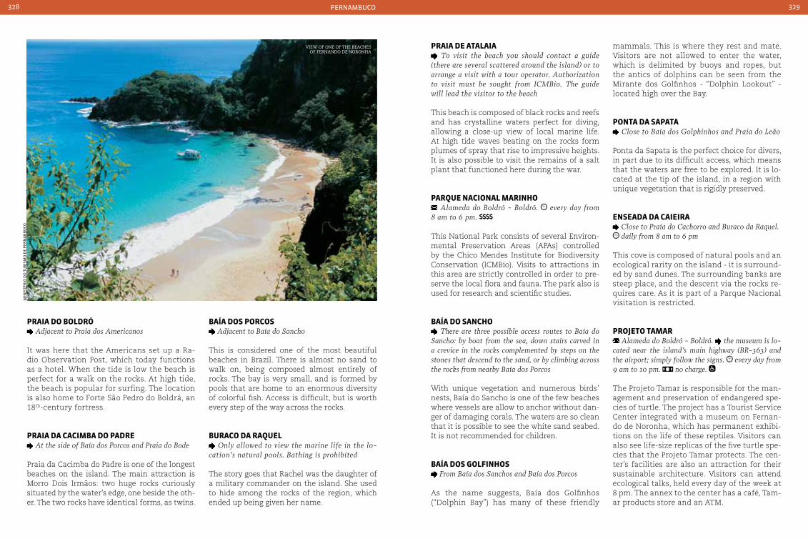
pernamBuCo328 329
praIa do boLdrÓ Adjacent to Praia dos Americanos
It was here that the Americans set up a Ra-dio Observation Post, which today functions as a hotel. When the tide is low the beach is perfect for a walk on the rocks. At high tide, the beach is popular for surfing. The location is also home to Forte São Pedro do Boldrá, an 18th-century fortress.
praIa da cacIMba do padre At the side of Baía dos Porcos and Praia do Bode
Praia da Cacimba do Padre is one of the longest beaches on the island. The main attraction is Morro Dois Irmãos: two huge rocks curiously situated by the water’s edge, one beside the oth-er. The two rocks have identical forms, as twins.
baía doS porcoS Adjacent to Baía do Sancho
This is considered one of the most beautiful beaches in Brazil. There is almost no sand to walk on, being composed almost entirely of rocks. The bay is very small, and is formed by pools that are home to an enormous diversity of colorful fish. Access is difficult, but is worth every step of the way across the rocks.
buraco da raQueL Only allowed to view the marine life in the lo-
cation’s natural pools. Bathing is prohibited
The story goes that Rachel was the daughter of a military commander on the island. She used to hide among the rocks of the region, which ended up being given her name.
praIa de ataLaIa To visit the beach you should contact a guide
(there are several scattered around the island) or to arrange a visit with a tour operator. Authorization to visit must be sought from IcMBio. The guide will lead the visitor to the beach
This beach is composed of black rocks and reefs and has crystalline waters perfect for diving, allowing a close-up view of local marine life. At high tide waves beating on the rocks form plumes of spray that rise to impressive heights. It is also possible to visit the remains of a salt plant that functioned here during the war.
parQue nacIonaL MarInHo Alameda do Boldró - Boldró. every day from
8 am to 6 pm.
This National Park consists of several Environ-mental Preservation Areas (APAs) controlled by the Chico Mendes Institute for Biodiversity Conservation (ICMBio). Visits to attractions in this area are strictly controlled in order to pre-serve the local flora and fauna. The park also is used for research and scientific studies.
baía do SancHo There are three possible access routes to Baía do
Sancho: by boat from the sea, down stairs carved in a crevice in the rocks complemented by steps on the stones that descend to the sand, or by climbing across the rocks from nearby Baía dos Porcos
With unique vegetation and numerous birds’ nests, Baía do Sancho is one of the few beaches where vessels are allow to anchor without dan-ger of damaging corals. The waters are so clean that it is possible to see the white sand seabed. It is not recommended for children.
baía doS GoLFInHoS From Baía dos Sanchos and Baía dos Porcos
As the name suggests, Baía dos Golfinhos (“Dolphin Bay”) has many of these friendly
mammals. This is where they rest and mate. Visitors are not allowed to enter the water, which is delimited by buoys and ropes, but the antics of dolphins can be seen from the Mirante dos Golfinhos - “Dolphin Lookout” - located high over the Bay.
ponta da Sapata close to Baía dos Golphinhos and Praia do Leão
Ponta da Sapata is the perfect choice for divers, in part due to its difficult access, which means that the waters are free to be explored. It is lo-cated at the tip of the island, in a region with unique vegetation that is rigidly preserved.
enSeada da caIeIra close to Praía do cachorro and Buraco da Raquel. daily from 8 am to 6 pm
This cove is composed of natural pools and an ecological rarity on the island - it is surround-ed by sand dunes. The surrounding banks are steep place, and the descent via the rocks re-quires care. As it is part of a Parque Nacional visitation is restricted.
proJeto taMar Alameda do Boldró - Boldró. the museum is lo-
cated near the island’s main highway (BR-363) and the airport; simply follow the signs. every day from 9 am to 10 pm. no charge.
The Projeto Tamar is responsible for the man-agement and preservation of endangered spe-cies of turtle. The project has a Tourist Service Center integrated with a museum on Fernan-do de Noronha, which has permanent exhibi-tions on the life of these reptiles. Visitors can also see life-size replicas of the five turtle spe-cies that the Projeto Tamar protects. The cen-ter’s facilities are also an attraction for their sustainable architecture. Visitors can attend ecological talks, held every day of the week at 8 pm. The annex to the center has a café, Tam-ar products store and an ATM.
min
isté
rio
do
tu
ris
mo
de
per
na
nB
uCo
view of one of the Beaches of fernando de noronha
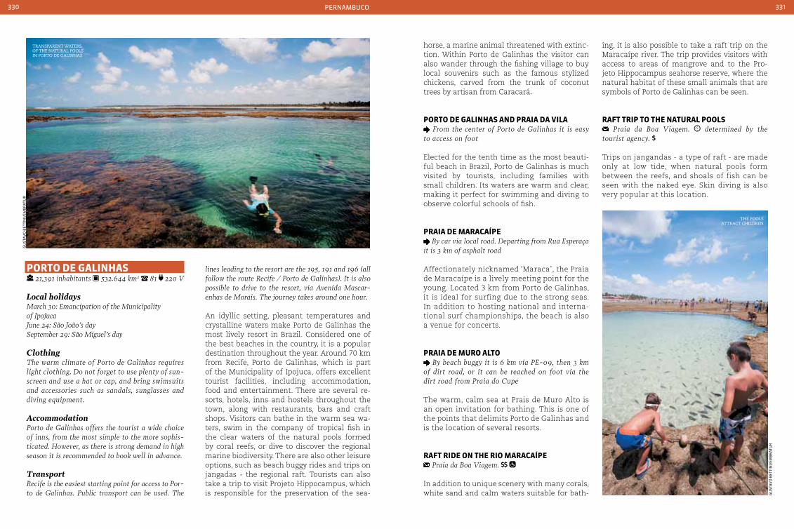
pernamBuCo330 331
porto de GaLInHaS 21,391 inhabitants 532.644 km2 81 220 V
Local holidaysMarch 30: Emancipation of the Municipality of IpojucaJune 24: São João’s daySeptember 29: São Miguel’s day
ClothingThe warm climate of Porto de Galinhas requires light clothing. Do not forget to use plenty of sun-screen and use a hat or cap, and bring swimsuits and accessories such as sandals, sunglasses and diving equipment.
Accommodation Porto de Galinhas offers the tourist a wide choice of inns, from the most simple to the more sophis-ticated. However, as there is strong demand in high season it is recommended to book well in advance.
TransportRecife is the easiest starting point for access to Por-to de Galinhas. Public transport can be used. The
lines leading to the resort are the 195, 191 and 196 (all follow the route Recife / Porto de Galinhas). It is also possible to drive to the resort, via Avenida Mascar-enhas de Morais. The journey takes around one hour.
An idyllic setting, pleasant temperatures and crystalline waters make Porto de Galinhas the most lively resort in Brazil. Considered one of the best beaches in the country, it is a popular destination throughout the year. Around 70 km from Recife, Porto de Galinhas, which is part of the Municipality of Ipojuca, offers excellent tourist facilities, including accommodation, food and entertainment. There are several re-sorts, hotels, inns and hostels throughout the town, along with restaurants, bars and craft shops. Visitors can bathe in the warm sea wa-ters, swim in the company of tropical fish in the clear waters of the natural pools formed by coral reefs, or dive to discover the regional marine biodiversity. There are also other leisure options, such as beach buggy rides and trips on jangadas - the regional raft. Tourists can also take a trip to visit Projeto Hippocampus, which is responsible for the preservation of the sea-
horse, a marine animal threatened with extinc-tion. Within Porto de Galinhas the visitor can also wander through the fishing village to buy local souvenirs such as the famous stylized chickens, carved from the trunk of coconut trees by artisan from Caracará.
porto de GaLInHaS and praIa da VILa From the center of Porto de Galinhas it is easy
to access on foot
Elected for the tenth time as the most beauti-ful beach in Brazil, Porto de Galinhas is much visited by tourists, including families with small children. Its waters are warm and clear, making it perfect for swimming and diving to observe colorful schools of fish.
praIa de Maracaípe By car via local road. Departing from Rua Esperaça
it is 3 km of asphalt road
Affectionately nicknamed ‘Maraca’, the Praia de Maracaípe is a lively meeting point for the young. Located 3 km from Porto de Galinhas, it is ideal for surfing due to the strong seas. In addition to hosting national and interna-tional surf championships, the beach is also a venue for concerts.
praIa de Muro aLto
By beach buggy it is 6 km via PE-09, then 3 km of dirt road, or it can be reached on foot via the dirt road from Praia do cupe
The warm, calm sea at Prais de Muro Alto is an open invitation for bathing. This is one of the points that delimits Porto de Galinhas and is the location of several resorts.
raFt rIde on tHe rIo Maracaípe Praia da Boa Viagem.
In addition to unique scenery with many corals, white sand and calm waters suitable for bath-
ing, it is also possible to take a raft trip on the Maracaípe river. The trip provides visitors with access to areas of mangrove and to the Pro-jeto Hippocampus seahorse reserve, where the natural habitat of these small animals that are symbols of Porto de Galinhas can be seen.
raFt trIp to tHe naturaL pooLS Praia da Boa Viagem. determined by the
tourist agency.
Trips on jangandas - a type of raft - are made only at low tide, when natural pools form between the reefs, and shoals of fish can be seen with the naked eye. Skin diving is also very popular at this location.
gu
staV
o B
etti
ni/
emB
rat
ur
gu
staV
o B
etti
ni/
emB
rat
ur
transParent waters of the natural Pools in Porto de galinhas
the Pools attract children

333
pIauí
Pedra furada, in serra da caPivara
Vag
ner
Ca
rVa
lHei
ro
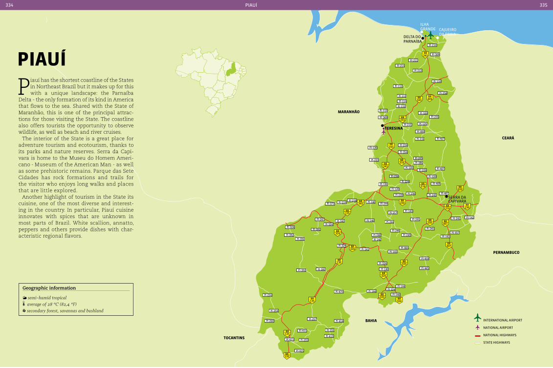
MaranHão
ceará
baHIa
343BR
343BR
343BR
343BR
343BR
343BR
135BR
324BR
324BR
324BR
324BR
135BR
135BR
135BR
135BR
316BR
316BR
020BR
020BR
020BR
020BR
407BR
407BR
230BR
230BR
316BR
404BR
PI-210
PI-309
PI-211
PI-213
PI-112
PI-110
PI-258PI-113
PI-114
PI-115
PI-112
PI-369
PI-320PI-216
PI-115PI-215
PI-214
PI-450
PI-407PI-216
PI-224PI-130
PI-233
PI-354
PI-225
PI-386
PI-120
PI-236
PI-130
PI-120
PI-224
PI-226 PI-407
PI-120
PI-469
PI-407PI-245PI-236PI-239
PI-372 PI-219PI-218 PI-140
PI-244
PI-217PI-143
PI-142PI-241
PI-457PI-143
PI-245
PI-241PI-244PI-140PI-343
PI-247
PI-324
PI-391PI-324
PI-392
PI-392
PI-324PI-141
PI-248
PI-140
PI-246
PI-249
PI-464
PI-141
PI-459
PI-465
PI-324
PI-140
PI-144PI-324
PI-140PI-144PI-470
PI-395PI-392
PI-254
PI-254
PI-260
PI-411 PI-255
PI-411
PI-415
PI-413
PI-255
PI-257PI-414
tereSIna
serra da CapiVara
Cajueiro da praia
ilHa grande
delta do parnaÍBa
pernaMbuco
tocantInS
international airport
national airport
national HigHways
state HigHways
piauÍ334 335
pIauí
Piauí has the shortest coastline of the States in Northeast Brazil but it makes up for this with a unique landscape: the Parnaíba
Delta - the only formation of its kind in America that flows to the sea. Shared with the State of Maranhão, this is one of the principal attrac-tions for those visiting the State. The coastline also offers tourists the opportunity to observe wildlife, as well as beach and river cruises.
The interior of the State is a great place for adventure tourism and ecotourism, thanks to its parks and nature reserves. Serra da Capi-vara is home to the Museu do Homem Ameri-cano - Museum of the American Man - as well as some prehistoric remains. Parque das Sete Cidades has rock formations and trails for the visitor who enjoys long walks and places that are little explored.
Another highlight of tourism in the State its cuisine, one of the most diverse and interest-ing in the country. In particular, Piauí cuisine innovates with spices that are unknown in most parts of Brazil. White scallion, annatto, peppers and others provide dishes with char-acteristic regional flavors.
Geographic information
semi-humid tropical average of 28 °c (82,4 °F) secondary forest, savannas and bushland
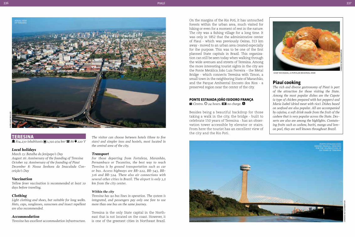
piauÍ336 337
tereSIna 814,230 inhabitants 1,391.974 km2 86 220 V
Local holidaysMarch 13: Batalha do Jenipapo’s Day August 16: Anniversary of the founding of TeresinaOctober 19: Anniversary of the founding of PiauíDecember 8: Nossa Senhora da Imaculada con-ceição’s Day
VaccinationYellow fever vaccination is recommended at least 10 days before traveling.
ClothingLight clothing and shoes, but suitable for long walks. Hats, caps, sunglasses, sunscreen and insect repellent are also recommended.
AccommodationTeresina has excellent accommodation infrastructure.
The visitor can choose between hotels (three to five stars) and simpler inns and hostels, most located in the central area of the city.
TransportFor those departing from Fortaleza, Maranhão, Pernambuco or Tocantins, the best way to reach Teresina is by ground transportation such as car or bus. Access highways are BR-222, BR-343, BR-316 and BR-324. There also air connections with several other cities in Brazil. The airport is only 3,5 km from the city center.
Within the cityTeresina has 92 bus lines in operation. The system is integrated, and passengers pay only one fare to use more than one bus on the same journey.
Teresina is the only State capital in the North-east that is not located on the coast. However, it is one of the greenest cities in Northeast Brazil.
On the margins of the Rio Poti, it has untouched forests within the urban area, much visited for hiking or even for a moment of rest in the nature. The city was a fishing village for a long time. It was only in 1852 that the administrative center of Piauí - which was previously Oeiras, 313 km away - moved to an urban area created especially for the purpose. This was to be one of the first planned State capitals in Brazil. This organiza-tion can still be seen today when walking through the wide avenues and streets of Teresina. Among the more interesting tourist sights in the city are the Ponte Metálica João Luis Ferreira - the Metal Bridge - which connects Teresina with Timon, a small town in the neighboring State of Maranhão, and the Parque Ambiental Encosto dos Rios - a preserved region near the center of the city.
ponte eStaIada João ISIdoro França centro. 24 hours. no charge.
Besides being a beautiful backdrop for those taking a walk in the city, the bridge - built to celebrate 150 years of Teresina - has an obser-vation tower accessible by elevator or stairs. From here the tourist has an excellent view of the city and the Rio Poti.
piauí cookingThe rich and diverse gastronomy of Piauí is part of the attraction for those visiting the State. Among the most popular dishes are the capote (a type of chicken prepared with hot peppers) and Maria Isabel (dried meat with rice). Dishes based on seafood are also popular. All are accompanied by cajuína, a soft drink made from the fruit of the cashew that is very popular across the State. Des-serts are also are among the highlights. contain-ing fruits such as cashew, buriti, mango and lem-on peel, they are well known throughout Brazil.
goat Buchada, a PoPular regional dish
Ponte estaiada joão isidoro frança, designed
for the celeBrations of 150 years of teresina
aerial view of teresina
au
rel
ian
o m
ull
er
Can
did
o n
eto
/em
Br
atu
r
Can
did
o n
eto
/em
Br
atu
r
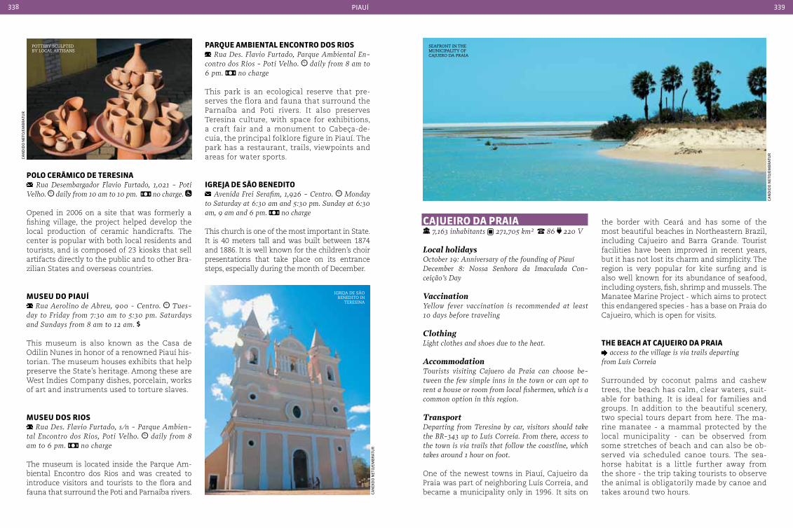
piauÍ338 339
parQue aMbIentaL encontro doS rIoS Rua Des. Flavio Furtado, Parque Ambiental En-
contro dos Rios - Poti Velho. daily from 8 am to 6 pm. no charge
This park is an ecological reserve that pre-serves the flora and fauna that surround the Parnaíba and Poti rivers. It also preserves Teresina culture, with space for exhibitions, a craft fair and a monument to Cabeça-de-cuia, the principal folklore figure in Piauí. The park has a restaurant, trails, viewpoints and areas for water sports.
IGreJa de São benedIto Avenida Frei Serafim, 1,926 - centro. Monday
to Saturday at 6:30 am and 5:30 pm. Sunday at 6:30 am, 9 am and 6 pm. no charge
This church is one of the most important in State. It is 40 meters tall and was built between 1874 and 1886. It is well known for the children’s choir presentations that take place on its entrance steps, especially during the month of December.
caJueIro da praIa 7,163 inhabitants 271,705 km² 86 220 V
Local holidaysOctober 19: Anniversary of the founding of PiauíDecember 8: Nossa Senhora da Imaculada con-ceição’s Day
VaccinationYellow fever vaccination is recommended at least 10 days before traveling
ClothingLight clothes and shoes due to the heat.
AccommodationTourists visiting cajuero da Praia can choose be-tween the few simple inns in the town or can opt to rent a house or room from local fishermen, which is a common option in this region.
TransportDeparting from Teresina by car, visitors should take the BR-343 up to Luís correia. From there, access to the town is via trails that follow the coastline, which takes around 1 hour on foot.
One of the newest towns in Piauí, Cajueiro da Praia was part of neighboring Luís Correia, and became a municipality only in 1996. It sits on
the border with Ceará and has some of the most beautiful beaches in Northeastern Brazil, including Cajueiro and Barra Grande. Tourist facilities have been improved in recent years, but it has not lost its charm and simplicity. The region is very popular for kite surfing and is also well known for its abundance of seafood, including oysters, fish, shrimp and mussels. The Manatee Marine Project - which aims to protect this endangered species - has a base on Praia do Cajueiro, which is open for visits.
tHe beacH at caJueIro da praIa access to the village is via trails departing
from Luís correia
Surrounded by coconut palms and cashew trees, the beach has calm, clear waters, suit-able for bathing. It is ideal for families and groups. In addition to the beautiful scenery, two special tours depart from here. The ma-rine manatee - a mammal protected by the local municipality - can be observed from some stretches of beach and can also be ob-served via scheduled canoe tours. The sea-horse habitat is a little further away from the shore - the trip taking tourists to observe the animal is obligatorily made by canoe and takes around two hours.
poLo cerÂMIco de tereSIna Rua Desembargador Flavio Furtado, 1,021 - Poti
Velho. daily from 10 am to 10 pm. no charge.
Opened in 2006 on a site that was formerly a fishing village, the project helped develop the local production of ceramic handicrafts. The center is popular with both local residents and tourists, and is composed of 23 kiosks that sell artifacts directly to the public and to other Bra-zilian States and overseas countries.
MuSeu do pIauí Rua Aerolino de Abreu, 900 - centro. Tues-
day to Friday from 7:30 am to 5:30 pm. Saturdays and Sundays from 8 am to 12 am.
This museum is also known as the Casa de Odilin Nunes in honor of a renowned Piauí his-torian. The museum houses exhibits that help preserve the State’s heritage. Among these are West Indies Company dishes, porcelain, works of art and instruments used to torture slaves.
MuSeu doS rIoS Rua Des. Flavio Furtado, s/n - Parque Ambien-
tal Encontro dos Rios, Poti Velho. daily from 8 am to 6 pm. no charge
The museum is located inside the Parque Am-biental Encontro dos Rios and was created to introduce visitors and tourists to the flora and fauna that surround the Poti and Parnaíba rivers.
Pottery sculPted By local artisans
igreja de são Benedito in
teresina
seafront in the municiPality of cajuero da Praia
Can
did
o n
eto
/em
Br
atu
r
Can
did
o n
eto
/em
Br
atu
r
Can
did
o n
eto
/em
Br
atu
r
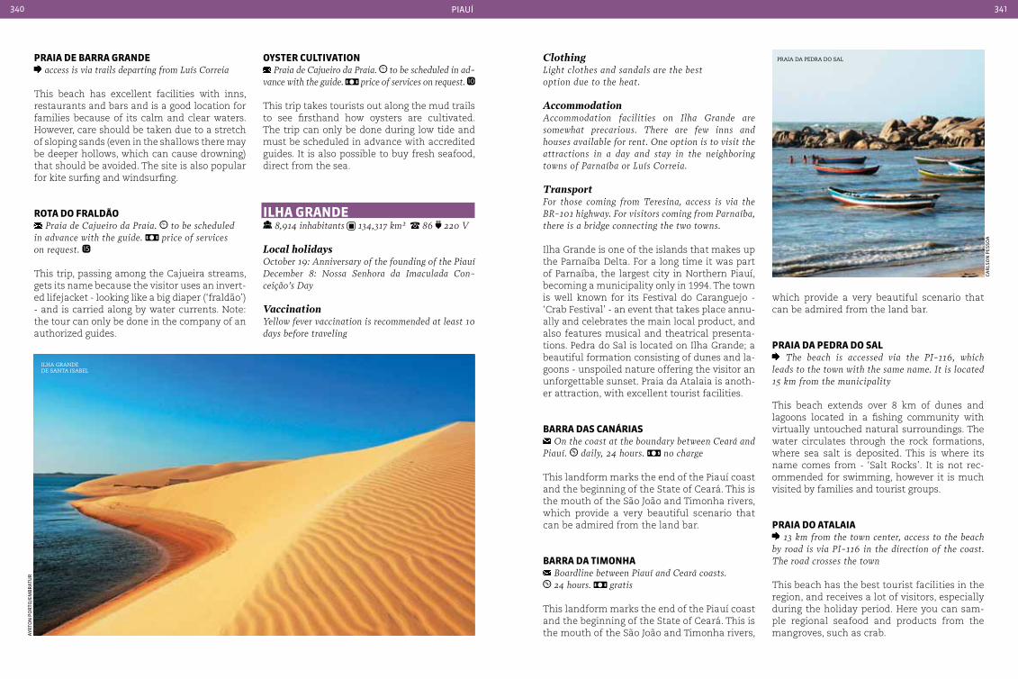
piauÍ340 341
oySter cuLtIVatIon Praia de cajueiro da Praia. to be scheduled in ad-
vance with the guide. price of services on request.
This trip takes tourists out along the mud trails to see firsthand how oysters are cultivated. The trip can only be done during low tide and must be scheduled in advance with accredited guides. It is also possible to buy fresh seafood, direct from the sea.
ILHa Grande 8,914 inhabitants 134,317 km² 86 220 V
Local holidaysOctober 19: Anniversary of the founding of the PiauíDecember 8: Nossa Senhora da Imaculada con-ceição’s Day
VaccinationYellow fever vaccination is recommended at least 10 days before traveling
ClothingLight clothes and sandals are the best option due to the heat.
AccommodationAccommodation facilities on Ilha Grande are somewhat precarious. There are few inns and houses available for rent. One option is to visit the attractions in a day and stay in the neighboring towns of Parnaíba or Luís correia.
TransportFor those coming from Teresina, access is via the BR-101 highway. For visitors coming from Parnaíba, there is a bridge connecting the two towns.
Ilha Grande is one of the islands that makes up the Parnaíba Delta. For a long time it was part of Parnaíba, the largest city in Northern Piauí, becoming a municipality only in 1994. The town is well known for its Festival do Caranguejo - ‘Crab Festival’ - an event that takes place annu-ally and celebrates the main local product, and also features musical and theatrical presenta-tions. Pedra do Sal is located on Ilha Grande; a beautiful formation consisting of dunes and la-goons - unspoiled nature offering the visitor an unforgettable sunset. Praia da Atalaia is anoth-er attraction, with excellent tourist facilities.
barra daS canárIaS On the coast at the boundary between ceará and
Piauí. daily, 24 hours. no charge
This landform marks the end of the Piauí coast and the beginning of the State of Ceará. This is the mouth of the São João and Timonha rivers, which provide a very beautiful scenario that can be admired from the land bar.
barra da tIMonHa Boardline between Piauí and ceará coasts. 24 hours. gratis
This landform marks the end of the Piauí coast and the beginning of the State of Ceará. This is the mouth of the São João and Timonha rivers,
praIa de barra Grande access is via trails departing from Luís correia
This beach has excellent facilities with inns, restaurants and bars and is a good location for families because of its calm and clear waters. However, care should be taken due to a stretch of sloping sands (even in the shallows there may be deeper hollows, which can cause drowning) that should be avoided. The site is also popular for kite surfing and windsurfing.
rota do FraLdão Praia de cajueiro da Praia. to be scheduled
in advance with the guide. price of services on request.
This trip, passing among the Cajueira streams, gets its name because the visitor uses an invert-ed lifejacket - looking like a big diaper (‘fraldão’) - and is carried along by water currents. Note: the tour can only be done in the company of an authorized guides.
which provide a very beautiful scenario that can be admired from the land bar.
praIa da pedra do SaL The beach is accessed via the PI-116, which
leads to the town with the same name. It is located 15 km from the municipality
This beach extends over 8 km of dunes and lagoons located in a fishing community with virtually untouched natural surroundings. The water circulates through the rock formations, where sea salt is deposited. This is where its name comes from - ‘Salt Rocks’. It is not rec-ommended for swimming, however it is much visited by families and tourist groups.
praIa do ataLaIa 13 km from the town center, access to the beach
by road is via PI-116 in the direction of the coast. The road crosses the town
This beach has the best tourist facilities in the region, and receives a lot of visitors, especially during the holiday period. Here you can sam-ple regional seafood and products from the mangroves, such as crab.
ilha grande de santa isaBel
Praia da Pedra do sal
Car
lso
n p
esso
a
ayr
ton
po
rto
/em
Br
atu
r
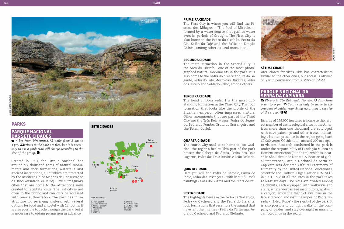
piauÍ342 343
parkS
parQue nacIonaL daS Sete cIdadeS
5 km from Piracuruca. daily from 8 am to 5 pm. visits to the park are free, but it is neces-sary to use a guide who will charge according to the size of the group.
Created in 1961, the Parque Nacional has around six thousand acres of natural monu-ments and rock formations, waterfalls and ancient inscriptions, all of which are protected by the Instituto Chico Mendes de Conservação da Biodiversidade (ICMBio). Seven imaginary cities that are home to the attractions were created to facilitate visits. The last city is not open to the public and can only be accessed with prior authorization. The park has infra-structure for receiving visitors, with several options for food and a hostel with 12 rooms. It is also possible to cycle through the park, but it is necessary to obtain permission in advance.
prIMeIra cIdadeThe First City is where you will find the Pi-scina dos Milagres - ‘The Pool of Miracles’ - formed by a water source that gushes water even in periods of drought. The First City is also home to the Pedra do Canhão, Pedra da Gia, Salão do Pajé and the Salão do Dragão Chinês, among other natural monuments.
SeGunda cIdadeThe main attraction in the Second City is the Arco do Triunfo - one of the most photo-graphed natural monuments in the park. It is also home to the Pedra do Americano, Pé do Gi-gante, Pedra do Falo, Morro das Oliveiras, Pedra do Castelo and Soldado Velho, among others.
terceIra cIdade The head of Dom Pedro I is the most out-standing formation in the Third City. The rock formation that looks like the profile of the Brazilian emperor often impresses visitors. Other monuments that are part of the Third City are the Três Reis Magos, Pedra do Segre-do, Pedra do Pombo, Gruta do Estrangeiro and the Totem do Sol.
Quarta cIdadeThe Fourth City used to be home to José Cati-rina, the region’s healer. This part of the park houses the Cabeça de Águia, Pedra dos Dois Lagartos, Pedra dos Dois Irmãos e Leão Deitado.
QuInta cIdade Here you will find Pedra do Camelo, Furna do Índio, Pedra das Inscrições - with beautiful rock paintings - Casa do Guarda and the Pedra do Rei.
Sexta cIdadeThe highlights here are the Pedra da Tartaruga, Pedra do Cachorro and the Pedra do Elefante, rock formations that resemble the animal that have lent their names - Pedra da Tartaruga, Pe-dra do Cachorro and Pedra do Elefante.
1
2
3
4
5
6
7
8
9 10 11
Cidade 6
Cidade 5
Cidade 4 Cidade
7
Cidade 3
Cidade 2
Cidade 1
Exit to Piracuruca
Exit to Piripiri
SÉtIMa cIdadeArea closed for visits. This has characteristics similar to the other cities, but access is allowed only with permission from ICMBio or IBAMA
.parQue nacIonaL da Serra da capIVara
PI-140 in São Raimundo Nonato. daily from 6 am to 6 pm. Tours can only be made in the company of guides, who charge according to the size of the group.
Its area of 129,000 hectares is home to the larg-est number of archaeological sites in the Amer-icas: more than one thousand are cataloged, with cave paintings and other traces indicat-ing a human presence in the region going back 60,000 years. Of this total, around 200 are open to visitors. Research conducted in the park is under the responsibility of Fundação Museu do Homem Americano (Fundham), which is locat-ed in São Raimundo Nonato. A location of glob-al importance, Parque Nacional da Serra da Capivara was declared Cultural Patrimony of Humanity by the United Nations Educational, Scientific and Cultural Organization (UNESCO) in 1991. To visit all the sites in the park takes at least six days. The sites are divided among 14 circuits, each equipped with walkways and stairs, where you can see inscriptions, go down a canyon, enjoy the flight of swallows in the late afternoon and visit the imposing Pedra Fu-rada - ‘Holed Stone’ - the symbol of the park. It is also possible to do night walks, in the com-pany of guides, and stay overnight in inns and campgrounds in the region.
Parque nacional das sete cidades
one of the archaeological sites of serra da caPivara
Can
did
o n
eto
/em
Br
atu
r
sim
on
e zw
irte
s
Sete cIdadeS
Park Attractions
1 Fonte Tépida2 Jardim Suspenso3 Arco do Triunfo4 Miradouro5 Castelo6 Lagartos
7 Archete8 Gruta do índio9 Gruta do Pagé10 Capela11 Portal
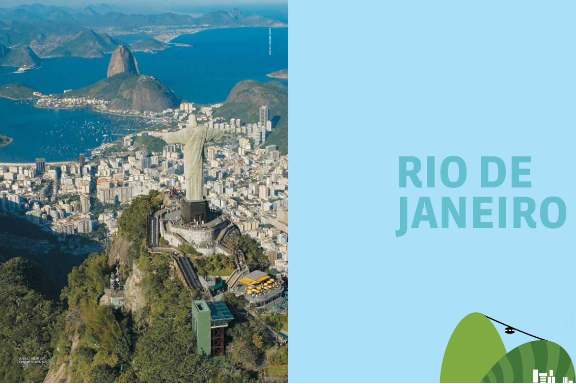
345
rIo deJaneIro
aerial view of cristo redentor
daV
id r
ego
jr/l
um
e

RJ- 220
RJ- 198
RJ- 230
RJ- 186
RJ- 198RJ- 210 RJ- 230
RJ- 224 RJ- 196
RJ- 224
RJ- 158
RJ- 216RJ- 196
RJ- 196RJ- 180
RJ- 192
RJ- 194RJ- 186
RJ- 158
RJ- 166RJ- 116 RJ- 146
RJ- 176
RJ- 170
RJ- 160
RJ- 144RJ- 148
RJ- 152
RJ- 116
RJ- 162 RJ- 182
RJ- 178
RJ- 168RJ- 142
RJ- 146RJ- 130
RJ- 150
RJ- 140
RJ- 140
RJ- 162
RJ- 106
RJ- 106
RJ- 106
RJ- 116
RJ- 116
RJ- 124
RJ- 123RJ- 131
RJ- 125
RJ- 115
RJ- 113
RJ- 129
RJ- 115
RJ- 147
RJ- 151
RJ- 151
RJ- 151
RJ- 145
RJ- 137
RJ- 153
RJ- 159RJ- 143
RJ- 139
RJ- 155
RJ- 155
RJ- 163
RJ- 165
RJ- 149
RJ- 130
RJ- 122
RJ- 196
RJ- 202
RJ- 202RJ- 200RJ- 116
RJ- 198RJ- 206
RJ- 204
RJ- 228
101BR 101
BR
101BR
101BR
101BR
116BR493
BR
492BR
116BR393
BR
393BR
494BR
116BR
116BR
116BR
465BR
493BR
040BR
101BR
101BR
101BR
356BR
356BR
356BR
356BR
495BR
RJ- 141
RJ- 107
rIo de JaneIro
São pauLo
MInaS GeraIS
eSpírIto Santo
angra dos reis
ilHa grande
Búzios
CaBo frio
arraial do CaBo
paraty
petrópolis
itaipaVa
teresópolis
itatiaia
international airport
national airport
national HigHways
state HigHways
rio de janeiro346 347
Regarded as one of the picture postcards of Brazil, the fame of the State is due in part to its capital City, also named Rio de Ja-
neiro, whose beautiful beaches and natural at-tractions are well known throughout world. The City is home to internationally recognized icons such as Maracanã football stadium, samba, and the Girl from Ipanema. Brazil’s most famous Carnival and the spectacular samba parades also take place in what is known as the “Cidade Maravilosa” - the Marvelous City.
Rio was the second capital of Brazil and used to be the residence of the Portuguese crown, which moved to Rio when Portugal was invaded by Na-poleon Bonaparte in the early 19th century.
The State as it is today is very young. It was created by a decree of the tenth-President Er-nesto Geisel in 1975. Previously there had been the State of Guanabara and the City of Rio de Janeiro, considered to be a “neutral city” as it was the nation’s capital. A native of the State of Rio is called a Fluminense. Someone born in the City of Rio de Janeiro is known as a Carioca.
rIo de JaneIro
Geographic information
tropical and high altitude tropical average annual temperature of 22 °c to 24 °c (71,6 °F to 75,2 °F)
atlantic forest
rio de janeiro
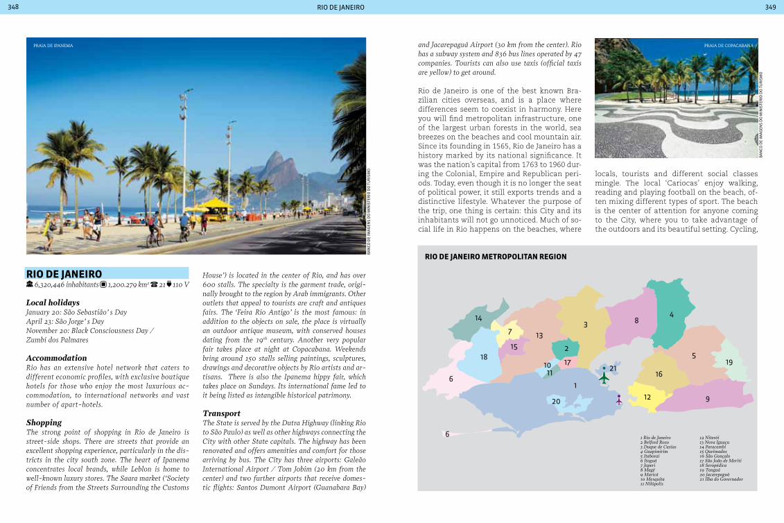
rio de janeiro348 349
Ba
nCo
de
ima
gen
s d
o m
inis
ter
io d
o t
ur
ism
o
Ba
nCo
de
ima
gen
s d
o m
inis
ter
io d
o t
ur
ism
o
rIo de JaneIro 6,320,446 inhabitants 1,200.279 km2 21 110 V
Local holidaysJanuary 20: São Sebastião’ s DayApril 23: São Jorge’ s DayNovember 20: Black consciousness Day / Zumbi dos Palmares
AccommodationRio has an extensive hotel network that caters to different economic profiles, with exclusive boutique hotels for those who enjoy the most luxurious ac-commodation, to international networks and vast number of apart-hotels.
ShoppingThe strong point of shopping in Rio de Janeiro is street-side shops. There are streets that provide an excellent shopping experience, particularly in the dis-tricts in the city south zone. The heart of Ipanema concentrates local brands, while Leblon is home to well-known luxury stores. The Saara market (‘Society of Friends from the Streets Surrounding the customs
House’) is located in the center of Rio, and has over 600 stalls. The specialty is the garment trade, origi-nally brought to the region by Arab immigrants. Other outlets that appeal to tourists are craft and antiques fairs. The ‘Feira Rio Antigo’ is the most famous: in addition to the objects on sale, the place is virtually an outdoor antique museum, with conserved houses dating from the 19th century. Another very popular fair takes place at night at copacabana. Weekends bring around 150 stalls selling paintings, sculptures, drawings and decorative objects by Rio artists and ar-tisans. There is also the Ipanema hippy fair, which takes place on Sundays. Its international fame led to it being listed as intangible historical patrimony.
TransportThe State is served by the Dutra Highway (linking Rio to São Paulo) as well as other highways connecting the city with other State capitals. The highway has been renovated and offers amenities and comfort for those arriving by bus. The city has three airports: Galeão International Airport / Tom Jobim (20 km from the center) and two further airports that receive domes-tic flights: Santos Dumont Airport (Guanabara Bay)
and Jacarepaguá Airport (30 km from the center). Rio has a subway system and 836 bus lines operated by 47 companies. Tourists can also use taxis (official taxis are yellow) to get around.
Rio de Janeiro is one of the best known Bra-zilian cities overseas, and is a place where differences seem to coexist in harmony. Here you will find metropolitan infrastructure, one of the largest urban forests in the world, sea breezes on the beaches and cool mountain air. Since its founding in 1565, Rio de Janeiro has a history marked by its national significance. It was the nation’s capital from 1763 to 1960 dur-ing the Colonial, Empire and Republican peri-ods. Today, even though it is no longer the seat of political power, it still exports trends and a distinctive lifestyle. Whatever the purpose of the trip, one thing is certain: this City and its inhabitants will not go unnoticed. Much of so-cial life in Rio happens on the beaches, where
locals, tourists and different social classes mingle. The local ‘Cariocas’ enjoy walking, reading and playing football on the beach, of-ten mixing different types of sport. The beach is the center of attention for anyone coming to the City, where you to take advantage of the outdoors and its beautiful setting. Cycling,
Praia de coPacaBana
1
21
2
34
5
6
6
78
9
1011
12
13
14
15
16
1718
19
20
rIo de JaneIro MetropoLItan reGIon
Praia de iPanema
1 Rio de Janeiro2 Belford Roxo3 Duque de Caxias4 Guapimirim5 Itaboraí6 Itaguá7 Japeri8 Magé9 Maricá10 Mesquita11 Nilópolis
12 Niterói13 Nova Iguaçu14 Paracambi15 Queimados16 São Gonçalo17 São João de Meriti18 Seropédica19 Tanguá20 Jacarepaguá21 Ilha do Governador

rio de janeiro350 351
walking and jogging along the seafront and lunch in small, charming restaurants are part of daily life of Rio, a City that provides visitors with a warm welcome and includes them in the City’s healthy routine. But it is not just the beaches are popular on sunny weekends. The roads on the seafront in the south of the City are closed to cars and receive crowds who enjoy walking, cycling (bikes can be rented on the seafront) or simply enjoying a day at the beach in Rio. It is a tourist program that is a must for anyone visiting the City, and should be rounded off by watching the spectacle of the sunset on Ipanema beach, one of the sights most beloved by residents. It is a tradi-tion to applaud this wonderful spectacle that nature provides for free every day. Do not be shy! Applaud as well!
JardIM botÂnIco Rua Jardim Botânico, 920 (pedestrians) and 1008
(vehicles). daily from 8 am to 5 pm.
Created by Dom João VI in 1808, the Botani-cal Garden is home to rare species of flora and provides recreation for both children and adults. The principal highlights are the centuries-old imperial palm trees at the en-trance to the garden, an orchid nursery with over 600 species, and the Sensory Garden - a space created especially for people with visu-al impairment. It has guided tours in English and Spanish, by appointment.
QuInta da boa VISta Quinta da Boa Vista. Tuesday to Sunday from
10 am to 4 pm.
This Neoclassic style building was the residence of the Imperial family during the 19th century. Since 1891 it has houses the Museu Nacional, the oldest scientific institution in Brazil and the largest natural history and anthropology museum in Latin America. In addition to the museum there is a park with landscapes that were designed in 1869, and the Rio de Janeiro Zoo, which has the largest collection of Brazil-ian primates and birds in the country.
aterro do FLaMenGo
Officially known as Parque Eduardo Gomes, Aterro do Flamengo is one of the most beau-tiful and popular parks in Brazil. Created by infill from a variety of ground works, the at-tractions at the site include gardens with na-tive vegetation designed by Burle Marx. The Aterro site is home to several important tour-ist sites, including the Museu de Arte Moderna, the Glória Marina and the Monument to those killed in World War II. The site is very popular for sports at weekends, as well as for walks and even with those risking a dip off the Flamengo beach. Some sporting competitions take place at the site, which has access via modern foot-bridges and subways for pedestrians.
Friendly cityRio is one of the main Brazilian destinations for LGBT tourism. The city has special loca-tions to receive this public, and improves fa-cilities for LGBT tourists every year. The city was elected by TripOutGayTravel as the sexiest gay city in the world for the second consecutive year. considered by voters to have the world’s most sensual residents, Rio was also highlight-ed because of its beaches, parties, and the ca-rioca lifestyle. In front of Posto 9 on Ipanema beach is one of the major international LGBT meeting places, where visitors have access to bars, restaurants and a variety of parties.
escadas de santa teresa
jardim BotÂnico
Ba
nCo
de
ima
gen
s d
o m
inis
ter
io d
o t
ur
ism
o
riC
ar
do
zer
ren
er/r
iotu
r
Ponte Rio - Niterói
Av. Brasil
Linha Amarela
Vevd. Pro
f. Rufino de Almeida Pizarro
Av. das Américas
Av. Semambetiba
1 Estádio do Maracanã2 Aeroporto do Galeão3 Aeroporto Santos Dumont4 Praia de Ipanema5 Praia de Copacabana6 Pão de Açúcar7 Cristo Redentor8 Lagoa Rodrigo de Freitas9 Parque Nacional da Tijuca10 Jardim Botânico11 Praia de São Conrado12 Lagoa da Tijuca13 Arpoador14 Leblon15 Parque Ecológico de Marapendi16 Lagoa de Jacarepaguá
810
1312
1
5
7 6
4
11
2
3
9
15
Av. Vieira Souto
Av. Atlâ
nticaTú
nel R
ebou
ças
RIO DE JANEIRO
14
Av. Brasil
Av. Brasil
16
1 Estádio do Maracanã2 International Airport of Galeão3 Airport Santos Dumont4 Praia de Ipanema5 Praia de Copacabana6 Pão de Açúcar7 Cristo Redentor8 Lagoa Rodrigo de Freitas9 Parque Nacional da Tijuca10 Jardim Botânico11 Praia de São Conrado12 Lagoa da Tijuca13 Arpoador14 Leblon15 Parque Ecológico de Marapendi16 Lagoa de Jacarepaguá
cIty oF rIo de JaneIro
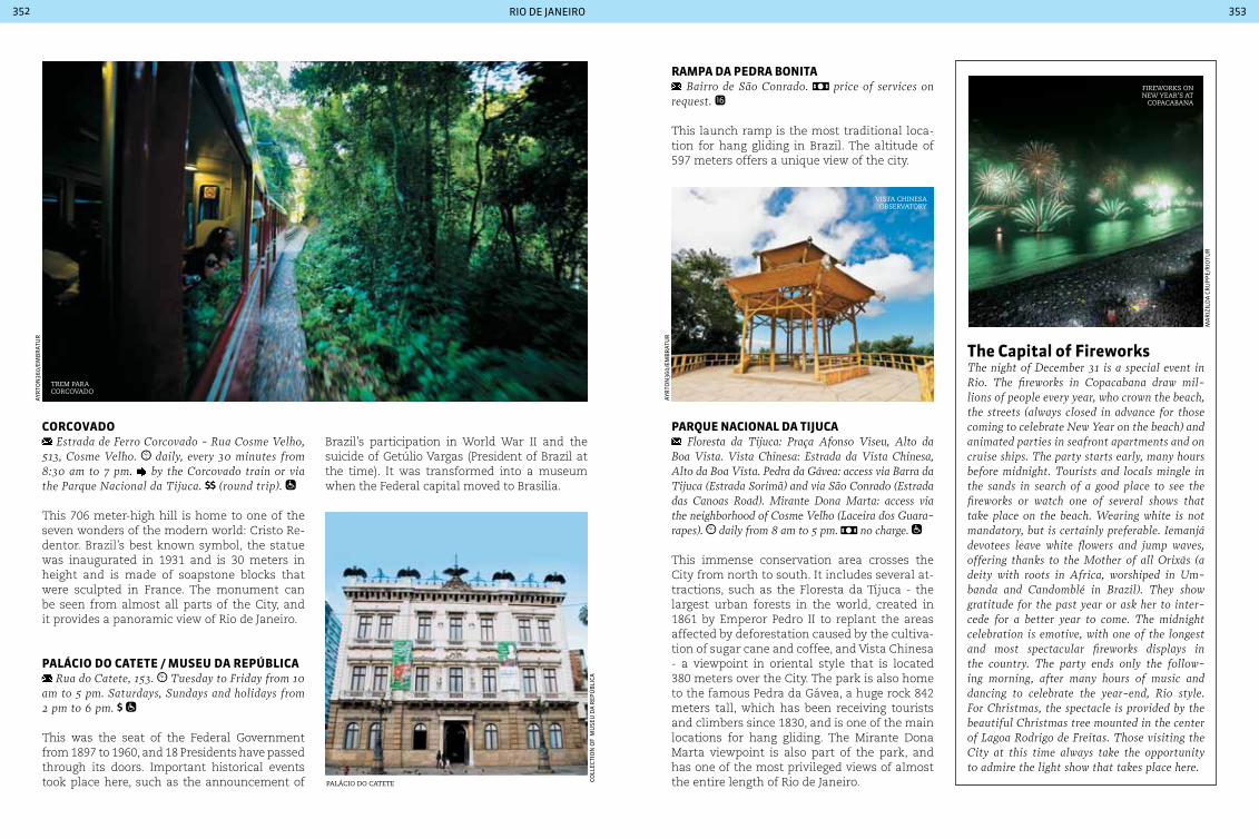
rio de janeiro352 353
corcoVado Estrada de Ferro corcovado - Rua cosme Velho,
513, cosme Velho. daily, every 30 minutes from 8:30 am to 7 pm. by the corcovado train or via the Parque Nacional da Tijuca. (round trip).
This 706 meter-high hill is home to one of the seven wonders of the modern world: Cristo Re-dentor. Brazil’s best known symbol, the statue was inaugurated in 1931 and is 30 meters in height and is made of soapstone blocks that were sculpted in France. The monument can be seen from almost all parts of the City, and it provides a panoramic view of Rio de Janeiro.
paLácIo do catete / MuSeu da repúbLIca Rua do catete, 153. Tuesday to Friday from 10
am to 5 pm. Saturdays, Sundays and holidays from 2 pm to 6 pm.
This was the seat of the Federal Government from 1897 to 1960, and 18 Presidents have passed through its doors. Important historical events took place here, such as the announcement of
Brazil’s participation in World War II and the suicide of Getúlio Vargas (President of Brazil at the time). It was transformed into a museum when the Federal capital moved to Brasilia.
the capital of FireworksThe night of December 31 is a special event in Rio. The fireworks in copacabana draw mil-lions of people every year, who crown the beach, the streets (always closed in advance for those coming to celebrate New Year on the beach) and animated parties in seafront apartments and on cruise ships. The party starts early, many hours before midnight. Tourists and locals mingle in the sands in search of a good place to see the fireworks or watch one of several shows that take place on the beach. Wearing white is not mandatory, but is certainly preferable. Iemanjá devotees leave white flowers and jump waves, offering thanks to the Mother of all Orixás (a deity with roots in Africa, worshiped in Um-banda and candomblé in Brazil). They show gratitude for the past year or ask her to inter-cede for a better year to come. The midnight celebration is emotive, with one of the longest and most spectacular fireworks displays in the country. The party ends only the follow-ing morning, after many hours of music and dancing to celebrate the year-end, Rio style. For christmas, the spectacle is provided by the beautiful christmas tree mounted in the center of Lagoa Rodrigo de Freitas. Those visiting the city at this time always take the opportunity to admire the light show that takes place here.
trem Para corcovado
ayr
ton
360/
emB
rat
ur
vista chinesa oBservatory
Palácio do catete
ayr
ton
360/
emB
rat
ur
Coll
eCti
on
of
mu
seu
da
rep
úB
liCa
fireworKs on new year’s at
coPacaBana
ma
riz
ild
a C
ru
pp
e/r
iotu
r
raMpa da pedra bonIta Bairro de São conrado. price of services on
request.
This launch ramp is the most traditional loca-tion for hang gliding in Brazil. The altitude of 597 meters offers a unique view of the city.
parQue nacIonaL da tIJuca Floresta da Tijuca: Praça Afonso Viseu, Alto da
Boa Vista. Vista chinesa: Estrada da Vista chinesa, Alto da Boa Vista. Pedra da Gávea: access via Barra da Tijuca (Estrada Sorimã) and via São conrado (Estrada das canoas Road). Mirante Dona Marta: access via the neighborhood of cosme Velho (Laceira dos Guara-rapes). daily from 8 am to 5 pm. no charge.
This immense conservation area crosses the City from north to south. It includes several at-tractions, such as the Floresta da Tijuca - the largest urban forests in the world, created in 1861 by Emperor Pedro II to replant the areas affected by deforestation caused by the cultiva-tion of sugar cane and coffee, and Vista Chinesa - a viewpoint in oriental style that is located 380 meters over the City. The park is also home to the famous Pedra da Gávea, a huge rock 842 meters tall, which has been receiving tourists and climbers since 1830, and is one of the main locations for hang gliding. The Mirante Dona Marta viewpoint is also part of the park, and has one of the most privileged views of almost the entire length of Rio de Janeiro.

rio de janeiro354 355
ILHa de paQuetá Ilha de Paquetá. consult at the Estação de
Bracas (boat berth) - irregular hours. consult at the Estação de Barcas (boat berth). boats leave from the Estação das Barcas at Praça 15.
In the middle of the Guanabara Bay, this small island was the site of the French occupation, which occurred in Rio de Janeiro from 1555 to 1567. Its attractions are the graceful beaches, historic buildings and traditional buggy rides.
pão de açúcar Avenida Pasteur, 520. the ticket office is open
from 8 am to 7:50 pm (the park closes at 20:50). ca-ble cars leave every 20 minutes, or when they reach maximum capacity (65 people). adults children 6-12 years.
One of the most famous sights in the world, ‘Pão de Açúcar’ offers rides in the traditional cable car, climbing on 400-meter high rocks, walks in the midst of nature, helicopter flights, bars and cafés. All this and 360-de-gree views of one of the most beautiful cities on the planet.
city of MusicRio lives to the accompaniment of rhythm. In fact, the various musical rhythms that run through the city are part of its history. The samba, of course, is par excellence carioca. It has a presence that goes well beyond carnival, and is celebrated in daily life in bars, on the beach and all across the city. Music lovers by nature, cariocas adore singing in different rhythms about their city and the issues that affect people’s lives. One of those rhythms is Bossa Nova, invented by Tom Jobim and Vinicius de Morais while sitting on the beachfront with a guitar, and inspired by the landscape. Bossa Nova is still the best-known Brazilian music style out-side the country and is appreciated in all corners of the planet. Its smooth and delicate melody, sophisticated and poetic lyrics guarantee its pres-ence in any environment. A musical style that is a little louder is carioca funk. It is the rhythm of the nightclubs in the periphery and on the hills, and is accompanied by sensual dances and songs about life in the slums. The beat of carioca funk has also became an export product, and even clothing brands related to funk lifestyle have been used by musicians from other countries.
Pão de açúcar
Parade os samBa school, marquÊs de saPucaí
Baianas during samBa school Parades in rio de janeiro
af
ro
dr
igu
es/r
iotu
r
nel
son
per
ez/r
iotu
r
an
dr
ea s
imõ
es/e
mB
rat
ur
Samba and carnival:the greatest shows on earthIf samba was born in Bahia, it was in Rio de Ja-neiro that it grew up. Each district of the city has samba circles, shows and the famous back-yard samba music groups, the ‘pagodes’. During carnival samba gains greater prominence, with samba school parades - an annual mega-event that takes place in the Sambadrome and is con-sidered to be the greatest spectacle on Earth. carnival and samba schools are part of daily life in Rio. Throughout the entire year the popula-tion prepares, practices, invests and supports one of the 25 samba schools that compete for the title of carnival champion. As soon as carni-val ends and the champion is declared, samba school members and supporters start prepara-tions for the following year. The theme, music, costumes and floats begin to be designed. Anoth-er way to enjoy the carnival is to follow one of the 400 carnival blocks – groups of revelers who organize themselves into street parties to enjoy the city’s carnival. There are carnival blocks for all tastes and all ages, spread across all districts. Some of the most popular are the cordão do Bola Preta, Banda de Ipanema and the modern Mono-
bloco. It is one of the most popular and fun ways to dress up, dance down the street singing and meet new people: the whole of Rio hits the streets dur-ing carnival. The cidade do Samba, the area with the warehouses holding the samba school floats, serves as a stage for events based on this musical style. Opened in 2006, this is a modern complex of studios with scenery and costume equipment, where the workers from the samba schools create and construct the carnival spectacle.

rio de janeiro356 357
frequented by artists, journalists and younger Rio residents. Its lively nightlife appeals to foreign visitors, who can see up close how the local popu-lation enjoys themselves.
Lapa: a region historically known as the birthplace of bohemia, home to numerous bars and restaurants with typical local dishes. The principal reference points are the Arcos da Lapa (‘Lapa Arches’), circo Voador and Fundição Progresso, which regularly hosts concerts and shows. The Arcos da Lapa were built be-tween 1744 and 1750 to carry the water supply to the city. This aqueduct is a trademark of the city.
rio attractions Santa Teresa: one of the most picturesque dis-tricts in Rio, it is situated on a hill and is home to numerous ateliers, bars and restaurants that endow a bohemian atmosphere to its streets.
Baixo Leblon: a meeting point for the young since the 1970s, it has animated nightlife with its many popular bars and restaurants. This part of the dis-trict of Leblon is home to the singer and composer caetano Veloso and journalist Nelson Motta.
Baixo Gávea: a bohemian district, off the normal tourist trail, with plenty of bars and restaurants
MuSeu de arte Moderna (MaM) Avenida Infante Dom Henrique, 85, Parque do
Flamengo Tuesday to Friday from 12 am to 6 pm Saturdays. Sundays and public holidays from 12 am to 7 pm.
The museum has 11,000 works in its perma-nent collection, including paintings and sculp-tures by internationally renowned artists such as Fernand Léger, Alberto Giacometti, Jean Arp, Henry Moore, Bourdelle, Marino Marini and Max Bill, among others. Brazilian artists includ-ing Di Cavalcanti, Lygia Clark, Helio Oiticica, Franz Weissmann, Amílcar de Castro and Wyl-lis de Castro also have works on display at the museum. The museum has an exhibition of works by Gilberto Chateaubriand - one of the
a tour of the city centerThe center of Rio is a place that exudes history. A walk through the main sites in the center takes the visitor on a trip to the old Rio, a city that blends a strong European influence with a tropical seaside landscape.
Cinelândia: this large square earned the name cinelândia in the 1930’s, due to a concentration of a large number of cinemas, theaters, bars and res-taurants. Today it is the address of several historic buildings including the Biblioteca Nacional and the Theatro Municipal. There is only one cinema remaining at the location – the Odeon cinema –, which is worthwhile visiting.
most comprehensive collections in the world in terms of modern art. Among the collection are works by Anita Malfatti, Tarsila do Amaral, Lasar Segall, Di Cavalcanti and Ismael Nery. It also has an exhibit of photography by Pierre Verger, with a unique documentary of African-Brazilian culture.
Maracanã StadIuM Rua Professor Eurico Rabelo, Avenida Maracanã. daily, including holidays, from 9 am to 7 pm.
Opened in 1950 to host the World Cup, the Esta-dio Mário Filho Stadium (the official name) will host the final of the 2014 tournament. Symbol of Brazilian football, Maracanã once held 200,000
Largo da Carioca: a commercial center of his-torical importance, where the main attraction is a 17th century convent - the Igreja de Terceira Ordem de São Francisco da Penitência, con-structed on top of a hill.
Rua do Ouvidor: before the inauguration of Avenida central, this was the most important street in the Empire. It now houses the remains of colonial buildings and has bustling commerce during the day.
Praça Mauá: the square is named after its first owner, the Baron of Mauá, and has a statue in his honor. It houses the Porto do Rio, which is responsible for much of Brazil’s exports and is an important commercial center.
Avenida Rio Branco: the old Avenida central, built early in the 20th century by the newly elected Republican government in order to modernize the country’s capital. It was inspired by Parisian bou-levards and is now one of the city’s main com-mercial streets. It links the two extremities in the center of Rio: the obelisk on Avenida Beira-Mar and Praça Maua in the port zone.
arcos da laPa
outeiro da gloria
theatro municiPal
ayr
ton
360/
emB
rat
ur
ayr
ton
360/
emB
rat
ur
ayr
ton
360/
emB
rat
ur
spectators. It has been the stage of some major sporting events, including the one thousandth goal by Pelé in 1969, as well as national and in-ternational concerts. It houses a museum dedi-cated to football with a “sidewalk of fame” with the footprints of the country’s principal players. The stadium is undergoing a major renovation for the 2014 World Cup.
MarIna da GLÓrIa Avenida Infante Dom Henrique.
The marina receives national and interna-tional vessels and has facilities for sailing and boat rental. The location regularly also hosts shows and events.
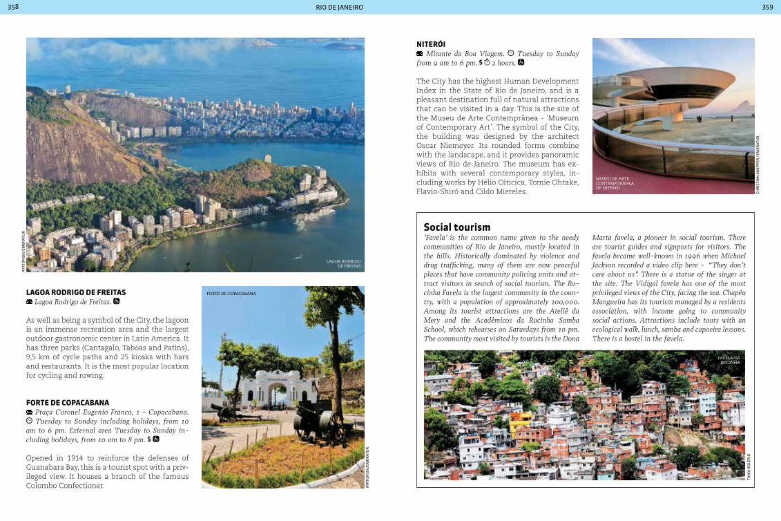
rio de janeiro358 359
LaGoa rodrIGo de FreItaS Lagoa Rodrigo de Freitas.
As well as being a symbol of the City, the lagoon is an immense recreation area and the largest outdoor gastronomic center in Latin America. It has three parks (Cantagalo, Taboas and Patins), 9,5 km of cycle paths and 25 kiosks with bars and restaurants. It is the most popular location for cycling and rowing.
Forte de copacabana Praça coronel Eugenio Franco, 1 - copacabana. Tuesday to Sunday including holidays, from 10
am to 6 pm. External area Tuesday to Sunday in-cluding holidays, from 10 am to 8 pm.
Opened in 1914 to reinforce the defenses of Guanabara Bay, this is a tourist spot with a priv-ileged view. It houses a branch of the famous Colombo Confectioner.
Social tourism ’Favela’ is the common name given to the needy communities of Rio de Janeiro, mostly located in the hills. Historically dominated by violence and drug trafficking, many of them are now peaceful places that have community policing units and at-tract visitors in search of social tourism. The Ro-cinha Favela is the largest community in the coun-try, with a population of approximately 100,000. Among its tourist attractions are the Ateliê da Mery and the Acadêmicos da Rocinha Samba School, which rehearses on Saturdays from 10 pm. The community most visited by tourists is the Dona
nIterÓI Mirante da Boa Viagem. Tuesday to Sunday
from 9 am to 6 pm. 2 hours.
The City has the highest Human Development Index in the State of Rio de Janeiro, and is a pleasant destination full of natural attractions that can be visited in a day. This is the site of the Museu de Arte Contemprânea - ‘Museum of Contemporary Art’. The symbol of the City, the building was designed by the architect Oscar Niemeyer. Its rounded forms combine with the landscape, and it provides panoramic views of Rio de Janeiro. The museum has ex-hibits with several contemporary styles, in-cluding works by Hélio Oiticica, Tomie Ohtake, Flavio-Shiró and Cildo Miereles.
Marta favela, a pioneer in social tourism. There are tourist guides and signposts for visitors. The favela became well-known in 1996 when Michael Jackson recorded a video clip here - “They don’t care about us”. There is a statue of the singer at the site. The Vidigal favela has one of the most privileged views of the city, facing the sea. chapéu Mangueira has its tourism managed by a residents association, with income going to community social actions. Attractions include tours with an ecological walk, lunch, samba and capoeira lessons. There is a hostel in the favela.
lagoa rodrigo de freitas
museu de arte contemPorÂnea de niterÓi
forte de coPacaBana
favela da rocinha
ayr
ton
360/
emB
rat
ur
ayr
ton
360/
emB
rat
ur
tan
ia B
ole
rio
CHr
isti
an
Kn
epp
er /
emB
rat
ur
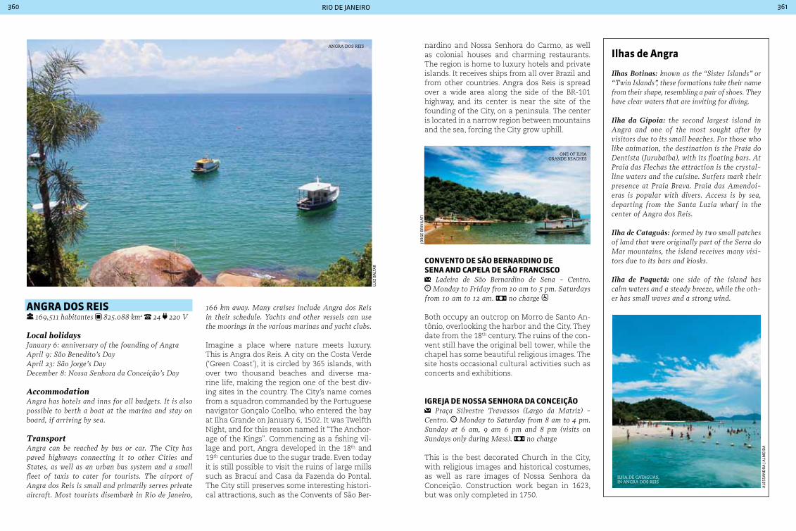
rio de janeiro360 361
anGra doS reIS
169,511 habitantes 825.088 km2 24 220 V
Local holidaysJanuary 6: anniversary of the founding of AngraApril 9: São Benedito’s DayApril 23: São Jorge’s DayDecember 8: Nossa Senhora da conceição’s Day
AccommodationAngra has hotels and inns for all budgets. It is also possible to berth a boat at the marina and stay on board, if arriving by sea.
TransportAngra can be reached by bus or car. The city has paved highways connecting it to other cities and States, as well as an urban bus system and a small fleet of taxis to cater for tourists. The airport of Angra dos Reis is small and primarily serves private aircraft. Most tourists disembark in Rio de Janeiro,
166 km away. Many cruises include Angra dos Reis in their schedule. Yachts and other vessels can use the moorings in the various marinas and yacht clubs.
Imagine a place where nature meets luxury. This is Angra dos Reis. A city on the Costa Verde (‘Green Coast’), it is circled by 365 islands, with over two thousand beaches and diverse ma-rine life, making the region one of the best div-ing sites in the country. The City’s name comes from a squadron commanded by the Portuguese navigator Gonçalo Coelho, who entered the bay at Ilha Grande on January 6, 1502. It was Twelfth Night, and for this reason named it “The Anchor-age of the Kings”. Commencing as a fishing vil-lage and port, Angra developed in the 18th and 19th centuries due to the sugar trade. Even today it is still possible to visit the ruins of large mills such as Bracuí and Casa da Fazenda do Pontal. The City still preserves some interesting histori-cal attractions, such as the Convents of São Ber-
Ilhas de angra
Ilhas Botinas: known as the “Sister Islands” or “Twin Islands”, these formations take their name from their shape, resembling a pair of shoes. They have clear waters that are inviting for diving.
Ilha da Gipoia: the second largest island in Angra and one of the most sought after by visitors due to its small beaches. For those who like animation, the destination is the Praia do Dentista (Jurubaíba), with its floating bars. At Praia das Flechas the attraction is the crystal-line waters and the cuisine. Surfers mark their presence at Praia Brava. Praia das Amendoi-eras is popular with divers. Access is by sea, departing from the Santa Luzia wharf in the center of Angra dos Reis.
Ilha de Cataguás: formed by two small patches of land that were originally part of the Serra do Mar mountains, the island receives many visi-tors due to its bars and kiosks.
Ilha de Paquetá: one side of the island has calm waters and a steady breeze, while the oth-er has small waves and a strong wind.
nardino and Nossa Senhora do Carmo, as well as colonial houses and charming restaurants. The region is home to luxury hotels and private islands. It receives ships from all over Brazil and from other countries. Angra dos Reis is spread over a wide area along the side of the BR-101 highway, and its center is near the site of the founding of the City, on a peninsula. The center is located in a narrow region between mountains and the sea, forcing the City grow uphill.
conVento de São bernardIno de Sena and capeLa de São FrancISco
Ladeira de São Bernardino de Sena - centro. Monday to Friday from 10 am to 5 pm. Saturdays
from 10 am to 12 am. no charge
Both occupy an outcrop on Morro de Santo An-tônio, overlooking the harbor and the City. They date from the 18th century. The ruins of the con-vent still have the original bell tower, while the chapel has some beautiful religious images. The site hosts occasional cultural activities such as concerts and exhibitions.
IGreJa de noSSa SenHora da conceIção Praça Silvestre Travassos (Largo da Matriz) -
centro. Monday to Saturday from 8 am to 4 pm. Sunday at 6 am, 9 am 6 pm and 8 pm (visits on Sundays only during Mass). no charge
This is the best decorated Church in the City, with religious images and historical costumes, as well as rare images of Nossa Senhora da Conceição. Construction work began in 1623, but was only completed in 1750.
angra dos reis
one of ilha grande Beaches
ilha de cataguás, in angra dos reis
luiz
Ba
lta
r
jor
ge
Br
iVil
ati
ale
ssa
nd
ra
j a
lmei
da

rio de janeiro362 363
búzIoS, arraIaL do cabo and cabo FrIo
27,560 inhabitants 70.278 km2 22 110 V
Local holidaysNovember 12: anniversary of the founding of BúziosJuly 26: Nossa Senhora da Sant´Anna’ s Day
AccommodationThe region has an excellent network of hotels, inns and campsites to cater to for tourists visiting the town. Inns vary in price and offer different servic-es, which can include everything from water sports to walks through specific local attractions.
TransportThe region has paved highways connecting to other towns in the State. The Umberto Modiano Airport in Búzios is small, and only has capacity for execu-tive jets. The marina at Búzios offers safe and well equipped anchorage.
This resort region stands out for its boutique-hotels, gastronomy, internationally recognized beachwear fashion, and of course the night-
angra dos reis beaches
Anil: a long urban beach with coconut trees and ki-osks. Much frequented by local residents.
Bonfim: an urban beach 300 meters long with calm waters and fine sand.
Biscaia: very popular with families.
Éguas: has views of the shipyard.
Figueira: the tree that gives its name to the beach provides shade from the sun. It has calm seas, good for bathing.
Grande: a meeting point for the young, with live mu-sic at the kiosks in high season.
Mambucaba: this has kiosks and craft stalls and is located in the centro Histórico de Mambucaba.
Ponta do Algodão: suitable for water sports.life. Up until the 1960s the fishing colony of Armação dos Búzios was a discreet, quiet, vil-lage with around 300 inhabitants, lying on the outskirts of the town of Cabo Frio. But one day an illustrious visitor chose this location for her holidays, and the place was never the same. The passage of French actress Brigitte Bardot has profoundly changed the direction of the town, which became known worldwide and attracted visitors who wanted to see the place that she had “discovered”. In function of this, Brigitte has a statue in her honor on the seafront, which also bears her name: Orla Bardot. As the region’s historical and urban center, the town of Cabo Frio has several historic attractions in-cluding the Capela de Nossa Senhora da Guia, the Passagem district and the Forte de São Ma-teus, which offers a splendid view of the coast. The importance of Cabo Frio in Brazil’s history dates back to 16th and 17th centuries, when it was on the route of the first pioneers and was the scene of several battles between the Portu-guese and French. Its beaches have cold waters and a constant wind, suitable for sports such as windsurfing, kitesurfing and surfing. At the
Búzios central Beach
pao
la s
an
são
liV
ia V
ieir
a
Praia do saco
an
dr
ea m
end
es
Saco: clear, calm water, with a rocky shore.
Vermelha: has reddish sand, which gives it its name - ‘Red Beach’. Access is via stone steps.
angra dos reis

rio de janeiro364 365
rua daS pedraS Rua das Pedras - Búzios. Monday to Saturday
from 11 am to 1 am. Sundays from 11 am to 12 pm The symbol of Buzios, the Rua das Pedras (‘Stone Road’) is known as the gastronomic and fashion center due to the concentration of the best restaurants and shops (especially for fash-ion beachwear), inns, art galleries and night-clubs along its 600 meters length.
orLa bardotBúzios
This sidewalk around 600 meters long is a con-tinuation of Rua das Pedras. A tribute to the actress who “discovered” Búzios, Orla Bardot is home to historic buildings and colonial man-sions, that give the town a nostalgic air. Works of art by Christina Motta adorn the sidewalk and are symbols of Búzios, with the highlight being the sculpture of Brigitte Bardot.
VIewpoIntS Búzios
Two of Búzios’ hills are natural viewpoints that provide spectacular views. From Mirante do For-no - easily accessible - you can see almost the entire peninsula. Mirante João Fernandes pro-vides views of Brava, Rasa and Armação beaches.
ponta da LaGoInHaBúzios
The lagoon has natural pools and native vegeta-tion, including the rare white head cactus. It is composed of rock formations dating back over 500 million years, with abundant marine fauna and native vegetation.
ponta do crIMInoSoBúzios
The highlight here is the small beach between the outcrops. Ponta do Criminoso is a meeting place for fishermen and is popular with divers.
reSerVa ecoLÓGIca de tauáBúzios. from 8 am to 6 pm. no charge
This private archaeological and ecological re-serve offers visitors the opportunity to see more than 30 exotic species and bromeliads, among other endangered plants. Butterflies and color-ful birds are another of the park’s attractions. The area is also considered to be of great im-portance for Brazilian culture due to the pres-ence of remains of ancient civilizations that lived here. In addition to birds, it is possible to see some species of animals, such as domestic animals such as the forest dog, armadillos and agouti. The Universities of Viçosa, Fluminense and Rio State have undertaken joint research to catalog the species that live here. The reserve also has a museum with exhibits of work by local artists. An indigenous Indian hut has a collection of objects made by Tupi-Guarani In-dians. Only small groups with a guide are per-mitted to enter the park.
Serra daS eMerÊncIaSBúzios
One of the most important reserves of brasil-wood in Rio de Janeiro, the Serra das Emerên-cias was declared an Environmental Protection Area to help prevent human encroachment and
búzios beaches
Azeda and Azedinha: with calm seas, these attract families and those in search of relaxation.
Brava: the surfer’s favorite.
Canto: located in the center of Búzios, it includes the Amores and Virgens baches.
Ferradura: has calm seas, good for water sports.
Ferradurinha: features a natural pool.
Foca: the sea is calm, with clear waters.
Forno: wild, suitable for diving.
Geribá: good waves, popular with surfers and the young.
João Fernandes: its many restaurants attract tourists in search of animation. Suitable for snorkeling.
Manguinhos: suitable for sail sports.
Olho de Boi: nudist beach.
Tartaruga: good bars and restaurants. The beach is a stop-over for schooners.
devastation of the region. The Serra also acts as protection for six islands in the region: Âncora, da Rasa, Branca, Caboclo, Feia and Gravatás, where the rich variety of marine life is an ad-ditional attraction. The Environmental Protec-tion Area has an area of 12,000 square meters set aside for the preservation of species endan-gered in Brazil. The Serra also has archaeologi-cal sites and native vegetation, which attracts birds and butterflies.
boat tourS Arraial do cabo
The best way to discover Arraial do Cabo and its attractions is by boat. Trips take an average of 4 hours (leaving the from Praia dos Anjos), the route takes in Prainhas, Gruta Azul and Ilha do Farol as well as stops at beaches and for diving.
northern end of the Região dos Lagos (‘Lake Dis-trict’), a small fishing village proves a natural water park of unparalleled beauty. Arraial do Cabo is synonymous with nature, adventure and much history. The town was historically a port for pirates, buccaneers and explorers. The most famous of these was Américo Vespúcio, who was here in 1502 and built a fort that to-day has an obelisk in his honor. There are many sites for diving distributed along the coast, with crystal clear waters, rich marine life and more than 30 shipwrecks. Among the principal sites near the town are the Gruta Azul (‘Blue Grotto’) and Ilha dos Franceses.
Praia de joão fernandes
Praia do farol,arraial do caBo
jon
atH
as
miK
osz
de
mo
ur
a
jon
atH
as
miK
osz
de
mo
ur
a
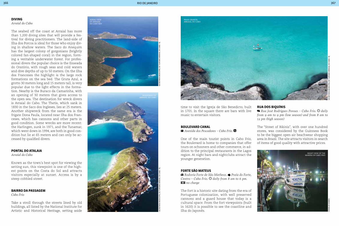
rio de janeiro366 367
dIVInGArraial do cabo
The seabed off the coast at Arraial has more than 1,200 diving sites that will provide a fes-tival for diving practitioners. The land-side of Ilha dos Porcos is ideal for those who enjoy div-ing in shallow waters. The Saco do Anequim has the largest colony of gorgonians (brightly colored fan-shaped coral) in the region, form-ing a veritable underwater forest. For profes-sional divers the popular choice is the Enseada do Oratório, with rough seas and cold waters and dive depths of up to 50 meters. On the Ilha dos Franceses the highlight is the large rock formations on the sea bed. The Gruta Azul, a grotto 30 meters long and 15 meters tall, is very popular due to the light effects in the forma-tion. Nearby is the Buraco da Camarinha, with an opening of 30 meters that gives access to the open sea. The destination for wreck divers is Arraial do Cabo. The Thetis, which sank in 1830 in the Saco dos Ingleses, lies at 25 meters. Another shipwreck from the same era is the frigate Dona Paula, located near Ilha dos Fran-ceses, which has cannons and other parts in good condition. Some wrecks are more recent: the Harlingen, sunk in 1971, and the Tunamar, which went down in 1994, are both in good con-dition but lie at 65 meters and can only be ac-cessed by qualified divers.
pontaL do ataLaIaArraial do cabo
Known as the town’s best spot for viewing the setting sun, this viewpoint is one of the high-est points on the Costa do Sol and attracts visitors especially at sunset. Access is by a steep cobbled street.
baIrro da paSSaGeMcabo Frio
Take a stroll through the streets lined by old buildings, all listed by the National Institute for Artistic and Historical Heritage, setting aside
time to visit the Igreja de São Benedicto, built in 1701. In the square there are bars with live music to entertain visitors.
bouLeVard canaL Avenida dos Pescadores - cabo Frio.
One of the main tourist points in Cabo Frio, the Boulevard is home to companies that offer tours on schooners and other commerce, in ad-dition to the principal restaurants in the Lagos region. At night bars and nightclubs attract the younger generation.
Forte São MateuS Rodovia Forte de São Matheus. Praia do Forte,
centro - cabo Frio. daily from 8 am to 6 pm. no charge
The fort is a historic site dating from the era of Portuguese colonization, with well preserved cannons and a guard house that today is a cultural space. From the fort viewpoints (built in 1620) it is possible to see the coastline and Ilha do Japonês.
rua doS bIQuínIS Rua José Rodrigues Povoas - cabo Frio. daily
from 9 am to 9 pm (low season) and from 8 am to 12 pm (high season)
The “Street of Bikinis”, with over one hundred stores, was considered by the Guinness Book to be the biggest open-air beachwear shopping area in Brazil. The site attracts visitors in search of items of good quality with attractive prices.
night view of the marina in caBo frio
Boqueirão of arraial do caBo
aerial view of arraial do caBo Bay
Praia grande,arraial do caBo
seCr
eta
ria
mu
niC
ipa
l d
e tu
ris
mo
ar
ra
ial
do
Ca
Bo
- r
j
seCr
eta
ria
mu
niC
ipa
l d
e tu
ris
mo
ar
ra
ial
do
Ca
Bo
- r
jd
ou
gla
s g
om
es
seCr
eta
ria
mu
niC
ipa
l d
e tu
ris
mo
ar
ra
ial
do
Ca
Bo
- r
j

rio de janeiro368 369
petrÓpoLIS 295,917 inhabitants 795.798 km2 24 110 V
Local holidaysMarch 16: anniversary of the founding of PetrópolisJuly 29: Day of arrival of the first German colonists in PetrópolisApril 23: São Jorge’s Day
AccommodationPetrópolis offers accommodation in charming inns and hotels that will appeal to different types of tourist. One recommendation is to take advantage of accommodation close to the forest, where you can see and hear the birds.
TransportPetrópolis may be reached by car or bus. Highways are paved and are maintained in good condition. care should be taken during the rainy season (December to February), when landslides may occur.
Located 68 km from the State capital of Rio de Janeiro, on the Serra da Estrela, Petrópolis is known as the “Imperial City”, and reserves a little of the country’s history on each of its streets. Significant historical events took place here, such as the first film session (1897) and the inauguration of the first paved road - União e Indústria - in 1861. It was also one of the first planned cities in Brazil. Its architecture includes
palaces, such as that which houses the Museu Imperial, the Catedral de São Pedro de Alcân-tara, the modernist house of the architect Lúcio Costa and the home of the father of aviation, Santos Dumont, which houses several of his in-ventions. The City was the residence of emper-ors, presidents, diplomats, intellectuals and art-ists. The history of Petrópolis is marked by the figure of Emperor Dom Pedro II, its founder and most illustrious inhabitant. From 1843 to 1889 the Emperor and his entire court moved to the City during the summer, during which time it was the capital of the Brazilian Empire. Petrópo-lis is now an important center for textiles, brew-ing and tourism. It also has a large scientific research unit, which is gaining national promi-nence in the development of technology.
LaGeS SoLtaS de doM João VI from Vila Inhomirim in Magé
to Bairro Secretário in Petrópolis
Inaugurated by the Emperor during a trip he made to the interior of the State, this track was built by slaves and at that time was considered to be an important work of Brazilian engineering. The paving, which is now listed and preserved, has many sharp turns. As it is practically covered by Atlantic Forest it is normally wet and slippery.
caSa de SantoS duMont Rua do Encanto, 22 - centro. Tuesday to Sunday
from 9:30 am to 5 pm. Guided tours in English, Por-tuguese and Spanish.
The residence was designed by Santos Dumont himself in 1918, and is located on what was known as Morro Encantado - ‘Enchanted Hill’, hence the nickname “The Enchanted”. The house now holds a collection of the personal belongings of the father of aviation, as well as curiosities such as the ladder that forces the visitor to begin the climb with the right foot.
catedraL de São pedro de aLcÂntara Rua São Pedro de Alcântara, 60 - centro. daily from 8 am to 6 pm. Visits to the steeple
can be made Tuesday to Saturday at 10 am or 5 pm.
This imposing Gothic building dating from 1925 was inspired by French and German cathedrals, and has a steeple 70 meters high. The Imperial Mausoleum is inside the Cathedral, with the re-mains of Dom Pedro II, Empress Teresa Cristina and Princess Isabel.
MuSeu IMperIaL Rua da Imperatriz, 220. Tuesday to Sun-
day from 11 am to 6 pm (ticket office to 5:30 pm). Sound and Light Show from Thursday to Saturday
at 8 pm. Family Ticket (2 adults + 2 students). Sound and Light Show.
The neoclassical style palace has gardens, halls and a rich historical collection. Among the permanent collection is the crown of Dom Pedro II, with 639 diamonds and 77 pearls and his golden scepter. On Thursday to Saturday nights the Palace is the setting for a Sound and Light show.
rua tereSa Rua Teresa. Monday from 2 pm to 6 pm. Tues-
day to Saturday from 9 am to 6 pm. Sundays from 10 am to 6 pm, except holidays
This was the first location along which passed horse-drawn vehicles, horses, trams and cars. Today Rua Teresa is home to the City’s tradition textile industry: a 2 km long open air shopping precinct that offers items at factory prices.
eStrada do IMperador located on the road that connects Petrópolis to
Paty do Alferes, via the top of Serra do couto, a distance of 36 km
This road was constructed in 1848 and carries the Emperor ’s name due to its frequent use for horse rides by Emperor Dom Pedro II. The road has been abandoned since the 1980’s and has been taken over by the forest. It is now used for ecotourism. Walking time is 1 hour 20 minutes, and it has an inclination of 70°.
VaLe doS GourMetS the shops in the Vale dos Gourmets operate Tues-
day, Thursday and Sundays from 10 am to 8 pm. Fri-day and Saturday from 10 am to 10 pm. Shops along Estrada União and Estrada Indústria open Monday to Friday from 9 am to 5 pm. Saturday and Sunday from 9 am to 6 pm
The ‘Vale dos Gourmets’ has good restaurants, hotels and inns, as well as international quality antique shops, and shops selling pottery, fur-niture, decor and fashion accessories. It is best
Itaipava Itaipava is a district of Petrópolis. Its name comes from Tupi and means “Lake of Stone.” The town receives a large number of visitors seeking a cozy location during winter. Itaipava stands out for its culinary tradition, exclusive shops and surrounding nature. Attractions include a municipal park surrounded by Atlantic forest, a valley full of bars and gourmet restaurants, shopping malls and even a castle. The Itaipava Fair, specialized in the sale of clothes, is one of the most popular locations. It is worth visiting.
museu imPerial, in PetroPolis
mu
seu
imp
eria
l/iB
ra
m/m
inC
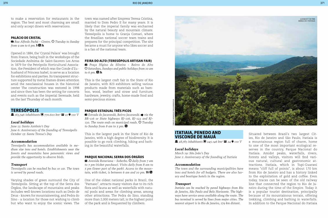
rio de janeiro370 371
to make a reservation for restaurants in the region. The best and most charming are small and only accept diners with reservations.
paLácIo de crIStaL Rua Alfredo Pachá - centro. Tuesday to Sunday
from 9 am to 6 pm.
Opened in 1884, the ‘Crystal Palace’ was brought from France, being built in the workshops of the Sociedade Anônima de Saint-Sauvers Les Arras in 1879 for the Petrópolis Horticultural Associa-tion, the President of which was the Conde d’Eu - husband of Princess Isabel, to serve as a location for exhibitions and parties. Its transparent struc-ture supported by metal frames draws attention amid the neoclassical houses in the historical center The construction was restored in 1998 and since then has been the setting for concerts and events such as the Imperial Serenade, held on the last Thursday of each month.
tereSÓpoLIS 163,746 inhabitants 770.601 km2 21 110 V
Local holidaysJune 13: Santo Antônio’s DayJune 6: Anniversary of the founding of TeresópolisOctober 15: Santa Teresa’s Day
AccommodationTeresópolis has accommodation available in me-dium size inns and hotels. Establishments near the forests and mountains have panoramic views and provide the opportunity to observe birds.
TransportTeresópolis can be reached by bus or car. The town is served by paved roads.
Varying shades of green surround the City of Teresópolis. Sitting at the top of the Serra dos Órgãos, the landscape of mountains and peaks includes well-known locations such as Dedo de Deus - known for mountaineering, and Pedra do Sino - a location for those not wishing to climb but who want to enjoy the scenic views. The
town was named after Empress Teresa Cristina, married to Dom Pedro II for many years. It is likely that the imperial family was enchanted by the natural beauty and mountain climate. Teresópolis is home to Granja Comari, where the Brazilian national soccer team trains and prepares for the principal competition. The site became a must for anyone who likes soccer and is a fan of the national team.
FeIra do aLto (tereSÓpoLIS artISan FaIr) Praça Higino da Silveira - Bairro do Alto Saturdays, Sundays and public holidays from 10 am
to 6 pm.
This is the largest craft fair in the State of Rio de Janeiro, with 823 exhibitors selling various products made from materials such as bam-boo, wood, leather and straw and furniture, hardware, jewelry, crafts, home-made food and semi-precious stones.
parQue eStaduaL trÊS pIcoS Estrada do Jacarandá, Bairro Jacarandá. via the
BR-116 or State highways RJ-116, RJ-122 and RJ-130. The route ends on municipal roads. Tuesday to Sunday from 8 am to 5 pm.
This is the largest park in the State of Rio de Janeiro, with a high degree of biodiversity. It is possible to go rock climbing, hiking and bath-ing in the beautiful waterfalls.
parQue nacIonaL Serra doS ÓrGãoS Avenida Rotariana - Soberbo. daily from 7 am
to 7 pm (ticket purchase). Visits daily from 8 am to 5 pm (lower part of the park). Access to the moun-tain, with ticket, is between 6 am and 10 pm.
One of the oldest national parks in Brazil, the “Parnaso”, attracts many visitors due to its rich flora and fauna as well as waterfalls with natu-ral pools and areas for climbing areas, among other attractions. The Pedra do Sino, standing more than 2,000 meters tall, is the highest point of the park and is frequented by climbers.
ItatIaIa, penedo and VISconde de Mauá
28,783 inhabitants 245.146 km2 24 110 V
Local holidays March 19: São João’s DayJune 1: Anniversary of the founding of Itatiaia
AccommodationThe town and the surrounding municipalities have inns and hotels for all budgets. There are also lux-ury and boutique hotels in the region.
TransportItatiaia can be reached by paved highways from Rio de Janeiro, São Paulo and Belo Horizonte. The high-ways have service areas available along the route. The bus terminal is served by lines from major cities. The nearest airport is in Rio de Janeiro, 179 km distant.
Situated between Brazil’s two largest Cit-ies, Rio de Janeiro and São Paulo, Itatiaia is a mountainous region full of charm, home to one of the most important ecological re-serves in the country, Parque Nacional do Itatiaia. Amidst peaks, waterfalls, rivers, forests and valleys, visitors will find vari-ous natural, cultural and gastronomic at-tractions. Itatiaia, which in Tupi-Guarani means “cliff full of points”, is about 170 km from Rio de Janeiro and has a history linked to the exploitation of gold and coffee. Even today, traces can be seen of the old railway line that connected the region to Rio de Ja-neiro during the time of the Empire. Today it is a popular tourist destination, principally because of its mountainous terrain, offering trekking, climbing and bathing in waterfalls. In addition to the Parque Nacional do Itatiaia
looKout in the serra do itatiaia
Car
los
Hen
riQ
ue
dia
s/em
Br
atu
r

rio de janeiro372 373
the region is home to the Finnish colony of Penedo, the villages of Maromba and Maringá, and the town of Visconde de Mauá - all op-tions are highly sought after by tourists from Brazil and abroad. The small town of Penedo was founded as the only Finnish colony in Brazil in 1929. The influence can be seen in the town’s food, handicrafts and architecture. Highlights are handmade chocolates and ice cream made in accordance with Finnish tra-dition. Another common dish in the region is trout, fished from the local mountain rivers. At the very top of the mountain is Visconde de Mauá. The town was named in honor of the legendary Brazilian businessman of the 19th century, Ireneu Evangelista de Sousa, the Viscount of Mauá, owner of a farm at the site that today is the national park, incorporating the villages of Maringá and Maromba. Horse-back riding, bathing in waterfalls and natural pools, boating, hiking, mountain biking and an alternative community are some of the at-tractions that the town offers. All this in an atmospheric and charming setting.
poção do MaroMba 1 km from Praça da Maromba, on the trail to
Escorrega - Visconde de Mauá
The ‘Maromba Well’, which is almost five me-ters deep, is a very popular natural attraction. There is a place where you can leap into the wa-ter, but caution is recommend since the depth varies between seasons.
MuSeu FInLandÊS Avenida das Mangueiras, 2.601 - Penedo. Saturday from 10 am to 5 pm.
The collection is composed of objects from Fin-land including art, tapestries and documents.
caSa do papaI noeL / peQuena FInLÂndIa Rua das Velas, 100 - Penedo. Tuesday to Thursday
from 1 pm to 8 pm. Friday from 1 pm to 9 pm. Saturdays and Sundays from 3 pm to 9 pm.
Known as “Father Christmas’ Summer House”, this location resembles a residence in the in-terior of Finland, and houses an interactive toy factory. Around house is so-called “Little Finland”, with several shops with Finnish names selling crafts.
cacHoeIra do eScorreGa The slide is located 3 km from the village of Ma-
romba - Visconde de Mauá
This attraction is a natural water slide 30 meters long. Swimmers slide down the rocks with the force of the water until they reach a natural pool. There is a craft fair at the site on weekends.
cacHoeIra Santa cLara from the village of Maromba it is an easy 40 min-
ute walk - Visconde de Mauá
This is one of the highest in the region, with a drop of 30 meters. The natural pool and show-ers are popular with visitors. The most adven-turous can practice rappel.
cacHoeIra de deuS Estrada da Fazendinha - Rio das Pedras. Penedo
This waterfall has a drop of four meters and has clean, cold waters that form a natural pool and strong rapids. Care is needed when bathing.
parQue corredeIraS do aLcantILado Parque das corredeiras, Museu Duas Rodas -
Visconde de Mauá. Park: Saturdays, Sundays and public holidays from 10 am to 5 pm. Museum: daily from 9 am to 5 pm. Park. Museum
This park provides several options for radical sports, including river floats, zipline, climbing, rappel, tree climbing and others. There is also the Museu Duas Rodas - ‘Two Wheels Museum’ - with over 100 vehicles on display, among them the oldest motorcycle in Brazil.
parQue nacIonaL do ItatIaIa Presidente Dutra highway - BR-116, km 316 (Parte
Baixa). For Parte Alta take the Presidente Dutra high-way - BR-116 to km 330. Then take BR-354 in the di-rection of Itamonte. daily from 8 am to 5 pm.
Founded in 1937, this is one of the oldest na-tional parks in Brazil. The park has a diversity of fauna and unique climate. It is possible to see areas of tropical forest as well as mountain for-est, with hail and even snow on more rigorous winter days. Pico das Agulhas Negras, at 2791 meters in altitude, is the fifth highest point in Brazil. Sports such as trekking and mountain-eering are among the attractions offered by the park. In addition the site is considered to be one of Brazil’s five best locations for bird watching. The park is divided into two distinct regions - Parte Baixa (lower reaches) and Parte Alta (up-per reaches).
parte baIxaCachoeira Camapuã: a six meter drop to a natu-ral pool, very popular for bathing.
Cachoeira Itaporani: reached by a 15 minutes of walking, this beautiful waterfall has three falls and a lake.
Cachoeira Poranga: has a large volume of wa-ter as a leap of 10 meter drop to a natural pool measuring 20 x 30 meters. Authorization is re-quired to access this waterfall.
Cachoeira Véu de Noiva: the waterfall is 40 me-ters high and is formed by the Maromba river. The site is accessed by a trail with a certain level of difficulty.
Centro de Visitantes: is home to the Museu Re-gional da Fauna e Flora, with a valuable collec-tion. The permanent exhibition displays sam-ples of plants and animals that live in the park.
Lago Azul: the ‘Blue Lake’ has facilities includ-ing kiosks and barbeques (which can be booked in advance) on the banks of this natural lake.
Mirante do Último Adeus: with a height of its 90 meters, you can enjoy a beautiful panoramic landscape of the park from this viewpoint.
Piscina Natural do Maromba: this large natural pool is at an altitude of 1,100 meters.
Três Picos: reached by a 6 km walk, the ‘Three Peaks’ provides beautiful views of the Paraíba river valley.
Prateleiras at the toP of Parque itatiaia
Car
los
Hen
riQ
ue
dia
s/em
Br
atu
r
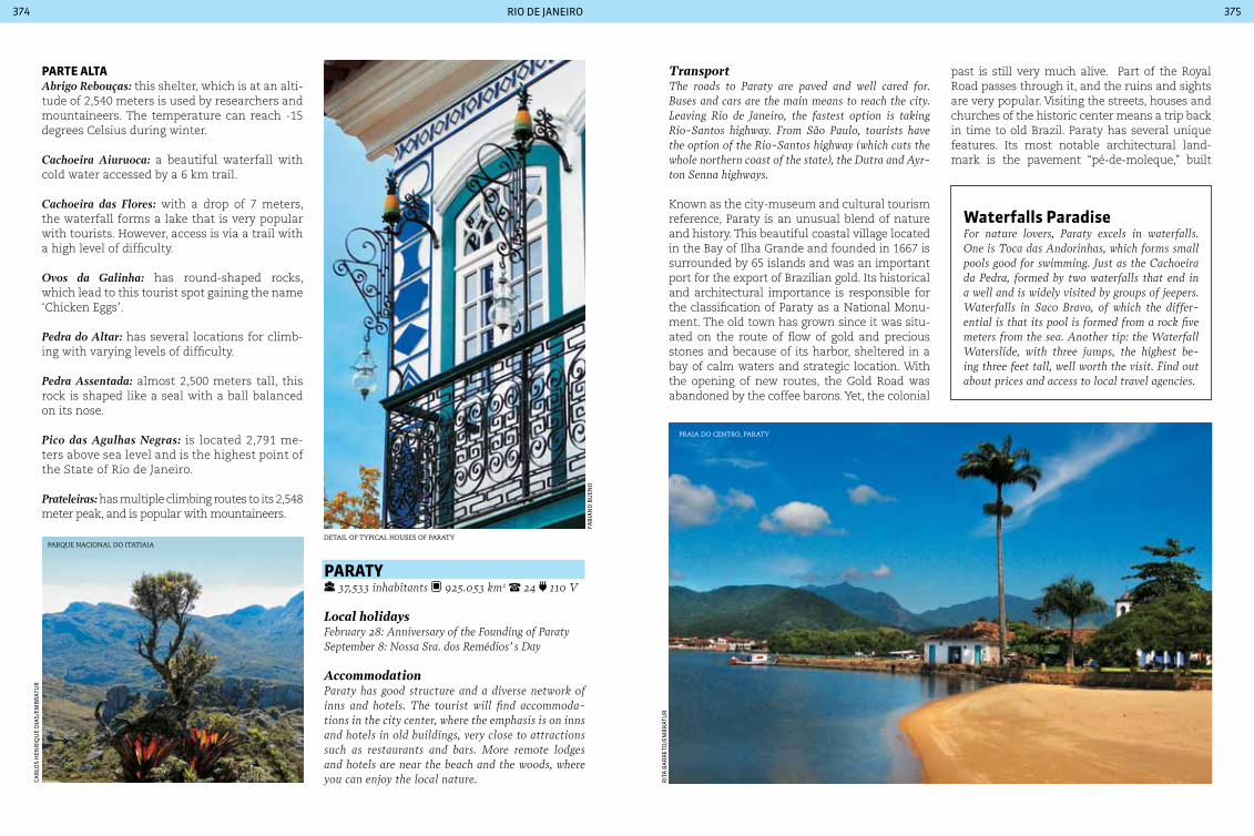
rio de janeiro374 375
parte aLtaAbrigo Rebouças: this shelter, which is at an alti-tude of 2,540 meters is used by researchers and mountaineers. The temperature can reach -15 degrees Celsius during winter.
Cachoeira Aiuruoca: a beautiful waterfall with cold water accessed by a 6 km trail.
Cachoeira das Flores: with a drop of 7 meters, the waterfall forms a lake that is very popular with tourists. However, access is via a trail with a high level of difficulty.
Ovos da Galinha: has round-shaped rocks, which lead to this tourist spot gaining the name ‘Chicken Eggs’.
Pedra do Altar: has several locations for climb-ing with varying levels of difficulty.
Pedra Assentada: almost 2,500 meters tall, this rock is shaped like a seal with a ball balanced on its nose.
Pico das Agulhas Negras: is located 2,791 me-ters above sea level and is the highest point of the State of Rio de Janeiro.
Prateleiras: has multiple climbing routes to its 2,548 meter peak, and is popular with mountaineers.
Parque nacional do itatiaia
Car
los
Hen
riQ
ue
dia
s/em
Br
atu
r
paraty 37,533 inhabitants 925.053 km2 24 110 V
Local holidaysFebruary 28: Anniversary of the Founding of ParatySeptember 8: Nossa Sra. dos Remédios’ s Day
AccommodationParaty has good structure and a diverse network of inns and hotels. The tourist will find accommoda-tions in the city center, where the emphasis is on inns and hotels in old buildings, very close to attractions such as restaurants and bars. More remote lodges and hotels are near the beach and the woods, where you can enjoy the local nature.
TransportThe roads to Paraty are paved and well cared for. Buses and cars are the main means to reach the city. Leaving Rio de Janeiro, the fastest option is taking Rio-Santos highway. From São Paulo, tourists have the option of the Rio-Santos highway (which cuts the whole northern coast of the state), the Dutra and Ayr-ton Senna highways.
Known as the city-museum and cultural tourism reference, Paraty is an unusual blend of nature and history. This beautiful coastal village located in the Bay of Ilha Grande and founded in 1667 is surrounded by 65 islands and was an important port for the export of Brazilian gold. Its historical and architectural importance is responsible for the classification of Paraty as a National Monu-ment. The old town has grown since it was situ-ated on the route of flow of gold and precious stones and because of its harbor, sheltered in a bay of calm waters and strategic location. With the opening of new routes, the Gold Road was abandoned by the coffee barons. Yet, the colonial
past is still very much alive. Part of the Royal Road passes through it, and the ruins and sights are very popular. Visiting the streets, houses and churches of the historic center means a trip back in time to old Brazil. Paraty has several unique features. Its most notable architectural land-mark is the pavement “pé-de-moleque,” built
waterfalls paradiseFor nature lovers, Paraty excels in waterfalls. One is Toca das Andorinhas, which forms small pools good for swimming. Just as the cachoeira da Pedra, formed by two waterfalls that end in a well and is widely visited by groups of jeepers. Waterfalls in Saco Bravo, of which the differ-ential is that its pool is formed from a rock five meters from the sea. Another tip: the Waterfall Waterslide, with three jumps, the highest be-ing three feet tall, well worth the visit. Find out about prices and access to local travel agencies.
faB
ian
o B
uen
o
rit
a B
ar
ret
o/e
mB
rat
ur
detail of tyPical houses of Paraty
Praia do centro, Paraty

rio de janeiro376 377
Vila de trindadeJust 30 km from Paraty, there is the small town of Trindade. The landscape that combines the Atlan-tic coast and virtually intact native vegetation is popular among tourists. Its pristine beaches, trails and waterfalls attract visitors throughout the year to complete, along with the historic sights of Paraty, the menu of attractions in the region. Highlight for cepilho, ideal for surfing, the beach and cachadaço Natural Pool, with its clear waters, surrounded by volcanic rocks, and that Stone Swallows, cave ac-cessed by a trail that leaves from Praia do Meio.
with large stones that make pedestrians walk slowly. The streets are shaped like troughs and the houses are at least a foot above its level to allow for the rising tide, the roads are washed naturally by sea water. The Masonic influence is also well known and can be seen in some corners that rely on three stone pillars carved to form the Masonic triangle. The tradition of making good spirits, dating from the time when the city grew to more than 200 sugar cane plantations, is an-other highlight. Currently, a major cultural event moves Paraty during four days of the year: the International Literary Festival of Paraty (FLIP), which became a symbol of renewal to the city, attracting visitors from all over the world.
IGreJa de noSSa SenHora doS reMÉdIoS Praça Monsenhor Hélio Pires. Tuesday to Sun-
day, from 9 am to 2 pm. Avenida Roberto Silveira
Church of the neoclassical style, his work was completed in 1873, albeit with its unfinished towers. At the opening, a procession led sa-cred images of Santa Rita to the church and this tradition was maintained, the Feast of Our Lady of Remedies. Emphasis on life-size images during the Holy Week.
SítIo arQueoLÓGIco de paraty-MIrIM Praia de Paraty-Mirim. daily, 24 hours. no charge
Distant 15 km from the center of Paraty, the site is a return to the past, bringing together old houses, ruins of a major sugar planta-tion and a beach where the products were shipped from the region. There is also the Igreja de Nossa Senhora da Conceição, built in the 17th century.
jaV
ier
CH
iap
pai
rit
a B
ar
ret
o/e
mB
rat
ur
Cris
tia
no
alm
eid
a
green and quiet waters
Festival Literário Internacional de paraty- FLIp FLIP - Paraty International Literary Festival - It was launched in 2003 and each year stands as one of the most important literary events in the coun-try. During five days in July, the whole city is taken by activities related to literature: there are about 200 events, including lectures, discussions and
roundtables that bring together great Brazilian writers and other nationalities. The festival also has a section devoted to young people, “Flipizona” and, in parallel, there is the “Flip Off” circuit Ideas event, with programming focused on local artists. For more information: http://www.flip.org.br
igreja de santa rita
nel
son
to
led
o/f
lip

rio de janeiro378 379
local craft shoP
Visit the main beaches of paratyBrava: As the name suggests, strong waves, vis-ited by surfers. Access by trail 30, minutes off the road to Trindade.
Deserta: accessible only by boat, its clear waters invite diving. It is one of the main points for the practice of marine observation in the city.
Cajaíba da Praia Grande: on the corner of the beach there is a trail to one of the most beauti-ful waterfalls in the region. The trail to get to it is simple and accessible, being an attraction in itself.
Jabaquara: beach with calm water and bottom mud rich in iodine and sulfur, which is consid-ered medicinal.
Lula: stopping point for boat trips.
Martim de Sá: wild and strong waves ideal for
surfing. Accessed by a trail of 1h, leaving from the beach landing.
Pontal: beach center of Paraty and accommodation options. It is not recommended for swimming.
Saco do Mamanguá: it has many fishing farms.
Pouso da Cajaíba: there lives a community of fishermen, providing some infrastructure.
São Gonçalo: with clear waters and white sand, is very crowded.
Sono: sandy beach, calm waters and green. From there leaves a trail that leads to the Lagoa do Jacaré, with its inviting natural swimming pool.
Sumaca: wild, rough seas and difficult to access.
Forte deFenSor perpÉtuo Av. Orlando carpinelli. Tuesday to Friday, from
9 am to 12 am and from 1 pm to 5 pm. Saturdays and Sundays from 9 pm to 12 pm and from 2 pm to 5 pm.
no charge.
Because of its importance as a military base some time ago, Paraty has built a security system that includes the Perpétuo Defensor. In the collection there were kept authentic English pieces. The fort has a beautiful view of the Bay of Paraty.
Fazenda Murycana
Estrada Paraty - cunha, km 6. daily from 8 am to 5 pm. admission fee. attractions
The farm, which was running Paraty’s old-est mill (17th century), today it still maintains large casks of brandy. Besides tasting drink and home cooked meals, the farm offers rec-reational activities such as horseback riding, hiking to waterfalls, bikes, canopy tours, zip line and climbing.
fer
na
nd
o f
elg
uei
ra
walking on “pé-de-moleque”A beautiful architectural ensemble with 31 blocks make up the historic center of Para-ty. The local meets the Town Hall, churches, the culture House and mansions of the era of colonial Brazil. There you can find craft shops and the best restaurants. The streets are paved with cobbles known as “pé-de-moleque” (foot-boy), symbol of the city. The streets began to be made of irregular stones (debris brought in Por-tuguese caravels,) in the 18th century and ended only in 1830. It was after 1970 that the historic downtown streets were closed to traffic.
rit
a B
ar
ret
o/e
mB
rat
ur
faB
ian
o B
uen
o
Pouso da cajaíBa
tyPical colonial house of Paraty

381
rIoGrandedo norte
riC
ar
do
jun
Qu
eir
a/e
mB
rat
urcatamarans on
the coral reefs of maracajaú
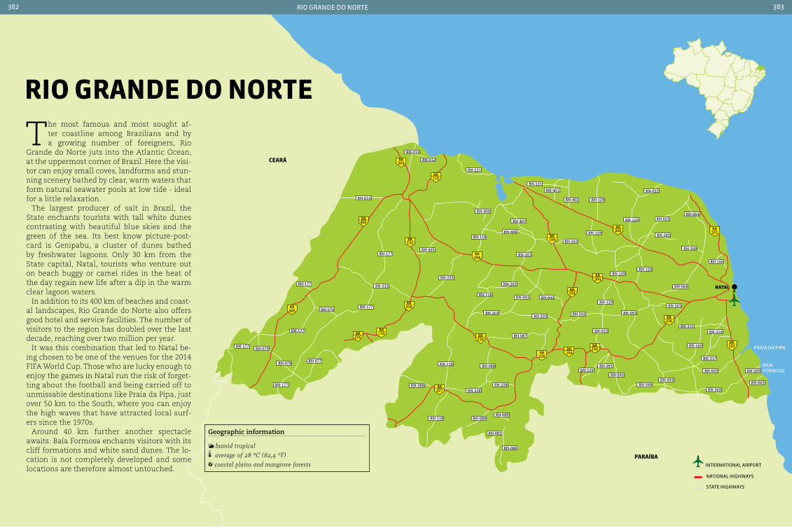
226BR
226BR
226BR
427BR
226BR
226BR
226BR 110
BR
110BR
110BR
405 BR
405BR
304BR
304BR
304BR
406BR
104BR
104BR
104BR
101BR
101BR
RN-064
RN-263
RN-309
RN-160
RN-023
RN-022
RN-129RN-402
RN-401
RN-407
RN-406
RN-404
RN-221
RN-012
RN-013
RN-014
RN-118
RN-233
RN-118
RN-203
RN-118
RN-118
RN-288
RN-089RN-089
RN-081
RN-086
RN-228
RN-228
RN-088
RN-203 RN-203
RN-203
RN-023RN-087
RN-042
RN-263
RN-263
RN-263
RN-129
RN-120
RN-129
RN-129
RN-093
RN-120
RN-064
RN-315
RN-160
RN-317
RN-316
RN-003
RN-093RN-092
RN-129RN-091
RN-269RN-269
RN-269
RN-062
RN-041
RN-405RN-177
RN-233RN-177
RN-177
RN-077
RN-177
RN-177
RN-177
RN-076
RN-079
RN-078
RN-221
nataL
ceará
paraíbainternational airport
national HigHways
state HigHways
rio grande do norte382 383
The most famous and most sought af-ter coastline among Brazilians and by a growing number of foreigners, Rio
Grande do Norte juts into the Atlantic Ocean, at the uppermost corner of Brazil. Here the visi-tor can enjoy small coves, landforms and stun-ning scenery bathed by clear, warm waters that form natural seawater pools at low tide - ideal for a little relaxation.
The largest producer of salt in Brazil, the State enchants tourists with tall white dunes contrasting with beautiful blue skies and the green of the sea. Its best know picture-post-card is Genipabu, a cluster of dunes bathed by freshwater lagoons. Only 30 km from the State capital, Natal, tourists who venture out on beach buggy or camel rides in the heat of the day regain new life after a dip in the warm clear lagoon waters.
In addition to its 400 km of beaches and coast-al landscapes, Rio Grande do Norte also offers good hotel and service facilities. The number of visitors to the region has doubled over the last decade, reaching over two million per year.
It was this combination that led to Natal be-ing chosen to be one of the venues for the 2014 FIFA World Cup. Those who are lucky enough to enjoy the games in Natal run the risk of forget-ting about the football and being carried off to unmissable destinations like Praia da Pipa, just over 50 km to the South, where you can enjoy the high waves that have attracted local surf-ers since the 1970s.
Around 40 km further another spectacle awaits: Baía Formosa enchants visitors with its cliff formations and white sand dunes. The lo-cation is not completely developed and some locations are therefore almost untouched.
rIo Grande do norte
Geographic information
humid tropical average of 28 °c (82,4 °F) coastal plains and mangrove forests
praia da pipa
Baiaformosa

rio grande do norte384 385
nataL 803,739 inhabitants 167,160 km2 84 220 V
Local holidaysJanuary 6: Reis Magos November 21: Nossa Senhora da Apresentação’s day
ClothingLight clothing and hat are best for the local climate
AccommodationWith a vast hotel network, Natal offers all types of tourist accommodation, including inns, hostels and three to five star hotels. Accommodation is located in various neighborhoods, but those located at the sea-front tend to be the most sought after.
TransportThe capital of Rio Grande do Norte is connected to the South of the country by the BR-101, and to the
North by the BR-304. There are regular bus lines from several Brazilian cities to Natal. There are also air connections with most major cities. The in-ternational airport is 18 km from the center, in the neighboring Municipality of Parnamirim. For those who prefer to travel by sea, the Port of Natal receives medium and large vessels from Brazil and abroad.
Within the cityThe urban bus fleet consists of 646 vehicles carry-ing over 10 million passengers per month. It is also possible to get around town using one of Natal’s fleet of taxis (white vehicles with a red stripe).
Beautiful beaches, dunes, rich culture and a high development index. Natal offers all of this to the thousands who visit each year, both from Brazil and abroad. The City is named Natal (Christmas) because on De-cember 25, 1597, Admiral Antonio Valente da Costa and his men entered the Rio Potengi
sand bar after several unsuccessful attempts at colonization. The date became the State Capital’s anniversary. During the Dutch occu-pation (between 1633 and 1654) several im-provements were made in the region. Later,
during World War II, the City served as a base for South Atlantic patrols, principally North American, which led to significant growth. With the strengthening of its economy and through tourism, the City began to provide one of the best qualities of urban life and in-frastructure in the Northeast of Brazil, some-thing which local residents are proud of.
FortaLeza doS reIS MaGoS At the tip of Praia do Meio. daily from 8 am
to 4:30 pm. students and pensioners pay half price
Known as the Fortaleza dos Reis Magos (The Fort of the Three Wise Men), actually named Fortaleza da Barra do Rio Grande, this was the first construction in Natal. Construction began on January 6, 1598 - Epiphany - hence the name. It is strategically location at the mouth of the Rio Potengi, offering a wide view of the sea and preventing invasion by pirates who came ashore to steal pau-brazil wood. The view from the fort is one of the most beautiful in Natal.
Ponta negra, one of the more PoPular
Beaches in natal
Ponte newton navarro, Better Known as Ponte forte-redinha
fortaleza dos reis magos, Built By the Portuguese in 1598 and designed to last for centuries
riC
ar
do
jun
Qu
eir
a/e
mB
rat
ur
riC
ar
do
jun
Qu
eir
a/e
mB
rat
ur
riC
ar
do
jun
Qu
eir
a/e
mB
rat
ur

rio grande do norte386 387
praIa da ponta neGra There are two ways to reach the beach, both by car:
the first commences at Ladeira do Sol and the second is Via costeira
12 km from the center of the City, this is one of the best known of beaches in Natal. Here you will find Morro do Careca, a 100 meter high dune and a well-known local landmark. The beach becomes busy at weekends, attracting both local residents and tourists drawn by the natural pools that form during low tide - an ideal spot for families with children. It is also the beach with the most tourist infrastructure, concentrating a large number of stalls, restaurants, inns and shops.
parQue daS dunaS Avenida Alexandrino de Alencar - Tirol. walks
can be made from Tuesday to Sunday and public holidays at 8 am, 8:15 am and 8:30 am, and in the afternoon at 2 pm, 2:15 pm and 2:30 pm.
A large green area amid the urban spread of Natal, its 1,172 hectares include the Bosque dos Namorados - with children playgrounds, primate
viewing area (marmosets) and a laboratory with regional plants and insects - as well as the dunes themselves. It is possible to learn more about the park through guided walks; these start at Bosque dos Namorados and are available with various distances and routes to suit the physical condi-tion of the group. During the tour, guides explain more about the regional flora and fauna, and the formation of the sand dunes.
centro MunIcIpaL de arteSanato Avenida Beira Mar - Praia do Meio. daily from
8 am to 10 pm. no charge
This is the place most recommended for those looking for typical regional products or souve-nirs, not just for the variety on offer, but also because of its location, at Praia do Meio. In ad-dition to the craft stores - selling traditional pottery figures, baskets woven from straw, and pieces carved in stone and wood - the center has food stalls where you can sample local delicacies, such as tapioca with varied fillings.
praIa de Mãe LuIza Along the beach, within walking distance from
Ponta Negra
The beach is not recommended for bathing, but deserves a visit due to the lighthouse - Farol de Natal - also known as Farol de Mãe Luiza, which provides some of the best views of the City. The name of the beach is a tribute to a famous midwife who lived and worked in the region in the 19th century.
praIa doS artIStaS Praia dos Artistas is very close to the city center.
It is within walking distance from either Praia do Meio or Praia do Forte. For those who prefer to make the journey by car, is can be reached via Avenida Hermes da Fonseca or the Via costeira
The ‘Artist’s Beach’ lies between the Praia do Meio and Praia do Forte. It is very popular throughout the week with both local residents
Local GastronomyThe cuisine of Rio Grande do Norte is rich in dishes based on seafood, such as shrimp - which even has its own annual festival in Natal, Feira Nacional do camarão (Fenacam). Prepared with cajá fruit and other natural ingredients, it is found in several delicious dishes. crab is also widely offered in coastal restaurants. It is pre-pared following several different recipes, includ-ing some international dishes. Tapioca and ice cream made from regional fruits are also among local delicacies which should be savored.
Praia de Ponta negra with morro do careca in the BacKground
a traditional raft launches from one of the Beaches in rio grande do norte
dunes and Beaches that enchant tourists
riC
ar
do
jun
Qu
eir
a/e
mB
rat
ur
riC
ar
do
jun
Qu
eir
a/e
mB
rat
ur
riC
ar
do
jun
Qu
eir
a/e
mB
rat
ur
riC
ar
do
jun
Qu
eir
a/e
mB
rat
ur
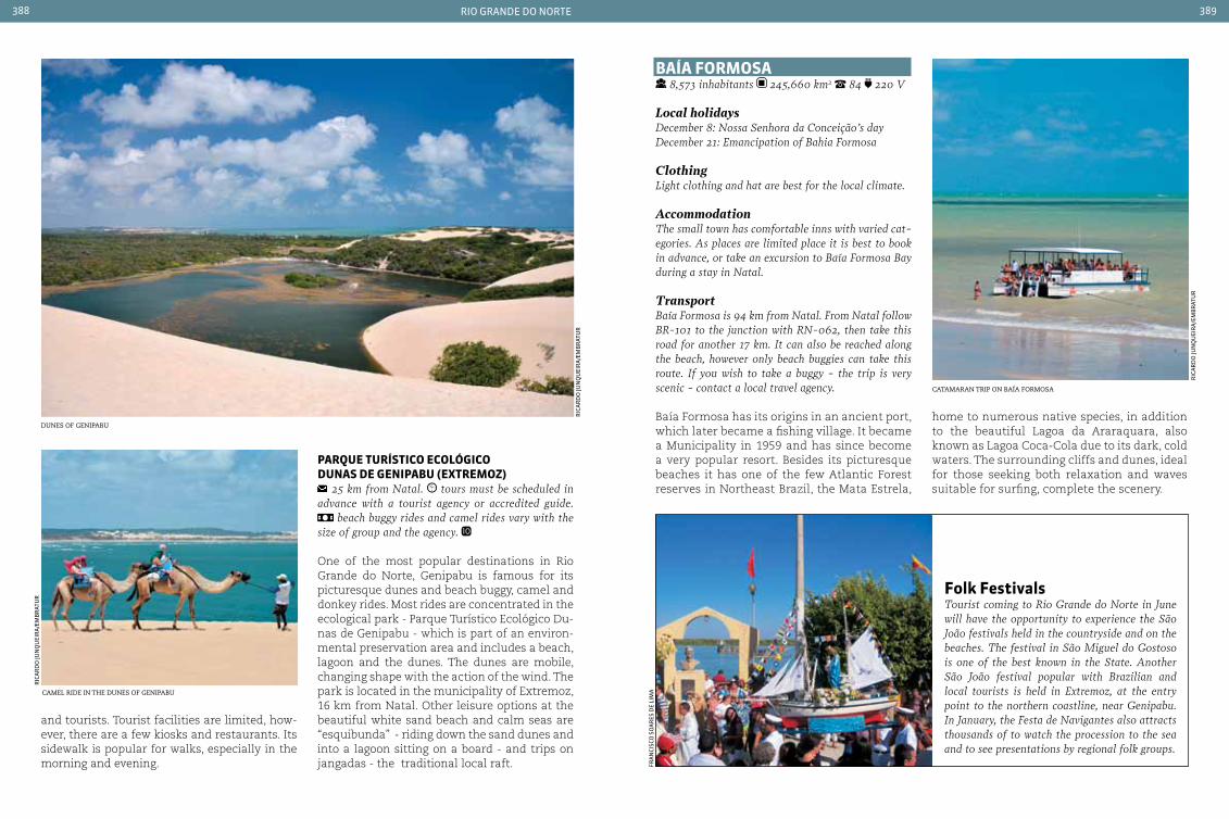
rio grande do norte388 389
and tourists. Tourist facilities are limited, how-ever, there are a few kiosks and restaurants. Its sidewalk is popular for walks, especially in the morning and evening.
parQue turíStIco ecoLÓGIco dunaS de GenIpabu (extreMoz)
25 km from Natal. tours must be scheduled in advance with a tourist agency or accredited guide.
beach buggy rides and camel rides vary with the size of group and the agency.
One of the most popular destinations in Rio Grande do Norte, Genipabu is famous for its picturesque dunes and beach buggy, camel and donkey rides. Most rides are concentrated in the ecological park - Parque Turístico Ecológico Du-nas de Genipabu - which is part of an environ-mental preservation area and includes a beach, lagoon and the dunes. The dunes are mobile, changing shape with the action of the wind. The park is located in the municipality of Extremoz, 16 km from Natal. Other leisure options at the beautiful white sand beach and calm seas are “esquibunda” - riding down the sand dunes and into a lagoon sitting on a board - and trips on jangadas - the traditional local raft.
baía ForMoSa 8,573 inhabitants 245,660 km2 84 220 V
Local holidaysDecember 8: Nossa Senhora da conceição’s dayDecember 21: Emancipation of Bahia Formosa
ClothingLight clothing and hat are best for the local climate.
AccommodationThe small town has comfortable inns with varied cat-egories. As places are limited place it is best to book in advance, or take an excursion to Baía Formosa Bay during a stay in Natal.
TransportBaía Formosa is 94 km from Natal. From Natal follow BR-101 to the junction with RN-062, then take this road for another 17 km. It can also be reached along the beach, however only beach buggies can take this route. If you wish to take a buggy - the trip is very scenic - contact a local travel agency.
Baía Formosa has its origins in an ancient port, which later became a fishing village. It became a Municipality in 1959 and has since become a very popular resort. Besides its picturesque beaches it has one of the few Atlantic Forest reserves in Northeast Brazil, the Mata Estrela,
Folk FestivalsTourist coming to Rio Grande do Norte in June will have the opportunity to experience the São João festivals held in the countryside and on the beaches. The festival in São Miguel do Gostoso is one of the best known in the State. Another São João festival popular with Brazilian and local tourists is held in Extremoz, at the entry point to the northern coastline, near Genipabu. In January, the Festa de Navigantes also attracts thousands of to watch the procession to the sea and to see presentations by regional folk groups.
dunes of geniPaBu home to numerous native species, in addition to the beautiful Lagoa da Araraquara, also known as Lagoa Coca-Cola due to its dark, cold waters. The surrounding cliffs and dunes, ideal for those seeking both relaxation and waves suitable for surfing, complete the scenery.
camel ride in the dunes of geniPaBu
riC
ar
do
jun
Qu
eir
a/e
mB
rat
ur
riC
ar
do
jun
Qu
eir
a/e
mB
rat
ur
catamaran triP on Baía formosa
riC
ar
do
jun
Qu
eir
a/e
mB
rat
ur
fra
nCi
sCo
so
ar
es d
e li
ma
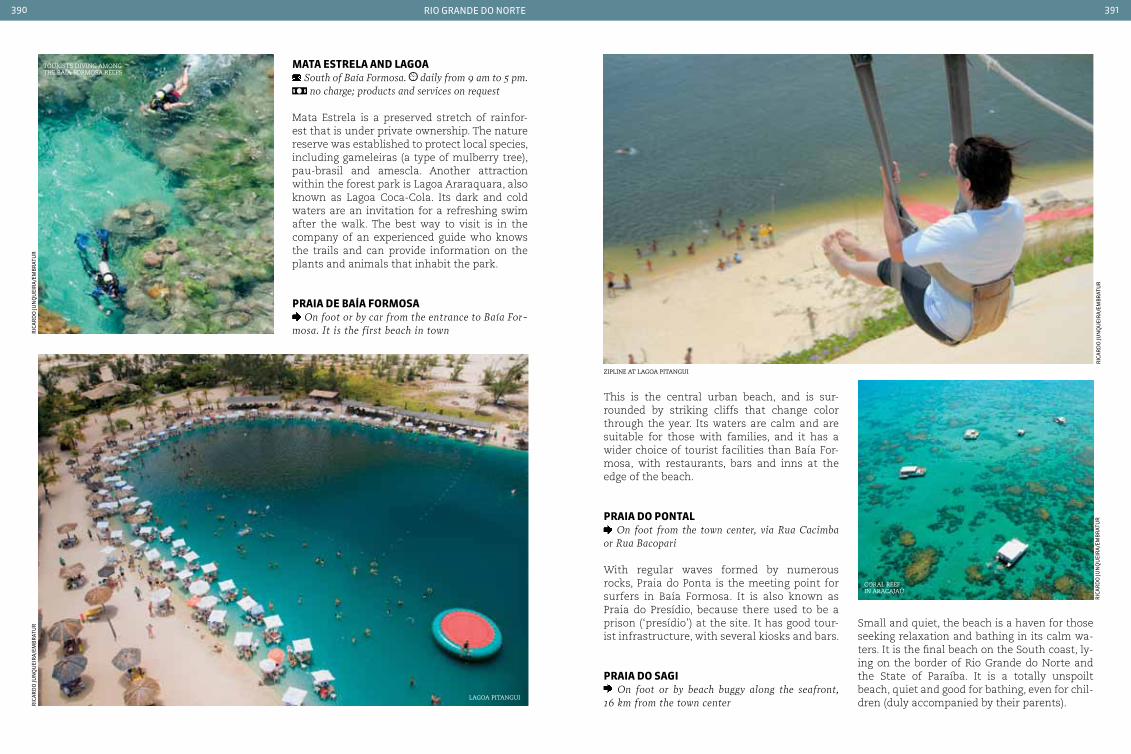
rio grande do norte390 391
This is the central urban beach, and is sur-rounded by striking cliffs that change color through the year. Its waters are calm and are suitable for those with families, and it has a wider choice of tourist facilities than Baía For-mosa, with restaurants, bars and inns at the edge of the beach.
praIa do pontaL On foot from the town center, via Rua cacimba
or Rua Bacopari
With regular waves formed by numerous rocks, Praia do Ponta is the meeting point for surfers in Baía Formosa. It is also known as Praia do Presídio, because there used to be a prison (‘presídio’) at the site. It has good tour-ist infrastructure, with several kiosks and bars.
praIa do SaGI On foot or by beach buggy along the seafront,
16 km from the town center
Small and quiet, the beach is a haven for those seeking relaxation and bathing in its calm wa-ters. It is the final beach on the South coast, ly-ing on the border of Rio Grande do Norte and the State of Paraíba. It is a totally unspoilt beach, quiet and good for bathing, even for chil-dren (duly accompanied by their parents).
Mata eStreLa and LaGoa South of Baía Formosa. daily from 9 am to 5 pm. no charge; products and services on request
Mata Estrela is a preserved stretch of rainfor-est that is under private ownership. The nature reserve was established to protect local species, including gameleiras (a type of mulberry tree), pau-brasil and amescla. Another attraction within the forest park is Lagoa Araraquara, also known as Lagoa Coca-Cola. Its dark and cold waters are an invitation for a refreshing swim after the walk. The best way to visit is in the company of an experienced guide who knows the trails and can provide information on the plants and animals that inhabit the park.
praIa de baía ForMoSa On foot or by car from the entrance to Baía For-
mosa. It is the first beach in town
ziPline at lagoa Pitangui
coral reef in aracajaú
tourists diving among the Baía formosa reefs
lagoa Pitangui
riC
ar
do
jun
Qu
eir
a/e
mB
rat
ur
riC
ar
do
jun
Qu
eir
a/e
mB
rat
ur
riC
ar
do
jun
Qu
eir
a/e
mB
rat
ur
riC
ar
do
jun
Qu
eir
a/e
mB
rat
ur

rio grande do norte392 393
praIa da pIpa 11,385 inhabitants (Tibau do Sul) 101,821 km2
84 220 V
Local holidaysApril 3: Anniversary of the founding of the cityJune 13: Santo Antônio’s day
ClothingLight clothing and hat are best for the local climate
AccommodationThere are a large number of inns and hostels in Pipa. However it may be difficult to find a room on the beach, especially during the summer. It is therefore recommended to make reservations well in advance. An option is to stay at other beaches in Tibau do Sul.
Transportcoming from Natal take BR-101 and enter the town of Goianinha. From there follow RN-003 to Tibau do Sul. Praia da Pipa is a further 8 km. Another option for those who wish to enjoy the scenery en route is to take a buggy along the beaches, starting at Ponta Negra in Natal. This route follows Rota do Sol to-wards the south, with a ferry to Tibau do Sul.
This sleepy fishing village in the Municipality of Tibau do Sul was first discovered by surf-ers in the late 90s. After its ‘discovery’ Pipa began to receive thousands of tourists inter-ested in experiencing this small corner on the South coast of Rio Grande do Norte with beaches that alternate between calm natural pools and high waves. The name Praia da Pipa
comes from Portuguese colonists, who lik-ened the shape of the coastline to that of a barrel (known as ‘pipa’ in Portugal). Currently the place is known as a destination for young-er tourists, seeking adventure sports such as surfing and kite surfing during the day and parties at night. The vibrant nightlife takes place in the various bars on the seafront.
praIa do centro It is the first beach when arriving in town
The main attraction at the busiest beach in the village are the natural pools that form at low tide, attracting both adults and children. The beach has bars, restaurants and kiosks. It is lo-cally known as Praia da Pipa.
praIa do aMor 2 km walk at low tide from Praia do centro
A picturesque beach, surrounded by cliffs and dunes, it is suitable for surfing due to the strong waves breaking on the shore. It receives few visitors and has no tourist facilities.
praIa do MadeIro can reach along the shoreline from Praia do cen-
tro, or by car via RN-003
Very popular with tourists, the beach has calm seas that are perfect for bathing, with clear water and few waves. Dolphins can be spotted throughout the year, mainly in the morning. For those who prefer sports, the beach always attracts people playing soccer, racquetball and foot-volley. It has several ki-osks to serve visitors and their families.
Praia da PiPa in tiBau do sul
view from Praia da PiPa
Praia da PiPa, one of the most famous Beaches on the Brazilian coast
riC
ar
do
jun
Qu
eir
a/e
mB
rat
ur
riC
ar
do
jun
Qu
eir
a/e
mB
rat
ur
riC
ar
do
jun
Qu
eir
a/e
mB
rat
ur
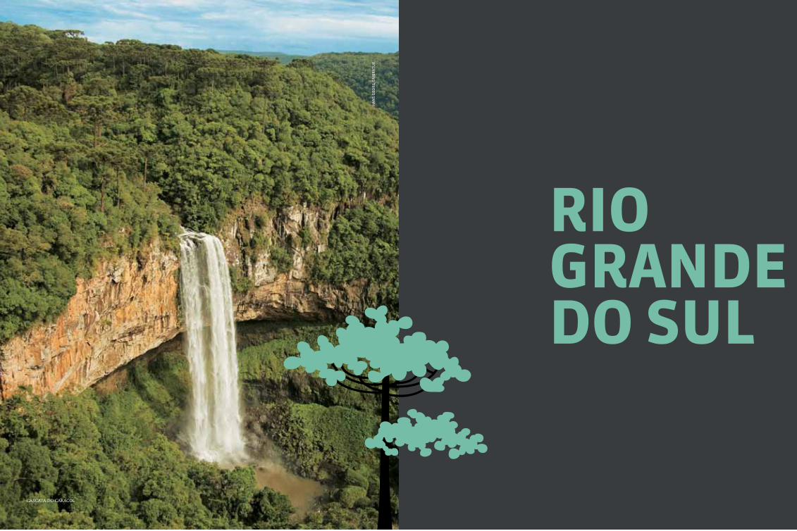
395
rIo Grande do SuL
Ha
ns
geo
rg
/em
Br
atu
r
cascata do caracol

rio grande do sul396 397
santoângelo
são migueldas missões
Santa catarIna
paraGuay
porto aLeGre
uruGuay
158BR
153BR
158BR
285BR
470BR
285BR
285BR
285BR
285BR
287BR
287BR
473BR
158BR
153BR
153BR
392BR
392BR
471BR
471BR
287BR 287
BR
116BR
101BR
101BR
116BR
116BR
116BR
471BR
471BR
290BR
472BR
290BR 290
BR
158BR
293BR
293BR
293BR
392BR
386BR
468BR
RS-504
RS-324
RS-143
RS-480
RS-420
RS-331
RS-126
RS-330
RS-223
RS-318RS-318
RS-481
RS-400RS-149
RS-392
RS-149RS-640
RS-241
RS-377RS-176
RS-566
RS-507
RS-183
RS-510
RS-158
RS-357
RS-625
RS-615 RS-608
RS-602
RS-704
RS-473
RS-265
RS-265
RS-702
RS-377
RS-529
RS-158RS-514
RS-210
RS-472
RS-561
RS-165
RS-155
RS-342
RS-305RS-344
RS-032
RS-470
RS-129RS-322
RS-122
RS-470
RS-122RS-453RS-224
RS-350
RS-476
RS-453
RS-110RS-020
RS-484
RS-786RS-040
RS-211
101BR
386BR
Geographic information
subtropical humid temperature 19.5 °c (67,1 °F) grasslands, subtropical forest, pine forests
rIo Grande do SuL
The most southerly State in Brazil, Rio Grande do Sul shows a different side of Brazilian culture and traditions that
blends Italian, German, Indian, Portuguese and Spanish heritage.
A region rich in culture, with excellent cuisine and the largest wine producing region in Brazil, Rio Grande do Sul offers immense hospitality to visitors in the cold winters in the mountains and at the ranch houses on the pampas - where you can experience the “Gaucho” traditions (in-cluding barbecue and mate tea) - and in Porto Alegre, the State’s cultural center.
The first immigrants to reach the region were the Spanish, who brought with them the Jesuit priests who went on to become responsible for the creation of the Sete Povos das Missões - ‘the Seven Peoples Missions’ - where Indians were converted to Christianity and thereby protected from the spread of slavery brought by the Portuguese.
The arrival of European immigrants would completely change the future of the region. Germans and Italians brought their own cul-tures, which today are a source of inspira-tion for the State. In the case of the Italians, their wine production found fertile ground in the region. This tradition has become big business: the Sierra Gaucho Vineyard Route, including Canela, Gramado, Bento Gonçalves and other towns attracts oenology tourism, with products improving in quality every year.
Gramado and Canela are the main attractions on the Rota Romântica - ‘The Romantic Route’ - where chocolate, a cool climate and pleas-ant parks and towns provide ideal settings for walks. Porto Alegre, the State capital, is making preparations to host the 2014 World Cup. Good food, good wine, great stories and an unforget-table landscape are some of the reasons not to miss the opportunity to visit the region.
international airport
national airport
national HigHways
state HigHways
uruguaiana
Bage
pelotas

rio grande do sul398 399
rio Grande do Sul GastronomyQuality and the variety on offer are two of the strengths of the region’s cuisine. Multicultural touches in thte local gastronomy are a heritage of the diverse ethnic groups who have settled the region. An important part of any visit to the re-gion is a visit to one of the many churrascarias - steakhouses where the meat is roasted directly on charcoal. Typical of so many countries, this is the principal dish in the State. Another local specialty that should be savored is mate tea, the traditional drink prepared with mate tea, and drunk throughout the year from a gourd.
porto aLeGre 1,409,351 inhabitants 496.684 km² 51 110 V
Local holidaysFebruary 2: Nossa Senhora dos NavegantesSeptember 20: Farroupilha Revolution
AccommodationPorto Alegre has numerous hotels that offer diverse options for visitors. There are international networks that have accommodation for those coming to town for tourism or leisure. Tourists can choose between more luxurious rooms or more traditional accommo-dation, especially in the historic center.
TransportThe city’s international airport receives flights from all over Brazil and other countries. Porto Alegre is also well served by highways that link it with other State capitals and cities.
Within the cityThe urban public transport network in Porto Alegre offers a choice of 224 bus lines as well as a sub-way, taxis and mini-buses. There is an above-ground metro linking the capital to local metropolitan cen-ters. The subway and buses have integrated ticket-ing, and the city also has a Tourism Line with dou-ble-decker buses equipped with panoramic windows, disabled access and bilingual tour guides.
gion in 1752. This first immigration to the State capital was repeated many times over during the following centuries, turning Porto Alegre into a cosmopolitan city that knows how to appreciate the many different ethnic and re-ligious backgrounds that make up its culture. With over 1.4 million inhabitants it has become a commercial hub for goods and services, and a stronghold of technology employed for the pub-lic good. It is also multifaceted in its landscapes - Porto Alegre has three sub-regions: the plains - where urban activity provides options for the-ater, music, literature, film and visual arts in a schedule of events that are distributed around 13 cultural centers, 50 museums and memori-als, more than 30 theatrical spaces and 64 cin-emas. There is also the fringes of Lago Guaíba, where local residents (known as “Gauchos”) and visitors can enjoy the famous sunset. From there it is also possible to view the avant-garde work of Portuguese architect Alvaro Siza, em-
bodied in the building housing the Museu da Fundação Iberê Camargo, a center for modern and contemporary art. Finally, a chain of hills offers privileged views of the calm waters of Lago Guaíba, as well providing the location for tours through the countryside, including bio-logical and environmental preservation areas.
Parque da redenção, Porto alegre
gu
tem
Ber
g o
stem
Ber
g/e
mB
rat
ur
Lake Guaíba - which crosses the State capital from north to south with its 72 km in length - was the first point of entry of Azorean Portu-guese couples who came to the Porto Alegre re-
centro cultural mário quintana
gu
tem
Ber
g o
stem
Ber
g/e
mB
rat
ur
ima
ge
Cou
rte
sy
caSa de cuLtura MárIo QuIntana Rua dos Andradas, 736 - centro. Monday from
2 pm to 9 pm. Tuesday to Friday from 9 am to 9 pm. Saturdays and Sundays from 12 am to 9 pm.
This cultural center was built in an old hotel dating from the early 20th century, which was once the home of the poet Quintana. Its rooms house cinemas, theater and spaces for ateliers and art workshops. The permanent collection of the Centro Cultural has works by artists including Jailton Moreira, Ireneu Garcia, Xico Stockinger and Karin Lambrecht, among others. Temporary exhibitions bring displays of photo-graphs, engravings and other art forms.
1
2
3
4
5
6
7
8
10
11
12
1314 15
27
16
17
18
19
20
21
22
23
24
25
26
28
29
30
9
1 Porto Alegre2 Canoas3 Novo Hamburgo4 Gravataí 5 Viamão 6 São Leopoldo7 Alvorada8 Sapucaia do Sul9 Cachoeirinha10 Guaíba11 Esteio
12 Sapiranga13 Montenegro14 Campo Bom15 Taquara16 Parobé17 Santo Antônio
da Patrulha18 Estância Velha19 Charqueadas20 Eldorado do Sul21 Portão
22 Dois Irmãos23 Triunfo24 São Jerônimo25 Nova Santa Rita26 Ivoti27 Nova Hartz28 Arroio dos Ratos29 Glorinha30 Araricá
porto aLeGreMetropoLItan reGIon
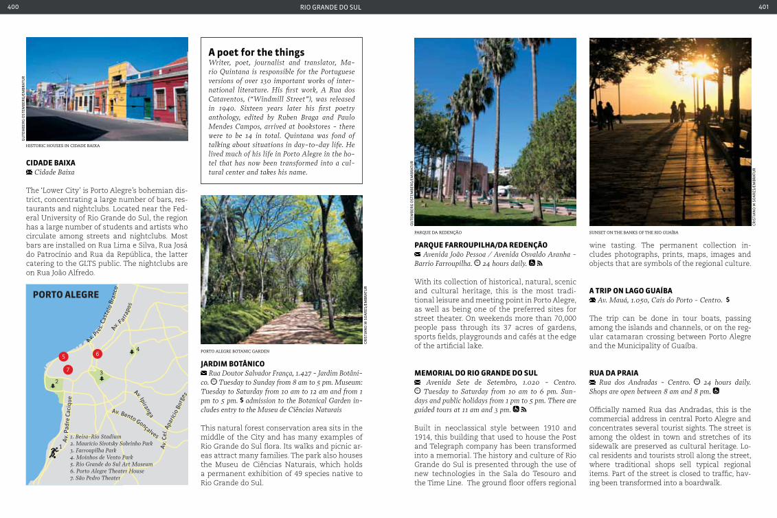
rio grande do sul400 401
cIdade baIxa cidade Baixa
The ‘Lower City’ is Porto Alegre’s bohemian dis-trict, concentrating a large number of bars, res-taurants and nightclubs. Located near the Fed-eral University of Rio Grande do Sul, the region has a large number of students and artists who circulate among streets and nightclubs. Most bars are installed on Rua Lima e Silva, Rua Josá do Patrocínio and Rua da República, the latter catering to the GLTS public. The nightclubs are on Rua João Alfredo.
JardIM botÂnIco Rua Doutor Salvador França, 1.427 - Jardim Botâni-
co. Tuesday to Sunday from 8 am to 5 pm. Museum: Tuesday to Saturday from 10 am to 12 am and from 1 pm to 5 pm. admission to the Botanical Garden in-cludes entry to the Museu de ciências Naturais
This natural forest conservation area sits in the middle of the City and has many examples of Rio Grande do Sul flora. Its walks and picnic ar-eas attract many families. The park also houses the Museu de Ciências Naturais, which holds a permanent exhibition of 49 species native to Rio Grande do Sul.
parQue FarroupILHa/da redenção Avenida João Pessoa / Avenida Osvaldo Aranha -
Barrio Farroupilha. 24 hours daily.
With its collection of historical, natural, scenic and cultural heritage, this is the most tradi-tional leisure and meeting point in Porto Alegre, as well as being one of the preferred sites for street theater. On weekends more than 70,000 people pass through its 37 acres of gardens, sports fields, playgrounds and cafés at the edge of the artificial lake.
MeMorIaL do rIo Grande do SuL Avenida Sete de Setembro, 1.020 - centro. Tuesday to Saturday from 10 am to 6 pm. Sun-
days and public holidays from 1 pm to 5 pm. There are guided tours at 11 am and 3 pm.
Built in neoclassical style between 1910 and 1914, this building that used to house the Post and Telegraph company has been transformed into a memorial. The history and culture of Rio Grande do Sul is presented through the use of new technologies in the Sala do Tesouro and the Time Line. The ground floor offers regional
wine tasting. The permanent collection in-cludes photographs, prints, maps, images and objects that are symbols of the regional culture.
a trIp on LaGo Guaíba Av. Mauá, 1.050, cais do Porto - centro.
The trip can be done in tour boats, passing among the islands and channels, or on the reg-ular catamaran crossing between Porto Alegre and the Municipality of Guaíba.
rua da praIa Rua dos Andradas - centro. 24 hours daily.
Shops are open between 8 am and 8 pm.
Officially named Rua das Andradas, this is the commercial address in central Porto Alegre and concentrates several tourist sights. The street is among the oldest in town and stretches of its sidewalk are preserved as cultural heritage. Lo-cal residents and tourists stroll along the street, where traditional shops sell typical regional items. Part of the street is closed to traffic, hav-ing been transformed into a boardwalk.
a poet for the things Writer, poet, journalist and translator, Ma-rio Quintana is responsible for the Portuguese versions of over 130 important works of inter-national literature. His first work, A Rua dos cataventos, (“Windmill Street”), was released in 1940. Sixteen years later his first poetry anthology, edited by Ruben Braga and Paulo Mendes campos, arrived at bookstores - there were to be 14 in total. Quintana was fond of talking about situations in day-to-day life. He lived much of his life in Porto Alegre in the ho-tel that has now been transformed into a cul-tural center and takes his name.
historic houses in cidade Baixa
Parque da redenção
Porto alegre Botanic garden
sunset on the BanKs of the rio guaíBa
gu
tem
Ber
g o
stem
Ber
g/e
mB
rat
ur
gu
tem
Ber
g o
stem
Ber
g/e
mB
rat
ur
Cris
tia
no
w s
oa
res
/em
Br
atu
r
Cris
tia
no
w s
oa
res
/em
Br
atu
r
Av
. P
res.
Cas
telo
Bra
nco
Av
. F
arrap
os
Av. Bento Gonçalves
Av. Ipiranga
Av.
Pad
re C
aciq
ue
1. Beira-Rio Stadium2. Maurício Sirotsky Sobrinho Park3. Farroupilha Park4. Moinhos de Vento Park5. Rio Grande do Sul Art Museum6. Porto Alegre Theater House7. São Pedro Theater
1
3
4
2
5 6
7
PORTO ALEGRE
Av.
Cel
. Apa
rício
Bor
ge
s
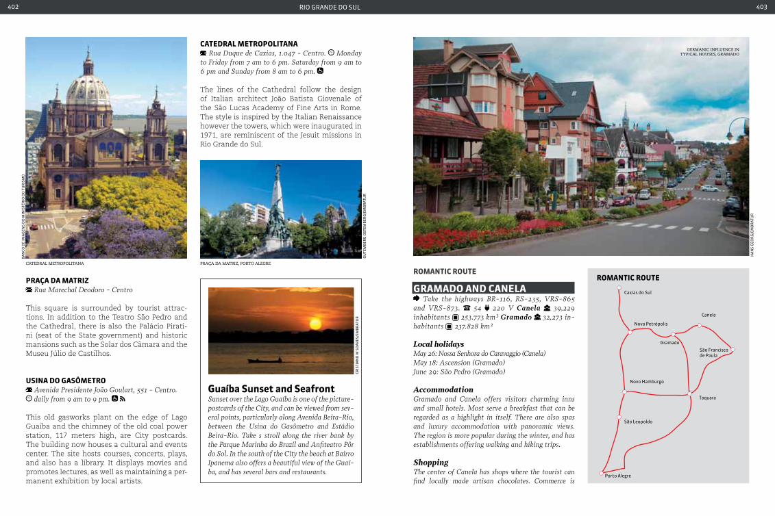
rio grande do sul402 403
praça da MatrIz Rua Marechal Deodoro - centro
This square is surrounded by tourist attrac-tions. In addition to the Teatro São Pedro and the Cathedral, there is also the Palácio Pirati-ni (seat of the State government) and historic mansions such as the Solar dos Câmara and the Museu Júlio de Castilhos.
uSIna do GaSÔMetro Avenida Presidente João Goulart, 551 - centro. daily from 9 am to 9 pm.
This old gasworks plant on the edge of Lago Guaíba and the chimney of the old coal power station, 117 meters high, are City postcards. The building now houses a cultural and events center. The site hosts courses, concerts, plays, and also has a library. It displays movies and promotes lectures, as well as maintaining a per-manent exhibition by local artists.
catedraL MetropoLItana Rua Duque de caxias, 1.047 - centro. Monday
to Friday from 7 am to 6 pm. Saturday from 9 am to 6 pm and Sunday from 8 am to 6 pm.
The lines of the Cathedral follow the design of Italian architect João Batista Giovenale of the São Lucas Academy of Fine Arts in Rome. The style is inspired by the Italian Renaissance however the towers, which were inaugurated in 1971, are reminiscent of the Jesuit missions in Rio Grande do Sul.
roMantIc route
GraMado and caneLa Take the highways BR-116, RS-235, VRS-865
and VRS-873. 54 220 V Canela 39,229 inhabitants 253.773 km² Gramado 32,273 in-habitants 237.828 km²
Local holidaysMay 26: Nossa Senhora do caravaggio (canela)May 18: Ascension (Gramado)June 29: São Pedro (Gramado)
AccommodationGramado and canela offers visitors charming inns and small hotels. Most serve a breakfast that can be regarded as a highlight in itself. There are also spas and luxury accommodation with panoramic views. The region is more popular during the winter, and has establishments offering walking and hiking trips.
ShoppingThe center of canela has shops where the tourist can find locally made artisan chocolates. commerce is
Praça da matriz, Porto alegrecatedral metroPolitana
gu
tem
Ber
g o
stem
Ber
g/e
mB
rat
ur
Ba
nCo
de
ima
gen
s d
o m
inis
tér
io d
o t
ur
ism
o
Cris
tia
no
w s
oa
res
/em
Br
atu
r
Guaíba Sunset and Seafront Sunset over the Lago Guaíba is one of the picture-postcards of the city, and can be viewed from sev-eral points, particularly along Avenida Beira-Rio, between the Usina do Gasômetro and Estádio Beira-Rio. Take s stroll along the river bank by the Parque Marinha do Brazil and Anfiteatro Pôr do Sol. In the south of the city the beach at Bairro Ipanema also offers a beautiful view of the Guaí-ba, and has several bars and restaurants.
germanic influence in tyPical houses, gramado
Ha
ns
geo
rg
/em
Br
atu
r
ROMANTIC ROUTE
Porto Alegre
São Leopoldo
Novo Hamburgo
Taquara
São Franciscode Paula
Canela
Gramado
Nova Petrópolis
Caxias do Sul

rio grande do sul404 405
mainly clustered around Avenida da Hortências, Ave-nida Oswaldo Aranha and Praça da Matriz. Wool knit-wear is another strong point of local handicrafts. The town center unites many of the shops, which also offer leather items and wood carvings. Gramado is famous for its locally-produced handmade chocolates, knit-wear and crystals. Most shops are concentrated in the town center on Avenida do Hortências and Avenida Borges Medeiros, where you can take a pause in small, charming cafés and chocolate shops along the way. The town is also famous for its furniture manufacture.
TransportRoads along the route are paved and provide beauti-ful scenic views. The town has a small airport that receives private aircraft and tourist charter flights. Salgado Filho Airport in Porto Alegre is the nearest international airport. The highways around Gram-ado are well maintained. canela Airport, on the RS-235 highway, receives private aircraft and tourist charter flights. Salgado Filho Airport in Porto Alegre is the nearest international airport
With displays of flowers throughout the year and with the unforgettable colors of yellow and purple ipê trees, lilies, azaleas and hydrangeas, the Romantic Route consists of 13 towns situ-ated between the plains of Vale dos Sinos and the upper reaches of the Serra do Gaucho. The towns have a common element in that they have retained the influences of German colo-nists who settled here in the 19th century.
The tour of 184 km passes through an area of 5,000 m2 with Bavarian-style half-timbered homes, popular festivals accompanied by the ubiquitous beers, craft fairs and performances by folk groups among the attractions. Colonial style cafés are among the more popular dining options.
Departing from São Leopoldo and ending in São Francisco de Paula, the route passes through the towns of Novo Hamburgo, Estância Velha, Ivoti, Dois Irmãos, Morro Reuter, Santa Maria do Herval, Presidente Lucena, Picada Café, Nova Petrópolis, Gramado and Canela. The last two are the most popular destinations in the region and have good hotel and restaurant infrastructure.
Low temperatures are also one of the regions attractions - it may drop to below freezing dur-ing winter in some towns.
caSa do arteSão Rua Largo da Fama, 227 - canela. daily from
10 am to 12 am and from 1 pm to 6 pm.
This old railway station now houses the Cane-la Craft Center. There are traditional Canela handicrafts including dolls, crochet, weaving and other crafts.
catedraL de pedra Praça da Matriz, centro. daily from 8 am to 6
pm. Mass: Saturday at 6 pm. Sunday at 8 am and 10:30 am (tourist mass) and 6 pm.
The Igreja de Nossa Senhora de Lourdes is constructed in Gothic style and is one of the postcards of the town. The 65 meter-high tower houses a carillon with 12 bells.
parQue do pInHeIro GroSSo Estrada do caracol (RS-466) 4.5 km, 1.701 -
caracol. canela. Monday to Friday from 8:45 am to 5:30 pm. Saturdays, Sundays and public holidays from 8:45 am to 6 pm.
The Araucaria pine which gives the park its name is around 700 years old, 48 meters in height and 7.5 meters in circumference. It can be viewed from an observation deck and walk-way. The Museu da Araucaria houses an envi-ronmental information center as well as exhib-its on the history of the region.
craft marKet of canela
catedral de Pedra, one of the symBols of canela
Parque do Pinheiro grosso
Ha
ns
geo
rg
/em
Br
atu
r
caBle car overlooKing cascata do caracol
Ha
ns
geo
rg
/em
Br
atu
r
Ha
ns
geo
rg
/em
Br
atu
r
Ha
ns
geo
rg
/em
Br
atu
r
caScata and parQue do caracoL Estrada do caracol (RS-466) - canela. Monday
to Friday from 9 am to 5:45 pm. Saturdays and Sun-days from 9 am to 6 pm. Adults children 6 to 11 years of age and adults over 60 years. Ride in the panoramic elevator and miniature. Train.
Cascata do Caracol is the principal postcard of Canela and is one of the most famous landmarks in Rio Grande do Sul. The park was created to preserve the environment around the cascades, and has restaurants, shops and a miniature train for children. Trails and a staircase leading to the base of the cascade. There is also a viewpoint that can be reached by a panoramic elevator.
Ha
ns
geo
rg
/em
Br
atu
r
Gramado crystalLocally produced crystal is a national benchmark in the manufacture of artistic glass, which makes use of the Italian “di Murano” technique. Unique designs and colors are obtained in the crystal by blowing and working the glass by hand. Tourists may observe the master glassblowers at work, and can attend a pre-sentation that tells the story of crystal and involves the audience in the manufacturing process.
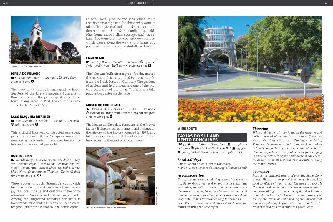
rio grande do sul406 407
IGreJa do reLÓGIo Rua Martin Lutero - Gramado. daily from
2 pm to 6 pm.
The clock tower and hydrangea gardens head-quarters of the Igreja Evangélica Luterana in Brazil are one of the picture-postcards of the town. Inaugurated in 1961, the church is dedi-cated to the Apostle Paul.
LaGo JoaQuIna rIta bIer Rua Leopoldo Rosenfeldt - Planalto. Gramado. daily, 24 hours.
This artificial lake was constructed using only picks and shovels. It has 17 square meters in area and is surrounded by summer homes, ho-tels and pines over 70 years old.
aGrItourISM Avenida Borges de Medeiros, (service desk at Praça
das communicações), next to the Gramado bus ter-minal. communities visited: Linha 28, Linha Bonita, Linha Nova, campestre do Tigre and Tapera daily from 9 am to 5 pm.
Three routes through Gramado’s countryside lead the tourist to locations where they can en-joy the local cuisine and customs of the com-munities of German and Italian descendants. Among the suggested activities for visits is homemade wine making - many households of-fer products for the visitor to take home. As well
wIne route
caxIaS do SuL and bento GonçaLVeS 54 220 V Bento Gonçalves 107,278 in-habitants 381.960 km2 Caxias do Sul 435,564
1,644,302 km² Distance from the capital: 115 km
Local holidaysJune 13: Santo Antônio (Bento Gonçalves)May 26: Nossa Senhora do caravaggio (caxias do Sul)
AccommodationOne of the main wine producing centers in the coun-try, Bento Gonçalves receives tourists in small inns and hotels, as well as its charming wine spas where the visitor can relax, have some beauty treatment and sample the region’s excellent wines. caxias do Sul has large hotel chains for those coming to town on busi-ness. There are also inns and other establishments for tourists visiting the wine region.
ShoppingWine and handicrafts are found in the wineries and outlets located along the tourist routes (Vale das Antas, cantinas Históricas, caminhos de Pedra, Vale dos Vinhedos and Pinto Bandeira), as well as in hotels and in the town centers on the Wine Route. The countryside has plenty of options for shopping in small outlets selling wine and home-made chees-es, as well as small restaurants and cantinas along the tourist routes.
TransportRoad is the principal means of reaching Bento Gon-çalves. Highways are paved and are maintained in good condition all year round. The nearest airport is caxias do Sul, 40 km away, which receives domestic and regional flights. However, Salgado Filho Interna-tional Airport in Porto Alegre is the main gateway to the region. caxias do Sul has a regional airport that receives regular flights from other municipalities. The town is served by well-maintained paved roads.
igreja do relÓgio in gramado
chocolate manufacturing, in gramado
Ha
ns
geo
rg
/em
Br
atu
r
Ha
ns
geo
rg
/em
Br
atu
r
as wine, local produce includes jellies, cakes and homemade pastas for those who want to take a little piece of Italian and German tradi-tion home with them. Some family households offer home-made Italian sausages such as sa-lami. The tours are made by antique omnibus, which pause along the way at old farms and points of interest such as waterfalls and rivers.
LaGo neGro Rua. A.J. Renner, Planalto - Gramado. 24 hours
daily. Paddle-boats: from 8:30 am to 7 pm.
The lake was built after a great fire devastated the region, and is surrounded by trees brought from the Black Forest in Germany. The gardens of azaleas and hydrangeas are one of the pic-ture-postcards of the town. Tourists can take paddle-boat rides on the lake.
MuSeu do cHocoLate Avenida das Hortênsias, 4.120 - Gramado. Monday to Friday from 9 am to 11:30 am and from
2 pm to 4:30 pm.
The Museu do Chocolate functions in the Prawer factory. It displays old equipment and pictures on the history of the factory founded in 1975, and tells the story of cocoa and chocolate. Visitors also have access to the craft production area.
the Barrel entrance gate - near Bento gonçalves
gu
tem
Ber
g o
stem
Ber
g/e
mB
rat
ur

rio grande do sul408 409
Surrounded by hills, valleys and rivers, 24 munici-palities make up the Grape and Wine Route.
The name comes from vine cultivation, pres-ent in 16 towns in the region that were settled by Italians who arrived in Brazil in the 19th cen-tury. Attractions along the route are located in micro-regions, each with its own character-istics. One such region is the Vale dos Vinhe-dos in Bento Gonçalves, which maintains the legacy of Italian immigrants in the production of fine wine - it is the only region in Brazil to have a Seal of Origin.
The Vale Trentino, located on the border of the Municipalities of Farroupilha and Caxias do Sul, also has vineyards, grown among people with a Venetian accent typical of the immigrants who settled in the region. On the Sparkling Wine
Route in Garibaldi, tourists can taste the cham-pagne produced by the charmat and champe-noise methods, as well as visit the six wineries and liquor producers in the municipality to learn more of their long and rich tradition. The towns that make up the route offer good options for accommodation in hotels, inns and small wine spas, ideal for couples. There are also in-ternational hotel networks that are structures for business travelers, and small boutique ho-tels, sought after by those who want to enjoy the charming landscape of the region. Wine tasting at the wineries of the region is one of the most popular tourist programs. The region’s principal highways are BR-116 and RS-122. Cax-ias do Sul has an airport that receives regular flights from major cities.
MuSeu do VInHo prIMo SLoMp Rua Luiz Franciosi Sério, 350 - Forqueta
The museum operates within the Vitivinícola Forqueta Cooperative and recounts the history of Italian colonization and the development of the wine industry in the region.
caMInHo daS pedraS São Pedro districte - the communities of São Pe-
dro, São Miguel, Barracão, São José da Busa, cruzeiro, Santo Antonio and Santo Antoninho. Bento Gonçalves.
via Estrada do Barracão, near Parque da Fenavinho. daily from 9 am to 5:30 pm
There are a large number of well preserved houses from the time of Italian colonization
in the São Pedro district. Some of them house restaurants, art studios, craft shops and lo-cal food stores selling cheeses, salami and wine. The Associação Caminho das Pedras organizes a tour of these establishments and also provides recommendations on 50 loca-tions of interest in order to understand a little more about the houses and the history of colonization.
caSa do VInHo Via Wine - centro. Bento Gonçalves. daily from 8 am to 5:30 pm.
This handicrafts exhibition center is maintained by the town and is host to an association of craftsmen that exhibit and sell their products.
VaLe doS VInHedoS RS-444 (Estrado do Vinho), 15 km marker, Vale
dos Vinhedos - Bento Gonçalves
Along the road that links the rural areas of Bento Gonçalves, Farroupilha and Monte Belo do Sul it is possible to visit small rural properties that share wineries, cantinas, boutique restaurants, craft shops, art studios and small cheese and other regional food production facilities. The tour is organized by Aprovale (Associação dos Produ-tores de Vinhos Finos of the Vale dos Vinhedos).
VaLe trentIno Via RS-122 Small roads interconnect the sites in
Trentino Valley
Between the Municipalities of Caxias do Sul and Farroupilha, the Vale Trentino passes through several wineries that offer not only fine wine and sparkling wine tasting, but are also keen to preserve Italian traditions and customs. The vineyards and old houses from the beginning of colonization provide a beautiful backdrop to the small road that crosses the town of Forqueta.
vale dos vinhedos one of the wineries in vale dos vinhedos
gu
tem
Ber
g o
stem
Ber
g/e
mB
rat
ur
Cris
tia
no
w s
oa
res
/em
Br
atu
r
gu
tem
Ber
g o
stem
Ber
g/e
mB
rat
ur
wine classes Regional wineries offer an activity that has appealed to many tourists, especially those who have an interest in enology: courses and short workshops on wine manufac-ture and tasting. With the growth of the wine market in the country, more and more Brazilians have become in-terested in learning how to choose a good wine. Among activities for day trips is a visit to the wineries to see the manufacturing process and to attend talks on the history of wine and how to choose the right product for every oc-casion, accompanied by a tasting session.
VALE DOS VINHEDOS
Linha Leopoldina
Linha Garibaldina
BentoGonçalves
Monte Belodo Sul
Garibaldi
123
4
5
1. Port2. Railway Station3. Das Neves Chapel4. Chapel of Nossa Sra. Pompéia5. Bienvenutti Castle
Estrada do Vinho (RS 444)
Estrada do Vinho (RS 444)
Via dos parreirais
Via dos par reirais
Via Trento
RS 4
70
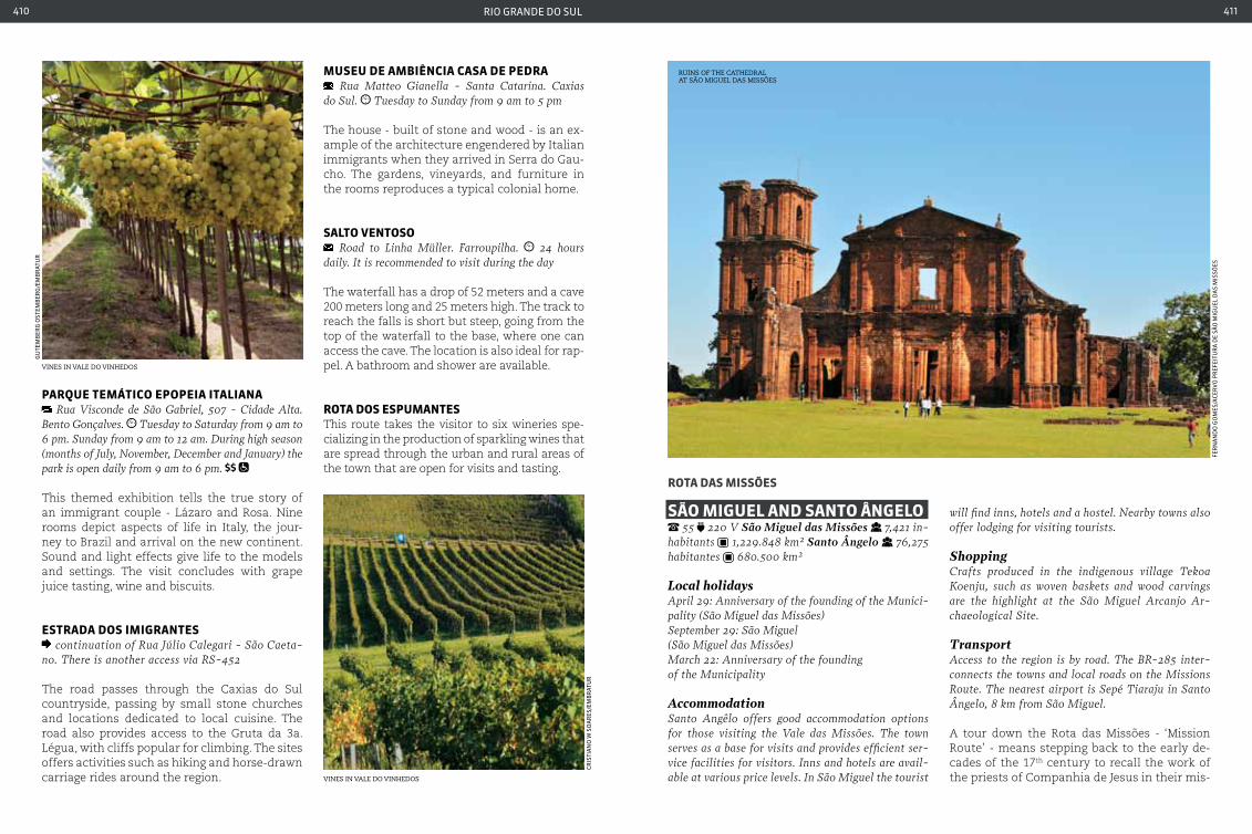
rio grande do sul410 411
parQue teMátIco epopeIa ItaLIana Rua Visconde de São Gabriel, 507 - cidade Alta.
Bento Gonçalves. Tuesday to Saturday from 9 am to 6 pm. Sunday from 9 am to 12 am. During high season (months of July, November, December and January) the park is open daily from 9 am to 6 pm.
This themed exhibition tells the true story of an immigrant couple - Lázaro and Rosa. Nine rooms depict aspects of life in Italy, the jour-ney to Brazil and arrival on the new continent. Sound and light effects give life to the models and settings. The visit concludes with grape juice tasting, wine and biscuits.
eStrada doS IMIGranteS continuation of Rua Júlio calegari - São caeta-
no. There is another access via RS-452
The road passes through the Caxias do Sul countryside, passing by small stone churches and locations dedicated to local cuisine. The road also provides access to the Gruta da 3a. Légua, with cliffs popular for climbing. The sites offers activities such as hiking and horse-drawn carriage rides around the region.
MuSeu de aMbIÊncIa caSa de pedra Rua Matteo Gianella - Santa catarina. caxias
do Sul. Tuesday to Sunday from 9 am to 5 pm
The house - built of stone and wood - is an ex-ample of the architecture engendered by Italian immigrants when they arrived in Serra do Gau-cho. The gardens, vineyards, and furniture in the rooms reproduces a typical colonial home.
SaLto VentoSo Road to Linha Müller. Farroupilha. 24 hours
daily. It is recommended to visit during the day
The waterfall has a drop of 52 meters and a cave 200 meters long and 25 meters high. The track to reach the falls is short but steep, going from the top of the waterfall to the base, where one can access the cave. The location is also ideal for rap-pel. A bathroom and shower are available.
rota doS eSpuManteSThis route takes the visitor to six wineries spe-cializing in the production of sparkling wines that are spread through the urban and rural areas of the town that are open for visits and tasting.
rota daS MISSõeS
São MIGueL and Santo ÂnGeLo 55 220 V São Miguel das Missões 7,421 in-
habitants 1,229.848 km² Santo Ângelo 76,275 habitantes 680.500 km²
Local holidaysApril 29: Anniversary of the founding of the Munici-pality (São Miguel das Missões)September 29: São Miguel(São Miguel das Missões)March 22: Anniversary of the founding of the Municipality
AccommodationSanto Angêlo offers good accommodation options for those visiting the Vale das Missões. The town serves as a base for visits and provides efficient ser-vice facilities for visitors. Inns and hotels are avail-able at various price levels. In São Miguel the tourist
will find inns, hotels and a hostel. Nearby towns also offer lodging for visiting tourists.
Shoppingcrafts produced in the indigenous village Tekoa Koenju, such as woven baskets and wood carvings are the highlight at the São Miguel Arcanjo Ar-chaeological Site.
TransportAccess to the region is by road. The BR-285 inter-connects the towns and local roads on the Missions Route. The nearest airport is Sepé Tiaraju in Santo Ângelo, 8 km from São Miguel.
A tour down the Rota das Missões - ‘Mission Route’ - means stepping back to the early de-cades of the 17th century to recall the work of the priests of Companhia de Jesus in their mis-
vines in vale do vinhedos
gu
tem
Ber
g o
stem
Ber
g/e
mB
rat
ur
vines in vale do vinhedos
Cris
tia
no
w s
oa
res
/em
Br
atu
r
ruins of the cathedral at são miguel das missÕes
fer
na
nd
o g
om
es/a
Cer
Vo
pr
efei
tur
a d
e sã
o m
igu
el d
as
mis
sões
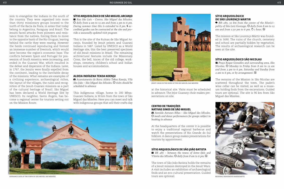
rio grande do sul412 413
sion to evangelize the Indians in the south of the country. They were organized into more than thirty missionary groups located to the north of the Bacia da Prata, in areas that today belong to Argentina, Paraguay and Brazil. The Jesuits faced attacks from pioneers and resis-tance from the natives, forcing them to move to the opposite bank of the Rio Uruguai, leaving behind the cattle they were rearing. However the herds continued reproducing and formed an immense number of livestock, which would later become the region’s economic base. The conflicts between Spain and Portugal for pos-session of South America were increasing, and ended in the Guarani War, which resulted in the defeat and dispersion of the Indians. Later, in 1767, the Jesuits were finally expelled from the continent, leading to the inevitable decay of the missions. What remains are examples of a civilizing experience, archaeological riches, the layout of the villages, the ruins and recog-nition of the Jesuit-Guarani missions as a part of the cultural heritage of Brazil. São Miguel has been declared a World Heritage Site by UNESCO. Its neighbor, Santo Ângelo, has be-come a regional center for tourists setting out on the Mission Route.
SítIo arQueoLÓGIco de São MIGueL arcanJo Rua São Luis - centro. São Miguel das Missões. daily from 9 am to 12 am and from 2 pm to 6 pm.
During summer time this is extended to 8 pm. ac-credited guides can be contracted at the site and pro-vide a seasonally updated visit program
This is the site of the Ruínas de São Miguel Ar-canjo, founded by Jesuit priests and Guarani Indians in 1687. Listed by UNESCO as a World Heritage site, this the best preserved specimen of old Jesuit missions in Brazil. The remaining architectural features include the Missionary Cross, the bell, traces of the old college, work-shops, cemetery, children’s school and Indian houses and accommodation.
aLdeIa IndíGena tekoa koenJu Assentamento da Barra Aldeia Tekoa Koenju, Vila
São João - São Miguel das Missões. visits should be scheduled in advance
This indigenous village, home to 200 Mbya-Guarani Indians, is 30 km from the town of São Miguel das Missões. Here you can meet and talk with indigenous groups that sell their crafts day
at the historical site. Visits must be scheduled in advance. The Jejor Guarany choir makes pre-sentations on site.
centro de tradIçõeS natIVaS SInoS de São MIGueL
Avenida Antunes Ribas - São Miguel das Missões. meals and dance performances for groups subject to
booking in advance
At the headquarters of the center it is possible to enjoy a traditional regional barbecue and watch the presentations of Rio Grande do Sul folklore. A dance group makes presentations for tourists by appointment.
SítIo arQueoLÓGIco de São João batISta BR 285 - between the towns of Entre-Ijuís and
Vitória das Missões. daily from 8 am to 6 pm.
The town of São João Batista holds the remains of a Jesuit mission destroyed in the Jesuit Wars. A visit includes an exhibition of archaeological finds and an eco-cultural presentation. Guided tours are optional.
jesuit cross in the ruins of the são miguel das missÕes
Ka
rla
ar
ns/
aCe
rV
o p
ref
eitu
ra
de
são
mig
uel
da
s m
issõ
es
SítIo arQueoLÓGIco de São Lourenço MártIr
BR-285, 30 km from the center of the Munici-pality of São Luiz Gonzaga. daily from 8 am to 12 am and from 1:30 pm to 6 pm. 1 hour.
The mission at São Lourenço Mártir was found-ed in 1690. The ruins of the church, cemetery and school are partially hidden by vegetation. The results of archaeological research can be seen at the site.
SítIo arQueoLÓGIco São nIcoLau Praça Roque Gonzáles and surrounding area, São
Nicolau. Monday to Friday from 8 am to 12 am and from 2 pm to 6 pm. Saturday and Sunday from 2 am to 6 pm, or by arrangement.
The remains of the Mission in São Nicolao are scattered throughout the town. The padre’s wine cellar can be visited, as well as a muse-um holding finds from the excavations. Guided tours are optional. The site is 96 km from São Miguel das Missões.
entrance gate at the town of são miguel das missÕes regional indigenous handicrafts
san
dr
a p
etr
y/a
Cer
Vo
ipH
an
fer
na
nd
o g
om
es/a
Cer
Vo
pr
efei
tur
a d
e sã
o m
igu
el d
as
mis
sões

415
rondÔnIaro
na
ldo
nin
a-s
ala
da
Vis
ua
l/em
Br
atu
r
lago cuniã, in Porto velho

rondônia416 417
porto VeLHo
boLIVIa
Mato GroSSo
aMazonaS
364BR
364BR
364BR
364BR
421BR
429BR
429BR
364BR
364BR
421BR
425BR
RO-452
RO-205
RO-257
RO-257
RO-133
RO-133
RO-133
RO-133
RO-387
RO-133
RO-476
RO-480
RO-010
RO-144
RO-010
RO-010
RO-010
RO-010
RO-429
RO-135
RO-479
RO-495
RO-370
RO-399
RO-399
RO-370
RO-491
RO-135
RO-383
RO-279
RO-010RO-370
RO-470
RO-470
RO-463
rondônia
Geographic information
equatorial averaging 28 oc (82,4 oF) tropical forest 85 m
international airport
national HigHways
state HigHways
Rondônia is one of the youngest States in Brazil. Located in on the western side of the North region of Brazil, the State lies
in an area known as the Western Amazon. Its great richness and diversity of flora and fauna provide a favorable environment for those look-ing for more radical adventures and ecotourism.
The current territorial boundaries were only defined in 1943, being elevated to the position of State only in 1982. In the 1960s and 1970s the region saw the arrival of new waves of im-migrants, in particular from the south of the country, who came in search of land conceded by the government.
Today, Rondônia, and in particular the region of Porto Velho, is passing though a new boom, due to the construction of the Santo Antônio and Ja-rau Hydroelectric Plants on the right bank of the Madeira river. The construction work employed a total of 19,000 workers in its initial phase.

rondônia418 419
igreja matriz de Porto velho
roast Pacu - a tyPical regional fishr
on
ald
o n
ina
-sa
lad
a V
isu
al/
emB
rat
ur
ra
i rei
s/em
Br
atu
r
porto VeLHo 428,527 inhabitants 34,096,429 km² 69 110 V
Local holidaysJanuary 4: Anniversary of founding of the State of Rondônia January 24: São Francisco de Sales celebration May 24: Nossa Senhora Auxiliadora’s day October 2: Founding of Porto Velho
VaccinationYellow fever vaccination is recommended, at least 10 days before traveling.
ClothingLight and comfortable clothing is recommended due to high temperatures and the high level of humid-ity, which further increases the sensation of heat. Accessories such as a hat and an umbrella should always be kept handy.
AccommodationPorto Velho has only few hotels available for visitors.
There are few more sophisticated options (five star) and inns are rare. The best options lie at the edge of the Madeira River.
TransportBy bus from Rio Branco (State of Acre) is a 10 hour journey, and from cuiabá (Mato Grosso) is 22 hours. By car from Rio Branco via BR-364 is 544 km and around 6 hours travel; from cuiabá, via BR-070, BR-174 and BR-364 is 1,456 km and around 18 hours travel. You can reach Rio Branco by air from the main Brazilian cities. It is also possible to use the air-taxi service. River transport is via the Madeira River, or by the Amazon River up to the mouth of the Madeira, and from there to the port.
The village that gave rise to Porto Velho ap-peared around the year 1907, during construc-tion of the Estrada de Ferro Madeira Marmoré (EFMM). Seven years later, it was elevated to the status of City and given its current name, however as part of the State of Amazonas. It was only incorporated into Rondônia in 1943, becoming the State capital.
The intention to build a railroad that would cross the Rio Madeira to transport rubber pro-duction from Bolivia and the region which is today Guajará-Mirim has existed since the middle of the century. When the project was implemented, the Estrada de Ferro Madeira-Mamoré project brought people from all over Brazil as well as British, Syrian-Lebanese and Bolivians to settle in the region.
Porto Velho has several river beaches along the Rio Madeira. Riverside communities in the Vale do Cuniã are just one of the attractions for nature lovers. In addition, tourists looking for adventure will enjoy the rapids on the Rio Machado for rafting (only from June to Novem-ber), canoeing and pack-floating, for a trip that unites emotion and local scenery.
MuSeu da eStrada de Ferro MadeIra-MaMorÉ
Avenida 7 de Setembro, Praça da Estrada de Ferro Madeira-Mamoré, centro. Tuesday to Saturday, from 9 am to 3 pm.
The museum has equipment from the Estrada de Ferro Madeira-Marmoré, which stretched for 366 km into the Amazon, connecting Porto Velho to Guajará-Mirim. 2012 marked the cen-tenary of its opening. The museum is also home to the Locomotiva Igreja Colonial, the first of its kind to be brought to the Amazon, in 1872.
VaLe do cunIã (rIVerSIde coMMunItIeS) located 130 km from Porto Velho, on the left
bank of the Madeira River. Tuesday to Friday from 9 am to 5 pm. Saturdays from 9 am to 2 pm.
one afternoon or morning
With an area for preservation of typical Ama-zonian plant and animal species, the reser-vation is surrounded by an impressive fo-rest with creeks and submersed tree species. Among the species that can be found in the region are jacaré-açu (black caiman) and fish such as pirarucu (bass) and aruamá. Visits are accompanied by monitors from the projects undertaken at the site.
culture and beliefsThe mixture of influences and indigenous peo-ples makes the culture of the Northern States rich in legends and beliefs. Folklore in Rondô-nia includes some colorful tales. Dolphins that seduce maidens and mermaids (‘iaras’ in local culture) that enchant men and lead them to their kingdom are just some examples. One of the more well-know festivals is the Feira Flor de Maracujá - “Flower of the Passion Fruit Fair” - which turns the city of Porto Velho into festival ground of dance and regional food. Religious festivals are also important in Rondônia culture, including the Divino Espírito Santo - the Divine Holy Spirit - which brings together hundreds of people in the months of May and June, and the Amazon Jerusalém - which re-enacts the Pas-sion of christ during Holy Week.
culinary MixA variety of dishes from other Northern states are also typical of Rondônia. Among the most ordered and best appreciated by the local popu-lation and tourists alike are maniçoba, caruru (with ingredients identical to cururu from the Northeast) and various dishes prepared with fish. Tucunaré, one of the tastiest fish in the region, is eaten in the form of a bouillabaisse, barbecued or fried, accompanied by açai and ground corn.
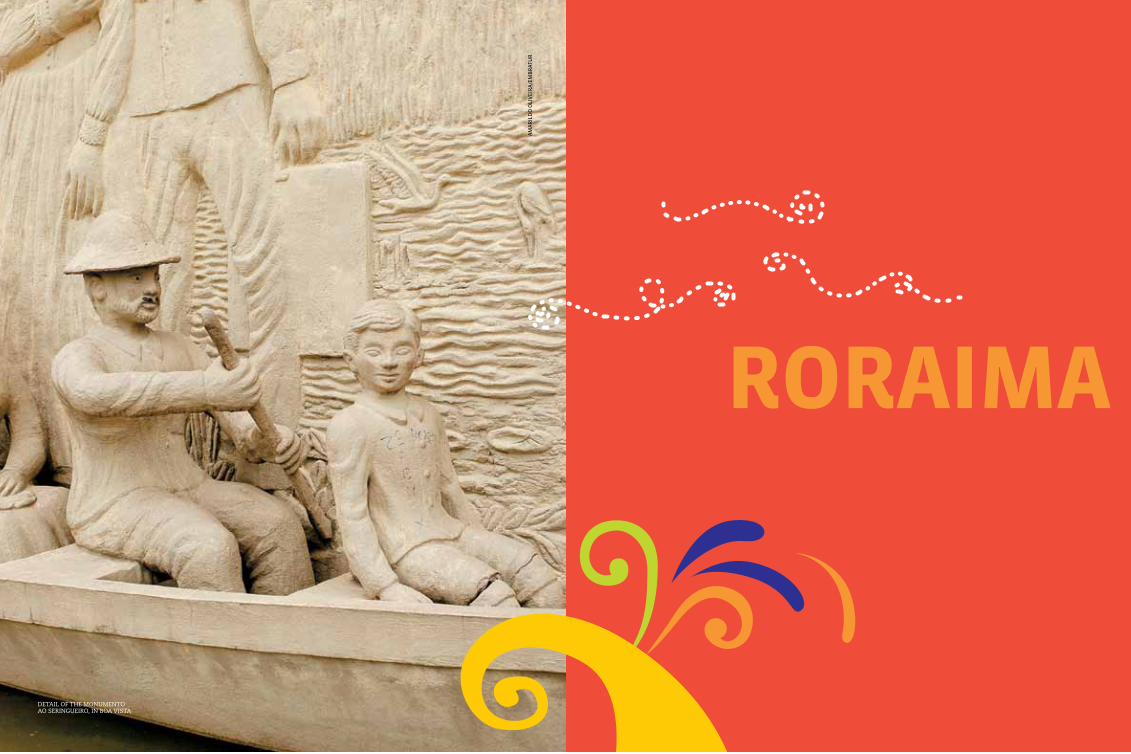
421
roraIMaa
ma
ril
do
oli
Vei
ra
/em
Br
atu
r
detail of the monumento ao seringueiro, in Boa vista
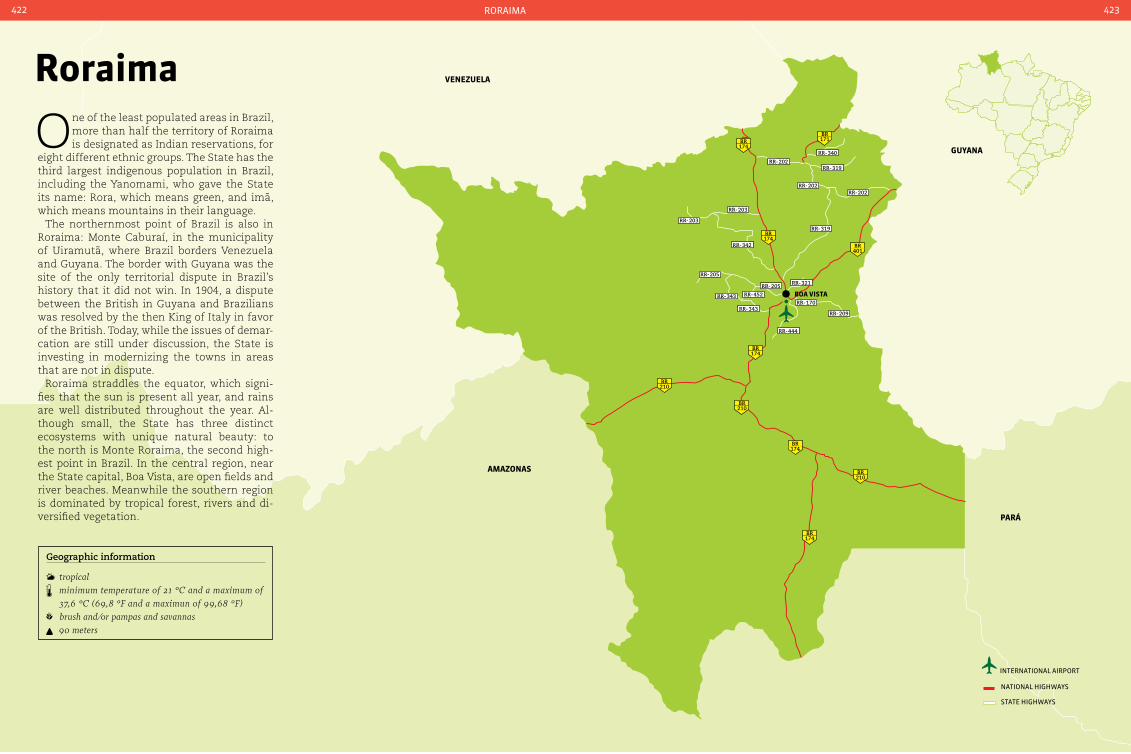
pará
Guyana
VenezueLa
boa VISta
174BR 171
BR
401BR
174BR
174BR
174BR
174BR
210BR
210BR
210BR
RR-202
RR-202
RR-203
RR-203
RR-342
RR-205
RR-205 RR-321
RR-343
RR-343
RR-444
RR-209
RR-170
RR-452
RR-202
RR-340
RR-319
RR-319
aMazonaS
international airport
national HigHways
state HigHways
roraima422 423
roraima
One of the least populated areas in Brazil, more than half the territory of Roraima is designated as Indian reservations, for
eight different ethnic groups. The State has the third largest indigenous population in Brazil, including the Yanomami, who gave the State its name: Rora, which means green, and imã, which means mountains in their language.
The northernmost point of Brazil is also in Roraima: Monte Caburaí, in the municipality of Uiramutã, where Brazil borders Venezuela and Guyana. The border with Guyana was the site of the only territorial dispute in Brazil’s history that it did not win. In 1904, a dispute between the British in Guyana and Brazilians was resolved by the then King of Italy in favor of the British. Today, while the issues of demar-cation are still under discussion, the State is investing in modernizing the towns in areas that are not in dispute.
Roraima straddles the equator, which signi-fies that the sun is present all year, and rains are well distributed throughout the year. Al-though small, the State has three distinct ecosystems with unique natural beauty: to the north is Monte Roraima, the second high-est point in Brazil. In the central region, near the State capital, Boa Vista, are open fields and river beaches. Meanwhile the southern region is dominated by tropical forest, rivers and di-versified vegetation.
Geographic information
tropical minimum temperature of 21 °c and a maximum of
37,6 °c (69,8 °F and a maximun of 99,68 °F) brush and/or pampas and savannas 90 meters
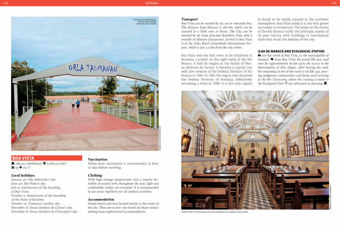
roraima424 425
boa VISta 284,313 inhabitants 5,687,022 km² 95 110 V
Local holidaysJanuary 20: São Sebastião’s dayJune 29: São Pedro’s day July 9: Anniversary of the founding of Boa VistaOctober 5: Anniversary of the founding of the State of Roraima October 15: commerce workers day December 8: Nossa Senhora do carmo’s day December 8: Nossa Senhora da conceição’s day
VaccinationYellow fever vaccination is recommended, at least 10 days before traveling.
ClothingWith high average temperatures and a relative hu-midity of around 75% throughout the year, light and comfortable clothes are essential. It is recommended to use insect repellents for all outdoor activities.
AccommodationSimple hotels and inns located mainly in the center of the city. There are no five-star hotels for those visitors seeking more sophisticated accommodation.
TransportBoa Vista can be reached by air, car or interstate bus. The distance from Manaus is 785 km, which can be traveled in a little over 10 hours. The city can be reached by air from principal Brazilian cities with a transfer at Manaus (Amazonas). Arrival in Boa Vista is at the Atlas Brasil cantanhede International Air-port, which is just 3.5 km from the city center.
Boa Vista was the first town to be inhabited in Roraima. Located on the right bank of the Rio Branco, it had its origins in the Parish of Nos-sa Senhora do Carmo. It became a capital city with the creation of the Federal Territory of Rio Branco in 1943. In 1962 the region was renamed the Federal Territory of Roraima, definitively becoming a State in 1988. It is the only capital
in Brazil to be totally located in the northern hemisphere. Boa Vista today is a city that grows and seeks to modernize. The areas on the banks of the Rio Branco holds the principal marks of its past history, with buildings in neoclassical style that recall the heyday of the city.
ILHa de Maracá and ecoLoGIcaL StatIon 100 km north of Boa Vista, in the municipality of
Amajari. from Boa Vista the paved RR-405 road runs for approximately 65 km up to the access to the Municipality of Alto Alegre. After leaving the road, the remaining 75 km of the route is via RR-343, pass-ing indigenous communities and farms until arriving at the Rio Uraricoera, where the crossing is made to the Ecological Unit. one afternoon or morning.
taumanan riverfront, one of the leisure
oPtions in Boa vista
inside view of the igreja de nossa senhora do carmo in Boa vista
am
ar
ild
o o
liV
eir
a/e
mB
rat
ur
am
ar
ild
o o
liV
eir
a/e
mB
rat
ur

roraima426 427
rich FlavorsThe Indigenous influence is very strong in Ro-raima cuisine. Dishes such as damorida - a soup made from fish, tucupi (yellow sauce ex-tracted from manioc and used in several Am-azon recipes) and peppers - and bodó fish tart (which is actually a mixture of catfish flesh with egg white, baked in an oven), will wet the palate of those visiting Roraima.
The island is home to the Estação Ecológica Maracá, which besides being a stretch of pre-served forest is home to species such as jag-uars, otters and howler monkeys. It is an im-portant center for biodiversity studies. Visits are accompanied by monitors, and must be booked in advance.
centro de arteSanato e turISMo VeLIa coutInHo
Annexed to the Praça das Águas, Avenida capitão Ene Garcez - centro. every day from 4 pm to 10 pm.
With capacity for up to eight thousand people, the site has shops selling handicrafts with an Indigenous influence, and has an exhibition area and a covered stage for concerts.
parQue nacIonaL Monte roraIMa consult a local travel agency for arrangements 1-2 days, if visitor chooses to stay in Tepuy or
São Francisco de Yuruani. according to group size. Those with health problems or poor physi-cal condition should not attempt the walk. There is an option of passing over the region by helicopter.
Monte Roraima is one of the oldest mountains on Earth, and straddles the border between Bra-zil, Guyana and Venezuela. With an altitude of 2,875 meters and a landscape dotted with riv-ers, waterfalls and rock formations, access is difficult and can only be made via the border with Venezuela. It is recommend to hire a guide in Boa Vista in order to undertake the trip.
monte roraima, one of the oldest mountains on earth
monumento do garimPeiro, Praça cívica in Boa vista
indigenous influence is strong in the local cuisine
Clo
Vis
mir
an
da
-sem
Com
tHa
lita
Ca
stel
lo B
ra
nCo
am
ar
ild
o o
liV
eir
a/e
mB
rat
ur
ra
i rei
s/em
Br
atu
r
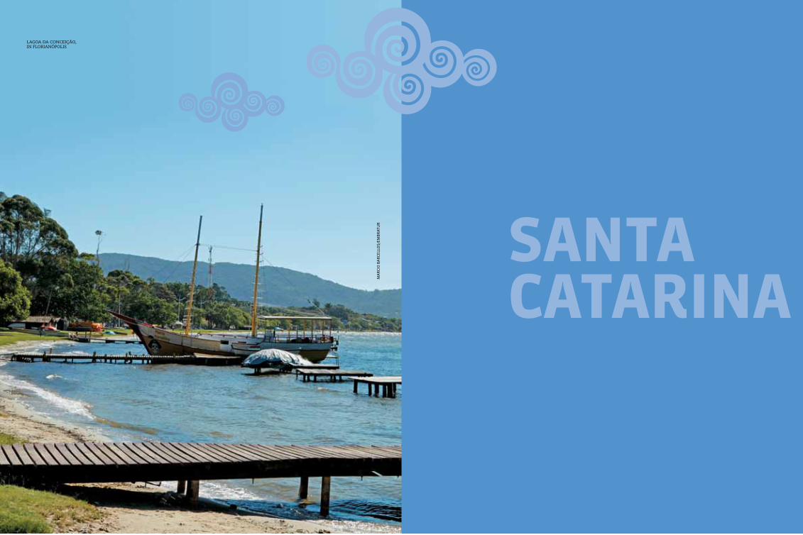
429
SantacatarIna
lagoa da conceição, in florianÓPolis
ma
rCi
o B
ar
Cell
os/
emB
rat
ur
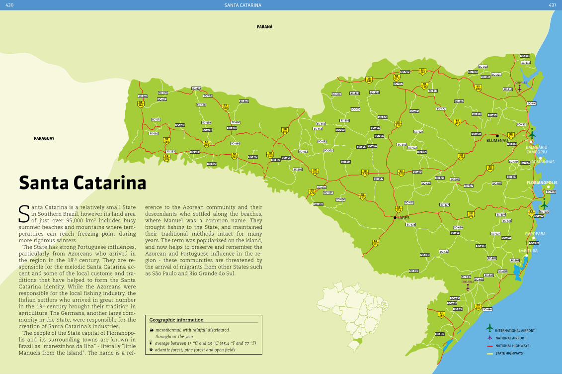
Balneário CamBoriú
Blumenau
163BR
282BR
282BR
282BR
282BR 101
BR
101BR
285BR
116BR
116BR
280BR
280BR
280BR
116BR
116BR
470BR
470BR
470BR
470BR
477BR
477BR
486BR
470BR
158BR
386BR 203
BR
480BR
153BR
153BR
SC-163SC-471
SC-473SC-480
SC-468
SC-459
SC-471
SC-492
SC-466
SC-283
SC-468
SC-465
SC-467
SC-302
SC-451
SC-455 SC-303
SC-302
SC-303
SC-478
SC-457
SC-423SC-477
SC-417 SC-416
SC-495
SC-413
SC-416SC-422
SC-302
SC-302
SC-453
SC-452
SC-463SC-458
SC-303
SC-470
SC-457
SC-455
SC-458
SC-456
SC-436
SC-425
SC-426 SC-302
SC-427SC-481
SC-408
SC-407
SC-431
SC-407
SC-431
SC-406
SC-406
SC-405
SC-438SC-430
SC-427SC-425
SC-439
SC-430SC-438
SC-430
SC-439
SC-482SC-407
SC-438SC-440
SC-446
SC-444
SC-443
SC-449
SC-448
SC-483
SC-447
SC-303
SC-456
SC-453 SC-457 SC-423
SC-422
SC-411
SC-479 SC-409
SC-478 SC-303
SC-477
SC-303
SC-419
SC-422
SC-301
SC-010
SC-416SC-301
SC-413
SC-412
SC-415
SC-283
SC-459
SC-468
SC-480
SC-487SC-469
BomBinHas
lages
garopaBa
paraGuay
paraná
imBituBa
SC-434
FLorIanÓpoLIS
international airport
national airport
national HigHways
state HigHways
santa Catarina430 431
Santa Catarina is a relatively small State in Southern Brazil, however its land area of just over 95,000 km2 includes busy
summer beaches and mountains where tem-peratures can reach freezing point during more rigorous winters.
The State has strong Portuguese influences, particularly from Azoreans who arrived in the region in the 18th century. They are re-sponsible for the melodic Santa Catarina ac-cent and some of the local customs and tra-ditions that have helped to form the Santa Catarina identity. While the Azoreans were responsible for the local fishing industry, the Italian settlers who arrived in great number in the 19th century brought their tradition in agriculture. The Germans, another large com-munity in the State, were responsible for the creation of Santa Catarina’s industries.
The people of the State capital of Florianópo-lis and its surrounding towns are known in Brazil as “manezinhos da Ilha” - literally “little Manuels from the Island”. The name is a ref-
Santa catarina
Geographic information
mesothermal, with rainfall distributed throughout the year average between 13 °c and 25 °c (55,4 °F and 77 °F) atlantic forest, pine forest and open fields
erence to the Azorean community and their descendants who settled along the beaches, where Manuel was a common name. They brought fishing to the State, and maintained their traditional methods intact for many years. The term was popularized on the island, and now helps to preserve and remember the Azorean and Portuguese influence in the re-gion - these communities are threatened by the arrival of migrants from other States such as São Paulo and Rio Grande do Sul.
joinVille
CriCiúma
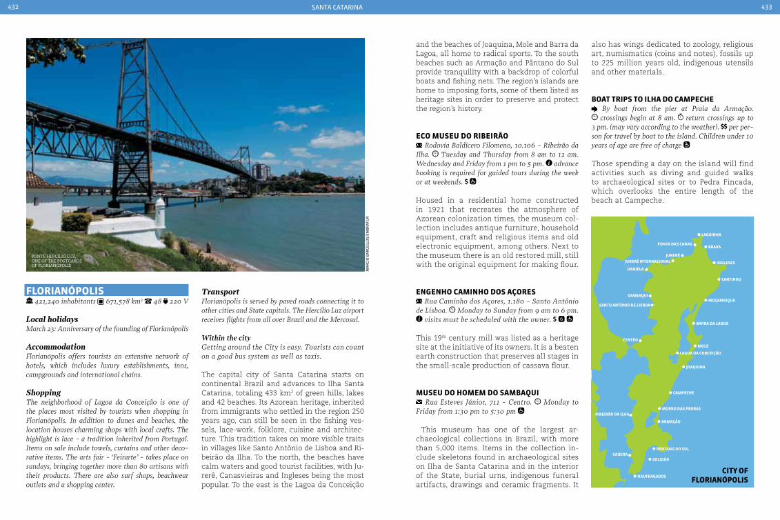
santa Catarina432 433
FLorIanÓpoLIS 421,240 inhabitants 671,578 km2 48 220 V
Local holidaysMarch 23: Anniversary of the founding of Florianópolis
AccommodationFlorianópolis offers tourists an extensive network of hotels, which includes luxury establishments, inns, campgrounds and international chains.
ShoppingThe neighborhood of Lagoa da conceição is one of the places most visited by tourists when shopping in Florianópolis. In addition to dunes and beaches, the location houses charming shops with local crafts. The highlight is lace - a tradition inherited from Portugal. Items on sale include towels, curtains and other deco-rative items. The arts fair - ‘Feirarte’ - takes place on sundays, bringing together more than 80 artisans with their products. There are also surf shops, beachwear outlets and a shopping center.
TransportFlorianópolis is served by paved roads connecting it to other cities and State capitals. The Hercílio Luz airport receives flights from all over Brazil and the Mercosul.
Within the cityGetting around the city is easy. Tourists can count on a good bus system as well as taxis.
The capital city of Santa Catarina starts on continental Brazil and advances to Ilha Santa Catarina, totaling 433 km2 of green hills, lakes and 42 beaches. Its Azorean heritage, inherited from immigrants who settled in the region 250 years ago, can still be seen in the fishing ves-sels, lace-work, folklore, cuisine and architec-ture. This tradition takes on more visible traits in villages like Santo Antônio de Lisboa and Ri-beirão da Ilha. To the north, the beaches have calm waters and good tourist facilities, with Ju-rerê, Canasvieiras and Ingleses being the most popular. To the east is the Lagoa da Conceição
and the beaches of Joaquina, Mole and Barra da Lagoa, all home to radical sports. To the south beaches such as Armação and Pântano do Sul provide tranquility with a backdrop of colorful boats and fishing nets. The region’s islands are home to imposing forts, some of them listed as heritage sites in order to preserve and protect the region’s history.
eco MuSeu do rIbeIrão Rodovia Baldicero Filomeno, 10.106 - Ribeirão da
Ilha. Tuesday and Thursday from 8 am to 12 am. Wednesday and Friday from 1 pm to 5 pm. advance booking is required for guided tours during the week or at weekends.
Housed in a residential home constructed in 1921 that recreates the atmosphere of Azorean colonization times, the museum col-lection includes antique furniture, household equipment, craft and religious items and old electronic equipment, among others. Next to the museum there is an old restored mill, still with the original equipment for making flour.
enGenHo caMInHo doS açoreS Rua caminho dos Açores, 1.180 - Santo Antônio
de Lisboa. Monday to Sunday from 9 am to 6 pm. visits must be scheduled with the owner.
This 19th century mill was listed as a heritage site at the initiative of its owners. It is a beaten earth construction that preserves all stages in the small-scale production of cassava flour.
MuSeu do HoMeM do SaMbaQuI Rua Esteves Júnior, 711 - centro. Monday to
Friday from 1:30 pm to 5:30 pm
This museum has one of the largest ar-chaeological collections in Brazil, with more than 5,000 items. Items in the collection in-clude skeletons found in archaeological sites on Ilha de Santa Catarina and in the interior of the State, burial urns, indigenous funeral artifacts, drawings and ceramic fragments. It
also has wings dedicated to zoology, religious art, numismatics (coins and notes), fossils up to 225 million years old, indigenous utensils and other materials.
boat trIpS to ILHa do caMpecHe By boat from the pier at Praia da Armação. crossings begin at 8 am. return crossings up to
3 pm. (may vary according to the weather). per per-son for travel by boat to the island. children under 10 years of age are free of charge
Those spending a day on the island will find activities such as diving and guided walks to archaeological sites or to Pedra Fincada, which overlooks the entire length of the beach at Campeche.
ma
rCi
o B
ar
Cell
os/
emB
rat
ur
Ponte hercílio luz, one of the Postcards of florianÓPolis
lagoinha
brava
ingleses
santinho
moçambique
barra da lagoa
mole
lagoa da conceição
joaquina
campeche
morro das pedras
armação
pântano do sul
solidão
naufragados
caieira
ribeirão da ilha
santo antônio de lisboa
centro
sambaqui
jurerêjurerê internacional
ponta das canas
daniela
cIty oF FLorIanÓpoLIS

santa Catarina434 435
bLuMenau 309,011 inhabitants 519,835 km² 47 220 V
Distance from the capital: 130 km
Local holidaysSeptember 2: Anniversary of the founding of Blumenau
AccommodationBlumenau has accommodations in various categories, including inns, hostels and three to five star hotels.
ShoppingBlumenau offers good shopping opportunities. Tex-tiles are among the local specialties, and the town has a huge offer of shirts, polos and sweatshirts - some even sold by the pound. crystal goods in the Salto Weissbach district are of particular interest to visitors. This is the location of a factory that sends products all over the country and abroad. In the center of town and in Vila Itoupava there is a wide selection of food and drinks on offer, includ-ing beer, wine and locally made sausages.
TransportBlumenau enjoys good roads links to other towns and cities. There is no commercial airport in the town. The local transport system is efficient and well-served by buses with connections between local neighborhoods and surrounding towns.
Set within the State of Santa Catarina, Blume-nau is a little piece of Germany in Brazil. That is because the town still preserves the culture and traditions of the early settlers who arrived in Vale do Itajaí in 1850. Germanic influences are still present in the architecture, cuisine, handicrafts, in the features of its people and in their celebra-tions. During the traditional circuit of events in October, Blumenau dominates with the Oktober-fest. During 17 days 400,000 liters of beer are con-sumed to the sound of German music. The town, which has the largest textile industry in Brazil, is also famous for its crystal and porcelain. Wide avenues skirted by typical buildings and bridges crossing the Rio Itajaí-Açu house lively pubs.
preFeItura MunIcIpaL de bLuMenau and reLÓGIo daS FLoreS
Praça Victor Konder, 2 - centro.
The building housing City Hall is one of the most important examples of Tudor-style ar-chitecture in the town. The Relógio das Flores (Flower Clock) can be found in its gardens, in-augurated in 2000 to commemorate the 130th anniversary of the founding of the town. It is one of the favorite places for photographs and to take a rest after a hearty German lunch.
praça HercíLIo Luz / bIerGarten at the start of Rua 15 de Novembro - centro. daily, 24 hours Museu da cerveja: Monday to
Friday from 9 am to 6 pm. Saturdays, Sundays and public holidays from 10 am to 5 pm, in the mini-brewery. in the mini-brewery
On the banks of the Rio Itajaí-Açu, the location provides a view of the Avenida Beira-Rio and the river itself. The square is better known as the Biergarten - a reference to the largest local festi-val: Oktoberfest. It houses the Museu da Cerveja (Beer Museum) and a mini-brewery, where you can sample beers and typical German dishes.
VILa ItoupaVa Take the Sc-474 highway. The main thoroughfare
is Avenida Henri conrad
This district, 25 km away from the center of Blumenau, is the most typical German corner of the town. It has half-timbered buildings, typi-cal restaurants - the specialty is stuffed duck - and points of sale for local products such as brandy, liqueurs and sweets.
rua 15 de noVeMbro Rua 15 de Novembro, between the current city Hall
and Alameda Duque de caxias - centro.
The Wurtstrasse (‘Sausage Street’), from the early days of the German colony, created a lo-cation designed to facilitate viewing the doz-ens of buildings that reflect the town’s history. Among these are the Teatro Carlos Gomes, Casa Husadel, Igreja Matriz with its tower, and the former City Hall, now headquarters of the Blu-menau Cultural Foundation.
parQue VILa GerMÂnIca Rua Alberto Stein, 199 - Bairro da Velha. shops from 10 am to 8 pm. no charge for vis-
its. products and services on request.
This exhibition and events center is the home of the Oktoberfest, the largest celebration of German culture in Brazil. The park also houses the Empório Vila Germânica, a shopping and leisure complex open to the public. The pavil-ions and buildings are half-timbered, resem-bling a typical German city.
construction with a german influence, characteristic of Blumenau
residents and tourists taKe to the streets during oKtoBerfest
san
tur
sC
Blumenau city hall
seCr
eta
ria
de
tur
ism
o d
e sa
nta
Cat
ar
ina
ma
rCi
o B
ar
Cell
os/
emB
rat
ur

santa Catarina436 437
boMbInHaS 14,293 inhabitants 33,767 km² 47 220 V
Local holidaysFebruary 2: Nossa Senhora de Navegantes’ dayMarch 15: Anniversary of the founding of BombinhasNovember 1: Todos os Santos’ day
AccommodationThe town of Bombinhas and the beaches in the region offer diverse options for accommodation in inns, ho-tels, campsites, apart-hotels and resorts.
TransportThe municipality of Bombinhas is located on the northern coast of Santa catarina, 14 km from the BR-101 highway. Access to the town is via paved roads. The nearest airports are those in Florianópolis and Navegantes, 70 km and 60 km distant respectively. It can also reached by sea - Bombinhas is close to two maritime passenger terminals: it is 50 km from Itajaí and 10 km from Porto Belo.
The northern coastline of Santa Catarina is known as the Costa Esmeralda - ‘Emerald Coast’ - because of the crystalline green waters. The town of Bombinhas is located in this re-gion. It is the smallest Municipality in the State in terms of land area, however it stands out as an ecological paradise, with a great diversity of landscapes and leisure activities in the midst
of a natural setting. There are 39 beaches in total, many of them suitable for diving and with good accommodation facilities. For lovers of ecotourism and adventure sports, Morro do Macaco and Mirante Eco 360° offer numerous outdoor activities such as trekking, climbing, zip lines and rappel.
Morro do Macaco Praia do canto Grande. it is recommended to
walk the track during the day, even though sunset is one of the local attractions. 20 to 30 minutes on the trail
A trail with medium difficulty leads to the top of this hill, from where there are panoramic views of the region, particularly of the Arvore-do Marine Biological Reserve, the beaches of Canto Grande, Mariscal, Morrinhos, Zimbros and also the towns of Tijucas, Governador Cel-so Ramos and Florianópolis. At dusk it is pos-sible to see the illuminations on the Hercílio Luz bridge in Florianópolis.
the calm waters of the Praia da sePultura, BomBinhas
morro do macaco
viewPoint
bombinhas beachesSepultura: transparent waters and no waves make this beach ideal for snorkeling.
Tainha: in the midst of the Atlantic Forest, this is an excellent spot for fishing.
Mariscal: 204 meters long, with white sand created from quartz crystals and medium waves. It is suitable for sun and sea bathing, surfing, sport fishing and walks.
Ingleses, also known as Retiro dos Padres: with rugged, almost wild beauty, this beach with crys-tal-clear water is surrounded by Atlantic forest.
Canto Grande: located in an isthmus with two opposing beaches, one on the inland side and the other on the sea side. The first has calm waters, is over 2 km long and borders the Baía de Zimbros. The sea-facing beach, 3.83 km long, has rougher waters, with waves that are perfect for surfing and cast fishing.
BomBinhas
sePultura Beach
ima
ge
Cou
rte
sy
ma
rCi
o B
ar
Cell
os/
emB
rat
ur
ma
rCi
o B
ar
Cell
os/
emB
rat
ur
ima
ge
Cou
rte
sy
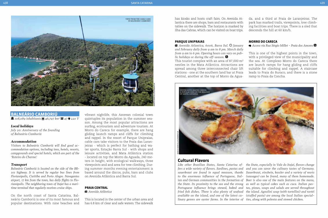
santa Catarina438 439
vibrant nightlife, this Azorean colonial town quintuples its population in the summer sea-son. Among the most popular attractions are surfing, ecotourism and adventure tourism. At Morro do Careca for example, there are hang gliding launch ramps and cliffs for climbing and rappel. In the resort of Parque Unipraias, cable cars take visitors to the Praia das Laran-jeiras - which is perfect for bathing and wa-ter sports, Estação Barra Sul - with shops and leisure activities, and Mata Atlântica station - located on top the Morro da Aguada, 240 me-ters in height, with ecological walkways, three viewpoints and and area for tree climbing. Dur-ing summer months evening entertainment is based around the discos, pubs, bars and clubs on Avenida Atlântica and Barra Sul.
praIa centraL Avenida Atlântica
This is located in the center of the urban area and has 6.8 km of clear and safe waters. The sidewalk
has kiosks and hosts craft fairs. On Avenida At-lantica there are shops, bars and restaurants with tables on the sidewalk. The horizon is marked by Ilha das Cabras, which can be visited on boat trips.
parQue unIpraIaS Avenida Atlantica, 6006, Barra Sul. January
and February daily from 9 am to 8 pm. March daily from 9 am to 6 pm. Opening hours can vary on pub-lic holidays or during the off-season. This tourist complex with an area of 87,000 m² nestles in the Mata Atlântica. Attractions are spread among three interconnected chair lift stations - one at the southern land bar at Praia Central, another at the top of Morro da Agua-
baLneárIo caMborIú 108,089 inhabitants 46,797 km2 47 220 V
Local holidaysJuly 20: Anniversary of the founding of Balneário camboriú
AccommodationVisitors to Balneário camboriú will find good ac-commodation options, including inns, hotels, resorts, campgrounds and special hotels, which are part of the ‘Roteiro do charme’.
TransportBalneário camboriú is located on the side of the BR-101 highway. It is served by regular bus lines from Florianópolis, curitiba and Porto Alegre. Navegantes airport, 17 km from the town, has daily flights to Flo-rianópolis. The neighboring town of Itajaí has a mari-time terminal that regularly receives cruise ships.
On the north coast of Santa Catarina, Bal-neário Camboriú is one of its most famous and popular destinations. With nine beaches and
view from the caBle cars in Balneário camBoriú
cultural Flavors Like other Brazilian States, Santa catarina of-fers a wide variety of flavors. Sardines, pastas and sauerkraut are found in equal measure, thanks to the enormous influence of Portuguese, Ital-ian and German communities in the formation of the State. Its proximity to the sea and the strong Portuguese influence brings stewed, baked and fried fish dishes. There is also plenty of seafood available on the island, and one of the latest cu-linary genres are oyster farms. In the interior of
the State, especially in Vale do Itajaí, flavors change and you can savor the culinary tastes of Germany. Sauerkraut, einsbein, kassler and a variety of wurts (sausages) can be found, many of them homemade. Beer is also one of the main features on the menu, as well as typical cakes such as cuca. Italian pas-tas, pizzas, soups and salads are served throughout the island. Agnolini soup (with tortellini) and tortéi (stuffed pasta) are among the local Italian special-ties, along with polenta and stewed chicken.
oyster with grated cheese, a PoPular dish on the Beaches of santa catarina
ma
rCi
o B
ar
Cell
os/
emB
rat
ur
ma
rCi
o B
ar
Cell
os/
emB
rat
ur
da, and a third at Praia de Laranjeiras. The park has marked trails, viewpoints, tree climb-ing facilities and boat trips. There is a sled that descends the hill at 60 km/h.
Morro do careca Access via Rua Sérgio Millet - Praia dos Amores
This is one of the highest points in the town, with a privileged view of the municipality and the sea. At Complexo Morro do Careca there are launch ramps for hang gliding and cliffs suitable for climbing and rappel. A staircase leads to Praia do Buraco, and there is a stone ramp to Praia da Concha.
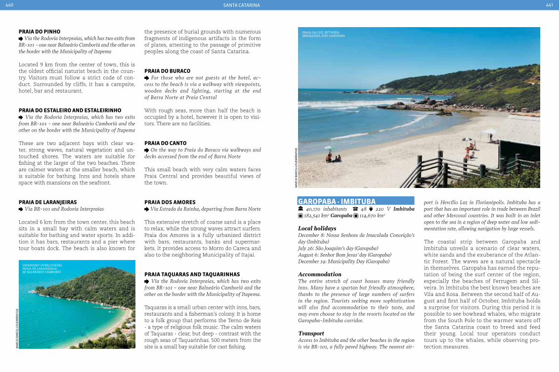
santa Catarina440 441
praIa do pInHo Via the Rodovia Interpraias, which has two exits from
BR-101 - one near Balneário camboriú and the other on the border with the Municipality of Itapema
Located 9 km from the center of town, this is the oldest official naturist beach in the coun-try. Visitors must follow a strict code of con-duct. Surrounded by cliffs, it has a campsite, hotel, bar and restaurant.
praIa do eStaLeIro and eStaLeIrInHo Via the Rodovia Interpraias, which has two exits
from BR-101 - one near Balneário camboriú and the other on the border with the Municipality of Itapema
These are two adjacent bays with clear wa-ter, strong waves, natural vegetation and un-touched shores. The waters are suitable for fishing at the larger of the two beaches. There are calmer waters at the smaller beach, which is suitable for bathing. Inns and hotels share space with mansions on the seafront.
praIa de LaranJeIraS Via BR-101 and Rodovia Interpraias
Located 6 km from the town center, this beach sits in a small bay with calm waters and is suitable for bathing and water sports. In addi-tion it has bars, restaurants and a pier where tour boats dock. The beach is also known for
the presence of burial grounds with numerous fragments of indigenous artifacts in the form of plates, attesting to the passage of primitive peoples along the coast of Santa Catarina.
praIa do buraco For those who are not guests at the hotel, ac-
cess to the beach is via a walkway with viewpoints, wooden decks and lighting, starting at the end of Barra Norte at Praia central
With rough seas, more than half the beach is occupied by a hotel, however it is open to visi-tors. There are no facilities.
praIa do canto On the way to Praia do Buraco via walkways and
decks accessed from the end of Barra Norte
This small beach with very calm waters faces Praia Central and provides beautiful views of the town.
praIa doS aMoreS Via Estrada da Rainha, departing from Barra Norte
This extensive stretch of coarse sand is a place to relax, while the strong waves attract surfers. Praia dos Amores is a fully urbanized district with bars, restaurants, banks and supermar-kets. It provides access to Morro do Careca and also to the neighboring Municipality of Itajaí.
praIa taQuaraS and taQuarInHaS Via the Rodovia Interpraias, which has two exits
from BR-101 - one near Balneário camboriú and the other on the border with the Municipality of Itapema.
Taquaras is a small urban center with inns, bars, restaurants and a fisherman’s colony. It is home to a folk group that performs the Terno de Reis - a type of religious folk music. The calm waters of Taquaras - clear, but deep - contrast with the rough seas of Taquarinhas. 500 meters from the site is a small bay suitable for cast fishing.
Garopaba - IMbItuba 40,170 inhabitants 48 220 V Imbituba 182,541 km2 Garopaba 114,670 km2
Local holidaysDecember 8: Nossa Senhora da Imaculada conceição’s day (Imbituba)July 26: São Joaquim’s day (Garopaba)August 6: Senhor Bom Jesus’ day (Garopaba)December 19: Municipality Day (Garopaba)
AccommodationThe entire stretch of coast houses many friendly inns. Many have a spartan but friendly atmosphere, thanks to the presence of large numbers of surfers in the region. Tourists seeking more sophistication will also find accommodation to their taste, and may even choose to stay in the resorts located on the Garopaba-Imbituba corridor.
TransportAccess to Imbituba and the other beaches in the region is via BR-101, a fully paved highway. The nearest air-
viewPoint overlooKing Praia de laranjeiras, at Balneário camBoriú
port is Hercílio Luz in Florianópolis. Imbituba has a port that has an important role in trade between Brazil and other Mercosul countries. It was built in an inlet open to the sea in a region of deep water and low sedi-mentation rate, allowing navigation by large vessels.
The coastal strip between Garopaba and Imbituba unveils a scenario of clear waters, white sands and the exuberance of the Atlan-tic Forest. The waves are a natural spectacle in themselves. Garopaba has earned the repu-tation of being the surf center of the region, especially the beaches of Ferrugem and Sil-veira. In Imbituba the best known beaches are Vila and Rosa. Between the second half of Au-gust and first half of October, Imbituba holds a surprise for visitors. During this period it is possible to see bowhead whales, who migrate from the South Pole to the warmer waters off the Santa Catarina coast to breed and feed their young. Local tour operators conduct tours up to the whales, while observing pro-tection measures.
Praia da luz, Between iBiraquera and garoPaBa
ma
rCi
o B
ar
Cell
os/
emB
rat
ur
ma
rCi
o B
ar
Cell
os/
emB
rat
ur
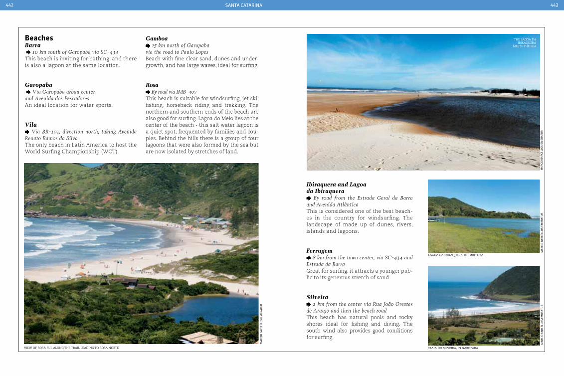
santa Catarina442 443
beachesBarra 10 km south of Garopaba via Sc-434This beach is inviting for bathing, and there is also a lagoon at the same location.
Garopaba Via Garopaba urban center and Avenida dos PescadoresAn ideal location for water sports.
Vila Via BR-101, direction north, taking Avenida
Renato Ramos da SilvaThe only beach in Latin America to host the World Surfing Championship (WCT).
Gamboa 15 km north of Garopaba
via the road to Paulo LopesBeach with fine clear sand, dunes and under-growth, and has large waves, ideal for surfing.
Rosa By road via IMB-407
This beach is suitable for windsurfing, jet ski, fishing, horseback riding and trekking. The northern and southern ends of the beach are also good for surfing. Lagoa do Meio lies at the center of the beach - this salt water lagoon is a quiet spot, frequented by families and cou-ples. Behind the hills there is a group of four lagoons that were also formed by the sea but are now isolated by stretches of land.
Ibiraquera and Lagoa da Ibiraquera
By road from the Estrada Geral da Barra and Avenida AtlânticaThis is considered one of the best beach-es in the country for windsurfing. The landscape of made up of dunes, rivers, islands and lagoons.
Ferrugem 8 km from the town center, via Sc-434 and
Estrada da Barra Great for surfing, it attracts a younger pub-lic to its generous stretch of sand.
Silveira 2 km from the center via Rua João Orestes
de Araujo and then the beach roadThis beach has natural pools and rocky shores ideal for fishing and diving. The south wind also provides good conditions for surfing.
view of rosa sul along the trail leading to rosa norte
the lagoa da iBiraquera
meets the sea
lagoa da iBiraquera, in imBituBa
Praia do silveira, in garoPaBa
ma
rCi
o B
ar
Cell
os/
emB
rat
ur
ma
rCi
o B
ar
Cell
os/
emB
rat
ur
ma
rCi
o B
ar
Cell
os/
emB
rat
ur
ma
rCi
o B
ar
Cell
os/
emB
rat
ur

santa Catarina444 445
LaGeS 156,727 inhabitants 2,629,789 km² 49 220 V
Local holidaysAugust 15: Nossa Senhora dos Prazeres’ day
AccommodationThe town is well served by inns and small, cozy ho-tels for those cold winter nights. Many offer fire-places in the rooms and tasty breakfasts.
TransportThe town can be reached via paved roads that con-nect it other cities. The nearest commercial airport is Hercílio Luz in Florianópolis. Another option is the smaller airport at caxias do Sul (RS), a dis-tance of around 230 km. caçador airport (167 km) receives daily flights from curitiba, Porto Alegre and São Paulo.
The Planalto Serrano in Santa Catarina is one of the coldest regions in Brazil. In winter the yel-low-green landscape of pines gives way to scen-ery covered in snow and ice - unusual for Bra-zil, even though it may only be for a few days. The main town in the region is Lages, known as the “Princess of the Mountain” because of its popularity with tourists. Two centuries ago the town was an important trading post on the Caminho dos Tropeiros (Drovers Way), and was the gateway for cattle en route to the São Paulo - Rio Grande do Sul markets. It still preserves its country traditions to this day, in the shape of country folk, farms and horses. The cold weather, stories told by the fireside, matte tea prepared with yerba and drunk from a gourd, and camargo - a mixture of coffee with milk freshly drawn from the cow, create the ideal at-mosphere for rural tourism.
caSa do arteSão Rua Benjamin constant, 141 - centro. Mon-
day to Friday from 2 pm to 6 pm.
This craft center offers traditional local arti-facts. Visitors can buy woolen blankets and throw-overs, leather work, bamboo and rattan, as well as apple and fig liqueurs.
duneS and praIa do ouVIdor 14 km south of Garopaba via Sc-434 to campo
D’Una, take the exit to Praia do Rosa
On the path leading to the beach there is a small church surrounded by dunes that provides a taster for the beauty of Praia do Ouvidor. The beach is 1 km long with dark colored sand and is surrounded by pine-topped hills and cliffs. The sea is not suitable for bathing in places.
duneS and praIa do SIrIú 9 km north of Garopaba via Sc-434
This beach is isolated and untouched, sur-rounded by dunes up to 40 meters high. It is ideal for sand-boarding. It has waterfalls, flour mills and a distillery. It is divided into two parts: the beach, whose northern corner is a haven for families and has restaurants spe-cializing in Azorean cuisine, and the second part is the dunes.
whale watching Avenida Santa catarina, 1465 - Bairro Paes
Leme. BR-101 in the direction of the south coast. www.baleiafranca.org.br
The Environmental Protection Area (APA) for whales was established in 2000 and extends over 156,100 hectares off the south-central coast of Santa catarina. In addition to protecting the ar-eas with the highest concentration of whales with young, it also protects selected land areas with rocky shores, dunes, marshes and ponds. On some beaches the whales may only be observed from land, ensuring that the females and their young have a sanctuary where they will not be disturbed by boats. These are: Praia da Vila, Praia da Luz and Praia d’Água in Imbituba, and Praia da Gamboa, Praia do Silveira and Praia de Garopaba in Garop-aba. Visits to protected areas are only permitted between late May and early June and in early No-vember, although there are no pre-defined dates.
CleB
er m
aCH
ad
o
igreja matriz de lages
Morro da cruz Rua João Odilo Madruga - Bairro Morro Grande. via Avenida Dom Pedro II
To get to the hilltop to enjoy the panoramic 360o view of the town and surrounding ar-eas requires a climb up a staircase with 365 steps. There is a cross and a chapel at the top of the hill, which is also a destination for Catholic pilgrimages.
eQueStrIan tourISM
Lages is known for being one of the first Brazil-ian municipalities to invest in rural tourism. The local tourist agencies offer tours through the countryside, departing from farm-hotels or parks in the region. There are tours with varying degrees of difficulty and duration, with stops planned for tasting locally pre-pared delicacies.
parQue nacIonaL São JoaQuIM Avenida Felicíssimo Rodrigues Sobrinho, 1.542 -
Bairro Esquina. The main route is via BR-282. In the town of Santa clara in Bom Retiro, turn left onto Sc-438 (Serra do Panelão) arriving in the town of Urubici after 25 km. From here to the park is a further 27 km on rural roads (unpaved), via Estrada Geral do Morro da Igreja. Alternative access is via Sc-438, Es-trada da Serra do Rio do Rastro, which leads to Bom Jardim da Serra. daily from 8 am to 6 pm. 1 day.
depending on the service contracted
Created to protect the Araucaria Forest, its 40,300 hectares are spread throughout the Municipalities of Urubici, Bom Jardim da Ser-ra, Orleans and Grão Pará. The principal at-tractions are the Pedra Furada and the Morro da Igreja in Urubici, with easy access by car or motorcycle. Another option is the Cânion Laranjeiras located in Bom Jardim da Serra, whose poor access requires specially pre-pared cars and a 3 km walk. It is obligatory to have an accredited guide to enter the trails within the park.
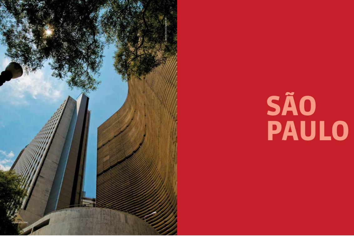
447
SãopauLo
mil
ton
ga
lVa
ni/
emB
rat
ur
coPan Building

são paulo448 449
153BR
374BR
374BR
153BR
116BR
101BR
459BR
101BR
153BR
154BR
262BR
158BR
158BR
154BR
SP-230
SP-230
SP-222
SP-139
SP-079
SP-055
SP-165
SP-250
SP-127
SP-189SP-268
SP-270
SP-249
SP-281
SP-157
SP-147
SP-197
SP-308
SP-310
SP-225
SP-215
SP-255
SP-331
SP-304
SP-310SP-333
SP-326
SP-344
SP-338
SP-330
SP-334SP-351
SP-373
SP-345
SP-334SP-330
SP-326
SP-351
SP-321
SP-479
SP-320
SP-527
SP-461
SP-425
SP-300
SP-463
SP-595
SP-310
SP-463
SP-563
SP-501
SP-425SP-483
SP-425 SP-457
SP-383
SP-294
SP-304
SP-310
SP-318
SP-215
SP-225
SP-304SP-300
SP-321
SP-331
SP-333
SP-421SP-284
SP-101SP-127
SP-300
SP-143
SP-280
SP-300
SP-330SP-065
SP-008
SP-340
SP-060 SP-099
SP-088
SP-121SP-125
SP-153
SP-171
SP-068
SP-280SP-270
SP-303
SP-327
SP-261
374BR
SP-375SP-266
267BR
376BR
369BR
381BR
116BR
262BR
SP-355
rIo de JaneIro
MInaS GeraIS
paraná
Mato GroSSo do SuL
Mato GroSSo
São pauLo
petar
ilHaBela
são seBastião
uBatuBa
santos
guarujásão ViCente
Brotas
Campos do jordão
Geographic information
subtropical an annual average of 19,25 °c (66,65 °F);
with mild winters and moderately high temperatures during the summer
mangroves in the coastline, atlantic forest and tropical forest in the rest of the state
São paulo
international airport
national airport
national HigHways
state HigHways
The state of São Paulo has many surprises in store for its visitors. From the cosmo-politan capital, to the beaches, mountains,
rivers and preserved forests, there are plenty of tourist attractions for those who come here on business or pleasure. With a territory slightly larger than Great Britain, São Paulo is known for being a state that welcomes everyone: there are more than 70 nationalities, and Brazilians from all other states arrive daily in search of new op-portunities, culture and entertainment.
The state's coast is over 600 km long and offers beaches for everyone: from surfers, who can find in Maresias and Itamambuca, among others, in the north coast, excellent waves for surfing, to en-vironmentalists, who can find in Cananéia, Juréia and in Ilha do Cardoso untouched havens, trans-formed into natural reserves. The interior has in store attractions for those who prefer adventure, such as extreme sports in Brotas and Boituva, the national capital of parachuting. Campos do Jordão and neighboring towns in the Serra da Mantiqueira provide cold winters and mountain landscapes. For those who enjoy culture in its different artistic manifestations, the capital, also named São Paulo, always has a good show on.
Campinas
guarulHos

são paulo450 451
São pauLo 11,253,503 1,523.278 km2 11 110 V (in the
main hotels in the city there are 220 V power outlets)
Local holidaysJanuary 25: Foundation of the city of São Paulo July 9: constitutionalist Revolution of 1932
Accommodation São Paulo has the largest hotel network in the coun-try, including international networks, luxury hotels, affordable networks and medium-sized hotels. Ac-commodation is distributed according to event areas – as the city is very large, hotel networks try to be near places such as the airport, convention centers,
fairs and the racetrack. São Paulo also has efficient apart-hotels, hostels and guesthouses.
TransportThe city is served by well-maintained paved roads con-necting it to other cities and capitals in the country. The state’s road network is extensive and crosses the entire state with quality. São Paulo has the largest airport in Brazil, the busiest in Latin America. The Guarulhos/cumbica International Airport is being renovated to ex-pand its facilities and to better welcome all the visitors arriving in the city. In the urban perimeter, congonhas airport receives flights from other Brazilian capitals and the Mercosul. Visitors can also arrive in Viracopos (in campinas, 100 km from São Paulo).
mil
ton
ga
lVa
ni/
emB
rat
ur
luz station
Within the cityTourists will find bus lines, subway lines, above-ground metro, trains and taxis at their disposal to move around the city. However, they should be prepared to face heavy traffic. The subway operates daily from 4:40 am and has different closing hours in each station.
The largest city in the southern hemisphere and one of the most populated in the world, São Paulo is the most cosmopolitan center in the country. It is the capital of culture, gastronomy, entertainment, nightlife entertainment, econ-omy, fashion and much more. São Paulo has everything visitors might expect at any time of the day. All this activity and diversity can be explained by the approximately 70 different na-tionalities living here (the city has the largest Italian community outside Italy; and also the largest Japanese community outside Japan) and by the more than 10 million inhabitants. It can also be explained by all the Brazilians who mi-grated to the city from all over the country. São Paulo always has something interesting to of-fer: 260 cinemas, 181 concert halls, 79 shopping centers, 75 parks and green areas, 90 libraries, and countless nightclubs and bars, festivals and exhibitions. São Paulo never stops. In ad-dition to all the permanent attractions in the city, the local events calendar - with an interna-tional level influence - attracts even more tour-ists, whether looking for cultural and artistic shows, such as the Bienal de Arte (art biennial), themed events like the world’s biggest Gay Pa-rade, or even sporting events such as Formula One, Indy Car Series and soccer.
aQuárIo de São pauLo Rua Huet Bacelar, 407 - Ipiranga. daily, from
9 am to 6 pm. children (from 3 to 12 years old) and seniors.
It is the largest aquarium in Latin America, with two thousand liters of water, and it was only inaugurated six years ago. It has several themed environments where about 300 animal species live, including sharks, penguins, mana-tees and albino alligators.
Paulista avenue
mil
ton
ga
lVa
ni/
emB
rat
ur
avenida paulista and regionSão Paulo’s financial center also has excellent entertainment and culture options. It is worth walking through the 2.8 km long avenue and visit many of the must-see attractions. Paulista is just like São Paulo: it never stops. The avenue has parks, such as Trianon and Mário covas, a charming museum always hosting new exhibi-tions, the Museu de Arte de São Paulo, as well as other exhibition spaces such as the Itaú cultural, SESI and FIESP buildings. The surrounding areas offer services, shops and traditional restaurants. During the weekends the avenue changes its scenery and is crowded by those who enjoy tak-ing photographs, who want to visit the antiques fair and enjoy one of the cinemas in the area.

são paulo452 453
Fundação MarIa LuISa e oScar aMerIcano Avenida Morumbi, 4.077 - Morumbi. Tuesday
to Sunday, from 10 am to 5:30 pm.
The permanent collection relating to the histo-ry of Brazil, presented in stages, includes items such as furniture, silverware and paintings. The building, constructed in 1950, is located in a beautiful garden with coffee and Brazil wood trees. It also has a lovely tea room.
centro cuLturaL São pauLo Rua Vergueiro, 1.000 - Paraíso (Vergueiro subway
station). Exhibition areas: tuesday to friday, from 10 am to 8 pm. Saturdays, Sundays and public holi-days, from 10 am to 6 pm. no charge.
A multidisciplinary cultural space, the CCSP has three large libraries, a comic book library and an area for temporary exhibitions and pre-sentations at good prices or even free of charge. It is one of the most traditional sites in the city and receives artists from all the other states and countries. Such names as Mercedes Sosa, Itamar Assumpção and other representatives of Brazilian culture and from other countries have performed there.
InStItuto cuLturaL Itaú Avenida Paulista, 149 - Bela Vista (Paraíso sub-
way station). Tuesday to Friday from 9 am to 8 pm. Saturday, Sundays and public holidays from 11 am to 8 pm. no charge.
The site hosts dance, music and theatre perfor-mances, as well as themed exhibitions, which attract many audiences. The institute has more than 30 thousand documents relating to the country’s culture. It also organizes exhibitions with contemporary artists and is one of the most visited locations in the city.
MuSeu do FuteboL Praça charles Miller, s/n - Pacaembu. 3664-3848. Tuesday to Sunday, from 9 am to
5 pm. and free of charge on Thursdays.
oscar freire, one of the most soPhisticated shoPPing streets in são Paulo
Located under the grandstands of the Pacaem-bu Stadium, the star of this museum is the favorite national sport. The history of Brazil-ian soccer is shown in interactive multimedia pieces (1400 photographs and 6 hours of video) distributed by 15 themed rooms.
MuSeu de arte de São pauLo (MaSp) Avenida Paulista, 1.578. cerqueira césar (Tri-
anon-Masp subway station). Tuesday to Sun-day from 11 am to 6 pm (ticket office closes at 5 pm). Thursday from 11 am to 8 pm (ticket office closes at 7 pm). closed on Mondays. (free of charge on Tuesdays)
It is the most famous museum of the city and has a permanent collection of inestimable value, with names such as Van Gogh, Renoir, Velázquez, Portinari and Picasso. The building which houses the museum is also considered a work of art, particularly because of its freestand-ing space - one of the largest in the world - which on sundays hosts the popular antiques fair. De-signed by Lina Bo Bordi, one of the biggest names in architecture in the country, the building is a landmark of modern architecture and a symbol of the city. It was listed by the National Institute of Historic and Artistic Heritage in 2003.
masP facade
mil
ton
ga
lVa
ni/
emB
rat
ur
Caio
pim
enta
- sp
tur
is
ShoppingSão Paulo is a great place for shopping. With over 50 specialized streets, 79 shopping centers, entire neighborhoods dedicated to popular com-merce and luxury areas to suit every pocket and taste. The city has large shopping areas, such as Rua 25 de Março, the biggest popular commerce area in Latin America. Here, visitors can find literally anything: toys, clothing, fabrics, home accessories, tools, costume jewelry, handicrafts, well, it’s hard not to find what you are looking for here. The low prices and extensive range of of-fers are an attraction in itself. It is recommended to get there by subway or taxi due to the heavy traffic. To buy clothing at very low prices, Luz area (Rua José Paulino and surrounding areas) is a good option. Local manufacturers and whole-salers welcome buyers from all over the country and offer products with different materials and
finishing. Some shops sell clothing per kilogram, which could be a cheap option. At the other end there are the Jardins and Itaim regions, where tourists can find luxury international brands and famous Brazilian designers. Jewelry, footwear and clothing in general can be found in Rua Oscar Freire area. The area also has good restaurants and coffee shops, some of the most popular in the city. Between 25 de Março and Oscar Freire, São Paulo offers another interesting large shop-ping area, such as Liberdade neighborhood, where Japanese small shops and greengrocers show how the neighborhood is a stronghold of the eastern community. In Vila Madalena, one of São Paulo’s bohemian districts, tourists can find alternative designers and artists’ shops and a great variety of handicrafts and thrift stores. The bars and res-taurants in the area are also a tourist attraction.

são paulo454 455
catedraL da SÉ Praça da Sé, - centro (Sé subway station). Monday to Friday from 8 am to 7 pm. Saturday
from 8 am to 5 pm. Sunday from 8 am to 6 pm. no charge. Guided tours.
One of the five largest neo-gothic temples in the world, the cathedral was inaugurated in 1954, on the city’s 400th anniversary. Guided tours visit the underground crypt which houses the remains of prominent people of São Paulo’s history. Opposite the church there is the Marco Zero (the city’s geographical center).
Mercado MunIcIpaL Rua da cantareira, 306 - centro. Monday to Sat-
urday, from 6 am to 6 pm. Sundays and public holidays, from 6 am to 4 pm. no charge.
The most traditional gourmet attraction of the city is located in an imposing building in downtown, with stained glass windows which show São Paulo’s coffee history. On the large porch, food stalls sell fruits and vegetables, meat, fish and sweets - all very fresh and ap-petizing. The gastronomy space, in the mezza-nine, offers several samples and tastings: the famous mortadella sandwiches and the cod-fish cakes are among the most popular.
MoSteIro de São bento Largo de São Bento - centro (São Bento subway
station). Monday to Friday from 7 am to 7 pm (Basilica and Monastery). Saturday and Sunday from 7 am to 12 pm and from 4 pm to 6 pm (Ba-silica). no charge.
With neo-roman architecture, the monastery was founded in 1958. The biggest highlight are the weekend masses, which have Gregorian chant presentations. On the site there is a shop selling products made by the monks.
MuSeu da LínGua portuGueSa Praça da Luz, s/n - centro (Luz subway station).
Tuesday to Sunday, from 10 am to 5 pm.
The language is taught through recreational and interactive activities, which honor the great names in Brazilian literature and move audiences. It is the first museum in the world dedicated to a language.
pátIo do coLÉGIo Praça Pátio do colégio, 2 - centro (Sé subway sta-
tion). Tuesday to Sunday from 8 am to 4:40 pm. Museu Anchieta. Over 60 years of age: free of
charge.
It is the official birth place of São Paulo, founded in 1554 by the Jesuits. The simple construction houses the important Museu Padre Anchieta, which includes pieces depicting the arrival of the settlers and the scale model of the city as it was in the beginning.
pInacoteca Praça da Luz, 2 - Bom Retiro (Tiradentes subway
station). Tuesday to Sunday from 10 to 5:30 pm,
1
3
4
5 67
8
9 10 11
12
14
15
1617
18
19
2021
2224
25
26
272829
30 3231
34
3635
37
33
13
2
1 São Paulo2 São Caetano do Sul3 Diadema4 São Bernardo do Campo5 Santo André6 Mauá7 Ribeirão Pires8 Rio Grande da Serra9 Suzano10 Mogi das Cruzes11 Biritiba Mirim12 Guararema13 Salesópolis
14 Santa Isabel15 Arujá16 Itaquaquecetuba17 Poá18 Ferraz de Vasconcelos19 Guarulhos20 Mairiporã21 Francisco Morato22 Franco da Rocha23 Caieiras24 Pirapora do Bom Jesus25 Santana de Parnaíba26 Barueri
27 Carapicuíba28 Jandira29 Itapevi30 Vargem Grande Paulista31 Embu32 Taboão da Serra33 Cotia34 Itapecerica da Serra35 São Lourenço da Serra36 Embu-Guaçu37 Juquitiba38 Osasco39 CajamarA Paranapiacaba
38
A
2339
Praça da sé, in downtown
são Paulo
mercado municiPal
Pinacoteca
mil
ton
ga
lVa
ni/
emB
rat
ur
mil
ton
ga
lVa
ni/
emB
rat
ur
mil
ton
ga
lVa
ni/
emB
rat
ur
São pauLo MetropoLItan reGIon
visitors can stay inside the building until 6 pm. free of charge, children under 10 years and
adults over 60 years.
The rich permanent collection, with over 100 thou-sand works, shows the best of Brazilian and inter-national art. The Picture Gallery has an important schedule of artistic and cultural events. The build-ing was designed in 1895 by the architect Ramos de Azevedo, one of the most influential names in local architecture during the 19th century.

são paulo456 457
tHeatro MunIcIpaL Praça Ramos de Azevedo - República (República
subway station). see schedules on the website.
In line with the Parisian opera theatres, the Theatro Municipal hosted the Semana de Arte Moderna held in 1922 (a movement which unit-ed musicians, painters, writers and artists in general, representing a renewal in language and creative freedom: From this movement, Brazil-ian arts began to work with completely free ideas in search of its own identity: Over time, it gained a historical value and was projected throughout the century). Currently, it hosts sev-eral shows (dance, concerts and musicals), some of which are free of charge during weekends.
SaLa São pauLo (concert HaLL) Praça Júlio Prestes, 16 - campos Elíseos (Luz sub-
way station). only guided visits, hours upon request
by 3367-9573 Ticket office: Monday to Friday from 10 am to 6 pm or until the beginning of the con-cert. Saturday: when a show is on, from 10 am to 4:30 pm. Sunday and public holidays: 2 hours before the beginning of the show, if there is one. according to the show. Guided tours.
This modern concert hall has a dynamic sched-ule and one of the best acoustics in the world. It is located inside Estação Júlio Prestes and is home to the State Symphonic Orchestra. The room has an eclectic schedule which includes, besides the State of São Paulo Symphonic Orchestra, presen-tations from various groups, including interna-tional names. The State of São Paulo Symphonic Orchestra was considered by Gramophone Mag-azine as one of the world’s three most relevant emerging orchestras in 2010. Besides the presen-tations in Sala São Paulo, the orchestra also tours in the inner parts of the state.
sala são Paulo
stef
an
sCH
mel
ing
/fu
nd
açã
o o
sesp
ru
Ben
s CH
iri /
Bie
sp
Life around the tableWhat is there to say about a city with over 12 thousand restaurants, close to 60 different types of cuisine and includes gastronomy as one of its official cultural activities? São Paulo offers bars, restaurants, street food, cafeterias and snack bars for almost every taste. From its tra-ditional pastry (a symbol of the city) to inter-nationally awarded establishments, such as chef Alex Atala’s restaurant, which was chosen as the fourth best in the world by Restaurant Magazine (a reference in the gastronomy world), eating is a pleasure for all São Paulo residents. The city is constantly renovating its delicacies portfolio and is always offering a new trend, a new flavor and a new culture to its residents and visitors. Would you like some traditional Japanese food, like the ones found in little Tokyo restaurants? Liberdade, the eastern stronghold of the city, there are a few good options, from ramen shops to restaurants specialized in robata, sushi and sashimi. If you cannot afford more sophisticat-ed places, at weekends there is a neighborhood market where you can taste the Japanese food made on the streets, in stalls. Italian food is also one of the biggest in São Paulo. There is no lack
of cafeterias and pizzerias, as the largest Italian community outside Italy is located here. There are many traditional cafeterias, such as the ones in Bexiga neighborhood, and also sophisticated restaurants offering the latest trends in Italian cuisine. If you prefer Arab food, the city offers specialized restaurants which go beyond kibe or esfiha. Mutton, meats and typical roasts can be found in family restaurants, which passed on from one generation to the next, without losing its “secret” seasoning. São Paulo’s residents are proud of its gastronomy and the excellent qual-ity of the service. And for good reason. Eating is an important part of the city citizen’s life. Going out to eat is an excuse to meet friends, take walks, do business, date and even to visit new areas of the city, which become tourist at-tractions thanks to a new restaurant or because of traditional restaurants which survive the constant urban changes in the city. Korean, In-dian, Peruvian, chinese, Thai, Russian, Spanish, Andean, French, German, Scandinavian, and Greek cuisine are available in the city, as well as Brazilian cuisine from different states. The only difficult part is choosing.
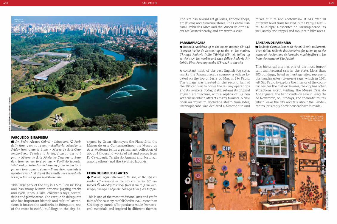
são paulo458 459
mixes culture and ecotourism. It has over 10 different level trails located in the Parque Natu-ral Municipal Nascentes de Paranapiacaba, as well as zip line, rappel and mountain bike areas.
Santana de parnaíba Rodovia castelo Branco to the 26-B exit, to Barueri.
Then follow Rodovia dos Romeiros for 12 km up to the center of the Santana de Parnaíba municipality (35 km from the center of São Paulo)
This historical city has one of the most impor-tant architectural sets in the state. More than 200 buildings, listed as heritage sites, represent the bandeirantes (pioneers) saga, which in 1561 left São Paulo to explore the interior of the coun-try. Besides the historic houses, the city has other attractions worth visiting: the Museu Casa do Anhanguera, the handicrafts on sale in Praça 14 de Novembro, on Sundays, and thematic routes which leave the city and talk about the Bandei-rantes (or simply show how cachaça is made).
parQue do IbIrapuera Av. Pedro Álvares cabral - Ibirapuera. Park:
daily from 5 am to 12 am. - Auditório: Monday to Friday from 9 am to 6 pm. - Museu de Arte con-temporânea: Tuesday to Friday, from 10 am to 6 pm. - Museu de Arte Moderna: Tuesday to Sun-day, from 10 am to 5:30 pm. - Pavilhão Japonês: Wednesday, Saturday and Sunday from 10 am to 12 pm and from 1 pm to 5 pm. - Planetário: schedule is updated every first day of the month; see the website www.prefeitura.sp.gov.br/astronomia
This large park of the city is 1.5 million m2 long and has many leisure options: jogging tracks and cycle lanes, a lake, children’s toys, several fields and picnic areas. The Parque do Ibirapuera also has important historic and cultural attrac-tions. It houses the Auditório do Ibirapuera, one of the most beautiful buildings in the city, de-
signed by Oscar Niemeyer; the Planetário, the Museu de Arte Contemporânea, the Museu de Arte Moderna (with a permanent collection of about 4 thousand works of art and pieces from Di Cavalcanti, Tarsila do Amaral and Portinari, among others) and the Pavilhão Japonês.
FeIra de eMbu daS arteS Rodovia Régis Bittencourt, BR-116, at the 279 km
marker (1st entrance) or the 282 km marker (2nd en-trance). Monday to Friday from 8 am to 5 pm. Sat-urdays, Sundays and public holidays from 9 am to 7 pm.
This is one of the most traditional arts and crafts fairs of the country, established in 1969. More than 500 display stands offer products made from sev-eral materials and inspired in different themes.
The site has several art galleries, antique shops, art studios and furniture stores. The Centro Cul-tural Embu das Artes and the Museu de Arte Sa-cra are located nearby, and are worth a visit.
paranapIacaba Rodovia Anchieta up to the 29 km marker, SP-148
(Estrada Velha de Santos) up to the 33 km marker. Through Rodovia Índio Tibiriçá (SP-31), follow up to the 45,5 km marker and then follow Rodovia Ri-beirão Pires Paranapiacaba (SP-122) to the city
A constant mist, of the best English fog style, marks the Paranapiacaba scenery, a village lo-cated on the top of Serra do Mar, in São Paulo. The village was created in the second half of the 19th century, to house the railway operations and its workers. Today, it still retains its original English architecture, with a replica of Big Ben with views which attracts many tourists. A true open air museum, including steam train rides, Paranapiacaba was declared a historic site and
Parque do iBiraPuera
shoP with traditional crafts in the city of
emBu das artes
rit
a B
ar
ret
o/e
mB
rat
ur
Ba
nCo
de
ima
gem
min
isté
rio
do
tu
ris
mo
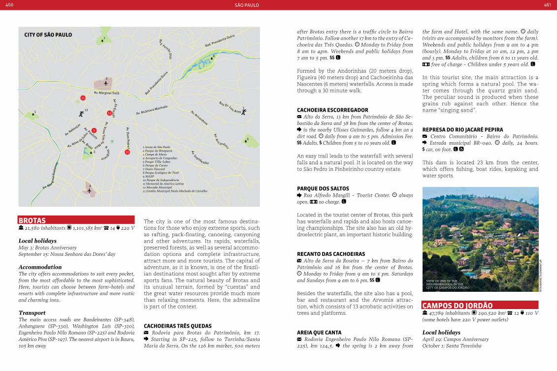
são paulo460 461
brotaS 21,580 inhabitants 1,101.385 km2 14 220 V
Local holidaysMay 3: Brotas AnniversarySeptember 15: Nossa Senhora das Dores’ day
AccommodationThe city offers accommodations to suit every pocket, from the most affordable to the most sophisticated. Here, tourists can choose between farm-hotels and resorts with complete infrastructure and more rustic and charming inns.
TransportThe main access roads are Bandeirantes (SP-348), Anhanguera (SP-330), Washington Luís (SP-310), Engenheiro Paulo Nilo Romano (SP-225) and Rodovia Américo Piva (SP-197). The nearest airport is in Bauru, 105 km away
The city is one of the most famous destina-tions for those who enjoy extreme sports, such as rafting, pack-floating, canoeing, canyoning and other adventures. Its rapids, waterfalls, preserved forests, as well as several accommo-dation options and complete infrastructure, attract more and more tourists. The capital of adventure, as it is known, is one of the Brazil-ian destinations most sought after by extreme sports fans. The natural beauty of Brotas and its unusual terrain, formed by “cuestas” and the great water resources provide much more than relaxing moments. Here, the adrenaline is part of the context.
cacHoeIraS trÊS QuedaS Rodovia para Brotas do Patrimônio, km 17. Starting in SP-225, follow to Torrinha/Santa
Maria da Serra. On the 126 km marker, 500 meters
after Brotas entry there is a traffic circle to Bairro Patrimônio. Follow another 17 km to the entry of ca-choeira das Três Quedas. Monday to Friday from 8 am to 4pm. Weekends and public holidays from 7 am to 5 pm.
Formed by the Andorinhas (20 meters drop), Figueira (40 meters drop) and Cachoeirinha das Nascentes (6 meters) waterfalls. Access is made through a 30 minute walk.
cacHoeIra eScorreGador Alto da Serra, 13 km from Patrimônio de São Se-
bastião da Serra and 38 km from the center of Brotas. in the nearby Ulisses Guimarães, follow 4 km on a
dirt road. daily from 9 am to 5 pm. Admission Fee. Adults. children from 5 to 10 years old.
An easy trail leads to the waterfall with several falls and a natural pool. It is located on the way to São Pedro in Pinheirinho country estate.
parQue doS SaLtoS Rua Alfredo Mangili - Tourist center. always
open. no charge.
Located in the tourist center of Brotas, this park has waterfalls and rapids and also hosts canoe-ing championships. The site also has an old hy-droelectric plant, an important historic building.
recanto daS cacHoeIraS Alto da Serra da Roseira – 7 km from Bairro do
Patrimônio and 16 km from the center of Brotas. Monday to Friday from 9 am to 5 pm. Saturdays
and Sundays from 9 am to 6 pm.
Besides the waterfalls, the site also has a pool, bar and restaurant and the Arvomix attrac-tion, which consists of 13 acrobatic activities on trees and platforms.
areIa Que canta Rodovia Engenheiro Paulo Nilo Romano (SP-
225), km 124,5. the spring is 2 km away from
the farm and Hotel, with the same name. daily (visits are accompanied by monitors from the farm). Weekends and public holidays from 9 am to 4 pm (hourly). Monday to Friday at 10 am, 12 pm, 2 pm and 3 pm. Adults, children from 6 to 11 years old.
free of charge - children under 5 years old.
In this tourist site, the main attraction is a spring which forms a natural pool. The wa-ter comes through the quartz grain sand. The peculiar sound is produced when these grains rub against each other. Hence the name “singing sand”.
repreSa do rIo JacarÉ pepIra centro comunitário - Bairro do Patrimônio. Estrada municipal BR-040. daily, 24 hours.
car, on foot.
This dam is located 23 km from the center, which offers fishing, boat rides, kayaking and water sports.
caMpoS do Jordão 47,789 inhabitants 290.520 km2 12 110 V
(some hotels have 220 V power outlets)
Local holidaysApril 29: campos AnniversaryOctober 1: Santa Teresinha
view of one of the neighBorhoods in the city of camPos do jordão
rit
a B
ar
ret
o/e
mB
rat
ur
Av. Aric anduva
Ro
d. Fernão Dias
Av. Mar gina
l Pin
heiro
s
Rua Dr. Luís Aires
Av. Sapobe mba
R. Vergueiro
Av. do Estad
o
113
4
3
Av. Marginal Tietê Rod. Pre
sidente
Dutra
Av. Alcântara Machado
Av. D
om Pedro I
Av. Rebouças
Av. PaulistaAv. Brasil
Av. Aricanduva
Rod. Presidente Dutra
Av. Vinte Três de MaioA v. N
ove de Ju
lho
2
5
8
6
7
9
12
10
11
1 Arena de São Paulo2 Parque do Ibirapuera3 Campo de Marte4 Aeroporto de Congonhas5 Parque Villa-Lobos6 Parque do Carmo7 Horto Florestal8 Parque Ecológico do Tietê9 MASP10 Parque da Independência11 Memorial da América Latina12 Mercado Municipal13 Estádio Municipal Paulo Machado de Carvalho
cIty oF São pauLo

são paulo462 463
AccommodationIn campos do Jordão the best accommodations are found in inns. Tourists have several options available: near the center, more distant and hidden in the forest, more sophisticated options which are included in the ‘Roteiro do charme’ and exclusive small boutique ho-tels, with a high quality service. There are also hotels who offer not only accommodation but also outdoor activities, ideal for those travelling with children, and also hotels which function as hotel management schools, where the country’s future hotel and tourism industry professionals are trained.
TransportThe best and most beautiful way of getting to campos do Jordão is by car or bus, which allows tourists to enjoy a privileged view of the Mantiqueira forest. The city has private heliports. The main way of getting around the city is on foot, which allows tourists to stop at specific attraction areas. There are bus lines to the urban locations, however to visit the most distant places it is necessary to do it by car or taxi.
Located in the heart of Serra da Mantiqueira, Campos do Jordão is one of the most visited mountainous destinations in Brazil. With privi-leged location and particularly rich in natural resources, the city is popular due to its moun-tain climate, its Norman style architecture and several leisure options, mainly related to ecotourism. The site has an even more inviting atmosphere during the winter. Among the at-tractions, there is the Festival Internacional de Inverno, the biggest and most important classi-cal music event in Latin America. The gastron-omy is also another attraction of the city and surrounding areas. Sophisticated restaurants with gourmet menus please even the most de-manding tastes. Sweets and chocolates are lo-cal specialties and help increase the number of people visiting the city. The preparation of hand-made chocolate can be viewed by tourists in one of the local factories. There are smaller shops which offer homemade products, also delicious. Shopping is also a pleasing activity for tourists.
The city center, around Praça da Matriz, in the Capivari area, has knitwear shops which offer items made of wool and thread, both in tradi-tional or more contemporary designs. Handi-crafts can be found in small shops, hidden in the nearby roads which lead to more remote areas of the city, and in small galleries and shopping centers located around the center. Wood, iron, brass and fabric items are local specialties and are offered in the several interior design shops located mainly in Capivari and Abernéssia. It is also possible, with some luck, to find small ba-zaars organized during the winter.
ducHa de prata Avenida Roberto Simonsen - Vila Inglesa. 24 hours daily.
The site includes artificial showers formed by the dam of the Ribeirão das Perdizes. Besides waterfalls, there are kiosks with handicrafts and souvenirs from the city.
Horto FLoreStaL (parQue eStaduaL caMpoS do Jordão)
Avenida Pedro Paulo – Parque Estadual. daily, from 9 am to 4 pm. closed on Wednesday (except on public holidays and holiday months). from 8 to 59 years old free of charge, children under 8 years and adults over 60 years.
It is the oldest forest garden in Brazil and the largest coniferous reserve in the state. Its pre-served nature area (over 8 thousand hectares) occupies one third of Campos do Jordão and it is a great excuse to admire the region’s nature, with planned and signposted trails which pass through waterfalls, centuries-old pine forests and stunning views. One of these is the Caminho da Cachoeira Celestina, a 5 hour walk.
Morro do eLeFante Rua Marco Antônio cardoso, 240. by car
or cable car, leaving from the Parque da Estrada de Ferro. weekends and public holidays from 9 am to 5 pm.
One of the city’s most visited viewpoints, Mor-ro do Elefante is at an altitude of 1800 meters and provides a panoramic view of Campos do Jordão. The top can be accessed by car or cable car, which leaves from the Parque da Estrada de Ferro and provides an unforgettable trip where the natural beauty of the site can be viewed.
traIn tourS Avenida Dr. Emílio Ribas, no number. cam-
pos do Jordão-Santo Antônio do Pinhal: Monday to Friday, departures at 10 am and 2 pm. Saturdays, Sundays and public holidays, departures at 10 am. 1:30 pm and 2 pm. (round trip). Urban Tram “Emílio Ribas”: every day from 10 am to 4 pm, hourly. (round trip)
Until the 1970s, the railway was one of the ways to get to Campos do Jordão. Today it is a charming tourist attraction, with routes which tell a bit about the city and the Serra da Mantiqueira history. Among the rides on offer there is ‘Campos do Jordão-Santo Antônio do Pinhal’, a 2h30 trip in one of the most beauti-ful stretches of the Mountains. Another option available is the Urban Tram: leaving from the Emílio Ribas Station, the lovely red and yellow trams, symbols of the city, cross the site in an approximately 25 minute tour.
pedra do baú Estrada da campista, km 21. in campos de
Jordão: follow the signs from Obelisco de Jaguaribe opposite the Padaria Roma. In São Bento do Sapu-caí: Estrada do Paiol Grande, drive up to the 13 km marker and follow the signs
Located in the neighboring Municipality of São Bento do Sapucaí, the Pedra do Baú complex is a meeting point for the adventurous, with activi-ties such as para-gliding, hang-gliding, climbing, mountain biking or even just walking. The rock formation has an altitude of 1,850 meters and is formed by Bauzinho, Pedra do Baú and Ana Cha-ta. For those who are looking for an easier walk Bauzinho is the ideal choice, as it only demands a 10 minute walk from the parking area. For the
shoPPing street in camPos do jordão
rit
a B
ar
ret
o/e
mB
rat
ur

são paulo464 465
extreme sports fans , the best option is Pedra do Baú - its top can only be reached through a metal stairway, with steep trails, in a total dura-tion of 5 hours. It is necessary to use a guide, as it is a dangerous location.
petar (parQue eStaduaL turíStIco do aLto rIbeIra) In the middle of mountains and valleys, in the southern part of São Paulo state, there is one of the most important preservation units in the world. Petar, Parque Estadual Turístico do Alto
Ribeira, includes archeological sites, quilom-bos, waterfalls and trails, as well as the main attractions: more than 300 caves with different difficulty levels. The park was created in 1958. This ecotourism treasure is located inside the largest preserved part of the Atlantic Forest in the country, around 320 km from São Paulo. Vis-its are divided in four centers, from where the tourists leave in the company of local and ac-credited guides. The guides and visits should be booked in advance. Visitors should check with the park administration which are the available attractions. Weather changes and general con-ditions may close some attractions temporarily.
park centerSnúcLeo de Santana
Rodovia Iporanga-Apiaí (SP-165). (daily fee)
The main Petar caves, with easy access, are lo-cated here. The highlights are the Caverna de Santana, the second largest in the state, the Morro Preto cave, with a beautiful entrance and a large chamber, and the Caverna Água Suja, which has an interior waterfall. The most visit-ed waterfalls are the Cachoeira das Andorinhas (one of the most beautiful in the park), and the Betarizinho and Couto waterfalls, which are good for swimming. It is necessary to go through a rappel and vertical techniques training. The Núcleo Santana is located in the southern part of Petar, near the Bairro da Serra (Iporanga).
núcLeo doS cabocLoS Rodovia SP-250, km 294; from there follow 17 km
through Estrada do Espírito Santo to the center. Ad-mission Fee: Overnight. Day visit
It is located in the center of the park. It is the only site with camping space and infrastruc-ture. The caves here are difficult to access. One of these, Temenina, has skylights which bright-en its interior. Other attractions more easily accessed include Cachoeira dos Sete Reis, with two drops and the Maximiniano, with a crystal-line natural pool. Self-guided trails are also part of the center’s tour.
núcLeo caSa de pedraPetar tourism center: (15) 3552-1875. Iporanga-Ribeirão dirt road (leaving from SP-165). (daily fee)
In this part of the park the highlights are the Cave-rna Casa de Pedra, with the largest cave mouth in the world (215 meters high). The center, located in the southern part of Petar, in the Vale do Rio Iporanga, also includes waterfalls and trails.
núcLeo ouro GroSSo Vale do Rio Betari - Bairro da Serra. To access the
restricted areas, an advance request to the Petar man-agement must be made. Visits are only allowed in pre-determined tours and accompanied by a park guide or accredited monitor. Groups should book in advance. It is not allowed to remove anything from the caves, not even loose rocks. It is not allowed to touch the speleo-thems (stalactites and stalagmites). (daily fee)
Located in Bairro da Serra, the center includes one of the most difficult caves to visit (by water): the Ouro Grosso Cave, with five waterfalls. An-
Iporanga
Apiaí
Núcleo de Santana
Núcleo Caboclos
1
5
6
7
8
9
10
11 12
13
14
15
16
17
18
19
20
21
22
23
24
25
26
2
3
4
1 Pescaria2 Temimina3 Cabana4 Chapéu5 Alambari de Cima6 Areias7 Morro Preto8 Juvenal9 Arataca10 Casa de Pedra11 Cogumelos12 Farto13 Córrego Fundo
14 Lage Branca15 Pérolas16 Ouro Grosso17 Geremias18 Paiva19 Santana20 Laje dos Macacos21 Água Suja22 Desmoronada23 Espírito Santo24 Tobias25 Capinzal26 Monjolinho
Caves
PETAR
NúcleoOuro Grosso
SP 2
50
SP 250
SP 2
50
waterfall at Petar region
cave in Petar
Coll
eCti
on
of
pet
ar
Coll
eCti
on
of
pet
ar
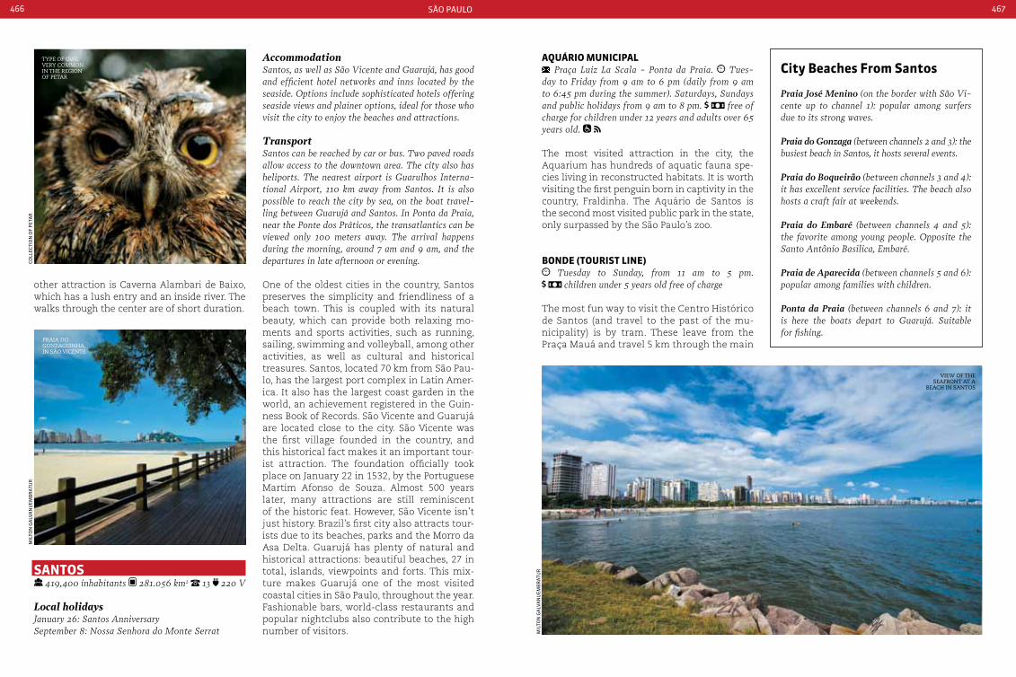
são paulo466 467
AccommodationSantos, as well as São Vicente and Guarujá, has good and efficient hotel networks and inns located by the seaside. Options include sophisticated hotels offering seaside views and plainer options, ideal for those who visit the city to enjoy the beaches and attractions.
TransportSantos can be reached by car or bus. Two paved roads allow access to the downtown area. The city also has heliports. The nearest airport is Guarulhos Interna-tional Airport, 110 km away from Santos. It is also possible to reach the city by sea, on the boat travel-ling between Guarujá and Santos. In Ponta da Praia, near the Ponte dos Práticos, the transatlantics can be viewed only 100 meters away. The arrival happens during the morning, around 7 am and 9 am, and the departures in late afternoon or evening.
One of the oldest cities in the country, Santos preserves the simplicity and friendliness of a beach town. This is coupled with its natural beauty, which can provide both relaxing mo-ments and sports activities, such as running, sailing, swimming and volleyball, among other activities, as well as cultural and historical treasures. Santos, located 70 km from São Pau-lo, has the largest port complex in Latin Amer-ica. It also has the largest coast garden in the world, an achievement registered in the Guin-ness Book of Records. São Vicente and Guarujá are located close to the city. São Vicente was the first village founded in the country, and this historical fact makes it an important tour-ist attraction. The foundation officially took place on January 22 in 1532, by the Portuguese Martim Afonso de Souza. Almost 500 years later, many attractions are still reminiscent of the historic feat. However, São Vicente isn’t just history. Brazil’s first city also attracts tour-ists due to its beaches, parks and the Morro da Asa Delta. Guarujá has plenty of natural and historical attractions: beautiful beaches, 27 in total, islands, viewpoints and forts. This mix-ture makes Guarujá one of the most visited coastal cities in São Paulo, throughout the year. Fashionable bars, world-class restaurants and popular nightclubs also contribute to the high number of visitors.
aQuárIo MunIcIpaL Praça Luiz La Scala - Ponta da Praia. Tues-
day to Friday from 9 am to 6 pm (daily from 9 am to 6:45 pm during the summer). Saturdays, Sundays and public holidays from 9 am to 8 pm. free of charge for children under 12 years and adults over 65 years old.
The most visited attraction in the city, the Aquarium has hundreds of aquatic fauna spe-cies living in reconstructed habitats. It is worth visiting the first penguin born in captivity in the country, Fraldinha. The Aquário de Santos is the second most visited public park in the state, only surpassed by the São Paulo’s zoo.
bonde (tourISt LIne) Tuesday to Sunday, from 11 am to 5 pm.
children under 5 years old free of charge
The most fun way to visit the Centro Histórico de Santos (and travel to the past of the mu-nicipality) is by tram. These leave from the Praça Mauá and travel 5 km through the main
tyPe of owl very common in the region of Petar
view of the seafront at a
Beach in santos
Praia do gonzaguinha, in são vicente
city beaches From Santos
Praia José Menino (on the border with São Vi-cente up to channel 1): popular among surfers due to its strong waves.
Praia do Gonzaga (between channels 2 and 3): the busiest beach in Santos, it hosts several events.
Praia do Boqueirão (between channels 3 and 4): it has excellent service facilities. The beach also hosts a craft fair at weekends.
Praia do Embaré (between channels 4 and 5): the favorite among young people. Opposite the Santo Antônio Basilica, Embaré.
Praia de Aparecida (between channels 5 and 6): popular among families with children.
Ponta da Praia (between channels 6 and 7): it is here the boats depart to Guarujá. Suitable for fishing.
mil
ton
ga
lVa
ni/
emB
rat
ur
mil
ton
ga
lVa
ni/
emB
rat
ur
Coll
eCti
on
of
pet
ar
SantoS 419,400 inhabitants 281.056 km2 13 220 V
Local holidaysJanuary 26: Santos AnniversarySeptember 8: Nossa Senhora do Monte Serrat
other attraction is Caverna Alambari de Baixo, which has a lush entry and an inside river. The walks through the center are of short duration.

são paulo468 469
Guarujá beachesAstúrias: this busy beach is popular among long board surfers.
Edén: access is made through a steep trail. Good for swimming, diving and fishing.
Enseada: the biggest beach in Guarujá, with 100 kiosks.
Guaiuba: its kiosks offer good gastronomy. The waters are suitable for diving.
Iporanga: 25 km from the city center, the beach is popular for diving. Its highlights are a water-fall and a natural pool.
Mar Casado: good for swimming due to its calm waters.
Perequê: a caiçaras stronghold, it is a fishing colony.
Pernambuco: this sophisticated fine sand beach is good for kayaking, sailing, body boarding and surfing.
Pitangueiras: a clear water central beach, good for swimming.
Tombo: it is a sloped beach that hosts surfing championships.
streets and attractions of the city, with stops in the Outeiro de Santa Catarina and the Pa-lácio Saturnino de Brito.
boLSa do caFÉ Rua 15 de Novembro, 95 - centro. Monday to
Saturday from 8 am to 6 pm. Sunday from 10 am to 5 pm.
The beautiful building of around 6 thousand m2, built in 1922, housed one of the main cof-fee and commodities exchange in the world. Today, it houses the permanent collection of the Museu do Café. The panels by Brazil-ian painter and historian Benedicto Calixto adorn the building.
eStádIo urbano caLdeIra - VILa beLMIro Rua Princesa Isabel, 77 - Vila Belmiro. Tues-
day to Sunday from 9 am to 7 pm (ticket office closes at 6 pm), except on match days. Admis-sion fee: Normal visit (memorial + grandstands). Guided tour (memorial + ground boxes + press
room + locker room + field).
The Santos Soccer Club Stadium, a team in-ternationally famous due to its biggest star: Pelé. The stadium, one of the oldest in Brazil, was constructed in 1916. Today, it has capacity for 20 thousand people. It includes the club’s Achievements Memorial, with trophies, docu-ments and photographs.
LaJe de SantoS Boarding in Edgard Perdigão Bridge. Ponta da
Praia. according to the chosen tour operator. according to each tour operator. of age accom-
panied by an adult
The best diving spot of São Paulo, and the third best in the country, is located within the city’s lim-its. Laje de Santos is located 45 km from the beach and offers divers and underwater photographers a privileged view up to 30 meters deep. This is where Moreia is located, a shipwreck from 1922.
beacH SHoreLIne and GardenS Avenida Bartolomeu de Gusmão
The 7 km long beach has the largest coast gar-den in the world, according to the Guinness Book of Records. It has over 800 different flow-erbeds and plants. A popular bikeway follows the entire coast and garden.
SantuárIo de noSSa SenHora do Monte Serrat
Praça correia de Mello, 33 - centro Histórico. daily from 8 am to 8 pm. Admission Fee: Tram
return trip - free of charge for children under 8 years old
The city’s patron saint is the highlight of this temple. The shrine, built at the turn of the 17th
century, sits on top of Monte Serrat: where you can view almost all downtown Santos. The access is made by tram or staircase with over 400 steps.
MeMorIaL doS 500 anoS do deScobrIMento do braSIL
Alameda Paulo Gonçalves, at the top of Ilha Porchat. 24 hours daily.
Designed by Oscar Niemeyer to commemorate the 500th anniversary of the discovery of Brazil. The beaches from Santos and São Vicente can be viewed from the monument’s viewpoint.
Praia de são vicente
São Vicente beaches
Ilha Porchat: located between the Itararé and Gonzaguinha beaches, the Island’s main attrac-tions are the bars, restaurants and nightclubs.
Gonzaguinha: popular for jet skiing, wake-boarding and windsurfing, and also due to its bars, restaurants and kiosks. On Sundays there is a craft fair.
Itararé: the largest and most popular beach in São Vicente, good for surfing. It is where the para-gliders and hang-gliders land.
Milionários: a quiet beach, 200 meters long. It is located near the rocks of Ilha Porchat.
Praia de santos
mil
ton
ga
lVa
ni/
emB
rat
ur
mil
ton
ga
lVa
ni/
emB
rat
ur
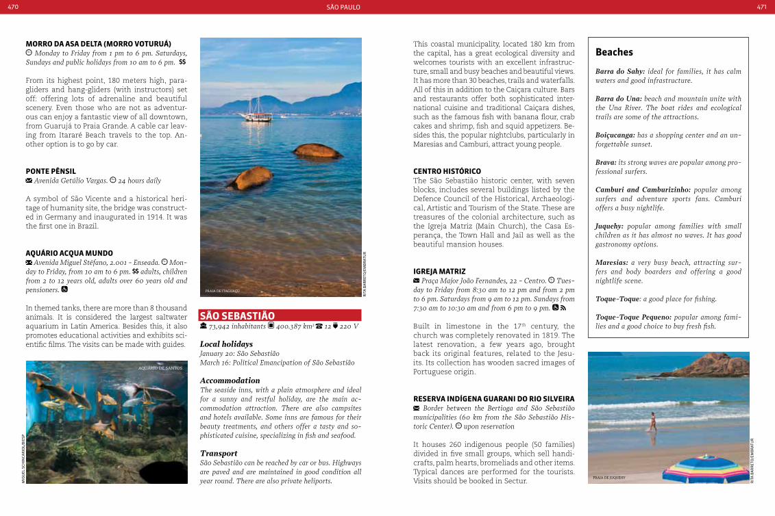
são paulo470 471
Morro da aSa deLta (Morro Voturuá) Monday to Friday from 1 pm to 6 pm. Saturdays,
Sundays and public holidays from 10 am to 6 pm.
From its highest point, 180 meters high, para-gliders and hang-gliders (with instructors) set off: offering lots of adrenaline and beautiful scenery. Even those who are not as adventur-ous can enjoy a fantastic view of all downtown, from Guarujá to Praia Grande. A cable car leav-ing from Itararé Beach travels to the top. An-other option is to go by car.
ponte pÊnSIL Avenida Getúlio Vargas. 24 hours daily
A symbol of São Vicente and a historical heri-tage of humanity site, the bridge was construct-ed in Germany and inaugurated in 1914. It was the first one in Brazil.
aQuárIo acQua Mundo Avenida Miguel Stéfano, 2.001 - Enseada. Mon-
day to Friday, from 10 am to 6 pm. adults, children from 2 to 12 years old, adults over 60 years old and pensioners.
In themed tanks, there are more than 8 thousand animals. It is considered the largest saltwater aquarium in Latin America. Besides this, it also promotes educational activities and exhibits sci-entific films. The visits can be made with guides.
beaches
Barra do Sahy: ideal for families, it has calm waters and good infrastructure.
Barra do Una: beach and mountain unite with the Una River. The boat rides and ecological trails are some of the attractions.
Boiçucanga: has a shopping center and an un-forgettable sunset.
Brava: its strong waves are popular among pro-fessional surfers.
Camburi and Camburizinho: popular among surfers and adventure sports fans. camburi offers a busy nightlife.
Juquehy: popular among families with small children as it has almost no waves. It has good gastronomy options.
Maresias: a very busy beach, attracting sur-fers and body boarders and offering a good nightlife scene.
Toque-Toque: a good place for fishing.
Toque-Toque Pequeno: popular among fami-lies and a good choice to buy fresh fish.
São SebaStIão 73,942 inhabitants 400.387 km2 12 220 V
Local holidaysJanuary 20: São SebastiãoMarch 16: Political Emancipation of São Sebastião
AccommodationThe seaside inns, with a plain atmosphere and ideal for a sunny and restful holiday, are the main ac-commodation attraction. There are also campsites and hotels available. Some inns are famous for their beauty treatments, and others offer a tasty and so-phisticated cuisine, specializing in fish and seafood.
TransportSão Sebastião can be reached by car or bus. Highways are paved and are maintained in good condition all year round. There are also private heliports.
This coastal municipality, located 180 km from the capital, has a great ecological diversity and welcomes tourists with an excellent infrastruc-ture, small and busy beaches and beautiful views. It has more than 30 beaches, trails and waterfalls. All of this in addition to the Caiçara culture. Bars and restaurants offer both sophisticated inter-national cuisine and traditional Caiçara dishes, such as the famous fish with banana flour, crab cakes and shrimp, fish and squid appetizers. Be-sides this, the popular nightclubs, particularly in Maresias and Camburi, attract young people.
centro HIStÓrIcoThe São Sebastião historic center, with seven blocks, includes several buildings listed by the Defence Council of the Historical, Archaeologi-cal, Artistic and Tourism of the State. These are treasures of the colonial architecture, such as the Igreja Matriz (Main Church), the Casa Es-perança, the Town Hall and Jail as well as the beautiful mansion houses.
IGreJa MatrIz Praça Major João Fernandes, 22 - centro. Tues-
day to Friday from 8:30 am to 12 pm and from 2 pm to 6 pm. Saturdays from 9 am to 12 pm. Sundays from 7:30 am to 10:30 am and from 6 pm to 9 pm.
Built in limestone in the 17th century, the church was completely renovated in 1819. The latest renovation, a few years ago, brought back its original features, related to the Jesu-its. Its collection has wooden sacred images of Portuguese origin.
reSerVa IndíGena GuaranI do rIo SILVeIra Border between the Bertioga and São Sebastião
municipalities (60 km from the São Sebastião His-toric center). upon reservation
It houses 260 indigenous people (50 families) divided in five small groups, which sell handi-crafts, palm hearts, bromeliads and other items. Typical dances are performed for the tourists. Visits should be booked in Sectur.
Praia de itaguaçú
Praia de juquehy
rit
a B
ar
ret
o/e
mB
rat
ur
rit
a B
ar
ret
o/e
mB
rat
ur
mig
uel
sCH
inCa
rio
l/B
iesp
aquário de santos

são paulo472 473
SítIo arQueoLÓGIco de São FrancISco Avenida Manoel Teixeira, 1.200 - São Sebastião, ac-
cess through Rodovia caraguá-São Sebastião. daily from 8 am to 5 pm. the access to the site is made through trails with medium difficulty
The archeological site has 200 years of history within its 20,000 m2. The ruins of the original construction, such as columns, walls, staircas-es and terraces, show that a large slave farm used to be there. The guides who accompany the visit (which are mandatory) explain inter-esting facts about the site.
Islands and beaches
Jabaquara: one of the most beautiful beaches in Ilhabela, it is great for swimming and for fishing and spearfishing.
Pacuíba: this 50 meters long beach it the perfect scenery for those who want peace and quiet.
Armação: popular among yachtsmen, sailors and kite surfing fans.
Sino: the beach houses the Pedra do Sino, one of the Island’s biggest attractions.
Viana: ideal for snorkeling.
Barreiros: it has beautiful views.
Santa Tereza: ideal for buying fresh fish.
Saco da Capela: offers excellent infrastructure with seafront bars and hotels.
Pequeá: suitable for canoeing, diving and swimming.
Engenho d’água: it has an old sugar cane mill, a historical heritage of the city.
Itaguaçu: it has good infrastructure and calm waters ideal for swimming.
Perequê: one of the largest and most popular beaches. During high season it hosts several events.
Pedras Miúdas: where the Submarine Ecological Sanctuary is located.
Portinho: a cozy beach which attracts many tourists.
Feiticeira: good for kite surfing and a visual paradise.
Julião: good for families with small children.
Pinto and Tamoios. The boat trip from the conti-nent to Ilhabela takes about 15 minutes (advanced booking is recommended on public holidays).
The busiest island on São Paulo’s coast. Ilha-bela, the only Brazilian maritime archipelago and municipality, was founded in 1805. The sailing capital offers the best climate condi-tions for this sport, which is why many cham-pionships are held there. The Ilhabela Sailing Week, an international tournament which takes place every July, is one of the site’s main attractions. It is also ideal for wreck diving. About twenty old shipwrecks are located in the southern coast of the island, which are responsible for the nickname of the area: The Latin America Bermuda Triangle.
waterFaLLSNear the Praia da Feiticeira, after an easy trail, you can find the Cachoeira dos Três Tombos, with a natural and crystalline water pool. Another good attraction is the Cachoeira do Gato, the most visited on the island. To get there, there’s a medium level difficulty trail (a guide is recommended) which lasts about 45 minutes. One of the most traditional tour-ist sites in Ilhabela is the Cachoeira da Toca, with campsite, natural showers, historic trails, slides and surfing.
parQue eStaduaL de ILHabeLa Monday to Friday, from 8 am to 5 pm
The archipelago park, with 27 thousand hect-ares, includes 85% of the Ilhabela municipal-ity. A dense forest protects streams, creeks, islands, islets and more than one hundred waterfalls. The park’s main attraction are the waterfalls and the natural pools. The first pool that can be accessed is the Poço da Pe-dra, right at the beginning of the trail. Poço da Escada is located 500 meters from there and after that there is the Shower and the Slide. Poço do Jabuti is the last pool. The trail which leads to the waterfalls is signposted and has recreational areas.
ilhaBela downtown
ilhaBela seafront
rit
a B
ar
ret
o/e
mB
rat
ur
rit
a B
ar
ret
o/e
mB
rat
ur
ILHabeLa 28,196 inhabitants 347.537 km2 12 220 V
Local holidaysSeptember 3: city Anniversary
AccommodationIlhabela offers different types of accommodation for tourists. Most of the hotels and inns have seafront views, and are located by the seaside or in the Is-land’s mountains. The island has rustic and charm-ing inns as well as more sophisticated hotels, besides the possibility to rent houses.
TransportIlhabela is 230 km from São Paulo. From the capi-tal, follow the highways Ayrton Senna, carvalho
Grande: offers several leisure activities.
Curral: its natural beauty is complemented by sophisticated bars.
Bonete: its beauty is internationally famous. Good for surfing.
Indaiauba: has several fishing spots.
Castelhanos: sea with rough waters. Nearby there are two creeks and a big waterfall.
Poço: has a natural pool, suitable for swimming.
Ilha da Cabras: popular among divers.
Ilha de Búzios: a paradise for divers where turtles and dolphins can be seen.

são paulo474 475
ubatuba 78,801 inhabitants 710.783 km2 12 220 V
Local holidaysJune 29: São Pedro Pescador FestivalSeptember 14: Iperoig PeaceOctober 28: city Anniversary
AccommodationInns and hotels near the region beaches are avail-able. There are options which include the ‘Roteiro do charme’ and offer delicious food and comfort-able facilities. For the more adventurous there are inns distant from the center and the main beaches, which, in exchange for less sophistication, offer almost unknown views and beaches.
TransportRoad transport is the most used to visit Ubatuba. The roads are paved and maintained in good condi-tion. There is also a local airport, Gastão Madeira (Daesp), which receives small airplanes.
Known as the “Surfing Capital”, the city, with a 90 km coastline, has more than 80 beaches suitable for ecotourism and extreme and wa-
ter sports. The municipality also includes 10 islands with stunning scenery. Ubatuba used to be inhabited by Tamoios Indians, who had conflicts with the Portuguese over the lands. One of those who attempted to make a peace agreement was the priest José de Anchieta, who ended up being held hostage and impris-oned. The agreement was made in 1563, in a treaty named “Iperoig Peace”. Ubatuba’s coast, islands and Atlantic Forest (80% of the area is part of the Parque Estadual da Serra do Mar) have a natural beauty, which attract Brazilian visitors and tourists from all over the world.
proJeto taMar Rua Antônio Athanasio da Silva, 273 - Itaguá. Sunday to Thursday (closed on Wednesdays), from
10 am to 6 pm. Friday and Saturday from 10 am to 8 pm. free of charges, children under 1.20 meter tall and adults over 60 years.
The sea turtle project (Tamar) has several species. In guided tours, the guides talk about the turtles and explain the spawning and hatching. The site also has a museum dedicated to the species.
saco da riBeira
sea turtle (Projeto tamar)
juli
an
a B
ra
nCo
/Bie
sp
ru
Ben
s CH
iri/
Bie
sp
beaches
Brava da Almada: strong waves, good for surfing.
Brava do Frade: good for surfers.
Brava do Sul: has a natural pool on the coast.
Camburi and Camburizinho: one of the most popular in the region, crossed by a river.
Felix: on the left there is tumble beach and on the right side a natural pool.
Fortaleza: suitable for water sports.
Grande: its strong waves are popular among surfers.
Itamambuca: a good place for extreme sports.
Lázaro: has shades and a good infrastructure.
Maranduba: has good swimming spots and it is suitable for families.
Pereque-Açu: has a large stretch of sand and shal-low waters, suitable for families.
Piçinguaba: declared a historic site.
Prumirim: a beautiful waterfall nearby attracts visitors.
Puruba: good for diving and swimming. Puruba River is also located there.
Saco da Ribeira: this beautiful beach is the symbol of the city, it is also a regatta spot.
Sununga: a little beach with rough waters (current). This is where the crying cave is located.
Tenório: an urban beach with rough sea.
Toninhas: at certain times of the year it is possible to view dolphins near this beach.
Ubatumirim: a beautiful beach with calm waters.
Vermelha do Norte: it has reddish sands and is good for surfing.
Vermelha do Sul: a sloped beach, surrounded by virgin forest.
477
SerGIpea
luiz
io a
CCio
ly/e
mB
rat
uratalaia waterfront
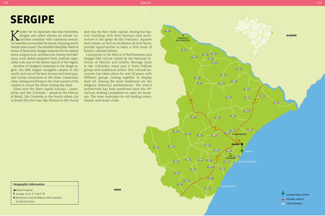
aracaJu
101BR
101BR
235BR
349BR
235BR
SE-300
SE-206
SE-206
SE-108
SE-300
SE-452
SE-200
SE-108
SE-416
SE-106
SE-104
SE-202
SE-304SE-206
SE-208
SE-104SE-104
SE-104
SE-226
SE-214
SE-214 SE-305
SE-214
SE-318
SE-438
SE-102
SE-430
SE-102
SE-428
SE-216
SE-112
SE-102
SE-218SE-442
SE-444
SE-440SE-104
SE-302
SE-224
SE-224
SE-222
SE-222
SE-220
SE-220
SE-202
SE-312
SE-414
SE-422
sãoCristóVão
laranjeiras
aLaGoaS
baHIa
Canindé desão franCisCo
playa del saCo
playa del refúgio
atalaia
SE-200
international airport
national airport
state HigHways
sergipe478 479
Geographic information
humid tropical average of 26 °c (78,8 °F) herbaceous and shrubland, with remnants of atlantic forest
SerGIpe
Known for its elaborate São João festivities, Sergipe also offers visitors an almost un-touched coastline with numerous beauti-
ful beaches surrounded by dunes, enjoying warm waters year round. The smallest Brazilian State in terms of land area, Sergipe reserves for its visitors some unique tours, architecture, history and deli-cious local dishes prepared from seafood, espe-cially crab, one of the dishes typical of the region.
Another of Sergipe’s treasures is the Xingó re-gion, the fifth largest navigable canyon in the world, and one of the best-known and most pop-ular tourist attractions in the State. Catamaran rides, rafting and diving in the clear waters of the canyon is a must for those visiting the State.
Cities near the State capital Aracaju - Laran-jeiras and São Cristovão - preserve the history of Brazil. São Cristovão is the fourth oldest city in Brazil (the first was São Vicente in São Paulo)
and was the first State capital. Among the his-toric buildings, with their baroque style archi-tecture is the Igreja de São Francisco. Squares and crosses, as well as the Museu de Arte Sacra, provide opportunities to learn a little more of Brazil’s colonial history.
Laranjeiras is the Mecca of Northeastern and Sergipe folk culture. Listed by the National In-stitute of Historic and Artistic Heritage (next to São Cristovão), every year it hosts folklore groups and traditional artists. This cultural en-counter has taken place for over 30 years, with different groups coming together to display their art. Among the most traditional are the religious theatrical performances. The town’s architecture has been preserved since the 19th
century, making Laranjeiras an open air muse-um. The town maintains its old reading rooms, theater and music clubs.
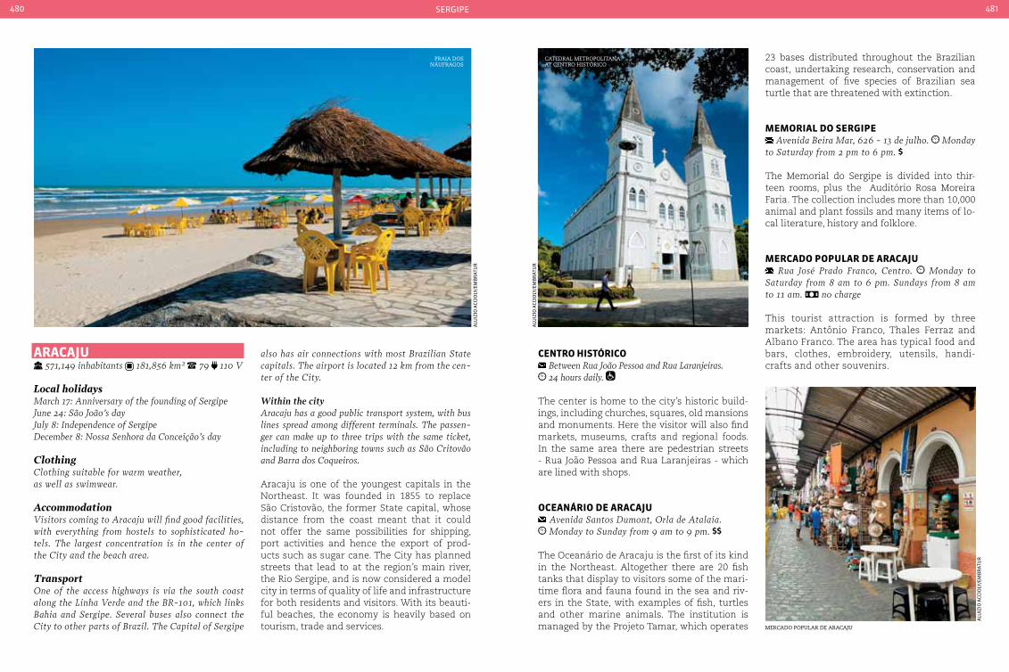
sergipe480 481
Praia dos náufragos
mercado PoPular de aracaju
aracaJu 571,149 inhabitants 181,856 km² 79 110 V
Local holidaysMarch 17: Anniversary of the founding of SergipeJune 24: São João’s dayJuly 8: Independence of SergipeDecember 8: Nossa Senhora da conceição’s day
Clothingclothing suitable for warm weather, as well as swimwear.
AccommodationVisitors coming to Aracaju will find good facilities, with everything from hostels to sophisticated ho-tels. The largest concentration is in the center of the city and the beach area.
TransportOne of the access highways is via the south coast along the Linha Verde and the BR-101, which links Bahia and Sergipe. Several buses also connect the city to other parts of Brazil. The capital of Sergipe
also has air connections with most Brazilian State capitals. The airport is located 12 km from the cen-ter of the city.
Within the cityAracaju has a good public transport system, with bus lines spread among different terminals. The passen-ger can make up to three trips with the same ticket, including to neighboring towns such as São critovão and Barra dos coqueiros.
Aracaju is one of the youngest capitals in the Northeast. It was founded in 1855 to replace São Cristovão, the former State capital, whose distance from the coast meant that it could not offer the same possibilities for shipping, port activities and hence the export of prod-ucts such as sugar cane. The City has planned streets that lead to at the region’s main river, the Rio Sergipe, and is now considered a model city in terms of quality of life and infrastructure for both residents and visitors. With its beauti-ful beaches, the economy is heavily based on tourism, trade and services.
centro HIStÓrIco Between Rua João Pessoa and Rua Laranjeiras. 24 hours daily.
The center is home to the city’s historic build-ings, including churches, squares, old mansions and monuments. Here the visitor will also find markets, museums, crafts and regional foods. In the same area there are pedestrian streets - Rua João Pessoa and Rua Laranjeiras - which are lined with shops.
oceanárIo de aracaJu Avenida Santos Dumont, Orla de Atalaia. Monday to Sunday from 9 am to 9 pm.
The Oceanário de Aracaju is the first of its kind in the Northeast. Altogether there are 20 fish tanks that display to visitors some of the mari-time flora and fauna found in the sea and riv-ers in the State, with examples of fish, turtles and other marine animals. The institution is managed by the Projeto Tamar, which operates
23 bases distributed throughout the Brazilian coast, undertaking research, conservation and management of five species of Brazilian sea turtle that are threatened with extinction.
MeMorIaL do SerGIpe Avenida Beira Mar, 626 - 13 de julho. Monday
to Saturday from 2 pm to 6 pm.
The Memorial do Sergipe is divided into thir-teen rooms, plus the Auditório Rosa Moreira Faria. The collection includes more than 10,000 animal and plant fossils and many items of lo-cal literature, history and folklore.
Mercado popuLar de aracaJu Rua José Prado Franco, centro. Monday to
Saturday from 8 am to 6 pm. Sundays from 8 am to 11 am. no charge
This tourist attraction is formed by three markets: Antônio Franco, Thales Ferraz and Albano Franco. The area has typical food and bars, clothes, embroidery, utensils, handi-crafts and other souvenirs.
alu
izio
aCC
ioly
/em
Br
atu
r
alu
izio
aCC
ioly
/em
Br
atu
r
alu
izio
aCC
ioly
/em
Br
atu
r
catedral metroPolitana at centro histÓrico
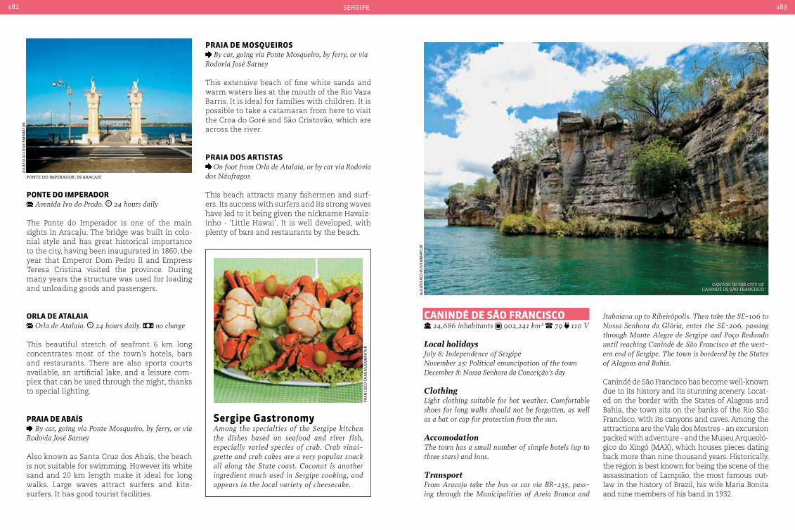
sergipe482 483
ponte do IMperador Avenida Ivo do Prado. 24 hours daily
The Ponte do Imperador is one of the main sights in Aracaju. The bridge was built in colo-nial style and has great historical importance to the city, having been inaugurated in 1860, the year that Emperor Dom Pedro II and Empress Teresa Cristina visited the province. During many years the structure was used for loading and unloading goods and passengers.
orLa de ataLaIa Orla de Atalaia. 24 hours daily. no charge
This beautiful stretch of seafront 6 km long concentrates most of the town’s hotels, bars and restaurants. There are also sports courts available, an artificial lake, and a leisure com-plex that can be used through the night, thanks to special lighting.
praIa de abaíS By car, going via Ponte Mosqueiro, by ferry, or via
Rodovia José Sarney
Also known as Santa Cruz dos Abaís, the beach is not suitable for swimming. However its white sand and 20 km length make it ideal for long walks. Large waves attract surfers and kite-surfers. It has good tourist facilities.
praIa de MoSQueIroS By car, going via Ponte Mosqueiro, by ferry, or via
Rodovia José Sarney
This extensive beach of fine white sands and warm waters lies at the mouth of the Rio Vaza Barris. It is ideal for families with children. It is possible to take a catamaran from here to visit the Croa do Goré and São Cristovão, which are across the river.
praIa doS artIStaS On foot from Orla de Atalaia, or by car via Rodovia
dos Náufragos
This beach attracts many fishermen and surf-ers. Its success with surfers and its strong waves have led to it being given the nickname Havaiz-inho - ‘Little Hawai’. It is well developed, with plenty of bars and restaurants by the beach.
canIndÉ de São FrancISco 24,686 inhabitants 902,241 km² 79 110 V
Local holidaysJuly 8: Independence of SergipeNovember 25: Political emancipation of the townDecember 8: Nossa Senhora da conceição’s day
ClothingLight clothing suitable for hot weather. comfortable shoes for long walks should not be forgotten, as well as a hat or cap for protection from the sun.
AccomodationThe town has a small number of simple hotels (up to three stars) and inns.
TransportFrom Aracaju take the bus or car via BR-235, pass-ing through the Municipalities of Areia Branca and
Itabaiana up to Ribeirópolis. Then take the SE-106 to Nossa Senhora da Glória, enter the SE-206, passing through Monte Alegre de Sergipe and Poço Redondo until reaching canindé de São Francisco at the west-ern end of Sergipe. The town is bordered by the States of Alagoas and Bahia.
Canindé de São Francisco has become well-known due to its history and its stunning scenery. Locat-ed on the border with the States of Alagoas and Bahia, the town sits on the banks of the Rio São Francisco, with its canyons and caves. Among the attractions are the Vale dos Mestres - an excursion packed with adventure - and the Museu Arqueoló-gico do Xingó (MAX), which houses pieces dating back more than nine thousand years. Historically, the region is best known for being the scene of the assassination of Lampião, the most famous out-law in the history of Brazil, his wife Maria Bonita and nine members of his band in 1932.
Ponte do imPerador, in aracajú
canyon in the city of canindé de são francisco
alu
izio
aCC
ioly
/em
Br
atu
r
alu
izio
aCC
ioly
/em
Br
atu
r
fra
nCi
sCo
CH
ag
as/
emB
rat
ur
Sergipe GastronomyAmong the specialties of the Sergipe kitchen the dishes based on seafood and river fish, especially varied species of crab. crab vinai-grette and crab cakes are a very popular snack all along the State coast. coconut is another ingredient much used in Sergipe cooking, and appears in the local variety of cheesecake.

sergipe484 485
VaLe doS MeStreS Povoado curituba. to be agreed with the guide. it is advised to do the tour with a guide registered
with the town’s tourist office. per person, but this varies depending on group size.
Here visitor can see paintings on the sandstone walls dating back more than three thousand years, as well as traveling through the caat-
inga shrubland and other fauna typical of the region’s countryside. Common species in the region are lizards and preá (a mammal similar to a skunk). Tours should be undertaken in the company of a local guide.
Gruta de taLHado On the border with Bahia and Alagoas. times of
the tours must be agreed in advance with the guide. it is advised to do the tour with a guide registered
with the town’s secretary of tourism. per person, but this varies depending on group size.
The cavern walls appear as if they were carved by hand. Access is by the Rio São Francisco, and along the way visitors can admire the stone walls that present different forms, such as the Chinese Stone and Hawk Rock. Once anchored in the cavern it is possible to dive into the cold, clear waters of the river.
This is the location where Virgulino Ferreira - the outlaw ‘Lampião’ - and his wife, Maria Bo-nita and nine other bandits were killed in an ambush in 1932. It is still possible to see the marks of the bullets on the rocks while the guides who accompany visitors recount the de-tails of this important moment in the history of the Brazilian Northeast.
crosses symBolize the gruta de angico where lamPião and maria Bonita were murdered
rio de são francisco, in the city of canindé de são francisco
canyon in the rio são francisco
PetroglyPhs in the vale dos mestres fossilized rocK in the museu de arqueologia de xingÓ
museu de arqueologia de xingÓ
Gruta de anGIco In Poço Redondo, 25 km from canindé. to be
agreed with the guide. the tour must be under-taken in the company of a guide; cost is according to group size.
MuSeu de arQueoLoGIa de xInGÓ Rodovia canindé-Piranhas, Hydro-electric plant
exit - Xingó. Wednesday to Sunday from 9 am to 4:3o pm.
Archeological studies have shown that the Xingó Canyon has been populated by man for over nine thousand years. Before construction of the hydroelectric plant in the region between 1991 and 1994, many artifacts were saved, with around 30,000 pieces being retrieved from eight different archaeological sites including ceram-ics, fireplaces and skeletons.
waLkInG In tHe cÂnIon do xInGÓ Rio São Francisco. tours depart several times a day,
but must be reserved at least a few hours in advance
The canyon is 65 km long and was formed dur-ing the construction of the Xingó hydroelec-tric dam. Parts of the canyon can be visited on schooner and catamaran rides. The site is also a great place for those who enjoy nature; dur-ing the tour it is possible to observe birds and reptiles that live in the scrublands.
alu
izio
aCC
ioly
/em
Br
atu
ra
luiz
io a
CCio
ly/e
mB
rat
ur
alu
izio
aCC
ioly
/em
Br
atu
r
alu
izio
aCC
ioly
/em
Br
atu
ra
luiz
io a
CCio
ly/e
mB
rat
ur
alu
izio
aCC
ioly
/em
Br
atu
r

sergipe486 487
tHe townS oF LaranJeIraSand São crIStÓVão
79 110 V Laranjeiras 26,902 inhabitants 162,279 São Cristovão 78,874 inhabitants 436,861 km²
Local holidays Laranjeiras June 19: Sagrado coração de Jesus’ dayJuly 8: Independence of SergipeAugust 7: Political emancipation of the town
Local holidays São CristóvãoJuly 8: Independence of SergipeSeptember 8: Senhora da Vitória’s day
ClothingLight clothing suitable for hot weather.
AccommodationSão critovão has only a few accommodation options in simple inns and small hotels. As in the case of Laranjeiras, it is possible to make the trip in one day, returning at night to Aracaju.
TransportFrom Aracaju drive to São cristovão via the BR-101. Another option is to use one of the urban bus lines departing from Aracaju, which are part of the integrated transport system.
Less than 30 km from Aracaju, these two towns guard much of the history of Sergipe. Founded in 1540, São Cristovão was the first State capital and only the fourth in the country. With great wealth at the height of the sugar cane era, Laranjeiras, which was founded in 1701, retains strong cultural and folklore traditions, as well as the undeniable beauty of its buildings. It was also an impor-tant river port in the early days of the prov-ince of Sergipe. Because of their architectural and cultural importance, both towns have been listed by the National Institute of His-toric and Artistic Heritage (Iphan). The im-maculately preserved colonial architecture remains intact, including the original paving, evoking the rich past of Northeast Brazil.
caLçadão GetúLIo VarGaS calçadão Getulio Vargas - centro. Laranjeiras. 24 hours. no charge
This boardwalk is surrounded by buildings constructed during the 19th century, with archi-tecture in the neoclassical style. It used to be the commercial center of the town. The ground floor of the houses were shops, and upstairs were the merchant’s residences.
IGreJa noSSa SenHora do roSárIo e São benedIto
Rua José Prado Franco - centro. Laranjeiras. daily from 8 am to 6 pm. no charge
The church was built on top of a hill by slaves, in order to preserve their faith and devotion to these saints. During the Holy Kings celebrations the church becomes the scene of the corona-tion of the ‘Rainha das Taieires’ (and Afro-Bra-zilian folk tradition that is very important in the State, worshiping São Benedito and Nossa Senhora do Rosário, deities of great importance to the local community).
MuSeu de arte Sacra de LaranJeIraS Praça Heráclito Diniz Gonçalves, 39 - centro. Laran-
jeiras. Tuesday to Friday from 10 am to 5 pm. Satur-days and Sundays from 1 pm to 5 pm.
This museum was previously installed in the Igreja de Nossa Senhora da Conceição dos Par-dos, however during the 1990s the museum was transferred to a neoclassical style house built in the early 20th century. The collection of
Praça de são francisco de assis, recognized as world cultural heritage By unesco
internal area of the museu de arte sacra
alu
izio
aCC
ioly
/em
Br
atu
r
ima
ge
Cou
rte
sy
more than 500 pieces includes pictures, silver-ware and porcelain donated by other churches in the town and by the local community.
praça de São FrancISco centro Histórico - São cristóvão. 24 hours
This square is home to the principal build-ings in the town: the Igreja e Convento de São Francisco - dating from the 17th century, which today houses the Museu de Arte Sacra; the Mu-seu Histórico, former Palácio Provincial and the Casa de Misericórdia - a beautiful baroque structure that was the first hospital in the prov-ince of Sergipe in the 17th century.
praça do carMo centro Histórico - São cristóvão. 24 horas
Another of the town’s squares, this is home to the Igreja de Nossa Senhora do Rosário dos Ho-mens Pretos, built by the Jesuits in the 18th centu-ry, and the Convento do Carmo with the Museu dos Ex-votos in an annex.

489
tocantInSfl
aVio
CH
an
/em
Br
atu
r
formiga waterfall in jalaPão

pará
MaranHão
pIauí
baHIa
GoIáS
Mato GroSSo
230BR
153BR
153BR
153BR
153BR
153BR
153BR
153BR
242BR
242BR
242BR
242BR
010BR
010BR
010BR
235BR
010BR
010BR
010BR
226BR
TO-201
TO-010 TO-405
TO-126
TO-134
TO-413
TO-210 TO-126
TO-134TO-416
TO-164TO-010
TO-222
TO-427
TO-230TO-430
TO-164
TO-335
TO-239
TO-336TO-437
TO-164TO-348
TO-342TO-442
TO-348
TO-446
TO-080
TO-354
TO-447
TO-354
TO-255TO-255
TO-164
TO-374
TO-070
TO-070
TO-181
TO-373
TO-373
TO-498
TO-296
TO-387
TO-498
TO-050
TO-387
TO-050
TO-485 TO-110
TO-110
TO-477
TO-040
TO-280
TO-030
TO-020
TO-245
TO-280
TO-365
TO-458 TO-262
TO-040TO-050
TO-458
TO-070
TO-255
TO-255
TO-050
TO-070TO-454
TO-080TO-010
TO-050
TO-010 TO-342
TO-245
TO-010
TO-431
TO-239
TO-226TO-335
TO-226
TO-010
TO-222
TO-478
TO-010
paLMaS
parQue estadual do Cantão
national airport
national HigHways
state HigHways
toCantins490 491
tocantInS
The youngest of the 27 Brazilian States, Tocantins was split from Goiás in 1988. It marks the division between the Brazil-
ian Center-West and Northern regions, where the savanna and the Amazon forest meet.
The region’s wealth in gold deposits has been known since the 18th century. When the first reserves were discovered by the Portu-guese crown practically prohibited travel in the current state of Tocantins. Roads were blocked and river navigation was prohibited, all to ensure that gold mining was done pri-marily by the Portuguese crown. The decline in gold production and the discovery of re-serves in Minas Gerais led to the region enter-ing a process of neglect and stagnation.
The remaining population chose to move to the countryside and began livestock rearing and agricultural production. Although agri-culture and livestock had their beginnings on smallholdings, today they are an important
source of income for Tocantins. Since its begin-nings the State has received many migrants from São Paulo, Minas Gerais and Rio Grande do Sul, which has resulted in a unique cultural mix, different from the rest of Brazil. It is one of the few places in the country where North and South meet and mingle, creating new traditions in culture and cuisine.
Handicrafts also evidence the mixture of traditions: from leather goods made by people from the South to the straw and wood trans-formed into art objects, household items, and ornaments all have their place in the regional shops. Tourism is an activity that grows every year in Tocantins. With a large area set aside for conservation - around 2 million hectares in of the State’s territory is preserved for in-digenous peoples - the State is improving tourist infrastructure in its two immense na-tional parks, Guangzhou and Jalapão, in order to attract more visitors.
Geographic information
semi-humid tropical average of 26 °c (78,8 °F) savanna and amazon forest

toCantins492 493
paLMaS 228,332 inhabitants 181,856 km2 63 220 V
Local holidaysMarch 19: São José’s DayMay 20: Founding of PalmasOctober 5: creation of the State of Tocantins
VaccinationYellow fever vaccination is recommended at least 10 days before traveling.
AccommodationPalmas has a modern network of hotels that cater to visitors coming to the city for business, or a strategic stop-over on their way to the interior of the State. It also offers inns both in the center and the outskirts.
TransportPalmas has an international airport which receives flights from virtually every city in the country. Access roads are paved.
The State capital of Tocantins is one of the major tourist cities in the North of Brazil. Located in a re-gion of transition between savanna and Amazon vegetation, Palmas enjoys a tremendous diversity of scenery, freshwater beaches, conservation ar-eas, rivers and waterfalls. It is also the youngest capital in Brazil. Inaugurated on May 23, 1989, Palmas was designed in the early 80’s as a func-tional and organized city. Visitors can easily find their way around its wide streets and tree-lined avenues. Its strategic location in the heart of Bra-zil makes it the gateway to world renowned natu-
ral attractions such as Jalapão, one of the leading ecotourism destinations in Latin America. Visitors choosing Palmas as a destination will find a good network of hotels and typical regional restaurants.
praça doS GIraSSÓIS Avenida Juscelino Kubitscheck
With an area of approximately 570,000 square meters, the Praça dos Girassóis (‘Sunflower Square’) is the second largest public square in the world (the largest is the Tiananmen Square in Beijing, China). It is home to headquarters of all three State government bodies, as well as the Memorial Coluna Prestes, the Metropoli-tan Cathedral, a compass representing the To-cantins indigenous nations, the Monumento à Bíblia (marking the geodesic center of Brazil) and other monuments.
MeMorIaL coLuna preSteS Rua dos Girassóis. Wednesday to Saturday from
8 am to 6 pm, Sundays until 12 am.
Built in honor of the uprising of 1922 and the march led by the Coluna Prestes (the culmina-tion of the movement that aimed to overthrow the oligarchy that dominated the country at that time), the memorial was designed by the architect Oscar Niemeyer. The collection
consists of documents, photographs and per-sonal items donated by the family of Luis Car-los Prestes (the Brazilian military and politi-cal leader and revolutionary) and recalls the 25,000 km traveled by Prestes and his group in the interior if Brazil, including Tocantins, in the 1920s and 30s.
LaGo da uSIna HIdreLÉtrIca LuíS eduardo MaGaLHãeS
Avenida Juscelino Kubitscheck, heading East (at the end of the avenue)
Open throughout the year, the lake (also known as Lago do Lajeado) is a tourist resort with beaches, islands, marinas, port, harbor, green areas, artificial reefs and theme parks. With a length of 163 km long and covering an area of 630 km2 in area, and is the result of the con-struction of the Luís Eduardo Magalhães Hy-droelectric Plant. It is located between the
cultural MixTocantins’ cultural mix results in variations to typical dishes from Portugal, São Paulo, Minas Gerais and indigenous peoples. Among these is Paçoca de Arraias. created to last for many hours and requiring few ingredients, the basic ingredients of paçoca are chopped dried beef, fried and mashed in gravy, cassava flour and salt. Fish in the north such as bass, tucunaré and pi-ranha are also to be found on regional menus, often with banana leaf, milk, grilled or stewed with regional spices. Another typical regional item is Amor Perfeito - ‘perfect love’ - a sweet biscuit served during religious festivals, espe-cially in the city of the Natividade. Bolo bor-racha - ‘rubber cake’ - is another dish that can often be found during folk festivals, made from tapioca, eggs and bacon. Desserts made from lo-cal fruits such as açaí and cupuaçu are also pop-ular, either eaten whole or prepared in the form of mousses, puddings or chocolate fillings. Fruit liqueurs made from mangaba, murici and pequi, among others, are often to be found in craft and regional product shops.
memorial coluna Prestes
Praia da Prata in Palmas
flaV
io C
Ha
n/e
mB
rat
ur
flaV
io C
Ha
n/e
mB
rat
ur
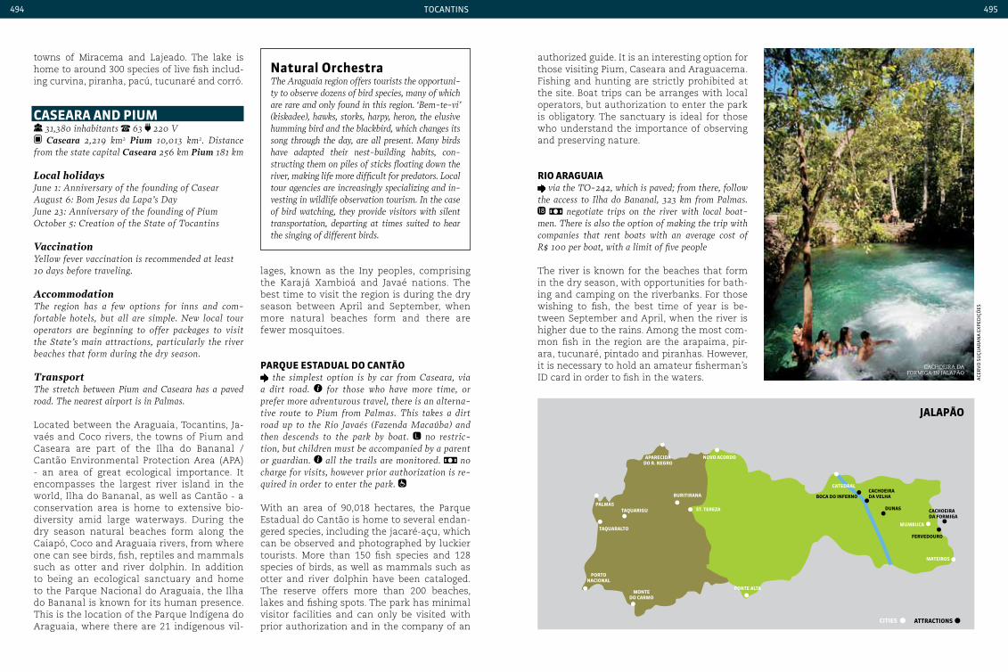
JaLapão
aparecIda do r. neGro
noVo acordo
paLMaS
porto nacIonaL
Monte do carMo
ponte aLta
burItIrana
catedraLcacHoeIra da VeLHa
cacHoeIra da ForMIGa
boca do InFerno
attractIonS
FerVedouro
MuMbuca
cItIeS
MateIroS
taQuarIGu St. tereza
taQuaraLto
dunaS
toCantins494 495
lages, known as the Iny peoples, comprising the Karajá Xambioá and Javaé nations. The best time to visit the region is during the dry season between April and September, when more natural beaches form and there are fewer mosquitoes.
parQue eStaduaL do cantão the simplest option is by car from caseara, via
a dirt road. for those who have more time, or prefer more adventurous travel, there is an alterna-tive route to Pium from Palmas. This takes a dirt road up to the Rio Javaés (Fazenda Macaúba) and then descends to the park by boat. no restric-tion, but children must be accompanied by a parent or guardian. all the trails are monitored. no charge for visits, however prior authorization is re-quired in order to enter the park.
With an area of 90,018 hectares, the Parque Estadual do Cantão is home to several endan-gered species, including the jacaré-açu, which can be observed and photographed by luckier tourists. More than 150 fish species and 128 species of birds, as well as mammals such as otter and river dolphin have been cataloged. The reserve offers more than 200 beaches, lakes and fishing spots. The park has minimal visitor facilities and can only be visited with prior authorization and in the company of an
authorized guide. It is an interesting option for those visiting Pium, Caseara and Araguacema. Fishing and hunting are strictly prohibited at the site. Boat trips can be arranges with local operators, but authorization to enter the park is obligatory. The sanctuary is ideal for those who understand the importance of observing and preserving nature.
rIo araGuaIa via the TO-242, which is paved; from there, follow
the access to Ilha do Bananal, 323 km from Palmas. negotiate trips on the river with local boat-
men. There is also the option of making the trip with companies that rent boats with an average cost of R$ 100 per boat, with a limit of five people
The river is known for the beaches that form in the dry season, with opportunities for bath-ing and camping on the riverbanks. For those wishing to fish, the best time of year is be-tween September and April, when the river is higher due to the rains. Among the most com-mon fish in the region are the arapaima, pir-ara, tucunaré, pintado and piranhas. However, it is necessary to hold an amateur fisherman’s ID card in order to fish in the waters.
natural orchestra The Araguaia region offers tourists the opportuni-ty to observe dozens of bird species, many of which are rare and only found in this region. ‘Bem-te-vi’ (kiskadee), hawks, storks, harpy, heron, the elusive humming bird and the blackbird, which changes its song through the day, are all present. Many birds have adapted their nest-building habits, con-structing them on piles of sticks floating down the river, making life more difficult for predators. Local tour agencies are increasingly specializing and in-vesting in wildlife observation tourism. In the case of bird watching, they provide visitors with silent transportation, departing at times suited to hear the singing of different birds.
cachoeira da formiga in jalaPão
aCe
rV
o s
uçu
ar
an
a e
Xped
içõ
es
towns of Miracema and Lajeado. The lake is home to around 300 species of live fish includ-ing curvina, piranha, pacú, tucunaré and corró.
caSeara and pIuM 31,380 inhabitants 63 220 V Caseara 2,219 km2 Pium 10,013 km2. Distance
from the state capital Caseara 256 km Pium 181 km
Local holidaysJune 1: Anniversary of the founding of casearAugust 6: Bom Jesus da Lapa’s DayJune 23: Anniversary of the founding of PiumOctober 5: creation of the State of Tocantins
VaccinationYellow fever vaccination is recommended at least 10 days before traveling.
AccommodationThe region has a few options for inns and com-fortable hotels, but all are simple. New local tour operators are beginning to offer packages to visit the State’s main attractions, particularly the river beaches that form during the dry season.
TransportThe stretch between Pium and caseara has a paved road. The nearest airport is in Palmas.
Located between the Araguaia, Tocantins, Ja-vaés and Coco rivers, the towns of Pium and Caseara are part of the Ilha do Bananal / Cantão Environmental Protection Area (APA) - an area of great ecological importance. It encompasses the largest river island in the world, Ilha do Bananal, as well as Cantão - a conservation area is home to extensive bio-diversity amid large waterways. During the dry season natural beaches form along the Caiapó, Coco and Araguaia rivers, from where one can see birds, fish, reptiles and mammals such as otter and river dolphin. In addition to being an ecological sanctuary and home to the Parque Nacional do Araguaia, the Ilha do Bananal is known for its human presence. This is the location of the Parque Indígena do Araguaia, where there are 21 indigenous vil-
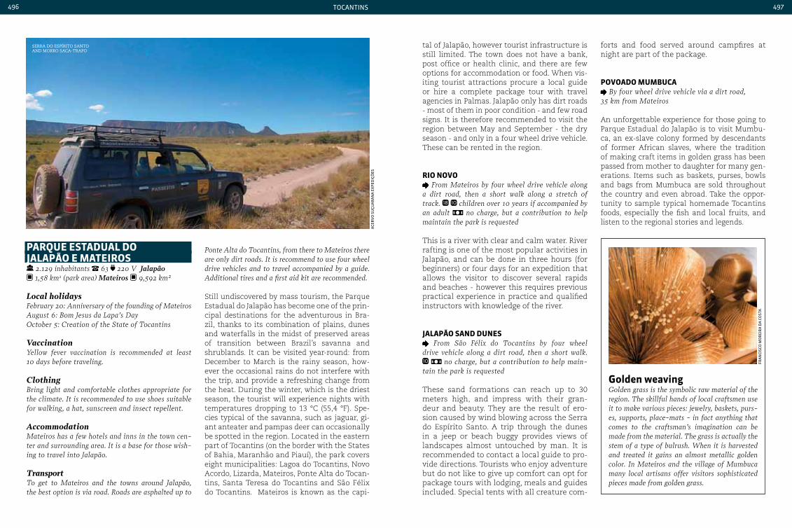
toCantins496 497
parQue eStaduaL do JaLapão e MateIroS
2.129 inhabitants 63 220 V Jalapão 1,58 km2 (park area) Mateiros 9,592 km²
Local holidaysFebruary 20: Anniversary of the founding of Mateiros August 6: Bom Jesus da Lapa’s Day October 5: creation of the State of Tocantins
VaccinationYellow fever vaccination is recommended at least 10 days before traveling.
ClothingBring light and comfortable clothes appropriate for the climate. It is recommended to use shoes suitable for walking, a hat, sunscreen and insect repellent.
AccommodationMateiros has a few hotels and inns in the town cen-ter and surrounding area. It is a base for those wish-ing to travel into Jalapão.
TransportTo get to Mateiros and the towns around Jalapão, the best option is via road. Roads are asphalted up to
Ponte Alta do Tocantins, from there to Mateiros there are only dirt roads. It is recommend to use four wheel drive vehicles and to travel accompanied by a guide. Additional tires and a first aid kit are recommended.
Still undiscovered by mass tourism, the Parque Estadual do Jalapão has become one of the prin-cipal destinations for the adventurous in Bra-zil, thanks to its combination of plains, dunes and waterfalls in the midst of preserved areas of transition between Brazil’s savanna and shrublands. It can be visited year-round: from December to March is the rainy season, how-ever the occasional rains do not interfere with the trip, and provide a refreshing change from the heat. During the winter, which is the driest season, the tourist will experience nights with temperatures dropping to 13 °C (55,4 °F). Spe-cies typical of the savanna, such as jaguar, gi-ant anteater and pampas deer can occasionally be spotted in the region. Located in the eastern part of Tocantins (on the border with the States of Bahia, Maranhão and Piauí), the park covers eight municipalities: Lagoa do Tocantins, Novo Acordo, Lizarda, Mateiros, Ponte Alta do Tocan-tins, Santa Teresa do Tocantins and São Félix do Tocantins. Mateiros is known as the capi-
Golden weavingGolden grass is the symbolic raw material of the region. The skillful hands of local craftsmen use it to make various pieces: jewelry, baskets, purs-es, supports, place-mats - in fact anything that comes to the craftsman’s imagination can be made from the material. The grass is actually the stem of a type of bulrush. When it is harvested and treated it gains an almost metallic golden color. In Mateiros and the village of Mumbuca many local artisans offer visitors sophisticated pieces made from golden grass.
serra do esPírito santo and morro saca-traPo
tal of Jalapão, however tourist infrastructure is still limited. The town does not have a bank, post office or health clinic, and there are few options for accommodation or food. When vis-iting tourist attractions procure a local guide or hire a complete package tour with travel agencies in Palmas. Jalapão only has dirt roads - most of them in poor condition - and few road signs. It is therefore recommended to visit the region between May and September - the dry season - and only in a four wheel drive vehicle. These can be rented in the region.
rIo noVo From Mateiros by four wheel drive vehicle along
a dirt road, then a short walk along a stretch of track. children over 10 years if accompanied by an adult no charge, but a contribution to help maintain the park is requested
This is a river with clear and calm water. River rafting is one of the most popular activities in Jalapão, and can be done in three hours (for beginners) or four days for an expedition that allows the visitor to discover several rapids and beaches - however this requires previous practical experience in practice and qualified instructors with knowledge of the river.
JaLapão Sand duneS From São Félix do Tocantins by four wheel
drive vehicle along a dirt road, then a short walk. no charge, but a contribution to help main-
tain the park is requested
These sand formations can reach up to 30 meters high, and impress with their gran-deur and beauty. They are the result of ero-sion caused by wind blowing across the Serra do Espírito Santo. A trip through the dunes in a jeep or beach buggy provides views of landscapes almost untouched by man. It is recommended to contact a local guide to pro-vide directions. Tourists who enjoy adventure but do not like to give up comfort can opt for package tours with lodging, meals and guides included. Special tents with all creature com-
forts and food served around campfires at night are part of the package.
poVoado MuMbuca By four wheel drive vehicle via a dirt road,
35 km from Mateiros
An unforgettable experience for those going to Parque Estadual do Jalapão is to visit Mumbu-ca, an ex-slave colony formed by descendants of former African slaves, where the tradition of making craft items in golden grass has been passed from mother to daughter for many gen-erations. Items such as baskets, purses, bowls and bags from Mumbuca are sold throughout the country and even abroad. Take the oppor-tunity to sample typical homemade Tocantins foods, especially the fish and local fruits, and listen to the regional stories and legends.
aCe
rV
o s
uçu
ar
an
a e
Xped
içõ
es
fra
nCi
sCo
mo
rei
ra
da
Co
sta

Responsible AgencyArtplan Production
General DirectionSérgio Motta Mello
Planning DirectorSelma Santa Cruz
Content DirectorErnesto Bernardes
PlanningAna Lúcia Araújo
Commercial ManagerLuís Castro
Clients and Projects ManagerCarolina Longo
Clients ManagerJuliana Satto EditingDaniele Aronque
Text and ResearchAna Karla Rodrigues, Cristina Charão Marques, Lara Silbiger, Maira Termero, Mila Vanícola, Noelly Russo, Renata Rufatto and Ronaldo Mendes Art Direction and Graphic ProjectRenato Leal
Art EditingThais Bellini
Art CoordinationDaniela Sato
LayoutAdriano Moreno Barbosa, Andrea Chang, Amanda Justiniano, Daniela Sato, Fernanda Maria Muniz, João Guitton, Lídia Arrais and Luiz Felipe Gualtieri Monteiro MapsAlan Key
IconographyRenate Hartfiel
Image treatmentEduardo Jordão
Translation and ProofreadingTES Brasil
ProductionClaudia Cardoso and Fabiana Baioni
PrintGráfica e Editora Positiva Ltda. Cover credits1. Hans Georg2. André Turatti3. Daniel Arcanjo4. Ayrton Porto5. Milton Galvani6. Roberto Faria7. Marcio Barcellos8. Hans Georg9. Daniel de Granville10. Mario Sergio Silvestre11. Rita Barreto12. Acervo do Ministério do turismo13. Roberto Faria14. Neno Vianna15. Gabriel Lordello16. Felipe Gombossy17. Cristiano W. Soares18. Ricardo Junqueira19. Aluizio Gomes Accioly Filho20. Marco Ceotto21. Ayrton Camargo
Tourist Guide
Tou
rist Gu
ide
visitbrasil.com
1 12
15
19
18
4
9
7
13
16
20
5
10
3 14
17
21
6
11
8
2