Embed Size (px)
Citation preview
DGB I
Bosnia and Herzegovinacampsites | campingplätze | campeggi
www.bhtourism.ba
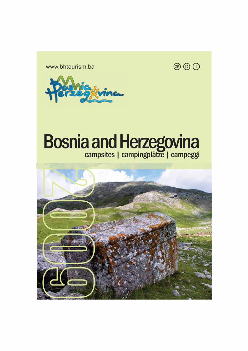
LegendZeichenerklärung / Leggenda
Number of Camping SpacesAnzahl der parzellierten StellplätzeNumero piazzoleBeds - äumberBetten - AnzahlLetti – NumeroBungalow - NumberBungalows – AnzahlNumero bungalowCaravan RentalVermietung von WohnmobilenRoulotte da affittareCaravan AccessZugänglich für WohnmobileNumero roulotteTentMietzelteTende da affittare
Toilets – NumberToiletten – AnzahlNumero toiletteChemical toilet disposal (special drainage) Entleerung von Chemietoiletten (separater Abfluss)Vuotatoio chimico Showers – NumberDuschen - AnzahlDoccie – In totale
Children’s playgroundKinderspielplatzParco giochi
Sports fieldSportplätzeCampo sport
Pets allowedHaustiere erlaubtAccesso animali domestici
Dishwashing basinSpülbeckenSanitari per cucina Wash basin - NumberWaschbecken – AnzahlLavandini – In totale
RestaurantRestaurantRistoranteCafé barCafé-BarBar Electicity OutletStromanschlussPrese correnteTelephone boothTelefonzelleTelefono pubblicoParking placeParkplatzParcheggioAmbulanceAmbulanzAssistenza medicaWashing machineWaschmaschineLavanderiaShop Lebensmittelladen – MinimarketMarket
CapacityKapazität (Anzahl der Campingäste)Numero persone
Accessible to disabled Behinderten gerecht Accesso disabili
ImpressumThe Tourism Association of Bosnia and Herzegovina and the listed campsites in Bosnia and Herzegovina can assume no responsibility for any possible errors or misprints.This brochure is published by: Tourism Association of Bosnia and Herzegovina, Branilaca Sarajeva 21/4, Sarajevo 71000, Tel/Fax:+387 (0)33 252900, Email: [email protected], Web: www.bhtourism.baConcept and design by: Green Visions, Munever SalihovićMap design by: Ademir HukićPhotographs provided by: Tourism Association of Bosnia and Herzegovina Archives, Deutsche Gesellschaft für Technische Zusammenarbeit (GTZ) GmbH Archives, Aleksandar Pastir, Ermin Lipović, Munever Salihović, Green Visions, Sebastien Venuat, Tim Clancy.Supported by: Deutsche Gesellschaft für Technische Zusammenarbeit (GTZ) GmbH, Bundesministerium für wirtschaftliche Zusammenarbeit und Entwicklung, Tourism Association of Bosnia and Herzegovina, Tourism Organization of Republika Srpska
3
4
8
16
24
26
32
44
48
Central BosniaZentralbosnienBosnia centrale
East BosniaOstbosnien Bosnia Orientale
HerzegovinaHerzegowina Erzegovina
North East BosniaNordostbosnien Bosnia Nord-Est
MapLandkarteMappa
North West BosniaNordwestbosnienBosnia Nord Ovest
SarajevoSarajewo Sarajevo
About Bosnia and HerzegovinaŰber Bosnien-HerzegowinaDati Sulla Bosnia Erzegovina
ContentsInhaltsverzeichnis / Indice
Central BosniaZentralbosnien / Bosnia Centrale
Jajc
e
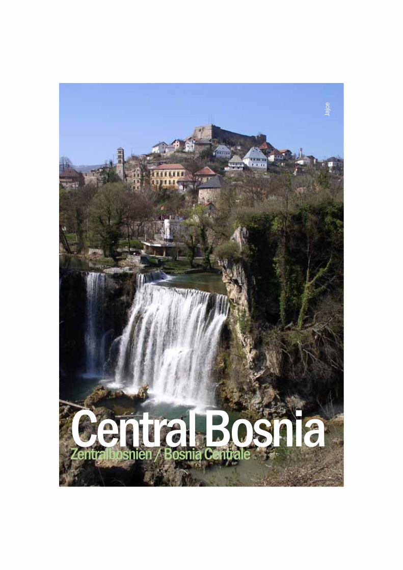
Central Bosnia has a long and remarkable history. This delicate and fascinating mélange of western and eastern cultures marks the true character of Central Bosnia. This tiny kingdom, with its fortresses perched throughout the lush, green rolling hills of this region offers a warm and hospitable experience in the heart of Bosnia’s cultural heritage. As the birthplace of the Bosnian state, this region plays a major role in the cultural, natural and historical heritage of past and present-day Bosnia and Herzegovina.
Zentralbosnien hat eine lange und beachtenswerte Geschichte. Diese sensible und faszinierende Mischung aus westlicher und östlicher Kultur zeichnet den wahren Charakter von Zentralbosnien aus. Dieses winzige Königreich mit Festungen, die in den üppigen, sich grün wälzenden Bergen dieser Region verstreut sind, bietet eine warmherzige und gastfreundliche Erfahrung im Herzen des kulturellen Erbes von Bosnien. Diese Region spielt als Geburtsstätte des bosnischen Staates eine bedeutende Rolle im kulturellen und historischen Erbe, aber das Naturerbe ist ebenfalls von Bedeutung. Dies gilt sowohl für die Vergangenheit als auch für die Gegenwart von Bosnien-Herzegowina.
La Bosnia centrale ha una storia lunga ed eccezionale. Questa miscela delicata ed affascinante di culture occidentali ed orientali segna il vero carattere della Bosnia centrale. Questo piccolo regno, con le sue fortezze fra le colline ricche, verdi e rotonde della regione, offre un’esperienza calorosa ed ospitale nel cuore del patrimonio culturale della Bosnia. Essendo la culla dello stato bosniaco, questa regione ha un grande ruolo il patrimonio culturale, naturale e storico del passato e del presente della Bosnia Erzegovina.
- Kraljeva Sutjeska with its Franciscan Monastery and Bobovac Medieval Fortress
- Visoko with what might turn out to be the first European pyramids!!
- Travnik a city of Mosques- Ajvatovica the largest Muslim holly site in Europe
- Jajce and its spectacular Medieval Citadel and waterfalls
DGB I
- Kraljeva Sutjeska mit demFranziskanerkloster und der mittelal-terlichen Festung Bobovac
- Visoko mit etwas, was sichalsdie ersten europäischen Pyramiden herausstellen könnte!!
- Travnik, eine Stadt der Moscheen- Ajvatovica, die größte muslimische heilige Stätte inEuropa- Jajce und seine spektakuläre mittelalterliche Stadtburg sowie der Wasserfall
- Kraljeva Sutjeska con il suo Monastero francescano e la Fortezza medievale di Bobovac
- Visoko dove potrebbero trovarsi le prime piramidi europee!
- Travnik, città di Moschee- Ajvatovica il più grande santuario musulmano in Europa
- Jajce e la sua spettacolare Cittadella Medievale e le cascate
Highlights
Highlights
Da non perdere
5
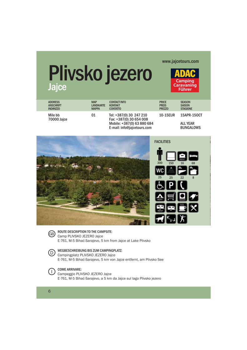
Plivsko jezeroJajce
Mile bb 70000 Jajce
Tel: +387(0) 30 247 210Fax: +387(0) 30 654 008Mobile: +387(0) 63 880 684E-mail: [email protected]
15APR-15OCT
ALL YEAR BUNGALOWS
10-15EUR01
PRICEPREISPREZZO
MAPLANDKARTEMAPPA
CONTACT INFOKONTAKTCONTATTO
SEASONSAISONSTAGIONE
ADDRESSANSCHRIFTINDIRIZZO
www.jajcetours.com
150300 16 68
25 25 22 8
FACILITIES
ROUTE DESCRIPTION TO THE CAMPSITE:Camp PLIVSKO JEZERO Jajce E-761, M-5 Bihać-Sarajevo, 5 km from Jajce at Lake Plivsko
WEGBESCHREIBUNG BIS ZUM CAMPINGPLATZ:Campingplatz PLIVSKO JEZERO Jajce E-761, M-5 Bihać-Sarajevo, 5 km von Jajce entfernt, am Plivsko See
COME ARRIVARE:Campeggio PLIVSKO JEZERO Jajce E-761, M-5 Bihać-Sarajevo, a 5 km da Jajce sul lago Plivsko jezero
D
GB
I
6
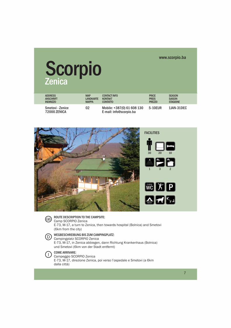
Scorpio Zenica
Smetovi - Zenice72000 ZENICA
Mobile: +387(0) 61 608 130E-mail: [email protected]
1JAN-31DEC5-10EUR02
PRICEPREISPREZZ0
MAPLANDKARTEMAPPA
CONTACT INFOKONTAKTCONTATTO
SEASONSAISONSTAGIONE
ADDRESSANSCHRIFTINDIRIZZO
www.scorpio.ba
2030 10
1 3 2
FACILITIES
ROUTE DESCRIPTION TO THE CAMPSITE:Camp SCORPIO ZenicaE-73, M-17, a turn to Zenica, then towards hospital (Bolnica) and Smetovi (6km from the city)
WEGBESCHREIBUNG BIS ZUM CAMPINGPLATZ:Campingplatz SCORPIO Zenica E-73, M-17, in Zenica abbiegen, dann Richtung Krankenhaus (Bolnica) und Smetovi (6km von der Stadt entfernt)
COME ARRIVARE:Campeggio SCORPIO ZenicaE-73, M-17, direzione Zenica, poi verso l’ospedale e Smetovi (a 6km dalla città)
D
GB
I
7
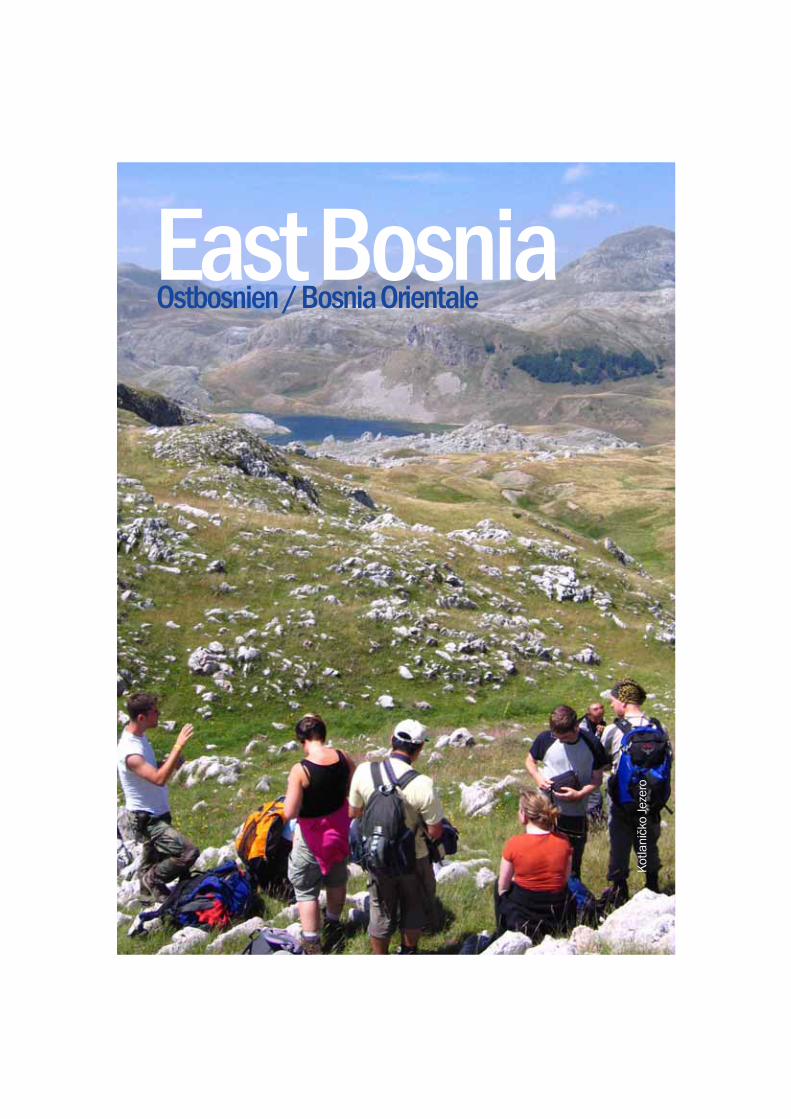
East BosniaOstbosnien / Bosnia Orientale
Kot
lani
čko
Jeze
ro
The eastern part of Bosnia is a very mountainous and isolated region. Few towns are industrialised and most depend on farming and shepherding for a living. One advantage of this so-called ‘underdevelopment’ is the large expanse of untouched wilderness and forests, and the tiny villages that still rely on the land for survival. The Drina River has been a lifeline to the development and growth of this area, and from Foča to Višegrad many beautiful towns have been erected along her banks. The Drina is formed on the border of Montenegro where the Tara and Piva rivers meet.
Der östliche Teil von Bosnien ist eine sehr gebirgige und abgeschottete Region. Nur wenige Städte sind industrialisiert, die meisten leben von der Landwirtschaft, vor allem der Schafzucht. Ein Vorteil dieser wenig entwickelten Gegend ist, dass sich noch immer ausgedehnte Wälder und unberührte Wildnis finden lassen, dazwischen winzige Dörfer, die immer noch auf das Land als Lebensgrundlage vertrauen. Der Fluss Drina entsteht aus den Flüssen Tara und Piva und bildet die Grenze zu Montenegro. Er war die Lebensader und Grundlage für die Entwicklung und das Wachstum dieser Landschaft. Entlang der Drina wurden viele schöne Städtchen, wie beispielsweise Foča oder Višegrad, gegründet.
La parte orientale della Bosnia è particolarmente montuosa ed isolata. Poche città sono industrializzate e la maggior parte deve la sua sopravvivenza all’agricoltura e all’ allevamento. Un vantaggio di questo cosidetto “sottosviluppo” sono le grandi aree naturali e le foreste intatte, ipeaesi piccoli che ancora contano sulla terra per sopravvivere. Il fiume Drina è la fonte di vita dell’attuale sviluppo e la crescita della regione lungo la quale, partendo da Foča fino a Višegrad, sono stati erretti molti splendidi paesi. Il fiume Drina nasce sul confine col Montenegro, dove s’incontrano i fiumi Tara e Piva.
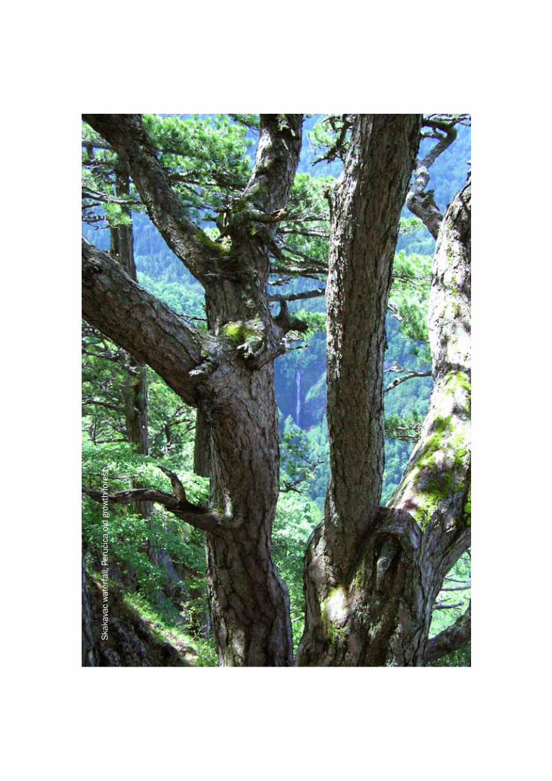
- Sutjeska National Park with one of the last primeval forests in Europe
- Whitewater rafting on the Tara River with canyon walls over 1200 meters above!
- Enjoy a gentle boat ride on the Drina River
- Fly fishing on the numerous mountain streams and rivers
DGB I
- Nationalpark Sutjeska mit einem der letzten Urwälder in Europa
- Wildwasser-Rafting auf dem Fluss Tara mit bis zu 1200 Meter tiefen Schluchten!
- Genießen Sie eine gemächliche Bootsfahrt auf dem Fluss Drina
- Fliegenfischen an zahlreichen Bergbächen und Flüssen
- Kraljeva Sutjeska con il suo Monastero francescano e la Fortezza medievale di Bobovac
- Visoko dove potrebbero trovarsi le prime piramidi europee!
- Travnik, città di Moschee- Ajvatovica il più grande
santuario musulmano in Europa- Jajce e la sua spettacolare
Cittadella Medievale e le cascate
Highlights
Highlights
Da non perdere
9
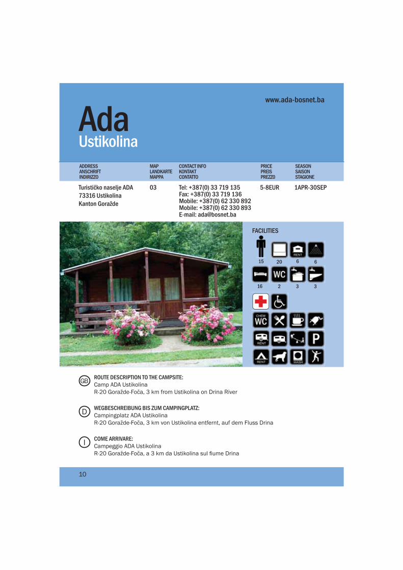
AdaTurističko naselje ADA73316 UstikolinaKanton Goražde
Tel: +387(0) 33 719 135Fax: +387(0) 33 719 136Mobile: +387(0) 62 330 892Mobile: +387(0) 62 330 893E-mail: [email protected]
1APR-30SEP5-8EUR03
UstikolinaPRICEPREISPREZZ0
MAPLANDKARTEMAPPA
CONTACT INFOKONTAKTCONTATTO
SEASONSAISONSTAGIONE
ADDRESSANSCHRIFTINDIRIZZO
www.ada-bosnet.ba
2015 6 6
2 3
FACILITIES
ROUTE DESCRIPTION TO THE CAMPSITE:Camp ADA UstikolinaR-20 Goražde-Foča, 3 km from Ustikolina on Drina River
WEGBESCHREIBUNG BIS ZUM CAMPINGPLATZ:Campingplatz ADA UstikolinaR-20 Goražde-Foča, 3 km von Ustikolina entfernt, auf dem Fluss Drina
COME ARRIVARE:Campeggio ADA UstikolinaR-20 Goražde-Foča, a 3 km da Ustikolina sul fiume Drina
D
GB
I
10
16 3
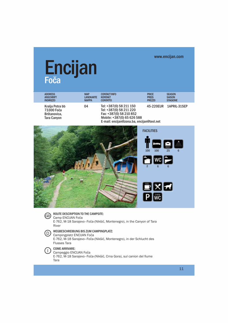
EncijanKralja Petra bb 73300 Foča Brštanovica, Tara Canyon
Tel: +387(0) 58 211 150Tel: +387(0) 58 211 220Fax: +387(0) 58 210 852Mobile: +387(0) 65 626 588E-mail: [email protected], [email protected]
1APRIL-31SEP45-220EUR04
FočaPRICEPREISPREZZ0
MAPLANDKARTEMAPPA
CONTACT INFOKONTAKTCONTATTO
SEASONSAISONSTAGIONE
ADDRESSANSCHRIFTINDIRIZZO
www.encijan.com
100 25
6 6
6
FACILITIES
ROUTE DESCRIPTION TO THE CAMPSITE:Camp ENCIJAN FočaE-762, M-18 Sarajevo–Foča-(Nikšić, Montenegro), in the Canyon of Tara River
WEGBESCHREIBUNG BIS ZUM CAMPINGPLATZ:Campingplatz ENCIJAN FočaE-762, M-18 Sarajevo–Foča-(Nikšić, Montenegro), in der Schlucht des Flusses Tara
COME ARRIVARE:Campeggio ENCIJAN FočaE-762, M-18 Sarajevo–Foča-(Nikšić, Crna Gora), sul canion del fiume Tara
D
GB
I
11
100
2
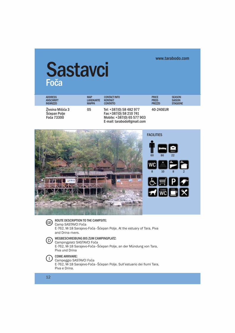
Sastavci Živoina Mišića 3Šćepan PoljeFoča 73300
Tel: +387(0) 58 482 977Fax:+387(0) 58 210 741Mobile: +387(0) 65 577 903E-mail: [email protected]
40-240EUR05
FočaPRICEPREISPREZZ0
MAPLANDKARTEMAPPA
CONTACT INFOKONTAKTCONTATTO
SEASONSAISONSTAGIONE
ADDRESSANSCHRIFTINDIRIZZO
www.tarabodo.com
8 10 8 2
FACILITIES
ROUTE DESCRIPTION TO THE CAMPSITE:Camp SASTAVCI FočaE-762, M-18 Sarajevo-Foča–Šćepan Polje. At the estuary of Tara, Piva and Drina rivers.
WEGBESCHREIBUNG BIS ZUM CAMPINGPLATZ:Campingplatz SASTAVCI FočaE-762, M-18 Sarajevo-Foča–Šćepan Polje, an der Mündung von Tara, Piva und Drina
COME ARRIVARE:Campeggio SASTAVCI FočaE-762, M-18 Sarajevo-Foča–Šćepan Polje. Sull’estuario dei fiumi Tara, Piva e Drina.
D
GB
I
12
228660
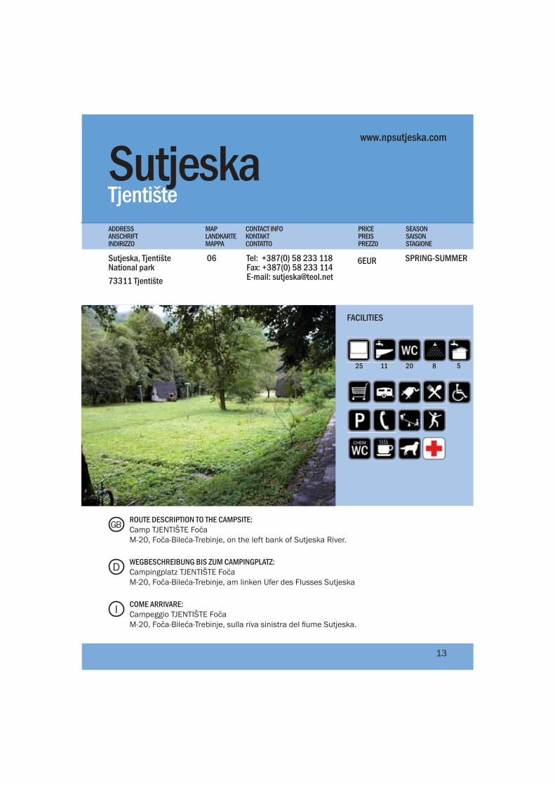
SutjeskaSutjeska, Tjentište National park 73311 Tjentište
Tel: +387(0) 58 233 118Fax: +387(0) 58 233 114E-mail: [email protected]
SPRING-SUMMER6EUR06
TjentištePRICEPREISPREZZ0
MAPLANDKARTEMAPPA
CONTACT INFOKONTAKTCONTATTO
SEASONSAISONSTAGIONE
ADDRESSANSCHRIFTINDIRIZZO
25 20 811 5
FACILITIES
ROUTE DESCRIPTION TO THE CAMPSITE:Camp TJENTIŠTE FočaM-20, Foča-Bileća-Trebinje, on the left bank of Sutjeska River.
WEGBESCHREIBUNG BIS ZUM CAMPINGPLATZ:Campingplatz TJENTIŠTE FočaM-20, Foča-Bileća-Trebinje, am linken Ufer des Flusses Sutjeska
COME ARRIVARE:Campeggio TJENTIŠTE FočaM-20, Foča-Bileća-Trebinje, sulla riva sinistra del fiume Sutjeska.
D
GB
I
13
www.npsutjeska.com
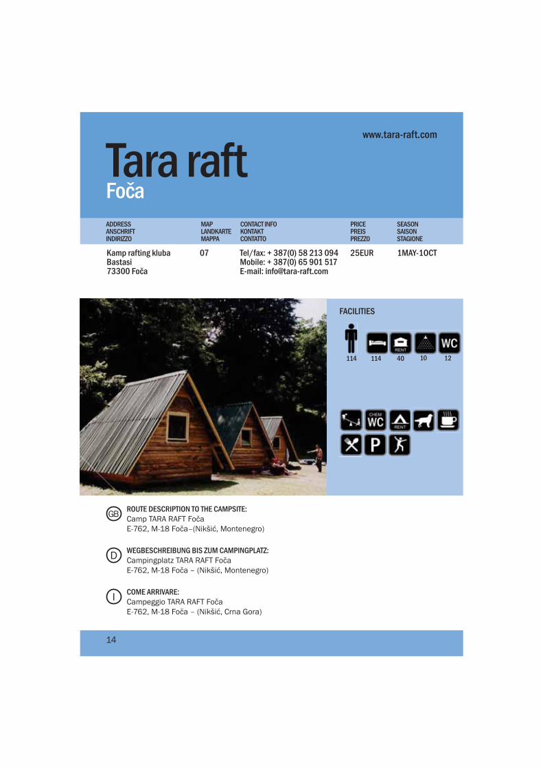
Tara raft Kamp rafting klubaBastasi73300 Foča
Tel/fax: + 387(0) 58 213 094Mobile: + 387(0) 65 901 517E-mail: [email protected]
1MAY-1OCT25EUR07
FočaPRICEPREISPREZZ0
MAPLANDKARTEMAPPA
CONTACT INFOKONTAKTCONTATTO
SEASONSAISONSTAGIONE
ADDRESSANSCHRIFTINDIRIZZO
www.tara-raft.com
114114 40 10
FACILITIES
ROUTE DESCRIPTION TO THE CAMPSITE:Camp TARA RAFT FočaE-762, M-18 Foča–(Nikšić, Montenegro)
WEGBESCHREIBUNG BIS ZUM CAMPINGPLATZ:Campingplatz TARA RAFT FočaE-762, M-18 Foča – (Nikšić, Montenegro)
COME ARRIVARE:Campeggio TARA RAFT FočaE-762, M-18 Foča – (Nikšić, Crna Gora)
D
GB
I
14
12
Skak
avac
wat
erfa
ll, P
eruč
ica
old
grow
th fo
rest
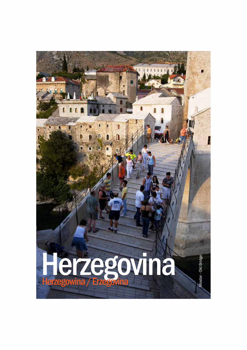
HerzegovinaHerzegowina / Erzegovina M
osta
r - O
ld B
ridge
Bosnia and Herzegovina are two regions geographically divided by the towering Dinaric Alps, where a mild Mediterranean climate clash-es with a harsher continental one. While some areas of Herzegovina are dry, it also possesses some of the greatest resources of fresh water springs, crystal clear rivers and dozens of endemic types of flora and fauna. A warm Mediter-ranean climate dominates most of Herzegovina, creating a very different bio-system than that of Bosnia’s central and northern regions. Figs, pomegranates, grapes, kiwi’s, rose hip and man-darins all grow in this sunny cli-mate. The natural and cultural heritage of Herzegovina and all its peoples can confidently be touted as the richest and most attractive region for tourism in Bosnia and Herzegovina.
Bosnien und Herzegowina sind zwei, geographisch durch die gewaltigen Dinarischen Alpen getrennten Regionen. Hier tref-fen das milde mediterrane Klima der Herzegowina und das raue kontinentale von Bosnien aufein-ander. Obwohl die Herzegowina eher regenarm ist, verfügt sie über einige der großartigsten Frischwasserquellen, kristallklare Flüsse und über eine vielfältige und einzigartige Pflanzen- und Tierwelt. Das milde Klima und die zahlreichen Sonnentage brin-gen eine Vielzahl mediterraner Früchte hervor: Feigen, Granatäp-fel, Trauben, Kiwi, Hagebutte und Mandarinen. Zusammen mit dem reichhaltigen kulturellen Erbe, kann die Herzegowina als eine der attraktivsten Urlaubsre-gionen in Bosnien-Herzegowina überhaupt bezeichnet werden.
Bosnia ed Erzegovina sono due regioni geograficamente divise dalle gigantesche Dinaridi, dove si scontrano il clima mite medi-terraneo e quello più rigido con-tinentale. Anche se alcune parti dell’Erzegovina sono secche, ci sono anche delle grandi risorse di sorgenti di acqua fresca, fiumi lim-pidi e dozzine di speci endemiche di flora e fauna. Un clima caldo mediterraneo domina nella mag-gior parte della regione, creando bio-sistemi molto diversi da quelli della Bosnia centrale e regioni settentrionali. Fichi, melagrani, uva, kiwi, rosa selvatica e manda-rini crescono in questo clima so-leggiato. Il patrimonio naturale e culturale dell’Erzegovina ed i suoi abitati puo’ essere denominata la regione più ricca ed attraente per il turismo della Bosnia Erze-govina.
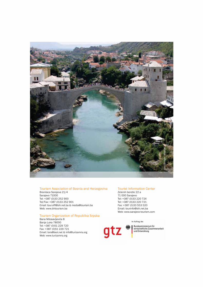
- Rafting on the Neterva river- Visit Mostar with its fine Otomanarchitecture and the Old Brige
- Wine route along many small vineyards producing some of the finest wines in southern Europe
- Medugorje the 2nd largest Catholic Pilgrimage in the world
- Kravica waterfalls and a canoe safari on the Trebizat river
- Boat ride through the marshes of Hutovo Blato Bird Reserve, the largest in southern Europe.
- Stroll around Radimlja with its numerous medieval tombstones
- Discover Počitelj with its unique architecture and artist colony
DGB I
- Rafting auf dem Fluss Neretva- Besuch in Mostar mit der Architektur aus dem Osmanischen Reich und der Alten Brücke
- Weinstraße entlang vieler kleiner Weinberge, auf welchen einige der feinsten Weinsorten in Südosteuropa hergestellt werden
- Međugorje, die zweitgrößte katholische Pilgerstätte in der Welt
- Wasserfall Kravica und Kanusafari auf dem Fluss Trebižat
- Bootsfahrt durch das mediterrane Feuchtgebiet Hutovo Blato, das größte Vogelreservat in Südosteuropa
- Spaziergang rund um Radimlja mit seinen zahlreichen mittelalterlichen Grabsteinen
- Entdecken Sie Počitelj mit seiner einzigartigen Architektur und der Künstlerkolonie
- Rafting sul fiume Neretva- Visita di Mostar con la sua architettura ottomana e la Citta’ vecchia’
- La strada del vino lungo i numerosi piccoli vigneti che produconoalcuni dei vini più delicati dell’Europa meridionale
- Medugorje il secondo luogo del più grande pellegrinaggio cattolico del mondo
- Cascate Kravica e canoa safari sul fiume Trebižat
- Giri in barca attraverso le paludi della riserva di uccelli Hutovo Blato, la più grande dell’Europa meridionale
- Una passeggiata a Radimljacon le sue numerose tombe funerarie medievali
- Scoprire Počitelj con la sua achitettura unica e la galleria d’arte
Highlights Highlights Da non perdere
17
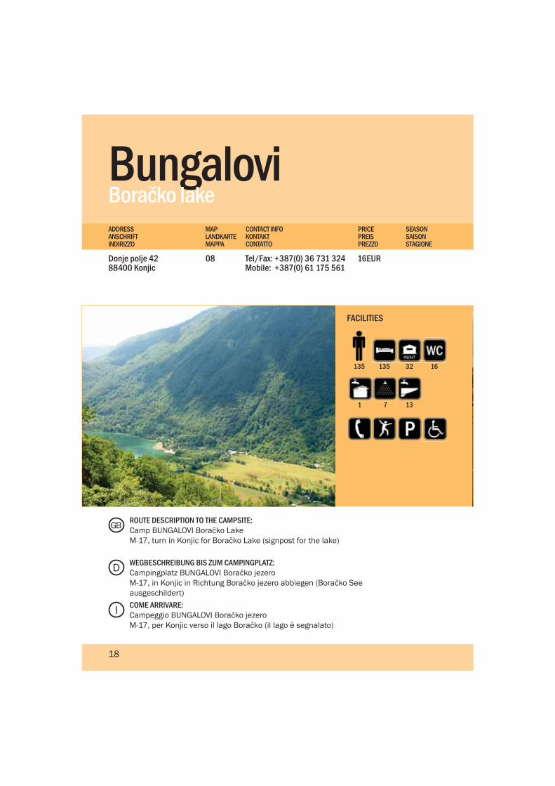
BungaloviDonje polje 42 88400 Konjic
Tel/Fax: +387(0) 36 731 324Mobile: +387(0) 61 175 561
16EUR08
Boračko lakePRICEPREISPREZZ0
MAPLANDKARTEMAPPA
CONTACT INFOKONTAKTCONTATTO
SEASONSAISONSTAGIONE
ADDRESSANSCHRIFTINDIRIZZO
135135 32 16
137
FACILITIES
ROUTE DESCRIPTION TO THE CAMPSITE:Camp BUNGALOVI Boračko LakeM-17, turn in Konjic for Boračko Lake (signpost for the lake)
WEGBESCHREIBUNG BIS ZUM CAMPINGPLATZ:Campingplatz BUNGALOVI Boračko jezeroM-17, in Konjic in Richtung Boračko jezero abbiegen (Boračko See ausgeschildert) COME ARRIVARE:Campeggio BUNGALOVI Boračko jezeroM-17, per Konjic verso il lago Boračko (il lago è segnalato)
D
GB
I
18
1
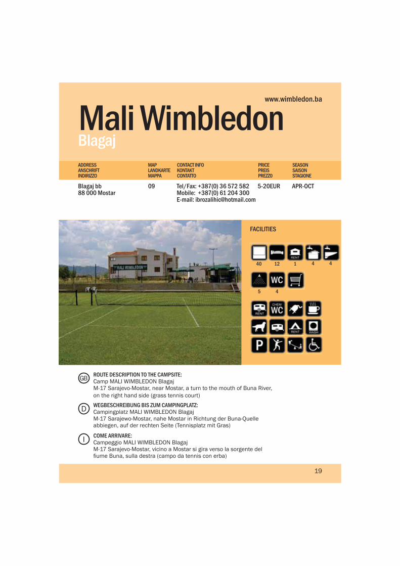
Mali WimbledonBlagaj
Blagaj bb88 000 Mostar
Tel/Fax: +387(0) 36 572 582Mobile: +387(0) 61 204 300E-mail: [email protected]
APR-OCT5-20EUR09
PRICEPREISPREZZ0
MAPLANDKARTEMAPPA
CONTACT INFOKONTAKTCONTATTO
SEASONSAISONSTAGIONE
ADDRESSANSCHRIFTINDIRIZZO
www.wimbledon.ba
1240 1
45
4
FACILITIES
ROUTE DESCRIPTION TO THE CAMPSITE:Camp MALI WIMBLEDON BlagajM-17 Sarajevo-Mostar, near Mostar, a turn to the mouth of Buna River, on the right hand side (grass tennis court)
WEGBESCHREIBUNG BIS ZUM CAMPINGPLATZ:Campingplatz MALI WIMBLEDON BlagajM-17 Sarajewo-Mostar, nahe Mostar in Richtung der Buna-Quelle abbiegen, auf der rechten Seite (Tennisplatz mit Gras)
COME ARRIVARE:Campeggio MALI WIMBLEDON BlagajM-17 Sarajevo-Mostar, vicino a Mostar si gira verso la sorgente del fiume Buna, sulla destra (campo da tennis con erba)
D
GB
I
19
4
OazaKonjic
Orahovica bb, Jablaničko jezero88400 Konjic
Tel/Fax: +387(0) 36 721 722Mobile: +387(0) 61 222 646E-mail: [email protected]
1MAY-30SEP5-15EUR10
PRICEPREISPREZZ0
MAPLANDKARTEMAPPA
CONTACT INFOKONTAKTCONTATTO
SEASONSAISONSTAGIONE
ADDRESSANSCHRIFTINDIRIZZO
www.jablanicko-jezero.freeservers.com/kamp_oaza.html
2080-100 3 2
4
FACILITIES
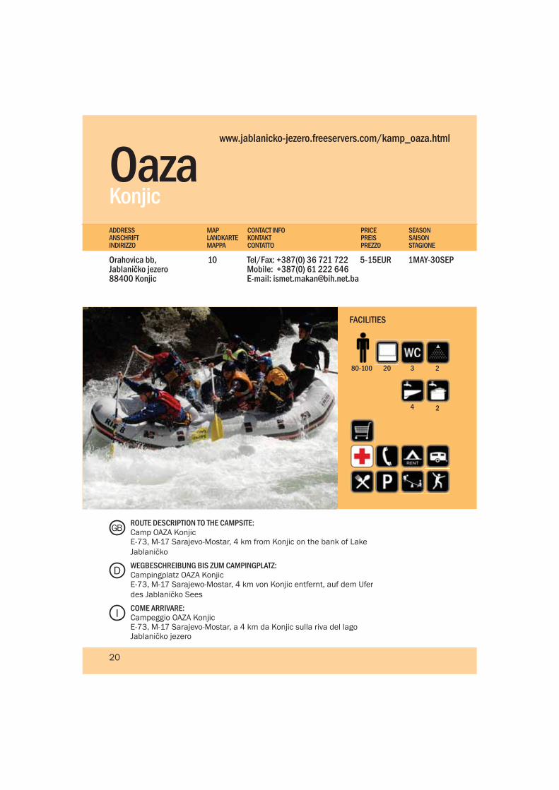
ROUTE DESCRIPTION TO THE CAMPSITE:Camp OAZA KonjicE-73, M-17 Sarajevo-Mostar, 4 km from Konjic on the bank of Lake Jablaničko
WEGBESCHREIBUNG BIS ZUM CAMPINGPLATZ:Campingplatz OAZA KonjicE-73, M-17 Sarajewo-Mostar, 4 km von Konjic entfernt, auf dem Ufer des Jablaničko Sees
COME ARRIVARE:Campeggio OAZA KonjicE-73, M-17 Sarajevo-Mostar, a 4 km da Konjic sulla riva del lago Jablaničko jezero
D
GB
I
20
2
Ramska Kuća Prozor
Makljen - Planina88440 Prozor-Rama
Tel.: +387 (0)36 770 242Fax.: +387 (0)36 770 218
1MAY-15OCT3-15EUR11
PRICEPREISPREZZ0
MAPLANDKARTEMAPPA
CONTACT INFOKONTAKTCONTATTO
SEASONSAISONSTAGIONE
ADDRESSANSCHRIFTINDIRIZZO
www.travel-tourist.com
2060 26 6
8 8 6
FACILITIES
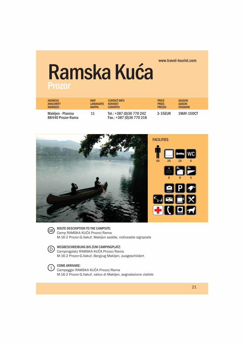
ROUTE DESCRIPTION TO THE CAMPSITE:Camp RAMSKA KUĆA Prozor/RamaM-16-2 Prozor-G.Vakuf, Makljen saddle, noticeable signposts
WEGBESCHREIBUNG BIS ZUM CAMPINGPLATZ:Campingplatz RAMSKA KUĆA Prozor/RamaM-16-2 Prozor-G.Vakuf, Bergzug Makljen, ausgeschildert
COME ARRIVARE:Campeggio RAMSKA KUĆA Prozor/RamaM-16-2 Prozor-G.Vakuf, valico di Makljen, segnalazione visibile
D
GB
I
21
ZemoMeđugorje
Sivrići bb88266 Međugorje
Tel./Fax.: +387 (0)36 651 878Mobile: +387(0)63 360 878E-mail: [email protected]
1JAN-31DEC3-8EUR12
PRICEPREISPREZZ0
MAPLANDKARTEMAPPA
CONTACT INFOKONTAKTCONTATTO
SEASONSAISONSTAGIONE
ADDRESSANSCHRIFTINDIRIZZO
www.tel.net.ba/medjugorje-pansion.camp
6565 63 5
5 12 12
FACILITIES
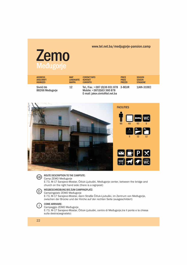
ROUTE DESCRIPTION TO THE CAMPSITE:Camp ZEMO MeđugorjeE-73, M-17 Sarajevo-Mostar, Čitluk-Ljubuški, Međugorje center, between the bridge and church on the right hand side (there is a signpost)
WEGBESCHREIBUNG BIS ZUM CAMPINGPLATZ:Campingplatz ZEMO MeđugorjeE-73, M-17 Sarajevo-Mostar, dann Straße Čitluk-Ljubuški, im Zentrum von Međugorje, zwischen der Brücke und der Kirche auf der rechten Seite (ausgeschildert)
COME ARRIVARE:Campeggio ZEMO MeđugorjeE-73, M-17 Sarajevo-Mostar, Čitluk-Ljubuški, centro di Međugorje,tra il ponte e la chiesa sulla destra(segnalato)
D
GB
I
22
Međ
ugor
je

North East BosniaNordostbosnien / Bosnia Nord-Est
Sreb
reni
k, M
edie
val C
astle
The northeast corner of Bosnia and Herzegovina is the industrial backbone of the country. However don’t let that deter you as there are still dozens of places to see and visit, and like any other part of BiH you don’t have to go very far to find an isolated mountain, a cool stream or a thick green forest, that have existed since far back into the middle ages. The mountains and lakes, particularly in the far east, are endless green carpets of magnificent natural terrain. Konjuh, Majevica, and Ozren crisscross the middle section of the northeast and create large natural boundaries between the mountain hill climates and the long flatlands of Semberija in the extreme north of the region.
- Walking through the rolling of the Konjuh Mountain range
- Mineral water springs at Slana Banja and Kiseljak
- Visit the beautiful small Ottoman town of Gradačac
- Fishing in the numerous freshwater lakes dotted in the region
- Explore the numerous small canyons and caves in the Tajan Nature Park
- Srebrenica and its impressive Memorial Center in Potocari
DGB I
- Wandern durch die hügelige Gebirgskette Konjuh
- Mineralwasserquellen in Slana Banja und Kiseljak
- Besuchen Sie die wunderschöne kleine Stadt Gradačac aus der Zeit des Osmanischen Reichs
- Angeln in zahlreichen Frischwasserseen, die in der Region verstreut sind
- Erkunden Sie die vielen kleinen Schluchten und Höhlen im Naturpark Tajan
- Srebrenica und die eindrucksvolle Gedenkstätte in Potočari
- Passeggiata attraverso le catene montuose di Konjuh
- Sorgenti di acque minerali a Slana Banja e Kiseljak
- Visita paesino ottomano di del Gradačac
- Pesca sui numerosi laghi con acqua fresca che punteggiano la regione
- Esplorazione dei numerosi piccoli canion e delle grotte nel Parco naturale di Tajan
- Srebrenica e il suo importante Centro della Memoria a Potočari
Highlights Highlights Da non perdere
Die nordöstliche Ecke von Bosnien-Herzegowina ist das wirtschaftliche Rückgrat des Landes. Doch lassen Sie sich nicht davon abschrecken, denn dort sind viele Orte einer Besichtigung und eines Besuchs wert und wie in jedem anderen Teil von Bosnien-Herzegowina, müssen Sie nicht weit reisen, um einen abgelegenen Berg, ein kühles Gewässer oder einen undurchdringlichen grünen Wald zu finden, die bereits seit uralten Zeiten existieren. Berge und Seen bilden endlose grüne Teppiche. Die Hügelketten Konjuh, Majevica und Ozren kreuzen den mittleren Abschnitt des Nordostens und bilden eine riesige natürliche Abgrenzung zwischen dem Gebirgsklima und dem weiten Flachland von Semberija, ganz im Norden der Region.
L’angolo nord-est della Bosnia Erzegovina è la base industri-ale del paese. Ma non fatevi scoraggiare da questo poichè ci sono molti posti da vedere e visitare e, come in altre parti della Bosnia Erzegovina, non dovete andare lontano per tro-vare una montagna isolata, un ruscello fresco o una foresta densa e verde esistente da centenni. Le montagne e i laghi, in particolare nell’ est, creano degli infiniti tap-peti verdi di magnifici terreni naturali. Konjuh, Majevica, e Ozren attraversano la sezione centrale del nord-est creando grandi confini naturali tra i climi montani e le lunghe pia-nure di Semberija all’estremo nord del paese.
25
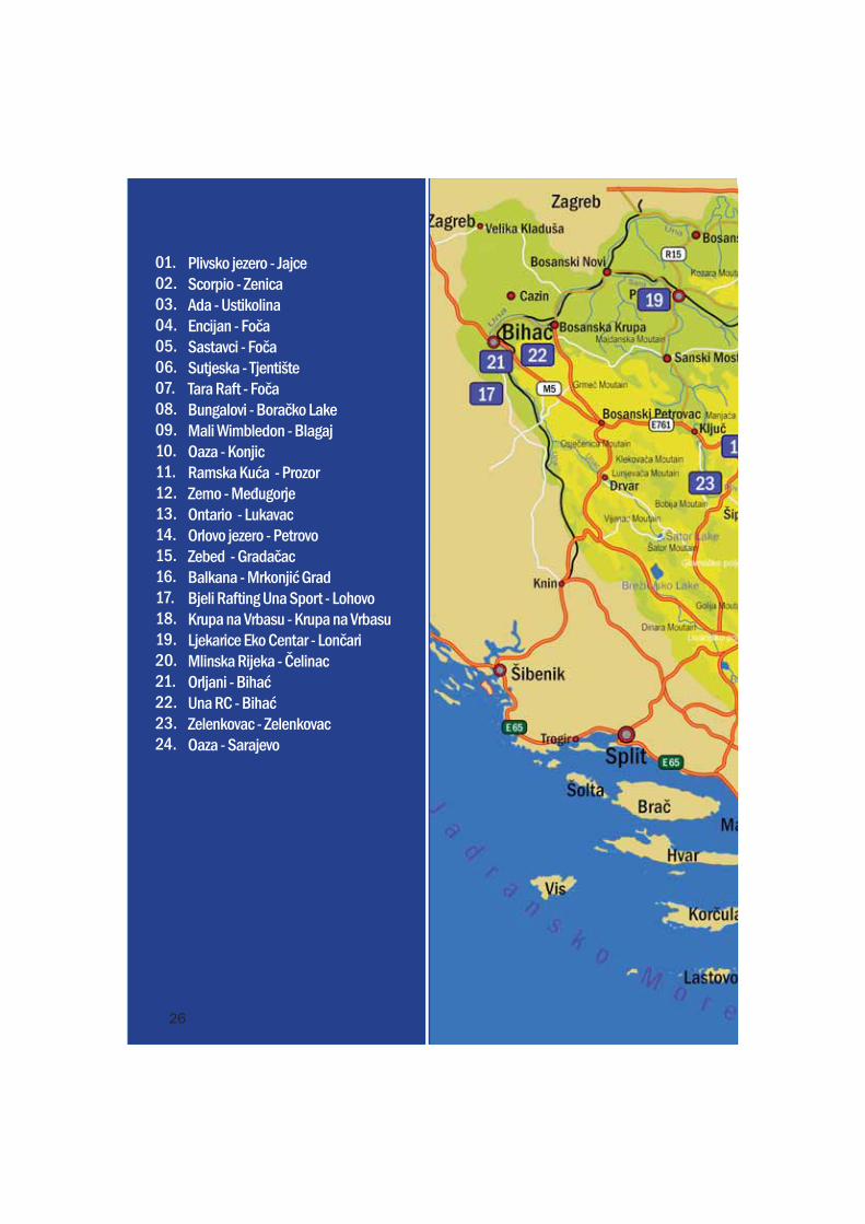
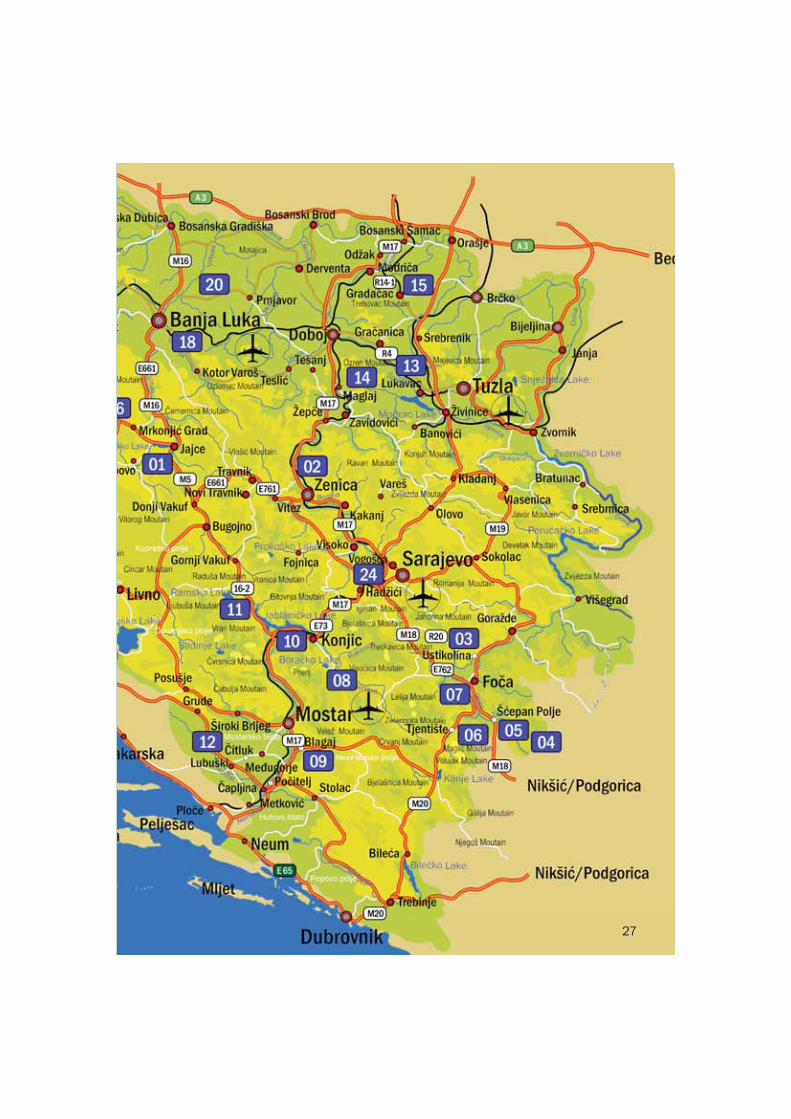
Plivsko jezero - JajceScorpio - ZenicaAda - UstikolinaEncijan - FočaSastavci - FočaSutjeska - TjentišteTara Raft - FočaBungalovi - Boračko LakeMali Wimbledon - BlagajOaza - KonjicRamska Kuća - ProzorZemo - MeđugorjeOntario - LukavacOrlovo jezero - PetrovoZebed - GradačacBalkana - Mrkonjić GradBjeli Rafting Una Sport - LohovoKrupa na Vrbasu - Krupa na VrbasuLjekarice Eko Centar - LončariMlinska Rijeka - ČelinacOrljani - BihaćUna RC - BihaćZelenkovac - ZelenkovacOaza - Sarajevo
01.02.03.04.05.06.07.08.09.10.11.12.13.14.15.16.17.18.19.20.21.22.23.24.
26
27
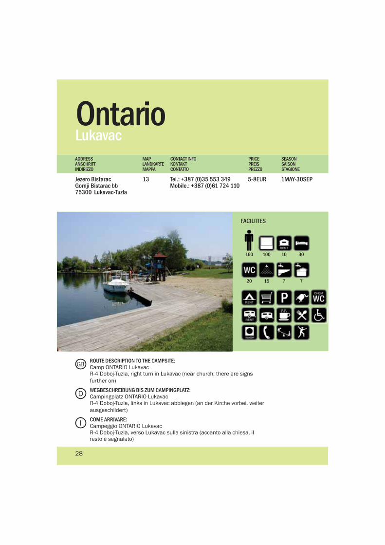
Ontario Lukavac
Jezero BistaracGornji Bistarac bb75300 Lukavac-Tuzla
Tel.: +387 (0)35 553 349Mobile.: +387 (0)61 724 110
1MAY-30SEP5-8EUR13
PRICEPREISPREZZ0
MAPLANDKARTEMAPPA
CONTACT INFOKONTAKTCONTATTO
SEASONSAISONSTAGIONE
ADDRESSANSCHRIFTINDIRIZZO
100160 10 30
20 15 7 7
FACILITIES
ROUTE DESCRIPTION TO THE CAMPSITE:Camp ONTARIO LukavacR-4 Doboj-Tuzla, right turn in Lukavac (near church, there are signs further on)
WEGBESCHREIBUNG BIS ZUM CAMPINGPLATZ:Campingplatz ONTARIO LukavacR-4 Doboj-Tuzla, links in Lukavac abbiegen (an der Kirche vorbei, weiter ausgeschildert)
COME ARRIVARE:Campeggio ONTARIO LukavacR-4 Doboj-Tuzla, verso Lukavac sulla sinistra (accanto alla chiesa, il resto è segnalato)
D
GB
I
28
Orlovo JezeroPetrovo
74317 Petrovo Mobile.: +387(0) 65 920 076Fax.:+387(0) 53 262 101
1MAY-12OCT1EUR14
PRICEPREISPREZZ0
MAPLANDKARTEMAPPA
CONTACT INFOKONTAKTCONTATTO
SEASONSAISONSTAGIONE
ADDRESSANSCHRIFTINDIRIZZO
40100 2 1
1
FACILITIES
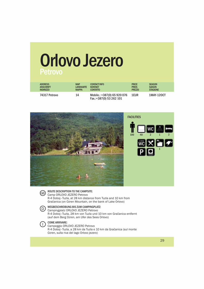
ROUTE DESCRIPTION TO THE CAMPSITE:Camp ORLOVO JEZERO PetrovoR-4 Doboj–Tuzla, at 28 km distance from Tuzla and 10 km from Gračanica (on Ozren Mountain, on the bank of Lake Orlovo)
WEGBESCHREIBUNG BIS ZUM CAMPINGPLATZ:Campingplatz ORLOVO JEZERO PetrovoR-4 Doboj–Tuzla, 28 km von Tuzla und 10 km von Gračanica entfernt (auf dem Berg Ozren, am Ufer des Sees Orlovo)
COME ARRIVARE:Campeggio ORLOVO JEZERO PetrovoR-4 Doboj–Tuzla, a 28 km da Tuzla e 10 km da Gračanica (sul monte Ozren, sulla riva del lago Orlovo jezero)
D
GB
I
29
2
ZebedGradačac
Jezero HaznaHazna bb 76250 Gradačac
Tel/Fax: +387 (0)35 852 505Mobile: +387 (0)61 142 022E-mail:[email protected]
1MAY-30SEP5EUR15
www.zebed.com.ba
PRICEPREISPREZZ0
MAPLANDKARTEMAPPA
CONTACT INFOKONTAKTCONTATTO
SEASONSAISONSTAGIONE
ADDRESSANSCHRIFTINDIRIZZO
45100
4 12
FACILITIES
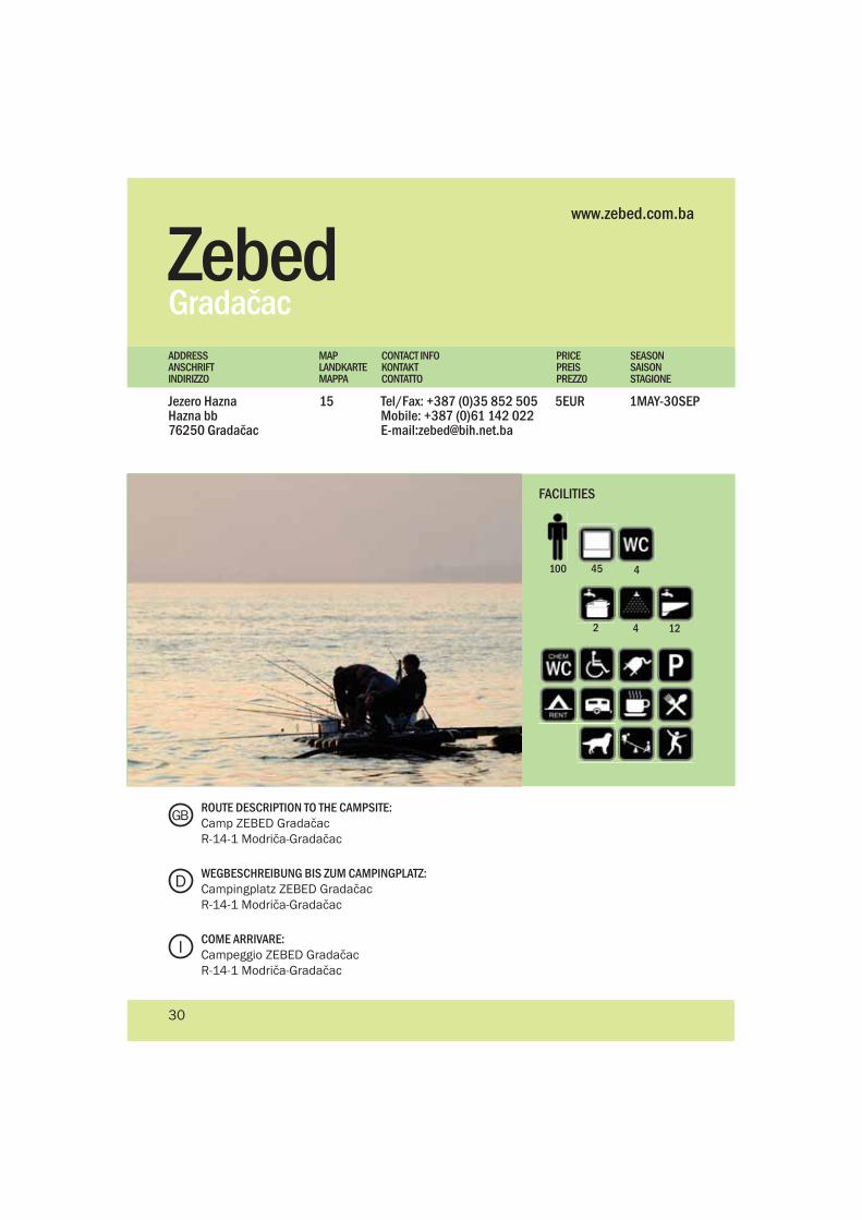
ROUTE DESCRIPTION TO THE CAMPSITE:Camp ZEBED GradačacR-14-1 Modriča-Gradačac
WEGBESCHREIBUNG BIS ZUM CAMPINGPLATZ:Campingplatz ZEBED GradačacR-14-1 Modriča-Gradačac
COME ARRIVARE:Campeggio ZEBED GradačacR-14-1 Modriča-Gradačac
D
GB
I
30
2
4
Kon
juh
Mou
ntai
n
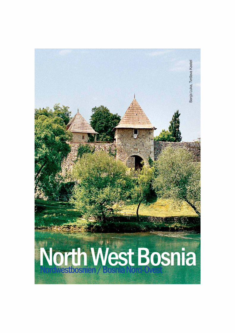
North West BosniaNordwestbosnien / Bosnia Nord-Ovest
Ban
ja L
uka,
Tvr
đava
Kas
tel
What is most striking about the Krajina is not its political divide, but rather the beautiful interconnected rivers and the lush, green countryside. The sheer quantity of crystal-clear rivers in this region is phenomenal. The Vrbas, Una, Sana, Sanica and Unac rivers are only a few of the pure water sources that flow into the Sava River. The Bosnian Krajina’s greatest tourist attractions all revolve around its natural resources. Just about anywhere in the Krajina one can find beautiful places to hike, walk, bike, fish, hunt or just enjoy a lazy day in the great outdoors. Although there are no tourist cities like Mostar or Sarajevo to visit, Banja Luka and Biha? are regional centres with things to see or do. But chances are you will spend no more than a day there before you find yourself rafting on the Una, or relaxing in the thermal spas at Slatina.
- Visit Banja Luka for a stroll along the Vrbas River and the Tvrdava Kastel
- Participate in the Annual International Una Rafting Regatta
- Rafting, kayaking and canyoning on the Vrbas river
- Walking and biking in the Kozara National Park
- Sports fishing on the pristine Una and Unac rivers
- Explore the beautiful and impressive Ostrožac Castle in Cazin
DGB I
- Machen Sie einen Spaziergang in Banja Luka entlang des Flusses Vrbas und in der Festung Kastel
- Nehmen Sie an der jährlichen Internationalen Rafting-Regatta an der Una teil
- Rafting, Kajakfahren und Canyoning am Fluss Vrbas
- Wandern und Radfahren im Nationalpark Kozara
- Sportangeln an den unberührten Flüssen Una und Unac
- Erkunden Sie die wunderschöne und eindrucksvolle Burg Ostrožac in Cazin
- Visita di Banja Luka per fare una passeggiata lungo il fiume Vrbas e la Tvrdava Kastel
- Partecipazione alla Regata Annuale Internazionale sul fiume Una
- Rafting, kayaking e canyoning sul fiume Vrbas
- Passeggiate e ciclismo nel Parco nazionale Kozara
- Pesca sportiva sui fiumi intatti Una ed Unac
- Esplorazone del bellissimo e toccante castello Ostrožac a Cazin
Highlights
Highlights Da non perdere
Es ist nicht die politische Teilung, die in der Krajina auffallend ist, sondern eher die wunderschönen, ineinander aufgehenden Flüsse und die üppige, grüne Landschaft. Allein die Menge an kristallklaren Gewässern in dieser Region ist phänomenal. Die Flüsse Vrbas, Una, Sana, Sanica und Unac sind einige der wichtigsten, die alle in den Fluss Save münden. Grundlage des Tourismus in der bosnischen Krajina sind die natürlichen Ressourcen. Fast überall lassen sich wunderschöne Orte zum Bergwandern, Wandern, Fahrradfahren, Angeln, Jagen oder zum Faulenzen finden. Obwohl es keine typischen touristischen Städte wie Mostar oder Sarajevo zu besuchen gibt, kann man in den regionalen Zentren wie Banja Luka und Bihać Vieles sehen und unternehmen. Schnell werden Sie aber darauf stoßen, wie spannend ein Rafting auf der Una oder wie entspannend ein Bad in den Thermalquellen von Slatina sein kann.
Quello che colpisce di più di Krajina non è la sua divisione politica ma i suoi fiumi incro-ciati e la campagna ricca e verde. Il numero di fiumi limpi-di di questa regione è fenom-enale. I fiumi Vrbas, Una, Sana, Sanica e Unac sono solamente alcune delle sor-genti puri che affluiscono nel fiume Sava. Le più grandi at-trazioni della Krajina bosniaca sono situate fra le risorse naturali. Da qualsiasi parte di Krajina si possono trovare i posti bellissimi per escursioni, passeggiate, ciclismo, pesca, caccia o semplicemente per godersi giornate pigre all’aria aperta. Anche se non ci sono città turistiche come Mostar o Sarajevo da visitare, Banja Luka e Bihać sono i centri regionali con piu’ cose da ve-dere e da fare. Però è molto probabile che non passerà neanche un solo giorno prima che vi troviate a fare rafting sul fiume Una o a rilassarvi nelle terme di Slatina.
33
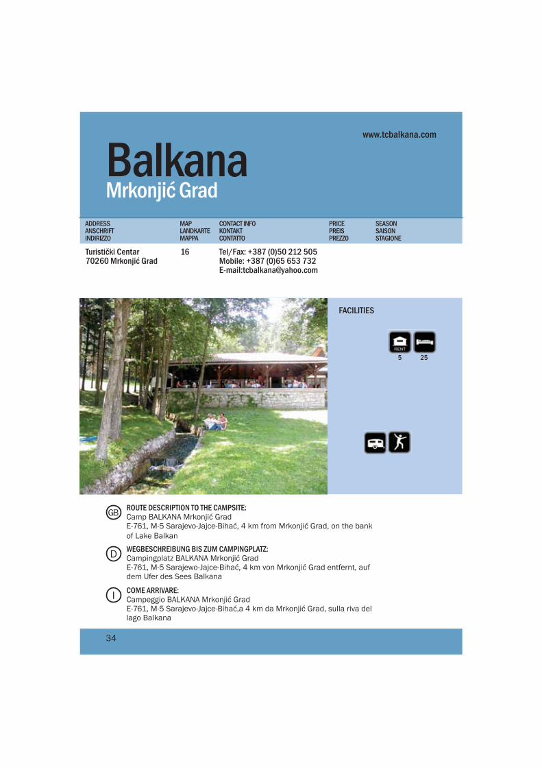
BalkanaMrkonjić Grad
Turistički Centar70260 Mrkonjić Grad
Tel/Fax: +387 (0)50 212 505Mobile: +387 (0)65 653 732E-mail:[email protected]
16
PRICEPREISPREZZ0
MAPLANDKARTEMAPPA
CONTACT INFOKONTAKTCONTATTO
SEASONSAISONSTAGIONE
ADDRESSANSCHRIFTINDIRIZZO
www.tcbalkana.com
5 25
FACILITIES
ROUTE DESCRIPTION TO THE CAMPSITE:Camp BALKANA Mrkonjić GradE-761, M-5 Sarajevo-Jajce-Bihać, 4 km from Mrkonjić Grad, on the bank of Lake Balkan
WEGBESCHREIBUNG BIS ZUM CAMPINGPLATZ:Campingplatz BALKANA Mrkonjić GradE-761, M-5 Sarajewo-Jajce-Bihać, 4 km von Mrkonjić Grad entfernt, auf dem Ufer des Sees Balkana
COME ARRIVARE:Campeggio BALKANA Mrkonjić GradE-761, M-5 Sarajevo-Jajce-Bihać,a 4 km da Mrkonjić Grad, sulla riva del lago Balkana
D
GB
I
34
Bjeli Rafting Una SportLohovo
Klokot Pecikovići77000 Bihać
Tel: +387(0)37 388 555Fax: +387(0)37 388 553Mobile:+387(0)61 138 853E-mail:[email protected]
1 APR-30 SEP5EUR17
PRICEPREISPREZZ0
MAPLANDKARTEMAPPA
CONTACT INFOKONTAKTCONTATTO
SEASONSAISONSTAGIONE
ADDRESSANSCHRIFTINDIRIZZO
www.una-rafting.ba
50100 8 8
FACILITIES
ROUTE DESCRIPTION TO THE CAMPSITE:Camp BJELI BihaćE-761, M-5 Bihać-Sarajevo, 14 km from Bihać towards Sarajevo, a turn to the Croatian border crossing Užljebić (there is a sign)
WEGBESCHREIBUNG BIS ZUM CAMPINGPLATZ:Campingplatz BJELI BihaćE-761, M-5 Bihać-Sarajevo, 14 km von Bihać in Richtung Sarajevo entfernt, abbiegen in Richtung des Grenzübergangs Užljebić zu Kroatien, (CP ausgeschildert)
COME ARRIVARE:Campeggio BJELI BihaćE-761, M-5 Bihać-Sarajevo, a 14 km da Bihać verso Sarajevo, in direzione della frontiera croata Užljebić (il campeggio è segnalato)
D
GB
I
35
50
6
8
4
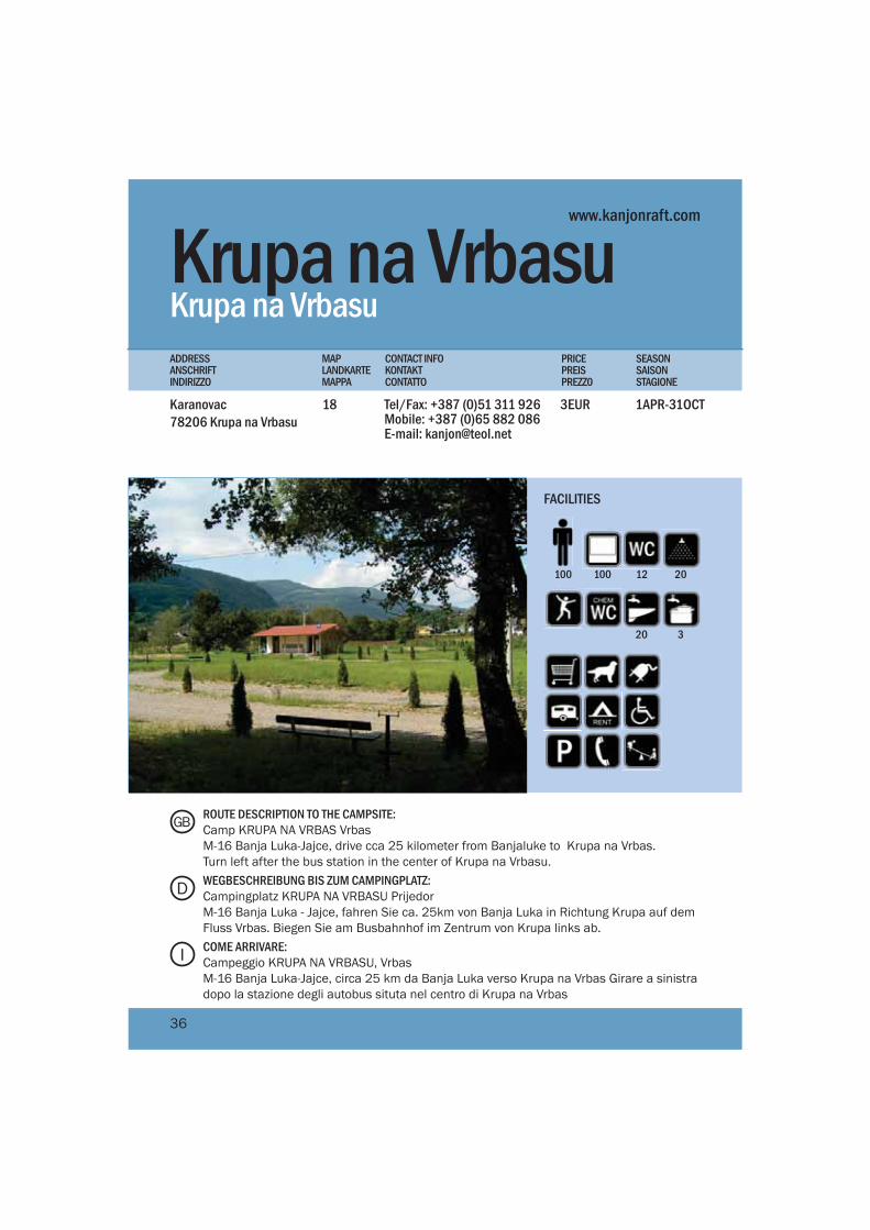
Krupa na VrbasuKrupa na Vrbasu
Karanovac 78206 Krupa na Vrbasu
Tel/Fax: +387 (0)51 311 926Mobile: +387 (0)65 882 086E-mail: [email protected]
1APR-31OCT3EUR18
PRICEPREISPREZZ0
MAPLANDKARTEMAPPA
CONTACT INFOKONTAKTCONTATTO
SEASONSAISONSTAGIONE
ADDRESSANSCHRIFTINDIRIZZO
www.kanjonraft.com
100100 12 20
20 3
FACILITIES
ROUTE DESCRIPTION TO THE CAMPSITE:Camp KRUPA NA VRBAS VrbasM-16 Banja Luka-Jajce, drive cca 25 kilometer from Banjaluke to Krupa na Vrbas.Turn left after the bus station in the center of Krupa na Vrbasu.WEGBESCHREIBUNG BIS ZUM CAMPINGPLATZ:Campingplatz KRUPA NA VRBASU PrijedorM-16 Banja Luka - Jajce, fahren Sie ca. 25km von Banja Luka in Richtung Krupa auf dem Fluss Vrbas. Biegen Sie am Busbahnhof im Zentrum von Krupa links ab.COME ARRIVARE:Campeggio KRUPA NA VRBASU, VrbasM-16 Banja Luka-Jajce, circa 25 km da Banja Luka verso Krupa na Vrbas Girare a sinistra dopo la stazione degli autobus situta nel centro di Krupa na Vrbas
D
GB
I
36
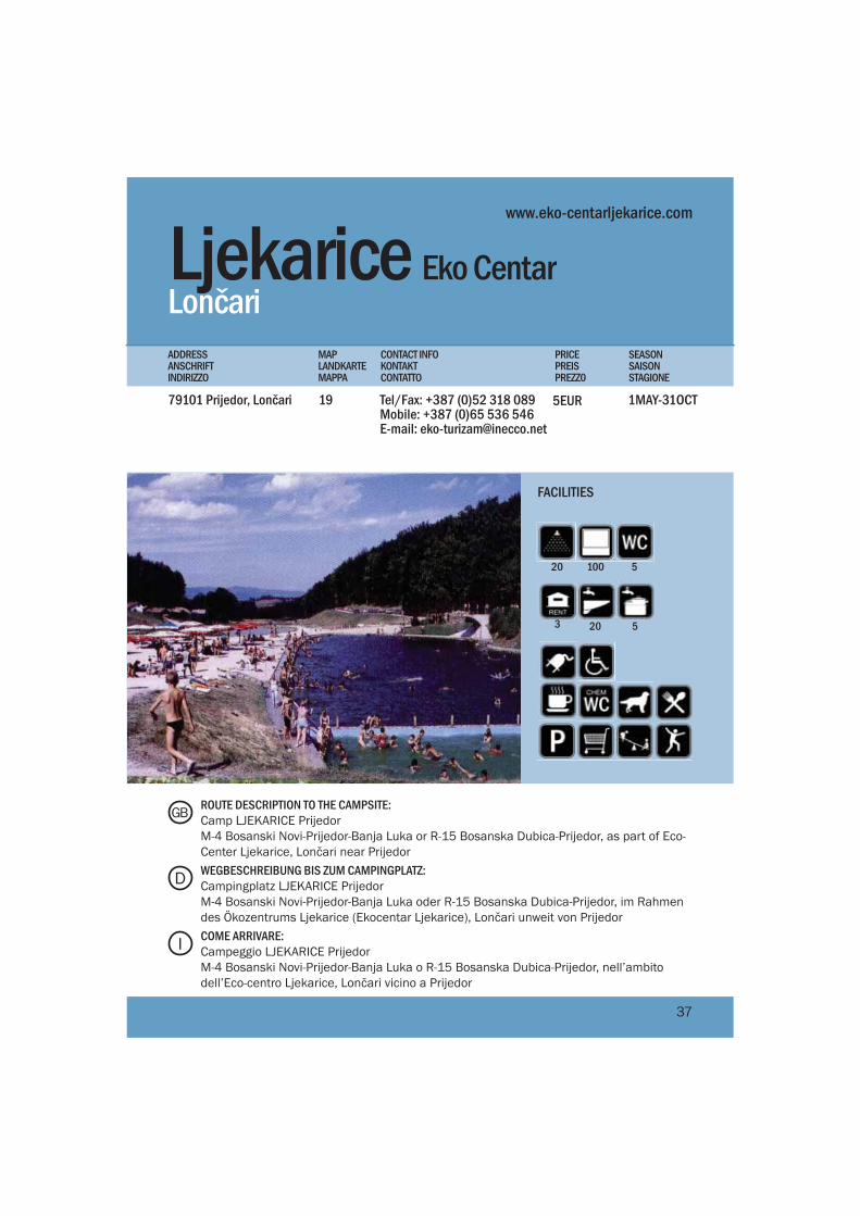
Ljekarice Eko Centar Lončari
79101 Prijedor, Lončari Tel/Fax: +387 (0)52 318 089Mobile: +387 (0)65 536 546E-mail: [email protected]
1MAY-31OCT19
PRICEPREISPREZZ0
MAPLANDKARTEMAPPA
CONTACT INFOKONTAKTCONTATTO
SEASONSAISONSTAGIONE
ADDRESSANSCHRIFTINDIRIZZO
100 520
20 5
FACILITIES
ROUTE DESCRIPTION TO THE CAMPSITE:Camp LJEKARICE PrijedorM-4 Bosanski Novi-Prijedor-Banja Luka or R-15 Bosanska Dubica-Prijedor, as part of Eco-Center Ljekarice, Lončari near PrijedorWEGBESCHREIBUNG BIS ZUM CAMPINGPLATZ:Campingplatz LJEKARICE PrijedorM-4 Bosanski Novi-Prijedor-Banja Luka oder R-15 Bosanska Dubica-Prijedor, im Rahmen des Ökozentrums Ljekarice (Ekocentar Ljekarice), Lončari unweit von PrijedorCOME ARRIVARE:Campeggio LJEKARICE PrijedorM-4 Bosanski Novi-Prijedor-Banja Luka o R-15 Bosanska Dubica-Prijedor, nell’ambito dell’Eco-centro Ljekarice, Lončari vicino a Prijedor
D
GB
I
37
5EUR
3
www.eko-centarljekarice.com
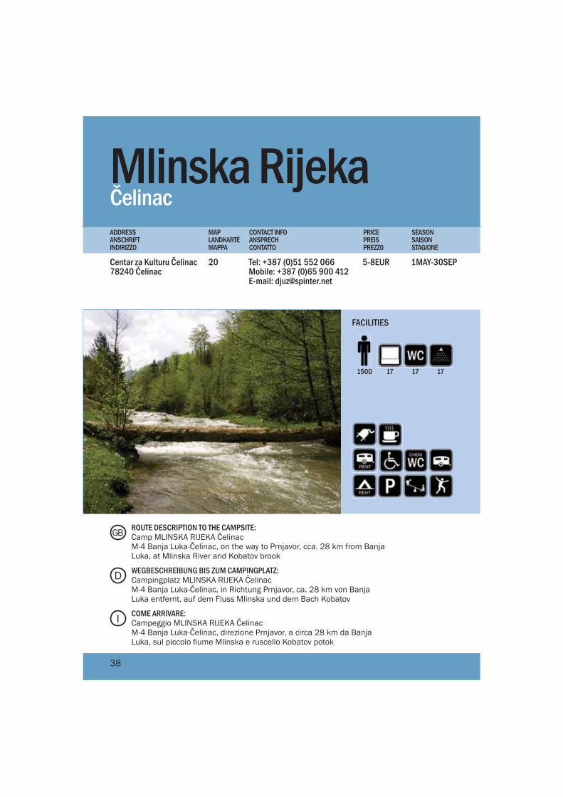
Mlinska Rijeka Čelinac
Centar za Kulturu Čelinac 78240 Čelinac
Tel: +387 (0)51 552 066Mobile: +387 (0)65 900 412E-mail: [email protected]
1MAY-30SEP5-8EUR20
PRICEPREISPREZZ0
MAPLANDKARTEMAPPA
CONTACT INFOANSPRECHCONTATTO
SEASONSAISONSTAGIONE
ADDRESSANSCHRIFTINDIRIZZO
171500 17 17
FACILITIES
ROUTE DESCRIPTION TO THE CAMPSITE:Camp MLINSKA RIJEKA ČelinacM-4 Banja Luka-Čelinac, on the way to Prnjavor, cca. 28 km from Banja Luka, at Mlinska River and Kobatov brook
WEGBESCHREIBUNG BIS ZUM CAMPINGPLATZ:Campingplatz MLINSKA RIJEKA ČelinacM-4 Banja Luka-Čelinac, in Richtung Prnjavor, ca. 28 km von Banja Luka entfernt, auf dem Fluss Mlinska und dem Bach Kobatov
COME ARRIVARE:Campeggio MLINSKA RIJEKA ČelinacM-4 Banja Luka-Čelinac, direzione Prnjavor, a circa 28 km da Banja Luka, sul piccolo fiume Mlinska e ruscello Kobatov potok
D
GB
I
38
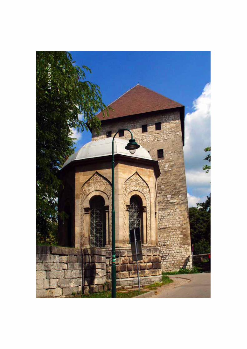
Bih
ać, O
ld T
own
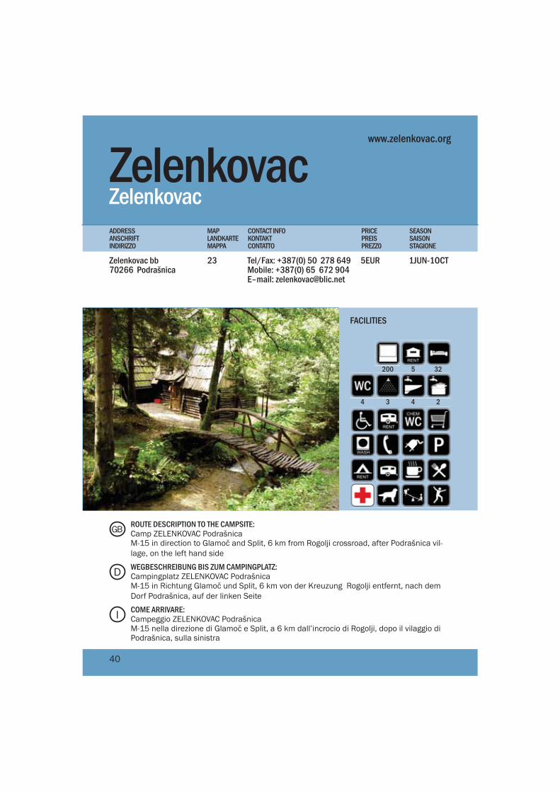
Zelenkovac Zelenkovac
Zelenkovac bb70266 Podrašnica
Tel/Fax: +387(0) 50 278 649Mobile: +387(0) 65 672 904E–mail: [email protected]
1JUN-1OCT5EUR23
PRICEPREISPREZZ0
MAPLANDKARTEMAPPA
CONTACT INFOKONTAKTCONTATTO
SEASONSAISONSTAGIONE
ADDRESSANSCHRIFTINDIRIZZO
www.zelenkovac.org
200 5 32
4 3 4 2
FACILITIES
ROUTE DESCRIPTION TO THE CAMPSITE:Camp ZELENKOVAC PodrašnicaM-15 in direction to Glamoč and Split, 6 km from Rogolji crossroad, after Podrašnica vil-lage, on the left hand side
WEGBESCHREIBUNG BIS ZUM CAMPINGPLATZ:Campingplatz ZELENKOVAC PodrašnicaM-15 in Richtung Glamoč und Split, 6 km von der Kreuzung Rogolji entfernt, nach dem Dorf Podrašnica, auf der linken Seite
COME ARRIVARE:Campeggio ZELENKOVAC PodrašnicaM-15 nella direzione di Glamoč e Split, a 6 km dall’incrocio di Rogolji, dopo il vilaggio di Podrašnica, sulla sinistra
D
GB
I
40
Orljani Bihać
Put 5 korpusa bb77000 Bihać
Tel.: +387 (0)37 318 100 Fax.: +387 (0)37 318 109 Mobile: +387 (0)61 142 658E-mail: [email protected]
1APR-30OCT5EUR21
PRICEPREISPREZZ0
MAPLANDKARTEMAPPA
CONTACT INFOKONTAKTCONTATTO
SEASONSAISONSTAGIONE
ADDRESSANSCHRIFTINDIRIZZO
www.aduna.ba
100150 6 2
4 4
FACILITIES
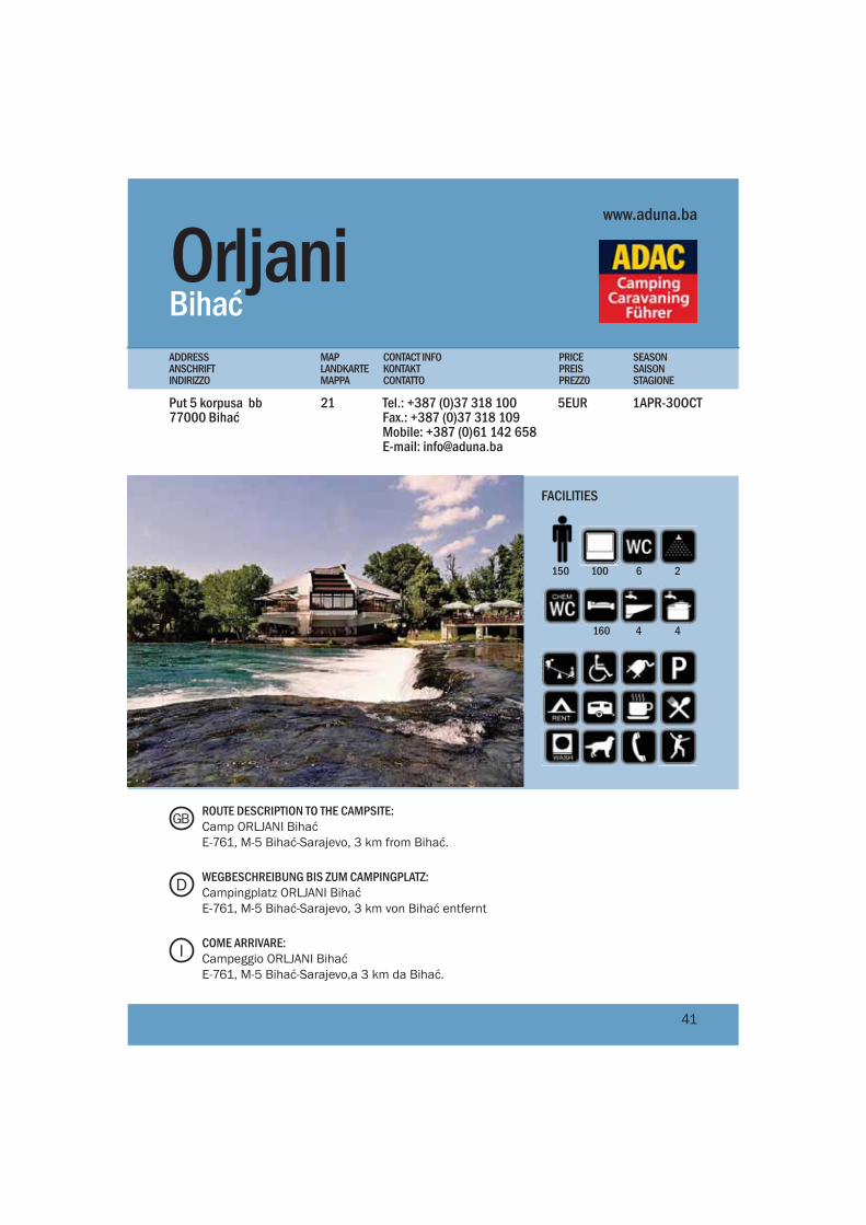
ROUTE DESCRIPTION TO THE CAMPSITE:Camp ORLJANI BihaćE-761, M-5 Bihać-Sarajevo, 3 km from Bihać.
WEGBESCHREIBUNG BIS ZUM CAMPINGPLATZ:Campingplatz ORLJANI BihaćE-761, M-5 Bihać-Sarajevo, 3 km von Bihać entfernt
COME ARRIVARE:Campeggio ORLJANI BihaćE-761, M-5 Bihać-Sarajevo,a 3 km da Bihać.
D
GB
I
41
160

Una RC Bihać
Kiro Rafting KampGolubić bb77000 Bihać
Tel/Fax: +387 (0)37 361 051Mobile: +387 (0)61 192 338 E-mail: [email protected]
1APR-31OCT8-15EUR22
PRICEPREISPREZZ0
MAPLANDKARTEMAPPA
CONTACT INFOKONTAKTCONTATTO
SEASONSAISONSTAGIONE
ADDRESSANSCHRIFTINDIRIZZO
www.una-kiro-rafting.com
3580 3 18
5 6 6 4
FACILITIES
ROUTE DESCRIPTION TO THE CAMPSITE:Camp KIRO BihaćE-761, M5 Bihać-Jajce-Sarajevo, Golubić settlement, 6 km from Bihać
WEGBESCHREIBUNG BIS ZUM CAMPINGPLATZ:Campingplatz KIRO BihaćE-761, M5 Bihać-Jajce-Sarajevo, Ortschaft Golubić, 6 km von Bihać entfernt COME ARRIVARE:Campeggio KIRO BihaćE-761, M5 Bihać-Jajce-Sarajevo, zona abitata Golubić, a 6 km da Bihać
D
GB
I
42
Poči
telj
SarajevoSarajewo / Sarajevo
Sebi
lj w
ater
foun
tain
, Sar
ajev
o
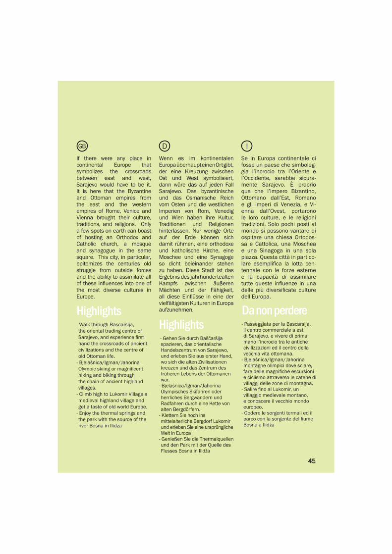
If there were any place in continental Europe that symbolizes the crossroads between east and west, Sarajevo would have to be it. It is here that the Byzantine and Ottoman empires from the east and the western empires of Rome, Venice and Vienna brought their culture, traditions, and religions. Only a few spots on earth can boast of hosting an Orthodox and Catholic church, a mosque and synagogue in the same square. This city, in particular, epitomizes the centuries old struggle from outside forces and the ability to assimilate all of these influences into one of the most diverse cultures in Europe.
- Walk through Bascarsija, the oriental trading centre of Sarajevo, and experience first hand the crossroads of ancient civilizations and the centre of old Ottoman life.
- Bjelašnica/Igman/Jahorina Olympic skiing or magnificent hiking and biking through the chain of ancient highland villages.
- Climb high to Lukomir Village a medieval highland village and get a taste of old world Europe.
- Enjoy the thermal springs and the park with the source of the river Bosna in Ilidza
DGB I
- Gehen Sie durch Baščaršija spazieren, das orientalische Handelszentrum von Sarajewo, und erleben Sie aus erster Hand, wo sich die alten Zivilisationen kreuzen und das Zentrum des früheren Lebens der Ottomanen war.
- Bjelašnica/Igman/Jahorina Olympisches Skifahren oder herrliches Bergwandern und Radfahren durch eine Kette von alten Bergdörfern.
- Klettern Sie hoch ins mittelalterliche Bergdorf Lukomir und erleben Sie eine ursprüngliche Welt in Europa
- Genießen Sie die Thermalquellen und den Park mit der Quelle des Flusses Bosna in Ilidža
- Passeggiata per la Bascarsija, il centro commerciale a est di Sarajevo, e vivere di prima mano l’incrocio tra le antiche civilizzazioni ed il centro della vecchia vita ottomana.
- Bjelašnica/Igman/Jahorina montagne olimpici dove sciare, fare delle magnifiche escursioni e ciclismo attraverso le catene di villaggi delle zone di montagna.
- Salire fino al Lukomir, un villaggio medievale montano, e conoscere il vecchio mondo europeo.
- Godere le sorgenti termali ed il parco con la sorgente del fiume Bosna a Ilidža
Highlights Highlights
Da non perdere
Wenn es im kontinentalen Europa überhaupt einen Ort gibt, der eine Kreuzung zwischen Ost und West symbolisiert, dann wäre das auf jeden Fall Sarajewo. Das byzantinische und das Osmanische Reich vom Osten und die westlichen Imperien von Rom, Venedig und Wien haben ihre Kultur, Traditionen und Religionen hinterlassen. Nur wenige Orte auf der Erde können sich damit rühmen, eine orthodoxe und katholische Kirche, eine Moschee und eine Synagoge so dicht beieinander stehen zu haben. Diese Stadt ist das Ergebnis des jahrhundertealten Kampfs zwischen äußeren Mächten und der Fähigkeit, all diese Einflüsse in eine der vielfältigsten Kulturen in Europa aufzunehmen.
Se in Europa continentale ci fosse un paese che simboleg-gia l’incrocio tra l’Oriente e l’Occidente, sarebbe sicura-mente Sarajevo. È proprio qua che l’impero Bizantino, Ottomano dall’Est, Romano e gli imperi di Venezia, e Vi-enna dall’Ovest, portarono le loro culture, e le religioni tradizioni. Solo pochi posti al mondo si possono vantare di ospitare una chiesa Ortodos-sa e Cattolica, una Moschea e una Sinagoga in una sola piazza. Questa città in partico-lare esemplifica la lotta cen-tennale con le forze esterne e la capacità di assimilare tutte queste influenze in una delle più diversificate culture dell’Europa.
4145
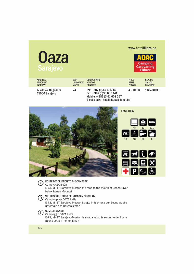
OazaSarajevo
IV Viteške Brigade 371000 Sarajevo
Tel: + 387 (0)33 636 140Fax: + 387 (0)33 636 141Mobile: + 387 (0)61 608 267E-mail: [email protected]
1JAN-31DEC4 -30EUR24
PRICEPREISPREZZ0
MAPLANDKARTEMAPPA
CONTACT INFOKONTAKTCONTATTO
SEASONSAISONSTAGIONE
ADDRESSANSCHRIFTINDIRIZZO
www.hoteliilidza.ba
48 13 131
18 18 20 6
FACILITIES
ROUTE DESCRIPTION TO THE CAMPSITE:Camp OAZA IlidžaE-73, M–17 Sarajevo-Mostar, the road to the mouth of Bosna River below Igman Mountain
WEGBESCHREIBUNG BIS ZUM CAMPINGPLATZ:Campingplatz OAZA IlidžaE-73, M–17 Sarajevo-Mostar, Straße in Richtung der Bosna-Quelle unterhalb des Berges Igman
COME ARRIVARE:Campeggio OAZA IlidžaE-73, M–17 Sarajevo-Mostar, la strada verso la sorgente del fiume Bosna sotto il monte Igman
D
GB
I
46
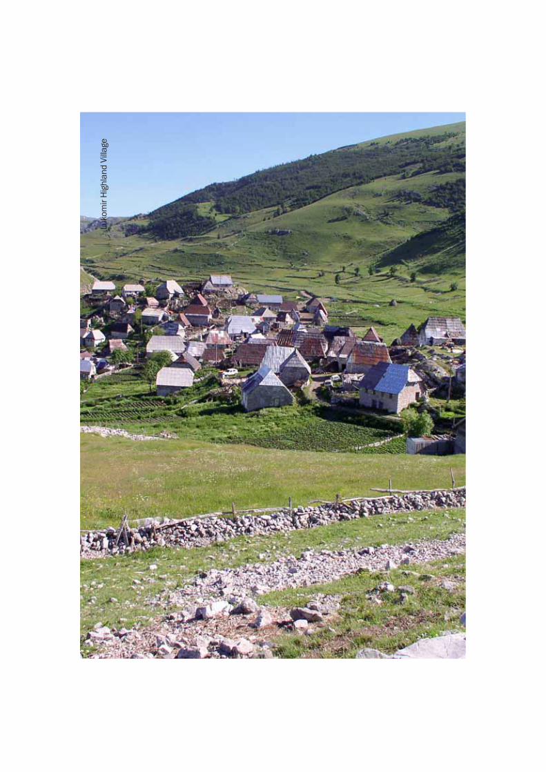
Luko
mir
Hig
hlan
d Vi
llage
ABOUT BOSNIA AND HERZEGOVINACountry name Bosnia and HerzegovinaLocation Southeast Europe, borders with Croatia(932km),Serbia (312km) and Montenegro (215km)Land area 51,129km2Language Bosnian, Croatian, SerbianPopulation 3.8 millionReligion Muslim (44%), Orthodox Christian (32%), Roman Catholic (17%), Others (7%)Capital Sarajevo (population 400,000)Other major cities and towns Banja Luka, Tuzla, Zenica, Mostar, BihaćAdministrative division two entities Federation of BiH (ten cantons) and Republika SrpskaHighest point Maglić Mountain 2,386 mNational parks: Kozara National Park, Sutjeska National ParkNature parks: Blidinje, Hutovo Blato, TajanBird reserves: Hutovo Blato, BardačaTime CET (GMT + 1 hour)Electricity: 220VACurrency KM (convertible mark), 1 € = 1,95583 KMInternational telephone code +387
ClimateIn Bosnia and Herzegovina, Mediterranean and Alpine influences meet and create a mosaic of climate types within a relatively small area. The south enjoys warm, sunny and dry weather, with very mild winters. In the more continental areas the weather is similar to that of central Europe - hot summers, cool springs and autumns, and cold winters with considerable snowfall. The Mediterranean and continental climates meet in the middle, creating eco systems that cannot be found anywhere else. The mountains create a climate of their own. The Alpine climate rules the mountain terrains of the high Dinarics above 1700 meters. Winters are very cold with considerable snow cover in the north.
How to get here?Travelling by car is by far the easiest means of transportation to see the country the way you would like and at your own pace. The roads are decent but don’t expect any motorways or anything resembling a long straight highway. The roads are curvy and wind through river valleys and up and over mountains. Bosnia and Herzegovina enjoys a well connected road system, connecting every city and town with asphalt roads. Fuel stations are plentiful all over the country.
There are no toll roads in BiH. It is important to travel with a good map. Road signs in some areas are frequent and accurate but all of a sudden there may not be a sign in sight to indicate anything at all. Traveling through the Republic of Srpska can also be a challenging experience. The road signs are mainly in Cyrillic.
VisasAll EU members are exempt from visa requirements and may enter BiH at any time. American and Canadian citizens are not required to have visas for entry to the country either. Bosnia and Herzegovina (BiH) can only be entered with a valid passport. The country’s border authorities do not accept any other type of personal identification.
Entry visa requirementsVisas are issued by BiH’s diplomatic missions. Visas for private travel require an application form and a certified letter of intent of a BiH citizen. Business visas require an application form, an invitation of a BiH business partner and a certified letter of intent from the BiH trade office.
Registration is obligatory within 24 hours of arrival in BiH. Any act in opposition to this regulation could cause a financial penalty or lead to deportation.
Mountain SafetyThe mine situation is addressed below. General mountain safety should include a first aid kit, maps and extra warm gear. A guide is highly recommended. The higher altitude mountain ranges can experience drastic temperature changes. When a storm or fog rolls in, the temperature can easily drop 10 degrees Celsius in a matter of hours. Bosnia and Herzegovina is a mountainous land and each valley and range has its own unique system. A rainy day in Sarajevo could mean a sunny afternoon on Bjela?nica. A scorching hot day in Sarajevo could mean freezing winds on Bjela?nica peak overlooking the city.
National HolidaysCatholic New Year January 1Orthodox Christmas January 7Orthodox New Year January 14Independence day March 1Labour Day May 1Catholic Christmas December 25Bajram (Muslim Holy Day) these dates are related to moon cycles and are not the same every year.
Literature1.Bradt Travel Guide to Bosnia and Herzegovina, Tim Clancy2.Forgotten Beauties (mountain guide), by Matias Gomes3.Journey through Herzegovina, Buybook publishing - Sarajevo4.Journey through Sarajevo, Buybook publishing - Sarajevo5.Journey through Central and North Bosnia, Buybook publishing - Sarajevo6.Sarajevo Cityspot, Thomas Cook Publishing - UK7.Western Balkan Traveler, Thomas Cook publishing8.Mountaineering Tourist Guide to the mountains around Sarajevo,Braco Babić & Drago Bozija9. Reiseführer “Bosnien-Herzegowina entdecken - Unterwegs zwischen Save und Adria”, Marko Plesnik,
48
GB
Trescher Verlag10. Bosnie Herzegovine, Petit Futé11. Autokarte Bosnien-Herzegowina, Freitag & Berndt
Land MinesThere is definitely a threat and danger of land mines in BiH, BUT, it does not mean that you cannot step off the asphalt. Highly populated areas are clear of mines and are perfectly safe to visit. The most significant danger is in the countryside where the former lines of confrontation were. That is not easily known by travellers so the best policy is if you don’t know - don’t go. Many mountain ranges are mined and some rural areas that were front lines are still contaminated. There is plenty of safe hiking, walking, wandering and exploring to be done in Bosnia and Herzegovina - it’s simply not wise to do it alone. Take a guide or a local who knows the terrain. There are mountain associations and eco tourism organizations that are your best bet for a safe mountain adventure.
ÜBER BOSNIEN-HERZEGOWINAOffizieller Name: Bosnien-HerzegowinaLage: Südosteuropa, grenzt an Kroatien (932km), Serbien (312km) und Montenegro (215km)Fläche: 51,129km²Sprachen: Bosnisch, Kroatisch, SerbischBevölkerung: 3,8 MillionenReligionen: muslimisch (44%), christlich-orthodox (32%), römisch-katholisch (17%), andere (7%)Hauptstadt: Sarajevo (Bevölkerung 400,000)Andere Großstädte: Banja Luka, Tuzla, Zenica, Mostar, BihaćVerwaltungsgliederung: zwei Entitäten – Föderation von Bosnien-Herzegowina (zehn Kantone) und die Republika SrpskaHöchster Punkt: Berg Maglić 2,386 mNationalparks: Kozara National Park, Sutjeska National ParkNaturparks: Hutovo Blato, Blidinje, TajanVogelreservate: Hutovo Blato, BardačaZeitzone: CET (GMT + 1 Stunde)Strom: 220VAWährung: KM (Konvertible Mark), 1 € = 1,95583 KMInternationale Telefonvorwahl: +387
KlimaDie Einflüsse des Mittelmeers und der Alpen treffen in Bosnien-Herzegowina aufeinander und bilden ein Mosaik aus Klimazonen innerhalb einer relativ kleinen Region. Der Süden genießt das warme, sonnige und trockene Wetter, mit sehr mildem Winter. In den kontinentalen
Gebieten ist das Wetter dem in Zentraleuropa ähnlich – heißer Sommer, kühler Herbst und Frühling sowie kalter Winter mit beträchtlichem Schneefall. Mediterranes und kontinentales Klima treffen in der Mitte aufeinander und bilden ein Ökosystem, das nirgendwo anders vorzufinden ist. Die Bergregionen haben ihr eigenes Klima. Alpin wird das Klima in den Gebieten der Dinarischen Alpen, die über 1700 Meter liegen. Die Winter sind sehr kalt mit beträchtlicher Schneemenge in den nördlichen Landesteilen.
Wie kommt man hin?Die Anreise mit dem Pkw stellt die einfachste Möglichkeit dar, das Land in der Intensität kennen zu lernen, wie Sie das möchten. Die Straßen sind von ordentlicher Qualität, aber erwarten Sie keine Autobahnen oder etwas, das einer langen geraden Autobahn ähnelt. Die Straßen sind kurvenreich und schlängeln sich durch die Flusstäler oder hoch hinauf in die Berge. Bosnien-Herzegowina verfügt über ein gut ausgebautes Straßennetz, das alle Städte durch asphaltierte Straßen miteinander verbindet. Tankstellen gibt es reichlich im ganzen Land.
In Bosnien-Herzegowina gibt es keine Mautstraßen. Es ist wichtig, mit einer guten Autokarte zu reisen. Einige Gegenden sind mittlerweile sehr gut beschildert, in anderen Gegenden finden sich dafür teilweise überhaupt keine Wegweiser mehr. Das Fahren durch die Republika Srpska kann auch eine herausfordernde Erfahrung sein: Hier sind die Straßenschilder häufig in kyrillischer Schrift.
VisaAlle EU-Mitglieder sind von der Visumpflicht befreit und können jederzeit in Bosnien-Herzegowina einreisen. Die amerikanischen und kanadischen Bürger brauchen ebenfalls kein Visum, um das Land zu betreten. In Bosnien-Herzegowina (BiH) kann man nur mit einem gültigen Reisepass einreisen. Die Grenzbehörden des Landes akzeptieren keine anderen Ausweispapiere.
Anforderungen für EinreisevisumVisa werden von den diplomatischen Vertretungen von Bosnien-Herzegowina erteilt. Individuell Reisende müssen einen Antrag für die Ausstellung des Visums stellen und eine beglaubigte Absichtserklärung eines bosnisch-herzegowinischen Bürgers haben. Geschäftsreisende müssen einen Antrag stellen, eine Einladung eines bosnisch-herzegowinischen Geschäftspartners und eine beglaubigte Absichtserklärung der bosnisch-herzegowinischen Handelskammer besitzen.
Eine Anmeldung ist innerhalb von 24 Stunden nach der Einreise in Bosnien-Herzegowina Pflicht. Jede Handlung, die dieser Regelung widerspricht, kann eine Geldstrafe zur Folge haben oder zur Ausweisung führen.
49
D
Sicherheit in den BergenDie Minensituation ist unten erwähnt. Zur generellen Sicherheit in den Bergen sollte ein Erste-Hilfe-Kasten, Autokarten und extra warme Bekleidung mitgeführt werden. Es ist sehr empfehlenswert, einen Reiseführer einzusetzen. In den höheren Berggebieten kann es zu drastischen Temperaturänderungen kommen. Wenn ein Sturm oder Nebel herannahen, kann die Temperatur in ein paar Stunden um 10 Grad Celsius fallen. Bosnien-Herzegowina ist ein bergiges Land und jedes Tal und jeder Gebirgszug hat sein einzigartiges System. Ein regnerischer Tag in Sarajewo kann einen sonnigen Nachmittag auf dem Berg Bjelašnica bedeuten, oder ein stechend heißer Tag in der Stadt, eisig kalte Winde auf der Spitze der Bjelašnica, die hoch über die Stadt hinausragt.
Nationale Feiertage1. Januar – Katholisches Neujahr7. Januar – Orthodoxes Weihnachten14. Januar – Orthodoxes Neujahr1. März - Unabhängigkeitstag1. Mai - Tag der Arbeit25. Dezember – Katholisches WeihnachtenBajram (muslimischer Feiertag), die Termine richten sich nach Mondphasen und sind nicht jedes Jahr gleich
Literatur1. Bradt Travel Guide to Bosnia and Herzegovina, Tim Clancy2. Forgotten Beauties (mountain guide), by Matias Gomes3. Journey through Herzegovina, Buybook publishing - Sarajevo4. Journey through Sarajevo, Buybook publishing - Sarajevo5. Journey through Central and North Bosnia, Buybook publishing - Sarajevo6. Sarajevo Cityspot, Thomas Cook Publishing - UK7. Western Balkan Traveler, Thomas Cook publishing8. Mountaineering Tourist Guide to the mountains around Sarajevo,Braco Babić & Drago Bozija9. Reiseführer “Bosnien-Herzegowina entdecken - Unterwegs zwischen Save und Adria”, Marko Plesnik, Trescher Verlag10. Bosnie Herzegovine, Petit Futé11. Autokarte Bosnien-Herzegowina, Freitag & Berndt
LandminenEs gibt eine Bedrohung und Gefahr durch Landminen in Bosnien-Herzegowina, ABER: das bedeutet nicht, dass Sie den Asphalt nicht verlassen können. Dicht bewohnte Gegenden sind minenfrei und absolut sicher für Besuche.
Die größte Gefahr herrscht auf dem Lande, wo die Frontlinien verlaufen sind. Das können Reisende nicht einfach erkennen und der beste Rat ist, betreten Sie keine unbekannten Gebiete. Viele Gebirgszüge sind vermint und manche ländlichen Gegenden, die Frontlinien bildeten, sind immer noch kontaminiert.
In Bosnien-Herzegowina gibt es reichlich viele Möglichkeiten zum Bergwandern, Wandern, für Spaziergänge und zum Erkunden der Natur, aber es ist nicht ratsam, dies auf eigene Faust zu machen. Nehmen Sie sich einen Reiseführer oder einen Einheimischen als Begleitung, der die Gegend gut kennt. Es gibt Bergvereine und Ökotourismusorganisationen, die Ihnen beim Abenteuer auf den Bergen Sicherheit bieten können.
DATI SULLA BOSNIA ERZEGOVINANome dello stato Bosnia ErzegovinaPosizione Europa Sud-Est, confine con la Croazia (932km),Serbia (312km) e Montenegro (215km)Superfice 51,129km2Lingua Bosniaca, Croata, SerbaPopolazione 3.8 millioniReligione Musulmana, (44%), Ortodossa cristiana (32%),Romana Cattolica (17%), Altre (7%)Capitale Sarajevo (popolazione 400,000)Altre città e paesi più grandi Banja Luka, Tuzla, Zenica, Mostar, BihaćDivisione amministrativa due entità Federazione di Bosnia Erzegovina (dieci cantoni) e Republika SrpskaPunto più alto Monte Maglić 2,386 mParchi nazionali: Kozara National Park, Sutjeska National ParkParchi naturali: Blidinje, Hutovo Blato, TajanRiserve di uccelli: Hutovo Blato, BardačaTempo CET (GMT + 1 ora)Elettricità: 220VAValuta KM (marco convertibile), 1 € = 1,95583 KMCodice internazionale telefonico +387
ClimaIn Bosnia Erzegovina s’incontrano influenze mediterranee e alpine creando un mosaico di tipi climatici in un’ area relativamente piccola. A sud si puo’ godere di un clima caldo, soleggiato e secco, con inverni molto miti. Nelle aree più continentali il clima è simile a quello dell’Europa centrale – estati calde, primavere e autunni freschi e inverni freddi molto nevosi. Il clima mediterraneo e continentale s’incontrano nel centro, creando eco-sistemi che non si trovano da nessun’altra parte al mondo. Le montagne creano un clima proprio. Il clima alpino domina nelle zone montane delle Dinaridi sopra i 1700 metri. Gli
I
50
inverni sono molto freddi e nevosi al nord.
Come arrivare?Viaggiare in macchina è il mezzo di trasporto più semplice per vedere il paese come vorreste e con il ritmo che preferite. Le strade sono buone ma non aspettatevi autostrade o strutture simili. Le strade sono piene di curve e si percorrono serpeggiando attraverso le valli dei fiumi e sopra le montagne. La Bosnia Erzegovina ha un sistema di strade ben connesso che collega tutte le città e i paesi con strade asfaltate. I distributori sono numerosi in tutto il paese.
In Bosnia Erzegovina non ci sono pedaggi. È importante viaggiare con una buona cartina. La segnalazione stradale in certe zone è frequente e molto buona ma all’improvviso potrebbe succedere che non ci sia un segnale in vista. Viaggiare in Republika Srpska (Repubblica Serba) può anche essere una sfida. La maggior parte dei segnali è in cirilico.
VistiTutti i membri dell’Unione Europea sono esenti dalla richiesta di visto e possono entrare in Bosnia Erzegovina in qualsiasi momento. Neanche i cittadini americani e canadesi hanno bisogno di visti per entrare nel paese. Però un passaporto valido ci vuole per entrare in Bosnia Erzegovina (BiH). Le autorità dei confini statali non accettano nessun’altro tipo di identificazione personale.
Richesta di visti per entrareI visti vengono rilasciati dalle missioni diplomatiche della BiH. Per avere il visto per un viaggio privato bisogna compilare una domanda e essere in possesso di una lettera di intenti certificata da un cittadino bosniaco. Per i visti di lavoro c’è bisogno di una domanda, un’invito da un partner commerciale bosniaco e una lettera di intenti certificata da un’azienda bosniaca.
È obbligatorio registrarsi entro 24 ore dall’arrivo nel paese. Ogni atto di opposizione a questo regolamento può causare una multa o portare alla deportazione.
Sicurezza in montagnaLa situazione delle mine è descritta in seguito. La sicurezza in montagna in generale dovrebbe includere dotazione di pronto soccorso, cartine e indumenti molto caldi. Una guida è vivamente consigliabile. Sulle catene montuose più alte si possono incontrare cambiamenti di temperatura drastici. Con tempeste e nebbia, la temperatura può facilmenete scendere anche di 10 gradi in poche ore. La Bosnia Erzegovina è una zona montuosa e ogni valle e catena ha il suo proprio sistema. Un giorno di pioggia a Sarajevo può essere un pomeriggio di sole su Bjelašnica. Un giorno ardente a Sarajevo può essere vento gelato sulla cima di Bjelašnica che si affaccia sulla città.
Feste nazionaliCapodanno Cattolico 1. GennaioNatale Ortodosso 7. GennaioCapodanno Ortodosso 14. GennaioFesta d’indipendenza 1. MarzoFesta del lavoro 1. MaggioNatale Cattolico 25. DicembreBajram (Festa santa musulmana) queste date sono legate ai cicli lunari e non hanno una cadenza annuale fissa
Letteratura1. Bradt Travel Guida per Bosnia Erzegovina, Tim Clancy2. Bellezze dimenticate (guida montagne), di Matias Gomes3. Viaggio in Erzegovina, pubblicato da Buybook - Sarajevo4. Viaggio a Sarajevo, pubblicato da Buybook - Sarajevo5. Viaggio in Bosnia centrale e settentrionale, pubblicato da Buybook - Sarajevo6. Sarajevo Cityspot, edizione Thomas Cook - UK7. Western Balkan Traveler, edizione Thomas Cook8. Guida turistica per alpinismo sulle montagne intorno a Sarajevo,Braco Babić e Drago Bozija9. Reiseführer “Bosnien-Herzegowina entdecken - Unterwegs zwischen Save und Adria”, Marko Plesnik, Trescher Verlag10. Bosnie Herzegovine, Petit Futé11. Autokarte Bosnien-Herzegowina, Freitag & Berndt
Le mineIl pericolo di mine assolutamente esiste in Bosnia Erzegovina, ma questo non vuol dire che non si possa scendere dall’asfalto. Nelle zone densamente popolate non ce ne sono e sono perefttamente sicure da visitare. Il pericolo più grande e’ rappresentato dalle campagne dove c’erano le linee di fronte. Questo fatto non è molto conosciuto dai viaggiatori e quindi la politica più sicura è: se non lo sai, non ci andare. Molte catene montuose sono minate ed alcune zone che erano linee di scontri sono ancora contaminate. Ci sono tanti posti per escursioni, passeggiate ed esplorazioni da fare in Bosnia Erzegovina – è semplicemente sconsigliato farlo da soli. Prendete una guida o una persona del luogo che conosce la zona. Ci sono anche molte organizzazioni di eco-turismo e associazioni alpinistiche che sono la vostra migliore scelta per un’avventura sicura in montagna.
51
Tourist Information CenterZelenih beretki 22 a71 000 Sarajevo Tel: +387 (0)33 220 724Tel: +387 (0)33 220 721Fax: +387 (0)33 553 520Email: [email protected]: www.sarajevo-tourism.com
Tourism Association of Bosnia and HerzegovinaBranilaca Sarajeva 21/4Sarajevo 71000Tel: +387 (0)33 252 900Tel/Fax: +387 (0)33 252 901Email: [email protected] & [email protected]: www.bhtourism.ba
Tourism Organization of Republika SrpskaBana Milosavljevića 8Banja Luka 78000Tel: +387 (0)51 229 720Fax: +387 (0)51 229 721Email: [email protected] & [email protected]: www.turizamrs.org
Old
Brid
ge -
Mos
tar