Embed Size (px)
Citation preview

BMKG Development of RANET network and
DECISION SUPPORT SYSTEM to determine earthquake and
tsunami warning to remote rural community
Fifth technical conference on management of meteorological and
hydrological services in RA V (South- west Pacific)
Kuala Lumpur, Malaysia, 20-24 April

BMKG Topic Introduction◦
IOTWS◦
InaTEWS
Decision Support System (DSS) for tsunami warningDissemination system◦
How to reach rural community with information
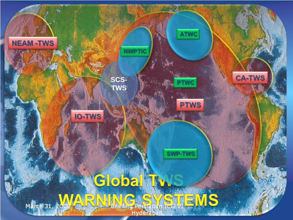
SCS- TWS

Earthquake and Tsunami DisasterPERIOD : 1991 - 2009
Liwa 94Liwa 94Bengkulu 00Bengkulu 00
Banggai 00Banggai 00
Mataram 04Mataram 04
Simeulue 02Simeulue 02
Kerinci 95Kerinci 95
Majalengka 01Majalengka 01 Alor 91Alor 91
Manokwari 03Manokwari 03
Nabire 04, 04Nabire 04, 04
EarthquakeEarthquake TSUNAMITSUNAMI
EarthquakeEarthquake
Mentawai 05Mentawai 05
Earthquake : 28 x Tsunami : 13 x
Yogyakarta 06Yogyakarta 06
P. Buru 06P. Buru 06
Alor, 04Alor, 04Flores 92Flores 92
Biak, 96Biak, 96
Molucca 98Molucca 98
Banyuwangi 94Banyuwangi 94
Aceh 04Aceh 04
Pangandaran 06Pangandaran 06
Nias 05Nias 05
Timor 95Timor 95
Padangpanjang 07Padangpanjang 07
BMKG
Bengkulu 07Bengkulu 07
Situbondo 07Situbondo 07
Gorontalo 08Gorontalo 08Manokwari 09Manokwari 09

BMKG IOTWS (Indian Ocean Tsunami Warning and mitigation System)
RTWP (Regional Tsunami Watch Provider)◦
Australia, India, Indonesia◦
Malaysia, Thailand and Iran
NTWC (National Tsunami Warning Center)◦
All countries in Indian Ocean rim

BMKG
Components ofIndonesia Tsunami Early Warning
System
No casualties
1. Monitoring2. Processing
3. Dissemination4. Preparedness
Tsunami or notIn 5 minutes
After the earthquake
Earthquake
Evacuation or not
1.
Earthquake monitoring (BMKG)●
Seismograph, 160 BB stations
●
Accelerograph, 500 stations
2.
Sea Monitoring●
DART-Buoy, 25 buoys (BPPT)
●
Tide Gauges, 60 stations (BAKO)
3.
Earth Deformation●
GPS-land stations, 50 stations, (BAKO)
●
Earth Observation (LAPAN)

BMKG Basic Challenge for Tsunami Early Warning
Situ
atio
n A
war
enes
s
Time orDistant
●
Uncertainty●
Completeness●
Exactness●
Robustness
hours
daysminutes
first guess by earthquake parametersSecond guess by modeling and scenario Well-informed,
observed, analyzedand justified decisions
100 kmLocal
1000 kmRegional
> 1000 kmOcean wide

BMKG Effort to reduce uncertainty timely
Aggregate all incoming sensors and informationDevelop pre-calculated tsunami Interacting with simulation and modelling systemsEmulate the SOP of early warning into GUI (Graphic User Interface)◦
Have earthquake parameters and tsunami potential◦
Access tsunami database◦
Develop scenario of threat
Connecting to available dissemination systems

BMKG Concept of the DSSLead tsunami early warning process◦
Collect earthquake parameters
◦
Access tsunami scenario database
Give situation, level of threat◦
Trade uncertainty and robustness with time
Propose decisions timelyUpdate situation for confirmationUpdate decisions for distant tsunami warning
Earthquak
e parameter
sTsunami scenario dbase

BMKG
GPS-BouysTide Gauges OBU
Sensor Integration
Simulation System
Risk- & Vulnerability Modelling
Geospatial Data Repository
Situation Assessment and Decision Support
Open Architecture to support Integration of Additional Components
Sensor System X
Sensors
2wcom FM-RDSSystem
DisseminationSystem Y
Additional Analysis / Processing Capabilities, additional Data Sources
Additional Tsunami
Scenarios
seismic CGPS EO

BMKG
11

BMKGTsunami Warning Issuance in 2007-08
Magnitude > 6.3 (7.0)
September 12,2007 3.6m Tsunami
January 21,2007 10cm Tsunami February 25,2008
12cm Tsunami
November 17,2008 10cmTsunami
January 3,2009
75cm Tsunami
BMKG

BMKGOutput
Situationperspective
Observationperspective
Decisionperspective
Confirmationperspective
Display 1 Display 2 Display 3 Display 4
BMKG
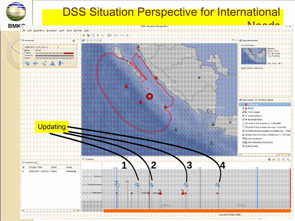
DSS Situation Perspective for International Needs
Updating
1 2 3 4

BMKG DSS Benefits for tsunami warning
1.
Displaying situation after earthquake, forecast simulation, sensor observation, and level of tsunami threat simultaneously in 4 displays including a prepared message from the system ready for dissemination.
2.
Provide opportunity to the operator to update the level of threat based on the instrumental observation
3.
Distant tsunami region will get less uncertainty of the threat
BMKG
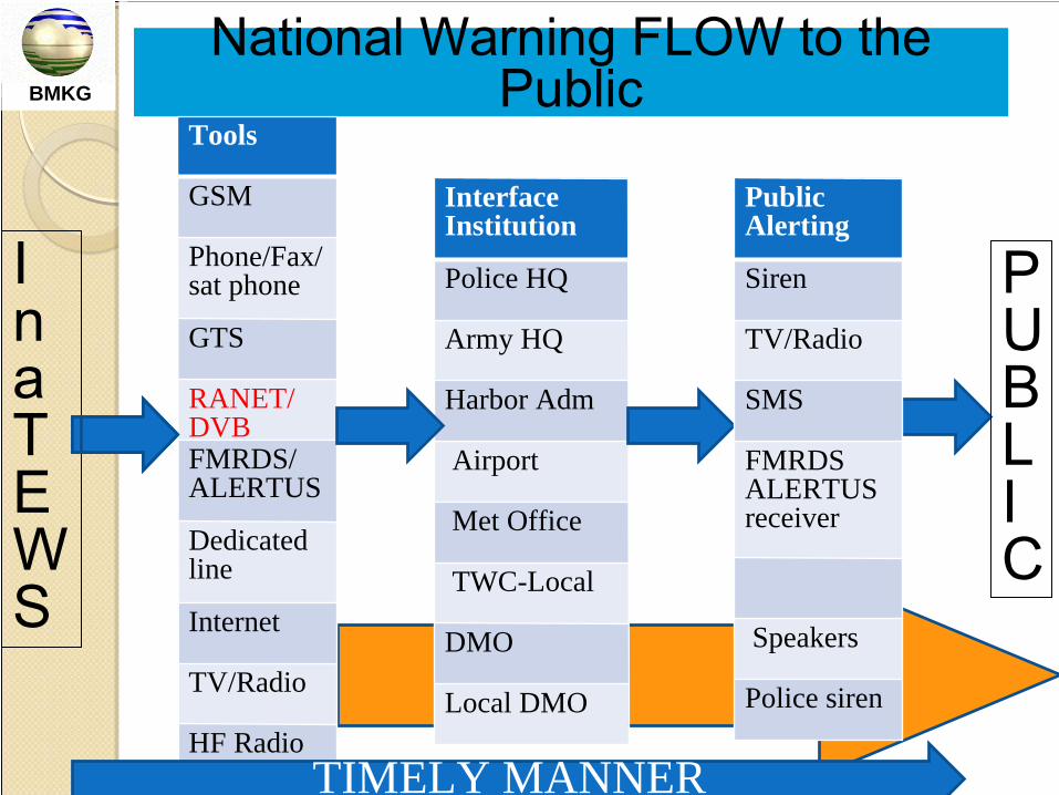
National Warning FLOW to the Public
Tools
GSM
Phone/Fax/ sat phone
GTS
RANET/DVBFMRDS/ALERTUS
Dedicated line
Internet
TV/Radio
HF Radio
Interface Institution
Police HQ
Army HQ
Harbor Adm
Airport
Met Office
TWC-Local
DMO
Local DMO
P U B L I
C
In
a T E W S
Public Alerting
Siren
TV/Radio
SMS
FMRDS ALERTUS receiver
Speakers
Police siren
TIMELY MANNER

BMKG
MULTI MODA INFORMATION DISSEMINATION
Earthquake/Tsunami warningWeather forecastClimate forecast
FDRSInterface Institutions
BMK
NGO-USARanet system.net
AUSTRALIAbom.gov.au
GTS
Lin
e
Inte
rnet
USAnooa.gov
• INTERNET• LEASED LINE (FO, RF)• SMS• FAX, PHONE
FO = Fiber OpticRF = Radio Frequency
SERVER
AsiaStar(RANET)
DVB
PALAPA-C(DVB)
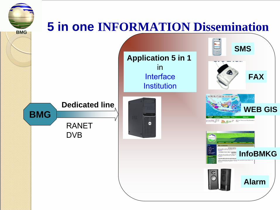
BMKG 5 in one INFORMATION Dissemination
TXT & XML Filesms
faxwebvoicealarm
Application 5 in 1in
InterfaceInstitution
BMGDedicated line
RANETDVB
BMG
SMS
Alarm
WEB GIS
FAX
InfoBMKG

BMKG
Worldspace’s satellites coverage, support RANET Tongshi receiver

BMKG
5 in 1 software (5 applications in 1 server)
Developed by BMKG1.
Alert•
Generate sound to alert the operator in the operation room if earthquake is located in a certain location, initially set by operators
2.
Web gis•
Generate maps to show earthquake location3.
SMS server•
Activate local SMS server to send SMS to mobile phone number listed on the table (set by operator)
•
Send daily 1 SMS to AEIC for daily life checking4.
Fax server•
Activate fax server to send fax to fax number listed on the table (set by operator)
5.
Phone•
If the server is connected to phone line and has text to voice application, this application is like an answering machine containing earthquake and tsunami information

BMKG
NETWORK OF RADIO INTERNETFOR INFORMATION DISSEMINATION
2008 (140 Sites)BMKG
Installed at remote areas not covered by terrestrial communication system
Earthquake/Tsunami warningWeather forecastClimate forecast
FDRS
BMG

BMKG
Satelliteprovider
Server 5 IN 1
METEO
CLIMATE
GEOWeb ServerDissemination
Server
Automatic
PALAPA
Automatic
DVB components
Digital Video Broadcasting (DVB)
Transmit the web content to remote area
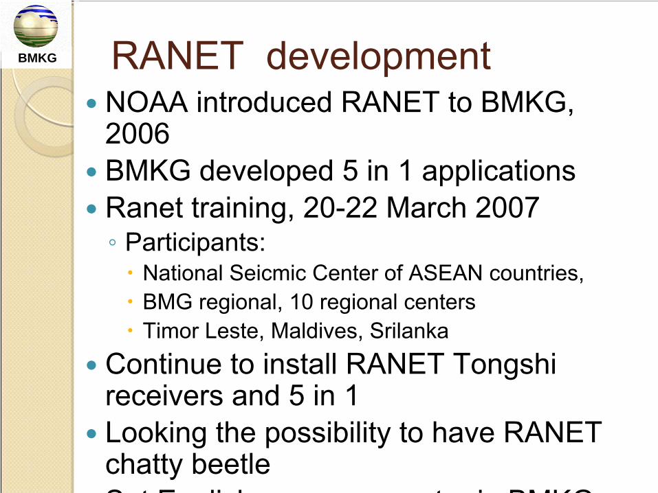
BMKG RANET developmentNOAA introduced RANET to BMKG, 2006BMKG developed 5 in 1 applicationsRanet training, 20-22 March 2007◦
Participants:
National Seicmic Center of ASEAN countries,BMG regional, 10 regional centersTimor Leste, Maldives, Srilanka
Continue to install RANET Tongshi receivers and 5 in 1Looking the possibility to have RANET chatty beetleS
t
E
li
h
t
i
BMKG
BMKG Powerful of RANET with 5 in 1 application in PC
Near real time communication tools from BMKG operation center in Jakarta to remoteCan be used for all products of BMKG for public awareness and informationFree from basic topology of communication, because using satellite communicationCan be installed in remote area Can re-disseminate information through fax and GSMCan access local authorities wherever they are as long as in GSM coverage

BMKG
Indonesia Tsunami Early Warning System
METEOROLOGICAL, CLIMATOLOGICAL AND GEOPHYSICAL AGENCY
JL. ANGKASA I NO. 2 KEMAYORANJAKARTA PUSAT –
INDONESIA
TEL/ FAX. 62 21 4246321/ 4246703http://www.bmg.go.id