Embed Size (px)
Citation preview
Biomes

What causes the seasons on Earth?

Biome – a biome is a complex communities that cover a large area and is characterized by defined abiotic conditions (i.e. climate and soil) and assemblages of organisms.
Climate has the most dramatic effect on determination of terrestrial biomes. Climate is made up of average annual precipitation, the rate of potential evapotranspiration, and altitude/latitude.
Aquatic biomes can be split into two major groups -freshwater and marine - and are determined by water depth, flow rate, temperature, and chemistry.
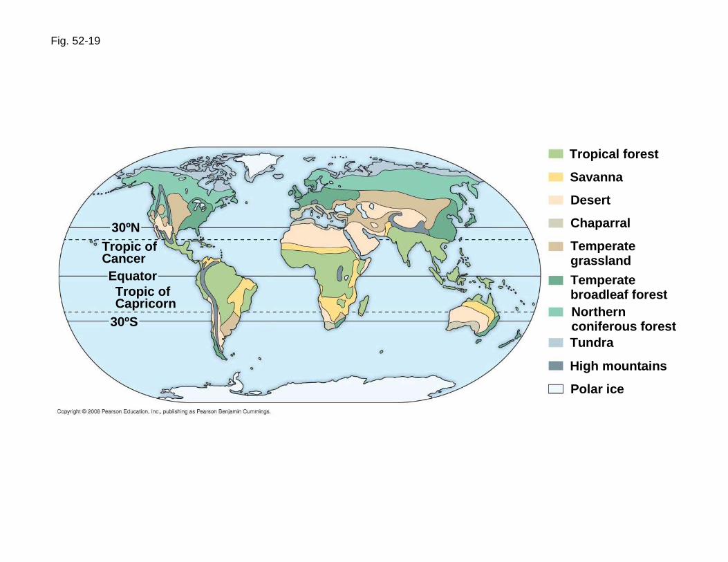
Fig. 52-19
Tropical forest
Savanna
Desert
Chaparral
Temperategrassland
Temperatebroadleaf forestNorthernconiferous forestTundra
High mountains
Polar ice
30ºNTropic ofCancerEquatorTropic ofCapricorn
30ºS

Fig. 52-15
LakesCoral reefsRiversOceanicpelagic andbenthic zonesEstuariesIntertidal zones
Tropic ofCancerEquator
Tropic ofCapricorn
30ºN
30ºS

Terrestrial Biomes & Climate
The amount of precipitation depends on closeness to large bodies of water, global air circulation patterns, and geographic features, like mountains.
Evapotranspiration rate is “the process of transferring moisture from the earth to the atmosphere by evaporation of water and transpiration from plants”(www.dictionary.com).
Lower air pressure at high altitudes causes lower average temperature and higher latitudes receive less solar energy per year than lower latitudes.

Fig. 52-10aLatitudinal Variation in Sunlight Intensity
Low angle of incoming sunlight
Sun directly overhead at equinoxes
Low angle of incoming sunlight
Atmosphere90ºS (South Pole)60ºS
30ºS
23.5ºS (Tropic ofCapricorn)
0º (equator)
30ºN23.5ºN (Tropic ofCancer)
60ºN90ºN (North Pole)
Seasonal Variation in Sunlight Intensity
60ºN30ºN
30ºS
0º (equator)
March equinox
June solstice
Constant tiltof 23.5º
September equinox
December solstice

Fig. 52-10dGlobal Air Circulation and Precipitation Patterns
60ºN
30ºN
0º (equator)
30ºS
60ºS
Global Wind Patterns
Descendingdry airabsorbsmoisture Ascending
moist airreleasesmoisture
Descendingdry airabsorbsmoisture
Aridzone
Tropics Aridzone
0º
66.5ºN(Arctic Circle)
60ºN
30ºN
0º(equator)
30ºS
60ºS66.5ºS(Antarctic Circle)
Westerlies
Northeast trades
Doldrums
Southeast trades
Westerlies
23.5º30º 23.5º 30º


Fig. 52-12
Warm airover land rises.1
23
4
Air cools athigh elevation.
Cool air over watermoves inland, replacingrising warm air over land.
Coolerair sinksover water.

Fig. 52-13
Winddirection
Mountainrange
Leeward sideof mountain
Ocean


Animals, plants, and all the other organisms are adapted to live within the biomes where they are found.
Different adaptations allow for organisms to thrive in the different conditions found in each biome. A plant’s and animal’s ability to survive and reproduce under conditions that differ from their optimum condition is called tolerance .
Some organisms are adapted to live in microclimates within each biome. A microclimate is an area that differs significantly from the climate of the surrounding area.
Major Terrestrial Biomes:• Tropical Rain Forest• Tropical Dry Forest• Tropical Savanna• Temperate Grassland• Desert
• Temperate Woodland and Shrubland(Chaparral)• Temperate Forest• Northwestern Coniferous Forest• Boreal Forest (Taiga)• Tundra• Mountains• Ice Caps


Fig. 52-21a
A tropical rain forest in Borneo
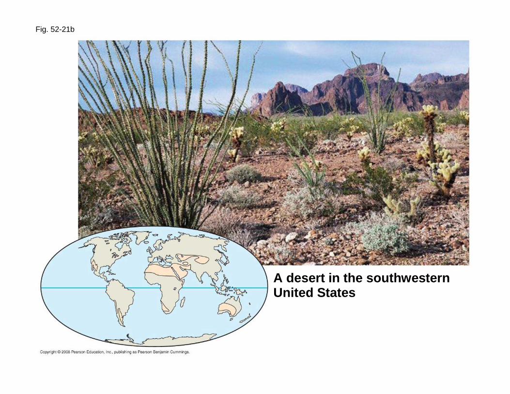
Fig. 52-21b
A desert in the southwesternUnited States
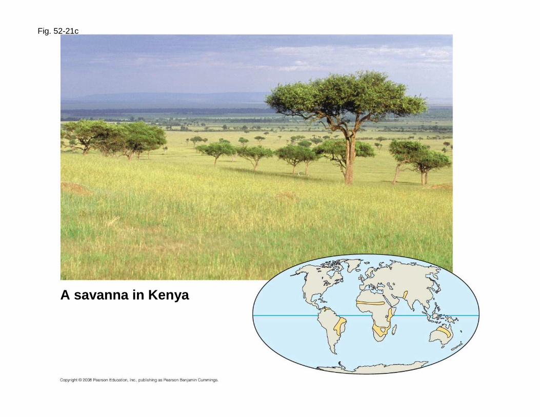
Fig. 52-21c
A savanna in Kenya

Fig. 52-21d
An area of chaparralin California

Fig. 52-21e
Sheyenne National Grasslandin North Dakota
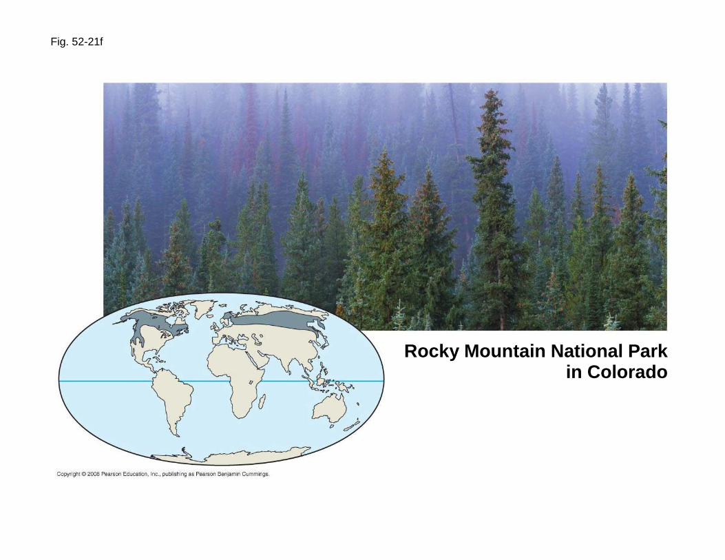
Fig. 52-21f
Rocky Mountain National Parkin Colorado
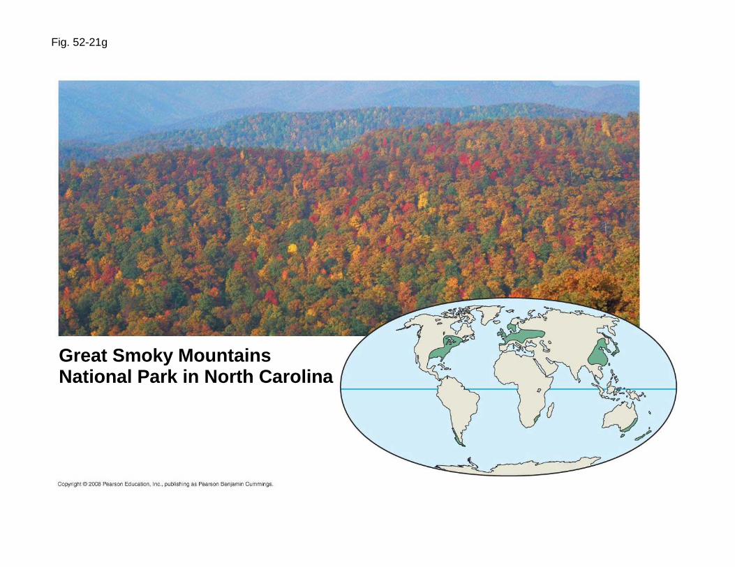
Fig. 52-21g
Great Smoky MountainsNational Park in North Carolina
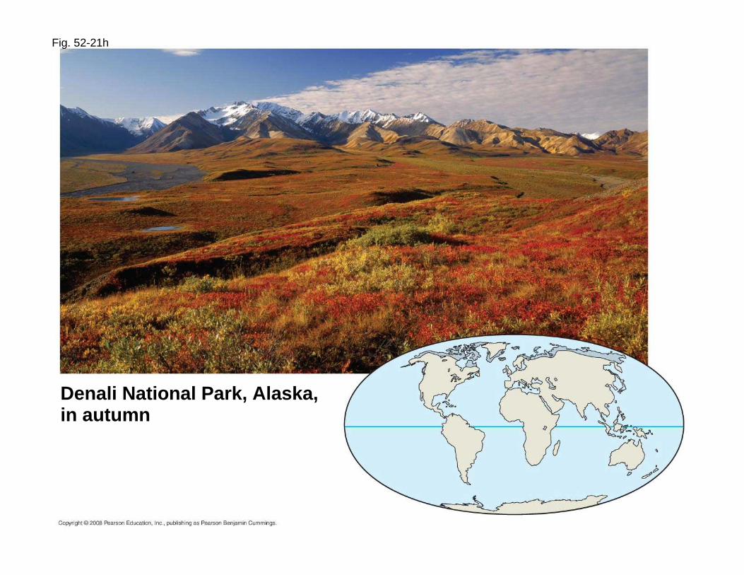
Fig. 52-21h
Denali National Park, Alaska,in autumn

1. The major abiotic & biotic characteristics of each biome including their worldwide distribution.
2. Representative diagrams of the four biogeochemical cycles from within each biome.
3. Four possible habitats within the biome.4. A food web containing at least five species, their names, and
associated trophic relationships.5. Examples of three of the five symbiotic relationships.6. One potential candidate for a keystone species.7. Climatograph from an city associated with your biome.
Time for action!Everyone select one of the biomes from the list (no duplications) and uncover more information about it. Compile the results in your notebooks, but be prepared to share with the class.
IF YOU HAVE ANY QUESTIONS, EMAIL Mr. Schmalz BEFORE SUNDAY NIGHT: [email protected]

Making a Climatogram
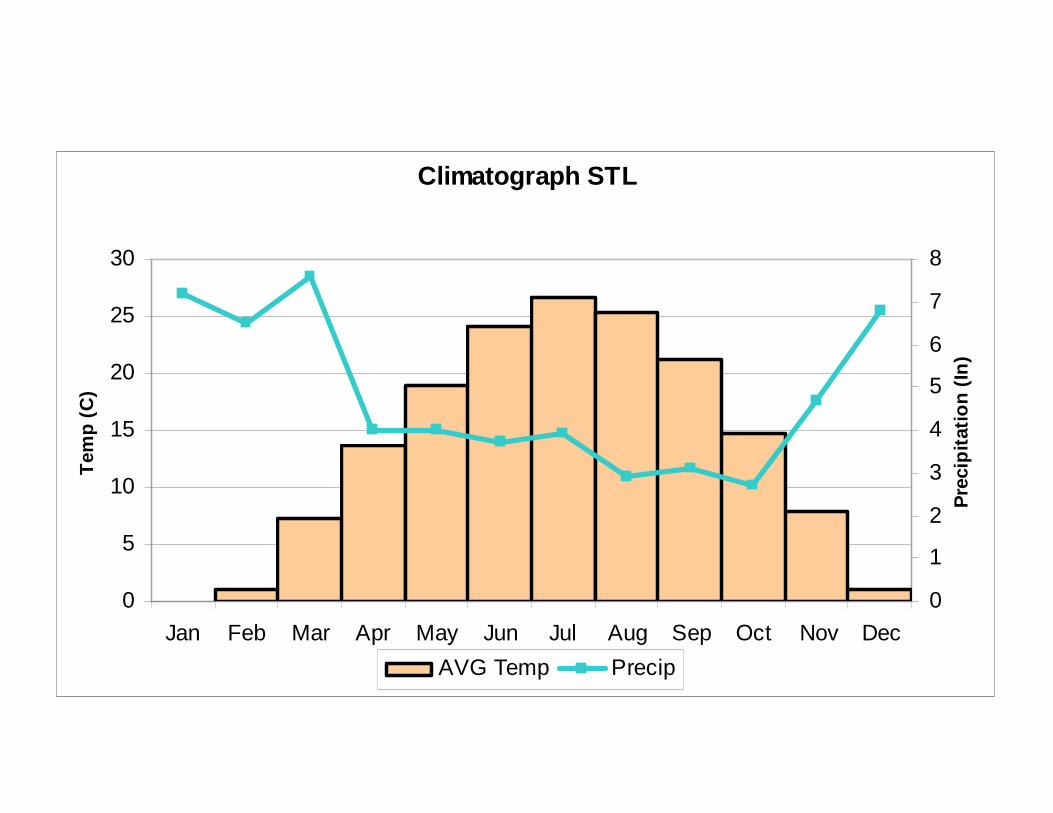
Climatograph STL
0
5
10
15
20
25
30
Jan Feb Mar Apr May Jun Jul Aug Sep Oct Nov Dec
Tem
p (C
)
0
1
2
3
4
5
6
7
8
Pre
cipi
tatio
n (I
n)
AVG Temp Precip

Aquatic BiomesDO NOT GO ANY FURTHER!

Fig. 52-11
Labradorcurrent
Gulfstream
Equator
Cold water
Warm water

Describe different ocean zones

Discuss major plants and animals found in oceans and in freshwater ecosystems

Apply the knowledge gained in studying ecological principles to an investigation of a living ecosystem