Embed Size (px)
Citation preview

United States Department of Agriculture Forest Service
Southwestern Region
April 2013
Biological Assessment
Sunflower Grazing Allotment
Tonto National Forest Maricopa County, Arizona
For more information, contact:
Kelly M. Kessler
Tonto National Forest
Mesa Ranger District
5140 E. Ingram St.
Mesa, AZ 85205
480.610.3305

The U.S. Department of Agriculture (USDA) prohibits discrimination in all its programs
and activities on the basis of race, color, national origin, age, disability, and where
applicable, sex, marital status, familial status, parental status, religion, sexual orientation,
genetic information, political beliefs, reprisal, or because all or part of an individual's
income is derived from any public assistance program. (Not all prohibited bases apply to all
programs.) Persons with disabilities who require alternative means for communication of
program information (Braille, large print, audiotape, etc.) should contact USDA's TARGET
Center at (202) 720-2600 (voice and TDD). To file a complaint of discrimination, write to
USDA, Director, Office of Civil Rights, 1400 Independence Avenue, SW, Washington,
D.C. 20250-9410, or call (800) 795-3272 (voice) or (202) 720-6382 (TDD). USDA is an
equal opportunity provider and employer.
Printed on recycled paper in April 2013.

1 Sunflower Allotment Biological Assessment
TABLE OF CONTENTS
INTRODUCTION ........................................................................................................................................ 3
Candidate Species Considered .................................................................................................................. 5
Critical Habitat Considered ....................................................................................................................... 5
Management Direction .............................................................................................................................. 6
PROJECT DESCRIPTION ........................................................................................................................... 6
Location .................................................................................................................................................... 6
Allotment Management History................................................................................................................ 7
Current Condition ......................................................................................................................................... 8
Dos S Unit ................................................................................................................................................. 8
Desert Unit .............................................................................................................................................. 13
Cline Unit ................................................................................................................................................ 15
Cottonwood Unit ..................................................................................................................................... 17
Definition of Action Area ........................................................................................................................... 18
Proposed Action .......................................................................................................................................... 18
Adaptive Management ............................................................................................................................ 19
Mitigation Measures ............................................................................................................................... 20
Consevation Measures ............................................................................................................................ 21
ENVIRONMENTAL BASELINE .............................................................................................................. 22
CUMULATIVE EFFECTS ........................................................................................................................ 22
SPECIES ACCOUNTS, STATUS OF THE SPECIES IN THE ACTION AREA, EFFECTS,
DETERMINATION, AND RATIONALES ............................................................................................... 23
Gila Topminnow (Poeciliopsis occidentalis occidentalis) ......................................................................... 23
Life History and Distribution .................................................................................................................. 23
Status Within The Action Area ............................................................................................................... 24
Effects Analysis ...................................................................................................................................... 28
Determination of Effects – Gila Topminnow ......................................................................................... 29
Desert Pupfish (Cyprinodon macularius) ................................................................................................... 29
Life History and Distribution .................................................................................................................. 29
Status Within The Action Area ............................................................................................................... 30
Effects Analysis ...................................................................................................................................... 31
Determination of Effects ......................................................................................................................... 31
Mexican Spotted Owl Critical Habitat (Strix occidentalis lucida) ............................................................. 31
Status Within The Action Area ............................................................................................................... 32
2 Sunflower Allotment Biological Assessment
Effects Analysis ...................................................................................................................................... 32
Determination of Effects ......................................................................................................................... 32
Sonoran Desert Tortoise (Gopherus morafkai) - Candidate ....................................................................... 33
Life History ............................................................................................................................................. 33
Status Within The Action Area ............................................................................................................... 33
Effects Analysis ...................................................................................................................................... 34
Determination of Effects ......................................................................................................................... 34
LIST OF PREPARERS AND APPROVERS ............................................................................................. 35
LITERATURE CITED ............................................................................................................................... 36
Appendix A: Definitions ............................................................................................................................. 38

3 Sunflower Allotment Biological Assessment
INTRODUCTION Tonto National Forest (Tonto NF), Mesa Ranger District (District) proposes to authorize livestock
grazing on the Sunflower allotment in a manner that is consistent with the Forest Plan standards,
guidelines, and objectives, and maintains or improves natural resources. The project area encompasses
approximately 158,000 acres northeast of Mesa, Arizona extending north of Saguaro, Canyon, and
Apache Lakes, to just south of Sunflower, Arizona, east along Four Peaks, and west bordering the Cave
Creek Ranger District. State Route 87 bisects the allotment from south to north.
This action is needed to analyze existing environmental conditions and expected effects of continued
livestock grazing on Sunflower allotment. Suitability of these lands for livestock grazing is documented
in the Tonto National Forest Land and Resource Management Plan (LRMP)(1985 as amended), however
determining capability and level of grazing in light of current resource issues must be accomplished. This
analysis will include adaptive management strategies which would be incorporated into any action
decision and subsequent Allotment Management Plan.
There is a need to comply with the 1995 Rescissions Act, which directs the Forest Service to establish a
schedule for completing environmental analysis for grazing allotments. There is a need for updated
analysis to incorporate the permittee’ s proposed action for continued grazing on the Sunflower allotment,
including reduced permitted numbers to account for resource limitations caused by recreational impacts
and ongoing drought, and a suitable grazing system for the allotment. There is a need to analyze the
feasibility and importance of maintaining existing range improvements to comply with agency standards.
This will include analysis of the feasibility of maintaining an exclosure fence along Sycamore Creek.
The purpose of this biological assessment is to review the proposed Sunflower allotment management in
sufficient detail to determine to what extent the proposed action may affect any of the threatened,
endangered, or proposed species below. This biological assessment (BA) is prepared in accordance with
legal requirements set forth under Section 7 of the Endangered Species Act (ESA)(16 U.S.C. 1536), and
its regulations 50 CFR 402, and follows the standards established in Forest Service Manual Direction
(FSM 2672.4-2672.43).
Consultation History The Forest Service has requested formal consultation with the United States Fish and Wildlife Service
(USFWS) multiple times over the past 20 years regarding livestock management activities (grazing and
fencing) and the stocking of both Gila topminnow (Poeciliposis occidentalis occidentalis) and desert
pupfish (Cyprinodon macularius) in two locations on the Sunflower allotment; Mud and Hidden Water
Springs. These two springs are located in the Dos S unit and Cottonwood unit respectively. Additionally,
the Forest Service consulted on the use of heavy equipment to remove vegetation and/or deepen the ponds
at the Mud Spring location.
February 14, 1994 – The USFWS issued a biological opinion (BO) for the allotment management
plan for the Dos S unit of the Sunflower allotment (USFWS file number 02-21-92-F-213).
October 2, 1996 – The USFWS issued an amendment to the above BO, to included activities to
exclude the existing drinker (Mud Spring) and additional upland habitat from livestock access,
and add a new livestock drinker outside of the exclosure.
February 28, 2002 – The USFWS issued a BO for ongoing grazing management for 20 allotments
on the Tonto NF, including the Sunflower Allotment (USFWS file number 02-21-99-F-300).

4 Sunflower Allotment Biological Assessment
April 11, 2005 – The Tonto NF requested re-initiation of consultation to authorize the Arizona
Game and Fish Department (AZGFD) to stock desert pupfish into Mud and Hidden Water
Springs, and an amendment on the previous BOs for Mud Springs (02-21-92-F-213) and Hidden
Water Springs (02-21-99-F-300).
May 19, 2006 – The USFWS issued a BO on the reintroduction of desert pupfish into Mud and
Hidden Water Springs, and the effects of implementing the current Sunflower allotment
management plan (AMP) on this species.
Given the extensive history of consultation, the issuance of BOs with applicable reasonable and prudent
measures with terms and conditions and conservation measures, and because the current proposed action
(described on page 17) for the Dos S (Mud Spring) and Cottonwood unit (Hidden Water Spring) is
essentially the same as was described in the previous biological assessments, the District evaluated
whether any of the “triggers” identified under 50 CFR 402.16 had been met which would require
reinitiation of formal consultation. 50 CFR 402.16 states the following;
Reinitiation of formal consultation is required and shall be requested by the Federal agency or by the
Service, where discretionary Federal involvement or control over the action has been retained or is
authorized by law and:
(a) If the amount or extent of taking specified in the incidental take statement is exceeded;
(b) If new information reveals effects of the action that may affect listed species or critical habitat in a
manner or to an extent not previously considered;
(c) If the identified action is subsequently modified in a manner that causes an effect to the listed species
or critical habitat that was not considered in the biological opinion; or
(d) If a new species is listed or critical habitat designated that may be affected by the identified action.
The District does not believe that any of the above “triggers” have been met, and therefore will
incorporate, by reference, the applicable reasonable and prudent measures and terms and conditions
described in biological opinion USFWS file 02-21-05-F-0450. However, this biological assessment does
include a discussion on the life history and status of Gila topminnow and desert pupfish beginning on
page 23.
Table 1 contains determinations for all listed species occurring in Maricopa County. Species for which no
effect determinations were made are not known to occur or have suitable habitat within the action area.
Table 1. Sunflower Allotment Threatened and Endangered Species List and Determination.
Common
Name Species Status Determinations
Within
Project
Area
Gila
Topminnow Poeciliposis occidentalis
occidentalis
Endangered May Affect Likely
to Adversely
Affect (see above)
Yes
Desert Pupfish Cyprinodon macularius Endangered May Affect Likely
to Adversely
Affect (see above)
Yes
Mexican
Spotted Owl Strix occidentalis lucida Threatened No Effect No

5 Sunflower Allotment Biological Assessment
Common
Name Species Status Determinations
Within
Project
Area
Arizona
Cliffrose Purshia subintegra Endangered No Effect No
Acuna Cactus Echinomastus
erectocentrus var.
acunensis
Proposed
Endangered
No Effect No
Lesser Long-
Nosed Bat Leptonycteris curasoae
yerbabuenae
Endangered No Effect No
Woundfin Plagopterus argentissimus Endangered No Effect No
Razorback
Sucker Xyrauchen texanus Endangered No Effect No
California
Least Tern Sterna antillarum browni Endangered No Effect No
Southwestern
Willow
Flycatcher
Empidonax traillii extimus Endangered No Effect No
Yuma Clapper
Rail Rallus longirostris
yumanensis
Endangered No Effect No
Sonoran
Pronghorn Antilocapra americana
sonoriensis
Endangered
No Effect No
Candidate Species Considered
Table 2. Candidate species known to occur within the action area.
Common name Scientific name
Sonoran Desert Tortoise (Gopherus morafkai)
Critical Habitat Considered
Table 3. Threatened and endangered species with critical habitat designation within the action area.
Common Name Scientific Name Final Ruling Effective Date
Mexican Spotted Owl (Strix occidentalis lucida) 31 Aug 2004

6 Sunflower Allotment Biological Assessment
Management Direction
Permitted grazing on the Forest is authorized by public law as implemented by the LRMP, as amended
(USFS 1985). The LRMP provides guidance and direction for a 10-15 year period. It establishes goals,
objectives, and standards and guidelines for multiple-use and sustained yield management of renewable
resources.
This BA and Section 7 consultation references the “Framework for Streamlining Informal Consultation
for Livestock Grazing Activities” (USFS 2005). Publications referenced for the life history, habitat
description, distribution, effects analysis, recovery status, and baseline for each species include, but are
not restricted to, the Desert Pupfish Recovery Plan (USFWS 1993), the BO for Ongoing and Long Term
Grazing on the Forest (USFWS 2002), the BO for Ongoing Livestock Grazing Activities for Southwest
Region (USFWS 1999), the BO for Eleven Land and Resource Plans for the Southwestern Region
(USFWS 2005), the BO for Ongoing for Three Allotments on the Tonto National Forest (USFWS 2009),
and the Final Recovery Plan for the Mexican Spotted Owl (USFWS 2012).
PROJECT DESCRIPTION
Location
The project area encompasses approximately 158,000 acres northeast of Mesa, Arizona extending north
of Saguaro, Canyon, and Apache Lakes, to just south of Sunflower, Arizona, east along Four Peaks, and
west bordering the Cave Creek Ranger District. State Route 87 bisects the allotment from south to north
(Figure 1).

7 Sunflower Allotment Biological Assessment
Allotment Management History
Cattle were introduced to Arizona in the late 1870s following the Civil War and the subjugation of the
Apaches. By the early 1890s, one and a half million cattle had been brought to Arizona (Allen 1989).
During this time period, there was no regulation of grazing. In 1905, the Tonto National Forest was
designated to protect the watersheds that provide water to the Phoenix area.
In 1966, the grazing capacity for the Sunflower allotment was estimated to carry 2,707 head, 25,250
animal unit months (AUMs). This stocking rate was slightly above the average from previous years.
Trend was static or downward. There was a large trespass of 7,014 AUMs for the previous 10 years. It
was felt that with the large trespass removed, and if a pasture was built at the lower end of the allotment
for holding the yearlings, the range trend might keep its static condition or revert to an upward trend.
However, it was noted that a rest-rotation grazing system and additional water developments would need
to be developed.
In 1988 permitted numbers were 1,700 cattle yearlong plus natural increase (NI) for five months. This
equates to approximately 7 acres per head month. This rate, on average, had been conducive to successful
management of allotments on the Forest. This allotment wasn’t successfully managed at this stocking
rate, at least partly because of the significant lack of distribution and no planned periods of rest (1988
EA).
A Decision Notice (DN) signed August 17, 1988 approved dividing the allotment into management units.
A management plan approved this strategy on December 14, 1989. Five units were established on the
allotment; Desert unit, Cottonwood unit, Dos S unit, Cline unit, and the Diamond unit. Management
systems were developed for each unit within the allotment. The permit was issued for a total of 1,700
head. Permit signed 02/08/1983 authorized 1,700 cattle yearlong and 1,118 yearlings from 01/01 – 05/31
annually.
In 1991 an environmental analysis (EA) was initiated on the Dos S unit to develop a livestock grazing
strategy for the unit. A DN and Finding of No Significant Impact (FONSI) were issued on August 5, 1994
which implemented a grazing strategy that included the following seven pastures; Adams, Maverick,
Otero, Picadilla, Pine Creek, Ranger Station, and Sycamore Creek Riparian. The Sycamore Creek riparian
pasture was to be closed to all livestock grazing during the initial ten years of management, and the
upland pastures were to be managed with a Santa Rita grazing system.
Sunflower Permit signed 08/04/1993 authorized 1,250 adults from 01/01 – 12/31, and 825 yearlings from
01/01 – 05/31. The Diamond unit of the Sunflower allotment was taken out of the total allotment acreage
(29,467 acres) and a new permit for the Diamond allotment (#12-781) is issued on 08/04/1993
authorizing 450 adults and 293 yearlings. These numbers (Diamond) were removed from the previous
permitted number of 1,700. (1,700 – 450 = 1,250).
In July 1999, an EA was initiated on the Cottonwood and Cline units. A DN and FONSI were issued on
November 20, 2000. The Decision excluded livestock grazing (100 head) within the Cottonwood unit for
a period of ten years, and authorized 35 head of cattle to graze yearlong in a “two pasture flip-flop”
management system in the Cline unit. The DN stated that the Cottonwood unit would not be restocked
without additional NEPA analysis.

8 Sunflower Allotment Biological Assessment
The Sunflower allotment permit was modified by letter on May 22, 2002 and authorized the following
numbers of livestock for the indicated season of use:
Unit Number Kind Class From To
Cline 35 Cattle Adult Cattle 1/1 12/31
Cottonwood 100* Cattle Adult Cattle 1/1 12/31
Desert (50)** Cattle Adult Cattle 10/15 5/15
Desert 500 Cattle Yearling, Natural Increase 10/15 5/15
Dos S 650 Cattle Adult Cattle 1/1 12/31
Dos S 165 Cattle Yearling, Natural Increase 1/1 5/31
*These 100 adult cattle are in a 10-year non-use period beginning on May 22, 2002.
** These 50 adult cattle are part of the total permitted numbers of 685 adult cattle (Dos S adults + Cline:
650 +35 = 685). The 685 adult cattle do not include the 100 adult cattle that are in a 10-year non-use
period beginning on May 22, 2002.
Due to non-compliance, for failure to remove livestock as directed, the permit was suspended by 50
percent, as documented in a certified letter dated November 4, 2002. Permit #12018 dated June 2, 2004,
was issued reflecting this suspension.
Unit Number Kind Class From To
Cline 35 Cattle Adult Cattle 1/1 12/31
Cottonwood 100* Cattle Adult Cattle 1/1 12/31
Desert (50)** Cattle Adult Cattle 10/15 5/15
Desert 163 Cattle Yearling, Natural Increase 10/15 5/15
Dos S 312 Cattle Adult Cattle 1/1 12/31
Dos S 165 Cattle Yearling, Natural Increase 1/1 5/31
* These 100 adult cattle are in a 10-year non-use period beginning on May 22, 2002.
** These 50 adult cattle are part of the total permitted numbers of 347 adult cattle. The 347 adult cattle do
not include the 100 adult cattle that are in a 10-year non-use period beginning on May 22, 2002.
An allotment analysis was completed on the Dos S and Desert units in 2007. The proposed action was to
continue non-use of these two units to coincide with termination of the non-use period imposed on the
Cottonwood unit. A Decision Memo (DM) was issued on September 12, 2007, and permit modification
#12018A was signed on November 9, 2007.
Current Condition
Dos S Unit The Dos S unit is located northeast of the Phoenix metropolitan area along Highway 87, which bisects the
unit into a west and east half. This division was incorporated into the management of the unit as the
rotation included use of the west pastures for six months, then movement to the east pastures for six
months. The unit is bounded to the north by the Diamond allotment, to the southwest by the Ft.
McDowell Indian Reservation, to the west by the Cave Creek Ranger District, to the southeast by the
Desert unit, and the east by the Cline unit.
This unit hasn’t been grazed since 2002, when livestock were removed due to drought related resource
concerns.

9 Sunflower Allotment Biological Assessment
The Dos S unit of the Sunflower allotment consists of approximately 80,000 acres of Sonoran desert
scrub, mesquite bosque, mixed broadleaf deciduous riparian, interior chaparral, and desert grassland
vegetation. Elevation ranges from 1,540 – 6,100 feet. Riparian on the Dos S unit currently comprises
approximately 3% of the total unit acreage. The upland communities can be subdivided into three
categories; interior chaparral (10,000 acres), mixed communities (16,000 acres), and Sonoran Desert
scrub (51,840 acres).
Interior chaparral – located along the east side of the unit, characterized by evergreen shrubs the most
common being shrub live oak (Quercus turbinella). Other common shrubs include birchleaf mountain
mahogany (Cercocarpus montanus), skunkbush sumac (Rhus trilobata), desert ceanothus (Ceanothus
spp.), yellow silktassel (Garrya flavescens), Wright’s silktassel (Garrya Wrightii), hollyleaf buckthorn
(Rhamnus crocea), sugar sumac (Rhus ovata), and at higher elevations, manzanita (Arctostaphylos
pungens). Inclusions of pinyon pine (Pinus edulis), juniper (Juniperus spp.), and ponderosa pine (Pinus
ponderosa) are common within this community. This vegetation type has been impacted the least by
livestock grazing. The upper reaches of this community have historically shown little evidence of
livestock use.
Mixed communities – The Dos S supports a mid-elevation mix of biotic communities that connect the
Sonoran desert scrub at lower elevations to the interior chaparral at higher elevations, as well as areas of
semi-desert grassland biotic communities. Dominant shrub and sub-shrub species include; jojoba
(Simmondsia chinensis), yellow paloverde (Parkinsonia microphylla), desert hackberry (Celtis pallida),
fairyduster (Calliandra eriophylla), Wright’s buckwheat (Eriogonum Wrightii), catclaw acacia (Acacia
greggii), turpentine bush (Ericameria laricifolia), range ratany (Krameria spp.), snakeweed (Gutierrezia
sarothrae), slender janusia (Janusia gracilis), pricklypear cactus (Opuntia engelmannii). Dominate
herbaceous species include; curly mesquite (Hilaria belangeri), sideoats grama (Bouteloua curtipendula),
and threeawn (Aristida spp.). This diversity makes this area the highest forage producer within the unit.
Livestock use of this area has been variable with areas adjacent to water being heavily used while remote
areas have received little to no use.
Riparian communities – (1993 EA) Riparian on the Dos S unit comprises approximately 3% of the total
unit acreage. This 3% can be subdivided into five categories, mesquite (1,500 acres), mixed broadleaf
(200 acres), cottonwood (60 acres), rock or sand streambed (capable of supporting riparian vegetation
primarily cottonwood-willow) (400 acres), and springs (10 acres). The Dos S unit contains important
riparian habitat in Sycamore Creek, Mesquite Wash, Mud Spring, and Log Corral Canyon.

10 Sunflower Allotment Biological Assessment
C5T3 – 09/13/2012 – Maverick Pasutre, Dos S Unit
Sonoran Desert Scrub – Characterized by paloverde (Parkinsonia spp.) and various cacti, including
saguaro. Dominate vegetation is perennial shrubs and small trees intermixed with various cactus species.
Common shrub and sub-shrub species include; fairyduster (Calliandra eriophylla), jojoba (Simmondsia
chinensis), turpentine bush (Ericameria laricifolia), desert globemallow (Sphaeralcea ambigua),
Wright’s buckwheat (Eriogonum Wrightii), menodora (Menodora spp.), desert hackberry (Celtis pallida),
wolfberry (Lycium spp.), ocotillo (Fouquieria splendens) and range ratany (Krameria spp.). Annual
grasses and forbs are common within the community with abundance varying considerably. Perennial
grasses are also present, but far less common than exotic annuals such as red brome (Bromus rubens).
These introduced species now provide considerable forage in the spring if adequate winter moisture is
received. Native perennial species include; curly mesquite (Hilaria belangeri), threeawn (Aristida), and
sideoats grama (Bouteloua curtipendula). Livestock use patterns are variable, with water availability
being the controlling factor.
C9T1 – 02/23/2012 – Dos S Unit, Adams Pasture

11 Sunflower Allotment Biological Assessment
C9T3 02/23/2012 – Dos S Unit, Adams Pasture
Parker three-step monitoring sites (Cluster (C)) and pace transects (PT) were established in key areas on
the allotment in the mid-1960s. This monitoring method is designed to measure long term vegetation
condition, vegetation trend, soil stability, and soil trend. Vegetation trend usually refers to vegetative
conditions based on available forage for livestock. Table 4 compares Parker three-step monitoring data
collected over multiple years on the Dos S unit.
Table 4. Dos S Unit Parker Three-Step and Pace Transects
Cluster/Transect Unit/Pasture Date Vegetation Rating
and Trend
Soil Rating and
Trend
PT 5 Dos S/Maverick 03/25/1965 Very Poor, ↓ Poor, →
10/09/2002 Very Poor, ↓ Fair, →
08/14/2012 Poor, ↑ Poor, ↑
PT 7 Dos S/Pine Creek 04/07/1965 Very Poor, → Very Poor, →
10/27/2002 Poor, → Fair, ↑
C 5 Dos S/Maverick 03/23/1965 Poor, ↓ Poor, ↓
05/19/1977 Poor, NC Very Poor, NC
02/01/1984 Fair, ↓ Fair, →
10/09/2002 Poor, ↓ Fair, →
03/27/2007 Fair, ↑ Fair, →
09/13/2012 Fair, ↑ Fair, ↓
C 6 Dos S/Otero 03/24/1965 Fair, → Poor, ↓
02/09/1984 Fair, → Fair, ↓
10/08/2002 Poor, ↓ Fair, →
C 9 Dos S/Adams 07/09/1965 Poor, → Very Poor, →
11/16/1983 Poor, → Poor, ↓
10/08/2002 Poor, ↓ Fair, →
02/23/2012 Poor, → Fair, →

12 Sunflower Allotment Biological Assessment
Cluster/Transect Unit/Pasture Date Vegetation Rating
and Trend
Soil Rating and
Trend
C 13 Dos S/Adams 08/03/1967 Very Poor, ↓ NC
02/17/1984 Poor, ↓ Poor, ↓
10/07/2002 Very Poor, ↓ Fair, →
08/15/2012 Fair, ↑ Poor, ↑
NC – Not Complete
Relative Species Abundance: Livestock were completely removed from the allotment in 2002. Parker
three-step data collected in 2002 and 2012 was compared to detect any changes in species abundance
(composition) which may have occurred during the 10 year non-use period.
PT5 – Dos S (Maverick pasture)
2002 – Calliandra (32%), curly mesquite (4%), buckhorn cholla (22%), prickly pear (13%),
hedgehog cactus (7%), turpentine bush (5%), mesquite (6%), jojoba (2%), three-awn spp. (<1%).
2012 – Calliandra (29%), curly mesquite (2%), buckhorn cholla (not listed), prickly pear (10%),
hedgehog (8%), turpentine bush (2%), mesquite (not in transect), jojoba (2%), three-awn spp.
(17%), range ratany (6%).
The most notable changes in this key area is the 16% increase in three-awn spp. and the presence of range
ratany (6%) noted in 2012, when absent in the 2002 monitoring.
C5 – Dos S (Maverick pasture)
2002 – Calliandra (61%), three-awn spp. (4%), prickly pear (2%), curly mesquite (7%), sideoats
grama (3%), hedgehog cactus (13%), catclaw acacia (1%), broom snakeweed (1%).
2007 – Calliandra (58%), three-awn spp. (13%), prickly pear (1%), curly mesquite (7%), sideoats
grama (3%), hedgehog cactus (3%), catclaw acacia (1%), broom snakeweed (<1%).
2012 – Calliandra (52%), three-awn spp. (16%), prickly pear (12%) curly mesquite (3%), sideoats
grama (1%), hedgehog cactus (2%), catclaw acacia (3%), broom snakeweed (6%).
The most notable changes seen are an increase in three-awn spp., prickly pear, and broom snakeweed.
C9 – Dos S (Adams pasture) 2002 – Calliandra (37%), hedgehog cactus (14%), buckhorn cholla (15%), flat-top buckwheat
(6%), jojoba (6%), range ratany (4%).
2012 – Calliandra (25%), hedgehog cactus (1%), buckhorn cholla (13%), flat-top buckwheat
(5%), jojoba (8%), range ratany (trace), three-awn spp. (29%), menodora (6%).
The most notable changes in this key area were the 29% increase in three-awn spp. and the 6% increase in
menodora. In 2002, these species were present within the 50’x150’ plot, however, they were not detected
within any of the three transects. Also noted was a decrease in calliandra (12%), hedgehog cactus (10%),
and range ratany (4%) from 2002 to 2012.
C13 – Dos S (Adams pasture)
2002 – Calliandra (53%), three-awn spp. (9%), brittlebush (3%), janusia (2%), catclaw acacia
(4%), prickly pear (4%).

13 Sunflower Allotment Biological Assessment
2012- Calliandra (41%), three-awn spp. (9%), brittlebush (4%), janusia (3%), catclaw acacia
(13%), prickly pear (8%).
The most notable changes were an increase in catclaw acacia and prickly pear, 9% and 4% respectively.
Problems and Conflicts
The Dos S unit, due to its close proximity to the Phoenix metropolitan area, receives intense recreational
use including; multiple off-highway vehicle (OHV) use (i.e. all-terrain vehicles, motorcycles), target
shooting, hiking, and horseback riding. An extensive network of primarily user created trails and two
track roads has occurred primarily within the Adams, Otero, and Sycamore Creek pastures. This heavy
recreational use has resulted in the following problems and conflicts with the livestock operation;
vandalism of range improvements, cutting of unit boundary fences, livestock harassment, and damage or
destruction of forage resources through the creation of new trails.
A portion of the Heber-Reno sheep driveway runs through the Dos S unit, specifically through the
Adams, Otero, and Pine Creek pastures. The driveway is roughly 19,440 acres, and is not included in the
allotments total acreage. The sheep driveway permittees are authorized to use the driveway twice
annually, typically in April (north) and October (south), to move their sheep from their winter grounds in
Chandler, to their summer grounds on the Apache-Sitgreaves National Forest. The length of time on the
unit is generally less than three days each way; north and south.
Desert Unit The Desert unit of the Sunflower allotment includes 19,300 acres of Sonoran desert scrub along the south
end of the allotment. Elevations range from 2,520 feet to 1,600 feet near the Salt River. The unit is
bounded on the south by the Salt River (Saguaro Lake), to the west by Highway 87, to the east by the
Cottonwood unit, and the north by the Cline unit. This area is characterized by a series of ridges and
drainages that run north and south. Slopes are gentle to moderately steep comprised primarily of
decomposed granite. Accelerated erosion occurs in areas where little perennial vegetation exists. There is
no riparian habitat, or threatened and endangered species known to occur in the Desert unit.
The Desert unit has historically been used as a seasonal unit from October 15 through May 15, when
annual precipitation (winter) provides for the production of annual grasses and forbs. Livestock use is a
combination of a limited number of adult cull cows and yearlings from the Dos S, Cottonwood, and Cline
units. Because this unit is dependent upon annual precipitation, considerable variation in production
occurs from year to year. The primary browse species within this unit is jojoba, however, additional
palatable browse species include; range ratany, wolfberry, and calliandra. Three-awn species are the
dominant perennial grass species within this unit.
All livestock were removed due to drought conditions in 2002. The permit issued June 2, 2004 reduced
the permitted numbers to 50 cows and 163 yearlings (NI) from 10/15 – 5/15 annually.

14 Sunflower Allotment Biological Assessment
C10 08/20/2012 – Desert Unit
Table 5. Desert Unit Parker Three-Step Clusters and Pace Transects
Cluster/Transect Unit Date Vegetation Rating
and Trend
Soil Rating and
Trend
PD Desert Unit 10/07/2002 Very Poor, ↓ Poor, →
08/16/2012 Very Poor, → Poor, →
PT 1 (C10) Desert Unit 07/09/1965 Poor, → Poor, →
10/21/1983 Poor, → Poor, ↓
02/10/1992 Poor, → Fair, →
10/07/2002 Very Poor, ↓ Poor, →
08/20/2012 Very Poor, →
C12 Desert Unit 08/03/1967 Poor, ↑ Fair, →
02/17/1984 Poor, → Fair, →
10/07/2002 Very Poor, ↓ Fair, →
08/15/2012 Poor, ↑ Fair, ↑
C 14 Desert Unit 08/03/1967 Poor, → Poor, →
02/16/1984 Poor, → Fair, →
01/23/1992 Poor, → Fair, →
Relative Species Abundance: Livestock were completely removed from the allotment in 2002. Parker
three-step data collected in 2002 and 2012 was compared to detect any changes in species abundance
(composition) which may have occurred during the 10 year non-use period.
C10 – Desert Unit
2002 – Triangle-leaf bursage (33%), range ratany (19%), wolfberry (16%), globe mallow (9%),
Mormon tea (5%), whitethorn acacia (5%), three-awn spp. (4%).
2012 – Triangle-leaf bursage (80%), range ratany (3%), wolfberry (2%), globe mallow (1%),
Mormon tea (1%), whitethorn acacia (1%), three-awn spp. (10%).

15 Sunflower Allotment Biological Assessment
It is important to note that in 2002 the transect stakes were not relocated, so three paced transects were
completed in the general vicinity (~ 1 acre) of the Parker location. In 2012, the original Parker three-step
transects were relocated and read. Therefore, the comparison between 2002 and 2012 data may be slightly
skewed.
The data show a marked increase (47%) in triangle-leaf bursage, and a slight (6%) increase in three-awn
spp. The remaining dominant browse species decreased in the key area.
C12 – Desert Unit
2002 – Calliandra (40%), three-awn spp. (16%), buckhorn cholla (12%), janusia (10%).
2012 – Calliandra (37%), three-awn spp. (26%), buckhorn cholla (9%), janusia (3%), catclaw
acacia (9%).
Most notable was the increase in three-awn spp. (10%) from 2002 to 2012. Additionally, catclaw acacia,
not detected in the 2002 transect, was the closest perennial plant 9% of the time in 2012.
Cline Unit This unit occurs in the east central portion of the Sunflower allotment. It is a small unit consisting of
approximately 9,800 acres; bounded on the northeast by the Tonto Basin Ranger District, the south by the
Cottonwood unit, the north and west by the Dos S unit.
Elevations range from 3,400 feet in Cottonwood Creek to 6,236 feet on Pine Mountain. Terrain varies
from rolling hills to steep, rugged slopes. Soils are generally granitic, as described below for the
Cottonwood unit.
This area was managed for vegetation type conversion during the 1960s, when prescribed burning and
herbicides were used to reduce the density of chaparral species and provide a seedbed for introduced
grasses. Records indicate that in 1979 and 1981, two prescribed burns were completed within this unit,
with 1,200 and 1,500 acres respectively treated. In 1996, the Lone Fire burned approximately 5,000 acres
within the Cline unit.
In 1989 this unit was permitted 200 cattle yearlong and 72 NI for five months. A DN signed November
14, 2000 reduced permitted numbers in this unit from 200 to 35 head. The unit was to be divided into two
pastures (Picadilla and Brushy Basin) using existing fences, and be managed in a two pasture flip-flop
rotation.
2004 permit authorized 35 head yearlong in this unit, pending repair of designated improvements. This
management system was never implemented, as livestock were removed from the allotment due to
drought conditions in 2002.
Vegetation is predominantly interior chaparral, including such species as; scrub oak (Quercus turbinella),
Emory oak (Quercus Emoryi), cat-claw acacia (Acacia greggii), desert ceanothus (Ceanothus spp.), and
sugar sumac (Rhus ovata). The herbaceous component is comprised mainly of introduced lovegrass
species (Eragrostis spp.), with some sand dropseed (Sporobolus cryptandrus) present. Important riparian
areas include Picadillo Creek, Cottonwood Creek, Tehanos Spring, and Mud Spring.

16 Sunflower Allotment Biological Assessment
General location of C2 02/15/2012 – Cline Unit
Cline Unit – 2012 Introduced lovegrass

17 Sunflower Allotment Biological Assessment
There are three Parker Three-Step clusters; C1, C2, and C3 within this unit, however, these haven’t been
re-read since their establishment in 1968 and 1969 due to the density of chaparral. A schedule of
prescribed fire within this unit would improve the forage resource for livestock and habitat for wildlife.
Cottonwood Unit This unit is roughly 49,400 acres in size, with approximately 90 percent of the unit within the Four Peaks
Wilderness. The unit is bounded to the south by the Salt River, including Canyon Lake and Apache Lake,
to the north by the Cline and Dos S units, to the west by the Desert unit, and to the east by the Tonto
Basin Ranger District.
Elevations range from 1,720 feet at the Salt River to 7,657 feet on Brown’s Peak, the northernmost peak
on Four Peaks. The terrain varies from relatively gently rolling slopes on the west side of the unit, to steep
mountainous terrain in the Four Peaks area on the east side of the unit. Soils are generally granitic,
varying from decomposed granite on the gentler west half of the allotment, then grading into granite
boulders and exposed granite cliffs to the east. Mean annual precipitation ranges from 15 - 24 inches, with
the amount generally increasing with elevation.
Vegetation is generally Sonoran desert scrub in the lower elevations, chaparral and desert grassland in the
mid-elevations and pockets of ponderosa pine can be found on the northeast slopes in the higher
elevations. Important riparian areas include Alder Creek, Cottonwood Creek, Boulder Creek, and Cane
Spring Canyon.
In 1989, the permitted numbers for this unit were; 400 cattle yearlong and 145 NI for 5 months. A DN
signed November 14, 2000, reduced permitted numbers from 400 to 100 head due to resource conditions,
and placed the unit into non-use for the following 10 years. This unit hasn’t been grazed since that time.
There are very few range improvements and virtually no interior pasture fences. Much of the boundary
separating this unit from the Dos S and Cline units is natural barrier. A few spring developments and
stock tanks occur on the unit, as well as several holding pastures and corrals. Livestock distribution is
generally accomplished through herding and salting.
Table 6. Cottonwood Unit Parker Three-Step Cluster
Cluster/Transect Unit Date Vegetation Rating
and Trend
Soil Rating and
Trend
C 11 Cottonwood Unit 07/16/1965 Poor, → Fair, →
10/31/1983 Fair, → Poor, ↓
03/06/2012 Poor, → Fair, →

18 Sunflower Allotment Biological Assessment
C11 03/06/2012 – Cottonwood Unit
Definition of Action Area For this analysis, the action area will be defined as those areas within the Sunflower allotment boundary.
Proposed Action The intent of the proposed action and permittee for Sunflower allotment is to authorize grazing in a
manner that is consistent with Forest Plan standards, guidelines, and objectives, and maintains or
improves natural resources. The permittee has a cultural and historic attachment to the land which
contributes to the local economy by producing a commodity and provides stewardship to benefit public
lands.
Livestock would be grazed as cow/calf herds using a deferred-rest rotational system in Dos S, Cline, and
Cottonwood units and seasonal grazing (October 15-May 15) on the Desert unit. An upper limit of 500
head (cows, bulls) with carryover of natural increase (offspring) is proposed. Grazing would begin with a
single reduced herd and, as herd size increased through carryover of offspring, multiple herds could be
formed to better distribute livestock across units. Since livestock have not grazed the allotment for many
years, flexibility during herd rebuilding would be critical.
The fence constructed in 1994 to exclude Sycamore Creek from livestock grazing is in a state of disrepair
from being cut and driven through, and washed out in places due to flood events. Continued maintenance
of this fence by the permittee would be modified as follows: keep the Sycamore Creek riparian exclosure
fence from just below the gaging station downstream from the Sugarloaf Road (FR 402) crossing at
Sycamore Creek (See red line on Sunflower Unit/Pasture Map), north to the Maverick pasture fence. The
area below the proposed southernmost exclosure boundary would remain unfenced and open to OHVs
and livestock. This portion of Sycamore Creek is a heavily used OHV area and is primarily a wide,
shallow sandy wash with no riparian vegetation. This proposal protects intermittent sections of riparian
vegetation along Sycamore Creek and also dense riparian vegetation along Rock Creek and Mesquite

19 Sunflower Allotment Biological Assessment
Wash. Reconstruction of damaged portions of the Sycamore Creek exclosure fence would be required
prior to any livestock use in those portions of the Dos S unit adjacent to the exclosure (Otero and Adams
pastures). Additionally, the permittee would be responsible for all costs and maintenance associated with
maintaining the exclosure fence.
Range improvements necessary for initial herd management would need to be repaired/ replaced prior to
placing livestock in a starting unit. Type and quantity of improvements would vary depending on starting
location of the initial herd. As the herd grows and the grazing strategy broadens, other range
improvements would be repaired/ replaced ahead of use of additional units. Available forage, rainfall, and
historical perspective would be factors considered and related to decisions being made during herd
expansion.
Initial stocking would authorize a reduced number of cows and bulls based on current resource
conditions. During each pasture rotation, monitoring that documents range conditions, forage use, and
permittee compliance would be used to manage timing and duration of livestock use in each pasture to
ensure livestock management activities are conforming to management objectives. Overall livestock use
would also be documented for each rotation of each pasture at the end of the grazing period.
Planned use is described as conservative (30-40% of current year’s growth on herbaceous material and
50% or less on browse material). With this use, about ½ of the good and fair forage value plants would
show signs of use by livestock, little evidence of concentrated livestock trailing would be seen across the
landscape as a whole, and most of the accessible range would show some use. These guidelines are
intended to demonstrate proper distribution of livestock across the landscape rather than a concentration
in specific areas. Managing for this level of use is expected to result in improved rangeland and watershed
conditions and achievement of desired conditions over time. Current conditions on the allotment would be
assessed through pasture inspections and recent monitoring data.
In addition to livestock grazing, this action proposes to implement prescribed burning techniques within
an analysis area of approximately 18,300 acres. The proposed area includes the eastern boundary of the
Pine Creek and Picadilla pastures of the Dos S unit and the entirety of the Cline unit, excluding the Four
Peaks Wilderness. Although the analysis area includes roughly 18,300 acres, those acres suited for
treatment within that block, will likely be less. Additionally, only 1,500 to 3,000 acres would be treated
within any given year based on Forest targets, available personnel, pasture rotation schedule, fuel
moisture, and weather. This action is needed to enhance forage production and water yield while moving
these vegetation types closer to an appropriate Fire Regime Condition Class.
If monitoring results reveal that grazing activities are resulting in undesirable impacts, the Forest Service
would amend the management action. The amendment would be based on a modified action adjusting one
or more aspects of grazing (intensity, timing, numbers, frequency, duration). Through adaptive
management, adjustments would provide sufficient flexibility to adapt to changing circumstances.
Adaptive Management Adaptive management uses monitoring results to continually modify management in order to achieve
specific objectives. The proposed action would provide sufficient flexibility to adapt management to
changing circumstances. If monitoring indicates that desired resource conditions are not being achieved,
adaptive management decisions would be used to modify management. Such changes may include annual
administrative decisions to adjust the specific number of livestock and/or Animal Unit Months (AUMs),
specific dates for grazing, class of animal or pasture rotations. These changes would not exceed limits for
timing, intensity, duration and frequency as defined in the term grazing permit. Adaptive management
would be implemented through annual operating instructions, which would adjust livestock numbers and
the timing of grazing so that use is consistent with current productivity and capacity and is meeting
management objectives.

20 Sunflower Allotment Biological Assessment
Adaptive management also includes monitoring to determine whether identified structural improvements
are necessary or need to be modified. In the case that changing circumstances require physical
improvements or management actions not disclosed or analyzed herein, further interdisciplinary review
would occur. The review would consider any changed circumstances and site-specific environmental
effects of improvements in the context of the overall project. Based on the results of the interdisciplinary
review, the District Ranger would determine whether correction, supplementation, or revision of the
decision is necessary in accordance with Forest Service policy or whether further analysis under National
Environmental Policy Act (NEPA) is required.
Mitigation Measures
Upland Utilization Monitoring
Forage utilization would be managed at a level corresponding to light to conservative intensity (up to 40%
on herbaceous key forage species). Use of browse species and annuals would be limited to not more than
50% of current annual growth in order to provide for grazed plant recovery, increases in herbage
production and retention of herbaceous litter to protect soils (implementation monitoring).
As livestock use each specific unit (pasture), district range personnel would monitor effects of grazing
activities in the uplands such as use on herbaceous and woody vegetation, trailing, and effects on soils
and wildlife habitat. This information would be used to help determine when cattle should rotate out of
the scheduled unit during the grazing season. If livestock were reaching use limits for current annual
production or causing other undesirable effects they would be moved from the pasture to the next
scheduled unit. Post grazing monitoring would then document effects and, when combined with actual
livestock use information over time, would help determine the carrying capacity of each unit for livestock
to refine future allotment management. If livestock consistently reach forage use limits before their
scheduled move dates, annual authorized numbers and/or AUMs, would be adjusted in the next year’s
annual operating instructions. Over time, this information could be used to adjust permitted numbers on
the term grazing permit.
If acceptable use levels in management units are reached before the end of the grazing year or season,
livestock may have to be removed from the allotment to avoid exceeding utilization guidelines identified
in this decision. Better distribution of livestock avoids concentrating effects and provides the best
opportunity for livestock to remain on the allotment for the entire grazing season.
Riparian Utilization Monitoring
A stream reach is defined as any length of stream between two points. Key reaches, similar to upland key
areas (ITT 1999), are stream channels/ springs/ riparian areas that are representative, responsive to
changes in management, accessible to livestock, and contain key species. Key reaches are synonymous
with designated monitoring areas (DMAs) defined by Burton et al. (2011) as the location where
monitoring occurs. Table 7 displays the key reaches by pasture. The eight riparian areas identified have
the potential to improve within a relatively short time period (10 years) or have reached desired condition,
and have been identified as key reaches for this analysis.

21 Sunflower Allotment Biological Assessment
Table 7. List of key reaches within each pasture.
Unit Pasture Key Reach
Dos S Maverick Maverick Spring Canyon
Sycamore Riparian Sycamore Creek, Mesquite Wash
Cline Coldwater/ Brushy
Basin Trap
Picadilla Creek
Mud Spring/Tejanos Tejanos Spring
Mud Spring Brushy Basin
Cottonwood Cottonwood Cane Spring Canyon (Hidden Water Spring)
Alder Trap Alder Creek
Riparian vegetation available in key reaches would be monitored using riparian utilization measurements
(implementation monitoring) following the Interagency Technical Reference and Burton (2011) or the
most current acceptable method.
Changes in riparian vegetation and stream channel geomorphology condition and trend would be
measured at five to ten year intervals (effectiveness monitoring) using protocols described in “Utilization
Studies and Residual Measurements” (ITT 1999, Burton et al. 2011) photo point monitoring, or the most
current acceptable method.
For riparian monitoring Tonto NF is using Cole Browse methodology to monitor riparian woody species,
and the Height-Weight method for deergrass (ITT 1999). According to ITT (1999) in the chapter on
Study Design and Analysis, before monitoring, planning is necessary to determine objectives of
monitoring, design of the study and statistical validity of the measurements. Tonto NF has determined
that in a reach of approximately 1,000 feet, sampling of 30 to 50 plants within that reach is necessary for
statistically valid monitoring.
Use guidelines for riparian components are as follows: obligate riparian tree species – limit use to < 50
percent of terminal leaders (top 1/3 of plant) on palatable riparian tree species accessible to livestock
(usually < 6 feet tall); deergrass – limit use to < 40 percent of plant species biomass; emergent species
(rushes, sedges, cat-tails, horse-tails) – maintain six to eight inches of stubble height during the grazing
period; stream banks- limit use to < 20 percent of alterable banks where stream banks are present or
forming. Once riparian utilization guidelines are met, cattle would be moved to the next scheduled pasture
regardless of available forage in the uplands. It may become necessary to minimize or remove access to
riparian habitat, if grazing pressure becomes a limiting factor in the use of pastures.
Conservation Measures
Gila Topminnow
Mud Springs, including the four “potholes” and concrete drinker are fenced off to exclude
livestock use. Fence will be functional prior to any livestock entering the Picadilla pasture of the
Dos S unit.
Hidden Water Spring, located in the Four Peaks Wilderness (Cottonwood unit), has been fenced
in the past to exclude livestock access, however, the fence is currently in disrepair. This fence
will be functional prior to any livestock entering this unit.
Conservative upland utilization levels will ensure maintenance of herbaceous cover, thereby
increasing infiltration rates and reducing erosion and sediment loss which will help maintain
water quality within the springs.

22 Sunflower Allotment Biological Assessment
Cane Springs Canyon (Hidden Water Spring) has been selected as a key riparian reach; therefore,
riparian utilization monitoring will be conducted to ensure the aforementioned conservative
utilization standards are met.
Desert Pupfish
Conservation measures for desert pupfish in Mud and Hidden Water Springs would be the same
as described for Gila topminnow.
Mexican Spotted Owl Critical Habitat
The proposed action includes a modified rest-rotation grazing strategy that provides annual and
seasonal rest. This management strategy allows for plant growth and reproduction throughout the
allotment. In addition to rest built into grazing strategies, conservative use standards set for the
allotment also provide for residual vegetation to ensure maintenance of adequate prey species.
To minimize disturbance (smoke) to resident owls, unless non-breeding is inferred or confirmed
that year per the accepted survey protocol, prescribed fire treatments should occur during the non-
breeding season (September 1 – February 28) (USFWS 2012).
Sonoran Desert Tortoise (Candidate)
The proposed action includes a modified rest-rotation grazing strategy that provides annual and
seasonal rest. This management strategy allows for plant growth and reproduction throughout the
allotment. Additionally, conservative utilization standards will ensure adequate residual
vegetation to support tortoise forage requirements.
ENVIRONMENTAL BASELINE
The environmental baseline includes past and present impacts of all Federal, State, or private actions in
the action area, the anticipated impacts of all proposed Federal actions in the action area that have
undergone formal or early section 7 consultation, and the impact of State and private actions which are
contemporaneous with the consultation process. The environmental baseline defines the current status of
the species and its habitat in the action area to provide a platform to assess the effects of the action now
under consultation.
CUMULATIVE EFFECTS
Cumulative effects include the effects of future State, tribal, local or private actions that are reasonably
certain to occur in the action area considered in this biological assessment. Future Federal actions that are
unrelated to the proposed action are not considered in this section because they will be subject to separate
consultation pursuant to section 7 of the Act.
Portions of the Dos S Unit and Desert Unit (also known as “Lower Sycamore” and “The Rolls”
respectively), due to their close proximity to the Phoenix metropolitan area, receive intense recreational
use, including Off Highway Vehicle (OHV) use (i.e. all- terrain vehicle (ATV), motorcycles), target
shooting, hiking, and horseback riding. An extensive network of primarily user-created trails and two
track roads has developed.

23 Sunflower Allotment Biological Assessment
SPECIES ACCOUNTS, STATUS OF THE SPECIES IN THE ACTION AREA, EFFECTS, DETERMINATION, AND RATIONALES
Gila Topminnow (Poeciliopsis occidentalis occidentalis)
Life History and Distribution The Gila topminnow was listed as endangered in 1967 without critical habitat. The species was later
revised to include two subspecies, P. o. occidentalis and P. o. sonoriensis. Both subspecies are protected
under ESA. Only Gila topminnow populations in the United States, and not in Mexico, are listed under
the ESA. The original recovery plan for the Gila and Yaqui topminnows was completed on March 15,
1984. This recovery plan calls for the down listing or delisting of both species. Criteria for down listing
were met for a short period. However, due to concerns regarding the status of several populations, down
listing was delayed. Subsequently, the number of reintroduced populations dropped below that required
for down listing, where it has remained (USFWS, 2005).
Gila topminnow is a small member of the livebearer family, Poeciliidae. Males seldom exceed one inch in
length and females two inches. Coloration is tan to olive on the body and usually white on the belly.
Scales on the dorsum are darkly outlined, and the fin rays are outlined with melanophores, although
lacking in dark spots. Breeding males are impressively blackened. Gonopodium of male reaches past
snout when in copulatory position. Gila topminnow is similar in appearance to western mosquitofish
(Gambusia affinis) (Minckley 1973).
Habitat requirements of Gila topminnow are fairly broad; it prefers shallow, warm and fairly quiet waters,
but can adjust to a rather wide range, living in quiet to moderate currents, depths to three feet, and water
temperatures from constant 80 F springs to streams fluctuating from 43-99º F (Minckley 1973). The
species lives in a wide variety of water types; springs, cienegas, marshes, permanent or interrupted
streams, and formerly along the edges of large rivers. Preferred habitat contains dense mats of algae and
debris, usually along stream margins or below riffles, with sandy substrates sometimes covered with
organic mud and debris. Gila topminnow also live in a fairly wide range of water chemistries, with
recorded pH's from 6.6 to 8.9, dissolved oxygen readings from 2.2 to 11 ppm, and salinities from tap
water to sea water. Gila topminnow food habits are generalized and include bottom debris, vegetative
materials, amphipod crustaceans and insect larvae, including mosquitoes. The mode of reproduction in
Gila topminnow is internal fertilization of the eggs with internal development of the young. The young
are born alive. Onset of breeding and brood size is affected by water temperature, photoperiod, food
availability, and predation. In constant warm temperature springs, breeding takes place year-round,
whereas in fluctuating habitats, breeding occurs from April to August. Brood size varies from 1 to 20
young, and two broods are carried simultaneously by the female, one much further developed than the
other. Gestation period is 24 to 28 days. Topminnow life span is approximately one year (Minckley 1973,
AZGFD 2001a).
Gila topminnow were historically widespread and abundant in the Gila River drainage. It was described
as "one of the commonest fish in the southern part of the Colorado River drainage..." in the early 1940s,
and was found throughout the Gila River system up to about 4,500 feet elevation. Locally, Gila
topminnow were reported from the Salt River at Roosevelt, and in Tonto Creek in 1904. Today, Gila
topminnow are eliminated from all riverine habitats and remains in only eight natural sites (two on public
lands) and in a varying number of transplanted sites.

24 Sunflower Allotment Biological Assessment
Status Within The Action Area Gila topminnow are known to occur in two locations on the Sunflower allotment; Mud and Hidden Water
Springs.
Mud Spring – Mud Spring is located in the Mazatzal Mountains, approximately nine miles south of
Sunflower, Arizona, just east of State Route 87 in the Dos S unit (T5N, R8E, Sec. 26) (See spring
location map). The watershed above the complex is small, consisting of a low hillside; vegetated by
foothill paloverde, saguaro cactus and low understory shrubs. The ponds and trough are vegetated with
cattail, bulrush, and desert saltgrass. Topminnow were originally stocked into Mud Spring in 1982. They
eventually made their way into a cement trough (fed by a pipe), and have been observed there since 1987.
It was determined that the spring was capable of supporting multiple “ponds” which could be used to
establish populations of topminnow. On February 11, 1994 the FWS issued biological opinion 2-21-92-F-
213 authorizing the construction of the ponds. In 1996, four dug-out ponds were constructed in a south-
to-north line (south pond, middle-south pond, middle-north pond, and north pond), and the area was
fenced to exclude livestock from the ponds. Additionally, a new trough was installed outside of the
exclosure to provide drinking water to livestock.
2007 – Mud Spring South Pond

25 Sunflower Allotment Biological Assessment
Middle South Pond – 06/13/2013
Middle North Pond – 06/13/2013

26 Sunflower Allotment Biological Assessment
North Pond – 06/13/2013
2004 – Mud Springs Cement Trough

27 Sunflower Allotment Biological Assessment
In 1997, the Arizona Game and Fish Department (AZGFD) acquired topminnow, from Boyce Thompson
Arboretum, which were stocked into the south and middle-south ponds. In 1999, population augmentation
in the aforementioned two ponds was again conducted, as well as stocking the remaining two ponds
(middle-north and north) with topminnow (Robinson 2010). Subsequent stockings were conducted in
2007 and 2008.
Annual monitoring of the springs is conducted by AZGFD, with reports submitted to USFWS and the
Forest. Data collected during the 2012 monitoring effort indicate that topminnow populations in the
south, middle-south, and cement trough are established and stable (Pearson 2013).
Hidden Water Spring - (T3N, R9E, Sec. 21) is located in Cane Springs Canyon within the Four Peaks
Wilderness. It is within the Cottonwood unit of the Sunflower allotment, which has been in non-use since
May 22, 2002. Unlike Mud Spring it is located in a larger watershed, consisting of roughly 6,000 acres
with very steep canyon topography. Hidden Water Spring was fenced from livestock in 1999 (FWS file
number 02-21-99-F-300), however, personal observations made during a recent site visit (February 5,
2013) showed that sections of the exclosure fence are missing and/or in need of repair.
Gila topminnow were reestablished into Hidden Water Spring in 1976, making this the longest
continually surviving reestablished topminnow population and thus, is extremely important (Minkley
1999). Though no roads lead to Hidden Water Spring, vehicles can travel down Cottonwood Creek to
Cane Springs Canyon. With increasing recreation, Hidden Water Spring and its associated pond may see
some increase in recreational use, although given its remote location and its small size; these effects will
likely be insignificant.
Hidden Water Spring 04/22/2013 (Photo by Native Fish Program AZGFD)
28 Sunflower Allotment Biological Assessment
On April 22, 2013, Ross Timmons, AZGFD Topminnow – Pupfish Coordinator surveyed Hidden Water
Spring, and found no topminnow. Although no topminnow were observed, per AZGFD protocol, three
negative annual surveys are required before a species is determined to be extirpated from a site.
Restocking of this spring will be forthcoming (Ross Timmons, personal communication, April 24, 2013).
Given that grazing hasn’t occurred within this unit for at least twelve years, the apparent decline in
topminnow cannot be attributed to livestock impacts or livestock management activities.
Effects Analysis The Framework outlines that one of the following criteria must be met for making “no effect”
determinations for Gila topminnow:
1. The species or critical habitat is not present in the action area.
2. Livestock grazing in the action area will be excluded so that there is no species exposure and thus no
response. Furthermore, there will be no indirect effects such as:
a. Sedimentation (sediment traps occur between the allotment and TEP species habitat),
b. Evidence of active erosion caused by livestock or livestock management activities.
The Framework states the following criteria must be met for a not likely to adversely affect determination
for the Gila topminnow:
1. Evidence suggests that there is reason to believe Gila topminnow may be present in the action area,
2. Direct effects to Gila topminnow will be avoided by yearlong exclusion of livestock from occupied
TEP species habitats in the action area,
3. Indirect effects to Gila topminnow occurring within the action area which result from upland
livestock grazing are determined to be insignificant or discountable.
As previously mentioned, there haven’t been livestock on the Sunflower allotment since 2002 per
previous NEPA decisions. However, when cattle are authorized to return, no direct effects of livestock
grazing, such as trampling, are anticipated due to the fact that Mud Spring, the four potholes, and the
cement trough are fenced off to exclude livestock access. Prior to any livestock entering the Picadilla
pasture of the Dos S unit, and throughout the unit’s assigned grazing period, the fence will be checked to
ensure that it is functional. The exclosure fence around Hidden Water Spring is currently in disrepair,
however, prior to livestock entering the Cottonwood unit, and throughout the assigned grazing period, the
fence will be checked to ensure that it is functional.
Livestock grazing can indirectly impact watershed condition and topminnow habitat through the removal
of upland and riparian vegetation, and soil compaction both of which can increase runoff, thereby
increasing sediment load and decreasing water quality. Recent visits to this allotment suggest that current
range condition is in stable to improving condition. Though grazing may delay the recovery of watershed
conditions, under conservative use grazing, range and soil conditions should not degrade, but rather
remain stable or improve over time. Therefore, indirect effects resulting from upland livestock grazing to
Gila topminnow are not likely to reach the level where take would occur, thus these indirect effects are
insignificant or discountable to Gila topminnow.
Neither of the topminnow sites are within the prescribed fire analysis area or watershed. Mud Spring is
located roughly 3 miles west of the westernmost portion of the proposed burn block, and Hidden Water
Spring is approximately 7 miles south of the proposed burn block. Therefore, no effects are anticipated.
No cumulative effects are anticipated.

29 Sunflower Allotment Biological Assessment
Determination of Effects – Gila Topminnow In 2005 the District reinitiated formal section 7 consultation under the Endangered Species Act of 1973
(16 U.S.C. 1531-1544), as amended (Act). At issue were the impacts on desert pupfish in Mud and
Hidden Water springs, from the continued use of a 10-year term permit to graze livestock on the
Sunflower Allotment. This reinitiation would amend the two existing BOs; (FWS file 02-21-92-F-213)
for Mud Springs and (FWS file 02-21-99-F-300) for Hidden Water Springs. This amendment would
provide for incidental take of desert pupfish as well as Gila topminnow. A may affect, likely to adversely
affect determination was made and received USFWS concurrence (USFWS 02-21-05-F-0450) on May
19, 2006. The reasonable and prudent measures with terms and conditions and conservation measures
identified in that BO are still in effect and will be incorporated by reference. The status of the species,
environmental baseline, effects of the action, cumulative effects, and conclusions remain the same for
Gila topminnow.
Desert Pupfish (Cyprinodon macularius)
Life History and Distribution The desert pupfish is a small cyprinodontid fish ranging from one to two inches in length and is
composed of two subspecies in the United States: a Colorado River form Cyprinodon macularius and a
Quitobaquito form Cyprinodon eremus. Both of these species of desert pupfish are native to and occur in
Arizona. The Santa Cruz pupfish, Cyrinodon arcuatus is extinct (AZGFD 2001b).
Baird and Girard first described the desert pupfish in 1853 from the specimens they collected from the
San Pedro River in Arizona. The following is a composite description C. macularius from Baird and
Girard (1853), Miller (1943), Minckley (1973), and Moyle (1976):
"The body of the desert pupfish is chubby or markedly compressed laterally in adult males. The body
structure is thick; the mouth is highly protractile and comes equipped with tricuspid jaw teeth. It has a
smoothly rounded profile. The desert pupfish has spine-like projections that are characteristics of scale
circuli. The background coloration in females and juveniles is silvery; the sides have narrow, vertical dark
bars, laterally. It gives the appearance of a disjunct lateral band. The fins are pretty much colorless except
for a dark ocellus in the dorsal and (maybe) a dark spot on the anal fin. Mature males are brightly colored,
the caudal fin and the posterior portion of the caudal peduncle are orange or yellow, or they can
sometimes be an intense orange-red. Other fins are usually dark colored. The body is an iridescent light-
to-sky blue color, especially on the dorsal surface of the predorsal region and on the head."
Historically, the desert pupfish lived in the Gila River basin in Arizona and Sonora, San Pedro, Salt
Rivers, the lower Colorado River in Arizona, and also downstream from the Needles to the Gulf of
Arizona and Sonora. They were also found near Puerto Penasco, Mexico and the endorheic Laguna
Salada basin of Baja California, Mexico (Minkley 1973). The distribution of the desert pupfish was once
widespread yet varied due to natural variation in distribution and volume of local aquatic environments in
the region. However, where there was a stable aquatic environments and food the populations probably
were stable and well distributed. Today the desert pupfish is severely restricted in both range and
numbers. Natural populations of the Colorado river form have been extirpated (locally extinct) from
Arizona, however 15 captive populations exist and there are currently two repatriated populations in the
wild – one occurs near Safford, Arizona (Cold Spring) and another in the Aqua Fria National Monument
(Lousy Canyon). In California, desert pupfish are restricted to three natural locations and the non-natural
irrigation drains around the Salton Sea. The Colorado River form also occupies certain restricted locations
of the Colorado River Delta in Sonora and Baja California, Mexico.

30 Sunflower Allotment Biological Assessment
The desert pupfish can become sexually mature as early as six weeks of age if there is an abundance of
food and suitable temperatures. Most do not breed until their second summer, although on rare occasions
they will breed in their first summer. The male pupfish are highly aggressive during the mating season in
which they establish, actively patrol, and defend territories that are customarily less than one meter deep
(Moyle 1976). The females usually swim in loose schools and forage inconspicuously. When a female is
ready to spawn she leaves the school and then is attracted by a territorial male. Spawning takes less than a
minute, but can take longer depending on how many eggs the female produces. The eggs are randomly
dispersed throughout the male's territory and there is no direct parental care. Incubation varies with water
temperature, but is usually about ten days long (Barlow 1961, USFWS 1993). Larva pupfish feed on tiny
invertebrates usually within a few hours to a day after hatching. As they grow they become omnivores,
consuming whatever algae, plants, small invertebrates, and detritus is available. Adult foods consist of
crustaceans, insects, mollusks, pile worms, detritus or algae.
Desert pupfish have the extraordinary ability to survive in very harsh conditions. They can survive in
water that has three times more salt than the ocean; it can survive in high water temperatures. The desert
pupfish can also survive in low dissolved oxygen concentration. Amazingly they can survive abrupt
changes in the water salinity and temperature (Lowe et al. 1967).
Status Within The Action Area Mud Spring – In 2005 the Forest requested to re-initiate formal section 7 consultation under the
Endangered Species Act of 1973 (16 U.S.C. 1531-1544), as amended, with the FWS following AZGFDs’
stocking of desert pupfish (pupfish) into Mud and Hidden Water Springs. On May 19, 2006, the FWS
issued their biological opinion (02-21-05-F-0450), that the continuation of livestock grazing on the
Sunflower allotment was not likely to jeopardize the continued existence of this species and ultimately;
the project should benefit the desert pupfish.
On June 12, 2007 desert pupfish (n=146), acquired from Boyce Thompson Arboretum, were added to the
existing Gila topminnow population in the south pond of Mud Spring (Robinson 2008). Stocking of
desert pupfish is covered under the AZGFD 10(a) 1(A) permit. Two additional stockings occurred in
2008, adding 175 pupfish into the middle-south pond, and 121 into the north pond. On August 26, 2009
the remaining pond, middle-north pond, was stocked with 49 pupfish taken from the south pond. Then
again on October 15, 2009, desert pupfish originating from Bubbling Ponds Native Fish Conservation
Facility were stocked into each of the four ponds (Robinson 2010).
A species is considered to have become established when it is reproducing to the point where it is self-
sustaining. Monitoring data collected annually by AZGFD from 2008 through 2012 indicate that desert
pupfish are established in the south, middle-south, and north ponds (Robinson 2010). The most recent
monitoring effort took place on July 5, 2012; no pupfish were detected in the middle-north pond. The lack
of fish presence was speculated to be due to a water quality issue or water depth issue. The pond was <12
inches deep, and was discolored due to a large saguaro that had fallen into the pond and was decomposing
(Pearson 2013).
Hidden Water Spring – Same location as described above for Gila topminnow. This spring was stocked
with a small number of desert pupfish in 1976, but the population did not persist. As previously
mentioned, the biological opinion (02-21-05-F-0450), issued by the FWS on May 19, 2006 authorized the
stocking of desert pupfish into Hidden Water Spring; although additional stocking efforts have not yet
occurred.

31 Sunflower Allotment Biological Assessment
Effects Analysis The effects of the proposed action on desert pupfish will be the same as those described for Gila
topminnow above.
Determination of Effects In 2005 the District reinitiated formal section 7 consultation under the Endangered Species Act of 1973
(16 U.S.C. 1531-1544), as amended (Act). At issue were the impacts on desert pupfish in Mud and
Hidden Water springs, from the continued use of a 10-year term permit to graze livestock on the
Sunflower Allotment. This reinitiation would amend the two existing BOs; (FWS file 02-21-92-F-213)
for Mud Springs and (FWS file 02-21-99-F-300) for Hidden Water Springs. This amendment would
provide for incidental take of desert pupfish as well as Gila topminnow. A may affect, likely to adversely
affect determination was made and received USFWS concurrence (USFWS 02-21-05-F-0450) on May
19, 2006. The reasonable and prudent measures with terms and conditions and conservation measures
identified in that BO are still in effect and will be incorporated by reference. The status of the species,
environmental baseline, effects of the action, cumulative effects, and conclusions remain the same for
Gila topminnow.
Mexican Spotted Owl Critical Habitat (Strix occidentalis lucida)
On 31 August 2004, the FWS designated approximately 3.5 million ha (8.6 million ac) of critical habitat
for the Mexican spotted owl on Federal lands in Arizona, Colorado, New Mexico, and Utah (69 FR
53181). Within the critical habitat boundaries, critical habitat includes only protected and restricted
habitats as defined in the original Recovery Plan (USDI FWS 1995). Similarly, the primary constituent
elements of critical habitat were listed as those habitat features recognized in the 1995 Recovery Plan as
associated with Mexican spotted owl occupancy, as follows:
1. Primary Constituent Elements Related to Forest Structure:
A range of tree species, including mixed-conifer, pine-oak, and riparian forest types, composed of
different tree sizes reflecting different ages of trees, 30-45% of which are large trees with a trunk
diameter of ≥0.3 m (12 in) when measured at 1.4 m (4.5 ft) from the ground;
A shaded canopy created by the tree branches and foliage covering ≥40% of the ground;
and,
Large, dead trees (i.e., snags) with a trunk diameter of at least 0.3 m (12 in) when
measured at 1.4 m (4.5 ft) from the ground.
2. Primary Constituent Elements Related to Maintenance of Adequate Prey Species:
High volumes of fallen trees and other woody debris;
A wide range of tree and plant species, including hardwoods; and,
Adequate levels of residual plant cover to maintain fruits, seeds, and allow plant regeneration.
3. Primary Constituent Elements Related to Canyon Habitat (one or more of the following):
Presence of water (often providing cooler air temperature and often higher humidity than the
surrounding areas);
Clumps or stringers of mixed-conifer, pine-oak, pinyon-juniper, and/or riparian vegetation;

32 Sunflower Allotment Biological Assessment
Canyon walls containing crevices, ledges, or caves; and,
High percentage of ground litter and woody debris.
Status Within The Action Area Mexican spotted owl critical habitat “MSO Critical Habitat” map included with this analysis. This
suitable habitat is in association with the Buck Basin and Four Peaks Protected Activity Centers, both of
which are located on the Tonto Basin Ranger District. The critical habitat is within the Basin and Range-
West Ecological Management Unit. Approximately 34,000 acres (Tonto NF Geographical Information
System (GIS) data) of suitable habitat lie within the action area, specifically along the eastern allotment
boundary. However, of the 34,000 designated acres, roughly 4,000 acres or less, primarily along Four
Peaks, contain the primary constituent elements listed above.
Effects Analysis Livestock grazing and management in the action area would not affect seven of the eight constituent
elements (presence or amount of large diameter trees, canopy closure, diversity of tree sizes or tree
species, snags, or woody debris in forest stands) for critical habitat for forest types, and the measures
outlined in the proposed action are designed to address the remaining element (adequate levels of residual
plant cover to maintain fruits, seeds, and allow plant regeneration).
Grazing, in general, removes plant biomass from the system and may compact the soil. These changes
may influence prey availability and prey habitat conditions. The proposed action is to manage the
Sunflower allotment under a rest-rotation grazing strategy that provides annual and seasonal rest. This
strategy allows for plant growth and reproduction in many areas of the allotment each year. In addition to
rest built into grazing strategies, conservative use standards set for the allotment also provide for residual
vegetation. As mentioned above, during a pasture use period the District Ranger will assess grazing use
patterns across the pasture, grazing intensity in key areas, and timing of the grazing period to determine if
management action is necessary to avoid adverse effects to spotted owl critical habitat.
The prescribed burn analysis area is entirely within designated critical habitat; however, as previously
mentioned, the dominate vegetation type within the analysis area is interior chaparral which does not
contain the primary constituent elements listed above. The PCEs related to forest structure and canyon
habitat are located within the Four Peaks Wilderness and are outside of the analysis area.
The Recovery Plan recommends the use of prescribed fire and hazardous fuels treatments down-slope of
surrounding PACs, to reduce the risk of catastrophic wildfire. Treatment priorities include; treatments in
other forest and woodland types over those of PACs and recovery habitats to the extent practicable.
Where appropriate, areas surrounding PACs could be treated with higher prescribed fire and mechanical
treatment intensities to better achieve management objectives (e.g., reduction of hazardous fuels and
potential for stand-replacing fires, enhancement of landscape, and forest structural diversity) (USFWS
2012). To minimize disturbance (smoke) to resident owls, unless non-breeding is inferred or confirmed
that year per the accepted survey protocol, prescribed fire treatments should occur during the not-breeding
season (September 1 – February 28) (USFWS 2012).
Determination of Effects It is my determination that the proposed action on the Sunflower allotment, May affect, not likely to
adversely affect, the Mexican Spotted Owl designated critical habitat.

33 Sunflower Allotment Biological Assessment
Sonoran Desert Tortoise (Gopherus morafkai) - Candidate
Life History The Sonoran population of desert tortoise primarily inhabits rocky slopes and bajadas of Mojave and
Sonoran desert scrub habitats throughout much of southern and western Arizona at elevations ranging
from about 500 to 5,300 feet (AGFD 2010). Desert tortoises are absent or they occur at very low densities
in the intermountain valley floors, with surveys indicating that individuals can occur up to one mile from
the nearest slope (Averill-Murray and Averill-Murray 2005). Individuals that occur in these intermountain
valley floor habitats are almost always restricted to washes with caliche caves, but these individuals also
spend time in the alluvial slopes above the washes (Averill-Murray and Averill-Murray 2005, Riedle et al.
2008).
Adequate shelter is a critical habitat feature for Sonoran desert tortoise because it allows individuals to
escape extreme temperatures. Individuals often excavate burrows in loose soil below rocks and boulders,
or they can use rock crevices.
Sonoran desert tortoises exhibit a pronounced seasonal activity, with most activity occurring during the
moderately warm spring months, then decreasing as temperatures increase. The peak activity period
begins at the onset of summer monsoons and lasts until about mid-October. Individuals then move to their
hibernacula for overwintering.
Adults reach sizes of about 20-36 cm (8-15 in) and have a high domed shell, usually a brownish carapace,
with definite pattern and prominent growth lines on both the plastron and carapace (Stebbins 1985). The
plastron is yellowish without a hinge. The limbs are very stocky, including elephant-like rear limbs; the
forelimbs are covered with large conical scales. The tail is short. Males have elongate gular (throat)
shields, and chin glands on each side of the lower jaw are larger than that of the female.
Individuals typically mate during the summer monsoon season, which is followed by the female laying
one clutch of about 6 eggs (range from 3 to 13) inside burrows with adequate soil development.
Hatchlings emerge after about 3 to 4 months. The young tortoises grow relatively rapidly, and can reach
about one-half of their adult size in 5 to 10 years (AGFD 2010).
Sonoran Desert tortoises are herbivores, with their diet largely consisting of various annual and perennial
grasses, forbs, and succulents. Numerous other items such as various trees, shrubs, and woody vines are
also eaten.
Density of Sonoran Desert tortoises varies dramatically, varying from 15 to 150 individuals per square
mile across the 18 plots that are regularly surveyed in Arizona. These surveys also indicate that
populations are mostly stable or increasing; 17 populations were stable or increasing, while only one
population decreased dramatically (AGFD 2010).
Status Within The Action Area Sonoran desert tortoises occur primarily in the southern portions of the allotment, specifically the
Picadilla, Otero, and Adams pastures of the Dos S unit, and the western portion of the Cline unit.
The AZGFD has been collecting data on the Sugarloaf study site since 1991, and it combined with the
Four Peaks study site, immediately east of SR87, is approximately 2,150 acres. This area incorporates the
mark-recapture survey area, and the home ranges of 13 juvenile desert tortoises that are currently tracked
using radio-telemetry.

34 Sunflower Allotment Biological Assessment
Over the last 22 years, 181 tortoises at the Sugarloaf site have been marked. The population is healthy
(free of clinical signs of disease), and stable, with an estimated survival rate of 98% (Cristina Jones,
personal communication, February 28, 2013).
The Four Peaks long-term monitoring plot was surveyed in 1992, 1995, and 2001. Murray (1993)
reported that the Four Peaks population is the densest reported in the Sonoran desert. This population has
remained stable since it was established in 1991.
Sonoran Desert Tortoise Habitat – Sugarloaf Site (Photo by Cristina Jones, AZGFD).
Effects Analysis Although Sonoran Desert tortoises prefer rocky, boulder-covered hills and mountains, they also inhabit
desert washes and canyon bottoms where their forage areas may overlap with areas used by livestock.
Therefore, the potential exists for competition for forage between tortoises and livestock; however
conservative utilization levels are expected to provide adequate forage for both.
The Sugarloaf and Four Peaks long-term study sites are located south and west of the prescribed fire
analysis area, so those populations won’t be affected by the proposed action. Although likely not in the
density seen in the lower elevations of this allotment, the analysis does contain marginal tortoise habitat.
Therefore, the proposed prescribed fire may impact individuals.
No other effects are expected to occur.
Determination of Effects It is my determination that the proposed action on the Sunflower allotment, May affect, not likely to
adversely affect, the Sonoran desert tortoise.
35 Sunflower Allotment Biological Assessment
LIST OF PREPARERS AND APPROVERS
Prepared and approved by:
/s/Kelly M. Kessler 06/18/2013
Kelly M. Kessler Date
Range/Wildlife Staff Officer – Tonto National Forest, Mesa Ranger District
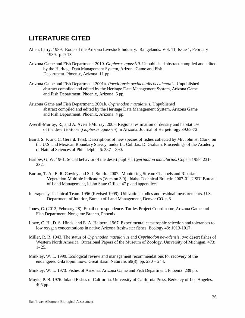
36 Sunflower Allotment Biological Assessment
LITERATURE CITED
Allen, Larry. 1989. Roots of the Arizona Livestock Industry. Rangelands. Vol. 11, Issue 1, February
1989. p. 9-13.
Arizona Game and Fish Department. 2010. Gopherus agassizii. Unpublished abstract compiled and edited
by the Heritage Data Management System, Arizona Game and Fish
Department. Phoenix, Arizona. 11 pp.
Arizona Game and Fish Department. 2001a. Poeciliopsis occidentalis occidentalis. Unpublished
abstract compiled and edited by the Heritage Data Management System, Arizona Game
and Fish Department. Phoenix, Arizona. 6 pp.
Arizona Game and Fish Department. 2001b. Cyprinodon macularius. Unpublished
abstract compiled and edited by the Heritage Data Management System, Arizona Game
and Fish Department. Phoenix, Arizona. 4 pp.
Averill-Murray, R., and A. Averill-Murray. 2005. Regional estimation of density and habitat use
of the desert tortoise (Gopherus agassizii) in Arizona. Journal of Herpetology 39:65-72.
Baird, S. F. and C. Gerard. 1853. Descriptions of new species of fishes collected by Mr. John H. Clark, on
the U.S. and Mexican Boundary Survey, under Lt. Col. Jas. D. Graham. Proceedings of the Academy
of Natural Sciences of Philadelphia 6: 387 – 390.
Barlow, G. W. 1961. Social behavior of the desert pupfish, Cyprinodon macularius. Copeia 1958: 231-
232.
Burton, T. A., E. R. Cowley and S. J. Smith. 2007. Monitoring Stream Channels and Riparian
Vegetation-Multiple Indicators (Version 3.0). Idaho Technical Bulletin 2007-01. USDI Bureau
of Land Management, Idaho State Office. 47 p and appendices.
Interagency Technical Team. 1996 (Revised 1999). Utilization studies and residual measurements. U.S.
Department of Interior, Bureau of Land Management, Denver CO. p.3
Jones, C. (2013, February 28). Email correspondence. Turtles Project Coordinator, Arizona Game and
Fish Department, Nongame Branch, Phoenix.
Lowe, C. H., D. S. Hinds, and E. A. Halpern. 1967. Experimental catastrophic selection and tolerances to
low oxygen concentrations in native Arizona freshwater fishes. Ecology 48: 1013-1017.
Miller, R, R. 1943. The status of Cyprinodon macularius and Cyprinodon nevadensis, two desert fishes of
Western North America. Occasional Papers of the Museum of Zoology, University of Michigan. 473:
1- 25.
Minkley, W. L. 1999. Ecological review and management recommendations for recovery of the
endangered Gila topminnow. Great Basin Naturalis 59(3). pp. 230 – 244.
Minkley, W. L. 1973. Fishes of Arizona. Arizona Game and Fish Department, Phoenix. 239 pp.
Moyle, P. B. 1976. Inland Fishes of California. University of California Press, Berkeley of Los Angeles.
405 pp.

37 Sunflower Allotment Biological Assessment
Murray, R. C. 1993. The desert tortoise on National Forest Lands in Arizona. Final Report. School of
Renewable Natural Resources. University of Arizona, Tucson. 58 pp.
Pearson, D. B., A. T. Robinson, and C. D. Crowder. 2013. Establishment of Gila Topminnow and Desert
Pupfish at Mud Springs (Site #18), Mesa Ranger District, Tonto National Forest. Final Report to Gila
River Basin Native Fishes Conservation Program, Under Task 3-75a; U.S. Fish and Wildlife Service
Cooperative Agreement No. F09AC00084. Arizona Game and Fish Department, Nongame Branch,
Phoenix.
Riedle, J., R. Averill-Murray, C. Lutz, and D. Bolen. 2008. Habitat use by desert tortoises
(Gopherus agassizii) on alluvial fans in the Sonoran Desert, south-central Arizona.
Copeia 2008:414-420.
Robinson, A. T. 2008. Mud Springs #18 Gila Topminnow and Desert Pupfish Monitoring. Arizona Game
and Fish Department, Research Branch, Phoenix.
Stebbins, R.C. 1985. A field guide to western reptiles and amphibians. Houghton Mifflin
Company, Boston, Massachusetts. 104pp.
Timmons, R. 2013. Email correspondence. Topminnow-Pupfish Coordinator, Arizona Game and Fish
Department, Nongame Branch, Phoenix.
U.S. Fish and Wildlife Service.
-----. 1993. Desert pupfish Recovery Plan. Phoenix, AZ. 67 pp.
-----. 1995a. Threatened and endangered wildlife and plants: Final rule determining endangered status for
the southwestern willow flycatcher. Federal Register 60:10694-10715.
-----. 1998b. Endangered and threatened species of Arizona. pp. 49-50.
-----. 1999. Biological opinion for Southwest Region USFS, ongoing livestock grazing activities on
allotments. 383 pp.
-----. 2002. Biological opinion, on-going and long-term grazing on the Tonto National Forest. AZ
Ecological Services Field Office. 208 pp.
-----. 2005. Programmatic biological and conference opinion. The continued implementation of the land
and resource management plans for the eleven national forests and national grasslands of the
southwestern region. Albuquerque, New Mexico. 1,010 pp.
-----. 2012. Final Recovery Plan for the Mexican Spotted Owl (Strix occidentalis lucida), First Revision.
U.S. Fish and Wildlife Service. Albuquerque, New Mexico, USA. 413 pp.

38 Sunflower Allotment Biological Assessment
Appendix A: Definitions
Adaptive Management – A formal, systematic, and rigorous approach to learning from the outcomes of
management actions, accommodating change, and improving management.
Reference: Nyberg, J.B., Forest Practices Branch, BC Forest Service. An Introductory Guide to
Adaptive Management For Project Leaders and Participants, January 1999.
Animal Unit Month (AUM) – The amount of forage required by an animal unit for one month. An
animal unit is defined as a mature (1,000 pound) cow or equivalent, based on an average consumption
rate of 26 pounds of forage dry matter per day (Society for Range Management 1989).
Composition – The relative amount (percent) of one plant species or one community type in relation to
other species or community types in a given area.
Conservative Use – Forage utilization is maintained on key forage species between 30 and 40% or less of
annual forage production by weight for herbaceous perennials and 50% or less on woody browse species.
Qualitative indicators of conservative use can be described by the following; forage plants have abundant
seed stalks; areas more than a mile from water show little use; about one third to one half primary forage
plants show grazing on key areas (Holechek and Galt 2000).
Critical Area – Those areas that must be treated with special consideration because of inherent site
factors, size, location, condition, values, or significant potential conflicts among uses (Society for Range
Management 1998). Riparian areas and locations where listed species occur are examples of critical areas
on the TNF.
Deferment: The delay of grazing to achieve a specific management objective. A strategy aimed at
providing time for plant reproduction, establishment of new plants, restoration of plant vigor, a return to
environmental conditions appropriate for grazing, or the accumulation of forage for later use.
Desired Conditions: Descriptions of the social, economic and ecological attributes that characterize or
exemplify the desired outcome of land management. They are aspirational and likely to vary both in time
and space. Adapted from: Foundations of Forest Planning: Volume 1(Version 2.0) Model of a Forest
Plan. USDA Forest Service, January 2005
Frequency (as a management tool): refers to the number of times forage plants are defoliated during the
grazing period. Reed Floyd, Roy Roath, and Dave Bradford. 1999. The Grazing Response Index: A
Simple and Effective Method to Evaluate Grazing Impacts. Rangelands 21(4): 3-6.
Frequency (as a measurement for trend): The ratio between the number of sample units that contain a
species and the total number of sample units.
Grazing Intensity: The degree of herbage removed through grazing and trampling by livestock. Grazing
intensity may be described in terms herbage removed during the grazing and/or growing period or as a
utilization level at the end of the growing period. It is important to clearly define how intensity is being
viewed and described. Removal of leaf material, when the plant is actively growing can affect root
growth which in turn affects future leaf growth. Sufficient leaf area is essential to support plant functions
through photosynthesis. Heavy to severe intensity or utilization can affect current plant development and
growth, as well as growth during subsequent growing seasons.

39 Sunflower Allotment Biological Assessment
Grazing Intensity - Holechek (Reference 1 below):
Light- Only choice plants are used. There is no use of poor forage plants. The range appears
practically undisturbed.
Moderate- About ½ of the good and fair forage value plants are used. There is little evidence of
livestock trailing and most of the accessible range shows some use.
Heavy- Range has a clipped or mowed appearance. Over half of the fair and poor value forage
plants are used. All accessible parts of the range show use and key areas are closely cropped.
They may appear stripped if grazing is very severe and there is evidence of livestock trailing to
forage.
The above descriptions may be especially helpful when evaluating grazing during the growing season.
Additional qualitative assessment of grazing intensity can be determined using the Landscape Appearance
Method. It can be found in the Interagency Technical Reference 1734-3 Utilization Studies and Residual
Measurements, page 119.
Grazing Intensity as depicted as a utilization level at the end of the growing season as discussed by
Holechek, (Reference 2 below):
Light to non-use 0-30 percent
Conservative 31-40 percent
Moderate 41-50 percent
Heavy 51-60 percent
Severe 61+ percent
References: (1) Holechek, Jerry L., Rex D. Pieper, and Carlton H. Herbel. 2004. Range
Management, Principles & Practices. Prentice Hall, page 248.
(2) Holechek, Jerry L. and Dee Galt. 2000. Grazing Intensity Guidelines.
Rangelands 22(3): 11-14.
An additional qualitative grazing assessment and planning tool is the Grazing Response Index (GRI).
Reed Floyd, Roy Roath, and Dave Bradford. 1999. The Grazing Response Index: A Simple and Effective
Method to Evaluate Grazing Impacts. Rangelands 21(4): 3-6.
Grazing Occurrence is how often a given area is grazed. How often a pasture is exposed to grazing or
rested from grazing provides for different responses within the plant community due to differing
opportunities for plant recovery.
Grazing Period is defined as the length of time grazing livestock or wildlife occupies a specific land area.
The length of time a pasture is exposed to grazing affects many variables such as potential for regrowth of
plant material, soil impacts and animal behavior. The grazing period influences the intensity of grazing
and the frequency of grazing. It can also influence items tied to animal behavior such as trailing, and
trampling such as between loafing and watering areas.
Head Month is defined as one month’s use and occupancy of the range by one animal.

40 Sunflower Allotment Biological Assessment
Key Area: A relatively small portion of a range selected because of its location, use or grazing value as a
monitoring point for grazing use. It is assumed that key areas, if properly selected, will reflect the overall
acceptability of current grazing management over the range.
Key Species: (1) Forage species whose use serves as an indicator to the degree of use of associated
species. (2) Species, which must, because of their importance be considered in the management program.
Modified Rest-Rotation: Management system that incorporates yearlong rest for a selected pasture
annually, and which provides for a systematic rotation of the deferment among pastures.
Monitoring: The orderly collection, analysis, and interpretation of resource data used to evaluate progress
toward meeting management objectives. This process must be conducted over time in order to determine
whether or not management objectives are being met. *
Implementation Monitoring – This short-term monitoring answers the question, was the
management implemented as designed? Annually documents several items. Examples include:
1) Were management actions implemented as designed, and
2) Did the management actions achieve the annual effect expected?
Items, which may be documented through implementation monitoring, include, but are not
limited to: actual use (livestock numbers and days), condition of range improvements, utilization,
and wildlife observations.
Effectiveness Monitoring – This long-term monitoring documents whether management actions
are having the expected progress towards achieving resource management objectives.
Resource Management Objectives: Concise statements of measurable, time specific outcomes intended to
achieve desired conditions. The objectives for a plan are the means of measuring progress toward
achieving or maintaining desired conditions. Adapted from: Foundations of Forest Planning: Volume
1(Version 2.0) Model of a Forest Plan. USDA Forest Service, January 2005
Rest: is to leave an area of grazing land ungrazed or unharvested for a specific time, such as a year, a
growing season, or a specified period required within a particular management practice.
Rest-Rotation: A grazing management scheme in which rest periods for individual pastures, paddocks or
grazing units, generally for the full growing season, are incorporated in a grazing rotation.
Riparian Area – The interface between terrestrial and aquatic ecosystems that make up a mosaic of
landforms, communities, and environments within the larger landscape (Gregory et al. 1991; Whitney
1998).
Seasonal Utilization: The amount of utilization that has occurred before the end of the growing
season. Interagency Technical Reference 1734-3, page 1.
Timing: The time of season grazing occurs relative to the phenological stage of plant development, such
as early growth period, reproductive period, or dormant period. Disturbance, such as that from grazing,
may provide differing responses within the plant depending upon the stage of development.
Trend: The direction of change in an attribute as observed over time.

41 Sunflower Allotment Biological Assessment
Utilization: The proportion or degree of the current year’s forage production that is consumed or
destroyed by animals (including insects). The term may refer either to a single plant species, a group of
species, or to the vegetation community as a whole. Interagency Technical Reference 1734-3, page 133.