Embed Size (px)
Citation preview

WILDLAND CONSULTANTS LTD, 99 SALA STREET, P.O. BOX 7137, TE NGAE, ROTORUA Ph 07-343-9017, Fax 07-343-9018, email [email protected], www.wildlands.co.nz
BAY OF PLENTY REGION
SAND DUNE VEGETATION MAPPING
AND CONDITION ASSESSMENT
METHODS FOR TAURANGA
ECOLOGICAL DISTRICT
AUGUST 2008 Report No. 2033 Prepared for: ENVIRONMENT BAY OF PLENTY P.O. BOX 364 WHAKATANE
Contract Report No. 1816 © 2008
CONTENTS
1. INTRODUCTION 1
2. PROJECT OBJECTIVES 1
3. SAND DUNE VEGETATION MAPPING AND CONDITION ASSESSMENT 1 3.1 Total extent of dunelands 2 3.2 Land use/cover 2 3.3 Location and extent of study sites 3 3.4 Transects 3
3.4.1 Location of transects 3 3.4.2 Additional transects 6 3.4.3 Transect numbering 7 3.4.4 Transects located on non-dune coastal landforms 7
4. FIELD SURVEY 8 4.1 Prior to field survey 8 4.2 Vegatation unit condition sheets 12 4.3 GPS location transects and photographs 14
5. TIMING OF FIELDWORK 15
6. DATA CAPTURE ANALYSIS 15
7. REMEASUREMENT 15
8. DISCUSSION 16
ACKNOWLEDGMENTS 16
REFERENCES 16 APPENDICES 1. Vegetation description methods and vegetation structural class
definitions (from Atkinson 1985) 18 2. Site sheets 21 3. Hydroclass definitions 25 4. Landform definitions (from Hesp 2000) 26 5. Cover classes 27 6. Transect sheets 28 7. Vegetation unit condition assessment sheets 31 8. Impacts 34 9. Example plot sheet and maps: Pukehina Spit (SDVC-018) 35 10. Vascular plants of sand dunes in the Bay of Plenty 49

Contract Report No. 1816 © 2008
11. Vegetation types observed during the first survey of wild unmanaged vegetation on sand dune landforms (including dune wetlands) in the Tauranga Ecological District 67
PROJECT TEAM Sarah Beadel - Field trial, report preparation. Chris Bycroft - Field work, report compilation. Matt Renner - Field work, report compilation. Lisette Collins - Technical input, report compilation. William Shaw - Technical review. Roger Bawden - GIS mapping. Reviewed and approved for release by:
_______________________ Sarah Beadel Director Wildland Consultants Ltd © Wildland Consultants Ltd 2008 This report has been produced by Wildland Consultants Ltd for Environment Bay of Plenty. All copyright in this report is the property of Wildland Consultants Ltd and any unauthorised publication, reproduction, or adaptation of this report is a breach of that copyright.

1
Contract Report No. 2033 1 © 2008
1. INTRODUCTION “Sand dunes occur where sea and land meet, and are formed from sand derived from both terrestrial and marine sources. The formation of dune systems is influenced by a number of factors, including the shape of the coastline and beach, currents and the ocean swell, prevailing wind, frequency of storms and the sand’s particle size.”
(MfE & DOC 2007) Recently it has been estimated that only 21,300 ha of sand dunes remain throughout New Zealand (Leathwick et al. 2003). This is only about 11.6% of the original extent. As well as the removal of sand dunes, the indigenous character of the areas remaining has generally been heavily modified through grazing, fire, and weed invasion. Environment Bay of Plenty wishes to map the extent of coastal dunes and indigenous vegetation cover, and to capture information on selected ‘condition factors’. It is proposed that the data collected will be used for long-term monitoring of change in vegetation cover and condition. Wildland Consultants was commissioned to develop methods for dune mapping and condition assessment. This report describes methods for mapping dune vegetation implemented in the first season of the field survey (Wildlands Consultants 2008b). The methods were trialled prior to the full field survey at three sites: Pukehina Spit, Pukehina Beach, and Maketu Spit (Wildland Consultants 2008a). This field trial was undertaken to ensure that the methods captured relevant data suitable for the purpose of dune monitoring, and that the methods were amenable to field application. The methods implemented during the first full field survey (of Tauranga Ecological District in March-April 2008 (Wildlands 2008a)) were those refined as a result of that field trial. The methods described here not only provide an explicit description of the survey methods, they also communicate those subtle nuances encountered during the first full implementation of this monitoring protocol. It is hoped that this will facilitate the seamless replication of this monitoring protocol in future seasons, as required.
2. PROJECT OBJECTIVES
• To describe methods to map dune vegetation and capture information on selected condition factors in a manner that can be used for long-term monitoring of change in vegetation cover and condition of the dunes.
3. SAND DUNE VEGETATION MAPPING AND CONDITION ASSESSMENT To achieve the objectives identified by Environment Bay of Plenty, it was determined that three data sets need to be created: • Extent of dunes (developed and undeveloped) (GIS map); • Vegetation map of wild undeveloped areas (GIS map);

2
Contract Report No. 2033 2 © 2008
• Condition assessments undertaken along a stratified series of belt transects having a random origin.
3.1 Total extent of dunelands
The extent of sand dunes was mapped for the whole of the Bay of Plenty (except for Tauranga City - see below) by utilising the appropriate 1:250,000 scale Geological Map of New Zealand field maps, particularly Kingma (1965), Healy et al. (1964), and Schofield (1973). The locations of active duneland also followed maps in Hilton et al. 2000, and current knowledge of Wildland Consultants Ltd staff of sand dune systems in the Bay of Plenty Region. The extent of sand dunes within the Tauranga City Council boundaries (TCC) was based on landform data from the Tauranga City Council State of the Environment (SOE) report 2005 (Wildland Consultants 2005). These landforms were first mapped in c.1996 based on Department of Conservation (DOC) landform maps for the Bay of Plenty Conservancy (Department of Conservation 1996). In 2000, the landform boundaries were redefined and mapped in more detail than the original DOC maps, based largely on digital contour information supplied by Tauranga District Council in 2000 (mostly 1 m contours) (Wildland Consultants 2000). These 2000 boundaries were then reviewed according to newer aerial photography for the 2005 SOE (State of the Environment) report. Mapping of the sand dune landform was field checked during the course of the vegetation mapping and monitoring component of the full field survey of Tauranga Ecological District. Mapping of the sand dunes outside of the Tauranga Ecological District will need to be refined following the detailed field survey in the summer of 2008/2009.
3.2 Land use/cover
The following broad land use/cover categories were mapped onto sand dune landforms using 2007 High Resolution Coastal Photographs or using the 2003 Regional Digital Aerial Mosaic (RDAM), where the 2007 coverage was not available: - Agriculture/Horticulture (includes pasture, orchards, cropping land etc); - Plantation forest; - Residential and built-up area (includes commercial, industrial etc); - Roads/Parking areas/Railway line; - Urban parkland (includes parks, green belts etc); - Wild undeveloped areas. The scale of mapping was 1:1,000 where there was coverage by the 2007 High Resolution Coastal Photographs (there is a slight spatial difference between the NZTM and NZMG aerials, NZMG was used where possible) or at 1:5,000 where only the 2003 RDAM was available.

3
Contract Report No. 2033 3 © 2008
3.3 Location and extent of study sites The entire coastline of the Tauranga Ecological District was divided into sites based on the natural area boundaries identified in the coastal environment study (Wildland Consultants 2006) Significant Vegetation and Habitat Zone (SVHZ) sites, and the Tauranga Natural Areas Survey (Wildland Consultants (2008). ‘Wild undeveloped areas’ (see Section 3.4 below) within these sites were identified and assigned a “Sand Dune Vegetation mapping and Condition assessment site” (SDVC) number (e.g. Pukehina Spit: SDVC-18), ordered west to east along the Bay of Plenty coastline. Areas that lay between SVHZ sites and Natural Area sites were treated as single SDVC sites when dune landform was continuous, or nearly continuous, between natural area boundaries. Where dune landform comprised two or more discrete areas, separated by rivers or long areas of non-dune coast, each discrete area was treated as a separate site. Twenty-one sites were identified.
The vegetation cover of all areas of sand dunes identified as ‘wild undeveloped areas’ within the dune landform map was mapped in detail as part of this project (see Figures 1 and 2).
3.4 Transects
3.4.1 Location of transects
Belt transects were located at 1 kilometre intervals along the Bay of Plenty coastline. This system of belt-transects was laid out by firstly chosing a geodesic anchor for the random location. The Kaituna River mouth was chosen for this anchor because it was near the pilot study site. This anchor determined the first four digits of the Easting for the nearest transect, which was the one randomly located. Next a random number between 1 and 1000, and containing three digits, was generated. This number comprised the last three digits within the easting of the nearest transect to the Kaituna River mouth and effectively randomized the location of the nearest transect within a kilometre of the river mouth. The actual anchor chosen did not influence the randomness inherent in transect location based on random numbers, because it facilitates full randomisation of transect location within 1 kilometre, for transects spaced at 1 kilometer intervals. The transect origin was then located at the intersection of the randomised easting and the topographic coastline derived from the NZMS260 map series. Once the location of the initial randomised transect location had been fixed, the remaining transects were laid out up and down the coast at 1 kilometer intervals based on the NZMS 260 series digital coastline (including estuaries, harbours, and sand dunes) by using the ArcGIS “divide” command. The direction (bearing) of each transect was perpendicular to the topographic coastline of the NMS260 map series. With the exception of transects at the northern end of Matakana Island, each transect terminated at the inland end of the wild unmanaged dune system, at managed margins or a change in landform.

4
Contract Report No. 2033 4 © 2008
Figure 1

5
Contract Report No. 2033 5 © 2008
Figure 2

6
Contract Report No. 2033 6 © 2008
At the northern end of Matakana Island transects were extended over managed boundaries and into isolated wild unmanaged areas surrounded by managed vegetation where the presence of these areas had been identified on the basis of 1:1000 aerial photographs. Managed vegetation was neither mapped nor assessed.
The sole exception to this extension rule at the northern end of Matakana Island was Transect 015, whose orientation intersected several other transects. This transect was terminated at the first point of intersection with another transect, No. 016. This rule should be revisited in future surveys to facilitate monitoring of vegetation within Natural Area 059 (Wildland Consultants 2008a).
In the field each belt transect was located using 1:1,000 scale aerial photographs and a late-model, hand-held GPS unit (Garmin 60 CSx, with sufficient memory to record tracks; including the boundaries of each belt transect). This made it easy to identify transect boundaries in the field. The tracking function also facilitated systematic coverage of the entire transect. 3.4.2 Additional transects
The 1 kilometre spacing of belt transects did not always allow for the sampling of every individual site, and also failed to sample all vegetation types greater than 1 hectare in size within sites. Additional transects were located as required to ensure: (i) at least one transect bisects each SDVC site; (ii) all vegetation types greater than 1 ha within each SDVC site are traversed by at
least one transect. The location of these transects was achieved by inserting a proposed transect half-way between the two transect lines closest either side of the target site. If this proposed transect did not dissect the target area another proposed transect was located halfway between the existing transect and the previous proposed transect (Figure 3). This divide, then divide again until successful strategy was repeated until a proposed transect intersected the target site. This proposed transect was then identified, and surveyed in the same way as usual. Additional proposed transects were identified before fieldwork was carried out through visual inspection of 1:1000 aerial photographs. However, additional transects can be located during the course of fieldwork following the above strategy if needed.

7
Contract Report No. 2033 7 © 2008
Established transects (1 km apart)
Target site/vegetation type
Halfway 1 Halfway 2
Figure 3: Diagram illustrating the process of locating additional transects. 3.4.3 Transect numbering Transects are numbered by 1 kilometre increments reflecting their distance from the most norther westerly transect. Additional transects were numbered for the kilometre transect immediately north, and then identified by a subsidiary number (for example 096.1). 3.4.4 Transects located on non-dune coastal landforms Proposed transects dissecting rocky coastlines, estuarine margins, or other areas without dune landforms were not measured. However, as these transects are components of the 1 kilometer intervals upon which transect location within dune
Transect No. 096
Transect No. 096.1
Transect No. 097
Step 1: Proposed transect does not dissect target feature, do not establish.
Step 2: Proposed transect does dissect target feature, establish and measure.
Step 3: Number of established additional transect.

8
Contract Report No. 2033 8 © 2008
systems is based, they remain an integral component of the sampling design. Seven transects (004, 068, 069, 070, 071, 074, and 084) were not measured as they were located on parts of the coastline where there were no sand dunes.
4. FIELD SURVEY
4.1 Prior to field survey
Hard copies of digital aerial photographs at a scale of 1:1,000 were printed showing the boundaries of SDVC assessment sites, and transect locations.
A walk through survey of all dune vegetation within each site was completed. This walk through survey aimed to sight and identify all vegetation types discernable on 1:1000 aerial photographs. It also facilitated assessment of continuity of vegetation types between transects, despite internal heterogeneity that might manifest in the form of a proliferation of slightly different Atkinson (1985) descriptions (Appendix 1) between adjacent transects.
Vegetation mapping proceeded during the course of this walk through survey. There is no substitute for on the ground observations as a tool for training the surveyor to recognise relevant regularities and patterns in vegetation, particularly those associated with different dune landforms, i.e. transgressive dunefields, dune swales and so on.
During the site inspections, vegetation type boundaries were refined (see Figures 4 and 5 for examples of vegetation maps), vegetation type names were assigned - following Atkinson 1985 - refer to Appendix 1 for an explanation (also see section on vegetation classification below), and a brief description of each vegetation type (2-3 sentences) was compiled.
The distance between points of detailed examination (900 m) meant that intrinsic internal variability in vegetation types can be encapsulated within the vegetation descriptions from different transects within sites. Mapping of vegetation types at 1:1,000 required some of the detailed types identified during transect assessment to be combined when vegetation for whole sites was mapped and described. Continuity between vegetation types despite slight internal variability was usually perceptible on the ground, and was apparent when mapping on aerial photographs at 1:1000. Where different vegetation types at the transect level required amalgamation at the scale of mapping for the entire coastline, the description of the vegetation types associated with mapped polygons presented on the site sheets was expanded to encompass observed variability on the ground at the site level. This enabled the spatial distribution of different vegetation types to be mapped along the entire site. The third scale of vegetation description was at a vegetation class level. Vegetation types identified and mapped for each site should be site-specific and detailed. However, for the purposes of broad scale vegetation mapping of the Tauranga Ecological District and the entire Bay of Plenty, detailed vegetation types developed for each site need to be translated into broader vegetation classes. A vegetation classification system for the dune vegetation observed by this survey was developed for this purpose, an extract from which is presented in Table 1. This allowed

9
Contract Report No. 2033 9 © 2008
Figure 4

10
Contract Report No. 2033 10 © 2008
Figure 5

11
Contract Report No. 2033 11 © 2008
information on particular types or groups of vegetation types to be summarised. Care was taken to avoid a proliferation of detailed ‘types’ within this broad system of vegetation classification. This system should facilitate quantification of the extent and relative abundance of different kinds of vegetation within the dune system throughout the entire ecological district by specifying vegetation classes that can be compared across disparate geographic localities. The hierarchical relationship between, and nestedness of, these three levels of vegetation description is illustrated diagrammatically in Figure 6.
Figure 6: Hierarchical relationship between the three levels of vegetation description
employed by this study.
Data Set 5 was collected to measure vegetation condition at specific sites and was used along with the Data Set 4 to generate the standard vegetation types and habitats identified and mapped for the Ecological District (Data Set 3). An example of vegetation types included within Data Set 3 is presented in Table 1.
Table 1: Example of a hierarchical vegetation classification system for vegetation
types mapped for sand dunes within the Tauranga Ecological District.
Structural Class Vegetation Class Vegetation Types and Habitats (on GIS
Vegetation Map of Tauranga Sand Dunes) 01 Forest 01 Pohutukawa-dominant
forest 01 Pohutukawa forest
02 Radiata pine-dominant forest
01 Radiata pine/mingimingi-grey willow-cabbage tree/Baumea juncea forest
02 Treeland 01 Mixed exotic tree dominated treeland
01 Banksia-(radiata pine)/houpara/ Ficinia nodosa treeland and sedgeland
03 Vineland 01 Pohuehue dominant vineland
01 Pohuehue vineland 02 Ficinia nodosa/pohuehue vineland and
sedgeland 03 Ficinia nodosa/pohuehue vineland 04 Pohuehue-spinifex vineland
04 Scrub 01 Mixed exotic scrub 01 Gorse-lupin-pampas scrub 02 Gorse-dominant scrub 201 Gorse scrub
05 Shrubland 01 Coast tea tree-dominant shrubland
01 Coast tea tree shrubland
08 Grassland 01 Spinifex-dominant grassland
01 Spinifex grassland 02 Spinifex-pingao grassland 03 Spinifex-marram grassland 04 Spinifex-Calystegia soldanella-pingao
Transect plot sheet
Hierachy

12
Contract Report No. 2033 12 © 2008
Structural Class Vegetation Class Vegetation Types and Habitats (on GIS
Vegetation Map of Tauranga Sand Dunes) grassland
02 Marram-dominant grassland
201 Marram grassland
03 Mixed exotic grassland 301 Lupin/sweet vernal-Yorkshire fog grassland 13 Herbfield 01 Gazania-dominant
herbfield 01 Gazania herbfield
19 Sandfield 01 Spinifex-dominant sandfield
01 Spinifex sandfield 02 Spinifex-pingao sandfield
02 Sandfield (vegetation cover <1%)
202 Sandfield
The following data were also recorded on the site sheets:
- Site number
- Site name
- Date of field survey
- Transect number(s)
- Field surveyor(s)
- Vegetation types: List vegetation type name - as per Atkinson 1985 - and description (2-3 sentences for each type) (see the last column in Table 1).
- Each vegetation type was assigned its own unit number. This unit number could also be used on the vegetation unit condition assessment sheets, along with the vegetation type (name). The unit numbers presented on site sheets from the first field season are the same vegetation numbers as those presented in the Tauranga Natural Areas survey report (Wildlands Consultants 2008b) where site boundaries are equivalent.
- The hydroclass (Appendix 3) for each vegetation type identified in the field.
- The landform(s) (Appendix 4) for each vegetation type identified in the field.
4.2 Vegatation unit condition sheets
Vegetation unit condition sheets (Appendix 7) were completed for each vegetation unit identifiable in transects. Aerial photographs were used to assist in identification of vegetation units. A brief description of the vegetation type accompanied the Atkinson (1985) vegetation name on the site sheet. Within height classes, the order of species within the vegetation type name follows their relative abundance from highest to lowest. Presence and cover-abundance of weed species was recorded, as was the total cover of exotic species within the vegetation type once the systematic survey of the survey was completed following the scoring scheme presented in Appendix 5.

13
Contract Report No. 2033 13 © 2008
The following data were also recorded on the Vegetation Unit Condition Assessment sheet: - Field surveyor(s);
- Date of field survey;
- Transect number;
- Polygon number. The polygon number was used during the field survey to relate vegetation units to polygons mapped on aerials. As vegetation types within transects were encountered they were numbered sequentially from 1. This number was recorded on unit condition plot sheets in the form: “Transect number”/ “vegetation unit number”. The number was used to identify polygons on the aerials. Vegetation unit numbers were started from 1 for each transect;
- Vegetation type name (as per Atkinson 1985);
- Weeds: Pest plant species (weeds) and weed groups which are commonly present on sand dunes in the Bay of Plenty are listed on the record sheet. A cover class was to be assigned to each of these species and groups. A cover class was also to be assigned for the total cover of pest plants within that vegetation unit (see Appendix 5 for cover classes). Additional pest plant species were identified and listed individually if they are prominent at a site or are threatening ecological value;
- Threatened and significant plant species are also listed on the record sheet, and were assigned cover classes within each vegetation unit;
- Impacts: A list of common types of impacts is provided on the record sheet. For each of the impacts which are observed within the vegetation type unit the intensity of the impact was scored as having a positive or negative effect on a scale of -3 to +3 (refer to Appendix 8 for further explanation of the scoring system);
- A visual estimate, to closest 10%, of the indigenous cover within the vegetation type should be collected during the course of future surveys (see Appendix 8 for plot sheets);
- Additional notes about a site can be recorded in the final section of the record sheet.
- The unit number refers to the unique number assigned to each broad Atkinson vegetation description within each site on the site sheets. This field can be filled out once all transects within a site have been completed, and all vegetation types within a site have been identified. It can be complemented with the Atkinson vegetation type (see Figures 4 and 5).

14
Contract Report No. 2033 14 © 2008
4.3 GPS location transects and photographs
The Seaward GPS location was recorded at the intersection of MHWS (strand line) and the transect line. One photo was taken from this point looking inland down line of transect.
The Inland GPS location was recorded at the intersection of the transect line and the managed edge or landform boundary. Two photos were taken at this point, each looking toward the beach and offset at 45º to transect line, one looking up the coast, the other down the coast.
The “Impacts” listed in the table on the site sheet were assessed at the end of the systematic walk through.
GPS location of rare and threatened flora and fauna (as per Hitchmough et al. 2007) species recorded, number of individuals counted. Populations could be photographed for future reference to historical condition of individuals. Only definite observation of threatened species was recorded. Within the context of analyses of occurrence data only definite presence can be assessed with confidance. Absence is methodologically difficult to determine, and as yet there is no way in which the likelihood of species occurrence can be quantified. For these reasons only species observed at sites during the course of survey work were recorded.
Management recommendations assessed at time of site survey and recorded on transect sheets. Specific recommendations for different vegetation types also recorded. A transect sheet was completed for each transect. The following data were also recorded on the Transect sheets (refer to Appendix 7): - Site number;
- Transect number;
- Number of polygons;
- Date of field survey;
- Location: GPS waypoint (at inland and seaward ends of transect);
- Photo records: Included GPS waypoint, camera and lens details, and photograph identifier number. Photographs were taken at 1.70 metres height, and at a 45 degree angle in each direction from the transect centre line bearing (when looking towards the ocean), at the inland end of the transect. Additional photographs were also taken to record additional vegetation types. Photographs were taken with a 35 mm equivalent digital sensor.

15
Contract Report No. 2033 15 © 2008
5. TIMING OF FIELDWORK
This survey was conducted in March-April at the end of one of the driest summers on record. Virtually no exotic annual grass species were observed on dunes during this survey. These are likely to contribute to cover abundance scores obtained in future surveys, and may over-ride dune condition signals this survey is designed to give, at least in the short term. This could be avoided by giving two cover abundance scores in the next remeasurement - one including exotic annual grasses and one excluding exotic annual grasses. The absence of annual grasses on dunes highlights another crucial point: the contribution of seasonal variation to difference in vegetation. We recommend that repeat surveys be carried out at the same time of year, or at least within the same season, to avoid the potentially confounding influence of season.
6. DATA CAPTURE ANALYSIS
• The vegetation mapping data, including site boundaries, vegetation type boundaries, vegetation types and structural classes) were captured as polygons and metadata within a GIS shapefile.
• The areas (ha) of each site, and the extent of each vegetation type present within a site were calculated on the basis of this GIS shapefile.
Suggestions for data analyses that would quantify degrees of change in the level of weed invasion are presented in Section 6.2 of Wildland Consultants (2008b).
7. REMEASUREMENT Remeasurements will need to follow the same methods and be applied in a consistent manner by an ecologist very experienced with sand dune vegetation. Where remeasurements show changes in vegetation type boundaries, reasons for changes will need to be identified. It will be important to identify whether it is a real change in vegetation extent or cover composition, or simply an artefact of the level of detail being captured, or a different interpretation of the vegetation pattern. The timing of remeasurements for the vegetation mapping component will be driven by availability of up-to-date aerial photography. It will be most relevant to undertake mapping relatively soon (i.e. within a year) of updated aerial photography becoming available. Transect remeasurements should be undertaken at the same time of year as previous surveys, or could be event-driven. The latter could be initiated if it is perceived that there have been major changes in vegetation condition at specific locations/sites or throughout the region, or there may have been major storm events or other environmental perturbation of the dune system.

16
Contract Report No. 2033 16 © 2008
8. DISCUSSION The methods presented in this report will provide an effective approach to monitor extent and condition in sand dunes in the Bay of Plenty Region, if the monitoring is carried out on a regular basis by experienced ecologists who are familiar with coastal dune ecosystems and consistently follow the prescribed methods. The data gathered will enable analysis of changes in the extent of vegetation types and identify changes in dune vegetation condition, at individual sites and in any mapped areas. Vegetation classes within individual sand dune sites are clearly visible on the 1:1,000 scale aerial photography, and some impacts and changes are very obvious, e.g. walking and vehicle tracks and blow-outs. Information on impacts (particularly those which are human-induced) will enable assessment of gross changes in condition to be identified and quantified. This should enable management agencies to improve the management of the remaining indigenous vegetation on dunes in the Bay of Plenty by identifying and addressing key issues. Similarly, the data on weeds, threatened plants, and fauna will also enable improved decision-making and will play an important part in the assessment of relative priorities for specific projects.
ACKNOWLEDGMENTS Nancy Willems and Sue Mavor (Environment Bay of Plenty) instigated this project and provided logistical support. Heather Blackwell (Environment Bay of Plenty) assisted with fieldwork on twenty of the transects. Thanks to Tom Pyatt (Department of Conservation, Bay of Plenty Conservancy) for access to historical maps showing the active duneland (Hilton et al. 2000). REFERENCES Atkinson I.A.E. 1985: Derivation of vegetation mapping units for an ecological survey of
Tongariro National Park, North Island, New Zealand. New Zealand Journal of Botany, 23: 361-378.
Hesp P.A. 2000. Coastal Sand Dunes: Form and Function. The Coastal Dunes Vegetation
Network Technical Bulletin No.4. Forest Research, Rotorua. 29pp. Leathwick J., McGlone M., Walker S. 2003: New Zealand’s Potential Vegetation Pattern.
Unpublished report. Ministry for the Environment (MfE), Department of Conservation (DOC) 2007: Protecting
our Places. Information about the statement of natural priorities for protecting rare and threatened biodiversity on private land. Ministry for the Environment and Department of Conservation, Wellington. 51 pp.
17
Contract Report No. 2033 17 © 2008
Ministry of Works 1962: National resources survey, Part 2. Bay of Plenty Region.
R.E. Owen, Government Printer, Wellington. Wildland Consultants 2006: Significant indigenous vegetation and significant habitats of
indigenous fauna in the coastal environment of the Bay of Plenty Region. Wildland Consultants Ltd Contract Report No. 1345. Prepared for Environment Bay of Plenty. Volume 1 - 553 pp, Volume 2 - maps 49 pp.
Wildland Consultants Ltd 2007: Ecological survey of regenerating indigenous dune forest,
Matata, Bay of Plenty. Wildland Consultants Ltd Contract Report No. 1678. Prepared for Environment Bay of Plenty. 62 pp.
Wildland Consultants Ltd 2008a: Bay of Plenty Region sand dune vegetation mapping and
condition assessment trial. Wildland Consultants Ltd Contract Report No. 1816. Prepared for Environment Bay of Plenty. 41 pp.
Wildland Consultants Ltd 2008b: Natural areas in Tauranga Ecological District. Wildland
Consultants Ltd Contract Report No. 1914. Prepared for Environment Bay of Plenty. 689 pp.
Wildland Consultants Ltd 2008c: Sand dune vegetation and condition monitoring, and
management recommendations, Tauranga Ecological District. Wildland Consultants Ltd Contract Report No. 1915. Prepared for Environment Bay of Plenty. 45 pp.

18
Contract Report No. 2033 18 © 2008
APPENDIX 1
VEGETATION DESCRIPTION METHODS AND VEGETATION STRUCTURAL CLASS DEFINITIONS (FROM ATKINSON 1985)
Atkinson (1985) details a standardized method for describing vegetation that incorporates both compositional and structural information, as summarised below. Atkinson Vegetation Descriptions The dominant canopy species are listed first, and then any species in lower vegetation tiers (if these are known) followed by the structural class of the vegetation, e.g. rimu/tawa-kamahi forest; Ficinia nodosa/pohuehue sedge-vineland. Common names are preferred (when they cannot be mistaken) otherwise Latin names are used (see list of common and Latin name equivalents). The percentage cover of particular species and their position in the vegetation tiers are indicated as follows: (tawa) less than 5% cover of the bracketed species (rimu)/tawa indicates less than 5% cover of rimu emergent over a canopy of tawa tawa-hinau indicates tawa and hinau occur in the same tier ⇔ indicates a mosaic of two or more vegetation types exists within a defined area Structural Classes for Atkinson Vegetation Descriptions Forest Woody vegetation in which the cover of trees and shrubs in the canopy is
>80% and in which tree cover exceeds that of shrubs. Trees are woody plants >10 cm dbh. Tree ferns >10 cm dbh are treated as trees.
Treeland Vegetation in which the cover of trees in the canopy is 20-80%, with tree
cover exceeding that of any other growth form, and in which the trees form a discontinuous upper canopy above either a lower canopy of predominantly non-woody vegetation or bare ground, e.g. mahoe/rarahu treeland. (Note: Vegetation consisting of trees above shrubs is classified as either forest or scrub depending on the proportion of trees and shrubs in the canopy.)
Vineland Vegetation in which the cover of unsupported (or artificially supported) woody
vines in the canopy is 20-100% and in which the cover of these vines exceeds that of any other growth form or bare ground. Vegetation containing woody vines that are supported by trees or shrubs is classified as forest, scrub or shrubland. Examples of woody vines occur in the genera Actinidia, Clematis, Lonicera, Metrosideros, Muehlenbeckia, Ripogonum, Vitis and others.
Scrub Woody vegetation in which the cover of shrubs and trees in the canopy is >80%
and in which shrub cover exceeds that of trees (cf forest). Shrubs are woody plants <10 cm dbh.
Shrubland Vegetation in which the cover of shrubs in the canopy is 20-80% and in which
the shrub cover exceeds that of any other growth form or bare ground. It is sometimes useful to separate tussock-shrublands as a sub-class for areas where tussocks are >20% but less than shrubs. (Note: the term scrubland is not used in this classification.)

19
Contract Report No. 2033 19 © 2008
Tussockland Vegetation in which the cover of tussocks in the canopy is 20-100% and in
which the tussock cover exceeds that of any other growth form or bare ground. Tussocks include all grasses, sedges, rushes, and other herbaceous plants with linear leaves (or linear non-woody stems) that are densely clumped and >10 cm height. Examples of the growth form occur in all species of Cortaderia, Gahnia and Phormium, and in some species of Chinochloa, Poa, Festuca, Rytidosperma, Cyperus, Carex, Uncinia, Juncus, Astelia, Aciphylla and Celmisia.
Fernland Vegetation in which the cover of ferns in the canopy is 20-100% and in which
the fern cover exceeds that of any other growth form or bare ground. Tree ferns >10 cm dbh are excluded as trees (cf. forest).
Grassland Vegetation in which the cover of grass in the canopy is 20-100% and in which
the grass cover exceeds that of any other growth form or bare ground. Tussock-grasses are excluded from the grass growth-form.
Sedgeland Vegetation in which the cover of sedges in the canopy is 20-100% and in which
the sedge cover exceeds that of any other growth form or bare ground. Included in the sedge growth form are Leptocarpus similis and many species of Carex, Uncinia, Isolepis, and Bolboschoenus. Tussock-sedges and reed-forming sedges (cf. reedland) are excluded.
Rushland Vegetation in which the cover of rushes in the canopy is 20-100% and in which
the rush cover exceeds that of any other growth form or bare ground. Included in the rush growth form are some species of Juncus, most species of Leptocarpus, and all species of Sporadanthus, and Empodisma. Tussock-rushes are excluded.
Reedland Vegetation in which the cover of reeds in the canopy is 20-100% and in which
the reed cover exceeds that of any other growth form or open water. Reeds are herbaceous plants growing in standing or slowly-running water that have tall, slender, erect, unbranched leaves or culms that are either hollow or have a very spongy pith. Examples include Typha, Bolboschoenus, Schoenoplectus tabernaemontani, Eleocharis sphacelata, and Baumea articulata.
Cushionfield Vegetation in which the cover of cushion plants in the canopy is 20-100% and
in which the cushion-plant cover exceeds that of any other growth form or bare ground. Cushion plants include herbaceous, semi-woody and woody plants with short densely packed branches and closely spaced leaves that together form dense hemispherical cushions. The growth form occurs in all species of Donatia, Gaimardia, Hectorella, Oreobolus, and Phyllachne as well as in some species of Aciphylla, Celmisia, Centrolepis, Chionohebe, Colobanthus, Dracophyllum, Drapetes, Haastia, Leucogenes, Luzula, Myosotis, Poa, Raoulia, and Scleranthus.
Herbfield Vegetation in which the cover of herbs in the canopy is 20-100% and in which
the herb cover exceeds that of any other growth form or bare ground. Herbs include all herbaceous and low-growing semi-woody plants that are not separated as ferns, tussocks, grasses, sedges, rushes, reeds, cushion plants, mosses or lichens.
Mossfield Vegetation in which the cover of mosses in the canopy is 20-100% and in which
the moss cover exceeds that of any other growth form or bare ground.

20
Contract Report No. 2033 20 © 2008
Lichenfield Vegetation in which the cover of lichens in the canopy is 20-100% and in which
the lichen cover exceeds that of any other growth form or bare ground. Rockland Land in which the area of residual bare rock exceeds the area covered by any
one class of plant growth-form. Cliff vegetation often includes rocklands. They are named from the leading plant species when plant cover ≥1%, e.g. [koromiko] rockland.
Boulderfield Land in which the area of unconsolidated bare boulders (>200 mm diam.)
exceeds the area covered by any one class of plant growth-form. Boulderfields are named from the leading plant species when plant cover ≥1%.
Stonefield/gravelfield Land in which the area of unconsolidated bare stones (20-200 mm diam.)
exceeds the area covered by any one class of plant growth-form. The appropriate name is given depending on whether stones or gravel form the greater area of ground surface. Stonefields and gravelfields are named from the leading plant species when plant cover ≥1%.
Sandfield Land in which the area of bare sand (0.02 - 2 mm diam.) exceeds the area
covered by any one class of plant growth-form. Dune vegetation often includes sandfields which are named from the leading plant species when plant cover ≥ 1%.
Loamfield/Peatfield Land in which the area of loam and/or peat exceeds the area covered by any one
class of plant growth-form. The appropriate name if given depending on whether loam or peat forms the greater area of ground surface. Loamfields and peatfields are named from the leading plant species when plant cover ≥1%.
Flaxland Vegetation in which the cover of flax in the canopy is 20-80%, and in which the
flax cover exceeds that of any other growth form or bare ground. Pasture Pasture comprises exotic grasses and herbs, and often includes sweet vernal,
ryegrass, browntop, dandelion, foxglove, with scattered Yorkshire fog, selfheal, and white clover.

21
Contract Report No. 2033 21 © 2008
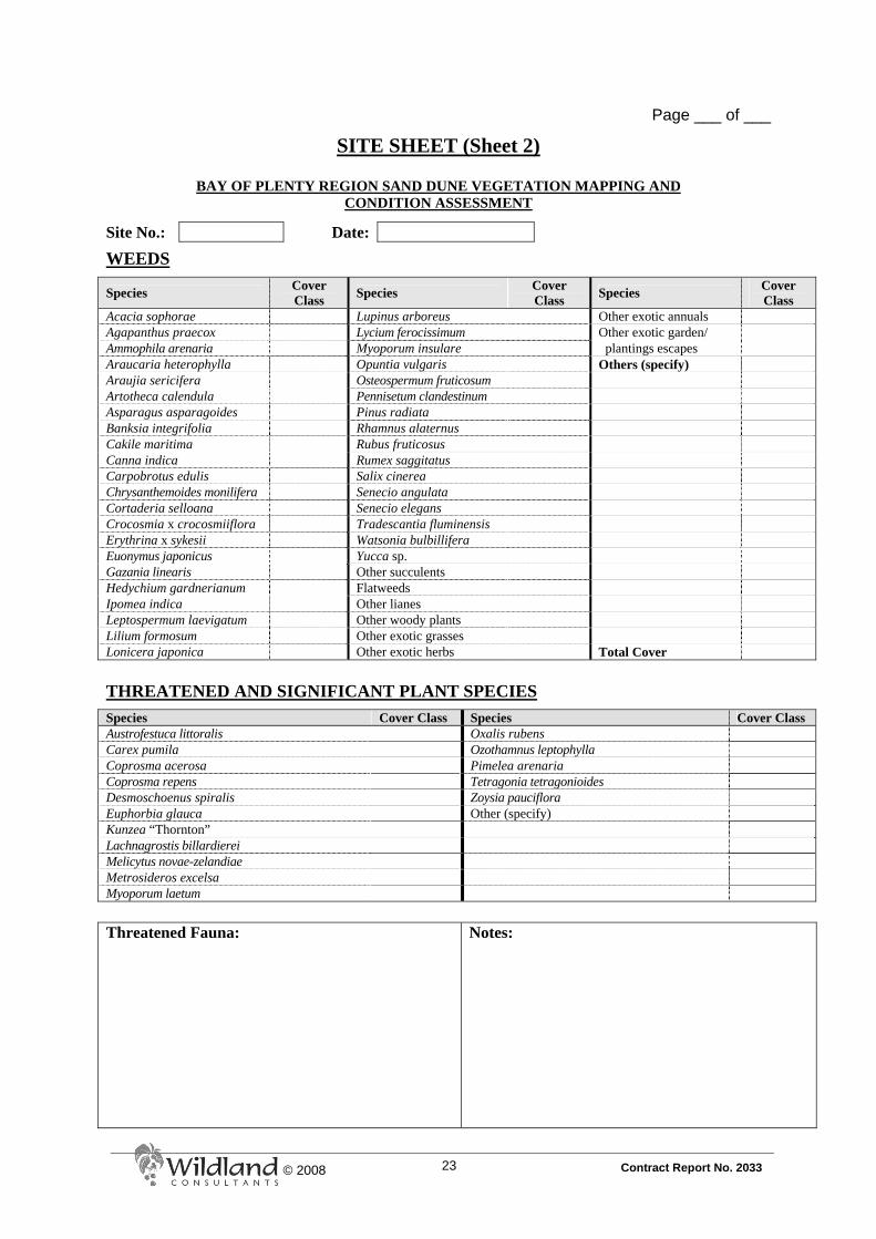
APPENDIX 2
SITE SHEETS

22
Contract Report No. 2033 22 © 2008
Page ___ of ___
A. SITE SHEET (Sheet 1)
BAY OF PLENTY REGION SAND DUNE VEGETATION MAPPING AND CONDITION ASSESSMENT
Site No.: Site Name: Date:
Transect No(s):
Surveyor(s):
Unit No. Vegetation Type Name (as per Atkinson 1985) and Description (2-3 sentences) Hydro
Class Landform
IMPACTS
Activity Unit No. for presence Comments
Restoration plantings Pest plant control Walking tracks (official) Walking tracks (unofficial) Vehicle tracks Pest plants Blowouts Exotic gardens Aesthetic indigenous plantings Other vegetation clearance Drains Organic waste dumping Inorganic waste dumping Recreation impact Litter Rabbits Weeds Other (specify)
23
Contract Report No. 2033 23 © 2008
Page ___ of ___
SITE SHEET (Sheet 2)
BAY OF PLENTY REGION SAND DUNE VEGETATION MAPPING AND CONDITION ASSESSMENT
Site No.: Date:
WEEDS
Species Cover Class Species Cover
Class Species Cover Class
Acacia sophorae Lupinus arboreus Other exotic annuals Agapanthus praecox Lycium ferocissimum Other exotic garden/ Ammophila arenaria Myoporum insulare plantings escapes Araucaria heterophylla Opuntia vulgaris Others (specify) Araujia sericifera Osteospermum fruticosum Artotheca calendula Pennisetum clandestinum Asparagus asparagoides Pinus radiata Banksia integrifolia Rhamnus alaternus Cakile maritima Rubus fruticosus Canna indica Rumex saggitatus Carpobrotus edulis Salix cinerea Chrysanthemoides monilifera Senecio angulata Cortaderia selloana Senecio elegans Crocosmia x crocosmiiflora Tradescantia fluminensis Erythrina x sykesii Watsonia bulbillifera Euonymus japonicus Yucca sp. Gazania linearis Other succulents Hedychium gardnerianum Flatweeds Ipomea indica Other lianes Leptospermum laevigatum Other woody plants Lilium formosum Other exotic grasses Lonicera japonica Other exotic herbs Total Cover
THREATENED AND SIGNIFICANT PLANT SPECIES
Species Cover Class Species Cover Class Austrofestuca littoralis Oxalis rubens Carex pumila Ozothamnus leptophylla Coprosma acerosa Pimelea arenaria Coprosma repens Tetragonia tetragonioides Desmoschoenus spiralis Zoysia pauciflora Euphorbia glauca Other (specify) Kunzea “Thornton” Lachnagrostis billardierei Melicytus novae-zelandiae Metrosideros excelsa Myoporum laetum
Threatened Fauna: Notes:

24
Contract Report No. 2033 24 © 2008
Page ___ of ___
SITE SHEET (Additional Vegetation Recording Sheet if Required)
BAY OF PLENTY REGION SAND DUNE VEGETATION MAPPING AND CONDITION ASSESSMENT
Site No.: Date: Unit No. Vegetation Type Name (as per Atkinson 1985) and Description (2-3 sentences) Hydro
Class Landform

25
Contract Report No. 2033 25 © 2008
APPENDIX 3
HYDROCLASS DEFINITIONS
Terrestrial All areas on land that are not wetlands (c.f. other hydroclass categories). Estuarine Tidal and non-tidal saline wetlands associated with a coastal body of water
with a free connection to the open sea and where fresh water, derived from land drainage (usually rivers) is mixed with sea water (Allaby 1994).
Palustrine Small open-water bodies, vegetated wet ground, and all other non-tidal
wetlands not covered by riverine or lacustrine (Buxton 1991). Riverine Flowing waters contained within a channel, e.g. streams, rivers, and their
margins (Buxton 1991). Lacustrine Dams or lakes with open water (Buxton 1991).

26
Contract Report No. 2033 26 © 2008
APPENDIX 4
LANDFORM DEFINITIONS
(FROM HESP 2000) Berm: A wave-built terrace landform lying between dunes and high
water. Impressive example at the western end of Matakana Island appears to be the result of massive inshore movement of subtidal sand bars during recent (2007) storm events. Unvegetated dry sand on the surface of berms constitutes a significant source of Aeolian sand.
Blowout: Blowouts are erosional dune landforms. They are either saucer-,
cup-, bowl-, or trough-shaped depressions or hollows formed by wind erosion of a pre-existing sandy substrate or dune.
Established Foredune: Established foredunes are older, more permanent foredunes.
They develop from incipient foredunes and are distinguished by the growth of intermediate, often woody plant species, and commonly by their greater complexity of form, height, and width.
Foredune Plain: A coastal plain comprising two or more foredunes. Incipient Foredune: A new foredune formed by Aeolian sand deposition within
pioneer plants commonly on the back of the beach above the spring high tide line.
Parabolic Dune: Parabolic dunes are U-shaped or V-shaped dunes which roughly
describe a parabola (upside down U) in outline. They are characterised by trailing ridges which terminate downwind in a parabolic-shaped depositional lobe. They may be active or relict (i.e. fully vegetated).
Transgressive Dunefield: Transgressive dunefields are relatively large-scale Aeolian sand
deposits formed by the downwind and/or alongshore movement (or transgression) of sand over vegetated to semi-vegetated terrain.

27
Contract Report No. 2033 27 © 2008
APPENDIX 5
COVER CLASSES
Cover classes used to assess vegetation cover: 1 = <1% 2 = 2-5% 3 = 6-25% 4 = 25-50% 5 = 50-75% 6 = 75-100%

28
Contract Report No. 2033 28 © 2008
APPENDIX 6
TRANSECT SHEETS

29
Contract Report No. 2033 29 © 2008
Page ___ of ___
B. TRANSECT SHEET
BAY OF PLENTY REGION SAND DUNE VEGETATION MAPPING AND CONDITION ASSESSMENT
Site No.: Transect No.:
Date: No. of Polygons: Surveyor(s): GPS: Inland Seaward
Camera/lens details:
GPS
Reference: Photo Number:
GPS Reference:
Photo Number:
Brief Description and Management Priorities: Weed Management Priority H M L Notes:

30
Contract Report No. 2033 30 © 2008
Page ___ of ___
Weed Management Priority H M L

31
Contract Report No. 2033 31 © 2008
APPENDIX 7
VEGETATION UNIT CONDITION
ASSESSMENT SHEETS
32
Contract Report No. 2033 32 © 2008
C. VEGETATION UNIT CONDITION ASSESSMENT (Sheet 1)
BAY OF PLENTY REGION SAND DUNE VEGETATION MAPPING AND CONDITION ASSESSMENT
Transect
No. Polygon No.1 Surveyor(s): Date:
Unit No. Vegetation Type Name (as per Atkinson 1985)
WEEDS
Species Cover Class Species Cover
Class Species Cover Class
Acacia sophorae Lonicera japonica Other woody plants Agapanthus praecox Lupinus arboreus Other exotic grasses Ammophila arenaria Lycium ferocissimum Other exotic herbs Araujia sericifera Myoporum insulare Others (specify) Artotheca calendula Opuntia vulgaris Asparagus asparagoides Osteospermum fruticosum Banksia integrifolia Pennisetum clandestinum Canna indica Pinus radiata Carpobrotus edulis Rhamnus alaternus Chrysanthemoides monilifera Rubus fruticosus Cortaderia selloana Rumex saggitatus Crocosmia x crocosmiiflora Salix cinerea Erythrina x sykesii Senecio angulata Euonymus japonicus Senecio elegans Gazania linearis Tradescantia fluminensis Hedychium gardnerianum Watsonia bulbillifera Ipomoea indica Other succulents Leptospermum laevigatum Flatweeds Lilium formosum Other lianes Total Cover
THREATENED AND SIGNIFICANT PLANT SPECIES
Species Cover Class Species Cover Class Austrofestuca littoralis Myoporum laetum Carex pumila Oxalis rubens Coprosma acerosa Ozothamnus leptophylla Coprosma repens Pimelea arenaria Euphorbia glauca Tetragonia tetragonioides Kunzea “Thornton” Zoysia pauciflora Lachnagrostis billardierei Melicytus novae-zelandiae Metrosideros excelsa
1 Comprises transect number and vegetation type number, e.g. 14-1.
Page ___ of ___

33
Contract Report No. 2033 33 © 2008
VEGETATION UNIT CONDITION ASSESSMENT (Sheet 2)
BAY OF PLENTY REGION SAND DUNE VEGETATION MAPPING AND CONDITION ASSESSMENT
Date: Polygon No.
IMPACTS
Activity +ve/-ve Comments Restoration plantings Pest plant control Walking tracks (official) Walking tracks (unofficial) Vehicle tracks Blowouts Exotic gardens Other vegetation clearance Drains Organic waste dumping Inorganic waste dumping Recreation impact Litter Rabbits Other (specify) Notes:
Page ___ of ___

34
Contract Report No. 2033 34 © 2008
APPENDIX 8
IMPACTS +VE/-VE EFFECTS -3 Major negative impacts such as large scale vegetation clearance, widespread
dumping of refuse. -2 Moderate negative effects. -1 Minor negative effects. 0 Neutral, no change evident, unknown. 1 Minor positive works/effort. 2 Moderate positive works/effort. 3 Major positive works/effort.

35
Contract Report No. 2033 35 © 2008
APPENDIX 9
EXAMPLE PLOT SHEET AND MAPS: PUKEHINA SPIT
(SDVC-018)
COMPLETE SITE

49
Contract Report No. 2033 49 © 2008
APPENDIX 10
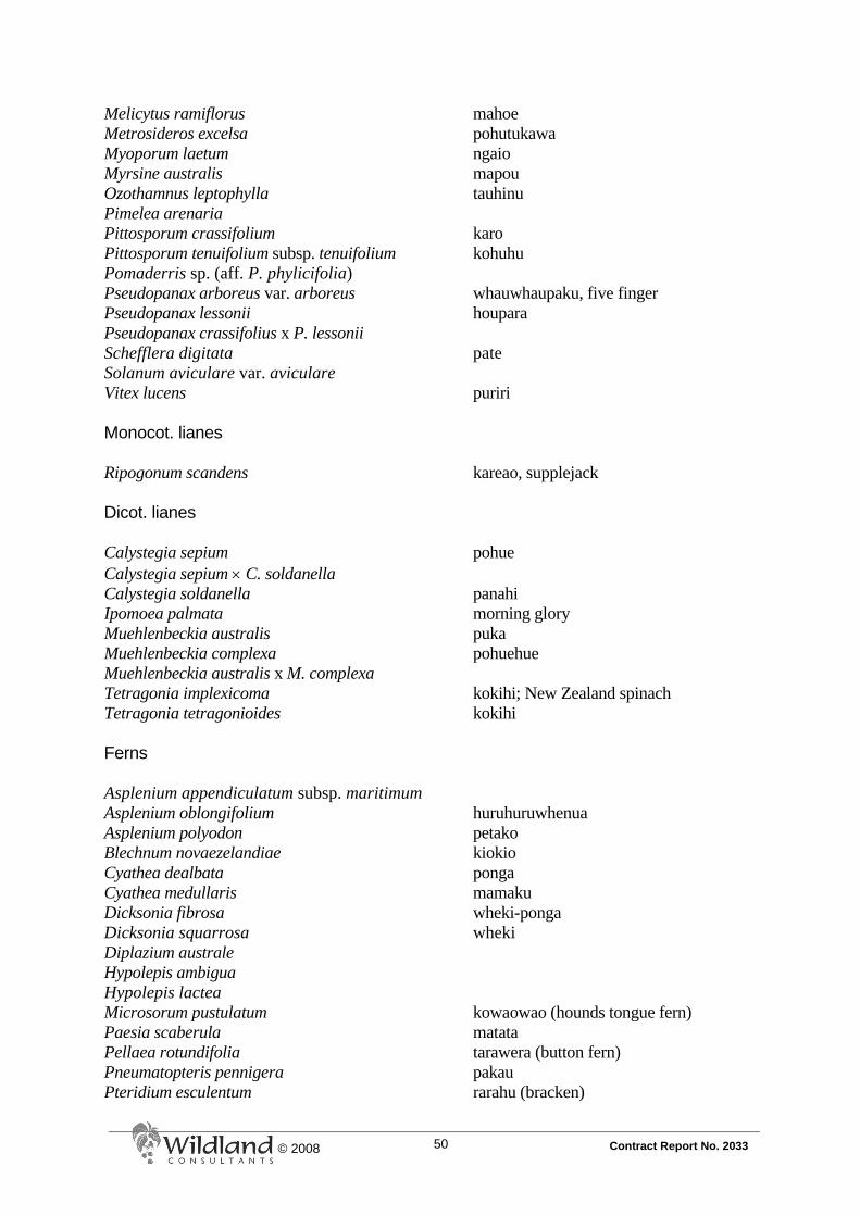
VASCULAR PLANTS OF SAND DUNES IN THE BAY OF PLENTY (Sarah Beadel)
Notes 1. Species list excludes wetland species present at stream mouths and in interdune
wetlands. 3. To be updated and expanded following completion of Bay of Plenty Region sand dune
study. INDIGENOUS SPECIES Monocot. trees and shrubs Cordyline australis ti kouka Phormium cookianum wharariki, mountain flax Phormium tenax harakeke, flax Dicot. trees and shrubs Beilschmiedia tawa tawa Brachyglottis repanda s.s. rangiora Coprosma acerosa Coprosma grandifolia kanono Coprosma lucida kanono Coprosma propinqua subsp. propinqua x C. robusta Coprosma repens taupata Coprosma robusta karamu Coriaria arborea var. arborea tutu Corynocarpus laevigatus karaka Dodonaea viscosa akeake Entelea arborescens whau Fuchsia excorticata kotukutuku Geniostoma rupestre var. ligustrifolium hangehange Hebe stricta var. stricta koromiko Knightia excelsa rewarewa Kunzea ericoides var. ericoides kanuka Kunzea aff. ericoides (Thornton) coastal kanuka species Leptospermum scoparium manuka Leucopogon fasciculatus mingimingi Leucopogon fraseri s.s. patotara Litsea calicaris mangeao Macropiper excelsum var. excelsum kawakawa Melicytus novae-zelandiae coastal mahoe
50
Contract Report No. 2033 50 © 2008
Melicytus ramiflorus mahoe Metrosideros excelsa pohutukawa Myoporum laetum ngaio Myrsine australis mapou Ozothamnus leptophylla tauhinu Pimelea arenaria Pittosporum crassifolium karo Pittosporum tenuifolium subsp. tenuifolium kohuhu Pomaderris sp. (aff. P. phylicifolia) Pseudopanax arboreus var. arboreus whauwhaupaku, five finger Pseudopanax lessonii houpara Pseudopanax crassifolius x P. lessonii Schefflera digitata pate Solanum aviculare var. aviculare Vitex lucens puriri Monocot. lianes Ripogonum scandens kareao, supplejack Dicot. lianes Calystegia sepium pohue Calystegia sepium × C. soldanella Calystegia soldanella panahi Ipomoea palmata morning glory Muehlenbeckia australis puka Muehlenbeckia complexa pohuehue Muehlenbeckia australis x M. complexa Tetragonia implexicoma kokihi; New Zealand spinach Tetragonia tetragonioides kokihi Ferns Asplenium appendiculatum subsp. maritimum Asplenium oblongifolium huruhuruwhenua Asplenium polyodon petako Blechnum novaezelandiae kiokio Cyathea dealbata ponga Cyathea medullaris mamaku Dicksonia fibrosa wheki-ponga Dicksonia squarrosa wheki Diplazium australe Hypolepis ambigua Hypolepis lactea Microsorum pustulatum kowaowao (hounds tongue fern) Paesia scaberula matata Pellaea rotundifolia tarawera (button fern) Pneumatopteris pennigera pakau Pteridium esculentum rarahu (bracken)

51
Contract Report No. 2033 51 © 2008
Pteris macilenta (incl. P. pendula) sweet fern Pteris tremula turawera (shaking brake) Pyrrosia eleagnifolia leather-leaf fern Rumohra adiantiformis Orchids Microtis unifolia maikaika Thelymitra longifolia maikuku Grasses Austrofestuca littoralis hinarepe Cortaderia fulvida toetoe Deyeuxia quadriseta Lachnagrostis billardierei perehia Microlaena stipoides patiti Oplismenus hirtellus subsp. imbecillis Poa pusilla Spinifex sericeus kowhangatara Zoysia pauciflora Sedges Baumea juncea Bolboschoenus fluviatilis ririwaka Carex breviculmis Carex geminata Carex inversa Carex maorica Carex pumila Carex "raotest" Carex secta purei Carex solandri Carex testacea Carex virgata purei Cyperus ustulatus toetoe upokotangata Desmoschoenus spiralis pingao Ficinia nodosa wiwi Schoenus nitens Rushes Apodasmia similis oioi Juncus edgariae wi Juncus planifolius

52
Contract Report No. 2033 52 © 2008
Monocot. herbs (other than orchids, grasses, sedges and rushes) Dianella nigra turutu Phormium tenax harakeke, flax Triglochin striata arrow grass Typha orientalis raupo Composite herbs Pseudognaphalium sp. (P. luteoalbum agg.) “Pseudognaphalium coast” Senecio biserratus Senecio glomeratus Senecio hispidulus Senecio lautus Senecio quadridentatus Dicot. herbs (other than composites) Atriplex hollowayi (AK 3965) (collected in 1890) Chenopodium ambiguum Dichondra repens Euphorbia glauca1 Geranium solanderi Haloragis erecta subsp. erecta toatoa Oxalis rubens Parietaria debilis Persicaria decipiens Solanum americanum EXOTIC SPECIES Gymnosperms Araucaria heterophylla Norfolk Island pine Chamaecyparis lawsoniana Lawsons cypress Cupressus macrocarpa macrocarpa Juniperus sp. Pinus patula patula pine Pinus pinaster maritime pine Pinus radiata radiata pine Dicot. trees and shrubs Abutilon × hybridum Chinese lantern Acacia sophorae Acacia mearnsii black wattle
1 Off-shore islands only, planted on mainland.
53
Contract Report No. 2033 53 © 2008
Albizia lophantha brush wattle Allocasuarina luehmanii bulloak Anigozanthos sp. kangaroo paw Banksia integrifolia banksia Banksia intermedia banksia Berberis glaucocarpa barberry Bougainvillea glabra bougainvillea Buddleja davidii buddleia Callistemon sp. bottlebrush Camelia japonica camelia Casuarina littoralis she-oak Casuarina sp. sheoak Chamaecytisus palmensis tree lucerne Chrysanthemoides monilifera boneseed Cistus × skanbergii Cistus sp. Clerodendron trichotomum harlequin glory bower Coleonema pulchellum Convolvulus sabatius subsp. mauritanicus convolvulus Cotoneaster glaucophyllus cotoneaster Cotoneaster sp. Crataegus monogyna hawthorn Cytisus scoparius broom Dahlia sp. dahlia Daphne odora daphne Echium candicans tower of jewels Erica lusitanica Spanish heath Eriobotrya japonica loquat Erythrina x sykesii coral tree Eucalyptus botryoides eucalyptus Euonymus japonicus Japanese spindle tree Fatsia japonica fatsia Feijoa sellowiana feijoa Ficus carica fig Ficus macrophylla Moreton Bay fig Fuchsia sp. fuchsia Grevillea spp. Hibiscus syriacus blue hibiscus Hibiscus sp. hibiscus Hydrangea macrophylla hydrangea Impatiens sodenii shrub balsam Juglans regia walnut Lagunaria patersenii Norfolk Island hibicus Lathyrus latifolius everlasting pea Lavatera arborea tree mallow Lavendula angustifolia lavender Leonotis leonurus lion’s ear Leptospermum laevigatum coast tea tree Ligustrum lucidum tree privet Ligustrum sinense Chinese privet
54
Contract Report No. 2033 54 © 2008
Lophostemon confertus brush box Lupinus arboreus lupin Lycium ferocissimum African boxthorn Mahonia bealei leather leaf mahonia Malus × domestica apple tree Melaleuca sp. Mellianthus major cape honey flower Myoporum insulare Australian ngaio Nerium oleander oleander Opuntia vulgaris prickly pear Paraserianthes lophantha brush wattle Pelargonium sp. geranium Plumbago auriculata leadwort Podalyria sericea Populus alba cv. Nivea silver poplar Populus sp. poplar Prunus domestica plum Prunus persica peach tree, nectarine Prunus sp. ornamental cherry Pyracantha coccinea pyracantha Quercus ilex oak Rhamnus alaternus Italian buckthorn Rhapiolepis umbellatum Yeddo hawthorn Rosa rubiginosa sweet brier Rosa sp. climbing rose Rosmarinus officinalis rosemary Rubus sp. (R. fruticosus agg.) blackberry Salix cinerea grey willow Salix fragilis crack willow Salix matsudana cv. tortuosa corkscrew willow Schinus terebinthifolius Brazilian pepper tree Solanum mauritianum woolly nightshade Solanum rantonetti Tecomaria capensis Cape honeysuckle Telopea sp. warratah Ulex europaeus gorse Westringia fruticosa × W. eremicola Ferns Nephrolepis cordifolia tuber ladder fern Dicot. lianes Anredera cordifolia madeira vine Araujia sericifera moth plant Cucurbita sp. pumpkin Elaeagnus × reflexa elaeagnus Hedera helix ivy Ipomoea indica blue morning glory
55
Contract Report No. 2033 55 © 2008
Lonicera japonica Japanese honeysuckle Mandevillea laxa Passiflora caerulea passionflower Passiflora edulis black passionfruit Rumex saggitattus climbing dock Salpichroa origanifolia lily of the valley vine Senecio angulatus cape ivy Senecio mikanioides German ivy Solanum jasminoides potato vine Vinca major periwinkle Monocot. trees and shrubs Cordyline fruticosus ti Phoenix canariensis Phoenix palm Grasses Agrostis capillaris browntop Agrostis stolonifera creeping bent Aira caryophyllea silvery hairy grass Alopecurus geniculatus kneed foxtail Ammophila arenaria marram Anthoxanthum odoratum sweet vernal Arundo donax giant reed Avena barbata slender oat Briza maxima large quaking grass Bromus diandrus ripgut brome Bromus hordeaceus soft brome Bromus willdenowii prairie brome Cortaderia selloana pampas Cortaderia jubata pampas Cynodon dactylon Indian doab Dactylis glomerata cocksfoot Digitaria sanguinalis summer grass Echinochloa crus-galli barnyard grass Ehrharta erecta veld grass Eleusine indica crowfoot grass Elytrigia pycnantha sea couch Elytrigia repens couch Festuca arundinacea tall fescue Festuca rubra subsp. rubra red fescue Glyceria maxima reed sweetgrass Holcus lanatus Yorkshire fog Lagurus ovatus harestail Lolium perenne rye grass Paspalum dilatatum paspalum Paspalum distichum Mercer grass Pennisetum clandestinum kikuyu grass Poa pratensis Kentucky bluegrass

56
Contract Report No. 2033 56 © 2008
Pseudosasa japonica bamboo Schedonorus phoenix tall fescue Sporobolus africanus ratstail Setaria viridus green bristle grass Stenotaphrum secundatum buffalo grass Sedges Carex divulsa Cyperus eragrostis Cyperus involucratus umbrella sedge Rushes Juncus acuminatus Juncus articulatus Juncus effusus soft rush Juncus microcephalus Monocot. herbs (other than orchids, grasses, sedges and rushes) Agapanthus praecox agapanthus Agave americana cactus Alocasia macrorrhiza elephant’s ear Aloe arborescens aloe Aloe sp. aloe Alstroemeria psittacina alstroemeria Amaryllis belladonna belladonna lily Asparagus asparagoides smilax Asparagus densiflorus ‘Sprengeri’ Asparagus scandens climbing asparagus Canna indica canna lily Colocasia esculenta taro Crocosmia × crocosmiiflora montbretia Eucomis comosa Gladiolus cv. Grandiflorus gladioli Hedychium gardnerianum wild ginger Iris siberica iris Kniphofia × praecox red hot poker Libertia peregrinans Lilium formosanum Saponaria officinalis Tradescantia fluminensis tradescantia Watsonia sp. watsonia Zantedeschia aethiopica arum lily Zantedeschia sp. calla lily

57
Contract Report No. 2033 57 © 2008
Composite herbs Achillea millefolium yarrow Anthemis cotula stinking mayweed Arctotis stoechadifolia cape daisy Artemisia arborescens hedge artemisia Bidens frondosa beggars’ ticks Chrysanthemum segetum corn marigold Cirsium arvense California thistle Cirsium vulgare Scotch thistle Conyza albida fleabane Conyza canadensis Canadian fleabane Crepis capillaris hawksbeard Erigeron karvinskianus Mexican daisy Gamochaeta spicata cudweed Gazania linearis gazania Hypochoeris radicata catsear Lactuca serriola prickly lettuce Leontodon taraxacoides hawkbit Osteospermum fruticosum rain daisy/dimorphotheca Senecio bipinnatisectus Australian fireweed Senecio cineraria Senecio elegans purple groundsel Senecio jacobaea ragwort Senecio skirrhodon gravel groundsel Sonchus oleraceus puha Dicot. herbs (other than composites) Acanthus mollis Aeonium arboreum Amaranthus deflexus prostrate amaranth Amaranthus retroflexus mat amaranth Amaranthus powellii redroot Anagallis arvensis scarlet pimpernel Anthericum sp. spider plant Antirrhinum sp. snapdragon Artemisia verlotiorum Chinese mugwort Atriplex prostrata orache Beta vulgaris silver beet Brassica rapa subsp. sylvestris wild turnip Cakile edentula sea rocket Cakile maritima sea rocket Calendula officinalis marigold Carpobrotus aegnilaterus ice plant Carpobrotus edulis ice plant Chenopodium album fathen Chenopodium ambrosioides Mexican tea Cosmos bipinnatus cosmos Cotyledon orbiculata pig’s ear
58
Contract Report No. 2033 58 © 2008
Crassula tetragona Datura stramonium thorn apple Drosanthemum sp. ice plant Euphorbia lathyris caper spurge Euphorbia peplus milkweed Foeniculum vulgare fennel Fumaria muralis scrambling fumitory Galium aparine cleavers Geranium robertianum herb Robert Impatiens walleriana busy Lizzie Lepidium virginicum pepper grass Lepidium sp. Linum bienne Linun trigynum yellow flax Lobelia erinus edging lobelia Lobularia maritima sweet alyssum Lotus pedunculatus lotus Lunaria annua honesty Lycopersican esculentum tomato Medicago sativa lucerne Melilotus indicus King Island melilot Mentha sp. (edible) mint Modiola caroliniana creeping mallow Nasturtium sp. Nigella damascena love-in-a-mist Oenothera stricta evening primrose Orobanche minor broomrape Oxalis pes-caprae oxalis Pastinaca sativa wild parsnip Persicaria capitata Petunia × hybrida petunia Physalis peruviana cape gooseberry Phytolacca octandra inkweed Plantago lanceolata narrow-leaved plantain Plantago major broad-leaved plantain Plectranthus ciliata plectranthus Polygonum hydropiper water pepper Polygonum persicaria willow weed Portulaca oleracea wild portulaca Ranunculus repens creeping buttercup Raphanus raphanistrum subsp. maritumus Rumex acetosella sheep’s sorrel Rumex obtusifolius dock Sagina procumbens pearlwort Sedum album white stonecrop Sedum prealtum Sedum × rubrotinctum jellybean plant Sedum spectabile Silene gallica catchfly Solanum chenopodioides velvety nightshade

59
Contract Report No. 2033 59 © 2008
Solanum nigrum var. black nightshade Solanum tuberosum potato Stellaria media chickweed Trifolium arvense haresfoot trefoil Trifolium dubium suckling clover Trifolium pratense red clover Trifolium repens white clover Tropaeolum majus garden nasturtium Verbena bonariensis purple-top Vicia sativa vetch Vicia sp. Viola riviana viola Viola × wittrockiana pansy ADVENTIVE SPECIES Gymnosperms Araucaria heterophylla Norfolk Island pine Chamaecyparis lawsoniana Lawsons cypress Cupressus macrocarpa macrocarpa Juniperus sp. Pinus patula patula pine Pinus pinaster maritime pine Pinus radiata radiata pine Dicot. trees and shrubs Abutilon × hybridum Chinese lantern Acacia sophorae Acacia mearnsii black wattle Albizia lophantha brush wattle Allocasuarina luehmanii bulloak Anigozanthos sp. kangaroo paw Banksia integrifolia banksia Banksia intermedia banksia Berberis glaucocarpa barberry Bougainvillea glabra bougainvillea Buddleja davidii buddleia Callistemon sp. bottlebrush Camelia japonica camelia Casuarina littoralis she-oak Casuarina sp. sheoak Chamaecytisus palmensis tree lucerne Chrysanthemoides monilifera boneseed Cistus × skanbergii Cistus sp. Clerodendron trichotomum harlequin glory bower Coleonema pulchellum Convolvulus sabatius subsp. mauritanicus convolvulus

60
Contract Report No. 2033 60 © 2008
Cotoneaster glaucophyllus cotoneaster Cotoneaster sp. Crataegus monogyna hawthorn Cytisus scoparius broom Dahlia sp. dahlia Daphne odora daphne Echium candicans tower of jewels Erica caffra Erica lusitanica Spanish heath Eriobotrya japonica loquat Erythrina x sykesii coral tree Eucalyptus sp. (botryoides?) eucalyptus Euonymus japonicus Japanese spindle tree Fatsia japonica fatsia Feijoa sellowiana feijoa Ficus carica fig Ficus macrophylla Moreton Bay fig Fuchsia sp. fuchsia Grevillea spp. Hibiscus syriacus blue hibiscus Hibiscus sp. hibiscus Hydrangea macrophylla hydrangea Impatiens sodenii shrub balsam Juglans regia walnut Lagunaria patersenii Norfolk Island hibicus Lathyrus latifolius everlasting pea Lavatera arborea tree mallow Lavendula angustifolia lavender Leonotis leonurus lion’s ear Leptospermum laevigatum coast tea tree Ligustrum lucidum tree privet Ligustrum sinense Chinese privet Lophostemon confertus brush box Lupinus arboreus lupin Lycium ferocissimum African boxthorn Mahonia bealei leather leaf mahonia Malus × domestica apple tree Melaleuca sp. Mellianthus major cape honey flower Myoporum insulare Australian ngaio Nerium oleander oleander Opuntia vulgaris prickly pear Paraserianthes lophantha brush wattle Pelargonium sp. geranium Plumbago auriculata leadwort Podalyria sericea Populus alba cv. Nivea silver poplar Populus sp. poplar Prunus domestica plum Prunus persica peach tree, nectarine

61
Contract Report No. 2033 61 © 2008
Prunus sp. ornamental cherry Pyracantha coccinea pyracantha Quercus ilex oak Rhamnus alaternus Italian buckthorn Rhapiolepis umbellatum Yeddo hawthorn Rosa rubiginosa sweet brier Rosa sp. climbing rose Rosmarinus officinalis rosemary Rubus phoenicolasius Japanese wineberry Rubus sp. (R. fruticosus agg.) blackberry Salix cinerea grey willow Salix fragilis crack willow Salix matsudana cv. tortuosa corkscrew willow Schinus terebinthifolius Brazilian pepper tree Solanum mauritianum woolly nightshade Solanum rantonetti Tecomaria capensis Cape honeysuckle Telopea sp. warratah Ulex europaeus gorse Westringia fruticosa × W. eremicola Ferns Nephrolepis cordifolia tuber ladder fern Dicot. lianes Anredera cordifolia madeira vine Araujia sericifera moth plant Cucurbita sp. pumpkin Elaeagnus × reflexa elaeagnus Hedera helix ivy Ipomoea indica blue morning glory Lonicera japonica Japanese honeysuckle Mandevillea laxa Passiflora caerulea passionflower Passiflora edulis black passionfruit Rumex saggitattus climbing dock Salpichroa origanifolia lily of the valley vine Senecio angulatus cape ivy Senecio mikanioides German ivy Solanum jasminoides potato vine Vinca major periwinkle Monocot. trees and shrubs Cordyline fruticosus ti Phoenix canariensis Phoenix palm

62
Contract Report No. 2033 62 © 2008
Grasses Agrostis capillaris browntop Agrostis stolonifera creeping bent Aira caryophyllea silvery hairy grass Alopecurus geniculatus kneed foxtail Ammophila arenaria marram Anthoxanthum odoratum sweet vernal Arundo donax giant reed Avena barbata slender oat Axonopus fissifolius narrow-leaved carpet grass Briza maxima large quaking grass Bromus diandrus ripgut brome Bromus hordeaceus soft brome Bromus willdenowii prairie brome Cortaderia selloana pampas Cynodon dactylon Indian doab Dactylis glomerata cocksfoot Digitaria sanguinalis summer grass Echinochloa crus-galli barnyard grass Ehrharta erecta veld grass Eleusine indica crowfoot grass Elytrigia pycnantha sea couch Elytrigia repens couch Festuca arundinacea tall fescue Festuca rubra subsp. rubra red fescue Glyceria maxima reed sweetgrass Holcus lanatus Yorkshire fog Lagurus ovatus harestail Lolium perenne rye grass Paspalum dilatatum paspalum Paspalum distichum Mercer grass Paspalum vaginatum saltwater paspalum Pennisetum clandestinum kikuyu grass Poa pratensis Kentucky bluegrass Pseudosasa japonica bamboo Schedonorus phoenix tall fescue Sporobolus africanus ratstail Setaria gracilis knot-root bristle grass Setaria palmifolia palm grass Setaria viridus green bristle grass Stenotaphrum secundatum buffalo grass Sedges Carex divulsa Cyperus eragrostis Cyperus involucratus umbrella sedge

63
Contract Report No. 2033 63 © 2008
Rushes Juncus acuminatus Juncus articulatus Juncus bufonius Juncus effusus soft rush Juncus microcephalus Juncus tenuis track rush Monocot. herbs (other than orchids, grasses, sedges and rushes) Agapanthus praecox agapanthus Agave americana cactus Alocasia macrorrhiza elephant’s ear Aloe arborescens aloe Aloe sp. aloe Alstroemeria psittacina alstroemeria Amaryllis belladonna naked lady, belladonna lily Asparagus asparagoides smilax Asparagus scandens climbing asparagus Asparagus densiflorus ‘Sprengeri’ Canna × generalis canna lily Colocasia esculenta taro Crocosmia × crocosmiiflora montbretia Eucomis comosa Gladiolus cv. Grandiflorus gladioli Hedychium gardnerianum wild ginger Iris siberica iris Kniphofia × praecox red hot poker Libertia peregrinans Lilium formosanum Saponaria officinalis Tradescantia fluminensis tradescantia Watsonia sp. watsonia Zantedeschia aethiopica arum lily Zantedeschia sp. calla lily Composite herbs Achillea millefolium yarrow Anthemis cotula stinking mayweed Arctotis stoechadifolia cape daisy Artemisia arborescens hedge artemisia Artemisia verlotiorum Chinese mugwort Aster subulatus sea aster Bidens frondosa beggars’ ticks Chrysanthemum segetum corn marigold Cirsium arvense California thistle Cirsium vulgare Scotch thistle Conyza albida fleabane

64
Contract Report No. 2033 64 © 2008
Conyza canadensis Canadian fleabane Crepis capillaris hawksbeard Erigeron karvinskianus Mexican daisy Gamochaeta spicata cudweed Gazania linearis gazania Hypochoeris radicata catsear Lactuca serriola prickly lettuce Lapsana communis nipplewort Leontodon taraxacoides hawkbit Osteospermum fruticosum rain daisy/dimorphotheca Senecio bipinnatisectus Australian fireweed Senecio cineraria Senecio elegans purple groundsel Senecio jacobaea ragwort Senecio skirrhodon gravel groundsel Sonchus oleraceus puha Taraxacum officinale dandelion Dicot. herbs (other than composites) Acanthus mollis Aeonium arboreum Amaranthus deflexus prostrate amaranth Amaranthus retroflexus mat amaranth Amaranthus powellii redroot Anagallis arvensis scarlet pimpernel Anthericum sp. spider plant Antirrhinum sp. snapdragon Artemisia verlotiorum Chinese mugwort Atriplex prostrata orache Beta vulgaris silver beet Brassica rapa subsp. sylvestris wild turnip Cakile edentula sea rocket Cakile maritima sea rocket Calendula officinalis marigold Carpobrotus aegnilaterus ice plant Carpobrotus edulis ice plant Chenopodium album fathen Chenopodium ambrosioides Mexican tea Chenopodium pumilio (AK 72596) Cosmos bipinnatus cosmos Cotyledon orbiculata pig’s ear Crassula muscosa Crassula tetragona Datura stramonium thorn apple Drosanthemum sp. ice plant Euphorbia lathyris caper spurge Euphorbia peplus milkweed Foeniculum vulgare fennel Fumaria muralis scrambling fumitory

65
Contract Report No. 2033 65 © 2008
Galium aparine cleavers Galium divaricatum slender bedstraw Geranium robertianum herb Robert Geranium sp. geranium Impatiens walleriana busy Lizzie Lepidium africanum agg. narrow-leaved cress Lepidium bonariense Lepidium sativum Lepidium virginicum pepper grass Lepidium sp. Linum bienne Linun trigynum yellow flax Lobelia erinus edging lobelia Lobularia maritima sweet alyssum Lotus pedunculatus lotus Lunaria annua honesty Lycopersican esculentum tomato Medicago sativa lucerne Melilotus indicus King Island melilot Mentha sp. (edible) mint Modiola caroliniana creeping mallow Myosotis sylvatica garden forget-me-not Myosotis sp. forget-me-not Nasturtium sp. Nigella damascena love-in-a-mist Oenothera stricta evening primrose Orobanche minor broomrape Oxalis pes-caprae oxalis Pastinaca sativa wild parsnip Pelargonium crispum lemon scented geranium Pelargonium x hortorum geranium Persicaria capitata Petunia × hybrida petunia Physalis peruviana cape gooseberry Phytolacca octandra inkweed Plantago lanceolata narrow-leaved plantain Plantago major broad-leaved plantain Plectranthus ciliata plectranthus Polygonum hydropiper water pepper Polygonum persicaria willow weed Polygonum tetraphyllum allseed Portulaca oleracea wild portulaca Prunella vulgaris selfheal Ranunculus repens creeping buttercup Raphanus raphanistrum subsp. maritumus Rumex acetosella sheep’s sorrel Rumex obtusifolius dock Sagina procumbens pearlwort Sedum album white stonecrop Sedum prealtum
66
Contract Report No. 2033 66 © 2008
Sedum × rubrotinctum jellybean plant Sedum spectabile Silene gallica catchfly Sison amomum stone parsley Solanum chenopodioides velvety nightshade Solanum nigrum var. black nightshade Solanum tuberosum potato Spergularia rubra sand spurrey Stellaria media chickweed Trifolium arvense haresfoot trefoil Trifolium dubium suckling clover Trifolium pratense red clover Trifolium repens white clover Tropaeolum majus garden nasturtium Verbena bonariensis purple-top Verbena officinalis vervain Veronica anagallis-aquatica water speedwell Veronica arvensis field speedwell Veronica persica scrambling speedwell Veronica serpyllifolia turf speedwell Vicia sativa vetch Vicia sp. Vinca major periwinkle Viola arvensis field pansy Viola riviana viola Viola × wittrockiana pansy Yucca gloriosa yucca Wahlenbergia sp. harebell

67
Contract Report No. 2033 67 © 2008
APPENDIX 11
VEGETATION TYPES OBSERVED DURING THE FIRST SURVEY OF WILD UNMANAGED VEGETATION ON SAND DUNE LANDFORMS (INCLUDING DUNE WETLANDS) IN THE
TAURANGA ECOLOGICAL DISTRICT
Structural Class Vegetation Class Vegetation Types and Habitats
01 Forest 01 Pine forest 01.01.01 Pine forest 02 Banksia forest 01.02.01 Banksia forest 03 Willow forest 01.03.01 Willow forest 02 Treeland 01 Pine treeland 02.01.01 Pine treeland 02 Banksia treeland 02.02.01 Banksia treeland 03 Vineland 01 Pohuehue vineland
03.01.01 Pohuehue-Ficinia nodosa vineland 03.01.02 Pohuehue-bracken vineland 03.01.03 Pohuehue-marram vineland 03.01.04 Pohuehue-kikuyu vineland 03.01.05 Pohuehue-agapanthus vineland
02 Cape ivy vineland 03.02.01 Cape ivy vineland 03 Periwinkle vineland 03.03.01 Periwinkle vineland 04 Japanese honeysuckle vineland 03.04.01 Japanese honeysuckle vineland 05 Muehlenbeckia australis vineland 03.05.01 Muehlenbeckia australis vineland 04 Scrub 01 Mixed indigenous scrub 04.01.01 Ti kouka-karamu scrub 04.01.02 Ti kouka-mamaku-karamu scrub 04.01.03 Mixed indigenous scrub 02 Gorse scrub 04.02.01 Gorse-pohuehue scrub 04.02.02 Gorse-broom/pohuehue scrub 04.02.03 Gorse-pampas scrub 03 Coast tea tree scrub 04.03.01 Coast tea tree scrub 04 Grey willow scrub 04.04.01 Grey willow scrub 05 Shrubland 01 Manuka shrubland 05.01.01 Manuka-mixed indigenous
shrubland 02 Ti kouka-taupata shrubland 05.02.01 Ti kouka-taupata shrubland 03 Lupin shrubland 05.03.01 Lupin/spinifex shrubland 04 Gorse shrubland 05.04.01 Gorse/oioi-kikuyu shrubland 05.04.02 Gorse/exotic grasses shrubland 05.04.03 Gorse-pampas shrubland 05 Coast tea tree shrubland 05.05.01 Coast tea tree-pine shrubland 06 African boxthorn shrubland 05.06.01 African boxthorn/pohuehue
shrubland 07 Grey willow shrubland 05.07.01 Grey willow shrubland 05.07.02 Grey willow-mixed indigenous
shrubland 06 Tussockland 01 Sea rush tussockland 06.01.01 Sea rush tussockland 02 Pampas tussockland 06.02.01 Pampas-mixed indigenous
tussockland 06.02.02 Pampas-Ficinia nodosa
tussockland 06.02.03 Pampas-gorse tussockland 06.02.04 Pampas-grey willow tussockland 07 Fernland 01 Bracken fernland 07.01.01 Bracken-pohuehue fernland 08 Grassland 01 Spinifex grassland 08.01.01 Spinifex-pingao/Calystegia
soldanella grassland 08.01.02 Spinifex/Calystegia soldanella
grassland 02 Marram grassland 08.02.01 Marram grassland 03 Buffalo grass grassland 08.03.01 Buffalo grass-pohuehue grassland

68
Contract Report No. 2033 68 © 2008
Structural Class Vegetation Class Vegetation Types and Habitats
04 Kikuyu grassland 08.04.01 Kikuyu-pohuehue grassland 05 Cocksfoot grassland 08.05.01 Cocksfoot grassland 06 Knot-root bristle-grass grassland 08.06.01 Knot-root bristle-grass grassland 07 Tall fescue grassland 08.07.01 Tall fescue-kikuyu grassland 08 Sea-couch grassland 08.08.01 Sea-couch dominant grassland 09 Sedgeland 01 Pingao sedgeland 09.01.01 Pingao sedgeland 02 Carex testacea sedgeland 09.02.01 Carex testacea-pohuehue-Ficinia
nodosa sedgeland 03 Ficinia nodosa sedgeland 09.03.01 Ficinia nodosa-pohuehue
sedgeland 04 Baumea juncea sedgeland 09.04.01 Baumea juncea sedgeland 10 Rushland 01 Oioi rushland 10.01.01 Oioi rushland 11 Reedland 01 Raupo reedland 11.01.01 Raupo reedland 02 Schoenoplectus
tabernaemontani-Baumea articulata reedland
11.02.01 Schoenoplectus tabernaemontani-Baumea articulata reedland
13 Herbfield 01 South African iceplant herbfield 13.01.01 South African iceplant herbfield 02 Gazania herbfield 13.02.01 Gazania linearis-Arctotis-South
African iceplant herbfield 03 Flatweeds herbfield 13.03.01 Flatweeds herbfield 04 Mixed exotic herbfield 13.04.01 Mixed exotics herbfield 05 Asparagus densiflorus herbfield 13.05.01 Ficinia nodosa/Asparagus
densiflorus-Gazania linearis-pohuehue herbfield
13.05.02 Asparagus densiflorus-buffalo grass herbfield
06 Agapanthus herbfield 13.06.01 Agapanthus praecox-Gazania linearis-South African iceplant herbfield
07 Canna lily herbfield 13.07.01 Canna lily herbfield 08 Rorripa palustris herbfield 13.08.01 Rorripa palustris herbfield 19 Sandfield 01 Sandfield 19.01.01 Spinifex sandfield
19.01.02 Pingao-spinifex sandfield 19.01.03 Carex pumila sandfield 19.01.04 Ficinia nodosa-Calystegia
soldanella sandfield 19.01.05 Sea rocket sandfield
22 Open water 01 Open water 22.01.01 Open freshwater 22.01.02 Impounded open water